Deprecated: Creation of dynamic property Zend_View::$sMode is deprecated in /var/www/stall-frei/htdocs/staging.stall-frei.de/library/vendor/shardj/zf1-future/library/Zend/View/Abstract.php on line 308
Heu, Stroh oder Futter in Hohentengen
Gesucht wird in "Am Waldeck, 88367 Hohentengen, Deutschland"
93 Einträge
Deprecated: Creation of dynamic property Zend_View::$listObjects is deprecated in /var/www/stall-frei/htdocs/staging.stall-frei.de/library/vendor/shardj/zf1-future/library/Zend/View/Abstract.php on line 308
Deprecated: Creation of dynamic property Zend_View::$listMode is deprecated in /var/www/stall-frei/htdocs/staging.stall-frei.de/library/vendor/shardj/zf1-future/library/Zend/View/Abstract.php on line 308
Deprecated: Creation of dynamic property Zend_View::$renderedObjects is deprecated in /var/www/stall-frei/htdocs/staging.stall-frei.de/library/vendor/shardj/zf1-future/library/Zend/View/Abstract.php on line 308
Deprecated: Creation of dynamic property Zend_View::$index is deprecated in /var/www/stall-frei/htdocs/staging.stall-frei.de/library/vendor/shardj/zf1-future/library/Zend/View/Abstract.php on line 308
Deprecated: Creation of dynamic property Zend_View::$displayMode is deprecated in /var/www/stall-frei/htdocs/staging.stall-frei.de/library/vendor/shardj/zf1-future/library/Zend/View/Abstract.php on line 308
Deprecated: Creation of dynamic property Zend_View::$remarketingIds is deprecated in /var/www/stall-frei/htdocs/staging.stall-frei.de/library/vendor/shardj/zf1-future/library/Zend/View/Abstract.php on line 308
Deprecated: Creation of dynamic property Zend_View::$listItem is deprecated in /var/www/stall-frei/htdocs/staging.stall-frei.de/library/vendor/shardj/zf1-future/library/Zend/View/Abstract.php on line 308
Deprecated: Creation of dynamic property Zend_View::$object is deprecated in /var/www/stall-frei/htdocs/staging.stall-frei.de/library/vendor/shardj/zf1-future/library/Zend/View/Abstract.php on line 308
Deprecated: Creation of dynamic property Zend_View::$attributes is deprecated in /var/www/stall-frei/htdocs/staging.stall-frei.de/library/vendor/shardj/zf1-future/library/Zend/View/Abstract.php on line 308

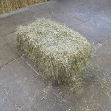
Stroh, Kleinballen, Weizenstroh
Ertingen
Tobias
@Tobias4
Stroh
Kleinballen/HD-Ballen
Regenfrei
Wird verladen
2 weitere...
B+

Strohpellets, Einstreupellets, Strohcobs, Pellets
Seekirch
Eloda Pellets
@ElodaPellets
Einstreu
Empfänger lädt ab
Pellets
Wird verladen
2 weitere...
B+
Deprecated: Creation of dynamic property Zend_View_Helper_Ads::$adLink is deprecated in /var/www/stall-frei/htdocs/staging.stall-frei.de/library/Psf/View/Helper/Ads.php on line 108

Futtersack HeuToy, Fressbremse in pink
Mechtersen
STALL-FREIde Marketing
@STALL-FREI-Marketing
Stundenlange Beschäftigung die
Koliken vorbeugt, geringe Staubinhalation mit
steuerbarer Futterentnahme

Heucobs, Luzernecobs, Futterpellets, Heupellets
Seekirch
Eloda Pellets
@ElodaPellets
Futter
Pellets
Wird verladen
Abholung
Lieferung
B+
Leider kein Vorschaubild
Leider kein Vorschaubild
B+
Leider kein Vorschaubild
Leider kein Vorschaubild
Kleine HD-Ballen Heu
Weil im Schönbuch
Sabine-Dettinger
@Sabine-Dettinger
Heu
Empfänger lädt ab
Kleinballen/HD-Ballen
Bio
Regenfrei
2 weitere...
B+

Hafer aus Ernte 2025 auch gequetscht zu verkaufen
Wolfschlugen
Reitanlage im Höfelweg
@Reitanlage-im-Hoefelweg
Futter
Wird verladen
Abholung
B+
Leider kein Vorschaubild
Leider kein Vorschaubild
Heu- und Luzernecobs
Holzgerlingen
Schlosshof-Holzgerlingen
@Schlosshof-Holzgerlingen
Einstreu
Pellets
Regenfrei
Wird verladen
1 weitere...
B+

Das Beste für die Hufe
Mechtersen
STALL-FREIde Marketing
@STALL-FREI-Marketing
Hufschmiede und Hufpfleger in Ihrer Nähe
Leider kein Vorschaubild
Leider kein Vorschaubild
Heucobs zu verkaufen
Langenau
Bewegungsstall-Unseld
@Bewegungsstall-Unseld
Heu
Großballen
Regenfrei
Wird verladen
B+
Leider kein Vorschaubild
Leider kein Vorschaubild
Heucobs in Bigbags oder 25 kg Säcke
Langenau
Bewegungsstall-Unseld
@Bewegungsstall-Unseld
Futter
Pellets
Regenfrei
Wird verladen
1 weitere...
B+
Deprecated: Creation of dynamic property Zend_View::$pageCount is deprecated in /var/www/stall-frei/htdocs/staging.stall-frei.de/library/vendor/shardj/zf1-future/library/Zend/View/Abstract.php on line 308
Deprecated: Creation of dynamic property Zend_View::$itemCountPerPage is deprecated in /var/www/stall-frei/htdocs/staging.stall-frei.de/library/vendor/shardj/zf1-future/library/Zend/View/Abstract.php on line 308
Deprecated: Creation of dynamic property Zend_View::$first is deprecated in /var/www/stall-frei/htdocs/staging.stall-frei.de/library/vendor/shardj/zf1-future/library/Zend/View/Abstract.php on line 308
Deprecated: Creation of dynamic property Zend_View::$current is deprecated in /var/www/stall-frei/htdocs/staging.stall-frei.de/library/vendor/shardj/zf1-future/library/Zend/View/Abstract.php on line 308
Deprecated: Creation of dynamic property Zend_View::$last is deprecated in /var/www/stall-frei/htdocs/staging.stall-frei.de/library/vendor/shardj/zf1-future/library/Zend/View/Abstract.php on line 308
Deprecated: Creation of dynamic property Zend_View::$next is deprecated in /var/www/stall-frei/htdocs/staging.stall-frei.de/library/vendor/shardj/zf1-future/library/Zend/View/Abstract.php on line 308
Deprecated: Creation of dynamic property Zend_View::$pagesInRange is deprecated in /var/www/stall-frei/htdocs/staging.stall-frei.de/library/vendor/shardj/zf1-future/library/Zend/View/Abstract.php on line 308
Deprecated: Creation of dynamic property Zend_View::$firstPageInRange is deprecated in /var/www/stall-frei/htdocs/staging.stall-frei.de/library/vendor/shardj/zf1-future/library/Zend/View/Abstract.php on line 308
Deprecated: Creation of dynamic property Zend_View::$lastPageInRange is deprecated in /var/www/stall-frei/htdocs/staging.stall-frei.de/library/vendor/shardj/zf1-future/library/Zend/View/Abstract.php on line 308
Deprecated: Creation of dynamic property Zend_View::$currentItemCount is deprecated in /var/www/stall-frei/htdocs/staging.stall-frei.de/library/vendor/shardj/zf1-future/library/Zend/View/Abstract.php on line 308
Deprecated: Creation of dynamic property Zend_View::$totalItemCount is deprecated in /var/www/stall-frei/htdocs/staging.stall-frei.de/library/vendor/shardj/zf1-future/library/Zend/View/Abstract.php on line 308
Deprecated: Creation of dynamic property Zend_View::$firstItemNumber is deprecated in /var/www/stall-frei/htdocs/staging.stall-frei.de/library/vendor/shardj/zf1-future/library/Zend/View/Abstract.php on line 308
Deprecated: Creation of dynamic property Zend_View::$lastItemNumber is deprecated in /var/www/stall-frei/htdocs/staging.stall-frei.de/library/vendor/shardj/zf1-future/library/Zend/View/Abstract.php on line 308
Deprecated: Creation of dynamic property Zend_View::$router is deprecated in /var/www/stall-frei/htdocs/staging.stall-frei.de/library/vendor/shardj/zf1-future/library/Zend/View/Abstract.php on line 308
Deprecated: Creation of dynamic property Zend_View::$urlParams is deprecated in /var/www/stall-frei/htdocs/staging.stall-frei.de/library/vendor/shardj/zf1-future/library/Zend/View/Abstract.php on line 308
Deprecated: Creation of dynamic property Zend_View::$showAds is deprecated in /var/www/stall-frei/htdocs/staging.stall-frei.de/library/vendor/shardj/zf1-future/library/Zend/View/Abstract.php on line 308
Deprecated: Creation of dynamic property Zend_View::$objectIds is deprecated in /var/www/stall-frei/htdocs/staging.stall-frei.de/library/vendor/shardj/zf1-future/library/Zend/View/Abstract.php on line 308
Deprecated: Creation of dynamic property Zend_View::$showNavbar is deprecated in /var/www/stall-frei/htdocs/staging.stall-frei.de/library/vendor/shardj/zf1-future/library/Zend/View/Abstract.php on line 308
Deprecated: Creation of dynamic property Zend_View::$showBreadcrumb is deprecated in /var/www/stall-frei/htdocs/staging.stall-frei.de/library/vendor/shardj/zf1-future/library/Zend/View/Abstract.php on line 308
Deprecated: Creation of dynamic property Zend_View::$showFooter is deprecated in /var/www/stall-frei/htdocs/staging.stall-frei.de/library/vendor/shardj/zf1-future/library/Zend/View/Abstract.php on line 308
Deprecated: Creation of dynamic property Zend_View::$showInternalAds is deprecated in /var/www/stall-frei/htdocs/staging.stall-frei.de/library/vendor/shardj/zf1-future/library/Zend/View/Abstract.php on line 308
Deprecated: Creation of dynamic property Zend_View::$blNoContent is deprecated in /var/www/stall-frei/htdocs/staging.stall-frei.de/library/vendor/shardj/zf1-future/library/Zend/View/Abstract.php on line 308
Deprecated: Creation of dynamic property Zend_View::$sMetaDesc is deprecated in /var/www/stall-frei/htdocs/staging.stall-frei.de/library/vendor/shardj/zf1-future/library/Zend/View/Abstract.php on line 308
Deprecated: Creation of dynamic property Zend_View::$useGmaps is deprecated in /var/www/stall-frei/htdocs/staging.stall-frei.de/library/vendor/shardj/zf1-future/library/Zend/View/Abstract.php on line 308
Deprecated: Creation of dynamic property Zend_View::$touches is deprecated in /var/www/stall-frei/htdocs/staging.stall-frei.de/library/vendor/shardj/zf1-future/library/Zend/View/Abstract.php on line 308
Deprecated: Creation of dynamic property Zend_View::$oProject is deprecated in /var/www/stall-frei/htdocs/staging.stall-frei.de/library/vendor/shardj/zf1-future/library/Zend/View/Abstract.php on line 308
Deprecated: Creation of dynamic property Zend_View::$pageHeadline is deprecated in /var/www/stall-frei/htdocs/staging.stall-frei.de/library/vendor/shardj/zf1-future/library/Zend/View/Abstract.php on line 308
Deprecated: Creation of dynamic property Zend_View::$disableLocationField is deprecated in /var/www/stall-frei/htdocs/staging.stall-frei.de/library/vendor/shardj/zf1-future/library/Zend/View/Abstract.php on line 308
Deprecated: Creation of dynamic property Zend_View::$isSearch is deprecated in /var/www/stall-frei/htdocs/staging.stall-frei.de/library/vendor/shardj/zf1-future/library/Zend/View/Abstract.php on line 308
Deprecated: Creation of dynamic property Zend_View::$pageTitle is deprecated in /var/www/stall-frei/htdocs/staging.stall-frei.de/library/vendor/shardj/zf1-future/library/Zend/View/Abstract.php on line 308
Deprecated: Creation of dynamic property Psf_Form_Element_Text::$class is deprecated in /var/www/stall-frei/htdocs/staging.stall-frei.de/library/vendor/shardj/zf1-future/library/Zend/Form/Element.php on line 874
Deprecated: Creation of dynamic property Psf_Form_Element_Text::$size is deprecated in /var/www/stall-frei/htdocs/staging.stall-frei.de/library/vendor/shardj/zf1-future/library/Zend/Form/Element.php on line 874
Deprecated: Creation of dynamic property Psf_Form_Element_Text::$placeholder is deprecated in /var/www/stall-frei/htdocs/staging.stall-frei.de/library/vendor/shardj/zf1-future/library/Zend/Form/Element.php on line 874
Deprecated: Creation of dynamic property Psf_Form_Element_Hidden::$class is deprecated in /var/www/stall-frei/htdocs/staging.stall-frei.de/library/vendor/shardj/zf1-future/library/Zend/Form/Element.php on line 874
Deprecated: Creation of dynamic property Psf_Form_Element_Hidden::$class is deprecated in /var/www/stall-frei/htdocs/staging.stall-frei.de/library/vendor/shardj/zf1-future/library/Zend/Form/Element.php on line 874
Deprecated: Creation of dynamic property Psf_Form_Element_Hidden::$class is deprecated in /var/www/stall-frei/htdocs/staging.stall-frei.de/library/vendor/shardj/zf1-future/library/Zend/Form/Element.php on line 874
Deprecated: Creation of dynamic property Psf_Form_Element_Hidden::$class is deprecated in /var/www/stall-frei/htdocs/staging.stall-frei.de/library/vendor/shardj/zf1-future/library/Zend/Form/Element.php on line 874
Deprecated: Creation of dynamic property Psf_Form_Element_Select::$class is deprecated in /var/www/stall-frei/htdocs/staging.stall-frei.de/library/vendor/shardj/zf1-future/library/Zend/Form/Element.php on line 874
Deprecated: Creation of dynamic property Psf_Form_Element_Select::$class is deprecated in /var/www/stall-frei/htdocs/staging.stall-frei.de/library/vendor/shardj/zf1-future/library/Zend/Form/Element.php on line 874
Deprecated: Creation of dynamic property Psf_Form_Element_Select::$class is deprecated in /var/www/stall-frei/htdocs/staging.stall-frei.de/library/vendor/shardj/zf1-future/library/Zend/Form/Element.php on line 874
Deprecated: Creation of dynamic property Psf_Form_Element_Select::$class is deprecated in /var/www/stall-frei/htdocs/staging.stall-frei.de/library/vendor/shardj/zf1-future/library/Zend/Form/Element.php on line 874
Deprecated: Creation of dynamic property Zend_View::$sort is deprecated in /var/www/stall-frei/htdocs/staging.stall-frei.de/library/vendor/shardj/zf1-future/library/Zend/View/Abstract.php on line 308
Deprecated: Creation of dynamic property Zend_View::$searchLocation is deprecated in /var/www/stall-frei/htdocs/staging.stall-frei.de/library/vendor/shardj/zf1-future/library/Zend/View/Abstract.php on line 308
Deprecated: Creation of dynamic property Zend_View::$locationHint is deprecated in /var/www/stall-frei/htdocs/staging.stall-frei.de/library/vendor/shardj/zf1-future/library/Zend/View/Abstract.php on line 308
Psf_GeoCoder_Abstract::getLocation: Am Waldeck Get Location CachedOrLive
Psf_GeoCoder_Abstract::getCachedOrLive: Am Waldeck
Psf_GeoCoder_OpenCageData::makeApiRequest: response:
Array
(
[documentation] => https://opencagedata.com/api
[licenses] => Array
(
[0] => Array
(
[name] => see attribution guide
[url] => https://opencagedata.com/credits
)
)
[results] => Array
(
[0] => Array
(
[bounds] => Array
(
[northeast] => Array
(
[lat] => 48.0347788
[lng] => 9.3466556
)
[southwest] => Array
(
[lat] => 48.0346788
[lng] => 9.3465556
)
)
[components] => Array
(
[ISO_3166-1_alpha-2] => DE
[ISO_3166-1_alpha-3] => DEU
[ISO_3166-2] => Array
(
[0] => DE-BW
)
[_category] => building
[_normalized_city] => Hohentengen
[_type] => building
[city] => Hohentengen
[continent] => Europe
[country] => Deutschland
[country_code] => de
[county] => Landkreis Sigmaringen
[isolated_dwelling] => Am Waldeck
[municipality] => GVV Mengen
[political_union] => European Union
[postcode] => 88367
[state] => Baden-Württemberg
[state_code] => BW
)
[confidence] => 10
[formatted] => Am Waldeck, 88367 Hohentengen, Deutschland
[geometry] => Array
(
[lat] => 48.0347288
[lng] => 9.3466056
)
)
[1] => Array
(
[bounds] => Array
(
[northeast] => Array
(
[lat] => 49.0134492
[lng] => 7.9961704
)
[southwest] => Array
(
[lat] => 48.9934492
[lng] => 7.9761704
)
)
[components] => Array
(
[ISO_3166-1_alpha-2] => FR
[ISO_3166-1_alpha-3] => FRA
[ISO_3166-2] => Array
(
[0] => FR-GES
[1] => FR-6AE
[2] => FR-67
)
[_category] => place
[_normalized_city] => Weißenburg
[_type] => hamlet
[city_district] => Altenstadt
[continent] => Europe
[country] => Frankreich
[country_code] => fr
[county] => Unterelsass
[local_authority] => Communauté de communes du Pays de Wissembourg
[locality] => Am Waldeck
[municipality] => Hagenau-Weißenburg
[political_union] => European Union
[postcode] => 67160
[region] => Metropolitanes Frankreich
[state] => Grand Est
[state_code] => GES
[state_district] => Collectivité européenne d'Alsace
[town] => Weißenburg
)
[confidence] => 8
[formatted] => 67160 Weißenburg, Frankreich
[geometry] => Array
(
[lat] => 49.0034492
[lng] => 7.9861704
)
)
[2] => Array
(
[bounds] => Array
(
[northeast] => Array
(
[lat] => 50.8234269
[lng] => 12.7728318
)
[southwest] => Array
(
[lat] => 50.8034269
[lng] => 12.7528318
)
)
[components] => Array
(
[ISO_3166-1_alpha-2] => DE
[ISO_3166-1_alpha-3] => DEU
[ISO_3166-2] => Array
(
[0] => DE-SN
)
[_category] => place
[_normalized_city] => Chemnitz
[_type] => hamlet
[city] => Chemnitz
[continent] => Europe
[country] => Deutschland
[country_code] => de
[locality] => Am Waldeck
[political_union] => European Union
[postcode] => 09224
[quarter] => Berghäuser
[state] => Sachsen
[state_code] => SN
[village] => Grüna
)
[confidence] => 8
[formatted] => Am Waldeck, 09224 Grüna, Deutschland
[geometry] => Array
(
[lat] => 50.8134269
[lng] => 12.7628318
)
)
[3] => Array
(
[bounds] => Array
(
[northeast] => Array
(
[lat] => 52.8550432
[lng] => 7.8281006
)
[southwest] => Array
(
[lat] => 52.851639
[lng] => 7.8204257
)
)
[components] => Array
(
[ISO_3166-1_alpha-2] => DE
[ISO_3166-1_alpha-3] => DEU
[ISO_3166-2] => Array
(
[0] => DE-NI
)
[_category] => road
[_normalized_city] => Lindern (Oldenburg)
[_type] => road
[continent] => Europe
[country] => Deutschland
[country_code] => de
[county] => Landkreis Cloppenburg
[hamlet] => Hegel
[political_union] => European Union
[postcode] => 49699
[road] => Am Waldeck
[state] => Niedersachsen
[state_code] => NI
[village] => Lindern (Oldenburg)
)
[confidence] => 9
[formatted] => Am Waldeck, 49699 Lindern (Oldenburg), Deutschland
[geometry] => Array
(
[lat] => 52.8534978
[lng] => 7.8241968
)
)
[4] => Array
(
[bounds] => Array
(
[northeast] => Array
(
[lat] => 52.8623241
[lng] => 7.9324468
)
[southwest] => Array
(
[lat] => 52.8575509
[lng] => 7.9289371
)
)
[components] => Array
(
[ISO_3166-1_alpha-2] => DE
[ISO_3166-1_alpha-3] => DEU
[ISO_3166-2] => Array
(
[0] => DE-NI
)
[_category] => road
[_normalized_city] => Molbergen
[_type] => road
[continent] => Europe
[country] => Deutschland
[country_code] => de
[county] => Landkreis Cloppenburg
[political_union] => European Union
[postcode] => 49696
[road] => Am Waldeck
[road_type] => residential
[state] => Niedersachsen
[state_code] => NI
[village] => Molbergen
)
[confidence] => 9
[formatted] => Am Waldeck, 49696 Molbergen, Deutschland
[geometry] => Array
(
[lat] => 52.8600685
[lng] => 7.9305239
)
)
[5] => Array
(
[bounds] => Array
(
[northeast] => Array
(
[lat] => 50.1319621
[lng] => 8.450263
)
[southwest] => Array
(
[lat] => 50.1307598
[lng] => 8.4411422
)
)
[components] => Array
(
[ISO_3166-1_alpha-2] => DE
[ISO_3166-1_alpha-3] => DEU
[ISO_3166-2] => Array
(
[0] => DE-HE
)
[_category] => road
[_normalized_city] => Kelkheim (Taunus)
[_type] => road
[continent] => Europe
[country] => Deutschland
[country_code] => de
[county] => Main-Taunus-Kreis
[political_union] => European Union
[postcode] => 65779
[road] => Am Waldeck
[road_type] => residential
[state] => Hessen
[state_code] => HE
[suburb] => Münster
[town] => Kelkheim (Taunus)
)
[confidence] => 9
[formatted] => Am Waldeck, 65779 Kelkheim (Taunus), Deutschland
[geometry] => Array
(
[lat] => 50.1313796
[lng] => 8.4457154
)
)
[6] => Array
(
[bounds] => Array
(
[northeast] => Array
(
[lat] => 48.0355186
[lng] => 9.3488479
)
[southwest] => Array
(
[lat] => 48.0336384
[lng] => 9.3450197
)
)
[components] => Array
(
[ISO_3166-1_alpha-2] => DE
[ISO_3166-1_alpha-3] => DEU
[ISO_3166-2] => Array
(
[0] => DE-BW
)
[_category] => road
[_normalized_city] => Hohentengen
[_type] => road
[city] => Hohentengen
[continent] => Europe
[country] => Deutschland
[country_code] => de
[county] => Landkreis Sigmaringen
[municipality] => GVV Mengen
[political_union] => European Union
[postcode] => 88367
[road] => Am Waldeck
[state] => Baden-Württemberg
[state_code] => BW
)
[confidence] => 9
[formatted] => Am Waldeck, 88367 Hohentengen, Deutschland
[geometry] => Array
(
[lat] => 48.0347922
[lng] => 9.3470469
)
)
[7] => Array
(
[bounds] => Array
(
[northeast] => Array
(
[lat] => 48.6247592
[lng] => 7.9992106
)
[southwest] => Array
(
[lat] => 48.622511
[lng] => 7.9980005
)
)
[components] => Array
(
[ISO_3166-1_alpha-2] => DE
[ISO_3166-1_alpha-3] => DEU
[ISO_3166-2] => Array
(
[0] => DE-BW
)
[_category] => road
[_normalized_city] => Achern
[_type] => road
[continent] => Europe
[country] => Deutschland
[country_code] => de
[county] => Ortenaukreis
[municipality] => VVG der Stadt Achern
[political_union] => European Union
[postcode] => 77855
[road] => Am Waldeck
[state] => Baden-Württemberg
[state_code] => BW
[town] => Achern
[village] => Wagshurst
)
[confidence] => 9
[formatted] => Am Waldeck, 77855 Wagshurst, Deutschland
[geometry] => Array
(
[lat] => 48.62387
[lng] => 7.9991777
)
)
[8] => Array
(
[bounds] => Array
(
[northeast] => Array
(
[lat] => 48.5399855
[lng] => 10.9996472
)
[southwest] => Array
(
[lat] => 48.538686
[lng] => 10.998454
)
)
[components] => Array
(
[ISO_3166-1_alpha-2] => DE
[ISO_3166-1_alpha-3] => DEU
[ISO_3166-2] => Array
(
[0] => DE-BY
)
[_category] => road
[_normalized_city] => Petersdorf
[_type] => road
[city] => Petersdorf
[continent] => Europe
[country] => Deutschland
[country_code] => de
[county] => Landkreis Aichach-Friedberg
[municipality] => Aindling
[political_union] => European Union
[postcode] => 86574
[road] => Am Waldeck
[road_type] => residential
[state] => Bayern
[state_code] => BY
)
[confidence] => 9
[formatted] => Am Waldeck, 86574 Petersdorf, Deutschland
[geometry] => Array
(
[lat] => 48.5394712
[lng] => 10.998928
)
)
[9] => Array
(
[components] => Array
(
[ISO_3166-1_alpha-2] => FR
[ISO_3166-1_alpha-3] => FRA
[ISO_3166-2] => Array
(
[0] => FR-GES
[1] => FR-6AE
[2] => FR-68
)
[_category] => road
[_normalized_city] => Riedisheim
[_type] => road
[city] => Riedisheim
[continent] => Europe
[country] => France
[country_code] => fr
[county] => Haut-Rhin
[local_authority] => Mulhouse Alsace Agglomération
[political_union] => European Union
[postcode] => 68400
[road] => Rue du Waldeck
[state] => Grand Est
[state_code] => GES
)
[confidence] => 4
[formatted] => Rue du Waldeck, 68400 Riedisheim, France
[geometry] => Array
(
[lat] => 47.738212
[lng] => 7.357487
)
)
)
[status] => Array
(
[code] => 200
[message] => OK
)
[stay_informed] => Array
(
[blog] => https://blog.opencagedata.com
[mastodon] => https://en.osm.town/@opencage
)
[thanks] => For using an OpenCage API
[timestamp] => Array
(
[created_http] => Sat, 07 Feb 2026 04:00:56 GMT
[created_unix] => 1770436856
)
[total_results] => 10
)
Psf_GeoCoder_Abstract::convertLocationResult
{"documentation":"https:\/\/opencagedata.com\/api","licenses":[{"name":"see attribution guide","url":"https:\/\/opencagedata.com\/credits"}],"results":[{"bounds":{"northeast":{"lat":48.0347788,"lng":9.3466556},"southwest":{"lat":48.0346788,"lng":9.3465556}},"components":{"ISO_3166-1_alpha-2":"DE","ISO_3166-1_alpha-3":"DEU","ISO_3166-2":["DE-BW"],"_category":"building","_normalized_city":"Hohentengen","_type":"building","city":"Hohentengen","continent":"Europe","country":"Deutschland","country_code":"de","county":"Landkreis Sigmaringen","isolated_dwelling":"Am Waldeck","municipality":"GVV Mengen","political_union":"European Union","postcode":"88367","state":"Baden-W\u00fcrttemberg","state_code":"BW"},"confidence":10,"formatted":"Am Waldeck, 88367 Hohentengen, Deutschland","geometry":{"lat":48.0347288,"lng":9.3466056}},{"bounds":{"northeast":{"lat":49.0134492,"lng":7.9961704},"southwest":{"lat":48.9934492,"lng":7.9761704}},"components":{"ISO_3166-1_alpha-2":"FR","ISO_3166-1_alpha-3":"FRA","ISO_3166-2":["FR-GES","FR-6AE","FR-67"],"_category":"place","_normalized_city":"Wei\u00dfenburg","_type":"hamlet","city_district":"Altenstadt","continent":"Europe","country":"Frankreich","country_code":"fr","county":"Unterelsass","local_authority":"Communaut\u00e9 de communes du Pays de Wissembourg","locality":"Am Waldeck","municipality":"Hagenau-Wei\u00dfenburg","political_union":"European Union","postcode":"67160","region":"Metropolitanes Frankreich","state":"Grand Est","state_code":"GES","state_district":"Collectivit\u00e9 europ\u00e9enne d'Alsace","town":"Wei\u00dfenburg"},"confidence":8,"formatted":"67160 Wei\u00dfenburg, Frankreich","geometry":{"lat":49.0034492,"lng":7.9861704}},{"bounds":{"northeast":{"lat":50.8234269,"lng":12.7728318},"southwest":{"lat":50.8034269,"lng":12.7528318}},"components":{"ISO_3166-1_alpha-2":"DE","ISO_3166-1_alpha-3":"DEU","ISO_3166-2":["DE-SN"],"_category":"place","_normalized_city":"Chemnitz","_type":"hamlet","city":"Chemnitz","continent":"Europe","country":"Deutschland","country_code":"de","locality":"Am Waldeck","political_union":"European Union","postcode":"09224","quarter":"Bergh\u00e4user","state":"Sachsen","state_code":"SN","village":"Gr\u00fcna"},"confidence":8,"formatted":"Am Waldeck, 09224 Gr\u00fcna, Deutschland","geometry":{"lat":50.8134269,"lng":12.7628318}},{"bounds":{"northeast":{"lat":52.8550432,"lng":7.8281006},"southwest":{"lat":52.851639,"lng":7.8204257}},"components":{"ISO_3166-1_alpha-2":"DE","ISO_3166-1_alpha-3":"DEU","ISO_3166-2":["DE-NI"],"_category":"road","_normalized_city":"Lindern (Oldenburg)","_type":"road","continent":"Europe","country":"Deutschland","country_code":"de","county":"Landkreis Cloppenburg","hamlet":"Hegel","political_union":"European Union","postcode":"49699","road":"Am Waldeck","state":"Niedersachsen","state_code":"NI","village":"Lindern (Oldenburg)"},"confidence":9,"formatted":"Am Waldeck, 49699 Lindern (Oldenburg), Deutschland","geometry":{"lat":52.8534978,"lng":7.8241968}},{"bounds":{"northeast":{"lat":52.8623241,"lng":7.9324468},"southwest":{"lat":52.8575509,"lng":7.9289371}},"components":{"ISO_3166-1_alpha-2":"DE","ISO_3166-1_alpha-3":"DEU","ISO_3166-2":["DE-NI"],"_category":"road","_normalized_city":"Molbergen","_type":"road","continent":"Europe","country":"Deutschland","country_code":"de","county":"Landkreis Cloppenburg","political_union":"European Union","postcode":"49696","road":"Am Waldeck","road_type":"residential","state":"Niedersachsen","state_code":"NI","village":"Molbergen"},"confidence":9,"formatted":"Am Waldeck, 49696 Molbergen, Deutschland","geometry":{"lat":52.8600685,"lng":7.9305239}},{"bounds":{"northeast":{"lat":50.1319621,"lng":8.450263},"southwest":{"lat":50.1307598,"lng":8.4411422}},"components":{"ISO_3166-1_alpha-2":"DE","ISO_3166-1_alpha-3":"DEU","ISO_3166-2":["DE-HE"],"_category":"road","_normalized_city":"Kelkheim (Taunus)","_type":"road","continent":"Europe","country":"Deutschland","country_code":"de","county":"Main-Taunus-Kreis","political_union":"European Union","postcode":"65779","road":"Am Waldeck","road_type":"residential","state":"Hessen","state_code":"HE","suburb":"M\u00fcnster","town":"Kelkheim (Taunus)"},"confidence":9,"formatted":"Am Waldeck, 65779 Kelkheim (Taunus), Deutschland","geometry":{"lat":50.1313796,"lng":8.4457154}},{"bounds":{"northeast":{"lat":48.0355186,"lng":9.3488479},"southwest":{"lat":48.0336384,"lng":9.3450197}},"components":{"ISO_3166-1_alpha-2":"DE","ISO_3166-1_alpha-3":"DEU","ISO_3166-2":["DE-BW"],"_category":"road","_normalized_city":"Hohentengen","_type":"road","city":"Hohentengen","continent":"Europe","country":"Deutschland","country_code":"de","county":"Landkreis Sigmaringen","municipality":"GVV Mengen","political_union":"European Union","postcode":"88367","road":"Am Waldeck","state":"Baden-W\u00fcrttemberg","state_code":"BW"},"confidence":9,"formatted":"Am Waldeck, 88367 Hohentengen, Deutschland","geometry":{"lat":48.0347922,"lng":9.3470469}},{"bounds":{"northeast":{"lat":48.6247592,"lng":7.9992106},"southwest":{"lat":48.622511,"lng":7.9980005}},"components":{"ISO_3166-1_alpha-2":"DE","ISO_3166-1_alpha-3":"DEU","ISO_3166-2":["DE-BW"],"_category":"road","_normalized_city":"Achern","_type":"road","continent":"Europe","country":"Deutschland","country_code":"de","county":"Ortenaukreis","municipality":"VVG der Stadt Achern","political_union":"European Union","postcode":"77855","road":"Am Waldeck","state":"Baden-W\u00fcrttemberg","state_code":"BW","town":"Achern","village":"Wagshurst"},"confidence":9,"formatted":"Am Waldeck, 77855 Wagshurst, Deutschland","geometry":{"lat":48.62387,"lng":7.9991777}},{"bounds":{"northeast":{"lat":48.5399855,"lng":10.9996472},"southwest":{"lat":48.538686,"lng":10.998454}},"components":{"ISO_3166-1_alpha-2":"DE","ISO_3166-1_alpha-3":"DEU","ISO_3166-2":["DE-BY"],"_category":"road","_normalized_city":"Petersdorf","_type":"road","city":"Petersdorf","continent":"Europe","country":"Deutschland","country_code":"de","county":"Landkreis Aichach-Friedberg","municipality":"Aindling","political_union":"European Union","postcode":"86574","road":"Am Waldeck","road_type":"residential","state":"Bayern","state_code":"BY"},"confidence":9,"formatted":"Am Waldeck, 86574 Petersdorf, Deutschland","geometry":{"lat":48.5394712,"lng":10.998928}},{"components":{"ISO_3166-1_alpha-2":"FR","ISO_3166-1_alpha-3":"FRA","ISO_3166-2":["FR-GES","FR-6AE","FR-68"],"_category":"road","_normalized_city":"Riedisheim","_type":"road","city":"Riedisheim","continent":"Europe","country":"France","country_code":"fr","county":"Haut-Rhin","local_authority":"Mulhouse Alsace Agglom\u00e9ration","political_union":"European Union","postcode":"68400","road":"Rue du Waldeck","state":"Grand Est","state_code":"GES"},"confidence":4,"formatted":"Rue du Waldeck, 68400 Riedisheim, France","geometry":{"lat":47.738212,"lng":7.357487}}],"status":{"code":200,"message":"OK"},"stay_informed":{"blog":"https:\/\/blog.opencagedata.com","mastodon":"https:\/\/en.osm.town\/@opencage"},"thanks":"For using an OpenCage API","timestamp":{"created_http":"Sat, 07 Feb 2026 04:00:56 GMT","created_unix":1770436856},"total_results":10}Array
(
[0] => stdClass Object
(
[bounds] => stdClass Object
(
[northeast] => stdClass Object
(
[lat] => 48.0347788
[lng] => 9.3466556
)
[southwest] => stdClass Object
(
[lat] => 48.0346788
[lng] => 9.3465556
)
)
[components] => stdClass Object
(
[ISO_3166-1_alpha-2] => DE
[ISO_3166-1_alpha-3] => DEU
[ISO_3166-2] => Array
(
[0] => DE-BW
)
[_category] => building
[_normalized_city] => Hohentengen
[_type] => building
[city] => Hohentengen
[continent] => Europe
[country] => Deutschland
[country_code] => de
[county] => Landkreis Sigmaringen
[isolated_dwelling] => Am Waldeck
[municipality] => GVV Mengen
[political_union] => European Union
[postcode] => 88367
[state] => Baden-Württemberg
[state_code] => BW
)
[confidence] => 10
[formatted] => Am Waldeck, 88367 Hohentengen, Deutschland
[geometry] => stdClass Object
(
[lat] => 48.0347288
[lng] => 9.3466056
)
)
[1] => stdClass Object
(
[bounds] => stdClass Object
(
[northeast] => stdClass Object
(
[lat] => 49.0134492
[lng] => 7.9961704
)
[southwest] => stdClass Object
(
[lat] => 48.9934492
[lng] => 7.9761704
)
)
[components] => stdClass Object
(
[ISO_3166-1_alpha-2] => FR
[ISO_3166-1_alpha-3] => FRA
[ISO_3166-2] => Array
(
[0] => FR-GES
[1] => FR-6AE
[2] => FR-67
)
[_category] => place
[_normalized_city] => Weißenburg
[_type] => hamlet
[city_district] => Altenstadt
[continent] => Europe
[country] => Frankreich
[country_code] => fr
[county] => Unterelsass
[local_authority] => Communauté de communes du Pays de Wissembourg
[locality] => Am Waldeck
[municipality] => Hagenau-Weißenburg
[political_union] => European Union
[postcode] => 67160
[region] => Metropolitanes Frankreich
[state] => Grand Est
[state_code] => GES
[state_district] => Collectivité européenne d'Alsace
[town] => Weißenburg
)
[confidence] => 8
[formatted] => 67160 Weißenburg, Frankreich
[geometry] => stdClass Object
(
[lat] => 49.0034492
[lng] => 7.9861704
)
)
[2] => stdClass Object
(
[bounds] => stdClass Object
(
[northeast] => stdClass Object
(
[lat] => 50.8234269
[lng] => 12.7728318
)
[southwest] => stdClass Object
(
[lat] => 50.8034269
[lng] => 12.7528318
)
)
[components] => stdClass Object
(
[ISO_3166-1_alpha-2] => DE
[ISO_3166-1_alpha-3] => DEU
[ISO_3166-2] => Array
(
[0] => DE-SN
)
[_category] => place
[_normalized_city] => Chemnitz
[_type] => hamlet
[city] => Chemnitz
[continent] => Europe
[country] => Deutschland
[country_code] => de
[locality] => Am Waldeck
[political_union] => European Union
[postcode] => 09224
[quarter] => Berghäuser
[state] => Sachsen
[state_code] => SN
[village] => Grüna
)
[confidence] => 8
[formatted] => Am Waldeck, 09224 Grüna, Deutschland
[geometry] => stdClass Object
(
[lat] => 50.8134269
[lng] => 12.7628318
)
)
[3] => stdClass Object
(
[bounds] => stdClass Object
(
[northeast] => stdClass Object
(
[lat] => 52.8550432
[lng] => 7.8281006
)
[southwest] => stdClass Object
(
[lat] => 52.851639
[lng] => 7.8204257
)
)
[components] => stdClass Object
(
[ISO_3166-1_alpha-2] => DE
[ISO_3166-1_alpha-3] => DEU
[ISO_3166-2] => Array
(
[0] => DE-NI
)
[_category] => road
[_normalized_city] => Lindern (Oldenburg)
[_type] => road
[continent] => Europe
[country] => Deutschland
[country_code] => de
[county] => Landkreis Cloppenburg
[hamlet] => Hegel
[political_union] => European Union
[postcode] => 49699
[road] => Am Waldeck
[state] => Niedersachsen
[state_code] => NI
[village] => Lindern (Oldenburg)
)
[confidence] => 9
[formatted] => Am Waldeck, 49699 Lindern (Oldenburg), Deutschland
[geometry] => stdClass Object
(
[lat] => 52.8534978
[lng] => 7.8241968
)
)
[4] => stdClass Object
(
[bounds] => stdClass Object
(
[northeast] => stdClass Object
(
[lat] => 52.8623241
[lng] => 7.9324468
)
[southwest] => stdClass Object
(
[lat] => 52.8575509
[lng] => 7.9289371
)
)
[components] => stdClass Object
(
[ISO_3166-1_alpha-2] => DE
[ISO_3166-1_alpha-3] => DEU
[ISO_3166-2] => Array
(
[0] => DE-NI
)
[_category] => road
[_normalized_city] => Molbergen
[_type] => road
[continent] => Europe
[country] => Deutschland
[country_code] => de
[county] => Landkreis Cloppenburg
[political_union] => European Union
[postcode] => 49696
[road] => Am Waldeck
[road_type] => residential
[state] => Niedersachsen
[state_code] => NI
[village] => Molbergen
)
[confidence] => 9
[formatted] => Am Waldeck, 49696 Molbergen, Deutschland
[geometry] => stdClass Object
(
[lat] => 52.8600685
[lng] => 7.9305239
)
)
[5] => stdClass Object
(
[bounds] => stdClass Object
(
[northeast] => stdClass Object
(
[lat] => 50.1319621
[lng] => 8.450263
)
[southwest] => stdClass Object
(
[lat] => 50.1307598
[lng] => 8.4411422
)
)
[components] => stdClass Object
(
[ISO_3166-1_alpha-2] => DE
[ISO_3166-1_alpha-3] => DEU
[ISO_3166-2] => Array
(
[0] => DE-HE
)
[_category] => road
[_normalized_city] => Kelkheim (Taunus)
[_type] => road
[continent] => Europe
[country] => Deutschland
[country_code] => de
[county] => Main-Taunus-Kreis
[political_union] => European Union
[postcode] => 65779
[road] => Am Waldeck
[road_type] => residential
[state] => Hessen
[state_code] => HE
[suburb] => Münster
[town] => Kelkheim (Taunus)
)
[confidence] => 9
[formatted] => Am Waldeck, 65779 Kelkheim (Taunus), Deutschland
[geometry] => stdClass Object
(
[lat] => 50.1313796
[lng] => 8.4457154
)
)
[6] => stdClass Object
(
[bounds] => stdClass Object
(
[northeast] => stdClass Object
(
[lat] => 48.0355186
[lng] => 9.3488479
)
[southwest] => stdClass Object
(
[lat] => 48.0336384
[lng] => 9.3450197
)
)
[components] => stdClass Object
(
[ISO_3166-1_alpha-2] => DE
[ISO_3166-1_alpha-3] => DEU
[ISO_3166-2] => Array
(
[0] => DE-BW
)
[_category] => road
[_normalized_city] => Hohentengen
[_type] => road
[city] => Hohentengen
[continent] => Europe
[country] => Deutschland
[country_code] => de
[county] => Landkreis Sigmaringen
[municipality] => GVV Mengen
[political_union] => European Union
[postcode] => 88367
[road] => Am Waldeck
[state] => Baden-Württemberg
[state_code] => BW
)
[confidence] => 9
[formatted] => Am Waldeck, 88367 Hohentengen, Deutschland
[geometry] => stdClass Object
(
[lat] => 48.0347922
[lng] => 9.3470469
)
)
[7] => stdClass Object
(
[bounds] => stdClass Object
(
[northeast] => stdClass Object
(
[lat] => 48.6247592
[lng] => 7.9992106
)
[southwest] => stdClass Object
(
[lat] => 48.622511
[lng] => 7.9980005
)
)
[components] => stdClass Object
(
[ISO_3166-1_alpha-2] => DE
[ISO_3166-1_alpha-3] => DEU
[ISO_3166-2] => Array
(
[0] => DE-BW
)
[_category] => road
[_normalized_city] => Achern
[_type] => road
[continent] => Europe
[country] => Deutschland
[country_code] => de
[county] => Ortenaukreis
[municipality] => VVG der Stadt Achern
[political_union] => European Union
[postcode] => 77855
[road] => Am Waldeck
[state] => Baden-Württemberg
[state_code] => BW
[town] => Achern
[village] => Wagshurst
)
[confidence] => 9
[formatted] => Am Waldeck, 77855 Wagshurst, Deutschland
[geometry] => stdClass Object
(
[lat] => 48.62387
[lng] => 7.9991777
)
)
[8] => stdClass Object
(
[bounds] => stdClass Object
(
[northeast] => stdClass Object
(
[lat] => 48.5399855
[lng] => 10.9996472
)
[southwest] => stdClass Object
(
[lat] => 48.538686
[lng] => 10.998454
)
)
[components] => stdClass Object
(
[ISO_3166-1_alpha-2] => DE
[ISO_3166-1_alpha-3] => DEU
[ISO_3166-2] => Array
(
[0] => DE-BY
)
[_category] => road
[_normalized_city] => Petersdorf
[_type] => road
[city] => Petersdorf
[continent] => Europe
[country] => Deutschland
[country_code] => de
[county] => Landkreis Aichach-Friedberg
[municipality] => Aindling
[political_union] => European Union
[postcode] => 86574
[road] => Am Waldeck
[road_type] => residential
[state] => Bayern
[state_code] => BY
)
[confidence] => 9
[formatted] => Am Waldeck, 86574 Petersdorf, Deutschland
[geometry] => stdClass Object
(
[lat] => 48.5394712
[lng] => 10.998928
)
)
[9] => stdClass Object
(
[components] => stdClass Object
(
[ISO_3166-1_alpha-2] => FR
[ISO_3166-1_alpha-3] => FRA
[ISO_3166-2] => Array
(
[0] => FR-GES
[1] => FR-6AE
[2] => FR-68
)
[_category] => road
[_normalized_city] => Riedisheim
[_type] => road
[city] => Riedisheim
[continent] => Europe
[country] => France
[country_code] => fr
[county] => Haut-Rhin
[local_authority] => Mulhouse Alsace Agglomération
[political_union] => European Union
[postcode] => 68400
[road] => Rue du Waldeck
[state] => Grand Est
[state_code] => GES
)
[confidence] => 4
[formatted] => Rue du Waldeck, 68400 Riedisheim, France
[geometry] => stdClass Object
(
[lat] => 47.738212
[lng] => 7.357487
)
)
)
Psf_GeoCoder_OpenCageData::getKeyMap: 0
stdClass Object
(
    [bounds] => stdClass Object
        (
            [northeast] => stdClass Object
                (
                    [lat] => 48.0347788
                    [lng] => 9.3466556
                )

            [southwest] => stdClass Object
                (
                    [lat] => 48.0346788
                    [lng] => 9.3465556
                )

        )

    [components] => stdClass Object
        (
            [ISO_3166-1_alpha-2] => DE
            [ISO_3166-1_alpha-3] => DEU
            [ISO_3166-2] => Array
                (
                    [0] => DE-BW
                )

            [_category] => building
            [_normalized_city] => Hohentengen
            [_type] => building
            [city] => Hohentengen
            [continent] => Europe
            [country] => Deutschland
            [country_code] => de
            [county] => Landkreis Sigmaringen
            [isolated_dwelling] => Am Waldeck
            [municipality] => GVV Mengen
            [political_union] => European Union
            [postcode] => 88367
            [state] => Baden-Württemberg
            [state_code] => BW
        )

    [confidence] => 10
    [formatted] => Am Waldeck, 88367 Hohentengen, Deutschland
    [geometry] => stdClass Object
        (
            [lat] => 48.0347288
            [lng] => 9.3466056
        )

)
Psf_GeoCoder_OpenCageData::getCounty: Sigmaringen
Psf_GeoCoder_OpenCageData::addMissingData REFETCH!
Array
(
    [address] => Am Waldeck, 88367 Hohentengen, Deutschland
    [type] => building
    [street] =>
    [city] => Hohentengen
    [county] => Sigmaringen
    [state] => Baden-Württemberg
    [zip] => 88367
    [country] => Deutschland
    [suburb] =>
    [countrycode] => de
    [latitude] => 48.0347288
    [longitude] => 9.3466056
    [accuracy] => 1
    [confidence] => 10
    [bounds] => stdClass Object
        (
            [northeast] => stdClass Object
                (
                    [lat] => 48.0347788
                    [lng] => 9.3466556
                )

            [southwest] => stdClass Object
                (
                    [lat] => 48.0346788
                    [lng] => 9.3465556
                )

        )

)
reformat!
Array
(
    [address] => Am Waldeck, 88367 Hohentengen, Deutschland
    [type] => building
    [street] =>
    [city] => Hohentengen
    [county] => Sigmaringen
    [state] => Baden-Württemberg
    [zip] => 88367
    [country] => Deutschland
    [suburb] =>
    [countrycode] => de
    [latitude] => 48.0347288
    [longitude] => 9.3466056
    [accuracy] => 1
    [confidence] => 10
    [bounds] => stdClass Object
        (
            [northeast] => stdClass Object
                (
                    [lat] => 48.0347788
                    [lng] => 9.3466556
                )

            [southwest] => stdClass Object
                (
                    [lat] => 48.0346788
                    [lng] => 9.3465556
                )

        )

    [place] => 88367 Hohentengen, Baden-Württemberg
    [hash] => 9302a57ca1b78c7d3e511d7fdeee087d
)
Psf_GeoCoder_OpenCageData::getKeyMap: 1
stdClass Object
(
    [bounds] => stdClass Object
        (
            [northeast] => stdClass Object
                (
                    [lat] => 49.0134492
                    [lng] => 7.9961704
                )

            [southwest] => stdClass Object
                (
                    [lat] => 48.9934492
                    [lng] => 7.9761704
                )

        )

    [components] => stdClass Object
        (
            [ISO_3166-1_alpha-2] => FR
            [ISO_3166-1_alpha-3] => FRA
            [ISO_3166-2] => Array
                (
                    [0] => FR-GES
                    [1] => FR-6AE
                    [2] => FR-67
                )

            [_category] => place
            [_normalized_city] => Weißenburg
            [_type] => hamlet
            [city_district] => Altenstadt
            [continent] => Europe
            [country] => Frankreich
            [country_code] => fr
            [county] => Unterelsass
            [local_authority] => Communauté de communes du Pays de Wissembourg
            [locality] => Am Waldeck
            [municipality] => Hagenau-Weißenburg
            [political_union] => European Union
            [postcode] => 67160
            [region] => Metropolitanes Frankreich
            [state] => Grand Est
            [state_code] => GES
            [state_district] => Collectivité européenne d'Alsace
            [town] => Weißenburg
        )

    [confidence] => 8
    [formatted] => 67160 Weißenburg, Frankreich
    [geometry] => stdClass Object
        (
            [lat] => 49.0034492
            [lng] => 7.9861704
        )

)
Psf_GeoCoder_OpenCageData::getCounty: Unterelsass
Psf_GeoCoder_OpenCageData::addMissingData REFETCH!
Array
(
    [address] => 67160 Weißenburg, Frankreich
    [type] => hamlet
    [street] =>
    [city] => Weißenburg
    [county] => Unterelsass
    [state] => Grand Est
    [zip] => 67160
    [country] => Frankreich
    [suburb] =>
    [countrycode] => fr
    [latitude] => 49.0034492
    [longitude] => 7.9861704
    [accuracy] => 1
    [confidence] => 8
    [bounds] => stdClass Object
        (
            [northeast] => stdClass Object
                (
                    [lat] => 49.0134492
                    [lng] => 7.9961704
                )

            [southwest] => stdClass Object
                (
                    [lat] => 48.9934492
                    [lng] => 7.9761704
                )

        )

)
reformat!
Array
(
    [address] => 67160 Weißenburg, Frankreich
    [type] => hamlet
    [street] =>
    [city] => Weißenburg
    [county] => Unterelsass
    [state] => Grand Est
    [zip] => 67160
    [country] => Frankreich
    [suburb] =>
    [countrycode] => fr
    [latitude] => 49.0034492
    [longitude] => 7.9861704
    [accuracy] => 1
    [confidence] => 8
    [bounds] => stdClass Object
        (
            [northeast] => stdClass Object
                (
                    [lat] => 49.0134492
                    [lng] => 7.9961704
                )

            [southwest] => stdClass Object
                (
                    [lat] => 48.9934492
                    [lng] => 7.9761704
                )

        )

    [place] => 67160 Weißenburg, Grand Est
    [hash] => 6ceb0d7f59224409aa8a17a4c5a9582d
)
Psf_GeoCoder_OpenCageData::getKeyMap: 2
stdClass Object
(
    [bounds] => stdClass Object
        (
            [northeast] => stdClass Object
                (
                    [lat] => 50.8234269
                    [lng] => 12.7728318
                )

            [southwest] => stdClass Object
                (
                    [lat] => 50.8034269
                    [lng] => 12.7528318
                )

        )

    [components] => stdClass Object
        (
            [ISO_3166-1_alpha-2] => DE
            [ISO_3166-1_alpha-3] => DEU
            [ISO_3166-2] => Array
                (
                    [0] => DE-SN
                )

            [_category] => place
            [_normalized_city] => Chemnitz
            [_type] => hamlet
            [city] => Chemnitz
            [continent] => Europe
            [country] => Deutschland
            [country_code] => de
            [locality] => Am Waldeck
            [political_union] => European Union
            [postcode] => 09224
            [quarter] => Berghäuser
            [state] => Sachsen
            [state_code] => SN
            [village] => Grüna
        )

    [confidence] => 8
    [formatted] => Am Waldeck, 09224 Grüna, Deutschland
    [geometry] => stdClass Object
        (
            [lat] => 50.8134269
            [lng] => 12.7628318
        )

)
Psf_GeoCoder_OpenCageData::getCounty: Chemnitz
Psf_GeoCoder_OpenCageData::addMissingData REFETCH!
Array
(
    [address] => Am Waldeck, 09224 Grüna, Deutschland
    [type] => hamlet
    [street] =>
    [city] => Grüna
    [county] => Chemnitz
    [state] => Sachsen
    [zip] => 09224
    [country] => Deutschland
    [suburb] =>
    [countrycode] => de
    [latitude] => 50.8134269
    [longitude] => 12.7628318
    [accuracy] => 1
    [confidence] => 8
    [bounds] => stdClass Object
        (
            [northeast] => stdClass Object
                (
                    [lat] => 50.8234269
                    [lng] => 12.7728318
                )

            [southwest] => stdClass Object
                (
                    [lat] => 50.8034269
                    [lng] => 12.7528318
                )

        )

)
reformat!
Array
(
    [address] => Am Waldeck, 09224 Grüna, Deutschland
    [type] => hamlet
    [street] =>
    [city] => Grüna
    [county] => Chemnitz
    [state] => Sachsen
    [zip] => 09224
    [country] => Deutschland
    [suburb] =>
    [countrycode] => de
    [latitude] => 50.8134269
    [longitude] => 12.7628318
    [accuracy] => 1
    [confidence] => 8
    [bounds] => stdClass Object
        (
            [northeast] => stdClass Object
                (
                    [lat] => 50.8234269
                    [lng] => 12.7728318
                )

            [southwest] => stdClass Object
                (
                    [lat] => 50.8034269
                    [lng] => 12.7528318
                )

        )

    [place] => 09224 Grüna, Sachsen
    [hash] => 73017b8930c78d8d3c984b482821a89a
)
Psf_GeoCoder_OpenCageData::getKeyMap: 3
stdClass Object
(
    [bounds] => stdClass Object
        (
            [northeast] => stdClass Object
                (
                    [lat] => 52.8550432
                    [lng] => 7.8281006
                )

            [southwest] => stdClass Object
                (
                    [lat] => 52.851639
                    [lng] => 7.8204257
                )

        )

    [components] => stdClass Object
        (
            [ISO_3166-1_alpha-2] => DE
            [ISO_3166-1_alpha-3] => DEU
            [ISO_3166-2] => Array
                (
                    [0] => DE-NI
                )

            [_category] => road
            [_normalized_city] => Lindern (Oldenburg)
            [_type] => road
            [continent] => Europe
            [country] => Deutschland
            [country_code] => de
            [county] => Landkreis Cloppenburg
            [hamlet] => Hegel
            [political_union] => European Union
            [postcode] => 49699
            [road] => Am Waldeck
            [state] => Niedersachsen
            [state_code] => NI
            [village] => Lindern (Oldenburg)
        )

    [confidence] => 9
    [formatted] => Am Waldeck, 49699 Lindern (Oldenburg), Deutschland
    [geometry] => stdClass Object
        (
            [lat] => 52.8534978
            [lng] => 7.8241968
        )

)
Psf_GeoCoder_OpenCageData::getCounty: Cloppenburg
Psf_GeoCoder_OpenCageData::addMissingData REFETCH!
Array
(
    [address] => Am Waldeck, 49699 Lindern (Oldenburg), Deutschland
    [type] => road
    [street] => Am Waldeck
    [city] => Lindern (Oldenburg)
    [county] => Cloppenburg
    [state] => Niedersachsen
    [zip] => 49699
    [country] => Deutschland
    [suburb] =>
    [countrycode] => de
    [latitude] => 52.8534978
    [longitude] => 7.8241968
    [accuracy] => 1
    [confidence] => 9
    [bounds] => stdClass Object
        (
            [northeast] => stdClass Object
                (
                    [lat] => 52.8550432
                    [lng] => 7.8281006
                )

            [southwest] => stdClass Object
                (
                    [lat] => 52.851639
                    [lng] => 7.8204257
                )

        )

)
reformat!
Array
(
    [address] => Am Waldeck, 49699 Lindern (Oldenburg), Deutschland
    [type] => road
    [street] => Am Waldeck
    [city] => Lindern (Oldenburg)
    [county] => Cloppenburg
    [state] => Niedersachsen
    [zip] => 49699
    [country] => Deutschland
    [suburb] =>
    [countrycode] => de
    [latitude] => 52.8534978
    [longitude] => 7.8241968
    [accuracy] => 1
    [confidence] => 9
    [bounds] => stdClass Object
        (
            [northeast] => stdClass Object
                (
                    [lat] => 52.8550432
                    [lng] => 7.8281006
                )

            [southwest] => stdClass Object
                (
                    [lat] => 52.851639
                    [lng] => 7.8204257
                )

        )

    [place] => Am Waldeck, 49699 Lindern (Oldenburg), Niedersachsen
    [hash] => d772607acb5544bb8592396e4b2cedad
)
Psf_GeoCoder_OpenCageData::getKeyMap: 4
stdClass Object
(
    [bounds] => stdClass Object
        (
            [northeast] => stdClass Object
                (
                    [lat] => 52.8623241
                    [lng] => 7.9324468
                )

            [southwest] => stdClass Object
                (
                    [lat] => 52.8575509
                    [lng] => 7.9289371
                )

        )

    [components] => stdClass Object
        (
            [ISO_3166-1_alpha-2] => DE
            [ISO_3166-1_alpha-3] => DEU
            [ISO_3166-2] => Array
                (
                    [0] => DE-NI
                )

            [_category] => road
            [_normalized_city] => Molbergen
            [_type] => road
            [continent] => Europe
            [country] => Deutschland
            [country_code] => de
            [county] => Landkreis Cloppenburg
            [political_union] => European Union
            [postcode] => 49696
            [road] => Am Waldeck
            [road_type] => residential
            [state] => Niedersachsen
            [state_code] => NI
            [village] => Molbergen
        )

    [confidence] => 9
    [formatted] => Am Waldeck, 49696 Molbergen, Deutschland
    [geometry] => stdClass Object
        (
            [lat] => 52.8600685
            [lng] => 7.9305239
        )

)
Psf_GeoCoder_OpenCageData::getCounty: Cloppenburg
Psf_GeoCoder_OpenCageData::addMissingData REFETCH!
Array
(
    [address] => Am Waldeck, 49696 Molbergen, Deutschland
    [type] => road
    [street] => Am Waldeck
    [city] => Molbergen
    [county] => Cloppenburg
    [state] => Niedersachsen
    [zip] => 49696
    [country] => Deutschland
    [suburb] =>
    [countrycode] => de
    [latitude] => 52.8600685
    [longitude] => 7.9305239
    [accuracy] => 1
    [confidence] => 9
    [bounds] => stdClass Object
        (
            [northeast] => stdClass Object
                (
                    [lat] => 52.8623241
                    [lng] => 7.9324468
                )

            [southwest] => stdClass Object
                (
                    [lat] => 52.8575509
                    [lng] => 7.9289371
                )

        )

)
reformat!
Array
(
    [address] => Am Waldeck, 49696 Molbergen, Deutschland
    [type] => road
    [street] => Am Waldeck
    [city] => Molbergen
    [county] => Cloppenburg
    [state] => Niedersachsen
    [zip] => 49696
    [country] => Deutschland
    [suburb] =>
    [countrycode] => de
    [latitude] => 52.8600685
    [longitude] => 7.9305239
    [accuracy] => 1
    [confidence] => 9
    [bounds] => stdClass Object
        (
            [northeast] => stdClass Object
                (
                    [lat] => 52.8623241
                    [lng] => 7.9324468
                )

            [southwest] => stdClass Object
                (
                    [lat] => 52.8575509
                    [lng] => 7.9289371
                )

        )

    [place] => Am Waldeck, 49696 Molbergen, Niedersachsen
    [hash] => 7c3723a39576624171f772d93986cf59
)
Psf_GeoCoder_OpenCageData::getKeyMap: 5
stdClass Object
(
    [bounds] => stdClass Object
        (
            [northeast] => stdClass Object
                (
                    [lat] => 50.1319621
                    [lng] => 8.450263
                )

            [southwest] => stdClass Object
                (
                    [lat] => 50.1307598
                    [lng] => 8.4411422
                )

        )

    [components] => stdClass Object
        (
            [ISO_3166-1_alpha-2] => DE
            [ISO_3166-1_alpha-3] => DEU
            [ISO_3166-2] => Array
                (
                    [0] => DE-HE
                )

            [_category] => road
            [_normalized_city] => Kelkheim (Taunus)
            [_type] => road
            [continent] => Europe
            [country] => Deutschland
            [country_code] => de
            [county] => Main-Taunus-Kreis
            [political_union] => European Union
            [postcode] => 65779
            [road] => Am Waldeck
            [road_type] => residential
            [state] => Hessen
            [state_code] => HE
            [suburb] => Münster
            [town] => Kelkheim (Taunus)
        )

    [confidence] => 9
    [formatted] => Am Waldeck, 65779 Kelkheim (Taunus), Deutschland
    [geometry] => stdClass Object
        (
            [lat] => 50.1313796
            [lng] => 8.4457154
        )

)
Psf_GeoCoder_OpenCageData::getCounty: Main-Taunus-Kreis
Psf_GeoCoder_OpenCageData::addMissingData REFETCH!
Array
(
    [address] => Am Waldeck, 65779 Kelkheim (Taunus), Deutschland
    [type] => road
    [street] => Am Waldeck
    [city] => Kelkheim (Taunus)
    [county] => Main-Taunus-Kreis
    [state] => Hessen
    [zip] => 65779
    [country] => Deutschland
    [suburb] => Münster
    [countrycode] => de
    [latitude] => 50.1313796
    [longitude] => 8.4457154
    [accuracy] => 1
    [confidence] => 9
    [bounds] => stdClass Object
        (
            [northeast] => stdClass Object
                (
                    [lat] => 50.1319621
                    [lng] => 8.450263
                )

            [southwest] => stdClass Object
                (
                    [lat] => 50.1307598
                    [lng] => 8.4411422
                )

        )

)
reformat!
Array
(
    [address] => Am Waldeck, 65779 Kelkheim (Taunus), Deutschland
    [type] => road
    [street] => Am Waldeck
    [city] => Kelkheim (Taunus)
    [county] => Main-Taunus-Kreis
    [state] => Hessen
    [zip] => 65779
    [country] => Deutschland
    [suburb] => Münster
    [countrycode] => de
    [latitude] => 50.1313796
    [longitude] => 8.4457154
    [accuracy] => 1
    [confidence] => 9
    [bounds] => stdClass Object
        (
            [northeast] => stdClass Object
                (
                    [lat] => 50.1319621
                    [lng] => 8.450263
                )

            [southwest] => stdClass Object
                (
                    [lat] => 50.1307598
                    [lng] => 8.4411422
                )

        )

    [place] => Am Waldeck, 65779 Kelkheim (Taunus), Hessen
    [hash] => 1bbe60ffe8c5887f240c6bddc40e55b8
)
Psf_GeoCoder_OpenCageData::getKeyMap: 6
stdClass Object
(
    [bounds] => stdClass Object
        (
            [northeast] => stdClass Object
                (
                    [lat] => 48.0355186
                    [lng] => 9.3488479
                )

            [southwest] => stdClass Object
                (
                    [lat] => 48.0336384
                    [lng] => 9.3450197
                )

        )

    [components] => stdClass Object
        (
            [ISO_3166-1_alpha-2] => DE
            [ISO_3166-1_alpha-3] => DEU
            [ISO_3166-2] => Array
                (
                    [0] => DE-BW
                )

            [_category] => road
            [_normalized_city] => Hohentengen
            [_type] => road
            [city] => Hohentengen
            [continent] => Europe
            [country] => Deutschland
            [country_code] => de
            [county] => Landkreis Sigmaringen
            [municipality] => GVV Mengen
            [political_union] => European Union
            [postcode] => 88367
            [road] => Am Waldeck
            [state] => Baden-Württemberg
            [state_code] => BW
        )

    [confidence] => 9
    [formatted] => Am Waldeck, 88367 Hohentengen, Deutschland
    [geometry] => stdClass Object
        (
            [lat] => 48.0347922
            [lng] => 9.3470469
        )

)
Psf_GeoCoder_OpenCageData::getCounty: Sigmaringen
Psf_GeoCoder_OpenCageData::addMissingData REFETCH!
Array
(
    [address] => Am Waldeck, 88367 Hohentengen, Deutschland
    [type] => road
    [street] => Am Waldeck
    [city] => Hohentengen
    [county] => Sigmaringen
    [state] => Baden-Württemberg
    [zip] => 88367
    [country] => Deutschland
    [suburb] =>
    [countrycode] => de
    [latitude] => 48.0347922
    [longitude] => 9.3470469
    [accuracy] => 1
    [confidence] => 9
    [bounds] => stdClass Object
        (
            [northeast] => stdClass Object
                (
                    [lat] => 48.0355186
                    [lng] => 9.3488479
                )

            [southwest] => stdClass Object
                (
                    [lat] => 48.0336384
                    [lng] => 9.3450197
                )

        )

)
reformat!
Array
(
    [address] => Am Waldeck, 88367 Hohentengen, Deutschland
    [type] => road
    [street] => Am Waldeck
    [city] => Hohentengen
    [county] => Sigmaringen
    [state] => Baden-Württemberg
    [zip] => 88367
    [country] => Deutschland
    [suburb] =>
    [countrycode] => de
    [latitude] => 48.0347922
    [longitude] => 9.3470469
    [accuracy] => 1
    [confidence] => 9
    [bounds] => stdClass Object
        (
            [northeast] => stdClass Object
                (
                    [lat] => 48.0355186
                    [lng] => 9.3488479
                )

            [southwest] => stdClass Object
                (
                    [lat] => 48.0336384
                    [lng] => 9.3450197
                )

        )

    [place] => Am Waldeck, 88367 Hohentengen, Baden-Württemberg
    [hash] => 96d3b52596eca5d21d93df6f847f6e3d
)
Psf_GeoCoder_OpenCageData::getKeyMap: 7
stdClass Object
(
    [bounds] => stdClass Object
        (
            [northeast] => stdClass Object
                (
                    [lat] => 48.6247592
                    [lng] => 7.9992106
                )

            [southwest] => stdClass Object
                (
                    [lat] => 48.622511
                    [lng] => 7.9980005
                )

        )

    [components] => stdClass Object
        (
            [ISO_3166-1_alpha-2] => DE
            [ISO_3166-1_alpha-3] => DEU
            [ISO_3166-2] => Array
                (
                    [0] => DE-BW
                )

            [_category] => road
            [_normalized_city] => Achern
            [_type] => road
            [continent] => Europe
            [country] => Deutschland
            [country_code] => de
            [county] => Ortenaukreis
            [municipality] => VVG der Stadt Achern
            [political_union] => European Union
            [postcode] => 77855
            [road] => Am Waldeck
            [state] => Baden-Württemberg
            [state_code] => BW
            [town] => Achern
            [village] => Wagshurst
        )

    [confidence] => 9
    [formatted] => Am Waldeck, 77855 Wagshurst, Deutschland
    [geometry] => stdClass Object
        (
            [lat] => 48.62387
            [lng] => 7.9991777
        )

)
Psf_GeoCoder_OpenCageData::getCounty: Ortenaukreis
Psf_GeoCoder_OpenCageData::addMissingData REFETCH!
Array
(
    [address] => Am Waldeck, 77855 Wagshurst, Deutschland
    [type] => road
    [street] => Am Waldeck
    [city] => Achern
    [county] => Ortenaukreis
    [state] => Baden-Württemberg
    [zip] => 77855
    [country] => Deutschland
    [suburb] =>
    [countrycode] => de
    [latitude] => 48.62387
    [longitude] => 7.9991777
    [accuracy] => 1
    [confidence] => 9
    [bounds] => stdClass Object
        (
            [northeast] => stdClass Object
                (
                    [lat] => 48.6247592
                    [lng] => 7.9992106
                )

            [southwest] => stdClass Object
                (
                    [lat] => 48.622511
                    [lng] => 7.9980005
                )

        )

)
reformat!
Array
(
    [address] => Am Waldeck, 77855 Achern
    [type] => road
    [street] => Am Waldeck
    [city] => Achern
    [county] => Ortenaukreis
    [state] => Baden-Württemberg
    [zip] => 77855
    [country] => Deutschland
    [suburb] =>
    [countrycode] => de
    [latitude] => 48.62387
    [longitude] => 7.9991777
    [accuracy] => 1
    [confidence] => 9
    [bounds] => stdClass Object
        (
            [northeast] => stdClass Object
                (
                    [lat] => 48.6247592
                    [lng] => 7.9992106
                )

            [southwest] => stdClass Object
                (
                    [lat] => 48.622511
                    [lng] => 7.9980005
                )

        )

    [place] => Am Waldeck, 77855 Achern, Baden-Württemberg
    [hash] => f98651f1274954686e29a687815f2a1e
)
Psf_GeoCoder_OpenCageData::getKeyMap: 8
stdClass Object
(
    [bounds] => stdClass Object
        (
            [northeast] => stdClass Object
                (
                    [lat] => 48.5399855
                    [lng] => 10.9996472
                )

            [southwest] => stdClass Object
                (
                    [lat] => 48.538686
                    [lng] => 10.998454
                )

        )

    [components] => stdClass Object
        (
            [ISO_3166-1_alpha-2] => DE
            [ISO_3166-1_alpha-3] => DEU
            [ISO_3166-2] => Array
                (
                    [0] => DE-BY
                )

            [_category] => road
            [_normalized_city] => Petersdorf
            [_type] => road
            [city] => Petersdorf
            [continent] => Europe
            [country] => Deutschland
            [country_code] => de
            [county] => Landkreis Aichach-Friedberg
            [municipality] => Aindling
            [political_union] => European Union
            [postcode] => 86574
            [road] => Am Waldeck
            [road_type] => residential
            [state] => Bayern
            [state_code] => BY
        )

    [confidence] => 9
    [formatted] => Am Waldeck, 86574 Petersdorf, Deutschland
    [geometry] => stdClass Object
        (
            [lat] => 48.5394712
            [lng] => 10.998928
        )

)
Psf_GeoCoder_OpenCageData::getCounty: Aichach-Friedberg
Psf_GeoCoder_OpenCageData::addMissingData REFETCH!
Array
(
    [address] => Am Waldeck, 86574 Petersdorf, Deutschland
    [type] => road
    [street] => Am Waldeck
    [city] => Petersdorf
    [county] => Aichach-Friedberg
    [state] => Bayern
    [zip] => 86574
    [country] => Deutschland
    [suburb] =>
    [countrycode] => de
    [latitude] => 48.5394712
    [longitude] => 10.998928
    [accuracy] => 1
    [confidence] => 9
    [bounds] => stdClass Object
        (
            [northeast] => stdClass Object
                (
                    [lat] => 48.5399855
                    [lng] => 10.9996472
                )

            [southwest] => stdClass Object
                (
                    [lat] => 48.538686
                    [lng] => 10.998454
                )

        )

)
reformat!
Array
(
    [address] => Am Waldeck, 86574 Petersdorf, Deutschland
    [type] => road
    [street] => Am Waldeck
    [city] => Petersdorf
    [county] => Aichach-Friedberg
    [state] => Bayern
    [zip] => 86574
    [country] => Deutschland
    [suburb] =>
    [countrycode] => de
    [latitude] => 48.5394712
    [longitude] => 10.998928
    [accuracy] => 1
    [confidence] => 9
    [bounds] => stdClass Object
        (
            [northeast] => stdClass Object
                (
                    [lat] => 48.5399855
                    [lng] => 10.9996472
                )

            [southwest] => stdClass Object
                (
                    [lat] => 48.538686
                    [lng] => 10.998454
                )

        )

    [place] => Am Waldeck, 86574 Petersdorf, Bayern
    [hash] => 2f47df67624ffa9b62cfa015dc69e9a4
)
Psf_GeoCoder_OpenCageData::getKeyMap: 9
stdClass Object
(
    [components] => stdClass Object
        (
            [ISO_3166-1_alpha-2] => FR
            [ISO_3166-1_alpha-3] => FRA
            [ISO_3166-2] => Array
                (
                    [0] => FR-GES
                    [1] => FR-6AE
                    [2] => FR-68
                )

            [_category] => road
            [_normalized_city] => Riedisheim
            [_type] => road
            [city] => Riedisheim
            [continent] => Europe
            [country] => France
            [country_code] => fr
            [county] => Haut-Rhin
            [local_authority] => Mulhouse Alsace Agglomération
            [political_union] => European Union
            [postcode] => 68400
            [road] => Rue du Waldeck
            [state] => Grand Est
            [state_code] => GES
        )

    [confidence] => 4
    [formatted] => Rue du Waldeck, 68400 Riedisheim, France
    [geometry] => stdClass Object
        (
            [lat] => 47.738212
            [lng] => 7.357487
        )

)
Psf_GeoCoder_OpenCageData::getCounty: Haut-Rhin
Psf_GeoCoder_OpenCageData::addMissingData REFETCH!
Array
(
    [address] => Rue du Waldeck, 68400 Riedisheim, France
    [type] => road
    [street] => Rue du Waldeck
    [city] => Riedisheim
    [county] => Haut-Rhin
    [state] => Grand Est
    [zip] => 68400
    [country] => France
    [suburb] =>
    [countrycode] => fr
    [latitude] => 47.738212
    [longitude] => 7.357487
    [accuracy] => 1
    [confidence] => 4
    [bounds] =>
)
reformat!
Array
(
    [address] => Rue du Waldeck, 68400 Riedisheim, France
    [type] => road
    [street] => Rue du Waldeck
    [city] => Riedisheim
    [county] => Haut-Rhin
    [state] => Grand Est
    [zip] => 68400
    [country] => France
    [suburb] =>
    [countrycode] => fr
    [latitude] => 47.738212
    [longitude] => 7.357487
    [accuracy] => 1
    [confidence] => 4
    [bounds] =>
    [place] => Rue du Waldeck, 68400 Riedisheim, Grand Est
    [hash] => 78044c995b67485dafdd9ce7e0b675c5
)
Deprecated: Creation of dynamic property Zend_View::$locationHintStyle is deprecated in /var/www/stall-frei/htdocs/staging.stall-frei.de/library/vendor/shardj/zf1-future/library/Zend/View/Abstract.php on line 308
Deprecated: Creation of dynamic property Zend_View::$adGeoLocation is deprecated in /var/www/stall-frei/htdocs/staging.stall-frei.de/library/vendor/shardj/zf1-future/library/Zend/View/Abstract.php on line 308
Deprecated: Creation of dynamic property Zend_View::$recordCount is deprecated in /var/www/stall-frei/htdocs/staging.stall-frei.de/library/vendor/shardj/zf1-future/library/Zend/View/Abstract.php on line 308
Deprecated: explode(): Passing null to parameter #2 ($string) of type string is deprecated in /var/www/stall-frei/htdocs/staging.stall-frei.de/application/models/SearchAgent.php on line 100
Deprecated: explode(): Passing null to parameter #2 ($string) of type string is deprecated in /var/www/stall-frei/htdocs/staging.stall-frei.de/application/models/SearchAgent.php on line 100
Deprecated: explode(): Passing null to parameter #2 ($string) of type string is deprecated in /var/www/stall-frei/htdocs/staging.stall-frei.de/application/models/SearchAgent.php on line 100
Deprecated: explode(): Passing null to parameter #2 ($string) of type string is deprecated in /var/www/stall-frei/htdocs/staging.stall-frei.de/application/models/SearchAgent.php on line 100
Deprecated: explode(): Passing null to parameter #2 ($string) of type string is deprecated in /var/www/stall-frei/htdocs/staging.stall-frei.de/application/models/SearchAgent.php on line 100
Deprecated: explode(): Passing null to parameter #2 ($string) of type string is deprecated in /var/www/stall-frei/htdocs/staging.stall-frei.de/application/models/SearchAgent.php on line 100
Deprecated: trim(): Passing null to parameter #1 ($string) of type string is deprecated in /var/www/stall-frei/htdocs/staging.stall-frei.de/application/models/Account/Search.php on line 82
Warning: Cannot modify header information - headers already sent by (output started at /var/www/stall-frei/htdocs/staging.stall-frei.de/library/vendor/shardj/zf1-future/library/Zend/View/Abstract.php:308) in /var/www/stall-frei/htdocs/staging.stall-frei.de/application/models/Account/Search.php on line 71
Deprecated: Creation of dynamic property Zend_View::$paginationParams is deprecated in /var/www/stall-frei/htdocs/staging.stall-frei.de/library/vendor/shardj/zf1-future/library/Zend/View/Abstract.php on line 308
Deprecated: Creation of dynamic property Zend_View::$objectPaginator is deprecated in /var/www/stall-frei/htdocs/staging.stall-frei.de/library/vendor/shardj/zf1-future/library/Zend/View/Abstract.php on line 308
Deprecated: Creation of dynamic property Zend_View::$featuredObjects is deprecated in /var/www/stall-frei/htdocs/staging.stall-frei.de/library/vendor/shardj/zf1-future/library/Zend/View/Abstract.php on line 308
Deprecated: Creation of dynamic property Zend_View::$hints is deprecated in /var/www/stall-frei/htdocs/staging.stall-frei.de/library/vendor/shardj/zf1-future/library/Zend/View/Abstract.php on line 308
Deprecated: Creation of dynamic property Zend_View::$attributeHints is deprecated in /var/www/stall-frei/htdocs/staging.stall-frei.de/library/vendor/shardj/zf1-future/library/Zend/View/Abstract.php on line 308
Deprecated: Creation of dynamic property Zend_View::$oSearchForm is deprecated in /var/www/stall-frei/htdocs/staging.stall-frei.de/library/vendor/shardj/zf1-future/library/Zend/View/Abstract.php on line 308