Deprecated: Creation of dynamic property Zend_View::$sMode is deprecated in /var/www/stall-frei/htdocs/staging.stall-frei.de/library/vendor/shardj/zf1-future/library/Zend/View/Abstract.php on line 308
Heu, Stroh oder Futter in Hornberg
Gesucht wird in "78132 Hornberg, Deutschland"
94 Einträge
Deprecated: Creation of dynamic property Zend_View::$listObjects is deprecated in /var/www/stall-frei/htdocs/staging.stall-frei.de/library/vendor/shardj/zf1-future/library/Zend/View/Abstract.php on line 308
Deprecated: Creation of dynamic property Zend_View::$listMode is deprecated in /var/www/stall-frei/htdocs/staging.stall-frei.de/library/vendor/shardj/zf1-future/library/Zend/View/Abstract.php on line 308
Deprecated: Creation of dynamic property Zend_View::$renderedObjects is deprecated in /var/www/stall-frei/htdocs/staging.stall-frei.de/library/vendor/shardj/zf1-future/library/Zend/View/Abstract.php on line 308
Deprecated: Creation of dynamic property Zend_View::$index is deprecated in /var/www/stall-frei/htdocs/staging.stall-frei.de/library/vendor/shardj/zf1-future/library/Zend/View/Abstract.php on line 308
Deprecated: Creation of dynamic property Zend_View::$displayMode is deprecated in /var/www/stall-frei/htdocs/staging.stall-frei.de/library/vendor/shardj/zf1-future/library/Zend/View/Abstract.php on line 308
Deprecated: Creation of dynamic property Zend_View::$remarketingIds is deprecated in /var/www/stall-frei/htdocs/staging.stall-frei.de/library/vendor/shardj/zf1-future/library/Zend/View/Abstract.php on line 308
Deprecated: Creation of dynamic property Zend_View::$listItem is deprecated in /var/www/stall-frei/htdocs/staging.stall-frei.de/library/vendor/shardj/zf1-future/library/Zend/View/Abstract.php on line 308
Deprecated: Creation of dynamic property Zend_View::$object is deprecated in /var/www/stall-frei/htdocs/staging.stall-frei.de/library/vendor/shardj/zf1-future/library/Zend/View/Abstract.php on line 308
Deprecated: Creation of dynamic property Zend_View::$attributes is deprecated in /var/www/stall-frei/htdocs/staging.stall-frei.de/library/vendor/shardj/zf1-future/library/Zend/View/Abstract.php on line 308

B+

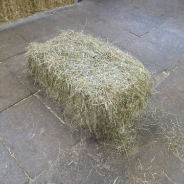
HD Ballen Heu
Gundelfingen
Niklas Schwehr
@Schwehr_HD-Ballen
Heu
Empfänger lädt ab
Kleinballen/HD-Ballen
Bio
Regenfrei
3 weitere...
B+
Deprecated: Creation of dynamic property Zend_View_Helper_Ads::$adLink is deprecated in /var/www/stall-frei/htdocs/staging.stall-frei.de/library/Psf/View/Helper/Ads.php on line 108

Das Beste für die Hufe
Mechtersen
STALL-FREIde Marketing
@STALL-FREI-Marketing
Hufschmiede und Hufpfleger in Ihrer Nähe
Leider kein Vorschaubild
Leider kein Vorschaubild
B+

Schwarzwald Heu+Stroh in Quaderballen & Rund...
Rickenbach
Matthias Griener
@Lohnunternehmen_Griener
Heu
Lieferant entlädt
Rundballen
Regenfrei
3 weitere...
ganz aktuell
B+

Biete Heu und Stroh in Quaderballen und Rundballen
Rickenbach
Matthias Griener
@Lohnunternehmen_Griener
Heu
Lieferant entlädt
Großballen
Regenfrei
3 weitere...
ganz aktuell
B+
Leider kein Vorschaubild
Leider kein Vorschaubild
Heu- und Luzernecobs
Holzgerlingen
Schlosshof-Holzgerlingen
@Schlosshof-Holzgerlingen
Einstreu
Pellets
Regenfrei
Wird verladen
1 weitere...
B+
Leider kein Vorschaubild
Leider kein Vorschaubild
Kleine HD-Ballen Heu
Weil im Schönbuch
Sabine-Dettinger
@Sabine-Dettinger
Heu
Empfänger lädt ab
Kleinballen/HD-Ballen
Bio
Regenfrei
2 weitere...
B+

Hafer aus Ernte 2025 auch gequetscht zu verkaufen
Wolfschlugen
Reitanlage im Höfelweg
@Reitanlage-im-Hoefelweg
Futter
Wird verladen
Abholung
B+

Job gesucht?
Mechtersen
STALL-FREIde Marketing
@STALL-FREI-Marketing
Sie suchen einen Job und arbeiten gerne mit Pferden oder auf Reitanlagen?
Besuchen Sie jetzt unseren Stellenmarkt!

Stroh, Kleinballen, Weizenstroh
Ertingen
Tobias
@Tobias4
Stroh
Kleinballen/HD-Ballen
Regenfrei
Wird verladen
2 weitere...
B+
Deprecated: Creation of dynamic property Zend_View::$pageCount is deprecated in /var/www/stall-frei/htdocs/staging.stall-frei.de/library/vendor/shardj/zf1-future/library/Zend/View/Abstract.php on line 308
Deprecated: Creation of dynamic property Zend_View::$itemCountPerPage is deprecated in /var/www/stall-frei/htdocs/staging.stall-frei.de/library/vendor/shardj/zf1-future/library/Zend/View/Abstract.php on line 308
Deprecated: Creation of dynamic property Zend_View::$first is deprecated in /var/www/stall-frei/htdocs/staging.stall-frei.de/library/vendor/shardj/zf1-future/library/Zend/View/Abstract.php on line 308
Deprecated: Creation of dynamic property Zend_View::$current is deprecated in /var/www/stall-frei/htdocs/staging.stall-frei.de/library/vendor/shardj/zf1-future/library/Zend/View/Abstract.php on line 308
Deprecated: Creation of dynamic property Zend_View::$last is deprecated in /var/www/stall-frei/htdocs/staging.stall-frei.de/library/vendor/shardj/zf1-future/library/Zend/View/Abstract.php on line 308
Deprecated: Creation of dynamic property Zend_View::$next is deprecated in /var/www/stall-frei/htdocs/staging.stall-frei.de/library/vendor/shardj/zf1-future/library/Zend/View/Abstract.php on line 308
Deprecated: Creation of dynamic property Zend_View::$pagesInRange is deprecated in /var/www/stall-frei/htdocs/staging.stall-frei.de/library/vendor/shardj/zf1-future/library/Zend/View/Abstract.php on line 308
Deprecated: Creation of dynamic property Zend_View::$firstPageInRange is deprecated in /var/www/stall-frei/htdocs/staging.stall-frei.de/library/vendor/shardj/zf1-future/library/Zend/View/Abstract.php on line 308
Deprecated: Creation of dynamic property Zend_View::$lastPageInRange is deprecated in /var/www/stall-frei/htdocs/staging.stall-frei.de/library/vendor/shardj/zf1-future/library/Zend/View/Abstract.php on line 308
Deprecated: Creation of dynamic property Zend_View::$currentItemCount is deprecated in /var/www/stall-frei/htdocs/staging.stall-frei.de/library/vendor/shardj/zf1-future/library/Zend/View/Abstract.php on line 308
Deprecated: Creation of dynamic property Zend_View::$totalItemCount is deprecated in /var/www/stall-frei/htdocs/staging.stall-frei.de/library/vendor/shardj/zf1-future/library/Zend/View/Abstract.php on line 308
Deprecated: Creation of dynamic property Zend_View::$firstItemNumber is deprecated in /var/www/stall-frei/htdocs/staging.stall-frei.de/library/vendor/shardj/zf1-future/library/Zend/View/Abstract.php on line 308
Deprecated: Creation of dynamic property Zend_View::$lastItemNumber is deprecated in /var/www/stall-frei/htdocs/staging.stall-frei.de/library/vendor/shardj/zf1-future/library/Zend/View/Abstract.php on line 308
Deprecated: Creation of dynamic property Zend_View::$router is deprecated in /var/www/stall-frei/htdocs/staging.stall-frei.de/library/vendor/shardj/zf1-future/library/Zend/View/Abstract.php on line 308
Deprecated: Creation of dynamic property Zend_View::$urlParams is deprecated in /var/www/stall-frei/htdocs/staging.stall-frei.de/library/vendor/shardj/zf1-future/library/Zend/View/Abstract.php on line 308
Deprecated: Creation of dynamic property Zend_View::$showAds is deprecated in /var/www/stall-frei/htdocs/staging.stall-frei.de/library/vendor/shardj/zf1-future/library/Zend/View/Abstract.php on line 308
Deprecated: Creation of dynamic property Zend_View::$objectIds is deprecated in /var/www/stall-frei/htdocs/staging.stall-frei.de/library/vendor/shardj/zf1-future/library/Zend/View/Abstract.php on line 308
Deprecated: Creation of dynamic property Zend_View::$showNavbar is deprecated in /var/www/stall-frei/htdocs/staging.stall-frei.de/library/vendor/shardj/zf1-future/library/Zend/View/Abstract.php on line 308
Deprecated: Creation of dynamic property Zend_View::$showBreadcrumb is deprecated in /var/www/stall-frei/htdocs/staging.stall-frei.de/library/vendor/shardj/zf1-future/library/Zend/View/Abstract.php on line 308
Deprecated: Creation of dynamic property Zend_View::$showFooter is deprecated in /var/www/stall-frei/htdocs/staging.stall-frei.de/library/vendor/shardj/zf1-future/library/Zend/View/Abstract.php on line 308
Deprecated: Creation of dynamic property Zend_View::$showInternalAds is deprecated in /var/www/stall-frei/htdocs/staging.stall-frei.de/library/vendor/shardj/zf1-future/library/Zend/View/Abstract.php on line 308
Deprecated: Creation of dynamic property Zend_View::$blNoContent is deprecated in /var/www/stall-frei/htdocs/staging.stall-frei.de/library/vendor/shardj/zf1-future/library/Zend/View/Abstract.php on line 308
Deprecated: Creation of dynamic property Zend_View::$sMetaDesc is deprecated in /var/www/stall-frei/htdocs/staging.stall-frei.de/library/vendor/shardj/zf1-future/library/Zend/View/Abstract.php on line 308
Deprecated: Creation of dynamic property Zend_View::$useGmaps is deprecated in /var/www/stall-frei/htdocs/staging.stall-frei.de/library/vendor/shardj/zf1-future/library/Zend/View/Abstract.php on line 308
Deprecated: Creation of dynamic property Zend_View::$touches is deprecated in /var/www/stall-frei/htdocs/staging.stall-frei.de/library/vendor/shardj/zf1-future/library/Zend/View/Abstract.php on line 308
Deprecated: Creation of dynamic property Zend_View::$oProject is deprecated in /var/www/stall-frei/htdocs/staging.stall-frei.de/library/vendor/shardj/zf1-future/library/Zend/View/Abstract.php on line 308
Deprecated: Creation of dynamic property Zend_View::$pageHeadline is deprecated in /var/www/stall-frei/htdocs/staging.stall-frei.de/library/vendor/shardj/zf1-future/library/Zend/View/Abstract.php on line 308
Deprecated: Creation of dynamic property Zend_View::$disableLocationField is deprecated in /var/www/stall-frei/htdocs/staging.stall-frei.de/library/vendor/shardj/zf1-future/library/Zend/View/Abstract.php on line 308
Deprecated: Creation of dynamic property Zend_View::$isSearch is deprecated in /var/www/stall-frei/htdocs/staging.stall-frei.de/library/vendor/shardj/zf1-future/library/Zend/View/Abstract.php on line 308
Deprecated: Creation of dynamic property Zend_View::$pageTitle is deprecated in /var/www/stall-frei/htdocs/staging.stall-frei.de/library/vendor/shardj/zf1-future/library/Zend/View/Abstract.php on line 308
Deprecated: Creation of dynamic property Psf_Form_Element_Text::$class is deprecated in /var/www/stall-frei/htdocs/staging.stall-frei.de/library/vendor/shardj/zf1-future/library/Zend/Form/Element.php on line 874
Deprecated: Creation of dynamic property Psf_Form_Element_Text::$size is deprecated in /var/www/stall-frei/htdocs/staging.stall-frei.de/library/vendor/shardj/zf1-future/library/Zend/Form/Element.php on line 874
Deprecated: Creation of dynamic property Psf_Form_Element_Text::$placeholder is deprecated in /var/www/stall-frei/htdocs/staging.stall-frei.de/library/vendor/shardj/zf1-future/library/Zend/Form/Element.php on line 874
Deprecated: Creation of dynamic property Psf_Form_Element_Hidden::$class is deprecated in /var/www/stall-frei/htdocs/staging.stall-frei.de/library/vendor/shardj/zf1-future/library/Zend/Form/Element.php on line 874
Deprecated: Creation of dynamic property Psf_Form_Element_Hidden::$class is deprecated in /var/www/stall-frei/htdocs/staging.stall-frei.de/library/vendor/shardj/zf1-future/library/Zend/Form/Element.php on line 874
Deprecated: Creation of dynamic property Psf_Form_Element_Hidden::$class is deprecated in /var/www/stall-frei/htdocs/staging.stall-frei.de/library/vendor/shardj/zf1-future/library/Zend/Form/Element.php on line 874
Deprecated: Creation of dynamic property Psf_Form_Element_Hidden::$class is deprecated in /var/www/stall-frei/htdocs/staging.stall-frei.de/library/vendor/shardj/zf1-future/library/Zend/Form/Element.php on line 874
Deprecated: Creation of dynamic property Psf_Form_Element_Select::$class is deprecated in /var/www/stall-frei/htdocs/staging.stall-frei.de/library/vendor/shardj/zf1-future/library/Zend/Form/Element.php on line 874
Deprecated: Creation of dynamic property Psf_Form_Element_Select::$class is deprecated in /var/www/stall-frei/htdocs/staging.stall-frei.de/library/vendor/shardj/zf1-future/library/Zend/Form/Element.php on line 874
Deprecated: Creation of dynamic property Psf_Form_Element_Select::$class is deprecated in /var/www/stall-frei/htdocs/staging.stall-frei.de/library/vendor/shardj/zf1-future/library/Zend/Form/Element.php on line 874
Deprecated: Creation of dynamic property Psf_Form_Element_Select::$class is deprecated in /var/www/stall-frei/htdocs/staging.stall-frei.de/library/vendor/shardj/zf1-future/library/Zend/Form/Element.php on line 874
Deprecated: Creation of dynamic property Zend_View::$sort is deprecated in /var/www/stall-frei/htdocs/staging.stall-frei.de/library/vendor/shardj/zf1-future/library/Zend/View/Abstract.php on line 308
Deprecated: Creation of dynamic property Zend_View::$searchLocation is deprecated in /var/www/stall-frei/htdocs/staging.stall-frei.de/library/vendor/shardj/zf1-future/library/Zend/View/Abstract.php on line 308
Deprecated: Creation of dynamic property Zend_View::$locationHint is deprecated in /var/www/stall-frei/htdocs/staging.stall-frei.de/library/vendor/shardj/zf1-future/library/Zend/View/Abstract.php on line 308
Psf_GeoCoder_Abstract::getLocation: Hornberg Get Location CachedOrLive
Psf_GeoCoder_Abstract::getCachedOrLive: Hornberg
Psf_GeoCoder_OpenCageData::makeApiRequest: response:
Array
(
[documentation] => https://opencagedata.com/api
[licenses] => Array
(
[0] => Array
(
[name] => see attribution guide
[url] => https://opencagedata.com/credits
)
)
[results] => Array
(
[0] => Array
(
[bounds] => Array
(
[northeast] => Array
(
[lat] => 48.2476993
[lng] => 8.3130062
)
[southwest] => Array
(
[lat] => 48.1582346
[lng] => 8.1791441
)
)
[components] => Array
(
[ISO_3166-1_alpha-2] => DE
[ISO_3166-1_alpha-3] => DEU
[ISO_3166-2] => Array
(
[0] => DE-BW
)
[_category] => place
[_normalized_city] => Hornberg
[_type] => city
[continent] => Europe
[country] => Deutschland
[country_code] => de
[county] => Ortenaukreis
[political_union] => European Union
[postcode] => 78132
[state] => Baden-Württemberg
[state_code] => BW
[town] => Hornberg
)
[confidence] => 7
[formatted] => 78132 Hornberg, Deutschland
[geometry] => Array
(
[lat] => 48.2128411
[lng] => 8.2316356
)
)
[1] => Array
(
[bounds] => Array
(
[northeast] => Array
(
[lat] => 49.020839
[lng] => 10.2000314
)
[southwest] => Array
(
[lat] => 49.020739
[lng] => 10.1999314
)
)
[components] => Array
(
[ISO_3166-1_alpha-2] => DE
[ISO_3166-1_alpha-3] => DEU
[ISO_3166-2] => Array
(
[0] => DE-BW
)
[_category] => natural/water
[_normalized_city] => Ellenberg
[_type] => peak
[continent] => Europe
[country] => Deutschland
[country_code] => de
[county] => Ostalbkreis
[municipality] => VVG der Stadt Ellwangen (Jagst)
[peak] => Hornberg
[political_union] => European Union
[postcode] => 73488
[state] => Baden-Württemberg
[state_code] => BW
[village] => Ellenberg
)
[confidence] => 9
[formatted] => Hornberg, 73488 Ellenberg, Deutschland
[geometry] => Array
(
[lat] => 49.020789
[lng] => 10.1999814
)
)
[2] => Array
(
[bounds] => Array
(
[northeast] => Array
(
[lat] => 49.2247794
[lng] => 10.1700389
)
[southwest] => Array
(
[lat] => 49.2246794
[lng] => 10.1699389
)
)
[components] => Array
(
[ISO_3166-1_alpha-2] => DE
[ISO_3166-1_alpha-3] => DEU
[ISO_3166-2] => Array
(
[0] => DE-BY
)
[_category] => natural/water
[_normalized_city] => Schnelldorf
[_type] => peak
[continent] => Europe
[country] => Deutschland
[country_code] => de
[county] => Landkreis Ansbach
[peak] => Hornberg
[political_union] => European Union
[postcode] => 91625
[state] => Bayern
[state_code] => BY
[village] => Schnelldorf
)
[confidence] => 9
[formatted] => Hornberg, 91625 Schnelldorf, Deutschland
[geometry] => Array
(
[lat] => 49.2247294
[lng] => 10.1699889
)
)
[3] => Array
(
[bounds] => Array
(
[northeast] => Array
(
[lat] => 49.2170905
[lng] => 10.0443865
)
[southwest] => Array
(
[lat] => 49.2041595
[lng] => 9.9885326
)
)
[components] => Array
(
[ISO_3166-1_alpha-2] => DE
[ISO_3166-1_alpha-3] => DEU
[ISO_3166-2] => Array
(
[0] => DE-BW
)
[_category] => place
[_normalized_city] => Kirchberg an der Jagst
[_type] => village
[continent] => Europe
[country] => Deutschland
[country_code] => de
[county] => Landkreis Schwäbisch Hall
[municipality] => GVV Brettach/Jagst
[political_union] => European Union
[state] => Baden-Württemberg
[state_code] => BW
[town] => Kirchberg an der Jagst
[village] => Hornberg
)
[confidence] => 7
[formatted] => Hornberg, Baden-Württemberg, Deutschland
[geometry] => Array
(
[lat] => 49.2077802
[lng] => 9.9964102
)
)
[4] => Array
(
[bounds] => Array
(
[northeast] => Array
(
[lat] => 50.973061
[lng] => 14.2534766
)
[southwest] => Array
(
[lat] => 50.972961
[lng] => 14.2533766
)
)
[components] => Array
(
[ISO_3166-1_alpha-2] => DE
[ISO_3166-1_alpha-3] => DEU
[ISO_3166-2] => Array
(
[0] => DE-SN
)
[_category] => natural/water
[_normalized_city] => Sebnitz
[_type] => peak
[continent] => Europe
[country] => Deutschland
[country_code] => de
[county] => Sächsische Schweiz-Osterzgebirge
[peak] => Hornberg
[political_union] => European Union
[postcode] => 01855
[state] => Sachsen
[state_code] => SN
[town] => Sebnitz
)
[confidence] => 9
[formatted] => Hornberg, 01855 Sebnitz, Deutschland
[geometry] => Array
(
[lat] => 50.973011
[lng] => 14.2534266
)
)
[5] => Array
(
[bounds] => Array
(
[northeast] => Array
(
[lat] => 50.987476
[lng] => 10.2363447
)
[southwest] => Array
(
[lat] => 50.987376
[lng] => 10.2362447
)
)
[components] => Array
(
[ISO_3166-1_alpha-2] => DE
[ISO_3166-1_alpha-3] => DEU
[ISO_3166-2] => Array
(
[0] => DE-TH
)
[_category] => natural/water
[_normalized_city] => Eisenach
[_type] => peak
[continent] => Europe
[country] => Deutschland
[country_code] => de
[county] => Wartburgkreis
[peak] => Hornberg
[political_union] => European Union
[postcode] => 99819
[state] => Thüringen
[state_code] => TH
[town] => Eisenach
)
[confidence] => 9
[formatted] => Hornberg, 99819 Eisenach, Deutschland
[geometry] => Array
(
[lat] => 50.987426
[lng] => 10.2362947
)
)
[6] => Array
(
[bounds] => Array
(
[northeast] => Array
(
[lat] => 52.9736563
[lng] => 9.8155498
)
[southwest] => Array
(
[lat] => 52.9735563
[lng] => 9.8154498
)
)
[components] => Array
(
[ISO_3166-1_alpha-2] => DE
[ISO_3166-1_alpha-3] => DEU
[ISO_3166-2] => Array
(
[0] => DE-NI
)
[_category] => natural/water
[_normalized_city] => Soltau
[_type] => peak
[continent] => Europe
[country] => Deutschland
[country_code] => de
[county] => Heidekreis
[peak] => Hornberg
[political_union] => European Union
[postcode] => 29614
[state] => Niedersachsen
[state_code] => NI
[town] => Soltau
)
[confidence] => 9
[formatted] => Hornberg, 29614 Soltau, Deutschland
[geometry] => Array
(
[lat] => 52.9736063
[lng] => 9.8154998
)
)
[7] => Array
(
[bounds] => Array
(
[northeast] => Array
(
[lat] => 49.0153206
[lng] => 10.1880073
)
[southwest] => Array
(
[lat] => 49.0152206
[lng] => 10.1879073
)
)
[components] => Array
(
[ISO_3166-1_alpha-2] => DE
[ISO_3166-1_alpha-3] => DEU
[ISO_3166-2] => Array
(
[0] => DE-BW
)
[_category] => natural/water
[_normalized_city] => Ellwangen (Jagst)
[_type] => peak
[continent] => Europe
[country] => Deutschland
[country_code] => de
[county] => Ostalbkreis
[municipality] => VVG der Stadt Ellwangen (Jagst)
[peak] => Hornberg
[political_union] => European Union
[postcode] => 73488
[state] => Baden-Württemberg
[state_code] => BW
[town] => Ellwangen (Jagst)
)
[confidence] => 9
[formatted] => Hornberg, 73488 Ellwangen (Jagst), Deutschland
[geometry] => Array
(
[lat] => 49.0152706
[lng] => 10.1879573
)
)
[8] => Array
(
[bounds] => Array
(
[northeast] => Array
(
[lat] => 48.9679236
[lng] => 9.6648762
)
[southwest] => Array
(
[lat] => 48.9678236
[lng] => 9.6647762
)
)
[components] => Array
(
[ISO_3166-1_alpha-2] => DE
[ISO_3166-1_alpha-3] => DEU
[ISO_3166-2] => Array
(
[0] => DE-BW
)
[_category] => natural/water
[_normalized_city] => Fichtenberg
[_type] => peak
[continent] => Europe
[country] => Deutschland
[country_code] => de
[county] => Landkreis Schwäbisch Hall
[municipality] => GVV Limpurger Land
[peak] => Hornberg
[political_union] => European Union
[postcode] => 74427
[state] => Baden-Württemberg
[state_code] => BW
[village] => Fichtenberg
)
[confidence] => 9
[formatted] => Hornberg, 74427 Fichtenberg, Deutschland
[geometry] => Array
(
[lat] => 48.9678736
[lng] => 9.6648262
)
)
[9] => Array
(
[components] => Array
(
[ISO_3166-1_alpha-2] => FR
[ISO_3166-1_alpha-3] => FRA
[ISO_3166-2] => Array
(
[0] => FR-IDF
[1] => FR-92
)
[_category] => road
[_normalized_city] => Levallois-Perret
[_type] => road
[city] => Levallois-Perret
[continent] => Europe
[country] => France
[country_code] => fr
[county] => Hauts-de-Seine
[local_authority] => Métropole du Grand Paris
[political_union] => European Union
[postcode] => 92300
[road] => Rue Charles Deutschmann
[state] => Île-de-France
[state_code] => IDF
)
[confidence] => 2
[formatted] => Rue Charles Deutschmann, 92300 Levallois-Perret, France
[geometry] => Array
(
[lat] => 48.900049
[lng] => 2.2842
)
)
)
[status] => Array
(
[code] => 200
[message] => OK
)
[stay_informed] => Array
(
[blog] => https://blog.opencagedata.com
[mastodon] => https://en.osm.town/@opencage
)
[thanks] => For using an OpenCage API
[timestamp] => Array
(
[created_http] => Thu, 05 Feb 2026 13:58:34 GMT
[created_unix] => 1770299914
)
[total_results] => 10
)
Psf_GeoCoder_Abstract::convertLocationResult
{"documentation":"https:\/\/opencagedata.com\/api","licenses":[{"name":"see attribution guide","url":"https:\/\/opencagedata.com\/credits"}],"results":[{"bounds":{"northeast":{"lat":48.2476993,"lng":8.3130062},"southwest":{"lat":48.1582346,"lng":8.1791441}},"components":{"ISO_3166-1_alpha-2":"DE","ISO_3166-1_alpha-3":"DEU","ISO_3166-2":["DE-BW"],"_category":"place","_normalized_city":"Hornberg","_type":"city","continent":"Europe","country":"Deutschland","country_code":"de","county":"Ortenaukreis","political_union":"European Union","postcode":"78132","state":"Baden-W\u00fcrttemberg","state_code":"BW","town":"Hornberg"},"confidence":7,"formatted":"78132 Hornberg, Deutschland","geometry":{"lat":48.2128411,"lng":8.2316356}},{"bounds":{"northeast":{"lat":49.020839,"lng":10.2000314},"southwest":{"lat":49.020739,"lng":10.1999314}},"components":{"ISO_3166-1_alpha-2":"DE","ISO_3166-1_alpha-3":"DEU","ISO_3166-2":["DE-BW"],"_category":"natural\/water","_normalized_city":"Ellenberg","_type":"peak","continent":"Europe","country":"Deutschland","country_code":"de","county":"Ostalbkreis","municipality":"VVG der Stadt Ellwangen (Jagst)","peak":"Hornberg","political_union":"European Union","postcode":"73488","state":"Baden-W\u00fcrttemberg","state_code":"BW","village":"Ellenberg"},"confidence":9,"formatted":"Hornberg, 73488 Ellenberg, Deutschland","geometry":{"lat":49.020789,"lng":10.1999814}},{"bounds":{"northeast":{"lat":49.2247794,"lng":10.1700389},"southwest":{"lat":49.2246794,"lng":10.1699389}},"components":{"ISO_3166-1_alpha-2":"DE","ISO_3166-1_alpha-3":"DEU","ISO_3166-2":["DE-BY"],"_category":"natural\/water","_normalized_city":"Schnelldorf","_type":"peak","continent":"Europe","country":"Deutschland","country_code":"de","county":"Landkreis Ansbach","peak":"Hornberg","political_union":"European Union","postcode":"91625","state":"Bayern","state_code":"BY","village":"Schnelldorf"},"confidence":9,"formatted":"Hornberg, 91625 Schnelldorf, Deutschland","geometry":{"lat":49.2247294,"lng":10.1699889}},{"bounds":{"northeast":{"lat":49.2170905,"lng":10.0443865},"southwest":{"lat":49.2041595,"lng":9.9885326}},"components":{"ISO_3166-1_alpha-2":"DE","ISO_3166-1_alpha-3":"DEU","ISO_3166-2":["DE-BW"],"_category":"place","_normalized_city":"Kirchberg an der Jagst","_type":"village","continent":"Europe","country":"Deutschland","country_code":"de","county":"Landkreis Schw\u00e4bisch Hall","municipality":"GVV Brettach\/Jagst","political_union":"European Union","state":"Baden-W\u00fcrttemberg","state_code":"BW","town":"Kirchberg an der Jagst","village":"Hornberg"},"confidence":7,"formatted":"Hornberg, Baden-W\u00fcrttemberg, Deutschland","geometry":{"lat":49.2077802,"lng":9.9964102}},{"bounds":{"northeast":{"lat":50.973061,"lng":14.2534766},"southwest":{"lat":50.972961,"lng":14.2533766}},"components":{"ISO_3166-1_alpha-2":"DE","ISO_3166-1_alpha-3":"DEU","ISO_3166-2":["DE-SN"],"_category":"natural\/water","_normalized_city":"Sebnitz","_type":"peak","continent":"Europe","country":"Deutschland","country_code":"de","county":"S\u00e4chsische Schweiz-Osterzgebirge","peak":"Hornberg","political_union":"European Union","postcode":"01855","state":"Sachsen","state_code":"SN","town":"Sebnitz"},"confidence":9,"formatted":"Hornberg, 01855 Sebnitz, Deutschland","geometry":{"lat":50.973011,"lng":14.2534266}},{"bounds":{"northeast":{"lat":50.987476,"lng":10.2363447},"southwest":{"lat":50.987376,"lng":10.2362447}},"components":{"ISO_3166-1_alpha-2":"DE","ISO_3166-1_alpha-3":"DEU","ISO_3166-2":["DE-TH"],"_category":"natural\/water","_normalized_city":"Eisenach","_type":"peak","continent":"Europe","country":"Deutschland","country_code":"de","county":"Wartburgkreis","peak":"Hornberg","political_union":"European Union","postcode":"99819","state":"Th\u00fcringen","state_code":"TH","town":"Eisenach"},"confidence":9,"formatted":"Hornberg, 99819 Eisenach, Deutschland","geometry":{"lat":50.987426,"lng":10.2362947}},{"bounds":{"northeast":{"lat":52.9736563,"lng":9.8155498},"southwest":{"lat":52.9735563,"lng":9.8154498}},"components":{"ISO_3166-1_alpha-2":"DE","ISO_3166-1_alpha-3":"DEU","ISO_3166-2":["DE-NI"],"_category":"natural\/water","_normalized_city":"Soltau","_type":"peak","continent":"Europe","country":"Deutschland","country_code":"de","county":"Heidekreis","peak":"Hornberg","political_union":"European Union","postcode":"29614","state":"Niedersachsen","state_code":"NI","town":"Soltau"},"confidence":9,"formatted":"Hornberg, 29614 Soltau, Deutschland","geometry":{"lat":52.9736063,"lng":9.8154998}},{"bounds":{"northeast":{"lat":49.0153206,"lng":10.1880073},"southwest":{"lat":49.0152206,"lng":10.1879073}},"components":{"ISO_3166-1_alpha-2":"DE","ISO_3166-1_alpha-3":"DEU","ISO_3166-2":["DE-BW"],"_category":"natural\/water","_normalized_city":"Ellwangen (Jagst)","_type":"peak","continent":"Europe","country":"Deutschland","country_code":"de","county":"Ostalbkreis","municipality":"VVG der Stadt Ellwangen (Jagst)","peak":"Hornberg","political_union":"European Union","postcode":"73488","state":"Baden-W\u00fcrttemberg","state_code":"BW","town":"Ellwangen (Jagst)"},"confidence":9,"formatted":"Hornberg, 73488 Ellwangen (Jagst), Deutschland","geometry":{"lat":49.0152706,"lng":10.1879573}},{"bounds":{"northeast":{"lat":48.9679236,"lng":9.6648762},"southwest":{"lat":48.9678236,"lng":9.6647762}},"components":{"ISO_3166-1_alpha-2":"DE","ISO_3166-1_alpha-3":"DEU","ISO_3166-2":["DE-BW"],"_category":"natural\/water","_normalized_city":"Fichtenberg","_type":"peak","continent":"Europe","country":"Deutschland","country_code":"de","county":"Landkreis Schw\u00e4bisch Hall","municipality":"GVV Limpurger Land","peak":"Hornberg","political_union":"European Union","postcode":"74427","state":"Baden-W\u00fcrttemberg","state_code":"BW","village":"Fichtenberg"},"confidence":9,"formatted":"Hornberg, 74427 Fichtenberg, Deutschland","geometry":{"lat":48.9678736,"lng":9.6648262}},{"components":{"ISO_3166-1_alpha-2":"FR","ISO_3166-1_alpha-3":"FRA","ISO_3166-2":["FR-IDF","FR-92"],"_category":"road","_normalized_city":"Levallois-Perret","_type":"road","city":"Levallois-Perret","continent":"Europe","country":"France","country_code":"fr","county":"Hauts-de-Seine","local_authority":"M\u00e9tropole du Grand Paris","political_union":"European Union","postcode":"92300","road":"Rue Charles Deutschmann","state":"\u00cele-de-France","state_code":"IDF"},"confidence":2,"formatted":"Rue Charles Deutschmann, 92300 Levallois-Perret, France","geometry":{"lat":48.900049,"lng":2.2842}}],"status":{"code":200,"message":"OK"},"stay_informed":{"blog":"https:\/\/blog.opencagedata.com","mastodon":"https:\/\/en.osm.town\/@opencage"},"thanks":"For using an OpenCage API","timestamp":{"created_http":"Thu, 05 Feb 2026 13:58:34 GMT","created_unix":1770299914},"total_results":10}Array
(
[0] => stdClass Object
(
[bounds] => stdClass Object
(
[northeast] => stdClass Object
(
[lat] => 48.2476993
[lng] => 8.3130062
)
[southwest] => stdClass Object
(
[lat] => 48.1582346
[lng] => 8.1791441
)
)
[components] => stdClass Object
(
[ISO_3166-1_alpha-2] => DE
[ISO_3166-1_alpha-3] => DEU
[ISO_3166-2] => Array
(
[0] => DE-BW
)
[_category] => place
[_normalized_city] => Hornberg
[_type] => city
[continent] => Europe
[country] => Deutschland
[country_code] => de
[county] => Ortenaukreis
[political_union] => European Union
[postcode] => 78132
[state] => Baden-Württemberg
[state_code] => BW
[town] => Hornberg
)
[confidence] => 7
[formatted] => 78132 Hornberg, Deutschland
[geometry] => stdClass Object
(
[lat] => 48.2128411
[lng] => 8.2316356
)
)
[1] => stdClass Object
(
[bounds] => stdClass Object
(
[northeast] => stdClass Object
(
[lat] => 49.020839
[lng] => 10.2000314
)
[southwest] => stdClass Object
(
[lat] => 49.020739
[lng] => 10.1999314
)
)
[components] => stdClass Object
(
[ISO_3166-1_alpha-2] => DE
[ISO_3166-1_alpha-3] => DEU
[ISO_3166-2] => Array
(
[0] => DE-BW
)
[_category] => natural/water
[_normalized_city] => Ellenberg
[_type] => peak
[continent] => Europe
[country] => Deutschland
[country_code] => de
[county] => Ostalbkreis
[municipality] => VVG der Stadt Ellwangen (Jagst)
[peak] => Hornberg
[political_union] => European Union
[postcode] => 73488
[state] => Baden-Württemberg
[state_code] => BW
[village] => Ellenberg
)
[confidence] => 9
[formatted] => Hornberg, 73488 Ellenberg, Deutschland
[geometry] => stdClass Object
(
[lat] => 49.020789
[lng] => 10.1999814
)
)
[2] => stdClass Object
(
[bounds] => stdClass Object
(
[northeast] => stdClass Object
(
[lat] => 49.2247794
[lng] => 10.1700389
)
[southwest] => stdClass Object
(
[lat] => 49.2246794
[lng] => 10.1699389
)
)
[components] => stdClass Object
(
[ISO_3166-1_alpha-2] => DE
[ISO_3166-1_alpha-3] => DEU
[ISO_3166-2] => Array
(
[0] => DE-BY
)
[_category] => natural/water
[_normalized_city] => Schnelldorf
[_type] => peak
[continent] => Europe
[country] => Deutschland
[country_code] => de
[county] => Landkreis Ansbach
[peak] => Hornberg
[political_union] => European Union
[postcode] => 91625
[state] => Bayern
[state_code] => BY
[village] => Schnelldorf
)
[confidence] => 9
[formatted] => Hornberg, 91625 Schnelldorf, Deutschland
[geometry] => stdClass Object
(
[lat] => 49.2247294
[lng] => 10.1699889
)
)
[3] => stdClass Object
(
[bounds] => stdClass Object
(
[northeast] => stdClass Object
(
[lat] => 49.2170905
[lng] => 10.0443865
)
[southwest] => stdClass Object
(
[lat] => 49.2041595
[lng] => 9.9885326
)
)
[components] => stdClass Object
(
[ISO_3166-1_alpha-2] => DE
[ISO_3166-1_alpha-3] => DEU
[ISO_3166-2] => Array
(
[0] => DE-BW
)
[_category] => place
[_normalized_city] => Kirchberg an der Jagst
[_type] => village
[continent] => Europe
[country] => Deutschland
[country_code] => de
[county] => Landkreis Schwäbisch Hall
[municipality] => GVV Brettach/Jagst
[political_union] => European Union
[state] => Baden-Württemberg
[state_code] => BW
[town] => Kirchberg an der Jagst
[village] => Hornberg
)
[confidence] => 7
[formatted] => Hornberg, Baden-Württemberg, Deutschland
[geometry] => stdClass Object
(
[lat] => 49.2077802
[lng] => 9.9964102
)
)
[4] => stdClass Object
(
[bounds] => stdClass Object
(
[northeast] => stdClass Object
(
[lat] => 50.973061
[lng] => 14.2534766
)
[southwest] => stdClass Object
(
[lat] => 50.972961
[lng] => 14.2533766
)
)
[components] => stdClass Object
(
[ISO_3166-1_alpha-2] => DE
[ISO_3166-1_alpha-3] => DEU
[ISO_3166-2] => Array
(
[0] => DE-SN
)
[_category] => natural/water
[_normalized_city] => Sebnitz
[_type] => peak
[continent] => Europe
[country] => Deutschland
[country_code] => de
[county] => Sächsische Schweiz-Osterzgebirge
[peak] => Hornberg
[political_union] => European Union
[postcode] => 01855
[state] => Sachsen
[state_code] => SN
[town] => Sebnitz
)
[confidence] => 9
[formatted] => Hornberg, 01855 Sebnitz, Deutschland
[geometry] => stdClass Object
(
[lat] => 50.973011
[lng] => 14.2534266
)
)
[5] => stdClass Object
(
[bounds] => stdClass Object
(
[northeast] => stdClass Object
(
[lat] => 50.987476
[lng] => 10.2363447
)
[southwest] => stdClass Object
(
[lat] => 50.987376
[lng] => 10.2362447
)
)
[components] => stdClass Object
(
[ISO_3166-1_alpha-2] => DE
[ISO_3166-1_alpha-3] => DEU
[ISO_3166-2] => Array
(
[0] => DE-TH
)
[_category] => natural/water
[_normalized_city] => Eisenach
[_type] => peak
[continent] => Europe
[country] => Deutschland
[country_code] => de
[county] => Wartburgkreis
[peak] => Hornberg
[political_union] => European Union
[postcode] => 99819
[state] => Thüringen
[state_code] => TH
[town] => Eisenach
)
[confidence] => 9
[formatted] => Hornberg, 99819 Eisenach, Deutschland
[geometry] => stdClass Object
(
[lat] => 50.987426
[lng] => 10.2362947
)
)
[6] => stdClass Object
(
[bounds] => stdClass Object
(
[northeast] => stdClass Object
(
[lat] => 52.9736563
[lng] => 9.8155498
)
[southwest] => stdClass Object
(
[lat] => 52.9735563
[lng] => 9.8154498
)
)
[components] => stdClass Object
(
[ISO_3166-1_alpha-2] => DE
[ISO_3166-1_alpha-3] => DEU
[ISO_3166-2] => Array
(
[0] => DE-NI
)
[_category] => natural/water
[_normalized_city] => Soltau
[_type] => peak
[continent] => Europe
[country] => Deutschland
[country_code] => de
[county] => Heidekreis
[peak] => Hornberg
[political_union] => European Union
[postcode] => 29614
[state] => Niedersachsen
[state_code] => NI
[town] => Soltau
)
[confidence] => 9
[formatted] => Hornberg, 29614 Soltau, Deutschland
[geometry] => stdClass Object
(
[lat] => 52.9736063
[lng] => 9.8154998
)
)
[7] => stdClass Object
(
[bounds] => stdClass Object
(
[northeast] => stdClass Object
(
[lat] => 49.0153206
[lng] => 10.1880073
)
[southwest] => stdClass Object
(
[lat] => 49.0152206
[lng] => 10.1879073
)
)
[components] => stdClass Object
(
[ISO_3166-1_alpha-2] => DE
[ISO_3166-1_alpha-3] => DEU
[ISO_3166-2] => Array
(
[0] => DE-BW
)
[_category] => natural/water
[_normalized_city] => Ellwangen (Jagst)
[_type] => peak
[continent] => Europe
[country] => Deutschland
[country_code] => de
[county] => Ostalbkreis
[municipality] => VVG der Stadt Ellwangen (Jagst)
[peak] => Hornberg
[political_union] => European Union
[postcode] => 73488
[state] => Baden-Württemberg
[state_code] => BW
[town] => Ellwangen (Jagst)
)
[confidence] => 9
[formatted] => Hornberg, 73488 Ellwangen (Jagst), Deutschland
[geometry] => stdClass Object
(
[lat] => 49.0152706
[lng] => 10.1879573
)
)
[8] => stdClass Object
(
[bounds] => stdClass Object
(
[northeast] => stdClass Object
(
[lat] => 48.9679236
[lng] => 9.6648762
)
[southwest] => stdClass Object
(
[lat] => 48.9678236
[lng] => 9.6647762
)
)
[components] => stdClass Object
(
[ISO_3166-1_alpha-2] => DE
[ISO_3166-1_alpha-3] => DEU
[ISO_3166-2] => Array
(
[0] => DE-BW
)
[_category] => natural/water
[_normalized_city] => Fichtenberg
[_type] => peak
[continent] => Europe
[country] => Deutschland
[country_code] => de
[county] => Landkreis Schwäbisch Hall
[municipality] => GVV Limpurger Land
[peak] => Hornberg
[political_union] => European Union
[postcode] => 74427
[state] => Baden-Württemberg
[state_code] => BW
[village] => Fichtenberg
)
[confidence] => 9
[formatted] => Hornberg, 74427 Fichtenberg, Deutschland
[geometry] => stdClass Object
(
[lat] => 48.9678736
[lng] => 9.6648262
)
)
[9] => stdClass Object
(
[components] => stdClass Object
(
[ISO_3166-1_alpha-2] => FR
[ISO_3166-1_alpha-3] => FRA
[ISO_3166-2] => Array
(
[0] => FR-IDF
[1] => FR-92
)
[_category] => road
[_normalized_city] => Levallois-Perret
[_type] => road
[city] => Levallois-Perret
[continent] => Europe
[country] => France
[country_code] => fr
[county] => Hauts-de-Seine
[local_authority] => Métropole du Grand Paris
[political_union] => European Union
[postcode] => 92300
[road] => Rue Charles Deutschmann
[state] => Île-de-France
[state_code] => IDF
)
[confidence] => 2
[formatted] => Rue Charles Deutschmann, 92300 Levallois-Perret, France
[geometry] => stdClass Object
(
[lat] => 48.900049
[lng] => 2.2842
)
)
)
Psf_GeoCoder_OpenCageData::getKeyMap: 0
stdClass Object
(
    [bounds] => stdClass Object
        (
            [northeast] => stdClass Object
                (
                    [lat] => 48.2476993
                    [lng] => 8.3130062
                )

            [southwest] => stdClass Object
                (
                    [lat] => 48.1582346
                    [lng] => 8.1791441
                )

        )

    [components] => stdClass Object
        (
            [ISO_3166-1_alpha-2] => DE
            [ISO_3166-1_alpha-3] => DEU
            [ISO_3166-2] => Array
                (
                    [0] => DE-BW
                )

            [_category] => place
            [_normalized_city] => Hornberg
            [_type] => city
            [continent] => Europe
            [country] => Deutschland
            [country_code] => de
            [county] => Ortenaukreis
            [political_union] => European Union
            [postcode] => 78132
            [state] => Baden-Württemberg
            [state_code] => BW
            [town] => Hornberg
        )

    [confidence] => 7
    [formatted] => 78132 Hornberg, Deutschland
    [geometry] => stdClass Object
        (
            [lat] => 48.2128411
            [lng] => 8.2316356
        )

)
Psf_GeoCoder_OpenCageData::getCounty: Ortenaukreis
Psf_GeoCoder_OpenCageData::addMissingData REFETCH!
Array
(
    [address] => 78132 Hornberg, Deutschland
    [type] => city
    [street] =>
    [city] => Hornberg
    [county] => Ortenaukreis
    [state] => Baden-Württemberg
    [zip] => 78132
    [country] => Deutschland
    [suburb] =>
    [countrycode] => de
    [latitude] => 48.2128411
    [longitude] => 8.2316356
    [accuracy] => 1
    [confidence] => 7
    [bounds] => stdClass Object
        (
            [northeast] => stdClass Object
                (
                    [lat] => 48.2476993
                    [lng] => 8.3130062
                )

            [southwest] => stdClass Object
                (
                    [lat] => 48.1582346
                    [lng] => 8.1791441
                )

        )

)
reformat!
Array
(
    [address] => 78132 Hornberg, Deutschland
    [type] => city
    [street] =>
    [city] => Hornberg
    [county] => Ortenaukreis
    [state] => Baden-Württemberg
    [zip] => 78132
    [country] => Deutschland
    [suburb] =>
    [countrycode] => de
    [latitude] => 48.2128411
    [longitude] => 8.2316356
    [accuracy] => 1
    [confidence] => 7
    [bounds] => stdClass Object
        (
            [northeast] => stdClass Object
                (
                    [lat] => 48.2476993
                    [lng] => 8.3130062
                )

            [southwest] => stdClass Object
                (
                    [lat] => 48.1582346
                    [lng] => 8.1791441
                )

        )

    [place] => 78132 Hornberg, Baden-Württemberg
    [hash] => 5b0dfd90ece6bbedd91270a6d55407c7
)
Psf_GeoCoder_OpenCageData::getKeyMap: 1
stdClass Object
(
    [bounds] => stdClass Object
        (
            [northeast] => stdClass Object
                (
                    [lat] => 49.020839
                    [lng] => 10.2000314
                )

            [southwest] => stdClass Object
                (
                    [lat] => 49.020739
                    [lng] => 10.1999314
                )

        )

    [components] => stdClass Object
        (
            [ISO_3166-1_alpha-2] => DE
            [ISO_3166-1_alpha-3] => DEU
            [ISO_3166-2] => Array
                (
                    [0] => DE-BW
                )

            [_category] => natural/water
            [_normalized_city] => Ellenberg
            [_type] => peak
            [continent] => Europe
            [country] => Deutschland
            [country_code] => de
            [county] => Ostalbkreis
            [municipality] => VVG der Stadt Ellwangen (Jagst)
            [peak] => Hornberg
            [political_union] => European Union
            [postcode] => 73488
            [state] => Baden-Württemberg
            [state_code] => BW
            [village] => Ellenberg
        )

    [confidence] => 9
    [formatted] => Hornberg, 73488 Ellenberg, Deutschland
    [geometry] => stdClass Object
        (
            [lat] => 49.020789
            [lng] => 10.1999814
        )

)
Psf_GeoCoder_OpenCageData::getCounty: Ostalbkreis
Psf_GeoCoder_OpenCageData::addMissingData REFETCH!
Array
(
    [address] => Hornberg, 73488 Ellenberg, Deutschland
    [type] => peak
    [street] =>
    [city] => Ellenberg
    [county] => Ostalbkreis
    [state] => Baden-Württemberg
    [zip] => 73488
    [country] => Deutschland
    [suburb] =>
    [countrycode] => de
    [latitude] => 49.020789
    [longitude] => 10.1999814
    [accuracy] => 1
    [confidence] => 9
    [bounds] => stdClass Object
        (
            [northeast] => stdClass Object
                (
                    [lat] => 49.020839
                    [lng] => 10.2000314
                )

            [southwest] => stdClass Object
                (
                    [lat] => 49.020739
                    [lng] => 10.1999314
                )

        )

)
reformat!
Array
(
    [address] => Hornberg, 73488 Ellenberg, Deutschland
    [type] => peak
    [street] =>
    [city] => Ellenberg
    [county] => Ostalbkreis
    [state] => Baden-Württemberg
    [zip] => 73488
    [country] => Deutschland
    [suburb] =>
    [countrycode] => de
    [latitude] => 49.020789
    [longitude] => 10.1999814
    [accuracy] => 1
    [confidence] => 9
    [bounds] => stdClass Object
        (
            [northeast] => stdClass Object
                (
                    [lat] => 49.020839
                    [lng] => 10.2000314
                )

            [southwest] => stdClass Object
                (
                    [lat] => 49.020739
                    [lng] => 10.1999314
                )

        )

    [place] => 73488 Ellenberg, Baden-Württemberg
    [hash] => 4d1b5c2d22c5fa53a861ccc6ee32e438
)
Psf_GeoCoder_OpenCageData::getKeyMap: 2
stdClass Object
(
    [bounds] => stdClass Object
        (
            [northeast] => stdClass Object
                (
                    [lat] => 49.2247794
                    [lng] => 10.1700389
                )

            [southwest] => stdClass Object
                (
                    [lat] => 49.2246794
                    [lng] => 10.1699389
                )

        )

    [components] => stdClass Object
        (
            [ISO_3166-1_alpha-2] => DE
            [ISO_3166-1_alpha-3] => DEU
            [ISO_3166-2] => Array
                (
                    [0] => DE-BY
                )

            [_category] => natural/water
            [_normalized_city] => Schnelldorf
            [_type] => peak
            [continent] => Europe
            [country] => Deutschland
            [country_code] => de
            [county] => Landkreis Ansbach
            [peak] => Hornberg
            [political_union] => European Union
            [postcode] => 91625
            [state] => Bayern
            [state_code] => BY
            [village] => Schnelldorf
        )

    [confidence] => 9
    [formatted] => Hornberg, 91625 Schnelldorf, Deutschland
    [geometry] => stdClass Object
        (
            [lat] => 49.2247294
            [lng] => 10.1699889
        )

)
Psf_GeoCoder_OpenCageData::getCounty: Ansbach
Psf_GeoCoder_OpenCageData::addMissingData REFETCH!
Array
(
    [address] => Hornberg, 91625 Schnelldorf, Deutschland
    [type] => peak
    [street] =>
    [city] => Schnelldorf
    [county] => Ansbach
    [state] => Bayern
    [zip] => 91625
    [country] => Deutschland
    [suburb] =>
    [countrycode] => de
    [latitude] => 49.2247294
    [longitude] => 10.1699889
    [accuracy] => 1
    [confidence] => 9
    [bounds] => stdClass Object
        (
            [northeast] => stdClass Object
                (
                    [lat] => 49.2247794
                    [lng] => 10.1700389
                )

            [southwest] => stdClass Object
                (
                    [lat] => 49.2246794
                    [lng] => 10.1699389
                )

        )

)
reformat!
Array
(
    [address] => Hornberg, 91625 Schnelldorf, Deutschland
    [type] => peak
    [street] =>
    [city] => Schnelldorf
    [county] => Ansbach
    [state] => Bayern
    [zip] => 91625
    [country] => Deutschland
    [suburb] =>
    [countrycode] => de
    [latitude] => 49.2247294
    [longitude] => 10.1699889
    [accuracy] => 1
    [confidence] => 9
    [bounds] => stdClass Object
        (
            [northeast] => stdClass Object
                (
                    [lat] => 49.2247794
                    [lng] => 10.1700389
                )

            [southwest] => stdClass Object
                (
                    [lat] => 49.2246794
                    [lng] => 10.1699389
                )

        )

    [place] => 91625 Schnelldorf, Bayern
    [hash] => a9813989ce4619ff7183cfc8b9c60c0f
)
Psf_GeoCoder_OpenCageData::getKeyMap: 3
stdClass Object
(
    [bounds] => stdClass Object
        (
            [northeast] => stdClass Object
                (
                    [lat] => 49.2170905
                    [lng] => 10.0443865
                )

            [southwest] => stdClass Object
                (
                    [lat] => 49.2041595
                    [lng] => 9.9885326
                )

        )

    [components] => stdClass Object
        (
            [ISO_3166-1_alpha-2] => DE
            [ISO_3166-1_alpha-3] => DEU
            [ISO_3166-2] => Array
                (
                    [0] => DE-BW
                )

            [_category] => place
            [_normalized_city] => Kirchberg an der Jagst
            [_type] => village
            [continent] => Europe
            [country] => Deutschland
            [country_code] => de
            [county] => Landkreis Schwäbisch Hall
            [municipality] => GVV Brettach/Jagst
            [political_union] => European Union
            [state] => Baden-Württemberg
            [state_code] => BW
            [town] => Kirchberg an der Jagst
            [village] => Hornberg
        )

    [confidence] => 7
    [formatted] => Hornberg, Baden-Württemberg, Deutschland
    [geometry] => stdClass Object
        (
            [lat] => 49.2077802
            [lng] => 9.9964102
        )

)
Psf_GeoCoder_OpenCageData::getCounty: Schwäbisch Hall
Psf_GeoCoder_OpenCageData::addMissingData REFETCH!
Array
(
    [address] => Hornberg, Baden-Württemberg, Deutschland
    [type] => village
    [street] =>
    [city] => Kirchberg an der Jagst
    [county] => Schwäbisch Hall
    [state] => Baden-Württemberg
    [zip] =>
    [country] => Deutschland
    [suburb] =>
    [countrycode] => de
    [latitude] => 49.2077802
    [longitude] => 9.9964102
    [accuracy] => 1
    [confidence] => 7
    [bounds] => stdClass Object
        (
            [northeast] => stdClass Object
                (
                    [lat] => 49.2170905
                    [lng] => 10.0443865
                )

            [southwest] => stdClass Object
                (
                    [lat] => 49.2041595
                    [lng] => 9.9885326
                )

        )

)
reformat!
Array
(
    [address] => Kirchberg an der Jagst
    [type] => village
    [street] =>
    [city] => Kirchberg an der Jagst
    [county] => Schwäbisch Hall
    [state] => Baden-Württemberg
    [zip] =>
    [country] => Deutschland
    [suburb] =>
    [countrycode] => de
    [latitude] => 49.2077802
    [longitude] => 9.9964102
    [accuracy] => 1
    [confidence] => 7
    [bounds] => stdClass Object
        (
            [northeast] => stdClass Object
                (
                    [lat] => 49.2170905
                    [lng] => 10.0443865
                )

            [southwest] => stdClass Object
                (
                    [lat] => 49.2041595
                    [lng] => 9.9885326
                )

        )

    [place] => Kirchberg an der Jagst, Baden-Württemberg
    [hash] => 03ae12cf55e12ab419e6a0dc01e0886a
)
Psf_GeoCoder_OpenCageData::getKeyMap: 4
stdClass Object
(
    [bounds] => stdClass Object
        (
            [northeast] => stdClass Object
                (
                    [lat] => 50.973061
                    [lng] => 14.2534766
                )

            [southwest] => stdClass Object
                (
                    [lat] => 50.972961
                    [lng] => 14.2533766
                )

        )

    [components] => stdClass Object
        (
            [ISO_3166-1_alpha-2] => DE
            [ISO_3166-1_alpha-3] => DEU
            [ISO_3166-2] => Array
                (
                    [0] => DE-SN
                )

            [_category] => natural/water
            [_normalized_city] => Sebnitz
            [_type] => peak
            [continent] => Europe
            [country] => Deutschland
            [country_code] => de
            [county] => Sächsische Schweiz-Osterzgebirge
            [peak] => Hornberg
            [political_union] => European Union
            [postcode] => 01855
            [state] => Sachsen
            [state_code] => SN
            [town] => Sebnitz
        )

    [confidence] => 9
    [formatted] => Hornberg, 01855 Sebnitz, Deutschland
    [geometry] => stdClass Object
        (
            [lat] => 50.973011
            [lng] => 14.2534266
        )

)
Psf_GeoCoder_OpenCageData::getCounty: Sächsische Schweiz-Osterzgebirge
Psf_GeoCoder_OpenCageData::addMissingData REFETCH!
Array
(
    [address] => Hornberg, 01855 Sebnitz, Deutschland
    [type] => peak
    [street] =>
    [city] => Sebnitz
    [county] => Sächsische Schweiz-Osterzgebirge
    [state] => Sachsen
    [zip] => 01855
    [country] => Deutschland
    [suburb] =>
    [countrycode] => de
    [latitude] => 50.973011
    [longitude] => 14.2534266
    [accuracy] => 1
    [confidence] => 9
    [bounds] => stdClass Object
        (
            [northeast] => stdClass Object
                (
                    [lat] => 50.973061
                    [lng] => 14.2534766
                )

            [southwest] => stdClass Object
                (
                    [lat] => 50.972961
                    [lng] => 14.2533766
                )

        )

)
reformat!
Array
(
    [address] => Hornberg, 01855 Sebnitz, Deutschland
    [type] => peak
    [street] =>
    [city] => Sebnitz
    [county] => Sächsische Schweiz-Osterzgebirge
    [state] => Sachsen
    [zip] => 01855
    [country] => Deutschland
    [suburb] =>
    [countrycode] => de
    [latitude] => 50.973011
    [longitude] => 14.2534266
    [accuracy] => 1
    [confidence] => 9
    [bounds] => stdClass Object
        (
            [northeast] => stdClass Object
                (
                    [lat] => 50.973061
                    [lng] => 14.2534766
                )

            [southwest] => stdClass Object
                (
                    [lat] => 50.972961
                    [lng] => 14.2533766
                )

        )

    [place] => 01855 Sebnitz, Sachsen
    [hash] => d882dfb4f9bc90192b7240d282487a1f
)
Psf_GeoCoder_OpenCageData::getKeyMap: 5
stdClass Object
(
    [bounds] => stdClass Object
        (
            [northeast] => stdClass Object
                (
                    [lat] => 50.987476
                    [lng] => 10.2363447
                )

            [southwest] => stdClass Object
                (
                    [lat] => 50.987376
                    [lng] => 10.2362447
                )

        )

    [components] => stdClass Object
        (
            [ISO_3166-1_alpha-2] => DE
            [ISO_3166-1_alpha-3] => DEU
            [ISO_3166-2] => Array
                (
                    [0] => DE-TH
                )

            [_category] => natural/water
            [_normalized_city] => Eisenach
            [_type] => peak
            [continent] => Europe
            [country] => Deutschland
            [country_code] => de
            [county] => Wartburgkreis
            [peak] => Hornberg
            [political_union] => European Union
            [postcode] => 99819
            [state] => Thüringen
            [state_code] => TH
            [town] => Eisenach
        )

    [confidence] => 9
    [formatted] => Hornberg, 99819 Eisenach, Deutschland
    [geometry] => stdClass Object
        (
            [lat] => 50.987426
            [lng] => 10.2362947
        )

)
Psf_GeoCoder_OpenCageData::getCounty: Wartburgkreis
Psf_GeoCoder_OpenCageData::addMissingData REFETCH!
Array
(
    [address] => Hornberg, 99819 Eisenach, Deutschland
    [type] => peak
    [street] =>
    [city] => Eisenach
    [county] => Wartburgkreis
    [state] => Thüringen
    [zip] => 99819
    [country] => Deutschland
    [suburb] =>
    [countrycode] => de
    [latitude] => 50.987426
    [longitude] => 10.2362947
    [accuracy] => 1
    [confidence] => 9
    [bounds] => stdClass Object
        (
            [northeast] => stdClass Object
                (
                    [lat] => 50.987476
                    [lng] => 10.2363447
                )

            [southwest] => stdClass Object
                (
                    [lat] => 50.987376
                    [lng] => 10.2362447
                )

        )

)
reformat!
Array
(
    [address] => Hornberg, 99819 Eisenach, Deutschland
    [type] => peak
    [street] =>
    [city] => Eisenach
    [county] => Wartburgkreis
    [state] => Thüringen
    [zip] => 99819
    [country] => Deutschland
    [suburb] =>
    [countrycode] => de
    [latitude] => 50.987426
    [longitude] => 10.2362947
    [accuracy] => 1
    [confidence] => 9
    [bounds] => stdClass Object
        (
            [northeast] => stdClass Object
                (
                    [lat] => 50.987476
                    [lng] => 10.2363447
                )

            [southwest] => stdClass Object
                (
                    [lat] => 50.987376
                    [lng] => 10.2362447
                )

        )

    [place] => 99819 Eisenach, Thüringen
    [hash] => fba09d570b71580511d868683fb9424d
)
Psf_GeoCoder_OpenCageData::getKeyMap: 6
stdClass Object
(
    [bounds] => stdClass Object
        (
            [northeast] => stdClass Object
                (
                    [lat] => 52.9736563
                    [lng] => 9.8155498
                )

            [southwest] => stdClass Object
                (
                    [lat] => 52.9735563
                    [lng] => 9.8154498
                )

        )

    [components] => stdClass Object
        (
            [ISO_3166-1_alpha-2] => DE
            [ISO_3166-1_alpha-3] => DEU
            [ISO_3166-2] => Array
                (
                    [0] => DE-NI
                )

            [_category] => natural/water
            [_normalized_city] => Soltau
            [_type] => peak
            [continent] => Europe
            [country] => Deutschland
            [country_code] => de
            [county] => Heidekreis
            [peak] => Hornberg
            [political_union] => European Union
            [postcode] => 29614
            [state] => Niedersachsen
            [state_code] => NI
            [town] => Soltau
        )

    [confidence] => 9
    [formatted] => Hornberg, 29614 Soltau, Deutschland
    [geometry] => stdClass Object
        (
            [lat] => 52.9736063
            [lng] => 9.8154998
        )

)
Psf_GeoCoder_OpenCageData::getCounty: Heidekreis
Psf_GeoCoder_OpenCageData::addMissingData REFETCH!
Array
(
    [address] => Hornberg, 29614 Soltau, Deutschland
    [type] => peak
    [street] =>
    [city] => Soltau
    [county] => Heidekreis
    [state] => Niedersachsen
    [zip] => 29614
    [country] => Deutschland
    [suburb] =>
    [countrycode] => de
    [latitude] => 52.9736063
    [longitude] => 9.8154998
    [accuracy] => 1
    [confidence] => 9
    [bounds] => stdClass Object
        (
            [northeast] => stdClass Object
                (
                    [lat] => 52.9736563
                    [lng] => 9.8155498
                )

            [southwest] => stdClass Object
                (
                    [lat] => 52.9735563
                    [lng] => 9.8154498
                )

        )

)
reformat!
Array
(
    [address] => Hornberg, 29614 Soltau, Deutschland
    [type] => peak
    [street] =>
    [city] => Soltau
    [county] => Heidekreis
    [state] => Niedersachsen
    [zip] => 29614
    [country] => Deutschland
    [suburb] =>
    [countrycode] => de
    [latitude] => 52.9736063
    [longitude] => 9.8154998
    [accuracy] => 1
    [confidence] => 9
    [bounds] => stdClass Object
        (
            [northeast] => stdClass Object
                (
                    [lat] => 52.9736563
                    [lng] => 9.8155498
                )

            [southwest] => stdClass Object
                (
                    [lat] => 52.9735563
                    [lng] => 9.8154498
                )

        )

    [place] => 29614 Soltau, Niedersachsen
    [hash] => c3a9884a322c7bc12f77bdb7a1b1785b
)
Psf_GeoCoder_OpenCageData::getKeyMap: 7
stdClass Object
(
    [bounds] => stdClass Object
        (
            [northeast] => stdClass Object
                (
                    [lat] => 49.0153206
                    [lng] => 10.1880073
                )

            [southwest] => stdClass Object
                (
                    [lat] => 49.0152206
                    [lng] => 10.1879073
                )

        )

    [components] => stdClass Object
        (
            [ISO_3166-1_alpha-2] => DE
            [ISO_3166-1_alpha-3] => DEU
            [ISO_3166-2] => Array
                (
                    [0] => DE-BW
                )

            [_category] => natural/water
            [_normalized_city] => Ellwangen (Jagst)
            [_type] => peak
            [continent] => Europe
            [country] => Deutschland
            [country_code] => de
            [county] => Ostalbkreis
            [municipality] => VVG der Stadt Ellwangen (Jagst)
            [peak] => Hornberg
            [political_union] => European Union
            [postcode] => 73488
            [state] => Baden-Württemberg
            [state_code] => BW
            [town] => Ellwangen (Jagst)
        )

    [confidence] => 9
    [formatted] => Hornberg, 73488 Ellwangen (Jagst), Deutschland
    [geometry] => stdClass Object
        (
            [lat] => 49.0152706
            [lng] => 10.1879573
        )

)
Psf_GeoCoder_OpenCageData::getCounty: Ostalbkreis
Psf_GeoCoder_OpenCageData::addMissingData REFETCH!
Array
(
    [address] => Hornberg, 73488 Ellwangen (Jagst), Deutschland
    [type] => peak
    [street] =>
    [city] => Ellwangen (Jagst)
    [county] => Ostalbkreis
    [state] => Baden-Württemberg
    [zip] => 73488
    [country] => Deutschland
    [suburb] =>
    [countrycode] => de
    [latitude] => 49.0152706
    [longitude] => 10.1879573
    [accuracy] => 1
    [confidence] => 9
    [bounds] => stdClass Object
        (
            [northeast] => stdClass Object
                (
                    [lat] => 49.0153206
                    [lng] => 10.1880073
                )

            [southwest] => stdClass Object
                (
                    [lat] => 49.0152206
                    [lng] => 10.1879073
                )

        )

)
reformat!
Array
(
    [address] => Hornberg, 73488 Ellwangen (Jagst), Deutschland
    [type] => peak
    [street] =>
    [city] => Ellwangen (Jagst)
    [county] => Ostalbkreis
    [state] => Baden-Württemberg
    [zip] => 73488
    [country] => Deutschland
    [suburb] =>
    [countrycode] => de
    [latitude] => 49.0152706
    [longitude] => 10.1879573
    [accuracy] => 1
    [confidence] => 9
    [bounds] => stdClass Object
        (
            [northeast] => stdClass Object
                (
                    [lat] => 49.0153206
                    [lng] => 10.1880073
                )

            [southwest] => stdClass Object
                (
                    [lat] => 49.0152206
                    [lng] => 10.1879073
                )

        )

    [place] => 73488 Ellwangen (Jagst), Baden-Württemberg
    [hash] => 79258a5aa4242025cd24f4629a66c9cd
)
Psf_GeoCoder_OpenCageData::getKeyMap: 8
stdClass Object
(
    [bounds] => stdClass Object
        (
            [northeast] => stdClass Object
                (
                    [lat] => 48.9679236
                    [lng] => 9.6648762
                )

            [southwest] => stdClass Object
                (
                    [lat] => 48.9678236
                    [lng] => 9.6647762
                )

        )

    [components] => stdClass Object
        (
            [ISO_3166-1_alpha-2] => DE
            [ISO_3166-1_alpha-3] => DEU
            [ISO_3166-2] => Array
                (
                    [0] => DE-BW
                )

            [_category] => natural/water
            [_normalized_city] => Fichtenberg
            [_type] => peak
            [continent] => Europe
            [country] => Deutschland
            [country_code] => de
            [county] => Landkreis Schwäbisch Hall
            [municipality] => GVV Limpurger Land
            [peak] => Hornberg
            [political_union] => European Union
            [postcode] => 74427
            [state] => Baden-Württemberg
            [state_code] => BW
            [village] => Fichtenberg
        )

    [confidence] => 9
    [formatted] => Hornberg, 74427 Fichtenberg, Deutschland
    [geometry] => stdClass Object
        (
            [lat] => 48.9678736
            [lng] => 9.6648262
        )

)
Psf_GeoCoder_OpenCageData::getCounty: Schwäbisch Hall
Psf_GeoCoder_OpenCageData::addMissingData REFETCH!
Array
(
    [address] => Hornberg, 74427 Fichtenberg, Deutschland
    [type] => peak
    [street] =>
    [city] => Fichtenberg
    [county] => Schwäbisch Hall
    [state] => Baden-Württemberg
    [zip] => 74427
    [country] => Deutschland
    [suburb] =>
    [countrycode] => de
    [latitude] => 48.9678736
    [longitude] => 9.6648262
    [accuracy] => 1
    [confidence] => 9
    [bounds] => stdClass Object
        (
            [northeast] => stdClass Object
                (
                    [lat] => 48.9679236
                    [lng] => 9.6648762
                )

            [southwest] => stdClass Object
                (
                    [lat] => 48.9678236
                    [lng] => 9.6647762
                )

        )

)
reformat!
Array
(
    [address] => Hornberg, 74427 Fichtenberg, Deutschland
    [type] => peak
    [street] =>
    [city] => Fichtenberg
    [county] => Schwäbisch Hall
    [state] => Baden-Württemberg
    [zip] => 74427
    [country] => Deutschland
    [suburb] =>
    [countrycode] => de
    [latitude] => 48.9678736
    [longitude] => 9.6648262
    [accuracy] => 1
    [confidence] => 9
    [bounds] => stdClass Object
        (
            [northeast] => stdClass Object
                (
                    [lat] => 48.9679236
                    [lng] => 9.6648762
                )

            [southwest] => stdClass Object
                (
                    [lat] => 48.9678236
                    [lng] => 9.6647762
                )

        )

    [place] => 74427 Fichtenberg, Baden-Württemberg
    [hash] => d4a84ffc982ff898b5195370a3217a95
)
Psf_GeoCoder_OpenCageData::getKeyMap: 9
stdClass Object
(
    [components] => stdClass Object
        (
            [ISO_3166-1_alpha-2] => FR
            [ISO_3166-1_alpha-3] => FRA
            [ISO_3166-2] => Array
                (
                    [0] => FR-IDF
                    [1] => FR-92
                )

            [_category] => road
            [_normalized_city] => Levallois-Perret
            [_type] => road
            [city] => Levallois-Perret
            [continent] => Europe
            [country] => France
            [country_code] => fr
            [county] => Hauts-de-Seine
            [local_authority] => Métropole du Grand Paris
            [political_union] => European Union
            [postcode] => 92300
            [road] => Rue Charles Deutschmann
            [state] => Île-de-France
            [state_code] => IDF
        )

    [confidence] => 2
    [formatted] => Rue Charles Deutschmann, 92300 Levallois-Perret, France
    [geometry] => stdClass Object
        (
            [lat] => 48.900049
            [lng] => 2.2842
        )

)
Psf_GeoCoder_OpenCageData::getCounty: Hauts-de-Seine
Psf_GeoCoder_OpenCageData::addMissingData REFETCH!
Array
(
    [address] => Rue Charles Deutschmann, 92300 Levallois-Perret, France
    [type] => road
    [street] => Rue Charles Deutschmann
    [city] => Levallois-Perret
    [county] => Hauts-de-Seine
    [state] => Île-de-France
    [zip] => 92300
    [country] => France
    [suburb] =>
    [countrycode] => fr
    [latitude] => 48.900049
    [longitude] => 2.2842
    [accuracy] => 1
    [confidence] => 2
    [bounds] =>
)
reformat!
Array
(
    [address] => Rue Charles Deutschmann, 92300 Levallois-Perret, France
    [type] => road
    [street] => Rue Charles Deutschmann
    [city] => Levallois-Perret
    [county] => Hauts-de-Seine
    [state] => Île-de-France
    [zip] => 92300
    [country] => France
    [suburb] =>
    [countrycode] => fr
    [latitude] => 48.900049
    [longitude] => 2.2842
    [accuracy] => 1
    [confidence] => 2
    [bounds] =>
    [place] => Rue Charles Deutschmann, 92300 Levallois-Perret, Île-de-France
    [hash] => b7dc44def3990e8a7eaf18e019eca466
)
Deprecated: Creation of dynamic property Zend_View::$locationHintStyle is deprecated in /var/www/stall-frei/htdocs/staging.stall-frei.de/library/vendor/shardj/zf1-future/library/Zend/View/Abstract.php on line 308
Deprecated: Creation of dynamic property Zend_View::$adGeoLocation is deprecated in /var/www/stall-frei/htdocs/staging.stall-frei.de/library/vendor/shardj/zf1-future/library/Zend/View/Abstract.php on line 308
Deprecated: Creation of dynamic property Zend_View::$recordCount is deprecated in /var/www/stall-frei/htdocs/staging.stall-frei.de/library/vendor/shardj/zf1-future/library/Zend/View/Abstract.php on line 308
Deprecated: explode(): Passing null to parameter #2 ($string) of type string is deprecated in /var/www/stall-frei/htdocs/staging.stall-frei.de/application/models/SearchAgent.php on line 100
Deprecated: explode(): Passing null to parameter #2 ($string) of type string is deprecated in /var/www/stall-frei/htdocs/staging.stall-frei.de/application/models/SearchAgent.php on line 100
Deprecated: explode(): Passing null to parameter #2 ($string) of type string is deprecated in /var/www/stall-frei/htdocs/staging.stall-frei.de/application/models/SearchAgent.php on line 100
Deprecated: explode(): Passing null to parameter #2 ($string) of type string is deprecated in /var/www/stall-frei/htdocs/staging.stall-frei.de/application/models/SearchAgent.php on line 100
Deprecated: explode(): Passing null to parameter #2 ($string) of type string is deprecated in /var/www/stall-frei/htdocs/staging.stall-frei.de/application/models/SearchAgent.php on line 100
Deprecated: explode(): Passing null to parameter #2 ($string) of type string is deprecated in /var/www/stall-frei/htdocs/staging.stall-frei.de/application/models/SearchAgent.php on line 100
Deprecated: trim(): Passing null to parameter #1 ($string) of type string is deprecated in /var/www/stall-frei/htdocs/staging.stall-frei.de/application/models/Account/Search.php on line 82
Warning: Cannot modify header information - headers already sent by (output started at /var/www/stall-frei/htdocs/staging.stall-frei.de/library/vendor/shardj/zf1-future/library/Zend/View/Abstract.php:308) in /var/www/stall-frei/htdocs/staging.stall-frei.de/application/models/Account/Search.php on line 71
Deprecated: Creation of dynamic property Zend_View::$paginationParams is deprecated in /var/www/stall-frei/htdocs/staging.stall-frei.de/library/vendor/shardj/zf1-future/library/Zend/View/Abstract.php on line 308
Deprecated: Creation of dynamic property Zend_View::$objectPaginator is deprecated in /var/www/stall-frei/htdocs/staging.stall-frei.de/library/vendor/shardj/zf1-future/library/Zend/View/Abstract.php on line 308
Deprecated: Creation of dynamic property Zend_View::$featuredObjects is deprecated in /var/www/stall-frei/htdocs/staging.stall-frei.de/library/vendor/shardj/zf1-future/library/Zend/View/Abstract.php on line 308
Deprecated: Creation of dynamic property Zend_View::$hints is deprecated in /var/www/stall-frei/htdocs/staging.stall-frei.de/library/vendor/shardj/zf1-future/library/Zend/View/Abstract.php on line 308
Deprecated: Creation of dynamic property Zend_View::$attributeHints is deprecated in /var/www/stall-frei/htdocs/staging.stall-frei.de/library/vendor/shardj/zf1-future/library/Zend/View/Abstract.php on line 308
Deprecated: Creation of dynamic property Zend_View::$oSearchForm is deprecated in /var/www/stall-frei/htdocs/staging.stall-frei.de/library/vendor/shardj/zf1-future/library/Zend/View/Abstract.php on line 308