Deprecated: Creation of dynamic property Zend_View::$sMode is deprecated in /var/www/stall-frei/htdocs/staging.stall-frei.de/library/vendor/shardj/zf1-future/library/Zend/View/Abstract.php on line 308
Heu, Stroh oder Futter in Wörth am Rhein
Gesucht wird in "76744 Wörth am Rhein, Deutschland"
94 Einträge
Deprecated: Creation of dynamic property Zend_View::$listObjects is deprecated in /var/www/stall-frei/htdocs/staging.stall-frei.de/library/vendor/shardj/zf1-future/library/Zend/View/Abstract.php on line 308
Deprecated: Creation of dynamic property Zend_View::$listMode is deprecated in /var/www/stall-frei/htdocs/staging.stall-frei.de/library/vendor/shardj/zf1-future/library/Zend/View/Abstract.php on line 308
Deprecated: Creation of dynamic property Zend_View::$renderedObjects is deprecated in /var/www/stall-frei/htdocs/staging.stall-frei.de/library/vendor/shardj/zf1-future/library/Zend/View/Abstract.php on line 308
Deprecated: Creation of dynamic property Zend_View::$index is deprecated in /var/www/stall-frei/htdocs/staging.stall-frei.de/library/vendor/shardj/zf1-future/library/Zend/View/Abstract.php on line 308
Deprecated: Creation of dynamic property Zend_View::$displayMode is deprecated in /var/www/stall-frei/htdocs/staging.stall-frei.de/library/vendor/shardj/zf1-future/library/Zend/View/Abstract.php on line 308
Deprecated: Creation of dynamic property Zend_View::$remarketingIds is deprecated in /var/www/stall-frei/htdocs/staging.stall-frei.de/library/vendor/shardj/zf1-future/library/Zend/View/Abstract.php on line 308
Deprecated: Creation of dynamic property Zend_View::$listItem is deprecated in /var/www/stall-frei/htdocs/staging.stall-frei.de/library/vendor/shardj/zf1-future/library/Zend/View/Abstract.php on line 308
Deprecated: Creation of dynamic property Zend_View::$object is deprecated in /var/www/stall-frei/htdocs/staging.stall-frei.de/library/vendor/shardj/zf1-future/library/Zend/View/Abstract.php on line 308
Deprecated: Creation of dynamic property Zend_View::$attributes is deprecated in /var/www/stall-frei/htdocs/staging.stall-frei.de/library/vendor/shardj/zf1-future/library/Zend/View/Abstract.php on line 308

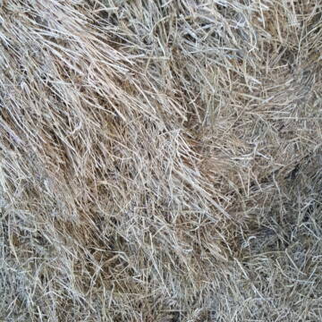
Heu HD Ballen
Carlsberg
Maike Käpernick
@ReitschuleKaepernick
Heu
Empfänger lädt ab
Kleinballen/HD-Ballen
Bio
Regenfrei
2 weitere...
B+

10 Rb Heu/15 RB Öhmd/15 RB Stroh
Helmstadt
Juergen
@Juergen77
Einstreu
Empfänger lädt ab
Rundballen
Regenfrei
2 weitere...
B+
Deprecated: Creation of dynamic property Zend_View_Helper_Ads::$adLink is deprecated in /var/www/stall-frei/htdocs/staging.stall-frei.de/library/Psf/View/Helper/Ads.php on line 108

Futtersack HeuToy, Fressbremse in pink
Mechtersen
STALL-FREIde Marketing
@STALL-FREI-Marketing
Stundenlange Beschäftigung die
Koliken vorbeugt, geringe Staubinhalation mit
steuerbarer Futterentnahme
Leider kein Vorschaubild
Leider kein Vorschaubild
Heu zu verkaufen
Bad Rappenau
Uwe Wolf
@Uwe_Wolf
Heu
Empfänger lädt ab
Rundballen
Regenfrei
2 weitere...
B+

Bio Heu
Mehlbach
irena-zinssmeister
@irena-zinssmeister
Heu
Empfänger lädt ab
Großballen
Bio
Regenfrei
2 weitere...
aktuell
B+

B+

B+
Leider kein Vorschaubild
Leider kein Vorschaubild
Heu- und Luzernecobs
Holzgerlingen
Schlosshof-Holzgerlingen
@Schlosshof-Holzgerlingen
Einstreu
Pellets
Regenfrei
Wird verladen
1 weitere...
B+

Persönlichkeitsentwicklung mit Pferden
Bad Salzuflen
Katja Dors
@Pferdezeiten
Begleite andere auf ihrem Entwicklungsweg und entdecke die transformative Kraft der pferdegestützten Persönlichkeitsentwicklung !
neu
R
Leider kein Vorschaubild
Leider kein Vorschaubild
Kleine HD-Ballen Heu
Weil im Schönbuch
Sabine-Dettinger
@Sabine-Dettinger
Heu
Empfänger lädt ab
Kleinballen/HD-Ballen
Bio
Regenfrei
2 weitere...
B+

HD-Ballen Heu
Ginsweiler
Laura
@Heuverkauf_Ginsweiler
Heu
Kleinballen/HD-Ballen
Regenfrei
Wird verladen
2 weitere...
B+
Deprecated: Creation of dynamic property Zend_View::$pageCount is deprecated in /var/www/stall-frei/htdocs/staging.stall-frei.de/library/vendor/shardj/zf1-future/library/Zend/View/Abstract.php on line 308
Deprecated: Creation of dynamic property Zend_View::$itemCountPerPage is deprecated in /var/www/stall-frei/htdocs/staging.stall-frei.de/library/vendor/shardj/zf1-future/library/Zend/View/Abstract.php on line 308
Deprecated: Creation of dynamic property Zend_View::$first is deprecated in /var/www/stall-frei/htdocs/staging.stall-frei.de/library/vendor/shardj/zf1-future/library/Zend/View/Abstract.php on line 308
Deprecated: Creation of dynamic property Zend_View::$current is deprecated in /var/www/stall-frei/htdocs/staging.stall-frei.de/library/vendor/shardj/zf1-future/library/Zend/View/Abstract.php on line 308
Deprecated: Creation of dynamic property Zend_View::$last is deprecated in /var/www/stall-frei/htdocs/staging.stall-frei.de/library/vendor/shardj/zf1-future/library/Zend/View/Abstract.php on line 308
Deprecated: Creation of dynamic property Zend_View::$next is deprecated in /var/www/stall-frei/htdocs/staging.stall-frei.de/library/vendor/shardj/zf1-future/library/Zend/View/Abstract.php on line 308
Deprecated: Creation of dynamic property Zend_View::$pagesInRange is deprecated in /var/www/stall-frei/htdocs/staging.stall-frei.de/library/vendor/shardj/zf1-future/library/Zend/View/Abstract.php on line 308
Deprecated: Creation of dynamic property Zend_View::$firstPageInRange is deprecated in /var/www/stall-frei/htdocs/staging.stall-frei.de/library/vendor/shardj/zf1-future/library/Zend/View/Abstract.php on line 308
Deprecated: Creation of dynamic property Zend_View::$lastPageInRange is deprecated in /var/www/stall-frei/htdocs/staging.stall-frei.de/library/vendor/shardj/zf1-future/library/Zend/View/Abstract.php on line 308
Deprecated: Creation of dynamic property Zend_View::$currentItemCount is deprecated in /var/www/stall-frei/htdocs/staging.stall-frei.de/library/vendor/shardj/zf1-future/library/Zend/View/Abstract.php on line 308
Deprecated: Creation of dynamic property Zend_View::$totalItemCount is deprecated in /var/www/stall-frei/htdocs/staging.stall-frei.de/library/vendor/shardj/zf1-future/library/Zend/View/Abstract.php on line 308
Deprecated: Creation of dynamic property Zend_View::$firstItemNumber is deprecated in /var/www/stall-frei/htdocs/staging.stall-frei.de/library/vendor/shardj/zf1-future/library/Zend/View/Abstract.php on line 308
Deprecated: Creation of dynamic property Zend_View::$lastItemNumber is deprecated in /var/www/stall-frei/htdocs/staging.stall-frei.de/library/vendor/shardj/zf1-future/library/Zend/View/Abstract.php on line 308
Deprecated: Creation of dynamic property Zend_View::$router is deprecated in /var/www/stall-frei/htdocs/staging.stall-frei.de/library/vendor/shardj/zf1-future/library/Zend/View/Abstract.php on line 308
Deprecated: Creation of dynamic property Zend_View::$urlParams is deprecated in /var/www/stall-frei/htdocs/staging.stall-frei.de/library/vendor/shardj/zf1-future/library/Zend/View/Abstract.php on line 308
Deprecated: Creation of dynamic property Zend_View::$showAds is deprecated in /var/www/stall-frei/htdocs/staging.stall-frei.de/library/vendor/shardj/zf1-future/library/Zend/View/Abstract.php on line 308
Deprecated: Creation of dynamic property Zend_View::$objectIds is deprecated in /var/www/stall-frei/htdocs/staging.stall-frei.de/library/vendor/shardj/zf1-future/library/Zend/View/Abstract.php on line 308
Deprecated: Creation of dynamic property Zend_View::$showNavbar is deprecated in /var/www/stall-frei/htdocs/staging.stall-frei.de/library/vendor/shardj/zf1-future/library/Zend/View/Abstract.php on line 308
Deprecated: Creation of dynamic property Zend_View::$showBreadcrumb is deprecated in /var/www/stall-frei/htdocs/staging.stall-frei.de/library/vendor/shardj/zf1-future/library/Zend/View/Abstract.php on line 308
Deprecated: Creation of dynamic property Zend_View::$showFooter is deprecated in /var/www/stall-frei/htdocs/staging.stall-frei.de/library/vendor/shardj/zf1-future/library/Zend/View/Abstract.php on line 308
Deprecated: Creation of dynamic property Zend_View::$showInternalAds is deprecated in /var/www/stall-frei/htdocs/staging.stall-frei.de/library/vendor/shardj/zf1-future/library/Zend/View/Abstract.php on line 308
Deprecated: Creation of dynamic property Zend_View::$blNoContent is deprecated in /var/www/stall-frei/htdocs/staging.stall-frei.de/library/vendor/shardj/zf1-future/library/Zend/View/Abstract.php on line 308
Deprecated: Creation of dynamic property Zend_View::$sMetaDesc is deprecated in /var/www/stall-frei/htdocs/staging.stall-frei.de/library/vendor/shardj/zf1-future/library/Zend/View/Abstract.php on line 308
Deprecated: Creation of dynamic property Zend_View::$useGmaps is deprecated in /var/www/stall-frei/htdocs/staging.stall-frei.de/library/vendor/shardj/zf1-future/library/Zend/View/Abstract.php on line 308
Deprecated: Creation of dynamic property Zend_View::$touches is deprecated in /var/www/stall-frei/htdocs/staging.stall-frei.de/library/vendor/shardj/zf1-future/library/Zend/View/Abstract.php on line 308
Deprecated: Creation of dynamic property Zend_View::$oProject is deprecated in /var/www/stall-frei/htdocs/staging.stall-frei.de/library/vendor/shardj/zf1-future/library/Zend/View/Abstract.php on line 308
Deprecated: Creation of dynamic property Zend_View::$pageHeadline is deprecated in /var/www/stall-frei/htdocs/staging.stall-frei.de/library/vendor/shardj/zf1-future/library/Zend/View/Abstract.php on line 308
Deprecated: Creation of dynamic property Zend_View::$disableLocationField is deprecated in /var/www/stall-frei/htdocs/staging.stall-frei.de/library/vendor/shardj/zf1-future/library/Zend/View/Abstract.php on line 308
Deprecated: Creation of dynamic property Zend_View::$isSearch is deprecated in /var/www/stall-frei/htdocs/staging.stall-frei.de/library/vendor/shardj/zf1-future/library/Zend/View/Abstract.php on line 308
Deprecated: Creation of dynamic property Zend_View::$pageTitle is deprecated in /var/www/stall-frei/htdocs/staging.stall-frei.de/library/vendor/shardj/zf1-future/library/Zend/View/Abstract.php on line 308
Deprecated: Creation of dynamic property Psf_Form_Element_Text::$class is deprecated in /var/www/stall-frei/htdocs/staging.stall-frei.de/library/vendor/shardj/zf1-future/library/Zend/Form/Element.php on line 874
Deprecated: Creation of dynamic property Psf_Form_Element_Text::$size is deprecated in /var/www/stall-frei/htdocs/staging.stall-frei.de/library/vendor/shardj/zf1-future/library/Zend/Form/Element.php on line 874
Deprecated: Creation of dynamic property Psf_Form_Element_Text::$placeholder is deprecated in /var/www/stall-frei/htdocs/staging.stall-frei.de/library/vendor/shardj/zf1-future/library/Zend/Form/Element.php on line 874
Deprecated: Creation of dynamic property Psf_Form_Element_Hidden::$class is deprecated in /var/www/stall-frei/htdocs/staging.stall-frei.de/library/vendor/shardj/zf1-future/library/Zend/Form/Element.php on line 874
Deprecated: Creation of dynamic property Psf_Form_Element_Hidden::$class is deprecated in /var/www/stall-frei/htdocs/staging.stall-frei.de/library/vendor/shardj/zf1-future/library/Zend/Form/Element.php on line 874
Deprecated: Creation of dynamic property Psf_Form_Element_Hidden::$class is deprecated in /var/www/stall-frei/htdocs/staging.stall-frei.de/library/vendor/shardj/zf1-future/library/Zend/Form/Element.php on line 874
Deprecated: Creation of dynamic property Psf_Form_Element_Hidden::$class is deprecated in /var/www/stall-frei/htdocs/staging.stall-frei.de/library/vendor/shardj/zf1-future/library/Zend/Form/Element.php on line 874
Deprecated: Creation of dynamic property Psf_Form_Element_Select::$class is deprecated in /var/www/stall-frei/htdocs/staging.stall-frei.de/library/vendor/shardj/zf1-future/library/Zend/Form/Element.php on line 874
Deprecated: Creation of dynamic property Psf_Form_Element_Select::$class is deprecated in /var/www/stall-frei/htdocs/staging.stall-frei.de/library/vendor/shardj/zf1-future/library/Zend/Form/Element.php on line 874
Deprecated: Creation of dynamic property Psf_Form_Element_Select::$class is deprecated in /var/www/stall-frei/htdocs/staging.stall-frei.de/library/vendor/shardj/zf1-future/library/Zend/Form/Element.php on line 874
Deprecated: Creation of dynamic property Psf_Form_Element_Select::$class is deprecated in /var/www/stall-frei/htdocs/staging.stall-frei.de/library/vendor/shardj/zf1-future/library/Zend/Form/Element.php on line 874
Deprecated: Creation of dynamic property Zend_View::$sort is deprecated in /var/www/stall-frei/htdocs/staging.stall-frei.de/library/vendor/shardj/zf1-future/library/Zend/View/Abstract.php on line 308
Deprecated: Creation of dynamic property Zend_View::$searchLocation is deprecated in /var/www/stall-frei/htdocs/staging.stall-frei.de/library/vendor/shardj/zf1-future/library/Zend/View/Abstract.php on line 308
Deprecated: Creation of dynamic property Zend_View::$locationHint is deprecated in /var/www/stall-frei/htdocs/staging.stall-frei.de/library/vendor/shardj/zf1-future/library/Zend/View/Abstract.php on line 308
Psf_GeoCoder_Abstract::getLocation: Wörth Get Location CachedOrLive
Psf_GeoCoder_Abstract::getCachedOrLive: Wörth
Psf_GeoCoder_OpenCageData::makeApiRequest: response:
Array
(
[documentation] => https://opencagedata.com/api
[licenses] => Array
(
[0] => Array
(
[name] => see attribution guide
[url] => https://opencagedata.com/credits
)
)
[results] => Array
(
[0] => Array
(
[bounds] => Array
(
[northeast] => Array
(
[lat] => 49.0926751
[lng] => 8.3507426
)
[southwest] => Array
(
[lat] => 48.980197
[lng] => 8.066126
)
)
[components] => Array
(
[ISO_3166-1_alpha-2] => DE
[ISO_3166-1_alpha-3] => DEU
[ISO_3166-2] => Array
(
[0] => DE-RP
)
[_category] => place
[_normalized_city] => Wörth am Rhein
[_type] => city
[continent] => Europe
[country] => Deutschland
[country_code] => de
[county] => Landkreis Germersheim
[political_union] => European Union
[postcode] => 76744
[state] => Rheinland-Pfalz
[state_code] => RP
[town] => Wörth am Rhein
)
[confidence] => 5
[formatted] => 76744 Wörth am Rhein, Deutschland
[geometry] => Array
(
[lat] => 49.0543232
[lng] => 8.2667399
)
)
[1] => Array
(
[bounds] => Array
(
[northeast] => Array
(
[lat] => 49.8109123
[lng] => 9.1763869
)
[southwest] => Array
(
[lat] => 49.7552381
[lng] => 9.1068885
)
)
[components] => Array
(
[ISO_3166-1_alpha-2] => DE
[ISO_3166-1_alpha-3] => DEU
[ISO_3166-2] => Array
(
[0] => DE-BY
)
[_category] => place
[_normalized_city] => Wörth am Main
[_type] => city
[continent] => Europe
[country] => Deutschland
[country_code] => de
[county] => Landkreis Miltenberg
[political_union] => European Union
[postcode] => 63939
[state] => Bayern
[state_code] => BY
[town] => Wörth am Main
)
[confidence] => 7
[formatted] => 63939 Wörth am Main, Deutschland
[geometry] => Array
(
[lat] => 49.7955109
[lng] => 9.1574558
)
)
[2] => Array
(
[bounds] => Array
(
[northeast] => Array
(
[lat] => 48.266717
[lng] => 11.9701949
)
[southwest] => Array
(
[lat] => 48.2230791
[lng] => 11.8696977
)
)
[components] => Array
(
[ISO_3166-1_alpha-2] => DE
[ISO_3166-1_alpha-3] => DEU
[ISO_3166-2] => Array
(
[0] => DE-BY
)
[_category] => place
[_normalized_city] => Wörth
[_type] => village
[continent] => Europe
[country] => Deutschland
[country_code] => de
[county] => Landkreis Erding
[municipality] => Hörlkofen (VGem)
[political_union] => European Union
[postcode] => 85457
[state] => Bayern
[state_code] => BY
[village] => Wörth
)
[confidence] => 7
[formatted] => 85457 Wörth, Deutschland
[geometry] => Array
(
[lat] => 48.2455026
[lng] => 11.9026032
)
)
[3] => Array
(
[bounds] => Array
(
[northeast] => Array
(
[lat] => 53.4852292
[lng] => 10.4366264
)
[southwest] => Array
(
[lat] => 53.4548832
[lng] => 10.3914187
)
)
[components] => Array
(
[ISO_3166-1_alpha-2] => DE
[ISO_3166-1_alpha-3] => DEU
[ISO_3166-2] => Array
(
[0] => DE-SH
)
[_category] => place
[_normalized_city] => Worth
[_type] => village
[continent] => Europe
[country] => Deutschland
[country_code] => de
[county] => Kreis Herzogtum Lauenburg
[municipality] => Hohe Elbgeest
[political_union] => European Union
[state] => Schleswig-Holstein
[state_code] => SH
[village] => Worth
)
[confidence] => 7
[formatted] => Worth, Schleswig-Holstein, Deutschland
[geometry] => Array
(
[lat] => 53.4684056
[lng] => 10.4092105
)
)
[4] => Array
(
[bounds] => Array
(
[northeast] => Array
(
[lat] => 48.2967959
[lng] => 12.3003664
)
[southwest] => Array
(
[lat] => 48.2567959
[lng] => 12.2603664
)
)
[components] => Array
(
[ISO_3166-1_alpha-2] => DE
[ISO_3166-1_alpha-3] => DEU
[ISO_3166-2] => Array
(
[0] => DE-BY
)
[_category] => place
[_normalized_city] => Schwindegg
[_type] => village
[city] => Schwindegg
[continent] => Europe
[country] => Deutschland
[country_code] => de
[county] => Landkreis Mühldorf am Inn
[political_union] => European Union
[postcode] => 84419
[state] => Bayern
[state_code] => BY
[village] => Wörth
)
[confidence] => 7
[formatted] => 84419 Wörth, Deutschland
[geometry] => Array
(
[lat] => 48.2767959
[lng] => 12.2803664
)
)
[5] => Array
(
[bounds] => Array
(
[northeast] => Array
(
[lat] => 47.6876141
[lng] => 11.1741039
)
[southwest] => Array
(
[lat] => 47.68154
[lng] => 11.1582955
)
)
[components] => Array
(
[ISO_3166-1_alpha-2] => DE
[ISO_3166-1_alpha-3] => DEU
[ISO_3166-2] => Array
(
[0] => DE-BY
)
[_category] => natural/water
[_normalized_city] => Seehausen am Staffelsee
[_type] => islet
[continent] => Europe
[country] => Deutschland
[country_code] => de
[county] => Landkreis Garmisch-Partenkirchen
[hamlet] => Buchau
[islet] => Wörth
[municipality] => Seehausen am Staffelsee (VGem)
[political_union] => European Union
[postcode] => 82418
[state] => Bayern
[state_code] => BY
[village] => Seehausen am Staffelsee
)
[confidence] => 9
[formatted] => Wörth, Buchau, 82418 Seehausen am Staffelsee, Deutschland
[geometry] => Array
(
[lat] => 47.6846012
[lng] => 11.1625589
)
)
[6] => Array
(
[bounds] => Array
(
[northeast] => Array
(
[lat] => 47.7779089
[lng] => 11.0384016
)
[southwest] => Array
(
[lat] => 47.777264
[lng] => 11.0368575
)
)
[components] => Array
(
[ISO_3166-1_alpha-2] => DE
[ISO_3166-1_alpha-3] => DEU
[ISO_3166-2] => Array
(
[0] => DE-BY
)
[_category] => place
[_normalized_city] => Böbing
[_type] => hamlet
[continent] => Europe
[country] => Deutschland
[country_code] => de
[county] => Landkreis Weilheim-Schongau
[hamlet] => Wörth
[municipality] => Rottenbuch (VGem)
[political_union] => European Union
[state] => Bayern
[state_code] => BY
[village] => Böbing
)
[confidence] => 9
[formatted] => Wörth, Böbing, Bayern, Deutschland
[geometry] => Array
(
[lat] => 47.7776438
[lng] => 11.0376262
)
)
[7] => Array
(
[bounds] => Array
(
[northeast] => Array
(
[lat] => 48.6807511
[lng] => 8.1865337
)
[southwest] => Array
(
[lat] => 48.6407511
[lng] => 8.1465337
)
)
[components] => Array
(
[ISO_3166-1_alpha-2] => DE
[ISO_3166-1_alpha-3] => DEU
[ISO_3166-2] => Array
(
[0] => DE-BW
)
[_category] => place
[_normalized_city] => Bühl
[_type] => hamlet
[continent] => Europe
[country] => Deutschland
[country_code] => de
[county] => Landkreis Rastatt
[hamlet] => Wörth
[municipality] => VVG der Stadt Bühl
[political_union] => European Union
[postcode] => 77830
[state] => Baden-Württemberg
[state_code] => BW
[town] => Bühl
[village] => Neusatz
)
[confidence] => 7
[formatted] => Wörth, 77830 Neusatz, Deutschland
[geometry] => Array
(
[lat] => 48.6607511
[lng] => 8.1665337
)
)
[8] => Array
(
[bounds] => Array
(
[northeast] => Array
(
[lat] => 47.8305213
[lng] => 10.3603639
)
[southwest] => Array
(
[lat] => 47.7905213
[lng] => 10.3203639
)
)
[components] => Array
(
[ISO_3166-1_alpha-2] => DE
[ISO_3166-1_alpha-3] => DEU
[ISO_3166-2] => Array
(
[0] => DE-BY
)
[_category] => place
[_normalized_city] => Haldenwang
[_type] => hamlet
[city] => Haldenwang
[continent] => Europe
[country] => Deutschland
[country_code] => de
[county] => Landkreis Oberallgäu
[hamlet] => Wörth
[political_union] => European Union
[postcode] => 87490
[state] => Bayern
[state_code] => BY
)
[confidence] => 7
[formatted] => Wörth, 87490 Haldenwang, Deutschland
[geometry] => Array
(
[lat] => 47.8105213
[lng] => 10.3403639
)
)
[9] => Array
(
[bounds] => Array
(
[northeast] => Array
(
[lat] => 48.220689
[lng] => 12.471174
)
[southwest] => Array
(
[lat] => 48.180689
[lng] => 12.431174
)
)
[components] => Array
(
[ISO_3166-1_alpha-2] => DE
[ISO_3166-1_alpha-3] => DEU
[ISO_3166-2] => Array
(
[0] => DE-BY
)
[_category] => place
[_normalized_city] => Waldkraiburg
[_type] => hamlet
[continent] => Europe
[country] => Deutschland
[country_code] => de
[county] => Landkreis Mühldorf am Inn
[hamlet] => Wörth
[political_union] => European Union
[postcode] => 84559
[state] => Bayern
[state_code] => BY
[town] => Waldkraiburg
)
[confidence] => 7
[formatted] => Wörth, 84559 Waldkraiburg, Deutschland
[geometry] => Array
(
[lat] => 48.200689
[lng] => 12.451174
)
)
)
[status] => Array
(
[code] => 200
[message] => OK
)
[stay_informed] => Array
(
[blog] => https://blog.opencagedata.com
[mastodon] => https://en.osm.town/@opencage
)
[thanks] => For using an OpenCage API
[timestamp] => Array
(
[created_http] => Thu, 05 Feb 2026 15:17:10 GMT
[created_unix] => 1770304630
)
[total_results] => 10
)
Psf_GeoCoder_Abstract::convertLocationResult
{"documentation":"https:\/\/opencagedata.com\/api","licenses":[{"name":"see attribution guide","url":"https:\/\/opencagedata.com\/credits"}],"results":[{"bounds":{"northeast":{"lat":49.0926751,"lng":8.3507426},"southwest":{"lat":48.980197,"lng":8.066126}},"components":{"ISO_3166-1_alpha-2":"DE","ISO_3166-1_alpha-3":"DEU","ISO_3166-2":["DE-RP"],"_category":"place","_normalized_city":"W\u00f6rth am Rhein","_type":"city","continent":"Europe","country":"Deutschland","country_code":"de","county":"Landkreis Germersheim","political_union":"European Union","postcode":"76744","state":"Rheinland-Pfalz","state_code":"RP","town":"W\u00f6rth am Rhein"},"confidence":5,"formatted":"76744 W\u00f6rth am Rhein, Deutschland","geometry":{"lat":49.0543232,"lng":8.2667399}},{"bounds":{"northeast":{"lat":49.8109123,"lng":9.1763869},"southwest":{"lat":49.7552381,"lng":9.1068885}},"components":{"ISO_3166-1_alpha-2":"DE","ISO_3166-1_alpha-3":"DEU","ISO_3166-2":["DE-BY"],"_category":"place","_normalized_city":"W\u00f6rth am Main","_type":"city","continent":"Europe","country":"Deutschland","country_code":"de","county":"Landkreis Miltenberg","political_union":"European Union","postcode":"63939","state":"Bayern","state_code":"BY","town":"W\u00f6rth am Main"},"confidence":7,"formatted":"63939 W\u00f6rth am Main, Deutschland","geometry":{"lat":49.7955109,"lng":9.1574558}},{"bounds":{"northeast":{"lat":48.266717,"lng":11.9701949},"southwest":{"lat":48.2230791,"lng":11.8696977}},"components":{"ISO_3166-1_alpha-2":"DE","ISO_3166-1_alpha-3":"DEU","ISO_3166-2":["DE-BY"],"_category":"place","_normalized_city":"W\u00f6rth","_type":"village","continent":"Europe","country":"Deutschland","country_code":"de","county":"Landkreis Erding","municipality":"H\u00f6rlkofen (VGem)","political_union":"European Union","postcode":"85457","state":"Bayern","state_code":"BY","village":"W\u00f6rth"},"confidence":7,"formatted":"85457 W\u00f6rth, Deutschland","geometry":{"lat":48.2455026,"lng":11.9026032}},{"bounds":{"northeast":{"lat":53.4852292,"lng":10.4366264},"southwest":{"lat":53.4548832,"lng":10.3914187}},"components":{"ISO_3166-1_alpha-2":"DE","ISO_3166-1_alpha-3":"DEU","ISO_3166-2":["DE-SH"],"_category":"place","_normalized_city":"Worth","_type":"village","continent":"Europe","country":"Deutschland","country_code":"de","county":"Kreis Herzogtum Lauenburg","municipality":"Hohe Elbgeest","political_union":"European Union","state":"Schleswig-Holstein","state_code":"SH","village":"Worth"},"confidence":7,"formatted":"Worth, Schleswig-Holstein, Deutschland","geometry":{"lat":53.4684056,"lng":10.4092105}},{"bounds":{"northeast":{"lat":48.2967959,"lng":12.3003664},"southwest":{"lat":48.2567959,"lng":12.2603664}},"components":{"ISO_3166-1_alpha-2":"DE","ISO_3166-1_alpha-3":"DEU","ISO_3166-2":["DE-BY"],"_category":"place","_normalized_city":"Schwindegg","_type":"village","city":"Schwindegg","continent":"Europe","country":"Deutschland","country_code":"de","county":"Landkreis M\u00fchldorf am Inn","political_union":"European Union","postcode":"84419","state":"Bayern","state_code":"BY","village":"W\u00f6rth"},"confidence":7,"formatted":"84419 W\u00f6rth, Deutschland","geometry":{"lat":48.2767959,"lng":12.2803664}},{"bounds":{"northeast":{"lat":47.6876141,"lng":11.1741039},"southwest":{"lat":47.68154,"lng":11.1582955}},"components":{"ISO_3166-1_alpha-2":"DE","ISO_3166-1_alpha-3":"DEU","ISO_3166-2":["DE-BY"],"_category":"natural\/water","_normalized_city":"Seehausen am Staffelsee","_type":"islet","continent":"Europe","country":"Deutschland","country_code":"de","county":"Landkreis Garmisch-Partenkirchen","hamlet":"Buchau","islet":"W\u00f6rth","municipality":"Seehausen am Staffelsee (VGem)","political_union":"European Union","postcode":"82418","state":"Bayern","state_code":"BY","village":"Seehausen am Staffelsee"},"confidence":9,"formatted":"W\u00f6rth, Buchau, 82418 Seehausen am Staffelsee, Deutschland","geometry":{"lat":47.6846012,"lng":11.1625589}},{"bounds":{"northeast":{"lat":47.7779089,"lng":11.0384016},"southwest":{"lat":47.777264,"lng":11.0368575}},"components":{"ISO_3166-1_alpha-2":"DE","ISO_3166-1_alpha-3":"DEU","ISO_3166-2":["DE-BY"],"_category":"place","_normalized_city":"B\u00f6bing","_type":"hamlet","continent":"Europe","country":"Deutschland","country_code":"de","county":"Landkreis Weilheim-Schongau","hamlet":"W\u00f6rth","municipality":"Rottenbuch (VGem)","political_union":"European Union","state":"Bayern","state_code":"BY","village":"B\u00f6bing"},"confidence":9,"formatted":"W\u00f6rth, B\u00f6bing, Bayern, Deutschland","geometry":{"lat":47.7776438,"lng":11.0376262}},{"bounds":{"northeast":{"lat":48.6807511,"lng":8.1865337},"southwest":{"lat":48.6407511,"lng":8.1465337}},"components":{"ISO_3166-1_alpha-2":"DE","ISO_3166-1_alpha-3":"DEU","ISO_3166-2":["DE-BW"],"_category":"place","_normalized_city":"B\u00fchl","_type":"hamlet","continent":"Europe","country":"Deutschland","country_code":"de","county":"Landkreis Rastatt","hamlet":"W\u00f6rth","municipality":"VVG der Stadt B\u00fchl","political_union":"European Union","postcode":"77830","state":"Baden-W\u00fcrttemberg","state_code":"BW","town":"B\u00fchl","village":"Neusatz"},"confidence":7,"formatted":"W\u00f6rth, 77830 Neusatz, Deutschland","geometry":{"lat":48.6607511,"lng":8.1665337}},{"bounds":{"northeast":{"lat":47.8305213,"lng":10.3603639},"southwest":{"lat":47.7905213,"lng":10.3203639}},"components":{"ISO_3166-1_alpha-2":"DE","ISO_3166-1_alpha-3":"DEU","ISO_3166-2":["DE-BY"],"_category":"place","_normalized_city":"Haldenwang","_type":"hamlet","city":"Haldenwang","continent":"Europe","country":"Deutschland","country_code":"de","county":"Landkreis Oberallg\u00e4u","hamlet":"W\u00f6rth","political_union":"European Union","postcode":"87490","state":"Bayern","state_code":"BY"},"confidence":7,"formatted":"W\u00f6rth, 87490 Haldenwang, Deutschland","geometry":{"lat":47.8105213,"lng":10.3403639}},{"bounds":{"northeast":{"lat":48.220689,"lng":12.471174},"southwest":{"lat":48.180689,"lng":12.431174}},"components":{"ISO_3166-1_alpha-2":"DE","ISO_3166-1_alpha-3":"DEU","ISO_3166-2":["DE-BY"],"_category":"place","_normalized_city":"Waldkraiburg","_type":"hamlet","continent":"Europe","country":"Deutschland","country_code":"de","county":"Landkreis M\u00fchldorf am Inn","hamlet":"W\u00f6rth","political_union":"European Union","postcode":"84559","state":"Bayern","state_code":"BY","town":"Waldkraiburg"},"confidence":7,"formatted":"W\u00f6rth, 84559 Waldkraiburg, Deutschland","geometry":{"lat":48.200689,"lng":12.451174}}],"status":{"code":200,"message":"OK"},"stay_informed":{"blog":"https:\/\/blog.opencagedata.com","mastodon":"https:\/\/en.osm.town\/@opencage"},"thanks":"For using an OpenCage API","timestamp":{"created_http":"Thu, 05 Feb 2026 15:17:10 GMT","created_unix":1770304630},"total_results":10}Array
(
[0] => stdClass Object
(
[bounds] => stdClass Object
(
[northeast] => stdClass Object
(
[lat] => 49.0926751
[lng] => 8.3507426
)
[southwest] => stdClass Object
(
[lat] => 48.980197
[lng] => 8.066126
)
)
[components] => stdClass Object
(
[ISO_3166-1_alpha-2] => DE
[ISO_3166-1_alpha-3] => DEU
[ISO_3166-2] => Array
(
[0] => DE-RP
)
[_category] => place
[_normalized_city] => Wörth am Rhein
[_type] => city
[continent] => Europe
[country] => Deutschland
[country_code] => de
[county] => Landkreis Germersheim
[political_union] => European Union
[postcode] => 76744
[state] => Rheinland-Pfalz
[state_code] => RP
[town] => Wörth am Rhein
)
[confidence] => 5
[formatted] => 76744 Wörth am Rhein, Deutschland
[geometry] => stdClass Object
(
[lat] => 49.0543232
[lng] => 8.2667399
)
)
[1] => stdClass Object
(
[bounds] => stdClass Object
(
[northeast] => stdClass Object
(
[lat] => 49.8109123
[lng] => 9.1763869
)
[southwest] => stdClass Object
(
[lat] => 49.7552381
[lng] => 9.1068885
)
)
[components] => stdClass Object
(
[ISO_3166-1_alpha-2] => DE
[ISO_3166-1_alpha-3] => DEU
[ISO_3166-2] => Array
(
[0] => DE-BY
)
[_category] => place
[_normalized_city] => Wörth am Main
[_type] => city
[continent] => Europe
[country] => Deutschland
[country_code] => de
[county] => Landkreis Miltenberg
[political_union] => European Union
[postcode] => 63939
[state] => Bayern
[state_code] => BY
[town] => Wörth am Main
)
[confidence] => 7
[formatted] => 63939 Wörth am Main, Deutschland
[geometry] => stdClass Object
(
[lat] => 49.7955109
[lng] => 9.1574558
)
)
[2] => stdClass Object
(
[bounds] => stdClass Object
(
[northeast] => stdClass Object
(
[lat] => 48.266717
[lng] => 11.9701949
)
[southwest] => stdClass Object
(
[lat] => 48.2230791
[lng] => 11.8696977
)
)
[components] => stdClass Object
(
[ISO_3166-1_alpha-2] => DE
[ISO_3166-1_alpha-3] => DEU
[ISO_3166-2] => Array
(
[0] => DE-BY
)
[_category] => place
[_normalized_city] => Wörth
[_type] => village
[continent] => Europe
[country] => Deutschland
[country_code] => de
[county] => Landkreis Erding
[municipality] => Hörlkofen (VGem)
[political_union] => European Union
[postcode] => 85457
[state] => Bayern
[state_code] => BY
[village] => Wörth
)
[confidence] => 7
[formatted] => 85457 Wörth, Deutschland
[geometry] => stdClass Object
(
[lat] => 48.2455026
[lng] => 11.9026032
)
)
[3] => stdClass Object
(
[bounds] => stdClass Object
(
[northeast] => stdClass Object
(
[lat] => 53.4852292
[lng] => 10.4366264
)
[southwest] => stdClass Object
(
[lat] => 53.4548832
[lng] => 10.3914187
)
)
[components] => stdClass Object
(
[ISO_3166-1_alpha-2] => DE
[ISO_3166-1_alpha-3] => DEU
[ISO_3166-2] => Array
(
[0] => DE-SH
)
[_category] => place
[_normalized_city] => Worth
[_type] => village
[continent] => Europe
[country] => Deutschland
[country_code] => de
[county] => Kreis Herzogtum Lauenburg
[municipality] => Hohe Elbgeest
[political_union] => European Union
[state] => Schleswig-Holstein
[state_code] => SH
[village] => Worth
)
[confidence] => 7
[formatted] => Worth, Schleswig-Holstein, Deutschland
[geometry] => stdClass Object
(
[lat] => 53.4684056
[lng] => 10.4092105
)
)
[4] => stdClass Object
(
[bounds] => stdClass Object
(
[northeast] => stdClass Object
(
[lat] => 48.2967959
[lng] => 12.3003664
)
[southwest] => stdClass Object
(
[lat] => 48.2567959
[lng] => 12.2603664
)
)
[components] => stdClass Object
(
[ISO_3166-1_alpha-2] => DE
[ISO_3166-1_alpha-3] => DEU
[ISO_3166-2] => Array
(
[0] => DE-BY
)
[_category] => place
[_normalized_city] => Schwindegg
[_type] => village
[city] => Schwindegg
[continent] => Europe
[country] => Deutschland
[country_code] => de
[county] => Landkreis Mühldorf am Inn
[political_union] => European Union
[postcode] => 84419
[state] => Bayern
[state_code] => BY
[village] => Wörth
)
[confidence] => 7
[formatted] => 84419 Wörth, Deutschland
[geometry] => stdClass Object
(
[lat] => 48.2767959
[lng] => 12.2803664
)
)
[5] => stdClass Object
(
[bounds] => stdClass Object
(
[northeast] => stdClass Object
(
[lat] => 47.6876141
[lng] => 11.1741039
)
[southwest] => stdClass Object
(
[lat] => 47.68154
[lng] => 11.1582955
)
)
[components] => stdClass Object
(
[ISO_3166-1_alpha-2] => DE
[ISO_3166-1_alpha-3] => DEU
[ISO_3166-2] => Array
(
[0] => DE-BY
)
[_category] => natural/water
[_normalized_city] => Seehausen am Staffelsee
[_type] => islet
[continent] => Europe
[country] => Deutschland
[country_code] => de
[county] => Landkreis Garmisch-Partenkirchen
[hamlet] => Buchau
[islet] => Wörth
[municipality] => Seehausen am Staffelsee (VGem)
[political_union] => European Union
[postcode] => 82418
[state] => Bayern
[state_code] => BY
[village] => Seehausen am Staffelsee
)
[confidence] => 9
[formatted] => Wörth, Buchau, 82418 Seehausen am Staffelsee, Deutschland
[geometry] => stdClass Object
(
[lat] => 47.6846012
[lng] => 11.1625589
)
)
[6] => stdClass Object
(
[bounds] => stdClass Object
(
[northeast] => stdClass Object
(
[lat] => 47.7779089
[lng] => 11.0384016
)
[southwest] => stdClass Object
(
[lat] => 47.777264
[lng] => 11.0368575
)
)
[components] => stdClass Object
(
[ISO_3166-1_alpha-2] => DE
[ISO_3166-1_alpha-3] => DEU
[ISO_3166-2] => Array
(
[0] => DE-BY
)
[_category] => place
[_normalized_city] => Böbing
[_type] => hamlet
[continent] => Europe
[country] => Deutschland
[country_code] => de
[county] => Landkreis Weilheim-Schongau
[hamlet] => Wörth
[municipality] => Rottenbuch (VGem)
[political_union] => European Union
[state] => Bayern
[state_code] => BY
[village] => Böbing
)
[confidence] => 9
[formatted] => Wörth, Böbing, Bayern, Deutschland
[geometry] => stdClass Object
(
[lat] => 47.7776438
[lng] => 11.0376262
)
)
[7] => stdClass Object
(
[bounds] => stdClass Object
(
[northeast] => stdClass Object
(
[lat] => 48.6807511
[lng] => 8.1865337
)
[southwest] => stdClass Object
(
[lat] => 48.6407511
[lng] => 8.1465337
)
)
[components] => stdClass Object
(
[ISO_3166-1_alpha-2] => DE
[ISO_3166-1_alpha-3] => DEU
[ISO_3166-2] => Array
(
[0] => DE-BW
)
[_category] => place
[_normalized_city] => Bühl
[_type] => hamlet
[continent] => Europe
[country] => Deutschland
[country_code] => de
[county] => Landkreis Rastatt
[hamlet] => Wörth
[municipality] => VVG der Stadt Bühl
[political_union] => European Union
[postcode] => 77830
[state] => Baden-Württemberg
[state_code] => BW
[town] => Bühl
[village] => Neusatz
)
[confidence] => 7
[formatted] => Wörth, 77830 Neusatz, Deutschland
[geometry] => stdClass Object
(
[lat] => 48.6607511
[lng] => 8.1665337
)
)
[8] => stdClass Object
(
[bounds] => stdClass Object
(
[northeast] => stdClass Object
(
[lat] => 47.8305213
[lng] => 10.3603639
)
[southwest] => stdClass Object
(
[lat] => 47.7905213
[lng] => 10.3203639
)
)
[components] => stdClass Object
(
[ISO_3166-1_alpha-2] => DE
[ISO_3166-1_alpha-3] => DEU
[ISO_3166-2] => Array
(
[0] => DE-BY
)
[_category] => place
[_normalized_city] => Haldenwang
[_type] => hamlet
[city] => Haldenwang
[continent] => Europe
[country] => Deutschland
[country_code] => de
[county] => Landkreis Oberallgäu
[hamlet] => Wörth
[political_union] => European Union
[postcode] => 87490
[state] => Bayern
[state_code] => BY
)
[confidence] => 7
[formatted] => Wörth, 87490 Haldenwang, Deutschland
[geometry] => stdClass Object
(
[lat] => 47.8105213
[lng] => 10.3403639
)
)
[9] => stdClass Object
(
[bounds] => stdClass Object
(
[northeast] => stdClass Object
(
[lat] => 48.220689
[lng] => 12.471174
)
[southwest] => stdClass Object
(
[lat] => 48.180689
[lng] => 12.431174
)
)
[components] => stdClass Object
(
[ISO_3166-1_alpha-2] => DE
[ISO_3166-1_alpha-3] => DEU
[ISO_3166-2] => Array
(
[0] => DE-BY
)
[_category] => place
[_normalized_city] => Waldkraiburg
[_type] => hamlet
[continent] => Europe
[country] => Deutschland
[country_code] => de
[county] => Landkreis Mühldorf am Inn
[hamlet] => Wörth
[political_union] => European Union
[postcode] => 84559
[state] => Bayern
[state_code] => BY
[town] => Waldkraiburg
)
[confidence] => 7
[formatted] => Wörth, 84559 Waldkraiburg, Deutschland
[geometry] => stdClass Object
(
[lat] => 48.200689
[lng] => 12.451174
)
)
)
Psf_GeoCoder_OpenCageData::getKeyMap: 0
stdClass Object
(
    [bounds] => stdClass Object
        (
            [northeast] => stdClass Object
                (
                    [lat] => 49.0926751
                    [lng] => 8.3507426
                )

            [southwest] => stdClass Object
                (
                    [lat] => 48.980197
                    [lng] => 8.066126
                )

        )

    [components] => stdClass Object
        (
            [ISO_3166-1_alpha-2] => DE
            [ISO_3166-1_alpha-3] => DEU
            [ISO_3166-2] => Array
                (
                    [0] => DE-RP
                )

            [_category] => place
            [_normalized_city] => Wörth am Rhein
            [_type] => city
            [continent] => Europe
            [country] => Deutschland
            [country_code] => de
            [county] => Landkreis Germersheim
            [political_union] => European Union
            [postcode] => 76744
            [state] => Rheinland-Pfalz
            [state_code] => RP
            [town] => Wörth am Rhein
        )

    [confidence] => 5
    [formatted] => 76744 Wörth am Rhein, Deutschland
    [geometry] => stdClass Object
        (
            [lat] => 49.0543232
            [lng] => 8.2667399
        )

)
Psf_GeoCoder_OpenCageData::getCounty: Germersheim
Psf_GeoCoder_OpenCageData::addMissingData REFETCH!
Array
(
    [address] => 76744 Wörth am Rhein, Deutschland
    [type] => city
    [street] =>
    [city] => Wörth am Rhein
    [county] => Germersheim
    [state] => Rheinland-Pfalz
    [zip] => 76744
    [country] => Deutschland
    [suburb] =>
    [countrycode] => de
    [latitude] => 49.0543232
    [longitude] => 8.2667399
    [accuracy] => 1
    [confidence] => 5
    [bounds] => stdClass Object
        (
            [northeast] => stdClass Object
                (
                    [lat] => 49.0926751
                    [lng] => 8.3507426
                )

            [southwest] => stdClass Object
                (
                    [lat] => 48.980197
                    [lng] => 8.066126
                )

        )

)
reformat!
Array
(
    [address] => 76744 Wörth am Rhein, Deutschland
    [type] => city
    [street] =>
    [city] => Wörth am Rhein
    [county] => Germersheim
    [state] => Rheinland-Pfalz
    [zip] => 76744
    [country] => Deutschland
    [suburb] =>
    [countrycode] => de
    [latitude] => 49.0543232
    [longitude] => 8.2667399
    [accuracy] => 1
    [confidence] => 5
    [bounds] => stdClass Object
        (
            [northeast] => stdClass Object
                (
                    [lat] => 49.0926751
                    [lng] => 8.3507426
                )

            [southwest] => stdClass Object
                (
                    [lat] => 48.980197
                    [lng] => 8.066126
                )

        )

    [place] => 76744 Wörth am Rhein, Rheinland-Pfalz
    [hash] => 2012c7e51d82e48737d796c9afc5d1db
)
Psf_GeoCoder_OpenCageData::getKeyMap: 1
stdClass Object
(
    [bounds] => stdClass Object
        (
            [northeast] => stdClass Object
                (
                    [lat] => 49.8109123
                    [lng] => 9.1763869
                )

            [southwest] => stdClass Object
                (
                    [lat] => 49.7552381
                    [lng] => 9.1068885
                )

        )

    [components] => stdClass Object
        (
            [ISO_3166-1_alpha-2] => DE
            [ISO_3166-1_alpha-3] => DEU
            [ISO_3166-2] => Array
                (
                    [0] => DE-BY
                )

            [_category] => place
            [_normalized_city] => Wörth am Main
            [_type] => city
            [continent] => Europe
            [country] => Deutschland
            [country_code] => de
            [county] => Landkreis Miltenberg
            [political_union] => European Union
            [postcode] => 63939
            [state] => Bayern
            [state_code] => BY
            [town] => Wörth am Main
        )

    [confidence] => 7
    [formatted] => 63939 Wörth am Main, Deutschland
    [geometry] => stdClass Object
        (
            [lat] => 49.7955109
            [lng] => 9.1574558
        )

)
Psf_GeoCoder_OpenCageData::getCounty: Miltenberg
Psf_GeoCoder_OpenCageData::addMissingData REFETCH!
Array
(
    [address] => 63939 Wörth am Main, Deutschland
    [type] => city
    [street] =>
    [city] => Wörth am Main
    [county] => Miltenberg
    [state] => Bayern
    [zip] => 63939
    [country] => Deutschland
    [suburb] =>
    [countrycode] => de
    [latitude] => 49.7955109
    [longitude] => 9.1574558
    [accuracy] => 1
    [confidence] => 7
    [bounds] => stdClass Object
        (
            [northeast] => stdClass Object
                (
                    [lat] => 49.8109123
                    [lng] => 9.1763869
                )

            [southwest] => stdClass Object
                (
                    [lat] => 49.7552381
                    [lng] => 9.1068885
                )

        )

)
reformat!
Array
(
    [address] => 63939 Wörth am Main, Deutschland
    [type] => city
    [street] =>
    [city] => Wörth am Main
    [county] => Miltenberg
    [state] => Bayern
    [zip] => 63939
    [country] => Deutschland
    [suburb] =>
    [countrycode] => de
    [latitude] => 49.7955109
    [longitude] => 9.1574558
    [accuracy] => 1
    [confidence] => 7
    [bounds] => stdClass Object
        (
            [northeast] => stdClass Object
                (
                    [lat] => 49.8109123
                    [lng] => 9.1763869
                )

            [southwest] => stdClass Object
                (
                    [lat] => 49.7552381
                    [lng] => 9.1068885
                )

        )

    [place] => 63939 Wörth am Main, Bayern
    [hash] => 57712afbb047789058c68f2e6a66a3ad
)
Psf_GeoCoder_OpenCageData::getKeyMap: 2
stdClass Object
(
    [bounds] => stdClass Object
        (
            [northeast] => stdClass Object
                (
                    [lat] => 48.266717
                    [lng] => 11.9701949
                )

            [southwest] => stdClass Object
                (
                    [lat] => 48.2230791
                    [lng] => 11.8696977
                )

        )

    [components] => stdClass Object
        (
            [ISO_3166-1_alpha-2] => DE
            [ISO_3166-1_alpha-3] => DEU
            [ISO_3166-2] => Array
                (
                    [0] => DE-BY
                )

            [_category] => place
            [_normalized_city] => Wörth
            [_type] => village
            [continent] => Europe
            [country] => Deutschland
            [country_code] => de
            [county] => Landkreis Erding
            [municipality] => Hörlkofen (VGem)
            [political_union] => European Union
            [postcode] => 85457
            [state] => Bayern
            [state_code] => BY
            [village] => Wörth
        )

    [confidence] => 7
    [formatted] => 85457 Wörth, Deutschland
    [geometry] => stdClass Object
        (
            [lat] => 48.2455026
            [lng] => 11.9026032
        )

)
Psf_GeoCoder_OpenCageData::getCounty: Erding
Psf_GeoCoder_OpenCageData::addMissingData REFETCH!
Array
(
    [address] => 85457 Wörth, Deutschland
    [type] => village
    [street] =>
    [city] => Wörth
    [county] => Erding
    [state] => Bayern
    [zip] => 85457
    [country] => Deutschland
    [suburb] =>
    [countrycode] => de
    [latitude] => 48.2455026
    [longitude] => 11.9026032
    [accuracy] => 1
    [confidence] => 7
    [bounds] => stdClass Object
        (
            [northeast] => stdClass Object
                (
                    [lat] => 48.266717
                    [lng] => 11.9701949
                )

            [southwest] => stdClass Object
                (
                    [lat] => 48.2230791
                    [lng] => 11.8696977
                )

        )

)
reformat!
Array
(
    [address] => 85457 Wörth, Deutschland
    [type] => village
    [street] =>
    [city] => Wörth
    [county] => Erding
    [state] => Bayern
    [zip] => 85457
    [country] => Deutschland
    [suburb] =>
    [countrycode] => de
    [latitude] => 48.2455026
    [longitude] => 11.9026032
    [accuracy] => 1
    [confidence] => 7
    [bounds] => stdClass Object
        (
            [northeast] => stdClass Object
                (
                    [lat] => 48.266717
                    [lng] => 11.9701949
                )

            [southwest] => stdClass Object
                (
                    [lat] => 48.2230791
                    [lng] => 11.8696977
                )

        )

    [place] => 85457 Wörth, Bayern
    [hash] => 09ad528dbc52c1441bfcdbd10512b5dd
)
Psf_GeoCoder_OpenCageData::getKeyMap: 3
stdClass Object
(
    [bounds] => stdClass Object
        (
            [northeast] => stdClass Object
                (
                    [lat] => 53.4852292
                    [lng] => 10.4366264
                )

            [southwest] => stdClass Object
                (
                    [lat] => 53.4548832
                    [lng] => 10.3914187
                )

        )

    [components] => stdClass Object
        (
            [ISO_3166-1_alpha-2] => DE
            [ISO_3166-1_alpha-3] => DEU
            [ISO_3166-2] => Array
                (
                    [0] => DE-SH
                )

            [_category] => place
            [_normalized_city] => Worth
            [_type] => village
            [continent] => Europe
            [country] => Deutschland
            [country_code] => de
            [county] => Kreis Herzogtum Lauenburg
            [municipality] => Hohe Elbgeest
            [political_union] => European Union
            [state] => Schleswig-Holstein
            [state_code] => SH
            [village] => Worth
        )

    [confidence] => 7
    [formatted] => Worth, Schleswig-Holstein, Deutschland
    [geometry] => stdClass Object
        (
            [lat] => 53.4684056
            [lng] => 10.4092105
        )

)
Psf_GeoCoder_OpenCageData::getCounty: Herzogtum Lauenburg
Psf_GeoCoder_OpenCageData::addMissingData REFETCH!
Array
(
    [address] => Worth, Schleswig-Holstein, Deutschland
    [type] => village
    [street] =>
    [city] => Worth
    [county] => Herzogtum Lauenburg
    [state] => Schleswig-Holstein
    [zip] =>
    [country] => Deutschland
    [suburb] =>
    [countrycode] => de
    [latitude] => 53.4684056
    [longitude] => 10.4092105
    [accuracy] => 1
    [confidence] => 7
    [bounds] => stdClass Object
        (
            [northeast] => stdClass Object
                (
                    [lat] => 53.4852292
                    [lng] => 10.4366264
                )

            [southwest] => stdClass Object
                (
                    [lat] => 53.4548832
                    [lng] => 10.3914187
                )

        )

)
reformat!
Array
(
    [address] => Worth, Schleswig-Holstein, Deutschland
    [type] => village
    [street] =>
    [city] => Worth
    [county] => Herzogtum Lauenburg
    [state] => Schleswig-Holstein
    [zip] =>
    [country] => Deutschland
    [suburb] =>
    [countrycode] => de
    [latitude] => 53.4684056
    [longitude] => 10.4092105
    [accuracy] => 1
    [confidence] => 7
    [bounds] => stdClass Object
        (
            [northeast] => stdClass Object
                (
                    [lat] => 53.4852292
                    [lng] => 10.4366264
                )

            [southwest] => stdClass Object
                (
                    [lat] => 53.4548832
                    [lng] => 10.3914187
                )

        )

    [place] => Worth, Schleswig-Holstein
    [hash] => 77d943fd9f035e155731dd6db449ef9d
)
Psf_GeoCoder_OpenCageData::getKeyMap: 4
stdClass Object
(
    [bounds] => stdClass Object
        (
            [northeast] => stdClass Object
                (
                    [lat] => 48.2967959
                    [lng] => 12.3003664
                )

            [southwest] => stdClass Object
                (
                    [lat] => 48.2567959
                    [lng] => 12.2603664
                )

        )

    [components] => stdClass Object
        (
            [ISO_3166-1_alpha-2] => DE
            [ISO_3166-1_alpha-3] => DEU
            [ISO_3166-2] => Array
                (
                    [0] => DE-BY
                )

            [_category] => place
            [_normalized_city] => Schwindegg
            [_type] => village
            [city] => Schwindegg
            [continent] => Europe
            [country] => Deutschland
            [country_code] => de
            [county] => Landkreis Mühldorf am Inn
            [political_union] => European Union
            [postcode] => 84419
            [state] => Bayern
            [state_code] => BY
            [village] => Wörth
        )

    [confidence] => 7
    [formatted] => 84419 Wörth, Deutschland
    [geometry] => stdClass Object
        (
            [lat] => 48.2767959
            [lng] => 12.2803664
        )

)
Psf_GeoCoder_OpenCageData::getCounty: Mühldorf am Inn
Psf_GeoCoder_OpenCageData::addMissingData REFETCH!
Array
(
    [address] => 84419 Wörth, Deutschland
    [type] => village
    [street] =>
    [city] => Wörth
    [county] => Mühldorf am Inn
    [state] => Bayern
    [zip] => 84419
    [country] => Deutschland
    [suburb] =>
    [countrycode] => de
    [latitude] => 48.2767959
    [longitude] => 12.2803664
    [accuracy] => 1
    [confidence] => 7
    [bounds] => stdClass Object
        (
            [northeast] => stdClass Object
                (
                    [lat] => 48.2967959
                    [lng] => 12.3003664
                )

            [southwest] => stdClass Object
                (
                    [lat] => 48.2567959
                    [lng] => 12.2603664
                )

        )

)
reformat!
Array
(
    [address] => 84419 Wörth, Deutschland
    [type] => village
    [street] =>
    [city] => Wörth
    [county] => Mühldorf am Inn
    [state] => Bayern
    [zip] => 84419
    [country] => Deutschland
    [suburb] =>
    [countrycode] => de
    [latitude] => 48.2767959
    [longitude] => 12.2803664
    [accuracy] => 1
    [confidence] => 7
    [bounds] => stdClass Object
        (
            [northeast] => stdClass Object
                (
                    [lat] => 48.2967959
                    [lng] => 12.3003664
                )

            [southwest] => stdClass Object
                (
                    [lat] => 48.2567959
                    [lng] => 12.2603664
                )

        )

    [place] => 84419 Wörth, Bayern
    [hash] => 6514d6d0234d3f8d7329459a05262c1e
)
Psf_GeoCoder_OpenCageData::getKeyMap: 5
stdClass Object
(
    [bounds] => stdClass Object
        (
            [northeast] => stdClass Object
                (
                    [lat] => 47.6876141
                    [lng] => 11.1741039
                )

            [southwest] => stdClass Object
                (
                    [lat] => 47.68154
                    [lng] => 11.1582955
                )

        )

    [components] => stdClass Object
        (
            [ISO_3166-1_alpha-2] => DE
            [ISO_3166-1_alpha-3] => DEU
            [ISO_3166-2] => Array
                (
                    [0] => DE-BY
                )

            [_category] => natural/water
            [_normalized_city] => Seehausen am Staffelsee
            [_type] => islet
            [continent] => Europe
            [country] => Deutschland
            [country_code] => de
            [county] => Landkreis Garmisch-Partenkirchen
            [hamlet] => Buchau
            [islet] => Wörth
            [municipality] => Seehausen am Staffelsee (VGem)
            [political_union] => European Union
            [postcode] => 82418
            [state] => Bayern
            [state_code] => BY
            [village] => Seehausen am Staffelsee
        )

    [confidence] => 9
    [formatted] => Wörth, Buchau, 82418 Seehausen am Staffelsee, Deutschland
    [geometry] => stdClass Object
        (
            [lat] => 47.6846012
            [lng] => 11.1625589
        )

)
Psf_GeoCoder_OpenCageData::getCounty: Garmisch-Partenkirchen
Psf_GeoCoder_OpenCageData::addMissingData REFETCH!
Array
(
    [address] => Wörth, Buchau, 82418 Seehausen am Staffelsee, Deutschland
    [type] => islet
    [street] => Buchau
    [city] => Seehausen am Staffelsee
    [county] => Garmisch-Partenkirchen
    [state] => Bayern
    [zip] => 82418
    [country] => Deutschland
    [suburb] =>
    [countrycode] => de
    [latitude] => 47.6846012
    [longitude] => 11.1625589
    [accuracy] => 1
    [confidence] => 9
    [bounds] => stdClass Object
        (
            [northeast] => stdClass Object
                (
                    [lat] => 47.6876141
                    [lng] => 11.1741039
                )

            [southwest] => stdClass Object
                (
                    [lat] => 47.68154
                    [lng] => 11.1582955
                )

        )

)
reformat!
Array
(
    [address] => Wörth, Buchau, 82418 Seehausen am Staffelsee, Deutschland
    [type] => islet
    [street] => Buchau
    [city] => Seehausen am Staffelsee
    [county] => Garmisch-Partenkirchen
    [state] => Bayern
    [zip] => 82418
    [country] => Deutschland
    [suburb] =>
    [countrycode] => de
    [latitude] => 47.6846012
    [longitude] => 11.1625589
    [accuracy] => 1
    [confidence] => 9
    [bounds] => stdClass Object
        (
            [northeast] => stdClass Object
                (
                    [lat] => 47.6876141
                    [lng] => 11.1741039
                )

            [southwest] => stdClass Object
                (
                    [lat] => 47.68154
                    [lng] => 11.1582955
                )

        )

    [place] => Buchau, 82418 Seehausen am Staffelsee, Bayern
    [hash] => 08edf1909bd3b328ceafce43b62d1efa
)
Psf_GeoCoder_OpenCageData::getKeyMap: 6
stdClass Object
(
    [bounds] => stdClass Object
        (
            [northeast] => stdClass Object
                (
                    [lat] => 47.7779089
                    [lng] => 11.0384016
                )

            [southwest] => stdClass Object
                (
                    [lat] => 47.777264
                    [lng] => 11.0368575
                )

        )

    [components] => stdClass Object
        (
            [ISO_3166-1_alpha-2] => DE
            [ISO_3166-1_alpha-3] => DEU
            [ISO_3166-2] => Array
                (
                    [0] => DE-BY
                )

            [_category] => place
            [_normalized_city] => Böbing
            [_type] => hamlet
            [continent] => Europe
            [country] => Deutschland
            [country_code] => de
            [county] => Landkreis Weilheim-Schongau
            [hamlet] => Wörth
            [municipality] => Rottenbuch (VGem)
            [political_union] => European Union
            [state] => Bayern
            [state_code] => BY
            [village] => Böbing
        )

    [confidence] => 9
    [formatted] => Wörth, Böbing, Bayern, Deutschland
    [geometry] => stdClass Object
        (
            [lat] => 47.7776438
            [lng] => 11.0376262
        )

)
Psf_GeoCoder_OpenCageData::getCounty: Weilheim-Schongau
Psf_GeoCoder_OpenCageData::addMissingData REFETCH!
Array
(
    [address] => Wörth, Böbing, Bayern, Deutschland
    [type] => hamlet
    [street] => Wörth
    [city] => Böbing
    [county] => Weilheim-Schongau
    [state] => Bayern
    [zip] =>
    [country] => Deutschland
    [suburb] =>
    [countrycode] => de
    [latitude] => 47.7776438
    [longitude] => 11.0376262
    [accuracy] => 1
    [confidence] => 9
    [bounds] => stdClass Object
        (
            [northeast] => stdClass Object
                (
                    [lat] => 47.7779089
                    [lng] => 11.0384016
                )

            [southwest] => stdClass Object
                (
                    [lat] => 47.777264
                    [lng] => 11.0368575
                )

        )

)
reformat!
Array
(
    [address] => Wörth, Böbing, Bayern, Deutschland
    [type] => hamlet
    [street] => Wörth
    [city] => Böbing
    [county] => Weilheim-Schongau
    [state] => Bayern
    [zip] =>
    [country] => Deutschland
    [suburb] =>
    [countrycode] => de
    [latitude] => 47.7776438
    [longitude] => 11.0376262
    [accuracy] => 1
    [confidence] => 9
    [bounds] => stdClass Object
        (
            [northeast] => stdClass Object
                (
                    [lat] => 47.7779089
                    [lng] => 11.0384016
                )

            [southwest] => stdClass Object
                (
                    [lat] => 47.777264
                    [lng] => 11.0368575
                )

        )

    [place] => Wörth, Böbing, Bayern
    [hash] => b49680d4c093bbe56521426be3236a4a
)
Psf_GeoCoder_OpenCageData::getKeyMap: 7
stdClass Object
(
    [bounds] => stdClass Object
        (
            [northeast] => stdClass Object
                (
                    [lat] => 48.6807511
                    [lng] => 8.1865337
                )

            [southwest] => stdClass Object
                (
                    [lat] => 48.6407511
                    [lng] => 8.1465337
                )

        )

    [components] => stdClass Object
        (
            [ISO_3166-1_alpha-2] => DE
            [ISO_3166-1_alpha-3] => DEU
            [ISO_3166-2] => Array
                (
                    [0] => DE-BW
                )

            [_category] => place
            [_normalized_city] => Bühl
            [_type] => hamlet
            [continent] => Europe
            [country] => Deutschland
            [country_code] => de
            [county] => Landkreis Rastatt
            [hamlet] => Wörth
            [municipality] => VVG der Stadt Bühl
            [political_union] => European Union
            [postcode] => 77830
            [state] => Baden-Württemberg
            [state_code] => BW
            [town] => Bühl
            [village] => Neusatz
        )

    [confidence] => 7
    [formatted] => Wörth, 77830 Neusatz, Deutschland
    [geometry] => stdClass Object
        (
            [lat] => 48.6607511
            [lng] => 8.1665337
        )

)
Psf_GeoCoder_OpenCageData::getCounty: Rastatt
Psf_GeoCoder_OpenCageData::addMissingData REFETCH!
Array
(
    [address] => Wörth, 77830 Neusatz, Deutschland
    [type] => hamlet
    [street] => Wörth
    [city] => Bühl
    [county] => Rastatt
    [state] => Baden-Württemberg
    [zip] => 77830
    [country] => Deutschland
    [suburb] =>
    [countrycode] => de
    [latitude] => 48.6607511
    [longitude] => 8.1665337
    [accuracy] => 1
    [confidence] => 7
    [bounds] => stdClass Object
        (
            [northeast] => stdClass Object
                (
                    [lat] => 48.6807511
                    [lng] => 8.1865337
                )

            [southwest] => stdClass Object
                (
                    [lat] => 48.6407511
                    [lng] => 8.1465337
                )

        )

)
reformat!
Array
(
    [address] => Wörth, 77830 Bühl
    [type] => hamlet
    [street] => Wörth
    [city] => Bühl
    [county] => Rastatt
    [state] => Baden-Württemberg
    [zip] => 77830
    [country] => Deutschland
    [suburb] =>
    [countrycode] => de
    [latitude] => 48.6607511
    [longitude] => 8.1665337
    [accuracy] => 1
    [confidence] => 7
    [bounds] => stdClass Object
        (
            [northeast] => stdClass Object
                (
                    [lat] => 48.6807511
                    [lng] => 8.1865337
                )

            [southwest] => stdClass Object
                (
                    [lat] => 48.6407511
                    [lng] => 8.1465337
                )

        )

    [place] => Wörth, 77830 Bühl, Baden-Württemberg
    [hash] => 113653f64d3b973466bc0c254b48ac55
)
Psf_GeoCoder_OpenCageData::getKeyMap: 8
stdClass Object
(
    [bounds] => stdClass Object
        (
            [northeast] => stdClass Object
                (
                    [lat] => 47.8305213
                    [lng] => 10.3603639
                )

            [southwest] => stdClass Object
                (
                    [lat] => 47.7905213
                    [lng] => 10.3203639
                )

        )

    [components] => stdClass Object
        (
            [ISO_3166-1_alpha-2] => DE
            [ISO_3166-1_alpha-3] => DEU
            [ISO_3166-2] => Array
                (
                    [0] => DE-BY
                )

            [_category] => place
            [_normalized_city] => Haldenwang
            [_type] => hamlet
            [city] => Haldenwang
            [continent] => Europe
            [country] => Deutschland
            [country_code] => de
            [county] => Landkreis Oberallgäu
            [hamlet] => Wörth
            [political_union] => European Union
            [postcode] => 87490
            [state] => Bayern
            [state_code] => BY
        )

    [confidence] => 7
    [formatted] => Wörth, 87490 Haldenwang, Deutschland
    [geometry] => stdClass Object
        (
            [lat] => 47.8105213
            [lng] => 10.3403639
        )

)
Psf_GeoCoder_OpenCageData::getCounty: Oberallgäu
Psf_GeoCoder_OpenCageData::addMissingData REFETCH!
Array
(
    [address] => Wörth, 87490 Haldenwang, Deutschland
    [type] => hamlet
    [street] => Wörth
    [city] => Haldenwang
    [county] => Oberallgäu
    [state] => Bayern
    [zip] => 87490
    [country] => Deutschland
    [suburb] =>
    [countrycode] => de
    [latitude] => 47.8105213
    [longitude] => 10.3403639
    [accuracy] => 1
    [confidence] => 7
    [bounds] => stdClass Object
        (
            [northeast] => stdClass Object
                (
                    [lat] => 47.8305213
                    [lng] => 10.3603639
                )

            [southwest] => stdClass Object
                (
                    [lat] => 47.7905213
                    [lng] => 10.3203639
                )

        )

)
reformat!
Array
(
    [address] => Wörth, 87490 Haldenwang, Deutschland
    [type] => hamlet
    [street] => Wörth
    [city] => Haldenwang
    [county] => Oberallgäu
    [state] => Bayern
    [zip] => 87490
    [country] => Deutschland
    [suburb] =>
    [countrycode] => de
    [latitude] => 47.8105213
    [longitude] => 10.3403639
    [accuracy] => 1
    [confidence] => 7
    [bounds] => stdClass Object
        (
            [northeast] => stdClass Object
                (
                    [lat] => 47.8305213
                    [lng] => 10.3603639
                )

            [southwest] => stdClass Object
                (
                    [lat] => 47.7905213
                    [lng] => 10.3203639
                )

        )

    [place] => Wörth, 87490 Haldenwang, Bayern
    [hash] => 5ccedcbf9c20ac5db79e2591bd9ba020
)
Psf_GeoCoder_OpenCageData::getKeyMap: 9
stdClass Object
(
    [bounds] => stdClass Object
        (
            [northeast] => stdClass Object
                (
                    [lat] => 48.220689
                    [lng] => 12.471174
                )

            [southwest] => stdClass Object
                (
                    [lat] => 48.180689
                    [lng] => 12.431174
                )

        )

    [components] => stdClass Object
        (
            [ISO_3166-1_alpha-2] => DE
            [ISO_3166-1_alpha-3] => DEU
            [ISO_3166-2] => Array
                (
                    [0] => DE-BY
                )

            [_category] => place
            [_normalized_city] => Waldkraiburg
            [_type] => hamlet
            [continent] => Europe
            [country] => Deutschland
            [country_code] => de
            [county] => Landkreis Mühldorf am Inn
            [hamlet] => Wörth
            [political_union] => European Union
            [postcode] => 84559
            [state] => Bayern
            [state_code] => BY
            [town] => Waldkraiburg
        )

    [confidence] => 7
    [formatted] => Wörth, 84559 Waldkraiburg, Deutschland
    [geometry] => stdClass Object
        (
            [lat] => 48.200689
            [lng] => 12.451174
        )

)
Psf_GeoCoder_OpenCageData::getCounty: Mühldorf am Inn
Psf_GeoCoder_OpenCageData::addMissingData REFETCH!
Array
(
    [address] => Wörth, 84559 Waldkraiburg, Deutschland
    [type] => hamlet
    [street] => Wörth
    [city] => Waldkraiburg
    [county] => Mühldorf am Inn
    [state] => Bayern
    [zip] => 84559
    [country] => Deutschland
    [suburb] =>
    [countrycode] => de
    [latitude] => 48.200689
    [longitude] => 12.451174
    [accuracy] => 1
    [confidence] => 7
    [bounds] => stdClass Object
        (
            [northeast] => stdClass Object
                (
                    [lat] => 48.220689
                    [lng] => 12.471174
                )

            [southwest] => stdClass Object
                (
                    [lat] => 48.180689
                    [lng] => 12.431174
                )

        )

)
reformat!
Array
(
    [address] => Wörth, 84559 Waldkraiburg, Deutschland
    [type] => hamlet
    [street] => Wörth
    [city] => Waldkraiburg
    [county] => Mühldorf am Inn
    [state] => Bayern
    [zip] => 84559
    [country] => Deutschland
    [suburb] =>
    [countrycode] => de
    [latitude] => 48.200689
    [longitude] => 12.451174
    [accuracy] => 1
    [confidence] => 7
    [bounds] => stdClass Object
        (
            [northeast] => stdClass Object
                (
                    [lat] => 48.220689
                    [lng] => 12.471174
                )

            [southwest] => stdClass Object
                (
                    [lat] => 48.180689
                    [lng] => 12.431174
                )

        )

    [place] => Wörth, 84559 Waldkraiburg, Bayern
    [hash] => 29d5c48bfcf0001017c9329fd6b73e33
)
Deprecated: Creation of dynamic property Zend_View::$locationHintStyle is deprecated in /var/www/stall-frei/htdocs/staging.stall-frei.de/library/vendor/shardj/zf1-future/library/Zend/View/Abstract.php on line 308
Deprecated: Creation of dynamic property Zend_View::$adGeoLocation is deprecated in /var/www/stall-frei/htdocs/staging.stall-frei.de/library/vendor/shardj/zf1-future/library/Zend/View/Abstract.php on line 308
Deprecated: Creation of dynamic property Zend_View::$recordCount is deprecated in /var/www/stall-frei/htdocs/staging.stall-frei.de/library/vendor/shardj/zf1-future/library/Zend/View/Abstract.php on line 308
Deprecated: explode(): Passing null to parameter #2 ($string) of type string is deprecated in /var/www/stall-frei/htdocs/staging.stall-frei.de/application/models/SearchAgent.php on line 100
Deprecated: explode(): Passing null to parameter #2 ($string) of type string is deprecated in /var/www/stall-frei/htdocs/staging.stall-frei.de/application/models/SearchAgent.php on line 100
Deprecated: explode(): Passing null to parameter #2 ($string) of type string is deprecated in /var/www/stall-frei/htdocs/staging.stall-frei.de/application/models/SearchAgent.php on line 100
Deprecated: explode(): Passing null to parameter #2 ($string) of type string is deprecated in /var/www/stall-frei/htdocs/staging.stall-frei.de/application/models/SearchAgent.php on line 100
Deprecated: explode(): Passing null to parameter #2 ($string) of type string is deprecated in /var/www/stall-frei/htdocs/staging.stall-frei.de/application/models/SearchAgent.php on line 100
Deprecated: explode(): Passing null to parameter #2 ($string) of type string is deprecated in /var/www/stall-frei/htdocs/staging.stall-frei.de/application/models/SearchAgent.php on line 100
Deprecated: trim(): Passing null to parameter #1 ($string) of type string is deprecated in /var/www/stall-frei/htdocs/staging.stall-frei.de/application/models/Account/Search.php on line 82
Warning: Cannot modify header information - headers already sent by (output started at /var/www/stall-frei/htdocs/staging.stall-frei.de/library/vendor/shardj/zf1-future/library/Zend/View/Abstract.php:308) in /var/www/stall-frei/htdocs/staging.stall-frei.de/application/models/Account/Search.php on line 71
Deprecated: Creation of dynamic property Zend_View::$paginationParams is deprecated in /var/www/stall-frei/htdocs/staging.stall-frei.de/library/vendor/shardj/zf1-future/library/Zend/View/Abstract.php on line 308
Deprecated: Creation of dynamic property Zend_View::$objectPaginator is deprecated in /var/www/stall-frei/htdocs/staging.stall-frei.de/library/vendor/shardj/zf1-future/library/Zend/View/Abstract.php on line 308
Deprecated: Creation of dynamic property Zend_View::$featuredObjects is deprecated in /var/www/stall-frei/htdocs/staging.stall-frei.de/library/vendor/shardj/zf1-future/library/Zend/View/Abstract.php on line 308
Deprecated: Creation of dynamic property Zend_View::$hints is deprecated in /var/www/stall-frei/htdocs/staging.stall-frei.de/library/vendor/shardj/zf1-future/library/Zend/View/Abstract.php on line 308
Deprecated: Creation of dynamic property Zend_View::$attributeHints is deprecated in /var/www/stall-frei/htdocs/staging.stall-frei.de/library/vendor/shardj/zf1-future/library/Zend/View/Abstract.php on line 308
Deprecated: Creation of dynamic property Zend_View::$oSearchForm is deprecated in /var/www/stall-frei/htdocs/staging.stall-frei.de/library/vendor/shardj/zf1-future/library/Zend/View/Abstract.php on line 308