Deprecated: Creation of dynamic property Zend_View::$sMode is deprecated in /var/www/stall-frei/htdocs/staging.stall-frei.de/library/vendor/shardj/zf1-future/library/Zend/View/Abstract.php on line 308
Heu, Stroh oder Futter in Lahr
Gesucht wird in "Lahr, Rheinland-Pfalz, Deutschland"
92 Einträge
Deprecated: Creation of dynamic property Zend_View::$listObjects is deprecated in /var/www/stall-frei/htdocs/staging.stall-frei.de/library/vendor/shardj/zf1-future/library/Zend/View/Abstract.php on line 308
Deprecated: Creation of dynamic property Zend_View::$listMode is deprecated in /var/www/stall-frei/htdocs/staging.stall-frei.de/library/vendor/shardj/zf1-future/library/Zend/View/Abstract.php on line 308
Deprecated: Creation of dynamic property Zend_View::$renderedObjects is deprecated in /var/www/stall-frei/htdocs/staging.stall-frei.de/library/vendor/shardj/zf1-future/library/Zend/View/Abstract.php on line 308
Deprecated: Creation of dynamic property Zend_View::$index is deprecated in /var/www/stall-frei/htdocs/staging.stall-frei.de/library/vendor/shardj/zf1-future/library/Zend/View/Abstract.php on line 308
Deprecated: Creation of dynamic property Zend_View::$displayMode is deprecated in /var/www/stall-frei/htdocs/staging.stall-frei.de/library/vendor/shardj/zf1-future/library/Zend/View/Abstract.php on line 308
Deprecated: Creation of dynamic property Zend_View::$remarketingIds is deprecated in /var/www/stall-frei/htdocs/staging.stall-frei.de/library/vendor/shardj/zf1-future/library/Zend/View/Abstract.php on line 308
Deprecated: Creation of dynamic property Zend_View::$listItem is deprecated in /var/www/stall-frei/htdocs/staging.stall-frei.de/library/vendor/shardj/zf1-future/library/Zend/View/Abstract.php on line 308
Deprecated: Creation of dynamic property Zend_View::$object is deprecated in /var/www/stall-frei/htdocs/staging.stall-frei.de/library/vendor/shardj/zf1-future/library/Zend/View/Abstract.php on line 308
Deprecated: Creation of dynamic property Zend_View::$attributes is deprecated in /var/www/stall-frei/htdocs/staging.stall-frei.de/library/vendor/shardj/zf1-future/library/Zend/View/Abstract.php on line 308

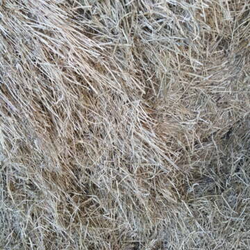
HD-Ballen Heu
Ginsweiler
Laura
@Heuverkauf_Ginsweiler
Heu
Kleinballen/HD-Ballen
Regenfrei
Wird verladen
2 weitere...
B+
Deprecated: Creation of dynamic property Zend_View_Helper_Ads::$adLink is deprecated in /var/www/stall-frei/htdocs/staging.stall-frei.de/library/Psf/View/Helper/Ads.php on line 108

Mitarbeiter gesucht?
Mechtersen
STALL-FREIde Marketing
@STALL-FREI-Marketing
Stellenangebote kostenlos veröffentlichen!


Heu, Heulage und Stroh in jeglichen Ballenformen
Hennef
Hof-Bongartz
@Hof-Bongartz
Heu
Lieferant entlädt
Großballen
Regenfrei
3 weitere...
P+

Bio Heu
Mehlbach
irena-zinssmeister
@irena-zinssmeister
Heu
Empfänger lädt ab
Großballen
Bio
Regenfrei
2 weitere...
aktuell
B+

Heu Rundballen
Espenschied
Marvin Kloos
@Birkenhof_Espenschied
Heu
Rundballen
Bio
Regenfrei
Wird verladen
2 weitere...
B+

Heu, Bio Ökol, Kräuter, Pferd, Kreuzkraut frei
Rösrath
Konrad-Biohof-Gut-Breide-LAG
@BiohofGutBreideLAG
Heu
Empfänger lädt ab
Rundballen
Bio
Regenfrei
2 weitere...
B+

Futtersack HeuToy, Fressbremse in pink
Mechtersen
STALL-FREIde Marketing
@STALL-FREI-Marketing
Stundenlange Beschäftigung die
Koliken vorbeugt, geringe Staubinhalation mit
steuerbarer Futterentnahme

Heu HD Ballen
Carlsberg
Maike Käpernick
@ReitschuleKaepernick
Heu
Empfänger lädt ab
Kleinballen/HD-Ballen
Bio
Regenfrei
2 weitere...
B+


TaunusHeu staubreduziert
Idstein
Torsten Fischer
@HayClean
Heu
Käufer lädt selbst
Abholung
Lieferung
P+

Zeitgesteuert portioniertes Heu, portionsraufe
Hilden
BB-Equipment-GmbH
@BB-Equipment-GmbH
Heu
Lieferant entlädt
Lose
Wird verladen
2 weitere...
B+

Die zeitgesteuerte Heuraufe powerraufe bis 30kg He
Hilden
BB-Equipment-GmbH
@BB-Equipment-GmbH
Heu
Lieferant entlädt
Wird verladen
Abholung
Lieferung
B+
Deprecated: Creation of dynamic property Zend_View::$pageCount is deprecated in /var/www/stall-frei/htdocs/staging.stall-frei.de/library/vendor/shardj/zf1-future/library/Zend/View/Abstract.php on line 308
Deprecated: Creation of dynamic property Zend_View::$itemCountPerPage is deprecated in /var/www/stall-frei/htdocs/staging.stall-frei.de/library/vendor/shardj/zf1-future/library/Zend/View/Abstract.php on line 308
Deprecated: Creation of dynamic property Zend_View::$first is deprecated in /var/www/stall-frei/htdocs/staging.stall-frei.de/library/vendor/shardj/zf1-future/library/Zend/View/Abstract.php on line 308
Deprecated: Creation of dynamic property Zend_View::$current is deprecated in /var/www/stall-frei/htdocs/staging.stall-frei.de/library/vendor/shardj/zf1-future/library/Zend/View/Abstract.php on line 308
Deprecated: Creation of dynamic property Zend_View::$last is deprecated in /var/www/stall-frei/htdocs/staging.stall-frei.de/library/vendor/shardj/zf1-future/library/Zend/View/Abstract.php on line 308
Deprecated: Creation of dynamic property Zend_View::$next is deprecated in /var/www/stall-frei/htdocs/staging.stall-frei.de/library/vendor/shardj/zf1-future/library/Zend/View/Abstract.php on line 308
Deprecated: Creation of dynamic property Zend_View::$pagesInRange is deprecated in /var/www/stall-frei/htdocs/staging.stall-frei.de/library/vendor/shardj/zf1-future/library/Zend/View/Abstract.php on line 308
Deprecated: Creation of dynamic property Zend_View::$firstPageInRange is deprecated in /var/www/stall-frei/htdocs/staging.stall-frei.de/library/vendor/shardj/zf1-future/library/Zend/View/Abstract.php on line 308
Deprecated: Creation of dynamic property Zend_View::$lastPageInRange is deprecated in /var/www/stall-frei/htdocs/staging.stall-frei.de/library/vendor/shardj/zf1-future/library/Zend/View/Abstract.php on line 308
Deprecated: Creation of dynamic property Zend_View::$currentItemCount is deprecated in /var/www/stall-frei/htdocs/staging.stall-frei.de/library/vendor/shardj/zf1-future/library/Zend/View/Abstract.php on line 308
Deprecated: Creation of dynamic property Zend_View::$totalItemCount is deprecated in /var/www/stall-frei/htdocs/staging.stall-frei.de/library/vendor/shardj/zf1-future/library/Zend/View/Abstract.php on line 308
Deprecated: Creation of dynamic property Zend_View::$firstItemNumber is deprecated in /var/www/stall-frei/htdocs/staging.stall-frei.de/library/vendor/shardj/zf1-future/library/Zend/View/Abstract.php on line 308
Deprecated: Creation of dynamic property Zend_View::$lastItemNumber is deprecated in /var/www/stall-frei/htdocs/staging.stall-frei.de/library/vendor/shardj/zf1-future/library/Zend/View/Abstract.php on line 308
Deprecated: Creation of dynamic property Zend_View::$router is deprecated in /var/www/stall-frei/htdocs/staging.stall-frei.de/library/vendor/shardj/zf1-future/library/Zend/View/Abstract.php on line 308
Deprecated: Creation of dynamic property Zend_View::$urlParams is deprecated in /var/www/stall-frei/htdocs/staging.stall-frei.de/library/vendor/shardj/zf1-future/library/Zend/View/Abstract.php on line 308
Deprecated: Creation of dynamic property Zend_View::$showAds is deprecated in /var/www/stall-frei/htdocs/staging.stall-frei.de/library/vendor/shardj/zf1-future/library/Zend/View/Abstract.php on line 308
Deprecated: Creation of dynamic property Zend_View::$objectIds is deprecated in /var/www/stall-frei/htdocs/staging.stall-frei.de/library/vendor/shardj/zf1-future/library/Zend/View/Abstract.php on line 308
Deprecated: Creation of dynamic property Zend_View::$showNavbar is deprecated in /var/www/stall-frei/htdocs/staging.stall-frei.de/library/vendor/shardj/zf1-future/library/Zend/View/Abstract.php on line 308
Deprecated: Creation of dynamic property Zend_View::$showBreadcrumb is deprecated in /var/www/stall-frei/htdocs/staging.stall-frei.de/library/vendor/shardj/zf1-future/library/Zend/View/Abstract.php on line 308
Deprecated: Creation of dynamic property Zend_View::$showFooter is deprecated in /var/www/stall-frei/htdocs/staging.stall-frei.de/library/vendor/shardj/zf1-future/library/Zend/View/Abstract.php on line 308
Deprecated: Creation of dynamic property Zend_View::$showInternalAds is deprecated in /var/www/stall-frei/htdocs/staging.stall-frei.de/library/vendor/shardj/zf1-future/library/Zend/View/Abstract.php on line 308
Deprecated: Creation of dynamic property Zend_View::$blNoContent is deprecated in /var/www/stall-frei/htdocs/staging.stall-frei.de/library/vendor/shardj/zf1-future/library/Zend/View/Abstract.php on line 308
Deprecated: Creation of dynamic property Zend_View::$sMetaDesc is deprecated in /var/www/stall-frei/htdocs/staging.stall-frei.de/library/vendor/shardj/zf1-future/library/Zend/View/Abstract.php on line 308
Deprecated: Creation of dynamic property Zend_View::$useGmaps is deprecated in /var/www/stall-frei/htdocs/staging.stall-frei.de/library/vendor/shardj/zf1-future/library/Zend/View/Abstract.php on line 308
Deprecated: Creation of dynamic property Zend_View::$touches is deprecated in /var/www/stall-frei/htdocs/staging.stall-frei.de/library/vendor/shardj/zf1-future/library/Zend/View/Abstract.php on line 308
Deprecated: Creation of dynamic property Zend_View::$oProject is deprecated in /var/www/stall-frei/htdocs/staging.stall-frei.de/library/vendor/shardj/zf1-future/library/Zend/View/Abstract.php on line 308
Deprecated: Creation of dynamic property Zend_View::$pageHeadline is deprecated in /var/www/stall-frei/htdocs/staging.stall-frei.de/library/vendor/shardj/zf1-future/library/Zend/View/Abstract.php on line 308
Deprecated: Creation of dynamic property Zend_View::$disableLocationField is deprecated in /var/www/stall-frei/htdocs/staging.stall-frei.de/library/vendor/shardj/zf1-future/library/Zend/View/Abstract.php on line 308
Deprecated: Creation of dynamic property Zend_View::$isSearch is deprecated in /var/www/stall-frei/htdocs/staging.stall-frei.de/library/vendor/shardj/zf1-future/library/Zend/View/Abstract.php on line 308
Deprecated: Creation of dynamic property Zend_View::$pageTitle is deprecated in /var/www/stall-frei/htdocs/staging.stall-frei.de/library/vendor/shardj/zf1-future/library/Zend/View/Abstract.php on line 308
Deprecated: Creation of dynamic property Psf_Form_Element_Text::$class is deprecated in /var/www/stall-frei/htdocs/staging.stall-frei.de/library/vendor/shardj/zf1-future/library/Zend/Form/Element.php on line 874
Deprecated: Creation of dynamic property Psf_Form_Element_Text::$size is deprecated in /var/www/stall-frei/htdocs/staging.stall-frei.de/library/vendor/shardj/zf1-future/library/Zend/Form/Element.php on line 874
Deprecated: Creation of dynamic property Psf_Form_Element_Text::$placeholder is deprecated in /var/www/stall-frei/htdocs/staging.stall-frei.de/library/vendor/shardj/zf1-future/library/Zend/Form/Element.php on line 874
Deprecated: Creation of dynamic property Psf_Form_Element_Hidden::$class is deprecated in /var/www/stall-frei/htdocs/staging.stall-frei.de/library/vendor/shardj/zf1-future/library/Zend/Form/Element.php on line 874
Deprecated: Creation of dynamic property Psf_Form_Element_Hidden::$class is deprecated in /var/www/stall-frei/htdocs/staging.stall-frei.de/library/vendor/shardj/zf1-future/library/Zend/Form/Element.php on line 874
Deprecated: Creation of dynamic property Psf_Form_Element_Hidden::$class is deprecated in /var/www/stall-frei/htdocs/staging.stall-frei.de/library/vendor/shardj/zf1-future/library/Zend/Form/Element.php on line 874
Deprecated: Creation of dynamic property Psf_Form_Element_Hidden::$class is deprecated in /var/www/stall-frei/htdocs/staging.stall-frei.de/library/vendor/shardj/zf1-future/library/Zend/Form/Element.php on line 874
Deprecated: Creation of dynamic property Psf_Form_Element_Select::$class is deprecated in /var/www/stall-frei/htdocs/staging.stall-frei.de/library/vendor/shardj/zf1-future/library/Zend/Form/Element.php on line 874
Deprecated: Creation of dynamic property Psf_Form_Element_Select::$class is deprecated in /var/www/stall-frei/htdocs/staging.stall-frei.de/library/vendor/shardj/zf1-future/library/Zend/Form/Element.php on line 874
Deprecated: Creation of dynamic property Psf_Form_Element_Select::$class is deprecated in /var/www/stall-frei/htdocs/staging.stall-frei.de/library/vendor/shardj/zf1-future/library/Zend/Form/Element.php on line 874
Deprecated: Creation of dynamic property Psf_Form_Element_Select::$class is deprecated in /var/www/stall-frei/htdocs/staging.stall-frei.de/library/vendor/shardj/zf1-future/library/Zend/Form/Element.php on line 874
Deprecated: Creation of dynamic property Zend_View::$sort is deprecated in /var/www/stall-frei/htdocs/staging.stall-frei.de/library/vendor/shardj/zf1-future/library/Zend/View/Abstract.php on line 308
Deprecated: Creation of dynamic property Zend_View::$searchLocation is deprecated in /var/www/stall-frei/htdocs/staging.stall-frei.de/library/vendor/shardj/zf1-future/library/Zend/View/Abstract.php on line 308
Deprecated: Creation of dynamic property Zend_View::$locationHint is deprecated in /var/www/stall-frei/htdocs/staging.stall-frei.de/library/vendor/shardj/zf1-future/library/Zend/View/Abstract.php on line 308
Psf_GeoCoder_Abstract::getLocation: Lahr Get Location CachedOrLive
Psf_GeoCoder_Abstract::getCachedOrLive: Lahr
Psf_GeoCoder_OpenCageData::makeApiRequest: response:
Array
(
[documentation] => https://opencagedata.com/api
[licenses] => Array
(
[0] => Array
(
[name] => see attribution guide
[url] => https://opencagedata.com/credits
)
)
[results] => Array
(
[0] => Array
(
[bounds] => Array
(
[northeast] => Array
(
[lat] => 49.9746414
[lng] => 6.3063094
)
[southwest] => Array
(
[lat] => 49.9351597
[lng] => 6.253966
)
)
[components] => Array
(
[ISO_3166-1_alpha-2] => DE
[ISO_3166-1_alpha-3] => DEU
[ISO_3166-2] => Array
(
[0] => DE-RP
)
[_category] => place
[_normalized_city] => Lahr
[_type] => village
[continent] => Europe
[country] => Deutschland
[country_code] => de
[county] => Eifelkreis Bitburg-Prüm
[municipality] => Südeifel
[political_union] => European Union
[state] => Rheinland-Pfalz
[state_code] => RP
[village] => Lahr
)
[confidence] => 7
[formatted] => Lahr, Rheinland-Pfalz, Deutschland
[geometry] => Array
(
[lat] => 49.9440252
[lng] => 6.2909576
)
)
[1] => Array
(
[bounds] => Array
(
[northeast] => Array
(
[lat] => 48.3821347
[lng] => 7.9796434
)
[southwest] => Array
(
[lat] => 48.2865637
[lng] => 7.7857385
)
)
[components] => Array
(
[ISO_3166-1_alpha-2] => DE
[ISO_3166-1_alpha-3] => DEU
[ISO_3166-2] => Array
(
[0] => DE-BW
)
[_category] => place
[_normalized_city] => Lahr/Schwarzwald
[_type] => city
[city] => Lahr/Schwarzwald
[continent] => Europe
[country] => Deutschland
[country_code] => de
[county] => Ortenaukreis
[municipality] => VVG der Stadt Lahr/Schwarzwald
[political_union] => European Union
[postcode] => 77933
[state] => Baden-Württemberg
[state_code] => BW
)
[confidence] => 6
[formatted] => Lahr/Schwarzwald, Baden-Württemberg, Deutschland
[geometry] => Array
(
[lat] => 48.3345157
[lng] => 7.8831998
)
)
[2] => Array
(
[bounds] => Array
(
[northeast] => Array
(
[lat] => 48.3703238
[lng] => 7.9284374
)
[southwest] => Array
(
[lat] => 48.3009951
[lng] => 7.7931371
)
)
[components] => Array
(
[ISO_3166-1_alpha-2] => DE
[ISO_3166-1_alpha-3] => DEU
[ISO_3166-2] => Array
(
[0] => DE-BW
)
[_category] => place
[_normalized_city] => Lahr/Schwarzwald
[_type] => neighbourhood
[city] => Lahr/Schwarzwald
[continent] => Europe
[country] => Deutschland
[country_code] => de
[county] => Ortenaukreis
[municipality] => VVG der Stadt Lahr/Schwarzwald
[political_union] => European Union
[postcode] => 77933
[state] => Baden-Württemberg
[state_code] => BW
[suburb] => Lahr
)
[confidence] => 7
[formatted] => 77933 Lahr/Schwarzwald, Deutschland
[geometry] => Array
(
[lat] => 48.338896
[lng] => 7.8710825
)
)
[3] => Array
(
[bounds] => Array
(
[northeast] => Array
(
[lat] => 50.1335864
[lng] => 7.3748759
)
[southwest] => Array
(
[lat] => 50.1114998
[lng] => 7.3399739
)
)
[components] => Array
(
[ISO_3166-1_alpha-2] => DE
[ISO_3166-1_alpha-3] => DEU
[ISO_3166-2] => Array
(
[0] => DE-RP
)
[_category] => place
[_normalized_city] => Lahr
[_type] => village
[continent] => Europe
[country] => Deutschland
[country_code] => de
[county] => Rhein-Hunsrück-Kreis
[municipality] => Kastellaun
[political_union] => European Union
[state] => Rheinland-Pfalz
[state_code] => RP
[village] => Lahr
)
[confidence] => 7
[formatted] => Lahr, Rheinland-Pfalz, Deutschland
[geometry] => Array
(
[lat] => 50.1254275
[lng] => 7.3657236
)
)
[4] => Array
(
[bounds] => Array
(
[northeast] => Array
(
[lat] => 50.5294925
[lng] => 8.1662617
)
[southwest] => Array
(
[lat] => 50.4908603
[lng] => 8.1132474
)
)
[components] => Array
(
[ISO_3166-1_alpha-2] => DE
[ISO_3166-1_alpha-3] => DEU
[ISO_3166-2] => Array
(
[0] => DE-HE
)
[_category] => place
[_normalized_city] => Lahr
[_type] => village
[continent] => Europe
[country] => Deutschland
[country_code] => de
[county] => Landkreis Limburg-Weilburg
[municipality] => Waldbrunn (Westerwald)
[political_union] => European Union
[state] => Hessen
[state_code] => HE
[village] => Lahr
)
[confidence] => 7
[formatted] => Lahr, Hessen, Deutschland
[geometry] => Array
(
[lat] => 50.5098368
[lng] => 8.1306499
)
)
[5] => Array
(
[bounds] => Array
(
[northeast] => Array
(
[lat] => 49.9406488
[lng] => 6.3160696
)
[southwest] => Array
(
[lat] => 49.9163971
[lng] => 6.2736745
)
)
[components] => Array
(
[ISO_3166-1_alpha-2] => DE
[ISO_3166-1_alpha-3] => DEU
[ISO_3166-2] => Array
(
[0] => DE-RP
)
[_category] => place
[_normalized_city] => Hüttingen bei Lahr
[_type] => village
[continent] => Europe
[country] => Deutschland
[country_code] => de
[county] => Eifelkreis Bitburg-Prüm
[municipality] => Südeifel
[political_union] => European Union
[state] => Rheinland-Pfalz
[state_code] => RP
[village] => Hüttingen bei Lahr
)
[confidence] => 7
[formatted] => Hüttingen bei Lahr, Rheinland-Pfalz, Deutschland
[geometry] => Array
(
[lat] => 49.9309873
[lng] => 6.2979655
)
)
[6] => Array
(
[components] => Array
(
[ISO_3166-1_alpha-2] => FR
[ISO_3166-1_alpha-3] => FRA
[ISO_3166-2] => Array
(
[0] => FR-BFC
[1] => FR-39
)
[_category] => road
[_normalized_city] => Dole
[_type] => road
[city] => Dole
[continent] => Europe
[country] => France
[country_code] => fr
[county] => Jura
[local_authority] => Communauté d'agglomération du Grand Dole
[political_union] => European Union
[postcode] => 39100
[road] => Avenue de Lahr
[state] => Bourgogne-Franche-Comté
[state_code] => BFC
)
[confidence] => 2
[formatted] => Avenue de Lahr, 39100 Dole, France
[geometry] => Array
(
[lat] => 47.090625
[lng] => 5.497135
)
)
[7] => Array
(
[components] => Array
(
[ISO_3166-1_alpha-2] => FR
[ISO_3166-1_alpha-3] => FRA
[ISO_3166-2] => Array
(
[0] => FR-NAQ
[1] => FR-64
)
[_category] => road
[_normalized_city] => Etsaut
[_type] => road
[city] => Etsaut
[continent] => Europe
[country] => France
[country_code] => fr
[county] => Pyrénées-Atlantiques
[local_authority] => Communauté de communes du Haut Béarn
[political_union] => European Union
[postcode] => 64490
[road] => Chemin de Larres
[state] => Nouvelle-Aquitaine
[state_code] => NAQ
)
[confidence] => 2
[formatted] => Chemin de Larres, 64490 Etsaut, France
[geometry] => Array
(
[lat] => 42.913762
[lng] => -0.570284
)
)
[8] => Array
(
[components] => Array
(
[ISO_3166-1_alpha-2] => FR
[ISO_3166-1_alpha-3] => FRA
[ISO_3166-2] => Array
(
[0] => FR-OCC
[1] => FR-32
)
[_category] => road
[_normalized_city] => Marambat
[_type] => road
[city] => Marambat
[continent] => Europe
[country] => France
[country_code] => fr
[county] => Gers
[local_authority] => Communauté de communes d'Artagnan en Fezensac
[political_union] => European Union
[postcode] => 32190
[road] => Chemin de Lar
[state] => Occitanie
[state_code] => OCC
)
[confidence] => 10
[formatted] => Chemin de Lar, 32190 Marambat, France
[geometry] => Array
(
[lat] => 43.771276
[lng] => 0.31022
)
)
[9] => Array
(
[components] => Array
(
[ISO_3166-1_alpha-2] => FR
[ISO_3166-1_alpha-3] => FRA
[ISO_3166-2] => Array
(
[0] => FR-ARA
[1] => FR-42
)
[_category] => road
[_normalized_city] => Pralong
[_type] => road
[city] => Pralong
[continent] => Europe
[country] => France
[country_code] => fr
[county] => Loire
[local_authority] => Loire Forez Agglomération
[political_union] => European Union
[postcode] => 42600
[road] => Route de Lard
[state] => Auvergne-Rhône-Alpes
[state_code] => ARA
)
[confidence] => 10
[formatted] => Route de Lard, 42600 Pralong, France
[geometry] => Array
(
[lat] => 45.658858
[lng] => 4.003287
)
)
)
[status] => Array
(
[code] => 200
[message] => OK
)
[stay_informed] => Array
(
[blog] => https://blog.opencagedata.com
[mastodon] => https://en.osm.town/@opencage
)
[thanks] => For using an OpenCage API
[timestamp] => Array
(
[created_http] => Sat, 07 Feb 2026 17:58:33 GMT
[created_unix] => 1770487113
)
[total_results] => 10
)
Psf_GeoCoder_Abstract::convertLocationResult
{"documentation":"https:\/\/opencagedata.com\/api","licenses":[{"name":"see attribution guide","url":"https:\/\/opencagedata.com\/credits"}],"results":[{"bounds":{"northeast":{"lat":49.9746414,"lng":6.3063094},"southwest":{"lat":49.9351597,"lng":6.253966}},"components":{"ISO_3166-1_alpha-2":"DE","ISO_3166-1_alpha-3":"DEU","ISO_3166-2":["DE-RP"],"_category":"place","_normalized_city":"Lahr","_type":"village","continent":"Europe","country":"Deutschland","country_code":"de","county":"Eifelkreis Bitburg-Pr\u00fcm","municipality":"S\u00fcdeifel","political_union":"European Union","state":"Rheinland-Pfalz","state_code":"RP","village":"Lahr"},"confidence":7,"formatted":"Lahr, Rheinland-Pfalz, Deutschland","geometry":{"lat":49.9440252,"lng":6.2909576}},{"bounds":{"northeast":{"lat":48.3821347,"lng":7.9796434},"southwest":{"lat":48.2865637,"lng":7.7857385}},"components":{"ISO_3166-1_alpha-2":"DE","ISO_3166-1_alpha-3":"DEU","ISO_3166-2":["DE-BW"],"_category":"place","_normalized_city":"Lahr\/Schwarzwald","_type":"city","city":"Lahr\/Schwarzwald","continent":"Europe","country":"Deutschland","country_code":"de","county":"Ortenaukreis","municipality":"VVG der Stadt Lahr\/Schwarzwald","political_union":"European Union","postcode":"77933","state":"Baden-W\u00fcrttemberg","state_code":"BW"},"confidence":6,"formatted":"Lahr\/Schwarzwald, Baden-W\u00fcrttemberg, Deutschland","geometry":{"lat":48.3345157,"lng":7.8831998}},{"bounds":{"northeast":{"lat":48.3703238,"lng":7.9284374},"southwest":{"lat":48.3009951,"lng":7.7931371}},"components":{"ISO_3166-1_alpha-2":"DE","ISO_3166-1_alpha-3":"DEU","ISO_3166-2":["DE-BW"],"_category":"place","_normalized_city":"Lahr\/Schwarzwald","_type":"neighbourhood","city":"Lahr\/Schwarzwald","continent":"Europe","country":"Deutschland","country_code":"de","county":"Ortenaukreis","municipality":"VVG der Stadt Lahr\/Schwarzwald","political_union":"European Union","postcode":"77933","state":"Baden-W\u00fcrttemberg","state_code":"BW","suburb":"Lahr"},"confidence":7,"formatted":"77933 Lahr\/Schwarzwald, Deutschland","geometry":{"lat":48.338896,"lng":7.8710825}},{"bounds":{"northeast":{"lat":50.1335864,"lng":7.3748759},"southwest":{"lat":50.1114998,"lng":7.3399739}},"components":{"ISO_3166-1_alpha-2":"DE","ISO_3166-1_alpha-3":"DEU","ISO_3166-2":["DE-RP"],"_category":"place","_normalized_city":"Lahr","_type":"village","continent":"Europe","country":"Deutschland","country_code":"de","county":"Rhein-Hunsr\u00fcck-Kreis","municipality":"Kastellaun","political_union":"European Union","state":"Rheinland-Pfalz","state_code":"RP","village":"Lahr"},"confidence":7,"formatted":"Lahr, Rheinland-Pfalz, Deutschland","geometry":{"lat":50.1254275,"lng":7.3657236}},{"bounds":{"northeast":{"lat":50.5294925,"lng":8.1662617},"southwest":{"lat":50.4908603,"lng":8.1132474}},"components":{"ISO_3166-1_alpha-2":"DE","ISO_3166-1_alpha-3":"DEU","ISO_3166-2":["DE-HE"],"_category":"place","_normalized_city":"Lahr","_type":"village","continent":"Europe","country":"Deutschland","country_code":"de","county":"Landkreis Limburg-Weilburg","municipality":"Waldbrunn (Westerwald)","political_union":"European Union","state":"Hessen","state_code":"HE","village":"Lahr"},"confidence":7,"formatted":"Lahr, Hessen, Deutschland","geometry":{"lat":50.5098368,"lng":8.1306499}},{"bounds":{"northeast":{"lat":49.9406488,"lng":6.3160696},"southwest":{"lat":49.9163971,"lng":6.2736745}},"components":{"ISO_3166-1_alpha-2":"DE","ISO_3166-1_alpha-3":"DEU","ISO_3166-2":["DE-RP"],"_category":"place","_normalized_city":"H\u00fcttingen bei Lahr","_type":"village","continent":"Europe","country":"Deutschland","country_code":"de","county":"Eifelkreis Bitburg-Pr\u00fcm","municipality":"S\u00fcdeifel","political_union":"European Union","state":"Rheinland-Pfalz","state_code":"RP","village":"H\u00fcttingen bei Lahr"},"confidence":7,"formatted":"H\u00fcttingen bei Lahr, Rheinland-Pfalz, Deutschland","geometry":{"lat":49.9309873,"lng":6.2979655}},{"components":{"ISO_3166-1_alpha-2":"FR","ISO_3166-1_alpha-3":"FRA","ISO_3166-2":["FR-BFC","FR-39"],"_category":"road","_normalized_city":"Dole","_type":"road","city":"Dole","continent":"Europe","country":"France","country_code":"fr","county":"Jura","local_authority":"Communaut\u00e9 d'agglom\u00e9ration du Grand Dole","political_union":"European Union","postcode":"39100","road":"Avenue de Lahr","state":"Bourgogne-Franche-Comt\u00e9","state_code":"BFC"},"confidence":2,"formatted":"Avenue de Lahr, 39100 Dole, France","geometry":{"lat":47.090625,"lng":5.497135}},{"components":{"ISO_3166-1_alpha-2":"FR","ISO_3166-1_alpha-3":"FRA","ISO_3166-2":["FR-NAQ","FR-64"],"_category":"road","_normalized_city":"Etsaut","_type":"road","city":"Etsaut","continent":"Europe","country":"France","country_code":"fr","county":"Pyr\u00e9n\u00e9es-Atlantiques","local_authority":"Communaut\u00e9 de communes du Haut B\u00e9arn","political_union":"European Union","postcode":"64490","road":"Chemin de Larres","state":"Nouvelle-Aquitaine","state_code":"NAQ"},"confidence":2,"formatted":"Chemin de Larres, 64490 Etsaut, France","geometry":{"lat":42.913762,"lng":-0.570284}},{"components":{"ISO_3166-1_alpha-2":"FR","ISO_3166-1_alpha-3":"FRA","ISO_3166-2":["FR-OCC","FR-32"],"_category":"road","_normalized_city":"Marambat","_type":"road","city":"Marambat","continent":"Europe","country":"France","country_code":"fr","county":"Gers","local_authority":"Communaut\u00e9 de communes d'Artagnan en Fezensac","political_union":"European Union","postcode":"32190","road":"Chemin de Lar","state":"Occitanie","state_code":"OCC"},"confidence":10,"formatted":"Chemin de Lar, 32190 Marambat, France","geometry":{"lat":43.771276,"lng":0.31022}},{"components":{"ISO_3166-1_alpha-2":"FR","ISO_3166-1_alpha-3":"FRA","ISO_3166-2":["FR-ARA","FR-42"],"_category":"road","_normalized_city":"Pralong","_type":"road","city":"Pralong","continent":"Europe","country":"France","country_code":"fr","county":"Loire","local_authority":"Loire Forez Agglom\u00e9ration","political_union":"European Union","postcode":"42600","road":"Route de Lard","state":"Auvergne-Rh\u00f4ne-Alpes","state_code":"ARA"},"confidence":10,"formatted":"Route de Lard, 42600 Pralong, France","geometry":{"lat":45.658858,"lng":4.003287}}],"status":{"code":200,"message":"OK"},"stay_informed":{"blog":"https:\/\/blog.opencagedata.com","mastodon":"https:\/\/en.osm.town\/@opencage"},"thanks":"For using an OpenCage API","timestamp":{"created_http":"Sat, 07 Feb 2026 17:58:33 GMT","created_unix":1770487113},"total_results":10}Array
(
[0] => stdClass Object
(
[bounds] => stdClass Object
(
[northeast] => stdClass Object
(
[lat] => 49.9746414
[lng] => 6.3063094
)
[southwest] => stdClass Object
(
[lat] => 49.9351597
[lng] => 6.253966
)
)
[components] => stdClass Object
(
[ISO_3166-1_alpha-2] => DE
[ISO_3166-1_alpha-3] => DEU
[ISO_3166-2] => Array
(
[0] => DE-RP
)
[_category] => place
[_normalized_city] => Lahr
[_type] => village
[continent] => Europe
[country] => Deutschland
[country_code] => de
[county] => Eifelkreis Bitburg-Prüm
[municipality] => Südeifel
[political_union] => European Union
[state] => Rheinland-Pfalz
[state_code] => RP
[village] => Lahr
)
[confidence] => 7
[formatted] => Lahr, Rheinland-Pfalz, Deutschland
[geometry] => stdClass Object
(
[lat] => 49.9440252
[lng] => 6.2909576
)
)
[1] => stdClass Object
(
[bounds] => stdClass Object
(
[northeast] => stdClass Object
(
[lat] => 48.3821347
[lng] => 7.9796434
)
[southwest] => stdClass Object
(
[lat] => 48.2865637
[lng] => 7.7857385
)
)
[components] => stdClass Object
(
[ISO_3166-1_alpha-2] => DE
[ISO_3166-1_alpha-3] => DEU
[ISO_3166-2] => Array
(
[0] => DE-BW
)
[_category] => place
[_normalized_city] => Lahr/Schwarzwald
[_type] => city
[city] => Lahr/Schwarzwald
[continent] => Europe
[country] => Deutschland
[country_code] => de
[county] => Ortenaukreis
[municipality] => VVG der Stadt Lahr/Schwarzwald
[political_union] => European Union
[postcode] => 77933
[state] => Baden-Württemberg
[state_code] => BW
)
[confidence] => 6
[formatted] => Lahr/Schwarzwald, Baden-Württemberg, Deutschland
[geometry] => stdClass Object
(
[lat] => 48.3345157
[lng] => 7.8831998
)
)
[2] => stdClass Object
(
[bounds] => stdClass Object
(
[northeast] => stdClass Object
(
[lat] => 48.3703238
[lng] => 7.9284374
)
[southwest] => stdClass Object
(
[lat] => 48.3009951
[lng] => 7.7931371
)
)
[components] => stdClass Object
(
[ISO_3166-1_alpha-2] => DE
[ISO_3166-1_alpha-3] => DEU
[ISO_3166-2] => Array
(
[0] => DE-BW
)
[_category] => place
[_normalized_city] => Lahr/Schwarzwald
[_type] => neighbourhood
[city] => Lahr/Schwarzwald
[continent] => Europe
[country] => Deutschland
[country_code] => de
[county] => Ortenaukreis
[municipality] => VVG der Stadt Lahr/Schwarzwald
[political_union] => European Union
[postcode] => 77933
[state] => Baden-Württemberg
[state_code] => BW
[suburb] => Lahr
)
[confidence] => 7
[formatted] => 77933 Lahr/Schwarzwald, Deutschland
[geometry] => stdClass Object
(
[lat] => 48.338896
[lng] => 7.8710825
)
)
[3] => stdClass Object
(
[bounds] => stdClass Object
(
[northeast] => stdClass Object
(
[lat] => 50.1335864
[lng] => 7.3748759
)
[southwest] => stdClass Object
(
[lat] => 50.1114998
[lng] => 7.3399739
)
)
[components] => stdClass Object
(
[ISO_3166-1_alpha-2] => DE
[ISO_3166-1_alpha-3] => DEU
[ISO_3166-2] => Array
(
[0] => DE-RP
)
[_category] => place
[_normalized_city] => Lahr
[_type] => village
[continent] => Europe
[country] => Deutschland
[country_code] => de
[county] => Rhein-Hunsrück-Kreis
[municipality] => Kastellaun
[political_union] => European Union
[state] => Rheinland-Pfalz
[state_code] => RP
[village] => Lahr
)
[confidence] => 7
[formatted] => Lahr, Rheinland-Pfalz, Deutschland
[geometry] => stdClass Object
(
[lat] => 50.1254275
[lng] => 7.3657236
)
)
[4] => stdClass Object
(
[bounds] => stdClass Object
(
[northeast] => stdClass Object
(
[lat] => 50.5294925
[lng] => 8.1662617
)
[southwest] => stdClass Object
(
[lat] => 50.4908603
[lng] => 8.1132474
)
)
[components] => stdClass Object
(
[ISO_3166-1_alpha-2] => DE
[ISO_3166-1_alpha-3] => DEU
[ISO_3166-2] => Array
(
[0] => DE-HE
)
[_category] => place
[_normalized_city] => Lahr
[_type] => village
[continent] => Europe
[country] => Deutschland
[country_code] => de
[county] => Landkreis Limburg-Weilburg
[municipality] => Waldbrunn (Westerwald)
[political_union] => European Union
[state] => Hessen
[state_code] => HE
[village] => Lahr
)
[confidence] => 7
[formatted] => Lahr, Hessen, Deutschland
[geometry] => stdClass Object
(
[lat] => 50.5098368
[lng] => 8.1306499
)
)
[5] => stdClass Object
(
[bounds] => stdClass Object
(
[northeast] => stdClass Object
(
[lat] => 49.9406488
[lng] => 6.3160696
)
[southwest] => stdClass Object
(
[lat] => 49.9163971
[lng] => 6.2736745
)
)
[components] => stdClass Object
(
[ISO_3166-1_alpha-2] => DE
[ISO_3166-1_alpha-3] => DEU
[ISO_3166-2] => Array
(
[0] => DE-RP
)
[_category] => place
[_normalized_city] => Hüttingen bei Lahr
[_type] => village
[continent] => Europe
[country] => Deutschland
[country_code] => de
[county] => Eifelkreis Bitburg-Prüm
[municipality] => Südeifel
[political_union] => European Union
[state] => Rheinland-Pfalz
[state_code] => RP
[village] => Hüttingen bei Lahr
)
[confidence] => 7
[formatted] => Hüttingen bei Lahr, Rheinland-Pfalz, Deutschland
[geometry] => stdClass Object
(
[lat] => 49.9309873
[lng] => 6.2979655
)
)
[6] => stdClass Object
(
[components] => stdClass Object
(
[ISO_3166-1_alpha-2] => FR
[ISO_3166-1_alpha-3] => FRA
[ISO_3166-2] => Array
(
[0] => FR-BFC
[1] => FR-39
)
[_category] => road
[_normalized_city] => Dole
[_type] => road
[city] => Dole
[continent] => Europe
[country] => France
[country_code] => fr
[county] => Jura
[local_authority] => Communauté d'agglomération du Grand Dole
[political_union] => European Union
[postcode] => 39100
[road] => Avenue de Lahr
[state] => Bourgogne-Franche-Comté
[state_code] => BFC
)
[confidence] => 2
[formatted] => Avenue de Lahr, 39100 Dole, France
[geometry] => stdClass Object
(
[lat] => 47.090625
[lng] => 5.497135
)
)
[7] => stdClass Object
(
[components] => stdClass Object
(
[ISO_3166-1_alpha-2] => FR
[ISO_3166-1_alpha-3] => FRA
[ISO_3166-2] => Array
(
[0] => FR-NAQ
[1] => FR-64
)
[_category] => road
[_normalized_city] => Etsaut
[_type] => road
[city] => Etsaut
[continent] => Europe
[country] => France
[country_code] => fr
[county] => Pyrénées-Atlantiques
[local_authority] => Communauté de communes du Haut Béarn
[political_union] => European Union
[postcode] => 64490
[road] => Chemin de Larres
[state] => Nouvelle-Aquitaine
[state_code] => NAQ
)
[confidence] => 2
[formatted] => Chemin de Larres, 64490 Etsaut, France
[geometry] => stdClass Object
(
[lat] => 42.913762
[lng] => -0.570284
)
)
[8] => stdClass Object
(
[components] => stdClass Object
(
[ISO_3166-1_alpha-2] => FR
[ISO_3166-1_alpha-3] => FRA
[ISO_3166-2] => Array
(
[0] => FR-OCC
[1] => FR-32
)
[_category] => road
[_normalized_city] => Marambat
[_type] => road
[city] => Marambat
[continent] => Europe
[country] => France
[country_code] => fr
[county] => Gers
[local_authority] => Communauté de communes d'Artagnan en Fezensac
[political_union] => European Union
[postcode] => 32190
[road] => Chemin de Lar
[state] => Occitanie
[state_code] => OCC
)
[confidence] => 10
[formatted] => Chemin de Lar, 32190 Marambat, France
[geometry] => stdClass Object
(
[lat] => 43.771276
[lng] => 0.31022
)
)
[9] => stdClass Object
(
[components] => stdClass Object
(
[ISO_3166-1_alpha-2] => FR
[ISO_3166-1_alpha-3] => FRA
[ISO_3166-2] => Array
(
[0] => FR-ARA
[1] => FR-42
)
[_category] => road
[_normalized_city] => Pralong
[_type] => road
[city] => Pralong
[continent] => Europe
[country] => France
[country_code] => fr
[county] => Loire
[local_authority] => Loire Forez Agglomération
[political_union] => European Union
[postcode] => 42600
[road] => Route de Lard
[state] => Auvergne-Rhône-Alpes
[state_code] => ARA
)
[confidence] => 10
[formatted] => Route de Lard, 42600 Pralong, France
[geometry] => stdClass Object
(
[lat] => 45.658858
[lng] => 4.003287
)
)
)
Psf_GeoCoder_OpenCageData::getKeyMap: 0
stdClass Object
(
    [bounds] => stdClass Object
        (
            [northeast] => stdClass Object
                (
                    [lat] => 49.9746414
                    [lng] => 6.3063094
                )

            [southwest] => stdClass Object
                (
                    [lat] => 49.9351597
                    [lng] => 6.253966
                )

        )

    [components] => stdClass Object
        (
            [ISO_3166-1_alpha-2] => DE
            [ISO_3166-1_alpha-3] => DEU
            [ISO_3166-2] => Array
                (
                    [0] => DE-RP
                )

            [_category] => place
            [_normalized_city] => Lahr
            [_type] => village
            [continent] => Europe
            [country] => Deutschland
            [country_code] => de
            [county] => Eifelkreis Bitburg-Prüm
            [municipality] => Südeifel
            [political_union] => European Union
            [state] => Rheinland-Pfalz
            [state_code] => RP
            [village] => Lahr
        )

    [confidence] => 7
    [formatted] => Lahr, Rheinland-Pfalz, Deutschland
    [geometry] => stdClass Object
        (
            [lat] => 49.9440252
            [lng] => 6.2909576
        )

)
Psf_GeoCoder_OpenCageData::getCounty: Eifelkreis Bitburg-Prüm
Psf_GeoCoder_OpenCageData::addMissingData REFETCH!
Array
(
    [address] => Lahr, Rheinland-Pfalz, Deutschland
    [type] => village
    [street] =>
    [city] => Lahr
    [county] => Eifelkreis Bitburg-Prüm
    [state] => Rheinland-Pfalz
    [zip] =>
    [country] => Deutschland
    [suburb] =>
    [countrycode] => de
    [latitude] => 49.9440252
    [longitude] => 6.2909576
    [accuracy] => 1
    [confidence] => 7
    [bounds] => stdClass Object
        (
            [northeast] => stdClass Object
                (
                    [lat] => 49.9746414
                    [lng] => 6.3063094
                )

            [southwest] => stdClass Object
                (
                    [lat] => 49.9351597
                    [lng] => 6.253966
                )

        )

)
reformat!
Array
(
    [address] => Lahr, Rheinland-Pfalz, Deutschland
    [type] => village
    [street] =>
    [city] => Lahr
    [county] => Eifelkreis Bitburg-Prüm
    [state] => Rheinland-Pfalz
    [zip] =>
    [country] => Deutschland
    [suburb] =>
    [countrycode] => de
    [latitude] => 49.9440252
    [longitude] => 6.2909576
    [accuracy] => 1
    [confidence] => 7
    [bounds] => stdClass Object
        (
            [northeast] => stdClass Object
                (
                    [lat] => 49.9746414
                    [lng] => 6.3063094
                )

            [southwest] => stdClass Object
                (
                    [lat] => 49.9351597
                    [lng] => 6.253966
                )

        )

    [place] => Lahr, Rheinland-Pfalz
    [hash] => 0cb2243b366855bdc4d2c1a31d1c6f11
)
Psf_GeoCoder_OpenCageData::getKeyMap: 1
stdClass Object
(
    [bounds] => stdClass Object
        (
            [northeast] => stdClass Object
                (
                    [lat] => 48.3821347
                    [lng] => 7.9796434
                )

            [southwest] => stdClass Object
                (
                    [lat] => 48.2865637
                    [lng] => 7.7857385
                )

        )

    [components] => stdClass Object
        (
            [ISO_3166-1_alpha-2] => DE
            [ISO_3166-1_alpha-3] => DEU
            [ISO_3166-2] => Array
                (
                    [0] => DE-BW
                )

            [_category] => place
            [_normalized_city] => Lahr/Schwarzwald
            [_type] => city
            [city] => Lahr/Schwarzwald
            [continent] => Europe
            [country] => Deutschland
            [country_code] => de
            [county] => Ortenaukreis
            [municipality] => VVG der Stadt Lahr/Schwarzwald
            [political_union] => European Union
            [postcode] => 77933
            [state] => Baden-Württemberg
            [state_code] => BW
        )

    [confidence] => 6
    [formatted] => Lahr/Schwarzwald, Baden-Württemberg, Deutschland
    [geometry] => stdClass Object
        (
            [lat] => 48.3345157
            [lng] => 7.8831998
        )

)
Psf_GeoCoder_OpenCageData::getCounty: Ortenaukreis
Psf_GeoCoder_OpenCageData::addMissingData REFETCH!
Array
(
    [address] => Lahr/Schwarzwald, Baden-Württemberg, Deutschland
    [type] => city
    [street] =>
    [city] => Lahr/Schwarzwald
    [county] => Ortenaukreis
    [state] => Baden-Württemberg
    [zip] => 77933
    [country] => Deutschland
    [suburb] =>
    [countrycode] => de
    [latitude] => 48.3345157
    [longitude] => 7.8831998
    [accuracy] => 1
    [confidence] => 6
    [bounds] => stdClass Object
        (
            [northeast] => stdClass Object
                (
                    [lat] => 48.3821347
                    [lng] => 7.9796434
                )

            [southwest] => stdClass Object
                (
                    [lat] => 48.2865637
                    [lng] => 7.7857385
                )

        )

)
reformat!
Array
(
    [address] => Lahr/Schwarzwald, Baden-Württemberg, Deutschland
    [type] => city
    [street] =>
    [city] => Lahr/Schwarzwald
    [county] => Ortenaukreis
    [state] => Baden-Württemberg
    [zip] => 77933
    [country] => Deutschland
    [suburb] =>
    [countrycode] => de
    [latitude] => 48.3345157
    [longitude] => 7.8831998
    [accuracy] => 1
    [confidence] => 6
    [bounds] => stdClass Object
        (
            [northeast] => stdClass Object
                (
                    [lat] => 48.3821347
                    [lng] => 7.9796434
                )

            [southwest] => stdClass Object
                (
                    [lat] => 48.2865637
                    [lng] => 7.7857385
                )

        )

    [place] => 77933 Lahr/Schwarzwald, Baden-Württemberg
    [hash] => 0b11a52fa15966a4ffa9191a72f0856a
)
Psf_GeoCoder_OpenCageData::getKeyMap: 2
stdClass Object
(
    [bounds] => stdClass Object
        (
            [northeast] => stdClass Object
                (
                    [lat] => 48.3703238
                    [lng] => 7.9284374
                )

            [southwest] => stdClass Object
                (
                    [lat] => 48.3009951
                    [lng] => 7.7931371
                )

        )

    [components] => stdClass Object
        (
            [ISO_3166-1_alpha-2] => DE
            [ISO_3166-1_alpha-3] => DEU
            [ISO_3166-2] => Array
                (
                    [0] => DE-BW
                )

            [_category] => place
            [_normalized_city] => Lahr/Schwarzwald
            [_type] => neighbourhood
            [city] => Lahr/Schwarzwald
            [continent] => Europe
            [country] => Deutschland
            [country_code] => de
            [county] => Ortenaukreis
            [municipality] => VVG der Stadt Lahr/Schwarzwald
            [political_union] => European Union
            [postcode] => 77933
            [state] => Baden-Württemberg
            [state_code] => BW
            [suburb] => Lahr
        )

    [confidence] => 7
    [formatted] => 77933 Lahr/Schwarzwald, Deutschland
    [geometry] => stdClass Object
        (
            [lat] => 48.338896
            [lng] => 7.8710825
        )

)
Psf_GeoCoder_OpenCageData::getCounty: Ortenaukreis
Psf_GeoCoder_OpenCageData::addMissingData REFETCH!
Array
(
    [address] => 77933 Lahr/Schwarzwald, Deutschland
    [type] => neighbourhood
    [street] =>
    [city] => Lahr
    [county] => Ortenaukreis
    [state] => Baden-Württemberg
    [zip] => 77933
    [country] => Deutschland
    [suburb] => Lahr
    [countrycode] => de
    [latitude] => 48.338896
    [longitude] => 7.8710825
    [accuracy] => 1
    [confidence] => 7
    [bounds] => stdClass Object
        (
            [northeast] => stdClass Object
                (
                    [lat] => 48.3703238
                    [lng] => 7.9284374
                )

            [southwest] => stdClass Object
                (
                    [lat] => 48.3009951
                    [lng] => 7.7931371
                )

        )

)
reformat!
Array
(
    [address] => 77933 Lahr/Schwarzwald, Deutschland
    [type] => neighbourhood
    [street] =>
    [city] => Lahr
    [county] => Ortenaukreis
    [state] => Baden-Württemberg
    [zip] => 77933
    [country] => Deutschland
    [suburb] => Lahr
    [countrycode] => de
    [latitude] => 48.338896
    [longitude] => 7.8710825
    [accuracy] => 1
    [confidence] => 7
    [bounds] => stdClass Object
        (
            [northeast] => stdClass Object
                (
                    [lat] => 48.3703238
                    [lng] => 7.9284374
                )

            [southwest] => stdClass Object
                (
                    [lat] => 48.3009951
                    [lng] => 7.7931371
                )

        )

    [place] => 77933 Lahr, Baden-Württemberg
    [hash] => 2c9b8e37b961914839f2deb0e80ed0d0
)
Psf_GeoCoder_OpenCageData::getKeyMap: 3
stdClass Object
(
    [bounds] => stdClass Object
        (
            [northeast] => stdClass Object
                (
                    [lat] => 50.1335864
                    [lng] => 7.3748759
                )

            [southwest] => stdClass Object
                (
                    [lat] => 50.1114998
                    [lng] => 7.3399739
                )

        )

    [components] => stdClass Object
        (
            [ISO_3166-1_alpha-2] => DE
            [ISO_3166-1_alpha-3] => DEU
            [ISO_3166-2] => Array
                (
                    [0] => DE-RP
                )

            [_category] => place
            [_normalized_city] => Lahr
            [_type] => village
            [continent] => Europe
            [country] => Deutschland
            [country_code] => de
            [county] => Rhein-Hunsrück-Kreis
            [municipality] => Kastellaun
            [political_union] => European Union
            [state] => Rheinland-Pfalz
            [state_code] => RP
            [village] => Lahr
        )

    [confidence] => 7
    [formatted] => Lahr, Rheinland-Pfalz, Deutschland
    [geometry] => stdClass Object
        (
            [lat] => 50.1254275
            [lng] => 7.3657236
        )

)
Psf_GeoCoder_OpenCageData::getCounty: Rhein-Hunsrück-Kreis
Psf_GeoCoder_OpenCageData::addMissingData REFETCH!
Array
(
    [address] => Lahr, Rheinland-Pfalz, Deutschland
    [type] => village
    [street] =>
    [city] => Lahr
    [county] => Rhein-Hunsrück-Kreis
    [state] => Rheinland-Pfalz
    [zip] =>
    [country] => Deutschland
    [suburb] =>
    [countrycode] => de
    [latitude] => 50.1254275
    [longitude] => 7.3657236
    [accuracy] => 1
    [confidence] => 7
    [bounds] => stdClass Object
        (
            [northeast] => stdClass Object
                (
                    [lat] => 50.1335864
                    [lng] => 7.3748759
                )

            [southwest] => stdClass Object
                (
                    [lat] => 50.1114998
                    [lng] => 7.3399739
                )

        )

)
reformat!
Array
(
    [address] => Lahr, Rheinland-Pfalz, Deutschland
    [type] => village
    [street] =>
    [city] => Lahr
    [county] => Rhein-Hunsrück-Kreis
    [state] => Rheinland-Pfalz
    [zip] =>
    [country] => Deutschland
    [suburb] =>
    [countrycode] => de
    [latitude] => 50.1254275
    [longitude] => 7.3657236
    [accuracy] => 1
    [confidence] => 7
    [bounds] => stdClass Object
        (
            [northeast] => stdClass Object
                (
                    [lat] => 50.1335864
                    [lng] => 7.3748759
                )

            [southwest] => stdClass Object
                (
                    [lat] => 50.1114998
                    [lng] => 7.3399739
                )

        )

    [place] => Lahr, Rheinland-Pfalz
    [hash] => 0cb2243b366855bdc4d2c1a31d1c6f11
)
Psf_GeoCoder_OpenCageData::getKeyMap: 4
stdClass Object
(
    [bounds] => stdClass Object
        (
            [northeast] => stdClass Object
                (
                    [lat] => 50.5294925
                    [lng] => 8.1662617
                )

            [southwest] => stdClass Object
                (
                    [lat] => 50.4908603
                    [lng] => 8.1132474
                )

        )

    [components] => stdClass Object
        (
            [ISO_3166-1_alpha-2] => DE
            [ISO_3166-1_alpha-3] => DEU
            [ISO_3166-2] => Array
                (
                    [0] => DE-HE
                )

            [_category] => place
            [_normalized_city] => Lahr
            [_type] => village
            [continent] => Europe
            [country] => Deutschland
            [country_code] => de
            [county] => Landkreis Limburg-Weilburg
            [municipality] => Waldbrunn (Westerwald)
            [political_union] => European Union
            [state] => Hessen
            [state_code] => HE
            [village] => Lahr
        )

    [confidence] => 7
    [formatted] => Lahr, Hessen, Deutschland
    [geometry] => stdClass Object
        (
            [lat] => 50.5098368
            [lng] => 8.1306499
        )

)
Psf_GeoCoder_OpenCageData::getCounty: Limburg-Weilburg
Psf_GeoCoder_OpenCageData::addMissingData REFETCH!
Array
(
    [address] => Lahr, Hessen, Deutschland
    [type] => village
    [street] =>
    [city] => Lahr
    [county] => Limburg-Weilburg
    [state] => Hessen
    [zip] =>
    [country] => Deutschland
    [suburb] =>
    [countrycode] => de
    [latitude] => 50.5098368
    [longitude] => 8.1306499
    [accuracy] => 1
    [confidence] => 7
    [bounds] => stdClass Object
        (
            [northeast] => stdClass Object
                (
                    [lat] => 50.5294925
                    [lng] => 8.1662617
                )

            [southwest] => stdClass Object
                (
                    [lat] => 50.4908603
                    [lng] => 8.1132474
                )

        )

)
reformat!
Array
(
    [address] => Lahr, Hessen, Deutschland
    [type] => village
    [street] =>
    [city] => Lahr
    [county] => Limburg-Weilburg
    [state] => Hessen
    [zip] =>
    [country] => Deutschland
    [suburb] =>
    [countrycode] => de
    [latitude] => 50.5098368
    [longitude] => 8.1306499
    [accuracy] => 1
    [confidence] => 7
    [bounds] => stdClass Object
        (
            [northeast] => stdClass Object
                (
                    [lat] => 50.5294925
                    [lng] => 8.1662617
                )

            [southwest] => stdClass Object
                (
                    [lat] => 50.4908603
                    [lng] => 8.1132474
                )

        )

    [place] => Lahr, Hessen
    [hash] => 4d78361fdcbbf3eb26e7d16486969cce
)
Psf_GeoCoder_OpenCageData::getKeyMap: 5
stdClass Object
(
    [bounds] => stdClass Object
        (
            [northeast] => stdClass Object
                (
                    [lat] => 49.9406488
                    [lng] => 6.3160696
                )

            [southwest] => stdClass Object
                (
                    [lat] => 49.9163971
                    [lng] => 6.2736745
                )

        )

    [components] => stdClass Object
        (
            [ISO_3166-1_alpha-2] => DE
            [ISO_3166-1_alpha-3] => DEU
            [ISO_3166-2] => Array
                (
                    [0] => DE-RP
                )

            [_category] => place
            [_normalized_city] => Hüttingen bei Lahr
            [_type] => village
            [continent] => Europe
            [country] => Deutschland
            [country_code] => de
            [county] => Eifelkreis Bitburg-Prüm
            [municipality] => Südeifel
            [political_union] => European Union
            [state] => Rheinland-Pfalz
            [state_code] => RP
            [village] => Hüttingen bei Lahr
        )

    [confidence] => 7
    [formatted] => Hüttingen bei Lahr, Rheinland-Pfalz, Deutschland
    [geometry] => stdClass Object
        (
            [lat] => 49.9309873
            [lng] => 6.2979655
        )

)
Psf_GeoCoder_OpenCageData::getCounty: Eifelkreis Bitburg-Prüm
Psf_GeoCoder_OpenCageData::addMissingData REFETCH!
Array
(
    [address] => Hüttingen bei Lahr, Rheinland-Pfalz, Deutschland
    [type] => village
    [street] =>
    [city] => Hüttingen bei Lahr
    [county] => Eifelkreis Bitburg-Prüm
    [state] => Rheinland-Pfalz
    [zip] =>
    [country] => Deutschland
    [suburb] =>
    [countrycode] => de
    [latitude] => 49.9309873
    [longitude] => 6.2979655
    [accuracy] => 1
    [confidence] => 7
    [bounds] => stdClass Object
        (
            [northeast] => stdClass Object
                (
                    [lat] => 49.9406488
                    [lng] => 6.3160696
                )

            [southwest] => stdClass Object
                (
                    [lat] => 49.9163971
                    [lng] => 6.2736745
                )

        )

)
reformat!
Array
(
    [address] => Hüttingen bei Lahr, Rheinland-Pfalz, Deutschland
    [type] => village
    [street] =>
    [city] => Hüttingen bei Lahr
    [county] => Eifelkreis Bitburg-Prüm
    [state] => Rheinland-Pfalz
    [zip] =>
    [country] => Deutschland
    [suburb] =>
    [countrycode] => de
    [latitude] => 49.9309873
    [longitude] => 6.2979655
    [accuracy] => 1
    [confidence] => 7
    [bounds] => stdClass Object
        (
            [northeast] => stdClass Object
                (
                    [lat] => 49.9406488
                    [lng] => 6.3160696
                )

            [southwest] => stdClass Object
                (
                    [lat] => 49.9163971
                    [lng] => 6.2736745
                )

        )

    [place] => Hüttingen bei Lahr, Rheinland-Pfalz
    [hash] => f9ba7ee66c1c19a55c05e47fe18ac018
)
Psf_GeoCoder_OpenCageData::getKeyMap: 6
stdClass Object
(
    [components] => stdClass Object
        (
            [ISO_3166-1_alpha-2] => FR
            [ISO_3166-1_alpha-3] => FRA
            [ISO_3166-2] => Array
                (
                    [0] => FR-BFC
                    [1] => FR-39
                )

            [_category] => road
            [_normalized_city] => Dole
            [_type] => road
            [city] => Dole
            [continent] => Europe
            [country] => France
            [country_code] => fr
            [county] => Jura
            [local_authority] => Communauté d'agglomération du Grand Dole
            [political_union] => European Union
            [postcode] => 39100
            [road] => Avenue de Lahr
            [state] => Bourgogne-Franche-Comté
            [state_code] => BFC
        )

    [confidence] => 2
    [formatted] => Avenue de Lahr, 39100 Dole, France
    [geometry] => stdClass Object
        (
            [lat] => 47.090625
            [lng] => 5.497135
        )

)
Psf_GeoCoder_OpenCageData::getCounty: Jura
Psf_GeoCoder_OpenCageData::addMissingData REFETCH!
Array
(
    [address] => Avenue de Lahr, 39100 Dole, France
    [type] => road
    [street] => Avenue de Lahr
    [city] => Dole
    [county] => Jura
    [state] => Bourgogne-Franche-Comté
    [zip] => 39100
    [country] => France
    [suburb] =>
    [countrycode] => fr
    [latitude] => 47.090625
    [longitude] => 5.497135
    [accuracy] => 1
    [confidence] => 2
    [bounds] =>
)
reformat!
Array
(
    [address] => Avenue de Lahr, 39100 Dole, France
    [type] => road
    [street] => Avenue de Lahr
    [city] => Dole
    [county] => Jura
    [state] => Bourgogne-Franche-Comté
    [zip] => 39100
    [country] => France
    [suburb] =>
    [countrycode] => fr
    [latitude] => 47.090625
    [longitude] => 5.497135
    [accuracy] => 1
    [confidence] => 2
    [bounds] =>
    [place] => Avenue de Lahr, 39100 Dole, Bourgogne-Franche-Comté
    [hash] => 80e7778a8437a41848096a047fd49708
)
Psf_GeoCoder_OpenCageData::getKeyMap: 7
stdClass Object
(
    [components] => stdClass Object
        (
            [ISO_3166-1_alpha-2] => FR
            [ISO_3166-1_alpha-3] => FRA
            [ISO_3166-2] => Array
                (
                    [0] => FR-NAQ
                    [1] => FR-64
                )

            [_category] => road
            [_normalized_city] => Etsaut
            [_type] => road
            [city] => Etsaut
            [continent] => Europe
            [country] => France
            [country_code] => fr
            [county] => Pyrénées-Atlantiques
            [local_authority] => Communauté de communes du Haut Béarn
            [political_union] => European Union
            [postcode] => 64490
            [road] => Chemin de Larres
            [state] => Nouvelle-Aquitaine
            [state_code] => NAQ
        )

    [confidence] => 2
    [formatted] => Chemin de Larres, 64490 Etsaut, France
    [geometry] => stdClass Object
        (
            [lat] => 42.913762
            [lng] => -0.570284
        )

)
Psf_GeoCoder_OpenCageData::getCounty: Pyrénées-Atlantiques
Psf_GeoCoder_OpenCageData::addMissingData REFETCH!
Array
(
    [address] => Chemin de Larres, 64490 Etsaut, France
    [type] => road
    [street] => Chemin de Larres
    [city] => Etsaut
    [county] => Pyrénées-Atlantiques
    [state] => Nouvelle-Aquitaine
    [zip] => 64490
    [country] => France
    [suburb] =>
    [countrycode] => fr
    [latitude] => 42.913762
    [longitude] => -0.570284
    [accuracy] => 1
    [confidence] => 2
    [bounds] =>
)
reformat!
Array
(
    [address] => Chemin de Larres, 64490 Etsaut, France
    [type] => road
    [street] => Chemin de Larres
    [city] => Etsaut
    [county] => Pyrénées-Atlantiques
    [state] => Nouvelle-Aquitaine
    [zip] => 64490
    [country] => France
    [suburb] =>
    [countrycode] => fr
    [latitude] => 42.913762
    [longitude] => -0.570284
    [accuracy] => 1
    [confidence] => 2
    [bounds] =>
    [place] => Chemin de Larres, 64490 Etsaut, Nouvelle-Aquitaine
    [hash] => 9bf71892f5f2fdb99b44e9cd79513814
)
Psf_GeoCoder_OpenCageData::getKeyMap: 8
stdClass Object
(
    [components] => stdClass Object
        (
            [ISO_3166-1_alpha-2] => FR
            [ISO_3166-1_alpha-3] => FRA
            [ISO_3166-2] => Array
                (
                    [0] => FR-OCC
                    [1] => FR-32
                )

            [_category] => road
            [_normalized_city] => Marambat
            [_type] => road
            [city] => Marambat
            [continent] => Europe
            [country] => France
            [country_code] => fr
            [county] => Gers
            [local_authority] => Communauté de communes d'Artagnan en Fezensac
            [political_union] => European Union
            [postcode] => 32190
            [road] => Chemin de Lar
            [state] => Occitanie
            [state_code] => OCC
        )

    [confidence] => 10
    [formatted] => Chemin de Lar, 32190 Marambat, France
    [geometry] => stdClass Object
        (
            [lat] => 43.771276
            [lng] => 0.31022
        )

)
Psf_GeoCoder_OpenCageData::getCounty: Gers
Psf_GeoCoder_OpenCageData::addMissingData REFETCH!
Array
(
    [address] => Chemin de Lar, 32190 Marambat, France
    [type] => road
    [street] => Chemin de Lar
    [city] => Marambat
    [county] => Gers
    [state] => Occitanie
    [zip] => 32190
    [country] => France
    [suburb] =>
    [countrycode] => fr
    [latitude] => 43.771276
    [longitude] => 0.31022
    [accuracy] => 1
    [confidence] => 10
    [bounds] =>
)
reformat!
Array
(
    [address] => Chemin de Lar, 32190 Marambat, France
    [type] => road
    [street] => Chemin de Lar
    [city] => Marambat
    [county] => Gers
    [state] => Occitanie
    [zip] => 32190
    [country] => France
    [suburb] =>
    [countrycode] => fr
    [latitude] => 43.771276
    [longitude] => 0.31022
    [accuracy] => 1
    [confidence] => 10
    [bounds] =>
    [place] => Chemin de Lar, 32190 Marambat, Occitanie
    [hash] => d598e355216d7ad18318506b5c017fc3
)
Psf_GeoCoder_OpenCageData::getKeyMap: 9
stdClass Object
(
    [components] => stdClass Object
        (
            [ISO_3166-1_alpha-2] => FR
            [ISO_3166-1_alpha-3] => FRA
            [ISO_3166-2] => Array
                (
                    [0] => FR-ARA
                    [1] => FR-42
                )

            [_category] => road
            [_normalized_city] => Pralong
            [_type] => road
            [city] => Pralong
            [continent] => Europe
            [country] => France
            [country_code] => fr
            [county] => Loire
            [local_authority] => Loire Forez Agglomération
            [political_union] => European Union
            [postcode] => 42600
            [road] => Route de Lard
            [state] => Auvergne-Rhône-Alpes
            [state_code] => ARA
        )

    [confidence] => 10
    [formatted] => Route de Lard, 42600 Pralong, France
    [geometry] => stdClass Object
        (
            [lat] => 45.658858
            [lng] => 4.003287
        )

)
Psf_GeoCoder_OpenCageData::getCounty: Loire
Psf_GeoCoder_OpenCageData::addMissingData REFETCH!
Array
(
    [address] => Route de Lard, 42600 Pralong, France
    [type] => road
    [street] => Route de Lard
    [city] => Pralong
    [county] => Loire
    [state] => Auvergne-Rhône-Alpes
    [zip] => 42600
    [country] => France
    [suburb] =>
    [countrycode] => fr
    [latitude] => 45.658858
    [longitude] => 4.003287
    [accuracy] => 1
    [confidence] => 10
    [bounds] =>
)
reformat!
Array
(
    [address] => Route de Lard, 42600 Pralong, France
    [type] => road
    [street] => Route de Lard
    [city] => Pralong
    [county] => Loire
    [state] => Auvergne-Rhône-Alpes
    [zip] => 42600
    [country] => France
    [suburb] =>
    [countrycode] => fr
    [latitude] => 45.658858
    [longitude] => 4.003287
    [accuracy] => 1
    [confidence] => 10
    [bounds] =>
    [place] => Route de Lard, 42600 Pralong, Auvergne-Rhône-Alpes
    [hash] => 29fa9bf3fb896bc6b166037230640205
)
Deprecated: Creation of dynamic property Zend_View::$locationHintStyle is deprecated in /var/www/stall-frei/htdocs/staging.stall-frei.de/library/vendor/shardj/zf1-future/library/Zend/View/Abstract.php on line 308
Deprecated: Creation of dynamic property Zend_View::$adGeoLocation is deprecated in /var/www/stall-frei/htdocs/staging.stall-frei.de/library/vendor/shardj/zf1-future/library/Zend/View/Abstract.php on line 308
Deprecated: Creation of dynamic property Zend_View::$recordCount is deprecated in /var/www/stall-frei/htdocs/staging.stall-frei.de/library/vendor/shardj/zf1-future/library/Zend/View/Abstract.php on line 308
Deprecated: explode(): Passing null to parameter #2 ($string) of type string is deprecated in /var/www/stall-frei/htdocs/staging.stall-frei.de/application/models/SearchAgent.php on line 100
Deprecated: explode(): Passing null to parameter #2 ($string) of type string is deprecated in /var/www/stall-frei/htdocs/staging.stall-frei.de/application/models/SearchAgent.php on line 100
Deprecated: explode(): Passing null to parameter #2 ($string) of type string is deprecated in /var/www/stall-frei/htdocs/staging.stall-frei.de/application/models/SearchAgent.php on line 100
Deprecated: explode(): Passing null to parameter #2 ($string) of type string is deprecated in /var/www/stall-frei/htdocs/staging.stall-frei.de/application/models/SearchAgent.php on line 100
Deprecated: explode(): Passing null to parameter #2 ($string) of type string is deprecated in /var/www/stall-frei/htdocs/staging.stall-frei.de/application/models/SearchAgent.php on line 100
Deprecated: explode(): Passing null to parameter #2 ($string) of type string is deprecated in /var/www/stall-frei/htdocs/staging.stall-frei.de/application/models/SearchAgent.php on line 100
Deprecated: trim(): Passing null to parameter #1 ($string) of type string is deprecated in /var/www/stall-frei/htdocs/staging.stall-frei.de/application/models/Account/Search.php on line 82
Warning: Cannot modify header information - headers already sent by (output started at /var/www/stall-frei/htdocs/staging.stall-frei.de/library/vendor/shardj/zf1-future/library/Zend/View/Abstract.php:308) in /var/www/stall-frei/htdocs/staging.stall-frei.de/application/models/Account/Search.php on line 71
Deprecated: Creation of dynamic property Zend_View::$paginationParams is deprecated in /var/www/stall-frei/htdocs/staging.stall-frei.de/library/vendor/shardj/zf1-future/library/Zend/View/Abstract.php on line 308
Deprecated: Creation of dynamic property Zend_View::$objectPaginator is deprecated in /var/www/stall-frei/htdocs/staging.stall-frei.de/library/vendor/shardj/zf1-future/library/Zend/View/Abstract.php on line 308
Deprecated: Creation of dynamic property Zend_View::$featuredObjects is deprecated in /var/www/stall-frei/htdocs/staging.stall-frei.de/library/vendor/shardj/zf1-future/library/Zend/View/Abstract.php on line 308
Deprecated: Creation of dynamic property Zend_View::$hints is deprecated in /var/www/stall-frei/htdocs/staging.stall-frei.de/library/vendor/shardj/zf1-future/library/Zend/View/Abstract.php on line 308
Deprecated: Creation of dynamic property Zend_View::$attributeHints is deprecated in /var/www/stall-frei/htdocs/staging.stall-frei.de/library/vendor/shardj/zf1-future/library/Zend/View/Abstract.php on line 308
Deprecated: Creation of dynamic property Zend_View::$oSearchForm is deprecated in /var/www/stall-frei/htdocs/staging.stall-frei.de/library/vendor/shardj/zf1-future/library/Zend/View/Abstract.php on line 308