Deprecated: Creation of dynamic property Zend_View::$sMode is deprecated in /var/www/stall-frei/htdocs/staging.stall-frei.de/library/vendor/shardj/zf1-future/library/Zend/View/Abstract.php on line 308
Heu, Stroh oder Futter in Walke
Gesucht wird in "77709 Walke, Deutschland"
94 Einträge
Deprecated: Creation of dynamic property Zend_View::$listObjects is deprecated in /var/www/stall-frei/htdocs/staging.stall-frei.de/library/vendor/shardj/zf1-future/library/Zend/View/Abstract.php on line 308
Deprecated: Creation of dynamic property Zend_View::$listMode is deprecated in /var/www/stall-frei/htdocs/staging.stall-frei.de/library/vendor/shardj/zf1-future/library/Zend/View/Abstract.php on line 308
Deprecated: Creation of dynamic property Zend_View::$renderedObjects is deprecated in /var/www/stall-frei/htdocs/staging.stall-frei.de/library/vendor/shardj/zf1-future/library/Zend/View/Abstract.php on line 308
Deprecated: Creation of dynamic property Zend_View::$index is deprecated in /var/www/stall-frei/htdocs/staging.stall-frei.de/library/vendor/shardj/zf1-future/library/Zend/View/Abstract.php on line 308
Deprecated: Creation of dynamic property Zend_View::$displayMode is deprecated in /var/www/stall-frei/htdocs/staging.stall-frei.de/library/vendor/shardj/zf1-future/library/Zend/View/Abstract.php on line 308
Deprecated: Creation of dynamic property Zend_View::$remarketingIds is deprecated in /var/www/stall-frei/htdocs/staging.stall-frei.de/library/vendor/shardj/zf1-future/library/Zend/View/Abstract.php on line 308
Deprecated: Creation of dynamic property Zend_View::$listItem is deprecated in /var/www/stall-frei/htdocs/staging.stall-frei.de/library/vendor/shardj/zf1-future/library/Zend/View/Abstract.php on line 308
Deprecated: Creation of dynamic property Zend_View::$object is deprecated in /var/www/stall-frei/htdocs/staging.stall-frei.de/library/vendor/shardj/zf1-future/library/Zend/View/Abstract.php on line 308
Deprecated: Creation of dynamic property Zend_View::$attributes is deprecated in /var/www/stall-frei/htdocs/staging.stall-frei.de/library/vendor/shardj/zf1-future/library/Zend/View/Abstract.php on line 308

B+
Deprecated: Creation of dynamic property Zend_View_Helper_Ads::$adLink is deprecated in /var/www/stall-frei/htdocs/staging.stall-frei.de/library/Psf/View/Helper/Ads.php on line 108

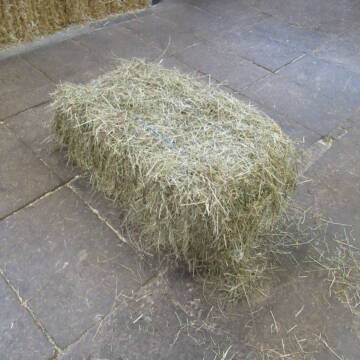
Frisches Stroh zu verkaufen!
Mechtersen
STALL-FREIde Marketing
@STALL-FREI-Marketing
Kaufe frisches Stroh für dein Pferd!

HD Ballen Heu
Gundelfingen
Niklas Schwehr
@Schwehr_HD-Ballen
Heu
Empfänger lädt ab
Kleinballen/HD-Ballen
Bio
Regenfrei
3 weitere...
B+
Leider kein Vorschaubild
Leider kein Vorschaubild
B+
Leider kein Vorschaubild
Leider kein Vorschaubild
Heu- und Luzernecobs
Holzgerlingen
Schlosshof-Holzgerlingen
@Schlosshof-Holzgerlingen
Einstreu
Pellets
Regenfrei
Wird verladen
1 weitere...
B+
Leider kein Vorschaubild
Leider kein Vorschaubild
Kleine HD-Ballen Heu
Weil im Schönbuch
Sabine-Dettinger
@Sabine-Dettinger
Heu
Empfänger lädt ab
Kleinballen/HD-Ballen
Bio
Regenfrei
2 weitere...
B+

Persönlichkeitsentwicklung mit Pferden
Bad Salzuflen
Katja Dors
@Pferdezeiten
Begleite andere auf ihrem Entwicklungsweg und entdecke die transformative Kraft der pferdegestützten Persönlichkeitsentwicklung !
neu
R

Schwarzwald Heu+Stroh in Quaderballen & Rund...
Rickenbach
Matthias Griener
@Lohnunternehmen_Griener
Heu
Lieferant entlädt
Rundballen
Regenfrei
3 weitere...
ganz aktuell
B+

Biete Heu und Stroh in Quaderballen und Rundballen
Rickenbach
Matthias Griener
@Lohnunternehmen_Griener
Heu
Lieferant entlädt
Großballen
Regenfrei
3 weitere...
ganz aktuell
B+

Hafer aus Ernte 2025 auch gequetscht zu verkaufen
Wolfschlugen
Reitanlage im Höfelweg
@Reitanlage-im-Hoefelweg
Futter
Wird verladen
Abholung
B+

Stroh, Kleinballen, Weizenstroh
Ertingen
Tobias
@Tobias4
Stroh
Kleinballen/HD-Ballen
Regenfrei
Wird verladen
2 weitere...
B+
Deprecated: Creation of dynamic property Zend_View::$pageCount is deprecated in /var/www/stall-frei/htdocs/staging.stall-frei.de/library/vendor/shardj/zf1-future/library/Zend/View/Abstract.php on line 308
Deprecated: Creation of dynamic property Zend_View::$itemCountPerPage is deprecated in /var/www/stall-frei/htdocs/staging.stall-frei.de/library/vendor/shardj/zf1-future/library/Zend/View/Abstract.php on line 308
Deprecated: Creation of dynamic property Zend_View::$first is deprecated in /var/www/stall-frei/htdocs/staging.stall-frei.de/library/vendor/shardj/zf1-future/library/Zend/View/Abstract.php on line 308
Deprecated: Creation of dynamic property Zend_View::$current is deprecated in /var/www/stall-frei/htdocs/staging.stall-frei.de/library/vendor/shardj/zf1-future/library/Zend/View/Abstract.php on line 308
Deprecated: Creation of dynamic property Zend_View::$last is deprecated in /var/www/stall-frei/htdocs/staging.stall-frei.de/library/vendor/shardj/zf1-future/library/Zend/View/Abstract.php on line 308
Deprecated: Creation of dynamic property Zend_View::$next is deprecated in /var/www/stall-frei/htdocs/staging.stall-frei.de/library/vendor/shardj/zf1-future/library/Zend/View/Abstract.php on line 308
Deprecated: Creation of dynamic property Zend_View::$pagesInRange is deprecated in /var/www/stall-frei/htdocs/staging.stall-frei.de/library/vendor/shardj/zf1-future/library/Zend/View/Abstract.php on line 308
Deprecated: Creation of dynamic property Zend_View::$firstPageInRange is deprecated in /var/www/stall-frei/htdocs/staging.stall-frei.de/library/vendor/shardj/zf1-future/library/Zend/View/Abstract.php on line 308
Deprecated: Creation of dynamic property Zend_View::$lastPageInRange is deprecated in /var/www/stall-frei/htdocs/staging.stall-frei.de/library/vendor/shardj/zf1-future/library/Zend/View/Abstract.php on line 308
Deprecated: Creation of dynamic property Zend_View::$currentItemCount is deprecated in /var/www/stall-frei/htdocs/staging.stall-frei.de/library/vendor/shardj/zf1-future/library/Zend/View/Abstract.php on line 308
Deprecated: Creation of dynamic property Zend_View::$totalItemCount is deprecated in /var/www/stall-frei/htdocs/staging.stall-frei.de/library/vendor/shardj/zf1-future/library/Zend/View/Abstract.php on line 308
Deprecated: Creation of dynamic property Zend_View::$firstItemNumber is deprecated in /var/www/stall-frei/htdocs/staging.stall-frei.de/library/vendor/shardj/zf1-future/library/Zend/View/Abstract.php on line 308
Deprecated: Creation of dynamic property Zend_View::$lastItemNumber is deprecated in /var/www/stall-frei/htdocs/staging.stall-frei.de/library/vendor/shardj/zf1-future/library/Zend/View/Abstract.php on line 308
Deprecated: Creation of dynamic property Zend_View::$router is deprecated in /var/www/stall-frei/htdocs/staging.stall-frei.de/library/vendor/shardj/zf1-future/library/Zend/View/Abstract.php on line 308
Deprecated: Creation of dynamic property Zend_View::$urlParams is deprecated in /var/www/stall-frei/htdocs/staging.stall-frei.de/library/vendor/shardj/zf1-future/library/Zend/View/Abstract.php on line 308
Deprecated: Creation of dynamic property Zend_View::$showAds is deprecated in /var/www/stall-frei/htdocs/staging.stall-frei.de/library/vendor/shardj/zf1-future/library/Zend/View/Abstract.php on line 308
Deprecated: Creation of dynamic property Zend_View::$objectIds is deprecated in /var/www/stall-frei/htdocs/staging.stall-frei.de/library/vendor/shardj/zf1-future/library/Zend/View/Abstract.php on line 308
Deprecated: Creation of dynamic property Zend_View::$showNavbar is deprecated in /var/www/stall-frei/htdocs/staging.stall-frei.de/library/vendor/shardj/zf1-future/library/Zend/View/Abstract.php on line 308
Deprecated: Creation of dynamic property Zend_View::$showBreadcrumb is deprecated in /var/www/stall-frei/htdocs/staging.stall-frei.de/library/vendor/shardj/zf1-future/library/Zend/View/Abstract.php on line 308
Deprecated: Creation of dynamic property Zend_View::$showFooter is deprecated in /var/www/stall-frei/htdocs/staging.stall-frei.de/library/vendor/shardj/zf1-future/library/Zend/View/Abstract.php on line 308
Deprecated: Creation of dynamic property Zend_View::$showInternalAds is deprecated in /var/www/stall-frei/htdocs/staging.stall-frei.de/library/vendor/shardj/zf1-future/library/Zend/View/Abstract.php on line 308
Deprecated: Creation of dynamic property Zend_View::$blNoContent is deprecated in /var/www/stall-frei/htdocs/staging.stall-frei.de/library/vendor/shardj/zf1-future/library/Zend/View/Abstract.php on line 308
Deprecated: Creation of dynamic property Zend_View::$sMetaDesc is deprecated in /var/www/stall-frei/htdocs/staging.stall-frei.de/library/vendor/shardj/zf1-future/library/Zend/View/Abstract.php on line 308
Deprecated: Creation of dynamic property Zend_View::$useGmaps is deprecated in /var/www/stall-frei/htdocs/staging.stall-frei.de/library/vendor/shardj/zf1-future/library/Zend/View/Abstract.php on line 308
Deprecated: Creation of dynamic property Zend_View::$touches is deprecated in /var/www/stall-frei/htdocs/staging.stall-frei.de/library/vendor/shardj/zf1-future/library/Zend/View/Abstract.php on line 308
Deprecated: Creation of dynamic property Zend_View::$oProject is deprecated in /var/www/stall-frei/htdocs/staging.stall-frei.de/library/vendor/shardj/zf1-future/library/Zend/View/Abstract.php on line 308
Deprecated: Creation of dynamic property Zend_View::$pageHeadline is deprecated in /var/www/stall-frei/htdocs/staging.stall-frei.de/library/vendor/shardj/zf1-future/library/Zend/View/Abstract.php on line 308
Deprecated: Creation of dynamic property Zend_View::$disableLocationField is deprecated in /var/www/stall-frei/htdocs/staging.stall-frei.de/library/vendor/shardj/zf1-future/library/Zend/View/Abstract.php on line 308
Deprecated: Creation of dynamic property Zend_View::$isSearch is deprecated in /var/www/stall-frei/htdocs/staging.stall-frei.de/library/vendor/shardj/zf1-future/library/Zend/View/Abstract.php on line 308
Deprecated: Creation of dynamic property Zend_View::$pageTitle is deprecated in /var/www/stall-frei/htdocs/staging.stall-frei.de/library/vendor/shardj/zf1-future/library/Zend/View/Abstract.php on line 308
Deprecated: Creation of dynamic property Psf_Form_Element_Text::$class is deprecated in /var/www/stall-frei/htdocs/staging.stall-frei.de/library/vendor/shardj/zf1-future/library/Zend/Form/Element.php on line 874
Deprecated: Creation of dynamic property Psf_Form_Element_Text::$size is deprecated in /var/www/stall-frei/htdocs/staging.stall-frei.de/library/vendor/shardj/zf1-future/library/Zend/Form/Element.php on line 874
Deprecated: Creation of dynamic property Psf_Form_Element_Text::$placeholder is deprecated in /var/www/stall-frei/htdocs/staging.stall-frei.de/library/vendor/shardj/zf1-future/library/Zend/Form/Element.php on line 874
Deprecated: Creation of dynamic property Psf_Form_Element_Hidden::$class is deprecated in /var/www/stall-frei/htdocs/staging.stall-frei.de/library/vendor/shardj/zf1-future/library/Zend/Form/Element.php on line 874
Deprecated: Creation of dynamic property Psf_Form_Element_Hidden::$class is deprecated in /var/www/stall-frei/htdocs/staging.stall-frei.de/library/vendor/shardj/zf1-future/library/Zend/Form/Element.php on line 874
Deprecated: Creation of dynamic property Psf_Form_Element_Hidden::$class is deprecated in /var/www/stall-frei/htdocs/staging.stall-frei.de/library/vendor/shardj/zf1-future/library/Zend/Form/Element.php on line 874
Deprecated: Creation of dynamic property Psf_Form_Element_Hidden::$class is deprecated in /var/www/stall-frei/htdocs/staging.stall-frei.de/library/vendor/shardj/zf1-future/library/Zend/Form/Element.php on line 874
Deprecated: Creation of dynamic property Psf_Form_Element_Select::$class is deprecated in /var/www/stall-frei/htdocs/staging.stall-frei.de/library/vendor/shardj/zf1-future/library/Zend/Form/Element.php on line 874
Deprecated: Creation of dynamic property Psf_Form_Element_Select::$class is deprecated in /var/www/stall-frei/htdocs/staging.stall-frei.de/library/vendor/shardj/zf1-future/library/Zend/Form/Element.php on line 874
Deprecated: Creation of dynamic property Psf_Form_Element_Select::$class is deprecated in /var/www/stall-frei/htdocs/staging.stall-frei.de/library/vendor/shardj/zf1-future/library/Zend/Form/Element.php on line 874
Deprecated: Creation of dynamic property Psf_Form_Element_Select::$class is deprecated in /var/www/stall-frei/htdocs/staging.stall-frei.de/library/vendor/shardj/zf1-future/library/Zend/Form/Element.php on line 874
Deprecated: Creation of dynamic property Zend_View::$sort is deprecated in /var/www/stall-frei/htdocs/staging.stall-frei.de/library/vendor/shardj/zf1-future/library/Zend/View/Abstract.php on line 308
Deprecated: Creation of dynamic property Zend_View::$searchLocation is deprecated in /var/www/stall-frei/htdocs/staging.stall-frei.de/library/vendor/shardj/zf1-future/library/Zend/View/Abstract.php on line 308
Deprecated: Creation of dynamic property Zend_View::$locationHint is deprecated in /var/www/stall-frei/htdocs/staging.stall-frei.de/library/vendor/shardj/zf1-future/library/Zend/View/Abstract.php on line 308
Psf_GeoCoder_Abstract::getLocation: Walke Get Location CachedOrLive
Psf_GeoCoder_Abstract::getCachedOrLive: Walke
Psf_GeoCoder_OpenCageData::makeApiRequest: response:
Array
(
[documentation] => https://opencagedata.com/api
[licenses] => Array
(
[0] => Array
(
[name] => see attribution guide
[url] => https://opencagedata.com/credits
)
)
[results] => Array
(
[0] => Array
(
[bounds] => Array
(
[northeast] => Array
(
[lat] => 48.3649764
[lng] => 8.2459098
)
[southwest] => Array
(
[lat] => 48.3249764
[lng] => 8.2059098
)
)
[components] => Array
(
[ISO_3166-1_alpha-2] => DE
[ISO_3166-1_alpha-3] => DEU
[ISO_3166-2] => Array
(
[0] => DE-BW
)
[_category] => place
[_normalized_city] => Oberwolfach
[_type] => village
[city] => Oberwolfach
[continent] => Europe
[country] => Deutschland
[country_code] => de
[county] => Ortenaukreis
[municipality] => VVG der Stadt Wolfach
[political_union] => European Union
[postcode] => 77709
[state] => Baden-Württemberg
[state_code] => BW
[village] => Walke
)
[confidence] => 7
[formatted] => 77709 Walke, Deutschland
[geometry] => Array
(
[lat] => 48.3449764
[lng] => 8.2259098
)
)
[1] => Array
(
[bounds] => Array
(
[northeast] => Array
(
[lat] => 48.081281
[lng] => 9.3558886
)
[southwest] => Array
(
[lat] => 48.041281
[lng] => 9.3158886
)
)
[components] => Array
(
[ISO_3166-1_alpha-2] => DE
[ISO_3166-1_alpha-3] => DEU
[ISO_3166-2] => Array
(
[0] => DE-BW
)
[_category] => place
[_normalized_city] => Mengen
[_type] => hamlet
[continent] => Europe
[country] => Deutschland
[country_code] => de
[county] => Landkreis Sigmaringen
[hamlet] => Walke
[municipality] => GVV Mengen
[political_union] => European Union
[postcode] => 88512
[state] => Baden-Württemberg
[state_code] => BW
[town] => Mengen
)
[confidence] => 7
[formatted] => Walke, 88512 Mengen, Deutschland
[geometry] => Array
(
[lat] => 48.061281
[lng] => 9.3358886
)
)
[2] => Array
(
[bounds] => Array
(
[northeast] => Array
(
[lat] => 47.8083654
[lng] => 8.3032644
)
[southwest] => Array
(
[lat] => 47.8082654
[lng] => 8.3031644
)
)
[components] => Array
(
[ISO_3166-1_alpha-2] => DE
[ISO_3166-1_alpha-3] => DEU
[ISO_3166-2] => Array
(
[0] => DE-BW
)
[_category] => building
[_normalized_city] => Bonndorf im Schwarzwald
[_type] => building
[continent] => Europe
[country] => Deutschland
[country_code] => de
[county] => Landkreis Waldshut
[isolated_dwelling] => Walke
[municipality] => VVG der Stadt Bonndorf im Schwarzwald
[political_union] => European Union
[postcode] => 79848
[state] => Baden-Württemberg
[state_code] => BW
[town] => Bonndorf im Schwarzwald
)
[confidence] => 10
[formatted] => Walke, 79848 Bonndorf im Schwarzwald, Deutschland
[geometry] => Array
(
[lat] => 47.8083154
[lng] => 8.3032144
)
)
[3] => Array
(
[bounds] => Array
(
[northeast] => Array
(
[lat] => 51.0084315
[lng] => 9.476471
)
[southwest] => Array
(
[lat] => 51.0077986
[lng] => 9.4753717
)
)
[components] => Array
(
[ISO_3166-1_alpha-2] => DE
[ISO_3166-1_alpha-3] => DEU
[ISO_3166-2] => Array
(
[0] => DE-HE
)
[_category] => place
[_normalized_city] => Remsfeld
[_type] => village
[commercial] => Walke
[continent] => Europe
[country] => Deutschland
[country_code] => de
[county] => Schwalm-Eder-Kreis
[municipality] => Knüllwald
[political_union] => European Union
[postcode] => 34593
[state] => Hessen
[state_code] => HE
[village] => Remsfeld
)
[confidence] => 9
[formatted] => 34593 Remsfeld, Deutschland
[geometry] => Array
(
[lat] => 51.0080841
[lng] => 9.4758578
)
)
[4] => Array
(
[bounds] => Array
(
[northeast] => Array
(
[lat] => 51.5072645
[lng] => 14.4048666
)
[southwest] => Array
(
[lat] => 51.4998993
[lng] => 14.4033735
)
)
[components] => Array
(
[ISO_3166-1_alpha-2] => DE
[ISO_3166-1_alpha-3] => DEU
[ISO_3166-2] => Array
(
[0] => DE-SN
)
[_category] => road
[_normalized_city] => Spreetal
[_type] => road
[city] => Spreetal
[continent] => Europe
[country] => Deutschland
[country_code] => de
[county] => Bautzen
[political_union] => European Union
[postcode] => 02979
[road] => Walke
[state] => Sachsen
[state_code] => SN
)
[confidence] => 9
[formatted] => Walke, 02979 Spreetal, Deutschland
[geometry] => Array
(
[lat] => 51.5033024
[lng] => 14.4043561
)
)
[5] => Array
(
[bounds] => Array
(
[northeast] => Array
(
[lat] => 48.0618717
[lng] => 9.3363431
)
[southwest] => Array
(
[lat] => 48.0601086
[lng] => 9.3356206
)
)
[components] => Array
(
[ISO_3166-1_alpha-2] => DE
[ISO_3166-1_alpha-3] => DEU
[ISO_3166-2] => Array
(
[0] => DE-BW
)
[_category] => road
[_normalized_city] => Mengen
[_type] => road
[continent] => Europe
[country] => Deutschland
[country_code] => de
[county] => Landkreis Sigmaringen
[hamlet] => Walke
[municipality] => GVV Mengen
[political_union] => European Union
[postcode] => 88512
[road] => Walke
[road_type] => residential
[state] => Baden-Württemberg
[state_code] => BW
[town] => Mengen
)
[confidence] => 9
[formatted] => Walke, 88512 Mengen, Deutschland
[geometry] => Array
(
[lat] => 48.0610733
[lng] => 9.3358699
)
)
[6] => Array
(
[bounds] => Array
(
[northeast] => Array
(
[lat] => 48.4799036
[lng] => 8.3775561
)
[southwest] => Array
(
[lat] => 48.4786812
[lng] => 8.3772365
)
)
[components] => Array
(
[ISO_3166-1_alpha-2] => DE
[ISO_3166-1_alpha-3] => DEU
[ISO_3166-2] => Array
(
[0] => DE-BW
)
[_category] => road
[_normalized_city] => Baiersbronn
[_type] => road
[continent] => Europe
[country] => Deutschland
[country_code] => de
[county] => Landkreis Freudenstadt
[political_union] => European Union
[postcode] => 72270
[road] => Walke
[road_type] => residential
[state] => Baden-Württemberg
[state_code] => BW
[town] => Baiersbronn
)
[confidence] => 9
[formatted] => Walke, 72270 Baiersbronn, Deutschland
[geometry] => Array
(
[lat] => 48.4792889
[lng] => 8.3774128
)
)
[7] => Array
(
[bounds] => Array
(
[northeast] => Array
(
[lat] => 47.8082555
[lng] => 8.3037248
)
[southwest] => Array
(
[lat] => 47.8081258
[lng] => 8.3035854
)
)
[components] => Array
(
[ISO_3166-1_alpha-2] => DE
[ISO_3166-1_alpha-3] => DEU
[ISO_3166-2] => Array
(
[0] => DE-BW
)
[_category] => road
[_normalized_city] => Bonndorf im Schwarzwald
[_type] => road
[continent] => Europe
[country] => Deutschland
[country_code] => de
[county] => Landkreis Waldshut
[municipality] => VVG der Stadt Bonndorf im Schwarzwald
[political_union] => European Union
[postcode] => 79848
[road] => Walke
[road_type] => service
[state] => Baden-Württemberg
[state_code] => BW
[town] => Bonndorf im Schwarzwald
)
[confidence] => 9
[formatted] => Walke, 79848 Bonndorf im Schwarzwald, Deutschland
[geometry] => Array
(
[lat] => 47.8081907
[lng] => 8.3036551
)
)
[8] => Array
(
[bounds] => Array
(
[northeast] => Array
(
[lat] => 48.4785267
[lng] => 8.3774626
)
[southwest] => Array
(
[lat] => 48.4784267
[lng] => 8.3773626
)
)
[components] => Array
(
[ISO_3166-1_alpha-2] => DE
[ISO_3166-1_alpha-3] => DEU
[ISO_3166-2] => Array
(
[0] => DE-BW
)
[_category] => travel/tourism
[_normalized_city] => Baiersbronn
[_type] => information
[continent] => Europe
[country] => Deutschland
[country_code] => de
[county] => Landkreis Freudenstadt
[information] => Walke
[political_union] => European Union
[postcode] => 72270
[road] => Walke
[state] => Baden-Württemberg
[state_code] => BW
[town] => Baiersbronn
)
[confidence] => 9
[formatted] => Walke, 72270 Baiersbronn, Deutschland
[geometry] => Array
(
[lat] => 48.4784767
[lng] => 8.3774126
)
)
[9] => Array
(
[components] => Array
(
[ISO_3166-1_alpha-2] => FR
[ISO_3166-1_alpha-3] => FRA
[ISO_3166-2] => Array
(
[0] => FR-GES
[1] => FR-6AE
[2] => FR-67
)
[_category] => road
[_normalized_city] => Wissembourg
[_type] => road
[city] => Wissembourg
[continent] => Europe
[country] => France
[country_code] => fr
[county] => Bas-Rhin
[local_authority] => Communauté de communes du Pays de Wissembourg
[political_union] => European Union
[postcode] => 67160
[road] => Rue de la Walk
[state] => Grand Est
[state_code] => GES
)
[confidence] => 3
[formatted] => Rue de la Walk, 67160 Wissembourg, France
[geometry] => Array
(
[lat] => 49.03797
[lng] => 7.934059
)
)
)
[status] => Array
(
[code] => 200
[message] => OK
)
[stay_informed] => Array
(
[blog] => https://blog.opencagedata.com
[mastodon] => https://en.osm.town/@opencage
)
[thanks] => For using an OpenCage API
[timestamp] => Array
(
[created_http] => Thu, 05 Feb 2026 12:33:08 GMT
[created_unix] => 1770294788
)
[total_results] => 10
)
Psf_GeoCoder_Abstract::convertLocationResult
{"documentation":"https:\/\/opencagedata.com\/api","licenses":[{"name":"see attribution guide","url":"https:\/\/opencagedata.com\/credits"}],"results":[{"bounds":{"northeast":{"lat":48.3649764,"lng":8.2459098},"southwest":{"lat":48.3249764,"lng":8.2059098}},"components":{"ISO_3166-1_alpha-2":"DE","ISO_3166-1_alpha-3":"DEU","ISO_3166-2":["DE-BW"],"_category":"place","_normalized_city":"Oberwolfach","_type":"village","city":"Oberwolfach","continent":"Europe","country":"Deutschland","country_code":"de","county":"Ortenaukreis","municipality":"VVG der Stadt Wolfach","political_union":"European Union","postcode":"77709","state":"Baden-W\u00fcrttemberg","state_code":"BW","village":"Walke"},"confidence":7,"formatted":"77709 Walke, Deutschland","geometry":{"lat":48.3449764,"lng":8.2259098}},{"bounds":{"northeast":{"lat":48.081281,"lng":9.3558886},"southwest":{"lat":48.041281,"lng":9.3158886}},"components":{"ISO_3166-1_alpha-2":"DE","ISO_3166-1_alpha-3":"DEU","ISO_3166-2":["DE-BW"],"_category":"place","_normalized_city":"Mengen","_type":"hamlet","continent":"Europe","country":"Deutschland","country_code":"de","county":"Landkreis Sigmaringen","hamlet":"Walke","municipality":"GVV Mengen","political_union":"European Union","postcode":"88512","state":"Baden-W\u00fcrttemberg","state_code":"BW","town":"Mengen"},"confidence":7,"formatted":"Walke, 88512 Mengen, Deutschland","geometry":{"lat":48.061281,"lng":9.3358886}},{"bounds":{"northeast":{"lat":47.8083654,"lng":8.3032644},"southwest":{"lat":47.8082654,"lng":8.3031644}},"components":{"ISO_3166-1_alpha-2":"DE","ISO_3166-1_alpha-3":"DEU","ISO_3166-2":["DE-BW"],"_category":"building","_normalized_city":"Bonndorf im Schwarzwald","_type":"building","continent":"Europe","country":"Deutschland","country_code":"de","county":"Landkreis Waldshut","isolated_dwelling":"Walke","municipality":"VVG der Stadt Bonndorf im Schwarzwald","political_union":"European Union","postcode":"79848","state":"Baden-W\u00fcrttemberg","state_code":"BW","town":"Bonndorf im Schwarzwald"},"confidence":10,"formatted":"Walke, 79848 Bonndorf im Schwarzwald, Deutschland","geometry":{"lat":47.8083154,"lng":8.3032144}},{"bounds":{"northeast":{"lat":51.0084315,"lng":9.476471},"southwest":{"lat":51.0077986,"lng":9.4753717}},"components":{"ISO_3166-1_alpha-2":"DE","ISO_3166-1_alpha-3":"DEU","ISO_3166-2":["DE-HE"],"_category":"place","_normalized_city":"Remsfeld","_type":"village","commercial":"Walke","continent":"Europe","country":"Deutschland","country_code":"de","county":"Schwalm-Eder-Kreis","municipality":"Kn\u00fcllwald","political_union":"European Union","postcode":"34593","state":"Hessen","state_code":"HE","village":"Remsfeld"},"confidence":9,"formatted":"34593 Remsfeld, Deutschland","geometry":{"lat":51.0080841,"lng":9.4758578}},{"bounds":{"northeast":{"lat":51.5072645,"lng":14.4048666},"southwest":{"lat":51.4998993,"lng":14.4033735}},"components":{"ISO_3166-1_alpha-2":"DE","ISO_3166-1_alpha-3":"DEU","ISO_3166-2":["DE-SN"],"_category":"road","_normalized_city":"Spreetal","_type":"road","city":"Spreetal","continent":"Europe","country":"Deutschland","country_code":"de","county":"Bautzen","political_union":"European Union","postcode":"02979","road":"Walke","state":"Sachsen","state_code":"SN"},"confidence":9,"formatted":"Walke, 02979 Spreetal, Deutschland","geometry":{"lat":51.5033024,"lng":14.4043561}},{"bounds":{"northeast":{"lat":48.0618717,"lng":9.3363431},"southwest":{"lat":48.0601086,"lng":9.3356206}},"components":{"ISO_3166-1_alpha-2":"DE","ISO_3166-1_alpha-3":"DEU","ISO_3166-2":["DE-BW"],"_category":"road","_normalized_city":"Mengen","_type":"road","continent":"Europe","country":"Deutschland","country_code":"de","county":"Landkreis Sigmaringen","hamlet":"Walke","municipality":"GVV Mengen","political_union":"European Union","postcode":"88512","road":"Walke","road_type":"residential","state":"Baden-W\u00fcrttemberg","state_code":"BW","town":"Mengen"},"confidence":9,"formatted":"Walke, 88512 Mengen, Deutschland","geometry":{"lat":48.0610733,"lng":9.3358699}},{"bounds":{"northeast":{"lat":48.4799036,"lng":8.3775561},"southwest":{"lat":48.4786812,"lng":8.3772365}},"components":{"ISO_3166-1_alpha-2":"DE","ISO_3166-1_alpha-3":"DEU","ISO_3166-2":["DE-BW"],"_category":"road","_normalized_city":"Baiersbronn","_type":"road","continent":"Europe","country":"Deutschland","country_code":"de","county":"Landkreis Freudenstadt","political_union":"European Union","postcode":"72270","road":"Walke","road_type":"residential","state":"Baden-W\u00fcrttemberg","state_code":"BW","town":"Baiersbronn"},"confidence":9,"formatted":"Walke, 72270 Baiersbronn, Deutschland","geometry":{"lat":48.4792889,"lng":8.3774128}},{"bounds":{"northeast":{"lat":47.8082555,"lng":8.3037248},"southwest":{"lat":47.8081258,"lng":8.3035854}},"components":{"ISO_3166-1_alpha-2":"DE","ISO_3166-1_alpha-3":"DEU","ISO_3166-2":["DE-BW"],"_category":"road","_normalized_city":"Bonndorf im Schwarzwald","_type":"road","continent":"Europe","country":"Deutschland","country_code":"de","county":"Landkreis Waldshut","municipality":"VVG der Stadt Bonndorf im Schwarzwald","political_union":"European Union","postcode":"79848","road":"Walke","road_type":"service","state":"Baden-W\u00fcrttemberg","state_code":"BW","town":"Bonndorf im Schwarzwald"},"confidence":9,"formatted":"Walke, 79848 Bonndorf im Schwarzwald, Deutschland","geometry":{"lat":47.8081907,"lng":8.3036551}},{"bounds":{"northeast":{"lat":48.4785267,"lng":8.3774626},"southwest":{"lat":48.4784267,"lng":8.3773626}},"components":{"ISO_3166-1_alpha-2":"DE","ISO_3166-1_alpha-3":"DEU","ISO_3166-2":["DE-BW"],"_category":"travel\/tourism","_normalized_city":"Baiersbronn","_type":"information","continent":"Europe","country":"Deutschland","country_code":"de","county":"Landkreis Freudenstadt","information":"Walke","political_union":"European Union","postcode":"72270","road":"Walke","state":"Baden-W\u00fcrttemberg","state_code":"BW","town":"Baiersbronn"},"confidence":9,"formatted":"Walke, 72270 Baiersbronn, Deutschland","geometry":{"lat":48.4784767,"lng":8.3774126}},{"components":{"ISO_3166-1_alpha-2":"FR","ISO_3166-1_alpha-3":"FRA","ISO_3166-2":["FR-GES","FR-6AE","FR-67"],"_category":"road","_normalized_city":"Wissembourg","_type":"road","city":"Wissembourg","continent":"Europe","country":"France","country_code":"fr","county":"Bas-Rhin","local_authority":"Communaut\u00e9 de communes du Pays de Wissembourg","political_union":"European Union","postcode":"67160","road":"Rue de la Walk","state":"Grand Est","state_code":"GES"},"confidence":3,"formatted":"Rue de la Walk, 67160 Wissembourg, France","geometry":{"lat":49.03797,"lng":7.934059}}],"status":{"code":200,"message":"OK"},"stay_informed":{"blog":"https:\/\/blog.opencagedata.com","mastodon":"https:\/\/en.osm.town\/@opencage"},"thanks":"For using an OpenCage API","timestamp":{"created_http":"Thu, 05 Feb 2026 12:33:08 GMT","created_unix":1770294788},"total_results":10}Array
(
[0] => stdClass Object
(
[bounds] => stdClass Object
(
[northeast] => stdClass Object
(
[lat] => 48.3649764
[lng] => 8.2459098
)
[southwest] => stdClass Object
(
[lat] => 48.3249764
[lng] => 8.2059098
)
)
[components] => stdClass Object
(
[ISO_3166-1_alpha-2] => DE
[ISO_3166-1_alpha-3] => DEU
[ISO_3166-2] => Array
(
[0] => DE-BW
)
[_category] => place
[_normalized_city] => Oberwolfach
[_type] => village
[city] => Oberwolfach
[continent] => Europe
[country] => Deutschland
[country_code] => de
[county] => Ortenaukreis
[municipality] => VVG der Stadt Wolfach
[political_union] => European Union
[postcode] => 77709
[state] => Baden-Württemberg
[state_code] => BW
[village] => Walke
)
[confidence] => 7
[formatted] => 77709 Walke, Deutschland
[geometry] => stdClass Object
(
[lat] => 48.3449764
[lng] => 8.2259098
)
)
[1] => stdClass Object
(
[bounds] => stdClass Object
(
[northeast] => stdClass Object
(
[lat] => 48.081281
[lng] => 9.3558886
)
[southwest] => stdClass Object
(
[lat] => 48.041281
[lng] => 9.3158886
)
)
[components] => stdClass Object
(
[ISO_3166-1_alpha-2] => DE
[ISO_3166-1_alpha-3] => DEU
[ISO_3166-2] => Array
(
[0] => DE-BW
)
[_category] => place
[_normalized_city] => Mengen
[_type] => hamlet
[continent] => Europe
[country] => Deutschland
[country_code] => de
[county] => Landkreis Sigmaringen
[hamlet] => Walke
[municipality] => GVV Mengen
[political_union] => European Union
[postcode] => 88512
[state] => Baden-Württemberg
[state_code] => BW
[town] => Mengen
)
[confidence] => 7
[formatted] => Walke, 88512 Mengen, Deutschland
[geometry] => stdClass Object
(
[lat] => 48.061281
[lng] => 9.3358886
)
)
[2] => stdClass Object
(
[bounds] => stdClass Object
(
[northeast] => stdClass Object
(
[lat] => 47.8083654
[lng] => 8.3032644
)
[southwest] => stdClass Object
(
[lat] => 47.8082654
[lng] => 8.3031644
)
)
[components] => stdClass Object
(
[ISO_3166-1_alpha-2] => DE
[ISO_3166-1_alpha-3] => DEU
[ISO_3166-2] => Array
(
[0] => DE-BW
)
[_category] => building
[_normalized_city] => Bonndorf im Schwarzwald
[_type] => building
[continent] => Europe
[country] => Deutschland
[country_code] => de
[county] => Landkreis Waldshut
[isolated_dwelling] => Walke
[municipality] => VVG der Stadt Bonndorf im Schwarzwald
[political_union] => European Union
[postcode] => 79848
[state] => Baden-Württemberg
[state_code] => BW
[town] => Bonndorf im Schwarzwald
)
[confidence] => 10
[formatted] => Walke, 79848 Bonndorf im Schwarzwald, Deutschland
[geometry] => stdClass Object
(
[lat] => 47.8083154
[lng] => 8.3032144
)
)
[3] => stdClass Object
(
[bounds] => stdClass Object
(
[northeast] => stdClass Object
(
[lat] => 51.0084315
[lng] => 9.476471
)
[southwest] => stdClass Object
(
[lat] => 51.0077986
[lng] => 9.4753717
)
)
[components] => stdClass Object
(
[ISO_3166-1_alpha-2] => DE
[ISO_3166-1_alpha-3] => DEU
[ISO_3166-2] => Array
(
[0] => DE-HE
)
[_category] => place
[_normalized_city] => Remsfeld
[_type] => village
[commercial] => Walke
[continent] => Europe
[country] => Deutschland
[country_code] => de
[county] => Schwalm-Eder-Kreis
[municipality] => Knüllwald
[political_union] => European Union
[postcode] => 34593
[state] => Hessen
[state_code] => HE
[village] => Remsfeld
)
[confidence] => 9
[formatted] => 34593 Remsfeld, Deutschland
[geometry] => stdClass Object
(
[lat] => 51.0080841
[lng] => 9.4758578
)
)
[4] => stdClass Object
(
[bounds] => stdClass Object
(
[northeast] => stdClass Object
(
[lat] => 51.5072645
[lng] => 14.4048666
)
[southwest] => stdClass Object
(
[lat] => 51.4998993
[lng] => 14.4033735
)
)
[components] => stdClass Object
(
[ISO_3166-1_alpha-2] => DE
[ISO_3166-1_alpha-3] => DEU
[ISO_3166-2] => Array
(
[0] => DE-SN
)
[_category] => road
[_normalized_city] => Spreetal
[_type] => road
[city] => Spreetal
[continent] => Europe
[country] => Deutschland
[country_code] => de
[county] => Bautzen
[political_union] => European Union
[postcode] => 02979
[road] => Walke
[state] => Sachsen
[state_code] => SN
)
[confidence] => 9
[formatted] => Walke, 02979 Spreetal, Deutschland
[geometry] => stdClass Object
(
[lat] => 51.5033024
[lng] => 14.4043561
)
)
[5] => stdClass Object
(
[bounds] => stdClass Object
(
[northeast] => stdClass Object
(
[lat] => 48.0618717
[lng] => 9.3363431
)
[southwest] => stdClass Object
(
[lat] => 48.0601086
[lng] => 9.3356206
)
)
[components] => stdClass Object
(
[ISO_3166-1_alpha-2] => DE
[ISO_3166-1_alpha-3] => DEU
[ISO_3166-2] => Array
(
[0] => DE-BW
)
[_category] => road
[_normalized_city] => Mengen
[_type] => road
[continent] => Europe
[country] => Deutschland
[country_code] => de
[county] => Landkreis Sigmaringen
[hamlet] => Walke
[municipality] => GVV Mengen
[political_union] => European Union
[postcode] => 88512
[road] => Walke
[road_type] => residential
[state] => Baden-Württemberg
[state_code] => BW
[town] => Mengen
)
[confidence] => 9
[formatted] => Walke, 88512 Mengen, Deutschland
[geometry] => stdClass Object
(
[lat] => 48.0610733
[lng] => 9.3358699
)
)
[6] => stdClass Object
(
[bounds] => stdClass Object
(
[northeast] => stdClass Object
(
[lat] => 48.4799036
[lng] => 8.3775561
)
[southwest] => stdClass Object
(
[lat] => 48.4786812
[lng] => 8.3772365
)
)
[components] => stdClass Object
(
[ISO_3166-1_alpha-2] => DE
[ISO_3166-1_alpha-3] => DEU
[ISO_3166-2] => Array
(
[0] => DE-BW
)
[_category] => road
[_normalized_city] => Baiersbronn
[_type] => road
[continent] => Europe
[country] => Deutschland
[country_code] => de
[county] => Landkreis Freudenstadt
[political_union] => European Union
[postcode] => 72270
[road] => Walke
[road_type] => residential
[state] => Baden-Württemberg
[state_code] => BW
[town] => Baiersbronn
)
[confidence] => 9
[formatted] => Walke, 72270 Baiersbronn, Deutschland
[geometry] => stdClass Object
(
[lat] => 48.4792889
[lng] => 8.3774128
)
)
[7] => stdClass Object
(
[bounds] => stdClass Object
(
[northeast] => stdClass Object
(
[lat] => 47.8082555
[lng] => 8.3037248
)
[southwest] => stdClass Object
(
[lat] => 47.8081258
[lng] => 8.3035854
)
)
[components] => stdClass Object
(
[ISO_3166-1_alpha-2] => DE
[ISO_3166-1_alpha-3] => DEU
[ISO_3166-2] => Array
(
[0] => DE-BW
)
[_category] => road
[_normalized_city] => Bonndorf im Schwarzwald
[_type] => road
[continent] => Europe
[country] => Deutschland
[country_code] => de
[county] => Landkreis Waldshut
[municipality] => VVG der Stadt Bonndorf im Schwarzwald
[political_union] => European Union
[postcode] => 79848
[road] => Walke
[road_type] => service
[state] => Baden-Württemberg
[state_code] => BW
[town] => Bonndorf im Schwarzwald
)
[confidence] => 9
[formatted] => Walke, 79848 Bonndorf im Schwarzwald, Deutschland
[geometry] => stdClass Object
(
[lat] => 47.8081907
[lng] => 8.3036551
)
)
[8] => stdClass Object
(
[bounds] => stdClass Object
(
[northeast] => stdClass Object
(
[lat] => 48.4785267
[lng] => 8.3774626
)
[southwest] => stdClass Object
(
[lat] => 48.4784267
[lng] => 8.3773626
)
)
[components] => stdClass Object
(
[ISO_3166-1_alpha-2] => DE
[ISO_3166-1_alpha-3] => DEU
[ISO_3166-2] => Array
(
[0] => DE-BW
)
[_category] => travel/tourism
[_normalized_city] => Baiersbronn
[_type] => information
[continent] => Europe
[country] => Deutschland
[country_code] => de
[county] => Landkreis Freudenstadt
[information] => Walke
[political_union] => European Union
[postcode] => 72270
[road] => Walke
[state] => Baden-Württemberg
[state_code] => BW
[town] => Baiersbronn
)
[confidence] => 9
[formatted] => Walke, 72270 Baiersbronn, Deutschland
[geometry] => stdClass Object
(
[lat] => 48.4784767
[lng] => 8.3774126
)
)
[9] => stdClass Object
(
[components] => stdClass Object
(
[ISO_3166-1_alpha-2] => FR
[ISO_3166-1_alpha-3] => FRA
[ISO_3166-2] => Array
(
[0] => FR-GES
[1] => FR-6AE
[2] => FR-67
)
[_category] => road
[_normalized_city] => Wissembourg
[_type] => road
[city] => Wissembourg
[continent] => Europe
[country] => France
[country_code] => fr
[county] => Bas-Rhin
[local_authority] => Communauté de communes du Pays de Wissembourg
[political_union] => European Union
[postcode] => 67160
[road] => Rue de la Walk
[state] => Grand Est
[state_code] => GES
)
[confidence] => 3
[formatted] => Rue de la Walk, 67160 Wissembourg, France
[geometry] => stdClass Object
(
[lat] => 49.03797
[lng] => 7.934059
)
)
)
Psf_GeoCoder_OpenCageData::getKeyMap: 0
stdClass Object
(
    [bounds] => stdClass Object
        (
            [northeast] => stdClass Object
                (
                    [lat] => 48.3649764
                    [lng] => 8.2459098
                )

            [southwest] => stdClass Object
                (
                    [lat] => 48.3249764
                    [lng] => 8.2059098
                )

        )

    [components] => stdClass Object
        (
            [ISO_3166-1_alpha-2] => DE
            [ISO_3166-1_alpha-3] => DEU
            [ISO_3166-2] => Array
                (
                    [0] => DE-BW
                )

            [_category] => place
            [_normalized_city] => Oberwolfach
            [_type] => village
            [city] => Oberwolfach
            [continent] => Europe
            [country] => Deutschland
            [country_code] => de
            [county] => Ortenaukreis
            [municipality] => VVG der Stadt Wolfach
            [political_union] => European Union
            [postcode] => 77709
            [state] => Baden-Württemberg
            [state_code] => BW
            [village] => Walke
        )

    [confidence] => 7
    [formatted] => 77709 Walke, Deutschland
    [geometry] => stdClass Object
        (
            [lat] => 48.3449764
            [lng] => 8.2259098
        )

)
Psf_GeoCoder_OpenCageData::getCounty: Ortenaukreis
Psf_GeoCoder_OpenCageData::addMissingData REFETCH!
Array
(
    [address] => 77709 Walke, Deutschland
    [type] => village
    [street] =>
    [city] => Walke
    [county] => Ortenaukreis
    [state] => Baden-Württemberg
    [zip] => 77709
    [country] => Deutschland
    [suburb] =>
    [countrycode] => de
    [latitude] => 48.3449764
    [longitude] => 8.2259098
    [accuracy] => 1
    [confidence] => 7
    [bounds] => stdClass Object
        (
            [northeast] => stdClass Object
                (
                    [lat] => 48.3649764
                    [lng] => 8.2459098
                )

            [southwest] => stdClass Object
                (
                    [lat] => 48.3249764
                    [lng] => 8.2059098
                )

        )

)
reformat!
Array
(
    [address] => 77709 Walke, Deutschland
    [type] => village
    [street] =>
    [city] => Walke
    [county] => Ortenaukreis
    [state] => Baden-Württemberg
    [zip] => 77709
    [country] => Deutschland
    [suburb] =>
    [countrycode] => de
    [latitude] => 48.3449764
    [longitude] => 8.2259098
    [accuracy] => 1
    [confidence] => 7
    [bounds] => stdClass Object
        (
            [northeast] => stdClass Object
                (
                    [lat] => 48.3649764
                    [lng] => 8.2459098
                )

            [southwest] => stdClass Object
                (
                    [lat] => 48.3249764
                    [lng] => 8.2059098
                )

        )

    [place] => 77709 Walke, Baden-Württemberg
    [hash] => 53ce91b10d652afd3ed9556f406caec8
)
Psf_GeoCoder_OpenCageData::getKeyMap: 1
stdClass Object
(
    [bounds] => stdClass Object
        (
            [northeast] => stdClass Object
                (
                    [lat] => 48.081281
                    [lng] => 9.3558886
                )

            [southwest] => stdClass Object
                (
                    [lat] => 48.041281
                    [lng] => 9.3158886
                )

        )

    [components] => stdClass Object
        (
            [ISO_3166-1_alpha-2] => DE
            [ISO_3166-1_alpha-3] => DEU
            [ISO_3166-2] => Array
                (
                    [0] => DE-BW
                )

            [_category] => place
            [_normalized_city] => Mengen
            [_type] => hamlet
            [continent] => Europe
            [country] => Deutschland
            [country_code] => de
            [county] => Landkreis Sigmaringen
            [hamlet] => Walke
            [municipality] => GVV Mengen
            [political_union] => European Union
            [postcode] => 88512
            [state] => Baden-Württemberg
            [state_code] => BW
            [town] => Mengen
        )

    [confidence] => 7
    [formatted] => Walke, 88512 Mengen, Deutschland
    [geometry] => stdClass Object
        (
            [lat] => 48.061281
            [lng] => 9.3358886
        )

)
Psf_GeoCoder_OpenCageData::getCounty: Sigmaringen
Psf_GeoCoder_OpenCageData::addMissingData REFETCH!
Array
(
    [address] => Walke, 88512 Mengen, Deutschland
    [type] => hamlet
    [street] => Walke
    [city] => Mengen
    [county] => Sigmaringen
    [state] => Baden-Württemberg
    [zip] => 88512
    [country] => Deutschland
    [suburb] =>
    [countrycode] => de
    [latitude] => 48.061281
    [longitude] => 9.3358886
    [accuracy] => 1
    [confidence] => 7
    [bounds] => stdClass Object
        (
            [northeast] => stdClass Object
                (
                    [lat] => 48.081281
                    [lng] => 9.3558886
                )

            [southwest] => stdClass Object
                (
                    [lat] => 48.041281
                    [lng] => 9.3158886
                )

        )

)
reformat!
Array
(
    [address] => Walke, 88512 Mengen, Deutschland
    [type] => hamlet
    [street] => Walke
    [city] => Mengen
    [county] => Sigmaringen
    [state] => Baden-Württemberg
    [zip] => 88512
    [country] => Deutschland
    [suburb] =>
    [countrycode] => de
    [latitude] => 48.061281
    [longitude] => 9.3358886
    [accuracy] => 1
    [confidence] => 7
    [bounds] => stdClass Object
        (
            [northeast] => stdClass Object
                (
                    [lat] => 48.081281
                    [lng] => 9.3558886
                )

            [southwest] => stdClass Object
                (
                    [lat] => 48.041281
                    [lng] => 9.3158886
                )

        )

    [place] => Walke, 88512 Mengen, Baden-Württemberg
    [hash] => e2f872fe5c70d7fea0b432e247411c51
)
Psf_GeoCoder_OpenCageData::getKeyMap: 2
stdClass Object
(
    [bounds] => stdClass Object
        (
            [northeast] => stdClass Object
                (
                    [lat] => 47.8083654
                    [lng] => 8.3032644
                )

            [southwest] => stdClass Object
                (
                    [lat] => 47.8082654
                    [lng] => 8.3031644
                )

        )

    [components] => stdClass Object
        (
            [ISO_3166-1_alpha-2] => DE
            [ISO_3166-1_alpha-3] => DEU
            [ISO_3166-2] => Array
                (
                    [0] => DE-BW
                )

            [_category] => building
            [_normalized_city] => Bonndorf im Schwarzwald
            [_type] => building
            [continent] => Europe
            [country] => Deutschland
            [country_code] => de
            [county] => Landkreis Waldshut
            [isolated_dwelling] => Walke
            [municipality] => VVG der Stadt Bonndorf im Schwarzwald
            [political_union] => European Union
            [postcode] => 79848
            [state] => Baden-Württemberg
            [state_code] => BW
            [town] => Bonndorf im Schwarzwald
        )

    [confidence] => 10
    [formatted] => Walke, 79848 Bonndorf im Schwarzwald, Deutschland
    [geometry] => stdClass Object
        (
            [lat] => 47.8083154
            [lng] => 8.3032144
        )

)
Psf_GeoCoder_OpenCageData::getCounty: Waldshut
Psf_GeoCoder_OpenCageData::addMissingData REFETCH!
Array
(
    [address] => Walke, 79848 Bonndorf im Schwarzwald, Deutschland
    [type] => building
    [street] =>
    [city] => Bonndorf im Schwarzwald
    [county] => Waldshut
    [state] => Baden-Württemberg
    [zip] => 79848
    [country] => Deutschland
    [suburb] =>
    [countrycode] => de
    [latitude] => 47.8083154
    [longitude] => 8.3032144
    [accuracy] => 1
    [confidence] => 10
    [bounds] => stdClass Object
        (
            [northeast] => stdClass Object
                (
                    [lat] => 47.8083654
                    [lng] => 8.3032644
                )

            [southwest] => stdClass Object
                (
                    [lat] => 47.8082654
                    [lng] => 8.3031644
                )

        )

)
reformat!
Array
(
    [address] => Walke, 79848 Bonndorf im Schwarzwald, Deutschland
    [type] => building
    [street] =>
    [city] => Bonndorf im Schwarzwald
    [county] => Waldshut
    [state] => Baden-Württemberg
    [zip] => 79848
    [country] => Deutschland
    [suburb] =>
    [countrycode] => de
    [latitude] => 47.8083154
    [longitude] => 8.3032144
    [accuracy] => 1
    [confidence] => 10
    [bounds] => stdClass Object
        (
            [northeast] => stdClass Object
                (
                    [lat] => 47.8083654
                    [lng] => 8.3032644
                )

            [southwest] => stdClass Object
                (
                    [lat] => 47.8082654
                    [lng] => 8.3031644
                )

        )

    [place] => 79848 Bonndorf im Schwarzwald, Baden-Württemberg
    [hash] => a3f07d0b1afcc8c73570f3a3f323539d
)
Psf_GeoCoder_OpenCageData::getKeyMap: 3
stdClass Object
(
    [bounds] => stdClass Object
        (
            [northeast] => stdClass Object
                (
                    [lat] => 51.0084315
                    [lng] => 9.476471
                )

            [southwest] => stdClass Object
                (
                    [lat] => 51.0077986
                    [lng] => 9.4753717
                )

        )

    [components] => stdClass Object
        (
            [ISO_3166-1_alpha-2] => DE
            [ISO_3166-1_alpha-3] => DEU
            [ISO_3166-2] => Array
                (
                    [0] => DE-HE
                )

            [_category] => place
            [_normalized_city] => Remsfeld
            [_type] => village
            [commercial] => Walke
            [continent] => Europe
            [country] => Deutschland
            [country_code] => de
            [county] => Schwalm-Eder-Kreis
            [municipality] => Knüllwald
            [political_union] => European Union
            [postcode] => 34593
            [state] => Hessen
            [state_code] => HE
            [village] => Remsfeld
        )

    [confidence] => 9
    [formatted] => 34593 Remsfeld, Deutschland
    [geometry] => stdClass Object
        (
            [lat] => 51.0080841
            [lng] => 9.4758578
        )

)
Psf_GeoCoder_OpenCageData::getCounty: Schwalm-Eder-Kreis
Psf_GeoCoder_OpenCageData::addMissingData REFETCH!
Array
(
    [address] => 34593 Remsfeld, Deutschland
    [type] => village
    [street] =>
    [city] => Remsfeld
    [county] => Schwalm-Eder-Kreis
    [state] => Hessen
    [zip] => 34593
    [country] => Deutschland
    [suburb] =>
    [countrycode] => de
    [latitude] => 51.0080841
    [longitude] => 9.4758578
    [accuracy] => 1
    [confidence] => 9
    [bounds] => stdClass Object
        (
            [northeast] => stdClass Object
                (
                    [lat] => 51.0084315
                    [lng] => 9.476471
                )

            [southwest] => stdClass Object
                (
                    [lat] => 51.0077986
                    [lng] => 9.4753717
                )

        )

)
reformat!
Array
(
    [address] => 34593 Remsfeld, Deutschland
    [type] => village
    [street] =>
    [city] => Remsfeld
    [county] => Schwalm-Eder-Kreis
    [state] => Hessen
    [zip] => 34593
    [country] => Deutschland
    [suburb] =>
    [countrycode] => de
    [latitude] => 51.0080841
    [longitude] => 9.4758578
    [accuracy] => 1
    [confidence] => 9
    [bounds] => stdClass Object
        (
            [northeast] => stdClass Object
                (
                    [lat] => 51.0084315
                    [lng] => 9.476471
                )

            [southwest] => stdClass Object
                (
                    [lat] => 51.0077986
                    [lng] => 9.4753717
                )

        )

    [place] => 34593 Remsfeld, Hessen
    [hash] => e7c2b25c06723004e56abfca203dfe36
)
Psf_GeoCoder_OpenCageData::getKeyMap: 4
stdClass Object
(
    [bounds] => stdClass Object
        (
            [northeast] => stdClass Object
                (
                    [lat] => 51.5072645
                    [lng] => 14.4048666
                )

            [southwest] => stdClass Object
                (
                    [lat] => 51.4998993
                    [lng] => 14.4033735
                )

        )

    [components] => stdClass Object
        (
            [ISO_3166-1_alpha-2] => DE
            [ISO_3166-1_alpha-3] => DEU
            [ISO_3166-2] => Array
                (
                    [0] => DE-SN
                )

            [_category] => road
            [_normalized_city] => Spreetal
            [_type] => road
            [city] => Spreetal
            [continent] => Europe
            [country] => Deutschland
            [country_code] => de
            [county] => Bautzen
            [political_union] => European Union
            [postcode] => 02979
            [road] => Walke
            [state] => Sachsen
            [state_code] => SN
        )

    [confidence] => 9
    [formatted] => Walke, 02979 Spreetal, Deutschland
    [geometry] => stdClass Object
        (
            [lat] => 51.5033024
            [lng] => 14.4043561
        )

)
Psf_GeoCoder_OpenCageData::getCounty: Bautzen
Psf_GeoCoder_OpenCageData::addMissingData REFETCH!
Array
(
    [address] => Walke, 02979 Spreetal, Deutschland
    [type] => road
    [street] => Walke
    [city] => Spreetal
    [county] => Bautzen
    [state] => Sachsen
    [zip] => 02979
    [country] => Deutschland
    [suburb] =>
    [countrycode] => de
    [latitude] => 51.5033024
    [longitude] => 14.4043561
    [accuracy] => 1
    [confidence] => 9
    [bounds] => stdClass Object
        (
            [northeast] => stdClass Object
                (
                    [lat] => 51.5072645
                    [lng] => 14.4048666
                )

            [southwest] => stdClass Object
                (
                    [lat] => 51.4998993
                    [lng] => 14.4033735
                )

        )

)
reformat!
Array
(
    [address] => Walke, 02979 Spreetal, Deutschland
    [type] => road
    [street] => Walke
    [city] => Spreetal
    [county] => Bautzen
    [state] => Sachsen
    [zip] => 02979
    [country] => Deutschland
    [suburb] =>
    [countrycode] => de
    [latitude] => 51.5033024
    [longitude] => 14.4043561
    [accuracy] => 1
    [confidence] => 9
    [bounds] => stdClass Object
        (
            [northeast] => stdClass Object
                (
                    [lat] => 51.5072645
                    [lng] => 14.4048666
                )

            [southwest] => stdClass Object
                (
                    [lat] => 51.4998993
                    [lng] => 14.4033735
                )

        )

    [place] => Walke, 02979 Spreetal, Sachsen
    [hash] => 11b96763eb4e50bfac8a220b8feb2b5e
)
Psf_GeoCoder_OpenCageData::getKeyMap: 5
stdClass Object
(
    [bounds] => stdClass Object
        (
            [northeast] => stdClass Object
                (
                    [lat] => 48.0618717
                    [lng] => 9.3363431
                )

            [southwest] => stdClass Object
                (
                    [lat] => 48.0601086
                    [lng] => 9.3356206
                )

        )

    [components] => stdClass Object
        (
            [ISO_3166-1_alpha-2] => DE
            [ISO_3166-1_alpha-3] => DEU
            [ISO_3166-2] => Array
                (
                    [0] => DE-BW
                )

            [_category] => road
            [_normalized_city] => Mengen
            [_type] => road
            [continent] => Europe
            [country] => Deutschland
            [country_code] => de
            [county] => Landkreis Sigmaringen
            [hamlet] => Walke
            [municipality] => GVV Mengen
            [political_union] => European Union
            [postcode] => 88512
            [road] => Walke
            [road_type] => residential
            [state] => Baden-Württemberg
            [state_code] => BW
            [town] => Mengen
        )

    [confidence] => 9
    [formatted] => Walke, 88512 Mengen, Deutschland
    [geometry] => stdClass Object
        (
            [lat] => 48.0610733
            [lng] => 9.3358699
        )

)
Psf_GeoCoder_OpenCageData::getCounty: Sigmaringen
Psf_GeoCoder_OpenCageData::addMissingData REFETCH!
Array
(
    [address] => Walke, 88512 Mengen, Deutschland
    [type] => road
    [street] => Walke
    [city] => Mengen
    [county] => Sigmaringen
    [state] => Baden-Württemberg
    [zip] => 88512
    [country] => Deutschland
    [suburb] =>
    [countrycode] => de
    [latitude] => 48.0610733
    [longitude] => 9.3358699
    [accuracy] => 1
    [confidence] => 9
    [bounds] => stdClass Object
        (
            [northeast] => stdClass Object
                (
                    [lat] => 48.0618717
                    [lng] => 9.3363431
                )

            [southwest] => stdClass Object
                (
                    [lat] => 48.0601086
                    [lng] => 9.3356206
                )

        )

)
reformat!
Array
(
    [address] => Walke, 88512 Mengen, Deutschland
    [type] => road
    [street] => Walke
    [city] => Mengen
    [county] => Sigmaringen
    [state] => Baden-Württemberg
    [zip] => 88512
    [country] => Deutschland
    [suburb] =>
    [countrycode] => de
    [latitude] => 48.0610733
    [longitude] => 9.3358699
    [accuracy] => 1
    [confidence] => 9
    [bounds] => stdClass Object
        (
            [northeast] => stdClass Object
                (
                    [lat] => 48.0618717
                    [lng] => 9.3363431
                )

            [southwest] => stdClass Object
                (
                    [lat] => 48.0601086
                    [lng] => 9.3356206
                )

        )

    [place] => Walke, 88512 Mengen, Baden-Württemberg
    [hash] => e2f872fe5c70d7fea0b432e247411c51
)
Psf_GeoCoder_OpenCageData::getKeyMap: 6
stdClass Object
(
    [bounds] => stdClass Object
        (
            [northeast] => stdClass Object
                (
                    [lat] => 48.4799036
                    [lng] => 8.3775561
                )

            [southwest] => stdClass Object
                (
                    [lat] => 48.4786812
                    [lng] => 8.3772365
                )

        )

    [components] => stdClass Object
        (
            [ISO_3166-1_alpha-2] => DE
            [ISO_3166-1_alpha-3] => DEU
            [ISO_3166-2] => Array
                (
                    [0] => DE-BW
                )

            [_category] => road
            [_normalized_city] => Baiersbronn
            [_type] => road
            [continent] => Europe
            [country] => Deutschland
            [country_code] => de
            [county] => Landkreis Freudenstadt
            [political_union] => European Union
            [postcode] => 72270
            [road] => Walke
            [road_type] => residential
            [state] => Baden-Württemberg
            [state_code] => BW
            [town] => Baiersbronn
        )

    [confidence] => 9
    [formatted] => Walke, 72270 Baiersbronn, Deutschland
    [geometry] => stdClass Object
        (
            [lat] => 48.4792889
            [lng] => 8.3774128
        )

)
Psf_GeoCoder_OpenCageData::getCounty: Freudenstadt
Psf_GeoCoder_OpenCageData::addMissingData REFETCH!
Array
(
    [address] => Walke, 72270 Baiersbronn, Deutschland
    [type] => road
    [street] => Walke
    [city] => Baiersbronn
    [county] => Freudenstadt
    [state] => Baden-Württemberg
    [zip] => 72270
    [country] => Deutschland
    [suburb] =>
    [countrycode] => de
    [latitude] => 48.4792889
    [longitude] => 8.3774128
    [accuracy] => 1
    [confidence] => 9
    [bounds] => stdClass Object
        (
            [northeast] => stdClass Object
                (
                    [lat] => 48.4799036
                    [lng] => 8.3775561
                )

            [southwest] => stdClass Object
                (
                    [lat] => 48.4786812
                    [lng] => 8.3772365
                )

        )

)
reformat!
Array
(
    [address] => Walke, 72270 Baiersbronn, Deutschland
    [type] => road
    [street] => Walke
    [city] => Baiersbronn
    [county] => Freudenstadt
    [state] => Baden-Württemberg
    [zip] => 72270
    [country] => Deutschland
    [suburb] =>
    [countrycode] => de
    [latitude] => 48.4792889
    [longitude] => 8.3774128
    [accuracy] => 1
    [confidence] => 9
    [bounds] => stdClass Object
        (
            [northeast] => stdClass Object
                (
                    [lat] => 48.4799036
                    [lng] => 8.3775561
                )

            [southwest] => stdClass Object
                (
                    [lat] => 48.4786812
                    [lng] => 8.3772365
                )

        )

    [place] => Walke, 72270 Baiersbronn, Baden-Württemberg
    [hash] => f0b168a3ad2552cfd9d0c561c0f0edd1
)
Psf_GeoCoder_OpenCageData::getKeyMap: 7
stdClass Object
(
    [bounds] => stdClass Object
        (
            [northeast] => stdClass Object
                (
                    [lat] => 47.8082555
                    [lng] => 8.3037248
                )

            [southwest] => stdClass Object
                (
                    [lat] => 47.8081258
                    [lng] => 8.3035854
                )

        )

    [components] => stdClass Object
        (
            [ISO_3166-1_alpha-2] => DE
            [ISO_3166-1_alpha-3] => DEU
            [ISO_3166-2] => Array
                (
                    [0] => DE-BW
                )

            [_category] => road
            [_normalized_city] => Bonndorf im Schwarzwald
            [_type] => road
            [continent] => Europe
            [country] => Deutschland
            [country_code] => de
            [county] => Landkreis Waldshut
            [municipality] => VVG der Stadt Bonndorf im Schwarzwald
            [political_union] => European Union
            [postcode] => 79848
            [road] => Walke
            [road_type] => service
            [state] => Baden-Württemberg
            [state_code] => BW
            [town] => Bonndorf im Schwarzwald
        )

    [confidence] => 9
    [formatted] => Walke, 79848 Bonndorf im Schwarzwald, Deutschland
    [geometry] => stdClass Object
        (
            [lat] => 47.8081907
            [lng] => 8.3036551
        )

)
Psf_GeoCoder_OpenCageData::getCounty: Waldshut
Psf_GeoCoder_OpenCageData::addMissingData REFETCH!
Array
(
    [address] => Walke, 79848 Bonndorf im Schwarzwald, Deutschland
    [type] => road
    [street] => Walke
    [city] => Bonndorf im Schwarzwald
    [county] => Waldshut
    [state] => Baden-Württemberg
    [zip] => 79848
    [country] => Deutschland
    [suburb] =>
    [countrycode] => de
    [latitude] => 47.8081907
    [longitude] => 8.3036551
    [accuracy] => 1
    [confidence] => 9
    [bounds] => stdClass Object
        (
            [northeast] => stdClass Object
                (
                    [lat] => 47.8082555
                    [lng] => 8.3037248
                )

            [southwest] => stdClass Object
                (
                    [lat] => 47.8081258
                    [lng] => 8.3035854
                )

        )

)
reformat!
Array
(
    [address] => Walke, 79848 Bonndorf im Schwarzwald, Deutschland
    [type] => road
    [street] => Walke
    [city] => Bonndorf im Schwarzwald
    [county] => Waldshut
    [state] => Baden-Württemberg
    [zip] => 79848
    [country] => Deutschland
    [suburb] =>
    [countrycode] => de
    [latitude] => 47.8081907
    [longitude] => 8.3036551
    [accuracy] => 1
    [confidence] => 9
    [bounds] => stdClass Object
        (
            [northeast] => stdClass Object
                (
                    [lat] => 47.8082555
                    [lng] => 8.3037248
                )

            [southwest] => stdClass Object
                (
                    [lat] => 47.8081258
                    [lng] => 8.3035854
                )

        )

    [place] => Walke, 79848 Bonndorf im Schwarzwald, Baden-Württemberg
    [hash] => 6234ce676ef18d1f578bd8a55f94c44c
)
Psf_GeoCoder_OpenCageData::getKeyMap: 8
stdClass Object
(
    [bounds] => stdClass Object
        (
            [northeast] => stdClass Object
                (
                    [lat] => 48.4785267
                    [lng] => 8.3774626
                )

            [southwest] => stdClass Object
                (
                    [lat] => 48.4784267
                    [lng] => 8.3773626
                )

        )

    [components] => stdClass Object
        (
            [ISO_3166-1_alpha-2] => DE
            [ISO_3166-1_alpha-3] => DEU
            [ISO_3166-2] => Array
                (
                    [0] => DE-BW
                )

            [_category] => travel/tourism
            [_normalized_city] => Baiersbronn
            [_type] => information
            [continent] => Europe
            [country] => Deutschland
            [country_code] => de
            [county] => Landkreis Freudenstadt
            [information] => Walke
            [political_union] => European Union
            [postcode] => 72270
            [road] => Walke
            [state] => Baden-Württemberg
            [state_code] => BW
            [town] => Baiersbronn
        )

    [confidence] => 9
    [formatted] => Walke, 72270 Baiersbronn, Deutschland
    [geometry] => stdClass Object
        (
            [lat] => 48.4784767
            [lng] => 8.3774126
        )

)
Psf_GeoCoder_OpenCageData::getCounty: Freudenstadt
Psf_GeoCoder_OpenCageData::addMissingData REFETCH!
Array
(
    [address] => Walke, 72270 Baiersbronn, Deutschland
    [type] => information
    [street] => Walke
    [city] => Baiersbronn
    [county] => Freudenstadt
    [state] => Baden-Württemberg
    [zip] => 72270
    [country] => Deutschland
    [suburb] =>
    [countrycode] => de
    [latitude] => 48.4784767
    [longitude] => 8.3774126
    [accuracy] => 1
    [confidence] => 9
    [bounds] => stdClass Object
        (
            [northeast] => stdClass Object
                (
                    [lat] => 48.4785267
                    [lng] => 8.3774626
                )

            [southwest] => stdClass Object
                (
                    [lat] => 48.4784267
                    [lng] => 8.3773626
                )

        )

)
reformat!
Array
(
    [address] => Walke, 72270 Baiersbronn, Deutschland
    [type] => information
    [street] => Walke
    [city] => Baiersbronn
    [county] => Freudenstadt
    [state] => Baden-Württemberg
    [zip] => 72270
    [country] => Deutschland
    [suburb] =>
    [countrycode] => de
    [latitude] => 48.4784767
    [longitude] => 8.3774126
    [accuracy] => 1
    [confidence] => 9
    [bounds] => stdClass Object
        (
            [northeast] => stdClass Object
                (
                    [lat] => 48.4785267
                    [lng] => 8.3774626
                )

            [southwest] => stdClass Object
                (
                    [lat] => 48.4784267
                    [lng] => 8.3773626
                )

        )

    [place] => Walke, 72270 Baiersbronn, Baden-Württemberg
    [hash] => f0b168a3ad2552cfd9d0c561c0f0edd1
)
Psf_GeoCoder_OpenCageData::getKeyMap: 9
stdClass Object
(
    [components] => stdClass Object
        (
            [ISO_3166-1_alpha-2] => FR
            [ISO_3166-1_alpha-3] => FRA
            [ISO_3166-2] => Array
                (
                    [0] => FR-GES
                    [1] => FR-6AE
                    [2] => FR-67
                )

            [_category] => road
            [_normalized_city] => Wissembourg
            [_type] => road
            [city] => Wissembourg
            [continent] => Europe
            [country] => France
            [country_code] => fr
            [county] => Bas-Rhin
            [local_authority] => Communauté de communes du Pays de Wissembourg
            [political_union] => European Union
            [postcode] => 67160
            [road] => Rue de la Walk
            [state] => Grand Est
            [state_code] => GES
        )

    [confidence] => 3
    [formatted] => Rue de la Walk, 67160 Wissembourg, France
    [geometry] => stdClass Object
        (
            [lat] => 49.03797
            [lng] => 7.934059
        )

)
Psf_GeoCoder_OpenCageData::getCounty: Bas-Rhin
Psf_GeoCoder_OpenCageData::addMissingData REFETCH!
Array
(
    [address] => Rue de la Walk, 67160 Wissembourg, France
    [type] => road
    [street] => Rue de la Walk
    [city] => Wissembourg
    [county] => Bas-Rhin
    [state] => Grand Est
    [zip] => 67160
    [country] => France
    [suburb] =>
    [countrycode] => fr
    [latitude] => 49.03797
    [longitude] => 7.934059
    [accuracy] => 1
    [confidence] => 3
    [bounds] =>
)
reformat!
Array
(
    [address] => Rue de la Walk, 67160 Wissembourg, France
    [type] => road
    [street] => Rue de la Walk
    [city] => Wissembourg
    [county] => Bas-Rhin
    [state] => Grand Est
    [zip] => 67160
    [country] => France
    [suburb] =>
    [countrycode] => fr
    [latitude] => 49.03797
    [longitude] => 7.934059
    [accuracy] => 1
    [confidence] => 3
    [bounds] =>
    [place] => Rue de la Walk, 67160 Wissembourg, Grand Est
    [hash] => 303c54c6192870c38e6e4ebd7300ac53
)
Deprecated: Creation of dynamic property Zend_View::$locationHintStyle is deprecated in /var/www/stall-frei/htdocs/staging.stall-frei.de/library/vendor/shardj/zf1-future/library/Zend/View/Abstract.php on line 308
Deprecated: Creation of dynamic property Zend_View::$adGeoLocation is deprecated in /var/www/stall-frei/htdocs/staging.stall-frei.de/library/vendor/shardj/zf1-future/library/Zend/View/Abstract.php on line 308
Deprecated: Creation of dynamic property Zend_View::$recordCount is deprecated in /var/www/stall-frei/htdocs/staging.stall-frei.de/library/vendor/shardj/zf1-future/library/Zend/View/Abstract.php on line 308
Deprecated: explode(): Passing null to parameter #2 ($string) of type string is deprecated in /var/www/stall-frei/htdocs/staging.stall-frei.de/application/models/SearchAgent.php on line 100
Deprecated: explode(): Passing null to parameter #2 ($string) of type string is deprecated in /var/www/stall-frei/htdocs/staging.stall-frei.de/application/models/SearchAgent.php on line 100
Deprecated: explode(): Passing null to parameter #2 ($string) of type string is deprecated in /var/www/stall-frei/htdocs/staging.stall-frei.de/application/models/SearchAgent.php on line 100
Deprecated: explode(): Passing null to parameter #2 ($string) of type string is deprecated in /var/www/stall-frei/htdocs/staging.stall-frei.de/application/models/SearchAgent.php on line 100
Deprecated: explode(): Passing null to parameter #2 ($string) of type string is deprecated in /var/www/stall-frei/htdocs/staging.stall-frei.de/application/models/SearchAgent.php on line 100
Deprecated: explode(): Passing null to parameter #2 ($string) of type string is deprecated in /var/www/stall-frei/htdocs/staging.stall-frei.de/application/models/SearchAgent.php on line 100
Deprecated: trim(): Passing null to parameter #1 ($string) of type string is deprecated in /var/www/stall-frei/htdocs/staging.stall-frei.de/application/models/Account/Search.php on line 82
Warning: Cannot modify header information - headers already sent by (output started at /var/www/stall-frei/htdocs/staging.stall-frei.de/library/vendor/shardj/zf1-future/library/Zend/View/Abstract.php:308) in /var/www/stall-frei/htdocs/staging.stall-frei.de/application/models/Account/Search.php on line 71
Deprecated: Creation of dynamic property Zend_View::$paginationParams is deprecated in /var/www/stall-frei/htdocs/staging.stall-frei.de/library/vendor/shardj/zf1-future/library/Zend/View/Abstract.php on line 308
Deprecated: Creation of dynamic property Zend_View::$objectPaginator is deprecated in /var/www/stall-frei/htdocs/staging.stall-frei.de/library/vendor/shardj/zf1-future/library/Zend/View/Abstract.php on line 308
Deprecated: Creation of dynamic property Zend_View::$featuredObjects is deprecated in /var/www/stall-frei/htdocs/staging.stall-frei.de/library/vendor/shardj/zf1-future/library/Zend/View/Abstract.php on line 308
Deprecated: Creation of dynamic property Zend_View::$hints is deprecated in /var/www/stall-frei/htdocs/staging.stall-frei.de/library/vendor/shardj/zf1-future/library/Zend/View/Abstract.php on line 308
Deprecated: Creation of dynamic property Zend_View::$attributeHints is deprecated in /var/www/stall-frei/htdocs/staging.stall-frei.de/library/vendor/shardj/zf1-future/library/Zend/View/Abstract.php on line 308
Deprecated: Creation of dynamic property Zend_View::$oSearchForm is deprecated in /var/www/stall-frei/htdocs/staging.stall-frei.de/library/vendor/shardj/zf1-future/library/Zend/View/Abstract.php on line 308