Deprecated: Creation of dynamic property Zend_View::$sMode is deprecated in /var/www/stall-frei/htdocs/staging.stall-frei.de/library/vendor/shardj/zf1-future/library/Zend/View/Abstract.php on line 308
Heu, Stroh oder Futter in Hader
Gesucht wird in "94167 Hader, Deutschland"
92 Einträge
Deprecated: Creation of dynamic property Zend_View::$listObjects is deprecated in /var/www/stall-frei/htdocs/staging.stall-frei.de/library/vendor/shardj/zf1-future/library/Zend/View/Abstract.php on line 308
Deprecated: Creation of dynamic property Zend_View::$listMode is deprecated in /var/www/stall-frei/htdocs/staging.stall-frei.de/library/vendor/shardj/zf1-future/library/Zend/View/Abstract.php on line 308
Deprecated: Creation of dynamic property Zend_View::$renderedObjects is deprecated in /var/www/stall-frei/htdocs/staging.stall-frei.de/library/vendor/shardj/zf1-future/library/Zend/View/Abstract.php on line 308
Deprecated: Creation of dynamic property Zend_View::$index is deprecated in /var/www/stall-frei/htdocs/staging.stall-frei.de/library/vendor/shardj/zf1-future/library/Zend/View/Abstract.php on line 308
Deprecated: Creation of dynamic property Zend_View::$displayMode is deprecated in /var/www/stall-frei/htdocs/staging.stall-frei.de/library/vendor/shardj/zf1-future/library/Zend/View/Abstract.php on line 308
Deprecated: Creation of dynamic property Zend_View::$remarketingIds is deprecated in /var/www/stall-frei/htdocs/staging.stall-frei.de/library/vendor/shardj/zf1-future/library/Zend/View/Abstract.php on line 308
Deprecated: Creation of dynamic property Zend_View::$listItem is deprecated in /var/www/stall-frei/htdocs/staging.stall-frei.de/library/vendor/shardj/zf1-future/library/Zend/View/Abstract.php on line 308
Deprecated: Creation of dynamic property Zend_View::$object is deprecated in /var/www/stall-frei/htdocs/staging.stall-frei.de/library/vendor/shardj/zf1-future/library/Zend/View/Abstract.php on line 308
Deprecated: Creation of dynamic property Zend_View::$attributes is deprecated in /var/www/stall-frei/htdocs/staging.stall-frei.de/library/vendor/shardj/zf1-future/library/Zend/View/Abstract.php on line 308

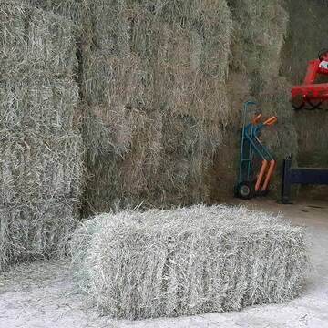
Heupellets und Strohpellets Bio
Bogen
Marion Christ
@Marion-Christ
Einstreu
Pellets
Bio
Abholung
Lieferung
B+
Deprecated: Creation of dynamic property Zend_View_Helper_Ads::$adLink is deprecated in /var/www/stall-frei/htdocs/staging.stall-frei.de/library/Psf/View/Helper/Ads.php on line 108

Persönlichkeitsentwicklung mit Pferden
Bad Salzuflen
Katja Dors
@Pferdezeiten
Begleite andere auf ihrem Entwicklungsweg und entdecke die transformative Kraft der pferdegestützten Persönlichkeitsentwicklung !
neu
R

B+
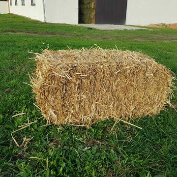
Heukleinballen (34 x 44 x 90 cm)
Marquartstein
Hacher Fahrnpoint
@Hacher-Berghof-Fahrnpoint
Heu
Kleinballen/HD-Ballen
Regenfrei
Wird verladen
1 weitere...
B+

Heu 2. Schnitt 2025 Grummet HD Ballen
Altmannstein
Thomas Resch
@Cappo
Heu
Empfänger lädt ab
Kleinballen/HD-Ballen
Wird verladen
2 weitere...
B+

Bio-Pferdeheu in Rundballen
Reichersbeuern
Biohof-Sixt
@Biohof-Sixt
Heu
Empfänger lädt ab
Rundballen
Bio
2 weitere...
aktuell
B+
Leider kein Vorschaubild
Leider kein Vorschaubild
HEUCOBS/GRASCOBSMenge in kg Preis 0,75€/kg im Sa...
Starnberg
Reiterhof-Klim
@Reiterhof-Klim
Futter
Pellets
Abholung
B+
Leider kein Vorschaubild
Leider kein Vorschaubild
heu 2025 heu 2ter schnitt 2025
Maisach
Reitstall Thurner
@ReitstallThurner
Heu
Empfänger lädt ab
Rundballen
Regenfrei
3 weitere...
B+


HD-Heuballen, 1. Schnitt & 2. Schnitt
Hilpoltstein
KnollmeyerBallen
@KnollmeyerBallen
Heu
Lieferant entlädt
Kleinballen/HD-Ballen
Regenfrei
3 weitere...
B+
HD-Strohballen, Gersten-, Dinkel- und Weizenstroh
Hilpoltstein
KnollmeyerBallen
@KnollmeyerBallen
Einstreu
Lieferant entlädt
Kleinballen/HD-Ballen
Regenfrei
3 weitere...
B+


Strohpellet, Strohgranulat, Heu & Stroh
Allmannshofen
J&M Kratzer
@JMKratzer
Einstreu
Lieferant entlädt
Pellets
Wird verladen
2 weitere...
P+
Deprecated: Creation of dynamic property Zend_View::$pageCount is deprecated in /var/www/stall-frei/htdocs/staging.stall-frei.de/library/vendor/shardj/zf1-future/library/Zend/View/Abstract.php on line 308
Deprecated: Creation of dynamic property Zend_View::$itemCountPerPage is deprecated in /var/www/stall-frei/htdocs/staging.stall-frei.de/library/vendor/shardj/zf1-future/library/Zend/View/Abstract.php on line 308
Deprecated: Creation of dynamic property Zend_View::$first is deprecated in /var/www/stall-frei/htdocs/staging.stall-frei.de/library/vendor/shardj/zf1-future/library/Zend/View/Abstract.php on line 308
Deprecated: Creation of dynamic property Zend_View::$current is deprecated in /var/www/stall-frei/htdocs/staging.stall-frei.de/library/vendor/shardj/zf1-future/library/Zend/View/Abstract.php on line 308
Deprecated: Creation of dynamic property Zend_View::$last is deprecated in /var/www/stall-frei/htdocs/staging.stall-frei.de/library/vendor/shardj/zf1-future/library/Zend/View/Abstract.php on line 308
Deprecated: Creation of dynamic property Zend_View::$next is deprecated in /var/www/stall-frei/htdocs/staging.stall-frei.de/library/vendor/shardj/zf1-future/library/Zend/View/Abstract.php on line 308
Deprecated: Creation of dynamic property Zend_View::$pagesInRange is deprecated in /var/www/stall-frei/htdocs/staging.stall-frei.de/library/vendor/shardj/zf1-future/library/Zend/View/Abstract.php on line 308
Deprecated: Creation of dynamic property Zend_View::$firstPageInRange is deprecated in /var/www/stall-frei/htdocs/staging.stall-frei.de/library/vendor/shardj/zf1-future/library/Zend/View/Abstract.php on line 308
Deprecated: Creation of dynamic property Zend_View::$lastPageInRange is deprecated in /var/www/stall-frei/htdocs/staging.stall-frei.de/library/vendor/shardj/zf1-future/library/Zend/View/Abstract.php on line 308
Deprecated: Creation of dynamic property Zend_View::$currentItemCount is deprecated in /var/www/stall-frei/htdocs/staging.stall-frei.de/library/vendor/shardj/zf1-future/library/Zend/View/Abstract.php on line 308
Deprecated: Creation of dynamic property Zend_View::$totalItemCount is deprecated in /var/www/stall-frei/htdocs/staging.stall-frei.de/library/vendor/shardj/zf1-future/library/Zend/View/Abstract.php on line 308
Deprecated: Creation of dynamic property Zend_View::$firstItemNumber is deprecated in /var/www/stall-frei/htdocs/staging.stall-frei.de/library/vendor/shardj/zf1-future/library/Zend/View/Abstract.php on line 308
Deprecated: Creation of dynamic property Zend_View::$lastItemNumber is deprecated in /var/www/stall-frei/htdocs/staging.stall-frei.de/library/vendor/shardj/zf1-future/library/Zend/View/Abstract.php on line 308
Deprecated: Creation of dynamic property Zend_View::$router is deprecated in /var/www/stall-frei/htdocs/staging.stall-frei.de/library/vendor/shardj/zf1-future/library/Zend/View/Abstract.php on line 308
Deprecated: Creation of dynamic property Zend_View::$urlParams is deprecated in /var/www/stall-frei/htdocs/staging.stall-frei.de/library/vendor/shardj/zf1-future/library/Zend/View/Abstract.php on line 308
Deprecated: Creation of dynamic property Zend_View::$showAds is deprecated in /var/www/stall-frei/htdocs/staging.stall-frei.de/library/vendor/shardj/zf1-future/library/Zend/View/Abstract.php on line 308
Deprecated: Creation of dynamic property Zend_View::$objectIds is deprecated in /var/www/stall-frei/htdocs/staging.stall-frei.de/library/vendor/shardj/zf1-future/library/Zend/View/Abstract.php on line 308
Deprecated: Creation of dynamic property Zend_View::$showNavbar is deprecated in /var/www/stall-frei/htdocs/staging.stall-frei.de/library/vendor/shardj/zf1-future/library/Zend/View/Abstract.php on line 308
Deprecated: Creation of dynamic property Zend_View::$showBreadcrumb is deprecated in /var/www/stall-frei/htdocs/staging.stall-frei.de/library/vendor/shardj/zf1-future/library/Zend/View/Abstract.php on line 308
Deprecated: Creation of dynamic property Zend_View::$showFooter is deprecated in /var/www/stall-frei/htdocs/staging.stall-frei.de/library/vendor/shardj/zf1-future/library/Zend/View/Abstract.php on line 308
Deprecated: Creation of dynamic property Zend_View::$showInternalAds is deprecated in /var/www/stall-frei/htdocs/staging.stall-frei.de/library/vendor/shardj/zf1-future/library/Zend/View/Abstract.php on line 308
Deprecated: Creation of dynamic property Zend_View::$blNoContent is deprecated in /var/www/stall-frei/htdocs/staging.stall-frei.de/library/vendor/shardj/zf1-future/library/Zend/View/Abstract.php on line 308
Deprecated: Creation of dynamic property Zend_View::$sMetaDesc is deprecated in /var/www/stall-frei/htdocs/staging.stall-frei.de/library/vendor/shardj/zf1-future/library/Zend/View/Abstract.php on line 308
Deprecated: Creation of dynamic property Zend_View::$useGmaps is deprecated in /var/www/stall-frei/htdocs/staging.stall-frei.de/library/vendor/shardj/zf1-future/library/Zend/View/Abstract.php on line 308
Deprecated: Creation of dynamic property Zend_View::$touches is deprecated in /var/www/stall-frei/htdocs/staging.stall-frei.de/library/vendor/shardj/zf1-future/library/Zend/View/Abstract.php on line 308
Deprecated: Creation of dynamic property Zend_View::$oProject is deprecated in /var/www/stall-frei/htdocs/staging.stall-frei.de/library/vendor/shardj/zf1-future/library/Zend/View/Abstract.php on line 308
Deprecated: Creation of dynamic property Zend_View::$pageHeadline is deprecated in /var/www/stall-frei/htdocs/staging.stall-frei.de/library/vendor/shardj/zf1-future/library/Zend/View/Abstract.php on line 308
Deprecated: Creation of dynamic property Zend_View::$disableLocationField is deprecated in /var/www/stall-frei/htdocs/staging.stall-frei.de/library/vendor/shardj/zf1-future/library/Zend/View/Abstract.php on line 308
Deprecated: Creation of dynamic property Zend_View::$isSearch is deprecated in /var/www/stall-frei/htdocs/staging.stall-frei.de/library/vendor/shardj/zf1-future/library/Zend/View/Abstract.php on line 308
Deprecated: Creation of dynamic property Zend_View::$pageTitle is deprecated in /var/www/stall-frei/htdocs/staging.stall-frei.de/library/vendor/shardj/zf1-future/library/Zend/View/Abstract.php on line 308
Deprecated: Creation of dynamic property Psf_Form_Element_Text::$class is deprecated in /var/www/stall-frei/htdocs/staging.stall-frei.de/library/vendor/shardj/zf1-future/library/Zend/Form/Element.php on line 874
Deprecated: Creation of dynamic property Psf_Form_Element_Text::$size is deprecated in /var/www/stall-frei/htdocs/staging.stall-frei.de/library/vendor/shardj/zf1-future/library/Zend/Form/Element.php on line 874
Deprecated: Creation of dynamic property Psf_Form_Element_Text::$placeholder is deprecated in /var/www/stall-frei/htdocs/staging.stall-frei.de/library/vendor/shardj/zf1-future/library/Zend/Form/Element.php on line 874
Deprecated: Creation of dynamic property Psf_Form_Element_Hidden::$class is deprecated in /var/www/stall-frei/htdocs/staging.stall-frei.de/library/vendor/shardj/zf1-future/library/Zend/Form/Element.php on line 874
Deprecated: Creation of dynamic property Psf_Form_Element_Hidden::$class is deprecated in /var/www/stall-frei/htdocs/staging.stall-frei.de/library/vendor/shardj/zf1-future/library/Zend/Form/Element.php on line 874
Deprecated: Creation of dynamic property Psf_Form_Element_Hidden::$class is deprecated in /var/www/stall-frei/htdocs/staging.stall-frei.de/library/vendor/shardj/zf1-future/library/Zend/Form/Element.php on line 874
Deprecated: Creation of dynamic property Psf_Form_Element_Hidden::$class is deprecated in /var/www/stall-frei/htdocs/staging.stall-frei.de/library/vendor/shardj/zf1-future/library/Zend/Form/Element.php on line 874
Deprecated: Creation of dynamic property Psf_Form_Element_Select::$class is deprecated in /var/www/stall-frei/htdocs/staging.stall-frei.de/library/vendor/shardj/zf1-future/library/Zend/Form/Element.php on line 874
Deprecated: Creation of dynamic property Psf_Form_Element_Select::$class is deprecated in /var/www/stall-frei/htdocs/staging.stall-frei.de/library/vendor/shardj/zf1-future/library/Zend/Form/Element.php on line 874
Deprecated: Creation of dynamic property Psf_Form_Element_Select::$class is deprecated in /var/www/stall-frei/htdocs/staging.stall-frei.de/library/vendor/shardj/zf1-future/library/Zend/Form/Element.php on line 874
Deprecated: Creation of dynamic property Psf_Form_Element_Select::$class is deprecated in /var/www/stall-frei/htdocs/staging.stall-frei.de/library/vendor/shardj/zf1-future/library/Zend/Form/Element.php on line 874
Deprecated: Creation of dynamic property Zend_View::$sort is deprecated in /var/www/stall-frei/htdocs/staging.stall-frei.de/library/vendor/shardj/zf1-future/library/Zend/View/Abstract.php on line 308
Deprecated: Creation of dynamic property Zend_View::$searchLocation is deprecated in /var/www/stall-frei/htdocs/staging.stall-frei.de/library/vendor/shardj/zf1-future/library/Zend/View/Abstract.php on line 308
Deprecated: Creation of dynamic property Zend_View::$locationHint is deprecated in /var/www/stall-frei/htdocs/staging.stall-frei.de/library/vendor/shardj/zf1-future/library/Zend/View/Abstract.php on line 308
Psf_GeoCoder_Abstract::getLocation: Hader Get Location CachedOrLive
Psf_GeoCoder_Abstract::getCachedOrLive: Hader
Psf_GeoCoder_OpenCageData::makeApiRequest: response:
Array
(
[documentation] => https://opencagedata.com/api
[licenses] => Array
(
[0] => Array
(
[name] => see attribution guide
[url] => https://opencagedata.com/credits
)
)
[results] => Array
(
[0] => Array
(
[bounds] => Array
(
[northeast] => Array
(
[lat] => 48.4759168
[lng] => 13.3135892
)
[southwest] => Array
(
[lat] => 48.4359168
[lng] => 13.2735892
)
)
[components] => Array
(
[ISO_3166-1_alpha-2] => DE
[ISO_3166-1_alpha-3] => DEU
[ISO_3166-2] => Array
(
[0] => DE-BY
)
[_category] => place
[_normalized_city] => Ruhstorf a.d.Rott
[_type] => village
[city] => Ruhstorf a.d.Rott
[continent] => Europe
[country] => Deutschland
[country_code] => de
[county] => Landkreis Passau
[political_union] => European Union
[postcode] => 94167
[state] => Bayern
[state_code] => BY
[village] => Hader
)
[confidence] => 7
[formatted] => 94167 Hader, Deutschland
[geometry] => Array
(
[lat] => 48.4559168
[lng] => 13.2935892
)
)
[1] => Array
(
[bounds] => Array
(
[northeast] => Array
(
[lat] => 48.5777479
[lng] => 12.0391902
)
[southwest] => Array
(
[lat] => 48.5377479
[lng] => 11.9991902
)
)
[components] => Array
(
[ISO_3166-1_alpha-2] => DE
[ISO_3166-1_alpha-3] => DEU
[ISO_3166-2] => Array
(
[0] => DE-BY
)
[_category] => place
[_normalized_city] => Bruckberg
[_type] => hamlet
[city] => Bruckberg
[continent] => Europe
[country] => Deutschland
[country_code] => de
[county] => Landkreis Landshut
[hamlet] => Hader
[political_union] => European Union
[postcode] => 84079
[state] => Bayern
[state_code] => BY
)
[confidence] => 7
[formatted] => Hader, 84079 Bruckberg, Deutschland
[geometry] => Array
(
[lat] => 48.5577479
[lng] => 12.0191902
)
)
[2] => Array
(
[bounds] => Array
(
[northeast] => Array
(
[lat] => 48.6250185
[lng] => 12.1692189
)
[southwest] => Array
(
[lat] => 48.5850185
[lng] => 12.1292189
)
)
[components] => Array
(
[ISO_3166-1_alpha-2] => DE
[ISO_3166-1_alpha-3] => DEU
[ISO_3166-2] => Array
(
[0] => DE-BY
)
[_category] => place
[_normalized_city] => Ergolding
[_type] => hamlet
[continent] => Europe
[country] => Deutschland
[country_code] => de
[county] => Landkreis Landshut
[hamlet] => Hader
[political_union] => European Union
[postcode] => 84030
[state] => Bayern
[state_code] => BY
[town] => Ergolding
)
[confidence] => 7
[formatted] => Hader, 84030 Ergolding, Deutschland
[geometry] => Array
(
[lat] => 48.6050185
[lng] => 12.1492189
)
)
[3] => Array
(
[bounds] => Array
(
[northeast] => Array
(
[lat] => 48.6539032
[lng] => 12.0804697
)
[southwest] => Array
(
[lat] => 48.6139032
[lng] => 12.0404697
)
)
[components] => Array
(
[ISO_3166-1_alpha-2] => DE
[ISO_3166-1_alpha-3] => DEU
[ISO_3166-2] => Array
(
[0] => DE-BY
)
[_category] => place
[_normalized_city] => Hohenthann
[_type] => hamlet
[city] => Hohenthann
[continent] => Europe
[country] => Deutschland
[country_code] => de
[county] => Landkreis Landshut
[hamlet] => Hader
[political_union] => European Union
[postcode] => 84098
[state] => Bayern
[state_code] => BY
)
[confidence] => 7
[formatted] => Hader, 84098 Hohenthann, Deutschland
[geometry] => Array
(
[lat] => 48.6339032
[lng] => 12.0604697
)
)
[4] => Array
(
[bounds] => Array
(
[northeast] => Array
(
[lat] => 48.6065885
[lng] => 12.1501946
)
[southwest] => Array
(
[lat] => 48.6054332
[lng] => 12.1465881
)
)
[components] => Array
(
[ISO_3166-1_alpha-2] => DE
[ISO_3166-1_alpha-3] => DEU
[ISO_3166-2] => Array
(
[0] => DE-BY
)
[_category] => road
[_normalized_city] => Ergolding
[_type] => road
[continent] => Europe
[country] => Deutschland
[country_code] => de
[county] => Landkreis Landshut
[hamlet] => Hader
[political_union] => European Union
[postcode] => 84030
[road] => Hader
[road_type] => service
[state] => Bayern
[state_code] => BY
[town] => Ergolding
)
[confidence] => 9
[formatted] => Hader, 84030 Ergolding, Deutschland
[geometry] => Array
(
[lat] => 48.6062492
[lng] => 12.1484705
)
)
[5] => Array
(
[bounds] => Array
(
[northeast] => Array
(
[lat] => 48.3759431
[lng] => 10.6561416
)
[southwest] => Array
(
[lat] => 48.3359431
[lng] => 10.6161416
)
)
[components] => Array
(
[ISO_3166-1_alpha-2] => DE
[ISO_3166-1_alpha-3] => DEU
[ISO_3166-2] => Array
(
[0] => DE-BY
)
[_category] => place
[_normalized_city] => Dinkelscherben
[_type] => city
[continent] => Europe
[country] => Deutschland
[country_code] => de
[county] => Landkreis Augsburg
[political_union] => European Union
[postcode] => 86424
[state] => Bayern
[state_code] => BY
[town] => Dinkelscherben
)
[confidence] => 7
[formatted] => 86424 Dinkelscherben, Deutschland
[geometry] => Array
(
[lat] => 48.3559431
[lng] => 10.6361416
)
)
[6] => Array
(
[bounds] => Array
(
[northeast] => Array
(
[lat] => 52.143008
[lng] => 7.6003723
)
[southwest] => Array
(
[lat] => 52.1421476
[lng] => 7.5993648
)
)
[components] => Array
(
[ISO_3166-1_alpha-2] => DE
[ISO_3166-1_alpha-3] => DEU
[ISO_3166-2] => Array
(
[0] => DE-NW
)
[_category] => agriculture
[_normalized_city] => Greven
[_type] => farmyard
[continent] => Europe
[country] => Deutschland
[country_code] => de
[county] => Kreis Steinfurt
[farmyard] => Häder
[political_union] => European Union
[postcode] => 48268
[state] => Nordrhein-Westfalen
[state_code] => NW
[town] => Greven
)
[confidence] => 9
[formatted] => Häder, 48268 Greven, Deutschland
[geometry] => Array
(
[lat] => 52.1426759
[lng] => 7.5997843
)
)
[7] => Array
(
[components] => Array
(
[ISO_3166-1_alpha-2] => FR
[ISO_3166-1_alpha-3] => FRA
[ISO_3166-2] => Array
(
[0] => FR-PDL
[1] => FR-85
)
[_category] => road
[_normalized_city] => Challans
[_type] => road
[city] => Challans
[continent] => Europe
[country] => France
[country_code] => fr
[county] => Vendée
[local_authority] => Challans-Gois Communauté
[political_union] => European Union
[postcode] => 85300
[road] => Rue clément ader
[state] => Pays de la Loire
[state_code] => PDL
)
[confidence] => 2
[formatted] => Rue clément ader, 85300 Challans, France
[geometry] => Array
(
[lat] => 46.836744
[lng] => -1.863028
)
)
[8] => Array
(
[components] => Array
(
[ISO_3166-1_alpha-2] => FR
[ISO_3166-1_alpha-3] => FRA
[ISO_3166-2] => Array
(
[0] => FR-NAQ
[1] => FR-33
)
[_category] => road
[_normalized_city] => La Teste-de-Buch
[_type] => road
[city] => La Teste-de-Buch
[continent] => Europe
[country] => France
[country_code] => fr
[county] => Gironde
[local_authority] => Communauté d'agglomération Bassin d'Arcachon Sud
[political_union] => European Union
[postcode] => 33260
[road] => Rue Clément Ader
[state] => Nouvelle-Aquitaine
[state_code] => NAQ
)
[confidence] => 2
[formatted] => Rue Clément Ader, 33260 La Teste-de-Buch, France
[geometry] => Array
(
[lat] => 44.635015
[lng] => -1.130146
)
)
[9] => Array
(
[components] => Array
(
[ISO_3166-1_alpha-2] => FR
[ISO_3166-1_alpha-3] => FRA
[ISO_3166-2] => Array
(
[0] => FR-OCC
[1] => FR-31
)
[_category] => road
[_normalized_city] => Plaisance-du-Touch
[_type] => road
[city] => Plaisance-du-Touch
[continent] => Europe
[country] => France
[country_code] => fr
[county] => Haute-Garonne
[local_authority] => Le Grand Ouest Toulousain
[political_union] => European Union
[postcode] => 31830
[road] => Rue Clément Ader
[state] => Occitanie
[state_code] => OCC
)
[confidence] => 2
[formatted] => Rue Clément Ader, 31830 Plaisance-du-Touch, France
[geometry] => Array
(
[lat] => 43.56523
[lng] => 1.278553
)
)
)
[status] => Array
(
[code] => 200
[message] => OK
)
[stay_informed] => Array
(
[blog] => https://blog.opencagedata.com
[mastodon] => https://en.osm.town/@opencage
)
[thanks] => For using an OpenCage API
[timestamp] => Array
(
[created_http] => Sat, 07 Feb 2026 17:44:20 GMT
[created_unix] => 1770486260
)
[total_results] => 10
)
Psf_GeoCoder_Abstract::convertLocationResult
{"documentation":"https:\/\/opencagedata.com\/api","licenses":[{"name":"see attribution guide","url":"https:\/\/opencagedata.com\/credits"}],"results":[{"bounds":{"northeast":{"lat":48.4759168,"lng":13.3135892},"southwest":{"lat":48.4359168,"lng":13.2735892}},"components":{"ISO_3166-1_alpha-2":"DE","ISO_3166-1_alpha-3":"DEU","ISO_3166-2":["DE-BY"],"_category":"place","_normalized_city":"Ruhstorf a.d.Rott","_type":"village","city":"Ruhstorf a.d.Rott","continent":"Europe","country":"Deutschland","country_code":"de","county":"Landkreis Passau","political_union":"European Union","postcode":"94167","state":"Bayern","state_code":"BY","village":"Hader"},"confidence":7,"formatted":"94167 Hader, Deutschland","geometry":{"lat":48.4559168,"lng":13.2935892}},{"bounds":{"northeast":{"lat":48.5777479,"lng":12.0391902},"southwest":{"lat":48.5377479,"lng":11.9991902}},"components":{"ISO_3166-1_alpha-2":"DE","ISO_3166-1_alpha-3":"DEU","ISO_3166-2":["DE-BY"],"_category":"place","_normalized_city":"Bruckberg","_type":"hamlet","city":"Bruckberg","continent":"Europe","country":"Deutschland","country_code":"de","county":"Landkreis Landshut","hamlet":"Hader","political_union":"European Union","postcode":"84079","state":"Bayern","state_code":"BY"},"confidence":7,"formatted":"Hader, 84079 Bruckberg, Deutschland","geometry":{"lat":48.5577479,"lng":12.0191902}},{"bounds":{"northeast":{"lat":48.6250185,"lng":12.1692189},"southwest":{"lat":48.5850185,"lng":12.1292189}},"components":{"ISO_3166-1_alpha-2":"DE","ISO_3166-1_alpha-3":"DEU","ISO_3166-2":["DE-BY"],"_category":"place","_normalized_city":"Ergolding","_type":"hamlet","continent":"Europe","country":"Deutschland","country_code":"de","county":"Landkreis Landshut","hamlet":"Hader","political_union":"European Union","postcode":"84030","state":"Bayern","state_code":"BY","town":"Ergolding"},"confidence":7,"formatted":"Hader, 84030 Ergolding, Deutschland","geometry":{"lat":48.6050185,"lng":12.1492189}},{"bounds":{"northeast":{"lat":48.6539032,"lng":12.0804697},"southwest":{"lat":48.6139032,"lng":12.0404697}},"components":{"ISO_3166-1_alpha-2":"DE","ISO_3166-1_alpha-3":"DEU","ISO_3166-2":["DE-BY"],"_category":"place","_normalized_city":"Hohenthann","_type":"hamlet","city":"Hohenthann","continent":"Europe","country":"Deutschland","country_code":"de","county":"Landkreis Landshut","hamlet":"Hader","political_union":"European Union","postcode":"84098","state":"Bayern","state_code":"BY"},"confidence":7,"formatted":"Hader, 84098 Hohenthann, Deutschland","geometry":{"lat":48.6339032,"lng":12.0604697}},{"bounds":{"northeast":{"lat":48.6065885,"lng":12.1501946},"southwest":{"lat":48.6054332,"lng":12.1465881}},"components":{"ISO_3166-1_alpha-2":"DE","ISO_3166-1_alpha-3":"DEU","ISO_3166-2":["DE-BY"],"_category":"road","_normalized_city":"Ergolding","_type":"road","continent":"Europe","country":"Deutschland","country_code":"de","county":"Landkreis Landshut","hamlet":"Hader","political_union":"European Union","postcode":"84030","road":"Hader","road_type":"service","state":"Bayern","state_code":"BY","town":"Ergolding"},"confidence":9,"formatted":"Hader, 84030 Ergolding, Deutschland","geometry":{"lat":48.6062492,"lng":12.1484705}},{"bounds":{"northeast":{"lat":48.3759431,"lng":10.6561416},"southwest":{"lat":48.3359431,"lng":10.6161416}},"components":{"ISO_3166-1_alpha-2":"DE","ISO_3166-1_alpha-3":"DEU","ISO_3166-2":["DE-BY"],"_category":"place","_normalized_city":"Dinkelscherben","_type":"city","continent":"Europe","country":"Deutschland","country_code":"de","county":"Landkreis Augsburg","political_union":"European Union","postcode":"86424","state":"Bayern","state_code":"BY","town":"Dinkelscherben"},"confidence":7,"formatted":"86424 Dinkelscherben, Deutschland","geometry":{"lat":48.3559431,"lng":10.6361416}},{"bounds":{"northeast":{"lat":52.143008,"lng":7.6003723},"southwest":{"lat":52.1421476,"lng":7.5993648}},"components":{"ISO_3166-1_alpha-2":"DE","ISO_3166-1_alpha-3":"DEU","ISO_3166-2":["DE-NW"],"_category":"agriculture","_normalized_city":"Greven","_type":"farmyard","continent":"Europe","country":"Deutschland","country_code":"de","county":"Kreis Steinfurt","farmyard":"H\u00e4der","political_union":"European Union","postcode":"48268","state":"Nordrhein-Westfalen","state_code":"NW","town":"Greven"},"confidence":9,"formatted":"H\u00e4der, 48268 Greven, Deutschland","geometry":{"lat":52.1426759,"lng":7.5997843}},{"components":{"ISO_3166-1_alpha-2":"FR","ISO_3166-1_alpha-3":"FRA","ISO_3166-2":["FR-PDL","FR-85"],"_category":"road","_normalized_city":"Challans","_type":"road","city":"Challans","continent":"Europe","country":"France","country_code":"fr","county":"Vend\u00e9e","local_authority":"Challans-Gois Communaut\u00e9","political_union":"European Union","postcode":"85300","road":"Rue cl\u00e9ment ader","state":"Pays de la Loire","state_code":"PDL"},"confidence":2,"formatted":"Rue cl\u00e9ment ader, 85300 Challans, France","geometry":{"lat":46.836744,"lng":-1.863028}},{"components":{"ISO_3166-1_alpha-2":"FR","ISO_3166-1_alpha-3":"FRA","ISO_3166-2":["FR-NAQ","FR-33"],"_category":"road","_normalized_city":"La Teste-de-Buch","_type":"road","city":"La Teste-de-Buch","continent":"Europe","country":"France","country_code":"fr","county":"Gironde","local_authority":"Communaut\u00e9 d'agglom\u00e9ration Bassin d'Arcachon Sud","political_union":"European Union","postcode":"33260","road":"Rue Cl\u00e9ment Ader","state":"Nouvelle-Aquitaine","state_code":"NAQ"},"confidence":2,"formatted":"Rue Cl\u00e9ment Ader, 33260 La Teste-de-Buch, France","geometry":{"lat":44.635015,"lng":-1.130146}},{"components":{"ISO_3166-1_alpha-2":"FR","ISO_3166-1_alpha-3":"FRA","ISO_3166-2":["FR-OCC","FR-31"],"_category":"road","_normalized_city":"Plaisance-du-Touch","_type":"road","city":"Plaisance-du-Touch","continent":"Europe","country":"France","country_code":"fr","county":"Haute-Garonne","local_authority":"Le Grand Ouest Toulousain","political_union":"European Union","postcode":"31830","road":"Rue Cl\u00e9ment Ader","state":"Occitanie","state_code":"OCC"},"confidence":2,"formatted":"Rue Cl\u00e9ment Ader, 31830 Plaisance-du-Touch, France","geometry":{"lat":43.56523,"lng":1.278553}}],"status":{"code":200,"message":"OK"},"stay_informed":{"blog":"https:\/\/blog.opencagedata.com","mastodon":"https:\/\/en.osm.town\/@opencage"},"thanks":"For using an OpenCage API","timestamp":{"created_http":"Sat, 07 Feb 2026 17:44:20 GMT","created_unix":1770486260},"total_results":10}Array
(
[0] => stdClass Object
(
[bounds] => stdClass Object
(
[northeast] => stdClass Object
(
[lat] => 48.4759168
[lng] => 13.3135892
)
[southwest] => stdClass Object
(
[lat] => 48.4359168
[lng] => 13.2735892
)
)
[components] => stdClass Object
(
[ISO_3166-1_alpha-2] => DE
[ISO_3166-1_alpha-3] => DEU
[ISO_3166-2] => Array
(
[0] => DE-BY
)
[_category] => place
[_normalized_city] => Ruhstorf a.d.Rott
[_type] => village
[city] => Ruhstorf a.d.Rott
[continent] => Europe
[country] => Deutschland
[country_code] => de
[county] => Landkreis Passau
[political_union] => European Union
[postcode] => 94167
[state] => Bayern
[state_code] => BY
[village] => Hader
)
[confidence] => 7
[formatted] => 94167 Hader, Deutschland
[geometry] => stdClass Object
(
[lat] => 48.4559168
[lng] => 13.2935892
)
)
[1] => stdClass Object
(
[bounds] => stdClass Object
(
[northeast] => stdClass Object
(
[lat] => 48.5777479
[lng] => 12.0391902
)
[southwest] => stdClass Object
(
[lat] => 48.5377479
[lng] => 11.9991902
)
)
[components] => stdClass Object
(
[ISO_3166-1_alpha-2] => DE
[ISO_3166-1_alpha-3] => DEU
[ISO_3166-2] => Array
(
[0] => DE-BY
)
[_category] => place
[_normalized_city] => Bruckberg
[_type] => hamlet
[city] => Bruckberg
[continent] => Europe
[country] => Deutschland
[country_code] => de
[county] => Landkreis Landshut
[hamlet] => Hader
[political_union] => European Union
[postcode] => 84079
[state] => Bayern
[state_code] => BY
)
[confidence] => 7
[formatted] => Hader, 84079 Bruckberg, Deutschland
[geometry] => stdClass Object
(
[lat] => 48.5577479
[lng] => 12.0191902
)
)
[2] => stdClass Object
(
[bounds] => stdClass Object
(
[northeast] => stdClass Object
(
[lat] => 48.6250185
[lng] => 12.1692189
)
[southwest] => stdClass Object
(
[lat] => 48.5850185
[lng] => 12.1292189
)
)
[components] => stdClass Object
(
[ISO_3166-1_alpha-2] => DE
[ISO_3166-1_alpha-3] => DEU
[ISO_3166-2] => Array
(
[0] => DE-BY
)
[_category] => place
[_normalized_city] => Ergolding
[_type] => hamlet
[continent] => Europe
[country] => Deutschland
[country_code] => de
[county] => Landkreis Landshut
[hamlet] => Hader
[political_union] => European Union
[postcode] => 84030
[state] => Bayern
[state_code] => BY
[town] => Ergolding
)
[confidence] => 7
[formatted] => Hader, 84030 Ergolding, Deutschland
[geometry] => stdClass Object
(
[lat] => 48.6050185
[lng] => 12.1492189
)
)
[3] => stdClass Object
(
[bounds] => stdClass Object
(
[northeast] => stdClass Object
(
[lat] => 48.6539032
[lng] => 12.0804697
)
[southwest] => stdClass Object
(
[lat] => 48.6139032
[lng] => 12.0404697
)
)
[components] => stdClass Object
(
[ISO_3166-1_alpha-2] => DE
[ISO_3166-1_alpha-3] => DEU
[ISO_3166-2] => Array
(
[0] => DE-BY
)
[_category] => place
[_normalized_city] => Hohenthann
[_type] => hamlet
[city] => Hohenthann
[continent] => Europe
[country] => Deutschland
[country_code] => de
[county] => Landkreis Landshut
[hamlet] => Hader
[political_union] => European Union
[postcode] => 84098
[state] => Bayern
[state_code] => BY
)
[confidence] => 7
[formatted] => Hader, 84098 Hohenthann, Deutschland
[geometry] => stdClass Object
(
[lat] => 48.6339032
[lng] => 12.0604697
)
)
[4] => stdClass Object
(
[bounds] => stdClass Object
(
[northeast] => stdClass Object
(
[lat] => 48.6065885
[lng] => 12.1501946
)
[southwest] => stdClass Object
(
[lat] => 48.6054332
[lng] => 12.1465881
)
)
[components] => stdClass Object
(
[ISO_3166-1_alpha-2] => DE
[ISO_3166-1_alpha-3] => DEU
[ISO_3166-2] => Array
(
[0] => DE-BY
)
[_category] => road
[_normalized_city] => Ergolding
[_type] => road
[continent] => Europe
[country] => Deutschland
[country_code] => de
[county] => Landkreis Landshut
[hamlet] => Hader
[political_union] => European Union
[postcode] => 84030
[road] => Hader
[road_type] => service
[state] => Bayern
[state_code] => BY
[town] => Ergolding
)
[confidence] => 9
[formatted] => Hader, 84030 Ergolding, Deutschland
[geometry] => stdClass Object
(
[lat] => 48.6062492
[lng] => 12.1484705
)
)
[5] => stdClass Object
(
[bounds] => stdClass Object
(
[northeast] => stdClass Object
(
[lat] => 48.3759431
[lng] => 10.6561416
)
[southwest] => stdClass Object
(
[lat] => 48.3359431
[lng] => 10.6161416
)
)
[components] => stdClass Object
(
[ISO_3166-1_alpha-2] => DE
[ISO_3166-1_alpha-3] => DEU
[ISO_3166-2] => Array
(
[0] => DE-BY
)
[_category] => place
[_normalized_city] => Dinkelscherben
[_type] => city
[continent] => Europe
[country] => Deutschland
[country_code] => de
[county] => Landkreis Augsburg
[political_union] => European Union
[postcode] => 86424
[state] => Bayern
[state_code] => BY
[town] => Dinkelscherben
)
[confidence] => 7
[formatted] => 86424 Dinkelscherben, Deutschland
[geometry] => stdClass Object
(
[lat] => 48.3559431
[lng] => 10.6361416
)
)
[6] => stdClass Object
(
[bounds] => stdClass Object
(
[northeast] => stdClass Object
(
[lat] => 52.143008
[lng] => 7.6003723
)
[southwest] => stdClass Object
(
[lat] => 52.1421476
[lng] => 7.5993648
)
)
[components] => stdClass Object
(
[ISO_3166-1_alpha-2] => DE
[ISO_3166-1_alpha-3] => DEU
[ISO_3166-2] => Array
(
[0] => DE-NW
)
[_category] => agriculture
[_normalized_city] => Greven
[_type] => farmyard
[continent] => Europe
[country] => Deutschland
[country_code] => de
[county] => Kreis Steinfurt
[farmyard] => Häder
[political_union] => European Union
[postcode] => 48268
[state] => Nordrhein-Westfalen
[state_code] => NW
[town] => Greven
)
[confidence] => 9
[formatted] => Häder, 48268 Greven, Deutschland
[geometry] => stdClass Object
(
[lat] => 52.1426759
[lng] => 7.5997843
)
)
[7] => stdClass Object
(
[components] => stdClass Object
(
[ISO_3166-1_alpha-2] => FR
[ISO_3166-1_alpha-3] => FRA
[ISO_3166-2] => Array
(
[0] => FR-PDL
[1] => FR-85
)
[_category] => road
[_normalized_city] => Challans
[_type] => road
[city] => Challans
[continent] => Europe
[country] => France
[country_code] => fr
[county] => Vendée
[local_authority] => Challans-Gois Communauté
[political_union] => European Union
[postcode] => 85300
[road] => Rue clément ader
[state] => Pays de la Loire
[state_code] => PDL
)
[confidence] => 2
[formatted] => Rue clément ader, 85300 Challans, France
[geometry] => stdClass Object
(
[lat] => 46.836744
[lng] => -1.863028
)
)
[8] => stdClass Object
(
[components] => stdClass Object
(
[ISO_3166-1_alpha-2] => FR
[ISO_3166-1_alpha-3] => FRA
[ISO_3166-2] => Array
(
[0] => FR-NAQ
[1] => FR-33
)
[_category] => road
[_normalized_city] => La Teste-de-Buch
[_type] => road
[city] => La Teste-de-Buch
[continent] => Europe
[country] => France
[country_code] => fr
[county] => Gironde
[local_authority] => Communauté d'agglomération Bassin d'Arcachon Sud
[political_union] => European Union
[postcode] => 33260
[road] => Rue Clément Ader
[state] => Nouvelle-Aquitaine
[state_code] => NAQ
)
[confidence] => 2
[formatted] => Rue Clément Ader, 33260 La Teste-de-Buch, France
[geometry] => stdClass Object
(
[lat] => 44.635015
[lng] => -1.130146
)
)
[9] => stdClass Object
(
[components] => stdClass Object
(
[ISO_3166-1_alpha-2] => FR
[ISO_3166-1_alpha-3] => FRA
[ISO_3166-2] => Array
(
[0] => FR-OCC
[1] => FR-31
)
[_category] => road
[_normalized_city] => Plaisance-du-Touch
[_type] => road
[city] => Plaisance-du-Touch
[continent] => Europe
[country] => France
[country_code] => fr
[county] => Haute-Garonne
[local_authority] => Le Grand Ouest Toulousain
[political_union] => European Union
[postcode] => 31830
[road] => Rue Clément Ader
[state] => Occitanie
[state_code] => OCC
)
[confidence] => 2
[formatted] => Rue Clément Ader, 31830 Plaisance-du-Touch, France
[geometry] => stdClass Object
(
[lat] => 43.56523
[lng] => 1.278553
)
)
)
Psf_GeoCoder_OpenCageData::getKeyMap: 0
stdClass Object
(
    [bounds] => stdClass Object
        (
            [northeast] => stdClass Object
                (
                    [lat] => 48.4759168
                    [lng] => 13.3135892
                )

            [southwest] => stdClass Object
                (
                    [lat] => 48.4359168
                    [lng] => 13.2735892
                )

        )

    [components] => stdClass Object
        (
            [ISO_3166-1_alpha-2] => DE
            [ISO_3166-1_alpha-3] => DEU
            [ISO_3166-2] => Array
                (
                    [0] => DE-BY
                )

            [_category] => place
            [_normalized_city] => Ruhstorf a.d.Rott
            [_type] => village
            [city] => Ruhstorf a.d.Rott
            [continent] => Europe
            [country] => Deutschland
            [country_code] => de
            [county] => Landkreis Passau
            [political_union] => European Union
            [postcode] => 94167
            [state] => Bayern
            [state_code] => BY
            [village] => Hader
        )

    [confidence] => 7
    [formatted] => 94167 Hader, Deutschland
    [geometry] => stdClass Object
        (
            [lat] => 48.4559168
            [lng] => 13.2935892
        )

)
Psf_GeoCoder_OpenCageData::getCounty: Passau
Psf_GeoCoder_OpenCageData::addMissingData REFETCH!
Array
(
    [address] => 94167 Hader, Deutschland
    [type] => village
    [street] =>
    [city] => Hader
    [county] => Passau
    [state] => Bayern
    [zip] => 94167
    [country] => Deutschland
    [suburb] =>
    [countrycode] => de
    [latitude] => 48.4559168
    [longitude] => 13.2935892
    [accuracy] => 1
    [confidence] => 7
    [bounds] => stdClass Object
        (
            [northeast] => stdClass Object
                (
                    [lat] => 48.4759168
                    [lng] => 13.3135892
                )

            [southwest] => stdClass Object
                (
                    [lat] => 48.4359168
                    [lng] => 13.2735892
                )

        )

)
reformat!
Array
(
    [address] => 94167 Hader, Deutschland
    [type] => village
    [street] =>
    [city] => Hader
    [county] => Passau
    [state] => Bayern
    [zip] => 94167
    [country] => Deutschland
    [suburb] =>
    [countrycode] => de
    [latitude] => 48.4559168
    [longitude] => 13.2935892
    [accuracy] => 1
    [confidence] => 7
    [bounds] => stdClass Object
        (
            [northeast] => stdClass Object
                (
                    [lat] => 48.4759168
                    [lng] => 13.3135892
                )

            [southwest] => stdClass Object
                (
                    [lat] => 48.4359168
                    [lng] => 13.2735892
                )

        )

    [place] => 94167 Hader, Bayern
    [hash] => 6358319f6080c5b8c28615003909bf19
)
Psf_GeoCoder_OpenCageData::getKeyMap: 1
stdClass Object
(
    [bounds] => stdClass Object
        (
            [northeast] => stdClass Object
                (
                    [lat] => 48.5777479
                    [lng] => 12.0391902
                )

            [southwest] => stdClass Object
                (
                    [lat] => 48.5377479
                    [lng] => 11.9991902
                )

        )

    [components] => stdClass Object
        (
            [ISO_3166-1_alpha-2] => DE
            [ISO_3166-1_alpha-3] => DEU
            [ISO_3166-2] => Array
                (
                    [0] => DE-BY
                )

            [_category] => place
            [_normalized_city] => Bruckberg
            [_type] => hamlet
            [city] => Bruckberg
            [continent] => Europe
            [country] => Deutschland
            [country_code] => de
            [county] => Landkreis Landshut
            [hamlet] => Hader
            [political_union] => European Union
            [postcode] => 84079
            [state] => Bayern
            [state_code] => BY
        )

    [confidence] => 7
    [formatted] => Hader, 84079 Bruckberg, Deutschland
    [geometry] => stdClass Object
        (
            [lat] => 48.5577479
            [lng] => 12.0191902
        )

)
Psf_GeoCoder_OpenCageData::getCounty: Landshut
Psf_GeoCoder_OpenCageData::addMissingData REFETCH!
Array
(
    [address] => Hader, 84079 Bruckberg, Deutschland
    [type] => hamlet
    [street] => Hader
    [city] => Bruckberg
    [county] => Landshut
    [state] => Bayern
    [zip] => 84079
    [country] => Deutschland
    [suburb] =>
    [countrycode] => de
    [latitude] => 48.5577479
    [longitude] => 12.0191902
    [accuracy] => 1
    [confidence] => 7
    [bounds] => stdClass Object
        (
            [northeast] => stdClass Object
                (
                    [lat] => 48.5777479
                    [lng] => 12.0391902
                )

            [southwest] => stdClass Object
                (
                    [lat] => 48.5377479
                    [lng] => 11.9991902
                )

        )

)
reformat!
Array
(
    [address] => Hader, 84079 Bruckberg, Deutschland
    [type] => hamlet
    [street] => Hader
    [city] => Bruckberg
    [county] => Landshut
    [state] => Bayern
    [zip] => 84079
    [country] => Deutschland
    [suburb] =>
    [countrycode] => de
    [latitude] => 48.5577479
    [longitude] => 12.0191902
    [accuracy] => 1
    [confidence] => 7
    [bounds] => stdClass Object
        (
            [northeast] => stdClass Object
                (
                    [lat] => 48.5777479
                    [lng] => 12.0391902
                )

            [southwest] => stdClass Object
                (
                    [lat] => 48.5377479
                    [lng] => 11.9991902
                )

        )

    [place] => Hader, 84079 Bruckberg, Bayern
    [hash] => 3a6ce84d2a4be653dd3976da8df7e14b
)
Psf_GeoCoder_OpenCageData::getKeyMap: 2
stdClass Object
(
    [bounds] => stdClass Object
        (
            [northeast] => stdClass Object
                (
                    [lat] => 48.6250185
                    [lng] => 12.1692189
                )

            [southwest] => stdClass Object
                (
                    [lat] => 48.5850185
                    [lng] => 12.1292189
                )

        )

    [components] => stdClass Object
        (
            [ISO_3166-1_alpha-2] => DE
            [ISO_3166-1_alpha-3] => DEU
            [ISO_3166-2] => Array
                (
                    [0] => DE-BY
                )

            [_category] => place
            [_normalized_city] => Ergolding
            [_type] => hamlet
            [continent] => Europe
            [country] => Deutschland
            [country_code] => de
            [county] => Landkreis Landshut
            [hamlet] => Hader
            [political_union] => European Union
            [postcode] => 84030
            [state] => Bayern
            [state_code] => BY
            [town] => Ergolding
        )

    [confidence] => 7
    [formatted] => Hader, 84030 Ergolding, Deutschland
    [geometry] => stdClass Object
        (
            [lat] => 48.6050185
            [lng] => 12.1492189
        )

)
Psf_GeoCoder_OpenCageData::getCounty: Landshut
Psf_GeoCoder_OpenCageData::addMissingData REFETCH!
Array
(
    [address] => Hader, 84030 Ergolding, Deutschland
    [type] => hamlet
    [street] => Hader
    [city] => Ergolding
    [county] => Landshut
    [state] => Bayern
    [zip] => 84030
    [country] => Deutschland
    [suburb] =>
    [countrycode] => de
    [latitude] => 48.6050185
    [longitude] => 12.1492189
    [accuracy] => 1
    [confidence] => 7
    [bounds] => stdClass Object
        (
            [northeast] => stdClass Object
                (
                    [lat] => 48.6250185
                    [lng] => 12.1692189
                )

            [southwest] => stdClass Object
                (
                    [lat] => 48.5850185
                    [lng] => 12.1292189
                )

        )

)
reformat!
Array
(
    [address] => Hader, 84030 Ergolding, Deutschland
    [type] => hamlet
    [street] => Hader
    [city] => Ergolding
    [county] => Landshut
    [state] => Bayern
    [zip] => 84030
    [country] => Deutschland
    [suburb] =>
    [countrycode] => de
    [latitude] => 48.6050185
    [longitude] => 12.1492189
    [accuracy] => 1
    [confidence] => 7
    [bounds] => stdClass Object
        (
            [northeast] => stdClass Object
                (
                    [lat] => 48.6250185
                    [lng] => 12.1692189
                )

            [southwest] => stdClass Object
                (
                    [lat] => 48.5850185
                    [lng] => 12.1292189
                )

        )

    [place] => Hader, 84030 Ergolding, Bayern
    [hash] => 480ded35e1046cb1ce6a0460bdbff1d2
)
Psf_GeoCoder_OpenCageData::getKeyMap: 3
stdClass Object
(
    [bounds] => stdClass Object
        (
            [northeast] => stdClass Object
                (
                    [lat] => 48.6539032
                    [lng] => 12.0804697
                )

            [southwest] => stdClass Object
                (
                    [lat] => 48.6139032
                    [lng] => 12.0404697
                )

        )

    [components] => stdClass Object
        (
            [ISO_3166-1_alpha-2] => DE
            [ISO_3166-1_alpha-3] => DEU
            [ISO_3166-2] => Array
                (
                    [0] => DE-BY
                )

            [_category] => place
            [_normalized_city] => Hohenthann
            [_type] => hamlet
            [city] => Hohenthann
            [continent] => Europe
            [country] => Deutschland
            [country_code] => de
            [county] => Landkreis Landshut
            [hamlet] => Hader
            [political_union] => European Union
            [postcode] => 84098
            [state] => Bayern
            [state_code] => BY
        )

    [confidence] => 7
    [formatted] => Hader, 84098 Hohenthann, Deutschland
    [geometry] => stdClass Object
        (
            [lat] => 48.6339032
            [lng] => 12.0604697
        )

)
Psf_GeoCoder_OpenCageData::getCounty: Landshut
Psf_GeoCoder_OpenCageData::addMissingData REFETCH!
Array
(
    [address] => Hader, 84098 Hohenthann, Deutschland
    [type] => hamlet
    [street] => Hader
    [city] => Hohenthann
    [county] => Landshut
    [state] => Bayern
    [zip] => 84098
    [country] => Deutschland
    [suburb] =>
    [countrycode] => de
    [latitude] => 48.6339032
    [longitude] => 12.0604697
    [accuracy] => 1
    [confidence] => 7
    [bounds] => stdClass Object
        (
            [northeast] => stdClass Object
                (
                    [lat] => 48.6539032
                    [lng] => 12.0804697
                )

            [southwest] => stdClass Object
                (
                    [lat] => 48.6139032
                    [lng] => 12.0404697
                )

        )

)
reformat!
Array
(
    [address] => Hader, 84098 Hohenthann, Deutschland
    [type] => hamlet
    [street] => Hader
    [city] => Hohenthann
    [county] => Landshut
    [state] => Bayern
    [zip] => 84098
    [country] => Deutschland
    [suburb] =>
    [countrycode] => de
    [latitude] => 48.6339032
    [longitude] => 12.0604697
    [accuracy] => 1
    [confidence] => 7
    [bounds] => stdClass Object
        (
            [northeast] => stdClass Object
                (
                    [lat] => 48.6539032
                    [lng] => 12.0804697
                )

            [southwest] => stdClass Object
                (
                    [lat] => 48.6139032
                    [lng] => 12.0404697
                )

        )

    [place] => Hader, 84098 Hohenthann, Bayern
    [hash] => a02176c251c98ee70d2872e76d40bd48
)
Psf_GeoCoder_OpenCageData::getKeyMap: 4
stdClass Object
(
    [bounds] => stdClass Object
        (
            [northeast] => stdClass Object
                (
                    [lat] => 48.6065885
                    [lng] => 12.1501946
                )

            [southwest] => stdClass Object
                (
                    [lat] => 48.6054332
                    [lng] => 12.1465881
                )

        )

    [components] => stdClass Object
        (
            [ISO_3166-1_alpha-2] => DE
            [ISO_3166-1_alpha-3] => DEU
            [ISO_3166-2] => Array
                (
                    [0] => DE-BY
                )

            [_category] => road
            [_normalized_city] => Ergolding
            [_type] => road
            [continent] => Europe
            [country] => Deutschland
            [country_code] => de
            [county] => Landkreis Landshut
            [hamlet] => Hader
            [political_union] => European Union
            [postcode] => 84030
            [road] => Hader
            [road_type] => service
            [state] => Bayern
            [state_code] => BY
            [town] => Ergolding
        )

    [confidence] => 9
    [formatted] => Hader, 84030 Ergolding, Deutschland
    [geometry] => stdClass Object
        (
            [lat] => 48.6062492
            [lng] => 12.1484705
        )

)
Psf_GeoCoder_OpenCageData::getCounty: Landshut
Psf_GeoCoder_OpenCageData::addMissingData REFETCH!
Array
(
    [address] => Hader, 84030 Ergolding, Deutschland
    [type] => road
    [street] => Hader
    [city] => Ergolding
    [county] => Landshut
    [state] => Bayern
    [zip] => 84030
    [country] => Deutschland
    [suburb] =>
    [countrycode] => de
    [latitude] => 48.6062492
    [longitude] => 12.1484705
    [accuracy] => 1
    [confidence] => 9
    [bounds] => stdClass Object
        (
            [northeast] => stdClass Object
                (
                    [lat] => 48.6065885
                    [lng] => 12.1501946
                )

            [southwest] => stdClass Object
                (
                    [lat] => 48.6054332
                    [lng] => 12.1465881
                )

        )

)
reformat!
Array
(
    [address] => Hader, 84030 Ergolding, Deutschland
    [type] => road
    [street] => Hader
    [city] => Ergolding
    [county] => Landshut
    [state] => Bayern
    [zip] => 84030
    [country] => Deutschland
    [suburb] =>
    [countrycode] => de
    [latitude] => 48.6062492
    [longitude] => 12.1484705
    [accuracy] => 1
    [confidence] => 9
    [bounds] => stdClass Object
        (
            [northeast] => stdClass Object
                (
                    [lat] => 48.6065885
                    [lng] => 12.1501946
                )

            [southwest] => stdClass Object
                (
                    [lat] => 48.6054332
                    [lng] => 12.1465881
                )

        )

    [place] => Hader, 84030 Ergolding, Bayern
    [hash] => 480ded35e1046cb1ce6a0460bdbff1d2
)
Psf_GeoCoder_OpenCageData::getKeyMap: 5
stdClass Object
(
    [bounds] => stdClass Object
        (
            [northeast] => stdClass Object
                (
                    [lat] => 48.3759431
                    [lng] => 10.6561416
                )

            [southwest] => stdClass Object
                (
                    [lat] => 48.3359431
                    [lng] => 10.6161416
                )

        )

    [components] => stdClass Object
        (
            [ISO_3166-1_alpha-2] => DE
            [ISO_3166-1_alpha-3] => DEU
            [ISO_3166-2] => Array
                (
                    [0] => DE-BY
                )

            [_category] => place
            [_normalized_city] => Dinkelscherben
            [_type] => city
            [continent] => Europe
            [country] => Deutschland
            [country_code] => de
            [county] => Landkreis Augsburg
            [political_union] => European Union
            [postcode] => 86424
            [state] => Bayern
            [state_code] => BY
            [town] => Dinkelscherben
        )

    [confidence] => 7
    [formatted] => 86424 Dinkelscherben, Deutschland
    [geometry] => stdClass Object
        (
            [lat] => 48.3559431
            [lng] => 10.6361416
        )

)
Psf_GeoCoder_OpenCageData::getCounty: Augsburg
Psf_GeoCoder_OpenCageData::addMissingData REFETCH!
Array
(
    [address] => 86424 Dinkelscherben, Deutschland
    [type] => city
    [street] =>
    [city] => Dinkelscherben
    [county] => Augsburg
    [state] => Bayern
    [zip] => 86424
    [country] => Deutschland
    [suburb] =>
    [countrycode] => de
    [latitude] => 48.3559431
    [longitude] => 10.6361416
    [accuracy] => 1
    [confidence] => 7
    [bounds] => stdClass Object
        (
            [northeast] => stdClass Object
                (
                    [lat] => 48.3759431
                    [lng] => 10.6561416
                )

            [southwest] => stdClass Object
                (
                    [lat] => 48.3359431
                    [lng] => 10.6161416
                )

        )

)
reformat!
Array
(
    [address] => 86424 Dinkelscherben, Deutschland
    [type] => city
    [street] =>
    [city] => Dinkelscherben
    [county] => Augsburg
    [state] => Bayern
    [zip] => 86424
    [country] => Deutschland
    [suburb] =>
    [countrycode] => de
    [latitude] => 48.3559431
    [longitude] => 10.6361416
    [accuracy] => 1
    [confidence] => 7
    [bounds] => stdClass Object
        (
            [northeast] => stdClass Object
                (
                    [lat] => 48.3759431
                    [lng] => 10.6561416
                )

            [southwest] => stdClass Object
                (
                    [lat] => 48.3359431
                    [lng] => 10.6161416
                )

        )

    [place] => 86424 Dinkelscherben, Bayern
    [hash] => f4a2dfe4380136a0311f947d5bd3eeec
)
Psf_GeoCoder_OpenCageData::getKeyMap: 6
stdClass Object
(
    [bounds] => stdClass Object
        (
            [northeast] => stdClass Object
                (
                    [lat] => 52.143008
                    [lng] => 7.6003723
                )

            [southwest] => stdClass Object
                (
                    [lat] => 52.1421476
                    [lng] => 7.5993648
                )

        )

    [components] => stdClass Object
        (
            [ISO_3166-1_alpha-2] => DE
            [ISO_3166-1_alpha-3] => DEU
            [ISO_3166-2] => Array
                (
                    [0] => DE-NW
                )

            [_category] => agriculture
            [_normalized_city] => Greven
            [_type] => farmyard
            [continent] => Europe
            [country] => Deutschland
            [country_code] => de
            [county] => Kreis Steinfurt
            [farmyard] => Häder
            [political_union] => European Union
            [postcode] => 48268
            [state] => Nordrhein-Westfalen
            [state_code] => NW
            [town] => Greven
        )

    [confidence] => 9
    [formatted] => Häder, 48268 Greven, Deutschland
    [geometry] => stdClass Object
        (
            [lat] => 52.1426759
            [lng] => 7.5997843
        )

)
Psf_GeoCoder_OpenCageData::getCounty: Steinfurt
Psf_GeoCoder_OpenCageData::addMissingData REFETCH!
Array
(
    [address] => Häder, 48268 Greven, Deutschland
    [type] => farmyard
    [street] =>
    [city] => Greven
    [county] => Steinfurt
    [state] => Nordrhein-Westfalen
    [zip] => 48268
    [country] => Deutschland
    [suburb] =>
    [countrycode] => de
    [latitude] => 52.1426759
    [longitude] => 7.5997843
    [accuracy] => 1
    [confidence] => 9
    [bounds] => stdClass Object
        (
            [northeast] => stdClass Object
                (
                    [lat] => 52.143008
                    [lng] => 7.6003723
                )

            [southwest] => stdClass Object
                (
                    [lat] => 52.1421476
                    [lng] => 7.5993648
                )

        )

)
reformat!
Array
(
    [address] => Häder, 48268 Greven, Deutschland
    [type] => farmyard
    [street] =>
    [city] => Greven
    [county] => Steinfurt
    [state] => Nordrhein-Westfalen
    [zip] => 48268
    [country] => Deutschland
    [suburb] =>
    [countrycode] => de
    [latitude] => 52.1426759
    [longitude] => 7.5997843
    [accuracy] => 1
    [confidence] => 9
    [bounds] => stdClass Object
        (
            [northeast] => stdClass Object
                (
                    [lat] => 52.143008
                    [lng] => 7.6003723
                )

            [southwest] => stdClass Object
                (
                    [lat] => 52.1421476
                    [lng] => 7.5993648
                )

        )

    [place] => 48268 Greven, Nordrhein-Westfalen
    [hash] => a8d6f079b8db75b1e2dfcd8c6e0af5e9
)
Psf_GeoCoder_OpenCageData::getKeyMap: 7
stdClass Object
(
    [components] => stdClass Object
        (
            [ISO_3166-1_alpha-2] => FR
            [ISO_3166-1_alpha-3] => FRA
            [ISO_3166-2] => Array
                (
                    [0] => FR-PDL
                    [1] => FR-85
                )

            [_category] => road
            [_normalized_city] => Challans
            [_type] => road
            [city] => Challans
            [continent] => Europe
            [country] => France
            [country_code] => fr
            [county] => Vendée
            [local_authority] => Challans-Gois Communauté
            [political_union] => European Union
            [postcode] => 85300
            [road] => Rue clément ader
            [state] => Pays de la Loire
            [state_code] => PDL
        )

    [confidence] => 2
    [formatted] => Rue clément ader, 85300 Challans, France
    [geometry] => stdClass Object
        (
            [lat] => 46.836744
            [lng] => -1.863028
        )

)
Psf_GeoCoder_OpenCageData::getCounty: Vendée
Psf_GeoCoder_OpenCageData::addMissingData REFETCH!
Array
(
    [address] => Rue clément ader, 85300 Challans, France
    [type] => road
    [street] => Rue clément ader
    [city] => Challans
    [county] => Vendée
    [state] => Pays de la Loire
    [zip] => 85300
    [country] => France
    [suburb] =>
    [countrycode] => fr
    [latitude] => 46.836744
    [longitude] => -1.863028
    [accuracy] => 1
    [confidence] => 2
    [bounds] =>
)
reformat!
Array
(
    [address] => Rue clément ader, 85300 Challans, France
    [type] => road
    [street] => Rue clément ader
    [city] => Challans
    [county] => Vendée
    [state] => Pays de la Loire
    [zip] => 85300
    [country] => France
    [suburb] =>
    [countrycode] => fr
    [latitude] => 46.836744
    [longitude] => -1.863028
    [accuracy] => 1
    [confidence] => 2
    [bounds] =>
    [place] => Rue clément ader, 85300 Challans, Pays de la Loire
    [hash] => b591b7f4b6e838577a77d14de2ee6fe0
)
Psf_GeoCoder_OpenCageData::getKeyMap: 8
stdClass Object
(
    [components] => stdClass Object
        (
            [ISO_3166-1_alpha-2] => FR
            [ISO_3166-1_alpha-3] => FRA
            [ISO_3166-2] => Array
                (
                    [0] => FR-NAQ
                    [1] => FR-33
                )

            [_category] => road
            [_normalized_city] => La Teste-de-Buch
            [_type] => road
            [city] => La Teste-de-Buch
            [continent] => Europe
            [country] => France
            [country_code] => fr
            [county] => Gironde
            [local_authority] => Communauté d'agglomération Bassin d'Arcachon Sud
            [political_union] => European Union
            [postcode] => 33260
            [road] => Rue Clément Ader
            [state] => Nouvelle-Aquitaine
            [state_code] => NAQ
        )

    [confidence] => 2
    [formatted] => Rue Clément Ader, 33260 La Teste-de-Buch, France
    [geometry] => stdClass Object
        (
            [lat] => 44.635015
            [lng] => -1.130146
        )

)
Psf_GeoCoder_OpenCageData::getCounty: Gironde
Psf_GeoCoder_OpenCageData::addMissingData REFETCH!
Array
(
    [address] => Rue Clément Ader, 33260 La Teste-de-Buch, France
    [type] => road
    [street] => Rue Clément Ader
    [city] => La Teste-de-Buch
    [county] => Gironde
    [state] => Nouvelle-Aquitaine
    [zip] => 33260
    [country] => France
    [suburb] =>
    [countrycode] => fr
    [latitude] => 44.635015
    [longitude] => -1.130146
    [accuracy] => 1
    [confidence] => 2
    [bounds] =>
)
reformat!
Array
(
    [address] => Rue Clément Ader, 33260 La Teste-de-Buch, France
    [type] => road
    [street] => Rue Clément Ader
    [city] => La Teste-de-Buch
    [county] => Gironde
    [state] => Nouvelle-Aquitaine
    [zip] => 33260
    [country] => France
    [suburb] =>
    [countrycode] => fr
    [latitude] => 44.635015
    [longitude] => -1.130146
    [accuracy] => 1
    [confidence] => 2
    [bounds] =>
    [place] => Rue Clément Ader, 33260 La Teste-de-Buch, Nouvelle-Aquitaine
    [hash] => 8ad1c3f4d2a69f6cc81ae3f8ed3cedca
)
Psf_GeoCoder_OpenCageData::getKeyMap: 9
stdClass Object
(
    [components] => stdClass Object
        (
            [ISO_3166-1_alpha-2] => FR
            [ISO_3166-1_alpha-3] => FRA
            [ISO_3166-2] => Array
                (
                    [0] => FR-OCC
                    [1] => FR-31
                )

            [_category] => road
            [_normalized_city] => Plaisance-du-Touch
            [_type] => road
            [city] => Plaisance-du-Touch
            [continent] => Europe
            [country] => France
            [country_code] => fr
            [county] => Haute-Garonne
            [local_authority] => Le Grand Ouest Toulousain
            [political_union] => European Union
            [postcode] => 31830
            [road] => Rue Clément Ader
            [state] => Occitanie
            [state_code] => OCC
        )

    [confidence] => 2
    [formatted] => Rue Clément Ader, 31830 Plaisance-du-Touch, France
    [geometry] => stdClass Object
        (
            [lat] => 43.56523
            [lng] => 1.278553
        )

)
Psf_GeoCoder_OpenCageData::getCounty: Haute-Garonne
Psf_GeoCoder_OpenCageData::addMissingData REFETCH!
Array
(
    [address] => Rue Clément Ader, 31830 Plaisance-du-Touch, France
    [type] => road
    [street] => Rue Clément Ader
    [city] => Plaisance-du-Touch
    [county] => Haute-Garonne
    [state] => Occitanie
    [zip] => 31830
    [country] => France
    [suburb] =>
    [countrycode] => fr
    [latitude] => 43.56523
    [longitude] => 1.278553
    [accuracy] => 1
    [confidence] => 2
    [bounds] =>
)
reformat!
Array
(
    [address] => Rue Clément Ader, 31830 Plaisance-du-Touch, France
    [type] => road
    [street] => Rue Clément Ader
    [city] => Plaisance-du-Touch
    [county] => Haute-Garonne
    [state] => Occitanie
    [zip] => 31830
    [country] => France
    [suburb] =>
    [countrycode] => fr
    [latitude] => 43.56523
    [longitude] => 1.278553
    [accuracy] => 1
    [confidence] => 2
    [bounds] =>
    [place] => Rue Clément Ader, 31830 Plaisance-du-Touch, Occitanie
    [hash] => 72db7189683616ac267a9d82a0e83229
)
Deprecated: Creation of dynamic property Zend_View::$locationHintStyle is deprecated in /var/www/stall-frei/htdocs/staging.stall-frei.de/library/vendor/shardj/zf1-future/library/Zend/View/Abstract.php on line 308
Deprecated: Creation of dynamic property Zend_View::$adGeoLocation is deprecated in /var/www/stall-frei/htdocs/staging.stall-frei.de/library/vendor/shardj/zf1-future/library/Zend/View/Abstract.php on line 308
Deprecated: Creation of dynamic property Zend_View::$recordCount is deprecated in /var/www/stall-frei/htdocs/staging.stall-frei.de/library/vendor/shardj/zf1-future/library/Zend/View/Abstract.php on line 308
Deprecated: explode(): Passing null to parameter #2 ($string) of type string is deprecated in /var/www/stall-frei/htdocs/staging.stall-frei.de/application/models/SearchAgent.php on line 100
Deprecated: explode(): Passing null to parameter #2 ($string) of type string is deprecated in /var/www/stall-frei/htdocs/staging.stall-frei.de/application/models/SearchAgent.php on line 100
Deprecated: explode(): Passing null to parameter #2 ($string) of type string is deprecated in /var/www/stall-frei/htdocs/staging.stall-frei.de/application/models/SearchAgent.php on line 100
Deprecated: explode(): Passing null to parameter #2 ($string) of type string is deprecated in /var/www/stall-frei/htdocs/staging.stall-frei.de/application/models/SearchAgent.php on line 100
Deprecated: explode(): Passing null to parameter #2 ($string) of type string is deprecated in /var/www/stall-frei/htdocs/staging.stall-frei.de/application/models/SearchAgent.php on line 100
Deprecated: explode(): Passing null to parameter #2 ($string) of type string is deprecated in /var/www/stall-frei/htdocs/staging.stall-frei.de/application/models/SearchAgent.php on line 100
Deprecated: trim(): Passing null to parameter #1 ($string) of type string is deprecated in /var/www/stall-frei/htdocs/staging.stall-frei.de/application/models/Account/Search.php on line 82
Warning: Cannot modify header information - headers already sent by (output started at /var/www/stall-frei/htdocs/staging.stall-frei.de/library/vendor/shardj/zf1-future/library/Zend/View/Abstract.php:308) in /var/www/stall-frei/htdocs/staging.stall-frei.de/application/models/Account/Search.php on line 71
Deprecated: Creation of dynamic property Zend_View::$paginationParams is deprecated in /var/www/stall-frei/htdocs/staging.stall-frei.de/library/vendor/shardj/zf1-future/library/Zend/View/Abstract.php on line 308
Deprecated: Creation of dynamic property Zend_View::$objectPaginator is deprecated in /var/www/stall-frei/htdocs/staging.stall-frei.de/library/vendor/shardj/zf1-future/library/Zend/View/Abstract.php on line 308
Deprecated: Creation of dynamic property Zend_View::$featuredObjects is deprecated in /var/www/stall-frei/htdocs/staging.stall-frei.de/library/vendor/shardj/zf1-future/library/Zend/View/Abstract.php on line 308
Deprecated: Creation of dynamic property Zend_View::$hints is deprecated in /var/www/stall-frei/htdocs/staging.stall-frei.de/library/vendor/shardj/zf1-future/library/Zend/View/Abstract.php on line 308
Deprecated: Creation of dynamic property Zend_View::$attributeHints is deprecated in /var/www/stall-frei/htdocs/staging.stall-frei.de/library/vendor/shardj/zf1-future/library/Zend/View/Abstract.php on line 308
Deprecated: Creation of dynamic property Zend_View::$oSearchForm is deprecated in /var/www/stall-frei/htdocs/staging.stall-frei.de/library/vendor/shardj/zf1-future/library/Zend/View/Abstract.php on line 308