Deprecated: Creation of dynamic property Zend_View::$sMode is deprecated in /var/www/stall-frei/htdocs/staging.stall-frei.de/library/vendor/shardj/zf1-future/library/Zend/View/Abstract.php on line 308
Heu, Stroh oder Futter in Göttingen
Gesucht wird in "Hainberg, 37075 Göttingen, Deutschland"
95 Einträge
Deprecated: Creation of dynamic property Zend_View::$listObjects is deprecated in /var/www/stall-frei/htdocs/staging.stall-frei.de/library/vendor/shardj/zf1-future/library/Zend/View/Abstract.php on line 308
Deprecated: Creation of dynamic property Zend_View::$listMode is deprecated in /var/www/stall-frei/htdocs/staging.stall-frei.de/library/vendor/shardj/zf1-future/library/Zend/View/Abstract.php on line 308
Deprecated: Creation of dynamic property Zend_View::$renderedObjects is deprecated in /var/www/stall-frei/htdocs/staging.stall-frei.de/library/vendor/shardj/zf1-future/library/Zend/View/Abstract.php on line 308
Deprecated: Creation of dynamic property Zend_View::$index is deprecated in /var/www/stall-frei/htdocs/staging.stall-frei.de/library/vendor/shardj/zf1-future/library/Zend/View/Abstract.php on line 308
Deprecated: Creation of dynamic property Zend_View::$displayMode is deprecated in /var/www/stall-frei/htdocs/staging.stall-frei.de/library/vendor/shardj/zf1-future/library/Zend/View/Abstract.php on line 308
Deprecated: Creation of dynamic property Zend_View::$remarketingIds is deprecated in /var/www/stall-frei/htdocs/staging.stall-frei.de/library/vendor/shardj/zf1-future/library/Zend/View/Abstract.php on line 308
Deprecated: Creation of dynamic property Zend_View::$listItem is deprecated in /var/www/stall-frei/htdocs/staging.stall-frei.de/library/vendor/shardj/zf1-future/library/Zend/View/Abstract.php on line 308
Deprecated: Creation of dynamic property Zend_View::$object is deprecated in /var/www/stall-frei/htdocs/staging.stall-frei.de/library/vendor/shardj/zf1-future/library/Zend/View/Abstract.php on line 308
Deprecated: Creation of dynamic property Zend_View::$attributes is deprecated in /var/www/stall-frei/htdocs/staging.stall-frei.de/library/vendor/shardj/zf1-future/library/Zend/View/Abstract.php on line 308


1 Palette Stramofarm Strohpellets 30Sack á 25KG
Leinefelde- Worbis
stramofarm GmbH
@stramofarm
Einstreu
Lieferant entlädt
Pellets
Regenfrei
2 weitere...
P+


1 Palette Stramofarm Heupellets 30 Sack á 15Kg
Leinefelde
stramofarm GmbH
@stramofarm
Heu
Lieferant entlädt
Pellets
Regenfrei
2 weitere...
P+
Deprecated: Creation of dynamic property Zend_View_Helper_Ads::$adLink is deprecated in /var/www/stall-frei/htdocs/staging.stall-frei.de/library/Psf/View/Helper/Ads.php on line 108
Job gesucht?
Mechtersen
STALL-FREIde Marketing
@STALL-FREI-Marketing
Sie suchen einen Job und arbeiten gerne mit Pferden oder auf Reitanlagen?
Besuchen Sie jetzt unseren Stellenmarkt!

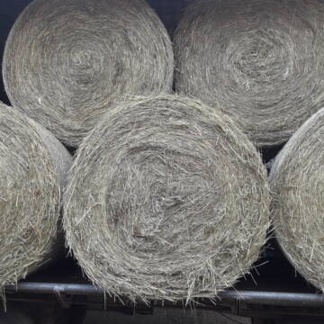
Rundballen Stroh
Elze-Esbeck
Hof Bartels
@Bartels
Stroh
Lieferant entlädt
Rundballen
Regenfrei
3 weitere...
B+
Heu Rundballen zu verkaufen
Peine
Hof-Hoppenworth
@Hof-Hoppenworth
Heu
Empfänger lädt ab
Rundballen
Regenfrei
3 weitere...
B+

Leider kein Vorschaubild
Leider kein Vorschaubild
Heu - HD Ballen aus Juni 2025
Wunstorf
Heike-Wichmann-Sasse
@Heike-Wichmann-Sasse
Heu
Empfänger lädt ab
Kleinballen/HD-Ballen
Regenfrei
2 weitere...
B+
Leider kein Vorschaubild
Leider kein Vorschaubild
HD-Ballen Handballen Heu Heuballen Ernte 2024
Wolfsburg
Bendlin GbR
@Bendlin_GbR
Heu
Kleinballen/HD-Ballen
Regenfrei
Käufer lädt selbst
2 weitere...
B+
Leider kein Vorschaubild
Leider kein Vorschaubild
HD-Ballen Handballen Stroh Strohballen Ernte 2024
Wolfsburg
Bendlin GbR
@Bendlin_GbR
Stroh
Kleinballen/HD-Ballen
Regenfrei
Käufer lädt selbst
2 weitere...
B+

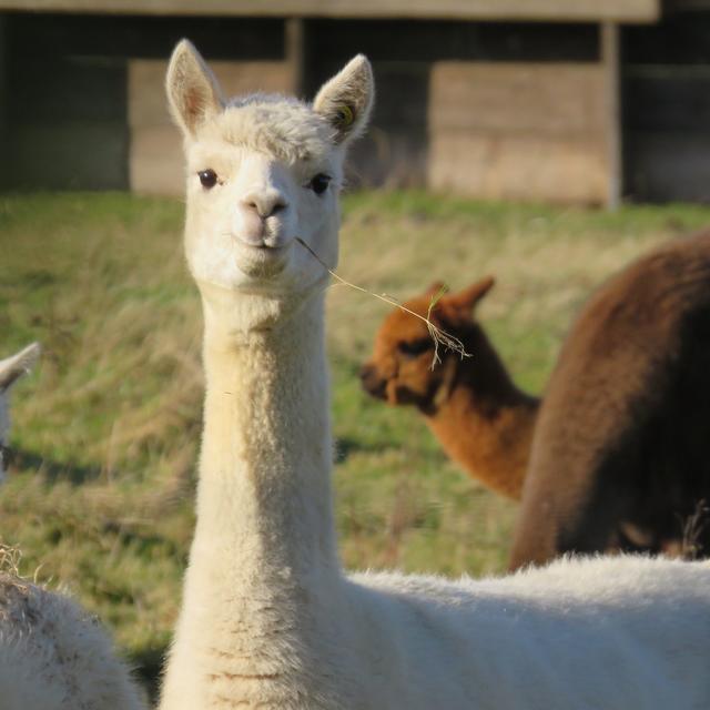
Futtersack HeuToy, Fressbremse in pink
Mechtersen
STALL-FREIde Marketing
@STALL-FREI-Marketing
Stundenlange Beschäftigung die
Koliken vorbeugt, geringe Staubinhalation mit
steuerbarer Futterentnahme


Premium Holzpellets als EINSTREU für die Pferdeb...
Spenge
Kenny Puhl
@Puhl-Pellets
Einstreu
Lieferant entlädt
Pellets
Wird verladen
2 weitere...
P+

Luzerneheu 1.Schnitt
Teutschenthal
Nancy
@Haltergemeinschaft-TT
Heu
Empfänger lädt ab
Rundballen
Regenfrei
2 weitere...
B+
Deprecated: Creation of dynamic property Zend_View::$pageCount is deprecated in /var/www/stall-frei/htdocs/staging.stall-frei.de/library/vendor/shardj/zf1-future/library/Zend/View/Abstract.php on line 308
Deprecated: Creation of dynamic property Zend_View::$itemCountPerPage is deprecated in /var/www/stall-frei/htdocs/staging.stall-frei.de/library/vendor/shardj/zf1-future/library/Zend/View/Abstract.php on line 308
Deprecated: Creation of dynamic property Zend_View::$first is deprecated in /var/www/stall-frei/htdocs/staging.stall-frei.de/library/vendor/shardj/zf1-future/library/Zend/View/Abstract.php on line 308
Deprecated: Creation of dynamic property Zend_View::$current is deprecated in /var/www/stall-frei/htdocs/staging.stall-frei.de/library/vendor/shardj/zf1-future/library/Zend/View/Abstract.php on line 308
Deprecated: Creation of dynamic property Zend_View::$last is deprecated in /var/www/stall-frei/htdocs/staging.stall-frei.de/library/vendor/shardj/zf1-future/library/Zend/View/Abstract.php on line 308
Deprecated: Creation of dynamic property Zend_View::$next is deprecated in /var/www/stall-frei/htdocs/staging.stall-frei.de/library/vendor/shardj/zf1-future/library/Zend/View/Abstract.php on line 308
Deprecated: Creation of dynamic property Zend_View::$pagesInRange is deprecated in /var/www/stall-frei/htdocs/staging.stall-frei.de/library/vendor/shardj/zf1-future/library/Zend/View/Abstract.php on line 308
Deprecated: Creation of dynamic property Zend_View::$firstPageInRange is deprecated in /var/www/stall-frei/htdocs/staging.stall-frei.de/library/vendor/shardj/zf1-future/library/Zend/View/Abstract.php on line 308
Deprecated: Creation of dynamic property Zend_View::$lastPageInRange is deprecated in /var/www/stall-frei/htdocs/staging.stall-frei.de/library/vendor/shardj/zf1-future/library/Zend/View/Abstract.php on line 308
Deprecated: Creation of dynamic property Zend_View::$currentItemCount is deprecated in /var/www/stall-frei/htdocs/staging.stall-frei.de/library/vendor/shardj/zf1-future/library/Zend/View/Abstract.php on line 308
Deprecated: Creation of dynamic property Zend_View::$totalItemCount is deprecated in /var/www/stall-frei/htdocs/staging.stall-frei.de/library/vendor/shardj/zf1-future/library/Zend/View/Abstract.php on line 308
Deprecated: Creation of dynamic property Zend_View::$firstItemNumber is deprecated in /var/www/stall-frei/htdocs/staging.stall-frei.de/library/vendor/shardj/zf1-future/library/Zend/View/Abstract.php on line 308
Deprecated: Creation of dynamic property Zend_View::$lastItemNumber is deprecated in /var/www/stall-frei/htdocs/staging.stall-frei.de/library/vendor/shardj/zf1-future/library/Zend/View/Abstract.php on line 308
Deprecated: Creation of dynamic property Zend_View::$router is deprecated in /var/www/stall-frei/htdocs/staging.stall-frei.de/library/vendor/shardj/zf1-future/library/Zend/View/Abstract.php on line 308
Deprecated: Creation of dynamic property Zend_View::$urlParams is deprecated in /var/www/stall-frei/htdocs/staging.stall-frei.de/library/vendor/shardj/zf1-future/library/Zend/View/Abstract.php on line 308
Deprecated: Creation of dynamic property Zend_View::$showAds is deprecated in /var/www/stall-frei/htdocs/staging.stall-frei.de/library/vendor/shardj/zf1-future/library/Zend/View/Abstract.php on line 308
Deprecated: Creation of dynamic property Zend_View::$objectIds is deprecated in /var/www/stall-frei/htdocs/staging.stall-frei.de/library/vendor/shardj/zf1-future/library/Zend/View/Abstract.php on line 308
Deprecated: Creation of dynamic property Zend_View::$showNavbar is deprecated in /var/www/stall-frei/htdocs/staging.stall-frei.de/library/vendor/shardj/zf1-future/library/Zend/View/Abstract.php on line 308
Deprecated: Creation of dynamic property Zend_View::$showBreadcrumb is deprecated in /var/www/stall-frei/htdocs/staging.stall-frei.de/library/vendor/shardj/zf1-future/library/Zend/View/Abstract.php on line 308
Deprecated: Creation of dynamic property Zend_View::$showFooter is deprecated in /var/www/stall-frei/htdocs/staging.stall-frei.de/library/vendor/shardj/zf1-future/library/Zend/View/Abstract.php on line 308
Deprecated: Creation of dynamic property Zend_View::$showInternalAds is deprecated in /var/www/stall-frei/htdocs/staging.stall-frei.de/library/vendor/shardj/zf1-future/library/Zend/View/Abstract.php on line 308
Deprecated: Creation of dynamic property Zend_View::$blNoContent is deprecated in /var/www/stall-frei/htdocs/staging.stall-frei.de/library/vendor/shardj/zf1-future/library/Zend/View/Abstract.php on line 308
Deprecated: Creation of dynamic property Zend_View::$sMetaDesc is deprecated in /var/www/stall-frei/htdocs/staging.stall-frei.de/library/vendor/shardj/zf1-future/library/Zend/View/Abstract.php on line 308
Deprecated: Creation of dynamic property Zend_View::$useGmaps is deprecated in /var/www/stall-frei/htdocs/staging.stall-frei.de/library/vendor/shardj/zf1-future/library/Zend/View/Abstract.php on line 308
Deprecated: Creation of dynamic property Zend_View::$touches is deprecated in /var/www/stall-frei/htdocs/staging.stall-frei.de/library/vendor/shardj/zf1-future/library/Zend/View/Abstract.php on line 308
Deprecated: Creation of dynamic property Zend_View::$oProject is deprecated in /var/www/stall-frei/htdocs/staging.stall-frei.de/library/vendor/shardj/zf1-future/library/Zend/View/Abstract.php on line 308
Deprecated: Creation of dynamic property Zend_View::$pageHeadline is deprecated in /var/www/stall-frei/htdocs/staging.stall-frei.de/library/vendor/shardj/zf1-future/library/Zend/View/Abstract.php on line 308
Deprecated: Creation of dynamic property Zend_View::$disableLocationField is deprecated in /var/www/stall-frei/htdocs/staging.stall-frei.de/library/vendor/shardj/zf1-future/library/Zend/View/Abstract.php on line 308
Deprecated: Creation of dynamic property Zend_View::$isSearch is deprecated in /var/www/stall-frei/htdocs/staging.stall-frei.de/library/vendor/shardj/zf1-future/library/Zend/View/Abstract.php on line 308
Deprecated: Creation of dynamic property Zend_View::$pageTitle is deprecated in /var/www/stall-frei/htdocs/staging.stall-frei.de/library/vendor/shardj/zf1-future/library/Zend/View/Abstract.php on line 308
Deprecated: Creation of dynamic property Psf_Form_Element_Text::$class is deprecated in /var/www/stall-frei/htdocs/staging.stall-frei.de/library/vendor/shardj/zf1-future/library/Zend/Form/Element.php on line 874
Deprecated: Creation of dynamic property Psf_Form_Element_Text::$size is deprecated in /var/www/stall-frei/htdocs/staging.stall-frei.de/library/vendor/shardj/zf1-future/library/Zend/Form/Element.php on line 874
Deprecated: Creation of dynamic property Psf_Form_Element_Text::$placeholder is deprecated in /var/www/stall-frei/htdocs/staging.stall-frei.de/library/vendor/shardj/zf1-future/library/Zend/Form/Element.php on line 874
Deprecated: Creation of dynamic property Psf_Form_Element_Hidden::$class is deprecated in /var/www/stall-frei/htdocs/staging.stall-frei.de/library/vendor/shardj/zf1-future/library/Zend/Form/Element.php on line 874
Deprecated: Creation of dynamic property Psf_Form_Element_Hidden::$class is deprecated in /var/www/stall-frei/htdocs/staging.stall-frei.de/library/vendor/shardj/zf1-future/library/Zend/Form/Element.php on line 874
Deprecated: Creation of dynamic property Psf_Form_Element_Hidden::$class is deprecated in /var/www/stall-frei/htdocs/staging.stall-frei.de/library/vendor/shardj/zf1-future/library/Zend/Form/Element.php on line 874
Deprecated: Creation of dynamic property Psf_Form_Element_Hidden::$class is deprecated in /var/www/stall-frei/htdocs/staging.stall-frei.de/library/vendor/shardj/zf1-future/library/Zend/Form/Element.php on line 874
Deprecated: Creation of dynamic property Psf_Form_Element_Select::$class is deprecated in /var/www/stall-frei/htdocs/staging.stall-frei.de/library/vendor/shardj/zf1-future/library/Zend/Form/Element.php on line 874
Deprecated: Creation of dynamic property Psf_Form_Element_Select::$class is deprecated in /var/www/stall-frei/htdocs/staging.stall-frei.de/library/vendor/shardj/zf1-future/library/Zend/Form/Element.php on line 874
Deprecated: Creation of dynamic property Psf_Form_Element_Select::$class is deprecated in /var/www/stall-frei/htdocs/staging.stall-frei.de/library/vendor/shardj/zf1-future/library/Zend/Form/Element.php on line 874
Deprecated: Creation of dynamic property Psf_Form_Element_Select::$class is deprecated in /var/www/stall-frei/htdocs/staging.stall-frei.de/library/vendor/shardj/zf1-future/library/Zend/Form/Element.php on line 874
Deprecated: Creation of dynamic property Zend_View::$sort is deprecated in /var/www/stall-frei/htdocs/staging.stall-frei.de/library/vendor/shardj/zf1-future/library/Zend/View/Abstract.php on line 308
Deprecated: Creation of dynamic property Zend_View::$searchLocation is deprecated in /var/www/stall-frei/htdocs/staging.stall-frei.de/library/vendor/shardj/zf1-future/library/Zend/View/Abstract.php on line 308
Deprecated: Creation of dynamic property Zend_View::$locationHint is deprecated in /var/www/stall-frei/htdocs/staging.stall-frei.de/library/vendor/shardj/zf1-future/library/Zend/View/Abstract.php on line 308
Psf_GeoCoder_Abstract::getLocation: Hainberg Get Location CachedOrLive
Psf_GeoCoder_Abstract::getCachedOrLive: Hainberg
Psf_GeoCoder_OpenCageData::makeApiRequest: response:
Array
(
[documentation] => https://opencagedata.com/api
[licenses] => Array
(
[0] => Array
(
[name] => see attribution guide
[url] => https://opencagedata.com/credits
)
)
[results] => Array
(
[0] => Array
(
[bounds] => Array
(
[northeast] => Array
(
[lat] => 51.5406727
[lng] => 9.9732473
)
[southwest] => Array
(
[lat] => 51.5405727
[lng] => 9.9731473
)
)
[components] => Array
(
[ISO_3166-1_alpha-2] => DE
[ISO_3166-1_alpha-3] => DEU
[ISO_3166-2] => Array
(
[0] => DE-NI
)
[_category] => natural/water
[_normalized_city] => Göttingen
[_type] => peak
[city] => Göttingen
[continent] => Europe
[country] => Deutschland
[country_code] => de
[county] => Landkreis Göttingen
[municipality] => Radolfshausen
[peak] => Hainberg
[political_union] => European Union
[postcode] => 37075
[state] => Niedersachsen
[state_code] => NI
)
[confidence] => 9
[formatted] => Hainberg, 37075 Göttingen, Deutschland
[geometry] => Array
(
[lat] => 51.5406227
[lng] => 9.9731973
)
)
[1] => Array
(
[bounds] => Array
(
[northeast] => Array
(
[lat] => 48.5643373
[lng] => 12.8216533
)
[southwest] => Array
(
[lat] => 48.5243373
[lng] => 12.7816533
)
)
[components] => Array
(
[ISO_3166-1_alpha-2] => DE
[ISO_3166-1_alpha-3] => DEU
[ISO_3166-2] => Array
(
[0] => DE-BY
)
[_category] => place
[_normalized_city] => Arnstorf
[_type] => village
[continent] => Europe
[country] => Deutschland
[country_code] => de
[county] => Landkreis Rottal-Inn
[political_union] => European Union
[postcode] => 94424
[state] => Bayern
[state_code] => BY
[town] => Arnstorf
[village] => Hainberg
)
[confidence] => 7
[formatted] => 94424 Hainberg, Deutschland
[geometry] => Array
(
[lat] => 48.5443373
[lng] => 12.8016533
)
)
[2] => Array
(
[bounds] => Array
(
[northeast] => Array
(
[lat] => 50.737012
[lng] => 11.6415654
)
[southwest] => Array
(
[lat] => 50.736912
[lng] => 11.6414654
)
)
[components] => Array
(
[ISO_3166-1_alpha-2] => DE
[ISO_3166-1_alpha-3] => DEU
[ISO_3166-2] => Array
(
[0] => DE-TH
)
[_category] => natural/water
[_normalized_city] => Oppurg
[_type] => peak
[continent] => Europe
[country] => Deutschland
[country_code] => de
[county] => Saale-Orla-Kreis
[municipality] => Oppurg
[peak] => Hainberg
[political_union] => European Union
[state] => Thüringen
[state_code] => TH
[village] => Oppurg
)
[confidence] => 9
[formatted] => Hainberg, Oppurg, Thüringen, Deutschland
[geometry] => Array
(
[lat] => 50.736962
[lng] => 11.6415154
)
)
[3] => Array
(
[bounds] => Array
(
[northeast] => Array
(
[lat] => 51.2686046
[lng] => 13.5054521
)
[southwest] => Array
(
[lat] => 51.2685046
[lng] => 13.5053521
)
)
[components] => Array
(
[ISO_3166-1_alpha-2] => DE
[ISO_3166-1_alpha-3] => DEU
[ISO_3166-2] => Array
(
[0] => DE-SN
)
[_category] => natural/water
[_normalized_city] => Priestewitz
[_type] => peak
[continent] => Europe
[country] => Deutschland
[country_code] => de
[county] => Meißen
[peak] => Hainberg
[political_union] => European Union
[postcode] => 01558
[state] => Sachsen
[state_code] => SN
[village] => Priestewitz
)
[confidence] => 9
[formatted] => Hainberg, 01558 Priestewitz, Deutschland
[geometry] => Array
(
[lat] => 51.2685546
[lng] => 13.5054021
)
)
[4] => Array
(
[bounds] => Array
(
[northeast] => Array
(
[lat] => 50.7666102
[lng] => 11.7959496
)
[southwest] => Array
(
[lat] => 50.7665102
[lng] => 11.7958496
)
)
[components] => Array
(
[ISO_3166-1_alpha-2] => DE
[ISO_3166-1_alpha-3] => DEU
[ISO_3166-2] => Array
(
[0] => DE-TH
)
[_category] => natural/water
[_normalized_city] => Rosendorf
[_type] => peak
[continent] => Europe
[country] => Deutschland
[country_code] => de
[county] => Saale-Orla-Kreis
[municipality] => Triptis
[peak] => Hainberg
[political_union] => European Union
[state] => Thüringen
[state_code] => TH
[village] => Rosendorf
)
[confidence] => 9
[formatted] => Hainberg, Rosendorf, Thüringen, Deutschland
[geometry] => Array
(
[lat] => 50.7665602
[lng] => 11.7958996
)
)
[5] => Array
(
[bounds] => Array
(
[northeast] => Array
(
[lat] => 51.304782
[lng] => 13.4219311
)
[southwest] => Array
(
[lat] => 51.304682
[lng] => 13.4218311
)
)
[components] => Array
(
[ISO_3166-1_alpha-2] => DE
[ISO_3166-1_alpha-3] => DEU
[ISO_3166-2] => Array
(
[0] => DE-SN
)
[_category] => natural/water
[_normalized_city] => Nünchritz
[_type] => peak
[continent] => Europe
[country] => Deutschland
[country_code] => de
[county] => Meißen
[municipality] => Nünchritz
[peak] => Hainberg
[political_union] => European Union
[postcode] => 01612
[state] => Sachsen
[state_code] => SN
[village] => Nünchritz
)
[confidence] => 9
[formatted] => Hainberg, 01612 Nünchritz, Deutschland
[geometry] => Array
(
[lat] => 51.304732
[lng] => 13.4218811
)
)
[6] => Array
(
[bounds] => Array
(
[northeast] => Array
(
[lat] => 51.135157
[lng] => 12.8112884
)
[southwest] => Array
(
[lat] => 51.135057
[lng] => 12.8111884
)
)
[components] => Array
(
[ISO_3166-1_alpha-2] => DE
[ISO_3166-1_alpha-3] => DEU
[ISO_3166-2] => Array
(
[0] => DE-SN
)
[_category] => natural/water
[_normalized_city] => Colditz
[_type] => peak
[continent] => Europe
[country] => Deutschland
[country_code] => de
[county] => Landkreis Leipzig
[peak] => Hainberg
[political_union] => European Union
[postcode] => 04680
[state] => Sachsen
[state_code] => SN
[town] => Colditz
)
[confidence] => 9
[formatted] => Hainberg, 04680 Colditz, Deutschland
[geometry] => Array
(
[lat] => 51.135107
[lng] => 12.8112384
)
)
[7] => Array
(
[bounds] => Array
(
[northeast] => Array
(
[lat] => 50.8351754
[lng] => 14.7266662
)
[southwest] => Array
(
[lat] => 50.8350754
[lng] => 14.7265662
)
)
[components] => Array
(
[ISO_3166-1_alpha-2] => DE
[ISO_3166-1_alpha-3] => DEU
[ISO_3166-2] => Array
(
[0] => DE-SN
)
[_category] => natural/water
[_normalized_city] => Oybin
[_type] => peak
[continent] => Europe
[country] => Deutschland
[country_code] => de
[county] => Görlitz
[municipality] => Olbersdorf
[peak] => Hainberg
[political_union] => European Union
[postcode] => 02797
[state] => Sachsen
[state_code] => SN
[village] => Oybin
)
[confidence] => 9
[formatted] => Hainberg, 02797 Oybin, Deutschland
[geometry] => Array
(
[lat] => 50.8351254
[lng] => 14.7266162
)
)
[8] => Array
(
[bounds] => Array
(
[northeast] => Array
(
[lat] => 50.6498643
[lng] => 13.3340113
)
[southwest] => Array
(
[lat] => 50.6497643
[lng] => 13.3339113
)
)
[components] => Array
(
[ISO_3166-1_alpha-2] => DE
[ISO_3166-1_alpha-3] => DEU
[ISO_3166-2] => Array
(
[0] => DE-SN
)
[_category] => natural/water
[_normalized_city] => Olbernhau
[_type] => peak
[continent] => Europe
[country] => Deutschland
[country_code] => de
[county] => Erzgebirgskreis
[peak] => Hainberg
[political_union] => European Union
[postcode] => 09526
[state] => Sachsen
[state_code] => SN
[town] => Olbernhau
)
[confidence] => 9
[formatted] => Hainberg, 09526 Olbernhau, Deutschland
[geometry] => Array
(
[lat] => 50.6498143
[lng] => 13.3339613
)
)
[9] => Array
(
[components] => Array
(
[ISO_3166-1_alpha-2] => FR
[ISO_3166-1_alpha-3] => FRA
[ISO_3166-2] => Array
(
[0] => FR-IDF
[1] => FR-92
)
[_category] => road
[_normalized_city] => Levallois-Perret
[_type] => road
[city] => Levallois-Perret
[continent] => Europe
[country] => France
[country_code] => fr
[county] => Hauts-de-Seine
[local_authority] => Métropole du Grand Paris
[political_union] => European Union
[postcode] => 92300
[road] => Rue Charles Deutschmann
[state] => Île-de-France
[state_code] => IDF
)
[confidence] => 3
[formatted] => Rue Charles Deutschmann, 92300 Levallois-Perret, France
[geometry] => Array
(
[lat] => 48.900049
[lng] => 2.2842
)
)
)
[status] => Array
(
[code] => 200
[message] => OK
)
[stay_informed] => Array
(
[blog] => https://blog.opencagedata.com
[mastodon] => https://en.osm.town/@opencage
)
[thanks] => For using an OpenCage API
[timestamp] => Array
(
[created_http] => Mon, 09 Feb 2026 08:28:17 GMT
[created_unix] => 1770625697
)
[total_results] => 10
)
Psf_GeoCoder_Abstract::convertLocationResult
{"documentation":"https:\/\/opencagedata.com\/api","licenses":[{"name":"see attribution guide","url":"https:\/\/opencagedata.com\/credits"}],"results":[{"bounds":{"northeast":{"lat":51.5406727,"lng":9.9732473},"southwest":{"lat":51.5405727,"lng":9.9731473}},"components":{"ISO_3166-1_alpha-2":"DE","ISO_3166-1_alpha-3":"DEU","ISO_3166-2":["DE-NI"],"_category":"natural\/water","_normalized_city":"G\u00f6ttingen","_type":"peak","city":"G\u00f6ttingen","continent":"Europe","country":"Deutschland","country_code":"de","county":"Landkreis G\u00f6ttingen","municipality":"Radolfshausen","peak":"Hainberg","political_union":"European Union","postcode":"37075","state":"Niedersachsen","state_code":"NI"},"confidence":9,"formatted":"Hainberg, 37075 G\u00f6ttingen, Deutschland","geometry":{"lat":51.5406227,"lng":9.9731973}},{"bounds":{"northeast":{"lat":48.5643373,"lng":12.8216533},"southwest":{"lat":48.5243373,"lng":12.7816533}},"components":{"ISO_3166-1_alpha-2":"DE","ISO_3166-1_alpha-3":"DEU","ISO_3166-2":["DE-BY"],"_category":"place","_normalized_city":"Arnstorf","_type":"village","continent":"Europe","country":"Deutschland","country_code":"de","county":"Landkreis Rottal-Inn","political_union":"European Union","postcode":"94424","state":"Bayern","state_code":"BY","town":"Arnstorf","village":"Hainberg"},"confidence":7,"formatted":"94424 Hainberg, Deutschland","geometry":{"lat":48.5443373,"lng":12.8016533}},{"bounds":{"northeast":{"lat":50.737012,"lng":11.6415654},"southwest":{"lat":50.736912,"lng":11.6414654}},"components":{"ISO_3166-1_alpha-2":"DE","ISO_3166-1_alpha-3":"DEU","ISO_3166-2":["DE-TH"],"_category":"natural\/water","_normalized_city":"Oppurg","_type":"peak","continent":"Europe","country":"Deutschland","country_code":"de","county":"Saale-Orla-Kreis","municipality":"Oppurg","peak":"Hainberg","political_union":"European Union","state":"Th\u00fcringen","state_code":"TH","village":"Oppurg"},"confidence":9,"formatted":"Hainberg, Oppurg, Th\u00fcringen, Deutschland","geometry":{"lat":50.736962,"lng":11.6415154}},{"bounds":{"northeast":{"lat":51.2686046,"lng":13.5054521},"southwest":{"lat":51.2685046,"lng":13.5053521}},"components":{"ISO_3166-1_alpha-2":"DE","ISO_3166-1_alpha-3":"DEU","ISO_3166-2":["DE-SN"],"_category":"natural\/water","_normalized_city":"Priestewitz","_type":"peak","continent":"Europe","country":"Deutschland","country_code":"de","county":"Mei\u00dfen","peak":"Hainberg","political_union":"European Union","postcode":"01558","state":"Sachsen","state_code":"SN","village":"Priestewitz"},"confidence":9,"formatted":"Hainberg, 01558 Priestewitz, Deutschland","geometry":{"lat":51.2685546,"lng":13.5054021}},{"bounds":{"northeast":{"lat":50.7666102,"lng":11.7959496},"southwest":{"lat":50.7665102,"lng":11.7958496}},"components":{"ISO_3166-1_alpha-2":"DE","ISO_3166-1_alpha-3":"DEU","ISO_3166-2":["DE-TH"],"_category":"natural\/water","_normalized_city":"Rosendorf","_type":"peak","continent":"Europe","country":"Deutschland","country_code":"de","county":"Saale-Orla-Kreis","municipality":"Triptis","peak":"Hainberg","political_union":"European Union","state":"Th\u00fcringen","state_code":"TH","village":"Rosendorf"},"confidence":9,"formatted":"Hainberg, Rosendorf, Th\u00fcringen, Deutschland","geometry":{"lat":50.7665602,"lng":11.7958996}},{"bounds":{"northeast":{"lat":51.304782,"lng":13.4219311},"southwest":{"lat":51.304682,"lng":13.4218311}},"components":{"ISO_3166-1_alpha-2":"DE","ISO_3166-1_alpha-3":"DEU","ISO_3166-2":["DE-SN"],"_category":"natural\/water","_normalized_city":"N\u00fcnchritz","_type":"peak","continent":"Europe","country":"Deutschland","country_code":"de","county":"Mei\u00dfen","municipality":"N\u00fcnchritz","peak":"Hainberg","political_union":"European Union","postcode":"01612","state":"Sachsen","state_code":"SN","village":"N\u00fcnchritz"},"confidence":9,"formatted":"Hainberg, 01612 N\u00fcnchritz, Deutschland","geometry":{"lat":51.304732,"lng":13.4218811}},{"bounds":{"northeast":{"lat":51.135157,"lng":12.8112884},"southwest":{"lat":51.135057,"lng":12.8111884}},"components":{"ISO_3166-1_alpha-2":"DE","ISO_3166-1_alpha-3":"DEU","ISO_3166-2":["DE-SN"],"_category":"natural\/water","_normalized_city":"Colditz","_type":"peak","continent":"Europe","country":"Deutschland","country_code":"de","county":"Landkreis Leipzig","peak":"Hainberg","political_union":"European Union","postcode":"04680","state":"Sachsen","state_code":"SN","town":"Colditz"},"confidence":9,"formatted":"Hainberg, 04680 Colditz, Deutschland","geometry":{"lat":51.135107,"lng":12.8112384}},{"bounds":{"northeast":{"lat":50.8351754,"lng":14.7266662},"southwest":{"lat":50.8350754,"lng":14.7265662}},"components":{"ISO_3166-1_alpha-2":"DE","ISO_3166-1_alpha-3":"DEU","ISO_3166-2":["DE-SN"],"_category":"natural\/water","_normalized_city":"Oybin","_type":"peak","continent":"Europe","country":"Deutschland","country_code":"de","county":"G\u00f6rlitz","municipality":"Olbersdorf","peak":"Hainberg","political_union":"European Union","postcode":"02797","state":"Sachsen","state_code":"SN","village":"Oybin"},"confidence":9,"formatted":"Hainberg, 02797 Oybin, Deutschland","geometry":{"lat":50.8351254,"lng":14.7266162}},{"bounds":{"northeast":{"lat":50.6498643,"lng":13.3340113},"southwest":{"lat":50.6497643,"lng":13.3339113}},"components":{"ISO_3166-1_alpha-2":"DE","ISO_3166-1_alpha-3":"DEU","ISO_3166-2":["DE-SN"],"_category":"natural\/water","_normalized_city":"Olbernhau","_type":"peak","continent":"Europe","country":"Deutschland","country_code":"de","county":"Erzgebirgskreis","peak":"Hainberg","political_union":"European Union","postcode":"09526","state":"Sachsen","state_code":"SN","town":"Olbernhau"},"confidence":9,"formatted":"Hainberg, 09526 Olbernhau, Deutschland","geometry":{"lat":50.6498143,"lng":13.3339613}},{"components":{"ISO_3166-1_alpha-2":"FR","ISO_3166-1_alpha-3":"FRA","ISO_3166-2":["FR-IDF","FR-92"],"_category":"road","_normalized_city":"Levallois-Perret","_type":"road","city":"Levallois-Perret","continent":"Europe","country":"France","country_code":"fr","county":"Hauts-de-Seine","local_authority":"M\u00e9tropole du Grand Paris","political_union":"European Union","postcode":"92300","road":"Rue Charles Deutschmann","state":"\u00cele-de-France","state_code":"IDF"},"confidence":3,"formatted":"Rue Charles Deutschmann, 92300 Levallois-Perret, France","geometry":{"lat":48.900049,"lng":2.2842}}],"status":{"code":200,"message":"OK"},"stay_informed":{"blog":"https:\/\/blog.opencagedata.com","mastodon":"https:\/\/en.osm.town\/@opencage"},"thanks":"For using an OpenCage API","timestamp":{"created_http":"Mon, 09 Feb 2026 08:28:17 GMT","created_unix":1770625697},"total_results":10}Array
(
[0] => stdClass Object
(
[bounds] => stdClass Object
(
[northeast] => stdClass Object
(
[lat] => 51.5406727
[lng] => 9.9732473
)
[southwest] => stdClass Object
(
[lat] => 51.5405727
[lng] => 9.9731473
)
)
[components] => stdClass Object
(
[ISO_3166-1_alpha-2] => DE
[ISO_3166-1_alpha-3] => DEU
[ISO_3166-2] => Array
(
[0] => DE-NI
)
[_category] => natural/water
[_normalized_city] => Göttingen
[_type] => peak
[city] => Göttingen
[continent] => Europe
[country] => Deutschland
[country_code] => de
[county] => Landkreis Göttingen
[municipality] => Radolfshausen
[peak] => Hainberg
[political_union] => European Union
[postcode] => 37075
[state] => Niedersachsen
[state_code] => NI
)
[confidence] => 9
[formatted] => Hainberg, 37075 Göttingen, Deutschland
[geometry] => stdClass Object
(
[lat] => 51.5406227
[lng] => 9.9731973
)
)
[1] => stdClass Object
(
[bounds] => stdClass Object
(
[northeast] => stdClass Object
(
[lat] => 48.5643373
[lng] => 12.8216533
)
[southwest] => stdClass Object
(
[lat] => 48.5243373
[lng] => 12.7816533
)
)
[components] => stdClass Object
(
[ISO_3166-1_alpha-2] => DE
[ISO_3166-1_alpha-3] => DEU
[ISO_3166-2] => Array
(
[0] => DE-BY
)
[_category] => place
[_normalized_city] => Arnstorf
[_type] => village
[continent] => Europe
[country] => Deutschland
[country_code] => de
[county] => Landkreis Rottal-Inn
[political_union] => European Union
[postcode] => 94424
[state] => Bayern
[state_code] => BY
[town] => Arnstorf
[village] => Hainberg
)
[confidence] => 7
[formatted] => 94424 Hainberg, Deutschland
[geometry] => stdClass Object
(
[lat] => 48.5443373
[lng] => 12.8016533
)
)
[2] => stdClass Object
(
[bounds] => stdClass Object
(
[northeast] => stdClass Object
(
[lat] => 50.737012
[lng] => 11.6415654
)
[southwest] => stdClass Object
(
[lat] => 50.736912
[lng] => 11.6414654
)
)
[components] => stdClass Object
(
[ISO_3166-1_alpha-2] => DE
[ISO_3166-1_alpha-3] => DEU
[ISO_3166-2] => Array
(
[0] => DE-TH
)
[_category] => natural/water
[_normalized_city] => Oppurg
[_type] => peak
[continent] => Europe
[country] => Deutschland
[country_code] => de
[county] => Saale-Orla-Kreis
[municipality] => Oppurg
[peak] => Hainberg
[political_union] => European Union
[state] => Thüringen
[state_code] => TH
[village] => Oppurg
)
[confidence] => 9
[formatted] => Hainberg, Oppurg, Thüringen, Deutschland
[geometry] => stdClass Object
(
[lat] => 50.736962
[lng] => 11.6415154
)
)
[3] => stdClass Object
(
[bounds] => stdClass Object
(
[northeast] => stdClass Object
(
[lat] => 51.2686046
[lng] => 13.5054521
)
[southwest] => stdClass Object
(
[lat] => 51.2685046
[lng] => 13.5053521
)
)
[components] => stdClass Object
(
[ISO_3166-1_alpha-2] => DE
[ISO_3166-1_alpha-3] => DEU
[ISO_3166-2] => Array
(
[0] => DE-SN
)
[_category] => natural/water
[_normalized_city] => Priestewitz
[_type] => peak
[continent] => Europe
[country] => Deutschland
[country_code] => de
[county] => Meißen
[peak] => Hainberg
[political_union] => European Union
[postcode] => 01558
[state] => Sachsen
[state_code] => SN
[village] => Priestewitz
)
[confidence] => 9
[formatted] => Hainberg, 01558 Priestewitz, Deutschland
[geometry] => stdClass Object
(
[lat] => 51.2685546
[lng] => 13.5054021
)
)
[4] => stdClass Object
(
[bounds] => stdClass Object
(
[northeast] => stdClass Object
(
[lat] => 50.7666102
[lng] => 11.7959496
)
[southwest] => stdClass Object
(
[lat] => 50.7665102
[lng] => 11.7958496
)
)
[components] => stdClass Object
(
[ISO_3166-1_alpha-2] => DE
[ISO_3166-1_alpha-3] => DEU
[ISO_3166-2] => Array
(
[0] => DE-TH
)
[_category] => natural/water
[_normalized_city] => Rosendorf
[_type] => peak
[continent] => Europe
[country] => Deutschland
[country_code] => de
[county] => Saale-Orla-Kreis
[municipality] => Triptis
[peak] => Hainberg
[political_union] => European Union
[state] => Thüringen
[state_code] => TH
[village] => Rosendorf
)
[confidence] => 9
[formatted] => Hainberg, Rosendorf, Thüringen, Deutschland
[geometry] => stdClass Object
(
[lat] => 50.7665602
[lng] => 11.7958996
)
)
[5] => stdClass Object
(
[bounds] => stdClass Object
(
[northeast] => stdClass Object
(
[lat] => 51.304782
[lng] => 13.4219311
)
[southwest] => stdClass Object
(
[lat] => 51.304682
[lng] => 13.4218311
)
)
[components] => stdClass Object
(
[ISO_3166-1_alpha-2] => DE
[ISO_3166-1_alpha-3] => DEU
[ISO_3166-2] => Array
(
[0] => DE-SN
)
[_category] => natural/water
[_normalized_city] => Nünchritz
[_type] => peak
[continent] => Europe
[country] => Deutschland
[country_code] => de
[county] => Meißen
[municipality] => Nünchritz
[peak] => Hainberg
[political_union] => European Union
[postcode] => 01612
[state] => Sachsen
[state_code] => SN
[village] => Nünchritz
)
[confidence] => 9
[formatted] => Hainberg, 01612 Nünchritz, Deutschland
[geometry] => stdClass Object
(
[lat] => 51.304732
[lng] => 13.4218811
)
)
[6] => stdClass Object
(
[bounds] => stdClass Object
(
[northeast] => stdClass Object
(
[lat] => 51.135157
[lng] => 12.8112884
)
[southwest] => stdClass Object
(
[lat] => 51.135057
[lng] => 12.8111884
)
)
[components] => stdClass Object
(
[ISO_3166-1_alpha-2] => DE
[ISO_3166-1_alpha-3] => DEU
[ISO_3166-2] => Array
(
[0] => DE-SN
)
[_category] => natural/water
[_normalized_city] => Colditz
[_type] => peak
[continent] => Europe
[country] => Deutschland
[country_code] => de
[county] => Landkreis Leipzig
[peak] => Hainberg
[political_union] => European Union
[postcode] => 04680
[state] => Sachsen
[state_code] => SN
[town] => Colditz
)
[confidence] => 9
[formatted] => Hainberg, 04680 Colditz, Deutschland
[geometry] => stdClass Object
(
[lat] => 51.135107
[lng] => 12.8112384
)
)
[7] => stdClass Object
(
[bounds] => stdClass Object
(
[northeast] => stdClass Object
(
[lat] => 50.8351754
[lng] => 14.7266662
)
[southwest] => stdClass Object
(
[lat] => 50.8350754
[lng] => 14.7265662
)
)
[components] => stdClass Object
(
[ISO_3166-1_alpha-2] => DE
[ISO_3166-1_alpha-3] => DEU
[ISO_3166-2] => Array
(
[0] => DE-SN
)
[_category] => natural/water
[_normalized_city] => Oybin
[_type] => peak
[continent] => Europe
[country] => Deutschland
[country_code] => de
[county] => Görlitz
[municipality] => Olbersdorf
[peak] => Hainberg
[political_union] => European Union
[postcode] => 02797
[state] => Sachsen
[state_code] => SN
[village] => Oybin
)
[confidence] => 9
[formatted] => Hainberg, 02797 Oybin, Deutschland
[geometry] => stdClass Object
(
[lat] => 50.8351254
[lng] => 14.7266162
)
)
[8] => stdClass Object
(
[bounds] => stdClass Object
(
[northeast] => stdClass Object
(
[lat] => 50.6498643
[lng] => 13.3340113
)
[southwest] => stdClass Object
(
[lat] => 50.6497643
[lng] => 13.3339113
)
)
[components] => stdClass Object
(
[ISO_3166-1_alpha-2] => DE
[ISO_3166-1_alpha-3] => DEU
[ISO_3166-2] => Array
(
[0] => DE-SN
)
[_category] => natural/water
[_normalized_city] => Olbernhau
[_type] => peak
[continent] => Europe
[country] => Deutschland
[country_code] => de
[county] => Erzgebirgskreis
[peak] => Hainberg
[political_union] => European Union
[postcode] => 09526
[state] => Sachsen
[state_code] => SN
[town] => Olbernhau
)
[confidence] => 9
[formatted] => Hainberg, 09526 Olbernhau, Deutschland
[geometry] => stdClass Object
(
[lat] => 50.6498143
[lng] => 13.3339613
)
)
[9] => stdClass Object
(
[components] => stdClass Object
(
[ISO_3166-1_alpha-2] => FR
[ISO_3166-1_alpha-3] => FRA
[ISO_3166-2] => Array
(
[0] => FR-IDF
[1] => FR-92
)
[_category] => road
[_normalized_city] => Levallois-Perret
[_type] => road
[city] => Levallois-Perret
[continent] => Europe
[country] => France
[country_code] => fr
[county] => Hauts-de-Seine
[local_authority] => Métropole du Grand Paris
[political_union] => European Union
[postcode] => 92300
[road] => Rue Charles Deutschmann
[state] => Île-de-France
[state_code] => IDF
)
[confidence] => 3
[formatted] => Rue Charles Deutschmann, 92300 Levallois-Perret, France
[geometry] => stdClass Object
(
[lat] => 48.900049
[lng] => 2.2842
)
)
)
Psf_GeoCoder_OpenCageData::getKeyMap: 0
stdClass Object
(
    [bounds] => stdClass Object
        (
            [northeast] => stdClass Object
                (
                    [lat] => 51.5406727
                    [lng] => 9.9732473
                )

            [southwest] => stdClass Object
                (
                    [lat] => 51.5405727
                    [lng] => 9.9731473
                )

        )

    [components] => stdClass Object
        (
            [ISO_3166-1_alpha-2] => DE
            [ISO_3166-1_alpha-3] => DEU
            [ISO_3166-2] => Array
                (
                    [0] => DE-NI
                )

            [_category] => natural/water
            [_normalized_city] => Göttingen
            [_type] => peak
            [city] => Göttingen
            [continent] => Europe
            [country] => Deutschland
            [country_code] => de
            [county] => Landkreis Göttingen
            [municipality] => Radolfshausen
            [peak] => Hainberg
            [political_union] => European Union
            [postcode] => 37075
            [state] => Niedersachsen
            [state_code] => NI
        )

    [confidence] => 9
    [formatted] => Hainberg, 37075 Göttingen, Deutschland
    [geometry] => stdClass Object
        (
            [lat] => 51.5406227
            [lng] => 9.9731973
        )

)
Psf_GeoCoder_OpenCageData::getCounty: Göttingen
Psf_GeoCoder_OpenCageData::addMissingData REFETCH!
Array
(
    [address] => Hainberg, 37075 Göttingen, Deutschland
    [type] => peak
    [street] =>
    [city] => Göttingen
    [county] => Göttingen
    [state] => Niedersachsen
    [zip] => 37075
    [country] => Deutschland
    [suburb] =>
    [countrycode] => de
    [latitude] => 51.5406227
    [longitude] => 9.9731973
    [accuracy] => 1
    [confidence] => 9
    [bounds] => stdClass Object
        (
            [northeast] => stdClass Object
                (
                    [lat] => 51.5406727
                    [lng] => 9.9732473
                )

            [southwest] => stdClass Object
                (
                    [lat] => 51.5405727
                    [lng] => 9.9731473
                )

        )

)
reformat!
Array
(
    [address] => Hainberg, 37075 Göttingen, Deutschland
    [type] => peak
    [street] =>
    [city] => Göttingen
    [county] => Göttingen
    [state] => Niedersachsen
    [zip] => 37075
    [country] => Deutschland
    [suburb] =>
    [countrycode] => de
    [latitude] => 51.5406227
    [longitude] => 9.9731973
    [accuracy] => 1
    [confidence] => 9
    [bounds] => stdClass Object
        (
            [northeast] => stdClass Object
                (
                    [lat] => 51.5406727
                    [lng] => 9.9732473
                )

            [southwest] => stdClass Object
                (
                    [lat] => 51.5405727
                    [lng] => 9.9731473
                )

        )

    [place] => 37075 Göttingen, Niedersachsen
    [hash] => 691b72a60f76fda840c00ebe56c9e2e9
)
Psf_GeoCoder_OpenCageData::getKeyMap: 1
stdClass Object
(
    [bounds] => stdClass Object
        (
            [northeast] => stdClass Object
                (
                    [lat] => 48.5643373
                    [lng] => 12.8216533
                )

            [southwest] => stdClass Object
                (
                    [lat] => 48.5243373
                    [lng] => 12.7816533
                )

        )

    [components] => stdClass Object
        (
            [ISO_3166-1_alpha-2] => DE
            [ISO_3166-1_alpha-3] => DEU
            [ISO_3166-2] => Array
                (
                    [0] => DE-BY
                )

            [_category] => place
            [_normalized_city] => Arnstorf
            [_type] => village
            [continent] => Europe
            [country] => Deutschland
            [country_code] => de
            [county] => Landkreis Rottal-Inn
            [political_union] => European Union
            [postcode] => 94424
            [state] => Bayern
            [state_code] => BY
            [town] => Arnstorf
            [village] => Hainberg
        )

    [confidence] => 7
    [formatted] => 94424 Hainberg, Deutschland
    [geometry] => stdClass Object
        (
            [lat] => 48.5443373
            [lng] => 12.8016533
        )

)
Psf_GeoCoder_OpenCageData::getCounty: Rottal-Inn
Psf_GeoCoder_OpenCageData::addMissingData REFETCH!
Array
(
    [address] => 94424 Hainberg, Deutschland
    [type] => village
    [street] =>
    [city] => Arnstorf
    [county] => Rottal-Inn
    [state] => Bayern
    [zip] => 94424
    [country] => Deutschland
    [suburb] =>
    [countrycode] => de
    [latitude] => 48.5443373
    [longitude] => 12.8016533
    [accuracy] => 1
    [confidence] => 7
    [bounds] => stdClass Object
        (
            [northeast] => stdClass Object
                (
                    [lat] => 48.5643373
                    [lng] => 12.8216533
                )

            [southwest] => stdClass Object
                (
                    [lat] => 48.5243373
                    [lng] => 12.7816533
                )

        )

)
reformat!
Array
(
    [address] => 94424 Arnstorf
    [type] => village
    [street] =>
    [city] => Arnstorf
    [county] => Rottal-Inn
    [state] => Bayern
    [zip] => 94424
    [country] => Deutschland
    [suburb] =>
    [countrycode] => de
    [latitude] => 48.5443373
    [longitude] => 12.8016533
    [accuracy] => 1
    [confidence] => 7
    [bounds] => stdClass Object
        (
            [northeast] => stdClass Object
                (
                    [lat] => 48.5643373
                    [lng] => 12.8216533
                )

            [southwest] => stdClass Object
                (
                    [lat] => 48.5243373
                    [lng] => 12.7816533
                )

        )

    [place] => 94424 Arnstorf, Bayern
    [hash] => c3db5e7078b0b6c732f9413c259e9676
)
Psf_GeoCoder_OpenCageData::getKeyMap: 2
stdClass Object
(
    [bounds] => stdClass Object
        (
            [northeast] => stdClass Object
                (
                    [lat] => 50.737012
                    [lng] => 11.6415654
                )

            [southwest] => stdClass Object
                (
                    [lat] => 50.736912
                    [lng] => 11.6414654
                )

        )

    [components] => stdClass Object
        (
            [ISO_3166-1_alpha-2] => DE
            [ISO_3166-1_alpha-3] => DEU
            [ISO_3166-2] => Array
                (
                    [0] => DE-TH
                )

            [_category] => natural/water
            [_normalized_city] => Oppurg
            [_type] => peak
            [continent] => Europe
            [country] => Deutschland
            [country_code] => de
            [county] => Saale-Orla-Kreis
            [municipality] => Oppurg
            [peak] => Hainberg
            [political_union] => European Union
            [state] => Thüringen
            [state_code] => TH
            [village] => Oppurg
        )

    [confidence] => 9
    [formatted] => Hainberg, Oppurg, Thüringen, Deutschland
    [geometry] => stdClass Object
        (
            [lat] => 50.736962
            [lng] => 11.6415154
        )

)
Psf_GeoCoder_OpenCageData::getCounty: Saale-Orla-Kreis
Psf_GeoCoder_OpenCageData::addMissingData REFETCH!
Array
(
    [address] => Hainberg, Oppurg, Thüringen, Deutschland
    [type] => peak
    [street] =>
    [city] => Oppurg
    [county] => Saale-Orla-Kreis
    [state] => Thüringen
    [zip] =>
    [country] => Deutschland
    [suburb] =>
    [countrycode] => de
    [latitude] => 50.736962
    [longitude] => 11.6415154
    [accuracy] => 1
    [confidence] => 9
    [bounds] => stdClass Object
        (
            [northeast] => stdClass Object
                (
                    [lat] => 50.737012
                    [lng] => 11.6415654
                )

            [southwest] => stdClass Object
                (
                    [lat] => 50.736912
                    [lng] => 11.6414654
                )

        )

)
reformat!
Array
(
    [address] => Hainberg, Oppurg, Thüringen, Deutschland
    [type] => peak
    [street] =>
    [city] => Oppurg
    [county] => Saale-Orla-Kreis
    [state] => Thüringen
    [zip] =>
    [country] => Deutschland
    [suburb] =>
    [countrycode] => de
    [latitude] => 50.736962
    [longitude] => 11.6415154
    [accuracy] => 1
    [confidence] => 9
    [bounds] => stdClass Object
        (
            [northeast] => stdClass Object
                (
                    [lat] => 50.737012
                    [lng] => 11.6415654
                )

            [southwest] => stdClass Object
                (
                    [lat] => 50.736912
                    [lng] => 11.6414654
                )

        )

    [place] => Oppurg, Thüringen
    [hash] => 154f04c786b31b628df8b39c12ecabe7
)
Psf_GeoCoder_OpenCageData::getKeyMap: 3
stdClass Object
(
    [bounds] => stdClass Object
        (
            [northeast] => stdClass Object
                (
                    [lat] => 51.2686046
                    [lng] => 13.5054521
                )

            [southwest] => stdClass Object
                (
                    [lat] => 51.2685046
                    [lng] => 13.5053521
                )

        )

    [components] => stdClass Object
        (
            [ISO_3166-1_alpha-2] => DE
            [ISO_3166-1_alpha-3] => DEU
            [ISO_3166-2] => Array
                (
                    [0] => DE-SN
                )

            [_category] => natural/water
            [_normalized_city] => Priestewitz
            [_type] => peak
            [continent] => Europe
            [country] => Deutschland
            [country_code] => de
            [county] => Meißen
            [peak] => Hainberg
            [political_union] => European Union
            [postcode] => 01558
            [state] => Sachsen
            [state_code] => SN
            [village] => Priestewitz
        )

    [confidence] => 9
    [formatted] => Hainberg, 01558 Priestewitz, Deutschland
    [geometry] => stdClass Object
        (
            [lat] => 51.2685546
            [lng] => 13.5054021
        )

)
Psf_GeoCoder_OpenCageData::getCounty: Meißen
Psf_GeoCoder_OpenCageData::addMissingData REFETCH!
Array
(
    [address] => Hainberg, 01558 Priestewitz, Deutschland
    [type] => peak
    [street] =>
    [city] => Priestewitz
    [county] => Meißen
    [state] => Sachsen
    [zip] => 01558
    [country] => Deutschland
    [suburb] =>
    [countrycode] => de
    [latitude] => 51.2685546
    [longitude] => 13.5054021
    [accuracy] => 1
    [confidence] => 9
    [bounds] => stdClass Object
        (
            [northeast] => stdClass Object
                (
                    [lat] => 51.2686046
                    [lng] => 13.5054521
                )

            [southwest] => stdClass Object
                (
                    [lat] => 51.2685046
                    [lng] => 13.5053521
                )

        )

)
reformat!
Array
(
    [address] => Hainberg, 01558 Priestewitz, Deutschland
    [type] => peak
    [street] =>
    [city] => Priestewitz
    [county] => Meißen
    [state] => Sachsen
    [zip] => 01558
    [country] => Deutschland
    [suburb] =>
    [countrycode] => de
    [latitude] => 51.2685546
    [longitude] => 13.5054021
    [accuracy] => 1
    [confidence] => 9
    [bounds] => stdClass Object
        (
            [northeast] => stdClass Object
                (
                    [lat] => 51.2686046
                    [lng] => 13.5054521
                )

            [southwest] => stdClass Object
                (
                    [lat] => 51.2685046
                    [lng] => 13.5053521
                )

        )

    [place] => 01558 Priestewitz, Sachsen
    [hash] => 00da53d9ffa08584ff07d5bc3bc582b1
)
Psf_GeoCoder_OpenCageData::getKeyMap: 4
stdClass Object
(
    [bounds] => stdClass Object
        (
            [northeast] => stdClass Object
                (
                    [lat] => 50.7666102
                    [lng] => 11.7959496
                )

            [southwest] => stdClass Object
                (
                    [lat] => 50.7665102
                    [lng] => 11.7958496
                )

        )

    [components] => stdClass Object
        (
            [ISO_3166-1_alpha-2] => DE
            [ISO_3166-1_alpha-3] => DEU
            [ISO_3166-2] => Array
                (
                    [0] => DE-TH
                )

            [_category] => natural/water
            [_normalized_city] => Rosendorf
            [_type] => peak
            [continent] => Europe
            [country] => Deutschland
            [country_code] => de
            [county] => Saale-Orla-Kreis
            [municipality] => Triptis
            [peak] => Hainberg
            [political_union] => European Union
            [state] => Thüringen
            [state_code] => TH
            [village] => Rosendorf
        )

    [confidence] => 9
    [formatted] => Hainberg, Rosendorf, Thüringen, Deutschland
    [geometry] => stdClass Object
        (
            [lat] => 50.7665602
            [lng] => 11.7958996
        )

)
Psf_GeoCoder_OpenCageData::getCounty: Saale-Orla-Kreis
Psf_GeoCoder_OpenCageData::addMissingData REFETCH!
Array
(
    [address] => Hainberg, Rosendorf, Thüringen, Deutschland
    [type] => peak
    [street] =>
    [city] => Rosendorf
    [county] => Saale-Orla-Kreis
    [state] => Thüringen
    [zip] =>
    [country] => Deutschland
    [suburb] =>
    [countrycode] => de
    [latitude] => 50.7665602
    [longitude] => 11.7958996
    [accuracy] => 1
    [confidence] => 9
    [bounds] => stdClass Object
        (
            [northeast] => stdClass Object
                (
                    [lat] => 50.7666102
                    [lng] => 11.7959496
                )

            [southwest] => stdClass Object
                (
                    [lat] => 50.7665102
                    [lng] => 11.7958496
                )

        )

)
reformat!
Array
(
    [address] => Hainberg, Rosendorf, Thüringen, Deutschland
    [type] => peak
    [street] =>
    [city] => Rosendorf
    [county] => Saale-Orla-Kreis
    [state] => Thüringen
    [zip] =>
    [country] => Deutschland
    [suburb] =>
    [countrycode] => de
    [latitude] => 50.7665602
    [longitude] => 11.7958996
    [accuracy] => 1
    [confidence] => 9
    [bounds] => stdClass Object
        (
            [northeast] => stdClass Object
                (
                    [lat] => 50.7666102
                    [lng] => 11.7959496
                )

            [southwest] => stdClass Object
                (
                    [lat] => 50.7665102
                    [lng] => 11.7958496
                )

        )

    [place] => Rosendorf, Thüringen
    [hash] => 922998071c038ddf353f6cd1116f5160
)
Psf_GeoCoder_OpenCageData::getKeyMap: 5
stdClass Object
(
    [bounds] => stdClass Object
        (
            [northeast] => stdClass Object
                (
                    [lat] => 51.304782
                    [lng] => 13.4219311
                )

            [southwest] => stdClass Object
                (
                    [lat] => 51.304682
                    [lng] => 13.4218311
                )

        )

    [components] => stdClass Object
        (
            [ISO_3166-1_alpha-2] => DE
            [ISO_3166-1_alpha-3] => DEU
            [ISO_3166-2] => Array
                (
                    [0] => DE-SN
                )

            [_category] => natural/water
            [_normalized_city] => Nünchritz
            [_type] => peak
            [continent] => Europe
            [country] => Deutschland
            [country_code] => de
            [county] => Meißen
            [municipality] => Nünchritz
            [peak] => Hainberg
            [political_union] => European Union
            [postcode] => 01612
            [state] => Sachsen
            [state_code] => SN
            [village] => Nünchritz
        )

    [confidence] => 9
    [formatted] => Hainberg, 01612 Nünchritz, Deutschland
    [geometry] => stdClass Object
        (
            [lat] => 51.304732
            [lng] => 13.4218811
        )

)
Psf_GeoCoder_OpenCageData::getCounty: Meißen
Psf_GeoCoder_OpenCageData::addMissingData REFETCH!
Array
(
    [address] => Hainberg, 01612 Nünchritz, Deutschland
    [type] => peak
    [street] =>
    [city] => Nünchritz
    [county] => Meißen
    [state] => Sachsen
    [zip] => 01612
    [country] => Deutschland
    [suburb] =>
    [countrycode] => de
    [latitude] => 51.304732
    [longitude] => 13.4218811
    [accuracy] => 1
    [confidence] => 9
    [bounds] => stdClass Object
        (
            [northeast] => stdClass Object
                (
                    [lat] => 51.304782
                    [lng] => 13.4219311
                )

            [southwest] => stdClass Object
                (
                    [lat] => 51.304682
                    [lng] => 13.4218311
                )

        )

)
reformat!
Array
(
    [address] => Hainberg, 01612 Nünchritz, Deutschland
    [type] => peak
    [street] =>
    [city] => Nünchritz
    [county] => Meißen
    [state] => Sachsen
    [zip] => 01612
    [country] => Deutschland
    [suburb] =>
    [countrycode] => de
    [latitude] => 51.304732
    [longitude] => 13.4218811
    [accuracy] => 1
    [confidence] => 9
    [bounds] => stdClass Object
        (
            [northeast] => stdClass Object
                (
                    [lat] => 51.304782
                    [lng] => 13.4219311
                )

            [southwest] => stdClass Object
                (
                    [lat] => 51.304682
                    [lng] => 13.4218311
                )

        )

    [place] => 01612 Nünchritz, Sachsen
    [hash] => 2d7bcc33d50cafee080a5ec76fd9dc58
)
Psf_GeoCoder_OpenCageData::getKeyMap: 6
stdClass Object
(
    [bounds] => stdClass Object
        (
            [northeast] => stdClass Object
                (
                    [lat] => 51.135157
                    [lng] => 12.8112884
                )

            [southwest] => stdClass Object
                (
                    [lat] => 51.135057
                    [lng] => 12.8111884
                )

        )

    [components] => stdClass Object
        (
            [ISO_3166-1_alpha-2] => DE
            [ISO_3166-1_alpha-3] => DEU
            [ISO_3166-2] => Array
                (
                    [0] => DE-SN
                )

            [_category] => natural/water
            [_normalized_city] => Colditz
            [_type] => peak
            [continent] => Europe
            [country] => Deutschland
            [country_code] => de
            [county] => Landkreis Leipzig
            [peak] => Hainberg
            [political_union] => European Union
            [postcode] => 04680
            [state] => Sachsen
            [state_code] => SN
            [town] => Colditz
        )

    [confidence] => 9
    [formatted] => Hainberg, 04680 Colditz, Deutschland
    [geometry] => stdClass Object
        (
            [lat] => 51.135107
            [lng] => 12.8112384
        )

)
Psf_GeoCoder_OpenCageData::getCounty: Leipzig
Psf_GeoCoder_OpenCageData::addMissingData REFETCH!
Array
(
    [address] => Hainberg, 04680 Colditz, Deutschland
    [type] => peak
    [street] =>
    [city] => Colditz
    [county] => Leipzig
    [state] => Sachsen
    [zip] => 04680
    [country] => Deutschland
    [suburb] =>
    [countrycode] => de
    [latitude] => 51.135107
    [longitude] => 12.8112384
    [accuracy] => 1
    [confidence] => 9
    [bounds] => stdClass Object
        (
            [northeast] => stdClass Object
                (
                    [lat] => 51.135157
                    [lng] => 12.8112884
                )

            [southwest] => stdClass Object
                (
                    [lat] => 51.135057
                    [lng] => 12.8111884
                )

        )

)
reformat!
Array
(
    [address] => Hainberg, 04680 Colditz, Deutschland
    [type] => peak
    [street] =>
    [city] => Colditz
    [county] => Leipzig
    [state] => Sachsen
    [zip] => 04680
    [country] => Deutschland
    [suburb] =>
    [countrycode] => de
    [latitude] => 51.135107
    [longitude] => 12.8112384
    [accuracy] => 1
    [confidence] => 9
    [bounds] => stdClass Object
        (
            [northeast] => stdClass Object
                (
                    [lat] => 51.135157
                    [lng] => 12.8112884
                )

            [southwest] => stdClass Object
                (
                    [lat] => 51.135057
                    [lng] => 12.8111884
                )

        )

    [place] => 04680 Colditz, Sachsen
    [hash] => a86f50e4fc07f6191742454685e5d16b
)
Psf_GeoCoder_OpenCageData::getKeyMap: 7
stdClass Object
(
    [bounds] => stdClass Object
        (
            [northeast] => stdClass Object
                (
                    [lat] => 50.8351754
                    [lng] => 14.7266662
                )

            [southwest] => stdClass Object
                (
                    [lat] => 50.8350754
                    [lng] => 14.7265662
                )

        )

    [components] => stdClass Object
        (
            [ISO_3166-1_alpha-2] => DE
            [ISO_3166-1_alpha-3] => DEU
            [ISO_3166-2] => Array
                (
                    [0] => DE-SN
                )

            [_category] => natural/water
            [_normalized_city] => Oybin
            [_type] => peak
            [continent] => Europe
            [country] => Deutschland
            [country_code] => de
            [county] => Görlitz
            [municipality] => Olbersdorf
            [peak] => Hainberg
            [political_union] => European Union
            [postcode] => 02797
            [state] => Sachsen
            [state_code] => SN
            [village] => Oybin
        )

    [confidence] => 9
    [formatted] => Hainberg, 02797 Oybin, Deutschland
    [geometry] => stdClass Object
        (
            [lat] => 50.8351254
            [lng] => 14.7266162
        )

)
Psf_GeoCoder_OpenCageData::getCounty: Görlitz
Psf_GeoCoder_OpenCageData::addMissingData REFETCH!
Array
(
    [address] => Hainberg, 02797 Oybin, Deutschland
    [type] => peak
    [street] =>
    [city] => Oybin
    [county] => Görlitz
    [state] => Sachsen
    [zip] => 02797
    [country] => Deutschland
    [suburb] =>
    [countrycode] => de
    [latitude] => 50.8351254
    [longitude] => 14.7266162
    [accuracy] => 1
    [confidence] => 9
    [bounds] => stdClass Object
        (
            [northeast] => stdClass Object
                (
                    [lat] => 50.8351754
                    [lng] => 14.7266662
                )

            [southwest] => stdClass Object
                (
                    [lat] => 50.8350754
                    [lng] => 14.7265662
                )

        )

)
reformat!
Array
(
    [address] => Hainberg, 02797 Oybin, Deutschland
    [type] => peak
    [street] =>
    [city] => Oybin
    [county] => Görlitz
    [state] => Sachsen
    [zip] => 02797
    [country] => Deutschland
    [suburb] =>
    [countrycode] => de
    [latitude] => 50.8351254
    [longitude] => 14.7266162
    [accuracy] => 1
    [confidence] => 9
    [bounds] => stdClass Object
        (
            [northeast] => stdClass Object
                (
                    [lat] => 50.8351754
                    [lng] => 14.7266662
                )

            [southwest] => stdClass Object
                (
                    [lat] => 50.8350754
                    [lng] => 14.7265662
                )

        )

    [place] => 02797 Oybin, Sachsen
    [hash] => 1a423effa4c4be05ee23064d04e3938b
)
Psf_GeoCoder_OpenCageData::getKeyMap: 8
stdClass Object
(
    [bounds] => stdClass Object
        (
            [northeast] => stdClass Object
                (
                    [lat] => 50.6498643
                    [lng] => 13.3340113
                )

            [southwest] => stdClass Object
                (
                    [lat] => 50.6497643
                    [lng] => 13.3339113
                )

        )

    [components] => stdClass Object
        (
            [ISO_3166-1_alpha-2] => DE
            [ISO_3166-1_alpha-3] => DEU
            [ISO_3166-2] => Array
                (
                    [0] => DE-SN
                )

            [_category] => natural/water
            [_normalized_city] => Olbernhau
            [_type] => peak
            [continent] => Europe
            [country] => Deutschland
            [country_code] => de
            [county] => Erzgebirgskreis
            [peak] => Hainberg
            [political_union] => European Union
            [postcode] => 09526
            [state] => Sachsen
            [state_code] => SN
            [town] => Olbernhau
        )

    [confidence] => 9
    [formatted] => Hainberg, 09526 Olbernhau, Deutschland
    [geometry] => stdClass Object
        (
            [lat] => 50.6498143
            [lng] => 13.3339613
        )

)
Psf_GeoCoder_OpenCageData::getCounty: Erzgebirgskreis
Psf_GeoCoder_OpenCageData::addMissingData REFETCH!
Array
(
    [address] => Hainberg, 09526 Olbernhau, Deutschland
    [type] => peak
    [street] =>
    [city] => Olbernhau
    [county] => Erzgebirgskreis
    [state] => Sachsen
    [zip] => 09526
    [country] => Deutschland
    [suburb] =>
    [countrycode] => de
    [latitude] => 50.6498143
    [longitude] => 13.3339613
    [accuracy] => 1
    [confidence] => 9
    [bounds] => stdClass Object
        (
            [northeast] => stdClass Object
                (
                    [lat] => 50.6498643
                    [lng] => 13.3340113
                )

            [southwest] => stdClass Object
                (
                    [lat] => 50.6497643
                    [lng] => 13.3339113
                )

        )

)
reformat!
Array
(
    [address] => Hainberg, 09526 Olbernhau, Deutschland
    [type] => peak
    [street] =>
    [city] => Olbernhau
    [county] => Erzgebirgskreis
    [state] => Sachsen
    [zip] => 09526
    [country] => Deutschland
    [suburb] =>
    [countrycode] => de
    [latitude] => 50.6498143
    [longitude] => 13.3339613
    [accuracy] => 1
    [confidence] => 9
    [bounds] => stdClass Object
        (
            [northeast] => stdClass Object
                (
                    [lat] => 50.6498643
                    [lng] => 13.3340113
                )

            [southwest] => stdClass Object
                (
                    [lat] => 50.6497643
                    [lng] => 13.3339113
                )

        )

    [place] => 09526 Olbernhau, Sachsen
    [hash] => d3945e159417951504bce6b45b89296e
)
Psf_GeoCoder_OpenCageData::getKeyMap: 9
stdClass Object
(
    [components] => stdClass Object
        (
            [ISO_3166-1_alpha-2] => FR
            [ISO_3166-1_alpha-3] => FRA
            [ISO_3166-2] => Array
                (
                    [0] => FR-IDF
                    [1] => FR-92
                )

            [_category] => road
            [_normalized_city] => Levallois-Perret
            [_type] => road
            [city] => Levallois-Perret
            [continent] => Europe
            [country] => France
            [country_code] => fr
            [county] => Hauts-de-Seine
            [local_authority] => Métropole du Grand Paris
            [political_union] => European Union
            [postcode] => 92300
            [road] => Rue Charles Deutschmann
            [state] => Île-de-France
            [state_code] => IDF
        )

    [confidence] => 3
    [formatted] => Rue Charles Deutschmann, 92300 Levallois-Perret, France
    [geometry] => stdClass Object
        (
            [lat] => 48.900049
            [lng] => 2.2842
        )

)
Psf_GeoCoder_OpenCageData::getCounty: Hauts-de-Seine
Psf_GeoCoder_OpenCageData::addMissingData REFETCH!
Array
(
    [address] => Rue Charles Deutschmann, 92300 Levallois-Perret, France
    [type] => road
    [street] => Rue Charles Deutschmann
    [city] => Levallois-Perret
    [county] => Hauts-de-Seine
    [state] => Île-de-France
    [zip] => 92300
    [country] => France
    [suburb] =>
    [countrycode] => fr
    [latitude] => 48.900049
    [longitude] => 2.2842
    [accuracy] => 1
    [confidence] => 3
    [bounds] =>
)
reformat!
Array
(
    [address] => Rue Charles Deutschmann, 92300 Levallois-Perret, France
    [type] => road
    [street] => Rue Charles Deutschmann
    [city] => Levallois-Perret
    [county] => Hauts-de-Seine
    [state] => Île-de-France
    [zip] => 92300
    [country] => France
    [suburb] =>
    [countrycode] => fr
    [latitude] => 48.900049
    [longitude] => 2.2842
    [accuracy] => 1
    [confidence] => 3
    [bounds] =>
    [place] => Rue Charles Deutschmann, 92300 Levallois-Perret, Île-de-France
    [hash] => b7dc44def3990e8a7eaf18e019eca466
)
Deprecated: Creation of dynamic property Zend_View::$locationHintStyle is deprecated in /var/www/stall-frei/htdocs/staging.stall-frei.de/library/vendor/shardj/zf1-future/library/Zend/View/Abstract.php on line 308
Deprecated: Creation of dynamic property Zend_View::$adGeoLocation is deprecated in /var/www/stall-frei/htdocs/staging.stall-frei.de/library/vendor/shardj/zf1-future/library/Zend/View/Abstract.php on line 308
Deprecated: Creation of dynamic property Zend_View::$recordCount is deprecated in /var/www/stall-frei/htdocs/staging.stall-frei.de/library/vendor/shardj/zf1-future/library/Zend/View/Abstract.php on line 308
Deprecated: explode(): Passing null to parameter #2 ($string) of type string is deprecated in /var/www/stall-frei/htdocs/staging.stall-frei.de/application/models/SearchAgent.php on line 100
Deprecated: explode(): Passing null to parameter #2 ($string) of type string is deprecated in /var/www/stall-frei/htdocs/staging.stall-frei.de/application/models/SearchAgent.php on line 100
Deprecated: explode(): Passing null to parameter #2 ($string) of type string is deprecated in /var/www/stall-frei/htdocs/staging.stall-frei.de/application/models/SearchAgent.php on line 100
Deprecated: explode(): Passing null to parameter #2 ($string) of type string is deprecated in /var/www/stall-frei/htdocs/staging.stall-frei.de/application/models/SearchAgent.php on line 100
Deprecated: explode(): Passing null to parameter #2 ($string) of type string is deprecated in /var/www/stall-frei/htdocs/staging.stall-frei.de/application/models/SearchAgent.php on line 100
Deprecated: explode(): Passing null to parameter #2 ($string) of type string is deprecated in /var/www/stall-frei/htdocs/staging.stall-frei.de/application/models/SearchAgent.php on line 100
Deprecated: trim(): Passing null to parameter #1 ($string) of type string is deprecated in /var/www/stall-frei/htdocs/staging.stall-frei.de/application/models/Account/Search.php on line 82
Warning: Cannot modify header information - headers already sent by (output started at /var/www/stall-frei/htdocs/staging.stall-frei.de/library/vendor/shardj/zf1-future/library/Zend/View/Abstract.php:308) in /var/www/stall-frei/htdocs/staging.stall-frei.de/application/models/Account/Search.php on line 71
Deprecated: Creation of dynamic property Zend_View::$paginationParams is deprecated in /var/www/stall-frei/htdocs/staging.stall-frei.de/library/vendor/shardj/zf1-future/library/Zend/View/Abstract.php on line 308
Deprecated: Creation of dynamic property Zend_View::$objectPaginator is deprecated in /var/www/stall-frei/htdocs/staging.stall-frei.de/library/vendor/shardj/zf1-future/library/Zend/View/Abstract.php on line 308
Deprecated: Creation of dynamic property Zend_View::$featuredObjects is deprecated in /var/www/stall-frei/htdocs/staging.stall-frei.de/library/vendor/shardj/zf1-future/library/Zend/View/Abstract.php on line 308
Deprecated: Creation of dynamic property Zend_View::$hints is deprecated in /var/www/stall-frei/htdocs/staging.stall-frei.de/library/vendor/shardj/zf1-future/library/Zend/View/Abstract.php on line 308
Deprecated: Creation of dynamic property Zend_View::$attributeHints is deprecated in /var/www/stall-frei/htdocs/staging.stall-frei.de/library/vendor/shardj/zf1-future/library/Zend/View/Abstract.php on line 308
Deprecated: Creation of dynamic property Zend_View::$oSearchForm is deprecated in /var/www/stall-frei/htdocs/staging.stall-frei.de/library/vendor/shardj/zf1-future/library/Zend/View/Abstract.php on line 308