Deprecated: Creation of dynamic property Zend_View::$sMode is deprecated in /var/www/stall-frei/htdocs/staging.stall-frei.de/library/vendor/shardj/zf1-future/library/Zend/View/Abstract.php on line 308
Heu, Stroh oder Futter in Kellberg
Gesucht wird in "94136 Kellberg, Deutschland"
94 Einträge
Deprecated: Creation of dynamic property Zend_View::$listObjects is deprecated in /var/www/stall-frei/htdocs/staging.stall-frei.de/library/vendor/shardj/zf1-future/library/Zend/View/Abstract.php on line 308
Deprecated: Creation of dynamic property Zend_View::$listMode is deprecated in /var/www/stall-frei/htdocs/staging.stall-frei.de/library/vendor/shardj/zf1-future/library/Zend/View/Abstract.php on line 308
Deprecated: Creation of dynamic property Zend_View::$renderedObjects is deprecated in /var/www/stall-frei/htdocs/staging.stall-frei.de/library/vendor/shardj/zf1-future/library/Zend/View/Abstract.php on line 308
Deprecated: Creation of dynamic property Zend_View::$index is deprecated in /var/www/stall-frei/htdocs/staging.stall-frei.de/library/vendor/shardj/zf1-future/library/Zend/View/Abstract.php on line 308
Deprecated: Creation of dynamic property Zend_View::$displayMode is deprecated in /var/www/stall-frei/htdocs/staging.stall-frei.de/library/vendor/shardj/zf1-future/library/Zend/View/Abstract.php on line 308
Deprecated: Creation of dynamic property Zend_View::$remarketingIds is deprecated in /var/www/stall-frei/htdocs/staging.stall-frei.de/library/vendor/shardj/zf1-future/library/Zend/View/Abstract.php on line 308
Deprecated: Creation of dynamic property Zend_View::$listItem is deprecated in /var/www/stall-frei/htdocs/staging.stall-frei.de/library/vendor/shardj/zf1-future/library/Zend/View/Abstract.php on line 308
Deprecated: Creation of dynamic property Zend_View::$object is deprecated in /var/www/stall-frei/htdocs/staging.stall-frei.de/library/vendor/shardj/zf1-future/library/Zend/View/Abstract.php on line 308
Deprecated: Creation of dynamic property Zend_View::$attributes is deprecated in /var/www/stall-frei/htdocs/staging.stall-frei.de/library/vendor/shardj/zf1-future/library/Zend/View/Abstract.php on line 308

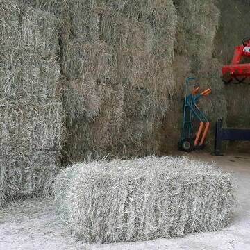
Heupellets und Strohpellets Bio
Bogen
Marion Christ
@Marion-Christ
Einstreu
Pellets
Bio
Abholung
Lieferung
B+

B+
Deprecated: Creation of dynamic property Zend_View_Helper_Ads::$adLink is deprecated in /var/www/stall-frei/htdocs/staging.stall-frei.de/library/Psf/View/Helper/Ads.php on line 108

Reit- und Fahrstall FERTLHOF
Schweitenkirchen
Josef Heckmeier
@Josef-Heckmeier
Wunderschöner Pensionsstall, direkt an der A9 - Ausfahrt Pfaffenhofen gelegen
neu erbaut in 2015 mit großen, modernen Boxen mit
brandneu
R
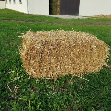
Heukleinballen (34 x 44 x 90 cm)
Marquartstein
Hacher Fahrnpoint
@Hacher-Berghof-Fahrnpoint
Heu
Kleinballen/HD-Ballen
Regenfrei
Wird verladen
1 weitere...
B+

Heu 2. Schnitt 2025 Grummet HD Ballen
Altmannstein
Thomas Resch
@Cappo
Heu
Empfänger lädt ab
Kleinballen/HD-Ballen
Wird verladen
2 weitere...
B+

Bio-Pferdeheu in Rundballen
Reichersbeuern
Biohof-Sixt
@Biohof-Sixt
Heu
Empfänger lädt ab
Rundballen
Bio
2 weitere...
aktuell
B+

Vergeben Reitbeteiligung 1-2 mal die Woche
Breitbrunn
Nicole Welponer
@NicoleW.
Wir vergeben für unser Pony eine Reitbeteiligung. Rocky ist ein 5 Jahre alter Welsh B Apfelschimmel Wallach. Rocky ist sehr brav
Leider kein Vorschaubild
Leider kein Vorschaubild
heu 2025 heu 2ter schnitt 2025
Maisach
Reitstall Thurner
@ReitstallThurner
Heu
Empfänger lädt ab
Rundballen
Regenfrei
3 weitere...
B+
Leider kein Vorschaubild
Leider kein Vorschaubild
HEUCOBS/GRASCOBSMenge in kg Preis 0,75€/kg im Sa...
Starnberg
Reiterhof-Klim
@Reiterhof-Klim
Futter
Pellets
Abholung
B+

HD-Heuballen, 1. Schnitt & 2. Schnitt
Hilpoltstein
KnollmeyerBallen
@KnollmeyerBallen
Heu
Lieferant entlädt
Kleinballen/HD-Ballen
Regenfrei
3 weitere...
B+
HD-Strohballen, Gersten-, Dinkel- und Weizenstroh
Hilpoltstein
KnollmeyerBallen
@KnollmeyerBallen
Einstreu
Lieferant entlädt
Kleinballen/HD-Ballen
Regenfrei
3 weitere...
B+


Strohpellet, Strohgranulat, Heu & Stroh
Allmannshofen
J&M Kratzer
@JMKratzer
Einstreu
Lieferant entlädt
Pellets
Wird verladen
2 weitere...
P+
Deprecated: Creation of dynamic property Zend_View::$pageCount is deprecated in /var/www/stall-frei/htdocs/staging.stall-frei.de/library/vendor/shardj/zf1-future/library/Zend/View/Abstract.php on line 308
Deprecated: Creation of dynamic property Zend_View::$itemCountPerPage is deprecated in /var/www/stall-frei/htdocs/staging.stall-frei.de/library/vendor/shardj/zf1-future/library/Zend/View/Abstract.php on line 308
Deprecated: Creation of dynamic property Zend_View::$first is deprecated in /var/www/stall-frei/htdocs/staging.stall-frei.de/library/vendor/shardj/zf1-future/library/Zend/View/Abstract.php on line 308
Deprecated: Creation of dynamic property Zend_View::$current is deprecated in /var/www/stall-frei/htdocs/staging.stall-frei.de/library/vendor/shardj/zf1-future/library/Zend/View/Abstract.php on line 308
Deprecated: Creation of dynamic property Zend_View::$last is deprecated in /var/www/stall-frei/htdocs/staging.stall-frei.de/library/vendor/shardj/zf1-future/library/Zend/View/Abstract.php on line 308
Deprecated: Creation of dynamic property Zend_View::$next is deprecated in /var/www/stall-frei/htdocs/staging.stall-frei.de/library/vendor/shardj/zf1-future/library/Zend/View/Abstract.php on line 308
Deprecated: Creation of dynamic property Zend_View::$pagesInRange is deprecated in /var/www/stall-frei/htdocs/staging.stall-frei.de/library/vendor/shardj/zf1-future/library/Zend/View/Abstract.php on line 308
Deprecated: Creation of dynamic property Zend_View::$firstPageInRange is deprecated in /var/www/stall-frei/htdocs/staging.stall-frei.de/library/vendor/shardj/zf1-future/library/Zend/View/Abstract.php on line 308
Deprecated: Creation of dynamic property Zend_View::$lastPageInRange is deprecated in /var/www/stall-frei/htdocs/staging.stall-frei.de/library/vendor/shardj/zf1-future/library/Zend/View/Abstract.php on line 308
Deprecated: Creation of dynamic property Zend_View::$currentItemCount is deprecated in /var/www/stall-frei/htdocs/staging.stall-frei.de/library/vendor/shardj/zf1-future/library/Zend/View/Abstract.php on line 308
Deprecated: Creation of dynamic property Zend_View::$totalItemCount is deprecated in /var/www/stall-frei/htdocs/staging.stall-frei.de/library/vendor/shardj/zf1-future/library/Zend/View/Abstract.php on line 308
Deprecated: Creation of dynamic property Zend_View::$firstItemNumber is deprecated in /var/www/stall-frei/htdocs/staging.stall-frei.de/library/vendor/shardj/zf1-future/library/Zend/View/Abstract.php on line 308
Deprecated: Creation of dynamic property Zend_View::$lastItemNumber is deprecated in /var/www/stall-frei/htdocs/staging.stall-frei.de/library/vendor/shardj/zf1-future/library/Zend/View/Abstract.php on line 308
Deprecated: Creation of dynamic property Zend_View::$router is deprecated in /var/www/stall-frei/htdocs/staging.stall-frei.de/library/vendor/shardj/zf1-future/library/Zend/View/Abstract.php on line 308
Deprecated: Creation of dynamic property Zend_View::$urlParams is deprecated in /var/www/stall-frei/htdocs/staging.stall-frei.de/library/vendor/shardj/zf1-future/library/Zend/View/Abstract.php on line 308
Deprecated: Creation of dynamic property Zend_View::$showAds is deprecated in /var/www/stall-frei/htdocs/staging.stall-frei.de/library/vendor/shardj/zf1-future/library/Zend/View/Abstract.php on line 308
Deprecated: Creation of dynamic property Zend_View::$objectIds is deprecated in /var/www/stall-frei/htdocs/staging.stall-frei.de/library/vendor/shardj/zf1-future/library/Zend/View/Abstract.php on line 308
Deprecated: Creation of dynamic property Zend_View::$showNavbar is deprecated in /var/www/stall-frei/htdocs/staging.stall-frei.de/library/vendor/shardj/zf1-future/library/Zend/View/Abstract.php on line 308
Deprecated: Creation of dynamic property Zend_View::$showBreadcrumb is deprecated in /var/www/stall-frei/htdocs/staging.stall-frei.de/library/vendor/shardj/zf1-future/library/Zend/View/Abstract.php on line 308
Deprecated: Creation of dynamic property Zend_View::$showFooter is deprecated in /var/www/stall-frei/htdocs/staging.stall-frei.de/library/vendor/shardj/zf1-future/library/Zend/View/Abstract.php on line 308
Deprecated: Creation of dynamic property Zend_View::$showInternalAds is deprecated in /var/www/stall-frei/htdocs/staging.stall-frei.de/library/vendor/shardj/zf1-future/library/Zend/View/Abstract.php on line 308
Deprecated: Creation of dynamic property Zend_View::$blNoContent is deprecated in /var/www/stall-frei/htdocs/staging.stall-frei.de/library/vendor/shardj/zf1-future/library/Zend/View/Abstract.php on line 308
Deprecated: Creation of dynamic property Zend_View::$sMetaDesc is deprecated in /var/www/stall-frei/htdocs/staging.stall-frei.de/library/vendor/shardj/zf1-future/library/Zend/View/Abstract.php on line 308
Deprecated: Creation of dynamic property Zend_View::$useGmaps is deprecated in /var/www/stall-frei/htdocs/staging.stall-frei.de/library/vendor/shardj/zf1-future/library/Zend/View/Abstract.php on line 308
Deprecated: Creation of dynamic property Zend_View::$touches is deprecated in /var/www/stall-frei/htdocs/staging.stall-frei.de/library/vendor/shardj/zf1-future/library/Zend/View/Abstract.php on line 308
Deprecated: Creation of dynamic property Zend_View::$oProject is deprecated in /var/www/stall-frei/htdocs/staging.stall-frei.de/library/vendor/shardj/zf1-future/library/Zend/View/Abstract.php on line 308
Deprecated: Creation of dynamic property Zend_View::$pageHeadline is deprecated in /var/www/stall-frei/htdocs/staging.stall-frei.de/library/vendor/shardj/zf1-future/library/Zend/View/Abstract.php on line 308
Deprecated: Creation of dynamic property Zend_View::$disableLocationField is deprecated in /var/www/stall-frei/htdocs/staging.stall-frei.de/library/vendor/shardj/zf1-future/library/Zend/View/Abstract.php on line 308
Deprecated: Creation of dynamic property Zend_View::$isSearch is deprecated in /var/www/stall-frei/htdocs/staging.stall-frei.de/library/vendor/shardj/zf1-future/library/Zend/View/Abstract.php on line 308
Deprecated: Creation of dynamic property Zend_View::$pageTitle is deprecated in /var/www/stall-frei/htdocs/staging.stall-frei.de/library/vendor/shardj/zf1-future/library/Zend/View/Abstract.php on line 308
Deprecated: Creation of dynamic property Psf_Form_Element_Text::$class is deprecated in /var/www/stall-frei/htdocs/staging.stall-frei.de/library/vendor/shardj/zf1-future/library/Zend/Form/Element.php on line 874
Deprecated: Creation of dynamic property Psf_Form_Element_Text::$size is deprecated in /var/www/stall-frei/htdocs/staging.stall-frei.de/library/vendor/shardj/zf1-future/library/Zend/Form/Element.php on line 874
Deprecated: Creation of dynamic property Psf_Form_Element_Text::$placeholder is deprecated in /var/www/stall-frei/htdocs/staging.stall-frei.de/library/vendor/shardj/zf1-future/library/Zend/Form/Element.php on line 874
Deprecated: Creation of dynamic property Psf_Form_Element_Hidden::$class is deprecated in /var/www/stall-frei/htdocs/staging.stall-frei.de/library/vendor/shardj/zf1-future/library/Zend/Form/Element.php on line 874
Deprecated: Creation of dynamic property Psf_Form_Element_Hidden::$class is deprecated in /var/www/stall-frei/htdocs/staging.stall-frei.de/library/vendor/shardj/zf1-future/library/Zend/Form/Element.php on line 874
Deprecated: Creation of dynamic property Psf_Form_Element_Hidden::$class is deprecated in /var/www/stall-frei/htdocs/staging.stall-frei.de/library/vendor/shardj/zf1-future/library/Zend/Form/Element.php on line 874
Deprecated: Creation of dynamic property Psf_Form_Element_Hidden::$class is deprecated in /var/www/stall-frei/htdocs/staging.stall-frei.de/library/vendor/shardj/zf1-future/library/Zend/Form/Element.php on line 874
Deprecated: Creation of dynamic property Psf_Form_Element_Select::$class is deprecated in /var/www/stall-frei/htdocs/staging.stall-frei.de/library/vendor/shardj/zf1-future/library/Zend/Form/Element.php on line 874
Deprecated: Creation of dynamic property Psf_Form_Element_Select::$class is deprecated in /var/www/stall-frei/htdocs/staging.stall-frei.de/library/vendor/shardj/zf1-future/library/Zend/Form/Element.php on line 874
Deprecated: Creation of dynamic property Psf_Form_Element_Select::$class is deprecated in /var/www/stall-frei/htdocs/staging.stall-frei.de/library/vendor/shardj/zf1-future/library/Zend/Form/Element.php on line 874
Deprecated: Creation of dynamic property Psf_Form_Element_Select::$class is deprecated in /var/www/stall-frei/htdocs/staging.stall-frei.de/library/vendor/shardj/zf1-future/library/Zend/Form/Element.php on line 874
Deprecated: Creation of dynamic property Zend_View::$sort is deprecated in /var/www/stall-frei/htdocs/staging.stall-frei.de/library/vendor/shardj/zf1-future/library/Zend/View/Abstract.php on line 308
Deprecated: Creation of dynamic property Zend_View::$searchLocation is deprecated in /var/www/stall-frei/htdocs/staging.stall-frei.de/library/vendor/shardj/zf1-future/library/Zend/View/Abstract.php on line 308
Deprecated: Creation of dynamic property Zend_View::$locationHint is deprecated in /var/www/stall-frei/htdocs/staging.stall-frei.de/library/vendor/shardj/zf1-future/library/Zend/View/Abstract.php on line 308
Psf_GeoCoder_Abstract::getLocation: Kellberg Get Location CachedOrLive
Psf_GeoCoder_Abstract::getCachedOrLive: Kellberg
Psf_GeoCoder_OpenCageData::makeApiRequest: response:
Array
(
[documentation] => https://opencagedata.com/api
[licenses] => Array
(
[0] => Array
(
[name] => see attribution guide
[url] => https://opencagedata.com/credits
)
)
[results] => Array
(
[0] => Array
(
[bounds] => Array
(
[northeast] => Array
(
[lat] => 48.6139221
[lng] => 13.5715595
)
[southwest] => Array
(
[lat] => 48.5739221
[lng] => 13.5315595
)
)
[components] => Array
(
[ISO_3166-1_alpha-2] => DE
[ISO_3166-1_alpha-3] => DEU
[ISO_3166-2] => Array
(
[0] => DE-BY
)
[_category] => place
[_normalized_city] => Thyrnau
[_type] => village
[city] => Thyrnau
[continent] => Europe
[country] => Deutschland
[country_code] => de
[county] => Landkreis Passau
[political_union] => European Union
[postcode] => 94136
[state] => Bayern
[state_code] => BY
[village] => Kellberg
)
[confidence] => 7
[formatted] => 94136 Kellberg, Deutschland
[geometry] => Array
(
[lat] => 48.5939221
[lng] => 13.5515595
)
)
[1] => Array
(
[bounds] => Array
(
[northeast] => Array
(
[lat] => 51.8863938
[lng] => 9.6429858
)
[southwest] => Array
(
[lat] => 51.8862938
[lng] => 9.6428858
)
)
[components] => Array
(
[ISO_3166-1_alpha-2] => DE
[ISO_3166-1_alpha-3] => DEU
[ISO_3166-2] => Array
(
[0] => DE-NI
)
[_category] => natural/water
[_normalized_city] => Stadtoldendorf
[_type] => peak
[continent] => Europe
[country] => Deutschland
[country_code] => de
[county] => Landkreis Holzminden
[municipality] => Samtgemeinde Eschershausen-Stadtoldendorf
[peak] => Kellberg
[political_union] => European Union
[postcode] => 37627
[state] => Niedersachsen
[state_code] => NI
[town] => Stadtoldendorf
)
[confidence] => 9
[formatted] => Kellberg, 37627 Stadtoldendorf, Deutschland
[geometry] => Array
(
[lat] => 51.8863438
[lng] => 9.6429358
)
)
[2] => Array
(
[bounds] => Array
(
[northeast] => Array
(
[lat] => 48.5502481
[lng] => 13.1602277
)
[southwest] => Array
(
[lat] => 48.5102481
[lng] => 13.1202277
)
)
[components] => Array
(
[ISO_3166-1_alpha-2] => DE
[ISO_3166-1_alpha-3] => DEU
[ISO_3166-2] => Array
(
[0] => DE-BY
)
[_category] => place
[_normalized_city] => Haarbach
[_type] => hamlet
[continent] => Europe
[country] => Deutschland
[country_code] => de
[county] => Landkreis Passau
[hamlet] => Kellberg
[political_union] => European Union
[postcode] => 94542
[state] => Bayern
[state_code] => BY
[village] => Haarbach
)
[confidence] => 7
[formatted] => Kellberg, 94542 Haarbach, Deutschland
[geometry] => Array
(
[lat] => 48.5302481
[lng] => 13.1402277
)
)
[3] => Array
(
[bounds] => Array
(
[northeast] => Array
(
[lat] => 48.4282448
[lng] => 13.0066043
)
[southwest] => Array
(
[lat] => 48.3882448
[lng] => 12.9666043
)
)
[components] => Array
(
[ISO_3166-1_alpha-2] => DE
[ISO_3166-1_alpha-3] => DEU
[ISO_3166-2] => Array
(
[0] => DE-BY
)
[_category] => place
[_normalized_city] => Triftern
[_type] => hamlet
[continent] => Europe
[country] => Deutschland
[country_code] => de
[county] => Landkreis Rottal-Inn
[hamlet] => Kellberg
[political_union] => European Union
[postcode] => 84371
[state] => Bayern
[state_code] => BY
[village] => Triftern
)
[confidence] => 7
[formatted] => Kellberg, 84371 Triftern, Deutschland
[geometry] => Array
(
[lat] => 48.4082448
[lng] => 12.9866043
)
)
[4] => Array
(
[bounds] => Array
(
[northeast] => Array
(
[lat] => 51.5183984
[lng] => 9.8268288
)
[southwest] => Array
(
[lat] => 51.4983984
[lng] => 9.8068288
)
)
[components] => Array
(
[ISO_3166-1_alpha-2] => DE
[ISO_3166-1_alpha-3] => DEU
[ISO_3166-2] => Array
(
[0] => DE-NI
)
[_category] => place
[_normalized_city] => Rosdorf
[_type] => hamlet
[city_district] => Klein Wiershausen
[continent] => Europe
[country] => Deutschland
[country_code] => de
[county] => Landkreis Göttingen
[locality] => Kellberg
[political_union] => European Union
[postcode] => 37124
[state] => Niedersachsen
[state_code] => NI
[town] => Rosdorf
)
[confidence] => 8
[formatted] => Kellberg, 37124 Rosdorf, Deutschland
[geometry] => Array
(
[lat] => 51.5083984
[lng] => 9.8168288
)
)
[5] => Array
(
[bounds] => Array
(
[northeast] => Array
(
[lat] => 51.5324651
[lng] => 9.0367207
)
[southwest] => Array
(
[lat] => 51.5320924
[lng] => 9.0346971
)
)
[components] => Array
(
[ISO_3166-1_alpha-2] => DE
[ISO_3166-1_alpha-3] => DEU
[ISO_3166-2] => Array
(
[0] => DE-NW
)
[_category] => road
[_normalized_city] => Warburg
[_type] => road
[continent] => Europe
[country] => Deutschland
[country_code] => de
[county] => Kreis Höxter
[political_union] => European Union
[postcode] => 34414
[road] => Kellberg
[road_type] => residential
[state] => Nordrhein-Westfalen
[state_code] => NW
[suburb] => Scherfede
[town] => Warburg
)
[confidence] => 9
[formatted] => Kellberg, 34414 Warburg, Deutschland
[geometry] => Array
(
[lat] => 51.5321667
[lng] => 9.0356853
)
)
[6] => Array
(
[components] => Array
(
[ISO_3166-1_alpha-2] => FR
[ISO_3166-1_alpha-3] => FRA
[ISO_3166-2] => Array
(
[0] => FR-GES
[1] => FR-6AE
[2] => FR-68
)
[_category] => road
[_normalized_city] => Hagenthal-le-Bas
[_type] => road
[city] => Hagenthal-le-Bas
[continent] => Europe
[country] => France
[country_code] => fr
[county] => Haut-Rhin
[local_authority] => Saint-Louis Agglomération
[political_union] => European Union
[postcode] => 68220
[road] => Rue du Kelberg
[state] => Grand Est
[state_code] => GES
)
[confidence] => 2
[formatted] => Rue du Kelberg, 68220 Hagenthal-le-Bas, France
[geometry] => Array
(
[lat] => 47.540889
[lng] => 7.495692
)
)
[7] => Array
(
[components] => Array
(
[ISO_3166-1_alpha-2] => FR
[ISO_3166-1_alpha-3] => FRA
[ISO_3166-2] => Array
(
[0] => FR-GES
[1] => FR-6AE
[2] => FR-67
)
[_category] => road
[_normalized_city] => Lochwiller
[_type] => road
[city] => Lochwiller
[continent] => Europe
[country] => France
[country_code] => fr
[county] => Bas-Rhin
[local_authority] => Communauté de communes du Pays de Saverne
[political_union] => European Union
[postcode] => 67440
[road] => Koellberg
[state] => Grand Est
[state_code] => GES
)
[confidence] => 2
[formatted] => Koellberg, 67440 Lochwiller, France
[geometry] => Array
(
[lat] => 48.695305
[lng] => 7.418348
)
)
[8] => Array
(
[components] => Array
(
[ISO_3166-1_alpha-2] => FR
[ISO_3166-1_alpha-3] => FRA
[ISO_3166-2] => Array
(
[0] => FR-GES
[1] => FR-6AE
[2] => FR-67
)
[_category] => road
[_normalized_city] => Lochwiller
[_type] => road
[city] => Lochwiller
[continent] => Europe
[country] => France
[country_code] => fr
[county] => Bas-Rhin
[local_authority] => Communauté de communes du Pays de Saverne
[political_union] => European Union
[postcode] => 67440
[road] => Impasse du Koellberg
[state] => Grand Est
[state_code] => GES
)
[confidence] => 2
[formatted] => Impasse du Koellberg, 67440 Lochwiller, France
[geometry] => Array
(
[lat] => 48.695031
[lng] => 7.418078
)
)
[9] => Array
(
[components] => Array
(
[ISO_3166-1_alpha-2] => FR
[ISO_3166-1_alpha-3] => FRA
[ISO_3166-2] => Array
(
[0] => FR-NAQ
[1] => FR-17
)
[_category] => road
[_normalized_city] => La Rochelle
[_type] => road
[city] => La Rochelle
[continent] => Europe
[country] => France
[country_code] => fr
[county] => Charente-Maritime
[local_authority] => Communauté d'agglomération de La Rochelle
[political_union] => European Union
[postcode] => 17000
[road] => Rue Kleber
[state] => Nouvelle-Aquitaine
[state_code] => NAQ
)
[confidence] => 2
[formatted] => Rue Kleber, 17000 La Rochelle, France
[geometry] => Array
(
[lat] => 46.167713
[lng] => -1.162991
)
)
)
[status] => Array
(
[code] => 200
[message] => OK
)
[stay_informed] => Array
(
[blog] => https://blog.opencagedata.com
[mastodon] => https://en.osm.town/@opencage
)
[thanks] => For using an OpenCage API
[timestamp] => Array
(
[created_http] => Sun, 08 Feb 2026 14:09:44 GMT
[created_unix] => 1770559784
)
[total_results] => 10
)
Psf_GeoCoder_Abstract::convertLocationResult
{"documentation":"https:\/\/opencagedata.com\/api","licenses":[{"name":"see attribution guide","url":"https:\/\/opencagedata.com\/credits"}],"results":[{"bounds":{"northeast":{"lat":48.6139221,"lng":13.5715595},"southwest":{"lat":48.5739221,"lng":13.5315595}},"components":{"ISO_3166-1_alpha-2":"DE","ISO_3166-1_alpha-3":"DEU","ISO_3166-2":["DE-BY"],"_category":"place","_normalized_city":"Thyrnau","_type":"village","city":"Thyrnau","continent":"Europe","country":"Deutschland","country_code":"de","county":"Landkreis Passau","political_union":"European Union","postcode":"94136","state":"Bayern","state_code":"BY","village":"Kellberg"},"confidence":7,"formatted":"94136 Kellberg, Deutschland","geometry":{"lat":48.5939221,"lng":13.5515595}},{"bounds":{"northeast":{"lat":51.8863938,"lng":9.6429858},"southwest":{"lat":51.8862938,"lng":9.6428858}},"components":{"ISO_3166-1_alpha-2":"DE","ISO_3166-1_alpha-3":"DEU","ISO_3166-2":["DE-NI"],"_category":"natural\/water","_normalized_city":"Stadtoldendorf","_type":"peak","continent":"Europe","country":"Deutschland","country_code":"de","county":"Landkreis Holzminden","municipality":"Samtgemeinde Eschershausen-Stadtoldendorf","peak":"Kellberg","political_union":"European Union","postcode":"37627","state":"Niedersachsen","state_code":"NI","town":"Stadtoldendorf"},"confidence":9,"formatted":"Kellberg, 37627 Stadtoldendorf, Deutschland","geometry":{"lat":51.8863438,"lng":9.6429358}},{"bounds":{"northeast":{"lat":48.5502481,"lng":13.1602277},"southwest":{"lat":48.5102481,"lng":13.1202277}},"components":{"ISO_3166-1_alpha-2":"DE","ISO_3166-1_alpha-3":"DEU","ISO_3166-2":["DE-BY"],"_category":"place","_normalized_city":"Haarbach","_type":"hamlet","continent":"Europe","country":"Deutschland","country_code":"de","county":"Landkreis Passau","hamlet":"Kellberg","political_union":"European Union","postcode":"94542","state":"Bayern","state_code":"BY","village":"Haarbach"},"confidence":7,"formatted":"Kellberg, 94542 Haarbach, Deutschland","geometry":{"lat":48.5302481,"lng":13.1402277}},{"bounds":{"northeast":{"lat":48.4282448,"lng":13.0066043},"southwest":{"lat":48.3882448,"lng":12.9666043}},"components":{"ISO_3166-1_alpha-2":"DE","ISO_3166-1_alpha-3":"DEU","ISO_3166-2":["DE-BY"],"_category":"place","_normalized_city":"Triftern","_type":"hamlet","continent":"Europe","country":"Deutschland","country_code":"de","county":"Landkreis Rottal-Inn","hamlet":"Kellberg","political_union":"European Union","postcode":"84371","state":"Bayern","state_code":"BY","village":"Triftern"},"confidence":7,"formatted":"Kellberg, 84371 Triftern, Deutschland","geometry":{"lat":48.4082448,"lng":12.9866043}},{"bounds":{"northeast":{"lat":51.5183984,"lng":9.8268288},"southwest":{"lat":51.4983984,"lng":9.8068288}},"components":{"ISO_3166-1_alpha-2":"DE","ISO_3166-1_alpha-3":"DEU","ISO_3166-2":["DE-NI"],"_category":"place","_normalized_city":"Rosdorf","_type":"hamlet","city_district":"Klein Wiershausen","continent":"Europe","country":"Deutschland","country_code":"de","county":"Landkreis G\u00f6ttingen","locality":"Kellberg","political_union":"European Union","postcode":"37124","state":"Niedersachsen","state_code":"NI","town":"Rosdorf"},"confidence":8,"formatted":"Kellberg, 37124 Rosdorf, Deutschland","geometry":{"lat":51.5083984,"lng":9.8168288}},{"bounds":{"northeast":{"lat":51.5324651,"lng":9.0367207},"southwest":{"lat":51.5320924,"lng":9.0346971}},"components":{"ISO_3166-1_alpha-2":"DE","ISO_3166-1_alpha-3":"DEU","ISO_3166-2":["DE-NW"],"_category":"road","_normalized_city":"Warburg","_type":"road","continent":"Europe","country":"Deutschland","country_code":"de","county":"Kreis H\u00f6xter","political_union":"European Union","postcode":"34414","road":"Kellberg","road_type":"residential","state":"Nordrhein-Westfalen","state_code":"NW","suburb":"Scherfede","town":"Warburg"},"confidence":9,"formatted":"Kellberg, 34414 Warburg, Deutschland","geometry":{"lat":51.5321667,"lng":9.0356853}},{"components":{"ISO_3166-1_alpha-2":"FR","ISO_3166-1_alpha-3":"FRA","ISO_3166-2":["FR-GES","FR-6AE","FR-68"],"_category":"road","_normalized_city":"Hagenthal-le-Bas","_type":"road","city":"Hagenthal-le-Bas","continent":"Europe","country":"France","country_code":"fr","county":"Haut-Rhin","local_authority":"Saint-Louis Agglom\u00e9ration","political_union":"European Union","postcode":"68220","road":"Rue du Kelberg","state":"Grand Est","state_code":"GES"},"confidence":2,"formatted":"Rue du Kelberg, 68220 Hagenthal-le-Bas, France","geometry":{"lat":47.540889,"lng":7.495692}},{"components":{"ISO_3166-1_alpha-2":"FR","ISO_3166-1_alpha-3":"FRA","ISO_3166-2":["FR-GES","FR-6AE","FR-67"],"_category":"road","_normalized_city":"Lochwiller","_type":"road","city":"Lochwiller","continent":"Europe","country":"France","country_code":"fr","county":"Bas-Rhin","local_authority":"Communaut\u00e9 de communes du Pays de Saverne","political_union":"European Union","postcode":"67440","road":"Koellberg","state":"Grand Est","state_code":"GES"},"confidence":2,"formatted":"Koellberg, 67440 Lochwiller, France","geometry":{"lat":48.695305,"lng":7.418348}},{"components":{"ISO_3166-1_alpha-2":"FR","ISO_3166-1_alpha-3":"FRA","ISO_3166-2":["FR-GES","FR-6AE","FR-67"],"_category":"road","_normalized_city":"Lochwiller","_type":"road","city":"Lochwiller","continent":"Europe","country":"France","country_code":"fr","county":"Bas-Rhin","local_authority":"Communaut\u00e9 de communes du Pays de Saverne","political_union":"European Union","postcode":"67440","road":"Impasse du Koellberg","state":"Grand Est","state_code":"GES"},"confidence":2,"formatted":"Impasse du Koellberg, 67440 Lochwiller, France","geometry":{"lat":48.695031,"lng":7.418078}},{"components":{"ISO_3166-1_alpha-2":"FR","ISO_3166-1_alpha-3":"FRA","ISO_3166-2":["FR-NAQ","FR-17"],"_category":"road","_normalized_city":"La Rochelle","_type":"road","city":"La Rochelle","continent":"Europe","country":"France","country_code":"fr","county":"Charente-Maritime","local_authority":"Communaut\u00e9 d'agglom\u00e9ration de La Rochelle","political_union":"European Union","postcode":"17000","road":"Rue Kleber","state":"Nouvelle-Aquitaine","state_code":"NAQ"},"confidence":2,"formatted":"Rue Kleber, 17000 La Rochelle, France","geometry":{"lat":46.167713,"lng":-1.162991}}],"status":{"code":200,"message":"OK"},"stay_informed":{"blog":"https:\/\/blog.opencagedata.com","mastodon":"https:\/\/en.osm.town\/@opencage"},"thanks":"For using an OpenCage API","timestamp":{"created_http":"Sun, 08 Feb 2026 14:09:44 GMT","created_unix":1770559784},"total_results":10}Array
(
[0] => stdClass Object
(
[bounds] => stdClass Object
(
[northeast] => stdClass Object
(
[lat] => 48.6139221
[lng] => 13.5715595
)
[southwest] => stdClass Object
(
[lat] => 48.5739221
[lng] => 13.5315595
)
)
[components] => stdClass Object
(
[ISO_3166-1_alpha-2] => DE
[ISO_3166-1_alpha-3] => DEU
[ISO_3166-2] => Array
(
[0] => DE-BY
)
[_category] => place
[_normalized_city] => Thyrnau
[_type] => village
[city] => Thyrnau
[continent] => Europe
[country] => Deutschland
[country_code] => de
[county] => Landkreis Passau
[political_union] => European Union
[postcode] => 94136
[state] => Bayern
[state_code] => BY
[village] => Kellberg
)
[confidence] => 7
[formatted] => 94136 Kellberg, Deutschland
[geometry] => stdClass Object
(
[lat] => 48.5939221
[lng] => 13.5515595
)
)
[1] => stdClass Object
(
[bounds] => stdClass Object
(
[northeast] => stdClass Object
(
[lat] => 51.8863938
[lng] => 9.6429858
)
[southwest] => stdClass Object
(
[lat] => 51.8862938
[lng] => 9.6428858
)
)
[components] => stdClass Object
(
[ISO_3166-1_alpha-2] => DE
[ISO_3166-1_alpha-3] => DEU
[ISO_3166-2] => Array
(
[0] => DE-NI
)
[_category] => natural/water
[_normalized_city] => Stadtoldendorf
[_type] => peak
[continent] => Europe
[country] => Deutschland
[country_code] => de
[county] => Landkreis Holzminden
[municipality] => Samtgemeinde Eschershausen-Stadtoldendorf
[peak] => Kellberg
[political_union] => European Union
[postcode] => 37627
[state] => Niedersachsen
[state_code] => NI
[town] => Stadtoldendorf
)
[confidence] => 9
[formatted] => Kellberg, 37627 Stadtoldendorf, Deutschland
[geometry] => stdClass Object
(
[lat] => 51.8863438
[lng] => 9.6429358
)
)
[2] => stdClass Object
(
[bounds] => stdClass Object
(
[northeast] => stdClass Object
(
[lat] => 48.5502481
[lng] => 13.1602277
)
[southwest] => stdClass Object
(
[lat] => 48.5102481
[lng] => 13.1202277
)
)
[components] => stdClass Object
(
[ISO_3166-1_alpha-2] => DE
[ISO_3166-1_alpha-3] => DEU
[ISO_3166-2] => Array
(
[0] => DE-BY
)
[_category] => place
[_normalized_city] => Haarbach
[_type] => hamlet
[continent] => Europe
[country] => Deutschland
[country_code] => de
[county] => Landkreis Passau
[hamlet] => Kellberg
[political_union] => European Union
[postcode] => 94542
[state] => Bayern
[state_code] => BY
[village] => Haarbach
)
[confidence] => 7
[formatted] => Kellberg, 94542 Haarbach, Deutschland
[geometry] => stdClass Object
(
[lat] => 48.5302481
[lng] => 13.1402277
)
)
[3] => stdClass Object
(
[bounds] => stdClass Object
(
[northeast] => stdClass Object
(
[lat] => 48.4282448
[lng] => 13.0066043
)
[southwest] => stdClass Object
(
[lat] => 48.3882448
[lng] => 12.9666043
)
)
[components] => stdClass Object
(
[ISO_3166-1_alpha-2] => DE
[ISO_3166-1_alpha-3] => DEU
[ISO_3166-2] => Array
(
[0] => DE-BY
)
[_category] => place
[_normalized_city] => Triftern
[_type] => hamlet
[continent] => Europe
[country] => Deutschland
[country_code] => de
[county] => Landkreis Rottal-Inn
[hamlet] => Kellberg
[political_union] => European Union
[postcode] => 84371
[state] => Bayern
[state_code] => BY
[village] => Triftern
)
[confidence] => 7
[formatted] => Kellberg, 84371 Triftern, Deutschland
[geometry] => stdClass Object
(
[lat] => 48.4082448
[lng] => 12.9866043
)
)
[4] => stdClass Object
(
[bounds] => stdClass Object
(
[northeast] => stdClass Object
(
[lat] => 51.5183984
[lng] => 9.8268288
)
[southwest] => stdClass Object
(
[lat] => 51.4983984
[lng] => 9.8068288
)
)
[components] => stdClass Object
(
[ISO_3166-1_alpha-2] => DE
[ISO_3166-1_alpha-3] => DEU
[ISO_3166-2] => Array
(
[0] => DE-NI
)
[_category] => place
[_normalized_city] => Rosdorf
[_type] => hamlet
[city_district] => Klein Wiershausen
[continent] => Europe
[country] => Deutschland
[country_code] => de
[county] => Landkreis Göttingen
[locality] => Kellberg
[political_union] => European Union
[postcode] => 37124
[state] => Niedersachsen
[state_code] => NI
[town] => Rosdorf
)
[confidence] => 8
[formatted] => Kellberg, 37124 Rosdorf, Deutschland
[geometry] => stdClass Object
(
[lat] => 51.5083984
[lng] => 9.8168288
)
)
[5] => stdClass Object
(
[bounds] => stdClass Object
(
[northeast] => stdClass Object
(
[lat] => 51.5324651
[lng] => 9.0367207
)
[southwest] => stdClass Object
(
[lat] => 51.5320924
[lng] => 9.0346971
)
)
[components] => stdClass Object
(
[ISO_3166-1_alpha-2] => DE
[ISO_3166-1_alpha-3] => DEU
[ISO_3166-2] => Array
(
[0] => DE-NW
)
[_category] => road
[_normalized_city] => Warburg
[_type] => road
[continent] => Europe
[country] => Deutschland
[country_code] => de
[county] => Kreis Höxter
[political_union] => European Union
[postcode] => 34414
[road] => Kellberg
[road_type] => residential
[state] => Nordrhein-Westfalen
[state_code] => NW
[suburb] => Scherfede
[town] => Warburg
)
[confidence] => 9
[formatted] => Kellberg, 34414 Warburg, Deutschland
[geometry] => stdClass Object
(
[lat] => 51.5321667
[lng] => 9.0356853
)
)
[6] => stdClass Object
(
[components] => stdClass Object
(
[ISO_3166-1_alpha-2] => FR
[ISO_3166-1_alpha-3] => FRA
[ISO_3166-2] => Array
(
[0] => FR-GES
[1] => FR-6AE
[2] => FR-68
)
[_category] => road
[_normalized_city] => Hagenthal-le-Bas
[_type] => road
[city] => Hagenthal-le-Bas
[continent] => Europe
[country] => France
[country_code] => fr
[county] => Haut-Rhin
[local_authority] => Saint-Louis Agglomération
[political_union] => European Union
[postcode] => 68220
[road] => Rue du Kelberg
[state] => Grand Est
[state_code] => GES
)
[confidence] => 2
[formatted] => Rue du Kelberg, 68220 Hagenthal-le-Bas, France
[geometry] => stdClass Object
(
[lat] => 47.540889
[lng] => 7.495692
)
)
[7] => stdClass Object
(
[components] => stdClass Object
(
[ISO_3166-1_alpha-2] => FR
[ISO_3166-1_alpha-3] => FRA
[ISO_3166-2] => Array
(
[0] => FR-GES
[1] => FR-6AE
[2] => FR-67
)
[_category] => road
[_normalized_city] => Lochwiller
[_type] => road
[city] => Lochwiller
[continent] => Europe
[country] => France
[country_code] => fr
[county] => Bas-Rhin
[local_authority] => Communauté de communes du Pays de Saverne
[political_union] => European Union
[postcode] => 67440
[road] => Koellberg
[state] => Grand Est
[state_code] => GES
)
[confidence] => 2
[formatted] => Koellberg, 67440 Lochwiller, France
[geometry] => stdClass Object
(
[lat] => 48.695305
[lng] => 7.418348
)
)
[8] => stdClass Object
(
[components] => stdClass Object
(
[ISO_3166-1_alpha-2] => FR
[ISO_3166-1_alpha-3] => FRA
[ISO_3166-2] => Array
(
[0] => FR-GES
[1] => FR-6AE
[2] => FR-67
)
[_category] => road
[_normalized_city] => Lochwiller
[_type] => road
[city] => Lochwiller
[continent] => Europe
[country] => France
[country_code] => fr
[county] => Bas-Rhin
[local_authority] => Communauté de communes du Pays de Saverne
[political_union] => European Union
[postcode] => 67440
[road] => Impasse du Koellberg
[state] => Grand Est
[state_code] => GES
)
[confidence] => 2
[formatted] => Impasse du Koellberg, 67440 Lochwiller, France
[geometry] => stdClass Object
(
[lat] => 48.695031
[lng] => 7.418078
)
)
[9] => stdClass Object
(
[components] => stdClass Object
(
[ISO_3166-1_alpha-2] => FR
[ISO_3166-1_alpha-3] => FRA
[ISO_3166-2] => Array
(
[0] => FR-NAQ
[1] => FR-17
)
[_category] => road
[_normalized_city] => La Rochelle
[_type] => road
[city] => La Rochelle
[continent] => Europe
[country] => France
[country_code] => fr
[county] => Charente-Maritime
[local_authority] => Communauté d'agglomération de La Rochelle
[political_union] => European Union
[postcode] => 17000
[road] => Rue Kleber
[state] => Nouvelle-Aquitaine
[state_code] => NAQ
)
[confidence] => 2
[formatted] => Rue Kleber, 17000 La Rochelle, France
[geometry] => stdClass Object
(
[lat] => 46.167713
[lng] => -1.162991
)
)
)
Psf_GeoCoder_OpenCageData::getKeyMap: 0
stdClass Object
(
    [bounds] => stdClass Object
        (
            [northeast] => stdClass Object
                (
                    [lat] => 48.6139221
                    [lng] => 13.5715595
                )

            [southwest] => stdClass Object
                (
                    [lat] => 48.5739221
                    [lng] => 13.5315595
                )

        )

    [components] => stdClass Object
        (
            [ISO_3166-1_alpha-2] => DE
            [ISO_3166-1_alpha-3] => DEU
            [ISO_3166-2] => Array
                (
                    [0] => DE-BY
                )

            [_category] => place
            [_normalized_city] => Thyrnau
            [_type] => village
            [city] => Thyrnau
            [continent] => Europe
            [country] => Deutschland
            [country_code] => de
            [county] => Landkreis Passau
            [political_union] => European Union
            [postcode] => 94136
            [state] => Bayern
            [state_code] => BY
            [village] => Kellberg
        )

    [confidence] => 7
    [formatted] => 94136 Kellberg, Deutschland
    [geometry] => stdClass Object
        (
            [lat] => 48.5939221
            [lng] => 13.5515595
        )

)
Psf_GeoCoder_OpenCageData::getCounty: Passau
Psf_GeoCoder_OpenCageData::addMissingData REFETCH!
Array
(
    [address] => 94136 Kellberg, Deutschland
    [type] => village
    [street] =>
    [city] => Kellberg
    [county] => Passau
    [state] => Bayern
    [zip] => 94136
    [country] => Deutschland
    [suburb] =>
    [countrycode] => de
    [latitude] => 48.5939221
    [longitude] => 13.5515595
    [accuracy] => 1
    [confidence] => 7
    [bounds] => stdClass Object
        (
            [northeast] => stdClass Object
                (
                    [lat] => 48.6139221
                    [lng] => 13.5715595
                )

            [southwest] => stdClass Object
                (
                    [lat] => 48.5739221
                    [lng] => 13.5315595
                )

        )

)
reformat!
Array
(
    [address] => 94136 Kellberg, Deutschland
    [type] => village
    [street] =>
    [city] => Kellberg
    [county] => Passau
    [state] => Bayern
    [zip] => 94136
    [country] => Deutschland
    [suburb] =>
    [countrycode] => de
    [latitude] => 48.5939221
    [longitude] => 13.5515595
    [accuracy] => 1
    [confidence] => 7
    [bounds] => stdClass Object
        (
            [northeast] => stdClass Object
                (
                    [lat] => 48.6139221
                    [lng] => 13.5715595
                )

            [southwest] => stdClass Object
                (
                    [lat] => 48.5739221
                    [lng] => 13.5315595
                )

        )

    [place] => 94136 Kellberg, Bayern
    [hash] => 566f6de76af21ed6f2667d340ecec30e
)
Psf_GeoCoder_OpenCageData::getKeyMap: 1
stdClass Object
(
    [bounds] => stdClass Object
        (
            [northeast] => stdClass Object
                (
                    [lat] => 51.8863938
                    [lng] => 9.6429858
                )

            [southwest] => stdClass Object
                (
                    [lat] => 51.8862938
                    [lng] => 9.6428858
                )

        )

    [components] => stdClass Object
        (
            [ISO_3166-1_alpha-2] => DE
            [ISO_3166-1_alpha-3] => DEU
            [ISO_3166-2] => Array
                (
                    [0] => DE-NI
                )

            [_category] => natural/water
            [_normalized_city] => Stadtoldendorf
            [_type] => peak
            [continent] => Europe
            [country] => Deutschland
            [country_code] => de
            [county] => Landkreis Holzminden
            [municipality] => Samtgemeinde Eschershausen-Stadtoldendorf
            [peak] => Kellberg
            [political_union] => European Union
            [postcode] => 37627
            [state] => Niedersachsen
            [state_code] => NI
            [town] => Stadtoldendorf
        )

    [confidence] => 9
    [formatted] => Kellberg, 37627 Stadtoldendorf, Deutschland
    [geometry] => stdClass Object
        (
            [lat] => 51.8863438
            [lng] => 9.6429358
        )

)
Psf_GeoCoder_OpenCageData::getCounty: Holzminden
Psf_GeoCoder_OpenCageData::addMissingData REFETCH!
Array
(
    [address] => Kellberg, 37627 Stadtoldendorf, Deutschland
    [type] => peak
    [street] =>
    [city] => Stadtoldendorf
    [county] => Holzminden
    [state] => Niedersachsen
    [zip] => 37627
    [country] => Deutschland
    [suburb] =>
    [countrycode] => de
    [latitude] => 51.8863438
    [longitude] => 9.6429358
    [accuracy] => 1
    [confidence] => 9
    [bounds] => stdClass Object
        (
            [northeast] => stdClass Object
                (
                    [lat] => 51.8863938
                    [lng] => 9.6429858
                )

            [southwest] => stdClass Object
                (
                    [lat] => 51.8862938
                    [lng] => 9.6428858
                )

        )

)
reformat!
Array
(
    [address] => Kellberg, 37627 Stadtoldendorf, Deutschland
    [type] => peak
    [street] =>
    [city] => Stadtoldendorf
    [county] => Holzminden
    [state] => Niedersachsen
    [zip] => 37627
    [country] => Deutschland
    [suburb] =>
    [countrycode] => de
    [latitude] => 51.8863438
    [longitude] => 9.6429358
    [accuracy] => 1
    [confidence] => 9
    [bounds] => stdClass Object
        (
            [northeast] => stdClass Object
                (
                    [lat] => 51.8863938
                    [lng] => 9.6429858
                )

            [southwest] => stdClass Object
                (
                    [lat] => 51.8862938
                    [lng] => 9.6428858
                )

        )

    [place] => 37627 Stadtoldendorf, Niedersachsen
    [hash] => e330e928614cab591778c02460ed8a0f
)
Psf_GeoCoder_OpenCageData::getKeyMap: 2
stdClass Object
(
    [bounds] => stdClass Object
        (
            [northeast] => stdClass Object
                (
                    [lat] => 48.5502481
                    [lng] => 13.1602277
                )

            [southwest] => stdClass Object
                (
                    [lat] => 48.5102481
                    [lng] => 13.1202277
                )

        )

    [components] => stdClass Object
        (
            [ISO_3166-1_alpha-2] => DE
            [ISO_3166-1_alpha-3] => DEU
            [ISO_3166-2] => Array
                (
                    [0] => DE-BY
                )

            [_category] => place
            [_normalized_city] => Haarbach
            [_type] => hamlet
            [continent] => Europe
            [country] => Deutschland
            [country_code] => de
            [county] => Landkreis Passau
            [hamlet] => Kellberg
            [political_union] => European Union
            [postcode] => 94542
            [state] => Bayern
            [state_code] => BY
            [village] => Haarbach
        )

    [confidence] => 7
    [formatted] => Kellberg, 94542 Haarbach, Deutschland
    [geometry] => stdClass Object
        (
            [lat] => 48.5302481
            [lng] => 13.1402277
        )

)
Psf_GeoCoder_OpenCageData::getCounty: Passau
Psf_GeoCoder_OpenCageData::addMissingData REFETCH!
Array
(
    [address] => Kellberg, 94542 Haarbach, Deutschland
    [type] => hamlet
    [street] => Kellberg
    [city] => Haarbach
    [county] => Passau
    [state] => Bayern
    [zip] => 94542
    [country] => Deutschland
    [suburb] =>
    [countrycode] => de
    [latitude] => 48.5302481
    [longitude] => 13.1402277
    [accuracy] => 1
    [confidence] => 7
    [bounds] => stdClass Object
        (
            [northeast] => stdClass Object
                (
                    [lat] => 48.5502481
                    [lng] => 13.1602277
                )

            [southwest] => stdClass Object
                (
                    [lat] => 48.5102481
                    [lng] => 13.1202277
                )

        )

)
reformat!
Array
(
    [address] => Kellberg, 94542 Haarbach, Deutschland
    [type] => hamlet
    [street] => Kellberg
    [city] => Haarbach
    [county] => Passau
    [state] => Bayern
    [zip] => 94542
    [country] => Deutschland
    [suburb] =>
    [countrycode] => de
    [latitude] => 48.5302481
    [longitude] => 13.1402277
    [accuracy] => 1
    [confidence] => 7
    [bounds] => stdClass Object
        (
            [northeast] => stdClass Object
                (
                    [lat] => 48.5502481
                    [lng] => 13.1602277
                )

            [southwest] => stdClass Object
                (
                    [lat] => 48.5102481
                    [lng] => 13.1202277
                )

        )

    [place] => Kellberg, 94542 Haarbach, Bayern
    [hash] => 83af4b375f7ad583c58fd115ce3e0453
)
Psf_GeoCoder_OpenCageData::getKeyMap: 3
stdClass Object
(
    [bounds] => stdClass Object
        (
            [northeast] => stdClass Object
                (
                    [lat] => 48.4282448
                    [lng] => 13.0066043
                )

            [southwest] => stdClass Object
                (
                    [lat] => 48.3882448
                    [lng] => 12.9666043
                )

        )

    [components] => stdClass Object
        (
            [ISO_3166-1_alpha-2] => DE
            [ISO_3166-1_alpha-3] => DEU
            [ISO_3166-2] => Array
                (
                    [0] => DE-BY
                )

            [_category] => place
            [_normalized_city] => Triftern
            [_type] => hamlet
            [continent] => Europe
            [country] => Deutschland
            [country_code] => de
            [county] => Landkreis Rottal-Inn
            [hamlet] => Kellberg
            [political_union] => European Union
            [postcode] => 84371
            [state] => Bayern
            [state_code] => BY
            [village] => Triftern
        )

    [confidence] => 7
    [formatted] => Kellberg, 84371 Triftern, Deutschland
    [geometry] => stdClass Object
        (
            [lat] => 48.4082448
            [lng] => 12.9866043
        )

)
Psf_GeoCoder_OpenCageData::getCounty: Rottal-Inn
Psf_GeoCoder_OpenCageData::addMissingData REFETCH!
Array
(
    [address] => Kellberg, 84371 Triftern, Deutschland
    [type] => hamlet
    [street] => Kellberg
    [city] => Triftern
    [county] => Rottal-Inn
    [state] => Bayern
    [zip] => 84371
    [country] => Deutschland
    [suburb] =>
    [countrycode] => de
    [latitude] => 48.4082448
    [longitude] => 12.9866043
    [accuracy] => 1
    [confidence] => 7
    [bounds] => stdClass Object
        (
            [northeast] => stdClass Object
                (
                    [lat] => 48.4282448
                    [lng] => 13.0066043
                )

            [southwest] => stdClass Object
                (
                    [lat] => 48.3882448
                    [lng] => 12.9666043
                )

        )

)
reformat!
Array
(
    [address] => Kellberg, 84371 Triftern, Deutschland
    [type] => hamlet
    [street] => Kellberg
    [city] => Triftern
    [county] => Rottal-Inn
    [state] => Bayern
    [zip] => 84371
    [country] => Deutschland
    [suburb] =>
    [countrycode] => de
    [latitude] => 48.4082448
    [longitude] => 12.9866043
    [accuracy] => 1
    [confidence] => 7
    [bounds] => stdClass Object
        (
            [northeast] => stdClass Object
                (
                    [lat] => 48.4282448
                    [lng] => 13.0066043
                )

            [southwest] => stdClass Object
                (
                    [lat] => 48.3882448
                    [lng] => 12.9666043
                )

        )

    [place] => Kellberg, 84371 Triftern, Bayern
    [hash] => 166dc7291e6a7fffbdd96458c782562b
)
Psf_GeoCoder_OpenCageData::getKeyMap: 4
stdClass Object
(
    [bounds] => stdClass Object
        (
            [northeast] => stdClass Object
                (
                    [lat] => 51.5183984
                    [lng] => 9.8268288
                )

            [southwest] => stdClass Object
                (
                    [lat] => 51.4983984
                    [lng] => 9.8068288
                )

        )

    [components] => stdClass Object
        (
            [ISO_3166-1_alpha-2] => DE
            [ISO_3166-1_alpha-3] => DEU
            [ISO_3166-2] => Array
                (
                    [0] => DE-NI
                )

            [_category] => place
            [_normalized_city] => Rosdorf
            [_type] => hamlet
            [city_district] => Klein Wiershausen
            [continent] => Europe
            [country] => Deutschland
            [country_code] => de
            [county] => Landkreis Göttingen
            [locality] => Kellberg
            [political_union] => European Union
            [postcode] => 37124
            [state] => Niedersachsen
            [state_code] => NI
            [town] => Rosdorf
        )

    [confidence] => 8
    [formatted] => Kellberg, 37124 Rosdorf, Deutschland
    [geometry] => stdClass Object
        (
            [lat] => 51.5083984
            [lng] => 9.8168288
        )

)
Psf_GeoCoder_OpenCageData::getCounty: Göttingen
Psf_GeoCoder_OpenCageData::addMissingData REFETCH!
Array
(
    [address] => Kellberg, 37124 Rosdorf, Deutschland
    [type] => hamlet
    [street] =>
    [city] => Rosdorf
    [county] => Göttingen
    [state] => Niedersachsen
    [zip] => 37124
    [country] => Deutschland
    [suburb] =>
    [countrycode] => de
    [latitude] => 51.5083984
    [longitude] => 9.8168288
    [accuracy] => 1
    [confidence] => 8
    [bounds] => stdClass Object
        (
            [northeast] => stdClass Object
                (
                    [lat] => 51.5183984
                    [lng] => 9.8268288
                )

            [southwest] => stdClass Object
                (
                    [lat] => 51.4983984
                    [lng] => 9.8068288
                )

        )

)
reformat!
Array
(
    [address] => Kellberg, 37124 Rosdorf, Deutschland
    [type] => hamlet
    [street] =>
    [city] => Rosdorf
    [county] => Göttingen
    [state] => Niedersachsen
    [zip] => 37124
    [country] => Deutschland
    [suburb] =>
    [countrycode] => de
    [latitude] => 51.5083984
    [longitude] => 9.8168288
    [accuracy] => 1
    [confidence] => 8
    [bounds] => stdClass Object
        (
            [northeast] => stdClass Object
                (
                    [lat] => 51.5183984
                    [lng] => 9.8268288
                )

            [southwest] => stdClass Object
                (
                    [lat] => 51.4983984
                    [lng] => 9.8068288
                )

        )

    [place] => 37124 Rosdorf, Niedersachsen
    [hash] => 7e6003963c93f8a79b9f7092a0a4ec8f
)
Psf_GeoCoder_OpenCageData::getKeyMap: 5
stdClass Object
(
    [bounds] => stdClass Object
        (
            [northeast] => stdClass Object
                (
                    [lat] => 51.5324651
                    [lng] => 9.0367207
                )

            [southwest] => stdClass Object
                (
                    [lat] => 51.5320924
                    [lng] => 9.0346971
                )

        )

    [components] => stdClass Object
        (
            [ISO_3166-1_alpha-2] => DE
            [ISO_3166-1_alpha-3] => DEU
            [ISO_3166-2] => Array
                (
                    [0] => DE-NW
                )

            [_category] => road
            [_normalized_city] => Warburg
            [_type] => road
            [continent] => Europe
            [country] => Deutschland
            [country_code] => de
            [county] => Kreis Höxter
            [political_union] => European Union
            [postcode] => 34414
            [road] => Kellberg
            [road_type] => residential
            [state] => Nordrhein-Westfalen
            [state_code] => NW
            [suburb] => Scherfede
            [town] => Warburg
        )

    [confidence] => 9
    [formatted] => Kellberg, 34414 Warburg, Deutschland
    [geometry] => stdClass Object
        (
            [lat] => 51.5321667
            [lng] => 9.0356853
        )

)
Psf_GeoCoder_OpenCageData::getCounty: Höxter
Psf_GeoCoder_OpenCageData::addMissingData REFETCH!
Array
(
    [address] => Kellberg, 34414 Warburg, Deutschland
    [type] => road
    [street] => Kellberg
    [city] => Warburg
    [county] => Höxter
    [state] => Nordrhein-Westfalen
    [zip] => 34414
    [country] => Deutschland
    [suburb] => Scherfede
    [countrycode] => de
    [latitude] => 51.5321667
    [longitude] => 9.0356853
    [accuracy] => 1
    [confidence] => 9
    [bounds] => stdClass Object
        (
            [northeast] => stdClass Object
                (
                    [lat] => 51.5324651
                    [lng] => 9.0367207
                )

            [southwest] => stdClass Object
                (
                    [lat] => 51.5320924
                    [lng] => 9.0346971
                )

        )

)
reformat!
Array
(
    [address] => Kellberg, 34414 Warburg, Deutschland
    [type] => road
    [street] => Kellberg
    [city] => Warburg
    [county] => Höxter
    [state] => Nordrhein-Westfalen
    [zip] => 34414
    [country] => Deutschland
    [suburb] => Scherfede
    [countrycode] => de
    [latitude] => 51.5321667
    [longitude] => 9.0356853
    [accuracy] => 1
    [confidence] => 9
    [bounds] => stdClass Object
        (
            [northeast] => stdClass Object
                (
                    [lat] => 51.5324651
                    [lng] => 9.0367207
                )

            [southwest] => stdClass Object
                (
                    [lat] => 51.5320924
                    [lng] => 9.0346971
                )

        )

    [place] => Kellberg, 34414 Warburg, Nordrhein-Westfalen
    [hash] => 734325c0305e8e7470bffb7365432f63
)
Psf_GeoCoder_OpenCageData::getKeyMap: 6
stdClass Object
(
    [components] => stdClass Object
        (
            [ISO_3166-1_alpha-2] => FR
            [ISO_3166-1_alpha-3] => FRA
            [ISO_3166-2] => Array
                (
                    [0] => FR-GES
                    [1] => FR-6AE
                    [2] => FR-68
                )

            [_category] => road
            [_normalized_city] => Hagenthal-le-Bas
            [_type] => road
            [city] => Hagenthal-le-Bas
            [continent] => Europe
            [country] => France
            [country_code] => fr
            [county] => Haut-Rhin
            [local_authority] => Saint-Louis Agglomération
            [political_union] => European Union
            [postcode] => 68220
            [road] => Rue du Kelberg
            [state] => Grand Est
            [state_code] => GES
        )

    [confidence] => 2
    [formatted] => Rue du Kelberg, 68220 Hagenthal-le-Bas, France
    [geometry] => stdClass Object
        (
            [lat] => 47.540889
            [lng] => 7.495692
        )

)
Psf_GeoCoder_OpenCageData::getCounty: Haut-Rhin
Psf_GeoCoder_OpenCageData::addMissingData REFETCH!
Array
(
    [address] => Rue du Kelberg, 68220 Hagenthal-le-Bas, France
    [type] => road
    [street] => Rue du Kelberg
    [city] => Hagenthal-le-Bas
    [county] => Haut-Rhin
    [state] => Grand Est
    [zip] => 68220
    [country] => France
    [suburb] =>
    [countrycode] => fr
    [latitude] => 47.540889
    [longitude] => 7.495692
    [accuracy] => 1
    [confidence] => 2
    [bounds] =>
)
reformat!
Array
(
    [address] => Rue du Kelberg, 68220 Hagenthal-le-Bas, France
    [type] => road
    [street] => Rue du Kelberg
    [city] => Hagenthal-le-Bas
    [county] => Haut-Rhin
    [state] => Grand Est
    [zip] => 68220
    [country] => France
    [suburb] =>
    [countrycode] => fr
    [latitude] => 47.540889
    [longitude] => 7.495692
    [accuracy] => 1
    [confidence] => 2
    [bounds] =>
    [place] => Rue du Kelberg, 68220 Hagenthal-le-Bas, Grand Est
    [hash] => 0ee414463182aa5e8929ff2535f71568
)
Psf_GeoCoder_OpenCageData::getKeyMap: 7
stdClass Object
(
    [components] => stdClass Object
        (
            [ISO_3166-1_alpha-2] => FR
            [ISO_3166-1_alpha-3] => FRA
            [ISO_3166-2] => Array
                (
                    [0] => FR-GES
                    [1] => FR-6AE
                    [2] => FR-67
                )

            [_category] => road
            [_normalized_city] => Lochwiller
            [_type] => road
            [city] => Lochwiller
            [continent] => Europe
            [country] => France
            [country_code] => fr
            [county] => Bas-Rhin
            [local_authority] => Communauté de communes du Pays de Saverne
            [political_union] => European Union
            [postcode] => 67440
            [road] => Koellberg
            [state] => Grand Est
            [state_code] => GES
        )

    [confidence] => 2
    [formatted] => Koellberg, 67440 Lochwiller, France
    [geometry] => stdClass Object
        (
            [lat] => 48.695305
            [lng] => 7.418348
        )

)
Psf_GeoCoder_OpenCageData::getCounty: Bas-Rhin
Psf_GeoCoder_OpenCageData::addMissingData REFETCH!
Array
(
    [address] => Koellberg, 67440 Lochwiller, France
    [type] => road
    [street] => Koellberg
    [city] => Lochwiller
    [county] => Bas-Rhin
    [state] => Grand Est
    [zip] => 67440
    [country] => France
    [suburb] =>
    [countrycode] => fr
    [latitude] => 48.695305
    [longitude] => 7.418348
    [accuracy] => 1
    [confidence] => 2
    [bounds] =>
)
reformat!
Array
(
    [address] => Koellberg, 67440 Lochwiller, France
    [type] => road
    [street] => Koellberg
    [city] => Lochwiller
    [county] => Bas-Rhin
    [state] => Grand Est
    [zip] => 67440
    [country] => France
    [suburb] =>
    [countrycode] => fr
    [latitude] => 48.695305
    [longitude] => 7.418348
    [accuracy] => 1
    [confidence] => 2
    [bounds] =>
    [place] => Koellberg, 67440 Lochwiller, Grand Est
    [hash] => f412873a246919f5a390c2c9467111b8
)
Psf_GeoCoder_OpenCageData::getKeyMap: 8
stdClass Object
(
    [components] => stdClass Object
        (
            [ISO_3166-1_alpha-2] => FR
            [ISO_3166-1_alpha-3] => FRA
            [ISO_3166-2] => Array
                (
                    [0] => FR-GES
                    [1] => FR-6AE
                    [2] => FR-67
                )

            [_category] => road
            [_normalized_city] => Lochwiller
            [_type] => road
            [city] => Lochwiller
            [continent] => Europe
            [country] => France
            [country_code] => fr
            [county] => Bas-Rhin
            [local_authority] => Communauté de communes du Pays de Saverne
            [political_union] => European Union
            [postcode] => 67440
            [road] => Impasse du Koellberg
            [state] => Grand Est
            [state_code] => GES
        )

    [confidence] => 2
    [formatted] => Impasse du Koellberg, 67440 Lochwiller, France
    [geometry] => stdClass Object
        (
            [lat] => 48.695031
            [lng] => 7.418078
        )

)
Psf_GeoCoder_OpenCageData::getCounty: Bas-Rhin
Psf_GeoCoder_OpenCageData::addMissingData REFETCH!
Array
(
    [address] => Impasse du Koellberg, 67440 Lochwiller, France
    [type] => road
    [street] => Impasse du Koellberg
    [city] => Lochwiller
    [county] => Bas-Rhin
    [state] => Grand Est
    [zip] => 67440
    [country] => France
    [suburb] =>
    [countrycode] => fr
    [latitude] => 48.695031
    [longitude] => 7.418078
    [accuracy] => 1
    [confidence] => 2
    [bounds] =>
)
reformat!
Array
(
    [address] => Impasse du Koellberg, 67440 Lochwiller, France
    [type] => road
    [street] => Impasse du Koellberg
    [city] => Lochwiller
    [county] => Bas-Rhin
    [state] => Grand Est
    [zip] => 67440
    [country] => France
    [suburb] =>
    [countrycode] => fr
    [latitude] => 48.695031
    [longitude] => 7.418078
    [accuracy] => 1
    [confidence] => 2
    [bounds] =>
    [place] => Impasse du Koellberg, 67440 Lochwiller, Grand Est
    [hash] => 3e826e6b84dcd3e40b81866072a8c80f
)
Psf_GeoCoder_OpenCageData::getKeyMap: 9
stdClass Object
(
    [components] => stdClass Object
        (
            [ISO_3166-1_alpha-2] => FR
            [ISO_3166-1_alpha-3] => FRA
            [ISO_3166-2] => Array
                (
                    [0] => FR-NAQ
                    [1] => FR-17
                )

            [_category] => road
            [_normalized_city] => La Rochelle
            [_type] => road
            [city] => La Rochelle
            [continent] => Europe
            [country] => France
            [country_code] => fr
            [county] => Charente-Maritime
            [local_authority] => Communauté d'agglomération de La Rochelle
            [political_union] => European Union
            [postcode] => 17000
            [road] => Rue Kleber
            [state] => Nouvelle-Aquitaine
            [state_code] => NAQ
        )

    [confidence] => 2
    [formatted] => Rue Kleber, 17000 La Rochelle, France
    [geometry] => stdClass Object
        (
            [lat] => 46.167713
            [lng] => -1.162991
        )

)
Psf_GeoCoder_OpenCageData::getCounty: Charente-Maritime
Psf_GeoCoder_OpenCageData::addMissingData REFETCH!
Array
(
    [address] => Rue Kleber, 17000 La Rochelle, France
    [type] => road
    [street] => Rue Kleber
    [city] => La Rochelle
    [county] => Charente-Maritime
    [state] => Nouvelle-Aquitaine
    [zip] => 17000
    [country] => France
    [suburb] =>
    [countrycode] => fr
    [latitude] => 46.167713
    [longitude] => -1.162991
    [accuracy] => 1
    [confidence] => 2
    [bounds] =>
)
reformat!
Array
(
    [address] => Rue Kleber, 17000 La Rochelle, France
    [type] => road
    [street] => Rue Kleber
    [city] => La Rochelle
    [county] => Charente-Maritime
    [state] => Nouvelle-Aquitaine
    [zip] => 17000
    [country] => France
    [suburb] =>
    [countrycode] => fr
    [latitude] => 46.167713
    [longitude] => -1.162991
    [accuracy] => 1
    [confidence] => 2
    [bounds] =>
    [place] => Rue Kleber, 17000 La Rochelle, Nouvelle-Aquitaine
    [hash] => f7b9c7c6d37862550eff1313f353c651
)
Deprecated: Creation of dynamic property Zend_View::$locationHintStyle is deprecated in /var/www/stall-frei/htdocs/staging.stall-frei.de/library/vendor/shardj/zf1-future/library/Zend/View/Abstract.php on line 308
Deprecated: Creation of dynamic property Zend_View::$adGeoLocation is deprecated in /var/www/stall-frei/htdocs/staging.stall-frei.de/library/vendor/shardj/zf1-future/library/Zend/View/Abstract.php on line 308
Deprecated: Creation of dynamic property Zend_View::$recordCount is deprecated in /var/www/stall-frei/htdocs/staging.stall-frei.de/library/vendor/shardj/zf1-future/library/Zend/View/Abstract.php on line 308
Deprecated: explode(): Passing null to parameter #2 ($string) of type string is deprecated in /var/www/stall-frei/htdocs/staging.stall-frei.de/application/models/SearchAgent.php on line 100
Deprecated: explode(): Passing null to parameter #2 ($string) of type string is deprecated in /var/www/stall-frei/htdocs/staging.stall-frei.de/application/models/SearchAgent.php on line 100
Deprecated: explode(): Passing null to parameter #2 ($string) of type string is deprecated in /var/www/stall-frei/htdocs/staging.stall-frei.de/application/models/SearchAgent.php on line 100
Deprecated: explode(): Passing null to parameter #2 ($string) of type string is deprecated in /var/www/stall-frei/htdocs/staging.stall-frei.de/application/models/SearchAgent.php on line 100
Deprecated: explode(): Passing null to parameter #2 ($string) of type string is deprecated in /var/www/stall-frei/htdocs/staging.stall-frei.de/application/models/SearchAgent.php on line 100
Deprecated: explode(): Passing null to parameter #2 ($string) of type string is deprecated in /var/www/stall-frei/htdocs/staging.stall-frei.de/application/models/SearchAgent.php on line 100
Deprecated: trim(): Passing null to parameter #1 ($string) of type string is deprecated in /var/www/stall-frei/htdocs/staging.stall-frei.de/application/models/Account/Search.php on line 82
Warning: Cannot modify header information - headers already sent by (output started at /var/www/stall-frei/htdocs/staging.stall-frei.de/library/vendor/shardj/zf1-future/library/Zend/View/Abstract.php:308) in /var/www/stall-frei/htdocs/staging.stall-frei.de/application/models/Account/Search.php on line 71
Deprecated: Creation of dynamic property Zend_View::$paginationParams is deprecated in /var/www/stall-frei/htdocs/staging.stall-frei.de/library/vendor/shardj/zf1-future/library/Zend/View/Abstract.php on line 308
Deprecated: Creation of dynamic property Zend_View::$objectPaginator is deprecated in /var/www/stall-frei/htdocs/staging.stall-frei.de/library/vendor/shardj/zf1-future/library/Zend/View/Abstract.php on line 308
Deprecated: Creation of dynamic property Zend_View::$featuredObjects is deprecated in /var/www/stall-frei/htdocs/staging.stall-frei.de/library/vendor/shardj/zf1-future/library/Zend/View/Abstract.php on line 308
Deprecated: Creation of dynamic property Zend_View::$hints is deprecated in /var/www/stall-frei/htdocs/staging.stall-frei.de/library/vendor/shardj/zf1-future/library/Zend/View/Abstract.php on line 308
Deprecated: Creation of dynamic property Zend_View::$attributeHints is deprecated in /var/www/stall-frei/htdocs/staging.stall-frei.de/library/vendor/shardj/zf1-future/library/Zend/View/Abstract.php on line 308
Deprecated: Creation of dynamic property Zend_View::$oSearchForm is deprecated in /var/www/stall-frei/htdocs/staging.stall-frei.de/library/vendor/shardj/zf1-future/library/Zend/View/Abstract.php on line 308