Deprecated: Creation of dynamic property Zend_View::$sMode is deprecated in /var/www/stall-frei/htdocs/staging.stall-frei.de/library/vendor/shardj/zf1-future/library/Zend/View/Abstract.php on line 308
Heu, Stroh oder Futter in Schöneberg
Gesucht wird in "Schöneberg, Berlin, Deutschland"
94 Einträge
Deprecated: Creation of dynamic property Zend_View::$listObjects is deprecated in /var/www/stall-frei/htdocs/staging.stall-frei.de/library/vendor/shardj/zf1-future/library/Zend/View/Abstract.php on line 308
Deprecated: Creation of dynamic property Zend_View::$listMode is deprecated in /var/www/stall-frei/htdocs/staging.stall-frei.de/library/vendor/shardj/zf1-future/library/Zend/View/Abstract.php on line 308
Deprecated: Creation of dynamic property Zend_View::$renderedObjects is deprecated in /var/www/stall-frei/htdocs/staging.stall-frei.de/library/vendor/shardj/zf1-future/library/Zend/View/Abstract.php on line 308
Deprecated: Creation of dynamic property Zend_View::$index is deprecated in /var/www/stall-frei/htdocs/staging.stall-frei.de/library/vendor/shardj/zf1-future/library/Zend/View/Abstract.php on line 308
Deprecated: Creation of dynamic property Zend_View::$displayMode is deprecated in /var/www/stall-frei/htdocs/staging.stall-frei.de/library/vendor/shardj/zf1-future/library/Zend/View/Abstract.php on line 308
Deprecated: Creation of dynamic property Zend_View::$remarketingIds is deprecated in /var/www/stall-frei/htdocs/staging.stall-frei.de/library/vendor/shardj/zf1-future/library/Zend/View/Abstract.php on line 308
Deprecated: Creation of dynamic property Zend_View::$listItem is deprecated in /var/www/stall-frei/htdocs/staging.stall-frei.de/library/vendor/shardj/zf1-future/library/Zend/View/Abstract.php on line 308
Deprecated: Creation of dynamic property Zend_View::$object is deprecated in /var/www/stall-frei/htdocs/staging.stall-frei.de/library/vendor/shardj/zf1-future/library/Zend/View/Abstract.php on line 308
Deprecated: Creation of dynamic property Zend_View::$attributes is deprecated in /var/www/stall-frei/htdocs/staging.stall-frei.de/library/vendor/shardj/zf1-future/library/Zend/View/Abstract.php on line 308
Leider kein Vorschaubild
Leider kein Vorschaubild
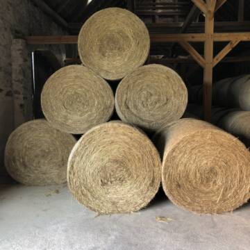
Heu zu verkaufen
Kremmen OT Staffelde
Rhinland Reitpark GmbH
@Rhinland-Reitpark
Heu
Empfänger lädt ab
Rundballen
Regenfrei
3 weitere...
B+
Deprecated: Creation of dynamic property Zend_View_Helper_Ads::$adLink is deprecated in /var/www/stall-frei/htdocs/staging.stall-frei.de/library/Psf/View/Helper/Ads.php on line 108

Persönlichkeitsentwicklung mit Pferden
Bad Salzuflen
Katja Dors
@Pferdezeiten
Begleite andere auf ihrem Entwicklungsweg und entdecke die transformative Kraft der pferdegestützten Persönlichkeitsentwicklung !
neu
R

Haferstroh in Futterqualität für gesunde Pferde ...
Schollene
Guthof Mühlenfels
@Gutshof-Muehlenfels
Einstreu
Lieferant entlädt
Großballen
Regenfrei
3 weitere...
B+

Fruktan- und zuckerarmes Heu in Premiumqualität !
Schollene
Guthof Mühlenfels
@Gutshof-Muehlenfels
Heu
Empfänger lädt ab
Rundballen
Bio
Regenfrei
3 weitere...
B+

Fruktan- und zuckerarmes Premium Wiesenheu !
Schollene
Guthof Mühlenfels
@Gutshof-Muehlenfels
Heu
Empfänger lädt ab
Rundballen
Regenfrei
3 weitere...
B+

Haferstroh 1.50m Ernte 25 Ausgezeichnete Qualität
Cavertitz
LWB Streubel
@Landwirtschaftsbetr.-Streubel
Stroh
Lieferant entlädt
Rundballen
Regenfrei
3 weitere...
B+
Pferdeheu 1.Schnitt Juli 2025/Rundballen 1.50m
Cavertitz
LWB Streubel
@Landwirtschaftsbetr.-Streubel
Heu
Lieferant entlädt
Rundballen
Bio
Regenfrei
3 weitere...
B+

Leider kein Vorschaubild
Leider kein Vorschaubild
Biohafer zu verkaufen
Altmärkische Höhe OT Losse
Landwirtschaft H.Stoltenberg
@ReiterhofLosse
Futter
Empfänger lädt ab
Lose
Bio
Regenfrei
2 weitere...
B+
Leider kein Vorschaubild
Leider kein Vorschaubild
Bio-Luzerneheu aus qualifiziertem Biobetrieb
Altmärkische Höhe OT Losse
Landwirtschaft H.Stoltenberg
@ReiterhofLosse
Heu
Empfänger lädt ab
Großballen
Bio
2 weitere...
B+

Heu und Stroh /Rundballen/Quaderballen
Sandersdorf
jule13
@Jule2024
Stroh
Lieferant entlädt
Rundballen
Regenfrei
3 weitere...
B+

Luzerneheu 1.Schnitt
Teutschenthal
Nancy
@Haltergemeinschaft-TT
Heu
Empfänger lädt ab
Rundballen
Regenfrei
2 weitere...
B+
Deprecated: Creation of dynamic property Zend_View::$pageCount is deprecated in /var/www/stall-frei/htdocs/staging.stall-frei.de/library/vendor/shardj/zf1-future/library/Zend/View/Abstract.php on line 308
Deprecated: Creation of dynamic property Zend_View::$itemCountPerPage is deprecated in /var/www/stall-frei/htdocs/staging.stall-frei.de/library/vendor/shardj/zf1-future/library/Zend/View/Abstract.php on line 308
Deprecated: Creation of dynamic property Zend_View::$first is deprecated in /var/www/stall-frei/htdocs/staging.stall-frei.de/library/vendor/shardj/zf1-future/library/Zend/View/Abstract.php on line 308
Deprecated: Creation of dynamic property Zend_View::$current is deprecated in /var/www/stall-frei/htdocs/staging.stall-frei.de/library/vendor/shardj/zf1-future/library/Zend/View/Abstract.php on line 308
Deprecated: Creation of dynamic property Zend_View::$last is deprecated in /var/www/stall-frei/htdocs/staging.stall-frei.de/library/vendor/shardj/zf1-future/library/Zend/View/Abstract.php on line 308
Deprecated: Creation of dynamic property Zend_View::$next is deprecated in /var/www/stall-frei/htdocs/staging.stall-frei.de/library/vendor/shardj/zf1-future/library/Zend/View/Abstract.php on line 308
Deprecated: Creation of dynamic property Zend_View::$pagesInRange is deprecated in /var/www/stall-frei/htdocs/staging.stall-frei.de/library/vendor/shardj/zf1-future/library/Zend/View/Abstract.php on line 308
Deprecated: Creation of dynamic property Zend_View::$firstPageInRange is deprecated in /var/www/stall-frei/htdocs/staging.stall-frei.de/library/vendor/shardj/zf1-future/library/Zend/View/Abstract.php on line 308
Deprecated: Creation of dynamic property Zend_View::$lastPageInRange is deprecated in /var/www/stall-frei/htdocs/staging.stall-frei.de/library/vendor/shardj/zf1-future/library/Zend/View/Abstract.php on line 308
Deprecated: Creation of dynamic property Zend_View::$currentItemCount is deprecated in /var/www/stall-frei/htdocs/staging.stall-frei.de/library/vendor/shardj/zf1-future/library/Zend/View/Abstract.php on line 308
Deprecated: Creation of dynamic property Zend_View::$totalItemCount is deprecated in /var/www/stall-frei/htdocs/staging.stall-frei.de/library/vendor/shardj/zf1-future/library/Zend/View/Abstract.php on line 308
Deprecated: Creation of dynamic property Zend_View::$firstItemNumber is deprecated in /var/www/stall-frei/htdocs/staging.stall-frei.de/library/vendor/shardj/zf1-future/library/Zend/View/Abstract.php on line 308
Deprecated: Creation of dynamic property Zend_View::$lastItemNumber is deprecated in /var/www/stall-frei/htdocs/staging.stall-frei.de/library/vendor/shardj/zf1-future/library/Zend/View/Abstract.php on line 308
Deprecated: Creation of dynamic property Zend_View::$router is deprecated in /var/www/stall-frei/htdocs/staging.stall-frei.de/library/vendor/shardj/zf1-future/library/Zend/View/Abstract.php on line 308
Deprecated: Creation of dynamic property Zend_View::$urlParams is deprecated in /var/www/stall-frei/htdocs/staging.stall-frei.de/library/vendor/shardj/zf1-future/library/Zend/View/Abstract.php on line 308
Deprecated: Creation of dynamic property Zend_View::$showAds is deprecated in /var/www/stall-frei/htdocs/staging.stall-frei.de/library/vendor/shardj/zf1-future/library/Zend/View/Abstract.php on line 308
Deprecated: Creation of dynamic property Zend_View::$objectIds is deprecated in /var/www/stall-frei/htdocs/staging.stall-frei.de/library/vendor/shardj/zf1-future/library/Zend/View/Abstract.php on line 308
Deprecated: Creation of dynamic property Zend_View::$showNavbar is deprecated in /var/www/stall-frei/htdocs/staging.stall-frei.de/library/vendor/shardj/zf1-future/library/Zend/View/Abstract.php on line 308
Deprecated: Creation of dynamic property Zend_View::$showBreadcrumb is deprecated in /var/www/stall-frei/htdocs/staging.stall-frei.de/library/vendor/shardj/zf1-future/library/Zend/View/Abstract.php on line 308
Deprecated: Creation of dynamic property Zend_View::$showFooter is deprecated in /var/www/stall-frei/htdocs/staging.stall-frei.de/library/vendor/shardj/zf1-future/library/Zend/View/Abstract.php on line 308
Deprecated: Creation of dynamic property Zend_View::$showInternalAds is deprecated in /var/www/stall-frei/htdocs/staging.stall-frei.de/library/vendor/shardj/zf1-future/library/Zend/View/Abstract.php on line 308
Deprecated: Creation of dynamic property Zend_View::$blNoContent is deprecated in /var/www/stall-frei/htdocs/staging.stall-frei.de/library/vendor/shardj/zf1-future/library/Zend/View/Abstract.php on line 308
Deprecated: Creation of dynamic property Zend_View::$sMetaDesc is deprecated in /var/www/stall-frei/htdocs/staging.stall-frei.de/library/vendor/shardj/zf1-future/library/Zend/View/Abstract.php on line 308
Deprecated: Creation of dynamic property Zend_View::$useGmaps is deprecated in /var/www/stall-frei/htdocs/staging.stall-frei.de/library/vendor/shardj/zf1-future/library/Zend/View/Abstract.php on line 308
Deprecated: Creation of dynamic property Zend_View::$touches is deprecated in /var/www/stall-frei/htdocs/staging.stall-frei.de/library/vendor/shardj/zf1-future/library/Zend/View/Abstract.php on line 308
Deprecated: Creation of dynamic property Zend_View::$oProject is deprecated in /var/www/stall-frei/htdocs/staging.stall-frei.de/library/vendor/shardj/zf1-future/library/Zend/View/Abstract.php on line 308
Deprecated: Creation of dynamic property Zend_View::$pageHeadline is deprecated in /var/www/stall-frei/htdocs/staging.stall-frei.de/library/vendor/shardj/zf1-future/library/Zend/View/Abstract.php on line 308
Deprecated: Creation of dynamic property Zend_View::$disableLocationField is deprecated in /var/www/stall-frei/htdocs/staging.stall-frei.de/library/vendor/shardj/zf1-future/library/Zend/View/Abstract.php on line 308
Deprecated: Creation of dynamic property Zend_View::$isSearch is deprecated in /var/www/stall-frei/htdocs/staging.stall-frei.de/library/vendor/shardj/zf1-future/library/Zend/View/Abstract.php on line 308
Deprecated: Creation of dynamic property Zend_View::$pageTitle is deprecated in /var/www/stall-frei/htdocs/staging.stall-frei.de/library/vendor/shardj/zf1-future/library/Zend/View/Abstract.php on line 308
Deprecated: Creation of dynamic property Psf_Form_Element_Text::$class is deprecated in /var/www/stall-frei/htdocs/staging.stall-frei.de/library/vendor/shardj/zf1-future/library/Zend/Form/Element.php on line 874
Deprecated: Creation of dynamic property Psf_Form_Element_Text::$size is deprecated in /var/www/stall-frei/htdocs/staging.stall-frei.de/library/vendor/shardj/zf1-future/library/Zend/Form/Element.php on line 874
Deprecated: Creation of dynamic property Psf_Form_Element_Text::$placeholder is deprecated in /var/www/stall-frei/htdocs/staging.stall-frei.de/library/vendor/shardj/zf1-future/library/Zend/Form/Element.php on line 874
Deprecated: Creation of dynamic property Psf_Form_Element_Hidden::$class is deprecated in /var/www/stall-frei/htdocs/staging.stall-frei.de/library/vendor/shardj/zf1-future/library/Zend/Form/Element.php on line 874
Deprecated: Creation of dynamic property Psf_Form_Element_Hidden::$class is deprecated in /var/www/stall-frei/htdocs/staging.stall-frei.de/library/vendor/shardj/zf1-future/library/Zend/Form/Element.php on line 874
Deprecated: Creation of dynamic property Psf_Form_Element_Hidden::$class is deprecated in /var/www/stall-frei/htdocs/staging.stall-frei.de/library/vendor/shardj/zf1-future/library/Zend/Form/Element.php on line 874
Deprecated: Creation of dynamic property Psf_Form_Element_Hidden::$class is deprecated in /var/www/stall-frei/htdocs/staging.stall-frei.de/library/vendor/shardj/zf1-future/library/Zend/Form/Element.php on line 874
Deprecated: Creation of dynamic property Psf_Form_Element_Select::$class is deprecated in /var/www/stall-frei/htdocs/staging.stall-frei.de/library/vendor/shardj/zf1-future/library/Zend/Form/Element.php on line 874
Deprecated: Creation of dynamic property Psf_Form_Element_Select::$class is deprecated in /var/www/stall-frei/htdocs/staging.stall-frei.de/library/vendor/shardj/zf1-future/library/Zend/Form/Element.php on line 874
Deprecated: Creation of dynamic property Psf_Form_Element_Select::$class is deprecated in /var/www/stall-frei/htdocs/staging.stall-frei.de/library/vendor/shardj/zf1-future/library/Zend/Form/Element.php on line 874
Deprecated: Creation of dynamic property Psf_Form_Element_Select::$class is deprecated in /var/www/stall-frei/htdocs/staging.stall-frei.de/library/vendor/shardj/zf1-future/library/Zend/Form/Element.php on line 874
Deprecated: Creation of dynamic property Zend_View::$sort is deprecated in /var/www/stall-frei/htdocs/staging.stall-frei.de/library/vendor/shardj/zf1-future/library/Zend/View/Abstract.php on line 308
Deprecated: Creation of dynamic property Zend_View::$searchLocation is deprecated in /var/www/stall-frei/htdocs/staging.stall-frei.de/library/vendor/shardj/zf1-future/library/Zend/View/Abstract.php on line 308
Deprecated: Creation of dynamic property Zend_View::$locationHint is deprecated in /var/www/stall-frei/htdocs/staging.stall-frei.de/library/vendor/shardj/zf1-future/library/Zend/View/Abstract.php on line 308
Psf_GeoCoder_Abstract::getLocation: Schöneberg Get Location CachedOrLive
Psf_GeoCoder_Abstract::getCachedOrLive: Schöneberg
Psf_GeoCoder_OpenCageData::makeApiRequest: response:
Array
(
[documentation] => https://opencagedata.com/api
[licenses] => Array
(
[0] => Array
(
[name] => see attribution guide
[url] => https://opencagedata.com/credits
)
)
[results] => Array
(
[0] => Array
(
[bounds] => Array
(
[northeast] => Array
(
[lat] => 52.5049347
[lng] => 13.3765623
)
[southwest] => Array
(
[lat] => 52.4546381
[lng] => 13.3362902
)
)
[components] => Array
(
[ISO_3166-1_alpha-2] => DE
[ISO_3166-1_alpha-3] => DEU
[ISO_3166-2] => Array
(
[0] => DE-BE
)
[_category] => place
[_normalized_city] => Berlin
[_type] => neighbourhood
[borough] => Tempelhof-Schöneberg
[city] => Berlin
[continent] => Europe
[country] => Deutschland
[country_code] => de
[political_union] => European Union
[state] => Berlin
[state_code] => BE
[suburb] => Schöneberg
)
[confidence] => 7
[formatted] => Schöneberg, Berlin, Deutschland
[geometry] => Array
(
[lat] => 52.482157
[lng] => 13.3551901
)
)
[1] => Array
(
[bounds] => Array
(
[northeast] => Array
(
[lat] => 49.9418744
[lng] => 7.7757634
)
[southwest] => Array
(
[lat] => 49.9140429
[lng] => 7.6953532
)
)
[components] => Array
(
[ISO_3166-1_alpha-2] => DE
[ISO_3166-1_alpha-3] => DEU
[ISO_3166-2] => Array
(
[0] => DE-RP
)
[_category] => place
[_normalized_city] => Schöneberg
[_type] => village
[continent] => Europe
[country] => Deutschland
[country_code] => de
[county] => Landkreis Bad Kreuznach
[municipality] => Langenlonsheim-Stromberg
[political_union] => European Union
[state] => Rheinland-Pfalz
[state_code] => RP
[village] => Schöneberg
)
[confidence] => 7
[formatted] => Schöneberg, Rheinland-Pfalz, Deutschland
[geometry] => Array
(
[lat] => 49.9204671
[lng] => 7.7494525
)
)
[2] => Array
(
[bounds] => Array
(
[northeast] => Array
(
[lat] => 50.6715714
[lng] => 7.6236573
)
[southwest] => Array
(
[lat] => 50.6508985
[lng] => 7.589246
)
)
[components] => Array
(
[ISO_3166-1_alpha-2] => DE
[ISO_3166-1_alpha-3] => DEU
[ISO_3166-2] => Array
(
[0] => DE-RP
)
[_category] => place
[_normalized_city] => Schöneberg
[_type] => village
[continent] => Europe
[country] => Deutschland
[country_code] => de
[county] => Landkreis Altenkirchen (Westerwald)
[municipality] => Altenkirchen-Flammersfeld
[political_union] => European Union
[postcode] => 57638
[state] => Rheinland-Pfalz
[state_code] => RP
[village] => Schöneberg
)
[confidence] => 7
[formatted] => 57638 Schöneberg, Deutschland
[geometry] => Array
(
[lat] => 50.6647711
[lng] => 7.604437
)
)
[3] => Array
(
[bounds] => Array
(
[northeast] => Array
(
[lat] => 53.0210758
[lng] => 14.2056284
)
[southwest] => Array
(
[lat] => 52.9613565
[lng] => 14.1183423
)
)
[components] => Array
(
[ISO_3166-1_alpha-2] => DE
[ISO_3166-1_alpha-3] => DEU
[ISO_3166-2] => Array
(
[0] => DE-BB
)
[_category] => place
[_normalized_city] => Schwedt/Oder
[_type] => village
[continent] => Europe
[country] => Deutschland
[country_code] => de
[county] => Uckermark
[political_union] => European Union
[state] => Brandenburg
[state_code] => BB
[town] => Schwedt/Oder
[village] => Schöneberg
)
[confidence] => 7
[formatted] => Schöneberg, Brandenburg, Deutschland
[geometry] => Array
(
[lat] => 53.0079676
[lng] => 14.142975
)
)
[4] => Array
(
[bounds] => Array
(
[northeast] => Array
(
[lat] => 50.6748249
[lng] => 7.4799285
)
[southwest] => Array
(
[lat] => 50.6348249
[lng] => 7.4399285
)
)
[components] => Array
(
[ISO_3166-1_alpha-2] => DE
[ISO_3166-1_alpha-3] => DEU
[ISO_3166-2] => Array
(
[0] => DE-RP
)
[_category] => place
[_normalized_city] => Schöneberg
[_type] => village
[continent] => Europe
[country] => Deutschland
[country_code] => de
[county] => Landkreis Neuwied
[municipality] => Asbach
[political_union] => European Union
[postcode] => 53577
[state] => Rheinland-Pfalz
[state_code] => RP
[village] => Schöneberg
)
[confidence] => 7
[formatted] => 53577 Schöneberg, Deutschland
[geometry] => Array
(
[lat] => 50.6548249
[lng] => 7.4599285
)
)
[5] => Array
(
[bounds] => Array
(
[northeast] => Array
(
[lat] => 51.5340842
[lng] => 9.4463869
)
[southwest] => Array
(
[lat] => 51.5060644
[lng] => 9.3942505
)
)
[components] => Array
(
[ISO_3166-1_alpha-2] => DE
[ISO_3166-1_alpha-3] => DEU
[ISO_3166-2] => Array
(
[0] => DE-HE
)
[_category] => place
[_normalized_city] => Schöneberg
[_type] => village
[continent] => Europe
[country] => Deutschland
[country_code] => de
[county] => Landkreis Kassel
[municipality] => Hofgeismar
[political_union] => European Union
[state] => Hessen
[state_code] => HE
[village] => Schöneberg
)
[confidence] => 7
[formatted] => Schöneberg, Hessen, Deutschland
[geometry] => Array
(
[lat] => 51.5168413
[lng] => 9.4176035
)
)
[6] => Array
(
[bounds] => Array
(
[northeast] => Array
(
[lat] => 48.107472
[lng] => 11.1041062
)
[southwest] => Array
(
[lat] => 48.107372
[lng] => 11.1040062
)
)
[components] => Array
(
[ISO_3166-1_alpha-2] => DE
[ISO_3166-1_alpha-3] => DEU
[ISO_3166-2] => Array
(
[0] => DE-BY
)
[_category] => natural/water
[_normalized_city] => Türkenfeld
[_type] => peak
[continent] => Europe
[country] => Deutschland
[country_code] => de
[county] => Landkreis Fürstenfeldbruck
[peak] => Schöneberg
[political_union] => European Union
[postcode] => 82299
[state] => Bayern
[state_code] => BY
[village] => Türkenfeld
)
[confidence] => 9
[formatted] => Schöneberg, 82299 Türkenfeld, Deutschland
[geometry] => Array
(
[lat] => 48.107422
[lng] => 11.1040562
)
)
[7] => Array
(
[bounds] => Array
(
[northeast] => Array
(
[lat] => 50.1005159
[lng] => 9.2077192
)
[southwest] => Array
(
[lat] => 50.1004159
[lng] => 9.2076192
)
)
[components] => Array
(
[ISO_3166-1_alpha-2] => DE
[ISO_3166-1_alpha-3] => DEU
[ISO_3166-2] => Array
(
[0] => DE-BY
)
[_category] => natural/water
[_normalized_city] => Krombach
[_type] => peak
[continent] => Europe
[country] => Deutschland
[country_code] => de
[county] => Landkreis Aschaffenburg
[municipality] => Schöllkrippen
[peak] => Schöneberg
[political_union] => European Union
[postcode] => 63829
[state] => Bayern
[state_code] => BY
[village] => Krombach
)
[confidence] => 9
[formatted] => Schöneberg, 63829 Krombach, Deutschland
[geometry] => Array
(
[lat] => 50.1004659
[lng] => 9.2076692
)
)
[8] => Array
(
[bounds] => Array
(
[northeast] => Array
(
[lat] => 50.4311895
[lng] => 7.0696746
)
[southwest] => Array
(
[lat] => 50.4310895
[lng] => 7.0695746
)
)
[components] => Array
(
[ISO_3166-1_alpha-2] => DE
[ISO_3166-1_alpha-3] => DEU
[ISO_3166-2] => Array
(
[0] => DE-RP
)
[_category] => natural/water
[_normalized_city] => Heckenbach
[_type] => peak
[continent] => Europe
[country] => Deutschland
[country_code] => de
[county] => Landkreis Ahrweiler
[municipality] => Altenahr
[peak] => Schöneberg
[political_union] => European Union
[postcode] => 56746
[state] => Rheinland-Pfalz
[state_code] => RP
[village] => Heckenbach
)
[confidence] => 9
[formatted] => Schöneberg, 56746 Heckenbach, Deutschland
[geometry] => Array
(
[lat] => 50.4311395
[lng] => 7.0696246
)
)
[9] => Array
(
[bounds] => Array
(
[northeast] => Array
(
[lat] => 52.12129
[lng] => 10.0309204
)
[southwest] => Array
(
[lat] => 52.12119
[lng] => 10.0308204
)
)
[components] => Array
(
[ISO_3166-1_alpha-2] => DE
[ISO_3166-1_alpha-3] => DEU
[ISO_3166-2] => Array
(
[0] => DE-NI
)
[_category] => natural/water
[_normalized_city] => Bad Salzdetfurth
[_type] => peak
[continent] => Europe
[country] => Deutschland
[country_code] => de
[county] => Landkreis Hildesheim
[peak] => Schöneberg
[political_union] => European Union
[state] => Niedersachsen
[state_code] => NI
[town] => Bad Salzdetfurth
)
[confidence] => 9
[formatted] => Schöneberg, Bad Salzdetfurth, Niedersachsen, Deutschland
[geometry] => Array
(
[lat] => 52.12124
[lng] => 10.0308704
)
)
)
[status] => Array
(
[code] => 200
[message] => OK
)
[stay_informed] => Array
(
[blog] => https://blog.opencagedata.com
[mastodon] => https://en.osm.town/@opencage
)
[thanks] => For using an OpenCage API
[timestamp] => Array
(
[created_http] => Fri, 06 Feb 2026 17:15:27 GMT
[created_unix] => 1770398127
)
[total_results] => 10
)
Psf_GeoCoder_Abstract::convertLocationResult
{"documentation":"https:\/\/opencagedata.com\/api","licenses":[{"name":"see attribution guide","url":"https:\/\/opencagedata.com\/credits"}],"results":[{"bounds":{"northeast":{"lat":52.5049347,"lng":13.3765623},"southwest":{"lat":52.4546381,"lng":13.3362902}},"components":{"ISO_3166-1_alpha-2":"DE","ISO_3166-1_alpha-3":"DEU","ISO_3166-2":["DE-BE"],"_category":"place","_normalized_city":"Berlin","_type":"neighbourhood","borough":"Tempelhof-Sch\u00f6neberg","city":"Berlin","continent":"Europe","country":"Deutschland","country_code":"de","political_union":"European Union","state":"Berlin","state_code":"BE","suburb":"Sch\u00f6neberg"},"confidence":7,"formatted":"Sch\u00f6neberg, Berlin, Deutschland","geometry":{"lat":52.482157,"lng":13.3551901}},{"bounds":{"northeast":{"lat":49.9418744,"lng":7.7757634},"southwest":{"lat":49.9140429,"lng":7.6953532}},"components":{"ISO_3166-1_alpha-2":"DE","ISO_3166-1_alpha-3":"DEU","ISO_3166-2":["DE-RP"],"_category":"place","_normalized_city":"Sch\u00f6neberg","_type":"village","continent":"Europe","country":"Deutschland","country_code":"de","county":"Landkreis Bad Kreuznach","municipality":"Langenlonsheim-Stromberg","political_union":"European Union","state":"Rheinland-Pfalz","state_code":"RP","village":"Sch\u00f6neberg"},"confidence":7,"formatted":"Sch\u00f6neberg, Rheinland-Pfalz, Deutschland","geometry":{"lat":49.9204671,"lng":7.7494525}},{"bounds":{"northeast":{"lat":50.6715714,"lng":7.6236573},"southwest":{"lat":50.6508985,"lng":7.589246}},"components":{"ISO_3166-1_alpha-2":"DE","ISO_3166-1_alpha-3":"DEU","ISO_3166-2":["DE-RP"],"_category":"place","_normalized_city":"Sch\u00f6neberg","_type":"village","continent":"Europe","country":"Deutschland","country_code":"de","county":"Landkreis Altenkirchen (Westerwald)","municipality":"Altenkirchen-Flammersfeld","political_union":"European Union","postcode":"57638","state":"Rheinland-Pfalz","state_code":"RP","village":"Sch\u00f6neberg"},"confidence":7,"formatted":"57638 Sch\u00f6neberg, Deutschland","geometry":{"lat":50.6647711,"lng":7.604437}},{"bounds":{"northeast":{"lat":53.0210758,"lng":14.2056284},"southwest":{"lat":52.9613565,"lng":14.1183423}},"components":{"ISO_3166-1_alpha-2":"DE","ISO_3166-1_alpha-3":"DEU","ISO_3166-2":["DE-BB"],"_category":"place","_normalized_city":"Schwedt\/Oder","_type":"village","continent":"Europe","country":"Deutschland","country_code":"de","county":"Uckermark","political_union":"European Union","state":"Brandenburg","state_code":"BB","town":"Schwedt\/Oder","village":"Sch\u00f6neberg"},"confidence":7,"formatted":"Sch\u00f6neberg, Brandenburg, Deutschland","geometry":{"lat":53.0079676,"lng":14.142975}},{"bounds":{"northeast":{"lat":50.6748249,"lng":7.4799285},"southwest":{"lat":50.6348249,"lng":7.4399285}},"components":{"ISO_3166-1_alpha-2":"DE","ISO_3166-1_alpha-3":"DEU","ISO_3166-2":["DE-RP"],"_category":"place","_normalized_city":"Sch\u00f6neberg","_type":"village","continent":"Europe","country":"Deutschland","country_code":"de","county":"Landkreis Neuwied","municipality":"Asbach","political_union":"European Union","postcode":"53577","state":"Rheinland-Pfalz","state_code":"RP","village":"Sch\u00f6neberg"},"confidence":7,"formatted":"53577 Sch\u00f6neberg, Deutschland","geometry":{"lat":50.6548249,"lng":7.4599285}},{"bounds":{"northeast":{"lat":51.5340842,"lng":9.4463869},"southwest":{"lat":51.5060644,"lng":9.3942505}},"components":{"ISO_3166-1_alpha-2":"DE","ISO_3166-1_alpha-3":"DEU","ISO_3166-2":["DE-HE"],"_category":"place","_normalized_city":"Sch\u00f6neberg","_type":"village","continent":"Europe","country":"Deutschland","country_code":"de","county":"Landkreis Kassel","municipality":"Hofgeismar","political_union":"European Union","state":"Hessen","state_code":"HE","village":"Sch\u00f6neberg"},"confidence":7,"formatted":"Sch\u00f6neberg, Hessen, Deutschland","geometry":{"lat":51.5168413,"lng":9.4176035}},{"bounds":{"northeast":{"lat":48.107472,"lng":11.1041062},"southwest":{"lat":48.107372,"lng":11.1040062}},"components":{"ISO_3166-1_alpha-2":"DE","ISO_3166-1_alpha-3":"DEU","ISO_3166-2":["DE-BY"],"_category":"natural\/water","_normalized_city":"T\u00fcrkenfeld","_type":"peak","continent":"Europe","country":"Deutschland","country_code":"de","county":"Landkreis F\u00fcrstenfeldbruck","peak":"Sch\u00f6neberg","political_union":"European Union","postcode":"82299","state":"Bayern","state_code":"BY","village":"T\u00fcrkenfeld"},"confidence":9,"formatted":"Sch\u00f6neberg, 82299 T\u00fcrkenfeld, Deutschland","geometry":{"lat":48.107422,"lng":11.1040562}},{"bounds":{"northeast":{"lat":50.1005159,"lng":9.2077192},"southwest":{"lat":50.1004159,"lng":9.2076192}},"components":{"ISO_3166-1_alpha-2":"DE","ISO_3166-1_alpha-3":"DEU","ISO_3166-2":["DE-BY"],"_category":"natural\/water","_normalized_city":"Krombach","_type":"peak","continent":"Europe","country":"Deutschland","country_code":"de","county":"Landkreis Aschaffenburg","municipality":"Sch\u00f6llkrippen","peak":"Sch\u00f6neberg","political_union":"European Union","postcode":"63829","state":"Bayern","state_code":"BY","village":"Krombach"},"confidence":9,"formatted":"Sch\u00f6neberg, 63829 Krombach, Deutschland","geometry":{"lat":50.1004659,"lng":9.2076692}},{"bounds":{"northeast":{"lat":50.4311895,"lng":7.0696746},"southwest":{"lat":50.4310895,"lng":7.0695746}},"components":{"ISO_3166-1_alpha-2":"DE","ISO_3166-1_alpha-3":"DEU","ISO_3166-2":["DE-RP"],"_category":"natural\/water","_normalized_city":"Heckenbach","_type":"peak","continent":"Europe","country":"Deutschland","country_code":"de","county":"Landkreis Ahrweiler","municipality":"Altenahr","peak":"Sch\u00f6neberg","political_union":"European Union","postcode":"56746","state":"Rheinland-Pfalz","state_code":"RP","village":"Heckenbach"},"confidence":9,"formatted":"Sch\u00f6neberg, 56746 Heckenbach, Deutschland","geometry":{"lat":50.4311395,"lng":7.0696246}},{"bounds":{"northeast":{"lat":52.12129,"lng":10.0309204},"southwest":{"lat":52.12119,"lng":10.0308204}},"components":{"ISO_3166-1_alpha-2":"DE","ISO_3166-1_alpha-3":"DEU","ISO_3166-2":["DE-NI"],"_category":"natural\/water","_normalized_city":"Bad Salzdetfurth","_type":"peak","continent":"Europe","country":"Deutschland","country_code":"de","county":"Landkreis Hildesheim","peak":"Sch\u00f6neberg","political_union":"European Union","state":"Niedersachsen","state_code":"NI","town":"Bad Salzdetfurth"},"confidence":9,"formatted":"Sch\u00f6neberg, Bad Salzdetfurth, Niedersachsen, Deutschland","geometry":{"lat":52.12124,"lng":10.0308704}}],"status":{"code":200,"message":"OK"},"stay_informed":{"blog":"https:\/\/blog.opencagedata.com","mastodon":"https:\/\/en.osm.town\/@opencage"},"thanks":"For using an OpenCage API","timestamp":{"created_http":"Fri, 06 Feb 2026 17:15:27 GMT","created_unix":1770398127},"total_results":10}Array
(
[0] => stdClass Object
(
[bounds] => stdClass Object
(
[northeast] => stdClass Object
(
[lat] => 52.5049347
[lng] => 13.3765623
)
[southwest] => stdClass Object
(
[lat] => 52.4546381
[lng] => 13.3362902
)
)
[components] => stdClass Object
(
[ISO_3166-1_alpha-2] => DE
[ISO_3166-1_alpha-3] => DEU
[ISO_3166-2] => Array
(
[0] => DE-BE
)
[_category] => place
[_normalized_city] => Berlin
[_type] => neighbourhood
[borough] => Tempelhof-Schöneberg
[city] => Berlin
[continent] => Europe
[country] => Deutschland
[country_code] => de
[political_union] => European Union
[state] => Berlin
[state_code] => BE
[suburb] => Schöneberg
)
[confidence] => 7
[formatted] => Schöneberg, Berlin, Deutschland
[geometry] => stdClass Object
(
[lat] => 52.482157
[lng] => 13.3551901
)
)
[1] => stdClass Object
(
[bounds] => stdClass Object
(
[northeast] => stdClass Object
(
[lat] => 49.9418744
[lng] => 7.7757634
)
[southwest] => stdClass Object
(
[lat] => 49.9140429
[lng] => 7.6953532
)
)
[components] => stdClass Object
(
[ISO_3166-1_alpha-2] => DE
[ISO_3166-1_alpha-3] => DEU
[ISO_3166-2] => Array
(
[0] => DE-RP
)
[_category] => place
[_normalized_city] => Schöneberg
[_type] => village
[continent] => Europe
[country] => Deutschland
[country_code] => de
[county] => Landkreis Bad Kreuznach
[municipality] => Langenlonsheim-Stromberg
[political_union] => European Union
[state] => Rheinland-Pfalz
[state_code] => RP
[village] => Schöneberg
)
[confidence] => 7
[formatted] => Schöneberg, Rheinland-Pfalz, Deutschland
[geometry] => stdClass Object
(
[lat] => 49.9204671
[lng] => 7.7494525
)
)
[2] => stdClass Object
(
[bounds] => stdClass Object
(
[northeast] => stdClass Object
(
[lat] => 50.6715714
[lng] => 7.6236573
)
[southwest] => stdClass Object
(
[lat] => 50.6508985
[lng] => 7.589246
)
)
[components] => stdClass Object
(
[ISO_3166-1_alpha-2] => DE
[ISO_3166-1_alpha-3] => DEU
[ISO_3166-2] => Array
(
[0] => DE-RP
)
[_category] => place
[_normalized_city] => Schöneberg
[_type] => village
[continent] => Europe
[country] => Deutschland
[country_code] => de
[county] => Landkreis Altenkirchen (Westerwald)
[municipality] => Altenkirchen-Flammersfeld
[political_union] => European Union
[postcode] => 57638
[state] => Rheinland-Pfalz
[state_code] => RP
[village] => Schöneberg
)
[confidence] => 7
[formatted] => 57638 Schöneberg, Deutschland
[geometry] => stdClass Object
(
[lat] => 50.6647711
[lng] => 7.604437
)
)
[3] => stdClass Object
(
[bounds] => stdClass Object
(
[northeast] => stdClass Object
(
[lat] => 53.0210758
[lng] => 14.2056284
)
[southwest] => stdClass Object
(
[lat] => 52.9613565
[lng] => 14.1183423
)
)
[components] => stdClass Object
(
[ISO_3166-1_alpha-2] => DE
[ISO_3166-1_alpha-3] => DEU
[ISO_3166-2] => Array
(
[0] => DE-BB
)
[_category] => place
[_normalized_city] => Schwedt/Oder
[_type] => village
[continent] => Europe
[country] => Deutschland
[country_code] => de
[county] => Uckermark
[political_union] => European Union
[state] => Brandenburg
[state_code] => BB
[town] => Schwedt/Oder
[village] => Schöneberg
)
[confidence] => 7
[formatted] => Schöneberg, Brandenburg, Deutschland
[geometry] => stdClass Object
(
[lat] => 53.0079676
[lng] => 14.142975
)
)
[4] => stdClass Object
(
[bounds] => stdClass Object
(
[northeast] => stdClass Object
(
[lat] => 50.6748249
[lng] => 7.4799285
)
[southwest] => stdClass Object
(
[lat] => 50.6348249
[lng] => 7.4399285
)
)
[components] => stdClass Object
(
[ISO_3166-1_alpha-2] => DE
[ISO_3166-1_alpha-3] => DEU
[ISO_3166-2] => Array
(
[0] => DE-RP
)
[_category] => place
[_normalized_city] => Schöneberg
[_type] => village
[continent] => Europe
[country] => Deutschland
[country_code] => de
[county] => Landkreis Neuwied
[municipality] => Asbach
[political_union] => European Union
[postcode] => 53577
[state] => Rheinland-Pfalz
[state_code] => RP
[village] => Schöneberg
)
[confidence] => 7
[formatted] => 53577 Schöneberg, Deutschland
[geometry] => stdClass Object
(
[lat] => 50.6548249
[lng] => 7.4599285
)
)
[5] => stdClass Object
(
[bounds] => stdClass Object
(
[northeast] => stdClass Object
(
[lat] => 51.5340842
[lng] => 9.4463869
)
[southwest] => stdClass Object
(
[lat] => 51.5060644
[lng] => 9.3942505
)
)
[components] => stdClass Object
(
[ISO_3166-1_alpha-2] => DE
[ISO_3166-1_alpha-3] => DEU
[ISO_3166-2] => Array
(
[0] => DE-HE
)
[_category] => place
[_normalized_city] => Schöneberg
[_type] => village
[continent] => Europe
[country] => Deutschland
[country_code] => de
[county] => Landkreis Kassel
[municipality] => Hofgeismar
[political_union] => European Union
[state] => Hessen
[state_code] => HE
[village] => Schöneberg
)
[confidence] => 7
[formatted] => Schöneberg, Hessen, Deutschland
[geometry] => stdClass Object
(
[lat] => 51.5168413
[lng] => 9.4176035
)
)
[6] => stdClass Object
(
[bounds] => stdClass Object
(
[northeast] => stdClass Object
(
[lat] => 48.107472
[lng] => 11.1041062
)
[southwest] => stdClass Object
(
[lat] => 48.107372
[lng] => 11.1040062
)
)
[components] => stdClass Object
(
[ISO_3166-1_alpha-2] => DE
[ISO_3166-1_alpha-3] => DEU
[ISO_3166-2] => Array
(
[0] => DE-BY
)
[_category] => natural/water
[_normalized_city] => Türkenfeld
[_type] => peak
[continent] => Europe
[country] => Deutschland
[country_code] => de
[county] => Landkreis Fürstenfeldbruck
[peak] => Schöneberg
[political_union] => European Union
[postcode] => 82299
[state] => Bayern
[state_code] => BY
[village] => Türkenfeld
)
[confidence] => 9
[formatted] => Schöneberg, 82299 Türkenfeld, Deutschland
[geometry] => stdClass Object
(
[lat] => 48.107422
[lng] => 11.1040562
)
)
[7] => stdClass Object
(
[bounds] => stdClass Object
(
[northeast] => stdClass Object
(
[lat] => 50.1005159
[lng] => 9.2077192
)
[southwest] => stdClass Object
(
[lat] => 50.1004159
[lng] => 9.2076192
)
)
[components] => stdClass Object
(
[ISO_3166-1_alpha-2] => DE
[ISO_3166-1_alpha-3] => DEU
[ISO_3166-2] => Array
(
[0] => DE-BY
)
[_category] => natural/water
[_normalized_city] => Krombach
[_type] => peak
[continent] => Europe
[country] => Deutschland
[country_code] => de
[county] => Landkreis Aschaffenburg
[municipality] => Schöllkrippen
[peak] => Schöneberg
[political_union] => European Union
[postcode] => 63829
[state] => Bayern
[state_code] => BY
[village] => Krombach
)
[confidence] => 9
[formatted] => Schöneberg, 63829 Krombach, Deutschland
[geometry] => stdClass Object
(
[lat] => 50.1004659
[lng] => 9.2076692
)
)
[8] => stdClass Object
(
[bounds] => stdClass Object
(
[northeast] => stdClass Object
(
[lat] => 50.4311895
[lng] => 7.0696746
)
[southwest] => stdClass Object
(
[lat] => 50.4310895
[lng] => 7.0695746
)
)
[components] => stdClass Object
(
[ISO_3166-1_alpha-2] => DE
[ISO_3166-1_alpha-3] => DEU
[ISO_3166-2] => Array
(
[0] => DE-RP
)
[_category] => natural/water
[_normalized_city] => Heckenbach
[_type] => peak
[continent] => Europe
[country] => Deutschland
[country_code] => de
[county] => Landkreis Ahrweiler
[municipality] => Altenahr
[peak] => Schöneberg
[political_union] => European Union
[postcode] => 56746
[state] => Rheinland-Pfalz
[state_code] => RP
[village] => Heckenbach
)
[confidence] => 9
[formatted] => Schöneberg, 56746 Heckenbach, Deutschland
[geometry] => stdClass Object
(
[lat] => 50.4311395
[lng] => 7.0696246
)
)
[9] => stdClass Object
(
[bounds] => stdClass Object
(
[northeast] => stdClass Object
(
[lat] => 52.12129
[lng] => 10.0309204
)
[southwest] => stdClass Object
(
[lat] => 52.12119
[lng] => 10.0308204
)
)
[components] => stdClass Object
(
[ISO_3166-1_alpha-2] => DE
[ISO_3166-1_alpha-3] => DEU
[ISO_3166-2] => Array
(
[0] => DE-NI
)
[_category] => natural/water
[_normalized_city] => Bad Salzdetfurth
[_type] => peak
[continent] => Europe
[country] => Deutschland
[country_code] => de
[county] => Landkreis Hildesheim
[peak] => Schöneberg
[political_union] => European Union
[state] => Niedersachsen
[state_code] => NI
[town] => Bad Salzdetfurth
)
[confidence] => 9
[formatted] => Schöneberg, Bad Salzdetfurth, Niedersachsen, Deutschland
[geometry] => stdClass Object
(
[lat] => 52.12124
[lng] => 10.0308704
)
)
)
Psf_GeoCoder_OpenCageData::getKeyMap: 0
stdClass Object
(
    [bounds] => stdClass Object
        (
            [northeast] => stdClass Object
                (
                    [lat] => 52.5049347
                    [lng] => 13.3765623
                )

            [southwest] => stdClass Object
                (
                    [lat] => 52.4546381
                    [lng] => 13.3362902
                )

        )

    [components] => stdClass Object
        (
            [ISO_3166-1_alpha-2] => DE
            [ISO_3166-1_alpha-3] => DEU
            [ISO_3166-2] => Array
                (
                    [0] => DE-BE
                )

            [_category] => place
            [_normalized_city] => Berlin
            [_type] => neighbourhood
            [borough] => Tempelhof-Schöneberg
            [city] => Berlin
            [continent] => Europe
            [country] => Deutschland
            [country_code] => de
            [political_union] => European Union
            [state] => Berlin
            [state_code] => BE
            [suburb] => Schöneberg
        )

    [confidence] => 7
    [formatted] => Schöneberg, Berlin, Deutschland
    [geometry] => stdClass Object
        (
            [lat] => 52.482157
            [lng] => 13.3551901
        )

)
Psf_GeoCoder_OpenCageData::getCounty: Berlin
Psf_GeoCoder_OpenCageData::addMissingData REFETCH!
Array
(
    [address] => Schöneberg, Berlin, Deutschland
    [type] => neighbourhood
    [street] =>
    [city] => Schöneberg
    [county] => Berlin
    [state] => Berlin
    [zip] =>
    [country] => Deutschland
    [suburb] => Schöneberg
    [countrycode] => de
    [latitude] => 52.482157
    [longitude] => 13.3551901
    [accuracy] => 1
    [confidence] => 7
    [bounds] => stdClass Object
        (
            [northeast] => stdClass Object
                (
                    [lat] => 52.5049347
                    [lng] => 13.3765623
                )

            [southwest] => stdClass Object
                (
                    [lat] => 52.4546381
                    [lng] => 13.3362902
                )

        )

)
reformat!
Array
(
    [address] => Schöneberg, Berlin, Deutschland
    [type] => neighbourhood
    [street] =>
    [city] => Schöneberg
    [county] => Berlin
    [state] => Berlin
    [zip] =>
    [country] => Deutschland
    [suburb] => Schöneberg
    [countrycode] => de
    [latitude] => 52.482157
    [longitude] => 13.3551901
    [accuracy] => 1
    [confidence] => 7
    [bounds] => stdClass Object
        (
            [northeast] => stdClass Object
                (
                    [lat] => 52.5049347
                    [lng] => 13.3765623
                )

            [southwest] => stdClass Object
                (
                    [lat] => 52.4546381
                    [lng] => 13.3362902
                )

        )

    [place] => Schöneberg, Berlin
    [hash] => 23ce3f968d8b4eec8bc90bcd4b6c7ee4
)
Psf_GeoCoder_OpenCageData::getKeyMap: 1
stdClass Object
(
    [bounds] => stdClass Object
        (
            [northeast] => stdClass Object
                (
                    [lat] => 49.9418744
                    [lng] => 7.7757634
                )

            [southwest] => stdClass Object
                (
                    [lat] => 49.9140429
                    [lng] => 7.6953532
                )

        )

    [components] => stdClass Object
        (
            [ISO_3166-1_alpha-2] => DE
            [ISO_3166-1_alpha-3] => DEU
            [ISO_3166-2] => Array
                (
                    [0] => DE-RP
                )

            [_category] => place
            [_normalized_city] => Schöneberg
            [_type] => village
            [continent] => Europe
            [country] => Deutschland
            [country_code] => de
            [county] => Landkreis Bad Kreuznach
            [municipality] => Langenlonsheim-Stromberg
            [political_union] => European Union
            [state] => Rheinland-Pfalz
            [state_code] => RP
            [village] => Schöneberg
        )

    [confidence] => 7
    [formatted] => Schöneberg, Rheinland-Pfalz, Deutschland
    [geometry] => stdClass Object
        (
            [lat] => 49.9204671
            [lng] => 7.7494525
        )

)
Psf_GeoCoder_OpenCageData::getCounty: Bad Kreuznach
Psf_GeoCoder_OpenCageData::addMissingData REFETCH!
Array
(
    [address] => Schöneberg, Rheinland-Pfalz, Deutschland
    [type] => village
    [street] =>
    [city] => Schöneberg
    [county] => Bad Kreuznach
    [state] => Rheinland-Pfalz
    [zip] =>
    [country] => Deutschland
    [suburb] =>
    [countrycode] => de
    [latitude] => 49.9204671
    [longitude] => 7.7494525
    [accuracy] => 1
    [confidence] => 7
    [bounds] => stdClass Object
        (
            [northeast] => stdClass Object
                (
                    [lat] => 49.9418744
                    [lng] => 7.7757634
                )

            [southwest] => stdClass Object
                (
                    [lat] => 49.9140429
                    [lng] => 7.6953532
                )

        )

)
reformat!
Array
(
    [address] => Schöneberg, Rheinland-Pfalz, Deutschland
    [type] => village
    [street] =>
    [city] => Schöneberg
    [county] => Bad Kreuznach
    [state] => Rheinland-Pfalz
    [zip] =>
    [country] => Deutschland
    [suburb] =>
    [countrycode] => de
    [latitude] => 49.9204671
    [longitude] => 7.7494525
    [accuracy] => 1
    [confidence] => 7
    [bounds] => stdClass Object
        (
            [northeast] => stdClass Object
                (
                    [lat] => 49.9418744
                    [lng] => 7.7757634
                )

            [southwest] => stdClass Object
                (
                    [lat] => 49.9140429
                    [lng] => 7.6953532
                )

        )

    [place] => Schöneberg, Rheinland-Pfalz
    [hash] => a441c63095830d2add921a7933206435
)
Psf_GeoCoder_OpenCageData::getKeyMap: 2
stdClass Object
(
    [bounds] => stdClass Object
        (
            [northeast] => stdClass Object
                (
                    [lat] => 50.6715714
                    [lng] => 7.6236573
                )

            [southwest] => stdClass Object
                (
                    [lat] => 50.6508985
                    [lng] => 7.589246
                )

        )

    [components] => stdClass Object
        (
            [ISO_3166-1_alpha-2] => DE
            [ISO_3166-1_alpha-3] => DEU
            [ISO_3166-2] => Array
                (
                    [0] => DE-RP
                )

            [_category] => place
            [_normalized_city] => Schöneberg
            [_type] => village
            [continent] => Europe
            [country] => Deutschland
            [country_code] => de
            [county] => Landkreis Altenkirchen (Westerwald)
            [municipality] => Altenkirchen-Flammersfeld
            [political_union] => European Union
            [postcode] => 57638
            [state] => Rheinland-Pfalz
            [state_code] => RP
            [village] => Schöneberg
        )

    [confidence] => 7
    [formatted] => 57638 Schöneberg, Deutschland
    [geometry] => stdClass Object
        (
            [lat] => 50.6647711
            [lng] => 7.604437
        )

)
Psf_GeoCoder_OpenCageData::getCounty: Altenkirchen (Westerwald)
Psf_GeoCoder_OpenCageData::addMissingData REFETCH!
Array
(
    [address] => 57638 Schöneberg, Deutschland
    [type] => village
    [street] =>
    [city] => Schöneberg
    [county] => Altenkirchen (Westerwald)
    [state] => Rheinland-Pfalz
    [zip] => 57638
    [country] => Deutschland
    [suburb] =>
    [countrycode] => de
    [latitude] => 50.6647711
    [longitude] => 7.604437
    [accuracy] => 1
    [confidence] => 7
    [bounds] => stdClass Object
        (
            [northeast] => stdClass Object
                (
                    [lat] => 50.6715714
                    [lng] => 7.6236573
                )

            [southwest] => stdClass Object
                (
                    [lat] => 50.6508985
                    [lng] => 7.589246
                )

        )

)
reformat!
Array
(
    [address] => 57638 Schöneberg, Deutschland
    [type] => village
    [street] =>
    [city] => Schöneberg
    [county] => Altenkirchen (Westerwald)
    [state] => Rheinland-Pfalz
    [zip] => 57638
    [country] => Deutschland
    [suburb] =>
    [countrycode] => de
    [latitude] => 50.6647711
    [longitude] => 7.604437
    [accuracy] => 1
    [confidence] => 7
    [bounds] => stdClass Object
        (
            [northeast] => stdClass Object
                (
                    [lat] => 50.6715714
                    [lng] => 7.6236573
                )

            [southwest] => stdClass Object
                (
                    [lat] => 50.6508985
                    [lng] => 7.589246
                )

        )

    [place] => 57638 Schöneberg, Rheinland-Pfalz
    [hash] => de2f0eca13e7237a022bfb5374948bce
)
Psf_GeoCoder_OpenCageData::getKeyMap: 3
stdClass Object
(
    [bounds] => stdClass Object
        (
            [northeast] => stdClass Object
                (
                    [lat] => 53.0210758
                    [lng] => 14.2056284
                )

            [southwest] => stdClass Object
                (
                    [lat] => 52.9613565
                    [lng] => 14.1183423
                )

        )

    [components] => stdClass Object
        (
            [ISO_3166-1_alpha-2] => DE
            [ISO_3166-1_alpha-3] => DEU
            [ISO_3166-2] => Array
                (
                    [0] => DE-BB
                )

            [_category] => place
            [_normalized_city] => Schwedt/Oder
            [_type] => village
            [continent] => Europe
            [country] => Deutschland
            [country_code] => de
            [county] => Uckermark
            [political_union] => European Union
            [state] => Brandenburg
            [state_code] => BB
            [town] => Schwedt/Oder
            [village] => Schöneberg
        )

    [confidence] => 7
    [formatted] => Schöneberg, Brandenburg, Deutschland
    [geometry] => stdClass Object
        (
            [lat] => 53.0079676
            [lng] => 14.142975
        )

)
Psf_GeoCoder_OpenCageData::getCounty: Uckermark
Psf_GeoCoder_OpenCageData::addMissingData REFETCH!
Array
(
    [address] => Schöneberg, Brandenburg, Deutschland
    [type] => village
    [street] =>
    [city] => Schwedt/Oder
    [county] => Uckermark
    [state] => Brandenburg
    [zip] =>
    [country] => Deutschland
    [suburb] =>
    [countrycode] => de
    [latitude] => 53.0079676
    [longitude] => 14.142975
    [accuracy] => 1
    [confidence] => 7
    [bounds] => stdClass Object
        (
            [northeast] => stdClass Object
                (
                    [lat] => 53.0210758
                    [lng] => 14.2056284
                )

            [southwest] => stdClass Object
                (
                    [lat] => 52.9613565
                    [lng] => 14.1183423
                )

        )

)
reformat!
Array
(
    [address] => Schwedt/Oder
    [type] => village
    [street] =>
    [city] => Schwedt/Oder
    [county] => Uckermark
    [state] => Brandenburg
    [zip] =>
    [country] => Deutschland
    [suburb] =>
    [countrycode] => de
    [latitude] => 53.0079676
    [longitude] => 14.142975
    [accuracy] => 1
    [confidence] => 7
    [bounds] => stdClass Object
        (
            [northeast] => stdClass Object
                (
                    [lat] => 53.0210758
                    [lng] => 14.2056284
                )

            [southwest] => stdClass Object
                (
                    [lat] => 52.9613565
                    [lng] => 14.1183423
                )

        )

    [place] => Schwedt/Oder, Brandenburg
    [hash] => 7ac5e25641833c49a12ec217bcd62db1
)
Psf_GeoCoder_OpenCageData::getKeyMap: 4
stdClass Object
(
    [bounds] => stdClass Object
        (
            [northeast] => stdClass Object
                (
                    [lat] => 50.6748249
                    [lng] => 7.4799285
                )

            [southwest] => stdClass Object
                (
                    [lat] => 50.6348249
                    [lng] => 7.4399285
                )

        )

    [components] => stdClass Object
        (
            [ISO_3166-1_alpha-2] => DE
            [ISO_3166-1_alpha-3] => DEU
            [ISO_3166-2] => Array
                (
                    [0] => DE-RP
                )

            [_category] => place
            [_normalized_city] => Schöneberg
            [_type] => village
            [continent] => Europe
            [country] => Deutschland
            [country_code] => de
            [county] => Landkreis Neuwied
            [municipality] => Asbach
            [political_union] => European Union
            [postcode] => 53577
            [state] => Rheinland-Pfalz
            [state_code] => RP
            [village] => Schöneberg
        )

    [confidence] => 7
    [formatted] => 53577 Schöneberg, Deutschland
    [geometry] => stdClass Object
        (
            [lat] => 50.6548249
            [lng] => 7.4599285
        )

)
Psf_GeoCoder_OpenCageData::getCounty: Neuwied
Psf_GeoCoder_OpenCageData::addMissingData REFETCH!
Array
(
    [address] => 53577 Schöneberg, Deutschland
    [type] => village
    [street] =>
    [city] => Schöneberg
    [county] => Neuwied
    [state] => Rheinland-Pfalz
    [zip] => 53577
    [country] => Deutschland
    [suburb] =>
    [countrycode] => de
    [latitude] => 50.6548249
    [longitude] => 7.4599285
    [accuracy] => 1
    [confidence] => 7
    [bounds] => stdClass Object
        (
            [northeast] => stdClass Object
                (
                    [lat] => 50.6748249
                    [lng] => 7.4799285
                )

            [southwest] => stdClass Object
                (
                    [lat] => 50.6348249
                    [lng] => 7.4399285
                )

        )

)
reformat!
Array
(
    [address] => 53577 Schöneberg, Deutschland
    [type] => village
    [street] =>
    [city] => Schöneberg
    [county] => Neuwied
    [state] => Rheinland-Pfalz
    [zip] => 53577
    [country] => Deutschland
    [suburb] =>
    [countrycode] => de
    [latitude] => 50.6548249
    [longitude] => 7.4599285
    [accuracy] => 1
    [confidence] => 7
    [bounds] => stdClass Object
        (
            [northeast] => stdClass Object
                (
                    [lat] => 50.6748249
                    [lng] => 7.4799285
                )

            [southwest] => stdClass Object
                (
                    [lat] => 50.6348249
                    [lng] => 7.4399285
                )

        )

    [place] => 53577 Schöneberg, Rheinland-Pfalz
    [hash] => 4861e9c3bbf3e7c6c79baac29245df9f
)
Psf_GeoCoder_OpenCageData::getKeyMap: 5
stdClass Object
(
    [bounds] => stdClass Object
        (
            [northeast] => stdClass Object
                (
                    [lat] => 51.5340842
                    [lng] => 9.4463869
                )

            [southwest] => stdClass Object
                (
                    [lat] => 51.5060644
                    [lng] => 9.3942505
                )

        )

    [components] => stdClass Object
        (
            [ISO_3166-1_alpha-2] => DE
            [ISO_3166-1_alpha-3] => DEU
            [ISO_3166-2] => Array
                (
                    [0] => DE-HE
                )

            [_category] => place
            [_normalized_city] => Schöneberg
            [_type] => village
            [continent] => Europe
            [country] => Deutschland
            [country_code] => de
            [county] => Landkreis Kassel
            [municipality] => Hofgeismar
            [political_union] => European Union
            [state] => Hessen
            [state_code] => HE
            [village] => Schöneberg
        )

    [confidence] => 7
    [formatted] => Schöneberg, Hessen, Deutschland
    [geometry] => stdClass Object
        (
            [lat] => 51.5168413
            [lng] => 9.4176035
        )

)
Psf_GeoCoder_OpenCageData::getCounty: Kassel
Psf_GeoCoder_OpenCageData::addMissingData REFETCH!
Array
(
    [address] => Schöneberg, Hessen, Deutschland
    [type] => village
    [street] =>
    [city] => Schöneberg
    [county] => Kassel
    [state] => Hessen
    [zip] =>
    [country] => Deutschland
    [suburb] =>
    [countrycode] => de
    [latitude] => 51.5168413
    [longitude] => 9.4176035
    [accuracy] => 1
    [confidence] => 7
    [bounds] => stdClass Object
        (
            [northeast] => stdClass Object
                (
                    [lat] => 51.5340842
                    [lng] => 9.4463869
                )

            [southwest] => stdClass Object
                (
                    [lat] => 51.5060644
                    [lng] => 9.3942505
                )

        )

)
reformat!
Array
(
    [address] => Schöneberg, Hessen, Deutschland
    [type] => village
    [street] =>
    [city] => Schöneberg
    [county] => Kassel
    [state] => Hessen
    [zip] =>
    [country] => Deutschland
    [suburb] =>
    [countrycode] => de
    [latitude] => 51.5168413
    [longitude] => 9.4176035
    [accuracy] => 1
    [confidence] => 7
    [bounds] => stdClass Object
        (
            [northeast] => stdClass Object
                (
                    [lat] => 51.5340842
                    [lng] => 9.4463869
                )

            [southwest] => stdClass Object
                (
                    [lat] => 51.5060644
                    [lng] => 9.3942505
                )

        )

    [place] => Schöneberg, Hessen
    [hash] => 7dba98550b105598093c9b22e10aa740
)
Psf_GeoCoder_OpenCageData::getKeyMap: 6
stdClass Object
(
    [bounds] => stdClass Object
        (
            [northeast] => stdClass Object
                (
                    [lat] => 48.107472
                    [lng] => 11.1041062
                )

            [southwest] => stdClass Object
                (
                    [lat] => 48.107372
                    [lng] => 11.1040062
                )

        )

    [components] => stdClass Object
        (
            [ISO_3166-1_alpha-2] => DE
            [ISO_3166-1_alpha-3] => DEU
            [ISO_3166-2] => Array
                (
                    [0] => DE-BY
                )

            [_category] => natural/water
            [_normalized_city] => Türkenfeld
            [_type] => peak
            [continent] => Europe
            [country] => Deutschland
            [country_code] => de
            [county] => Landkreis Fürstenfeldbruck
            [peak] => Schöneberg
            [political_union] => European Union
            [postcode] => 82299
            [state] => Bayern
            [state_code] => BY
            [village] => Türkenfeld
        )

    [confidence] => 9
    [formatted] => Schöneberg, 82299 Türkenfeld, Deutschland
    [geometry] => stdClass Object
        (
            [lat] => 48.107422
            [lng] => 11.1040562
        )

)
Psf_GeoCoder_OpenCageData::getCounty: Fürstenfeldbruck
Psf_GeoCoder_OpenCageData::addMissingData REFETCH!
Array
(
    [address] => Schöneberg, 82299 Türkenfeld, Deutschland
    [type] => peak
    [street] =>
    [city] => Türkenfeld
    [county] => Fürstenfeldbruck
    [state] => Bayern
    [zip] => 82299
    [country] => Deutschland
    [suburb] =>
    [countrycode] => de
    [latitude] => 48.107422
    [longitude] => 11.1040562
    [accuracy] => 1
    [confidence] => 9
    [bounds] => stdClass Object
        (
            [northeast] => stdClass Object
                (
                    [lat] => 48.107472
                    [lng] => 11.1041062
                )

            [southwest] => stdClass Object
                (
                    [lat] => 48.107372
                    [lng] => 11.1040062
                )

        )

)
reformat!
Array
(
    [address] => Schöneberg, 82299 Türkenfeld, Deutschland
    [type] => peak
    [street] =>
    [city] => Türkenfeld
    [county] => Fürstenfeldbruck
    [state] => Bayern
    [zip] => 82299
    [country] => Deutschland
    [suburb] =>
    [countrycode] => de
    [latitude] => 48.107422
    [longitude] => 11.1040562
    [accuracy] => 1
    [confidence] => 9
    [bounds] => stdClass Object
        (
            [northeast] => stdClass Object
                (
                    [lat] => 48.107472
                    [lng] => 11.1041062
                )

            [southwest] => stdClass Object
                (
                    [lat] => 48.107372
                    [lng] => 11.1040062
                )

        )

    [place] => 82299 Türkenfeld, Bayern
    [hash] => 71c443be666d8fc3c7633a747ba5b351
)
Psf_GeoCoder_OpenCageData::getKeyMap: 7
stdClass Object
(
    [bounds] => stdClass Object
        (
            [northeast] => stdClass Object
                (
                    [lat] => 50.1005159
                    [lng] => 9.2077192
                )

            [southwest] => stdClass Object
                (
                    [lat] => 50.1004159
                    [lng] => 9.2076192
                )

        )

    [components] => stdClass Object
        (
            [ISO_3166-1_alpha-2] => DE
            [ISO_3166-1_alpha-3] => DEU
            [ISO_3166-2] => Array
                (
                    [0] => DE-BY
                )

            [_category] => natural/water
            [_normalized_city] => Krombach
            [_type] => peak
            [continent] => Europe
            [country] => Deutschland
            [country_code] => de
            [county] => Landkreis Aschaffenburg
            [municipality] => Schöllkrippen
            [peak] => Schöneberg
            [political_union] => European Union
            [postcode] => 63829
            [state] => Bayern
            [state_code] => BY
            [village] => Krombach
        )

    [confidence] => 9
    [formatted] => Schöneberg, 63829 Krombach, Deutschland
    [geometry] => stdClass Object
        (
            [lat] => 50.1004659
            [lng] => 9.2076692
        )

)
Psf_GeoCoder_OpenCageData::getCounty: Aschaffenburg
Psf_GeoCoder_OpenCageData::addMissingData REFETCH!
Array
(
    [address] => Schöneberg, 63829 Krombach, Deutschland
    [type] => peak
    [street] =>
    [city] => Krombach
    [county] => Aschaffenburg
    [state] => Bayern
    [zip] => 63829
    [country] => Deutschland
    [suburb] =>
    [countrycode] => de
    [latitude] => 50.1004659
    [longitude] => 9.2076692
    [accuracy] => 1
    [confidence] => 9
    [bounds] => stdClass Object
        (
            [northeast] => stdClass Object
                (
                    [lat] => 50.1005159
                    [lng] => 9.2077192
                )

            [southwest] => stdClass Object
                (
                    [lat] => 50.1004159
                    [lng] => 9.2076192
                )

        )

)
reformat!
Array
(
    [address] => Schöneberg, 63829 Krombach, Deutschland
    [type] => peak
    [street] =>
    [city] => Krombach
    [county] => Aschaffenburg
    [state] => Bayern
    [zip] => 63829
    [country] => Deutschland
    [suburb] =>
    [countrycode] => de
    [latitude] => 50.1004659
    [longitude] => 9.2076692
    [accuracy] => 1
    [confidence] => 9
    [bounds] => stdClass Object
        (
            [northeast] => stdClass Object
                (
                    [lat] => 50.1005159
                    [lng] => 9.2077192
                )

            [southwest] => stdClass Object
                (
                    [lat] => 50.1004159
                    [lng] => 9.2076192
                )

        )

    [place] => 63829 Krombach, Bayern
    [hash] => 4b6329dad919b455ce28935558091b7a
)
Psf_GeoCoder_OpenCageData::getKeyMap: 8
stdClass Object
(
    [bounds] => stdClass Object
        (
            [northeast] => stdClass Object
                (
                    [lat] => 50.4311895
                    [lng] => 7.0696746
                )

            [southwest] => stdClass Object
                (
                    [lat] => 50.4310895
                    [lng] => 7.0695746
                )

        )

    [components] => stdClass Object
        (
            [ISO_3166-1_alpha-2] => DE
            [ISO_3166-1_alpha-3] => DEU
            [ISO_3166-2] => Array
                (
                    [0] => DE-RP
                )

            [_category] => natural/water
            [_normalized_city] => Heckenbach
            [_type] => peak
            [continent] => Europe
            [country] => Deutschland
            [country_code] => de
            [county] => Landkreis Ahrweiler
            [municipality] => Altenahr
            [peak] => Schöneberg
            [political_union] => European Union
            [postcode] => 56746
            [state] => Rheinland-Pfalz
            [state_code] => RP
            [village] => Heckenbach
        )

    [confidence] => 9
    [formatted] => Schöneberg, 56746 Heckenbach, Deutschland
    [geometry] => stdClass Object
        (
            [lat] => 50.4311395
            [lng] => 7.0696246
        )

)
Psf_GeoCoder_OpenCageData::getCounty: Ahrweiler
Psf_GeoCoder_OpenCageData::addMissingData REFETCH!
Array
(
    [address] => Schöneberg, 56746 Heckenbach, Deutschland
    [type] => peak
    [street] =>
    [city] => Heckenbach
    [county] => Ahrweiler
    [state] => Rheinland-Pfalz
    [zip] => 56746
    [country] => Deutschland
    [suburb] =>
    [countrycode] => de
    [latitude] => 50.4311395
    [longitude] => 7.0696246
    [accuracy] => 1
    [confidence] => 9
    [bounds] => stdClass Object
        (
            [northeast] => stdClass Object
                (
                    [lat] => 50.4311895
                    [lng] => 7.0696746
                )

            [southwest] => stdClass Object
                (
                    [lat] => 50.4310895
                    [lng] => 7.0695746
                )

        )

)
reformat!
Array
(
    [address] => Schöneberg, 56746 Heckenbach, Deutschland
    [type] => peak
    [street] =>
    [city] => Heckenbach
    [county] => Ahrweiler
    [state] => Rheinland-Pfalz
    [zip] => 56746
    [country] => Deutschland
    [suburb] =>
    [countrycode] => de
    [latitude] => 50.4311395
    [longitude] => 7.0696246
    [accuracy] => 1
    [confidence] => 9
    [bounds] => stdClass Object
        (
            [northeast] => stdClass Object
                (
                    [lat] => 50.4311895
                    [lng] => 7.0696746
                )

            [southwest] => stdClass Object
                (
                    [lat] => 50.4310895
                    [lng] => 7.0695746
                )

        )

    [place] => 56746 Heckenbach, Rheinland-Pfalz
    [hash] => f8de548c557ca530dcc2a0de6e1e897f
)
Psf_GeoCoder_OpenCageData::getKeyMap: 9
stdClass Object
(
    [bounds] => stdClass Object
        (
            [northeast] => stdClass Object
                (
                    [lat] => 52.12129
                    [lng] => 10.0309204
                )

            [southwest] => stdClass Object
                (
                    [lat] => 52.12119
                    [lng] => 10.0308204
                )

        )

    [components] => stdClass Object
        (
            [ISO_3166-1_alpha-2] => DE
            [ISO_3166-1_alpha-3] => DEU
            [ISO_3166-2] => Array
                (
                    [0] => DE-NI
                )

            [_category] => natural/water
            [_normalized_city] => Bad Salzdetfurth
            [_type] => peak
            [continent] => Europe
            [country] => Deutschland
            [country_code] => de
            [county] => Landkreis Hildesheim
            [peak] => Schöneberg
            [political_union] => European Union
            [state] => Niedersachsen
            [state_code] => NI
            [town] => Bad Salzdetfurth
        )

    [confidence] => 9
    [formatted] => Schöneberg, Bad Salzdetfurth, Niedersachsen, Deutschland
    [geometry] => stdClass Object
        (
            [lat] => 52.12124
            [lng] => 10.0308704
        )

)
Psf_GeoCoder_OpenCageData::getCounty: Hildesheim
Psf_GeoCoder_OpenCageData::addMissingData REFETCH!
Array
(
    [address] => Schöneberg, Bad Salzdetfurth, Niedersachsen, Deutschland
    [type] => peak
    [street] =>
    [city] => Bad Salzdetfurth
    [county] => Hildesheim
    [state] => Niedersachsen
    [zip] =>
    [country] => Deutschland
    [suburb] =>
    [countrycode] => de
    [latitude] => 52.12124
    [longitude] => 10.0308704
    [accuracy] => 1
    [confidence] => 9
    [bounds] => stdClass Object
        (
            [northeast] => stdClass Object
                (
                    [lat] => 52.12129
                    [lng] => 10.0309204
                )

            [southwest] => stdClass Object
                (
                    [lat] => 52.12119
                    [lng] => 10.0308204
                )

        )

)
reformat!
Array
(
    [address] => Schöneberg, Bad Salzdetfurth, Niedersachsen, Deutschland
    [type] => peak
    [street] =>
    [city] => Bad Salzdetfurth
    [county] => Hildesheim
    [state] => Niedersachsen
    [zip] =>
    [country] => Deutschland
    [suburb] =>
    [countrycode] => de
    [latitude] => 52.12124
    [longitude] => 10.0308704
    [accuracy] => 1
    [confidence] => 9
    [bounds] => stdClass Object
        (
            [northeast] => stdClass Object
                (
                    [lat] => 52.12129
                    [lng] => 10.0309204
                )

            [southwest] => stdClass Object
                (
                    [lat] => 52.12119
                    [lng] => 10.0308204
                )

        )

    [place] => Bad Salzdetfurth, Niedersachsen
    [hash] => edd64e8758f6e2d4f162dd967b54ec31
)
Deprecated: Creation of dynamic property Zend_View::$locationHintStyle is deprecated in /var/www/stall-frei/htdocs/staging.stall-frei.de/library/vendor/shardj/zf1-future/library/Zend/View/Abstract.php on line 308
Deprecated: Creation of dynamic property Zend_View::$adGeoLocation is deprecated in /var/www/stall-frei/htdocs/staging.stall-frei.de/library/vendor/shardj/zf1-future/library/Zend/View/Abstract.php on line 308
Deprecated: Creation of dynamic property Zend_View::$recordCount is deprecated in /var/www/stall-frei/htdocs/staging.stall-frei.de/library/vendor/shardj/zf1-future/library/Zend/View/Abstract.php on line 308
Deprecated: explode(): Passing null to parameter #2 ($string) of type string is deprecated in /var/www/stall-frei/htdocs/staging.stall-frei.de/application/models/SearchAgent.php on line 100
Deprecated: explode(): Passing null to parameter #2 ($string) of type string is deprecated in /var/www/stall-frei/htdocs/staging.stall-frei.de/application/models/SearchAgent.php on line 100
Deprecated: explode(): Passing null to parameter #2 ($string) of type string is deprecated in /var/www/stall-frei/htdocs/staging.stall-frei.de/application/models/SearchAgent.php on line 100
Deprecated: explode(): Passing null to parameter #2 ($string) of type string is deprecated in /var/www/stall-frei/htdocs/staging.stall-frei.de/application/models/SearchAgent.php on line 100
Deprecated: explode(): Passing null to parameter #2 ($string) of type string is deprecated in /var/www/stall-frei/htdocs/staging.stall-frei.de/application/models/SearchAgent.php on line 100
Deprecated: explode(): Passing null to parameter #2 ($string) of type string is deprecated in /var/www/stall-frei/htdocs/staging.stall-frei.de/application/models/SearchAgent.php on line 100
Deprecated: trim(): Passing null to parameter #1 ($string) of type string is deprecated in /var/www/stall-frei/htdocs/staging.stall-frei.de/application/models/Account/Search.php on line 82
Warning: Cannot modify header information - headers already sent by (output started at /var/www/stall-frei/htdocs/staging.stall-frei.de/library/vendor/shardj/zf1-future/library/Zend/View/Abstract.php:308) in /var/www/stall-frei/htdocs/staging.stall-frei.de/application/models/Account/Search.php on line 71
Deprecated: Creation of dynamic property Zend_View::$paginationParams is deprecated in /var/www/stall-frei/htdocs/staging.stall-frei.de/library/vendor/shardj/zf1-future/library/Zend/View/Abstract.php on line 308
Deprecated: Creation of dynamic property Zend_View::$objectPaginator is deprecated in /var/www/stall-frei/htdocs/staging.stall-frei.de/library/vendor/shardj/zf1-future/library/Zend/View/Abstract.php on line 308
Deprecated: Creation of dynamic property Zend_View::$featuredObjects is deprecated in /var/www/stall-frei/htdocs/staging.stall-frei.de/library/vendor/shardj/zf1-future/library/Zend/View/Abstract.php on line 308
Deprecated: Creation of dynamic property Zend_View::$hints is deprecated in /var/www/stall-frei/htdocs/staging.stall-frei.de/library/vendor/shardj/zf1-future/library/Zend/View/Abstract.php on line 308
Deprecated: Creation of dynamic property Zend_View::$attributeHints is deprecated in /var/www/stall-frei/htdocs/staging.stall-frei.de/library/vendor/shardj/zf1-future/library/Zend/View/Abstract.php on line 308
Deprecated: Creation of dynamic property Zend_View::$oSearchForm is deprecated in /var/www/stall-frei/htdocs/staging.stall-frei.de/library/vendor/shardj/zf1-future/library/Zend/View/Abstract.php on line 308