Deprecated: Creation of dynamic property Zend_View::$sMode is deprecated in /var/www/stall-frei/htdocs/staging.stall-frei.de/library/vendor/shardj/zf1-future/library/Zend/View/Abstract.php on line 308
Heu, Stroh oder Futter in Blaubeuren
Gesucht wird in "Ach, Blaubeuren, Baden-Württemberg, Deutschland"
94 Einträge
Deprecated: Creation of dynamic property Zend_View::$listObjects is deprecated in /var/www/stall-frei/htdocs/staging.stall-frei.de/library/vendor/shardj/zf1-future/library/Zend/View/Abstract.php on line 308
Deprecated: Creation of dynamic property Zend_View::$listMode is deprecated in /var/www/stall-frei/htdocs/staging.stall-frei.de/library/vendor/shardj/zf1-future/library/Zend/View/Abstract.php on line 308
Deprecated: Creation of dynamic property Zend_View::$renderedObjects is deprecated in /var/www/stall-frei/htdocs/staging.stall-frei.de/library/vendor/shardj/zf1-future/library/Zend/View/Abstract.php on line 308
Deprecated: Creation of dynamic property Zend_View::$index is deprecated in /var/www/stall-frei/htdocs/staging.stall-frei.de/library/vendor/shardj/zf1-future/library/Zend/View/Abstract.php on line 308
Deprecated: Creation of dynamic property Zend_View::$displayMode is deprecated in /var/www/stall-frei/htdocs/staging.stall-frei.de/library/vendor/shardj/zf1-future/library/Zend/View/Abstract.php on line 308
Deprecated: Creation of dynamic property Zend_View::$remarketingIds is deprecated in /var/www/stall-frei/htdocs/staging.stall-frei.de/library/vendor/shardj/zf1-future/library/Zend/View/Abstract.php on line 308
Deprecated: Creation of dynamic property Zend_View::$listItem is deprecated in /var/www/stall-frei/htdocs/staging.stall-frei.de/library/vendor/shardj/zf1-future/library/Zend/View/Abstract.php on line 308
Deprecated: Creation of dynamic property Zend_View::$object is deprecated in /var/www/stall-frei/htdocs/staging.stall-frei.de/library/vendor/shardj/zf1-future/library/Zend/View/Abstract.php on line 308
Deprecated: Creation of dynamic property Zend_View::$attributes is deprecated in /var/www/stall-frei/htdocs/staging.stall-frei.de/library/vendor/shardj/zf1-future/library/Zend/View/Abstract.php on line 308
Leider kein Vorschaubild
Leider kein Vorschaubild
Heucobs zu verkaufen
Langenau
Bewegungsstall-Unseld
@Bewegungsstall-Unseld
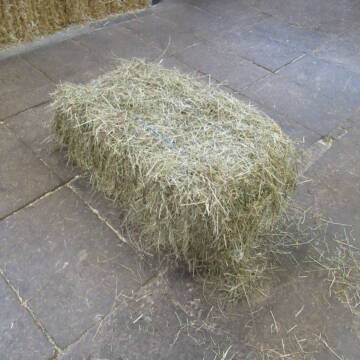
Heu
Großballen
Regenfrei
Wird verladen
B+
Leider kein Vorschaubild
Leider kein Vorschaubild
Heucobs in Bigbags oder 25 kg Säcke
Langenau
Bewegungsstall-Unseld
@Bewegungsstall-Unseld
Futter
Pellets
Regenfrei
Wird verladen
1 weitere...
B+
Deprecated: Creation of dynamic property Zend_View_Helper_Ads::$adLink is deprecated in /var/www/stall-frei/htdocs/staging.stall-frei.de/library/Psf/View/Helper/Ads.php on line 108

Futtersack HeuToy, Fressbremse in pink
Mechtersen
STALL-FREIde Marketing
@STALL-FREI-Marketing
Stundenlange Beschäftigung die
Koliken vorbeugt, geringe Staubinhalation mit
steuerbarer Futterentnahme

Bedampftes Heu in Großballen für Allergikerpferd...
Langenau
Bewegungsstall-Unseld
@Bewegungsstall-Unseld
Heu
Großballen
Regenfrei
Wird verladen
1 weitere...
B+

Strohpellets, Einstreupellets, Strohcobs, Pellets
Seekirch
Eloda Pellets
@ElodaPellets
Einstreu
Empfänger lädt ab
Pellets
Wird verladen
2 weitere...
B+

Heucobs, Luzernecobs, Futterpellets, Heupellets
Seekirch
Eloda Pellets
@ElodaPellets
Futter
Pellets
Wird verladen
Abholung
Lieferung
B+

Persönlichkeitsentwicklung mit Pferden
Bad Salzuflen
Katja Dors
@Pferdezeiten
Begleite andere auf ihrem Entwicklungsweg und entdecke die transformative Kraft der pferdegestützten Persönlichkeitsentwicklung !
neu
R

Stroh, Kleinballen, Weizenstroh
Ertingen
Tobias
@Tobias4
Stroh
Kleinballen/HD-Ballen
Regenfrei
Wird verladen
2 weitere...
B+

Biete Heu in Rundballen
Steinheim am Albuch
Westernreiterhof Ziegler
@NadinZiegler
Heu
Rundballen
Bio
Regenfrei
Wird verladen
1 weitere...
B+

Hafer aus Ernte 2025 auch gequetscht zu verkaufen
Wolfschlugen
Reitanlage im Höfelweg
@Reitanlage-im-Hoefelweg
Futter
Wird verladen
Abholung
B+
Leider kein Vorschaubild
Leider kein Vorschaubild
Kleine HD-Ballen Heu
Weil im Schönbuch
Sabine-Dettinger
@Sabine-Dettinger
Heu
Empfänger lädt ab
Kleinballen/HD-Ballen
Bio
Regenfrei
2 weitere...
B+
Deprecated: Creation of dynamic property Zend_View::$pageCount is deprecated in /var/www/stall-frei/htdocs/staging.stall-frei.de/library/vendor/shardj/zf1-future/library/Zend/View/Abstract.php on line 308
Deprecated: Creation of dynamic property Zend_View::$itemCountPerPage is deprecated in /var/www/stall-frei/htdocs/staging.stall-frei.de/library/vendor/shardj/zf1-future/library/Zend/View/Abstract.php on line 308
Deprecated: Creation of dynamic property Zend_View::$first is deprecated in /var/www/stall-frei/htdocs/staging.stall-frei.de/library/vendor/shardj/zf1-future/library/Zend/View/Abstract.php on line 308
Deprecated: Creation of dynamic property Zend_View::$current is deprecated in /var/www/stall-frei/htdocs/staging.stall-frei.de/library/vendor/shardj/zf1-future/library/Zend/View/Abstract.php on line 308
Deprecated: Creation of dynamic property Zend_View::$last is deprecated in /var/www/stall-frei/htdocs/staging.stall-frei.de/library/vendor/shardj/zf1-future/library/Zend/View/Abstract.php on line 308
Deprecated: Creation of dynamic property Zend_View::$next is deprecated in /var/www/stall-frei/htdocs/staging.stall-frei.de/library/vendor/shardj/zf1-future/library/Zend/View/Abstract.php on line 308
Deprecated: Creation of dynamic property Zend_View::$pagesInRange is deprecated in /var/www/stall-frei/htdocs/staging.stall-frei.de/library/vendor/shardj/zf1-future/library/Zend/View/Abstract.php on line 308
Deprecated: Creation of dynamic property Zend_View::$firstPageInRange is deprecated in /var/www/stall-frei/htdocs/staging.stall-frei.de/library/vendor/shardj/zf1-future/library/Zend/View/Abstract.php on line 308
Deprecated: Creation of dynamic property Zend_View::$lastPageInRange is deprecated in /var/www/stall-frei/htdocs/staging.stall-frei.de/library/vendor/shardj/zf1-future/library/Zend/View/Abstract.php on line 308
Deprecated: Creation of dynamic property Zend_View::$currentItemCount is deprecated in /var/www/stall-frei/htdocs/staging.stall-frei.de/library/vendor/shardj/zf1-future/library/Zend/View/Abstract.php on line 308
Deprecated: Creation of dynamic property Zend_View::$totalItemCount is deprecated in /var/www/stall-frei/htdocs/staging.stall-frei.de/library/vendor/shardj/zf1-future/library/Zend/View/Abstract.php on line 308
Deprecated: Creation of dynamic property Zend_View::$firstItemNumber is deprecated in /var/www/stall-frei/htdocs/staging.stall-frei.de/library/vendor/shardj/zf1-future/library/Zend/View/Abstract.php on line 308
Deprecated: Creation of dynamic property Zend_View::$lastItemNumber is deprecated in /var/www/stall-frei/htdocs/staging.stall-frei.de/library/vendor/shardj/zf1-future/library/Zend/View/Abstract.php on line 308
Deprecated: Creation of dynamic property Zend_View::$router is deprecated in /var/www/stall-frei/htdocs/staging.stall-frei.de/library/vendor/shardj/zf1-future/library/Zend/View/Abstract.php on line 308
Deprecated: Creation of dynamic property Zend_View::$urlParams is deprecated in /var/www/stall-frei/htdocs/staging.stall-frei.de/library/vendor/shardj/zf1-future/library/Zend/View/Abstract.php on line 308
Deprecated: Creation of dynamic property Zend_View::$showAds is deprecated in /var/www/stall-frei/htdocs/staging.stall-frei.de/library/vendor/shardj/zf1-future/library/Zend/View/Abstract.php on line 308
Deprecated: Creation of dynamic property Zend_View::$objectIds is deprecated in /var/www/stall-frei/htdocs/staging.stall-frei.de/library/vendor/shardj/zf1-future/library/Zend/View/Abstract.php on line 308
Deprecated: Creation of dynamic property Zend_View::$showNavbar is deprecated in /var/www/stall-frei/htdocs/staging.stall-frei.de/library/vendor/shardj/zf1-future/library/Zend/View/Abstract.php on line 308
Deprecated: Creation of dynamic property Zend_View::$showBreadcrumb is deprecated in /var/www/stall-frei/htdocs/staging.stall-frei.de/library/vendor/shardj/zf1-future/library/Zend/View/Abstract.php on line 308
Deprecated: Creation of dynamic property Zend_View::$showFooter is deprecated in /var/www/stall-frei/htdocs/staging.stall-frei.de/library/vendor/shardj/zf1-future/library/Zend/View/Abstract.php on line 308
Deprecated: Creation of dynamic property Zend_View::$showInternalAds is deprecated in /var/www/stall-frei/htdocs/staging.stall-frei.de/library/vendor/shardj/zf1-future/library/Zend/View/Abstract.php on line 308
Deprecated: Creation of dynamic property Zend_View::$blNoContent is deprecated in /var/www/stall-frei/htdocs/staging.stall-frei.de/library/vendor/shardj/zf1-future/library/Zend/View/Abstract.php on line 308
Deprecated: Creation of dynamic property Zend_View::$sMetaDesc is deprecated in /var/www/stall-frei/htdocs/staging.stall-frei.de/library/vendor/shardj/zf1-future/library/Zend/View/Abstract.php on line 308
Deprecated: Creation of dynamic property Zend_View::$useGmaps is deprecated in /var/www/stall-frei/htdocs/staging.stall-frei.de/library/vendor/shardj/zf1-future/library/Zend/View/Abstract.php on line 308
Deprecated: Creation of dynamic property Zend_View::$touches is deprecated in /var/www/stall-frei/htdocs/staging.stall-frei.de/library/vendor/shardj/zf1-future/library/Zend/View/Abstract.php on line 308
Deprecated: Creation of dynamic property Zend_View::$oProject is deprecated in /var/www/stall-frei/htdocs/staging.stall-frei.de/library/vendor/shardj/zf1-future/library/Zend/View/Abstract.php on line 308
Deprecated: Creation of dynamic property Zend_View::$pageHeadline is deprecated in /var/www/stall-frei/htdocs/staging.stall-frei.de/library/vendor/shardj/zf1-future/library/Zend/View/Abstract.php on line 308
Deprecated: Creation of dynamic property Zend_View::$disableLocationField is deprecated in /var/www/stall-frei/htdocs/staging.stall-frei.de/library/vendor/shardj/zf1-future/library/Zend/View/Abstract.php on line 308
Deprecated: Creation of dynamic property Zend_View::$isSearch is deprecated in /var/www/stall-frei/htdocs/staging.stall-frei.de/library/vendor/shardj/zf1-future/library/Zend/View/Abstract.php on line 308
Deprecated: Creation of dynamic property Zend_View::$pageTitle is deprecated in /var/www/stall-frei/htdocs/staging.stall-frei.de/library/vendor/shardj/zf1-future/library/Zend/View/Abstract.php on line 308
Deprecated: Creation of dynamic property Psf_Form_Element_Text::$class is deprecated in /var/www/stall-frei/htdocs/staging.stall-frei.de/library/vendor/shardj/zf1-future/library/Zend/Form/Element.php on line 874
Deprecated: Creation of dynamic property Psf_Form_Element_Text::$size is deprecated in /var/www/stall-frei/htdocs/staging.stall-frei.de/library/vendor/shardj/zf1-future/library/Zend/Form/Element.php on line 874
Deprecated: Creation of dynamic property Psf_Form_Element_Text::$placeholder is deprecated in /var/www/stall-frei/htdocs/staging.stall-frei.de/library/vendor/shardj/zf1-future/library/Zend/Form/Element.php on line 874
Deprecated: Creation of dynamic property Psf_Form_Element_Hidden::$class is deprecated in /var/www/stall-frei/htdocs/staging.stall-frei.de/library/vendor/shardj/zf1-future/library/Zend/Form/Element.php on line 874
Deprecated: Creation of dynamic property Psf_Form_Element_Hidden::$class is deprecated in /var/www/stall-frei/htdocs/staging.stall-frei.de/library/vendor/shardj/zf1-future/library/Zend/Form/Element.php on line 874
Deprecated: Creation of dynamic property Psf_Form_Element_Hidden::$class is deprecated in /var/www/stall-frei/htdocs/staging.stall-frei.de/library/vendor/shardj/zf1-future/library/Zend/Form/Element.php on line 874
Deprecated: Creation of dynamic property Psf_Form_Element_Hidden::$class is deprecated in /var/www/stall-frei/htdocs/staging.stall-frei.de/library/vendor/shardj/zf1-future/library/Zend/Form/Element.php on line 874
Deprecated: Creation of dynamic property Psf_Form_Element_Select::$class is deprecated in /var/www/stall-frei/htdocs/staging.stall-frei.de/library/vendor/shardj/zf1-future/library/Zend/Form/Element.php on line 874
Deprecated: Creation of dynamic property Psf_Form_Element_Select::$class is deprecated in /var/www/stall-frei/htdocs/staging.stall-frei.de/library/vendor/shardj/zf1-future/library/Zend/Form/Element.php on line 874
Deprecated: Creation of dynamic property Psf_Form_Element_Select::$class is deprecated in /var/www/stall-frei/htdocs/staging.stall-frei.de/library/vendor/shardj/zf1-future/library/Zend/Form/Element.php on line 874
Deprecated: Creation of dynamic property Psf_Form_Element_Select::$class is deprecated in /var/www/stall-frei/htdocs/staging.stall-frei.de/library/vendor/shardj/zf1-future/library/Zend/Form/Element.php on line 874
Deprecated: Creation of dynamic property Zend_View::$sort is deprecated in /var/www/stall-frei/htdocs/staging.stall-frei.de/library/vendor/shardj/zf1-future/library/Zend/View/Abstract.php on line 308
Deprecated: Creation of dynamic property Zend_View::$searchLocation is deprecated in /var/www/stall-frei/htdocs/staging.stall-frei.de/library/vendor/shardj/zf1-future/library/Zend/View/Abstract.php on line 308
Deprecated: Creation of dynamic property Zend_View::$locationHint is deprecated in /var/www/stall-frei/htdocs/staging.stall-frei.de/library/vendor/shardj/zf1-future/library/Zend/View/Abstract.php on line 308
Psf_GeoCoder_Abstract::getLocation: Ach Get Location CachedOrLive
Psf_GeoCoder_Abstract::getCachedOrLive: Ach
Psf_GeoCoder_OpenCageData::makeApiRequest: response:
Array
(
[documentation] => https://opencagedata.com/api
[licenses] => Array
(
[0] => Array
(
[name] => see attribution guide
[url] => https://opencagedata.com/credits
)
)
[results] => Array
(
[0] => Array
(
[bounds] => Array
(
[northeast] => Array
(
[lat] => 48.4154967
[lng] => 9.7906103
)
[southwest] => Array
(
[lat] => 48.3732171
[lng] => 9.7170068
)
)
[components] => Array
(
[ISO_3166-1_alpha-2] => DE
[ISO_3166-1_alpha-3] => DEU
[ISO_3166-2] => Array
(
[0] => DE-BW
)
[_category] => natural/water
[_normalized_city] => Blaubeuren
[_type] => river
[continent] => Europe
[country] => Deutschland
[country_code] => de
[county] => Alb-Donau-Kreis
[municipality] => VVG der Stadt Blaubeuren
[political_union] => European Union
[river] => Ach
[state] => Baden-Württemberg
[state_code] => BW
[town] => Blaubeuren
)
[confidence] => 7
[formatted] => Ach, Blaubeuren, Baden-Württemberg, Deutschland
[geometry] => Array
(
[lat] => 48.3874789
[lng] => 9.7642332
)
)
[1] => Array
(
[bounds] => Array
(
[northeast] => Array
(
[lat] => 47.7842067
[lng] => 11.1671835
)
[southwest] => Array
(
[lat] => 47.683534
[lng] => 11.005642
)
)
[components] => Array
(
[ISO_3166-1_alpha-2] => DE
[ISO_3166-1_alpha-3] => DEU
[ISO_3166-2] => Array
(
[0] => DE-BY
)
[_category] => natural/water
[_type] => stream
[continent] => Europe
[country] => Deutschland
[country_code] => de
[county] => Landkreis Garmisch-Partenkirchen
[political_union] => European Union
[state] => Bayern
[state_code] => BY
[stream] => Ach
)
[confidence] => 6
[formatted] => Ach, Garmisch-Partenkirchen, Bayern, Deutschland
[geometry] => Array
(
[lat] => 47.704194
[lng] => 11.089664
)
)
[2] => Array
(
[bounds] => Array
(
[northeast] => Array
(
[lat] => 47.715349
[lng] => 11.1490296
)
[southwest] => Array
(
[lat] => 47.7139986
[lng] => 11.1473955
)
)
[components] => Array
(
[ISO_3166-1_alpha-2] => DE
[ISO_3166-1_alpha-3] => DEU
[ISO_3166-2] => Array
(
[0] => DE-BY
)
[_category] => natural/water
[_normalized_city] => Uffing am Staffelsee
[_type] => water
[continent] => Europe
[country] => Deutschland
[country_code] => de
[county] => Landkreis Garmisch-Partenkirchen
[political_union] => European Union
[postcode] => 82449
[state] => Bayern
[state_code] => BY
[village] => Uffing am Staffelsee
[water] => Ach
)
[confidence] => 9
[formatted] => Ach, 82449 Uffing am Staffelsee, Deutschland
[geometry] => Array
(
[lat] => 47.7147825
[lng] => 11.1486003
)
)
[3] => Array
(
[bounds] => Array
(
[northeast] => Array
(
[lat] => 48.7288288
[lng] => 11.4993536
)
[southwest] => Array
(
[lat] => 48.5499773
[lng] => 11.0583892
)
)
[components] => Array
(
[ISO_3166-1_alpha-2] => DE
[ISO_3166-1_alpha-3] => DEU
[ISO_3166-2] => Array
(
[0] => DE-BY
)
[_category] => natural/water
[_type] => river
[continent] => Europe
[country] => Deutschland
[country_code] => de
[county] => Landkreis Neuburg-Schrobenhausen
[political_union] => European Union
[river] => Sandrach
[state] => Bayern
[state_code] => BY
)
[confidence] => 4
[formatted] => Sandrach, Neuburg-Schrobenhausen, Bayern, Deutschland
[geometry] => Array
(
[lat] => 48.6852397
[lng] => 11.2608432
)
)
[4] => Array
(
[bounds] => Array
(
[northeast] => Array
(
[lat] => 48.69455
[lng] => 11.2471959
)
[southwest] => Array
(
[lat] => 48.65455
[lng] => 11.2071959
)
)
[components] => Array
(
[ISO_3166-1_alpha-2] => DE
[ISO_3166-1_alpha-3] => DEU
[ISO_3166-2] => Array
(
[0] => DE-BY
)
[_category] => place
[_normalized_city] => Königsmoos
[_type] => village
[city] => Königsmoos
[continent] => Europe
[country] => Deutschland
[country_code] => de
[county] => Landkreis Neuburg-Schrobenhausen
[political_union] => European Union
[state] => Bayern
[state_code] => BY
[village] => Ach
)
[confidence] => 7
[formatted] => Ach, Bayern, Deutschland
[geometry] => Array
(
[lat] => 48.67455
[lng] => 11.2271959
)
)
[5] => Array
(
[bounds] => Array
(
[northeast] => Array
(
[lat] => 47.9027392
[lng] => 10.120552
)
[southwest] => Array
(
[lat] => 47.8044441
[lng] => 10.0916309
)
)
[components] => Array
(
[ISO_3166-1_alpha-2] => DE
[ISO_3166-1_alpha-3] => DEU
[ISO_3166-2] => Array
(
[0] => DE-BW
)
[_category] => natural/water
[_normalized_city] => Leutkirch im Allgäu
[_type] => river
[continent] => Europe
[country] => Deutschland
[country_code] => de
[county] => Landkreis Ravensburg
[municipality] => VVG der Stadt Leutkirch im Allgäu
[political_union] => European Union
[river] => Lautrach
[state] => Baden-Württemberg
[state_code] => BW
[town] => Leutkirch im Allgäu
)
[confidence] => 7
[formatted] => Lautrach, Leutkirch im Allgäu, Baden-Württemberg, Deutschland
[geometry] => Array
(
[lat] => 47.8577379
[lng] => 10.1046691
)
)
[6] => Array
(
[bounds] => Array
(
[northeast] => Array
(
[lat] => 48.2735425
[lng] => 13.021331
)
[southwest] => Array
(
[lat] => 48.2335425
[lng] => 12.981331
)
)
[components] => Array
(
[ISO_3166-1_alpha-2] => DE
[ISO_3166-1_alpha-3] => DEU
[ISO_3166-2] => Array
(
[0] => DE-BY
)
[_category] => place
[_normalized_city] => Kirchdorf am Inn
[_type] => hamlet
[city] => Kirchdorf am Inn
[continent] => Europe
[country] => Deutschland
[country_code] => de
[county] => Landkreis Rottal-Inn
[hamlet] => Ach
[political_union] => European Union
[postcode] => 84375
[state] => Bayern
[state_code] => BY
)
[confidence] => 7
[formatted] => Ach, 84375 Kirchdorf am Inn, Deutschland
[geometry] => Array
(
[lat] => 48.2535425
[lng] => 13.001331
)
)
[7] => Array
(
[bounds] => Array
(
[northeast] => Array
(
[lat] => 47.708372
[lng] => 10.0545931
)
[southwest] => Array
(
[lat] => 47.6917373
[lng] => 9.9934374
)
)
[components] => Array
(
[ISO_3166-1_alpha-2] => DE
[ISO_3166-1_alpha-3] => DEU
[ISO_3166-2] => Array
(
[0] => DE-BW
)
[_category] => natural/water
[_normalized_city] => Isny im Allgäu
[_type] => stream
[city_district] => Neutrauchburg
[continent] => Europe
[country] => Deutschland
[country_code] => de
[county] => Landkreis Ravensburg
[municipality] => Argenbühl
[political_union] => European Union
[state] => Baden-Württemberg
[state_code] => BW
[stream] => Isnyer Ach
[town] => Isny im Allgäu
)
[confidence] => 7
[formatted] => Isnyer Ach, Neutrauchburg, Isny im Allgäu, Baden-Württemberg, Deutschland
[geometry] => Array
(
[lat] => 47.692583
[lng] => 10.0173125
)
)
[8] => Array
(
[bounds] => Array
(
[northeast] => Array
(
[lat] => 48.0060466
[lng] => 10.7961818
)
[southwest] => Array
(
[lat] => 47.9669069
[lng] => 10.7888151
)
)
[components] => Array
(
[ISO_3166-1_alpha-2] => DE
[ISO_3166-1_alpha-3] => DEU
[ISO_3166-2] => Array
(
[0] => DE-BY
)
[_category] => natural/water
[_normalized_city] => Waal
[_type] => stream
[city] => Waal
[continent] => Europe
[country] => Deutschland
[country_code] => de
[county] => Landkreis Ostallgäu
[municipality] => Buchloe
[political_union] => European Union
[state] => Bayern
[state_code] => BY
[stream] => Ach
)
[confidence] => 7
[formatted] => Ach, Waal, Bayern, Deutschland
[geometry] => Array
(
[lat] => 47.9853074
[lng] => 10.7941664
)
)
[9] => Array
(
[bounds] => Array
(
[northeast] => Array
(
[lat] => 47.9185441
[lng] => 9.8946334
)
[southwest] => Array
(
[lat] => 47.906812
[lng] => 9.859567
)
)
[components] => Array
(
[ISO_3166-1_alpha-2] => DE
[ISO_3166-1_alpha-3] => DEU
[ISO_3166-2] => Array
(
[0] => DE-BW
)
[_category] => natural/water
[_normalized_city] => Bad Wurzach
[_type] => stream
[continent] => Europe
[country] => Deutschland
[country_code] => de
[county] => Landkreis Ravensburg
[political_union] => European Union
[state] => Baden-Württemberg
[state_code] => BW
[stream] => Ach
[town] => Bad Wurzach
[village] => Haidgau
)
[confidence] => 7
[formatted] => Ach, Haidgau, Baden-Württemberg, Deutschland
[geometry] => Array
(
[lat] => 47.9146845
[lng] => 9.8770161
)
)
)
[status] => Array
(
[code] => 200
[message] => OK
)
[stay_informed] => Array
(
[blog] => https://blog.opencagedata.com
[mastodon] => https://en.osm.town/@opencage
)
[thanks] => For using an OpenCage API
[timestamp] => Array
(
[created_http] => Sun, 08 Feb 2026 14:48:50 GMT
[created_unix] => 1770562130
)
[total_results] => 10
)
Psf_GeoCoder_Abstract::convertLocationResult
{"documentation":"https:\/\/opencagedata.com\/api","licenses":[{"name":"see attribution guide","url":"https:\/\/opencagedata.com\/credits"}],"results":[{"bounds":{"northeast":{"lat":48.4154967,"lng":9.7906103},"southwest":{"lat":48.3732171,"lng":9.7170068}},"components":{"ISO_3166-1_alpha-2":"DE","ISO_3166-1_alpha-3":"DEU","ISO_3166-2":["DE-BW"],"_category":"natural\/water","_normalized_city":"Blaubeuren","_type":"river","continent":"Europe","country":"Deutschland","country_code":"de","county":"Alb-Donau-Kreis","municipality":"VVG der Stadt Blaubeuren","political_union":"European Union","river":"Ach","state":"Baden-W\u00fcrttemberg","state_code":"BW","town":"Blaubeuren"},"confidence":7,"formatted":"Ach, Blaubeuren, Baden-W\u00fcrttemberg, Deutschland","geometry":{"lat":48.3874789,"lng":9.7642332}},{"bounds":{"northeast":{"lat":47.7842067,"lng":11.1671835},"southwest":{"lat":47.683534,"lng":11.005642}},"components":{"ISO_3166-1_alpha-2":"DE","ISO_3166-1_alpha-3":"DEU","ISO_3166-2":["DE-BY"],"_category":"natural\/water","_type":"stream","continent":"Europe","country":"Deutschland","country_code":"de","county":"Landkreis Garmisch-Partenkirchen","political_union":"European Union","state":"Bayern","state_code":"BY","stream":"Ach"},"confidence":6,"formatted":"Ach, Garmisch-Partenkirchen, Bayern, Deutschland","geometry":{"lat":47.704194,"lng":11.089664}},{"bounds":{"northeast":{"lat":47.715349,"lng":11.1490296},"southwest":{"lat":47.7139986,"lng":11.1473955}},"components":{"ISO_3166-1_alpha-2":"DE","ISO_3166-1_alpha-3":"DEU","ISO_3166-2":["DE-BY"],"_category":"natural\/water","_normalized_city":"Uffing am Staffelsee","_type":"water","continent":"Europe","country":"Deutschland","country_code":"de","county":"Landkreis Garmisch-Partenkirchen","political_union":"European Union","postcode":"82449","state":"Bayern","state_code":"BY","village":"Uffing am Staffelsee","water":"Ach"},"confidence":9,"formatted":"Ach, 82449 Uffing am Staffelsee, Deutschland","geometry":{"lat":47.7147825,"lng":11.1486003}},{"bounds":{"northeast":{"lat":48.7288288,"lng":11.4993536},"southwest":{"lat":48.5499773,"lng":11.0583892}},"components":{"ISO_3166-1_alpha-2":"DE","ISO_3166-1_alpha-3":"DEU","ISO_3166-2":["DE-BY"],"_category":"natural\/water","_type":"river","continent":"Europe","country":"Deutschland","country_code":"de","county":"Landkreis Neuburg-Schrobenhausen","political_union":"European Union","river":"Sandrach","state":"Bayern","state_code":"BY"},"confidence":4,"formatted":"Sandrach, Neuburg-Schrobenhausen, Bayern, Deutschland","geometry":{"lat":48.6852397,"lng":11.2608432}},{"bounds":{"northeast":{"lat":48.69455,"lng":11.2471959},"southwest":{"lat":48.65455,"lng":11.2071959}},"components":{"ISO_3166-1_alpha-2":"DE","ISO_3166-1_alpha-3":"DEU","ISO_3166-2":["DE-BY"],"_category":"place","_normalized_city":"K\u00f6nigsmoos","_type":"village","city":"K\u00f6nigsmoos","continent":"Europe","country":"Deutschland","country_code":"de","county":"Landkreis Neuburg-Schrobenhausen","political_union":"European Union","state":"Bayern","state_code":"BY","village":"Ach"},"confidence":7,"formatted":"Ach, Bayern, Deutschland","geometry":{"lat":48.67455,"lng":11.2271959}},{"bounds":{"northeast":{"lat":47.9027392,"lng":10.120552},"southwest":{"lat":47.8044441,"lng":10.0916309}},"components":{"ISO_3166-1_alpha-2":"DE","ISO_3166-1_alpha-3":"DEU","ISO_3166-2":["DE-BW"],"_category":"natural\/water","_normalized_city":"Leutkirch im Allg\u00e4u","_type":"river","continent":"Europe","country":"Deutschland","country_code":"de","county":"Landkreis Ravensburg","municipality":"VVG der Stadt Leutkirch im Allg\u00e4u","political_union":"European Union","river":"Lautrach","state":"Baden-W\u00fcrttemberg","state_code":"BW","town":"Leutkirch im Allg\u00e4u"},"confidence":7,"formatted":"Lautrach, Leutkirch im Allg\u00e4u, Baden-W\u00fcrttemberg, Deutschland","geometry":{"lat":47.8577379,"lng":10.1046691}},{"bounds":{"northeast":{"lat":48.2735425,"lng":13.021331},"southwest":{"lat":48.2335425,"lng":12.981331}},"components":{"ISO_3166-1_alpha-2":"DE","ISO_3166-1_alpha-3":"DEU","ISO_3166-2":["DE-BY"],"_category":"place","_normalized_city":"Kirchdorf am Inn","_type":"hamlet","city":"Kirchdorf am Inn","continent":"Europe","country":"Deutschland","country_code":"de","county":"Landkreis Rottal-Inn","hamlet":"Ach","political_union":"European Union","postcode":"84375","state":"Bayern","state_code":"BY"},"confidence":7,"formatted":"Ach, 84375 Kirchdorf am Inn, Deutschland","geometry":{"lat":48.2535425,"lng":13.001331}},{"bounds":{"northeast":{"lat":47.708372,"lng":10.0545931},"southwest":{"lat":47.6917373,"lng":9.9934374}},"components":{"ISO_3166-1_alpha-2":"DE","ISO_3166-1_alpha-3":"DEU","ISO_3166-2":["DE-BW"],"_category":"natural\/water","_normalized_city":"Isny im Allg\u00e4u","_type":"stream","city_district":"Neutrauchburg","continent":"Europe","country":"Deutschland","country_code":"de","county":"Landkreis Ravensburg","municipality":"Argenb\u00fchl","political_union":"European Union","state":"Baden-W\u00fcrttemberg","state_code":"BW","stream":"Isnyer Ach","town":"Isny im Allg\u00e4u"},"confidence":7,"formatted":"Isnyer Ach, Neutrauchburg, Isny im Allg\u00e4u, Baden-W\u00fcrttemberg, Deutschland","geometry":{"lat":47.692583,"lng":10.0173125}},{"bounds":{"northeast":{"lat":48.0060466,"lng":10.7961818},"southwest":{"lat":47.9669069,"lng":10.7888151}},"components":{"ISO_3166-1_alpha-2":"DE","ISO_3166-1_alpha-3":"DEU","ISO_3166-2":["DE-BY"],"_category":"natural\/water","_normalized_city":"Waal","_type":"stream","city":"Waal","continent":"Europe","country":"Deutschland","country_code":"de","county":"Landkreis Ostallg\u00e4u","municipality":"Buchloe","political_union":"European Union","state":"Bayern","state_code":"BY","stream":"Ach"},"confidence":7,"formatted":"Ach, Waal, Bayern, Deutschland","geometry":{"lat":47.9853074,"lng":10.7941664}},{"bounds":{"northeast":{"lat":47.9185441,"lng":9.8946334},"southwest":{"lat":47.906812,"lng":9.859567}},"components":{"ISO_3166-1_alpha-2":"DE","ISO_3166-1_alpha-3":"DEU","ISO_3166-2":["DE-BW"],"_category":"natural\/water","_normalized_city":"Bad Wurzach","_type":"stream","continent":"Europe","country":"Deutschland","country_code":"de","county":"Landkreis Ravensburg","political_union":"European Union","state":"Baden-W\u00fcrttemberg","state_code":"BW","stream":"Ach","town":"Bad Wurzach","village":"Haidgau"},"confidence":7,"formatted":"Ach, Haidgau, Baden-W\u00fcrttemberg, Deutschland","geometry":{"lat":47.9146845,"lng":9.8770161}}],"status":{"code":200,"message":"OK"},"stay_informed":{"blog":"https:\/\/blog.opencagedata.com","mastodon":"https:\/\/en.osm.town\/@opencage"},"thanks":"For using an OpenCage API","timestamp":{"created_http":"Sun, 08 Feb 2026 14:48:50 GMT","created_unix":1770562130},"total_results":10}Array
(
[0] => stdClass Object
(
[bounds] => stdClass Object
(
[northeast] => stdClass Object
(
[lat] => 48.4154967
[lng] => 9.7906103
)
[southwest] => stdClass Object
(
[lat] => 48.3732171
[lng] => 9.7170068
)
)
[components] => stdClass Object
(
[ISO_3166-1_alpha-2] => DE
[ISO_3166-1_alpha-3] => DEU
[ISO_3166-2] => Array
(
[0] => DE-BW
)
[_category] => natural/water
[_normalized_city] => Blaubeuren
[_type] => river
[continent] => Europe
[country] => Deutschland
[country_code] => de
[county] => Alb-Donau-Kreis
[municipality] => VVG der Stadt Blaubeuren
[political_union] => European Union
[river] => Ach
[state] => Baden-Württemberg
[state_code] => BW
[town] => Blaubeuren
)
[confidence] => 7
[formatted] => Ach, Blaubeuren, Baden-Württemberg, Deutschland
[geometry] => stdClass Object
(
[lat] => 48.3874789
[lng] => 9.7642332
)
)
[1] => stdClass Object
(
[bounds] => stdClass Object
(
[northeast] => stdClass Object
(
[lat] => 47.7842067
[lng] => 11.1671835
)
[southwest] => stdClass Object
(
[lat] => 47.683534
[lng] => 11.005642
)
)
[components] => stdClass Object
(
[ISO_3166-1_alpha-2] => DE
[ISO_3166-1_alpha-3] => DEU
[ISO_3166-2] => Array
(
[0] => DE-BY
)
[_category] => natural/water
[_type] => stream
[continent] => Europe
[country] => Deutschland
[country_code] => de
[county] => Landkreis Garmisch-Partenkirchen
[political_union] => European Union
[state] => Bayern
[state_code] => BY
[stream] => Ach
)
[confidence] => 6
[formatted] => Ach, Garmisch-Partenkirchen, Bayern, Deutschland
[geometry] => stdClass Object
(
[lat] => 47.704194
[lng] => 11.089664
)
)
[2] => stdClass Object
(
[bounds] => stdClass Object
(
[northeast] => stdClass Object
(
[lat] => 47.715349
[lng] => 11.1490296
)
[southwest] => stdClass Object
(
[lat] => 47.7139986
[lng] => 11.1473955
)
)
[components] => stdClass Object
(
[ISO_3166-1_alpha-2] => DE
[ISO_3166-1_alpha-3] => DEU
[ISO_3166-2] => Array
(
[0] => DE-BY
)
[_category] => natural/water
[_normalized_city] => Uffing am Staffelsee
[_type] => water
[continent] => Europe
[country] => Deutschland
[country_code] => de
[county] => Landkreis Garmisch-Partenkirchen
[political_union] => European Union
[postcode] => 82449
[state] => Bayern
[state_code] => BY
[village] => Uffing am Staffelsee
[water] => Ach
)
[confidence] => 9
[formatted] => Ach, 82449 Uffing am Staffelsee, Deutschland
[geometry] => stdClass Object
(
[lat] => 47.7147825
[lng] => 11.1486003
)
)
[3] => stdClass Object
(
[bounds] => stdClass Object
(
[northeast] => stdClass Object
(
[lat] => 48.7288288
[lng] => 11.4993536
)
[southwest] => stdClass Object
(
[lat] => 48.5499773
[lng] => 11.0583892
)
)
[components] => stdClass Object
(
[ISO_3166-1_alpha-2] => DE
[ISO_3166-1_alpha-3] => DEU
[ISO_3166-2] => Array
(
[0] => DE-BY
)
[_category] => natural/water
[_type] => river
[continent] => Europe
[country] => Deutschland
[country_code] => de
[county] => Landkreis Neuburg-Schrobenhausen
[political_union] => European Union
[river] => Sandrach
[state] => Bayern
[state_code] => BY
)
[confidence] => 4
[formatted] => Sandrach, Neuburg-Schrobenhausen, Bayern, Deutschland
[geometry] => stdClass Object
(
[lat] => 48.6852397
[lng] => 11.2608432
)
)
[4] => stdClass Object
(
[bounds] => stdClass Object
(
[northeast] => stdClass Object
(
[lat] => 48.69455
[lng] => 11.2471959
)
[southwest] => stdClass Object
(
[lat] => 48.65455
[lng] => 11.2071959
)
)
[components] => stdClass Object
(
[ISO_3166-1_alpha-2] => DE
[ISO_3166-1_alpha-3] => DEU
[ISO_3166-2] => Array
(
[0] => DE-BY
)
[_category] => place
[_normalized_city] => Königsmoos
[_type] => village
[city] => Königsmoos
[continent] => Europe
[country] => Deutschland
[country_code] => de
[county] => Landkreis Neuburg-Schrobenhausen
[political_union] => European Union
[state] => Bayern
[state_code] => BY
[village] => Ach
)
[confidence] => 7
[formatted] => Ach, Bayern, Deutschland
[geometry] => stdClass Object
(
[lat] => 48.67455
[lng] => 11.2271959
)
)
[5] => stdClass Object
(
[bounds] => stdClass Object
(
[northeast] => stdClass Object
(
[lat] => 47.9027392
[lng] => 10.120552
)
[southwest] => stdClass Object
(
[lat] => 47.8044441
[lng] => 10.0916309
)
)
[components] => stdClass Object
(
[ISO_3166-1_alpha-2] => DE
[ISO_3166-1_alpha-3] => DEU
[ISO_3166-2] => Array
(
[0] => DE-BW
)
[_category] => natural/water
[_normalized_city] => Leutkirch im Allgäu
[_type] => river
[continent] => Europe
[country] => Deutschland
[country_code] => de
[county] => Landkreis Ravensburg
[municipality] => VVG der Stadt Leutkirch im Allgäu
[political_union] => European Union
[river] => Lautrach
[state] => Baden-Württemberg
[state_code] => BW
[town] => Leutkirch im Allgäu
)
[confidence] => 7
[formatted] => Lautrach, Leutkirch im Allgäu, Baden-Württemberg, Deutschland
[geometry] => stdClass Object
(
[lat] => 47.8577379
[lng] => 10.1046691
)
)
[6] => stdClass Object
(
[bounds] => stdClass Object
(
[northeast] => stdClass Object
(
[lat] => 48.2735425
[lng] => 13.021331
)
[southwest] => stdClass Object
(
[lat] => 48.2335425
[lng] => 12.981331
)
)
[components] => stdClass Object
(
[ISO_3166-1_alpha-2] => DE
[ISO_3166-1_alpha-3] => DEU
[ISO_3166-2] => Array
(
[0] => DE-BY
)
[_category] => place
[_normalized_city] => Kirchdorf am Inn
[_type] => hamlet
[city] => Kirchdorf am Inn
[continent] => Europe
[country] => Deutschland
[country_code] => de
[county] => Landkreis Rottal-Inn
[hamlet] => Ach
[political_union] => European Union
[postcode] => 84375
[state] => Bayern
[state_code] => BY
)
[confidence] => 7
[formatted] => Ach, 84375 Kirchdorf am Inn, Deutschland
[geometry] => stdClass Object
(
[lat] => 48.2535425
[lng] => 13.001331
)
)
[7] => stdClass Object
(
[bounds] => stdClass Object
(
[northeast] => stdClass Object
(
[lat] => 47.708372
[lng] => 10.0545931
)
[southwest] => stdClass Object
(
[lat] => 47.6917373
[lng] => 9.9934374
)
)
[components] => stdClass Object
(
[ISO_3166-1_alpha-2] => DE
[ISO_3166-1_alpha-3] => DEU
[ISO_3166-2] => Array
(
[0] => DE-BW
)
[_category] => natural/water
[_normalized_city] => Isny im Allgäu
[_type] => stream
[city_district] => Neutrauchburg
[continent] => Europe
[country] => Deutschland
[country_code] => de
[county] => Landkreis Ravensburg
[municipality] => Argenbühl
[political_union] => European Union
[state] => Baden-Württemberg
[state_code] => BW
[stream] => Isnyer Ach
[town] => Isny im Allgäu
)
[confidence] => 7
[formatted] => Isnyer Ach, Neutrauchburg, Isny im Allgäu, Baden-Württemberg, Deutschland
[geometry] => stdClass Object
(
[lat] => 47.692583
[lng] => 10.0173125
)
)
[8] => stdClass Object
(
[bounds] => stdClass Object
(
[northeast] => stdClass Object
(
[lat] => 48.0060466
[lng] => 10.7961818
)
[southwest] => stdClass Object
(
[lat] => 47.9669069
[lng] => 10.7888151
)
)
[components] => stdClass Object
(
[ISO_3166-1_alpha-2] => DE
[ISO_3166-1_alpha-3] => DEU
[ISO_3166-2] => Array
(
[0] => DE-BY
)
[_category] => natural/water
[_normalized_city] => Waal
[_type] => stream
[city] => Waal
[continent] => Europe
[country] => Deutschland
[country_code] => de
[county] => Landkreis Ostallgäu
[municipality] => Buchloe
[political_union] => European Union
[state] => Bayern
[state_code] => BY
[stream] => Ach
)
[confidence] => 7
[formatted] => Ach, Waal, Bayern, Deutschland
[geometry] => stdClass Object
(
[lat] => 47.9853074
[lng] => 10.7941664
)
)
[9] => stdClass Object
(
[bounds] => stdClass Object
(
[northeast] => stdClass Object
(
[lat] => 47.9185441
[lng] => 9.8946334
)
[southwest] => stdClass Object
(
[lat] => 47.906812
[lng] => 9.859567
)
)
[components] => stdClass Object
(
[ISO_3166-1_alpha-2] => DE
[ISO_3166-1_alpha-3] => DEU
[ISO_3166-2] => Array
(
[0] => DE-BW
)
[_category] => natural/water
[_normalized_city] => Bad Wurzach
[_type] => stream
[continent] => Europe
[country] => Deutschland
[country_code] => de
[county] => Landkreis Ravensburg
[political_union] => European Union
[state] => Baden-Württemberg
[state_code] => BW
[stream] => Ach
[town] => Bad Wurzach
[village] => Haidgau
)
[confidence] => 7
[formatted] => Ach, Haidgau, Baden-Württemberg, Deutschland
[geometry] => stdClass Object
(
[lat] => 47.9146845
[lng] => 9.8770161
)
)
)
Psf_GeoCoder_OpenCageData::getKeyMap: 0
stdClass Object
(
    [bounds] => stdClass Object
        (
            [northeast] => stdClass Object
                (
                    [lat] => 48.4154967
                    [lng] => 9.7906103
                )

            [southwest] => stdClass Object
                (
                    [lat] => 48.3732171
                    [lng] => 9.7170068
                )

        )

    [components] => stdClass Object
        (
            [ISO_3166-1_alpha-2] => DE
            [ISO_3166-1_alpha-3] => DEU
            [ISO_3166-2] => Array
                (
                    [0] => DE-BW
                )

            [_category] => natural/water
            [_normalized_city] => Blaubeuren
            [_type] => river
            [continent] => Europe
            [country] => Deutschland
            [country_code] => de
            [county] => Alb-Donau-Kreis
            [municipality] => VVG der Stadt Blaubeuren
            [political_union] => European Union
            [river] => Ach
            [state] => Baden-Württemberg
            [state_code] => BW
            [town] => Blaubeuren
        )

    [confidence] => 7
    [formatted] => Ach, Blaubeuren, Baden-Württemberg, Deutschland
    [geometry] => stdClass Object
        (
            [lat] => 48.3874789
            [lng] => 9.7642332
        )

)
Psf_GeoCoder_OpenCageData::getCounty: Alb-Donau-Kreis
Psf_GeoCoder_OpenCageData::addMissingData REFETCH!
Array
(
    [address] => Ach, Blaubeuren, Baden-Württemberg, Deutschland
    [type] => river
    [street] =>
    [city] => Blaubeuren
    [county] => Alb-Donau-Kreis
    [state] => Baden-Württemberg
    [zip] =>
    [country] => Deutschland
    [suburb] =>
    [countrycode] => de
    [latitude] => 48.3874789
    [longitude] => 9.7642332
    [accuracy] => 1
    [confidence] => 7
    [bounds] => stdClass Object
        (
            [northeast] => stdClass Object
                (
                    [lat] => 48.4154967
                    [lng] => 9.7906103
                )

            [southwest] => stdClass Object
                (
                    [lat] => 48.3732171
                    [lng] => 9.7170068
                )

        )

)
reformat!
Array
(
    [address] => Ach, Blaubeuren, Baden-Württemberg, Deutschland
    [type] => river
    [street] =>
    [city] => Blaubeuren
    [county] => Alb-Donau-Kreis
    [state] => Baden-Württemberg
    [zip] =>
    [country] => Deutschland
    [suburb] =>
    [countrycode] => de
    [latitude] => 48.3874789
    [longitude] => 9.7642332
    [accuracy] => 1
    [confidence] => 7
    [bounds] => stdClass Object
        (
            [northeast] => stdClass Object
                (
                    [lat] => 48.4154967
                    [lng] => 9.7906103
                )

            [southwest] => stdClass Object
                (
                    [lat] => 48.3732171
                    [lng] => 9.7170068
                )

        )

    [place] => Blaubeuren, Baden-Württemberg
    [hash] => 2cf35a2c1d0ac24f3befd4237b463518
)
Psf_GeoCoder_OpenCageData::getKeyMap: 1
stdClass Object
(
    [bounds] => stdClass Object
        (
            [northeast] => stdClass Object
                (
                    [lat] => 47.7842067
                    [lng] => 11.1671835
                )

            [southwest] => stdClass Object
                (
                    [lat] => 47.683534
                    [lng] => 11.005642
                )

        )

    [components] => stdClass Object
        (
            [ISO_3166-1_alpha-2] => DE
            [ISO_3166-1_alpha-3] => DEU
            [ISO_3166-2] => Array
                (
                    [0] => DE-BY
                )

            [_category] => natural/water
            [_type] => stream
            [continent] => Europe
            [country] => Deutschland
            [country_code] => de
            [county] => Landkreis Garmisch-Partenkirchen
            [political_union] => European Union
            [state] => Bayern
            [state_code] => BY
            [stream] => Ach
        )

    [confidence] => 6
    [formatted] => Ach, Garmisch-Partenkirchen, Bayern, Deutschland
    [geometry] => stdClass Object
        (
            [lat] => 47.704194
            [lng] => 11.089664
        )

)
Psf_GeoCoder_OpenCageData::getCounty: Garmisch-Partenkirchen
Psf_GeoCoder_OpenCageData::addMissingData REFETCH!
Array
(
    [address] => Ach, Garmisch-Partenkirchen, Bayern, Deutschland
    [type] => stream
    [street] =>
    [city] =>
    [county] => Garmisch-Partenkirchen
    [state] => Bayern
    [zip] =>
    [country] => Deutschland
    [suburb] =>
    [countrycode] => de
    [latitude] => 47.704194
    [longitude] => 11.089664
    [accuracy] => 1
    [confidence] => 6
    [bounds] => stdClass Object
        (
            [northeast] => stdClass Object
                (
                    [lat] => 47.7842067
                    [lng] => 11.1671835
                )

            [southwest] => stdClass Object
                (
                    [lat] => 47.683534
                    [lng] => 11.005642
                )

        )

)
reformat!
Array
(
    [address] => Ach, Garmisch-Partenkirchen, Bayern, Deutschland
    [type] => stream
    [street] =>
    [city] =>
    [county] => Garmisch-Partenkirchen
    [state] => Bayern
    [zip] =>
    [country] => Deutschland
    [suburb] =>
    [countrycode] => de
    [latitude] => 47.704194
    [longitude] => 11.089664
    [accuracy] => 1
    [confidence] => 6
    [bounds] => stdClass Object
        (
            [northeast] => stdClass Object
                (
                    [lat] => 47.7842067
                    [lng] => 11.1671835
                )

            [southwest] => stdClass Object
                (
                    [lat] => 47.683534
                    [lng] => 11.005642
                )

        )

    [place] => , Bayern
    [hash] => 665b3ba80c07f525effa36eea15d58d9
)
Psf_GeoCoder_OpenCageData::getKeyMap: 2
stdClass Object
(
    [bounds] => stdClass Object
        (
            [northeast] => stdClass Object
                (
                    [lat] => 47.715349
                    [lng] => 11.1490296
                )

            [southwest] => stdClass Object
                (
                    [lat] => 47.7139986
                    [lng] => 11.1473955
                )

        )

    [components] => stdClass Object
        (
            [ISO_3166-1_alpha-2] => DE
            [ISO_3166-1_alpha-3] => DEU
            [ISO_3166-2] => Array
                (
                    [0] => DE-BY
                )

            [_category] => natural/water
            [_normalized_city] => Uffing am Staffelsee
            [_type] => water
            [continent] => Europe
            [country] => Deutschland
            [country_code] => de
            [county] => Landkreis Garmisch-Partenkirchen
            [political_union] => European Union
            [postcode] => 82449
            [state] => Bayern
            [state_code] => BY
            [village] => Uffing am Staffelsee
            [water] => Ach
        )

    [confidence] => 9
    [formatted] => Ach, 82449 Uffing am Staffelsee, Deutschland
    [geometry] => stdClass Object
        (
            [lat] => 47.7147825
            [lng] => 11.1486003
        )

)
Psf_GeoCoder_OpenCageData::getCounty: Garmisch-Partenkirchen
Psf_GeoCoder_OpenCageData::addMissingData REFETCH!
Array
(
    [address] => Ach, 82449 Uffing am Staffelsee, Deutschland
    [type] => water
    [street] =>
    [city] => Uffing am Staffelsee
    [county] => Garmisch-Partenkirchen
    [state] => Bayern
    [zip] => 82449
    [country] => Deutschland
    [suburb] =>
    [countrycode] => de
    [latitude] => 47.7147825
    [longitude] => 11.1486003
    [accuracy] => 1
    [confidence] => 9
    [bounds] => stdClass Object
        (
            [northeast] => stdClass Object
                (
                    [lat] => 47.715349
                    [lng] => 11.1490296
                )

            [southwest] => stdClass Object
                (
                    [lat] => 47.7139986
                    [lng] => 11.1473955
                )

        )

)
reformat!
Array
(
    [address] => Ach, 82449 Uffing am Staffelsee, Deutschland
    [type] => water
    [street] =>
    [city] => Uffing am Staffelsee
    [county] => Garmisch-Partenkirchen
    [state] => Bayern
    [zip] => 82449
    [country] => Deutschland
    [suburb] =>
    [countrycode] => de
    [latitude] => 47.7147825
    [longitude] => 11.1486003
    [accuracy] => 1
    [confidence] => 9
    [bounds] => stdClass Object
        (
            [northeast] => stdClass Object
                (
                    [lat] => 47.715349
                    [lng] => 11.1490296
                )

            [southwest] => stdClass Object
                (
                    [lat] => 47.7139986
                    [lng] => 11.1473955
                )

        )

    [place] => 82449 Uffing am Staffelsee, Bayern
    [hash] => 602d1544e0acd6c15a1f1fcd62aa5356
)
Psf_GeoCoder_OpenCageData::getKeyMap: 3
stdClass Object
(
    [bounds] => stdClass Object
        (
            [northeast] => stdClass Object
                (
                    [lat] => 48.7288288
                    [lng] => 11.4993536
                )

            [southwest] => stdClass Object
                (
                    [lat] => 48.5499773
                    [lng] => 11.0583892
                )

        )

    [components] => stdClass Object
        (
            [ISO_3166-1_alpha-2] => DE
            [ISO_3166-1_alpha-3] => DEU
            [ISO_3166-2] => Array
                (
                    [0] => DE-BY
                )

            [_category] => natural/water
            [_type] => river
            [continent] => Europe
            [country] => Deutschland
            [country_code] => de
            [county] => Landkreis Neuburg-Schrobenhausen
            [political_union] => European Union
            [river] => Sandrach
            [state] => Bayern
            [state_code] => BY
        )

    [confidence] => 4
    [formatted] => Sandrach, Neuburg-Schrobenhausen, Bayern, Deutschland
    [geometry] => stdClass Object
        (
            [lat] => 48.6852397
            [lng] => 11.2608432
        )

)
Psf_GeoCoder_OpenCageData::getCounty: Neuburg-Schrobenhausen
Psf_GeoCoder_OpenCageData::addMissingData REFETCH!
Array
(
    [address] => Sandrach, Neuburg-Schrobenhausen, Bayern, Deutschland
    [type] => river
    [street] =>
    [city] =>
    [county] => Neuburg-Schrobenhausen
    [state] => Bayern
    [zip] =>
    [country] => Deutschland
    [suburb] =>
    [countrycode] => de
    [latitude] => 48.6852397
    [longitude] => 11.2608432
    [accuracy] => 1
    [confidence] => 4
    [bounds] => stdClass Object
        (
            [northeast] => stdClass Object
                (
                    [lat] => 48.7288288
                    [lng] => 11.4993536
                )

            [southwest] => stdClass Object
                (
                    [lat] => 48.5499773
                    [lng] => 11.0583892
                )

        )

)
reformat!
Array
(
    [address] => Sandrach, Neuburg-Schrobenhausen, Bayern, Deutschland
    [type] => river
    [street] =>
    [city] =>
    [county] => Neuburg-Schrobenhausen
    [state] => Bayern
    [zip] =>
    [country] => Deutschland
    [suburb] =>
    [countrycode] => de
    [latitude] => 48.6852397
    [longitude] => 11.2608432
    [accuracy] => 1
    [confidence] => 4
    [bounds] => stdClass Object
        (
            [northeast] => stdClass Object
                (
                    [lat] => 48.7288288
                    [lng] => 11.4993536
                )

            [southwest] => stdClass Object
                (
                    [lat] => 48.5499773
                    [lng] => 11.0583892
                )

        )

    [place] => , Bayern
    [hash] => 665b3ba80c07f525effa36eea15d58d9
)
Psf_GeoCoder_OpenCageData::getKeyMap: 4
stdClass Object
(
    [bounds] => stdClass Object
        (
            [northeast] => stdClass Object
                (
                    [lat] => 48.69455
                    [lng] => 11.2471959
                )

            [southwest] => stdClass Object
                (
                    [lat] => 48.65455
                    [lng] => 11.2071959
                )

        )

    [components] => stdClass Object
        (
            [ISO_3166-1_alpha-2] => DE
            [ISO_3166-1_alpha-3] => DEU
            [ISO_3166-2] => Array
                (
                    [0] => DE-BY
                )

            [_category] => place
            [_normalized_city] => Königsmoos
            [_type] => village
            [city] => Königsmoos
            [continent] => Europe
            [country] => Deutschland
            [country_code] => de
            [county] => Landkreis Neuburg-Schrobenhausen
            [political_union] => European Union
            [state] => Bayern
            [state_code] => BY
            [village] => Ach
        )

    [confidence] => 7
    [formatted] => Ach, Bayern, Deutschland
    [geometry] => stdClass Object
        (
            [lat] => 48.67455
            [lng] => 11.2271959
        )

)
Psf_GeoCoder_OpenCageData::getCounty: Neuburg-Schrobenhausen
Psf_GeoCoder_OpenCageData::addMissingData REFETCH!
Array
(
    [address] => Ach, Bayern, Deutschland
    [type] => village
    [street] =>
    [city] => Ach
    [county] => Neuburg-Schrobenhausen
    [state] => Bayern
    [zip] =>
    [country] => Deutschland
    [suburb] =>
    [countrycode] => de
    [latitude] => 48.67455
    [longitude] => 11.2271959
    [accuracy] => 1
    [confidence] => 7
    [bounds] => stdClass Object
        (
            [northeast] => stdClass Object
                (
                    [lat] => 48.69455
                    [lng] => 11.2471959
                )

            [southwest] => stdClass Object
                (
                    [lat] => 48.65455
                    [lng] => 11.2071959
                )

        )

)
reformat!
Array
(
    [address] => Ach, Bayern, Deutschland
    [type] => village
    [street] =>
    [city] => Ach
    [county] => Neuburg-Schrobenhausen
    [state] => Bayern
    [zip] =>
    [country] => Deutschland
    [suburb] =>
    [countrycode] => de
    [latitude] => 48.67455
    [longitude] => 11.2271959
    [accuracy] => 1
    [confidence] => 7
    [bounds] => stdClass Object
        (
            [northeast] => stdClass Object
                (
                    [lat] => 48.69455
                    [lng] => 11.2471959
                )

            [southwest] => stdClass Object
                (
                    [lat] => 48.65455
                    [lng] => 11.2071959
                )

        )

    [place] => Ach, Bayern
    [hash] => 620fa47ac6256a552aa01242c6e0cb91
)
Psf_GeoCoder_OpenCageData::getKeyMap: 5
stdClass Object
(
    [bounds] => stdClass Object
        (
            [northeast] => stdClass Object
                (
                    [lat] => 47.9027392
                    [lng] => 10.120552
                )

            [southwest] => stdClass Object
                (
                    [lat] => 47.8044441
                    [lng] => 10.0916309
                )

        )

    [components] => stdClass Object
        (
            [ISO_3166-1_alpha-2] => DE
            [ISO_3166-1_alpha-3] => DEU
            [ISO_3166-2] => Array
                (
                    [0] => DE-BW
                )

            [_category] => natural/water
            [_normalized_city] => Leutkirch im Allgäu
            [_type] => river
            [continent] => Europe
            [country] => Deutschland
            [country_code] => de
            [county] => Landkreis Ravensburg
            [municipality] => VVG der Stadt Leutkirch im Allgäu
            [political_union] => European Union
            [river] => Lautrach
            [state] => Baden-Württemberg
            [state_code] => BW
            [town] => Leutkirch im Allgäu
        )

    [confidence] => 7
    [formatted] => Lautrach, Leutkirch im Allgäu, Baden-Württemberg, Deutschland
    [geometry] => stdClass Object
        (
            [lat] => 47.8577379
            [lng] => 10.1046691
        )

)
Psf_GeoCoder_OpenCageData::getCounty: Ravensburg
Psf_GeoCoder_OpenCageData::addMissingData REFETCH!
Array
(
    [address] => Lautrach, Leutkirch im Allgäu, Baden-Württemberg, Deutschland
    [type] => river
    [street] =>
    [city] => Leutkirch im Allgäu
    [county] => Ravensburg
    [state] => Baden-Württemberg
    [zip] =>
    [country] => Deutschland
    [suburb] =>
    [countrycode] => de
    [latitude] => 47.8577379
    [longitude] => 10.1046691
    [accuracy] => 1
    [confidence] => 7
    [bounds] => stdClass Object
        (
            [northeast] => stdClass Object
                (
                    [lat] => 47.9027392
                    [lng] => 10.120552
                )

            [southwest] => stdClass Object
                (
                    [lat] => 47.8044441
                    [lng] => 10.0916309
                )

        )

)
reformat!
Array
(
    [address] => Lautrach, Leutkirch im Allgäu, Baden-Württemberg, Deutschland
    [type] => river
    [street] =>
    [city] => Leutkirch im Allgäu
    [county] => Ravensburg
    [state] => Baden-Württemberg
    [zip] =>
    [country] => Deutschland
    [suburb] =>
    [countrycode] => de
    [latitude] => 47.8577379
    [longitude] => 10.1046691
    [accuracy] => 1
    [confidence] => 7
    [bounds] => stdClass Object
        (
            [northeast] => stdClass Object
                (
                    [lat] => 47.9027392
                    [lng] => 10.120552
                )

            [southwest] => stdClass Object
                (
                    [lat] => 47.8044441
                    [lng] => 10.0916309
                )

        )

    [place] => Leutkirch im Allgäu, Baden-Württemberg
    [hash] => 20e448924ea5d34192b6fa05cff99f91
)
Psf_GeoCoder_OpenCageData::getKeyMap: 6
stdClass Object
(
    [bounds] => stdClass Object
        (
            [northeast] => stdClass Object
                (
                    [lat] => 48.2735425
                    [lng] => 13.021331
                )

            [southwest] => stdClass Object
                (
                    [lat] => 48.2335425
                    [lng] => 12.981331
                )

        )

    [components] => stdClass Object
        (
            [ISO_3166-1_alpha-2] => DE
            [ISO_3166-1_alpha-3] => DEU
            [ISO_3166-2] => Array
                (
                    [0] => DE-BY
                )

            [_category] => place
            [_normalized_city] => Kirchdorf am Inn
            [_type] => hamlet
            [city] => Kirchdorf am Inn
            [continent] => Europe
            [country] => Deutschland
            [country_code] => de
            [county] => Landkreis Rottal-Inn
            [hamlet] => Ach
            [political_union] => European Union
            [postcode] => 84375
            [state] => Bayern
            [state_code] => BY
        )

    [confidence] => 7
    [formatted] => Ach, 84375 Kirchdorf am Inn, Deutschland
    [geometry] => stdClass Object
        (
            [lat] => 48.2535425
            [lng] => 13.001331
        )

)
Psf_GeoCoder_OpenCageData::getCounty: Rottal-Inn
Psf_GeoCoder_OpenCageData::addMissingData REFETCH!
Array
(
    [address] => Ach, 84375 Kirchdorf am Inn, Deutschland
    [type] => hamlet
    [street] => Ach
    [city] => Kirchdorf am Inn
    [county] => Rottal-Inn
    [state] => Bayern
    [zip] => 84375
    [country] => Deutschland
    [suburb] =>
    [countrycode] => de
    [latitude] => 48.2535425
    [longitude] => 13.001331
    [accuracy] => 1
    [confidence] => 7
    [bounds] => stdClass Object
        (
            [northeast] => stdClass Object
                (
                    [lat] => 48.2735425
                    [lng] => 13.021331
                )

            [southwest] => stdClass Object
                (
                    [lat] => 48.2335425
                    [lng] => 12.981331
                )

        )

)
reformat!
Array
(
    [address] => Ach, 84375 Kirchdorf am Inn, Deutschland
    [type] => hamlet
    [street] => Ach
    [city] => Kirchdorf am Inn
    [county] => Rottal-Inn
    [state] => Bayern
    [zip] => 84375
    [country] => Deutschland
    [suburb] =>
    [countrycode] => de
    [latitude] => 48.2535425
    [longitude] => 13.001331
    [accuracy] => 1
    [confidence] => 7
    [bounds] => stdClass Object
        (
            [northeast] => stdClass Object
                (
                    [lat] => 48.2735425
                    [lng] => 13.021331
                )

            [southwest] => stdClass Object
                (
                    [lat] => 48.2335425
                    [lng] => 12.981331
                )

        )

    [place] => Ach, 84375 Kirchdorf am Inn, Bayern
    [hash] => d3600397480f92abb828e853d84ae707
)
Psf_GeoCoder_OpenCageData::getKeyMap: 7
stdClass Object
(
    [bounds] => stdClass Object
        (
            [northeast] => stdClass Object
                (
                    [lat] => 47.708372
                    [lng] => 10.0545931
                )

            [southwest] => stdClass Object
                (
                    [lat] => 47.6917373
                    [lng] => 9.9934374
                )

        )

    [components] => stdClass Object
        (
            [ISO_3166-1_alpha-2] => DE
            [ISO_3166-1_alpha-3] => DEU
            [ISO_3166-2] => Array
                (
                    [0] => DE-BW
                )

            [_category] => natural/water
            [_normalized_city] => Isny im Allgäu
            [_type] => stream
            [city_district] => Neutrauchburg
            [continent] => Europe
            [country] => Deutschland
            [country_code] => de
            [county] => Landkreis Ravensburg
            [municipality] => Argenbühl
            [political_union] => European Union
            [state] => Baden-Württemberg
            [state_code] => BW
            [stream] => Isnyer Ach
            [town] => Isny im Allgäu
        )

    [confidence] => 7
    [formatted] => Isnyer Ach, Neutrauchburg, Isny im Allgäu, Baden-Württemberg, Deutschland
    [geometry] => stdClass Object
        (
            [lat] => 47.692583
            [lng] => 10.0173125
        )

)
Psf_GeoCoder_OpenCageData::getCounty: Ravensburg
Psf_GeoCoder_OpenCageData::addMissingData REFETCH!
Array
(
    [address] => Isnyer Ach, Neutrauchburg, Isny im Allgäu, Baden-Württemberg, Deutschland
    [type] => stream
    [street] =>
    [city] => Isny im Allgäu
    [county] => Ravensburg
    [state] => Baden-Württemberg
    [zip] =>
    [country] => Deutschland
    [suburb] =>
    [countrycode] => de
    [latitude] => 47.692583
    [longitude] => 10.0173125
    [accuracy] => 1
    [confidence] => 7
    [bounds] => stdClass Object
        (
            [northeast] => stdClass Object
                (
                    [lat] => 47.708372
                    [lng] => 10.0545931
                )

            [southwest] => stdClass Object
                (
                    [lat] => 47.6917373
                    [lng] => 9.9934374
                )

        )

)
reformat!
Array
(
    [address] => Isnyer Ach, Neutrauchburg, Isny im Allgäu, Baden-Württemberg, Deutschland
    [type] => stream
    [street] =>
    [city] => Isny im Allgäu
    [county] => Ravensburg
    [state] => Baden-Württemberg
    [zip] =>
    [country] => Deutschland
    [suburb] =>
    [countrycode] => de
    [latitude] => 47.692583
    [longitude] => 10.0173125
    [accuracy] => 1
    [confidence] => 7
    [bounds] => stdClass Object
        (
            [northeast] => stdClass Object
                (
                    [lat] => 47.708372
                    [lng] => 10.0545931
                )

            [southwest] => stdClass Object
                (
                    [lat] => 47.6917373
                    [lng] => 9.9934374
                )

        )

    [place] => Isny im Allgäu, Baden-Württemberg
    [hash] => 611078dcdf766fd0d44756c81c7782dc
)
Psf_GeoCoder_OpenCageData::getKeyMap: 8
stdClass Object
(
    [bounds] => stdClass Object
        (
            [northeast] => stdClass Object
                (
                    [lat] => 48.0060466
                    [lng] => 10.7961818
                )

            [southwest] => stdClass Object
                (
                    [lat] => 47.9669069
                    [lng] => 10.7888151
                )

        )

    [components] => stdClass Object
        (
            [ISO_3166-1_alpha-2] => DE
            [ISO_3166-1_alpha-3] => DEU
            [ISO_3166-2] => Array
                (
                    [0] => DE-BY
                )

            [_category] => natural/water
            [_normalized_city] => Waal
            [_type] => stream
            [city] => Waal
            [continent] => Europe
            [country] => Deutschland
            [country_code] => de
            [county] => Landkreis Ostallgäu
            [municipality] => Buchloe
            [political_union] => European Union
            [state] => Bayern
            [state_code] => BY
            [stream] => Ach
        )

    [confidence] => 7
    [formatted] => Ach, Waal, Bayern, Deutschland
    [geometry] => stdClass Object
        (
            [lat] => 47.9853074
            [lng] => 10.7941664
        )

)
Psf_GeoCoder_OpenCageData::getCounty: Ostallgäu
Psf_GeoCoder_OpenCageData::addMissingData REFETCH!
Array
(
    [address] => Ach, Waal, Bayern, Deutschland
    [type] => stream
    [street] =>
    [city] => Waal
    [county] => Ostallgäu
    [state] => Bayern
    [zip] =>
    [country] => Deutschland
    [suburb] =>
    [countrycode] => de
    [latitude] => 47.9853074
    [longitude] => 10.7941664
    [accuracy] => 1
    [confidence] => 7
    [bounds] => stdClass Object
        (
            [northeast] => stdClass Object
                (
                    [lat] => 48.0060466
                    [lng] => 10.7961818
                )

            [southwest] => stdClass Object
                (
                    [lat] => 47.9669069
                    [lng] => 10.7888151
                )

        )

)
reformat!
Array
(
    [address] => Ach, Waal, Bayern, Deutschland
    [type] => stream
    [street] =>
    [city] => Waal
    [county] => Ostallgäu
    [state] => Bayern
    [zip] =>
    [country] => Deutschland
    [suburb] =>
    [countrycode] => de
    [latitude] => 47.9853074
    [longitude] => 10.7941664
    [accuracy] => 1
    [confidence] => 7
    [bounds] => stdClass Object
        (
            [northeast] => stdClass Object
                (
                    [lat] => 48.0060466
                    [lng] => 10.7961818
                )

            [southwest] => stdClass Object
                (
                    [lat] => 47.9669069
                    [lng] => 10.7888151
                )

        )

    [place] => Waal, Bayern
    [hash] => 532723ddcc05289f7a1ae11638115733
)
Psf_GeoCoder_OpenCageData::getKeyMap: 9
stdClass Object
(
    [bounds] => stdClass Object
        (
            [northeast] => stdClass Object
                (
                    [lat] => 47.9185441
                    [lng] => 9.8946334
                )

            [southwest] => stdClass Object
                (
                    [lat] => 47.906812
                    [lng] => 9.859567
                )

        )

    [components] => stdClass Object
        (
            [ISO_3166-1_alpha-2] => DE
            [ISO_3166-1_alpha-3] => DEU
            [ISO_3166-2] => Array
                (
                    [0] => DE-BW
                )

            [_category] => natural/water
            [_normalized_city] => Bad Wurzach
            [_type] => stream
            [continent] => Europe
            [country] => Deutschland
            [country_code] => de
            [county] => Landkreis Ravensburg
            [political_union] => European Union
            [state] => Baden-Württemberg
            [state_code] => BW
            [stream] => Ach
            [town] => Bad Wurzach
            [village] => Haidgau
        )

    [confidence] => 7
    [formatted] => Ach, Haidgau, Baden-Württemberg, Deutschland
    [geometry] => stdClass Object
        (
            [lat] => 47.9146845
            [lng] => 9.8770161
        )

)
Psf_GeoCoder_OpenCageData::getCounty: Ravensburg
Psf_GeoCoder_OpenCageData::addMissingData REFETCH!
Array
(
    [address] => Ach, Haidgau, Baden-Württemberg, Deutschland
    [type] => stream
    [street] =>
    [city] => Bad Wurzach
    [county] => Ravensburg
    [state] => Baden-Württemberg
    [zip] =>
    [country] => Deutschland
    [suburb] =>
    [countrycode] => de
    [latitude] => 47.9146845
    [longitude] => 9.8770161
    [accuracy] => 1
    [confidence] => 7
    [bounds] => stdClass Object
        (
            [northeast] => stdClass Object
                (
                    [lat] => 47.9185441
                    [lng] => 9.8946334
                )

            [southwest] => stdClass Object
                (
                    [lat] => 47.906812
                    [lng] => 9.859567
                )

        )

)
reformat!
Array
(
    [address] => Bad Wurzach
    [type] => stream
    [street] =>
    [city] => Bad Wurzach
    [county] => Ravensburg
    [state] => Baden-Württemberg
    [zip] =>
    [country] => Deutschland
    [suburb] =>
    [countrycode] => de
    [latitude] => 47.9146845
    [longitude] => 9.8770161
    [accuracy] => 1
    [confidence] => 7
    [bounds] => stdClass Object
        (
            [northeast] => stdClass Object
                (
                    [lat] => 47.9185441
                    [lng] => 9.8946334
                )

            [southwest] => stdClass Object
                (
                    [lat] => 47.906812
                    [lng] => 9.859567
                )

        )

    [place] => Bad Wurzach, Baden-Württemberg
    [hash] => 2aea1388c54d37accea41cbf032238f4
)
Deprecated: Creation of dynamic property Zend_View::$locationHintStyle is deprecated in /var/www/stall-frei/htdocs/staging.stall-frei.de/library/vendor/shardj/zf1-future/library/Zend/View/Abstract.php on line 308
Deprecated: Creation of dynamic property Zend_View::$adGeoLocation is deprecated in /var/www/stall-frei/htdocs/staging.stall-frei.de/library/vendor/shardj/zf1-future/library/Zend/View/Abstract.php on line 308
Deprecated: Creation of dynamic property Zend_View::$recordCount is deprecated in /var/www/stall-frei/htdocs/staging.stall-frei.de/library/vendor/shardj/zf1-future/library/Zend/View/Abstract.php on line 308
Deprecated: explode(): Passing null to parameter #2 ($string) of type string is deprecated in /var/www/stall-frei/htdocs/staging.stall-frei.de/application/models/SearchAgent.php on line 100
Deprecated: explode(): Passing null to parameter #2 ($string) of type string is deprecated in /var/www/stall-frei/htdocs/staging.stall-frei.de/application/models/SearchAgent.php on line 100
Deprecated: explode(): Passing null to parameter #2 ($string) of type string is deprecated in /var/www/stall-frei/htdocs/staging.stall-frei.de/application/models/SearchAgent.php on line 100
Deprecated: explode(): Passing null to parameter #2 ($string) of type string is deprecated in /var/www/stall-frei/htdocs/staging.stall-frei.de/application/models/SearchAgent.php on line 100
Deprecated: explode(): Passing null to parameter #2 ($string) of type string is deprecated in /var/www/stall-frei/htdocs/staging.stall-frei.de/application/models/SearchAgent.php on line 100
Deprecated: explode(): Passing null to parameter #2 ($string) of type string is deprecated in /var/www/stall-frei/htdocs/staging.stall-frei.de/application/models/SearchAgent.php on line 100
Deprecated: trim(): Passing null to parameter #1 ($string) of type string is deprecated in /var/www/stall-frei/htdocs/staging.stall-frei.de/application/models/Account/Search.php on line 82
Warning: Cannot modify header information - headers already sent by (output started at /var/www/stall-frei/htdocs/staging.stall-frei.de/library/vendor/shardj/zf1-future/library/Zend/View/Abstract.php:308) in /var/www/stall-frei/htdocs/staging.stall-frei.de/application/models/Account/Search.php on line 71
Deprecated: Creation of dynamic property Zend_View::$paginationParams is deprecated in /var/www/stall-frei/htdocs/staging.stall-frei.de/library/vendor/shardj/zf1-future/library/Zend/View/Abstract.php on line 308
Deprecated: Creation of dynamic property Zend_View::$objectPaginator is deprecated in /var/www/stall-frei/htdocs/staging.stall-frei.de/library/vendor/shardj/zf1-future/library/Zend/View/Abstract.php on line 308
Deprecated: Creation of dynamic property Zend_View::$featuredObjects is deprecated in /var/www/stall-frei/htdocs/staging.stall-frei.de/library/vendor/shardj/zf1-future/library/Zend/View/Abstract.php on line 308
Deprecated: Creation of dynamic property Zend_View::$hints is deprecated in /var/www/stall-frei/htdocs/staging.stall-frei.de/library/vendor/shardj/zf1-future/library/Zend/View/Abstract.php on line 308
Deprecated: Creation of dynamic property Zend_View::$attributeHints is deprecated in /var/www/stall-frei/htdocs/staging.stall-frei.de/library/vendor/shardj/zf1-future/library/Zend/View/Abstract.php on line 308
Deprecated: Creation of dynamic property Zend_View::$oSearchForm is deprecated in /var/www/stall-frei/htdocs/staging.stall-frei.de/library/vendor/shardj/zf1-future/library/Zend/View/Abstract.php on line 308