Deprecated: Creation of dynamic property Zend_View::$sMode is deprecated in /var/www/stall-frei/htdocs/staging.stall-frei.de/library/vendor/shardj/zf1-future/library/Zend/View/Abstract.php on line 308
Heu, Stroh oder Futter
Gesucht wird in "Emberg, 75385 Bad Teinach-Zavelstein, Deutschland"
94 Einträge
Deprecated: Creation of dynamic property Zend_View::$listObjects is deprecated in /var/www/stall-frei/htdocs/staging.stall-frei.de/library/vendor/shardj/zf1-future/library/Zend/View/Abstract.php on line 308
Deprecated: Creation of dynamic property Zend_View::$listMode is deprecated in /var/www/stall-frei/htdocs/staging.stall-frei.de/library/vendor/shardj/zf1-future/library/Zend/View/Abstract.php on line 308
Deprecated: Creation of dynamic property Zend_View::$renderedObjects is deprecated in /var/www/stall-frei/htdocs/staging.stall-frei.de/library/vendor/shardj/zf1-future/library/Zend/View/Abstract.php on line 308
Deprecated: Creation of dynamic property Zend_View::$index is deprecated in /var/www/stall-frei/htdocs/staging.stall-frei.de/library/vendor/shardj/zf1-future/library/Zend/View/Abstract.php on line 308
Deprecated: Creation of dynamic property Zend_View::$displayMode is deprecated in /var/www/stall-frei/htdocs/staging.stall-frei.de/library/vendor/shardj/zf1-future/library/Zend/View/Abstract.php on line 308
Deprecated: Creation of dynamic property Zend_View::$remarketingIds is deprecated in /var/www/stall-frei/htdocs/staging.stall-frei.de/library/vendor/shardj/zf1-future/library/Zend/View/Abstract.php on line 308
Deprecated: Creation of dynamic property Zend_View::$listItem is deprecated in /var/www/stall-frei/htdocs/staging.stall-frei.de/library/vendor/shardj/zf1-future/library/Zend/View/Abstract.php on line 308
Deprecated: Creation of dynamic property Zend_View::$object is deprecated in /var/www/stall-frei/htdocs/staging.stall-frei.de/library/vendor/shardj/zf1-future/library/Zend/View/Abstract.php on line 308
Deprecated: Creation of dynamic property Zend_View::$attributes is deprecated in /var/www/stall-frei/htdocs/staging.stall-frei.de/library/vendor/shardj/zf1-future/library/Zend/View/Abstract.php on line 308
Leider kein Vorschaubild
Leider kein Vorschaubild
Heu- und Luzernecobs
Holzgerlingen
Schlosshof-Holzgerlingen
@Schlosshof-Holzgerlingen
Einstreu
Pellets
Regenfrei
Wird verladen
1 weitere...
B+
Leider kein Vorschaubild
Leider kein Vorschaubild
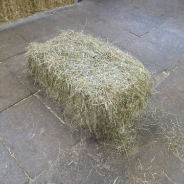
Kleine HD-Ballen Heu
Weil im Schönbuch
Sabine-Dettinger
@Sabine-Dettinger
Heu
Empfänger lädt ab
Kleinballen/HD-Ballen
Bio
Regenfrei
2 weitere...
B+
Deprecated: Creation of dynamic property Zend_View_Helper_Ads::$adLink is deprecated in /var/www/stall-frei/htdocs/staging.stall-frei.de/library/Psf/View/Helper/Ads.php on line 108

Futtersack HeuToy, Fressbremse in pink
Mechtersen
STALL-FREIde Marketing
@STALL-FREI-Marketing
Stundenlange Beschäftigung die
Koliken vorbeugt, geringe Staubinhalation mit
steuerbarer Futterentnahme

Hafer aus Ernte 2025 auch gequetscht zu verkaufen
Wolfschlugen
Reitanlage im Höfelweg
@Reitanlage-im-Hoefelweg
Futter
Wird verladen
Abholung
B+
Leider kein Vorschaubild
Leider kein Vorschaubild
B+


Heu Kleinballen 1. Schnitt - höchste Qualität
Weissach im Tal
Micha
@Micha3
Heu
Empfänger lädt ab
Kleinballen/HD-Ballen
Bio
Regenfrei
2 weitere...
aktuell
B+
Leider kein Vorschaubild
Leider kein Vorschaubild
Heu zu verkaufen
Bad Rappenau
Uwe Wolf
@Uwe_Wolf
Heu
Empfänger lädt ab
Rundballen
Regenfrei
2 weitere...
B+

10 Rb Heu/15 RB Öhmd/15 RB Stroh
Helmstadt
Juergen
@Juergen77
Einstreu
Empfänger lädt ab
Rundballen
Regenfrei
2 weitere...
B+

B+

Stroh, Kleinballen, Weizenstroh
Ertingen
Tobias
@Tobias4
Stroh
Kleinballen/HD-Ballen
Regenfrei
Wird verladen
2 weitere...
B+
Deprecated: Creation of dynamic property Zend_View::$pageCount is deprecated in /var/www/stall-frei/htdocs/staging.stall-frei.de/library/vendor/shardj/zf1-future/library/Zend/View/Abstract.php on line 308
Deprecated: Creation of dynamic property Zend_View::$itemCountPerPage is deprecated in /var/www/stall-frei/htdocs/staging.stall-frei.de/library/vendor/shardj/zf1-future/library/Zend/View/Abstract.php on line 308
Deprecated: Creation of dynamic property Zend_View::$first is deprecated in /var/www/stall-frei/htdocs/staging.stall-frei.de/library/vendor/shardj/zf1-future/library/Zend/View/Abstract.php on line 308
Deprecated: Creation of dynamic property Zend_View::$current is deprecated in /var/www/stall-frei/htdocs/staging.stall-frei.de/library/vendor/shardj/zf1-future/library/Zend/View/Abstract.php on line 308
Deprecated: Creation of dynamic property Zend_View::$last is deprecated in /var/www/stall-frei/htdocs/staging.stall-frei.de/library/vendor/shardj/zf1-future/library/Zend/View/Abstract.php on line 308
Deprecated: Creation of dynamic property Zend_View::$next is deprecated in /var/www/stall-frei/htdocs/staging.stall-frei.de/library/vendor/shardj/zf1-future/library/Zend/View/Abstract.php on line 308
Deprecated: Creation of dynamic property Zend_View::$pagesInRange is deprecated in /var/www/stall-frei/htdocs/staging.stall-frei.de/library/vendor/shardj/zf1-future/library/Zend/View/Abstract.php on line 308
Deprecated: Creation of dynamic property Zend_View::$firstPageInRange is deprecated in /var/www/stall-frei/htdocs/staging.stall-frei.de/library/vendor/shardj/zf1-future/library/Zend/View/Abstract.php on line 308
Deprecated: Creation of dynamic property Zend_View::$lastPageInRange is deprecated in /var/www/stall-frei/htdocs/staging.stall-frei.de/library/vendor/shardj/zf1-future/library/Zend/View/Abstract.php on line 308
Deprecated: Creation of dynamic property Zend_View::$currentItemCount is deprecated in /var/www/stall-frei/htdocs/staging.stall-frei.de/library/vendor/shardj/zf1-future/library/Zend/View/Abstract.php on line 308
Deprecated: Creation of dynamic property Zend_View::$totalItemCount is deprecated in /var/www/stall-frei/htdocs/staging.stall-frei.de/library/vendor/shardj/zf1-future/library/Zend/View/Abstract.php on line 308
Deprecated: Creation of dynamic property Zend_View::$firstItemNumber is deprecated in /var/www/stall-frei/htdocs/staging.stall-frei.de/library/vendor/shardj/zf1-future/library/Zend/View/Abstract.php on line 308
Deprecated: Creation of dynamic property Zend_View::$lastItemNumber is deprecated in /var/www/stall-frei/htdocs/staging.stall-frei.de/library/vendor/shardj/zf1-future/library/Zend/View/Abstract.php on line 308
Deprecated: Creation of dynamic property Zend_View::$router is deprecated in /var/www/stall-frei/htdocs/staging.stall-frei.de/library/vendor/shardj/zf1-future/library/Zend/View/Abstract.php on line 308
Deprecated: Creation of dynamic property Zend_View::$urlParams is deprecated in /var/www/stall-frei/htdocs/staging.stall-frei.de/library/vendor/shardj/zf1-future/library/Zend/View/Abstract.php on line 308
Deprecated: Creation of dynamic property Zend_View::$showAds is deprecated in /var/www/stall-frei/htdocs/staging.stall-frei.de/library/vendor/shardj/zf1-future/library/Zend/View/Abstract.php on line 308
Deprecated: Creation of dynamic property Zend_View::$objectIds is deprecated in /var/www/stall-frei/htdocs/staging.stall-frei.de/library/vendor/shardj/zf1-future/library/Zend/View/Abstract.php on line 308
Deprecated: Creation of dynamic property Zend_View::$showNavbar is deprecated in /var/www/stall-frei/htdocs/staging.stall-frei.de/library/vendor/shardj/zf1-future/library/Zend/View/Abstract.php on line 308
Deprecated: Creation of dynamic property Zend_View::$showBreadcrumb is deprecated in /var/www/stall-frei/htdocs/staging.stall-frei.de/library/vendor/shardj/zf1-future/library/Zend/View/Abstract.php on line 308
Deprecated: Creation of dynamic property Zend_View::$showFooter is deprecated in /var/www/stall-frei/htdocs/staging.stall-frei.de/library/vendor/shardj/zf1-future/library/Zend/View/Abstract.php on line 308
Deprecated: Creation of dynamic property Zend_View::$showInternalAds is deprecated in /var/www/stall-frei/htdocs/staging.stall-frei.de/library/vendor/shardj/zf1-future/library/Zend/View/Abstract.php on line 308
Deprecated: Creation of dynamic property Zend_View::$blNoContent is deprecated in /var/www/stall-frei/htdocs/staging.stall-frei.de/library/vendor/shardj/zf1-future/library/Zend/View/Abstract.php on line 308
Deprecated: Creation of dynamic property Zend_View::$sMetaDesc is deprecated in /var/www/stall-frei/htdocs/staging.stall-frei.de/library/vendor/shardj/zf1-future/library/Zend/View/Abstract.php on line 308
Deprecated: Creation of dynamic property Zend_View::$useGmaps is deprecated in /var/www/stall-frei/htdocs/staging.stall-frei.de/library/vendor/shardj/zf1-future/library/Zend/View/Abstract.php on line 308
Deprecated: Creation of dynamic property Zend_View::$touches is deprecated in /var/www/stall-frei/htdocs/staging.stall-frei.de/library/vendor/shardj/zf1-future/library/Zend/View/Abstract.php on line 308
Deprecated: Creation of dynamic property Zend_View::$oProject is deprecated in /var/www/stall-frei/htdocs/staging.stall-frei.de/library/vendor/shardj/zf1-future/library/Zend/View/Abstract.php on line 308
Deprecated: Creation of dynamic property Zend_View::$pageHeadline is deprecated in /var/www/stall-frei/htdocs/staging.stall-frei.de/library/vendor/shardj/zf1-future/library/Zend/View/Abstract.php on line 308
Deprecated: Creation of dynamic property Zend_View::$disableLocationField is deprecated in /var/www/stall-frei/htdocs/staging.stall-frei.de/library/vendor/shardj/zf1-future/library/Zend/View/Abstract.php on line 308
Deprecated: Creation of dynamic property Zend_View::$isSearch is deprecated in /var/www/stall-frei/htdocs/staging.stall-frei.de/library/vendor/shardj/zf1-future/library/Zend/View/Abstract.php on line 308
Deprecated: Creation of dynamic property Zend_View::$pageTitle is deprecated in /var/www/stall-frei/htdocs/staging.stall-frei.de/library/vendor/shardj/zf1-future/library/Zend/View/Abstract.php on line 308
Deprecated: Creation of dynamic property Psf_Form_Element_Text::$class is deprecated in /var/www/stall-frei/htdocs/staging.stall-frei.de/library/vendor/shardj/zf1-future/library/Zend/Form/Element.php on line 874
Deprecated: Creation of dynamic property Psf_Form_Element_Text::$size is deprecated in /var/www/stall-frei/htdocs/staging.stall-frei.de/library/vendor/shardj/zf1-future/library/Zend/Form/Element.php on line 874
Deprecated: Creation of dynamic property Psf_Form_Element_Text::$placeholder is deprecated in /var/www/stall-frei/htdocs/staging.stall-frei.de/library/vendor/shardj/zf1-future/library/Zend/Form/Element.php on line 874
Deprecated: Creation of dynamic property Psf_Form_Element_Hidden::$class is deprecated in /var/www/stall-frei/htdocs/staging.stall-frei.de/library/vendor/shardj/zf1-future/library/Zend/Form/Element.php on line 874
Deprecated: Creation of dynamic property Psf_Form_Element_Hidden::$class is deprecated in /var/www/stall-frei/htdocs/staging.stall-frei.de/library/vendor/shardj/zf1-future/library/Zend/Form/Element.php on line 874
Deprecated: Creation of dynamic property Psf_Form_Element_Hidden::$class is deprecated in /var/www/stall-frei/htdocs/staging.stall-frei.de/library/vendor/shardj/zf1-future/library/Zend/Form/Element.php on line 874
Deprecated: Creation of dynamic property Psf_Form_Element_Hidden::$class is deprecated in /var/www/stall-frei/htdocs/staging.stall-frei.de/library/vendor/shardj/zf1-future/library/Zend/Form/Element.php on line 874
Deprecated: Creation of dynamic property Psf_Form_Element_Select::$class is deprecated in /var/www/stall-frei/htdocs/staging.stall-frei.de/library/vendor/shardj/zf1-future/library/Zend/Form/Element.php on line 874
Deprecated: Creation of dynamic property Psf_Form_Element_Select::$class is deprecated in /var/www/stall-frei/htdocs/staging.stall-frei.de/library/vendor/shardj/zf1-future/library/Zend/Form/Element.php on line 874
Deprecated: Creation of dynamic property Psf_Form_Element_Select::$class is deprecated in /var/www/stall-frei/htdocs/staging.stall-frei.de/library/vendor/shardj/zf1-future/library/Zend/Form/Element.php on line 874
Deprecated: Creation of dynamic property Psf_Form_Element_Select::$class is deprecated in /var/www/stall-frei/htdocs/staging.stall-frei.de/library/vendor/shardj/zf1-future/library/Zend/Form/Element.php on line 874
Deprecated: Creation of dynamic property Zend_View::$sort is deprecated in /var/www/stall-frei/htdocs/staging.stall-frei.de/library/vendor/shardj/zf1-future/library/Zend/View/Abstract.php on line 308
Deprecated: Creation of dynamic property Zend_View::$searchLocation is deprecated in /var/www/stall-frei/htdocs/staging.stall-frei.de/library/vendor/shardj/zf1-future/library/Zend/View/Abstract.php on line 308
Deprecated: Creation of dynamic property Zend_View::$locationHint is deprecated in /var/www/stall-frei/htdocs/staging.stall-frei.de/library/vendor/shardj/zf1-future/library/Zend/View/Abstract.php on line 308
Psf_GeoCoder_Abstract::getLocation: Emberg Get Location CachedOrLive
Psf_GeoCoder_Abstract::getCachedOrLive: Emberg
Psf_GeoCoder_OpenCageData::makeApiRequest: response:
Array
(
[documentation] => https://opencagedata.com/api
[licenses] => Array
(
[0] => Array
(
[name] => see attribution guide
[url] => https://opencagedata.com/credits
)
)
[results] => Array
(
[0] => Array
(
[bounds] => Array
(
[northeast] => Array
(
[lat] => 48.7112426
[lng] => 8.6902376
)
[southwest] => Array
(
[lat] => 48.6712426
[lng] => 8.6502376
)
)
[components] => Array
(
[ISO_3166-1_alpha-2] => DE
[ISO_3166-1_alpha-3] => DEU
[ISO_3166-2] => Array
(
[0] => DE-BW
)
[_category] => place
[_normalized_city] => Bad Teinach-Zavelstein
[_type] => hamlet
[continent] => Europe
[country] => Deutschland
[country_code] => de
[county] => Landkreis Calw
[hamlet] => Emberg
[municipality] => Bad Teinach-Zavelstein
[political_union] => European Union
[postcode] => 75385
[state] => Baden-Württemberg
[state_code] => BW
)
[confidence] => 7
[formatted] => Emberg, 75385 Bad Teinach-Zavelstein, Deutschland
[geometry] => Array
(
[lat] => 48.6912426
[lng] => 8.6702376
)
)
[1] => Array
(
[bounds] => Array
(
[northeast] => Array
(
[lat] => 50.7313728
[lng] => 10.0917849
)
[southwest] => Array
(
[lat] => 50.7312728
[lng] => 10.0916849
)
)
[components] => Array
(
[ISO_3166-1_alpha-2] => DE
[ISO_3166-1_alpha-3] => DEU
[ISO_3166-2] => Array
(
[0] => DE-TH
)
[_category] => natural/water
[_normalized_city] => Dermbach
[_type] => peak
[continent] => Europe
[country] => Deutschland
[country_code] => de
[county] => Wartburgkreis
[municipality] => Dermbach
[peak] => Emberg
[political_union] => European Union
[postcode] => 36466
[state] => Thüringen
[state_code] => TH
[town] => Dermbach
)
[confidence] => 9
[formatted] => Emberg, 36466 Dermbach, Deutschland
[geometry] => Array
(
[lat] => 50.7313228
[lng] => 10.0917349
)
)
[2] => Array
(
[bounds] => Array
(
[northeast] => Array
(
[lat] => 51.3587517
[lng] => 7.6498479
)
[southwest] => Array
(
[lat] => 51.3582019
[lng] => 7.6487148
)
)
[components] => Array
(
[ISO_3166-1_alpha-2] => DE
[ISO_3166-1_alpha-3] => DEU
[ISO_3166-2] => Array
(
[0] => DE-NW
)
[_category] => building
[_normalized_city] => Iserlohn
[_type] => building
[continent] => Europe
[country] => Deutschland
[country_code] => de
[county] => Märkischer Kreis
[isolated_dwelling] => Emberg
[political_union] => European Union
[postcode] => 58644
[state] => Nordrhein-Westfalen
[state_code] => NW
[suburb] => Untergrüne
[town] => Iserlohn
)
[confidence] => 10
[formatted] => Emberg, 58644 Iserlohn, Deutschland
[geometry] => Array
(
[lat] => 51.358492
[lng] => 7.6494022
)
)
[3] => Array
(
[bounds] => Array
(
[northeast] => Array
(
[lat] => 50.7335682
[lng] => 10.0944642
)
[southwest] => Array
(
[lat] => 50.7334682
[lng] => 10.0943642
)
)
[components] => Array
(
[ISO_3166-1_alpha-2] => DE
[ISO_3166-1_alpha-3] => DEU
[ISO_3166-2] => Array
(
[0] => DE-TH
)
[_category] => travel/tourism
[_normalized_city] => Dermbach
[_type] => information
[continent] => Europe
[country] => Deutschland
[country_code] => de
[county] => Wartburgkreis
[information] => Emberg
[municipality] => Dermbach
[political_union] => European Union
[postcode] => 36466
[residential] => Oberalba
[road] => Oberalba
[state] => Thüringen
[state_code] => TH
[town] => Dermbach
)
[confidence] => 9
[formatted] => Emberg, Oberalba, 36466 Dermbach, Deutschland
[geometry] => Array
(
[lat] => 50.7335182
[lng] => 10.0944142
)
)
[4] => Array
(
[components] => Array
(
[ISO_3166-1_alpha-2] => FR
[ISO_3166-1_alpha-3] => FRA
[ISO_3166-2] => Array
(
[0] => FR-ARA
[1] => FR-63
)
[_category] => road
[_normalized_city] => Ambert
[_type] => road
[city] => Ambert
[continent] => Europe
[country] => France
[country_code] => fr
[county] => Puy-de-Dôme
[local_authority] => Communauté de communes Ambert Livradois Forez
[political_union] => European Union
[postcode] => 63600
[road] => Route de la Chardie
[state] => Auvergne-Rhône-Alpes
[state_code] => ARA
)
[confidence] => 2
[formatted] => Route de la Chardie, 63600 Ambert, France
[geometry] => Array
(
[lat] => 45.563897
[lng] => 3.706407
)
)
[5] => Array
(
[components] => Array
(
[ISO_3166-1_alpha-2] => FR
[ISO_3166-1_alpha-3] => FRA
[ISO_3166-2] => Array
(
[0] => FR-ARA
[1] => FR-63
)
[_category] => road
[_normalized_city] => Ambert
[_type] => road
[city] => Ambert
[continent] => Europe
[country] => France
[country_code] => fr
[county] => Puy-de-Dôme
[local_authority] => Communauté de communes Ambert Livradois Forez
[political_union] => European Union
[postcode] => 63600
[road] => Chemin de la Murette
[state] => Auvergne-Rhône-Alpes
[state_code] => ARA
)
[confidence] => 2
[formatted] => Chemin de la Murette, 63600 Ambert, France
[geometry] => Array
(
[lat] => 45.52349
[lng] => 3.74685
)
)
[6] => Array
(
[components] => Array
(
[ISO_3166-1_alpha-2] => FR
[ISO_3166-1_alpha-3] => FRA
[ISO_3166-2] => Array
(
[0] => FR-ARA
[1] => FR-63
)
[_category] => road
[_normalized_city] => Ambert
[_type] => road
[city] => Ambert
[continent] => Europe
[country] => France
[country_code] => fr
[county] => Puy-de-Dôme
[local_authority] => Communauté de communes Ambert Livradois Forez
[political_union] => European Union
[postcode] => 63600
[road] => Route des Chaux
[state] => Auvergne-Rhône-Alpes
[state_code] => ARA
)
[confidence] => 2
[formatted] => Route des Chaux, 63600 Ambert, France
[geometry] => Array
(
[lat] => 45.532069
[lng] => 3.765726
)
)
[7] => Array
(
[components] => Array
(
[ISO_3166-1_alpha-2] => FR
[ISO_3166-1_alpha-3] => FRA
[ISO_3166-2] => Array
(
[0] => FR-ARA
[1] => FR-63
)
[_category] => road
[_normalized_city] => Arlanc
[_type] => road
[city] => Arlanc
[continent] => Europe
[country] => France
[country_code] => fr
[county] => Puy-de-Dôme
[local_authority] => Communauté de communes Ambert Livradois Forez
[political_union] => European Union
[postcode] => 63220
[road] => Route d'Ambert
[state] => Auvergne-Rhône-Alpes
[state_code] => ARA
)
[confidence] => 2
[formatted] => Route d'Ambert, 63220 Arlanc, France
[geometry] => Array
(
[lat] => 45.434712
[lng] => 3.724114
)
)
[8] => Array
(
[components] => Array
(
[ISO_3166-1_alpha-2] => FR
[ISO_3166-1_alpha-3] => FRA
[ISO_3166-2] => Array
(
[0] => FR-PDL
[1] => FR-44
)
[_category] => road
[_normalized_city] => Saint-Nazaire
[_type] => road
[city] => Saint-Nazaire
[continent] => Europe
[country] => France
[country_code] => fr
[county] => Loire-Atlantique
[local_authority] => Communauté d'agglomération de la Région Nazairienne et de l'Estuaire
[political_union] => European Union
[postcode] => 44600
[road] => Route du Pré Hembert
[state] => Pays de la Loire
[state_code] => PDL
)
[confidence] => 2
[formatted] => Route du Pré Hembert, 44600 Saint-Nazaire, France
[geometry] => Array
(
[lat] => 47.268893
[lng] => -2.254553
)
)
[9] => Array
(
[components] => Array
(
[ISO_3166-1_alpha-2] => FR
[ISO_3166-1_alpha-3] => FRA
[ISO_3166-2] => Array
(
[0] => FR-ARA
[1] => FR-63
)
[_category] => road
[_normalized_city] => Vic-le-Comte
[_type] => road
[city] => Vic-le-Comte
[continent] => Europe
[country] => France
[country_code] => fr
[county] => Puy-de-Dôme
[local_authority] => Mond'Arverne Communauté
[political_union] => European Union
[postcode] => 63270
[road] => Route d'Ambert
[state] => Auvergne-Rhône-Alpes
[state_code] => ARA
)
[confidence] => 2
[formatted] => Route d'Ambert, 63270 Vic-le-Comte, France
[geometry] => Array
(
[lat] => 45.64276
[lng] => 3.255122
)
)
)
[status] => Array
(
[code] => 200
[message] => OK
)
[stay_informed] => Array
(
[blog] => https://blog.opencagedata.com
[mastodon] => https://en.osm.town/@opencage
)
[thanks] => For using an OpenCage API
[timestamp] => Array
(
[created_http] => Fri, 06 Feb 2026 13:51:47 GMT
[created_unix] => 1770385907
)
[total_results] => 10
)
Psf_GeoCoder_Abstract::convertLocationResult
{"documentation":"https:\/\/opencagedata.com\/api","licenses":[{"name":"see attribution guide","url":"https:\/\/opencagedata.com\/credits"}],"results":[{"bounds":{"northeast":{"lat":48.7112426,"lng":8.6902376},"southwest":{"lat":48.6712426,"lng":8.6502376}},"components":{"ISO_3166-1_alpha-2":"DE","ISO_3166-1_alpha-3":"DEU","ISO_3166-2":["DE-BW"],"_category":"place","_normalized_city":"Bad Teinach-Zavelstein","_type":"hamlet","continent":"Europe","country":"Deutschland","country_code":"de","county":"Landkreis Calw","hamlet":"Emberg","municipality":"Bad Teinach-Zavelstein","political_union":"European Union","postcode":"75385","state":"Baden-W\u00fcrttemberg","state_code":"BW"},"confidence":7,"formatted":"Emberg, 75385 Bad Teinach-Zavelstein, Deutschland","geometry":{"lat":48.6912426,"lng":8.6702376}},{"bounds":{"northeast":{"lat":50.7313728,"lng":10.0917849},"southwest":{"lat":50.7312728,"lng":10.0916849}},"components":{"ISO_3166-1_alpha-2":"DE","ISO_3166-1_alpha-3":"DEU","ISO_3166-2":["DE-TH"],"_category":"natural\/water","_normalized_city":"Dermbach","_type":"peak","continent":"Europe","country":"Deutschland","country_code":"de","county":"Wartburgkreis","municipality":"Dermbach","peak":"Emberg","political_union":"European Union","postcode":"36466","state":"Th\u00fcringen","state_code":"TH","town":"Dermbach"},"confidence":9,"formatted":"Emberg, 36466 Dermbach, Deutschland","geometry":{"lat":50.7313228,"lng":10.0917349}},{"bounds":{"northeast":{"lat":51.3587517,"lng":7.6498479},"southwest":{"lat":51.3582019,"lng":7.6487148}},"components":{"ISO_3166-1_alpha-2":"DE","ISO_3166-1_alpha-3":"DEU","ISO_3166-2":["DE-NW"],"_category":"building","_normalized_city":"Iserlohn","_type":"building","continent":"Europe","country":"Deutschland","country_code":"de","county":"M\u00e4rkischer Kreis","isolated_dwelling":"Emberg","political_union":"European Union","postcode":"58644","state":"Nordrhein-Westfalen","state_code":"NW","suburb":"Untergr\u00fcne","town":"Iserlohn"},"confidence":10,"formatted":"Emberg, 58644 Iserlohn, Deutschland","geometry":{"lat":51.358492,"lng":7.6494022}},{"bounds":{"northeast":{"lat":50.7335682,"lng":10.0944642},"southwest":{"lat":50.7334682,"lng":10.0943642}},"components":{"ISO_3166-1_alpha-2":"DE","ISO_3166-1_alpha-3":"DEU","ISO_3166-2":["DE-TH"],"_category":"travel\/tourism","_normalized_city":"Dermbach","_type":"information","continent":"Europe","country":"Deutschland","country_code":"de","county":"Wartburgkreis","information":"Emberg","municipality":"Dermbach","political_union":"European Union","postcode":"36466","residential":"Oberalba","road":"Oberalba","state":"Th\u00fcringen","state_code":"TH","town":"Dermbach"},"confidence":9,"formatted":"Emberg, Oberalba, 36466 Dermbach, Deutschland","geometry":{"lat":50.7335182,"lng":10.0944142}},{"components":{"ISO_3166-1_alpha-2":"FR","ISO_3166-1_alpha-3":"FRA","ISO_3166-2":["FR-ARA","FR-63"],"_category":"road","_normalized_city":"Ambert","_type":"road","city":"Ambert","continent":"Europe","country":"France","country_code":"fr","county":"Puy-de-D\u00f4me","local_authority":"Communaut\u00e9 de communes Ambert Livradois Forez","political_union":"European Union","postcode":"63600","road":"Route de la Chardie","state":"Auvergne-Rh\u00f4ne-Alpes","state_code":"ARA"},"confidence":2,"formatted":"Route de la Chardie, 63600 Ambert, France","geometry":{"lat":45.563897,"lng":3.706407}},{"components":{"ISO_3166-1_alpha-2":"FR","ISO_3166-1_alpha-3":"FRA","ISO_3166-2":["FR-ARA","FR-63"],"_category":"road","_normalized_city":"Ambert","_type":"road","city":"Ambert","continent":"Europe","country":"France","country_code":"fr","county":"Puy-de-D\u00f4me","local_authority":"Communaut\u00e9 de communes Ambert Livradois Forez","political_union":"European Union","postcode":"63600","road":"Chemin de la Murette","state":"Auvergne-Rh\u00f4ne-Alpes","state_code":"ARA"},"confidence":2,"formatted":"Chemin de la Murette, 63600 Ambert, France","geometry":{"lat":45.52349,"lng":3.74685}},{"components":{"ISO_3166-1_alpha-2":"FR","ISO_3166-1_alpha-3":"FRA","ISO_3166-2":["FR-ARA","FR-63"],"_category":"road","_normalized_city":"Ambert","_type":"road","city":"Ambert","continent":"Europe","country":"France","country_code":"fr","county":"Puy-de-D\u00f4me","local_authority":"Communaut\u00e9 de communes Ambert Livradois Forez","political_union":"European Union","postcode":"63600","road":"Route des Chaux","state":"Auvergne-Rh\u00f4ne-Alpes","state_code":"ARA"},"confidence":2,"formatted":"Route des Chaux, 63600 Ambert, France","geometry":{"lat":45.532069,"lng":3.765726}},{"components":{"ISO_3166-1_alpha-2":"FR","ISO_3166-1_alpha-3":"FRA","ISO_3166-2":["FR-ARA","FR-63"],"_category":"road","_normalized_city":"Arlanc","_type":"road","city":"Arlanc","continent":"Europe","country":"France","country_code":"fr","county":"Puy-de-D\u00f4me","local_authority":"Communaut\u00e9 de communes Ambert Livradois Forez","political_union":"European Union","postcode":"63220","road":"Route d'Ambert","state":"Auvergne-Rh\u00f4ne-Alpes","state_code":"ARA"},"confidence":2,"formatted":"Route d'Ambert, 63220 Arlanc, France","geometry":{"lat":45.434712,"lng":3.724114}},{"components":{"ISO_3166-1_alpha-2":"FR","ISO_3166-1_alpha-3":"FRA","ISO_3166-2":["FR-PDL","FR-44"],"_category":"road","_normalized_city":"Saint-Nazaire","_type":"road","city":"Saint-Nazaire","continent":"Europe","country":"France","country_code":"fr","county":"Loire-Atlantique","local_authority":"Communaut\u00e9 d'agglom\u00e9ration de la R\u00e9gion Nazairienne et de l'Estuaire","political_union":"European Union","postcode":"44600","road":"Route du Pr\u00e9 Hembert","state":"Pays de la Loire","state_code":"PDL"},"confidence":2,"formatted":"Route du Pr\u00e9 Hembert, 44600 Saint-Nazaire, France","geometry":{"lat":47.268893,"lng":-2.254553}},{"components":{"ISO_3166-1_alpha-2":"FR","ISO_3166-1_alpha-3":"FRA","ISO_3166-2":["FR-ARA","FR-63"],"_category":"road","_normalized_city":"Vic-le-Comte","_type":"road","city":"Vic-le-Comte","continent":"Europe","country":"France","country_code":"fr","county":"Puy-de-D\u00f4me","local_authority":"Mond'Arverne Communaut\u00e9","political_union":"European Union","postcode":"63270","road":"Route d'Ambert","state":"Auvergne-Rh\u00f4ne-Alpes","state_code":"ARA"},"confidence":2,"formatted":"Route d'Ambert, 63270 Vic-le-Comte, France","geometry":{"lat":45.64276,"lng":3.255122}}],"status":{"code":200,"message":"OK"},"stay_informed":{"blog":"https:\/\/blog.opencagedata.com","mastodon":"https:\/\/en.osm.town\/@opencage"},"thanks":"For using an OpenCage API","timestamp":{"created_http":"Fri, 06 Feb 2026 13:51:47 GMT","created_unix":1770385907},"total_results":10}Array
(
[0] => stdClass Object
(
[bounds] => stdClass Object
(
[northeast] => stdClass Object
(
[lat] => 48.7112426
[lng] => 8.6902376
)
[southwest] => stdClass Object
(
[lat] => 48.6712426
[lng] => 8.6502376
)
)
[components] => stdClass Object
(
[ISO_3166-1_alpha-2] => DE
[ISO_3166-1_alpha-3] => DEU
[ISO_3166-2] => Array
(
[0] => DE-BW
)
[_category] => place
[_normalized_city] => Bad Teinach-Zavelstein
[_type] => hamlet
[continent] => Europe
[country] => Deutschland
[country_code] => de
[county] => Landkreis Calw
[hamlet] => Emberg
[municipality] => Bad Teinach-Zavelstein
[political_union] => European Union
[postcode] => 75385
[state] => Baden-Württemberg
[state_code] => BW
)
[confidence] => 7
[formatted] => Emberg, 75385 Bad Teinach-Zavelstein, Deutschland
[geometry] => stdClass Object
(
[lat] => 48.6912426
[lng] => 8.6702376
)
)
[1] => stdClass Object
(
[bounds] => stdClass Object
(
[northeast] => stdClass Object
(
[lat] => 50.7313728
[lng] => 10.0917849
)
[southwest] => stdClass Object
(
[lat] => 50.7312728
[lng] => 10.0916849
)
)
[components] => stdClass Object
(
[ISO_3166-1_alpha-2] => DE
[ISO_3166-1_alpha-3] => DEU
[ISO_3166-2] => Array
(
[0] => DE-TH
)
[_category] => natural/water
[_normalized_city] => Dermbach
[_type] => peak
[continent] => Europe
[country] => Deutschland
[country_code] => de
[county] => Wartburgkreis
[municipality] => Dermbach
[peak] => Emberg
[political_union] => European Union
[postcode] => 36466
[state] => Thüringen
[state_code] => TH
[town] => Dermbach
)
[confidence] => 9
[formatted] => Emberg, 36466 Dermbach, Deutschland
[geometry] => stdClass Object
(
[lat] => 50.7313228
[lng] => 10.0917349
)
)
[2] => stdClass Object
(
[bounds] => stdClass Object
(
[northeast] => stdClass Object
(
[lat] => 51.3587517
[lng] => 7.6498479
)
[southwest] => stdClass Object
(
[lat] => 51.3582019
[lng] => 7.6487148
)
)
[components] => stdClass Object
(
[ISO_3166-1_alpha-2] => DE
[ISO_3166-1_alpha-3] => DEU
[ISO_3166-2] => Array
(
[0] => DE-NW
)
[_category] => building
[_normalized_city] => Iserlohn
[_type] => building
[continent] => Europe
[country] => Deutschland
[country_code] => de
[county] => Märkischer Kreis
[isolated_dwelling] => Emberg
[political_union] => European Union
[postcode] => 58644
[state] => Nordrhein-Westfalen
[state_code] => NW
[suburb] => Untergrüne
[town] => Iserlohn
)
[confidence] => 10
[formatted] => Emberg, 58644 Iserlohn, Deutschland
[geometry] => stdClass Object
(
[lat] => 51.358492
[lng] => 7.6494022
)
)
[3] => stdClass Object
(
[bounds] => stdClass Object
(
[northeast] => stdClass Object
(
[lat] => 50.7335682
[lng] => 10.0944642
)
[southwest] => stdClass Object
(
[lat] => 50.7334682
[lng] => 10.0943642
)
)
[components] => stdClass Object
(
[ISO_3166-1_alpha-2] => DE
[ISO_3166-1_alpha-3] => DEU
[ISO_3166-2] => Array
(
[0] => DE-TH
)
[_category] => travel/tourism
[_normalized_city] => Dermbach
[_type] => information
[continent] => Europe
[country] => Deutschland
[country_code] => de
[county] => Wartburgkreis
[information] => Emberg
[municipality] => Dermbach
[political_union] => European Union
[postcode] => 36466
[residential] => Oberalba
[road] => Oberalba
[state] => Thüringen
[state_code] => TH
[town] => Dermbach
)
[confidence] => 9
[formatted] => Emberg, Oberalba, 36466 Dermbach, Deutschland
[geometry] => stdClass Object
(
[lat] => 50.7335182
[lng] => 10.0944142
)
)
[4] => stdClass Object
(
[components] => stdClass Object
(
[ISO_3166-1_alpha-2] => FR
[ISO_3166-1_alpha-3] => FRA
[ISO_3166-2] => Array
(
[0] => FR-ARA
[1] => FR-63
)
[_category] => road
[_normalized_city] => Ambert
[_type] => road
[city] => Ambert
[continent] => Europe
[country] => France
[country_code] => fr
[county] => Puy-de-Dôme
[local_authority] => Communauté de communes Ambert Livradois Forez
[political_union] => European Union
[postcode] => 63600
[road] => Route de la Chardie
[state] => Auvergne-Rhône-Alpes
[state_code] => ARA
)
[confidence] => 2
[formatted] => Route de la Chardie, 63600 Ambert, France
[geometry] => stdClass Object
(
[lat] => 45.563897
[lng] => 3.706407
)
)
[5] => stdClass Object
(
[components] => stdClass Object
(
[ISO_3166-1_alpha-2] => FR
[ISO_3166-1_alpha-3] => FRA
[ISO_3166-2] => Array
(
[0] => FR-ARA
[1] => FR-63
)
[_category] => road
[_normalized_city] => Ambert
[_type] => road
[city] => Ambert
[continent] => Europe
[country] => France
[country_code] => fr
[county] => Puy-de-Dôme
[local_authority] => Communauté de communes Ambert Livradois Forez
[political_union] => European Union
[postcode] => 63600
[road] => Chemin de la Murette
[state] => Auvergne-Rhône-Alpes
[state_code] => ARA
)
[confidence] => 2
[formatted] => Chemin de la Murette, 63600 Ambert, France
[geometry] => stdClass Object
(
[lat] => 45.52349
[lng] => 3.74685
)
)
[6] => stdClass Object
(
[components] => stdClass Object
(
[ISO_3166-1_alpha-2] => FR
[ISO_3166-1_alpha-3] => FRA
[ISO_3166-2] => Array
(
[0] => FR-ARA
[1] => FR-63
)
[_category] => road
[_normalized_city] => Ambert
[_type] => road
[city] => Ambert
[continent] => Europe
[country] => France
[country_code] => fr
[county] => Puy-de-Dôme
[local_authority] => Communauté de communes Ambert Livradois Forez
[political_union] => European Union
[postcode] => 63600
[road] => Route des Chaux
[state] => Auvergne-Rhône-Alpes
[state_code] => ARA
)
[confidence] => 2
[formatted] => Route des Chaux, 63600 Ambert, France
[geometry] => stdClass Object
(
[lat] => 45.532069
[lng] => 3.765726
)
)
[7] => stdClass Object
(
[components] => stdClass Object
(
[ISO_3166-1_alpha-2] => FR
[ISO_3166-1_alpha-3] => FRA
[ISO_3166-2] => Array
(
[0] => FR-ARA
[1] => FR-63
)
[_category] => road
[_normalized_city] => Arlanc
[_type] => road
[city] => Arlanc
[continent] => Europe
[country] => France
[country_code] => fr
[county] => Puy-de-Dôme
[local_authority] => Communauté de communes Ambert Livradois Forez
[political_union] => European Union
[postcode] => 63220
[road] => Route d'Ambert
[state] => Auvergne-Rhône-Alpes
[state_code] => ARA
)
[confidence] => 2
[formatted] => Route d'Ambert, 63220 Arlanc, France
[geometry] => stdClass Object
(
[lat] => 45.434712
[lng] => 3.724114
)
)
[8] => stdClass Object
(
[components] => stdClass Object
(
[ISO_3166-1_alpha-2] => FR
[ISO_3166-1_alpha-3] => FRA
[ISO_3166-2] => Array
(
[0] => FR-PDL
[1] => FR-44
)
[_category] => road
[_normalized_city] => Saint-Nazaire
[_type] => road
[city] => Saint-Nazaire
[continent] => Europe
[country] => France
[country_code] => fr
[county] => Loire-Atlantique
[local_authority] => Communauté d'agglomération de la Région Nazairienne et de l'Estuaire
[political_union] => European Union
[postcode] => 44600
[road] => Route du Pré Hembert
[state] => Pays de la Loire
[state_code] => PDL
)
[confidence] => 2
[formatted] => Route du Pré Hembert, 44600 Saint-Nazaire, France
[geometry] => stdClass Object
(
[lat] => 47.268893
[lng] => -2.254553
)
)
[9] => stdClass Object
(
[components] => stdClass Object
(
[ISO_3166-1_alpha-2] => FR
[ISO_3166-1_alpha-3] => FRA
[ISO_3166-2] => Array
(
[0] => FR-ARA
[1] => FR-63
)
[_category] => road
[_normalized_city] => Vic-le-Comte
[_type] => road
[city] => Vic-le-Comte
[continent] => Europe
[country] => France
[country_code] => fr
[county] => Puy-de-Dôme
[local_authority] => Mond'Arverne Communauté
[political_union] => European Union
[postcode] => 63270
[road] => Route d'Ambert
[state] => Auvergne-Rhône-Alpes
[state_code] => ARA
)
[confidence] => 2
[formatted] => Route d'Ambert, 63270 Vic-le-Comte, France
[geometry] => stdClass Object
(
[lat] => 45.64276
[lng] => 3.255122
)
)
)
Psf_GeoCoder_OpenCageData::getKeyMap: 0
stdClass Object
(
    [bounds] => stdClass Object
        (
            [northeast] => stdClass Object
                (
                    [lat] => 48.7112426
                    [lng] => 8.6902376
                )

            [southwest] => stdClass Object
                (
                    [lat] => 48.6712426
                    [lng] => 8.6502376
                )

        )

    [components] => stdClass Object
        (
            [ISO_3166-1_alpha-2] => DE
            [ISO_3166-1_alpha-3] => DEU
            [ISO_3166-2] => Array
                (
                    [0] => DE-BW
                )

            [_category] => place
            [_normalized_city] => Bad Teinach-Zavelstein
            [_type] => hamlet
            [continent] => Europe
            [country] => Deutschland
            [country_code] => de
            [county] => Landkreis Calw
            [hamlet] => Emberg
            [municipality] => Bad Teinach-Zavelstein
            [political_union] => European Union
            [postcode] => 75385
            [state] => Baden-Württemberg
            [state_code] => BW
        )

    [confidence] => 7
    [formatted] => Emberg, 75385 Bad Teinach-Zavelstein, Deutschland
    [geometry] => stdClass Object
        (
            [lat] => 48.6912426
            [lng] => 8.6702376
        )

)
Psf_GeoCoder_OpenCageData::getCounty: Calw
Psf_GeoCoder_OpenCageData::addMissingData REFETCH!
Array
(
    [address] => Emberg, 75385 Bad Teinach-Zavelstein, Deutschland
    [type] => hamlet
    [street] => Emberg
    [city] =>
    [county] => Calw
    [state] => Baden-Württemberg
    [zip] => 75385
    [country] => Deutschland
    [suburb] =>
    [countrycode] => de
    [latitude] => 48.6912426
    [longitude] => 8.6702376
    [accuracy] => 1
    [confidence] => 7
    [bounds] => stdClass Object
        (
            [northeast] => stdClass Object
                (
                    [lat] => 48.7112426
                    [lng] => 8.6902376
                )

            [southwest] => stdClass Object
                (
                    [lat] => 48.6712426
                    [lng] => 8.6502376
                )

        )

)
reformat!
Array
(
    [address] => Emberg, 75385 Bad Teinach-Zavelstein, Deutschland
    [type] => hamlet
    [street] => Emberg
    [city] =>
    [county] => Calw
    [state] => Baden-Württemberg
    [zip] => 75385
    [country] => Deutschland
    [suburb] =>
    [countrycode] => de
    [latitude] => 48.6912426
    [longitude] => 8.6702376
    [accuracy] => 1
    [confidence] => 7
    [bounds] => stdClass Object
        (
            [northeast] => stdClass Object
                (
                    [lat] => 48.7112426
                    [lng] => 8.6902376
                )

            [southwest] => stdClass Object
                (
                    [lat] => 48.6712426
                    [lng] => 8.6502376
                )

        )

    [place] => Emberg, 75385 , Baden-Württemberg
    [hash] => 1aa35bd5a075d0d5bb9a6233562f788b
)
Psf_GeoCoder_OpenCageData::getKeyMap: 1
stdClass Object
(
    [bounds] => stdClass Object
        (
            [northeast] => stdClass Object
                (
                    [lat] => 50.7313728
                    [lng] => 10.0917849
                )

            [southwest] => stdClass Object
                (
                    [lat] => 50.7312728
                    [lng] => 10.0916849
                )

        )

    [components] => stdClass Object
        (
            [ISO_3166-1_alpha-2] => DE
            [ISO_3166-1_alpha-3] => DEU
            [ISO_3166-2] => Array
                (
                    [0] => DE-TH
                )

            [_category] => natural/water
            [_normalized_city] => Dermbach
            [_type] => peak
            [continent] => Europe
            [country] => Deutschland
            [country_code] => de
            [county] => Wartburgkreis
            [municipality] => Dermbach
            [peak] => Emberg
            [political_union] => European Union
            [postcode] => 36466
            [state] => Thüringen
            [state_code] => TH
            [town] => Dermbach
        )

    [confidence] => 9
    [formatted] => Emberg, 36466 Dermbach, Deutschland
    [geometry] => stdClass Object
        (
            [lat] => 50.7313228
            [lng] => 10.0917349
        )

)
Psf_GeoCoder_OpenCageData::getCounty: Wartburgkreis
Psf_GeoCoder_OpenCageData::addMissingData REFETCH!
Array
(
    [address] => Emberg, 36466 Dermbach, Deutschland
    [type] => peak
    [street] =>
    [city] => Dermbach
    [county] => Wartburgkreis
    [state] => Thüringen
    [zip] => 36466
    [country] => Deutschland
    [suburb] =>
    [countrycode] => de
    [latitude] => 50.7313228
    [longitude] => 10.0917349
    [accuracy] => 1
    [confidence] => 9
    [bounds] => stdClass Object
        (
            [northeast] => stdClass Object
                (
                    [lat] => 50.7313728
                    [lng] => 10.0917849
                )

            [southwest] => stdClass Object
                (
                    [lat] => 50.7312728
                    [lng] => 10.0916849
                )

        )

)
reformat!
Array
(
    [address] => Emberg, 36466 Dermbach, Deutschland
    [type] => peak
    [street] =>
    [city] => Dermbach
    [county] => Wartburgkreis
    [state] => Thüringen
    [zip] => 36466
    [country] => Deutschland
    [suburb] =>
    [countrycode] => de
    [latitude] => 50.7313228
    [longitude] => 10.0917349
    [accuracy] => 1
    [confidence] => 9
    [bounds] => stdClass Object
        (
            [northeast] => stdClass Object
                (
                    [lat] => 50.7313728
                    [lng] => 10.0917849
                )

            [southwest] => stdClass Object
                (
                    [lat] => 50.7312728
                    [lng] => 10.0916849
                )

        )

    [place] => 36466 Dermbach, Thüringen
    [hash] => 116f8271f91a53d5ca882674f847d35b
)
Psf_GeoCoder_OpenCageData::getKeyMap: 2
stdClass Object
(
    [bounds] => stdClass Object
        (
            [northeast] => stdClass Object
                (
                    [lat] => 51.3587517
                    [lng] => 7.6498479
                )

            [southwest] => stdClass Object
                (
                    [lat] => 51.3582019
                    [lng] => 7.6487148
                )

        )

    [components] => stdClass Object
        (
            [ISO_3166-1_alpha-2] => DE
            [ISO_3166-1_alpha-3] => DEU
            [ISO_3166-2] => Array
                (
                    [0] => DE-NW
                )

            [_category] => building
            [_normalized_city] => Iserlohn
            [_type] => building
            [continent] => Europe
            [country] => Deutschland
            [country_code] => de
            [county] => Märkischer Kreis
            [isolated_dwelling] => Emberg
            [political_union] => European Union
            [postcode] => 58644
            [state] => Nordrhein-Westfalen
            [state_code] => NW
            [suburb] => Untergrüne
            [town] => Iserlohn
        )

    [confidence] => 10
    [formatted] => Emberg, 58644 Iserlohn, Deutschland
    [geometry] => stdClass Object
        (
            [lat] => 51.358492
            [lng] => 7.6494022
        )

)
Psf_GeoCoder_OpenCageData::getCounty: Märkischer Kreis
Psf_GeoCoder_OpenCageData::addMissingData REFETCH!
Array
(
    [address] => Emberg, 58644 Iserlohn, Deutschland
    [type] => building
    [street] =>
    [city] => Iserlohn
    [county] => Märkischer Kreis
    [state] => Nordrhein-Westfalen
    [zip] => 58644
    [country] => Deutschland
    [suburb] => Untergrüne
    [countrycode] => de
    [latitude] => 51.358492
    [longitude] => 7.6494022
    [accuracy] => 1
    [confidence] => 10
    [bounds] => stdClass Object
        (
            [northeast] => stdClass Object
                (
                    [lat] => 51.3587517
                    [lng] => 7.6498479
                )

            [southwest] => stdClass Object
                (
                    [lat] => 51.3582019
                    [lng] => 7.6487148
                )

        )

)
reformat!
Array
(
    [address] => Emberg, 58644 Iserlohn, Deutschland
    [type] => building
    [street] =>
    [city] => Iserlohn
    [county] => Märkischer Kreis
    [state] => Nordrhein-Westfalen
    [zip] => 58644
    [country] => Deutschland
    [suburb] => Untergrüne
    [countrycode] => de
    [latitude] => 51.358492
    [longitude] => 7.6494022
    [accuracy] => 1
    [confidence] => 10
    [bounds] => stdClass Object
        (
            [northeast] => stdClass Object
                (
                    [lat] => 51.3587517
                    [lng] => 7.6498479
                )

            [southwest] => stdClass Object
                (
                    [lat] => 51.3582019
                    [lng] => 7.6487148
                )

        )

    [place] => 58644 Iserlohn, Nordrhein-Westfalen
    [hash] => c6885cd345dd1f00916b5947e2649edf
)
Psf_GeoCoder_OpenCageData::getKeyMap: 3
stdClass Object
(
    [bounds] => stdClass Object
        (
            [northeast] => stdClass Object
                (
                    [lat] => 50.7335682
                    [lng] => 10.0944642
                )

            [southwest] => stdClass Object
                (
                    [lat] => 50.7334682
                    [lng] => 10.0943642
                )

        )

    [components] => stdClass Object
        (
            [ISO_3166-1_alpha-2] => DE
            [ISO_3166-1_alpha-3] => DEU
            [ISO_3166-2] => Array
                (
                    [0] => DE-TH
                )

            [_category] => travel/tourism
            [_normalized_city] => Dermbach
            [_type] => information
            [continent] => Europe
            [country] => Deutschland
            [country_code] => de
            [county] => Wartburgkreis
            [information] => Emberg
            [municipality] => Dermbach
            [political_union] => European Union
            [postcode] => 36466
            [residential] => Oberalba
            [road] => Oberalba
            [state] => Thüringen
            [state_code] => TH
            [town] => Dermbach
        )

    [confidence] => 9
    [formatted] => Emberg, Oberalba, 36466 Dermbach, Deutschland
    [geometry] => stdClass Object
        (
            [lat] => 50.7335182
            [lng] => 10.0944142
        )

)
Psf_GeoCoder_OpenCageData::getCounty: Wartburgkreis
Psf_GeoCoder_OpenCageData::addMissingData REFETCH!
Array
(
    [address] => Emberg, Oberalba, 36466 Dermbach, Deutschland
    [type] => information
    [street] => Oberalba
    [city] => Dermbach
    [county] => Wartburgkreis
    [state] => Thüringen
    [zip] => 36466
    [country] => Deutschland
    [suburb] =>
    [countrycode] => de
    [latitude] => 50.7335182
    [longitude] => 10.0944142
    [accuracy] => 1
    [confidence] => 9
    [bounds] => stdClass Object
        (
            [northeast] => stdClass Object
                (
                    [lat] => 50.7335682
                    [lng] => 10.0944642
                )

            [southwest] => stdClass Object
                (
                    [lat] => 50.7334682
                    [lng] => 10.0943642
                )

        )

)
reformat!
Array
(
    [address] => Emberg, Oberalba, 36466 Dermbach, Deutschland
    [type] => information
    [street] => Oberalba
    [city] => Dermbach
    [county] => Wartburgkreis
    [state] => Thüringen
    [zip] => 36466
    [country] => Deutschland
    [suburb] =>
    [countrycode] => de
    [latitude] => 50.7335182
    [longitude] => 10.0944142
    [accuracy] => 1
    [confidence] => 9
    [bounds] => stdClass Object
        (
            [northeast] => stdClass Object
                (
                    [lat] => 50.7335682
                    [lng] => 10.0944642
                )

            [southwest] => stdClass Object
                (
                    [lat] => 50.7334682
                    [lng] => 10.0943642
                )

        )

    [place] => Oberalba, 36466 Dermbach, Thüringen
    [hash] => 13976c1203b904d1dc9710d6bd51b520
)
Psf_GeoCoder_OpenCageData::getKeyMap: 4
stdClass Object
(
    [components] => stdClass Object
        (
            [ISO_3166-1_alpha-2] => FR
            [ISO_3166-1_alpha-3] => FRA
            [ISO_3166-2] => Array
                (
                    [0] => FR-ARA
                    [1] => FR-63
                )

            [_category] => road
            [_normalized_city] => Ambert
            [_type] => road
            [city] => Ambert
            [continent] => Europe
            [country] => France
            [country_code] => fr
            [county] => Puy-de-Dôme
            [local_authority] => Communauté de communes Ambert Livradois Forez
            [political_union] => European Union
            [postcode] => 63600
            [road] => Route de la Chardie
            [state] => Auvergne-Rhône-Alpes
            [state_code] => ARA
        )

    [confidence] => 2
    [formatted] => Route de la Chardie, 63600 Ambert, France
    [geometry] => stdClass Object
        (
            [lat] => 45.563897
            [lng] => 3.706407
        )

)
Psf_GeoCoder_OpenCageData::getCounty: Puy-de-Dôme
Psf_GeoCoder_OpenCageData::addMissingData REFETCH!
Array
(
    [address] => Route de la Chardie, 63600 Ambert, France
    [type] => road
    [street] => Route de la Chardie
    [city] => Ambert
    [county] => Puy-de-Dôme
    [state] => Auvergne-Rhône-Alpes
    [zip] => 63600
    [country] => France
    [suburb] =>
    [countrycode] => fr
    [latitude] => 45.563897
    [longitude] => 3.706407
    [accuracy] => 1
    [confidence] => 2
    [bounds] =>
)
reformat!
Array
(
    [address] => Route de la Chardie, 63600 Ambert, France
    [type] => road
    [street] => Route de la Chardie
    [city] => Ambert
    [county] => Puy-de-Dôme
    [state] => Auvergne-Rhône-Alpes
    [zip] => 63600
    [country] => France
    [suburb] =>
    [countrycode] => fr
    [latitude] => 45.563897
    [longitude] => 3.706407
    [accuracy] => 1
    [confidence] => 2
    [bounds] =>
    [place] => Route de la Chardie, 63600 Ambert, Auvergne-Rhône-Alpes
    [hash] => 07ece965117c54501d0b24ac83f644bd
)
Psf_GeoCoder_OpenCageData::getKeyMap: 5
stdClass Object
(
    [components] => stdClass Object
        (
            [ISO_3166-1_alpha-2] => FR
            [ISO_3166-1_alpha-3] => FRA
            [ISO_3166-2] => Array
                (
                    [0] => FR-ARA
                    [1] => FR-63
                )

            [_category] => road
            [_normalized_city] => Ambert
            [_type] => road
            [city] => Ambert
            [continent] => Europe
            [country] => France
            [country_code] => fr
            [county] => Puy-de-Dôme
            [local_authority] => Communauté de communes Ambert Livradois Forez
            [political_union] => European Union
            [postcode] => 63600
            [road] => Chemin de la Murette
            [state] => Auvergne-Rhône-Alpes
            [state_code] => ARA
        )

    [confidence] => 2
    [formatted] => Chemin de la Murette, 63600 Ambert, France
    [geometry] => stdClass Object
        (
            [lat] => 45.52349
            [lng] => 3.74685
        )

)
Psf_GeoCoder_OpenCageData::getCounty: Puy-de-Dôme
Psf_GeoCoder_OpenCageData::addMissingData REFETCH!
Array
(
    [address] => Chemin de la Murette, 63600 Ambert, France
    [type] => road
    [street] => Chemin de la Murette
    [city] => Ambert
    [county] => Puy-de-Dôme
    [state] => Auvergne-Rhône-Alpes
    [zip] => 63600
    [country] => France
    [suburb] =>
    [countrycode] => fr
    [latitude] => 45.52349
    [longitude] => 3.74685
    [accuracy] => 1
    [confidence] => 2
    [bounds] =>
)
reformat!
Array
(
    [address] => Chemin de la Murette, 63600 Ambert, France
    [type] => road
    [street] => Chemin de la Murette
    [city] => Ambert
    [county] => Puy-de-Dôme
    [state] => Auvergne-Rhône-Alpes
    [zip] => 63600
    [country] => France
    [suburb] =>
    [countrycode] => fr
    [latitude] => 45.52349
    [longitude] => 3.74685
    [accuracy] => 1
    [confidence] => 2
    [bounds] =>
    [place] => Chemin de la Murette, 63600 Ambert, Auvergne-Rhône-Alpes
    [hash] => 8c79c4275d550c621cf1a2260acb39f9
)
Psf_GeoCoder_OpenCageData::getKeyMap: 6
stdClass Object
(
    [components] => stdClass Object
        (
            [ISO_3166-1_alpha-2] => FR
            [ISO_3166-1_alpha-3] => FRA
            [ISO_3166-2] => Array
                (
                    [0] => FR-ARA
                    [1] => FR-63
                )

            [_category] => road
            [_normalized_city] => Ambert
            [_type] => road
            [city] => Ambert
            [continent] => Europe
            [country] => France
            [country_code] => fr
            [county] => Puy-de-Dôme
            [local_authority] => Communauté de communes Ambert Livradois Forez
            [political_union] => European Union
            [postcode] => 63600
            [road] => Route des Chaux
            [state] => Auvergne-Rhône-Alpes
            [state_code] => ARA
        )

    [confidence] => 2
    [formatted] => Route des Chaux, 63600 Ambert, France
    [geometry] => stdClass Object
        (
            [lat] => 45.532069
            [lng] => 3.765726
        )

)
Psf_GeoCoder_OpenCageData::getCounty: Puy-de-Dôme
Psf_GeoCoder_OpenCageData::addMissingData REFETCH!
Array
(
    [address] => Route des Chaux, 63600 Ambert, France
    [type] => road
    [street] => Route des Chaux
    [city] => Ambert
    [county] => Puy-de-Dôme
    [state] => Auvergne-Rhône-Alpes
    [zip] => 63600
    [country] => France
    [suburb] =>
    [countrycode] => fr
    [latitude] => 45.532069
    [longitude] => 3.765726
    [accuracy] => 1
    [confidence] => 2
    [bounds] =>
)
reformat!
Array
(
    [address] => Route des Chaux, 63600 Ambert, France
    [type] => road
    [street] => Route des Chaux
    [city] => Ambert
    [county] => Puy-de-Dôme
    [state] => Auvergne-Rhône-Alpes
    [zip] => 63600
    [country] => France
    [suburb] =>
    [countrycode] => fr
    [latitude] => 45.532069
    [longitude] => 3.765726
    [accuracy] => 1
    [confidence] => 2
    [bounds] =>
    [place] => Route des Chaux, 63600 Ambert, Auvergne-Rhône-Alpes
    [hash] => 687337c367f64fc6a89dc17d58e05d41
)
Psf_GeoCoder_OpenCageData::getKeyMap: 7
stdClass Object
(
    [components] => stdClass Object
        (
            [ISO_3166-1_alpha-2] => FR
            [ISO_3166-1_alpha-3] => FRA
            [ISO_3166-2] => Array
                (
                    [0] => FR-ARA
                    [1] => FR-63
                )

            [_category] => road
            [_normalized_city] => Arlanc
            [_type] => road
            [city] => Arlanc
            [continent] => Europe
            [country] => France
            [country_code] => fr
            [county] => Puy-de-Dôme
            [local_authority] => Communauté de communes Ambert Livradois Forez
            [political_union] => European Union
            [postcode] => 63220
            [road] => Route d'Ambert
            [state] => Auvergne-Rhône-Alpes
            [state_code] => ARA
        )

    [confidence] => 2
    [formatted] => Route d'Ambert, 63220 Arlanc, France
    [geometry] => stdClass Object
        (
            [lat] => 45.434712
            [lng] => 3.724114
        )

)
Psf_GeoCoder_OpenCageData::getCounty: Puy-de-Dôme
Psf_GeoCoder_OpenCageData::addMissingData REFETCH!
Array
(
    [address] => Route d'Ambert, 63220 Arlanc, France
    [type] => road
    [street] => Route d'Ambert
    [city] => Arlanc
    [county] => Puy-de-Dôme
    [state] => Auvergne-Rhône-Alpes
    [zip] => 63220
    [country] => France
    [suburb] =>
    [countrycode] => fr
    [latitude] => 45.434712
    [longitude] => 3.724114
    [accuracy] => 1
    [confidence] => 2
    [bounds] =>
)
reformat!
Array
(
    [address] => Route d'Ambert, 63220 Arlanc, France
    [type] => road
    [street] => Route d'Ambert
    [city] => Arlanc
    [county] => Puy-de-Dôme
    [state] => Auvergne-Rhône-Alpes
    [zip] => 63220
    [country] => France
    [suburb] =>
    [countrycode] => fr
    [latitude] => 45.434712
    [longitude] => 3.724114
    [accuracy] => 1
    [confidence] => 2
    [bounds] =>
    [place] => Route d'Ambert, 63220 Arlanc, Auvergne-Rhône-Alpes
    [hash] => 37e2ef206572a391fd40788ae4b8c023
)
Psf_GeoCoder_OpenCageData::getKeyMap: 8
stdClass Object
(
    [components] => stdClass Object
        (
            [ISO_3166-1_alpha-2] => FR
            [ISO_3166-1_alpha-3] => FRA
            [ISO_3166-2] => Array
                (
                    [0] => FR-PDL
                    [1] => FR-44
                )

            [_category] => road
            [_normalized_city] => Saint-Nazaire
            [_type] => road
            [city] => Saint-Nazaire
            [continent] => Europe
            [country] => France
            [country_code] => fr
            [county] => Loire-Atlantique
            [local_authority] => Communauté d'agglomération de la Région Nazairienne et de l'Estuaire
            [political_union] => European Union
            [postcode] => 44600
            [road] => Route du Pré Hembert
            [state] => Pays de la Loire
            [state_code] => PDL
        )

    [confidence] => 2
    [formatted] => Route du Pré Hembert, 44600 Saint-Nazaire, France
    [geometry] => stdClass Object
        (
            [lat] => 47.268893
            [lng] => -2.254553
        )

)
Psf_GeoCoder_OpenCageData::getCounty: Loire-Atlantique
Psf_GeoCoder_OpenCageData::addMissingData REFETCH!
Array
(
    [address] => Route du Pré Hembert, 44600 Saint-Nazaire, France
    [type] => road
    [street] => Route du Pré Hembert
    [city] => Saint-Nazaire
    [county] => Loire-Atlantique
    [state] => Pays de la Loire
    [zip] => 44600
    [country] => France
    [suburb] =>
    [countrycode] => fr
    [latitude] => 47.268893
    [longitude] => -2.254553
    [accuracy] => 1
    [confidence] => 2
    [bounds] =>
)
reformat!
Array
(
    [address] => Route du Pré Hembert, 44600 Saint-Nazaire, France
    [type] => road
    [street] => Route du Pré Hembert
    [city] => Saint-Nazaire
    [county] => Loire-Atlantique
    [state] => Pays de la Loire
    [zip] => 44600
    [country] => France
    [suburb] =>
    [countrycode] => fr
    [latitude] => 47.268893
    [longitude] => -2.254553
    [accuracy] => 1
    [confidence] => 2
    [bounds] =>
    [place] => Route du Pré Hembert, 44600 Saint-Nazaire, Pays de la Loire
    [hash] => 76cd8d78fa76135c252fcaa7027ffcdc
)
Psf_GeoCoder_OpenCageData::getKeyMap: 9
stdClass Object
(
    [components] => stdClass Object
        (
            [ISO_3166-1_alpha-2] => FR
            [ISO_3166-1_alpha-3] => FRA
            [ISO_3166-2] => Array
                (
                    [0] => FR-ARA
                    [1] => FR-63
                )

            [_category] => road
            [_normalized_city] => Vic-le-Comte
            [_type] => road
            [city] => Vic-le-Comte
            [continent] => Europe
            [country] => France
            [country_code] => fr
            [county] => Puy-de-Dôme
            [local_authority] => Mond'Arverne Communauté
            [political_union] => European Union
            [postcode] => 63270
            [road] => Route d'Ambert
            [state] => Auvergne-Rhône-Alpes
            [state_code] => ARA
        )

    [confidence] => 2
    [formatted] => Route d'Ambert, 63270 Vic-le-Comte, France
    [geometry] => stdClass Object
        (
            [lat] => 45.64276
            [lng] => 3.255122
        )

)
Psf_GeoCoder_OpenCageData::getCounty: Puy-de-Dôme
Psf_GeoCoder_OpenCageData::addMissingData REFETCH!
Array
(
    [address] => Route d'Ambert, 63270 Vic-le-Comte, France
    [type] => road
    [street] => Route d'Ambert
    [city] => Vic-le-Comte
    [county] => Puy-de-Dôme
    [state] => Auvergne-Rhône-Alpes
    [zip] => 63270
    [country] => France
    [suburb] =>
    [countrycode] => fr
    [latitude] => 45.64276
    [longitude] => 3.255122
    [accuracy] => 1
    [confidence] => 2
    [bounds] =>
)
reformat!
Array
(
    [address] => Route d'Ambert, 63270 Vic-le-Comte, France
    [type] => road
    [street] => Route d'Ambert
    [city] => Vic-le-Comte
    [county] => Puy-de-Dôme
    [state] => Auvergne-Rhône-Alpes
    [zip] => 63270
    [country] => France
    [suburb] =>
    [countrycode] => fr
    [latitude] => 45.64276
    [longitude] => 3.255122
    [accuracy] => 1
    [confidence] => 2
    [bounds] =>
    [place] => Route d'Ambert, 63270 Vic-le-Comte, Auvergne-Rhône-Alpes
    [hash] => b88756678a4b3a8f1cc34fbb56852b76
)
Deprecated: Creation of dynamic property Zend_View::$locationHintStyle is deprecated in /var/www/stall-frei/htdocs/staging.stall-frei.de/library/vendor/shardj/zf1-future/library/Zend/View/Abstract.php on line 308
Deprecated: Creation of dynamic property Zend_View::$adGeoLocation is deprecated in /var/www/stall-frei/htdocs/staging.stall-frei.de/library/vendor/shardj/zf1-future/library/Zend/View/Abstract.php on line 308
Deprecated: Creation of dynamic property Zend_View::$recordCount is deprecated in /var/www/stall-frei/htdocs/staging.stall-frei.de/library/vendor/shardj/zf1-future/library/Zend/View/Abstract.php on line 308
Deprecated: explode(): Passing null to parameter #2 ($string) of type string is deprecated in /var/www/stall-frei/htdocs/staging.stall-frei.de/application/models/SearchAgent.php on line 100
Deprecated: explode(): Passing null to parameter #2 ($string) of type string is deprecated in /var/www/stall-frei/htdocs/staging.stall-frei.de/application/models/SearchAgent.php on line 100
Deprecated: explode(): Passing null to parameter #2 ($string) of type string is deprecated in /var/www/stall-frei/htdocs/staging.stall-frei.de/application/models/SearchAgent.php on line 100
Deprecated: explode(): Passing null to parameter #2 ($string) of type string is deprecated in /var/www/stall-frei/htdocs/staging.stall-frei.de/application/models/SearchAgent.php on line 100
Deprecated: explode(): Passing null to parameter #2 ($string) of type string is deprecated in /var/www/stall-frei/htdocs/staging.stall-frei.de/application/models/SearchAgent.php on line 100
Deprecated: explode(): Passing null to parameter #2 ($string) of type string is deprecated in /var/www/stall-frei/htdocs/staging.stall-frei.de/application/models/SearchAgent.php on line 100
Deprecated: trim(): Passing null to parameter #1 ($string) of type string is deprecated in /var/www/stall-frei/htdocs/staging.stall-frei.de/application/models/Account/Search.php on line 82
Warning: Cannot modify header information - headers already sent by (output started at /var/www/stall-frei/htdocs/staging.stall-frei.de/library/vendor/shardj/zf1-future/library/Zend/View/Abstract.php:308) in /var/www/stall-frei/htdocs/staging.stall-frei.de/application/models/Account/Search.php on line 71
Deprecated: Creation of dynamic property Zend_View::$paginationParams is deprecated in /var/www/stall-frei/htdocs/staging.stall-frei.de/library/vendor/shardj/zf1-future/library/Zend/View/Abstract.php on line 308
Deprecated: Creation of dynamic property Zend_View::$objectPaginator is deprecated in /var/www/stall-frei/htdocs/staging.stall-frei.de/library/vendor/shardj/zf1-future/library/Zend/View/Abstract.php on line 308
Deprecated: Creation of dynamic property Zend_View::$featuredObjects is deprecated in /var/www/stall-frei/htdocs/staging.stall-frei.de/library/vendor/shardj/zf1-future/library/Zend/View/Abstract.php on line 308
Deprecated: Creation of dynamic property Zend_View::$hints is deprecated in /var/www/stall-frei/htdocs/staging.stall-frei.de/library/vendor/shardj/zf1-future/library/Zend/View/Abstract.php on line 308
Deprecated: Creation of dynamic property Zend_View::$attributeHints is deprecated in /var/www/stall-frei/htdocs/staging.stall-frei.de/library/vendor/shardj/zf1-future/library/Zend/View/Abstract.php on line 308
Deprecated: Creation of dynamic property Zend_View::$oSearchForm is deprecated in /var/www/stall-frei/htdocs/staging.stall-frei.de/library/vendor/shardj/zf1-future/library/Zend/View/Abstract.php on line 308