Deprecated: Creation of dynamic property Zend_View::$sMode is deprecated in /var/www/stall-frei/htdocs/staging.stall-frei.de/library/vendor/shardj/zf1-future/library/Zend/View/Abstract.php on line 308
Heu, Stroh oder Futter in Jandelsbrunn
Gesucht wird in "Aßberg, 94118 Jandelsbrunn, Deutschland"
93 Einträge
Deprecated: Creation of dynamic property Zend_View::$listObjects is deprecated in /var/www/stall-frei/htdocs/staging.stall-frei.de/library/vendor/shardj/zf1-future/library/Zend/View/Abstract.php on line 308
Deprecated: Creation of dynamic property Zend_View::$listMode is deprecated in /var/www/stall-frei/htdocs/staging.stall-frei.de/library/vendor/shardj/zf1-future/library/Zend/View/Abstract.php on line 308
Deprecated: Creation of dynamic property Zend_View::$renderedObjects is deprecated in /var/www/stall-frei/htdocs/staging.stall-frei.de/library/vendor/shardj/zf1-future/library/Zend/View/Abstract.php on line 308
Deprecated: Creation of dynamic property Zend_View::$index is deprecated in /var/www/stall-frei/htdocs/staging.stall-frei.de/library/vendor/shardj/zf1-future/library/Zend/View/Abstract.php on line 308
Deprecated: Creation of dynamic property Zend_View::$displayMode is deprecated in /var/www/stall-frei/htdocs/staging.stall-frei.de/library/vendor/shardj/zf1-future/library/Zend/View/Abstract.php on line 308
Deprecated: Creation of dynamic property Zend_View::$remarketingIds is deprecated in /var/www/stall-frei/htdocs/staging.stall-frei.de/library/vendor/shardj/zf1-future/library/Zend/View/Abstract.php on line 308
Deprecated: Creation of dynamic property Zend_View::$listItem is deprecated in /var/www/stall-frei/htdocs/staging.stall-frei.de/library/vendor/shardj/zf1-future/library/Zend/View/Abstract.php on line 308
Deprecated: Creation of dynamic property Zend_View::$object is deprecated in /var/www/stall-frei/htdocs/staging.stall-frei.de/library/vendor/shardj/zf1-future/library/Zend/View/Abstract.php on line 308
Deprecated: Creation of dynamic property Zend_View::$attributes is deprecated in /var/www/stall-frei/htdocs/staging.stall-frei.de/library/vendor/shardj/zf1-future/library/Zend/View/Abstract.php on line 308

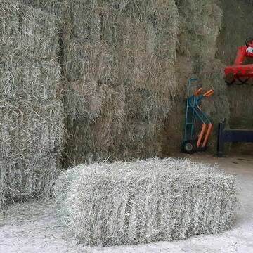
Heupellets und Strohpellets Bio
Bogen
Marion Christ
@Marion-Christ
Einstreu
Pellets
Bio
Abholung
Lieferung
B+

B+
Deprecated: Creation of dynamic property Zend_View_Helper_Ads::$adLink is deprecated in /var/www/stall-frei/htdocs/staging.stall-frei.de/library/Psf/View/Helper/Ads.php on line 108

Das Beste für die Hufe
Mechtersen
STALL-FREIde Marketing
@STALL-FREI-Marketing
Hufschmiede und Hufpfleger in Ihrer Nähe
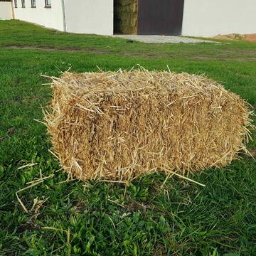
Heukleinballen (34 x 44 x 90 cm)
Marquartstein
Hacher Fahrnpoint
@Hacher-Berghof-Fahrnpoint
Heu
Kleinballen/HD-Ballen
Regenfrei
Wird verladen
1 weitere...
B+

Heu 2. Schnitt 2025 Grummet HD Ballen
Altmannstein
Thomas Resch
@Cappo
Heu
Empfänger lädt ab
Kleinballen/HD-Ballen
Wird verladen
2 weitere...
B+

Bio-Pferdeheu in Rundballen
Reichersbeuern
Biohof-Sixt
@Biohof-Sixt
Heu
Empfänger lädt ab
Rundballen
Bio
2 weitere...
aktuell
B+

Pferdepension Hit Aktivstall Kürmerhof
Hohenkammer
Kuermerhof
@Kuermerhof
*******JETZT NEU MIT ENTSTAUBTEM BIOHEU*********
*******Demnächst mit einem Abenteuerspielplatz für Pferde ( Extrem Trail/Pa

HD-Heuballen, 1. Schnitt & 2. Schnitt
Hilpoltstein
KnollmeyerBallen
@KnollmeyerBallen
Heu
Lieferant entlädt
Kleinballen/HD-Ballen
Regenfrei
3 weitere...
B+
HD-Strohballen, Gersten-, Dinkel- und Weizenstroh
Hilpoltstein
KnollmeyerBallen
@KnollmeyerBallen
Einstreu
Lieferant entlädt
Kleinballen/HD-Ballen
Regenfrei
3 weitere...
B+
Leider kein Vorschaubild
Leider kein Vorschaubild
heu 2025 heu 2ter schnitt 2025
Maisach
Reitstall Thurner
@ReitstallThurner
Heu
Empfänger lädt ab
Rundballen
Regenfrei
3 weitere...
B+
Leider kein Vorschaubild
Leider kein Vorschaubild
HEUCOBS/GRASCOBSMenge in kg Preis 0,75€/kg im Sa...
Starnberg
Reiterhof-Klim
@Reiterhof-Klim
Futter
Pellets
Abholung
B+


Strohpellet, Strohgranulat, Heu & Stroh
Allmannshofen
J&M Kratzer
@JMKratzer
Einstreu
Lieferant entlädt
Pellets
Wird verladen
2 weitere...
P+
Deprecated: Creation of dynamic property Zend_View::$pageCount is deprecated in /var/www/stall-frei/htdocs/staging.stall-frei.de/library/vendor/shardj/zf1-future/library/Zend/View/Abstract.php on line 308
Deprecated: Creation of dynamic property Zend_View::$itemCountPerPage is deprecated in /var/www/stall-frei/htdocs/staging.stall-frei.de/library/vendor/shardj/zf1-future/library/Zend/View/Abstract.php on line 308
Deprecated: Creation of dynamic property Zend_View::$first is deprecated in /var/www/stall-frei/htdocs/staging.stall-frei.de/library/vendor/shardj/zf1-future/library/Zend/View/Abstract.php on line 308
Deprecated: Creation of dynamic property Zend_View::$current is deprecated in /var/www/stall-frei/htdocs/staging.stall-frei.de/library/vendor/shardj/zf1-future/library/Zend/View/Abstract.php on line 308
Deprecated: Creation of dynamic property Zend_View::$last is deprecated in /var/www/stall-frei/htdocs/staging.stall-frei.de/library/vendor/shardj/zf1-future/library/Zend/View/Abstract.php on line 308
Deprecated: Creation of dynamic property Zend_View::$next is deprecated in /var/www/stall-frei/htdocs/staging.stall-frei.de/library/vendor/shardj/zf1-future/library/Zend/View/Abstract.php on line 308
Deprecated: Creation of dynamic property Zend_View::$pagesInRange is deprecated in /var/www/stall-frei/htdocs/staging.stall-frei.de/library/vendor/shardj/zf1-future/library/Zend/View/Abstract.php on line 308
Deprecated: Creation of dynamic property Zend_View::$firstPageInRange is deprecated in /var/www/stall-frei/htdocs/staging.stall-frei.de/library/vendor/shardj/zf1-future/library/Zend/View/Abstract.php on line 308
Deprecated: Creation of dynamic property Zend_View::$lastPageInRange is deprecated in /var/www/stall-frei/htdocs/staging.stall-frei.de/library/vendor/shardj/zf1-future/library/Zend/View/Abstract.php on line 308
Deprecated: Creation of dynamic property Zend_View::$currentItemCount is deprecated in /var/www/stall-frei/htdocs/staging.stall-frei.de/library/vendor/shardj/zf1-future/library/Zend/View/Abstract.php on line 308
Deprecated: Creation of dynamic property Zend_View::$totalItemCount is deprecated in /var/www/stall-frei/htdocs/staging.stall-frei.de/library/vendor/shardj/zf1-future/library/Zend/View/Abstract.php on line 308
Deprecated: Creation of dynamic property Zend_View::$firstItemNumber is deprecated in /var/www/stall-frei/htdocs/staging.stall-frei.de/library/vendor/shardj/zf1-future/library/Zend/View/Abstract.php on line 308
Deprecated: Creation of dynamic property Zend_View::$lastItemNumber is deprecated in /var/www/stall-frei/htdocs/staging.stall-frei.de/library/vendor/shardj/zf1-future/library/Zend/View/Abstract.php on line 308
Deprecated: Creation of dynamic property Zend_View::$router is deprecated in /var/www/stall-frei/htdocs/staging.stall-frei.de/library/vendor/shardj/zf1-future/library/Zend/View/Abstract.php on line 308
Deprecated: Creation of dynamic property Zend_View::$urlParams is deprecated in /var/www/stall-frei/htdocs/staging.stall-frei.de/library/vendor/shardj/zf1-future/library/Zend/View/Abstract.php on line 308
Deprecated: Creation of dynamic property Zend_View::$showAds is deprecated in /var/www/stall-frei/htdocs/staging.stall-frei.de/library/vendor/shardj/zf1-future/library/Zend/View/Abstract.php on line 308
Deprecated: Creation of dynamic property Zend_View::$objectIds is deprecated in /var/www/stall-frei/htdocs/staging.stall-frei.de/library/vendor/shardj/zf1-future/library/Zend/View/Abstract.php on line 308
Deprecated: Creation of dynamic property Zend_View::$showNavbar is deprecated in /var/www/stall-frei/htdocs/staging.stall-frei.de/library/vendor/shardj/zf1-future/library/Zend/View/Abstract.php on line 308
Deprecated: Creation of dynamic property Zend_View::$showBreadcrumb is deprecated in /var/www/stall-frei/htdocs/staging.stall-frei.de/library/vendor/shardj/zf1-future/library/Zend/View/Abstract.php on line 308
Deprecated: Creation of dynamic property Zend_View::$showFooter is deprecated in /var/www/stall-frei/htdocs/staging.stall-frei.de/library/vendor/shardj/zf1-future/library/Zend/View/Abstract.php on line 308
Deprecated: Creation of dynamic property Zend_View::$showInternalAds is deprecated in /var/www/stall-frei/htdocs/staging.stall-frei.de/library/vendor/shardj/zf1-future/library/Zend/View/Abstract.php on line 308
Deprecated: Creation of dynamic property Zend_View::$blNoContent is deprecated in /var/www/stall-frei/htdocs/staging.stall-frei.de/library/vendor/shardj/zf1-future/library/Zend/View/Abstract.php on line 308
Deprecated: Creation of dynamic property Zend_View::$sMetaDesc is deprecated in /var/www/stall-frei/htdocs/staging.stall-frei.de/library/vendor/shardj/zf1-future/library/Zend/View/Abstract.php on line 308
Deprecated: Creation of dynamic property Zend_View::$useGmaps is deprecated in /var/www/stall-frei/htdocs/staging.stall-frei.de/library/vendor/shardj/zf1-future/library/Zend/View/Abstract.php on line 308
Deprecated: Creation of dynamic property Zend_View::$touches is deprecated in /var/www/stall-frei/htdocs/staging.stall-frei.de/library/vendor/shardj/zf1-future/library/Zend/View/Abstract.php on line 308
Deprecated: Creation of dynamic property Zend_View::$oProject is deprecated in /var/www/stall-frei/htdocs/staging.stall-frei.de/library/vendor/shardj/zf1-future/library/Zend/View/Abstract.php on line 308
Deprecated: Creation of dynamic property Zend_View::$pageHeadline is deprecated in /var/www/stall-frei/htdocs/staging.stall-frei.de/library/vendor/shardj/zf1-future/library/Zend/View/Abstract.php on line 308
Deprecated: Creation of dynamic property Zend_View::$disableLocationField is deprecated in /var/www/stall-frei/htdocs/staging.stall-frei.de/library/vendor/shardj/zf1-future/library/Zend/View/Abstract.php on line 308
Deprecated: Creation of dynamic property Zend_View::$isSearch is deprecated in /var/www/stall-frei/htdocs/staging.stall-frei.de/library/vendor/shardj/zf1-future/library/Zend/View/Abstract.php on line 308
Deprecated: Creation of dynamic property Zend_View::$pageTitle is deprecated in /var/www/stall-frei/htdocs/staging.stall-frei.de/library/vendor/shardj/zf1-future/library/Zend/View/Abstract.php on line 308
Deprecated: Creation of dynamic property Psf_Form_Element_Text::$class is deprecated in /var/www/stall-frei/htdocs/staging.stall-frei.de/library/vendor/shardj/zf1-future/library/Zend/Form/Element.php on line 874
Deprecated: Creation of dynamic property Psf_Form_Element_Text::$size is deprecated in /var/www/stall-frei/htdocs/staging.stall-frei.de/library/vendor/shardj/zf1-future/library/Zend/Form/Element.php on line 874
Deprecated: Creation of dynamic property Psf_Form_Element_Text::$placeholder is deprecated in /var/www/stall-frei/htdocs/staging.stall-frei.de/library/vendor/shardj/zf1-future/library/Zend/Form/Element.php on line 874
Deprecated: Creation of dynamic property Psf_Form_Element_Hidden::$class is deprecated in /var/www/stall-frei/htdocs/staging.stall-frei.de/library/vendor/shardj/zf1-future/library/Zend/Form/Element.php on line 874
Deprecated: Creation of dynamic property Psf_Form_Element_Hidden::$class is deprecated in /var/www/stall-frei/htdocs/staging.stall-frei.de/library/vendor/shardj/zf1-future/library/Zend/Form/Element.php on line 874
Deprecated: Creation of dynamic property Psf_Form_Element_Hidden::$class is deprecated in /var/www/stall-frei/htdocs/staging.stall-frei.de/library/vendor/shardj/zf1-future/library/Zend/Form/Element.php on line 874
Deprecated: Creation of dynamic property Psf_Form_Element_Hidden::$class is deprecated in /var/www/stall-frei/htdocs/staging.stall-frei.de/library/vendor/shardj/zf1-future/library/Zend/Form/Element.php on line 874
Deprecated: Creation of dynamic property Psf_Form_Element_Select::$class is deprecated in /var/www/stall-frei/htdocs/staging.stall-frei.de/library/vendor/shardj/zf1-future/library/Zend/Form/Element.php on line 874
Deprecated: Creation of dynamic property Psf_Form_Element_Select::$class is deprecated in /var/www/stall-frei/htdocs/staging.stall-frei.de/library/vendor/shardj/zf1-future/library/Zend/Form/Element.php on line 874
Deprecated: Creation of dynamic property Psf_Form_Element_Select::$class is deprecated in /var/www/stall-frei/htdocs/staging.stall-frei.de/library/vendor/shardj/zf1-future/library/Zend/Form/Element.php on line 874
Deprecated: Creation of dynamic property Psf_Form_Element_Select::$class is deprecated in /var/www/stall-frei/htdocs/staging.stall-frei.de/library/vendor/shardj/zf1-future/library/Zend/Form/Element.php on line 874
Deprecated: Creation of dynamic property Zend_View::$sort is deprecated in /var/www/stall-frei/htdocs/staging.stall-frei.de/library/vendor/shardj/zf1-future/library/Zend/View/Abstract.php on line 308
Deprecated: Creation of dynamic property Zend_View::$searchLocation is deprecated in /var/www/stall-frei/htdocs/staging.stall-frei.de/library/vendor/shardj/zf1-future/library/Zend/View/Abstract.php on line 308
Deprecated: Creation of dynamic property Zend_View::$locationHint is deprecated in /var/www/stall-frei/htdocs/staging.stall-frei.de/library/vendor/shardj/zf1-future/library/Zend/View/Abstract.php on line 308
Psf_GeoCoder_Abstract::getLocation: Aßberg Get Location CachedOrLive
Psf_GeoCoder_Abstract::getCachedOrLive: Aßberg
Psf_GeoCoder_OpenCageData::makeApiRequest: response:
Array
(
[documentation] => https://opencagedata.com/api
[licenses] => Array
(
[0] => Array
(
[name] => see attribution guide
[url] => https://opencagedata.com/credits
)
)
[results] => Array
(
[0] => Array
(
[bounds] => Array
(
[northeast] => Array
(
[lat] => 48.7380173
[lng] => 13.7081385
)
[southwest] => Array
(
[lat] => 48.6980173
[lng] => 13.6681385
)
)
[components] => Array
(
[ISO_3166-1_alpha-2] => DE
[ISO_3166-1_alpha-3] => DEU
[ISO_3166-2] => Array
(
[0] => DE-BY
)
[_category] => place
[_normalized_city] => Jandelsbrunn
[_type] => hamlet
[city] => Jandelsbrunn
[continent] => Europe
[country] => Deutschland
[country_code] => de
[county] => Landkreis Freyung-Grafenau
[hamlet] => Aßberg
[political_union] => European Union
[postcode] => 94118
[state] => Bayern
[state_code] => BY
)
[confidence] => 7
[formatted] => Aßberg, 94118 Jandelsbrunn, Deutschland
[geometry] => Array
(
[lat] => 48.7180173
[lng] => 13.6881385
)
)
[1] => Array
(
[bounds] => Array
(
[northeast] => Array
(
[lat] => 51.76817
[lng] => 10.015367
)
[southwest] => Array
(
[lat] => 51.76807
[lng] => 10.015267
)
)
[components] => Array
(
[ISO_3166-1_alpha-2] => DE
[ISO_3166-1_alpha-3] => DEU
[ISO_3166-2] => Array
(
[0] => DE-NI
)
[_category] => natural/water
[_normalized_city] => Kalefeld
[_type] => peak
[continent] => Europe
[country] => Deutschland
[country_code] => de
[county] => Landkreis Northeim
[peak] => Aßberg
[political_union] => European Union
[state] => Niedersachsen
[state_code] => NI
[village] => Kalefeld
)
[confidence] => 9
[formatted] => Aßberg, Kalefeld, Niedersachsen, Deutschland
[geometry] => Array
(
[lat] => 51.76812
[lng] => 10.015317
)
)
[2] => Array
(
[bounds] => Array
(
[northeast] => Array
(
[lat] => 50.695162
[lng] => 7.7971029
)
[southwest] => Array
(
[lat] => 50.695062
[lng] => 7.7970029
)
)
[components] => Array
(
[ISO_3166-1_alpha-2] => DE
[ISO_3166-1_alpha-3] => DEU
[ISO_3166-2] => Array
(
[0] => DE-RP
)
[_category] => natural/water
[_normalized_city] => Limbach
[_type] => peak
[continent] => Europe
[country] => Deutschland
[country_code] => de
[county] => Westerwaldkreis
[municipality] => Hachenburg
[peak] => Aßberg
[political_union] => European Union
[postcode] => 57629
[state] => Rheinland-Pfalz
[state_code] => RP
[village] => Limbach
)
[confidence] => 9
[formatted] => Aßberg, 57629 Limbach, Deutschland
[geometry] => Array
(
[lat] => 50.695112
[lng] => 7.7970529
)
)
[3] => Array
(
[bounds] => Array
(
[northeast] => Array
(
[lat] => 50.5658236
[lng] => 11.2131191
)
[southwest] => Array
(
[lat] => 50.5657236
[lng] => 11.2130191
)
)
[components] => Array
(
[ISO_3166-1_alpha-2] => DE
[ISO_3166-1_alpha-3] => DEU
[ISO_3166-2] => Array
(
[0] => DE-TH
)
[_category] => natural/water
[_normalized_city] => Saalfeld/Saale
[_type] => peak
[continent] => Europe
[country] => Deutschland
[country_code] => de
[county] => Landkreis Saalfeld-Rudolstadt
[peak] => Aßberg
[political_union] => European Union
[state] => Thüringen
[state_code] => TH
[town] => Saalfeld/Saale
)
[confidence] => 9
[formatted] => Aßberg, Saalfeld/Saale, Thüringen, Deutschland
[geometry] => Array
(
[lat] => 50.5657736
[lng] => 11.2130691
)
)
[4] => Array
(
[bounds] => Array
(
[northeast] => Array
(
[lat] => 53.3037353
[lng] => 8.7532145
)
[southwest] => Array
(
[lat] => 53.3003013
[lng] => 8.7397481
)
)
[components] => Array
(
[ISO_3166-1_alpha-2] => DE
[ISO_3166-1_alpha-3] => DEU
[ISO_3166-2] => Array
(
[0] => DE-NI
)
[_category] => road
[_normalized_city] => Osterholz-Scharmbeck
[_type] => road
[continent] => Europe
[country] => Deutschland
[country_code] => de
[county] => Landkreis Osterholz
[political_union] => European Union
[postcode] => 27711
[road] => Aßberg
[state] => Niedersachsen
[state_code] => NI
[town] => Osterholz-Scharmbeck
)
[confidence] => 9
[formatted] => Aßberg, 27711 Osterholz-Scharmbeck, Deutschland
[geometry] => Array
(
[lat] => 53.3017106
[lng] => 8.7466262
)
)
[5] => Array
(
[components] => Array
(
[ISO_3166-1_alpha-2] => FR
[ISO_3166-1_alpha-3] => FRA
[ISO_3166-2] => Array
(
[0] => FR-IDF
[1] => FR-92
)
[_category] => road
[_normalized_city] => Levallois-Perret
[_type] => road
[city] => Levallois-Perret
[continent] => Europe
[country] => France
[country_code] => fr
[county] => Hauts-de-Seine
[local_authority] => Métropole du Grand Paris
[political_union] => European Union
[postcode] => 92300
[road] => Rue Charles Deutschmann
[state] => Île-de-France
[state_code] => IDF
)
[confidence] => 2
[formatted] => Rue Charles Deutschmann, 92300 Levallois-Perret, France
[geometry] => Array
(
[lat] => 48.900049
[lng] => 2.2842
)
)
[6] => Array
(
[components] => Array
(
[ISO_3166-1_alpha-2] => FR
[ISO_3166-1_alpha-3] => FRA
[ISO_3166-2] => Array
(
[0] => FR-OCC
[1] => FR-31
)
[_category] => road
[_normalized_city] => Toulouse
[_type] => road
[city] => Toulouse
[continent] => Europe
[country] => France
[country_code] => fr
[county] => Haute-Garonne
[local_authority] => Toulouse Métropole
[political_union] => European Union
[postcode] => 31100
[road] => Impasse du Gay Saber
[state] => Occitanie
[state_code] => OCC
)
[confidence] => 2
[formatted] => Impasse du Gay Saber, 31100 Toulouse, France
[geometry] => Array
(
[lat] => 43.582099
[lng] => 1.391818
)
)
[7] => Array
(
[components] => Array
(
[ISO_3166-1_alpha-2] => FR
[ISO_3166-1_alpha-3] => FRA
[ISO_3166-2] => Array
(
[0] => FR-HDF
[1] => FR-59
)
[_category] => road
[_normalized_city] => Crespin
[_type] => road
[city] => Crespin
[continent] => Europe
[country] => France
[country_code] => fr
[county] => Nord
[local_authority] => Communauté d’agglomération Valenciennes Métropole
[political_union] => European Union
[postcode] => 59154
[road] => Route de Saint-aybert
[state] => Hauts-de-France
[state_code] => HDF
)
[confidence] => 10
[formatted] => Route de Saint-aybert, 59154 Crespin, France
[geometry] => Array
(
[lat] => 50.428115
[lng] => 3.66033
)
)
[8] => Array
(
[components] => Array
(
[ISO_3166-1_alpha-2] => FR
[ISO_3166-1_alpha-3] => FRA
[ISO_3166-2] => Array
(
[0] => FR-HDF
[1] => FR-59
)
[_category] => road
[_normalized_city] => Saint-Aybert
[_type] => road
[city] => Saint-Aybert
[continent] => Europe
[country] => France
[country_code] => fr
[county] => Nord
[local_authority] => Communauté d’agglomération Valenciennes Métropole
[political_union] => European Union
[postcode] => 59163
[road] => la Canarderie
[state] => Hauts-de-France
[state_code] => HDF
)
[confidence] => 10
[formatted] => la Canarderie, 59163 Saint-Aybert, France
[geometry] => Array
(
[lat] => 50.456597
[lng] => 3.628047
)
)
[9] => Array
(
[components] => Array
(
[ISO_3166-1_alpha-2] => FR
[ISO_3166-1_alpha-3] => FRA
[ISO_3166-2] => Array
(
[0] => FR-HDF
[1] => FR-59
)
[_category] => road
[_normalized_city] => Thivencelle
[_type] => road
[city] => Thivencelle
[continent] => Europe
[country] => France
[country_code] => fr
[county] => Nord
[local_authority] => Communauté d’agglomération Valenciennes Métropole
[political_union] => European Union
[postcode] => 59163
[road] => Rue de Saint-aybert
[state] => Hauts-de-France
[state_code] => HDF
)
[confidence] => 10
[formatted] => Rue de Saint-aybert, 59163 Thivencelle, France
[geometry] => Array
(
[lat] => 50.443227
[lng] => 3.64087
)
)
)
[status] => Array
(
[code] => 200
[message] => OK
)
[stay_informed] => Array
(
[blog] => https://blog.opencagedata.com
[mastodon] => https://en.osm.town/@opencage
)
[thanks] => For using an OpenCage API
[timestamp] => Array
(
[created_http] => Sat, 07 Feb 2026 06:34:23 GMT
[created_unix] => 1770446063
)
[total_results] => 10
)
Psf_GeoCoder_Abstract::convertLocationResult
{"documentation":"https:\/\/opencagedata.com\/api","licenses":[{"name":"see attribution guide","url":"https:\/\/opencagedata.com\/credits"}],"results":[{"bounds":{"northeast":{"lat":48.7380173,"lng":13.7081385},"southwest":{"lat":48.6980173,"lng":13.6681385}},"components":{"ISO_3166-1_alpha-2":"DE","ISO_3166-1_alpha-3":"DEU","ISO_3166-2":["DE-BY"],"_category":"place","_normalized_city":"Jandelsbrunn","_type":"hamlet","city":"Jandelsbrunn","continent":"Europe","country":"Deutschland","country_code":"de","county":"Landkreis Freyung-Grafenau","hamlet":"A\u00dfberg","political_union":"European Union","postcode":"94118","state":"Bayern","state_code":"BY"},"confidence":7,"formatted":"A\u00dfberg, 94118 Jandelsbrunn, Deutschland","geometry":{"lat":48.7180173,"lng":13.6881385}},{"bounds":{"northeast":{"lat":51.76817,"lng":10.015367},"southwest":{"lat":51.76807,"lng":10.015267}},"components":{"ISO_3166-1_alpha-2":"DE","ISO_3166-1_alpha-3":"DEU","ISO_3166-2":["DE-NI"],"_category":"natural\/water","_normalized_city":"Kalefeld","_type":"peak","continent":"Europe","country":"Deutschland","country_code":"de","county":"Landkreis Northeim","peak":"A\u00dfberg","political_union":"European Union","state":"Niedersachsen","state_code":"NI","village":"Kalefeld"},"confidence":9,"formatted":"A\u00dfberg, Kalefeld, Niedersachsen, Deutschland","geometry":{"lat":51.76812,"lng":10.015317}},{"bounds":{"northeast":{"lat":50.695162,"lng":7.7971029},"southwest":{"lat":50.695062,"lng":7.7970029}},"components":{"ISO_3166-1_alpha-2":"DE","ISO_3166-1_alpha-3":"DEU","ISO_3166-2":["DE-RP"],"_category":"natural\/water","_normalized_city":"Limbach","_type":"peak","continent":"Europe","country":"Deutschland","country_code":"de","county":"Westerwaldkreis","municipality":"Hachenburg","peak":"A\u00dfberg","political_union":"European Union","postcode":"57629","state":"Rheinland-Pfalz","state_code":"RP","village":"Limbach"},"confidence":9,"formatted":"A\u00dfberg, 57629 Limbach, Deutschland","geometry":{"lat":50.695112,"lng":7.7970529}},{"bounds":{"northeast":{"lat":50.5658236,"lng":11.2131191},"southwest":{"lat":50.5657236,"lng":11.2130191}},"components":{"ISO_3166-1_alpha-2":"DE","ISO_3166-1_alpha-3":"DEU","ISO_3166-2":["DE-TH"],"_category":"natural\/water","_normalized_city":"Saalfeld\/Saale","_type":"peak","continent":"Europe","country":"Deutschland","country_code":"de","county":"Landkreis Saalfeld-Rudolstadt","peak":"A\u00dfberg","political_union":"European Union","state":"Th\u00fcringen","state_code":"TH","town":"Saalfeld\/Saale"},"confidence":9,"formatted":"A\u00dfberg, Saalfeld\/Saale, Th\u00fcringen, Deutschland","geometry":{"lat":50.5657736,"lng":11.2130691}},{"bounds":{"northeast":{"lat":53.3037353,"lng":8.7532145},"southwest":{"lat":53.3003013,"lng":8.7397481}},"components":{"ISO_3166-1_alpha-2":"DE","ISO_3166-1_alpha-3":"DEU","ISO_3166-2":["DE-NI"],"_category":"road","_normalized_city":"Osterholz-Scharmbeck","_type":"road","continent":"Europe","country":"Deutschland","country_code":"de","county":"Landkreis Osterholz","political_union":"European Union","postcode":"27711","road":"A\u00dfberg","state":"Niedersachsen","state_code":"NI","town":"Osterholz-Scharmbeck"},"confidence":9,"formatted":"A\u00dfberg, 27711 Osterholz-Scharmbeck, Deutschland","geometry":{"lat":53.3017106,"lng":8.7466262}},{"components":{"ISO_3166-1_alpha-2":"FR","ISO_3166-1_alpha-3":"FRA","ISO_3166-2":["FR-IDF","FR-92"],"_category":"road","_normalized_city":"Levallois-Perret","_type":"road","city":"Levallois-Perret","continent":"Europe","country":"France","country_code":"fr","county":"Hauts-de-Seine","local_authority":"M\u00e9tropole du Grand Paris","political_union":"European Union","postcode":"92300","road":"Rue Charles Deutschmann","state":"\u00cele-de-France","state_code":"IDF"},"confidence":2,"formatted":"Rue Charles Deutschmann, 92300 Levallois-Perret, France","geometry":{"lat":48.900049,"lng":2.2842}},{"components":{"ISO_3166-1_alpha-2":"FR","ISO_3166-1_alpha-3":"FRA","ISO_3166-2":["FR-OCC","FR-31"],"_category":"road","_normalized_city":"Toulouse","_type":"road","city":"Toulouse","continent":"Europe","country":"France","country_code":"fr","county":"Haute-Garonne","local_authority":"Toulouse M\u00e9tropole","political_union":"European Union","postcode":"31100","road":"Impasse du Gay Saber","state":"Occitanie","state_code":"OCC"},"confidence":2,"formatted":"Impasse du Gay Saber, 31100 Toulouse, France","geometry":{"lat":43.582099,"lng":1.391818}},{"components":{"ISO_3166-1_alpha-2":"FR","ISO_3166-1_alpha-3":"FRA","ISO_3166-2":["FR-HDF","FR-59"],"_category":"road","_normalized_city":"Crespin","_type":"road","city":"Crespin","continent":"Europe","country":"France","country_code":"fr","county":"Nord","local_authority":"Communaut\u00e9 d\u2019agglom\u00e9ration Valenciennes M\u00e9tropole","political_union":"European Union","postcode":"59154","road":"Route de Saint-aybert","state":"Hauts-de-France","state_code":"HDF"},"confidence":10,"formatted":"Route de Saint-aybert, 59154 Crespin, France","geometry":{"lat":50.428115,"lng":3.66033}},{"components":{"ISO_3166-1_alpha-2":"FR","ISO_3166-1_alpha-3":"FRA","ISO_3166-2":["FR-HDF","FR-59"],"_category":"road","_normalized_city":"Saint-Aybert","_type":"road","city":"Saint-Aybert","continent":"Europe","country":"France","country_code":"fr","county":"Nord","local_authority":"Communaut\u00e9 d\u2019agglom\u00e9ration Valenciennes M\u00e9tropole","political_union":"European Union","postcode":"59163","road":"la Canarderie","state":"Hauts-de-France","state_code":"HDF"},"confidence":10,"formatted":"la Canarderie, 59163 Saint-Aybert, France","geometry":{"lat":50.456597,"lng":3.628047}},{"components":{"ISO_3166-1_alpha-2":"FR","ISO_3166-1_alpha-3":"FRA","ISO_3166-2":["FR-HDF","FR-59"],"_category":"road","_normalized_city":"Thivencelle","_type":"road","city":"Thivencelle","continent":"Europe","country":"France","country_code":"fr","county":"Nord","local_authority":"Communaut\u00e9 d\u2019agglom\u00e9ration Valenciennes M\u00e9tropole","political_union":"European Union","postcode":"59163","road":"Rue de Saint-aybert","state":"Hauts-de-France","state_code":"HDF"},"confidence":10,"formatted":"Rue de Saint-aybert, 59163 Thivencelle, France","geometry":{"lat":50.443227,"lng":3.64087}}],"status":{"code":200,"message":"OK"},"stay_informed":{"blog":"https:\/\/blog.opencagedata.com","mastodon":"https:\/\/en.osm.town\/@opencage"},"thanks":"For using an OpenCage API","timestamp":{"created_http":"Sat, 07 Feb 2026 06:34:23 GMT","created_unix":1770446063},"total_results":10}Array
(
[0] => stdClass Object
(
[bounds] => stdClass Object
(
[northeast] => stdClass Object
(
[lat] => 48.7380173
[lng] => 13.7081385
)
[southwest] => stdClass Object
(
[lat] => 48.6980173
[lng] => 13.6681385
)
)
[components] => stdClass Object
(
[ISO_3166-1_alpha-2] => DE
[ISO_3166-1_alpha-3] => DEU
[ISO_3166-2] => Array
(
[0] => DE-BY
)
[_category] => place
[_normalized_city] => Jandelsbrunn
[_type] => hamlet
[city] => Jandelsbrunn
[continent] => Europe
[country] => Deutschland
[country_code] => de
[county] => Landkreis Freyung-Grafenau
[hamlet] => Aßberg
[political_union] => European Union
[postcode] => 94118
[state] => Bayern
[state_code] => BY
)
[confidence] => 7
[formatted] => Aßberg, 94118 Jandelsbrunn, Deutschland
[geometry] => stdClass Object
(
[lat] => 48.7180173
[lng] => 13.6881385
)
)
[1] => stdClass Object
(
[bounds] => stdClass Object
(
[northeast] => stdClass Object
(
[lat] => 51.76817
[lng] => 10.015367
)
[southwest] => stdClass Object
(
[lat] => 51.76807
[lng] => 10.015267
)
)
[components] => stdClass Object
(
[ISO_3166-1_alpha-2] => DE
[ISO_3166-1_alpha-3] => DEU
[ISO_3166-2] => Array
(
[0] => DE-NI
)
[_category] => natural/water
[_normalized_city] => Kalefeld
[_type] => peak
[continent] => Europe
[country] => Deutschland
[country_code] => de
[county] => Landkreis Northeim
[peak] => Aßberg
[political_union] => European Union
[state] => Niedersachsen
[state_code] => NI
[village] => Kalefeld
)
[confidence] => 9
[formatted] => Aßberg, Kalefeld, Niedersachsen, Deutschland
[geometry] => stdClass Object
(
[lat] => 51.76812
[lng] => 10.015317
)
)
[2] => stdClass Object
(
[bounds] => stdClass Object
(
[northeast] => stdClass Object
(
[lat] => 50.695162
[lng] => 7.7971029
)
[southwest] => stdClass Object
(
[lat] => 50.695062
[lng] => 7.7970029
)
)
[components] => stdClass Object
(
[ISO_3166-1_alpha-2] => DE
[ISO_3166-1_alpha-3] => DEU
[ISO_3166-2] => Array
(
[0] => DE-RP
)
[_category] => natural/water
[_normalized_city] => Limbach
[_type] => peak
[continent] => Europe
[country] => Deutschland
[country_code] => de
[county] => Westerwaldkreis
[municipality] => Hachenburg
[peak] => Aßberg
[political_union] => European Union
[postcode] => 57629
[state] => Rheinland-Pfalz
[state_code] => RP
[village] => Limbach
)
[confidence] => 9
[formatted] => Aßberg, 57629 Limbach, Deutschland
[geometry] => stdClass Object
(
[lat] => 50.695112
[lng] => 7.7970529
)
)
[3] => stdClass Object
(
[bounds] => stdClass Object
(
[northeast] => stdClass Object
(
[lat] => 50.5658236
[lng] => 11.2131191
)
[southwest] => stdClass Object
(
[lat] => 50.5657236
[lng] => 11.2130191
)
)
[components] => stdClass Object
(
[ISO_3166-1_alpha-2] => DE
[ISO_3166-1_alpha-3] => DEU
[ISO_3166-2] => Array
(
[0] => DE-TH
)
[_category] => natural/water
[_normalized_city] => Saalfeld/Saale
[_type] => peak
[continent] => Europe
[country] => Deutschland
[country_code] => de
[county] => Landkreis Saalfeld-Rudolstadt
[peak] => Aßberg
[political_union] => European Union
[state] => Thüringen
[state_code] => TH
[town] => Saalfeld/Saale
)
[confidence] => 9
[formatted] => Aßberg, Saalfeld/Saale, Thüringen, Deutschland
[geometry] => stdClass Object
(
[lat] => 50.5657736
[lng] => 11.2130691
)
)
[4] => stdClass Object
(
[bounds] => stdClass Object
(
[northeast] => stdClass Object
(
[lat] => 53.3037353
[lng] => 8.7532145
)
[southwest] => stdClass Object
(
[lat] => 53.3003013
[lng] => 8.7397481
)
)
[components] => stdClass Object
(
[ISO_3166-1_alpha-2] => DE
[ISO_3166-1_alpha-3] => DEU
[ISO_3166-2] => Array
(
[0] => DE-NI
)
[_category] => road
[_normalized_city] => Osterholz-Scharmbeck
[_type] => road
[continent] => Europe
[country] => Deutschland
[country_code] => de
[county] => Landkreis Osterholz
[political_union] => European Union
[postcode] => 27711
[road] => Aßberg
[state] => Niedersachsen
[state_code] => NI
[town] => Osterholz-Scharmbeck
)
[confidence] => 9
[formatted] => Aßberg, 27711 Osterholz-Scharmbeck, Deutschland
[geometry] => stdClass Object
(
[lat] => 53.3017106
[lng] => 8.7466262
)
)
[5] => stdClass Object
(
[components] => stdClass Object
(
[ISO_3166-1_alpha-2] => FR
[ISO_3166-1_alpha-3] => FRA
[ISO_3166-2] => Array
(
[0] => FR-IDF
[1] => FR-92
)
[_category] => road
[_normalized_city] => Levallois-Perret
[_type] => road
[city] => Levallois-Perret
[continent] => Europe
[country] => France
[country_code] => fr
[county] => Hauts-de-Seine
[local_authority] => Métropole du Grand Paris
[political_union] => European Union
[postcode] => 92300
[road] => Rue Charles Deutschmann
[state] => Île-de-France
[state_code] => IDF
)
[confidence] => 2
[formatted] => Rue Charles Deutschmann, 92300 Levallois-Perret, France
[geometry] => stdClass Object
(
[lat] => 48.900049
[lng] => 2.2842
)
)
[6] => stdClass Object
(
[components] => stdClass Object
(
[ISO_3166-1_alpha-2] => FR
[ISO_3166-1_alpha-3] => FRA
[ISO_3166-2] => Array
(
[0] => FR-OCC
[1] => FR-31
)
[_category] => road
[_normalized_city] => Toulouse
[_type] => road
[city] => Toulouse
[continent] => Europe
[country] => France
[country_code] => fr
[county] => Haute-Garonne
[local_authority] => Toulouse Métropole
[political_union] => European Union
[postcode] => 31100
[road] => Impasse du Gay Saber
[state] => Occitanie
[state_code] => OCC
)
[confidence] => 2
[formatted] => Impasse du Gay Saber, 31100 Toulouse, France
[geometry] => stdClass Object
(
[lat] => 43.582099
[lng] => 1.391818
)
)
[7] => stdClass Object
(
[components] => stdClass Object
(
[ISO_3166-1_alpha-2] => FR
[ISO_3166-1_alpha-3] => FRA
[ISO_3166-2] => Array
(
[0] => FR-HDF
[1] => FR-59
)
[_category] => road
[_normalized_city] => Crespin
[_type] => road
[city] => Crespin
[continent] => Europe
[country] => France
[country_code] => fr
[county] => Nord
[local_authority] => Communauté d’agglomération Valenciennes Métropole
[political_union] => European Union
[postcode] => 59154
[road] => Route de Saint-aybert
[state] => Hauts-de-France
[state_code] => HDF
)
[confidence] => 10
[formatted] => Route de Saint-aybert, 59154 Crespin, France
[geometry] => stdClass Object
(
[lat] => 50.428115
[lng] => 3.66033
)
)
[8] => stdClass Object
(
[components] => stdClass Object
(
[ISO_3166-1_alpha-2] => FR
[ISO_3166-1_alpha-3] => FRA
[ISO_3166-2] => Array
(
[0] => FR-HDF
[1] => FR-59
)
[_category] => road
[_normalized_city] => Saint-Aybert
[_type] => road
[city] => Saint-Aybert
[continent] => Europe
[country] => France
[country_code] => fr
[county] => Nord
[local_authority] => Communauté d’agglomération Valenciennes Métropole
[political_union] => European Union
[postcode] => 59163
[road] => la Canarderie
[state] => Hauts-de-France
[state_code] => HDF
)
[confidence] => 10
[formatted] => la Canarderie, 59163 Saint-Aybert, France
[geometry] => stdClass Object
(
[lat] => 50.456597
[lng] => 3.628047
)
)
[9] => stdClass Object
(
[components] => stdClass Object
(
[ISO_3166-1_alpha-2] => FR
[ISO_3166-1_alpha-3] => FRA
[ISO_3166-2] => Array
(
[0] => FR-HDF
[1] => FR-59
)
[_category] => road
[_normalized_city] => Thivencelle
[_type] => road
[city] => Thivencelle
[continent] => Europe
[country] => France
[country_code] => fr
[county] => Nord
[local_authority] => Communauté d’agglomération Valenciennes Métropole
[political_union] => European Union
[postcode] => 59163
[road] => Rue de Saint-aybert
[state] => Hauts-de-France
[state_code] => HDF
)
[confidence] => 10
[formatted] => Rue de Saint-aybert, 59163 Thivencelle, France
[geometry] => stdClass Object
(
[lat] => 50.443227
[lng] => 3.64087
)
)
)
Psf_GeoCoder_OpenCageData::getKeyMap: 0
stdClass Object
(
    [bounds] => stdClass Object
        (
            [northeast] => stdClass Object
                (
                    [lat] => 48.7380173
                    [lng] => 13.7081385
                )

            [southwest] => stdClass Object
                (
                    [lat] => 48.6980173
                    [lng] => 13.6681385
                )

        )

    [components] => stdClass Object
        (
            [ISO_3166-1_alpha-2] => DE
            [ISO_3166-1_alpha-3] => DEU
            [ISO_3166-2] => Array
                (
                    [0] => DE-BY
                )

            [_category] => place
            [_normalized_city] => Jandelsbrunn
            [_type] => hamlet
            [city] => Jandelsbrunn
            [continent] => Europe
            [country] => Deutschland
            [country_code] => de
            [county] => Landkreis Freyung-Grafenau
            [hamlet] => Aßberg
            [political_union] => European Union
            [postcode] => 94118
            [state] => Bayern
            [state_code] => BY
        )

    [confidence] => 7
    [formatted] => Aßberg, 94118 Jandelsbrunn, Deutschland
    [geometry] => stdClass Object
        (
            [lat] => 48.7180173
            [lng] => 13.6881385
        )

)
Psf_GeoCoder_OpenCageData::getCounty: Freyung-Grafenau
Psf_GeoCoder_OpenCageData::addMissingData REFETCH!
Array
(
    [address] => Aßberg, 94118 Jandelsbrunn, Deutschland
    [type] => hamlet
    [street] => Aßberg
    [city] => Jandelsbrunn
    [county] => Freyung-Grafenau
    [state] => Bayern
    [zip] => 94118
    [country] => Deutschland
    [suburb] =>
    [countrycode] => de
    [latitude] => 48.7180173
    [longitude] => 13.6881385
    [accuracy] => 1
    [confidence] => 7
    [bounds] => stdClass Object
        (
            [northeast] => stdClass Object
                (
                    [lat] => 48.7380173
                    [lng] => 13.7081385
                )

            [southwest] => stdClass Object
                (
                    [lat] => 48.6980173
                    [lng] => 13.6681385
                )

        )

)
reformat!
Array
(
    [address] => Aßberg, 94118 Jandelsbrunn, Deutschland
    [type] => hamlet
    [street] => Aßberg
    [city] => Jandelsbrunn
    [county] => Freyung-Grafenau
    [state] => Bayern
    [zip] => 94118
    [country] => Deutschland
    [suburb] =>
    [countrycode] => de
    [latitude] => 48.7180173
    [longitude] => 13.6881385
    [accuracy] => 1
    [confidence] => 7
    [bounds] => stdClass Object
        (
            [northeast] => stdClass Object
                (
                    [lat] => 48.7380173
                    [lng] => 13.7081385
                )

            [southwest] => stdClass Object
                (
                    [lat] => 48.6980173
                    [lng] => 13.6681385
                )

        )

    [place] => Aßberg, 94118 Jandelsbrunn, Bayern
    [hash] => bea444bfdaaf4a9f5954a9019c4041ee
)
Psf_GeoCoder_OpenCageData::getKeyMap: 1
stdClass Object
(
    [bounds] => stdClass Object
        (
            [northeast] => stdClass Object
                (
                    [lat] => 51.76817
                    [lng] => 10.015367
                )

            [southwest] => stdClass Object
                (
                    [lat] => 51.76807
                    [lng] => 10.015267
                )

        )

    [components] => stdClass Object
        (
            [ISO_3166-1_alpha-2] => DE
            [ISO_3166-1_alpha-3] => DEU
            [ISO_3166-2] => Array
                (
                    [0] => DE-NI
                )

            [_category] => natural/water
            [_normalized_city] => Kalefeld
            [_type] => peak
            [continent] => Europe
            [country] => Deutschland
            [country_code] => de
            [county] => Landkreis Northeim
            [peak] => Aßberg
            [political_union] => European Union
            [state] => Niedersachsen
            [state_code] => NI
            [village] => Kalefeld
        )

    [confidence] => 9
    [formatted] => Aßberg, Kalefeld, Niedersachsen, Deutschland
    [geometry] => stdClass Object
        (
            [lat] => 51.76812
            [lng] => 10.015317
        )

)
Psf_GeoCoder_OpenCageData::getCounty: Northeim
Psf_GeoCoder_OpenCageData::addMissingData REFETCH!
Array
(
    [address] => Aßberg, Kalefeld, Niedersachsen, Deutschland
    [type] => peak
    [street] =>
    [city] => Kalefeld
    [county] => Northeim
    [state] => Niedersachsen
    [zip] =>
    [country] => Deutschland
    [suburb] =>
    [countrycode] => de
    [latitude] => 51.76812
    [longitude] => 10.015317
    [accuracy] => 1
    [confidence] => 9
    [bounds] => stdClass Object
        (
            [northeast] => stdClass Object
                (
                    [lat] => 51.76817
                    [lng] => 10.015367
                )

            [southwest] => stdClass Object
                (
                    [lat] => 51.76807
                    [lng] => 10.015267
                )

        )

)
reformat!
Array
(
    [address] => Aßberg, Kalefeld, Niedersachsen, Deutschland
    [type] => peak
    [street] =>
    [city] => Kalefeld
    [county] => Northeim
    [state] => Niedersachsen
    [zip] =>
    [country] => Deutschland
    [suburb] =>
    [countrycode] => de
    [latitude] => 51.76812
    [longitude] => 10.015317
    [accuracy] => 1
    [confidence] => 9
    [bounds] => stdClass Object
        (
            [northeast] => stdClass Object
                (
                    [lat] => 51.76817
                    [lng] => 10.015367
                )

            [southwest] => stdClass Object
                (
                    [lat] => 51.76807
                    [lng] => 10.015267
                )

        )

    [place] => Kalefeld, Niedersachsen
    [hash] => dd691774623ded7ddbf22be992514f25
)
Psf_GeoCoder_OpenCageData::getKeyMap: 2
stdClass Object
(
    [bounds] => stdClass Object
        (
            [northeast] => stdClass Object
                (
                    [lat] => 50.695162
                    [lng] => 7.7971029
                )

            [southwest] => stdClass Object
                (
                    [lat] => 50.695062
                    [lng] => 7.7970029
                )

        )

    [components] => stdClass Object
        (
            [ISO_3166-1_alpha-2] => DE
            [ISO_3166-1_alpha-3] => DEU
            [ISO_3166-2] => Array
                (
                    [0] => DE-RP
                )

            [_category] => natural/water
            [_normalized_city] => Limbach
            [_type] => peak
            [continent] => Europe
            [country] => Deutschland
            [country_code] => de
            [county] => Westerwaldkreis
            [municipality] => Hachenburg
            [peak] => Aßberg
            [political_union] => European Union
            [postcode] => 57629
            [state] => Rheinland-Pfalz
            [state_code] => RP
            [village] => Limbach
        )

    [confidence] => 9
    [formatted] => Aßberg, 57629 Limbach, Deutschland
    [geometry] => stdClass Object
        (
            [lat] => 50.695112
            [lng] => 7.7970529
        )

)
Psf_GeoCoder_OpenCageData::getCounty: Westerwaldkreis
Psf_GeoCoder_OpenCageData::addMissingData REFETCH!
Array
(
    [address] => Aßberg, 57629 Limbach, Deutschland
    [type] => peak
    [street] =>
    [city] => Limbach
    [county] => Westerwaldkreis
    [state] => Rheinland-Pfalz
    [zip] => 57629
    [country] => Deutschland
    [suburb] =>
    [countrycode] => de
    [latitude] => 50.695112
    [longitude] => 7.7970529
    [accuracy] => 1
    [confidence] => 9
    [bounds] => stdClass Object
        (
            [northeast] => stdClass Object
                (
                    [lat] => 50.695162
                    [lng] => 7.7971029
                )

            [southwest] => stdClass Object
                (
                    [lat] => 50.695062
                    [lng] => 7.7970029
                )

        )

)
reformat!
Array
(
    [address] => Aßberg, 57629 Limbach, Deutschland
    [type] => peak
    [street] =>
    [city] => Limbach
    [county] => Westerwaldkreis
    [state] => Rheinland-Pfalz
    [zip] => 57629
    [country] => Deutschland
    [suburb] =>
    [countrycode] => de
    [latitude] => 50.695112
    [longitude] => 7.7970529
    [accuracy] => 1
    [confidence] => 9
    [bounds] => stdClass Object
        (
            [northeast] => stdClass Object
                (
                    [lat] => 50.695162
                    [lng] => 7.7971029
                )

            [southwest] => stdClass Object
                (
                    [lat] => 50.695062
                    [lng] => 7.7970029
                )

        )

    [place] => 57629 Limbach, Rheinland-Pfalz
    [hash] => c2b31202b185f48beb254f1702dbf4b9
)
Psf_GeoCoder_OpenCageData::getKeyMap: 3
stdClass Object
(
    [bounds] => stdClass Object
        (
            [northeast] => stdClass Object
                (
                    [lat] => 50.5658236
                    [lng] => 11.2131191
                )

            [southwest] => stdClass Object
                (
                    [lat] => 50.5657236
                    [lng] => 11.2130191
                )

        )

    [components] => stdClass Object
        (
            [ISO_3166-1_alpha-2] => DE
            [ISO_3166-1_alpha-3] => DEU
            [ISO_3166-2] => Array
                (
                    [0] => DE-TH
                )

            [_category] => natural/water
            [_normalized_city] => Saalfeld/Saale
            [_type] => peak
            [continent] => Europe
            [country] => Deutschland
            [country_code] => de
            [county] => Landkreis Saalfeld-Rudolstadt
            [peak] => Aßberg
            [political_union] => European Union
            [state] => Thüringen
            [state_code] => TH
            [town] => Saalfeld/Saale
        )

    [confidence] => 9
    [formatted] => Aßberg, Saalfeld/Saale, Thüringen, Deutschland
    [geometry] => stdClass Object
        (
            [lat] => 50.5657736
            [lng] => 11.2130691
        )

)
Psf_GeoCoder_OpenCageData::getCounty: Saalfeld-Rudolstadt
Psf_GeoCoder_OpenCageData::addMissingData REFETCH!
Array
(
    [address] => Aßberg, Saalfeld/Saale, Thüringen, Deutschland
    [type] => peak
    [street] =>
    [city] => Saalfeld/Saale
    [county] => Saalfeld-Rudolstadt
    [state] => Thüringen
    [zip] =>
    [country] => Deutschland
    [suburb] =>
    [countrycode] => de
    [latitude] => 50.5657736
    [longitude] => 11.2130691
    [accuracy] => 1
    [confidence] => 9
    [bounds] => stdClass Object
        (
            [northeast] => stdClass Object
                (
                    [lat] => 50.5658236
                    [lng] => 11.2131191
                )

            [southwest] => stdClass Object
                (
                    [lat] => 50.5657236
                    [lng] => 11.2130191
                )

        )

)
reformat!
Array
(
    [address] => Aßberg, Saalfeld/Saale, Thüringen, Deutschland
    [type] => peak
    [street] =>
    [city] => Saalfeld/Saale
    [county] => Saalfeld-Rudolstadt
    [state] => Thüringen
    [zip] =>
    [country] => Deutschland
    [suburb] =>
    [countrycode] => de
    [latitude] => 50.5657736
    [longitude] => 11.2130691
    [accuracy] => 1
    [confidence] => 9
    [bounds] => stdClass Object
        (
            [northeast] => stdClass Object
                (
                    [lat] => 50.5658236
                    [lng] => 11.2131191
                )

            [southwest] => stdClass Object
                (
                    [lat] => 50.5657236
                    [lng] => 11.2130191
                )

        )

    [place] => Saalfeld/Saale, Thüringen
    [hash] => e51ad8433056c617d64148a13290b8ae
)
Psf_GeoCoder_OpenCageData::getKeyMap: 4
stdClass Object
(
    [bounds] => stdClass Object
        (
            [northeast] => stdClass Object
                (
                    [lat] => 53.3037353
                    [lng] => 8.7532145
                )

            [southwest] => stdClass Object
                (
                    [lat] => 53.3003013
                    [lng] => 8.7397481
                )

        )

    [components] => stdClass Object
        (
            [ISO_3166-1_alpha-2] => DE
            [ISO_3166-1_alpha-3] => DEU
            [ISO_3166-2] => Array
                (
                    [0] => DE-NI
                )

            [_category] => road
            [_normalized_city] => Osterholz-Scharmbeck
            [_type] => road
            [continent] => Europe
            [country] => Deutschland
            [country_code] => de
            [county] => Landkreis Osterholz
            [political_union] => European Union
            [postcode] => 27711
            [road] => Aßberg
            [state] => Niedersachsen
            [state_code] => NI
            [town] => Osterholz-Scharmbeck
        )

    [confidence] => 9
    [formatted] => Aßberg, 27711 Osterholz-Scharmbeck, Deutschland
    [geometry] => stdClass Object
        (
            [lat] => 53.3017106
            [lng] => 8.7466262
        )

)
Psf_GeoCoder_OpenCageData::getCounty: Osterholz
Psf_GeoCoder_OpenCageData::addMissingData REFETCH!
Array
(
    [address] => Aßberg, 27711 Osterholz-Scharmbeck, Deutschland
    [type] => road
    [street] => Aßberg
    [city] => Osterholz-Scharmbeck
    [county] => Osterholz
    [state] => Niedersachsen
    [zip] => 27711
    [country] => Deutschland
    [suburb] =>
    [countrycode] => de
    [latitude] => 53.3017106
    [longitude] => 8.7466262
    [accuracy] => 1
    [confidence] => 9
    [bounds] => stdClass Object
        (
            [northeast] => stdClass Object
                (
                    [lat] => 53.3037353
                    [lng] => 8.7532145
                )

            [southwest] => stdClass Object
                (
                    [lat] => 53.3003013
                    [lng] => 8.7397481
                )

        )

)
reformat!
Array
(
    [address] => Aßberg, 27711 Osterholz-Scharmbeck, Deutschland
    [type] => road
    [street] => Aßberg
    [city] => Osterholz-Scharmbeck
    [county] => Osterholz
    [state] => Niedersachsen
    [zip] => 27711
    [country] => Deutschland
    [suburb] =>
    [countrycode] => de
    [latitude] => 53.3017106
    [longitude] => 8.7466262
    [accuracy] => 1
    [confidence] => 9
    [bounds] => stdClass Object
        (
            [northeast] => stdClass Object
                (
                    [lat] => 53.3037353
                    [lng] => 8.7532145
                )

            [southwest] => stdClass Object
                (
                    [lat] => 53.3003013
                    [lng] => 8.7397481
                )

        )

    [place] => Aßberg, 27711 Osterholz-Scharmbeck, Niedersachsen
    [hash] => 00780bb6ef2fad49b8b2e946d024a57e
)
Psf_GeoCoder_OpenCageData::getKeyMap: 5
stdClass Object
(
    [components] => stdClass Object
        (
            [ISO_3166-1_alpha-2] => FR
            [ISO_3166-1_alpha-3] => FRA
            [ISO_3166-2] => Array
                (
                    [0] => FR-IDF
                    [1] => FR-92
                )

            [_category] => road
            [_normalized_city] => Levallois-Perret
            [_type] => road
            [city] => Levallois-Perret
            [continent] => Europe
            [country] => France
            [country_code] => fr
            [county] => Hauts-de-Seine
            [local_authority] => Métropole du Grand Paris
            [political_union] => European Union
            [postcode] => 92300
            [road] => Rue Charles Deutschmann
            [state] => Île-de-France
            [state_code] => IDF
        )

    [confidence] => 2
    [formatted] => Rue Charles Deutschmann, 92300 Levallois-Perret, France
    [geometry] => stdClass Object
        (
            [lat] => 48.900049
            [lng] => 2.2842
        )

)
Psf_GeoCoder_OpenCageData::getCounty: Hauts-de-Seine
Psf_GeoCoder_OpenCageData::addMissingData REFETCH!
Array
(
    [address] => Rue Charles Deutschmann, 92300 Levallois-Perret, France
    [type] => road
    [street] => Rue Charles Deutschmann
    [city] => Levallois-Perret
    [county] => Hauts-de-Seine
    [state] => Île-de-France
    [zip] => 92300
    [country] => France
    [suburb] =>
    [countrycode] => fr
    [latitude] => 48.900049
    [longitude] => 2.2842
    [accuracy] => 1
    [confidence] => 2
    [bounds] =>
)
reformat!
Array
(
    [address] => Rue Charles Deutschmann, 92300 Levallois-Perret, France
    [type] => road
    [street] => Rue Charles Deutschmann
    [city] => Levallois-Perret
    [county] => Hauts-de-Seine
    [state] => Île-de-France
    [zip] => 92300
    [country] => France
    [suburb] =>
    [countrycode] => fr
    [latitude] => 48.900049
    [longitude] => 2.2842
    [accuracy] => 1
    [confidence] => 2
    [bounds] =>
    [place] => Rue Charles Deutschmann, 92300 Levallois-Perret, Île-de-France
    [hash] => b7dc44def3990e8a7eaf18e019eca466
)
Psf_GeoCoder_OpenCageData::getKeyMap: 6
stdClass Object
(
    [components] => stdClass Object
        (
            [ISO_3166-1_alpha-2] => FR
            [ISO_3166-1_alpha-3] => FRA
            [ISO_3166-2] => Array
                (
                    [0] => FR-OCC
                    [1] => FR-31
                )

            [_category] => road
            [_normalized_city] => Toulouse
            [_type] => road
            [city] => Toulouse
            [continent] => Europe
            [country] => France
            [country_code] => fr
            [county] => Haute-Garonne
            [local_authority] => Toulouse Métropole
            [political_union] => European Union
            [postcode] => 31100
            [road] => Impasse du Gay Saber
            [state] => Occitanie
            [state_code] => OCC
        )

    [confidence] => 2
    [formatted] => Impasse du Gay Saber, 31100 Toulouse, France
    [geometry] => stdClass Object
        (
            [lat] => 43.582099
            [lng] => 1.391818
        )

)
Psf_GeoCoder_OpenCageData::getCounty: Haute-Garonne
Psf_GeoCoder_OpenCageData::addMissingData REFETCH!
Array
(
    [address] => Impasse du Gay Saber, 31100 Toulouse, France
    [type] => road
    [street] => Impasse du Gay Saber
    [city] => Toulouse
    [county] => Haute-Garonne
    [state] => Occitanie
    [zip] => 31100
    [country] => France
    [suburb] =>
    [countrycode] => fr
    [latitude] => 43.582099
    [longitude] => 1.391818
    [accuracy] => 1
    [confidence] => 2
    [bounds] =>
)
reformat!
Array
(
    [address] => Impasse du Gay Saber, 31100 Toulouse, France
    [type] => road
    [street] => Impasse du Gay Saber
    [city] => Toulouse
    [county] => Haute-Garonne
    [state] => Occitanie
    [zip] => 31100
    [country] => France
    [suburb] =>
    [countrycode] => fr
    [latitude] => 43.582099
    [longitude] => 1.391818
    [accuracy] => 1
    [confidence] => 2
    [bounds] =>
    [place] => Impasse du Gay Saber, 31100 Toulouse, Occitanie
    [hash] => 51bf55176b0f47b044e0e13c70e96f13
)
Psf_GeoCoder_OpenCageData::getKeyMap: 7
stdClass Object
(
    [components] => stdClass Object
        (
            [ISO_3166-1_alpha-2] => FR
            [ISO_3166-1_alpha-3] => FRA
            [ISO_3166-2] => Array
                (
                    [0] => FR-HDF
                    [1] => FR-59
                )

            [_category] => road
            [_normalized_city] => Crespin
            [_type] => road
            [city] => Crespin
            [continent] => Europe
            [country] => France
            [country_code] => fr
            [county] => Nord
            [local_authority] => Communauté d’agglomération Valenciennes Métropole
            [political_union] => European Union
            [postcode] => 59154
            [road] => Route de Saint-aybert
            [state] => Hauts-de-France
            [state_code] => HDF
        )

    [confidence] => 10
    [formatted] => Route de Saint-aybert, 59154 Crespin, France
    [geometry] => stdClass Object
        (
            [lat] => 50.428115
            [lng] => 3.66033
        )

)
Psf_GeoCoder_OpenCageData::getCounty: Nord
Psf_GeoCoder_OpenCageData::addMissingData REFETCH!
Array
(
    [address] => Route de Saint-aybert, 59154 Crespin, France
    [type] => road
    [street] => Route de Saint-aybert
    [city] => Crespin
    [county] => Nord
    [state] => Hauts-de-France
    [zip] => 59154
    [country] => France
    [suburb] =>
    [countrycode] => fr
    [latitude] => 50.428115
    [longitude] => 3.66033
    [accuracy] => 1
    [confidence] => 10
    [bounds] =>
)
reformat!
Array
(
    [address] => Route de Saint-aybert, 59154 Crespin, France
    [type] => road
    [street] => Route de Saint-aybert
    [city] => Crespin
    [county] => Nord
    [state] => Hauts-de-France
    [zip] => 59154
    [country] => France
    [suburb] =>
    [countrycode] => fr
    [latitude] => 50.428115
    [longitude] => 3.66033
    [accuracy] => 1
    [confidence] => 10
    [bounds] =>
    [place] => Route de Saint-aybert, 59154 Crespin, Hauts-de-France
    [hash] => 0bfc4de952e4a8de457c98446d3af77d
)
Psf_GeoCoder_OpenCageData::getKeyMap: 8
stdClass Object
(
    [components] => stdClass Object
        (
            [ISO_3166-1_alpha-2] => FR
            [ISO_3166-1_alpha-3] => FRA
            [ISO_3166-2] => Array
                (
                    [0] => FR-HDF
                    [1] => FR-59
                )

            [_category] => road
            [_normalized_city] => Saint-Aybert
            [_type] => road
            [city] => Saint-Aybert
            [continent] => Europe
            [country] => France
            [country_code] => fr
            [county] => Nord
            [local_authority] => Communauté d’agglomération Valenciennes Métropole
            [political_union] => European Union
            [postcode] => 59163
            [road] => la Canarderie
            [state] => Hauts-de-France
            [state_code] => HDF
        )

    [confidence] => 10
    [formatted] => la Canarderie, 59163 Saint-Aybert, France
    [geometry] => stdClass Object
        (
            [lat] => 50.456597
            [lng] => 3.628047
        )

)
Psf_GeoCoder_OpenCageData::getCounty: Nord
Psf_GeoCoder_OpenCageData::addMissingData REFETCH!
Array
(
    [address] => la Canarderie, 59163 Saint-Aybert, France
    [type] => road
    [street] => la Canarderie
    [city] => Saint-Aybert
    [county] => Nord
    [state] => Hauts-de-France
    [zip] => 59163
    [country] => France
    [suburb] =>
    [countrycode] => fr
    [latitude] => 50.456597
    [longitude] => 3.628047
    [accuracy] => 1
    [confidence] => 10
    [bounds] =>
)
reformat!
Array
(
    [address] => la Canarderie, 59163 Saint-Aybert, France
    [type] => road
    [street] => la Canarderie
    [city] => Saint-Aybert
    [county] => Nord
    [state] => Hauts-de-France
    [zip] => 59163
    [country] => France
    [suburb] =>
    [countrycode] => fr
    [latitude] => 50.456597
    [longitude] => 3.628047
    [accuracy] => 1
    [confidence] => 10
    [bounds] =>
    [place] => la Canarderie, 59163 Saint-Aybert, Hauts-de-France
    [hash] => be8afac27d5ff752005f12e80e554f76
)
Psf_GeoCoder_OpenCageData::getKeyMap: 9
stdClass Object
(
    [components] => stdClass Object
        (
            [ISO_3166-1_alpha-2] => FR
            [ISO_3166-1_alpha-3] => FRA
            [ISO_3166-2] => Array
                (
                    [0] => FR-HDF
                    [1] => FR-59
                )

            [_category] => road
            [_normalized_city] => Thivencelle
            [_type] => road
            [city] => Thivencelle
            [continent] => Europe
            [country] => France
            [country_code] => fr
            [county] => Nord
            [local_authority] => Communauté d’agglomération Valenciennes Métropole
            [political_union] => European Union
            [postcode] => 59163
            [road] => Rue de Saint-aybert
            [state] => Hauts-de-France
            [state_code] => HDF
        )

    [confidence] => 10
    [formatted] => Rue de Saint-aybert, 59163 Thivencelle, France
    [geometry] => stdClass Object
        (
            [lat] => 50.443227
            [lng] => 3.64087
        )

)
Psf_GeoCoder_OpenCageData::getCounty: Nord
Psf_GeoCoder_OpenCageData::addMissingData REFETCH!
Array
(
    [address] => Rue de Saint-aybert, 59163 Thivencelle, France
    [type] => road
    [street] => Rue de Saint-aybert
    [city] => Thivencelle
    [county] => Nord
    [state] => Hauts-de-France
    [zip] => 59163
    [country] => France
    [suburb] =>
    [countrycode] => fr
    [latitude] => 50.443227
    [longitude] => 3.64087
    [accuracy] => 1
    [confidence] => 10
    [bounds] =>
)
reformat!
Array
(
    [address] => Rue de Saint-aybert, 59163 Thivencelle, France
    [type] => road
    [street] => Rue de Saint-aybert
    [city] => Thivencelle
    [county] => Nord
    [state] => Hauts-de-France
    [zip] => 59163
    [country] => France
    [suburb] =>
    [countrycode] => fr
    [latitude] => 50.443227
    [longitude] => 3.64087
    [accuracy] => 1
    [confidence] => 10
    [bounds] =>
    [place] => Rue de Saint-aybert, 59163 Thivencelle, Hauts-de-France
    [hash] => 6618dd810ff7ec92f3c5554973c93ef9
)
Deprecated: Creation of dynamic property Zend_View::$locationHintStyle is deprecated in /var/www/stall-frei/htdocs/staging.stall-frei.de/library/vendor/shardj/zf1-future/library/Zend/View/Abstract.php on line 308
Deprecated: Creation of dynamic property Zend_View::$adGeoLocation is deprecated in /var/www/stall-frei/htdocs/staging.stall-frei.de/library/vendor/shardj/zf1-future/library/Zend/View/Abstract.php on line 308
Deprecated: Creation of dynamic property Zend_View::$recordCount is deprecated in /var/www/stall-frei/htdocs/staging.stall-frei.de/library/vendor/shardj/zf1-future/library/Zend/View/Abstract.php on line 308
Deprecated: explode(): Passing null to parameter #2 ($string) of type string is deprecated in /var/www/stall-frei/htdocs/staging.stall-frei.de/application/models/SearchAgent.php on line 100
Deprecated: explode(): Passing null to parameter #2 ($string) of type string is deprecated in /var/www/stall-frei/htdocs/staging.stall-frei.de/application/models/SearchAgent.php on line 100
Deprecated: explode(): Passing null to parameter #2 ($string) of type string is deprecated in /var/www/stall-frei/htdocs/staging.stall-frei.de/application/models/SearchAgent.php on line 100
Deprecated: explode(): Passing null to parameter #2 ($string) of type string is deprecated in /var/www/stall-frei/htdocs/staging.stall-frei.de/application/models/SearchAgent.php on line 100
Deprecated: explode(): Passing null to parameter #2 ($string) of type string is deprecated in /var/www/stall-frei/htdocs/staging.stall-frei.de/application/models/SearchAgent.php on line 100
Deprecated: explode(): Passing null to parameter #2 ($string) of type string is deprecated in /var/www/stall-frei/htdocs/staging.stall-frei.de/application/models/SearchAgent.php on line 100
Deprecated: trim(): Passing null to parameter #1 ($string) of type string is deprecated in /var/www/stall-frei/htdocs/staging.stall-frei.de/application/models/Account/Search.php on line 82
Warning: Cannot modify header information - headers already sent by (output started at /var/www/stall-frei/htdocs/staging.stall-frei.de/library/vendor/shardj/zf1-future/library/Zend/View/Abstract.php:308) in /var/www/stall-frei/htdocs/staging.stall-frei.de/application/models/Account/Search.php on line 71
Deprecated: Creation of dynamic property Zend_View::$paginationParams is deprecated in /var/www/stall-frei/htdocs/staging.stall-frei.de/library/vendor/shardj/zf1-future/library/Zend/View/Abstract.php on line 308
Deprecated: Creation of dynamic property Zend_View::$objectPaginator is deprecated in /var/www/stall-frei/htdocs/staging.stall-frei.de/library/vendor/shardj/zf1-future/library/Zend/View/Abstract.php on line 308
Deprecated: Creation of dynamic property Zend_View::$featuredObjects is deprecated in /var/www/stall-frei/htdocs/staging.stall-frei.de/library/vendor/shardj/zf1-future/library/Zend/View/Abstract.php on line 308
Deprecated: Creation of dynamic property Zend_View::$hints is deprecated in /var/www/stall-frei/htdocs/staging.stall-frei.de/library/vendor/shardj/zf1-future/library/Zend/View/Abstract.php on line 308
Deprecated: Creation of dynamic property Zend_View::$attributeHints is deprecated in /var/www/stall-frei/htdocs/staging.stall-frei.de/library/vendor/shardj/zf1-future/library/Zend/View/Abstract.php on line 308
Deprecated: Creation of dynamic property Zend_View::$oSearchForm is deprecated in /var/www/stall-frei/htdocs/staging.stall-frei.de/library/vendor/shardj/zf1-future/library/Zend/View/Abstract.php on line 308