Deprecated: Creation of dynamic property Zend_View::$sMode is deprecated in /var/www/stall-frei/htdocs/staging.stall-frei.de/library/vendor/shardj/zf1-future/library/Zend/View/Abstract.php on line 308
Heu, Stroh oder Futter in Voggenberg
Gesucht wird in "94133 Voggenberg, Deutschland"
94 Einträge
Deprecated: Creation of dynamic property Zend_View::$listObjects is deprecated in /var/www/stall-frei/htdocs/staging.stall-frei.de/library/vendor/shardj/zf1-future/library/Zend/View/Abstract.php on line 308
Deprecated: Creation of dynamic property Zend_View::$listMode is deprecated in /var/www/stall-frei/htdocs/staging.stall-frei.de/library/vendor/shardj/zf1-future/library/Zend/View/Abstract.php on line 308
Deprecated: Creation of dynamic property Zend_View::$renderedObjects is deprecated in /var/www/stall-frei/htdocs/staging.stall-frei.de/library/vendor/shardj/zf1-future/library/Zend/View/Abstract.php on line 308
Deprecated: Creation of dynamic property Zend_View::$index is deprecated in /var/www/stall-frei/htdocs/staging.stall-frei.de/library/vendor/shardj/zf1-future/library/Zend/View/Abstract.php on line 308
Deprecated: Creation of dynamic property Zend_View::$displayMode is deprecated in /var/www/stall-frei/htdocs/staging.stall-frei.de/library/vendor/shardj/zf1-future/library/Zend/View/Abstract.php on line 308
Deprecated: Creation of dynamic property Zend_View::$remarketingIds is deprecated in /var/www/stall-frei/htdocs/staging.stall-frei.de/library/vendor/shardj/zf1-future/library/Zend/View/Abstract.php on line 308
Deprecated: Creation of dynamic property Zend_View::$listItem is deprecated in /var/www/stall-frei/htdocs/staging.stall-frei.de/library/vendor/shardj/zf1-future/library/Zend/View/Abstract.php on line 308
Deprecated: Creation of dynamic property Zend_View::$object is deprecated in /var/www/stall-frei/htdocs/staging.stall-frei.de/library/vendor/shardj/zf1-future/library/Zend/View/Abstract.php on line 308
Deprecated: Creation of dynamic property Zend_View::$attributes is deprecated in /var/www/stall-frei/htdocs/staging.stall-frei.de/library/vendor/shardj/zf1-future/library/Zend/View/Abstract.php on line 308

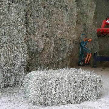
Heupellets und Strohpellets Bio
Bogen
Marion Christ
@Marion-Christ
Einstreu
Pellets
Bio
Abholung
Lieferung
B+
Deprecated: Creation of dynamic property Zend_View_Helper_Ads::$adLink is deprecated in /var/www/stall-frei/htdocs/staging.stall-frei.de/library/Psf/View/Helper/Ads.php on line 108

Persönlichkeitsentwicklung mit Pferden
Bad Salzuflen
Katja Dors
@Pferdezeiten
Begleite andere auf ihrem Entwicklungsweg und entdecke die transformative Kraft der pferdegestützten Persönlichkeitsentwicklung !
neu
R

B+
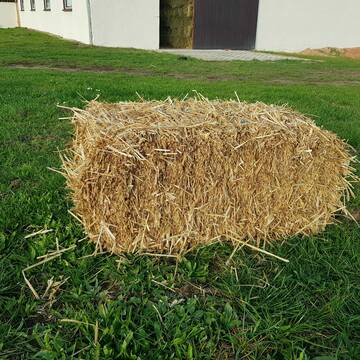
Heukleinballen (34 x 44 x 90 cm)
Marquartstein
Hacher Fahrnpoint
@Hacher-Berghof-Fahrnpoint
Heu
Kleinballen/HD-Ballen
Regenfrei
Wird verladen
1 weitere...
B+

Heu 2. Schnitt 2025 Grummet HD Ballen
Altmannstein
Thomas Resch
@Cappo
Heu
Empfänger lädt ab
Kleinballen/HD-Ballen
Wird verladen
2 weitere...
B+

HD-Heuballen, 1. Schnitt & 2. Schnitt
Hilpoltstein
KnollmeyerBallen
@KnollmeyerBallen
Heu
Lieferant entlädt
Kleinballen/HD-Ballen
Regenfrei
3 weitere...
B+
HD-Strohballen, Gersten-, Dinkel- und Weizenstroh
Hilpoltstein
KnollmeyerBallen
@KnollmeyerBallen
Einstreu
Lieferant entlädt
Kleinballen/HD-Ballen
Regenfrei
3 weitere...
B+

Futtersack HeuToy, Fressbremse in pink
Mechtersen
STALL-FREIde Marketing
@STALL-FREI-Marketing
Stundenlange Beschäftigung die
Koliken vorbeugt, geringe Staubinhalation mit
steuerbarer Futterentnahme

Bio-Pferdeheu in Rundballen
Reichersbeuern
Biohof-Sixt
@Biohof-Sixt
Heu
Empfänger lädt ab
Rundballen
Bio
2 weitere...
ganz aktuell
B+
Leider kein Vorschaubild
Leider kein Vorschaubild
heu 2025 heu 2ter schnitt 2025
Maisach
Reitstall Thurner
@ReitstallThurner
Heu
Empfänger lädt ab
Rundballen
Regenfrei
3 weitere...
B+
Leider kein Vorschaubild
Leider kein Vorschaubild
HEUCOBS/GRASCOBSMenge in kg Preis 0,75€/kg im Sa...
Starnberg
Reiterhof-Klim
@Reiterhof-Klim
Futter
Pellets
Abholung
B+


Strohpellet, Strohgranulat, Heu & Stroh
Allmannshofen
J&M Kratzer
@JMKratzer
Einstreu
Lieferant entlädt
Pellets
Wird verladen
2 weitere...
P+
Deprecated: Creation of dynamic property Zend_View::$pageCount is deprecated in /var/www/stall-frei/htdocs/staging.stall-frei.de/library/vendor/shardj/zf1-future/library/Zend/View/Abstract.php on line 308
Deprecated: Creation of dynamic property Zend_View::$itemCountPerPage is deprecated in /var/www/stall-frei/htdocs/staging.stall-frei.de/library/vendor/shardj/zf1-future/library/Zend/View/Abstract.php on line 308
Deprecated: Creation of dynamic property Zend_View::$first is deprecated in /var/www/stall-frei/htdocs/staging.stall-frei.de/library/vendor/shardj/zf1-future/library/Zend/View/Abstract.php on line 308
Deprecated: Creation of dynamic property Zend_View::$current is deprecated in /var/www/stall-frei/htdocs/staging.stall-frei.de/library/vendor/shardj/zf1-future/library/Zend/View/Abstract.php on line 308
Deprecated: Creation of dynamic property Zend_View::$last is deprecated in /var/www/stall-frei/htdocs/staging.stall-frei.de/library/vendor/shardj/zf1-future/library/Zend/View/Abstract.php on line 308
Deprecated: Creation of dynamic property Zend_View::$next is deprecated in /var/www/stall-frei/htdocs/staging.stall-frei.de/library/vendor/shardj/zf1-future/library/Zend/View/Abstract.php on line 308
Deprecated: Creation of dynamic property Zend_View::$pagesInRange is deprecated in /var/www/stall-frei/htdocs/staging.stall-frei.de/library/vendor/shardj/zf1-future/library/Zend/View/Abstract.php on line 308
Deprecated: Creation of dynamic property Zend_View::$firstPageInRange is deprecated in /var/www/stall-frei/htdocs/staging.stall-frei.de/library/vendor/shardj/zf1-future/library/Zend/View/Abstract.php on line 308
Deprecated: Creation of dynamic property Zend_View::$lastPageInRange is deprecated in /var/www/stall-frei/htdocs/staging.stall-frei.de/library/vendor/shardj/zf1-future/library/Zend/View/Abstract.php on line 308
Deprecated: Creation of dynamic property Zend_View::$currentItemCount is deprecated in /var/www/stall-frei/htdocs/staging.stall-frei.de/library/vendor/shardj/zf1-future/library/Zend/View/Abstract.php on line 308
Deprecated: Creation of dynamic property Zend_View::$totalItemCount is deprecated in /var/www/stall-frei/htdocs/staging.stall-frei.de/library/vendor/shardj/zf1-future/library/Zend/View/Abstract.php on line 308
Deprecated: Creation of dynamic property Zend_View::$firstItemNumber is deprecated in /var/www/stall-frei/htdocs/staging.stall-frei.de/library/vendor/shardj/zf1-future/library/Zend/View/Abstract.php on line 308
Deprecated: Creation of dynamic property Zend_View::$lastItemNumber is deprecated in /var/www/stall-frei/htdocs/staging.stall-frei.de/library/vendor/shardj/zf1-future/library/Zend/View/Abstract.php on line 308
Deprecated: Creation of dynamic property Zend_View::$router is deprecated in /var/www/stall-frei/htdocs/staging.stall-frei.de/library/vendor/shardj/zf1-future/library/Zend/View/Abstract.php on line 308
Deprecated: Creation of dynamic property Zend_View::$urlParams is deprecated in /var/www/stall-frei/htdocs/staging.stall-frei.de/library/vendor/shardj/zf1-future/library/Zend/View/Abstract.php on line 308
Deprecated: Creation of dynamic property Zend_View::$showAds is deprecated in /var/www/stall-frei/htdocs/staging.stall-frei.de/library/vendor/shardj/zf1-future/library/Zend/View/Abstract.php on line 308
Deprecated: Creation of dynamic property Zend_View::$objectIds is deprecated in /var/www/stall-frei/htdocs/staging.stall-frei.de/library/vendor/shardj/zf1-future/library/Zend/View/Abstract.php on line 308
Deprecated: Creation of dynamic property Zend_View::$showNavbar is deprecated in /var/www/stall-frei/htdocs/staging.stall-frei.de/library/vendor/shardj/zf1-future/library/Zend/View/Abstract.php on line 308
Deprecated: Creation of dynamic property Zend_View::$showBreadcrumb is deprecated in /var/www/stall-frei/htdocs/staging.stall-frei.de/library/vendor/shardj/zf1-future/library/Zend/View/Abstract.php on line 308
Deprecated: Creation of dynamic property Zend_View::$showFooter is deprecated in /var/www/stall-frei/htdocs/staging.stall-frei.de/library/vendor/shardj/zf1-future/library/Zend/View/Abstract.php on line 308
Deprecated: Creation of dynamic property Zend_View::$showInternalAds is deprecated in /var/www/stall-frei/htdocs/staging.stall-frei.de/library/vendor/shardj/zf1-future/library/Zend/View/Abstract.php on line 308
Deprecated: Creation of dynamic property Zend_View::$blNoContent is deprecated in /var/www/stall-frei/htdocs/staging.stall-frei.de/library/vendor/shardj/zf1-future/library/Zend/View/Abstract.php on line 308
Deprecated: Creation of dynamic property Zend_View::$sMetaDesc is deprecated in /var/www/stall-frei/htdocs/staging.stall-frei.de/library/vendor/shardj/zf1-future/library/Zend/View/Abstract.php on line 308
Deprecated: Creation of dynamic property Zend_View::$useGmaps is deprecated in /var/www/stall-frei/htdocs/staging.stall-frei.de/library/vendor/shardj/zf1-future/library/Zend/View/Abstract.php on line 308
Deprecated: Creation of dynamic property Zend_View::$touches is deprecated in /var/www/stall-frei/htdocs/staging.stall-frei.de/library/vendor/shardj/zf1-future/library/Zend/View/Abstract.php on line 308
Deprecated: Creation of dynamic property Zend_View::$oProject is deprecated in /var/www/stall-frei/htdocs/staging.stall-frei.de/library/vendor/shardj/zf1-future/library/Zend/View/Abstract.php on line 308
Deprecated: Creation of dynamic property Zend_View::$pageHeadline is deprecated in /var/www/stall-frei/htdocs/staging.stall-frei.de/library/vendor/shardj/zf1-future/library/Zend/View/Abstract.php on line 308
Deprecated: Creation of dynamic property Zend_View::$disableLocationField is deprecated in /var/www/stall-frei/htdocs/staging.stall-frei.de/library/vendor/shardj/zf1-future/library/Zend/View/Abstract.php on line 308
Deprecated: Creation of dynamic property Zend_View::$isSearch is deprecated in /var/www/stall-frei/htdocs/staging.stall-frei.de/library/vendor/shardj/zf1-future/library/Zend/View/Abstract.php on line 308
Deprecated: Creation of dynamic property Zend_View::$pageTitle is deprecated in /var/www/stall-frei/htdocs/staging.stall-frei.de/library/vendor/shardj/zf1-future/library/Zend/View/Abstract.php on line 308
Deprecated: Creation of dynamic property Psf_Form_Element_Text::$class is deprecated in /var/www/stall-frei/htdocs/staging.stall-frei.de/library/vendor/shardj/zf1-future/library/Zend/Form/Element.php on line 874
Deprecated: Creation of dynamic property Psf_Form_Element_Text::$size is deprecated in /var/www/stall-frei/htdocs/staging.stall-frei.de/library/vendor/shardj/zf1-future/library/Zend/Form/Element.php on line 874
Deprecated: Creation of dynamic property Psf_Form_Element_Text::$placeholder is deprecated in /var/www/stall-frei/htdocs/staging.stall-frei.de/library/vendor/shardj/zf1-future/library/Zend/Form/Element.php on line 874
Deprecated: Creation of dynamic property Psf_Form_Element_Hidden::$class is deprecated in /var/www/stall-frei/htdocs/staging.stall-frei.de/library/vendor/shardj/zf1-future/library/Zend/Form/Element.php on line 874
Deprecated: Creation of dynamic property Psf_Form_Element_Hidden::$class is deprecated in /var/www/stall-frei/htdocs/staging.stall-frei.de/library/vendor/shardj/zf1-future/library/Zend/Form/Element.php on line 874
Deprecated: Creation of dynamic property Psf_Form_Element_Hidden::$class is deprecated in /var/www/stall-frei/htdocs/staging.stall-frei.de/library/vendor/shardj/zf1-future/library/Zend/Form/Element.php on line 874
Deprecated: Creation of dynamic property Psf_Form_Element_Hidden::$class is deprecated in /var/www/stall-frei/htdocs/staging.stall-frei.de/library/vendor/shardj/zf1-future/library/Zend/Form/Element.php on line 874
Deprecated: Creation of dynamic property Psf_Form_Element_Select::$class is deprecated in /var/www/stall-frei/htdocs/staging.stall-frei.de/library/vendor/shardj/zf1-future/library/Zend/Form/Element.php on line 874
Deprecated: Creation of dynamic property Psf_Form_Element_Select::$class is deprecated in /var/www/stall-frei/htdocs/staging.stall-frei.de/library/vendor/shardj/zf1-future/library/Zend/Form/Element.php on line 874
Deprecated: Creation of dynamic property Psf_Form_Element_Select::$class is deprecated in /var/www/stall-frei/htdocs/staging.stall-frei.de/library/vendor/shardj/zf1-future/library/Zend/Form/Element.php on line 874
Deprecated: Creation of dynamic property Psf_Form_Element_Select::$class is deprecated in /var/www/stall-frei/htdocs/staging.stall-frei.de/library/vendor/shardj/zf1-future/library/Zend/Form/Element.php on line 874
Deprecated: Creation of dynamic property Zend_View::$sort is deprecated in /var/www/stall-frei/htdocs/staging.stall-frei.de/library/vendor/shardj/zf1-future/library/Zend/View/Abstract.php on line 308
Deprecated: Creation of dynamic property Zend_View::$searchLocation is deprecated in /var/www/stall-frei/htdocs/staging.stall-frei.de/library/vendor/shardj/zf1-future/library/Zend/View/Abstract.php on line 308
Deprecated: Creation of dynamic property Zend_View::$locationHint is deprecated in /var/www/stall-frei/htdocs/staging.stall-frei.de/library/vendor/shardj/zf1-future/library/Zend/View/Abstract.php on line 308
Psf_GeoCoder_Abstract::getLocation: Voggenberg Get Location CachedOrLive
Psf_GeoCoder_Abstract::getCachedOrLive: Voggenberg
Psf_GeoCoder_OpenCageData::makeApiRequest: response:
Array
(
[documentation] => https://opencagedata.com/api
[licenses] => Array
(
[0] => Array
(
[name] => see attribution guide
[url] => https://opencagedata.com/credits
)
)
[results] => Array
(
[0] => Array
(
[bounds] => Array
(
[northeast] => Array
(
[lat] => 48.777262
[lng] => 13.5741235
)
[southwest] => Array
(
[lat] => 48.737262
[lng] => 13.5341235
)
)
[components] => Array
(
[ISO_3166-1_alpha-2] => DE
[ISO_3166-1_alpha-3] => DEU
[ISO_3166-2] => Array
(
[0] => DE-BY
)
[_category] => place
[_normalized_city] => Röhrnbach
[_type] => village
[city] => Röhrnbach
[continent] => Europe
[country] => Deutschland
[country_code] => de
[county] => Landkreis Freyung-Grafenau
[political_union] => European Union
[postcode] => 94133
[state] => Bayern
[state_code] => BY
[village] => Voggenberg
)
[confidence] => 7
[formatted] => 94133 Voggenberg, Deutschland
[geometry] => Array
(
[lat] => 48.757262
[lng] => 13.5541235
)
)
[1] => Array
(
[bounds] => Array
(
[northeast] => Array
(
[lat] => 48.8911129
[lng] => 9.7222611
)
[southwest] => Array
(
[lat] => 48.8511129
[lng] => 9.6822611
)
)
[components] => Array
(
[ISO_3166-1_alpha-2] => DE
[ISO_3166-1_alpha-3] => DEU
[ISO_3166-2] => Array
(
[0] => DE-BW
)
[_category] => place
[_normalized_city] => Alfdorf
[_type] => hamlet
[city] => Alfdorf
[continent] => Europe
[country] => Deutschland
[country_code] => de
[county] => Rems-Murr-Kreis
[hamlet] => Voggenberg
[political_union] => European Union
[postcode] => 73553
[state] => Baden-Württemberg
[state_code] => BW
)
[confidence] => 7
[formatted] => Voggenberg, 73553 Alfdorf, Deutschland
[geometry] => Array
(
[lat] => 48.8711129
[lng] => 9.7022611
)
)
[2] => Array
(
[bounds] => Array
(
[northeast] => Array
(
[lat] => 48.8719217
[lng] => 9.7013527
)
[southwest] => Array
(
[lat] => 48.8711004
[lng] => 9.7010022
)
)
[components] => Array
(
[ISO_3166-1_alpha-2] => DE
[ISO_3166-1_alpha-3] => DEU
[ISO_3166-2] => Array
(
[0] => DE-BW
)
[_category] => road
[_normalized_city] => Alfdorf
[_type] => road
[city] => Alfdorf
[continent] => Europe
[country] => Deutschland
[country_code] => de
[county] => Rems-Murr-Kreis
[hamlet] => Voggenberg
[political_union] => European Union
[postcode] => 73553
[road] => Voggenberg
[road_type] => tertiary
[state] => Baden-Württemberg
[state_code] => BW
)
[confidence] => 9
[formatted] => Voggenberg, 73553 Alfdorf, Deutschland
[geometry] => Array
(
[lat] => 48.8715162
[lng] => 9.7012136
)
)
[3] => Array
(
[components] => Array
(
[ISO_3166-1_alpha-2] => FR
[ISO_3166-1_alpha-3] => FRA
[ISO_3166-2] => Array
(
[0] => FR-GES
[1] => FR-6AE
[2] => FR-68
)
[_category] => road
[_normalized_city] => Altkirch
[_type] => road
[city] => Altkirch
[continent] => Europe
[country] => France
[country_code] => fr
[county] => Haut-Rhin
[local_authority] => Communauté de communes Sundgau
[political_union] => European Union
[postcode] => 68130
[road] => Rue du Roggenberg
[state] => Grand Est
[state_code] => GES
)
[confidence] => 3
[formatted] => Rue du Roggenberg, 68130 Altkirch, France
[geometry] => Array
(
[lat] => 47.617364
[lng] => 7.240136
)
)
[4] => Array
(
[components] => Array
(
[ISO_3166-1_alpha-2] => FR
[ISO_3166-1_alpha-3] => FRA
[ISO_3166-2] => Array
(
[0] => FR-GES
[1] => FR-6AE
[2] => FR-68
)
[_category] => road
[_normalized_city] => Hirsingue
[_type] => road
[city] => Hirsingue
[continent] => Europe
[country] => France
[country_code] => fr
[county] => Haut-Rhin
[local_authority] => Communauté de communes Sundgau
[political_union] => European Union
[postcode] => 68560
[road] => Rue du Roggenberg
[state] => Grand Est
[state_code] => GES
)
[confidence] => 3
[formatted] => Rue du Roggenberg, 68560 Hirsingue, France
[geometry] => Array
(
[lat] => 47.593197
[lng] => 7.254719
)
)
[5] => Array
(
[components] => Array
(
[ISO_3166-1_alpha-2] => FR
[ISO_3166-1_alpha-3] => FRA
[ISO_3166-2] => Array
(
[0] => FR-IDF
[1] => FR-95
)
[_category] => road
[_normalized_city] => Argenteuil
[_type] => road
[city] => Argenteuil
[continent] => Europe
[country] => France
[country_code] => fr
[county] => Val-d'Oise
[local_authority] => Métropole du Grand Paris
[political_union] => European Union
[postcode] => 95100
[road] => Rue de Volembert
[state] => Île-de-France
[state_code] => IDF
)
[confidence] => 2
[formatted] => Rue de Volembert, 95100 Argenteuil, France
[geometry] => Array
(
[lat] => 48.95675
[lng] => 2.257577
)
)
[6] => Array
(
[components] => Array
(
[ISO_3166-1_alpha-2] => FR
[ISO_3166-1_alpha-3] => FRA
[ISO_3166-2] => Array
(
[0] => FR-IDF
[1] => FR-92
)
[_category] => road
[_normalized_city] => Levallois-Perret
[_type] => road
[city] => Levallois-Perret
[continent] => Europe
[country] => France
[country_code] => fr
[county] => Hauts-de-Seine
[local_authority] => Métropole du Grand Paris
[political_union] => European Union
[postcode] => 92300
[road] => Rue Charles Deutschmann
[state] => Île-de-France
[state_code] => IDF
)
[confidence] => 2
[formatted] => Rue Charles Deutschmann, 92300 Levallois-Perret, France
[geometry] => Array
(
[lat] => 48.900049
[lng] => 2.2842
)
)
[7] => Array
(
[components] => Array
(
[ISO_3166-1_alpha-2] => FR
[ISO_3166-1_alpha-3] => FRA
[ISO_3166-2] => Array
(
[0] => FR-IDF
[1] => FR-95
)
[_category] => road
[_normalized_city] => Sannois
[_type] => road
[city] => Sannois
[continent] => Europe
[country] => France
[country_code] => fr
[county] => Val-d'Oise
[local_authority] => Communauté d'agglomération Val Parisis
[political_union] => European Union
[postcode] => 95110
[road] => Rue du Volembert
[state] => Île-de-France
[state_code] => IDF
)
[confidence] => 10
[formatted] => Rue du Volembert, 95110 Sannois, France
[geometry] => Array
(
[lat] => 48.965227
[lng] => 2.263219
)
)
[8] => Array
(
[components] => Array
(
[ISO_3166-1_alpha-2] => FR
[ISO_3166-1_alpha-3] => FRA
[ISO_3166-2] => Array
(
[0] => FR-PDL
[1] => FR-72
)
[_category] => road
[_normalized_city] => Saint-Michel-de-Chavaignes
[_type] => road
[city] => Saint-Michel-de-Chavaignes
[continent] => Europe
[country] => France
[country_code] => fr
[county] => Sarthe
[local_authority] => Communauté de communes Le Gesnois Bilurien
[political_union] => European Union
[postcode] => 72440
[road] => Lieu Dit Volembert
[state] => Pays de la Loire
[state_code] => PDL
)
[confidence] => 10
[formatted] => Lieu Dit Volembert, 72440 Saint-Michel-de-Chavaignes, France
[geometry] => Array
(
[lat] => 48.007198
[lng] => 0.554131
)
)
[9] => Array
(
[components] => Array
(
[ISO_3166-1_alpha-2] => FR
[ISO_3166-1_alpha-3] => FRA
[ISO_3166-2] => Array
(
[0] => FR-GES
[1] => FR-10
)
[_category] => road
[_normalized_city] => Saint-Mards-en-Othe
[_type] => road
[city] => Saint-Mards-en-Othe
[continent] => Europe
[country] => France
[country_code] => fr
[county] => Aube
[local_authority] => Communauté de communes du Pays d'Othe
[political_union] => European Union
[postcode] => 10160
[road] => Vossembert
[state] => Grand Est
[state_code] => GES
)
[confidence] => 10
[formatted] => Vossembert, 10160 Saint-Mards-en-Othe, France
[geometry] => Array
(
[lat] => 48.170832
[lng] => 3.794133
)
)
)
[status] => Array
(
[code] => 200
[message] => OK
)
[stay_informed] => Array
(
[blog] => https://blog.opencagedata.com
[mastodon] => https://en.osm.town/@opencage
)
[thanks] => For using an OpenCage API
[timestamp] => Array
(
[created_http] => Fri, 06 Feb 2026 19:55:59 GMT
[created_unix] => 1770407759
)
[total_results] => 10
)
Psf_GeoCoder_Abstract::convertLocationResult
{"documentation":"https:\/\/opencagedata.com\/api","licenses":[{"name":"see attribution guide","url":"https:\/\/opencagedata.com\/credits"}],"results":[{"bounds":{"northeast":{"lat":48.777262,"lng":13.5741235},"southwest":{"lat":48.737262,"lng":13.5341235}},"components":{"ISO_3166-1_alpha-2":"DE","ISO_3166-1_alpha-3":"DEU","ISO_3166-2":["DE-BY"],"_category":"place","_normalized_city":"R\u00f6hrnbach","_type":"village","city":"R\u00f6hrnbach","continent":"Europe","country":"Deutschland","country_code":"de","county":"Landkreis Freyung-Grafenau","political_union":"European Union","postcode":"94133","state":"Bayern","state_code":"BY","village":"Voggenberg"},"confidence":7,"formatted":"94133 Voggenberg, Deutschland","geometry":{"lat":48.757262,"lng":13.5541235}},{"bounds":{"northeast":{"lat":48.8911129,"lng":9.7222611},"southwest":{"lat":48.8511129,"lng":9.6822611}},"components":{"ISO_3166-1_alpha-2":"DE","ISO_3166-1_alpha-3":"DEU","ISO_3166-2":["DE-BW"],"_category":"place","_normalized_city":"Alfdorf","_type":"hamlet","city":"Alfdorf","continent":"Europe","country":"Deutschland","country_code":"de","county":"Rems-Murr-Kreis","hamlet":"Voggenberg","political_union":"European Union","postcode":"73553","state":"Baden-W\u00fcrttemberg","state_code":"BW"},"confidence":7,"formatted":"Voggenberg, 73553 Alfdorf, Deutschland","geometry":{"lat":48.8711129,"lng":9.7022611}},{"bounds":{"northeast":{"lat":48.8719217,"lng":9.7013527},"southwest":{"lat":48.8711004,"lng":9.7010022}},"components":{"ISO_3166-1_alpha-2":"DE","ISO_3166-1_alpha-3":"DEU","ISO_3166-2":["DE-BW"],"_category":"road","_normalized_city":"Alfdorf","_type":"road","city":"Alfdorf","continent":"Europe","country":"Deutschland","country_code":"de","county":"Rems-Murr-Kreis","hamlet":"Voggenberg","political_union":"European Union","postcode":"73553","road":"Voggenberg","road_type":"tertiary","state":"Baden-W\u00fcrttemberg","state_code":"BW"},"confidence":9,"formatted":"Voggenberg, 73553 Alfdorf, Deutschland","geometry":{"lat":48.8715162,"lng":9.7012136}},{"components":{"ISO_3166-1_alpha-2":"FR","ISO_3166-1_alpha-3":"FRA","ISO_3166-2":["FR-GES","FR-6AE","FR-68"],"_category":"road","_normalized_city":"Altkirch","_type":"road","city":"Altkirch","continent":"Europe","country":"France","country_code":"fr","county":"Haut-Rhin","local_authority":"Communaut\u00e9 de communes Sundgau","political_union":"European Union","postcode":"68130","road":"Rue du Roggenberg","state":"Grand Est","state_code":"GES"},"confidence":3,"formatted":"Rue du Roggenberg, 68130 Altkirch, France","geometry":{"lat":47.617364,"lng":7.240136}},{"components":{"ISO_3166-1_alpha-2":"FR","ISO_3166-1_alpha-3":"FRA","ISO_3166-2":["FR-GES","FR-6AE","FR-68"],"_category":"road","_normalized_city":"Hirsingue","_type":"road","city":"Hirsingue","continent":"Europe","country":"France","country_code":"fr","county":"Haut-Rhin","local_authority":"Communaut\u00e9 de communes Sundgau","political_union":"European Union","postcode":"68560","road":"Rue du Roggenberg","state":"Grand Est","state_code":"GES"},"confidence":3,"formatted":"Rue du Roggenberg, 68560 Hirsingue, France","geometry":{"lat":47.593197,"lng":7.254719}},{"components":{"ISO_3166-1_alpha-2":"FR","ISO_3166-1_alpha-3":"FRA","ISO_3166-2":["FR-IDF","FR-95"],"_category":"road","_normalized_city":"Argenteuil","_type":"road","city":"Argenteuil","continent":"Europe","country":"France","country_code":"fr","county":"Val-d'Oise","local_authority":"M\u00e9tropole du Grand Paris","political_union":"European Union","postcode":"95100","road":"Rue de Volembert","state":"\u00cele-de-France","state_code":"IDF"},"confidence":2,"formatted":"Rue de Volembert, 95100 Argenteuil, France","geometry":{"lat":48.95675,"lng":2.257577}},{"components":{"ISO_3166-1_alpha-2":"FR","ISO_3166-1_alpha-3":"FRA","ISO_3166-2":["FR-IDF","FR-92"],"_category":"road","_normalized_city":"Levallois-Perret","_type":"road","city":"Levallois-Perret","continent":"Europe","country":"France","country_code":"fr","county":"Hauts-de-Seine","local_authority":"M\u00e9tropole du Grand Paris","political_union":"European Union","postcode":"92300","road":"Rue Charles Deutschmann","state":"\u00cele-de-France","state_code":"IDF"},"confidence":2,"formatted":"Rue Charles Deutschmann, 92300 Levallois-Perret, France","geometry":{"lat":48.900049,"lng":2.2842}},{"components":{"ISO_3166-1_alpha-2":"FR","ISO_3166-1_alpha-3":"FRA","ISO_3166-2":["FR-IDF","FR-95"],"_category":"road","_normalized_city":"Sannois","_type":"road","city":"Sannois","continent":"Europe","country":"France","country_code":"fr","county":"Val-d'Oise","local_authority":"Communaut\u00e9 d'agglom\u00e9ration Val Parisis","political_union":"European Union","postcode":"95110","road":"Rue du Volembert","state":"\u00cele-de-France","state_code":"IDF"},"confidence":10,"formatted":"Rue du Volembert, 95110 Sannois, France","geometry":{"lat":48.965227,"lng":2.263219}},{"components":{"ISO_3166-1_alpha-2":"FR","ISO_3166-1_alpha-3":"FRA","ISO_3166-2":["FR-PDL","FR-72"],"_category":"road","_normalized_city":"Saint-Michel-de-Chavaignes","_type":"road","city":"Saint-Michel-de-Chavaignes","continent":"Europe","country":"France","country_code":"fr","county":"Sarthe","local_authority":"Communaut\u00e9 de communes Le Gesnois Bilurien","political_union":"European Union","postcode":"72440","road":"Lieu Dit Volembert","state":"Pays de la Loire","state_code":"PDL"},"confidence":10,"formatted":"Lieu Dit Volembert, 72440 Saint-Michel-de-Chavaignes, France","geometry":{"lat":48.007198,"lng":0.554131}},{"components":{"ISO_3166-1_alpha-2":"FR","ISO_3166-1_alpha-3":"FRA","ISO_3166-2":["FR-GES","FR-10"],"_category":"road","_normalized_city":"Saint-Mards-en-Othe","_type":"road","city":"Saint-Mards-en-Othe","continent":"Europe","country":"France","country_code":"fr","county":"Aube","local_authority":"Communaut\u00e9 de communes du Pays d'Othe","political_union":"European Union","postcode":"10160","road":"Vossembert","state":"Grand Est","state_code":"GES"},"confidence":10,"formatted":"Vossembert, 10160 Saint-Mards-en-Othe, France","geometry":{"lat":48.170832,"lng":3.794133}}],"status":{"code":200,"message":"OK"},"stay_informed":{"blog":"https:\/\/blog.opencagedata.com","mastodon":"https:\/\/en.osm.town\/@opencage"},"thanks":"For using an OpenCage API","timestamp":{"created_http":"Fri, 06 Feb 2026 19:55:59 GMT","created_unix":1770407759},"total_results":10}Array
(
[0] => stdClass Object
(
[bounds] => stdClass Object
(
[northeast] => stdClass Object
(
[lat] => 48.777262
[lng] => 13.5741235
)
[southwest] => stdClass Object
(
[lat] => 48.737262
[lng] => 13.5341235
)
)
[components] => stdClass Object
(
[ISO_3166-1_alpha-2] => DE
[ISO_3166-1_alpha-3] => DEU
[ISO_3166-2] => Array
(
[0] => DE-BY
)
[_category] => place
[_normalized_city] => Röhrnbach
[_type] => village
[city] => Röhrnbach
[continent] => Europe
[country] => Deutschland
[country_code] => de
[county] => Landkreis Freyung-Grafenau
[political_union] => European Union
[postcode] => 94133
[state] => Bayern
[state_code] => BY
[village] => Voggenberg
)
[confidence] => 7
[formatted] => 94133 Voggenberg, Deutschland
[geometry] => stdClass Object
(
[lat] => 48.757262
[lng] => 13.5541235
)
)
[1] => stdClass Object
(
[bounds] => stdClass Object
(
[northeast] => stdClass Object
(
[lat] => 48.8911129
[lng] => 9.7222611
)
[southwest] => stdClass Object
(
[lat] => 48.8511129
[lng] => 9.6822611
)
)
[components] => stdClass Object
(
[ISO_3166-1_alpha-2] => DE
[ISO_3166-1_alpha-3] => DEU
[ISO_3166-2] => Array
(
[0] => DE-BW
)
[_category] => place
[_normalized_city] => Alfdorf
[_type] => hamlet
[city] => Alfdorf
[continent] => Europe
[country] => Deutschland
[country_code] => de
[county] => Rems-Murr-Kreis
[hamlet] => Voggenberg
[political_union] => European Union
[postcode] => 73553
[state] => Baden-Württemberg
[state_code] => BW
)
[confidence] => 7
[formatted] => Voggenberg, 73553 Alfdorf, Deutschland
[geometry] => stdClass Object
(
[lat] => 48.8711129
[lng] => 9.7022611
)
)
[2] => stdClass Object
(
[bounds] => stdClass Object
(
[northeast] => stdClass Object
(
[lat] => 48.8719217
[lng] => 9.7013527
)
[southwest] => stdClass Object
(
[lat] => 48.8711004
[lng] => 9.7010022
)
)
[components] => stdClass Object
(
[ISO_3166-1_alpha-2] => DE
[ISO_3166-1_alpha-3] => DEU
[ISO_3166-2] => Array
(
[0] => DE-BW
)
[_category] => road
[_normalized_city] => Alfdorf
[_type] => road
[city] => Alfdorf
[continent] => Europe
[country] => Deutschland
[country_code] => de
[county] => Rems-Murr-Kreis
[hamlet] => Voggenberg
[political_union] => European Union
[postcode] => 73553
[road] => Voggenberg
[road_type] => tertiary
[state] => Baden-Württemberg
[state_code] => BW
)
[confidence] => 9
[formatted] => Voggenberg, 73553 Alfdorf, Deutschland
[geometry] => stdClass Object
(
[lat] => 48.8715162
[lng] => 9.7012136
)
)
[3] => stdClass Object
(
[components] => stdClass Object
(
[ISO_3166-1_alpha-2] => FR
[ISO_3166-1_alpha-3] => FRA
[ISO_3166-2] => Array
(
[0] => FR-GES
[1] => FR-6AE
[2] => FR-68
)
[_category] => road
[_normalized_city] => Altkirch
[_type] => road
[city] => Altkirch
[continent] => Europe
[country] => France
[country_code] => fr
[county] => Haut-Rhin
[local_authority] => Communauté de communes Sundgau
[political_union] => European Union
[postcode] => 68130
[road] => Rue du Roggenberg
[state] => Grand Est
[state_code] => GES
)
[confidence] => 3
[formatted] => Rue du Roggenberg, 68130 Altkirch, France
[geometry] => stdClass Object
(
[lat] => 47.617364
[lng] => 7.240136
)
)
[4] => stdClass Object
(
[components] => stdClass Object
(
[ISO_3166-1_alpha-2] => FR
[ISO_3166-1_alpha-3] => FRA
[ISO_3166-2] => Array
(
[0] => FR-GES
[1] => FR-6AE
[2] => FR-68
)
[_category] => road
[_normalized_city] => Hirsingue
[_type] => road
[city] => Hirsingue
[continent] => Europe
[country] => France
[country_code] => fr
[county] => Haut-Rhin
[local_authority] => Communauté de communes Sundgau
[political_union] => European Union
[postcode] => 68560
[road] => Rue du Roggenberg
[state] => Grand Est
[state_code] => GES
)
[confidence] => 3
[formatted] => Rue du Roggenberg, 68560 Hirsingue, France
[geometry] => stdClass Object
(
[lat] => 47.593197
[lng] => 7.254719
)
)
[5] => stdClass Object
(
[components] => stdClass Object
(
[ISO_3166-1_alpha-2] => FR
[ISO_3166-1_alpha-3] => FRA
[ISO_3166-2] => Array
(
[0] => FR-IDF
[1] => FR-95
)
[_category] => road
[_normalized_city] => Argenteuil
[_type] => road
[city] => Argenteuil
[continent] => Europe
[country] => France
[country_code] => fr
[county] => Val-d'Oise
[local_authority] => Métropole du Grand Paris
[political_union] => European Union
[postcode] => 95100
[road] => Rue de Volembert
[state] => Île-de-France
[state_code] => IDF
)
[confidence] => 2
[formatted] => Rue de Volembert, 95100 Argenteuil, France
[geometry] => stdClass Object
(
[lat] => 48.95675
[lng] => 2.257577
)
)
[6] => stdClass Object
(
[components] => stdClass Object
(
[ISO_3166-1_alpha-2] => FR
[ISO_3166-1_alpha-3] => FRA
[ISO_3166-2] => Array
(
[0] => FR-IDF
[1] => FR-92
)
[_category] => road
[_normalized_city] => Levallois-Perret
[_type] => road
[city] => Levallois-Perret
[continent] => Europe
[country] => France
[country_code] => fr
[county] => Hauts-de-Seine
[local_authority] => Métropole du Grand Paris
[political_union] => European Union
[postcode] => 92300
[road] => Rue Charles Deutschmann
[state] => Île-de-France
[state_code] => IDF
)
[confidence] => 2
[formatted] => Rue Charles Deutschmann, 92300 Levallois-Perret, France
[geometry] => stdClass Object
(
[lat] => 48.900049
[lng] => 2.2842
)
)
[7] => stdClass Object
(
[components] => stdClass Object
(
[ISO_3166-1_alpha-2] => FR
[ISO_3166-1_alpha-3] => FRA
[ISO_3166-2] => Array
(
[0] => FR-IDF
[1] => FR-95
)
[_category] => road
[_normalized_city] => Sannois
[_type] => road
[city] => Sannois
[continent] => Europe
[country] => France
[country_code] => fr
[county] => Val-d'Oise
[local_authority] => Communauté d'agglomération Val Parisis
[political_union] => European Union
[postcode] => 95110
[road] => Rue du Volembert
[state] => Île-de-France
[state_code] => IDF
)
[confidence] => 10
[formatted] => Rue du Volembert, 95110 Sannois, France
[geometry] => stdClass Object
(
[lat] => 48.965227
[lng] => 2.263219
)
)
[8] => stdClass Object
(
[components] => stdClass Object
(
[ISO_3166-1_alpha-2] => FR
[ISO_3166-1_alpha-3] => FRA
[ISO_3166-2] => Array
(
[0] => FR-PDL
[1] => FR-72
)
[_category] => road
[_normalized_city] => Saint-Michel-de-Chavaignes
[_type] => road
[city] => Saint-Michel-de-Chavaignes
[continent] => Europe
[country] => France
[country_code] => fr
[county] => Sarthe
[local_authority] => Communauté de communes Le Gesnois Bilurien
[political_union] => European Union
[postcode] => 72440
[road] => Lieu Dit Volembert
[state] => Pays de la Loire
[state_code] => PDL
)
[confidence] => 10
[formatted] => Lieu Dit Volembert, 72440 Saint-Michel-de-Chavaignes, France
[geometry] => stdClass Object
(
[lat] => 48.007198
[lng] => 0.554131
)
)
[9] => stdClass Object
(
[components] => stdClass Object
(
[ISO_3166-1_alpha-2] => FR
[ISO_3166-1_alpha-3] => FRA
[ISO_3166-2] => Array
(
[0] => FR-GES
[1] => FR-10
)
[_category] => road
[_normalized_city] => Saint-Mards-en-Othe
[_type] => road
[city] => Saint-Mards-en-Othe
[continent] => Europe
[country] => France
[country_code] => fr
[county] => Aube
[local_authority] => Communauté de communes du Pays d'Othe
[political_union] => European Union
[postcode] => 10160
[road] => Vossembert
[state] => Grand Est
[state_code] => GES
)
[confidence] => 10
[formatted] => Vossembert, 10160 Saint-Mards-en-Othe, France
[geometry] => stdClass Object
(
[lat] => 48.170832
[lng] => 3.794133
)
)
)
Psf_GeoCoder_OpenCageData::getKeyMap: 0
stdClass Object
(
    [bounds] => stdClass Object
        (
            [northeast] => stdClass Object
                (
                    [lat] => 48.777262
                    [lng] => 13.5741235
                )

            [southwest] => stdClass Object
                (
                    [lat] => 48.737262
                    [lng] => 13.5341235
                )

        )

    [components] => stdClass Object
        (
            [ISO_3166-1_alpha-2] => DE
            [ISO_3166-1_alpha-3] => DEU
            [ISO_3166-2] => Array
                (
                    [0] => DE-BY
                )

            [_category] => place
            [_normalized_city] => Röhrnbach
            [_type] => village
            [city] => Röhrnbach
            [continent] => Europe
            [country] => Deutschland
            [country_code] => de
            [county] => Landkreis Freyung-Grafenau
            [political_union] => European Union
            [postcode] => 94133
            [state] => Bayern
            [state_code] => BY
            [village] => Voggenberg
        )

    [confidence] => 7
    [formatted] => 94133 Voggenberg, Deutschland
    [geometry] => stdClass Object
        (
            [lat] => 48.757262
            [lng] => 13.5541235
        )

)
Psf_GeoCoder_OpenCageData::getCounty: Freyung-Grafenau
Psf_GeoCoder_OpenCageData::addMissingData REFETCH!
Array
(
    [address] => 94133 Voggenberg, Deutschland
    [type] => village
    [street] =>
    [city] => Voggenberg
    [county] => Freyung-Grafenau
    [state] => Bayern
    [zip] => 94133
    [country] => Deutschland
    [suburb] =>
    [countrycode] => de
    [latitude] => 48.757262
    [longitude] => 13.5541235
    [accuracy] => 1
    [confidence] => 7
    [bounds] => stdClass Object
        (
            [northeast] => stdClass Object
                (
                    [lat] => 48.777262
                    [lng] => 13.5741235
                )

            [southwest] => stdClass Object
                (
                    [lat] => 48.737262
                    [lng] => 13.5341235
                )

        )

)
reformat!
Array
(
    [address] => 94133 Voggenberg, Deutschland
    [type] => village
    [street] =>
    [city] => Voggenberg
    [county] => Freyung-Grafenau
    [state] => Bayern
    [zip] => 94133
    [country] => Deutschland
    [suburb] =>
    [countrycode] => de
    [latitude] => 48.757262
    [longitude] => 13.5541235
    [accuracy] => 1
    [confidence] => 7
    [bounds] => stdClass Object
        (
            [northeast] => stdClass Object
                (
                    [lat] => 48.777262
                    [lng] => 13.5741235
                )

            [southwest] => stdClass Object
                (
                    [lat] => 48.737262
                    [lng] => 13.5341235
                )

        )

    [place] => 94133 Voggenberg, Bayern
    [hash] => 6058e646f7aec456fb445b756a4e19c1
)
Psf_GeoCoder_OpenCageData::getKeyMap: 1
stdClass Object
(
    [bounds] => stdClass Object
        (
            [northeast] => stdClass Object
                (
                    [lat] => 48.8911129
                    [lng] => 9.7222611
                )

            [southwest] => stdClass Object
                (
                    [lat] => 48.8511129
                    [lng] => 9.6822611
                )

        )

    [components] => stdClass Object
        (
            [ISO_3166-1_alpha-2] => DE
            [ISO_3166-1_alpha-3] => DEU
            [ISO_3166-2] => Array
                (
                    [0] => DE-BW
                )

            [_category] => place
            [_normalized_city] => Alfdorf
            [_type] => hamlet
            [city] => Alfdorf
            [continent] => Europe
            [country] => Deutschland
            [country_code] => de
            [county] => Rems-Murr-Kreis
            [hamlet] => Voggenberg
            [political_union] => European Union
            [postcode] => 73553
            [state] => Baden-Württemberg
            [state_code] => BW
        )

    [confidence] => 7
    [formatted] => Voggenberg, 73553 Alfdorf, Deutschland
    [geometry] => stdClass Object
        (
            [lat] => 48.8711129
            [lng] => 9.7022611
        )

)
Psf_GeoCoder_OpenCageData::getCounty: Rems-Murr-Kreis
Psf_GeoCoder_OpenCageData::addMissingData REFETCH!
Array
(
    [address] => Voggenberg, 73553 Alfdorf, Deutschland
    [type] => hamlet
    [street] => Voggenberg
    [city] => Alfdorf
    [county] => Rems-Murr-Kreis
    [state] => Baden-Württemberg
    [zip] => 73553
    [country] => Deutschland
    [suburb] =>
    [countrycode] => de
    [latitude] => 48.8711129
    [longitude] => 9.7022611
    [accuracy] => 1
    [confidence] => 7
    [bounds] => stdClass Object
        (
            [northeast] => stdClass Object
                (
                    [lat] => 48.8911129
                    [lng] => 9.7222611
                )

            [southwest] => stdClass Object
                (
                    [lat] => 48.8511129
                    [lng] => 9.6822611
                )

        )

)
reformat!
Array
(
    [address] => Voggenberg, 73553 Alfdorf, Deutschland
    [type] => hamlet
    [street] => Voggenberg
    [city] => Alfdorf
    [county] => Rems-Murr-Kreis
    [state] => Baden-Württemberg
    [zip] => 73553
    [country] => Deutschland
    [suburb] =>
    [countrycode] => de
    [latitude] => 48.8711129
    [longitude] => 9.7022611
    [accuracy] => 1
    [confidence] => 7
    [bounds] => stdClass Object
        (
            [northeast] => stdClass Object
                (
                    [lat] => 48.8911129
                    [lng] => 9.7222611
                )

            [southwest] => stdClass Object
                (
                    [lat] => 48.8511129
                    [lng] => 9.6822611
                )

        )

    [place] => Voggenberg, 73553 Alfdorf, Baden-Württemberg
    [hash] => be3e828f94d3d6591e92fa75a3ed5d4f
)
Psf_GeoCoder_OpenCageData::getKeyMap: 2
stdClass Object
(
    [bounds] => stdClass Object
        (
            [northeast] => stdClass Object
                (
                    [lat] => 48.8719217
                    [lng] => 9.7013527
                )

            [southwest] => stdClass Object
                (
                    [lat] => 48.8711004
                    [lng] => 9.7010022
                )

        )

    [components] => stdClass Object
        (
            [ISO_3166-1_alpha-2] => DE
            [ISO_3166-1_alpha-3] => DEU
            [ISO_3166-2] => Array
                (
                    [0] => DE-BW
                )

            [_category] => road
            [_normalized_city] => Alfdorf
            [_type] => road
            [city] => Alfdorf
            [continent] => Europe
            [country] => Deutschland
            [country_code] => de
            [county] => Rems-Murr-Kreis
            [hamlet] => Voggenberg
            [political_union] => European Union
            [postcode] => 73553
            [road] => Voggenberg
            [road_type] => tertiary
            [state] => Baden-Württemberg
            [state_code] => BW
        )

    [confidence] => 9
    [formatted] => Voggenberg, 73553 Alfdorf, Deutschland
    [geometry] => stdClass Object
        (
            [lat] => 48.8715162
            [lng] => 9.7012136
        )

)
Psf_GeoCoder_OpenCageData::getCounty: Rems-Murr-Kreis
Psf_GeoCoder_OpenCageData::addMissingData REFETCH!
Array
(
    [address] => Voggenberg, 73553 Alfdorf, Deutschland
    [type] => road
    [street] => Voggenberg
    [city] => Alfdorf
    [county] => Rems-Murr-Kreis
    [state] => Baden-Württemberg
    [zip] => 73553
    [country] => Deutschland
    [suburb] =>
    [countrycode] => de
    [latitude] => 48.8715162
    [longitude] => 9.7012136
    [accuracy] => 1
    [confidence] => 9
    [bounds] => stdClass Object
        (
            [northeast] => stdClass Object
                (
                    [lat] => 48.8719217
                    [lng] => 9.7013527
                )

            [southwest] => stdClass Object
                (
                    [lat] => 48.8711004
                    [lng] => 9.7010022
                )

        )

)
reformat!
Array
(
    [address] => Voggenberg, 73553 Alfdorf, Deutschland
    [type] => road
    [street] => Voggenberg
    [city] => Alfdorf
    [county] => Rems-Murr-Kreis
    [state] => Baden-Württemberg
    [zip] => 73553
    [country] => Deutschland
    [suburb] =>
    [countrycode] => de
    [latitude] => 48.8715162
    [longitude] => 9.7012136
    [accuracy] => 1
    [confidence] => 9
    [bounds] => stdClass Object
        (
            [northeast] => stdClass Object
                (
                    [lat] => 48.8719217
                    [lng] => 9.7013527
                )

            [southwest] => stdClass Object
                (
                    [lat] => 48.8711004
                    [lng] => 9.7010022
                )

        )

    [place] => Voggenberg, 73553 Alfdorf, Baden-Württemberg
    [hash] => be3e828f94d3d6591e92fa75a3ed5d4f
)
Psf_GeoCoder_OpenCageData::getKeyMap: 3
stdClass Object
(
    [components] => stdClass Object
        (
            [ISO_3166-1_alpha-2] => FR
            [ISO_3166-1_alpha-3] => FRA
            [ISO_3166-2] => Array
                (
                    [0] => FR-GES
                    [1] => FR-6AE
                    [2] => FR-68
                )

            [_category] => road
            [_normalized_city] => Altkirch
            [_type] => road
            [city] => Altkirch
            [continent] => Europe
            [country] => France
            [country_code] => fr
            [county] => Haut-Rhin
            [local_authority] => Communauté de communes Sundgau
            [political_union] => European Union
            [postcode] => 68130
            [road] => Rue du Roggenberg
            [state] => Grand Est
            [state_code] => GES
        )

    [confidence] => 3
    [formatted] => Rue du Roggenberg, 68130 Altkirch, France
    [geometry] => stdClass Object
        (
            [lat] => 47.617364
            [lng] => 7.240136
        )

)
Psf_GeoCoder_OpenCageData::getCounty: Haut-Rhin
Psf_GeoCoder_OpenCageData::addMissingData REFETCH!
Array
(
    [address] => Rue du Roggenberg, 68130 Altkirch, France
    [type] => road
    [street] => Rue du Roggenberg
    [city] => Altkirch
    [county] => Haut-Rhin
    [state] => Grand Est
    [zip] => 68130
    [country] => France
    [suburb] =>
    [countrycode] => fr
    [latitude] => 47.617364
    [longitude] => 7.240136
    [accuracy] => 1
    [confidence] => 3
    [bounds] =>
)
reformat!
Array
(
    [address] => Rue du Roggenberg, 68130 Altkirch, France
    [type] => road
    [street] => Rue du Roggenberg
    [city] => Altkirch
    [county] => Haut-Rhin
    [state] => Grand Est
    [zip] => 68130
    [country] => France
    [suburb] =>
    [countrycode] => fr
    [latitude] => 47.617364
    [longitude] => 7.240136
    [accuracy] => 1
    [confidence] => 3
    [bounds] =>
    [place] => Rue du Roggenberg, 68130 Altkirch, Grand Est
    [hash] => efb226695f7bfb1bc4d9a5f588da2d84
)
Psf_GeoCoder_OpenCageData::getKeyMap: 4
stdClass Object
(
    [components] => stdClass Object
        (
            [ISO_3166-1_alpha-2] => FR
            [ISO_3166-1_alpha-3] => FRA
            [ISO_3166-2] => Array
                (
                    [0] => FR-GES
                    [1] => FR-6AE
                    [2] => FR-68
                )

            [_category] => road
            [_normalized_city] => Hirsingue
            [_type] => road
            [city] => Hirsingue
            [continent] => Europe
            [country] => France
            [country_code] => fr
            [county] => Haut-Rhin
            [local_authority] => Communauté de communes Sundgau
            [political_union] => European Union
            [postcode] => 68560
            [road] => Rue du Roggenberg
            [state] => Grand Est
            [state_code] => GES
        )

    [confidence] => 3
    [formatted] => Rue du Roggenberg, 68560 Hirsingue, France
    [geometry] => stdClass Object
        (
            [lat] => 47.593197
            [lng] => 7.254719
        )

)
Psf_GeoCoder_OpenCageData::getCounty: Haut-Rhin
Psf_GeoCoder_OpenCageData::addMissingData REFETCH!
Array
(
    [address] => Rue du Roggenberg, 68560 Hirsingue, France
    [type] => road
    [street] => Rue du Roggenberg
    [city] => Hirsingue
    [county] => Haut-Rhin
    [state] => Grand Est
    [zip] => 68560
    [country] => France
    [suburb] =>
    [countrycode] => fr
    [latitude] => 47.593197
    [longitude] => 7.254719
    [accuracy] => 1
    [confidence] => 3
    [bounds] =>
)
reformat!
Array
(
    [address] => Rue du Roggenberg, 68560 Hirsingue, France
    [type] => road
    [street] => Rue du Roggenberg
    [city] => Hirsingue
    [county] => Haut-Rhin
    [state] => Grand Est
    [zip] => 68560
    [country] => France
    [suburb] =>
    [countrycode] => fr
    [latitude] => 47.593197
    [longitude] => 7.254719
    [accuracy] => 1
    [confidence] => 3
    [bounds] =>
    [place] => Rue du Roggenberg, 68560 Hirsingue, Grand Est
    [hash] => 2375ff09bf6547f7532f28fcfd66d0d0
)
Psf_GeoCoder_OpenCageData::getKeyMap: 5
stdClass Object
(
    [components] => stdClass Object
        (
            [ISO_3166-1_alpha-2] => FR
            [ISO_3166-1_alpha-3] => FRA
            [ISO_3166-2] => Array
                (
                    [0] => FR-IDF
                    [1] => FR-95
                )

            [_category] => road
            [_normalized_city] => Argenteuil
            [_type] => road
            [city] => Argenteuil
            [continent] => Europe
            [country] => France
            [country_code] => fr
            [county] => Val-d'Oise
            [local_authority] => Métropole du Grand Paris
            [political_union] => European Union
            [postcode] => 95100
            [road] => Rue de Volembert
            [state] => Île-de-France
            [state_code] => IDF
        )

    [confidence] => 2
    [formatted] => Rue de Volembert, 95100 Argenteuil, France
    [geometry] => stdClass Object
        (
            [lat] => 48.95675
            [lng] => 2.257577
        )

)
Psf_GeoCoder_OpenCageData::getCounty: Val-d'Oise
Psf_GeoCoder_OpenCageData::addMissingData REFETCH!
Array
(
    [address] => Rue de Volembert, 95100 Argenteuil, France
    [type] => road
    [street] => Rue de Volembert
    [city] => Argenteuil
    [county] => Val-d'Oise
    [state] => Île-de-France
    [zip] => 95100
    [country] => France
    [suburb] =>
    [countrycode] => fr
    [latitude] => 48.95675
    [longitude] => 2.257577
    [accuracy] => 1
    [confidence] => 2
    [bounds] =>
)
reformat!
Array
(
    [address] => Rue de Volembert, 95100 Argenteuil, France
    [type] => road
    [street] => Rue de Volembert
    [city] => Argenteuil
    [county] => Val-d'Oise
    [state] => Île-de-France
    [zip] => 95100
    [country] => France
    [suburb] =>
    [countrycode] => fr
    [latitude] => 48.95675
    [longitude] => 2.257577
    [accuracy] => 1
    [confidence] => 2
    [bounds] =>
    [place] => Rue de Volembert, 95100 Argenteuil, Île-de-France
    [hash] => 1a3f9901e8cbf0ad40352e97d387da31
)
Psf_GeoCoder_OpenCageData::getKeyMap: 6
stdClass Object
(
    [components] => stdClass Object
        (
            [ISO_3166-1_alpha-2] => FR
            [ISO_3166-1_alpha-3] => FRA
            [ISO_3166-2] => Array
                (
                    [0] => FR-IDF
                    [1] => FR-92
                )

            [_category] => road
            [_normalized_city] => Levallois-Perret
            [_type] => road
            [city] => Levallois-Perret
            [continent] => Europe
            [country] => France
            [country_code] => fr
            [county] => Hauts-de-Seine
            [local_authority] => Métropole du Grand Paris
            [political_union] => European Union
            [postcode] => 92300
            [road] => Rue Charles Deutschmann
            [state] => Île-de-France
            [state_code] => IDF
        )

    [confidence] => 2
    [formatted] => Rue Charles Deutschmann, 92300 Levallois-Perret, France
    [geometry] => stdClass Object
        (
            [lat] => 48.900049
            [lng] => 2.2842
        )

)
Psf_GeoCoder_OpenCageData::getCounty: Hauts-de-Seine
Psf_GeoCoder_OpenCageData::addMissingData REFETCH!
Array
(
    [address] => Rue Charles Deutschmann, 92300 Levallois-Perret, France
    [type] => road
    [street] => Rue Charles Deutschmann
    [city] => Levallois-Perret
    [county] => Hauts-de-Seine
    [state] => Île-de-France
    [zip] => 92300
    [country] => France
    [suburb] =>
    [countrycode] => fr
    [latitude] => 48.900049
    [longitude] => 2.2842
    [accuracy] => 1
    [confidence] => 2
    [bounds] =>
)
reformat!
Array
(
    [address] => Rue Charles Deutschmann, 92300 Levallois-Perret, France
    [type] => road
    [street] => Rue Charles Deutschmann
    [city] => Levallois-Perret
    [county] => Hauts-de-Seine
    [state] => Île-de-France
    [zip] => 92300
    [country] => France
    [suburb] =>
    [countrycode] => fr
    [latitude] => 48.900049
    [longitude] => 2.2842
    [accuracy] => 1
    [confidence] => 2
    [bounds] =>
    [place] => Rue Charles Deutschmann, 92300 Levallois-Perret, Île-de-France
    [hash] => b7dc44def3990e8a7eaf18e019eca466
)
Psf_GeoCoder_OpenCageData::getKeyMap: 7
stdClass Object
(
    [components] => stdClass Object
        (
            [ISO_3166-1_alpha-2] => FR
            [ISO_3166-1_alpha-3] => FRA
            [ISO_3166-2] => Array
                (
                    [0] => FR-IDF
                    [1] => FR-95
                )

            [_category] => road
            [_normalized_city] => Sannois
            [_type] => road
            [city] => Sannois
            [continent] => Europe
            [country] => France
            [country_code] => fr
            [county] => Val-d'Oise
            [local_authority] => Communauté d'agglomération Val Parisis
            [political_union] => European Union
            [postcode] => 95110
            [road] => Rue du Volembert
            [state] => Île-de-France
            [state_code] => IDF
        )

    [confidence] => 10
    [formatted] => Rue du Volembert, 95110 Sannois, France
    [geometry] => stdClass Object
        (
            [lat] => 48.965227
            [lng] => 2.263219
        )

)
Psf_GeoCoder_OpenCageData::getCounty: Val-d'Oise
Psf_GeoCoder_OpenCageData::addMissingData REFETCH!
Array
(
    [address] => Rue du Volembert, 95110 Sannois, France
    [type] => road
    [street] => Rue du Volembert
    [city] => Sannois
    [county] => Val-d'Oise
    [state] => Île-de-France
    [zip] => 95110
    [country] => France
    [suburb] =>
    [countrycode] => fr
    [latitude] => 48.965227
    [longitude] => 2.263219
    [accuracy] => 1
    [confidence] => 10
    [bounds] =>
)
reformat!
Array
(
    [address] => Rue du Volembert, 95110 Sannois, France
    [type] => road
    [street] => Rue du Volembert
    [city] => Sannois
    [county] => Val-d'Oise
    [state] => Île-de-France
    [zip] => 95110
    [country] => France
    [suburb] =>
    [countrycode] => fr
    [latitude] => 48.965227
    [longitude] => 2.263219
    [accuracy] => 1
    [confidence] => 10
    [bounds] =>
    [place] => Rue du Volembert, 95110 Sannois, Île-de-France
    [hash] => 058619aa91eeb3215542141eadcf813a
)
Psf_GeoCoder_OpenCageData::getKeyMap: 8
stdClass Object
(
    [components] => stdClass Object
        (
            [ISO_3166-1_alpha-2] => FR
            [ISO_3166-1_alpha-3] => FRA
            [ISO_3166-2] => Array
                (
                    [0] => FR-PDL
                    [1] => FR-72
                )

            [_category] => road
            [_normalized_city] => Saint-Michel-de-Chavaignes
            [_type] => road
            [city] => Saint-Michel-de-Chavaignes
            [continent] => Europe
            [country] => France
            [country_code] => fr
            [county] => Sarthe
            [local_authority] => Communauté de communes Le Gesnois Bilurien
            [political_union] => European Union
            [postcode] => 72440
            [road] => Lieu Dit Volembert
            [state] => Pays de la Loire
            [state_code] => PDL
        )

    [confidence] => 10
    [formatted] => Lieu Dit Volembert, 72440 Saint-Michel-de-Chavaignes, France
    [geometry] => stdClass Object
        (
            [lat] => 48.007198
            [lng] => 0.554131
        )

)
Psf_GeoCoder_OpenCageData::getCounty: Sarthe
Psf_GeoCoder_OpenCageData::addMissingData REFETCH!
Array
(
    [address] => Lieu Dit Volembert, 72440 Saint-Michel-de-Chavaignes, France
    [type] => road
    [street] => Lieu Dit Volembert
    [city] => Saint-Michel-de-Chavaignes
    [county] => Sarthe
    [state] => Pays de la Loire
    [zip] => 72440
    [country] => France
    [suburb] =>
    [countrycode] => fr
    [latitude] => 48.007198
    [longitude] => 0.554131
    [accuracy] => 1
    [confidence] => 10
    [bounds] =>
)
reformat!
Array
(
    [address] => Lieu Dit Volembert, 72440 Saint-Michel-de-Chavaignes, France
    [type] => road
    [street] => Lieu Dit Volembert
    [city] => Saint-Michel-de-Chavaignes
    [county] => Sarthe
    [state] => Pays de la Loire
    [zip] => 72440
    [country] => France
    [suburb] =>
    [countrycode] => fr
    [latitude] => 48.007198
    [longitude] => 0.554131
    [accuracy] => 1
    [confidence] => 10
    [bounds] =>
    [place] => Lieu Dit Volembert, 72440 Saint-Michel-de-Chavaignes, Pays de la Loire
    [hash] => 59f96734f7bbe3298b936085541a38cc
)
Psf_GeoCoder_OpenCageData::getKeyMap: 9
stdClass Object
(
    [components] => stdClass Object
        (
            [ISO_3166-1_alpha-2] => FR
            [ISO_3166-1_alpha-3] => FRA
            [ISO_3166-2] => Array
                (
                    [0] => FR-GES
                    [1] => FR-10
                )

            [_category] => road
            [_normalized_city] => Saint-Mards-en-Othe
            [_type] => road
            [city] => Saint-Mards-en-Othe
            [continent] => Europe
            [country] => France
            [country_code] => fr
            [county] => Aube
            [local_authority] => Communauté de communes du Pays d'Othe
            [political_union] => European Union
            [postcode] => 10160
            [road] => Vossembert
            [state] => Grand Est
            [state_code] => GES
        )

    [confidence] => 10
    [formatted] => Vossembert, 10160 Saint-Mards-en-Othe, France
    [geometry] => stdClass Object
        (
            [lat] => 48.170832
            [lng] => 3.794133
        )

)
Psf_GeoCoder_OpenCageData::getCounty: Aube
Psf_GeoCoder_OpenCageData::addMissingData REFETCH!
Array
(
    [address] => Vossembert, 10160 Saint-Mards-en-Othe, France
    [type] => road
    [street] => Vossembert
    [city] => Saint-Mards-en-Othe
    [county] => Aube
    [state] => Grand Est
    [zip] => 10160
    [country] => France
    [suburb] =>
    [countrycode] => fr
    [latitude] => 48.170832
    [longitude] => 3.794133
    [accuracy] => 1
    [confidence] => 10
    [bounds] =>
)
reformat!
Array
(
    [address] => Vossembert, 10160 Saint-Mards-en-Othe, France
    [type] => road
    [street] => Vossembert
    [city] => Saint-Mards-en-Othe
    [county] => Aube
    [state] => Grand Est
    [zip] => 10160
    [country] => France
    [suburb] =>
    [countrycode] => fr
    [latitude] => 48.170832
    [longitude] => 3.794133
    [accuracy] => 1
    [confidence] => 10
    [bounds] =>
    [place] => Vossembert, 10160 Saint-Mards-en-Othe, Grand Est
    [hash] => aa8411e84dd2e25089744e208c926a0d
)
Deprecated: Creation of dynamic property Zend_View::$locationHintStyle is deprecated in /var/www/stall-frei/htdocs/staging.stall-frei.de/library/vendor/shardj/zf1-future/library/Zend/View/Abstract.php on line 308
Deprecated: Creation of dynamic property Zend_View::$adGeoLocation is deprecated in /var/www/stall-frei/htdocs/staging.stall-frei.de/library/vendor/shardj/zf1-future/library/Zend/View/Abstract.php on line 308
Deprecated: Creation of dynamic property Zend_View::$recordCount is deprecated in /var/www/stall-frei/htdocs/staging.stall-frei.de/library/vendor/shardj/zf1-future/library/Zend/View/Abstract.php on line 308
Deprecated: explode(): Passing null to parameter #2 ($string) of type string is deprecated in /var/www/stall-frei/htdocs/staging.stall-frei.de/application/models/SearchAgent.php on line 100
Deprecated: explode(): Passing null to parameter #2 ($string) of type string is deprecated in /var/www/stall-frei/htdocs/staging.stall-frei.de/application/models/SearchAgent.php on line 100
Deprecated: explode(): Passing null to parameter #2 ($string) of type string is deprecated in /var/www/stall-frei/htdocs/staging.stall-frei.de/application/models/SearchAgent.php on line 100
Deprecated: explode(): Passing null to parameter #2 ($string) of type string is deprecated in /var/www/stall-frei/htdocs/staging.stall-frei.de/application/models/SearchAgent.php on line 100
Deprecated: explode(): Passing null to parameter #2 ($string) of type string is deprecated in /var/www/stall-frei/htdocs/staging.stall-frei.de/application/models/SearchAgent.php on line 100
Deprecated: explode(): Passing null to parameter #2 ($string) of type string is deprecated in /var/www/stall-frei/htdocs/staging.stall-frei.de/application/models/SearchAgent.php on line 100
Deprecated: trim(): Passing null to parameter #1 ($string) of type string is deprecated in /var/www/stall-frei/htdocs/staging.stall-frei.de/application/models/Account/Search.php on line 82
Warning: Cannot modify header information - headers already sent by (output started at /var/www/stall-frei/htdocs/staging.stall-frei.de/library/vendor/shardj/zf1-future/library/Zend/View/Abstract.php:308) in /var/www/stall-frei/htdocs/staging.stall-frei.de/application/models/Account/Search.php on line 71
Deprecated: Creation of dynamic property Zend_View::$paginationParams is deprecated in /var/www/stall-frei/htdocs/staging.stall-frei.de/library/vendor/shardj/zf1-future/library/Zend/View/Abstract.php on line 308
Deprecated: Creation of dynamic property Zend_View::$objectPaginator is deprecated in /var/www/stall-frei/htdocs/staging.stall-frei.de/library/vendor/shardj/zf1-future/library/Zend/View/Abstract.php on line 308
Deprecated: Creation of dynamic property Zend_View::$featuredObjects is deprecated in /var/www/stall-frei/htdocs/staging.stall-frei.de/library/vendor/shardj/zf1-future/library/Zend/View/Abstract.php on line 308
Deprecated: Creation of dynamic property Zend_View::$hints is deprecated in /var/www/stall-frei/htdocs/staging.stall-frei.de/library/vendor/shardj/zf1-future/library/Zend/View/Abstract.php on line 308
Deprecated: Creation of dynamic property Zend_View::$attributeHints is deprecated in /var/www/stall-frei/htdocs/staging.stall-frei.de/library/vendor/shardj/zf1-future/library/Zend/View/Abstract.php on line 308
Deprecated: Creation of dynamic property Zend_View::$oSearchForm is deprecated in /var/www/stall-frei/htdocs/staging.stall-frei.de/library/vendor/shardj/zf1-future/library/Zend/View/Abstract.php on line 308