Deprecated: Creation of dynamic property Zend_View::$sMode is deprecated in /var/www/stall-frei/htdocs/staging.stall-frei.de/library/vendor/shardj/zf1-future/library/Zend/View/Abstract.php on line 308
Heu, Stroh oder Futter in Pleckensteiner Wald
Gesucht wird in "Pleckensteiner Wald, Bayern, Deutschland"
92 Einträge
Deprecated: Creation of dynamic property Zend_View::$listObjects is deprecated in /var/www/stall-frei/htdocs/staging.stall-frei.de/library/vendor/shardj/zf1-future/library/Zend/View/Abstract.php on line 308
Deprecated: Creation of dynamic property Zend_View::$listMode is deprecated in /var/www/stall-frei/htdocs/staging.stall-frei.de/library/vendor/shardj/zf1-future/library/Zend/View/Abstract.php on line 308
Deprecated: Creation of dynamic property Zend_View::$renderedObjects is deprecated in /var/www/stall-frei/htdocs/staging.stall-frei.de/library/vendor/shardj/zf1-future/library/Zend/View/Abstract.php on line 308
Deprecated: Creation of dynamic property Zend_View::$index is deprecated in /var/www/stall-frei/htdocs/staging.stall-frei.de/library/vendor/shardj/zf1-future/library/Zend/View/Abstract.php on line 308
Deprecated: Creation of dynamic property Zend_View::$displayMode is deprecated in /var/www/stall-frei/htdocs/staging.stall-frei.de/library/vendor/shardj/zf1-future/library/Zend/View/Abstract.php on line 308
Deprecated: Creation of dynamic property Zend_View::$remarketingIds is deprecated in /var/www/stall-frei/htdocs/staging.stall-frei.de/library/vendor/shardj/zf1-future/library/Zend/View/Abstract.php on line 308
Deprecated: Creation of dynamic property Zend_View::$listItem is deprecated in /var/www/stall-frei/htdocs/staging.stall-frei.de/library/vendor/shardj/zf1-future/library/Zend/View/Abstract.php on line 308
Deprecated: Creation of dynamic property Zend_View::$object is deprecated in /var/www/stall-frei/htdocs/staging.stall-frei.de/library/vendor/shardj/zf1-future/library/Zend/View/Abstract.php on line 308
Deprecated: Creation of dynamic property Zend_View::$attributes is deprecated in /var/www/stall-frei/htdocs/staging.stall-frei.de/library/vendor/shardj/zf1-future/library/Zend/View/Abstract.php on line 308

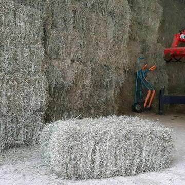
Heupellets und Strohpellets Bio
Bogen
Marion Christ
@Marion-Christ
Einstreu
Pellets
Bio
Abholung
Lieferung
B+

B+
Deprecated: Creation of dynamic property Zend_View_Helper_Ads::$adLink is deprecated in /var/www/stall-frei/htdocs/staging.stall-frei.de/library/Psf/View/Helper/Ads.php on line 108

Pferdepension Hit Aktivstall Kürmerhof
Hohenkammer
Kuermerhof
@Kuermerhof
*******JETZT NEU MIT ENTSTAUBTEM BIOHEU*********
*******Demnächst mit einem Abenteuerspielplatz für Pferde ( Extrem Trail/Pa
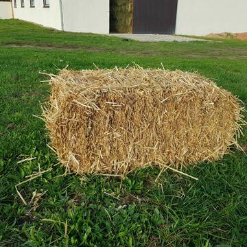
Heukleinballen (34 x 44 x 90 cm)
Marquartstein
Hacher Fahrnpoint
@Hacher-Berghof-Fahrnpoint
Heu
Kleinballen/HD-Ballen
Regenfrei
Wird verladen
1 weitere...
B+

Heu 2. Schnitt 2025 Grummet HD Ballen
Altmannstein
Thomas Resch
@Cappo
Heu
Empfänger lädt ab
Kleinballen/HD-Ballen
Wird verladen
2 weitere...
B+

HD-Heuballen, 1. Schnitt & 2. Schnitt
Hilpoltstein
KnollmeyerBallen
@KnollmeyerBallen
Heu
Lieferant entlädt
Kleinballen/HD-Ballen
Regenfrei
3 weitere...
B+

Job gesucht?
Mechtersen
STALL-FREIde Marketing
@STALL-FREI-Marketing
Sie suchen einen Job und arbeiten gerne mit Pferden oder auf Reitanlagen?
Besuchen Sie jetzt unseren Stellenmarkt!
HD-Strohballen, Gersten-, Dinkel- und Weizenstroh
Hilpoltstein
KnollmeyerBallen
@KnollmeyerBallen
Einstreu
Lieferant entlädt
Kleinballen/HD-Ballen
Regenfrei
3 weitere...
B+

Bio-Pferdeheu in Rundballen
Reichersbeuern
Biohof-Sixt
@Biohof-Sixt
Heu
Empfänger lädt ab
Rundballen
Bio
2 weitere...
aktuell
B+
Leider kein Vorschaubild
Leider kein Vorschaubild
heu 2025 heu 2ter schnitt 2025
Maisach
Reitstall Thurner
@ReitstallThurner
Heu
Empfänger lädt ab
Rundballen
Regenfrei
3 weitere...
B+
Leider kein Vorschaubild
Leider kein Vorschaubild
HEUCOBS/GRASCOBSMenge in kg Preis 0,75€/kg im Sa...
Starnberg
Reiterhof-Klim
@Reiterhof-Klim
Futter
Pellets
Abholung
B+


Strohpellet, Strohgranulat, Heu & Stroh
Allmannshofen
J&M Kratzer
@JMKratzer
Einstreu
Lieferant entlädt
Pellets
Wird verladen
2 weitere...
P+
Deprecated: Creation of dynamic property Zend_View::$pageCount is deprecated in /var/www/stall-frei/htdocs/staging.stall-frei.de/library/vendor/shardj/zf1-future/library/Zend/View/Abstract.php on line 308
Deprecated: Creation of dynamic property Zend_View::$itemCountPerPage is deprecated in /var/www/stall-frei/htdocs/staging.stall-frei.de/library/vendor/shardj/zf1-future/library/Zend/View/Abstract.php on line 308
Deprecated: Creation of dynamic property Zend_View::$first is deprecated in /var/www/stall-frei/htdocs/staging.stall-frei.de/library/vendor/shardj/zf1-future/library/Zend/View/Abstract.php on line 308
Deprecated: Creation of dynamic property Zend_View::$current is deprecated in /var/www/stall-frei/htdocs/staging.stall-frei.de/library/vendor/shardj/zf1-future/library/Zend/View/Abstract.php on line 308
Deprecated: Creation of dynamic property Zend_View::$last is deprecated in /var/www/stall-frei/htdocs/staging.stall-frei.de/library/vendor/shardj/zf1-future/library/Zend/View/Abstract.php on line 308
Deprecated: Creation of dynamic property Zend_View::$next is deprecated in /var/www/stall-frei/htdocs/staging.stall-frei.de/library/vendor/shardj/zf1-future/library/Zend/View/Abstract.php on line 308
Deprecated: Creation of dynamic property Zend_View::$pagesInRange is deprecated in /var/www/stall-frei/htdocs/staging.stall-frei.de/library/vendor/shardj/zf1-future/library/Zend/View/Abstract.php on line 308
Deprecated: Creation of dynamic property Zend_View::$firstPageInRange is deprecated in /var/www/stall-frei/htdocs/staging.stall-frei.de/library/vendor/shardj/zf1-future/library/Zend/View/Abstract.php on line 308
Deprecated: Creation of dynamic property Zend_View::$lastPageInRange is deprecated in /var/www/stall-frei/htdocs/staging.stall-frei.de/library/vendor/shardj/zf1-future/library/Zend/View/Abstract.php on line 308
Deprecated: Creation of dynamic property Zend_View::$currentItemCount is deprecated in /var/www/stall-frei/htdocs/staging.stall-frei.de/library/vendor/shardj/zf1-future/library/Zend/View/Abstract.php on line 308
Deprecated: Creation of dynamic property Zend_View::$totalItemCount is deprecated in /var/www/stall-frei/htdocs/staging.stall-frei.de/library/vendor/shardj/zf1-future/library/Zend/View/Abstract.php on line 308
Deprecated: Creation of dynamic property Zend_View::$firstItemNumber is deprecated in /var/www/stall-frei/htdocs/staging.stall-frei.de/library/vendor/shardj/zf1-future/library/Zend/View/Abstract.php on line 308
Deprecated: Creation of dynamic property Zend_View::$lastItemNumber is deprecated in /var/www/stall-frei/htdocs/staging.stall-frei.de/library/vendor/shardj/zf1-future/library/Zend/View/Abstract.php on line 308
Deprecated: Creation of dynamic property Zend_View::$router is deprecated in /var/www/stall-frei/htdocs/staging.stall-frei.de/library/vendor/shardj/zf1-future/library/Zend/View/Abstract.php on line 308
Deprecated: Creation of dynamic property Zend_View::$urlParams is deprecated in /var/www/stall-frei/htdocs/staging.stall-frei.de/library/vendor/shardj/zf1-future/library/Zend/View/Abstract.php on line 308
Deprecated: Creation of dynamic property Zend_View::$showAds is deprecated in /var/www/stall-frei/htdocs/staging.stall-frei.de/library/vendor/shardj/zf1-future/library/Zend/View/Abstract.php on line 308
Deprecated: Creation of dynamic property Zend_View::$objectIds is deprecated in /var/www/stall-frei/htdocs/staging.stall-frei.de/library/vendor/shardj/zf1-future/library/Zend/View/Abstract.php on line 308
Deprecated: Creation of dynamic property Zend_View::$showNavbar is deprecated in /var/www/stall-frei/htdocs/staging.stall-frei.de/library/vendor/shardj/zf1-future/library/Zend/View/Abstract.php on line 308
Deprecated: Creation of dynamic property Zend_View::$showBreadcrumb is deprecated in /var/www/stall-frei/htdocs/staging.stall-frei.de/library/vendor/shardj/zf1-future/library/Zend/View/Abstract.php on line 308
Deprecated: Creation of dynamic property Zend_View::$showFooter is deprecated in /var/www/stall-frei/htdocs/staging.stall-frei.de/library/vendor/shardj/zf1-future/library/Zend/View/Abstract.php on line 308
Deprecated: Creation of dynamic property Zend_View::$showInternalAds is deprecated in /var/www/stall-frei/htdocs/staging.stall-frei.de/library/vendor/shardj/zf1-future/library/Zend/View/Abstract.php on line 308
Deprecated: Creation of dynamic property Zend_View::$blNoContent is deprecated in /var/www/stall-frei/htdocs/staging.stall-frei.de/library/vendor/shardj/zf1-future/library/Zend/View/Abstract.php on line 308
Deprecated: Creation of dynamic property Zend_View::$sMetaDesc is deprecated in /var/www/stall-frei/htdocs/staging.stall-frei.de/library/vendor/shardj/zf1-future/library/Zend/View/Abstract.php on line 308
Deprecated: Creation of dynamic property Zend_View::$useGmaps is deprecated in /var/www/stall-frei/htdocs/staging.stall-frei.de/library/vendor/shardj/zf1-future/library/Zend/View/Abstract.php on line 308
Deprecated: Creation of dynamic property Zend_View::$touches is deprecated in /var/www/stall-frei/htdocs/staging.stall-frei.de/library/vendor/shardj/zf1-future/library/Zend/View/Abstract.php on line 308
Deprecated: Creation of dynamic property Zend_View::$oProject is deprecated in /var/www/stall-frei/htdocs/staging.stall-frei.de/library/vendor/shardj/zf1-future/library/Zend/View/Abstract.php on line 308
Deprecated: Creation of dynamic property Zend_View::$pageHeadline is deprecated in /var/www/stall-frei/htdocs/staging.stall-frei.de/library/vendor/shardj/zf1-future/library/Zend/View/Abstract.php on line 308
Deprecated: Creation of dynamic property Zend_View::$disableLocationField is deprecated in /var/www/stall-frei/htdocs/staging.stall-frei.de/library/vendor/shardj/zf1-future/library/Zend/View/Abstract.php on line 308
Deprecated: Creation of dynamic property Zend_View::$isSearch is deprecated in /var/www/stall-frei/htdocs/staging.stall-frei.de/library/vendor/shardj/zf1-future/library/Zend/View/Abstract.php on line 308
Deprecated: Creation of dynamic property Zend_View::$pageTitle is deprecated in /var/www/stall-frei/htdocs/staging.stall-frei.de/library/vendor/shardj/zf1-future/library/Zend/View/Abstract.php on line 308
Deprecated: Creation of dynamic property Psf_Form_Element_Text::$class is deprecated in /var/www/stall-frei/htdocs/staging.stall-frei.de/library/vendor/shardj/zf1-future/library/Zend/Form/Element.php on line 874
Deprecated: Creation of dynamic property Psf_Form_Element_Text::$size is deprecated in /var/www/stall-frei/htdocs/staging.stall-frei.de/library/vendor/shardj/zf1-future/library/Zend/Form/Element.php on line 874
Deprecated: Creation of dynamic property Psf_Form_Element_Text::$placeholder is deprecated in /var/www/stall-frei/htdocs/staging.stall-frei.de/library/vendor/shardj/zf1-future/library/Zend/Form/Element.php on line 874
Deprecated: Creation of dynamic property Psf_Form_Element_Hidden::$class is deprecated in /var/www/stall-frei/htdocs/staging.stall-frei.de/library/vendor/shardj/zf1-future/library/Zend/Form/Element.php on line 874
Deprecated: Creation of dynamic property Psf_Form_Element_Hidden::$class is deprecated in /var/www/stall-frei/htdocs/staging.stall-frei.de/library/vendor/shardj/zf1-future/library/Zend/Form/Element.php on line 874
Deprecated: Creation of dynamic property Psf_Form_Element_Hidden::$class is deprecated in /var/www/stall-frei/htdocs/staging.stall-frei.de/library/vendor/shardj/zf1-future/library/Zend/Form/Element.php on line 874
Deprecated: Creation of dynamic property Psf_Form_Element_Hidden::$class is deprecated in /var/www/stall-frei/htdocs/staging.stall-frei.de/library/vendor/shardj/zf1-future/library/Zend/Form/Element.php on line 874
Deprecated: Creation of dynamic property Psf_Form_Element_Select::$class is deprecated in /var/www/stall-frei/htdocs/staging.stall-frei.de/library/vendor/shardj/zf1-future/library/Zend/Form/Element.php on line 874
Deprecated: Creation of dynamic property Psf_Form_Element_Select::$class is deprecated in /var/www/stall-frei/htdocs/staging.stall-frei.de/library/vendor/shardj/zf1-future/library/Zend/Form/Element.php on line 874
Deprecated: Creation of dynamic property Psf_Form_Element_Select::$class is deprecated in /var/www/stall-frei/htdocs/staging.stall-frei.de/library/vendor/shardj/zf1-future/library/Zend/Form/Element.php on line 874
Deprecated: Creation of dynamic property Psf_Form_Element_Select::$class is deprecated in /var/www/stall-frei/htdocs/staging.stall-frei.de/library/vendor/shardj/zf1-future/library/Zend/Form/Element.php on line 874
Deprecated: Creation of dynamic property Zend_View::$sort is deprecated in /var/www/stall-frei/htdocs/staging.stall-frei.de/library/vendor/shardj/zf1-future/library/Zend/View/Abstract.php on line 308
Deprecated: Creation of dynamic property Zend_View::$searchLocation is deprecated in /var/www/stall-frei/htdocs/staging.stall-frei.de/library/vendor/shardj/zf1-future/library/Zend/View/Abstract.php on line 308
Deprecated: Creation of dynamic property Zend_View::$locationHint is deprecated in /var/www/stall-frei/htdocs/staging.stall-frei.de/library/vendor/shardj/zf1-future/library/Zend/View/Abstract.php on line 308
Psf_GeoCoder_Abstract::getLocation: Pleckensteiner Wald Get Location CachedOrLive
Psf_GeoCoder_Abstract::getCachedOrLive: Pleckensteiner Wald
Psf_GeoCoder_OpenCageData::makeApiRequest: response:
Array
(
[documentation] => https://opencagedata.com/api
[licenses] => Array
(
[0] => Array
(
[name] => see attribution guide
[url] => https://opencagedata.com/credits
)
)
[results] => Array
(
[0] => Array
(
[bounds] => Array
(
[northeast] => Array
(
[lat] => 48.7872811
[lng] => 13.8396235
)
[southwest] => Array
(
[lat] => 48.7524522
[lng] => 13.7452553
)
)
[components] => Array
(
[ISO_3166-1_alpha-2] => DE
[ISO_3166-1_alpha-3] => DEU
[ISO_3166-2] => Array
(
[0] => DE-BY
)
[_category] => place
[_normalized_city] => Pleckensteiner Wald
[_type] => city
[city] => Pleckensteiner Wald
[continent] => Europe
[country] => Deutschland
[country_code] => de
[county] => Landkreis Freyung-Grafenau
[political_union] => European Union
[state] => Bayern
[state_code] => BY
)
[confidence] => 7
[formatted] => Pleckensteiner Wald, Bayern, Deutschland
[geometry] => Array
(
[lat] => 48.769842
[lng] => 13.803194
)
)
[1] => Array
(
[bounds] => Array
(
[northeast] => Array
(
[lat] => 48.7694921
[lng] => 13.7993716
)
[southwest] => Array
(
[lat] => 48.7693921
[lng] => 13.7992716
)
)
[components] => Array
(
[ISO_3166-1_alpha-2] => DE
[ISO_3166-1_alpha-3] => DEU
[ISO_3166-2] => Array
(
[0] => DE-BY
)
[_category] => natural/water
[_normalized_city] => Pleckensteiner Wald
[_type] => wood
[city] => Pleckensteiner Wald
[continent] => Europe
[country] => Deutschland
[country_code] => de
[county] => Landkreis Freyung-Grafenau
[political_union] => European Union
[postcode] => 94089
[state] => Bayern
[state_code] => BY
[wood] => Pleckensteiner Wald
)
[confidence] => 9
[formatted] => Pleckensteiner Wald, 94089 Pleckensteiner Wald, Deutschland
[geometry] => Array
(
[lat] => 48.7694421
[lng] => 13.7993216
)
)
[2] => Array
(
[components] => Array
(
[ISO_3166-1_alpha-2] => FR
[ISO_3166-1_alpha-3] => FRA
[ISO_3166-2] => Array
(
[0] => FR-GES
[1] => FR-57
)
[_category] => road
[_normalized_city] => Baerenthal
[_type] => road
[city] => Baerenthal
[continent] => Europe
[country] => France
[country_code] => fr
[county] => Moselle
[local_authority] => Communauté de communes du Pays de Bitche
[political_union] => European Union
[postcode] => 57230
[road] => Rue Walther Waldele
[state] => Grand Est
[state_code] => GES
)
[confidence] => 2
[formatted] => Rue Walther Waldele, 57230 Baerenthal, France
[geometry] => Array
(
[lat] => 48.974603
[lng] => 7.527756
)
)
[3] => Array
(
[components] => Array
(
[ISO_3166-1_alpha-2] => FR
[ISO_3166-1_alpha-3] => FRA
[ISO_3166-2] => Array
(
[0] => FR-ARA
[1] => FR-74
)
[_category] => road
[_normalized_city] => Valleiry
[_type] => road
[city] => Valleiry
[continent] => Europe
[country] => France
[country_code] => fr
[county] => Haute-Savoie
[local_authority] => Communauté de communes du Genevois
[political_union] => European Union
[postcode] => 74520
[road] => Route d'annecy
[state] => Auvergne-Rhône-Alpes
[state_code] => ARA
)
[confidence] => 2
[formatted] => Route d'annecy, 74520 Valleiry, France
[geometry] => Array
(
[lat] => 46.107115
[lng] => 5.97251
)
)
[4] => Array
(
[components] => Array
(
[ISO_3166-1_alpha-2] => FR
[ISO_3166-1_alpha-3] => FRA
[ISO_3166-2] => Array
(
[0] => FR-ARA
[1] => FR-74
)
[_category] => road
[_normalized_city] => Valleiry
[_type] => road
[city] => Valleiry
[continent] => Europe
[country] => France
[country_code] => fr
[county] => Haute-Savoie
[local_authority] => Communauté de communes du Genevois
[political_union] => European Union
[postcode] => 74520
[road] => Chemin du verger
[state] => Auvergne-Rhône-Alpes
[state_code] => ARA
)
[confidence] => 10
[formatted] => Chemin du verger, 74520 Valleiry, France
[geometry] => Array
(
[lat] => 46.106018
[lng] => 5.97287
)
)
[5] => Array
(
[components] => Array
(
[ISO_3166-1_alpha-2] => FR
[ISO_3166-1_alpha-3] => FRA
[ISO_3166-2] => Array
(
[0] => FR-ARA
[1] => FR-74
)
[_category] => road
[_normalized_city] => Valleiry
[_type] => road
[city] => Valleiry
[continent] => Europe
[country] => France
[country_code] => fr
[county] => Haute-Savoie
[local_authority] => Communauté de communes du Genevois
[political_union] => European Union
[postcode] => 74520
[road] => Chemin du sorbier
[state] => Auvergne-Rhône-Alpes
[state_code] => ARA
)
[confidence] => 10
[formatted] => Chemin du sorbier, 74520 Valleiry, France
[geometry] => Array
(
[lat] => 46.106724
[lng] => 5.961472
)
)
[6] => Array
(
[components] => Array
(
[ISO_3166-1_alpha-2] => FR
[ISO_3166-1_alpha-3] => FRA
[ISO_3166-2] => Array
(
[0] => FR-ARA
[1] => FR-74
)
[_category] => road
[_normalized_city] => Valleiry
[_type] => road
[city] => Valleiry
[continent] => Europe
[country] => France
[country_code] => fr
[county] => Haute-Savoie
[local_authority] => Communauté de communes du Genevois
[political_union] => European Union
[postcode] => 74520
[road] => Rue de chênex
[state] => Auvergne-Rhône-Alpes
[state_code] => ARA
)
[confidence] => 10
[formatted] => Rue de chênex, 74520 Valleiry, France
[geometry] => Array
(
[lat] => 46.107453
[lng] => 5.968847
)
)
[7] => Array
(
[components] => Array
(
[ISO_3166-1_alpha-2] => FR
[ISO_3166-1_alpha-3] => FRA
[ISO_3166-2] => Array
(
[0] => FR-ARA
[1] => FR-74
)
[_category] => road
[_normalized_city] => Vers
[_type] => road
[city] => Vers
[continent] => Europe
[country] => France
[country_code] => fr
[county] => Haute-Savoie
[local_authority] => Communauté de communes du Genevois
[political_union] => European Union
[postcode] => 74160
[road] => Route de valleiry
[state] => Auvergne-Rhône-Alpes
[state_code] => ARA
)
[confidence] => 10
[formatted] => Route de valleiry, 74160 Vers, France
[geometry] => Array
(
[lat] => 46.093679
[lng] => 6.016922
)
)
[8] => Array
(
[components] => Array
(
[ISO_3166-1_alpha-2] => FR
[ISO_3166-1_alpha-3] => FRA
[ISO_3166-2] => Array
(
[0] => FR-ARA
[1] => FR-74
)
[_category] => road
[_normalized_city] => Valleiry
[_type] => road
[city] => Valleiry
[continent] => Europe
[country] => France
[country_code] => fr
[county] => Haute-Savoie
[local_authority] => Communauté de communes du Genevois
[political_union] => European Union
[postcode] => 74520
[road] => Rue des pinsons
[state] => Auvergne-Rhône-Alpes
[state_code] => ARA
)
[confidence] => 10
[formatted] => Rue des pinsons, 74520 Valleiry, France
[geometry] => Array
(
[lat] => 46.106815
[lng] => 5.977177
)
)
[9] => Array
(
[components] => Array
(
[ISO_3166-1_alpha-2] => FR
[ISO_3166-1_alpha-3] => FRA
[ISO_3166-2] => Array
(
[0] => FR-ARA
[1] => FR-74
)
[_category] => road
[_normalized_city] => Valleiry
[_type] => road
[city] => Valleiry
[continent] => Europe
[country] => France
[country_code] => fr
[county] => Haute-Savoie
[local_authority] => Communauté de communes du Genevois
[political_union] => European Union
[postcode] => 74520
[road] => Route de saint-julien-en-genevois
[state] => Auvergne-Rhône-Alpes
[state_code] => ARA
)
[confidence] => 10
[formatted] => Route de saint-julien-en-genevois, 74520 Valleiry, France
[geometry] => Array
(
[lat] => 46.108754
[lng] => 5.971194
)
)
)
[status] => Array
(
[code] => 200
[message] => OK
)
[stay_informed] => Array
(
[blog] => https://blog.opencagedata.com
[mastodon] => https://en.osm.town/@opencage
)
[thanks] => For using an OpenCage API
[timestamp] => Array
(
[created_http] => Sat, 07 Feb 2026 15:13:10 GMT
[created_unix] => 1770477190
)
[total_results] => 10
)
Psf_GeoCoder_Abstract::convertLocationResult
{"documentation":"https:\/\/opencagedata.com\/api","licenses":[{"name":"see attribution guide","url":"https:\/\/opencagedata.com\/credits"}],"results":[{"bounds":{"northeast":{"lat":48.7872811,"lng":13.8396235},"southwest":{"lat":48.7524522,"lng":13.7452553}},"components":{"ISO_3166-1_alpha-2":"DE","ISO_3166-1_alpha-3":"DEU","ISO_3166-2":["DE-BY"],"_category":"place","_normalized_city":"Pleckensteiner Wald","_type":"city","city":"Pleckensteiner Wald","continent":"Europe","country":"Deutschland","country_code":"de","county":"Landkreis Freyung-Grafenau","political_union":"European Union","state":"Bayern","state_code":"BY"},"confidence":7,"formatted":"Pleckensteiner Wald, Bayern, Deutschland","geometry":{"lat":48.769842,"lng":13.803194}},{"bounds":{"northeast":{"lat":48.7694921,"lng":13.7993716},"southwest":{"lat":48.7693921,"lng":13.7992716}},"components":{"ISO_3166-1_alpha-2":"DE","ISO_3166-1_alpha-3":"DEU","ISO_3166-2":["DE-BY"],"_category":"natural\/water","_normalized_city":"Pleckensteiner Wald","_type":"wood","city":"Pleckensteiner Wald","continent":"Europe","country":"Deutschland","country_code":"de","county":"Landkreis Freyung-Grafenau","political_union":"European Union","postcode":"94089","state":"Bayern","state_code":"BY","wood":"Pleckensteiner Wald"},"confidence":9,"formatted":"Pleckensteiner Wald, 94089 Pleckensteiner Wald, Deutschland","geometry":{"lat":48.7694421,"lng":13.7993216}},{"components":{"ISO_3166-1_alpha-2":"FR","ISO_3166-1_alpha-3":"FRA","ISO_3166-2":["FR-GES","FR-57"],"_category":"road","_normalized_city":"Baerenthal","_type":"road","city":"Baerenthal","continent":"Europe","country":"France","country_code":"fr","county":"Moselle","local_authority":"Communaut\u00e9 de communes du Pays de Bitche","political_union":"European Union","postcode":"57230","road":"Rue Walther Waldele","state":"Grand Est","state_code":"GES"},"confidence":2,"formatted":"Rue Walther Waldele, 57230 Baerenthal, France","geometry":{"lat":48.974603,"lng":7.527756}},{"components":{"ISO_3166-1_alpha-2":"FR","ISO_3166-1_alpha-3":"FRA","ISO_3166-2":["FR-ARA","FR-74"],"_category":"road","_normalized_city":"Valleiry","_type":"road","city":"Valleiry","continent":"Europe","country":"France","country_code":"fr","county":"Haute-Savoie","local_authority":"Communaut\u00e9 de communes du Genevois","political_union":"European Union","postcode":"74520","road":"Route d'annecy","state":"Auvergne-Rh\u00f4ne-Alpes","state_code":"ARA"},"confidence":2,"formatted":"Route d'annecy, 74520 Valleiry, France","geometry":{"lat":46.107115,"lng":5.97251}},{"components":{"ISO_3166-1_alpha-2":"FR","ISO_3166-1_alpha-3":"FRA","ISO_3166-2":["FR-ARA","FR-74"],"_category":"road","_normalized_city":"Valleiry","_type":"road","city":"Valleiry","continent":"Europe","country":"France","country_code":"fr","county":"Haute-Savoie","local_authority":"Communaut\u00e9 de communes du Genevois","political_union":"European Union","postcode":"74520","road":"Chemin du verger","state":"Auvergne-Rh\u00f4ne-Alpes","state_code":"ARA"},"confidence":10,"formatted":"Chemin du verger, 74520 Valleiry, France","geometry":{"lat":46.106018,"lng":5.97287}},{"components":{"ISO_3166-1_alpha-2":"FR","ISO_3166-1_alpha-3":"FRA","ISO_3166-2":["FR-ARA","FR-74"],"_category":"road","_normalized_city":"Valleiry","_type":"road","city":"Valleiry","continent":"Europe","country":"France","country_code":"fr","county":"Haute-Savoie","local_authority":"Communaut\u00e9 de communes du Genevois","political_union":"European Union","postcode":"74520","road":"Chemin du sorbier","state":"Auvergne-Rh\u00f4ne-Alpes","state_code":"ARA"},"confidence":10,"formatted":"Chemin du sorbier, 74520 Valleiry, France","geometry":{"lat":46.106724,"lng":5.961472}},{"components":{"ISO_3166-1_alpha-2":"FR","ISO_3166-1_alpha-3":"FRA","ISO_3166-2":["FR-ARA","FR-74"],"_category":"road","_normalized_city":"Valleiry","_type":"road","city":"Valleiry","continent":"Europe","country":"France","country_code":"fr","county":"Haute-Savoie","local_authority":"Communaut\u00e9 de communes du Genevois","political_union":"European Union","postcode":"74520","road":"Rue de ch\u00eanex","state":"Auvergne-Rh\u00f4ne-Alpes","state_code":"ARA"},"confidence":10,"formatted":"Rue de ch\u00eanex, 74520 Valleiry, France","geometry":{"lat":46.107453,"lng":5.968847}},{"components":{"ISO_3166-1_alpha-2":"FR","ISO_3166-1_alpha-3":"FRA","ISO_3166-2":["FR-ARA","FR-74"],"_category":"road","_normalized_city":"Vers","_type":"road","city":"Vers","continent":"Europe","country":"France","country_code":"fr","county":"Haute-Savoie","local_authority":"Communaut\u00e9 de communes du Genevois","political_union":"European Union","postcode":"74160","road":"Route de valleiry","state":"Auvergne-Rh\u00f4ne-Alpes","state_code":"ARA"},"confidence":10,"formatted":"Route de valleiry, 74160 Vers, France","geometry":{"lat":46.093679,"lng":6.016922}},{"components":{"ISO_3166-1_alpha-2":"FR","ISO_3166-1_alpha-3":"FRA","ISO_3166-2":["FR-ARA","FR-74"],"_category":"road","_normalized_city":"Valleiry","_type":"road","city":"Valleiry","continent":"Europe","country":"France","country_code":"fr","county":"Haute-Savoie","local_authority":"Communaut\u00e9 de communes du Genevois","political_union":"European Union","postcode":"74520","road":"Rue des pinsons","state":"Auvergne-Rh\u00f4ne-Alpes","state_code":"ARA"},"confidence":10,"formatted":"Rue des pinsons, 74520 Valleiry, France","geometry":{"lat":46.106815,"lng":5.977177}},{"components":{"ISO_3166-1_alpha-2":"FR","ISO_3166-1_alpha-3":"FRA","ISO_3166-2":["FR-ARA","FR-74"],"_category":"road","_normalized_city":"Valleiry","_type":"road","city":"Valleiry","continent":"Europe","country":"France","country_code":"fr","county":"Haute-Savoie","local_authority":"Communaut\u00e9 de communes du Genevois","political_union":"European Union","postcode":"74520","road":"Route de saint-julien-en-genevois","state":"Auvergne-Rh\u00f4ne-Alpes","state_code":"ARA"},"confidence":10,"formatted":"Route de saint-julien-en-genevois, 74520 Valleiry, France","geometry":{"lat":46.108754,"lng":5.971194}}],"status":{"code":200,"message":"OK"},"stay_informed":{"blog":"https:\/\/blog.opencagedata.com","mastodon":"https:\/\/en.osm.town\/@opencage"},"thanks":"For using an OpenCage API","timestamp":{"created_http":"Sat, 07 Feb 2026 15:13:10 GMT","created_unix":1770477190},"total_results":10}Array
(
[0] => stdClass Object
(
[bounds] => stdClass Object
(
[northeast] => stdClass Object
(
[lat] => 48.7872811
[lng] => 13.8396235
)
[southwest] => stdClass Object
(
[lat] => 48.7524522
[lng] => 13.7452553
)
)
[components] => stdClass Object
(
[ISO_3166-1_alpha-2] => DE
[ISO_3166-1_alpha-3] => DEU
[ISO_3166-2] => Array
(
[0] => DE-BY
)
[_category] => place
[_normalized_city] => Pleckensteiner Wald
[_type] => city
[city] => Pleckensteiner Wald
[continent] => Europe
[country] => Deutschland
[country_code] => de
[county] => Landkreis Freyung-Grafenau
[political_union] => European Union
[state] => Bayern
[state_code] => BY
)
[confidence] => 7
[formatted] => Pleckensteiner Wald, Bayern, Deutschland
[geometry] => stdClass Object
(
[lat] => 48.769842
[lng] => 13.803194
)
)
[1] => stdClass Object
(
[bounds] => stdClass Object
(
[northeast] => stdClass Object
(
[lat] => 48.7694921
[lng] => 13.7993716
)
[southwest] => stdClass Object
(
[lat] => 48.7693921
[lng] => 13.7992716
)
)
[components] => stdClass Object
(
[ISO_3166-1_alpha-2] => DE
[ISO_3166-1_alpha-3] => DEU
[ISO_3166-2] => Array
(
[0] => DE-BY
)
[_category] => natural/water
[_normalized_city] => Pleckensteiner Wald
[_type] => wood
[city] => Pleckensteiner Wald
[continent] => Europe
[country] => Deutschland
[country_code] => de
[county] => Landkreis Freyung-Grafenau
[political_union] => European Union
[postcode] => 94089
[state] => Bayern
[state_code] => BY
[wood] => Pleckensteiner Wald
)
[confidence] => 9
[formatted] => Pleckensteiner Wald, 94089 Pleckensteiner Wald, Deutschland
[geometry] => stdClass Object
(
[lat] => 48.7694421
[lng] => 13.7993216
)
)
[2] => stdClass Object
(
[components] => stdClass Object
(
[ISO_3166-1_alpha-2] => FR
[ISO_3166-1_alpha-3] => FRA
[ISO_3166-2] => Array
(
[0] => FR-GES
[1] => FR-57
)
[_category] => road
[_normalized_city] => Baerenthal
[_type] => road
[city] => Baerenthal
[continent] => Europe
[country] => France
[country_code] => fr
[county] => Moselle
[local_authority] => Communauté de communes du Pays de Bitche
[political_union] => European Union
[postcode] => 57230
[road] => Rue Walther Waldele
[state] => Grand Est
[state_code] => GES
)
[confidence] => 2
[formatted] => Rue Walther Waldele, 57230 Baerenthal, France
[geometry] => stdClass Object
(
[lat] => 48.974603
[lng] => 7.527756
)
)
[3] => stdClass Object
(
[components] => stdClass Object
(
[ISO_3166-1_alpha-2] => FR
[ISO_3166-1_alpha-3] => FRA
[ISO_3166-2] => Array
(
[0] => FR-ARA
[1] => FR-74
)
[_category] => road
[_normalized_city] => Valleiry
[_type] => road
[city] => Valleiry
[continent] => Europe
[country] => France
[country_code] => fr
[county] => Haute-Savoie
[local_authority] => Communauté de communes du Genevois
[political_union] => European Union
[postcode] => 74520
[road] => Route d'annecy
[state] => Auvergne-Rhône-Alpes
[state_code] => ARA
)
[confidence] => 2
[formatted] => Route d'annecy, 74520 Valleiry, France
[geometry] => stdClass Object
(
[lat] => 46.107115
[lng] => 5.97251
)
)
[4] => stdClass Object
(
[components] => stdClass Object
(
[ISO_3166-1_alpha-2] => FR
[ISO_3166-1_alpha-3] => FRA
[ISO_3166-2] => Array
(
[0] => FR-ARA
[1] => FR-74
)
[_category] => road
[_normalized_city] => Valleiry
[_type] => road
[city] => Valleiry
[continent] => Europe
[country] => France
[country_code] => fr
[county] => Haute-Savoie
[local_authority] => Communauté de communes du Genevois
[political_union] => European Union
[postcode] => 74520
[road] => Chemin du verger
[state] => Auvergne-Rhône-Alpes
[state_code] => ARA
)
[confidence] => 10
[formatted] => Chemin du verger, 74520 Valleiry, France
[geometry] => stdClass Object
(
[lat] => 46.106018
[lng] => 5.97287
)
)
[5] => stdClass Object
(
[components] => stdClass Object
(
[ISO_3166-1_alpha-2] => FR
[ISO_3166-1_alpha-3] => FRA
[ISO_3166-2] => Array
(
[0] => FR-ARA
[1] => FR-74
)
[_category] => road
[_normalized_city] => Valleiry
[_type] => road
[city] => Valleiry
[continent] => Europe
[country] => France
[country_code] => fr
[county] => Haute-Savoie
[local_authority] => Communauté de communes du Genevois
[political_union] => European Union
[postcode] => 74520
[road] => Chemin du sorbier
[state] => Auvergne-Rhône-Alpes
[state_code] => ARA
)
[confidence] => 10
[formatted] => Chemin du sorbier, 74520 Valleiry, France
[geometry] => stdClass Object
(
[lat] => 46.106724
[lng] => 5.961472
)
)
[6] => stdClass Object
(
[components] => stdClass Object
(
[ISO_3166-1_alpha-2] => FR
[ISO_3166-1_alpha-3] => FRA
[ISO_3166-2] => Array
(
[0] => FR-ARA
[1] => FR-74
)
[_category] => road
[_normalized_city] => Valleiry
[_type] => road
[city] => Valleiry
[continent] => Europe
[country] => France
[country_code] => fr
[county] => Haute-Savoie
[local_authority] => Communauté de communes du Genevois
[political_union] => European Union
[postcode] => 74520
[road] => Rue de chênex
[state] => Auvergne-Rhône-Alpes
[state_code] => ARA
)
[confidence] => 10
[formatted] => Rue de chênex, 74520 Valleiry, France
[geometry] => stdClass Object
(
[lat] => 46.107453
[lng] => 5.968847
)
)
[7] => stdClass Object
(
[components] => stdClass Object
(
[ISO_3166-1_alpha-2] => FR
[ISO_3166-1_alpha-3] => FRA
[ISO_3166-2] => Array
(
[0] => FR-ARA
[1] => FR-74
)
[_category] => road
[_normalized_city] => Vers
[_type] => road
[city] => Vers
[continent] => Europe
[country] => France
[country_code] => fr
[county] => Haute-Savoie
[local_authority] => Communauté de communes du Genevois
[political_union] => European Union
[postcode] => 74160
[road] => Route de valleiry
[state] => Auvergne-Rhône-Alpes
[state_code] => ARA
)
[confidence] => 10
[formatted] => Route de valleiry, 74160 Vers, France
[geometry] => stdClass Object
(
[lat] => 46.093679
[lng] => 6.016922
)
)
[8] => stdClass Object
(
[components] => stdClass Object
(
[ISO_3166-1_alpha-2] => FR
[ISO_3166-1_alpha-3] => FRA
[ISO_3166-2] => Array
(
[0] => FR-ARA
[1] => FR-74
)
[_category] => road
[_normalized_city] => Valleiry
[_type] => road
[city] => Valleiry
[continent] => Europe
[country] => France
[country_code] => fr
[county] => Haute-Savoie
[local_authority] => Communauté de communes du Genevois
[political_union] => European Union
[postcode] => 74520
[road] => Rue des pinsons
[state] => Auvergne-Rhône-Alpes
[state_code] => ARA
)
[confidence] => 10
[formatted] => Rue des pinsons, 74520 Valleiry, France
[geometry] => stdClass Object
(
[lat] => 46.106815
[lng] => 5.977177
)
)
[9] => stdClass Object
(
[components] => stdClass Object
(
[ISO_3166-1_alpha-2] => FR
[ISO_3166-1_alpha-3] => FRA
[ISO_3166-2] => Array
(
[0] => FR-ARA
[1] => FR-74
)
[_category] => road
[_normalized_city] => Valleiry
[_type] => road
[city] => Valleiry
[continent] => Europe
[country] => France
[country_code] => fr
[county] => Haute-Savoie
[local_authority] => Communauté de communes du Genevois
[political_union] => European Union
[postcode] => 74520
[road] => Route de saint-julien-en-genevois
[state] => Auvergne-Rhône-Alpes
[state_code] => ARA
)
[confidence] => 10
[formatted] => Route de saint-julien-en-genevois, 74520 Valleiry, France
[geometry] => stdClass Object
(
[lat] => 46.108754
[lng] => 5.971194
)
)
)
Psf_GeoCoder_OpenCageData::getKeyMap: 0
stdClass Object
(
    [bounds] => stdClass Object
        (
            [northeast] => stdClass Object
                (
                    [lat] => 48.7872811
                    [lng] => 13.8396235
                )

            [southwest] => stdClass Object
                (
                    [lat] => 48.7524522
                    [lng] => 13.7452553
                )

        )

    [components] => stdClass Object
        (
            [ISO_3166-1_alpha-2] => DE
            [ISO_3166-1_alpha-3] => DEU
            [ISO_3166-2] => Array
                (
                    [0] => DE-BY
                )

            [_category] => place
            [_normalized_city] => Pleckensteiner Wald
            [_type] => city
            [city] => Pleckensteiner Wald
            [continent] => Europe
            [country] => Deutschland
            [country_code] => de
            [county] => Landkreis Freyung-Grafenau
            [political_union] => European Union
            [state] => Bayern
            [state_code] => BY
        )

    [confidence] => 7
    [formatted] => Pleckensteiner Wald, Bayern, Deutschland
    [geometry] => stdClass Object
        (
            [lat] => 48.769842
            [lng] => 13.803194
        )

)
Psf_GeoCoder_OpenCageData::getCounty: Freyung-Grafenau
Psf_GeoCoder_OpenCageData::addMissingData REFETCH!
Array
(
    [address] => Pleckensteiner Wald, Bayern, Deutschland
    [type] => city
    [street] =>
    [city] => Pleckensteiner Wald
    [county] => Freyung-Grafenau
    [state] => Bayern
    [zip] =>
    [country] => Deutschland
    [suburb] =>
    [countrycode] => de
    [latitude] => 48.769842
    [longitude] => 13.803194
    [accuracy] => 1
    [confidence] => 7
    [bounds] => stdClass Object
        (
            [northeast] => stdClass Object
                (
                    [lat] => 48.7872811
                    [lng] => 13.8396235
                )

            [southwest] => stdClass Object
                (
                    [lat] => 48.7524522
                    [lng] => 13.7452553
                )

        )

)
reformat!
Array
(
    [address] => Pleckensteiner Wald, Bayern, Deutschland
    [type] => city
    [street] =>
    [city] => Pleckensteiner Wald
    [county] => Freyung-Grafenau
    [state] => Bayern
    [zip] =>
    [country] => Deutschland
    [suburb] =>
    [countrycode] => de
    [latitude] => 48.769842
    [longitude] => 13.803194
    [accuracy] => 1
    [confidence] => 7
    [bounds] => stdClass Object
        (
            [northeast] => stdClass Object
                (
                    [lat] => 48.7872811
                    [lng] => 13.8396235
                )

            [southwest] => stdClass Object
                (
                    [lat] => 48.7524522
                    [lng] => 13.7452553
                )

        )

    [place] => Pleckensteiner Wald, Bayern
    [hash] => 226bd7f4d4efc9764a66605c77891d6b
)
Psf_GeoCoder_OpenCageData::getKeyMap: 1
stdClass Object
(
    [bounds] => stdClass Object
        (
            [northeast] => stdClass Object
                (
                    [lat] => 48.7694921
                    [lng] => 13.7993716
                )

            [southwest] => stdClass Object
                (
                    [lat] => 48.7693921
                    [lng] => 13.7992716
                )

        )

    [components] => stdClass Object
        (
            [ISO_3166-1_alpha-2] => DE
            [ISO_3166-1_alpha-3] => DEU
            [ISO_3166-2] => Array
                (
                    [0] => DE-BY
                )

            [_category] => natural/water
            [_normalized_city] => Pleckensteiner Wald
            [_type] => wood
            [city] => Pleckensteiner Wald
            [continent] => Europe
            [country] => Deutschland
            [country_code] => de
            [county] => Landkreis Freyung-Grafenau
            [political_union] => European Union
            [postcode] => 94089
            [state] => Bayern
            [state_code] => BY
            [wood] => Pleckensteiner Wald
        )

    [confidence] => 9
    [formatted] => Pleckensteiner Wald, 94089 Pleckensteiner Wald, Deutschland
    [geometry] => stdClass Object
        (
            [lat] => 48.7694421
            [lng] => 13.7993216
        )

)
Psf_GeoCoder_OpenCageData::getCounty: Freyung-Grafenau
Psf_GeoCoder_OpenCageData::addMissingData REFETCH!
Array
(
    [address] => Pleckensteiner Wald, 94089 Pleckensteiner Wald, Deutschland
    [type] => wood
    [street] =>
    [city] => Pleckensteiner Wald
    [county] => Freyung-Grafenau
    [state] => Bayern
    [zip] => 94089
    [country] => Deutschland
    [suburb] =>
    [countrycode] => de
    [latitude] => 48.7694421
    [longitude] => 13.7993216
    [accuracy] => 1
    [confidence] => 9
    [bounds] => stdClass Object
        (
            [northeast] => stdClass Object
                (
                    [lat] => 48.7694921
                    [lng] => 13.7993716
                )

            [southwest] => stdClass Object
                (
                    [lat] => 48.7693921
                    [lng] => 13.7992716
                )

        )

)
reformat!
Array
(
    [address] => Pleckensteiner Wald, 94089 Pleckensteiner Wald, Deutschland
    [type] => wood
    [street] =>
    [city] => Pleckensteiner Wald
    [county] => Freyung-Grafenau
    [state] => Bayern
    [zip] => 94089
    [country] => Deutschland
    [suburb] =>
    [countrycode] => de
    [latitude] => 48.7694421
    [longitude] => 13.7993216
    [accuracy] => 1
    [confidence] => 9
    [bounds] => stdClass Object
        (
            [northeast] => stdClass Object
                (
                    [lat] => 48.7694921
                    [lng] => 13.7993716
                )

            [southwest] => stdClass Object
                (
                    [lat] => 48.7693921
                    [lng] => 13.7992716
                )

        )

    [place] => 94089 Pleckensteiner Wald, Bayern
    [hash] => 2c1b2fc10a0c5da7b6f996d58ffd097a
)
Psf_GeoCoder_OpenCageData::getKeyMap: 2
stdClass Object
(
    [components] => stdClass Object
        (
            [ISO_3166-1_alpha-2] => FR
            [ISO_3166-1_alpha-3] => FRA
            [ISO_3166-2] => Array
                (
                    [0] => FR-GES
                    [1] => FR-57
                )

            [_category] => road
            [_normalized_city] => Baerenthal
            [_type] => road
            [city] => Baerenthal
            [continent] => Europe
            [country] => France
            [country_code] => fr
            [county] => Moselle
            [local_authority] => Communauté de communes du Pays de Bitche
            [political_union] => European Union
            [postcode] => 57230
            [road] => Rue Walther Waldele
            [state] => Grand Est
            [state_code] => GES
        )

    [confidence] => 2
    [formatted] => Rue Walther Waldele, 57230 Baerenthal, France
    [geometry] => stdClass Object
        (
            [lat] => 48.974603
            [lng] => 7.527756
        )

)
Psf_GeoCoder_OpenCageData::getCounty: Moselle
Psf_GeoCoder_OpenCageData::addMissingData REFETCH!
Array
(
    [address] => Rue Walther Waldele, 57230 Baerenthal, France
    [type] => road
    [street] => Rue Walther Waldele
    [city] => Baerenthal
    [county] => Moselle
    [state] => Grand Est
    [zip] => 57230
    [country] => France
    [suburb] =>
    [countrycode] => fr
    [latitude] => 48.974603
    [longitude] => 7.527756
    [accuracy] => 1
    [confidence] => 2
    [bounds] =>
)
reformat!
Array
(
    [address] => Rue Walther Waldele, 57230 Baerenthal, France
    [type] => road
    [street] => Rue Walther Waldele
    [city] => Baerenthal
    [county] => Moselle
    [state] => Grand Est
    [zip] => 57230
    [country] => France
    [suburb] =>
    [countrycode] => fr
    [latitude] => 48.974603
    [longitude] => 7.527756
    [accuracy] => 1
    [confidence] => 2
    [bounds] =>
    [place] => Rue Walther Waldele, 57230 Baerenthal, Grand Est
    [hash] => 139f8f4777bc00b859cc9f52e2e05156
)
Psf_GeoCoder_OpenCageData::getKeyMap: 3
stdClass Object
(
    [components] => stdClass Object
        (
            [ISO_3166-1_alpha-2] => FR
            [ISO_3166-1_alpha-3] => FRA
            [ISO_3166-2] => Array
                (
                    [0] => FR-ARA
                    [1] => FR-74
                )

            [_category] => road
            [_normalized_city] => Valleiry
            [_type] => road
            [city] => Valleiry
            [continent] => Europe
            [country] => France
            [country_code] => fr
            [county] => Haute-Savoie
            [local_authority] => Communauté de communes du Genevois
            [political_union] => European Union
            [postcode] => 74520
            [road] => Route d'annecy
            [state] => Auvergne-Rhône-Alpes
            [state_code] => ARA
        )

    [confidence] => 2
    [formatted] => Route d'annecy, 74520 Valleiry, France
    [geometry] => stdClass Object
        (
            [lat] => 46.107115
            [lng] => 5.97251
        )

)
Psf_GeoCoder_OpenCageData::getCounty: Haute-Savoie
Psf_GeoCoder_OpenCageData::addMissingData REFETCH!
Array
(
    [address] => Route d'annecy, 74520 Valleiry, France
    [type] => road
    [street] => Route d'annecy
    [city] => Valleiry
    [county] => Haute-Savoie
    [state] => Auvergne-Rhône-Alpes
    [zip] => 74520
    [country] => France
    [suburb] =>
    [countrycode] => fr
    [latitude] => 46.107115
    [longitude] => 5.97251
    [accuracy] => 1
    [confidence] => 2
    [bounds] =>
)
reformat!
Array
(
    [address] => Route d'annecy, 74520 Valleiry, France
    [type] => road
    [street] => Route d'annecy
    [city] => Valleiry
    [county] => Haute-Savoie
    [state] => Auvergne-Rhône-Alpes
    [zip] => 74520
    [country] => France
    [suburb] =>
    [countrycode] => fr
    [latitude] => 46.107115
    [longitude] => 5.97251
    [accuracy] => 1
    [confidence] => 2
    [bounds] =>
    [place] => Route d'annecy, 74520 Valleiry, Auvergne-Rhône-Alpes
    [hash] => 3ba5ee47c92012cbc798d54fb4cdf0c9
)
Psf_GeoCoder_OpenCageData::getKeyMap: 4
stdClass Object
(
    [components] => stdClass Object
        (
            [ISO_3166-1_alpha-2] => FR
            [ISO_3166-1_alpha-3] => FRA
            [ISO_3166-2] => Array
                (
                    [0] => FR-ARA
                    [1] => FR-74
                )

            [_category] => road
            [_normalized_city] => Valleiry
            [_type] => road
            [city] => Valleiry
            [continent] => Europe
            [country] => France
            [country_code] => fr
            [county] => Haute-Savoie
            [local_authority] => Communauté de communes du Genevois
            [political_union] => European Union
            [postcode] => 74520
            [road] => Chemin du verger
            [state] => Auvergne-Rhône-Alpes
            [state_code] => ARA
        )

    [confidence] => 10
    [formatted] => Chemin du verger, 74520 Valleiry, France
    [geometry] => stdClass Object
        (
            [lat] => 46.106018
            [lng] => 5.97287
        )

)
Psf_GeoCoder_OpenCageData::getCounty: Haute-Savoie
Psf_GeoCoder_OpenCageData::addMissingData REFETCH!
Array
(
    [address] => Chemin du verger, 74520 Valleiry, France
    [type] => road
    [street] => Chemin du verger
    [city] => Valleiry
    [county] => Haute-Savoie
    [state] => Auvergne-Rhône-Alpes
    [zip] => 74520
    [country] => France
    [suburb] =>
    [countrycode] => fr
    [latitude] => 46.106018
    [longitude] => 5.97287
    [accuracy] => 1
    [confidence] => 10
    [bounds] =>
)
reformat!
Array
(
    [address] => Chemin du verger, 74520 Valleiry, France
    [type] => road
    [street] => Chemin du verger
    [city] => Valleiry
    [county] => Haute-Savoie
    [state] => Auvergne-Rhône-Alpes
    [zip] => 74520
    [country] => France
    [suburb] =>
    [countrycode] => fr
    [latitude] => 46.106018
    [longitude] => 5.97287
    [accuracy] => 1
    [confidence] => 10
    [bounds] =>
    [place] => Chemin du verger, 74520 Valleiry, Auvergne-Rhône-Alpes
    [hash] => 801bba9090c4fa5534ef5b3298061710
)
Psf_GeoCoder_OpenCageData::getKeyMap: 5
stdClass Object
(
    [components] => stdClass Object
        (
            [ISO_3166-1_alpha-2] => FR
            [ISO_3166-1_alpha-3] => FRA
            [ISO_3166-2] => Array
                (
                    [0] => FR-ARA
                    [1] => FR-74
                )

            [_category] => road
            [_normalized_city] => Valleiry
            [_type] => road
            [city] => Valleiry
            [continent] => Europe
            [country] => France
            [country_code] => fr
            [county] => Haute-Savoie
            [local_authority] => Communauté de communes du Genevois
            [political_union] => European Union
            [postcode] => 74520
            [road] => Chemin du sorbier
            [state] => Auvergne-Rhône-Alpes
            [state_code] => ARA
        )

    [confidence] => 10
    [formatted] => Chemin du sorbier, 74520 Valleiry, France
    [geometry] => stdClass Object
        (
            [lat] => 46.106724
            [lng] => 5.961472
        )

)
Psf_GeoCoder_OpenCageData::getCounty: Haute-Savoie
Psf_GeoCoder_OpenCageData::addMissingData REFETCH!
Array
(
    [address] => Chemin du sorbier, 74520 Valleiry, France
    [type] => road
    [street] => Chemin du sorbier
    [city] => Valleiry
    [county] => Haute-Savoie
    [state] => Auvergne-Rhône-Alpes
    [zip] => 74520
    [country] => France
    [suburb] =>
    [countrycode] => fr
    [latitude] => 46.106724
    [longitude] => 5.961472
    [accuracy] => 1
    [confidence] => 10
    [bounds] =>
)
reformat!
Array
(
    [address] => Chemin du sorbier, 74520 Valleiry, France
    [type] => road
    [street] => Chemin du sorbier
    [city] => Valleiry
    [county] => Haute-Savoie
    [state] => Auvergne-Rhône-Alpes
    [zip] => 74520
    [country] => France
    [suburb] =>
    [countrycode] => fr
    [latitude] => 46.106724
    [longitude] => 5.961472
    [accuracy] => 1
    [confidence] => 10
    [bounds] =>
    [place] => Chemin du sorbier, 74520 Valleiry, Auvergne-Rhône-Alpes
    [hash] => 3ce9ee370052fefbbb71164e25ded60a
)
Psf_GeoCoder_OpenCageData::getKeyMap: 6
stdClass Object
(
    [components] => stdClass Object
        (
            [ISO_3166-1_alpha-2] => FR
            [ISO_3166-1_alpha-3] => FRA
            [ISO_3166-2] => Array
                (
                    [0] => FR-ARA
                    [1] => FR-74
                )

            [_category] => road
            [_normalized_city] => Valleiry
            [_type] => road
            [city] => Valleiry
            [continent] => Europe
            [country] => France
            [country_code] => fr
            [county] => Haute-Savoie
            [local_authority] => Communauté de communes du Genevois
            [political_union] => European Union
            [postcode] => 74520
            [road] => Rue de chênex
            [state] => Auvergne-Rhône-Alpes
            [state_code] => ARA
        )

    [confidence] => 10
    [formatted] => Rue de chênex, 74520 Valleiry, France
    [geometry] => stdClass Object
        (
            [lat] => 46.107453
            [lng] => 5.968847
        )

)
Psf_GeoCoder_OpenCageData::getCounty: Haute-Savoie
Psf_GeoCoder_OpenCageData::addMissingData REFETCH!
Array
(
    [address] => Rue de chênex, 74520 Valleiry, France
    [type] => road
    [street] => Rue de chênex
    [city] => Valleiry
    [county] => Haute-Savoie
    [state] => Auvergne-Rhône-Alpes
    [zip] => 74520
    [country] => France
    [suburb] =>
    [countrycode] => fr
    [latitude] => 46.107453
    [longitude] => 5.968847
    [accuracy] => 1
    [confidence] => 10
    [bounds] =>
)
reformat!
Array
(
    [address] => Rue de chênex, 74520 Valleiry, France
    [type] => road
    [street] => Rue de chênex
    [city] => Valleiry
    [county] => Haute-Savoie
    [state] => Auvergne-Rhône-Alpes
    [zip] => 74520
    [country] => France
    [suburb] =>
    [countrycode] => fr
    [latitude] => 46.107453
    [longitude] => 5.968847
    [accuracy] => 1
    [confidence] => 10
    [bounds] =>
    [place] => Rue de chênex, 74520 Valleiry, Auvergne-Rhône-Alpes
    [hash] => b33c553073c26d4378a77367c2db3a94
)
Psf_GeoCoder_OpenCageData::getKeyMap: 7
stdClass Object
(
    [components] => stdClass Object
        (
            [ISO_3166-1_alpha-2] => FR
            [ISO_3166-1_alpha-3] => FRA
            [ISO_3166-2] => Array
                (
                    [0] => FR-ARA
                    [1] => FR-74
                )

            [_category] => road
            [_normalized_city] => Vers
            [_type] => road
            [city] => Vers
            [continent] => Europe
            [country] => France
            [country_code] => fr
            [county] => Haute-Savoie
            [local_authority] => Communauté de communes du Genevois
            [political_union] => European Union
            [postcode] => 74160
            [road] => Route de valleiry
            [state] => Auvergne-Rhône-Alpes
            [state_code] => ARA
        )

    [confidence] => 10
    [formatted] => Route de valleiry, 74160 Vers, France
    [geometry] => stdClass Object
        (
            [lat] => 46.093679
            [lng] => 6.016922
        )

)
Psf_GeoCoder_OpenCageData::getCounty: Haute-Savoie
Psf_GeoCoder_OpenCageData::addMissingData REFETCH!
Array
(
    [address] => Route de valleiry, 74160 Vers, France
    [type] => road
    [street] => Route de valleiry
    [city] => Vers
    [county] => Haute-Savoie
    [state] => Auvergne-Rhône-Alpes
    [zip] => 74160
    [country] => France
    [suburb] =>
    [countrycode] => fr
    [latitude] => 46.093679
    [longitude] => 6.016922
    [accuracy] => 1
    [confidence] => 10
    [bounds] =>
)
reformat!
Array
(
    [address] => Route de valleiry, 74160 Vers, France
    [type] => road
    [street] => Route de valleiry
    [city] => Vers
    [county] => Haute-Savoie
    [state] => Auvergne-Rhône-Alpes
    [zip] => 74160
    [country] => France
    [suburb] =>
    [countrycode] => fr
    [latitude] => 46.093679
    [longitude] => 6.016922
    [accuracy] => 1
    [confidence] => 10
    [bounds] =>
    [place] => Route de valleiry, 74160 Vers, Auvergne-Rhône-Alpes
    [hash] => 79d27029c5f558712f3e03b92b7698f7
)
Psf_GeoCoder_OpenCageData::getKeyMap: 8
stdClass Object
(
    [components] => stdClass Object
        (
            [ISO_3166-1_alpha-2] => FR
            [ISO_3166-1_alpha-3] => FRA
            [ISO_3166-2] => Array
                (
                    [0] => FR-ARA
                    [1] => FR-74
                )

            [_category] => road
            [_normalized_city] => Valleiry
            [_type] => road
            [city] => Valleiry
            [continent] => Europe
            [country] => France
            [country_code] => fr
            [county] => Haute-Savoie
            [local_authority] => Communauté de communes du Genevois
            [political_union] => European Union
            [postcode] => 74520
            [road] => Rue des pinsons
            [state] => Auvergne-Rhône-Alpes
            [state_code] => ARA
        )

    [confidence] => 10
    [formatted] => Rue des pinsons, 74520 Valleiry, France
    [geometry] => stdClass Object
        (
            [lat] => 46.106815
            [lng] => 5.977177
        )

)
Psf_GeoCoder_OpenCageData::getCounty: Haute-Savoie
Psf_GeoCoder_OpenCageData::addMissingData REFETCH!
Array
(
    [address] => Rue des pinsons, 74520 Valleiry, France
    [type] => road
    [street] => Rue des pinsons
    [city] => Valleiry
    [county] => Haute-Savoie
    [state] => Auvergne-Rhône-Alpes
    [zip] => 74520
    [country] => France
    [suburb] =>
    [countrycode] => fr
    [latitude] => 46.106815
    [longitude] => 5.977177
    [accuracy] => 1
    [confidence] => 10
    [bounds] =>
)
reformat!
Array
(
    [address] => Rue des pinsons, 74520 Valleiry, France
    [type] => road
    [street] => Rue des pinsons
    [city] => Valleiry
    [county] => Haute-Savoie
    [state] => Auvergne-Rhône-Alpes
    [zip] => 74520
    [country] => France
    [suburb] =>
    [countrycode] => fr
    [latitude] => 46.106815
    [longitude] => 5.977177
    [accuracy] => 1
    [confidence] => 10
    [bounds] =>
    [place] => Rue des pinsons, 74520 Valleiry, Auvergne-Rhône-Alpes
    [hash] => a3155901b427da2e5daf8d896d9a6ca3
)
Psf_GeoCoder_OpenCageData::getKeyMap: 9
stdClass Object
(
    [components] => stdClass Object
        (
            [ISO_3166-1_alpha-2] => FR
            [ISO_3166-1_alpha-3] => FRA
            [ISO_3166-2] => Array
                (
                    [0] => FR-ARA
                    [1] => FR-74
                )

            [_category] => road
            [_normalized_city] => Valleiry
            [_type] => road
            [city] => Valleiry
            [continent] => Europe
            [country] => France
            [country_code] => fr
            [county] => Haute-Savoie
            [local_authority] => Communauté de communes du Genevois
            [political_union] => European Union
            [postcode] => 74520
            [road] => Route de saint-julien-en-genevois
            [state] => Auvergne-Rhône-Alpes
            [state_code] => ARA
        )

    [confidence] => 10
    [formatted] => Route de saint-julien-en-genevois, 74520 Valleiry, France
    [geometry] => stdClass Object
        (
            [lat] => 46.108754
            [lng] => 5.971194
        )

)
Psf_GeoCoder_OpenCageData::getCounty: Haute-Savoie
Psf_GeoCoder_OpenCageData::addMissingData REFETCH!
Array
(
    [address] => Route de saint-julien-en-genevois, 74520 Valleiry, France
    [type] => road
    [street] => Route de saint-julien-en-genevois
    [city] => Valleiry
    [county] => Haute-Savoie
    [state] => Auvergne-Rhône-Alpes
    [zip] => 74520
    [country] => France
    [suburb] =>
    [countrycode] => fr
    [latitude] => 46.108754
    [longitude] => 5.971194
    [accuracy] => 1
    [confidence] => 10
    [bounds] =>
)
reformat!
Array
(
    [address] => Route de saint-julien-en-genevois, 74520 Valleiry, France
    [type] => road
    [street] => Route de saint-julien-en-genevois
    [city] => Valleiry
    [county] => Haute-Savoie
    [state] => Auvergne-Rhône-Alpes
    [zip] => 74520
    [country] => France
    [suburb] =>
    [countrycode] => fr
    [latitude] => 46.108754
    [longitude] => 5.971194
    [accuracy] => 1
    [confidence] => 10
    [bounds] =>
    [place] => Route de saint-julien-en-genevois, 74520 Valleiry, Auvergne-Rhône-Alpes
    [hash] => edb5072aea125cea592f67ae7e2fc6da
)
Deprecated: Creation of dynamic property Zend_View::$locationHintStyle is deprecated in /var/www/stall-frei/htdocs/staging.stall-frei.de/library/vendor/shardj/zf1-future/library/Zend/View/Abstract.php on line 308
Deprecated: Creation of dynamic property Zend_View::$adGeoLocation is deprecated in /var/www/stall-frei/htdocs/staging.stall-frei.de/library/vendor/shardj/zf1-future/library/Zend/View/Abstract.php on line 308
Deprecated: Creation of dynamic property Zend_View::$recordCount is deprecated in /var/www/stall-frei/htdocs/staging.stall-frei.de/library/vendor/shardj/zf1-future/library/Zend/View/Abstract.php on line 308
Deprecated: explode(): Passing null to parameter #2 ($string) of type string is deprecated in /var/www/stall-frei/htdocs/staging.stall-frei.de/application/models/SearchAgent.php on line 100
Deprecated: explode(): Passing null to parameter #2 ($string) of type string is deprecated in /var/www/stall-frei/htdocs/staging.stall-frei.de/application/models/SearchAgent.php on line 100
Deprecated: explode(): Passing null to parameter #2 ($string) of type string is deprecated in /var/www/stall-frei/htdocs/staging.stall-frei.de/application/models/SearchAgent.php on line 100
Deprecated: explode(): Passing null to parameter #2 ($string) of type string is deprecated in /var/www/stall-frei/htdocs/staging.stall-frei.de/application/models/SearchAgent.php on line 100
Deprecated: explode(): Passing null to parameter #2 ($string) of type string is deprecated in /var/www/stall-frei/htdocs/staging.stall-frei.de/application/models/SearchAgent.php on line 100
Deprecated: explode(): Passing null to parameter #2 ($string) of type string is deprecated in /var/www/stall-frei/htdocs/staging.stall-frei.de/application/models/SearchAgent.php on line 100
Deprecated: trim(): Passing null to parameter #1 ($string) of type string is deprecated in /var/www/stall-frei/htdocs/staging.stall-frei.de/application/models/Account/Search.php on line 82
Warning: Cannot modify header information - headers already sent by (output started at /var/www/stall-frei/htdocs/staging.stall-frei.de/library/vendor/shardj/zf1-future/library/Zend/View/Abstract.php:308) in /var/www/stall-frei/htdocs/staging.stall-frei.de/application/models/Account/Search.php on line 71
Deprecated: Creation of dynamic property Zend_View::$paginationParams is deprecated in /var/www/stall-frei/htdocs/staging.stall-frei.de/library/vendor/shardj/zf1-future/library/Zend/View/Abstract.php on line 308
Deprecated: Creation of dynamic property Zend_View::$objectPaginator is deprecated in /var/www/stall-frei/htdocs/staging.stall-frei.de/library/vendor/shardj/zf1-future/library/Zend/View/Abstract.php on line 308
Deprecated: Creation of dynamic property Zend_View::$featuredObjects is deprecated in /var/www/stall-frei/htdocs/staging.stall-frei.de/library/vendor/shardj/zf1-future/library/Zend/View/Abstract.php on line 308
Deprecated: Creation of dynamic property Zend_View::$hints is deprecated in /var/www/stall-frei/htdocs/staging.stall-frei.de/library/vendor/shardj/zf1-future/library/Zend/View/Abstract.php on line 308
Deprecated: Creation of dynamic property Zend_View::$attributeHints is deprecated in /var/www/stall-frei/htdocs/staging.stall-frei.de/library/vendor/shardj/zf1-future/library/Zend/View/Abstract.php on line 308
Deprecated: Creation of dynamic property Zend_View::$oSearchForm is deprecated in /var/www/stall-frei/htdocs/staging.stall-frei.de/library/vendor/shardj/zf1-future/library/Zend/View/Abstract.php on line 308