Deprecated: Creation of dynamic property Zend_View::$sMode is deprecated in /var/www/stall-frei/htdocs/staging.stall-frei.de/library/vendor/shardj/zf1-future/library/Zend/View/Abstract.php on line 308
Heu, Stroh oder Futter in Bruchsal
Gesucht wird in "Michaelsberg, 76646 Bruchsal, Deutschland"
94 Einträge
Deprecated: Creation of dynamic property Zend_View::$listObjects is deprecated in /var/www/stall-frei/htdocs/staging.stall-frei.de/library/vendor/shardj/zf1-future/library/Zend/View/Abstract.php on line 308
Deprecated: Creation of dynamic property Zend_View::$listMode is deprecated in /var/www/stall-frei/htdocs/staging.stall-frei.de/library/vendor/shardj/zf1-future/library/Zend/View/Abstract.php on line 308
Deprecated: Creation of dynamic property Zend_View::$renderedObjects is deprecated in /var/www/stall-frei/htdocs/staging.stall-frei.de/library/vendor/shardj/zf1-future/library/Zend/View/Abstract.php on line 308
Deprecated: Creation of dynamic property Zend_View::$index is deprecated in /var/www/stall-frei/htdocs/staging.stall-frei.de/library/vendor/shardj/zf1-future/library/Zend/View/Abstract.php on line 308
Deprecated: Creation of dynamic property Zend_View::$displayMode is deprecated in /var/www/stall-frei/htdocs/staging.stall-frei.de/library/vendor/shardj/zf1-future/library/Zend/View/Abstract.php on line 308
Deprecated: Creation of dynamic property Zend_View::$remarketingIds is deprecated in /var/www/stall-frei/htdocs/staging.stall-frei.de/library/vendor/shardj/zf1-future/library/Zend/View/Abstract.php on line 308
Deprecated: Creation of dynamic property Zend_View::$listItem is deprecated in /var/www/stall-frei/htdocs/staging.stall-frei.de/library/vendor/shardj/zf1-future/library/Zend/View/Abstract.php on line 308
Deprecated: Creation of dynamic property Zend_View::$object is deprecated in /var/www/stall-frei/htdocs/staging.stall-frei.de/library/vendor/shardj/zf1-future/library/Zend/View/Abstract.php on line 308
Deprecated: Creation of dynamic property Zend_View::$attributes is deprecated in /var/www/stall-frei/htdocs/staging.stall-frei.de/library/vendor/shardj/zf1-future/library/Zend/View/Abstract.php on line 308

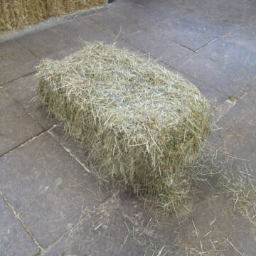
10 Rb Heu/15 RB Öhmd/15 RB Stroh
Helmstadt
Juergen
@Juergen77
Einstreu
Empfänger lädt ab
Rundballen
Regenfrei
2 weitere...
B+
Deprecated: Creation of dynamic property Zend_View_Helper_Ads::$adLink is deprecated in /var/www/stall-frei/htdocs/staging.stall-frei.de/library/Psf/View/Helper/Ads.php on line 108

Persönlichkeitsentwicklung mit Pferden
Bad Salzuflen
Katja Dors
@Pferdezeiten
Begleite andere auf ihrem Entwicklungsweg und entdecke die transformative Kraft der pferdegestützten Persönlichkeitsentwicklung !
neu
R
Leider kein Vorschaubild
Leider kein Vorschaubild
Heu zu verkaufen
Bad Rappenau
Uwe Wolf
@Uwe_Wolf
Heu
Empfänger lädt ab
Rundballen
Regenfrei
2 weitere...
B+

Heu HD Ballen
Carlsberg
Maike Käpernick
@ReitschuleKaepernick
Heu
Empfänger lädt ab
Kleinballen/HD-Ballen
Bio
Regenfrei
2 weitere...
B+

B+

B+
Leider kein Vorschaubild
Leider kein Vorschaubild
Heu- und Luzernecobs
Holzgerlingen
Schlosshof-Holzgerlingen
@Schlosshof-Holzgerlingen
Einstreu
Pellets
Regenfrei
Wird verladen
1 weitere...
B+
Leider kein Vorschaubild
Leider kein Vorschaubild
Kleine HD-Ballen Heu
Weil im Schönbuch
Sabine-Dettinger
@Sabine-Dettinger
Heu
Empfänger lädt ab
Kleinballen/HD-Ballen
Bio
Regenfrei
2 weitere...
B+

MOBILE PFERDEWAAGE
Walddorfhäslach
ReitFein
@ReitFein
Kennst du das genaue Gewicht deines Pferdes? Mit uns erfährst du es - ohne viel Aufwand.
Umso mehr ihr seit, desto günstiger wird es.
aktuell
R

Heu Kleinballen 1. Schnitt - höchste Qualität
Weissach im Tal
Micha
@Micha3
Heu
Empfänger lädt ab
Kleinballen/HD-Ballen
Bio
Regenfrei
2 weitere...
aktuell
B+

Hafer aus Ernte 2025 auch gequetscht zu verkaufen
Wolfschlugen
Reitanlage im Höfelweg
@Reitanlage-im-Hoefelweg
Futter
Wird verladen
Abholung
B+
Deprecated: Creation of dynamic property Zend_View::$pageCount is deprecated in /var/www/stall-frei/htdocs/staging.stall-frei.de/library/vendor/shardj/zf1-future/library/Zend/View/Abstract.php on line 308
Deprecated: Creation of dynamic property Zend_View::$itemCountPerPage is deprecated in /var/www/stall-frei/htdocs/staging.stall-frei.de/library/vendor/shardj/zf1-future/library/Zend/View/Abstract.php on line 308
Deprecated: Creation of dynamic property Zend_View::$first is deprecated in /var/www/stall-frei/htdocs/staging.stall-frei.de/library/vendor/shardj/zf1-future/library/Zend/View/Abstract.php on line 308
Deprecated: Creation of dynamic property Zend_View::$current is deprecated in /var/www/stall-frei/htdocs/staging.stall-frei.de/library/vendor/shardj/zf1-future/library/Zend/View/Abstract.php on line 308
Deprecated: Creation of dynamic property Zend_View::$last is deprecated in /var/www/stall-frei/htdocs/staging.stall-frei.de/library/vendor/shardj/zf1-future/library/Zend/View/Abstract.php on line 308
Deprecated: Creation of dynamic property Zend_View::$next is deprecated in /var/www/stall-frei/htdocs/staging.stall-frei.de/library/vendor/shardj/zf1-future/library/Zend/View/Abstract.php on line 308
Deprecated: Creation of dynamic property Zend_View::$pagesInRange is deprecated in /var/www/stall-frei/htdocs/staging.stall-frei.de/library/vendor/shardj/zf1-future/library/Zend/View/Abstract.php on line 308
Deprecated: Creation of dynamic property Zend_View::$firstPageInRange is deprecated in /var/www/stall-frei/htdocs/staging.stall-frei.de/library/vendor/shardj/zf1-future/library/Zend/View/Abstract.php on line 308
Deprecated: Creation of dynamic property Zend_View::$lastPageInRange is deprecated in /var/www/stall-frei/htdocs/staging.stall-frei.de/library/vendor/shardj/zf1-future/library/Zend/View/Abstract.php on line 308
Deprecated: Creation of dynamic property Zend_View::$currentItemCount is deprecated in /var/www/stall-frei/htdocs/staging.stall-frei.de/library/vendor/shardj/zf1-future/library/Zend/View/Abstract.php on line 308
Deprecated: Creation of dynamic property Zend_View::$totalItemCount is deprecated in /var/www/stall-frei/htdocs/staging.stall-frei.de/library/vendor/shardj/zf1-future/library/Zend/View/Abstract.php on line 308
Deprecated: Creation of dynamic property Zend_View::$firstItemNumber is deprecated in /var/www/stall-frei/htdocs/staging.stall-frei.de/library/vendor/shardj/zf1-future/library/Zend/View/Abstract.php on line 308
Deprecated: Creation of dynamic property Zend_View::$lastItemNumber is deprecated in /var/www/stall-frei/htdocs/staging.stall-frei.de/library/vendor/shardj/zf1-future/library/Zend/View/Abstract.php on line 308
Deprecated: Creation of dynamic property Zend_View::$router is deprecated in /var/www/stall-frei/htdocs/staging.stall-frei.de/library/vendor/shardj/zf1-future/library/Zend/View/Abstract.php on line 308
Deprecated: Creation of dynamic property Zend_View::$urlParams is deprecated in /var/www/stall-frei/htdocs/staging.stall-frei.de/library/vendor/shardj/zf1-future/library/Zend/View/Abstract.php on line 308
Deprecated: Creation of dynamic property Zend_View::$showAds is deprecated in /var/www/stall-frei/htdocs/staging.stall-frei.de/library/vendor/shardj/zf1-future/library/Zend/View/Abstract.php on line 308
Deprecated: Creation of dynamic property Zend_View::$objectIds is deprecated in /var/www/stall-frei/htdocs/staging.stall-frei.de/library/vendor/shardj/zf1-future/library/Zend/View/Abstract.php on line 308
Deprecated: Creation of dynamic property Zend_View::$showNavbar is deprecated in /var/www/stall-frei/htdocs/staging.stall-frei.de/library/vendor/shardj/zf1-future/library/Zend/View/Abstract.php on line 308
Deprecated: Creation of dynamic property Zend_View::$showBreadcrumb is deprecated in /var/www/stall-frei/htdocs/staging.stall-frei.de/library/vendor/shardj/zf1-future/library/Zend/View/Abstract.php on line 308
Deprecated: Creation of dynamic property Zend_View::$showFooter is deprecated in /var/www/stall-frei/htdocs/staging.stall-frei.de/library/vendor/shardj/zf1-future/library/Zend/View/Abstract.php on line 308
Deprecated: Creation of dynamic property Zend_View::$showInternalAds is deprecated in /var/www/stall-frei/htdocs/staging.stall-frei.de/library/vendor/shardj/zf1-future/library/Zend/View/Abstract.php on line 308
Deprecated: Creation of dynamic property Zend_View::$blNoContent is deprecated in /var/www/stall-frei/htdocs/staging.stall-frei.de/library/vendor/shardj/zf1-future/library/Zend/View/Abstract.php on line 308
Deprecated: Creation of dynamic property Zend_View::$sMetaDesc is deprecated in /var/www/stall-frei/htdocs/staging.stall-frei.de/library/vendor/shardj/zf1-future/library/Zend/View/Abstract.php on line 308
Deprecated: Creation of dynamic property Zend_View::$useGmaps is deprecated in /var/www/stall-frei/htdocs/staging.stall-frei.de/library/vendor/shardj/zf1-future/library/Zend/View/Abstract.php on line 308
Deprecated: Creation of dynamic property Zend_View::$touches is deprecated in /var/www/stall-frei/htdocs/staging.stall-frei.de/library/vendor/shardj/zf1-future/library/Zend/View/Abstract.php on line 308
Deprecated: Creation of dynamic property Zend_View::$oProject is deprecated in /var/www/stall-frei/htdocs/staging.stall-frei.de/library/vendor/shardj/zf1-future/library/Zend/View/Abstract.php on line 308
Deprecated: Creation of dynamic property Zend_View::$pageHeadline is deprecated in /var/www/stall-frei/htdocs/staging.stall-frei.de/library/vendor/shardj/zf1-future/library/Zend/View/Abstract.php on line 308
Deprecated: Creation of dynamic property Zend_View::$disableLocationField is deprecated in /var/www/stall-frei/htdocs/staging.stall-frei.de/library/vendor/shardj/zf1-future/library/Zend/View/Abstract.php on line 308
Deprecated: Creation of dynamic property Zend_View::$isSearch is deprecated in /var/www/stall-frei/htdocs/staging.stall-frei.de/library/vendor/shardj/zf1-future/library/Zend/View/Abstract.php on line 308
Deprecated: Creation of dynamic property Zend_View::$pageTitle is deprecated in /var/www/stall-frei/htdocs/staging.stall-frei.de/library/vendor/shardj/zf1-future/library/Zend/View/Abstract.php on line 308
Deprecated: Creation of dynamic property Psf_Form_Element_Text::$class is deprecated in /var/www/stall-frei/htdocs/staging.stall-frei.de/library/vendor/shardj/zf1-future/library/Zend/Form/Element.php on line 874
Deprecated: Creation of dynamic property Psf_Form_Element_Text::$size is deprecated in /var/www/stall-frei/htdocs/staging.stall-frei.de/library/vendor/shardj/zf1-future/library/Zend/Form/Element.php on line 874
Deprecated: Creation of dynamic property Psf_Form_Element_Text::$placeholder is deprecated in /var/www/stall-frei/htdocs/staging.stall-frei.de/library/vendor/shardj/zf1-future/library/Zend/Form/Element.php on line 874
Deprecated: Creation of dynamic property Psf_Form_Element_Hidden::$class is deprecated in /var/www/stall-frei/htdocs/staging.stall-frei.de/library/vendor/shardj/zf1-future/library/Zend/Form/Element.php on line 874
Deprecated: Creation of dynamic property Psf_Form_Element_Hidden::$class is deprecated in /var/www/stall-frei/htdocs/staging.stall-frei.de/library/vendor/shardj/zf1-future/library/Zend/Form/Element.php on line 874
Deprecated: Creation of dynamic property Psf_Form_Element_Hidden::$class is deprecated in /var/www/stall-frei/htdocs/staging.stall-frei.de/library/vendor/shardj/zf1-future/library/Zend/Form/Element.php on line 874
Deprecated: Creation of dynamic property Psf_Form_Element_Hidden::$class is deprecated in /var/www/stall-frei/htdocs/staging.stall-frei.de/library/vendor/shardj/zf1-future/library/Zend/Form/Element.php on line 874
Deprecated: Creation of dynamic property Psf_Form_Element_Select::$class is deprecated in /var/www/stall-frei/htdocs/staging.stall-frei.de/library/vendor/shardj/zf1-future/library/Zend/Form/Element.php on line 874
Deprecated: Creation of dynamic property Psf_Form_Element_Select::$class is deprecated in /var/www/stall-frei/htdocs/staging.stall-frei.de/library/vendor/shardj/zf1-future/library/Zend/Form/Element.php on line 874
Deprecated: Creation of dynamic property Psf_Form_Element_Select::$class is deprecated in /var/www/stall-frei/htdocs/staging.stall-frei.de/library/vendor/shardj/zf1-future/library/Zend/Form/Element.php on line 874
Deprecated: Creation of dynamic property Psf_Form_Element_Select::$class is deprecated in /var/www/stall-frei/htdocs/staging.stall-frei.de/library/vendor/shardj/zf1-future/library/Zend/Form/Element.php on line 874
Deprecated: Creation of dynamic property Zend_View::$sort is deprecated in /var/www/stall-frei/htdocs/staging.stall-frei.de/library/vendor/shardj/zf1-future/library/Zend/View/Abstract.php on line 308
Deprecated: Creation of dynamic property Zend_View::$searchLocation is deprecated in /var/www/stall-frei/htdocs/staging.stall-frei.de/library/vendor/shardj/zf1-future/library/Zend/View/Abstract.php on line 308
Deprecated: Creation of dynamic property Zend_View::$locationHint is deprecated in /var/www/stall-frei/htdocs/staging.stall-frei.de/library/vendor/shardj/zf1-future/library/Zend/View/Abstract.php on line 308
Psf_GeoCoder_Abstract::getLocation: Michaelsberg Get Location CachedOrLive
Psf_GeoCoder_Abstract::getCachedOrLive: Michaelsberg
Psf_GeoCoder_OpenCageData::makeApiRequest: response:
Array
(
[documentation] => https://opencagedata.com/api
[licenses] => Array
(
[0] => Array
(
[name] => see attribution guide
[url] => https://opencagedata.com/credits
)
)
[results] => Array
(
[0] => Array
(
[bounds] => Array
(
[northeast] => Array
(
[lat] => 49.0885767
[lng] => 8.565237
)
[southwest] => Array
(
[lat] => 49.0884767
[lng] => 8.565137
)
)
[components] => Array
(
[ISO_3166-1_alpha-2] => DE
[ISO_3166-1_alpha-3] => DEU
[ISO_3166-2] => Array
(
[0] => DE-BW
)
[_category] => natural/water
[_normalized_city] => Bruchsal
[_type] => peak
[continent] => Europe
[country] => Deutschland
[country_code] => de
[county] => Landkreis Karlsruhe
[municipality] => VVG der Stadt Bruchsal
[peak] => Michaelsberg
[political_union] => European Union
[postcode] => 76646
[state] => Baden-Württemberg
[state_code] => BW
[town] => Bruchsal
)
[confidence] => 9
[formatted] => Michaelsberg, 76646 Bruchsal, Deutschland
[geometry] => Array
(
[lat] => 49.0885267
[lng] => 8.565187
)
)
[1] => Array
(
[bounds] => Array
(
[northeast] => Array
(
[lat] => 49.0382569
[lng] => 9.0448381
)
[southwest] => Array
(
[lat] => 49.0381569
[lng] => 9.0447381
)
)
[components] => Array
(
[ISO_3166-1_alpha-2] => DE
[ISO_3166-1_alpha-3] => DEU
[ISO_3166-2] => Array
(
[0] => DE-BW
)
[_category] => natural/water
[_normalized_city] => Cleebronn
[_type] => peak
[continent] => Europe
[country] => Deutschland
[country_code] => de
[county] => Landkreis Heilbronn
[municipality] => VVG der Stadt Brackenheim
[peak] => Michaelsberg
[political_union] => European Union
[postcode] => 74389
[state] => Baden-Württemberg
[state_code] => BW
[village] => Cleebronn
)
[confidence] => 9
[formatted] => Michaelsberg, 74389 Cleebronn, Deutschland
[geometry] => Array
(
[lat] => 49.0382069
[lng] => 9.0447881
)
)
[2] => Array
(
[bounds] => Array
(
[northeast] => Array
(
[lat] => 50.7951279
[lng] => 7.2111783
)
[southwest] => Array
(
[lat] => 50.7950279
[lng] => 7.2110783
)
)
[components] => Array
(
[ISO_3166-1_alpha-2] => DE
[ISO_3166-1_alpha-3] => DEU
[ISO_3166-2] => Array
(
[0] => DE-NW
)
[_category] => natural/water
[_normalized_city] => Siegburg
[_type] => peak
[continent] => Europe
[country] => Deutschland
[country_code] => de
[county] => Rhein-Sieg-Kreis
[peak] => Michaelsberg
[political_union] => European Union
[postcode] => 53721
[state] => Nordrhein-Westfalen
[state_code] => NW
[town] => Siegburg
)
[confidence] => 9
[formatted] => Michaelsberg, 53721 Siegburg, Deutschland
[geometry] => Array
(
[lat] => 50.7950779
[lng] => 7.2111283
)
)
[3] => Array
(
[bounds] => Array
(
[northeast] => Array
(
[lat] => 49.2912359
[lng] => 9.1539172
)
[southwest] => Array
(
[lat] => 49.2911359
[lng] => 9.1538172
)
)
[components] => Array
(
[ISO_3166-1_alpha-2] => DE
[ISO_3166-1_alpha-3] => DEU
[ISO_3166-2] => Array
(
[0] => DE-BW
)
[_category] => natural/water
[_normalized_city] => Gundelsheim
[_type] => peak
[continent] => Europe
[country] => Deutschland
[country_code] => de
[county] => Landkreis Heilbronn
[peak] => Michaelsberg
[political_union] => European Union
[postcode] => 74855
[state] => Baden-Württemberg
[state_code] => BW
[town] => Gundelsheim
)
[confidence] => 9
[formatted] => Michaelsberg, 74855 Gundelsheim, Deutschland
[geometry] => Array
(
[lat] => 49.2911859
[lng] => 9.1538672
)
)
[4] => Array
(
[bounds] => Array
(
[northeast] => Array
(
[lat] => 49.3824131
[lng] => 7.9790191
)
[southwest] => Array
(
[lat] => 49.3823131
[lng] => 7.9789191
)
)
[components] => Array
(
[ISO_3166-1_alpha-2] => DE
[ISO_3166-1_alpha-3] => DEU
[ISO_3166-2] => Array
(
[0] => DE-RP
)
[_category] => natural/water
[_normalized_city] => Esthal
[_type] => peak
[continent] => Europe
[country] => Deutschland
[country_code] => de
[county] => Landkreis Bad Dürkheim
[municipality] => Lambrecht (Pfalz)
[peak] => Michaelsberg
[political_union] => European Union
[postcode] => 67472
[state] => Rheinland-Pfalz
[state_code] => RP
[village] => Esthal
)
[confidence] => 9
[formatted] => Michaelsberg, 67472 Esthal, Deutschland
[geometry] => Array
(
[lat] => 49.3823631
[lng] => 7.9789691
)
)
[5] => Array
(
[bounds] => Array
(
[northeast] => Array
(
[lat] => 49.4578652
[lng] => 8.387387
)
[southwest] => Array
(
[lat] => 49.4577652
[lng] => 8.387287
)
)
[components] => Array
(
[ISO_3166-1_alpha-2] => DE
[ISO_3166-1_alpha-3] => DEU
[ISO_3166-2] => Array
(
[0] => DE-RP
)
[_category] => natural/water
[_normalized_city] => Ludwigshafen am Rhein
[_type] => peak
[city] => Ludwigshafen am Rhein
[continent] => Europe
[country] => Deutschland
[country_code] => de
[peak] => Michaelsberg
[political_union] => European Union
[postcode] => 67067
[state] => Rheinland-Pfalz
[state_code] => RP
)
[confidence] => 9
[formatted] => Michaelsberg, 67067 Ludwigshafen am Rhein, Deutschland
[geometry] => Array
(
[lat] => 49.4578152
[lng] => 8.387337
)
)
[6] => Array
(
[bounds] => Array
(
[northeast] => Array
(
[lat] => 49.4199121
[lng] => 8.7043793
)
[southwest] => Array
(
[lat] => 49.4198121
[lng] => 8.7042793
)
)
[components] => Array
(
[ISO_3166-1_alpha-2] => DE
[ISO_3166-1_alpha-3] => DEU
[ISO_3166-2] => Array
(
[0] => DE-BW
)
[_category] => natural/water
[_normalized_city] => Heidelberg
[_type] => peak
[city] => Heidelberg
[continent] => Europe
[country] => Deutschland
[country_code] => de
[peak] => Michelsberg
[political_union] => European Union
[postcode] => 69001
[state] => Baden-Württemberg
[state_code] => BW
)
[confidence] => 9
[formatted] => Michelsberg, 69001 Heidelberg, Deutschland
[geometry] => Array
(
[lat] => 49.4198621
[lng] => 8.7043293
)
)
[7] => Array
(
[bounds] => Array
(
[northeast] => Array
(
[lat] => 49.3117006
[lng] => 9.1721151
)
[southwest] => Array
(
[lat] => 49.2717006
[lng] => 9.1321151
)
)
[components] => Array
(
[ISO_3166-1_alpha-2] => DE
[ISO_3166-1_alpha-3] => DEU
[ISO_3166-2] => Array
(
[0] => DE-BW
)
[_category] => place
[_normalized_city] => Gundelsheim
[_type] => hamlet
[continent] => Europe
[country] => Deutschland
[country_code] => de
[county] => Landkreis Heilbronn
[hamlet] => Michaelsberg
[political_union] => European Union
[postcode] => 74855
[state] => Baden-Württemberg
[state_code] => BW
[town] => Gundelsheim
[village] => Böttingen
)
[confidence] => 7
[formatted] => Michaelsberg, 74855 Böttingen, Deutschland
[geometry] => Array
(
[lat] => 49.2917006
[lng] => 9.1521151
)
)
[8] => Array
(
[bounds] => Array
(
[northeast] => Array
(
[lat] => 47.7382312
[lng] => 9.4472751
)
[southwest] => Array
(
[lat] => 47.7182312
[lng] => 9.4272751
)
)
[components] => Array
(
[ISO_3166-1_alpha-2] => DE
[ISO_3166-1_alpha-3] => DEU
[ISO_3166-2] => Array
(
[0] => DE-BW
)
[_category] => agriculture
[_normalized_city] => Markdorf
[_type] => farm
[continent] => Europe
[country] => Deutschland
[country_code] => de
[county] => Bodenseekreis
[farm] => Michaelsberg
[municipality] => GVV Markdorf
[political_union] => European Union
[postcode] => 88677
[state] => Baden-Württemberg
[state_code] => BW
[town] => Markdorf
[village] => Riedheim
)
[confidence] => 8
[formatted] => Michaelsberg, 88677 Riedheim, Deutschland
[geometry] => Array
(
[lat] => 47.7282312
[lng] => 9.4372751
)
)
[9] => Array
(
[bounds] => Array
(
[northeast] => Array
(
[lat] => 49.038798
[lng] => 9.0463739
)
[southwest] => Array
(
[lat] => 49.038698
[lng] => 9.0462739
)
)
[components] => Array
(
[ISO_3166-1_alpha-2] => DE
[ISO_3166-1_alpha-3] => DEU
[ISO_3166-2] => Array
(
[0] => DE-BW
)
[_category] => building
[_normalized_city] => Cleebronn
[_type] => building
[continent] => Europe
[country] => Deutschland
[country_code] => de
[county] => Landkreis Heilbronn
[hamlet] => Treffentrill
[isolated_dwelling] => Michaelsberg
[municipality] => VVG der Stadt Brackenheim
[political_union] => European Union
[postcode] => 74389
[state] => Baden-Württemberg
[state_code] => BW
[village] => Cleebronn
)
[confidence] => 10
[formatted] => Michaelsberg, Treffentrill, 74389 Cleebronn, Deutschland
[geometry] => Array
(
[lat] => 49.038748
[lng] => 9.0463239
)
)
)
[status] => Array
(
[code] => 200
[message] => OK
)
[stay_informed] => Array
(
[blog] => https://blog.opencagedata.com
[mastodon] => https://en.osm.town/@opencage
)
[thanks] => For using an OpenCage API
[timestamp] => Array
(
[created_http] => Sun, 08 Feb 2026 14:09:00 GMT
[created_unix] => 1770559740
)
[total_results] => 10
)
Psf_GeoCoder_Abstract::convertLocationResult
{"documentation":"https:\/\/opencagedata.com\/api","licenses":[{"name":"see attribution guide","url":"https:\/\/opencagedata.com\/credits"}],"results":[{"bounds":{"northeast":{"lat":49.0885767,"lng":8.565237},"southwest":{"lat":49.0884767,"lng":8.565137}},"components":{"ISO_3166-1_alpha-2":"DE","ISO_3166-1_alpha-3":"DEU","ISO_3166-2":["DE-BW"],"_category":"natural\/water","_normalized_city":"Bruchsal","_type":"peak","continent":"Europe","country":"Deutschland","country_code":"de","county":"Landkreis Karlsruhe","municipality":"VVG der Stadt Bruchsal","peak":"Michaelsberg","political_union":"European Union","postcode":"76646","state":"Baden-W\u00fcrttemberg","state_code":"BW","town":"Bruchsal"},"confidence":9,"formatted":"Michaelsberg, 76646 Bruchsal, Deutschland","geometry":{"lat":49.0885267,"lng":8.565187}},{"bounds":{"northeast":{"lat":49.0382569,"lng":9.0448381},"southwest":{"lat":49.0381569,"lng":9.0447381}},"components":{"ISO_3166-1_alpha-2":"DE","ISO_3166-1_alpha-3":"DEU","ISO_3166-2":["DE-BW"],"_category":"natural\/water","_normalized_city":"Cleebronn","_type":"peak","continent":"Europe","country":"Deutschland","country_code":"de","county":"Landkreis Heilbronn","municipality":"VVG der Stadt Brackenheim","peak":"Michaelsberg","political_union":"European Union","postcode":"74389","state":"Baden-W\u00fcrttemberg","state_code":"BW","village":"Cleebronn"},"confidence":9,"formatted":"Michaelsberg, 74389 Cleebronn, Deutschland","geometry":{"lat":49.0382069,"lng":9.0447881}},{"bounds":{"northeast":{"lat":50.7951279,"lng":7.2111783},"southwest":{"lat":50.7950279,"lng":7.2110783}},"components":{"ISO_3166-1_alpha-2":"DE","ISO_3166-1_alpha-3":"DEU","ISO_3166-2":["DE-NW"],"_category":"natural\/water","_normalized_city":"Siegburg","_type":"peak","continent":"Europe","country":"Deutschland","country_code":"de","county":"Rhein-Sieg-Kreis","peak":"Michaelsberg","political_union":"European Union","postcode":"53721","state":"Nordrhein-Westfalen","state_code":"NW","town":"Siegburg"},"confidence":9,"formatted":"Michaelsberg, 53721 Siegburg, Deutschland","geometry":{"lat":50.7950779,"lng":7.2111283}},{"bounds":{"northeast":{"lat":49.2912359,"lng":9.1539172},"southwest":{"lat":49.2911359,"lng":9.1538172}},"components":{"ISO_3166-1_alpha-2":"DE","ISO_3166-1_alpha-3":"DEU","ISO_3166-2":["DE-BW"],"_category":"natural\/water","_normalized_city":"Gundelsheim","_type":"peak","continent":"Europe","country":"Deutschland","country_code":"de","county":"Landkreis Heilbronn","peak":"Michaelsberg","political_union":"European Union","postcode":"74855","state":"Baden-W\u00fcrttemberg","state_code":"BW","town":"Gundelsheim"},"confidence":9,"formatted":"Michaelsberg, 74855 Gundelsheim, Deutschland","geometry":{"lat":49.2911859,"lng":9.1538672}},{"bounds":{"northeast":{"lat":49.3824131,"lng":7.9790191},"southwest":{"lat":49.3823131,"lng":7.9789191}},"components":{"ISO_3166-1_alpha-2":"DE","ISO_3166-1_alpha-3":"DEU","ISO_3166-2":["DE-RP"],"_category":"natural\/water","_normalized_city":"Esthal","_type":"peak","continent":"Europe","country":"Deutschland","country_code":"de","county":"Landkreis Bad D\u00fcrkheim","municipality":"Lambrecht (Pfalz)","peak":"Michaelsberg","political_union":"European Union","postcode":"67472","state":"Rheinland-Pfalz","state_code":"RP","village":"Esthal"},"confidence":9,"formatted":"Michaelsberg, 67472 Esthal, Deutschland","geometry":{"lat":49.3823631,"lng":7.9789691}},{"bounds":{"northeast":{"lat":49.4578652,"lng":8.387387},"southwest":{"lat":49.4577652,"lng":8.387287}},"components":{"ISO_3166-1_alpha-2":"DE","ISO_3166-1_alpha-3":"DEU","ISO_3166-2":["DE-RP"],"_category":"natural\/water","_normalized_city":"Ludwigshafen am Rhein","_type":"peak","city":"Ludwigshafen am Rhein","continent":"Europe","country":"Deutschland","country_code":"de","peak":"Michaelsberg","political_union":"European Union","postcode":"67067","state":"Rheinland-Pfalz","state_code":"RP"},"confidence":9,"formatted":"Michaelsberg, 67067 Ludwigshafen am Rhein, Deutschland","geometry":{"lat":49.4578152,"lng":8.387337}},{"bounds":{"northeast":{"lat":49.4199121,"lng":8.7043793},"southwest":{"lat":49.4198121,"lng":8.7042793}},"components":{"ISO_3166-1_alpha-2":"DE","ISO_3166-1_alpha-3":"DEU","ISO_3166-2":["DE-BW"],"_category":"natural\/water","_normalized_city":"Heidelberg","_type":"peak","city":"Heidelberg","continent":"Europe","country":"Deutschland","country_code":"de","peak":"Michelsberg","political_union":"European Union","postcode":"69001","state":"Baden-W\u00fcrttemberg","state_code":"BW"},"confidence":9,"formatted":"Michelsberg, 69001 Heidelberg, Deutschland","geometry":{"lat":49.4198621,"lng":8.7043293}},{"bounds":{"northeast":{"lat":49.3117006,"lng":9.1721151},"southwest":{"lat":49.2717006,"lng":9.1321151}},"components":{"ISO_3166-1_alpha-2":"DE","ISO_3166-1_alpha-3":"DEU","ISO_3166-2":["DE-BW"],"_category":"place","_normalized_city":"Gundelsheim","_type":"hamlet","continent":"Europe","country":"Deutschland","country_code":"de","county":"Landkreis Heilbronn","hamlet":"Michaelsberg","political_union":"European Union","postcode":"74855","state":"Baden-W\u00fcrttemberg","state_code":"BW","town":"Gundelsheim","village":"B\u00f6ttingen"},"confidence":7,"formatted":"Michaelsberg, 74855 B\u00f6ttingen, Deutschland","geometry":{"lat":49.2917006,"lng":9.1521151}},{"bounds":{"northeast":{"lat":47.7382312,"lng":9.4472751},"southwest":{"lat":47.7182312,"lng":9.4272751}},"components":{"ISO_3166-1_alpha-2":"DE","ISO_3166-1_alpha-3":"DEU","ISO_3166-2":["DE-BW"],"_category":"agriculture","_normalized_city":"Markdorf","_type":"farm","continent":"Europe","country":"Deutschland","country_code":"de","county":"Bodenseekreis","farm":"Michaelsberg","municipality":"GVV Markdorf","political_union":"European Union","postcode":"88677","state":"Baden-W\u00fcrttemberg","state_code":"BW","town":"Markdorf","village":"Riedheim"},"confidence":8,"formatted":"Michaelsberg, 88677 Riedheim, Deutschland","geometry":{"lat":47.7282312,"lng":9.4372751}},{"bounds":{"northeast":{"lat":49.038798,"lng":9.0463739},"southwest":{"lat":49.038698,"lng":9.0462739}},"components":{"ISO_3166-1_alpha-2":"DE","ISO_3166-1_alpha-3":"DEU","ISO_3166-2":["DE-BW"],"_category":"building","_normalized_city":"Cleebronn","_type":"building","continent":"Europe","country":"Deutschland","country_code":"de","county":"Landkreis Heilbronn","hamlet":"Treffentrill","isolated_dwelling":"Michaelsberg","municipality":"VVG der Stadt Brackenheim","political_union":"European Union","postcode":"74389","state":"Baden-W\u00fcrttemberg","state_code":"BW","village":"Cleebronn"},"confidence":10,"formatted":"Michaelsberg, Treffentrill, 74389 Cleebronn, Deutschland","geometry":{"lat":49.038748,"lng":9.0463239}}],"status":{"code":200,"message":"OK"},"stay_informed":{"blog":"https:\/\/blog.opencagedata.com","mastodon":"https:\/\/en.osm.town\/@opencage"},"thanks":"For using an OpenCage API","timestamp":{"created_http":"Sun, 08 Feb 2026 14:09:00 GMT","created_unix":1770559740},"total_results":10}Array
(
[0] => stdClass Object
(
[bounds] => stdClass Object
(
[northeast] => stdClass Object
(
[lat] => 49.0885767
[lng] => 8.565237
)
[southwest] => stdClass Object
(
[lat] => 49.0884767
[lng] => 8.565137
)
)
[components] => stdClass Object
(
[ISO_3166-1_alpha-2] => DE
[ISO_3166-1_alpha-3] => DEU
[ISO_3166-2] => Array
(
[0] => DE-BW
)
[_category] => natural/water
[_normalized_city] => Bruchsal
[_type] => peak
[continent] => Europe
[country] => Deutschland
[country_code] => de
[county] => Landkreis Karlsruhe
[municipality] => VVG der Stadt Bruchsal
[peak] => Michaelsberg
[political_union] => European Union
[postcode] => 76646
[state] => Baden-Württemberg
[state_code] => BW
[town] => Bruchsal
)
[confidence] => 9
[formatted] => Michaelsberg, 76646 Bruchsal, Deutschland
[geometry] => stdClass Object
(
[lat] => 49.0885267
[lng] => 8.565187
)
)
[1] => stdClass Object
(
[bounds] => stdClass Object
(
[northeast] => stdClass Object
(
[lat] => 49.0382569
[lng] => 9.0448381
)
[southwest] => stdClass Object
(
[lat] => 49.0381569
[lng] => 9.0447381
)
)
[components] => stdClass Object
(
[ISO_3166-1_alpha-2] => DE
[ISO_3166-1_alpha-3] => DEU
[ISO_3166-2] => Array
(
[0] => DE-BW
)
[_category] => natural/water
[_normalized_city] => Cleebronn
[_type] => peak
[continent] => Europe
[country] => Deutschland
[country_code] => de
[county] => Landkreis Heilbronn
[municipality] => VVG der Stadt Brackenheim
[peak] => Michaelsberg
[political_union] => European Union
[postcode] => 74389
[state] => Baden-Württemberg
[state_code] => BW
[village] => Cleebronn
)
[confidence] => 9
[formatted] => Michaelsberg, 74389 Cleebronn, Deutschland
[geometry] => stdClass Object
(
[lat] => 49.0382069
[lng] => 9.0447881
)
)
[2] => stdClass Object
(
[bounds] => stdClass Object
(
[northeast] => stdClass Object
(
[lat] => 50.7951279
[lng] => 7.2111783
)
[southwest] => stdClass Object
(
[lat] => 50.7950279
[lng] => 7.2110783
)
)
[components] => stdClass Object
(
[ISO_3166-1_alpha-2] => DE
[ISO_3166-1_alpha-3] => DEU
[ISO_3166-2] => Array
(
[0] => DE-NW
)
[_category] => natural/water
[_normalized_city] => Siegburg
[_type] => peak
[continent] => Europe
[country] => Deutschland
[country_code] => de
[county] => Rhein-Sieg-Kreis
[peak] => Michaelsberg
[political_union] => European Union
[postcode] => 53721
[state] => Nordrhein-Westfalen
[state_code] => NW
[town] => Siegburg
)
[confidence] => 9
[formatted] => Michaelsberg, 53721 Siegburg, Deutschland
[geometry] => stdClass Object
(
[lat] => 50.7950779
[lng] => 7.2111283
)
)
[3] => stdClass Object
(
[bounds] => stdClass Object
(
[northeast] => stdClass Object
(
[lat] => 49.2912359
[lng] => 9.1539172
)
[southwest] => stdClass Object
(
[lat] => 49.2911359
[lng] => 9.1538172
)
)
[components] => stdClass Object
(
[ISO_3166-1_alpha-2] => DE
[ISO_3166-1_alpha-3] => DEU
[ISO_3166-2] => Array
(
[0] => DE-BW
)
[_category] => natural/water
[_normalized_city] => Gundelsheim
[_type] => peak
[continent] => Europe
[country] => Deutschland
[country_code] => de
[county] => Landkreis Heilbronn
[peak] => Michaelsberg
[political_union] => European Union
[postcode] => 74855
[state] => Baden-Württemberg
[state_code] => BW
[town] => Gundelsheim
)
[confidence] => 9
[formatted] => Michaelsberg, 74855 Gundelsheim, Deutschland
[geometry] => stdClass Object
(
[lat] => 49.2911859
[lng] => 9.1538672
)
)
[4] => stdClass Object
(
[bounds] => stdClass Object
(
[northeast] => stdClass Object
(
[lat] => 49.3824131
[lng] => 7.9790191
)
[southwest] => stdClass Object
(
[lat] => 49.3823131
[lng] => 7.9789191
)
)
[components] => stdClass Object
(
[ISO_3166-1_alpha-2] => DE
[ISO_3166-1_alpha-3] => DEU
[ISO_3166-2] => Array
(
[0] => DE-RP
)
[_category] => natural/water
[_normalized_city] => Esthal
[_type] => peak
[continent] => Europe
[country] => Deutschland
[country_code] => de
[county] => Landkreis Bad Dürkheim
[municipality] => Lambrecht (Pfalz)
[peak] => Michaelsberg
[political_union] => European Union
[postcode] => 67472
[state] => Rheinland-Pfalz
[state_code] => RP
[village] => Esthal
)
[confidence] => 9
[formatted] => Michaelsberg, 67472 Esthal, Deutschland
[geometry] => stdClass Object
(
[lat] => 49.3823631
[lng] => 7.9789691
)
)
[5] => stdClass Object
(
[bounds] => stdClass Object
(
[northeast] => stdClass Object
(
[lat] => 49.4578652
[lng] => 8.387387
)
[southwest] => stdClass Object
(
[lat] => 49.4577652
[lng] => 8.387287
)
)
[components] => stdClass Object
(
[ISO_3166-1_alpha-2] => DE
[ISO_3166-1_alpha-3] => DEU
[ISO_3166-2] => Array
(
[0] => DE-RP
)
[_category] => natural/water
[_normalized_city] => Ludwigshafen am Rhein
[_type] => peak
[city] => Ludwigshafen am Rhein
[continent] => Europe
[country] => Deutschland
[country_code] => de
[peak] => Michaelsberg
[political_union] => European Union
[postcode] => 67067
[state] => Rheinland-Pfalz
[state_code] => RP
)
[confidence] => 9
[formatted] => Michaelsberg, 67067 Ludwigshafen am Rhein, Deutschland
[geometry] => stdClass Object
(
[lat] => 49.4578152
[lng] => 8.387337
)
)
[6] => stdClass Object
(
[bounds] => stdClass Object
(
[northeast] => stdClass Object
(
[lat] => 49.4199121
[lng] => 8.7043793
)
[southwest] => stdClass Object
(
[lat] => 49.4198121
[lng] => 8.7042793
)
)
[components] => stdClass Object
(
[ISO_3166-1_alpha-2] => DE
[ISO_3166-1_alpha-3] => DEU
[ISO_3166-2] => Array
(
[0] => DE-BW
)
[_category] => natural/water
[_normalized_city] => Heidelberg
[_type] => peak
[city] => Heidelberg
[continent] => Europe
[country] => Deutschland
[country_code] => de
[peak] => Michelsberg
[political_union] => European Union
[postcode] => 69001
[state] => Baden-Württemberg
[state_code] => BW
)
[confidence] => 9
[formatted] => Michelsberg, 69001 Heidelberg, Deutschland
[geometry] => stdClass Object
(
[lat] => 49.4198621
[lng] => 8.7043293
)
)
[7] => stdClass Object
(
[bounds] => stdClass Object
(
[northeast] => stdClass Object
(
[lat] => 49.3117006
[lng] => 9.1721151
)
[southwest] => stdClass Object
(
[lat] => 49.2717006
[lng] => 9.1321151
)
)
[components] => stdClass Object
(
[ISO_3166-1_alpha-2] => DE
[ISO_3166-1_alpha-3] => DEU
[ISO_3166-2] => Array
(
[0] => DE-BW
)
[_category] => place
[_normalized_city] => Gundelsheim
[_type] => hamlet
[continent] => Europe
[country] => Deutschland
[country_code] => de
[county] => Landkreis Heilbronn
[hamlet] => Michaelsberg
[political_union] => European Union
[postcode] => 74855
[state] => Baden-Württemberg
[state_code] => BW
[town] => Gundelsheim
[village] => Böttingen
)
[confidence] => 7
[formatted] => Michaelsberg, 74855 Böttingen, Deutschland
[geometry] => stdClass Object
(
[lat] => 49.2917006
[lng] => 9.1521151
)
)
[8] => stdClass Object
(
[bounds] => stdClass Object
(
[northeast] => stdClass Object
(
[lat] => 47.7382312
[lng] => 9.4472751
)
[southwest] => stdClass Object
(
[lat] => 47.7182312
[lng] => 9.4272751
)
)
[components] => stdClass Object
(
[ISO_3166-1_alpha-2] => DE
[ISO_3166-1_alpha-3] => DEU
[ISO_3166-2] => Array
(
[0] => DE-BW
)
[_category] => agriculture
[_normalized_city] => Markdorf
[_type] => farm
[continent] => Europe
[country] => Deutschland
[country_code] => de
[county] => Bodenseekreis
[farm] => Michaelsberg
[municipality] => GVV Markdorf
[political_union] => European Union
[postcode] => 88677
[state] => Baden-Württemberg
[state_code] => BW
[town] => Markdorf
[village] => Riedheim
)
[confidence] => 8
[formatted] => Michaelsberg, 88677 Riedheim, Deutschland
[geometry] => stdClass Object
(
[lat] => 47.7282312
[lng] => 9.4372751
)
)
[9] => stdClass Object
(
[bounds] => stdClass Object
(
[northeast] => stdClass Object
(
[lat] => 49.038798
[lng] => 9.0463739
)
[southwest] => stdClass Object
(
[lat] => 49.038698
[lng] => 9.0462739
)
)
[components] => stdClass Object
(
[ISO_3166-1_alpha-2] => DE
[ISO_3166-1_alpha-3] => DEU
[ISO_3166-2] => Array
(
[0] => DE-BW
)
[_category] => building
[_normalized_city] => Cleebronn
[_type] => building
[continent] => Europe
[country] => Deutschland
[country_code] => de
[county] => Landkreis Heilbronn
[hamlet] => Treffentrill
[isolated_dwelling] => Michaelsberg
[municipality] => VVG der Stadt Brackenheim
[political_union] => European Union
[postcode] => 74389
[state] => Baden-Württemberg
[state_code] => BW
[village] => Cleebronn
)
[confidence] => 10
[formatted] => Michaelsberg, Treffentrill, 74389 Cleebronn, Deutschland
[geometry] => stdClass Object
(
[lat] => 49.038748
[lng] => 9.0463239
)
)
)
Psf_GeoCoder_OpenCageData::getKeyMap: 0
stdClass Object
(
    [bounds] => stdClass Object
        (
            [northeast] => stdClass Object
                (
                    [lat] => 49.0885767
                    [lng] => 8.565237
                )

            [southwest] => stdClass Object
                (
                    [lat] => 49.0884767
                    [lng] => 8.565137
                )

        )

    [components] => stdClass Object
        (
            [ISO_3166-1_alpha-2] => DE
            [ISO_3166-1_alpha-3] => DEU
            [ISO_3166-2] => Array
                (
                    [0] => DE-BW
                )

            [_category] => natural/water
            [_normalized_city] => Bruchsal
            [_type] => peak
            [continent] => Europe
            [country] => Deutschland
            [country_code] => de
            [county] => Landkreis Karlsruhe
            [municipality] => VVG der Stadt Bruchsal
            [peak] => Michaelsberg
            [political_union] => European Union
            [postcode] => 76646
            [state] => Baden-Württemberg
            [state_code] => BW
            [town] => Bruchsal
        )

    [confidence] => 9
    [formatted] => Michaelsberg, 76646 Bruchsal, Deutschland
    [geometry] => stdClass Object
        (
            [lat] => 49.0885267
            [lng] => 8.565187
        )

)
Psf_GeoCoder_OpenCageData::getCounty: Karlsruhe
Psf_GeoCoder_OpenCageData::addMissingData REFETCH!
Array
(
    [address] => Michaelsberg, 76646 Bruchsal, Deutschland
    [type] => peak
    [street] =>
    [city] => Bruchsal
    [county] => Karlsruhe
    [state] => Baden-Württemberg
    [zip] => 76646
    [country] => Deutschland
    [suburb] =>
    [countrycode] => de
    [latitude] => 49.0885267
    [longitude] => 8.565187
    [accuracy] => 1
    [confidence] => 9
    [bounds] => stdClass Object
        (
            [northeast] => stdClass Object
                (
                    [lat] => 49.0885767
                    [lng] => 8.565237
                )

            [southwest] => stdClass Object
                (
                    [lat] => 49.0884767
                    [lng] => 8.565137
                )

        )

)
reformat!
Array
(
    [address] => Michaelsberg, 76646 Bruchsal, Deutschland
    [type] => peak
    [street] =>
    [city] => Bruchsal
    [county] => Karlsruhe
    [state] => Baden-Württemberg
    [zip] => 76646
    [country] => Deutschland
    [suburb] =>
    [countrycode] => de
    [latitude] => 49.0885267
    [longitude] => 8.565187
    [accuracy] => 1
    [confidence] => 9
    [bounds] => stdClass Object
        (
            [northeast] => stdClass Object
                (
                    [lat] => 49.0885767
                    [lng] => 8.565237
                )

            [southwest] => stdClass Object
                (
                    [lat] => 49.0884767
                    [lng] => 8.565137
                )

        )

    [place] => 76646 Bruchsal, Baden-Württemberg
    [hash] => 438add0b8452fec0312b55719120bc50
)
Psf_GeoCoder_OpenCageData::getKeyMap: 1
stdClass Object
(
    [bounds] => stdClass Object
        (
            [northeast] => stdClass Object
                (
                    [lat] => 49.0382569
                    [lng] => 9.0448381
                )

            [southwest] => stdClass Object
                (
                    [lat] => 49.0381569
                    [lng] => 9.0447381
                )

        )

    [components] => stdClass Object
        (
            [ISO_3166-1_alpha-2] => DE
            [ISO_3166-1_alpha-3] => DEU
            [ISO_3166-2] => Array
                (
                    [0] => DE-BW
                )

            [_category] => natural/water
            [_normalized_city] => Cleebronn
            [_type] => peak
            [continent] => Europe
            [country] => Deutschland
            [country_code] => de
            [county] => Landkreis Heilbronn
            [municipality] => VVG der Stadt Brackenheim
            [peak] => Michaelsberg
            [political_union] => European Union
            [postcode] => 74389
            [state] => Baden-Württemberg
            [state_code] => BW
            [village] => Cleebronn
        )

    [confidence] => 9
    [formatted] => Michaelsberg, 74389 Cleebronn, Deutschland
    [geometry] => stdClass Object
        (
            [lat] => 49.0382069
            [lng] => 9.0447881
        )

)
Psf_GeoCoder_OpenCageData::getCounty: Heilbronn
Psf_GeoCoder_OpenCageData::addMissingData REFETCH!
Array
(
    [address] => Michaelsberg, 74389 Cleebronn, Deutschland
    [type] => peak
    [street] =>
    [city] => Cleebronn
    [county] => Heilbronn
    [state] => Baden-Württemberg
    [zip] => 74389
    [country] => Deutschland
    [suburb] =>
    [countrycode] => de
    [latitude] => 49.0382069
    [longitude] => 9.0447881
    [accuracy] => 1
    [confidence] => 9
    [bounds] => stdClass Object
        (
            [northeast] => stdClass Object
                (
                    [lat] => 49.0382569
                    [lng] => 9.0448381
                )

            [southwest] => stdClass Object
                (
                    [lat] => 49.0381569
                    [lng] => 9.0447381
                )

        )

)
reformat!
Array
(
    [address] => Michaelsberg, 74389 Cleebronn, Deutschland
    [type] => peak
    [street] =>
    [city] => Cleebronn
    [county] => Heilbronn
    [state] => Baden-Württemberg
    [zip] => 74389
    [country] => Deutschland
    [suburb] =>
    [countrycode] => de
    [latitude] => 49.0382069
    [longitude] => 9.0447881
    [accuracy] => 1
    [confidence] => 9
    [bounds] => stdClass Object
        (
            [northeast] => stdClass Object
                (
                    [lat] => 49.0382569
                    [lng] => 9.0448381
                )

            [southwest] => stdClass Object
                (
                    [lat] => 49.0381569
                    [lng] => 9.0447381
                )

        )

    [place] => 74389 Cleebronn, Baden-Württemberg
    [hash] => 10fdb0a86c60412f6046507bed894dd4
)
Psf_GeoCoder_OpenCageData::getKeyMap: 2
stdClass Object
(
    [bounds] => stdClass Object
        (
            [northeast] => stdClass Object
                (
                    [lat] => 50.7951279
                    [lng] => 7.2111783
                )

            [southwest] => stdClass Object
                (
                    [lat] => 50.7950279
                    [lng] => 7.2110783
                )

        )

    [components] => stdClass Object
        (
            [ISO_3166-1_alpha-2] => DE
            [ISO_3166-1_alpha-3] => DEU
            [ISO_3166-2] => Array
                (
                    [0] => DE-NW
                )

            [_category] => natural/water
            [_normalized_city] => Siegburg
            [_type] => peak
            [continent] => Europe
            [country] => Deutschland
            [country_code] => de
            [county] => Rhein-Sieg-Kreis
            [peak] => Michaelsberg
            [political_union] => European Union
            [postcode] => 53721
            [state] => Nordrhein-Westfalen
            [state_code] => NW
            [town] => Siegburg
        )

    [confidence] => 9
    [formatted] => Michaelsberg, 53721 Siegburg, Deutschland
    [geometry] => stdClass Object
        (
            [lat] => 50.7950779
            [lng] => 7.2111283
        )

)
Psf_GeoCoder_OpenCageData::getCounty: Rhein-Sieg-Kreis
Psf_GeoCoder_OpenCageData::addMissingData REFETCH!
Array
(
    [address] => Michaelsberg, 53721 Siegburg, Deutschland
    [type] => peak
    [street] =>
    [city] => Siegburg
    [county] => Rhein-Sieg-Kreis
    [state] => Nordrhein-Westfalen
    [zip] => 53721
    [country] => Deutschland
    [suburb] =>
    [countrycode] => de
    [latitude] => 50.7950779
    [longitude] => 7.2111283
    [accuracy] => 1
    [confidence] => 9
    [bounds] => stdClass Object
        (
            [northeast] => stdClass Object
                (
                    [lat] => 50.7951279
                    [lng] => 7.2111783
                )

            [southwest] => stdClass Object
                (
                    [lat] => 50.7950279
                    [lng] => 7.2110783
                )

        )

)
reformat!
Array
(
    [address] => Michaelsberg, 53721 Siegburg, Deutschland
    [type] => peak
    [street] =>
    [city] => Siegburg
    [county] => Rhein-Sieg-Kreis
    [state] => Nordrhein-Westfalen
    [zip] => 53721
    [country] => Deutschland
    [suburb] =>
    [countrycode] => de
    [latitude] => 50.7950779
    [longitude] => 7.2111283
    [accuracy] => 1
    [confidence] => 9
    [bounds] => stdClass Object
        (
            [northeast] => stdClass Object
                (
                    [lat] => 50.7951279
                    [lng] => 7.2111783
                )

            [southwest] => stdClass Object
                (
                    [lat] => 50.7950279
                    [lng] => 7.2110783
                )

        )

    [place] => 53721 Siegburg, Nordrhein-Westfalen
    [hash] => af9329394cb7e202a4046725e49c0b6e
)
Psf_GeoCoder_OpenCageData::getKeyMap: 3
stdClass Object
(
    [bounds] => stdClass Object
        (
            [northeast] => stdClass Object
                (
                    [lat] => 49.2912359
                    [lng] => 9.1539172
                )

            [southwest] => stdClass Object
                (
                    [lat] => 49.2911359
                    [lng] => 9.1538172
                )

        )

    [components] => stdClass Object
        (
            [ISO_3166-1_alpha-2] => DE
            [ISO_3166-1_alpha-3] => DEU
            [ISO_3166-2] => Array
                (
                    [0] => DE-BW
                )

            [_category] => natural/water
            [_normalized_city] => Gundelsheim
            [_type] => peak
            [continent] => Europe
            [country] => Deutschland
            [country_code] => de
            [county] => Landkreis Heilbronn
            [peak] => Michaelsberg
            [political_union] => European Union
            [postcode] => 74855
            [state] => Baden-Württemberg
            [state_code] => BW
            [town] => Gundelsheim
        )

    [confidence] => 9
    [formatted] => Michaelsberg, 74855 Gundelsheim, Deutschland
    [geometry] => stdClass Object
        (
            [lat] => 49.2911859
            [lng] => 9.1538672
        )

)
Psf_GeoCoder_OpenCageData::getCounty: Heilbronn
Psf_GeoCoder_OpenCageData::addMissingData REFETCH!
Array
(
    [address] => Michaelsberg, 74855 Gundelsheim, Deutschland
    [type] => peak
    [street] =>
    [city] => Gundelsheim
    [county] => Heilbronn
    [state] => Baden-Württemberg
    [zip] => 74855
    [country] => Deutschland
    [suburb] =>
    [countrycode] => de
    [latitude] => 49.2911859
    [longitude] => 9.1538672
    [accuracy] => 1
    [confidence] => 9
    [bounds] => stdClass Object
        (
            [northeast] => stdClass Object
                (
                    [lat] => 49.2912359
                    [lng] => 9.1539172
                )

            [southwest] => stdClass Object
                (
                    [lat] => 49.2911359
                    [lng] => 9.1538172
                )

        )

)
reformat!
Array
(
    [address] => Michaelsberg, 74855 Gundelsheim, Deutschland
    [type] => peak
    [street] =>
    [city] => Gundelsheim
    [county] => Heilbronn
    [state] => Baden-Württemberg
    [zip] => 74855
    [country] => Deutschland
    [suburb] =>
    [countrycode] => de
    [latitude] => 49.2911859
    [longitude] => 9.1538672
    [accuracy] => 1
    [confidence] => 9
    [bounds] => stdClass Object
        (
            [northeast] => stdClass Object
                (
                    [lat] => 49.2912359
                    [lng] => 9.1539172
                )

            [southwest] => stdClass Object
                (
                    [lat] => 49.2911359
                    [lng] => 9.1538172
                )

        )

    [place] => 74855 Gundelsheim, Baden-Württemberg
    [hash] => 836de6db96b73db8bc93bf9414bc213f
)
Psf_GeoCoder_OpenCageData::getKeyMap: 4
stdClass Object
(
    [bounds] => stdClass Object
        (
            [northeast] => stdClass Object
                (
                    [lat] => 49.3824131
                    [lng] => 7.9790191
                )

            [southwest] => stdClass Object
                (
                    [lat] => 49.3823131
                    [lng] => 7.9789191
                )

        )

    [components] => stdClass Object
        (
            [ISO_3166-1_alpha-2] => DE
            [ISO_3166-1_alpha-3] => DEU
            [ISO_3166-2] => Array
                (
                    [0] => DE-RP
                )

            [_category] => natural/water
            [_normalized_city] => Esthal
            [_type] => peak
            [continent] => Europe
            [country] => Deutschland
            [country_code] => de
            [county] => Landkreis Bad Dürkheim
            [municipality] => Lambrecht (Pfalz)
            [peak] => Michaelsberg
            [political_union] => European Union
            [postcode] => 67472
            [state] => Rheinland-Pfalz
            [state_code] => RP
            [village] => Esthal
        )

    [confidence] => 9
    [formatted] => Michaelsberg, 67472 Esthal, Deutschland
    [geometry] => stdClass Object
        (
            [lat] => 49.3823631
            [lng] => 7.9789691
        )

)
Psf_GeoCoder_OpenCageData::getCounty: Bad Dürkheim
Psf_GeoCoder_OpenCageData::addMissingData REFETCH!
Array
(
    [address] => Michaelsberg, 67472 Esthal, Deutschland
    [type] => peak
    [street] =>
    [city] => Esthal
    [county] => Bad Dürkheim
    [state] => Rheinland-Pfalz
    [zip] => 67472
    [country] => Deutschland
    [suburb] =>
    [countrycode] => de
    [latitude] => 49.3823631
    [longitude] => 7.9789691
    [accuracy] => 1
    [confidence] => 9
    [bounds] => stdClass Object
        (
            [northeast] => stdClass Object
                (
                    [lat] => 49.3824131
                    [lng] => 7.9790191
                )

            [southwest] => stdClass Object
                (
                    [lat] => 49.3823131
                    [lng] => 7.9789191
                )

        )

)
reformat!
Array
(
    [address] => Michaelsberg, 67472 Esthal, Deutschland
    [type] => peak
    [street] =>
    [city] => Esthal
    [county] => Bad Dürkheim
    [state] => Rheinland-Pfalz
    [zip] => 67472
    [country] => Deutschland
    [suburb] =>
    [countrycode] => de
    [latitude] => 49.3823631
    [longitude] => 7.9789691
    [accuracy] => 1
    [confidence] => 9
    [bounds] => stdClass Object
        (
            [northeast] => stdClass Object
                (
                    [lat] => 49.3824131
                    [lng] => 7.9790191
                )

            [southwest] => stdClass Object
                (
                    [lat] => 49.3823131
                    [lng] => 7.9789191
                )

        )

    [place] => 67472 Esthal, Rheinland-Pfalz
    [hash] => 7fe775cbe1cb28c4d7818f0c5a7c5b76
)
Psf_GeoCoder_OpenCageData::getKeyMap: 5
stdClass Object
(
    [bounds] => stdClass Object
        (
            [northeast] => stdClass Object
                (
                    [lat] => 49.4578652
                    [lng] => 8.387387
                )

            [southwest] => stdClass Object
                (
                    [lat] => 49.4577652
                    [lng] => 8.387287
                )

        )

    [components] => stdClass Object
        (
            [ISO_3166-1_alpha-2] => DE
            [ISO_3166-1_alpha-3] => DEU
            [ISO_3166-2] => Array
                (
                    [0] => DE-RP
                )

            [_category] => natural/water
            [_normalized_city] => Ludwigshafen am Rhein
            [_type] => peak
            [city] => Ludwigshafen am Rhein
            [continent] => Europe
            [country] => Deutschland
            [country_code] => de
            [peak] => Michaelsberg
            [political_union] => European Union
            [postcode] => 67067
            [state] => Rheinland-Pfalz
            [state_code] => RP
        )

    [confidence] => 9
    [formatted] => Michaelsberg, 67067 Ludwigshafen am Rhein, Deutschland
    [geometry] => stdClass Object
        (
            [lat] => 49.4578152
            [lng] => 8.387337
        )

)
Psf_GeoCoder_OpenCageData::getCounty: Ludwigshafen am Rhein
Psf_GeoCoder_OpenCageData::addMissingData REFETCH!
Array
(
    [address] => Michaelsberg, 67067 Ludwigshafen am Rhein, Deutschland
    [type] => peak
    [street] =>
    [city] => Ludwigshafen am Rhein
    [county] => Ludwigshafen am Rhein
    [state] => Rheinland-Pfalz
    [zip] => 67067
    [country] => Deutschland
    [suburb] =>
    [countrycode] => de
    [latitude] => 49.4578152
    [longitude] => 8.387337
    [accuracy] => 1
    [confidence] => 9
    [bounds] => stdClass Object
        (
            [northeast] => stdClass Object
                (
                    [lat] => 49.4578652
                    [lng] => 8.387387
                )

            [southwest] => stdClass Object
                (
                    [lat] => 49.4577652
                    [lng] => 8.387287
                )

        )

)
reformat!
Array
(
    [address] => Michaelsberg, 67067 Ludwigshafen am Rhein, Deutschland
    [type] => peak
    [street] =>
    [city] => Ludwigshafen am Rhein
    [county] => Ludwigshafen am Rhein
    [state] => Rheinland-Pfalz
    [zip] => 67067
    [country] => Deutschland
    [suburb] =>
    [countrycode] => de
    [latitude] => 49.4578152
    [longitude] => 8.387337
    [accuracy] => 1
    [confidence] => 9
    [bounds] => stdClass Object
        (
            [northeast] => stdClass Object
                (
                    [lat] => 49.4578652
                    [lng] => 8.387387
                )

            [southwest] => stdClass Object
                (
                    [lat] => 49.4577652
                    [lng] => 8.387287
                )

        )

    [place] => 67067 Ludwigshafen am Rhein, Rheinland-Pfalz
    [hash] => bd9de87f8cb79c5b2a08a236689fabd8
)
Psf_GeoCoder_OpenCageData::getKeyMap: 6
stdClass Object
(
    [bounds] => stdClass Object
        (
            [northeast] => stdClass Object
                (
                    [lat] => 49.4199121
                    [lng] => 8.7043793
                )

            [southwest] => stdClass Object
                (
                    [lat] => 49.4198121
                    [lng] => 8.7042793
                )

        )

    [components] => stdClass Object
        (
            [ISO_3166-1_alpha-2] => DE
            [ISO_3166-1_alpha-3] => DEU
            [ISO_3166-2] => Array
                (
                    [0] => DE-BW
                )

            [_category] => natural/water
            [_normalized_city] => Heidelberg
            [_type] => peak
            [city] => Heidelberg
            [continent] => Europe
            [country] => Deutschland
            [country_code] => de
            [peak] => Michelsberg
            [political_union] => European Union
            [postcode] => 69001
            [state] => Baden-Württemberg
            [state_code] => BW
        )

    [confidence] => 9
    [formatted] => Michelsberg, 69001 Heidelberg, Deutschland
    [geometry] => stdClass Object
        (
            [lat] => 49.4198621
            [lng] => 8.7043293
        )

)
Psf_GeoCoder_OpenCageData::getCounty: Heidelberg
Psf_GeoCoder_OpenCageData::addMissingData REFETCH!
Array
(
    [address] => Michelsberg, 69001 Heidelberg, Deutschland
    [type] => peak
    [street] =>
    [city] => Heidelberg
    [county] => Heidelberg
    [state] => Baden-Württemberg
    [zip] => 69001
    [country] => Deutschland
    [suburb] =>
    [countrycode] => de
    [latitude] => 49.4198621
    [longitude] => 8.7043293
    [accuracy] => 1
    [confidence] => 9
    [bounds] => stdClass Object
        (
            [northeast] => stdClass Object
                (
                    [lat] => 49.4199121
                    [lng] => 8.7043793
                )

            [southwest] => stdClass Object
                (
                    [lat] => 49.4198121
                    [lng] => 8.7042793
                )

        )

)
reformat!
Array
(
    [address] => Michelsberg, 69001 Heidelberg, Deutschland
    [type] => peak
    [street] =>
    [city] => Heidelberg
    [county] => Heidelberg
    [state] => Baden-Württemberg
    [zip] => 69001
    [country] => Deutschland
    [suburb] =>
    [countrycode] => de
    [latitude] => 49.4198621
    [longitude] => 8.7043293
    [accuracy] => 1
    [confidence] => 9
    [bounds] => stdClass Object
        (
            [northeast] => stdClass Object
                (
                    [lat] => 49.4199121
                    [lng] => 8.7043793
                )

            [southwest] => stdClass Object
                (
                    [lat] => 49.4198121
                    [lng] => 8.7042793
                )

        )

    [place] => 69001 Heidelberg, Baden-Württemberg
    [hash] => 88e1266cc53e4a1df8a6263e015195bf
)
Psf_GeoCoder_OpenCageData::getKeyMap: 7
stdClass Object
(
    [bounds] => stdClass Object
        (
            [northeast] => stdClass Object
                (
                    [lat] => 49.3117006
                    [lng] => 9.1721151
                )

            [southwest] => stdClass Object
                (
                    [lat] => 49.2717006
                    [lng] => 9.1321151
                )

        )

    [components] => stdClass Object
        (
            [ISO_3166-1_alpha-2] => DE
            [ISO_3166-1_alpha-3] => DEU
            [ISO_3166-2] => Array
                (
                    [0] => DE-BW
                )

            [_category] => place
            [_normalized_city] => Gundelsheim
            [_type] => hamlet
            [continent] => Europe
            [country] => Deutschland
            [country_code] => de
            [county] => Landkreis Heilbronn
            [hamlet] => Michaelsberg
            [political_union] => European Union
            [postcode] => 74855
            [state] => Baden-Württemberg
            [state_code] => BW
            [town] => Gundelsheim
            [village] => Böttingen
        )

    [confidence] => 7
    [formatted] => Michaelsberg, 74855 Böttingen, Deutschland
    [geometry] => stdClass Object
        (
            [lat] => 49.2917006
            [lng] => 9.1521151
        )

)
Psf_GeoCoder_OpenCageData::getCounty: Heilbronn
Psf_GeoCoder_OpenCageData::addMissingData REFETCH!
Array
(
    [address] => Michaelsberg, 74855 Böttingen, Deutschland
    [type] => hamlet
    [street] => Michaelsberg
    [city] => Gundelsheim
    [county] => Heilbronn
    [state] => Baden-Württemberg
    [zip] => 74855
    [country] => Deutschland
    [suburb] =>
    [countrycode] => de
    [latitude] => 49.2917006
    [longitude] => 9.1521151
    [accuracy] => 1
    [confidence] => 7
    [bounds] => stdClass Object
        (
            [northeast] => stdClass Object
                (
                    [lat] => 49.3117006
                    [lng] => 9.1721151
                )

            [southwest] => stdClass Object
                (
                    [lat] => 49.2717006
                    [lng] => 9.1321151
                )

        )

)
reformat!
Array
(
    [address] => Michaelsberg, 74855 Gundelsheim
    [type] => hamlet
    [street] => Michaelsberg
    [city] => Gundelsheim
    [county] => Heilbronn
    [state] => Baden-Württemberg
    [zip] => 74855
    [country] => Deutschland
    [suburb] =>
    [countrycode] => de
    [latitude] => 49.2917006
    [longitude] => 9.1521151
    [accuracy] => 1
    [confidence] => 7
    [bounds] => stdClass Object
        (
            [northeast] => stdClass Object
                (
                    [lat] => 49.3117006
                    [lng] => 9.1721151
                )

            [southwest] => stdClass Object
                (
                    [lat] => 49.2717006
                    [lng] => 9.1321151
                )

        )

    [place] => Michaelsberg, 74855 Gundelsheim, Baden-Württemberg
    [hash] => 63c3d4518e914f7ef0789c9d301220f2
)
Psf_GeoCoder_OpenCageData::getKeyMap: 8
stdClass Object
(
    [bounds] => stdClass Object
        (
            [northeast] => stdClass Object
                (
                    [lat] => 47.7382312
                    [lng] => 9.4472751
                )

            [southwest] => stdClass Object
                (
                    [lat] => 47.7182312
                    [lng] => 9.4272751
                )

        )

    [components] => stdClass Object
        (
            [ISO_3166-1_alpha-2] => DE
            [ISO_3166-1_alpha-3] => DEU
            [ISO_3166-2] => Array
                (
                    [0] => DE-BW
                )

            [_category] => agriculture
            [_normalized_city] => Markdorf
            [_type] => farm
            [continent] => Europe
            [country] => Deutschland
            [country_code] => de
            [county] => Bodenseekreis
            [farm] => Michaelsberg
            [municipality] => GVV Markdorf
            [political_union] => European Union
            [postcode] => 88677
            [state] => Baden-Württemberg
            [state_code] => BW
            [town] => Markdorf
            [village] => Riedheim
        )

    [confidence] => 8
    [formatted] => Michaelsberg, 88677 Riedheim, Deutschland
    [geometry] => stdClass Object
        (
            [lat] => 47.7282312
            [lng] => 9.4372751
        )

)
Psf_GeoCoder_OpenCageData::getCounty: Bodenseekreis
Psf_GeoCoder_OpenCageData::addMissingData REFETCH!
Array
(
    [address] => Michaelsberg, 88677 Riedheim, Deutschland
    [type] => farm
    [street] =>
    [city] => Markdorf
    [county] => Bodenseekreis
    [state] => Baden-Württemberg
    [zip] => 88677
    [country] => Deutschland
    [suburb] =>
    [countrycode] => de
    [latitude] => 47.7282312
    [longitude] => 9.4372751
    [accuracy] => 1
    [confidence] => 8
    [bounds] => stdClass Object
        (
            [northeast] => stdClass Object
                (
                    [lat] => 47.7382312
                    [lng] => 9.4472751
                )

            [southwest] => stdClass Object
                (
                    [lat] => 47.7182312
                    [lng] => 9.4272751
                )

        )

)
reformat!
Array
(
    [address] => 88677 Markdorf
    [type] => farm
    [street] =>
    [city] => Markdorf
    [county] => Bodenseekreis
    [state] => Baden-Württemberg
    [zip] => 88677
    [country] => Deutschland
    [suburb] =>
    [countrycode] => de
    [latitude] => 47.7282312
    [longitude] => 9.4372751
    [accuracy] => 1
    [confidence] => 8
    [bounds] => stdClass Object
        (
            [northeast] => stdClass Object
                (
                    [lat] => 47.7382312
                    [lng] => 9.4472751
                )

            [southwest] => stdClass Object
                (
                    [lat] => 47.7182312
                    [lng] => 9.4272751
                )

        )

    [place] => 88677 Markdorf, Baden-Württemberg
    [hash] => e4b51b853ff8284750cf00b78dc585ba
)
Psf_GeoCoder_OpenCageData::getKeyMap: 9
stdClass Object
(
    [bounds] => stdClass Object
        (
            [northeast] => stdClass Object
                (
                    [lat] => 49.038798
                    [lng] => 9.0463739
                )

            [southwest] => stdClass Object
                (
                    [lat] => 49.038698
                    [lng] => 9.0462739
                )

        )

    [components] => stdClass Object
        (
            [ISO_3166-1_alpha-2] => DE
            [ISO_3166-1_alpha-3] => DEU
            [ISO_3166-2] => Array
                (
                    [0] => DE-BW
                )

            [_category] => building
            [_normalized_city] => Cleebronn
            [_type] => building
            [continent] => Europe
            [country] => Deutschland
            [country_code] => de
            [county] => Landkreis Heilbronn
            [hamlet] => Treffentrill
            [isolated_dwelling] => Michaelsberg
            [municipality] => VVG der Stadt Brackenheim
            [political_union] => European Union
            [postcode] => 74389
            [state] => Baden-Württemberg
            [state_code] => BW
            [village] => Cleebronn
        )

    [confidence] => 10
    [formatted] => Michaelsberg, Treffentrill, 74389 Cleebronn, Deutschland
    [geometry] => stdClass Object
        (
            [lat] => 49.038748
            [lng] => 9.0463239
        )

)
Psf_GeoCoder_OpenCageData::getCounty: Heilbronn
Psf_GeoCoder_OpenCageData::addMissingData REFETCH!
Array
(
    [address] => Michaelsberg, Treffentrill, 74389 Cleebronn, Deutschland
    [type] => building
    [street] => Treffentrill
    [city] => Cleebronn
    [county] => Heilbronn
    [state] => Baden-Württemberg
    [zip] => 74389
    [country] => Deutschland
    [suburb] =>
    [countrycode] => de
    [latitude] => 49.038748
    [longitude] => 9.0463239
    [accuracy] => 1
    [confidence] => 10
    [bounds] => stdClass Object
        (
            [northeast] => stdClass Object
                (
                    [lat] => 49.038798
                    [lng] => 9.0463739
                )

            [southwest] => stdClass Object
                (
                    [lat] => 49.038698
                    [lng] => 9.0462739
                )

        )

)
reformat!
Array
(
    [address] => Michaelsberg, Treffentrill, 74389 Cleebronn, Deutschland
    [type] => building
    [street] => Treffentrill
    [city] => Cleebronn
    [county] => Heilbronn
    [state] => Baden-Württemberg
    [zip] => 74389
    [country] => Deutschland
    [suburb] =>
    [countrycode] => de
    [latitude] => 49.038748
    [longitude] => 9.0463239
    [accuracy] => 1
    [confidence] => 10
    [bounds] => stdClass Object
        (
            [northeast] => stdClass Object
                (
                    [lat] => 49.038798
                    [lng] => 9.0463739
                )

            [southwest] => stdClass Object
                (
                    [lat] => 49.038698
                    [lng] => 9.0462739
                )

        )

    [place] => Treffentrill, 74389 Cleebronn, Baden-Württemberg
    [hash] => 54b9fcbe7e21d5beb695c76c23e7382c
)
Deprecated: Creation of dynamic property Zend_View::$locationHintStyle is deprecated in /var/www/stall-frei/htdocs/staging.stall-frei.de/library/vendor/shardj/zf1-future/library/Zend/View/Abstract.php on line 308
Deprecated: Creation of dynamic property Zend_View::$adGeoLocation is deprecated in /var/www/stall-frei/htdocs/staging.stall-frei.de/library/vendor/shardj/zf1-future/library/Zend/View/Abstract.php on line 308
Deprecated: Creation of dynamic property Zend_View::$recordCount is deprecated in /var/www/stall-frei/htdocs/staging.stall-frei.de/library/vendor/shardj/zf1-future/library/Zend/View/Abstract.php on line 308
Deprecated: explode(): Passing null to parameter #2 ($string) of type string is deprecated in /var/www/stall-frei/htdocs/staging.stall-frei.de/application/models/SearchAgent.php on line 100
Deprecated: explode(): Passing null to parameter #2 ($string) of type string is deprecated in /var/www/stall-frei/htdocs/staging.stall-frei.de/application/models/SearchAgent.php on line 100
Deprecated: explode(): Passing null to parameter #2 ($string) of type string is deprecated in /var/www/stall-frei/htdocs/staging.stall-frei.de/application/models/SearchAgent.php on line 100
Deprecated: explode(): Passing null to parameter #2 ($string) of type string is deprecated in /var/www/stall-frei/htdocs/staging.stall-frei.de/application/models/SearchAgent.php on line 100
Deprecated: explode(): Passing null to parameter #2 ($string) of type string is deprecated in /var/www/stall-frei/htdocs/staging.stall-frei.de/application/models/SearchAgent.php on line 100
Deprecated: explode(): Passing null to parameter #2 ($string) of type string is deprecated in /var/www/stall-frei/htdocs/staging.stall-frei.de/application/models/SearchAgent.php on line 100
Deprecated: trim(): Passing null to parameter #1 ($string) of type string is deprecated in /var/www/stall-frei/htdocs/staging.stall-frei.de/application/models/Account/Search.php on line 82
Warning: Cannot modify header information - headers already sent by (output started at /var/www/stall-frei/htdocs/staging.stall-frei.de/library/vendor/shardj/zf1-future/library/Zend/View/Abstract.php:308) in /var/www/stall-frei/htdocs/staging.stall-frei.de/application/models/Account/Search.php on line 71
Deprecated: Creation of dynamic property Zend_View::$paginationParams is deprecated in /var/www/stall-frei/htdocs/staging.stall-frei.de/library/vendor/shardj/zf1-future/library/Zend/View/Abstract.php on line 308
Deprecated: Creation of dynamic property Zend_View::$objectPaginator is deprecated in /var/www/stall-frei/htdocs/staging.stall-frei.de/library/vendor/shardj/zf1-future/library/Zend/View/Abstract.php on line 308
Deprecated: Creation of dynamic property Zend_View::$featuredObjects is deprecated in /var/www/stall-frei/htdocs/staging.stall-frei.de/library/vendor/shardj/zf1-future/library/Zend/View/Abstract.php on line 308
Deprecated: Creation of dynamic property Zend_View::$hints is deprecated in /var/www/stall-frei/htdocs/staging.stall-frei.de/library/vendor/shardj/zf1-future/library/Zend/View/Abstract.php on line 308
Deprecated: Creation of dynamic property Zend_View::$attributeHints is deprecated in /var/www/stall-frei/htdocs/staging.stall-frei.de/library/vendor/shardj/zf1-future/library/Zend/View/Abstract.php on line 308
Deprecated: Creation of dynamic property Zend_View::$oSearchForm is deprecated in /var/www/stall-frei/htdocs/staging.stall-frei.de/library/vendor/shardj/zf1-future/library/Zend/View/Abstract.php on line 308