Deprecated: Creation of dynamic property Zend_View::$sMode is deprecated in /var/www/stall-frei/htdocs/staging.stall-frei.de/library/vendor/shardj/zf1-future/library/Zend/View/Abstract.php on line 308
Heu, Stroh oder Futter in Kandel
Gesucht wird in "76870 Kandel, Deutschland"
93 Einträge
Deprecated: Creation of dynamic property Zend_View::$listObjects is deprecated in /var/www/stall-frei/htdocs/staging.stall-frei.de/library/vendor/shardj/zf1-future/library/Zend/View/Abstract.php on line 308
Deprecated: Creation of dynamic property Zend_View::$listMode is deprecated in /var/www/stall-frei/htdocs/staging.stall-frei.de/library/vendor/shardj/zf1-future/library/Zend/View/Abstract.php on line 308
Deprecated: Creation of dynamic property Zend_View::$renderedObjects is deprecated in /var/www/stall-frei/htdocs/staging.stall-frei.de/library/vendor/shardj/zf1-future/library/Zend/View/Abstract.php on line 308
Deprecated: Creation of dynamic property Zend_View::$index is deprecated in /var/www/stall-frei/htdocs/staging.stall-frei.de/library/vendor/shardj/zf1-future/library/Zend/View/Abstract.php on line 308
Deprecated: Creation of dynamic property Zend_View::$displayMode is deprecated in /var/www/stall-frei/htdocs/staging.stall-frei.de/library/vendor/shardj/zf1-future/library/Zend/View/Abstract.php on line 308
Deprecated: Creation of dynamic property Zend_View::$remarketingIds is deprecated in /var/www/stall-frei/htdocs/staging.stall-frei.de/library/vendor/shardj/zf1-future/library/Zend/View/Abstract.php on line 308
Deprecated: Creation of dynamic property Zend_View::$listItem is deprecated in /var/www/stall-frei/htdocs/staging.stall-frei.de/library/vendor/shardj/zf1-future/library/Zend/View/Abstract.php on line 308
Deprecated: Creation of dynamic property Zend_View::$object is deprecated in /var/www/stall-frei/htdocs/staging.stall-frei.de/library/vendor/shardj/zf1-future/library/Zend/View/Abstract.php on line 308
Deprecated: Creation of dynamic property Zend_View::$attributes is deprecated in /var/www/stall-frei/htdocs/staging.stall-frei.de/library/vendor/shardj/zf1-future/library/Zend/View/Abstract.php on line 308

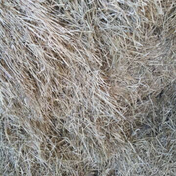
Heu HD Ballen
Carlsberg
Maike Käpernick
@ReitschuleKaepernick
Heu
Empfänger lädt ab
Kleinballen/HD-Ballen
Bio
Regenfrei
2 weitere...
B+
Deprecated: Creation of dynamic property Zend_View_Helper_Ads::$adLink is deprecated in /var/www/stall-frei/htdocs/staging.stall-frei.de/library/Psf/View/Helper/Ads.php on line 108

***Reitstall Birkenhof*** Pferdegerechte Haltung
Köln
Daniele-Fazzi
@Daniele-Fazzi
Herzlich Willkommen
auf dem Reitstall Birkenhof
Jetzt neu ‼️ auf dem Birkenhof:
Private Geländestrecke rund um unser

Bio Heu
Mehlbach
irena-zinssmeister
@irena-zinssmeister
Heu
Empfänger lädt ab
Großballen
Bio
Regenfrei
2 weitere...
aktuell
B+

10 Rb Heu/15 RB Öhmd/15 RB Stroh
Helmstadt
Juergen
@Juergen77
Einstreu
Empfänger lädt ab
Rundballen
Regenfrei
2 weitere...
B+
Leider kein Vorschaubild
Leider kein Vorschaubild
Heu zu verkaufen
Bad Rappenau
Uwe Wolf
@Uwe_Wolf
Heu
Empfänger lädt ab
Rundballen
Regenfrei
2 weitere...
B+

B+

B+

HIT Aktiv-Stall (Wallache) bei Fam. Senckenberg
Groß-Gerau
Senckenberg
@Senckenberg
Mehr Freiheit für Ihr Pferd - freie Plätze im HIT-Aktivstall

HD-Ballen Heu
Ginsweiler
Laura
@Heuverkauf_Ginsweiler
Heu
Kleinballen/HD-Ballen
Regenfrei
Wird verladen
2 weitere...
B+
Leider kein Vorschaubild
Leider kein Vorschaubild
Heu- und Luzernecobs
Holzgerlingen
Schlosshof-Holzgerlingen
@Schlosshof-Holzgerlingen
Einstreu
Pellets
Regenfrei
Wird verladen
1 weitere...
B+
Leider kein Vorschaubild
Leider kein Vorschaubild
Kleine HD-Ballen Heu
Weil im Schönbuch
Sabine-Dettinger
@Sabine-Dettinger
Heu
Empfänger lädt ab
Kleinballen/HD-Ballen
Bio
Regenfrei
2 weitere...
B+
Deprecated: Creation of dynamic property Zend_View::$pageCount is deprecated in /var/www/stall-frei/htdocs/staging.stall-frei.de/library/vendor/shardj/zf1-future/library/Zend/View/Abstract.php on line 308
Deprecated: Creation of dynamic property Zend_View::$itemCountPerPage is deprecated in /var/www/stall-frei/htdocs/staging.stall-frei.de/library/vendor/shardj/zf1-future/library/Zend/View/Abstract.php on line 308
Deprecated: Creation of dynamic property Zend_View::$first is deprecated in /var/www/stall-frei/htdocs/staging.stall-frei.de/library/vendor/shardj/zf1-future/library/Zend/View/Abstract.php on line 308
Deprecated: Creation of dynamic property Zend_View::$current is deprecated in /var/www/stall-frei/htdocs/staging.stall-frei.de/library/vendor/shardj/zf1-future/library/Zend/View/Abstract.php on line 308
Deprecated: Creation of dynamic property Zend_View::$last is deprecated in /var/www/stall-frei/htdocs/staging.stall-frei.de/library/vendor/shardj/zf1-future/library/Zend/View/Abstract.php on line 308
Deprecated: Creation of dynamic property Zend_View::$next is deprecated in /var/www/stall-frei/htdocs/staging.stall-frei.de/library/vendor/shardj/zf1-future/library/Zend/View/Abstract.php on line 308
Deprecated: Creation of dynamic property Zend_View::$pagesInRange is deprecated in /var/www/stall-frei/htdocs/staging.stall-frei.de/library/vendor/shardj/zf1-future/library/Zend/View/Abstract.php on line 308
Deprecated: Creation of dynamic property Zend_View::$firstPageInRange is deprecated in /var/www/stall-frei/htdocs/staging.stall-frei.de/library/vendor/shardj/zf1-future/library/Zend/View/Abstract.php on line 308
Deprecated: Creation of dynamic property Zend_View::$lastPageInRange is deprecated in /var/www/stall-frei/htdocs/staging.stall-frei.de/library/vendor/shardj/zf1-future/library/Zend/View/Abstract.php on line 308
Deprecated: Creation of dynamic property Zend_View::$currentItemCount is deprecated in /var/www/stall-frei/htdocs/staging.stall-frei.de/library/vendor/shardj/zf1-future/library/Zend/View/Abstract.php on line 308
Deprecated: Creation of dynamic property Zend_View::$totalItemCount is deprecated in /var/www/stall-frei/htdocs/staging.stall-frei.de/library/vendor/shardj/zf1-future/library/Zend/View/Abstract.php on line 308
Deprecated: Creation of dynamic property Zend_View::$firstItemNumber is deprecated in /var/www/stall-frei/htdocs/staging.stall-frei.de/library/vendor/shardj/zf1-future/library/Zend/View/Abstract.php on line 308
Deprecated: Creation of dynamic property Zend_View::$lastItemNumber is deprecated in /var/www/stall-frei/htdocs/staging.stall-frei.de/library/vendor/shardj/zf1-future/library/Zend/View/Abstract.php on line 308
Deprecated: Creation of dynamic property Zend_View::$router is deprecated in /var/www/stall-frei/htdocs/staging.stall-frei.de/library/vendor/shardj/zf1-future/library/Zend/View/Abstract.php on line 308
Deprecated: Creation of dynamic property Zend_View::$urlParams is deprecated in /var/www/stall-frei/htdocs/staging.stall-frei.de/library/vendor/shardj/zf1-future/library/Zend/View/Abstract.php on line 308
Deprecated: Creation of dynamic property Zend_View::$showAds is deprecated in /var/www/stall-frei/htdocs/staging.stall-frei.de/library/vendor/shardj/zf1-future/library/Zend/View/Abstract.php on line 308
Deprecated: Creation of dynamic property Zend_View::$objectIds is deprecated in /var/www/stall-frei/htdocs/staging.stall-frei.de/library/vendor/shardj/zf1-future/library/Zend/View/Abstract.php on line 308
Deprecated: Creation of dynamic property Zend_View::$showNavbar is deprecated in /var/www/stall-frei/htdocs/staging.stall-frei.de/library/vendor/shardj/zf1-future/library/Zend/View/Abstract.php on line 308
Deprecated: Creation of dynamic property Zend_View::$showBreadcrumb is deprecated in /var/www/stall-frei/htdocs/staging.stall-frei.de/library/vendor/shardj/zf1-future/library/Zend/View/Abstract.php on line 308
Deprecated: Creation of dynamic property Zend_View::$showFooter is deprecated in /var/www/stall-frei/htdocs/staging.stall-frei.de/library/vendor/shardj/zf1-future/library/Zend/View/Abstract.php on line 308
Deprecated: Creation of dynamic property Zend_View::$showInternalAds is deprecated in /var/www/stall-frei/htdocs/staging.stall-frei.de/library/vendor/shardj/zf1-future/library/Zend/View/Abstract.php on line 308
Deprecated: Creation of dynamic property Zend_View::$blNoContent is deprecated in /var/www/stall-frei/htdocs/staging.stall-frei.de/library/vendor/shardj/zf1-future/library/Zend/View/Abstract.php on line 308
Deprecated: Creation of dynamic property Zend_View::$sMetaDesc is deprecated in /var/www/stall-frei/htdocs/staging.stall-frei.de/library/vendor/shardj/zf1-future/library/Zend/View/Abstract.php on line 308
Deprecated: Creation of dynamic property Zend_View::$useGmaps is deprecated in /var/www/stall-frei/htdocs/staging.stall-frei.de/library/vendor/shardj/zf1-future/library/Zend/View/Abstract.php on line 308
Deprecated: Creation of dynamic property Zend_View::$touches is deprecated in /var/www/stall-frei/htdocs/staging.stall-frei.de/library/vendor/shardj/zf1-future/library/Zend/View/Abstract.php on line 308
Deprecated: Creation of dynamic property Zend_View::$oProject is deprecated in /var/www/stall-frei/htdocs/staging.stall-frei.de/library/vendor/shardj/zf1-future/library/Zend/View/Abstract.php on line 308
Deprecated: Creation of dynamic property Zend_View::$pageHeadline is deprecated in /var/www/stall-frei/htdocs/staging.stall-frei.de/library/vendor/shardj/zf1-future/library/Zend/View/Abstract.php on line 308
Deprecated: Creation of dynamic property Zend_View::$disableLocationField is deprecated in /var/www/stall-frei/htdocs/staging.stall-frei.de/library/vendor/shardj/zf1-future/library/Zend/View/Abstract.php on line 308
Deprecated: Creation of dynamic property Zend_View::$isSearch is deprecated in /var/www/stall-frei/htdocs/staging.stall-frei.de/library/vendor/shardj/zf1-future/library/Zend/View/Abstract.php on line 308
Deprecated: Creation of dynamic property Zend_View::$pageTitle is deprecated in /var/www/stall-frei/htdocs/staging.stall-frei.de/library/vendor/shardj/zf1-future/library/Zend/View/Abstract.php on line 308
Deprecated: Creation of dynamic property Psf_Form_Element_Text::$class is deprecated in /var/www/stall-frei/htdocs/staging.stall-frei.de/library/vendor/shardj/zf1-future/library/Zend/Form/Element.php on line 874
Deprecated: Creation of dynamic property Psf_Form_Element_Text::$size is deprecated in /var/www/stall-frei/htdocs/staging.stall-frei.de/library/vendor/shardj/zf1-future/library/Zend/Form/Element.php on line 874
Deprecated: Creation of dynamic property Psf_Form_Element_Text::$placeholder is deprecated in /var/www/stall-frei/htdocs/staging.stall-frei.de/library/vendor/shardj/zf1-future/library/Zend/Form/Element.php on line 874
Deprecated: Creation of dynamic property Psf_Form_Element_Hidden::$class is deprecated in /var/www/stall-frei/htdocs/staging.stall-frei.de/library/vendor/shardj/zf1-future/library/Zend/Form/Element.php on line 874
Deprecated: Creation of dynamic property Psf_Form_Element_Hidden::$class is deprecated in /var/www/stall-frei/htdocs/staging.stall-frei.de/library/vendor/shardj/zf1-future/library/Zend/Form/Element.php on line 874
Deprecated: Creation of dynamic property Psf_Form_Element_Hidden::$class is deprecated in /var/www/stall-frei/htdocs/staging.stall-frei.de/library/vendor/shardj/zf1-future/library/Zend/Form/Element.php on line 874
Deprecated: Creation of dynamic property Psf_Form_Element_Hidden::$class is deprecated in /var/www/stall-frei/htdocs/staging.stall-frei.de/library/vendor/shardj/zf1-future/library/Zend/Form/Element.php on line 874
Deprecated: Creation of dynamic property Psf_Form_Element_Select::$class is deprecated in /var/www/stall-frei/htdocs/staging.stall-frei.de/library/vendor/shardj/zf1-future/library/Zend/Form/Element.php on line 874
Deprecated: Creation of dynamic property Psf_Form_Element_Select::$class is deprecated in /var/www/stall-frei/htdocs/staging.stall-frei.de/library/vendor/shardj/zf1-future/library/Zend/Form/Element.php on line 874
Deprecated: Creation of dynamic property Psf_Form_Element_Select::$class is deprecated in /var/www/stall-frei/htdocs/staging.stall-frei.de/library/vendor/shardj/zf1-future/library/Zend/Form/Element.php on line 874
Deprecated: Creation of dynamic property Psf_Form_Element_Select::$class is deprecated in /var/www/stall-frei/htdocs/staging.stall-frei.de/library/vendor/shardj/zf1-future/library/Zend/Form/Element.php on line 874
Deprecated: Creation of dynamic property Zend_View::$sort is deprecated in /var/www/stall-frei/htdocs/staging.stall-frei.de/library/vendor/shardj/zf1-future/library/Zend/View/Abstract.php on line 308
Deprecated: Creation of dynamic property Zend_View::$searchLocation is deprecated in /var/www/stall-frei/htdocs/staging.stall-frei.de/library/vendor/shardj/zf1-future/library/Zend/View/Abstract.php on line 308
Deprecated: Creation of dynamic property Zend_View::$locationHint is deprecated in /var/www/stall-frei/htdocs/staging.stall-frei.de/library/vendor/shardj/zf1-future/library/Zend/View/Abstract.php on line 308
Psf_GeoCoder_Abstract::getLocation: Kandel Get Location CachedOrLive
Psf_GeoCoder_Abstract::getCachedOrLive: Kandel
Psf_GeoCoder_OpenCageData::makeApiRequest: response:
Array
(
[documentation] => https://opencagedata.com/api
[licenses] => Array
(
[0] => Array
(
[name] => see attribution guide
[url] => https://opencagedata.com/credits
)
)
[results] => Array
(
[0] => Array
(
[bounds] => Array
(
[northeast] => Array
(
[lat] => 49.1105963
[lng] => 8.2594537
)
[southwest] => Array
(
[lat] => 49.0589627
[lng] => 8.1334554
)
)
[components] => Array
(
[ISO_3166-1_alpha-2] => DE
[ISO_3166-1_alpha-3] => DEU
[ISO_3166-2] => Array
(
[0] => DE-RP
)
[_category] => place
[_normalized_city] => Kandel
[_type] => city
[continent] => Europe
[country] => Deutschland
[country_code] => de
[county] => Landkreis Germersheim
[municipality] => Kandel
[political_union] => European Union
[postcode] => 76870
[state] => Rheinland-Pfalz
[state_code] => RP
[town] => Kandel
)
[confidence] => 7
[formatted] => 76870 Kandel, Deutschland
[geometry] => Array
(
[lat] => 49.0809754
[lng] => 8.1970699
)
)
[1] => Array
(
[bounds] => Array
(
[northeast] => Array
(
[lat] => 48.065051
[lng] => 8.0163078
)
[southwest] => Array
(
[lat] => 48.064951
[lng] => 8.0162078
)
)
[components] => Array
(
[ISO_3166-1_alpha-2] => DE
[ISO_3166-1_alpha-3] => DEU
[ISO_3166-2] => Array
(
[0] => DE-BW
)
[_category] => natural/water
[_normalized_city] => Simonswald
[_type] => mountain_pass
[continent] => Europe
[country] => Deutschland
[country_code] => de
[county] => Landkreis Emmendingen
[mountain_pass] => Kandel
[municipality] => VVG der Stadt Waldkirch
[political_union] => European Union
[postcode] => 79271
[state] => Baden-Württemberg
[state_code] => BW
[village] => Simonswald
)
[confidence] => 9
[formatted] => Kandel, 79271 Simonswald, Deutschland
[geometry] => Array
(
[lat] => 48.065001
[lng] => 8.0162578
)
)
[2] => Array
(
[bounds] => Array
(
[northeast] => Array
(
[lat] => 48.0625977
[lng] => 8.0113688
)
[southwest] => Array
(
[lat] => 48.0624977
[lng] => 8.0112688
)
)
[components] => Array
(
[ISO_3166-1_alpha-2] => DE
[ISO_3166-1_alpha-3] => DEU
[ISO_3166-2] => Array
(
[0] => DE-BW
)
[_category] => natural/water
[_normalized_city] => Waldkirch
[_type] => peak
[continent] => Europe
[country] => Deutschland
[country_code] => de
[county] => Landkreis Emmendingen
[municipality] => VVG der Stadt Waldkirch
[peak] => Kandel
[political_union] => European Union
[postcode] => 79271
[state] => Baden-Württemberg
[state_code] => BW
[town] => Waldkirch
)
[confidence] => 9
[formatted] => Kandel, 79271 Waldkirch, Deutschland
[geometry] => Array
(
[lat] => 48.0625477
[lng] => 8.0113188
)
)
[3] => Array
(
[bounds] => Array
(
[northeast] => Array
(
[lat] => 49.1360882
[lng] => 8.2594537
)
[southwest] => Array
(
[lat] => 49.0539738
[lng] => 8.0551003
)
)
[components] => Array
(
[ISO_3166-1_alpha-2] => DE
[ISO_3166-1_alpha-3] => DEU
[ISO_3166-2] => Array
(
[0] => DE-RP
)
[_category] => place
[_normalized_city] => Kandel
[_type] => municipality
[continent] => Europe
[country] => Deutschland
[country_code] => de
[county] => Landkreis Germersheim
[municipality] => Kandel
[political_union] => European Union
[state] => Rheinland-Pfalz
[state_code] => RP
)
[confidence] => 6
[formatted] => Kandel, Rheinland-Pfalz, Deutschland
[geometry] => Array
(
[lat] => 49.095048
[lng] => 8.1798818
)
)
[4] => Array
(
[components] => Array
(
[ISO_3166-1_alpha-2] => FR
[ISO_3166-1_alpha-3] => FRA
[ISO_3166-2] => Array
(
[0] => FR-GES
[1] => FR-6AE
[2] => FR-67
)
[_category] => road
[_normalized_city] => Reichshoffen
[_type] => road
[city] => Reichshoffen
[continent] => Europe
[country] => France
[country_code] => fr
[county] => Bas-Rhin
[local_authority] => Communauté de communes du Pays de Niederbronn-les-Bains
[political_union] => European Union
[postcode] => 67110
[road] => Rue de Kandel
[state] => Grand Est
[state_code] => GES
)
[confidence] => 3
[formatted] => Rue de Kandel, 67110 Reichshoffen, France
[geometry] => Array
(
[lat] => 48.933122
[lng] => 7.659801
)
)
[5] => Array
(
[components] => Array
(
[ISO_3166-1_alpha-2] => FR
[ISO_3166-1_alpha-3] => FRA
[ISO_3166-2] => Array
(
[0] => FR-OCC
[1] => FR-31
)
[_category] => road
[_normalized_city] => Montgiscard
[_type] => road
[city] => Montgiscard
[continent] => Europe
[country] => France
[country_code] => fr
[county] => Haute-Garonne
[local_authority] => Sicoval
[political_union] => European Union
[postcode] => 31450
[road] => Chemin de Candel
[state] => Occitanie
[state_code] => OCC
)
[confidence] => 2
[formatted] => Chemin de Candel, 31450 Montgiscard, France
[geometry] => Array
(
[lat] => 43.455307
[lng] => 1.569396
)
)
[6] => Array
(
[components] => Array
(
[ISO_3166-1_alpha-2] => FR
[ISO_3166-1_alpha-3] => FRA
[ISO_3166-2] => Array
(
[0] => FR-NAQ
[1] => FR-64
)
[_category] => road
[_normalized_city] => Saint-Pierre-d'Irube
[_type] => road
[city] => Saint-Pierre-d'Irube
[continent] => Europe
[country] => France
[country_code] => fr
[county] => Pyrénées-Atlantiques
[local_authority] => Communauté d'agglomération du Pays Basque
[political_union] => European Union
[postcode] => 64990
[road] => Rue de Candelé
[state] => Nouvelle-Aquitaine
[state_code] => NAQ
)
[confidence] => 2
[formatted] => Rue de Candelé, 64990 Saint-Pierre-d'Irube, France
[geometry] => Array
(
[lat] => 43.477518
[lng] => -1.460056
)
)
[7] => Array
(
[components] => Array
(
[ISO_3166-1_alpha-2] => FR
[ISO_3166-1_alpha-3] => FRA
[ISO_3166-2] => Array
(
[0] => FR-GES
[1] => FR-57
)
[_category] => road
[_normalized_city] => Manom
[_type] => road
[city] => Manom
[continent] => Europe
[country] => France
[country_code] => fr
[county] => Moselle
[local_authority] => Communauté d'agglomération Portes de France - Thionville
[political_union] => European Union
[postcode] => 57100
[road] => Impasse du Kandel
[state] => Grand Est
[state_code] => GES
)
[confidence] => 2
[formatted] => Impasse du Kandel, 57100 Manom, France
[geometry] => Array
(
[lat] => 49.369774
[lng] => 6.189794
)
)
[8] => Array
(
[components] => Array
(
[ISO_3166-1_alpha-2] => FR
[ISO_3166-1_alpha-3] => FRA
[ISO_3166-2] => Array
(
[0] => FR-OCC
[1] => FR-65
)
[_category] => road
[_normalized_city] => Bonrepos
[_type] => road
[city] => Bonrepos
[continent] => Europe
[country] => France
[country_code] => fr
[county] => Hautes-Pyrénées
[local_authority] => Communauté de communes du Plateau de Lannemezan
[political_union] => European Union
[postcode] => 65330
[road] => chemin de candele
[state] => Occitanie
[state_code] => OCC
)
[confidence] => 2
[formatted] => chemin de candele, 65330 Bonrepos, France
[geometry] => Array
(
[lat] => 43.196644
[lng] => 0.374989
)
)
[9] => Array
(
[components] => Array
(
[ISO_3166-1_alpha-2] => FR
[ISO_3166-1_alpha-3] => FRA
[ISO_3166-2] => Array
(
[0] => FR-OCC
[1] => FR-31
)
[_category] => road
[_normalized_city] => Saint-Clar-de-Rivière
[_type] => road
[city] => Saint-Clar-de-Rivière
[continent] => Europe
[country] => France
[country_code] => fr
[county] => Haute-Garonne
[local_authority] => Le Muretain Agglo
[political_union] => European Union
[postcode] => 31600
[road] => Chemin des Candélès
[state] => Occitanie
[state_code] => OCC
)
[confidence] => 2
[formatted] => Chemin des Candélès, 31600 Saint-Clar-de-Rivière, France
[geometry] => Array
(
[lat] => 43.469228
[lng] => 1.21003
)
)
)
[status] => Array
(
[code] => 200
[message] => OK
)
[stay_informed] => Array
(
[blog] => https://blog.opencagedata.com
[mastodon] => https://en.osm.town/@opencage
)
[thanks] => For using an OpenCage API
[timestamp] => Array
(
[created_http] => Fri, 06 Feb 2026 22:42:34 GMT
[created_unix] => 1770417754
)
[total_results] => 10
)
Psf_GeoCoder_Abstract::convertLocationResult
{"documentation":"https:\/\/opencagedata.com\/api","licenses":[{"name":"see attribution guide","url":"https:\/\/opencagedata.com\/credits"}],"results":[{"bounds":{"northeast":{"lat":49.1105963,"lng":8.2594537},"southwest":{"lat":49.0589627,"lng":8.1334554}},"components":{"ISO_3166-1_alpha-2":"DE","ISO_3166-1_alpha-3":"DEU","ISO_3166-2":["DE-RP"],"_category":"place","_normalized_city":"Kandel","_type":"city","continent":"Europe","country":"Deutschland","country_code":"de","county":"Landkreis Germersheim","municipality":"Kandel","political_union":"European Union","postcode":"76870","state":"Rheinland-Pfalz","state_code":"RP","town":"Kandel"},"confidence":7,"formatted":"76870 Kandel, Deutschland","geometry":{"lat":49.0809754,"lng":8.1970699}},{"bounds":{"northeast":{"lat":48.065051,"lng":8.0163078},"southwest":{"lat":48.064951,"lng":8.0162078}},"components":{"ISO_3166-1_alpha-2":"DE","ISO_3166-1_alpha-3":"DEU","ISO_3166-2":["DE-BW"],"_category":"natural\/water","_normalized_city":"Simonswald","_type":"mountain_pass","continent":"Europe","country":"Deutschland","country_code":"de","county":"Landkreis Emmendingen","mountain_pass":"Kandel","municipality":"VVG der Stadt Waldkirch","political_union":"European Union","postcode":"79271","state":"Baden-W\u00fcrttemberg","state_code":"BW","village":"Simonswald"},"confidence":9,"formatted":"Kandel, 79271 Simonswald, Deutschland","geometry":{"lat":48.065001,"lng":8.0162578}},{"bounds":{"northeast":{"lat":48.0625977,"lng":8.0113688},"southwest":{"lat":48.0624977,"lng":8.0112688}},"components":{"ISO_3166-1_alpha-2":"DE","ISO_3166-1_alpha-3":"DEU","ISO_3166-2":["DE-BW"],"_category":"natural\/water","_normalized_city":"Waldkirch","_type":"peak","continent":"Europe","country":"Deutschland","country_code":"de","county":"Landkreis Emmendingen","municipality":"VVG der Stadt Waldkirch","peak":"Kandel","political_union":"European Union","postcode":"79271","state":"Baden-W\u00fcrttemberg","state_code":"BW","town":"Waldkirch"},"confidence":9,"formatted":"Kandel, 79271 Waldkirch, Deutschland","geometry":{"lat":48.0625477,"lng":8.0113188}},{"bounds":{"northeast":{"lat":49.1360882,"lng":8.2594537},"southwest":{"lat":49.0539738,"lng":8.0551003}},"components":{"ISO_3166-1_alpha-2":"DE","ISO_3166-1_alpha-3":"DEU","ISO_3166-2":["DE-RP"],"_category":"place","_normalized_city":"Kandel","_type":"municipality","continent":"Europe","country":"Deutschland","country_code":"de","county":"Landkreis Germersheim","municipality":"Kandel","political_union":"European Union","state":"Rheinland-Pfalz","state_code":"RP"},"confidence":6,"formatted":"Kandel, Rheinland-Pfalz, Deutschland","geometry":{"lat":49.095048,"lng":8.1798818}},{"components":{"ISO_3166-1_alpha-2":"FR","ISO_3166-1_alpha-3":"FRA","ISO_3166-2":["FR-GES","FR-6AE","FR-67"],"_category":"road","_normalized_city":"Reichshoffen","_type":"road","city":"Reichshoffen","continent":"Europe","country":"France","country_code":"fr","county":"Bas-Rhin","local_authority":"Communaut\u00e9 de communes du Pays de Niederbronn-les-Bains","political_union":"European Union","postcode":"67110","road":"Rue de Kandel","state":"Grand Est","state_code":"GES"},"confidence":3,"formatted":"Rue de Kandel, 67110 Reichshoffen, France","geometry":{"lat":48.933122,"lng":7.659801}},{"components":{"ISO_3166-1_alpha-2":"FR","ISO_3166-1_alpha-3":"FRA","ISO_3166-2":["FR-OCC","FR-31"],"_category":"road","_normalized_city":"Montgiscard","_type":"road","city":"Montgiscard","continent":"Europe","country":"France","country_code":"fr","county":"Haute-Garonne","local_authority":"Sicoval","political_union":"European Union","postcode":"31450","road":"Chemin de Candel","state":"Occitanie","state_code":"OCC"},"confidence":2,"formatted":"Chemin de Candel, 31450 Montgiscard, France","geometry":{"lat":43.455307,"lng":1.569396}},{"components":{"ISO_3166-1_alpha-2":"FR","ISO_3166-1_alpha-3":"FRA","ISO_3166-2":["FR-NAQ","FR-64"],"_category":"road","_normalized_city":"Saint-Pierre-d'Irube","_type":"road","city":"Saint-Pierre-d'Irube","continent":"Europe","country":"France","country_code":"fr","county":"Pyr\u00e9n\u00e9es-Atlantiques","local_authority":"Communaut\u00e9 d'agglom\u00e9ration du Pays Basque","political_union":"European Union","postcode":"64990","road":"Rue de Candel\u00e9","state":"Nouvelle-Aquitaine","state_code":"NAQ"},"confidence":2,"formatted":"Rue de Candel\u00e9, 64990 Saint-Pierre-d'Irube, France","geometry":{"lat":43.477518,"lng":-1.460056}},{"components":{"ISO_3166-1_alpha-2":"FR","ISO_3166-1_alpha-3":"FRA","ISO_3166-2":["FR-GES","FR-57"],"_category":"road","_normalized_city":"Manom","_type":"road","city":"Manom","continent":"Europe","country":"France","country_code":"fr","county":"Moselle","local_authority":"Communaut\u00e9 d'agglom\u00e9ration Portes de France - Thionville","political_union":"European Union","postcode":"57100","road":"Impasse du Kandel","state":"Grand Est","state_code":"GES"},"confidence":2,"formatted":"Impasse du Kandel, 57100 Manom, France","geometry":{"lat":49.369774,"lng":6.189794}},{"components":{"ISO_3166-1_alpha-2":"FR","ISO_3166-1_alpha-3":"FRA","ISO_3166-2":["FR-OCC","FR-65"],"_category":"road","_normalized_city":"Bonrepos","_type":"road","city":"Bonrepos","continent":"Europe","country":"France","country_code":"fr","county":"Hautes-Pyr\u00e9n\u00e9es","local_authority":"Communaut\u00e9 de communes du Plateau de Lannemezan","political_union":"European Union","postcode":"65330","road":"chemin de candele","state":"Occitanie","state_code":"OCC"},"confidence":2,"formatted":"chemin de candele, 65330 Bonrepos, France","geometry":{"lat":43.196644,"lng":0.374989}},{"components":{"ISO_3166-1_alpha-2":"FR","ISO_3166-1_alpha-3":"FRA","ISO_3166-2":["FR-OCC","FR-31"],"_category":"road","_normalized_city":"Saint-Clar-de-Rivi\u00e8re","_type":"road","city":"Saint-Clar-de-Rivi\u00e8re","continent":"Europe","country":"France","country_code":"fr","county":"Haute-Garonne","local_authority":"Le Muretain Agglo","political_union":"European Union","postcode":"31600","road":"Chemin des Cand\u00e9l\u00e8s","state":"Occitanie","state_code":"OCC"},"confidence":2,"formatted":"Chemin des Cand\u00e9l\u00e8s, 31600 Saint-Clar-de-Rivi\u00e8re, France","geometry":{"lat":43.469228,"lng":1.21003}}],"status":{"code":200,"message":"OK"},"stay_informed":{"blog":"https:\/\/blog.opencagedata.com","mastodon":"https:\/\/en.osm.town\/@opencage"},"thanks":"For using an OpenCage API","timestamp":{"created_http":"Fri, 06 Feb 2026 22:42:34 GMT","created_unix":1770417754},"total_results":10}Array
(
[0] => stdClass Object
(
[bounds] => stdClass Object
(
[northeast] => stdClass Object
(
[lat] => 49.1105963
[lng] => 8.2594537
)
[southwest] => stdClass Object
(
[lat] => 49.0589627
[lng] => 8.1334554
)
)
[components] => stdClass Object
(
[ISO_3166-1_alpha-2] => DE
[ISO_3166-1_alpha-3] => DEU
[ISO_3166-2] => Array
(
[0] => DE-RP
)
[_category] => place
[_normalized_city] => Kandel
[_type] => city
[continent] => Europe
[country] => Deutschland
[country_code] => de
[county] => Landkreis Germersheim
[municipality] => Kandel
[political_union] => European Union
[postcode] => 76870
[state] => Rheinland-Pfalz
[state_code] => RP
[town] => Kandel
)
[confidence] => 7
[formatted] => 76870 Kandel, Deutschland
[geometry] => stdClass Object
(
[lat] => 49.0809754
[lng] => 8.1970699
)
)
[1] => stdClass Object
(
[bounds] => stdClass Object
(
[northeast] => stdClass Object
(
[lat] => 48.065051
[lng] => 8.0163078
)
[southwest] => stdClass Object
(
[lat] => 48.064951
[lng] => 8.0162078
)
)
[components] => stdClass Object
(
[ISO_3166-1_alpha-2] => DE
[ISO_3166-1_alpha-3] => DEU
[ISO_3166-2] => Array
(
[0] => DE-BW
)
[_category] => natural/water
[_normalized_city] => Simonswald
[_type] => mountain_pass
[continent] => Europe
[country] => Deutschland
[country_code] => de
[county] => Landkreis Emmendingen
[mountain_pass] => Kandel
[municipality] => VVG der Stadt Waldkirch
[political_union] => European Union
[postcode] => 79271
[state] => Baden-Württemberg
[state_code] => BW
[village] => Simonswald
)
[confidence] => 9
[formatted] => Kandel, 79271 Simonswald, Deutschland
[geometry] => stdClass Object
(
[lat] => 48.065001
[lng] => 8.0162578
)
)
[2] => stdClass Object
(
[bounds] => stdClass Object
(
[northeast] => stdClass Object
(
[lat] => 48.0625977
[lng] => 8.0113688
)
[southwest] => stdClass Object
(
[lat] => 48.0624977
[lng] => 8.0112688
)
)
[components] => stdClass Object
(
[ISO_3166-1_alpha-2] => DE
[ISO_3166-1_alpha-3] => DEU
[ISO_3166-2] => Array
(
[0] => DE-BW
)
[_category] => natural/water
[_normalized_city] => Waldkirch
[_type] => peak
[continent] => Europe
[country] => Deutschland
[country_code] => de
[county] => Landkreis Emmendingen
[municipality] => VVG der Stadt Waldkirch
[peak] => Kandel
[political_union] => European Union
[postcode] => 79271
[state] => Baden-Württemberg
[state_code] => BW
[town] => Waldkirch
)
[confidence] => 9
[formatted] => Kandel, 79271 Waldkirch, Deutschland
[geometry] => stdClass Object
(
[lat] => 48.0625477
[lng] => 8.0113188
)
)
[3] => stdClass Object
(
[bounds] => stdClass Object
(
[northeast] => stdClass Object
(
[lat] => 49.1360882
[lng] => 8.2594537
)
[southwest] => stdClass Object
(
[lat] => 49.0539738
[lng] => 8.0551003
)
)
[components] => stdClass Object
(
[ISO_3166-1_alpha-2] => DE
[ISO_3166-1_alpha-3] => DEU
[ISO_3166-2] => Array
(
[0] => DE-RP
)
[_category] => place
[_normalized_city] => Kandel
[_type] => municipality
[continent] => Europe
[country] => Deutschland
[country_code] => de
[county] => Landkreis Germersheim
[municipality] => Kandel
[political_union] => European Union
[state] => Rheinland-Pfalz
[state_code] => RP
)
[confidence] => 6
[formatted] => Kandel, Rheinland-Pfalz, Deutschland
[geometry] => stdClass Object
(
[lat] => 49.095048
[lng] => 8.1798818
)
)
[4] => stdClass Object
(
[components] => stdClass Object
(
[ISO_3166-1_alpha-2] => FR
[ISO_3166-1_alpha-3] => FRA
[ISO_3166-2] => Array
(
[0] => FR-GES
[1] => FR-6AE
[2] => FR-67
)
[_category] => road
[_normalized_city] => Reichshoffen
[_type] => road
[city] => Reichshoffen
[continent] => Europe
[country] => France
[country_code] => fr
[county] => Bas-Rhin
[local_authority] => Communauté de communes du Pays de Niederbronn-les-Bains
[political_union] => European Union
[postcode] => 67110
[road] => Rue de Kandel
[state] => Grand Est
[state_code] => GES
)
[confidence] => 3
[formatted] => Rue de Kandel, 67110 Reichshoffen, France
[geometry] => stdClass Object
(
[lat] => 48.933122
[lng] => 7.659801
)
)
[5] => stdClass Object
(
[components] => stdClass Object
(
[ISO_3166-1_alpha-2] => FR
[ISO_3166-1_alpha-3] => FRA
[ISO_3166-2] => Array
(
[0] => FR-OCC
[1] => FR-31
)
[_category] => road
[_normalized_city] => Montgiscard
[_type] => road
[city] => Montgiscard
[continent] => Europe
[country] => France
[country_code] => fr
[county] => Haute-Garonne
[local_authority] => Sicoval
[political_union] => European Union
[postcode] => 31450
[road] => Chemin de Candel
[state] => Occitanie
[state_code] => OCC
)
[confidence] => 2
[formatted] => Chemin de Candel, 31450 Montgiscard, France
[geometry] => stdClass Object
(
[lat] => 43.455307
[lng] => 1.569396
)
)
[6] => stdClass Object
(
[components] => stdClass Object
(
[ISO_3166-1_alpha-2] => FR
[ISO_3166-1_alpha-3] => FRA
[ISO_3166-2] => Array
(
[0] => FR-NAQ
[1] => FR-64
)
[_category] => road
[_normalized_city] => Saint-Pierre-d'Irube
[_type] => road
[city] => Saint-Pierre-d'Irube
[continent] => Europe
[country] => France
[country_code] => fr
[county] => Pyrénées-Atlantiques
[local_authority] => Communauté d'agglomération du Pays Basque
[political_union] => European Union
[postcode] => 64990
[road] => Rue de Candelé
[state] => Nouvelle-Aquitaine
[state_code] => NAQ
)
[confidence] => 2
[formatted] => Rue de Candelé, 64990 Saint-Pierre-d'Irube, France
[geometry] => stdClass Object
(
[lat] => 43.477518
[lng] => -1.460056
)
)
[7] => stdClass Object
(
[components] => stdClass Object
(
[ISO_3166-1_alpha-2] => FR
[ISO_3166-1_alpha-3] => FRA
[ISO_3166-2] => Array
(
[0] => FR-GES
[1] => FR-57
)
[_category] => road
[_normalized_city] => Manom
[_type] => road
[city] => Manom
[continent] => Europe
[country] => France
[country_code] => fr
[county] => Moselle
[local_authority] => Communauté d'agglomération Portes de France - Thionville
[political_union] => European Union
[postcode] => 57100
[road] => Impasse du Kandel
[state] => Grand Est
[state_code] => GES
)
[confidence] => 2
[formatted] => Impasse du Kandel, 57100 Manom, France
[geometry] => stdClass Object
(
[lat] => 49.369774
[lng] => 6.189794
)
)
[8] => stdClass Object
(
[components] => stdClass Object
(
[ISO_3166-1_alpha-2] => FR
[ISO_3166-1_alpha-3] => FRA
[ISO_3166-2] => Array
(
[0] => FR-OCC
[1] => FR-65
)
[_category] => road
[_normalized_city] => Bonrepos
[_type] => road
[city] => Bonrepos
[continent] => Europe
[country] => France
[country_code] => fr
[county] => Hautes-Pyrénées
[local_authority] => Communauté de communes du Plateau de Lannemezan
[political_union] => European Union
[postcode] => 65330
[road] => chemin de candele
[state] => Occitanie
[state_code] => OCC
)
[confidence] => 2
[formatted] => chemin de candele, 65330 Bonrepos, France
[geometry] => stdClass Object
(
[lat] => 43.196644
[lng] => 0.374989
)
)
[9] => stdClass Object
(
[components] => stdClass Object
(
[ISO_3166-1_alpha-2] => FR
[ISO_3166-1_alpha-3] => FRA
[ISO_3166-2] => Array
(
[0] => FR-OCC
[1] => FR-31
)
[_category] => road
[_normalized_city] => Saint-Clar-de-Rivière
[_type] => road
[city] => Saint-Clar-de-Rivière
[continent] => Europe
[country] => France
[country_code] => fr
[county] => Haute-Garonne
[local_authority] => Le Muretain Agglo
[political_union] => European Union
[postcode] => 31600
[road] => Chemin des Candélès
[state] => Occitanie
[state_code] => OCC
)
[confidence] => 2
[formatted] => Chemin des Candélès, 31600 Saint-Clar-de-Rivière, France
[geometry] => stdClass Object
(
[lat] => 43.469228
[lng] => 1.21003
)
)
)
Psf_GeoCoder_OpenCageData::getKeyMap: 0
stdClass Object
(
    [bounds] => stdClass Object
        (
            [northeast] => stdClass Object
                (
                    [lat] => 49.1105963
                    [lng] => 8.2594537
                )

            [southwest] => stdClass Object
                (
                    [lat] => 49.0589627
                    [lng] => 8.1334554
                )

        )

    [components] => stdClass Object
        (
            [ISO_3166-1_alpha-2] => DE
            [ISO_3166-1_alpha-3] => DEU
            [ISO_3166-2] => Array
                (
                    [0] => DE-RP
                )

            [_category] => place
            [_normalized_city] => Kandel
            [_type] => city
            [continent] => Europe
            [country] => Deutschland
            [country_code] => de
            [county] => Landkreis Germersheim
            [municipality] => Kandel
            [political_union] => European Union
            [postcode] => 76870
            [state] => Rheinland-Pfalz
            [state_code] => RP
            [town] => Kandel
        )

    [confidence] => 7
    [formatted] => 76870 Kandel, Deutschland
    [geometry] => stdClass Object
        (
            [lat] => 49.0809754
            [lng] => 8.1970699
        )

)
Psf_GeoCoder_OpenCageData::getCounty: Germersheim
Psf_GeoCoder_OpenCageData::addMissingData REFETCH!
Array
(
    [address] => 76870 Kandel, Deutschland
    [type] => city
    [street] =>
    [city] => Kandel
    [county] => Germersheim
    [state] => Rheinland-Pfalz
    [zip] => 76870
    [country] => Deutschland
    [suburb] =>
    [countrycode] => de
    [latitude] => 49.0809754
    [longitude] => 8.1970699
    [accuracy] => 1
    [confidence] => 7
    [bounds] => stdClass Object
        (
            [northeast] => stdClass Object
                (
                    [lat] => 49.1105963
                    [lng] => 8.2594537
                )

            [southwest] => stdClass Object
                (
                    [lat] => 49.0589627
                    [lng] => 8.1334554
                )

        )

)
reformat!
Array
(
    [address] => 76870 Kandel, Deutschland
    [type] => city
    [street] =>
    [city] => Kandel
    [county] => Germersheim
    [state] => Rheinland-Pfalz
    [zip] => 76870
    [country] => Deutschland
    [suburb] =>
    [countrycode] => de
    [latitude] => 49.0809754
    [longitude] => 8.1970699
    [accuracy] => 1
    [confidence] => 7
    [bounds] => stdClass Object
        (
            [northeast] => stdClass Object
                (
                    [lat] => 49.1105963
                    [lng] => 8.2594537
                )

            [southwest] => stdClass Object
                (
                    [lat] => 49.0589627
                    [lng] => 8.1334554
                )

        )

    [place] => 76870 Kandel, Rheinland-Pfalz
    [hash] => ecf0d423e4d6a1448254f0911872995a
)
Psf_GeoCoder_OpenCageData::getKeyMap: 1
stdClass Object
(
    [bounds] => stdClass Object
        (
            [northeast] => stdClass Object
                (
                    [lat] => 48.065051
                    [lng] => 8.0163078
                )

            [southwest] => stdClass Object
                (
                    [lat] => 48.064951
                    [lng] => 8.0162078
                )

        )

    [components] => stdClass Object
        (
            [ISO_3166-1_alpha-2] => DE
            [ISO_3166-1_alpha-3] => DEU
            [ISO_3166-2] => Array
                (
                    [0] => DE-BW
                )

            [_category] => natural/water
            [_normalized_city] => Simonswald
            [_type] => mountain_pass
            [continent] => Europe
            [country] => Deutschland
            [country_code] => de
            [county] => Landkreis Emmendingen
            [mountain_pass] => Kandel
            [municipality] => VVG der Stadt Waldkirch
            [political_union] => European Union
            [postcode] => 79271
            [state] => Baden-Württemberg
            [state_code] => BW
            [village] => Simonswald
        )

    [confidence] => 9
    [formatted] => Kandel, 79271 Simonswald, Deutschland
    [geometry] => stdClass Object
        (
            [lat] => 48.065001
            [lng] => 8.0162578
        )

)
Psf_GeoCoder_OpenCageData::getCounty: Emmendingen
Psf_GeoCoder_OpenCageData::addMissingData REFETCH!
Array
(
    [address] => Kandel, 79271 Simonswald, Deutschland
    [type] => mountain_pass
    [street] =>
    [city] => Simonswald
    [county] => Emmendingen
    [state] => Baden-Württemberg
    [zip] => 79271
    [country] => Deutschland
    [suburb] =>
    [countrycode] => de
    [latitude] => 48.065001
    [longitude] => 8.0162578
    [accuracy] => 1
    [confidence] => 9
    [bounds] => stdClass Object
        (
            [northeast] => stdClass Object
                (
                    [lat] => 48.065051
                    [lng] => 8.0163078
                )

            [southwest] => stdClass Object
                (
                    [lat] => 48.064951
                    [lng] => 8.0162078
                )

        )

)
reformat!
Array
(
    [address] => Kandel, 79271 Simonswald, Deutschland
    [type] => mountain_pass
    [street] =>
    [city] => Simonswald
    [county] => Emmendingen
    [state] => Baden-Württemberg
    [zip] => 79271
    [country] => Deutschland
    [suburb] =>
    [countrycode] => de
    [latitude] => 48.065001
    [longitude] => 8.0162578
    [accuracy] => 1
    [confidence] => 9
    [bounds] => stdClass Object
        (
            [northeast] => stdClass Object
                (
                    [lat] => 48.065051
                    [lng] => 8.0163078
                )

            [southwest] => stdClass Object
                (
                    [lat] => 48.064951
                    [lng] => 8.0162078
                )

        )

    [place] => 79271 Simonswald, Baden-Württemberg
    [hash] => 24d60c8d069c83a14481fdb6ece2b89f
)
Psf_GeoCoder_OpenCageData::getKeyMap: 2
stdClass Object
(
    [bounds] => stdClass Object
        (
            [northeast] => stdClass Object
                (
                    [lat] => 48.0625977
                    [lng] => 8.0113688
                )

            [southwest] => stdClass Object
                (
                    [lat] => 48.0624977
                    [lng] => 8.0112688
                )

        )

    [components] => stdClass Object
        (
            [ISO_3166-1_alpha-2] => DE
            [ISO_3166-1_alpha-3] => DEU
            [ISO_3166-2] => Array
                (
                    [0] => DE-BW
                )

            [_category] => natural/water
            [_normalized_city] => Waldkirch
            [_type] => peak
            [continent] => Europe
            [country] => Deutschland
            [country_code] => de
            [county] => Landkreis Emmendingen
            [municipality] => VVG der Stadt Waldkirch
            [peak] => Kandel
            [political_union] => European Union
            [postcode] => 79271
            [state] => Baden-Württemberg
            [state_code] => BW
            [town] => Waldkirch
        )

    [confidence] => 9
    [formatted] => Kandel, 79271 Waldkirch, Deutschland
    [geometry] => stdClass Object
        (
            [lat] => 48.0625477
            [lng] => 8.0113188
        )

)
Psf_GeoCoder_OpenCageData::getCounty: Emmendingen
Psf_GeoCoder_OpenCageData::addMissingData REFETCH!
Array
(
    [address] => Kandel, 79271 Waldkirch, Deutschland
    [type] => peak
    [street] =>
    [city] => Waldkirch
    [county] => Emmendingen
    [state] => Baden-Württemberg
    [zip] => 79271
    [country] => Deutschland
    [suburb] =>
    [countrycode] => de
    [latitude] => 48.0625477
    [longitude] => 8.0113188
    [accuracy] => 1
    [confidence] => 9
    [bounds] => stdClass Object
        (
            [northeast] => stdClass Object
                (
                    [lat] => 48.0625977
                    [lng] => 8.0113688
                )

            [southwest] => stdClass Object
                (
                    [lat] => 48.0624977
                    [lng] => 8.0112688
                )

        )

)
reformat!
Array
(
    [address] => Kandel, 79271 Waldkirch, Deutschland
    [type] => peak
    [street] =>
    [city] => Waldkirch
    [county] => Emmendingen
    [state] => Baden-Württemberg
    [zip] => 79271
    [country] => Deutschland
    [suburb] =>
    [countrycode] => de
    [latitude] => 48.0625477
    [longitude] => 8.0113188
    [accuracy] => 1
    [confidence] => 9
    [bounds] => stdClass Object
        (
            [northeast] => stdClass Object
                (
                    [lat] => 48.0625977
                    [lng] => 8.0113688
                )

            [southwest] => stdClass Object
                (
                    [lat] => 48.0624977
                    [lng] => 8.0112688
                )

        )

    [place] => 79271 Waldkirch, Baden-Württemberg
    [hash] => 6dd4a317b0a4fa50bfb1aa9d5cf212db
)
Psf_GeoCoder_OpenCageData::getKeyMap: 3
stdClass Object
(
    [bounds] => stdClass Object
        (
            [northeast] => stdClass Object
                (
                    [lat] => 49.1360882
                    [lng] => 8.2594537
                )

            [southwest] => stdClass Object
                (
                    [lat] => 49.0539738
                    [lng] => 8.0551003
                )

        )

    [components] => stdClass Object
        (
            [ISO_3166-1_alpha-2] => DE
            [ISO_3166-1_alpha-3] => DEU
            [ISO_3166-2] => Array
                (
                    [0] => DE-RP
                )

            [_category] => place
            [_normalized_city] => Kandel
            [_type] => municipality
            [continent] => Europe
            [country] => Deutschland
            [country_code] => de
            [county] => Landkreis Germersheim
            [municipality] => Kandel
            [political_union] => European Union
            [state] => Rheinland-Pfalz
            [state_code] => RP
        )

    [confidence] => 6
    [formatted] => Kandel, Rheinland-Pfalz, Deutschland
    [geometry] => stdClass Object
        (
            [lat] => 49.095048
            [lng] => 8.1798818
        )

)
Psf_GeoCoder_OpenCageData::getCounty: Germersheim
Psf_GeoCoder_OpenCageData::addMissingData REFETCH!
Array
(
    [address] => Kandel, Rheinland-Pfalz, Deutschland
    [type] => municipality
    [street] =>
    [city] =>
    [county] => Germersheim
    [state] => Rheinland-Pfalz
    [zip] =>
    [country] => Deutschland
    [suburb] =>
    [countrycode] => de
    [latitude] => 49.095048
    [longitude] => 8.1798818
    [accuracy] => 1
    [confidence] => 6
    [bounds] => stdClass Object
        (
            [northeast] => stdClass Object
                (
                    [lat] => 49.1360882
                    [lng] => 8.2594537
                )

            [southwest] => stdClass Object
                (
                    [lat] => 49.0539738
                    [lng] => 8.0551003
                )

        )

)
reformat!
Array
(
    [address] => Kandel, Rheinland-Pfalz, Deutschland
    [type] => municipality
    [street] =>
    [city] =>
    [county] => Germersheim
    [state] => Rheinland-Pfalz
    [zip] =>
    [country] => Deutschland
    [suburb] =>
    [countrycode] => de
    [latitude] => 49.095048
    [longitude] => 8.1798818
    [accuracy] => 1
    [confidence] => 6
    [bounds] => stdClass Object
        (
            [northeast] => stdClass Object
                (
                    [lat] => 49.1360882
                    [lng] => 8.2594537
                )

            [southwest] => stdClass Object
                (
                    [lat] => 49.0539738
                    [lng] => 8.0551003
                )

        )

    [place] => , Rheinland-Pfalz
    [hash] => 502d767202480e9387995f7818794e6b
)
Psf_GeoCoder_OpenCageData::getKeyMap: 4
stdClass Object
(
    [components] => stdClass Object
        (
            [ISO_3166-1_alpha-2] => FR
            [ISO_3166-1_alpha-3] => FRA
            [ISO_3166-2] => Array
                (
                    [0] => FR-GES
                    [1] => FR-6AE
                    [2] => FR-67
                )

            [_category] => road
            [_normalized_city] => Reichshoffen
            [_type] => road
            [city] => Reichshoffen
            [continent] => Europe
            [country] => France
            [country_code] => fr
            [county] => Bas-Rhin
            [local_authority] => Communauté de communes du Pays de Niederbronn-les-Bains
            [political_union] => European Union
            [postcode] => 67110
            [road] => Rue de Kandel
            [state] => Grand Est
            [state_code] => GES
        )

    [confidence] => 3
    [formatted] => Rue de Kandel, 67110 Reichshoffen, France
    [geometry] => stdClass Object
        (
            [lat] => 48.933122
            [lng] => 7.659801
        )

)
Psf_GeoCoder_OpenCageData::getCounty: Bas-Rhin
Psf_GeoCoder_OpenCageData::addMissingData REFETCH!
Array
(
    [address] => Rue de Kandel, 67110 Reichshoffen, France
    [type] => road
    [street] => Rue de Kandel
    [city] => Reichshoffen
    [county] => Bas-Rhin
    [state] => Grand Est
    [zip] => 67110
    [country] => France
    [suburb] =>
    [countrycode] => fr
    [latitude] => 48.933122
    [longitude] => 7.659801
    [accuracy] => 1
    [confidence] => 3
    [bounds] =>
)
reformat!
Array
(
    [address] => Rue de Kandel, 67110 Reichshoffen, France
    [type] => road
    [street] => Rue de Kandel
    [city] => Reichshoffen
    [county] => Bas-Rhin
    [state] => Grand Est
    [zip] => 67110
    [country] => France
    [suburb] =>
    [countrycode] => fr
    [latitude] => 48.933122
    [longitude] => 7.659801
    [accuracy] => 1
    [confidence] => 3
    [bounds] =>
    [place] => Rue de Kandel, 67110 Reichshoffen, Grand Est
    [hash] => 810a6060dfc1b1c57c21d012cf4df9d6
)
Psf_GeoCoder_OpenCageData::getKeyMap: 5
stdClass Object
(
    [components] => stdClass Object
        (
            [ISO_3166-1_alpha-2] => FR
            [ISO_3166-1_alpha-3] => FRA
            [ISO_3166-2] => Array
                (
                    [0] => FR-OCC
                    [1] => FR-31
                )

            [_category] => road
            [_normalized_city] => Montgiscard
            [_type] => road
            [city] => Montgiscard
            [continent] => Europe
            [country] => France
            [country_code] => fr
            [county] => Haute-Garonne
            [local_authority] => Sicoval
            [political_union] => European Union
            [postcode] => 31450
            [road] => Chemin de Candel
            [state] => Occitanie
            [state_code] => OCC
        )

    [confidence] => 2
    [formatted] => Chemin de Candel, 31450 Montgiscard, France
    [geometry] => stdClass Object
        (
            [lat] => 43.455307
            [lng] => 1.569396
        )

)
Psf_GeoCoder_OpenCageData::getCounty: Haute-Garonne
Psf_GeoCoder_OpenCageData::addMissingData REFETCH!
Array
(
    [address] => Chemin de Candel, 31450 Montgiscard, France
    [type] => road
    [street] => Chemin de Candel
    [city] => Montgiscard
    [county] => Haute-Garonne
    [state] => Occitanie
    [zip] => 31450
    [country] => France
    [suburb] =>
    [countrycode] => fr
    [latitude] => 43.455307
    [longitude] => 1.569396
    [accuracy] => 1
    [confidence] => 2
    [bounds] =>
)
reformat!
Array
(
    [address] => Chemin de Candel, 31450 Montgiscard, France
    [type] => road
    [street] => Chemin de Candel
    [city] => Montgiscard
    [county] => Haute-Garonne
    [state] => Occitanie
    [zip] => 31450
    [country] => France
    [suburb] =>
    [countrycode] => fr
    [latitude] => 43.455307
    [longitude] => 1.569396
    [accuracy] => 1
    [confidence] => 2
    [bounds] =>
    [place] => Chemin de Candel, 31450 Montgiscard, Occitanie
    [hash] => 771964dbeff1663dcdd615c6ca5fd652
)
Psf_GeoCoder_OpenCageData::getKeyMap: 6
stdClass Object
(
    [components] => stdClass Object
        (
            [ISO_3166-1_alpha-2] => FR
            [ISO_3166-1_alpha-3] => FRA
            [ISO_3166-2] => Array
                (
                    [0] => FR-NAQ
                    [1] => FR-64
                )

            [_category] => road
            [_normalized_city] => Saint-Pierre-d'Irube
            [_type] => road
            [city] => Saint-Pierre-d'Irube
            [continent] => Europe
            [country] => France
            [country_code] => fr
            [county] => Pyrénées-Atlantiques
            [local_authority] => Communauté d'agglomération du Pays Basque
            [political_union] => European Union
            [postcode] => 64990
            [road] => Rue de Candelé
            [state] => Nouvelle-Aquitaine
            [state_code] => NAQ
        )

    [confidence] => 2
    [formatted] => Rue de Candelé, 64990 Saint-Pierre-d'Irube, France
    [geometry] => stdClass Object
        (
            [lat] => 43.477518
            [lng] => -1.460056
        )

)
Psf_GeoCoder_OpenCageData::getCounty: Pyrénées-Atlantiques
Psf_GeoCoder_OpenCageData::addMissingData REFETCH!
Array
(
    [address] => Rue de Candelé, 64990 Saint-Pierre-d'Irube, France
    [type] => road
    [street] => Rue de Candelé
    [city] => Saint-Pierre-d'Irube
    [county] => Pyrénées-Atlantiques
    [state] => Nouvelle-Aquitaine
    [zip] => 64990
    [country] => France
    [suburb] =>
    [countrycode] => fr
    [latitude] => 43.477518
    [longitude] => -1.460056
    [accuracy] => 1
    [confidence] => 2
    [bounds] =>
)
reformat!
Array
(
    [address] => Rue de Candelé, 64990 Saint-Pierre-d'Irube, France
    [type] => road
    [street] => Rue de Candelé
    [city] => Saint-Pierre-d'Irube
    [county] => Pyrénées-Atlantiques
    [state] => Nouvelle-Aquitaine
    [zip] => 64990
    [country] => France
    [suburb] =>
    [countrycode] => fr
    [latitude] => 43.477518
    [longitude] => -1.460056
    [accuracy] => 1
    [confidence] => 2
    [bounds] =>
    [place] => Rue de Candelé, 64990 Saint-Pierre-d'Irube, Nouvelle-Aquitaine
    [hash] => 96fc2b8dfd3c6ea5fe1cfabae1e2c86a
)
Psf_GeoCoder_OpenCageData::getKeyMap: 7
stdClass Object
(
    [components] => stdClass Object
        (
            [ISO_3166-1_alpha-2] => FR
            [ISO_3166-1_alpha-3] => FRA
            [ISO_3166-2] => Array
                (
                    [0] => FR-GES
                    [1] => FR-57
                )

            [_category] => road
            [_normalized_city] => Manom
            [_type] => road
            [city] => Manom
            [continent] => Europe
            [country] => France
            [country_code] => fr
            [county] => Moselle
            [local_authority] => Communauté d'agglomération Portes de France - Thionville
            [political_union] => European Union
            [postcode] => 57100
            [road] => Impasse du Kandel
            [state] => Grand Est
            [state_code] => GES
        )

    [confidence] => 2
    [formatted] => Impasse du Kandel, 57100 Manom, France
    [geometry] => stdClass Object
        (
            [lat] => 49.369774
            [lng] => 6.189794
        )

)
Psf_GeoCoder_OpenCageData::getCounty: Moselle
Psf_GeoCoder_OpenCageData::addMissingData REFETCH!
Array
(
    [address] => Impasse du Kandel, 57100 Manom, France
    [type] => road
    [street] => Impasse du Kandel
    [city] => Manom
    [county] => Moselle
    [state] => Grand Est
    [zip] => 57100
    [country] => France
    [suburb] =>
    [countrycode] => fr
    [latitude] => 49.369774
    [longitude] => 6.189794
    [accuracy] => 1
    [confidence] => 2
    [bounds] =>
)
reformat!
Array
(
    [address] => Impasse du Kandel, 57100 Manom, France
    [type] => road
    [street] => Impasse du Kandel
    [city] => Manom
    [county] => Moselle
    [state] => Grand Est
    [zip] => 57100
    [country] => France
    [suburb] =>
    [countrycode] => fr
    [latitude] => 49.369774
    [longitude] => 6.189794
    [accuracy] => 1
    [confidence] => 2
    [bounds] =>
    [place] => Impasse du Kandel, 57100 Manom, Grand Est
    [hash] => 7a21979010724019a1d69c1fb9ab0689
)
Psf_GeoCoder_OpenCageData::getKeyMap: 8
stdClass Object
(
    [components] => stdClass Object
        (
            [ISO_3166-1_alpha-2] => FR
            [ISO_3166-1_alpha-3] => FRA
            [ISO_3166-2] => Array
                (
                    [0] => FR-OCC
                    [1] => FR-65
                )

            [_category] => road
            [_normalized_city] => Bonrepos
            [_type] => road
            [city] => Bonrepos
            [continent] => Europe
            [country] => France
            [country_code] => fr
            [county] => Hautes-Pyrénées
            [local_authority] => Communauté de communes du Plateau de Lannemezan
            [political_union] => European Union
            [postcode] => 65330
            [road] => chemin de candele
            [state] => Occitanie
            [state_code] => OCC
        )

    [confidence] => 2
    [formatted] => chemin de candele, 65330 Bonrepos, France
    [geometry] => stdClass Object
        (
            [lat] => 43.196644
            [lng] => 0.374989
        )

)
Psf_GeoCoder_OpenCageData::getCounty: Hautes-Pyrénées
Psf_GeoCoder_OpenCageData::addMissingData REFETCH!
Array
(
    [address] => chemin de candele, 65330 Bonrepos, France
    [type] => road
    [street] => chemin de candele
    [city] => Bonrepos
    [county] => Hautes-Pyrénées
    [state] => Occitanie
    [zip] => 65330
    [country] => France
    [suburb] =>
    [countrycode] => fr
    [latitude] => 43.196644
    [longitude] => 0.374989
    [accuracy] => 1
    [confidence] => 2
    [bounds] =>
)
reformat!
Array
(
    [address] => chemin de candele, 65330 Bonrepos, France
    [type] => road
    [street] => chemin de candele
    [city] => Bonrepos
    [county] => Hautes-Pyrénées
    [state] => Occitanie
    [zip] => 65330
    [country] => France
    [suburb] =>
    [countrycode] => fr
    [latitude] => 43.196644
    [longitude] => 0.374989
    [accuracy] => 1
    [confidence] => 2
    [bounds] =>
    [place] => chemin de candele, 65330 Bonrepos, Occitanie
    [hash] => cbc6473f0e99f82a81379846ba6318aa
)
Psf_GeoCoder_OpenCageData::getKeyMap: 9
stdClass Object
(
    [components] => stdClass Object
        (
            [ISO_3166-1_alpha-2] => FR
            [ISO_3166-1_alpha-3] => FRA
            [ISO_3166-2] => Array
                (
                    [0] => FR-OCC
                    [1] => FR-31
                )

            [_category] => road
            [_normalized_city] => Saint-Clar-de-Rivière
            [_type] => road
            [city] => Saint-Clar-de-Rivière
            [continent] => Europe
            [country] => France
            [country_code] => fr
            [county] => Haute-Garonne
            [local_authority] => Le Muretain Agglo
            [political_union] => European Union
            [postcode] => 31600
            [road] => Chemin des Candélès
            [state] => Occitanie
            [state_code] => OCC
        )

    [confidence] => 2
    [formatted] => Chemin des Candélès, 31600 Saint-Clar-de-Rivière, France
    [geometry] => stdClass Object
        (
            [lat] => 43.469228
            [lng] => 1.21003
        )

)
Psf_GeoCoder_OpenCageData::getCounty: Haute-Garonne
Psf_GeoCoder_OpenCageData::addMissingData REFETCH!
Array
(
    [address] => Chemin des Candélès, 31600 Saint-Clar-de-Rivière, France
    [type] => road
    [street] => Chemin des Candélès
    [city] => Saint-Clar-de-Rivière
    [county] => Haute-Garonne
    [state] => Occitanie
    [zip] => 31600
    [country] => France
    [suburb] =>
    [countrycode] => fr
    [latitude] => 43.469228
    [longitude] => 1.21003
    [accuracy] => 1
    [confidence] => 2
    [bounds] =>
)
reformat!
Array
(
    [address] => Chemin des Candélès, 31600 Saint-Clar-de-Rivière, France
    [type] => road
    [street] => Chemin des Candélès
    [city] => Saint-Clar-de-Rivière
    [county] => Haute-Garonne
    [state] => Occitanie
    [zip] => 31600
    [country] => France
    [suburb] =>
    [countrycode] => fr
    [latitude] => 43.469228
    [longitude] => 1.21003
    [accuracy] => 1
    [confidence] => 2
    [bounds] =>
    [place] => Chemin des Candélès, 31600 Saint-Clar-de-Rivière, Occitanie
    [hash] => a1ffa4c0b5a021f4a4b4bdb09635720f
)
Deprecated: Creation of dynamic property Zend_View::$locationHintStyle is deprecated in /var/www/stall-frei/htdocs/staging.stall-frei.de/library/vendor/shardj/zf1-future/library/Zend/View/Abstract.php on line 308
Deprecated: Creation of dynamic property Zend_View::$adGeoLocation is deprecated in /var/www/stall-frei/htdocs/staging.stall-frei.de/library/vendor/shardj/zf1-future/library/Zend/View/Abstract.php on line 308
Deprecated: Creation of dynamic property Zend_View::$recordCount is deprecated in /var/www/stall-frei/htdocs/staging.stall-frei.de/library/vendor/shardj/zf1-future/library/Zend/View/Abstract.php on line 308
Deprecated: explode(): Passing null to parameter #2 ($string) of type string is deprecated in /var/www/stall-frei/htdocs/staging.stall-frei.de/application/models/SearchAgent.php on line 100
Deprecated: explode(): Passing null to parameter #2 ($string) of type string is deprecated in /var/www/stall-frei/htdocs/staging.stall-frei.de/application/models/SearchAgent.php on line 100
Deprecated: explode(): Passing null to parameter #2 ($string) of type string is deprecated in /var/www/stall-frei/htdocs/staging.stall-frei.de/application/models/SearchAgent.php on line 100
Deprecated: explode(): Passing null to parameter #2 ($string) of type string is deprecated in /var/www/stall-frei/htdocs/staging.stall-frei.de/application/models/SearchAgent.php on line 100
Deprecated: explode(): Passing null to parameter #2 ($string) of type string is deprecated in /var/www/stall-frei/htdocs/staging.stall-frei.de/application/models/SearchAgent.php on line 100
Deprecated: explode(): Passing null to parameter #2 ($string) of type string is deprecated in /var/www/stall-frei/htdocs/staging.stall-frei.de/application/models/SearchAgent.php on line 100
Deprecated: trim(): Passing null to parameter #1 ($string) of type string is deprecated in /var/www/stall-frei/htdocs/staging.stall-frei.de/application/models/Account/Search.php on line 82
Warning: Cannot modify header information - headers already sent by (output started at /var/www/stall-frei/htdocs/staging.stall-frei.de/library/vendor/shardj/zf1-future/library/Zend/View/Abstract.php:308) in /var/www/stall-frei/htdocs/staging.stall-frei.de/application/models/Account/Search.php on line 71
Deprecated: Creation of dynamic property Zend_View::$paginationParams is deprecated in /var/www/stall-frei/htdocs/staging.stall-frei.de/library/vendor/shardj/zf1-future/library/Zend/View/Abstract.php on line 308
Deprecated: Creation of dynamic property Zend_View::$objectPaginator is deprecated in /var/www/stall-frei/htdocs/staging.stall-frei.de/library/vendor/shardj/zf1-future/library/Zend/View/Abstract.php on line 308
Deprecated: Creation of dynamic property Zend_View::$featuredObjects is deprecated in /var/www/stall-frei/htdocs/staging.stall-frei.de/library/vendor/shardj/zf1-future/library/Zend/View/Abstract.php on line 308
Deprecated: Creation of dynamic property Zend_View::$hints is deprecated in /var/www/stall-frei/htdocs/staging.stall-frei.de/library/vendor/shardj/zf1-future/library/Zend/View/Abstract.php on line 308
Deprecated: Creation of dynamic property Zend_View::$attributeHints is deprecated in /var/www/stall-frei/htdocs/staging.stall-frei.de/library/vendor/shardj/zf1-future/library/Zend/View/Abstract.php on line 308
Deprecated: Creation of dynamic property Zend_View::$oSearchForm is deprecated in /var/www/stall-frei/htdocs/staging.stall-frei.de/library/vendor/shardj/zf1-future/library/Zend/View/Abstract.php on line 308