Deprecated: Creation of dynamic property Zend_View::$sMode is deprecated in /var/www/stall-frei/htdocs/staging.stall-frei.de/library/vendor/shardj/zf1-future/library/Zend/View/Abstract.php on line 308
Heu, Stroh oder Futter in Engelsberg
Gesucht wird in "84549 Engelsberg, Deutschland"
92 Einträge
Deprecated: Creation of dynamic property Zend_View::$listObjects is deprecated in /var/www/stall-frei/htdocs/staging.stall-frei.de/library/vendor/shardj/zf1-future/library/Zend/View/Abstract.php on line 308
Deprecated: Creation of dynamic property Zend_View::$listMode is deprecated in /var/www/stall-frei/htdocs/staging.stall-frei.de/library/vendor/shardj/zf1-future/library/Zend/View/Abstract.php on line 308
Deprecated: Creation of dynamic property Zend_View::$renderedObjects is deprecated in /var/www/stall-frei/htdocs/staging.stall-frei.de/library/vendor/shardj/zf1-future/library/Zend/View/Abstract.php on line 308
Deprecated: Creation of dynamic property Zend_View::$index is deprecated in /var/www/stall-frei/htdocs/staging.stall-frei.de/library/vendor/shardj/zf1-future/library/Zend/View/Abstract.php on line 308
Deprecated: Creation of dynamic property Zend_View::$displayMode is deprecated in /var/www/stall-frei/htdocs/staging.stall-frei.de/library/vendor/shardj/zf1-future/library/Zend/View/Abstract.php on line 308
Deprecated: Creation of dynamic property Zend_View::$remarketingIds is deprecated in /var/www/stall-frei/htdocs/staging.stall-frei.de/library/vendor/shardj/zf1-future/library/Zend/View/Abstract.php on line 308
Deprecated: Creation of dynamic property Zend_View::$listItem is deprecated in /var/www/stall-frei/htdocs/staging.stall-frei.de/library/vendor/shardj/zf1-future/library/Zend/View/Abstract.php on line 308
Deprecated: Creation of dynamic property Zend_View::$object is deprecated in /var/www/stall-frei/htdocs/staging.stall-frei.de/library/vendor/shardj/zf1-future/library/Zend/View/Abstract.php on line 308
Deprecated: Creation of dynamic property Zend_View::$attributes is deprecated in /var/www/stall-frei/htdocs/staging.stall-frei.de/library/vendor/shardj/zf1-future/library/Zend/View/Abstract.php on line 308
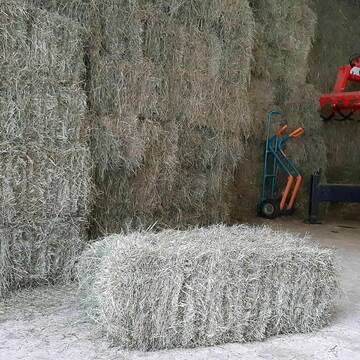
Heukleinballen (34 x 44 x 90 cm)
Marquartstein
Hacher Fahrnpoint
@Hacher-Berghof-Fahrnpoint
Heu
Kleinballen/HD-Ballen
Regenfrei
Wird verladen
1 weitere...
B+
Deprecated: Creation of dynamic property Zend_View_Helper_Ads::$adLink is deprecated in /var/www/stall-frei/htdocs/staging.stall-frei.de/library/Psf/View/Helper/Ads.php on line 108

Neuer HIT Aktivstall - Gut Moosrain
Murnau am Staffelsee
Markus-Simson
@Markus-Simson
Wir bieten Ihnen das HIT Aktivstall Konzept auf dem neuesten Stand in einzigartiger Lage und in einer geschlossenen Anlage:
- Fut
neu
R

B+

Bio-Pferdeheu in Rundballen
Reichersbeuern
Biohof-Sixt
@Biohof-Sixt
Heu
Empfänger lädt ab
Rundballen
Bio
2 weitere...
aktuell
B+

Heupellets und Strohpellets Bio
Bogen
Marion Christ
@Marion-Christ
Einstreu
Pellets
Bio
Abholung
Lieferung
B+
Leider kein Vorschaubild
Leider kein Vorschaubild
HEUCOBS/GRASCOBSMenge in kg Preis 0,75€/kg im Sa...
Starnberg
Reiterhof-Klim
@Reiterhof-Klim
Futter
Pellets
Abholung
B+

Job gesucht?
Mechtersen
STALL-FREIde Marketing
@STALL-FREI-Marketing
Sie suchen einen Job und arbeiten gerne mit Pferden oder auf Reitanlagen?
Besuchen Sie jetzt unseren Stellenmarkt!
Leider kein Vorschaubild
Leider kein Vorschaubild
heu 2025 heu 2ter schnitt 2025
Maisach
Reitstall Thurner
@ReitstallThurner
Heu
Empfänger lädt ab
Rundballen
Regenfrei
3 weitere...
B+

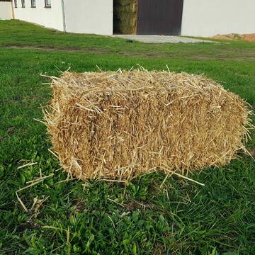
Heu 2. Schnitt 2025 Grummet HD Ballen
Altmannstein
Thomas Resch
@Cappo
Heu
Empfänger lädt ab
Kleinballen/HD-Ballen
Wird verladen
2 weitere...
B+


Strohpellet, Strohgranulat, Heu & Stroh
Allmannshofen
J&M Kratzer
@JMKratzer
Einstreu
Lieferant entlädt
Pellets
Wird verladen
2 weitere...
P+

HD-Heuballen, 1. Schnitt & 2. Schnitt
Hilpoltstein
KnollmeyerBallen
@KnollmeyerBallen
Heu
Lieferant entlädt
Kleinballen/HD-Ballen
Regenfrei
3 weitere...
B+
HD-Strohballen, Gersten-, Dinkel- und Weizenstroh
Hilpoltstein
KnollmeyerBallen
@KnollmeyerBallen
Einstreu
Lieferant entlädt
Kleinballen/HD-Ballen
Regenfrei
3 weitere...
B+
Deprecated: Creation of dynamic property Zend_View::$pageCount is deprecated in /var/www/stall-frei/htdocs/staging.stall-frei.de/library/vendor/shardj/zf1-future/library/Zend/View/Abstract.php on line 308
Deprecated: Creation of dynamic property Zend_View::$itemCountPerPage is deprecated in /var/www/stall-frei/htdocs/staging.stall-frei.de/library/vendor/shardj/zf1-future/library/Zend/View/Abstract.php on line 308
Deprecated: Creation of dynamic property Zend_View::$first is deprecated in /var/www/stall-frei/htdocs/staging.stall-frei.de/library/vendor/shardj/zf1-future/library/Zend/View/Abstract.php on line 308
Deprecated: Creation of dynamic property Zend_View::$current is deprecated in /var/www/stall-frei/htdocs/staging.stall-frei.de/library/vendor/shardj/zf1-future/library/Zend/View/Abstract.php on line 308
Deprecated: Creation of dynamic property Zend_View::$last is deprecated in /var/www/stall-frei/htdocs/staging.stall-frei.de/library/vendor/shardj/zf1-future/library/Zend/View/Abstract.php on line 308
Deprecated: Creation of dynamic property Zend_View::$next is deprecated in /var/www/stall-frei/htdocs/staging.stall-frei.de/library/vendor/shardj/zf1-future/library/Zend/View/Abstract.php on line 308
Deprecated: Creation of dynamic property Zend_View::$pagesInRange is deprecated in /var/www/stall-frei/htdocs/staging.stall-frei.de/library/vendor/shardj/zf1-future/library/Zend/View/Abstract.php on line 308
Deprecated: Creation of dynamic property Zend_View::$firstPageInRange is deprecated in /var/www/stall-frei/htdocs/staging.stall-frei.de/library/vendor/shardj/zf1-future/library/Zend/View/Abstract.php on line 308
Deprecated: Creation of dynamic property Zend_View::$lastPageInRange is deprecated in /var/www/stall-frei/htdocs/staging.stall-frei.de/library/vendor/shardj/zf1-future/library/Zend/View/Abstract.php on line 308
Deprecated: Creation of dynamic property Zend_View::$currentItemCount is deprecated in /var/www/stall-frei/htdocs/staging.stall-frei.de/library/vendor/shardj/zf1-future/library/Zend/View/Abstract.php on line 308
Deprecated: Creation of dynamic property Zend_View::$totalItemCount is deprecated in /var/www/stall-frei/htdocs/staging.stall-frei.de/library/vendor/shardj/zf1-future/library/Zend/View/Abstract.php on line 308
Deprecated: Creation of dynamic property Zend_View::$firstItemNumber is deprecated in /var/www/stall-frei/htdocs/staging.stall-frei.de/library/vendor/shardj/zf1-future/library/Zend/View/Abstract.php on line 308
Deprecated: Creation of dynamic property Zend_View::$lastItemNumber is deprecated in /var/www/stall-frei/htdocs/staging.stall-frei.de/library/vendor/shardj/zf1-future/library/Zend/View/Abstract.php on line 308
Deprecated: Creation of dynamic property Zend_View::$router is deprecated in /var/www/stall-frei/htdocs/staging.stall-frei.de/library/vendor/shardj/zf1-future/library/Zend/View/Abstract.php on line 308
Deprecated: Creation of dynamic property Zend_View::$urlParams is deprecated in /var/www/stall-frei/htdocs/staging.stall-frei.de/library/vendor/shardj/zf1-future/library/Zend/View/Abstract.php on line 308
Deprecated: Creation of dynamic property Zend_View::$showAds is deprecated in /var/www/stall-frei/htdocs/staging.stall-frei.de/library/vendor/shardj/zf1-future/library/Zend/View/Abstract.php on line 308
Deprecated: Creation of dynamic property Zend_View::$objectIds is deprecated in /var/www/stall-frei/htdocs/staging.stall-frei.de/library/vendor/shardj/zf1-future/library/Zend/View/Abstract.php on line 308
Deprecated: Creation of dynamic property Zend_View::$showNavbar is deprecated in /var/www/stall-frei/htdocs/staging.stall-frei.de/library/vendor/shardj/zf1-future/library/Zend/View/Abstract.php on line 308
Deprecated: Creation of dynamic property Zend_View::$showBreadcrumb is deprecated in /var/www/stall-frei/htdocs/staging.stall-frei.de/library/vendor/shardj/zf1-future/library/Zend/View/Abstract.php on line 308
Deprecated: Creation of dynamic property Zend_View::$showFooter is deprecated in /var/www/stall-frei/htdocs/staging.stall-frei.de/library/vendor/shardj/zf1-future/library/Zend/View/Abstract.php on line 308
Deprecated: Creation of dynamic property Zend_View::$showInternalAds is deprecated in /var/www/stall-frei/htdocs/staging.stall-frei.de/library/vendor/shardj/zf1-future/library/Zend/View/Abstract.php on line 308
Deprecated: Creation of dynamic property Zend_View::$blNoContent is deprecated in /var/www/stall-frei/htdocs/staging.stall-frei.de/library/vendor/shardj/zf1-future/library/Zend/View/Abstract.php on line 308
Deprecated: Creation of dynamic property Zend_View::$sMetaDesc is deprecated in /var/www/stall-frei/htdocs/staging.stall-frei.de/library/vendor/shardj/zf1-future/library/Zend/View/Abstract.php on line 308
Deprecated: Creation of dynamic property Zend_View::$useGmaps is deprecated in /var/www/stall-frei/htdocs/staging.stall-frei.de/library/vendor/shardj/zf1-future/library/Zend/View/Abstract.php on line 308
Deprecated: Creation of dynamic property Zend_View::$touches is deprecated in /var/www/stall-frei/htdocs/staging.stall-frei.de/library/vendor/shardj/zf1-future/library/Zend/View/Abstract.php on line 308
Deprecated: Creation of dynamic property Zend_View::$oProject is deprecated in /var/www/stall-frei/htdocs/staging.stall-frei.de/library/vendor/shardj/zf1-future/library/Zend/View/Abstract.php on line 308
Deprecated: Creation of dynamic property Zend_View::$pageHeadline is deprecated in /var/www/stall-frei/htdocs/staging.stall-frei.de/library/vendor/shardj/zf1-future/library/Zend/View/Abstract.php on line 308
Deprecated: Creation of dynamic property Zend_View::$disableLocationField is deprecated in /var/www/stall-frei/htdocs/staging.stall-frei.de/library/vendor/shardj/zf1-future/library/Zend/View/Abstract.php on line 308
Deprecated: Creation of dynamic property Zend_View::$isSearch is deprecated in /var/www/stall-frei/htdocs/staging.stall-frei.de/library/vendor/shardj/zf1-future/library/Zend/View/Abstract.php on line 308
Deprecated: Creation of dynamic property Zend_View::$pageTitle is deprecated in /var/www/stall-frei/htdocs/staging.stall-frei.de/library/vendor/shardj/zf1-future/library/Zend/View/Abstract.php on line 308
Deprecated: Creation of dynamic property Psf_Form_Element_Text::$class is deprecated in /var/www/stall-frei/htdocs/staging.stall-frei.de/library/vendor/shardj/zf1-future/library/Zend/Form/Element.php on line 874
Deprecated: Creation of dynamic property Psf_Form_Element_Text::$size is deprecated in /var/www/stall-frei/htdocs/staging.stall-frei.de/library/vendor/shardj/zf1-future/library/Zend/Form/Element.php on line 874
Deprecated: Creation of dynamic property Psf_Form_Element_Text::$placeholder is deprecated in /var/www/stall-frei/htdocs/staging.stall-frei.de/library/vendor/shardj/zf1-future/library/Zend/Form/Element.php on line 874
Deprecated: Creation of dynamic property Psf_Form_Element_Hidden::$class is deprecated in /var/www/stall-frei/htdocs/staging.stall-frei.de/library/vendor/shardj/zf1-future/library/Zend/Form/Element.php on line 874
Deprecated: Creation of dynamic property Psf_Form_Element_Hidden::$class is deprecated in /var/www/stall-frei/htdocs/staging.stall-frei.de/library/vendor/shardj/zf1-future/library/Zend/Form/Element.php on line 874
Deprecated: Creation of dynamic property Psf_Form_Element_Hidden::$class is deprecated in /var/www/stall-frei/htdocs/staging.stall-frei.de/library/vendor/shardj/zf1-future/library/Zend/Form/Element.php on line 874
Deprecated: Creation of dynamic property Psf_Form_Element_Hidden::$class is deprecated in /var/www/stall-frei/htdocs/staging.stall-frei.de/library/vendor/shardj/zf1-future/library/Zend/Form/Element.php on line 874
Deprecated: Creation of dynamic property Psf_Form_Element_Select::$class is deprecated in /var/www/stall-frei/htdocs/staging.stall-frei.de/library/vendor/shardj/zf1-future/library/Zend/Form/Element.php on line 874
Deprecated: Creation of dynamic property Psf_Form_Element_Select::$class is deprecated in /var/www/stall-frei/htdocs/staging.stall-frei.de/library/vendor/shardj/zf1-future/library/Zend/Form/Element.php on line 874
Deprecated: Creation of dynamic property Psf_Form_Element_Select::$class is deprecated in /var/www/stall-frei/htdocs/staging.stall-frei.de/library/vendor/shardj/zf1-future/library/Zend/Form/Element.php on line 874
Deprecated: Creation of dynamic property Psf_Form_Element_Select::$class is deprecated in /var/www/stall-frei/htdocs/staging.stall-frei.de/library/vendor/shardj/zf1-future/library/Zend/Form/Element.php on line 874
Deprecated: Creation of dynamic property Zend_View::$sort is deprecated in /var/www/stall-frei/htdocs/staging.stall-frei.de/library/vendor/shardj/zf1-future/library/Zend/View/Abstract.php on line 308
Deprecated: Creation of dynamic property Zend_View::$searchLocation is deprecated in /var/www/stall-frei/htdocs/staging.stall-frei.de/library/vendor/shardj/zf1-future/library/Zend/View/Abstract.php on line 308
Deprecated: Creation of dynamic property Zend_View::$locationHint is deprecated in /var/www/stall-frei/htdocs/staging.stall-frei.de/library/vendor/shardj/zf1-future/library/Zend/View/Abstract.php on line 308
Psf_GeoCoder_Abstract::getLocation: Engelsberg Get Location CachedOrLive
Psf_GeoCoder_Abstract::getCachedOrLive: Engelsberg
Psf_GeoCoder_OpenCageData::makeApiRequest: response:
Array
(
[documentation] => https://opencagedata.com/api
[licenses] => Array
(
[0] => Array
(
[name] => see attribution guide
[url] => https://opencagedata.com/credits
)
)
[results] => Array
(
[0] => Array
(
[bounds] => Array
(
[northeast] => Array
(
[lat] => 48.1639534
[lng] => 12.5760093
)
[southwest] => Array
(
[lat] => 48.0953628
[lng] => 12.4646165
)
)
[components] => Array
(
[ISO_3166-1_alpha-2] => DE
[ISO_3166-1_alpha-3] => DEU
[ISO_3166-2] => Array
(
[0] => DE-BY
)
[_category] => place
[_normalized_city] => Engelsberg
[_type] => village
[continent] => Europe
[country] => Deutschland
[country_code] => de
[county] => Landkreis Traunstein
[political_union] => European Union
[postcode] => 84549
[state] => Bayern
[state_code] => BY
[village] => Engelsberg
)
[confidence] => 7
[formatted] => 84549 Engelsberg, Deutschland
[geometry] => Array
(
[lat] => 48.1156289
[lng] => 12.5435719
)
)
[1] => Array
(
[bounds] => Array
(
[northeast] => Array
(
[lat] => 49.3433417
[lng] => 11.6445334
)
[southwest] => Array
(
[lat] => 49.3033417
[lng] => 11.6045334
)
)
[components] => Array
(
[ISO_3166-1_alpha-2] => DE
[ISO_3166-1_alpha-3] => DEU
[ISO_3166-2] => Array
(
[0] => DE-BY
)
[_category] => place
[_normalized_city] => Lauterhofen
[_type] => village
[city] => Lauterhofen
[continent] => Europe
[country] => Deutschland
[country_code] => de
[county] => Landkreis Neumarkt in der Oberpfalz
[political_union] => European Union
[state] => Bayern
[state_code] => BY
[village] => Engelsberg
)
[confidence] => 7
[formatted] => Engelsberg, Bayern, Deutschland
[geometry] => Array
(
[lat] => 49.3233417
[lng] => 11.6245334
)
)
[2] => Array
(
[bounds] => Array
(
[northeast] => Array
(
[lat] => 49.471723
[lng] => 9.8322494
)
[southwest] => Array
(
[lat] => 49.471623
[lng] => 9.8321494
)
)
[components] => Array
(
[ISO_3166-1_alpha-2] => DE
[ISO_3166-1_alpha-3] => DEU
[ISO_3166-2] => Array
(
[0] => DE-BW
)
[_category] => natural/water
[_normalized_city] => Bad Mergentheim
[_type] => peak
[continent] => Europe
[country] => Deutschland
[country_code] => de
[county] => Main-Tauber-Kreis
[municipality] => VVG der Stadt Bad Mergentheim
[peak] => Engelsberg
[political_union] => European Union
[postcode] => 97999
[state] => Baden-Württemberg
[state_code] => BW
[town] => Bad Mergentheim
)
[confidence] => 9
[formatted] => Engelsberg, 97999 Bad Mergentheim, Deutschland
[geometry] => Array
(
[lat] => 49.471673
[lng] => 9.8321994
)
)
[3] => Array
(
[bounds] => Array
(
[northeast] => Array
(
[lat] => 50.4961452
[lng] => 11.479082
)
[southwest] => Array
(
[lat] => 50.4960452
[lng] => 11.478982
)
)
[components] => Array
(
[ISO_3166-1_alpha-2] => DE
[ISO_3166-1_alpha-3] => DEU
[ISO_3166-2] => Array
(
[0] => DE-TH
)
[_category] => natural/water
[_normalized_city] => Lehesten
[_type] => peak
[continent] => Europe
[country] => Deutschland
[country_code] => de
[county] => Landkreis Saalfeld-Rudolstadt
[municipality] => Schiefergebirge
[peak] => Engelsberg
[political_union] => European Union
[postcode] => 07349
[state] => Thüringen
[state_code] => TH
[town] => Lehesten
)
[confidence] => 9
[formatted] => Engelsberg, 07349 Lehesten, Deutschland
[geometry] => Array
(
[lat] => 50.4960952
[lng] => 11.479032
)
)
[4] => Array
(
[bounds] => Array
(
[northeast] => Array
(
[lat] => 48.5385821
[lng] => 11.9780186
)
[southwest] => Array
(
[lat] => 48.5384821
[lng] => 11.9779186
)
)
[components] => Array
(
[ISO_3166-1_alpha-2] => DE
[ISO_3166-1_alpha-3] => DEU
[ISO_3166-2] => Array
(
[0] => DE-BY
)
[_category] => natural/water
[_normalized_city] => Bruckberg
[_type] => peak
[continent] => Europe
[country] => Deutschland
[country_code] => de
[county] => Landkreis Landshut
[peak] => Engelsberg
[political_union] => European Union
[postcode] => 85408
[state] => Bayern
[state_code] => BY
[village] => Bruckberg
)
[confidence] => 9
[formatted] => Engelsberg, 85408 Bruckberg, Deutschland
[geometry] => Array
(
[lat] => 48.5385321
[lng] => 11.9779686
)
)
[5] => Array
(
[bounds] => Array
(
[northeast] => Array
(
[lat] => 51.0311712
[lng] => 7.9360267
)
[southwest] => Array
(
[lat] => 51.0310712
[lng] => 7.9359267
)
)
[components] => Array
(
[ISO_3166-1_alpha-2] => DE
[ISO_3166-1_alpha-3] => DEU
[ISO_3166-2] => Array
(
[0] => DE-NW
)
[_category] => natural/water
[_normalized_city] => Olpe
[_type] => peak
[continent] => Europe
[country] => Deutschland
[country_code] => de
[county] => Kreis Olpe
[peak] => Engelsberg
[political_union] => European Union
[state] => Nordrhein-Westfalen
[state_code] => NW
[town] => Olpe
)
[confidence] => 9
[formatted] => Engelsberg, Olpe, Nordrhein-Westfalen, Deutschland
[geometry] => Array
(
[lat] => 51.0311212
[lng] => 7.9359767
)
)
[6] => Array
(
[bounds] => Array
(
[northeast] => Array
(
[lat] => 48.1675304
[lng] => 11.2488915
)
[southwest] => Array
(
[lat] => 48.1674304
[lng] => 11.2487915
)
)
[components] => Array
(
[ISO_3166-1_alpha-2] => DE
[ISO_3166-1_alpha-3] => DEU
[ISO_3166-2] => Array
(
[0] => DE-BY
)
[_category] => natural/water
[_normalized_city] => Fürstenfeldbruck
[_type] => peak
[continent] => Europe
[country] => Deutschland
[country_code] => de
[county] => Landkreis Fürstenfeldbruck
[peak] => Engelsberg
[political_union] => European Union
[postcode] => 82256
[state] => Bayern
[state_code] => BY
[town] => Fürstenfeldbruck
)
[confidence] => 9
[formatted] => Engelsberg, 82256 Fürstenfeldbruck, Deutschland
[geometry] => Array
(
[lat] => 48.1674804
[lng] => 11.2488415
)
)
[7] => Array
(
[bounds] => Array
(
[northeast] => Array
(
[lat] => 50.6366982
[lng] => 10.0500354
)
[southwest] => Array
(
[lat] => 50.6365982
[lng] => 10.0499354
)
)
[components] => Array
(
[ISO_3166-1_alpha-2] => DE
[ISO_3166-1_alpha-3] => DEU
[ISO_3166-2] => Array
(
[0] => DE-HE
)
[_category] => natural/water
[_normalized_city] => Tann
[_type] => peak
[continent] => Europe
[country] => Deutschland
[country_code] => de
[county] => Landkreis Fulda
[municipality] => Tann (Rhön)
[peak] => Engelsberg
[political_union] => European Union
[postcode] => 36142
[state] => Hessen
[state_code] => HE
[village] => Tann
)
[confidence] => 9
[formatted] => Engelsberg, 36142 Tann, Deutschland
[geometry] => Array
(
[lat] => 50.6366482
[lng] => 10.0499854
)
)
[8] => Array
(
[bounds] => Array
(
[northeast] => Array
(
[lat] => 48.9453662
[lng] => 9.3279294
)
[southwest] => Array
(
[lat] => 48.9452662
[lng] => 9.3278294
)
)
[components] => Array
(
[ISO_3166-1_alpha-2] => DE
[ISO_3166-1_alpha-3] => DEU
[ISO_3166-2] => Array
(
[0] => DE-BW
)
[_category] => natural/water
[_normalized_city] => Kirchberg an der Murr
[_type] => peak
[continent] => Europe
[country] => Deutschland
[country_code] => de
[county] => Rems-Murr-Kreis
[municipality] => VVG der Stadt Backnang
[peak] => Engelsberg
[political_union] => European Union
[postcode] => 71737
[state] => Baden-Württemberg
[state_code] => BW
[village] => Kirchberg an der Murr
)
[confidence] => 9
[formatted] => Engelsberg, 71737 Kirchberg an der Murr, Deutschland
[geometry] => Array
(
[lat] => 48.9453162
[lng] => 9.3278794
)
)
[9] => Array
(
[bounds] => Array
(
[northeast] => Array
(
[lat] => 48.1644934
[lng] => 12.7115219
)
[southwest] => Array
(
[lat] => 48.1244934
[lng] => 12.6715219
)
)
[components] => Array
(
[ISO_3166-1_alpha-2] => DE
[ISO_3166-1_alpha-3] => DEU
[ISO_3166-2] => Array
(
[0] => DE-BY
)
[_category] => place
[_normalized_city] => Burgkirchen an der Alz
[_type] => hamlet
[continent] => Europe
[country] => Deutschland
[country_code] => de
[county] => Landkreis Altötting
[hamlet] => Engelsberg
[political_union] => European Union
[postcode] => 84553
[state] => Bayern
[state_code] => BY
[town] => Burgkirchen an der Alz
)
[confidence] => 7
[formatted] => Engelsberg, 84553 Burgkirchen an der Alz, Deutschland
[geometry] => Array
(
[lat] => 48.1444934
[lng] => 12.6915219
)
)
)
[status] => Array
(
[code] => 200
[message] => OK
)
[stay_informed] => Array
(
[blog] => https://blog.opencagedata.com
[mastodon] => https://en.osm.town/@opencage
)
[thanks] => For using an OpenCage API
[timestamp] => Array
(
[created_http] => Sun, 08 Feb 2026 00:16:14 GMT
[created_unix] => 1770509774
)
[total_results] => 10
)
Psf_GeoCoder_Abstract::convertLocationResult
{"documentation":"https:\/\/opencagedata.com\/api","licenses":[{"name":"see attribution guide","url":"https:\/\/opencagedata.com\/credits"}],"results":[{"bounds":{"northeast":{"lat":48.1639534,"lng":12.5760093},"southwest":{"lat":48.0953628,"lng":12.4646165}},"components":{"ISO_3166-1_alpha-2":"DE","ISO_3166-1_alpha-3":"DEU","ISO_3166-2":["DE-BY"],"_category":"place","_normalized_city":"Engelsberg","_type":"village","continent":"Europe","country":"Deutschland","country_code":"de","county":"Landkreis Traunstein","political_union":"European Union","postcode":"84549","state":"Bayern","state_code":"BY","village":"Engelsberg"},"confidence":7,"formatted":"84549 Engelsberg, Deutschland","geometry":{"lat":48.1156289,"lng":12.5435719}},{"bounds":{"northeast":{"lat":49.3433417,"lng":11.6445334},"southwest":{"lat":49.3033417,"lng":11.6045334}},"components":{"ISO_3166-1_alpha-2":"DE","ISO_3166-1_alpha-3":"DEU","ISO_3166-2":["DE-BY"],"_category":"place","_normalized_city":"Lauterhofen","_type":"village","city":"Lauterhofen","continent":"Europe","country":"Deutschland","country_code":"de","county":"Landkreis Neumarkt in der Oberpfalz","political_union":"European Union","state":"Bayern","state_code":"BY","village":"Engelsberg"},"confidence":7,"formatted":"Engelsberg, Bayern, Deutschland","geometry":{"lat":49.3233417,"lng":11.6245334}},{"bounds":{"northeast":{"lat":49.471723,"lng":9.8322494},"southwest":{"lat":49.471623,"lng":9.8321494}},"components":{"ISO_3166-1_alpha-2":"DE","ISO_3166-1_alpha-3":"DEU","ISO_3166-2":["DE-BW"],"_category":"natural\/water","_normalized_city":"Bad Mergentheim","_type":"peak","continent":"Europe","country":"Deutschland","country_code":"de","county":"Main-Tauber-Kreis","municipality":"VVG der Stadt Bad Mergentheim","peak":"Engelsberg","political_union":"European Union","postcode":"97999","state":"Baden-W\u00fcrttemberg","state_code":"BW","town":"Bad Mergentheim"},"confidence":9,"formatted":"Engelsberg, 97999 Bad Mergentheim, Deutschland","geometry":{"lat":49.471673,"lng":9.8321994}},{"bounds":{"northeast":{"lat":50.4961452,"lng":11.479082},"southwest":{"lat":50.4960452,"lng":11.478982}},"components":{"ISO_3166-1_alpha-2":"DE","ISO_3166-1_alpha-3":"DEU","ISO_3166-2":["DE-TH"],"_category":"natural\/water","_normalized_city":"Lehesten","_type":"peak","continent":"Europe","country":"Deutschland","country_code":"de","county":"Landkreis Saalfeld-Rudolstadt","municipality":"Schiefergebirge","peak":"Engelsberg","political_union":"European Union","postcode":"07349","state":"Th\u00fcringen","state_code":"TH","town":"Lehesten"},"confidence":9,"formatted":"Engelsberg, 07349 Lehesten, Deutschland","geometry":{"lat":50.4960952,"lng":11.479032}},{"bounds":{"northeast":{"lat":48.5385821,"lng":11.9780186},"southwest":{"lat":48.5384821,"lng":11.9779186}},"components":{"ISO_3166-1_alpha-2":"DE","ISO_3166-1_alpha-3":"DEU","ISO_3166-2":["DE-BY"],"_category":"natural\/water","_normalized_city":"Bruckberg","_type":"peak","continent":"Europe","country":"Deutschland","country_code":"de","county":"Landkreis Landshut","peak":"Engelsberg","political_union":"European Union","postcode":"85408","state":"Bayern","state_code":"BY","village":"Bruckberg"},"confidence":9,"formatted":"Engelsberg, 85408 Bruckberg, Deutschland","geometry":{"lat":48.5385321,"lng":11.9779686}},{"bounds":{"northeast":{"lat":51.0311712,"lng":7.9360267},"southwest":{"lat":51.0310712,"lng":7.9359267}},"components":{"ISO_3166-1_alpha-2":"DE","ISO_3166-1_alpha-3":"DEU","ISO_3166-2":["DE-NW"],"_category":"natural\/water","_normalized_city":"Olpe","_type":"peak","continent":"Europe","country":"Deutschland","country_code":"de","county":"Kreis Olpe","peak":"Engelsberg","political_union":"European Union","state":"Nordrhein-Westfalen","state_code":"NW","town":"Olpe"},"confidence":9,"formatted":"Engelsberg, Olpe, Nordrhein-Westfalen, Deutschland","geometry":{"lat":51.0311212,"lng":7.9359767}},{"bounds":{"northeast":{"lat":48.1675304,"lng":11.2488915},"southwest":{"lat":48.1674304,"lng":11.2487915}},"components":{"ISO_3166-1_alpha-2":"DE","ISO_3166-1_alpha-3":"DEU","ISO_3166-2":["DE-BY"],"_category":"natural\/water","_normalized_city":"F\u00fcrstenfeldbruck","_type":"peak","continent":"Europe","country":"Deutschland","country_code":"de","county":"Landkreis F\u00fcrstenfeldbruck","peak":"Engelsberg","political_union":"European Union","postcode":"82256","state":"Bayern","state_code":"BY","town":"F\u00fcrstenfeldbruck"},"confidence":9,"formatted":"Engelsberg, 82256 F\u00fcrstenfeldbruck, Deutschland","geometry":{"lat":48.1674804,"lng":11.2488415}},{"bounds":{"northeast":{"lat":50.6366982,"lng":10.0500354},"southwest":{"lat":50.6365982,"lng":10.0499354}},"components":{"ISO_3166-1_alpha-2":"DE","ISO_3166-1_alpha-3":"DEU","ISO_3166-2":["DE-HE"],"_category":"natural\/water","_normalized_city":"Tann","_type":"peak","continent":"Europe","country":"Deutschland","country_code":"de","county":"Landkreis Fulda","municipality":"Tann (Rh\u00f6n)","peak":"Engelsberg","political_union":"European Union","postcode":"36142","state":"Hessen","state_code":"HE","village":"Tann"},"confidence":9,"formatted":"Engelsberg, 36142 Tann, Deutschland","geometry":{"lat":50.6366482,"lng":10.0499854}},{"bounds":{"northeast":{"lat":48.9453662,"lng":9.3279294},"southwest":{"lat":48.9452662,"lng":9.3278294}},"components":{"ISO_3166-1_alpha-2":"DE","ISO_3166-1_alpha-3":"DEU","ISO_3166-2":["DE-BW"],"_category":"natural\/water","_normalized_city":"Kirchberg an der Murr","_type":"peak","continent":"Europe","country":"Deutschland","country_code":"de","county":"Rems-Murr-Kreis","municipality":"VVG der Stadt Backnang","peak":"Engelsberg","political_union":"European Union","postcode":"71737","state":"Baden-W\u00fcrttemberg","state_code":"BW","village":"Kirchberg an der Murr"},"confidence":9,"formatted":"Engelsberg, 71737 Kirchberg an der Murr, Deutschland","geometry":{"lat":48.9453162,"lng":9.3278794}},{"bounds":{"northeast":{"lat":48.1644934,"lng":12.7115219},"southwest":{"lat":48.1244934,"lng":12.6715219}},"components":{"ISO_3166-1_alpha-2":"DE","ISO_3166-1_alpha-3":"DEU","ISO_3166-2":["DE-BY"],"_category":"place","_normalized_city":"Burgkirchen an der Alz","_type":"hamlet","continent":"Europe","country":"Deutschland","country_code":"de","county":"Landkreis Alt\u00f6tting","hamlet":"Engelsberg","political_union":"European Union","postcode":"84553","state":"Bayern","state_code":"BY","town":"Burgkirchen an der Alz"},"confidence":7,"formatted":"Engelsberg, 84553 Burgkirchen an der Alz, Deutschland","geometry":{"lat":48.1444934,"lng":12.6915219}}],"status":{"code":200,"message":"OK"},"stay_informed":{"blog":"https:\/\/blog.opencagedata.com","mastodon":"https:\/\/en.osm.town\/@opencage"},"thanks":"For using an OpenCage API","timestamp":{"created_http":"Sun, 08 Feb 2026 00:16:14 GMT","created_unix":1770509774},"total_results":10}Array
(
[0] => stdClass Object
(
[bounds] => stdClass Object
(
[northeast] => stdClass Object
(
[lat] => 48.1639534
[lng] => 12.5760093
)
[southwest] => stdClass Object
(
[lat] => 48.0953628
[lng] => 12.4646165
)
)
[components] => stdClass Object
(
[ISO_3166-1_alpha-2] => DE
[ISO_3166-1_alpha-3] => DEU
[ISO_3166-2] => Array
(
[0] => DE-BY
)
[_category] => place
[_normalized_city] => Engelsberg
[_type] => village
[continent] => Europe
[country] => Deutschland
[country_code] => de
[county] => Landkreis Traunstein
[political_union] => European Union
[postcode] => 84549
[state] => Bayern
[state_code] => BY
[village] => Engelsberg
)
[confidence] => 7
[formatted] => 84549 Engelsberg, Deutschland
[geometry] => stdClass Object
(
[lat] => 48.1156289
[lng] => 12.5435719
)
)
[1] => stdClass Object
(
[bounds] => stdClass Object
(
[northeast] => stdClass Object
(
[lat] => 49.3433417
[lng] => 11.6445334
)
[southwest] => stdClass Object
(
[lat] => 49.3033417
[lng] => 11.6045334
)
)
[components] => stdClass Object
(
[ISO_3166-1_alpha-2] => DE
[ISO_3166-1_alpha-3] => DEU
[ISO_3166-2] => Array
(
[0] => DE-BY
)
[_category] => place
[_normalized_city] => Lauterhofen
[_type] => village
[city] => Lauterhofen
[continent] => Europe
[country] => Deutschland
[country_code] => de
[county] => Landkreis Neumarkt in der Oberpfalz
[political_union] => European Union
[state] => Bayern
[state_code] => BY
[village] => Engelsberg
)
[confidence] => 7
[formatted] => Engelsberg, Bayern, Deutschland
[geometry] => stdClass Object
(
[lat] => 49.3233417
[lng] => 11.6245334
)
)
[2] => stdClass Object
(
[bounds] => stdClass Object
(
[northeast] => stdClass Object
(
[lat] => 49.471723
[lng] => 9.8322494
)
[southwest] => stdClass Object
(
[lat] => 49.471623
[lng] => 9.8321494
)
)
[components] => stdClass Object
(
[ISO_3166-1_alpha-2] => DE
[ISO_3166-1_alpha-3] => DEU
[ISO_3166-2] => Array
(
[0] => DE-BW
)
[_category] => natural/water
[_normalized_city] => Bad Mergentheim
[_type] => peak
[continent] => Europe
[country] => Deutschland
[country_code] => de
[county] => Main-Tauber-Kreis
[municipality] => VVG der Stadt Bad Mergentheim
[peak] => Engelsberg
[political_union] => European Union
[postcode] => 97999
[state] => Baden-Württemberg
[state_code] => BW
[town] => Bad Mergentheim
)
[confidence] => 9
[formatted] => Engelsberg, 97999 Bad Mergentheim, Deutschland
[geometry] => stdClass Object
(
[lat] => 49.471673
[lng] => 9.8321994
)
)
[3] => stdClass Object
(
[bounds] => stdClass Object
(
[northeast] => stdClass Object
(
[lat] => 50.4961452
[lng] => 11.479082
)
[southwest] => stdClass Object
(
[lat] => 50.4960452
[lng] => 11.478982
)
)
[components] => stdClass Object
(
[ISO_3166-1_alpha-2] => DE
[ISO_3166-1_alpha-3] => DEU
[ISO_3166-2] => Array
(
[0] => DE-TH
)
[_category] => natural/water
[_normalized_city] => Lehesten
[_type] => peak
[continent] => Europe
[country] => Deutschland
[country_code] => de
[county] => Landkreis Saalfeld-Rudolstadt
[municipality] => Schiefergebirge
[peak] => Engelsberg
[political_union] => European Union
[postcode] => 07349
[state] => Thüringen
[state_code] => TH
[town] => Lehesten
)
[confidence] => 9
[formatted] => Engelsberg, 07349 Lehesten, Deutschland
[geometry] => stdClass Object
(
[lat] => 50.4960952
[lng] => 11.479032
)
)
[4] => stdClass Object
(
[bounds] => stdClass Object
(
[northeast] => stdClass Object
(
[lat] => 48.5385821
[lng] => 11.9780186
)
[southwest] => stdClass Object
(
[lat] => 48.5384821
[lng] => 11.9779186
)
)
[components] => stdClass Object
(
[ISO_3166-1_alpha-2] => DE
[ISO_3166-1_alpha-3] => DEU
[ISO_3166-2] => Array
(
[0] => DE-BY
)
[_category] => natural/water
[_normalized_city] => Bruckberg
[_type] => peak
[continent] => Europe
[country] => Deutschland
[country_code] => de
[county] => Landkreis Landshut
[peak] => Engelsberg
[political_union] => European Union
[postcode] => 85408
[state] => Bayern
[state_code] => BY
[village] => Bruckberg
)
[confidence] => 9
[formatted] => Engelsberg, 85408 Bruckberg, Deutschland
[geometry] => stdClass Object
(
[lat] => 48.5385321
[lng] => 11.9779686
)
)
[5] => stdClass Object
(
[bounds] => stdClass Object
(
[northeast] => stdClass Object
(
[lat] => 51.0311712
[lng] => 7.9360267
)
[southwest] => stdClass Object
(
[lat] => 51.0310712
[lng] => 7.9359267
)
)
[components] => stdClass Object
(
[ISO_3166-1_alpha-2] => DE
[ISO_3166-1_alpha-3] => DEU
[ISO_3166-2] => Array
(
[0] => DE-NW
)
[_category] => natural/water
[_normalized_city] => Olpe
[_type] => peak
[continent] => Europe
[country] => Deutschland
[country_code] => de
[county] => Kreis Olpe
[peak] => Engelsberg
[political_union] => European Union
[state] => Nordrhein-Westfalen
[state_code] => NW
[town] => Olpe
)
[confidence] => 9
[formatted] => Engelsberg, Olpe, Nordrhein-Westfalen, Deutschland
[geometry] => stdClass Object
(
[lat] => 51.0311212
[lng] => 7.9359767
)
)
[6] => stdClass Object
(
[bounds] => stdClass Object
(
[northeast] => stdClass Object
(
[lat] => 48.1675304
[lng] => 11.2488915
)
[southwest] => stdClass Object
(
[lat] => 48.1674304
[lng] => 11.2487915
)
)
[components] => stdClass Object
(
[ISO_3166-1_alpha-2] => DE
[ISO_3166-1_alpha-3] => DEU
[ISO_3166-2] => Array
(
[0] => DE-BY
)
[_category] => natural/water
[_normalized_city] => Fürstenfeldbruck
[_type] => peak
[continent] => Europe
[country] => Deutschland
[country_code] => de
[county] => Landkreis Fürstenfeldbruck
[peak] => Engelsberg
[political_union] => European Union
[postcode] => 82256
[state] => Bayern
[state_code] => BY
[town] => Fürstenfeldbruck
)
[confidence] => 9
[formatted] => Engelsberg, 82256 Fürstenfeldbruck, Deutschland
[geometry] => stdClass Object
(
[lat] => 48.1674804
[lng] => 11.2488415
)
)
[7] => stdClass Object
(
[bounds] => stdClass Object
(
[northeast] => stdClass Object
(
[lat] => 50.6366982
[lng] => 10.0500354
)
[southwest] => stdClass Object
(
[lat] => 50.6365982
[lng] => 10.0499354
)
)
[components] => stdClass Object
(
[ISO_3166-1_alpha-2] => DE
[ISO_3166-1_alpha-3] => DEU
[ISO_3166-2] => Array
(
[0] => DE-HE
)
[_category] => natural/water
[_normalized_city] => Tann
[_type] => peak
[continent] => Europe
[country] => Deutschland
[country_code] => de
[county] => Landkreis Fulda
[municipality] => Tann (Rhön)
[peak] => Engelsberg
[political_union] => European Union
[postcode] => 36142
[state] => Hessen
[state_code] => HE
[village] => Tann
)
[confidence] => 9
[formatted] => Engelsberg, 36142 Tann, Deutschland
[geometry] => stdClass Object
(
[lat] => 50.6366482
[lng] => 10.0499854
)
)
[8] => stdClass Object
(
[bounds] => stdClass Object
(
[northeast] => stdClass Object
(
[lat] => 48.9453662
[lng] => 9.3279294
)
[southwest] => stdClass Object
(
[lat] => 48.9452662
[lng] => 9.3278294
)
)
[components] => stdClass Object
(
[ISO_3166-1_alpha-2] => DE
[ISO_3166-1_alpha-3] => DEU
[ISO_3166-2] => Array
(
[0] => DE-BW
)
[_category] => natural/water
[_normalized_city] => Kirchberg an der Murr
[_type] => peak
[continent] => Europe
[country] => Deutschland
[country_code] => de
[county] => Rems-Murr-Kreis
[municipality] => VVG der Stadt Backnang
[peak] => Engelsberg
[political_union] => European Union
[postcode] => 71737
[state] => Baden-Württemberg
[state_code] => BW
[village] => Kirchberg an der Murr
)
[confidence] => 9
[formatted] => Engelsberg, 71737 Kirchberg an der Murr, Deutschland
[geometry] => stdClass Object
(
[lat] => 48.9453162
[lng] => 9.3278794
)
)
[9] => stdClass Object
(
[bounds] => stdClass Object
(
[northeast] => stdClass Object
(
[lat] => 48.1644934
[lng] => 12.7115219
)
[southwest] => stdClass Object
(
[lat] => 48.1244934
[lng] => 12.6715219
)
)
[components] => stdClass Object
(
[ISO_3166-1_alpha-2] => DE
[ISO_3166-1_alpha-3] => DEU
[ISO_3166-2] => Array
(
[0] => DE-BY
)
[_category] => place
[_normalized_city] => Burgkirchen an der Alz
[_type] => hamlet
[continent] => Europe
[country] => Deutschland
[country_code] => de
[county] => Landkreis Altötting
[hamlet] => Engelsberg
[political_union] => European Union
[postcode] => 84553
[state] => Bayern
[state_code] => BY
[town] => Burgkirchen an der Alz
)
[confidence] => 7
[formatted] => Engelsberg, 84553 Burgkirchen an der Alz, Deutschland
[geometry] => stdClass Object
(
[lat] => 48.1444934
[lng] => 12.6915219
)
)
)
Psf_GeoCoder_OpenCageData::getKeyMap: 0
stdClass Object
(
    [bounds] => stdClass Object
        (
            [northeast] => stdClass Object
                (
                    [lat] => 48.1639534
                    [lng] => 12.5760093
                )

            [southwest] => stdClass Object
                (
                    [lat] => 48.0953628
                    [lng] => 12.4646165
                )

        )

    [components] => stdClass Object
        (
            [ISO_3166-1_alpha-2] => DE
            [ISO_3166-1_alpha-3] => DEU
            [ISO_3166-2] => Array
                (
                    [0] => DE-BY
                )

            [_category] => place
            [_normalized_city] => Engelsberg
            [_type] => village
            [continent] => Europe
            [country] => Deutschland
            [country_code] => de
            [county] => Landkreis Traunstein
            [political_union] => European Union
            [postcode] => 84549
            [state] => Bayern
            [state_code] => BY
            [village] => Engelsberg
        )

    [confidence] => 7
    [formatted] => 84549 Engelsberg, Deutschland
    [geometry] => stdClass Object
        (
            [lat] => 48.1156289
            [lng] => 12.5435719
        )

)
Psf_GeoCoder_OpenCageData::getCounty: Traunstein
Psf_GeoCoder_OpenCageData::addMissingData REFETCH!
Array
(
    [address] => 84549 Engelsberg, Deutschland
    [type] => village
    [street] =>
    [city] => Engelsberg
    [county] => Traunstein
    [state] => Bayern
    [zip] => 84549
    [country] => Deutschland
    [suburb] =>
    [countrycode] => de
    [latitude] => 48.1156289
    [longitude] => 12.5435719
    [accuracy] => 1
    [confidence] => 7
    [bounds] => stdClass Object
        (
            [northeast] => stdClass Object
                (
                    [lat] => 48.1639534
                    [lng] => 12.5760093
                )

            [southwest] => stdClass Object
                (
                    [lat] => 48.0953628
                    [lng] => 12.4646165
                )

        )

)
reformat!
Array
(
    [address] => 84549 Engelsberg, Deutschland
    [type] => village
    [street] =>
    [city] => Engelsberg
    [county] => Traunstein
    [state] => Bayern
    [zip] => 84549
    [country] => Deutschland
    [suburb] =>
    [countrycode] => de
    [latitude] => 48.1156289
    [longitude] => 12.5435719
    [accuracy] => 1
    [confidence] => 7
    [bounds] => stdClass Object
        (
            [northeast] => stdClass Object
                (
                    [lat] => 48.1639534
                    [lng] => 12.5760093
                )

            [southwest] => stdClass Object
                (
                    [lat] => 48.0953628
                    [lng] => 12.4646165
                )

        )

    [place] => 84549 Engelsberg, Bayern
    [hash] => 27526e8598a7ca5914ec4a9d7a5c2036
)
Psf_GeoCoder_OpenCageData::getKeyMap: 1
stdClass Object
(
    [bounds] => stdClass Object
        (
            [northeast] => stdClass Object
                (
                    [lat] => 49.3433417
                    [lng] => 11.6445334
                )

            [southwest] => stdClass Object
                (
                    [lat] => 49.3033417
                    [lng] => 11.6045334
                )

        )

    [components] => stdClass Object
        (
            [ISO_3166-1_alpha-2] => DE
            [ISO_3166-1_alpha-3] => DEU
            [ISO_3166-2] => Array
                (
                    [0] => DE-BY
                )

            [_category] => place
            [_normalized_city] => Lauterhofen
            [_type] => village
            [city] => Lauterhofen
            [continent] => Europe
            [country] => Deutschland
            [country_code] => de
            [county] => Landkreis Neumarkt in der Oberpfalz
            [political_union] => European Union
            [state] => Bayern
            [state_code] => BY
            [village] => Engelsberg
        )

    [confidence] => 7
    [formatted] => Engelsberg, Bayern, Deutschland
    [geometry] => stdClass Object
        (
            [lat] => 49.3233417
            [lng] => 11.6245334
        )

)
Psf_GeoCoder_OpenCageData::getCounty: Neumarkt in der Oberpfalz
Psf_GeoCoder_OpenCageData::addMissingData REFETCH!
Array
(
    [address] => Engelsberg, Bayern, Deutschland
    [type] => village
    [street] =>
    [city] => Engelsberg
    [county] => Neumarkt in der Oberpfalz
    [state] => Bayern
    [zip] =>
    [country] => Deutschland
    [suburb] =>
    [countrycode] => de
    [latitude] => 49.3233417
    [longitude] => 11.6245334
    [accuracy] => 1
    [confidence] => 7
    [bounds] => stdClass Object
        (
            [northeast] => stdClass Object
                (
                    [lat] => 49.3433417
                    [lng] => 11.6445334
                )

            [southwest] => stdClass Object
                (
                    [lat] => 49.3033417
                    [lng] => 11.6045334
                )

        )

)
reformat!
Array
(
    [address] => Engelsberg, Bayern, Deutschland
    [type] => village
    [street] =>
    [city] => Engelsberg
    [county] => Neumarkt in der Oberpfalz
    [state] => Bayern
    [zip] =>
    [country] => Deutschland
    [suburb] =>
    [countrycode] => de
    [latitude] => 49.3233417
    [longitude] => 11.6245334
    [accuracy] => 1
    [confidence] => 7
    [bounds] => stdClass Object
        (
            [northeast] => stdClass Object
                (
                    [lat] => 49.3433417
                    [lng] => 11.6445334
                )

            [southwest] => stdClass Object
                (
                    [lat] => 49.3033417
                    [lng] => 11.6045334
                )

        )

    [place] => Engelsberg, Bayern
    [hash] => e726fa8b4219ee734bc949022cdeacb4
)
Psf_GeoCoder_OpenCageData::getKeyMap: 2
stdClass Object
(
    [bounds] => stdClass Object
        (
            [northeast] => stdClass Object
                (
                    [lat] => 49.471723
                    [lng] => 9.8322494
                )

            [southwest] => stdClass Object
                (
                    [lat] => 49.471623
                    [lng] => 9.8321494
                )

        )

    [components] => stdClass Object
        (
            [ISO_3166-1_alpha-2] => DE
            [ISO_3166-1_alpha-3] => DEU
            [ISO_3166-2] => Array
                (
                    [0] => DE-BW
                )

            [_category] => natural/water
            [_normalized_city] => Bad Mergentheim
            [_type] => peak
            [continent] => Europe
            [country] => Deutschland
            [country_code] => de
            [county] => Main-Tauber-Kreis
            [municipality] => VVG der Stadt Bad Mergentheim
            [peak] => Engelsberg
            [political_union] => European Union
            [postcode] => 97999
            [state] => Baden-Württemberg
            [state_code] => BW
            [town] => Bad Mergentheim
        )

    [confidence] => 9
    [formatted] => Engelsberg, 97999 Bad Mergentheim, Deutschland
    [geometry] => stdClass Object
        (
            [lat] => 49.471673
            [lng] => 9.8321994
        )

)
Psf_GeoCoder_OpenCageData::getCounty: Main-Tauber-Kreis
Psf_GeoCoder_OpenCageData::addMissingData REFETCH!
Array
(
    [address] => Engelsberg, 97999 Bad Mergentheim, Deutschland
    [type] => peak
    [street] =>
    [city] => Bad Mergentheim
    [county] => Main-Tauber-Kreis
    [state] => Baden-Württemberg
    [zip] => 97999
    [country] => Deutschland
    [suburb] =>
    [countrycode] => de
    [latitude] => 49.471673
    [longitude] => 9.8321994
    [accuracy] => 1
    [confidence] => 9
    [bounds] => stdClass Object
        (
            [northeast] => stdClass Object
                (
                    [lat] => 49.471723
                    [lng] => 9.8322494
                )

            [southwest] => stdClass Object
                (
                    [lat] => 49.471623
                    [lng] => 9.8321494
                )

        )

)
reformat!
Array
(
    [address] => Engelsberg, 97999 Bad Mergentheim, Deutschland
    [type] => peak
    [street] =>
    [city] => Bad Mergentheim
    [county] => Main-Tauber-Kreis
    [state] => Baden-Württemberg
    [zip] => 97999
    [country] => Deutschland
    [suburb] =>
    [countrycode] => de
    [latitude] => 49.471673
    [longitude] => 9.8321994
    [accuracy] => 1
    [confidence] => 9
    [bounds] => stdClass Object
        (
            [northeast] => stdClass Object
                (
                    [lat] => 49.471723
                    [lng] => 9.8322494
                )

            [southwest] => stdClass Object
                (
                    [lat] => 49.471623
                    [lng] => 9.8321494
                )

        )

    [place] => 97999 Bad Mergentheim, Baden-Württemberg
    [hash] => f0090ec582946b865a2e405098079eb1
)
Psf_GeoCoder_OpenCageData::getKeyMap: 3
stdClass Object
(
    [bounds] => stdClass Object
        (
            [northeast] => stdClass Object
                (
                    [lat] => 50.4961452
                    [lng] => 11.479082
                )

            [southwest] => stdClass Object
                (
                    [lat] => 50.4960452
                    [lng] => 11.478982
                )

        )

    [components] => stdClass Object
        (
            [ISO_3166-1_alpha-2] => DE
            [ISO_3166-1_alpha-3] => DEU
            [ISO_3166-2] => Array
                (
                    [0] => DE-TH
                )

            [_category] => natural/water
            [_normalized_city] => Lehesten
            [_type] => peak
            [continent] => Europe
            [country] => Deutschland
            [country_code] => de
            [county] => Landkreis Saalfeld-Rudolstadt
            [municipality] => Schiefergebirge
            [peak] => Engelsberg
            [political_union] => European Union
            [postcode] => 07349
            [state] => Thüringen
            [state_code] => TH
            [town] => Lehesten
        )

    [confidence] => 9
    [formatted] => Engelsberg, 07349 Lehesten, Deutschland
    [geometry] => stdClass Object
        (
            [lat] => 50.4960952
            [lng] => 11.479032
        )

)
Psf_GeoCoder_OpenCageData::getCounty: Saalfeld-Rudolstadt
Psf_GeoCoder_OpenCageData::addMissingData REFETCH!
Array
(
    [address] => Engelsberg, 07349 Lehesten, Deutschland
    [type] => peak
    [street] =>
    [city] => Lehesten
    [county] => Saalfeld-Rudolstadt
    [state] => Thüringen
    [zip] => 07349
    [country] => Deutschland
    [suburb] =>
    [countrycode] => de
    [latitude] => 50.4960952
    [longitude] => 11.479032
    [accuracy] => 1
    [confidence] => 9
    [bounds] => stdClass Object
        (
            [northeast] => stdClass Object
                (
                    [lat] => 50.4961452
                    [lng] => 11.479082
                )

            [southwest] => stdClass Object
                (
                    [lat] => 50.4960452
                    [lng] => 11.478982
                )

        )

)
reformat!
Array
(
    [address] => Engelsberg, 07349 Lehesten, Deutschland
    [type] => peak
    [street] =>
    [city] => Lehesten
    [county] => Saalfeld-Rudolstadt
    [state] => Thüringen
    [zip] => 07349
    [country] => Deutschland
    [suburb] =>
    [countrycode] => de
    [latitude] => 50.4960952
    [longitude] => 11.479032
    [accuracy] => 1
    [confidence] => 9
    [bounds] => stdClass Object
        (
            [northeast] => stdClass Object
                (
                    [lat] => 50.4961452
                    [lng] => 11.479082
                )

            [southwest] => stdClass Object
                (
                    [lat] => 50.4960452
                    [lng] => 11.478982
                )

        )

    [place] => 07349 Lehesten, Thüringen
    [hash] => 9f234741cfe9eddc05493e5acd98cdfc
)
Psf_GeoCoder_OpenCageData::getKeyMap: 4
stdClass Object
(
    [bounds] => stdClass Object
        (
            [northeast] => stdClass Object
                (
                    [lat] => 48.5385821
                    [lng] => 11.9780186
                )

            [southwest] => stdClass Object
                (
                    [lat] => 48.5384821
                    [lng] => 11.9779186
                )

        )

    [components] => stdClass Object
        (
            [ISO_3166-1_alpha-2] => DE
            [ISO_3166-1_alpha-3] => DEU
            [ISO_3166-2] => Array
                (
                    [0] => DE-BY
                )

            [_category] => natural/water
            [_normalized_city] => Bruckberg
            [_type] => peak
            [continent] => Europe
            [country] => Deutschland
            [country_code] => de
            [county] => Landkreis Landshut
            [peak] => Engelsberg
            [political_union] => European Union
            [postcode] => 85408
            [state] => Bayern
            [state_code] => BY
            [village] => Bruckberg
        )

    [confidence] => 9
    [formatted] => Engelsberg, 85408 Bruckberg, Deutschland
    [geometry] => stdClass Object
        (
            [lat] => 48.5385321
            [lng] => 11.9779686
        )

)
Psf_GeoCoder_OpenCageData::getCounty: Landshut
Psf_GeoCoder_OpenCageData::addMissingData REFETCH!
Array
(
    [address] => Engelsberg, 85408 Bruckberg, Deutschland
    [type] => peak
    [street] =>
    [city] => Bruckberg
    [county] => Landshut
    [state] => Bayern
    [zip] => 85408
    [country] => Deutschland
    [suburb] =>
    [countrycode] => de
    [latitude] => 48.5385321
    [longitude] => 11.9779686
    [accuracy] => 1
    [confidence] => 9
    [bounds] => stdClass Object
        (
            [northeast] => stdClass Object
                (
                    [lat] => 48.5385821
                    [lng] => 11.9780186
                )

            [southwest] => stdClass Object
                (
                    [lat] => 48.5384821
                    [lng] => 11.9779186
                )

        )

)
reformat!
Array
(
    [address] => Engelsberg, 85408 Bruckberg, Deutschland
    [type] => peak
    [street] =>
    [city] => Bruckberg
    [county] => Landshut
    [state] => Bayern
    [zip] => 85408
    [country] => Deutschland
    [suburb] =>
    [countrycode] => de
    [latitude] => 48.5385321
    [longitude] => 11.9779686
    [accuracy] => 1
    [confidence] => 9
    [bounds] => stdClass Object
        (
            [northeast] => stdClass Object
                (
                    [lat] => 48.5385821
                    [lng] => 11.9780186
                )

            [southwest] => stdClass Object
                (
                    [lat] => 48.5384821
                    [lng] => 11.9779186
                )

        )

    [place] => 85408 Bruckberg, Bayern
    [hash] => 34a677f961e1f8193fff4d8698282930
)
Psf_GeoCoder_OpenCageData::getKeyMap: 5
stdClass Object
(
    [bounds] => stdClass Object
        (
            [northeast] => stdClass Object
                (
                    [lat] => 51.0311712
                    [lng] => 7.9360267
                )

            [southwest] => stdClass Object
                (
                    [lat] => 51.0310712
                    [lng] => 7.9359267
                )

        )

    [components] => stdClass Object
        (
            [ISO_3166-1_alpha-2] => DE
            [ISO_3166-1_alpha-3] => DEU
            [ISO_3166-2] => Array
                (
                    [0] => DE-NW
                )

            [_category] => natural/water
            [_normalized_city] => Olpe
            [_type] => peak
            [continent] => Europe
            [country] => Deutschland
            [country_code] => de
            [county] => Kreis Olpe
            [peak] => Engelsberg
            [political_union] => European Union
            [state] => Nordrhein-Westfalen
            [state_code] => NW
            [town] => Olpe
        )

    [confidence] => 9
    [formatted] => Engelsberg, Olpe, Nordrhein-Westfalen, Deutschland
    [geometry] => stdClass Object
        (
            [lat] => 51.0311212
            [lng] => 7.9359767
        )

)
Psf_GeoCoder_OpenCageData::getCounty: Olpe
Psf_GeoCoder_OpenCageData::addMissingData REFETCH!
Array
(
    [address] => Engelsberg, Olpe, Nordrhein-Westfalen, Deutschland
    [type] => peak
    [street] =>
    [city] => Olpe
    [county] => Olpe
    [state] => Nordrhein-Westfalen
    [zip] =>
    [country] => Deutschland
    [suburb] =>
    [countrycode] => de
    [latitude] => 51.0311212
    [longitude] => 7.9359767
    [accuracy] => 1
    [confidence] => 9
    [bounds] => stdClass Object
        (
            [northeast] => stdClass Object
                (
                    [lat] => 51.0311712
                    [lng] => 7.9360267
                )

            [southwest] => stdClass Object
                (
                    [lat] => 51.0310712
                    [lng] => 7.9359267
                )

        )

)
reformat!
Array
(
    [address] => Engelsberg, Olpe, Nordrhein-Westfalen, Deutschland
    [type] => peak
    [street] =>
    [city] => Olpe
    [county] => Olpe
    [state] => Nordrhein-Westfalen
    [zip] =>
    [country] => Deutschland
    [suburb] =>
    [countrycode] => de
    [latitude] => 51.0311212
    [longitude] => 7.9359767
    [accuracy] => 1
    [confidence] => 9
    [bounds] => stdClass Object
        (
            [northeast] => stdClass Object
                (
                    [lat] => 51.0311712
                    [lng] => 7.9360267
                )

            [southwest] => stdClass Object
                (
                    [lat] => 51.0310712
                    [lng] => 7.9359267
                )

        )

    [place] => Olpe, Nordrhein-Westfalen
    [hash] => 7309d0eaa6232066c32b878992ead96d
)
Psf_GeoCoder_OpenCageData::getKeyMap: 6
stdClass Object
(
    [bounds] => stdClass Object
        (
            [northeast] => stdClass Object
                (
                    [lat] => 48.1675304
                    [lng] => 11.2488915
                )

            [southwest] => stdClass Object
                (
                    [lat] => 48.1674304
                    [lng] => 11.2487915
                )

        )

    [components] => stdClass Object
        (
            [ISO_3166-1_alpha-2] => DE
            [ISO_3166-1_alpha-3] => DEU
            [ISO_3166-2] => Array
                (
                    [0] => DE-BY
                )

            [_category] => natural/water
            [_normalized_city] => Fürstenfeldbruck
            [_type] => peak
            [continent] => Europe
            [country] => Deutschland
            [country_code] => de
            [county] => Landkreis Fürstenfeldbruck
            [peak] => Engelsberg
            [political_union] => European Union
            [postcode] => 82256
            [state] => Bayern
            [state_code] => BY
            [town] => Fürstenfeldbruck
        )

    [confidence] => 9
    [formatted] => Engelsberg, 82256 Fürstenfeldbruck, Deutschland
    [geometry] => stdClass Object
        (
            [lat] => 48.1674804
            [lng] => 11.2488415
        )

)
Psf_GeoCoder_OpenCageData::getCounty: Fürstenfeldbruck
Psf_GeoCoder_OpenCageData::addMissingData REFETCH!
Array
(
    [address] => Engelsberg, 82256 Fürstenfeldbruck, Deutschland
    [type] => peak
    [street] =>
    [city] => Fürstenfeldbruck
    [county] => Fürstenfeldbruck
    [state] => Bayern
    [zip] => 82256
    [country] => Deutschland
    [suburb] =>
    [countrycode] => de
    [latitude] => 48.1674804
    [longitude] => 11.2488415
    [accuracy] => 1
    [confidence] => 9
    [bounds] => stdClass Object
        (
            [northeast] => stdClass Object
                (
                    [lat] => 48.1675304
                    [lng] => 11.2488915
                )

            [southwest] => stdClass Object
                (
                    [lat] => 48.1674304
                    [lng] => 11.2487915
                )

        )

)
reformat!
Array
(
    [address] => Engelsberg, 82256 Fürstenfeldbruck, Deutschland
    [type] => peak
    [street] =>
    [city] => Fürstenfeldbruck
    [county] => Fürstenfeldbruck
    [state] => Bayern
    [zip] => 82256
    [country] => Deutschland
    [suburb] =>
    [countrycode] => de
    [latitude] => 48.1674804
    [longitude] => 11.2488415
    [accuracy] => 1
    [confidence] => 9
    [bounds] => stdClass Object
        (
            [northeast] => stdClass Object
                (
                    [lat] => 48.1675304
                    [lng] => 11.2488915
                )

            [southwest] => stdClass Object
                (
                    [lat] => 48.1674304
                    [lng] => 11.2487915
                )

        )

    [place] => 82256 Fürstenfeldbruck, Bayern
    [hash] => 94ecc02dae617512efa65f1ba215a764
)
Psf_GeoCoder_OpenCageData::getKeyMap: 7
stdClass Object
(
    [bounds] => stdClass Object
        (
            [northeast] => stdClass Object
                (
                    [lat] => 50.6366982
                    [lng] => 10.0500354
                )

            [southwest] => stdClass Object
                (
                    [lat] => 50.6365982
                    [lng] => 10.0499354
                )

        )

    [components] => stdClass Object
        (
            [ISO_3166-1_alpha-2] => DE
            [ISO_3166-1_alpha-3] => DEU
            [ISO_3166-2] => Array
                (
                    [0] => DE-HE
                )

            [_category] => natural/water
            [_normalized_city] => Tann
            [_type] => peak
            [continent] => Europe
            [country] => Deutschland
            [country_code] => de
            [county] => Landkreis Fulda
            [municipality] => Tann (Rhön)
            [peak] => Engelsberg
            [political_union] => European Union
            [postcode] => 36142
            [state] => Hessen
            [state_code] => HE
            [village] => Tann
        )

    [confidence] => 9
    [formatted] => Engelsberg, 36142 Tann, Deutschland
    [geometry] => stdClass Object
        (
            [lat] => 50.6366482
            [lng] => 10.0499854
        )

)
Psf_GeoCoder_OpenCageData::getCounty: Fulda
Psf_GeoCoder_OpenCageData::addMissingData REFETCH!
Array
(
    [address] => Engelsberg, 36142 Tann, Deutschland
    [type] => peak
    [street] =>
    [city] => Tann
    [county] => Fulda
    [state] => Hessen
    [zip] => 36142
    [country] => Deutschland
    [suburb] =>
    [countrycode] => de
    [latitude] => 50.6366482
    [longitude] => 10.0499854
    [accuracy] => 1
    [confidence] => 9
    [bounds] => stdClass Object
        (
            [northeast] => stdClass Object
                (
                    [lat] => 50.6366982
                    [lng] => 10.0500354
                )

            [southwest] => stdClass Object
                (
                    [lat] => 50.6365982
                    [lng] => 10.0499354
                )

        )

)
reformat!
Array
(
    [address] => Engelsberg, 36142 Tann, Deutschland
    [type] => peak
    [street] =>
    [city] => Tann
    [county] => Fulda
    [state] => Hessen
    [zip] => 36142
    [country] => Deutschland
    [suburb] =>
    [countrycode] => de
    [latitude] => 50.6366482
    [longitude] => 10.0499854
    [accuracy] => 1
    [confidence] => 9
    [bounds] => stdClass Object
        (
            [northeast] => stdClass Object
                (
                    [lat] => 50.6366982
                    [lng] => 10.0500354
                )

            [southwest] => stdClass Object
                (
                    [lat] => 50.6365982
                    [lng] => 10.0499354
                )

        )

    [place] => 36142 Tann, Hessen
    [hash] => c4f8a19d2cc6766b03766c9f1368539c
)
Psf_GeoCoder_OpenCageData::getKeyMap: 8
stdClass Object
(
    [bounds] => stdClass Object
        (
            [northeast] => stdClass Object
                (
                    [lat] => 48.9453662
                    [lng] => 9.3279294
                )

            [southwest] => stdClass Object
                (
                    [lat] => 48.9452662
                    [lng] => 9.3278294
                )

        )

    [components] => stdClass Object
        (
            [ISO_3166-1_alpha-2] => DE
            [ISO_3166-1_alpha-3] => DEU
            [ISO_3166-2] => Array
                (
                    [0] => DE-BW
                )

            [_category] => natural/water
            [_normalized_city] => Kirchberg an der Murr
            [_type] => peak
            [continent] => Europe
            [country] => Deutschland
            [country_code] => de
            [county] => Rems-Murr-Kreis
            [municipality] => VVG der Stadt Backnang
            [peak] => Engelsberg
            [political_union] => European Union
            [postcode] => 71737
            [state] => Baden-Württemberg
            [state_code] => BW
            [village] => Kirchberg an der Murr
        )

    [confidence] => 9
    [formatted] => Engelsberg, 71737 Kirchberg an der Murr, Deutschland
    [geometry] => stdClass Object
        (
            [lat] => 48.9453162
            [lng] => 9.3278794
        )

)
Psf_GeoCoder_OpenCageData::getCounty: Rems-Murr-Kreis
Psf_GeoCoder_OpenCageData::addMissingData REFETCH!
Array
(
    [address] => Engelsberg, 71737 Kirchberg an der Murr, Deutschland
    [type] => peak
    [street] =>
    [city] => Kirchberg an der Murr
    [county] => Rems-Murr-Kreis
    [state] => Baden-Württemberg
    [zip] => 71737
    [country] => Deutschland
    [suburb] =>
    [countrycode] => de
    [latitude] => 48.9453162
    [longitude] => 9.3278794
    [accuracy] => 1
    [confidence] => 9
    [bounds] => stdClass Object
        (
            [northeast] => stdClass Object
                (
                    [lat] => 48.9453662
                    [lng] => 9.3279294
                )

            [southwest] => stdClass Object
                (
                    [lat] => 48.9452662
                    [lng] => 9.3278294
                )

        )

)
reformat!
Array
(
    [address] => Engelsberg, 71737 Kirchberg an der Murr, Deutschland
    [type] => peak
    [street] =>
    [city] => Kirchberg an der Murr
    [county] => Rems-Murr-Kreis
    [state] => Baden-Württemberg
    [zip] => 71737
    [country] => Deutschland
    [suburb] =>
    [countrycode] => de
    [latitude] => 48.9453162
    [longitude] => 9.3278794
    [accuracy] => 1
    [confidence] => 9
    [bounds] => stdClass Object
        (
            [northeast] => stdClass Object
                (
                    [lat] => 48.9453662
                    [lng] => 9.3279294
                )

            [southwest] => stdClass Object
                (
                    [lat] => 48.9452662
                    [lng] => 9.3278294
                )

        )

    [place] => 71737 Kirchberg an der Murr, Baden-Württemberg
    [hash] => bcf991c9ba4892670b2f813b42cd6531
)
Psf_GeoCoder_OpenCageData::getKeyMap: 9
stdClass Object
(
    [bounds] => stdClass Object
        (
            [northeast] => stdClass Object
                (
                    [lat] => 48.1644934
                    [lng] => 12.7115219
                )

            [southwest] => stdClass Object
                (
                    [lat] => 48.1244934
                    [lng] => 12.6715219
                )

        )

    [components] => stdClass Object
        (
            [ISO_3166-1_alpha-2] => DE
            [ISO_3166-1_alpha-3] => DEU
            [ISO_3166-2] => Array
                (
                    [0] => DE-BY
                )

            [_category] => place
            [_normalized_city] => Burgkirchen an der Alz
            [_type] => hamlet
            [continent] => Europe
            [country] => Deutschland
            [country_code] => de
            [county] => Landkreis Altötting
            [hamlet] => Engelsberg
            [political_union] => European Union
            [postcode] => 84553
            [state] => Bayern
            [state_code] => BY
            [town] => Burgkirchen an der Alz
        )

    [confidence] => 7
    [formatted] => Engelsberg, 84553 Burgkirchen an der Alz, Deutschland
    [geometry] => stdClass Object
        (
            [lat] => 48.1444934
            [lng] => 12.6915219
        )

)
Psf_GeoCoder_OpenCageData::getCounty: Altötting
Psf_GeoCoder_OpenCageData::addMissingData REFETCH!
Array
(
    [address] => Engelsberg, 84553 Burgkirchen an der Alz, Deutschland
    [type] => hamlet
    [street] => Engelsberg
    [city] => Burgkirchen an der Alz
    [county] => Altötting
    [state] => Bayern
    [zip] => 84553
    [country] => Deutschland
    [suburb] =>
    [countrycode] => de
    [latitude] => 48.1444934
    [longitude] => 12.6915219
    [accuracy] => 1
    [confidence] => 7
    [bounds] => stdClass Object
        (
            [northeast] => stdClass Object
                (
                    [lat] => 48.1644934
                    [lng] => 12.7115219
                )

            [southwest] => stdClass Object
                (
                    [lat] => 48.1244934
                    [lng] => 12.6715219
                )

        )

)
reformat!
Array
(
    [address] => Engelsberg, 84553 Burgkirchen an der Alz, Deutschland
    [type] => hamlet
    [street] => Engelsberg
    [city] => Burgkirchen an der Alz
    [county] => Altötting
    [state] => Bayern
    [zip] => 84553
    [country] => Deutschland
    [suburb] =>
    [countrycode] => de
    [latitude] => 48.1444934
    [longitude] => 12.6915219
    [accuracy] => 1
    [confidence] => 7
    [bounds] => stdClass Object
        (
            [northeast] => stdClass Object
                (
                    [lat] => 48.1644934
                    [lng] => 12.7115219
                )

            [southwest] => stdClass Object
                (
                    [lat] => 48.1244934
                    [lng] => 12.6715219
                )

        )

    [place] => Engelsberg, 84553 Burgkirchen an der Alz, Bayern
    [hash] => d183f95094fb924471f3258d952ab43a
)
Deprecated: Creation of dynamic property Zend_View::$locationHintStyle is deprecated in /var/www/stall-frei/htdocs/staging.stall-frei.de/library/vendor/shardj/zf1-future/library/Zend/View/Abstract.php on line 308
Deprecated: Creation of dynamic property Zend_View::$adGeoLocation is deprecated in /var/www/stall-frei/htdocs/staging.stall-frei.de/library/vendor/shardj/zf1-future/library/Zend/View/Abstract.php on line 308
Deprecated: Creation of dynamic property Zend_View::$recordCount is deprecated in /var/www/stall-frei/htdocs/staging.stall-frei.de/library/vendor/shardj/zf1-future/library/Zend/View/Abstract.php on line 308
Deprecated: explode(): Passing null to parameter #2 ($string) of type string is deprecated in /var/www/stall-frei/htdocs/staging.stall-frei.de/application/models/SearchAgent.php on line 100
Deprecated: explode(): Passing null to parameter #2 ($string) of type string is deprecated in /var/www/stall-frei/htdocs/staging.stall-frei.de/application/models/SearchAgent.php on line 100
Deprecated: explode(): Passing null to parameter #2 ($string) of type string is deprecated in /var/www/stall-frei/htdocs/staging.stall-frei.de/application/models/SearchAgent.php on line 100
Deprecated: explode(): Passing null to parameter #2 ($string) of type string is deprecated in /var/www/stall-frei/htdocs/staging.stall-frei.de/application/models/SearchAgent.php on line 100
Deprecated: explode(): Passing null to parameter #2 ($string) of type string is deprecated in /var/www/stall-frei/htdocs/staging.stall-frei.de/application/models/SearchAgent.php on line 100
Deprecated: explode(): Passing null to parameter #2 ($string) of type string is deprecated in /var/www/stall-frei/htdocs/staging.stall-frei.de/application/models/SearchAgent.php on line 100
Deprecated: trim(): Passing null to parameter #1 ($string) of type string is deprecated in /var/www/stall-frei/htdocs/staging.stall-frei.de/application/models/Account/Search.php on line 82
Warning: Cannot modify header information - headers already sent by (output started at /var/www/stall-frei/htdocs/staging.stall-frei.de/library/vendor/shardj/zf1-future/library/Zend/View/Abstract.php:308) in /var/www/stall-frei/htdocs/staging.stall-frei.de/application/models/Account/Search.php on line 71
Deprecated: Creation of dynamic property Zend_View::$paginationParams is deprecated in /var/www/stall-frei/htdocs/staging.stall-frei.de/library/vendor/shardj/zf1-future/library/Zend/View/Abstract.php on line 308
Deprecated: Creation of dynamic property Zend_View::$objectPaginator is deprecated in /var/www/stall-frei/htdocs/staging.stall-frei.de/library/vendor/shardj/zf1-future/library/Zend/View/Abstract.php on line 308
Deprecated: Creation of dynamic property Zend_View::$featuredObjects is deprecated in /var/www/stall-frei/htdocs/staging.stall-frei.de/library/vendor/shardj/zf1-future/library/Zend/View/Abstract.php on line 308
Deprecated: Creation of dynamic property Zend_View::$hints is deprecated in /var/www/stall-frei/htdocs/staging.stall-frei.de/library/vendor/shardj/zf1-future/library/Zend/View/Abstract.php on line 308
Deprecated: Creation of dynamic property Zend_View::$attributeHints is deprecated in /var/www/stall-frei/htdocs/staging.stall-frei.de/library/vendor/shardj/zf1-future/library/Zend/View/Abstract.php on line 308
Deprecated: Creation of dynamic property Zend_View::$oSearchForm is deprecated in /var/www/stall-frei/htdocs/staging.stall-frei.de/library/vendor/shardj/zf1-future/library/Zend/View/Abstract.php on line 308