Deprecated: Creation of dynamic property Zend_View::$sMode is deprecated in /var/www/stall-frei/htdocs/staging.stall-frei.de/library/vendor/shardj/zf1-future/library/Zend/View/Abstract.php on line 308
Heu, Stroh oder Futter in Sonnschied
Gesucht wird in "Sonnschied, Rheinland-Pfalz, Deutschland"
94 Einträge
Deprecated: Creation of dynamic property Zend_View::$listObjects is deprecated in /var/www/stall-frei/htdocs/staging.stall-frei.de/library/vendor/shardj/zf1-future/library/Zend/View/Abstract.php on line 308
Deprecated: Creation of dynamic property Zend_View::$listMode is deprecated in /var/www/stall-frei/htdocs/staging.stall-frei.de/library/vendor/shardj/zf1-future/library/Zend/View/Abstract.php on line 308
Deprecated: Creation of dynamic property Zend_View::$renderedObjects is deprecated in /var/www/stall-frei/htdocs/staging.stall-frei.de/library/vendor/shardj/zf1-future/library/Zend/View/Abstract.php on line 308
Deprecated: Creation of dynamic property Zend_View::$index is deprecated in /var/www/stall-frei/htdocs/staging.stall-frei.de/library/vendor/shardj/zf1-future/library/Zend/View/Abstract.php on line 308
Deprecated: Creation of dynamic property Zend_View::$displayMode is deprecated in /var/www/stall-frei/htdocs/staging.stall-frei.de/library/vendor/shardj/zf1-future/library/Zend/View/Abstract.php on line 308
Deprecated: Creation of dynamic property Zend_View::$remarketingIds is deprecated in /var/www/stall-frei/htdocs/staging.stall-frei.de/library/vendor/shardj/zf1-future/library/Zend/View/Abstract.php on line 308
Deprecated: Creation of dynamic property Zend_View::$listItem is deprecated in /var/www/stall-frei/htdocs/staging.stall-frei.de/library/vendor/shardj/zf1-future/library/Zend/View/Abstract.php on line 308
Deprecated: Creation of dynamic property Zend_View::$object is deprecated in /var/www/stall-frei/htdocs/staging.stall-frei.de/library/vendor/shardj/zf1-future/library/Zend/View/Abstract.php on line 308
Deprecated: Creation of dynamic property Zend_View::$attributes is deprecated in /var/www/stall-frei/htdocs/staging.stall-frei.de/library/vendor/shardj/zf1-future/library/Zend/View/Abstract.php on line 308

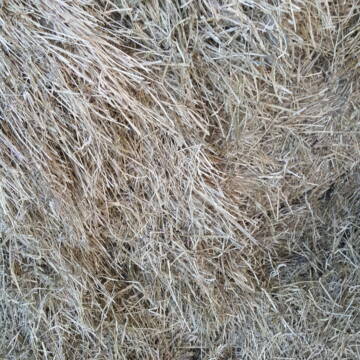
HD-Ballen Heu
Ginsweiler
Laura
@Heuverkauf_Ginsweiler
Heu
Kleinballen/HD-Ballen
Regenfrei
Wird verladen
2 weitere...
B+
Deprecated: Creation of dynamic property Zend_View_Helper_Ads::$adLink is deprecated in /var/www/stall-frei/htdocs/staging.stall-frei.de/library/Psf/View/Helper/Ads.php on line 108


Bio Heu
Mehlbach
irena-zinssmeister
@irena-zinssmeister
Heu
Empfänger lädt ab
Großballen
Bio
Regenfrei
2 weitere...
aktuell
B+

Heu Rundballen
Espenschied
Marvin Kloos
@Birkenhof_Espenschied
Heu
Rundballen
Bio
Regenfrei
Wird verladen
2 weitere...
B+

Heu HD Ballen
Carlsberg
Maike Käpernick
@ReitschuleKaepernick
Heu
Empfänger lädt ab
Kleinballen/HD-Ballen
Bio
Regenfrei
2 weitere...
B+


TaunusHeu staubreduziert
Idstein
Torsten Fischer
@HayClean
Heu
Käufer lädt selbst
Abholung
Lieferung
P+

Offenstall/Paddockbox für Pony oder Kleinpferd
Glashütten
Tatjana Bommersheim
@TatjanaBommersheim
Wir haben ab dem 1.04.26 eine Platz in einem unsere Offenställe (Wallach oder Stute)und eine unserer Paddockboxen (Wallach oder S
brandneu
R

Heu-, Heulage- und Strohverkauf
Riedstadt
Kirsten Bonn
@Reitanlage-Bonn-Riedstadt
Heu
Großballen
Regenfrei
Wird verladen
1 weitere...
B+

Gurbe Pferdefutter
Mühltal
Schäfer
@Tina-Schaefer
Futter
Pellets
Bio
Käufer lädt selbst
1 weitere...
B+

B+

B+
Deprecated: Creation of dynamic property Zend_View::$pageCount is deprecated in /var/www/stall-frei/htdocs/staging.stall-frei.de/library/vendor/shardj/zf1-future/library/Zend/View/Abstract.php on line 308
Deprecated: Creation of dynamic property Zend_View::$itemCountPerPage is deprecated in /var/www/stall-frei/htdocs/staging.stall-frei.de/library/vendor/shardj/zf1-future/library/Zend/View/Abstract.php on line 308
Deprecated: Creation of dynamic property Zend_View::$first is deprecated in /var/www/stall-frei/htdocs/staging.stall-frei.de/library/vendor/shardj/zf1-future/library/Zend/View/Abstract.php on line 308
Deprecated: Creation of dynamic property Zend_View::$current is deprecated in /var/www/stall-frei/htdocs/staging.stall-frei.de/library/vendor/shardj/zf1-future/library/Zend/View/Abstract.php on line 308
Deprecated: Creation of dynamic property Zend_View::$last is deprecated in /var/www/stall-frei/htdocs/staging.stall-frei.de/library/vendor/shardj/zf1-future/library/Zend/View/Abstract.php on line 308
Deprecated: Creation of dynamic property Zend_View::$next is deprecated in /var/www/stall-frei/htdocs/staging.stall-frei.de/library/vendor/shardj/zf1-future/library/Zend/View/Abstract.php on line 308
Deprecated: Creation of dynamic property Zend_View::$pagesInRange is deprecated in /var/www/stall-frei/htdocs/staging.stall-frei.de/library/vendor/shardj/zf1-future/library/Zend/View/Abstract.php on line 308
Deprecated: Creation of dynamic property Zend_View::$firstPageInRange is deprecated in /var/www/stall-frei/htdocs/staging.stall-frei.de/library/vendor/shardj/zf1-future/library/Zend/View/Abstract.php on line 308
Deprecated: Creation of dynamic property Zend_View::$lastPageInRange is deprecated in /var/www/stall-frei/htdocs/staging.stall-frei.de/library/vendor/shardj/zf1-future/library/Zend/View/Abstract.php on line 308
Deprecated: Creation of dynamic property Zend_View::$currentItemCount is deprecated in /var/www/stall-frei/htdocs/staging.stall-frei.de/library/vendor/shardj/zf1-future/library/Zend/View/Abstract.php on line 308
Deprecated: Creation of dynamic property Zend_View::$totalItemCount is deprecated in /var/www/stall-frei/htdocs/staging.stall-frei.de/library/vendor/shardj/zf1-future/library/Zend/View/Abstract.php on line 308
Deprecated: Creation of dynamic property Zend_View::$firstItemNumber is deprecated in /var/www/stall-frei/htdocs/staging.stall-frei.de/library/vendor/shardj/zf1-future/library/Zend/View/Abstract.php on line 308
Deprecated: Creation of dynamic property Zend_View::$lastItemNumber is deprecated in /var/www/stall-frei/htdocs/staging.stall-frei.de/library/vendor/shardj/zf1-future/library/Zend/View/Abstract.php on line 308
Deprecated: Creation of dynamic property Zend_View::$router is deprecated in /var/www/stall-frei/htdocs/staging.stall-frei.de/library/vendor/shardj/zf1-future/library/Zend/View/Abstract.php on line 308
Deprecated: Creation of dynamic property Zend_View::$urlParams is deprecated in /var/www/stall-frei/htdocs/staging.stall-frei.de/library/vendor/shardj/zf1-future/library/Zend/View/Abstract.php on line 308
Deprecated: Creation of dynamic property Zend_View::$showAds is deprecated in /var/www/stall-frei/htdocs/staging.stall-frei.de/library/vendor/shardj/zf1-future/library/Zend/View/Abstract.php on line 308
Deprecated: Creation of dynamic property Zend_View::$objectIds is deprecated in /var/www/stall-frei/htdocs/staging.stall-frei.de/library/vendor/shardj/zf1-future/library/Zend/View/Abstract.php on line 308
Deprecated: Creation of dynamic property Zend_View::$showNavbar is deprecated in /var/www/stall-frei/htdocs/staging.stall-frei.de/library/vendor/shardj/zf1-future/library/Zend/View/Abstract.php on line 308
Deprecated: Creation of dynamic property Zend_View::$showBreadcrumb is deprecated in /var/www/stall-frei/htdocs/staging.stall-frei.de/library/vendor/shardj/zf1-future/library/Zend/View/Abstract.php on line 308
Deprecated: Creation of dynamic property Zend_View::$showFooter is deprecated in /var/www/stall-frei/htdocs/staging.stall-frei.de/library/vendor/shardj/zf1-future/library/Zend/View/Abstract.php on line 308
Deprecated: Creation of dynamic property Zend_View::$showInternalAds is deprecated in /var/www/stall-frei/htdocs/staging.stall-frei.de/library/vendor/shardj/zf1-future/library/Zend/View/Abstract.php on line 308
Deprecated: Creation of dynamic property Zend_View::$blNoContent is deprecated in /var/www/stall-frei/htdocs/staging.stall-frei.de/library/vendor/shardj/zf1-future/library/Zend/View/Abstract.php on line 308
Deprecated: Creation of dynamic property Zend_View::$sMetaDesc is deprecated in /var/www/stall-frei/htdocs/staging.stall-frei.de/library/vendor/shardj/zf1-future/library/Zend/View/Abstract.php on line 308
Deprecated: Creation of dynamic property Zend_View::$useGmaps is deprecated in /var/www/stall-frei/htdocs/staging.stall-frei.de/library/vendor/shardj/zf1-future/library/Zend/View/Abstract.php on line 308
Deprecated: Creation of dynamic property Zend_View::$touches is deprecated in /var/www/stall-frei/htdocs/staging.stall-frei.de/library/vendor/shardj/zf1-future/library/Zend/View/Abstract.php on line 308
Deprecated: Creation of dynamic property Zend_View::$oProject is deprecated in /var/www/stall-frei/htdocs/staging.stall-frei.de/library/vendor/shardj/zf1-future/library/Zend/View/Abstract.php on line 308
Deprecated: Creation of dynamic property Zend_View::$pageHeadline is deprecated in /var/www/stall-frei/htdocs/staging.stall-frei.de/library/vendor/shardj/zf1-future/library/Zend/View/Abstract.php on line 308
Deprecated: Creation of dynamic property Zend_View::$disableLocationField is deprecated in /var/www/stall-frei/htdocs/staging.stall-frei.de/library/vendor/shardj/zf1-future/library/Zend/View/Abstract.php on line 308
Deprecated: Creation of dynamic property Zend_View::$isSearch is deprecated in /var/www/stall-frei/htdocs/staging.stall-frei.de/library/vendor/shardj/zf1-future/library/Zend/View/Abstract.php on line 308
Deprecated: Creation of dynamic property Zend_View::$pageTitle is deprecated in /var/www/stall-frei/htdocs/staging.stall-frei.de/library/vendor/shardj/zf1-future/library/Zend/View/Abstract.php on line 308
Deprecated: Creation of dynamic property Psf_Form_Element_Text::$class is deprecated in /var/www/stall-frei/htdocs/staging.stall-frei.de/library/vendor/shardj/zf1-future/library/Zend/Form/Element.php on line 874
Deprecated: Creation of dynamic property Psf_Form_Element_Text::$size is deprecated in /var/www/stall-frei/htdocs/staging.stall-frei.de/library/vendor/shardj/zf1-future/library/Zend/Form/Element.php on line 874
Deprecated: Creation of dynamic property Psf_Form_Element_Text::$placeholder is deprecated in /var/www/stall-frei/htdocs/staging.stall-frei.de/library/vendor/shardj/zf1-future/library/Zend/Form/Element.php on line 874
Deprecated: Creation of dynamic property Psf_Form_Element_Hidden::$class is deprecated in /var/www/stall-frei/htdocs/staging.stall-frei.de/library/vendor/shardj/zf1-future/library/Zend/Form/Element.php on line 874
Deprecated: Creation of dynamic property Psf_Form_Element_Hidden::$class is deprecated in /var/www/stall-frei/htdocs/staging.stall-frei.de/library/vendor/shardj/zf1-future/library/Zend/Form/Element.php on line 874
Deprecated: Creation of dynamic property Psf_Form_Element_Hidden::$class is deprecated in /var/www/stall-frei/htdocs/staging.stall-frei.de/library/vendor/shardj/zf1-future/library/Zend/Form/Element.php on line 874
Deprecated: Creation of dynamic property Psf_Form_Element_Hidden::$class is deprecated in /var/www/stall-frei/htdocs/staging.stall-frei.de/library/vendor/shardj/zf1-future/library/Zend/Form/Element.php on line 874
Deprecated: Creation of dynamic property Psf_Form_Element_Select::$class is deprecated in /var/www/stall-frei/htdocs/staging.stall-frei.de/library/vendor/shardj/zf1-future/library/Zend/Form/Element.php on line 874
Deprecated: Creation of dynamic property Psf_Form_Element_Select::$class is deprecated in /var/www/stall-frei/htdocs/staging.stall-frei.de/library/vendor/shardj/zf1-future/library/Zend/Form/Element.php on line 874
Deprecated: Creation of dynamic property Psf_Form_Element_Select::$class is deprecated in /var/www/stall-frei/htdocs/staging.stall-frei.de/library/vendor/shardj/zf1-future/library/Zend/Form/Element.php on line 874
Deprecated: Creation of dynamic property Psf_Form_Element_Select::$class is deprecated in /var/www/stall-frei/htdocs/staging.stall-frei.de/library/vendor/shardj/zf1-future/library/Zend/Form/Element.php on line 874
Deprecated: Creation of dynamic property Zend_View::$sort is deprecated in /var/www/stall-frei/htdocs/staging.stall-frei.de/library/vendor/shardj/zf1-future/library/Zend/View/Abstract.php on line 308
Deprecated: Creation of dynamic property Zend_View::$searchLocation is deprecated in /var/www/stall-frei/htdocs/staging.stall-frei.de/library/vendor/shardj/zf1-future/library/Zend/View/Abstract.php on line 308
Deprecated: Creation of dynamic property Zend_View::$locationHint is deprecated in /var/www/stall-frei/htdocs/staging.stall-frei.de/library/vendor/shardj/zf1-future/library/Zend/View/Abstract.php on line 308
Psf_GeoCoder_Abstract::getLocation: Sonnschied Get Location CachedOrLive
Psf_GeoCoder_Abstract::getCachedOrLive: Sonnschied
Psf_GeoCoder_OpenCageData::makeApiRequest: response:
Array
(
[documentation] => https://opencagedata.com/api
[licenses] => Array
(
[0] => Array
(
[name] => see attribution guide
[url] => https://opencagedata.com/credits
)
)
[results] => Array
(
[0] => Array
(
[bounds] => Array
(
[northeast] => Array
(
[lat] => 49.8312152
[lng] => 7.4049252
)
[southwest] => Array
(
[lat] => 49.8054783
[lng] => 7.3750461
)
)
[components] => Array
(
[ISO_3166-1_alpha-2] => DE
[ISO_3166-1_alpha-3] => DEU
[ISO_3166-2] => Array
(
[0] => DE-RP
)
[_category] => place
[_normalized_city] => Sonnschied
[_type] => village
[continent] => Europe
[country] => Deutschland
[country_code] => de
[county] => Landkreis Birkenfeld
[municipality] => Herrstein-Rhaunen
[political_union] => European Union
[state] => Rheinland-Pfalz
[state_code] => RP
[village] => Sonnschied
)
[confidence] => 7
[formatted] => Sonnschied, Rheinland-Pfalz, Deutschland
[geometry] => Array
(
[lat] => 49.8192736
[lng] => 7.389251
)
)
[1] => Array
(
[components] => Array
(
[ISO_3166-1_alpha-2] => FR
[ISO_3166-1_alpha-3] => FRA
[ISO_3166-2] => Array
(
[0] => FR-IDF
[1] => FR-92
)
[_category] => road
[_normalized_city] => Levallois-Perret
[_type] => road
[city] => Levallois-Perret
[continent] => Europe
[country] => France
[country_code] => fr
[county] => Hauts-de-Seine
[local_authority] => Métropole du Grand Paris
[political_union] => European Union
[postcode] => 92300
[road] => Rue Charles Deutschmann
[state] => Île-de-France
[state_code] => IDF
)
[confidence] => 3
[formatted] => Rue Charles Deutschmann, 92300 Levallois-Perret, France
[geometry] => Array
(
[lat] => 48.900049
[lng] => 2.2842
)
)
[2] => Array
(
[components] => Array
(
[ISO_3166-1_alpha-2] => FR
[ISO_3166-1_alpha-3] => FRA
[ISO_3166-2] => Array
(
[0] => FR-ARA
[1] => FR-07
)
[_category] => road
[_normalized_city] => Lavilledieu
[_type] => road
[city] => Lavilledieu
[continent] => Europe
[country] => France
[country_code] => fr
[county] => Ardèche
[local_authority] => Communauté de communes du Bassin d'Aubenas
[political_union] => European Union
[postcode] => 07170
[road] => Chemin des Conchis
[state] => Auvergne-Rhône-Alpes
[state_code] => ARA
)
[confidence] => 2
[formatted] => Chemin des Conchis, 07170 Lavilledieu, France
[geometry] => Array
(
[lat] => 44.570318
[lng] => 4.453341
)
)
[3] => Array
(
[components] => Array
(
[ISO_3166-1_alpha-2] => FR
[ISO_3166-1_alpha-3] => FRA
[ISO_3166-2] => Array
(
[0] => FR-HDF
[1] => FR-62
)
[_category] => road
[_normalized_city] => Conchy-sur-Canche
[_type] => road
[city] => Conchy-sur-Canche
[continent] => Europe
[country] => France
[country_code] => fr
[county] => Pas-de-Calais
[local_authority] => Communauté de communes du Ternois
[political_union] => European Union
[postcode] => 62270
[road] => Rue des Randonneurs
[state] => Hauts-de-France
[state_code] => HDF
)
[confidence] => 2
[formatted] => Rue des Randonneurs, 62270 Conchy-sur-Canche, France
[geometry] => Array
(
[lat] => 50.303816
[lng] => 2.200089
)
)
[4] => Array
(
[components] => Array
(
[ISO_3166-1_alpha-2] => FR
[ISO_3166-1_alpha-3] => FRA
[ISO_3166-2] => Array
(
[0] => FR-ARA
[1] => FR-07
)
[_category] => road
[_normalized_city] => Genestelle
[_type] => road
[city] => Genestelle
[continent] => Europe
[country] => France
[country_code] => fr
[county] => Ardèche
[local_authority] => Communauté de communes du Bassin d'Aubenas
[political_union] => European Union
[postcode] => 07530
[road] => route de conchis
[state] => Auvergne-Rhône-Alpes
[state_code] => ARA
)
[confidence] => 2
[formatted] => route de conchis, 07530 Genestelle, France
[geometry] => Array
(
[lat] => 44.724382
[lng] => 4.39166
)
)
[5] => Array
(
[components] => Array
(
[ISO_3166-1_alpha-2] => FR
[ISO_3166-1_alpha-3] => FRA
[ISO_3166-2] => Array
(
[0] => FR-HDF
[1] => FR-60
)
[_category] => road
[_normalized_city] => Conchy-les-Pots
[_type] => road
[city] => Conchy-les-Pots
[continent] => Europe
[country] => France
[country_code] => fr
[county] => Oise
[local_authority] => Communauté de communes du Pays des Sources
[political_union] => European Union
[postcode] => 60490
[road] => Rue de Flandres
[state] => Hauts-de-France
[state_code] => HDF
)
[confidence] => 2
[formatted] => Rue de Flandres, 60490 Conchy-les-Pots, France
[geometry] => Array
(
[lat] => 49.609049
[lng] => 2.728945
)
)
[6] => Array
(
[components] => Array
(
[ISO_3166-1_alpha-2] => FR
[ISO_3166-1_alpha-3] => FRA
[ISO_3166-2] => Array
(
[0] => FR-HDF
[1] => FR-60
)
[_category] => road
[_normalized_city] => Conchy-les-Pots
[_type] => road
[city] => Conchy-les-Pots
[continent] => Europe
[country] => France
[country_code] => fr
[county] => Oise
[local_authority] => Communauté de communes du Pays des Sources
[political_union] => European Union
[postcode] => 60490
[road] => La Route de Flandre
[state] => Hauts-de-France
[state_code] => HDF
)
[confidence] => 2
[formatted] => La Route de Flandre, 60490 Conchy-les-Pots, France
[geometry] => Array
(
[lat] => 49.603306
[lng] => 2.726541
)
)
[7] => Array
(
[components] => Array
(
[ISO_3166-1_alpha-2] => FR
[ISO_3166-1_alpha-3] => FRA
[ISO_3166-2] => Array
(
[0] => FR-ARA
[1] => FR-07
)
[_category] => road
[_normalized_city] => Saint-Étienne-de-Boulogne
[_type] => road
[city] => Saint-Étienne-de-Boulogne
[continent] => Europe
[country] => France
[country_code] => fr
[county] => Ardèche
[local_authority] => Communauté de communes du Bassin d'Aubenas
[political_union] => European Union
[postcode] => 07200
[road] => Route de la Conchy
[state] => Auvergne-Rhône-Alpes
[state_code] => ARA
)
[confidence] => 2
[formatted] => Route de la Conchy, 07200 Saint-Étienne-de-Boulogne, France
[geometry] => Array
(
[lat] => 44.705294
[lng] => 4.470737
)
)
[8] => Array
(
[components] => Array
(
[ISO_3166-1_alpha-2] => FR
[ISO_3166-1_alpha-3] => FRA
[ISO_3166-2] => Array
(
[0] => FR-ARA
[1] => FR-07
)
[_category] => road
[_normalized_city] => Désaignes
[_type] => road
[city] => Désaignes
[continent] => Europe
[country] => France
[country_code] => fr
[county] => Ardèche
[local_authority] => Communauté de communes du Pays de Lamastre
[political_union] => European Union
[postcode] => 07570
[road] => chemin des conchis
[state] => Auvergne-Rhône-Alpes
[state_code] => ARA
)
[confidence] => 2
[formatted] => chemin des conchis, 07570 Désaignes, France
[geometry] => Array
(
[lat] => 45.006719
[lng] => 4.521063
)
)
[9] => Array
(
[components] => Array
(
[ISO_3166-1_alpha-2] => FR
[ISO_3166-1_alpha-3] => FRA
[ISO_3166-2] => Array
(
[0] => FR-BFC
[1] => FR-71
)
[_category] => road
[_normalized_city] => Le Rousset-Marizy
[_type] => road
[city] => Le Rousset-Marizy
[continent] => Europe
[country] => France
[country_code] => fr
[county] => Saône-et-Loire
[local_authority] => Communauté de communes Le Grand Charolais
[political_union] => European Union
[postcode] => 71220
[road] => Chemin des Jonchis
[state] => Bourgogne-Franche-Comté
[state_code] => BFC
)
[confidence] => 10
[formatted] => Chemin des Jonchis, 71220 Le Rousset-Marizy, France
[geometry] => Array
(
[lat] => 46.590647
[lng] => 4.475634
)
)
)
[status] => Array
(
[code] => 200
[message] => OK
)
[stay_informed] => Array
(
[blog] => https://blog.opencagedata.com
[mastodon] => https://en.osm.town/@opencage
)
[thanks] => For using an OpenCage API
[timestamp] => Array
(
[created_http] => Thu, 05 Feb 2026 13:32:02 GMT
[created_unix] => 1770298322
)
[total_results] => 10
)
Psf_GeoCoder_Abstract::convertLocationResult
{"documentation":"https:\/\/opencagedata.com\/api","licenses":[{"name":"see attribution guide","url":"https:\/\/opencagedata.com\/credits"}],"results":[{"bounds":{"northeast":{"lat":49.8312152,"lng":7.4049252},"southwest":{"lat":49.8054783,"lng":7.3750461}},"components":{"ISO_3166-1_alpha-2":"DE","ISO_3166-1_alpha-3":"DEU","ISO_3166-2":["DE-RP"],"_category":"place","_normalized_city":"Sonnschied","_type":"village","continent":"Europe","country":"Deutschland","country_code":"de","county":"Landkreis Birkenfeld","municipality":"Herrstein-Rhaunen","political_union":"European Union","state":"Rheinland-Pfalz","state_code":"RP","village":"Sonnschied"},"confidence":7,"formatted":"Sonnschied, Rheinland-Pfalz, Deutschland","geometry":{"lat":49.8192736,"lng":7.389251}},{"components":{"ISO_3166-1_alpha-2":"FR","ISO_3166-1_alpha-3":"FRA","ISO_3166-2":["FR-IDF","FR-92"],"_category":"road","_normalized_city":"Levallois-Perret","_type":"road","city":"Levallois-Perret","continent":"Europe","country":"France","country_code":"fr","county":"Hauts-de-Seine","local_authority":"M\u00e9tropole du Grand Paris","political_union":"European Union","postcode":"92300","road":"Rue Charles Deutschmann","state":"\u00cele-de-France","state_code":"IDF"},"confidence":3,"formatted":"Rue Charles Deutschmann, 92300 Levallois-Perret, France","geometry":{"lat":48.900049,"lng":2.2842}},{"components":{"ISO_3166-1_alpha-2":"FR","ISO_3166-1_alpha-3":"FRA","ISO_3166-2":["FR-ARA","FR-07"],"_category":"road","_normalized_city":"Lavilledieu","_type":"road","city":"Lavilledieu","continent":"Europe","country":"France","country_code":"fr","county":"Ard\u00e8che","local_authority":"Communaut\u00e9 de communes du Bassin d'Aubenas","political_union":"European Union","postcode":"07170","road":"Chemin des Conchis","state":"Auvergne-Rh\u00f4ne-Alpes","state_code":"ARA"},"confidence":2,"formatted":"Chemin des Conchis, 07170 Lavilledieu, France","geometry":{"lat":44.570318,"lng":4.453341}},{"components":{"ISO_3166-1_alpha-2":"FR","ISO_3166-1_alpha-3":"FRA","ISO_3166-2":["FR-HDF","FR-62"],"_category":"road","_normalized_city":"Conchy-sur-Canche","_type":"road","city":"Conchy-sur-Canche","continent":"Europe","country":"France","country_code":"fr","county":"Pas-de-Calais","local_authority":"Communaut\u00e9 de communes du Ternois","political_union":"European Union","postcode":"62270","road":"Rue des Randonneurs","state":"Hauts-de-France","state_code":"HDF"},"confidence":2,"formatted":"Rue des Randonneurs, 62270 Conchy-sur-Canche, France","geometry":{"lat":50.303816,"lng":2.200089}},{"components":{"ISO_3166-1_alpha-2":"FR","ISO_3166-1_alpha-3":"FRA","ISO_3166-2":["FR-ARA","FR-07"],"_category":"road","_normalized_city":"Genestelle","_type":"road","city":"Genestelle","continent":"Europe","country":"France","country_code":"fr","county":"Ard\u00e8che","local_authority":"Communaut\u00e9 de communes du Bassin d'Aubenas","political_union":"European Union","postcode":"07530","road":"route de conchis","state":"Auvergne-Rh\u00f4ne-Alpes","state_code":"ARA"},"confidence":2,"formatted":"route de conchis, 07530 Genestelle, France","geometry":{"lat":44.724382,"lng":4.39166}},{"components":{"ISO_3166-1_alpha-2":"FR","ISO_3166-1_alpha-3":"FRA","ISO_3166-2":["FR-HDF","FR-60"],"_category":"road","_normalized_city":"Conchy-les-Pots","_type":"road","city":"Conchy-les-Pots","continent":"Europe","country":"France","country_code":"fr","county":"Oise","local_authority":"Communaut\u00e9 de communes du Pays des Sources","political_union":"European Union","postcode":"60490","road":"Rue de Flandres","state":"Hauts-de-France","state_code":"HDF"},"confidence":2,"formatted":"Rue de Flandres, 60490 Conchy-les-Pots, France","geometry":{"lat":49.609049,"lng":2.728945}},{"components":{"ISO_3166-1_alpha-2":"FR","ISO_3166-1_alpha-3":"FRA","ISO_3166-2":["FR-HDF","FR-60"],"_category":"road","_normalized_city":"Conchy-les-Pots","_type":"road","city":"Conchy-les-Pots","continent":"Europe","country":"France","country_code":"fr","county":"Oise","local_authority":"Communaut\u00e9 de communes du Pays des Sources","political_union":"European Union","postcode":"60490","road":"La Route de Flandre","state":"Hauts-de-France","state_code":"HDF"},"confidence":2,"formatted":"La Route de Flandre, 60490 Conchy-les-Pots, France","geometry":{"lat":49.603306,"lng":2.726541}},{"components":{"ISO_3166-1_alpha-2":"FR","ISO_3166-1_alpha-3":"FRA","ISO_3166-2":["FR-ARA","FR-07"],"_category":"road","_normalized_city":"Saint-\u00c9tienne-de-Boulogne","_type":"road","city":"Saint-\u00c9tienne-de-Boulogne","continent":"Europe","country":"France","country_code":"fr","county":"Ard\u00e8che","local_authority":"Communaut\u00e9 de communes du Bassin d'Aubenas","political_union":"European Union","postcode":"07200","road":"Route de la Conchy","state":"Auvergne-Rh\u00f4ne-Alpes","state_code":"ARA"},"confidence":2,"formatted":"Route de la Conchy, 07200 Saint-\u00c9tienne-de-Boulogne, France","geometry":{"lat":44.705294,"lng":4.470737}},{"components":{"ISO_3166-1_alpha-2":"FR","ISO_3166-1_alpha-3":"FRA","ISO_3166-2":["FR-ARA","FR-07"],"_category":"road","_normalized_city":"D\u00e9saignes","_type":"road","city":"D\u00e9saignes","continent":"Europe","country":"France","country_code":"fr","county":"Ard\u00e8che","local_authority":"Communaut\u00e9 de communes du Pays de Lamastre","political_union":"European Union","postcode":"07570","road":"chemin des conchis","state":"Auvergne-Rh\u00f4ne-Alpes","state_code":"ARA"},"confidence":2,"formatted":"chemin des conchis, 07570 D\u00e9saignes, France","geometry":{"lat":45.006719,"lng":4.521063}},{"components":{"ISO_3166-1_alpha-2":"FR","ISO_3166-1_alpha-3":"FRA","ISO_3166-2":["FR-BFC","FR-71"],"_category":"road","_normalized_city":"Le Rousset-Marizy","_type":"road","city":"Le Rousset-Marizy","continent":"Europe","country":"France","country_code":"fr","county":"Sa\u00f4ne-et-Loire","local_authority":"Communaut\u00e9 de communes Le Grand Charolais","political_union":"European Union","postcode":"71220","road":"Chemin des Jonchis","state":"Bourgogne-Franche-Comt\u00e9","state_code":"BFC"},"confidence":10,"formatted":"Chemin des Jonchis, 71220 Le Rousset-Marizy, France","geometry":{"lat":46.590647,"lng":4.475634}}],"status":{"code":200,"message":"OK"},"stay_informed":{"blog":"https:\/\/blog.opencagedata.com","mastodon":"https:\/\/en.osm.town\/@opencage"},"thanks":"For using an OpenCage API","timestamp":{"created_http":"Thu, 05 Feb 2026 13:32:02 GMT","created_unix":1770298322},"total_results":10}Array
(
[0] => stdClass Object
(
[bounds] => stdClass Object
(
[northeast] => stdClass Object
(
[lat] => 49.8312152
[lng] => 7.4049252
)
[southwest] => stdClass Object
(
[lat] => 49.8054783
[lng] => 7.3750461
)
)
[components] => stdClass Object
(
[ISO_3166-1_alpha-2] => DE
[ISO_3166-1_alpha-3] => DEU
[ISO_3166-2] => Array
(
[0] => DE-RP
)
[_category] => place
[_normalized_city] => Sonnschied
[_type] => village
[continent] => Europe
[country] => Deutschland
[country_code] => de
[county] => Landkreis Birkenfeld
[municipality] => Herrstein-Rhaunen
[political_union] => European Union
[state] => Rheinland-Pfalz
[state_code] => RP
[village] => Sonnschied
)
[confidence] => 7
[formatted] => Sonnschied, Rheinland-Pfalz, Deutschland
[geometry] => stdClass Object
(
[lat] => 49.8192736
[lng] => 7.389251
)
)
[1] => stdClass Object
(
[components] => stdClass Object
(
[ISO_3166-1_alpha-2] => FR
[ISO_3166-1_alpha-3] => FRA
[ISO_3166-2] => Array
(
[0] => FR-IDF
[1] => FR-92
)
[_category] => road
[_normalized_city] => Levallois-Perret
[_type] => road
[city] => Levallois-Perret
[continent] => Europe
[country] => France
[country_code] => fr
[county] => Hauts-de-Seine
[local_authority] => Métropole du Grand Paris
[political_union] => European Union
[postcode] => 92300
[road] => Rue Charles Deutschmann
[state] => Île-de-France
[state_code] => IDF
)
[confidence] => 3
[formatted] => Rue Charles Deutschmann, 92300 Levallois-Perret, France
[geometry] => stdClass Object
(
[lat] => 48.900049
[lng] => 2.2842
)
)
[2] => stdClass Object
(
[components] => stdClass Object
(
[ISO_3166-1_alpha-2] => FR
[ISO_3166-1_alpha-3] => FRA
[ISO_3166-2] => Array
(
[0] => FR-ARA
[1] => FR-07
)
[_category] => road
[_normalized_city] => Lavilledieu
[_type] => road
[city] => Lavilledieu
[continent] => Europe
[country] => France
[country_code] => fr
[county] => Ardèche
[local_authority] => Communauté de communes du Bassin d'Aubenas
[political_union] => European Union
[postcode] => 07170
[road] => Chemin des Conchis
[state] => Auvergne-Rhône-Alpes
[state_code] => ARA
)
[confidence] => 2
[formatted] => Chemin des Conchis, 07170 Lavilledieu, France
[geometry] => stdClass Object
(
[lat] => 44.570318
[lng] => 4.453341
)
)
[3] => stdClass Object
(
[components] => stdClass Object
(
[ISO_3166-1_alpha-2] => FR
[ISO_3166-1_alpha-3] => FRA
[ISO_3166-2] => Array
(
[0] => FR-HDF
[1] => FR-62
)
[_category] => road
[_normalized_city] => Conchy-sur-Canche
[_type] => road
[city] => Conchy-sur-Canche
[continent] => Europe
[country] => France
[country_code] => fr
[county] => Pas-de-Calais
[local_authority] => Communauté de communes du Ternois
[political_union] => European Union
[postcode] => 62270
[road] => Rue des Randonneurs
[state] => Hauts-de-France
[state_code] => HDF
)
[confidence] => 2
[formatted] => Rue des Randonneurs, 62270 Conchy-sur-Canche, France
[geometry] => stdClass Object
(
[lat] => 50.303816
[lng] => 2.200089
)
)
[4] => stdClass Object
(
[components] => stdClass Object
(
[ISO_3166-1_alpha-2] => FR
[ISO_3166-1_alpha-3] => FRA
[ISO_3166-2] => Array
(
[0] => FR-ARA
[1] => FR-07
)
[_category] => road
[_normalized_city] => Genestelle
[_type] => road
[city] => Genestelle
[continent] => Europe
[country] => France
[country_code] => fr
[county] => Ardèche
[local_authority] => Communauté de communes du Bassin d'Aubenas
[political_union] => European Union
[postcode] => 07530
[road] => route de conchis
[state] => Auvergne-Rhône-Alpes
[state_code] => ARA
)
[confidence] => 2
[formatted] => route de conchis, 07530 Genestelle, France
[geometry] => stdClass Object
(
[lat] => 44.724382
[lng] => 4.39166
)
)
[5] => stdClass Object
(
[components] => stdClass Object
(
[ISO_3166-1_alpha-2] => FR
[ISO_3166-1_alpha-3] => FRA
[ISO_3166-2] => Array
(
[0] => FR-HDF
[1] => FR-60
)
[_category] => road
[_normalized_city] => Conchy-les-Pots
[_type] => road
[city] => Conchy-les-Pots
[continent] => Europe
[country] => France
[country_code] => fr
[county] => Oise
[local_authority] => Communauté de communes du Pays des Sources
[political_union] => European Union
[postcode] => 60490
[road] => Rue de Flandres
[state] => Hauts-de-France
[state_code] => HDF
)
[confidence] => 2
[formatted] => Rue de Flandres, 60490 Conchy-les-Pots, France
[geometry] => stdClass Object
(
[lat] => 49.609049
[lng] => 2.728945
)
)
[6] => stdClass Object
(
[components] => stdClass Object
(
[ISO_3166-1_alpha-2] => FR
[ISO_3166-1_alpha-3] => FRA
[ISO_3166-2] => Array
(
[0] => FR-HDF
[1] => FR-60
)
[_category] => road
[_normalized_city] => Conchy-les-Pots
[_type] => road
[city] => Conchy-les-Pots
[continent] => Europe
[country] => France
[country_code] => fr
[county] => Oise
[local_authority] => Communauté de communes du Pays des Sources
[political_union] => European Union
[postcode] => 60490
[road] => La Route de Flandre
[state] => Hauts-de-France
[state_code] => HDF
)
[confidence] => 2
[formatted] => La Route de Flandre, 60490 Conchy-les-Pots, France
[geometry] => stdClass Object
(
[lat] => 49.603306
[lng] => 2.726541
)
)
[7] => stdClass Object
(
[components] => stdClass Object
(
[ISO_3166-1_alpha-2] => FR
[ISO_3166-1_alpha-3] => FRA
[ISO_3166-2] => Array
(
[0] => FR-ARA
[1] => FR-07
)
[_category] => road
[_normalized_city] => Saint-Étienne-de-Boulogne
[_type] => road
[city] => Saint-Étienne-de-Boulogne
[continent] => Europe
[country] => France
[country_code] => fr
[county] => Ardèche
[local_authority] => Communauté de communes du Bassin d'Aubenas
[political_union] => European Union
[postcode] => 07200
[road] => Route de la Conchy
[state] => Auvergne-Rhône-Alpes
[state_code] => ARA
)
[confidence] => 2
[formatted] => Route de la Conchy, 07200 Saint-Étienne-de-Boulogne, France
[geometry] => stdClass Object
(
[lat] => 44.705294
[lng] => 4.470737
)
)
[8] => stdClass Object
(
[components] => stdClass Object
(
[ISO_3166-1_alpha-2] => FR
[ISO_3166-1_alpha-3] => FRA
[ISO_3166-2] => Array
(
[0] => FR-ARA
[1] => FR-07
)
[_category] => road
[_normalized_city] => Désaignes
[_type] => road
[city] => Désaignes
[continent] => Europe
[country] => France
[country_code] => fr
[county] => Ardèche
[local_authority] => Communauté de communes du Pays de Lamastre
[political_union] => European Union
[postcode] => 07570
[road] => chemin des conchis
[state] => Auvergne-Rhône-Alpes
[state_code] => ARA
)
[confidence] => 2
[formatted] => chemin des conchis, 07570 Désaignes, France
[geometry] => stdClass Object
(
[lat] => 45.006719
[lng] => 4.521063
)
)
[9] => stdClass Object
(
[components] => stdClass Object
(
[ISO_3166-1_alpha-2] => FR
[ISO_3166-1_alpha-3] => FRA
[ISO_3166-2] => Array
(
[0] => FR-BFC
[1] => FR-71
)
[_category] => road
[_normalized_city] => Le Rousset-Marizy
[_type] => road
[city] => Le Rousset-Marizy
[continent] => Europe
[country] => France
[country_code] => fr
[county] => Saône-et-Loire
[local_authority] => Communauté de communes Le Grand Charolais
[political_union] => European Union
[postcode] => 71220
[road] => Chemin des Jonchis
[state] => Bourgogne-Franche-Comté
[state_code] => BFC
)
[confidence] => 10
[formatted] => Chemin des Jonchis, 71220 Le Rousset-Marizy, France
[geometry] => stdClass Object
(
[lat] => 46.590647
[lng] => 4.475634
)
)
)
Psf_GeoCoder_OpenCageData::getKeyMap: 0
stdClass Object
(
    [bounds] => stdClass Object
        (
            [northeast] => stdClass Object
                (
                    [lat] => 49.8312152
                    [lng] => 7.4049252
                )

            [southwest] => stdClass Object
                (
                    [lat] => 49.8054783
                    [lng] => 7.3750461
                )

        )

    [components] => stdClass Object
        (
            [ISO_3166-1_alpha-2] => DE
            [ISO_3166-1_alpha-3] => DEU
            [ISO_3166-2] => Array
                (
                    [0] => DE-RP
                )

            [_category] => place
            [_normalized_city] => Sonnschied
            [_type] => village
            [continent] => Europe
            [country] => Deutschland
            [country_code] => de
            [county] => Landkreis Birkenfeld
            [municipality] => Herrstein-Rhaunen
            [political_union] => European Union
            [state] => Rheinland-Pfalz
            [state_code] => RP
            [village] => Sonnschied
        )

    [confidence] => 7
    [formatted] => Sonnschied, Rheinland-Pfalz, Deutschland
    [geometry] => stdClass Object
        (
            [lat] => 49.8192736
            [lng] => 7.389251
        )

)
Psf_GeoCoder_OpenCageData::getCounty: Birkenfeld
Psf_GeoCoder_OpenCageData::addMissingData REFETCH!
Array
(
    [address] => Sonnschied, Rheinland-Pfalz, Deutschland
    [type] => village
    [street] =>
    [city] => Sonnschied
    [county] => Birkenfeld
    [state] => Rheinland-Pfalz
    [zip] =>
    [country] => Deutschland
    [suburb] =>
    [countrycode] => de
    [latitude] => 49.8192736
    [longitude] => 7.389251
    [accuracy] => 1
    [confidence] => 7
    [bounds] => stdClass Object
        (
            [northeast] => stdClass Object
                (
                    [lat] => 49.8312152
                    [lng] => 7.4049252
                )

            [southwest] => stdClass Object
                (
                    [lat] => 49.8054783
                    [lng] => 7.3750461
                )

        )

)
reformat!
Array
(
    [address] => Sonnschied, Rheinland-Pfalz, Deutschland
    [type] => village
    [street] =>
    [city] => Sonnschied
    [county] => Birkenfeld
    [state] => Rheinland-Pfalz
    [zip] =>
    [country] => Deutschland
    [suburb] =>
    [countrycode] => de
    [latitude] => 49.8192736
    [longitude] => 7.389251
    [accuracy] => 1
    [confidence] => 7
    [bounds] => stdClass Object
        (
            [northeast] => stdClass Object
                (
                    [lat] => 49.8312152
                    [lng] => 7.4049252
                )

            [southwest] => stdClass Object
                (
                    [lat] => 49.8054783
                    [lng] => 7.3750461
                )

        )

    [place] => Sonnschied, Rheinland-Pfalz
    [hash] => 9c668f9ff9a98b5dc0ce8d23a0769f20
)
Psf_GeoCoder_OpenCageData::getKeyMap: 1
stdClass Object
(
    [components] => stdClass Object
        (
            [ISO_3166-1_alpha-2] => FR
            [ISO_3166-1_alpha-3] => FRA
            [ISO_3166-2] => Array
                (
                    [0] => FR-IDF
                    [1] => FR-92
                )

            [_category] => road
            [_normalized_city] => Levallois-Perret
            [_type] => road
            [city] => Levallois-Perret
            [continent] => Europe
            [country] => France
            [country_code] => fr
            [county] => Hauts-de-Seine
            [local_authority] => Métropole du Grand Paris
            [political_union] => European Union
            [postcode] => 92300
            [road] => Rue Charles Deutschmann
            [state] => Île-de-France
            [state_code] => IDF
        )

    [confidence] => 3
    [formatted] => Rue Charles Deutschmann, 92300 Levallois-Perret, France
    [geometry] => stdClass Object
        (
            [lat] => 48.900049
            [lng] => 2.2842
        )

)
Psf_GeoCoder_OpenCageData::getCounty: Hauts-de-Seine
Psf_GeoCoder_OpenCageData::addMissingData REFETCH!
Array
(
    [address] => Rue Charles Deutschmann, 92300 Levallois-Perret, France
    [type] => road
    [street] => Rue Charles Deutschmann
    [city] => Levallois-Perret
    [county] => Hauts-de-Seine
    [state] => Île-de-France
    [zip] => 92300
    [country] => France
    [suburb] =>
    [countrycode] => fr
    [latitude] => 48.900049
    [longitude] => 2.2842
    [accuracy] => 1
    [confidence] => 3
    [bounds] =>
)
reformat!
Array
(
    [address] => Rue Charles Deutschmann, 92300 Levallois-Perret, France
    [type] => road
    [street] => Rue Charles Deutschmann
    [city] => Levallois-Perret
    [county] => Hauts-de-Seine
    [state] => Île-de-France
    [zip] => 92300
    [country] => France
    [suburb] =>
    [countrycode] => fr
    [latitude] => 48.900049
    [longitude] => 2.2842
    [accuracy] => 1
    [confidence] => 3
    [bounds] =>
    [place] => Rue Charles Deutschmann, 92300 Levallois-Perret, Île-de-France
    [hash] => b7dc44def3990e8a7eaf18e019eca466
)
Psf_GeoCoder_OpenCageData::getKeyMap: 2
stdClass Object
(
    [components] => stdClass Object
        (
            [ISO_3166-1_alpha-2] => FR
            [ISO_3166-1_alpha-3] => FRA
            [ISO_3166-2] => Array
                (
                    [0] => FR-ARA
                    [1] => FR-07
                )

            [_category] => road
            [_normalized_city] => Lavilledieu
            [_type] => road
            [city] => Lavilledieu
            [continent] => Europe
            [country] => France
            [country_code] => fr
            [county] => Ardèche
            [local_authority] => Communauté de communes du Bassin d'Aubenas
            [political_union] => European Union
            [postcode] => 07170
            [road] => Chemin des Conchis
            [state] => Auvergne-Rhône-Alpes
            [state_code] => ARA
        )

    [confidence] => 2
    [formatted] => Chemin des Conchis, 07170 Lavilledieu, France
    [geometry] => stdClass Object
        (
            [lat] => 44.570318
            [lng] => 4.453341
        )

)
Psf_GeoCoder_OpenCageData::getCounty: Ardèche
Psf_GeoCoder_OpenCageData::addMissingData REFETCH!
Array
(
    [address] => Chemin des Conchis, 07170 Lavilledieu, France
    [type] => road
    [street] => Chemin des Conchis
    [city] => Lavilledieu
    [county] => Ardèche
    [state] => Auvergne-Rhône-Alpes
    [zip] => 07170
    [country] => France
    [suburb] =>
    [countrycode] => fr
    [latitude] => 44.570318
    [longitude] => 4.453341
    [accuracy] => 1
    [confidence] => 2
    [bounds] =>
)
reformat!
Array
(
    [address] => Chemin des Conchis, 07170 Lavilledieu, France
    [type] => road
    [street] => Chemin des Conchis
    [city] => Lavilledieu
    [county] => Ardèche
    [state] => Auvergne-Rhône-Alpes
    [zip] => 07170
    [country] => France
    [suburb] =>
    [countrycode] => fr
    [latitude] => 44.570318
    [longitude] => 4.453341
    [accuracy] => 1
    [confidence] => 2
    [bounds] =>
    [place] => Chemin des Conchis, 07170 Lavilledieu, Auvergne-Rhône-Alpes
    [hash] => 5997afa7e11bee81e98177c9558db8ef
)
Psf_GeoCoder_OpenCageData::getKeyMap: 3
stdClass Object
(
    [components] => stdClass Object
        (
            [ISO_3166-1_alpha-2] => FR
            [ISO_3166-1_alpha-3] => FRA
            [ISO_3166-2] => Array
                (
                    [0] => FR-HDF
                    [1] => FR-62
                )

            [_category] => road
            [_normalized_city] => Conchy-sur-Canche
            [_type] => road
            [city] => Conchy-sur-Canche
            [continent] => Europe
            [country] => France
            [country_code] => fr
            [county] => Pas-de-Calais
            [local_authority] => Communauté de communes du Ternois
            [political_union] => European Union
            [postcode] => 62270
            [road] => Rue des Randonneurs
            [state] => Hauts-de-France
            [state_code] => HDF
        )

    [confidence] => 2
    [formatted] => Rue des Randonneurs, 62270 Conchy-sur-Canche, France
    [geometry] => stdClass Object
        (
            [lat] => 50.303816
            [lng] => 2.200089
        )

)
Psf_GeoCoder_OpenCageData::getCounty: Pas-de-Calais
Psf_GeoCoder_OpenCageData::addMissingData REFETCH!
Array
(
    [address] => Rue des Randonneurs, 62270 Conchy-sur-Canche, France
    [type] => road
    [street] => Rue des Randonneurs
    [city] => Conchy-sur-Canche
    [county] => Pas-de-Calais
    [state] => Hauts-de-France
    [zip] => 62270
    [country] => France
    [suburb] =>
    [countrycode] => fr
    [latitude] => 50.303816
    [longitude] => 2.200089
    [accuracy] => 1
    [confidence] => 2
    [bounds] =>
)
reformat!
Array
(
    [address] => Rue des Randonneurs, 62270 Conchy-sur-Canche, France
    [type] => road
    [street] => Rue des Randonneurs
    [city] => Conchy-sur-Canche
    [county] => Pas-de-Calais
    [state] => Hauts-de-France
    [zip] => 62270
    [country] => France
    [suburb] =>
    [countrycode] => fr
    [latitude] => 50.303816
    [longitude] => 2.200089
    [accuracy] => 1
    [confidence] => 2
    [bounds] =>
    [place] => Rue des Randonneurs, 62270 Conchy-sur-Canche, Hauts-de-France
    [hash] => 0b4f4ad0b8d011087256743e61310e16
)
Psf_GeoCoder_OpenCageData::getKeyMap: 4
stdClass Object
(
    [components] => stdClass Object
        (
            [ISO_3166-1_alpha-2] => FR
            [ISO_3166-1_alpha-3] => FRA
            [ISO_3166-2] => Array
                (
                    [0] => FR-ARA
                    [1] => FR-07
                )

            [_category] => road
            [_normalized_city] => Genestelle
            [_type] => road
            [city] => Genestelle
            [continent] => Europe
            [country] => France
            [country_code] => fr
            [county] => Ardèche
            [local_authority] => Communauté de communes du Bassin d'Aubenas
            [political_union] => European Union
            [postcode] => 07530
            [road] => route de conchis
            [state] => Auvergne-Rhône-Alpes
            [state_code] => ARA
        )

    [confidence] => 2
    [formatted] => route de conchis, 07530 Genestelle, France
    [geometry] => stdClass Object
        (
            [lat] => 44.724382
            [lng] => 4.39166
        )

)
Psf_GeoCoder_OpenCageData::getCounty: Ardèche
Psf_GeoCoder_OpenCageData::addMissingData REFETCH!
Array
(
    [address] => route de conchis, 07530 Genestelle, France
    [type] => road
    [street] => route de conchis
    [city] => Genestelle
    [county] => Ardèche
    [state] => Auvergne-Rhône-Alpes
    [zip] => 07530
    [country] => France
    [suburb] =>
    [countrycode] => fr
    [latitude] => 44.724382
    [longitude] => 4.39166
    [accuracy] => 1
    [confidence] => 2
    [bounds] =>
)
reformat!
Array
(
    [address] => route de conchis, 07530 Genestelle, France
    [type] => road
    [street] => route de conchis
    [city] => Genestelle
    [county] => Ardèche
    [state] => Auvergne-Rhône-Alpes
    [zip] => 07530
    [country] => France
    [suburb] =>
    [countrycode] => fr
    [latitude] => 44.724382
    [longitude] => 4.39166
    [accuracy] => 1
    [confidence] => 2
    [bounds] =>
    [place] => route de conchis, 07530 Genestelle, Auvergne-Rhône-Alpes
    [hash] => 171d5bf6589da24db234f58def62019f
)
Psf_GeoCoder_OpenCageData::getKeyMap: 5
stdClass Object
(
    [components] => stdClass Object
        (
            [ISO_3166-1_alpha-2] => FR
            [ISO_3166-1_alpha-3] => FRA
            [ISO_3166-2] => Array
                (
                    [0] => FR-HDF
                    [1] => FR-60
                )

            [_category] => road
            [_normalized_city] => Conchy-les-Pots
            [_type] => road
            [city] => Conchy-les-Pots
            [continent] => Europe
            [country] => France
            [country_code] => fr
            [county] => Oise
            [local_authority] => Communauté de communes du Pays des Sources
            [political_union] => European Union
            [postcode] => 60490
            [road] => Rue de Flandres
            [state] => Hauts-de-France
            [state_code] => HDF
        )

    [confidence] => 2
    [formatted] => Rue de Flandres, 60490 Conchy-les-Pots, France
    [geometry] => stdClass Object
        (
            [lat] => 49.609049
            [lng] => 2.728945
        )

)
Psf_GeoCoder_OpenCageData::getCounty: Oise
Psf_GeoCoder_OpenCageData::addMissingData REFETCH!
Array
(
    [address] => Rue de Flandres, 60490 Conchy-les-Pots, France
    [type] => road
    [street] => Rue de Flandres
    [city] => Conchy-les-Pots
    [county] => Oise
    [state] => Hauts-de-France
    [zip] => 60490
    [country] => France
    [suburb] =>
    [countrycode] => fr
    [latitude] => 49.609049
    [longitude] => 2.728945
    [accuracy] => 1
    [confidence] => 2
    [bounds] =>
)
reformat!
Array
(
    [address] => Rue de Flandres, 60490 Conchy-les-Pots, France
    [type] => road
    [street] => Rue de Flandres
    [city] => Conchy-les-Pots
    [county] => Oise
    [state] => Hauts-de-France
    [zip] => 60490
    [country] => France
    [suburb] =>
    [countrycode] => fr
    [latitude] => 49.609049
    [longitude] => 2.728945
    [accuracy] => 1
    [confidence] => 2
    [bounds] =>
    [place] => Rue de Flandres, 60490 Conchy-les-Pots, Hauts-de-France
    [hash] => 8102a9ce1aef83b6fa2293971d64339b
)
Psf_GeoCoder_OpenCageData::getKeyMap: 6
stdClass Object
(
    [components] => stdClass Object
        (
            [ISO_3166-1_alpha-2] => FR
            [ISO_3166-1_alpha-3] => FRA
            [ISO_3166-2] => Array
                (
                    [0] => FR-HDF
                    [1] => FR-60
                )

            [_category] => road
            [_normalized_city] => Conchy-les-Pots
            [_type] => road
            [city] => Conchy-les-Pots
            [continent] => Europe
            [country] => France
            [country_code] => fr
            [county] => Oise
            [local_authority] => Communauté de communes du Pays des Sources
            [political_union] => European Union
            [postcode] => 60490
            [road] => La Route de Flandre
            [state] => Hauts-de-France
            [state_code] => HDF
        )

    [confidence] => 2
    [formatted] => La Route de Flandre, 60490 Conchy-les-Pots, France
    [geometry] => stdClass Object
        (
            [lat] => 49.603306
            [lng] => 2.726541
        )

)
Psf_GeoCoder_OpenCageData::getCounty: Oise
Psf_GeoCoder_OpenCageData::addMissingData REFETCH!
Array
(
    [address] => La Route de Flandre, 60490 Conchy-les-Pots, France
    [type] => road
    [street] => La Route de Flandre
    [city] => Conchy-les-Pots
    [county] => Oise
    [state] => Hauts-de-France
    [zip] => 60490
    [country] => France
    [suburb] =>
    [countrycode] => fr
    [latitude] => 49.603306
    [longitude] => 2.726541
    [accuracy] => 1
    [confidence] => 2
    [bounds] =>
)
reformat!
Array
(
    [address] => La Route de Flandre, 60490 Conchy-les-Pots, France
    [type] => road
    [street] => La Route de Flandre
    [city] => Conchy-les-Pots
    [county] => Oise
    [state] => Hauts-de-France
    [zip] => 60490
    [country] => France
    [suburb] =>
    [countrycode] => fr
    [latitude] => 49.603306
    [longitude] => 2.726541
    [accuracy] => 1
    [confidence] => 2
    [bounds] =>
    [place] => La Route de Flandre, 60490 Conchy-les-Pots, Hauts-de-France
    [hash] => 22e8e4144fc1835f4e2c8cbdfa38731a
)
Psf_GeoCoder_OpenCageData::getKeyMap: 7
stdClass Object
(
    [components] => stdClass Object
        (
            [ISO_3166-1_alpha-2] => FR
            [ISO_3166-1_alpha-3] => FRA
            [ISO_3166-2] => Array
                (
                    [0] => FR-ARA
                    [1] => FR-07
                )

            [_category] => road
            [_normalized_city] => Saint-Étienne-de-Boulogne
            [_type] => road
            [city] => Saint-Étienne-de-Boulogne
            [continent] => Europe
            [country] => France
            [country_code] => fr
            [county] => Ardèche
            [local_authority] => Communauté de communes du Bassin d'Aubenas
            [political_union] => European Union
            [postcode] => 07200
            [road] => Route de la Conchy
            [state] => Auvergne-Rhône-Alpes
            [state_code] => ARA
        )

    [confidence] => 2
    [formatted] => Route de la Conchy, 07200 Saint-Étienne-de-Boulogne, France
    [geometry] => stdClass Object
        (
            [lat] => 44.705294
            [lng] => 4.470737
        )

)
Psf_GeoCoder_OpenCageData::getCounty: Ardèche
Psf_GeoCoder_OpenCageData::addMissingData REFETCH!
Array
(
    [address] => Route de la Conchy, 07200 Saint-Étienne-de-Boulogne, France
    [type] => road
    [street] => Route de la Conchy
    [city] => Saint-Étienne-de-Boulogne
    [county] => Ardèche
    [state] => Auvergne-Rhône-Alpes
    [zip] => 07200
    [country] => France
    [suburb] =>
    [countrycode] => fr
    [latitude] => 44.705294
    [longitude] => 4.470737
    [accuracy] => 1
    [confidence] => 2
    [bounds] =>
)
reformat!
Array
(
    [address] => Route de la Conchy, 07200 Saint-Étienne-de-Boulogne, France
    [type] => road
    [street] => Route de la Conchy
    [city] => Saint-Étienne-de-Boulogne
    [county] => Ardèche
    [state] => Auvergne-Rhône-Alpes
    [zip] => 07200
    [country] => France
    [suburb] =>
    [countrycode] => fr
    [latitude] => 44.705294
    [longitude] => 4.470737
    [accuracy] => 1
    [confidence] => 2
    [bounds] =>
    [place] => Route de la Conchy, 07200 Saint-Étienne-de-Boulogne, Auvergne-Rhône-Alpes
    [hash] => 55b061327319fa54ce53d39d7d62ec10
)
Psf_GeoCoder_OpenCageData::getKeyMap: 8
stdClass Object
(
    [components] => stdClass Object
        (
            [ISO_3166-1_alpha-2] => FR
            [ISO_3166-1_alpha-3] => FRA
            [ISO_3166-2] => Array
                (
                    [0] => FR-ARA
                    [1] => FR-07
                )

            [_category] => road
            [_normalized_city] => Désaignes
            [_type] => road
            [city] => Désaignes
            [continent] => Europe
            [country] => France
            [country_code] => fr
            [county] => Ardèche
            [local_authority] => Communauté de communes du Pays de Lamastre
            [political_union] => European Union
            [postcode] => 07570
            [road] => chemin des conchis
            [state] => Auvergne-Rhône-Alpes
            [state_code] => ARA
        )

    [confidence] => 2
    [formatted] => chemin des conchis, 07570 Désaignes, France
    [geometry] => stdClass Object
        (
            [lat] => 45.006719
            [lng] => 4.521063
        )

)
Psf_GeoCoder_OpenCageData::getCounty: Ardèche
Psf_GeoCoder_OpenCageData::addMissingData REFETCH!
Array
(
    [address] => chemin des conchis, 07570 Désaignes, France
    [type] => road
    [street] => chemin des conchis
    [city] => Désaignes
    [county] => Ardèche
    [state] => Auvergne-Rhône-Alpes
    [zip] => 07570
    [country] => France
    [suburb] =>
    [countrycode] => fr
    [latitude] => 45.006719
    [longitude] => 4.521063
    [accuracy] => 1
    [confidence] => 2
    [bounds] =>
)
reformat!
Array
(
    [address] => chemin des conchis, 07570 Désaignes, France
    [type] => road
    [street] => chemin des conchis
    [city] => Désaignes
    [county] => Ardèche
    [state] => Auvergne-Rhône-Alpes
    [zip] => 07570
    [country] => France
    [suburb] =>
    [countrycode] => fr
    [latitude] => 45.006719
    [longitude] => 4.521063
    [accuracy] => 1
    [confidence] => 2
    [bounds] =>
    [place] => chemin des conchis, 07570 Désaignes, Auvergne-Rhône-Alpes
    [hash] => 12e0069048b38eca6ea998c12452a4ff
)
Psf_GeoCoder_OpenCageData::getKeyMap: 9
stdClass Object
(
    [components] => stdClass Object
        (
            [ISO_3166-1_alpha-2] => FR
            [ISO_3166-1_alpha-3] => FRA
            [ISO_3166-2] => Array
                (
                    [0] => FR-BFC
                    [1] => FR-71
                )

            [_category] => road
            [_normalized_city] => Le Rousset-Marizy
            [_type] => road
            [city] => Le Rousset-Marizy
            [continent] => Europe
            [country] => France
            [country_code] => fr
            [county] => Saône-et-Loire
            [local_authority] => Communauté de communes Le Grand Charolais
            [political_union] => European Union
            [postcode] => 71220
            [road] => Chemin des Jonchis
            [state] => Bourgogne-Franche-Comté
            [state_code] => BFC
        )

    [confidence] => 10
    [formatted] => Chemin des Jonchis, 71220 Le Rousset-Marizy, France
    [geometry] => stdClass Object
        (
            [lat] => 46.590647
            [lng] => 4.475634
        )

)
Psf_GeoCoder_OpenCageData::getCounty: Saône-et-Loire
Psf_GeoCoder_OpenCageData::addMissingData REFETCH!
Array
(
    [address] => Chemin des Jonchis, 71220 Le Rousset-Marizy, France
    [type] => road
    [street] => Chemin des Jonchis
    [city] => Le Rousset-Marizy
    [county] => Saône-et-Loire
    [state] => Bourgogne-Franche-Comté
    [zip] => 71220
    [country] => France
    [suburb] =>
    [countrycode] => fr
    [latitude] => 46.590647
    [longitude] => 4.475634
    [accuracy] => 1
    [confidence] => 10
    [bounds] =>
)
reformat!
Array
(
    [address] => Chemin des Jonchis, 71220 Le Rousset-Marizy, France
    [type] => road
    [street] => Chemin des Jonchis
    [city] => Le Rousset-Marizy
    [county] => Saône-et-Loire
    [state] => Bourgogne-Franche-Comté
    [zip] => 71220
    [country] => France
    [suburb] =>
    [countrycode] => fr
    [latitude] => 46.590647
    [longitude] => 4.475634
    [accuracy] => 1
    [confidence] => 10
    [bounds] =>
    [place] => Chemin des Jonchis, 71220 Le Rousset-Marizy, Bourgogne-Franche-Comté
    [hash] => 986ca38fa75f94cb3fccfab9df17d347
)
Deprecated: Creation of dynamic property Zend_View::$locationHintStyle is deprecated in /var/www/stall-frei/htdocs/staging.stall-frei.de/library/vendor/shardj/zf1-future/library/Zend/View/Abstract.php on line 308
Deprecated: Creation of dynamic property Zend_View::$adGeoLocation is deprecated in /var/www/stall-frei/htdocs/staging.stall-frei.de/library/vendor/shardj/zf1-future/library/Zend/View/Abstract.php on line 308
Deprecated: Creation of dynamic property Zend_View::$recordCount is deprecated in /var/www/stall-frei/htdocs/staging.stall-frei.de/library/vendor/shardj/zf1-future/library/Zend/View/Abstract.php on line 308
Deprecated: explode(): Passing null to parameter #2 ($string) of type string is deprecated in /var/www/stall-frei/htdocs/staging.stall-frei.de/application/models/SearchAgent.php on line 100
Deprecated: explode(): Passing null to parameter #2 ($string) of type string is deprecated in /var/www/stall-frei/htdocs/staging.stall-frei.de/application/models/SearchAgent.php on line 100
Deprecated: explode(): Passing null to parameter #2 ($string) of type string is deprecated in /var/www/stall-frei/htdocs/staging.stall-frei.de/application/models/SearchAgent.php on line 100
Deprecated: explode(): Passing null to parameter #2 ($string) of type string is deprecated in /var/www/stall-frei/htdocs/staging.stall-frei.de/application/models/SearchAgent.php on line 100
Deprecated: explode(): Passing null to parameter #2 ($string) of type string is deprecated in /var/www/stall-frei/htdocs/staging.stall-frei.de/application/models/SearchAgent.php on line 100
Deprecated: explode(): Passing null to parameter #2 ($string) of type string is deprecated in /var/www/stall-frei/htdocs/staging.stall-frei.de/application/models/SearchAgent.php on line 100
Deprecated: trim(): Passing null to parameter #1 ($string) of type string is deprecated in /var/www/stall-frei/htdocs/staging.stall-frei.de/application/models/Account/Search.php on line 82
Warning: Cannot modify header information - headers already sent by (output started at /var/www/stall-frei/htdocs/staging.stall-frei.de/library/vendor/shardj/zf1-future/library/Zend/View/Abstract.php:308) in /var/www/stall-frei/htdocs/staging.stall-frei.de/application/models/Account/Search.php on line 71
Deprecated: Creation of dynamic property Zend_View::$paginationParams is deprecated in /var/www/stall-frei/htdocs/staging.stall-frei.de/library/vendor/shardj/zf1-future/library/Zend/View/Abstract.php on line 308
Deprecated: Creation of dynamic property Zend_View::$objectPaginator is deprecated in /var/www/stall-frei/htdocs/staging.stall-frei.de/library/vendor/shardj/zf1-future/library/Zend/View/Abstract.php on line 308
Deprecated: Creation of dynamic property Zend_View::$featuredObjects is deprecated in /var/www/stall-frei/htdocs/staging.stall-frei.de/library/vendor/shardj/zf1-future/library/Zend/View/Abstract.php on line 308
Deprecated: Creation of dynamic property Zend_View::$hints is deprecated in /var/www/stall-frei/htdocs/staging.stall-frei.de/library/vendor/shardj/zf1-future/library/Zend/View/Abstract.php on line 308
Deprecated: Creation of dynamic property Zend_View::$attributeHints is deprecated in /var/www/stall-frei/htdocs/staging.stall-frei.de/library/vendor/shardj/zf1-future/library/Zend/View/Abstract.php on line 308
Deprecated: Creation of dynamic property Zend_View::$oSearchForm is deprecated in /var/www/stall-frei/htdocs/staging.stall-frei.de/library/vendor/shardj/zf1-future/library/Zend/View/Abstract.php on line 308