Deprecated: Creation of dynamic property Zend_View::$sMode is deprecated in /var/www/stall-frei/htdocs/staging.stall-frei.de/library/vendor/shardj/zf1-future/library/Zend/View/Abstract.php on line 308
Heu, Stroh oder Futter in Dörnberg
Gesucht wird in "56379 Dörnberg, Deutschland"
92 Einträge
Deprecated: Creation of dynamic property Zend_View::$listObjects is deprecated in /var/www/stall-frei/htdocs/staging.stall-frei.de/library/vendor/shardj/zf1-future/library/Zend/View/Abstract.php on line 308
Deprecated: Creation of dynamic property Zend_View::$listMode is deprecated in /var/www/stall-frei/htdocs/staging.stall-frei.de/library/vendor/shardj/zf1-future/library/Zend/View/Abstract.php on line 308
Deprecated: Creation of dynamic property Zend_View::$renderedObjects is deprecated in /var/www/stall-frei/htdocs/staging.stall-frei.de/library/vendor/shardj/zf1-future/library/Zend/View/Abstract.php on line 308
Deprecated: Creation of dynamic property Zend_View::$index is deprecated in /var/www/stall-frei/htdocs/staging.stall-frei.de/library/vendor/shardj/zf1-future/library/Zend/View/Abstract.php on line 308
Deprecated: Creation of dynamic property Zend_View::$displayMode is deprecated in /var/www/stall-frei/htdocs/staging.stall-frei.de/library/vendor/shardj/zf1-future/library/Zend/View/Abstract.php on line 308
Deprecated: Creation of dynamic property Zend_View::$remarketingIds is deprecated in /var/www/stall-frei/htdocs/staging.stall-frei.de/library/vendor/shardj/zf1-future/library/Zend/View/Abstract.php on line 308
Deprecated: Creation of dynamic property Zend_View::$listItem is deprecated in /var/www/stall-frei/htdocs/staging.stall-frei.de/library/vendor/shardj/zf1-future/library/Zend/View/Abstract.php on line 308
Deprecated: Creation of dynamic property Zend_View::$object is deprecated in /var/www/stall-frei/htdocs/staging.stall-frei.de/library/vendor/shardj/zf1-future/library/Zend/View/Abstract.php on line 308
Deprecated: Creation of dynamic property Zend_View::$attributes is deprecated in /var/www/stall-frei/htdocs/staging.stall-frei.de/library/vendor/shardj/zf1-future/library/Zend/View/Abstract.php on line 308


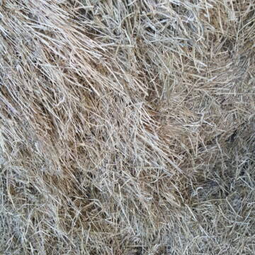
TaunusHeu staubreduziert
Idstein
Torsten Fischer
@HayClean
Heu
Käufer lädt selbst
Abholung
Lieferung
P+
Deprecated: Creation of dynamic property Zend_View_Helper_Ads::$adLink is deprecated in /var/www/stall-frei/htdocs/staging.stall-frei.de/library/Psf/View/Helper/Ads.php on line 108

Offenstall/Paddockbox für Pony oder Kleinpferd
Glashütten
Tatjana Bommersheim
@TatjanaBommersheim
Wir haben ab dem 1.04.26 eine Platz in einem unsere Offenställe (Wallach oder Stute)und eine unserer Paddockboxen (Wallach oder S
neu
R

Heu Rundballen
Espenschied
Marvin Kloos
@Birkenhof_Espenschied
Heu
Rundballen
Bio
Regenfrei
Wird verladen
2 weitere...
B+
Leider kein Vorschaubild
Leider kein Vorschaubild
Bio-Heu Rundballen zu verkaufen
Biebertal
Lindenhoefe
@Lindenhoefe
Heu
Lieferant entlädt
Rundballen
Wird verladen
2 weitere...
B+


Heu, Heulage und Stroh in jeglichen Ballenformen
Hennef
Hof-Bongartz
@Hof-Bongartz
Heu
Lieferant entlädt
Großballen
Regenfrei
3 weitere...
P+

Heu-, Heulage- und Strohverkauf
Riedstadt
Kirsten Bonn
@Reitanlage-Bonn-Riedstadt
Heu
Großballen
Regenfrei
Wird verladen
1 weitere...
B+

HD-Ballen Heu
Ginsweiler
Laura
@Heuverkauf_Ginsweiler
Heu
Kleinballen/HD-Ballen
Regenfrei
Wird verladen
2 weitere...
B+

Gurbe Pferdefutter
Mühltal
Schäfer
@Tina-Schaefer
Futter
Pellets
Bio
Käufer lädt selbst
1 weitere...
B+

Heu, Bio Ökol, Kräuter, Pferd, Kreuzkraut frei
Rösrath
Konrad-Biohof-Gut-Breide-LAG
@BiohofGutBreideLAG
Heu
Empfänger lädt ab
Rundballen
Bio
Regenfrei
2 weitere...
B+

Job gesucht?
Mechtersen
STALL-FREIde Marketing
@STALL-FREI-Marketing
Sie suchen einen Job und arbeiten gerne mit Pferden oder auf Reitanlagen?
Besuchen Sie jetzt unseren Stellenmarkt!

Bio Heu
Mehlbach
irena-zinssmeister
@irena-zinssmeister
Heu
Empfänger lädt ab
Großballen
Bio
Regenfrei
2 weitere...
aktuell
B+
Deprecated: Creation of dynamic property Zend_View::$pageCount is deprecated in /var/www/stall-frei/htdocs/staging.stall-frei.de/library/vendor/shardj/zf1-future/library/Zend/View/Abstract.php on line 308
Deprecated: Creation of dynamic property Zend_View::$itemCountPerPage is deprecated in /var/www/stall-frei/htdocs/staging.stall-frei.de/library/vendor/shardj/zf1-future/library/Zend/View/Abstract.php on line 308
Deprecated: Creation of dynamic property Zend_View::$first is deprecated in /var/www/stall-frei/htdocs/staging.stall-frei.de/library/vendor/shardj/zf1-future/library/Zend/View/Abstract.php on line 308
Deprecated: Creation of dynamic property Zend_View::$current is deprecated in /var/www/stall-frei/htdocs/staging.stall-frei.de/library/vendor/shardj/zf1-future/library/Zend/View/Abstract.php on line 308
Deprecated: Creation of dynamic property Zend_View::$last is deprecated in /var/www/stall-frei/htdocs/staging.stall-frei.de/library/vendor/shardj/zf1-future/library/Zend/View/Abstract.php on line 308
Deprecated: Creation of dynamic property Zend_View::$next is deprecated in /var/www/stall-frei/htdocs/staging.stall-frei.de/library/vendor/shardj/zf1-future/library/Zend/View/Abstract.php on line 308
Deprecated: Creation of dynamic property Zend_View::$pagesInRange is deprecated in /var/www/stall-frei/htdocs/staging.stall-frei.de/library/vendor/shardj/zf1-future/library/Zend/View/Abstract.php on line 308
Deprecated: Creation of dynamic property Zend_View::$firstPageInRange is deprecated in /var/www/stall-frei/htdocs/staging.stall-frei.de/library/vendor/shardj/zf1-future/library/Zend/View/Abstract.php on line 308
Deprecated: Creation of dynamic property Zend_View::$lastPageInRange is deprecated in /var/www/stall-frei/htdocs/staging.stall-frei.de/library/vendor/shardj/zf1-future/library/Zend/View/Abstract.php on line 308
Deprecated: Creation of dynamic property Zend_View::$currentItemCount is deprecated in /var/www/stall-frei/htdocs/staging.stall-frei.de/library/vendor/shardj/zf1-future/library/Zend/View/Abstract.php on line 308
Deprecated: Creation of dynamic property Zend_View::$totalItemCount is deprecated in /var/www/stall-frei/htdocs/staging.stall-frei.de/library/vendor/shardj/zf1-future/library/Zend/View/Abstract.php on line 308
Deprecated: Creation of dynamic property Zend_View::$firstItemNumber is deprecated in /var/www/stall-frei/htdocs/staging.stall-frei.de/library/vendor/shardj/zf1-future/library/Zend/View/Abstract.php on line 308
Deprecated: Creation of dynamic property Zend_View::$lastItemNumber is deprecated in /var/www/stall-frei/htdocs/staging.stall-frei.de/library/vendor/shardj/zf1-future/library/Zend/View/Abstract.php on line 308
Deprecated: Creation of dynamic property Zend_View::$router is deprecated in /var/www/stall-frei/htdocs/staging.stall-frei.de/library/vendor/shardj/zf1-future/library/Zend/View/Abstract.php on line 308
Deprecated: Creation of dynamic property Zend_View::$urlParams is deprecated in /var/www/stall-frei/htdocs/staging.stall-frei.de/library/vendor/shardj/zf1-future/library/Zend/View/Abstract.php on line 308
Deprecated: Creation of dynamic property Zend_View::$showAds is deprecated in /var/www/stall-frei/htdocs/staging.stall-frei.de/library/vendor/shardj/zf1-future/library/Zend/View/Abstract.php on line 308
Deprecated: Creation of dynamic property Zend_View::$objectIds is deprecated in /var/www/stall-frei/htdocs/staging.stall-frei.de/library/vendor/shardj/zf1-future/library/Zend/View/Abstract.php on line 308
Deprecated: Creation of dynamic property Zend_View::$showNavbar is deprecated in /var/www/stall-frei/htdocs/staging.stall-frei.de/library/vendor/shardj/zf1-future/library/Zend/View/Abstract.php on line 308
Deprecated: Creation of dynamic property Zend_View::$showBreadcrumb is deprecated in /var/www/stall-frei/htdocs/staging.stall-frei.de/library/vendor/shardj/zf1-future/library/Zend/View/Abstract.php on line 308
Deprecated: Creation of dynamic property Zend_View::$showFooter is deprecated in /var/www/stall-frei/htdocs/staging.stall-frei.de/library/vendor/shardj/zf1-future/library/Zend/View/Abstract.php on line 308
Deprecated: Creation of dynamic property Zend_View::$showInternalAds is deprecated in /var/www/stall-frei/htdocs/staging.stall-frei.de/library/vendor/shardj/zf1-future/library/Zend/View/Abstract.php on line 308
Deprecated: Creation of dynamic property Zend_View::$blNoContent is deprecated in /var/www/stall-frei/htdocs/staging.stall-frei.de/library/vendor/shardj/zf1-future/library/Zend/View/Abstract.php on line 308
Deprecated: Creation of dynamic property Zend_View::$sMetaDesc is deprecated in /var/www/stall-frei/htdocs/staging.stall-frei.de/library/vendor/shardj/zf1-future/library/Zend/View/Abstract.php on line 308
Deprecated: Creation of dynamic property Zend_View::$useGmaps is deprecated in /var/www/stall-frei/htdocs/staging.stall-frei.de/library/vendor/shardj/zf1-future/library/Zend/View/Abstract.php on line 308
Deprecated: Creation of dynamic property Zend_View::$touches is deprecated in /var/www/stall-frei/htdocs/staging.stall-frei.de/library/vendor/shardj/zf1-future/library/Zend/View/Abstract.php on line 308
Deprecated: Creation of dynamic property Zend_View::$oProject is deprecated in /var/www/stall-frei/htdocs/staging.stall-frei.de/library/vendor/shardj/zf1-future/library/Zend/View/Abstract.php on line 308
Deprecated: Creation of dynamic property Zend_View::$pageHeadline is deprecated in /var/www/stall-frei/htdocs/staging.stall-frei.de/library/vendor/shardj/zf1-future/library/Zend/View/Abstract.php on line 308
Deprecated: Creation of dynamic property Zend_View::$disableLocationField is deprecated in /var/www/stall-frei/htdocs/staging.stall-frei.de/library/vendor/shardj/zf1-future/library/Zend/View/Abstract.php on line 308
Deprecated: Creation of dynamic property Zend_View::$isSearch is deprecated in /var/www/stall-frei/htdocs/staging.stall-frei.de/library/vendor/shardj/zf1-future/library/Zend/View/Abstract.php on line 308
Deprecated: Creation of dynamic property Zend_View::$pageTitle is deprecated in /var/www/stall-frei/htdocs/staging.stall-frei.de/library/vendor/shardj/zf1-future/library/Zend/View/Abstract.php on line 308
Deprecated: Creation of dynamic property Psf_Form_Element_Text::$class is deprecated in /var/www/stall-frei/htdocs/staging.stall-frei.de/library/vendor/shardj/zf1-future/library/Zend/Form/Element.php on line 874
Deprecated: Creation of dynamic property Psf_Form_Element_Text::$size is deprecated in /var/www/stall-frei/htdocs/staging.stall-frei.de/library/vendor/shardj/zf1-future/library/Zend/Form/Element.php on line 874
Deprecated: Creation of dynamic property Psf_Form_Element_Text::$placeholder is deprecated in /var/www/stall-frei/htdocs/staging.stall-frei.de/library/vendor/shardj/zf1-future/library/Zend/Form/Element.php on line 874
Deprecated: Creation of dynamic property Psf_Form_Element_Hidden::$class is deprecated in /var/www/stall-frei/htdocs/staging.stall-frei.de/library/vendor/shardj/zf1-future/library/Zend/Form/Element.php on line 874
Deprecated: Creation of dynamic property Psf_Form_Element_Hidden::$class is deprecated in /var/www/stall-frei/htdocs/staging.stall-frei.de/library/vendor/shardj/zf1-future/library/Zend/Form/Element.php on line 874
Deprecated: Creation of dynamic property Psf_Form_Element_Hidden::$class is deprecated in /var/www/stall-frei/htdocs/staging.stall-frei.de/library/vendor/shardj/zf1-future/library/Zend/Form/Element.php on line 874
Deprecated: Creation of dynamic property Psf_Form_Element_Hidden::$class is deprecated in /var/www/stall-frei/htdocs/staging.stall-frei.de/library/vendor/shardj/zf1-future/library/Zend/Form/Element.php on line 874
Deprecated: Creation of dynamic property Psf_Form_Element_Select::$class is deprecated in /var/www/stall-frei/htdocs/staging.stall-frei.de/library/vendor/shardj/zf1-future/library/Zend/Form/Element.php on line 874
Deprecated: Creation of dynamic property Psf_Form_Element_Select::$class is deprecated in /var/www/stall-frei/htdocs/staging.stall-frei.de/library/vendor/shardj/zf1-future/library/Zend/Form/Element.php on line 874
Deprecated: Creation of dynamic property Psf_Form_Element_Select::$class is deprecated in /var/www/stall-frei/htdocs/staging.stall-frei.de/library/vendor/shardj/zf1-future/library/Zend/Form/Element.php on line 874
Deprecated: Creation of dynamic property Psf_Form_Element_Select::$class is deprecated in /var/www/stall-frei/htdocs/staging.stall-frei.de/library/vendor/shardj/zf1-future/library/Zend/Form/Element.php on line 874
Deprecated: Creation of dynamic property Zend_View::$sort is deprecated in /var/www/stall-frei/htdocs/staging.stall-frei.de/library/vendor/shardj/zf1-future/library/Zend/View/Abstract.php on line 308
Deprecated: Creation of dynamic property Zend_View::$searchLocation is deprecated in /var/www/stall-frei/htdocs/staging.stall-frei.de/library/vendor/shardj/zf1-future/library/Zend/View/Abstract.php on line 308
Deprecated: Creation of dynamic property Zend_View::$locationHint is deprecated in /var/www/stall-frei/htdocs/staging.stall-frei.de/library/vendor/shardj/zf1-future/library/Zend/View/Abstract.php on line 308
Psf_GeoCoder_Abstract::getLocation: Dörnberg Get Location CachedOrLive
Psf_GeoCoder_Abstract::getCachedOrLive: Dörnberg
Psf_GeoCoder_Abstract::convertLocationResult
{"documentation":"https:\/\/opencagedata.com\/api","licenses":[{"name":"see attribution guide","url":"https:\/\/opencagedata.com\/credits"}],"results":[{"bounds":{"northeast":{"lat":50.3435132,"lng":7.9068843},"southwest":{"lat":50.3109083,"lng":7.8689305}},"components":{"ISO_3166-1_alpha-2":"DE","ISO_3166-1_alpha-3":"DEU","ISO_3166-2":["DE-RP"],"_category":"place","_normalized_city":"D\u00f6rnberg","_type":"village","continent":"Europe","country":"Deutschland","country_code":"de","county":"Rhein-Lahn-Kreis","municipality":"Diez","political_union":"European Union","postcode":"56379","state":"Rheinland-Pfalz","state_code":"RP","village":"D\u00f6rnberg"},"confidence":7,"formatted":"56379 D\u00f6rnberg, Deutschland","geometry":{"lat":50.3256326,"lng":7.8833914}},{"bounds":{"northeast":{"lat":51.3188667,"lng":8.4195604},"southwest":{"lat":51.3177715,"lng":8.416985}},"components":{"ISO_3166-1_alpha-2":"DE","ISO_3166-1_alpha-3":"DEU","ISO_3166-2":["DE-NW"],"_category":"natural\/water","_normalized_city":"Bestwig","_type":"nature_reserve","continent":"Europe","country":"Deutschland","country_code":"de","county":"Hochsauerlandkreis","nature_reserve":"D\u00f6rnberg","political_union":"European Union","postcode":"59909","state":"Nordrhein-Westfalen","state_code":"NW","town":"Bestwig"},"confidence":9,"formatted":"D\u00f6rnberg, 59909 Bestwig, Deutschland","geometry":{"lat":51.3182982,"lng":8.4179254}},{"bounds":{"northeast":{"lat":52.0905014,"lng":8.5151765},"southwest":{"lat":52.0142691,"lng":8.420952}},"components":{"ISO_3166-1_alpha-2":"DE","ISO_3166-1_alpha-3":"DEU","ISO_3166-2":["DE-NW"],"_category":"place","_normalized_city":"Bielefeld","_type":"neighbourhood","city":"Bielefeld","continent":"Europe","country":"Deutschland","country_code":"de","political_union":"European Union","postcode":"33619","quarter":"Dornberg","state":"Nordrhein-Westfalen","state_code":"NW"},"confidence":7,"formatted":"33619 Bielefeld, Deutschland","geometry":{"lat":52.0471898,"lng":8.4540006}},{"bounds":{"northeast":{"lat":51.3598247,"lng":9.381977},"southwest":{"lat":51.3151925,"lng":9.3128085}},"components":{"ISO_3166-1_alpha-2":"DE","ISO_3166-1_alpha-3":"DEU","ISO_3166-2":["DE-HE"],"_category":"place","_normalized_city":"D\u00f6rnberg","_type":"village","continent":"Europe","country":"Deutschland","country_code":"de","county":"Landkreis Kassel","municipality":"Habichtswald","political_union":"European Union","state":"Hessen","state_code":"HE","village":"D\u00f6rnberg"},"confidence":7,"formatted":"D\u00f6rnberg, Hessen, Deutschland","geometry":{"lat":51.3426724,"lng":9.3432901}},{"bounds":{"northeast":{"lat":51.2125319,"lng":7.843947},"southwest":{"lat":51.2124319,"lng":7.843847}},"components":{"ISO_3166-1_alpha-2":"DE","ISO_3166-1_alpha-3":"DEU","ISO_3166-2":["DE-NW"],"_category":"natural\/water","_normalized_city":"Plettenberg","_type":"peak","continent":"Europe","country":"Deutschland","country_code":"de","county":"M\u00e4rkischer Kreis","peak":"D\u00f6rnberg","political_union":"European Union","postcode":"58840","state":"Nordrhein-Westfalen","state_code":"NW","town":"Plettenberg"},"confidence":9,"formatted":"D\u00f6rnberg, 58840 Plettenberg, Deutschland","geometry":{"lat":51.2124819,"lng":7.843897}},{"bounds":{"northeast":{"lat":50.40255,"lng":7.9114389},"southwest":{"lat":50.40245,"lng":7.9113389}},"components":{"ISO_3166-1_alpha-2":"DE","ISO_3166-1_alpha-3":"DEU","ISO_3166-2":["DE-RP"],"_category":"natural\/water","_normalized_city":"Eppenrod","_type":"peak","continent":"Europe","country":"Deutschland","country_code":"de","county":"Rhein-Lahn-Kreis","municipality":"Diez","peak":"D\u00f6rnberg","political_union":"European Union","postcode":"56412","state":"Rheinland-Pfalz","state_code":"RP","village":"Eppenrod"},"confidence":9,"formatted":"D\u00f6rnberg, 56412 Eppenrod, Deutschland","geometry":{"lat":50.4025,"lng":7.9113889}},{"bounds":{"northeast":{"lat":51.025518,"lng":9.0738242},"southwest":{"lat":51.025418,"lng":9.0737242}},"components":{"ISO_3166-1_alpha-2":"DE","ISO_3166-1_alpha-3":"DEU","ISO_3166-2":["DE-HE"],"_category":"natural\/water","_normalized_city":"Dodenhausen","_type":"peak","continent":"Europe","country":"Deutschland","country_code":"de","county":"Landkreis Waldeck-Frankenberg","municipality":"Haina (Kloster)","peak":"D\u00f6rnberg","political_union":"European Union","state":"Hessen","state_code":"HE","village":"Dodenhausen"},"confidence":9,"formatted":"D\u00f6rnberg, Dodenhausen, Hessen, Deutschland","geometry":{"lat":51.025468,"lng":9.0737742}},{"bounds":{"northeast":{"lat":49.8754516,"lng":9.1120521},"southwest":{"lat":49.8753516,"lng":9.1119521}},"components":{"ISO_3166-1_alpha-2":"DE","ISO_3166-1_alpha-3":"DEU","ISO_3166-2":["DE-BY"],"_category":"natural\/water","_normalized_city":"Gro\u00dfwallstadt","_type":"peak","continent":"Europe","country":"Deutschland","country_code":"de","county":"Landkreis Miltenberg","peak":"D\u00f6rnberg","political_union":"European Union","postcode":"63853","state":"Bayern","state_code":"BY","village":"Gro\u00dfwallstadt"},"confidence":9,"formatted":"D\u00f6rnberg, 63853 Gro\u00dfwallstadt, Deutschland","geometry":{"lat":49.8754016,"lng":9.1120021}},{"bounds":{"northeast":{"lat":51.3091086,"lng":8.423303},"southwest":{"lat":51.3090086,"lng":8.423203}},"components":{"ISO_3166-1_alpha-2":"DE","ISO_3166-1_alpha-3":"DEU","ISO_3166-2":["DE-NW"],"_category":"natural\/water","_normalized_city":"Bestwig","_type":"peak","continent":"Europe","country":"Deutschland","country_code":"de","county":"Hochsauerlandkreis","peak":"D\u00f6rnberg","political_union":"European Union","postcode":"59909","state":"Nordrhein-Westfalen","state_code":"NW","town":"Bestwig"},"confidence":9,"formatted":"D\u00f6rnberg, 59909 Bestwig, Deutschland","geometry":{"lat":51.3090586,"lng":8.423253}},{"components":{"ISO_3166-1_alpha-2":"FR","ISO_3166-1_alpha-3":"FRA","ISO_3166-2":["FR-NAQ","FR-16"],"_category":"road","_normalized_city":"Nanteuil-en-Vall\u00e9e","_type":"road","city":"Nanteuil-en-Vall\u00e9e","continent":"Europe","country":"France","country_code":"fr","county":"Charente","local_authority":"Communaut\u00e9 de communes Val-de-Charente","political_union":"European Union","postcode":"16700","road":"La Dorni\u00e8re","state":"Nouvelle-Aquitaine","state_code":"NAQ"},"confidence":2,"formatted":"La Dorni\u00e8re, 16700 Nanteuil-en-Vall\u00e9e, France","geometry":{"lat":45.980343,"lng":0.359367}}],"status":{"code":200,"message":"OK"},"stay_informed":{"blog":"https:\/\/blog.opencagedata.com","mastodon":"https:\/\/en.osm.town\/@opencage"},"thanks":"For using an OpenCage API","timestamp":{"created_http":"Sat, 07 Feb 2026 07:18:02 GMT","created_unix":1770448682},"total_results":10}Array
(
[0] => stdClass Object
(
[bounds] => stdClass Object
(
[northeast] => stdClass Object
(
[lat] => 50.3435132
[lng] => 7.9068843
)
[southwest] => stdClass Object
(
[lat] => 50.3109083
[lng] => 7.8689305
)
)
[components] => stdClass Object
(
[ISO_3166-1_alpha-2] => DE
[ISO_3166-1_alpha-3] => DEU
[ISO_3166-2] => Array
(
[0] => DE-RP
)
[_category] => place
[_normalized_city] => Dörnberg
[_type] => village
[continent] => Europe
[country] => Deutschland
[country_code] => de
[county] => Rhein-Lahn-Kreis
[municipality] => Diez
[political_union] => European Union
[postcode] => 56379
[state] => Rheinland-Pfalz
[state_code] => RP
[village] => Dörnberg
)
[confidence] => 7
[formatted] => 56379 Dörnberg, Deutschland
[geometry] => stdClass Object
(
[lat] => 50.3256326
[lng] => 7.8833914
)
)
[1] => stdClass Object
(
[bounds] => stdClass Object
(
[northeast] => stdClass Object
(
[lat] => 51.3188667
[lng] => 8.4195604
)
[southwest] => stdClass Object
(
[lat] => 51.3177715
[lng] => 8.416985
)
)
[components] => stdClass Object
(
[ISO_3166-1_alpha-2] => DE
[ISO_3166-1_alpha-3] => DEU
[ISO_3166-2] => Array
(
[0] => DE-NW
)
[_category] => natural/water
[_normalized_city] => Bestwig
[_type] => nature_reserve
[continent] => Europe
[country] => Deutschland
[country_code] => de
[county] => Hochsauerlandkreis
[nature_reserve] => Dörnberg
[political_union] => European Union
[postcode] => 59909
[state] => Nordrhein-Westfalen
[state_code] => NW
[town] => Bestwig
)
[confidence] => 9
[formatted] => Dörnberg, 59909 Bestwig, Deutschland
[geometry] => stdClass Object
(
[lat] => 51.3182982
[lng] => 8.4179254
)
)
[2] => stdClass Object
(
[bounds] => stdClass Object
(
[northeast] => stdClass Object
(
[lat] => 52.0905014
[lng] => 8.5151765
)
[southwest] => stdClass Object
(
[lat] => 52.0142691
[lng] => 8.420952
)
)
[components] => stdClass Object
(
[ISO_3166-1_alpha-2] => DE
[ISO_3166-1_alpha-3] => DEU
[ISO_3166-2] => Array
(
[0] => DE-NW
)
[_category] => place
[_normalized_city] => Bielefeld
[_type] => neighbourhood
[city] => Bielefeld
[continent] => Europe
[country] => Deutschland
[country_code] => de
[political_union] => European Union
[postcode] => 33619
[quarter] => Dornberg
[state] => Nordrhein-Westfalen
[state_code] => NW
)
[confidence] => 7
[formatted] => 33619 Bielefeld, Deutschland
[geometry] => stdClass Object
(
[lat] => 52.0471898
[lng] => 8.4540006
)
)
[3] => stdClass Object
(
[bounds] => stdClass Object
(
[northeast] => stdClass Object
(
[lat] => 51.3598247
[lng] => 9.381977
)
[southwest] => stdClass Object
(
[lat] => 51.3151925
[lng] => 9.3128085
)
)
[components] => stdClass Object
(
[ISO_3166-1_alpha-2] => DE
[ISO_3166-1_alpha-3] => DEU
[ISO_3166-2] => Array
(
[0] => DE-HE
)
[_category] => place
[_normalized_city] => Dörnberg
[_type] => village
[continent] => Europe
[country] => Deutschland
[country_code] => de
[county] => Landkreis Kassel
[municipality] => Habichtswald
[political_union] => European Union
[state] => Hessen
[state_code] => HE
[village] => Dörnberg
)
[confidence] => 7
[formatted] => Dörnberg, Hessen, Deutschland
[geometry] => stdClass Object
(
[lat] => 51.3426724
[lng] => 9.3432901
)
)
[4] => stdClass Object
(
[bounds] => stdClass Object
(
[northeast] => stdClass Object
(
[lat] => 51.2125319
[lng] => 7.843947
)
[southwest] => stdClass Object
(
[lat] => 51.2124319
[lng] => 7.843847
)
)
[components] => stdClass Object
(
[ISO_3166-1_alpha-2] => DE
[ISO_3166-1_alpha-3] => DEU
[ISO_3166-2] => Array
(
[0] => DE-NW
)
[_category] => natural/water
[_normalized_city] => Plettenberg
[_type] => peak
[continent] => Europe
[country] => Deutschland
[country_code] => de
[county] => Märkischer Kreis
[peak] => Dörnberg
[political_union] => European Union
[postcode] => 58840
[state] => Nordrhein-Westfalen
[state_code] => NW
[town] => Plettenberg
)
[confidence] => 9
[formatted] => Dörnberg, 58840 Plettenberg, Deutschland
[geometry] => stdClass Object
(
[lat] => 51.2124819
[lng] => 7.843897
)
)
[5] => stdClass Object
(
[bounds] => stdClass Object
(
[northeast] => stdClass Object
(
[lat] => 50.40255
[lng] => 7.9114389
)
[southwest] => stdClass Object
(
[lat] => 50.40245
[lng] => 7.9113389
)
)
[components] => stdClass Object
(
[ISO_3166-1_alpha-2] => DE
[ISO_3166-1_alpha-3] => DEU
[ISO_3166-2] => Array
(
[0] => DE-RP
)
[_category] => natural/water
[_normalized_city] => Eppenrod
[_type] => peak
[continent] => Europe
[country] => Deutschland
[country_code] => de
[county] => Rhein-Lahn-Kreis
[municipality] => Diez
[peak] => Dörnberg
[political_union] => European Union
[postcode] => 56412
[state] => Rheinland-Pfalz
[state_code] => RP
[village] => Eppenrod
)
[confidence] => 9
[formatted] => Dörnberg, 56412 Eppenrod, Deutschland
[geometry] => stdClass Object
(
[lat] => 50.4025
[lng] => 7.9113889
)
)
[6] => stdClass Object
(
[bounds] => stdClass Object
(
[northeast] => stdClass Object
(
[lat] => 51.025518
[lng] => 9.0738242
)
[southwest] => stdClass Object
(
[lat] => 51.025418
[lng] => 9.0737242
)
)
[components] => stdClass Object
(
[ISO_3166-1_alpha-2] => DE
[ISO_3166-1_alpha-3] => DEU
[ISO_3166-2] => Array
(
[0] => DE-HE
)
[_category] => natural/water
[_normalized_city] => Dodenhausen
[_type] => peak
[continent] => Europe
[country] => Deutschland
[country_code] => de
[county] => Landkreis Waldeck-Frankenberg
[municipality] => Haina (Kloster)
[peak] => Dörnberg
[political_union] => European Union
[state] => Hessen
[state_code] => HE
[village] => Dodenhausen
)
[confidence] => 9
[formatted] => Dörnberg, Dodenhausen, Hessen, Deutschland
[geometry] => stdClass Object
(
[lat] => 51.025468
[lng] => 9.0737742
)
)
[7] => stdClass Object
(
[bounds] => stdClass Object
(
[northeast] => stdClass Object
(
[lat] => 49.8754516
[lng] => 9.1120521
)
[southwest] => stdClass Object
(
[lat] => 49.8753516
[lng] => 9.1119521
)
)
[components] => stdClass Object
(
[ISO_3166-1_alpha-2] => DE
[ISO_3166-1_alpha-3] => DEU
[ISO_3166-2] => Array
(
[0] => DE-BY
)
[_category] => natural/water
[_normalized_city] => Großwallstadt
[_type] => peak
[continent] => Europe
[country] => Deutschland
[country_code] => de
[county] => Landkreis Miltenberg
[peak] => Dörnberg
[political_union] => European Union
[postcode] => 63853
[state] => Bayern
[state_code] => BY
[village] => Großwallstadt
)
[confidence] => 9
[formatted] => Dörnberg, 63853 Großwallstadt, Deutschland
[geometry] => stdClass Object
(
[lat] => 49.8754016
[lng] => 9.1120021
)
)
[8] => stdClass Object
(
[bounds] => stdClass Object
(
[northeast] => stdClass Object
(
[lat] => 51.3091086
[lng] => 8.423303
)
[southwest] => stdClass Object
(
[lat] => 51.3090086
[lng] => 8.423203
)
)
[components] => stdClass Object
(
[ISO_3166-1_alpha-2] => DE
[ISO_3166-1_alpha-3] => DEU
[ISO_3166-2] => Array
(
[0] => DE-NW
)
[_category] => natural/water
[_normalized_city] => Bestwig
[_type] => peak
[continent] => Europe
[country] => Deutschland
[country_code] => de
[county] => Hochsauerlandkreis
[peak] => Dörnberg
[political_union] => European Union
[postcode] => 59909
[state] => Nordrhein-Westfalen
[state_code] => NW
[town] => Bestwig
)
[confidence] => 9
[formatted] => Dörnberg, 59909 Bestwig, Deutschland
[geometry] => stdClass Object
(
[lat] => 51.3090586
[lng] => 8.423253
)
)
[9] => stdClass Object
(
[components] => stdClass Object
(
[ISO_3166-1_alpha-2] => FR
[ISO_3166-1_alpha-3] => FRA
[ISO_3166-2] => Array
(
[0] => FR-NAQ
[1] => FR-16
)
[_category] => road
[_normalized_city] => Nanteuil-en-Vallée
[_type] => road
[city] => Nanteuil-en-Vallée
[continent] => Europe
[country] => France
[country_code] => fr
[county] => Charente
[local_authority] => Communauté de communes Val-de-Charente
[political_union] => European Union
[postcode] => 16700
[road] => La Dornière
[state] => Nouvelle-Aquitaine
[state_code] => NAQ
)
[confidence] => 2
[formatted] => La Dornière, 16700 Nanteuil-en-Vallée, France
[geometry] => stdClass Object
(
[lat] => 45.980343
[lng] => 0.359367
)
)
)
Psf_GeoCoder_OpenCageData::getKeyMap: 0
stdClass Object
(
    [bounds] => stdClass Object
        (
            [northeast] => stdClass Object
                (
                    [lat] => 50.3435132
                    [lng] => 7.9068843
                )

            [southwest] => stdClass Object
                (
                    [lat] => 50.3109083
                    [lng] => 7.8689305
                )

        )

    [components] => stdClass Object
        (
            [ISO_3166-1_alpha-2] => DE
            [ISO_3166-1_alpha-3] => DEU
            [ISO_3166-2] => Array
                (
                    [0] => DE-RP
                )

            [_category] => place
            [_normalized_city] => Dörnberg
            [_type] => village
            [continent] => Europe
            [country] => Deutschland
            [country_code] => de
            [county] => Rhein-Lahn-Kreis
            [municipality] => Diez
            [political_union] => European Union
            [postcode] => 56379
            [state] => Rheinland-Pfalz
            [state_code] => RP
            [village] => Dörnberg
        )

    [confidence] => 7
    [formatted] => 56379 Dörnberg, Deutschland
    [geometry] => stdClass Object
        (
            [lat] => 50.3256326
            [lng] => 7.8833914
        )

)
Psf_GeoCoder_OpenCageData::getCounty: Rhein-Lahn-Kreis
Psf_GeoCoder_OpenCageData::addMissingData REFETCH!
Array
(
    [address] => 56379 Dörnberg, Deutschland
    [type] => village
    [street] =>
    [city] => Dörnberg
    [county] => Rhein-Lahn-Kreis
    [state] => Rheinland-Pfalz
    [zip] => 56379
    [country] => Deutschland
    [suburb] =>
    [countrycode] => de
    [latitude] => 50.3256326
    [longitude] => 7.8833914
    [accuracy] => 1
    [confidence] => 7
    [bounds] => stdClass Object
        (
            [northeast] => stdClass Object
                (
                    [lat] => 50.3435132
                    [lng] => 7.9068843
                )

            [southwest] => stdClass Object
                (
                    [lat] => 50.3109083
                    [lng] => 7.8689305
                )

        )

)
reformat!
Array
(
    [address] => 56379 Dörnberg, Deutschland
    [type] => village
    [street] =>
    [city] => Dörnberg
    [county] => Rhein-Lahn-Kreis
    [state] => Rheinland-Pfalz
    [zip] => 56379
    [country] => Deutschland
    [suburb] =>
    [countrycode] => de
    [latitude] => 50.3256326
    [longitude] => 7.8833914
    [accuracy] => 1
    [confidence] => 7
    [bounds] => stdClass Object
        (
            [northeast] => stdClass Object
                (
                    [lat] => 50.3435132
                    [lng] => 7.9068843
                )

            [southwest] => stdClass Object
                (
                    [lat] => 50.3109083
                    [lng] => 7.8689305
                )

        )

    [place] => 56379 Dörnberg, Rheinland-Pfalz
    [hash] => 52088618ce7e278529435a0bf97ec738
)
Psf_GeoCoder_OpenCageData::getKeyMap: 1
stdClass Object
(
    [bounds] => stdClass Object
        (
            [northeast] => stdClass Object
                (
                    [lat] => 51.3188667
                    [lng] => 8.4195604
                )

            [southwest] => stdClass Object
                (
                    [lat] => 51.3177715
                    [lng] => 8.416985
                )

        )

    [components] => stdClass Object
        (
            [ISO_3166-1_alpha-2] => DE
            [ISO_3166-1_alpha-3] => DEU
            [ISO_3166-2] => Array
                (
                    [0] => DE-NW
                )

            [_category] => natural/water
            [_normalized_city] => Bestwig
            [_type] => nature_reserve
            [continent] => Europe
            [country] => Deutschland
            [country_code] => de
            [county] => Hochsauerlandkreis
            [nature_reserve] => Dörnberg
            [political_union] => European Union
            [postcode] => 59909
            [state] => Nordrhein-Westfalen
            [state_code] => NW
            [town] => Bestwig
        )

    [confidence] => 9
    [formatted] => Dörnberg, 59909 Bestwig, Deutschland
    [geometry] => stdClass Object
        (
            [lat] => 51.3182982
            [lng] => 8.4179254
        )

)
Psf_GeoCoder_OpenCageData::getCounty: Hochsauerlandkreis
Psf_GeoCoder_OpenCageData::addMissingData REFETCH!
Array
(
    [address] => Dörnberg, 59909 Bestwig, Deutschland
    [type] => nature_reserve
    [street] =>
    [city] => Bestwig
    [county] => Hochsauerlandkreis
    [state] => Nordrhein-Westfalen
    [zip] => 59909
    [country] => Deutschland
    [suburb] =>
    [countrycode] => de
    [latitude] => 51.3182982
    [longitude] => 8.4179254
    [accuracy] => 1
    [confidence] => 9
    [bounds] => stdClass Object
        (
            [northeast] => stdClass Object
                (
                    [lat] => 51.3188667
                    [lng] => 8.4195604
                )

            [southwest] => stdClass Object
                (
                    [lat] => 51.3177715
                    [lng] => 8.416985
                )

        )

)
reformat!
Array
(
    [address] => Dörnberg, 59909 Bestwig, Deutschland
    [type] => nature_reserve
    [street] =>
    [city] => Bestwig
    [county] => Hochsauerlandkreis
    [state] => Nordrhein-Westfalen
    [zip] => 59909
    [country] => Deutschland
    [suburb] =>
    [countrycode] => de
    [latitude] => 51.3182982
    [longitude] => 8.4179254
    [accuracy] => 1
    [confidence] => 9
    [bounds] => stdClass Object
        (
            [northeast] => stdClass Object
                (
                    [lat] => 51.3188667
                    [lng] => 8.4195604
                )

            [southwest] => stdClass Object
                (
                    [lat] => 51.3177715
                    [lng] => 8.416985
                )

        )

    [place] => 59909 Bestwig, Nordrhein-Westfalen
    [hash] => c784d965da3842069416f697f28fec8c
)
Psf_GeoCoder_OpenCageData::getKeyMap: 2
stdClass Object
(
    [bounds] => stdClass Object
        (
            [northeast] => stdClass Object
                (
                    [lat] => 52.0905014
                    [lng] => 8.5151765
                )

            [southwest] => stdClass Object
                (
                    [lat] => 52.0142691
                    [lng] => 8.420952
                )

        )

    [components] => stdClass Object
        (
            [ISO_3166-1_alpha-2] => DE
            [ISO_3166-1_alpha-3] => DEU
            [ISO_3166-2] => Array
                (
                    [0] => DE-NW
                )

            [_category] => place
            [_normalized_city] => Bielefeld
            [_type] => neighbourhood
            [city] => Bielefeld
            [continent] => Europe
            [country] => Deutschland
            [country_code] => de
            [political_union] => European Union
            [postcode] => 33619
            [quarter] => Dornberg
            [state] => Nordrhein-Westfalen
            [state_code] => NW
        )

    [confidence] => 7
    [formatted] => 33619 Bielefeld, Deutschland
    [geometry] => stdClass Object
        (
            [lat] => 52.0471898
            [lng] => 8.4540006
        )

)
Psf_GeoCoder_OpenCageData::getCounty: Bielefeld
Psf_GeoCoder_OpenCageData::addMissingData REFETCH!
Array
(
    [address] => 33619 Bielefeld, Deutschland
    [type] => neighbourhood
    [street] =>
    [city] => Bielefeld
    [county] => Bielefeld
    [state] => Nordrhein-Westfalen
    [zip] => 33619
    [country] => Deutschland
    [suburb] =>
    [countrycode] => de
    [latitude] => 52.0471898
    [longitude] => 8.4540006
    [accuracy] => 1
    [confidence] => 7
    [bounds] => stdClass Object
        (
            [northeast] => stdClass Object
                (
                    [lat] => 52.0905014
                    [lng] => 8.5151765
                )

            [southwest] => stdClass Object
                (
                    [lat] => 52.0142691
                    [lng] => 8.420952
                )

        )

)
reformat!
Array
(
    [address] => 33619 Bielefeld, Deutschland
    [type] => neighbourhood
    [street] =>
    [city] => Bielefeld
    [county] => Bielefeld
    [state] => Nordrhein-Westfalen
    [zip] => 33619
    [country] => Deutschland
    [suburb] =>
    [countrycode] => de
    [latitude] => 52.0471898
    [longitude] => 8.4540006
    [accuracy] => 1
    [confidence] => 7
    [bounds] => stdClass Object
        (
            [northeast] => stdClass Object
                (
                    [lat] => 52.0905014
                    [lng] => 8.5151765
                )

            [southwest] => stdClass Object
                (
                    [lat] => 52.0142691
                    [lng] => 8.420952
                )

        )

    [place] => 33619 Bielefeld, Nordrhein-Westfalen
    [hash] => a9c5c4f93e35dc08c7873dc64d058a23
)
Psf_GeoCoder_OpenCageData::getKeyMap: 3
stdClass Object
(
    [bounds] => stdClass Object
        (
            [northeast] => stdClass Object
                (
                    [lat] => 51.3598247
                    [lng] => 9.381977
                )

            [southwest] => stdClass Object
                (
                    [lat] => 51.3151925
                    [lng] => 9.3128085
                )

        )

    [components] => stdClass Object
        (
            [ISO_3166-1_alpha-2] => DE
            [ISO_3166-1_alpha-3] => DEU
            [ISO_3166-2] => Array
                (
                    [0] => DE-HE
                )

            [_category] => place
            [_normalized_city] => Dörnberg
            [_type] => village
            [continent] => Europe
            [country] => Deutschland
            [country_code] => de
            [county] => Landkreis Kassel
            [municipality] => Habichtswald
            [political_union] => European Union
            [state] => Hessen
            [state_code] => HE
            [village] => Dörnberg
        )

    [confidence] => 7
    [formatted] => Dörnberg, Hessen, Deutschland
    [geometry] => stdClass Object
        (
            [lat] => 51.3426724
            [lng] => 9.3432901
        )

)
Psf_GeoCoder_OpenCageData::getCounty: Kassel
Psf_GeoCoder_OpenCageData::addMissingData REFETCH!
Array
(
    [address] => Dörnberg, Hessen, Deutschland
    [type] => village
    [street] =>
    [city] => Dörnberg
    [county] => Kassel
    [state] => Hessen
    [zip] =>
    [country] => Deutschland
    [suburb] =>
    [countrycode] => de
    [latitude] => 51.3426724
    [longitude] => 9.3432901
    [accuracy] => 1
    [confidence] => 7
    [bounds] => stdClass Object
        (
            [northeast] => stdClass Object
                (
                    [lat] => 51.3598247
                    [lng] => 9.381977
                )

            [southwest] => stdClass Object
                (
                    [lat] => 51.3151925
                    [lng] => 9.3128085
                )

        )

)
reformat!
Array
(
    [address] => Dörnberg, Hessen, Deutschland
    [type] => village
    [street] =>
    [city] => Dörnberg
    [county] => Kassel
    [state] => Hessen
    [zip] =>
    [country] => Deutschland
    [suburb] =>
    [countrycode] => de
    [latitude] => 51.3426724
    [longitude] => 9.3432901
    [accuracy] => 1
    [confidence] => 7
    [bounds] => stdClass Object
        (
            [northeast] => stdClass Object
                (
                    [lat] => 51.3598247
                    [lng] => 9.381977
                )

            [southwest] => stdClass Object
                (
                    [lat] => 51.3151925
                    [lng] => 9.3128085
                )

        )

    [place] => Dörnberg, Hessen
    [hash] => 62d1c8c0321ef08650070d6806edb291
)
Psf_GeoCoder_OpenCageData::getKeyMap: 4
stdClass Object
(
    [bounds] => stdClass Object
        (
            [northeast] => stdClass Object
                (
                    [lat] => 51.2125319
                    [lng] => 7.843947
                )

            [southwest] => stdClass Object
                (
                    [lat] => 51.2124319
                    [lng] => 7.843847
                )

        )

    [components] => stdClass Object
        (
            [ISO_3166-1_alpha-2] => DE
            [ISO_3166-1_alpha-3] => DEU
            [ISO_3166-2] => Array
                (
                    [0] => DE-NW
                )

            [_category] => natural/water
            [_normalized_city] => Plettenberg
            [_type] => peak
            [continent] => Europe
            [country] => Deutschland
            [country_code] => de
            [county] => Märkischer Kreis
            [peak] => Dörnberg
            [political_union] => European Union
            [postcode] => 58840
            [state] => Nordrhein-Westfalen
            [state_code] => NW
            [town] => Plettenberg
        )

    [confidence] => 9
    [formatted] => Dörnberg, 58840 Plettenberg, Deutschland
    [geometry] => stdClass Object
        (
            [lat] => 51.2124819
            [lng] => 7.843897
        )

)
Psf_GeoCoder_OpenCageData::getCounty: Märkischer Kreis
Psf_GeoCoder_OpenCageData::addMissingData REFETCH!
Array
(
    [address] => Dörnberg, 58840 Plettenberg, Deutschland
    [type] => peak
    [street] =>
    [city] => Plettenberg
    [county] => Märkischer Kreis
    [state] => Nordrhein-Westfalen
    [zip] => 58840
    [country] => Deutschland
    [suburb] =>
    [countrycode] => de
    [latitude] => 51.2124819
    [longitude] => 7.843897
    [accuracy] => 1
    [confidence] => 9
    [bounds] => stdClass Object
        (
            [northeast] => stdClass Object
                (
                    [lat] => 51.2125319
                    [lng] => 7.843947
                )

            [southwest] => stdClass Object
                (
                    [lat] => 51.2124319
                    [lng] => 7.843847
                )

        )

)
reformat!
Array
(
    [address] => Dörnberg, 58840 Plettenberg, Deutschland
    [type] => peak
    [street] =>
    [city] => Plettenberg
    [county] => Märkischer Kreis
    [state] => Nordrhein-Westfalen
    [zip] => 58840
    [country] => Deutschland
    [suburb] =>
    [countrycode] => de
    [latitude] => 51.2124819
    [longitude] => 7.843897
    [accuracy] => 1
    [confidence] => 9
    [bounds] => stdClass Object
        (
            [northeast] => stdClass Object
                (
                    [lat] => 51.2125319
                    [lng] => 7.843947
                )

            [southwest] => stdClass Object
                (
                    [lat] => 51.2124319
                    [lng] => 7.843847
                )

        )

    [place] => 58840 Plettenberg, Nordrhein-Westfalen
    [hash] => 945af4b0c94f383ea1c3ce660abc258a
)
Psf_GeoCoder_OpenCageData::getKeyMap: 5
stdClass Object
(
    [bounds] => stdClass Object
        (
            [northeast] => stdClass Object
                (
                    [lat] => 50.40255
                    [lng] => 7.9114389
                )

            [southwest] => stdClass Object
                (
                    [lat] => 50.40245
                    [lng] => 7.9113389
                )

        )

    [components] => stdClass Object
        (
            [ISO_3166-1_alpha-2] => DE
            [ISO_3166-1_alpha-3] => DEU
            [ISO_3166-2] => Array
                (
                    [0] => DE-RP
                )

            [_category] => natural/water
            [_normalized_city] => Eppenrod
            [_type] => peak
            [continent] => Europe
            [country] => Deutschland
            [country_code] => de
            [county] => Rhein-Lahn-Kreis
            [municipality] => Diez
            [peak] => Dörnberg
            [political_union] => European Union
            [postcode] => 56412
            [state] => Rheinland-Pfalz
            [state_code] => RP
            [village] => Eppenrod
        )

    [confidence] => 9
    [formatted] => Dörnberg, 56412 Eppenrod, Deutschland
    [geometry] => stdClass Object
        (
            [lat] => 50.4025
            [lng] => 7.9113889
        )

)
Psf_GeoCoder_OpenCageData::getCounty: Rhein-Lahn-Kreis
Psf_GeoCoder_OpenCageData::addMissingData REFETCH!
Array
(
    [address] => Dörnberg, 56412 Eppenrod, Deutschland
    [type] => peak
    [street] =>
    [city] => Eppenrod
    [county] => Rhein-Lahn-Kreis
    [state] => Rheinland-Pfalz
    [zip] => 56412
    [country] => Deutschland
    [suburb] =>
    [countrycode] => de
    [latitude] => 50.4025
    [longitude] => 7.9113889
    [accuracy] => 1
    [confidence] => 9
    [bounds] => stdClass Object
        (
            [northeast] => stdClass Object
                (
                    [lat] => 50.40255
                    [lng] => 7.9114389
                )

            [southwest] => stdClass Object
                (
                    [lat] => 50.40245
                    [lng] => 7.9113389
                )

        )

)
reformat!
Array
(
    [address] => Dörnberg, 56412 Eppenrod, Deutschland
    [type] => peak
    [street] =>
    [city] => Eppenrod
    [county] => Rhein-Lahn-Kreis
    [state] => Rheinland-Pfalz
    [zip] => 56412
    [country] => Deutschland
    [suburb] =>
    [countrycode] => de
    [latitude] => 50.4025
    [longitude] => 7.9113889
    [accuracy] => 1
    [confidence] => 9
    [bounds] => stdClass Object
        (
            [northeast] => stdClass Object
                (
                    [lat] => 50.40255
                    [lng] => 7.9114389
                )

            [southwest] => stdClass Object
                (
                    [lat] => 50.40245
                    [lng] => 7.9113389
                )

        )

    [place] => 56412 Eppenrod, Rheinland-Pfalz
    [hash] => 0f979e996cbdd86cd5716c34be0f3b87
)
Psf_GeoCoder_OpenCageData::getKeyMap: 6
stdClass Object
(
    [bounds] => stdClass Object
        (
            [northeast] => stdClass Object
                (
                    [lat] => 51.025518
                    [lng] => 9.0738242
                )

            [southwest] => stdClass Object
                (
                    [lat] => 51.025418
                    [lng] => 9.0737242
                )

        )

    [components] => stdClass Object
        (
            [ISO_3166-1_alpha-2] => DE
            [ISO_3166-1_alpha-3] => DEU
            [ISO_3166-2] => Array
                (
                    [0] => DE-HE
                )

            [_category] => natural/water
            [_normalized_city] => Dodenhausen
            [_type] => peak
            [continent] => Europe
            [country] => Deutschland
            [country_code] => de
            [county] => Landkreis Waldeck-Frankenberg
            [municipality] => Haina (Kloster)
            [peak] => Dörnberg
            [political_union] => European Union
            [state] => Hessen
            [state_code] => HE
            [village] => Dodenhausen
        )

    [confidence] => 9
    [formatted] => Dörnberg, Dodenhausen, Hessen, Deutschland
    [geometry] => stdClass Object
        (
            [lat] => 51.025468
            [lng] => 9.0737742
        )

)
Psf_GeoCoder_OpenCageData::getCounty: Waldeck-Frankenberg
Psf_GeoCoder_OpenCageData::addMissingData REFETCH!
Array
(
    [address] => Dörnberg, Dodenhausen, Hessen, Deutschland
    [type] => peak
    [street] =>
    [city] => Dodenhausen
    [county] => Waldeck-Frankenberg
    [state] => Hessen
    [zip] =>
    [country] => Deutschland
    [suburb] =>
    [countrycode] => de
    [latitude] => 51.025468
    [longitude] => 9.0737742
    [accuracy] => 1
    [confidence] => 9
    [bounds] => stdClass Object
        (
            [northeast] => stdClass Object
                (
                    [lat] => 51.025518
                    [lng] => 9.0738242
                )

            [southwest] => stdClass Object
                (
                    [lat] => 51.025418
                    [lng] => 9.0737242
                )

        )

)
reformat!
Array
(
    [address] => Dörnberg, Dodenhausen, Hessen, Deutschland
    [type] => peak
    [street] =>
    [city] => Dodenhausen
    [county] => Waldeck-Frankenberg
    [state] => Hessen
    [zip] =>
    [country] => Deutschland
    [suburb] =>
    [countrycode] => de
    [latitude] => 51.025468
    [longitude] => 9.0737742
    [accuracy] => 1
    [confidence] => 9
    [bounds] => stdClass Object
        (
            [northeast] => stdClass Object
                (
                    [lat] => 51.025518
                    [lng] => 9.0738242
                )

            [southwest] => stdClass Object
                (
                    [lat] => 51.025418
                    [lng] => 9.0737242
                )

        )

    [place] => Dodenhausen, Hessen
    [hash] => c1072235daccb401612dd0c84eb24da8
)
Psf_GeoCoder_OpenCageData::getKeyMap: 7
stdClass Object
(
    [bounds] => stdClass Object
        (
            [northeast] => stdClass Object
                (
                    [lat] => 49.8754516
                    [lng] => 9.1120521
                )

            [southwest] => stdClass Object
                (
                    [lat] => 49.8753516
                    [lng] => 9.1119521
                )

        )

    [components] => stdClass Object
        (
            [ISO_3166-1_alpha-2] => DE
            [ISO_3166-1_alpha-3] => DEU
            [ISO_3166-2] => Array
                (
                    [0] => DE-BY
                )

            [_category] => natural/water
            [_normalized_city] => Großwallstadt
            [_type] => peak
            [continent] => Europe
            [country] => Deutschland
            [country_code] => de
            [county] => Landkreis Miltenberg
            [peak] => Dörnberg
            [political_union] => European Union
            [postcode] => 63853
            [state] => Bayern
            [state_code] => BY
            [village] => Großwallstadt
        )

    [confidence] => 9
    [formatted] => Dörnberg, 63853 Großwallstadt, Deutschland
    [geometry] => stdClass Object
        (
            [lat] => 49.8754016
            [lng] => 9.1120021
        )

)
Psf_GeoCoder_OpenCageData::getCounty: Miltenberg
Psf_GeoCoder_OpenCageData::addMissingData REFETCH!
Array
(
    [address] => Dörnberg, 63853 Großwallstadt, Deutschland
    [type] => peak
    [street] =>
    [city] => Großwallstadt
    [county] => Miltenberg
    [state] => Bayern
    [zip] => 63853
    [country] => Deutschland
    [suburb] =>
    [countrycode] => de
    [latitude] => 49.8754016
    [longitude] => 9.1120021
    [accuracy] => 1
    [confidence] => 9
    [bounds] => stdClass Object
        (
            [northeast] => stdClass Object
                (
                    [lat] => 49.8754516
                    [lng] => 9.1120521
                )

            [southwest] => stdClass Object
                (
                    [lat] => 49.8753516
                    [lng] => 9.1119521
                )

        )

)
reformat!
Array
(
    [address] => Dörnberg, 63853 Großwallstadt, Deutschland
    [type] => peak
    [street] =>
    [city] => Großwallstadt
    [county] => Miltenberg
    [state] => Bayern
    [zip] => 63853
    [country] => Deutschland
    [suburb] =>
    [countrycode] => de
    [latitude] => 49.8754016
    [longitude] => 9.1120021
    [accuracy] => 1
    [confidence] => 9
    [bounds] => stdClass Object
        (
            [northeast] => stdClass Object
                (
                    [lat] => 49.8754516
                    [lng] => 9.1120521
                )

            [southwest] => stdClass Object
                (
                    [lat] => 49.8753516
                    [lng] => 9.1119521
                )

        )

    [place] => 63853 Großwallstadt, Bayern
    [hash] => 81f0bf6b54957ed6ed4dd61834b51b3a
)
Psf_GeoCoder_OpenCageData::getKeyMap: 8
stdClass Object
(
    [bounds] => stdClass Object
        (
            [northeast] => stdClass Object
                (
                    [lat] => 51.3091086
                    [lng] => 8.423303
                )

            [southwest] => stdClass Object
                (
                    [lat] => 51.3090086
                    [lng] => 8.423203
                )

        )

    [components] => stdClass Object
        (
            [ISO_3166-1_alpha-2] => DE
            [ISO_3166-1_alpha-3] => DEU
            [ISO_3166-2] => Array
                (
                    [0] => DE-NW
                )

            [_category] => natural/water
            [_normalized_city] => Bestwig
            [_type] => peak
            [continent] => Europe
            [country] => Deutschland
            [country_code] => de
            [county] => Hochsauerlandkreis
            [peak] => Dörnberg
            [political_union] => European Union
            [postcode] => 59909
            [state] => Nordrhein-Westfalen
            [state_code] => NW
            [town] => Bestwig
        )

    [confidence] => 9
    [formatted] => Dörnberg, 59909 Bestwig, Deutschland
    [geometry] => stdClass Object
        (
            [lat] => 51.3090586
            [lng] => 8.423253
        )

)
Psf_GeoCoder_OpenCageData::getCounty: Hochsauerlandkreis
Psf_GeoCoder_OpenCageData::addMissingData REFETCH!
Array
(
    [address] => Dörnberg, 59909 Bestwig, Deutschland
    [type] => peak
    [street] =>
    [city] => Bestwig
    [county] => Hochsauerlandkreis
    [state] => Nordrhein-Westfalen
    [zip] => 59909
    [country] => Deutschland
    [suburb] =>
    [countrycode] => de
    [latitude] => 51.3090586
    [longitude] => 8.423253
    [accuracy] => 1
    [confidence] => 9
    [bounds] => stdClass Object
        (
            [northeast] => stdClass Object
                (
                    [lat] => 51.3091086
                    [lng] => 8.423303
                )

            [southwest] => stdClass Object
                (
                    [lat] => 51.3090086
                    [lng] => 8.423203
                )

        )

)
reformat!
Array
(
    [address] => Dörnberg, 59909 Bestwig, Deutschland
    [type] => peak
    [street] =>
    [city] => Bestwig
    [county] => Hochsauerlandkreis
    [state] => Nordrhein-Westfalen
    [zip] => 59909
    [country] => Deutschland
    [suburb] =>
    [countrycode] => de
    [latitude] => 51.3090586
    [longitude] => 8.423253
    [accuracy] => 1
    [confidence] => 9
    [bounds] => stdClass Object
        (
            [northeast] => stdClass Object
                (
                    [lat] => 51.3091086
                    [lng] => 8.423303
                )

            [southwest] => stdClass Object
                (
                    [lat] => 51.3090086
                    [lng] => 8.423203
                )

        )

    [place] => 59909 Bestwig, Nordrhein-Westfalen
    [hash] => c784d965da3842069416f697f28fec8c
)
Psf_GeoCoder_OpenCageData::getKeyMap: 9
stdClass Object
(
    [components] => stdClass Object
        (
            [ISO_3166-1_alpha-2] => FR
            [ISO_3166-1_alpha-3] => FRA
            [ISO_3166-2] => Array
                (
                    [0] => FR-NAQ
                    [1] => FR-16
                )

            [_category] => road
            [_normalized_city] => Nanteuil-en-Vallée
            [_type] => road
            [city] => Nanteuil-en-Vallée
            [continent] => Europe
            [country] => France
            [country_code] => fr
            [county] => Charente
            [local_authority] => Communauté de communes Val-de-Charente
            [political_union] => European Union
            [postcode] => 16700
            [road] => La Dornière
            [state] => Nouvelle-Aquitaine
            [state_code] => NAQ
        )

    [confidence] => 2
    [formatted] => La Dornière, 16700 Nanteuil-en-Vallée, France
    [geometry] => stdClass Object
        (
            [lat] => 45.980343
            [lng] => 0.359367
        )

)
Psf_GeoCoder_OpenCageData::getCounty: Charente
Psf_GeoCoder_OpenCageData::addMissingData REFETCH!
Array
(
    [address] => La Dornière, 16700 Nanteuil-en-Vallée, France
    [type] => road
    [street] => La Dornière
    [city] => Nanteuil-en-Vallée
    [county] => Charente
    [state] => Nouvelle-Aquitaine
    [zip] => 16700
    [country] => France
    [suburb] =>
    [countrycode] => fr
    [latitude] => 45.980343
    [longitude] => 0.359367
    [accuracy] => 1
    [confidence] => 2
    [bounds] =>
)
reformat!
Array
(
    [address] => La Dornière, 16700 Nanteuil-en-Vallée, France
    [type] => road
    [street] => La Dornière
    [city] => Nanteuil-en-Vallée
    [county] => Charente
    [state] => Nouvelle-Aquitaine
    [zip] => 16700
    [country] => France
    [suburb] =>
    [countrycode] => fr
    [latitude] => 45.980343
    [longitude] => 0.359367
    [accuracy] => 1
    [confidence] => 2
    [bounds] =>
    [place] => La Dornière, 16700 Nanteuil-en-Vallée, Nouvelle-Aquitaine
    [hash] => 37146a7832c515c3696ce0912b75c2f9
)
Deprecated: Creation of dynamic property Zend_View::$locationHintStyle is deprecated in /var/www/stall-frei/htdocs/staging.stall-frei.de/library/vendor/shardj/zf1-future/library/Zend/View/Abstract.php on line 308
Deprecated: Creation of dynamic property Zend_View::$adGeoLocation is deprecated in /var/www/stall-frei/htdocs/staging.stall-frei.de/library/vendor/shardj/zf1-future/library/Zend/View/Abstract.php on line 308
Deprecated: Creation of dynamic property Zend_View::$recordCount is deprecated in /var/www/stall-frei/htdocs/staging.stall-frei.de/library/vendor/shardj/zf1-future/library/Zend/View/Abstract.php on line 308
Deprecated: explode(): Passing null to parameter #2 ($string) of type string is deprecated in /var/www/stall-frei/htdocs/staging.stall-frei.de/application/models/SearchAgent.php on line 100
Deprecated: explode(): Passing null to parameter #2 ($string) of type string is deprecated in /var/www/stall-frei/htdocs/staging.stall-frei.de/application/models/SearchAgent.php on line 100
Deprecated: explode(): Passing null to parameter #2 ($string) of type string is deprecated in /var/www/stall-frei/htdocs/staging.stall-frei.de/application/models/SearchAgent.php on line 100
Deprecated: explode(): Passing null to parameter #2 ($string) of type string is deprecated in /var/www/stall-frei/htdocs/staging.stall-frei.de/application/models/SearchAgent.php on line 100
Deprecated: explode(): Passing null to parameter #2 ($string) of type string is deprecated in /var/www/stall-frei/htdocs/staging.stall-frei.de/application/models/SearchAgent.php on line 100
Deprecated: explode(): Passing null to parameter #2 ($string) of type string is deprecated in /var/www/stall-frei/htdocs/staging.stall-frei.de/application/models/SearchAgent.php on line 100
Deprecated: trim(): Passing null to parameter #1 ($string) of type string is deprecated in /var/www/stall-frei/htdocs/staging.stall-frei.de/application/models/Account/Search.php on line 82
Warning: Cannot modify header information - headers already sent by (output started at /var/www/stall-frei/htdocs/staging.stall-frei.de/library/vendor/shardj/zf1-future/library/Zend/View/Abstract.php:308) in /var/www/stall-frei/htdocs/staging.stall-frei.de/application/models/Account/Search.php on line 71
Deprecated: Creation of dynamic property Zend_View::$paginationParams is deprecated in /var/www/stall-frei/htdocs/staging.stall-frei.de/library/vendor/shardj/zf1-future/library/Zend/View/Abstract.php on line 308
Deprecated: Creation of dynamic property Zend_View::$objectPaginator is deprecated in /var/www/stall-frei/htdocs/staging.stall-frei.de/library/vendor/shardj/zf1-future/library/Zend/View/Abstract.php on line 308
Deprecated: Creation of dynamic property Zend_View::$featuredObjects is deprecated in /var/www/stall-frei/htdocs/staging.stall-frei.de/library/vendor/shardj/zf1-future/library/Zend/View/Abstract.php on line 308
Deprecated: Creation of dynamic property Zend_View::$hints is deprecated in /var/www/stall-frei/htdocs/staging.stall-frei.de/library/vendor/shardj/zf1-future/library/Zend/View/Abstract.php on line 308
Deprecated: Creation of dynamic property Zend_View::$attributeHints is deprecated in /var/www/stall-frei/htdocs/staging.stall-frei.de/library/vendor/shardj/zf1-future/library/Zend/View/Abstract.php on line 308
Deprecated: Creation of dynamic property Zend_View::$oSearchForm is deprecated in /var/www/stall-frei/htdocs/staging.stall-frei.de/library/vendor/shardj/zf1-future/library/Zend/View/Abstract.php on line 308