Deprecated: Creation of dynamic property Zend_View::$sMode is deprecated in /var/www/stall-frei/htdocs/staging.stall-frei.de/library/vendor/shardj/zf1-future/library/Zend/View/Abstract.php on line 308
Heu, Stroh oder Futter in Süß
Gesucht wird in "Süß, Hessen, Deutschland"
95 Einträge
Deprecated: Creation of dynamic property Zend_View::$listObjects is deprecated in /var/www/stall-frei/htdocs/staging.stall-frei.de/library/vendor/shardj/zf1-future/library/Zend/View/Abstract.php on line 308
Deprecated: Creation of dynamic property Zend_View::$listMode is deprecated in /var/www/stall-frei/htdocs/staging.stall-frei.de/library/vendor/shardj/zf1-future/library/Zend/View/Abstract.php on line 308
Deprecated: Creation of dynamic property Zend_View::$renderedObjects is deprecated in /var/www/stall-frei/htdocs/staging.stall-frei.de/library/vendor/shardj/zf1-future/library/Zend/View/Abstract.php on line 308
Deprecated: Creation of dynamic property Zend_View::$index is deprecated in /var/www/stall-frei/htdocs/staging.stall-frei.de/library/vendor/shardj/zf1-future/library/Zend/View/Abstract.php on line 308
Deprecated: Creation of dynamic property Zend_View::$displayMode is deprecated in /var/www/stall-frei/htdocs/staging.stall-frei.de/library/vendor/shardj/zf1-future/library/Zend/View/Abstract.php on line 308
Deprecated: Creation of dynamic property Zend_View::$remarketingIds is deprecated in /var/www/stall-frei/htdocs/staging.stall-frei.de/library/vendor/shardj/zf1-future/library/Zend/View/Abstract.php on line 308
Deprecated: Creation of dynamic property Zend_View::$listItem is deprecated in /var/www/stall-frei/htdocs/staging.stall-frei.de/library/vendor/shardj/zf1-future/library/Zend/View/Abstract.php on line 308
Deprecated: Creation of dynamic property Zend_View::$object is deprecated in /var/www/stall-frei/htdocs/staging.stall-frei.de/library/vendor/shardj/zf1-future/library/Zend/View/Abstract.php on line 308
Deprecated: Creation of dynamic property Zend_View::$attributes is deprecated in /var/www/stall-frei/htdocs/staging.stall-frei.de/library/vendor/shardj/zf1-future/library/Zend/View/Abstract.php on line 308


1 Palette Stramofarm Strohpellets 30Sack á 25KG
Leinefelde- Worbis
stramofarm GmbH
@stramofarm
Einstreu
Lieferant entlädt
Pellets
Regenfrei
2 weitere...
P+


1 Palette Stramofarm Heupellets 30 Sack á 15Kg
Leinefelde
stramofarm GmbH
@stramofarm
Heu
Lieferant entlädt
Pellets
Regenfrei
2 weitere...
P+
Deprecated: Creation of dynamic property Zend_View_Helper_Ads::$adLink is deprecated in /var/www/stall-frei/htdocs/staging.stall-frei.de/library/Psf/View/Helper/Ads.php on line 108

Futtersack HeuToy, Fressbremse in pink
Mechtersen
STALL-FREIde Marketing
@STALL-FREI-Marketing
Stundenlange Beschäftigung die
Koliken vorbeugt, geringe Staubinhalation mit
steuerbarer Futterentnahme
Leider kein Vorschaubild
Leider kein Vorschaubild
Bio-Heu Rundballen zu verkaufen
Biebertal
Lindenhoefe
@Lindenhoefe
Heu
Lieferant entlädt
Rundballen
Wird verladen
2 weitere...
B+


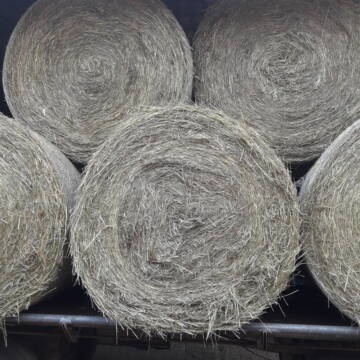
Rundballen Stroh
Elze-Esbeck
Hof Bartels
@Bartels
Stroh
Lieferant entlädt
Rundballen
Regenfrei
3 weitere...
B+

Waldboden Einstreu Lieferung Deutschlandweit
Goldbach
Steigerwald Waldboden Einstreu
@Steigerwald_Waldboden_Einstreu
Einstreu
Lieferant entlädt
Bigbag
Bio
3 weitere...
B+

Luzerneheu 1.Schnitt
Teutschenthal
Nancy
@Haltergemeinschaft-TT
Heu
Empfänger lädt ab
Rundballen
Regenfrei
2 weitere...
B+


TaunusHeu staubreduziert
Idstein
Torsten Fischer
@HayClean
Heu
Käufer lädt selbst
Abholung
Lieferung
P+

Reitanlage bei Familie Senckenberg
Groß-Gerau
Senckenberg
@Senckenberg
Freie Pferdeboxen auf dem Idyllischen Rheinfelderhof in Groß-Gerau


Futtermittel & Einstreu mit Lieferung!
Schwaara
MK-Agrarprodukte
@MK-Agrarprodukte
Heu
Empfänger lädt ab
Großballen
Regenfrei
2 weitere...
P+
Heu Rundballen zu verkaufen
Peine
Hof-Hoppenworth
@Hof-Hoppenworth
Heu
Empfänger lädt ab
Rundballen
Regenfrei
3 weitere...
B+
Deprecated: Creation of dynamic property Zend_View::$pageCount is deprecated in /var/www/stall-frei/htdocs/staging.stall-frei.de/library/vendor/shardj/zf1-future/library/Zend/View/Abstract.php on line 308
Deprecated: Creation of dynamic property Zend_View::$itemCountPerPage is deprecated in /var/www/stall-frei/htdocs/staging.stall-frei.de/library/vendor/shardj/zf1-future/library/Zend/View/Abstract.php on line 308
Deprecated: Creation of dynamic property Zend_View::$first is deprecated in /var/www/stall-frei/htdocs/staging.stall-frei.de/library/vendor/shardj/zf1-future/library/Zend/View/Abstract.php on line 308
Deprecated: Creation of dynamic property Zend_View::$current is deprecated in /var/www/stall-frei/htdocs/staging.stall-frei.de/library/vendor/shardj/zf1-future/library/Zend/View/Abstract.php on line 308
Deprecated: Creation of dynamic property Zend_View::$last is deprecated in /var/www/stall-frei/htdocs/staging.stall-frei.de/library/vendor/shardj/zf1-future/library/Zend/View/Abstract.php on line 308
Deprecated: Creation of dynamic property Zend_View::$next is deprecated in /var/www/stall-frei/htdocs/staging.stall-frei.de/library/vendor/shardj/zf1-future/library/Zend/View/Abstract.php on line 308
Deprecated: Creation of dynamic property Zend_View::$pagesInRange is deprecated in /var/www/stall-frei/htdocs/staging.stall-frei.de/library/vendor/shardj/zf1-future/library/Zend/View/Abstract.php on line 308
Deprecated: Creation of dynamic property Zend_View::$firstPageInRange is deprecated in /var/www/stall-frei/htdocs/staging.stall-frei.de/library/vendor/shardj/zf1-future/library/Zend/View/Abstract.php on line 308
Deprecated: Creation of dynamic property Zend_View::$lastPageInRange is deprecated in /var/www/stall-frei/htdocs/staging.stall-frei.de/library/vendor/shardj/zf1-future/library/Zend/View/Abstract.php on line 308
Deprecated: Creation of dynamic property Zend_View::$currentItemCount is deprecated in /var/www/stall-frei/htdocs/staging.stall-frei.de/library/vendor/shardj/zf1-future/library/Zend/View/Abstract.php on line 308
Deprecated: Creation of dynamic property Zend_View::$totalItemCount is deprecated in /var/www/stall-frei/htdocs/staging.stall-frei.de/library/vendor/shardj/zf1-future/library/Zend/View/Abstract.php on line 308
Deprecated: Creation of dynamic property Zend_View::$firstItemNumber is deprecated in /var/www/stall-frei/htdocs/staging.stall-frei.de/library/vendor/shardj/zf1-future/library/Zend/View/Abstract.php on line 308
Deprecated: Creation of dynamic property Zend_View::$lastItemNumber is deprecated in /var/www/stall-frei/htdocs/staging.stall-frei.de/library/vendor/shardj/zf1-future/library/Zend/View/Abstract.php on line 308
Deprecated: Creation of dynamic property Zend_View::$router is deprecated in /var/www/stall-frei/htdocs/staging.stall-frei.de/library/vendor/shardj/zf1-future/library/Zend/View/Abstract.php on line 308
Deprecated: Creation of dynamic property Zend_View::$urlParams is deprecated in /var/www/stall-frei/htdocs/staging.stall-frei.de/library/vendor/shardj/zf1-future/library/Zend/View/Abstract.php on line 308
Deprecated: Creation of dynamic property Zend_View::$showAds is deprecated in /var/www/stall-frei/htdocs/staging.stall-frei.de/library/vendor/shardj/zf1-future/library/Zend/View/Abstract.php on line 308
Deprecated: Creation of dynamic property Zend_View::$objectIds is deprecated in /var/www/stall-frei/htdocs/staging.stall-frei.de/library/vendor/shardj/zf1-future/library/Zend/View/Abstract.php on line 308
Deprecated: Creation of dynamic property Zend_View::$showNavbar is deprecated in /var/www/stall-frei/htdocs/staging.stall-frei.de/library/vendor/shardj/zf1-future/library/Zend/View/Abstract.php on line 308
Deprecated: Creation of dynamic property Zend_View::$showBreadcrumb is deprecated in /var/www/stall-frei/htdocs/staging.stall-frei.de/library/vendor/shardj/zf1-future/library/Zend/View/Abstract.php on line 308
Deprecated: Creation of dynamic property Zend_View::$showFooter is deprecated in /var/www/stall-frei/htdocs/staging.stall-frei.de/library/vendor/shardj/zf1-future/library/Zend/View/Abstract.php on line 308
Deprecated: Creation of dynamic property Zend_View::$showInternalAds is deprecated in /var/www/stall-frei/htdocs/staging.stall-frei.de/library/vendor/shardj/zf1-future/library/Zend/View/Abstract.php on line 308
Deprecated: Creation of dynamic property Zend_View::$blNoContent is deprecated in /var/www/stall-frei/htdocs/staging.stall-frei.de/library/vendor/shardj/zf1-future/library/Zend/View/Abstract.php on line 308
Deprecated: Creation of dynamic property Zend_View::$sMetaDesc is deprecated in /var/www/stall-frei/htdocs/staging.stall-frei.de/library/vendor/shardj/zf1-future/library/Zend/View/Abstract.php on line 308
Deprecated: Creation of dynamic property Zend_View::$useGmaps is deprecated in /var/www/stall-frei/htdocs/staging.stall-frei.de/library/vendor/shardj/zf1-future/library/Zend/View/Abstract.php on line 308
Deprecated: Creation of dynamic property Zend_View::$touches is deprecated in /var/www/stall-frei/htdocs/staging.stall-frei.de/library/vendor/shardj/zf1-future/library/Zend/View/Abstract.php on line 308
Deprecated: Creation of dynamic property Zend_View::$oProject is deprecated in /var/www/stall-frei/htdocs/staging.stall-frei.de/library/vendor/shardj/zf1-future/library/Zend/View/Abstract.php on line 308
Deprecated: Creation of dynamic property Zend_View::$pageHeadline is deprecated in /var/www/stall-frei/htdocs/staging.stall-frei.de/library/vendor/shardj/zf1-future/library/Zend/View/Abstract.php on line 308
Deprecated: Creation of dynamic property Zend_View::$disableLocationField is deprecated in /var/www/stall-frei/htdocs/staging.stall-frei.de/library/vendor/shardj/zf1-future/library/Zend/View/Abstract.php on line 308
Deprecated: Creation of dynamic property Zend_View::$isSearch is deprecated in /var/www/stall-frei/htdocs/staging.stall-frei.de/library/vendor/shardj/zf1-future/library/Zend/View/Abstract.php on line 308
Deprecated: Creation of dynamic property Zend_View::$pageTitle is deprecated in /var/www/stall-frei/htdocs/staging.stall-frei.de/library/vendor/shardj/zf1-future/library/Zend/View/Abstract.php on line 308
Deprecated: Creation of dynamic property Psf_Form_Element_Text::$class is deprecated in /var/www/stall-frei/htdocs/staging.stall-frei.de/library/vendor/shardj/zf1-future/library/Zend/Form/Element.php on line 874
Deprecated: Creation of dynamic property Psf_Form_Element_Text::$size is deprecated in /var/www/stall-frei/htdocs/staging.stall-frei.de/library/vendor/shardj/zf1-future/library/Zend/Form/Element.php on line 874
Deprecated: Creation of dynamic property Psf_Form_Element_Text::$placeholder is deprecated in /var/www/stall-frei/htdocs/staging.stall-frei.de/library/vendor/shardj/zf1-future/library/Zend/Form/Element.php on line 874
Deprecated: Creation of dynamic property Psf_Form_Element_Hidden::$class is deprecated in /var/www/stall-frei/htdocs/staging.stall-frei.de/library/vendor/shardj/zf1-future/library/Zend/Form/Element.php on line 874
Deprecated: Creation of dynamic property Psf_Form_Element_Hidden::$class is deprecated in /var/www/stall-frei/htdocs/staging.stall-frei.de/library/vendor/shardj/zf1-future/library/Zend/Form/Element.php on line 874
Deprecated: Creation of dynamic property Psf_Form_Element_Hidden::$class is deprecated in /var/www/stall-frei/htdocs/staging.stall-frei.de/library/vendor/shardj/zf1-future/library/Zend/Form/Element.php on line 874
Deprecated: Creation of dynamic property Psf_Form_Element_Hidden::$class is deprecated in /var/www/stall-frei/htdocs/staging.stall-frei.de/library/vendor/shardj/zf1-future/library/Zend/Form/Element.php on line 874
Deprecated: Creation of dynamic property Psf_Form_Element_Select::$class is deprecated in /var/www/stall-frei/htdocs/staging.stall-frei.de/library/vendor/shardj/zf1-future/library/Zend/Form/Element.php on line 874
Deprecated: Creation of dynamic property Psf_Form_Element_Select::$class is deprecated in /var/www/stall-frei/htdocs/staging.stall-frei.de/library/vendor/shardj/zf1-future/library/Zend/Form/Element.php on line 874
Deprecated: Creation of dynamic property Psf_Form_Element_Select::$class is deprecated in /var/www/stall-frei/htdocs/staging.stall-frei.de/library/vendor/shardj/zf1-future/library/Zend/Form/Element.php on line 874
Deprecated: Creation of dynamic property Psf_Form_Element_Select::$class is deprecated in /var/www/stall-frei/htdocs/staging.stall-frei.de/library/vendor/shardj/zf1-future/library/Zend/Form/Element.php on line 874
Deprecated: Creation of dynamic property Zend_View::$sort is deprecated in /var/www/stall-frei/htdocs/staging.stall-frei.de/library/vendor/shardj/zf1-future/library/Zend/View/Abstract.php on line 308
Deprecated: Creation of dynamic property Zend_View::$searchLocation is deprecated in /var/www/stall-frei/htdocs/staging.stall-frei.de/library/vendor/shardj/zf1-future/library/Zend/View/Abstract.php on line 308
Deprecated: Creation of dynamic property Zend_View::$locationHint is deprecated in /var/www/stall-frei/htdocs/staging.stall-frei.de/library/vendor/shardj/zf1-future/library/Zend/View/Abstract.php on line 308
Psf_GeoCoder_Abstract::getLocation: Süß Get Location CachedOrLive
Psf_GeoCoder_Abstract::getCachedOrLive: Süß
Psf_GeoCoder_OpenCageData::makeApiRequest: response:
Array
(
[documentation] => https://opencagedata.com/api
[licenses] => Array
(
[0] => Array
(
[name] => see attribution guide
[url] => https://opencagedata.com/credits
)
)
[results] => Array
(
[0] => Array
(
[bounds] => Array
(
[northeast] => Array
(
[lat] => 51.000864
[lng] => 9.9964481
)
[southwest] => Array
(
[lat] => 50.9786032
[lng] => 9.9500959
)
)
[components] => Array
(
[ISO_3166-1_alpha-2] => DE
[ISO_3166-1_alpha-3] => DEU
[ISO_3166-2] => Array
(
[0] => DE-HE
)
[_category] => place
[_normalized_city] => Süß
[_type] => village
[continent] => Europe
[country] => Deutschland
[country_code] => de
[county] => Landkreis Hersfeld-Rotenburg
[municipality] => Nentershausen
[political_union] => European Union
[state] => Hessen
[state_code] => HE
[village] => Süß
)
[confidence] => 7
[formatted] => Süß, Hessen, Deutschland
[geometry] => Array
(
[lat] => 50.9883932
[lng] => 9.973062
)
)
[1] => Array
(
[bounds] => Array
(
[northeast] => Array
(
[lat] => 49.570531
[lng] => 11.8167769
)
[southwest] => Array
(
[lat] => 49.530531
[lng] => 11.7767769
)
)
[components] => Array
(
[ISO_3166-1_alpha-2] => DE
[ISO_3166-1_alpha-3] => DEU
[ISO_3166-2] => Array
(
[0] => DE-BY
)
[_category] => place
[_normalized_city] => Hahnbach
[_type] => village
[city] => Hahnbach
[continent] => Europe
[country] => Deutschland
[country_code] => de
[county] => Landkreis Amberg-Sulzbach
[municipality] => Hahnbach (VGem)
[political_union] => European Union
[postcode] => 92256
[state] => Bayern
[state_code] => BY
[village] => Süß
)
[confidence] => 7
[formatted] => 92256 Süß, Deutschland
[geometry] => Array
(
[lat] => 49.550531
[lng] => 11.7967769
)
)
[2] => Array
(
[bounds] => Array
(
[northeast] => Array
(
[lat] => 48.6257237
[lng] => 11.9788009
)
[southwest] => Array
(
[lat] => 48.5728543
[lng] => 11.8915711
)
)
[components] => Array
(
[ISO_3166-1_alpha-2] => DE
[ISO_3166-1_alpha-3] => DEU
[ISO_3166-2] => Array
(
[0] => DE-BY
)
[_category] => place
[_normalized_city] => Obersüßbach
[_type] => village
[continent] => Europe
[country] => Deutschland
[country_code] => de
[county] => Landkreis Landshut
[municipality] => Furth (VGem)
[political_union] => European Union
[postcode] => 84101
[state] => Bayern
[state_code] => BY
[village] => Obersüßbach
)
[confidence] => 7
[formatted] => 84101 Obersüßbach, Deutschland
[geometry] => Array
(
[lat] => 48.6124798
[lng] => 11.9433191
)
)
[3] => Array
(
[components] => Array
(
[ISO_3166-1_alpha-2] => FR
[ISO_3166-1_alpha-3] => FRA
[ISO_3166-2] => Array
(
[0] => FR-PDL
[1] => FR-44
)
[_category] => road
[_normalized_city] => Sucé-sur-Erdre
[_type] => road
[city] => Sucé-sur-Erdre
[continent] => Europe
[country] => France
[country_code] => fr
[county] => Loire-Atlantique
[local_authority] => Communauté de communes d'Erdre et Gesvres
[political_union] => European Union
[postcode] => 44240
[road] => Rue de la Lande
[state] => Pays de la Loire
[state_code] => PDL
)
[confidence] => 2
[formatted] => Rue de la Lande, 44240 Sucé-sur-Erdre, France
[geometry] => Array
(
[lat] => 47.334578
[lng] => -1.514315
)
)
[4] => Array
(
[components] => Array
(
[ISO_3166-1_alpha-2] => FR
[ISO_3166-1_alpha-3] => FRA
[ISO_3166-2] => Array
(
[0] => FR-PDL
[1] => FR-44
)
[_category] => road
[_normalized_city] => Sucé-sur-Erdre
[_type] => road
[city] => Sucé-sur-Erdre
[continent] => Europe
[country] => France
[country_code] => fr
[county] => Loire-Atlantique
[local_authority] => Communauté de communes d'Erdre et Gesvres
[political_union] => European Union
[postcode] => 44240
[road] => Allée de la Chasse
[state] => Pays de la Loire
[state_code] => PDL
)
[confidence] => 2
[formatted] => Allée de la Chasse, 44240 Sucé-sur-Erdre, France
[geometry] => Array
(
[lat] => 47.347665
[lng] => -1.528328
)
)
[5] => Array
(
[components] => Array
(
[ISO_3166-1_alpha-2] => FR
[ISO_3166-1_alpha-3] => FRA
[ISO_3166-2] => Array
(
[0] => FR-ARA
[1] => FR-63
)
[_category] => place
[_normalized_city] => Clermont-Ferrand
[_type] => place
[city] => Clermont-Ferrand
[continent] => Europe
[country] => France
[country_code] => fr
[county] => Puy-de-Dôme
[local_authority] => Clermont Auvergne Métropole
[place] => place Paul Suss
[political_union] => European Union
[postcode] => 63000
[state] => Auvergne-Rhône-Alpes
[state_code] => ARA
)
[confidence] => 2
[formatted] => place Paul Suss, 63000 Clermont-Ferrand, France
[geometry] => Array
(
[lat] => 45.760186
[lng] => 3.094821
)
)
[6] => Array
(
[components] => Array
(
[ISO_3166-1_alpha-2] => FR
[ISO_3166-1_alpha-3] => FRA
[ISO_3166-2] => Array
(
[0] => FR-PDL
[1] => FR-44
)
[_category] => road
[_normalized_city] => Sucé-sur-Erdre
[_type] => road
[city] => Sucé-sur-Erdre
[continent] => Europe
[country] => France
[country_code] => fr
[county] => Loire-Atlantique
[local_authority] => Communauté de communes d'Erdre et Gesvres
[political_union] => European Union
[postcode] => 44240
[road] => Route de la Chapelle
[state] => Pays de la Loire
[state_code] => PDL
)
[confidence] => 2
[formatted] => Route de la Chapelle, 44240 Sucé-sur-Erdre, France
[geometry] => Array
(
[lat] => 47.336975
[lng] => -1.534232
)
)
[7] => Array
(
[components] => Array
(
[ISO_3166-1_alpha-2] => FR
[ISO_3166-1_alpha-3] => FRA
[ISO_3166-2] => Array
(
[0] => FR-PDL
[1] => FR-44
)
[_category] => road
[_normalized_city] => Sucé-sur-Erdre
[_type] => road
[city] => Sucé-sur-Erdre
[continent] => Europe
[country] => France
[country_code] => fr
[county] => Loire-Atlantique
[local_authority] => Communauté de communes d'Erdre et Gesvres
[political_union] => European Union
[postcode] => 44240
[road] => Route de Grandonneau
[state] => Pays de la Loire
[state_code] => PDL
)
[confidence] => 2
[formatted] => Route de Grandonneau, 44240 Sucé-sur-Erdre, France
[geometry] => Array
(
[lat] => 47.323756
[lng] => -1.485008
)
)
[8] => Array
(
[components] => Array
(
[ISO_3166-1_alpha-2] => FR
[ISO_3166-1_alpha-3] => FRA
[ISO_3166-2] => Array
(
[0] => FR-PDL
[1] => FR-44
)
[_category] => road
[_normalized_city] => Sucé-sur-Erdre
[_type] => road
[city] => Sucé-sur-Erdre
[continent] => Europe
[country] => France
[country_code] => fr
[county] => Loire-Atlantique
[local_authority] => Communauté de communes d'Erdre et Gesvres
[political_union] => European Union
[postcode] => 44240
[road] => Route des Vaux
[state] => Pays de la Loire
[state_code] => PDL
)
[confidence] => 2
[formatted] => Route des Vaux, 44240 Sucé-sur-Erdre, France
[geometry] => Array
(
[lat] => 47.360126
[lng] => -1.521904
)
)
[9] => Array
(
[components] => Array
(
[ISO_3166-1_alpha-2] => FR
[ISO_3166-1_alpha-3] => FRA
[ISO_3166-2] => Array
(
[0] => FR-PDL
[1] => FR-44
)
[_category] => road
[_normalized_city] => Sucé-sur-Erdre
[_type] => road
[city] => Sucé-sur-Erdre
[continent] => Europe
[country] => France
[country_code] => fr
[county] => Loire-Atlantique
[local_authority] => Communauté de communes d'Erdre et Gesvres
[political_union] => European Union
[postcode] => 44240
[road] => Route de la Grande Bodinière
[state] => Pays de la Loire
[state_code] => PDL
)
[confidence] => 2
[formatted] => Route de la Grande Bodinière, 44240 Sucé-sur-Erdre, France
[geometry] => Array
(
[lat] => 47.383192
[lng] => -1.51146
)
)
)
[status] => Array
(
[code] => 200
[message] => OK
)
[stay_informed] => Array
(
[blog] => https://blog.opencagedata.com
[mastodon] => https://en.osm.town/@opencage
)
[thanks] => For using an OpenCage API
[timestamp] => Array
(
[created_http] => Mon, 09 Feb 2026 12:53:27 GMT
[created_unix] => 1770641607
)
[total_results] => 10
)
Psf_GeoCoder_Abstract::convertLocationResult
{"documentation":"https:\/\/opencagedata.com\/api","licenses":[{"name":"see attribution guide","url":"https:\/\/opencagedata.com\/credits"}],"results":[{"bounds":{"northeast":{"lat":51.000864,"lng":9.9964481},"southwest":{"lat":50.9786032,"lng":9.9500959}},"components":{"ISO_3166-1_alpha-2":"DE","ISO_3166-1_alpha-3":"DEU","ISO_3166-2":["DE-HE"],"_category":"place","_normalized_city":"S\u00fc\u00df","_type":"village","continent":"Europe","country":"Deutschland","country_code":"de","county":"Landkreis Hersfeld-Rotenburg","municipality":"Nentershausen","political_union":"European Union","state":"Hessen","state_code":"HE","village":"S\u00fc\u00df"},"confidence":7,"formatted":"S\u00fc\u00df, Hessen, Deutschland","geometry":{"lat":50.9883932,"lng":9.973062}},{"bounds":{"northeast":{"lat":49.570531,"lng":11.8167769},"southwest":{"lat":49.530531,"lng":11.7767769}},"components":{"ISO_3166-1_alpha-2":"DE","ISO_3166-1_alpha-3":"DEU","ISO_3166-2":["DE-BY"],"_category":"place","_normalized_city":"Hahnbach","_type":"village","city":"Hahnbach","continent":"Europe","country":"Deutschland","country_code":"de","county":"Landkreis Amberg-Sulzbach","municipality":"Hahnbach (VGem)","political_union":"European Union","postcode":"92256","state":"Bayern","state_code":"BY","village":"S\u00fc\u00df"},"confidence":7,"formatted":"92256 S\u00fc\u00df, Deutschland","geometry":{"lat":49.550531,"lng":11.7967769}},{"bounds":{"northeast":{"lat":48.6257237,"lng":11.9788009},"southwest":{"lat":48.5728543,"lng":11.8915711}},"components":{"ISO_3166-1_alpha-2":"DE","ISO_3166-1_alpha-3":"DEU","ISO_3166-2":["DE-BY"],"_category":"place","_normalized_city":"Obers\u00fc\u00dfbach","_type":"village","continent":"Europe","country":"Deutschland","country_code":"de","county":"Landkreis Landshut","municipality":"Furth (VGem)","political_union":"European Union","postcode":"84101","state":"Bayern","state_code":"BY","village":"Obers\u00fc\u00dfbach"},"confidence":7,"formatted":"84101 Obers\u00fc\u00dfbach, Deutschland","geometry":{"lat":48.6124798,"lng":11.9433191}},{"components":{"ISO_3166-1_alpha-2":"FR","ISO_3166-1_alpha-3":"FRA","ISO_3166-2":["FR-PDL","FR-44"],"_category":"road","_normalized_city":"Suc\u00e9-sur-Erdre","_type":"road","city":"Suc\u00e9-sur-Erdre","continent":"Europe","country":"France","country_code":"fr","county":"Loire-Atlantique","local_authority":"Communaut\u00e9 de communes d'Erdre et Gesvres","political_union":"European Union","postcode":"44240","road":"Rue de la Lande","state":"Pays de la Loire","state_code":"PDL"},"confidence":2,"formatted":"Rue de la Lande, 44240 Suc\u00e9-sur-Erdre, France","geometry":{"lat":47.334578,"lng":-1.514315}},{"components":{"ISO_3166-1_alpha-2":"FR","ISO_3166-1_alpha-3":"FRA","ISO_3166-2":["FR-PDL","FR-44"],"_category":"road","_normalized_city":"Suc\u00e9-sur-Erdre","_type":"road","city":"Suc\u00e9-sur-Erdre","continent":"Europe","country":"France","country_code":"fr","county":"Loire-Atlantique","local_authority":"Communaut\u00e9 de communes d'Erdre et Gesvres","political_union":"European Union","postcode":"44240","road":"All\u00e9e de la Chasse","state":"Pays de la Loire","state_code":"PDL"},"confidence":2,"formatted":"All\u00e9e de la Chasse, 44240 Suc\u00e9-sur-Erdre, France","geometry":{"lat":47.347665,"lng":-1.528328}},{"components":{"ISO_3166-1_alpha-2":"FR","ISO_3166-1_alpha-3":"FRA","ISO_3166-2":["FR-ARA","FR-63"],"_category":"place","_normalized_city":"Clermont-Ferrand","_type":"place","city":"Clermont-Ferrand","continent":"Europe","country":"France","country_code":"fr","county":"Puy-de-D\u00f4me","local_authority":"Clermont Auvergne M\u00e9tropole","place":"place Paul Suss","political_union":"European Union","postcode":"63000","state":"Auvergne-Rh\u00f4ne-Alpes","state_code":"ARA"},"confidence":2,"formatted":"place Paul Suss, 63000 Clermont-Ferrand, France","geometry":{"lat":45.760186,"lng":3.094821}},{"components":{"ISO_3166-1_alpha-2":"FR","ISO_3166-1_alpha-3":"FRA","ISO_3166-2":["FR-PDL","FR-44"],"_category":"road","_normalized_city":"Suc\u00e9-sur-Erdre","_type":"road","city":"Suc\u00e9-sur-Erdre","continent":"Europe","country":"France","country_code":"fr","county":"Loire-Atlantique","local_authority":"Communaut\u00e9 de communes d'Erdre et Gesvres","political_union":"European Union","postcode":"44240","road":"Route de la Chapelle","state":"Pays de la Loire","state_code":"PDL"},"confidence":2,"formatted":"Route de la Chapelle, 44240 Suc\u00e9-sur-Erdre, France","geometry":{"lat":47.336975,"lng":-1.534232}},{"components":{"ISO_3166-1_alpha-2":"FR","ISO_3166-1_alpha-3":"FRA","ISO_3166-2":["FR-PDL","FR-44"],"_category":"road","_normalized_city":"Suc\u00e9-sur-Erdre","_type":"road","city":"Suc\u00e9-sur-Erdre","continent":"Europe","country":"France","country_code":"fr","county":"Loire-Atlantique","local_authority":"Communaut\u00e9 de communes d'Erdre et Gesvres","political_union":"European Union","postcode":"44240","road":"Route de Grandonneau","state":"Pays de la Loire","state_code":"PDL"},"confidence":2,"formatted":"Route de Grandonneau, 44240 Suc\u00e9-sur-Erdre, France","geometry":{"lat":47.323756,"lng":-1.485008}},{"components":{"ISO_3166-1_alpha-2":"FR","ISO_3166-1_alpha-3":"FRA","ISO_3166-2":["FR-PDL","FR-44"],"_category":"road","_normalized_city":"Suc\u00e9-sur-Erdre","_type":"road","city":"Suc\u00e9-sur-Erdre","continent":"Europe","country":"France","country_code":"fr","county":"Loire-Atlantique","local_authority":"Communaut\u00e9 de communes d'Erdre et Gesvres","political_union":"European Union","postcode":"44240","road":"Route des Vaux","state":"Pays de la Loire","state_code":"PDL"},"confidence":2,"formatted":"Route des Vaux, 44240 Suc\u00e9-sur-Erdre, France","geometry":{"lat":47.360126,"lng":-1.521904}},{"components":{"ISO_3166-1_alpha-2":"FR","ISO_3166-1_alpha-3":"FRA","ISO_3166-2":["FR-PDL","FR-44"],"_category":"road","_normalized_city":"Suc\u00e9-sur-Erdre","_type":"road","city":"Suc\u00e9-sur-Erdre","continent":"Europe","country":"France","country_code":"fr","county":"Loire-Atlantique","local_authority":"Communaut\u00e9 de communes d'Erdre et Gesvres","political_union":"European Union","postcode":"44240","road":"Route de la Grande Bodini\u00e8re","state":"Pays de la Loire","state_code":"PDL"},"confidence":2,"formatted":"Route de la Grande Bodini\u00e8re, 44240 Suc\u00e9-sur-Erdre, France","geometry":{"lat":47.383192,"lng":-1.51146}}],"status":{"code":200,"message":"OK"},"stay_informed":{"blog":"https:\/\/blog.opencagedata.com","mastodon":"https:\/\/en.osm.town\/@opencage"},"thanks":"For using an OpenCage API","timestamp":{"created_http":"Mon, 09 Feb 2026 12:53:27 GMT","created_unix":1770641607},"total_results":10}Array
(
[0] => stdClass Object
(
[bounds] => stdClass Object
(
[northeast] => stdClass Object
(
[lat] => 51.000864
[lng] => 9.9964481
)
[southwest] => stdClass Object
(
[lat] => 50.9786032
[lng] => 9.9500959
)
)
[components] => stdClass Object
(
[ISO_3166-1_alpha-2] => DE
[ISO_3166-1_alpha-3] => DEU
[ISO_3166-2] => Array
(
[0] => DE-HE
)
[_category] => place
[_normalized_city] => Süß
[_type] => village
[continent] => Europe
[country] => Deutschland
[country_code] => de
[county] => Landkreis Hersfeld-Rotenburg
[municipality] => Nentershausen
[political_union] => European Union
[state] => Hessen
[state_code] => HE
[village] => Süß
)
[confidence] => 7
[formatted] => Süß, Hessen, Deutschland
[geometry] => stdClass Object
(
[lat] => 50.9883932
[lng] => 9.973062
)
)
[1] => stdClass Object
(
[bounds] => stdClass Object
(
[northeast] => stdClass Object
(
[lat] => 49.570531
[lng] => 11.8167769
)
[southwest] => stdClass Object
(
[lat] => 49.530531
[lng] => 11.7767769
)
)
[components] => stdClass Object
(
[ISO_3166-1_alpha-2] => DE
[ISO_3166-1_alpha-3] => DEU
[ISO_3166-2] => Array
(
[0] => DE-BY
)
[_category] => place
[_normalized_city] => Hahnbach
[_type] => village
[city] => Hahnbach
[continent] => Europe
[country] => Deutschland
[country_code] => de
[county] => Landkreis Amberg-Sulzbach
[municipality] => Hahnbach (VGem)
[political_union] => European Union
[postcode] => 92256
[state] => Bayern
[state_code] => BY
[village] => Süß
)
[confidence] => 7
[formatted] => 92256 Süß, Deutschland
[geometry] => stdClass Object
(
[lat] => 49.550531
[lng] => 11.7967769
)
)
[2] => stdClass Object
(
[bounds] => stdClass Object
(
[northeast] => stdClass Object
(
[lat] => 48.6257237
[lng] => 11.9788009
)
[southwest] => stdClass Object
(
[lat] => 48.5728543
[lng] => 11.8915711
)
)
[components] => stdClass Object
(
[ISO_3166-1_alpha-2] => DE
[ISO_3166-1_alpha-3] => DEU
[ISO_3166-2] => Array
(
[0] => DE-BY
)
[_category] => place
[_normalized_city] => Obersüßbach
[_type] => village
[continent] => Europe
[country] => Deutschland
[country_code] => de
[county] => Landkreis Landshut
[municipality] => Furth (VGem)
[political_union] => European Union
[postcode] => 84101
[state] => Bayern
[state_code] => BY
[village] => Obersüßbach
)
[confidence] => 7
[formatted] => 84101 Obersüßbach, Deutschland
[geometry] => stdClass Object
(
[lat] => 48.6124798
[lng] => 11.9433191
)
)
[3] => stdClass Object
(
[components] => stdClass Object
(
[ISO_3166-1_alpha-2] => FR
[ISO_3166-1_alpha-3] => FRA
[ISO_3166-2] => Array
(
[0] => FR-PDL
[1] => FR-44
)
[_category] => road
[_normalized_city] => Sucé-sur-Erdre
[_type] => road
[city] => Sucé-sur-Erdre
[continent] => Europe
[country] => France
[country_code] => fr
[county] => Loire-Atlantique
[local_authority] => Communauté de communes d'Erdre et Gesvres
[political_union] => European Union
[postcode] => 44240
[road] => Rue de la Lande
[state] => Pays de la Loire
[state_code] => PDL
)
[confidence] => 2
[formatted] => Rue de la Lande, 44240 Sucé-sur-Erdre, France
[geometry] => stdClass Object
(
[lat] => 47.334578
[lng] => -1.514315
)
)
[4] => stdClass Object
(
[components] => stdClass Object
(
[ISO_3166-1_alpha-2] => FR
[ISO_3166-1_alpha-3] => FRA
[ISO_3166-2] => Array
(
[0] => FR-PDL
[1] => FR-44
)
[_category] => road
[_normalized_city] => Sucé-sur-Erdre
[_type] => road
[city] => Sucé-sur-Erdre
[continent] => Europe
[country] => France
[country_code] => fr
[county] => Loire-Atlantique
[local_authority] => Communauté de communes d'Erdre et Gesvres
[political_union] => European Union
[postcode] => 44240
[road] => Allée de la Chasse
[state] => Pays de la Loire
[state_code] => PDL
)
[confidence] => 2
[formatted] => Allée de la Chasse, 44240 Sucé-sur-Erdre, France
[geometry] => stdClass Object
(
[lat] => 47.347665
[lng] => -1.528328
)
)
[5] => stdClass Object
(
[components] => stdClass Object
(
[ISO_3166-1_alpha-2] => FR
[ISO_3166-1_alpha-3] => FRA
[ISO_3166-2] => Array
(
[0] => FR-ARA
[1] => FR-63
)
[_category] => place
[_normalized_city] => Clermont-Ferrand
[_type] => place
[city] => Clermont-Ferrand
[continent] => Europe
[country] => France
[country_code] => fr
[county] => Puy-de-Dôme
[local_authority] => Clermont Auvergne Métropole
[place] => place Paul Suss
[political_union] => European Union
[postcode] => 63000
[state] => Auvergne-Rhône-Alpes
[state_code] => ARA
)
[confidence] => 2
[formatted] => place Paul Suss, 63000 Clermont-Ferrand, France
[geometry] => stdClass Object
(
[lat] => 45.760186
[lng] => 3.094821
)
)
[6] => stdClass Object
(
[components] => stdClass Object
(
[ISO_3166-1_alpha-2] => FR
[ISO_3166-1_alpha-3] => FRA
[ISO_3166-2] => Array
(
[0] => FR-PDL
[1] => FR-44
)
[_category] => road
[_normalized_city] => Sucé-sur-Erdre
[_type] => road
[city] => Sucé-sur-Erdre
[continent] => Europe
[country] => France
[country_code] => fr
[county] => Loire-Atlantique
[local_authority] => Communauté de communes d'Erdre et Gesvres
[political_union] => European Union
[postcode] => 44240
[road] => Route de la Chapelle
[state] => Pays de la Loire
[state_code] => PDL
)
[confidence] => 2
[formatted] => Route de la Chapelle, 44240 Sucé-sur-Erdre, France
[geometry] => stdClass Object
(
[lat] => 47.336975
[lng] => -1.534232
)
)
[7] => stdClass Object
(
[components] => stdClass Object
(
[ISO_3166-1_alpha-2] => FR
[ISO_3166-1_alpha-3] => FRA
[ISO_3166-2] => Array
(
[0] => FR-PDL
[1] => FR-44
)
[_category] => road
[_normalized_city] => Sucé-sur-Erdre
[_type] => road
[city] => Sucé-sur-Erdre
[continent] => Europe
[country] => France
[country_code] => fr
[county] => Loire-Atlantique
[local_authority] => Communauté de communes d'Erdre et Gesvres
[political_union] => European Union
[postcode] => 44240
[road] => Route de Grandonneau
[state] => Pays de la Loire
[state_code] => PDL
)
[confidence] => 2
[formatted] => Route de Grandonneau, 44240 Sucé-sur-Erdre, France
[geometry] => stdClass Object
(
[lat] => 47.323756
[lng] => -1.485008
)
)
[8] => stdClass Object
(
[components] => stdClass Object
(
[ISO_3166-1_alpha-2] => FR
[ISO_3166-1_alpha-3] => FRA
[ISO_3166-2] => Array
(
[0] => FR-PDL
[1] => FR-44
)
[_category] => road
[_normalized_city] => Sucé-sur-Erdre
[_type] => road
[city] => Sucé-sur-Erdre
[continent] => Europe
[country] => France
[country_code] => fr
[county] => Loire-Atlantique
[local_authority] => Communauté de communes d'Erdre et Gesvres
[political_union] => European Union
[postcode] => 44240
[road] => Route des Vaux
[state] => Pays de la Loire
[state_code] => PDL
)
[confidence] => 2
[formatted] => Route des Vaux, 44240 Sucé-sur-Erdre, France
[geometry] => stdClass Object
(
[lat] => 47.360126
[lng] => -1.521904
)
)
[9] => stdClass Object
(
[components] => stdClass Object
(
[ISO_3166-1_alpha-2] => FR
[ISO_3166-1_alpha-3] => FRA
[ISO_3166-2] => Array
(
[0] => FR-PDL
[1] => FR-44
)
[_category] => road
[_normalized_city] => Sucé-sur-Erdre
[_type] => road
[city] => Sucé-sur-Erdre
[continent] => Europe
[country] => France
[country_code] => fr
[county] => Loire-Atlantique
[local_authority] => Communauté de communes d'Erdre et Gesvres
[political_union] => European Union
[postcode] => 44240
[road] => Route de la Grande Bodinière
[state] => Pays de la Loire
[state_code] => PDL
)
[confidence] => 2
[formatted] => Route de la Grande Bodinière, 44240 Sucé-sur-Erdre, France
[geometry] => stdClass Object
(
[lat] => 47.383192
[lng] => -1.51146
)
)
)
Psf_GeoCoder_OpenCageData::getKeyMap: 0
stdClass Object
(
    [bounds] => stdClass Object
        (
            [northeast] => stdClass Object
                (
                    [lat] => 51.000864
                    [lng] => 9.9964481
                )

            [southwest] => stdClass Object
                (
                    [lat] => 50.9786032
                    [lng] => 9.9500959
                )

        )

    [components] => stdClass Object
        (
            [ISO_3166-1_alpha-2] => DE
            [ISO_3166-1_alpha-3] => DEU
            [ISO_3166-2] => Array
                (
                    [0] => DE-HE
                )

            [_category] => place
            [_normalized_city] => Süß
            [_type] => village
            [continent] => Europe
            [country] => Deutschland
            [country_code] => de
            [county] => Landkreis Hersfeld-Rotenburg
            [municipality] => Nentershausen
            [political_union] => European Union
            [state] => Hessen
            [state_code] => HE
            [village] => Süß
        )

    [confidence] => 7
    [formatted] => Süß, Hessen, Deutschland
    [geometry] => stdClass Object
        (
            [lat] => 50.9883932
            [lng] => 9.973062
        )

)
Psf_GeoCoder_OpenCageData::getCounty: Hersfeld-Rotenburg
Psf_GeoCoder_OpenCageData::addMissingData REFETCH!
Array
(
    [address] => Süß, Hessen, Deutschland
    [type] => village
    [street] =>
    [city] => Süß
    [county] => Hersfeld-Rotenburg
    [state] => Hessen
    [zip] =>
    [country] => Deutschland
    [suburb] =>
    [countrycode] => de
    [latitude] => 50.9883932
    [longitude] => 9.973062
    [accuracy] => 1
    [confidence] => 7
    [bounds] => stdClass Object
        (
            [northeast] => stdClass Object
                (
                    [lat] => 51.000864
                    [lng] => 9.9964481
                )

            [southwest] => stdClass Object
                (
                    [lat] => 50.9786032
                    [lng] => 9.9500959
                )

        )

)
reformat!
Array
(
    [address] => Süß, Hessen, Deutschland
    [type] => village
    [street] =>
    [city] => Süß
    [county] => Hersfeld-Rotenburg
    [state] => Hessen
    [zip] =>
    [country] => Deutschland
    [suburb] =>
    [countrycode] => de
    [latitude] => 50.9883932
    [longitude] => 9.973062
    [accuracy] => 1
    [confidence] => 7
    [bounds] => stdClass Object
        (
            [northeast] => stdClass Object
                (
                    [lat] => 51.000864
                    [lng] => 9.9964481
                )

            [southwest] => stdClass Object
                (
                    [lat] => 50.9786032
                    [lng] => 9.9500959
                )

        )

    [place] => Süß, Hessen
    [hash] => e3d83dac391e82e98ca34d9f1f3af8f8
)
Psf_GeoCoder_OpenCageData::getKeyMap: 1
stdClass Object
(
    [bounds] => stdClass Object
        (
            [northeast] => stdClass Object
                (
                    [lat] => 49.570531
                    [lng] => 11.8167769
                )

            [southwest] => stdClass Object
                (
                    [lat] => 49.530531
                    [lng] => 11.7767769
                )

        )

    [components] => stdClass Object
        (
            [ISO_3166-1_alpha-2] => DE
            [ISO_3166-1_alpha-3] => DEU
            [ISO_3166-2] => Array
                (
                    [0] => DE-BY
                )

            [_category] => place
            [_normalized_city] => Hahnbach
            [_type] => village
            [city] => Hahnbach
            [continent] => Europe
            [country] => Deutschland
            [country_code] => de
            [county] => Landkreis Amberg-Sulzbach
            [municipality] => Hahnbach (VGem)
            [political_union] => European Union
            [postcode] => 92256
            [state] => Bayern
            [state_code] => BY
            [village] => Süß
        )

    [confidence] => 7
    [formatted] => 92256 Süß, Deutschland
    [geometry] => stdClass Object
        (
            [lat] => 49.550531
            [lng] => 11.7967769
        )

)
Psf_GeoCoder_OpenCageData::getCounty: Amberg-Sulzbach
Psf_GeoCoder_OpenCageData::addMissingData REFETCH!
Array
(
    [address] => 92256 Süß, Deutschland
    [type] => village
    [street] =>
    [city] => Süß
    [county] => Amberg-Sulzbach
    [state] => Bayern
    [zip] => 92256
    [country] => Deutschland
    [suburb] =>
    [countrycode] => de
    [latitude] => 49.550531
    [longitude] => 11.7967769
    [accuracy] => 1
    [confidence] => 7
    [bounds] => stdClass Object
        (
            [northeast] => stdClass Object
                (
                    [lat] => 49.570531
                    [lng] => 11.8167769
                )

            [southwest] => stdClass Object
                (
                    [lat] => 49.530531
                    [lng] => 11.7767769
                )

        )

)
reformat!
Array
(
    [address] => 92256 Süß, Deutschland
    [type] => village
    [street] =>
    [city] => Süß
    [county] => Amberg-Sulzbach
    [state] => Bayern
    [zip] => 92256
    [country] => Deutschland
    [suburb] =>
    [countrycode] => de
    [latitude] => 49.550531
    [longitude] => 11.7967769
    [accuracy] => 1
    [confidence] => 7
    [bounds] => stdClass Object
        (
            [northeast] => stdClass Object
                (
                    [lat] => 49.570531
                    [lng] => 11.8167769
                )

            [southwest] => stdClass Object
                (
                    [lat] => 49.530531
                    [lng] => 11.7767769
                )

        )

    [place] => 92256 Süß, Bayern
    [hash] => 27bb7a42e2e64d18e56b6f810631481e
)
Psf_GeoCoder_OpenCageData::getKeyMap: 2
stdClass Object
(
    [bounds] => stdClass Object
        (
            [northeast] => stdClass Object
                (
                    [lat] => 48.6257237
                    [lng] => 11.9788009
                )

            [southwest] => stdClass Object
                (
                    [lat] => 48.5728543
                    [lng] => 11.8915711
                )

        )

    [components] => stdClass Object
        (
            [ISO_3166-1_alpha-2] => DE
            [ISO_3166-1_alpha-3] => DEU
            [ISO_3166-2] => Array
                (
                    [0] => DE-BY
                )

            [_category] => place
            [_normalized_city] => Obersüßbach
            [_type] => village
            [continent] => Europe
            [country] => Deutschland
            [country_code] => de
            [county] => Landkreis Landshut
            [municipality] => Furth (VGem)
            [political_union] => European Union
            [postcode] => 84101
            [state] => Bayern
            [state_code] => BY
            [village] => Obersüßbach
        )

    [confidence] => 7
    [formatted] => 84101 Obersüßbach, Deutschland
    [geometry] => stdClass Object
        (
            [lat] => 48.6124798
            [lng] => 11.9433191
        )

)
Psf_GeoCoder_OpenCageData::getCounty: Landshut
Psf_GeoCoder_OpenCageData::addMissingData REFETCH!
Array
(
    [address] => 84101 Obersüßbach, Deutschland
    [type] => village
    [street] =>
    [city] => Obersüßbach
    [county] => Landshut
    [state] => Bayern
    [zip] => 84101
    [country] => Deutschland
    [suburb] =>
    [countrycode] => de
    [latitude] => 48.6124798
    [longitude] => 11.9433191
    [accuracy] => 1
    [confidence] => 7
    [bounds] => stdClass Object
        (
            [northeast] => stdClass Object
                (
                    [lat] => 48.6257237
                    [lng] => 11.9788009
                )

            [southwest] => stdClass Object
                (
                    [lat] => 48.5728543
                    [lng] => 11.8915711
                )

        )

)
reformat!
Array
(
    [address] => 84101 Obersüßbach, Deutschland
    [type] => village
    [street] =>
    [city] => Obersüßbach
    [county] => Landshut
    [state] => Bayern
    [zip] => 84101
    [country] => Deutschland
    [suburb] =>
    [countrycode] => de
    [latitude] => 48.6124798
    [longitude] => 11.9433191
    [accuracy] => 1
    [confidence] => 7
    [bounds] => stdClass Object
        (
            [northeast] => stdClass Object
                (
                    [lat] => 48.6257237
                    [lng] => 11.9788009
                )

            [southwest] => stdClass Object
                (
                    [lat] => 48.5728543
                    [lng] => 11.8915711
                )

        )

    [place] => 84101 Obersüßbach, Bayern
    [hash] => 4db8a947e59fd3cddde7ac71c2fd4787
)
Psf_GeoCoder_OpenCageData::getKeyMap: 3
stdClass Object
(
    [components] => stdClass Object
        (
            [ISO_3166-1_alpha-2] => FR
            [ISO_3166-1_alpha-3] => FRA
            [ISO_3166-2] => Array
                (
                    [0] => FR-PDL
                    [1] => FR-44
                )

            [_category] => road
            [_normalized_city] => Sucé-sur-Erdre
            [_type] => road
            [city] => Sucé-sur-Erdre
            [continent] => Europe
            [country] => France
            [country_code] => fr
            [county] => Loire-Atlantique
            [local_authority] => Communauté de communes d'Erdre et Gesvres
            [political_union] => European Union
            [postcode] => 44240
            [road] => Rue de la Lande
            [state] => Pays de la Loire
            [state_code] => PDL
        )

    [confidence] => 2
    [formatted] => Rue de la Lande, 44240 Sucé-sur-Erdre, France
    [geometry] => stdClass Object
        (
            [lat] => 47.334578
            [lng] => -1.514315
        )

)
Psf_GeoCoder_OpenCageData::getCounty: Loire-Atlantique
Psf_GeoCoder_OpenCageData::addMissingData REFETCH!
Array
(
    [address] => Rue de la Lande, 44240 Sucé-sur-Erdre, France
    [type] => road
    [street] => Rue de la Lande
    [city] => Sucé-sur-Erdre
    [county] => Loire-Atlantique
    [state] => Pays de la Loire
    [zip] => 44240
    [country] => France
    [suburb] =>
    [countrycode] => fr
    [latitude] => 47.334578
    [longitude] => -1.514315
    [accuracy] => 1
    [confidence] => 2
    [bounds] =>
)
reformat!
Array
(
    [address] => Rue de la Lande, 44240 Sucé-sur-Erdre, France
    [type] => road
    [street] => Rue de la Lande
    [city] => Sucé-sur-Erdre
    [county] => Loire-Atlantique
    [state] => Pays de la Loire
    [zip] => 44240
    [country] => France
    [suburb] =>
    [countrycode] => fr
    [latitude] => 47.334578
    [longitude] => -1.514315
    [accuracy] => 1
    [confidence] => 2
    [bounds] =>
    [place] => Rue de la Lande, 44240 Sucé-sur-Erdre, Pays de la Loire
    [hash] => b127488caed2e3f938c8bbdb5bd0c777
)
Psf_GeoCoder_OpenCageData::getKeyMap: 4
stdClass Object
(
    [components] => stdClass Object
        (
            [ISO_3166-1_alpha-2] => FR
            [ISO_3166-1_alpha-3] => FRA
            [ISO_3166-2] => Array
                (
                    [0] => FR-PDL
                    [1] => FR-44
                )

            [_category] => road
            [_normalized_city] => Sucé-sur-Erdre
            [_type] => road
            [city] => Sucé-sur-Erdre
            [continent] => Europe
            [country] => France
            [country_code] => fr
            [county] => Loire-Atlantique
            [local_authority] => Communauté de communes d'Erdre et Gesvres
            [political_union] => European Union
            [postcode] => 44240
            [road] => Allée de la Chasse
            [state] => Pays de la Loire
            [state_code] => PDL
        )

    [confidence] => 2
    [formatted] => Allée de la Chasse, 44240 Sucé-sur-Erdre, France
    [geometry] => stdClass Object
        (
            [lat] => 47.347665
            [lng] => -1.528328
        )

)
Psf_GeoCoder_OpenCageData::getCounty: Loire-Atlantique
Psf_GeoCoder_OpenCageData::addMissingData REFETCH!
Array
(
    [address] => Allée de la Chasse, 44240 Sucé-sur-Erdre, France
    [type] => road
    [street] => Allée de la Chasse
    [city] => Sucé-sur-Erdre
    [county] => Loire-Atlantique
    [state] => Pays de la Loire
    [zip] => 44240
    [country] => France
    [suburb] =>
    [countrycode] => fr
    [latitude] => 47.347665
    [longitude] => -1.528328
    [accuracy] => 1
    [confidence] => 2
    [bounds] =>
)
reformat!
Array
(
    [address] => Allée de la Chasse, 44240 Sucé-sur-Erdre, France
    [type] => road
    [street] => Allée de la Chasse
    [city] => Sucé-sur-Erdre
    [county] => Loire-Atlantique
    [state] => Pays de la Loire
    [zip] => 44240
    [country] => France
    [suburb] =>
    [countrycode] => fr
    [latitude] => 47.347665
    [longitude] => -1.528328
    [accuracy] => 1
    [confidence] => 2
    [bounds] =>
    [place] => Allée de la Chasse, 44240 Sucé-sur-Erdre, Pays de la Loire
    [hash] => e9a62386644f3c31a309711e4b0546ea
)
Psf_GeoCoder_OpenCageData::getKeyMap: 5
stdClass Object
(
    [components] => stdClass Object
        (
            [ISO_3166-1_alpha-2] => FR
            [ISO_3166-1_alpha-3] => FRA
            [ISO_3166-2] => Array
                (
                    [0] => FR-ARA
                    [1] => FR-63
                )

            [_category] => place
            [_normalized_city] => Clermont-Ferrand
            [_type] => place
            [city] => Clermont-Ferrand
            [continent] => Europe
            [country] => France
            [country_code] => fr
            [county] => Puy-de-Dôme
            [local_authority] => Clermont Auvergne Métropole
            [place] => place Paul Suss
            [political_union] => European Union
            [postcode] => 63000
            [state] => Auvergne-Rhône-Alpes
            [state_code] => ARA
        )

    [confidence] => 2
    [formatted] => place Paul Suss, 63000 Clermont-Ferrand, France
    [geometry] => stdClass Object
        (
            [lat] => 45.760186
            [lng] => 3.094821
        )

)
Psf_GeoCoder_OpenCageData::getCounty: Puy-de-Dôme
Psf_GeoCoder_OpenCageData::addMissingData REFETCH!
Array
(
    [address] => place Paul Suss, 63000 Clermont-Ferrand, France
    [type] => place
    [street] =>
    [city] => Clermont-Ferrand
    [county] => Puy-de-Dôme
    [state] => Auvergne-Rhône-Alpes
    [zip] => 63000
    [country] => France
    [suburb] =>
    [countrycode] => fr
    [latitude] => 45.760186
    [longitude] => 3.094821
    [accuracy] => 1
    [confidence] => 2
    [bounds] =>
)
reformat!
Array
(
    [address] => place Paul Suss, 63000 Clermont-Ferrand, France
    [type] => place
    [street] =>
    [city] => Clermont-Ferrand
    [county] => Puy-de-Dôme
    [state] => Auvergne-Rhône-Alpes
    [zip] => 63000
    [country] => France
    [suburb] =>
    [countrycode] => fr
    [latitude] => 45.760186
    [longitude] => 3.094821
    [accuracy] => 1
    [confidence] => 2
    [bounds] =>
    [place] => 63000 Clermont-Ferrand, Auvergne-Rhône-Alpes
    [hash] => 28666e590242cd5fc25b7224bb2cc428
)
Psf_GeoCoder_OpenCageData::getKeyMap: 6
stdClass Object
(
    [components] => stdClass Object
        (
            [ISO_3166-1_alpha-2] => FR
            [ISO_3166-1_alpha-3] => FRA
            [ISO_3166-2] => Array
                (
                    [0] => FR-PDL
                    [1] => FR-44
                )

            [_category] => road
            [_normalized_city] => Sucé-sur-Erdre
            [_type] => road
            [city] => Sucé-sur-Erdre
            [continent] => Europe
            [country] => France
            [country_code] => fr
            [county] => Loire-Atlantique
            [local_authority] => Communauté de communes d'Erdre et Gesvres
            [political_union] => European Union
            [postcode] => 44240
            [road] => Route de la Chapelle
            [state] => Pays de la Loire
            [state_code] => PDL
        )

    [confidence] => 2
    [formatted] => Route de la Chapelle, 44240 Sucé-sur-Erdre, France
    [geometry] => stdClass Object
        (
            [lat] => 47.336975
            [lng] => -1.534232
        )

)
Psf_GeoCoder_OpenCageData::getCounty: Loire-Atlantique
Psf_GeoCoder_OpenCageData::addMissingData REFETCH!
Array
(
    [address] => Route de la Chapelle, 44240 Sucé-sur-Erdre, France
    [type] => road
    [street] => Route de la Chapelle
    [city] => Sucé-sur-Erdre
    [county] => Loire-Atlantique
    [state] => Pays de la Loire
    [zip] => 44240
    [country] => France
    [suburb] =>
    [countrycode] => fr
    [latitude] => 47.336975
    [longitude] => -1.534232
    [accuracy] => 1
    [confidence] => 2
    [bounds] =>
)
reformat!
Array
(
    [address] => Route de la Chapelle, 44240 Sucé-sur-Erdre, France
    [type] => road
    [street] => Route de la Chapelle
    [city] => Sucé-sur-Erdre
    [county] => Loire-Atlantique
    [state] => Pays de la Loire
    [zip] => 44240
    [country] => France
    [suburb] =>
    [countrycode] => fr
    [latitude] => 47.336975
    [longitude] => -1.534232
    [accuracy] => 1
    [confidence] => 2
    [bounds] =>
    [place] => Route de la Chapelle, 44240 Sucé-sur-Erdre, Pays de la Loire
    [hash] => bb5e516963ef279731ed760085aa76eb
)
Psf_GeoCoder_OpenCageData::getKeyMap: 7
stdClass Object
(
    [components] => stdClass Object
        (
            [ISO_3166-1_alpha-2] => FR
            [ISO_3166-1_alpha-3] => FRA
            [ISO_3166-2] => Array
                (
                    [0] => FR-PDL
                    [1] => FR-44
                )

            [_category] => road
            [_normalized_city] => Sucé-sur-Erdre
            [_type] => road
            [city] => Sucé-sur-Erdre
            [continent] => Europe
            [country] => France
            [country_code] => fr
            [county] => Loire-Atlantique
            [local_authority] => Communauté de communes d'Erdre et Gesvres
            [political_union] => European Union
            [postcode] => 44240
            [road] => Route de Grandonneau
            [state] => Pays de la Loire
            [state_code] => PDL
        )

    [confidence] => 2
    [formatted] => Route de Grandonneau, 44240 Sucé-sur-Erdre, France
    [geometry] => stdClass Object
        (
            [lat] => 47.323756
            [lng] => -1.485008
        )

)
Psf_GeoCoder_OpenCageData::getCounty: Loire-Atlantique
Psf_GeoCoder_OpenCageData::addMissingData REFETCH!
Array
(
    [address] => Route de Grandonneau, 44240 Sucé-sur-Erdre, France
    [type] => road
    [street] => Route de Grandonneau
    [city] => Sucé-sur-Erdre
    [county] => Loire-Atlantique
    [state] => Pays de la Loire
    [zip] => 44240
    [country] => France
    [suburb] =>
    [countrycode] => fr
    [latitude] => 47.323756
    [longitude] => -1.485008
    [accuracy] => 1
    [confidence] => 2
    [bounds] =>
)
reformat!
Array
(
    [address] => Route de Grandonneau, 44240 Sucé-sur-Erdre, France
    [type] => road
    [street] => Route de Grandonneau
    [city] => Sucé-sur-Erdre
    [county] => Loire-Atlantique
    [state] => Pays de la Loire
    [zip] => 44240
    [country] => France
    [suburb] =>
    [countrycode] => fr
    [latitude] => 47.323756
    [longitude] => -1.485008
    [accuracy] => 1
    [confidence] => 2
    [bounds] =>
    [place] => Route de Grandonneau, 44240 Sucé-sur-Erdre, Pays de la Loire
    [hash] => 120bd3047cccfafaf78837b8ecfd707e
)
Psf_GeoCoder_OpenCageData::getKeyMap: 8
stdClass Object
(
    [components] => stdClass Object
        (
            [ISO_3166-1_alpha-2] => FR
            [ISO_3166-1_alpha-3] => FRA
            [ISO_3166-2] => Array
                (
                    [0] => FR-PDL
                    [1] => FR-44
                )

            [_category] => road
            [_normalized_city] => Sucé-sur-Erdre
            [_type] => road
            [city] => Sucé-sur-Erdre
            [continent] => Europe
            [country] => France
            [country_code] => fr
            [county] => Loire-Atlantique
            [local_authority] => Communauté de communes d'Erdre et Gesvres
            [political_union] => European Union
            [postcode] => 44240
            [road] => Route des Vaux
            [state] => Pays de la Loire
            [state_code] => PDL
        )

    [confidence] => 2
    [formatted] => Route des Vaux, 44240 Sucé-sur-Erdre, France
    [geometry] => stdClass Object
        (
            [lat] => 47.360126
            [lng] => -1.521904
        )

)
Psf_GeoCoder_OpenCageData::getCounty: Loire-Atlantique
Psf_GeoCoder_OpenCageData::addMissingData REFETCH!
Array
(
    [address] => Route des Vaux, 44240 Sucé-sur-Erdre, France
    [type] => road
    [street] => Route des Vaux
    [city] => Sucé-sur-Erdre
    [county] => Loire-Atlantique
    [state] => Pays de la Loire
    [zip] => 44240
    [country] => France
    [suburb] =>
    [countrycode] => fr
    [latitude] => 47.360126
    [longitude] => -1.521904
    [accuracy] => 1
    [confidence] => 2
    [bounds] =>
)
reformat!
Array
(
    [address] => Route des Vaux, 44240 Sucé-sur-Erdre, France
    [type] => road
    [street] => Route des Vaux
    [city] => Sucé-sur-Erdre
    [county] => Loire-Atlantique
    [state] => Pays de la Loire
    [zip] => 44240
    [country] => France
    [suburb] =>
    [countrycode] => fr
    [latitude] => 47.360126
    [longitude] => -1.521904
    [accuracy] => 1
    [confidence] => 2
    [bounds] =>
    [place] => Route des Vaux, 44240 Sucé-sur-Erdre, Pays de la Loire
    [hash] => a8f841954687410aaf9cbfe9dc2acfd3
)
Psf_GeoCoder_OpenCageData::getKeyMap: 9
stdClass Object
(
    [components] => stdClass Object
        (
            [ISO_3166-1_alpha-2] => FR
            [ISO_3166-1_alpha-3] => FRA
            [ISO_3166-2] => Array
                (
                    [0] => FR-PDL
                    [1] => FR-44
                )

            [_category] => road
            [_normalized_city] => Sucé-sur-Erdre
            [_type] => road
            [city] => Sucé-sur-Erdre
            [continent] => Europe
            [country] => France
            [country_code] => fr
            [county] => Loire-Atlantique
            [local_authority] => Communauté de communes d'Erdre et Gesvres
            [political_union] => European Union
            [postcode] => 44240
            [road] => Route de la Grande Bodinière
            [state] => Pays de la Loire
            [state_code] => PDL
        )

    [confidence] => 2
    [formatted] => Route de la Grande Bodinière, 44240 Sucé-sur-Erdre, France
    [geometry] => stdClass Object
        (
            [lat] => 47.383192
            [lng] => -1.51146
        )

)
Psf_GeoCoder_OpenCageData::getCounty: Loire-Atlantique
Psf_GeoCoder_OpenCageData::addMissingData REFETCH!
Array
(
    [address] => Route de la Grande Bodinière, 44240 Sucé-sur-Erdre, France
    [type] => road
    [street] => Route de la Grande Bodinière
    [city] => Sucé-sur-Erdre
    [county] => Loire-Atlantique
    [state] => Pays de la Loire
    [zip] => 44240
    [country] => France
    [suburb] =>
    [countrycode] => fr
    [latitude] => 47.383192
    [longitude] => -1.51146
    [accuracy] => 1
    [confidence] => 2
    [bounds] =>
)
reformat!
Array
(
    [address] => Route de la Grande Bodinière, 44240 Sucé-sur-Erdre, France
    [type] => road
    [street] => Route de la Grande Bodinière
    [city] => Sucé-sur-Erdre
    [county] => Loire-Atlantique
    [state] => Pays de la Loire
    [zip] => 44240
    [country] => France
    [suburb] =>
    [countrycode] => fr
    [latitude] => 47.383192
    [longitude] => -1.51146
    [accuracy] => 1
    [confidence] => 2
    [bounds] =>
    [place] => Route de la Grande Bodinière, 44240 Sucé-sur-Erdre, Pays de la Loire
    [hash] => 873f2409d9f3d1bc5ff076170e01ce19
)
Deprecated: Creation of dynamic property Zend_View::$locationHintStyle is deprecated in /var/www/stall-frei/htdocs/staging.stall-frei.de/library/vendor/shardj/zf1-future/library/Zend/View/Abstract.php on line 308
Deprecated: Creation of dynamic property Zend_View::$adGeoLocation is deprecated in /var/www/stall-frei/htdocs/staging.stall-frei.de/library/vendor/shardj/zf1-future/library/Zend/View/Abstract.php on line 308
Deprecated: Creation of dynamic property Zend_View::$recordCount is deprecated in /var/www/stall-frei/htdocs/staging.stall-frei.de/library/vendor/shardj/zf1-future/library/Zend/View/Abstract.php on line 308
Deprecated: explode(): Passing null to parameter #2 ($string) of type string is deprecated in /var/www/stall-frei/htdocs/staging.stall-frei.de/application/models/SearchAgent.php on line 100
Deprecated: explode(): Passing null to parameter #2 ($string) of type string is deprecated in /var/www/stall-frei/htdocs/staging.stall-frei.de/application/models/SearchAgent.php on line 100
Deprecated: explode(): Passing null to parameter #2 ($string) of type string is deprecated in /var/www/stall-frei/htdocs/staging.stall-frei.de/application/models/SearchAgent.php on line 100
Deprecated: explode(): Passing null to parameter #2 ($string) of type string is deprecated in /var/www/stall-frei/htdocs/staging.stall-frei.de/application/models/SearchAgent.php on line 100
Deprecated: explode(): Passing null to parameter #2 ($string) of type string is deprecated in /var/www/stall-frei/htdocs/staging.stall-frei.de/application/models/SearchAgent.php on line 100
Deprecated: explode(): Passing null to parameter #2 ($string) of type string is deprecated in /var/www/stall-frei/htdocs/staging.stall-frei.de/application/models/SearchAgent.php on line 100
Deprecated: trim(): Passing null to parameter #1 ($string) of type string is deprecated in /var/www/stall-frei/htdocs/staging.stall-frei.de/application/models/Account/Search.php on line 82
Warning: Cannot modify header information - headers already sent by (output started at /var/www/stall-frei/htdocs/staging.stall-frei.de/library/vendor/shardj/zf1-future/library/Zend/View/Abstract.php:308) in /var/www/stall-frei/htdocs/staging.stall-frei.de/application/models/Account/Search.php on line 71
Deprecated: Creation of dynamic property Zend_View::$paginationParams is deprecated in /var/www/stall-frei/htdocs/staging.stall-frei.de/library/vendor/shardj/zf1-future/library/Zend/View/Abstract.php on line 308
Deprecated: Creation of dynamic property Zend_View::$objectPaginator is deprecated in /var/www/stall-frei/htdocs/staging.stall-frei.de/library/vendor/shardj/zf1-future/library/Zend/View/Abstract.php on line 308
Deprecated: Creation of dynamic property Zend_View::$featuredObjects is deprecated in /var/www/stall-frei/htdocs/staging.stall-frei.de/library/vendor/shardj/zf1-future/library/Zend/View/Abstract.php on line 308
Deprecated: Creation of dynamic property Zend_View::$hints is deprecated in /var/www/stall-frei/htdocs/staging.stall-frei.de/library/vendor/shardj/zf1-future/library/Zend/View/Abstract.php on line 308
Deprecated: Creation of dynamic property Zend_View::$attributeHints is deprecated in /var/www/stall-frei/htdocs/staging.stall-frei.de/library/vendor/shardj/zf1-future/library/Zend/View/Abstract.php on line 308
Deprecated: Creation of dynamic property Zend_View::$oSearchForm is deprecated in /var/www/stall-frei/htdocs/staging.stall-frei.de/library/vendor/shardj/zf1-future/library/Zend/View/Abstract.php on line 308