Deprecated: Creation of dynamic property Zend_View::$sMode is deprecated in /var/www/stall-frei/htdocs/staging.stall-frei.de/library/vendor/shardj/zf1-future/library/Zend/View/Abstract.php on line 308
Heu, Stroh oder Futter in Bad Tennstedt
Gesucht wird in "99955 Bad Tennstedt, Deutschland"
95 Einträge
Deprecated: Creation of dynamic property Zend_View::$listObjects is deprecated in /var/www/stall-frei/htdocs/staging.stall-frei.de/library/vendor/shardj/zf1-future/library/Zend/View/Abstract.php on line 308
Deprecated: Creation of dynamic property Zend_View::$listMode is deprecated in /var/www/stall-frei/htdocs/staging.stall-frei.de/library/vendor/shardj/zf1-future/library/Zend/View/Abstract.php on line 308
Deprecated: Creation of dynamic property Zend_View::$renderedObjects is deprecated in /var/www/stall-frei/htdocs/staging.stall-frei.de/library/vendor/shardj/zf1-future/library/Zend/View/Abstract.php on line 308
Deprecated: Creation of dynamic property Zend_View::$index is deprecated in /var/www/stall-frei/htdocs/staging.stall-frei.de/library/vendor/shardj/zf1-future/library/Zend/View/Abstract.php on line 308
Deprecated: Creation of dynamic property Zend_View::$displayMode is deprecated in /var/www/stall-frei/htdocs/staging.stall-frei.de/library/vendor/shardj/zf1-future/library/Zend/View/Abstract.php on line 308
Deprecated: Creation of dynamic property Zend_View::$remarketingIds is deprecated in /var/www/stall-frei/htdocs/staging.stall-frei.de/library/vendor/shardj/zf1-future/library/Zend/View/Abstract.php on line 308
Deprecated: Creation of dynamic property Zend_View::$listItem is deprecated in /var/www/stall-frei/htdocs/staging.stall-frei.de/library/vendor/shardj/zf1-future/library/Zend/View/Abstract.php on line 308
Deprecated: Creation of dynamic property Zend_View::$object is deprecated in /var/www/stall-frei/htdocs/staging.stall-frei.de/library/vendor/shardj/zf1-future/library/Zend/View/Abstract.php on line 308
Deprecated: Creation of dynamic property Zend_View::$attributes is deprecated in /var/www/stall-frei/htdocs/staging.stall-frei.de/library/vendor/shardj/zf1-future/library/Zend/View/Abstract.php on line 308


1 Palette Stramofarm Heupellets 30 Sack á 15Kg
Leinefelde
stramofarm GmbH
@stramofarm
Heu
Lieferant entlädt
Pellets
Regenfrei
2 weitere...
P+
Deprecated: Creation of dynamic property Zend_View_Helper_Ads::$adLink is deprecated in /var/www/stall-frei/htdocs/staging.stall-frei.de/library/Psf/View/Helper/Ads.php on line 108

Futtersack HeuToy, Fressbremse in pink
Mechtersen
STALL-FREIde Marketing
@STALL-FREI-Marketing
Stundenlange Beschäftigung die
Koliken vorbeugt, geringe Staubinhalation mit
steuerbarer Futterentnahme


1 Palette Stramofarm Strohpellets 30Sack á 25KG
Leinefelde- Worbis
stramofarm GmbH
@stramofarm
Einstreu
Lieferant entlädt
Pellets
Regenfrei
2 weitere...
P+

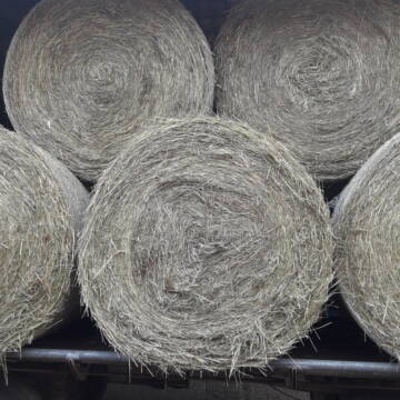
Luzerneheu 1.Schnitt
Teutschenthal
Nancy
@Haltergemeinschaft-TT
Heu
Empfänger lädt ab
Rundballen
Regenfrei
2 weitere...
B+


Futtermittel & Einstreu mit Lieferung!
Schwaara
MK-Agrarprodukte
@MK-Agrarprodukte
Heu
Empfänger lädt ab
Großballen
Regenfrei
2 weitere...
P+

Heu und Stroh /Rundballen/Quaderballen
Sandersdorf
jule13
@Jule2024
Stroh
Lieferant entlädt
Rundballen
Regenfrei
3 weitere...
B+
Leider kein Vorschaubild
Leider kein Vorschaubild
BIO-Heu, 1. Schnitt 2025, Quaderballen (60x40x30)
Tirpersdorf
Forstbaumschule
@Forstbaumschule
Heu
Kleinballen/HD-Ballen
Bio
Regenfrei
Wird verladen
1 weitere...
B+

Pferdepension Hit Aktivstall Kürmerhof
Hohenkammer
Kuermerhof
@Kuermerhof
*******JETZT NEU MIT ENTSTAUBTEM BIOHEU*********
*******Demnächst mit einem Abenteuerspielplatz für Pferde ( Extrem Trail/Pa
Leider kein Vorschaubild
Leider kein Vorschaubild
BIO-Heu, 1. Schnitt 2024, Quaderballen (60x40x30)
Tirpersdorf
Forstbaumschule
@Forstbaumschule
Heu
Kleinballen/HD-Ballen
Bio
Regenfrei
Käufer lädt selbst
1 weitere...
aktuell
B+
Leider kein Vorschaubild
Leider kein Vorschaubild
Bio-Heu, 1. Schnitt aus 2024 (BIOLAND) zu verkauf.
Tirpersdorf
Forstbaumschule
@Forstbaumschule
Heu
Empfänger lädt ab
Großballen
Bio
Regenfrei
2 weitere...
B+

Rundballen Stroh
Elze-Esbeck
Hof Bartels
@Bartels
Stroh
Lieferant entlädt
Rundballen
Regenfrei
3 weitere...
B+
Heu Rundballen zu verkaufen
Peine
Hof-Hoppenworth
@Hof-Hoppenworth
Heu
Empfänger lädt ab
Rundballen
Regenfrei
3 weitere...
B+
Deprecated: Creation of dynamic property Zend_View::$pageCount is deprecated in /var/www/stall-frei/htdocs/staging.stall-frei.de/library/vendor/shardj/zf1-future/library/Zend/View/Abstract.php on line 308
Deprecated: Creation of dynamic property Zend_View::$itemCountPerPage is deprecated in /var/www/stall-frei/htdocs/staging.stall-frei.de/library/vendor/shardj/zf1-future/library/Zend/View/Abstract.php on line 308
Deprecated: Creation of dynamic property Zend_View::$first is deprecated in /var/www/stall-frei/htdocs/staging.stall-frei.de/library/vendor/shardj/zf1-future/library/Zend/View/Abstract.php on line 308
Deprecated: Creation of dynamic property Zend_View::$current is deprecated in /var/www/stall-frei/htdocs/staging.stall-frei.de/library/vendor/shardj/zf1-future/library/Zend/View/Abstract.php on line 308
Deprecated: Creation of dynamic property Zend_View::$last is deprecated in /var/www/stall-frei/htdocs/staging.stall-frei.de/library/vendor/shardj/zf1-future/library/Zend/View/Abstract.php on line 308
Deprecated: Creation of dynamic property Zend_View::$next is deprecated in /var/www/stall-frei/htdocs/staging.stall-frei.de/library/vendor/shardj/zf1-future/library/Zend/View/Abstract.php on line 308
Deprecated: Creation of dynamic property Zend_View::$pagesInRange is deprecated in /var/www/stall-frei/htdocs/staging.stall-frei.de/library/vendor/shardj/zf1-future/library/Zend/View/Abstract.php on line 308
Deprecated: Creation of dynamic property Zend_View::$firstPageInRange is deprecated in /var/www/stall-frei/htdocs/staging.stall-frei.de/library/vendor/shardj/zf1-future/library/Zend/View/Abstract.php on line 308
Deprecated: Creation of dynamic property Zend_View::$lastPageInRange is deprecated in /var/www/stall-frei/htdocs/staging.stall-frei.de/library/vendor/shardj/zf1-future/library/Zend/View/Abstract.php on line 308
Deprecated: Creation of dynamic property Zend_View::$currentItemCount is deprecated in /var/www/stall-frei/htdocs/staging.stall-frei.de/library/vendor/shardj/zf1-future/library/Zend/View/Abstract.php on line 308
Deprecated: Creation of dynamic property Zend_View::$totalItemCount is deprecated in /var/www/stall-frei/htdocs/staging.stall-frei.de/library/vendor/shardj/zf1-future/library/Zend/View/Abstract.php on line 308
Deprecated: Creation of dynamic property Zend_View::$firstItemNumber is deprecated in /var/www/stall-frei/htdocs/staging.stall-frei.de/library/vendor/shardj/zf1-future/library/Zend/View/Abstract.php on line 308
Deprecated: Creation of dynamic property Zend_View::$lastItemNumber is deprecated in /var/www/stall-frei/htdocs/staging.stall-frei.de/library/vendor/shardj/zf1-future/library/Zend/View/Abstract.php on line 308
Deprecated: Creation of dynamic property Zend_View::$router is deprecated in /var/www/stall-frei/htdocs/staging.stall-frei.de/library/vendor/shardj/zf1-future/library/Zend/View/Abstract.php on line 308
Deprecated: Creation of dynamic property Zend_View::$urlParams is deprecated in /var/www/stall-frei/htdocs/staging.stall-frei.de/library/vendor/shardj/zf1-future/library/Zend/View/Abstract.php on line 308
Deprecated: Creation of dynamic property Zend_View::$showAds is deprecated in /var/www/stall-frei/htdocs/staging.stall-frei.de/library/vendor/shardj/zf1-future/library/Zend/View/Abstract.php on line 308
Deprecated: Creation of dynamic property Zend_View::$objectIds is deprecated in /var/www/stall-frei/htdocs/staging.stall-frei.de/library/vendor/shardj/zf1-future/library/Zend/View/Abstract.php on line 308
Deprecated: Creation of dynamic property Zend_View::$showNavbar is deprecated in /var/www/stall-frei/htdocs/staging.stall-frei.de/library/vendor/shardj/zf1-future/library/Zend/View/Abstract.php on line 308
Deprecated: Creation of dynamic property Zend_View::$showBreadcrumb is deprecated in /var/www/stall-frei/htdocs/staging.stall-frei.de/library/vendor/shardj/zf1-future/library/Zend/View/Abstract.php on line 308
Deprecated: Creation of dynamic property Zend_View::$showFooter is deprecated in /var/www/stall-frei/htdocs/staging.stall-frei.de/library/vendor/shardj/zf1-future/library/Zend/View/Abstract.php on line 308
Deprecated: Creation of dynamic property Zend_View::$showInternalAds is deprecated in /var/www/stall-frei/htdocs/staging.stall-frei.de/library/vendor/shardj/zf1-future/library/Zend/View/Abstract.php on line 308
Deprecated: Creation of dynamic property Zend_View::$blNoContent is deprecated in /var/www/stall-frei/htdocs/staging.stall-frei.de/library/vendor/shardj/zf1-future/library/Zend/View/Abstract.php on line 308
Deprecated: Creation of dynamic property Zend_View::$sMetaDesc is deprecated in /var/www/stall-frei/htdocs/staging.stall-frei.de/library/vendor/shardj/zf1-future/library/Zend/View/Abstract.php on line 308
Deprecated: Creation of dynamic property Zend_View::$useGmaps is deprecated in /var/www/stall-frei/htdocs/staging.stall-frei.de/library/vendor/shardj/zf1-future/library/Zend/View/Abstract.php on line 308
Deprecated: Creation of dynamic property Zend_View::$touches is deprecated in /var/www/stall-frei/htdocs/staging.stall-frei.de/library/vendor/shardj/zf1-future/library/Zend/View/Abstract.php on line 308
Deprecated: Creation of dynamic property Zend_View::$oProject is deprecated in /var/www/stall-frei/htdocs/staging.stall-frei.de/library/vendor/shardj/zf1-future/library/Zend/View/Abstract.php on line 308
Deprecated: Creation of dynamic property Zend_View::$pageHeadline is deprecated in /var/www/stall-frei/htdocs/staging.stall-frei.de/library/vendor/shardj/zf1-future/library/Zend/View/Abstract.php on line 308
Deprecated: Creation of dynamic property Zend_View::$disableLocationField is deprecated in /var/www/stall-frei/htdocs/staging.stall-frei.de/library/vendor/shardj/zf1-future/library/Zend/View/Abstract.php on line 308
Deprecated: Creation of dynamic property Zend_View::$isSearch is deprecated in /var/www/stall-frei/htdocs/staging.stall-frei.de/library/vendor/shardj/zf1-future/library/Zend/View/Abstract.php on line 308
Deprecated: Creation of dynamic property Zend_View::$pageTitle is deprecated in /var/www/stall-frei/htdocs/staging.stall-frei.de/library/vendor/shardj/zf1-future/library/Zend/View/Abstract.php on line 308
Deprecated: Creation of dynamic property Psf_Form_Element_Text::$class is deprecated in /var/www/stall-frei/htdocs/staging.stall-frei.de/library/vendor/shardj/zf1-future/library/Zend/Form/Element.php on line 874
Deprecated: Creation of dynamic property Psf_Form_Element_Text::$size is deprecated in /var/www/stall-frei/htdocs/staging.stall-frei.de/library/vendor/shardj/zf1-future/library/Zend/Form/Element.php on line 874
Deprecated: Creation of dynamic property Psf_Form_Element_Text::$placeholder is deprecated in /var/www/stall-frei/htdocs/staging.stall-frei.de/library/vendor/shardj/zf1-future/library/Zend/Form/Element.php on line 874
Deprecated: Creation of dynamic property Psf_Form_Element_Hidden::$class is deprecated in /var/www/stall-frei/htdocs/staging.stall-frei.de/library/vendor/shardj/zf1-future/library/Zend/Form/Element.php on line 874
Deprecated: Creation of dynamic property Psf_Form_Element_Hidden::$class is deprecated in /var/www/stall-frei/htdocs/staging.stall-frei.de/library/vendor/shardj/zf1-future/library/Zend/Form/Element.php on line 874
Deprecated: Creation of dynamic property Psf_Form_Element_Hidden::$class is deprecated in /var/www/stall-frei/htdocs/staging.stall-frei.de/library/vendor/shardj/zf1-future/library/Zend/Form/Element.php on line 874
Deprecated: Creation of dynamic property Psf_Form_Element_Hidden::$class is deprecated in /var/www/stall-frei/htdocs/staging.stall-frei.de/library/vendor/shardj/zf1-future/library/Zend/Form/Element.php on line 874
Deprecated: Creation of dynamic property Psf_Form_Element_Select::$class is deprecated in /var/www/stall-frei/htdocs/staging.stall-frei.de/library/vendor/shardj/zf1-future/library/Zend/Form/Element.php on line 874
Deprecated: Creation of dynamic property Psf_Form_Element_Select::$class is deprecated in /var/www/stall-frei/htdocs/staging.stall-frei.de/library/vendor/shardj/zf1-future/library/Zend/Form/Element.php on line 874
Deprecated: Creation of dynamic property Psf_Form_Element_Select::$class is deprecated in /var/www/stall-frei/htdocs/staging.stall-frei.de/library/vendor/shardj/zf1-future/library/Zend/Form/Element.php on line 874
Deprecated: Creation of dynamic property Psf_Form_Element_Select::$class is deprecated in /var/www/stall-frei/htdocs/staging.stall-frei.de/library/vendor/shardj/zf1-future/library/Zend/Form/Element.php on line 874
Deprecated: Creation of dynamic property Zend_View::$sort is deprecated in /var/www/stall-frei/htdocs/staging.stall-frei.de/library/vendor/shardj/zf1-future/library/Zend/View/Abstract.php on line 308
Deprecated: Creation of dynamic property Zend_View::$searchLocation is deprecated in /var/www/stall-frei/htdocs/staging.stall-frei.de/library/vendor/shardj/zf1-future/library/Zend/View/Abstract.php on line 308
Deprecated: Creation of dynamic property Zend_View::$locationHint is deprecated in /var/www/stall-frei/htdocs/staging.stall-frei.de/library/vendor/shardj/zf1-future/library/Zend/View/Abstract.php on line 308
Psf_GeoCoder_Abstract::getLocation: Bad Tennstedt Get Location CachedOrLive
Psf_GeoCoder_Abstract::getCachedOrLive: Bad Tennstedt
Psf_GeoCoder_OpenCageData::makeApiRequest: response:
Array
(
[documentation] => https://opencagedata.com/api
[licenses] => Array
(
[0] => Array
(
[name] => see attribution guide
[url] => https://opencagedata.com/credits
)
)
[results] => Array
(
[0] => Array
(
[bounds] => Array
(
[northeast] => Array
(
[lat] => 51.1826225
[lng] => 10.8838598
)
[southwest] => Array
(
[lat] => 51.1288585
[lng] => 10.7778182
)
)
[components] => Array
(
[ISO_3166-1_alpha-2] => DE
[ISO_3166-1_alpha-3] => DEU
[ISO_3166-2] => Array
(
[0] => DE-TH
)
[_category] => place
[_normalized_city] => Bad Tennstedt
[_type] => city
[continent] => Europe
[country] => Deutschland
[country_code] => de
[county] => Unstrut-Hainich-Kreis
[municipality] => Bad Tennstedt
[political_union] => European Union
[postcode] => 99955
[state] => Thüringen
[state_code] => TH
[town] => Bad Tennstedt
)
[confidence] => 7
[formatted] => 99955 Bad Tennstedt, Deutschland
[geometry] => Array
(
[lat] => 51.1540155
[lng] => 10.8369361
)
)
[1] => Array
(
[bounds] => Array
(
[northeast] => Array
(
[lat] => 51.2224371
[lng] => 10.9227206
)
[southwest] => Array
(
[lat] => 51.1288585
[lng] => 10.6769493
)
)
[components] => Array
(
[ISO_3166-1_alpha-2] => DE
[ISO_3166-1_alpha-3] => DEU
[ISO_3166-2] => Array
(
[0] => DE-TH
)
[_category] => place
[_normalized_city] => Bad Tennstedt
[_type] => municipality
[continent] => Europe
[country] => Deutschland
[country_code] => de
[county] => Unstrut-Hainich-Kreis
[municipality] => Bad Tennstedt
[political_union] => European Union
[postcode] => 99955
[state] => Thüringen
[state_code] => TH
)
[confidence] => 6
[formatted] => 99955 Bad Tennstedt, Deutschland
[geometry] => Array
(
[lat] => 51.175208
[lng] => 10.7944668
)
)
[2] => Array
(
[components] => Array
(
[ISO_3166-1_alpha-2] => FR
[ISO_3166-1_alpha-3] => FRA
[ISO_3166-2] => Array
(
[0] => FR-BRE
[1] => FR-35
)
[_category] => road
[_normalized_city] => Maxent
[_type] => road
[city] => Maxent
[continent] => Europe
[country] => France
[country_code] => fr
[county] => Ille-et-Vilaine
[local_authority] => Communauté de communes de Brocéliande
[political_union] => European Union
[postcode] => 35380
[road] => Bas Pennee
[state] => Bretagne
[state_code] => BRE
)
[confidence] => 10
[formatted] => Bas Pennee, 35380 Maxent, France
[geometry] => Array
(
[lat] => 47.96042
[lng] => -2.064727
)
)
[3] => Array
(
[components] => Array
(
[ISO_3166-1_alpha-2] => FR
[ISO_3166-1_alpha-3] => FRA
[ISO_3166-2] => Array
(
[0] => FR-CVL
[1] => FR-37
)
[_category] => road
[_normalized_city] => Esvres
[_type] => road
[city] => Esvres
[continent] => Europe
[country] => France
[country_code] => fr
[county] => Indre-et-Loire
[local_authority] => Communauté de communes Touraine Vallée de l'Indre
[political_union] => European Union
[postcode] => 37320
[road] => Bas Vonte
[state] => Centre-Val de Loire
[state_code] => CVL
)
[confidence] => 10
[formatted] => Bas Vonte, 37320 Esvres, France
[geometry] => Array
(
[lat] => 47.27544
[lng] => 0.809764
)
)
[4] => Array
(
[components] => Array
(
[ISO_3166-1_alpha-2] => FR
[ISO_3166-1_alpha-3] => FRA
[ISO_3166-2] => Array
(
[0] => FR-PDL
[1] => FR-44
)
[_category] => road
[_normalized_city] => Guenrouet
[_type] => road
[city] => Guenrouet
[continent] => Europe
[country] => France
[country_code] => fr
[county] => Loire-Atlantique
[local_authority] => Communauté de communes du Pays de Pont-Château - Saint-Gildas-des-Bois
[political_union] => European Union
[postcode] => 44530
[road] => Bas Epaud
[state] => Pays de la Loire
[state_code] => PDL
)
[confidence] => 10
[formatted] => Bas Epaud, 44530 Guenrouet, France
[geometry] => Array
(
[lat] => 47.486247
[lng] => -1.920472
)
)
[5] => Array
(
[components] => Array
(
[ISO_3166-1_alpha-2] => FR
[ISO_3166-1_alpha-3] => FRA
[ISO_3166-2] => Array
(
[0] => FR-PDL
[1] => FR-49
)
[_category] => road
[_normalized_city] => Erdre-en-Anjou
[_type] => road
[city] => Erdre-en-Anjou
[continent] => Europe
[country] => France
[country_code] => fr
[county] => Maine-et-Loire
[local_authority] => Communauté de communes des Vallées du Haut-Anjou
[political_union] => European Union
[postcode] => 49370
[road] => Bas Talour
[state] => Pays de la Loire
[state_code] => PDL
)
[confidence] => 10
[formatted] => Bas Talour, 49370 Erdre-en-Anjou, France
[geometry] => Array
(
[lat] => 47.551282
[lng] => -0.820789
)
)
[6] => Array
(
[components] => Array
(
[ISO_3166-1_alpha-2] => FR
[ISO_3166-1_alpha-3] => FRA
[ISO_3166-2] => Array
(
[0] => FR-CVL
[1] => FR-37
)
[_category] => road
[_normalized_city] => Esvres
[_type] => road
[city] => Esvres
[continent] => Europe
[country] => France
[country_code] => fr
[county] => Indre-et-Loire
[local_authority] => Communauté de communes Touraine Vallée de l'Indre
[political_union] => European Union
[postcode] => 37320
[road] => Bas Veneuil
[state] => Centre-Val de Loire
[state_code] => CVL
)
[confidence] => 10
[formatted] => Bas Veneuil, 37320 Esvres, France
[geometry] => Array
(
[lat] => 47.273538
[lng] => 0.813846
)
)
[7] => Array
(
[components] => Array
(
[ISO_3166-1_alpha-2] => FR
[ISO_3166-1_alpha-3] => FRA
[ISO_3166-2] => Array
(
[0] => FR-NAQ
[1] => FR-47
)
[_category] => road
[_normalized_city] => Marmande
[_type] => road
[city] => Marmande
[continent] => Europe
[country] => France
[country_code] => fr
[county] => Lot-et-Garonne
[local_authority] => Val de Garonne Agglomération
[political_union] => European Union
[postcode] => 47200
[road] => Denoye Bas
[state] => Nouvelle-Aquitaine
[state_code] => NAQ
)
[confidence] => 10
[formatted] => Denoye Bas, 47200 Marmande, France
[geometry] => Array
(
[lat] => 44.517146
[lng] => 0.201429
)
)
[8] => Array
(
[components] => Array
(
[ISO_3166-1_alpha-2] => FR
[ISO_3166-1_alpha-3] => FRA
[ISO_3166-2] => Array
(
[0] => FR-PAC
[1] => FR-13
)
[_category] => road
[_normalized_city] => Mimet
[_type] => road
[city] => Mimet
[continent] => Europe
[country] => France
[country_code] => fr
[county] => Bouches-du-Rhône
[local_authority] => Aix-Marseille-Provence
[political_union] => European Union
[postcode] => 13105
[road] => Château Bas
[state] => Provence-Alpes-Côte d'Azur
[state_code] => PAC
)
[confidence] => 10
[formatted] => Château Bas, 13105 Mimet, France
[geometry] => Array
(
[lat] => 43.427477
[lng] => 5.481442
)
)
[9] => Array
(
[components] => Array
(
[ISO_3166-1_alpha-2] => MQ
[ISO_3166-1_alpha-3] => MTQ
[ISO_3166-2] => Array
(
[0] => FR-972
)
[_category] => place
[_normalized_city] => Rivière-Salée
[_type] => place
[city] => Rivière-Salée
[continent] => North America
[country] => France
[country_code] => fr
[county] => Martinique
[local_authority] => Communauté d'agglomération de l'Espace Sud de la Martinique
[place] => Bât Topaze
[political_union] => European Union
[postcode] => 97215
[state] =>
)
[confidence] => 10
[formatted] => Bât Topaze, 97215 Rivière-Salée, France
[geometry] => Array
(
[lat] => 14.524073
[lng] => -60.972582
)
)
)
[status] => Array
(
[code] => 200
[message] => OK
)
[stay_informed] => Array
(
[blog] => https://blog.opencagedata.com
[mastodon] => https://en.osm.town/@opencage
)
[thanks] => For using an OpenCage API
[timestamp] => Array
(
[created_http] => Sun, 08 Feb 2026 21:11:45 GMT
[created_unix] => 1770585105
)
[total_results] => 10
)
Psf_GeoCoder_Abstract::convertLocationResult
{"documentation":"https:\/\/opencagedata.com\/api","licenses":[{"name":"see attribution guide","url":"https:\/\/opencagedata.com\/credits"}],"results":[{"bounds":{"northeast":{"lat":51.1826225,"lng":10.8838598},"southwest":{"lat":51.1288585,"lng":10.7778182}},"components":{"ISO_3166-1_alpha-2":"DE","ISO_3166-1_alpha-3":"DEU","ISO_3166-2":["DE-TH"],"_category":"place","_normalized_city":"Bad Tennstedt","_type":"city","continent":"Europe","country":"Deutschland","country_code":"de","county":"Unstrut-Hainich-Kreis","municipality":"Bad Tennstedt","political_union":"European Union","postcode":"99955","state":"Th\u00fcringen","state_code":"TH","town":"Bad Tennstedt"},"confidence":7,"formatted":"99955 Bad Tennstedt, Deutschland","geometry":{"lat":51.1540155,"lng":10.8369361}},{"bounds":{"northeast":{"lat":51.2224371,"lng":10.9227206},"southwest":{"lat":51.1288585,"lng":10.6769493}},"components":{"ISO_3166-1_alpha-2":"DE","ISO_3166-1_alpha-3":"DEU","ISO_3166-2":["DE-TH"],"_category":"place","_normalized_city":"Bad Tennstedt","_type":"municipality","continent":"Europe","country":"Deutschland","country_code":"de","county":"Unstrut-Hainich-Kreis","municipality":"Bad Tennstedt","political_union":"European Union","postcode":"99955","state":"Th\u00fcringen","state_code":"TH"},"confidence":6,"formatted":"99955 Bad Tennstedt, Deutschland","geometry":{"lat":51.175208,"lng":10.7944668}},{"components":{"ISO_3166-1_alpha-2":"FR","ISO_3166-1_alpha-3":"FRA","ISO_3166-2":["FR-BRE","FR-35"],"_category":"road","_normalized_city":"Maxent","_type":"road","city":"Maxent","continent":"Europe","country":"France","country_code":"fr","county":"Ille-et-Vilaine","local_authority":"Communaut\u00e9 de communes de Broc\u00e9liande","political_union":"European Union","postcode":"35380","road":"Bas Pennee","state":"Bretagne","state_code":"BRE"},"confidence":10,"formatted":"Bas Pennee, 35380 Maxent, France","geometry":{"lat":47.96042,"lng":-2.064727}},{"components":{"ISO_3166-1_alpha-2":"FR","ISO_3166-1_alpha-3":"FRA","ISO_3166-2":["FR-CVL","FR-37"],"_category":"road","_normalized_city":"Esvres","_type":"road","city":"Esvres","continent":"Europe","country":"France","country_code":"fr","county":"Indre-et-Loire","local_authority":"Communaut\u00e9 de communes Touraine Vall\u00e9e de l'Indre","political_union":"European Union","postcode":"37320","road":"Bas Vonte","state":"Centre-Val de Loire","state_code":"CVL"},"confidence":10,"formatted":"Bas Vonte, 37320 Esvres, France","geometry":{"lat":47.27544,"lng":0.809764}},{"components":{"ISO_3166-1_alpha-2":"FR","ISO_3166-1_alpha-3":"FRA","ISO_3166-2":["FR-PDL","FR-44"],"_category":"road","_normalized_city":"Guenrouet","_type":"road","city":"Guenrouet","continent":"Europe","country":"France","country_code":"fr","county":"Loire-Atlantique","local_authority":"Communaut\u00e9 de communes du Pays de Pont-Ch\u00e2teau - Saint-Gildas-des-Bois","political_union":"European Union","postcode":"44530","road":"Bas Epaud","state":"Pays de la Loire","state_code":"PDL"},"confidence":10,"formatted":"Bas Epaud, 44530 Guenrouet, France","geometry":{"lat":47.486247,"lng":-1.920472}},{"components":{"ISO_3166-1_alpha-2":"FR","ISO_3166-1_alpha-3":"FRA","ISO_3166-2":["FR-PDL","FR-49"],"_category":"road","_normalized_city":"Erdre-en-Anjou","_type":"road","city":"Erdre-en-Anjou","continent":"Europe","country":"France","country_code":"fr","county":"Maine-et-Loire","local_authority":"Communaut\u00e9 de communes des Vall\u00e9es du Haut-Anjou","political_union":"European Union","postcode":"49370","road":"Bas Talour","state":"Pays de la Loire","state_code":"PDL"},"confidence":10,"formatted":"Bas Talour, 49370 Erdre-en-Anjou, France","geometry":{"lat":47.551282,"lng":-0.820789}},{"components":{"ISO_3166-1_alpha-2":"FR","ISO_3166-1_alpha-3":"FRA","ISO_3166-2":["FR-CVL","FR-37"],"_category":"road","_normalized_city":"Esvres","_type":"road","city":"Esvres","continent":"Europe","country":"France","country_code":"fr","county":"Indre-et-Loire","local_authority":"Communaut\u00e9 de communes Touraine Vall\u00e9e de l'Indre","political_union":"European Union","postcode":"37320","road":"Bas Veneuil","state":"Centre-Val de Loire","state_code":"CVL"},"confidence":10,"formatted":"Bas Veneuil, 37320 Esvres, France","geometry":{"lat":47.273538,"lng":0.813846}},{"components":{"ISO_3166-1_alpha-2":"FR","ISO_3166-1_alpha-3":"FRA","ISO_3166-2":["FR-NAQ","FR-47"],"_category":"road","_normalized_city":"Marmande","_type":"road","city":"Marmande","continent":"Europe","country":"France","country_code":"fr","county":"Lot-et-Garonne","local_authority":"Val de Garonne Agglom\u00e9ration","political_union":"European Union","postcode":"47200","road":"Denoye Bas","state":"Nouvelle-Aquitaine","state_code":"NAQ"},"confidence":10,"formatted":"Denoye Bas, 47200 Marmande, France","geometry":{"lat":44.517146,"lng":0.201429}},{"components":{"ISO_3166-1_alpha-2":"FR","ISO_3166-1_alpha-3":"FRA","ISO_3166-2":["FR-PAC","FR-13"],"_category":"road","_normalized_city":"Mimet","_type":"road","city":"Mimet","continent":"Europe","country":"France","country_code":"fr","county":"Bouches-du-Rh\u00f4ne","local_authority":"Aix-Marseille-Provence","political_union":"European Union","postcode":"13105","road":"Ch\u00e2teau Bas","state":"Provence-Alpes-C\u00f4te d'Azur","state_code":"PAC"},"confidence":10,"formatted":"Ch\u00e2teau Bas, 13105 Mimet, France","geometry":{"lat":43.427477,"lng":5.481442}},{"components":{"ISO_3166-1_alpha-2":"MQ","ISO_3166-1_alpha-3":"MTQ","ISO_3166-2":["FR-972"],"_category":"place","_normalized_city":"Rivi\u00e8re-Sal\u00e9e","_type":"place","city":"Rivi\u00e8re-Sal\u00e9e","continent":"North America","country":"France","country_code":"fr","county":"Martinique","local_authority":"Communaut\u00e9 d'agglom\u00e9ration de l'Espace Sud de la Martinique","place":"B\u00e2t Topaze","political_union":"European Union","postcode":"97215","state":null},"confidence":10,"formatted":"B\u00e2t Topaze, 97215 Rivi\u00e8re-Sal\u00e9e, France","geometry":{"lat":14.524073,"lng":-60.972582}}],"status":{"code":200,"message":"OK"},"stay_informed":{"blog":"https:\/\/blog.opencagedata.com","mastodon":"https:\/\/en.osm.town\/@opencage"},"thanks":"For using an OpenCage API","timestamp":{"created_http":"Sun, 08 Feb 2026 21:11:45 GMT","created_unix":1770585105},"total_results":10}Array
(
[0] => stdClass Object
(
[bounds] => stdClass Object
(
[northeast] => stdClass Object
(
[lat] => 51.1826225
[lng] => 10.8838598
)
[southwest] => stdClass Object
(
[lat] => 51.1288585
[lng] => 10.7778182
)
)
[components] => stdClass Object
(
[ISO_3166-1_alpha-2] => DE
[ISO_3166-1_alpha-3] => DEU
[ISO_3166-2] => Array
(
[0] => DE-TH
)
[_category] => place
[_normalized_city] => Bad Tennstedt
[_type] => city
[continent] => Europe
[country] => Deutschland
[country_code] => de
[county] => Unstrut-Hainich-Kreis
[municipality] => Bad Tennstedt
[political_union] => European Union
[postcode] => 99955
[state] => Thüringen
[state_code] => TH
[town] => Bad Tennstedt
)
[confidence] => 7
[formatted] => 99955 Bad Tennstedt, Deutschland
[geometry] => stdClass Object
(
[lat] => 51.1540155
[lng] => 10.8369361
)
)
[1] => stdClass Object
(
[bounds] => stdClass Object
(
[northeast] => stdClass Object
(
[lat] => 51.2224371
[lng] => 10.9227206
)
[southwest] => stdClass Object
(
[lat] => 51.1288585
[lng] => 10.6769493
)
)
[components] => stdClass Object
(
[ISO_3166-1_alpha-2] => DE
[ISO_3166-1_alpha-3] => DEU
[ISO_3166-2] => Array
(
[0] => DE-TH
)
[_category] => place
[_normalized_city] => Bad Tennstedt
[_type] => municipality
[continent] => Europe
[country] => Deutschland
[country_code] => de
[county] => Unstrut-Hainich-Kreis
[municipality] => Bad Tennstedt
[political_union] => European Union
[postcode] => 99955
[state] => Thüringen
[state_code] => TH
)
[confidence] => 6
[formatted] => 99955 Bad Tennstedt, Deutschland
[geometry] => stdClass Object
(
[lat] => 51.175208
[lng] => 10.7944668
)
)
[2] => stdClass Object
(
[components] => stdClass Object
(
[ISO_3166-1_alpha-2] => FR
[ISO_3166-1_alpha-3] => FRA
[ISO_3166-2] => Array
(
[0] => FR-BRE
[1] => FR-35
)
[_category] => road
[_normalized_city] => Maxent
[_type] => road
[city] => Maxent
[continent] => Europe
[country] => France
[country_code] => fr
[county] => Ille-et-Vilaine
[local_authority] => Communauté de communes de Brocéliande
[political_union] => European Union
[postcode] => 35380
[road] => Bas Pennee
[state] => Bretagne
[state_code] => BRE
)
[confidence] => 10
[formatted] => Bas Pennee, 35380 Maxent, France
[geometry] => stdClass Object
(
[lat] => 47.96042
[lng] => -2.064727
)
)
[3] => stdClass Object
(
[components] => stdClass Object
(
[ISO_3166-1_alpha-2] => FR
[ISO_3166-1_alpha-3] => FRA
[ISO_3166-2] => Array
(
[0] => FR-CVL
[1] => FR-37
)
[_category] => road
[_normalized_city] => Esvres
[_type] => road
[city] => Esvres
[continent] => Europe
[country] => France
[country_code] => fr
[county] => Indre-et-Loire
[local_authority] => Communauté de communes Touraine Vallée de l'Indre
[political_union] => European Union
[postcode] => 37320
[road] => Bas Vonte
[state] => Centre-Val de Loire
[state_code] => CVL
)
[confidence] => 10
[formatted] => Bas Vonte, 37320 Esvres, France
[geometry] => stdClass Object
(
[lat] => 47.27544
[lng] => 0.809764
)
)
[4] => stdClass Object
(
[components] => stdClass Object
(
[ISO_3166-1_alpha-2] => FR
[ISO_3166-1_alpha-3] => FRA
[ISO_3166-2] => Array
(
[0] => FR-PDL
[1] => FR-44
)
[_category] => road
[_normalized_city] => Guenrouet
[_type] => road
[city] => Guenrouet
[continent] => Europe
[country] => France
[country_code] => fr
[county] => Loire-Atlantique
[local_authority] => Communauté de communes du Pays de Pont-Château - Saint-Gildas-des-Bois
[political_union] => European Union
[postcode] => 44530
[road] => Bas Epaud
[state] => Pays de la Loire
[state_code] => PDL
)
[confidence] => 10
[formatted] => Bas Epaud, 44530 Guenrouet, France
[geometry] => stdClass Object
(
[lat] => 47.486247
[lng] => -1.920472
)
)
[5] => stdClass Object
(
[components] => stdClass Object
(
[ISO_3166-1_alpha-2] => FR
[ISO_3166-1_alpha-3] => FRA
[ISO_3166-2] => Array
(
[0] => FR-PDL
[1] => FR-49
)
[_category] => road
[_normalized_city] => Erdre-en-Anjou
[_type] => road
[city] => Erdre-en-Anjou
[continent] => Europe
[country] => France
[country_code] => fr
[county] => Maine-et-Loire
[local_authority] => Communauté de communes des Vallées du Haut-Anjou
[political_union] => European Union
[postcode] => 49370
[road] => Bas Talour
[state] => Pays de la Loire
[state_code] => PDL
)
[confidence] => 10
[formatted] => Bas Talour, 49370 Erdre-en-Anjou, France
[geometry] => stdClass Object
(
[lat] => 47.551282
[lng] => -0.820789
)
)
[6] => stdClass Object
(
[components] => stdClass Object
(
[ISO_3166-1_alpha-2] => FR
[ISO_3166-1_alpha-3] => FRA
[ISO_3166-2] => Array
(
[0] => FR-CVL
[1] => FR-37
)
[_category] => road
[_normalized_city] => Esvres
[_type] => road
[city] => Esvres
[continent] => Europe
[country] => France
[country_code] => fr
[county] => Indre-et-Loire
[local_authority] => Communauté de communes Touraine Vallée de l'Indre
[political_union] => European Union
[postcode] => 37320
[road] => Bas Veneuil
[state] => Centre-Val de Loire
[state_code] => CVL
)
[confidence] => 10
[formatted] => Bas Veneuil, 37320 Esvres, France
[geometry] => stdClass Object
(
[lat] => 47.273538
[lng] => 0.813846
)
)
[7] => stdClass Object
(
[components] => stdClass Object
(
[ISO_3166-1_alpha-2] => FR
[ISO_3166-1_alpha-3] => FRA
[ISO_3166-2] => Array
(
[0] => FR-NAQ
[1] => FR-47
)
[_category] => road
[_normalized_city] => Marmande
[_type] => road
[city] => Marmande
[continent] => Europe
[country] => France
[country_code] => fr
[county] => Lot-et-Garonne
[local_authority] => Val de Garonne Agglomération
[political_union] => European Union
[postcode] => 47200
[road] => Denoye Bas
[state] => Nouvelle-Aquitaine
[state_code] => NAQ
)
[confidence] => 10
[formatted] => Denoye Bas, 47200 Marmande, France
[geometry] => stdClass Object
(
[lat] => 44.517146
[lng] => 0.201429
)
)
[8] => stdClass Object
(
[components] => stdClass Object
(
[ISO_3166-1_alpha-2] => FR
[ISO_3166-1_alpha-3] => FRA
[ISO_3166-2] => Array
(
[0] => FR-PAC
[1] => FR-13
)
[_category] => road
[_normalized_city] => Mimet
[_type] => road
[city] => Mimet
[continent] => Europe
[country] => France
[country_code] => fr
[county] => Bouches-du-Rhône
[local_authority] => Aix-Marseille-Provence
[political_union] => European Union
[postcode] => 13105
[road] => Château Bas
[state] => Provence-Alpes-Côte d'Azur
[state_code] => PAC
)
[confidence] => 10
[formatted] => Château Bas, 13105 Mimet, France
[geometry] => stdClass Object
(
[lat] => 43.427477
[lng] => 5.481442
)
)
[9] => stdClass Object
(
[components] => stdClass Object
(
[ISO_3166-1_alpha-2] => MQ
[ISO_3166-1_alpha-3] => MTQ
[ISO_3166-2] => Array
(
[0] => FR-972
)
[_category] => place
[_normalized_city] => Rivière-Salée
[_type] => place
[city] => Rivière-Salée
[continent] => North America
[country] => France
[country_code] => fr
[county] => Martinique
[local_authority] => Communauté d'agglomération de l'Espace Sud de la Martinique
[place] => Bât Topaze
[political_union] => European Union
[postcode] => 97215
[state] =>
)
[confidence] => 10
[formatted] => Bât Topaze, 97215 Rivière-Salée, France
[geometry] => stdClass Object
(
[lat] => 14.524073
[lng] => -60.972582
)
)
)
Psf_GeoCoder_OpenCageData::getKeyMap: 0
stdClass Object
(
    [bounds] => stdClass Object
        (
            [northeast] => stdClass Object
                (
                    [lat] => 51.1826225
                    [lng] => 10.8838598
                )

            [southwest] => stdClass Object
                (
                    [lat] => 51.1288585
                    [lng] => 10.7778182
                )

        )

    [components] => stdClass Object
        (
            [ISO_3166-1_alpha-2] => DE
            [ISO_3166-1_alpha-3] => DEU
            [ISO_3166-2] => Array
                (
                    [0] => DE-TH
                )

            [_category] => place
            [_normalized_city] => Bad Tennstedt
            [_type] => city
            [continent] => Europe
            [country] => Deutschland
            [country_code] => de
            [county] => Unstrut-Hainich-Kreis
            [municipality] => Bad Tennstedt
            [political_union] => European Union
            [postcode] => 99955
            [state] => Thüringen
            [state_code] => TH
            [town] => Bad Tennstedt
        )

    [confidence] => 7
    [formatted] => 99955 Bad Tennstedt, Deutschland
    [geometry] => stdClass Object
        (
            [lat] => 51.1540155
            [lng] => 10.8369361
        )

)
Psf_GeoCoder_OpenCageData::getCounty: Unstrut-Hainich-Kreis
Psf_GeoCoder_OpenCageData::addMissingData REFETCH!
Array
(
    [address] => 99955 Bad Tennstedt, Deutschland
    [type] => city
    [street] =>
    [city] => Bad Tennstedt
    [county] => Unstrut-Hainich-Kreis
    [state] => Thüringen
    [zip] => 99955
    [country] => Deutschland
    [suburb] =>
    [countrycode] => de
    [latitude] => 51.1540155
    [longitude] => 10.8369361
    [accuracy] => 1
    [confidence] => 7
    [bounds] => stdClass Object
        (
            [northeast] => stdClass Object
                (
                    [lat] => 51.1826225
                    [lng] => 10.8838598
                )

            [southwest] => stdClass Object
                (
                    [lat] => 51.1288585
                    [lng] => 10.7778182
                )

        )

)
reformat!
Array
(
    [address] => 99955 Bad Tennstedt, Deutschland
    [type] => city
    [street] =>
    [city] => Bad Tennstedt
    [county] => Unstrut-Hainich-Kreis
    [state] => Thüringen
    [zip] => 99955
    [country] => Deutschland
    [suburb] =>
    [countrycode] => de
    [latitude] => 51.1540155
    [longitude] => 10.8369361
    [accuracy] => 1
    [confidence] => 7
    [bounds] => stdClass Object
        (
            [northeast] => stdClass Object
                (
                    [lat] => 51.1826225
                    [lng] => 10.8838598
                )

            [southwest] => stdClass Object
                (
                    [lat] => 51.1288585
                    [lng] => 10.7778182
                )

        )

    [place] => 99955 Bad Tennstedt, Thüringen
    [hash] => c608cbec3445fc6098eae17e6c5d8824
)
Psf_GeoCoder_OpenCageData::getKeyMap: 1
stdClass Object
(
    [bounds] => stdClass Object
        (
            [northeast] => stdClass Object
                (
                    [lat] => 51.2224371
                    [lng] => 10.9227206
                )

            [southwest] => stdClass Object
                (
                    [lat] => 51.1288585
                    [lng] => 10.6769493
                )

        )

    [components] => stdClass Object
        (
            [ISO_3166-1_alpha-2] => DE
            [ISO_3166-1_alpha-3] => DEU
            [ISO_3166-2] => Array
                (
                    [0] => DE-TH
                )

            [_category] => place
            [_normalized_city] => Bad Tennstedt
            [_type] => municipality
            [continent] => Europe
            [country] => Deutschland
            [country_code] => de
            [county] => Unstrut-Hainich-Kreis
            [municipality] => Bad Tennstedt
            [political_union] => European Union
            [postcode] => 99955
            [state] => Thüringen
            [state_code] => TH
        )

    [confidence] => 6
    [formatted] => 99955 Bad Tennstedt, Deutschland
    [geometry] => stdClass Object
        (
            [lat] => 51.175208
            [lng] => 10.7944668
        )

)
Psf_GeoCoder_OpenCageData::getCounty: Unstrut-Hainich-Kreis
Psf_GeoCoder_OpenCageData::addMissingData REFETCH!
Array
(
    [address] => 99955 Bad Tennstedt, Deutschland
    [type] => municipality
    [street] =>
    [city] =>
    [county] => Unstrut-Hainich-Kreis
    [state] => Thüringen
    [zip] => 99955
    [country] => Deutschland
    [suburb] =>
    [countrycode] => de
    [latitude] => 51.175208
    [longitude] => 10.7944668
    [accuracy] => 1
    [confidence] => 6
    [bounds] => stdClass Object
        (
            [northeast] => stdClass Object
                (
                    [lat] => 51.2224371
                    [lng] => 10.9227206
                )

            [southwest] => stdClass Object
                (
                    [lat] => 51.1288585
                    [lng] => 10.6769493
                )

        )

)
reformat!
Array
(
    [address] => 99955 Bad Tennstedt, Deutschland
    [type] => municipality
    [street] =>
    [city] =>
    [county] => Unstrut-Hainich-Kreis
    [state] => Thüringen
    [zip] => 99955
    [country] => Deutschland
    [suburb] =>
    [countrycode] => de
    [latitude] => 51.175208
    [longitude] => 10.7944668
    [accuracy] => 1
    [confidence] => 6
    [bounds] => stdClass Object
        (
            [northeast] => stdClass Object
                (
                    [lat] => 51.2224371
                    [lng] => 10.9227206
                )

            [southwest] => stdClass Object
                (
                    [lat] => 51.1288585
                    [lng] => 10.6769493
                )

        )

    [place] => 99955 , Thüringen
    [hash] => 4f862f2218b82413a0386064c697eaef
)
Psf_GeoCoder_OpenCageData::getKeyMap: 2
stdClass Object
(
    [components] => stdClass Object
        (
            [ISO_3166-1_alpha-2] => FR
            [ISO_3166-1_alpha-3] => FRA
            [ISO_3166-2] => Array
                (
                    [0] => FR-BRE
                    [1] => FR-35
                )

            [_category] => road
            [_normalized_city] => Maxent
            [_type] => road
            [city] => Maxent
            [continent] => Europe
            [country] => France
            [country_code] => fr
            [county] => Ille-et-Vilaine
            [local_authority] => Communauté de communes de Brocéliande
            [political_union] => European Union
            [postcode] => 35380
            [road] => Bas Pennee
            [state] => Bretagne
            [state_code] => BRE
        )

    [confidence] => 10
    [formatted] => Bas Pennee, 35380 Maxent, France
    [geometry] => stdClass Object
        (
            [lat] => 47.96042
            [lng] => -2.064727
        )

)
Psf_GeoCoder_OpenCageData::getCounty: Ille-et-Vilaine
Psf_GeoCoder_OpenCageData::addMissingData REFETCH!
Array
(
    [address] => Bas Pennee, 35380 Maxent, France
    [type] => road
    [street] => Bas Pennee
    [city] => Maxent
    [county] => Ille-et-Vilaine
    [state] => Bretagne
    [zip] => 35380
    [country] => France
    [suburb] =>
    [countrycode] => fr
    [latitude] => 47.96042
    [longitude] => -2.064727
    [accuracy] => 1
    [confidence] => 10
    [bounds] =>
)
reformat!
Array
(
    [address] => Bas Pennee, 35380 Maxent, France
    [type] => road
    [street] => Bas Pennee
    [city] => Maxent
    [county] => Ille-et-Vilaine
    [state] => Bretagne
    [zip] => 35380
    [country] => France
    [suburb] =>
    [countrycode] => fr
    [latitude] => 47.96042
    [longitude] => -2.064727
    [accuracy] => 1
    [confidence] => 10
    [bounds] =>
    [place] => Bas Pennee, 35380 Maxent, Bretagne
    [hash] => 899483c4f440fe8348ab2625432140a5
)
Psf_GeoCoder_OpenCageData::getKeyMap: 3
stdClass Object
(
    [components] => stdClass Object
        (
            [ISO_3166-1_alpha-2] => FR
            [ISO_3166-1_alpha-3] => FRA
            [ISO_3166-2] => Array
                (
                    [0] => FR-CVL
                    [1] => FR-37
                )

            [_category] => road
            [_normalized_city] => Esvres
            [_type] => road
            [city] => Esvres
            [continent] => Europe
            [country] => France
            [country_code] => fr
            [county] => Indre-et-Loire
            [local_authority] => Communauté de communes Touraine Vallée de l'Indre
            [political_union] => European Union
            [postcode] => 37320
            [road] => Bas Vonte
            [state] => Centre-Val de Loire
            [state_code] => CVL
        )

    [confidence] => 10
    [formatted] => Bas Vonte, 37320 Esvres, France
    [geometry] => stdClass Object
        (
            [lat] => 47.27544
            [lng] => 0.809764
        )

)
Psf_GeoCoder_OpenCageData::getCounty: Indre-et-Loire
Psf_GeoCoder_OpenCageData::addMissingData REFETCH!
Array
(
    [address] => Bas Vonte, 37320 Esvres, France
    [type] => road
    [street] => Bas Vonte
    [city] => Esvres
    [county] => Indre-et-Loire
    [state] => Centre-Val de Loire
    [zip] => 37320
    [country] => France
    [suburb] =>
    [countrycode] => fr
    [latitude] => 47.27544
    [longitude] => 0.809764
    [accuracy] => 1
    [confidence] => 10
    [bounds] =>
)
reformat!
Array
(
    [address] => Bas Vonte, 37320 Esvres, France
    [type] => road
    [street] => Bas Vonte
    [city] => Esvres
    [county] => Indre-et-Loire
    [state] => Centre-Val de Loire
    [zip] => 37320
    [country] => France
    [suburb] =>
    [countrycode] => fr
    [latitude] => 47.27544
    [longitude] => 0.809764
    [accuracy] => 1
    [confidence] => 10
    [bounds] =>
    [place] => Bas Vonte, 37320 Esvres, Centre-Val de Loire
    [hash] => e33847b1895bafa6e0f34a808d688e66
)
Psf_GeoCoder_OpenCageData::getKeyMap: 4
stdClass Object
(
    [components] => stdClass Object
        (
            [ISO_3166-1_alpha-2] => FR
            [ISO_3166-1_alpha-3] => FRA
            [ISO_3166-2] => Array
                (
                    [0] => FR-PDL
                    [1] => FR-44
                )

            [_category] => road
            [_normalized_city] => Guenrouet
            [_type] => road
            [city] => Guenrouet
            [continent] => Europe
            [country] => France
            [country_code] => fr
            [county] => Loire-Atlantique
            [local_authority] => Communauté de communes du Pays de Pont-Château - Saint-Gildas-des-Bois
            [political_union] => European Union
            [postcode] => 44530
            [road] => Bas Epaud
            [state] => Pays de la Loire
            [state_code] => PDL
        )

    [confidence] => 10
    [formatted] => Bas Epaud, 44530 Guenrouet, France
    [geometry] => stdClass Object
        (
            [lat] => 47.486247
            [lng] => -1.920472
        )

)
Psf_GeoCoder_OpenCageData::getCounty: Loire-Atlantique
Psf_GeoCoder_OpenCageData::addMissingData REFETCH!
Array
(
    [address] => Bas Epaud, 44530 Guenrouet, France
    [type] => road
    [street] => Bas Epaud
    [city] => Guenrouet
    [county] => Loire-Atlantique
    [state] => Pays de la Loire
    [zip] => 44530
    [country] => France
    [suburb] =>
    [countrycode] => fr
    [latitude] => 47.486247
    [longitude] => -1.920472
    [accuracy] => 1
    [confidence] => 10
    [bounds] =>
)
reformat!
Array
(
    [address] => Bas Epaud, 44530 Guenrouet, France
    [type] => road
    [street] => Bas Epaud
    [city] => Guenrouet
    [county] => Loire-Atlantique
    [state] => Pays de la Loire
    [zip] => 44530
    [country] => France
    [suburb] =>
    [countrycode] => fr
    [latitude] => 47.486247
    [longitude] => -1.920472
    [accuracy] => 1
    [confidence] => 10
    [bounds] =>
    [place] => Bas Epaud, 44530 Guenrouet, Pays de la Loire
    [hash] => 90954b9d747bfec72fe246428782859a
)
Psf_GeoCoder_OpenCageData::getKeyMap: 5
stdClass Object
(
    [components] => stdClass Object
        (
            [ISO_3166-1_alpha-2] => FR
            [ISO_3166-1_alpha-3] => FRA
            [ISO_3166-2] => Array
                (
                    [0] => FR-PDL
                    [1] => FR-49
                )

            [_category] => road
            [_normalized_city] => Erdre-en-Anjou
            [_type] => road
            [city] => Erdre-en-Anjou
            [continent] => Europe
            [country] => France
            [country_code] => fr
            [county] => Maine-et-Loire
            [local_authority] => Communauté de communes des Vallées du Haut-Anjou
            [political_union] => European Union
            [postcode] => 49370
            [road] => Bas Talour
            [state] => Pays de la Loire
            [state_code] => PDL
        )

    [confidence] => 10
    [formatted] => Bas Talour, 49370 Erdre-en-Anjou, France
    [geometry] => stdClass Object
        (
            [lat] => 47.551282
            [lng] => -0.820789
        )

)
Psf_GeoCoder_OpenCageData::getCounty: Maine-et-Loire
Psf_GeoCoder_OpenCageData::addMissingData REFETCH!
Array
(
    [address] => Bas Talour, 49370 Erdre-en-Anjou, France
    [type] => road
    [street] => Bas Talour
    [city] => Erdre-en-Anjou
    [county] => Maine-et-Loire
    [state] => Pays de la Loire
    [zip] => 49370
    [country] => France
    [suburb] =>
    [countrycode] => fr
    [latitude] => 47.551282
    [longitude] => -0.820789
    [accuracy] => 1
    [confidence] => 10
    [bounds] =>
)
reformat!
Array
(
    [address] => Bas Talour, 49370 Erdre-en-Anjou, France
    [type] => road
    [street] => Bas Talour
    [city] => Erdre-en-Anjou
    [county] => Maine-et-Loire
    [state] => Pays de la Loire
    [zip] => 49370
    [country] => France
    [suburb] =>
    [countrycode] => fr
    [latitude] => 47.551282
    [longitude] => -0.820789
    [accuracy] => 1
    [confidence] => 10
    [bounds] =>
    [place] => Bas Talour, 49370 Erdre-en-Anjou, Pays de la Loire
    [hash] => c23cf901237727f63b63905bf4d77a04
)
Psf_GeoCoder_OpenCageData::getKeyMap: 6
stdClass Object
(
    [components] => stdClass Object
        (
            [ISO_3166-1_alpha-2] => FR
            [ISO_3166-1_alpha-3] => FRA
            [ISO_3166-2] => Array
                (
                    [0] => FR-CVL
                    [1] => FR-37
                )

            [_category] => road
            [_normalized_city] => Esvres
            [_type] => road
            [city] => Esvres
            [continent] => Europe
            [country] => France
            [country_code] => fr
            [county] => Indre-et-Loire
            [local_authority] => Communauté de communes Touraine Vallée de l'Indre
            [political_union] => European Union
            [postcode] => 37320
            [road] => Bas Veneuil
            [state] => Centre-Val de Loire
            [state_code] => CVL
        )

    [confidence] => 10
    [formatted] => Bas Veneuil, 37320 Esvres, France
    [geometry] => stdClass Object
        (
            [lat] => 47.273538
            [lng] => 0.813846
        )

)
Psf_GeoCoder_OpenCageData::getCounty: Indre-et-Loire
Psf_GeoCoder_OpenCageData::addMissingData REFETCH!
Array
(
    [address] => Bas Veneuil, 37320 Esvres, France
    [type] => road
    [street] => Bas Veneuil
    [city] => Esvres
    [county] => Indre-et-Loire
    [state] => Centre-Val de Loire
    [zip] => 37320
    [country] => France
    [suburb] =>
    [countrycode] => fr
    [latitude] => 47.273538
    [longitude] => 0.813846
    [accuracy] => 1
    [confidence] => 10
    [bounds] =>
)
reformat!
Array
(
    [address] => Bas Veneuil, 37320 Esvres, France
    [type] => road
    [street] => Bas Veneuil
    [city] => Esvres
    [county] => Indre-et-Loire
    [state] => Centre-Val de Loire
    [zip] => 37320
    [country] => France
    [suburb] =>
    [countrycode] => fr
    [latitude] => 47.273538
    [longitude] => 0.813846
    [accuracy] => 1
    [confidence] => 10
    [bounds] =>
    [place] => Bas Veneuil, 37320 Esvres, Centre-Val de Loire
    [hash] => 0a256197ef968f12dedba20f485e2383
)
Psf_GeoCoder_OpenCageData::getKeyMap: 7
stdClass Object
(
    [components] => stdClass Object
        (
            [ISO_3166-1_alpha-2] => FR
            [ISO_3166-1_alpha-3] => FRA
            [ISO_3166-2] => Array
                (
                    [0] => FR-NAQ
                    [1] => FR-47
                )

            [_category] => road
            [_normalized_city] => Marmande
            [_type] => road
            [city] => Marmande
            [continent] => Europe
            [country] => France
            [country_code] => fr
            [county] => Lot-et-Garonne
            [local_authority] => Val de Garonne Agglomération
            [political_union] => European Union
            [postcode] => 47200
            [road] => Denoye Bas
            [state] => Nouvelle-Aquitaine
            [state_code] => NAQ
        )

    [confidence] => 10
    [formatted] => Denoye Bas, 47200 Marmande, France
    [geometry] => stdClass Object
        (
            [lat] => 44.517146
            [lng] => 0.201429
        )

)
Psf_GeoCoder_OpenCageData::getCounty: Lot-et-Garonne
Psf_GeoCoder_OpenCageData::addMissingData REFETCH!
Array
(
    [address] => Denoye Bas, 47200 Marmande, France
    [type] => road
    [street] => Denoye Bas
    [city] => Marmande
    [county] => Lot-et-Garonne
    [state] => Nouvelle-Aquitaine
    [zip] => 47200
    [country] => France
    [suburb] =>
    [countrycode] => fr
    [latitude] => 44.517146
    [longitude] => 0.201429
    [accuracy] => 1
    [confidence] => 10
    [bounds] =>
)
reformat!
Array
(
    [address] => Denoye Bas, 47200 Marmande, France
    [type] => road
    [street] => Denoye Bas
    [city] => Marmande
    [county] => Lot-et-Garonne
    [state] => Nouvelle-Aquitaine
    [zip] => 47200
    [country] => France
    [suburb] =>
    [countrycode] => fr
    [latitude] => 44.517146
    [longitude] => 0.201429
    [accuracy] => 1
    [confidence] => 10
    [bounds] =>
    [place] => Denoye Bas, 47200 Marmande, Nouvelle-Aquitaine
    [hash] => b79a7ebf99a6aa0e7a36940668520113
)
Psf_GeoCoder_OpenCageData::getKeyMap: 8
stdClass Object
(
    [components] => stdClass Object
        (
            [ISO_3166-1_alpha-2] => FR
            [ISO_3166-1_alpha-3] => FRA
            [ISO_3166-2] => Array
                (
                    [0] => FR-PAC
                    [1] => FR-13
                )

            [_category] => road
            [_normalized_city] => Mimet
            [_type] => road
            [city] => Mimet
            [continent] => Europe
            [country] => France
            [country_code] => fr
            [county] => Bouches-du-Rhône
            [local_authority] => Aix-Marseille-Provence
            [political_union] => European Union
            [postcode] => 13105
            [road] => Château Bas
            [state] => Provence-Alpes-Côte d'Azur
            [state_code] => PAC
        )

    [confidence] => 10
    [formatted] => Château Bas, 13105 Mimet, France
    [geometry] => stdClass Object
        (
            [lat] => 43.427477
            [lng] => 5.481442
        )

)
Psf_GeoCoder_OpenCageData::getCounty: Bouches-du-Rhône
Psf_GeoCoder_OpenCageData::addMissingData REFETCH!
Array
(
    [address] => Château Bas, 13105 Mimet, France
    [type] => road
    [street] => Château Bas
    [city] => Mimet
    [county] => Bouches-du-Rhône
    [state] => Provence-Alpes-Côte d'Azur
    [zip] => 13105
    [country] => France
    [suburb] =>
    [countrycode] => fr
    [latitude] => 43.427477
    [longitude] => 5.481442
    [accuracy] => 1
    [confidence] => 10
    [bounds] =>
)
reformat!
Array
(
    [address] => Château Bas, 13105 Mimet, France
    [type] => road
    [street] => Château Bas
    [city] => Mimet
    [county] => Bouches-du-Rhône
    [state] => Provence-Alpes-Côte d'Azur
    [zip] => 13105
    [country] => France
    [suburb] =>
    [countrycode] => fr
    [latitude] => 43.427477
    [longitude] => 5.481442
    [accuracy] => 1
    [confidence] => 10
    [bounds] =>
    [place] => Château Bas, 13105 Mimet, Provence-Alpes-Côte d'Azur
    [hash] => 900e33217e9c161caefa7c8a4d2957f2
)
Psf_GeoCoder_OpenCageData::getKeyMap: 9
stdClass Object
(
    [components] => stdClass Object
        (
            [ISO_3166-1_alpha-2] => MQ
            [ISO_3166-1_alpha-3] => MTQ
            [ISO_3166-2] => Array
                (
                    [0] => FR-972
                )

            [_category] => place
            [_normalized_city] => Rivière-Salée
            [_type] => place
            [city] => Rivière-Salée
            [continent] => North America
            [country] => France
            [country_code] => fr
            [county] => Martinique
            [local_authority] => Communauté d'agglomération de l'Espace Sud de la Martinique
            [place] => Bât Topaze
            [political_union] => European Union
            [postcode] => 97215
            [state] =>
        )

    [confidence] => 10
    [formatted] => Bât Topaze, 97215 Rivière-Salée, France
    [geometry] => stdClass Object
        (
            [lat] => 14.524073
            [lng] => -60.972582
        )

)
Psf_GeoCoder_OpenCageData::getCounty: Martinique
Psf_GeoCoder_OpenCageData::addMissingData REFETCH!
Array
(
    [address] => Bât Topaze, 97215 Rivière-Salée, France
    [type] => place
    [street] =>
    [city] => Rivière-Salée
    [county] => Martinique
    [state] =>
    [zip] => 97215
    [country] => France
    [suburb] =>
    [countrycode] => fr
    [latitude] => 14.524073
    [longitude] => -60.972582
    [accuracy] => 1
    [confidence] => 10
    [bounds] =>
)
reformat!
Array
(
    [address] => Bât Topaze, 97215 Rivière-Salée, France
    [type] => place
    [street] =>
    [city] => Rivière-Salée
    [county] => Martinique
    [state] =>
    [zip] => 97215
    [country] => France
    [suburb] =>
    [countrycode] => fr
    [latitude] => 14.524073
    [longitude] => -60.972582
    [accuracy] => 1
    [confidence] => 10
    [bounds] =>
    [place] => Bât Topaze, 97215 Rivière-Salée, France
    [hash] => 0a63310f7a4134f1753d6558966eeb56
)
Deprecated: Creation of dynamic property Zend_View::$locationHintStyle is deprecated in /var/www/stall-frei/htdocs/staging.stall-frei.de/library/vendor/shardj/zf1-future/library/Zend/View/Abstract.php on line 308
Deprecated: Creation of dynamic property Zend_View::$adGeoLocation is deprecated in /var/www/stall-frei/htdocs/staging.stall-frei.de/library/vendor/shardj/zf1-future/library/Zend/View/Abstract.php on line 308
Deprecated: Creation of dynamic property Zend_View::$recordCount is deprecated in /var/www/stall-frei/htdocs/staging.stall-frei.de/library/vendor/shardj/zf1-future/library/Zend/View/Abstract.php on line 308
Deprecated: explode(): Passing null to parameter #2 ($string) of type string is deprecated in /var/www/stall-frei/htdocs/staging.stall-frei.de/application/models/SearchAgent.php on line 100
Deprecated: explode(): Passing null to parameter #2 ($string) of type string is deprecated in /var/www/stall-frei/htdocs/staging.stall-frei.de/application/models/SearchAgent.php on line 100
Deprecated: explode(): Passing null to parameter #2 ($string) of type string is deprecated in /var/www/stall-frei/htdocs/staging.stall-frei.de/application/models/SearchAgent.php on line 100
Deprecated: explode(): Passing null to parameter #2 ($string) of type string is deprecated in /var/www/stall-frei/htdocs/staging.stall-frei.de/application/models/SearchAgent.php on line 100
Deprecated: explode(): Passing null to parameter #2 ($string) of type string is deprecated in /var/www/stall-frei/htdocs/staging.stall-frei.de/application/models/SearchAgent.php on line 100
Deprecated: explode(): Passing null to parameter #2 ($string) of type string is deprecated in /var/www/stall-frei/htdocs/staging.stall-frei.de/application/models/SearchAgent.php on line 100
Deprecated: trim(): Passing null to parameter #1 ($string) of type string is deprecated in /var/www/stall-frei/htdocs/staging.stall-frei.de/application/models/Account/Search.php on line 82
Warning: Cannot modify header information - headers already sent by (output started at /var/www/stall-frei/htdocs/staging.stall-frei.de/library/vendor/shardj/zf1-future/library/Zend/View/Abstract.php:308) in /var/www/stall-frei/htdocs/staging.stall-frei.de/application/models/Account/Search.php on line 71
Deprecated: Creation of dynamic property Zend_View::$paginationParams is deprecated in /var/www/stall-frei/htdocs/staging.stall-frei.de/library/vendor/shardj/zf1-future/library/Zend/View/Abstract.php on line 308
Deprecated: Creation of dynamic property Zend_View::$objectPaginator is deprecated in /var/www/stall-frei/htdocs/staging.stall-frei.de/library/vendor/shardj/zf1-future/library/Zend/View/Abstract.php on line 308
Deprecated: Creation of dynamic property Zend_View::$featuredObjects is deprecated in /var/www/stall-frei/htdocs/staging.stall-frei.de/library/vendor/shardj/zf1-future/library/Zend/View/Abstract.php on line 308
Deprecated: Creation of dynamic property Zend_View::$hints is deprecated in /var/www/stall-frei/htdocs/staging.stall-frei.de/library/vendor/shardj/zf1-future/library/Zend/View/Abstract.php on line 308
Deprecated: Creation of dynamic property Zend_View::$attributeHints is deprecated in /var/www/stall-frei/htdocs/staging.stall-frei.de/library/vendor/shardj/zf1-future/library/Zend/View/Abstract.php on line 308
Deprecated: Creation of dynamic property Zend_View::$oSearchForm is deprecated in /var/www/stall-frei/htdocs/staging.stall-frei.de/library/vendor/shardj/zf1-future/library/Zend/View/Abstract.php on line 308