Deprecated: Creation of dynamic property Zend_View::$sMode is deprecated in /var/www/stall-frei/htdocs/staging.stall-frei.de/library/vendor/shardj/zf1-future/library/Zend/View/Abstract.php on line 308
Heu, Stroh oder Futter in Wolfshagen
Gesucht wird in "17337 Wolfshagen, Deutschland"
94 Einträge
Deprecated: Creation of dynamic property Zend_View::$listObjects is deprecated in /var/www/stall-frei/htdocs/staging.stall-frei.de/library/vendor/shardj/zf1-future/library/Zend/View/Abstract.php on line 308
Deprecated: Creation of dynamic property Zend_View::$listMode is deprecated in /var/www/stall-frei/htdocs/staging.stall-frei.de/library/vendor/shardj/zf1-future/library/Zend/View/Abstract.php on line 308
Deprecated: Creation of dynamic property Zend_View::$renderedObjects is deprecated in /var/www/stall-frei/htdocs/staging.stall-frei.de/library/vendor/shardj/zf1-future/library/Zend/View/Abstract.php on line 308
Deprecated: Creation of dynamic property Zend_View::$index is deprecated in /var/www/stall-frei/htdocs/staging.stall-frei.de/library/vendor/shardj/zf1-future/library/Zend/View/Abstract.php on line 308
Deprecated: Creation of dynamic property Zend_View::$displayMode is deprecated in /var/www/stall-frei/htdocs/staging.stall-frei.de/library/vendor/shardj/zf1-future/library/Zend/View/Abstract.php on line 308
Deprecated: Creation of dynamic property Zend_View::$remarketingIds is deprecated in /var/www/stall-frei/htdocs/staging.stall-frei.de/library/vendor/shardj/zf1-future/library/Zend/View/Abstract.php on line 308
Deprecated: Creation of dynamic property Zend_View::$listItem is deprecated in /var/www/stall-frei/htdocs/staging.stall-frei.de/library/vendor/shardj/zf1-future/library/Zend/View/Abstract.php on line 308
Deprecated: Creation of dynamic property Zend_View::$object is deprecated in /var/www/stall-frei/htdocs/staging.stall-frei.de/library/vendor/shardj/zf1-future/library/Zend/View/Abstract.php on line 308
Deprecated: Creation of dynamic property Zend_View::$attributes is deprecated in /var/www/stall-frei/htdocs/staging.stall-frei.de/library/vendor/shardj/zf1-future/library/Zend/View/Abstract.php on line 308
Leider kein Vorschaubild
Leider kein Vorschaubild
Heu zu verkaufen
Kremmen OT Staffelde
Rhinland Reitpark GmbH
@Rhinland-Reitpark
Heu
Empfänger lädt ab
Rundballen
Regenfrei
3 weitere...
B+
Deprecated: Creation of dynamic property Zend_View_Helper_Ads::$adLink is deprecated in /var/www/stall-frei/htdocs/staging.stall-frei.de/library/Psf/View/Helper/Ads.php on line 108

Heu aus neuer Ernte
Mechtersen
STALL-FREIde Marketing
@STALL-FREI-Marketing
Heulage und Pferdeheu aus der neuen Ernte findest du in unserem Futtermarkt

Haferstroh in Futterqualität für gesunde Pferde ...
Schollene
Guthof Mühlenfels
@Gutshof-Muehlenfels
Einstreu
Lieferant entlädt
Großballen
Regenfrei
3 weitere...
B+

Fruktan- und zuckerarmes Heu in Premiumqualität !
Schollene
Guthof Mühlenfels
@Gutshof-Muehlenfels
Heu
Empfänger lädt ab
Rundballen
Bio
Regenfrei
3 weitere...
B+

Fruktan- und zuckerarmes Premium Wiesenheu !
Schollene
Guthof Mühlenfels
@Gutshof-Muehlenfels
Heu
Empfänger lädt ab
Rundballen
Regenfrei
3 weitere...
B+
Leider kein Vorschaubild
Leider kein Vorschaubild
Biohafer zu verkaufen
Altmärkische Höhe OT Losse
Landwirtschaft H.Stoltenberg
@ReiterhofLosse
Futter
Empfänger lädt ab
Lose
Bio
Regenfrei
2 weitere...
B+
Leider kein Vorschaubild
Leider kein Vorschaubild
Bio-Luzerneheu aus qualifiziertem Biobetrieb
Altmärkische Höhe OT Losse
Landwirtschaft H.Stoltenberg
@ReiterhofLosse
Heu
Empfänger lädt ab
Großballen
Bio
2 weitere...
B+

Strohstrukturpellets
Warsow
Luca Grabeleu, Marquardt
@LucaGrabeleu
Einstreu
Empfänger lädt ab
Bigbag
Regenfrei
3 weitere...
B+

Futtersack HeuToy, Fressbremse in pink
Mechtersen
STALL-FREIde Marketing
@STALL-FREI-Marketing
Stundenlange Beschäftigung die
Koliken vorbeugt, geringe Staubinhalation mit
steuerbarer Futterentnahme
Heu 1.Schnitt 2021
Upahl
hermannmeyerzuborgsen
@hermannmeyerzuborgsen
Heu
Empfänger lädt ab
Rundballen
Regenfrei
3 weitere...
P+

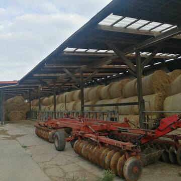
Heu und Stroh zu verkaufen
21527 Kollow
Hof -Linautal
@Hof-Linautal
Heu
Lieferant entlädt
Rundballen
Regenfrei
3 weitere...
ganz aktuell
B+

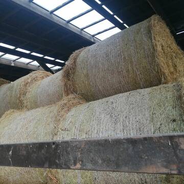
Heu in Rundballen (ca.130cm) super Qualität
Pronstorf
Caros Pferdeparadies
@KaOb
Heu
Rundballen
Regenfrei
Wird verladen
2 weitere...
B+
Deprecated: Creation of dynamic property Zend_View::$pageCount is deprecated in /var/www/stall-frei/htdocs/staging.stall-frei.de/library/vendor/shardj/zf1-future/library/Zend/View/Abstract.php on line 308
Deprecated: Creation of dynamic property Zend_View::$itemCountPerPage is deprecated in /var/www/stall-frei/htdocs/staging.stall-frei.de/library/vendor/shardj/zf1-future/library/Zend/View/Abstract.php on line 308
Deprecated: Creation of dynamic property Zend_View::$first is deprecated in /var/www/stall-frei/htdocs/staging.stall-frei.de/library/vendor/shardj/zf1-future/library/Zend/View/Abstract.php on line 308
Deprecated: Creation of dynamic property Zend_View::$current is deprecated in /var/www/stall-frei/htdocs/staging.stall-frei.de/library/vendor/shardj/zf1-future/library/Zend/View/Abstract.php on line 308
Deprecated: Creation of dynamic property Zend_View::$last is deprecated in /var/www/stall-frei/htdocs/staging.stall-frei.de/library/vendor/shardj/zf1-future/library/Zend/View/Abstract.php on line 308
Deprecated: Creation of dynamic property Zend_View::$next is deprecated in /var/www/stall-frei/htdocs/staging.stall-frei.de/library/vendor/shardj/zf1-future/library/Zend/View/Abstract.php on line 308
Deprecated: Creation of dynamic property Zend_View::$pagesInRange is deprecated in /var/www/stall-frei/htdocs/staging.stall-frei.de/library/vendor/shardj/zf1-future/library/Zend/View/Abstract.php on line 308
Deprecated: Creation of dynamic property Zend_View::$firstPageInRange is deprecated in /var/www/stall-frei/htdocs/staging.stall-frei.de/library/vendor/shardj/zf1-future/library/Zend/View/Abstract.php on line 308
Deprecated: Creation of dynamic property Zend_View::$lastPageInRange is deprecated in /var/www/stall-frei/htdocs/staging.stall-frei.de/library/vendor/shardj/zf1-future/library/Zend/View/Abstract.php on line 308
Deprecated: Creation of dynamic property Zend_View::$currentItemCount is deprecated in /var/www/stall-frei/htdocs/staging.stall-frei.de/library/vendor/shardj/zf1-future/library/Zend/View/Abstract.php on line 308
Deprecated: Creation of dynamic property Zend_View::$totalItemCount is deprecated in /var/www/stall-frei/htdocs/staging.stall-frei.de/library/vendor/shardj/zf1-future/library/Zend/View/Abstract.php on line 308
Deprecated: Creation of dynamic property Zend_View::$firstItemNumber is deprecated in /var/www/stall-frei/htdocs/staging.stall-frei.de/library/vendor/shardj/zf1-future/library/Zend/View/Abstract.php on line 308
Deprecated: Creation of dynamic property Zend_View::$lastItemNumber is deprecated in /var/www/stall-frei/htdocs/staging.stall-frei.de/library/vendor/shardj/zf1-future/library/Zend/View/Abstract.php on line 308
Deprecated: Creation of dynamic property Zend_View::$router is deprecated in /var/www/stall-frei/htdocs/staging.stall-frei.de/library/vendor/shardj/zf1-future/library/Zend/View/Abstract.php on line 308
Deprecated: Creation of dynamic property Zend_View::$urlParams is deprecated in /var/www/stall-frei/htdocs/staging.stall-frei.de/library/vendor/shardj/zf1-future/library/Zend/View/Abstract.php on line 308
Deprecated: Creation of dynamic property Zend_View::$showAds is deprecated in /var/www/stall-frei/htdocs/staging.stall-frei.de/library/vendor/shardj/zf1-future/library/Zend/View/Abstract.php on line 308
Deprecated: Creation of dynamic property Zend_View::$objectIds is deprecated in /var/www/stall-frei/htdocs/staging.stall-frei.de/library/vendor/shardj/zf1-future/library/Zend/View/Abstract.php on line 308
Deprecated: Creation of dynamic property Zend_View::$showNavbar is deprecated in /var/www/stall-frei/htdocs/staging.stall-frei.de/library/vendor/shardj/zf1-future/library/Zend/View/Abstract.php on line 308
Deprecated: Creation of dynamic property Zend_View::$showBreadcrumb is deprecated in /var/www/stall-frei/htdocs/staging.stall-frei.de/library/vendor/shardj/zf1-future/library/Zend/View/Abstract.php on line 308
Deprecated: Creation of dynamic property Zend_View::$showFooter is deprecated in /var/www/stall-frei/htdocs/staging.stall-frei.de/library/vendor/shardj/zf1-future/library/Zend/View/Abstract.php on line 308
Deprecated: Creation of dynamic property Zend_View::$showInternalAds is deprecated in /var/www/stall-frei/htdocs/staging.stall-frei.de/library/vendor/shardj/zf1-future/library/Zend/View/Abstract.php on line 308
Deprecated: Creation of dynamic property Zend_View::$blNoContent is deprecated in /var/www/stall-frei/htdocs/staging.stall-frei.de/library/vendor/shardj/zf1-future/library/Zend/View/Abstract.php on line 308
Deprecated: Creation of dynamic property Zend_View::$sMetaDesc is deprecated in /var/www/stall-frei/htdocs/staging.stall-frei.de/library/vendor/shardj/zf1-future/library/Zend/View/Abstract.php on line 308
Deprecated: Creation of dynamic property Zend_View::$useGmaps is deprecated in /var/www/stall-frei/htdocs/staging.stall-frei.de/library/vendor/shardj/zf1-future/library/Zend/View/Abstract.php on line 308
Deprecated: Creation of dynamic property Zend_View::$touches is deprecated in /var/www/stall-frei/htdocs/staging.stall-frei.de/library/vendor/shardj/zf1-future/library/Zend/View/Abstract.php on line 308
Deprecated: Creation of dynamic property Zend_View::$oProject is deprecated in /var/www/stall-frei/htdocs/staging.stall-frei.de/library/vendor/shardj/zf1-future/library/Zend/View/Abstract.php on line 308
Deprecated: Creation of dynamic property Zend_View::$pageHeadline is deprecated in /var/www/stall-frei/htdocs/staging.stall-frei.de/library/vendor/shardj/zf1-future/library/Zend/View/Abstract.php on line 308
Deprecated: Creation of dynamic property Zend_View::$disableLocationField is deprecated in /var/www/stall-frei/htdocs/staging.stall-frei.de/library/vendor/shardj/zf1-future/library/Zend/View/Abstract.php on line 308
Deprecated: Creation of dynamic property Zend_View::$isSearch is deprecated in /var/www/stall-frei/htdocs/staging.stall-frei.de/library/vendor/shardj/zf1-future/library/Zend/View/Abstract.php on line 308
Deprecated: Creation of dynamic property Zend_View::$pageTitle is deprecated in /var/www/stall-frei/htdocs/staging.stall-frei.de/library/vendor/shardj/zf1-future/library/Zend/View/Abstract.php on line 308
Deprecated: Creation of dynamic property Psf_Form_Element_Text::$class is deprecated in /var/www/stall-frei/htdocs/staging.stall-frei.de/library/vendor/shardj/zf1-future/library/Zend/Form/Element.php on line 874
Deprecated: Creation of dynamic property Psf_Form_Element_Text::$size is deprecated in /var/www/stall-frei/htdocs/staging.stall-frei.de/library/vendor/shardj/zf1-future/library/Zend/Form/Element.php on line 874
Deprecated: Creation of dynamic property Psf_Form_Element_Text::$placeholder is deprecated in /var/www/stall-frei/htdocs/staging.stall-frei.de/library/vendor/shardj/zf1-future/library/Zend/Form/Element.php on line 874
Deprecated: Creation of dynamic property Psf_Form_Element_Hidden::$class is deprecated in /var/www/stall-frei/htdocs/staging.stall-frei.de/library/vendor/shardj/zf1-future/library/Zend/Form/Element.php on line 874
Deprecated: Creation of dynamic property Psf_Form_Element_Hidden::$class is deprecated in /var/www/stall-frei/htdocs/staging.stall-frei.de/library/vendor/shardj/zf1-future/library/Zend/Form/Element.php on line 874
Deprecated: Creation of dynamic property Psf_Form_Element_Hidden::$class is deprecated in /var/www/stall-frei/htdocs/staging.stall-frei.de/library/vendor/shardj/zf1-future/library/Zend/Form/Element.php on line 874
Deprecated: Creation of dynamic property Psf_Form_Element_Hidden::$class is deprecated in /var/www/stall-frei/htdocs/staging.stall-frei.de/library/vendor/shardj/zf1-future/library/Zend/Form/Element.php on line 874
Deprecated: Creation of dynamic property Psf_Form_Element_Select::$class is deprecated in /var/www/stall-frei/htdocs/staging.stall-frei.de/library/vendor/shardj/zf1-future/library/Zend/Form/Element.php on line 874
Deprecated: Creation of dynamic property Psf_Form_Element_Select::$class is deprecated in /var/www/stall-frei/htdocs/staging.stall-frei.de/library/vendor/shardj/zf1-future/library/Zend/Form/Element.php on line 874
Deprecated: Creation of dynamic property Psf_Form_Element_Select::$class is deprecated in /var/www/stall-frei/htdocs/staging.stall-frei.de/library/vendor/shardj/zf1-future/library/Zend/Form/Element.php on line 874
Deprecated: Creation of dynamic property Psf_Form_Element_Select::$class is deprecated in /var/www/stall-frei/htdocs/staging.stall-frei.de/library/vendor/shardj/zf1-future/library/Zend/Form/Element.php on line 874
Deprecated: Creation of dynamic property Zend_View::$sort is deprecated in /var/www/stall-frei/htdocs/staging.stall-frei.de/library/vendor/shardj/zf1-future/library/Zend/View/Abstract.php on line 308
Deprecated: Creation of dynamic property Zend_View::$searchLocation is deprecated in /var/www/stall-frei/htdocs/staging.stall-frei.de/library/vendor/shardj/zf1-future/library/Zend/View/Abstract.php on line 308
Deprecated: Creation of dynamic property Zend_View::$locationHint is deprecated in /var/www/stall-frei/htdocs/staging.stall-frei.de/library/vendor/shardj/zf1-future/library/Zend/View/Abstract.php on line 308
Psf_GeoCoder_Abstract::getLocation: Wolfshagen Get Location CachedOrLive
Psf_GeoCoder_Abstract::getCachedOrLive: Wolfshagen
Psf_GeoCoder_OpenCageData::makeApiRequest: response:
Array
(
[documentation] => https://opencagedata.com/api
[licenses] => Array
(
[0] => Array
(
[name] => see attribution guide
[url] => https://opencagedata.com/credits
)
)
[results] => Array
(
[0] => Array
(
[bounds] => Array
(
[northeast] => Array
(
[lat] => 53.4783586
[lng] => 13.7095058
)
[southwest] => Array
(
[lat] => 53.4033758
[lng] => 13.6256799
)
)
[components] => Array
(
[ISO_3166-1_alpha-2] => DE
[ISO_3166-1_alpha-3] => DEU
[ISO_3166-2] => Array
(
[0] => DE-BB
)
[_category] => place
[_normalized_city] => Wolfshagen
[_type] => village
[continent] => Europe
[country] => Deutschland
[country_code] => de
[county] => Uckermark
[municipality] => Uckerland
[political_union] => European Union
[postcode] => 17337
[state] => Brandenburg
[state_code] => BB
[village] => Wolfshagen
)
[confidence] => 7
[formatted] => 17337 Wolfshagen, Deutschland
[geometry] => Array
(
[lat] => 53.4388965
[lng] => 13.6497231
)
)
[1] => Array
(
[bounds] => Array
(
[northeast] => Array
(
[lat] => 53.1807852
[lng] => 12.0781646
)
[southwest] => Array
(
[lat] => 53.1197246
[lng] => 11.9846233
)
)
[components] => Array
(
[ISO_3166-1_alpha-2] => DE
[ISO_3166-1_alpha-3] => DEU
[ISO_3166-2] => Array
(
[0] => DE-BB
)
[_category] => place
[_normalized_city] => Groß Pankow (Prignitz)
[_type] => village
[city] => Groß Pankow (Prignitz)
[continent] => Europe
[country] => Deutschland
[country_code] => de
[county] => Prignitz
[political_union] => European Union
[state] => Brandenburg
[state_code] => BB
[village] => Wolfshagen
)
[confidence] => 7
[formatted] => Wolfshagen, Brandenburg, Deutschland
[geometry] => Array
(
[lat] => 53.15
[lng] => 12.0167
)
)
[2] => Array
(
[bounds] => Array
(
[northeast] => Array
(
[lat] => 50.9582569
[lng] => 7.9414259
)
[southwest] => Array
(
[lat] => 50.9581569
[lng] => 7.9413259
)
)
[components] => Array
(
[ISO_3166-1_alpha-2] => DE
[ISO_3166-1_alpha-3] => DEU
[ISO_3166-2] => Array
(
[0] => DE-NW
)
[_category] => natural/water
[_normalized_city] => Kreuztal
[_type] => peak
[continent] => Europe
[country] => Deutschland
[country_code] => de
[county] => Kreis Siegen-Wittgenstein
[peak] => Wolfshagen
[political_union] => European Union
[postcode] => 57223
[state] => Nordrhein-Westfalen
[state_code] => NW
[town] => Kreuztal
)
[confidence] => 9
[formatted] => Wolfshagen, 57223 Kreuztal, Deutschland
[geometry] => Array
(
[lat] => 50.9582069
[lng] => 7.9413759
)
)
[3] => Array
(
[bounds] => Array
(
[northeast] => Array
(
[lat] => 54.2446
[lng] => 12.854864
)
[southwest] => Array
(
[lat] => 54.2046
[lng] => 12.814864
)
)
[components] => Array
(
[ISO_3166-1_alpha-2] => DE
[ISO_3166-1_alpha-3] => DEU
[ISO_3166-2] => Array
(
[0] => DE-MV
)
[_category] => place
[_normalized_city] => Wolfshagen
[_type] => village
[continent] => Europe
[country] => Deutschland
[country_code] => de
[county] => Vorpommern-Rügen
[municipality] => Millienhagen-Oebelitz
[political_union] => European Union
[state] => Mecklenburg-Vorpommern
[state_code] => MV
[village] => Wolfshagen
)
[confidence] => 7
[formatted] => Wolfshagen, Mecklenburg-Vorpommern, Deutschland
[geometry] => Array
(
[lat] => 54.2246
[lng] => 12.834864
)
)
[4] => Array
(
[bounds] => Array
(
[northeast] => Array
(
[lat] => 52.5832672
[lng] => 13.7744043
)
[southwest] => Array
(
[lat] => 52.5432672
[lng] => 13.7344043
)
)
[components] => Array
(
[ISO_3166-1_alpha-2] => DE
[ISO_3166-1_alpha-3] => DEU
[ISO_3166-2] => Array
(
[0] => DE-BB
)
[_category] => place
[_normalized_city] => Altlandsberg
[_type] => hamlet
[continent] => Europe
[country] => Deutschland
[country_code] => de
[county] => Märkisch-Oderland
[hamlet] => Wolfshagen
[political_union] => European Union
[postcode] => 15370
[state] => Brandenburg
[state_code] => BB
[town] => Altlandsberg
)
[confidence] => 7
[formatted] => Wolfshagen, 15370 Altlandsberg, Deutschland
[geometry] => Array
(
[lat] => 52.5632672
[lng] => 13.7544043
)
)
[5] => Array
(
[bounds] => Array
(
[northeast] => Array
(
[lat] => 52.5638759
[lng] => 13.7554609
)
[southwest] => Array
(
[lat] => 52.5626584
[lng] => 13.7509215
)
)
[components] => Array
(
[ISO_3166-1_alpha-2] => DE
[ISO_3166-1_alpha-3] => DEU
[ISO_3166-2] => Array
(
[0] => DE-BB
)
[_category] => road
[_normalized_city] => Altlandsberg
[_type] => road
[continent] => Europe
[country] => Deutschland
[country_code] => de
[county] => Märkisch-Oderland
[hamlet] => Wolfshagen
[political_union] => European Union
[postcode] => 15345
[road] => Wolfshagen
[road_type] => tertiary
[state] => Brandenburg
[state_code] => BB
[town] => Altlandsberg
)
[confidence] => 9
[formatted] => Wolfshagen, 15345 Altlandsberg, Deutschland
[geometry] => Array
(
[lat] => 52.56344
[lng] => 13.7532351
)
)
[6] => Array
(
[bounds] => Array
(
[northeast] => Array
(
[lat] => 52.1962956
[lng] => 7.9814487
)
[southwest] => Array
(
[lat] => 52.1956695
[lng] => 7.9797042
)
)
[components] => Array
(
[ISO_3166-1_alpha-2] => DE
[ISO_3166-1_alpha-3] => DEU
[ISO_3166-2] => Array
(
[0] => DE-NI
)
[_category] => road
[_normalized_city] => Hagen am Teutoburger Wald
[_type] => road
[city_district] => Obermark
[continent] => Europe
[country] => Deutschland
[country_code] => de
[county] => Landkreis Osnabrück
[political_union] => European Union
[postcode] => 49170
[road] => Wolfshagen
[road_type] => residential
[state] => Niedersachsen
[state_code] => NI
[suburb] => Hagen
[town] => Hagen am Teutoburger Wald
)
[confidence] => 9
[formatted] => Wolfshagen, 49170 Hagen am Teutoburger Wald, Deutschland
[geometry] => Array
(
[lat] => 52.1957988
[lng] => 7.9807917
)
)
[7] => Array
(
[bounds] => Array
(
[northeast] => Array
(
[lat] => 53.5608727
[lng] => 10.0489557
)
[southwest] => Array
(
[lat] => 53.5591567
[lng] => 10.0485306
)
)
[components] => Array
(
[ISO_3166-1_alpha-2] => DE
[ISO_3166-1_alpha-3] => DEU
[ISO_3166-2] => Array
(
[0] => DE-HH
)
[_category] => road
[_normalized_city] => Hamburg
[_type] => road
[borough] => Hamburg-Mitte
[city] => Hamburg
[continent] => Europe
[country] => Deutschland
[country_code] => de
[political_union] => European Union
[postcode] => 20535
[road] => Wolfshagen
[road_type] => residential
[state] => Hamburg
[state_code] => HH
[suburb] => Hamm
)
[confidence] => 9
[formatted] => Wolfshagen, 20535 Hamburg, Deutschland
[geometry] => Array
(
[lat] => 53.560028
[lng] => 10.0487161
)
)
[8] => Array
(
[bounds] => Array
(
[northeast] => Array
(
[lat] => 51.7707849
[lng] => 10.8065061
)
[southwest] => Array
(
[lat] => 51.7704269
[lng] => 10.8050267
)
)
[components] => Array
(
[ISO_3166-1_alpha-2] => DE
[ISO_3166-1_alpha-3] => DEU
[ISO_3166-2] => Array
(
[0] => DE-ST
)
[_category] => road
[_normalized_city] => Elbingerode
[_type] => road
[continent] => Europe
[country] => Deutschland
[country_code] => de
[county] => Landkreis Harz
[municipality] => Oberharz am Brocken
[political_union] => European Union
[postcode] => 38875
[road] => Wolfshagen
[road_type] => residential
[state] => Sachsen-Anhalt
[state_code] => ST
[town] => Elbingerode
)
[confidence] => 9
[formatted] => Wolfshagen, 38875 Elbingerode, Deutschland
[geometry] => Array
(
[lat] => 51.7705967
[lng] => 10.8057639
)
)
[9] => Array
(
[components] => Array
(
[ISO_3166-1_alpha-2] => FR
[ISO_3166-1_alpha-3] => FRA
[ISO_3166-2] => Array
(
[0] => FR-IDF
[1] => FR-92
)
[_category] => road
[_normalized_city] => Levallois-Perret
[_type] => road
[city] => Levallois-Perret
[continent] => Europe
[country] => France
[country_code] => fr
[county] => Hauts-de-Seine
[local_authority] => Métropole du Grand Paris
[political_union] => European Union
[postcode] => 92300
[road] => Rue Charles Deutschmann
[state] => Île-de-France
[state_code] => IDF
)
[confidence] => 2
[formatted] => Rue Charles Deutschmann, 92300 Levallois-Perret, France
[geometry] => Array
(
[lat] => 48.900049
[lng] => 2.2842
)
)
)
[status] => Array
(
[code] => 200
[message] => OK
)
[stay_informed] => Array
(
[blog] => https://blog.opencagedata.com
[mastodon] => https://en.osm.town/@opencage
)
[thanks] => For using an OpenCage API
[timestamp] => Array
(
[created_http] => Fri, 06 Feb 2026 18:24:45 GMT
[created_unix] => 1770402285
)
[total_results] => 10
)
Psf_GeoCoder_Abstract::convertLocationResult
{"documentation":"https:\/\/opencagedata.com\/api","licenses":[{"name":"see attribution guide","url":"https:\/\/opencagedata.com\/credits"}],"results":[{"bounds":{"northeast":{"lat":53.4783586,"lng":13.7095058},"southwest":{"lat":53.4033758,"lng":13.6256799}},"components":{"ISO_3166-1_alpha-2":"DE","ISO_3166-1_alpha-3":"DEU","ISO_3166-2":["DE-BB"],"_category":"place","_normalized_city":"Wolfshagen","_type":"village","continent":"Europe","country":"Deutschland","country_code":"de","county":"Uckermark","municipality":"Uckerland","political_union":"European Union","postcode":"17337","state":"Brandenburg","state_code":"BB","village":"Wolfshagen"},"confidence":7,"formatted":"17337 Wolfshagen, Deutschland","geometry":{"lat":53.4388965,"lng":13.6497231}},{"bounds":{"northeast":{"lat":53.1807852,"lng":12.0781646},"southwest":{"lat":53.1197246,"lng":11.9846233}},"components":{"ISO_3166-1_alpha-2":"DE","ISO_3166-1_alpha-3":"DEU","ISO_3166-2":["DE-BB"],"_category":"place","_normalized_city":"Gro\u00df Pankow (Prignitz)","_type":"village","city":"Gro\u00df Pankow (Prignitz)","continent":"Europe","country":"Deutschland","country_code":"de","county":"Prignitz","political_union":"European Union","state":"Brandenburg","state_code":"BB","village":"Wolfshagen"},"confidence":7,"formatted":"Wolfshagen, Brandenburg, Deutschland","geometry":{"lat":53.15,"lng":12.0167}},{"bounds":{"northeast":{"lat":50.9582569,"lng":7.9414259},"southwest":{"lat":50.9581569,"lng":7.9413259}},"components":{"ISO_3166-1_alpha-2":"DE","ISO_3166-1_alpha-3":"DEU","ISO_3166-2":["DE-NW"],"_category":"natural\/water","_normalized_city":"Kreuztal","_type":"peak","continent":"Europe","country":"Deutschland","country_code":"de","county":"Kreis Siegen-Wittgenstein","peak":"Wolfshagen","political_union":"European Union","postcode":"57223","state":"Nordrhein-Westfalen","state_code":"NW","town":"Kreuztal"},"confidence":9,"formatted":"Wolfshagen, 57223 Kreuztal, Deutschland","geometry":{"lat":50.9582069,"lng":7.9413759}},{"bounds":{"northeast":{"lat":54.2446,"lng":12.854864},"southwest":{"lat":54.2046,"lng":12.814864}},"components":{"ISO_3166-1_alpha-2":"DE","ISO_3166-1_alpha-3":"DEU","ISO_3166-2":["DE-MV"],"_category":"place","_normalized_city":"Wolfshagen","_type":"village","continent":"Europe","country":"Deutschland","country_code":"de","county":"Vorpommern-R\u00fcgen","municipality":"Millienhagen-Oebelitz","political_union":"European Union","state":"Mecklenburg-Vorpommern","state_code":"MV","village":"Wolfshagen"},"confidence":7,"formatted":"Wolfshagen, Mecklenburg-Vorpommern, Deutschland","geometry":{"lat":54.2246,"lng":12.834864}},{"bounds":{"northeast":{"lat":52.5832672,"lng":13.7744043},"southwest":{"lat":52.5432672,"lng":13.7344043}},"components":{"ISO_3166-1_alpha-2":"DE","ISO_3166-1_alpha-3":"DEU","ISO_3166-2":["DE-BB"],"_category":"place","_normalized_city":"Altlandsberg","_type":"hamlet","continent":"Europe","country":"Deutschland","country_code":"de","county":"M\u00e4rkisch-Oderland","hamlet":"Wolfshagen","political_union":"European Union","postcode":"15370","state":"Brandenburg","state_code":"BB","town":"Altlandsberg"},"confidence":7,"formatted":"Wolfshagen, 15370 Altlandsberg, Deutschland","geometry":{"lat":52.5632672,"lng":13.7544043}},{"bounds":{"northeast":{"lat":52.5638759,"lng":13.7554609},"southwest":{"lat":52.5626584,"lng":13.7509215}},"components":{"ISO_3166-1_alpha-2":"DE","ISO_3166-1_alpha-3":"DEU","ISO_3166-2":["DE-BB"],"_category":"road","_normalized_city":"Altlandsberg","_type":"road","continent":"Europe","country":"Deutschland","country_code":"de","county":"M\u00e4rkisch-Oderland","hamlet":"Wolfshagen","political_union":"European Union","postcode":"15345","road":"Wolfshagen","road_type":"tertiary","state":"Brandenburg","state_code":"BB","town":"Altlandsberg"},"confidence":9,"formatted":"Wolfshagen, 15345 Altlandsberg, Deutschland","geometry":{"lat":52.56344,"lng":13.7532351}},{"bounds":{"northeast":{"lat":52.1962956,"lng":7.9814487},"southwest":{"lat":52.1956695,"lng":7.9797042}},"components":{"ISO_3166-1_alpha-2":"DE","ISO_3166-1_alpha-3":"DEU","ISO_3166-2":["DE-NI"],"_category":"road","_normalized_city":"Hagen am Teutoburger Wald","_type":"road","city_district":"Obermark","continent":"Europe","country":"Deutschland","country_code":"de","county":"Landkreis Osnabr\u00fcck","political_union":"European Union","postcode":"49170","road":"Wolfshagen","road_type":"residential","state":"Niedersachsen","state_code":"NI","suburb":"Hagen","town":"Hagen am Teutoburger Wald"},"confidence":9,"formatted":"Wolfshagen, 49170 Hagen am Teutoburger Wald, Deutschland","geometry":{"lat":52.1957988,"lng":7.9807917}},{"bounds":{"northeast":{"lat":53.5608727,"lng":10.0489557},"southwest":{"lat":53.5591567,"lng":10.0485306}},"components":{"ISO_3166-1_alpha-2":"DE","ISO_3166-1_alpha-3":"DEU","ISO_3166-2":["DE-HH"],"_category":"road","_normalized_city":"Hamburg","_type":"road","borough":"Hamburg-Mitte","city":"Hamburg","continent":"Europe","country":"Deutschland","country_code":"de","political_union":"European Union","postcode":"20535","road":"Wolfshagen","road_type":"residential","state":"Hamburg","state_code":"HH","suburb":"Hamm"},"confidence":9,"formatted":"Wolfshagen, 20535 Hamburg, Deutschland","geometry":{"lat":53.560028,"lng":10.0487161}},{"bounds":{"northeast":{"lat":51.7707849,"lng":10.8065061},"southwest":{"lat":51.7704269,"lng":10.8050267}},"components":{"ISO_3166-1_alpha-2":"DE","ISO_3166-1_alpha-3":"DEU","ISO_3166-2":["DE-ST"],"_category":"road","_normalized_city":"Elbingerode","_type":"road","continent":"Europe","country":"Deutschland","country_code":"de","county":"Landkreis Harz","municipality":"Oberharz am Brocken","political_union":"European Union","postcode":"38875","road":"Wolfshagen","road_type":"residential","state":"Sachsen-Anhalt","state_code":"ST","town":"Elbingerode"},"confidence":9,"formatted":"Wolfshagen, 38875 Elbingerode, Deutschland","geometry":{"lat":51.7705967,"lng":10.8057639}},{"components":{"ISO_3166-1_alpha-2":"FR","ISO_3166-1_alpha-3":"FRA","ISO_3166-2":["FR-IDF","FR-92"],"_category":"road","_normalized_city":"Levallois-Perret","_type":"road","city":"Levallois-Perret","continent":"Europe","country":"France","country_code":"fr","county":"Hauts-de-Seine","local_authority":"M\u00e9tropole du Grand Paris","political_union":"European Union","postcode":"92300","road":"Rue Charles Deutschmann","state":"\u00cele-de-France","state_code":"IDF"},"confidence":2,"formatted":"Rue Charles Deutschmann, 92300 Levallois-Perret, France","geometry":{"lat":48.900049,"lng":2.2842}}],"status":{"code":200,"message":"OK"},"stay_informed":{"blog":"https:\/\/blog.opencagedata.com","mastodon":"https:\/\/en.osm.town\/@opencage"},"thanks":"For using an OpenCage API","timestamp":{"created_http":"Fri, 06 Feb 2026 18:24:45 GMT","created_unix":1770402285},"total_results":10}Array
(
[0] => stdClass Object
(
[bounds] => stdClass Object
(
[northeast] => stdClass Object
(
[lat] => 53.4783586
[lng] => 13.7095058
)
[southwest] => stdClass Object
(
[lat] => 53.4033758
[lng] => 13.6256799
)
)
[components] => stdClass Object
(
[ISO_3166-1_alpha-2] => DE
[ISO_3166-1_alpha-3] => DEU
[ISO_3166-2] => Array
(
[0] => DE-BB
)
[_category] => place
[_normalized_city] => Wolfshagen
[_type] => village
[continent] => Europe
[country] => Deutschland
[country_code] => de
[county] => Uckermark
[municipality] => Uckerland
[political_union] => European Union
[postcode] => 17337
[state] => Brandenburg
[state_code] => BB
[village] => Wolfshagen
)
[confidence] => 7
[formatted] => 17337 Wolfshagen, Deutschland
[geometry] => stdClass Object
(
[lat] => 53.4388965
[lng] => 13.6497231
)
)
[1] => stdClass Object
(
[bounds] => stdClass Object
(
[northeast] => stdClass Object
(
[lat] => 53.1807852
[lng] => 12.0781646
)
[southwest] => stdClass Object
(
[lat] => 53.1197246
[lng] => 11.9846233
)
)
[components] => stdClass Object
(
[ISO_3166-1_alpha-2] => DE
[ISO_3166-1_alpha-3] => DEU
[ISO_3166-2] => Array
(
[0] => DE-BB
)
[_category] => place
[_normalized_city] => Groß Pankow (Prignitz)
[_type] => village
[city] => Groß Pankow (Prignitz)
[continent] => Europe
[country] => Deutschland
[country_code] => de
[county] => Prignitz
[political_union] => European Union
[state] => Brandenburg
[state_code] => BB
[village] => Wolfshagen
)
[confidence] => 7
[formatted] => Wolfshagen, Brandenburg, Deutschland
[geometry] => stdClass Object
(
[lat] => 53.15
[lng] => 12.0167
)
)
[2] => stdClass Object
(
[bounds] => stdClass Object
(
[northeast] => stdClass Object
(
[lat] => 50.9582569
[lng] => 7.9414259
)
[southwest] => stdClass Object
(
[lat] => 50.9581569
[lng] => 7.9413259
)
)
[components] => stdClass Object
(
[ISO_3166-1_alpha-2] => DE
[ISO_3166-1_alpha-3] => DEU
[ISO_3166-2] => Array
(
[0] => DE-NW
)
[_category] => natural/water
[_normalized_city] => Kreuztal
[_type] => peak
[continent] => Europe
[country] => Deutschland
[country_code] => de
[county] => Kreis Siegen-Wittgenstein
[peak] => Wolfshagen
[political_union] => European Union
[postcode] => 57223
[state] => Nordrhein-Westfalen
[state_code] => NW
[town] => Kreuztal
)
[confidence] => 9
[formatted] => Wolfshagen, 57223 Kreuztal, Deutschland
[geometry] => stdClass Object
(
[lat] => 50.9582069
[lng] => 7.9413759
)
)
[3] => stdClass Object
(
[bounds] => stdClass Object
(
[northeast] => stdClass Object
(
[lat] => 54.2446
[lng] => 12.854864
)
[southwest] => stdClass Object
(
[lat] => 54.2046
[lng] => 12.814864
)
)
[components] => stdClass Object
(
[ISO_3166-1_alpha-2] => DE
[ISO_3166-1_alpha-3] => DEU
[ISO_3166-2] => Array
(
[0] => DE-MV
)
[_category] => place
[_normalized_city] => Wolfshagen
[_type] => village
[continent] => Europe
[country] => Deutschland
[country_code] => de
[county] => Vorpommern-Rügen
[municipality] => Millienhagen-Oebelitz
[political_union] => European Union
[state] => Mecklenburg-Vorpommern
[state_code] => MV
[village] => Wolfshagen
)
[confidence] => 7
[formatted] => Wolfshagen, Mecklenburg-Vorpommern, Deutschland
[geometry] => stdClass Object
(
[lat] => 54.2246
[lng] => 12.834864
)
)
[4] => stdClass Object
(
[bounds] => stdClass Object
(
[northeast] => stdClass Object
(
[lat] => 52.5832672
[lng] => 13.7744043
)
[southwest] => stdClass Object
(
[lat] => 52.5432672
[lng] => 13.7344043
)
)
[components] => stdClass Object
(
[ISO_3166-1_alpha-2] => DE
[ISO_3166-1_alpha-3] => DEU
[ISO_3166-2] => Array
(
[0] => DE-BB
)
[_category] => place
[_normalized_city] => Altlandsberg
[_type] => hamlet
[continent] => Europe
[country] => Deutschland
[country_code] => de
[county] => Märkisch-Oderland
[hamlet] => Wolfshagen
[political_union] => European Union
[postcode] => 15370
[state] => Brandenburg
[state_code] => BB
[town] => Altlandsberg
)
[confidence] => 7
[formatted] => Wolfshagen, 15370 Altlandsberg, Deutschland
[geometry] => stdClass Object
(
[lat] => 52.5632672
[lng] => 13.7544043
)
)
[5] => stdClass Object
(
[bounds] => stdClass Object
(
[northeast] => stdClass Object
(
[lat] => 52.5638759
[lng] => 13.7554609
)
[southwest] => stdClass Object
(
[lat] => 52.5626584
[lng] => 13.7509215
)
)
[components] => stdClass Object
(
[ISO_3166-1_alpha-2] => DE
[ISO_3166-1_alpha-3] => DEU
[ISO_3166-2] => Array
(
[0] => DE-BB
)
[_category] => road
[_normalized_city] => Altlandsberg
[_type] => road
[continent] => Europe
[country] => Deutschland
[country_code] => de
[county] => Märkisch-Oderland
[hamlet] => Wolfshagen
[political_union] => European Union
[postcode] => 15345
[road] => Wolfshagen
[road_type] => tertiary
[state] => Brandenburg
[state_code] => BB
[town] => Altlandsberg
)
[confidence] => 9
[formatted] => Wolfshagen, 15345 Altlandsberg, Deutschland
[geometry] => stdClass Object
(
[lat] => 52.56344
[lng] => 13.7532351
)
)
[6] => stdClass Object
(
[bounds] => stdClass Object
(
[northeast] => stdClass Object
(
[lat] => 52.1962956
[lng] => 7.9814487
)
[southwest] => stdClass Object
(
[lat] => 52.1956695
[lng] => 7.9797042
)
)
[components] => stdClass Object
(
[ISO_3166-1_alpha-2] => DE
[ISO_3166-1_alpha-3] => DEU
[ISO_3166-2] => Array
(
[0] => DE-NI
)
[_category] => road
[_normalized_city] => Hagen am Teutoburger Wald
[_type] => road
[city_district] => Obermark
[continent] => Europe
[country] => Deutschland
[country_code] => de
[county] => Landkreis Osnabrück
[political_union] => European Union
[postcode] => 49170
[road] => Wolfshagen
[road_type] => residential
[state] => Niedersachsen
[state_code] => NI
[suburb] => Hagen
[town] => Hagen am Teutoburger Wald
)
[confidence] => 9
[formatted] => Wolfshagen, 49170 Hagen am Teutoburger Wald, Deutschland
[geometry] => stdClass Object
(
[lat] => 52.1957988
[lng] => 7.9807917
)
)
[7] => stdClass Object
(
[bounds] => stdClass Object
(
[northeast] => stdClass Object
(
[lat] => 53.5608727
[lng] => 10.0489557
)
[southwest] => stdClass Object
(
[lat] => 53.5591567
[lng] => 10.0485306
)
)
[components] => stdClass Object
(
[ISO_3166-1_alpha-2] => DE
[ISO_3166-1_alpha-3] => DEU
[ISO_3166-2] => Array
(
[0] => DE-HH
)
[_category] => road
[_normalized_city] => Hamburg
[_type] => road
[borough] => Hamburg-Mitte
[city] => Hamburg
[continent] => Europe
[country] => Deutschland
[country_code] => de
[political_union] => European Union
[postcode] => 20535
[road] => Wolfshagen
[road_type] => residential
[state] => Hamburg
[state_code] => HH
[suburb] => Hamm
)
[confidence] => 9
[formatted] => Wolfshagen, 20535 Hamburg, Deutschland
[geometry] => stdClass Object
(
[lat] => 53.560028
[lng] => 10.0487161
)
)
[8] => stdClass Object
(
[bounds] => stdClass Object
(
[northeast] => stdClass Object
(
[lat] => 51.7707849
[lng] => 10.8065061
)
[southwest] => stdClass Object
(
[lat] => 51.7704269
[lng] => 10.8050267
)
)
[components] => stdClass Object
(
[ISO_3166-1_alpha-2] => DE
[ISO_3166-1_alpha-3] => DEU
[ISO_3166-2] => Array
(
[0] => DE-ST
)
[_category] => road
[_normalized_city] => Elbingerode
[_type] => road
[continent] => Europe
[country] => Deutschland
[country_code] => de
[county] => Landkreis Harz
[municipality] => Oberharz am Brocken
[political_union] => European Union
[postcode] => 38875
[road] => Wolfshagen
[road_type] => residential
[state] => Sachsen-Anhalt
[state_code] => ST
[town] => Elbingerode
)
[confidence] => 9
[formatted] => Wolfshagen, 38875 Elbingerode, Deutschland
[geometry] => stdClass Object
(
[lat] => 51.7705967
[lng] => 10.8057639
)
)
[9] => stdClass Object
(
[components] => stdClass Object
(
[ISO_3166-1_alpha-2] => FR
[ISO_3166-1_alpha-3] => FRA
[ISO_3166-2] => Array
(
[0] => FR-IDF
[1] => FR-92
)
[_category] => road
[_normalized_city] => Levallois-Perret
[_type] => road
[city] => Levallois-Perret
[continent] => Europe
[country] => France
[country_code] => fr
[county] => Hauts-de-Seine
[local_authority] => Métropole du Grand Paris
[political_union] => European Union
[postcode] => 92300
[road] => Rue Charles Deutschmann
[state] => Île-de-France
[state_code] => IDF
)
[confidence] => 2
[formatted] => Rue Charles Deutschmann, 92300 Levallois-Perret, France
[geometry] => stdClass Object
(
[lat] => 48.900049
[lng] => 2.2842
)
)
)
Psf_GeoCoder_OpenCageData::getKeyMap: 0
stdClass Object
(
    [bounds] => stdClass Object
        (
            [northeast] => stdClass Object
                (
                    [lat] => 53.4783586
                    [lng] => 13.7095058
                )

            [southwest] => stdClass Object
                (
                    [lat] => 53.4033758
                    [lng] => 13.6256799
                )

        )

    [components] => stdClass Object
        (
            [ISO_3166-1_alpha-2] => DE
            [ISO_3166-1_alpha-3] => DEU
            [ISO_3166-2] => Array
                (
                    [0] => DE-BB
                )

            [_category] => place
            [_normalized_city] => Wolfshagen
            [_type] => village
            [continent] => Europe
            [country] => Deutschland
            [country_code] => de
            [county] => Uckermark
            [municipality] => Uckerland
            [political_union] => European Union
            [postcode] => 17337
            [state] => Brandenburg
            [state_code] => BB
            [village] => Wolfshagen
        )

    [confidence] => 7
    [formatted] => 17337 Wolfshagen, Deutschland
    [geometry] => stdClass Object
        (
            [lat] => 53.4388965
            [lng] => 13.6497231
        )

)
Psf_GeoCoder_OpenCageData::getCounty: Uckermark
Psf_GeoCoder_OpenCageData::addMissingData REFETCH!
Array
(
    [address] => 17337 Wolfshagen, Deutschland
    [type] => village
    [street] =>
    [city] => Wolfshagen
    [county] => Uckermark
    [state] => Brandenburg
    [zip] => 17337
    [country] => Deutschland
    [suburb] =>
    [countrycode] => de
    [latitude] => 53.4388965
    [longitude] => 13.6497231
    [accuracy] => 1
    [confidence] => 7
    [bounds] => stdClass Object
        (
            [northeast] => stdClass Object
                (
                    [lat] => 53.4783586
                    [lng] => 13.7095058
                )

            [southwest] => stdClass Object
                (
                    [lat] => 53.4033758
                    [lng] => 13.6256799
                )

        )

)
reformat!
Array
(
    [address] => 17337 Wolfshagen, Deutschland
    [type] => village
    [street] =>
    [city] => Wolfshagen
    [county] => Uckermark
    [state] => Brandenburg
    [zip] => 17337
    [country] => Deutschland
    [suburb] =>
    [countrycode] => de
    [latitude] => 53.4388965
    [longitude] => 13.6497231
    [accuracy] => 1
    [confidence] => 7
    [bounds] => stdClass Object
        (
            [northeast] => stdClass Object
                (
                    [lat] => 53.4783586
                    [lng] => 13.7095058
                )

            [southwest] => stdClass Object
                (
                    [lat] => 53.4033758
                    [lng] => 13.6256799
                )

        )

    [place] => 17337 Wolfshagen, Brandenburg
    [hash] => 9a4427591315077b8b3347b20da5ddc5
)
Psf_GeoCoder_OpenCageData::getKeyMap: 1
stdClass Object
(
    [bounds] => stdClass Object
        (
            [northeast] => stdClass Object
                (
                    [lat] => 53.1807852
                    [lng] => 12.0781646
                )

            [southwest] => stdClass Object
                (
                    [lat] => 53.1197246
                    [lng] => 11.9846233
                )

        )

    [components] => stdClass Object
        (
            [ISO_3166-1_alpha-2] => DE
            [ISO_3166-1_alpha-3] => DEU
            [ISO_3166-2] => Array
                (
                    [0] => DE-BB
                )

            [_category] => place
            [_normalized_city] => Groß Pankow (Prignitz)
            [_type] => village
            [city] => Groß Pankow (Prignitz)
            [continent] => Europe
            [country] => Deutschland
            [country_code] => de
            [county] => Prignitz
            [political_union] => European Union
            [state] => Brandenburg
            [state_code] => BB
            [village] => Wolfshagen
        )

    [confidence] => 7
    [formatted] => Wolfshagen, Brandenburg, Deutschland
    [geometry] => stdClass Object
        (
            [lat] => 53.15
            [lng] => 12.0167
        )

)
Psf_GeoCoder_OpenCageData::getCounty: Prignitz
Psf_GeoCoder_OpenCageData::addMissingData REFETCH!
Array
(
    [address] => Wolfshagen, Brandenburg, Deutschland
    [type] => village
    [street] =>
    [city] => Wolfshagen
    [county] => Prignitz
    [state] => Brandenburg
    [zip] =>
    [country] => Deutschland
    [suburb] =>
    [countrycode] => de
    [latitude] => 53.15
    [longitude] => 12.0167
    [accuracy] => 1
    [confidence] => 7
    [bounds] => stdClass Object
        (
            [northeast] => stdClass Object
                (
                    [lat] => 53.1807852
                    [lng] => 12.0781646
                )

            [southwest] => stdClass Object
                (
                    [lat] => 53.1197246
                    [lng] => 11.9846233
                )

        )

)
reformat!
Array
(
    [address] => Wolfshagen, Brandenburg, Deutschland
    [type] => village
    [street] =>
    [city] => Wolfshagen
    [county] => Prignitz
    [state] => Brandenburg
    [zip] =>
    [country] => Deutschland
    [suburb] =>
    [countrycode] => de
    [latitude] => 53.15
    [longitude] => 12.0167
    [accuracy] => 1
    [confidence] => 7
    [bounds] => stdClass Object
        (
            [northeast] => stdClass Object
                (
                    [lat] => 53.1807852
                    [lng] => 12.0781646
                )

            [southwest] => stdClass Object
                (
                    [lat] => 53.1197246
                    [lng] => 11.9846233
                )

        )

    [place] => Wolfshagen, Brandenburg
    [hash] => 326d93af45f9a60411adaf897e9217fa
)
Psf_GeoCoder_OpenCageData::getKeyMap: 2
stdClass Object
(
    [bounds] => stdClass Object
        (
            [northeast] => stdClass Object
                (
                    [lat] => 50.9582569
                    [lng] => 7.9414259
                )

            [southwest] => stdClass Object
                (
                    [lat] => 50.9581569
                    [lng] => 7.9413259
                )

        )

    [components] => stdClass Object
        (
            [ISO_3166-1_alpha-2] => DE
            [ISO_3166-1_alpha-3] => DEU
            [ISO_3166-2] => Array
                (
                    [0] => DE-NW
                )

            [_category] => natural/water
            [_normalized_city] => Kreuztal
            [_type] => peak
            [continent] => Europe
            [country] => Deutschland
            [country_code] => de
            [county] => Kreis Siegen-Wittgenstein
            [peak] => Wolfshagen
            [political_union] => European Union
            [postcode] => 57223
            [state] => Nordrhein-Westfalen
            [state_code] => NW
            [town] => Kreuztal
        )

    [confidence] => 9
    [formatted] => Wolfshagen, 57223 Kreuztal, Deutschland
    [geometry] => stdClass Object
        (
            [lat] => 50.9582069
            [lng] => 7.9413759
        )

)
Psf_GeoCoder_OpenCageData::getCounty: Siegen-Wittgenstein
Psf_GeoCoder_OpenCageData::addMissingData REFETCH!
Array
(
    [address] => Wolfshagen, 57223 Kreuztal, Deutschland
    [type] => peak
    [street] =>
    [city] => Kreuztal
    [county] => Siegen-Wittgenstein
    [state] => Nordrhein-Westfalen
    [zip] => 57223
    [country] => Deutschland
    [suburb] =>
    [countrycode] => de
    [latitude] => 50.9582069
    [longitude] => 7.9413759
    [accuracy] => 1
    [confidence] => 9
    [bounds] => stdClass Object
        (
            [northeast] => stdClass Object
                (
                    [lat] => 50.9582569
                    [lng] => 7.9414259
                )

            [southwest] => stdClass Object
                (
                    [lat] => 50.9581569
                    [lng] => 7.9413259
                )

        )

)
reformat!
Array
(
    [address] => Wolfshagen, 57223 Kreuztal, Deutschland
    [type] => peak
    [street] =>
    [city] => Kreuztal
    [county] => Siegen-Wittgenstein
    [state] => Nordrhein-Westfalen
    [zip] => 57223
    [country] => Deutschland
    [suburb] =>
    [countrycode] => de
    [latitude] => 50.9582069
    [longitude] => 7.9413759
    [accuracy] => 1
    [confidence] => 9
    [bounds] => stdClass Object
        (
            [northeast] => stdClass Object
                (
                    [lat] => 50.9582569
                    [lng] => 7.9414259
                )

            [southwest] => stdClass Object
                (
                    [lat] => 50.9581569
                    [lng] => 7.9413259
                )

        )

    [place] => 57223 Kreuztal, Nordrhein-Westfalen
    [hash] => ddfefb19fe64b33455a62c3672947599
)
Psf_GeoCoder_OpenCageData::getKeyMap: 3
stdClass Object
(
    [bounds] => stdClass Object
        (
            [northeast] => stdClass Object
                (
                    [lat] => 54.2446
                    [lng] => 12.854864
                )

            [southwest] => stdClass Object
                (
                    [lat] => 54.2046
                    [lng] => 12.814864
                )

        )

    [components] => stdClass Object
        (
            [ISO_3166-1_alpha-2] => DE
            [ISO_3166-1_alpha-3] => DEU
            [ISO_3166-2] => Array
                (
                    [0] => DE-MV
                )

            [_category] => place
            [_normalized_city] => Wolfshagen
            [_type] => village
            [continent] => Europe
            [country] => Deutschland
            [country_code] => de
            [county] => Vorpommern-Rügen
            [municipality] => Millienhagen-Oebelitz
            [political_union] => European Union
            [state] => Mecklenburg-Vorpommern
            [state_code] => MV
            [village] => Wolfshagen
        )

    [confidence] => 7
    [formatted] => Wolfshagen, Mecklenburg-Vorpommern, Deutschland
    [geometry] => stdClass Object
        (
            [lat] => 54.2246
            [lng] => 12.834864
        )

)
Psf_GeoCoder_OpenCageData::getCounty: Vorpommern-Rügen
Psf_GeoCoder_OpenCageData::addMissingData REFETCH!
Array
(
    [address] => Wolfshagen, Mecklenburg-Vorpommern, Deutschland
    [type] => village
    [street] =>
    [city] => Wolfshagen
    [county] => Vorpommern-Rügen
    [state] => Mecklenburg-Vorpommern
    [zip] =>
    [country] => Deutschland
    [suburb] =>
    [countrycode] => de
    [latitude] => 54.2246
    [longitude] => 12.834864
    [accuracy] => 1
    [confidence] => 7
    [bounds] => stdClass Object
        (
            [northeast] => stdClass Object
                (
                    [lat] => 54.2446
                    [lng] => 12.854864
                )

            [southwest] => stdClass Object
                (
                    [lat] => 54.2046
                    [lng] => 12.814864
                )

        )

)
reformat!
Array
(
    [address] => Wolfshagen, Mecklenburg-Vorpommern, Deutschland
    [type] => village
    [street] =>
    [city] => Wolfshagen
    [county] => Vorpommern-Rügen
    [state] => Mecklenburg-Vorpommern
    [zip] =>
    [country] => Deutschland
    [suburb] =>
    [countrycode] => de
    [latitude] => 54.2246
    [longitude] => 12.834864
    [accuracy] => 1
    [confidence] => 7
    [bounds] => stdClass Object
        (
            [northeast] => stdClass Object
                (
                    [lat] => 54.2446
                    [lng] => 12.854864
                )

            [southwest] => stdClass Object
                (
                    [lat] => 54.2046
                    [lng] => 12.814864
                )

        )

    [place] => Wolfshagen, Mecklenburg-Vorpommern
    [hash] => 0ab51387dc87dec4e4b4a73a9ec9bfd7
)
Psf_GeoCoder_OpenCageData::getKeyMap: 4
stdClass Object
(
    [bounds] => stdClass Object
        (
            [northeast] => stdClass Object
                (
                    [lat] => 52.5832672
                    [lng] => 13.7744043
                )

            [southwest] => stdClass Object
                (
                    [lat] => 52.5432672
                    [lng] => 13.7344043
                )

        )

    [components] => stdClass Object
        (
            [ISO_3166-1_alpha-2] => DE
            [ISO_3166-1_alpha-3] => DEU
            [ISO_3166-2] => Array
                (
                    [0] => DE-BB
                )

            [_category] => place
            [_normalized_city] => Altlandsberg
            [_type] => hamlet
            [continent] => Europe
            [country] => Deutschland
            [country_code] => de
            [county] => Märkisch-Oderland
            [hamlet] => Wolfshagen
            [political_union] => European Union
            [postcode] => 15370
            [state] => Brandenburg
            [state_code] => BB
            [town] => Altlandsberg
        )

    [confidence] => 7
    [formatted] => Wolfshagen, 15370 Altlandsberg, Deutschland
    [geometry] => stdClass Object
        (
            [lat] => 52.5632672
            [lng] => 13.7544043
        )

)
Psf_GeoCoder_OpenCageData::getCounty: Märkisch-Oderland
Psf_GeoCoder_OpenCageData::addMissingData REFETCH!
Array
(
    [address] => Wolfshagen, 15370 Altlandsberg, Deutschland
    [type] => hamlet
    [street] => Wolfshagen
    [city] => Altlandsberg
    [county] => Märkisch-Oderland
    [state] => Brandenburg
    [zip] => 15370
    [country] => Deutschland
    [suburb] =>
    [countrycode] => de
    [latitude] => 52.5632672
    [longitude] => 13.7544043
    [accuracy] => 1
    [confidence] => 7
    [bounds] => stdClass Object
        (
            [northeast] => stdClass Object
                (
                    [lat] => 52.5832672
                    [lng] => 13.7744043
                )

            [southwest] => stdClass Object
                (
                    [lat] => 52.5432672
                    [lng] => 13.7344043
                )

        )

)
reformat!
Array
(
    [address] => Wolfshagen, 15370 Altlandsberg, Deutschland
    [type] => hamlet
    [street] => Wolfshagen
    [city] => Altlandsberg
    [county] => Märkisch-Oderland
    [state] => Brandenburg
    [zip] => 15370
    [country] => Deutschland
    [suburb] =>
    [countrycode] => de
    [latitude] => 52.5632672
    [longitude] => 13.7544043
    [accuracy] => 1
    [confidence] => 7
    [bounds] => stdClass Object
        (
            [northeast] => stdClass Object
                (
                    [lat] => 52.5832672
                    [lng] => 13.7744043
                )

            [southwest] => stdClass Object
                (
                    [lat] => 52.5432672
                    [lng] => 13.7344043
                )

        )

    [place] => Wolfshagen, 15370 Altlandsberg, Brandenburg
    [hash] => 733a04321ab147392cce5459b3adc237
)
Psf_GeoCoder_OpenCageData::getKeyMap: 5
stdClass Object
(
    [bounds] => stdClass Object
        (
            [northeast] => stdClass Object
                (
                    [lat] => 52.5638759
                    [lng] => 13.7554609
                )

            [southwest] => stdClass Object
                (
                    [lat] => 52.5626584
                    [lng] => 13.7509215
                )

        )

    [components] => stdClass Object
        (
            [ISO_3166-1_alpha-2] => DE
            [ISO_3166-1_alpha-3] => DEU
            [ISO_3166-2] => Array
                (
                    [0] => DE-BB
                )

            [_category] => road
            [_normalized_city] => Altlandsberg
            [_type] => road
            [continent] => Europe
            [country] => Deutschland
            [country_code] => de
            [county] => Märkisch-Oderland
            [hamlet] => Wolfshagen
            [political_union] => European Union
            [postcode] => 15345
            [road] => Wolfshagen
            [road_type] => tertiary
            [state] => Brandenburg
            [state_code] => BB
            [town] => Altlandsberg
        )

    [confidence] => 9
    [formatted] => Wolfshagen, 15345 Altlandsberg, Deutschland
    [geometry] => stdClass Object
        (
            [lat] => 52.56344
            [lng] => 13.7532351
        )

)
Psf_GeoCoder_OpenCageData::getCounty: Märkisch-Oderland
Psf_GeoCoder_OpenCageData::addMissingData REFETCH!
Array
(
    [address] => Wolfshagen, 15345 Altlandsberg, Deutschland
    [type] => road
    [street] => Wolfshagen
    [city] => Altlandsberg
    [county] => Märkisch-Oderland
    [state] => Brandenburg
    [zip] => 15345
    [country] => Deutschland
    [suburb] =>
    [countrycode] => de
    [latitude] => 52.56344
    [longitude] => 13.7532351
    [accuracy] => 1
    [confidence] => 9
    [bounds] => stdClass Object
        (
            [northeast] => stdClass Object
                (
                    [lat] => 52.5638759
                    [lng] => 13.7554609
                )

            [southwest] => stdClass Object
                (
                    [lat] => 52.5626584
                    [lng] => 13.7509215
                )

        )

)
reformat!
Array
(
    [address] => Wolfshagen, 15345 Altlandsberg, Deutschland
    [type] => road
    [street] => Wolfshagen
    [city] => Altlandsberg
    [county] => Märkisch-Oderland
    [state] => Brandenburg
    [zip] => 15345
    [country] => Deutschland
    [suburb] =>
    [countrycode] => de
    [latitude] => 52.56344
    [longitude] => 13.7532351
    [accuracy] => 1
    [confidence] => 9
    [bounds] => stdClass Object
        (
            [northeast] => stdClass Object
                (
                    [lat] => 52.5638759
                    [lng] => 13.7554609
                )

            [southwest] => stdClass Object
                (
                    [lat] => 52.5626584
                    [lng] => 13.7509215
                )

        )

    [place] => Wolfshagen, 15345 Altlandsberg, Brandenburg
    [hash] => 69d5f75008e8ff28dbfc734824508c0f
)
Psf_GeoCoder_OpenCageData::getKeyMap: 6
stdClass Object
(
    [bounds] => stdClass Object
        (
            [northeast] => stdClass Object
                (
                    [lat] => 52.1962956
                    [lng] => 7.9814487
                )

            [southwest] => stdClass Object
                (
                    [lat] => 52.1956695
                    [lng] => 7.9797042
                )

        )

    [components] => stdClass Object
        (
            [ISO_3166-1_alpha-2] => DE
            [ISO_3166-1_alpha-3] => DEU
            [ISO_3166-2] => Array
                (
                    [0] => DE-NI
                )

            [_category] => road
            [_normalized_city] => Hagen am Teutoburger Wald
            [_type] => road
            [city_district] => Obermark
            [continent] => Europe
            [country] => Deutschland
            [country_code] => de
            [county] => Landkreis Osnabrück
            [political_union] => European Union
            [postcode] => 49170
            [road] => Wolfshagen
            [road_type] => residential
            [state] => Niedersachsen
            [state_code] => NI
            [suburb] => Hagen
            [town] => Hagen am Teutoburger Wald
        )

    [confidence] => 9
    [formatted] => Wolfshagen, 49170 Hagen am Teutoburger Wald, Deutschland
    [geometry] => stdClass Object
        (
            [lat] => 52.1957988
            [lng] => 7.9807917
        )

)
Psf_GeoCoder_OpenCageData::getCounty: Osnabrück
Psf_GeoCoder_OpenCageData::addMissingData REFETCH!
Array
(
    [address] => Wolfshagen, 49170 Hagen am Teutoburger Wald, Deutschland
    [type] => road
    [street] => Wolfshagen
    [city] => Hagen am Teutoburger Wald
    [county] => Osnabrück
    [state] => Niedersachsen
    [zip] => 49170
    [country] => Deutschland
    [suburb] => Hagen
    [countrycode] => de
    [latitude] => 52.1957988
    [longitude] => 7.9807917
    [accuracy] => 1
    [confidence] => 9
    [bounds] => stdClass Object
        (
            [northeast] => stdClass Object
                (
                    [lat] => 52.1962956
                    [lng] => 7.9814487
                )

            [southwest] => stdClass Object
                (
                    [lat] => 52.1956695
                    [lng] => 7.9797042
                )

        )

)
reformat!
Array
(
    [address] => Wolfshagen, 49170 Hagen am Teutoburger Wald, Deutschland
    [type] => road
    [street] => Wolfshagen
    [city] => Hagen am Teutoburger Wald
    [county] => Osnabrück
    [state] => Niedersachsen
    [zip] => 49170
    [country] => Deutschland
    [suburb] => Hagen
    [countrycode] => de
    [latitude] => 52.1957988
    [longitude] => 7.9807917
    [accuracy] => 1
    [confidence] => 9
    [bounds] => stdClass Object
        (
            [northeast] => stdClass Object
                (
                    [lat] => 52.1962956
                    [lng] => 7.9814487
                )

            [southwest] => stdClass Object
                (
                    [lat] => 52.1956695
                    [lng] => 7.9797042
                )

        )

    [place] => Wolfshagen, 49170 Hagen am Teutoburger Wald, Niedersachsen
    [hash] => e7fc30da131f04a410e662a55eb81c9e
)
Psf_GeoCoder_OpenCageData::getKeyMap: 7
stdClass Object
(
    [bounds] => stdClass Object
        (
            [northeast] => stdClass Object
                (
                    [lat] => 53.5608727
                    [lng] => 10.0489557
                )

            [southwest] => stdClass Object
                (
                    [lat] => 53.5591567
                    [lng] => 10.0485306
                )

        )

    [components] => stdClass Object
        (
            [ISO_3166-1_alpha-2] => DE
            [ISO_3166-1_alpha-3] => DEU
            [ISO_3166-2] => Array
                (
                    [0] => DE-HH
                )

            [_category] => road
            [_normalized_city] => Hamburg
            [_type] => road
            [borough] => Hamburg-Mitte
            [city] => Hamburg
            [continent] => Europe
            [country] => Deutschland
            [country_code] => de
            [political_union] => European Union
            [postcode] => 20535
            [road] => Wolfshagen
            [road_type] => residential
            [state] => Hamburg
            [state_code] => HH
            [suburb] => Hamm
        )

    [confidence] => 9
    [formatted] => Wolfshagen, 20535 Hamburg, Deutschland
    [geometry] => stdClass Object
        (
            [lat] => 53.560028
            [lng] => 10.0487161
        )

)
Psf_GeoCoder_OpenCageData::getCounty: Hamburg
Psf_GeoCoder_OpenCageData::addMissingData REFETCH!
Array
(
    [address] => Wolfshagen, 20535 Hamburg, Deutschland
    [type] => road
    [street] => Wolfshagen
    [city] => Hamm
    [county] => Hamburg
    [state] => Hamburg
    [zip] => 20535
    [country] => Deutschland
    [suburb] => Hamm
    [countrycode] => de
    [latitude] => 53.560028
    [longitude] => 10.0487161
    [accuracy] => 1
    [confidence] => 9
    [bounds] => stdClass Object
        (
            [northeast] => stdClass Object
                (
                    [lat] => 53.5608727
                    [lng] => 10.0489557
                )

            [southwest] => stdClass Object
                (
                    [lat] => 53.5591567
                    [lng] => 10.0485306
                )

        )

)
reformat!
Array
(
    [address] => Wolfshagen, 20535 Hamm
    [type] => road
    [street] => Wolfshagen
    [city] => Hamm
    [county] => Hamburg
    [state] => Hamburg
    [zip] => 20535
    [country] => Deutschland
    [suburb] => Hamm
    [countrycode] => de
    [latitude] => 53.560028
    [longitude] => 10.0487161
    [accuracy] => 1
    [confidence] => 9
    [bounds] => stdClass Object
        (
            [northeast] => stdClass Object
                (
                    [lat] => 53.5608727
                    [lng] => 10.0489557
                )

            [southwest] => stdClass Object
                (
                    [lat] => 53.5591567
                    [lng] => 10.0485306
                )

        )

    [place] => Wolfshagen, 20535 Hamm, Hamburg
    [hash] => f4448ae978d8a645657bd6f705a35338
)
Psf_GeoCoder_OpenCageData::getKeyMap: 8
stdClass Object
(
    [bounds] => stdClass Object
        (
            [northeast] => stdClass Object
                (
                    [lat] => 51.7707849
                    [lng] => 10.8065061
                )

            [southwest] => stdClass Object
                (
                    [lat] => 51.7704269
                    [lng] => 10.8050267
                )

        )

    [components] => stdClass Object
        (
            [ISO_3166-1_alpha-2] => DE
            [ISO_3166-1_alpha-3] => DEU
            [ISO_3166-2] => Array
                (
                    [0] => DE-ST
                )

            [_category] => road
            [_normalized_city] => Elbingerode
            [_type] => road
            [continent] => Europe
            [country] => Deutschland
            [country_code] => de
            [county] => Landkreis Harz
            [municipality] => Oberharz am Brocken
            [political_union] => European Union
            [postcode] => 38875
            [road] => Wolfshagen
            [road_type] => residential
            [state] => Sachsen-Anhalt
            [state_code] => ST
            [town] => Elbingerode
        )

    [confidence] => 9
    [formatted] => Wolfshagen, 38875 Elbingerode, Deutschland
    [geometry] => stdClass Object
        (
            [lat] => 51.7705967
            [lng] => 10.8057639
        )

)
Psf_GeoCoder_OpenCageData::getCounty: Harz
Psf_GeoCoder_OpenCageData::addMissingData REFETCH!
Array
(
    [address] => Wolfshagen, 38875 Elbingerode, Deutschland
    [type] => road
    [street] => Wolfshagen
    [city] => Elbingerode
    [county] => Harz
    [state] => Sachsen-Anhalt
    [zip] => 38875
    [country] => Deutschland
    [suburb] =>
    [countrycode] => de
    [latitude] => 51.7705967
    [longitude] => 10.8057639
    [accuracy] => 1
    [confidence] => 9
    [bounds] => stdClass Object
        (
            [northeast] => stdClass Object
                (
                    [lat] => 51.7707849
                    [lng] => 10.8065061
                )

            [southwest] => stdClass Object
                (
                    [lat] => 51.7704269
                    [lng] => 10.8050267
                )

        )

)
reformat!
Array
(
    [address] => Wolfshagen, 38875 Elbingerode, Deutschland
    [type] => road
    [street] => Wolfshagen
    [city] => Elbingerode
    [county] => Harz
    [state] => Sachsen-Anhalt
    [zip] => 38875
    [country] => Deutschland
    [suburb] =>
    [countrycode] => de
    [latitude] => 51.7705967
    [longitude] => 10.8057639
    [accuracy] => 1
    [confidence] => 9
    [bounds] => stdClass Object
        (
            [northeast] => stdClass Object
                (
                    [lat] => 51.7707849
                    [lng] => 10.8065061
                )

            [southwest] => stdClass Object
                (
                    [lat] => 51.7704269
                    [lng] => 10.8050267
                )

        )

    [place] => Wolfshagen, 38875 Elbingerode, Sachsen-Anhalt
    [hash] => 248683621bba90c4aa5b6d3fb38f8834
)
Psf_GeoCoder_OpenCageData::getKeyMap: 9
stdClass Object
(
    [components] => stdClass Object
        (
            [ISO_3166-1_alpha-2] => FR
            [ISO_3166-1_alpha-3] => FRA
            [ISO_3166-2] => Array
                (
                    [0] => FR-IDF
                    [1] => FR-92
                )

            [_category] => road
            [_normalized_city] => Levallois-Perret
            [_type] => road
            [city] => Levallois-Perret
            [continent] => Europe
            [country] => France
            [country_code] => fr
            [county] => Hauts-de-Seine
            [local_authority] => Métropole du Grand Paris
            [political_union] => European Union
            [postcode] => 92300
            [road] => Rue Charles Deutschmann
            [state] => Île-de-France
            [state_code] => IDF
        )

    [confidence] => 2
    [formatted] => Rue Charles Deutschmann, 92300 Levallois-Perret, France
    [geometry] => stdClass Object
        (
            [lat] => 48.900049
            [lng] => 2.2842
        )

)
Psf_GeoCoder_OpenCageData::getCounty: Hauts-de-Seine
Psf_GeoCoder_OpenCageData::addMissingData REFETCH!
Array
(
    [address] => Rue Charles Deutschmann, 92300 Levallois-Perret, France
    [type] => road
    [street] => Rue Charles Deutschmann
    [city] => Levallois-Perret
    [county] => Hauts-de-Seine
    [state] => Île-de-France
    [zip] => 92300
    [country] => France
    [suburb] =>
    [countrycode] => fr
    [latitude] => 48.900049
    [longitude] => 2.2842
    [accuracy] => 1
    [confidence] => 2
    [bounds] =>
)
reformat!
Array
(
    [address] => Rue Charles Deutschmann, 92300 Levallois-Perret, France
    [type] => road
    [street] => Rue Charles Deutschmann
    [city] => Levallois-Perret
    [county] => Hauts-de-Seine
    [state] => Île-de-France
    [zip] => 92300
    [country] => France
    [suburb] =>
    [countrycode] => fr
    [latitude] => 48.900049
    [longitude] => 2.2842
    [accuracy] => 1
    [confidence] => 2
    [bounds] =>
    [place] => Rue Charles Deutschmann, 92300 Levallois-Perret, Île-de-France
    [hash] => b7dc44def3990e8a7eaf18e019eca466
)
Deprecated: Creation of dynamic property Zend_View::$locationHintStyle is deprecated in /var/www/stall-frei/htdocs/staging.stall-frei.de/library/vendor/shardj/zf1-future/library/Zend/View/Abstract.php on line 308
Deprecated: Creation of dynamic property Zend_View::$adGeoLocation is deprecated in /var/www/stall-frei/htdocs/staging.stall-frei.de/library/vendor/shardj/zf1-future/library/Zend/View/Abstract.php on line 308
Deprecated: Creation of dynamic property Zend_View::$recordCount is deprecated in /var/www/stall-frei/htdocs/staging.stall-frei.de/library/vendor/shardj/zf1-future/library/Zend/View/Abstract.php on line 308
Deprecated: explode(): Passing null to parameter #2 ($string) of type string is deprecated in /var/www/stall-frei/htdocs/staging.stall-frei.de/application/models/SearchAgent.php on line 100
Deprecated: explode(): Passing null to parameter #2 ($string) of type string is deprecated in /var/www/stall-frei/htdocs/staging.stall-frei.de/application/models/SearchAgent.php on line 100
Deprecated: explode(): Passing null to parameter #2 ($string) of type string is deprecated in /var/www/stall-frei/htdocs/staging.stall-frei.de/application/models/SearchAgent.php on line 100
Deprecated: explode(): Passing null to parameter #2 ($string) of type string is deprecated in /var/www/stall-frei/htdocs/staging.stall-frei.de/application/models/SearchAgent.php on line 100
Deprecated: explode(): Passing null to parameter #2 ($string) of type string is deprecated in /var/www/stall-frei/htdocs/staging.stall-frei.de/application/models/SearchAgent.php on line 100
Deprecated: explode(): Passing null to parameter #2 ($string) of type string is deprecated in /var/www/stall-frei/htdocs/staging.stall-frei.de/application/models/SearchAgent.php on line 100
Deprecated: trim(): Passing null to parameter #1 ($string) of type string is deprecated in /var/www/stall-frei/htdocs/staging.stall-frei.de/application/models/Account/Search.php on line 82
Warning: Cannot modify header information - headers already sent by (output started at /var/www/stall-frei/htdocs/staging.stall-frei.de/library/vendor/shardj/zf1-future/library/Zend/View/Abstract.php:308) in /var/www/stall-frei/htdocs/staging.stall-frei.de/application/models/Account/Search.php on line 71
Deprecated: Creation of dynamic property Zend_View::$paginationParams is deprecated in /var/www/stall-frei/htdocs/staging.stall-frei.de/library/vendor/shardj/zf1-future/library/Zend/View/Abstract.php on line 308
Deprecated: Creation of dynamic property Zend_View::$objectPaginator is deprecated in /var/www/stall-frei/htdocs/staging.stall-frei.de/library/vendor/shardj/zf1-future/library/Zend/View/Abstract.php on line 308
Deprecated: Creation of dynamic property Zend_View::$featuredObjects is deprecated in /var/www/stall-frei/htdocs/staging.stall-frei.de/library/vendor/shardj/zf1-future/library/Zend/View/Abstract.php on line 308
Deprecated: Creation of dynamic property Zend_View::$hints is deprecated in /var/www/stall-frei/htdocs/staging.stall-frei.de/library/vendor/shardj/zf1-future/library/Zend/View/Abstract.php on line 308
Deprecated: Creation of dynamic property Zend_View::$attributeHints is deprecated in /var/www/stall-frei/htdocs/staging.stall-frei.de/library/vendor/shardj/zf1-future/library/Zend/View/Abstract.php on line 308
Deprecated: Creation of dynamic property Zend_View::$oSearchForm is deprecated in /var/www/stall-frei/htdocs/staging.stall-frei.de/library/vendor/shardj/zf1-future/library/Zend/View/Abstract.php on line 308