Deprecated: Creation of dynamic property Zend_View::$sMode is deprecated in /var/www/stall-frei/htdocs/staging.stall-frei.de/library/vendor/shardj/zf1-future/library/Zend/View/Abstract.php on line 308
Heu, Stroh oder Futter in Hollern-Twielenfleth
Gesucht wird in "21723 Hollern-Twielenfleth, Deutschland"
94 Einträge
Deprecated: Creation of dynamic property Zend_View::$listObjects is deprecated in /var/www/stall-frei/htdocs/staging.stall-frei.de/library/vendor/shardj/zf1-future/library/Zend/View/Abstract.php on line 308
Deprecated: Creation of dynamic property Zend_View::$listMode is deprecated in /var/www/stall-frei/htdocs/staging.stall-frei.de/library/vendor/shardj/zf1-future/library/Zend/View/Abstract.php on line 308
Deprecated: Creation of dynamic property Zend_View::$renderedObjects is deprecated in /var/www/stall-frei/htdocs/staging.stall-frei.de/library/vendor/shardj/zf1-future/library/Zend/View/Abstract.php on line 308
Deprecated: Creation of dynamic property Zend_View::$index is deprecated in /var/www/stall-frei/htdocs/staging.stall-frei.de/library/vendor/shardj/zf1-future/library/Zend/View/Abstract.php on line 308
Deprecated: Creation of dynamic property Zend_View::$displayMode is deprecated in /var/www/stall-frei/htdocs/staging.stall-frei.de/library/vendor/shardj/zf1-future/library/Zend/View/Abstract.php on line 308
Deprecated: Creation of dynamic property Zend_View::$remarketingIds is deprecated in /var/www/stall-frei/htdocs/staging.stall-frei.de/library/vendor/shardj/zf1-future/library/Zend/View/Abstract.php on line 308
Deprecated: Creation of dynamic property Zend_View::$listItem is deprecated in /var/www/stall-frei/htdocs/staging.stall-frei.de/library/vendor/shardj/zf1-future/library/Zend/View/Abstract.php on line 308
Deprecated: Creation of dynamic property Zend_View::$object is deprecated in /var/www/stall-frei/htdocs/staging.stall-frei.de/library/vendor/shardj/zf1-future/library/Zend/View/Abstract.php on line 308
Deprecated: Creation of dynamic property Zend_View::$attributes is deprecated in /var/www/stall-frei/htdocs/staging.stall-frei.de/library/vendor/shardj/zf1-future/library/Zend/View/Abstract.php on line 308

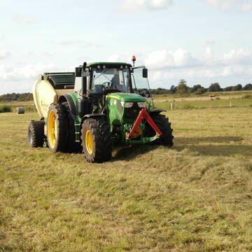
Heu HD-Ballen 2. Schnitt extensiv Heugräser
Drochtersen
M-Kluth
@M-Kluth
Heu
Empfänger lädt ab
Kleinballen/HD-Ballen
Regenfrei
3 weitere...
B+
Deprecated: Creation of dynamic property Zend_View_Helper_Ads::$adLink is deprecated in /var/www/stall-frei/htdocs/staging.stall-frei.de/library/Psf/View/Helper/Ads.php on line 108

Futtersack HeuToy, Fressbremse in pink
Mechtersen
STALL-FREIde Marketing
@STALL-FREI-Marketing
Stundenlange Beschäftigung die
Koliken vorbeugt, geringe Staubinhalation mit
steuerbarer Futterentnahme

Heu, Heulage, ökologisch, artenreich top Qualitä...
Hamburg
Frederic Wübbe
@Stall_Am_Burgberg
Heu
Lieferant entlädt
Rundballen
Bio
3 weitere...
B+

Heulage in Top-Bioqualität
Bothel
LB Sarah Lühring
@Bonito
Heulage
Rundballen
Regenfrei
Wird verladen
1 weitere...
B+

Heu und Stroh zu verkaufen
21527 Kollow
Hof -Linautal
@Hof-Linautal
Heu
Lieferant entlädt
Rundballen
Regenfrei
3 weitere...
aktuell
B+


Erstklassiges PferdeHeu in HD-Ballen
Jevenstedt
Tim Rohwer
@EIDERHEU
Heu
Kleinballen/HD-Ballen
Regenfrei
B+

Heu in Rundballen (ca.130cm) super Qualität
Pronstorf
Caros Pferdeparadies
@KaOb
Heu
Rundballen
Regenfrei
Wird verladen
2 weitere...
B+

Heu/trockene Heulage für Pferde Zucker,Fruktanarm
Sophienhamm
Herr-Kolb
@Herr-Kolb
Heulage
Lieferant entlädt
Regenfrei
Wird verladen
2 weitere...
B+
Eiweisarmes Heu oder Heulage
Sophienhamm
Herr-Kolb
@Herr-Kolb
Heu
Rundballen
Regenfrei
Wird verladen
B+

Heu in Quaderballen zu verkaufen
Bergen
Bianca Hinrichs-Schröder
@BHS1976
Futter
Empfänger lädt ab
Kleinballen/HD-Ballen
Bio
Regenfrei
2 weitere...
B+
Deprecated: Creation of dynamic property Zend_View::$pageCount is deprecated in /var/www/stall-frei/htdocs/staging.stall-frei.de/library/vendor/shardj/zf1-future/library/Zend/View/Abstract.php on line 308
Deprecated: Creation of dynamic property Zend_View::$itemCountPerPage is deprecated in /var/www/stall-frei/htdocs/staging.stall-frei.de/library/vendor/shardj/zf1-future/library/Zend/View/Abstract.php on line 308
Deprecated: Creation of dynamic property Zend_View::$first is deprecated in /var/www/stall-frei/htdocs/staging.stall-frei.de/library/vendor/shardj/zf1-future/library/Zend/View/Abstract.php on line 308
Deprecated: Creation of dynamic property Zend_View::$current is deprecated in /var/www/stall-frei/htdocs/staging.stall-frei.de/library/vendor/shardj/zf1-future/library/Zend/View/Abstract.php on line 308
Deprecated: Creation of dynamic property Zend_View::$last is deprecated in /var/www/stall-frei/htdocs/staging.stall-frei.de/library/vendor/shardj/zf1-future/library/Zend/View/Abstract.php on line 308
Deprecated: Creation of dynamic property Zend_View::$next is deprecated in /var/www/stall-frei/htdocs/staging.stall-frei.de/library/vendor/shardj/zf1-future/library/Zend/View/Abstract.php on line 308
Deprecated: Creation of dynamic property Zend_View::$pagesInRange is deprecated in /var/www/stall-frei/htdocs/staging.stall-frei.de/library/vendor/shardj/zf1-future/library/Zend/View/Abstract.php on line 308
Deprecated: Creation of dynamic property Zend_View::$firstPageInRange is deprecated in /var/www/stall-frei/htdocs/staging.stall-frei.de/library/vendor/shardj/zf1-future/library/Zend/View/Abstract.php on line 308
Deprecated: Creation of dynamic property Zend_View::$lastPageInRange is deprecated in /var/www/stall-frei/htdocs/staging.stall-frei.de/library/vendor/shardj/zf1-future/library/Zend/View/Abstract.php on line 308
Deprecated: Creation of dynamic property Zend_View::$currentItemCount is deprecated in /var/www/stall-frei/htdocs/staging.stall-frei.de/library/vendor/shardj/zf1-future/library/Zend/View/Abstract.php on line 308
Deprecated: Creation of dynamic property Zend_View::$totalItemCount is deprecated in /var/www/stall-frei/htdocs/staging.stall-frei.de/library/vendor/shardj/zf1-future/library/Zend/View/Abstract.php on line 308
Deprecated: Creation of dynamic property Zend_View::$firstItemNumber is deprecated in /var/www/stall-frei/htdocs/staging.stall-frei.de/library/vendor/shardj/zf1-future/library/Zend/View/Abstract.php on line 308
Deprecated: Creation of dynamic property Zend_View::$lastItemNumber is deprecated in /var/www/stall-frei/htdocs/staging.stall-frei.de/library/vendor/shardj/zf1-future/library/Zend/View/Abstract.php on line 308
Deprecated: Creation of dynamic property Zend_View::$router is deprecated in /var/www/stall-frei/htdocs/staging.stall-frei.de/library/vendor/shardj/zf1-future/library/Zend/View/Abstract.php on line 308
Deprecated: Creation of dynamic property Zend_View::$urlParams is deprecated in /var/www/stall-frei/htdocs/staging.stall-frei.de/library/vendor/shardj/zf1-future/library/Zend/View/Abstract.php on line 308
Deprecated: Creation of dynamic property Zend_View::$showAds is deprecated in /var/www/stall-frei/htdocs/staging.stall-frei.de/library/vendor/shardj/zf1-future/library/Zend/View/Abstract.php on line 308
Deprecated: Creation of dynamic property Zend_View::$objectIds is deprecated in /var/www/stall-frei/htdocs/staging.stall-frei.de/library/vendor/shardj/zf1-future/library/Zend/View/Abstract.php on line 308
Deprecated: Creation of dynamic property Zend_View::$showNavbar is deprecated in /var/www/stall-frei/htdocs/staging.stall-frei.de/library/vendor/shardj/zf1-future/library/Zend/View/Abstract.php on line 308
Deprecated: Creation of dynamic property Zend_View::$showBreadcrumb is deprecated in /var/www/stall-frei/htdocs/staging.stall-frei.de/library/vendor/shardj/zf1-future/library/Zend/View/Abstract.php on line 308
Deprecated: Creation of dynamic property Zend_View::$showFooter is deprecated in /var/www/stall-frei/htdocs/staging.stall-frei.de/library/vendor/shardj/zf1-future/library/Zend/View/Abstract.php on line 308
Deprecated: Creation of dynamic property Zend_View::$showInternalAds is deprecated in /var/www/stall-frei/htdocs/staging.stall-frei.de/library/vendor/shardj/zf1-future/library/Zend/View/Abstract.php on line 308
Deprecated: Creation of dynamic property Zend_View::$blNoContent is deprecated in /var/www/stall-frei/htdocs/staging.stall-frei.de/library/vendor/shardj/zf1-future/library/Zend/View/Abstract.php on line 308
Deprecated: Creation of dynamic property Zend_View::$sMetaDesc is deprecated in /var/www/stall-frei/htdocs/staging.stall-frei.de/library/vendor/shardj/zf1-future/library/Zend/View/Abstract.php on line 308
Deprecated: Creation of dynamic property Zend_View::$useGmaps is deprecated in /var/www/stall-frei/htdocs/staging.stall-frei.de/library/vendor/shardj/zf1-future/library/Zend/View/Abstract.php on line 308
Deprecated: Creation of dynamic property Zend_View::$touches is deprecated in /var/www/stall-frei/htdocs/staging.stall-frei.de/library/vendor/shardj/zf1-future/library/Zend/View/Abstract.php on line 308
Deprecated: Creation of dynamic property Zend_View::$oProject is deprecated in /var/www/stall-frei/htdocs/staging.stall-frei.de/library/vendor/shardj/zf1-future/library/Zend/View/Abstract.php on line 308
Deprecated: Creation of dynamic property Zend_View::$pageHeadline is deprecated in /var/www/stall-frei/htdocs/staging.stall-frei.de/library/vendor/shardj/zf1-future/library/Zend/View/Abstract.php on line 308
Deprecated: Creation of dynamic property Zend_View::$disableLocationField is deprecated in /var/www/stall-frei/htdocs/staging.stall-frei.de/library/vendor/shardj/zf1-future/library/Zend/View/Abstract.php on line 308
Deprecated: Creation of dynamic property Zend_View::$isSearch is deprecated in /var/www/stall-frei/htdocs/staging.stall-frei.de/library/vendor/shardj/zf1-future/library/Zend/View/Abstract.php on line 308
Deprecated: Creation of dynamic property Zend_View::$pageTitle is deprecated in /var/www/stall-frei/htdocs/staging.stall-frei.de/library/vendor/shardj/zf1-future/library/Zend/View/Abstract.php on line 308
Deprecated: Creation of dynamic property Psf_Form_Element_Text::$class is deprecated in /var/www/stall-frei/htdocs/staging.stall-frei.de/library/vendor/shardj/zf1-future/library/Zend/Form/Element.php on line 874
Deprecated: Creation of dynamic property Psf_Form_Element_Text::$size is deprecated in /var/www/stall-frei/htdocs/staging.stall-frei.de/library/vendor/shardj/zf1-future/library/Zend/Form/Element.php on line 874
Deprecated: Creation of dynamic property Psf_Form_Element_Text::$placeholder is deprecated in /var/www/stall-frei/htdocs/staging.stall-frei.de/library/vendor/shardj/zf1-future/library/Zend/Form/Element.php on line 874
Deprecated: Creation of dynamic property Psf_Form_Element_Hidden::$class is deprecated in /var/www/stall-frei/htdocs/staging.stall-frei.de/library/vendor/shardj/zf1-future/library/Zend/Form/Element.php on line 874
Deprecated: Creation of dynamic property Psf_Form_Element_Hidden::$class is deprecated in /var/www/stall-frei/htdocs/staging.stall-frei.de/library/vendor/shardj/zf1-future/library/Zend/Form/Element.php on line 874
Deprecated: Creation of dynamic property Psf_Form_Element_Hidden::$class is deprecated in /var/www/stall-frei/htdocs/staging.stall-frei.de/library/vendor/shardj/zf1-future/library/Zend/Form/Element.php on line 874
Deprecated: Creation of dynamic property Psf_Form_Element_Hidden::$class is deprecated in /var/www/stall-frei/htdocs/staging.stall-frei.de/library/vendor/shardj/zf1-future/library/Zend/Form/Element.php on line 874
Deprecated: Creation of dynamic property Psf_Form_Element_Select::$class is deprecated in /var/www/stall-frei/htdocs/staging.stall-frei.de/library/vendor/shardj/zf1-future/library/Zend/Form/Element.php on line 874
Deprecated: Creation of dynamic property Psf_Form_Element_Select::$class is deprecated in /var/www/stall-frei/htdocs/staging.stall-frei.de/library/vendor/shardj/zf1-future/library/Zend/Form/Element.php on line 874
Deprecated: Creation of dynamic property Psf_Form_Element_Select::$class is deprecated in /var/www/stall-frei/htdocs/staging.stall-frei.de/library/vendor/shardj/zf1-future/library/Zend/Form/Element.php on line 874
Deprecated: Creation of dynamic property Psf_Form_Element_Select::$class is deprecated in /var/www/stall-frei/htdocs/staging.stall-frei.de/library/vendor/shardj/zf1-future/library/Zend/Form/Element.php on line 874
Deprecated: Creation of dynamic property Zend_View::$sort is deprecated in /var/www/stall-frei/htdocs/staging.stall-frei.de/library/vendor/shardj/zf1-future/library/Zend/View/Abstract.php on line 308
Deprecated: Creation of dynamic property Zend_View::$searchLocation is deprecated in /var/www/stall-frei/htdocs/staging.stall-frei.de/library/vendor/shardj/zf1-future/library/Zend/View/Abstract.php on line 308
Deprecated: Creation of dynamic property Zend_View::$locationHint is deprecated in /var/www/stall-frei/htdocs/staging.stall-frei.de/library/vendor/shardj/zf1-future/library/Zend/View/Abstract.php on line 308
Psf_GeoCoder_Abstract::getLocation: Hollern-Twielenfleth Get Location CachedOrLive
Psf_GeoCoder_Abstract::getCachedOrLive: Hollern-Twielenfleth
Psf_GeoCoder_OpenCageData::makeApiRequest: response:
Array
(
[documentation] => https://opencagedata.com/api
[licenses] => Array
(
[0] => Array
(
[name] => see attribution guide
[url] => https://opencagedata.com/credits
)
)
[results] => Array
(
[0] => Array
(
[bounds] => Array
(
[northeast] => Array
(
[lat] => 53.6166502
[lng] => 9.5917286
)
[southwest] => Array
(
[lat] => 53.5655095
[lng] => 9.4956018
)
)
[components] => Array
(
[ISO_3166-1_alpha-2] => DE
[ISO_3166-1_alpha-3] => DEU
[ISO_3166-2] => Array
(
[0] => DE-NI
)
[_category] => place
[_normalized_city] => Hollern-Twielenfleth
[_type] => village
[continent] => Europe
[country] => Deutschland
[country_code] => de
[county] => Landkreis Stade
[municipality] => Samtgemeinde Lühe
[political_union] => European Union
[postcode] => 21723
[state] => Niedersachsen
[state_code] => NI
[village] => Hollern-Twielenfleth
)
[confidence] => 7
[formatted] => 21723 Hollern-Twielenfleth, Deutschland
[geometry] => Array
(
[lat] => 53.5970704
[lng] => 9.529815
)
)
[1] => Array
(
[components] => Array
(
[ISO_3166-1_alpha-2] => FR
[ISO_3166-1_alpha-3] => FRA
[ISO_3166-2] => Array
(
[0] => FR-NOR
[1] => FR-61
)
[_category] => road
[_normalized_city] => Berd'huis
[_type] => road
[city] => Berd'huis
[continent] => Europe
[country] => France
[country_code] => fr
[county] => Orne
[local_authority] => Communauté de communes Cœur du Perche
[political_union] => European Union
[postcode] => 61340
[road] => Chemin de la Hollerie
[state] => Normandie
[state_code] => NOR
)
[confidence] => 2
[formatted] => Chemin de la Hollerie, 61340 Berd'huis, France
[geometry] => Array
(
[lat] => 48.34401
[lng] => 0.727925
)
)
[2] => Array
(
[components] => Array
(
[ISO_3166-1_alpha-2] => FR
[ISO_3166-1_alpha-3] => FRA
[ISO_3166-2] => Array
(
[0] => FR-IDF
[1] => FR-92
)
[_category] => road
[_normalized_city] => Levallois-Perret
[_type] => road
[city] => Levallois-Perret
[continent] => Europe
[country] => France
[country_code] => fr
[county] => Hauts-de-Seine
[local_authority] => Métropole du Grand Paris
[political_union] => European Union
[postcode] => 92300
[road] => Rue Charles Deutschmann
[state] => Île-de-France
[state_code] => IDF
)
[confidence] => 2
[formatted] => Rue Charles Deutschmann, 92300 Levallois-Perret, France
[geometry] => Array
(
[lat] => 48.900049
[lng] => 2.2842
)
)
[3] => Array
(
[components] => Array
(
[ISO_3166-1_alpha-2] => FR
[ISO_3166-1_alpha-3] => FRA
[ISO_3166-2] => Array
(
[0] => FR-BRE
[1] => FR-56
)
[_category] => road
[_normalized_city] => Elven
[_type] => road
[city] => Elven
[continent] => Europe
[country] => France
[country_code] => fr
[county] => Morbihan
[local_authority] => Golfe du Morbihan - Vannes agglomération
[political_union] => European Union
[postcode] => 56250
[road] => Lieu Dit Le Blern
[state] => Bretagne
[state_code] => BRE
)
[confidence] => 2
[formatted] => Lieu Dit Le Blern, 56250 Elven, France
[geometry] => Array
(
[lat] => 47.739765
[lng] => -2.633055
)
)
[4] => Array
(
[components] => Array
(
[ISO_3166-1_alpha-2] => FR
[ISO_3166-1_alpha-3] => FRA
[ISO_3166-2] => Array
(
[0] => FR-CVL
[1] => FR-41
)
[_category] => road
[_normalized_city] => Blois
[_type] => road
[city] => Blois
[continent] => Europe
[country] => France
[country_code] => fr
[county] => Loir-et-Cher
[local_authority] => Communauté d'agglomération de Blois "Agglopolys"
[political_union] => European Union
[postcode] => 41000
[road] => Chemin des Holéris
[state] => Centre-Val de Loire
[state_code] => CVL
)
[confidence] => 2
[formatted] => Chemin des Holéris, 41000 Blois, France
[geometry] => Array
(
[lat] => 47.573724
[lng] => 1.335652
)
)
[5] => Array
(
[components] => Array
(
[ISO_3166-1_alpha-2] => FR
[ISO_3166-1_alpha-3] => FRA
[ISO_3166-2] => Array
(
[0] => FR-CVL
[1] => FR-45
)
[_category] => road
[_normalized_city] => La Ferté-Saint-Aubin
[_type] => road
[city] => La Ferté-Saint-Aubin
[continent] => Europe
[country] => France
[country_code] => fr
[county] => Loiret
[local_authority] => Communauté de communes des Portes de Sologne
[political_union] => European Union
[postcode] => 45240
[road] => Route des Olleries
[state] => Centre-Val de Loire
[state_code] => CVL
)
[confidence] => 2
[formatted] => Route des Olleries, 45240 La Ferté-Saint-Aubin, France
[geometry] => Array
(
[lat] => 47.722186
[lng] => 1.880182
)
)
[6] => Array
(
[components] => Array
(
[ISO_3166-1_alpha-2] => FR
[ISO_3166-1_alpha-3] => FRA
[ISO_3166-2] => Array
(
[0] => FR-NAQ
[1] => FR-16
)
[_category] => road
[_normalized_city] => La Rochefoucauld-en-Angoumois
[_type] => road
[city] => La Rochefoucauld-en-Angoumois
[continent] => Europe
[country] => France
[country_code] => fr
[county] => Charente
[local_authority] => Communauté de communes la Rochefoucauld - Porte du Périgord
[political_union] => European Union
[postcode] => 16110
[road] => Chemin d'Olérat
[state] => Nouvelle-Aquitaine
[state_code] => NAQ
)
[confidence] => 10
[formatted] => Chemin d'Olérat, 16110 La Rochefoucauld-en-Angoumois, France
[geometry] => Array
(
[lat] => 45.72855
[lng] => 0.382542
)
)
[7] => Array
(
[components] => Array
(
[ISO_3166-1_alpha-2] => RE
[ISO_3166-1_alpha-3] => REU
[ISO_3166-2] => Array
(
[0] => FR-974
)
[_category] => road
[_normalized_city] => Saint-Benoît
[_type] => road
[city] => Saint-Benoît
[continent] => Africa
[country] => France
[country_code] => fr
[county] => La Réunion
[local_authority] => Communauté intercommunale Réunion Est
[political_union] => European Union
[postcode] => 97470
[road] => Chemin Olery
[state] =>
)
[confidence] => 10
[formatted] => Chemin Olery, 97470 Saint-Benoît, France
[geometry] => Array
(
[lat] => -21.011004
[lng] => 55.690207
)
)
[8] => Array
(
[components] => Array
(
[ISO_3166-1_alpha-2] => FR
[ISO_3166-1_alpha-3] => FRA
[ISO_3166-2] => Array
(
[0] => FR-OCC
[1] => FR-32
)
[_category] => place
[_normalized_city] => Couloumé-Mondebat
[_type] => place
[city] => Couloumé-Mondebat
[continent] => Europe
[country] => France
[country_code] => fr
[county] => Gers
[local_authority] => Communauté de communes Bastides et Vallons du Gers
[place] => La Grange d'Olleris
[political_union] => European Union
[postcode] => 32160
[state] => Occitanie
[state_code] => OCC
)
[confidence] => 10
[formatted] => La Grange d'Olleris, 32160 Couloumé-Mondebat, France
[geometry] => Array
(
[lat] => 43.617685
[lng] => 0.112513
)
)
[9] => Array
(
[components] => Array
(
[ISO_3166-1_alpha-2] => FR
[ISO_3166-1_alpha-3] => FRA
[ISO_3166-2] => Array
(
[0] => FR-NAQ
[1] => FR-16
)
[_category] => road
[_normalized_city] => La Rochefoucauld-en-Angoumois
[_type] => road
[city] => La Rochefoucauld-en-Angoumois
[continent] => Europe
[country] => France
[country_code] => fr
[county] => Charente
[local_authority] => Communauté de communes la Rochefoucauld - Porte du Périgord
[political_union] => European Union
[postcode] => 16110
[road] => Zone d'Olerat
[state] => Nouvelle-Aquitaine
[state_code] => NAQ
)
[confidence] => 10
[formatted] => Zone d'Olerat, 16110 La Rochefoucauld-en-Angoumois, France
[geometry] => Array
(
[lat] => 45.728831
[lng] => 0.390168
)
)
)
[status] => Array
(
[code] => 200
[message] => OK
)
[stay_informed] => Array
(
[blog] => https://blog.opencagedata.com
[mastodon] => https://en.osm.town/@opencage
)
[thanks] => For using an OpenCage API
[timestamp] => Array
(
[created_http] => Sun, 08 Feb 2026 14:16:02 GMT
[created_unix] => 1770560162
)
[total_results] => 10
)
Psf_GeoCoder_Abstract::convertLocationResult
{"documentation":"https:\/\/opencagedata.com\/api","licenses":[{"name":"see attribution guide","url":"https:\/\/opencagedata.com\/credits"}],"results":[{"bounds":{"northeast":{"lat":53.6166502,"lng":9.5917286},"southwest":{"lat":53.5655095,"lng":9.4956018}},"components":{"ISO_3166-1_alpha-2":"DE","ISO_3166-1_alpha-3":"DEU","ISO_3166-2":["DE-NI"],"_category":"place","_normalized_city":"Hollern-Twielenfleth","_type":"village","continent":"Europe","country":"Deutschland","country_code":"de","county":"Landkreis Stade","municipality":"Samtgemeinde L\u00fche","political_union":"European Union","postcode":"21723","state":"Niedersachsen","state_code":"NI","village":"Hollern-Twielenfleth"},"confidence":7,"formatted":"21723 Hollern-Twielenfleth, Deutschland","geometry":{"lat":53.5970704,"lng":9.529815}},{"components":{"ISO_3166-1_alpha-2":"FR","ISO_3166-1_alpha-3":"FRA","ISO_3166-2":["FR-NOR","FR-61"],"_category":"road","_normalized_city":"Berd'huis","_type":"road","city":"Berd'huis","continent":"Europe","country":"France","country_code":"fr","county":"Orne","local_authority":"Communaut\u00e9 de communes C\u0153ur du Perche","political_union":"European Union","postcode":"61340","road":"Chemin de la Hollerie","state":"Normandie","state_code":"NOR"},"confidence":2,"formatted":"Chemin de la Hollerie, 61340 Berd'huis, France","geometry":{"lat":48.34401,"lng":0.727925}},{"components":{"ISO_3166-1_alpha-2":"FR","ISO_3166-1_alpha-3":"FRA","ISO_3166-2":["FR-IDF","FR-92"],"_category":"road","_normalized_city":"Levallois-Perret","_type":"road","city":"Levallois-Perret","continent":"Europe","country":"France","country_code":"fr","county":"Hauts-de-Seine","local_authority":"M\u00e9tropole du Grand Paris","political_union":"European Union","postcode":"92300","road":"Rue Charles Deutschmann","state":"\u00cele-de-France","state_code":"IDF"},"confidence":2,"formatted":"Rue Charles Deutschmann, 92300 Levallois-Perret, France","geometry":{"lat":48.900049,"lng":2.2842}},{"components":{"ISO_3166-1_alpha-2":"FR","ISO_3166-1_alpha-3":"FRA","ISO_3166-2":["FR-BRE","FR-56"],"_category":"road","_normalized_city":"Elven","_type":"road","city":"Elven","continent":"Europe","country":"France","country_code":"fr","county":"Morbihan","local_authority":"Golfe du Morbihan - Vannes agglom\u00e9ration","political_union":"European Union","postcode":"56250","road":"Lieu Dit Le Blern","state":"Bretagne","state_code":"BRE"},"confidence":2,"formatted":"Lieu Dit Le Blern, 56250 Elven, France","geometry":{"lat":47.739765,"lng":-2.633055}},{"components":{"ISO_3166-1_alpha-2":"FR","ISO_3166-1_alpha-3":"FRA","ISO_3166-2":["FR-CVL","FR-41"],"_category":"road","_normalized_city":"Blois","_type":"road","city":"Blois","continent":"Europe","country":"France","country_code":"fr","county":"Loir-et-Cher","local_authority":"Communaut\u00e9 d'agglom\u00e9ration de Blois \"Agglopolys\"","political_union":"European Union","postcode":"41000","road":"Chemin des Hol\u00e9ris","state":"Centre-Val de Loire","state_code":"CVL"},"confidence":2,"formatted":"Chemin des Hol\u00e9ris, 41000 Blois, France","geometry":{"lat":47.573724,"lng":1.335652}},{"components":{"ISO_3166-1_alpha-2":"FR","ISO_3166-1_alpha-3":"FRA","ISO_3166-2":["FR-CVL","FR-45"],"_category":"road","_normalized_city":"La Fert\u00e9-Saint-Aubin","_type":"road","city":"La Fert\u00e9-Saint-Aubin","continent":"Europe","country":"France","country_code":"fr","county":"Loiret","local_authority":"Communaut\u00e9 de communes des Portes de Sologne","political_union":"European Union","postcode":"45240","road":"Route des Olleries","state":"Centre-Val de Loire","state_code":"CVL"},"confidence":2,"formatted":"Route des Olleries, 45240 La Fert\u00e9-Saint-Aubin, France","geometry":{"lat":47.722186,"lng":1.880182}},{"components":{"ISO_3166-1_alpha-2":"FR","ISO_3166-1_alpha-3":"FRA","ISO_3166-2":["FR-NAQ","FR-16"],"_category":"road","_normalized_city":"La Rochefoucauld-en-Angoumois","_type":"road","city":"La Rochefoucauld-en-Angoumois","continent":"Europe","country":"France","country_code":"fr","county":"Charente","local_authority":"Communaut\u00e9 de communes la Rochefoucauld - Porte du P\u00e9rigord","political_union":"European Union","postcode":"16110","road":"Chemin d'Ol\u00e9rat","state":"Nouvelle-Aquitaine","state_code":"NAQ"},"confidence":10,"formatted":"Chemin d'Ol\u00e9rat, 16110 La Rochefoucauld-en-Angoumois, France","geometry":{"lat":45.72855,"lng":0.382542}},{"components":{"ISO_3166-1_alpha-2":"RE","ISO_3166-1_alpha-3":"REU","ISO_3166-2":["FR-974"],"_category":"road","_normalized_city":"Saint-Beno\u00eet","_type":"road","city":"Saint-Beno\u00eet","continent":"Africa","country":"France","country_code":"fr","county":"La R\u00e9union","local_authority":"Communaut\u00e9 intercommunale R\u00e9union Est","political_union":"European Union","postcode":"97470","road":"Chemin Olery","state":null},"confidence":10,"formatted":"Chemin Olery, 97470 Saint-Beno\u00eet, France","geometry":{"lat":-21.011004,"lng":55.690207}},{"components":{"ISO_3166-1_alpha-2":"FR","ISO_3166-1_alpha-3":"FRA","ISO_3166-2":["FR-OCC","FR-32"],"_category":"place","_normalized_city":"Couloum\u00e9-Mondebat","_type":"place","city":"Couloum\u00e9-Mondebat","continent":"Europe","country":"France","country_code":"fr","county":"Gers","local_authority":"Communaut\u00e9 de communes Bastides et Vallons du Gers","place":"La Grange d'Olleris","political_union":"European Union","postcode":"32160","state":"Occitanie","state_code":"OCC"},"confidence":10,"formatted":"La Grange d'Olleris, 32160 Couloum\u00e9-Mondebat, France","geometry":{"lat":43.617685,"lng":0.112513}},{"components":{"ISO_3166-1_alpha-2":"FR","ISO_3166-1_alpha-3":"FRA","ISO_3166-2":["FR-NAQ","FR-16"],"_category":"road","_normalized_city":"La Rochefoucauld-en-Angoumois","_type":"road","city":"La Rochefoucauld-en-Angoumois","continent":"Europe","country":"France","country_code":"fr","county":"Charente","local_authority":"Communaut\u00e9 de communes la Rochefoucauld - Porte du P\u00e9rigord","political_union":"European Union","postcode":"16110","road":"Zone d'Olerat","state":"Nouvelle-Aquitaine","state_code":"NAQ"},"confidence":10,"formatted":"Zone d'Olerat, 16110 La Rochefoucauld-en-Angoumois, France","geometry":{"lat":45.728831,"lng":0.390168}}],"status":{"code":200,"message":"OK"},"stay_informed":{"blog":"https:\/\/blog.opencagedata.com","mastodon":"https:\/\/en.osm.town\/@opencage"},"thanks":"For using an OpenCage API","timestamp":{"created_http":"Sun, 08 Feb 2026 14:16:02 GMT","created_unix":1770560162},"total_results":10}Array
(
[0] => stdClass Object
(
[bounds] => stdClass Object
(
[northeast] => stdClass Object
(
[lat] => 53.6166502
[lng] => 9.5917286
)
[southwest] => stdClass Object
(
[lat] => 53.5655095
[lng] => 9.4956018
)
)
[components] => stdClass Object
(
[ISO_3166-1_alpha-2] => DE
[ISO_3166-1_alpha-3] => DEU
[ISO_3166-2] => Array
(
[0] => DE-NI
)
[_category] => place
[_normalized_city] => Hollern-Twielenfleth
[_type] => village
[continent] => Europe
[country] => Deutschland
[country_code] => de
[county] => Landkreis Stade
[municipality] => Samtgemeinde Lühe
[political_union] => European Union
[postcode] => 21723
[state] => Niedersachsen
[state_code] => NI
[village] => Hollern-Twielenfleth
)
[confidence] => 7
[formatted] => 21723 Hollern-Twielenfleth, Deutschland
[geometry] => stdClass Object
(
[lat] => 53.5970704
[lng] => 9.529815
)
)
[1] => stdClass Object
(
[components] => stdClass Object
(
[ISO_3166-1_alpha-2] => FR
[ISO_3166-1_alpha-3] => FRA
[ISO_3166-2] => Array
(
[0] => FR-NOR
[1] => FR-61
)
[_category] => road
[_normalized_city] => Berd'huis
[_type] => road
[city] => Berd'huis
[continent] => Europe
[country] => France
[country_code] => fr
[county] => Orne
[local_authority] => Communauté de communes Cœur du Perche
[political_union] => European Union
[postcode] => 61340
[road] => Chemin de la Hollerie
[state] => Normandie
[state_code] => NOR
)
[confidence] => 2
[formatted] => Chemin de la Hollerie, 61340 Berd'huis, France
[geometry] => stdClass Object
(
[lat] => 48.34401
[lng] => 0.727925
)
)
[2] => stdClass Object
(
[components] => stdClass Object
(
[ISO_3166-1_alpha-2] => FR
[ISO_3166-1_alpha-3] => FRA
[ISO_3166-2] => Array
(
[0] => FR-IDF
[1] => FR-92
)
[_category] => road
[_normalized_city] => Levallois-Perret
[_type] => road
[city] => Levallois-Perret
[continent] => Europe
[country] => France
[country_code] => fr
[county] => Hauts-de-Seine
[local_authority] => Métropole du Grand Paris
[political_union] => European Union
[postcode] => 92300
[road] => Rue Charles Deutschmann
[state] => Île-de-France
[state_code] => IDF
)
[confidence] => 2
[formatted] => Rue Charles Deutschmann, 92300 Levallois-Perret, France
[geometry] => stdClass Object
(
[lat] => 48.900049
[lng] => 2.2842
)
)
[3] => stdClass Object
(
[components] => stdClass Object
(
[ISO_3166-1_alpha-2] => FR
[ISO_3166-1_alpha-3] => FRA
[ISO_3166-2] => Array
(
[0] => FR-BRE
[1] => FR-56
)
[_category] => road
[_normalized_city] => Elven
[_type] => road
[city] => Elven
[continent] => Europe
[country] => France
[country_code] => fr
[county] => Morbihan
[local_authority] => Golfe du Morbihan - Vannes agglomération
[political_union] => European Union
[postcode] => 56250
[road] => Lieu Dit Le Blern
[state] => Bretagne
[state_code] => BRE
)
[confidence] => 2
[formatted] => Lieu Dit Le Blern, 56250 Elven, France
[geometry] => stdClass Object
(
[lat] => 47.739765
[lng] => -2.633055
)
)
[4] => stdClass Object
(
[components] => stdClass Object
(
[ISO_3166-1_alpha-2] => FR
[ISO_3166-1_alpha-3] => FRA
[ISO_3166-2] => Array
(
[0] => FR-CVL
[1] => FR-41
)
[_category] => road
[_normalized_city] => Blois
[_type] => road
[city] => Blois
[continent] => Europe
[country] => France
[country_code] => fr
[county] => Loir-et-Cher
[local_authority] => Communauté d'agglomération de Blois "Agglopolys"
[political_union] => European Union
[postcode] => 41000
[road] => Chemin des Holéris
[state] => Centre-Val de Loire
[state_code] => CVL
)
[confidence] => 2
[formatted] => Chemin des Holéris, 41000 Blois, France
[geometry] => stdClass Object
(
[lat] => 47.573724
[lng] => 1.335652
)
)
[5] => stdClass Object
(
[components] => stdClass Object
(
[ISO_3166-1_alpha-2] => FR
[ISO_3166-1_alpha-3] => FRA
[ISO_3166-2] => Array
(
[0] => FR-CVL
[1] => FR-45
)
[_category] => road
[_normalized_city] => La Ferté-Saint-Aubin
[_type] => road
[city] => La Ferté-Saint-Aubin
[continent] => Europe
[country] => France
[country_code] => fr
[county] => Loiret
[local_authority] => Communauté de communes des Portes de Sologne
[political_union] => European Union
[postcode] => 45240
[road] => Route des Olleries
[state] => Centre-Val de Loire
[state_code] => CVL
)
[confidence] => 2
[formatted] => Route des Olleries, 45240 La Ferté-Saint-Aubin, France
[geometry] => stdClass Object
(
[lat] => 47.722186
[lng] => 1.880182
)
)
[6] => stdClass Object
(
[components] => stdClass Object
(
[ISO_3166-1_alpha-2] => FR
[ISO_3166-1_alpha-3] => FRA
[ISO_3166-2] => Array
(
[0] => FR-NAQ
[1] => FR-16
)
[_category] => road
[_normalized_city] => La Rochefoucauld-en-Angoumois
[_type] => road
[city] => La Rochefoucauld-en-Angoumois
[continent] => Europe
[country] => France
[country_code] => fr
[county] => Charente
[local_authority] => Communauté de communes la Rochefoucauld - Porte du Périgord
[political_union] => European Union
[postcode] => 16110
[road] => Chemin d'Olérat
[state] => Nouvelle-Aquitaine
[state_code] => NAQ
)
[confidence] => 10
[formatted] => Chemin d'Olérat, 16110 La Rochefoucauld-en-Angoumois, France
[geometry] => stdClass Object
(
[lat] => 45.72855
[lng] => 0.382542
)
)
[7] => stdClass Object
(
[components] => stdClass Object
(
[ISO_3166-1_alpha-2] => RE
[ISO_3166-1_alpha-3] => REU
[ISO_3166-2] => Array
(
[0] => FR-974
)
[_category] => road
[_normalized_city] => Saint-Benoît
[_type] => road
[city] => Saint-Benoît
[continent] => Africa
[country] => France
[country_code] => fr
[county] => La Réunion
[local_authority] => Communauté intercommunale Réunion Est
[political_union] => European Union
[postcode] => 97470
[road] => Chemin Olery
[state] =>
)
[confidence] => 10
[formatted] => Chemin Olery, 97470 Saint-Benoît, France
[geometry] => stdClass Object
(
[lat] => -21.011004
[lng] => 55.690207
)
)
[8] => stdClass Object
(
[components] => stdClass Object
(
[ISO_3166-1_alpha-2] => FR
[ISO_3166-1_alpha-3] => FRA
[ISO_3166-2] => Array
(
[0] => FR-OCC
[1] => FR-32
)
[_category] => place
[_normalized_city] => Couloumé-Mondebat
[_type] => place
[city] => Couloumé-Mondebat
[continent] => Europe
[country] => France
[country_code] => fr
[county] => Gers
[local_authority] => Communauté de communes Bastides et Vallons du Gers
[place] => La Grange d'Olleris
[political_union] => European Union
[postcode] => 32160
[state] => Occitanie
[state_code] => OCC
)
[confidence] => 10
[formatted] => La Grange d'Olleris, 32160 Couloumé-Mondebat, France
[geometry] => stdClass Object
(
[lat] => 43.617685
[lng] => 0.112513
)
)
[9] => stdClass Object
(
[components] => stdClass Object
(
[ISO_3166-1_alpha-2] => FR
[ISO_3166-1_alpha-3] => FRA
[ISO_3166-2] => Array
(
[0] => FR-NAQ
[1] => FR-16
)
[_category] => road
[_normalized_city] => La Rochefoucauld-en-Angoumois
[_type] => road
[city] => La Rochefoucauld-en-Angoumois
[continent] => Europe
[country] => France
[country_code] => fr
[county] => Charente
[local_authority] => Communauté de communes la Rochefoucauld - Porte du Périgord
[political_union] => European Union
[postcode] => 16110
[road] => Zone d'Olerat
[state] => Nouvelle-Aquitaine
[state_code] => NAQ
)
[confidence] => 10
[formatted] => Zone d'Olerat, 16110 La Rochefoucauld-en-Angoumois, France
[geometry] => stdClass Object
(
[lat] => 45.728831
[lng] => 0.390168
)
)
)
Psf_GeoCoder_OpenCageData::getKeyMap: 0
stdClass Object
(
    [bounds] => stdClass Object
        (
            [northeast] => stdClass Object
                (
                    [lat] => 53.6166502
                    [lng] => 9.5917286
                )

            [southwest] => stdClass Object
                (
                    [lat] => 53.5655095
                    [lng] => 9.4956018
                )

        )

    [components] => stdClass Object
        (
            [ISO_3166-1_alpha-2] => DE
            [ISO_3166-1_alpha-3] => DEU
            [ISO_3166-2] => Array
                (
                    [0] => DE-NI
                )

            [_category] => place
            [_normalized_city] => Hollern-Twielenfleth
            [_type] => village
            [continent] => Europe
            [country] => Deutschland
            [country_code] => de
            [county] => Landkreis Stade
            [municipality] => Samtgemeinde Lühe
            [political_union] => European Union
            [postcode] => 21723
            [state] => Niedersachsen
            [state_code] => NI
            [village] => Hollern-Twielenfleth
        )

    [confidence] => 7
    [formatted] => 21723 Hollern-Twielenfleth, Deutschland
    [geometry] => stdClass Object
        (
            [lat] => 53.5970704
            [lng] => 9.529815
        )

)
Psf_GeoCoder_OpenCageData::getCounty: Stade
Psf_GeoCoder_OpenCageData::addMissingData REFETCH!
Array
(
    [address] => 21723 Hollern-Twielenfleth, Deutschland
    [type] => village
    [street] =>
    [city] => Hollern-Twielenfleth
    [county] => Stade
    [state] => Niedersachsen
    [zip] => 21723
    [country] => Deutschland
    [suburb] =>
    [countrycode] => de
    [latitude] => 53.5970704
    [longitude] => 9.529815
    [accuracy] => 1
    [confidence] => 7
    [bounds] => stdClass Object
        (
            [northeast] => stdClass Object
                (
                    [lat] => 53.6166502
                    [lng] => 9.5917286
                )

            [southwest] => stdClass Object
                (
                    [lat] => 53.5655095
                    [lng] => 9.4956018
                )

        )

)
reformat!
Array
(
    [address] => 21723 Hollern-Twielenfleth, Deutschland
    [type] => village
    [street] =>
    [city] => Hollern-Twielenfleth
    [county] => Stade
    [state] => Niedersachsen
    [zip] => 21723
    [country] => Deutschland
    [suburb] =>
    [countrycode] => de
    [latitude] => 53.5970704
    [longitude] => 9.529815
    [accuracy] => 1
    [confidence] => 7
    [bounds] => stdClass Object
        (
            [northeast] => stdClass Object
                (
                    [lat] => 53.6166502
                    [lng] => 9.5917286
                )

            [southwest] => stdClass Object
                (
                    [lat] => 53.5655095
                    [lng] => 9.4956018
                )

        )

    [place] => 21723 Hollern-Twielenfleth, Niedersachsen
    [hash] => bb8caba22c42cacaafbcb5cf85909ec6
)
Psf_GeoCoder_OpenCageData::getKeyMap: 1
stdClass Object
(
    [components] => stdClass Object
        (
            [ISO_3166-1_alpha-2] => FR
            [ISO_3166-1_alpha-3] => FRA
            [ISO_3166-2] => Array
                (
                    [0] => FR-NOR
                    [1] => FR-61
                )

            [_category] => road
            [_normalized_city] => Berd'huis
            [_type] => road
            [city] => Berd'huis
            [continent] => Europe
            [country] => France
            [country_code] => fr
            [county] => Orne
            [local_authority] => Communauté de communes Cœur du Perche
            [political_union] => European Union
            [postcode] => 61340
            [road] => Chemin de la Hollerie
            [state] => Normandie
            [state_code] => NOR
        )

    [confidence] => 2
    [formatted] => Chemin de la Hollerie, 61340 Berd'huis, France
    [geometry] => stdClass Object
        (
            [lat] => 48.34401
            [lng] => 0.727925
        )

)
Psf_GeoCoder_OpenCageData::getCounty: Orne
Psf_GeoCoder_OpenCageData::addMissingData REFETCH!
Array
(
    [address] => Chemin de la Hollerie, 61340 Berd'huis, France
    [type] => road
    [street] => Chemin de la Hollerie
    [city] => Berd'huis
    [county] => Orne
    [state] => Normandie
    [zip] => 61340
    [country] => France
    [suburb] =>
    [countrycode] => fr
    [latitude] => 48.34401
    [longitude] => 0.727925
    [accuracy] => 1
    [confidence] => 2
    [bounds] =>
)
reformat!
Array
(
    [address] => Chemin de la Hollerie, 61340 Berd'huis, France
    [type] => road
    [street] => Chemin de la Hollerie
    [city] => Berd'huis
    [county] => Orne
    [state] => Normandie
    [zip] => 61340
    [country] => France
    [suburb] =>
    [countrycode] => fr
    [latitude] => 48.34401
    [longitude] => 0.727925
    [accuracy] => 1
    [confidence] => 2
    [bounds] =>
    [place] => Chemin de la Hollerie, 61340 Berd'huis, Normandie
    [hash] => c5f0fb3a8e614f40c1a5dd9e8e0ab32b
)
Psf_GeoCoder_OpenCageData::getKeyMap: 2
stdClass Object
(
    [components] => stdClass Object
        (
            [ISO_3166-1_alpha-2] => FR
            [ISO_3166-1_alpha-3] => FRA
            [ISO_3166-2] => Array
                (
                    [0] => FR-IDF
                    [1] => FR-92
                )

            [_category] => road
            [_normalized_city] => Levallois-Perret
            [_type] => road
            [city] => Levallois-Perret
            [continent] => Europe
            [country] => France
            [country_code] => fr
            [county] => Hauts-de-Seine
            [local_authority] => Métropole du Grand Paris
            [political_union] => European Union
            [postcode] => 92300
            [road] => Rue Charles Deutschmann
            [state] => Île-de-France
            [state_code] => IDF
        )

    [confidence] => 2
    [formatted] => Rue Charles Deutschmann, 92300 Levallois-Perret, France
    [geometry] => stdClass Object
        (
            [lat] => 48.900049
            [lng] => 2.2842
        )

)
Psf_GeoCoder_OpenCageData::getCounty: Hauts-de-Seine
Psf_GeoCoder_OpenCageData::addMissingData REFETCH!
Array
(
    [address] => Rue Charles Deutschmann, 92300 Levallois-Perret, France
    [type] => road
    [street] => Rue Charles Deutschmann
    [city] => Levallois-Perret
    [county] => Hauts-de-Seine
    [state] => Île-de-France
    [zip] => 92300
    [country] => France
    [suburb] =>
    [countrycode] => fr
    [latitude] => 48.900049
    [longitude] => 2.2842
    [accuracy] => 1
    [confidence] => 2
    [bounds] =>
)
reformat!
Array
(
    [address] => Rue Charles Deutschmann, 92300 Levallois-Perret, France
    [type] => road
    [street] => Rue Charles Deutschmann
    [city] => Levallois-Perret
    [county] => Hauts-de-Seine
    [state] => Île-de-France
    [zip] => 92300
    [country] => France
    [suburb] =>
    [countrycode] => fr
    [latitude] => 48.900049
    [longitude] => 2.2842
    [accuracy] => 1
    [confidence] => 2
    [bounds] =>
    [place] => Rue Charles Deutschmann, 92300 Levallois-Perret, Île-de-France
    [hash] => b7dc44def3990e8a7eaf18e019eca466
)
Psf_GeoCoder_OpenCageData::getKeyMap: 3
stdClass Object
(
    [components] => stdClass Object
        (
            [ISO_3166-1_alpha-2] => FR
            [ISO_3166-1_alpha-3] => FRA
            [ISO_3166-2] => Array
                (
                    [0] => FR-BRE
                    [1] => FR-56
                )

            [_category] => road
            [_normalized_city] => Elven
            [_type] => road
            [city] => Elven
            [continent] => Europe
            [country] => France
            [country_code] => fr
            [county] => Morbihan
            [local_authority] => Golfe du Morbihan - Vannes agglomération
            [political_union] => European Union
            [postcode] => 56250
            [road] => Lieu Dit Le Blern
            [state] => Bretagne
            [state_code] => BRE
        )

    [confidence] => 2
    [formatted] => Lieu Dit Le Blern, 56250 Elven, France
    [geometry] => stdClass Object
        (
            [lat] => 47.739765
            [lng] => -2.633055
        )

)
Psf_GeoCoder_OpenCageData::getCounty: Morbihan
Psf_GeoCoder_OpenCageData::addMissingData REFETCH!
Array
(
    [address] => Lieu Dit Le Blern, 56250 Elven, France
    [type] => road
    [street] => Lieu Dit Le Blern
    [city] => Elven
    [county] => Morbihan
    [state] => Bretagne
    [zip] => 56250
    [country] => France
    [suburb] =>
    [countrycode] => fr
    [latitude] => 47.739765
    [longitude] => -2.633055
    [accuracy] => 1
    [confidence] => 2
    [bounds] =>
)
reformat!
Array
(
    [address] => Lieu Dit Le Blern, 56250 Elven, France
    [type] => road
    [street] => Lieu Dit Le Blern
    [city] => Elven
    [county] => Morbihan
    [state] => Bretagne
    [zip] => 56250
    [country] => France
    [suburb] =>
    [countrycode] => fr
    [latitude] => 47.739765
    [longitude] => -2.633055
    [accuracy] => 1
    [confidence] => 2
    [bounds] =>
    [place] => Lieu Dit Le Blern, 56250 Elven, Bretagne
    [hash] => e78a5b3bdd1705361aeff2f7461177b1
)
Psf_GeoCoder_OpenCageData::getKeyMap: 4
stdClass Object
(
    [components] => stdClass Object
        (
            [ISO_3166-1_alpha-2] => FR
            [ISO_3166-1_alpha-3] => FRA
            [ISO_3166-2] => Array
                (
                    [0] => FR-CVL
                    [1] => FR-41
                )

            [_category] => road
            [_normalized_city] => Blois
            [_type] => road
            [city] => Blois
            [continent] => Europe
            [country] => France
            [country_code] => fr
            [county] => Loir-et-Cher
            [local_authority] => Communauté d'agglomération de Blois "Agglopolys"
            [political_union] => European Union
            [postcode] => 41000
            [road] => Chemin des Holéris
            [state] => Centre-Val de Loire
            [state_code] => CVL
        )

    [confidence] => 2
    [formatted] => Chemin des Holéris, 41000 Blois, France
    [geometry] => stdClass Object
        (
            [lat] => 47.573724
            [lng] => 1.335652
        )

)
Psf_GeoCoder_OpenCageData::getCounty: Loir-et-Cher
Psf_GeoCoder_OpenCageData::addMissingData REFETCH!
Array
(
    [address] => Chemin des Holéris, 41000 Blois, France
    [type] => road
    [street] => Chemin des Holéris
    [city] => Blois
    [county] => Loir-et-Cher
    [state] => Centre-Val de Loire
    [zip] => 41000
    [country] => France
    [suburb] =>
    [countrycode] => fr
    [latitude] => 47.573724
    [longitude] => 1.335652
    [accuracy] => 1
    [confidence] => 2
    [bounds] =>
)
reformat!
Array
(
    [address] => Chemin des Holéris, 41000 Blois, France
    [type] => road
    [street] => Chemin des Holéris
    [city] => Blois
    [county] => Loir-et-Cher
    [state] => Centre-Val de Loire
    [zip] => 41000
    [country] => France
    [suburb] =>
    [countrycode] => fr
    [latitude] => 47.573724
    [longitude] => 1.335652
    [accuracy] => 1
    [confidence] => 2
    [bounds] =>
    [place] => Chemin des Holéris, 41000 Blois, Centre-Val de Loire
    [hash] => 1127db47b40a427b4a51d4c30c7385a9
)
Psf_GeoCoder_OpenCageData::getKeyMap: 5
stdClass Object
(
    [components] => stdClass Object
        (
            [ISO_3166-1_alpha-2] => FR
            [ISO_3166-1_alpha-3] => FRA
            [ISO_3166-2] => Array
                (
                    [0] => FR-CVL
                    [1] => FR-45
                )

            [_category] => road
            [_normalized_city] => La Ferté-Saint-Aubin
            [_type] => road
            [city] => La Ferté-Saint-Aubin
            [continent] => Europe
            [country] => France
            [country_code] => fr
            [county] => Loiret
            [local_authority] => Communauté de communes des Portes de Sologne
            [political_union] => European Union
            [postcode] => 45240
            [road] => Route des Olleries
            [state] => Centre-Val de Loire
            [state_code] => CVL
        )

    [confidence] => 2
    [formatted] => Route des Olleries, 45240 La Ferté-Saint-Aubin, France
    [geometry] => stdClass Object
        (
            [lat] => 47.722186
            [lng] => 1.880182
        )

)
Psf_GeoCoder_OpenCageData::getCounty: Loiret
Psf_GeoCoder_OpenCageData::addMissingData REFETCH!
Array
(
    [address] => Route des Olleries, 45240 La Ferté-Saint-Aubin, France
    [type] => road
    [street] => Route des Olleries
    [city] => La Ferté-Saint-Aubin
    [county] => Loiret
    [state] => Centre-Val de Loire
    [zip] => 45240
    [country] => France
    [suburb] =>
    [countrycode] => fr
    [latitude] => 47.722186
    [longitude] => 1.880182
    [accuracy] => 1
    [confidence] => 2
    [bounds] =>
)
reformat!
Array
(
    [address] => Route des Olleries, 45240 La Ferté-Saint-Aubin, France
    [type] => road
    [street] => Route des Olleries
    [city] => La Ferté-Saint-Aubin
    [county] => Loiret
    [state] => Centre-Val de Loire
    [zip] => 45240
    [country] => France
    [suburb] =>
    [countrycode] => fr
    [latitude] => 47.722186
    [longitude] => 1.880182
    [accuracy] => 1
    [confidence] => 2
    [bounds] =>
    [place] => Route des Olleries, 45240 La Ferté-Saint-Aubin, Centre-Val de Loire
    [hash] => 06af968856559fd0ca5671c53d957aae
)
Psf_GeoCoder_OpenCageData::getKeyMap: 6
stdClass Object
(
    [components] => stdClass Object
        (
            [ISO_3166-1_alpha-2] => FR
            [ISO_3166-1_alpha-3] => FRA
            [ISO_3166-2] => Array
                (
                    [0] => FR-NAQ
                    [1] => FR-16
                )

            [_category] => road
            [_normalized_city] => La Rochefoucauld-en-Angoumois
            [_type] => road
            [city] => La Rochefoucauld-en-Angoumois
            [continent] => Europe
            [country] => France
            [country_code] => fr
            [county] => Charente
            [local_authority] => Communauté de communes la Rochefoucauld - Porte du Périgord
            [political_union] => European Union
            [postcode] => 16110
            [road] => Chemin d'Olérat
            [state] => Nouvelle-Aquitaine
            [state_code] => NAQ
        )

    [confidence] => 10
    [formatted] => Chemin d'Olérat, 16110 La Rochefoucauld-en-Angoumois, France
    [geometry] => stdClass Object
        (
            [lat] => 45.72855
            [lng] => 0.382542
        )

)
Psf_GeoCoder_OpenCageData::getCounty: Charente
Psf_GeoCoder_OpenCageData::addMissingData REFETCH!
Array
(
    [address] => Chemin d'Olérat, 16110 La Rochefoucauld-en-Angoumois, France
    [type] => road
    [street] => Chemin d'Olérat
    [city] => La Rochefoucauld-en-Angoumois
    [county] => Charente
    [state] => Nouvelle-Aquitaine
    [zip] => 16110
    [country] => France
    [suburb] =>
    [countrycode] => fr
    [latitude] => 45.72855
    [longitude] => 0.382542
    [accuracy] => 1
    [confidence] => 10
    [bounds] =>
)
reformat!
Array
(
    [address] => Chemin d'Olérat, 16110 La Rochefoucauld-en-Angoumois, France
    [type] => road
    [street] => Chemin d'Olérat
    [city] => La Rochefoucauld-en-Angoumois
    [county] => Charente
    [state] => Nouvelle-Aquitaine
    [zip] => 16110
    [country] => France
    [suburb] =>
    [countrycode] => fr
    [latitude] => 45.72855
    [longitude] => 0.382542
    [accuracy] => 1
    [confidence] => 10
    [bounds] =>
    [place] => Chemin d'Olérat, 16110 La Rochefoucauld-en-Angoumois, Nouvelle-Aquitaine
    [hash] => 6e561e09f5a867a65b6497aa425e301f
)
Psf_GeoCoder_OpenCageData::getKeyMap: 7
stdClass Object
(
    [components] => stdClass Object
        (
            [ISO_3166-1_alpha-2] => RE
            [ISO_3166-1_alpha-3] => REU
            [ISO_3166-2] => Array
                (
                    [0] => FR-974
                )

            [_category] => road
            [_normalized_city] => Saint-Benoît
            [_type] => road
            [city] => Saint-Benoît
            [continent] => Africa
            [country] => France
            [country_code] => fr
            [county] => La Réunion
            [local_authority] => Communauté intercommunale Réunion Est
            [political_union] => European Union
            [postcode] => 97470
            [road] => Chemin Olery
            [state] =>
        )

    [confidence] => 10
    [formatted] => Chemin Olery, 97470 Saint-Benoît, France
    [geometry] => stdClass Object
        (
            [lat] => -21.011004
            [lng] => 55.690207
        )

)
Psf_GeoCoder_OpenCageData::getCounty: La Réunion
Psf_GeoCoder_OpenCageData::addMissingData REFETCH!
Array
(
    [address] => Chemin Olery, 97470 Saint-Benoît, France
    [type] => road
    [street] => Chemin Olery
    [city] => Saint-Benoît
    [county] => La Réunion
    [state] =>
    [zip] => 97470
    [country] => France
    [suburb] =>
    [countrycode] => fr
    [latitude] => -21.011004
    [longitude] => 55.690207
    [accuracy] => 1
    [confidence] => 10
    [bounds] =>
)
reformat!
Array
(
    [address] => Chemin Olery, 97470 Saint-Benoît, France
    [type] => road
    [street] => Chemin Olery
    [city] => Saint-Benoît
    [county] => La Réunion
    [state] =>
    [zip] => 97470
    [country] => France
    [suburb] =>
    [countrycode] => fr
    [latitude] => -21.011004
    [longitude] => 55.690207
    [accuracy] => 1
    [confidence] => 10
    [bounds] =>
    [place] => Chemin Olery, 97470 Saint-Benoît, France
    [hash] => 382a078f2484d39fb4fd68d11ee8dd9c
)
Psf_GeoCoder_OpenCageData::getKeyMap: 8
stdClass Object
(
    [components] => stdClass Object
        (
            [ISO_3166-1_alpha-2] => FR
            [ISO_3166-1_alpha-3] => FRA
            [ISO_3166-2] => Array
                (
                    [0] => FR-OCC
                    [1] => FR-32
                )

            [_category] => place
            [_normalized_city] => Couloumé-Mondebat
            [_type] => place
            [city] => Couloumé-Mondebat
            [continent] => Europe
            [country] => France
            [country_code] => fr
            [county] => Gers
            [local_authority] => Communauté de communes Bastides et Vallons du Gers
            [place] => La Grange d'Olleris
            [political_union] => European Union
            [postcode] => 32160
            [state] => Occitanie
            [state_code] => OCC
        )

    [confidence] => 10
    [formatted] => La Grange d'Olleris, 32160 Couloumé-Mondebat, France
    [geometry] => stdClass Object
        (
            [lat] => 43.617685
            [lng] => 0.112513
        )

)
Psf_GeoCoder_OpenCageData::getCounty: Gers
Psf_GeoCoder_OpenCageData::addMissingData REFETCH!
Array
(
    [address] => La Grange d'Olleris, 32160 Couloumé-Mondebat, France
    [type] => place
    [street] =>
    [city] => Couloumé-Mondebat
    [county] => Gers
    [state] => Occitanie
    [zip] => 32160
    [country] => France
    [suburb] =>
    [countrycode] => fr
    [latitude] => 43.617685
    [longitude] => 0.112513
    [accuracy] => 1
    [confidence] => 10
    [bounds] =>
)
reformat!
Array
(
    [address] => La Grange d'Olleris, 32160 Couloumé-Mondebat, France
    [type] => place
    [street] =>
    [city] => Couloumé-Mondebat
    [county] => Gers
    [state] => Occitanie
    [zip] => 32160
    [country] => France
    [suburb] =>
    [countrycode] => fr
    [latitude] => 43.617685
    [longitude] => 0.112513
    [accuracy] => 1
    [confidence] => 10
    [bounds] =>
    [place] => 32160 Couloumé-Mondebat, Occitanie
    [hash] => d2f5d1158a0aba765bb793dd5450508b
)
Psf_GeoCoder_OpenCageData::getKeyMap: 9
stdClass Object
(
    [components] => stdClass Object
        (
            [ISO_3166-1_alpha-2] => FR
            [ISO_3166-1_alpha-3] => FRA
            [ISO_3166-2] => Array
                (
                    [0] => FR-NAQ
                    [1] => FR-16
                )

            [_category] => road
            [_normalized_city] => La Rochefoucauld-en-Angoumois
            [_type] => road
            [city] => La Rochefoucauld-en-Angoumois
            [continent] => Europe
            [country] => France
            [country_code] => fr
            [county] => Charente
            [local_authority] => Communauté de communes la Rochefoucauld - Porte du Périgord
            [political_union] => European Union
            [postcode] => 16110
            [road] => Zone d'Olerat
            [state] => Nouvelle-Aquitaine
            [state_code] => NAQ
        )

    [confidence] => 10
    [formatted] => Zone d'Olerat, 16110 La Rochefoucauld-en-Angoumois, France
    [geometry] => stdClass Object
        (
            [lat] => 45.728831
            [lng] => 0.390168
        )

)
Psf_GeoCoder_OpenCageData::getCounty: Charente
Psf_GeoCoder_OpenCageData::addMissingData REFETCH!
Array
(
    [address] => Zone d'Olerat, 16110 La Rochefoucauld-en-Angoumois, France
    [type] => road
    [street] => Zone d'Olerat
    [city] => La Rochefoucauld-en-Angoumois
    [county] => Charente
    [state] => Nouvelle-Aquitaine
    [zip] => 16110
    [country] => France
    [suburb] =>
    [countrycode] => fr
    [latitude] => 45.728831
    [longitude] => 0.390168
    [accuracy] => 1
    [confidence] => 10
    [bounds] =>
)
reformat!
Array
(
    [address] => Zone d'Olerat, 16110 La Rochefoucauld-en-Angoumois, France
    [type] => road
    [street] => Zone d'Olerat
    [city] => La Rochefoucauld-en-Angoumois
    [county] => Charente
    [state] => Nouvelle-Aquitaine
    [zip] => 16110
    [country] => France
    [suburb] =>
    [countrycode] => fr
    [latitude] => 45.728831
    [longitude] => 0.390168
    [accuracy] => 1
    [confidence] => 10
    [bounds] =>
    [place] => Zone d'Olerat, 16110 La Rochefoucauld-en-Angoumois, Nouvelle-Aquitaine
    [hash] => ed670ed140c90d5032002581fce69196
)
Deprecated: Creation of dynamic property Zend_View::$locationHintStyle is deprecated in /var/www/stall-frei/htdocs/staging.stall-frei.de/library/vendor/shardj/zf1-future/library/Zend/View/Abstract.php on line 308
Deprecated: Creation of dynamic property Zend_View::$adGeoLocation is deprecated in /var/www/stall-frei/htdocs/staging.stall-frei.de/library/vendor/shardj/zf1-future/library/Zend/View/Abstract.php on line 308
Deprecated: Creation of dynamic property Zend_View::$recordCount is deprecated in /var/www/stall-frei/htdocs/staging.stall-frei.de/library/vendor/shardj/zf1-future/library/Zend/View/Abstract.php on line 308
Deprecated: explode(): Passing null to parameter #2 ($string) of type string is deprecated in /var/www/stall-frei/htdocs/staging.stall-frei.de/application/models/SearchAgent.php on line 100
Deprecated: explode(): Passing null to parameter #2 ($string) of type string is deprecated in /var/www/stall-frei/htdocs/staging.stall-frei.de/application/models/SearchAgent.php on line 100
Deprecated: explode(): Passing null to parameter #2 ($string) of type string is deprecated in /var/www/stall-frei/htdocs/staging.stall-frei.de/application/models/SearchAgent.php on line 100
Deprecated: explode(): Passing null to parameter #2 ($string) of type string is deprecated in /var/www/stall-frei/htdocs/staging.stall-frei.de/application/models/SearchAgent.php on line 100
Deprecated: explode(): Passing null to parameter #2 ($string) of type string is deprecated in /var/www/stall-frei/htdocs/staging.stall-frei.de/application/models/SearchAgent.php on line 100
Deprecated: explode(): Passing null to parameter #2 ($string) of type string is deprecated in /var/www/stall-frei/htdocs/staging.stall-frei.de/application/models/SearchAgent.php on line 100
Deprecated: trim(): Passing null to parameter #1 ($string) of type string is deprecated in /var/www/stall-frei/htdocs/staging.stall-frei.de/application/models/Account/Search.php on line 82
Warning: Cannot modify header information - headers already sent by (output started at /var/www/stall-frei/htdocs/staging.stall-frei.de/library/vendor/shardj/zf1-future/library/Zend/View/Abstract.php:308) in /var/www/stall-frei/htdocs/staging.stall-frei.de/application/models/Account/Search.php on line 71
Deprecated: Creation of dynamic property Zend_View::$paginationParams is deprecated in /var/www/stall-frei/htdocs/staging.stall-frei.de/library/vendor/shardj/zf1-future/library/Zend/View/Abstract.php on line 308
Deprecated: Creation of dynamic property Zend_View::$objectPaginator is deprecated in /var/www/stall-frei/htdocs/staging.stall-frei.de/library/vendor/shardj/zf1-future/library/Zend/View/Abstract.php on line 308
Deprecated: Creation of dynamic property Zend_View::$featuredObjects is deprecated in /var/www/stall-frei/htdocs/staging.stall-frei.de/library/vendor/shardj/zf1-future/library/Zend/View/Abstract.php on line 308
Deprecated: Creation of dynamic property Zend_View::$hints is deprecated in /var/www/stall-frei/htdocs/staging.stall-frei.de/library/vendor/shardj/zf1-future/library/Zend/View/Abstract.php on line 308
Deprecated: Creation of dynamic property Zend_View::$attributeHints is deprecated in /var/www/stall-frei/htdocs/staging.stall-frei.de/library/vendor/shardj/zf1-future/library/Zend/View/Abstract.php on line 308
Deprecated: Creation of dynamic property Zend_View::$oSearchForm is deprecated in /var/www/stall-frei/htdocs/staging.stall-frei.de/library/vendor/shardj/zf1-future/library/Zend/View/Abstract.php on line 308