Deprecated: Creation of dynamic property Zend_View::$sMode is deprecated in /var/www/stall-frei/htdocs/staging.stall-frei.de/library/vendor/shardj/zf1-future/library/Zend/View/Abstract.php on line 308
Heu, Stroh oder Futter in Wentorf (Amt Sandesneben)
Gesucht wird in "Wentorf (Amt Sandesneben), Schleswig-Holstein, Deutschland"
93 Einträge
Deprecated: Creation of dynamic property Zend_View::$listObjects is deprecated in /var/www/stall-frei/htdocs/staging.stall-frei.de/library/vendor/shardj/zf1-future/library/Zend/View/Abstract.php on line 308
Deprecated: Creation of dynamic property Zend_View::$listMode is deprecated in /var/www/stall-frei/htdocs/staging.stall-frei.de/library/vendor/shardj/zf1-future/library/Zend/View/Abstract.php on line 308
Deprecated: Creation of dynamic property Zend_View::$renderedObjects is deprecated in /var/www/stall-frei/htdocs/staging.stall-frei.de/library/vendor/shardj/zf1-future/library/Zend/View/Abstract.php on line 308
Deprecated: Creation of dynamic property Zend_View::$index is deprecated in /var/www/stall-frei/htdocs/staging.stall-frei.de/library/vendor/shardj/zf1-future/library/Zend/View/Abstract.php on line 308
Deprecated: Creation of dynamic property Zend_View::$displayMode is deprecated in /var/www/stall-frei/htdocs/staging.stall-frei.de/library/vendor/shardj/zf1-future/library/Zend/View/Abstract.php on line 308
Deprecated: Creation of dynamic property Zend_View::$remarketingIds is deprecated in /var/www/stall-frei/htdocs/staging.stall-frei.de/library/vendor/shardj/zf1-future/library/Zend/View/Abstract.php on line 308
Deprecated: Creation of dynamic property Zend_View::$listItem is deprecated in /var/www/stall-frei/htdocs/staging.stall-frei.de/library/vendor/shardj/zf1-future/library/Zend/View/Abstract.php on line 308
Deprecated: Creation of dynamic property Zend_View::$object is deprecated in /var/www/stall-frei/htdocs/staging.stall-frei.de/library/vendor/shardj/zf1-future/library/Zend/View/Abstract.php on line 308
Deprecated: Creation of dynamic property Zend_View::$attributes is deprecated in /var/www/stall-frei/htdocs/staging.stall-frei.de/library/vendor/shardj/zf1-future/library/Zend/View/Abstract.php on line 308

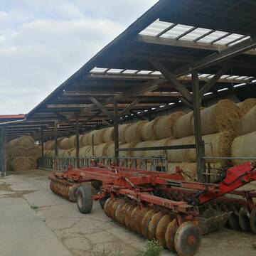
Heu und Stroh zu verkaufen
21527 Kollow
Hof -Linautal
@Hof-Linautal
Heu
Lieferant entlädt
Rundballen
Regenfrei
3 weitere...
aktuell
B+
Deprecated: Creation of dynamic property Zend_View_Helper_Ads::$adLink is deprecated in /var/www/stall-frei/htdocs/staging.stall-frei.de/library/Psf/View/Helper/Ads.php on line 108

Mitarbeiter gesucht?
Mechtersen
STALL-FREIde Marketing
@STALL-FREI-Marketing
Stellenangebote kostenlos veröffentlichen!

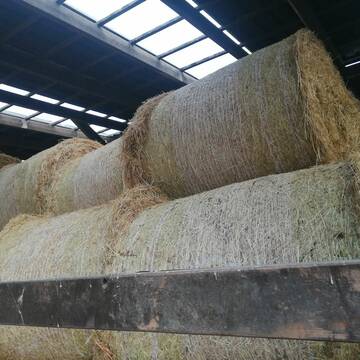
Heu in Rundballen (ca.130cm) super Qualität
Pronstorf
Caros Pferdeparadies
@KaOb
Heu
Rundballen
Regenfrei
Wird verladen
2 weitere...
B+
Heu 1.Schnitt 2021
Upahl
hermannmeyerzuborgsen
@hermannmeyerzuborgsen
Heu
Empfänger lädt ab
Rundballen
Regenfrei
3 weitere...
P+

Heu, Heulage, ökologisch, artenreich top Qualitä...
Hamburg
Frederic Wübbe
@Stall_Am_Burgberg
Heu
Lieferant entlädt
Rundballen
Bio
3 weitere...
B+

Strohstrukturpellets
Warsow
Luca Grabeleu, Marquardt
@LucaGrabeleu
Einstreu
Empfänger lädt ab
Bigbag
Regenfrei
3 weitere...
B+

Futtersack HeuToy, Fressbremse in pink
Mechtersen
STALL-FREIde Marketing
@STALL-FREI-Marketing
Stundenlange Beschäftigung die
Koliken vorbeugt, geringe Staubinhalation mit
steuerbarer Futterentnahme

Heu HD-Ballen 2. Schnitt extensiv Heugräser
Drochtersen
M-Kluth
@M-Kluth
Heu
Empfänger lädt ab
Kleinballen/HD-Ballen
Regenfrei
3 weitere...
B+

Erstklassiges PferdeHeu in HD-Ballen
Jevenstedt
Tim Rohwer
@EIDERHEU
Heu
Kleinballen/HD-Ballen
Regenfrei
B+
Leider kein Vorschaubild
Leider kein Vorschaubild
Heulage, Grassamenheu lage 2025
Schwedeneck
Jeannine Wittern
@Jeannine-Wittern
Heulage
Lieferant entlädt
Rundballen
Regenfrei
3 weitere...
B+

Heu/trockene Heulage für Pferde Zucker,Fruktanarm
Sophienhamm
Herr-Kolb
@Herr-Kolb
Heulage
Lieferant entlädt
Regenfrei
Wird verladen
2 weitere...
B+
Deprecated: Creation of dynamic property Zend_View::$pageCount is deprecated in /var/www/stall-frei/htdocs/staging.stall-frei.de/library/vendor/shardj/zf1-future/library/Zend/View/Abstract.php on line 308
Deprecated: Creation of dynamic property Zend_View::$itemCountPerPage is deprecated in /var/www/stall-frei/htdocs/staging.stall-frei.de/library/vendor/shardj/zf1-future/library/Zend/View/Abstract.php on line 308
Deprecated: Creation of dynamic property Zend_View::$first is deprecated in /var/www/stall-frei/htdocs/staging.stall-frei.de/library/vendor/shardj/zf1-future/library/Zend/View/Abstract.php on line 308
Deprecated: Creation of dynamic property Zend_View::$current is deprecated in /var/www/stall-frei/htdocs/staging.stall-frei.de/library/vendor/shardj/zf1-future/library/Zend/View/Abstract.php on line 308
Deprecated: Creation of dynamic property Zend_View::$last is deprecated in /var/www/stall-frei/htdocs/staging.stall-frei.de/library/vendor/shardj/zf1-future/library/Zend/View/Abstract.php on line 308
Deprecated: Creation of dynamic property Zend_View::$next is deprecated in /var/www/stall-frei/htdocs/staging.stall-frei.de/library/vendor/shardj/zf1-future/library/Zend/View/Abstract.php on line 308
Deprecated: Creation of dynamic property Zend_View::$pagesInRange is deprecated in /var/www/stall-frei/htdocs/staging.stall-frei.de/library/vendor/shardj/zf1-future/library/Zend/View/Abstract.php on line 308
Deprecated: Creation of dynamic property Zend_View::$firstPageInRange is deprecated in /var/www/stall-frei/htdocs/staging.stall-frei.de/library/vendor/shardj/zf1-future/library/Zend/View/Abstract.php on line 308
Deprecated: Creation of dynamic property Zend_View::$lastPageInRange is deprecated in /var/www/stall-frei/htdocs/staging.stall-frei.de/library/vendor/shardj/zf1-future/library/Zend/View/Abstract.php on line 308
Deprecated: Creation of dynamic property Zend_View::$currentItemCount is deprecated in /var/www/stall-frei/htdocs/staging.stall-frei.de/library/vendor/shardj/zf1-future/library/Zend/View/Abstract.php on line 308
Deprecated: Creation of dynamic property Zend_View::$totalItemCount is deprecated in /var/www/stall-frei/htdocs/staging.stall-frei.de/library/vendor/shardj/zf1-future/library/Zend/View/Abstract.php on line 308
Deprecated: Creation of dynamic property Zend_View::$firstItemNumber is deprecated in /var/www/stall-frei/htdocs/staging.stall-frei.de/library/vendor/shardj/zf1-future/library/Zend/View/Abstract.php on line 308
Deprecated: Creation of dynamic property Zend_View::$lastItemNumber is deprecated in /var/www/stall-frei/htdocs/staging.stall-frei.de/library/vendor/shardj/zf1-future/library/Zend/View/Abstract.php on line 308
Deprecated: Creation of dynamic property Zend_View::$router is deprecated in /var/www/stall-frei/htdocs/staging.stall-frei.de/library/vendor/shardj/zf1-future/library/Zend/View/Abstract.php on line 308
Deprecated: Creation of dynamic property Zend_View::$urlParams is deprecated in /var/www/stall-frei/htdocs/staging.stall-frei.de/library/vendor/shardj/zf1-future/library/Zend/View/Abstract.php on line 308
Deprecated: Creation of dynamic property Zend_View::$showAds is deprecated in /var/www/stall-frei/htdocs/staging.stall-frei.de/library/vendor/shardj/zf1-future/library/Zend/View/Abstract.php on line 308
Deprecated: Creation of dynamic property Zend_View::$objectIds is deprecated in /var/www/stall-frei/htdocs/staging.stall-frei.de/library/vendor/shardj/zf1-future/library/Zend/View/Abstract.php on line 308
Deprecated: Creation of dynamic property Zend_View::$showNavbar is deprecated in /var/www/stall-frei/htdocs/staging.stall-frei.de/library/vendor/shardj/zf1-future/library/Zend/View/Abstract.php on line 308
Deprecated: Creation of dynamic property Zend_View::$showBreadcrumb is deprecated in /var/www/stall-frei/htdocs/staging.stall-frei.de/library/vendor/shardj/zf1-future/library/Zend/View/Abstract.php on line 308
Deprecated: Creation of dynamic property Zend_View::$showFooter is deprecated in /var/www/stall-frei/htdocs/staging.stall-frei.de/library/vendor/shardj/zf1-future/library/Zend/View/Abstract.php on line 308
Deprecated: Creation of dynamic property Zend_View::$showInternalAds is deprecated in /var/www/stall-frei/htdocs/staging.stall-frei.de/library/vendor/shardj/zf1-future/library/Zend/View/Abstract.php on line 308
Deprecated: Creation of dynamic property Zend_View::$blNoContent is deprecated in /var/www/stall-frei/htdocs/staging.stall-frei.de/library/vendor/shardj/zf1-future/library/Zend/View/Abstract.php on line 308
Deprecated: Creation of dynamic property Zend_View::$sMetaDesc is deprecated in /var/www/stall-frei/htdocs/staging.stall-frei.de/library/vendor/shardj/zf1-future/library/Zend/View/Abstract.php on line 308
Deprecated: Creation of dynamic property Zend_View::$useGmaps is deprecated in /var/www/stall-frei/htdocs/staging.stall-frei.de/library/vendor/shardj/zf1-future/library/Zend/View/Abstract.php on line 308
Deprecated: Creation of dynamic property Zend_View::$touches is deprecated in /var/www/stall-frei/htdocs/staging.stall-frei.de/library/vendor/shardj/zf1-future/library/Zend/View/Abstract.php on line 308
Deprecated: Creation of dynamic property Zend_View::$oProject is deprecated in /var/www/stall-frei/htdocs/staging.stall-frei.de/library/vendor/shardj/zf1-future/library/Zend/View/Abstract.php on line 308
Deprecated: Creation of dynamic property Zend_View::$pageHeadline is deprecated in /var/www/stall-frei/htdocs/staging.stall-frei.de/library/vendor/shardj/zf1-future/library/Zend/View/Abstract.php on line 308
Deprecated: Creation of dynamic property Zend_View::$disableLocationField is deprecated in /var/www/stall-frei/htdocs/staging.stall-frei.de/library/vendor/shardj/zf1-future/library/Zend/View/Abstract.php on line 308
Deprecated: Creation of dynamic property Zend_View::$isSearch is deprecated in /var/www/stall-frei/htdocs/staging.stall-frei.de/library/vendor/shardj/zf1-future/library/Zend/View/Abstract.php on line 308
Deprecated: Creation of dynamic property Zend_View::$pageTitle is deprecated in /var/www/stall-frei/htdocs/staging.stall-frei.de/library/vendor/shardj/zf1-future/library/Zend/View/Abstract.php on line 308
Deprecated: Creation of dynamic property Psf_Form_Element_Text::$class is deprecated in /var/www/stall-frei/htdocs/staging.stall-frei.de/library/vendor/shardj/zf1-future/library/Zend/Form/Element.php on line 874
Deprecated: Creation of dynamic property Psf_Form_Element_Text::$size is deprecated in /var/www/stall-frei/htdocs/staging.stall-frei.de/library/vendor/shardj/zf1-future/library/Zend/Form/Element.php on line 874
Deprecated: Creation of dynamic property Psf_Form_Element_Text::$placeholder is deprecated in /var/www/stall-frei/htdocs/staging.stall-frei.de/library/vendor/shardj/zf1-future/library/Zend/Form/Element.php on line 874
Deprecated: Creation of dynamic property Psf_Form_Element_Hidden::$class is deprecated in /var/www/stall-frei/htdocs/staging.stall-frei.de/library/vendor/shardj/zf1-future/library/Zend/Form/Element.php on line 874
Deprecated: Creation of dynamic property Psf_Form_Element_Hidden::$class is deprecated in /var/www/stall-frei/htdocs/staging.stall-frei.de/library/vendor/shardj/zf1-future/library/Zend/Form/Element.php on line 874
Deprecated: Creation of dynamic property Psf_Form_Element_Hidden::$class is deprecated in /var/www/stall-frei/htdocs/staging.stall-frei.de/library/vendor/shardj/zf1-future/library/Zend/Form/Element.php on line 874
Deprecated: Creation of dynamic property Psf_Form_Element_Hidden::$class is deprecated in /var/www/stall-frei/htdocs/staging.stall-frei.de/library/vendor/shardj/zf1-future/library/Zend/Form/Element.php on line 874
Deprecated: Creation of dynamic property Psf_Form_Element_Select::$class is deprecated in /var/www/stall-frei/htdocs/staging.stall-frei.de/library/vendor/shardj/zf1-future/library/Zend/Form/Element.php on line 874
Deprecated: Creation of dynamic property Psf_Form_Element_Select::$class is deprecated in /var/www/stall-frei/htdocs/staging.stall-frei.de/library/vendor/shardj/zf1-future/library/Zend/Form/Element.php on line 874
Deprecated: Creation of dynamic property Psf_Form_Element_Select::$class is deprecated in /var/www/stall-frei/htdocs/staging.stall-frei.de/library/vendor/shardj/zf1-future/library/Zend/Form/Element.php on line 874
Deprecated: Creation of dynamic property Psf_Form_Element_Select::$class is deprecated in /var/www/stall-frei/htdocs/staging.stall-frei.de/library/vendor/shardj/zf1-future/library/Zend/Form/Element.php on line 874
Deprecated: Creation of dynamic property Zend_View::$sort is deprecated in /var/www/stall-frei/htdocs/staging.stall-frei.de/library/vendor/shardj/zf1-future/library/Zend/View/Abstract.php on line 308
Deprecated: Creation of dynamic property Zend_View::$searchLocation is deprecated in /var/www/stall-frei/htdocs/staging.stall-frei.de/library/vendor/shardj/zf1-future/library/Zend/View/Abstract.php on line 308
Deprecated: Creation of dynamic property Zend_View::$locationHint is deprecated in /var/www/stall-frei/htdocs/staging.stall-frei.de/library/vendor/shardj/zf1-future/library/Zend/View/Abstract.php on line 308
Psf_GeoCoder_Abstract::getLocation: Wentorf Get Location CachedOrLive
Psf_GeoCoder_Abstract::getCachedOrLive: Wentorf
Psf_GeoCoder_OpenCageData::makeApiRequest: response:
Array
(
[documentation] => https://opencagedata.com/api
[licenses] => Array
(
[0] => Array
(
[name] => see attribution guide
[url] => https://opencagedata.com/credits
)
)
[results] => Array
(
[0] => Array
(
[bounds] => Array
(
[northeast] => Array
(
[lat] => 53.6905397
[lng] => 10.4914979
)
[southwest] => Array
(
[lat] => 53.6606193
[lng] => 10.4483097
)
)
[components] => Array
(
[ISO_3166-1_alpha-2] => DE
[ISO_3166-1_alpha-3] => DEU
[ISO_3166-2] => Array
(
[0] => DE-SH
)
[_category] => place
[_normalized_city] => Wentorf (Amt Sandesneben)
[_type] => village
[continent] => Europe
[country] => Deutschland
[country_code] => de
[county] => Kreis Herzogtum Lauenburg
[municipality] => Sandesneben-Nusse
[political_union] => European Union
[state] => Schleswig-Holstein
[state_code] => SH
[village] => Wentorf (Amt Sandesneben)
)
[confidence] => 7
[formatted] => Wentorf (Amt Sandesneben), Schleswig-Holstein, Deutschland
[geometry] => Array
(
[lat] => 53.6726492
[lng] => 10.4740888
)
)
[1] => Array
(
[bounds] => Array
(
[northeast] => Array
(
[lat] => 52.7669585
[lng] => 10.6706332
)
[southwest] => Array
(
[lat] => 52.7362591
[lng] => 10.6321227
)
)
[components] => Array
(
[ISO_3166-1_alpha-2] => DE
[ISO_3166-1_alpha-3] => DEU
[ISO_3166-2] => Array
(
[0] => DE-NI
)
[_category] => place
[_normalized_city] => Obernholz
[_type] => village
[city] => Obernholz
[continent] => Europe
[country] => Deutschland
[country_code] => de
[county] => Landkreis Gifhorn
[municipality] => Samtgemeinde Hankensbüttel
[political_union] => European Union
[state] => Niedersachsen
[state_code] => NI
[village] => Wentorf
)
[confidence] => 7
[formatted] => Wentorf, Niedersachsen, Deutschland
[geometry] => Array
(
[lat] => 52.7463132
[lng] => 10.6542286
)
)
[2] => Array
(
[bounds] => Array
(
[northeast] => Array
(
[lat] => 54.3017207
[lng] => 10.5681647
)
[southwest] => Array
(
[lat] => 54.2617207
[lng] => 10.5281647
)
)
[components] => Array
(
[ISO_3166-1_alpha-2] => DE
[ISO_3166-1_alpha-3] => DEU
[ISO_3166-2] => Array
(
[0] => DE-SH
)
[_category] => place
[_normalized_city] => Klamp
[_type] => village
[city] => Klamp
[continent] => Europe
[country] => Deutschland
[country_code] => de
[county] => Kreis Plön
[municipality] => Lütjenburg
[political_union] => European Union
[state] => Schleswig-Holstein
[state_code] => SH
[village] => Wentorf
)
[confidence] => 7
[formatted] => Wentorf, Schleswig-Holstein, Deutschland
[geometry] => Array
(
[lat] => 54.2817207
[lng] => 10.5481647
)
)
[3] => Array
(
[bounds] => Array
(
[northeast] => Array
(
[lat] => 52.1330679
[lng] => 8.929436
)
[southwest] => Array
(
[lat] => 52.0930679
[lng] => 8.889436
)
)
[components] => Array
(
[ISO_3166-1_alpha-2] => DE
[ISO_3166-1_alpha-3] => DEU
[ISO_3166-2] => Array
(
[0] => DE-NW
)
[_category] => place
[_normalized_city] => Westorf
[_type] => hamlet
[continent] => Europe
[country] => Deutschland
[country_code] => de
[county] => Kreis Lippe
[hamlet] => Wentorf
[municipality] => Kalletal
[political_union] => European Union
[postcode] => 32689
[state] => Nordrhein-Westfalen
[state_code] => NW
[town] => Westorf
)
[confidence] => 7
[formatted] => Wentorf, 32689 Westorf, Deutschland
[geometry] => Array
(
[lat] => 52.1130679
[lng] => 8.909436
)
)
[4] => Array
(
[bounds] => Array
(
[northeast] => Array
(
[lat] => 54.3941373
[lng] => 9.782116
)
[southwest] => Array
(
[lat] => 54.3541373
[lng] => 9.742116
)
)
[components] => Array
(
[ISO_3166-1_alpha-2] => DE
[ISO_3166-1_alpha-3] => DEU
[ISO_3166-2] => Array
(
[0] => DE-SH
)
[_category] => place
[_normalized_city] => Bünsdorf
[_type] => hamlet
[continent] => Europe
[country] => Deutschland
[country_code] => de
[county] => Kreis Rendsburg-Eckernförde
[hamlet] => Wentorf
[municipality] => Hüttener Berge
[political_union] => European Union
[postcode] => 24361
[state] => Schleswig-Holstein
[state_code] => SH
[village] => Bünsdorf
)
[confidence] => 7
[formatted] => Wentorf, 24361 Bünsdorf, Deutschland
[geometry] => Array
(
[lat] => 54.3741373
[lng] => 9.762116
)
)
[5] => Array
(
[components] => Array
(
[ISO_3166-1_alpha-2] => FR
[ISO_3166-1_alpha-3] => FRA
[ISO_3166-2] => Array
(
[0] => FR-IDF
[1] => FR-92
)
[_category] => road
[_normalized_city] => Levallois-Perret
[_type] => road
[city] => Levallois-Perret
[continent] => Europe
[country] => France
[country_code] => fr
[county] => Hauts-de-Seine
[local_authority] => Métropole du Grand Paris
[political_union] => European Union
[postcode] => 92300
[road] => Rue Charles Deutschmann
[state] => Île-de-France
[state_code] => IDF
)
[confidence] => 2
[formatted] => Rue Charles Deutschmann, 92300 Levallois-Perret, France
[geometry] => Array
(
[lat] => 48.900049
[lng] => 2.2842
)
)
[6] => Array
(
[components] => Array
(
[ISO_3166-1_alpha-2] => FR
[ISO_3166-1_alpha-3] => FRA
[ISO_3166-2] => Array
(
[0] => FR-ARA
[1] => FR-07
)
[_category] => road
[_normalized_city] => Saint-Agrève
[_type] => road
[city] => Saint-Agrève
[continent] => Europe
[country] => France
[country_code] => fr
[county] => Ardèche
[local_authority] => Communauté de communes Val'Eyrieux
[political_union] => European Union
[postcode] => 07320
[road] => Chemin du Ventor
[state] => Auvergne-Rhône-Alpes
[state_code] => ARA
)
[confidence] => 2
[formatted] => Chemin du Ventor, 07320 Saint-Agrève, France
[geometry] => Array
(
[lat] => 44.996823
[lng] => 4.389931
)
)
[7] => Array
(
[components] => Array
(
[ISO_3166-1_alpha-2] => FR
[ISO_3166-1_alpha-3] => FRA
[ISO_3166-2] => Array
(
[0] => FR-PAC
[1] => FR-05
)
[_category] => road
[_normalized_city] => Aubessagne
[_type] => road
[city] => Aubessagne
[continent] => Europe
[country] => France
[country_code] => fr
[county] => Hautes-Alpes
[local_authority] => Communauté de communes Champsaur-Valgaudemar
[political_union] => European Union
[postcode] => 05500
[road] => Route du Ventort
[state] => Provence-Alpes-Côte d'Azur
[state_code] => PAC
)
[confidence] => 2
[formatted] => Route du Ventort, 05500 Aubessagne, France
[geometry] => Array
(
[lat] => 44.746991
[lng] => 6.03929
)
)
[8] => Array
(
[components] => Array
(
[ISO_3166-1_alpha-2] => FR
[ISO_3166-1_alpha-3] => FRA
[ISO_3166-2] => Array
(
[0] => FR-ARA
[1] => FR-43
)
[_category] => road
[_normalized_city] => Lapte
[_type] => road
[city] => Lapte
[continent] => Europe
[country] => France
[country_code] => fr
[county] => Haute-Loire
[local_authority] => Communauté de communes des Sucs
[political_union] => European Union
[postcode] => 43200
[road] => Rue du Ventor
[state] => Auvergne-Rhône-Alpes
[state_code] => ARA
)
[confidence] => 2
[formatted] => Rue du Ventor, 43200 Lapte, France
[geometry] => Array
(
[lat] => 45.186906
[lng] => 4.216425
)
)
)
[status] => Array
(
[code] => 200
[message] => OK
)
[stay_informed] => Array
(
[blog] => https://blog.opencagedata.com
[mastodon] => https://en.osm.town/@opencage
)
[thanks] => For using an OpenCage API
[timestamp] => Array
(
[created_http] => Sat, 07 Feb 2026 08:19:37 GMT
[created_unix] => 1770452377
)
[total_results] => 9
)
Psf_GeoCoder_Abstract::convertLocationResult
{"documentation":"https:\/\/opencagedata.com\/api","licenses":[{"name":"see attribution guide","url":"https:\/\/opencagedata.com\/credits"}],"results":[{"bounds":{"northeast":{"lat":53.6905397,"lng":10.4914979},"southwest":{"lat":53.6606193,"lng":10.4483097}},"components":{"ISO_3166-1_alpha-2":"DE","ISO_3166-1_alpha-3":"DEU","ISO_3166-2":["DE-SH"],"_category":"place","_normalized_city":"Wentorf (Amt Sandesneben)","_type":"village","continent":"Europe","country":"Deutschland","country_code":"de","county":"Kreis Herzogtum Lauenburg","municipality":"Sandesneben-Nusse","political_union":"European Union","state":"Schleswig-Holstein","state_code":"SH","village":"Wentorf (Amt Sandesneben)"},"confidence":7,"formatted":"Wentorf (Amt Sandesneben), Schleswig-Holstein, Deutschland","geometry":{"lat":53.6726492,"lng":10.4740888}},{"bounds":{"northeast":{"lat":52.7669585,"lng":10.6706332},"southwest":{"lat":52.7362591,"lng":10.6321227}},"components":{"ISO_3166-1_alpha-2":"DE","ISO_3166-1_alpha-3":"DEU","ISO_3166-2":["DE-NI"],"_category":"place","_normalized_city":"Obernholz","_type":"village","city":"Obernholz","continent":"Europe","country":"Deutschland","country_code":"de","county":"Landkreis Gifhorn","municipality":"Samtgemeinde Hankensb\u00fcttel","political_union":"European Union","state":"Niedersachsen","state_code":"NI","village":"Wentorf"},"confidence":7,"formatted":"Wentorf, Niedersachsen, Deutschland","geometry":{"lat":52.7463132,"lng":10.6542286}},{"bounds":{"northeast":{"lat":54.3017207,"lng":10.5681647},"southwest":{"lat":54.2617207,"lng":10.5281647}},"components":{"ISO_3166-1_alpha-2":"DE","ISO_3166-1_alpha-3":"DEU","ISO_3166-2":["DE-SH"],"_category":"place","_normalized_city":"Klamp","_type":"village","city":"Klamp","continent":"Europe","country":"Deutschland","country_code":"de","county":"Kreis Pl\u00f6n","municipality":"L\u00fctjenburg","political_union":"European Union","state":"Schleswig-Holstein","state_code":"SH","village":"Wentorf"},"confidence":7,"formatted":"Wentorf, Schleswig-Holstein, Deutschland","geometry":{"lat":54.2817207,"lng":10.5481647}},{"bounds":{"northeast":{"lat":52.1330679,"lng":8.929436},"southwest":{"lat":52.0930679,"lng":8.889436}},"components":{"ISO_3166-1_alpha-2":"DE","ISO_3166-1_alpha-3":"DEU","ISO_3166-2":["DE-NW"],"_category":"place","_normalized_city":"Westorf","_type":"hamlet","continent":"Europe","country":"Deutschland","country_code":"de","county":"Kreis Lippe","hamlet":"Wentorf","municipality":"Kalletal","political_union":"European Union","postcode":"32689","state":"Nordrhein-Westfalen","state_code":"NW","town":"Westorf"},"confidence":7,"formatted":"Wentorf, 32689 Westorf, Deutschland","geometry":{"lat":52.1130679,"lng":8.909436}},{"bounds":{"northeast":{"lat":54.3941373,"lng":9.782116},"southwest":{"lat":54.3541373,"lng":9.742116}},"components":{"ISO_3166-1_alpha-2":"DE","ISO_3166-1_alpha-3":"DEU","ISO_3166-2":["DE-SH"],"_category":"place","_normalized_city":"B\u00fcnsdorf","_type":"hamlet","continent":"Europe","country":"Deutschland","country_code":"de","county":"Kreis Rendsburg-Eckernf\u00f6rde","hamlet":"Wentorf","municipality":"H\u00fcttener Berge","political_union":"European Union","postcode":"24361","state":"Schleswig-Holstein","state_code":"SH","village":"B\u00fcnsdorf"},"confidence":7,"formatted":"Wentorf, 24361 B\u00fcnsdorf, Deutschland","geometry":{"lat":54.3741373,"lng":9.762116}},{"components":{"ISO_3166-1_alpha-2":"FR","ISO_3166-1_alpha-3":"FRA","ISO_3166-2":["FR-IDF","FR-92"],"_category":"road","_normalized_city":"Levallois-Perret","_type":"road","city":"Levallois-Perret","continent":"Europe","country":"France","country_code":"fr","county":"Hauts-de-Seine","local_authority":"M\u00e9tropole du Grand Paris","political_union":"European Union","postcode":"92300","road":"Rue Charles Deutschmann","state":"\u00cele-de-France","state_code":"IDF"},"confidence":2,"formatted":"Rue Charles Deutschmann, 92300 Levallois-Perret, France","geometry":{"lat":48.900049,"lng":2.2842}},{"components":{"ISO_3166-1_alpha-2":"FR","ISO_3166-1_alpha-3":"FRA","ISO_3166-2":["FR-ARA","FR-07"],"_category":"road","_normalized_city":"Saint-Agr\u00e8ve","_type":"road","city":"Saint-Agr\u00e8ve","continent":"Europe","country":"France","country_code":"fr","county":"Ard\u00e8che","local_authority":"Communaut\u00e9 de communes Val'Eyrieux","political_union":"European Union","postcode":"07320","road":"Chemin du Ventor","state":"Auvergne-Rh\u00f4ne-Alpes","state_code":"ARA"},"confidence":2,"formatted":"Chemin du Ventor, 07320 Saint-Agr\u00e8ve, France","geometry":{"lat":44.996823,"lng":4.389931}},{"components":{"ISO_3166-1_alpha-2":"FR","ISO_3166-1_alpha-3":"FRA","ISO_3166-2":["FR-PAC","FR-05"],"_category":"road","_normalized_city":"Aubessagne","_type":"road","city":"Aubessagne","continent":"Europe","country":"France","country_code":"fr","county":"Hautes-Alpes","local_authority":"Communaut\u00e9 de communes Champsaur-Valgaudemar","political_union":"European Union","postcode":"05500","road":"Route du Ventort","state":"Provence-Alpes-C\u00f4te d'Azur","state_code":"PAC"},"confidence":2,"formatted":"Route du Ventort, 05500 Aubessagne, France","geometry":{"lat":44.746991,"lng":6.03929}},{"components":{"ISO_3166-1_alpha-2":"FR","ISO_3166-1_alpha-3":"FRA","ISO_3166-2":["FR-ARA","FR-43"],"_category":"road","_normalized_city":"Lapte","_type":"road","city":"Lapte","continent":"Europe","country":"France","country_code":"fr","county":"Haute-Loire","local_authority":"Communaut\u00e9 de communes des Sucs","political_union":"European Union","postcode":"43200","road":"Rue du Ventor","state":"Auvergne-Rh\u00f4ne-Alpes","state_code":"ARA"},"confidence":2,"formatted":"Rue du Ventor, 43200 Lapte, France","geometry":{"lat":45.186906,"lng":4.216425}}],"status":{"code":200,"message":"OK"},"stay_informed":{"blog":"https:\/\/blog.opencagedata.com","mastodon":"https:\/\/en.osm.town\/@opencage"},"thanks":"For using an OpenCage API","timestamp":{"created_http":"Sat, 07 Feb 2026 08:19:37 GMT","created_unix":1770452377},"total_results":9}Array
(
[0] => stdClass Object
(
[bounds] => stdClass Object
(
[northeast] => stdClass Object
(
[lat] => 53.6905397
[lng] => 10.4914979
)
[southwest] => stdClass Object
(
[lat] => 53.6606193
[lng] => 10.4483097
)
)
[components] => stdClass Object
(
[ISO_3166-1_alpha-2] => DE
[ISO_3166-1_alpha-3] => DEU
[ISO_3166-2] => Array
(
[0] => DE-SH
)
[_category] => place
[_normalized_city] => Wentorf (Amt Sandesneben)
[_type] => village
[continent] => Europe
[country] => Deutschland
[country_code] => de
[county] => Kreis Herzogtum Lauenburg
[municipality] => Sandesneben-Nusse
[political_union] => European Union
[state] => Schleswig-Holstein
[state_code] => SH
[village] => Wentorf (Amt Sandesneben)
)
[confidence] => 7
[formatted] => Wentorf (Amt Sandesneben), Schleswig-Holstein, Deutschland
[geometry] => stdClass Object
(
[lat] => 53.6726492
[lng] => 10.4740888
)
)
[1] => stdClass Object
(
[bounds] => stdClass Object
(
[northeast] => stdClass Object
(
[lat] => 52.7669585
[lng] => 10.6706332
)
[southwest] => stdClass Object
(
[lat] => 52.7362591
[lng] => 10.6321227
)
)
[components] => stdClass Object
(
[ISO_3166-1_alpha-2] => DE
[ISO_3166-1_alpha-3] => DEU
[ISO_3166-2] => Array
(
[0] => DE-NI
)
[_category] => place
[_normalized_city] => Obernholz
[_type] => village
[city] => Obernholz
[continent] => Europe
[country] => Deutschland
[country_code] => de
[county] => Landkreis Gifhorn
[municipality] => Samtgemeinde Hankensbüttel
[political_union] => European Union
[state] => Niedersachsen
[state_code] => NI
[village] => Wentorf
)
[confidence] => 7
[formatted] => Wentorf, Niedersachsen, Deutschland
[geometry] => stdClass Object
(
[lat] => 52.7463132
[lng] => 10.6542286
)
)
[2] => stdClass Object
(
[bounds] => stdClass Object
(
[northeast] => stdClass Object
(
[lat] => 54.3017207
[lng] => 10.5681647
)
[southwest] => stdClass Object
(
[lat] => 54.2617207
[lng] => 10.5281647
)
)
[components] => stdClass Object
(
[ISO_3166-1_alpha-2] => DE
[ISO_3166-1_alpha-3] => DEU
[ISO_3166-2] => Array
(
[0] => DE-SH
)
[_category] => place
[_normalized_city] => Klamp
[_type] => village
[city] => Klamp
[continent] => Europe
[country] => Deutschland
[country_code] => de
[county] => Kreis Plön
[municipality] => Lütjenburg
[political_union] => European Union
[state] => Schleswig-Holstein
[state_code] => SH
[village] => Wentorf
)
[confidence] => 7
[formatted] => Wentorf, Schleswig-Holstein, Deutschland
[geometry] => stdClass Object
(
[lat] => 54.2817207
[lng] => 10.5481647
)
)
[3] => stdClass Object
(
[bounds] => stdClass Object
(
[northeast] => stdClass Object
(
[lat] => 52.1330679
[lng] => 8.929436
)
[southwest] => stdClass Object
(
[lat] => 52.0930679
[lng] => 8.889436
)
)
[components] => stdClass Object
(
[ISO_3166-1_alpha-2] => DE
[ISO_3166-1_alpha-3] => DEU
[ISO_3166-2] => Array
(
[0] => DE-NW
)
[_category] => place
[_normalized_city] => Westorf
[_type] => hamlet
[continent] => Europe
[country] => Deutschland
[country_code] => de
[county] => Kreis Lippe
[hamlet] => Wentorf
[municipality] => Kalletal
[political_union] => European Union
[postcode] => 32689
[state] => Nordrhein-Westfalen
[state_code] => NW
[town] => Westorf
)
[confidence] => 7
[formatted] => Wentorf, 32689 Westorf, Deutschland
[geometry] => stdClass Object
(
[lat] => 52.1130679
[lng] => 8.909436
)
)
[4] => stdClass Object
(
[bounds] => stdClass Object
(
[northeast] => stdClass Object
(
[lat] => 54.3941373
[lng] => 9.782116
)
[southwest] => stdClass Object
(
[lat] => 54.3541373
[lng] => 9.742116
)
)
[components] => stdClass Object
(
[ISO_3166-1_alpha-2] => DE
[ISO_3166-1_alpha-3] => DEU
[ISO_3166-2] => Array
(
[0] => DE-SH
)
[_category] => place
[_normalized_city] => Bünsdorf
[_type] => hamlet
[continent] => Europe
[country] => Deutschland
[country_code] => de
[county] => Kreis Rendsburg-Eckernförde
[hamlet] => Wentorf
[municipality] => Hüttener Berge
[political_union] => European Union
[postcode] => 24361
[state] => Schleswig-Holstein
[state_code] => SH
[village] => Bünsdorf
)
[confidence] => 7
[formatted] => Wentorf, 24361 Bünsdorf, Deutschland
[geometry] => stdClass Object
(
[lat] => 54.3741373
[lng] => 9.762116
)
)
[5] => stdClass Object
(
[components] => stdClass Object
(
[ISO_3166-1_alpha-2] => FR
[ISO_3166-1_alpha-3] => FRA
[ISO_3166-2] => Array
(
[0] => FR-IDF
[1] => FR-92
)
[_category] => road
[_normalized_city] => Levallois-Perret
[_type] => road
[city] => Levallois-Perret
[continent] => Europe
[country] => France
[country_code] => fr
[county] => Hauts-de-Seine
[local_authority] => Métropole du Grand Paris
[political_union] => European Union
[postcode] => 92300
[road] => Rue Charles Deutschmann
[state] => Île-de-France
[state_code] => IDF
)
[confidence] => 2
[formatted] => Rue Charles Deutschmann, 92300 Levallois-Perret, France
[geometry] => stdClass Object
(
[lat] => 48.900049
[lng] => 2.2842
)
)
[6] => stdClass Object
(
[components] => stdClass Object
(
[ISO_3166-1_alpha-2] => FR
[ISO_3166-1_alpha-3] => FRA
[ISO_3166-2] => Array
(
[0] => FR-ARA
[1] => FR-07
)
[_category] => road
[_normalized_city] => Saint-Agrève
[_type] => road
[city] => Saint-Agrève
[continent] => Europe
[country] => France
[country_code] => fr
[county] => Ardèche
[local_authority] => Communauté de communes Val'Eyrieux
[political_union] => European Union
[postcode] => 07320
[road] => Chemin du Ventor
[state] => Auvergne-Rhône-Alpes
[state_code] => ARA
)
[confidence] => 2
[formatted] => Chemin du Ventor, 07320 Saint-Agrève, France
[geometry] => stdClass Object
(
[lat] => 44.996823
[lng] => 4.389931
)
)
[7] => stdClass Object
(
[components] => stdClass Object
(
[ISO_3166-1_alpha-2] => FR
[ISO_3166-1_alpha-3] => FRA
[ISO_3166-2] => Array
(
[0] => FR-PAC
[1] => FR-05
)
[_category] => road
[_normalized_city] => Aubessagne
[_type] => road
[city] => Aubessagne
[continent] => Europe
[country] => France
[country_code] => fr
[county] => Hautes-Alpes
[local_authority] => Communauté de communes Champsaur-Valgaudemar
[political_union] => European Union
[postcode] => 05500
[road] => Route du Ventort
[state] => Provence-Alpes-Côte d'Azur
[state_code] => PAC
)
[confidence] => 2
[formatted] => Route du Ventort, 05500 Aubessagne, France
[geometry] => stdClass Object
(
[lat] => 44.746991
[lng] => 6.03929
)
)
[8] => stdClass Object
(
[components] => stdClass Object
(
[ISO_3166-1_alpha-2] => FR
[ISO_3166-1_alpha-3] => FRA
[ISO_3166-2] => Array
(
[0] => FR-ARA
[1] => FR-43
)
[_category] => road
[_normalized_city] => Lapte
[_type] => road
[city] => Lapte
[continent] => Europe
[country] => France
[country_code] => fr
[county] => Haute-Loire
[local_authority] => Communauté de communes des Sucs
[political_union] => European Union
[postcode] => 43200
[road] => Rue du Ventor
[state] => Auvergne-Rhône-Alpes
[state_code] => ARA
)
[confidence] => 2
[formatted] => Rue du Ventor, 43200 Lapte, France
[geometry] => stdClass Object
(
[lat] => 45.186906
[lng] => 4.216425
)
)
)
Psf_GeoCoder_OpenCageData::getKeyMap: 0
stdClass Object
(
    [bounds] => stdClass Object
        (
            [northeast] => stdClass Object
                (
                    [lat] => 53.6905397
                    [lng] => 10.4914979
                )

            [southwest] => stdClass Object
                (
                    [lat] => 53.6606193
                    [lng] => 10.4483097
                )

        )

    [components] => stdClass Object
        (
            [ISO_3166-1_alpha-2] => DE
            [ISO_3166-1_alpha-3] => DEU
            [ISO_3166-2] => Array
                (
                    [0] => DE-SH
                )

            [_category] => place
            [_normalized_city] => Wentorf (Amt Sandesneben)
            [_type] => village
            [continent] => Europe
            [country] => Deutschland
            [country_code] => de
            [county] => Kreis Herzogtum Lauenburg
            [municipality] => Sandesneben-Nusse
            [political_union] => European Union
            [state] => Schleswig-Holstein
            [state_code] => SH
            [village] => Wentorf (Amt Sandesneben)
        )

    [confidence] => 7
    [formatted] => Wentorf (Amt Sandesneben), Schleswig-Holstein, Deutschland
    [geometry] => stdClass Object
        (
            [lat] => 53.6726492
            [lng] => 10.4740888
        )

)
Psf_GeoCoder_OpenCageData::getCounty: Herzogtum Lauenburg
Psf_GeoCoder_OpenCageData::addMissingData REFETCH!
Array
(
    [address] => Wentorf (Amt Sandesneben), Schleswig-Holstein, Deutschland
    [type] => village
    [street] =>
    [city] => Wentorf (Amt Sandesneben)
    [county] => Herzogtum Lauenburg
    [state] => Schleswig-Holstein
    [zip] =>
    [country] => Deutschland
    [suburb] =>
    [countrycode] => de
    [latitude] => 53.6726492
    [longitude] => 10.4740888
    [accuracy] => 1
    [confidence] => 7
    [bounds] => stdClass Object
        (
            [northeast] => stdClass Object
                (
                    [lat] => 53.6905397
                    [lng] => 10.4914979
                )

            [southwest] => stdClass Object
                (
                    [lat] => 53.6606193
                    [lng] => 10.4483097
                )

        )

)
reformat!
Array
(
    [address] => Wentorf (Amt Sandesneben), Schleswig-Holstein, Deutschland
    [type] => village
    [street] =>
    [city] => Wentorf (Amt Sandesneben)
    [county] => Herzogtum Lauenburg
    [state] => Schleswig-Holstein
    [zip] =>
    [country] => Deutschland
    [suburb] =>
    [countrycode] => de
    [latitude] => 53.6726492
    [longitude] => 10.4740888
    [accuracy] => 1
    [confidence] => 7
    [bounds] => stdClass Object
        (
            [northeast] => stdClass Object
                (
                    [lat] => 53.6905397
                    [lng] => 10.4914979
                )

            [southwest] => stdClass Object
                (
                    [lat] => 53.6606193
                    [lng] => 10.4483097
                )

        )

    [place] => Wentorf (Amt Sandesneben), Schleswig-Holstein
    [hash] => e26377c9e73d6977f7d732c98cda4686
)
Psf_GeoCoder_OpenCageData::getKeyMap: 1
stdClass Object
(
    [bounds] => stdClass Object
        (
            [northeast] => stdClass Object
                (
                    [lat] => 52.7669585
                    [lng] => 10.6706332
                )

            [southwest] => stdClass Object
                (
                    [lat] => 52.7362591
                    [lng] => 10.6321227
                )

        )

    [components] => stdClass Object
        (
            [ISO_3166-1_alpha-2] => DE
            [ISO_3166-1_alpha-3] => DEU
            [ISO_3166-2] => Array
                (
                    [0] => DE-NI
                )

            [_category] => place
            [_normalized_city] => Obernholz
            [_type] => village
            [city] => Obernholz
            [continent] => Europe
            [country] => Deutschland
            [country_code] => de
            [county] => Landkreis Gifhorn
            [municipality] => Samtgemeinde Hankensbüttel
            [political_union] => European Union
            [state] => Niedersachsen
            [state_code] => NI
            [village] => Wentorf
        )

    [confidence] => 7
    [formatted] => Wentorf, Niedersachsen, Deutschland
    [geometry] => stdClass Object
        (
            [lat] => 52.7463132
            [lng] => 10.6542286
        )

)
Psf_GeoCoder_OpenCageData::getCounty: Gifhorn
Psf_GeoCoder_OpenCageData::addMissingData REFETCH!
Array
(
    [address] => Wentorf, Niedersachsen, Deutschland
    [type] => village
    [street] =>
    [city] => Wentorf
    [county] => Gifhorn
    [state] => Niedersachsen
    [zip] =>
    [country] => Deutschland
    [suburb] =>
    [countrycode] => de
    [latitude] => 52.7463132
    [longitude] => 10.6542286
    [accuracy] => 1
    [confidence] => 7
    [bounds] => stdClass Object
        (
            [northeast] => stdClass Object
                (
                    [lat] => 52.7669585
                    [lng] => 10.6706332
                )

            [southwest] => stdClass Object
                (
                    [lat] => 52.7362591
                    [lng] => 10.6321227
                )

        )

)
reformat!
Array
(
    [address] => Wentorf, Niedersachsen, Deutschland
    [type] => village
    [street] =>
    [city] => Wentorf
    [county] => Gifhorn
    [state] => Niedersachsen
    [zip] =>
    [country] => Deutschland
    [suburb] =>
    [countrycode] => de
    [latitude] => 52.7463132
    [longitude] => 10.6542286
    [accuracy] => 1
    [confidence] => 7
    [bounds] => stdClass Object
        (
            [northeast] => stdClass Object
                (
                    [lat] => 52.7669585
                    [lng] => 10.6706332
                )

            [southwest] => stdClass Object
                (
                    [lat] => 52.7362591
                    [lng] => 10.6321227
                )

        )

    [place] => Wentorf, Niedersachsen
    [hash] => 9a6f87d3350148eca2bbbb7f989f0078
)
Psf_GeoCoder_OpenCageData::getKeyMap: 2
stdClass Object
(
    [bounds] => stdClass Object
        (
            [northeast] => stdClass Object
                (
                    [lat] => 54.3017207
                    [lng] => 10.5681647
                )

            [southwest] => stdClass Object
                (
                    [lat] => 54.2617207
                    [lng] => 10.5281647
                )

        )

    [components] => stdClass Object
        (
            [ISO_3166-1_alpha-2] => DE
            [ISO_3166-1_alpha-3] => DEU
            [ISO_3166-2] => Array
                (
                    [0] => DE-SH
                )

            [_category] => place
            [_normalized_city] => Klamp
            [_type] => village
            [city] => Klamp
            [continent] => Europe
            [country] => Deutschland
            [country_code] => de
            [county] => Kreis Plön
            [municipality] => Lütjenburg
            [political_union] => European Union
            [state] => Schleswig-Holstein
            [state_code] => SH
            [village] => Wentorf
        )

    [confidence] => 7
    [formatted] => Wentorf, Schleswig-Holstein, Deutschland
    [geometry] => stdClass Object
        (
            [lat] => 54.2817207
            [lng] => 10.5481647
        )

)
Psf_GeoCoder_OpenCageData::getCounty: Plön
Psf_GeoCoder_OpenCageData::addMissingData REFETCH!
Array
(
    [address] => Wentorf, Schleswig-Holstein, Deutschland
    [type] => village
    [street] =>
    [city] => Wentorf
    [county] => Plön
    [state] => Schleswig-Holstein
    [zip] =>
    [country] => Deutschland
    [suburb] =>
    [countrycode] => de
    [latitude] => 54.2817207
    [longitude] => 10.5481647
    [accuracy] => 1
    [confidence] => 7
    [bounds] => stdClass Object
        (
            [northeast] => stdClass Object
                (
                    [lat] => 54.3017207
                    [lng] => 10.5681647
                )

            [southwest] => stdClass Object
                (
                    [lat] => 54.2617207
                    [lng] => 10.5281647
                )

        )

)
reformat!
Array
(
    [address] => Wentorf, Schleswig-Holstein, Deutschland
    [type] => village
    [street] =>
    [city] => Wentorf
    [county] => Plön
    [state] => Schleswig-Holstein
    [zip] =>
    [country] => Deutschland
    [suburb] =>
    [countrycode] => de
    [latitude] => 54.2817207
    [longitude] => 10.5481647
    [accuracy] => 1
    [confidence] => 7
    [bounds] => stdClass Object
        (
            [northeast] => stdClass Object
                (
                    [lat] => 54.3017207
                    [lng] => 10.5681647
                )

            [southwest] => stdClass Object
                (
                    [lat] => 54.2617207
                    [lng] => 10.5281647
                )

        )

    [place] => Wentorf, Schleswig-Holstein
    [hash] => c8674a0d34b1e8b414d609345ba310eb
)
Psf_GeoCoder_OpenCageData::getKeyMap: 3
stdClass Object
(
    [bounds] => stdClass Object
        (
            [northeast] => stdClass Object
                (
                    [lat] => 52.1330679
                    [lng] => 8.929436
                )

            [southwest] => stdClass Object
                (
                    [lat] => 52.0930679
                    [lng] => 8.889436
                )

        )

    [components] => stdClass Object
        (
            [ISO_3166-1_alpha-2] => DE
            [ISO_3166-1_alpha-3] => DEU
            [ISO_3166-2] => Array
                (
                    [0] => DE-NW
                )

            [_category] => place
            [_normalized_city] => Westorf
            [_type] => hamlet
            [continent] => Europe
            [country] => Deutschland
            [country_code] => de
            [county] => Kreis Lippe
            [hamlet] => Wentorf
            [municipality] => Kalletal
            [political_union] => European Union
            [postcode] => 32689
            [state] => Nordrhein-Westfalen
            [state_code] => NW
            [town] => Westorf
        )

    [confidence] => 7
    [formatted] => Wentorf, 32689 Westorf, Deutschland
    [geometry] => stdClass Object
        (
            [lat] => 52.1130679
            [lng] => 8.909436
        )

)
Psf_GeoCoder_OpenCageData::getCounty: Lippe
Psf_GeoCoder_OpenCageData::addMissingData REFETCH!
Array
(
    [address] => Wentorf, 32689 Westorf, Deutschland
    [type] => hamlet
    [street] => Wentorf
    [city] => Westorf
    [county] => Lippe
    [state] => Nordrhein-Westfalen
    [zip] => 32689
    [country] => Deutschland
    [suburb] =>
    [countrycode] => de
    [latitude] => 52.1130679
    [longitude] => 8.909436
    [accuracy] => 1
    [confidence] => 7
    [bounds] => stdClass Object
        (
            [northeast] => stdClass Object
                (
                    [lat] => 52.1330679
                    [lng] => 8.929436
                )

            [southwest] => stdClass Object
                (
                    [lat] => 52.0930679
                    [lng] => 8.889436
                )

        )

)
reformat!
Array
(
    [address] => Wentorf, 32689 Westorf, Deutschland
    [type] => hamlet
    [street] => Wentorf
    [city] => Westorf
    [county] => Lippe
    [state] => Nordrhein-Westfalen
    [zip] => 32689
    [country] => Deutschland
    [suburb] =>
    [countrycode] => de
    [latitude] => 52.1130679
    [longitude] => 8.909436
    [accuracy] => 1
    [confidence] => 7
    [bounds] => stdClass Object
        (
            [northeast] => stdClass Object
                (
                    [lat] => 52.1330679
                    [lng] => 8.929436
                )

            [southwest] => stdClass Object
                (
                    [lat] => 52.0930679
                    [lng] => 8.889436
                )

        )

    [place] => Wentorf, 32689 Westorf, Nordrhein-Westfalen
    [hash] => 935edbccb8f2107f2520293755ffbf39
)
Psf_GeoCoder_OpenCageData::getKeyMap: 4
stdClass Object
(
    [bounds] => stdClass Object
        (
            [northeast] => stdClass Object
                (
                    [lat] => 54.3941373
                    [lng] => 9.782116
                )

            [southwest] => stdClass Object
                (
                    [lat] => 54.3541373
                    [lng] => 9.742116
                )

        )

    [components] => stdClass Object
        (
            [ISO_3166-1_alpha-2] => DE
            [ISO_3166-1_alpha-3] => DEU
            [ISO_3166-2] => Array
                (
                    [0] => DE-SH
                )

            [_category] => place
            [_normalized_city] => Bünsdorf
            [_type] => hamlet
            [continent] => Europe
            [country] => Deutschland
            [country_code] => de
            [county] => Kreis Rendsburg-Eckernförde
            [hamlet] => Wentorf
            [municipality] => Hüttener Berge
            [political_union] => European Union
            [postcode] => 24361
            [state] => Schleswig-Holstein
            [state_code] => SH
            [village] => Bünsdorf
        )

    [confidence] => 7
    [formatted] => Wentorf, 24361 Bünsdorf, Deutschland
    [geometry] => stdClass Object
        (
            [lat] => 54.3741373
            [lng] => 9.762116
        )

)
Psf_GeoCoder_OpenCageData::getCounty: Rendsburg-Eckernförde
Psf_GeoCoder_OpenCageData::addMissingData REFETCH!
Array
(
    [address] => Wentorf, 24361 Bünsdorf, Deutschland
    [type] => hamlet
    [street] => Wentorf
    [city] => Bünsdorf
    [county] => Rendsburg-Eckernförde
    [state] => Schleswig-Holstein
    [zip] => 24361
    [country] => Deutschland
    [suburb] =>
    [countrycode] => de
    [latitude] => 54.3741373
    [longitude] => 9.762116
    [accuracy] => 1
    [confidence] => 7
    [bounds] => stdClass Object
        (
            [northeast] => stdClass Object
                (
                    [lat] => 54.3941373
                    [lng] => 9.782116
                )

            [southwest] => stdClass Object
                (
                    [lat] => 54.3541373
                    [lng] => 9.742116
                )

        )

)
reformat!
Array
(
    [address] => Wentorf, 24361 Bünsdorf, Deutschland
    [type] => hamlet
    [street] => Wentorf
    [city] => Bünsdorf
    [county] => Rendsburg-Eckernförde
    [state] => Schleswig-Holstein
    [zip] => 24361
    [country] => Deutschland
    [suburb] =>
    [countrycode] => de
    [latitude] => 54.3741373
    [longitude] => 9.762116
    [accuracy] => 1
    [confidence] => 7
    [bounds] => stdClass Object
        (
            [northeast] => stdClass Object
                (
                    [lat] => 54.3941373
                    [lng] => 9.782116
                )

            [southwest] => stdClass Object
                (
                    [lat] => 54.3541373
                    [lng] => 9.742116
                )

        )

    [place] => Wentorf, 24361 Bünsdorf, Schleswig-Holstein
    [hash] => cf48811c7029540ab4623f02cf942a73
)
Psf_GeoCoder_OpenCageData::getKeyMap: 5
stdClass Object
(
    [components] => stdClass Object
        (
            [ISO_3166-1_alpha-2] => FR
            [ISO_3166-1_alpha-3] => FRA
            [ISO_3166-2] => Array
                (
                    [0] => FR-IDF
                    [1] => FR-92
                )

            [_category] => road
            [_normalized_city] => Levallois-Perret
            [_type] => road
            [city] => Levallois-Perret
            [continent] => Europe
            [country] => France
            [country_code] => fr
            [county] => Hauts-de-Seine
            [local_authority] => Métropole du Grand Paris
            [political_union] => European Union
            [postcode] => 92300
            [road] => Rue Charles Deutschmann
            [state] => Île-de-France
            [state_code] => IDF
        )

    [confidence] => 2
    [formatted] => Rue Charles Deutschmann, 92300 Levallois-Perret, France
    [geometry] => stdClass Object
        (
            [lat] => 48.900049
            [lng] => 2.2842
        )

)
Psf_GeoCoder_OpenCageData::getCounty: Hauts-de-Seine
Psf_GeoCoder_OpenCageData::addMissingData REFETCH!
Array
(
    [address] => Rue Charles Deutschmann, 92300 Levallois-Perret, France
    [type] => road
    [street] => Rue Charles Deutschmann
    [city] => Levallois-Perret
    [county] => Hauts-de-Seine
    [state] => Île-de-France
    [zip] => 92300
    [country] => France
    [suburb] =>
    [countrycode] => fr
    [latitude] => 48.900049
    [longitude] => 2.2842
    [accuracy] => 1
    [confidence] => 2
    [bounds] =>
)
reformat!
Array
(
    [address] => Rue Charles Deutschmann, 92300 Levallois-Perret, France
    [type] => road
    [street] => Rue Charles Deutschmann
    [city] => Levallois-Perret
    [county] => Hauts-de-Seine
    [state] => Île-de-France
    [zip] => 92300
    [country] => France
    [suburb] =>
    [countrycode] => fr
    [latitude] => 48.900049
    [longitude] => 2.2842
    [accuracy] => 1
    [confidence] => 2
    [bounds] =>
    [place] => Rue Charles Deutschmann, 92300 Levallois-Perret, Île-de-France
    [hash] => b7dc44def3990e8a7eaf18e019eca466
)
Psf_GeoCoder_OpenCageData::getKeyMap: 6
stdClass Object
(
    [components] => stdClass Object
        (
            [ISO_3166-1_alpha-2] => FR
            [ISO_3166-1_alpha-3] => FRA
            [ISO_3166-2] => Array
                (
                    [0] => FR-ARA
                    [1] => FR-07
                )

            [_category] => road
            [_normalized_city] => Saint-Agrève
            [_type] => road
            [city] => Saint-Agrève
            [continent] => Europe
            [country] => France
            [country_code] => fr
            [county] => Ardèche
            [local_authority] => Communauté de communes Val'Eyrieux
            [political_union] => European Union
            [postcode] => 07320
            [road] => Chemin du Ventor
            [state] => Auvergne-Rhône-Alpes
            [state_code] => ARA
        )

    [confidence] => 2
    [formatted] => Chemin du Ventor, 07320 Saint-Agrève, France
    [geometry] => stdClass Object
        (
            [lat] => 44.996823
            [lng] => 4.389931
        )

)
Psf_GeoCoder_OpenCageData::getCounty: Ardèche
Psf_GeoCoder_OpenCageData::addMissingData REFETCH!
Array
(
    [address] => Chemin du Ventor, 07320 Saint-Agrève, France
    [type] => road
    [street] => Chemin du Ventor
    [city] => Saint-Agrève
    [county] => Ardèche
    [state] => Auvergne-Rhône-Alpes
    [zip] => 07320
    [country] => France
    [suburb] =>
    [countrycode] => fr
    [latitude] => 44.996823
    [longitude] => 4.389931
    [accuracy] => 1
    [confidence] => 2
    [bounds] =>
)
reformat!
Array
(
    [address] => Chemin du Ventor, 07320 Saint-Agrève, France
    [type] => road
    [street] => Chemin du Ventor
    [city] => Saint-Agrève
    [county] => Ardèche
    [state] => Auvergne-Rhône-Alpes
    [zip] => 07320
    [country] => France
    [suburb] =>
    [countrycode] => fr
    [latitude] => 44.996823
    [longitude] => 4.389931
    [accuracy] => 1
    [confidence] => 2
    [bounds] =>
    [place] => Chemin du Ventor, 07320 Saint-Agrève, Auvergne-Rhône-Alpes
    [hash] => 3327db5f7388955d516882599f458182
)
Psf_GeoCoder_OpenCageData::getKeyMap: 7
stdClass Object
(
    [components] => stdClass Object
        (
            [ISO_3166-1_alpha-2] => FR
            [ISO_3166-1_alpha-3] => FRA
            [ISO_3166-2] => Array
                (
                    [0] => FR-PAC
                    [1] => FR-05
                )

            [_category] => road
            [_normalized_city] => Aubessagne
            [_type] => road
            [city] => Aubessagne
            [continent] => Europe
            [country] => France
            [country_code] => fr
            [county] => Hautes-Alpes
            [local_authority] => Communauté de communes Champsaur-Valgaudemar
            [political_union] => European Union
            [postcode] => 05500
            [road] => Route du Ventort
            [state] => Provence-Alpes-Côte d'Azur
            [state_code] => PAC
        )

    [confidence] => 2
    [formatted] => Route du Ventort, 05500 Aubessagne, France
    [geometry] => stdClass Object
        (
            [lat] => 44.746991
            [lng] => 6.03929
        )

)
Psf_GeoCoder_OpenCageData::getCounty: Hautes-Alpes
Psf_GeoCoder_OpenCageData::addMissingData REFETCH!
Array
(
    [address] => Route du Ventort, 05500 Aubessagne, France
    [type] => road
    [street] => Route du Ventort
    [city] => Aubessagne
    [county] => Hautes-Alpes
    [state] => Provence-Alpes-Côte d'Azur
    [zip] => 05500
    [country] => France
    [suburb] =>
    [countrycode] => fr
    [latitude] => 44.746991
    [longitude] => 6.03929
    [accuracy] => 1
    [confidence] => 2
    [bounds] =>
)
reformat!
Array
(
    [address] => Route du Ventort, 05500 Aubessagne, France
    [type] => road
    [street] => Route du Ventort
    [city] => Aubessagne
    [county] => Hautes-Alpes
    [state] => Provence-Alpes-Côte d'Azur
    [zip] => 05500
    [country] => France
    [suburb] =>
    [countrycode] => fr
    [latitude] => 44.746991
    [longitude] => 6.03929
    [accuracy] => 1
    [confidence] => 2
    [bounds] =>
    [place] => Route du Ventort, 05500 Aubessagne, Provence-Alpes-Côte d'Azur
    [hash] => 06f1572d5ac56394bf4263a924adbd9b
)
Psf_GeoCoder_OpenCageData::getKeyMap: 8
stdClass Object
(
    [components] => stdClass Object
        (
            [ISO_3166-1_alpha-2] => FR
            [ISO_3166-1_alpha-3] => FRA
            [ISO_3166-2] => Array
                (
                    [0] => FR-ARA
                    [1] => FR-43
                )

            [_category] => road
            [_normalized_city] => Lapte
            [_type] => road
            [city] => Lapte
            [continent] => Europe
            [country] => France
            [country_code] => fr
            [county] => Haute-Loire
            [local_authority] => Communauté de communes des Sucs
            [political_union] => European Union
            [postcode] => 43200
            [road] => Rue du Ventor
            [state] => Auvergne-Rhône-Alpes
            [state_code] => ARA
        )

    [confidence] => 2
    [formatted] => Rue du Ventor, 43200 Lapte, France
    [geometry] => stdClass Object
        (
            [lat] => 45.186906
            [lng] => 4.216425
        )

)
Psf_GeoCoder_OpenCageData::getCounty: Haute-Loire
Psf_GeoCoder_OpenCageData::addMissingData REFETCH!
Array
(
    [address] => Rue du Ventor, 43200 Lapte, France
    [type] => road
    [street] => Rue du Ventor
    [city] => Lapte
    [county] => Haute-Loire
    [state] => Auvergne-Rhône-Alpes
    [zip] => 43200
    [country] => France
    [suburb] =>
    [countrycode] => fr
    [latitude] => 45.186906
    [longitude] => 4.216425
    [accuracy] => 1
    [confidence] => 2
    [bounds] =>
)
reformat!
Array
(
    [address] => Rue du Ventor, 43200 Lapte, France
    [type] => road
    [street] => Rue du Ventor
    [city] => Lapte
    [county] => Haute-Loire
    [state] => Auvergne-Rhône-Alpes
    [zip] => 43200
    [country] => France
    [suburb] =>
    [countrycode] => fr
    [latitude] => 45.186906
    [longitude] => 4.216425
    [accuracy] => 1
    [confidence] => 2
    [bounds] =>
    [place] => Rue du Ventor, 43200 Lapte, Auvergne-Rhône-Alpes
    [hash] => 36379983481a400997146fb5a589bd6f
)
Deprecated: Creation of dynamic property Zend_View::$locationHintStyle is deprecated in /var/www/stall-frei/htdocs/staging.stall-frei.de/library/vendor/shardj/zf1-future/library/Zend/View/Abstract.php on line 308
Deprecated: Creation of dynamic property Zend_View::$adGeoLocation is deprecated in /var/www/stall-frei/htdocs/staging.stall-frei.de/library/vendor/shardj/zf1-future/library/Zend/View/Abstract.php on line 308
Deprecated: Creation of dynamic property Zend_View::$recordCount is deprecated in /var/www/stall-frei/htdocs/staging.stall-frei.de/library/vendor/shardj/zf1-future/library/Zend/View/Abstract.php on line 308
Deprecated: explode(): Passing null to parameter #2 ($string) of type string is deprecated in /var/www/stall-frei/htdocs/staging.stall-frei.de/application/models/SearchAgent.php on line 100
Deprecated: explode(): Passing null to parameter #2 ($string) of type string is deprecated in /var/www/stall-frei/htdocs/staging.stall-frei.de/application/models/SearchAgent.php on line 100
Deprecated: explode(): Passing null to parameter #2 ($string) of type string is deprecated in /var/www/stall-frei/htdocs/staging.stall-frei.de/application/models/SearchAgent.php on line 100
Deprecated: explode(): Passing null to parameter #2 ($string) of type string is deprecated in /var/www/stall-frei/htdocs/staging.stall-frei.de/application/models/SearchAgent.php on line 100
Deprecated: explode(): Passing null to parameter #2 ($string) of type string is deprecated in /var/www/stall-frei/htdocs/staging.stall-frei.de/application/models/SearchAgent.php on line 100
Deprecated: explode(): Passing null to parameter #2 ($string) of type string is deprecated in /var/www/stall-frei/htdocs/staging.stall-frei.de/application/models/SearchAgent.php on line 100
Deprecated: trim(): Passing null to parameter #1 ($string) of type string is deprecated in /var/www/stall-frei/htdocs/staging.stall-frei.de/application/models/Account/Search.php on line 82
Warning: Cannot modify header information - headers already sent by (output started at /var/www/stall-frei/htdocs/staging.stall-frei.de/library/vendor/shardj/zf1-future/library/Zend/View/Abstract.php:308) in /var/www/stall-frei/htdocs/staging.stall-frei.de/application/models/Account/Search.php on line 71
Deprecated: Creation of dynamic property Zend_View::$paginationParams is deprecated in /var/www/stall-frei/htdocs/staging.stall-frei.de/library/vendor/shardj/zf1-future/library/Zend/View/Abstract.php on line 308
Deprecated: Creation of dynamic property Zend_View::$objectPaginator is deprecated in /var/www/stall-frei/htdocs/staging.stall-frei.de/library/vendor/shardj/zf1-future/library/Zend/View/Abstract.php on line 308
Deprecated: Creation of dynamic property Zend_View::$featuredObjects is deprecated in /var/www/stall-frei/htdocs/staging.stall-frei.de/library/vendor/shardj/zf1-future/library/Zend/View/Abstract.php on line 308
Deprecated: Creation of dynamic property Zend_View::$hints is deprecated in /var/www/stall-frei/htdocs/staging.stall-frei.de/library/vendor/shardj/zf1-future/library/Zend/View/Abstract.php on line 308
Deprecated: Creation of dynamic property Zend_View::$attributeHints is deprecated in /var/www/stall-frei/htdocs/staging.stall-frei.de/library/vendor/shardj/zf1-future/library/Zend/View/Abstract.php on line 308
Deprecated: Creation of dynamic property Zend_View::$oSearchForm is deprecated in /var/www/stall-frei/htdocs/staging.stall-frei.de/library/vendor/shardj/zf1-future/library/Zend/View/Abstract.php on line 308