Deprecated: Creation of dynamic property Zend_View::$sMode is deprecated in /var/www/stall-frei/htdocs/staging.stall-frei.de/library/vendor/shardj/zf1-future/library/Zend/View/Abstract.php on line 308
Heu, Stroh oder Futter in Grabau
Gesucht wird in "Grabau, Schleswig-Holstein, Deutschland"
92 Einträge
Deprecated: Creation of dynamic property Zend_View::$listObjects is deprecated in /var/www/stall-frei/htdocs/staging.stall-frei.de/library/vendor/shardj/zf1-future/library/Zend/View/Abstract.php on line 308
Deprecated: Creation of dynamic property Zend_View::$listMode is deprecated in /var/www/stall-frei/htdocs/staging.stall-frei.de/library/vendor/shardj/zf1-future/library/Zend/View/Abstract.php on line 308
Deprecated: Creation of dynamic property Zend_View::$renderedObjects is deprecated in /var/www/stall-frei/htdocs/staging.stall-frei.de/library/vendor/shardj/zf1-future/library/Zend/View/Abstract.php on line 308
Deprecated: Creation of dynamic property Zend_View::$index is deprecated in /var/www/stall-frei/htdocs/staging.stall-frei.de/library/vendor/shardj/zf1-future/library/Zend/View/Abstract.php on line 308
Deprecated: Creation of dynamic property Zend_View::$displayMode is deprecated in /var/www/stall-frei/htdocs/staging.stall-frei.de/library/vendor/shardj/zf1-future/library/Zend/View/Abstract.php on line 308
Deprecated: Creation of dynamic property Zend_View::$remarketingIds is deprecated in /var/www/stall-frei/htdocs/staging.stall-frei.de/library/vendor/shardj/zf1-future/library/Zend/View/Abstract.php on line 308
Deprecated: Creation of dynamic property Zend_View::$listItem is deprecated in /var/www/stall-frei/htdocs/staging.stall-frei.de/library/vendor/shardj/zf1-future/library/Zend/View/Abstract.php on line 308
Deprecated: Creation of dynamic property Zend_View::$object is deprecated in /var/www/stall-frei/htdocs/staging.stall-frei.de/library/vendor/shardj/zf1-future/library/Zend/View/Abstract.php on line 308
Deprecated: Creation of dynamic property Zend_View::$attributes is deprecated in /var/www/stall-frei/htdocs/staging.stall-frei.de/library/vendor/shardj/zf1-future/library/Zend/View/Abstract.php on line 308

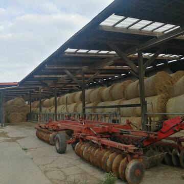
Heu und Stroh zu verkaufen
21527 Kollow
Hof -Linautal
@Hof-Linautal
Heu
Lieferant entlädt
Rundballen
Regenfrei
3 weitere...
aktuell
B+
Deprecated: Creation of dynamic property Zend_View_Helper_Ads::$adLink is deprecated in /var/www/stall-frei/htdocs/staging.stall-frei.de/library/Psf/View/Helper/Ads.php on line 108

Futtersack HeuToy, Fressbremse in pink
Mechtersen
STALL-FREIde Marketing
@STALL-FREI-Marketing
Stundenlange Beschäftigung die
Koliken vorbeugt, geringe Staubinhalation mit
steuerbarer Futterentnahme

Heu, Heulage, ökologisch, artenreich top Qualitä...
Hamburg
Frederic Wübbe
@Stall_Am_Burgberg
Heu
Lieferant entlädt
Rundballen
Bio
3 weitere...
B+
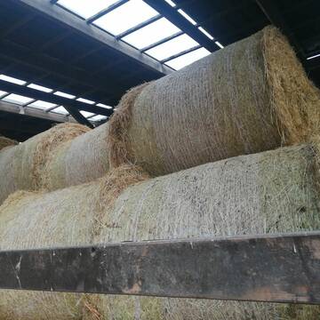
Heu 1.Schnitt 2021
Upahl
hermannmeyerzuborgsen
@hermannmeyerzuborgsen
Heu
Empfänger lädt ab
Rundballen
Regenfrei
3 weitere...
P+

Strohstrukturpellets
Warsow
Luca Grabeleu, Marquardt
@LucaGrabeleu
Einstreu
Empfänger lädt ab
Bigbag
Regenfrei
3 weitere...
B+

Heu in Rundballen (ca.130cm) super Qualität
Pronstorf
Caros Pferdeparadies
@KaOb
Heu
Rundballen
Regenfrei
Wird verladen
2 weitere...
B+

Heu und Heulage verkaufen
Mechtersen
STALL-FREIde Marketing
@STALL-FREI-Marketing
Verkaufen Sie Ihr Heu und Ihre Heulage direkt an Reiter, Pferdeställe und Reitanlagen

Heu HD-Ballen 2. Schnitt extensiv Heugräser
Drochtersen
M-Kluth
@M-Kluth
Heu
Empfänger lädt ab
Kleinballen/HD-Ballen
Regenfrei
3 weitere...
B+

Heu in Quaderballen zu verkaufen
Bergen
Bianca Hinrichs-Schröder
@BHS1976
Futter
Empfänger lädt ab
Kleinballen/HD-Ballen
Bio
Regenfrei
2 weitere...
B+

Heulage in Top-Bioqualität
Bothel
LB Sarah Lühring
@Bonito
Heulage
Rundballen
Regenfrei
Wird verladen
1 weitere...
B+

Erstklassiges PferdeHeu in HD-Ballen
Jevenstedt
Tim Rohwer
@EIDERHEU
Heu
Kleinballen/HD-Ballen
Regenfrei
B+
Deprecated: Creation of dynamic property Zend_View::$pageCount is deprecated in /var/www/stall-frei/htdocs/staging.stall-frei.de/library/vendor/shardj/zf1-future/library/Zend/View/Abstract.php on line 308
Deprecated: Creation of dynamic property Zend_View::$itemCountPerPage is deprecated in /var/www/stall-frei/htdocs/staging.stall-frei.de/library/vendor/shardj/zf1-future/library/Zend/View/Abstract.php on line 308
Deprecated: Creation of dynamic property Zend_View::$first is deprecated in /var/www/stall-frei/htdocs/staging.stall-frei.de/library/vendor/shardj/zf1-future/library/Zend/View/Abstract.php on line 308
Deprecated: Creation of dynamic property Zend_View::$current is deprecated in /var/www/stall-frei/htdocs/staging.stall-frei.de/library/vendor/shardj/zf1-future/library/Zend/View/Abstract.php on line 308
Deprecated: Creation of dynamic property Zend_View::$last is deprecated in /var/www/stall-frei/htdocs/staging.stall-frei.de/library/vendor/shardj/zf1-future/library/Zend/View/Abstract.php on line 308
Deprecated: Creation of dynamic property Zend_View::$next is deprecated in /var/www/stall-frei/htdocs/staging.stall-frei.de/library/vendor/shardj/zf1-future/library/Zend/View/Abstract.php on line 308
Deprecated: Creation of dynamic property Zend_View::$pagesInRange is deprecated in /var/www/stall-frei/htdocs/staging.stall-frei.de/library/vendor/shardj/zf1-future/library/Zend/View/Abstract.php on line 308
Deprecated: Creation of dynamic property Zend_View::$firstPageInRange is deprecated in /var/www/stall-frei/htdocs/staging.stall-frei.de/library/vendor/shardj/zf1-future/library/Zend/View/Abstract.php on line 308
Deprecated: Creation of dynamic property Zend_View::$lastPageInRange is deprecated in /var/www/stall-frei/htdocs/staging.stall-frei.de/library/vendor/shardj/zf1-future/library/Zend/View/Abstract.php on line 308
Deprecated: Creation of dynamic property Zend_View::$currentItemCount is deprecated in /var/www/stall-frei/htdocs/staging.stall-frei.de/library/vendor/shardj/zf1-future/library/Zend/View/Abstract.php on line 308
Deprecated: Creation of dynamic property Zend_View::$totalItemCount is deprecated in /var/www/stall-frei/htdocs/staging.stall-frei.de/library/vendor/shardj/zf1-future/library/Zend/View/Abstract.php on line 308
Deprecated: Creation of dynamic property Zend_View::$firstItemNumber is deprecated in /var/www/stall-frei/htdocs/staging.stall-frei.de/library/vendor/shardj/zf1-future/library/Zend/View/Abstract.php on line 308
Deprecated: Creation of dynamic property Zend_View::$lastItemNumber is deprecated in /var/www/stall-frei/htdocs/staging.stall-frei.de/library/vendor/shardj/zf1-future/library/Zend/View/Abstract.php on line 308
Deprecated: Creation of dynamic property Zend_View::$router is deprecated in /var/www/stall-frei/htdocs/staging.stall-frei.de/library/vendor/shardj/zf1-future/library/Zend/View/Abstract.php on line 308
Deprecated: Creation of dynamic property Zend_View::$urlParams is deprecated in /var/www/stall-frei/htdocs/staging.stall-frei.de/library/vendor/shardj/zf1-future/library/Zend/View/Abstract.php on line 308
Deprecated: Creation of dynamic property Zend_View::$showAds is deprecated in /var/www/stall-frei/htdocs/staging.stall-frei.de/library/vendor/shardj/zf1-future/library/Zend/View/Abstract.php on line 308
Deprecated: Creation of dynamic property Zend_View::$objectIds is deprecated in /var/www/stall-frei/htdocs/staging.stall-frei.de/library/vendor/shardj/zf1-future/library/Zend/View/Abstract.php on line 308
Deprecated: Creation of dynamic property Zend_View::$showNavbar is deprecated in /var/www/stall-frei/htdocs/staging.stall-frei.de/library/vendor/shardj/zf1-future/library/Zend/View/Abstract.php on line 308
Deprecated: Creation of dynamic property Zend_View::$showBreadcrumb is deprecated in /var/www/stall-frei/htdocs/staging.stall-frei.de/library/vendor/shardj/zf1-future/library/Zend/View/Abstract.php on line 308
Deprecated: Creation of dynamic property Zend_View::$showFooter is deprecated in /var/www/stall-frei/htdocs/staging.stall-frei.de/library/vendor/shardj/zf1-future/library/Zend/View/Abstract.php on line 308
Deprecated: Creation of dynamic property Zend_View::$showInternalAds is deprecated in /var/www/stall-frei/htdocs/staging.stall-frei.de/library/vendor/shardj/zf1-future/library/Zend/View/Abstract.php on line 308
Deprecated: Creation of dynamic property Zend_View::$blNoContent is deprecated in /var/www/stall-frei/htdocs/staging.stall-frei.de/library/vendor/shardj/zf1-future/library/Zend/View/Abstract.php on line 308
Deprecated: Creation of dynamic property Zend_View::$sMetaDesc is deprecated in /var/www/stall-frei/htdocs/staging.stall-frei.de/library/vendor/shardj/zf1-future/library/Zend/View/Abstract.php on line 308
Deprecated: Creation of dynamic property Zend_View::$useGmaps is deprecated in /var/www/stall-frei/htdocs/staging.stall-frei.de/library/vendor/shardj/zf1-future/library/Zend/View/Abstract.php on line 308
Deprecated: Creation of dynamic property Zend_View::$touches is deprecated in /var/www/stall-frei/htdocs/staging.stall-frei.de/library/vendor/shardj/zf1-future/library/Zend/View/Abstract.php on line 308
Deprecated: Creation of dynamic property Zend_View::$oProject is deprecated in /var/www/stall-frei/htdocs/staging.stall-frei.de/library/vendor/shardj/zf1-future/library/Zend/View/Abstract.php on line 308
Deprecated: Creation of dynamic property Zend_View::$pageHeadline is deprecated in /var/www/stall-frei/htdocs/staging.stall-frei.de/library/vendor/shardj/zf1-future/library/Zend/View/Abstract.php on line 308
Deprecated: Creation of dynamic property Zend_View::$disableLocationField is deprecated in /var/www/stall-frei/htdocs/staging.stall-frei.de/library/vendor/shardj/zf1-future/library/Zend/View/Abstract.php on line 308
Deprecated: Creation of dynamic property Zend_View::$isSearch is deprecated in /var/www/stall-frei/htdocs/staging.stall-frei.de/library/vendor/shardj/zf1-future/library/Zend/View/Abstract.php on line 308
Deprecated: Creation of dynamic property Zend_View::$pageTitle is deprecated in /var/www/stall-frei/htdocs/staging.stall-frei.de/library/vendor/shardj/zf1-future/library/Zend/View/Abstract.php on line 308
Deprecated: Creation of dynamic property Psf_Form_Element_Text::$class is deprecated in /var/www/stall-frei/htdocs/staging.stall-frei.de/library/vendor/shardj/zf1-future/library/Zend/Form/Element.php on line 874
Deprecated: Creation of dynamic property Psf_Form_Element_Text::$size is deprecated in /var/www/stall-frei/htdocs/staging.stall-frei.de/library/vendor/shardj/zf1-future/library/Zend/Form/Element.php on line 874
Deprecated: Creation of dynamic property Psf_Form_Element_Text::$placeholder is deprecated in /var/www/stall-frei/htdocs/staging.stall-frei.de/library/vendor/shardj/zf1-future/library/Zend/Form/Element.php on line 874
Deprecated: Creation of dynamic property Psf_Form_Element_Hidden::$class is deprecated in /var/www/stall-frei/htdocs/staging.stall-frei.de/library/vendor/shardj/zf1-future/library/Zend/Form/Element.php on line 874
Deprecated: Creation of dynamic property Psf_Form_Element_Hidden::$class is deprecated in /var/www/stall-frei/htdocs/staging.stall-frei.de/library/vendor/shardj/zf1-future/library/Zend/Form/Element.php on line 874
Deprecated: Creation of dynamic property Psf_Form_Element_Hidden::$class is deprecated in /var/www/stall-frei/htdocs/staging.stall-frei.de/library/vendor/shardj/zf1-future/library/Zend/Form/Element.php on line 874
Deprecated: Creation of dynamic property Psf_Form_Element_Hidden::$class is deprecated in /var/www/stall-frei/htdocs/staging.stall-frei.de/library/vendor/shardj/zf1-future/library/Zend/Form/Element.php on line 874
Deprecated: Creation of dynamic property Psf_Form_Element_Select::$class is deprecated in /var/www/stall-frei/htdocs/staging.stall-frei.de/library/vendor/shardj/zf1-future/library/Zend/Form/Element.php on line 874
Deprecated: Creation of dynamic property Psf_Form_Element_Select::$class is deprecated in /var/www/stall-frei/htdocs/staging.stall-frei.de/library/vendor/shardj/zf1-future/library/Zend/Form/Element.php on line 874
Deprecated: Creation of dynamic property Psf_Form_Element_Select::$class is deprecated in /var/www/stall-frei/htdocs/staging.stall-frei.de/library/vendor/shardj/zf1-future/library/Zend/Form/Element.php on line 874
Deprecated: Creation of dynamic property Psf_Form_Element_Select::$class is deprecated in /var/www/stall-frei/htdocs/staging.stall-frei.de/library/vendor/shardj/zf1-future/library/Zend/Form/Element.php on line 874
Deprecated: Creation of dynamic property Zend_View::$sort is deprecated in /var/www/stall-frei/htdocs/staging.stall-frei.de/library/vendor/shardj/zf1-future/library/Zend/View/Abstract.php on line 308
Deprecated: Creation of dynamic property Zend_View::$searchLocation is deprecated in /var/www/stall-frei/htdocs/staging.stall-frei.de/library/vendor/shardj/zf1-future/library/Zend/View/Abstract.php on line 308
Deprecated: Creation of dynamic property Zend_View::$locationHint is deprecated in /var/www/stall-frei/htdocs/staging.stall-frei.de/library/vendor/shardj/zf1-future/library/Zend/View/Abstract.php on line 308
Psf_GeoCoder_Abstract::getLocation: Grabau Get Location CachedOrLive
Psf_GeoCoder_Abstract::getCachedOrLive: Grabau
Psf_GeoCoder_OpenCageData::makeApiRequest: response:
Array
(
[documentation] => https://opencagedata.com/api
[licenses] => Array
(
[0] => Array
(
[name] => see attribution guide
[url] => https://opencagedata.com/credits
)
)
[results] => Array
(
[0] => Array
(
[bounds] => Array
(
[northeast] => Array
(
[lat] => 53.5273011
[lng] => 10.5422054
)
[southwest] => Array
(
[lat] => 53.4851531
[lng] => 10.4915489
)
)
[components] => Array
(
[ISO_3166-1_alpha-2] => DE
[ISO_3166-1_alpha-3] => DEU
[ISO_3166-2] => Array
(
[0] => DE-SH
)
[_category] => place
[_normalized_city] => Grabau
[_type] => village
[continent] => Europe
[country] => Deutschland
[country_code] => de
[county] => Kreis Herzogtum Lauenburg
[municipality] => Schwarzenbek-Land
[political_union] => European Union
[state] => Schleswig-Holstein
[state_code] => SH
[village] => Grabau
)
[confidence] => 7
[formatted] => Grabau, Schleswig-Holstein, Deutschland
[geometry] => Array
(
[lat] => 53.5138364
[lng] => 10.521246
)
)
[1] => Array
(
[bounds] => Array
(
[northeast] => Array
(
[lat] => 53.8285417
[lng] => 10.299403
)
[southwest] => Array
(
[lat] => 53.7872938
[lng] => 10.2406586
)
)
[components] => Array
(
[ISO_3166-1_alpha-2] => DE
[ISO_3166-1_alpha-3] => DEU
[ISO_3166-2] => Array
(
[0] => DE-SH
)
[_category] => place
[_normalized_city] => Grabau
[_type] => village
[continent] => Europe
[country] => Deutschland
[country_code] => de
[county] => Kreis Stormarn
[municipality] => Bad Oldesloe-Land
[political_union] => European Union
[postcode] => 23845
[state] => Schleswig-Holstein
[state_code] => SH
[village] => Grabau
)
[confidence] => 7
[formatted] => 23845 Grabau, Deutschland
[geometry] => Array
(
[lat] => 53.8026385
[lng] => 10.2765507
)
)
[2] => Array
(
[bounds] => Array
(
[northeast] => Array
(
[lat] => 52.9677479
[lng] => 10.8305912
)
[southwest] => Array
(
[lat] => 52.9277479
[lng] => 10.7905912
)
)
[components] => Array
(
[ISO_3166-1_alpha-2] => DE
[ISO_3166-1_alpha-3] => DEU
[ISO_3166-2] => Array
(
[0] => DE-NI
)
[_category] => place
[_normalized_city] => Suhlendorf
[_type] => village
[city] => Suhlendorf
[continent] => Europe
[country] => Deutschland
[country_code] => de
[county] => Landkreis Uelzen
[municipality] => Samtgemeinde Rosche
[political_union] => European Union
[postcode] => 29562
[state] => Niedersachsen
[state_code] => NI
[village] => Grabau
)
[confidence] => 7
[formatted] => 29562 Grabau, Deutschland
[geometry] => Array
(
[lat] => 52.9477479
[lng] => 10.8105912
)
)
[3] => Array
(
[bounds] => Array
(
[northeast] => Array
(
[lat] => 53.1483431
[lng] => 11.1039065
)
[southwest] => Array
(
[lat] => 53.1083431
[lng] => 11.0639065
)
)
[components] => Array
(
[ISO_3166-1_alpha-2] => DE
[ISO_3166-1_alpha-3] => DEU
[ISO_3166-2] => Array
(
[0] => DE-NI
)
[_category] => place
[_normalized_city] => Hitzacker (Elbe)
[_type] => neighbourhood
[continent] => Europe
[country] => Deutschland
[country_code] => de
[county] => Landkreis Lüchow-Dannenberg
[municipality] => Samtgemeinde Elbtalaue
[political_union] => European Union
[postcode] => 29451
[state] => Niedersachsen
[state_code] => NI
[suburb] => Grabau
[town] => Hitzacker (Elbe)
)
[confidence] => 7
[formatted] => 29451 Hitzacker (Elbe), Deutschland
[geometry] => Array
(
[lat] => 53.1283431
[lng] => 11.0839065
)
)
[4] => Array
(
[components] => Array
(
[ISO_3166-1_alpha-2] => FR
[ISO_3166-1_alpha-3] => FRA
[ISO_3166-2] => Array
(
[0] => FR-IDF
[1] => FR-92
)
[_category] => road
[_normalized_city] => Levallois-Perret
[_type] => road
[city] => Levallois-Perret
[continent] => Europe
[country] => France
[country_code] => fr
[county] => Hauts-de-Seine
[local_authority] => Métropole du Grand Paris
[political_union] => European Union
[postcode] => 92300
[road] => Rue Charles Deutschmann
[state] => Île-de-France
[state_code] => IDF
)
[confidence] => 2
[formatted] => Rue Charles Deutschmann, 92300 Levallois-Perret, France
[geometry] => Array
(
[lat] => 48.900049
[lng] => 2.2842
)
)
[5] => Array
(
[components] => Array
(
[ISO_3166-1_alpha-2] => FR
[ISO_3166-1_alpha-3] => FRA
[ISO_3166-2] => Array
(
[0] => FR-OCC
[1] => FR-09
)
[_category] => road
[_normalized_city] => Arabaux
[_type] => road
[city] => Arabaux
[continent] => Europe
[country] => France
[country_code] => fr
[county] => Ariège
[local_authority] => L'Agglo Foix-Varilhes
[political_union] => European Union
[postcode] => 09000
[road] => Chemin de Montpla
[state] => Occitanie
[state_code] => OCC
)
[confidence] => 2
[formatted] => Chemin de Montpla, 09000 Arabaux, France
[geometry] => Array
(
[lat] => 42.976015
[lng] => 1.637838
)
)
[6] => Array
(
[components] => Array
(
[ISO_3166-1_alpha-2] => FR
[ISO_3166-1_alpha-3] => FRA
[ISO_3166-2] => Array
(
[0] => FR-OCC
[1] => FR-09
)
[_category] => road
[_normalized_city] => Arabaux
[_type] => road
[city] => Arabaux
[continent] => Europe
[country] => France
[country_code] => fr
[county] => Ariège
[local_authority] => L'Agglo Foix-Varilhes
[political_union] => European Union
[postcode] => 09000
[road] => Route de Foix
[state] => Occitanie
[state_code] => OCC
)
[confidence] => 2
[formatted] => Route de Foix, 09000 Arabaux, France
[geometry] => Array
(
[lat] => 42.984036
[lng] => 1.642554
)
)
[7] => Array
(
[components] => Array
(
[ISO_3166-1_alpha-2] => FR
[ISO_3166-1_alpha-3] => FRA
[ISO_3166-2] => Array
(
[0] => FR-NOR
[1] => FR-14
)
[_category] => road
[_normalized_city] => Blay
[_type] => road
[city] => Blay
[continent] => Europe
[country] => France
[country_code] => fr
[county] => Calvados
[local_authority] => Isigny Omaha Intercom
[political_union] => European Union
[postcode] => 14400
[road] => Impasse des Arabaux
[state] => Normandie
[state_code] => NOR
)
[confidence] => 2
[formatted] => Impasse des Arabaux, 14400 Blay, France
[geometry] => Array
(
[lat] => 49.271757
[lng] => -0.837825
)
)
[8] => Array
(
[components] => Array
(
[ISO_3166-1_alpha-2] => FR
[ISO_3166-1_alpha-3] => FRA
[ISO_3166-2] => Array
(
[0] => FR-OCC
[1] => FR-09
)
[_category] => road
[_normalized_city] => Arabaux
[_type] => road
[city] => Arabaux
[continent] => Europe
[country] => France
[country_code] => fr
[county] => Ariège
[local_authority] => L'Agglo Foix-Varilhes
[political_union] => European Union
[postcode] => 09000
[road] => Place de Tourenq
[state] => Occitanie
[state_code] => OCC
)
[confidence] => 2
[formatted] => Place de Tourenq, 09000 Arabaux, France
[geometry] => Array
(
[lat] => 42.984094
[lng] => 1.647168
)
)
[9] => Array
(
[components] => Array
(
[ISO_3166-1_alpha-2] => FR
[ISO_3166-1_alpha-3] => FRA
[ISO_3166-2] => Array
(
[0] => FR-OCC
[1] => FR-09
)
[_category] => road
[_normalized_city] => Arabaux
[_type] => road
[city] => Arabaux
[continent] => Europe
[country] => France
[country_code] => fr
[county] => Ariège
[local_authority] => L'Agglo Foix-Varilhes
[political_union] => European Union
[postcode] => 09000
[road] => Chemin de Tourenq
[state] => Occitanie
[state_code] => OCC
)
[confidence] => 2
[formatted] => Chemin de Tourenq, 09000 Arabaux, France
[geometry] => Array
(
[lat] => 42.984682
[lng] => 1.643357
)
)
)
[status] => Array
(
[code] => 200
[message] => OK
)
[stay_informed] => Array
(
[blog] => https://blog.opencagedata.com
[mastodon] => https://en.osm.town/@opencage
)
[thanks] => For using an OpenCage API
[timestamp] => Array
(
[created_http] => Sat, 07 Feb 2026 08:36:17 GMT
[created_unix] => 1770453377
)
[total_results] => 10
)
Psf_GeoCoder_Abstract::convertLocationResult
{"documentation":"https:\/\/opencagedata.com\/api","licenses":[{"name":"see attribution guide","url":"https:\/\/opencagedata.com\/credits"}],"results":[{"bounds":{"northeast":{"lat":53.5273011,"lng":10.5422054},"southwest":{"lat":53.4851531,"lng":10.4915489}},"components":{"ISO_3166-1_alpha-2":"DE","ISO_3166-1_alpha-3":"DEU","ISO_3166-2":["DE-SH"],"_category":"place","_normalized_city":"Grabau","_type":"village","continent":"Europe","country":"Deutschland","country_code":"de","county":"Kreis Herzogtum Lauenburg","municipality":"Schwarzenbek-Land","political_union":"European Union","state":"Schleswig-Holstein","state_code":"SH","village":"Grabau"},"confidence":7,"formatted":"Grabau, Schleswig-Holstein, Deutschland","geometry":{"lat":53.5138364,"lng":10.521246}},{"bounds":{"northeast":{"lat":53.8285417,"lng":10.299403},"southwest":{"lat":53.7872938,"lng":10.2406586}},"components":{"ISO_3166-1_alpha-2":"DE","ISO_3166-1_alpha-3":"DEU","ISO_3166-2":["DE-SH"],"_category":"place","_normalized_city":"Grabau","_type":"village","continent":"Europe","country":"Deutschland","country_code":"de","county":"Kreis Stormarn","municipality":"Bad Oldesloe-Land","political_union":"European Union","postcode":"23845","state":"Schleswig-Holstein","state_code":"SH","village":"Grabau"},"confidence":7,"formatted":"23845 Grabau, Deutschland","geometry":{"lat":53.8026385,"lng":10.2765507}},{"bounds":{"northeast":{"lat":52.9677479,"lng":10.8305912},"southwest":{"lat":52.9277479,"lng":10.7905912}},"components":{"ISO_3166-1_alpha-2":"DE","ISO_3166-1_alpha-3":"DEU","ISO_3166-2":["DE-NI"],"_category":"place","_normalized_city":"Suhlendorf","_type":"village","city":"Suhlendorf","continent":"Europe","country":"Deutschland","country_code":"de","county":"Landkreis Uelzen","municipality":"Samtgemeinde Rosche","political_union":"European Union","postcode":"29562","state":"Niedersachsen","state_code":"NI","village":"Grabau"},"confidence":7,"formatted":"29562 Grabau, Deutschland","geometry":{"lat":52.9477479,"lng":10.8105912}},{"bounds":{"northeast":{"lat":53.1483431,"lng":11.1039065},"southwest":{"lat":53.1083431,"lng":11.0639065}},"components":{"ISO_3166-1_alpha-2":"DE","ISO_3166-1_alpha-3":"DEU","ISO_3166-2":["DE-NI"],"_category":"place","_normalized_city":"Hitzacker (Elbe)","_type":"neighbourhood","continent":"Europe","country":"Deutschland","country_code":"de","county":"Landkreis L\u00fcchow-Dannenberg","municipality":"Samtgemeinde Elbtalaue","political_union":"European Union","postcode":"29451","state":"Niedersachsen","state_code":"NI","suburb":"Grabau","town":"Hitzacker (Elbe)"},"confidence":7,"formatted":"29451 Hitzacker (Elbe), Deutschland","geometry":{"lat":53.1283431,"lng":11.0839065}},{"components":{"ISO_3166-1_alpha-2":"FR","ISO_3166-1_alpha-3":"FRA","ISO_3166-2":["FR-IDF","FR-92"],"_category":"road","_normalized_city":"Levallois-Perret","_type":"road","city":"Levallois-Perret","continent":"Europe","country":"France","country_code":"fr","county":"Hauts-de-Seine","local_authority":"M\u00e9tropole du Grand Paris","political_union":"European Union","postcode":"92300","road":"Rue Charles Deutschmann","state":"\u00cele-de-France","state_code":"IDF"},"confidence":2,"formatted":"Rue Charles Deutschmann, 92300 Levallois-Perret, France","geometry":{"lat":48.900049,"lng":2.2842}},{"components":{"ISO_3166-1_alpha-2":"FR","ISO_3166-1_alpha-3":"FRA","ISO_3166-2":["FR-OCC","FR-09"],"_category":"road","_normalized_city":"Arabaux","_type":"road","city":"Arabaux","continent":"Europe","country":"France","country_code":"fr","county":"Ari\u00e8ge","local_authority":"L'Agglo Foix-Varilhes","political_union":"European Union","postcode":"09000","road":"Chemin de Montpla","state":"Occitanie","state_code":"OCC"},"confidence":2,"formatted":"Chemin de Montpla, 09000 Arabaux, France","geometry":{"lat":42.976015,"lng":1.637838}},{"components":{"ISO_3166-1_alpha-2":"FR","ISO_3166-1_alpha-3":"FRA","ISO_3166-2":["FR-OCC","FR-09"],"_category":"road","_normalized_city":"Arabaux","_type":"road","city":"Arabaux","continent":"Europe","country":"France","country_code":"fr","county":"Ari\u00e8ge","local_authority":"L'Agglo Foix-Varilhes","political_union":"European Union","postcode":"09000","road":"Route de Foix","state":"Occitanie","state_code":"OCC"},"confidence":2,"formatted":"Route de Foix, 09000 Arabaux, France","geometry":{"lat":42.984036,"lng":1.642554}},{"components":{"ISO_3166-1_alpha-2":"FR","ISO_3166-1_alpha-3":"FRA","ISO_3166-2":["FR-NOR","FR-14"],"_category":"road","_normalized_city":"Blay","_type":"road","city":"Blay","continent":"Europe","country":"France","country_code":"fr","county":"Calvados","local_authority":"Isigny Omaha Intercom","political_union":"European Union","postcode":"14400","road":"Impasse des Arabaux","state":"Normandie","state_code":"NOR"},"confidence":2,"formatted":"Impasse des Arabaux, 14400 Blay, France","geometry":{"lat":49.271757,"lng":-0.837825}},{"components":{"ISO_3166-1_alpha-2":"FR","ISO_3166-1_alpha-3":"FRA","ISO_3166-2":["FR-OCC","FR-09"],"_category":"road","_normalized_city":"Arabaux","_type":"road","city":"Arabaux","continent":"Europe","country":"France","country_code":"fr","county":"Ari\u00e8ge","local_authority":"L'Agglo Foix-Varilhes","political_union":"European Union","postcode":"09000","road":"Place de Tourenq","state":"Occitanie","state_code":"OCC"},"confidence":2,"formatted":"Place de Tourenq, 09000 Arabaux, France","geometry":{"lat":42.984094,"lng":1.647168}},{"components":{"ISO_3166-1_alpha-2":"FR","ISO_3166-1_alpha-3":"FRA","ISO_3166-2":["FR-OCC","FR-09"],"_category":"road","_normalized_city":"Arabaux","_type":"road","city":"Arabaux","continent":"Europe","country":"France","country_code":"fr","county":"Ari\u00e8ge","local_authority":"L'Agglo Foix-Varilhes","political_union":"European Union","postcode":"09000","road":"Chemin de Tourenq","state":"Occitanie","state_code":"OCC"},"confidence":2,"formatted":"Chemin de Tourenq, 09000 Arabaux, France","geometry":{"lat":42.984682,"lng":1.643357}}],"status":{"code":200,"message":"OK"},"stay_informed":{"blog":"https:\/\/blog.opencagedata.com","mastodon":"https:\/\/en.osm.town\/@opencage"},"thanks":"For using an OpenCage API","timestamp":{"created_http":"Sat, 07 Feb 2026 08:36:17 GMT","created_unix":1770453377},"total_results":10}Array
(
[0] => stdClass Object
(
[bounds] => stdClass Object
(
[northeast] => stdClass Object
(
[lat] => 53.5273011
[lng] => 10.5422054
)
[southwest] => stdClass Object
(
[lat] => 53.4851531
[lng] => 10.4915489
)
)
[components] => stdClass Object
(
[ISO_3166-1_alpha-2] => DE
[ISO_3166-1_alpha-3] => DEU
[ISO_3166-2] => Array
(
[0] => DE-SH
)
[_category] => place
[_normalized_city] => Grabau
[_type] => village
[continent] => Europe
[country] => Deutschland
[country_code] => de
[county] => Kreis Herzogtum Lauenburg
[municipality] => Schwarzenbek-Land
[political_union] => European Union
[state] => Schleswig-Holstein
[state_code] => SH
[village] => Grabau
)
[confidence] => 7
[formatted] => Grabau, Schleswig-Holstein, Deutschland
[geometry] => stdClass Object
(
[lat] => 53.5138364
[lng] => 10.521246
)
)
[1] => stdClass Object
(
[bounds] => stdClass Object
(
[northeast] => stdClass Object
(
[lat] => 53.8285417
[lng] => 10.299403
)
[southwest] => stdClass Object
(
[lat] => 53.7872938
[lng] => 10.2406586
)
)
[components] => stdClass Object
(
[ISO_3166-1_alpha-2] => DE
[ISO_3166-1_alpha-3] => DEU
[ISO_3166-2] => Array
(
[0] => DE-SH
)
[_category] => place
[_normalized_city] => Grabau
[_type] => village
[continent] => Europe
[country] => Deutschland
[country_code] => de
[county] => Kreis Stormarn
[municipality] => Bad Oldesloe-Land
[political_union] => European Union
[postcode] => 23845
[state] => Schleswig-Holstein
[state_code] => SH
[village] => Grabau
)
[confidence] => 7
[formatted] => 23845 Grabau, Deutschland
[geometry] => stdClass Object
(
[lat] => 53.8026385
[lng] => 10.2765507
)
)
[2] => stdClass Object
(
[bounds] => stdClass Object
(
[northeast] => stdClass Object
(
[lat] => 52.9677479
[lng] => 10.8305912
)
[southwest] => stdClass Object
(
[lat] => 52.9277479
[lng] => 10.7905912
)
)
[components] => stdClass Object
(
[ISO_3166-1_alpha-2] => DE
[ISO_3166-1_alpha-3] => DEU
[ISO_3166-2] => Array
(
[0] => DE-NI
)
[_category] => place
[_normalized_city] => Suhlendorf
[_type] => village
[city] => Suhlendorf
[continent] => Europe
[country] => Deutschland
[country_code] => de
[county] => Landkreis Uelzen
[municipality] => Samtgemeinde Rosche
[political_union] => European Union
[postcode] => 29562
[state] => Niedersachsen
[state_code] => NI
[village] => Grabau
)
[confidence] => 7
[formatted] => 29562 Grabau, Deutschland
[geometry] => stdClass Object
(
[lat] => 52.9477479
[lng] => 10.8105912
)
)
[3] => stdClass Object
(
[bounds] => stdClass Object
(
[northeast] => stdClass Object
(
[lat] => 53.1483431
[lng] => 11.1039065
)
[southwest] => stdClass Object
(
[lat] => 53.1083431
[lng] => 11.0639065
)
)
[components] => stdClass Object
(
[ISO_3166-1_alpha-2] => DE
[ISO_3166-1_alpha-3] => DEU
[ISO_3166-2] => Array
(
[0] => DE-NI
)
[_category] => place
[_normalized_city] => Hitzacker (Elbe)
[_type] => neighbourhood
[continent] => Europe
[country] => Deutschland
[country_code] => de
[county] => Landkreis Lüchow-Dannenberg
[municipality] => Samtgemeinde Elbtalaue
[political_union] => European Union
[postcode] => 29451
[state] => Niedersachsen
[state_code] => NI
[suburb] => Grabau
[town] => Hitzacker (Elbe)
)
[confidence] => 7
[formatted] => 29451 Hitzacker (Elbe), Deutschland
[geometry] => stdClass Object
(
[lat] => 53.1283431
[lng] => 11.0839065
)
)
[4] => stdClass Object
(
[components] => stdClass Object
(
[ISO_3166-1_alpha-2] => FR
[ISO_3166-1_alpha-3] => FRA
[ISO_3166-2] => Array
(
[0] => FR-IDF
[1] => FR-92
)
[_category] => road
[_normalized_city] => Levallois-Perret
[_type] => road
[city] => Levallois-Perret
[continent] => Europe
[country] => France
[country_code] => fr
[county] => Hauts-de-Seine
[local_authority] => Métropole du Grand Paris
[political_union] => European Union
[postcode] => 92300
[road] => Rue Charles Deutschmann
[state] => Île-de-France
[state_code] => IDF
)
[confidence] => 2
[formatted] => Rue Charles Deutschmann, 92300 Levallois-Perret, France
[geometry] => stdClass Object
(
[lat] => 48.900049
[lng] => 2.2842
)
)
[5] => stdClass Object
(
[components] => stdClass Object
(
[ISO_3166-1_alpha-2] => FR
[ISO_3166-1_alpha-3] => FRA
[ISO_3166-2] => Array
(
[0] => FR-OCC
[1] => FR-09
)
[_category] => road
[_normalized_city] => Arabaux
[_type] => road
[city] => Arabaux
[continent] => Europe
[country] => France
[country_code] => fr
[county] => Ariège
[local_authority] => L'Agglo Foix-Varilhes
[political_union] => European Union
[postcode] => 09000
[road] => Chemin de Montpla
[state] => Occitanie
[state_code] => OCC
)
[confidence] => 2
[formatted] => Chemin de Montpla, 09000 Arabaux, France
[geometry] => stdClass Object
(
[lat] => 42.976015
[lng] => 1.637838
)
)
[6] => stdClass Object
(
[components] => stdClass Object
(
[ISO_3166-1_alpha-2] => FR
[ISO_3166-1_alpha-3] => FRA
[ISO_3166-2] => Array
(
[0] => FR-OCC
[1] => FR-09
)
[_category] => road
[_normalized_city] => Arabaux
[_type] => road
[city] => Arabaux
[continent] => Europe
[country] => France
[country_code] => fr
[county] => Ariège
[local_authority] => L'Agglo Foix-Varilhes
[political_union] => European Union
[postcode] => 09000
[road] => Route de Foix
[state] => Occitanie
[state_code] => OCC
)
[confidence] => 2
[formatted] => Route de Foix, 09000 Arabaux, France
[geometry] => stdClass Object
(
[lat] => 42.984036
[lng] => 1.642554
)
)
[7] => stdClass Object
(
[components] => stdClass Object
(
[ISO_3166-1_alpha-2] => FR
[ISO_3166-1_alpha-3] => FRA
[ISO_3166-2] => Array
(
[0] => FR-NOR
[1] => FR-14
)
[_category] => road
[_normalized_city] => Blay
[_type] => road
[city] => Blay
[continent] => Europe
[country] => France
[country_code] => fr
[county] => Calvados
[local_authority] => Isigny Omaha Intercom
[political_union] => European Union
[postcode] => 14400
[road] => Impasse des Arabaux
[state] => Normandie
[state_code] => NOR
)
[confidence] => 2
[formatted] => Impasse des Arabaux, 14400 Blay, France
[geometry] => stdClass Object
(
[lat] => 49.271757
[lng] => -0.837825
)
)
[8] => stdClass Object
(
[components] => stdClass Object
(
[ISO_3166-1_alpha-2] => FR
[ISO_3166-1_alpha-3] => FRA
[ISO_3166-2] => Array
(
[0] => FR-OCC
[1] => FR-09
)
[_category] => road
[_normalized_city] => Arabaux
[_type] => road
[city] => Arabaux
[continent] => Europe
[country] => France
[country_code] => fr
[county] => Ariège
[local_authority] => L'Agglo Foix-Varilhes
[political_union] => European Union
[postcode] => 09000
[road] => Place de Tourenq
[state] => Occitanie
[state_code] => OCC
)
[confidence] => 2
[formatted] => Place de Tourenq, 09000 Arabaux, France
[geometry] => stdClass Object
(
[lat] => 42.984094
[lng] => 1.647168
)
)
[9] => stdClass Object
(
[components] => stdClass Object
(
[ISO_3166-1_alpha-2] => FR
[ISO_3166-1_alpha-3] => FRA
[ISO_3166-2] => Array
(
[0] => FR-OCC
[1] => FR-09
)
[_category] => road
[_normalized_city] => Arabaux
[_type] => road
[city] => Arabaux
[continent] => Europe
[country] => France
[country_code] => fr
[county] => Ariège
[local_authority] => L'Agglo Foix-Varilhes
[political_union] => European Union
[postcode] => 09000
[road] => Chemin de Tourenq
[state] => Occitanie
[state_code] => OCC
)
[confidence] => 2
[formatted] => Chemin de Tourenq, 09000 Arabaux, France
[geometry] => stdClass Object
(
[lat] => 42.984682
[lng] => 1.643357
)
)
)
Psf_GeoCoder_OpenCageData::getKeyMap: 0
stdClass Object
(
    [bounds] => stdClass Object
        (
            [northeast] => stdClass Object
                (
                    [lat] => 53.5273011
                    [lng] => 10.5422054
                )

            [southwest] => stdClass Object
                (
                    [lat] => 53.4851531
                    [lng] => 10.4915489
                )

        )

    [components] => stdClass Object
        (
            [ISO_3166-1_alpha-2] => DE
            [ISO_3166-1_alpha-3] => DEU
            [ISO_3166-2] => Array
                (
                    [0] => DE-SH
                )

            [_category] => place
            [_normalized_city] => Grabau
            [_type] => village
            [continent] => Europe
            [country] => Deutschland
            [country_code] => de
            [county] => Kreis Herzogtum Lauenburg
            [municipality] => Schwarzenbek-Land
            [political_union] => European Union
            [state] => Schleswig-Holstein
            [state_code] => SH
            [village] => Grabau
        )

    [confidence] => 7
    [formatted] => Grabau, Schleswig-Holstein, Deutschland
    [geometry] => stdClass Object
        (
            [lat] => 53.5138364
            [lng] => 10.521246
        )

)
Psf_GeoCoder_OpenCageData::getCounty: Herzogtum Lauenburg
Psf_GeoCoder_OpenCageData::addMissingData REFETCH!
Array
(
    [address] => Grabau, Schleswig-Holstein, Deutschland
    [type] => village
    [street] =>
    [city] => Grabau
    [county] => Herzogtum Lauenburg
    [state] => Schleswig-Holstein
    [zip] =>
    [country] => Deutschland
    [suburb] =>
    [countrycode] => de
    [latitude] => 53.5138364
    [longitude] => 10.521246
    [accuracy] => 1
    [confidence] => 7
    [bounds] => stdClass Object
        (
            [northeast] => stdClass Object
                (
                    [lat] => 53.5273011
                    [lng] => 10.5422054
                )

            [southwest] => stdClass Object
                (
                    [lat] => 53.4851531
                    [lng] => 10.4915489
                )

        )

)
reformat!
Array
(
    [address] => Grabau, Schleswig-Holstein, Deutschland
    [type] => village
    [street] =>
    [city] => Grabau
    [county] => Herzogtum Lauenburg
    [state] => Schleswig-Holstein
    [zip] =>
    [country] => Deutschland
    [suburb] =>
    [countrycode] => de
    [latitude] => 53.5138364
    [longitude] => 10.521246
    [accuracy] => 1
    [confidence] => 7
    [bounds] => stdClass Object
        (
            [northeast] => stdClass Object
                (
                    [lat] => 53.5273011
                    [lng] => 10.5422054
                )

            [southwest] => stdClass Object
                (
                    [lat] => 53.4851531
                    [lng] => 10.4915489
                )

        )

    [place] => Grabau, Schleswig-Holstein
    [hash] => 1935aa4335ac396521231a2cf2f7f964
)
Psf_GeoCoder_OpenCageData::getKeyMap: 1
stdClass Object
(
    [bounds] => stdClass Object
        (
            [northeast] => stdClass Object
                (
                    [lat] => 53.8285417
                    [lng] => 10.299403
                )

            [southwest] => stdClass Object
                (
                    [lat] => 53.7872938
                    [lng] => 10.2406586
                )

        )

    [components] => stdClass Object
        (
            [ISO_3166-1_alpha-2] => DE
            [ISO_3166-1_alpha-3] => DEU
            [ISO_3166-2] => Array
                (
                    [0] => DE-SH
                )

            [_category] => place
            [_normalized_city] => Grabau
            [_type] => village
            [continent] => Europe
            [country] => Deutschland
            [country_code] => de
            [county] => Kreis Stormarn
            [municipality] => Bad Oldesloe-Land
            [political_union] => European Union
            [postcode] => 23845
            [state] => Schleswig-Holstein
            [state_code] => SH
            [village] => Grabau
        )

    [confidence] => 7
    [formatted] => 23845 Grabau, Deutschland
    [geometry] => stdClass Object
        (
            [lat] => 53.8026385
            [lng] => 10.2765507
        )

)
Psf_GeoCoder_OpenCageData::getCounty: Stormarn
Psf_GeoCoder_OpenCageData::addMissingData REFETCH!
Array
(
    [address] => 23845 Grabau, Deutschland
    [type] => village
    [street] =>
    [city] => Grabau
    [county] => Stormarn
    [state] => Schleswig-Holstein
    [zip] => 23845
    [country] => Deutschland
    [suburb] =>
    [countrycode] => de
    [latitude] => 53.8026385
    [longitude] => 10.2765507
    [accuracy] => 1
    [confidence] => 7
    [bounds] => stdClass Object
        (
            [northeast] => stdClass Object
                (
                    [lat] => 53.8285417
                    [lng] => 10.299403
                )

            [southwest] => stdClass Object
                (
                    [lat] => 53.7872938
                    [lng] => 10.2406586
                )

        )

)
reformat!
Array
(
    [address] => 23845 Grabau, Deutschland
    [type] => village
    [street] =>
    [city] => Grabau
    [county] => Stormarn
    [state] => Schleswig-Holstein
    [zip] => 23845
    [country] => Deutschland
    [suburb] =>
    [countrycode] => de
    [latitude] => 53.8026385
    [longitude] => 10.2765507
    [accuracy] => 1
    [confidence] => 7
    [bounds] => stdClass Object
        (
            [northeast] => stdClass Object
                (
                    [lat] => 53.8285417
                    [lng] => 10.299403
                )

            [southwest] => stdClass Object
                (
                    [lat] => 53.7872938
                    [lng] => 10.2406586
                )

        )

    [place] => 23845 Grabau, Schleswig-Holstein
    [hash] => 42517fb7410e5ce181d47883c9ca1e48
)
Psf_GeoCoder_OpenCageData::getKeyMap: 2
stdClass Object
(
    [bounds] => stdClass Object
        (
            [northeast] => stdClass Object
                (
                    [lat] => 52.9677479
                    [lng] => 10.8305912
                )

            [southwest] => stdClass Object
                (
                    [lat] => 52.9277479
                    [lng] => 10.7905912
                )

        )

    [components] => stdClass Object
        (
            [ISO_3166-1_alpha-2] => DE
            [ISO_3166-1_alpha-3] => DEU
            [ISO_3166-2] => Array
                (
                    [0] => DE-NI
                )

            [_category] => place
            [_normalized_city] => Suhlendorf
            [_type] => village
            [city] => Suhlendorf
            [continent] => Europe
            [country] => Deutschland
            [country_code] => de
            [county] => Landkreis Uelzen
            [municipality] => Samtgemeinde Rosche
            [political_union] => European Union
            [postcode] => 29562
            [state] => Niedersachsen
            [state_code] => NI
            [village] => Grabau
        )

    [confidence] => 7
    [formatted] => 29562 Grabau, Deutschland
    [geometry] => stdClass Object
        (
            [lat] => 52.9477479
            [lng] => 10.8105912
        )

)
Psf_GeoCoder_OpenCageData::getCounty: Uelzen
Psf_GeoCoder_OpenCageData::addMissingData REFETCH!
Array
(
    [address] => 29562 Grabau, Deutschland
    [type] => village
    [street] =>
    [city] => Grabau
    [county] => Uelzen
    [state] => Niedersachsen
    [zip] => 29562
    [country] => Deutschland
    [suburb] =>
    [countrycode] => de
    [latitude] => 52.9477479
    [longitude] => 10.8105912
    [accuracy] => 1
    [confidence] => 7
    [bounds] => stdClass Object
        (
            [northeast] => stdClass Object
                (
                    [lat] => 52.9677479
                    [lng] => 10.8305912
                )

            [southwest] => stdClass Object
                (
                    [lat] => 52.9277479
                    [lng] => 10.7905912
                )

        )

)
reformat!
Array
(
    [address] => 29562 Grabau, Deutschland
    [type] => village
    [street] =>
    [city] => Grabau
    [county] => Uelzen
    [state] => Niedersachsen
    [zip] => 29562
    [country] => Deutschland
    [suburb] =>
    [countrycode] => de
    [latitude] => 52.9477479
    [longitude] => 10.8105912
    [accuracy] => 1
    [confidence] => 7
    [bounds] => stdClass Object
        (
            [northeast] => stdClass Object
                (
                    [lat] => 52.9677479
                    [lng] => 10.8305912
                )

            [southwest] => stdClass Object
                (
                    [lat] => 52.9277479
                    [lng] => 10.7905912
                )

        )

    [place] => 29562 Grabau, Niedersachsen
    [hash] => c892616e3cc36dd677345227b42ea528
)
Psf_GeoCoder_OpenCageData::getKeyMap: 3
stdClass Object
(
    [bounds] => stdClass Object
        (
            [northeast] => stdClass Object
                (
                    [lat] => 53.1483431
                    [lng] => 11.1039065
                )

            [southwest] => stdClass Object
                (
                    [lat] => 53.1083431
                    [lng] => 11.0639065
                )

        )

    [components] => stdClass Object
        (
            [ISO_3166-1_alpha-2] => DE
            [ISO_3166-1_alpha-3] => DEU
            [ISO_3166-2] => Array
                (
                    [0] => DE-NI
                )

            [_category] => place
            [_normalized_city] => Hitzacker (Elbe)
            [_type] => neighbourhood
            [continent] => Europe
            [country] => Deutschland
            [country_code] => de
            [county] => Landkreis Lüchow-Dannenberg
            [municipality] => Samtgemeinde Elbtalaue
            [political_union] => European Union
            [postcode] => 29451
            [state] => Niedersachsen
            [state_code] => NI
            [suburb] => Grabau
            [town] => Hitzacker (Elbe)
        )

    [confidence] => 7
    [formatted] => 29451 Hitzacker (Elbe), Deutschland
    [geometry] => stdClass Object
        (
            [lat] => 53.1283431
            [lng] => 11.0839065
        )

)
Psf_GeoCoder_OpenCageData::getCounty: Lüchow-Dannenberg
Psf_GeoCoder_OpenCageData::addMissingData REFETCH!
Array
(
    [address] => 29451 Hitzacker (Elbe), Deutschland
    [type] => neighbourhood
    [street] =>
    [city] => Hitzacker (Elbe)
    [county] => Lüchow-Dannenberg
    [state] => Niedersachsen
    [zip] => 29451
    [country] => Deutschland
    [suburb] => Grabau
    [countrycode] => de
    [latitude] => 53.1283431
    [longitude] => 11.0839065
    [accuracy] => 1
    [confidence] => 7
    [bounds] => stdClass Object
        (
            [northeast] => stdClass Object
                (
                    [lat] => 53.1483431
                    [lng] => 11.1039065
                )

            [southwest] => stdClass Object
                (
                    [lat] => 53.1083431
                    [lng] => 11.0639065
                )

        )

)
reformat!
Array
(
    [address] => 29451 Hitzacker (Elbe), Deutschland
    [type] => neighbourhood
    [street] =>
    [city] => Hitzacker (Elbe)
    [county] => Lüchow-Dannenberg
    [state] => Niedersachsen
    [zip] => 29451
    [country] => Deutschland
    [suburb] => Grabau
    [countrycode] => de
    [latitude] => 53.1283431
    [longitude] => 11.0839065
    [accuracy] => 1
    [confidence] => 7
    [bounds] => stdClass Object
        (
            [northeast] => stdClass Object
                (
                    [lat] => 53.1483431
                    [lng] => 11.1039065
                )

            [southwest] => stdClass Object
                (
                    [lat] => 53.1083431
                    [lng] => 11.0639065
                )

        )

    [place] => 29451 Hitzacker (Elbe), Niedersachsen
    [hash] => 384ba97172c255cdf4dc03275ba086b5
)
Psf_GeoCoder_OpenCageData::getKeyMap: 4
stdClass Object
(
    [components] => stdClass Object
        (
            [ISO_3166-1_alpha-2] => FR
            [ISO_3166-1_alpha-3] => FRA
            [ISO_3166-2] => Array
                (
                    [0] => FR-IDF
                    [1] => FR-92
                )

            [_category] => road
            [_normalized_city] => Levallois-Perret
            [_type] => road
            [city] => Levallois-Perret
            [continent] => Europe
            [country] => France
            [country_code] => fr
            [county] => Hauts-de-Seine
            [local_authority] => Métropole du Grand Paris
            [political_union] => European Union
            [postcode] => 92300
            [road] => Rue Charles Deutschmann
            [state] => Île-de-France
            [state_code] => IDF
        )

    [confidence] => 2
    [formatted] => Rue Charles Deutschmann, 92300 Levallois-Perret, France
    [geometry] => stdClass Object
        (
            [lat] => 48.900049
            [lng] => 2.2842
        )

)
Psf_GeoCoder_OpenCageData::getCounty: Hauts-de-Seine
Psf_GeoCoder_OpenCageData::addMissingData REFETCH!
Array
(
    [address] => Rue Charles Deutschmann, 92300 Levallois-Perret, France
    [type] => road
    [street] => Rue Charles Deutschmann
    [city] => Levallois-Perret
    [county] => Hauts-de-Seine
    [state] => Île-de-France
    [zip] => 92300
    [country] => France
    [suburb] =>
    [countrycode] => fr
    [latitude] => 48.900049
    [longitude] => 2.2842
    [accuracy] => 1
    [confidence] => 2
    [bounds] =>
)
reformat!
Array
(
    [address] => Rue Charles Deutschmann, 92300 Levallois-Perret, France
    [type] => road
    [street] => Rue Charles Deutschmann
    [city] => Levallois-Perret
    [county] => Hauts-de-Seine
    [state] => Île-de-France
    [zip] => 92300
    [country] => France
    [suburb] =>
    [countrycode] => fr
    [latitude] => 48.900049
    [longitude] => 2.2842
    [accuracy] => 1
    [confidence] => 2
    [bounds] =>
    [place] => Rue Charles Deutschmann, 92300 Levallois-Perret, Île-de-France
    [hash] => b7dc44def3990e8a7eaf18e019eca466
)
Psf_GeoCoder_OpenCageData::getKeyMap: 5
stdClass Object
(
    [components] => stdClass Object
        (
            [ISO_3166-1_alpha-2] => FR
            [ISO_3166-1_alpha-3] => FRA
            [ISO_3166-2] => Array
                (
                    [0] => FR-OCC
                    [1] => FR-09
                )

            [_category] => road
            [_normalized_city] => Arabaux
            [_type] => road
            [city] => Arabaux
            [continent] => Europe
            [country] => France
            [country_code] => fr
            [county] => Ariège
            [local_authority] => L'Agglo Foix-Varilhes
            [political_union] => European Union
            [postcode] => 09000
            [road] => Chemin de Montpla
            [state] => Occitanie
            [state_code] => OCC
        )

    [confidence] => 2
    [formatted] => Chemin de Montpla, 09000 Arabaux, France
    [geometry] => stdClass Object
        (
            [lat] => 42.976015
            [lng] => 1.637838
        )

)
Psf_GeoCoder_OpenCageData::getCounty: Ariège
Psf_GeoCoder_OpenCageData::addMissingData REFETCH!
Array
(
    [address] => Chemin de Montpla, 09000 Arabaux, France
    [type] => road
    [street] => Chemin de Montpla
    [city] => Arabaux
    [county] => Ariège
    [state] => Occitanie
    [zip] => 09000
    [country] => France
    [suburb] =>
    [countrycode] => fr
    [latitude] => 42.976015
    [longitude] => 1.637838
    [accuracy] => 1
    [confidence] => 2
    [bounds] =>
)
reformat!
Array
(
    [address] => Chemin de Montpla, 09000 Arabaux, France
    [type] => road
    [street] => Chemin de Montpla
    [city] => Arabaux
    [county] => Ariège
    [state] => Occitanie
    [zip] => 09000
    [country] => France
    [suburb] =>
    [countrycode] => fr
    [latitude] => 42.976015
    [longitude] => 1.637838
    [accuracy] => 1
    [confidence] => 2
    [bounds] =>
    [place] => Chemin de Montpla, 09000 Arabaux, Occitanie
    [hash] => 5a3e9d38f1347368308df9d3437930b6
)
Psf_GeoCoder_OpenCageData::getKeyMap: 6
stdClass Object
(
    [components] => stdClass Object
        (
            [ISO_3166-1_alpha-2] => FR
            [ISO_3166-1_alpha-3] => FRA
            [ISO_3166-2] => Array
                (
                    [0] => FR-OCC
                    [1] => FR-09
                )

            [_category] => road
            [_normalized_city] => Arabaux
            [_type] => road
            [city] => Arabaux
            [continent] => Europe
            [country] => France
            [country_code] => fr
            [county] => Ariège
            [local_authority] => L'Agglo Foix-Varilhes
            [political_union] => European Union
            [postcode] => 09000
            [road] => Route de Foix
            [state] => Occitanie
            [state_code] => OCC
        )

    [confidence] => 2
    [formatted] => Route de Foix, 09000 Arabaux, France
    [geometry] => stdClass Object
        (
            [lat] => 42.984036
            [lng] => 1.642554
        )

)
Psf_GeoCoder_OpenCageData::getCounty: Ariège
Psf_GeoCoder_OpenCageData::addMissingData REFETCH!
Array
(
    [address] => Route de Foix, 09000 Arabaux, France
    [type] => road
    [street] => Route de Foix
    [city] => Arabaux
    [county] => Ariège
    [state] => Occitanie
    [zip] => 09000
    [country] => France
    [suburb] =>
    [countrycode] => fr
    [latitude] => 42.984036
    [longitude] => 1.642554
    [accuracy] => 1
    [confidence] => 2
    [bounds] =>
)
reformat!
Array
(
    [address] => Route de Foix, 09000 Arabaux, France
    [type] => road
    [street] => Route de Foix
    [city] => Arabaux
    [county] => Ariège
    [state] => Occitanie
    [zip] => 09000
    [country] => France
    [suburb] =>
    [countrycode] => fr
    [latitude] => 42.984036
    [longitude] => 1.642554
    [accuracy] => 1
    [confidence] => 2
    [bounds] =>
    [place] => Route de Foix, 09000 Arabaux, Occitanie
    [hash] => cfbbf5b8b282a8506c0b7bd5549cf8cf
)
Psf_GeoCoder_OpenCageData::getKeyMap: 7
stdClass Object
(
    [components] => stdClass Object
        (
            [ISO_3166-1_alpha-2] => FR
            [ISO_3166-1_alpha-3] => FRA
            [ISO_3166-2] => Array
                (
                    [0] => FR-NOR
                    [1] => FR-14
                )

            [_category] => road
            [_normalized_city] => Blay
            [_type] => road
            [city] => Blay
            [continent] => Europe
            [country] => France
            [country_code] => fr
            [county] => Calvados
            [local_authority] => Isigny Omaha Intercom
            [political_union] => European Union
            [postcode] => 14400
            [road] => Impasse des Arabaux
            [state] => Normandie
            [state_code] => NOR
        )

    [confidence] => 2
    [formatted] => Impasse des Arabaux, 14400 Blay, France
    [geometry] => stdClass Object
        (
            [lat] => 49.271757
            [lng] => -0.837825
        )

)
Psf_GeoCoder_OpenCageData::getCounty: Calvados
Psf_GeoCoder_OpenCageData::addMissingData REFETCH!
Array
(
    [address] => Impasse des Arabaux, 14400 Blay, France
    [type] => road
    [street] => Impasse des Arabaux
    [city] => Blay
    [county] => Calvados
    [state] => Normandie
    [zip] => 14400
    [country] => France
    [suburb] =>
    [countrycode] => fr
    [latitude] => 49.271757
    [longitude] => -0.837825
    [accuracy] => 1
    [confidence] => 2
    [bounds] =>
)
reformat!
Array
(
    [address] => Impasse des Arabaux, 14400 Blay, France
    [type] => road
    [street] => Impasse des Arabaux
    [city] => Blay
    [county] => Calvados
    [state] => Normandie
    [zip] => 14400
    [country] => France
    [suburb] =>
    [countrycode] => fr
    [latitude] => 49.271757
    [longitude] => -0.837825
    [accuracy] => 1
    [confidence] => 2
    [bounds] =>
    [place] => Impasse des Arabaux, 14400 Blay, Normandie
    [hash] => c3911ecd463a583b75a33eb7f5ab4c94
)
Psf_GeoCoder_OpenCageData::getKeyMap: 8
stdClass Object
(
    [components] => stdClass Object
        (
            [ISO_3166-1_alpha-2] => FR
            [ISO_3166-1_alpha-3] => FRA
            [ISO_3166-2] => Array
                (
                    [0] => FR-OCC
                    [1] => FR-09
                )

            [_category] => road
            [_normalized_city] => Arabaux
            [_type] => road
            [city] => Arabaux
            [continent] => Europe
            [country] => France
            [country_code] => fr
            [county] => Ariège
            [local_authority] => L'Agglo Foix-Varilhes
            [political_union] => European Union
            [postcode] => 09000
            [road] => Place de Tourenq
            [state] => Occitanie
            [state_code] => OCC
        )

    [confidence] => 2
    [formatted] => Place de Tourenq, 09000 Arabaux, France
    [geometry] => stdClass Object
        (
            [lat] => 42.984094
            [lng] => 1.647168
        )

)
Psf_GeoCoder_OpenCageData::getCounty: Ariège
Psf_GeoCoder_OpenCageData::addMissingData REFETCH!
Array
(
    [address] => Place de Tourenq, 09000 Arabaux, France
    [type] => road
    [street] => Place de Tourenq
    [city] => Arabaux
    [county] => Ariège
    [state] => Occitanie
    [zip] => 09000
    [country] => France
    [suburb] =>
    [countrycode] => fr
    [latitude] => 42.984094
    [longitude] => 1.647168
    [accuracy] => 1
    [confidence] => 2
    [bounds] =>
)
reformat!
Array
(
    [address] => Place de Tourenq, 09000 Arabaux, France
    [type] => road
    [street] => Place de Tourenq
    [city] => Arabaux
    [county] => Ariège
    [state] => Occitanie
    [zip] => 09000
    [country] => France
    [suburb] =>
    [countrycode] => fr
    [latitude] => 42.984094
    [longitude] => 1.647168
    [accuracy] => 1
    [confidence] => 2
    [bounds] =>
    [place] => Place de Tourenq, 09000 Arabaux, Occitanie
    [hash] => b87ff7e9777d5fca92fb508374932e48
)
Psf_GeoCoder_OpenCageData::getKeyMap: 9
stdClass Object
(
    [components] => stdClass Object
        (
            [ISO_3166-1_alpha-2] => FR
            [ISO_3166-1_alpha-3] => FRA
            [ISO_3166-2] => Array
                (
                    [0] => FR-OCC
                    [1] => FR-09
                )

            [_category] => road
            [_normalized_city] => Arabaux
            [_type] => road
            [city] => Arabaux
            [continent] => Europe
            [country] => France
            [country_code] => fr
            [county] => Ariège
            [local_authority] => L'Agglo Foix-Varilhes
            [political_union] => European Union
            [postcode] => 09000
            [road] => Chemin de Tourenq
            [state] => Occitanie
            [state_code] => OCC
        )

    [confidence] => 2
    [formatted] => Chemin de Tourenq, 09000 Arabaux, France
    [geometry] => stdClass Object
        (
            [lat] => 42.984682
            [lng] => 1.643357
        )

)
Psf_GeoCoder_OpenCageData::getCounty: Ariège
Psf_GeoCoder_OpenCageData::addMissingData REFETCH!
Array
(
    [address] => Chemin de Tourenq, 09000 Arabaux, France
    [type] => road
    [street] => Chemin de Tourenq
    [city] => Arabaux
    [county] => Ariège
    [state] => Occitanie
    [zip] => 09000
    [country] => France
    [suburb] =>
    [countrycode] => fr
    [latitude] => 42.984682
    [longitude] => 1.643357
    [accuracy] => 1
    [confidence] => 2
    [bounds] =>
)
reformat!
Array
(
    [address] => Chemin de Tourenq, 09000 Arabaux, France
    [type] => road
    [street] => Chemin de Tourenq
    [city] => Arabaux
    [county] => Ariège
    [state] => Occitanie
    [zip] => 09000
    [country] => France
    [suburb] =>
    [countrycode] => fr
    [latitude] => 42.984682
    [longitude] => 1.643357
    [accuracy] => 1
    [confidence] => 2
    [bounds] =>
    [place] => Chemin de Tourenq, 09000 Arabaux, Occitanie
    [hash] => e200da7dbceb48623b1e25cc93fc12aa
)
Deprecated: Creation of dynamic property Zend_View::$locationHintStyle is deprecated in /var/www/stall-frei/htdocs/staging.stall-frei.de/library/vendor/shardj/zf1-future/library/Zend/View/Abstract.php on line 308
Deprecated: Creation of dynamic property Zend_View::$adGeoLocation is deprecated in /var/www/stall-frei/htdocs/staging.stall-frei.de/library/vendor/shardj/zf1-future/library/Zend/View/Abstract.php on line 308
Deprecated: Creation of dynamic property Zend_View::$recordCount is deprecated in /var/www/stall-frei/htdocs/staging.stall-frei.de/library/vendor/shardj/zf1-future/library/Zend/View/Abstract.php on line 308
Deprecated: explode(): Passing null to parameter #2 ($string) of type string is deprecated in /var/www/stall-frei/htdocs/staging.stall-frei.de/application/models/SearchAgent.php on line 100
Deprecated: explode(): Passing null to parameter #2 ($string) of type string is deprecated in /var/www/stall-frei/htdocs/staging.stall-frei.de/application/models/SearchAgent.php on line 100
Deprecated: explode(): Passing null to parameter #2 ($string) of type string is deprecated in /var/www/stall-frei/htdocs/staging.stall-frei.de/application/models/SearchAgent.php on line 100
Deprecated: explode(): Passing null to parameter #2 ($string) of type string is deprecated in /var/www/stall-frei/htdocs/staging.stall-frei.de/application/models/SearchAgent.php on line 100
Deprecated: explode(): Passing null to parameter #2 ($string) of type string is deprecated in /var/www/stall-frei/htdocs/staging.stall-frei.de/application/models/SearchAgent.php on line 100
Deprecated: explode(): Passing null to parameter #2 ($string) of type string is deprecated in /var/www/stall-frei/htdocs/staging.stall-frei.de/application/models/SearchAgent.php on line 100
Deprecated: trim(): Passing null to parameter #1 ($string) of type string is deprecated in /var/www/stall-frei/htdocs/staging.stall-frei.de/application/models/Account/Search.php on line 82
Warning: Cannot modify header information - headers already sent by (output started at /var/www/stall-frei/htdocs/staging.stall-frei.de/library/vendor/shardj/zf1-future/library/Zend/View/Abstract.php:308) in /var/www/stall-frei/htdocs/staging.stall-frei.de/application/models/Account/Search.php on line 71
Deprecated: Creation of dynamic property Zend_View::$paginationParams is deprecated in /var/www/stall-frei/htdocs/staging.stall-frei.de/library/vendor/shardj/zf1-future/library/Zend/View/Abstract.php on line 308
Deprecated: Creation of dynamic property Zend_View::$objectPaginator is deprecated in /var/www/stall-frei/htdocs/staging.stall-frei.de/library/vendor/shardj/zf1-future/library/Zend/View/Abstract.php on line 308
Deprecated: Creation of dynamic property Zend_View::$featuredObjects is deprecated in /var/www/stall-frei/htdocs/staging.stall-frei.de/library/vendor/shardj/zf1-future/library/Zend/View/Abstract.php on line 308
Deprecated: Creation of dynamic property Zend_View::$hints is deprecated in /var/www/stall-frei/htdocs/staging.stall-frei.de/library/vendor/shardj/zf1-future/library/Zend/View/Abstract.php on line 308
Deprecated: Creation of dynamic property Zend_View::$attributeHints is deprecated in /var/www/stall-frei/htdocs/staging.stall-frei.de/library/vendor/shardj/zf1-future/library/Zend/View/Abstract.php on line 308
Deprecated: Creation of dynamic property Zend_View::$oSearchForm is deprecated in /var/www/stall-frei/htdocs/staging.stall-frei.de/library/vendor/shardj/zf1-future/library/Zend/View/Abstract.php on line 308