Deprecated: Creation of dynamic property Zend_View::$sMode is deprecated in /var/www/stall-frei/htdocs/staging.stall-frei.de/library/vendor/shardj/zf1-future/library/Zend/View/Abstract.php on line 308
Heu, Stroh oder Futter in Ottendorf
Gesucht wird in "Ottendorf, Schleswig-Holstein, Deutschland"
92 Einträge
Deprecated: Creation of dynamic property Zend_View::$listObjects is deprecated in /var/www/stall-frei/htdocs/staging.stall-frei.de/library/vendor/shardj/zf1-future/library/Zend/View/Abstract.php on line 308
Deprecated: Creation of dynamic property Zend_View::$listMode is deprecated in /var/www/stall-frei/htdocs/staging.stall-frei.de/library/vendor/shardj/zf1-future/library/Zend/View/Abstract.php on line 308
Deprecated: Creation of dynamic property Zend_View::$renderedObjects is deprecated in /var/www/stall-frei/htdocs/staging.stall-frei.de/library/vendor/shardj/zf1-future/library/Zend/View/Abstract.php on line 308
Deprecated: Creation of dynamic property Zend_View::$index is deprecated in /var/www/stall-frei/htdocs/staging.stall-frei.de/library/vendor/shardj/zf1-future/library/Zend/View/Abstract.php on line 308
Deprecated: Creation of dynamic property Zend_View::$displayMode is deprecated in /var/www/stall-frei/htdocs/staging.stall-frei.de/library/vendor/shardj/zf1-future/library/Zend/View/Abstract.php on line 308
Deprecated: Creation of dynamic property Zend_View::$remarketingIds is deprecated in /var/www/stall-frei/htdocs/staging.stall-frei.de/library/vendor/shardj/zf1-future/library/Zend/View/Abstract.php on line 308
Deprecated: Creation of dynamic property Zend_View::$listItem is deprecated in /var/www/stall-frei/htdocs/staging.stall-frei.de/library/vendor/shardj/zf1-future/library/Zend/View/Abstract.php on line 308
Deprecated: Creation of dynamic property Zend_View::$object is deprecated in /var/www/stall-frei/htdocs/staging.stall-frei.de/library/vendor/shardj/zf1-future/library/Zend/View/Abstract.php on line 308
Deprecated: Creation of dynamic property Zend_View::$attributes is deprecated in /var/www/stall-frei/htdocs/staging.stall-frei.de/library/vendor/shardj/zf1-future/library/Zend/View/Abstract.php on line 308
Leider kein Vorschaubild
Leider kein Vorschaubild
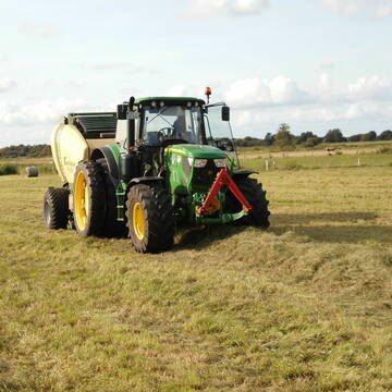
Heulage, Grassamenheu lage 2025
Schwedeneck
Jeannine Wittern
@Jeannine-Wittern
Heulage
Lieferant entlädt
Rundballen
Regenfrei
3 weitere...
B+
Deprecated: Creation of dynamic property Zend_View_Helper_Ads::$adLink is deprecated in /var/www/stall-frei/htdocs/staging.stall-frei.de/library/Psf/View/Helper/Ads.php on line 108

Futtersack HeuToy, Fressbremse in pink
Mechtersen
STALL-FREIde Marketing
@STALL-FREI-Marketing
Stundenlange Beschäftigung die
Koliken vorbeugt, geringe Staubinhalation mit
steuerbarer Futterentnahme

Erstklassiges PferdeHeu in HD-Ballen
Jevenstedt
Tim Rohwer
@EIDERHEU
Heu
Kleinballen/HD-Ballen
Regenfrei
B+
Eiweisarmes Heu oder Heulage
Sophienhamm
Herr-Kolb
@Herr-Kolb
Heu
Rundballen
Regenfrei
Wird verladen
B+

Heu/trockene Heulage für Pferde Zucker,Fruktanarm
Sophienhamm
Herr-Kolb
@Herr-Kolb
Heulage
Lieferant entlädt
Regenfrei
Wird verladen
2 weitere...
B+

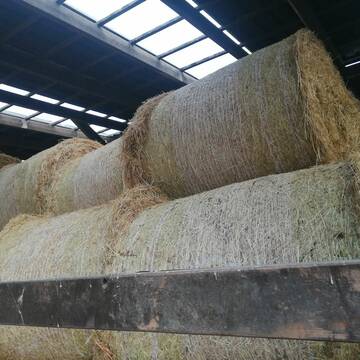
Heu in Rundballen (ca.130cm) super Qualität
Pronstorf
Caros Pferdeparadies
@KaOb
Heu
Rundballen
Regenfrei
Wird verladen
2 weitere...
B+

Leider kein Vorschaubild
Leider kein Vorschaubild
B+
Leider kein Vorschaubild
Leider kein Vorschaubild
3 grosse Heulageballen ( 1,30m Durchmesser)
Flensburg
Andrea Hartmann
@Andrea45
Heulage
Großballen
Abholung
B+
Heu 1.Schnitt 2021
Upahl
hermannmeyerzuborgsen
@hermannmeyerzuborgsen
Heu
Empfänger lädt ab
Rundballen
Regenfrei
3 weitere...
P+

Heu HD-Ballen 2. Schnitt extensiv Heugräser
Drochtersen
M-Kluth
@M-Kluth
Heu
Empfänger lädt ab
Kleinballen/HD-Ballen
Regenfrei
3 weitere...
B+

Heu, Heulage, ökologisch, artenreich top Qualitä...
Hamburg
Frederic Wübbe
@Stall_Am_Burgberg
Heu
Lieferant entlädt
Rundballen
Bio
3 weitere...
B+
Deprecated: Creation of dynamic property Zend_View::$pageCount is deprecated in /var/www/stall-frei/htdocs/staging.stall-frei.de/library/vendor/shardj/zf1-future/library/Zend/View/Abstract.php on line 308
Deprecated: Creation of dynamic property Zend_View::$itemCountPerPage is deprecated in /var/www/stall-frei/htdocs/staging.stall-frei.de/library/vendor/shardj/zf1-future/library/Zend/View/Abstract.php on line 308
Deprecated: Creation of dynamic property Zend_View::$first is deprecated in /var/www/stall-frei/htdocs/staging.stall-frei.de/library/vendor/shardj/zf1-future/library/Zend/View/Abstract.php on line 308
Deprecated: Creation of dynamic property Zend_View::$current is deprecated in /var/www/stall-frei/htdocs/staging.stall-frei.de/library/vendor/shardj/zf1-future/library/Zend/View/Abstract.php on line 308
Deprecated: Creation of dynamic property Zend_View::$last is deprecated in /var/www/stall-frei/htdocs/staging.stall-frei.de/library/vendor/shardj/zf1-future/library/Zend/View/Abstract.php on line 308
Deprecated: Creation of dynamic property Zend_View::$next is deprecated in /var/www/stall-frei/htdocs/staging.stall-frei.de/library/vendor/shardj/zf1-future/library/Zend/View/Abstract.php on line 308
Deprecated: Creation of dynamic property Zend_View::$pagesInRange is deprecated in /var/www/stall-frei/htdocs/staging.stall-frei.de/library/vendor/shardj/zf1-future/library/Zend/View/Abstract.php on line 308
Deprecated: Creation of dynamic property Zend_View::$firstPageInRange is deprecated in /var/www/stall-frei/htdocs/staging.stall-frei.de/library/vendor/shardj/zf1-future/library/Zend/View/Abstract.php on line 308
Deprecated: Creation of dynamic property Zend_View::$lastPageInRange is deprecated in /var/www/stall-frei/htdocs/staging.stall-frei.de/library/vendor/shardj/zf1-future/library/Zend/View/Abstract.php on line 308
Deprecated: Creation of dynamic property Zend_View::$currentItemCount is deprecated in /var/www/stall-frei/htdocs/staging.stall-frei.de/library/vendor/shardj/zf1-future/library/Zend/View/Abstract.php on line 308
Deprecated: Creation of dynamic property Zend_View::$totalItemCount is deprecated in /var/www/stall-frei/htdocs/staging.stall-frei.de/library/vendor/shardj/zf1-future/library/Zend/View/Abstract.php on line 308
Deprecated: Creation of dynamic property Zend_View::$firstItemNumber is deprecated in /var/www/stall-frei/htdocs/staging.stall-frei.de/library/vendor/shardj/zf1-future/library/Zend/View/Abstract.php on line 308
Deprecated: Creation of dynamic property Zend_View::$lastItemNumber is deprecated in /var/www/stall-frei/htdocs/staging.stall-frei.de/library/vendor/shardj/zf1-future/library/Zend/View/Abstract.php on line 308
Deprecated: Creation of dynamic property Zend_View::$router is deprecated in /var/www/stall-frei/htdocs/staging.stall-frei.de/library/vendor/shardj/zf1-future/library/Zend/View/Abstract.php on line 308
Deprecated: Creation of dynamic property Zend_View::$urlParams is deprecated in /var/www/stall-frei/htdocs/staging.stall-frei.de/library/vendor/shardj/zf1-future/library/Zend/View/Abstract.php on line 308
Deprecated: Creation of dynamic property Zend_View::$showAds is deprecated in /var/www/stall-frei/htdocs/staging.stall-frei.de/library/vendor/shardj/zf1-future/library/Zend/View/Abstract.php on line 308
Deprecated: Creation of dynamic property Zend_View::$objectIds is deprecated in /var/www/stall-frei/htdocs/staging.stall-frei.de/library/vendor/shardj/zf1-future/library/Zend/View/Abstract.php on line 308
Deprecated: Creation of dynamic property Zend_View::$showNavbar is deprecated in /var/www/stall-frei/htdocs/staging.stall-frei.de/library/vendor/shardj/zf1-future/library/Zend/View/Abstract.php on line 308
Deprecated: Creation of dynamic property Zend_View::$showBreadcrumb is deprecated in /var/www/stall-frei/htdocs/staging.stall-frei.de/library/vendor/shardj/zf1-future/library/Zend/View/Abstract.php on line 308
Deprecated: Creation of dynamic property Zend_View::$showFooter is deprecated in /var/www/stall-frei/htdocs/staging.stall-frei.de/library/vendor/shardj/zf1-future/library/Zend/View/Abstract.php on line 308
Deprecated: Creation of dynamic property Zend_View::$showInternalAds is deprecated in /var/www/stall-frei/htdocs/staging.stall-frei.de/library/vendor/shardj/zf1-future/library/Zend/View/Abstract.php on line 308
Deprecated: Creation of dynamic property Zend_View::$blNoContent is deprecated in /var/www/stall-frei/htdocs/staging.stall-frei.de/library/vendor/shardj/zf1-future/library/Zend/View/Abstract.php on line 308
Deprecated: Creation of dynamic property Zend_View::$sMetaDesc is deprecated in /var/www/stall-frei/htdocs/staging.stall-frei.de/library/vendor/shardj/zf1-future/library/Zend/View/Abstract.php on line 308
Deprecated: Creation of dynamic property Zend_View::$useGmaps is deprecated in /var/www/stall-frei/htdocs/staging.stall-frei.de/library/vendor/shardj/zf1-future/library/Zend/View/Abstract.php on line 308
Deprecated: Creation of dynamic property Zend_View::$touches is deprecated in /var/www/stall-frei/htdocs/staging.stall-frei.de/library/vendor/shardj/zf1-future/library/Zend/View/Abstract.php on line 308
Deprecated: Creation of dynamic property Zend_View::$oProject is deprecated in /var/www/stall-frei/htdocs/staging.stall-frei.de/library/vendor/shardj/zf1-future/library/Zend/View/Abstract.php on line 308
Deprecated: Creation of dynamic property Zend_View::$pageHeadline is deprecated in /var/www/stall-frei/htdocs/staging.stall-frei.de/library/vendor/shardj/zf1-future/library/Zend/View/Abstract.php on line 308
Deprecated: Creation of dynamic property Zend_View::$disableLocationField is deprecated in /var/www/stall-frei/htdocs/staging.stall-frei.de/library/vendor/shardj/zf1-future/library/Zend/View/Abstract.php on line 308
Deprecated: Creation of dynamic property Zend_View::$isSearch is deprecated in /var/www/stall-frei/htdocs/staging.stall-frei.de/library/vendor/shardj/zf1-future/library/Zend/View/Abstract.php on line 308
Deprecated: Creation of dynamic property Zend_View::$pageTitle is deprecated in /var/www/stall-frei/htdocs/staging.stall-frei.de/library/vendor/shardj/zf1-future/library/Zend/View/Abstract.php on line 308
Deprecated: Creation of dynamic property Psf_Form_Element_Text::$class is deprecated in /var/www/stall-frei/htdocs/staging.stall-frei.de/library/vendor/shardj/zf1-future/library/Zend/Form/Element.php on line 874
Deprecated: Creation of dynamic property Psf_Form_Element_Text::$size is deprecated in /var/www/stall-frei/htdocs/staging.stall-frei.de/library/vendor/shardj/zf1-future/library/Zend/Form/Element.php on line 874
Deprecated: Creation of dynamic property Psf_Form_Element_Text::$placeholder is deprecated in /var/www/stall-frei/htdocs/staging.stall-frei.de/library/vendor/shardj/zf1-future/library/Zend/Form/Element.php on line 874
Deprecated: Creation of dynamic property Psf_Form_Element_Hidden::$class is deprecated in /var/www/stall-frei/htdocs/staging.stall-frei.de/library/vendor/shardj/zf1-future/library/Zend/Form/Element.php on line 874
Deprecated: Creation of dynamic property Psf_Form_Element_Hidden::$class is deprecated in /var/www/stall-frei/htdocs/staging.stall-frei.de/library/vendor/shardj/zf1-future/library/Zend/Form/Element.php on line 874
Deprecated: Creation of dynamic property Psf_Form_Element_Hidden::$class is deprecated in /var/www/stall-frei/htdocs/staging.stall-frei.de/library/vendor/shardj/zf1-future/library/Zend/Form/Element.php on line 874
Deprecated: Creation of dynamic property Psf_Form_Element_Hidden::$class is deprecated in /var/www/stall-frei/htdocs/staging.stall-frei.de/library/vendor/shardj/zf1-future/library/Zend/Form/Element.php on line 874
Deprecated: Creation of dynamic property Psf_Form_Element_Select::$class is deprecated in /var/www/stall-frei/htdocs/staging.stall-frei.de/library/vendor/shardj/zf1-future/library/Zend/Form/Element.php on line 874
Deprecated: Creation of dynamic property Psf_Form_Element_Select::$class is deprecated in /var/www/stall-frei/htdocs/staging.stall-frei.de/library/vendor/shardj/zf1-future/library/Zend/Form/Element.php on line 874
Deprecated: Creation of dynamic property Psf_Form_Element_Select::$class is deprecated in /var/www/stall-frei/htdocs/staging.stall-frei.de/library/vendor/shardj/zf1-future/library/Zend/Form/Element.php on line 874
Deprecated: Creation of dynamic property Psf_Form_Element_Select::$class is deprecated in /var/www/stall-frei/htdocs/staging.stall-frei.de/library/vendor/shardj/zf1-future/library/Zend/Form/Element.php on line 874
Deprecated: Creation of dynamic property Zend_View::$sort is deprecated in /var/www/stall-frei/htdocs/staging.stall-frei.de/library/vendor/shardj/zf1-future/library/Zend/View/Abstract.php on line 308
Deprecated: Creation of dynamic property Zend_View::$searchLocation is deprecated in /var/www/stall-frei/htdocs/staging.stall-frei.de/library/vendor/shardj/zf1-future/library/Zend/View/Abstract.php on line 308
Deprecated: Creation of dynamic property Zend_View::$locationHint is deprecated in /var/www/stall-frei/htdocs/staging.stall-frei.de/library/vendor/shardj/zf1-future/library/Zend/View/Abstract.php on line 308
Psf_GeoCoder_Abstract::getLocation: Ottendorf Get Location CachedOrLive
Psf_GeoCoder_Abstract::getCachedOrLive: Ottendorf
Psf_GeoCoder_OpenCageData::makeApiRequest: response:
Array
(
[documentation] => https://opencagedata.com/api
[licenses] => Array
(
[0] => Array
(
[name] => see attribution guide
[url] => https://opencagedata.com/credits
)
)
[results] => Array
(
[0] => Array
(
[bounds] => Array
(
[northeast] => Array
(
[lat] => 54.3609393
[lng] => 10.0725134
)
[southwest] => Array
(
[lat] => 54.3287947
[lng] => 10.0201558
)
)
[components] => Array
(
[ISO_3166-1_alpha-2] => DE
[ISO_3166-1_alpha-3] => DEU
[ISO_3166-2] => Array
(
[0] => DE-SH
)
[_category] => place
[_normalized_city] => Ottendorf
[_type] => village
[continent] => Europe
[country] => Deutschland
[country_code] => de
[county] => Kreis Rendsburg-Eckernförde
[municipality] => Amt Achterwehr
[political_union] => European Union
[state] => Schleswig-Holstein
[state_code] => SH
[village] => Ottendorf
)
[confidence] => 7
[formatted] => Ottendorf, Schleswig-Holstein, Deutschland
[geometry] => Array
(
[lat] => 54.3417316
[lng] => 10.0534212
)
)
[1] => Array
(
[bounds] => Array
(
[northeast] => Array
(
[lat] => 50.8446493
[lng] => 11.8491139
)
[southwest] => Array
(
[lat] => 50.8098344
[lng] => 11.813758
)
)
[components] => Array
(
[ISO_3166-1_alpha-2] => DE
[ISO_3166-1_alpha-3] => DEU
[ISO_3166-2] => Array
(
[0] => DE-TH
)
[_category] => place
[_normalized_city] => Ottendorf
[_type] => village
[continent] => Europe
[country] => Deutschland
[country_code] => de
[county] => Saale-Holzland-Kreis
[municipality] => Hügelland/Täler
[political_union] => European Union
[state] => Thüringen
[state_code] => TH
[village] => Ottendorf
)
[confidence] => 7
[formatted] => Ottendorf, Thüringen, Deutschland
[geometry] => Array
(
[lat] => 50.8268557
[lng] => 11.8223391
)
)
[2] => Array
(
[bounds] => Array
(
[northeast] => Array
(
[lat] => 50.9642062
[lng] => 14.3097666
)
[southwest] => Array
(
[lat] => 50.9242062
[lng] => 14.2697666
)
)
[components] => Array
(
[ISO_3166-1_alpha-2] => DE
[ISO_3166-1_alpha-3] => DEU
[ISO_3166-2] => Array
(
[0] => DE-SN
)
[_category] => place
[_normalized_city] => Sebnitz
[_type] => village
[continent] => Europe
[country] => Deutschland
[country_code] => de
[county] => Sächsische Schweiz-Osterzgebirge
[political_union] => European Union
[postcode] => 01855
[state] => Sachsen
[state_code] => SN
[town] => Sebnitz
[village] => Ottendorf
)
[confidence] => 7
[formatted] => 01855 Ottendorf, Deutschland
[geometry] => Array
(
[lat] => 50.9442062
[lng] => 14.2897666
)
)
[3] => Array
(
[bounds] => Array
(
[northeast] => Array
(
[lat] => 50.954559
[lng] => 12.9834211
)
[southwest] => Array
(
[lat] => 50.914559
[lng] => 12.9434211
)
)
[components] => Array
(
[ISO_3166-1_alpha-2] => DE
[ISO_3166-1_alpha-3] => DEU
[ISO_3166-2] => Array
(
[0] => DE-SN
)
[_category] => place
[_normalized_city] => Lichtenau
[_type] => village
[city] => Lichtenau
[continent] => Europe
[country] => Deutschland
[country_code] => de
[county] => Mittelsachsen
[municipality] => Lichtenau
[political_union] => European Union
[postcode] => 09244
[state] => Sachsen
[state_code] => SN
[village] => Ottendorf
)
[confidence] => 7
[formatted] => 09244 Ottendorf, Deutschland
[geometry] => Array
(
[lat] => 50.934559
[lng] => 12.9634211
)
)
[4] => Array
(
[bounds] => Array
(
[northeast] => Array
(
[lat] => 50.9177994
[lng] => 13.9435594
)
[southwest] => Array
(
[lat] => 50.8777994
[lng] => 13.9035594
)
)
[components] => Array
(
[ISO_3166-1_alpha-2] => DE
[ISO_3166-1_alpha-3] => DEU
[ISO_3166-2] => Array
(
[0] => DE-SN
)
[_category] => place
[_normalized_city] => Ottendorf
[_type] => village
[continent] => Europe
[country] => Deutschland
[country_code] => de
[county] => Sächsische Schweiz-Osterzgebirge
[municipality] => Bahretal
[political_union] => European Union
[postcode] => 01819
[state] => Sachsen
[state_code] => SN
[village] => Ottendorf
)
[confidence] => 7
[formatted] => 01819 Ottendorf, Deutschland
[geometry] => Array
(
[lat] => 50.8977994
[lng] => 13.9235594
)
)
[5] => Array
(
[bounds] => Array
(
[northeast] => Array
(
[lat] => 50.5041442
[lng] => 11.42255
)
[southwest] => Array
(
[lat] => 50.4641442
[lng] => 11.38255
)
)
[components] => Array
(
[ISO_3166-1_alpha-2] => DE
[ISO_3166-1_alpha-3] => DEU
[ISO_3166-2] => Array
(
[0] => DE-BY
)
[_category] => place
[_normalized_city] => Ludwigsstadt
[_type] => village
[continent] => Europe
[country] => Deutschland
[country_code] => de
[county] => Landkreis Kronach
[political_union] => European Union
[postcode] => 96337
[state] => Bayern
[state_code] => BY
[town] => Ludwigsstadt
[village] => Ottendorf
)
[confidence] => 7
[formatted] => 96337 Ottendorf, Deutschland
[geometry] => Array
(
[lat] => 50.4841442
[lng] => 11.40255
)
)
[6] => Array
(
[bounds] => Array
(
[northeast] => Array
(
[lat] => 53.4124492
[lng] => 9.4415939
)
[southwest] => Array
(
[lat] => 53.3724492
[lng] => 9.4015939
)
)
[components] => Array
(
[ISO_3166-1_alpha-2] => DE
[ISO_3166-1_alpha-3] => DEU
[ISO_3166-2] => Array
(
[0] => DE-NI
)
[_category] => place
[_normalized_city] => Ahlerstedt
[_type] => village
[city] => Ahlerstedt
[continent] => Europe
[country] => Deutschland
[country_code] => de
[county] => Landkreis Stade
[municipality] => Samtgemeinde Harsefeld
[political_union] => European Union
[postcode] => 21702
[state] => Niedersachsen
[state_code] => NI
[village] => Ottendorf
)
[confidence] => 7
[formatted] => 21702 Ottendorf, Deutschland
[geometry] => Array
(
[lat] => 53.3924492
[lng] => 9.4215939
)
)
[7] => Array
(
[bounds] => Array
(
[northeast] => Array
(
[lat] => 50.0397154
[lng] => 10.3920163
)
[southwest] => Array
(
[lat] => 49.9997154
[lng] => 10.3520163
)
)
[components] => Array
(
[ISO_3166-1_alpha-2] => DE
[ISO_3166-1_alpha-3] => DEU
[ISO_3166-2] => Array
(
[0] => DE-BY
)
[_category] => place
[_normalized_city] => Gädheim
[_type] => village
[city] => Gädheim
[continent] => Europe
[country] => Deutschland
[country_code] => de
[county] => Landkreis Haßberge
[municipality] => Theres (VGem)
[political_union] => European Union
[postcode] => 97503
[state] => Bayern
[state_code] => BY
[village] => Ottendorf
)
[confidence] => 7
[formatted] => 97503 Ottendorf, Deutschland
[geometry] => Array
(
[lat] => 50.0197154
[lng] => 10.3720163
)
)
[8] => Array
(
[bounds] => Array
(
[northeast] => Array
(
[lat] => 51.8728175
[lng] => 14.4226287
)
[southwest] => Array
(
[lat] => 51.8328175
[lng] => 14.3826287
)
)
[components] => Array
(
[ISO_3166-1_alpha-2] => DE
[ISO_3166-1_alpha-3] => DEU
[ISO_3166-2] => Array
(
[0] => DE-BB
)
[_category] => place
[_normalized_city] => Peitz
[_type] => hamlet
[continent] => Europe
[country] => Deutschland
[country_code] => de
[county] => Spree-Neiße
[hamlet] => Ottendorf
[municipality] => Amt Peitz
[political_union] => European Union
[postcode] => 03185
[state] => Brandenburg
[state_code] => BB
[town] => Peitz
)
[confidence] => 7
[formatted] => Ottendorf, 03185 Peitz, Deutschland
[geometry] => Array
(
[lat] => 51.8528175
[lng] => 14.4026287
)
)
[9] => Array
(
[bounds] => Array
(
[northeast] => Array
(
[lat] => 49.0458764
[lng] => 9.7641761
)
[southwest] => Array
(
[lat] => 49.0088845
[lng] => 9.7023545
)
)
[components] => Array
(
[ISO_3166-1_alpha-2] => DE
[ISO_3166-1_alpha-3] => DEU
[ISO_3166-2] => Array
(
[0] => DE-BW
)
[_category] => place
[_normalized_city] => Gaildorf
[_type] => village
[continent] => Europe
[country] => Deutschland
[country_code] => de
[county] => Landkreis Schwäbisch Hall
[municipality] => GVV Limpurger Land
[political_union] => European Union
[state] => Baden-Württemberg
[state_code] => BW
[town] => Gaildorf
[village] => Ottendorf
)
[confidence] => 7
[formatted] => Ottendorf, Baden-Württemberg, Deutschland
[geometry] => Array
(
[lat] => 49.0295055
[lng] => 9.7486856
)
)
)
[status] => Array
(
[code] => 200
[message] => OK
)
[stay_informed] => Array
(
[blog] => https://blog.opencagedata.com
[mastodon] => https://en.osm.town/@opencage
)
[thanks] => For using an OpenCage API
[timestamp] => Array
(
[created_http] => Sat, 07 Feb 2026 17:58:25 GMT
[created_unix] => 1770487105
)
[total_results] => 10
)
Psf_GeoCoder_Abstract::convertLocationResult
{"documentation":"https:\/\/opencagedata.com\/api","licenses":[{"name":"see attribution guide","url":"https:\/\/opencagedata.com\/credits"}],"results":[{"bounds":{"northeast":{"lat":54.3609393,"lng":10.0725134},"southwest":{"lat":54.3287947,"lng":10.0201558}},"components":{"ISO_3166-1_alpha-2":"DE","ISO_3166-1_alpha-3":"DEU","ISO_3166-2":["DE-SH"],"_category":"place","_normalized_city":"Ottendorf","_type":"village","continent":"Europe","country":"Deutschland","country_code":"de","county":"Kreis Rendsburg-Eckernf\u00f6rde","municipality":"Amt Achterwehr","political_union":"European Union","state":"Schleswig-Holstein","state_code":"SH","village":"Ottendorf"},"confidence":7,"formatted":"Ottendorf, Schleswig-Holstein, Deutschland","geometry":{"lat":54.3417316,"lng":10.0534212}},{"bounds":{"northeast":{"lat":50.8446493,"lng":11.8491139},"southwest":{"lat":50.8098344,"lng":11.813758}},"components":{"ISO_3166-1_alpha-2":"DE","ISO_3166-1_alpha-3":"DEU","ISO_3166-2":["DE-TH"],"_category":"place","_normalized_city":"Ottendorf","_type":"village","continent":"Europe","country":"Deutschland","country_code":"de","county":"Saale-Holzland-Kreis","municipality":"H\u00fcgelland\/T\u00e4ler","political_union":"European Union","state":"Th\u00fcringen","state_code":"TH","village":"Ottendorf"},"confidence":7,"formatted":"Ottendorf, Th\u00fcringen, Deutschland","geometry":{"lat":50.8268557,"lng":11.8223391}},{"bounds":{"northeast":{"lat":50.9642062,"lng":14.3097666},"southwest":{"lat":50.9242062,"lng":14.2697666}},"components":{"ISO_3166-1_alpha-2":"DE","ISO_3166-1_alpha-3":"DEU","ISO_3166-2":["DE-SN"],"_category":"place","_normalized_city":"Sebnitz","_type":"village","continent":"Europe","country":"Deutschland","country_code":"de","county":"S\u00e4chsische Schweiz-Osterzgebirge","political_union":"European Union","postcode":"01855","state":"Sachsen","state_code":"SN","town":"Sebnitz","village":"Ottendorf"},"confidence":7,"formatted":"01855 Ottendorf, Deutschland","geometry":{"lat":50.9442062,"lng":14.2897666}},{"bounds":{"northeast":{"lat":50.954559,"lng":12.9834211},"southwest":{"lat":50.914559,"lng":12.9434211}},"components":{"ISO_3166-1_alpha-2":"DE","ISO_3166-1_alpha-3":"DEU","ISO_3166-2":["DE-SN"],"_category":"place","_normalized_city":"Lichtenau","_type":"village","city":"Lichtenau","continent":"Europe","country":"Deutschland","country_code":"de","county":"Mittelsachsen","municipality":"Lichtenau","political_union":"European Union","postcode":"09244","state":"Sachsen","state_code":"SN","village":"Ottendorf"},"confidence":7,"formatted":"09244 Ottendorf, Deutschland","geometry":{"lat":50.934559,"lng":12.9634211}},{"bounds":{"northeast":{"lat":50.9177994,"lng":13.9435594},"southwest":{"lat":50.8777994,"lng":13.9035594}},"components":{"ISO_3166-1_alpha-2":"DE","ISO_3166-1_alpha-3":"DEU","ISO_3166-2":["DE-SN"],"_category":"place","_normalized_city":"Ottendorf","_type":"village","continent":"Europe","country":"Deutschland","country_code":"de","county":"S\u00e4chsische Schweiz-Osterzgebirge","municipality":"Bahretal","political_union":"European Union","postcode":"01819","state":"Sachsen","state_code":"SN","village":"Ottendorf"},"confidence":7,"formatted":"01819 Ottendorf, Deutschland","geometry":{"lat":50.8977994,"lng":13.9235594}},{"bounds":{"northeast":{"lat":50.5041442,"lng":11.42255},"southwest":{"lat":50.4641442,"lng":11.38255}},"components":{"ISO_3166-1_alpha-2":"DE","ISO_3166-1_alpha-3":"DEU","ISO_3166-2":["DE-BY"],"_category":"place","_normalized_city":"Ludwigsstadt","_type":"village","continent":"Europe","country":"Deutschland","country_code":"de","county":"Landkreis Kronach","political_union":"European Union","postcode":"96337","state":"Bayern","state_code":"BY","town":"Ludwigsstadt","village":"Ottendorf"},"confidence":7,"formatted":"96337 Ottendorf, Deutschland","geometry":{"lat":50.4841442,"lng":11.40255}},{"bounds":{"northeast":{"lat":53.4124492,"lng":9.4415939},"southwest":{"lat":53.3724492,"lng":9.4015939}},"components":{"ISO_3166-1_alpha-2":"DE","ISO_3166-1_alpha-3":"DEU","ISO_3166-2":["DE-NI"],"_category":"place","_normalized_city":"Ahlerstedt","_type":"village","city":"Ahlerstedt","continent":"Europe","country":"Deutschland","country_code":"de","county":"Landkreis Stade","municipality":"Samtgemeinde Harsefeld","political_union":"European Union","postcode":"21702","state":"Niedersachsen","state_code":"NI","village":"Ottendorf"},"confidence":7,"formatted":"21702 Ottendorf, Deutschland","geometry":{"lat":53.3924492,"lng":9.4215939}},{"bounds":{"northeast":{"lat":50.0397154,"lng":10.3920163},"southwest":{"lat":49.9997154,"lng":10.3520163}},"components":{"ISO_3166-1_alpha-2":"DE","ISO_3166-1_alpha-3":"DEU","ISO_3166-2":["DE-BY"],"_category":"place","_normalized_city":"G\u00e4dheim","_type":"village","city":"G\u00e4dheim","continent":"Europe","country":"Deutschland","country_code":"de","county":"Landkreis Ha\u00dfberge","municipality":"Theres (VGem)","political_union":"European Union","postcode":"97503","state":"Bayern","state_code":"BY","village":"Ottendorf"},"confidence":7,"formatted":"97503 Ottendorf, Deutschland","geometry":{"lat":50.0197154,"lng":10.3720163}},{"bounds":{"northeast":{"lat":51.8728175,"lng":14.4226287},"southwest":{"lat":51.8328175,"lng":14.3826287}},"components":{"ISO_3166-1_alpha-2":"DE","ISO_3166-1_alpha-3":"DEU","ISO_3166-2":["DE-BB"],"_category":"place","_normalized_city":"Peitz","_type":"hamlet","continent":"Europe","country":"Deutschland","country_code":"de","county":"Spree-Nei\u00dfe","hamlet":"Ottendorf","municipality":"Amt Peitz","political_union":"European Union","postcode":"03185","state":"Brandenburg","state_code":"BB","town":"Peitz"},"confidence":7,"formatted":"Ottendorf, 03185 Peitz, Deutschland","geometry":{"lat":51.8528175,"lng":14.4026287}},{"bounds":{"northeast":{"lat":49.0458764,"lng":9.7641761},"southwest":{"lat":49.0088845,"lng":9.7023545}},"components":{"ISO_3166-1_alpha-2":"DE","ISO_3166-1_alpha-3":"DEU","ISO_3166-2":["DE-BW"],"_category":"place","_normalized_city":"Gaildorf","_type":"village","continent":"Europe","country":"Deutschland","country_code":"de","county":"Landkreis Schw\u00e4bisch Hall","municipality":"GVV Limpurger Land","political_union":"European Union","state":"Baden-W\u00fcrttemberg","state_code":"BW","town":"Gaildorf","village":"Ottendorf"},"confidence":7,"formatted":"Ottendorf, Baden-W\u00fcrttemberg, Deutschland","geometry":{"lat":49.0295055,"lng":9.7486856}}],"status":{"code":200,"message":"OK"},"stay_informed":{"blog":"https:\/\/blog.opencagedata.com","mastodon":"https:\/\/en.osm.town\/@opencage"},"thanks":"For using an OpenCage API","timestamp":{"created_http":"Sat, 07 Feb 2026 17:58:25 GMT","created_unix":1770487105},"total_results":10}Array
(
[0] => stdClass Object
(
[bounds] => stdClass Object
(
[northeast] => stdClass Object
(
[lat] => 54.3609393
[lng] => 10.0725134
)
[southwest] => stdClass Object
(
[lat] => 54.3287947
[lng] => 10.0201558
)
)
[components] => stdClass Object
(
[ISO_3166-1_alpha-2] => DE
[ISO_3166-1_alpha-3] => DEU
[ISO_3166-2] => Array
(
[0] => DE-SH
)
[_category] => place
[_normalized_city] => Ottendorf
[_type] => village
[continent] => Europe
[country] => Deutschland
[country_code] => de
[county] => Kreis Rendsburg-Eckernförde
[municipality] => Amt Achterwehr
[political_union] => European Union
[state] => Schleswig-Holstein
[state_code] => SH
[village] => Ottendorf
)
[confidence] => 7
[formatted] => Ottendorf, Schleswig-Holstein, Deutschland
[geometry] => stdClass Object
(
[lat] => 54.3417316
[lng] => 10.0534212
)
)
[1] => stdClass Object
(
[bounds] => stdClass Object
(
[northeast] => stdClass Object
(
[lat] => 50.8446493
[lng] => 11.8491139
)
[southwest] => stdClass Object
(
[lat] => 50.8098344
[lng] => 11.813758
)
)
[components] => stdClass Object
(
[ISO_3166-1_alpha-2] => DE
[ISO_3166-1_alpha-3] => DEU
[ISO_3166-2] => Array
(
[0] => DE-TH
)
[_category] => place
[_normalized_city] => Ottendorf
[_type] => village
[continent] => Europe
[country] => Deutschland
[country_code] => de
[county] => Saale-Holzland-Kreis
[municipality] => Hügelland/Täler
[political_union] => European Union
[state] => Thüringen
[state_code] => TH
[village] => Ottendorf
)
[confidence] => 7
[formatted] => Ottendorf, Thüringen, Deutschland
[geometry] => stdClass Object
(
[lat] => 50.8268557
[lng] => 11.8223391
)
)
[2] => stdClass Object
(
[bounds] => stdClass Object
(
[northeast] => stdClass Object
(
[lat] => 50.9642062
[lng] => 14.3097666
)
[southwest] => stdClass Object
(
[lat] => 50.9242062
[lng] => 14.2697666
)
)
[components] => stdClass Object
(
[ISO_3166-1_alpha-2] => DE
[ISO_3166-1_alpha-3] => DEU
[ISO_3166-2] => Array
(
[0] => DE-SN
)
[_category] => place
[_normalized_city] => Sebnitz
[_type] => village
[continent] => Europe
[country] => Deutschland
[country_code] => de
[county] => Sächsische Schweiz-Osterzgebirge
[political_union] => European Union
[postcode] => 01855
[state] => Sachsen
[state_code] => SN
[town] => Sebnitz
[village] => Ottendorf
)
[confidence] => 7
[formatted] => 01855 Ottendorf, Deutschland
[geometry] => stdClass Object
(
[lat] => 50.9442062
[lng] => 14.2897666
)
)
[3] => stdClass Object
(
[bounds] => stdClass Object
(
[northeast] => stdClass Object
(
[lat] => 50.954559
[lng] => 12.9834211
)
[southwest] => stdClass Object
(
[lat] => 50.914559
[lng] => 12.9434211
)
)
[components] => stdClass Object
(
[ISO_3166-1_alpha-2] => DE
[ISO_3166-1_alpha-3] => DEU
[ISO_3166-2] => Array
(
[0] => DE-SN
)
[_category] => place
[_normalized_city] => Lichtenau
[_type] => village
[city] => Lichtenau
[continent] => Europe
[country] => Deutschland
[country_code] => de
[county] => Mittelsachsen
[municipality] => Lichtenau
[political_union] => European Union
[postcode] => 09244
[state] => Sachsen
[state_code] => SN
[village] => Ottendorf
)
[confidence] => 7
[formatted] => 09244 Ottendorf, Deutschland
[geometry] => stdClass Object
(
[lat] => 50.934559
[lng] => 12.9634211
)
)
[4] => stdClass Object
(
[bounds] => stdClass Object
(
[northeast] => stdClass Object
(
[lat] => 50.9177994
[lng] => 13.9435594
)
[southwest] => stdClass Object
(
[lat] => 50.8777994
[lng] => 13.9035594
)
)
[components] => stdClass Object
(
[ISO_3166-1_alpha-2] => DE
[ISO_3166-1_alpha-3] => DEU
[ISO_3166-2] => Array
(
[0] => DE-SN
)
[_category] => place
[_normalized_city] => Ottendorf
[_type] => village
[continent] => Europe
[country] => Deutschland
[country_code] => de
[county] => Sächsische Schweiz-Osterzgebirge
[municipality] => Bahretal
[political_union] => European Union
[postcode] => 01819
[state] => Sachsen
[state_code] => SN
[village] => Ottendorf
)
[confidence] => 7
[formatted] => 01819 Ottendorf, Deutschland
[geometry] => stdClass Object
(
[lat] => 50.8977994
[lng] => 13.9235594
)
)
[5] => stdClass Object
(
[bounds] => stdClass Object
(
[northeast] => stdClass Object
(
[lat] => 50.5041442
[lng] => 11.42255
)
[southwest] => stdClass Object
(
[lat] => 50.4641442
[lng] => 11.38255
)
)
[components] => stdClass Object
(
[ISO_3166-1_alpha-2] => DE
[ISO_3166-1_alpha-3] => DEU
[ISO_3166-2] => Array
(
[0] => DE-BY
)
[_category] => place
[_normalized_city] => Ludwigsstadt
[_type] => village
[continent] => Europe
[country] => Deutschland
[country_code] => de
[county] => Landkreis Kronach
[political_union] => European Union
[postcode] => 96337
[state] => Bayern
[state_code] => BY
[town] => Ludwigsstadt
[village] => Ottendorf
)
[confidence] => 7
[formatted] => 96337 Ottendorf, Deutschland
[geometry] => stdClass Object
(
[lat] => 50.4841442
[lng] => 11.40255
)
)
[6] => stdClass Object
(
[bounds] => stdClass Object
(
[northeast] => stdClass Object
(
[lat] => 53.4124492
[lng] => 9.4415939
)
[southwest] => stdClass Object
(
[lat] => 53.3724492
[lng] => 9.4015939
)
)
[components] => stdClass Object
(
[ISO_3166-1_alpha-2] => DE
[ISO_3166-1_alpha-3] => DEU
[ISO_3166-2] => Array
(
[0] => DE-NI
)
[_category] => place
[_normalized_city] => Ahlerstedt
[_type] => village
[city] => Ahlerstedt
[continent] => Europe
[country] => Deutschland
[country_code] => de
[county] => Landkreis Stade
[municipality] => Samtgemeinde Harsefeld
[political_union] => European Union
[postcode] => 21702
[state] => Niedersachsen
[state_code] => NI
[village] => Ottendorf
)
[confidence] => 7
[formatted] => 21702 Ottendorf, Deutschland
[geometry] => stdClass Object
(
[lat] => 53.3924492
[lng] => 9.4215939
)
)
[7] => stdClass Object
(
[bounds] => stdClass Object
(
[northeast] => stdClass Object
(
[lat] => 50.0397154
[lng] => 10.3920163
)
[southwest] => stdClass Object
(
[lat] => 49.9997154
[lng] => 10.3520163
)
)
[components] => stdClass Object
(
[ISO_3166-1_alpha-2] => DE
[ISO_3166-1_alpha-3] => DEU
[ISO_3166-2] => Array
(
[0] => DE-BY
)
[_category] => place
[_normalized_city] => Gädheim
[_type] => village
[city] => Gädheim
[continent] => Europe
[country] => Deutschland
[country_code] => de
[county] => Landkreis Haßberge
[municipality] => Theres (VGem)
[political_union] => European Union
[postcode] => 97503
[state] => Bayern
[state_code] => BY
[village] => Ottendorf
)
[confidence] => 7
[formatted] => 97503 Ottendorf, Deutschland
[geometry] => stdClass Object
(
[lat] => 50.0197154
[lng] => 10.3720163
)
)
[8] => stdClass Object
(
[bounds] => stdClass Object
(
[northeast] => stdClass Object
(
[lat] => 51.8728175
[lng] => 14.4226287
)
[southwest] => stdClass Object
(
[lat] => 51.8328175
[lng] => 14.3826287
)
)
[components] => stdClass Object
(
[ISO_3166-1_alpha-2] => DE
[ISO_3166-1_alpha-3] => DEU
[ISO_3166-2] => Array
(
[0] => DE-BB
)
[_category] => place
[_normalized_city] => Peitz
[_type] => hamlet
[continent] => Europe
[country] => Deutschland
[country_code] => de
[county] => Spree-Neiße
[hamlet] => Ottendorf
[municipality] => Amt Peitz
[political_union] => European Union
[postcode] => 03185
[state] => Brandenburg
[state_code] => BB
[town] => Peitz
)
[confidence] => 7
[formatted] => Ottendorf, 03185 Peitz, Deutschland
[geometry] => stdClass Object
(
[lat] => 51.8528175
[lng] => 14.4026287
)
)
[9] => stdClass Object
(
[bounds] => stdClass Object
(
[northeast] => stdClass Object
(
[lat] => 49.0458764
[lng] => 9.7641761
)
[southwest] => stdClass Object
(
[lat] => 49.0088845
[lng] => 9.7023545
)
)
[components] => stdClass Object
(
[ISO_3166-1_alpha-2] => DE
[ISO_3166-1_alpha-3] => DEU
[ISO_3166-2] => Array
(
[0] => DE-BW
)
[_category] => place
[_normalized_city] => Gaildorf
[_type] => village
[continent] => Europe
[country] => Deutschland
[country_code] => de
[county] => Landkreis Schwäbisch Hall
[municipality] => GVV Limpurger Land
[political_union] => European Union
[state] => Baden-Württemberg
[state_code] => BW
[town] => Gaildorf
[village] => Ottendorf
)
[confidence] => 7
[formatted] => Ottendorf, Baden-Württemberg, Deutschland
[geometry] => stdClass Object
(
[lat] => 49.0295055
[lng] => 9.7486856
)
)
)
Psf_GeoCoder_OpenCageData::getKeyMap: 0
stdClass Object
(
    [bounds] => stdClass Object
        (
            [northeast] => stdClass Object
                (
                    [lat] => 54.3609393
                    [lng] => 10.0725134
                )

            [southwest] => stdClass Object
                (
                    [lat] => 54.3287947
                    [lng] => 10.0201558
                )

        )

    [components] => stdClass Object
        (
            [ISO_3166-1_alpha-2] => DE
            [ISO_3166-1_alpha-3] => DEU
            [ISO_3166-2] => Array
                (
                    [0] => DE-SH
                )

            [_category] => place
            [_normalized_city] => Ottendorf
            [_type] => village
            [continent] => Europe
            [country] => Deutschland
            [country_code] => de
            [county] => Kreis Rendsburg-Eckernförde
            [municipality] => Amt Achterwehr
            [political_union] => European Union
            [state] => Schleswig-Holstein
            [state_code] => SH
            [village] => Ottendorf
        )

    [confidence] => 7
    [formatted] => Ottendorf, Schleswig-Holstein, Deutschland
    [geometry] => stdClass Object
        (
            [lat] => 54.3417316
            [lng] => 10.0534212
        )

)
Psf_GeoCoder_OpenCageData::getCounty: Rendsburg-Eckernförde
Psf_GeoCoder_OpenCageData::addMissingData REFETCH!
Array
(
    [address] => Ottendorf, Schleswig-Holstein, Deutschland
    [type] => village
    [street] =>
    [city] => Ottendorf
    [county] => Rendsburg-Eckernförde
    [state] => Schleswig-Holstein
    [zip] =>
    [country] => Deutschland
    [suburb] =>
    [countrycode] => de
    [latitude] => 54.3417316
    [longitude] => 10.0534212
    [accuracy] => 1
    [confidence] => 7
    [bounds] => stdClass Object
        (
            [northeast] => stdClass Object
                (
                    [lat] => 54.3609393
                    [lng] => 10.0725134
                )

            [southwest] => stdClass Object
                (
                    [lat] => 54.3287947
                    [lng] => 10.0201558
                )

        )

)
reformat!
Array
(
    [address] => Ottendorf, Schleswig-Holstein, Deutschland
    [type] => village
    [street] =>
    [city] => Ottendorf
    [county] => Rendsburg-Eckernförde
    [state] => Schleswig-Holstein
    [zip] =>
    [country] => Deutschland
    [suburb] =>
    [countrycode] => de
    [latitude] => 54.3417316
    [longitude] => 10.0534212
    [accuracy] => 1
    [confidence] => 7
    [bounds] => stdClass Object
        (
            [northeast] => stdClass Object
                (
                    [lat] => 54.3609393
                    [lng] => 10.0725134
                )

            [southwest] => stdClass Object
                (
                    [lat] => 54.3287947
                    [lng] => 10.0201558
                )

        )

    [place] => Ottendorf, Schleswig-Holstein
    [hash] => 946dea1b5f4523f25b1142bf14e87012
)
Psf_GeoCoder_OpenCageData::getKeyMap: 1
stdClass Object
(
    [bounds] => stdClass Object
        (
            [northeast] => stdClass Object
                (
                    [lat] => 50.8446493
                    [lng] => 11.8491139
                )

            [southwest] => stdClass Object
                (
                    [lat] => 50.8098344
                    [lng] => 11.813758
                )

        )

    [components] => stdClass Object
        (
            [ISO_3166-1_alpha-2] => DE
            [ISO_3166-1_alpha-3] => DEU
            [ISO_3166-2] => Array
                (
                    [0] => DE-TH
                )

            [_category] => place
            [_normalized_city] => Ottendorf
            [_type] => village
            [continent] => Europe
            [country] => Deutschland
            [country_code] => de
            [county] => Saale-Holzland-Kreis
            [municipality] => Hügelland/Täler
            [political_union] => European Union
            [state] => Thüringen
            [state_code] => TH
            [village] => Ottendorf
        )

    [confidence] => 7
    [formatted] => Ottendorf, Thüringen, Deutschland
    [geometry] => stdClass Object
        (
            [lat] => 50.8268557
            [lng] => 11.8223391
        )

)
Psf_GeoCoder_OpenCageData::getCounty: Saale-Holzland-Kreis
Psf_GeoCoder_OpenCageData::addMissingData REFETCH!
Array
(
    [address] => Ottendorf, Thüringen, Deutschland
    [type] => village
    [street] =>
    [city] => Ottendorf
    [county] => Saale-Holzland-Kreis
    [state] => Thüringen
    [zip] =>
    [country] => Deutschland
    [suburb] =>
    [countrycode] => de
    [latitude] => 50.8268557
    [longitude] => 11.8223391
    [accuracy] => 1
    [confidence] => 7
    [bounds] => stdClass Object
        (
            [northeast] => stdClass Object
                (
                    [lat] => 50.8446493
                    [lng] => 11.8491139
                )

            [southwest] => stdClass Object
                (
                    [lat] => 50.8098344
                    [lng] => 11.813758
                )

        )

)
reformat!
Array
(
    [address] => Ottendorf, Thüringen, Deutschland
    [type] => village
    [street] =>
    [city] => Ottendorf
    [county] => Saale-Holzland-Kreis
    [state] => Thüringen
    [zip] =>
    [country] => Deutschland
    [suburb] =>
    [countrycode] => de
    [latitude] => 50.8268557
    [longitude] => 11.8223391
    [accuracy] => 1
    [confidence] => 7
    [bounds] => stdClass Object
        (
            [northeast] => stdClass Object
                (
                    [lat] => 50.8446493
                    [lng] => 11.8491139
                )

            [southwest] => stdClass Object
                (
                    [lat] => 50.8098344
                    [lng] => 11.813758
                )

        )

    [place] => Ottendorf, Thüringen
    [hash] => bf78e8e4c522fee5aebb521675aafb68
)
Psf_GeoCoder_OpenCageData::getKeyMap: 2
stdClass Object
(
    [bounds] => stdClass Object
        (
            [northeast] => stdClass Object
                (
                    [lat] => 50.9642062
                    [lng] => 14.3097666
                )

            [southwest] => stdClass Object
                (
                    [lat] => 50.9242062
                    [lng] => 14.2697666
                )

        )

    [components] => stdClass Object
        (
            [ISO_3166-1_alpha-2] => DE
            [ISO_3166-1_alpha-3] => DEU
            [ISO_3166-2] => Array
                (
                    [0] => DE-SN
                )

            [_category] => place
            [_normalized_city] => Sebnitz
            [_type] => village
            [continent] => Europe
            [country] => Deutschland
            [country_code] => de
            [county] => Sächsische Schweiz-Osterzgebirge
            [political_union] => European Union
            [postcode] => 01855
            [state] => Sachsen
            [state_code] => SN
            [town] => Sebnitz
            [village] => Ottendorf
        )

    [confidence] => 7
    [formatted] => 01855 Ottendorf, Deutschland
    [geometry] => stdClass Object
        (
            [lat] => 50.9442062
            [lng] => 14.2897666
        )

)
Psf_GeoCoder_OpenCageData::getCounty: Sächsische Schweiz-Osterzgebirge
Psf_GeoCoder_OpenCageData::addMissingData REFETCH!
Array
(
    [address] => 01855 Ottendorf, Deutschland
    [type] => village
    [street] =>
    [city] => Sebnitz
    [county] => Sächsische Schweiz-Osterzgebirge
    [state] => Sachsen
    [zip] => 01855
    [country] => Deutschland
    [suburb] =>
    [countrycode] => de
    [latitude] => 50.9442062
    [longitude] => 14.2897666
    [accuracy] => 1
    [confidence] => 7
    [bounds] => stdClass Object
        (
            [northeast] => stdClass Object
                (
                    [lat] => 50.9642062
                    [lng] => 14.3097666
                )

            [southwest] => stdClass Object
                (
                    [lat] => 50.9242062
                    [lng] => 14.2697666
                )

        )

)
reformat!
Array
(
    [address] => 01855 Sebnitz
    [type] => village
    [street] =>
    [city] => Sebnitz
    [county] => Sächsische Schweiz-Osterzgebirge
    [state] => Sachsen
    [zip] => 01855
    [country] => Deutschland
    [suburb] =>
    [countrycode] => de
    [latitude] => 50.9442062
    [longitude] => 14.2897666
    [accuracy] => 1
    [confidence] => 7
    [bounds] => stdClass Object
        (
            [northeast] => stdClass Object
                (
                    [lat] => 50.9642062
                    [lng] => 14.3097666
                )

            [southwest] => stdClass Object
                (
                    [lat] => 50.9242062
                    [lng] => 14.2697666
                )

        )

    [place] => 01855 Sebnitz, Sachsen
    [hash] => d882dfb4f9bc90192b7240d282487a1f
)
Psf_GeoCoder_OpenCageData::getKeyMap: 3
stdClass Object
(
    [bounds] => stdClass Object
        (
            [northeast] => stdClass Object
                (
                    [lat] => 50.954559
                    [lng] => 12.9834211
                )

            [southwest] => stdClass Object
                (
                    [lat] => 50.914559
                    [lng] => 12.9434211
                )

        )

    [components] => stdClass Object
        (
            [ISO_3166-1_alpha-2] => DE
            [ISO_3166-1_alpha-3] => DEU
            [ISO_3166-2] => Array
                (
                    [0] => DE-SN
                )

            [_category] => place
            [_normalized_city] => Lichtenau
            [_type] => village
            [city] => Lichtenau
            [continent] => Europe
            [country] => Deutschland
            [country_code] => de
            [county] => Mittelsachsen
            [municipality] => Lichtenau
            [political_union] => European Union
            [postcode] => 09244
            [state] => Sachsen
            [state_code] => SN
            [village] => Ottendorf
        )

    [confidence] => 7
    [formatted] => 09244 Ottendorf, Deutschland
    [geometry] => stdClass Object
        (
            [lat] => 50.934559
            [lng] => 12.9634211
        )

)
Psf_GeoCoder_OpenCageData::getCounty: Mittelsachsen
Psf_GeoCoder_OpenCageData::addMissingData REFETCH!
Array
(
    [address] => 09244 Ottendorf, Deutschland
    [type] => village
    [street] =>
    [city] => Ottendorf
    [county] => Mittelsachsen
    [state] => Sachsen
    [zip] => 09244
    [country] => Deutschland
    [suburb] =>
    [countrycode] => de
    [latitude] => 50.934559
    [longitude] => 12.9634211
    [accuracy] => 1
    [confidence] => 7
    [bounds] => stdClass Object
        (
            [northeast] => stdClass Object
                (
                    [lat] => 50.954559
                    [lng] => 12.9834211
                )

            [southwest] => stdClass Object
                (
                    [lat] => 50.914559
                    [lng] => 12.9434211
                )

        )

)
reformat!
Array
(
    [address] => 09244 Ottendorf, Deutschland
    [type] => village
    [street] =>
    [city] => Ottendorf
    [county] => Mittelsachsen
    [state] => Sachsen
    [zip] => 09244
    [country] => Deutschland
    [suburb] =>
    [countrycode] => de
    [latitude] => 50.934559
    [longitude] => 12.9634211
    [accuracy] => 1
    [confidence] => 7
    [bounds] => stdClass Object
        (
            [northeast] => stdClass Object
                (
                    [lat] => 50.954559
                    [lng] => 12.9834211
                )

            [southwest] => stdClass Object
                (
                    [lat] => 50.914559
                    [lng] => 12.9434211
                )

        )

    [place] => 09244 Ottendorf, Sachsen
    [hash] => 46cd7237acd131ecce94e35df3f991cc
)
Psf_GeoCoder_OpenCageData::getKeyMap: 4
stdClass Object
(
    [bounds] => stdClass Object
        (
            [northeast] => stdClass Object
                (
                    [lat] => 50.9177994
                    [lng] => 13.9435594
                )

            [southwest] => stdClass Object
                (
                    [lat] => 50.8777994
                    [lng] => 13.9035594
                )

        )

    [components] => stdClass Object
        (
            [ISO_3166-1_alpha-2] => DE
            [ISO_3166-1_alpha-3] => DEU
            [ISO_3166-2] => Array
                (
                    [0] => DE-SN
                )

            [_category] => place
            [_normalized_city] => Ottendorf
            [_type] => village
            [continent] => Europe
            [country] => Deutschland
            [country_code] => de
            [county] => Sächsische Schweiz-Osterzgebirge
            [municipality] => Bahretal
            [political_union] => European Union
            [postcode] => 01819
            [state] => Sachsen
            [state_code] => SN
            [village] => Ottendorf
        )

    [confidence] => 7
    [formatted] => 01819 Ottendorf, Deutschland
    [geometry] => stdClass Object
        (
            [lat] => 50.8977994
            [lng] => 13.9235594
        )

)
Psf_GeoCoder_OpenCageData::getCounty: Sächsische Schweiz-Osterzgebirge
Psf_GeoCoder_OpenCageData::addMissingData REFETCH!
Array
(
    [address] => 01819 Ottendorf, Deutschland
    [type] => village
    [street] =>
    [city] => Ottendorf
    [county] => Sächsische Schweiz-Osterzgebirge
    [state] => Sachsen
    [zip] => 01819
    [country] => Deutschland
    [suburb] =>
    [countrycode] => de
    [latitude] => 50.8977994
    [longitude] => 13.9235594
    [accuracy] => 1
    [confidence] => 7
    [bounds] => stdClass Object
        (
            [northeast] => stdClass Object
                (
                    [lat] => 50.9177994
                    [lng] => 13.9435594
                )

            [southwest] => stdClass Object
                (
                    [lat] => 50.8777994
                    [lng] => 13.9035594
                )

        )

)
reformat!
Array
(
    [address] => 01819 Ottendorf, Deutschland
    [type] => village
    [street] =>
    [city] => Ottendorf
    [county] => Sächsische Schweiz-Osterzgebirge
    [state] => Sachsen
    [zip] => 01819
    [country] => Deutschland
    [suburb] =>
    [countrycode] => de
    [latitude] => 50.8977994
    [longitude] => 13.9235594
    [accuracy] => 1
    [confidence] => 7
    [bounds] => stdClass Object
        (
            [northeast] => stdClass Object
                (
                    [lat] => 50.9177994
                    [lng] => 13.9435594
                )

            [southwest] => stdClass Object
                (
                    [lat] => 50.8777994
                    [lng] => 13.9035594
                )

        )

    [place] => 01819 Ottendorf, Sachsen
    [hash] => cb6a73e391b23f40c0a86e2367125218
)
Psf_GeoCoder_OpenCageData::getKeyMap: 5
stdClass Object
(
    [bounds] => stdClass Object
        (
            [northeast] => stdClass Object
                (
                    [lat] => 50.5041442
                    [lng] => 11.42255
                )

            [southwest] => stdClass Object
                (
                    [lat] => 50.4641442
                    [lng] => 11.38255
                )

        )

    [components] => stdClass Object
        (
            [ISO_3166-1_alpha-2] => DE
            [ISO_3166-1_alpha-3] => DEU
            [ISO_3166-2] => Array
                (
                    [0] => DE-BY
                )

            [_category] => place
            [_normalized_city] => Ludwigsstadt
            [_type] => village
            [continent] => Europe
            [country] => Deutschland
            [country_code] => de
            [county] => Landkreis Kronach
            [political_union] => European Union
            [postcode] => 96337
            [state] => Bayern
            [state_code] => BY
            [town] => Ludwigsstadt
            [village] => Ottendorf
        )

    [confidence] => 7
    [formatted] => 96337 Ottendorf, Deutschland
    [geometry] => stdClass Object
        (
            [lat] => 50.4841442
            [lng] => 11.40255
        )

)
Psf_GeoCoder_OpenCageData::getCounty: Kronach
Psf_GeoCoder_OpenCageData::addMissingData REFETCH!
Array
(
    [address] => 96337 Ottendorf, Deutschland
    [type] => village
    [street] =>
    [city] => Ludwigsstadt
    [county] => Kronach
    [state] => Bayern
    [zip] => 96337
    [country] => Deutschland
    [suburb] =>
    [countrycode] => de
    [latitude] => 50.4841442
    [longitude] => 11.40255
    [accuracy] => 1
    [confidence] => 7
    [bounds] => stdClass Object
        (
            [northeast] => stdClass Object
                (
                    [lat] => 50.5041442
                    [lng] => 11.42255
                )

            [southwest] => stdClass Object
                (
                    [lat] => 50.4641442
                    [lng] => 11.38255
                )

        )

)
reformat!
Array
(
    [address] => 96337 Ludwigsstadt
    [type] => village
    [street] =>
    [city] => Ludwigsstadt
    [county] => Kronach
    [state] => Bayern
    [zip] => 96337
    [country] => Deutschland
    [suburb] =>
    [countrycode] => de
    [latitude] => 50.4841442
    [longitude] => 11.40255
    [accuracy] => 1
    [confidence] => 7
    [bounds] => stdClass Object
        (
            [northeast] => stdClass Object
                (
                    [lat] => 50.5041442
                    [lng] => 11.42255
                )

            [southwest] => stdClass Object
                (
                    [lat] => 50.4641442
                    [lng] => 11.38255
                )

        )

    [place] => 96337 Ludwigsstadt, Bayern
    [hash] => ea8853a46ee999ee0029673ee26819a3
)
Psf_GeoCoder_OpenCageData::getKeyMap: 6
stdClass Object
(
    [bounds] => stdClass Object
        (
            [northeast] => stdClass Object
                (
                    [lat] => 53.4124492
                    [lng] => 9.4415939
                )

            [southwest] => stdClass Object
                (
                    [lat] => 53.3724492
                    [lng] => 9.4015939
                )

        )

    [components] => stdClass Object
        (
            [ISO_3166-1_alpha-2] => DE
            [ISO_3166-1_alpha-3] => DEU
            [ISO_3166-2] => Array
                (
                    [0] => DE-NI
                )

            [_category] => place
            [_normalized_city] => Ahlerstedt
            [_type] => village
            [city] => Ahlerstedt
            [continent] => Europe
            [country] => Deutschland
            [country_code] => de
            [county] => Landkreis Stade
            [municipality] => Samtgemeinde Harsefeld
            [political_union] => European Union
            [postcode] => 21702
            [state] => Niedersachsen
            [state_code] => NI
            [village] => Ottendorf
        )

    [confidence] => 7
    [formatted] => 21702 Ottendorf, Deutschland
    [geometry] => stdClass Object
        (
            [lat] => 53.3924492
            [lng] => 9.4215939
        )

)
Psf_GeoCoder_OpenCageData::getCounty: Stade
Psf_GeoCoder_OpenCageData::addMissingData REFETCH!
Array
(
    [address] => 21702 Ottendorf, Deutschland
    [type] => village
    [street] =>
    [city] => Ottendorf
    [county] => Stade
    [state] => Niedersachsen
    [zip] => 21702
    [country] => Deutschland
    [suburb] =>
    [countrycode] => de
    [latitude] => 53.3924492
    [longitude] => 9.4215939
    [accuracy] => 1
    [confidence] => 7
    [bounds] => stdClass Object
        (
            [northeast] => stdClass Object
                (
                    [lat] => 53.4124492
                    [lng] => 9.4415939
                )

            [southwest] => stdClass Object
                (
                    [lat] => 53.3724492
                    [lng] => 9.4015939
                )

        )

)
reformat!
Array
(
    [address] => 21702 Ottendorf, Deutschland
    [type] => village
    [street] =>
    [city] => Ottendorf
    [county] => Stade
    [state] => Niedersachsen
    [zip] => 21702
    [country] => Deutschland
    [suburb] =>
    [countrycode] => de
    [latitude] => 53.3924492
    [longitude] => 9.4215939
    [accuracy] => 1
    [confidence] => 7
    [bounds] => stdClass Object
        (
            [northeast] => stdClass Object
                (
                    [lat] => 53.4124492
                    [lng] => 9.4415939
                )

            [southwest] => stdClass Object
                (
                    [lat] => 53.3724492
                    [lng] => 9.4015939
                )

        )

    [place] => 21702 Ottendorf, Niedersachsen
    [hash] => 978a835b9b40e0af8a4aa3d487a32afe
)
Psf_GeoCoder_OpenCageData::getKeyMap: 7
stdClass Object
(
    [bounds] => stdClass Object
        (
            [northeast] => stdClass Object
                (
                    [lat] => 50.0397154
                    [lng] => 10.3920163
                )

            [southwest] => stdClass Object
                (
                    [lat] => 49.9997154
                    [lng] => 10.3520163
                )

        )

    [components] => stdClass Object
        (
            [ISO_3166-1_alpha-2] => DE
            [ISO_3166-1_alpha-3] => DEU
            [ISO_3166-2] => Array
                (
                    [0] => DE-BY
                )

            [_category] => place
            [_normalized_city] => Gädheim
            [_type] => village
            [city] => Gädheim
            [continent] => Europe
            [country] => Deutschland
            [country_code] => de
            [county] => Landkreis Haßberge
            [municipality] => Theres (VGem)
            [political_union] => European Union
            [postcode] => 97503
            [state] => Bayern
            [state_code] => BY
            [village] => Ottendorf
        )

    [confidence] => 7
    [formatted] => 97503 Ottendorf, Deutschland
    [geometry] => stdClass Object
        (
            [lat] => 50.0197154
            [lng] => 10.3720163
        )

)
Psf_GeoCoder_OpenCageData::getCounty: Haßberge
Psf_GeoCoder_OpenCageData::addMissingData REFETCH!
Array
(
    [address] => 97503 Ottendorf, Deutschland
    [type] => village
    [street] =>
    [city] => Ottendorf
    [county] => Haßberge
    [state] => Bayern
    [zip] => 97503
    [country] => Deutschland
    [suburb] =>
    [countrycode] => de
    [latitude] => 50.0197154
    [longitude] => 10.3720163
    [accuracy] => 1
    [confidence] => 7
    [bounds] => stdClass Object
        (
            [northeast] => stdClass Object
                (
                    [lat] => 50.0397154
                    [lng] => 10.3920163
                )

            [southwest] => stdClass Object
                (
                    [lat] => 49.9997154
                    [lng] => 10.3520163
                )

        )

)
reformat!
Array
(
    [address] => 97503 Ottendorf, Deutschland
    [type] => village
    [street] =>
    [city] => Ottendorf
    [county] => Haßberge
    [state] => Bayern
    [zip] => 97503
    [country] => Deutschland
    [suburb] =>
    [countrycode] => de
    [latitude] => 50.0197154
    [longitude] => 10.3720163
    [accuracy] => 1
    [confidence] => 7
    [bounds] => stdClass Object
        (
            [northeast] => stdClass Object
                (
                    [lat] => 50.0397154
                    [lng] => 10.3920163
                )

            [southwest] => stdClass Object
                (
                    [lat] => 49.9997154
                    [lng] => 10.3520163
                )

        )

    [place] => 97503 Ottendorf, Bayern
    [hash] => 6bd859ec9d77df43412d13052d89f2e4
)
Psf_GeoCoder_OpenCageData::getKeyMap: 8
stdClass Object
(
    [bounds] => stdClass Object
        (
            [northeast] => stdClass Object
                (
                    [lat] => 51.8728175
                    [lng] => 14.4226287
                )

            [southwest] => stdClass Object
                (
                    [lat] => 51.8328175
                    [lng] => 14.3826287
                )

        )

    [components] => stdClass Object
        (
            [ISO_3166-1_alpha-2] => DE
            [ISO_3166-1_alpha-3] => DEU
            [ISO_3166-2] => Array
                (
                    [0] => DE-BB
                )

            [_category] => place
            [_normalized_city] => Peitz
            [_type] => hamlet
            [continent] => Europe
            [country] => Deutschland
            [country_code] => de
            [county] => Spree-Neiße
            [hamlet] => Ottendorf
            [municipality] => Amt Peitz
            [political_union] => European Union
            [postcode] => 03185
            [state] => Brandenburg
            [state_code] => BB
            [town] => Peitz
        )

    [confidence] => 7
    [formatted] => Ottendorf, 03185 Peitz, Deutschland
    [geometry] => stdClass Object
        (
            [lat] => 51.8528175
            [lng] => 14.4026287
        )

)
Psf_GeoCoder_OpenCageData::getCounty: Spree-Neiße
Psf_GeoCoder_OpenCageData::addMissingData REFETCH!
Array
(
    [address] => Ottendorf, 03185 Peitz, Deutschland
    [type] => hamlet
    [street] => Ottendorf
    [city] => Peitz
    [county] => Spree-Neiße
    [state] => Brandenburg
    [zip] => 03185
    [country] => Deutschland
    [suburb] =>
    [countrycode] => de
    [latitude] => 51.8528175
    [longitude] => 14.4026287
    [accuracy] => 1
    [confidence] => 7
    [bounds] => stdClass Object
        (
            [northeast] => stdClass Object
                (
                    [lat] => 51.8728175
                    [lng] => 14.4226287
                )

            [southwest] => stdClass Object
                (
                    [lat] => 51.8328175
                    [lng] => 14.3826287
                )

        )

)
reformat!
Array
(
    [address] => Ottendorf, 03185 Peitz, Deutschland
    [type] => hamlet
    [street] => Ottendorf
    [city] => Peitz
    [county] => Spree-Neiße
    [state] => Brandenburg
    [zip] => 03185
    [country] => Deutschland
    [suburb] =>
    [countrycode] => de
    [latitude] => 51.8528175
    [longitude] => 14.4026287
    [accuracy] => 1
    [confidence] => 7
    [bounds] => stdClass Object
        (
            [northeast] => stdClass Object
                (
                    [lat] => 51.8728175
                    [lng] => 14.4226287
                )

            [southwest] => stdClass Object
                (
                    [lat] => 51.8328175
                    [lng] => 14.3826287
                )

        )

    [place] => Ottendorf, 03185 Peitz, Brandenburg
    [hash] => c75b866e571a9106d0a4955cf80ddb90
)
Psf_GeoCoder_OpenCageData::getKeyMap: 9
stdClass Object
(
    [bounds] => stdClass Object
        (
            [northeast] => stdClass Object
                (
                    [lat] => 49.0458764
                    [lng] => 9.7641761
                )

            [southwest] => stdClass Object
                (
                    [lat] => 49.0088845
                    [lng] => 9.7023545
                )

        )

    [components] => stdClass Object
        (
            [ISO_3166-1_alpha-2] => DE
            [ISO_3166-1_alpha-3] => DEU
            [ISO_3166-2] => Array
                (
                    [0] => DE-BW
                )

            [_category] => place
            [_normalized_city] => Gaildorf
            [_type] => village
            [continent] => Europe
            [country] => Deutschland
            [country_code] => de
            [county] => Landkreis Schwäbisch Hall
            [municipality] => GVV Limpurger Land
            [political_union] => European Union
            [state] => Baden-Württemberg
            [state_code] => BW
            [town] => Gaildorf
            [village] => Ottendorf
        )

    [confidence] => 7
    [formatted] => Ottendorf, Baden-Württemberg, Deutschland
    [geometry] => stdClass Object
        (
            [lat] => 49.0295055
            [lng] => 9.7486856
        )

)
Psf_GeoCoder_OpenCageData::getCounty: Schwäbisch Hall
Psf_GeoCoder_OpenCageData::addMissingData REFETCH!
Array
(
    [address] => Ottendorf, Baden-Württemberg, Deutschland
    [type] => village
    [street] =>
    [city] => Gaildorf
    [county] => Schwäbisch Hall
    [state] => Baden-Württemberg
    [zip] =>
    [country] => Deutschland
    [suburb] =>
    [countrycode] => de
    [latitude] => 49.0295055
    [longitude] => 9.7486856
    [accuracy] => 1
    [confidence] => 7
    [bounds] => stdClass Object
        (
            [northeast] => stdClass Object
                (
                    [lat] => 49.0458764
                    [lng] => 9.7641761
                )

            [southwest] => stdClass Object
                (
                    [lat] => 49.0088845
                    [lng] => 9.7023545
                )

        )

)
reformat!
Array
(
    [address] => Gaildorf
    [type] => village
    [street] =>
    [city] => Gaildorf
    [county] => Schwäbisch Hall
    [state] => Baden-Württemberg
    [zip] =>
    [country] => Deutschland
    [suburb] =>
    [countrycode] => de
    [latitude] => 49.0295055
    [longitude] => 9.7486856
    [accuracy] => 1
    [confidence] => 7
    [bounds] => stdClass Object
        (
            [northeast] => stdClass Object
                (
                    [lat] => 49.0458764
                    [lng] => 9.7641761
                )

            [southwest] => stdClass Object
                (
                    [lat] => 49.0088845
                    [lng] => 9.7023545
                )

        )

    [place] => Gaildorf, Baden-Württemberg
    [hash] => 397a23ccd1bfdb655504eb73b472a24b
)
Deprecated: Creation of dynamic property Zend_View::$locationHintStyle is deprecated in /var/www/stall-frei/htdocs/staging.stall-frei.de/library/vendor/shardj/zf1-future/library/Zend/View/Abstract.php on line 308
Deprecated: Creation of dynamic property Zend_View::$adGeoLocation is deprecated in /var/www/stall-frei/htdocs/staging.stall-frei.de/library/vendor/shardj/zf1-future/library/Zend/View/Abstract.php on line 308
Deprecated: Creation of dynamic property Zend_View::$recordCount is deprecated in /var/www/stall-frei/htdocs/staging.stall-frei.de/library/vendor/shardj/zf1-future/library/Zend/View/Abstract.php on line 308
Deprecated: explode(): Passing null to parameter #2 ($string) of type string is deprecated in /var/www/stall-frei/htdocs/staging.stall-frei.de/application/models/SearchAgent.php on line 100
Deprecated: explode(): Passing null to parameter #2 ($string) of type string is deprecated in /var/www/stall-frei/htdocs/staging.stall-frei.de/application/models/SearchAgent.php on line 100
Deprecated: explode(): Passing null to parameter #2 ($string) of type string is deprecated in /var/www/stall-frei/htdocs/staging.stall-frei.de/application/models/SearchAgent.php on line 100
Deprecated: explode(): Passing null to parameter #2 ($string) of type string is deprecated in /var/www/stall-frei/htdocs/staging.stall-frei.de/application/models/SearchAgent.php on line 100
Deprecated: explode(): Passing null to parameter #2 ($string) of type string is deprecated in /var/www/stall-frei/htdocs/staging.stall-frei.de/application/models/SearchAgent.php on line 100
Deprecated: explode(): Passing null to parameter #2 ($string) of type string is deprecated in /var/www/stall-frei/htdocs/staging.stall-frei.de/application/models/SearchAgent.php on line 100
Deprecated: trim(): Passing null to parameter #1 ($string) of type string is deprecated in /var/www/stall-frei/htdocs/staging.stall-frei.de/application/models/Account/Search.php on line 82
Warning: Cannot modify header information - headers already sent by (output started at /var/www/stall-frei/htdocs/staging.stall-frei.de/library/vendor/shardj/zf1-future/library/Zend/View/Abstract.php:308) in /var/www/stall-frei/htdocs/staging.stall-frei.de/application/models/Account/Search.php on line 71
Deprecated: Creation of dynamic property Zend_View::$paginationParams is deprecated in /var/www/stall-frei/htdocs/staging.stall-frei.de/library/vendor/shardj/zf1-future/library/Zend/View/Abstract.php on line 308
Deprecated: Creation of dynamic property Zend_View::$objectPaginator is deprecated in /var/www/stall-frei/htdocs/staging.stall-frei.de/library/vendor/shardj/zf1-future/library/Zend/View/Abstract.php on line 308
Deprecated: Creation of dynamic property Zend_View::$featuredObjects is deprecated in /var/www/stall-frei/htdocs/staging.stall-frei.de/library/vendor/shardj/zf1-future/library/Zend/View/Abstract.php on line 308
Deprecated: Creation of dynamic property Zend_View::$hints is deprecated in /var/www/stall-frei/htdocs/staging.stall-frei.de/library/vendor/shardj/zf1-future/library/Zend/View/Abstract.php on line 308
Deprecated: Creation of dynamic property Zend_View::$attributeHints is deprecated in /var/www/stall-frei/htdocs/staging.stall-frei.de/library/vendor/shardj/zf1-future/library/Zend/View/Abstract.php on line 308
Deprecated: Creation of dynamic property Zend_View::$oSearchForm is deprecated in /var/www/stall-frei/htdocs/staging.stall-frei.de/library/vendor/shardj/zf1-future/library/Zend/View/Abstract.php on line 308