Deprecated: Creation of dynamic property Zend_View::$sMode is deprecated in /var/www/stall-frei/htdocs/staging.stall-frei.de/library/vendor/shardj/zf1-future/library/Zend/View/Abstract.php on line 308
Heu, Stroh oder Futter in Ravensberg
Gesucht wird in "24118 Ravensberg"
92 Einträge
Deprecated: Creation of dynamic property Zend_View::$listObjects is deprecated in /var/www/stall-frei/htdocs/staging.stall-frei.de/library/vendor/shardj/zf1-future/library/Zend/View/Abstract.php on line 308
Deprecated: Creation of dynamic property Zend_View::$listMode is deprecated in /var/www/stall-frei/htdocs/staging.stall-frei.de/library/vendor/shardj/zf1-future/library/Zend/View/Abstract.php on line 308
Deprecated: Creation of dynamic property Zend_View::$renderedObjects is deprecated in /var/www/stall-frei/htdocs/staging.stall-frei.de/library/vendor/shardj/zf1-future/library/Zend/View/Abstract.php on line 308
Deprecated: Creation of dynamic property Zend_View::$index is deprecated in /var/www/stall-frei/htdocs/staging.stall-frei.de/library/vendor/shardj/zf1-future/library/Zend/View/Abstract.php on line 308
Deprecated: Creation of dynamic property Zend_View::$displayMode is deprecated in /var/www/stall-frei/htdocs/staging.stall-frei.de/library/vendor/shardj/zf1-future/library/Zend/View/Abstract.php on line 308
Deprecated: Creation of dynamic property Zend_View::$remarketingIds is deprecated in /var/www/stall-frei/htdocs/staging.stall-frei.de/library/vendor/shardj/zf1-future/library/Zend/View/Abstract.php on line 308
Deprecated: Creation of dynamic property Zend_View::$listItem is deprecated in /var/www/stall-frei/htdocs/staging.stall-frei.de/library/vendor/shardj/zf1-future/library/Zend/View/Abstract.php on line 308
Deprecated: Creation of dynamic property Zend_View::$object is deprecated in /var/www/stall-frei/htdocs/staging.stall-frei.de/library/vendor/shardj/zf1-future/library/Zend/View/Abstract.php on line 308
Deprecated: Creation of dynamic property Zend_View::$attributes is deprecated in /var/www/stall-frei/htdocs/staging.stall-frei.de/library/vendor/shardj/zf1-future/library/Zend/View/Abstract.php on line 308
Leider kein Vorschaubild
Leider kein Vorschaubild
Heulage, Grassamenheu lage 2025
Schwedeneck
Jeannine Wittern
@Jeannine-Wittern
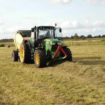
Heulage
Lieferant entlädt
Rundballen
Regenfrei
3 weitere...
B+

Erstklassiges PferdeHeu in HD-Ballen
Jevenstedt
Tim Rohwer
@EIDERHEU
Heu
Kleinballen/HD-Ballen
Regenfrei
B+
Deprecated: Creation of dynamic property Zend_View_Helper_Ads::$adLink is deprecated in /var/www/stall-frei/htdocs/staging.stall-frei.de/library/Psf/View/Helper/Ads.php on line 108

Persönlichkeitsentwicklung mit Pferden
Bad Salzuflen
Katja Dors
@Pferdezeiten
Begleite andere auf ihrem Entwicklungsweg und entdecke die transformative Kraft der pferdegestützten Persönlichkeitsentwicklung !
neu
R
Eiweisarmes Heu oder Heulage
Sophienhamm
Herr-Kolb
@Herr-Kolb
Heu
Rundballen
Regenfrei
Wird verladen
B+

Heu/trockene Heulage für Pferde Zucker,Fruktanarm
Sophienhamm
Herr-Kolb
@Herr-Kolb
Heulage
Lieferant entlädt
Regenfrei
Wird verladen
2 weitere...
B+

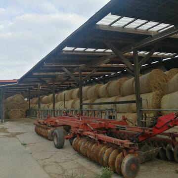
Heu in Rundballen (ca.130cm) super Qualität
Pronstorf
Caros Pferdeparadies
@KaOb
Heu
Rundballen
Regenfrei
Wird verladen
2 weitere...
B+

Futtersack HeuToy, Fressbremse in pink
Mechtersen
STALL-FREIde Marketing
@STALL-FREI-Marketing
Stundenlange Beschäftigung die
Koliken vorbeugt, geringe Staubinhalation mit
steuerbarer Futterentnahme
Leider kein Vorschaubild
Leider kein Vorschaubild
B+
Leider kein Vorschaubild
Leider kein Vorschaubild
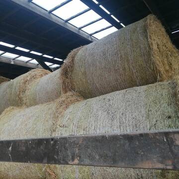
3 grosse Heulageballen ( 1,30m Durchmesser)
Flensburg
Andrea Hartmann
@Andrea45
Heulage
Großballen
Abholung
B+
Heu 1.Schnitt 2021
Upahl
hermannmeyerzuborgsen
@hermannmeyerzuborgsen
Heu
Empfänger lädt ab
Rundballen
Regenfrei
3 weitere...
P+

Heu HD-Ballen 2. Schnitt extensiv Heugräser
Drochtersen
M-Kluth
@M-Kluth
Heu
Empfänger lädt ab
Kleinballen/HD-Ballen
Regenfrei
3 weitere...
B+

Heu und Stroh zu verkaufen
21527 Kollow
Hof -Linautal
@Hof-Linautal
Heu
Lieferant entlädt
Rundballen
Regenfrei
3 weitere...
aktuell
B+
Deprecated: Creation of dynamic property Zend_View::$pageCount is deprecated in /var/www/stall-frei/htdocs/staging.stall-frei.de/library/vendor/shardj/zf1-future/library/Zend/View/Abstract.php on line 308
Deprecated: Creation of dynamic property Zend_View::$itemCountPerPage is deprecated in /var/www/stall-frei/htdocs/staging.stall-frei.de/library/vendor/shardj/zf1-future/library/Zend/View/Abstract.php on line 308
Deprecated: Creation of dynamic property Zend_View::$first is deprecated in /var/www/stall-frei/htdocs/staging.stall-frei.de/library/vendor/shardj/zf1-future/library/Zend/View/Abstract.php on line 308
Deprecated: Creation of dynamic property Zend_View::$current is deprecated in /var/www/stall-frei/htdocs/staging.stall-frei.de/library/vendor/shardj/zf1-future/library/Zend/View/Abstract.php on line 308
Deprecated: Creation of dynamic property Zend_View::$last is deprecated in /var/www/stall-frei/htdocs/staging.stall-frei.de/library/vendor/shardj/zf1-future/library/Zend/View/Abstract.php on line 308
Deprecated: Creation of dynamic property Zend_View::$next is deprecated in /var/www/stall-frei/htdocs/staging.stall-frei.de/library/vendor/shardj/zf1-future/library/Zend/View/Abstract.php on line 308
Deprecated: Creation of dynamic property Zend_View::$pagesInRange is deprecated in /var/www/stall-frei/htdocs/staging.stall-frei.de/library/vendor/shardj/zf1-future/library/Zend/View/Abstract.php on line 308
Deprecated: Creation of dynamic property Zend_View::$firstPageInRange is deprecated in /var/www/stall-frei/htdocs/staging.stall-frei.de/library/vendor/shardj/zf1-future/library/Zend/View/Abstract.php on line 308
Deprecated: Creation of dynamic property Zend_View::$lastPageInRange is deprecated in /var/www/stall-frei/htdocs/staging.stall-frei.de/library/vendor/shardj/zf1-future/library/Zend/View/Abstract.php on line 308
Deprecated: Creation of dynamic property Zend_View::$currentItemCount is deprecated in /var/www/stall-frei/htdocs/staging.stall-frei.de/library/vendor/shardj/zf1-future/library/Zend/View/Abstract.php on line 308
Deprecated: Creation of dynamic property Zend_View::$totalItemCount is deprecated in /var/www/stall-frei/htdocs/staging.stall-frei.de/library/vendor/shardj/zf1-future/library/Zend/View/Abstract.php on line 308
Deprecated: Creation of dynamic property Zend_View::$firstItemNumber is deprecated in /var/www/stall-frei/htdocs/staging.stall-frei.de/library/vendor/shardj/zf1-future/library/Zend/View/Abstract.php on line 308
Deprecated: Creation of dynamic property Zend_View::$lastItemNumber is deprecated in /var/www/stall-frei/htdocs/staging.stall-frei.de/library/vendor/shardj/zf1-future/library/Zend/View/Abstract.php on line 308
Deprecated: Creation of dynamic property Zend_View::$router is deprecated in /var/www/stall-frei/htdocs/staging.stall-frei.de/library/vendor/shardj/zf1-future/library/Zend/View/Abstract.php on line 308
Deprecated: Creation of dynamic property Zend_View::$urlParams is deprecated in /var/www/stall-frei/htdocs/staging.stall-frei.de/library/vendor/shardj/zf1-future/library/Zend/View/Abstract.php on line 308
Deprecated: Creation of dynamic property Zend_View::$showAds is deprecated in /var/www/stall-frei/htdocs/staging.stall-frei.de/library/vendor/shardj/zf1-future/library/Zend/View/Abstract.php on line 308
Deprecated: Creation of dynamic property Zend_View::$objectIds is deprecated in /var/www/stall-frei/htdocs/staging.stall-frei.de/library/vendor/shardj/zf1-future/library/Zend/View/Abstract.php on line 308
Deprecated: Creation of dynamic property Zend_View::$showNavbar is deprecated in /var/www/stall-frei/htdocs/staging.stall-frei.de/library/vendor/shardj/zf1-future/library/Zend/View/Abstract.php on line 308
Deprecated: Creation of dynamic property Zend_View::$showBreadcrumb is deprecated in /var/www/stall-frei/htdocs/staging.stall-frei.de/library/vendor/shardj/zf1-future/library/Zend/View/Abstract.php on line 308
Deprecated: Creation of dynamic property Zend_View::$showFooter is deprecated in /var/www/stall-frei/htdocs/staging.stall-frei.de/library/vendor/shardj/zf1-future/library/Zend/View/Abstract.php on line 308
Deprecated: Creation of dynamic property Zend_View::$showInternalAds is deprecated in /var/www/stall-frei/htdocs/staging.stall-frei.de/library/vendor/shardj/zf1-future/library/Zend/View/Abstract.php on line 308
Deprecated: Creation of dynamic property Zend_View::$blNoContent is deprecated in /var/www/stall-frei/htdocs/staging.stall-frei.de/library/vendor/shardj/zf1-future/library/Zend/View/Abstract.php on line 308
Deprecated: Creation of dynamic property Zend_View::$sMetaDesc is deprecated in /var/www/stall-frei/htdocs/staging.stall-frei.de/library/vendor/shardj/zf1-future/library/Zend/View/Abstract.php on line 308
Deprecated: Creation of dynamic property Zend_View::$useGmaps is deprecated in /var/www/stall-frei/htdocs/staging.stall-frei.de/library/vendor/shardj/zf1-future/library/Zend/View/Abstract.php on line 308
Deprecated: Creation of dynamic property Zend_View::$touches is deprecated in /var/www/stall-frei/htdocs/staging.stall-frei.de/library/vendor/shardj/zf1-future/library/Zend/View/Abstract.php on line 308
Deprecated: Creation of dynamic property Zend_View::$oProject is deprecated in /var/www/stall-frei/htdocs/staging.stall-frei.de/library/vendor/shardj/zf1-future/library/Zend/View/Abstract.php on line 308
Deprecated: Creation of dynamic property Zend_View::$pageHeadline is deprecated in /var/www/stall-frei/htdocs/staging.stall-frei.de/library/vendor/shardj/zf1-future/library/Zend/View/Abstract.php on line 308
Deprecated: Creation of dynamic property Zend_View::$disableLocationField is deprecated in /var/www/stall-frei/htdocs/staging.stall-frei.de/library/vendor/shardj/zf1-future/library/Zend/View/Abstract.php on line 308
Deprecated: Creation of dynamic property Zend_View::$isSearch is deprecated in /var/www/stall-frei/htdocs/staging.stall-frei.de/library/vendor/shardj/zf1-future/library/Zend/View/Abstract.php on line 308
Deprecated: Creation of dynamic property Zend_View::$pageTitle is deprecated in /var/www/stall-frei/htdocs/staging.stall-frei.de/library/vendor/shardj/zf1-future/library/Zend/View/Abstract.php on line 308
Deprecated: Creation of dynamic property Psf_Form_Element_Text::$class is deprecated in /var/www/stall-frei/htdocs/staging.stall-frei.de/library/vendor/shardj/zf1-future/library/Zend/Form/Element.php on line 874
Deprecated: Creation of dynamic property Psf_Form_Element_Text::$size is deprecated in /var/www/stall-frei/htdocs/staging.stall-frei.de/library/vendor/shardj/zf1-future/library/Zend/Form/Element.php on line 874
Deprecated: Creation of dynamic property Psf_Form_Element_Text::$placeholder is deprecated in /var/www/stall-frei/htdocs/staging.stall-frei.de/library/vendor/shardj/zf1-future/library/Zend/Form/Element.php on line 874
Deprecated: Creation of dynamic property Psf_Form_Element_Hidden::$class is deprecated in /var/www/stall-frei/htdocs/staging.stall-frei.de/library/vendor/shardj/zf1-future/library/Zend/Form/Element.php on line 874
Deprecated: Creation of dynamic property Psf_Form_Element_Hidden::$class is deprecated in /var/www/stall-frei/htdocs/staging.stall-frei.de/library/vendor/shardj/zf1-future/library/Zend/Form/Element.php on line 874
Deprecated: Creation of dynamic property Psf_Form_Element_Hidden::$class is deprecated in /var/www/stall-frei/htdocs/staging.stall-frei.de/library/vendor/shardj/zf1-future/library/Zend/Form/Element.php on line 874
Deprecated: Creation of dynamic property Psf_Form_Element_Hidden::$class is deprecated in /var/www/stall-frei/htdocs/staging.stall-frei.de/library/vendor/shardj/zf1-future/library/Zend/Form/Element.php on line 874
Deprecated: Creation of dynamic property Psf_Form_Element_Select::$class is deprecated in /var/www/stall-frei/htdocs/staging.stall-frei.de/library/vendor/shardj/zf1-future/library/Zend/Form/Element.php on line 874
Deprecated: Creation of dynamic property Psf_Form_Element_Select::$class is deprecated in /var/www/stall-frei/htdocs/staging.stall-frei.de/library/vendor/shardj/zf1-future/library/Zend/Form/Element.php on line 874
Deprecated: Creation of dynamic property Psf_Form_Element_Select::$class is deprecated in /var/www/stall-frei/htdocs/staging.stall-frei.de/library/vendor/shardj/zf1-future/library/Zend/Form/Element.php on line 874
Deprecated: Creation of dynamic property Psf_Form_Element_Select::$class is deprecated in /var/www/stall-frei/htdocs/staging.stall-frei.de/library/vendor/shardj/zf1-future/library/Zend/Form/Element.php on line 874
Deprecated: Creation of dynamic property Zend_View::$sort is deprecated in /var/www/stall-frei/htdocs/staging.stall-frei.de/library/vendor/shardj/zf1-future/library/Zend/View/Abstract.php on line 308
Deprecated: Creation of dynamic property Zend_View::$searchLocation is deprecated in /var/www/stall-frei/htdocs/staging.stall-frei.de/library/vendor/shardj/zf1-future/library/Zend/View/Abstract.php on line 308
Deprecated: Creation of dynamic property Zend_View::$locationHint is deprecated in /var/www/stall-frei/htdocs/staging.stall-frei.de/library/vendor/shardj/zf1-future/library/Zend/View/Abstract.php on line 308
Psf_GeoCoder_Abstract::getLocation: Ravensberg Get Location CachedOrLive
Psf_GeoCoder_Abstract::getCachedOrLive: Ravensberg
Psf_GeoCoder_OpenCageData::makeApiRequest: response:
Array
(
[documentation] => https://opencagedata.com/api
[licenses] => Array
(
[0] => Array
(
[name] => see attribution guide
[url] => https://opencagedata.com/credits
)
)
[results] => Array
(
[0] => Array
(
[bounds] => Array
(
[northeast] => Array
(
[lat] => 54.3515155
[lng] => 10.1338052
)
[southwest] => Array
(
[lat] => 54.331074
[lng] => 10.1016528
)
)
[components] => Array
(
[ISO_3166-1_alpha-2] => DE
[ISO_3166-1_alpha-3] => DEU
[ISO_3166-2] => Array
(
[0] => DE-SH
)
[_category] => place
[_normalized_city] => Kiel
[_type] => neighbourhood
[city] => Kiel
[continent] => Europe
[country] => Deutschland
[country_code] => de
[political_union] => European Union
[postcode] => 24118
[state] => Schleswig-Holstein
[state_code] => SH
[suburb] => Ravensberg
)
[confidence] => 7
[formatted] => 24118 Kiel, Deutschland
[geometry] => Array
(
[lat] => 54.3434673
[lng] => 10.13196
)
)
[1] => Array
(
[bounds] => Array
(
[northeast] => Array
(
[lat] => 51.6214389
[lng] => 10.5269944
)
[southwest] => Array
(
[lat] => 51.6213389
[lng] => 10.5268944
)
)
[components] => Array
(
[ISO_3166-1_alpha-2] => DE
[ISO_3166-1_alpha-3] => DEU
[ISO_3166-2] => Array
(
[0] => DE-NI
)
[_category] => natural/water
[_normalized_city] => Bad Sachsa
[_type] => volcano
[continent] => Europe
[country] => Deutschland
[country_code] => de
[county] => Landkreis Göttingen
[political_union] => European Union
[postcode] => 37441
[state] => Niedersachsen
[state_code] => NI
[town] => Bad Sachsa
[volcano] => Ravensberg
)
[confidence] => 9
[formatted] => Ravensberg, 37441 Bad Sachsa, Deutschland
[geometry] => Array
(
[lat] => 51.6213889
[lng] => 10.5269444
)
)
[2] => Array
(
[bounds] => Array
(
[northeast] => Array
(
[lat] => 53.3878203
[lng] => 13.5445077
)
[southwest] => Array
(
[lat] => 53.3877203
[lng] => 13.5444077
)
)
[components] => Array
(
[ISO_3166-1_alpha-2] => DE
[ISO_3166-1_alpha-3] => DEU
[ISO_3166-2] => Array
(
[0] => DE-MV
)
[_category] => natural/water
[_normalized_city] => Feldberger Seenlandschaft
[_type] => peak
[continent] => Europe
[country] => Deutschland
[country_code] => de
[county] => Mecklenburgische Seenplatte
[municipality] => Feldberger Seenlandschaft
[peak] => Ravensberg
[political_union] => European Union
[state] => Mecklenburg-Vorpommern
[state_code] => MV
)
[confidence] => 9
[formatted] => Ravensberg, Feldberger Seenlandschaft, Mecklenburg-Vorpommern, Deutschland
[geometry] => Array
(
[lat] => 53.3877703
[lng] => 13.5444577
)
)
[3] => Array
(
[bounds] => Array
(
[northeast] => Array
(
[lat] => 54.2882357
[lng] => 10.3957265
)
[southwest] => Array
(
[lat] => 54.2881357
[lng] => 10.3956265
)
)
[components] => Array
(
[ISO_3166-1_alpha-2] => DE
[ISO_3166-1_alpha-3] => DEU
[ISO_3166-2] => Array
(
[0] => DE-SH
)
[_category] => natural/water
[_normalized_city] => Martensrade
[_type] => peak
[continent] => Europe
[country] => Deutschland
[country_code] => de
[county] => Kreis Plön
[municipality] => Selent/Schlesen
[peak] => Ravensberg
[political_union] => European Union
[postcode] => 24238
[state] => Schleswig-Holstein
[state_code] => SH
[village] => Martensrade
)
[confidence] => 9
[formatted] => Ravensberg, 24238 Martensrade, Deutschland
[geometry] => Array
(
[lat] => 54.2881857
[lng] => 10.3956765
)
)
[4] => Array
(
[bounds] => Array
(
[northeast] => Array
(
[lat] => 50.8293849
[lng] => 7.1694923
)
[southwest] => Array
(
[lat] => 50.8292849
[lng] => 7.1693923
)
)
[components] => Array
(
[ISO_3166-1_alpha-2] => DE
[ISO_3166-1_alpha-3] => DEU
[ISO_3166-2] => Array
(
[0] => DE-NW
)
[_category] => natural/water
[_normalized_city] => Troisdorf
[_type] => peak
[continent] => Europe
[country] => Deutschland
[country_code] => de
[county] => Rhein-Sieg-Kreis
[peak] => Ravensberg
[political_union] => European Union
[postcode] => 53840
[state] => Nordrhein-Westfalen
[state_code] => NW
[town] => Troisdorf
)
[confidence] => 9
[formatted] => Ravensberg, 53840 Troisdorf, Deutschland
[geometry] => Array
(
[lat] => 50.8293349
[lng] => 7.1694423
)
)
[5] => Array
(
[bounds] => Array
(
[northeast] => Array
(
[lat] => 51.8619016
[lng] => 9.729591
)
[southwest] => Array
(
[lat] => 51.8618016
[lng] => 9.729491
)
)
[components] => Array
(
[ISO_3166-1_alpha-2] => DE
[ISO_3166-1_alpha-3] => DEU
[ISO_3166-2] => Array
(
[0] => DE-NI
)
[_category] => natural/water
[_normalized_city] => Dassel
[_type] => peak
[city] => Dassel
[continent] => Europe
[country] => Deutschland
[country_code] => de
[county] => Landkreis Northeim
[peak] => Ravensberg
[political_union] => European Union
[state] => Niedersachsen
[state_code] => NI
)
[confidence] => 9
[formatted] => Ravensberg, Dassel, Niedersachsen, Deutschland
[geometry] => Array
(
[lat] => 51.8618516
[lng] => 9.729541
)
)
[6] => Array
(
[bounds] => Array
(
[northeast] => Array
(
[lat] => 51.9399228
[lng] => 8.698933
)
[southwest] => Array
(
[lat] => 51.9398228
[lng] => 8.698833
)
)
[components] => Array
(
[ISO_3166-1_alpha-2] => DE
[ISO_3166-1_alpha-3] => DEU
[ISO_3166-2] => Array
(
[0] => DE-NW
)
[_category] => natural/water
[_normalized_city] => Oerlinghausen
[_type] => peak
[continent] => Europe
[country] => Deutschland
[country_code] => de
[county] => Kreis Lippe
[peak] => Ravensberg
[political_union] => European Union
[postcode] => 33813
[state] => Nordrhein-Westfalen
[state_code] => NW
[town] => Oerlinghausen
)
[confidence] => 9
[formatted] => Ravensberg, 33813 Oerlinghausen, Deutschland
[geometry] => Array
(
[lat] => 51.9398728
[lng] => 8.698883
)
)
[7] => Array
(
[bounds] => Array
(
[northeast] => Array
(
[lat] => 51.3792022
[lng] => 9.7109477
)
[southwest] => Array
(
[lat] => 51.3791022
[lng] => 9.7108477
)
)
[components] => Array
(
[ISO_3166-1_alpha-2] => DE
[ISO_3166-1_alpha-3] => DEU
[ISO_3166-2] => Array
(
[0] => DE-NI
)
[_category] => natural/water
[_normalized_city] => Hann. Münden
[_type] => peak
[city] => Hann. Münden
[continent] => Europe
[country] => Deutschland
[country_code] => de
[county] => Landkreis Göttingen
[peak] => Ravensberg
[political_union] => European Union
[state] => Niedersachsen
[state_code] => NI
)
[confidence] => 9
[formatted] => Ravensberg, Hann. Münden, Niedersachsen, Deutschland
[geometry] => Array
(
[lat] => 51.3791522
[lng] => 9.7108977
)
)
[8] => Array
(
[bounds] => Array
(
[northeast] => Array
(
[lat] => 52.8079581
[lng] => 7.2276309
)
[southwest] => Array
(
[lat] => 52.7679581
[lng] => 7.1876309
)
)
[components] => Array
(
[ISO_3166-1_alpha-2] => DE
[ISO_3166-1_alpha-3] => DEU
[ISO_3166-2] => Array
(
[0] => DE-NI
)
[_category] => place
[_normalized_city] => Haren (Ems)
[_type] => hamlet
[continent] => Europe
[country] => Deutschland
[country_code] => de
[county] => Landkreis Emsland
[hamlet] => Ravensberg
[political_union] => European Union
[postcode] => 49733
[state] => Niedersachsen
[state_code] => NI
[town] => Haren (Ems)
)
[confidence] => 7
[formatted] => Ravensberg, 49733 Haren (Ems), Deutschland
[geometry] => Array
(
[lat] => 52.7879581
[lng] => 7.2076309
)
)
[9] => Array
(
[bounds] => Array
(
[northeast] => Array
(
[lat] => 54.0110783
[lng] => 11.7321331
)
[southwest] => Array
(
[lat] => 53.9710783
[lng] => 11.6921331
)
)
[components] => Array
(
[ISO_3166-1_alpha-2] => DE
[ISO_3166-1_alpha-3] => DEU
[ISO_3166-2] => Array
(
[0] => DE-MV
)
[_category] => place
[_normalized_city] => Carinerland
[_type] => hamlet
[continent] => Europe
[country] => Deutschland
[country_code] => de
[county] => Landkreis Rostock
[hamlet] => Ravensberg
[municipality] => Carinerland
[political_union] => European Union
[state] => Mecklenburg-Vorpommern
[state_code] => MV
[village] => Carinerland
)
[confidence] => 7
[formatted] => Ravensberg, Carinerland, Mecklenburg-Vorpommern, Deutschland
[geometry] => Array
(
[lat] => 53.9910783
[lng] => 11.7121331
)
)
)
[status] => Array
(
[code] => 200
[message] => OK
)
[stay_informed] => Array
(
[blog] => https://blog.opencagedata.com
[mastodon] => https://en.osm.town/@opencage
)
[thanks] => For using an OpenCage API
[timestamp] => Array
(
[created_http] => Sun, 08 Feb 2026 11:22:17 GMT
[created_unix] => 1770549737
)
[total_results] => 10
)
Psf_GeoCoder_Abstract::convertLocationResult
{"documentation":"https:\/\/opencagedata.com\/api","licenses":[{"name":"see attribution guide","url":"https:\/\/opencagedata.com\/credits"}],"results":[{"bounds":{"northeast":{"lat":54.3515155,"lng":10.1338052},"southwest":{"lat":54.331074,"lng":10.1016528}},"components":{"ISO_3166-1_alpha-2":"DE","ISO_3166-1_alpha-3":"DEU","ISO_3166-2":["DE-SH"],"_category":"place","_normalized_city":"Kiel","_type":"neighbourhood","city":"Kiel","continent":"Europe","country":"Deutschland","country_code":"de","political_union":"European Union","postcode":"24118","state":"Schleswig-Holstein","state_code":"SH","suburb":"Ravensberg"},"confidence":7,"formatted":"24118 Kiel, Deutschland","geometry":{"lat":54.3434673,"lng":10.13196}},{"bounds":{"northeast":{"lat":51.6214389,"lng":10.5269944},"southwest":{"lat":51.6213389,"lng":10.5268944}},"components":{"ISO_3166-1_alpha-2":"DE","ISO_3166-1_alpha-3":"DEU","ISO_3166-2":["DE-NI"],"_category":"natural\/water","_normalized_city":"Bad Sachsa","_type":"volcano","continent":"Europe","country":"Deutschland","country_code":"de","county":"Landkreis G\u00f6ttingen","political_union":"European Union","postcode":"37441","state":"Niedersachsen","state_code":"NI","town":"Bad Sachsa","volcano":"Ravensberg"},"confidence":9,"formatted":"Ravensberg, 37441 Bad Sachsa, Deutschland","geometry":{"lat":51.6213889,"lng":10.5269444}},{"bounds":{"northeast":{"lat":53.3878203,"lng":13.5445077},"southwest":{"lat":53.3877203,"lng":13.5444077}},"components":{"ISO_3166-1_alpha-2":"DE","ISO_3166-1_alpha-3":"DEU","ISO_3166-2":["DE-MV"],"_category":"natural\/water","_normalized_city":"Feldberger Seenlandschaft","_type":"peak","continent":"Europe","country":"Deutschland","country_code":"de","county":"Mecklenburgische Seenplatte","municipality":"Feldberger Seenlandschaft","peak":"Ravensberg","political_union":"European Union","state":"Mecklenburg-Vorpommern","state_code":"MV"},"confidence":9,"formatted":"Ravensberg, Feldberger Seenlandschaft, Mecklenburg-Vorpommern, Deutschland","geometry":{"lat":53.3877703,"lng":13.5444577}},{"bounds":{"northeast":{"lat":54.2882357,"lng":10.3957265},"southwest":{"lat":54.2881357,"lng":10.3956265}},"components":{"ISO_3166-1_alpha-2":"DE","ISO_3166-1_alpha-3":"DEU","ISO_3166-2":["DE-SH"],"_category":"natural\/water","_normalized_city":"Martensrade","_type":"peak","continent":"Europe","country":"Deutschland","country_code":"de","county":"Kreis Pl\u00f6n","municipality":"Selent\/Schlesen","peak":"Ravensberg","political_union":"European Union","postcode":"24238","state":"Schleswig-Holstein","state_code":"SH","village":"Martensrade"},"confidence":9,"formatted":"Ravensberg, 24238 Martensrade, Deutschland","geometry":{"lat":54.2881857,"lng":10.3956765}},{"bounds":{"northeast":{"lat":50.8293849,"lng":7.1694923},"southwest":{"lat":50.8292849,"lng":7.1693923}},"components":{"ISO_3166-1_alpha-2":"DE","ISO_3166-1_alpha-3":"DEU","ISO_3166-2":["DE-NW"],"_category":"natural\/water","_normalized_city":"Troisdorf","_type":"peak","continent":"Europe","country":"Deutschland","country_code":"de","county":"Rhein-Sieg-Kreis","peak":"Ravensberg","political_union":"European Union","postcode":"53840","state":"Nordrhein-Westfalen","state_code":"NW","town":"Troisdorf"},"confidence":9,"formatted":"Ravensberg, 53840 Troisdorf, Deutschland","geometry":{"lat":50.8293349,"lng":7.1694423}},{"bounds":{"northeast":{"lat":51.8619016,"lng":9.729591},"southwest":{"lat":51.8618016,"lng":9.729491}},"components":{"ISO_3166-1_alpha-2":"DE","ISO_3166-1_alpha-3":"DEU","ISO_3166-2":["DE-NI"],"_category":"natural\/water","_normalized_city":"Dassel","_type":"peak","city":"Dassel","continent":"Europe","country":"Deutschland","country_code":"de","county":"Landkreis Northeim","peak":"Ravensberg","political_union":"European Union","state":"Niedersachsen","state_code":"NI"},"confidence":9,"formatted":"Ravensberg, Dassel, Niedersachsen, Deutschland","geometry":{"lat":51.8618516,"lng":9.729541}},{"bounds":{"northeast":{"lat":51.9399228,"lng":8.698933},"southwest":{"lat":51.9398228,"lng":8.698833}},"components":{"ISO_3166-1_alpha-2":"DE","ISO_3166-1_alpha-3":"DEU","ISO_3166-2":["DE-NW"],"_category":"natural\/water","_normalized_city":"Oerlinghausen","_type":"peak","continent":"Europe","country":"Deutschland","country_code":"de","county":"Kreis Lippe","peak":"Ravensberg","political_union":"European Union","postcode":"33813","state":"Nordrhein-Westfalen","state_code":"NW","town":"Oerlinghausen"},"confidence":9,"formatted":"Ravensberg, 33813 Oerlinghausen, Deutschland","geometry":{"lat":51.9398728,"lng":8.698883}},{"bounds":{"northeast":{"lat":51.3792022,"lng":9.7109477},"southwest":{"lat":51.3791022,"lng":9.7108477}},"components":{"ISO_3166-1_alpha-2":"DE","ISO_3166-1_alpha-3":"DEU","ISO_3166-2":["DE-NI"],"_category":"natural\/water","_normalized_city":"Hann. M\u00fcnden","_type":"peak","city":"Hann. M\u00fcnden","continent":"Europe","country":"Deutschland","country_code":"de","county":"Landkreis G\u00f6ttingen","peak":"Ravensberg","political_union":"European Union","state":"Niedersachsen","state_code":"NI"},"confidence":9,"formatted":"Ravensberg, Hann. M\u00fcnden, Niedersachsen, Deutschland","geometry":{"lat":51.3791522,"lng":9.7108977}},{"bounds":{"northeast":{"lat":52.8079581,"lng":7.2276309},"southwest":{"lat":52.7679581,"lng":7.1876309}},"components":{"ISO_3166-1_alpha-2":"DE","ISO_3166-1_alpha-3":"DEU","ISO_3166-2":["DE-NI"],"_category":"place","_normalized_city":"Haren (Ems)","_type":"hamlet","continent":"Europe","country":"Deutschland","country_code":"de","county":"Landkreis Emsland","hamlet":"Ravensberg","political_union":"European Union","postcode":"49733","state":"Niedersachsen","state_code":"NI","town":"Haren (Ems)"},"confidence":7,"formatted":"Ravensberg, 49733 Haren (Ems), Deutschland","geometry":{"lat":52.7879581,"lng":7.2076309}},{"bounds":{"northeast":{"lat":54.0110783,"lng":11.7321331},"southwest":{"lat":53.9710783,"lng":11.6921331}},"components":{"ISO_3166-1_alpha-2":"DE","ISO_3166-1_alpha-3":"DEU","ISO_3166-2":["DE-MV"],"_category":"place","_normalized_city":"Carinerland","_type":"hamlet","continent":"Europe","country":"Deutschland","country_code":"de","county":"Landkreis Rostock","hamlet":"Ravensberg","municipality":"Carinerland","political_union":"European Union","state":"Mecklenburg-Vorpommern","state_code":"MV","village":"Carinerland"},"confidence":7,"formatted":"Ravensberg, Carinerland, Mecklenburg-Vorpommern, Deutschland","geometry":{"lat":53.9910783,"lng":11.7121331}}],"status":{"code":200,"message":"OK"},"stay_informed":{"blog":"https:\/\/blog.opencagedata.com","mastodon":"https:\/\/en.osm.town\/@opencage"},"thanks":"For using an OpenCage API","timestamp":{"created_http":"Sun, 08 Feb 2026 11:22:17 GMT","created_unix":1770549737},"total_results":10}Array
(
[0] => stdClass Object
(
[bounds] => stdClass Object
(
[northeast] => stdClass Object
(
[lat] => 54.3515155
[lng] => 10.1338052
)
[southwest] => stdClass Object
(
[lat] => 54.331074
[lng] => 10.1016528
)
)
[components] => stdClass Object
(
[ISO_3166-1_alpha-2] => DE
[ISO_3166-1_alpha-3] => DEU
[ISO_3166-2] => Array
(
[0] => DE-SH
)
[_category] => place
[_normalized_city] => Kiel
[_type] => neighbourhood
[city] => Kiel
[continent] => Europe
[country] => Deutschland
[country_code] => de
[political_union] => European Union
[postcode] => 24118
[state] => Schleswig-Holstein
[state_code] => SH
[suburb] => Ravensberg
)
[confidence] => 7
[formatted] => 24118 Kiel, Deutschland
[geometry] => stdClass Object
(
[lat] => 54.3434673
[lng] => 10.13196
)
)
[1] => stdClass Object
(
[bounds] => stdClass Object
(
[northeast] => stdClass Object
(
[lat] => 51.6214389
[lng] => 10.5269944
)
[southwest] => stdClass Object
(
[lat] => 51.6213389
[lng] => 10.5268944
)
)
[components] => stdClass Object
(
[ISO_3166-1_alpha-2] => DE
[ISO_3166-1_alpha-3] => DEU
[ISO_3166-2] => Array
(
[0] => DE-NI
)
[_category] => natural/water
[_normalized_city] => Bad Sachsa
[_type] => volcano
[continent] => Europe
[country] => Deutschland
[country_code] => de
[county] => Landkreis Göttingen
[political_union] => European Union
[postcode] => 37441
[state] => Niedersachsen
[state_code] => NI
[town] => Bad Sachsa
[volcano] => Ravensberg
)
[confidence] => 9
[formatted] => Ravensberg, 37441 Bad Sachsa, Deutschland
[geometry] => stdClass Object
(
[lat] => 51.6213889
[lng] => 10.5269444
)
)
[2] => stdClass Object
(
[bounds] => stdClass Object
(
[northeast] => stdClass Object
(
[lat] => 53.3878203
[lng] => 13.5445077
)
[southwest] => stdClass Object
(
[lat] => 53.3877203
[lng] => 13.5444077
)
)
[components] => stdClass Object
(
[ISO_3166-1_alpha-2] => DE
[ISO_3166-1_alpha-3] => DEU
[ISO_3166-2] => Array
(
[0] => DE-MV
)
[_category] => natural/water
[_normalized_city] => Feldberger Seenlandschaft
[_type] => peak
[continent] => Europe
[country] => Deutschland
[country_code] => de
[county] => Mecklenburgische Seenplatte
[municipality] => Feldberger Seenlandschaft
[peak] => Ravensberg
[political_union] => European Union
[state] => Mecklenburg-Vorpommern
[state_code] => MV
)
[confidence] => 9
[formatted] => Ravensberg, Feldberger Seenlandschaft, Mecklenburg-Vorpommern, Deutschland
[geometry] => stdClass Object
(
[lat] => 53.3877703
[lng] => 13.5444577
)
)
[3] => stdClass Object
(
[bounds] => stdClass Object
(
[northeast] => stdClass Object
(
[lat] => 54.2882357
[lng] => 10.3957265
)
[southwest] => stdClass Object
(
[lat] => 54.2881357
[lng] => 10.3956265
)
)
[components] => stdClass Object
(
[ISO_3166-1_alpha-2] => DE
[ISO_3166-1_alpha-3] => DEU
[ISO_3166-2] => Array
(
[0] => DE-SH
)
[_category] => natural/water
[_normalized_city] => Martensrade
[_type] => peak
[continent] => Europe
[country] => Deutschland
[country_code] => de
[county] => Kreis Plön
[municipality] => Selent/Schlesen
[peak] => Ravensberg
[political_union] => European Union
[postcode] => 24238
[state] => Schleswig-Holstein
[state_code] => SH
[village] => Martensrade
)
[confidence] => 9
[formatted] => Ravensberg, 24238 Martensrade, Deutschland
[geometry] => stdClass Object
(
[lat] => 54.2881857
[lng] => 10.3956765
)
)
[4] => stdClass Object
(
[bounds] => stdClass Object
(
[northeast] => stdClass Object
(
[lat] => 50.8293849
[lng] => 7.1694923
)
[southwest] => stdClass Object
(
[lat] => 50.8292849
[lng] => 7.1693923
)
)
[components] => stdClass Object
(
[ISO_3166-1_alpha-2] => DE
[ISO_3166-1_alpha-3] => DEU
[ISO_3166-2] => Array
(
[0] => DE-NW
)
[_category] => natural/water
[_normalized_city] => Troisdorf
[_type] => peak
[continent] => Europe
[country] => Deutschland
[country_code] => de
[county] => Rhein-Sieg-Kreis
[peak] => Ravensberg
[political_union] => European Union
[postcode] => 53840
[state] => Nordrhein-Westfalen
[state_code] => NW
[town] => Troisdorf
)
[confidence] => 9
[formatted] => Ravensberg, 53840 Troisdorf, Deutschland
[geometry] => stdClass Object
(
[lat] => 50.8293349
[lng] => 7.1694423
)
)
[5] => stdClass Object
(
[bounds] => stdClass Object
(
[northeast] => stdClass Object
(
[lat] => 51.8619016
[lng] => 9.729591
)
[southwest] => stdClass Object
(
[lat] => 51.8618016
[lng] => 9.729491
)
)
[components] => stdClass Object
(
[ISO_3166-1_alpha-2] => DE
[ISO_3166-1_alpha-3] => DEU
[ISO_3166-2] => Array
(
[0] => DE-NI
)
[_category] => natural/water
[_normalized_city] => Dassel
[_type] => peak
[city] => Dassel
[continent] => Europe
[country] => Deutschland
[country_code] => de
[county] => Landkreis Northeim
[peak] => Ravensberg
[political_union] => European Union
[state] => Niedersachsen
[state_code] => NI
)
[confidence] => 9
[formatted] => Ravensberg, Dassel, Niedersachsen, Deutschland
[geometry] => stdClass Object
(
[lat] => 51.8618516
[lng] => 9.729541
)
)
[6] => stdClass Object
(
[bounds] => stdClass Object
(
[northeast] => stdClass Object
(
[lat] => 51.9399228
[lng] => 8.698933
)
[southwest] => stdClass Object
(
[lat] => 51.9398228
[lng] => 8.698833
)
)
[components] => stdClass Object
(
[ISO_3166-1_alpha-2] => DE
[ISO_3166-1_alpha-3] => DEU
[ISO_3166-2] => Array
(
[0] => DE-NW
)
[_category] => natural/water
[_normalized_city] => Oerlinghausen
[_type] => peak
[continent] => Europe
[country] => Deutschland
[country_code] => de
[county] => Kreis Lippe
[peak] => Ravensberg
[political_union] => European Union
[postcode] => 33813
[state] => Nordrhein-Westfalen
[state_code] => NW
[town] => Oerlinghausen
)
[confidence] => 9
[formatted] => Ravensberg, 33813 Oerlinghausen, Deutschland
[geometry] => stdClass Object
(
[lat] => 51.9398728
[lng] => 8.698883
)
)
[7] => stdClass Object
(
[bounds] => stdClass Object
(
[northeast] => stdClass Object
(
[lat] => 51.3792022
[lng] => 9.7109477
)
[southwest] => stdClass Object
(
[lat] => 51.3791022
[lng] => 9.7108477
)
)
[components] => stdClass Object
(
[ISO_3166-1_alpha-2] => DE
[ISO_3166-1_alpha-3] => DEU
[ISO_3166-2] => Array
(
[0] => DE-NI
)
[_category] => natural/water
[_normalized_city] => Hann. Münden
[_type] => peak
[city] => Hann. Münden
[continent] => Europe
[country] => Deutschland
[country_code] => de
[county] => Landkreis Göttingen
[peak] => Ravensberg
[political_union] => European Union
[state] => Niedersachsen
[state_code] => NI
)
[confidence] => 9
[formatted] => Ravensberg, Hann. Münden, Niedersachsen, Deutschland
[geometry] => stdClass Object
(
[lat] => 51.3791522
[lng] => 9.7108977
)
)
[8] => stdClass Object
(
[bounds] => stdClass Object
(
[northeast] => stdClass Object
(
[lat] => 52.8079581
[lng] => 7.2276309
)
[southwest] => stdClass Object
(
[lat] => 52.7679581
[lng] => 7.1876309
)
)
[components] => stdClass Object
(
[ISO_3166-1_alpha-2] => DE
[ISO_3166-1_alpha-3] => DEU
[ISO_3166-2] => Array
(
[0] => DE-NI
)
[_category] => place
[_normalized_city] => Haren (Ems)
[_type] => hamlet
[continent] => Europe
[country] => Deutschland
[country_code] => de
[county] => Landkreis Emsland
[hamlet] => Ravensberg
[political_union] => European Union
[postcode] => 49733
[state] => Niedersachsen
[state_code] => NI
[town] => Haren (Ems)
)
[confidence] => 7
[formatted] => Ravensberg, 49733 Haren (Ems), Deutschland
[geometry] => stdClass Object
(
[lat] => 52.7879581
[lng] => 7.2076309
)
)
[9] => stdClass Object
(
[bounds] => stdClass Object
(
[northeast] => stdClass Object
(
[lat] => 54.0110783
[lng] => 11.7321331
)
[southwest] => stdClass Object
(
[lat] => 53.9710783
[lng] => 11.6921331
)
)
[components] => stdClass Object
(
[ISO_3166-1_alpha-2] => DE
[ISO_3166-1_alpha-3] => DEU
[ISO_3166-2] => Array
(
[0] => DE-MV
)
[_category] => place
[_normalized_city] => Carinerland
[_type] => hamlet
[continent] => Europe
[country] => Deutschland
[country_code] => de
[county] => Landkreis Rostock
[hamlet] => Ravensberg
[municipality] => Carinerland
[political_union] => European Union
[state] => Mecklenburg-Vorpommern
[state_code] => MV
[village] => Carinerland
)
[confidence] => 7
[formatted] => Ravensberg, Carinerland, Mecklenburg-Vorpommern, Deutschland
[geometry] => stdClass Object
(
[lat] => 53.9910783
[lng] => 11.7121331
)
)
)
Psf_GeoCoder_OpenCageData::getKeyMap: 0
stdClass Object
(
    [bounds] => stdClass Object
        (
            [northeast] => stdClass Object
                (
                    [lat] => 54.3515155
                    [lng] => 10.1338052
                )

            [southwest] => stdClass Object
                (
                    [lat] => 54.331074
                    [lng] => 10.1016528
                )

        )

    [components] => stdClass Object
        (
            [ISO_3166-1_alpha-2] => DE
            [ISO_3166-1_alpha-3] => DEU
            [ISO_3166-2] => Array
                (
                    [0] => DE-SH
                )

            [_category] => place
            [_normalized_city] => Kiel
            [_type] => neighbourhood
            [city] => Kiel
            [continent] => Europe
            [country] => Deutschland
            [country_code] => de
            [political_union] => European Union
            [postcode] => 24118
            [state] => Schleswig-Holstein
            [state_code] => SH
            [suburb] => Ravensberg
        )

    [confidence] => 7
    [formatted] => 24118 Kiel, Deutschland
    [geometry] => stdClass Object
        (
            [lat] => 54.3434673
            [lng] => 10.13196
        )

)
Psf_GeoCoder_OpenCageData::getCounty: Kiel
Psf_GeoCoder_OpenCageData::addMissingData REFETCH!
Array
(
    [address] => 24118 Kiel, Deutschland
    [type] => neighbourhood
    [street] =>
    [city] => Ravensberg
    [county] => Kiel
    [state] => Schleswig-Holstein
    [zip] => 24118
    [country] => Deutschland
    [suburb] => Ravensberg
    [countrycode] => de
    [latitude] => 54.3434673
    [longitude] => 10.13196
    [accuracy] => 1
    [confidence] => 7
    [bounds] => stdClass Object
        (
            [northeast] => stdClass Object
                (
                    [lat] => 54.3515155
                    [lng] => 10.1338052
                )

            [southwest] => stdClass Object
                (
                    [lat] => 54.331074
                    [lng] => 10.1016528
                )

        )

)
reformat!
Array
(
    [address] => 24118 Ravensberg
    [type] => neighbourhood
    [street] =>
    [city] => Ravensberg
    [county] => Kiel
    [state] => Schleswig-Holstein
    [zip] => 24118
    [country] => Deutschland
    [suburb] => Ravensberg
    [countrycode] => de
    [latitude] => 54.3434673
    [longitude] => 10.13196
    [accuracy] => 1
    [confidence] => 7
    [bounds] => stdClass Object
        (
            [northeast] => stdClass Object
                (
                    [lat] => 54.3515155
                    [lng] => 10.1338052
                )

            [southwest] => stdClass Object
                (
                    [lat] => 54.331074
                    [lng] => 10.1016528
                )

        )

    [place] => 24118 Ravensberg, Schleswig-Holstein
    [hash] => 0780615edfbb795bea6f5f4de9d45674
)
Psf_GeoCoder_OpenCageData::getKeyMap: 1
stdClass Object
(
    [bounds] => stdClass Object
        (
            [northeast] => stdClass Object
                (
                    [lat] => 51.6214389
                    [lng] => 10.5269944
                )

            [southwest] => stdClass Object
                (
                    [lat] => 51.6213389
                    [lng] => 10.5268944
                )

        )

    [components] => stdClass Object
        (
            [ISO_3166-1_alpha-2] => DE
            [ISO_3166-1_alpha-3] => DEU
            [ISO_3166-2] => Array
                (
                    [0] => DE-NI
                )

            [_category] => natural/water
            [_normalized_city] => Bad Sachsa
            [_type] => volcano
            [continent] => Europe
            [country] => Deutschland
            [country_code] => de
            [county] => Landkreis Göttingen
            [political_union] => European Union
            [postcode] => 37441
            [state] => Niedersachsen
            [state_code] => NI
            [town] => Bad Sachsa
            [volcano] => Ravensberg
        )

    [confidence] => 9
    [formatted] => Ravensberg, 37441 Bad Sachsa, Deutschland
    [geometry] => stdClass Object
        (
            [lat] => 51.6213889
            [lng] => 10.5269444
        )

)
Psf_GeoCoder_OpenCageData::getCounty: Göttingen
Psf_GeoCoder_OpenCageData::addMissingData REFETCH!
Array
(
    [address] => Ravensberg, 37441 Bad Sachsa, Deutschland
    [type] => volcano
    [street] =>
    [city] => Bad Sachsa
    [county] => Göttingen
    [state] => Niedersachsen
    [zip] => 37441
    [country] => Deutschland
    [suburb] =>
    [countrycode] => de
    [latitude] => 51.6213889
    [longitude] => 10.5269444
    [accuracy] => 1
    [confidence] => 9
    [bounds] => stdClass Object
        (
            [northeast] => stdClass Object
                (
                    [lat] => 51.6214389
                    [lng] => 10.5269944
                )

            [southwest] => stdClass Object
                (
                    [lat] => 51.6213389
                    [lng] => 10.5268944
                )

        )

)
reformat!
Array
(
    [address] => Ravensberg, 37441 Bad Sachsa, Deutschland
    [type] => volcano
    [street] =>
    [city] => Bad Sachsa
    [county] => Göttingen
    [state] => Niedersachsen
    [zip] => 37441
    [country] => Deutschland
    [suburb] =>
    [countrycode] => de
    [latitude] => 51.6213889
    [longitude] => 10.5269444
    [accuracy] => 1
    [confidence] => 9
    [bounds] => stdClass Object
        (
            [northeast] => stdClass Object
                (
                    [lat] => 51.6214389
                    [lng] => 10.5269944
                )

            [southwest] => stdClass Object
                (
                    [lat] => 51.6213389
                    [lng] => 10.5268944
                )

        )

    [place] => 37441 Bad Sachsa, Niedersachsen
    [hash] => 15e3632508609aaed66e8289600732fa
)
Psf_GeoCoder_OpenCageData::getKeyMap: 2
stdClass Object
(
    [bounds] => stdClass Object
        (
            [northeast] => stdClass Object
                (
                    [lat] => 53.3878203
                    [lng] => 13.5445077
                )

            [southwest] => stdClass Object
                (
                    [lat] => 53.3877203
                    [lng] => 13.5444077
                )

        )

    [components] => stdClass Object
        (
            [ISO_3166-1_alpha-2] => DE
            [ISO_3166-1_alpha-3] => DEU
            [ISO_3166-2] => Array
                (
                    [0] => DE-MV
                )

            [_category] => natural/water
            [_normalized_city] => Feldberger Seenlandschaft
            [_type] => peak
            [continent] => Europe
            [country] => Deutschland
            [country_code] => de
            [county] => Mecklenburgische Seenplatte
            [municipality] => Feldberger Seenlandschaft
            [peak] => Ravensberg
            [political_union] => European Union
            [state] => Mecklenburg-Vorpommern
            [state_code] => MV
        )

    [confidence] => 9
    [formatted] => Ravensberg, Feldberger Seenlandschaft, Mecklenburg-Vorpommern, Deutschland
    [geometry] => stdClass Object
        (
            [lat] => 53.3877703
            [lng] => 13.5444577
        )

)
Psf_GeoCoder_OpenCageData::getCounty: Mecklenburgische Seenplatte
Psf_GeoCoder_OpenCageData::addMissingData REFETCH!
Array
(
    [address] => Ravensberg, Feldberger Seenlandschaft, Mecklenburg-Vorpommern, Deutschland
    [type] => peak
    [street] =>
    [city] =>
    [county] => Mecklenburgische Seenplatte
    [state] => Mecklenburg-Vorpommern
    [zip] =>
    [country] => Deutschland
    [suburb] =>
    [countrycode] => de
    [latitude] => 53.3877703
    [longitude] => 13.5444577
    [accuracy] => 1
    [confidence] => 9
    [bounds] => stdClass Object
        (
            [northeast] => stdClass Object
                (
                    [lat] => 53.3878203
                    [lng] => 13.5445077
                )

            [southwest] => stdClass Object
                (
                    [lat] => 53.3877203
                    [lng] => 13.5444077
                )

        )

)
reformat!
Array
(
    [address] => Ravensberg, Feldberger Seenlandschaft, Mecklenburg-Vorpommern, Deutschland
    [type] => peak
    [street] =>
    [city] =>
    [county] => Mecklenburgische Seenplatte
    [state] => Mecklenburg-Vorpommern
    [zip] =>
    [country] => Deutschland
    [suburb] =>
    [countrycode] => de
    [latitude] => 53.3877703
    [longitude] => 13.5444577
    [accuracy] => 1
    [confidence] => 9
    [bounds] => stdClass Object
        (
            [northeast] => stdClass Object
                (
                    [lat] => 53.3878203
                    [lng] => 13.5445077
                )

            [southwest] => stdClass Object
                (
                    [lat] => 53.3877203
                    [lng] => 13.5444077
                )

        )

    [place] => , Mecklenburg-Vorpommern
    [hash] => d4547f73b43db2ce77895681dddb6e49
)
Psf_GeoCoder_OpenCageData::getKeyMap: 3
stdClass Object
(
    [bounds] => stdClass Object
        (
            [northeast] => stdClass Object
                (
                    [lat] => 54.2882357
                    [lng] => 10.3957265
                )

            [southwest] => stdClass Object
                (
                    [lat] => 54.2881357
                    [lng] => 10.3956265
                )

        )

    [components] => stdClass Object
        (
            [ISO_3166-1_alpha-2] => DE
            [ISO_3166-1_alpha-3] => DEU
            [ISO_3166-2] => Array
                (
                    [0] => DE-SH
                )

            [_category] => natural/water
            [_normalized_city] => Martensrade
            [_type] => peak
            [continent] => Europe
            [country] => Deutschland
            [country_code] => de
            [county] => Kreis Plön
            [municipality] => Selent/Schlesen
            [peak] => Ravensberg
            [political_union] => European Union
            [postcode] => 24238
            [state] => Schleswig-Holstein
            [state_code] => SH
            [village] => Martensrade
        )

    [confidence] => 9
    [formatted] => Ravensberg, 24238 Martensrade, Deutschland
    [geometry] => stdClass Object
        (
            [lat] => 54.2881857
            [lng] => 10.3956765
        )

)
Psf_GeoCoder_OpenCageData::getCounty: Plön
Psf_GeoCoder_OpenCageData::addMissingData REFETCH!
Array
(
    [address] => Ravensberg, 24238 Martensrade, Deutschland
    [type] => peak
    [street] =>
    [city] => Martensrade
    [county] => Plön
    [state] => Schleswig-Holstein
    [zip] => 24238
    [country] => Deutschland
    [suburb] =>
    [countrycode] => de
    [latitude] => 54.2881857
    [longitude] => 10.3956765
    [accuracy] => 1
    [confidence] => 9
    [bounds] => stdClass Object
        (
            [northeast] => stdClass Object
                (
                    [lat] => 54.2882357
                    [lng] => 10.3957265
                )

            [southwest] => stdClass Object
                (
                    [lat] => 54.2881357
                    [lng] => 10.3956265
                )

        )

)
reformat!
Array
(
    [address] => Ravensberg, 24238 Martensrade, Deutschland
    [type] => peak
    [street] =>
    [city] => Martensrade
    [county] => Plön
    [state] => Schleswig-Holstein
    [zip] => 24238
    [country] => Deutschland
    [suburb] =>
    [countrycode] => de
    [latitude] => 54.2881857
    [longitude] => 10.3956765
    [accuracy] => 1
    [confidence] => 9
    [bounds] => stdClass Object
        (
            [northeast] => stdClass Object
                (
                    [lat] => 54.2882357
                    [lng] => 10.3957265
                )

            [southwest] => stdClass Object
                (
                    [lat] => 54.2881357
                    [lng] => 10.3956265
                )

        )

    [place] => 24238 Martensrade, Schleswig-Holstein
    [hash] => 1c28c7721419125d9bf410c22e8d8d93
)
Psf_GeoCoder_OpenCageData::getKeyMap: 4
stdClass Object
(
    [bounds] => stdClass Object
        (
            [northeast] => stdClass Object
                (
                    [lat] => 50.8293849
                    [lng] => 7.1694923
                )

            [southwest] => stdClass Object
                (
                    [lat] => 50.8292849
                    [lng] => 7.1693923
                )

        )

    [components] => stdClass Object
        (
            [ISO_3166-1_alpha-2] => DE
            [ISO_3166-1_alpha-3] => DEU
            [ISO_3166-2] => Array
                (
                    [0] => DE-NW
                )

            [_category] => natural/water
            [_normalized_city] => Troisdorf
            [_type] => peak
            [continent] => Europe
            [country] => Deutschland
            [country_code] => de
            [county] => Rhein-Sieg-Kreis
            [peak] => Ravensberg
            [political_union] => European Union
            [postcode] => 53840
            [state] => Nordrhein-Westfalen
            [state_code] => NW
            [town] => Troisdorf
        )

    [confidence] => 9
    [formatted] => Ravensberg, 53840 Troisdorf, Deutschland
    [geometry] => stdClass Object
        (
            [lat] => 50.8293349
            [lng] => 7.1694423
        )

)
Psf_GeoCoder_OpenCageData::getCounty: Rhein-Sieg-Kreis
Psf_GeoCoder_OpenCageData::addMissingData REFETCH!
Array
(
    [address] => Ravensberg, 53840 Troisdorf, Deutschland
    [type] => peak
    [street] =>
    [city] => Troisdorf
    [county] => Rhein-Sieg-Kreis
    [state] => Nordrhein-Westfalen
    [zip] => 53840
    [country] => Deutschland
    [suburb] =>
    [countrycode] => de
    [latitude] => 50.8293349
    [longitude] => 7.1694423
    [accuracy] => 1
    [confidence] => 9
    [bounds] => stdClass Object
        (
            [northeast] => stdClass Object
                (
                    [lat] => 50.8293849
                    [lng] => 7.1694923
                )

            [southwest] => stdClass Object
                (
                    [lat] => 50.8292849
                    [lng] => 7.1693923
                )

        )

)
reformat!
Array
(
    [address] => Ravensberg, 53840 Troisdorf, Deutschland
    [type] => peak
    [street] =>
    [city] => Troisdorf
    [county] => Rhein-Sieg-Kreis
    [state] => Nordrhein-Westfalen
    [zip] => 53840
    [country] => Deutschland
    [suburb] =>
    [countrycode] => de
    [latitude] => 50.8293349
    [longitude] => 7.1694423
    [accuracy] => 1
    [confidence] => 9
    [bounds] => stdClass Object
        (
            [northeast] => stdClass Object
                (
                    [lat] => 50.8293849
                    [lng] => 7.1694923
                )

            [southwest] => stdClass Object
                (
                    [lat] => 50.8292849
                    [lng] => 7.1693923
                )

        )

    [place] => 53840 Troisdorf, Nordrhein-Westfalen
    [hash] => e5a66b66df111583711b8f3863312b03
)
Psf_GeoCoder_OpenCageData::getKeyMap: 5
stdClass Object
(
    [bounds] => stdClass Object
        (
            [northeast] => stdClass Object
                (
                    [lat] => 51.8619016
                    [lng] => 9.729591
                )

            [southwest] => stdClass Object
                (
                    [lat] => 51.8618016
                    [lng] => 9.729491
                )

        )

    [components] => stdClass Object
        (
            [ISO_3166-1_alpha-2] => DE
            [ISO_3166-1_alpha-3] => DEU
            [ISO_3166-2] => Array
                (
                    [0] => DE-NI
                )

            [_category] => natural/water
            [_normalized_city] => Dassel
            [_type] => peak
            [city] => Dassel
            [continent] => Europe
            [country] => Deutschland
            [country_code] => de
            [county] => Landkreis Northeim
            [peak] => Ravensberg
            [political_union] => European Union
            [state] => Niedersachsen
            [state_code] => NI
        )

    [confidence] => 9
    [formatted] => Ravensberg, Dassel, Niedersachsen, Deutschland
    [geometry] => stdClass Object
        (
            [lat] => 51.8618516
            [lng] => 9.729541
        )

)
Psf_GeoCoder_OpenCageData::getCounty: Northeim
Psf_GeoCoder_OpenCageData::addMissingData REFETCH!
Array
(
    [address] => Ravensberg, Dassel, Niedersachsen, Deutschland
    [type] => peak
    [street] =>
    [city] => Dassel
    [county] => Northeim
    [state] => Niedersachsen
    [zip] =>
    [country] => Deutschland
    [suburb] =>
    [countrycode] => de
    [latitude] => 51.8618516
    [longitude] => 9.729541
    [accuracy] => 1
    [confidence] => 9
    [bounds] => stdClass Object
        (
            [northeast] => stdClass Object
                (
                    [lat] => 51.8619016
                    [lng] => 9.729591
                )

            [southwest] => stdClass Object
                (
                    [lat] => 51.8618016
                    [lng] => 9.729491
                )

        )

)
reformat!
Array
(
    [address] => Ravensberg, Dassel, Niedersachsen, Deutschland
    [type] => peak
    [street] =>
    [city] => Dassel
    [county] => Northeim
    [state] => Niedersachsen
    [zip] =>
    [country] => Deutschland
    [suburb] =>
    [countrycode] => de
    [latitude] => 51.8618516
    [longitude] => 9.729541
    [accuracy] => 1
    [confidence] => 9
    [bounds] => stdClass Object
        (
            [northeast] => stdClass Object
                (
                    [lat] => 51.8619016
                    [lng] => 9.729591
                )

            [southwest] => stdClass Object
                (
                    [lat] => 51.8618016
                    [lng] => 9.729491
                )

        )

    [place] => Dassel, Niedersachsen
    [hash] => cc7ca5f7ebbec71d69b917f3c3895606
)
Psf_GeoCoder_OpenCageData::getKeyMap: 6
stdClass Object
(
    [bounds] => stdClass Object
        (
            [northeast] => stdClass Object
                (
                    [lat] => 51.9399228
                    [lng] => 8.698933
                )

            [southwest] => stdClass Object
                (
                    [lat] => 51.9398228
                    [lng] => 8.698833
                )

        )

    [components] => stdClass Object
        (
            [ISO_3166-1_alpha-2] => DE
            [ISO_3166-1_alpha-3] => DEU
            [ISO_3166-2] => Array
                (
                    [0] => DE-NW
                )

            [_category] => natural/water
            [_normalized_city] => Oerlinghausen
            [_type] => peak
            [continent] => Europe
            [country] => Deutschland
            [country_code] => de
            [county] => Kreis Lippe
            [peak] => Ravensberg
            [political_union] => European Union
            [postcode] => 33813
            [state] => Nordrhein-Westfalen
            [state_code] => NW
            [town] => Oerlinghausen
        )

    [confidence] => 9
    [formatted] => Ravensberg, 33813 Oerlinghausen, Deutschland
    [geometry] => stdClass Object
        (
            [lat] => 51.9398728
            [lng] => 8.698883
        )

)
Psf_GeoCoder_OpenCageData::getCounty: Lippe
Psf_GeoCoder_OpenCageData::addMissingData REFETCH!
Array
(
    [address] => Ravensberg, 33813 Oerlinghausen, Deutschland
    [type] => peak
    [street] =>
    [city] => Oerlinghausen
    [county] => Lippe
    [state] => Nordrhein-Westfalen
    [zip] => 33813
    [country] => Deutschland
    [suburb] =>
    [countrycode] => de
    [latitude] => 51.9398728
    [longitude] => 8.698883
    [accuracy] => 1
    [confidence] => 9
    [bounds] => stdClass Object
        (
            [northeast] => stdClass Object
                (
                    [lat] => 51.9399228
                    [lng] => 8.698933
                )

            [southwest] => stdClass Object
                (
                    [lat] => 51.9398228
                    [lng] => 8.698833
                )

        )

)
reformat!
Array
(
    [address] => Ravensberg, 33813 Oerlinghausen, Deutschland
    [type] => peak
    [street] =>
    [city] => Oerlinghausen
    [county] => Lippe
    [state] => Nordrhein-Westfalen
    [zip] => 33813
    [country] => Deutschland
    [suburb] =>
    [countrycode] => de
    [latitude] => 51.9398728
    [longitude] => 8.698883
    [accuracy] => 1
    [confidence] => 9
    [bounds] => stdClass Object
        (
            [northeast] => stdClass Object
                (
                    [lat] => 51.9399228
                    [lng] => 8.698933
                )

            [southwest] => stdClass Object
                (
                    [lat] => 51.9398228
                    [lng] => 8.698833
                )

        )

    [place] => 33813 Oerlinghausen, Nordrhein-Westfalen
    [hash] => 51b933c29b0aac05b6ca163747df93e3
)
Psf_GeoCoder_OpenCageData::getKeyMap: 7
stdClass Object
(
    [bounds] => stdClass Object
        (
            [northeast] => stdClass Object
                (
                    [lat] => 51.3792022
                    [lng] => 9.7109477
                )

            [southwest] => stdClass Object
                (
                    [lat] => 51.3791022
                    [lng] => 9.7108477
                )

        )

    [components] => stdClass Object
        (
            [ISO_3166-1_alpha-2] => DE
            [ISO_3166-1_alpha-3] => DEU
            [ISO_3166-2] => Array
                (
                    [0] => DE-NI
                )

            [_category] => natural/water
            [_normalized_city] => Hann. Münden
            [_type] => peak
            [city] => Hann. Münden
            [continent] => Europe
            [country] => Deutschland
            [country_code] => de
            [county] => Landkreis Göttingen
            [peak] => Ravensberg
            [political_union] => European Union
            [state] => Niedersachsen
            [state_code] => NI
        )

    [confidence] => 9
    [formatted] => Ravensberg, Hann. Münden, Niedersachsen, Deutschland
    [geometry] => stdClass Object
        (
            [lat] => 51.3791522
            [lng] => 9.7108977
        )

)
Psf_GeoCoder_OpenCageData::getCounty: Göttingen
Psf_GeoCoder_OpenCageData::addMissingData REFETCH!
Array
(
    [address] => Ravensberg, Hann. Münden, Niedersachsen, Deutschland
    [type] => peak
    [street] =>
    [city] => Hann. Münden
    [county] => Göttingen
    [state] => Niedersachsen
    [zip] =>
    [country] => Deutschland
    [suburb] =>
    [countrycode] => de
    [latitude] => 51.3791522
    [longitude] => 9.7108977
    [accuracy] => 1
    [confidence] => 9
    [bounds] => stdClass Object
        (
            [northeast] => stdClass Object
                (
                    [lat] => 51.3792022
                    [lng] => 9.7109477
                )

            [southwest] => stdClass Object
                (
                    [lat] => 51.3791022
                    [lng] => 9.7108477
                )

        )

)
reformat!
Array
(
    [address] => Ravensberg, Hann. Münden, Niedersachsen, Deutschland
    [type] => peak
    [street] =>
    [city] => Hann. Münden
    [county] => Göttingen
    [state] => Niedersachsen
    [zip] =>
    [country] => Deutschland
    [suburb] =>
    [countrycode] => de
    [latitude] => 51.3791522
    [longitude] => 9.7108977
    [accuracy] => 1
    [confidence] => 9
    [bounds] => stdClass Object
        (
            [northeast] => stdClass Object
                (
                    [lat] => 51.3792022
                    [lng] => 9.7109477
                )

            [southwest] => stdClass Object
                (
                    [lat] => 51.3791022
                    [lng] => 9.7108477
                )

        )

    [place] => Hann. Münden, Niedersachsen
    [hash] => 5b7626cc286cdacc2b5fddffc5c015ec
)
Psf_GeoCoder_OpenCageData::getKeyMap: 8
stdClass Object
(
    [bounds] => stdClass Object
        (
            [northeast] => stdClass Object
                (
                    [lat] => 52.8079581
                    [lng] => 7.2276309
                )

            [southwest] => stdClass Object
                (
                    [lat] => 52.7679581
                    [lng] => 7.1876309
                )

        )

    [components] => stdClass Object
        (
            [ISO_3166-1_alpha-2] => DE
            [ISO_3166-1_alpha-3] => DEU
            [ISO_3166-2] => Array
                (
                    [0] => DE-NI
                )

            [_category] => place
            [_normalized_city] => Haren (Ems)
            [_type] => hamlet
            [continent] => Europe
            [country] => Deutschland
            [country_code] => de
            [county] => Landkreis Emsland
            [hamlet] => Ravensberg
            [political_union] => European Union
            [postcode] => 49733
            [state] => Niedersachsen
            [state_code] => NI
            [town] => Haren (Ems)
        )

    [confidence] => 7
    [formatted] => Ravensberg, 49733 Haren (Ems), Deutschland
    [geometry] => stdClass Object
        (
            [lat] => 52.7879581
            [lng] => 7.2076309
        )

)
Psf_GeoCoder_OpenCageData::getCounty: Emsland
Psf_GeoCoder_OpenCageData::addMissingData REFETCH!
Array
(
    [address] => Ravensberg, 49733 Haren (Ems), Deutschland
    [type] => hamlet
    [street] => Ravensberg
    [city] => Haren (Ems)
    [county] => Emsland
    [state] => Niedersachsen
    [zip] => 49733
    [country] => Deutschland
    [suburb] =>
    [countrycode] => de
    [latitude] => 52.7879581
    [longitude] => 7.2076309
    [accuracy] => 1
    [confidence] => 7
    [bounds] => stdClass Object
        (
            [northeast] => stdClass Object
                (
                    [lat] => 52.8079581
                    [lng] => 7.2276309
                )

            [southwest] => stdClass Object
                (
                    [lat] => 52.7679581
                    [lng] => 7.1876309
                )

        )

)
reformat!
Array
(
    [address] => Ravensberg, 49733 Haren (Ems), Deutschland
    [type] => hamlet
    [street] => Ravensberg
    [city] => Haren (Ems)
    [county] => Emsland
    [state] => Niedersachsen
    [zip] => 49733
    [country] => Deutschland
    [suburb] =>
    [countrycode] => de
    [latitude] => 52.7879581
    [longitude] => 7.2076309
    [accuracy] => 1
    [confidence] => 7
    [bounds] => stdClass Object
        (
            [northeast] => stdClass Object
                (
                    [lat] => 52.8079581
                    [lng] => 7.2276309
                )

            [southwest] => stdClass Object
                (
                    [lat] => 52.7679581
                    [lng] => 7.1876309
                )

        )

    [place] => Ravensberg, 49733 Haren (Ems), Niedersachsen
    [hash] => de46b7e1669536af5d89056c25511c8d
)
Psf_GeoCoder_OpenCageData::getKeyMap: 9
stdClass Object
(
    [bounds] => stdClass Object
        (
            [northeast] => stdClass Object
                (
                    [lat] => 54.0110783
                    [lng] => 11.7321331
                )

            [southwest] => stdClass Object
                (
                    [lat] => 53.9710783
                    [lng] => 11.6921331
                )

        )

    [components] => stdClass Object
        (
            [ISO_3166-1_alpha-2] => DE
            [ISO_3166-1_alpha-3] => DEU
            [ISO_3166-2] => Array
                (
                    [0] => DE-MV
                )

            [_category] => place
            [_normalized_city] => Carinerland
            [_type] => hamlet
            [continent] => Europe
            [country] => Deutschland
            [country_code] => de
            [county] => Landkreis Rostock
            [hamlet] => Ravensberg
            [municipality] => Carinerland
            [political_union] => European Union
            [state] => Mecklenburg-Vorpommern
            [state_code] => MV
            [village] => Carinerland
        )

    [confidence] => 7
    [formatted] => Ravensberg, Carinerland, Mecklenburg-Vorpommern, Deutschland
    [geometry] => stdClass Object
        (
            [lat] => 53.9910783
            [lng] => 11.7121331
        )

)
Psf_GeoCoder_OpenCageData::getCounty: Rostock
Psf_GeoCoder_OpenCageData::addMissingData REFETCH!
Array
(
    [address] => Ravensberg, Carinerland, Mecklenburg-Vorpommern, Deutschland
    [type] => hamlet
    [street] => Ravensberg
    [city] => Carinerland
    [county] => Rostock
    [state] => Mecklenburg-Vorpommern
    [zip] =>
    [country] => Deutschland
    [suburb] =>
    [countrycode] => de
    [latitude] => 53.9910783
    [longitude] => 11.7121331
    [accuracy] => 1
    [confidence] => 7
    [bounds] => stdClass Object
        (
            [northeast] => stdClass Object
                (
                    [lat] => 54.0110783
                    [lng] => 11.7321331
                )

            [southwest] => stdClass Object
                (
                    [lat] => 53.9710783
                    [lng] => 11.6921331
                )

        )

)
reformat!
Array
(
    [address] => Ravensberg, Carinerland, Mecklenburg-Vorpommern, Deutschland
    [type] => hamlet
    [street] => Ravensberg
    [city] => Carinerland
    [county] => Rostock
    [state] => Mecklenburg-Vorpommern
    [zip] =>
    [country] => Deutschland
    [suburb] =>
    [countrycode] => de
    [latitude] => 53.9910783
    [longitude] => 11.7121331
    [accuracy] => 1
    [confidence] => 7
    [bounds] => stdClass Object
        (
            [northeast] => stdClass Object
                (
                    [lat] => 54.0110783
                    [lng] => 11.7321331
                )

            [southwest] => stdClass Object
                (
                    [lat] => 53.9710783
                    [lng] => 11.6921331
                )

        )

    [place] => Ravensberg, Carinerland, Mecklenburg-Vorpommern
    [hash] => 5da3887f38c38fac65a3bff8fec21ae3
)
Deprecated: Creation of dynamic property Zend_View::$locationHintStyle is deprecated in /var/www/stall-frei/htdocs/staging.stall-frei.de/library/vendor/shardj/zf1-future/library/Zend/View/Abstract.php on line 308
Deprecated: Creation of dynamic property Zend_View::$adGeoLocation is deprecated in /var/www/stall-frei/htdocs/staging.stall-frei.de/library/vendor/shardj/zf1-future/library/Zend/View/Abstract.php on line 308
Deprecated: Creation of dynamic property Zend_View::$recordCount is deprecated in /var/www/stall-frei/htdocs/staging.stall-frei.de/library/vendor/shardj/zf1-future/library/Zend/View/Abstract.php on line 308
Deprecated: explode(): Passing null to parameter #2 ($string) of type string is deprecated in /var/www/stall-frei/htdocs/staging.stall-frei.de/application/models/SearchAgent.php on line 100
Deprecated: explode(): Passing null to parameter #2 ($string) of type string is deprecated in /var/www/stall-frei/htdocs/staging.stall-frei.de/application/models/SearchAgent.php on line 100
Deprecated: explode(): Passing null to parameter #2 ($string) of type string is deprecated in /var/www/stall-frei/htdocs/staging.stall-frei.de/application/models/SearchAgent.php on line 100
Deprecated: explode(): Passing null to parameter #2 ($string) of type string is deprecated in /var/www/stall-frei/htdocs/staging.stall-frei.de/application/models/SearchAgent.php on line 100
Deprecated: explode(): Passing null to parameter #2 ($string) of type string is deprecated in /var/www/stall-frei/htdocs/staging.stall-frei.de/application/models/SearchAgent.php on line 100
Deprecated: explode(): Passing null to parameter #2 ($string) of type string is deprecated in /var/www/stall-frei/htdocs/staging.stall-frei.de/application/models/SearchAgent.php on line 100
Deprecated: trim(): Passing null to parameter #1 ($string) of type string is deprecated in /var/www/stall-frei/htdocs/staging.stall-frei.de/application/models/Account/Search.php on line 82
Warning: Cannot modify header information - headers already sent by (output started at /var/www/stall-frei/htdocs/staging.stall-frei.de/library/vendor/shardj/zf1-future/library/Zend/View/Abstract.php:308) in /var/www/stall-frei/htdocs/staging.stall-frei.de/application/models/Account/Search.php on line 71
Deprecated: Creation of dynamic property Zend_View::$paginationParams is deprecated in /var/www/stall-frei/htdocs/staging.stall-frei.de/library/vendor/shardj/zf1-future/library/Zend/View/Abstract.php on line 308
Deprecated: Creation of dynamic property Zend_View::$objectPaginator is deprecated in /var/www/stall-frei/htdocs/staging.stall-frei.de/library/vendor/shardj/zf1-future/library/Zend/View/Abstract.php on line 308
Deprecated: Creation of dynamic property Zend_View::$featuredObjects is deprecated in /var/www/stall-frei/htdocs/staging.stall-frei.de/library/vendor/shardj/zf1-future/library/Zend/View/Abstract.php on line 308
Deprecated: Creation of dynamic property Zend_View::$hints is deprecated in /var/www/stall-frei/htdocs/staging.stall-frei.de/library/vendor/shardj/zf1-future/library/Zend/View/Abstract.php on line 308
Deprecated: Creation of dynamic property Zend_View::$attributeHints is deprecated in /var/www/stall-frei/htdocs/staging.stall-frei.de/library/vendor/shardj/zf1-future/library/Zend/View/Abstract.php on line 308
Deprecated: Creation of dynamic property Zend_View::$oSearchForm is deprecated in /var/www/stall-frei/htdocs/staging.stall-frei.de/library/vendor/shardj/zf1-future/library/Zend/View/Abstract.php on line 308