Deprecated: Creation of dynamic property Zend_View::$sMode is deprecated in /var/www/stall-frei/htdocs/staging.stall-frei.de/library/vendor/shardj/zf1-future/library/Zend/View/Abstract.php on line 308
Heu, Stroh oder Futter in Götheby-Holm
Gesucht wird in "24357 Götheby-Holm, Deutschland"
92 Einträge
Deprecated: Creation of dynamic property Zend_View::$listObjects is deprecated in /var/www/stall-frei/htdocs/staging.stall-frei.de/library/vendor/shardj/zf1-future/library/Zend/View/Abstract.php on line 308
Deprecated: Creation of dynamic property Zend_View::$listMode is deprecated in /var/www/stall-frei/htdocs/staging.stall-frei.de/library/vendor/shardj/zf1-future/library/Zend/View/Abstract.php on line 308
Deprecated: Creation of dynamic property Zend_View::$renderedObjects is deprecated in /var/www/stall-frei/htdocs/staging.stall-frei.de/library/vendor/shardj/zf1-future/library/Zend/View/Abstract.php on line 308
Deprecated: Creation of dynamic property Zend_View::$index is deprecated in /var/www/stall-frei/htdocs/staging.stall-frei.de/library/vendor/shardj/zf1-future/library/Zend/View/Abstract.php on line 308
Deprecated: Creation of dynamic property Zend_View::$displayMode is deprecated in /var/www/stall-frei/htdocs/staging.stall-frei.de/library/vendor/shardj/zf1-future/library/Zend/View/Abstract.php on line 308
Deprecated: Creation of dynamic property Zend_View::$remarketingIds is deprecated in /var/www/stall-frei/htdocs/staging.stall-frei.de/library/vendor/shardj/zf1-future/library/Zend/View/Abstract.php on line 308
Deprecated: Creation of dynamic property Zend_View::$listItem is deprecated in /var/www/stall-frei/htdocs/staging.stall-frei.de/library/vendor/shardj/zf1-future/library/Zend/View/Abstract.php on line 308
Deprecated: Creation of dynamic property Zend_View::$object is deprecated in /var/www/stall-frei/htdocs/staging.stall-frei.de/library/vendor/shardj/zf1-future/library/Zend/View/Abstract.php on line 308
Deprecated: Creation of dynamic property Zend_View::$attributes is deprecated in /var/www/stall-frei/htdocs/staging.stall-frei.de/library/vendor/shardj/zf1-future/library/Zend/View/Abstract.php on line 308

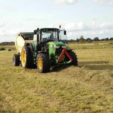
Erstklassiges PferdeHeu in HD-Ballen
Jevenstedt
Tim Rohwer
@EIDERHEU
Heu
Kleinballen/HD-Ballen
Regenfrei
B+
Deprecated: Creation of dynamic property Zend_View_Helper_Ads::$adLink is deprecated in /var/www/stall-frei/htdocs/staging.stall-frei.de/library/Psf/View/Helper/Ads.php on line 108

Futtersack HeuToy, Fressbremse in pink
Mechtersen
STALL-FREIde Marketing
@STALL-FREI-Marketing
Stundenlange Beschäftigung die
Koliken vorbeugt, geringe Staubinhalation mit
steuerbarer Futterentnahme
Eiweisarmes Heu oder Heulage
Sophienhamm
Herr-Kolb
@Herr-Kolb
Heu
Rundballen
Regenfrei
Wird verladen
B+

Heu/trockene Heulage für Pferde Zucker,Fruktanarm
Sophienhamm
Herr-Kolb
@Herr-Kolb
Heulage
Lieferant entlädt
Regenfrei
Wird verladen
2 weitere...
B+
Leider kein Vorschaubild
Leider kein Vorschaubild
Heulage, Grassamenheu lage 2025
Schwedeneck
Jeannine Wittern
@Jeannine-Wittern
Heulage
Lieferant entlädt
Rundballen
Regenfrei
3 weitere...
B+
Leider kein Vorschaubild
Leider kein Vorschaubild
B+
Leider kein Vorschaubild
Leider kein Vorschaubild
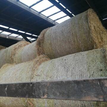
3 grosse Heulageballen ( 1,30m Durchmesser)
Flensburg
Andrea Hartmann
@Andrea45
Heulage
Großballen
Abholung
B+

Heu aus neuer Ernte
Mechtersen
STALL-FREIde Marketing
@STALL-FREI-Marketing
Heulage und Pferdeheu aus der neuen Ernte findest du in unserem Futtermarkt

Heu in Rundballen (ca.130cm) super Qualität
Pronstorf
Caros Pferdeparadies
@KaOb
Heu
Rundballen
Regenfrei
Wird verladen
2 weitere...
B+

Heu HD-Ballen 2. Schnitt extensiv Heugräser
Drochtersen
M-Kluth
@M-Kluth
Heu
Empfänger lädt ab
Kleinballen/HD-Ballen
Regenfrei
3 weitere...
B+
Heu 1.Schnitt 2021
Upahl
hermannmeyerzuborgsen
@hermannmeyerzuborgsen
Heu
Empfänger lädt ab
Rundballen
Regenfrei
3 weitere...
P+

Heu, Heulage, ökologisch, artenreich top Qualitä...
Hamburg
Frederic Wübbe
@Stall_Am_Burgberg
Heu
Lieferant entlädt
Rundballen
Bio
3 weitere...
B+
Deprecated: Creation of dynamic property Zend_View::$pageCount is deprecated in /var/www/stall-frei/htdocs/staging.stall-frei.de/library/vendor/shardj/zf1-future/library/Zend/View/Abstract.php on line 308
Deprecated: Creation of dynamic property Zend_View::$itemCountPerPage is deprecated in /var/www/stall-frei/htdocs/staging.stall-frei.de/library/vendor/shardj/zf1-future/library/Zend/View/Abstract.php on line 308
Deprecated: Creation of dynamic property Zend_View::$first is deprecated in /var/www/stall-frei/htdocs/staging.stall-frei.de/library/vendor/shardj/zf1-future/library/Zend/View/Abstract.php on line 308
Deprecated: Creation of dynamic property Zend_View::$current is deprecated in /var/www/stall-frei/htdocs/staging.stall-frei.de/library/vendor/shardj/zf1-future/library/Zend/View/Abstract.php on line 308
Deprecated: Creation of dynamic property Zend_View::$last is deprecated in /var/www/stall-frei/htdocs/staging.stall-frei.de/library/vendor/shardj/zf1-future/library/Zend/View/Abstract.php on line 308
Deprecated: Creation of dynamic property Zend_View::$next is deprecated in /var/www/stall-frei/htdocs/staging.stall-frei.de/library/vendor/shardj/zf1-future/library/Zend/View/Abstract.php on line 308
Deprecated: Creation of dynamic property Zend_View::$pagesInRange is deprecated in /var/www/stall-frei/htdocs/staging.stall-frei.de/library/vendor/shardj/zf1-future/library/Zend/View/Abstract.php on line 308
Deprecated: Creation of dynamic property Zend_View::$firstPageInRange is deprecated in /var/www/stall-frei/htdocs/staging.stall-frei.de/library/vendor/shardj/zf1-future/library/Zend/View/Abstract.php on line 308
Deprecated: Creation of dynamic property Zend_View::$lastPageInRange is deprecated in /var/www/stall-frei/htdocs/staging.stall-frei.de/library/vendor/shardj/zf1-future/library/Zend/View/Abstract.php on line 308
Deprecated: Creation of dynamic property Zend_View::$currentItemCount is deprecated in /var/www/stall-frei/htdocs/staging.stall-frei.de/library/vendor/shardj/zf1-future/library/Zend/View/Abstract.php on line 308
Deprecated: Creation of dynamic property Zend_View::$totalItemCount is deprecated in /var/www/stall-frei/htdocs/staging.stall-frei.de/library/vendor/shardj/zf1-future/library/Zend/View/Abstract.php on line 308
Deprecated: Creation of dynamic property Zend_View::$firstItemNumber is deprecated in /var/www/stall-frei/htdocs/staging.stall-frei.de/library/vendor/shardj/zf1-future/library/Zend/View/Abstract.php on line 308
Deprecated: Creation of dynamic property Zend_View::$lastItemNumber is deprecated in /var/www/stall-frei/htdocs/staging.stall-frei.de/library/vendor/shardj/zf1-future/library/Zend/View/Abstract.php on line 308
Deprecated: Creation of dynamic property Zend_View::$router is deprecated in /var/www/stall-frei/htdocs/staging.stall-frei.de/library/vendor/shardj/zf1-future/library/Zend/View/Abstract.php on line 308
Deprecated: Creation of dynamic property Zend_View::$urlParams is deprecated in /var/www/stall-frei/htdocs/staging.stall-frei.de/library/vendor/shardj/zf1-future/library/Zend/View/Abstract.php on line 308
Deprecated: Creation of dynamic property Zend_View::$showAds is deprecated in /var/www/stall-frei/htdocs/staging.stall-frei.de/library/vendor/shardj/zf1-future/library/Zend/View/Abstract.php on line 308
Deprecated: Creation of dynamic property Zend_View::$objectIds is deprecated in /var/www/stall-frei/htdocs/staging.stall-frei.de/library/vendor/shardj/zf1-future/library/Zend/View/Abstract.php on line 308
Deprecated: Creation of dynamic property Zend_View::$showNavbar is deprecated in /var/www/stall-frei/htdocs/staging.stall-frei.de/library/vendor/shardj/zf1-future/library/Zend/View/Abstract.php on line 308
Deprecated: Creation of dynamic property Zend_View::$showBreadcrumb is deprecated in /var/www/stall-frei/htdocs/staging.stall-frei.de/library/vendor/shardj/zf1-future/library/Zend/View/Abstract.php on line 308
Deprecated: Creation of dynamic property Zend_View::$showFooter is deprecated in /var/www/stall-frei/htdocs/staging.stall-frei.de/library/vendor/shardj/zf1-future/library/Zend/View/Abstract.php on line 308
Deprecated: Creation of dynamic property Zend_View::$showInternalAds is deprecated in /var/www/stall-frei/htdocs/staging.stall-frei.de/library/vendor/shardj/zf1-future/library/Zend/View/Abstract.php on line 308
Deprecated: Creation of dynamic property Zend_View::$blNoContent is deprecated in /var/www/stall-frei/htdocs/staging.stall-frei.de/library/vendor/shardj/zf1-future/library/Zend/View/Abstract.php on line 308
Deprecated: Creation of dynamic property Zend_View::$sMetaDesc is deprecated in /var/www/stall-frei/htdocs/staging.stall-frei.de/library/vendor/shardj/zf1-future/library/Zend/View/Abstract.php on line 308
Deprecated: Creation of dynamic property Zend_View::$useGmaps is deprecated in /var/www/stall-frei/htdocs/staging.stall-frei.de/library/vendor/shardj/zf1-future/library/Zend/View/Abstract.php on line 308
Deprecated: Creation of dynamic property Zend_View::$touches is deprecated in /var/www/stall-frei/htdocs/staging.stall-frei.de/library/vendor/shardj/zf1-future/library/Zend/View/Abstract.php on line 308
Deprecated: Creation of dynamic property Zend_View::$oProject is deprecated in /var/www/stall-frei/htdocs/staging.stall-frei.de/library/vendor/shardj/zf1-future/library/Zend/View/Abstract.php on line 308
Deprecated: Creation of dynamic property Zend_View::$pageHeadline is deprecated in /var/www/stall-frei/htdocs/staging.stall-frei.de/library/vendor/shardj/zf1-future/library/Zend/View/Abstract.php on line 308
Deprecated: Creation of dynamic property Zend_View::$disableLocationField is deprecated in /var/www/stall-frei/htdocs/staging.stall-frei.de/library/vendor/shardj/zf1-future/library/Zend/View/Abstract.php on line 308
Deprecated: Creation of dynamic property Zend_View::$isSearch is deprecated in /var/www/stall-frei/htdocs/staging.stall-frei.de/library/vendor/shardj/zf1-future/library/Zend/View/Abstract.php on line 308
Deprecated: Creation of dynamic property Zend_View::$pageTitle is deprecated in /var/www/stall-frei/htdocs/staging.stall-frei.de/library/vendor/shardj/zf1-future/library/Zend/View/Abstract.php on line 308
Deprecated: Creation of dynamic property Psf_Form_Element_Text::$class is deprecated in /var/www/stall-frei/htdocs/staging.stall-frei.de/library/vendor/shardj/zf1-future/library/Zend/Form/Element.php on line 874
Deprecated: Creation of dynamic property Psf_Form_Element_Text::$size is deprecated in /var/www/stall-frei/htdocs/staging.stall-frei.de/library/vendor/shardj/zf1-future/library/Zend/Form/Element.php on line 874
Deprecated: Creation of dynamic property Psf_Form_Element_Text::$placeholder is deprecated in /var/www/stall-frei/htdocs/staging.stall-frei.de/library/vendor/shardj/zf1-future/library/Zend/Form/Element.php on line 874
Deprecated: Creation of dynamic property Psf_Form_Element_Hidden::$class is deprecated in /var/www/stall-frei/htdocs/staging.stall-frei.de/library/vendor/shardj/zf1-future/library/Zend/Form/Element.php on line 874
Deprecated: Creation of dynamic property Psf_Form_Element_Hidden::$class is deprecated in /var/www/stall-frei/htdocs/staging.stall-frei.de/library/vendor/shardj/zf1-future/library/Zend/Form/Element.php on line 874
Deprecated: Creation of dynamic property Psf_Form_Element_Hidden::$class is deprecated in /var/www/stall-frei/htdocs/staging.stall-frei.de/library/vendor/shardj/zf1-future/library/Zend/Form/Element.php on line 874
Deprecated: Creation of dynamic property Psf_Form_Element_Hidden::$class is deprecated in /var/www/stall-frei/htdocs/staging.stall-frei.de/library/vendor/shardj/zf1-future/library/Zend/Form/Element.php on line 874
Deprecated: Creation of dynamic property Psf_Form_Element_Select::$class is deprecated in /var/www/stall-frei/htdocs/staging.stall-frei.de/library/vendor/shardj/zf1-future/library/Zend/Form/Element.php on line 874
Deprecated: Creation of dynamic property Psf_Form_Element_Select::$class is deprecated in /var/www/stall-frei/htdocs/staging.stall-frei.de/library/vendor/shardj/zf1-future/library/Zend/Form/Element.php on line 874
Deprecated: Creation of dynamic property Psf_Form_Element_Select::$class is deprecated in /var/www/stall-frei/htdocs/staging.stall-frei.de/library/vendor/shardj/zf1-future/library/Zend/Form/Element.php on line 874
Deprecated: Creation of dynamic property Psf_Form_Element_Select::$class is deprecated in /var/www/stall-frei/htdocs/staging.stall-frei.de/library/vendor/shardj/zf1-future/library/Zend/Form/Element.php on line 874
Deprecated: Creation of dynamic property Zend_View::$sort is deprecated in /var/www/stall-frei/htdocs/staging.stall-frei.de/library/vendor/shardj/zf1-future/library/Zend/View/Abstract.php on line 308
Deprecated: Creation of dynamic property Zend_View::$searchLocation is deprecated in /var/www/stall-frei/htdocs/staging.stall-frei.de/library/vendor/shardj/zf1-future/library/Zend/View/Abstract.php on line 308
Deprecated: Creation of dynamic property Zend_View::$locationHint is deprecated in /var/www/stall-frei/htdocs/staging.stall-frei.de/library/vendor/shardj/zf1-future/library/Zend/View/Abstract.php on line 308
Psf_GeoCoder_Abstract::getLocation: Götheby-Holm Get Location CachedOrLive
Psf_GeoCoder_Abstract::getCachedOrLive: Götheby-Holm
Psf_GeoCoder_OpenCageData::makeApiRequest: response:
Array
(
[documentation] => https://opencagedata.com/api
[licenses] => Array
(
[0] => Array
(
[name] => see attribution guide
[url] => https://opencagedata.com/credits
)
)
[results] => Array
(
[0] => Array
(
[bounds] => Array
(
[northeast] => Array
(
[lat] => 54.5025219
[lng] => 9.734257
)
[southwest] => Array
(
[lat] => 54.4625219
[lng] => 9.694257
)
)
[components] => Array
(
[ISO_3166-1_alpha-2] => DE
[ISO_3166-1_alpha-3] => DEU
[ISO_3166-2] => Array
(
[0] => DE-SH
)
[_category] => place
[_normalized_city] => Fleckeby
[_type] => village
[city] => Fleckeby
[continent] => Europe
[country] => Deutschland
[country_code] => de
[county] => Kreis Rendsburg-Eckernförde
[municipality] => Schlei-Ostsee
[political_union] => European Union
[postcode] => 24357
[state] => Schleswig-Holstein
[state_code] => SH
[village] => Götheby-Holm
)
[confidence] => 7
[formatted] => 24357 Götheby-Holm, Deutschland
[geometry] => Array
(
[lat] => 54.4825219
[lng] => 9.714257
)
)
[1] => Array
(
[components] => Array
(
[ISO_3166-1_alpha-2] => FR
[ISO_3166-1_alpha-3] => FRA
[ISO_3166-2] => Array
(
[0] => FR-OCC
[1] => FR-30
)
[_category] => road
[_normalized_city] => Cavillargues
[_type] => road
[city] => Cavillargues
[continent] => Europe
[country] => France
[country_code] => fr
[county] => Gard
[local_authority] => Communauté d'agglomération du Gard Rhodanien
[political_union] => European Union
[postcode] => 30330
[road] => Chemin des Holmes
[state] => Occitanie
[state_code] => OCC
)
[confidence] => 2
[formatted] => Chemin des Holmes, 30330 Cavillargues, France
[geometry] => Array
(
[lat] => 44.118116
[lng] => 4.518204
)
)
[2] => Array
(
[components] => Array
(
[ISO_3166-1_alpha-2] => FR
[ISO_3166-1_alpha-3] => FRA
[ISO_3166-2] => Array
(
[0] => FR-ARA
[1] => FR-26
)
[_category] => road
[_normalized_city] => Bésayes
[_type] => road
[city] => Bésayes
[continent] => Europe
[country] => France
[country_code] => fr
[county] => Drôme
[local_authority] => Valence Romans Agglo
[political_union] => European Union
[postcode] => 26300
[road] => Chemin des Holmes
[state] => Auvergne-Rhône-Alpes
[state_code] => ARA
)
[confidence] => 2
[formatted] => Chemin des Holmes, 26300 Bésayes, France
[geometry] => Array
(
[lat] => 44.974456
[lng] => 5.066109
)
)
[3] => Array
(
[components] => Array
(
[ISO_3166-1_alpha-2] => FR
[ISO_3166-1_alpha-3] => FRA
[ISO_3166-2] => Array
(
[0] => FR-ARA
[1] => FR-43
)
[_category] => road
[_normalized_city] => Saint-Julien-Chapteuil
[_type] => road
[city] => Saint-Julien-Chapteuil
[continent] => Europe
[country] => France
[country_code] => fr
[county] => Haute-Loire
[local_authority] => Communauté de communes Mézenc-Loire-Meygal
[political_union] => European Union
[postcode] => 43260
[road] => route de l'holme
[state] => Auvergne-Rhône-Alpes
[state_code] => ARA
)
[confidence] => 2
[formatted] => route de l'holme, 43260 Saint-Julien-Chapteuil, France
[geometry] => Array
(
[lat] => 45.045113
[lng] => 4.073114
)
)
[4] => Array
(
[components] => Array
(
[ISO_3166-1_alpha-2] => FR
[ISO_3166-1_alpha-3] => FRA
[ISO_3166-2] => Array
(
[0] => FR-OCC
[1] => FR-30
)
[_category] => road
[_normalized_city] => Alès
[_type] => road
[city] => Alès
[continent] => Europe
[country] => France
[country_code] => fr
[county] => Gard
[local_authority] => Alès Agglomération
[political_union] => European Union
[postcode] => 30100
[road] => Chemin de l’Olm
[state] => Occitanie
[state_code] => OCC
)
[confidence] => 2
[formatted] => Chemin de l’Olm, 30100 Alès, France
[geometry] => Array
(
[lat] => 44.099546
[lng] => 4.074328
)
)
[5] => Array
(
[components] => Array
(
[ISO_3166-1_alpha-2] => FR
[ISO_3166-1_alpha-3] => FRA
[ISO_3166-2] => Array
(
[0] => FR-OCC
[1] => FR-30
)
[_category] => road
[_normalized_city] => Cavillargues
[_type] => road
[city] => Cavillargues
[continent] => Europe
[country] => France
[country_code] => fr
[county] => Gard
[local_authority] => Communauté d'agglomération du Gard Rhodanien
[political_union] => European Union
[postcode] => 30330
[road] => Chemin Bas des Holmes
[state] => Occitanie
[state_code] => OCC
)
[confidence] => 2
[formatted] => Chemin Bas des Holmes, 30330 Cavillargues, France
[geometry] => Array
(
[lat] => 44.117148
[lng] => 4.519525
)
)
[6] => Array
(
[components] => Array
(
[ISO_3166-1_alpha-2] => FR
[ISO_3166-1_alpha-3] => FRA
[ISO_3166-2] => Array
(
[0] => FR-ARA
[1] => FR-43
)
[_category] => road
[_normalized_city] => Saint-Julien-Chapteuil
[_type] => road
[city] => Saint-Julien-Chapteuil
[continent] => Europe
[country] => France
[country_code] => fr
[county] => Haute-Loire
[local_authority] => Communauté de communes Mézenc-Loire-Meygal
[political_union] => European Union
[postcode] => 43260
[road] => Rue de l’Holme
[state] => Auvergne-Rhône-Alpes
[state_code] => ARA
)
[confidence] => 2
[formatted] => Rue de l’Holme, 43260 Saint-Julien-Chapteuil, France
[geometry] => Array
(
[lat] => 45.037738
[lng] => 4.061517
)
)
[7] => Array
(
[components] => Array
(
[ISO_3166-1_alpha-2] => FR
[ISO_3166-1_alpha-3] => FRA
[ISO_3166-2] => Array
(
[0] => FR-ARA
[1] => FR-42
)
[_category] => road
[_normalized_city] => Saint-Just-Saint-Rambert
[_type] => road
[city] => Saint-Just-Saint-Rambert
[continent] => Europe
[country] => France
[country_code] => fr
[county] => Loire
[local_authority] => Loire Forez Agglomération
[political_union] => European Union
[postcode] => 42170
[road] => Chemin des Olmes
[state] => Auvergne-Rhône-Alpes
[state_code] => ARA
)
[confidence] => 2
[formatted] => Chemin des Olmes, 42170 Saint-Just-Saint-Rambert, France
[geometry] => Array
(
[lat] => 45.500368
[lng] => 4.235284
)
)
[8] => Array
(
[components] => Array
(
[ISO_3166-1_alpha-2] => FR
[ISO_3166-1_alpha-3] => FRA
[ISO_3166-2] => Array
(
[0] => FR-OCC
[1] => FR-30
)
[_category] => road
[_normalized_city] => Saint-Christol-lez-Alès
[_type] => road
[city] => Saint-Christol-lez-Alès
[continent] => Europe
[country] => France
[country_code] => fr
[county] => Gard
[local_authority] => Alès Agglomération
[political_union] => European Union
[postcode] => 30380
[road] => Chemin de l'Olm
[state] => Occitanie
[state_code] => OCC
)
[confidence] => 2
[formatted] => Chemin de l'Olm, 30380 Saint-Christol-lez-Alès, France
[geometry] => Array
(
[lat] => 44.096792
[lng] => 4.084392
)
)
[9] => Array
(
[components] => Array
(
[ISO_3166-1_alpha-2] => FR
[ISO_3166-1_alpha-3] => FRA
[ISO_3166-2] => Array
(
[0] => FR-ARA
[1] => FR-42
)
[_category] => road
[_normalized_city] => Écotay-l'Olme
[_type] => road
[city] => Écotay-l'Olme
[continent] => Europe
[country] => France
[country_code] => fr
[county] => Loire
[local_authority] => Loire Forez Agglomération
[political_union] => European Union
[postcode] => 42600
[road] => Chemin de l'Olme
[state] => Auvergne-Rhône-Alpes
[state_code] => ARA
)
[confidence] => 2
[formatted] => Chemin de l'Olme, 42600 Écotay-l'Olme, France
[geometry] => Array
(
[lat] => 45.593117
[lng] => 4.048581
)
)
)
[status] => Array
(
[code] => 200
[message] => OK
)
[stay_informed] => Array
(
[blog] => https://blog.opencagedata.com
[mastodon] => https://en.osm.town/@opencage
)
[thanks] => For using an OpenCage API
[timestamp] => Array
(
[created_http] => Sun, 08 Feb 2026 06:08:57 GMT
[created_unix] => 1770530937
)
[total_results] => 10
)
Psf_GeoCoder_Abstract::convertLocationResult
{"documentation":"https:\/\/opencagedata.com\/api","licenses":[{"name":"see attribution guide","url":"https:\/\/opencagedata.com\/credits"}],"results":[{"bounds":{"northeast":{"lat":54.5025219,"lng":9.734257},"southwest":{"lat":54.4625219,"lng":9.694257}},"components":{"ISO_3166-1_alpha-2":"DE","ISO_3166-1_alpha-3":"DEU","ISO_3166-2":["DE-SH"],"_category":"place","_normalized_city":"Fleckeby","_type":"village","city":"Fleckeby","continent":"Europe","country":"Deutschland","country_code":"de","county":"Kreis Rendsburg-Eckernf\u00f6rde","municipality":"Schlei-Ostsee","political_union":"European Union","postcode":"24357","state":"Schleswig-Holstein","state_code":"SH","village":"G\u00f6theby-Holm"},"confidence":7,"formatted":"24357 G\u00f6theby-Holm, Deutschland","geometry":{"lat":54.4825219,"lng":9.714257}},{"components":{"ISO_3166-1_alpha-2":"FR","ISO_3166-1_alpha-3":"FRA","ISO_3166-2":["FR-OCC","FR-30"],"_category":"road","_normalized_city":"Cavillargues","_type":"road","city":"Cavillargues","continent":"Europe","country":"France","country_code":"fr","county":"Gard","local_authority":"Communaut\u00e9 d'agglom\u00e9ration du Gard Rhodanien","political_union":"European Union","postcode":"30330","road":"Chemin des Holmes","state":"Occitanie","state_code":"OCC"},"confidence":2,"formatted":"Chemin des Holmes, 30330 Cavillargues, France","geometry":{"lat":44.118116,"lng":4.518204}},{"components":{"ISO_3166-1_alpha-2":"FR","ISO_3166-1_alpha-3":"FRA","ISO_3166-2":["FR-ARA","FR-26"],"_category":"road","_normalized_city":"B\u00e9sayes","_type":"road","city":"B\u00e9sayes","continent":"Europe","country":"France","country_code":"fr","county":"Dr\u00f4me","local_authority":"Valence Romans Agglo","political_union":"European Union","postcode":"26300","road":"Chemin des Holmes","state":"Auvergne-Rh\u00f4ne-Alpes","state_code":"ARA"},"confidence":2,"formatted":"Chemin des Holmes, 26300 B\u00e9sayes, France","geometry":{"lat":44.974456,"lng":5.066109}},{"components":{"ISO_3166-1_alpha-2":"FR","ISO_3166-1_alpha-3":"FRA","ISO_3166-2":["FR-ARA","FR-43"],"_category":"road","_normalized_city":"Saint-Julien-Chapteuil","_type":"road","city":"Saint-Julien-Chapteuil","continent":"Europe","country":"France","country_code":"fr","county":"Haute-Loire","local_authority":"Communaut\u00e9 de communes M\u00e9zenc-Loire-Meygal","political_union":"European Union","postcode":"43260","road":"route de l'holme","state":"Auvergne-Rh\u00f4ne-Alpes","state_code":"ARA"},"confidence":2,"formatted":"route de l'holme, 43260 Saint-Julien-Chapteuil, France","geometry":{"lat":45.045113,"lng":4.073114}},{"components":{"ISO_3166-1_alpha-2":"FR","ISO_3166-1_alpha-3":"FRA","ISO_3166-2":["FR-OCC","FR-30"],"_category":"road","_normalized_city":"Al\u00e8s","_type":"road","city":"Al\u00e8s","continent":"Europe","country":"France","country_code":"fr","county":"Gard","local_authority":"Al\u00e8s Agglom\u00e9ration","political_union":"European Union","postcode":"30100","road":"Chemin de l\u2019Olm","state":"Occitanie","state_code":"OCC"},"confidence":2,"formatted":"Chemin de l\u2019Olm, 30100 Al\u00e8s, France","geometry":{"lat":44.099546,"lng":4.074328}},{"components":{"ISO_3166-1_alpha-2":"FR","ISO_3166-1_alpha-3":"FRA","ISO_3166-2":["FR-OCC","FR-30"],"_category":"road","_normalized_city":"Cavillargues","_type":"road","city":"Cavillargues","continent":"Europe","country":"France","country_code":"fr","county":"Gard","local_authority":"Communaut\u00e9 d'agglom\u00e9ration du Gard Rhodanien","political_union":"European Union","postcode":"30330","road":"Chemin Bas des Holmes","state":"Occitanie","state_code":"OCC"},"confidence":2,"formatted":"Chemin Bas des Holmes, 30330 Cavillargues, France","geometry":{"lat":44.117148,"lng":4.519525}},{"components":{"ISO_3166-1_alpha-2":"FR","ISO_3166-1_alpha-3":"FRA","ISO_3166-2":["FR-ARA","FR-43"],"_category":"road","_normalized_city":"Saint-Julien-Chapteuil","_type":"road","city":"Saint-Julien-Chapteuil","continent":"Europe","country":"France","country_code":"fr","county":"Haute-Loire","local_authority":"Communaut\u00e9 de communes M\u00e9zenc-Loire-Meygal","political_union":"European Union","postcode":"43260","road":"Rue de l\u2019Holme","state":"Auvergne-Rh\u00f4ne-Alpes","state_code":"ARA"},"confidence":2,"formatted":"Rue de l\u2019Holme, 43260 Saint-Julien-Chapteuil, France","geometry":{"lat":45.037738,"lng":4.061517}},{"components":{"ISO_3166-1_alpha-2":"FR","ISO_3166-1_alpha-3":"FRA","ISO_3166-2":["FR-ARA","FR-42"],"_category":"road","_normalized_city":"Saint-Just-Saint-Rambert","_type":"road","city":"Saint-Just-Saint-Rambert","continent":"Europe","country":"France","country_code":"fr","county":"Loire","local_authority":"Loire Forez Agglom\u00e9ration","political_union":"European Union","postcode":"42170","road":"Chemin des Olmes","state":"Auvergne-Rh\u00f4ne-Alpes","state_code":"ARA"},"confidence":2,"formatted":"Chemin des Olmes, 42170 Saint-Just-Saint-Rambert, France","geometry":{"lat":45.500368,"lng":4.235284}},{"components":{"ISO_3166-1_alpha-2":"FR","ISO_3166-1_alpha-3":"FRA","ISO_3166-2":["FR-OCC","FR-30"],"_category":"road","_normalized_city":"Saint-Christol-lez-Al\u00e8s","_type":"road","city":"Saint-Christol-lez-Al\u00e8s","continent":"Europe","country":"France","country_code":"fr","county":"Gard","local_authority":"Al\u00e8s Agglom\u00e9ration","political_union":"European Union","postcode":"30380","road":"Chemin de l'Olm","state":"Occitanie","state_code":"OCC"},"confidence":2,"formatted":"Chemin de l'Olm, 30380 Saint-Christol-lez-Al\u00e8s, France","geometry":{"lat":44.096792,"lng":4.084392}},{"components":{"ISO_3166-1_alpha-2":"FR","ISO_3166-1_alpha-3":"FRA","ISO_3166-2":["FR-ARA","FR-42"],"_category":"road","_normalized_city":"\u00c9cotay-l'Olme","_type":"road","city":"\u00c9cotay-l'Olme","continent":"Europe","country":"France","country_code":"fr","county":"Loire","local_authority":"Loire Forez Agglom\u00e9ration","political_union":"European Union","postcode":"42600","road":"Chemin de l'Olme","state":"Auvergne-Rh\u00f4ne-Alpes","state_code":"ARA"},"confidence":2,"formatted":"Chemin de l'Olme, 42600 \u00c9cotay-l'Olme, France","geometry":{"lat":45.593117,"lng":4.048581}}],"status":{"code":200,"message":"OK"},"stay_informed":{"blog":"https:\/\/blog.opencagedata.com","mastodon":"https:\/\/en.osm.town\/@opencage"},"thanks":"For using an OpenCage API","timestamp":{"created_http":"Sun, 08 Feb 2026 06:08:57 GMT","created_unix":1770530937},"total_results":10}Array
(
[0] => stdClass Object
(
[bounds] => stdClass Object
(
[northeast] => stdClass Object
(
[lat] => 54.5025219
[lng] => 9.734257
)
[southwest] => stdClass Object
(
[lat] => 54.4625219
[lng] => 9.694257
)
)
[components] => stdClass Object
(
[ISO_3166-1_alpha-2] => DE
[ISO_3166-1_alpha-3] => DEU
[ISO_3166-2] => Array
(
[0] => DE-SH
)
[_category] => place
[_normalized_city] => Fleckeby
[_type] => village
[city] => Fleckeby
[continent] => Europe
[country] => Deutschland
[country_code] => de
[county] => Kreis Rendsburg-Eckernförde
[municipality] => Schlei-Ostsee
[political_union] => European Union
[postcode] => 24357
[state] => Schleswig-Holstein
[state_code] => SH
[village] => Götheby-Holm
)
[confidence] => 7
[formatted] => 24357 Götheby-Holm, Deutschland
[geometry] => stdClass Object
(
[lat] => 54.4825219
[lng] => 9.714257
)
)
[1] => stdClass Object
(
[components] => stdClass Object
(
[ISO_3166-1_alpha-2] => FR
[ISO_3166-1_alpha-3] => FRA
[ISO_3166-2] => Array
(
[0] => FR-OCC
[1] => FR-30
)
[_category] => road
[_normalized_city] => Cavillargues
[_type] => road
[city] => Cavillargues
[continent] => Europe
[country] => France
[country_code] => fr
[county] => Gard
[local_authority] => Communauté d'agglomération du Gard Rhodanien
[political_union] => European Union
[postcode] => 30330
[road] => Chemin des Holmes
[state] => Occitanie
[state_code] => OCC
)
[confidence] => 2
[formatted] => Chemin des Holmes, 30330 Cavillargues, France
[geometry] => stdClass Object
(
[lat] => 44.118116
[lng] => 4.518204
)
)
[2] => stdClass Object
(
[components] => stdClass Object
(
[ISO_3166-1_alpha-2] => FR
[ISO_3166-1_alpha-3] => FRA
[ISO_3166-2] => Array
(
[0] => FR-ARA
[1] => FR-26
)
[_category] => road
[_normalized_city] => Bésayes
[_type] => road
[city] => Bésayes
[continent] => Europe
[country] => France
[country_code] => fr
[county] => Drôme
[local_authority] => Valence Romans Agglo
[political_union] => European Union
[postcode] => 26300
[road] => Chemin des Holmes
[state] => Auvergne-Rhône-Alpes
[state_code] => ARA
)
[confidence] => 2
[formatted] => Chemin des Holmes, 26300 Bésayes, France
[geometry] => stdClass Object
(
[lat] => 44.974456
[lng] => 5.066109
)
)
[3] => stdClass Object
(
[components] => stdClass Object
(
[ISO_3166-1_alpha-2] => FR
[ISO_3166-1_alpha-3] => FRA
[ISO_3166-2] => Array
(
[0] => FR-ARA
[1] => FR-43
)
[_category] => road
[_normalized_city] => Saint-Julien-Chapteuil
[_type] => road
[city] => Saint-Julien-Chapteuil
[continent] => Europe
[country] => France
[country_code] => fr
[county] => Haute-Loire
[local_authority] => Communauté de communes Mézenc-Loire-Meygal
[political_union] => European Union
[postcode] => 43260
[road] => route de l'holme
[state] => Auvergne-Rhône-Alpes
[state_code] => ARA
)
[confidence] => 2
[formatted] => route de l'holme, 43260 Saint-Julien-Chapteuil, France
[geometry] => stdClass Object
(
[lat] => 45.045113
[lng] => 4.073114
)
)
[4] => stdClass Object
(
[components] => stdClass Object
(
[ISO_3166-1_alpha-2] => FR
[ISO_3166-1_alpha-3] => FRA
[ISO_3166-2] => Array
(
[0] => FR-OCC
[1] => FR-30
)
[_category] => road
[_normalized_city] => Alès
[_type] => road
[city] => Alès
[continent] => Europe
[country] => France
[country_code] => fr
[county] => Gard
[local_authority] => Alès Agglomération
[political_union] => European Union
[postcode] => 30100
[road] => Chemin de l’Olm
[state] => Occitanie
[state_code] => OCC
)
[confidence] => 2
[formatted] => Chemin de l’Olm, 30100 Alès, France
[geometry] => stdClass Object
(
[lat] => 44.099546
[lng] => 4.074328
)
)
[5] => stdClass Object
(
[components] => stdClass Object
(
[ISO_3166-1_alpha-2] => FR
[ISO_3166-1_alpha-3] => FRA
[ISO_3166-2] => Array
(
[0] => FR-OCC
[1] => FR-30
)
[_category] => road
[_normalized_city] => Cavillargues
[_type] => road
[city] => Cavillargues
[continent] => Europe
[country] => France
[country_code] => fr
[county] => Gard
[local_authority] => Communauté d'agglomération du Gard Rhodanien
[political_union] => European Union
[postcode] => 30330
[road] => Chemin Bas des Holmes
[state] => Occitanie
[state_code] => OCC
)
[confidence] => 2
[formatted] => Chemin Bas des Holmes, 30330 Cavillargues, France
[geometry] => stdClass Object
(
[lat] => 44.117148
[lng] => 4.519525
)
)
[6] => stdClass Object
(
[components] => stdClass Object
(
[ISO_3166-1_alpha-2] => FR
[ISO_3166-1_alpha-3] => FRA
[ISO_3166-2] => Array
(
[0] => FR-ARA
[1] => FR-43
)
[_category] => road
[_normalized_city] => Saint-Julien-Chapteuil
[_type] => road
[city] => Saint-Julien-Chapteuil
[continent] => Europe
[country] => France
[country_code] => fr
[county] => Haute-Loire
[local_authority] => Communauté de communes Mézenc-Loire-Meygal
[political_union] => European Union
[postcode] => 43260
[road] => Rue de l’Holme
[state] => Auvergne-Rhône-Alpes
[state_code] => ARA
)
[confidence] => 2
[formatted] => Rue de l’Holme, 43260 Saint-Julien-Chapteuil, France
[geometry] => stdClass Object
(
[lat] => 45.037738
[lng] => 4.061517
)
)
[7] => stdClass Object
(
[components] => stdClass Object
(
[ISO_3166-1_alpha-2] => FR
[ISO_3166-1_alpha-3] => FRA
[ISO_3166-2] => Array
(
[0] => FR-ARA
[1] => FR-42
)
[_category] => road
[_normalized_city] => Saint-Just-Saint-Rambert
[_type] => road
[city] => Saint-Just-Saint-Rambert
[continent] => Europe
[country] => France
[country_code] => fr
[county] => Loire
[local_authority] => Loire Forez Agglomération
[political_union] => European Union
[postcode] => 42170
[road] => Chemin des Olmes
[state] => Auvergne-Rhône-Alpes
[state_code] => ARA
)
[confidence] => 2
[formatted] => Chemin des Olmes, 42170 Saint-Just-Saint-Rambert, France
[geometry] => stdClass Object
(
[lat] => 45.500368
[lng] => 4.235284
)
)
[8] => stdClass Object
(
[components] => stdClass Object
(
[ISO_3166-1_alpha-2] => FR
[ISO_3166-1_alpha-3] => FRA
[ISO_3166-2] => Array
(
[0] => FR-OCC
[1] => FR-30
)
[_category] => road
[_normalized_city] => Saint-Christol-lez-Alès
[_type] => road
[city] => Saint-Christol-lez-Alès
[continent] => Europe
[country] => France
[country_code] => fr
[county] => Gard
[local_authority] => Alès Agglomération
[political_union] => European Union
[postcode] => 30380
[road] => Chemin de l'Olm
[state] => Occitanie
[state_code] => OCC
)
[confidence] => 2
[formatted] => Chemin de l'Olm, 30380 Saint-Christol-lez-Alès, France
[geometry] => stdClass Object
(
[lat] => 44.096792
[lng] => 4.084392
)
)
[9] => stdClass Object
(
[components] => stdClass Object
(
[ISO_3166-1_alpha-2] => FR
[ISO_3166-1_alpha-3] => FRA
[ISO_3166-2] => Array
(
[0] => FR-ARA
[1] => FR-42
)
[_category] => road
[_normalized_city] => Écotay-l'Olme
[_type] => road
[city] => Écotay-l'Olme
[continent] => Europe
[country] => France
[country_code] => fr
[county] => Loire
[local_authority] => Loire Forez Agglomération
[political_union] => European Union
[postcode] => 42600
[road] => Chemin de l'Olme
[state] => Auvergne-Rhône-Alpes
[state_code] => ARA
)
[confidence] => 2
[formatted] => Chemin de l'Olme, 42600 Écotay-l'Olme, France
[geometry] => stdClass Object
(
[lat] => 45.593117
[lng] => 4.048581
)
)
)
Psf_GeoCoder_OpenCageData::getKeyMap: 0
stdClass Object
(
    [bounds] => stdClass Object
        (
            [northeast] => stdClass Object
                (
                    [lat] => 54.5025219
                    [lng] => 9.734257
                )

            [southwest] => stdClass Object
                (
                    [lat] => 54.4625219
                    [lng] => 9.694257
                )

        )

    [components] => stdClass Object
        (
            [ISO_3166-1_alpha-2] => DE
            [ISO_3166-1_alpha-3] => DEU
            [ISO_3166-2] => Array
                (
                    [0] => DE-SH
                )

            [_category] => place
            [_normalized_city] => Fleckeby
            [_type] => village
            [city] => Fleckeby
            [continent] => Europe
            [country] => Deutschland
            [country_code] => de
            [county] => Kreis Rendsburg-Eckernförde
            [municipality] => Schlei-Ostsee
            [political_union] => European Union
            [postcode] => 24357
            [state] => Schleswig-Holstein
            [state_code] => SH
            [village] => Götheby-Holm
        )

    [confidence] => 7
    [formatted] => 24357 Götheby-Holm, Deutschland
    [geometry] => stdClass Object
        (
            [lat] => 54.4825219
            [lng] => 9.714257
        )

)
Psf_GeoCoder_OpenCageData::getCounty: Rendsburg-Eckernförde
Psf_GeoCoder_OpenCageData::addMissingData REFETCH!
Array
(
    [address] => 24357 Götheby-Holm, Deutschland
    [type] => village
    [street] =>
    [city] => Götheby-Holm
    [county] => Rendsburg-Eckernförde
    [state] => Schleswig-Holstein
    [zip] => 24357
    [country] => Deutschland
    [suburb] =>
    [countrycode] => de
    [latitude] => 54.4825219
    [longitude] => 9.714257
    [accuracy] => 1
    [confidence] => 7
    [bounds] => stdClass Object
        (
            [northeast] => stdClass Object
                (
                    [lat] => 54.5025219
                    [lng] => 9.734257
                )

            [southwest] => stdClass Object
                (
                    [lat] => 54.4625219
                    [lng] => 9.694257
                )

        )

)
reformat!
Array
(
    [address] => 24357 Götheby-Holm, Deutschland
    [type] => village
    [street] =>
    [city] => Götheby-Holm
    [county] => Rendsburg-Eckernförde
    [state] => Schleswig-Holstein
    [zip] => 24357
    [country] => Deutschland
    [suburb] =>
    [countrycode] => de
    [latitude] => 54.4825219
    [longitude] => 9.714257
    [accuracy] => 1
    [confidence] => 7
    [bounds] => stdClass Object
        (
            [northeast] => stdClass Object
                (
                    [lat] => 54.5025219
                    [lng] => 9.734257
                )

            [southwest] => stdClass Object
                (
                    [lat] => 54.4625219
                    [lng] => 9.694257
                )

        )

    [place] => 24357 Götheby-Holm, Schleswig-Holstein
    [hash] => 08c3648a08e189844bf4dac56acea2d8
)
Psf_GeoCoder_OpenCageData::getKeyMap: 1
stdClass Object
(
    [components] => stdClass Object
        (
            [ISO_3166-1_alpha-2] => FR
            [ISO_3166-1_alpha-3] => FRA
            [ISO_3166-2] => Array
                (
                    [0] => FR-OCC
                    [1] => FR-30
                )

            [_category] => road
            [_normalized_city] => Cavillargues
            [_type] => road
            [city] => Cavillargues
            [continent] => Europe
            [country] => France
            [country_code] => fr
            [county] => Gard
            [local_authority] => Communauté d'agglomération du Gard Rhodanien
            [political_union] => European Union
            [postcode] => 30330
            [road] => Chemin des Holmes
            [state] => Occitanie
            [state_code] => OCC
        )

    [confidence] => 2
    [formatted] => Chemin des Holmes, 30330 Cavillargues, France
    [geometry] => stdClass Object
        (
            [lat] => 44.118116
            [lng] => 4.518204
        )

)
Psf_GeoCoder_OpenCageData::getCounty: Gard
Psf_GeoCoder_OpenCageData::addMissingData REFETCH!
Array
(
    [address] => Chemin des Holmes, 30330 Cavillargues, France
    [type] => road
    [street] => Chemin des Holmes
    [city] => Cavillargues
    [county] => Gard
    [state] => Occitanie
    [zip] => 30330
    [country] => France
    [suburb] =>
    [countrycode] => fr
    [latitude] => 44.118116
    [longitude] => 4.518204
    [accuracy] => 1
    [confidence] => 2
    [bounds] =>
)
reformat!
Array
(
    [address] => Chemin des Holmes, 30330 Cavillargues, France
    [type] => road
    [street] => Chemin des Holmes
    [city] => Cavillargues
    [county] => Gard
    [state] => Occitanie
    [zip] => 30330
    [country] => France
    [suburb] =>
    [countrycode] => fr
    [latitude] => 44.118116
    [longitude] => 4.518204
    [accuracy] => 1
    [confidence] => 2
    [bounds] =>
    [place] => Chemin des Holmes, 30330 Cavillargues, Occitanie
    [hash] => d79752c98c1df44f4c34cc30b8b04bde
)
Psf_GeoCoder_OpenCageData::getKeyMap: 2
stdClass Object
(
    [components] => stdClass Object
        (
            [ISO_3166-1_alpha-2] => FR
            [ISO_3166-1_alpha-3] => FRA
            [ISO_3166-2] => Array
                (
                    [0] => FR-ARA
                    [1] => FR-26
                )

            [_category] => road
            [_normalized_city] => Bésayes
            [_type] => road
            [city] => Bésayes
            [continent] => Europe
            [country] => France
            [country_code] => fr
            [county] => Drôme
            [local_authority] => Valence Romans Agglo
            [political_union] => European Union
            [postcode] => 26300
            [road] => Chemin des Holmes
            [state] => Auvergne-Rhône-Alpes
            [state_code] => ARA
        )

    [confidence] => 2
    [formatted] => Chemin des Holmes, 26300 Bésayes, France
    [geometry] => stdClass Object
        (
            [lat] => 44.974456
            [lng] => 5.066109
        )

)
Psf_GeoCoder_OpenCageData::getCounty: Drôme
Psf_GeoCoder_OpenCageData::addMissingData REFETCH!
Array
(
    [address] => Chemin des Holmes, 26300 Bésayes, France
    [type] => road
    [street] => Chemin des Holmes
    [city] => Bésayes
    [county] => Drôme
    [state] => Auvergne-Rhône-Alpes
    [zip] => 26300
    [country] => France
    [suburb] =>
    [countrycode] => fr
    [latitude] => 44.974456
    [longitude] => 5.066109
    [accuracy] => 1
    [confidence] => 2
    [bounds] =>
)
reformat!
Array
(
    [address] => Chemin des Holmes, 26300 Bésayes, France
    [type] => road
    [street] => Chemin des Holmes
    [city] => Bésayes
    [county] => Drôme
    [state] => Auvergne-Rhône-Alpes
    [zip] => 26300
    [country] => France
    [suburb] =>
    [countrycode] => fr
    [latitude] => 44.974456
    [longitude] => 5.066109
    [accuracy] => 1
    [confidence] => 2
    [bounds] =>
    [place] => Chemin des Holmes, 26300 Bésayes, Auvergne-Rhône-Alpes
    [hash] => af5f4b4351b6ef9bb99bc6d76632cea6
)
Psf_GeoCoder_OpenCageData::getKeyMap: 3
stdClass Object
(
    [components] => stdClass Object
        (
            [ISO_3166-1_alpha-2] => FR
            [ISO_3166-1_alpha-3] => FRA
            [ISO_3166-2] => Array
                (
                    [0] => FR-ARA
                    [1] => FR-43
                )

            [_category] => road
            [_normalized_city] => Saint-Julien-Chapteuil
            [_type] => road
            [city] => Saint-Julien-Chapteuil
            [continent] => Europe
            [country] => France
            [country_code] => fr
            [county] => Haute-Loire
            [local_authority] => Communauté de communes Mézenc-Loire-Meygal
            [political_union] => European Union
            [postcode] => 43260
            [road] => route de l'holme
            [state] => Auvergne-Rhône-Alpes
            [state_code] => ARA
        )

    [confidence] => 2
    [formatted] => route de l'holme, 43260 Saint-Julien-Chapteuil, France
    [geometry] => stdClass Object
        (
            [lat] => 45.045113
            [lng] => 4.073114
        )

)
Psf_GeoCoder_OpenCageData::getCounty: Haute-Loire
Psf_GeoCoder_OpenCageData::addMissingData REFETCH!
Array
(
    [address] => route de l'holme, 43260 Saint-Julien-Chapteuil, France
    [type] => road
    [street] => route de l'holme
    [city] => Saint-Julien-Chapteuil
    [county] => Haute-Loire
    [state] => Auvergne-Rhône-Alpes
    [zip] => 43260
    [country] => France
    [suburb] =>
    [countrycode] => fr
    [latitude] => 45.045113
    [longitude] => 4.073114
    [accuracy] => 1
    [confidence] => 2
    [bounds] =>
)
reformat!
Array
(
    [address] => route de l'holme, 43260 Saint-Julien-Chapteuil, France
    [type] => road
    [street] => route de l'holme
    [city] => Saint-Julien-Chapteuil
    [county] => Haute-Loire
    [state] => Auvergne-Rhône-Alpes
    [zip] => 43260
    [country] => France
    [suburb] =>
    [countrycode] => fr
    [latitude] => 45.045113
    [longitude] => 4.073114
    [accuracy] => 1
    [confidence] => 2
    [bounds] =>
    [place] => route de l'holme, 43260 Saint-Julien-Chapteuil, Auvergne-Rhône-Alpes
    [hash] => 1f5265f33dddc14abbfb7d6e0fe7d98c
)
Psf_GeoCoder_OpenCageData::getKeyMap: 4
stdClass Object
(
    [components] => stdClass Object
        (
            [ISO_3166-1_alpha-2] => FR
            [ISO_3166-1_alpha-3] => FRA
            [ISO_3166-2] => Array
                (
                    [0] => FR-OCC
                    [1] => FR-30
                )

            [_category] => road
            [_normalized_city] => Alès
            [_type] => road
            [city] => Alès
            [continent] => Europe
            [country] => France
            [country_code] => fr
            [county] => Gard
            [local_authority] => Alès Agglomération
            [political_union] => European Union
            [postcode] => 30100
            [road] => Chemin de l’Olm
            [state] => Occitanie
            [state_code] => OCC
        )

    [confidence] => 2
    [formatted] => Chemin de l’Olm, 30100 Alès, France
    [geometry] => stdClass Object
        (
            [lat] => 44.099546
            [lng] => 4.074328
        )

)
Psf_GeoCoder_OpenCageData::getCounty: Gard
Psf_GeoCoder_OpenCageData::addMissingData REFETCH!
Array
(
    [address] => Chemin de l’Olm, 30100 Alès, France
    [type] => road
    [street] => Chemin de l’Olm
    [city] => Alès
    [county] => Gard
    [state] => Occitanie
    [zip] => 30100
    [country] => France
    [suburb] =>
    [countrycode] => fr
    [latitude] => 44.099546
    [longitude] => 4.074328
    [accuracy] => 1
    [confidence] => 2
    [bounds] =>
)
reformat!
Array
(
    [address] => Chemin de l’Olm, 30100 Alès, France
    [type] => road
    [street] => Chemin de l’Olm
    [city] => Alès
    [county] => Gard
    [state] => Occitanie
    [zip] => 30100
    [country] => France
    [suburb] =>
    [countrycode] => fr
    [latitude] => 44.099546
    [longitude] => 4.074328
    [accuracy] => 1
    [confidence] => 2
    [bounds] =>
    [place] => Chemin de l’Olm, 30100 Alès, Occitanie
    [hash] => 3e2fb032cbe95d32c6758a37393d9802
)
Psf_GeoCoder_OpenCageData::getKeyMap: 5
stdClass Object
(
    [components] => stdClass Object
        (
            [ISO_3166-1_alpha-2] => FR
            [ISO_3166-1_alpha-3] => FRA
            [ISO_3166-2] => Array
                (
                    [0] => FR-OCC
                    [1] => FR-30
                )

            [_category] => road
            [_normalized_city] => Cavillargues
            [_type] => road
            [city] => Cavillargues
            [continent] => Europe
            [country] => France
            [country_code] => fr
            [county] => Gard
            [local_authority] => Communauté d'agglomération du Gard Rhodanien
            [political_union] => European Union
            [postcode] => 30330
            [road] => Chemin Bas des Holmes
            [state] => Occitanie
            [state_code] => OCC
        )

    [confidence] => 2
    [formatted] => Chemin Bas des Holmes, 30330 Cavillargues, France
    [geometry] => stdClass Object
        (
            [lat] => 44.117148
            [lng] => 4.519525
        )

)
Psf_GeoCoder_OpenCageData::getCounty: Gard
Psf_GeoCoder_OpenCageData::addMissingData REFETCH!
Array
(
    [address] => Chemin Bas des Holmes, 30330 Cavillargues, France
    [type] => road
    [street] => Chemin Bas des Holmes
    [city] => Cavillargues
    [county] => Gard
    [state] => Occitanie
    [zip] => 30330
    [country] => France
    [suburb] =>
    [countrycode] => fr
    [latitude] => 44.117148
    [longitude] => 4.519525
    [accuracy] => 1
    [confidence] => 2
    [bounds] =>
)
reformat!
Array
(
    [address] => Chemin Bas des Holmes, 30330 Cavillargues, France
    [type] => road
    [street] => Chemin Bas des Holmes
    [city] => Cavillargues
    [county] => Gard
    [state] => Occitanie
    [zip] => 30330
    [country] => France
    [suburb] =>
    [countrycode] => fr
    [latitude] => 44.117148
    [longitude] => 4.519525
    [accuracy] => 1
    [confidence] => 2
    [bounds] =>
    [place] => Chemin Bas des Holmes, 30330 Cavillargues, Occitanie
    [hash] => 2fcfa0aa495877150c3fb97f7c2aad95
)
Psf_GeoCoder_OpenCageData::getKeyMap: 6
stdClass Object
(
    [components] => stdClass Object
        (
            [ISO_3166-1_alpha-2] => FR
            [ISO_3166-1_alpha-3] => FRA
            [ISO_3166-2] => Array
                (
                    [0] => FR-ARA
                    [1] => FR-43
                )

            [_category] => road
            [_normalized_city] => Saint-Julien-Chapteuil
            [_type] => road
            [city] => Saint-Julien-Chapteuil
            [continent] => Europe
            [country] => France
            [country_code] => fr
            [county] => Haute-Loire
            [local_authority] => Communauté de communes Mézenc-Loire-Meygal
            [political_union] => European Union
            [postcode] => 43260
            [road] => Rue de l’Holme
            [state] => Auvergne-Rhône-Alpes
            [state_code] => ARA
        )

    [confidence] => 2
    [formatted] => Rue de l’Holme, 43260 Saint-Julien-Chapteuil, France
    [geometry] => stdClass Object
        (
            [lat] => 45.037738
            [lng] => 4.061517
        )

)
Psf_GeoCoder_OpenCageData::getCounty: Haute-Loire
Psf_GeoCoder_OpenCageData::addMissingData REFETCH!
Array
(
    [address] => Rue de l’Holme, 43260 Saint-Julien-Chapteuil, France
    [type] => road
    [street] => Rue de l’Holme
    [city] => Saint-Julien-Chapteuil
    [county] => Haute-Loire
    [state] => Auvergne-Rhône-Alpes
    [zip] => 43260
    [country] => France
    [suburb] =>
    [countrycode] => fr
    [latitude] => 45.037738
    [longitude] => 4.061517
    [accuracy] => 1
    [confidence] => 2
    [bounds] =>
)
reformat!
Array
(
    [address] => Rue de l’Holme, 43260 Saint-Julien-Chapteuil, France
    [type] => road
    [street] => Rue de l’Holme
    [city] => Saint-Julien-Chapteuil
    [county] => Haute-Loire
    [state] => Auvergne-Rhône-Alpes
    [zip] => 43260
    [country] => France
    [suburb] =>
    [countrycode] => fr
    [latitude] => 45.037738
    [longitude] => 4.061517
    [accuracy] => 1
    [confidence] => 2
    [bounds] =>
    [place] => Rue de l’Holme, 43260 Saint-Julien-Chapteuil, Auvergne-Rhône-Alpes
    [hash] => 445ee06c55b8d112c801e5865719c486
)
Psf_GeoCoder_OpenCageData::getKeyMap: 7
stdClass Object
(
    [components] => stdClass Object
        (
            [ISO_3166-1_alpha-2] => FR
            [ISO_3166-1_alpha-3] => FRA
            [ISO_3166-2] => Array
                (
                    [0] => FR-ARA
                    [1] => FR-42
                )

            [_category] => road
            [_normalized_city] => Saint-Just-Saint-Rambert
            [_type] => road
            [city] => Saint-Just-Saint-Rambert
            [continent] => Europe
            [country] => France
            [country_code] => fr
            [county] => Loire
            [local_authority] => Loire Forez Agglomération
            [political_union] => European Union
            [postcode] => 42170
            [road] => Chemin des Olmes
            [state] => Auvergne-Rhône-Alpes
            [state_code] => ARA
        )

    [confidence] => 2
    [formatted] => Chemin des Olmes, 42170 Saint-Just-Saint-Rambert, France
    [geometry] => stdClass Object
        (
            [lat] => 45.500368
            [lng] => 4.235284
        )

)
Psf_GeoCoder_OpenCageData::getCounty: Loire
Psf_GeoCoder_OpenCageData::addMissingData REFETCH!
Array
(
    [address] => Chemin des Olmes, 42170 Saint-Just-Saint-Rambert, France
    [type] => road
    [street] => Chemin des Olmes
    [city] => Saint-Just-Saint-Rambert
    [county] => Loire
    [state] => Auvergne-Rhône-Alpes
    [zip] => 42170
    [country] => France
    [suburb] =>
    [countrycode] => fr
    [latitude] => 45.500368
    [longitude] => 4.235284
    [accuracy] => 1
    [confidence] => 2
    [bounds] =>
)
reformat!
Array
(
    [address] => Chemin des Olmes, 42170 Saint-Just-Saint-Rambert, France
    [type] => road
    [street] => Chemin des Olmes
    [city] => Saint-Just-Saint-Rambert
    [county] => Loire
    [state] => Auvergne-Rhône-Alpes
    [zip] => 42170
    [country] => France
    [suburb] =>
    [countrycode] => fr
    [latitude] => 45.500368
    [longitude] => 4.235284
    [accuracy] => 1
    [confidence] => 2
    [bounds] =>
    [place] => Chemin des Olmes, 42170 Saint-Just-Saint-Rambert, Auvergne-Rhône-Alpes
    [hash] => 8ecc5d14adc8c1eb3bc56b8b87e4e864
)
Psf_GeoCoder_OpenCageData::getKeyMap: 8
stdClass Object
(
    [components] => stdClass Object
        (
            [ISO_3166-1_alpha-2] => FR
            [ISO_3166-1_alpha-3] => FRA
            [ISO_3166-2] => Array
                (
                    [0] => FR-OCC
                    [1] => FR-30
                )

            [_category] => road
            [_normalized_city] => Saint-Christol-lez-Alès
            [_type] => road
            [city] => Saint-Christol-lez-Alès
            [continent] => Europe
            [country] => France
            [country_code] => fr
            [county] => Gard
            [local_authority] => Alès Agglomération
            [political_union] => European Union
            [postcode] => 30380
            [road] => Chemin de l'Olm
            [state] => Occitanie
            [state_code] => OCC
        )

    [confidence] => 2
    [formatted] => Chemin de l'Olm, 30380 Saint-Christol-lez-Alès, France
    [geometry] => stdClass Object
        (
            [lat] => 44.096792
            [lng] => 4.084392
        )

)
Psf_GeoCoder_OpenCageData::getCounty: Gard
Psf_GeoCoder_OpenCageData::addMissingData REFETCH!
Array
(
    [address] => Chemin de l'Olm, 30380 Saint-Christol-lez-Alès, France
    [type] => road
    [street] => Chemin de l'Olm
    [city] => Saint-Christol-lez-Alès
    [county] => Gard
    [state] => Occitanie
    [zip] => 30380
    [country] => France
    [suburb] =>
    [countrycode] => fr
    [latitude] => 44.096792
    [longitude] => 4.084392
    [accuracy] => 1
    [confidence] => 2
    [bounds] =>
)
reformat!
Array
(
    [address] => Chemin de l'Olm, 30380 Saint-Christol-lez-Alès, France
    [type] => road
    [street] => Chemin de l'Olm
    [city] => Saint-Christol-lez-Alès
    [county] => Gard
    [state] => Occitanie
    [zip] => 30380
    [country] => France
    [suburb] =>
    [countrycode] => fr
    [latitude] => 44.096792
    [longitude] => 4.084392
    [accuracy] => 1
    [confidence] => 2
    [bounds] =>
    [place] => Chemin de l'Olm, 30380 Saint-Christol-lez-Alès, Occitanie
    [hash] => acf7dda5b5581a86c83e545c997b6d23
)
Psf_GeoCoder_OpenCageData::getKeyMap: 9
stdClass Object
(
    [components] => stdClass Object
        (
            [ISO_3166-1_alpha-2] => FR
            [ISO_3166-1_alpha-3] => FRA
            [ISO_3166-2] => Array
                (
                    [0] => FR-ARA
                    [1] => FR-42
                )

            [_category] => road
            [_normalized_city] => Écotay-l'Olme
            [_type] => road
            [city] => Écotay-l'Olme
            [continent] => Europe
            [country] => France
            [country_code] => fr
            [county] => Loire
            [local_authority] => Loire Forez Agglomération
            [political_union] => European Union
            [postcode] => 42600
            [road] => Chemin de l'Olme
            [state] => Auvergne-Rhône-Alpes
            [state_code] => ARA
        )

    [confidence] => 2
    [formatted] => Chemin de l'Olme, 42600 Écotay-l'Olme, France
    [geometry] => stdClass Object
        (
            [lat] => 45.593117
            [lng] => 4.048581
        )

)
Psf_GeoCoder_OpenCageData::getCounty: Loire
Psf_GeoCoder_OpenCageData::addMissingData REFETCH!
Array
(
    [address] => Chemin de l'Olme, 42600 Écotay-l'Olme, France
    [type] => road
    [street] => Chemin de l'Olme
    [city] => Écotay-l'Olme
    [county] => Loire
    [state] => Auvergne-Rhône-Alpes
    [zip] => 42600
    [country] => France
    [suburb] =>
    [countrycode] => fr
    [latitude] => 45.593117
    [longitude] => 4.048581
    [accuracy] => 1
    [confidence] => 2
    [bounds] =>
)
reformat!
Array
(
    [address] => Chemin de l'Olme, 42600 Écotay-l'Olme, France
    [type] => road
    [street] => Chemin de l'Olme
    [city] => Écotay-l'Olme
    [county] => Loire
    [state] => Auvergne-Rhône-Alpes
    [zip] => 42600
    [country] => France
    [suburb] =>
    [countrycode] => fr
    [latitude] => 45.593117
    [longitude] => 4.048581
    [accuracy] => 1
    [confidence] => 2
    [bounds] =>
    [place] => Chemin de l'Olme, 42600 Écotay-l'Olme, Auvergne-Rhône-Alpes
    [hash] => 232e9e35c5c2a99b7fde5e0aa6adbbde
)
Deprecated: Creation of dynamic property Zend_View::$locationHintStyle is deprecated in /var/www/stall-frei/htdocs/staging.stall-frei.de/library/vendor/shardj/zf1-future/library/Zend/View/Abstract.php on line 308
Deprecated: Creation of dynamic property Zend_View::$adGeoLocation is deprecated in /var/www/stall-frei/htdocs/staging.stall-frei.de/library/vendor/shardj/zf1-future/library/Zend/View/Abstract.php on line 308
Deprecated: Creation of dynamic property Zend_View::$recordCount is deprecated in /var/www/stall-frei/htdocs/staging.stall-frei.de/library/vendor/shardj/zf1-future/library/Zend/View/Abstract.php on line 308
Deprecated: explode(): Passing null to parameter #2 ($string) of type string is deprecated in /var/www/stall-frei/htdocs/staging.stall-frei.de/application/models/SearchAgent.php on line 100
Deprecated: explode(): Passing null to parameter #2 ($string) of type string is deprecated in /var/www/stall-frei/htdocs/staging.stall-frei.de/application/models/SearchAgent.php on line 100
Deprecated: explode(): Passing null to parameter #2 ($string) of type string is deprecated in /var/www/stall-frei/htdocs/staging.stall-frei.de/application/models/SearchAgent.php on line 100
Deprecated: explode(): Passing null to parameter #2 ($string) of type string is deprecated in /var/www/stall-frei/htdocs/staging.stall-frei.de/application/models/SearchAgent.php on line 100
Deprecated: explode(): Passing null to parameter #2 ($string) of type string is deprecated in /var/www/stall-frei/htdocs/staging.stall-frei.de/application/models/SearchAgent.php on line 100
Deprecated: explode(): Passing null to parameter #2 ($string) of type string is deprecated in /var/www/stall-frei/htdocs/staging.stall-frei.de/application/models/SearchAgent.php on line 100
Deprecated: trim(): Passing null to parameter #1 ($string) of type string is deprecated in /var/www/stall-frei/htdocs/staging.stall-frei.de/application/models/Account/Search.php on line 82
Warning: Cannot modify header information - headers already sent by (output started at /var/www/stall-frei/htdocs/staging.stall-frei.de/library/vendor/shardj/zf1-future/library/Zend/View/Abstract.php:308) in /var/www/stall-frei/htdocs/staging.stall-frei.de/application/models/Account/Search.php on line 71
Deprecated: Creation of dynamic property Zend_View::$paginationParams is deprecated in /var/www/stall-frei/htdocs/staging.stall-frei.de/library/vendor/shardj/zf1-future/library/Zend/View/Abstract.php on line 308
Deprecated: Creation of dynamic property Zend_View::$objectPaginator is deprecated in /var/www/stall-frei/htdocs/staging.stall-frei.de/library/vendor/shardj/zf1-future/library/Zend/View/Abstract.php on line 308
Deprecated: Creation of dynamic property Zend_View::$featuredObjects is deprecated in /var/www/stall-frei/htdocs/staging.stall-frei.de/library/vendor/shardj/zf1-future/library/Zend/View/Abstract.php on line 308
Deprecated: Creation of dynamic property Zend_View::$hints is deprecated in /var/www/stall-frei/htdocs/staging.stall-frei.de/library/vendor/shardj/zf1-future/library/Zend/View/Abstract.php on line 308
Deprecated: Creation of dynamic property Zend_View::$attributeHints is deprecated in /var/www/stall-frei/htdocs/staging.stall-frei.de/library/vendor/shardj/zf1-future/library/Zend/View/Abstract.php on line 308
Deprecated: Creation of dynamic property Zend_View::$oSearchForm is deprecated in /var/www/stall-frei/htdocs/staging.stall-frei.de/library/vendor/shardj/zf1-future/library/Zend/View/Abstract.php on line 308