Deprecated: Creation of dynamic property Zend_View::$sMode is deprecated in /var/www/stall-frei/htdocs/staging.stall-frei.de/library/vendor/shardj/zf1-future/library/Zend/View/Abstract.php on line 308
Dienstleistung in Stromberg
Gesucht wird in "55442 Stromberg, Deutschland"
487 Einträge
Deprecated: Creation of dynamic property Zend_View::$listObjects is deprecated in /var/www/stall-frei/htdocs/staging.stall-frei.de/library/vendor/shardj/zf1-future/library/Zend/View/Abstract.php on line 308
Deprecated: Creation of dynamic property Zend_View::$listMode is deprecated in /var/www/stall-frei/htdocs/staging.stall-frei.de/library/vendor/shardj/zf1-future/library/Zend/View/Abstract.php on line 308
Deprecated: Creation of dynamic property Zend_View::$renderedObjects is deprecated in /var/www/stall-frei/htdocs/staging.stall-frei.de/library/vendor/shardj/zf1-future/library/Zend/View/Abstract.php on line 308
Deprecated: Creation of dynamic property Zend_View::$index is deprecated in /var/www/stall-frei/htdocs/staging.stall-frei.de/library/vendor/shardj/zf1-future/library/Zend/View/Abstract.php on line 308
Deprecated: Creation of dynamic property Zend_View::$displayMode is deprecated in /var/www/stall-frei/htdocs/staging.stall-frei.de/library/vendor/shardj/zf1-future/library/Zend/View/Abstract.php on line 308
Deprecated: Creation of dynamic property Zend_View::$remarketingIds is deprecated in /var/www/stall-frei/htdocs/staging.stall-frei.de/library/vendor/shardj/zf1-future/library/Zend/View/Abstract.php on line 308
Deprecated: Creation of dynamic property Zend_View::$listItem is deprecated in /var/www/stall-frei/htdocs/staging.stall-frei.de/library/vendor/shardj/zf1-future/library/Zend/View/Abstract.php on line 308
Deprecated: Creation of dynamic property Zend_View::$object is deprecated in /var/www/stall-frei/htdocs/staging.stall-frei.de/library/vendor/shardj/zf1-future/library/Zend/View/Abstract.php on line 308
Deprecated: Creation of dynamic property Zend_View::$attributes is deprecated in /var/www/stall-frei/htdocs/staging.stall-frei.de/library/vendor/shardj/zf1-future/library/Zend/View/Abstract.php on line 308


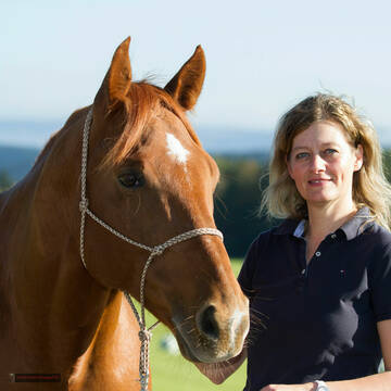
Pferdeladen-Schott/Futtermittel/Einstreu/Stallbed
Tiefenthal
Hof-Hohe-Birken
@Schott-Cornelia-HofHoheBirken
Futtermittel: Ladengeschäft
Futtermittel: Lieferung oder Versand
Pferdeverkauf
Beratung rund ums Pferd
Sonstiges
1 weitere...
B+
Deprecated: Creation of dynamic property Zend_View_Helper_Ads::$adLink is deprecated in /var/www/stall-frei/htdocs/staging.stall-frei.de/library/Psf/View/Helper/Ads.php on line 108

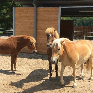
Offenstall/Paddockbox für Pony oder Kleinpferd
Glashütten
Tatjana Bommersheim
@TatjanaBommersheim
Wir haben ab dem 1.04.26 eine Platz in einem unsere Offenställe (Wallach oder Stute)und eine unserer Paddockboxen (Wallach oder S
neu
R
Tierheilpraktikerin Inge Homann
Vallendar
Tierheilpraktikerin I.Homann
@TierheilpraktikerinI.Homann
Tierheilpraktiker
Akupunktur
Bioresonanz nach Schmidt
5 weitere...
B+

Reiten in Leichtigkeit, Reitunterricht und Beritt
Battenberg
Pferderanch
@Sonya-Wenglein-Wranglein-Ranch
Coaching
gymnastizierende Arbeit an der Hand
Sattelberatung
Pferdeverkauf
Beratung rund ums Pferd
6 weitere...
B+

Mobiler Reitunterricht
Kleinkarlbach
Maike Käpernick
@ReitschuleKaepernick
Bodenarbeit
gymnastizierende Arbeit an der Hand
Beratung rund ums Pferd
5 weitere...
B+
Windwiesenhof
Altleiningen
Windwiesenhof
@Windwiesenhof
Bodenarbeit
gymnastizierende Arbeit an der Hand
Entwurf und Planung von Stallanlagen
Andere Heilverfahren
8 weitere...
B+

Hufbearbeitung Pferdeosteopathie Akupunktur (TCM)
Gernsheim
Gwen Silberhorn
@Gwen-Silberhorn
Huforthopäde
Hufpfleger
Beratung rund ums Pferd
Akupressur
Akupunktur
11 weitere...
B+

Persönlichkeitsentwicklung mit Pferden
Bad Salzuflen
Katja Dors
@Pferdezeiten
Begleite andere auf ihrem Entwicklungsweg und entdecke die transformative Kraft der pferdegestützten Persönlichkeitsentwicklung !
neu
R


Hufbearbeitung mit Blick fürs Ganze
Gernsheim
Hufservice Wagner
@hufservice-wagner
Hufpfleger
Orthopädischer Hufbeschlag
B+

Manuelle Therapie für Pferde im Frankfurter Raum
Frankfurt
Iris Niebuhr
@Niebuhr_Iris
Pferdephysiotherapeut
P+
Veröffentliche deine Suche als Gesuch und Suchauftrag, dann erhältst du Angebote, neue Treffer und Änderungen per E-Mail.
Diese Suche als Gesuch veröffentlichenDeprecated: Creation of dynamic property Zend_View::$pageCount is deprecated in /var/www/stall-frei/htdocs/staging.stall-frei.de/library/vendor/shardj/zf1-future/library/Zend/View/Abstract.php on line 308
Deprecated: Creation of dynamic property Zend_View::$itemCountPerPage is deprecated in /var/www/stall-frei/htdocs/staging.stall-frei.de/library/vendor/shardj/zf1-future/library/Zend/View/Abstract.php on line 308
Deprecated: Creation of dynamic property Zend_View::$first is deprecated in /var/www/stall-frei/htdocs/staging.stall-frei.de/library/vendor/shardj/zf1-future/library/Zend/View/Abstract.php on line 308
Deprecated: Creation of dynamic property Zend_View::$current is deprecated in /var/www/stall-frei/htdocs/staging.stall-frei.de/library/vendor/shardj/zf1-future/library/Zend/View/Abstract.php on line 308
Deprecated: Creation of dynamic property Zend_View::$last is deprecated in /var/www/stall-frei/htdocs/staging.stall-frei.de/library/vendor/shardj/zf1-future/library/Zend/View/Abstract.php on line 308
Deprecated: Creation of dynamic property Zend_View::$previous is deprecated in /var/www/stall-frei/htdocs/staging.stall-frei.de/library/vendor/shardj/zf1-future/library/Zend/View/Abstract.php on line 308
Deprecated: Creation of dynamic property Zend_View::$next is deprecated in /var/www/stall-frei/htdocs/staging.stall-frei.de/library/vendor/shardj/zf1-future/library/Zend/View/Abstract.php on line 308
Deprecated: Creation of dynamic property Zend_View::$pagesInRange is deprecated in /var/www/stall-frei/htdocs/staging.stall-frei.de/library/vendor/shardj/zf1-future/library/Zend/View/Abstract.php on line 308
Deprecated: Creation of dynamic property Zend_View::$firstPageInRange is deprecated in /var/www/stall-frei/htdocs/staging.stall-frei.de/library/vendor/shardj/zf1-future/library/Zend/View/Abstract.php on line 308
Deprecated: Creation of dynamic property Zend_View::$lastPageInRange is deprecated in /var/www/stall-frei/htdocs/staging.stall-frei.de/library/vendor/shardj/zf1-future/library/Zend/View/Abstract.php on line 308
Deprecated: Creation of dynamic property Zend_View::$currentItemCount is deprecated in /var/www/stall-frei/htdocs/staging.stall-frei.de/library/vendor/shardj/zf1-future/library/Zend/View/Abstract.php on line 308
Deprecated: Creation of dynamic property Zend_View::$totalItemCount is deprecated in /var/www/stall-frei/htdocs/staging.stall-frei.de/library/vendor/shardj/zf1-future/library/Zend/View/Abstract.php on line 308
Deprecated: Creation of dynamic property Zend_View::$firstItemNumber is deprecated in /var/www/stall-frei/htdocs/staging.stall-frei.de/library/vendor/shardj/zf1-future/library/Zend/View/Abstract.php on line 308
Deprecated: Creation of dynamic property Zend_View::$lastItemNumber is deprecated in /var/www/stall-frei/htdocs/staging.stall-frei.de/library/vendor/shardj/zf1-future/library/Zend/View/Abstract.php on line 308
Deprecated: Creation of dynamic property Zend_View::$router is deprecated in /var/www/stall-frei/htdocs/staging.stall-frei.de/library/vendor/shardj/zf1-future/library/Zend/View/Abstract.php on line 308
Deprecated: Creation of dynamic property Zend_View::$urlParams is deprecated in /var/www/stall-frei/htdocs/staging.stall-frei.de/library/vendor/shardj/zf1-future/library/Zend/View/Abstract.php on line 308
Deprecated: Creation of dynamic property Zend_View::$showAds is deprecated in /var/www/stall-frei/htdocs/staging.stall-frei.de/library/vendor/shardj/zf1-future/library/Zend/View/Abstract.php on line 308
Deprecated: Creation of dynamic property Zend_View::$objectIds is deprecated in /var/www/stall-frei/htdocs/staging.stall-frei.de/library/vendor/shardj/zf1-future/library/Zend/View/Abstract.php on line 308
Deprecated: Creation of dynamic property Zend_View::$showNavbar is deprecated in /var/www/stall-frei/htdocs/staging.stall-frei.de/library/vendor/shardj/zf1-future/library/Zend/View/Abstract.php on line 308
Deprecated: Creation of dynamic property Zend_View::$showBreadcrumb is deprecated in /var/www/stall-frei/htdocs/staging.stall-frei.de/library/vendor/shardj/zf1-future/library/Zend/View/Abstract.php on line 308
Deprecated: Creation of dynamic property Zend_View::$showFooter is deprecated in /var/www/stall-frei/htdocs/staging.stall-frei.de/library/vendor/shardj/zf1-future/library/Zend/View/Abstract.php on line 308
Deprecated: Creation of dynamic property Zend_View::$showInternalAds is deprecated in /var/www/stall-frei/htdocs/staging.stall-frei.de/library/vendor/shardj/zf1-future/library/Zend/View/Abstract.php on line 308
Deprecated: Creation of dynamic property Zend_View::$blNoContent is deprecated in /var/www/stall-frei/htdocs/staging.stall-frei.de/library/vendor/shardj/zf1-future/library/Zend/View/Abstract.php on line 308
Deprecated: Creation of dynamic property Zend_View::$sMetaDesc is deprecated in /var/www/stall-frei/htdocs/staging.stall-frei.de/library/vendor/shardj/zf1-future/library/Zend/View/Abstract.php on line 308
Deprecated: Creation of dynamic property Zend_View::$useGmaps is deprecated in /var/www/stall-frei/htdocs/staging.stall-frei.de/library/vendor/shardj/zf1-future/library/Zend/View/Abstract.php on line 308
Deprecated: Creation of dynamic property Zend_View::$touches is deprecated in /var/www/stall-frei/htdocs/staging.stall-frei.de/library/vendor/shardj/zf1-future/library/Zend/View/Abstract.php on line 308
Deprecated: Creation of dynamic property Zend_View::$oProject is deprecated in /var/www/stall-frei/htdocs/staging.stall-frei.de/library/vendor/shardj/zf1-future/library/Zend/View/Abstract.php on line 308
Deprecated: Creation of dynamic property Zend_View::$pageHeadline is deprecated in /var/www/stall-frei/htdocs/staging.stall-frei.de/library/vendor/shardj/zf1-future/library/Zend/View/Abstract.php on line 308
Deprecated: Creation of dynamic property Zend_View::$disableLocationField is deprecated in /var/www/stall-frei/htdocs/staging.stall-frei.de/library/vendor/shardj/zf1-future/library/Zend/View/Abstract.php on line 308
Deprecated: Creation of dynamic property Zend_View::$isSearch is deprecated in /var/www/stall-frei/htdocs/staging.stall-frei.de/library/vendor/shardj/zf1-future/library/Zend/View/Abstract.php on line 308
Deprecated: Creation of dynamic property Zend_View::$pageTitle is deprecated in /var/www/stall-frei/htdocs/staging.stall-frei.de/library/vendor/shardj/zf1-future/library/Zend/View/Abstract.php on line 308
Deprecated: Creation of dynamic property Psf_Form_Element_Text::$class is deprecated in /var/www/stall-frei/htdocs/staging.stall-frei.de/library/vendor/shardj/zf1-future/library/Zend/Form/Element.php on line 874
Deprecated: Creation of dynamic property Psf_Form_Element_Text::$size is deprecated in /var/www/stall-frei/htdocs/staging.stall-frei.de/library/vendor/shardj/zf1-future/library/Zend/Form/Element.php on line 874
Deprecated: Creation of dynamic property Psf_Form_Element_Text::$placeholder is deprecated in /var/www/stall-frei/htdocs/staging.stall-frei.de/library/vendor/shardj/zf1-future/library/Zend/Form/Element.php on line 874
Deprecated: Creation of dynamic property Psf_Form_Element_Hidden::$class is deprecated in /var/www/stall-frei/htdocs/staging.stall-frei.de/library/vendor/shardj/zf1-future/library/Zend/Form/Element.php on line 874
Deprecated: Creation of dynamic property Psf_Form_Element_Hidden::$class is deprecated in /var/www/stall-frei/htdocs/staging.stall-frei.de/library/vendor/shardj/zf1-future/library/Zend/Form/Element.php on line 874
Deprecated: Creation of dynamic property Psf_Form_Element_Hidden::$class is deprecated in /var/www/stall-frei/htdocs/staging.stall-frei.de/library/vendor/shardj/zf1-future/library/Zend/Form/Element.php on line 874
Deprecated: Creation of dynamic property Psf_Form_Element_Hidden::$class is deprecated in /var/www/stall-frei/htdocs/staging.stall-frei.de/library/vendor/shardj/zf1-future/library/Zend/Form/Element.php on line 874
Deprecated: Creation of dynamic property Psf_Form_Element_Select::$class is deprecated in /var/www/stall-frei/htdocs/staging.stall-frei.de/library/vendor/shardj/zf1-future/library/Zend/Form/Element.php on line 874
Deprecated: Creation of dynamic property Psf_Form_Element_Text::$class is deprecated in /var/www/stall-frei/htdocs/staging.stall-frei.de/library/vendor/shardj/zf1-future/library/Zend/Form/Element.php on line 874
Deprecated: Creation of dynamic property Psf_Form_Element_Checkbox::$label is deprecated in /var/www/stall-frei/htdocs/staging.stall-frei.de/library/vendor/shardj/zf1-future/library/Zend/Form/Element.php on line 874
Deprecated: Creation of dynamic property Zend_View::$sort is deprecated in /var/www/stall-frei/htdocs/staging.stall-frei.de/library/vendor/shardj/zf1-future/library/Zend/View/Abstract.php on line 308
Deprecated: Creation of dynamic property Zend_View::$searchLocation is deprecated in /var/www/stall-frei/htdocs/staging.stall-frei.de/library/vendor/shardj/zf1-future/library/Zend/View/Abstract.php on line 308
Deprecated: Creation of dynamic property Zend_View::$locationHint is deprecated in /var/www/stall-frei/htdocs/staging.stall-frei.de/library/vendor/shardj/zf1-future/library/Zend/View/Abstract.php on line 308
Psf_GeoCoder_Abstract::getLocation: Stromberg Get Location CachedOrLive
Psf_GeoCoder_Abstract::getCachedOrLive: Stromberg
Psf_GeoCoder_Abstract::convertLocationResult
{"documentation":"https:\/\/opencagedata.com\/api","licenses":[{"name":"see attribution guide","url":"https:\/\/opencagedata.com\/credits"}],"results":[{"bounds":{"northeast":{"lat":49.9667643,"lng":7.7990051},"southwest":{"lat":49.9256194,"lng":7.7389602}},"components":{"ISO_3166-1_alpha-2":"DE","ISO_3166-1_alpha-3":"DEU","ISO_3166-2":["DE-RP"],"_category":"place","_normalized_city":"Stromberg","_type":"city","continent":"Europe","country":"Deutschland","country_code":"de","county":"Landkreis Bad Kreuznach","municipality":"Langenlonsheim-Stromberg","political_union":"European Union","postcode":"55442","state":"Rheinland-Pfalz","state_code":"RP","town":"Stromberg"},"confidence":7,"formatted":"55442 Stromberg, Deutschland","geometry":{"lat":49.9447973,"lng":7.7763627}},{"bounds":{"northeast":{"lat":50.6861148,"lng":7.2079925},"southwest":{"lat":50.6860148,"lng":7.2078925}},"components":{"ISO_3166-1_alpha-2":"DE","ISO_3166-1_alpha-3":"DEU","ISO_3166-2":["DE-NW"],"_category":"natural\/water","_normalized_city":"K\u00f6nigswinter","_type":"peak","continent":"Europe","country":"Deutschland","country_code":"de","county":"Rhein-Sieg-Kreis","peak":"Petersberg","political_union":"European Union","postcode":"53179","state":"Nordrhein-Westfalen","state_code":"NW","town":"K\u00f6nigswinter"},"confidence":9,"formatted":"Petersberg, 53179 K\u00f6nigswinter, Deutschland","geometry":{"lat":50.6860648,"lng":7.2079425}},{"bounds":{"northeast":{"lat":50.7794106,"lng":7.5374935},"southwest":{"lat":50.7394106,"lng":7.4974935}},"components":{"ISO_3166-1_alpha-2":"DE","ISO_3166-1_alpha-3":"DEU","ISO_3166-2":["DE-NW"],"_category":"place","_normalized_city":"Windeck","_type":"village","continent":"Europe","country":"Deutschland","country_code":"de","county":"Rhein-Sieg-Kreis","political_union":"European Union","state":"Nordrhein-Westfalen","state_code":"NW","town":"Windeck","village":"Stromberg"},"confidence":7,"formatted":"Stromberg, Nordrhein-Westfalen, Deutschland","geometry":{"lat":50.7594106,"lng":7.5174935}},{"bounds":{"northeast":{"lat":51.8232116,"lng":8.2157004},"southwest":{"lat":51.7832116,"lng":8.1757004}},"components":{"ISO_3166-1_alpha-2":"DE","ISO_3166-1_alpha-3":"DEU","ISO_3166-2":["DE-NW"],"_category":"place","_normalized_city":"Oelde","_type":"village","continent":"Europe","country":"Deutschland","country_code":"de","county":"Kreis Warendorf","political_union":"European Union","postcode":"59302","state":"Nordrhein-Westfalen","state_code":"NW","town":"Oelde","village":"Stromberg"},"confidence":7,"formatted":"59302 Stromberg, Deutschland","geometry":{"lat":51.8032116,"lng":8.1957004}},{"bounds":{"northeast":{"lat":51.9794425,"lng":8.6226773},"southwest":{"lat":51.9793425,"lng":8.6225773}},"components":{"ISO_3166-1_alpha-2":"DE","ISO_3166-1_alpha-3":"DEU","ISO_3166-2":["DE-NW"],"_category":"natural\/water","_normalized_city":"Bielefeld","_type":"peak","city":"Bielefeld","continent":"Europe","country":"Deutschland","country_code":"de","peak":"Stromberg","political_union":"European Union","postcode":"33699","state":"Nordrhein-Westfalen","state_code":"NW"},"confidence":9,"formatted":"Stromberg, 33699 Bielefeld, Deutschland","geometry":{"lat":51.9793925,"lng":8.6226273}},{"bounds":{"northeast":{"lat":50.3941706,"lng":6.6364745},"southwest":{"lat":50.3940706,"lng":6.6363745}},"components":{"ISO_3166-1_alpha-2":"DE","ISO_3166-1_alpha-3":"DEU","ISO_3166-2":["DE-NW"],"_category":"natural\/water","_normalized_city":"Blankenheim","_type":"peak","continent":"Europe","country":"Deutschland","country_code":"de","county":"Kreis Euskirchen","peak":"Stromberg","political_union":"European Union","postcode":"54585","state":"Nordrhein-Westfalen","state_code":"NW","village":"Blankenheim"},"confidence":9,"formatted":"Stromberg, 54585 Blankenheim, Deutschland","geometry":{"lat":50.3941206,"lng":6.6364245}},{"bounds":{"northeast":{"lat":51.2810443,"lng":7.6984188},"southwest":{"lat":51.2809443,"lng":7.6983188}},"components":{"ISO_3166-1_alpha-2":"DE","ISO_3166-1_alpha-3":"DEU","ISO_3166-2":["DE-NW"],"_category":"natural\/water","_normalized_city":"Altena","_type":"peak","continent":"Europe","country":"Deutschland","country_code":"de","county":"M\u00e4rkischer Kreis","peak":"Stromberg","political_union":"European Union","postcode":"58762","state":"Nordrhein-Westfalen","state_code":"NW","town":"Altena"},"confidence":9,"formatted":"Stromberg, 58762 Altena, Deutschland","geometry":{"lat":51.2809943,"lng":7.6983688}},{"bounds":{"northeast":{"lat":51.7994616,"lng":8.2022606},"southwest":{"lat":51.7993616,"lng":8.2021606}},"components":{"ISO_3166-1_alpha-2":"DE","ISO_3166-1_alpha-3":"DEU","ISO_3166-2":["DE-NW"],"_category":"natural\/water","_normalized_city":"Oelde","_type":"peak","continent":"Europe","country":"Deutschland","country_code":"de","county":"Kreis Warendorf","peak":"Stromberg","political_union":"European Union","state":"Nordrhein-Westfalen","state_code":"NW","town":"Oelde"},"confidence":9,"formatted":"Stromberg, Oelde, Nordrhein-Westfalen, Deutschland","geometry":{"lat":51.7994116,"lng":8.2022106}},{"bounds":{"northeast":{"lat":50.5491839,"lng":7.9817412},"southwest":{"lat":50.5490839,"lng":7.9816412}},"components":{"ISO_3166-1_alpha-2":"DE","ISO_3166-1_alpha-3":"DEU","ISO_3166-2":["DE-RP"],"_category":"natural\/water","_normalized_city":"Willmenrod","_type":"peak","continent":"Europe","country":"Deutschland","country_code":"de","county":"Westerwaldkreis","municipality":"Westerburg","peak":"Stromberg","political_union":"European Union","postcode":"56457","state":"Rheinland-Pfalz","state_code":"RP","village":"Willmenrod"},"confidence":9,"formatted":"Stromberg, 56457 Willmenrod, Deutschland","geometry":{"lat":50.5491339,"lng":7.9816912}},{"bounds":{"northeast":{"lat":48.1681014,"lng":8.02942},"southwest":{"lat":48.1680014,"lng":8.02932}},"components":{"ISO_3166-1_alpha-2":"DE","ISO_3166-1_alpha-3":"DEU","ISO_3166-2":["DE-BW"],"_category":"natural\/water","_normalized_city":"Elzach","_type":"peak","continent":"Europe","country":"Deutschland","country_code":"de","county":"Landkreis Emmendingen","municipality":"GVV Elzach","peak":"Stromberg","political_union":"European Union","postcode":"79297","state":"Baden-W\u00fcrttemberg","state_code":"BW","town":"Elzach"},"confidence":9,"formatted":"Stromberg, 79297 Elzach, Deutschland","geometry":{"lat":48.1680514,"lng":8.02937}}],"status":{"code":200,"message":"OK"},"stay_informed":{"blog":"https:\/\/blog.opencagedata.com","mastodon":"https:\/\/en.osm.town\/@opencage"},"thanks":"For using an OpenCage API","timestamp":{"created_http":"Fri, 06 Feb 2026 22:27:46 GMT","created_unix":1770416866},"total_results":10}Array
(
[0] => stdClass Object
(
[bounds] => stdClass Object
(
[northeast] => stdClass Object
(
[lat] => 49.9667643
[lng] => 7.7990051
)
[southwest] => stdClass Object
(
[lat] => 49.9256194
[lng] => 7.7389602
)
)
[components] => stdClass Object
(
[ISO_3166-1_alpha-2] => DE
[ISO_3166-1_alpha-3] => DEU
[ISO_3166-2] => Array
(
[0] => DE-RP
)
[_category] => place
[_normalized_city] => Stromberg
[_type] => city
[continent] => Europe
[country] => Deutschland
[country_code] => de
[county] => Landkreis Bad Kreuznach
[municipality] => Langenlonsheim-Stromberg
[political_union] => European Union
[postcode] => 55442
[state] => Rheinland-Pfalz
[state_code] => RP
[town] => Stromberg
)
[confidence] => 7
[formatted] => 55442 Stromberg, Deutschland
[geometry] => stdClass Object
(
[lat] => 49.9447973
[lng] => 7.7763627
)
)
[1] => stdClass Object
(
[bounds] => stdClass Object
(
[northeast] => stdClass Object
(
[lat] => 50.6861148
[lng] => 7.2079925
)
[southwest] => stdClass Object
(
[lat] => 50.6860148
[lng] => 7.2078925
)
)
[components] => stdClass Object
(
[ISO_3166-1_alpha-2] => DE
[ISO_3166-1_alpha-3] => DEU
[ISO_3166-2] => Array
(
[0] => DE-NW
)
[_category] => natural/water
[_normalized_city] => Königswinter
[_type] => peak
[continent] => Europe
[country] => Deutschland
[country_code] => de
[county] => Rhein-Sieg-Kreis
[peak] => Petersberg
[political_union] => European Union
[postcode] => 53179
[state] => Nordrhein-Westfalen
[state_code] => NW
[town] => Königswinter
)
[confidence] => 9
[formatted] => Petersberg, 53179 Königswinter, Deutschland
[geometry] => stdClass Object
(
[lat] => 50.6860648
[lng] => 7.2079425
)
)
[2] => stdClass Object
(
[bounds] => stdClass Object
(
[northeast] => stdClass Object
(
[lat] => 50.7794106
[lng] => 7.5374935
)
[southwest] => stdClass Object
(
[lat] => 50.7394106
[lng] => 7.4974935
)
)
[components] => stdClass Object
(
[ISO_3166-1_alpha-2] => DE
[ISO_3166-1_alpha-3] => DEU
[ISO_3166-2] => Array
(
[0] => DE-NW
)
[_category] => place
[_normalized_city] => Windeck
[_type] => village
[continent] => Europe
[country] => Deutschland
[country_code] => de
[county] => Rhein-Sieg-Kreis
[political_union] => European Union
[state] => Nordrhein-Westfalen
[state_code] => NW
[town] => Windeck
[village] => Stromberg
)
[confidence] => 7
[formatted] => Stromberg, Nordrhein-Westfalen, Deutschland
[geometry] => stdClass Object
(
[lat] => 50.7594106
[lng] => 7.5174935
)
)
[3] => stdClass Object
(
[bounds] => stdClass Object
(
[northeast] => stdClass Object
(
[lat] => 51.8232116
[lng] => 8.2157004
)
[southwest] => stdClass Object
(
[lat] => 51.7832116
[lng] => 8.1757004
)
)
[components] => stdClass Object
(
[ISO_3166-1_alpha-2] => DE
[ISO_3166-1_alpha-3] => DEU
[ISO_3166-2] => Array
(
[0] => DE-NW
)
[_category] => place
[_normalized_city] => Oelde
[_type] => village
[continent] => Europe
[country] => Deutschland
[country_code] => de
[county] => Kreis Warendorf
[political_union] => European Union
[postcode] => 59302
[state] => Nordrhein-Westfalen
[state_code] => NW
[town] => Oelde
[village] => Stromberg
)
[confidence] => 7
[formatted] => 59302 Stromberg, Deutschland
[geometry] => stdClass Object
(
[lat] => 51.8032116
[lng] => 8.1957004
)
)
[4] => stdClass Object
(
[bounds] => stdClass Object
(
[northeast] => stdClass Object
(
[lat] => 51.9794425
[lng] => 8.6226773
)
[southwest] => stdClass Object
(
[lat] => 51.9793425
[lng] => 8.6225773
)
)
[components] => stdClass Object
(
[ISO_3166-1_alpha-2] => DE
[ISO_3166-1_alpha-3] => DEU
[ISO_3166-2] => Array
(
[0] => DE-NW
)
[_category] => natural/water
[_normalized_city] => Bielefeld
[_type] => peak
[city] => Bielefeld
[continent] => Europe
[country] => Deutschland
[country_code] => de
[peak] => Stromberg
[political_union] => European Union
[postcode] => 33699
[state] => Nordrhein-Westfalen
[state_code] => NW
)
[confidence] => 9
[formatted] => Stromberg, 33699 Bielefeld, Deutschland
[geometry] => stdClass Object
(
[lat] => 51.9793925
[lng] => 8.6226273
)
)
[5] => stdClass Object
(
[bounds] => stdClass Object
(
[northeast] => stdClass Object
(
[lat] => 50.3941706
[lng] => 6.6364745
)
[southwest] => stdClass Object
(
[lat] => 50.3940706
[lng] => 6.6363745
)
)
[components] => stdClass Object
(
[ISO_3166-1_alpha-2] => DE
[ISO_3166-1_alpha-3] => DEU
[ISO_3166-2] => Array
(
[0] => DE-NW
)
[_category] => natural/water
[_normalized_city] => Blankenheim
[_type] => peak
[continent] => Europe
[country] => Deutschland
[country_code] => de
[county] => Kreis Euskirchen
[peak] => Stromberg
[political_union] => European Union
[postcode] => 54585
[state] => Nordrhein-Westfalen
[state_code] => NW
[village] => Blankenheim
)
[confidence] => 9
[formatted] => Stromberg, 54585 Blankenheim, Deutschland
[geometry] => stdClass Object
(
[lat] => 50.3941206
[lng] => 6.6364245
)
)
[6] => stdClass Object
(
[bounds] => stdClass Object
(
[northeast] => stdClass Object
(
[lat] => 51.2810443
[lng] => 7.6984188
)
[southwest] => stdClass Object
(
[lat] => 51.2809443
[lng] => 7.6983188
)
)
[components] => stdClass Object
(
[ISO_3166-1_alpha-2] => DE
[ISO_3166-1_alpha-3] => DEU
[ISO_3166-2] => Array
(
[0] => DE-NW
)
[_category] => natural/water
[_normalized_city] => Altena
[_type] => peak
[continent] => Europe
[country] => Deutschland
[country_code] => de
[county] => Märkischer Kreis
[peak] => Stromberg
[political_union] => European Union
[postcode] => 58762
[state] => Nordrhein-Westfalen
[state_code] => NW
[town] => Altena
)
[confidence] => 9
[formatted] => Stromberg, 58762 Altena, Deutschland
[geometry] => stdClass Object
(
[lat] => 51.2809943
[lng] => 7.6983688
)
)
[7] => stdClass Object
(
[bounds] => stdClass Object
(
[northeast] => stdClass Object
(
[lat] => 51.7994616
[lng] => 8.2022606
)
[southwest] => stdClass Object
(
[lat] => 51.7993616
[lng] => 8.2021606
)
)
[components] => stdClass Object
(
[ISO_3166-1_alpha-2] => DE
[ISO_3166-1_alpha-3] => DEU
[ISO_3166-2] => Array
(
[0] => DE-NW
)
[_category] => natural/water
[_normalized_city] => Oelde
[_type] => peak
[continent] => Europe
[country] => Deutschland
[country_code] => de
[county] => Kreis Warendorf
[peak] => Stromberg
[political_union] => European Union
[state] => Nordrhein-Westfalen
[state_code] => NW
[town] => Oelde
)
[confidence] => 9
[formatted] => Stromberg, Oelde, Nordrhein-Westfalen, Deutschland
[geometry] => stdClass Object
(
[lat] => 51.7994116
[lng] => 8.2022106
)
)
[8] => stdClass Object
(
[bounds] => stdClass Object
(
[northeast] => stdClass Object
(
[lat] => 50.5491839
[lng] => 7.9817412
)
[southwest] => stdClass Object
(
[lat] => 50.5490839
[lng] => 7.9816412
)
)
[components] => stdClass Object
(
[ISO_3166-1_alpha-2] => DE
[ISO_3166-1_alpha-3] => DEU
[ISO_3166-2] => Array
(
[0] => DE-RP
)
[_category] => natural/water
[_normalized_city] => Willmenrod
[_type] => peak
[continent] => Europe
[country] => Deutschland
[country_code] => de
[county] => Westerwaldkreis
[municipality] => Westerburg
[peak] => Stromberg
[political_union] => European Union
[postcode] => 56457
[state] => Rheinland-Pfalz
[state_code] => RP
[village] => Willmenrod
)
[confidence] => 9
[formatted] => Stromberg, 56457 Willmenrod, Deutschland
[geometry] => stdClass Object
(
[lat] => 50.5491339
[lng] => 7.9816912
)
)
[9] => stdClass Object
(
[bounds] => stdClass Object
(
[northeast] => stdClass Object
(
[lat] => 48.1681014
[lng] => 8.02942
)
[southwest] => stdClass Object
(
[lat] => 48.1680014
[lng] => 8.02932
)
)
[components] => stdClass Object
(
[ISO_3166-1_alpha-2] => DE
[ISO_3166-1_alpha-3] => DEU
[ISO_3166-2] => Array
(
[0] => DE-BW
)
[_category] => natural/water
[_normalized_city] => Elzach
[_type] => peak
[continent] => Europe
[country] => Deutschland
[country_code] => de
[county] => Landkreis Emmendingen
[municipality] => GVV Elzach
[peak] => Stromberg
[political_union] => European Union
[postcode] => 79297
[state] => Baden-Württemberg
[state_code] => BW
[town] => Elzach
)
[confidence] => 9
[formatted] => Stromberg, 79297 Elzach, Deutschland
[geometry] => stdClass Object
(
[lat] => 48.1680514
[lng] => 8.02937
)
)
)
Psf_GeoCoder_OpenCageData::getKeyMap: 0
stdClass Object
(
    [bounds] => stdClass Object
        (
            [northeast] => stdClass Object
                (
                    [lat] => 49.9667643
                    [lng] => 7.7990051
                )

            [southwest] => stdClass Object
                (
                    [lat] => 49.9256194
                    [lng] => 7.7389602
                )

        )

    [components] => stdClass Object
        (
            [ISO_3166-1_alpha-2] => DE
            [ISO_3166-1_alpha-3] => DEU
            [ISO_3166-2] => Array
                (
                    [0] => DE-RP
                )

            [_category] => place
            [_normalized_city] => Stromberg
            [_type] => city
            [continent] => Europe
            [country] => Deutschland
            [country_code] => de
            [county] => Landkreis Bad Kreuznach
            [municipality] => Langenlonsheim-Stromberg
            [political_union] => European Union
            [postcode] => 55442
            [state] => Rheinland-Pfalz
            [state_code] => RP
            [town] => Stromberg
        )

    [confidence] => 7
    [formatted] => 55442 Stromberg, Deutschland
    [geometry] => stdClass Object
        (
            [lat] => 49.9447973
            [lng] => 7.7763627
        )

)
Psf_GeoCoder_OpenCageData::getCounty: Bad Kreuznach
Psf_GeoCoder_OpenCageData::addMissingData REFETCH!
Array
(
    [address] => 55442 Stromberg, Deutschland
    [type] => city
    [street] =>
    [city] => Stromberg
    [county] => Bad Kreuznach
    [state] => Rheinland-Pfalz
    [zip] => 55442
    [country] => Deutschland
    [suburb] =>
    [countrycode] => de
    [latitude] => 49.9447973
    [longitude] => 7.7763627
    [accuracy] => 1
    [confidence] => 7
    [bounds] => stdClass Object
        (
            [northeast] => stdClass Object
                (
                    [lat] => 49.9667643
                    [lng] => 7.7990051
                )

            [southwest] => stdClass Object
                (
                    [lat] => 49.9256194
                    [lng] => 7.7389602
                )

        )

)
reformat!
Array
(
    [address] => 55442 Stromberg, Deutschland
    [type] => city
    [street] =>
    [city] => Stromberg
    [county] => Bad Kreuznach
    [state] => Rheinland-Pfalz
    [zip] => 55442
    [country] => Deutschland
    [suburb] =>
    [countrycode] => de
    [latitude] => 49.9447973
    [longitude] => 7.7763627
    [accuracy] => 1
    [confidence] => 7
    [bounds] => stdClass Object
        (
            [northeast] => stdClass Object
                (
                    [lat] => 49.9667643
                    [lng] => 7.7990051
                )

            [southwest] => stdClass Object
                (
                    [lat] => 49.9256194
                    [lng] => 7.7389602
                )

        )

    [place] => 55442 Stromberg, Rheinland-Pfalz
    [hash] => 3c069ed096338e08cbcde75add28b8fc
)
Psf_GeoCoder_OpenCageData::getKeyMap: 1
stdClass Object
(
    [bounds] => stdClass Object
        (
            [northeast] => stdClass Object
                (
                    [lat] => 50.6861148
                    [lng] => 7.2079925
                )

            [southwest] => stdClass Object
                (
                    [lat] => 50.6860148
                    [lng] => 7.2078925
                )

        )

    [components] => stdClass Object
        (
            [ISO_3166-1_alpha-2] => DE
            [ISO_3166-1_alpha-3] => DEU
            [ISO_3166-2] => Array
                (
                    [0] => DE-NW
                )

            [_category] => natural/water
            [_normalized_city] => Königswinter
            [_type] => peak
            [continent] => Europe
            [country] => Deutschland
            [country_code] => de
            [county] => Rhein-Sieg-Kreis
            [peak] => Petersberg
            [political_union] => European Union
            [postcode] => 53179
            [state] => Nordrhein-Westfalen
            [state_code] => NW
            [town] => Königswinter
        )

    [confidence] => 9
    [formatted] => Petersberg, 53179 Königswinter, Deutschland
    [geometry] => stdClass Object
        (
            [lat] => 50.6860648
            [lng] => 7.2079425
        )

)
Psf_GeoCoder_OpenCageData::getCounty: Rhein-Sieg-Kreis
Psf_GeoCoder_OpenCageData::addMissingData REFETCH!
Array
(
    [address] => Petersberg, 53179 Königswinter, Deutschland
    [type] => peak
    [street] =>
    [city] => Königswinter
    [county] => Rhein-Sieg-Kreis
    [state] => Nordrhein-Westfalen
    [zip] => 53179
    [country] => Deutschland
    [suburb] =>
    [countrycode] => de
    [latitude] => 50.6860648
    [longitude] => 7.2079425
    [accuracy] => 1
    [confidence] => 9
    [bounds] => stdClass Object
        (
            [northeast] => stdClass Object
                (
                    [lat] => 50.6861148
                    [lng] => 7.2079925
                )

            [southwest] => stdClass Object
                (
                    [lat] => 50.6860148
                    [lng] => 7.2078925
                )

        )

)
reformat!
Array
(
    [address] => Petersberg, 53179 Königswinter, Deutschland
    [type] => peak
    [street] =>
    [city] => Königswinter
    [county] => Rhein-Sieg-Kreis
    [state] => Nordrhein-Westfalen
    [zip] => 53179
    [country] => Deutschland
    [suburb] =>
    [countrycode] => de
    [latitude] => 50.6860648
    [longitude] => 7.2079425
    [accuracy] => 1
    [confidence] => 9
    [bounds] => stdClass Object
        (
            [northeast] => stdClass Object
                (
                    [lat] => 50.6861148
                    [lng] => 7.2079925
                )

            [southwest] => stdClass Object
                (
                    [lat] => 50.6860148
                    [lng] => 7.2078925
                )

        )

    [place] => 53179 Königswinter, Nordrhein-Westfalen
    [hash] => adfb6f92a80fe9b0ca05e984d874da9e
)
Psf_GeoCoder_OpenCageData::getKeyMap: 2
stdClass Object
(
    [bounds] => stdClass Object
        (
            [northeast] => stdClass Object
                (
                    [lat] => 50.7794106
                    [lng] => 7.5374935
                )

            [southwest] => stdClass Object
                (
                    [lat] => 50.7394106
                    [lng] => 7.4974935
                )

        )

    [components] => stdClass Object
        (
            [ISO_3166-1_alpha-2] => DE
            [ISO_3166-1_alpha-3] => DEU
            [ISO_3166-2] => Array
                (
                    [0] => DE-NW
                )

            [_category] => place
            [_normalized_city] => Windeck
            [_type] => village
            [continent] => Europe
            [country] => Deutschland
            [country_code] => de
            [county] => Rhein-Sieg-Kreis
            [political_union] => European Union
            [state] => Nordrhein-Westfalen
            [state_code] => NW
            [town] => Windeck
            [village] => Stromberg
        )

    [confidence] => 7
    [formatted] => Stromberg, Nordrhein-Westfalen, Deutschland
    [geometry] => stdClass Object
        (
            [lat] => 50.7594106
            [lng] => 7.5174935
        )

)
Psf_GeoCoder_OpenCageData::getCounty: Rhein-Sieg-Kreis
Psf_GeoCoder_OpenCageData::addMissingData REFETCH!
Array
(
    [address] => Stromberg, Nordrhein-Westfalen, Deutschland
    [type] => village
    [street] =>
    [city] => Windeck
    [county] => Rhein-Sieg-Kreis
    [state] => Nordrhein-Westfalen
    [zip] =>
    [country] => Deutschland
    [suburb] =>
    [countrycode] => de
    [latitude] => 50.7594106
    [longitude] => 7.5174935
    [accuracy] => 1
    [confidence] => 7
    [bounds] => stdClass Object
        (
            [northeast] => stdClass Object
                (
                    [lat] => 50.7794106
                    [lng] => 7.5374935
                )

            [southwest] => stdClass Object
                (
                    [lat] => 50.7394106
                    [lng] => 7.4974935
                )

        )

)
reformat!
Array
(
    [address] => Windeck
    [type] => village
    [street] =>
    [city] => Windeck
    [county] => Rhein-Sieg-Kreis
    [state] => Nordrhein-Westfalen
    [zip] =>
    [country] => Deutschland
    [suburb] =>
    [countrycode] => de
    [latitude] => 50.7594106
    [longitude] => 7.5174935
    [accuracy] => 1
    [confidence] => 7
    [bounds] => stdClass Object
        (
            [northeast] => stdClass Object
                (
                    [lat] => 50.7794106
                    [lng] => 7.5374935
                )

            [southwest] => stdClass Object
                (
                    [lat] => 50.7394106
                    [lng] => 7.4974935
                )

        )

    [place] => Windeck, Nordrhein-Westfalen
    [hash] => 565adc7206536452b80168b72bc03803
)
Psf_GeoCoder_OpenCageData::getKeyMap: 3
stdClass Object
(
    [bounds] => stdClass Object
        (
            [northeast] => stdClass Object
                (
                    [lat] => 51.8232116
                    [lng] => 8.2157004
                )

            [southwest] => stdClass Object
                (
                    [lat] => 51.7832116
                    [lng] => 8.1757004
                )

        )

    [components] => stdClass Object
        (
            [ISO_3166-1_alpha-2] => DE
            [ISO_3166-1_alpha-3] => DEU
            [ISO_3166-2] => Array
                (
                    [0] => DE-NW
                )

            [_category] => place
            [_normalized_city] => Oelde
            [_type] => village
            [continent] => Europe
            [country] => Deutschland
            [country_code] => de
            [county] => Kreis Warendorf
            [political_union] => European Union
            [postcode] => 59302
            [state] => Nordrhein-Westfalen
            [state_code] => NW
            [town] => Oelde
            [village] => Stromberg
        )

    [confidence] => 7
    [formatted] => 59302 Stromberg, Deutschland
    [geometry] => stdClass Object
        (
            [lat] => 51.8032116
            [lng] => 8.1957004
        )

)
Psf_GeoCoder_OpenCageData::getCounty: Warendorf
Psf_GeoCoder_OpenCageData::addMissingData REFETCH!
Array
(
    [address] => 59302 Stromberg, Deutschland
    [type] => village
    [street] =>
    [city] => Oelde
    [county] => Warendorf
    [state] => Nordrhein-Westfalen
    [zip] => 59302
    [country] => Deutschland
    [suburb] =>
    [countrycode] => de
    [latitude] => 51.8032116
    [longitude] => 8.1957004
    [accuracy] => 1
    [confidence] => 7
    [bounds] => stdClass Object
        (
            [northeast] => stdClass Object
                (
                    [lat] => 51.8232116
                    [lng] => 8.2157004
                )

            [southwest] => stdClass Object
                (
                    [lat] => 51.7832116
                    [lng] => 8.1757004
                )

        )

)
reformat!
Array
(
    [address] => 59302 Oelde
    [type] => village
    [street] =>
    [city] => Oelde
    [county] => Warendorf
    [state] => Nordrhein-Westfalen
    [zip] => 59302
    [country] => Deutschland
    [suburb] =>
    [countrycode] => de
    [latitude] => 51.8032116
    [longitude] => 8.1957004
    [accuracy] => 1
    [confidence] => 7
    [bounds] => stdClass Object
        (
            [northeast] => stdClass Object
                (
                    [lat] => 51.8232116
                    [lng] => 8.2157004
                )

            [southwest] => stdClass Object
                (
                    [lat] => 51.7832116
                    [lng] => 8.1757004
                )

        )

    [place] => 59302 Oelde, Nordrhein-Westfalen
    [hash] => dde598a1cb8dedf0a1232202cd50a736
)
Psf_GeoCoder_OpenCageData::getKeyMap: 4
stdClass Object
(
    [bounds] => stdClass Object
        (
            [northeast] => stdClass Object
                (
                    [lat] => 51.9794425
                    [lng] => 8.6226773
                )

            [southwest] => stdClass Object
                (
                    [lat] => 51.9793425
                    [lng] => 8.6225773
                )

        )

    [components] => stdClass Object
        (
            [ISO_3166-1_alpha-2] => DE
            [ISO_3166-1_alpha-3] => DEU
            [ISO_3166-2] => Array
                (
                    [0] => DE-NW
                )

            [_category] => natural/water
            [_normalized_city] => Bielefeld
            [_type] => peak
            [city] => Bielefeld
            [continent] => Europe
            [country] => Deutschland
            [country_code] => de
            [peak] => Stromberg
            [political_union] => European Union
            [postcode] => 33699
            [state] => Nordrhein-Westfalen
            [state_code] => NW
        )

    [confidence] => 9
    [formatted] => Stromberg, 33699 Bielefeld, Deutschland
    [geometry] => stdClass Object
        (
            [lat] => 51.9793925
            [lng] => 8.6226273
        )

)
Psf_GeoCoder_OpenCageData::getCounty: Bielefeld
Psf_GeoCoder_OpenCageData::addMissingData REFETCH!
Array
(
    [address] => Stromberg, 33699 Bielefeld, Deutschland
    [type] => peak
    [street] =>
    [city] => Bielefeld
    [county] => Bielefeld
    [state] => Nordrhein-Westfalen
    [zip] => 33699
    [country] => Deutschland
    [suburb] =>
    [countrycode] => de
    [latitude] => 51.9793925
    [longitude] => 8.6226273
    [accuracy] => 1
    [confidence] => 9
    [bounds] => stdClass Object
        (
            [northeast] => stdClass Object
                (
                    [lat] => 51.9794425
                    [lng] => 8.6226773
                )

            [southwest] => stdClass Object
                (
                    [lat] => 51.9793425
                    [lng] => 8.6225773
                )

        )

)
reformat!
Array
(
    [address] => Stromberg, 33699 Bielefeld, Deutschland
    [type] => peak
    [street] =>
    [city] => Bielefeld
    [county] => Bielefeld
    [state] => Nordrhein-Westfalen
    [zip] => 33699
    [country] => Deutschland
    [suburb] =>
    [countrycode] => de
    [latitude] => 51.9793925
    [longitude] => 8.6226273
    [accuracy] => 1
    [confidence] => 9
    [bounds] => stdClass Object
        (
            [northeast] => stdClass Object
                (
                    [lat] => 51.9794425
                    [lng] => 8.6226773
                )

            [southwest] => stdClass Object
                (
                    [lat] => 51.9793425
                    [lng] => 8.6225773
                )

        )

    [place] => 33699 Bielefeld, Nordrhein-Westfalen
    [hash] => aad95bf6d6af96492893d48c79d16598
)
Psf_GeoCoder_OpenCageData::getKeyMap: 5
stdClass Object
(
    [bounds] => stdClass Object
        (
            [northeast] => stdClass Object
                (
                    [lat] => 50.3941706
                    [lng] => 6.6364745
                )

            [southwest] => stdClass Object
                (
                    [lat] => 50.3940706
                    [lng] => 6.6363745
                )

        )

    [components] => stdClass Object
        (
            [ISO_3166-1_alpha-2] => DE
            [ISO_3166-1_alpha-3] => DEU
            [ISO_3166-2] => Array
                (
                    [0] => DE-NW
                )

            [_category] => natural/water
            [_normalized_city] => Blankenheim
            [_type] => peak
            [continent] => Europe
            [country] => Deutschland
            [country_code] => de
            [county] => Kreis Euskirchen
            [peak] => Stromberg
            [political_union] => European Union
            [postcode] => 54585
            [state] => Nordrhein-Westfalen
            [state_code] => NW
            [village] => Blankenheim
        )

    [confidence] => 9
    [formatted] => Stromberg, 54585 Blankenheim, Deutschland
    [geometry] => stdClass Object
        (
            [lat] => 50.3941206
            [lng] => 6.6364245
        )

)
Psf_GeoCoder_OpenCageData::getCounty: Euskirchen
Psf_GeoCoder_OpenCageData::addMissingData REFETCH!
Array
(
    [address] => Stromberg, 54585 Blankenheim, Deutschland
    [type] => peak
    [street] =>
    [city] => Blankenheim
    [county] => Euskirchen
    [state] => Nordrhein-Westfalen
    [zip] => 54585
    [country] => Deutschland
    [suburb] =>
    [countrycode] => de
    [latitude] => 50.3941206
    [longitude] => 6.6364245
    [accuracy] => 1
    [confidence] => 9
    [bounds] => stdClass Object
        (
            [northeast] => stdClass Object
                (
                    [lat] => 50.3941706
                    [lng] => 6.6364745
                )

            [southwest] => stdClass Object
                (
                    [lat] => 50.3940706
                    [lng] => 6.6363745
                )

        )

)
reformat!
Array
(
    [address] => Stromberg, 54585 Blankenheim, Deutschland
    [type] => peak
    [street] =>
    [city] => Blankenheim
    [county] => Euskirchen
    [state] => Nordrhein-Westfalen
    [zip] => 54585
    [country] => Deutschland
    [suburb] =>
    [countrycode] => de
    [latitude] => 50.3941206
    [longitude] => 6.6364245
    [accuracy] => 1
    [confidence] => 9
    [bounds] => stdClass Object
        (
            [northeast] => stdClass Object
                (
                    [lat] => 50.3941706
                    [lng] => 6.6364745
                )

            [southwest] => stdClass Object
                (
                    [lat] => 50.3940706
                    [lng] => 6.6363745
                )

        )

    [place] => 54585 Blankenheim, Nordrhein-Westfalen
    [hash] => 39ff00df0a3d7b5a26f4c9fa790c9707
)
Psf_GeoCoder_OpenCageData::getKeyMap: 6
stdClass Object
(
    [bounds] => stdClass Object
        (
            [northeast] => stdClass Object
                (
                    [lat] => 51.2810443
                    [lng] => 7.6984188
                )

            [southwest] => stdClass Object
                (
                    [lat] => 51.2809443
                    [lng] => 7.6983188
                )

        )

    [components] => stdClass Object
        (
            [ISO_3166-1_alpha-2] => DE
            [ISO_3166-1_alpha-3] => DEU
            [ISO_3166-2] => Array
                (
                    [0] => DE-NW
                )

            [_category] => natural/water
            [_normalized_city] => Altena
            [_type] => peak
            [continent] => Europe
            [country] => Deutschland
            [country_code] => de
            [county] => Märkischer Kreis
            [peak] => Stromberg
            [political_union] => European Union
            [postcode] => 58762
            [state] => Nordrhein-Westfalen
            [state_code] => NW
            [town] => Altena
        )

    [confidence] => 9
    [formatted] => Stromberg, 58762 Altena, Deutschland
    [geometry] => stdClass Object
        (
            [lat] => 51.2809943
            [lng] => 7.6983688
        )

)
Psf_GeoCoder_OpenCageData::getCounty: Märkischer Kreis
Psf_GeoCoder_OpenCageData::addMissingData REFETCH!
Array
(
    [address] => Stromberg, 58762 Altena, Deutschland
    [type] => peak
    [street] =>
    [city] => Altena
    [county] => Märkischer Kreis
    [state] => Nordrhein-Westfalen
    [zip] => 58762
    [country] => Deutschland
    [suburb] =>
    [countrycode] => de
    [latitude] => 51.2809943
    [longitude] => 7.6983688
    [accuracy] => 1
    [confidence] => 9
    [bounds] => stdClass Object
        (
            [northeast] => stdClass Object
                (
                    [lat] => 51.2810443
                    [lng] => 7.6984188
                )

            [southwest] => stdClass Object
                (
                    [lat] => 51.2809443
                    [lng] => 7.6983188
                )

        )

)
reformat!
Array
(
    [address] => Stromberg, 58762 Altena, Deutschland
    [type] => peak
    [street] =>
    [city] => Altena
    [county] => Märkischer Kreis
    [state] => Nordrhein-Westfalen
    [zip] => 58762
    [country] => Deutschland
    [suburb] =>
    [countrycode] => de
    [latitude] => 51.2809943
    [longitude] => 7.6983688
    [accuracy] => 1
    [confidence] => 9
    [bounds] => stdClass Object
        (
            [northeast] => stdClass Object
                (
                    [lat] => 51.2810443
                    [lng] => 7.6984188
                )

            [southwest] => stdClass Object
                (
                    [lat] => 51.2809443
                    [lng] => 7.6983188
                )

        )

    [place] => 58762 Altena, Nordrhein-Westfalen
    [hash] => 924d366eeebf4658172a26645b4e20dc
)
Psf_GeoCoder_OpenCageData::getKeyMap: 7
stdClass Object
(
    [bounds] => stdClass Object
        (
            [northeast] => stdClass Object
                (
                    [lat] => 51.7994616
                    [lng] => 8.2022606
                )

            [southwest] => stdClass Object
                (
                    [lat] => 51.7993616
                    [lng] => 8.2021606
                )

        )

    [components] => stdClass Object
        (
            [ISO_3166-1_alpha-2] => DE
            [ISO_3166-1_alpha-3] => DEU
            [ISO_3166-2] => Array
                (
                    [0] => DE-NW
                )

            [_category] => natural/water
            [_normalized_city] => Oelde
            [_type] => peak
            [continent] => Europe
            [country] => Deutschland
            [country_code] => de
            [county] => Kreis Warendorf
            [peak] => Stromberg
            [political_union] => European Union
            [state] => Nordrhein-Westfalen
            [state_code] => NW
            [town] => Oelde
        )

    [confidence] => 9
    [formatted] => Stromberg, Oelde, Nordrhein-Westfalen, Deutschland
    [geometry] => stdClass Object
        (
            [lat] => 51.7994116
            [lng] => 8.2022106
        )

)
Psf_GeoCoder_OpenCageData::getCounty: Warendorf
Psf_GeoCoder_OpenCageData::addMissingData REFETCH!
Array
(
    [address] => Stromberg, Oelde, Nordrhein-Westfalen, Deutschland
    [type] => peak
    [street] =>
    [city] => Oelde
    [county] => Warendorf
    [state] => Nordrhein-Westfalen
    [zip] =>
    [country] => Deutschland
    [suburb] =>
    [countrycode] => de
    [latitude] => 51.7994116
    [longitude] => 8.2022106
    [accuracy] => 1
    [confidence] => 9
    [bounds] => stdClass Object
        (
            [northeast] => stdClass Object
                (
                    [lat] => 51.7994616
                    [lng] => 8.2022606
                )

            [southwest] => stdClass Object
                (
                    [lat] => 51.7993616
                    [lng] => 8.2021606
                )

        )

)
reformat!
Array
(
    [address] => Stromberg, Oelde, Nordrhein-Westfalen, Deutschland
    [type] => peak
    [street] =>
    [city] => Oelde
    [county] => Warendorf
    [state] => Nordrhein-Westfalen
    [zip] =>
    [country] => Deutschland
    [suburb] =>
    [countrycode] => de
    [latitude] => 51.7994116
    [longitude] => 8.2022106
    [accuracy] => 1
    [confidence] => 9
    [bounds] => stdClass Object
        (
            [northeast] => stdClass Object
                (
                    [lat] => 51.7994616
                    [lng] => 8.2022606
                )

            [southwest] => stdClass Object
                (
                    [lat] => 51.7993616
                    [lng] => 8.2021606
                )

        )

    [place] => Oelde, Nordrhein-Westfalen
    [hash] => 1a2285c4259a084764e2a83aff42abaa
)
Psf_GeoCoder_OpenCageData::getKeyMap: 8
stdClass Object
(
    [bounds] => stdClass Object
        (
            [northeast] => stdClass Object
                (
                    [lat] => 50.5491839
                    [lng] => 7.9817412
                )

            [southwest] => stdClass Object
                (
                    [lat] => 50.5490839
                    [lng] => 7.9816412
                )

        )

    [components] => stdClass Object
        (
            [ISO_3166-1_alpha-2] => DE
            [ISO_3166-1_alpha-3] => DEU
            [ISO_3166-2] => Array
                (
                    [0] => DE-RP
                )

            [_category] => natural/water
            [_normalized_city] => Willmenrod
            [_type] => peak
            [continent] => Europe
            [country] => Deutschland
            [country_code] => de
            [county] => Westerwaldkreis
            [municipality] => Westerburg
            [peak] => Stromberg
            [political_union] => European Union
            [postcode] => 56457
            [state] => Rheinland-Pfalz
            [state_code] => RP
            [village] => Willmenrod
        )

    [confidence] => 9
    [formatted] => Stromberg, 56457 Willmenrod, Deutschland
    [geometry] => stdClass Object
        (
            [lat] => 50.5491339
            [lng] => 7.9816912
        )

)
Psf_GeoCoder_OpenCageData::getCounty: Westerwaldkreis
Psf_GeoCoder_OpenCageData::addMissingData REFETCH!
Array
(
    [address] => Stromberg, 56457 Willmenrod, Deutschland
    [type] => peak
    [street] =>
    [city] => Willmenrod
    [county] => Westerwaldkreis
    [state] => Rheinland-Pfalz
    [zip] => 56457
    [country] => Deutschland
    [suburb] =>
    [countrycode] => de
    [latitude] => 50.5491339
    [longitude] => 7.9816912
    [accuracy] => 1
    [confidence] => 9
    [bounds] => stdClass Object
        (
            [northeast] => stdClass Object
                (
                    [lat] => 50.5491839
                    [lng] => 7.9817412
                )

            [southwest] => stdClass Object
                (
                    [lat] => 50.5490839
                    [lng] => 7.9816412
                )

        )

)
reformat!
Array
(
    [address] => Stromberg, 56457 Willmenrod, Deutschland
    [type] => peak
    [street] =>
    [city] => Willmenrod
    [county] => Westerwaldkreis
    [state] => Rheinland-Pfalz
    [zip] => 56457
    [country] => Deutschland
    [suburb] =>
    [countrycode] => de
    [latitude] => 50.5491339
    [longitude] => 7.9816912
    [accuracy] => 1
    [confidence] => 9
    [bounds] => stdClass Object
        (
            [northeast] => stdClass Object
                (
                    [lat] => 50.5491839
                    [lng] => 7.9817412
                )

            [southwest] => stdClass Object
                (
                    [lat] => 50.5490839
                    [lng] => 7.9816412
                )

        )

    [place] => 56457 Willmenrod, Rheinland-Pfalz
    [hash] => 5f2a1d8e889f3cab20eaea51ea755638
)
Psf_GeoCoder_OpenCageData::getKeyMap: 9
stdClass Object
(
    [bounds] => stdClass Object
        (
            [northeast] => stdClass Object
                (
                    [lat] => 48.1681014
                    [lng] => 8.02942
                )

            [southwest] => stdClass Object
                (
                    [lat] => 48.1680014
                    [lng] => 8.02932
                )

        )

    [components] => stdClass Object
        (
            [ISO_3166-1_alpha-2] => DE
            [ISO_3166-1_alpha-3] => DEU
            [ISO_3166-2] => Array
                (
                    [0] => DE-BW
                )

            [_category] => natural/water
            [_normalized_city] => Elzach
            [_type] => peak
            [continent] => Europe
            [country] => Deutschland
            [country_code] => de
            [county] => Landkreis Emmendingen
            [municipality] => GVV Elzach
            [peak] => Stromberg
            [political_union] => European Union
            [postcode] => 79297
            [state] => Baden-Württemberg
            [state_code] => BW
            [town] => Elzach
        )

    [confidence] => 9
    [formatted] => Stromberg, 79297 Elzach, Deutschland
    [geometry] => stdClass Object
        (
            [lat] => 48.1680514
            [lng] => 8.02937
        )

)
Psf_GeoCoder_OpenCageData::getCounty: Emmendingen
Psf_GeoCoder_OpenCageData::addMissingData REFETCH!
Array
(
    [address] => Stromberg, 79297 Elzach, Deutschland
    [type] => peak
    [street] =>
    [city] => Elzach
    [county] => Emmendingen
    [state] => Baden-Württemberg
    [zip] => 79297
    [country] => Deutschland
    [suburb] =>
    [countrycode] => de
    [latitude] => 48.1680514
    [longitude] => 8.02937
    [accuracy] => 1
    [confidence] => 9
    [bounds] => stdClass Object
        (
            [northeast] => stdClass Object
                (
                    [lat] => 48.1681014
                    [lng] => 8.02942
                )

            [southwest] => stdClass Object
                (
                    [lat] => 48.1680014
                    [lng] => 8.02932
                )

        )

)
reformat!
Array
(
    [address] => Stromberg, 79297 Elzach, Deutschland
    [type] => peak
    [street] =>
    [city] => Elzach
    [county] => Emmendingen
    [state] => Baden-Württemberg
    [zip] => 79297
    [country] => Deutschland
    [suburb] =>
    [countrycode] => de
    [latitude] => 48.1680514
    [longitude] => 8.02937
    [accuracy] => 1
    [confidence] => 9
    [bounds] => stdClass Object
        (
            [northeast] => stdClass Object
                (
                    [lat] => 48.1681014
                    [lng] => 8.02942
                )

            [southwest] => stdClass Object
                (
                    [lat] => 48.1680014
                    [lng] => 8.02932
                )

        )

    [place] => 79297 Elzach, Baden-Württemberg
    [hash] => 8fb1a88ed3736eb62ea5af9b99ad756e
)
Deprecated: Creation of dynamic property Zend_View::$locationHintStyle is deprecated in /var/www/stall-frei/htdocs/staging.stall-frei.de/library/vendor/shardj/zf1-future/library/Zend/View/Abstract.php on line 308
Deprecated: Creation of dynamic property Zend_View::$adGeoLocation is deprecated in /var/www/stall-frei/htdocs/staging.stall-frei.de/library/vendor/shardj/zf1-future/library/Zend/View/Abstract.php on line 308
Deprecated: Creation of dynamic property Zend_View::$recordCount is deprecated in /var/www/stall-frei/htdocs/staging.stall-frei.de/library/vendor/shardj/zf1-future/library/Zend/View/Abstract.php on line 308
Deprecated: Creation of dynamic property Zend_View::$paginationParams is deprecated in /var/www/stall-frei/htdocs/staging.stall-frei.de/library/vendor/shardj/zf1-future/library/Zend/View/Abstract.php on line 308
Deprecated: Creation of dynamic property Zend_View::$objectPaginator is deprecated in /var/www/stall-frei/htdocs/staging.stall-frei.de/library/vendor/shardj/zf1-future/library/Zend/View/Abstract.php on line 308
Deprecated: Creation of dynamic property Zend_View::$featuredObjects is deprecated in /var/www/stall-frei/htdocs/staging.stall-frei.de/library/vendor/shardj/zf1-future/library/Zend/View/Abstract.php on line 308
Deprecated: Creation of dynamic property Zend_View::$hints is deprecated in /var/www/stall-frei/htdocs/staging.stall-frei.de/library/vendor/shardj/zf1-future/library/Zend/View/Abstract.php on line 308
Deprecated: Creation of dynamic property Zend_View::$attributeHints is deprecated in /var/www/stall-frei/htdocs/staging.stall-frei.de/library/vendor/shardj/zf1-future/library/Zend/View/Abstract.php on line 308
Deprecated: Creation of dynamic property Zend_View::$oSearchForm is deprecated in /var/www/stall-frei/htdocs/staging.stall-frei.de/library/vendor/shardj/zf1-future/library/Zend/View/Abstract.php on line 308