Deprecated: Creation of dynamic property Zend_View::$sMode is deprecated in /var/www/stall-frei/htdocs/staging.stall-frei.de/library/vendor/shardj/zf1-future/library/Zend/View/Abstract.php on line 308
Dienstleistung in Ludwigsfelde
Gesucht wird in "Hageberg, Ludwigsfelde, Brandenburg, Deutschland"
490 Einträge
Deprecated: Creation of dynamic property Zend_View::$listObjects is deprecated in /var/www/stall-frei/htdocs/staging.stall-frei.de/library/vendor/shardj/zf1-future/library/Zend/View/Abstract.php on line 308
Deprecated: Creation of dynamic property Zend_View::$listMode is deprecated in /var/www/stall-frei/htdocs/staging.stall-frei.de/library/vendor/shardj/zf1-future/library/Zend/View/Abstract.php on line 308
Deprecated: Creation of dynamic property Zend_View::$renderedObjects is deprecated in /var/www/stall-frei/htdocs/staging.stall-frei.de/library/vendor/shardj/zf1-future/library/Zend/View/Abstract.php on line 308
Deprecated: Creation of dynamic property Zend_View::$index is deprecated in /var/www/stall-frei/htdocs/staging.stall-frei.de/library/vendor/shardj/zf1-future/library/Zend/View/Abstract.php on line 308
Deprecated: Creation of dynamic property Zend_View::$displayMode is deprecated in /var/www/stall-frei/htdocs/staging.stall-frei.de/library/vendor/shardj/zf1-future/library/Zend/View/Abstract.php on line 308
Deprecated: Creation of dynamic property Zend_View::$remarketingIds is deprecated in /var/www/stall-frei/htdocs/staging.stall-frei.de/library/vendor/shardj/zf1-future/library/Zend/View/Abstract.php on line 308
Deprecated: Creation of dynamic property Zend_View::$listItem is deprecated in /var/www/stall-frei/htdocs/staging.stall-frei.de/library/vendor/shardj/zf1-future/library/Zend/View/Abstract.php on line 308
Deprecated: Creation of dynamic property Zend_View::$object is deprecated in /var/www/stall-frei/htdocs/staging.stall-frei.de/library/vendor/shardj/zf1-future/library/Zend/View/Abstract.php on line 308
Deprecated: Creation of dynamic property Zend_View::$attributes is deprecated in /var/www/stall-frei/htdocs/staging.stall-frei.de/library/vendor/shardj/zf1-future/library/Zend/View/Abstract.php on line 308

Dressurunterricht nach der Schule der Légèreté
Oberreute
Pedra Funke
@Pedra-s-Dressurschule
Bodenarbeit
gymnastizierende Arbeit an der Hand
3 weitere...
B+
Deprecated: Creation of dynamic property Zend_View_Helper_Ads::$adLink is deprecated in /var/www/stall-frei/htdocs/staging.stall-frei.de/library/Psf/View/Helper/Ads.php on line 108

Aktivstall Blaslhof , der Weg lohnt sich!!
Uffing am Staffelsee
Blaslhof Aktivstall
@Blaslhof
Unser HIT Aktivstall ist 2008 mit 5 Stallsternen, der höchstmöglichen Auszeichnung für Artgerechte Pferdehaltung belohnt worde
Pferdeosteopathie tier.fit hörnschemeyer
Dabetsweiler
Marion Becker
@Marion-Hoernschemeyer
Pferdephysiotherapeut
Tierheilpraktiker
Akupunktur
Blutegeltherapie
5 weitere...
B+

Sabrina Gutt
Bräunlingen
Sarbrina Gutt
@Bewegungsgutt
Pferdephysiotherapeut
Beratung rund ums Pferd
Kleintierbehandlung (vor Ort)
Nutztierbehandlung
Akupressur
Lasertherapie
6 weitere...
B+

Hidalgo Lederbaumsattel Anpassung & Verkauf
Endingen
Kerstin Heyn
@Feine-Reitkunst-Heyn
Maßanfertigungen
Reitsportartikel
2 weitere...
B+

Reitunterricht: Reitkunst, Körpersprache & S...
Endingen
Kerstin Heyn
@Feine-Reitkunst-Heyn
Bodenarbeit
Coaching
5 weitere...
B+

Persönlichkeitsentwicklung mit Pferden
Bad Salzuflen
Katja Dors
@Pferdezeiten
Begleite andere auf ihrem Entwicklungsweg und entdecke die transformative Kraft der pferdegestützten Persönlichkeitsentwicklung !
neu
R

Unabhängige Futterberatung - Vor Ort
Freiburg
Sabeth Miocic
@Futterberatung-Breisgau
Beratung rund ums Pferd
mobile Waage
B+
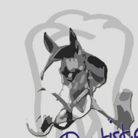
Pferde-Dentist
Breisach
Manfred-Huber1
@Manfred-Huber1
Beratung rund ums Pferd
Pferdedentist, Pferdezahnpflege
Akupunktur
Lasertherapie
1 weitere...
aktuell
B+
Vet-TCM Mobile Praxis ganzheitliche Tierheilkunde
Breisach
Vet-TCM
@Vet-TCM
Tierheilpraktiker
Futtermittel: Lieferung oder Versand
Sattelberatung
Beratung rund ums Pferd
Sonstiges
Pferdedentist, Pferdezahnpflege
7 weitere...
B+
Reitlehrerin und Tierheilpraktikerin
Albbruck
Uschi-Bachner
@Uschi-Bachner
Bodenarbeit
gymnastizierende Arbeit an der Hand
Beratung rund ums Pferd
Bachblütentherapie
Bioresonanz nach Schmidt
10 weitere...
aktuell
P+

Ganzheitliche OSTEOPATHIE für Pferde
Badenweiler
COSMEA_die_Pferdeosteopathin
@COSMEA_die_Pferdeostopathin
Tierheilpraktiker
Tierkommunikation
Osteopathie
B+
Werde Teil von STALL-FREI.de
Biete Dienstleistungen im Bereich Pferd und Reiter einfach und kostenlos an.
Deprecated: Creation of dynamic property Zend_View::$pageCount is deprecated in /var/www/stall-frei/htdocs/staging.stall-frei.de/library/vendor/shardj/zf1-future/library/Zend/View/Abstract.php on line 308
Deprecated: Creation of dynamic property Zend_View::$itemCountPerPage is deprecated in /var/www/stall-frei/htdocs/staging.stall-frei.de/library/vendor/shardj/zf1-future/library/Zend/View/Abstract.php on line 308
Deprecated: Creation of dynamic property Zend_View::$first is deprecated in /var/www/stall-frei/htdocs/staging.stall-frei.de/library/vendor/shardj/zf1-future/library/Zend/View/Abstract.php on line 308
Deprecated: Creation of dynamic property Zend_View::$current is deprecated in /var/www/stall-frei/htdocs/staging.stall-frei.de/library/vendor/shardj/zf1-future/library/Zend/View/Abstract.php on line 308
Deprecated: Creation of dynamic property Zend_View::$last is deprecated in /var/www/stall-frei/htdocs/staging.stall-frei.de/library/vendor/shardj/zf1-future/library/Zend/View/Abstract.php on line 308
Deprecated: Creation of dynamic property Zend_View::$previous is deprecated in /var/www/stall-frei/htdocs/staging.stall-frei.de/library/vendor/shardj/zf1-future/library/Zend/View/Abstract.php on line 308
Deprecated: Creation of dynamic property Zend_View::$pagesInRange is deprecated in /var/www/stall-frei/htdocs/staging.stall-frei.de/library/vendor/shardj/zf1-future/library/Zend/View/Abstract.php on line 308
Deprecated: Creation of dynamic property Zend_View::$firstPageInRange is deprecated in /var/www/stall-frei/htdocs/staging.stall-frei.de/library/vendor/shardj/zf1-future/library/Zend/View/Abstract.php on line 308
Deprecated: Creation of dynamic property Zend_View::$lastPageInRange is deprecated in /var/www/stall-frei/htdocs/staging.stall-frei.de/library/vendor/shardj/zf1-future/library/Zend/View/Abstract.php on line 308
Deprecated: Creation of dynamic property Zend_View::$currentItemCount is deprecated in /var/www/stall-frei/htdocs/staging.stall-frei.de/library/vendor/shardj/zf1-future/library/Zend/View/Abstract.php on line 308
Deprecated: Creation of dynamic property Zend_View::$totalItemCount is deprecated in /var/www/stall-frei/htdocs/staging.stall-frei.de/library/vendor/shardj/zf1-future/library/Zend/View/Abstract.php on line 308
Deprecated: Creation of dynamic property Zend_View::$firstItemNumber is deprecated in /var/www/stall-frei/htdocs/staging.stall-frei.de/library/vendor/shardj/zf1-future/library/Zend/View/Abstract.php on line 308
Deprecated: Creation of dynamic property Zend_View::$lastItemNumber is deprecated in /var/www/stall-frei/htdocs/staging.stall-frei.de/library/vendor/shardj/zf1-future/library/Zend/View/Abstract.php on line 308
Deprecated: Creation of dynamic property Zend_View::$router is deprecated in /var/www/stall-frei/htdocs/staging.stall-frei.de/library/vendor/shardj/zf1-future/library/Zend/View/Abstract.php on line 308
Deprecated: Creation of dynamic property Zend_View::$urlParams is deprecated in /var/www/stall-frei/htdocs/staging.stall-frei.de/library/vendor/shardj/zf1-future/library/Zend/View/Abstract.php on line 308
Deprecated: Creation of dynamic property Zend_View::$showAds is deprecated in /var/www/stall-frei/htdocs/staging.stall-frei.de/library/vendor/shardj/zf1-future/library/Zend/View/Abstract.php on line 308
Deprecated: Creation of dynamic property Zend_View::$objectIds is deprecated in /var/www/stall-frei/htdocs/staging.stall-frei.de/library/vendor/shardj/zf1-future/library/Zend/View/Abstract.php on line 308
Deprecated: Creation of dynamic property Zend_View::$showNavbar is deprecated in /var/www/stall-frei/htdocs/staging.stall-frei.de/library/vendor/shardj/zf1-future/library/Zend/View/Abstract.php on line 308
Deprecated: Creation of dynamic property Zend_View::$showBreadcrumb is deprecated in /var/www/stall-frei/htdocs/staging.stall-frei.de/library/vendor/shardj/zf1-future/library/Zend/View/Abstract.php on line 308
Deprecated: Creation of dynamic property Zend_View::$showFooter is deprecated in /var/www/stall-frei/htdocs/staging.stall-frei.de/library/vendor/shardj/zf1-future/library/Zend/View/Abstract.php on line 308
Deprecated: Creation of dynamic property Zend_View::$showInternalAds is deprecated in /var/www/stall-frei/htdocs/staging.stall-frei.de/library/vendor/shardj/zf1-future/library/Zend/View/Abstract.php on line 308
Deprecated: Creation of dynamic property Zend_View::$blNoContent is deprecated in /var/www/stall-frei/htdocs/staging.stall-frei.de/library/vendor/shardj/zf1-future/library/Zend/View/Abstract.php on line 308
Deprecated: Creation of dynamic property Zend_View::$sMetaDesc is deprecated in /var/www/stall-frei/htdocs/staging.stall-frei.de/library/vendor/shardj/zf1-future/library/Zend/View/Abstract.php on line 308
Deprecated: Creation of dynamic property Zend_View::$useGmaps is deprecated in /var/www/stall-frei/htdocs/staging.stall-frei.de/library/vendor/shardj/zf1-future/library/Zend/View/Abstract.php on line 308
Deprecated: Creation of dynamic property Zend_View::$touches is deprecated in /var/www/stall-frei/htdocs/staging.stall-frei.de/library/vendor/shardj/zf1-future/library/Zend/View/Abstract.php on line 308
Deprecated: Creation of dynamic property Zend_View::$oProject is deprecated in /var/www/stall-frei/htdocs/staging.stall-frei.de/library/vendor/shardj/zf1-future/library/Zend/View/Abstract.php on line 308
Deprecated: Creation of dynamic property Zend_View::$pageHeadline is deprecated in /var/www/stall-frei/htdocs/staging.stall-frei.de/library/vendor/shardj/zf1-future/library/Zend/View/Abstract.php on line 308
Deprecated: Creation of dynamic property Zend_View::$disableLocationField is deprecated in /var/www/stall-frei/htdocs/staging.stall-frei.de/library/vendor/shardj/zf1-future/library/Zend/View/Abstract.php on line 308
Deprecated: Creation of dynamic property Zend_View::$isSearch is deprecated in /var/www/stall-frei/htdocs/staging.stall-frei.de/library/vendor/shardj/zf1-future/library/Zend/View/Abstract.php on line 308
Deprecated: Creation of dynamic property Zend_View::$pageTitle is deprecated in /var/www/stall-frei/htdocs/staging.stall-frei.de/library/vendor/shardj/zf1-future/library/Zend/View/Abstract.php on line 308
Deprecated: Creation of dynamic property Psf_Form_Element_Text::$class is deprecated in /var/www/stall-frei/htdocs/staging.stall-frei.de/library/vendor/shardj/zf1-future/library/Zend/Form/Element.php on line 874
Deprecated: Creation of dynamic property Psf_Form_Element_Text::$size is deprecated in /var/www/stall-frei/htdocs/staging.stall-frei.de/library/vendor/shardj/zf1-future/library/Zend/Form/Element.php on line 874
Deprecated: Creation of dynamic property Psf_Form_Element_Text::$placeholder is deprecated in /var/www/stall-frei/htdocs/staging.stall-frei.de/library/vendor/shardj/zf1-future/library/Zend/Form/Element.php on line 874
Deprecated: Creation of dynamic property Psf_Form_Element_Hidden::$class is deprecated in /var/www/stall-frei/htdocs/staging.stall-frei.de/library/vendor/shardj/zf1-future/library/Zend/Form/Element.php on line 874
Deprecated: Creation of dynamic property Psf_Form_Element_Hidden::$class is deprecated in /var/www/stall-frei/htdocs/staging.stall-frei.de/library/vendor/shardj/zf1-future/library/Zend/Form/Element.php on line 874
Deprecated: Creation of dynamic property Psf_Form_Element_Hidden::$class is deprecated in /var/www/stall-frei/htdocs/staging.stall-frei.de/library/vendor/shardj/zf1-future/library/Zend/Form/Element.php on line 874
Deprecated: Creation of dynamic property Psf_Form_Element_Hidden::$class is deprecated in /var/www/stall-frei/htdocs/staging.stall-frei.de/library/vendor/shardj/zf1-future/library/Zend/Form/Element.php on line 874
Deprecated: Creation of dynamic property Psf_Form_Element_Select::$class is deprecated in /var/www/stall-frei/htdocs/staging.stall-frei.de/library/vendor/shardj/zf1-future/library/Zend/Form/Element.php on line 874
Deprecated: Creation of dynamic property Psf_Form_Element_Text::$class is deprecated in /var/www/stall-frei/htdocs/staging.stall-frei.de/library/vendor/shardj/zf1-future/library/Zend/Form/Element.php on line 874
Deprecated: Creation of dynamic property Psf_Form_Element_Checkbox::$label is deprecated in /var/www/stall-frei/htdocs/staging.stall-frei.de/library/vendor/shardj/zf1-future/library/Zend/Form/Element.php on line 874
Deprecated: Creation of dynamic property Zend_View::$sort is deprecated in /var/www/stall-frei/htdocs/staging.stall-frei.de/library/vendor/shardj/zf1-future/library/Zend/View/Abstract.php on line 308
Deprecated: Creation of dynamic property Zend_View::$searchLocation is deprecated in /var/www/stall-frei/htdocs/staging.stall-frei.de/library/vendor/shardj/zf1-future/library/Zend/View/Abstract.php on line 308
Deprecated: Creation of dynamic property Zend_View::$locationHint is deprecated in /var/www/stall-frei/htdocs/staging.stall-frei.de/library/vendor/shardj/zf1-future/library/Zend/View/Abstract.php on line 308
Psf_GeoCoder_Abstract::getLocation: Hageberg Get Location CachedOrLive
Psf_GeoCoder_Abstract::getCachedOrLive: Hageberg
Psf_GeoCoder_Abstract::convertLocationResult
{"documentation":"https:\/\/opencagedata.com\/api","licenses":[{"name":"see attribution guide","url":"https:\/\/opencagedata.com\/credits"}],"results":[{"bounds":{"northeast":{"lat":52.2881769,"lng":13.1949364},"southwest":{"lat":52.2880769,"lng":13.1948364}},"components":{"ISO_3166-1_alpha-2":"DE","ISO_3166-1_alpha-3":"DEU","ISO_3166-2":["DE-BB"],"_category":"natural\/water","_normalized_city":"Ludwigsfelde","_type":"peak","continent":"Europe","country":"Deutschland","country_code":"de","county":"Teltow-Fl\u00e4ming","peak":"Hageberg","political_union":"European Union","state":"Brandenburg","state_code":"BB","town":"Ludwigsfelde"},"confidence":9,"formatted":"Hageberg, Ludwigsfelde, Brandenburg, Deutschland","geometry":{"lat":52.2881269,"lng":13.1948864}},{"bounds":{"northeast":{"lat":50.0254367,"lng":7.0983551},"southwest":{"lat":50.0253367,"lng":7.0982551}},"components":{"ISO_3166-1_alpha-2":"DE","ISO_3166-1_alpha-3":"DEU","ISO_3166-2":["DE-RP"],"_category":"natural\/water","_normalized_city":"Reil","_type":"peak","continent":"Europe","country":"Deutschland","country_code":"de","county":"Landkreis Bernkastel-Wittlich","municipality":"Traben-Trarbach","peak":"Hageberg","political_union":"European Union","postcode":"56861","state":"Rheinland-Pfalz","state_code":"RP","village":"Reil"},"confidence":9,"formatted":"Hageberg, 56861 Reil, Deutschland","geometry":{"lat":50.0253867,"lng":7.0983051}},{"bounds":{"northeast":{"lat":52.4401367,"lng":10.7637121},"southwest":{"lat":52.4001367,"lng":10.7237121}},"components":{"ISO_3166-1_alpha-2":"DE","ISO_3166-1_alpha-3":"DEU","ISO_3166-2":["DE-NI"],"_category":"place","_normalized_city":"Wolfsburg","_type":"neighbourhood","city":"Wolfsburg","continent":"Europe","country":"Deutschland","country_code":"de","political_union":"European Union","postcode":"38440","state":"Niedersachsen","state_code":"NI","suburb":"Hageberg"},"confidence":7,"formatted":"38440 Wolfsburg, Deutschland","geometry":{"lat":52.4201367,"lng":10.7437121}},{"bounds":{"northeast":{"lat":51.1859317,"lng":7.9611449},"southwest":{"lat":51.1659317,"lng":7.9411449}},"components":{"ISO_3166-1_alpha-2":"DE","ISO_3166-1_alpha-3":"DEU","ISO_3166-2":["DE-NW"],"_category":"place","_normalized_city":"Finnentrop","_type":"hamlet","continent":"Europe","country":"Deutschland","country_code":"de","county":"Kreis Olpe","locality":"Hageberg","political_union":"European Union","postcode":"57413","state":"Nordrhein-Westfalen","state_code":"NW","town":"Finnentrop","village":"Finnentrop"},"confidence":8,"formatted":"Hageberg, 57413 Finnentrop, Deutschland","geometry":{"lat":51.1759317,"lng":7.9511449}},{"components":{"ISO_3166-1_alpha-2":"FR","ISO_3166-1_alpha-3":"FRA","ISO_3166-2":["FR-GES","FR-57"],"_category":"road","_normalized_city":"Walscheid","_type":"road","city":"Walscheid","continent":"Europe","country":"France","country_code":"fr","county":"Moselle","local_authority":"Communaut\u00e9 de communes Sarrebourg Moselle Sud","political_union":"European Union","postcode":"57870","road":"Route de Harreberg","state":"Grand Est","state_code":"GES"},"confidence":3,"formatted":"Route de Harreberg, 57870 Walscheid, France","geometry":{"lat":48.654504,"lng":7.155466}},{"components":{"ISO_3166-1_alpha-2":"FR","ISO_3166-1_alpha-3":"FRA","ISO_3166-2":["FR-IDF","FR-92"],"_category":"road","_normalized_city":"Levallois-Perret","_type":"road","city":"Levallois-Perret","continent":"Europe","country":"France","country_code":"fr","county":"Hauts-de-Seine","local_authority":"M\u00e9tropole du Grand Paris","political_union":"European Union","postcode":"92300","road":"Rue Charles Deutschmann","state":"\u00cele-de-France","state_code":"IDF"},"confidence":3,"formatted":"Rue Charles Deutschmann, 92300 Levallois-Perret, France","geometry":{"lat":48.900049,"lng":2.2842}},{"components":{"ISO_3166-1_alpha-2":"FR","ISO_3166-1_alpha-3":"FRA","ISO_3166-2":["FR-GES","FR-57"],"_category":"road","_normalized_city":"Harreberg","_type":"road","city":"Harreberg","continent":"Europe","country":"France","country_code":"fr","county":"Moselle","local_authority":"Communaut\u00e9 de communes Sarrebourg Moselle Sud","political_union":"European Union","postcode":"57870","road":"Rue de la Chapelle","state":"Grand Est","state_code":"GES"},"confidence":2,"formatted":"Rue de la Chapelle, 57870 Harreberg, France","geometry":{"lat":48.675511,"lng":7.139025}},{"components":{"ISO_3166-1_alpha-2":"FR","ISO_3166-1_alpha-3":"FRA","ISO_3166-2":["FR-GES","FR-57"],"_category":"road","_normalized_city":"Harreberg","_type":"road","city":"Harreberg","continent":"Europe","country":"France","country_code":"fr","county":"Moselle","local_authority":"Communaut\u00e9 de communes Sarrebourg Moselle Sud","political_union":"European Union","postcode":"57870","road":"Rue de la For\u00eat","state":"Grand Est","state_code":"GES"},"confidence":2,"formatted":"Rue de la For\u00eat, 57870 Harreberg, France","geometry":{"lat":48.674614,"lng":7.143813}},{"components":{"ISO_3166-1_alpha-2":"FR","ISO_3166-1_alpha-3":"FRA","ISO_3166-2":["FR-GES","FR-57"],"_category":"road","_normalized_city":"Harreberg","_type":"road","city":"Harreberg","continent":"Europe","country":"France","country_code":"fr","county":"Moselle","local_authority":"Communaut\u00e9 de communes Sarrebourg Moselle Sud","political_union":"European Union","postcode":"57870","road":"Rue des Tilleuls","state":"Grand Est","state_code":"GES"},"confidence":2,"formatted":"Rue des Tilleuls, 57870 Harreberg, France","geometry":{"lat":48.675068,"lng":7.143697}},{"components":{"ISO_3166-1_alpha-2":"FR","ISO_3166-1_alpha-3":"FRA","ISO_3166-2":["FR-GES","FR-57"],"_category":"road","_normalized_city":"Harreberg","_type":"road","city":"Harreberg","continent":"Europe","country":"France","country_code":"fr","county":"Moselle","local_authority":"Communaut\u00e9 de communes Sarrebourg Moselle Sud","political_union":"European Union","postcode":"57870","road":"Rue de la Source","state":"Grand Est","state_code":"GES"},"confidence":2,"formatted":"Rue de la Source, 57870 Harreberg, France","geometry":{"lat":48.662606,"lng":7.174046}}],"status":{"code":200,"message":"OK"},"stay_informed":{"blog":"https:\/\/blog.opencagedata.com","mastodon":"https:\/\/en.osm.town\/@opencage"},"thanks":"For using an OpenCage API","timestamp":{"created_http":"Sun, 08 Feb 2026 17:17:31 GMT","created_unix":1770571051},"total_results":10}Array
(
[0] => stdClass Object
(
[bounds] => stdClass Object
(
[northeast] => stdClass Object
(
[lat] => 52.2881769
[lng] => 13.1949364
)
[southwest] => stdClass Object
(
[lat] => 52.2880769
[lng] => 13.1948364
)
)
[components] => stdClass Object
(
[ISO_3166-1_alpha-2] => DE
[ISO_3166-1_alpha-3] => DEU
[ISO_3166-2] => Array
(
[0] => DE-BB
)
[_category] => natural/water
[_normalized_city] => Ludwigsfelde
[_type] => peak
[continent] => Europe
[country] => Deutschland
[country_code] => de
[county] => Teltow-Fläming
[peak] => Hageberg
[political_union] => European Union
[state] => Brandenburg
[state_code] => BB
[town] => Ludwigsfelde
)
[confidence] => 9
[formatted] => Hageberg, Ludwigsfelde, Brandenburg, Deutschland
[geometry] => stdClass Object
(
[lat] => 52.2881269
[lng] => 13.1948864
)
)
[1] => stdClass Object
(
[bounds] => stdClass Object
(
[northeast] => stdClass Object
(
[lat] => 50.0254367
[lng] => 7.0983551
)
[southwest] => stdClass Object
(
[lat] => 50.0253367
[lng] => 7.0982551
)
)
[components] => stdClass Object
(
[ISO_3166-1_alpha-2] => DE
[ISO_3166-1_alpha-3] => DEU
[ISO_3166-2] => Array
(
[0] => DE-RP
)
[_category] => natural/water
[_normalized_city] => Reil
[_type] => peak
[continent] => Europe
[country] => Deutschland
[country_code] => de
[county] => Landkreis Bernkastel-Wittlich
[municipality] => Traben-Trarbach
[peak] => Hageberg
[political_union] => European Union
[postcode] => 56861
[state] => Rheinland-Pfalz
[state_code] => RP
[village] => Reil
)
[confidence] => 9
[formatted] => Hageberg, 56861 Reil, Deutschland
[geometry] => stdClass Object
(
[lat] => 50.0253867
[lng] => 7.0983051
)
)
[2] => stdClass Object
(
[bounds] => stdClass Object
(
[northeast] => stdClass Object
(
[lat] => 52.4401367
[lng] => 10.7637121
)
[southwest] => stdClass Object
(
[lat] => 52.4001367
[lng] => 10.7237121
)
)
[components] => stdClass Object
(
[ISO_3166-1_alpha-2] => DE
[ISO_3166-1_alpha-3] => DEU
[ISO_3166-2] => Array
(
[0] => DE-NI
)
[_category] => place
[_normalized_city] => Wolfsburg
[_type] => neighbourhood
[city] => Wolfsburg
[continent] => Europe
[country] => Deutschland
[country_code] => de
[political_union] => European Union
[postcode] => 38440
[state] => Niedersachsen
[state_code] => NI
[suburb] => Hageberg
)
[confidence] => 7
[formatted] => 38440 Wolfsburg, Deutschland
[geometry] => stdClass Object
(
[lat] => 52.4201367
[lng] => 10.7437121
)
)
[3] => stdClass Object
(
[bounds] => stdClass Object
(
[northeast] => stdClass Object
(
[lat] => 51.1859317
[lng] => 7.9611449
)
[southwest] => stdClass Object
(
[lat] => 51.1659317
[lng] => 7.9411449
)
)
[components] => stdClass Object
(
[ISO_3166-1_alpha-2] => DE
[ISO_3166-1_alpha-3] => DEU
[ISO_3166-2] => Array
(
[0] => DE-NW
)
[_category] => place
[_normalized_city] => Finnentrop
[_type] => hamlet
[continent] => Europe
[country] => Deutschland
[country_code] => de
[county] => Kreis Olpe
[locality] => Hageberg
[political_union] => European Union
[postcode] => 57413
[state] => Nordrhein-Westfalen
[state_code] => NW
[town] => Finnentrop
[village] => Finnentrop
)
[confidence] => 8
[formatted] => Hageberg, 57413 Finnentrop, Deutschland
[geometry] => stdClass Object
(
[lat] => 51.1759317
[lng] => 7.9511449
)
)
[4] => stdClass Object
(
[components] => stdClass Object
(
[ISO_3166-1_alpha-2] => FR
[ISO_3166-1_alpha-3] => FRA
[ISO_3166-2] => Array
(
[0] => FR-GES
[1] => FR-57
)
[_category] => road
[_normalized_city] => Walscheid
[_type] => road
[city] => Walscheid
[continent] => Europe
[country] => France
[country_code] => fr
[county] => Moselle
[local_authority] => Communauté de communes Sarrebourg Moselle Sud
[political_union] => European Union
[postcode] => 57870
[road] => Route de Harreberg
[state] => Grand Est
[state_code] => GES
)
[confidence] => 3
[formatted] => Route de Harreberg, 57870 Walscheid, France
[geometry] => stdClass Object
(
[lat] => 48.654504
[lng] => 7.155466
)
)
[5] => stdClass Object
(
[components] => stdClass Object
(
[ISO_3166-1_alpha-2] => FR
[ISO_3166-1_alpha-3] => FRA
[ISO_3166-2] => Array
(
[0] => FR-IDF
[1] => FR-92
)
[_category] => road
[_normalized_city] => Levallois-Perret
[_type] => road
[city] => Levallois-Perret
[continent] => Europe
[country] => France
[country_code] => fr
[county] => Hauts-de-Seine
[local_authority] => Métropole du Grand Paris
[political_union] => European Union
[postcode] => 92300
[road] => Rue Charles Deutschmann
[state] => Île-de-France
[state_code] => IDF
)
[confidence] => 3
[formatted] => Rue Charles Deutschmann, 92300 Levallois-Perret, France
[geometry] => stdClass Object
(
[lat] => 48.900049
[lng] => 2.2842
)
)
[6] => stdClass Object
(
[components] => stdClass Object
(
[ISO_3166-1_alpha-2] => FR
[ISO_3166-1_alpha-3] => FRA
[ISO_3166-2] => Array
(
[0] => FR-GES
[1] => FR-57
)
[_category] => road
[_normalized_city] => Harreberg
[_type] => road
[city] => Harreberg
[continent] => Europe
[country] => France
[country_code] => fr
[county] => Moselle
[local_authority] => Communauté de communes Sarrebourg Moselle Sud
[political_union] => European Union
[postcode] => 57870
[road] => Rue de la Chapelle
[state] => Grand Est
[state_code] => GES
)
[confidence] => 2
[formatted] => Rue de la Chapelle, 57870 Harreberg, France
[geometry] => stdClass Object
(
[lat] => 48.675511
[lng] => 7.139025
)
)
[7] => stdClass Object
(
[components] => stdClass Object
(
[ISO_3166-1_alpha-2] => FR
[ISO_3166-1_alpha-3] => FRA
[ISO_3166-2] => Array
(
[0] => FR-GES
[1] => FR-57
)
[_category] => road
[_normalized_city] => Harreberg
[_type] => road
[city] => Harreberg
[continent] => Europe
[country] => France
[country_code] => fr
[county] => Moselle
[local_authority] => Communauté de communes Sarrebourg Moselle Sud
[political_union] => European Union
[postcode] => 57870
[road] => Rue de la Forêt
[state] => Grand Est
[state_code] => GES
)
[confidence] => 2
[formatted] => Rue de la Forêt, 57870 Harreberg, France
[geometry] => stdClass Object
(
[lat] => 48.674614
[lng] => 7.143813
)
)
[8] => stdClass Object
(
[components] => stdClass Object
(
[ISO_3166-1_alpha-2] => FR
[ISO_3166-1_alpha-3] => FRA
[ISO_3166-2] => Array
(
[0] => FR-GES
[1] => FR-57
)
[_category] => road
[_normalized_city] => Harreberg
[_type] => road
[city] => Harreberg
[continent] => Europe
[country] => France
[country_code] => fr
[county] => Moselle
[local_authority] => Communauté de communes Sarrebourg Moselle Sud
[political_union] => European Union
[postcode] => 57870
[road] => Rue des Tilleuls
[state] => Grand Est
[state_code] => GES
)
[confidence] => 2
[formatted] => Rue des Tilleuls, 57870 Harreberg, France
[geometry] => stdClass Object
(
[lat] => 48.675068
[lng] => 7.143697
)
)
[9] => stdClass Object
(
[components] => stdClass Object
(
[ISO_3166-1_alpha-2] => FR
[ISO_3166-1_alpha-3] => FRA
[ISO_3166-2] => Array
(
[0] => FR-GES
[1] => FR-57
)
[_category] => road
[_normalized_city] => Harreberg
[_type] => road
[city] => Harreberg
[continent] => Europe
[country] => France
[country_code] => fr
[county] => Moselle
[local_authority] => Communauté de communes Sarrebourg Moselle Sud
[political_union] => European Union
[postcode] => 57870
[road] => Rue de la Source
[state] => Grand Est
[state_code] => GES
)
[confidence] => 2
[formatted] => Rue de la Source, 57870 Harreberg, France
[geometry] => stdClass Object
(
[lat] => 48.662606
[lng] => 7.174046
)
)
)
Psf_GeoCoder_OpenCageData::getKeyMap: 0
stdClass Object
(
    [bounds] => stdClass Object
        (
            [northeast] => stdClass Object
                (
                    [lat] => 52.2881769
                    [lng] => 13.1949364
                )

            [southwest] => stdClass Object
                (
                    [lat] => 52.2880769
                    [lng] => 13.1948364
                )

        )

    [components] => stdClass Object
        (
            [ISO_3166-1_alpha-2] => DE
            [ISO_3166-1_alpha-3] => DEU
            [ISO_3166-2] => Array
                (
                    [0] => DE-BB
                )

            [_category] => natural/water
            [_normalized_city] => Ludwigsfelde
            [_type] => peak
            [continent] => Europe
            [country] => Deutschland
            [country_code] => de
            [county] => Teltow-Fläming
            [peak] => Hageberg
            [political_union] => European Union
            [state] => Brandenburg
            [state_code] => BB
            [town] => Ludwigsfelde
        )

    [confidence] => 9
    [formatted] => Hageberg, Ludwigsfelde, Brandenburg, Deutschland
    [geometry] => stdClass Object
        (
            [lat] => 52.2881269
            [lng] => 13.1948864
        )

)
Psf_GeoCoder_OpenCageData::getCounty: Teltow-Fläming
Psf_GeoCoder_OpenCageData::addMissingData REFETCH!
Array
(
    [address] => Hageberg, Ludwigsfelde, Brandenburg, Deutschland
    [type] => peak
    [street] =>
    [city] => Ludwigsfelde
    [county] => Teltow-Fläming
    [state] => Brandenburg
    [zip] =>
    [country] => Deutschland
    [suburb] =>
    [countrycode] => de
    [latitude] => 52.2881269
    [longitude] => 13.1948864
    [accuracy] => 1
    [confidence] => 9
    [bounds] => stdClass Object
        (
            [northeast] => stdClass Object
                (
                    [lat] => 52.2881769
                    [lng] => 13.1949364
                )

            [southwest] => stdClass Object
                (
                    [lat] => 52.2880769
                    [lng] => 13.1948364
                )

        )

)
reformat!
Array
(
    [address] => Hageberg, Ludwigsfelde, Brandenburg, Deutschland
    [type] => peak
    [street] =>
    [city] => Ludwigsfelde
    [county] => Teltow-Fläming
    [state] => Brandenburg
    [zip] =>
    [country] => Deutschland
    [suburb] =>
    [countrycode] => de
    [latitude] => 52.2881269
    [longitude] => 13.1948864
    [accuracy] => 1
    [confidence] => 9
    [bounds] => stdClass Object
        (
            [northeast] => stdClass Object
                (
                    [lat] => 52.2881769
                    [lng] => 13.1949364
                )

            [southwest] => stdClass Object
                (
                    [lat] => 52.2880769
                    [lng] => 13.1948364
                )

        )

    [place] => Ludwigsfelde, Brandenburg
    [hash] => 60fe1e1a98325d9b3e52349765b6026a
)
Psf_GeoCoder_OpenCageData::getKeyMap: 1
stdClass Object
(
    [bounds] => stdClass Object
        (
            [northeast] => stdClass Object
                (
                    [lat] => 50.0254367
                    [lng] => 7.0983551
                )

            [southwest] => stdClass Object
                (
                    [lat] => 50.0253367
                    [lng] => 7.0982551
                )

        )

    [components] => stdClass Object
        (
            [ISO_3166-1_alpha-2] => DE
            [ISO_3166-1_alpha-3] => DEU
            [ISO_3166-2] => Array
                (
                    [0] => DE-RP
                )

            [_category] => natural/water
            [_normalized_city] => Reil
            [_type] => peak
            [continent] => Europe
            [country] => Deutschland
            [country_code] => de
            [county] => Landkreis Bernkastel-Wittlich
            [municipality] => Traben-Trarbach
            [peak] => Hageberg
            [political_union] => European Union
            [postcode] => 56861
            [state] => Rheinland-Pfalz
            [state_code] => RP
            [village] => Reil
        )

    [confidence] => 9
    [formatted] => Hageberg, 56861 Reil, Deutschland
    [geometry] => stdClass Object
        (
            [lat] => 50.0253867
            [lng] => 7.0983051
        )

)
Psf_GeoCoder_OpenCageData::getCounty: Bernkastel-Wittlich
Psf_GeoCoder_OpenCageData::addMissingData REFETCH!
Array
(
    [address] => Hageberg, 56861 Reil, Deutschland
    [type] => peak
    [street] =>
    [city] => Reil
    [county] => Bernkastel-Wittlich
    [state] => Rheinland-Pfalz
    [zip] => 56861
    [country] => Deutschland
    [suburb] =>
    [countrycode] => de
    [latitude] => 50.0253867
    [longitude] => 7.0983051
    [accuracy] => 1
    [confidence] => 9
    [bounds] => stdClass Object
        (
            [northeast] => stdClass Object
                (
                    [lat] => 50.0254367
                    [lng] => 7.0983551
                )

            [southwest] => stdClass Object
                (
                    [lat] => 50.0253367
                    [lng] => 7.0982551
                )

        )

)
reformat!
Array
(
    [address] => Hageberg, 56861 Reil, Deutschland
    [type] => peak
    [street] =>
    [city] => Reil
    [county] => Bernkastel-Wittlich
    [state] => Rheinland-Pfalz
    [zip] => 56861
    [country] => Deutschland
    [suburb] =>
    [countrycode] => de
    [latitude] => 50.0253867
    [longitude] => 7.0983051
    [accuracy] => 1
    [confidence] => 9
    [bounds] => stdClass Object
        (
            [northeast] => stdClass Object
                (
                    [lat] => 50.0254367
                    [lng] => 7.0983551
                )

            [southwest] => stdClass Object
                (
                    [lat] => 50.0253367
                    [lng] => 7.0982551
                )

        )

    [place] => 56861 Reil, Rheinland-Pfalz
    [hash] => 89430a7e7d6b418c10e04a6f87d6e040
)
Psf_GeoCoder_OpenCageData::getKeyMap: 2
stdClass Object
(
    [bounds] => stdClass Object
        (
            [northeast] => stdClass Object
                (
                    [lat] => 52.4401367
                    [lng] => 10.7637121
                )

            [southwest] => stdClass Object
                (
                    [lat] => 52.4001367
                    [lng] => 10.7237121
                )

        )

    [components] => stdClass Object
        (
            [ISO_3166-1_alpha-2] => DE
            [ISO_3166-1_alpha-3] => DEU
            [ISO_3166-2] => Array
                (
                    [0] => DE-NI
                )

            [_category] => place
            [_normalized_city] => Wolfsburg
            [_type] => neighbourhood
            [city] => Wolfsburg
            [continent] => Europe
            [country] => Deutschland
            [country_code] => de
            [political_union] => European Union
            [postcode] => 38440
            [state] => Niedersachsen
            [state_code] => NI
            [suburb] => Hageberg
        )

    [confidence] => 7
    [formatted] => 38440 Wolfsburg, Deutschland
    [geometry] => stdClass Object
        (
            [lat] => 52.4201367
            [lng] => 10.7437121
        )

)
Psf_GeoCoder_OpenCageData::getCounty: Wolfsburg
Psf_GeoCoder_OpenCageData::addMissingData REFETCH!
Array
(
    [address] => 38440 Wolfsburg, Deutschland
    [type] => neighbourhood
    [street] =>
    [city] => Hageberg
    [county] => Wolfsburg
    [state] => Niedersachsen
    [zip] => 38440
    [country] => Deutschland
    [suburb] => Hageberg
    [countrycode] => de
    [latitude] => 52.4201367
    [longitude] => 10.7437121
    [accuracy] => 1
    [confidence] => 7
    [bounds] => stdClass Object
        (
            [northeast] => stdClass Object
                (
                    [lat] => 52.4401367
                    [lng] => 10.7637121
                )

            [southwest] => stdClass Object
                (
                    [lat] => 52.4001367
                    [lng] => 10.7237121
                )

        )

)
reformat!
Array
(
    [address] => 38440 Hageberg
    [type] => neighbourhood
    [street] =>
    [city] => Hageberg
    [county] => Wolfsburg
    [state] => Niedersachsen
    [zip] => 38440
    [country] => Deutschland
    [suburb] => Hageberg
    [countrycode] => de
    [latitude] => 52.4201367
    [longitude] => 10.7437121
    [accuracy] => 1
    [confidence] => 7
    [bounds] => stdClass Object
        (
            [northeast] => stdClass Object
                (
                    [lat] => 52.4401367
                    [lng] => 10.7637121
                )

            [southwest] => stdClass Object
                (
                    [lat] => 52.4001367
                    [lng] => 10.7237121
                )

        )

    [place] => 38440 Hageberg, Niedersachsen
    [hash] => ce4572612c471ca7ba8559111ea11a3c
)
Psf_GeoCoder_OpenCageData::getKeyMap: 3
stdClass Object
(
    [bounds] => stdClass Object
        (
            [northeast] => stdClass Object
                (
                    [lat] => 51.1859317
                    [lng] => 7.9611449
                )

            [southwest] => stdClass Object
                (
                    [lat] => 51.1659317
                    [lng] => 7.9411449
                )

        )

    [components] => stdClass Object
        (
            [ISO_3166-1_alpha-2] => DE
            [ISO_3166-1_alpha-3] => DEU
            [ISO_3166-2] => Array
                (
                    [0] => DE-NW
                )

            [_category] => place
            [_normalized_city] => Finnentrop
            [_type] => hamlet
            [continent] => Europe
            [country] => Deutschland
            [country_code] => de
            [county] => Kreis Olpe
            [locality] => Hageberg
            [political_union] => European Union
            [postcode] => 57413
            [state] => Nordrhein-Westfalen
            [state_code] => NW
            [town] => Finnentrop
            [village] => Finnentrop
        )

    [confidence] => 8
    [formatted] => Hageberg, 57413 Finnentrop, Deutschland
    [geometry] => stdClass Object
        (
            [lat] => 51.1759317
            [lng] => 7.9511449
        )

)
Psf_GeoCoder_OpenCageData::getCounty: Olpe
Psf_GeoCoder_OpenCageData::addMissingData REFETCH!
Array
(
    [address] => Hageberg, 57413 Finnentrop, Deutschland
    [type] => hamlet
    [street] =>
    [city] => Finnentrop
    [county] => Olpe
    [state] => Nordrhein-Westfalen
    [zip] => 57413
    [country] => Deutschland
    [suburb] =>
    [countrycode] => de
    [latitude] => 51.1759317
    [longitude] => 7.9511449
    [accuracy] => 1
    [confidence] => 8
    [bounds] => stdClass Object
        (
            [northeast] => stdClass Object
                (
                    [lat] => 51.1859317
                    [lng] => 7.9611449
                )

            [southwest] => stdClass Object
                (
                    [lat] => 51.1659317
                    [lng] => 7.9411449
                )

        )

)
reformat!
Array
(
    [address] => Hageberg, 57413 Finnentrop, Deutschland
    [type] => hamlet
    [street] =>
    [city] => Finnentrop
    [county] => Olpe
    [state] => Nordrhein-Westfalen
    [zip] => 57413
    [country] => Deutschland
    [suburb] =>
    [countrycode] => de
    [latitude] => 51.1759317
    [longitude] => 7.9511449
    [accuracy] => 1
    [confidence] => 8
    [bounds] => stdClass Object
        (
            [northeast] => stdClass Object
                (
                    [lat] => 51.1859317
                    [lng] => 7.9611449
                )

            [southwest] => stdClass Object
                (
                    [lat] => 51.1659317
                    [lng] => 7.9411449
                )

        )

    [place] => 57413 Finnentrop, Nordrhein-Westfalen
    [hash] => b0c2899dc6f121699d6734f39166728f
)
Psf_GeoCoder_OpenCageData::getKeyMap: 4
stdClass Object
(
    [components] => stdClass Object
        (
            [ISO_3166-1_alpha-2] => FR
            [ISO_3166-1_alpha-3] => FRA
            [ISO_3166-2] => Array
                (
                    [0] => FR-GES
                    [1] => FR-57
                )

            [_category] => road
            [_normalized_city] => Walscheid
            [_type] => road
            [city] => Walscheid
            [continent] => Europe
            [country] => France
            [country_code] => fr
            [county] => Moselle
            [local_authority] => Communauté de communes Sarrebourg Moselle Sud
            [political_union] => European Union
            [postcode] => 57870
            [road] => Route de Harreberg
            [state] => Grand Est
            [state_code] => GES
        )

    [confidence] => 3
    [formatted] => Route de Harreberg, 57870 Walscheid, France
    [geometry] => stdClass Object
        (
            [lat] => 48.654504
            [lng] => 7.155466
        )

)
Psf_GeoCoder_OpenCageData::getCounty: Moselle
Psf_GeoCoder_OpenCageData::addMissingData REFETCH!
Array
(
    [address] => Route de Harreberg, 57870 Walscheid, France
    [type] => road
    [street] => Route de Harreberg
    [city] => Walscheid
    [county] => Moselle
    [state] => Grand Est
    [zip] => 57870
    [country] => France
    [suburb] =>
    [countrycode] => fr
    [latitude] => 48.654504
    [longitude] => 7.155466
    [accuracy] => 1
    [confidence] => 3
    [bounds] =>
)
reformat!
Array
(
    [address] => Route de Harreberg, 57870 Walscheid, France
    [type] => road
    [street] => Route de Harreberg
    [city] => Walscheid
    [county] => Moselle
    [state] => Grand Est
    [zip] => 57870
    [country] => France
    [suburb] =>
    [countrycode] => fr
    [latitude] => 48.654504
    [longitude] => 7.155466
    [accuracy] => 1
    [confidence] => 3
    [bounds] =>
    [place] => Route de Harreberg, 57870 Walscheid, Grand Est
    [hash] => 15a9783276de6e6a234f9f913fb30a2c
)
Psf_GeoCoder_OpenCageData::getKeyMap: 5
stdClass Object
(
    [components] => stdClass Object
        (
            [ISO_3166-1_alpha-2] => FR
            [ISO_3166-1_alpha-3] => FRA
            [ISO_3166-2] => Array
                (
                    [0] => FR-IDF
                    [1] => FR-92
                )

            [_category] => road
            [_normalized_city] => Levallois-Perret
            [_type] => road
            [city] => Levallois-Perret
            [continent] => Europe
            [country] => France
            [country_code] => fr
            [county] => Hauts-de-Seine
            [local_authority] => Métropole du Grand Paris
            [political_union] => European Union
            [postcode] => 92300
            [road] => Rue Charles Deutschmann
            [state] => Île-de-France
            [state_code] => IDF
        )

    [confidence] => 3
    [formatted] => Rue Charles Deutschmann, 92300 Levallois-Perret, France
    [geometry] => stdClass Object
        (
            [lat] => 48.900049
            [lng] => 2.2842
        )

)
Psf_GeoCoder_OpenCageData::getCounty: Hauts-de-Seine
Psf_GeoCoder_OpenCageData::addMissingData REFETCH!
Array
(
    [address] => Rue Charles Deutschmann, 92300 Levallois-Perret, France
    [type] => road
    [street] => Rue Charles Deutschmann
    [city] => Levallois-Perret
    [county] => Hauts-de-Seine
    [state] => Île-de-France
    [zip] => 92300
    [country] => France
    [suburb] =>
    [countrycode] => fr
    [latitude] => 48.900049
    [longitude] => 2.2842
    [accuracy] => 1
    [confidence] => 3
    [bounds] =>
)
reformat!
Array
(
    [address] => Rue Charles Deutschmann, 92300 Levallois-Perret, France
    [type] => road
    [street] => Rue Charles Deutschmann
    [city] => Levallois-Perret
    [county] => Hauts-de-Seine
    [state] => Île-de-France
    [zip] => 92300
    [country] => France
    [suburb] =>
    [countrycode] => fr
    [latitude] => 48.900049
    [longitude] => 2.2842
    [accuracy] => 1
    [confidence] => 3
    [bounds] =>
    [place] => Rue Charles Deutschmann, 92300 Levallois-Perret, Île-de-France
    [hash] => b7dc44def3990e8a7eaf18e019eca466
)
Psf_GeoCoder_OpenCageData::getKeyMap: 6
stdClass Object
(
    [components] => stdClass Object
        (
            [ISO_3166-1_alpha-2] => FR
            [ISO_3166-1_alpha-3] => FRA
            [ISO_3166-2] => Array
                (
                    [0] => FR-GES
                    [1] => FR-57
                )

            [_category] => road
            [_normalized_city] => Harreberg
            [_type] => road
            [city] => Harreberg
            [continent] => Europe
            [country] => France
            [country_code] => fr
            [county] => Moselle
            [local_authority] => Communauté de communes Sarrebourg Moselle Sud
            [political_union] => European Union
            [postcode] => 57870
            [road] => Rue de la Chapelle
            [state] => Grand Est
            [state_code] => GES
        )

    [confidence] => 2
    [formatted] => Rue de la Chapelle, 57870 Harreberg, France
    [geometry] => stdClass Object
        (
            [lat] => 48.675511
            [lng] => 7.139025
        )

)
Psf_GeoCoder_OpenCageData::getCounty: Moselle
Psf_GeoCoder_OpenCageData::addMissingData REFETCH!
Array
(
    [address] => Rue de la Chapelle, 57870 Harreberg, France
    [type] => road
    [street] => Rue de la Chapelle
    [city] => Harreberg
    [county] => Moselle
    [state] => Grand Est
    [zip] => 57870
    [country] => France
    [suburb] =>
    [countrycode] => fr
    [latitude] => 48.675511
    [longitude] => 7.139025
    [accuracy] => 1
    [confidence] => 2
    [bounds] =>
)
reformat!
Array
(
    [address] => Rue de la Chapelle, 57870 Harreberg, France
    [type] => road
    [street] => Rue de la Chapelle
    [city] => Harreberg
    [county] => Moselle
    [state] => Grand Est
    [zip] => 57870
    [country] => France
    [suburb] =>
    [countrycode] => fr
    [latitude] => 48.675511
    [longitude] => 7.139025
    [accuracy] => 1
    [confidence] => 2
    [bounds] =>
    [place] => Rue de la Chapelle, 57870 Harreberg, Grand Est
    [hash] => 1548df37611ebc323f8db60b3d81428c
)
Psf_GeoCoder_OpenCageData::getKeyMap: 7
stdClass Object
(
    [components] => stdClass Object
        (
            [ISO_3166-1_alpha-2] => FR
            [ISO_3166-1_alpha-3] => FRA
            [ISO_3166-2] => Array
                (
                    [0] => FR-GES
                    [1] => FR-57
                )

            [_category] => road
            [_normalized_city] => Harreberg
            [_type] => road
            [city] => Harreberg
            [continent] => Europe
            [country] => France
            [country_code] => fr
            [county] => Moselle
            [local_authority] => Communauté de communes Sarrebourg Moselle Sud
            [political_union] => European Union
            [postcode] => 57870
            [road] => Rue de la Forêt
            [state] => Grand Est
            [state_code] => GES
        )

    [confidence] => 2
    [formatted] => Rue de la Forêt, 57870 Harreberg, France
    [geometry] => stdClass Object
        (
            [lat] => 48.674614
            [lng] => 7.143813
        )

)
Psf_GeoCoder_OpenCageData::getCounty: Moselle
Psf_GeoCoder_OpenCageData::addMissingData REFETCH!
Array
(
    [address] => Rue de la Forêt, 57870 Harreberg, France
    [type] => road
    [street] => Rue de la Forêt
    [city] => Harreberg
    [county] => Moselle
    [state] => Grand Est
    [zip] => 57870
    [country] => France
    [suburb] =>
    [countrycode] => fr
    [latitude] => 48.674614
    [longitude] => 7.143813
    [accuracy] => 1
    [confidence] => 2
    [bounds] =>
)
reformat!
Array
(
    [address] => Rue de la Forêt, 57870 Harreberg, France
    [type] => road
    [street] => Rue de la Forêt
    [city] => Harreberg
    [county] => Moselle
    [state] => Grand Est
    [zip] => 57870
    [country] => France
    [suburb] =>
    [countrycode] => fr
    [latitude] => 48.674614
    [longitude] => 7.143813
    [accuracy] => 1
    [confidence] => 2
    [bounds] =>
    [place] => Rue de la Forêt, 57870 Harreberg, Grand Est
    [hash] => 22a3810054988a31b8000f804d3bb122
)
Psf_GeoCoder_OpenCageData::getKeyMap: 8
stdClass Object
(
    [components] => stdClass Object
        (
            [ISO_3166-1_alpha-2] => FR
            [ISO_3166-1_alpha-3] => FRA
            [ISO_3166-2] => Array
                (
                    [0] => FR-GES
                    [1] => FR-57
                )

            [_category] => road
            [_normalized_city] => Harreberg
            [_type] => road
            [city] => Harreberg
            [continent] => Europe
            [country] => France
            [country_code] => fr
            [county] => Moselle
            [local_authority] => Communauté de communes Sarrebourg Moselle Sud
            [political_union] => European Union
            [postcode] => 57870
            [road] => Rue des Tilleuls
            [state] => Grand Est
            [state_code] => GES
        )

    [confidence] => 2
    [formatted] => Rue des Tilleuls, 57870 Harreberg, France
    [geometry] => stdClass Object
        (
            [lat] => 48.675068
            [lng] => 7.143697
        )

)
Psf_GeoCoder_OpenCageData::getCounty: Moselle
Psf_GeoCoder_OpenCageData::addMissingData REFETCH!
Array
(
    [address] => Rue des Tilleuls, 57870 Harreberg, France
    [type] => road
    [street] => Rue des Tilleuls
    [city] => Harreberg
    [county] => Moselle
    [state] => Grand Est
    [zip] => 57870
    [country] => France
    [suburb] =>
    [countrycode] => fr
    [latitude] => 48.675068
    [longitude] => 7.143697
    [accuracy] => 1
    [confidence] => 2
    [bounds] =>
)
reformat!
Array
(
    [address] => Rue des Tilleuls, 57870 Harreberg, France
    [type] => road
    [street] => Rue des Tilleuls
    [city] => Harreberg
    [county] => Moselle
    [state] => Grand Est
    [zip] => 57870
    [country] => France
    [suburb] =>
    [countrycode] => fr
    [latitude] => 48.675068
    [longitude] => 7.143697
    [accuracy] => 1
    [confidence] => 2
    [bounds] =>
    [place] => Rue des Tilleuls, 57870 Harreberg, Grand Est
    [hash] => 191e5119c9ea6edc89dfccfe3f85c7a0
)
Psf_GeoCoder_OpenCageData::getKeyMap: 9
stdClass Object
(
    [components] => stdClass Object
        (
            [ISO_3166-1_alpha-2] => FR
            [ISO_3166-1_alpha-3] => FRA
            [ISO_3166-2] => Array
                (
                    [0] => FR-GES
                    [1] => FR-57
                )

            [_category] => road
            [_normalized_city] => Harreberg
            [_type] => road
            [city] => Harreberg
            [continent] => Europe
            [country] => France
            [country_code] => fr
            [county] => Moselle
            [local_authority] => Communauté de communes Sarrebourg Moselle Sud
            [political_union] => European Union
            [postcode] => 57870
            [road] => Rue de la Source
            [state] => Grand Est
            [state_code] => GES
        )

    [confidence] => 2
    [formatted] => Rue de la Source, 57870 Harreberg, France
    [geometry] => stdClass Object
        (
            [lat] => 48.662606
            [lng] => 7.174046
        )

)
Psf_GeoCoder_OpenCageData::getCounty: Moselle
Psf_GeoCoder_OpenCageData::addMissingData REFETCH!
Array
(
    [address] => Rue de la Source, 57870 Harreberg, France
    [type] => road
    [street] => Rue de la Source
    [city] => Harreberg
    [county] => Moselle
    [state] => Grand Est
    [zip] => 57870
    [country] => France
    [suburb] =>
    [countrycode] => fr
    [latitude] => 48.662606
    [longitude] => 7.174046
    [accuracy] => 1
    [confidence] => 2
    [bounds] =>
)
reformat!
Array
(
    [address] => Rue de la Source, 57870 Harreberg, France
    [type] => road
    [street] => Rue de la Source
    [city] => Harreberg
    [county] => Moselle
    [state] => Grand Est
    [zip] => 57870
    [country] => France
    [suburb] =>
    [countrycode] => fr
    [latitude] => 48.662606
    [longitude] => 7.174046
    [accuracy] => 1
    [confidence] => 2
    [bounds] =>
    [place] => Rue de la Source, 57870 Harreberg, Grand Est
    [hash] => 133539f81665bc80a88e04fd6a3e4f61
)
Deprecated: Creation of dynamic property Zend_View::$locationHintStyle is deprecated in /var/www/stall-frei/htdocs/staging.stall-frei.de/library/vendor/shardj/zf1-future/library/Zend/View/Abstract.php on line 308
Deprecated: Creation of dynamic property Zend_View::$adGeoLocation is deprecated in /var/www/stall-frei/htdocs/staging.stall-frei.de/library/vendor/shardj/zf1-future/library/Zend/View/Abstract.php on line 308
Deprecated: Creation of dynamic property Zend_View::$recordCount is deprecated in /var/www/stall-frei/htdocs/staging.stall-frei.de/library/vendor/shardj/zf1-future/library/Zend/View/Abstract.php on line 308
Deprecated: Creation of dynamic property Zend_View::$paginationParams is deprecated in /var/www/stall-frei/htdocs/staging.stall-frei.de/library/vendor/shardj/zf1-future/library/Zend/View/Abstract.php on line 308
Deprecated: Creation of dynamic property Zend_View::$objectPaginator is deprecated in /var/www/stall-frei/htdocs/staging.stall-frei.de/library/vendor/shardj/zf1-future/library/Zend/View/Abstract.php on line 308
Deprecated: Creation of dynamic property Zend_View::$featuredObjects is deprecated in /var/www/stall-frei/htdocs/staging.stall-frei.de/library/vendor/shardj/zf1-future/library/Zend/View/Abstract.php on line 308
Deprecated: Creation of dynamic property Zend_View::$hints is deprecated in /var/www/stall-frei/htdocs/staging.stall-frei.de/library/vendor/shardj/zf1-future/library/Zend/View/Abstract.php on line 308
Deprecated: Creation of dynamic property Zend_View::$attributeHints is deprecated in /var/www/stall-frei/htdocs/staging.stall-frei.de/library/vendor/shardj/zf1-future/library/Zend/View/Abstract.php on line 308
Deprecated: Creation of dynamic property Zend_View::$oSearchForm is deprecated in /var/www/stall-frei/htdocs/staging.stall-frei.de/library/vendor/shardj/zf1-future/library/Zend/View/Abstract.php on line 308