Deprecated: Creation of dynamic property Zend_View::$sMode is deprecated in /var/www/stall-frei/htdocs/staging.stall-frei.de/library/vendor/shardj/zf1-future/library/Zend/View/Abstract.php on line 308
Dienstleistung in Bad Essen
Gesucht wird in "Hohenhorst, 49152 Bad Essen, Deutschland"
490 Einträge
Deprecated: Creation of dynamic property Zend_View::$listObjects is deprecated in /var/www/stall-frei/htdocs/staging.stall-frei.de/library/vendor/shardj/zf1-future/library/Zend/View/Abstract.php on line 308
Deprecated: Creation of dynamic property Zend_View::$listMode is deprecated in /var/www/stall-frei/htdocs/staging.stall-frei.de/library/vendor/shardj/zf1-future/library/Zend/View/Abstract.php on line 308
Deprecated: Creation of dynamic property Zend_View::$renderedObjects is deprecated in /var/www/stall-frei/htdocs/staging.stall-frei.de/library/vendor/shardj/zf1-future/library/Zend/View/Abstract.php on line 308
Deprecated: Creation of dynamic property Zend_View::$index is deprecated in /var/www/stall-frei/htdocs/staging.stall-frei.de/library/vendor/shardj/zf1-future/library/Zend/View/Abstract.php on line 308
Deprecated: Creation of dynamic property Zend_View::$displayMode is deprecated in /var/www/stall-frei/htdocs/staging.stall-frei.de/library/vendor/shardj/zf1-future/library/Zend/View/Abstract.php on line 308
Deprecated: Creation of dynamic property Zend_View::$remarketingIds is deprecated in /var/www/stall-frei/htdocs/staging.stall-frei.de/library/vendor/shardj/zf1-future/library/Zend/View/Abstract.php on line 308
Deprecated: Creation of dynamic property Zend_View::$listItem is deprecated in /var/www/stall-frei/htdocs/staging.stall-frei.de/library/vendor/shardj/zf1-future/library/Zend/View/Abstract.php on line 308
Deprecated: Creation of dynamic property Zend_View::$object is deprecated in /var/www/stall-frei/htdocs/staging.stall-frei.de/library/vendor/shardj/zf1-future/library/Zend/View/Abstract.php on line 308
Deprecated: Creation of dynamic property Zend_View::$attributes is deprecated in /var/www/stall-frei/htdocs/staging.stall-frei.de/library/vendor/shardj/zf1-future/library/Zend/View/Abstract.php on line 308

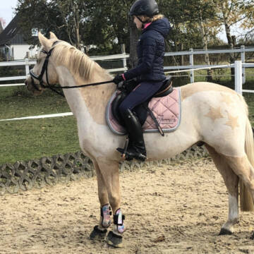
Pferdephysiotherapie
Haltern am See
Pferdephysiotherapie
@feed-your-horse
Pferdephysiotherapeut
Andere Heilverfahren
Magnetfeldtherapie
4 weitere...
aktuell
B+
Deprecated: Creation of dynamic property Zend_View_Helper_Ads::$adLink is deprecated in /var/www/stall-frei/htdocs/staging.stall-frei.de/library/Psf/View/Helper/Ads.php on line 108

Frisches Stroh zu verkaufen!
Mechtersen
STALL-FREIde Marketing
@STALL-FREI-Marketing
Kaufe frisches Stroh für dein Pferd!
Patricia's Scherservice
Dortmund
Patricia-s-Pferde-Scherservice
@Patricia-s-Pferde-Scherservice
Mobiler Scherservice
B+
Leider kein Vorschaubild
Leider kein Vorschaubild
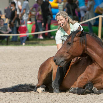
Reitunterricht auf gemütlichem Isihof
Lilienthal
Ulrike-Gast
@Ulrike-Gast
Bodenarbeit
gymnastizierende Arbeit an der Hand
5 weitere...
neu
B+

Hufschmied Hufbearbeitung Duplo Beschlag Barhuf
Iserlohn
Hufbearbeitung Bartkowiak
@hufbearbeitung-bartkowiak
Hufpfleger
Hufschmied
1 weitere...
B+

Hufbearbeitung
Bodenfelde/Wahnmbeck
Absarokee-Horse-Farm
@Absarokee-Horse-Farm
Bodenarbeit
Longenarbeit
Huforthopäde
Hufpfleger
7 weitere...
B+

Mitarbeiter gesucht?
Mechtersen
STALL-FREIde Marketing
@STALL-FREI-Marketing
Stellenangebote kostenlos veröffentlichen!

Reitunterricht FN Trainerin für Reiten
Recklinghausen
Agnes-Jenkis
@Agnes-Jenkis
Bodenarbeit
Longenarbeit
3 weitere...
B+
Freiarbeit, Körpersprache, Horse Agility, Zirkus
Oster
HorseCompetence
@HorseCompetence
Bodenarbeit
Coaching
Beratung rund ums Pferd
3 weitere...
B+
Leider kein Vorschaubild
Leider kein Vorschaubild
Reit- und Voltigierunterricht
Sottrum
Stall-Scheitan
@Stall-Scheitan
Bewegungstrainer
Bodenarbeit
Pferdesitting
Beratung rund ums Pferd
Tierkommunikation
Bachblütentherapie
Homöopathie
13 weitere...
B+
Leider kein Vorschaubild
Leider kein Vorschaubild
Reitunterricht
Apen
AnneMargraf
@AnneMargraf
Kinderreitkurse
Pferdewirt: Pferdezucht und -haltung
Soletherapie
1 weitere...
B+
Anbieter mit Orthopädischer Hufbeschlag
Angebote mit Pferdetransport, Deutschland
Dienstleister mit Hufpfleger
Deprecated: Creation of dynamic property Zend_View::$pageCount is deprecated in /var/www/stall-frei/htdocs/staging.stall-frei.de/library/vendor/shardj/zf1-future/library/Zend/View/Abstract.php on line 308
Deprecated: Creation of dynamic property Zend_View::$itemCountPerPage is deprecated in /var/www/stall-frei/htdocs/staging.stall-frei.de/library/vendor/shardj/zf1-future/library/Zend/View/Abstract.php on line 308
Deprecated: Creation of dynamic property Zend_View::$first is deprecated in /var/www/stall-frei/htdocs/staging.stall-frei.de/library/vendor/shardj/zf1-future/library/Zend/View/Abstract.php on line 308
Deprecated: Creation of dynamic property Zend_View::$current is deprecated in /var/www/stall-frei/htdocs/staging.stall-frei.de/library/vendor/shardj/zf1-future/library/Zend/View/Abstract.php on line 308
Deprecated: Creation of dynamic property Zend_View::$last is deprecated in /var/www/stall-frei/htdocs/staging.stall-frei.de/library/vendor/shardj/zf1-future/library/Zend/View/Abstract.php on line 308
Deprecated: Creation of dynamic property Zend_View::$previous is deprecated in /var/www/stall-frei/htdocs/staging.stall-frei.de/library/vendor/shardj/zf1-future/library/Zend/View/Abstract.php on line 308
Deprecated: Creation of dynamic property Zend_View::$next is deprecated in /var/www/stall-frei/htdocs/staging.stall-frei.de/library/vendor/shardj/zf1-future/library/Zend/View/Abstract.php on line 308
Deprecated: Creation of dynamic property Zend_View::$pagesInRange is deprecated in /var/www/stall-frei/htdocs/staging.stall-frei.de/library/vendor/shardj/zf1-future/library/Zend/View/Abstract.php on line 308
Deprecated: Creation of dynamic property Zend_View::$firstPageInRange is deprecated in /var/www/stall-frei/htdocs/staging.stall-frei.de/library/vendor/shardj/zf1-future/library/Zend/View/Abstract.php on line 308
Deprecated: Creation of dynamic property Zend_View::$lastPageInRange is deprecated in /var/www/stall-frei/htdocs/staging.stall-frei.de/library/vendor/shardj/zf1-future/library/Zend/View/Abstract.php on line 308
Deprecated: Creation of dynamic property Zend_View::$currentItemCount is deprecated in /var/www/stall-frei/htdocs/staging.stall-frei.de/library/vendor/shardj/zf1-future/library/Zend/View/Abstract.php on line 308
Deprecated: Creation of dynamic property Zend_View::$totalItemCount is deprecated in /var/www/stall-frei/htdocs/staging.stall-frei.de/library/vendor/shardj/zf1-future/library/Zend/View/Abstract.php on line 308
Deprecated: Creation of dynamic property Zend_View::$firstItemNumber is deprecated in /var/www/stall-frei/htdocs/staging.stall-frei.de/library/vendor/shardj/zf1-future/library/Zend/View/Abstract.php on line 308
Deprecated: Creation of dynamic property Zend_View::$lastItemNumber is deprecated in /var/www/stall-frei/htdocs/staging.stall-frei.de/library/vendor/shardj/zf1-future/library/Zend/View/Abstract.php on line 308
Deprecated: Creation of dynamic property Zend_View::$router is deprecated in /var/www/stall-frei/htdocs/staging.stall-frei.de/library/vendor/shardj/zf1-future/library/Zend/View/Abstract.php on line 308
Deprecated: Creation of dynamic property Zend_View::$urlParams is deprecated in /var/www/stall-frei/htdocs/staging.stall-frei.de/library/vendor/shardj/zf1-future/library/Zend/View/Abstract.php on line 308
Deprecated: Creation of dynamic property Zend_View::$showAds is deprecated in /var/www/stall-frei/htdocs/staging.stall-frei.de/library/vendor/shardj/zf1-future/library/Zend/View/Abstract.php on line 308
Deprecated: Creation of dynamic property Zend_View::$objectIds is deprecated in /var/www/stall-frei/htdocs/staging.stall-frei.de/library/vendor/shardj/zf1-future/library/Zend/View/Abstract.php on line 308
Deprecated: Creation of dynamic property Zend_View::$showNavbar is deprecated in /var/www/stall-frei/htdocs/staging.stall-frei.de/library/vendor/shardj/zf1-future/library/Zend/View/Abstract.php on line 308
Deprecated: Creation of dynamic property Zend_View::$showBreadcrumb is deprecated in /var/www/stall-frei/htdocs/staging.stall-frei.de/library/vendor/shardj/zf1-future/library/Zend/View/Abstract.php on line 308
Deprecated: Creation of dynamic property Zend_View::$showFooter is deprecated in /var/www/stall-frei/htdocs/staging.stall-frei.de/library/vendor/shardj/zf1-future/library/Zend/View/Abstract.php on line 308
Deprecated: Creation of dynamic property Zend_View::$showInternalAds is deprecated in /var/www/stall-frei/htdocs/staging.stall-frei.de/library/vendor/shardj/zf1-future/library/Zend/View/Abstract.php on line 308
Deprecated: Creation of dynamic property Zend_View::$blNoContent is deprecated in /var/www/stall-frei/htdocs/staging.stall-frei.de/library/vendor/shardj/zf1-future/library/Zend/View/Abstract.php on line 308
Deprecated: Creation of dynamic property Zend_View::$sMetaDesc is deprecated in /var/www/stall-frei/htdocs/staging.stall-frei.de/library/vendor/shardj/zf1-future/library/Zend/View/Abstract.php on line 308
Deprecated: Creation of dynamic property Zend_View::$useGmaps is deprecated in /var/www/stall-frei/htdocs/staging.stall-frei.de/library/vendor/shardj/zf1-future/library/Zend/View/Abstract.php on line 308
Deprecated: Creation of dynamic property Zend_View::$touches is deprecated in /var/www/stall-frei/htdocs/staging.stall-frei.de/library/vendor/shardj/zf1-future/library/Zend/View/Abstract.php on line 308
Deprecated: Creation of dynamic property Zend_View::$oProject is deprecated in /var/www/stall-frei/htdocs/staging.stall-frei.de/library/vendor/shardj/zf1-future/library/Zend/View/Abstract.php on line 308
Deprecated: Creation of dynamic property Zend_View::$pageHeadline is deprecated in /var/www/stall-frei/htdocs/staging.stall-frei.de/library/vendor/shardj/zf1-future/library/Zend/View/Abstract.php on line 308
Deprecated: Creation of dynamic property Zend_View::$disableLocationField is deprecated in /var/www/stall-frei/htdocs/staging.stall-frei.de/library/vendor/shardj/zf1-future/library/Zend/View/Abstract.php on line 308
Deprecated: Creation of dynamic property Zend_View::$isSearch is deprecated in /var/www/stall-frei/htdocs/staging.stall-frei.de/library/vendor/shardj/zf1-future/library/Zend/View/Abstract.php on line 308
Deprecated: Creation of dynamic property Zend_View::$pageTitle is deprecated in /var/www/stall-frei/htdocs/staging.stall-frei.de/library/vendor/shardj/zf1-future/library/Zend/View/Abstract.php on line 308
Deprecated: Creation of dynamic property Psf_Form_Element_Text::$class is deprecated in /var/www/stall-frei/htdocs/staging.stall-frei.de/library/vendor/shardj/zf1-future/library/Zend/Form/Element.php on line 874
Deprecated: Creation of dynamic property Psf_Form_Element_Text::$size is deprecated in /var/www/stall-frei/htdocs/staging.stall-frei.de/library/vendor/shardj/zf1-future/library/Zend/Form/Element.php on line 874
Deprecated: Creation of dynamic property Psf_Form_Element_Text::$placeholder is deprecated in /var/www/stall-frei/htdocs/staging.stall-frei.de/library/vendor/shardj/zf1-future/library/Zend/Form/Element.php on line 874
Deprecated: Creation of dynamic property Psf_Form_Element_Hidden::$class is deprecated in /var/www/stall-frei/htdocs/staging.stall-frei.de/library/vendor/shardj/zf1-future/library/Zend/Form/Element.php on line 874
Deprecated: Creation of dynamic property Psf_Form_Element_Hidden::$class is deprecated in /var/www/stall-frei/htdocs/staging.stall-frei.de/library/vendor/shardj/zf1-future/library/Zend/Form/Element.php on line 874
Deprecated: Creation of dynamic property Psf_Form_Element_Hidden::$class is deprecated in /var/www/stall-frei/htdocs/staging.stall-frei.de/library/vendor/shardj/zf1-future/library/Zend/Form/Element.php on line 874
Deprecated: Creation of dynamic property Psf_Form_Element_Hidden::$class is deprecated in /var/www/stall-frei/htdocs/staging.stall-frei.de/library/vendor/shardj/zf1-future/library/Zend/Form/Element.php on line 874
Deprecated: Creation of dynamic property Psf_Form_Element_Select::$class is deprecated in /var/www/stall-frei/htdocs/staging.stall-frei.de/library/vendor/shardj/zf1-future/library/Zend/Form/Element.php on line 874
Deprecated: Creation of dynamic property Psf_Form_Element_Text::$class is deprecated in /var/www/stall-frei/htdocs/staging.stall-frei.de/library/vendor/shardj/zf1-future/library/Zend/Form/Element.php on line 874
Deprecated: Creation of dynamic property Psf_Form_Element_Checkbox::$label is deprecated in /var/www/stall-frei/htdocs/staging.stall-frei.de/library/vendor/shardj/zf1-future/library/Zend/Form/Element.php on line 874
Deprecated: Creation of dynamic property Zend_View::$sort is deprecated in /var/www/stall-frei/htdocs/staging.stall-frei.de/library/vendor/shardj/zf1-future/library/Zend/View/Abstract.php on line 308
Deprecated: Creation of dynamic property Zend_View::$searchLocation is deprecated in /var/www/stall-frei/htdocs/staging.stall-frei.de/library/vendor/shardj/zf1-future/library/Zend/View/Abstract.php on line 308
Deprecated: Creation of dynamic property Zend_View::$locationHint is deprecated in /var/www/stall-frei/htdocs/staging.stall-frei.de/library/vendor/shardj/zf1-future/library/Zend/View/Abstract.php on line 308
Psf_GeoCoder_Abstract::getLocation: Hohenhorst Get Location CachedOrLive
Psf_GeoCoder_Abstract::getCachedOrLive: Hohenhorst
Psf_GeoCoder_Abstract::convertLocationResult
{"documentation":"https:\/\/opencagedata.com\/api","licenses":[{"name":"see attribution guide","url":"https:\/\/opencagedata.com\/credits"}],"results":[{"bounds":{"northeast":{"lat":52.2759088,"lng":8.3637391},"southwest":{"lat":52.2758088,"lng":8.3636391}},"components":{"ISO_3166-1_alpha-2":"DE","ISO_3166-1_alpha-3":"DEU","ISO_3166-2":["DE-NI"],"_category":"natural\/water","_normalized_city":"Bad Essen","_type":"peak","continent":"Europe","country":"Deutschland","country_code":"de","county":"Landkreis Osnabr\u00fcck","peak":"Hohenhorst","political_union":"European Union","postcode":"49152","state":"Niedersachsen","state_code":"NI","town":"Bad Essen"},"confidence":9,"formatted":"Hohenhorst, 49152 Bad Essen, Deutschland","geometry":{"lat":52.2758588,"lng":8.3636891}},{"bounds":{"northeast":{"lat":53.5916807,"lng":10.1651315},"southwest":{"lat":53.5762406,"lng":10.1315621}},"components":{"ISO_3166-1_alpha-2":"DE","ISO_3166-1_alpha-3":"DEU","ISO_3166-2":["DE-HH"],"_category":"place","_normalized_city":"Hamburg","_type":"neighbourhood","city":"Hamburg","city_district":"Wandsbek","continent":"Europe","country":"Deutschland","country_code":"de","neighbourhood":"Hohenhorst","political_union":"European Union","postcode":"22149","state":"Hamburg","state_code":"HH","suburb":"Rahlstedt"},"confidence":8,"formatted":"22149 Hamburg, Deutschland","geometry":{"lat":53.5837829,"lng":10.1499324}},{"bounds":{"northeast":{"lat":54.1905242,"lng":10.0151335},"southwest":{"lat":54.1505242,"lng":9.9751335}},"components":{"ISO_3166-1_alpha-2":"DE","ISO_3166-1_alpha-3":"DEU","ISO_3166-2":["DE-SH"],"_category":"place","_normalized_city":"M\u00fchbrook","_type":"hamlet","continent":"Europe","country":"Deutschland","country_code":"de","county":"Kreis Rendsburg-Eckernf\u00f6rde","hamlet":"Hohenhorst","municipality":"Bordesholm","political_union":"European Union","postcode":"24582","state":"Schleswig-Holstein","state_code":"SH","village":"M\u00fchbrook"},"confidence":7,"formatted":"Hohenhorst, 24582 M\u00fchbrook, Deutschland","geometry":{"lat":54.1705242,"lng":9.9951335}},{"bounds":{"northeast":{"lat":54.1768544,"lng":10.9163186},"southwest":{"lat":54.1767544,"lng":10.9162186}},"components":{"ISO_3166-1_alpha-2":"DE","ISO_3166-1_alpha-3":"DEU","ISO_3166-2":["DE-SH"],"_category":"building","_normalized_city":"Gr\u00f6mitz","_type":"building","continent":"Europe","country":"Deutschland","country_code":"de","county":"Kreis Ostholstein","isolated_dwelling":"Hohenhorst","political_union":"European Union","postcode":"23743","state":"Schleswig-Holstein","state_code":"SH","town":"Gr\u00f6mitz"},"confidence":10,"formatted":"Hohenhorst, 23743 Gr\u00f6mitz, Deutschland","geometry":{"lat":54.1768044,"lng":10.9162686}},{"bounds":{"northeast":{"lat":53.6542517,"lng":9.5734707},"southwest":{"lat":53.6455656,"lng":9.5604086}},"components":{"ISO_3166-1_alpha-2":"DE","ISO_3166-1_alpha-3":"DEU","ISO_3166-2":["DE-SH"],"_category":"place","_normalized_city":"Haselau","_type":"village","continent":"Europe","country":"Deutschland","country_code":"de","county":"Kreis Pinneberg","municipality":"Amt Geest und Marsch S\u00fcdholstein","political_union":"European Union","postcode":"25489","residential":"Hohenhorst","state":"Schleswig-Holstein","state_code":"SH","village":"Haselau"},"confidence":9,"formatted":"25489 Haselau, Deutschland","geometry":{"lat":53.6499202,"lng":9.5636909}},{"bounds":{"northeast":{"lat":53.9685521,"lng":9.8882423},"southwest":{"lat":53.9592764,"lng":9.8784945}},"components":{"ISO_3166-1_alpha-2":"DE","ISO_3166-1_alpha-3":"DEU","ISO_3166-2":["DE-SH"],"_category":"natural\/water","_normalized_city":"Wiemersdorf","_type":"forest","continent":"Europe","country":"Deutschland","country_code":"de","county":"Kreis Segeberg","forest":"Hohenhorst","hamlet":"Beverloh","municipality":"Amt Bad Bramstedt-Land","political_union":"European Union","postcode":"24649","state":"Schleswig-Holstein","state_code":"SH","village":"Wiemersdorf"},"confidence":9,"formatted":"Hohenhorst, Beverloh, 24649 Wiemersdorf, Deutschland","geometry":{"lat":53.9639246,"lng":9.8834989}},{"bounds":{"northeast":{"lat":54.3280726,"lng":10.4092833},"southwest":{"lat":54.3245232,"lng":10.3989115}},"components":{"ISO_3166-1_alpha-2":"DE","ISO_3166-1_alpha-3":"DEU","ISO_3166-2":["DE-SH"],"_category":"natural\/water","_normalized_city":"Fargau-Pratjau","_type":"forest","continent":"Europe","country":"Deutschland","country_code":"de","county":"Kreis Pl\u00f6n","forest":"Hohenhorst","municipality":"Fargau-Pratjau","political_union":"European Union","postcode":"24256","state":"Schleswig-Holstein","state_code":"SH"},"confidence":9,"formatted":"Hohenhorst, 24256 Fargau-Pratjau, Deutschland","geometry":{"lat":54.3266564,"lng":10.4034801}},{"bounds":{"northeast":{"lat":52.3837525,"lng":9.9567898},"southwest":{"lat":52.3637525,"lng":9.9367898}},"components":{"ISO_3166-1_alpha-2":"DE","ISO_3166-1_alpha-3":"DEU","ISO_3166-2":["DE-NI"],"_category":"place","_normalized_city":"Lehrte","_type":"hamlet","city_district":"Ahlten","continent":"Europe","country":"Deutschland","country_code":"de","county":"Region Hannover","locality":"Hohenhorst","political_union":"European Union","postcode":"31275","state":"Niedersachsen","state_code":"NI","town":"Lehrte"},"confidence":8,"formatted":"Hohenhorst, 31275 Lehrte, Deutschland","geometry":{"lat":52.3737525,"lng":9.9467898}},{"bounds":{"northeast":{"lat":52.0245737,"lng":7.5296857},"southwest":{"lat":52.0204242,"lng":7.501232}},"components":{"ISO_3166-1_alpha-2":"DE","ISO_3166-1_alpha-3":"DEU","ISO_3166-2":["DE-NW"],"_category":"road","_normalized_city":"Altenberge","_type":"road","continent":"Europe","country":"Deutschland","country_code":"de","county":"Kreis Steinfurt","political_union":"European Union","postcode":"48341","road":"Hohenhorst","state":"Nordrhein-Westfalen","state_code":"NW","village":"Altenberge"},"confidence":8,"formatted":"Hohenhorst, 48341 Altenberge, Deutschland","geometry":{"lat":52.0218,"lng":7.5156043}},{"components":{"ISO_3166-1_alpha-2":"FR","ISO_3166-1_alpha-3":"FRA","ISO_3166-2":["FR-IDF","FR-92"],"_category":"road","_normalized_city":"Levallois-Perret","_type":"road","city":"Levallois-Perret","continent":"Europe","country":"France","country_code":"fr","county":"Hauts-de-Seine","local_authority":"M\u00e9tropole du Grand Paris","political_union":"European Union","postcode":"92300","road":"Rue Charles Deutschmann","state":"\u00cele-de-France","state_code":"IDF"},"confidence":2,"formatted":"Rue Charles Deutschmann, 92300 Levallois-Perret, France","geometry":{"lat":48.900049,"lng":2.2842}}],"status":{"code":200,"message":"OK"},"stay_informed":{"blog":"https:\/\/blog.opencagedata.com","mastodon":"https:\/\/en.osm.town\/@opencage"},"thanks":"For using an OpenCage API","timestamp":{"created_http":"Sun, 08 Feb 2026 15:17:07 GMT","created_unix":1770563827},"total_results":10}Array
(
[0] => stdClass Object
(
[bounds] => stdClass Object
(
[northeast] => stdClass Object
(
[lat] => 52.2759088
[lng] => 8.3637391
)
[southwest] => stdClass Object
(
[lat] => 52.2758088
[lng] => 8.3636391
)
)
[components] => stdClass Object
(
[ISO_3166-1_alpha-2] => DE
[ISO_3166-1_alpha-3] => DEU
[ISO_3166-2] => Array
(
[0] => DE-NI
)
[_category] => natural/water
[_normalized_city] => Bad Essen
[_type] => peak
[continent] => Europe
[country] => Deutschland
[country_code] => de
[county] => Landkreis Osnabrück
[peak] => Hohenhorst
[political_union] => European Union
[postcode] => 49152
[state] => Niedersachsen
[state_code] => NI
[town] => Bad Essen
)
[confidence] => 9
[formatted] => Hohenhorst, 49152 Bad Essen, Deutschland
[geometry] => stdClass Object
(
[lat] => 52.2758588
[lng] => 8.3636891
)
)
[1] => stdClass Object
(
[bounds] => stdClass Object
(
[northeast] => stdClass Object
(
[lat] => 53.5916807
[lng] => 10.1651315
)
[southwest] => stdClass Object
(
[lat] => 53.5762406
[lng] => 10.1315621
)
)
[components] => stdClass Object
(
[ISO_3166-1_alpha-2] => DE
[ISO_3166-1_alpha-3] => DEU
[ISO_3166-2] => Array
(
[0] => DE-HH
)
[_category] => place
[_normalized_city] => Hamburg
[_type] => neighbourhood
[city] => Hamburg
[city_district] => Wandsbek
[continent] => Europe
[country] => Deutschland
[country_code] => de
[neighbourhood] => Hohenhorst
[political_union] => European Union
[postcode] => 22149
[state] => Hamburg
[state_code] => HH
[suburb] => Rahlstedt
)
[confidence] => 8
[formatted] => 22149 Hamburg, Deutschland
[geometry] => stdClass Object
(
[lat] => 53.5837829
[lng] => 10.1499324
)
)
[2] => stdClass Object
(
[bounds] => stdClass Object
(
[northeast] => stdClass Object
(
[lat] => 54.1905242
[lng] => 10.0151335
)
[southwest] => stdClass Object
(
[lat] => 54.1505242
[lng] => 9.9751335
)
)
[components] => stdClass Object
(
[ISO_3166-1_alpha-2] => DE
[ISO_3166-1_alpha-3] => DEU
[ISO_3166-2] => Array
(
[0] => DE-SH
)
[_category] => place
[_normalized_city] => Mühbrook
[_type] => hamlet
[continent] => Europe
[country] => Deutschland
[country_code] => de
[county] => Kreis Rendsburg-Eckernförde
[hamlet] => Hohenhorst
[municipality] => Bordesholm
[political_union] => European Union
[postcode] => 24582
[state] => Schleswig-Holstein
[state_code] => SH
[village] => Mühbrook
)
[confidence] => 7
[formatted] => Hohenhorst, 24582 Mühbrook, Deutschland
[geometry] => stdClass Object
(
[lat] => 54.1705242
[lng] => 9.9951335
)
)
[3] => stdClass Object
(
[bounds] => stdClass Object
(
[northeast] => stdClass Object
(
[lat] => 54.1768544
[lng] => 10.9163186
)
[southwest] => stdClass Object
(
[lat] => 54.1767544
[lng] => 10.9162186
)
)
[components] => stdClass Object
(
[ISO_3166-1_alpha-2] => DE
[ISO_3166-1_alpha-3] => DEU
[ISO_3166-2] => Array
(
[0] => DE-SH
)
[_category] => building
[_normalized_city] => Grömitz
[_type] => building
[continent] => Europe
[country] => Deutschland
[country_code] => de
[county] => Kreis Ostholstein
[isolated_dwelling] => Hohenhorst
[political_union] => European Union
[postcode] => 23743
[state] => Schleswig-Holstein
[state_code] => SH
[town] => Grömitz
)
[confidence] => 10
[formatted] => Hohenhorst, 23743 Grömitz, Deutschland
[geometry] => stdClass Object
(
[lat] => 54.1768044
[lng] => 10.9162686
)
)
[4] => stdClass Object
(
[bounds] => stdClass Object
(
[northeast] => stdClass Object
(
[lat] => 53.6542517
[lng] => 9.5734707
)
[southwest] => stdClass Object
(
[lat] => 53.6455656
[lng] => 9.5604086
)
)
[components] => stdClass Object
(
[ISO_3166-1_alpha-2] => DE
[ISO_3166-1_alpha-3] => DEU
[ISO_3166-2] => Array
(
[0] => DE-SH
)
[_category] => place
[_normalized_city] => Haselau
[_type] => village
[continent] => Europe
[country] => Deutschland
[country_code] => de
[county] => Kreis Pinneberg
[municipality] => Amt Geest und Marsch Südholstein
[political_union] => European Union
[postcode] => 25489
[residential] => Hohenhorst
[state] => Schleswig-Holstein
[state_code] => SH
[village] => Haselau
)
[confidence] => 9
[formatted] => 25489 Haselau, Deutschland
[geometry] => stdClass Object
(
[lat] => 53.6499202
[lng] => 9.5636909
)
)
[5] => stdClass Object
(
[bounds] => stdClass Object
(
[northeast] => stdClass Object
(
[lat] => 53.9685521
[lng] => 9.8882423
)
[southwest] => stdClass Object
(
[lat] => 53.9592764
[lng] => 9.8784945
)
)
[components] => stdClass Object
(
[ISO_3166-1_alpha-2] => DE
[ISO_3166-1_alpha-3] => DEU
[ISO_3166-2] => Array
(
[0] => DE-SH
)
[_category] => natural/water
[_normalized_city] => Wiemersdorf
[_type] => forest
[continent] => Europe
[country] => Deutschland
[country_code] => de
[county] => Kreis Segeberg
[forest] => Hohenhorst
[hamlet] => Beverloh
[municipality] => Amt Bad Bramstedt-Land
[political_union] => European Union
[postcode] => 24649
[state] => Schleswig-Holstein
[state_code] => SH
[village] => Wiemersdorf
)
[confidence] => 9
[formatted] => Hohenhorst, Beverloh, 24649 Wiemersdorf, Deutschland
[geometry] => stdClass Object
(
[lat] => 53.9639246
[lng] => 9.8834989
)
)
[6] => stdClass Object
(
[bounds] => stdClass Object
(
[northeast] => stdClass Object
(
[lat] => 54.3280726
[lng] => 10.4092833
)
[southwest] => stdClass Object
(
[lat] => 54.3245232
[lng] => 10.3989115
)
)
[components] => stdClass Object
(
[ISO_3166-1_alpha-2] => DE
[ISO_3166-1_alpha-3] => DEU
[ISO_3166-2] => Array
(
[0] => DE-SH
)
[_category] => natural/water
[_normalized_city] => Fargau-Pratjau
[_type] => forest
[continent] => Europe
[country] => Deutschland
[country_code] => de
[county] => Kreis Plön
[forest] => Hohenhorst
[municipality] => Fargau-Pratjau
[political_union] => European Union
[postcode] => 24256
[state] => Schleswig-Holstein
[state_code] => SH
)
[confidence] => 9
[formatted] => Hohenhorst, 24256 Fargau-Pratjau, Deutschland
[geometry] => stdClass Object
(
[lat] => 54.3266564
[lng] => 10.4034801
)
)
[7] => stdClass Object
(
[bounds] => stdClass Object
(
[northeast] => stdClass Object
(
[lat] => 52.3837525
[lng] => 9.9567898
)
[southwest] => stdClass Object
(
[lat] => 52.3637525
[lng] => 9.9367898
)
)
[components] => stdClass Object
(
[ISO_3166-1_alpha-2] => DE
[ISO_3166-1_alpha-3] => DEU
[ISO_3166-2] => Array
(
[0] => DE-NI
)
[_category] => place
[_normalized_city] => Lehrte
[_type] => hamlet
[city_district] => Ahlten
[continent] => Europe
[country] => Deutschland
[country_code] => de
[county] => Region Hannover
[locality] => Hohenhorst
[political_union] => European Union
[postcode] => 31275
[state] => Niedersachsen
[state_code] => NI
[town] => Lehrte
)
[confidence] => 8
[formatted] => Hohenhorst, 31275 Lehrte, Deutschland
[geometry] => stdClass Object
(
[lat] => 52.3737525
[lng] => 9.9467898
)
)
[8] => stdClass Object
(
[bounds] => stdClass Object
(
[northeast] => stdClass Object
(
[lat] => 52.0245737
[lng] => 7.5296857
)
[southwest] => stdClass Object
(
[lat] => 52.0204242
[lng] => 7.501232
)
)
[components] => stdClass Object
(
[ISO_3166-1_alpha-2] => DE
[ISO_3166-1_alpha-3] => DEU
[ISO_3166-2] => Array
(
[0] => DE-NW
)
[_category] => road
[_normalized_city] => Altenberge
[_type] => road
[continent] => Europe
[country] => Deutschland
[country_code] => de
[county] => Kreis Steinfurt
[political_union] => European Union
[postcode] => 48341
[road] => Hohenhorst
[state] => Nordrhein-Westfalen
[state_code] => NW
[village] => Altenberge
)
[confidence] => 8
[formatted] => Hohenhorst, 48341 Altenberge, Deutschland
[geometry] => stdClass Object
(
[lat] => 52.0218
[lng] => 7.5156043
)
)
[9] => stdClass Object
(
[components] => stdClass Object
(
[ISO_3166-1_alpha-2] => FR
[ISO_3166-1_alpha-3] => FRA
[ISO_3166-2] => Array
(
[0] => FR-IDF
[1] => FR-92
)
[_category] => road
[_normalized_city] => Levallois-Perret
[_type] => road
[city] => Levallois-Perret
[continent] => Europe
[country] => France
[country_code] => fr
[county] => Hauts-de-Seine
[local_authority] => Métropole du Grand Paris
[political_union] => European Union
[postcode] => 92300
[road] => Rue Charles Deutschmann
[state] => Île-de-France
[state_code] => IDF
)
[confidence] => 2
[formatted] => Rue Charles Deutschmann, 92300 Levallois-Perret, France
[geometry] => stdClass Object
(
[lat] => 48.900049
[lng] => 2.2842
)
)
)
Psf_GeoCoder_OpenCageData::getKeyMap: 0
stdClass Object
(
    [bounds] => stdClass Object
        (
            [northeast] => stdClass Object
                (
                    [lat] => 52.2759088
                    [lng] => 8.3637391
                )

            [southwest] => stdClass Object
                (
                    [lat] => 52.2758088
                    [lng] => 8.3636391
                )

        )

    [components] => stdClass Object
        (
            [ISO_3166-1_alpha-2] => DE
            [ISO_3166-1_alpha-3] => DEU
            [ISO_3166-2] => Array
                (
                    [0] => DE-NI
                )

            [_category] => natural/water
            [_normalized_city] => Bad Essen
            [_type] => peak
            [continent] => Europe
            [country] => Deutschland
            [country_code] => de
            [county] => Landkreis Osnabrück
            [peak] => Hohenhorst
            [political_union] => European Union
            [postcode] => 49152
            [state] => Niedersachsen
            [state_code] => NI
            [town] => Bad Essen
        )

    [confidence] => 9
    [formatted] => Hohenhorst, 49152 Bad Essen, Deutschland
    [geometry] => stdClass Object
        (
            [lat] => 52.2758588
            [lng] => 8.3636891
        )

)
Psf_GeoCoder_OpenCageData::getCounty: Osnabrück
Psf_GeoCoder_OpenCageData::addMissingData REFETCH!
Array
(
    [address] => Hohenhorst, 49152 Bad Essen, Deutschland
    [type] => peak
    [street] =>
    [city] => Bad Essen
    [county] => Osnabrück
    [state] => Niedersachsen
    [zip] => 49152
    [country] => Deutschland
    [suburb] =>
    [countrycode] => de
    [latitude] => 52.2758588
    [longitude] => 8.3636891
    [accuracy] => 1
    [confidence] => 9
    [bounds] => stdClass Object
        (
            [northeast] => stdClass Object
                (
                    [lat] => 52.2759088
                    [lng] => 8.3637391
                )

            [southwest] => stdClass Object
                (
                    [lat] => 52.2758088
                    [lng] => 8.3636391
                )

        )

)
reformat!
Array
(
    [address] => Hohenhorst, 49152 Bad Essen, Deutschland
    [type] => peak
    [street] =>
    [city] => Bad Essen
    [county] => Osnabrück
    [state] => Niedersachsen
    [zip] => 49152
    [country] => Deutschland
    [suburb] =>
    [countrycode] => de
    [latitude] => 52.2758588
    [longitude] => 8.3636891
    [accuracy] => 1
    [confidence] => 9
    [bounds] => stdClass Object
        (
            [northeast] => stdClass Object
                (
                    [lat] => 52.2759088
                    [lng] => 8.3637391
                )

            [southwest] => stdClass Object
                (
                    [lat] => 52.2758088
                    [lng] => 8.3636391
                )

        )

    [place] => 49152 Bad Essen, Niedersachsen
    [hash] => 2701010aca11530ec3ab77db39466d1b
)
Psf_GeoCoder_OpenCageData::getKeyMap: 1
stdClass Object
(
    [bounds] => stdClass Object
        (
            [northeast] => stdClass Object
                (
                    [lat] => 53.5916807
                    [lng] => 10.1651315
                )

            [southwest] => stdClass Object
                (
                    [lat] => 53.5762406
                    [lng] => 10.1315621
                )

        )

    [components] => stdClass Object
        (
            [ISO_3166-1_alpha-2] => DE
            [ISO_3166-1_alpha-3] => DEU
            [ISO_3166-2] => Array
                (
                    [0] => DE-HH
                )

            [_category] => place
            [_normalized_city] => Hamburg
            [_type] => neighbourhood
            [city] => Hamburg
            [city_district] => Wandsbek
            [continent] => Europe
            [country] => Deutschland
            [country_code] => de
            [neighbourhood] => Hohenhorst
            [political_union] => European Union
            [postcode] => 22149
            [state] => Hamburg
            [state_code] => HH
            [suburb] => Rahlstedt
        )

    [confidence] => 8
    [formatted] => 22149 Hamburg, Deutschland
    [geometry] => stdClass Object
        (
            [lat] => 53.5837829
            [lng] => 10.1499324
        )

)
Psf_GeoCoder_OpenCageData::getCounty: Hamburg
Psf_GeoCoder_OpenCageData::addMissingData REFETCH!
Array
(
    [address] => 22149 Hamburg, Deutschland
    [type] => neighbourhood
    [street] =>
    [city] => Rahlstedt
    [county] => Hamburg
    [state] => Hamburg
    [zip] => 22149
    [country] => Deutschland
    [suburb] => Rahlstedt
    [countrycode] => de
    [latitude] => 53.5837829
    [longitude] => 10.1499324
    [accuracy] => 1
    [confidence] => 8
    [bounds] => stdClass Object
        (
            [northeast] => stdClass Object
                (
                    [lat] => 53.5916807
                    [lng] => 10.1651315
                )

            [southwest] => stdClass Object
                (
                    [lat] => 53.5762406
                    [lng] => 10.1315621
                )

        )

)
reformat!
Array
(
    [address] => 22149 Rahlstedt
    [type] => neighbourhood
    [street] =>
    [city] => Rahlstedt
    [county] => Hamburg
    [state] => Hamburg
    [zip] => 22149
    [country] => Deutschland
    [suburb] => Rahlstedt
    [countrycode] => de
    [latitude] => 53.5837829
    [longitude] => 10.1499324
    [accuracy] => 1
    [confidence] => 8
    [bounds] => stdClass Object
        (
            [northeast] => stdClass Object
                (
                    [lat] => 53.5916807
                    [lng] => 10.1651315
                )

            [southwest] => stdClass Object
                (
                    [lat] => 53.5762406
                    [lng] => 10.1315621
                )

        )

    [place] => 22149 Rahlstedt, Hamburg
    [hash] => 336e3cbd23b5d019b1c58cdd0b1153b3
)
Psf_GeoCoder_OpenCageData::getKeyMap: 2
stdClass Object
(
    [bounds] => stdClass Object
        (
            [northeast] => stdClass Object
                (
                    [lat] => 54.1905242
                    [lng] => 10.0151335
                )

            [southwest] => stdClass Object
                (
                    [lat] => 54.1505242
                    [lng] => 9.9751335
                )

        )

    [components] => stdClass Object
        (
            [ISO_3166-1_alpha-2] => DE
            [ISO_3166-1_alpha-3] => DEU
            [ISO_3166-2] => Array
                (
                    [0] => DE-SH
                )

            [_category] => place
            [_normalized_city] => Mühbrook
            [_type] => hamlet
            [continent] => Europe
            [country] => Deutschland
            [country_code] => de
            [county] => Kreis Rendsburg-Eckernförde
            [hamlet] => Hohenhorst
            [municipality] => Bordesholm
            [political_union] => European Union
            [postcode] => 24582
            [state] => Schleswig-Holstein
            [state_code] => SH
            [village] => Mühbrook
        )

    [confidence] => 7
    [formatted] => Hohenhorst, 24582 Mühbrook, Deutschland
    [geometry] => stdClass Object
        (
            [lat] => 54.1705242
            [lng] => 9.9951335
        )

)
Psf_GeoCoder_OpenCageData::getCounty: Rendsburg-Eckernförde
Psf_GeoCoder_OpenCageData::addMissingData REFETCH!
Array
(
    [address] => Hohenhorst, 24582 Mühbrook, Deutschland
    [type] => hamlet
    [street] => Hohenhorst
    [city] => Mühbrook
    [county] => Rendsburg-Eckernförde
    [state] => Schleswig-Holstein
    [zip] => 24582
    [country] => Deutschland
    [suburb] =>
    [countrycode] => de
    [latitude] => 54.1705242
    [longitude] => 9.9951335
    [accuracy] => 1
    [confidence] => 7
    [bounds] => stdClass Object
        (
            [northeast] => stdClass Object
                (
                    [lat] => 54.1905242
                    [lng] => 10.0151335
                )

            [southwest] => stdClass Object
                (
                    [lat] => 54.1505242
                    [lng] => 9.9751335
                )

        )

)
reformat!
Array
(
    [address] => Hohenhorst, 24582 Mühbrook, Deutschland
    [type] => hamlet
    [street] => Hohenhorst
    [city] => Mühbrook
    [county] => Rendsburg-Eckernförde
    [state] => Schleswig-Holstein
    [zip] => 24582
    [country] => Deutschland
    [suburb] =>
    [countrycode] => de
    [latitude] => 54.1705242
    [longitude] => 9.9951335
    [accuracy] => 1
    [confidence] => 7
    [bounds] => stdClass Object
        (
            [northeast] => stdClass Object
                (
                    [lat] => 54.1905242
                    [lng] => 10.0151335
                )

            [southwest] => stdClass Object
                (
                    [lat] => 54.1505242
                    [lng] => 9.9751335
                )

        )

    [place] => Hohenhorst, 24582 Mühbrook, Schleswig-Holstein
    [hash] => b6d1d286e6befa141a341c907e3752be
)
Psf_GeoCoder_OpenCageData::getKeyMap: 3
stdClass Object
(
    [bounds] => stdClass Object
        (
            [northeast] => stdClass Object
                (
                    [lat] => 54.1768544
                    [lng] => 10.9163186
                )

            [southwest] => stdClass Object
                (
                    [lat] => 54.1767544
                    [lng] => 10.9162186
                )

        )

    [components] => stdClass Object
        (
            [ISO_3166-1_alpha-2] => DE
            [ISO_3166-1_alpha-3] => DEU
            [ISO_3166-2] => Array
                (
                    [0] => DE-SH
                )

            [_category] => building
            [_normalized_city] => Grömitz
            [_type] => building
            [continent] => Europe
            [country] => Deutschland
            [country_code] => de
            [county] => Kreis Ostholstein
            [isolated_dwelling] => Hohenhorst
            [political_union] => European Union
            [postcode] => 23743
            [state] => Schleswig-Holstein
            [state_code] => SH
            [town] => Grömitz
        )

    [confidence] => 10
    [formatted] => Hohenhorst, 23743 Grömitz, Deutschland
    [geometry] => stdClass Object
        (
            [lat] => 54.1768044
            [lng] => 10.9162686
        )

)
Psf_GeoCoder_OpenCageData::getCounty: Ostholstein
Psf_GeoCoder_OpenCageData::addMissingData REFETCH!
Array
(
    [address] => Hohenhorst, 23743 Grömitz, Deutschland
    [type] => building
    [street] =>
    [city] => Grömitz
    [county] => Ostholstein
    [state] => Schleswig-Holstein
    [zip] => 23743
    [country] => Deutschland
    [suburb] =>
    [countrycode] => de
    [latitude] => 54.1768044
    [longitude] => 10.9162686
    [accuracy] => 1
    [confidence] => 10
    [bounds] => stdClass Object
        (
            [northeast] => stdClass Object
                (
                    [lat] => 54.1768544
                    [lng] => 10.9163186
                )

            [southwest] => stdClass Object
                (
                    [lat] => 54.1767544
                    [lng] => 10.9162186
                )

        )

)
reformat!
Array
(
    [address] => Hohenhorst, 23743 Grömitz, Deutschland
    [type] => building
    [street] =>
    [city] => Grömitz
    [county] => Ostholstein
    [state] => Schleswig-Holstein
    [zip] => 23743
    [country] => Deutschland
    [suburb] =>
    [countrycode] => de
    [latitude] => 54.1768044
    [longitude] => 10.9162686
    [accuracy] => 1
    [confidence] => 10
    [bounds] => stdClass Object
        (
            [northeast] => stdClass Object
                (
                    [lat] => 54.1768544
                    [lng] => 10.9163186
                )

            [southwest] => stdClass Object
                (
                    [lat] => 54.1767544
                    [lng] => 10.9162186
                )

        )

    [place] => 23743 Grömitz, Schleswig-Holstein
    [hash] => 3671a7cb08a430f723395cb25c970980
)
Psf_GeoCoder_OpenCageData::getKeyMap: 4
stdClass Object
(
    [bounds] => stdClass Object
        (
            [northeast] => stdClass Object
                (
                    [lat] => 53.6542517
                    [lng] => 9.5734707
                )

            [southwest] => stdClass Object
                (
                    [lat] => 53.6455656
                    [lng] => 9.5604086
                )

        )

    [components] => stdClass Object
        (
            [ISO_3166-1_alpha-2] => DE
            [ISO_3166-1_alpha-3] => DEU
            [ISO_3166-2] => Array
                (
                    [0] => DE-SH
                )

            [_category] => place
            [_normalized_city] => Haselau
            [_type] => village
            [continent] => Europe
            [country] => Deutschland
            [country_code] => de
            [county] => Kreis Pinneberg
            [municipality] => Amt Geest und Marsch Südholstein
            [political_union] => European Union
            [postcode] => 25489
            [residential] => Hohenhorst
            [state] => Schleswig-Holstein
            [state_code] => SH
            [village] => Haselau
        )

    [confidence] => 9
    [formatted] => 25489 Haselau, Deutschland
    [geometry] => stdClass Object
        (
            [lat] => 53.6499202
            [lng] => 9.5636909
        )

)
Psf_GeoCoder_OpenCageData::getCounty: Pinneberg
Psf_GeoCoder_OpenCageData::addMissingData REFETCH!
Array
(
    [address] => 25489 Haselau, Deutschland
    [type] => village
    [street] =>
    [city] => Haselau
    [county] => Pinneberg
    [state] => Schleswig-Holstein
    [zip] => 25489
    [country] => Deutschland
    [suburb] =>
    [countrycode] => de
    [latitude] => 53.6499202
    [longitude] => 9.5636909
    [accuracy] => 1
    [confidence] => 9
    [bounds] => stdClass Object
        (
            [northeast] => stdClass Object
                (
                    [lat] => 53.6542517
                    [lng] => 9.5734707
                )

            [southwest] => stdClass Object
                (
                    [lat] => 53.6455656
                    [lng] => 9.5604086
                )

        )

)
reformat!
Array
(
    [address] => 25489 Haselau, Deutschland
    [type] => village
    [street] =>
    [city] => Haselau
    [county] => Pinneberg
    [state] => Schleswig-Holstein
    [zip] => 25489
    [country] => Deutschland
    [suburb] =>
    [countrycode] => de
    [latitude] => 53.6499202
    [longitude] => 9.5636909
    [accuracy] => 1
    [confidence] => 9
    [bounds] => stdClass Object
        (
            [northeast] => stdClass Object
                (
                    [lat] => 53.6542517
                    [lng] => 9.5734707
                )

            [southwest] => stdClass Object
                (
                    [lat] => 53.6455656
                    [lng] => 9.5604086
                )

        )

    [place] => 25489 Haselau, Schleswig-Holstein
    [hash] => 886b00c5d46afa032a19984b9ebfafb0
)
Psf_GeoCoder_OpenCageData::getKeyMap: 5
stdClass Object
(
    [bounds] => stdClass Object
        (
            [northeast] => stdClass Object
                (
                    [lat] => 53.9685521
                    [lng] => 9.8882423
                )

            [southwest] => stdClass Object
                (
                    [lat] => 53.9592764
                    [lng] => 9.8784945
                )

        )

    [components] => stdClass Object
        (
            [ISO_3166-1_alpha-2] => DE
            [ISO_3166-1_alpha-3] => DEU
            [ISO_3166-2] => Array
                (
                    [0] => DE-SH
                )

            [_category] => natural/water
            [_normalized_city] => Wiemersdorf
            [_type] => forest
            [continent] => Europe
            [country] => Deutschland
            [country_code] => de
            [county] => Kreis Segeberg
            [forest] => Hohenhorst
            [hamlet] => Beverloh
            [municipality] => Amt Bad Bramstedt-Land
            [political_union] => European Union
            [postcode] => 24649
            [state] => Schleswig-Holstein
            [state_code] => SH
            [village] => Wiemersdorf
        )

    [confidence] => 9
    [formatted] => Hohenhorst, Beverloh, 24649 Wiemersdorf, Deutschland
    [geometry] => stdClass Object
        (
            [lat] => 53.9639246
            [lng] => 9.8834989
        )

)
Psf_GeoCoder_OpenCageData::getCounty: Segeberg
Psf_GeoCoder_OpenCageData::addMissingData REFETCH!
Array
(
    [address] => Hohenhorst, Beverloh, 24649 Wiemersdorf, Deutschland
    [type] => forest
    [street] => Beverloh
    [city] => Wiemersdorf
    [county] => Segeberg
    [state] => Schleswig-Holstein
    [zip] => 24649
    [country] => Deutschland
    [suburb] =>
    [countrycode] => de
    [latitude] => 53.9639246
    [longitude] => 9.8834989
    [accuracy] => 1
    [confidence] => 9
    [bounds] => stdClass Object
        (
            [northeast] => stdClass Object
                (
                    [lat] => 53.9685521
                    [lng] => 9.8882423
                )

            [southwest] => stdClass Object
                (
                    [lat] => 53.9592764
                    [lng] => 9.8784945
                )

        )

)
reformat!
Array
(
    [address] => Hohenhorst, Beverloh, 24649 Wiemersdorf, Deutschland
    [type] => forest
    [street] => Beverloh
    [city] => Wiemersdorf
    [county] => Segeberg
    [state] => Schleswig-Holstein
    [zip] => 24649
    [country] => Deutschland
    [suburb] =>
    [countrycode] => de
    [latitude] => 53.9639246
    [longitude] => 9.8834989
    [accuracy] => 1
    [confidence] => 9
    [bounds] => stdClass Object
        (
            [northeast] => stdClass Object
                (
                    [lat] => 53.9685521
                    [lng] => 9.8882423
                )

            [southwest] => stdClass Object
                (
                    [lat] => 53.9592764
                    [lng] => 9.8784945
                )

        )

    [place] => Beverloh, 24649 Wiemersdorf, Schleswig-Holstein
    [hash] => 8f48635beeb80f8d20dc3197d4132bf2
)
Psf_GeoCoder_OpenCageData::getKeyMap: 6
stdClass Object
(
    [bounds] => stdClass Object
        (
            [northeast] => stdClass Object
                (
                    [lat] => 54.3280726
                    [lng] => 10.4092833
                )

            [southwest] => stdClass Object
                (
                    [lat] => 54.3245232
                    [lng] => 10.3989115
                )

        )

    [components] => stdClass Object
        (
            [ISO_3166-1_alpha-2] => DE
            [ISO_3166-1_alpha-3] => DEU
            [ISO_3166-2] => Array
                (
                    [0] => DE-SH
                )

            [_category] => natural/water
            [_normalized_city] => Fargau-Pratjau
            [_type] => forest
            [continent] => Europe
            [country] => Deutschland
            [country_code] => de
            [county] => Kreis Plön
            [forest] => Hohenhorst
            [municipality] => Fargau-Pratjau
            [political_union] => European Union
            [postcode] => 24256
            [state] => Schleswig-Holstein
            [state_code] => SH
        )

    [confidence] => 9
    [formatted] => Hohenhorst, 24256 Fargau-Pratjau, Deutschland
    [geometry] => stdClass Object
        (
            [lat] => 54.3266564
            [lng] => 10.4034801
        )

)
Psf_GeoCoder_OpenCageData::getCounty: Plön
Psf_GeoCoder_OpenCageData::addMissingData REFETCH!
Array
(
    [address] => Hohenhorst, 24256 Fargau-Pratjau, Deutschland
    [type] => forest
    [street] =>
    [city] =>
    [county] => Plön
    [state] => Schleswig-Holstein
    [zip] => 24256
    [country] => Deutschland
    [suburb] =>
    [countrycode] => de
    [latitude] => 54.3266564
    [longitude] => 10.4034801
    [accuracy] => 1
    [confidence] => 9
    [bounds] => stdClass Object
        (
            [northeast] => stdClass Object
                (
                    [lat] => 54.3280726
                    [lng] => 10.4092833
                )

            [southwest] => stdClass Object
                (
                    [lat] => 54.3245232
                    [lng] => 10.3989115
                )

        )

)
reformat!
Array
(
    [address] => Hohenhorst, 24256 Fargau-Pratjau, Deutschland
    [type] => forest
    [street] =>
    [city] =>
    [county] => Plön
    [state] => Schleswig-Holstein
    [zip] => 24256
    [country] => Deutschland
    [suburb] =>
    [countrycode] => de
    [latitude] => 54.3266564
    [longitude] => 10.4034801
    [accuracy] => 1
    [confidence] => 9
    [bounds] => stdClass Object
        (
            [northeast] => stdClass Object
                (
                    [lat] => 54.3280726
                    [lng] => 10.4092833
                )

            [southwest] => stdClass Object
                (
                    [lat] => 54.3245232
                    [lng] => 10.3989115
                )

        )

    [place] => 24256 , Schleswig-Holstein
    [hash] => b7b1f3542bb94264f0f2351a6e693d4e
)
Psf_GeoCoder_OpenCageData::getKeyMap: 7
stdClass Object
(
    [bounds] => stdClass Object
        (
            [northeast] => stdClass Object
                (
                    [lat] => 52.3837525
                    [lng] => 9.9567898
                )

            [southwest] => stdClass Object
                (
                    [lat] => 52.3637525
                    [lng] => 9.9367898
                )

        )

    [components] => stdClass Object
        (
            [ISO_3166-1_alpha-2] => DE
            [ISO_3166-1_alpha-3] => DEU
            [ISO_3166-2] => Array
                (
                    [0] => DE-NI
                )

            [_category] => place
            [_normalized_city] => Lehrte
            [_type] => hamlet
            [city_district] => Ahlten
            [continent] => Europe
            [country] => Deutschland
            [country_code] => de
            [county] => Region Hannover
            [locality] => Hohenhorst
            [political_union] => European Union
            [postcode] => 31275
            [state] => Niedersachsen
            [state_code] => NI
            [town] => Lehrte
        )

    [confidence] => 8
    [formatted] => Hohenhorst, 31275 Lehrte, Deutschland
    [geometry] => stdClass Object
        (
            [lat] => 52.3737525
            [lng] => 9.9467898
        )

)
Psf_GeoCoder_OpenCageData::getCounty: Hannover
Psf_GeoCoder_OpenCageData::addMissingData REFETCH!
Array
(
    [address] => Hohenhorst, 31275 Lehrte, Deutschland
    [type] => hamlet
    [street] =>
    [city] => Lehrte
    [county] => Hannover
    [state] => Niedersachsen
    [zip] => 31275
    [country] => Deutschland
    [suburb] =>
    [countrycode] => de
    [latitude] => 52.3737525
    [longitude] => 9.9467898
    [accuracy] => 1
    [confidence] => 8
    [bounds] => stdClass Object
        (
            [northeast] => stdClass Object
                (
                    [lat] => 52.3837525
                    [lng] => 9.9567898
                )

            [southwest] => stdClass Object
                (
                    [lat] => 52.3637525
                    [lng] => 9.9367898
                )

        )

)
reformat!
Array
(
    [address] => Hohenhorst, 31275 Lehrte, Deutschland
    [type] => hamlet
    [street] =>
    [city] => Lehrte
    [county] => Hannover
    [state] => Niedersachsen
    [zip] => 31275
    [country] => Deutschland
    [suburb] =>
    [countrycode] => de
    [latitude] => 52.3737525
    [longitude] => 9.9467898
    [accuracy] => 1
    [confidence] => 8
    [bounds] => stdClass Object
        (
            [northeast] => stdClass Object
                (
                    [lat] => 52.3837525
                    [lng] => 9.9567898
                )

            [southwest] => stdClass Object
                (
                    [lat] => 52.3637525
                    [lng] => 9.9367898
                )

        )

    [place] => 31275 Lehrte, Niedersachsen
    [hash] => f8b31190e2efd9e7729245fde345eac3
)
Psf_GeoCoder_OpenCageData::getKeyMap: 8
stdClass Object
(
    [bounds] => stdClass Object
        (
            [northeast] => stdClass Object
                (
                    [lat] => 52.0245737
                    [lng] => 7.5296857
                )

            [southwest] => stdClass Object
                (
                    [lat] => 52.0204242
                    [lng] => 7.501232
                )

        )

    [components] => stdClass Object
        (
            [ISO_3166-1_alpha-2] => DE
            [ISO_3166-1_alpha-3] => DEU
            [ISO_3166-2] => Array
                (
                    [0] => DE-NW
                )

            [_category] => road
            [_normalized_city] => Altenberge
            [_type] => road
            [continent] => Europe
            [country] => Deutschland
            [country_code] => de
            [county] => Kreis Steinfurt
            [political_union] => European Union
            [postcode] => 48341
            [road] => Hohenhorst
            [state] => Nordrhein-Westfalen
            [state_code] => NW
            [village] => Altenberge
        )

    [confidence] => 8
    [formatted] => Hohenhorst, 48341 Altenberge, Deutschland
    [geometry] => stdClass Object
        (
            [lat] => 52.0218
            [lng] => 7.5156043
        )

)
Psf_GeoCoder_OpenCageData::getCounty: Steinfurt
Psf_GeoCoder_OpenCageData::addMissingData REFETCH!
Array
(
    [address] => Hohenhorst, 48341 Altenberge, Deutschland
    [type] => road
    [street] => Hohenhorst
    [city] => Altenberge
    [county] => Steinfurt
    [state] => Nordrhein-Westfalen
    [zip] => 48341
    [country] => Deutschland
    [suburb] =>
    [countrycode] => de
    [latitude] => 52.0218
    [longitude] => 7.5156043
    [accuracy] => 1
    [confidence] => 8
    [bounds] => stdClass Object
        (
            [northeast] => stdClass Object
                (
                    [lat] => 52.0245737
                    [lng] => 7.5296857
                )

            [southwest] => stdClass Object
                (
                    [lat] => 52.0204242
                    [lng] => 7.501232
                )

        )

)
reformat!
Array
(
    [address] => Hohenhorst, 48341 Altenberge, Deutschland
    [type] => road
    [street] => Hohenhorst
    [city] => Altenberge
    [county] => Steinfurt
    [state] => Nordrhein-Westfalen
    [zip] => 48341
    [country] => Deutschland
    [suburb] =>
    [countrycode] => de
    [latitude] => 52.0218
    [longitude] => 7.5156043
    [accuracy] => 1
    [confidence] => 8
    [bounds] => stdClass Object
        (
            [northeast] => stdClass Object
                (
                    [lat] => 52.0245737
                    [lng] => 7.5296857
                )

            [southwest] => stdClass Object
                (
                    [lat] => 52.0204242
                    [lng] => 7.501232
                )

        )

    [place] => Hohenhorst, 48341 Altenberge, Nordrhein-Westfalen
    [hash] => 6d855ff7fb4b77ded1a6bf3d65595929
)
Psf_GeoCoder_OpenCageData::getKeyMap: 9
stdClass Object
(
    [components] => stdClass Object
        (
            [ISO_3166-1_alpha-2] => FR
            [ISO_3166-1_alpha-3] => FRA
            [ISO_3166-2] => Array
                (
                    [0] => FR-IDF
                    [1] => FR-92
                )

            [_category] => road
            [_normalized_city] => Levallois-Perret
            [_type] => road
            [city] => Levallois-Perret
            [continent] => Europe
            [country] => France
            [country_code] => fr
            [county] => Hauts-de-Seine
            [local_authority] => Métropole du Grand Paris
            [political_union] => European Union
            [postcode] => 92300
            [road] => Rue Charles Deutschmann
            [state] => Île-de-France
            [state_code] => IDF
        )

    [confidence] => 2
    [formatted] => Rue Charles Deutschmann, 92300 Levallois-Perret, France
    [geometry] => stdClass Object
        (
            [lat] => 48.900049
            [lng] => 2.2842
        )

)
Psf_GeoCoder_OpenCageData::getCounty: Hauts-de-Seine
Psf_GeoCoder_OpenCageData::addMissingData REFETCH!
Array
(
    [address] => Rue Charles Deutschmann, 92300 Levallois-Perret, France
    [type] => road
    [street] => Rue Charles Deutschmann
    [city] => Levallois-Perret
    [county] => Hauts-de-Seine
    [state] => Île-de-France
    [zip] => 92300
    [country] => France
    [suburb] =>
    [countrycode] => fr
    [latitude] => 48.900049
    [longitude] => 2.2842
    [accuracy] => 1
    [confidence] => 2
    [bounds] =>
)
reformat!
Array
(
    [address] => Rue Charles Deutschmann, 92300 Levallois-Perret, France
    [type] => road
    [street] => Rue Charles Deutschmann
    [city] => Levallois-Perret
    [county] => Hauts-de-Seine
    [state] => Île-de-France
    [zip] => 92300
    [country] => France
    [suburb] =>
    [countrycode] => fr
    [latitude] => 48.900049
    [longitude] => 2.2842
    [accuracy] => 1
    [confidence] => 2
    [bounds] =>
    [place] => Rue Charles Deutschmann, 92300 Levallois-Perret, Île-de-France
    [hash] => b7dc44def3990e8a7eaf18e019eca466
)
Deprecated: Creation of dynamic property Zend_View::$locationHintStyle is deprecated in /var/www/stall-frei/htdocs/staging.stall-frei.de/library/vendor/shardj/zf1-future/library/Zend/View/Abstract.php on line 308
Deprecated: Creation of dynamic property Zend_View::$adGeoLocation is deprecated in /var/www/stall-frei/htdocs/staging.stall-frei.de/library/vendor/shardj/zf1-future/library/Zend/View/Abstract.php on line 308
Deprecated: Creation of dynamic property Zend_View::$recordCount is deprecated in /var/www/stall-frei/htdocs/staging.stall-frei.de/library/vendor/shardj/zf1-future/library/Zend/View/Abstract.php on line 308
Deprecated: Creation of dynamic property Zend_View::$paginationParams is deprecated in /var/www/stall-frei/htdocs/staging.stall-frei.de/library/vendor/shardj/zf1-future/library/Zend/View/Abstract.php on line 308
Deprecated: Creation of dynamic property Zend_View::$objectPaginator is deprecated in /var/www/stall-frei/htdocs/staging.stall-frei.de/library/vendor/shardj/zf1-future/library/Zend/View/Abstract.php on line 308
Deprecated: Creation of dynamic property Zend_View::$featuredObjects is deprecated in /var/www/stall-frei/htdocs/staging.stall-frei.de/library/vendor/shardj/zf1-future/library/Zend/View/Abstract.php on line 308
Deprecated: Creation of dynamic property Zend_View::$hints is deprecated in /var/www/stall-frei/htdocs/staging.stall-frei.de/library/vendor/shardj/zf1-future/library/Zend/View/Abstract.php on line 308
Deprecated: Creation of dynamic property Zend_View::$attributeHints is deprecated in /var/www/stall-frei/htdocs/staging.stall-frei.de/library/vendor/shardj/zf1-future/library/Zend/View/Abstract.php on line 308
Deprecated: Creation of dynamic property Zend_View::$oSearchForm is deprecated in /var/www/stall-frei/htdocs/staging.stall-frei.de/library/vendor/shardj/zf1-future/library/Zend/View/Abstract.php on line 308