Deprecated: Creation of dynamic property Zend_View::$sMode is deprecated in /var/www/stall-frei/htdocs/staging.stall-frei.de/library/vendor/shardj/zf1-future/library/Zend/View/Abstract.php on line 308
Dienstleistung in Callbach
Gesucht wird in "67829 Callbach, Deutschland"
488 Einträge
Deprecated: Creation of dynamic property Zend_View::$listObjects is deprecated in /var/www/stall-frei/htdocs/staging.stall-frei.de/library/vendor/shardj/zf1-future/library/Zend/View/Abstract.php on line 308
Deprecated: Creation of dynamic property Zend_View::$listMode is deprecated in /var/www/stall-frei/htdocs/staging.stall-frei.de/library/vendor/shardj/zf1-future/library/Zend/View/Abstract.php on line 308
Deprecated: Creation of dynamic property Zend_View::$renderedObjects is deprecated in /var/www/stall-frei/htdocs/staging.stall-frei.de/library/vendor/shardj/zf1-future/library/Zend/View/Abstract.php on line 308
Deprecated: Creation of dynamic property Zend_View::$index is deprecated in /var/www/stall-frei/htdocs/staging.stall-frei.de/library/vendor/shardj/zf1-future/library/Zend/View/Abstract.php on line 308
Deprecated: Creation of dynamic property Zend_View::$displayMode is deprecated in /var/www/stall-frei/htdocs/staging.stall-frei.de/library/vendor/shardj/zf1-future/library/Zend/View/Abstract.php on line 308
Deprecated: Creation of dynamic property Zend_View::$remarketingIds is deprecated in /var/www/stall-frei/htdocs/staging.stall-frei.de/library/vendor/shardj/zf1-future/library/Zend/View/Abstract.php on line 308
Deprecated: Creation of dynamic property Zend_View::$listItem is deprecated in /var/www/stall-frei/htdocs/staging.stall-frei.de/library/vendor/shardj/zf1-future/library/Zend/View/Abstract.php on line 308
Deprecated: Creation of dynamic property Zend_View::$object is deprecated in /var/www/stall-frei/htdocs/staging.stall-frei.de/library/vendor/shardj/zf1-future/library/Zend/View/Abstract.php on line 308
Deprecated: Creation of dynamic property Zend_View::$attributes is deprecated in /var/www/stall-frei/htdocs/staging.stall-frei.de/library/vendor/shardj/zf1-future/library/Zend/View/Abstract.php on line 308

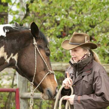
Barhufbearbeitung für Pferde und Esel
Rehborn
Claudia Wückert - HufPassion
@ClaudiaWueckert-Hufpassion
Huforthopäde
Hufpfleger
B+

Deprecated: Creation of dynamic property Zend_View_Helper_Ads::$adLink is deprecated in /var/www/stall-frei/htdocs/staging.stall-frei.de/library/Psf/View/Helper/Ads.php on line 108

***Reitstall Birkenhof*** Pferdegerechte Haltung
Köln
Daniele-Fazzi
@Daniele-Fazzi
Herzlich Willkommen
auf dem Reitstall Birkenhof
Jetzt neu ‼️ auf dem Birkenhof:
Private Geländestrecke rund um unser

Faszienetik nach Franz Grünbeck
Hallgarten
gruenwald_stefanie
@gruenwald_stefanie
Pferdeausbildung
Andere Heilverfahren
Bachblütentherapie
2 weitere...
B+
Nat. Horsemanship, Unterricht, Pferdesitting
Seesbach
pferd-24-hs-de
@pferd-24-hs-de
Bodenarbeit
Coaching
Pferdesitting
Gestaltung Internetauftritt
Sonstiges
Reiki bei Pferden
Tierpsychologe
8 weitere...
B+

Natur & Pferd - Hufpflege (biomechanisch ges...
Stromberg
Natur & Pferd
@Tina_Annemueller
Hufpfleger
B+


Persönlichkeitsentwicklung mit Pferden
Bad Salzuflen
Katja Dors
@Pferdezeiten
Begleite andere auf ihrem Entwicklungsweg und entdecke die transformative Kraft der pferdegestützten Persönlichkeitsentwicklung !
neu
R

Ausbildung und energetische Pferdeosteopathie
Sonnenberg-Winnenberg
Andrea Findley
@AndreaFindley
Bewegungstrainer
Bodenarbeit
Akupressur
Akupunktmassage nach Penzel
14 weitere...
B+
Wanderreitstation am Jakobs Pilgerweg
Vendersheim
Rheinhessischer-Pferdegarten
@Rheinhessischer-Pferdegarten
Bewegungstrainer
Bodenarbeit
Hufpfleger
Hufschmied
Futtermittel: Herstellung
Pferdesitting
18 weitere...
B+

Pferdeladen-Schott/Futtermittel/Einstreu/Stallbed
Tiefenthal
Hof-Hohe-Birken
@Schott-Cornelia-HofHoheBirken
Futtermittel: Ladengeschäft
Futtermittel: Lieferung oder Versand
Pferdeverkauf
Beratung rund ums Pferd
Sonstiges
1 weitere...
B+
Deprecated: Creation of dynamic property Zend_View::$pageCount is deprecated in /var/www/stall-frei/htdocs/staging.stall-frei.de/library/vendor/shardj/zf1-future/library/Zend/View/Abstract.php on line 308
Deprecated: Creation of dynamic property Zend_View::$itemCountPerPage is deprecated in /var/www/stall-frei/htdocs/staging.stall-frei.de/library/vendor/shardj/zf1-future/library/Zend/View/Abstract.php on line 308
Deprecated: Creation of dynamic property Zend_View::$first is deprecated in /var/www/stall-frei/htdocs/staging.stall-frei.de/library/vendor/shardj/zf1-future/library/Zend/View/Abstract.php on line 308
Deprecated: Creation of dynamic property Zend_View::$current is deprecated in /var/www/stall-frei/htdocs/staging.stall-frei.de/library/vendor/shardj/zf1-future/library/Zend/View/Abstract.php on line 308
Deprecated: Creation of dynamic property Zend_View::$last is deprecated in /var/www/stall-frei/htdocs/staging.stall-frei.de/library/vendor/shardj/zf1-future/library/Zend/View/Abstract.php on line 308
Deprecated: Creation of dynamic property Zend_View::$next is deprecated in /var/www/stall-frei/htdocs/staging.stall-frei.de/library/vendor/shardj/zf1-future/library/Zend/View/Abstract.php on line 308
Deprecated: Creation of dynamic property Zend_View::$pagesInRange is deprecated in /var/www/stall-frei/htdocs/staging.stall-frei.de/library/vendor/shardj/zf1-future/library/Zend/View/Abstract.php on line 308
Deprecated: Creation of dynamic property Zend_View::$firstPageInRange is deprecated in /var/www/stall-frei/htdocs/staging.stall-frei.de/library/vendor/shardj/zf1-future/library/Zend/View/Abstract.php on line 308
Deprecated: Creation of dynamic property Zend_View::$lastPageInRange is deprecated in /var/www/stall-frei/htdocs/staging.stall-frei.de/library/vendor/shardj/zf1-future/library/Zend/View/Abstract.php on line 308
Deprecated: Creation of dynamic property Zend_View::$currentItemCount is deprecated in /var/www/stall-frei/htdocs/staging.stall-frei.de/library/vendor/shardj/zf1-future/library/Zend/View/Abstract.php on line 308
Deprecated: Creation of dynamic property Zend_View::$totalItemCount is deprecated in /var/www/stall-frei/htdocs/staging.stall-frei.de/library/vendor/shardj/zf1-future/library/Zend/View/Abstract.php on line 308
Deprecated: Creation of dynamic property Zend_View::$firstItemNumber is deprecated in /var/www/stall-frei/htdocs/staging.stall-frei.de/library/vendor/shardj/zf1-future/library/Zend/View/Abstract.php on line 308
Deprecated: Creation of dynamic property Zend_View::$lastItemNumber is deprecated in /var/www/stall-frei/htdocs/staging.stall-frei.de/library/vendor/shardj/zf1-future/library/Zend/View/Abstract.php on line 308
Deprecated: Creation of dynamic property Zend_View::$router is deprecated in /var/www/stall-frei/htdocs/staging.stall-frei.de/library/vendor/shardj/zf1-future/library/Zend/View/Abstract.php on line 308
Deprecated: Creation of dynamic property Zend_View::$urlParams is deprecated in /var/www/stall-frei/htdocs/staging.stall-frei.de/library/vendor/shardj/zf1-future/library/Zend/View/Abstract.php on line 308
Deprecated: Creation of dynamic property Zend_View::$showAds is deprecated in /var/www/stall-frei/htdocs/staging.stall-frei.de/library/vendor/shardj/zf1-future/library/Zend/View/Abstract.php on line 308
Deprecated: Creation of dynamic property Zend_View::$objectIds is deprecated in /var/www/stall-frei/htdocs/staging.stall-frei.de/library/vendor/shardj/zf1-future/library/Zend/View/Abstract.php on line 308
Deprecated: Creation of dynamic property Zend_View::$showNavbar is deprecated in /var/www/stall-frei/htdocs/staging.stall-frei.de/library/vendor/shardj/zf1-future/library/Zend/View/Abstract.php on line 308
Deprecated: Creation of dynamic property Zend_View::$showBreadcrumb is deprecated in /var/www/stall-frei/htdocs/staging.stall-frei.de/library/vendor/shardj/zf1-future/library/Zend/View/Abstract.php on line 308
Deprecated: Creation of dynamic property Zend_View::$showFooter is deprecated in /var/www/stall-frei/htdocs/staging.stall-frei.de/library/vendor/shardj/zf1-future/library/Zend/View/Abstract.php on line 308
Deprecated: Creation of dynamic property Zend_View::$showInternalAds is deprecated in /var/www/stall-frei/htdocs/staging.stall-frei.de/library/vendor/shardj/zf1-future/library/Zend/View/Abstract.php on line 308
Deprecated: Creation of dynamic property Zend_View::$blNoContent is deprecated in /var/www/stall-frei/htdocs/staging.stall-frei.de/library/vendor/shardj/zf1-future/library/Zend/View/Abstract.php on line 308
Deprecated: Creation of dynamic property Zend_View::$sMetaDesc is deprecated in /var/www/stall-frei/htdocs/staging.stall-frei.de/library/vendor/shardj/zf1-future/library/Zend/View/Abstract.php on line 308
Deprecated: Creation of dynamic property Zend_View::$useGmaps is deprecated in /var/www/stall-frei/htdocs/staging.stall-frei.de/library/vendor/shardj/zf1-future/library/Zend/View/Abstract.php on line 308
Deprecated: Creation of dynamic property Zend_View::$touches is deprecated in /var/www/stall-frei/htdocs/staging.stall-frei.de/library/vendor/shardj/zf1-future/library/Zend/View/Abstract.php on line 308
Deprecated: Creation of dynamic property Zend_View::$oProject is deprecated in /var/www/stall-frei/htdocs/staging.stall-frei.de/library/vendor/shardj/zf1-future/library/Zend/View/Abstract.php on line 308
Deprecated: Creation of dynamic property Zend_View::$pageHeadline is deprecated in /var/www/stall-frei/htdocs/staging.stall-frei.de/library/vendor/shardj/zf1-future/library/Zend/View/Abstract.php on line 308
Deprecated: Creation of dynamic property Zend_View::$disableLocationField is deprecated in /var/www/stall-frei/htdocs/staging.stall-frei.de/library/vendor/shardj/zf1-future/library/Zend/View/Abstract.php on line 308
Deprecated: Creation of dynamic property Zend_View::$isSearch is deprecated in /var/www/stall-frei/htdocs/staging.stall-frei.de/library/vendor/shardj/zf1-future/library/Zend/View/Abstract.php on line 308
Deprecated: Creation of dynamic property Zend_View::$pageTitle is deprecated in /var/www/stall-frei/htdocs/staging.stall-frei.de/library/vendor/shardj/zf1-future/library/Zend/View/Abstract.php on line 308
Deprecated: Creation of dynamic property Psf_Form_Element_Text::$class is deprecated in /var/www/stall-frei/htdocs/staging.stall-frei.de/library/vendor/shardj/zf1-future/library/Zend/Form/Element.php on line 874
Deprecated: Creation of dynamic property Psf_Form_Element_Text::$size is deprecated in /var/www/stall-frei/htdocs/staging.stall-frei.de/library/vendor/shardj/zf1-future/library/Zend/Form/Element.php on line 874
Deprecated: Creation of dynamic property Psf_Form_Element_Text::$placeholder is deprecated in /var/www/stall-frei/htdocs/staging.stall-frei.de/library/vendor/shardj/zf1-future/library/Zend/Form/Element.php on line 874
Deprecated: Creation of dynamic property Psf_Form_Element_Hidden::$class is deprecated in /var/www/stall-frei/htdocs/staging.stall-frei.de/library/vendor/shardj/zf1-future/library/Zend/Form/Element.php on line 874
Deprecated: Creation of dynamic property Psf_Form_Element_Hidden::$class is deprecated in /var/www/stall-frei/htdocs/staging.stall-frei.de/library/vendor/shardj/zf1-future/library/Zend/Form/Element.php on line 874
Deprecated: Creation of dynamic property Psf_Form_Element_Hidden::$class is deprecated in /var/www/stall-frei/htdocs/staging.stall-frei.de/library/vendor/shardj/zf1-future/library/Zend/Form/Element.php on line 874
Deprecated: Creation of dynamic property Psf_Form_Element_Hidden::$class is deprecated in /var/www/stall-frei/htdocs/staging.stall-frei.de/library/vendor/shardj/zf1-future/library/Zend/Form/Element.php on line 874
Deprecated: Creation of dynamic property Psf_Form_Element_Select::$class is deprecated in /var/www/stall-frei/htdocs/staging.stall-frei.de/library/vendor/shardj/zf1-future/library/Zend/Form/Element.php on line 874
Deprecated: Creation of dynamic property Psf_Form_Element_Text::$class is deprecated in /var/www/stall-frei/htdocs/staging.stall-frei.de/library/vendor/shardj/zf1-future/library/Zend/Form/Element.php on line 874
Deprecated: Creation of dynamic property Psf_Form_Element_Checkbox::$label is deprecated in /var/www/stall-frei/htdocs/staging.stall-frei.de/library/vendor/shardj/zf1-future/library/Zend/Form/Element.php on line 874
Deprecated: Creation of dynamic property Zend_View::$sort is deprecated in /var/www/stall-frei/htdocs/staging.stall-frei.de/library/vendor/shardj/zf1-future/library/Zend/View/Abstract.php on line 308
Deprecated: Creation of dynamic property Zend_View::$searchLocation is deprecated in /var/www/stall-frei/htdocs/staging.stall-frei.de/library/vendor/shardj/zf1-future/library/Zend/View/Abstract.php on line 308
Deprecated: Creation of dynamic property Zend_View::$locationHint is deprecated in /var/www/stall-frei/htdocs/staging.stall-frei.de/library/vendor/shardj/zf1-future/library/Zend/View/Abstract.php on line 308
Psf_GeoCoder_Abstract::getLocation: Callbach Get Location CachedOrLive
Psf_GeoCoder_Abstract::getCachedOrLive: Callbach
Psf_GeoCoder_OpenCageData::makeApiRequest: response:
Array
(
[documentation] => https://opencagedata.com/api
[licenses] => Array
(
[0] => Array
(
[name] => see attribution guide
[url] => https://opencagedata.com/credits
)
)
[results] => Array
(
[0] => Array
(
[bounds] => Array
(
[northeast] => Array
(
[lat] => 49.7142378
[lng] => 7.7352164
)
[southwest] => Array
(
[lat] => 49.6908831
[lng] => 7.6890449
)
)
[components] => Array
(
[ISO_3166-1_alpha-2] => DE
[ISO_3166-1_alpha-3] => DEU
[ISO_3166-2] => Array
(
[0] => DE-RP
)
[_category] => place
[_normalized_city] => Callbach
[_type] => village
[continent] => Europe
[country] => Deutschland
[country_code] => de
[county] => Landkreis Bad Kreuznach
[municipality] => Nahe-Glan
[political_union] => European Union
[postcode] => 67829
[state] => Rheinland-Pfalz
[state_code] => RP
[village] => Callbach
)
[confidence] => 7
[formatted] => 67829 Callbach, Deutschland
[geometry] => Array
(
[lat] => 49.7038676
[lng] => 7.6996385
)
)
[1] => Array
(
[components] => Array
(
[ISO_3166-1_alpha-2] => FR
[ISO_3166-1_alpha-3] => FRA
[ISO_3166-2] => Array
(
[0] => FR-OCC
[1] => FR-12
)
[_category] => road
[_normalized_city] => Brusque
[_type] => road
[city] => Brusque
[continent] => Europe
[country] => France
[country_code] => fr
[county] => Aveyron
[local_authority] => Communauté de communes Monts, Rance et Rougier
[political_union] => European Union
[postcode] => 12360
[road] => Chemin de Malbach
[state] => Occitanie
[state_code] => OCC
)
[confidence] => 2
[formatted] => Chemin de Malbach, 12360 Brusque, France
[geometry] => Array
(
[lat] => 43.766827
[lng] => 2.949569
)
)
[2] => Array
(
[components] => Array
(
[ISO_3166-1_alpha-2] => FR
[ISO_3166-1_alpha-3] => FRA
[ISO_3166-2] => Array
(
[0] => FR-GES
[1] => FR-6AE
[2] => FR-68
)
[_category] => road
[_normalized_city] => Munster
[_type] => road
[city] => Munster
[continent] => Europe
[country] => France
[country_code] => fr
[county] => Haut-Rhin
[local_authority] => Communauté de communes de la Vallée de Munster
[political_union] => European Union
[postcode] => 68140
[road] => Kalbach
[state] => Grand Est
[state_code] => GES
)
[confidence] => 2
[formatted] => Kalbach, 68140 Munster, France
[geometry] => Array
(
[lat] => 48.051883
[lng] => 7.156868
)
)
[3] => Array
(
[components] => Array
(
[ISO_3166-1_alpha-2] => FR
[ISO_3166-1_alpha-3] => FRA
[ISO_3166-2] => Array
(
[0] => FR-GES
[1] => FR-6AE
[2] => FR-68
)
[_category] => road
[_normalized_city] => Munster
[_type] => road
[city] => Munster
[continent] => Europe
[country] => France
[country_code] => fr
[county] => Haut-Rhin
[local_authority] => Communauté de communes de la Vallée de Munster
[political_union] => European Union
[postcode] => 68140
[road] => Chemin du Kalbach
[state] => Grand Est
[state_code] => GES
)
[confidence] => 2
[formatted] => Chemin du Kalbach, 68140 Munster, France
[geometry] => Array
(
[lat] => 48.046016
[lng] => 7.158003
)
)
[4] => Array
(
[components] => Array
(
[ISO_3166-1_alpha-2] => FR
[ISO_3166-1_alpha-3] => FRA
[ISO_3166-2] => Array
(
[0] => FR-OCC
[1] => FR-81
)
[_category] => road
[_normalized_city] => Mirandol-Bourgnounac
[_type] => road
[city] => Mirandol-Bourgnounac
[continent] => Europe
[country] => France
[country_code] => fr
[county] => Tarn
[local_authority] => Communauté de communes Carmausin-Ségala
[political_union] => European Union
[postcode] => 81190
[road] => Chemin de Calbarès
[state] => Occitanie
[state_code] => OCC
)
[confidence] => 2
[formatted] => Chemin de Calbarès, 81190 Mirandol-Bourgnounac, France
[geometry] => Array
(
[lat] => 44.134326
[lng] => 2.13684
)
)
[5] => Array
(
[components] => Array
(
[ISO_3166-1_alpha-2] => FR
[ISO_3166-1_alpha-3] => FRA
[ISO_3166-2] => Array
(
[0] => FR-GES
[1] => FR-6AE
[2] => FR-68
)
[_category] => road
[_normalized_city] => Emlingen
[_type] => road
[city] => Emlingen
[continent] => Europe
[country] => France
[country_code] => fr
[county] => Haut-Rhin
[local_authority] => Communauté de communes Sundgau
[political_union] => European Union
[postcode] => 68130
[road] => Chemin du Thalbach
[state] => Grand Est
[state_code] => GES
)
[confidence] => 2
[formatted] => Chemin du Thalbach, 68130 Emlingen, France
[geometry] => Array
(
[lat] => 47.622494
[lng] => 7.285631
)
)
[6] => Array
(
[components] => Array
(
[ISO_3166-1_alpha-2] => FR
[ISO_3166-1_alpha-3] => FRA
[ISO_3166-2] => Array
(
[0] => FR-GES
[1] => FR-6AE
[2] => FR-68
)
[_category] => road
[_normalized_city] => Wittersdorf
[_type] => road
[city] => Wittersdorf
[continent] => Europe
[country] => France
[country_code] => fr
[county] => Haut-Rhin
[local_authority] => Communauté de communes Sundgau
[political_union] => European Union
[postcode] => 68130
[road] => Rue du Thalbach
[state] => Grand Est
[state_code] => GES
)
[confidence] => 2
[formatted] => Rue du Thalbach, 68130 Wittersdorf, France
[geometry] => Array
(
[lat] => 47.622325
[lng] => 7.278151
)
)
[7] => Array
(
[components] => Array
(
[ISO_3166-1_alpha-2] => FR
[ISO_3166-1_alpha-3] => FRA
[ISO_3166-2] => Array
(
[0] => FR-GES
[1] => FR-6AE
[2] => FR-67
)
[_category] => road
[_normalized_city] => Balbronn
[_type] => road
[city] => Balbronn
[continent] => Europe
[country] => France
[country_code] => fr
[county] => Bas-Rhin
[local_authority] => Communauté de communes de la Mossig et du Vignoble
[political_union] => European Union
[postcode] => 67310
[road] => Rue Balbach
[state] => Grand Est
[state_code] => GES
)
[confidence] => 2
[formatted] => Rue Balbach, 67310 Balbronn, France
[geometry] => Array
(
[lat] => 48.583888
[lng] => 7.438495
)
)
[8] => Array
(
[components] => Array
(
[ISO_3166-1_alpha-2] => FR
[ISO_3166-1_alpha-3] => FRA
[ISO_3166-2] => Array
(
[0] => FR-OCC
[1] => FR-09
)
[_category] => road
[_normalized_city] => Le Mas-d'Azil
[_type] => road
[city] => Le Mas-d'Azil
[continent] => Europe
[country] => France
[country_code] => fr
[county] => Ariège
[local_authority] => Communauté de communes Arize Lèze
[political_union] => European Union
[postcode] => 09290
[road] => Chemin de Mont Calbech
[state] => Occitanie
[state_code] => OCC
)
[confidence] => 2
[formatted] => Chemin de Mont Calbech, 09290 Le Mas-d'Azil, France
[geometry] => Array
(
[lat] => 43.091078
[lng] => 1.345447
)
)
[9] => Array
(
[components] => Array
(
[ISO_3166-1_alpha-2] => RE
[ISO_3166-1_alpha-3] => REU
[ISO_3166-2] => Array
(
[0] => FR-974
)
[_category] => road
[_normalized_city] => Saint-Benoît
[_type] => road
[city] => Saint-Benoît
[continent] => Africa
[country] => France
[country_code] => fr
[county] => La Réunion
[local_authority] => Communauté intercommunale Réunion Est
[political_union] => European Union
[postcode] => 97470
[road] => Rue des kalbass
[state] =>
)
[confidence] => 2
[formatted] => Rue des kalbass, 97470 Saint-Benoît, France
[geometry] => Array
(
[lat] => -21.11536
[lng] => 55.725078
)
)
)
[status] => Array
(
[code] => 200
[message] => OK
)
[stay_informed] => Array
(
[blog] => https://blog.opencagedata.com
[mastodon] => https://en.osm.town/@opencage
)
[thanks] => For using an OpenCage API
[timestamp] => Array
(
[created_http] => Sat, 07 Feb 2026 15:48:40 GMT
[created_unix] => 1770479320
)
[total_results] => 10
)
Psf_GeoCoder_Abstract::convertLocationResult
{"documentation":"https:\/\/opencagedata.com\/api","licenses":[{"name":"see attribution guide","url":"https:\/\/opencagedata.com\/credits"}],"results":[{"bounds":{"northeast":{"lat":49.7142378,"lng":7.7352164},"southwest":{"lat":49.6908831,"lng":7.6890449}},"components":{"ISO_3166-1_alpha-2":"DE","ISO_3166-1_alpha-3":"DEU","ISO_3166-2":["DE-RP"],"_category":"place","_normalized_city":"Callbach","_type":"village","continent":"Europe","country":"Deutschland","country_code":"de","county":"Landkreis Bad Kreuznach","municipality":"Nahe-Glan","political_union":"European Union","postcode":"67829","state":"Rheinland-Pfalz","state_code":"RP","village":"Callbach"},"confidence":7,"formatted":"67829 Callbach, Deutschland","geometry":{"lat":49.7038676,"lng":7.6996385}},{"components":{"ISO_3166-1_alpha-2":"FR","ISO_3166-1_alpha-3":"FRA","ISO_3166-2":["FR-OCC","FR-12"],"_category":"road","_normalized_city":"Brusque","_type":"road","city":"Brusque","continent":"Europe","country":"France","country_code":"fr","county":"Aveyron","local_authority":"Communaut\u00e9 de communes Monts, Rance et Rougier","political_union":"European Union","postcode":"12360","road":"Chemin de Malbach","state":"Occitanie","state_code":"OCC"},"confidence":2,"formatted":"Chemin de Malbach, 12360 Brusque, France","geometry":{"lat":43.766827,"lng":2.949569}},{"components":{"ISO_3166-1_alpha-2":"FR","ISO_3166-1_alpha-3":"FRA","ISO_3166-2":["FR-GES","FR-6AE","FR-68"],"_category":"road","_normalized_city":"Munster","_type":"road","city":"Munster","continent":"Europe","country":"France","country_code":"fr","county":"Haut-Rhin","local_authority":"Communaut\u00e9 de communes de la Vall\u00e9e de Munster","political_union":"European Union","postcode":"68140","road":"Kalbach","state":"Grand Est","state_code":"GES"},"confidence":2,"formatted":"Kalbach, 68140 Munster, France","geometry":{"lat":48.051883,"lng":7.156868}},{"components":{"ISO_3166-1_alpha-2":"FR","ISO_3166-1_alpha-3":"FRA","ISO_3166-2":["FR-GES","FR-6AE","FR-68"],"_category":"road","_normalized_city":"Munster","_type":"road","city":"Munster","continent":"Europe","country":"France","country_code":"fr","county":"Haut-Rhin","local_authority":"Communaut\u00e9 de communes de la Vall\u00e9e de Munster","political_union":"European Union","postcode":"68140","road":"Chemin du Kalbach","state":"Grand Est","state_code":"GES"},"confidence":2,"formatted":"Chemin du Kalbach, 68140 Munster, France","geometry":{"lat":48.046016,"lng":7.158003}},{"components":{"ISO_3166-1_alpha-2":"FR","ISO_3166-1_alpha-3":"FRA","ISO_3166-2":["FR-OCC","FR-81"],"_category":"road","_normalized_city":"Mirandol-Bourgnounac","_type":"road","city":"Mirandol-Bourgnounac","continent":"Europe","country":"France","country_code":"fr","county":"Tarn","local_authority":"Communaut\u00e9 de communes Carmausin-S\u00e9gala","political_union":"European Union","postcode":"81190","road":"Chemin de Calbar\u00e8s","state":"Occitanie","state_code":"OCC"},"confidence":2,"formatted":"Chemin de Calbar\u00e8s, 81190 Mirandol-Bourgnounac, France","geometry":{"lat":44.134326,"lng":2.13684}},{"components":{"ISO_3166-1_alpha-2":"FR","ISO_3166-1_alpha-3":"FRA","ISO_3166-2":["FR-GES","FR-6AE","FR-68"],"_category":"road","_normalized_city":"Emlingen","_type":"road","city":"Emlingen","continent":"Europe","country":"France","country_code":"fr","county":"Haut-Rhin","local_authority":"Communaut\u00e9 de communes Sundgau","political_union":"European Union","postcode":"68130","road":"Chemin du Thalbach","state":"Grand Est","state_code":"GES"},"confidence":2,"formatted":"Chemin du Thalbach, 68130 Emlingen, France","geometry":{"lat":47.622494,"lng":7.285631}},{"components":{"ISO_3166-1_alpha-2":"FR","ISO_3166-1_alpha-3":"FRA","ISO_3166-2":["FR-GES","FR-6AE","FR-68"],"_category":"road","_normalized_city":"Wittersdorf","_type":"road","city":"Wittersdorf","continent":"Europe","country":"France","country_code":"fr","county":"Haut-Rhin","local_authority":"Communaut\u00e9 de communes Sundgau","political_union":"European Union","postcode":"68130","road":"Rue du Thalbach","state":"Grand Est","state_code":"GES"},"confidence":2,"formatted":"Rue du Thalbach, 68130 Wittersdorf, France","geometry":{"lat":47.622325,"lng":7.278151}},{"components":{"ISO_3166-1_alpha-2":"FR","ISO_3166-1_alpha-3":"FRA","ISO_3166-2":["FR-GES","FR-6AE","FR-67"],"_category":"road","_normalized_city":"Balbronn","_type":"road","city":"Balbronn","continent":"Europe","country":"France","country_code":"fr","county":"Bas-Rhin","local_authority":"Communaut\u00e9 de communes de la Mossig et du Vignoble","political_union":"European Union","postcode":"67310","road":"Rue Balbach","state":"Grand Est","state_code":"GES"},"confidence":2,"formatted":"Rue Balbach, 67310 Balbronn, France","geometry":{"lat":48.583888,"lng":7.438495}},{"components":{"ISO_3166-1_alpha-2":"FR","ISO_3166-1_alpha-3":"FRA","ISO_3166-2":["FR-OCC","FR-09"],"_category":"road","_normalized_city":"Le Mas-d'Azil","_type":"road","city":"Le Mas-d'Azil","continent":"Europe","country":"France","country_code":"fr","county":"Ari\u00e8ge","local_authority":"Communaut\u00e9 de communes Arize L\u00e8ze","political_union":"European Union","postcode":"09290","road":"Chemin de Mont Calbech","state":"Occitanie","state_code":"OCC"},"confidence":2,"formatted":"Chemin de Mont Calbech, 09290 Le Mas-d'Azil, France","geometry":{"lat":43.091078,"lng":1.345447}},{"components":{"ISO_3166-1_alpha-2":"RE","ISO_3166-1_alpha-3":"REU","ISO_3166-2":["FR-974"],"_category":"road","_normalized_city":"Saint-Beno\u00eet","_type":"road","city":"Saint-Beno\u00eet","continent":"Africa","country":"France","country_code":"fr","county":"La R\u00e9union","local_authority":"Communaut\u00e9 intercommunale R\u00e9union Est","political_union":"European Union","postcode":"97470","road":"Rue des kalbass","state":null},"confidence":2,"formatted":"Rue des kalbass, 97470 Saint-Beno\u00eet, France","geometry":{"lat":-21.11536,"lng":55.725078}}],"status":{"code":200,"message":"OK"},"stay_informed":{"blog":"https:\/\/blog.opencagedata.com","mastodon":"https:\/\/en.osm.town\/@opencage"},"thanks":"For using an OpenCage API","timestamp":{"created_http":"Sat, 07 Feb 2026 15:48:40 GMT","created_unix":1770479320},"total_results":10}Array
(
[0] => stdClass Object
(
[bounds] => stdClass Object
(
[northeast] => stdClass Object
(
[lat] => 49.7142378
[lng] => 7.7352164
)
[southwest] => stdClass Object
(
[lat] => 49.6908831
[lng] => 7.6890449
)
)
[components] => stdClass Object
(
[ISO_3166-1_alpha-2] => DE
[ISO_3166-1_alpha-3] => DEU
[ISO_3166-2] => Array
(
[0] => DE-RP
)
[_category] => place
[_normalized_city] => Callbach
[_type] => village
[continent] => Europe
[country] => Deutschland
[country_code] => de
[county] => Landkreis Bad Kreuznach
[municipality] => Nahe-Glan
[political_union] => European Union
[postcode] => 67829
[state] => Rheinland-Pfalz
[state_code] => RP
[village] => Callbach
)
[confidence] => 7
[formatted] => 67829 Callbach, Deutschland
[geometry] => stdClass Object
(
[lat] => 49.7038676
[lng] => 7.6996385
)
)
[1] => stdClass Object
(
[components] => stdClass Object
(
[ISO_3166-1_alpha-2] => FR
[ISO_3166-1_alpha-3] => FRA
[ISO_3166-2] => Array
(
[0] => FR-OCC
[1] => FR-12
)
[_category] => road
[_normalized_city] => Brusque
[_type] => road
[city] => Brusque
[continent] => Europe
[country] => France
[country_code] => fr
[county] => Aveyron
[local_authority] => Communauté de communes Monts, Rance et Rougier
[political_union] => European Union
[postcode] => 12360
[road] => Chemin de Malbach
[state] => Occitanie
[state_code] => OCC
)
[confidence] => 2
[formatted] => Chemin de Malbach, 12360 Brusque, France
[geometry] => stdClass Object
(
[lat] => 43.766827
[lng] => 2.949569
)
)
[2] => stdClass Object
(
[components] => stdClass Object
(
[ISO_3166-1_alpha-2] => FR
[ISO_3166-1_alpha-3] => FRA
[ISO_3166-2] => Array
(
[0] => FR-GES
[1] => FR-6AE
[2] => FR-68
)
[_category] => road
[_normalized_city] => Munster
[_type] => road
[city] => Munster
[continent] => Europe
[country] => France
[country_code] => fr
[county] => Haut-Rhin
[local_authority] => Communauté de communes de la Vallée de Munster
[political_union] => European Union
[postcode] => 68140
[road] => Kalbach
[state] => Grand Est
[state_code] => GES
)
[confidence] => 2
[formatted] => Kalbach, 68140 Munster, France
[geometry] => stdClass Object
(
[lat] => 48.051883
[lng] => 7.156868
)
)
[3] => stdClass Object
(
[components] => stdClass Object
(
[ISO_3166-1_alpha-2] => FR
[ISO_3166-1_alpha-3] => FRA
[ISO_3166-2] => Array
(
[0] => FR-GES
[1] => FR-6AE
[2] => FR-68
)
[_category] => road
[_normalized_city] => Munster
[_type] => road
[city] => Munster
[continent] => Europe
[country] => France
[country_code] => fr
[county] => Haut-Rhin
[local_authority] => Communauté de communes de la Vallée de Munster
[political_union] => European Union
[postcode] => 68140
[road] => Chemin du Kalbach
[state] => Grand Est
[state_code] => GES
)
[confidence] => 2
[formatted] => Chemin du Kalbach, 68140 Munster, France
[geometry] => stdClass Object
(
[lat] => 48.046016
[lng] => 7.158003
)
)
[4] => stdClass Object
(
[components] => stdClass Object
(
[ISO_3166-1_alpha-2] => FR
[ISO_3166-1_alpha-3] => FRA
[ISO_3166-2] => Array
(
[0] => FR-OCC
[1] => FR-81
)
[_category] => road
[_normalized_city] => Mirandol-Bourgnounac
[_type] => road
[city] => Mirandol-Bourgnounac
[continent] => Europe
[country] => France
[country_code] => fr
[county] => Tarn
[local_authority] => Communauté de communes Carmausin-Ségala
[political_union] => European Union
[postcode] => 81190
[road] => Chemin de Calbarès
[state] => Occitanie
[state_code] => OCC
)
[confidence] => 2
[formatted] => Chemin de Calbarès, 81190 Mirandol-Bourgnounac, France
[geometry] => stdClass Object
(
[lat] => 44.134326
[lng] => 2.13684
)
)
[5] => stdClass Object
(
[components] => stdClass Object
(
[ISO_3166-1_alpha-2] => FR
[ISO_3166-1_alpha-3] => FRA
[ISO_3166-2] => Array
(
[0] => FR-GES
[1] => FR-6AE
[2] => FR-68
)
[_category] => road
[_normalized_city] => Emlingen
[_type] => road
[city] => Emlingen
[continent] => Europe
[country] => France
[country_code] => fr
[county] => Haut-Rhin
[local_authority] => Communauté de communes Sundgau
[political_union] => European Union
[postcode] => 68130
[road] => Chemin du Thalbach
[state] => Grand Est
[state_code] => GES
)
[confidence] => 2
[formatted] => Chemin du Thalbach, 68130 Emlingen, France
[geometry] => stdClass Object
(
[lat] => 47.622494
[lng] => 7.285631
)
)
[6] => stdClass Object
(
[components] => stdClass Object
(
[ISO_3166-1_alpha-2] => FR
[ISO_3166-1_alpha-3] => FRA
[ISO_3166-2] => Array
(
[0] => FR-GES
[1] => FR-6AE
[2] => FR-68
)
[_category] => road
[_normalized_city] => Wittersdorf
[_type] => road
[city] => Wittersdorf
[continent] => Europe
[country] => France
[country_code] => fr
[county] => Haut-Rhin
[local_authority] => Communauté de communes Sundgau
[political_union] => European Union
[postcode] => 68130
[road] => Rue du Thalbach
[state] => Grand Est
[state_code] => GES
)
[confidence] => 2
[formatted] => Rue du Thalbach, 68130 Wittersdorf, France
[geometry] => stdClass Object
(
[lat] => 47.622325
[lng] => 7.278151
)
)
[7] => stdClass Object
(
[components] => stdClass Object
(
[ISO_3166-1_alpha-2] => FR
[ISO_3166-1_alpha-3] => FRA
[ISO_3166-2] => Array
(
[0] => FR-GES
[1] => FR-6AE
[2] => FR-67
)
[_category] => road
[_normalized_city] => Balbronn
[_type] => road
[city] => Balbronn
[continent] => Europe
[country] => France
[country_code] => fr
[county] => Bas-Rhin
[local_authority] => Communauté de communes de la Mossig et du Vignoble
[political_union] => European Union
[postcode] => 67310
[road] => Rue Balbach
[state] => Grand Est
[state_code] => GES
)
[confidence] => 2
[formatted] => Rue Balbach, 67310 Balbronn, France
[geometry] => stdClass Object
(
[lat] => 48.583888
[lng] => 7.438495
)
)
[8] => stdClass Object
(
[components] => stdClass Object
(
[ISO_3166-1_alpha-2] => FR
[ISO_3166-1_alpha-3] => FRA
[ISO_3166-2] => Array
(
[0] => FR-OCC
[1] => FR-09
)
[_category] => road
[_normalized_city] => Le Mas-d'Azil
[_type] => road
[city] => Le Mas-d'Azil
[continent] => Europe
[country] => France
[country_code] => fr
[county] => Ariège
[local_authority] => Communauté de communes Arize Lèze
[political_union] => European Union
[postcode] => 09290
[road] => Chemin de Mont Calbech
[state] => Occitanie
[state_code] => OCC
)
[confidence] => 2
[formatted] => Chemin de Mont Calbech, 09290 Le Mas-d'Azil, France
[geometry] => stdClass Object
(
[lat] => 43.091078
[lng] => 1.345447
)
)
[9] => stdClass Object
(
[components] => stdClass Object
(
[ISO_3166-1_alpha-2] => RE
[ISO_3166-1_alpha-3] => REU
[ISO_3166-2] => Array
(
[0] => FR-974
)
[_category] => road
[_normalized_city] => Saint-Benoît
[_type] => road
[city] => Saint-Benoît
[continent] => Africa
[country] => France
[country_code] => fr
[county] => La Réunion
[local_authority] => Communauté intercommunale Réunion Est
[political_union] => European Union
[postcode] => 97470
[road] => Rue des kalbass
[state] =>
)
[confidence] => 2
[formatted] => Rue des kalbass, 97470 Saint-Benoît, France
[geometry] => stdClass Object
(
[lat] => -21.11536
[lng] => 55.725078
)
)
)
Psf_GeoCoder_OpenCageData::getKeyMap: 0
stdClass Object
(
    [bounds] => stdClass Object
        (
            [northeast] => stdClass Object
                (
                    [lat] => 49.7142378
                    [lng] => 7.7352164
                )

            [southwest] => stdClass Object
                (
                    [lat] => 49.6908831
                    [lng] => 7.6890449
                )

        )

    [components] => stdClass Object
        (
            [ISO_3166-1_alpha-2] => DE
            [ISO_3166-1_alpha-3] => DEU
            [ISO_3166-2] => Array
                (
                    [0] => DE-RP
                )

            [_category] => place
            [_normalized_city] => Callbach
            [_type] => village
            [continent] => Europe
            [country] => Deutschland
            [country_code] => de
            [county] => Landkreis Bad Kreuznach
            [municipality] => Nahe-Glan
            [political_union] => European Union
            [postcode] => 67829
            [state] => Rheinland-Pfalz
            [state_code] => RP
            [village] => Callbach
        )

    [confidence] => 7
    [formatted] => 67829 Callbach, Deutschland
    [geometry] => stdClass Object
        (
            [lat] => 49.7038676
            [lng] => 7.6996385
        )

)
Psf_GeoCoder_OpenCageData::getCounty: Bad Kreuznach
Psf_GeoCoder_OpenCageData::addMissingData REFETCH!
Array
(
    [address] => 67829 Callbach, Deutschland
    [type] => village
    [street] =>
    [city] => Callbach
    [county] => Bad Kreuznach
    [state] => Rheinland-Pfalz
    [zip] => 67829
    [country] => Deutschland
    [suburb] =>
    [countrycode] => de
    [latitude] => 49.7038676
    [longitude] => 7.6996385
    [accuracy] => 1
    [confidence] => 7
    [bounds] => stdClass Object
        (
            [northeast] => stdClass Object
                (
                    [lat] => 49.7142378
                    [lng] => 7.7352164
                )

            [southwest] => stdClass Object
                (
                    [lat] => 49.6908831
                    [lng] => 7.6890449
                )

        )

)
reformat!
Array
(
    [address] => 67829 Callbach, Deutschland
    [type] => village
    [street] =>
    [city] => Callbach
    [county] => Bad Kreuznach
    [state] => Rheinland-Pfalz
    [zip] => 67829
    [country] => Deutschland
    [suburb] =>
    [countrycode] => de
    [latitude] => 49.7038676
    [longitude] => 7.6996385
    [accuracy] => 1
    [confidence] => 7
    [bounds] => stdClass Object
        (
            [northeast] => stdClass Object
                (
                    [lat] => 49.7142378
                    [lng] => 7.7352164
                )

            [southwest] => stdClass Object
                (
                    [lat] => 49.6908831
                    [lng] => 7.6890449
                )

        )

    [place] => 67829 Callbach, Rheinland-Pfalz
    [hash] => 31a1e846e1f84cf3f497c0f642996c40
)
Psf_GeoCoder_OpenCageData::getKeyMap: 1
stdClass Object
(
    [components] => stdClass Object
        (
            [ISO_3166-1_alpha-2] => FR
            [ISO_3166-1_alpha-3] => FRA
            [ISO_3166-2] => Array
                (
                    [0] => FR-OCC
                    [1] => FR-12
                )

            [_category] => road
            [_normalized_city] => Brusque
            [_type] => road
            [city] => Brusque
            [continent] => Europe
            [country] => France
            [country_code] => fr
            [county] => Aveyron
            [local_authority] => Communauté de communes Monts, Rance et Rougier
            [political_union] => European Union
            [postcode] => 12360
            [road] => Chemin de Malbach
            [state] => Occitanie
            [state_code] => OCC
        )

    [confidence] => 2
    [formatted] => Chemin de Malbach, 12360 Brusque, France
    [geometry] => stdClass Object
        (
            [lat] => 43.766827
            [lng] => 2.949569
        )

)
Psf_GeoCoder_OpenCageData::getCounty: Aveyron
Psf_GeoCoder_OpenCageData::addMissingData REFETCH!
Array
(
    [address] => Chemin de Malbach, 12360 Brusque, France
    [type] => road
    [street] => Chemin de Malbach
    [city] => Brusque
    [county] => Aveyron
    [state] => Occitanie
    [zip] => 12360
    [country] => France
    [suburb] =>
    [countrycode] => fr
    [latitude] => 43.766827
    [longitude] => 2.949569
    [accuracy] => 1
    [confidence] => 2
    [bounds] =>
)
reformat!
Array
(
    [address] => Chemin de Malbach, 12360 Brusque, France
    [type] => road
    [street] => Chemin de Malbach
    [city] => Brusque
    [county] => Aveyron
    [state] => Occitanie
    [zip] => 12360
    [country] => France
    [suburb] =>
    [countrycode] => fr
    [latitude] => 43.766827
    [longitude] => 2.949569
    [accuracy] => 1
    [confidence] => 2
    [bounds] =>
    [place] => Chemin de Malbach, 12360 Brusque, Occitanie
    [hash] => 738ff431441557b626b32665e41be8ab
)
Psf_GeoCoder_OpenCageData::getKeyMap: 2
stdClass Object
(
    [components] => stdClass Object
        (
            [ISO_3166-1_alpha-2] => FR
            [ISO_3166-1_alpha-3] => FRA
            [ISO_3166-2] => Array
                (
                    [0] => FR-GES
                    [1] => FR-6AE
                    [2] => FR-68
                )

            [_category] => road
            [_normalized_city] => Munster
            [_type] => road
            [city] => Munster
            [continent] => Europe
            [country] => France
            [country_code] => fr
            [county] => Haut-Rhin
            [local_authority] => Communauté de communes de la Vallée de Munster
            [political_union] => European Union
            [postcode] => 68140
            [road] => Kalbach
            [state] => Grand Est
            [state_code] => GES
        )

    [confidence] => 2
    [formatted] => Kalbach, 68140 Munster, France
    [geometry] => stdClass Object
        (
            [lat] => 48.051883
            [lng] => 7.156868
        )

)
Psf_GeoCoder_OpenCageData::getCounty: Haut-Rhin
Psf_GeoCoder_OpenCageData::addMissingData REFETCH!
Array
(
    [address] => Kalbach, 68140 Munster, France
    [type] => road
    [street] => Kalbach
    [city] => Munster
    [county] => Haut-Rhin
    [state] => Grand Est
    [zip] => 68140
    [country] => France
    [suburb] =>
    [countrycode] => fr
    [latitude] => 48.051883
    [longitude] => 7.156868
    [accuracy] => 1
    [confidence] => 2
    [bounds] =>
)
reformat!
Array
(
    [address] => Kalbach, 68140 Munster, France
    [type] => road
    [street] => Kalbach
    [city] => Munster
    [county] => Haut-Rhin
    [state] => Grand Est
    [zip] => 68140
    [country] => France
    [suburb] =>
    [countrycode] => fr
    [latitude] => 48.051883
    [longitude] => 7.156868
    [accuracy] => 1
    [confidence] => 2
    [bounds] =>
    [place] => Kalbach, 68140 Munster, Grand Est
    [hash] => 0fd105d370704f6676605b1e9f446bc9
)
Psf_GeoCoder_OpenCageData::getKeyMap: 3
stdClass Object
(
    [components] => stdClass Object
        (
            [ISO_3166-1_alpha-2] => FR
            [ISO_3166-1_alpha-3] => FRA
            [ISO_3166-2] => Array
                (
                    [0] => FR-GES
                    [1] => FR-6AE
                    [2] => FR-68
                )

            [_category] => road
            [_normalized_city] => Munster
            [_type] => road
            [city] => Munster
            [continent] => Europe
            [country] => France
            [country_code] => fr
            [county] => Haut-Rhin
            [local_authority] => Communauté de communes de la Vallée de Munster
            [political_union] => European Union
            [postcode] => 68140
            [road] => Chemin du Kalbach
            [state] => Grand Est
            [state_code] => GES
        )

    [confidence] => 2
    [formatted] => Chemin du Kalbach, 68140 Munster, France
    [geometry] => stdClass Object
        (
            [lat] => 48.046016
            [lng] => 7.158003
        )

)
Psf_GeoCoder_OpenCageData::getCounty: Haut-Rhin
Psf_GeoCoder_OpenCageData::addMissingData REFETCH!
Array
(
    [address] => Chemin du Kalbach, 68140 Munster, France
    [type] => road
    [street] => Chemin du Kalbach
    [city] => Munster
    [county] => Haut-Rhin
    [state] => Grand Est
    [zip] => 68140
    [country] => France
    [suburb] =>
    [countrycode] => fr
    [latitude] => 48.046016
    [longitude] => 7.158003
    [accuracy] => 1
    [confidence] => 2
    [bounds] =>
)
reformat!
Array
(
    [address] => Chemin du Kalbach, 68140 Munster, France
    [type] => road
    [street] => Chemin du Kalbach
    [city] => Munster
    [county] => Haut-Rhin
    [state] => Grand Est
    [zip] => 68140
    [country] => France
    [suburb] =>
    [countrycode] => fr
    [latitude] => 48.046016
    [longitude] => 7.158003
    [accuracy] => 1
    [confidence] => 2
    [bounds] =>
    [place] => Chemin du Kalbach, 68140 Munster, Grand Est
    [hash] => acb869584cc492d1b29415ddb774ab97
)
Psf_GeoCoder_OpenCageData::getKeyMap: 4
stdClass Object
(
    [components] => stdClass Object
        (
            [ISO_3166-1_alpha-2] => FR
            [ISO_3166-1_alpha-3] => FRA
            [ISO_3166-2] => Array
                (
                    [0] => FR-OCC
                    [1] => FR-81
                )

            [_category] => road
            [_normalized_city] => Mirandol-Bourgnounac
            [_type] => road
            [city] => Mirandol-Bourgnounac
            [continent] => Europe
            [country] => France
            [country_code] => fr
            [county] => Tarn
            [local_authority] => Communauté de communes Carmausin-Ségala
            [political_union] => European Union
            [postcode] => 81190
            [road] => Chemin de Calbarès
            [state] => Occitanie
            [state_code] => OCC
        )

    [confidence] => 2
    [formatted] => Chemin de Calbarès, 81190 Mirandol-Bourgnounac, France
    [geometry] => stdClass Object
        (
            [lat] => 44.134326
            [lng] => 2.13684
        )

)
Psf_GeoCoder_OpenCageData::getCounty: Tarn
Psf_GeoCoder_OpenCageData::addMissingData REFETCH!
Array
(
    [address] => Chemin de Calbarès, 81190 Mirandol-Bourgnounac, France
    [type] => road
    [street] => Chemin de Calbarès
    [city] => Mirandol-Bourgnounac
    [county] => Tarn
    [state] => Occitanie
    [zip] => 81190
    [country] => France
    [suburb] =>
    [countrycode] => fr
    [latitude] => 44.134326
    [longitude] => 2.13684
    [accuracy] => 1
    [confidence] => 2
    [bounds] =>
)
reformat!
Array
(
    [address] => Chemin de Calbarès, 81190 Mirandol-Bourgnounac, France
    [type] => road
    [street] => Chemin de Calbarès
    [city] => Mirandol-Bourgnounac
    [county] => Tarn
    [state] => Occitanie
    [zip] => 81190
    [country] => France
    [suburb] =>
    [countrycode] => fr
    [latitude] => 44.134326
    [longitude] => 2.13684
    [accuracy] => 1
    [confidence] => 2
    [bounds] =>
    [place] => Chemin de Calbarès, 81190 Mirandol-Bourgnounac, Occitanie
    [hash] => dc063852f6e7d60bae65ebf6e8a5f1f8
)
Psf_GeoCoder_OpenCageData::getKeyMap: 5
stdClass Object
(
    [components] => stdClass Object
        (
            [ISO_3166-1_alpha-2] => FR
            [ISO_3166-1_alpha-3] => FRA
            [ISO_3166-2] => Array
                (
                    [0] => FR-GES
                    [1] => FR-6AE
                    [2] => FR-68
                )

            [_category] => road
            [_normalized_city] => Emlingen
            [_type] => road
            [city] => Emlingen
            [continent] => Europe
            [country] => France
            [country_code] => fr
            [county] => Haut-Rhin
            [local_authority] => Communauté de communes Sundgau
            [political_union] => European Union
            [postcode] => 68130
            [road] => Chemin du Thalbach
            [state] => Grand Est
            [state_code] => GES
        )

    [confidence] => 2
    [formatted] => Chemin du Thalbach, 68130 Emlingen, France
    [geometry] => stdClass Object
        (
            [lat] => 47.622494
            [lng] => 7.285631
        )

)
Psf_GeoCoder_OpenCageData::getCounty: Haut-Rhin
Psf_GeoCoder_OpenCageData::addMissingData REFETCH!
Array
(
    [address] => Chemin du Thalbach, 68130 Emlingen, France
    [type] => road
    [street] => Chemin du Thalbach
    [city] => Emlingen
    [county] => Haut-Rhin
    [state] => Grand Est
    [zip] => 68130
    [country] => France
    [suburb] =>
    [countrycode] => fr
    [latitude] => 47.622494
    [longitude] => 7.285631
    [accuracy] => 1
    [confidence] => 2
    [bounds] =>
)
reformat!
Array
(
    [address] => Chemin du Thalbach, 68130 Emlingen, France
    [type] => road
    [street] => Chemin du Thalbach
    [city] => Emlingen
    [county] => Haut-Rhin
    [state] => Grand Est
    [zip] => 68130
    [country] => France
    [suburb] =>
    [countrycode] => fr
    [latitude] => 47.622494
    [longitude] => 7.285631
    [accuracy] => 1
    [confidence] => 2
    [bounds] =>
    [place] => Chemin du Thalbach, 68130 Emlingen, Grand Est
    [hash] => 1d49a69531436d890909a054e928af14
)
Psf_GeoCoder_OpenCageData::getKeyMap: 6
stdClass Object
(
    [components] => stdClass Object
        (
            [ISO_3166-1_alpha-2] => FR
            [ISO_3166-1_alpha-3] => FRA
            [ISO_3166-2] => Array
                (
                    [0] => FR-GES
                    [1] => FR-6AE
                    [2] => FR-68
                )

            [_category] => road
            [_normalized_city] => Wittersdorf
            [_type] => road
            [city] => Wittersdorf
            [continent] => Europe
            [country] => France
            [country_code] => fr
            [county] => Haut-Rhin
            [local_authority] => Communauté de communes Sundgau
            [political_union] => European Union
            [postcode] => 68130
            [road] => Rue du Thalbach
            [state] => Grand Est
            [state_code] => GES
        )

    [confidence] => 2
    [formatted] => Rue du Thalbach, 68130 Wittersdorf, France
    [geometry] => stdClass Object
        (
            [lat] => 47.622325
            [lng] => 7.278151
        )

)
Psf_GeoCoder_OpenCageData::getCounty: Haut-Rhin
Psf_GeoCoder_OpenCageData::addMissingData REFETCH!
Array
(
    [address] => Rue du Thalbach, 68130 Wittersdorf, France
    [type] => road
    [street] => Rue du Thalbach
    [city] => Wittersdorf
    [county] => Haut-Rhin
    [state] => Grand Est
    [zip] => 68130
    [country] => France
    [suburb] =>
    [countrycode] => fr
    [latitude] => 47.622325
    [longitude] => 7.278151
    [accuracy] => 1
    [confidence] => 2
    [bounds] =>
)
reformat!
Array
(
    [address] => Rue du Thalbach, 68130 Wittersdorf, France
    [type] => road
    [street] => Rue du Thalbach
    [city] => Wittersdorf
    [county] => Haut-Rhin
    [state] => Grand Est
    [zip] => 68130
    [country] => France
    [suburb] =>
    [countrycode] => fr
    [latitude] => 47.622325
    [longitude] => 7.278151
    [accuracy] => 1
    [confidence] => 2
    [bounds] =>
    [place] => Rue du Thalbach, 68130 Wittersdorf, Grand Est
    [hash] => e1acdf9c2de352bb23a1e8bc332ce4b1
)
Psf_GeoCoder_OpenCageData::getKeyMap: 7
stdClass Object
(
    [components] => stdClass Object
        (
            [ISO_3166-1_alpha-2] => FR
            [ISO_3166-1_alpha-3] => FRA
            [ISO_3166-2] => Array
                (
                    [0] => FR-GES
                    [1] => FR-6AE
                    [2] => FR-67
                )

            [_category] => road
            [_normalized_city] => Balbronn
            [_type] => road
            [city] => Balbronn
            [continent] => Europe
            [country] => France
            [country_code] => fr
            [county] => Bas-Rhin
            [local_authority] => Communauté de communes de la Mossig et du Vignoble
            [political_union] => European Union
            [postcode] => 67310
            [road] => Rue Balbach
            [state] => Grand Est
            [state_code] => GES
        )

    [confidence] => 2
    [formatted] => Rue Balbach, 67310 Balbronn, France
    [geometry] => stdClass Object
        (
            [lat] => 48.583888
            [lng] => 7.438495
        )

)
Psf_GeoCoder_OpenCageData::getCounty: Bas-Rhin
Psf_GeoCoder_OpenCageData::addMissingData REFETCH!
Array
(
    [address] => Rue Balbach, 67310 Balbronn, France
    [type] => road
    [street] => Rue Balbach
    [city] => Balbronn
    [county] => Bas-Rhin
    [state] => Grand Est
    [zip] => 67310
    [country] => France
    [suburb] =>
    [countrycode] => fr
    [latitude] => 48.583888
    [longitude] => 7.438495
    [accuracy] => 1
    [confidence] => 2
    [bounds] =>
)
reformat!
Array
(
    [address] => Rue Balbach, 67310 Balbronn, France
    [type] => road
    [street] => Rue Balbach
    [city] => Balbronn
    [county] => Bas-Rhin
    [state] => Grand Est
    [zip] => 67310
    [country] => France
    [suburb] =>
    [countrycode] => fr
    [latitude] => 48.583888
    [longitude] => 7.438495
    [accuracy] => 1
    [confidence] => 2
    [bounds] =>
    [place] => Rue Balbach, 67310 Balbronn, Grand Est
    [hash] => 6bef860628980614879c8ea5a6280c3e
)
Psf_GeoCoder_OpenCageData::getKeyMap: 8
stdClass Object
(
    [components] => stdClass Object
        (
            [ISO_3166-1_alpha-2] => FR
            [ISO_3166-1_alpha-3] => FRA
            [ISO_3166-2] => Array
                (
                    [0] => FR-OCC
                    [1] => FR-09
                )

            [_category] => road
            [_normalized_city] => Le Mas-d'Azil
            [_type] => road
            [city] => Le Mas-d'Azil
            [continent] => Europe
            [country] => France
            [country_code] => fr
            [county] => Ariège
            [local_authority] => Communauté de communes Arize Lèze
            [political_union] => European Union
            [postcode] => 09290
            [road] => Chemin de Mont Calbech
            [state] => Occitanie
            [state_code] => OCC
        )

    [confidence] => 2
    [formatted] => Chemin de Mont Calbech, 09290 Le Mas-d'Azil, France
    [geometry] => stdClass Object
        (
            [lat] => 43.091078
            [lng] => 1.345447
        )

)
Psf_GeoCoder_OpenCageData::getCounty: Ariège
Psf_GeoCoder_OpenCageData::addMissingData REFETCH!
Array
(
    [address] => Chemin de Mont Calbech, 09290 Le Mas-d'Azil, France
    [type] => road
    [street] => Chemin de Mont Calbech
    [city] => Le Mas-d'Azil
    [county] => Ariège
    [state] => Occitanie
    [zip] => 09290
    [country] => France
    [suburb] =>
    [countrycode] => fr
    [latitude] => 43.091078
    [longitude] => 1.345447
    [accuracy] => 1
    [confidence] => 2
    [bounds] =>
)
reformat!
Array
(
    [address] => Chemin de Mont Calbech, 09290 Le Mas-d'Azil, France
    [type] => road
    [street] => Chemin de Mont Calbech
    [city] => Le Mas-d'Azil
    [county] => Ariège
    [state] => Occitanie
    [zip] => 09290
    [country] => France
    [suburb] =>
    [countrycode] => fr
    [latitude] => 43.091078
    [longitude] => 1.345447
    [accuracy] => 1
    [confidence] => 2
    [bounds] =>
    [place] => Chemin de Mont Calbech, 09290 Le Mas-d'Azil, Occitanie
    [hash] => c443324b4e91e5d0a2ee10392c96092d
)
Psf_GeoCoder_OpenCageData::getKeyMap: 9
stdClass Object
(
    [components] => stdClass Object
        (
            [ISO_3166-1_alpha-2] => RE
            [ISO_3166-1_alpha-3] => REU
            [ISO_3166-2] => Array
                (
                    [0] => FR-974
                )

            [_category] => road
            [_normalized_city] => Saint-Benoît
            [_type] => road
            [city] => Saint-Benoît
            [continent] => Africa
            [country] => France
            [country_code] => fr
            [county] => La Réunion
            [local_authority] => Communauté intercommunale Réunion Est
            [political_union] => European Union
            [postcode] => 97470
            [road] => Rue des kalbass
            [state] =>
        )

    [confidence] => 2
    [formatted] => Rue des kalbass, 97470 Saint-Benoît, France
    [geometry] => stdClass Object
        (
            [lat] => -21.11536
            [lng] => 55.725078
        )

)
Psf_GeoCoder_OpenCageData::getCounty: La Réunion
Psf_GeoCoder_OpenCageData::addMissingData REFETCH!
Array
(
    [address] => Rue des kalbass, 97470 Saint-Benoît, France
    [type] => road
    [street] => Rue des kalbass
    [city] => Saint-Benoît
    [county] => La Réunion
    [state] =>
    [zip] => 97470
    [country] => France
    [suburb] =>
    [countrycode] => fr
    [latitude] => -21.11536
    [longitude] => 55.725078
    [accuracy] => 1
    [confidence] => 2
    [bounds] =>
)
reformat!
Array
(
    [address] => Rue des kalbass, 97470 Saint-Benoît, France
    [type] => road
    [street] => Rue des kalbass
    [city] => Saint-Benoît
    [county] => La Réunion
    [state] =>
    [zip] => 97470
    [country] => France
    [suburb] =>
    [countrycode] => fr
    [latitude] => -21.11536
    [longitude] => 55.725078
    [accuracy] => 1
    [confidence] => 2
    [bounds] =>
    [place] => Rue des kalbass, 97470 Saint-Benoît, France
    [hash] => 634264c13fdd445b50381893c4495f99
)
Deprecated: Creation of dynamic property Zend_View::$locationHintStyle is deprecated in /var/www/stall-frei/htdocs/staging.stall-frei.de/library/vendor/shardj/zf1-future/library/Zend/View/Abstract.php on line 308
Deprecated: Creation of dynamic property Zend_View::$adGeoLocation is deprecated in /var/www/stall-frei/htdocs/staging.stall-frei.de/library/vendor/shardj/zf1-future/library/Zend/View/Abstract.php on line 308
Deprecated: Creation of dynamic property Zend_View::$recordCount is deprecated in /var/www/stall-frei/htdocs/staging.stall-frei.de/library/vendor/shardj/zf1-future/library/Zend/View/Abstract.php on line 308
Deprecated: explode(): Passing null to parameter #2 ($string) of type string is deprecated in /var/www/stall-frei/htdocs/staging.stall-frei.de/application/models/SearchAgent.php on line 100
Deprecated: explode(): Passing null to parameter #2 ($string) of type string is deprecated in /var/www/stall-frei/htdocs/staging.stall-frei.de/application/models/SearchAgent.php on line 100
Deprecated: explode(): Passing null to parameter #2 ($string) of type string is deprecated in /var/www/stall-frei/htdocs/staging.stall-frei.de/application/models/SearchAgent.php on line 100
Deprecated: explode(): Passing null to parameter #2 ($string) of type string is deprecated in /var/www/stall-frei/htdocs/staging.stall-frei.de/application/models/SearchAgent.php on line 100
Deprecated: explode(): Passing null to parameter #2 ($string) of type string is deprecated in /var/www/stall-frei/htdocs/staging.stall-frei.de/application/models/SearchAgent.php on line 100
Deprecated: explode(): Passing null to parameter #2 ($string) of type string is deprecated in /var/www/stall-frei/htdocs/staging.stall-frei.de/application/models/SearchAgent.php on line 100
Deprecated: explode(): Passing null to parameter #2 ($string) of type string is deprecated in /var/www/stall-frei/htdocs/staging.stall-frei.de/application/models/SearchAgent.php on line 100
Deprecated: explode(): Passing null to parameter #2 ($string) of type string is deprecated in /var/www/stall-frei/htdocs/staging.stall-frei.de/application/models/SearchAgent.php on line 100
Deprecated: trim(): Passing null to parameter #1 ($string) of type string is deprecated in /var/www/stall-frei/htdocs/staging.stall-frei.de/application/models/Account/Search.php on line 82
Warning: Cannot modify header information - headers already sent by (output started at /var/www/stall-frei/htdocs/staging.stall-frei.de/library/vendor/shardj/zf1-future/library/Zend/View/Abstract.php:308) in /var/www/stall-frei/htdocs/staging.stall-frei.de/application/models/Account/Search.php on line 71
Deprecated: Creation of dynamic property Zend_View::$paginationParams is deprecated in /var/www/stall-frei/htdocs/staging.stall-frei.de/library/vendor/shardj/zf1-future/library/Zend/View/Abstract.php on line 308
Deprecated: Creation of dynamic property Zend_View::$objectPaginator is deprecated in /var/www/stall-frei/htdocs/staging.stall-frei.de/library/vendor/shardj/zf1-future/library/Zend/View/Abstract.php on line 308
Deprecated: Creation of dynamic property Zend_View::$featuredObjects is deprecated in /var/www/stall-frei/htdocs/staging.stall-frei.de/library/vendor/shardj/zf1-future/library/Zend/View/Abstract.php on line 308
Deprecated: Creation of dynamic property Zend_View::$hints is deprecated in /var/www/stall-frei/htdocs/staging.stall-frei.de/library/vendor/shardj/zf1-future/library/Zend/View/Abstract.php on line 308
Deprecated: Creation of dynamic property Zend_View::$attributeHints is deprecated in /var/www/stall-frei/htdocs/staging.stall-frei.de/library/vendor/shardj/zf1-future/library/Zend/View/Abstract.php on line 308
Deprecated: Creation of dynamic property Zend_View::$oSearchForm is deprecated in /var/www/stall-frei/htdocs/staging.stall-frei.de/library/vendor/shardj/zf1-future/library/Zend/View/Abstract.php on line 308