Deprecated: Creation of dynamic property Zend_View::$sMode is deprecated in /var/www/stall-frei/htdocs/staging.stall-frei.de/library/vendor/shardj/zf1-future/library/Zend/View/Abstract.php on line 308
Dienstleistung in Dulsberg
Gesucht wird in "Eilbektal, 22049 Dulsberg"
490 Einträge
Deprecated: Creation of dynamic property Zend_View::$listObjects is deprecated in /var/www/stall-frei/htdocs/staging.stall-frei.de/library/vendor/shardj/zf1-future/library/Zend/View/Abstract.php on line 308
Deprecated: Creation of dynamic property Zend_View::$listMode is deprecated in /var/www/stall-frei/htdocs/staging.stall-frei.de/library/vendor/shardj/zf1-future/library/Zend/View/Abstract.php on line 308
Deprecated: Creation of dynamic property Zend_View::$renderedObjects is deprecated in /var/www/stall-frei/htdocs/staging.stall-frei.de/library/vendor/shardj/zf1-future/library/Zend/View/Abstract.php on line 308
Deprecated: Creation of dynamic property Zend_View::$index is deprecated in /var/www/stall-frei/htdocs/staging.stall-frei.de/library/vendor/shardj/zf1-future/library/Zend/View/Abstract.php on line 308
Deprecated: Creation of dynamic property Zend_View::$displayMode is deprecated in /var/www/stall-frei/htdocs/staging.stall-frei.de/library/vendor/shardj/zf1-future/library/Zend/View/Abstract.php on line 308
Deprecated: Creation of dynamic property Zend_View::$remarketingIds is deprecated in /var/www/stall-frei/htdocs/staging.stall-frei.de/library/vendor/shardj/zf1-future/library/Zend/View/Abstract.php on line 308
Deprecated: Creation of dynamic property Zend_View::$listItem is deprecated in /var/www/stall-frei/htdocs/staging.stall-frei.de/library/vendor/shardj/zf1-future/library/Zend/View/Abstract.php on line 308
Deprecated: Creation of dynamic property Zend_View::$object is deprecated in /var/www/stall-frei/htdocs/staging.stall-frei.de/library/vendor/shardj/zf1-future/library/Zend/View/Abstract.php on line 308
Deprecated: Creation of dynamic property Zend_View::$attributes is deprecated in /var/www/stall-frei/htdocs/staging.stall-frei.de/library/vendor/shardj/zf1-future/library/Zend/View/Abstract.php on line 308


Traumasensibles Coaching für Pferd + Mensch
Hamburg
Katja Hammerschmidt
@KatjaHammerschmidtHamburg
Coaching
Beratung rund ums Pferd
Tierfotografie
Andere Heilverfahren
Osteopathie
3 weitere...
P+
Deprecated: Creation of dynamic property Zend_View_Helper_Ads::$adLink is deprecated in /var/www/stall-frei/htdocs/staging.stall-frei.de/library/Psf/View/Helper/Ads.php on line 108

Futtersack HeuToy, Fressbremse in pink
Mechtersen
STALL-FREIde Marketing
@STALL-FREI-Marketing
Stundenlange Beschäftigung die
Koliken vorbeugt, geringe Staubinhalation mit
steuerbarer Futterentnahme

Mobile Praxis für Tierpsychologie - Clickertrain...
Hamburg
Mobile Praxis Tierpsychologie
@TierpsychologieBeatriceGroefke
Bodenarbeit
Coaching
Beratung rund ums Pferd
Tierpsychologe
Tierverhaltenstherapie
1 weitere...
B+
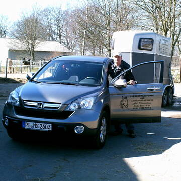
Pferdetransporte und Anhängerverleih
Schenefeld
Manfred Schröder
@Manfred
Kleintiertransport
Pferdeanhängervermietung
Transport mit dem Pferd
1 weitere...
B+
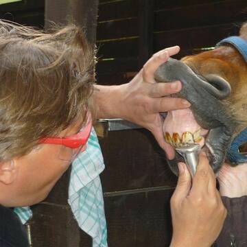
EQUIDENS - Pferdedentist für Hamburg und Umgebun...
Pinneberg
equidens
@equidens
Pferdedentist, Pferdezahnpflege
B+

Berittplatz mit Vollversorgung des Pferdes frei
Seevetal-Beckedorf
Reitstall-Baccara-Beckedorf
@Reitstall-Baccara-Beckedorf
Reitunterricht: Dressur
B+

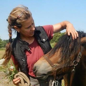
Persönlichkeitsentwicklung mit Pferden
Bad Salzuflen
Katja Dors
@Pferdezeiten
Begleite andere auf ihrem Entwicklungsweg und entdecke die transformative Kraft der pferdegestützten Persönlichkeitsentwicklung !
neu
R

Bemer Decke ausprobieren bei Ihnen im Stall,...
Witzhave
Kathanus Ranch Team
@Kathanus-Ranch
Tiermedizinische/r Fachangestellte/r
Magnetfeldtherapie
B+

Beritt im Süden von Hamburg
Seevetal
DressurManufaktur UG
@DressurManufaktur
Pferdeausbildung
Reitunterricht: Dressur
B+

Kunstmalerin Rosita Engelmohr
Henstedt Ulzburg
Kunstmalerin Rosita Engelmohr
@Kunstmalerin
Pferdeausbildung
Reitunterricht: Dressur
Futtermittel: Herstellung
Futtermittel: Ladengeschäft
Deckstation
Fohlenzucht
Fohlennotdienst
Kleintiertransport
25 weitere...
B+

GANZheitlich Gesunde Wege für Pferd UND Mensch
Seevetal
Ganzheitlich-Gesunde-Wege
@PHYSIO-RIDING-Coach
Bewegungstrainer
Bodenarbeit
Huforthopäde
Sattelberatung
Beratung rund ums Pferd
Tierfotografie
18 weitere...
B+
PHYSIO-RIDING® Coach + Huforthopädie (DHGeV)
Seevetal
Ganzheitlich-Gesunde-Wege
@PHYSIO-RIDING-Coach
Bewegungstrainer
Bodenarbeit
Huforthopäde
Hufpfleger
Hufschuhberatung/Hufschuhverleih
Sattelberatung
Beratung rund ums Pferd
Sonstiges
18 weitere...
B+
Deprecated: Creation of dynamic property Zend_View::$pageCount is deprecated in /var/www/stall-frei/htdocs/staging.stall-frei.de/library/vendor/shardj/zf1-future/library/Zend/View/Abstract.php on line 308
Deprecated: Creation of dynamic property Zend_View::$itemCountPerPage is deprecated in /var/www/stall-frei/htdocs/staging.stall-frei.de/library/vendor/shardj/zf1-future/library/Zend/View/Abstract.php on line 308
Deprecated: Creation of dynamic property Zend_View::$first is deprecated in /var/www/stall-frei/htdocs/staging.stall-frei.de/library/vendor/shardj/zf1-future/library/Zend/View/Abstract.php on line 308
Deprecated: Creation of dynamic property Zend_View::$current is deprecated in /var/www/stall-frei/htdocs/staging.stall-frei.de/library/vendor/shardj/zf1-future/library/Zend/View/Abstract.php on line 308
Deprecated: Creation of dynamic property Zend_View::$last is deprecated in /var/www/stall-frei/htdocs/staging.stall-frei.de/library/vendor/shardj/zf1-future/library/Zend/View/Abstract.php on line 308
Deprecated: Creation of dynamic property Zend_View::$next is deprecated in /var/www/stall-frei/htdocs/staging.stall-frei.de/library/vendor/shardj/zf1-future/library/Zend/View/Abstract.php on line 308
Deprecated: Creation of dynamic property Zend_View::$pagesInRange is deprecated in /var/www/stall-frei/htdocs/staging.stall-frei.de/library/vendor/shardj/zf1-future/library/Zend/View/Abstract.php on line 308
Deprecated: Creation of dynamic property Zend_View::$firstPageInRange is deprecated in /var/www/stall-frei/htdocs/staging.stall-frei.de/library/vendor/shardj/zf1-future/library/Zend/View/Abstract.php on line 308
Deprecated: Creation of dynamic property Zend_View::$lastPageInRange is deprecated in /var/www/stall-frei/htdocs/staging.stall-frei.de/library/vendor/shardj/zf1-future/library/Zend/View/Abstract.php on line 308
Deprecated: Creation of dynamic property Zend_View::$currentItemCount is deprecated in /var/www/stall-frei/htdocs/staging.stall-frei.de/library/vendor/shardj/zf1-future/library/Zend/View/Abstract.php on line 308
Deprecated: Creation of dynamic property Zend_View::$totalItemCount is deprecated in /var/www/stall-frei/htdocs/staging.stall-frei.de/library/vendor/shardj/zf1-future/library/Zend/View/Abstract.php on line 308
Deprecated: Creation of dynamic property Zend_View::$firstItemNumber is deprecated in /var/www/stall-frei/htdocs/staging.stall-frei.de/library/vendor/shardj/zf1-future/library/Zend/View/Abstract.php on line 308
Deprecated: Creation of dynamic property Zend_View::$lastItemNumber is deprecated in /var/www/stall-frei/htdocs/staging.stall-frei.de/library/vendor/shardj/zf1-future/library/Zend/View/Abstract.php on line 308
Deprecated: Creation of dynamic property Zend_View::$router is deprecated in /var/www/stall-frei/htdocs/staging.stall-frei.de/library/vendor/shardj/zf1-future/library/Zend/View/Abstract.php on line 308
Deprecated: Creation of dynamic property Zend_View::$urlParams is deprecated in /var/www/stall-frei/htdocs/staging.stall-frei.de/library/vendor/shardj/zf1-future/library/Zend/View/Abstract.php on line 308
Deprecated: Creation of dynamic property Zend_View::$showAds is deprecated in /var/www/stall-frei/htdocs/staging.stall-frei.de/library/vendor/shardj/zf1-future/library/Zend/View/Abstract.php on line 308
Deprecated: Creation of dynamic property Zend_View::$objectIds is deprecated in /var/www/stall-frei/htdocs/staging.stall-frei.de/library/vendor/shardj/zf1-future/library/Zend/View/Abstract.php on line 308
Deprecated: Creation of dynamic property Zend_View::$showNavbar is deprecated in /var/www/stall-frei/htdocs/staging.stall-frei.de/library/vendor/shardj/zf1-future/library/Zend/View/Abstract.php on line 308
Deprecated: Creation of dynamic property Zend_View::$showBreadcrumb is deprecated in /var/www/stall-frei/htdocs/staging.stall-frei.de/library/vendor/shardj/zf1-future/library/Zend/View/Abstract.php on line 308
Deprecated: Creation of dynamic property Zend_View::$showFooter is deprecated in /var/www/stall-frei/htdocs/staging.stall-frei.de/library/vendor/shardj/zf1-future/library/Zend/View/Abstract.php on line 308
Deprecated: Creation of dynamic property Zend_View::$showInternalAds is deprecated in /var/www/stall-frei/htdocs/staging.stall-frei.de/library/vendor/shardj/zf1-future/library/Zend/View/Abstract.php on line 308
Deprecated: Creation of dynamic property Zend_View::$blNoContent is deprecated in /var/www/stall-frei/htdocs/staging.stall-frei.de/library/vendor/shardj/zf1-future/library/Zend/View/Abstract.php on line 308
Deprecated: Creation of dynamic property Zend_View::$sMetaDesc is deprecated in /var/www/stall-frei/htdocs/staging.stall-frei.de/library/vendor/shardj/zf1-future/library/Zend/View/Abstract.php on line 308
Deprecated: Creation of dynamic property Zend_View::$useGmaps is deprecated in /var/www/stall-frei/htdocs/staging.stall-frei.de/library/vendor/shardj/zf1-future/library/Zend/View/Abstract.php on line 308
Deprecated: Creation of dynamic property Zend_View::$touches is deprecated in /var/www/stall-frei/htdocs/staging.stall-frei.de/library/vendor/shardj/zf1-future/library/Zend/View/Abstract.php on line 308
Deprecated: Creation of dynamic property Zend_View::$oProject is deprecated in /var/www/stall-frei/htdocs/staging.stall-frei.de/library/vendor/shardj/zf1-future/library/Zend/View/Abstract.php on line 308
Deprecated: Creation of dynamic property Zend_View::$pageHeadline is deprecated in /var/www/stall-frei/htdocs/staging.stall-frei.de/library/vendor/shardj/zf1-future/library/Zend/View/Abstract.php on line 308
Deprecated: Creation of dynamic property Zend_View::$disableLocationField is deprecated in /var/www/stall-frei/htdocs/staging.stall-frei.de/library/vendor/shardj/zf1-future/library/Zend/View/Abstract.php on line 308
Deprecated: Creation of dynamic property Zend_View::$isSearch is deprecated in /var/www/stall-frei/htdocs/staging.stall-frei.de/library/vendor/shardj/zf1-future/library/Zend/View/Abstract.php on line 308
Deprecated: Creation of dynamic property Zend_View::$pageTitle is deprecated in /var/www/stall-frei/htdocs/staging.stall-frei.de/library/vendor/shardj/zf1-future/library/Zend/View/Abstract.php on line 308
Deprecated: Creation of dynamic property Psf_Form_Element_Text::$class is deprecated in /var/www/stall-frei/htdocs/staging.stall-frei.de/library/vendor/shardj/zf1-future/library/Zend/Form/Element.php on line 874
Deprecated: Creation of dynamic property Psf_Form_Element_Text::$size is deprecated in /var/www/stall-frei/htdocs/staging.stall-frei.de/library/vendor/shardj/zf1-future/library/Zend/Form/Element.php on line 874
Deprecated: Creation of dynamic property Psf_Form_Element_Text::$placeholder is deprecated in /var/www/stall-frei/htdocs/staging.stall-frei.de/library/vendor/shardj/zf1-future/library/Zend/Form/Element.php on line 874
Deprecated: Creation of dynamic property Psf_Form_Element_Hidden::$class is deprecated in /var/www/stall-frei/htdocs/staging.stall-frei.de/library/vendor/shardj/zf1-future/library/Zend/Form/Element.php on line 874
Deprecated: Creation of dynamic property Psf_Form_Element_Hidden::$class is deprecated in /var/www/stall-frei/htdocs/staging.stall-frei.de/library/vendor/shardj/zf1-future/library/Zend/Form/Element.php on line 874
Deprecated: Creation of dynamic property Psf_Form_Element_Hidden::$class is deprecated in /var/www/stall-frei/htdocs/staging.stall-frei.de/library/vendor/shardj/zf1-future/library/Zend/Form/Element.php on line 874
Deprecated: Creation of dynamic property Psf_Form_Element_Hidden::$class is deprecated in /var/www/stall-frei/htdocs/staging.stall-frei.de/library/vendor/shardj/zf1-future/library/Zend/Form/Element.php on line 874
Deprecated: Creation of dynamic property Psf_Form_Element_Select::$class is deprecated in /var/www/stall-frei/htdocs/staging.stall-frei.de/library/vendor/shardj/zf1-future/library/Zend/Form/Element.php on line 874
Deprecated: Creation of dynamic property Psf_Form_Element_Text::$class is deprecated in /var/www/stall-frei/htdocs/staging.stall-frei.de/library/vendor/shardj/zf1-future/library/Zend/Form/Element.php on line 874
Deprecated: Creation of dynamic property Psf_Form_Element_Checkbox::$label is deprecated in /var/www/stall-frei/htdocs/staging.stall-frei.de/library/vendor/shardj/zf1-future/library/Zend/Form/Element.php on line 874
Deprecated: Creation of dynamic property Zend_View::$sort is deprecated in /var/www/stall-frei/htdocs/staging.stall-frei.de/library/vendor/shardj/zf1-future/library/Zend/View/Abstract.php on line 308
Deprecated: Creation of dynamic property Zend_View::$searchLocation is deprecated in /var/www/stall-frei/htdocs/staging.stall-frei.de/library/vendor/shardj/zf1-future/library/Zend/View/Abstract.php on line 308
Deprecated: Creation of dynamic property Zend_View::$locationHint is deprecated in /var/www/stall-frei/htdocs/staging.stall-frei.de/library/vendor/shardj/zf1-future/library/Zend/View/Abstract.php on line 308
Psf_GeoCoder_Abstract::getLocation: Friedrichsberg Get Location CachedOrLive
Psf_GeoCoder_Abstract::getCachedOrLive: Friedrichsberg
Psf_GeoCoder_Abstract::convertLocationResult
{"documentation":"https:\/\/opencagedata.com\/api","licenses":[{"name":"see attribution guide","url":"https:\/\/opencagedata.com\/credits"}],"results":[{"bounds":{"northeast":{"lat":53.5765469,"lng":10.0574709},"southwest":{"lat":53.5764469,"lng":10.0573709}},"components":{"ISO_3166-1_alpha-2":"DE","ISO_3166-1_alpha-3":"DEU","ISO_3166-2":["DE-HH"],"_category":"transportation","_normalized_city":"Hamburg","_type":"railway","city":"Hamburg","city_district":"Hamburg-Nord","continent":"Europe","country":"Deutschland","country_code":"de","political_union":"European Union","postcode":"22049","railway":"Friedrichsberg","road":"Eilbektal","state":"Hamburg","state_code":"HH","suburb":"Dulsberg"},"confidence":9,"formatted":"Friedrichsberg, Eilbektal, 22049 Hamburg, Deutschland","geometry":{"lat":53.5764969,"lng":10.0574209}},{"bounds":{"northeast":{"lat":51.2655978,"lng":7.1589938},"southwest":{"lat":51.2255978,"lng":7.1189938}},"components":{"ISO_3166-1_alpha-2":"DE","ISO_3166-1_alpha-3":"DEU","ISO_3166-2":["DE-NW"],"_category":"place","_normalized_city":"Wuppertal","_type":"neighbourhood","city":"Wuppertal","city_district":"Elberfeld","continent":"Europe","country":"Deutschland","country_code":"de","political_union":"European Union","postcode":"42117","state":"Nordrhein-Westfalen","state_code":"NW","suburb":"Friedrichsberg"},"confidence":7,"formatted":"42117 Wuppertal, Deutschland","geometry":{"lat":51.2455978,"lng":7.1389938}},{"bounds":{"northeast":{"lat":54.523489,"lng":9.5611171},"southwest":{"lat":54.483489,"lng":9.5211171}},"components":{"ISO_3166-1_alpha-2":"DE","ISO_3166-1_alpha-3":"DEU","ISO_3166-2":["DE-SH"],"_category":"place","_normalized_city":"Schleswig","_type":"neighbourhood","continent":"Europe","country":"Deutschland","country_code":"de","county":"Kreis Schleswig-Flensburg","political_union":"European Union","postcode":"24837","state":"Schleswig-Holstein","state_code":"SH","suburb":"Friedrichsberg","town":"Schleswig"},"confidence":7,"formatted":"24837 Schleswig, Deutschland","geometry":{"lat":54.503489,"lng":9.5411171}},{"bounds":{"northeast":{"lat":50.106321,"lng":11.3212394},"southwest":{"lat":50.106221,"lng":11.3211394}},"components":{"ISO_3166-1_alpha-2":"DE","ISO_3166-1_alpha-3":"DEU","ISO_3166-2":["DE-BY"],"_category":"building","_normalized_city":"Mainleus","_type":"building","city":"Mainleus","continent":"Europe","country":"Deutschland","country_code":"de","county":"Landkreis Kulmbach","hamlet":"Witzmannsberg","isolated_dwelling":"Friedrichsberg","political_union":"European Union","postcode":"95336","state":"Bayern","state_code":"BY"},"confidence":10,"formatted":"Friedrichsberg, Witzmannsberg, 95336 Mainleus, Deutschland","geometry":{"lat":50.106271,"lng":11.3211894}},{"bounds":{"northeast":{"lat":51.4711693,"lng":11.0174448},"southwest":{"lat":51.4710693,"lng":11.0173448}},"components":{"ISO_3166-1_alpha-2":"DE","ISO_3166-1_alpha-3":"DEU","ISO_3166-2":["DE-ST"],"_category":"natural\/water","_normalized_city":"Berga","_type":"peak","continent":"Europe","country":"Deutschland","country_code":"de","county":"Mansfeld-S\u00fcdharz","municipality":"Goldene Aue","peak":"Friedrichsberg","political_union":"European Union","postcode":"06536","state":"Sachsen-Anhalt","state_code":"ST","village":"Berga"},"confidence":9,"formatted":"Friedrichsberg, 06536 Berga, Deutschland","geometry":{"lat":51.4711193,"lng":11.0173948}},{"bounds":{"northeast":{"lat":49.7594028,"lng":10.3909333},"southwest":{"lat":49.7593028,"lng":10.3908333}},"components":{"ISO_3166-1_alpha-2":"DE","ISO_3166-1_alpha-3":"DEU","ISO_3166-2":["DE-BY"],"_category":"natural\/water","_normalized_city":"Abtswind","_type":"peak","continent":"Europe","country":"Deutschland","country_code":"de","county":"Landkreis Kitzingen","municipality":"Wiesentheid","peak":"Friedrichsberg","political_union":"European Union","state":"Bayern","state_code":"BY","village":"Abtswind"},"confidence":9,"formatted":"Friedrichsberg, Abtswind, Bayern, Deutschland","geometry":{"lat":49.7593528,"lng":10.3908833}},{"bounds":{"northeast":{"lat":50.4423863,"lng":7.5753889},"southwest":{"lat":50.4422863,"lng":7.5752889}},"components":{"ISO_3166-1_alpha-2":"DE","ISO_3166-1_alpha-3":"DEU","ISO_3166-2":["DE-RP"],"_category":"natural\/water","_normalized_city":"Bendorf","_type":"peak","continent":"Europe","country":"Deutschland","country_code":"de","county":"Landkreis Mayen-Koblenz","peak":"Friedrichsberg","political_union":"European Union","postcode":"36170","state":"Rheinland-Pfalz","state_code":"RP","town":"Bendorf"},"confidence":9,"formatted":"Friedrichsberg, 36170 Bendorf, Deutschland","geometry":{"lat":50.4423363,"lng":7.5753389}},{"bounds":{"northeast":{"lat":49.1846043,"lng":9.6654985},"southwest":{"lat":49.1845043,"lng":9.6653985}},"components":{"ISO_3166-1_alpha-2":"DE","ISO_3166-1_alpha-3":"DEU","ISO_3166-2":["DE-BW"],"_category":"natural\/water","_normalized_city":"Waldenburg","_type":"peak","continent":"Europe","country":"Deutschland","country_code":"de","county":"Hohenlohekreis","municipality":"GVV Hohenloher Ebene","peak":"Friedrichsberg","political_union":"European Union","postcode":"74638","state":"Baden-W\u00fcrttemberg","state_code":"BW","town":"Waldenburg"},"confidence":9,"formatted":"Friedrichsberg, 74638 Waldenburg, Deutschland","geometry":{"lat":49.1845543,"lng":9.6654485}},{"bounds":{"northeast":{"lat":50.4352819,"lng":9.061913},"southwest":{"lat":50.4351819,"lng":9.061813}},"components":{"ISO_3166-1_alpha-2":"DE","ISO_3166-1_alpha-3":"DEU","ISO_3166-2":["DE-HE"],"_category":"natural\/water","_normalized_city":"Michelnau","_type":"peak","continent":"Europe","country":"Deutschland","country_code":"de","county":"Wetteraukreis","municipality":"Nidda","peak":"Friedrichsberg","political_union":"European Union","postcode":"63667","state":"Hessen","state_code":"HE","village":"Michelnau"},"confidence":9,"formatted":"Friedrichsberg, 63667 Michelnau, Deutschland","geometry":{"lat":50.4352319,"lng":9.061863}},{"bounds":{"northeast":{"lat":54.3523855,"lng":10.2899984},"southwest":{"lat":54.3123855,"lng":10.2499984}},"components":{"ISO_3166-1_alpha-2":"DE","ISO_3166-1_alpha-3":"DEU","ISO_3166-2":["DE-SH"],"_category":"place","_normalized_city":"Dobersdorf","_type":"hamlet","city":"Dobersdorf","continent":"Europe","country":"Deutschland","country_code":"de","county":"Kreis Pl\u00f6n","hamlet":"Friedrichsberg","municipality":"Selent\/Schlesen","political_union":"European Union","postcode":"24253","state":"Schleswig-Holstein","state_code":"SH"},"confidence":7,"formatted":"Friedrichsberg, 24253 Dobersdorf, Deutschland","geometry":{"lat":54.3323855,"lng":10.2699984}}],"status":{"code":200,"message":"OK"},"stay_informed":{"blog":"https:\/\/blog.opencagedata.com","mastodon":"https:\/\/en.osm.town\/@opencage"},"thanks":"For using an OpenCage API","timestamp":{"created_http":"Mon, 09 Feb 2026 08:44:41 GMT","created_unix":1770626681},"total_results":10}Array
(
[0] => stdClass Object
(
[bounds] => stdClass Object
(
[northeast] => stdClass Object
(
[lat] => 53.5765469
[lng] => 10.0574709
)
[southwest] => stdClass Object
(
[lat] => 53.5764469
[lng] => 10.0573709
)
)
[components] => stdClass Object
(
[ISO_3166-1_alpha-2] => DE
[ISO_3166-1_alpha-3] => DEU
[ISO_3166-2] => Array
(
[0] => DE-HH
)
[_category] => transportation
[_normalized_city] => Hamburg
[_type] => railway
[city] => Hamburg
[city_district] => Hamburg-Nord
[continent] => Europe
[country] => Deutschland
[country_code] => de
[political_union] => European Union
[postcode] => 22049
[railway] => Friedrichsberg
[road] => Eilbektal
[state] => Hamburg
[state_code] => HH
[suburb] => Dulsberg
)
[confidence] => 9
[formatted] => Friedrichsberg, Eilbektal, 22049 Hamburg, Deutschland
[geometry] => stdClass Object
(
[lat] => 53.5764969
[lng] => 10.0574209
)
)
[1] => stdClass Object
(
[bounds] => stdClass Object
(
[northeast] => stdClass Object
(
[lat] => 51.2655978
[lng] => 7.1589938
)
[southwest] => stdClass Object
(
[lat] => 51.2255978
[lng] => 7.1189938
)
)
[components] => stdClass Object
(
[ISO_3166-1_alpha-2] => DE
[ISO_3166-1_alpha-3] => DEU
[ISO_3166-2] => Array
(
[0] => DE-NW
)
[_category] => place
[_normalized_city] => Wuppertal
[_type] => neighbourhood
[city] => Wuppertal
[city_district] => Elberfeld
[continent] => Europe
[country] => Deutschland
[country_code] => de
[political_union] => European Union
[postcode] => 42117
[state] => Nordrhein-Westfalen
[state_code] => NW
[suburb] => Friedrichsberg
)
[confidence] => 7
[formatted] => 42117 Wuppertal, Deutschland
[geometry] => stdClass Object
(
[lat] => 51.2455978
[lng] => 7.1389938
)
)
[2] => stdClass Object
(
[bounds] => stdClass Object
(
[northeast] => stdClass Object
(
[lat] => 54.523489
[lng] => 9.5611171
)
[southwest] => stdClass Object
(
[lat] => 54.483489
[lng] => 9.5211171
)
)
[components] => stdClass Object
(
[ISO_3166-1_alpha-2] => DE
[ISO_3166-1_alpha-3] => DEU
[ISO_3166-2] => Array
(
[0] => DE-SH
)
[_category] => place
[_normalized_city] => Schleswig
[_type] => neighbourhood
[continent] => Europe
[country] => Deutschland
[country_code] => de
[county] => Kreis Schleswig-Flensburg
[political_union] => European Union
[postcode] => 24837
[state] => Schleswig-Holstein
[state_code] => SH
[suburb] => Friedrichsberg
[town] => Schleswig
)
[confidence] => 7
[formatted] => 24837 Schleswig, Deutschland
[geometry] => stdClass Object
(
[lat] => 54.503489
[lng] => 9.5411171
)
)
[3] => stdClass Object
(
[bounds] => stdClass Object
(
[northeast] => stdClass Object
(
[lat] => 50.106321
[lng] => 11.3212394
)
[southwest] => stdClass Object
(
[lat] => 50.106221
[lng] => 11.3211394
)
)
[components] => stdClass Object
(
[ISO_3166-1_alpha-2] => DE
[ISO_3166-1_alpha-3] => DEU
[ISO_3166-2] => Array
(
[0] => DE-BY
)
[_category] => building
[_normalized_city] => Mainleus
[_type] => building
[city] => Mainleus
[continent] => Europe
[country] => Deutschland
[country_code] => de
[county] => Landkreis Kulmbach
[hamlet] => Witzmannsberg
[isolated_dwelling] => Friedrichsberg
[political_union] => European Union
[postcode] => 95336
[state] => Bayern
[state_code] => BY
)
[confidence] => 10
[formatted] => Friedrichsberg, Witzmannsberg, 95336 Mainleus, Deutschland
[geometry] => stdClass Object
(
[lat] => 50.106271
[lng] => 11.3211894
)
)
[4] => stdClass Object
(
[bounds] => stdClass Object
(
[northeast] => stdClass Object
(
[lat] => 51.4711693
[lng] => 11.0174448
)
[southwest] => stdClass Object
(
[lat] => 51.4710693
[lng] => 11.0173448
)
)
[components] => stdClass Object
(
[ISO_3166-1_alpha-2] => DE
[ISO_3166-1_alpha-3] => DEU
[ISO_3166-2] => Array
(
[0] => DE-ST
)
[_category] => natural/water
[_normalized_city] => Berga
[_type] => peak
[continent] => Europe
[country] => Deutschland
[country_code] => de
[county] => Mansfeld-Südharz
[municipality] => Goldene Aue
[peak] => Friedrichsberg
[political_union] => European Union
[postcode] => 06536
[state] => Sachsen-Anhalt
[state_code] => ST
[village] => Berga
)
[confidence] => 9
[formatted] => Friedrichsberg, 06536 Berga, Deutschland
[geometry] => stdClass Object
(
[lat] => 51.4711193
[lng] => 11.0173948
)
)
[5] => stdClass Object
(
[bounds] => stdClass Object
(
[northeast] => stdClass Object
(
[lat] => 49.7594028
[lng] => 10.3909333
)
[southwest] => stdClass Object
(
[lat] => 49.7593028
[lng] => 10.3908333
)
)
[components] => stdClass Object
(
[ISO_3166-1_alpha-2] => DE
[ISO_3166-1_alpha-3] => DEU
[ISO_3166-2] => Array
(
[0] => DE-BY
)
[_category] => natural/water
[_normalized_city] => Abtswind
[_type] => peak
[continent] => Europe
[country] => Deutschland
[country_code] => de
[county] => Landkreis Kitzingen
[municipality] => Wiesentheid
[peak] => Friedrichsberg
[political_union] => European Union
[state] => Bayern
[state_code] => BY
[village] => Abtswind
)
[confidence] => 9
[formatted] => Friedrichsberg, Abtswind, Bayern, Deutschland
[geometry] => stdClass Object
(
[lat] => 49.7593528
[lng] => 10.3908833
)
)
[6] => stdClass Object
(
[bounds] => stdClass Object
(
[northeast] => stdClass Object
(
[lat] => 50.4423863
[lng] => 7.5753889
)
[southwest] => stdClass Object
(
[lat] => 50.4422863
[lng] => 7.5752889
)
)
[components] => stdClass Object
(
[ISO_3166-1_alpha-2] => DE
[ISO_3166-1_alpha-3] => DEU
[ISO_3166-2] => Array
(
[0] => DE-RP
)
[_category] => natural/water
[_normalized_city] => Bendorf
[_type] => peak
[continent] => Europe
[country] => Deutschland
[country_code] => de
[county] => Landkreis Mayen-Koblenz
[peak] => Friedrichsberg
[political_union] => European Union
[postcode] => 36170
[state] => Rheinland-Pfalz
[state_code] => RP
[town] => Bendorf
)
[confidence] => 9
[formatted] => Friedrichsberg, 36170 Bendorf, Deutschland
[geometry] => stdClass Object
(
[lat] => 50.4423363
[lng] => 7.5753389
)
)
[7] => stdClass Object
(
[bounds] => stdClass Object
(
[northeast] => stdClass Object
(
[lat] => 49.1846043
[lng] => 9.6654985
)
[southwest] => stdClass Object
(
[lat] => 49.1845043
[lng] => 9.6653985
)
)
[components] => stdClass Object
(
[ISO_3166-1_alpha-2] => DE
[ISO_3166-1_alpha-3] => DEU
[ISO_3166-2] => Array
(
[0] => DE-BW
)
[_category] => natural/water
[_normalized_city] => Waldenburg
[_type] => peak
[continent] => Europe
[country] => Deutschland
[country_code] => de
[county] => Hohenlohekreis
[municipality] => GVV Hohenloher Ebene
[peak] => Friedrichsberg
[political_union] => European Union
[postcode] => 74638
[state] => Baden-Württemberg
[state_code] => BW
[town] => Waldenburg
)
[confidence] => 9
[formatted] => Friedrichsberg, 74638 Waldenburg, Deutschland
[geometry] => stdClass Object
(
[lat] => 49.1845543
[lng] => 9.6654485
)
)
[8] => stdClass Object
(
[bounds] => stdClass Object
(
[northeast] => stdClass Object
(
[lat] => 50.4352819
[lng] => 9.061913
)
[southwest] => stdClass Object
(
[lat] => 50.4351819
[lng] => 9.061813
)
)
[components] => stdClass Object
(
[ISO_3166-1_alpha-2] => DE
[ISO_3166-1_alpha-3] => DEU
[ISO_3166-2] => Array
(
[0] => DE-HE
)
[_category] => natural/water
[_normalized_city] => Michelnau
[_type] => peak
[continent] => Europe
[country] => Deutschland
[country_code] => de
[county] => Wetteraukreis
[municipality] => Nidda
[peak] => Friedrichsberg
[political_union] => European Union
[postcode] => 63667
[state] => Hessen
[state_code] => HE
[village] => Michelnau
)
[confidence] => 9
[formatted] => Friedrichsberg, 63667 Michelnau, Deutschland
[geometry] => stdClass Object
(
[lat] => 50.4352319
[lng] => 9.061863
)
)
[9] => stdClass Object
(
[bounds] => stdClass Object
(
[northeast] => stdClass Object
(
[lat] => 54.3523855
[lng] => 10.2899984
)
[southwest] => stdClass Object
(
[lat] => 54.3123855
[lng] => 10.2499984
)
)
[components] => stdClass Object
(
[ISO_3166-1_alpha-2] => DE
[ISO_3166-1_alpha-3] => DEU
[ISO_3166-2] => Array
(
[0] => DE-SH
)
[_category] => place
[_normalized_city] => Dobersdorf
[_type] => hamlet
[city] => Dobersdorf
[continent] => Europe
[country] => Deutschland
[country_code] => de
[county] => Kreis Plön
[hamlet] => Friedrichsberg
[municipality] => Selent/Schlesen
[political_union] => European Union
[postcode] => 24253
[state] => Schleswig-Holstein
[state_code] => SH
)
[confidence] => 7
[formatted] => Friedrichsberg, 24253 Dobersdorf, Deutschland
[geometry] => stdClass Object
(
[lat] => 54.3323855
[lng] => 10.2699984
)
)
)
Psf_GeoCoder_OpenCageData::getKeyMap: 0
stdClass Object
(
    [bounds] => stdClass Object
        (
            [northeast] => stdClass Object
                (
                    [lat] => 53.5765469
                    [lng] => 10.0574709
                )

            [southwest] => stdClass Object
                (
                    [lat] => 53.5764469
                    [lng] => 10.0573709
                )

        )

    [components] => stdClass Object
        (
            [ISO_3166-1_alpha-2] => DE
            [ISO_3166-1_alpha-3] => DEU
            [ISO_3166-2] => Array
                (
                    [0] => DE-HH
                )

            [_category] => transportation
            [_normalized_city] => Hamburg
            [_type] => railway
            [city] => Hamburg
            [city_district] => Hamburg-Nord
            [continent] => Europe
            [country] => Deutschland
            [country_code] => de
            [political_union] => European Union
            [postcode] => 22049
            [railway] => Friedrichsberg
            [road] => Eilbektal
            [state] => Hamburg
            [state_code] => HH
            [suburb] => Dulsberg
        )

    [confidence] => 9
    [formatted] => Friedrichsberg, Eilbektal, 22049 Hamburg, Deutschland
    [geometry] => stdClass Object
        (
            [lat] => 53.5764969
            [lng] => 10.0574209
        )

)
Psf_GeoCoder_OpenCageData::getCounty: Hamburg
Psf_GeoCoder_OpenCageData::addMissingData REFETCH!
Array
(
    [address] => Friedrichsberg, Eilbektal, 22049 Hamburg, Deutschland
    [type] => railway
    [street] => Eilbektal
    [city] => Dulsberg
    [county] => Hamburg
    [state] => Hamburg
    [zip] => 22049
    [country] => Deutschland
    [suburb] => Dulsberg
    [countrycode] => de
    [latitude] => 53.5764969
    [longitude] => 10.0574209
    [accuracy] => 1
    [confidence] => 9
    [bounds] => stdClass Object
        (
            [northeast] => stdClass Object
                (
                    [lat] => 53.5765469
                    [lng] => 10.0574709
                )

            [southwest] => stdClass Object
                (
                    [lat] => 53.5764469
                    [lng] => 10.0573709
                )

        )

)
reformat!
Array
(
    [address] => Eilbektal, 22049 Dulsberg
    [type] => railway
    [street] => Eilbektal
    [city] => Dulsberg
    [county] => Hamburg
    [state] => Hamburg
    [zip] => 22049
    [country] => Deutschland
    [suburb] => Dulsberg
    [countrycode] => de
    [latitude] => 53.5764969
    [longitude] => 10.0574209
    [accuracy] => 1
    [confidence] => 9
    [bounds] => stdClass Object
        (
            [northeast] => stdClass Object
                (
                    [lat] => 53.5765469
                    [lng] => 10.0574709
                )

            [southwest] => stdClass Object
                (
                    [lat] => 53.5764469
                    [lng] => 10.0573709
                )

        )

    [place] => Eilbektal, 22049 Dulsberg, Hamburg
    [hash] => 53d62ef196195d7e6588a6f200549829
)
Psf_GeoCoder_OpenCageData::getKeyMap: 1
stdClass Object
(
    [bounds] => stdClass Object
        (
            [northeast] => stdClass Object
                (
                    [lat] => 51.2655978
                    [lng] => 7.1589938
                )

            [southwest] => stdClass Object
                (
                    [lat] => 51.2255978
                    [lng] => 7.1189938
                )

        )

    [components] => stdClass Object
        (
            [ISO_3166-1_alpha-2] => DE
            [ISO_3166-1_alpha-3] => DEU
            [ISO_3166-2] => Array
                (
                    [0] => DE-NW
                )

            [_category] => place
            [_normalized_city] => Wuppertal
            [_type] => neighbourhood
            [city] => Wuppertal
            [city_district] => Elberfeld
            [continent] => Europe
            [country] => Deutschland
            [country_code] => de
            [political_union] => European Union
            [postcode] => 42117
            [state] => Nordrhein-Westfalen
            [state_code] => NW
            [suburb] => Friedrichsberg
        )

    [confidence] => 7
    [formatted] => 42117 Wuppertal, Deutschland
    [geometry] => stdClass Object
        (
            [lat] => 51.2455978
            [lng] => 7.1389938
        )

)
Psf_GeoCoder_OpenCageData::getCounty: Wuppertal
Psf_GeoCoder_OpenCageData::addMissingData REFETCH!
Array
(
    [address] => 42117 Wuppertal, Deutschland
    [type] => neighbourhood
    [street] =>
    [city] => Friedrichsberg
    [county] => Wuppertal
    [state] => Nordrhein-Westfalen
    [zip] => 42117
    [country] => Deutschland
    [suburb] => Friedrichsberg
    [countrycode] => de
    [latitude] => 51.2455978
    [longitude] => 7.1389938
    [accuracy] => 1
    [confidence] => 7
    [bounds] => stdClass Object
        (
            [northeast] => stdClass Object
                (
                    [lat] => 51.2655978
                    [lng] => 7.1589938
                )

            [southwest] => stdClass Object
                (
                    [lat] => 51.2255978
                    [lng] => 7.1189938
                )

        )

)
reformat!
Array
(
    [address] => 42117 Friedrichsberg
    [type] => neighbourhood
    [street] =>
    [city] => Friedrichsberg
    [county] => Wuppertal
    [state] => Nordrhein-Westfalen
    [zip] => 42117
    [country] => Deutschland
    [suburb] => Friedrichsberg
    [countrycode] => de
    [latitude] => 51.2455978
    [longitude] => 7.1389938
    [accuracy] => 1
    [confidence] => 7
    [bounds] => stdClass Object
        (
            [northeast] => stdClass Object
                (
                    [lat] => 51.2655978
                    [lng] => 7.1589938
                )

            [southwest] => stdClass Object
                (
                    [lat] => 51.2255978
                    [lng] => 7.1189938
                )

        )

    [place] => 42117 Friedrichsberg, Nordrhein-Westfalen
    [hash] => 5643de5e6cf98159a60c5de958abe199
)
Psf_GeoCoder_OpenCageData::getKeyMap: 2
stdClass Object
(
    [bounds] => stdClass Object
        (
            [northeast] => stdClass Object
                (
                    [lat] => 54.523489
                    [lng] => 9.5611171
                )

            [southwest] => stdClass Object
                (
                    [lat] => 54.483489
                    [lng] => 9.5211171
                )

        )

    [components] => stdClass Object
        (
            [ISO_3166-1_alpha-2] => DE
            [ISO_3166-1_alpha-3] => DEU
            [ISO_3166-2] => Array
                (
                    [0] => DE-SH
                )

            [_category] => place
            [_normalized_city] => Schleswig
            [_type] => neighbourhood
            [continent] => Europe
            [country] => Deutschland
            [country_code] => de
            [county] => Kreis Schleswig-Flensburg
            [political_union] => European Union
            [postcode] => 24837
            [state] => Schleswig-Holstein
            [state_code] => SH
            [suburb] => Friedrichsberg
            [town] => Schleswig
        )

    [confidence] => 7
    [formatted] => 24837 Schleswig, Deutschland
    [geometry] => stdClass Object
        (
            [lat] => 54.503489
            [lng] => 9.5411171
        )

)
Psf_GeoCoder_OpenCageData::getCounty: Schleswig-Flensburg
Psf_GeoCoder_OpenCageData::addMissingData REFETCH!
Array
(
    [address] => 24837 Schleswig, Deutschland
    [type] => neighbourhood
    [street] =>
    [city] => Schleswig
    [county] => Schleswig-Flensburg
    [state] => Schleswig-Holstein
    [zip] => 24837
    [country] => Deutschland
    [suburb] => Friedrichsberg
    [countrycode] => de
    [latitude] => 54.503489
    [longitude] => 9.5411171
    [accuracy] => 1
    [confidence] => 7
    [bounds] => stdClass Object
        (
            [northeast] => stdClass Object
                (
                    [lat] => 54.523489
                    [lng] => 9.5611171
                )

            [southwest] => stdClass Object
                (
                    [lat] => 54.483489
                    [lng] => 9.5211171
                )

        )

)
reformat!
Array
(
    [address] => 24837 Schleswig, Deutschland
    [type] => neighbourhood
    [street] =>
    [city] => Schleswig
    [county] => Schleswig-Flensburg
    [state] => Schleswig-Holstein
    [zip] => 24837
    [country] => Deutschland
    [suburb] => Friedrichsberg
    [countrycode] => de
    [latitude] => 54.503489
    [longitude] => 9.5411171
    [accuracy] => 1
    [confidence] => 7
    [bounds] => stdClass Object
        (
            [northeast] => stdClass Object
                (
                    [lat] => 54.523489
                    [lng] => 9.5611171
                )

            [southwest] => stdClass Object
                (
                    [lat] => 54.483489
                    [lng] => 9.5211171
                )

        )

    [place] => 24837 Schleswig, Schleswig-Holstein
    [hash] => 9fea5e9eaba1eb1b2162534bc9cae270
)
Psf_GeoCoder_OpenCageData::getKeyMap: 3
stdClass Object
(
    [bounds] => stdClass Object
        (
            [northeast] => stdClass Object
                (
                    [lat] => 50.106321
                    [lng] => 11.3212394
                )

            [southwest] => stdClass Object
                (
                    [lat] => 50.106221
                    [lng] => 11.3211394
                )

        )

    [components] => stdClass Object
        (
            [ISO_3166-1_alpha-2] => DE
            [ISO_3166-1_alpha-3] => DEU
            [ISO_3166-2] => Array
                (
                    [0] => DE-BY
                )

            [_category] => building
            [_normalized_city] => Mainleus
            [_type] => building
            [city] => Mainleus
            [continent] => Europe
            [country] => Deutschland
            [country_code] => de
            [county] => Landkreis Kulmbach
            [hamlet] => Witzmannsberg
            [isolated_dwelling] => Friedrichsberg
            [political_union] => European Union
            [postcode] => 95336
            [state] => Bayern
            [state_code] => BY
        )

    [confidence] => 10
    [formatted] => Friedrichsberg, Witzmannsberg, 95336 Mainleus, Deutschland
    [geometry] => stdClass Object
        (
            [lat] => 50.106271
            [lng] => 11.3211894
        )

)
Psf_GeoCoder_OpenCageData::getCounty: Kulmbach
Psf_GeoCoder_OpenCageData::addMissingData REFETCH!
Array
(
    [address] => Friedrichsberg, Witzmannsberg, 95336 Mainleus, Deutschland
    [type] => building
    [street] => Witzmannsberg
    [city] => Mainleus
    [county] => Kulmbach
    [state] => Bayern
    [zip] => 95336
    [country] => Deutschland
    [suburb] =>
    [countrycode] => de
    [latitude] => 50.106271
    [longitude] => 11.3211894
    [accuracy] => 1
    [confidence] => 10
    [bounds] => stdClass Object
        (
            [northeast] => stdClass Object
                (
                    [lat] => 50.106321
                    [lng] => 11.3212394
                )

            [southwest] => stdClass Object
                (
                    [lat] => 50.106221
                    [lng] => 11.3211394
                )

        )

)
reformat!
Array
(
    [address] => Friedrichsberg, Witzmannsberg, 95336 Mainleus, Deutschland
    [type] => building
    [street] => Witzmannsberg
    [city] => Mainleus
    [county] => Kulmbach
    [state] => Bayern
    [zip] => 95336
    [country] => Deutschland
    [suburb] =>
    [countrycode] => de
    [latitude] => 50.106271
    [longitude] => 11.3211894
    [accuracy] => 1
    [confidence] => 10
    [bounds] => stdClass Object
        (
            [northeast] => stdClass Object
                (
                    [lat] => 50.106321
                    [lng] => 11.3212394
                )

            [southwest] => stdClass Object
                (
                    [lat] => 50.106221
                    [lng] => 11.3211394
                )

        )

    [place] => Witzmannsberg, 95336 Mainleus, Bayern
    [hash] => 29c85f590d7d8ce5c85351379a6127cd
)
Psf_GeoCoder_OpenCageData::getKeyMap: 4
stdClass Object
(
    [bounds] => stdClass Object
        (
            [northeast] => stdClass Object
                (
                    [lat] => 51.4711693
                    [lng] => 11.0174448
                )

            [southwest] => stdClass Object
                (
                    [lat] => 51.4710693
                    [lng] => 11.0173448
                )

        )

    [components] => stdClass Object
        (
            [ISO_3166-1_alpha-2] => DE
            [ISO_3166-1_alpha-3] => DEU
            [ISO_3166-2] => Array
                (
                    [0] => DE-ST
                )

            [_category] => natural/water
            [_normalized_city] => Berga
            [_type] => peak
            [continent] => Europe
            [country] => Deutschland
            [country_code] => de
            [county] => Mansfeld-Südharz
            [municipality] => Goldene Aue
            [peak] => Friedrichsberg
            [political_union] => European Union
            [postcode] => 06536
            [state] => Sachsen-Anhalt
            [state_code] => ST
            [village] => Berga
        )

    [confidence] => 9
    [formatted] => Friedrichsberg, 06536 Berga, Deutschland
    [geometry] => stdClass Object
        (
            [lat] => 51.4711193
            [lng] => 11.0173948
        )

)
Psf_GeoCoder_OpenCageData::getCounty: Mansfeld-Südharz
Psf_GeoCoder_OpenCageData::addMissingData REFETCH!
Array
(
    [address] => Friedrichsberg, 06536 Berga, Deutschland
    [type] => peak
    [street] =>
    [city] => Berga
    [county] => Mansfeld-Südharz
    [state] => Sachsen-Anhalt
    [zip] => 06536
    [country] => Deutschland
    [suburb] =>
    [countrycode] => de
    [latitude] => 51.4711193
    [longitude] => 11.0173948
    [accuracy] => 1
    [confidence] => 9
    [bounds] => stdClass Object
        (
            [northeast] => stdClass Object
                (
                    [lat] => 51.4711693
                    [lng] => 11.0174448
                )

            [southwest] => stdClass Object
                (
                    [lat] => 51.4710693
                    [lng] => 11.0173448
                )

        )

)
reformat!
Array
(
    [address] => Friedrichsberg, 06536 Berga, Deutschland
    [type] => peak
    [street] =>
    [city] => Berga
    [county] => Mansfeld-Südharz
    [state] => Sachsen-Anhalt
    [zip] => 06536
    [country] => Deutschland
    [suburb] =>
    [countrycode] => de
    [latitude] => 51.4711193
    [longitude] => 11.0173948
    [accuracy] => 1
    [confidence] => 9
    [bounds] => stdClass Object
        (
            [northeast] => stdClass Object
                (
                    [lat] => 51.4711693
                    [lng] => 11.0174448
                )

            [southwest] => stdClass Object
                (
                    [lat] => 51.4710693
                    [lng] => 11.0173448
                )

        )

    [place] => 06536 Berga, Sachsen-Anhalt
    [hash] => cde474022dfd25f497b231057bcd3c39
)
Psf_GeoCoder_OpenCageData::getKeyMap: 5
stdClass Object
(
    [bounds] => stdClass Object
        (
            [northeast] => stdClass Object
                (
                    [lat] => 49.7594028
                    [lng] => 10.3909333
                )

            [southwest] => stdClass Object
                (
                    [lat] => 49.7593028
                    [lng] => 10.3908333
                )

        )

    [components] => stdClass Object
        (
            [ISO_3166-1_alpha-2] => DE
            [ISO_3166-1_alpha-3] => DEU
            [ISO_3166-2] => Array
                (
                    [0] => DE-BY
                )

            [_category] => natural/water
            [_normalized_city] => Abtswind
            [_type] => peak
            [continent] => Europe
            [country] => Deutschland
            [country_code] => de
            [county] => Landkreis Kitzingen
            [municipality] => Wiesentheid
            [peak] => Friedrichsberg
            [political_union] => European Union
            [state] => Bayern
            [state_code] => BY
            [village] => Abtswind
        )

    [confidence] => 9
    [formatted] => Friedrichsberg, Abtswind, Bayern, Deutschland
    [geometry] => stdClass Object
        (
            [lat] => 49.7593528
            [lng] => 10.3908833
        )

)
Psf_GeoCoder_OpenCageData::getCounty: Kitzingen
Psf_GeoCoder_OpenCageData::addMissingData REFETCH!
Array
(
    [address] => Friedrichsberg, Abtswind, Bayern, Deutschland
    [type] => peak
    [street] =>
    [city] => Abtswind
    [county] => Kitzingen
    [state] => Bayern
    [zip] =>
    [country] => Deutschland
    [suburb] =>
    [countrycode] => de
    [latitude] => 49.7593528
    [longitude] => 10.3908833
    [accuracy] => 1
    [confidence] => 9
    [bounds] => stdClass Object
        (
            [northeast] => stdClass Object
                (
                    [lat] => 49.7594028
                    [lng] => 10.3909333
                )

            [southwest] => stdClass Object
                (
                    [lat] => 49.7593028
                    [lng] => 10.3908333
                )

        )

)
reformat!
Array
(
    [address] => Friedrichsberg, Abtswind, Bayern, Deutschland
    [type] => peak
    [street] =>
    [city] => Abtswind
    [county] => Kitzingen
    [state] => Bayern
    [zip] =>
    [country] => Deutschland
    [suburb] =>
    [countrycode] => de
    [latitude] => 49.7593528
    [longitude] => 10.3908833
    [accuracy] => 1
    [confidence] => 9
    [bounds] => stdClass Object
        (
            [northeast] => stdClass Object
                (
                    [lat] => 49.7594028
                    [lng] => 10.3909333
                )

            [southwest] => stdClass Object
                (
                    [lat] => 49.7593028
                    [lng] => 10.3908333
                )

        )

    [place] => Abtswind, Bayern
    [hash] => 332382ead155708f0b3bd94ed5b9082c
)
Psf_GeoCoder_OpenCageData::getKeyMap: 6
stdClass Object
(
    [bounds] => stdClass Object
        (
            [northeast] => stdClass Object
                (
                    [lat] => 50.4423863
                    [lng] => 7.5753889
                )

            [southwest] => stdClass Object
                (
                    [lat] => 50.4422863
                    [lng] => 7.5752889
                )

        )

    [components] => stdClass Object
        (
            [ISO_3166-1_alpha-2] => DE
            [ISO_3166-1_alpha-3] => DEU
            [ISO_3166-2] => Array
                (
                    [0] => DE-RP
                )

            [_category] => natural/water
            [_normalized_city] => Bendorf
            [_type] => peak
            [continent] => Europe
            [country] => Deutschland
            [country_code] => de
            [county] => Landkreis Mayen-Koblenz
            [peak] => Friedrichsberg
            [political_union] => European Union
            [postcode] => 36170
            [state] => Rheinland-Pfalz
            [state_code] => RP
            [town] => Bendorf
        )

    [confidence] => 9
    [formatted] => Friedrichsberg, 36170 Bendorf, Deutschland
    [geometry] => stdClass Object
        (
            [lat] => 50.4423363
            [lng] => 7.5753389
        )

)
Psf_GeoCoder_OpenCageData::getCounty: Mayen-Koblenz
Psf_GeoCoder_OpenCageData::addMissingData REFETCH!
Array
(
    [address] => Friedrichsberg, 36170 Bendorf, Deutschland
    [type] => peak
    [street] =>
    [city] => Bendorf
    [county] => Mayen-Koblenz
    [state] => Rheinland-Pfalz
    [zip] => 36170
    [country] => Deutschland
    [suburb] =>
    [countrycode] => de
    [latitude] => 50.4423363
    [longitude] => 7.5753389
    [accuracy] => 1
    [confidence] => 9
    [bounds] => stdClass Object
        (
            [northeast] => stdClass Object
                (
                    [lat] => 50.4423863
                    [lng] => 7.5753889
                )

            [southwest] => stdClass Object
                (
                    [lat] => 50.4422863
                    [lng] => 7.5752889
                )

        )

)
reformat!
Array
(
    [address] => Friedrichsberg, 36170 Bendorf, Deutschland
    [type] => peak
    [street] =>
    [city] => Bendorf
    [county] => Mayen-Koblenz
    [state] => Rheinland-Pfalz
    [zip] => 36170
    [country] => Deutschland
    [suburb] =>
    [countrycode] => de
    [latitude] => 50.4423363
    [longitude] => 7.5753389
    [accuracy] => 1
    [confidence] => 9
    [bounds] => stdClass Object
        (
            [northeast] => stdClass Object
                (
                    [lat] => 50.4423863
                    [lng] => 7.5753889
                )

            [southwest] => stdClass Object
                (
                    [lat] => 50.4422863
                    [lng] => 7.5752889
                )

        )

    [place] => 36170 Bendorf, Rheinland-Pfalz
    [hash] => e300ed270a302f62d3a7144509895f7e
)
Psf_GeoCoder_OpenCageData::getKeyMap: 7
stdClass Object
(
    [bounds] => stdClass Object
        (
            [northeast] => stdClass Object
                (
                    [lat] => 49.1846043
                    [lng] => 9.6654985
                )

            [southwest] => stdClass Object
                (
                    [lat] => 49.1845043
                    [lng] => 9.6653985
                )

        )

    [components] => stdClass Object
        (
            [ISO_3166-1_alpha-2] => DE
            [ISO_3166-1_alpha-3] => DEU
            [ISO_3166-2] => Array
                (
                    [0] => DE-BW
                )

            [_category] => natural/water
            [_normalized_city] => Waldenburg
            [_type] => peak
            [continent] => Europe
            [country] => Deutschland
            [country_code] => de
            [county] => Hohenlohekreis
            [municipality] => GVV Hohenloher Ebene
            [peak] => Friedrichsberg
            [political_union] => European Union
            [postcode] => 74638
            [state] => Baden-Württemberg
            [state_code] => BW
            [town] => Waldenburg
        )

    [confidence] => 9
    [formatted] => Friedrichsberg, 74638 Waldenburg, Deutschland
    [geometry] => stdClass Object
        (
            [lat] => 49.1845543
            [lng] => 9.6654485
        )

)
Psf_GeoCoder_OpenCageData::getCounty: Hohenlohekreis
Psf_GeoCoder_OpenCageData::addMissingData REFETCH!
Array
(
    [address] => Friedrichsberg, 74638 Waldenburg, Deutschland
    [type] => peak
    [street] =>
    [city] => Waldenburg
    [county] => Hohenlohekreis
    [state] => Baden-Württemberg
    [zip] => 74638
    [country] => Deutschland
    [suburb] =>
    [countrycode] => de
    [latitude] => 49.1845543
    [longitude] => 9.6654485
    [accuracy] => 1
    [confidence] => 9
    [bounds] => stdClass Object
        (
            [northeast] => stdClass Object
                (
                    [lat] => 49.1846043
                    [lng] => 9.6654985
                )

            [southwest] => stdClass Object
                (
                    [lat] => 49.1845043
                    [lng] => 9.6653985
                )

        )

)
reformat!
Array
(
    [address] => Friedrichsberg, 74638 Waldenburg, Deutschland
    [type] => peak
    [street] =>
    [city] => Waldenburg
    [county] => Hohenlohekreis
    [state] => Baden-Württemberg
    [zip] => 74638
    [country] => Deutschland
    [suburb] =>
    [countrycode] => de
    [latitude] => 49.1845543
    [longitude] => 9.6654485
    [accuracy] => 1
    [confidence] => 9
    [bounds] => stdClass Object
        (
            [northeast] => stdClass Object
                (
                    [lat] => 49.1846043
                    [lng] => 9.6654985
                )

            [southwest] => stdClass Object
                (
                    [lat] => 49.1845043
                    [lng] => 9.6653985
                )

        )

    [place] => 74638 Waldenburg, Baden-Württemberg
    [hash] => c1a33300f7caa003c81231071590ab08
)
Psf_GeoCoder_OpenCageData::getKeyMap: 8
stdClass Object
(
    [bounds] => stdClass Object
        (
            [northeast] => stdClass Object
                (
                    [lat] => 50.4352819
                    [lng] => 9.061913
                )

            [southwest] => stdClass Object
                (
                    [lat] => 50.4351819
                    [lng] => 9.061813
                )

        )

    [components] => stdClass Object
        (
            [ISO_3166-1_alpha-2] => DE
            [ISO_3166-1_alpha-3] => DEU
            [ISO_3166-2] => Array
                (
                    [0] => DE-HE
                )

            [_category] => natural/water
            [_normalized_city] => Michelnau
            [_type] => peak
            [continent] => Europe
            [country] => Deutschland
            [country_code] => de
            [county] => Wetteraukreis
            [municipality] => Nidda
            [peak] => Friedrichsberg
            [political_union] => European Union
            [postcode] => 63667
            [state] => Hessen
            [state_code] => HE
            [village] => Michelnau
        )

    [confidence] => 9
    [formatted] => Friedrichsberg, 63667 Michelnau, Deutschland
    [geometry] => stdClass Object
        (
            [lat] => 50.4352319
            [lng] => 9.061863
        )

)
Psf_GeoCoder_OpenCageData::getCounty: Wetteraukreis
Psf_GeoCoder_OpenCageData::addMissingData REFETCH!
Array
(
    [address] => Friedrichsberg, 63667 Michelnau, Deutschland
    [type] => peak
    [street] =>
    [city] => Michelnau
    [county] => Wetteraukreis
    [state] => Hessen
    [zip] => 63667
    [country] => Deutschland
    [suburb] =>
    [countrycode] => de
    [latitude] => 50.4352319
    [longitude] => 9.061863
    [accuracy] => 1
    [confidence] => 9
    [bounds] => stdClass Object
        (
            [northeast] => stdClass Object
                (
                    [lat] => 50.4352819
                    [lng] => 9.061913
                )

            [southwest] => stdClass Object
                (
                    [lat] => 50.4351819
                    [lng] => 9.061813
                )

        )

)
reformat!
Array
(
    [address] => Friedrichsberg, 63667 Michelnau, Deutschland
    [type] => peak
    [street] =>
    [city] => Michelnau
    [county] => Wetteraukreis
    [state] => Hessen
    [zip] => 63667
    [country] => Deutschland
    [suburb] =>
    [countrycode] => de
    [latitude] => 50.4352319
    [longitude] => 9.061863
    [accuracy] => 1
    [confidence] => 9
    [bounds] => stdClass Object
        (
            [northeast] => stdClass Object
                (
                    [lat] => 50.4352819
                    [lng] => 9.061913
                )

            [southwest] => stdClass Object
                (
                    [lat] => 50.4351819
                    [lng] => 9.061813
                )

        )

    [place] => 63667 Michelnau, Hessen
    [hash] => eed5428bbdf9eb60e247785cfdf7d9de
)
Psf_GeoCoder_OpenCageData::getKeyMap: 9
stdClass Object
(
    [bounds] => stdClass Object
        (
            [northeast] => stdClass Object
                (
                    [lat] => 54.3523855
                    [lng] => 10.2899984
                )

            [southwest] => stdClass Object
                (
                    [lat] => 54.3123855
                    [lng] => 10.2499984
                )

        )

    [components] => stdClass Object
        (
            [ISO_3166-1_alpha-2] => DE
            [ISO_3166-1_alpha-3] => DEU
            [ISO_3166-2] => Array
                (
                    [0] => DE-SH
                )

            [_category] => place
            [_normalized_city] => Dobersdorf
            [_type] => hamlet
            [city] => Dobersdorf
            [continent] => Europe
            [country] => Deutschland
            [country_code] => de
            [county] => Kreis Plön
            [hamlet] => Friedrichsberg
            [municipality] => Selent/Schlesen
            [political_union] => European Union
            [postcode] => 24253
            [state] => Schleswig-Holstein
            [state_code] => SH
        )

    [confidence] => 7
    [formatted] => Friedrichsberg, 24253 Dobersdorf, Deutschland
    [geometry] => stdClass Object
        (
            [lat] => 54.3323855
            [lng] => 10.2699984
        )

)
Psf_GeoCoder_OpenCageData::getCounty: Plön
Psf_GeoCoder_OpenCageData::addMissingData REFETCH!
Array
(
    [address] => Friedrichsberg, 24253 Dobersdorf, Deutschland
    [type] => hamlet
    [street] => Friedrichsberg
    [city] => Dobersdorf
    [county] => Plön
    [state] => Schleswig-Holstein
    [zip] => 24253
    [country] => Deutschland
    [suburb] =>
    [countrycode] => de
    [latitude] => 54.3323855
    [longitude] => 10.2699984
    [accuracy] => 1
    [confidence] => 7
    [bounds] => stdClass Object
        (
            [northeast] => stdClass Object
                (
                    [lat] => 54.3523855
                    [lng] => 10.2899984
                )

            [southwest] => stdClass Object
                (
                    [lat] => 54.3123855
                    [lng] => 10.2499984
                )

        )

)
reformat!
Array
(
    [address] => Friedrichsberg, 24253 Dobersdorf, Deutschland
    [type] => hamlet
    [street] => Friedrichsberg
    [city] => Dobersdorf
    [county] => Plön
    [state] => Schleswig-Holstein
    [zip] => 24253
    [country] => Deutschland
    [suburb] =>
    [countrycode] => de
    [latitude] => 54.3323855
    [longitude] => 10.2699984
    [accuracy] => 1
    [confidence] => 7
    [bounds] => stdClass Object
        (
            [northeast] => stdClass Object
                (
                    [lat] => 54.3523855
                    [lng] => 10.2899984
                )

            [southwest] => stdClass Object
                (
                    [lat] => 54.3123855
                    [lng] => 10.2499984
                )

        )

    [place] => Friedrichsberg, 24253 Dobersdorf, Schleswig-Holstein
    [hash] => 73fe8233f02d9d1f1ef49a3a26a2c4ce
)
Deprecated: Creation of dynamic property Zend_View::$locationHintStyle is deprecated in /var/www/stall-frei/htdocs/staging.stall-frei.de/library/vendor/shardj/zf1-future/library/Zend/View/Abstract.php on line 308
Deprecated: Creation of dynamic property Zend_View::$adGeoLocation is deprecated in /var/www/stall-frei/htdocs/staging.stall-frei.de/library/vendor/shardj/zf1-future/library/Zend/View/Abstract.php on line 308
Deprecated: Creation of dynamic property Zend_View::$recordCount is deprecated in /var/www/stall-frei/htdocs/staging.stall-frei.de/library/vendor/shardj/zf1-future/library/Zend/View/Abstract.php on line 308
Deprecated: explode(): Passing null to parameter #2 ($string) of type string is deprecated in /var/www/stall-frei/htdocs/staging.stall-frei.de/application/models/SearchAgent.php on line 100
Deprecated: explode(): Passing null to parameter #2 ($string) of type string is deprecated in /var/www/stall-frei/htdocs/staging.stall-frei.de/application/models/SearchAgent.php on line 100
Deprecated: explode(): Passing null to parameter #2 ($string) of type string is deprecated in /var/www/stall-frei/htdocs/staging.stall-frei.de/application/models/SearchAgent.php on line 100
Deprecated: explode(): Passing null to parameter #2 ($string) of type string is deprecated in /var/www/stall-frei/htdocs/staging.stall-frei.de/application/models/SearchAgent.php on line 100
Deprecated: explode(): Passing null to parameter #2 ($string) of type string is deprecated in /var/www/stall-frei/htdocs/staging.stall-frei.de/application/models/SearchAgent.php on line 100
Deprecated: explode(): Passing null to parameter #2 ($string) of type string is deprecated in /var/www/stall-frei/htdocs/staging.stall-frei.de/application/models/SearchAgent.php on line 100
Deprecated: explode(): Passing null to parameter #2 ($string) of type string is deprecated in /var/www/stall-frei/htdocs/staging.stall-frei.de/application/models/SearchAgent.php on line 100
Deprecated: explode(): Passing null to parameter #2 ($string) of type string is deprecated in /var/www/stall-frei/htdocs/staging.stall-frei.de/application/models/SearchAgent.php on line 100
Deprecated: trim(): Passing null to parameter #1 ($string) of type string is deprecated in /var/www/stall-frei/htdocs/staging.stall-frei.de/application/models/Account/Search.php on line 82
Warning: Cannot modify header information - headers already sent by (output started at /var/www/stall-frei/htdocs/staging.stall-frei.de/library/vendor/shardj/zf1-future/library/Zend/View/Abstract.php:308) in /var/www/stall-frei/htdocs/staging.stall-frei.de/application/models/Account/Search.php on line 71
Deprecated: Creation of dynamic property Zend_View::$paginationParams is deprecated in /var/www/stall-frei/htdocs/staging.stall-frei.de/library/vendor/shardj/zf1-future/library/Zend/View/Abstract.php on line 308
Deprecated: Creation of dynamic property Zend_View::$objectPaginator is deprecated in /var/www/stall-frei/htdocs/staging.stall-frei.de/library/vendor/shardj/zf1-future/library/Zend/View/Abstract.php on line 308
Deprecated: Creation of dynamic property Zend_View::$featuredObjects is deprecated in /var/www/stall-frei/htdocs/staging.stall-frei.de/library/vendor/shardj/zf1-future/library/Zend/View/Abstract.php on line 308
Deprecated: Creation of dynamic property Zend_View::$hints is deprecated in /var/www/stall-frei/htdocs/staging.stall-frei.de/library/vendor/shardj/zf1-future/library/Zend/View/Abstract.php on line 308
Deprecated: Creation of dynamic property Zend_View::$attributeHints is deprecated in /var/www/stall-frei/htdocs/staging.stall-frei.de/library/vendor/shardj/zf1-future/library/Zend/View/Abstract.php on line 308
Deprecated: Creation of dynamic property Zend_View::$oSearchForm is deprecated in /var/www/stall-frei/htdocs/staging.stall-frei.de/library/vendor/shardj/zf1-future/library/Zend/View/Abstract.php on line 308