Deprecated: Creation of dynamic property Zend_View::$showAds is deprecated in /var/www/stall-frei/htdocs/staging.stall-frei.de/library/vendor/shardj/zf1-future/library/Zend/View/Abstract.php on line 308
Deprecated: Creation of dynamic property Zend_View::$objectIds is deprecated in /var/www/stall-frei/htdocs/staging.stall-frei.de/library/vendor/shardj/zf1-future/library/Zend/View/Abstract.php on line 308
Deprecated: Creation of dynamic property Zend_View::$remarketingPageType is deprecated in /var/www/stall-frei/htdocs/staging.stall-frei.de/library/vendor/shardj/zf1-future/library/Zend/View/Abstract.php on line 308
Deprecated: Creation of dynamic property Zend_View::$showNavbar is deprecated in /var/www/stall-frei/htdocs/staging.stall-frei.de/library/vendor/shardj/zf1-future/library/Zend/View/Abstract.php on line 308
Deprecated: Creation of dynamic property Zend_View::$showBreadcrumb is deprecated in /var/www/stall-frei/htdocs/staging.stall-frei.de/library/vendor/shardj/zf1-future/library/Zend/View/Abstract.php on line 308
Deprecated: Creation of dynamic property Zend_View::$showFooter is deprecated in /var/www/stall-frei/htdocs/staging.stall-frei.de/library/vendor/shardj/zf1-future/library/Zend/View/Abstract.php on line 308
Deprecated: Creation of dynamic property Zend_View::$showInternalAds is deprecated in /var/www/stall-frei/htdocs/staging.stall-frei.de/library/vendor/shardj/zf1-future/library/Zend/View/Abstract.php on line 308
Deprecated: Creation of dynamic property Zend_View::$blNoContent is deprecated in /var/www/stall-frei/htdocs/staging.stall-frei.de/library/vendor/shardj/zf1-future/library/Zend/View/Abstract.php on line 308
Deprecated: Creation of dynamic property Zend_View::$sMetaDesc is deprecated in /var/www/stall-frei/htdocs/staging.stall-frei.de/library/vendor/shardj/zf1-future/library/Zend/View/Abstract.php on line 308
Deprecated: Creation of dynamic property Zend_View::$pageClass is deprecated in /var/www/stall-frei/htdocs/staging.stall-frei.de/library/vendor/shardj/zf1-future/library/Zend/View/Abstract.php on line 308
Deprecated: Creation of dynamic property Zend_View::$useGmaps is deprecated in /var/www/stall-frei/htdocs/staging.stall-frei.de/library/vendor/shardj/zf1-future/library/Zend/View/Abstract.php on line 308
Deprecated: Creation of dynamic property Zend_View::$touches is deprecated in /var/www/stall-frei/htdocs/staging.stall-frei.de/library/vendor/shardj/zf1-future/library/Zend/View/Abstract.php on line 308
Deprecated: Creation of dynamic property Zend_View::$oProject is deprecated in /var/www/stall-frei/htdocs/staging.stall-frei.de/library/vendor/shardj/zf1-future/library/Zend/View/Abstract.php on line 308
Deprecated: Creation of dynamic property Zend_View::$pageHeadline is deprecated in /var/www/stall-frei/htdocs/staging.stall-frei.de/library/vendor/shardj/zf1-future/library/Zend/View/Abstract.php on line 308
Deprecated: Creation of dynamic property Zend_View::$obj_id is deprecated in /var/www/stall-frei/htdocs/staging.stall-frei.de/library/vendor/shardj/zf1-future/library/Zend/View/Abstract.php on line 308
Deprecated: Creation of dynamic property Zend_View::$object is deprecated in /var/www/stall-frei/htdocs/staging.stall-frei.de/library/vendor/shardj/zf1-future/library/Zend/View/Abstract.php on line 308
Der gesuchte Eintrag ist nicht mehr verfügbar.
Hier findest du Angebote in der Nähe von Hürtgenwald, Düren. Du kannst aber auch in einem anderen Ort suchen.Deprecated: Creation of dynamic property Zend_View::$sMode is deprecated in /var/www/stall-frei/htdocs/staging.stall-frei.de/library/vendor/shardj/zf1-future/library/Zend/View/Abstract.php on line 308
Gesucht wird in "Hürtgenwald, Stolberg, Nordrhein-Westfalen, Deutschland"
Deprecated: strlen(): Passing null to parameter #1 ($string) of type string is deprecated in /var/www/stall-frei/htdocs/staging.stall-frei.de/application/modules/object/views/scripts/search/_result.phtml on line 19
Deprecated: strlen(): Passing null to parameter #1 ($string) of type string is deprecated in /var/www/stall-frei/htdocs/staging.stall-frei.de/application/modules/object/views/scripts/search/_result.phtml on line 19
247 Einträge
Deprecated: Creation of dynamic property Zend_View::$listObjects is deprecated in /var/www/stall-frei/htdocs/staging.stall-frei.de/library/vendor/shardj/zf1-future/library/Zend/View/Abstract.php on line 308
Gesponsort


Deprecated: Creation of dynamic property Zend_View::$listMode is deprecated in /var/www/stall-frei/htdocs/staging.stall-frei.de/library/vendor/shardj/zf1-future/library/Zend/View/Abstract.php on line 308
Deprecated: Creation of dynamic property Zend_View::$renderedObjects is deprecated in /var/www/stall-frei/htdocs/staging.stall-frei.de/library/vendor/shardj/zf1-future/library/Zend/View/Abstract.php on line 308
Deprecated: Creation of dynamic property Zend_View::$index is deprecated in /var/www/stall-frei/htdocs/staging.stall-frei.de/library/vendor/shardj/zf1-future/library/Zend/View/Abstract.php on line 308
Deprecated: Creation of dynamic property Zend_View::$displayMode is deprecated in /var/www/stall-frei/htdocs/staging.stall-frei.de/library/vendor/shardj/zf1-future/library/Zend/View/Abstract.php on line 308
Deprecated: Creation of dynamic property Zend_View::$remarketingIds is deprecated in /var/www/stall-frei/htdocs/staging.stall-frei.de/library/vendor/shardj/zf1-future/library/Zend/View/Abstract.php on line 308
Deprecated: Creation of dynamic property Zend_View::$listItem is deprecated in /var/www/stall-frei/htdocs/staging.stall-frei.de/library/vendor/shardj/zf1-future/library/Zend/View/Abstract.php on line 308
Deprecated: Creation of dynamic property Zend_View::$adGeoLocation is deprecated in /var/www/stall-frei/htdocs/staging.stall-frei.de/library/vendor/shardj/zf1-future/library/Zend/View/Abstract.php on line 308
Deprecated: Creation of dynamic property Zend_View::$attributes is deprecated in /var/www/stall-frei/htdocs/staging.stall-frei.de/library/vendor/shardj/zf1-future/library/Zend/View/Abstract.php on line 308
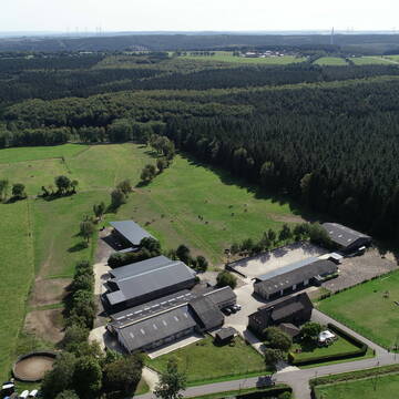
Turnier/Freizeit/Aufzucht/Rentnerstall
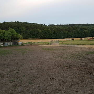
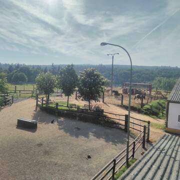
Hürtgenwald
Reitstall-Fassbender
@Reitstall-Fassbender
FN-Mitglied
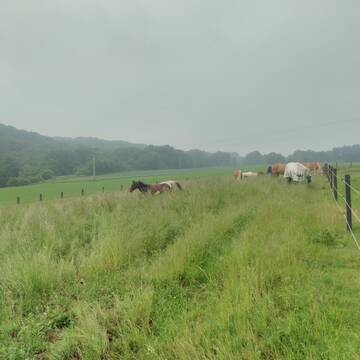
Freizeitstall
Vermieten
Hunde willkommen
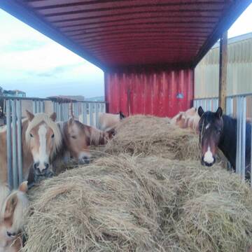
Krankenbox
Gnadenbrothof
Notfallboxen
26 weitere...
P
Gut Heidbüchel-Stall Menniken
Großhau
Monique Menniken
@Finy-Menniken
Fahrstall, Kutschwagen
Freizeitstall
Führanlage
Longierzirkel/Roundpen
Gnadenbrothof
Hengsthaltung möglich
Außenbox mit Paddock
Außenboxen
25 weitere...
P
Deprecated: Creation of dynamic property Zend_View_Helper_Ads::$adLink is deprecated in /var/www/stall-frei/htdocs/staging.stall-frei.de/library/Psf/View/Helper/Ads.php on line 108

***Reitstall Birkenhof*** Pferdegerechte Haltung
Köln
Daniele-Fazzi
@Daniele-Fazzi
Herzlich Willkommen
auf dem Reitstall Birkenhof
Jetzt neu ‼️ auf dem Birkenhof:
Private Geländestrecke rund um unser

Liebevoll geführter Aktivstall in der Eifel
Hürtgenwald
Bosselbacher-Hof
@Bosselbacher-Hof
Freizeitstall
Gastronomie
Hunde willkommen
Krankenbox
Hufrehe geeignet
Notfallboxen
Bewegungsstall
Laufstall
13 weitere...
P
Klosterhof Wenau
Langerwehe-Wenau
Klosterhof Wenau
@Klosterhof-Wenau
Freizeitstall
Reitlehrer und -unterricht
Vermieten
Hunde willkommen
Longierzirkel/Roundpen
Außenbox mit Paddock
Innenbox
15 weitere...
P

Gut Tannenhof
Langerwehe
Reitanlage Röthgener Burg
@SportKugel
FN-Mitglied
Freizeitstall
Vermieten
Hunde willkommen
Longierzirkel/Roundpen
Außenbox mit Paddock
Außenboxen
19 weitere...
P

Pferdeboxen in Stolberg-Büsbach
Stolberg
Peter Conrads
@PeterConrads
Freizeitstall
Vermieten
Führanlage
Hunde willkommen
Zuchtstutenhaltung möglich
16 weitere...
P

Turnier und Freizeitstall TB.
Langerwehe/Heistern
Turnier-und-Freizeitstall-TB
@Turnier-und-Freizeitstall-TB
Freizeitstall
Pferdeausbildung
Vermieten
Verpachten
Führanlage
Krankenbox
Allergikerstall
Fohlenaufzucht möglich
29 weitere...
P
Eifelhof Bock - Pferdepension Bock
Hürtgenwald
Pferdepension-Bock1
@Pferdepension-Bock1
Freizeitstall
Vermieten
Krankenbox
Longierzirkel/Roundpen
Allergikerstall
Notfallboxen
18 weitere...
P

Mitarbeiter gesucht?
Mechtersen
STALL-FREIde Marketing
@STALL-FREI-Marketing
Stellenangebote kostenlos veröffentlichen!


Herdenhaltung Offenstall Gemmenich
Gemmenich bei Aachen
Waheeda
@Waheeda
FN-Mitglied
Freizeitstall
Vermieten
Krankenbox
Longierzirkel/Roundpen
Notfallboxen
10 weitere...
S

HIT Aktivstall Rosenhof
Mechernich
Aktivstall-Rosenhof
@Aktivstall-Rosenhof
Fahrstall, Kutschwagen
Freizeitstall
Vermieten
Hunde willkommen
Krankenbox
Allergikerstall
bedampftes/gewaschenes Heu
30 weitere...
S
Deprecated: Creation of dynamic property Zend_View::$pageCount is deprecated in /var/www/stall-frei/htdocs/staging.stall-frei.de/library/vendor/shardj/zf1-future/library/Zend/View/Abstract.php on line 308
Deprecated: Creation of dynamic property Zend_View::$itemCountPerPage is deprecated in /var/www/stall-frei/htdocs/staging.stall-frei.de/library/vendor/shardj/zf1-future/library/Zend/View/Abstract.php on line 308
Deprecated: Creation of dynamic property Zend_View::$first is deprecated in /var/www/stall-frei/htdocs/staging.stall-frei.de/library/vendor/shardj/zf1-future/library/Zend/View/Abstract.php on line 308
Deprecated: Creation of dynamic property Zend_View::$current is deprecated in /var/www/stall-frei/htdocs/staging.stall-frei.de/library/vendor/shardj/zf1-future/library/Zend/View/Abstract.php on line 308
Deprecated: Creation of dynamic property Zend_View::$last is deprecated in /var/www/stall-frei/htdocs/staging.stall-frei.de/library/vendor/shardj/zf1-future/library/Zend/View/Abstract.php on line 308
Deprecated: Creation of dynamic property Zend_View::$next is deprecated in /var/www/stall-frei/htdocs/staging.stall-frei.de/library/vendor/shardj/zf1-future/library/Zend/View/Abstract.php on line 308
Deprecated: Creation of dynamic property Zend_View::$pagesInRange is deprecated in /var/www/stall-frei/htdocs/staging.stall-frei.de/library/vendor/shardj/zf1-future/library/Zend/View/Abstract.php on line 308
Deprecated: Creation of dynamic property Zend_View::$firstPageInRange is deprecated in /var/www/stall-frei/htdocs/staging.stall-frei.de/library/vendor/shardj/zf1-future/library/Zend/View/Abstract.php on line 308
Deprecated: Creation of dynamic property Zend_View::$lastPageInRange is deprecated in /var/www/stall-frei/htdocs/staging.stall-frei.de/library/vendor/shardj/zf1-future/library/Zend/View/Abstract.php on line 308
Deprecated: Creation of dynamic property Zend_View::$currentItemCount is deprecated in /var/www/stall-frei/htdocs/staging.stall-frei.de/library/vendor/shardj/zf1-future/library/Zend/View/Abstract.php on line 308
Deprecated: Creation of dynamic property Zend_View::$totalItemCount is deprecated in /var/www/stall-frei/htdocs/staging.stall-frei.de/library/vendor/shardj/zf1-future/library/Zend/View/Abstract.php on line 308
Deprecated: Creation of dynamic property Zend_View::$firstItemNumber is deprecated in /var/www/stall-frei/htdocs/staging.stall-frei.de/library/vendor/shardj/zf1-future/library/Zend/View/Abstract.php on line 308
Deprecated: Creation of dynamic property Zend_View::$lastItemNumber is deprecated in /var/www/stall-frei/htdocs/staging.stall-frei.de/library/vendor/shardj/zf1-future/library/Zend/View/Abstract.php on line 308
Deprecated: Creation of dynamic property Zend_View::$router is deprecated in /var/www/stall-frei/htdocs/staging.stall-frei.de/library/vendor/shardj/zf1-future/library/Zend/View/Abstract.php on line 308
Deprecated: Creation of dynamic property Zend_View::$urlParams is deprecated in /var/www/stall-frei/htdocs/staging.stall-frei.de/library/vendor/shardj/zf1-future/library/Zend/View/Abstract.php on line 308
Deprecated: Creation of dynamic property Zend_View::$PageRange is deprecated in /var/www/stall-frei/htdocs/staging.stall-frei.de/library/vendor/shardj/zf1-future/library/Zend/View/Abstract.php on line 308
Für deine Suchanfrage wurden 247 Einträge gefunden
247 Pferdeställe
Deprecated: Creation of dynamic property Zend_View::$summaryDone is deprecated in /var/www/stall-frei/htdocs/staging.stall-frei.de/library/vendor/shardj/zf1-future/library/Zend/View/Abstract.php on line 308
Gesponsort


Turnier/Freizeit/Aufzucht/Rentnerstall
Hürtgenwald
Reitstall-Fassbender
@Reitstall-Fassbender
FN-Mitglied
Freizeitstall
Vermieten
Hunde willkommen
Krankenbox
Gnadenbrothof
Notfallboxen
26 weitere...
P
Gut Heidbüchel-Stall Menniken
Großhau
Monique Menniken
@Finy-Menniken
Fahrstall, Kutschwagen
Freizeitstall
Führanlage
Longierzirkel/Roundpen
Gnadenbrothof
Hengsthaltung möglich
Außenbox mit Paddock
Außenboxen
25 weitere...
P

Futtersack HeuToy, Fressbremse in pink
Mechtersen
STALL-FREIde Marketing
@STALL-FREI-Marketing
Stundenlange Beschäftigung die
Koliken vorbeugt, geringe Staubinhalation mit
steuerbarer Futterentnahme
Liebevoll geführter Aktivstall in der Eifel
Hürtgenwald
Bosselbacher-Hof
@Bosselbacher-Hof
Freizeitstall
Gastronomie
Hunde willkommen
Krankenbox
Hufrehe geeignet
Notfallboxen
Bewegungsstall
Laufstall
13 weitere...
P
Klosterhof Wenau
Langerwehe-Wenau
Klosterhof Wenau
@Klosterhof-Wenau
Freizeitstall
Reitlehrer und -unterricht
Vermieten
Hunde willkommen
Longierzirkel/Roundpen
Außenbox mit Paddock
Innenbox
15 weitere...
P
Gut Tannenhof
Langerwehe
Reitanlage Röthgener Burg
@SportKugel
FN-Mitglied
Freizeitstall
Vermieten
Hunde willkommen
Longierzirkel/Roundpen
Außenbox mit Paddock
Außenboxen
19 weitere...
P

Persönlichkeitsentwicklung mit Pferden
Bad Salzuflen
Katja Dors
@Pferdezeiten
Begleite andere auf ihrem Entwicklungsweg und entdecke die transformative Kraft der pferdegestützten Persönlichkeitsentwicklung !
neu
R
Pferdeboxen in Stolberg-Büsbach
Stolberg
Peter Conrads
@PeterConrads
Freizeitstall
Vermieten
Führanlage
Hunde willkommen
Zuchtstutenhaltung möglich
16 weitere...
P
Turnier und Freizeitstall TB.
Langerwehe/Heistern
Turnier-und-Freizeitstall-TB
@Turnier-und-Freizeitstall-TB
Freizeitstall
Pferdeausbildung
Vermieten
Verpachten
Führanlage
Krankenbox
Allergikerstall
Fohlenaufzucht möglich
29 weitere...
P
Eifelhof Bock - Pferdepension Bock
Hürtgenwald
Pferdepension-Bock1
@Pferdepension-Bock1
Freizeitstall
Vermieten
Krankenbox
Longierzirkel/Roundpen
Allergikerstall
Notfallboxen
18 weitere...
P
Herdenhaltung Offenstall Gemmenich
Gemmenich bei Aachen
Waheeda
@Waheeda
FN-Mitglied
Freizeitstall
Vermieten
Krankenbox
Longierzirkel/Roundpen
Notfallboxen
10 weitere...
S
HIT Aktivstall Rosenhof
Mechernich
Aktivstall-Rosenhof
@Aktivstall-Rosenhof
Fahrstall, Kutschwagen
Freizeitstall
Vermieten
Hunde willkommen
Krankenbox
Allergikerstall
bedampftes/gewaschenes Heu
30 weitere...
S
Werde Teil von STALL-FREI.de
Du hast eine Pferdebox frei? Freie Plätze im Offenstall, Pferdestall oder der Reitanlage kostenlos anbieten.
Deprecated: Creation of dynamic property Zend_View::$pageCount is deprecated in /var/www/stall-frei/htdocs/staging.stall-frei.de/library/vendor/shardj/zf1-future/library/Zend/View/Abstract.php on line 308
Deprecated: Creation of dynamic property Zend_View::$itemCountPerPage is deprecated in /var/www/stall-frei/htdocs/staging.stall-frei.de/library/vendor/shardj/zf1-future/library/Zend/View/Abstract.php on line 308
Deprecated: Creation of dynamic property Zend_View::$first is deprecated in /var/www/stall-frei/htdocs/staging.stall-frei.de/library/vendor/shardj/zf1-future/library/Zend/View/Abstract.php on line 308
Deprecated: Creation of dynamic property Zend_View::$current is deprecated in /var/www/stall-frei/htdocs/staging.stall-frei.de/library/vendor/shardj/zf1-future/library/Zend/View/Abstract.php on line 308
Deprecated: Creation of dynamic property Zend_View::$last is deprecated in /var/www/stall-frei/htdocs/staging.stall-frei.de/library/vendor/shardj/zf1-future/library/Zend/View/Abstract.php on line 308
Deprecated: Creation of dynamic property Zend_View::$next is deprecated in /var/www/stall-frei/htdocs/staging.stall-frei.de/library/vendor/shardj/zf1-future/library/Zend/View/Abstract.php on line 308
Deprecated: Creation of dynamic property Zend_View::$pagesInRange is deprecated in /var/www/stall-frei/htdocs/staging.stall-frei.de/library/vendor/shardj/zf1-future/library/Zend/View/Abstract.php on line 308
Deprecated: Creation of dynamic property Zend_View::$firstPageInRange is deprecated in /var/www/stall-frei/htdocs/staging.stall-frei.de/library/vendor/shardj/zf1-future/library/Zend/View/Abstract.php on line 308
Deprecated: Creation of dynamic property Zend_View::$lastPageInRange is deprecated in /var/www/stall-frei/htdocs/staging.stall-frei.de/library/vendor/shardj/zf1-future/library/Zend/View/Abstract.php on line 308
Deprecated: Creation of dynamic property Zend_View::$currentItemCount is deprecated in /var/www/stall-frei/htdocs/staging.stall-frei.de/library/vendor/shardj/zf1-future/library/Zend/View/Abstract.php on line 308
Deprecated: Creation of dynamic property Zend_View::$totalItemCount is deprecated in /var/www/stall-frei/htdocs/staging.stall-frei.de/library/vendor/shardj/zf1-future/library/Zend/View/Abstract.php on line 308
Deprecated: Creation of dynamic property Zend_View::$firstItemNumber is deprecated in /var/www/stall-frei/htdocs/staging.stall-frei.de/library/vendor/shardj/zf1-future/library/Zend/View/Abstract.php on line 308
Deprecated: Creation of dynamic property Zend_View::$lastItemNumber is deprecated in /var/www/stall-frei/htdocs/staging.stall-frei.de/library/vendor/shardj/zf1-future/library/Zend/View/Abstract.php on line 308
Deprecated: Creation of dynamic property Zend_View::$router is deprecated in /var/www/stall-frei/htdocs/staging.stall-frei.de/library/vendor/shardj/zf1-future/library/Zend/View/Abstract.php on line 308
Deprecated: Creation of dynamic property Zend_View::$urlParams is deprecated in /var/www/stall-frei/htdocs/staging.stall-frei.de/library/vendor/shardj/zf1-future/library/Zend/View/Abstract.php on line 308
Deprecated: Creation of dynamic property Zend_View::$PageRange is deprecated in /var/www/stall-frei/htdocs/staging.stall-frei.de/library/vendor/shardj/zf1-future/library/Zend/View/Abstract.php on line 308
Deprecated: Creation of dynamic property Zend_View::$showFilterBar is deprecated in /var/www/stall-frei/htdocs/staging.stall-frei.de/library/vendor/shardj/zf1-future/library/Zend/View/Abstract.php on line 308
Deprecated: Creation of dynamic property Zend_View::$pageTitle is deprecated in /var/www/stall-frei/htdocs/staging.stall-frei.de/library/vendor/shardj/zf1-future/library/Zend/View/Abstract.php on line 308
Deprecated: Creation of dynamic property Zend_View::$isSearch is deprecated in /var/www/stall-frei/htdocs/staging.stall-frei.de/library/vendor/shardj/zf1-future/library/Zend/View/Abstract.php on line 308
Deprecated: Creation of dynamic property Psf_Form_Element_Text::$class is deprecated in /var/www/stall-frei/htdocs/staging.stall-frei.de/library/vendor/shardj/zf1-future/library/Zend/Form/Element.php on line 874
Deprecated: Creation of dynamic property Psf_Form_Element_Text::$size is deprecated in /var/www/stall-frei/htdocs/staging.stall-frei.de/library/vendor/shardj/zf1-future/library/Zend/Form/Element.php on line 874
Deprecated: Creation of dynamic property Psf_Form_Element_Text::$placeholder is deprecated in /var/www/stall-frei/htdocs/staging.stall-frei.de/library/vendor/shardj/zf1-future/library/Zend/Form/Element.php on line 874
Deprecated: Creation of dynamic property Psf_Form_Element_Hidden::$class is deprecated in /var/www/stall-frei/htdocs/staging.stall-frei.de/library/vendor/shardj/zf1-future/library/Zend/Form/Element.php on line 874
Deprecated: Creation of dynamic property Psf_Form_Element_Hidden::$class is deprecated in /var/www/stall-frei/htdocs/staging.stall-frei.de/library/vendor/shardj/zf1-future/library/Zend/Form/Element.php on line 874
Deprecated: Creation of dynamic property Psf_Form_Element_Hidden::$class is deprecated in /var/www/stall-frei/htdocs/staging.stall-frei.de/library/vendor/shardj/zf1-future/library/Zend/Form/Element.php on line 874
Deprecated: Creation of dynamic property Psf_Form_Element_Hidden::$class is deprecated in /var/www/stall-frei/htdocs/staging.stall-frei.de/library/vendor/shardj/zf1-future/library/Zend/Form/Element.php on line 874
Deprecated: Creation of dynamic property Psf_Form_Element_Select::$class is deprecated in /var/www/stall-frei/htdocs/staging.stall-frei.de/library/vendor/shardj/zf1-future/library/Zend/Form/Element.php on line 874
Deprecated: Creation of dynamic property Psf_Form_Element_Select::$class is deprecated in /var/www/stall-frei/htdocs/staging.stall-frei.de/library/vendor/shardj/zf1-future/library/Zend/Form/Element.php on line 874
Deprecated: Creation of dynamic property Psf_Form_Element_Select::$class is deprecated in /var/www/stall-frei/htdocs/staging.stall-frei.de/library/vendor/shardj/zf1-future/library/Zend/Form/Element.php on line 874
Deprecated: Creation of dynamic property Psf_Form_Element_Select::$class is deprecated in /var/www/stall-frei/htdocs/staging.stall-frei.de/library/vendor/shardj/zf1-future/library/Zend/Form/Element.php on line 874
Deprecated: Creation of dynamic property Psf_Form_Element_Text::$class is deprecated in /var/www/stall-frei/htdocs/staging.stall-frei.de/library/vendor/shardj/zf1-future/library/Zend/Form/Element.php on line 874
Deprecated: Creation of dynamic property Psf_Form_Element_Checkbox::$label is deprecated in /var/www/stall-frei/htdocs/staging.stall-frei.de/library/vendor/shardj/zf1-future/library/Zend/Form/Element.php on line 874
Deprecated: Creation of dynamic property Zend_View::$searchLocationString is deprecated in /var/www/stall-frei/htdocs/staging.stall-frei.de/library/vendor/shardj/zf1-future/library/Zend/View/Abstract.php on line 308
Deprecated: Creation of dynamic property Zend_View::$oSearchForm is deprecated in /var/www/stall-frei/htdocs/staging.stall-frei.de/library/vendor/shardj/zf1-future/library/Zend/View/Abstract.php on line 308
Deprecated: Creation of dynamic property Zend_View::$locationHintStyle is deprecated in /var/www/stall-frei/htdocs/staging.stall-frei.de/library/vendor/shardj/zf1-future/library/Zend/View/Abstract.php on line 308
Psf_GeoCoder_Abstract::getLocationList: Hürtgenwald, Düren
Psf_GeoCoder_Abstract::getLocationList: Hürtgenwald, Düren
Array
(
    [/stall/nordrhein-westfalen/huertgenwald/179379] =>
)
Psf_GeoCoder_Abstract::getCachedOrLive: Hürtgenwald, Düren
Psf_GeoCoder_OpenCageData::makeApiRequest: response:
Array
(
[documentation] => https://opencagedata.com/api
[licenses] => Array
(
[0] => Array
(
[name] => see attribution guide
[url] => https://opencagedata.com/credits
)
)
[results] => Array
(
[0] => Array
(
[bounds] => Array
(
[northeast] => Array
(
[lat] => 50.7858815
[lng] => 6.4360519
)
[southwest] => Array
(
[lat] => 50.6790462
[lng] => 6.2618023
)
)
[components] => Array
(
[ISO_3166-1_alpha-2] => DE
[ISO_3166-1_alpha-3] => DEU
[ISO_3166-2] => Array
(
[0] => DE-NW
)
[_category] => natural/water
[_normalized_city] => Stolberg
[_type] => forest
[continent] => Europe
[country] => Deutschland
[country_code] => de
[county] => Städteregion Aachen
[forest] => Hürtgenwald
[municipality] => Langerwehe
[political_union] => European Union
[state] => Nordrhein-Westfalen
[state_code] => NW
[town] => Stolberg
)
[confidence] => 6
[formatted] => Hürtgenwald, Stolberg, Nordrhein-Westfalen, Deutschland
[geometry] => Array
(
[lat] => 50.7323834
[lng] => 6.3140398
)
)
[1] => Array
(
[components] => Array
(
[ISO_3166-1_alpha-2] => FR
[ISO_3166-1_alpha-3] => FRA
[ISO_3166-2] => Array
(
[0] => FR-NAQ
[1] => FR-47
)
[_category] => road
[_normalized_city] => Agen
[_type] => road
[city] => Agen
[continent] => Europe
[country] => France
[country_code] => fr
[county] => Lot-et-Garonne
[local_authority] => Agglomération d'Agen
[political_union] => European Union
[postcode] => 47000
[road] => Rue de Durrens
[state] => Nouvelle-Aquitaine
[state_code] => NAQ
)
[confidence] => 2
[formatted] => Rue de Durrens, 47000 Agen, France
[geometry] => Array
(
[lat] => 44.201731
[lng] => 0.634759
)
)
[2] => Array
(
[components] => Array
(
[ISO_3166-1_alpha-2] => FR
[ISO_3166-1_alpha-3] => FRA
[ISO_3166-2] => Array
(
[0] => FR-HDF
[1] => FR-59
)
[_category] => road
[_normalized_city] => Valenciennes
[_type] => road
[city] => Valenciennes
[continent] => Europe
[country] => France
[country_code] => fr
[county] => Nord
[local_authority] => Communauté d’agglomération Valenciennes Métropole
[political_union] => European Union
[postcode] => 59300
[road] => Avenue de Düren
[state] => Hauts-de-France
[state_code] => HDF
)
[confidence] => 2
[formatted] => Avenue de Düren, 59300 Valenciennes, France
[geometry] => Array
(
[lat] => 50.356982
[lng] => 3.480659
)
)
[3] => Array
(
[components] => Array
(
[ISO_3166-1_alpha-2] => FR
[ISO_3166-1_alpha-3] => FRA
[ISO_3166-2] => Array
(
[0] => FR-NAQ
[1] => FR-47
)
[_category] => road
[_normalized_city] => Agen
[_type] => road
[city] => Agen
[continent] => Europe
[country] => France
[country_code] => fr
[county] => Lot-et-Garonne
[local_authority] => Agglomération d'Agen
[political_union] => European Union
[postcode] => 47000
[road] => Impasse de Durrens
[state] => Nouvelle-Aquitaine
[state_code] => NAQ
)
[confidence] => 2
[formatted] => Impasse de Durrens, 47000 Agen, France
[geometry] => Array
(
[lat] => 44.201186
[lng] => 0.635466
)
)
[4] => Array
(
[components] => Array
(
[ISO_3166-1_alpha-2] => FR
[ISO_3166-1_alpha-3] => FRA
[ISO_3166-2] => Array
(
[0] => FR-GES
[1] => FR-55
)
[_category] => road
[_normalized_city] => Bar-le-Duc
[_type] => road
[city] => Bar-le-Duc
[continent] => Europe
[country] => France
[country_code] => fr
[county] => Meuse
[local_authority] => Communauté d'agglomération de Bar-le-Duc - Sud Meuse
[political_union] => European Union
[postcode] => 55000
[road] => Rue Antoine Durenne
[state] => Grand Est
[state_code] => GES
)
[confidence] => 2
[formatted] => Rue Antoine Durenne, 55000 Bar-le-Duc, France
[geometry] => Array
(
[lat] => 48.767307
[lng] => 5.173005
)
)
[5] => Array
(
[components] => Array
(
[ISO_3166-1_alpha-2] => FR
[ISO_3166-1_alpha-3] => FRA
[ISO_3166-2] => Array
(
[0] => FR-NAQ
[1] => FR-33
)
[_category] => place
[_normalized_city] => Cenon
[_type] => place
[city] => Cenon
[continent] => Europe
[country] => France
[country_code] => fr
[county] => Gironde
[local_authority] => Bordeaux Métropole
[place] => Chemin Claude Durrens
[political_union] => European Union
[postcode] => 33150
[state] => Nouvelle-Aquitaine
[state_code] => NAQ
)
[confidence] => 10
[formatted] => Chemin Claude Durrens, 33150 Cenon, France
[geometry] => Array
(
[lat] => 44.850327
[lng] => -0.521225
)
)
[6] => Array
(
[components] => Array
(
[ISO_3166-1_alpha-2] => FR
[ISO_3166-1_alpha-3] => FRA
[ISO_3166-2] => Array
(
[0] => FR-GES
[1] => FR-52
)
[_category] => road
[_normalized_city] => Sommevoire
[_type] => road
[city] => Sommevoire
[continent] => Europe
[country] => France
[country_code] => fr
[county] => Haute-Marne
[local_authority] => Communauté d'agglomération de Saint-Dizier, Der et Blaise
[political_union] => European Union
[postcode] => 52220
[road] => Rue Antoine Durenne
[state] => Grand Est
[state_code] => GES
)
[confidence] => 10
[formatted] => Rue Antoine Durenne, 52220 Sommevoire, France
[geometry] => Array
(
[lat] => 48.414096
[lng] => 4.838401
)
)
[7] => Array
(
[components] => Array
(
[ISO_3166-1_alpha-2] => FR
[ISO_3166-1_alpha-3] => FRA
[ISO_3166-2] => Array
(
[0] => FR-ARA
[1] => FR-69
)
[_category] => road
[_normalized_city] => Saint-Genis-l'Argentière
[_type] => road
[city] => Saint-Genis-l'Argentière
[continent] => Europe
[country] => France
[country_code] => fr
[county] => Rhône
[local_authority] => Communauté de communes des Monts du Lyonnais
[political_union] => European Union
[postcode] => 69610
[road] => Route de Duerne
[state] => Auvergne-Rhône-Alpes
[state_code] => ARA
)
[confidence] => 10
[formatted] => Route de Duerne, 69610 Saint-Genis-l'Argentière, France
[geometry] => Array
(
[lat] => 45.701252
[lng] => 4.484388
)
)
[8] => Array
(
[components] => Array
(
[ISO_3166-1_alpha-2] => FR
[ISO_3166-1_alpha-3] => FRA
[ISO_3166-2] => Array
(
[0] => FR-ARA
[1] => FR-69
)
[_category] => road
[_normalized_city] => Duerne
[_type] => road
[city] => Duerne
[continent] => Europe
[country] => France
[country_code] => fr
[county] => Rhône
[local_authority] => Communauté de communes des Monts du Lyonnais
[political_union] => European Union
[postcode] => 69850
[road] => Impasse des Tourterelles
[state] => Auvergne-Rhône-Alpes
[state_code] => ARA
)
[confidence] => 10
[formatted] => Impasse des Tourterelles, 69850 Duerne, France
[geometry] => Array
(
[lat] => 45.684361
[lng] => 4.531301
)
)
[9] => Array
(
[components] => Array
(
[ISO_3166-1_alpha-2] => FR
[ISO_3166-1_alpha-3] => FRA
[ISO_3166-2] => Array
(
[0] => FR-ARA
[1] => FR-69
)
[_category] => road
[_normalized_city] => Duerne
[_type] => road
[city] => Duerne
[continent] => Europe
[country] => France
[country_code] => fr
[county] => Rhône
[local_authority] => Communauté de communes des Monts du Lyonnais
[political_union] => European Union
[postcode] => 69850
[road] => Rue du Vallon
[state] => Auvergne-Rhône-Alpes
[state_code] => ARA
)
[confidence] => 10
[formatted] => Rue du Vallon, 69850 Duerne, France
[geometry] => Array
(
[lat] => 45.683483
[lng] => 4.530825
)
)
)
[status] => Array
(
[code] => 200
[message] => OK
)
[stay_informed] => Array
(
[blog] => https://blog.opencagedata.com
[mastodon] => https://en.osm.town/@opencage
)
[thanks] => For using an OpenCage API
[timestamp] => Array
(
[created_http] => Fri, 06 Feb 2026 09:16:28 GMT
[created_unix] => 1770369388
)
[total_results] => 10
)
{"documentation":"https:\/\/opencagedata.com\/api","licenses":[{"name":"see attribution guide","url":"https:\/\/opencagedata.com\/credits"}],"results":[{"bounds":{"northeast":{"lat":50.7858815,"lng":6.4360519},"southwest":{"lat":50.6790462,"lng":6.2618023}},"components":{"ISO_3166-1_alpha-2":"DE","ISO_3166-1_alpha-3":"DEU","ISO_3166-2":["DE-NW"],"_category":"natural\/water","_normalized_city":"Stolberg","_type":"forest","continent":"Europe","country":"Deutschland","country_code":"de","county":"St\u00e4dteregion Aachen","forest":"H\u00fcrtgenwald","municipality":"Langerwehe","political_union":"European Union","state":"Nordrhein-Westfalen","state_code":"NW","town":"Stolberg"},"confidence":6,"formatted":"H\u00fcrtgenwald, Stolberg, Nordrhein-Westfalen, Deutschland","geometry":{"lat":50.7323834,"lng":6.3140398}},{"components":{"ISO_3166-1_alpha-2":"FR","ISO_3166-1_alpha-3":"FRA","ISO_3166-2":["FR-NAQ","FR-47"],"_category":"road","_normalized_city":"Agen","_type":"road","city":"Agen","continent":"Europe","country":"France","country_code":"fr","county":"Lot-et-Garonne","local_authority":"Agglom\u00e9ration d'Agen","political_union":"European Union","postcode":"47000","road":"Rue de Durrens","state":"Nouvelle-Aquitaine","state_code":"NAQ"},"confidence":2,"formatted":"Rue de Durrens, 47000 Agen, France","geometry":{"lat":44.201731,"lng":0.634759}},{"components":{"ISO_3166-1_alpha-2":"FR","ISO_3166-1_alpha-3":"FRA","ISO_3166-2":["FR-HDF","FR-59"],"_category":"road","_normalized_city":"Valenciennes","_type":"road","city":"Valenciennes","continent":"Europe","country":"France","country_code":"fr","county":"Nord","local_authority":"Communaut\u00e9 d\u2019agglom\u00e9ration Valenciennes M\u00e9tropole","political_union":"European Union","postcode":"59300","road":"Avenue de D\u00fcren","state":"Hauts-de-France","state_code":"HDF"},"confidence":2,"formatted":"Avenue de D\u00fcren, 59300 Valenciennes, France","geometry":{"lat":50.356982,"lng":3.480659}},{"components":{"ISO_3166-1_alpha-2":"FR","ISO_3166-1_alpha-3":"FRA","ISO_3166-2":["FR-NAQ","FR-47"],"_category":"road","_normalized_city":"Agen","_type":"road","city":"Agen","continent":"Europe","country":"France","country_code":"fr","county":"Lot-et-Garonne","local_authority":"Agglom\u00e9ration d'Agen","political_union":"European Union","postcode":"47000","road":"Impasse de Durrens","state":"Nouvelle-Aquitaine","state_code":"NAQ"},"confidence":2,"formatted":"Impasse de Durrens, 47000 Agen, France","geometry":{"lat":44.201186,"lng":0.635466}},{"components":{"ISO_3166-1_alpha-2":"FR","ISO_3166-1_alpha-3":"FRA","ISO_3166-2":["FR-GES","FR-55"],"_category":"road","_normalized_city":"Bar-le-Duc","_type":"road","city":"Bar-le-Duc","continent":"Europe","country":"France","country_code":"fr","county":"Meuse","local_authority":"Communaut\u00e9 d'agglom\u00e9ration de Bar-le-Duc - Sud Meuse","political_union":"European Union","postcode":"55000","road":"Rue Antoine Durenne","state":"Grand Est","state_code":"GES"},"confidence":2,"formatted":"Rue Antoine Durenne, 55000 Bar-le-Duc, France","geometry":{"lat":48.767307,"lng":5.173005}},{"components":{"ISO_3166-1_alpha-2":"FR","ISO_3166-1_alpha-3":"FRA","ISO_3166-2":["FR-NAQ","FR-33"],"_category":"place","_normalized_city":"Cenon","_type":"place","city":"Cenon","continent":"Europe","country":"France","country_code":"fr","county":"Gironde","local_authority":"Bordeaux M\u00e9tropole","place":"Chemin Claude Durrens","political_union":"European Union","postcode":"33150","state":"Nouvelle-Aquitaine","state_code":"NAQ"},"confidence":10,"formatted":"Chemin Claude Durrens, 33150 Cenon, France","geometry":{"lat":44.850327,"lng":-0.521225}},{"components":{"ISO_3166-1_alpha-2":"FR","ISO_3166-1_alpha-3":"FRA","ISO_3166-2":["FR-GES","FR-52"],"_category":"road","_normalized_city":"Sommevoire","_type":"road","city":"Sommevoire","continent":"Europe","country":"France","country_code":"fr","county":"Haute-Marne","local_authority":"Communaut\u00e9 d'agglom\u00e9ration de Saint-Dizier, Der et Blaise","political_union":"European Union","postcode":"52220","road":"Rue Antoine Durenne","state":"Grand Est","state_code":"GES"},"confidence":10,"formatted":"Rue Antoine Durenne, 52220 Sommevoire, France","geometry":{"lat":48.414096,"lng":4.838401}},{"components":{"ISO_3166-1_alpha-2":"FR","ISO_3166-1_alpha-3":"FRA","ISO_3166-2":["FR-ARA","FR-69"],"_category":"road","_normalized_city":"Saint-Genis-l'Argenti\u00e8re","_type":"road","city":"Saint-Genis-l'Argenti\u00e8re","continent":"Europe","country":"France","country_code":"fr","county":"Rh\u00f4ne","local_authority":"Communaut\u00e9 de communes des Monts du Lyonnais","political_union":"European Union","postcode":"69610","road":"Route de Duerne","state":"Auvergne-Rh\u00f4ne-Alpes","state_code":"ARA"},"confidence":10,"formatted":"Route de Duerne, 69610 Saint-Genis-l'Argenti\u00e8re, France","geometry":{"lat":45.701252,"lng":4.484388}},{"components":{"ISO_3166-1_alpha-2":"FR","ISO_3166-1_alpha-3":"FRA","ISO_3166-2":["FR-ARA","FR-69"],"_category":"road","_normalized_city":"Duerne","_type":"road","city":"Duerne","continent":"Europe","country":"France","country_code":"fr","county":"Rh\u00f4ne","local_authority":"Communaut\u00e9 de communes des Monts du Lyonnais","political_union":"European Union","postcode":"69850","road":"Impasse des Tourterelles","state":"Auvergne-Rh\u00f4ne-Alpes","state_code":"ARA"},"confidence":10,"formatted":"Impasse des Tourterelles, 69850 Duerne, France","geometry":{"lat":45.684361,"lng":4.531301}},{"components":{"ISO_3166-1_alpha-2":"FR","ISO_3166-1_alpha-3":"FRA","ISO_3166-2":["FR-ARA","FR-69"],"_category":"road","_normalized_city":"Duerne","_type":"road","city":"Duerne","continent":"Europe","country":"France","country_code":"fr","county":"Rh\u00f4ne","local_authority":"Communaut\u00e9 de communes des Monts du Lyonnais","political_union":"European Union","postcode":"69850","road":"Rue du Vallon","state":"Auvergne-Rh\u00f4ne-Alpes","state_code":"ARA"},"confidence":10,"formatted":"Rue du Vallon, 69850 Duerne, France","geometry":{"lat":45.683483,"lng":4.530825}}],"status":{"code":200,"message":"OK"},"stay_informed":{"blog":"https:\/\/blog.opencagedata.com","mastodon":"https:\/\/en.osm.town\/@opencage"},"thanks":"For using an OpenCage API","timestamp":{"created_http":"Fri, 06 Feb 2026 09:16:28 GMT","created_unix":1770369388},"total_results":10}Array
(
[0] => stdClass Object
(
[bounds] => stdClass Object
(
[northeast] => stdClass Object
(
[lat] => 50.7858815
[lng] => 6.4360519
)
[southwest] => stdClass Object
(
[lat] => 50.6790462
[lng] => 6.2618023
)
)
[components] => stdClass Object
(
[ISO_3166-1_alpha-2] => DE
[ISO_3166-1_alpha-3] => DEU
[ISO_3166-2] => Array
(
[0] => DE-NW
)
[_category] => natural/water
[_normalized_city] => Stolberg
[_type] => forest
[continent] => Europe
[country] => Deutschland
[country_code] => de
[county] => Städteregion Aachen
[forest] => Hürtgenwald
[municipality] => Langerwehe
[political_union] => European Union
[state] => Nordrhein-Westfalen
[state_code] => NW
[town] => Stolberg
)
[confidence] => 6
[formatted] => Hürtgenwald, Stolberg, Nordrhein-Westfalen, Deutschland
[geometry] => stdClass Object
(
[lat] => 50.7323834
[lng] => 6.3140398
)
)
[1] => stdClass Object
(
[components] => stdClass Object
(
[ISO_3166-1_alpha-2] => FR
[ISO_3166-1_alpha-3] => FRA
[ISO_3166-2] => Array
(
[0] => FR-NAQ
[1] => FR-47
)
[_category] => road
[_normalized_city] => Agen
[_type] => road
[city] => Agen
[continent] => Europe
[country] => France
[country_code] => fr
[county] => Lot-et-Garonne
[local_authority] => Agglomération d'Agen
[political_union] => European Union
[postcode] => 47000
[road] => Rue de Durrens
[state] => Nouvelle-Aquitaine
[state_code] => NAQ
)
[confidence] => 2
[formatted] => Rue de Durrens, 47000 Agen, France
[geometry] => stdClass Object
(
[lat] => 44.201731
[lng] => 0.634759
)
)
[2] => stdClass Object
(
[components] => stdClass Object
(
[ISO_3166-1_alpha-2] => FR
[ISO_3166-1_alpha-3] => FRA
[ISO_3166-2] => Array
(
[0] => FR-HDF
[1] => FR-59
)
[_category] => road
[_normalized_city] => Valenciennes
[_type] => road
[city] => Valenciennes
[continent] => Europe
[country] => France
[country_code] => fr
[county] => Nord
[local_authority] => Communauté d’agglomération Valenciennes Métropole
[political_union] => European Union
[postcode] => 59300
[road] => Avenue de Düren
[state] => Hauts-de-France
[state_code] => HDF
)
[confidence] => 2
[formatted] => Avenue de Düren, 59300 Valenciennes, France
[geometry] => stdClass Object
(
[lat] => 50.356982
[lng] => 3.480659
)
)
[3] => stdClass Object
(
[components] => stdClass Object
(
[ISO_3166-1_alpha-2] => FR
[ISO_3166-1_alpha-3] => FRA
[ISO_3166-2] => Array
(
[0] => FR-NAQ
[1] => FR-47
)
[_category] => road
[_normalized_city] => Agen
[_type] => road
[city] => Agen
[continent] => Europe
[country] => France
[country_code] => fr
[county] => Lot-et-Garonne
[local_authority] => Agglomération d'Agen
[political_union] => European Union
[postcode] => 47000
[road] => Impasse de Durrens
[state] => Nouvelle-Aquitaine
[state_code] => NAQ
)
[confidence] => 2
[formatted] => Impasse de Durrens, 47000 Agen, France
[geometry] => stdClass Object
(
[lat] => 44.201186
[lng] => 0.635466
)
)
[4] => stdClass Object
(
[components] => stdClass Object
(
[ISO_3166-1_alpha-2] => FR
[ISO_3166-1_alpha-3] => FRA
[ISO_3166-2] => Array
(
[0] => FR-GES
[1] => FR-55
)
[_category] => road
[_normalized_city] => Bar-le-Duc
[_type] => road
[city] => Bar-le-Duc
[continent] => Europe
[country] => France
[country_code] => fr
[county] => Meuse
[local_authority] => Communauté d'agglomération de Bar-le-Duc - Sud Meuse
[political_union] => European Union
[postcode] => 55000
[road] => Rue Antoine Durenne
[state] => Grand Est
[state_code] => GES
)
[confidence] => 2
[formatted] => Rue Antoine Durenne, 55000 Bar-le-Duc, France
[geometry] => stdClass Object
(
[lat] => 48.767307
[lng] => 5.173005
)
)
[5] => stdClass Object
(
[components] => stdClass Object
(
[ISO_3166-1_alpha-2] => FR
[ISO_3166-1_alpha-3] => FRA
[ISO_3166-2] => Array
(
[0] => FR-NAQ
[1] => FR-33
)
[_category] => place
[_normalized_city] => Cenon
[_type] => place
[city] => Cenon
[continent] => Europe
[country] => France
[country_code] => fr
[county] => Gironde
[local_authority] => Bordeaux Métropole
[place] => Chemin Claude Durrens
[political_union] => European Union
[postcode] => 33150
[state] => Nouvelle-Aquitaine
[state_code] => NAQ
)
[confidence] => 10
[formatted] => Chemin Claude Durrens, 33150 Cenon, France
[geometry] => stdClass Object
(
[lat] => 44.850327
[lng] => -0.521225
)
)
[6] => stdClass Object
(
[components] => stdClass Object
(
[ISO_3166-1_alpha-2] => FR
[ISO_3166-1_alpha-3] => FRA
[ISO_3166-2] => Array
(
[0] => FR-GES
[1] => FR-52
)
[_category] => road
[_normalized_city] => Sommevoire
[_type] => road
[city] => Sommevoire
[continent] => Europe
[country] => France
[country_code] => fr
[county] => Haute-Marne
[local_authority] => Communauté d'agglomération de Saint-Dizier, Der et Blaise
[political_union] => European Union
[postcode] => 52220
[road] => Rue Antoine Durenne
[state] => Grand Est
[state_code] => GES
)
[confidence] => 10
[formatted] => Rue Antoine Durenne, 52220 Sommevoire, France
[geometry] => stdClass Object
(
[lat] => 48.414096
[lng] => 4.838401
)
)
[7] => stdClass Object
(
[components] => stdClass Object
(
[ISO_3166-1_alpha-2] => FR
[ISO_3166-1_alpha-3] => FRA
[ISO_3166-2] => Array
(
[0] => FR-ARA
[1] => FR-69
)
[_category] => road
[_normalized_city] => Saint-Genis-l'Argentière
[_type] => road
[city] => Saint-Genis-l'Argentière
[continent] => Europe
[country] => France
[country_code] => fr
[county] => Rhône
[local_authority] => Communauté de communes des Monts du Lyonnais
[political_union] => European Union
[postcode] => 69610
[road] => Route de Duerne
[state] => Auvergne-Rhône-Alpes
[state_code] => ARA
)
[confidence] => 10
[formatted] => Route de Duerne, 69610 Saint-Genis-l'Argentière, France
[geometry] => stdClass Object
(
[lat] => 45.701252
[lng] => 4.484388
)
)
[8] => stdClass Object
(
[components] => stdClass Object
(
[ISO_3166-1_alpha-2] => FR
[ISO_3166-1_alpha-3] => FRA
[ISO_3166-2] => Array
(
[0] => FR-ARA
[1] => FR-69
)
[_category] => road
[_normalized_city] => Duerne
[_type] => road
[city] => Duerne
[continent] => Europe
[country] => France
[country_code] => fr
[county] => Rhône
[local_authority] => Communauté de communes des Monts du Lyonnais
[political_union] => European Union
[postcode] => 69850
[road] => Impasse des Tourterelles
[state] => Auvergne-Rhône-Alpes
[state_code] => ARA
)
[confidence] => 10
[formatted] => Impasse des Tourterelles, 69850 Duerne, France
[geometry] => stdClass Object
(
[lat] => 45.684361
[lng] => 4.531301
)
)
[9] => stdClass Object
(
[components] => stdClass Object
(
[ISO_3166-1_alpha-2] => FR
[ISO_3166-1_alpha-3] => FRA
[ISO_3166-2] => Array
(
[0] => FR-ARA
[1] => FR-69
)
[_category] => road
[_normalized_city] => Duerne
[_type] => road
[city] => Duerne
[continent] => Europe
[country] => France
[country_code] => fr
[county] => Rhône
[local_authority] => Communauté de communes des Monts du Lyonnais
[political_union] => European Union
[postcode] => 69850
[road] => Rue du Vallon
[state] => Auvergne-Rhône-Alpes
[state_code] => ARA
)
[confidence] => 10
[formatted] => Rue du Vallon, 69850 Duerne, France
[geometry] => stdClass Object
(
[lat] => 45.683483
[lng] => 4.530825
)
)
)
Psf_GeoCoder_OpenCageData::getKeyMap: 0
stdClass Object
(
    [bounds] => stdClass Object
        (
            [northeast] => stdClass Object
                (
                    [lat] => 50.7858815
                    [lng] => 6.4360519
                )

            [southwest] => stdClass Object
                (
                    [lat] => 50.6790462
                    [lng] => 6.2618023
                )

        )

    [components] => stdClass Object
        (
            [ISO_3166-1_alpha-2] => DE
            [ISO_3166-1_alpha-3] => DEU
            [ISO_3166-2] => Array
                (
                    [0] => DE-NW
                )

            [_category] => natural/water
            [_normalized_city] => Stolberg
            [_type] => forest
            [continent] => Europe
            [country] => Deutschland
            [country_code] => de
            [county] => Städteregion Aachen
            [forest] => Hürtgenwald
            [municipality] => Langerwehe
            [political_union] => European Union
            [state] => Nordrhein-Westfalen
            [state_code] => NW
            [town] => Stolberg
        )

    [confidence] => 6
    [formatted] => Hürtgenwald, Stolberg, Nordrhein-Westfalen, Deutschland
    [geometry] => stdClass Object
        (
            [lat] => 50.7323834
            [lng] => 6.3140398
        )

)
Psf_GeoCoder_OpenCageData::getCounty: Städteregion Aachen
Psf_GeoCoder_OpenCageData::addMissingData REFETCH!
Array
(
    [address] => Hürtgenwald, Stolberg, Nordrhein-Westfalen, Deutschland
    [type] => forest
    [street] =>
    [city] => Stolberg
    [county] => Städteregion Aachen
    [state] => Nordrhein-Westfalen
    [zip] =>
    [country] => Deutschland
    [suburb] =>
    [countrycode] => de
    [latitude] => 50.7323834
    [longitude] => 6.3140398
    [accuracy] => 1
    [confidence] => 6
    [bounds] => stdClass Object
        (
            [northeast] => stdClass Object
                (
                    [lat] => 50.7858815
                    [lng] => 6.4360519
                )

            [southwest] => stdClass Object
                (
                    [lat] => 50.6790462
                    [lng] => 6.2618023
                )

        )

)
reformat!
Array
(
    [address] => Hürtgenwald, Stolberg, Nordrhein-Westfalen, Deutschland
    [type] => forest
    [street] =>
    [city] => Stolberg
    [county] => Städteregion Aachen
    [state] => Nordrhein-Westfalen
    [zip] =>
    [country] => Deutschland
    [suburb] =>
    [countrycode] => de
    [latitude] => 50.7323834
    [longitude] => 6.3140398
    [accuracy] => 1
    [confidence] => 6
    [bounds] => stdClass Object
        (
            [northeast] => stdClass Object
                (
                    [lat] => 50.7858815
                    [lng] => 6.4360519
                )

            [southwest] => stdClass Object
                (
                    [lat] => 50.6790462
                    [lng] => 6.2618023
                )

        )

    [place] => Stolberg, Nordrhein-Westfalen
    [hash] => 6d706399f2d4c5191c75b4b64de66324
)
Psf_GeoCoder_OpenCageData::getKeyMap: 1
stdClass Object
(
    [components] => stdClass Object
        (
            [ISO_3166-1_alpha-2] => FR
            [ISO_3166-1_alpha-3] => FRA
            [ISO_3166-2] => Array
                (
                    [0] => FR-NAQ
                    [1] => FR-47
                )

            [_category] => road
            [_normalized_city] => Agen
            [_type] => road
            [city] => Agen
            [continent] => Europe
            [country] => France
            [country_code] => fr
            [county] => Lot-et-Garonne
            [local_authority] => Agglomération d'Agen
            [political_union] => European Union
            [postcode] => 47000
            [road] => Rue de Durrens
            [state] => Nouvelle-Aquitaine
            [state_code] => NAQ
        )

    [confidence] => 2
    [formatted] => Rue de Durrens, 47000 Agen, France
    [geometry] => stdClass Object
        (
            [lat] => 44.201731
            [lng] => 0.634759
        )

)
Psf_GeoCoder_OpenCageData::getCounty: Lot-et-Garonne
Psf_GeoCoder_OpenCageData::addMissingData REFETCH!
Array
(
    [address] => Rue de Durrens, 47000 Agen, France
    [type] => road
    [street] => Rue de Durrens
    [city] => Agen
    [county] => Lot-et-Garonne
    [state] => Nouvelle-Aquitaine
    [zip] => 47000
    [country] => France
    [suburb] =>
    [countrycode] => fr
    [latitude] => 44.201731
    [longitude] => 0.634759
    [accuracy] => 1
    [confidence] => 2
    [bounds] =>
)
reformat!
Array
(
    [address] => Rue de Durrens, 47000 Agen, France
    [type] => road
    [street] => Rue de Durrens
    [city] => Agen
    [county] => Lot-et-Garonne
    [state] => Nouvelle-Aquitaine
    [zip] => 47000
    [country] => France
    [suburb] =>
    [countrycode] => fr
    [latitude] => 44.201731
    [longitude] => 0.634759
    [accuracy] => 1
    [confidence] => 2
    [bounds] =>
    [place] => Rue de Durrens, 47000 Agen, Nouvelle-Aquitaine
    [hash] => 1963ffeb682a99e6d7a3a87a8a59c056
)
Psf_GeoCoder_OpenCageData::getKeyMap: 2
stdClass Object
(
    [components] => stdClass Object
        (
            [ISO_3166-1_alpha-2] => FR
            [ISO_3166-1_alpha-3] => FRA
            [ISO_3166-2] => Array
                (
                    [0] => FR-HDF
                    [1] => FR-59
                )

            [_category] => road
            [_normalized_city] => Valenciennes
            [_type] => road
            [city] => Valenciennes
            [continent] => Europe
            [country] => France
            [country_code] => fr
            [county] => Nord
            [local_authority] => Communauté d’agglomération Valenciennes Métropole
            [political_union] => European Union
            [postcode] => 59300
            [road] => Avenue de Düren
            [state] => Hauts-de-France
            [state_code] => HDF
        )

    [confidence] => 2
    [formatted] => Avenue de Düren, 59300 Valenciennes, France
    [geometry] => stdClass Object
        (
            [lat] => 50.356982
            [lng] => 3.480659
        )

)
Psf_GeoCoder_OpenCageData::getCounty: Nord
Psf_GeoCoder_OpenCageData::addMissingData REFETCH!
Array
(
    [address] => Avenue de Düren, 59300 Valenciennes, France
    [type] => road
    [street] => Avenue de Düren
    [city] => Valenciennes
    [county] => Nord
    [state] => Hauts-de-France
    [zip] => 59300
    [country] => France
    [suburb] =>
    [countrycode] => fr
    [latitude] => 50.356982
    [longitude] => 3.480659
    [accuracy] => 1
    [confidence] => 2
    [bounds] =>
)
reformat!
Array
(
    [address] => Avenue de Düren, 59300 Valenciennes, France
    [type] => road
    [street] => Avenue de Düren
    [city] => Valenciennes
    [county] => Nord
    [state] => Hauts-de-France
    [zip] => 59300
    [country] => France
    [suburb] =>
    [countrycode] => fr
    [latitude] => 50.356982
    [longitude] => 3.480659
    [accuracy] => 1
    [confidence] => 2
    [bounds] =>
    [place] => Avenue de Düren, 59300 Valenciennes, Hauts-de-France
    [hash] => 0273ef8b736fa8f5b39d8b8d5ca0dde7
)
Psf_GeoCoder_OpenCageData::getKeyMap: 3
stdClass Object
(
    [components] => stdClass Object
        (
            [ISO_3166-1_alpha-2] => FR
            [ISO_3166-1_alpha-3] => FRA
            [ISO_3166-2] => Array
                (
                    [0] => FR-NAQ
                    [1] => FR-47
                )

            [_category] => road
            [_normalized_city] => Agen
            [_type] => road
            [city] => Agen
            [continent] => Europe
            [country] => France
            [country_code] => fr
            [county] => Lot-et-Garonne
            [local_authority] => Agglomération d'Agen
            [political_union] => European Union
            [postcode] => 47000
            [road] => Impasse de Durrens
            [state] => Nouvelle-Aquitaine
            [state_code] => NAQ
        )

    [confidence] => 2
    [formatted] => Impasse de Durrens, 47000 Agen, France
    [geometry] => stdClass Object
        (
            [lat] => 44.201186
            [lng] => 0.635466
        )

)
Psf_GeoCoder_OpenCageData::getCounty: Lot-et-Garonne
Psf_GeoCoder_OpenCageData::addMissingData REFETCH!
Array
(
    [address] => Impasse de Durrens, 47000 Agen, France
    [type] => road
    [street] => Impasse de Durrens
    [city] => Agen
    [county] => Lot-et-Garonne
    [state] => Nouvelle-Aquitaine
    [zip] => 47000
    [country] => France
    [suburb] =>
    [countrycode] => fr
    [latitude] => 44.201186
    [longitude] => 0.635466
    [accuracy] => 1
    [confidence] => 2
    [bounds] =>
)
reformat!
Array
(
    [address] => Impasse de Durrens, 47000 Agen, France
    [type] => road
    [street] => Impasse de Durrens
    [city] => Agen
    [county] => Lot-et-Garonne
    [state] => Nouvelle-Aquitaine
    [zip] => 47000
    [country] => France
    [suburb] =>
    [countrycode] => fr
    [latitude] => 44.201186
    [longitude] => 0.635466
    [accuracy] => 1
    [confidence] => 2
    [bounds] =>
    [place] => Impasse de Durrens, 47000 Agen, Nouvelle-Aquitaine
    [hash] => 1bbc15a3f203fa6930f1fb7c391d78d0
)
Psf_GeoCoder_OpenCageData::getKeyMap: 4
stdClass Object
(
    [components] => stdClass Object
        (
            [ISO_3166-1_alpha-2] => FR
            [ISO_3166-1_alpha-3] => FRA
            [ISO_3166-2] => Array
                (
                    [0] => FR-GES
                    [1] => FR-55
                )

            [_category] => road
            [_normalized_city] => Bar-le-Duc
            [_type] => road
            [city] => Bar-le-Duc
            [continent] => Europe
            [country] => France
            [country_code] => fr
            [county] => Meuse
            [local_authority] => Communauté d'agglomération de Bar-le-Duc - Sud Meuse
            [political_union] => European Union
            [postcode] => 55000
            [road] => Rue Antoine Durenne
            [state] => Grand Est
            [state_code] => GES
        )

    [confidence] => 2
    [formatted] => Rue Antoine Durenne, 55000 Bar-le-Duc, France
    [geometry] => stdClass Object
        (
            [lat] => 48.767307
            [lng] => 5.173005
        )

)
Psf_GeoCoder_OpenCageData::getCounty: Meuse
Psf_GeoCoder_OpenCageData::addMissingData REFETCH!
Array
(
    [address] => Rue Antoine Durenne, 55000 Bar-le-Duc, France
    [type] => road
    [street] => Rue Antoine Durenne
    [city] => Bar-le-Duc
    [county] => Meuse
    [state] => Grand Est
    [zip] => 55000
    [country] => France
    [suburb] =>
    [countrycode] => fr
    [latitude] => 48.767307
    [longitude] => 5.173005
    [accuracy] => 1
    [confidence] => 2
    [bounds] =>
)
reformat!
Array
(
    [address] => Rue Antoine Durenne, 55000 Bar-le-Duc, France
    [type] => road
    [street] => Rue Antoine Durenne
    [city] => Bar-le-Duc
    [county] => Meuse
    [state] => Grand Est
    [zip] => 55000
    [country] => France
    [suburb] =>
    [countrycode] => fr
    [latitude] => 48.767307
    [longitude] => 5.173005
    [accuracy] => 1
    [confidence] => 2
    [bounds] =>
    [place] => Rue Antoine Durenne, 55000 Bar-le-Duc, Grand Est
    [hash] => a7c285cc5421887bc3a833c8a83a1d80
)
Psf_GeoCoder_OpenCageData::getKeyMap: 5
stdClass Object
(
    [components] => stdClass Object
        (
            [ISO_3166-1_alpha-2] => FR
            [ISO_3166-1_alpha-3] => FRA
            [ISO_3166-2] => Array
                (
                    [0] => FR-NAQ
                    [1] => FR-33
                )

            [_category] => place
            [_normalized_city] => Cenon
            [_type] => place
            [city] => Cenon
            [continent] => Europe
            [country] => France
            [country_code] => fr
            [county] => Gironde
            [local_authority] => Bordeaux Métropole
            [place] => Chemin Claude Durrens
            [political_union] => European Union
            [postcode] => 33150
            [state] => Nouvelle-Aquitaine
            [state_code] => NAQ
        )

    [confidence] => 10
    [formatted] => Chemin Claude Durrens, 33150 Cenon, France
    [geometry] => stdClass Object
        (
            [lat] => 44.850327
            [lng] => -0.521225
        )

)
Psf_GeoCoder_OpenCageData::getCounty: Gironde
Psf_GeoCoder_OpenCageData::addMissingData REFETCH!
Array
(
    [address] => Chemin Claude Durrens, 33150 Cenon, France
    [type] => place
    [street] =>
    [city] => Cenon
    [county] => Gironde
    [state] => Nouvelle-Aquitaine
    [zip] => 33150
    [country] => France
    [suburb] =>
    [countrycode] => fr
    [latitude] => 44.850327
    [longitude] => -0.521225
    [accuracy] => 1
    [confidence] => 10
    [bounds] =>
)
reformat!
Array
(
    [address] => Chemin Claude Durrens, 33150 Cenon, France
    [type] => place
    [street] =>
    [city] => Cenon
    [county] => Gironde
    [state] => Nouvelle-Aquitaine
    [zip] => 33150
    [country] => France
    [suburb] =>
    [countrycode] => fr
    [latitude] => 44.850327
    [longitude] => -0.521225
    [accuracy] => 1
    [confidence] => 10
    [bounds] =>
    [place] => 33150 Cenon, Nouvelle-Aquitaine
    [hash] => 71b81edaa92212abee07a55fdbc2fce8
)
Psf_GeoCoder_OpenCageData::getKeyMap: 6
stdClass Object
(
    [components] => stdClass Object
        (
            [ISO_3166-1_alpha-2] => FR
            [ISO_3166-1_alpha-3] => FRA
            [ISO_3166-2] => Array
                (
                    [0] => FR-GES
                    [1] => FR-52
                )

            [_category] => road
            [_normalized_city] => Sommevoire
            [_type] => road
            [city] => Sommevoire
            [continent] => Europe
            [country] => France
            [country_code] => fr
            [county] => Haute-Marne
            [local_authority] => Communauté d'agglomération de Saint-Dizier, Der et Blaise
            [political_union] => European Union
            [postcode] => 52220
            [road] => Rue Antoine Durenne
            [state] => Grand Est
            [state_code] => GES
        )

    [confidence] => 10
    [formatted] => Rue Antoine Durenne, 52220 Sommevoire, France
    [geometry] => stdClass Object
        (
            [lat] => 48.414096
            [lng] => 4.838401
        )

)
Psf_GeoCoder_OpenCageData::getCounty: Haute-Marne
Psf_GeoCoder_OpenCageData::addMissingData REFETCH!
Array
(
    [address] => Rue Antoine Durenne, 52220 Sommevoire, France
    [type] => road
    [street] => Rue Antoine Durenne
    [city] => Sommevoire
    [county] => Haute-Marne
    [state] => Grand Est
    [zip] => 52220
    [country] => France
    [suburb] =>
    [countrycode] => fr
    [latitude] => 48.414096
    [longitude] => 4.838401
    [accuracy] => 1
    [confidence] => 10
    [bounds] =>
)
reformat!
Array
(
    [address] => Rue Antoine Durenne, 52220 Sommevoire, France
    [type] => road
    [street] => Rue Antoine Durenne
    [city] => Sommevoire
    [county] => Haute-Marne
    [state] => Grand Est
    [zip] => 52220
    [country] => France
    [suburb] =>
    [countrycode] => fr
    [latitude] => 48.414096
    [longitude] => 4.838401
    [accuracy] => 1
    [confidence] => 10
    [bounds] =>
    [place] => Rue Antoine Durenne, 52220 Sommevoire, Grand Est
    [hash] => 8dec0b10caed3ab28c2fa772b34a24b5
)
Psf_GeoCoder_OpenCageData::getKeyMap: 7
stdClass Object
(
    [components] => stdClass Object
        (
            [ISO_3166-1_alpha-2] => FR
            [ISO_3166-1_alpha-3] => FRA
            [ISO_3166-2] => Array
                (
                    [0] => FR-ARA
                    [1] => FR-69
                )

            [_category] => road
            [_normalized_city] => Saint-Genis-l'Argentière
            [_type] => road
            [city] => Saint-Genis-l'Argentière
            [continent] => Europe
            [country] => France
            [country_code] => fr
            [county] => Rhône
            [local_authority] => Communauté de communes des Monts du Lyonnais
            [political_union] => European Union
            [postcode] => 69610
            [road] => Route de Duerne
            [state] => Auvergne-Rhône-Alpes
            [state_code] => ARA
        )

    [confidence] => 10
    [formatted] => Route de Duerne, 69610 Saint-Genis-l'Argentière, France
    [geometry] => stdClass Object
        (
            [lat] => 45.701252
            [lng] => 4.484388
        )

)
Psf_GeoCoder_OpenCageData::getCounty: Rhône
Psf_GeoCoder_OpenCageData::addMissingData REFETCH!
Array
(
    [address] => Route de Duerne, 69610 Saint-Genis-l'Argentière, France
    [type] => road
    [street] => Route de Duerne
    [city] => Saint-Genis-l'Argentière
    [county] => Rhône
    [state] => Auvergne-Rhône-Alpes
    [zip] => 69610
    [country] => France
    [suburb] =>
    [countrycode] => fr
    [latitude] => 45.701252
    [longitude] => 4.484388
    [accuracy] => 1
    [confidence] => 10
    [bounds] =>
)
reformat!
Array
(
    [address] => Route de Duerne, 69610 Saint-Genis-l'Argentière, France
    [type] => road
    [street] => Route de Duerne
    [city] => Saint-Genis-l'Argentière
    [county] => Rhône
    [state] => Auvergne-Rhône-Alpes
    [zip] => 69610
    [country] => France
    [suburb] =>
    [countrycode] => fr
    [latitude] => 45.701252
    [longitude] => 4.484388
    [accuracy] => 1
    [confidence] => 10
    [bounds] =>
    [place] => Route de Duerne, 69610 Saint-Genis-l'Argentière, Auvergne-Rhône-Alpes
    [hash] => afad57a25679effde1d0b5c49f147174
)
Psf_GeoCoder_OpenCageData::getKeyMap: 8
stdClass Object
(
    [components] => stdClass Object
        (
            [ISO_3166-1_alpha-2] => FR
            [ISO_3166-1_alpha-3] => FRA
            [ISO_3166-2] => Array
                (
                    [0] => FR-ARA
                    [1] => FR-69
                )

            [_category] => road
            [_normalized_city] => Duerne
            [_type] => road
            [city] => Duerne
            [continent] => Europe
            [country] => France
            [country_code] => fr
            [county] => Rhône
            [local_authority] => Communauté de communes des Monts du Lyonnais
            [political_union] => European Union
            [postcode] => 69850
            [road] => Impasse des Tourterelles
            [state] => Auvergne-Rhône-Alpes
            [state_code] => ARA
        )

    [confidence] => 10
    [formatted] => Impasse des Tourterelles, 69850 Duerne, France
    [geometry] => stdClass Object
        (
            [lat] => 45.684361
            [lng] => 4.531301
        )

)
Psf_GeoCoder_OpenCageData::getCounty: Rhône
Psf_GeoCoder_OpenCageData::addMissingData REFETCH!
Array
(
    [address] => Impasse des Tourterelles, 69850 Duerne, France
    [type] => road
    [street] => Impasse des Tourterelles
    [city] => Duerne
    [county] => Rhône
    [state] => Auvergne-Rhône-Alpes
    [zip] => 69850
    [country] => France
    [suburb] =>
    [countrycode] => fr
    [latitude] => 45.684361
    [longitude] => 4.531301
    [accuracy] => 1
    [confidence] => 10
    [bounds] =>
)
reformat!
Array
(
    [address] => Impasse des Tourterelles, 69850 Duerne, France
    [type] => road
    [street] => Impasse des Tourterelles
    [city] => Duerne
    [county] => Rhône
    [state] => Auvergne-Rhône-Alpes
    [zip] => 69850
    [country] => France
    [suburb] =>
    [countrycode] => fr
    [latitude] => 45.684361
    [longitude] => 4.531301
    [accuracy] => 1
    [confidence] => 10
    [bounds] =>
    [place] => Impasse des Tourterelles, 69850 Duerne, Auvergne-Rhône-Alpes
    [hash] => 7f540bf697deda2b7d4358b6de461ac3
)
Psf_GeoCoder_OpenCageData::getKeyMap: 9
stdClass Object
(
    [components] => stdClass Object
        (
            [ISO_3166-1_alpha-2] => FR
            [ISO_3166-1_alpha-3] => FRA
            [ISO_3166-2] => Array
                (
                    [0] => FR-ARA
                    [1] => FR-69
                )

            [_category] => road
            [_normalized_city] => Duerne
            [_type] => road
            [city] => Duerne
            [continent] => Europe
            [country] => France
            [country_code] => fr
            [county] => Rhône
            [local_authority] => Communauté de communes des Monts du Lyonnais
            [political_union] => European Union
            [postcode] => 69850
            [road] => Rue du Vallon
            [state] => Auvergne-Rhône-Alpes
            [state_code] => ARA
        )

    [confidence] => 10
    [formatted] => Rue du Vallon, 69850 Duerne, France
    [geometry] => stdClass Object
        (
            [lat] => 45.683483
            [lng] => 4.530825
        )

)
Psf_GeoCoder_OpenCageData::getCounty: Rhône
Psf_GeoCoder_OpenCageData::addMissingData REFETCH!
Array
(
    [address] => Rue du Vallon, 69850 Duerne, France
    [type] => road
    [street] => Rue du Vallon
    [city] => Duerne
    [county] => Rhône
    [state] => Auvergne-Rhône-Alpes
    [zip] => 69850
    [country] => France
    [suburb] =>
    [countrycode] => fr
    [latitude] => 45.683483
    [longitude] => 4.530825
    [accuracy] => 1
    [confidence] => 10
    [bounds] =>
)
reformat!
Array
(
    [address] => Rue du Vallon, 69850 Duerne, France
    [type] => road
    [street] => Rue du Vallon
    [city] => Duerne
    [county] => Rhône
    [state] => Auvergne-Rhône-Alpes
    [zip] => 69850
    [country] => France
    [suburb] =>
    [countrycode] => fr
    [latitude] => 45.683483
    [longitude] => 4.530825
    [accuracy] => 1
    [confidence] => 10
    [bounds] =>
    [place] => Rue du Vallon, 69850 Duerne, Auvergne-Rhône-Alpes
    [hash] => 2cab178aa2ad49d9d4fe2c7274c01f9e
)
Deprecated: Creation of dynamic property Zend_View::$searchLocation is deprecated in /var/www/stall-frei/htdocs/staging.stall-frei.de/library/vendor/shardj/zf1-future/library/Zend/View/Abstract.php on line 308
Deprecated: Creation of dynamic property Zend_View::$paginationParams is deprecated in /var/www/stall-frei/htdocs/staging.stall-frei.de/library/vendor/shardj/zf1-future/library/Zend/View/Abstract.php on line 308
Deprecated: Creation of dynamic property Zend_View::$objectPaginator is deprecated in /var/www/stall-frei/htdocs/staging.stall-frei.de/library/vendor/shardj/zf1-future/library/Zend/View/Abstract.php on line 308
Deprecated: Creation of dynamic property Zend_View::$featuredObjects is deprecated in /var/www/stall-frei/htdocs/staging.stall-frei.de/library/vendor/shardj/zf1-future/library/Zend/View/Abstract.php on line 308