Deprecated: Creation of dynamic property Zend_View::$sMode is deprecated in /var/www/stall-frei/htdocs/staging.stall-frei.de/library/vendor/shardj/zf1-future/library/Zend/View/Abstract.php on line 308
Stallplatz oder Offenstall in Ostviertel
Gesucht wird in "Ostviertel, Essen, Nordrhein-Westfalen, Deutschland"
6.331 Einträge
Deprecated: Creation of dynamic property Zend_View::$listObjects is deprecated in /var/www/stall-frei/htdocs/staging.stall-frei.de/library/vendor/shardj/zf1-future/library/Zend/View/Abstract.php on line 308
Gesponsort


Deprecated: Creation of dynamic property Zend_View::$listMode is deprecated in /var/www/stall-frei/htdocs/staging.stall-frei.de/library/vendor/shardj/zf1-future/library/Zend/View/Abstract.php on line 308
Deprecated: Creation of dynamic property Zend_View::$renderedObjects is deprecated in /var/www/stall-frei/htdocs/staging.stall-frei.de/library/vendor/shardj/zf1-future/library/Zend/View/Abstract.php on line 308
Deprecated: Creation of dynamic property Zend_View::$index is deprecated in /var/www/stall-frei/htdocs/staging.stall-frei.de/library/vendor/shardj/zf1-future/library/Zend/View/Abstract.php on line 308
Deprecated: Creation of dynamic property Zend_View::$displayMode is deprecated in /var/www/stall-frei/htdocs/staging.stall-frei.de/library/vendor/shardj/zf1-future/library/Zend/View/Abstract.php on line 308
Deprecated: Creation of dynamic property Zend_View::$remarketingIds is deprecated in /var/www/stall-frei/htdocs/staging.stall-frei.de/library/vendor/shardj/zf1-future/library/Zend/View/Abstract.php on line 308
Deprecated: Creation of dynamic property Zend_View::$listItem is deprecated in /var/www/stall-frei/htdocs/staging.stall-frei.de/library/vendor/shardj/zf1-future/library/Zend/View/Abstract.php on line 308
Deprecated: Creation of dynamic property Zend_View::$object is deprecated in /var/www/stall-frei/htdocs/staging.stall-frei.de/library/vendor/shardj/zf1-future/library/Zend/View/Abstract.php on line 308
Deprecated: Creation of dynamic property Zend_View::$attributes is deprecated in /var/www/stall-frei/htdocs/staging.stall-frei.de/library/vendor/shardj/zf1-future/library/Zend/View/Abstract.php on line 308

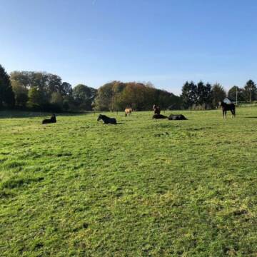
Frei Boxen für ambitionierte Springreiter
Witten
Gut-Altenhain
@Gut-Altenhain
Pferdeausbildung
Reitlehrer und -unterricht
Vermieten
Führanlage
Laufband
Außenboxen
Innenbox
10 weitere...
P
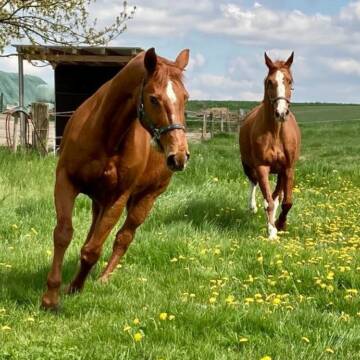
Pferdeboxen für Pferde / Ponys bis 1,60cm
Witten
Brandt
@Pferdefreund7
Freizeitstall
Vermieten
Paddock
Pensions- und Gastboxen
Innenbox
7 weitere...
P
Deprecated: Creation of dynamic property Zend_View_Helper_Ads::$adLink is deprecated in /var/www/stall-frei/htdocs/staging.stall-frei.de/library/Psf/View/Helper/Ads.php on line 108

Heu aus neuer Ernte
Mechtersen
STALL-FREIde Marketing
@STALL-FREI-Marketing
Heulage und Pferdeheu aus der neuen Ernte findest du in unserem Futtermarkt
Gut Zehnthof
Heiligenhaus
Gut-Zehnthof
@Gut-Zehnthof
Freizeitstall
Geländestrecke
Vermieten
Longierzirkel/Roundpen
Paddock
Hufrehe geeignet
10 weitere...
P

Freie Boxen auf dem Conradshof
Ratingen
Steffen Theus
@Conradshof
Freizeitstall
Geländestrecke
Hunde willkommen
Longierzirkel/Roundpen
Außenbox mit Paddock
Außenboxen
Einzelne Boxen oder Stallplätze
5 weitere...
P

Gut Gardum | Reitstall
Ratingen
Gut Gardum
@Gardumshof
Freizeitstall
Vermieten
Hunde willkommen
Krankenbox
Fohlenaufzucht möglich
Notfallboxen
18 weitere...
P

Reitstall Ascherfeld
Bochum
Reitstall Ascherfeld
@Ascherfeld
FN-Mitglied
Freizeitstall
Vermieten
Führanlage
Hunde willkommen
Außenbox mit Paddock
Außenboxen
18 weitere...
P
Leider kein Vorschaubild
Leider kein Vorschaubild
Reitstall Nowak
Mülheim an der Ruhr
Reitstall-Nowak
@Reitstall-Nowak
Vermieten
Führanlage
Longierzirkel/Roundpen
Außenboxen
Innenbox
Vollpension
9 weitere...
B

Heu und Heulage verkaufen
Mechtersen
STALL-FREIde Marketing
@STALL-FREI-Marketing
Verkaufen Sie Ihr Heu und Ihre Heulage direkt an Reiter, Pferdeställe und Reitanlagen
Leider kein Vorschaubild
Leider kein Vorschaubild
Pferdeboxen in kleiner Hofanlage
Mülheim
Rosendahl
@Stoetershof
Hunde willkommen
Paddock
Außenboxen
Einzelne Boxen oder Stallplätze
4 weitere...
B
Leider kein Vorschaubild
Leider kein Vorschaubild
Offenstall für 2-3 Pferde
Heiligenhaus
Moonlight-Hill
@Moonlight-Hill
FN-Mitglied
Freizeitstall
Vermieten
Krankenbox
Longierzirkel/Roundpen
Hufrehe geeignet
16 weitere...
B
Leider kein Vorschaubild
Leider kein Vorschaubild
Offenstallplatz frei für Wallach
Heiligenhaus
Moonlight-Hill
@Moonlight-Hill
Freizeitstall
Reitlehrer und -unterricht
Vermieten
Krankenbox
Longierzirkel/Roundpen
Hufrehe geeignet
16 weitere...
B
Werde Teil von STALL-FREI.de
Du hast eine Pferdebox frei? Freie Plätze im Offenstall, Pferdestall oder der Reitanlage kostenlos anbieten.
Deprecated: Creation of dynamic property Zend_View::$pageCount is deprecated in /var/www/stall-frei/htdocs/staging.stall-frei.de/library/vendor/shardj/zf1-future/library/Zend/View/Abstract.php on line 308
Deprecated: Creation of dynamic property Zend_View::$itemCountPerPage is deprecated in /var/www/stall-frei/htdocs/staging.stall-frei.de/library/vendor/shardj/zf1-future/library/Zend/View/Abstract.php on line 308
Deprecated: Creation of dynamic property Zend_View::$first is deprecated in /var/www/stall-frei/htdocs/staging.stall-frei.de/library/vendor/shardj/zf1-future/library/Zend/View/Abstract.php on line 308
Deprecated: Creation of dynamic property Zend_View::$current is deprecated in /var/www/stall-frei/htdocs/staging.stall-frei.de/library/vendor/shardj/zf1-future/library/Zend/View/Abstract.php on line 308
Deprecated: Creation of dynamic property Zend_View::$last is deprecated in /var/www/stall-frei/htdocs/staging.stall-frei.de/library/vendor/shardj/zf1-future/library/Zend/View/Abstract.php on line 308
Deprecated: Creation of dynamic property Zend_View::$previous is deprecated in /var/www/stall-frei/htdocs/staging.stall-frei.de/library/vendor/shardj/zf1-future/library/Zend/View/Abstract.php on line 308
Deprecated: Creation of dynamic property Zend_View::$next is deprecated in /var/www/stall-frei/htdocs/staging.stall-frei.de/library/vendor/shardj/zf1-future/library/Zend/View/Abstract.php on line 308
Deprecated: Creation of dynamic property Zend_View::$pagesInRange is deprecated in /var/www/stall-frei/htdocs/staging.stall-frei.de/library/vendor/shardj/zf1-future/library/Zend/View/Abstract.php on line 308
Deprecated: Creation of dynamic property Zend_View::$firstPageInRange is deprecated in /var/www/stall-frei/htdocs/staging.stall-frei.de/library/vendor/shardj/zf1-future/library/Zend/View/Abstract.php on line 308
Deprecated: Creation of dynamic property Zend_View::$lastPageInRange is deprecated in /var/www/stall-frei/htdocs/staging.stall-frei.de/library/vendor/shardj/zf1-future/library/Zend/View/Abstract.php on line 308
Deprecated: Creation of dynamic property Zend_View::$currentItemCount is deprecated in /var/www/stall-frei/htdocs/staging.stall-frei.de/library/vendor/shardj/zf1-future/library/Zend/View/Abstract.php on line 308
Deprecated: Creation of dynamic property Zend_View::$totalItemCount is deprecated in /var/www/stall-frei/htdocs/staging.stall-frei.de/library/vendor/shardj/zf1-future/library/Zend/View/Abstract.php on line 308
Deprecated: Creation of dynamic property Zend_View::$firstItemNumber is deprecated in /var/www/stall-frei/htdocs/staging.stall-frei.de/library/vendor/shardj/zf1-future/library/Zend/View/Abstract.php on line 308
Deprecated: Creation of dynamic property Zend_View::$lastItemNumber is deprecated in /var/www/stall-frei/htdocs/staging.stall-frei.de/library/vendor/shardj/zf1-future/library/Zend/View/Abstract.php on line 308
Deprecated: Creation of dynamic property Zend_View::$router is deprecated in /var/www/stall-frei/htdocs/staging.stall-frei.de/library/vendor/shardj/zf1-future/library/Zend/View/Abstract.php on line 308
Deprecated: Creation of dynamic property Zend_View::$urlParams is deprecated in /var/www/stall-frei/htdocs/staging.stall-frei.de/library/vendor/shardj/zf1-future/library/Zend/View/Abstract.php on line 308
Deprecated: Creation of dynamic property Zend_View::$showAds is deprecated in /var/www/stall-frei/htdocs/staging.stall-frei.de/library/vendor/shardj/zf1-future/library/Zend/View/Abstract.php on line 308
Deprecated: Creation of dynamic property Zend_View::$objectIds is deprecated in /var/www/stall-frei/htdocs/staging.stall-frei.de/library/vendor/shardj/zf1-future/library/Zend/View/Abstract.php on line 308
Deprecated: Creation of dynamic property Zend_View::$showNavbar is deprecated in /var/www/stall-frei/htdocs/staging.stall-frei.de/library/vendor/shardj/zf1-future/library/Zend/View/Abstract.php on line 308
Deprecated: Creation of dynamic property Zend_View::$showBreadcrumb is deprecated in /var/www/stall-frei/htdocs/staging.stall-frei.de/library/vendor/shardj/zf1-future/library/Zend/View/Abstract.php on line 308
Deprecated: Creation of dynamic property Zend_View::$showFooter is deprecated in /var/www/stall-frei/htdocs/staging.stall-frei.de/library/vendor/shardj/zf1-future/library/Zend/View/Abstract.php on line 308
Deprecated: Creation of dynamic property Zend_View::$showInternalAds is deprecated in /var/www/stall-frei/htdocs/staging.stall-frei.de/library/vendor/shardj/zf1-future/library/Zend/View/Abstract.php on line 308
Deprecated: Creation of dynamic property Zend_View::$blNoContent is deprecated in /var/www/stall-frei/htdocs/staging.stall-frei.de/library/vendor/shardj/zf1-future/library/Zend/View/Abstract.php on line 308
Deprecated: Creation of dynamic property Zend_View::$sMetaDesc is deprecated in /var/www/stall-frei/htdocs/staging.stall-frei.de/library/vendor/shardj/zf1-future/library/Zend/View/Abstract.php on line 308
Deprecated: Creation of dynamic property Zend_View::$useGmaps is deprecated in /var/www/stall-frei/htdocs/staging.stall-frei.de/library/vendor/shardj/zf1-future/library/Zend/View/Abstract.php on line 308
Deprecated: Creation of dynamic property Zend_View::$touches is deprecated in /var/www/stall-frei/htdocs/staging.stall-frei.de/library/vendor/shardj/zf1-future/library/Zend/View/Abstract.php on line 308
Deprecated: Creation of dynamic property Zend_View::$oProject is deprecated in /var/www/stall-frei/htdocs/staging.stall-frei.de/library/vendor/shardj/zf1-future/library/Zend/View/Abstract.php on line 308
Deprecated: Creation of dynamic property Zend_View::$pageHeadline is deprecated in /var/www/stall-frei/htdocs/staging.stall-frei.de/library/vendor/shardj/zf1-future/library/Zend/View/Abstract.php on line 308
Deprecated: Creation of dynamic property Zend_View::$disableLocationField is deprecated in /var/www/stall-frei/htdocs/staging.stall-frei.de/library/vendor/shardj/zf1-future/library/Zend/View/Abstract.php on line 308
Deprecated: Creation of dynamic property Zend_View::$isSearch is deprecated in /var/www/stall-frei/htdocs/staging.stall-frei.de/library/vendor/shardj/zf1-future/library/Zend/View/Abstract.php on line 308
Deprecated: Creation of dynamic property Zend_View::$pageTitle is deprecated in /var/www/stall-frei/htdocs/staging.stall-frei.de/library/vendor/shardj/zf1-future/library/Zend/View/Abstract.php on line 308
Deprecated: Creation of dynamic property Psf_Form_Element_Text::$class is deprecated in /var/www/stall-frei/htdocs/staging.stall-frei.de/library/vendor/shardj/zf1-future/library/Zend/Form/Element.php on line 874
Deprecated: Creation of dynamic property Psf_Form_Element_Text::$size is deprecated in /var/www/stall-frei/htdocs/staging.stall-frei.de/library/vendor/shardj/zf1-future/library/Zend/Form/Element.php on line 874
Deprecated: Creation of dynamic property Psf_Form_Element_Text::$placeholder is deprecated in /var/www/stall-frei/htdocs/staging.stall-frei.de/library/vendor/shardj/zf1-future/library/Zend/Form/Element.php on line 874
Deprecated: Creation of dynamic property Psf_Form_Element_Hidden::$class is deprecated in /var/www/stall-frei/htdocs/staging.stall-frei.de/library/vendor/shardj/zf1-future/library/Zend/Form/Element.php on line 874
Deprecated: Creation of dynamic property Psf_Form_Element_Hidden::$class is deprecated in /var/www/stall-frei/htdocs/staging.stall-frei.de/library/vendor/shardj/zf1-future/library/Zend/Form/Element.php on line 874
Deprecated: Creation of dynamic property Psf_Form_Element_Hidden::$class is deprecated in /var/www/stall-frei/htdocs/staging.stall-frei.de/library/vendor/shardj/zf1-future/library/Zend/Form/Element.php on line 874
Deprecated: Creation of dynamic property Psf_Form_Element_Hidden::$class is deprecated in /var/www/stall-frei/htdocs/staging.stall-frei.de/library/vendor/shardj/zf1-future/library/Zend/Form/Element.php on line 874
Deprecated: Creation of dynamic property Psf_Form_Element_Select::$class is deprecated in /var/www/stall-frei/htdocs/staging.stall-frei.de/library/vendor/shardj/zf1-future/library/Zend/Form/Element.php on line 874
Deprecated: Creation of dynamic property Psf_Form_Element_Select::$class is deprecated in /var/www/stall-frei/htdocs/staging.stall-frei.de/library/vendor/shardj/zf1-future/library/Zend/Form/Element.php on line 874
Deprecated: Creation of dynamic property Psf_Form_Element_Select::$class is deprecated in /var/www/stall-frei/htdocs/staging.stall-frei.de/library/vendor/shardj/zf1-future/library/Zend/Form/Element.php on line 874
Deprecated: Creation of dynamic property Psf_Form_Element_Select::$class is deprecated in /var/www/stall-frei/htdocs/staging.stall-frei.de/library/vendor/shardj/zf1-future/library/Zend/Form/Element.php on line 874
Deprecated: Creation of dynamic property Psf_Form_Element_Text::$class is deprecated in /var/www/stall-frei/htdocs/staging.stall-frei.de/library/vendor/shardj/zf1-future/library/Zend/Form/Element.php on line 874
Deprecated: Creation of dynamic property Psf_Form_Element_Checkbox::$label is deprecated in /var/www/stall-frei/htdocs/staging.stall-frei.de/library/vendor/shardj/zf1-future/library/Zend/Form/Element.php on line 874
Deprecated: Creation of dynamic property Zend_View::$sort is deprecated in /var/www/stall-frei/htdocs/staging.stall-frei.de/library/vendor/shardj/zf1-future/library/Zend/View/Abstract.php on line 308
Deprecated: Creation of dynamic property Zend_View::$searchLocation is deprecated in /var/www/stall-frei/htdocs/staging.stall-frei.de/library/vendor/shardj/zf1-future/library/Zend/View/Abstract.php on line 308
Deprecated: Creation of dynamic property Zend_View::$locationHint is deprecated in /var/www/stall-frei/htdocs/staging.stall-frei.de/library/vendor/shardj/zf1-future/library/Zend/View/Abstract.php on line 308
Psf_GeoCoder_Abstract::getLocation: Ostviertel Get Location CachedOrLive
Psf_GeoCoder_Abstract::getCachedOrLive: Ostviertel
Psf_GeoCoder_Abstract::convertLocationResult
{"documentation":"https:\/\/opencagedata.com\/api","licenses":[{"name":"see attribution guide","url":"https:\/\/opencagedata.com\/credits"}],"results":[{"bounds":{"northeast":{"lat":51.466663,"lng":7.0445651},"southwest":{"lat":51.448926,"lng":7.0150236}},"components":{"ISO_3166-1_alpha-2":"DE","ISO_3166-1_alpha-3":"DEU","ISO_3166-2":["DE-NW"],"_category":"place","_normalized_city":"Essen","_type":"neighbourhood","city":"Essen","city_district":"Stadtbezirk I","continent":"Europe","country":"Deutschland","country_code":"de","political_union":"European Union","state":"Nordrhein-Westfalen","state_code":"NW","suburb":"Ostviertel"},"confidence":7,"formatted":"Ostviertel, Essen, Nordrhein-Westfalen, Deutschland","geometry":{"lat":51.4577731,"lng":7.0288828}},{"bounds":{"northeast":{"lat":51.6363891,"lng":7.2485188},"southwest":{"lat":51.6092637,"lng":7.2020438}},"components":{"ISO_3166-1_alpha-2":"DE","ISO_3166-1_alpha-3":"DEU","ISO_3166-2":["DE-NW"],"_category":"place","_normalized_city":"Recklinghausen","_type":"neighbourhood","city":"Recklinghausen","continent":"Europe","country":"Deutschland","country_code":"de","county":"Kreis Recklinghausen","political_union":"European Union","state":"Nordrhein-Westfalen","state_code":"NW","suburb":"Ostviertel"},"confidence":7,"formatted":"Ostviertel, Recklinghausen, Nordrhein-Westfalen, Deutschland","geometry":{"lat":51.6180898,"lng":7.2151878}},{"bounds":{"northeast":{"lat":51.1746865,"lng":11.8400031},"southwest":{"lat":51.1346865,"lng":11.8000031}},"components":{"ISO_3166-1_alpha-2":"DE","ISO_3166-1_alpha-3":"DEU","ISO_3166-2":["DE-ST"],"_category":"place","_normalized_city":"Naumburg (Saale)","_type":"neighbourhood","continent":"Europe","country":"Deutschland","country_code":"de","county":"Burgenlandkreis","political_union":"European Union","postcode":"06618","state":"Sachsen-Anhalt","state_code":"ST","suburb":"Ostviertel","town":"Naumburg (Saale)"},"confidence":7,"formatted":"06618 Naumburg (Saale), Deutschland","geometry":{"lat":51.1546865,"lng":11.8200031}},{"bounds":{"northeast":{"lat":51.5589804,"lng":9.9749203},"southwest":{"lat":51.5189804,"lng":9.9349203}},"components":{"ISO_3166-1_alpha-2":"DE","ISO_3166-1_alpha-3":"DEU","ISO_3166-2":["DE-NI"],"_category":"place","_normalized_city":"G\u00f6ttingen","_type":"neighbourhood","city":"G\u00f6ttingen","continent":"Europe","country":"Deutschland","country_code":"de","county":"Landkreis G\u00f6ttingen","political_union":"European Union","postcode":"37075","state":"Niedersachsen","state_code":"NI","suburb":"Ostviertel"},"confidence":7,"formatted":"37075 G\u00f6ttingen, Deutschland","geometry":{"lat":51.5389804,"lng":9.9549203}},{"bounds":{"northeast":{"lat":50.8988398,"lng":12.1142065},"southwest":{"lat":50.8588398,"lng":12.0742065}},"components":{"ISO_3166-1_alpha-2":"DE","ISO_3166-1_alpha-3":"DEU","ISO_3166-2":["DE-TH"],"_category":"place","_normalized_city":"Gera","_type":"neighbourhood","continent":"Europe","country":"Deutschland","country_code":"de","political_union":"European Union","postcode":"07546","state":"Th\u00fcringen","state_code":"TH","suburb":"Ostviertel","town":"Gera"},"confidence":7,"formatted":"07546 Gera, Deutschland","geometry":{"lat":50.8788398,"lng":12.0942065}},{"bounds":{"northeast":{"lat":51.892554,"lng":10.5919212},"southwest":{"lat":51.8796299,"lng":10.5580501}},"components":{"ISO_3166-1_alpha-2":"DE","ISO_3166-1_alpha-3":"DEU","ISO_3166-2":["DE-NI"],"_category":"place","_normalized_city":"Bad Harzburg","_type":"neighbourhood","city":"Bad Harzburg","continent":"Europe","country":"Deutschland","country_code":"de","county":"Landkreis Goslar","political_union":"European Union","quarter":"Ostviertel","state":"Niedersachsen","state_code":"NI","town":"Bad Harzburg (Innenstadt)"},"confidence":8,"formatted":"Ostviertel, Bad Harzburg (Innenstadt), Niedersachsen, Deutschland","geometry":{"lat":51.883024,"lng":10.5746019}},{"bounds":{"northeast":{"lat":51.911662,"lng":10.5326805},"southwest":{"lat":51.9055075,"lng":10.5231531}},"components":{"ISO_3166-1_alpha-2":"DE","ISO_3166-1_alpha-3":"DEU","ISO_3166-2":["DE-NI"],"_category":"place","_normalized_city":"Bad Harzburg","_type":"neighbourhood","city":"Bad Harzburg","continent":"Europe","country":"Deutschland","country_code":"de","county":"Landkreis Goslar","neighbourhood":"Ostviertel","political_union":"European Union","state":"Niedersachsen","state_code":"NI"},"confidence":9,"formatted":"Ostviertel, Bad Harzburg, Niedersachsen, Deutschland","geometry":{"lat":51.908362,"lng":10.528039}},{"bounds":{"northeast":{"lat":51.154281,"lng":7.2402225},"southwest":{"lat":51.134281,"lng":7.2202225}},"components":{"ISO_3166-1_alpha-2":"DE","ISO_3166-1_alpha-3":"DEU","ISO_3166-2":["DE-NW"],"_category":"place","_normalized_city":"Wermelskirchen","_type":"hamlet","continent":"Europe","country":"Deutschland","country_code":"de","county":"Rheinisch-Bergischer Kreis","hamlet":"L\u00fcffringhausen","neighbourhood":"Musikerviertel","political_union":"European Union","postcode":"42929","state":"Nordrhein-Westfalen","state_code":"NW","town":"Wermelskirchen"},"confidence":8,"formatted":"L\u00fcffringhausen, 42929 Wermelskirchen, Deutschland","geometry":{"lat":51.144281,"lng":7.2302225}},{"components":{"ISO_3166-1_alpha-2":"FR","ISO_3166-1_alpha-3":"FRA","ISO_3166-2":["FR-IDF","FR-92"],"_category":"road","_normalized_city":"Levallois-Perret","_type":"road","city":"Levallois-Perret","continent":"Europe","country":"France","country_code":"fr","county":"Hauts-de-Seine","local_authority":"M\u00e9tropole du Grand Paris","political_union":"European Union","postcode":"92300","road":"Rue Charles Deutschmann","state":"\u00cele-de-France","state_code":"IDF"},"confidence":2,"formatted":"Rue Charles Deutschmann, 92300 Levallois-Perret, France","geometry":{"lat":48.900049,"lng":2.2842}},{"bounds":{"northeast":{"lat":55.055443,"lng":15.041211},"southwest":{"lat":47.270056,"lng":5.866778}},"components":{"ISO_3166-1_alpha-2":"DE","ISO_3166-1_alpha-3":"DEU","_category":"place","_type":"country","continent":"Europe","country":"Deutschland","country_code":"de","political_union":"European Union"},"confidence":1,"formatted":"Deutschland","geometry":{"lat":51.5,"lng":10.5}}],"status":{"code":200,"message":"OK"},"stay_informed":{"blog":"https:\/\/blog.opencagedata.com","mastodon":"https:\/\/en.osm.town\/@opencage"},"thanks":"For using an OpenCage API","timestamp":{"created_http":"Sat, 07 Feb 2026 20:45:39 GMT","created_unix":1770497139},"total_results":10}Array
(
[0] => stdClass Object
(
[bounds] => stdClass Object
(
[northeast] => stdClass Object
(
[lat] => 51.466663
[lng] => 7.0445651
)
[southwest] => stdClass Object
(
[lat] => 51.448926
[lng] => 7.0150236
)
)
[components] => stdClass Object
(
[ISO_3166-1_alpha-2] => DE
[ISO_3166-1_alpha-3] => DEU
[ISO_3166-2] => Array
(
[0] => DE-NW
)
[_category] => place
[_normalized_city] => Essen
[_type] => neighbourhood
[city] => Essen
[city_district] => Stadtbezirk I
[continent] => Europe
[country] => Deutschland
[country_code] => de
[political_union] => European Union
[state] => Nordrhein-Westfalen
[state_code] => NW
[suburb] => Ostviertel
)
[confidence] => 7
[formatted] => Ostviertel, Essen, Nordrhein-Westfalen, Deutschland
[geometry] => stdClass Object
(
[lat] => 51.4577731
[lng] => 7.0288828
)
)
[1] => stdClass Object
(
[bounds] => stdClass Object
(
[northeast] => stdClass Object
(
[lat] => 51.6363891
[lng] => 7.2485188
)
[southwest] => stdClass Object
(
[lat] => 51.6092637
[lng] => 7.2020438
)
)
[components] => stdClass Object
(
[ISO_3166-1_alpha-2] => DE
[ISO_3166-1_alpha-3] => DEU
[ISO_3166-2] => Array
(
[0] => DE-NW
)
[_category] => place
[_normalized_city] => Recklinghausen
[_type] => neighbourhood
[city] => Recklinghausen
[continent] => Europe
[country] => Deutschland
[country_code] => de
[county] => Kreis Recklinghausen
[political_union] => European Union
[state] => Nordrhein-Westfalen
[state_code] => NW
[suburb] => Ostviertel
)
[confidence] => 7
[formatted] => Ostviertel, Recklinghausen, Nordrhein-Westfalen, Deutschland
[geometry] => stdClass Object
(
[lat] => 51.6180898
[lng] => 7.2151878
)
)
[2] => stdClass Object
(
[bounds] => stdClass Object
(
[northeast] => stdClass Object
(
[lat] => 51.1746865
[lng] => 11.8400031
)
[southwest] => stdClass Object
(
[lat] => 51.1346865
[lng] => 11.8000031
)
)
[components] => stdClass Object
(
[ISO_3166-1_alpha-2] => DE
[ISO_3166-1_alpha-3] => DEU
[ISO_3166-2] => Array
(
[0] => DE-ST
)
[_category] => place
[_normalized_city] => Naumburg (Saale)
[_type] => neighbourhood
[continent] => Europe
[country] => Deutschland
[country_code] => de
[county] => Burgenlandkreis
[political_union] => European Union
[postcode] => 06618
[state] => Sachsen-Anhalt
[state_code] => ST
[suburb] => Ostviertel
[town] => Naumburg (Saale)
)
[confidence] => 7
[formatted] => 06618 Naumburg (Saale), Deutschland
[geometry] => stdClass Object
(
[lat] => 51.1546865
[lng] => 11.8200031
)
)
[3] => stdClass Object
(
[bounds] => stdClass Object
(
[northeast] => stdClass Object
(
[lat] => 51.5589804
[lng] => 9.9749203
)
[southwest] => stdClass Object
(
[lat] => 51.5189804
[lng] => 9.9349203
)
)
[components] => stdClass Object
(
[ISO_3166-1_alpha-2] => DE
[ISO_3166-1_alpha-3] => DEU
[ISO_3166-2] => Array
(
[0] => DE-NI
)
[_category] => place
[_normalized_city] => Göttingen
[_type] => neighbourhood
[city] => Göttingen
[continent] => Europe
[country] => Deutschland
[country_code] => de
[county] => Landkreis Göttingen
[political_union] => European Union
[postcode] => 37075
[state] => Niedersachsen
[state_code] => NI
[suburb] => Ostviertel
)
[confidence] => 7
[formatted] => 37075 Göttingen, Deutschland
[geometry] => stdClass Object
(
[lat] => 51.5389804
[lng] => 9.9549203
)
)
[4] => stdClass Object
(
[bounds] => stdClass Object
(
[northeast] => stdClass Object
(
[lat] => 50.8988398
[lng] => 12.1142065
)
[southwest] => stdClass Object
(
[lat] => 50.8588398
[lng] => 12.0742065
)
)
[components] => stdClass Object
(
[ISO_3166-1_alpha-2] => DE
[ISO_3166-1_alpha-3] => DEU
[ISO_3166-2] => Array
(
[0] => DE-TH
)
[_category] => place
[_normalized_city] => Gera
[_type] => neighbourhood
[continent] => Europe
[country] => Deutschland
[country_code] => de
[political_union] => European Union
[postcode] => 07546
[state] => Thüringen
[state_code] => TH
[suburb] => Ostviertel
[town] => Gera
)
[confidence] => 7
[formatted] => 07546 Gera, Deutschland
[geometry] => stdClass Object
(
[lat] => 50.8788398
[lng] => 12.0942065
)
)
[5] => stdClass Object
(
[bounds] => stdClass Object
(
[northeast] => stdClass Object
(
[lat] => 51.892554
[lng] => 10.5919212
)
[southwest] => stdClass Object
(
[lat] => 51.8796299
[lng] => 10.5580501
)
)
[components] => stdClass Object
(
[ISO_3166-1_alpha-2] => DE
[ISO_3166-1_alpha-3] => DEU
[ISO_3166-2] => Array
(
[0] => DE-NI
)
[_category] => place
[_normalized_city] => Bad Harzburg
[_type] => neighbourhood
[city] => Bad Harzburg
[continent] => Europe
[country] => Deutschland
[country_code] => de
[county] => Landkreis Goslar
[political_union] => European Union
[quarter] => Ostviertel
[state] => Niedersachsen
[state_code] => NI
[town] => Bad Harzburg (Innenstadt)
)
[confidence] => 8
[formatted] => Ostviertel, Bad Harzburg (Innenstadt), Niedersachsen, Deutschland
[geometry] => stdClass Object
(
[lat] => 51.883024
[lng] => 10.5746019
)
)
[6] => stdClass Object
(
[bounds] => stdClass Object
(
[northeast] => stdClass Object
(
[lat] => 51.911662
[lng] => 10.5326805
)
[southwest] => stdClass Object
(
[lat] => 51.9055075
[lng] => 10.5231531
)
)
[components] => stdClass Object
(
[ISO_3166-1_alpha-2] => DE
[ISO_3166-1_alpha-3] => DEU
[ISO_3166-2] => Array
(
[0] => DE-NI
)
[_category] => place
[_normalized_city] => Bad Harzburg
[_type] => neighbourhood
[city] => Bad Harzburg
[continent] => Europe
[country] => Deutschland
[country_code] => de
[county] => Landkreis Goslar
[neighbourhood] => Ostviertel
[political_union] => European Union
[state] => Niedersachsen
[state_code] => NI
)
[confidence] => 9
[formatted] => Ostviertel, Bad Harzburg, Niedersachsen, Deutschland
[geometry] => stdClass Object
(
[lat] => 51.908362
[lng] => 10.528039
)
)
[7] => stdClass Object
(
[bounds] => stdClass Object
(
[northeast] => stdClass Object
(
[lat] => 51.154281
[lng] => 7.2402225
)
[southwest] => stdClass Object
(
[lat] => 51.134281
[lng] => 7.2202225
)
)
[components] => stdClass Object
(
[ISO_3166-1_alpha-2] => DE
[ISO_3166-1_alpha-3] => DEU
[ISO_3166-2] => Array
(
[0] => DE-NW
)
[_category] => place
[_normalized_city] => Wermelskirchen
[_type] => hamlet
[continent] => Europe
[country] => Deutschland
[country_code] => de
[county] => Rheinisch-Bergischer Kreis
[hamlet] => Lüffringhausen
[neighbourhood] => Musikerviertel
[political_union] => European Union
[postcode] => 42929
[state] => Nordrhein-Westfalen
[state_code] => NW
[town] => Wermelskirchen
)
[confidence] => 8
[formatted] => Lüffringhausen, 42929 Wermelskirchen, Deutschland
[geometry] => stdClass Object
(
[lat] => 51.144281
[lng] => 7.2302225
)
)
[8] => stdClass Object
(
[components] => stdClass Object
(
[ISO_3166-1_alpha-2] => FR
[ISO_3166-1_alpha-3] => FRA
[ISO_3166-2] => Array
(
[0] => FR-IDF
[1] => FR-92
)
[_category] => road
[_normalized_city] => Levallois-Perret
[_type] => road
[city] => Levallois-Perret
[continent] => Europe
[country] => France
[country_code] => fr
[county] => Hauts-de-Seine
[local_authority] => Métropole du Grand Paris
[political_union] => European Union
[postcode] => 92300
[road] => Rue Charles Deutschmann
[state] => Île-de-France
[state_code] => IDF
)
[confidence] => 2
[formatted] => Rue Charles Deutschmann, 92300 Levallois-Perret, France
[geometry] => stdClass Object
(
[lat] => 48.900049
[lng] => 2.2842
)
)
[9] => stdClass Object
(
[bounds] => stdClass Object
(
[northeast] => stdClass Object
(
[lat] => 55.055443
[lng] => 15.041211
)
[southwest] => stdClass Object
(
[lat] => 47.270056
[lng] => 5.866778
)
)
[components] => stdClass Object
(
[ISO_3166-1_alpha-2] => DE
[ISO_3166-1_alpha-3] => DEU
[_category] => place
[_type] => country
[continent] => Europe
[country] => Deutschland
[country_code] => de
[political_union] => European Union
)
[confidence] => 1
[formatted] => Deutschland
[geometry] => stdClass Object
(
[lat] => 51.5
[lng] => 10.5
)
)
)
Psf_GeoCoder_OpenCageData::getKeyMap: 0
stdClass Object
(
    [bounds] => stdClass Object
        (
            [northeast] => stdClass Object
                (
                    [lat] => 51.466663
                    [lng] => 7.0445651
                )

            [southwest] => stdClass Object
                (
                    [lat] => 51.448926
                    [lng] => 7.0150236
                )

        )

    [components] => stdClass Object
        (
            [ISO_3166-1_alpha-2] => DE
            [ISO_3166-1_alpha-3] => DEU
            [ISO_3166-2] => Array
                (
                    [0] => DE-NW
                )

            [_category] => place
            [_normalized_city] => Essen
            [_type] => neighbourhood
            [city] => Essen
            [city_district] => Stadtbezirk I
            [continent] => Europe
            [country] => Deutschland
            [country_code] => de
            [political_union] => European Union
            [state] => Nordrhein-Westfalen
            [state_code] => NW
            [suburb] => Ostviertel
        )

    [confidence] => 7
    [formatted] => Ostviertel, Essen, Nordrhein-Westfalen, Deutschland
    [geometry] => stdClass Object
        (
            [lat] => 51.4577731
            [lng] => 7.0288828
        )

)
Psf_GeoCoder_OpenCageData::getCounty: Essen
Psf_GeoCoder_OpenCageData::addMissingData REFETCH!
Array
(
    [address] => Ostviertel, Essen, Nordrhein-Westfalen, Deutschland
    [type] => neighbourhood
    [street] =>
    [city] => Ostviertel
    [county] => Essen
    [state] => Nordrhein-Westfalen
    [zip] =>
    [country] => Deutschland
    [suburb] => Ostviertel
    [countrycode] => de
    [latitude] => 51.4577731
    [longitude] => 7.0288828
    [accuracy] => 1
    [confidence] => 7
    [bounds] => stdClass Object
        (
            [northeast] => stdClass Object
                (
                    [lat] => 51.466663
                    [lng] => 7.0445651
                )

            [southwest] => stdClass Object
                (
                    [lat] => 51.448926
                    [lng] => 7.0150236
                )

        )

)
reformat!
Array
(
    [address] => Ostviertel, Essen, Nordrhein-Westfalen, Deutschland
    [type] => neighbourhood
    [street] =>
    [city] => Ostviertel
    [county] => Essen
    [state] => Nordrhein-Westfalen
    [zip] =>
    [country] => Deutschland
    [suburb] => Ostviertel
    [countrycode] => de
    [latitude] => 51.4577731
    [longitude] => 7.0288828
    [accuracy] => 1
    [confidence] => 7
    [bounds] => stdClass Object
        (
            [northeast] => stdClass Object
                (
                    [lat] => 51.466663
                    [lng] => 7.0445651
                )

            [southwest] => stdClass Object
                (
                    [lat] => 51.448926
                    [lng] => 7.0150236
                )

        )

    [place] => Ostviertel, Nordrhein-Westfalen
    [hash] => 7794a92df37bd6e167c756279a6066dd
)
Psf_GeoCoder_OpenCageData::getKeyMap: 1
stdClass Object
(
    [bounds] => stdClass Object
        (
            [northeast] => stdClass Object
                (
                    [lat] => 51.6363891
                    [lng] => 7.2485188
                )

            [southwest] => stdClass Object
                (
                    [lat] => 51.6092637
                    [lng] => 7.2020438
                )

        )

    [components] => stdClass Object
        (
            [ISO_3166-1_alpha-2] => DE
            [ISO_3166-1_alpha-3] => DEU
            [ISO_3166-2] => Array
                (
                    [0] => DE-NW
                )

            [_category] => place
            [_normalized_city] => Recklinghausen
            [_type] => neighbourhood
            [city] => Recklinghausen
            [continent] => Europe
            [country] => Deutschland
            [country_code] => de
            [county] => Kreis Recklinghausen
            [political_union] => European Union
            [state] => Nordrhein-Westfalen
            [state_code] => NW
            [suburb] => Ostviertel
        )

    [confidence] => 7
    [formatted] => Ostviertel, Recklinghausen, Nordrhein-Westfalen, Deutschland
    [geometry] => stdClass Object
        (
            [lat] => 51.6180898
            [lng] => 7.2151878
        )

)
Psf_GeoCoder_OpenCageData::getCounty: Recklinghausen
Psf_GeoCoder_OpenCageData::addMissingData REFETCH!
Array
(
    [address] => Ostviertel, Recklinghausen, Nordrhein-Westfalen, Deutschland
    [type] => neighbourhood
    [street] =>
    [city] => Ostviertel
    [county] => Recklinghausen
    [state] => Nordrhein-Westfalen
    [zip] =>
    [country] => Deutschland
    [suburb] => Ostviertel
    [countrycode] => de
    [latitude] => 51.6180898
    [longitude] => 7.2151878
    [accuracy] => 1
    [confidence] => 7
    [bounds] => stdClass Object
        (
            [northeast] => stdClass Object
                (
                    [lat] => 51.6363891
                    [lng] => 7.2485188
                )

            [southwest] => stdClass Object
                (
                    [lat] => 51.6092637
                    [lng] => 7.2020438
                )

        )

)
reformat!
Array
(
    [address] => Ostviertel, Recklinghausen, Nordrhein-Westfalen, Deutschland
    [type] => neighbourhood
    [street] =>
    [city] => Ostviertel
    [county] => Recklinghausen
    [state] => Nordrhein-Westfalen
    [zip] =>
    [country] => Deutschland
    [suburb] => Ostviertel
    [countrycode] => de
    [latitude] => 51.6180898
    [longitude] => 7.2151878
    [accuracy] => 1
    [confidence] => 7
    [bounds] => stdClass Object
        (
            [northeast] => stdClass Object
                (
                    [lat] => 51.6363891
                    [lng] => 7.2485188
                )

            [southwest] => stdClass Object
                (
                    [lat] => 51.6092637
                    [lng] => 7.2020438
                )

        )

    [place] => Ostviertel, Nordrhein-Westfalen
    [hash] => 7794a92df37bd6e167c756279a6066dd
)
Psf_GeoCoder_OpenCageData::getKeyMap: 2
stdClass Object
(
    [bounds] => stdClass Object
        (
            [northeast] => stdClass Object
                (
                    [lat] => 51.1746865
                    [lng] => 11.8400031
                )

            [southwest] => stdClass Object
                (
                    [lat] => 51.1346865
                    [lng] => 11.8000031
                )

        )

    [components] => stdClass Object
        (
            [ISO_3166-1_alpha-2] => DE
            [ISO_3166-1_alpha-3] => DEU
            [ISO_3166-2] => Array
                (
                    [0] => DE-ST
                )

            [_category] => place
            [_normalized_city] => Naumburg (Saale)
            [_type] => neighbourhood
            [continent] => Europe
            [country] => Deutschland
            [country_code] => de
            [county] => Burgenlandkreis
            [political_union] => European Union
            [postcode] => 06618
            [state] => Sachsen-Anhalt
            [state_code] => ST
            [suburb] => Ostviertel
            [town] => Naumburg (Saale)
        )

    [confidence] => 7
    [formatted] => 06618 Naumburg (Saale), Deutschland
    [geometry] => stdClass Object
        (
            [lat] => 51.1546865
            [lng] => 11.8200031
        )

)
Psf_GeoCoder_OpenCageData::getCounty: Burgenlandkreis
Psf_GeoCoder_OpenCageData::addMissingData REFETCH!
Array
(
    [address] => 06618 Naumburg (Saale), Deutschland
    [type] => neighbourhood
    [street] =>
    [city] => Naumburg (Saale)
    [county] => Burgenlandkreis
    [state] => Sachsen-Anhalt
    [zip] => 06618
    [country] => Deutschland
    [suburb] => Ostviertel
    [countrycode] => de
    [latitude] => 51.1546865
    [longitude] => 11.8200031
    [accuracy] => 1
    [confidence] => 7
    [bounds] => stdClass Object
        (
            [northeast] => stdClass Object
                (
                    [lat] => 51.1746865
                    [lng] => 11.8400031
                )

            [southwest] => stdClass Object
                (
                    [lat] => 51.1346865
                    [lng] => 11.8000031
                )

        )

)
reformat!
Array
(
    [address] => 06618 Naumburg (Saale), Deutschland
    [type] => neighbourhood
    [street] =>
    [city] => Naumburg (Saale)
    [county] => Burgenlandkreis
    [state] => Sachsen-Anhalt
    [zip] => 06618
    [country] => Deutschland
    [suburb] => Ostviertel
    [countrycode] => de
    [latitude] => 51.1546865
    [longitude] => 11.8200031
    [accuracy] => 1
    [confidence] => 7
    [bounds] => stdClass Object
        (
            [northeast] => stdClass Object
                (
                    [lat] => 51.1746865
                    [lng] => 11.8400031
                )

            [southwest] => stdClass Object
                (
                    [lat] => 51.1346865
                    [lng] => 11.8000031
                )

        )

    [place] => 06618 Naumburg (Saale), Sachsen-Anhalt
    [hash] => 6c5134311bbb74896f8a47055a90a259
)
Psf_GeoCoder_OpenCageData::getKeyMap: 3
stdClass Object
(
    [bounds] => stdClass Object
        (
            [northeast] => stdClass Object
                (
                    [lat] => 51.5589804
                    [lng] => 9.9749203
                )

            [southwest] => stdClass Object
                (
                    [lat] => 51.5189804
                    [lng] => 9.9349203
                )

        )

    [components] => stdClass Object
        (
            [ISO_3166-1_alpha-2] => DE
            [ISO_3166-1_alpha-3] => DEU
            [ISO_3166-2] => Array
                (
                    [0] => DE-NI
                )

            [_category] => place
            [_normalized_city] => Göttingen
            [_type] => neighbourhood
            [city] => Göttingen
            [continent] => Europe
            [country] => Deutschland
            [country_code] => de
            [county] => Landkreis Göttingen
            [political_union] => European Union
            [postcode] => 37075
            [state] => Niedersachsen
            [state_code] => NI
            [suburb] => Ostviertel
        )

    [confidence] => 7
    [formatted] => 37075 Göttingen, Deutschland
    [geometry] => stdClass Object
        (
            [lat] => 51.5389804
            [lng] => 9.9549203
        )

)
Psf_GeoCoder_OpenCageData::getCounty: Göttingen
Psf_GeoCoder_OpenCageData::addMissingData REFETCH!
Array
(
    [address] => 37075 Göttingen, Deutschland
    [type] => neighbourhood
    [street] =>
    [city] => Ostviertel
    [county] => Göttingen
    [state] => Niedersachsen
    [zip] => 37075
    [country] => Deutschland
    [suburb] => Ostviertel
    [countrycode] => de
    [latitude] => 51.5389804
    [longitude] => 9.9549203
    [accuracy] => 1
    [confidence] => 7
    [bounds] => stdClass Object
        (
            [northeast] => stdClass Object
                (
                    [lat] => 51.5589804
                    [lng] => 9.9749203
                )

            [southwest] => stdClass Object
                (
                    [lat] => 51.5189804
                    [lng] => 9.9349203
                )

        )

)
reformat!
Array
(
    [address] => 37075 Ostviertel
    [type] => neighbourhood
    [street] =>
    [city] => Ostviertel
    [county] => Göttingen
    [state] => Niedersachsen
    [zip] => 37075
    [country] => Deutschland
    [suburb] => Ostviertel
    [countrycode] => de
    [latitude] => 51.5389804
    [longitude] => 9.9549203
    [accuracy] => 1
    [confidence] => 7
    [bounds] => stdClass Object
        (
            [northeast] => stdClass Object
                (
                    [lat] => 51.5589804
                    [lng] => 9.9749203
                )

            [southwest] => stdClass Object
                (
                    [lat] => 51.5189804
                    [lng] => 9.9349203
                )

        )

    [place] => 37075 Ostviertel, Niedersachsen
    [hash] => 459857e23173ee05a403df3fd15c7fb9
)
Psf_GeoCoder_OpenCageData::getKeyMap: 4
stdClass Object
(
    [bounds] => stdClass Object
        (
            [northeast] => stdClass Object
                (
                    [lat] => 50.8988398
                    [lng] => 12.1142065
                )

            [southwest] => stdClass Object
                (
                    [lat] => 50.8588398
                    [lng] => 12.0742065
                )

        )

    [components] => stdClass Object
        (
            [ISO_3166-1_alpha-2] => DE
            [ISO_3166-1_alpha-3] => DEU
            [ISO_3166-2] => Array
                (
                    [0] => DE-TH
                )

            [_category] => place
            [_normalized_city] => Gera
            [_type] => neighbourhood
            [continent] => Europe
            [country] => Deutschland
            [country_code] => de
            [political_union] => European Union
            [postcode] => 07546
            [state] => Thüringen
            [state_code] => TH
            [suburb] => Ostviertel
            [town] => Gera
        )

    [confidence] => 7
    [formatted] => 07546 Gera, Deutschland
    [geometry] => stdClass Object
        (
            [lat] => 50.8788398
            [lng] => 12.0942065
        )

)
Psf_GeoCoder_OpenCageData::getCounty:
Psf_GeoCoder_OpenCageData::addMissingData REFETCH!
Array
(
    [address] => 07546 Gera, Deutschland
    [type] => neighbourhood
    [street] =>
    [city] => Gera
    [county] =>
    [state] => Thüringen
    [zip] => 07546
    [country] => Deutschland
    [suburb] => Ostviertel
    [countrycode] => de
    [latitude] => 50.8788398
    [longitude] => 12.0942065
    [accuracy] => 1
    [confidence] => 7
    [bounds] => stdClass Object
        (
            [northeast] => stdClass Object
                (
                    [lat] => 50.8988398
                    [lng] => 12.1142065
                )

            [southwest] => stdClass Object
                (
                    [lat] => 50.8588398
                    [lng] => 12.0742065
                )

        )

)
reformat!
Array
(
    [address] => 07546 Gera, Deutschland
    [type] => neighbourhood
    [street] =>
    [city] => Gera
    [county] =>
    [state] => Thüringen
    [zip] => 07546
    [country] => Deutschland
    [suburb] => Ostviertel
    [countrycode] => de
    [latitude] => 50.8788398
    [longitude] => 12.0942065
    [accuracy] => 1
    [confidence] => 7
    [bounds] => stdClass Object
        (
            [northeast] => stdClass Object
                (
                    [lat] => 50.8988398
                    [lng] => 12.1142065
                )

            [southwest] => stdClass Object
                (
                    [lat] => 50.8588398
                    [lng] => 12.0742065
                )

        )

    [place] => 07546 Gera, Thüringen
    [hash] => ec25ad11e66d4a51f220dfe1e5471290
)
Psf_GeoCoder_OpenCageData::getKeyMap: 5
stdClass Object
(
    [bounds] => stdClass Object
        (
            [northeast] => stdClass Object
                (
                    [lat] => 51.892554
                    [lng] => 10.5919212
                )

            [southwest] => stdClass Object
                (
                    [lat] => 51.8796299
                    [lng] => 10.5580501
                )

        )

    [components] => stdClass Object
        (
            [ISO_3166-1_alpha-2] => DE
            [ISO_3166-1_alpha-3] => DEU
            [ISO_3166-2] => Array
                (
                    [0] => DE-NI
                )

            [_category] => place
            [_normalized_city] => Bad Harzburg
            [_type] => neighbourhood
            [city] => Bad Harzburg
            [continent] => Europe
            [country] => Deutschland
            [country_code] => de
            [county] => Landkreis Goslar
            [political_union] => European Union
            [quarter] => Ostviertel
            [state] => Niedersachsen
            [state_code] => NI
            [town] => Bad Harzburg (Innenstadt)
        )

    [confidence] => 8
    [formatted] => Ostviertel, Bad Harzburg (Innenstadt), Niedersachsen, Deutschland
    [geometry] => stdClass Object
        (
            [lat] => 51.883024
            [lng] => 10.5746019
        )

)
Psf_GeoCoder_OpenCageData::getCounty: Goslar
Psf_GeoCoder_OpenCageData::addMissingData REFETCH!
Array
(
    [address] => Ostviertel, Bad Harzburg (Innenstadt), Niedersachsen, Deutschland
    [type] => neighbourhood
    [street] =>
    [city] => Bad Harzburg (Innenstadt)
    [county] => Goslar
    [state] => Niedersachsen
    [zip] =>
    [country] => Deutschland
    [suburb] =>
    [countrycode] => de
    [latitude] => 51.883024
    [longitude] => 10.5746019
    [accuracy] => 1
    [confidence] => 8
    [bounds] => stdClass Object
        (
            [northeast] => stdClass Object
                (
                    [lat] => 51.892554
                    [lng] => 10.5919212
                )

            [southwest] => stdClass Object
                (
                    [lat] => 51.8796299
                    [lng] => 10.5580501
                )

        )

)
reformat!
Array
(
    [address] => Ostviertel, Bad Harzburg (Innenstadt), Niedersachsen, Deutschland
    [type] => neighbourhood
    [street] =>
    [city] => Bad Harzburg (Innenstadt)
    [county] => Goslar
    [state] => Niedersachsen
    [zip] =>
    [country] => Deutschland
    [suburb] =>
    [countrycode] => de
    [latitude] => 51.883024
    [longitude] => 10.5746019
    [accuracy] => 1
    [confidence] => 8
    [bounds] => stdClass Object
        (
            [northeast] => stdClass Object
                (
                    [lat] => 51.892554
                    [lng] => 10.5919212
                )

            [southwest] => stdClass Object
                (
                    [lat] => 51.8796299
                    [lng] => 10.5580501
                )

        )

    [place] => Bad Harzburg (Innenstadt), Niedersachsen
    [hash] => ffa82dc0732753bde1b93e8ad01644dc
)
Psf_GeoCoder_OpenCageData::getKeyMap: 6
stdClass Object
(
    [bounds] => stdClass Object
        (
            [northeast] => stdClass Object
                (
                    [lat] => 51.911662
                    [lng] => 10.5326805
                )

            [southwest] => stdClass Object
                (
                    [lat] => 51.9055075
                    [lng] => 10.5231531
                )

        )

    [components] => stdClass Object
        (
            [ISO_3166-1_alpha-2] => DE
            [ISO_3166-1_alpha-3] => DEU
            [ISO_3166-2] => Array
                (
                    [0] => DE-NI
                )

            [_category] => place
            [_normalized_city] => Bad Harzburg
            [_type] => neighbourhood
            [city] => Bad Harzburg
            [continent] => Europe
            [country] => Deutschland
            [country_code] => de
            [county] => Landkreis Goslar
            [neighbourhood] => Ostviertel
            [political_union] => European Union
            [state] => Niedersachsen
            [state_code] => NI
        )

    [confidence] => 9
    [formatted] => Ostviertel, Bad Harzburg, Niedersachsen, Deutschland
    [geometry] => stdClass Object
        (
            [lat] => 51.908362
            [lng] => 10.528039
        )

)
Psf_GeoCoder_OpenCageData::getCounty: Goslar
Psf_GeoCoder_OpenCageData::addMissingData REFETCH!
Array
(
    [address] => Ostviertel, Bad Harzburg, Niedersachsen, Deutschland
    [type] => neighbourhood
    [street] =>
    [city] => Bad Harzburg
    [county] => Goslar
    [state] => Niedersachsen
    [zip] =>
    [country] => Deutschland
    [suburb] =>
    [countrycode] => de
    [latitude] => 51.908362
    [longitude] => 10.528039
    [accuracy] => 1
    [confidence] => 9
    [bounds] => stdClass Object
        (
            [northeast] => stdClass Object
                (
                    [lat] => 51.911662
                    [lng] => 10.5326805
                )

            [southwest] => stdClass Object
                (
                    [lat] => 51.9055075
                    [lng] => 10.5231531
                )

        )

)
reformat!
Array
(
    [address] => Ostviertel, Bad Harzburg, Niedersachsen, Deutschland
    [type] => neighbourhood
    [street] =>
    [city] => Bad Harzburg
    [county] => Goslar
    [state] => Niedersachsen
    [zip] =>
    [country] => Deutschland
    [suburb] =>
    [countrycode] => de
    [latitude] => 51.908362
    [longitude] => 10.528039
    [accuracy] => 1
    [confidence] => 9
    [bounds] => stdClass Object
        (
            [northeast] => stdClass Object
                (
                    [lat] => 51.911662
                    [lng] => 10.5326805
                )

            [southwest] => stdClass Object
                (
                    [lat] => 51.9055075
                    [lng] => 10.5231531
                )

        )

    [place] => Bad Harzburg, Niedersachsen
    [hash] => 8f8a52bddfa1529edfc833c122510277
)
Psf_GeoCoder_OpenCageData::getKeyMap: 7
stdClass Object
(
    [bounds] => stdClass Object
        (
            [northeast] => stdClass Object
                (
                    [lat] => 51.154281
                    [lng] => 7.2402225
                )

            [southwest] => stdClass Object
                (
                    [lat] => 51.134281
                    [lng] => 7.2202225
                )

        )

    [components] => stdClass Object
        (
            [ISO_3166-1_alpha-2] => DE
            [ISO_3166-1_alpha-3] => DEU
            [ISO_3166-2] => Array
                (
                    [0] => DE-NW
                )

            [_category] => place
            [_normalized_city] => Wermelskirchen
            [_type] => hamlet
            [continent] => Europe
            [country] => Deutschland
            [country_code] => de
            [county] => Rheinisch-Bergischer Kreis
            [hamlet] => Lüffringhausen
            [neighbourhood] => Musikerviertel
            [political_union] => European Union
            [postcode] => 42929
            [state] => Nordrhein-Westfalen
            [state_code] => NW
            [town] => Wermelskirchen
        )

    [confidence] => 8
    [formatted] => Lüffringhausen, 42929 Wermelskirchen, Deutschland
    [geometry] => stdClass Object
        (
            [lat] => 51.144281
            [lng] => 7.2302225
        )

)
Psf_GeoCoder_OpenCageData::getCounty: Rheinisch-Bergischer Kreis
Psf_GeoCoder_OpenCageData::addMissingData REFETCH!
Array
(
    [address] => Lüffringhausen, 42929 Wermelskirchen, Deutschland
    [type] => hamlet
    [street] => Lüffringhausen
    [city] => Wermelskirchen
    [county] => Rheinisch-Bergischer Kreis
    [state] => Nordrhein-Westfalen
    [zip] => 42929
    [country] => Deutschland
    [suburb] =>
    [countrycode] => de
    [latitude] => 51.144281
    [longitude] => 7.2302225
    [accuracy] => 1
    [confidence] => 8
    [bounds] => stdClass Object
        (
            [northeast] => stdClass Object
                (
                    [lat] => 51.154281
                    [lng] => 7.2402225
                )

            [southwest] => stdClass Object
                (
                    [lat] => 51.134281
                    [lng] => 7.2202225
                )

        )

)
reformat!
Array
(
    [address] => Lüffringhausen, 42929 Wermelskirchen, Deutschland
    [type] => hamlet
    [street] => Lüffringhausen
    [city] => Wermelskirchen
    [county] => Rheinisch-Bergischer Kreis
    [state] => Nordrhein-Westfalen
    [zip] => 42929
    [country] => Deutschland
    [suburb] =>
    [countrycode] => de
    [latitude] => 51.144281
    [longitude] => 7.2302225
    [accuracy] => 1
    [confidence] => 8
    [bounds] => stdClass Object
        (
            [northeast] => stdClass Object
                (
                    [lat] => 51.154281
                    [lng] => 7.2402225
                )

            [southwest] => stdClass Object
                (
                    [lat] => 51.134281
                    [lng] => 7.2202225
                )

        )

    [place] => Lüffringhausen, 42929 Wermelskirchen, Nordrhein-Westfalen
    [hash] => 57bb973ed1eba96d591275d909ff47e1
)
Psf_GeoCoder_OpenCageData::getKeyMap: 8
stdClass Object
(
    [components] => stdClass Object
        (
            [ISO_3166-1_alpha-2] => FR
            [ISO_3166-1_alpha-3] => FRA
            [ISO_3166-2] => Array
                (
                    [0] => FR-IDF
                    [1] => FR-92
                )

            [_category] => road
            [_normalized_city] => Levallois-Perret
            [_type] => road
            [city] => Levallois-Perret
            [continent] => Europe
            [country] => France
            [country_code] => fr
            [county] => Hauts-de-Seine
            [local_authority] => Métropole du Grand Paris
            [political_union] => European Union
            [postcode] => 92300
            [road] => Rue Charles Deutschmann
            [state] => Île-de-France
            [state_code] => IDF
        )

    [confidence] => 2
    [formatted] => Rue Charles Deutschmann, 92300 Levallois-Perret, France
    [geometry] => stdClass Object
        (
            [lat] => 48.900049
            [lng] => 2.2842
        )

)
Psf_GeoCoder_OpenCageData::getCounty: Hauts-de-Seine
Psf_GeoCoder_OpenCageData::addMissingData REFETCH!
Array
(
    [address] => Rue Charles Deutschmann, 92300 Levallois-Perret, France
    [type] => road
    [street] => Rue Charles Deutschmann
    [city] => Levallois-Perret
    [county] => Hauts-de-Seine
    [state] => Île-de-France
    [zip] => 92300
    [country] => France
    [suburb] =>
    [countrycode] => fr
    [latitude] => 48.900049
    [longitude] => 2.2842
    [accuracy] => 1
    [confidence] => 2
    [bounds] =>
)
reformat!
Array
(
    [address] => Rue Charles Deutschmann, 92300 Levallois-Perret, France
    [type] => road
    [street] => Rue Charles Deutschmann
    [city] => Levallois-Perret
    [county] => Hauts-de-Seine
    [state] => Île-de-France
    [zip] => 92300
    [country] => France
    [suburb] =>
    [countrycode] => fr
    [latitude] => 48.900049
    [longitude] => 2.2842
    [accuracy] => 1
    [confidence] => 2
    [bounds] =>
    [place] => Rue Charles Deutschmann, 92300 Levallois-Perret, Île-de-France
    [hash] => b7dc44def3990e8a7eaf18e019eca466
)
Psf_GeoCoder_OpenCageData::getKeyMap: 9
stdClass Object
(
    [bounds] => stdClass Object
        (
            [northeast] => stdClass Object
                (
                    [lat] => 55.055443
                    [lng] => 15.041211
                )

            [southwest] => stdClass Object
                (
                    [lat] => 47.270056
                    [lng] => 5.866778
                )

        )

    [components] => stdClass Object
        (
            [ISO_3166-1_alpha-2] => DE
            [ISO_3166-1_alpha-3] => DEU
            [_category] => place
            [_type] => country
            [continent] => Europe
            [country] => Deutschland
            [country_code] => de
            [political_union] => European Union
        )

    [confidence] => 1
    [formatted] => Deutschland
    [geometry] => stdClass Object
        (
            [lat] => 51.5
            [lng] => 10.5
        )

)
Psf_GeoCoder_OpenCageData::getCounty:
Psf_GeoCoder_OpenCageData::addMissingData REFETCH!
Array
(
    [address] => Deutschland
    [type] => country
    [street] =>
    [city] =>
    [county] =>
    [state] =>
    [zip] =>
    [country] => Deutschland
    [suburb] =>
    [countrycode] => de
    [latitude] => 51.5
    [longitude] => 10.5
    [accuracy] => 1
    [confidence] => 1
    [bounds] => stdClass Object
        (
            [northeast] => stdClass Object
                (
                    [lat] => 55.055443
                    [lng] => 15.041211
                )

            [southwest] => stdClass Object
                (
                    [lat] => 47.270056
                    [lng] => 5.866778
                )

        )

)
reformat!
Array
(
    [address] => Deutschland
    [type] => country
    [street] =>
    [city] =>
    [county] =>
    [state] =>
    [zip] =>
    [country] => Deutschland
    [suburb] =>
    [countrycode] => de
    [latitude] => 51.5
    [longitude] => 10.5
    [accuracy] => 1
    [confidence] => 1
    [bounds] => stdClass Object
        (
            [northeast] => stdClass Object
                (
                    [lat] => 55.055443
                    [lng] => 15.041211
                )

            [southwest] => stdClass Object
                (
                    [lat] => 47.270056
                    [lng] => 5.866778
                )

        )

    [place] => Deutschland
    [hash] => 5869efb178cbefee33172ba03d331cb0
)
Deprecated: Creation of dynamic property Zend_View::$locationHintStyle is deprecated in /var/www/stall-frei/htdocs/staging.stall-frei.de/library/vendor/shardj/zf1-future/library/Zend/View/Abstract.php on line 308
Deprecated: Creation of dynamic property Zend_View::$adGeoLocation is deprecated in /var/www/stall-frei/htdocs/staging.stall-frei.de/library/vendor/shardj/zf1-future/library/Zend/View/Abstract.php on line 308
Deprecated: Creation of dynamic property Zend_View::$recordCount is deprecated in /var/www/stall-frei/htdocs/staging.stall-frei.de/library/vendor/shardj/zf1-future/library/Zend/View/Abstract.php on line 308
Deprecated: Creation of dynamic property Zend_View::$paginationParams is deprecated in /var/www/stall-frei/htdocs/staging.stall-frei.de/library/vendor/shardj/zf1-future/library/Zend/View/Abstract.php on line 308
Deprecated: Creation of dynamic property Zend_View::$objectPaginator is deprecated in /var/www/stall-frei/htdocs/staging.stall-frei.de/library/vendor/shardj/zf1-future/library/Zend/View/Abstract.php on line 308
Deprecated: Creation of dynamic property Zend_View::$featuredObjects is deprecated in /var/www/stall-frei/htdocs/staging.stall-frei.de/library/vendor/shardj/zf1-future/library/Zend/View/Abstract.php on line 308
Deprecated: Creation of dynamic property Zend_View::$hints is deprecated in /var/www/stall-frei/htdocs/staging.stall-frei.de/library/vendor/shardj/zf1-future/library/Zend/View/Abstract.php on line 308
Deprecated: Creation of dynamic property Zend_View::$attributeHints is deprecated in /var/www/stall-frei/htdocs/staging.stall-frei.de/library/vendor/shardj/zf1-future/library/Zend/View/Abstract.php on line 308
Deprecated: Creation of dynamic property Zend_View::$oSearchForm is deprecated in /var/www/stall-frei/htdocs/staging.stall-frei.de/library/vendor/shardj/zf1-future/library/Zend/View/Abstract.php on line 308