Deprecated: Creation of dynamic property Zend_View::$sMode is deprecated in /var/www/stall-frei/htdocs/staging.stall-frei.de/library/vendor/shardj/zf1-future/library/Zend/View/Abstract.php on line 308
Stallplatz oder Offenstall in Gönnersdorf
Gesucht wird in "Gönnersdorf, Rheinland-Pfalz, Deutschland"
6.331 Einträge
Deprecated: Creation of dynamic property Zend_View::$listObjects is deprecated in /var/www/stall-frei/htdocs/staging.stall-frei.de/library/vendor/shardj/zf1-future/library/Zend/View/Abstract.php on line 308
Gesponsort


Deprecated: Creation of dynamic property Zend_View::$listMode is deprecated in /var/www/stall-frei/htdocs/staging.stall-frei.de/library/vendor/shardj/zf1-future/library/Zend/View/Abstract.php on line 308
Deprecated: Creation of dynamic property Zend_View::$renderedObjects is deprecated in /var/www/stall-frei/htdocs/staging.stall-frei.de/library/vendor/shardj/zf1-future/library/Zend/View/Abstract.php on line 308
Deprecated: Creation of dynamic property Zend_View::$index is deprecated in /var/www/stall-frei/htdocs/staging.stall-frei.de/library/vendor/shardj/zf1-future/library/Zend/View/Abstract.php on line 308
Deprecated: Creation of dynamic property Zend_View::$displayMode is deprecated in /var/www/stall-frei/htdocs/staging.stall-frei.de/library/vendor/shardj/zf1-future/library/Zend/View/Abstract.php on line 308
Deprecated: Creation of dynamic property Zend_View::$remarketingIds is deprecated in /var/www/stall-frei/htdocs/staging.stall-frei.de/library/vendor/shardj/zf1-future/library/Zend/View/Abstract.php on line 308
Deprecated: Creation of dynamic property Zend_View::$listItem is deprecated in /var/www/stall-frei/htdocs/staging.stall-frei.de/library/vendor/shardj/zf1-future/library/Zend/View/Abstract.php on line 308
Deprecated: Creation of dynamic property Zend_View::$object is deprecated in /var/www/stall-frei/htdocs/staging.stall-frei.de/library/vendor/shardj/zf1-future/library/Zend/View/Abstract.php on line 308
Deprecated: Creation of dynamic property Zend_View::$attributes is deprecated in /var/www/stall-frei/htdocs/staging.stall-frei.de/library/vendor/shardj/zf1-future/library/Zend/View/Abstract.php on line 308

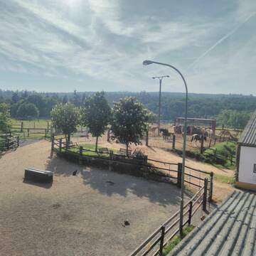
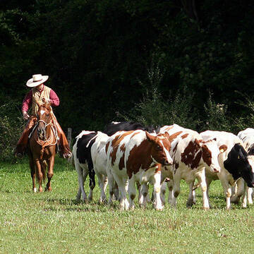
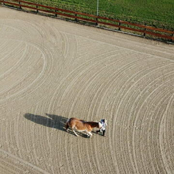
HIT Aktivstall Rosenhof
Mechernich
Aktivstall-Rosenhof
@Aktivstall-Rosenhof
Fahrstall, Kutschwagen
Freizeitstall
Vermieten
Hunde willkommen
Krankenbox
Allergikerstall
bedampftes/gewaschenes Heu
30 weitere...
S
Leider kein Vorschaubild
Leider kein Vorschaubild
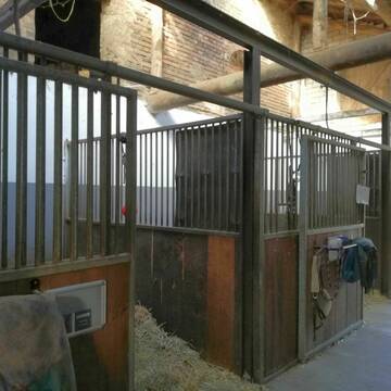
Pferdeboxen zu vermieten
Blankenheim
Mirco Dobberstein
@Mirco_1989
Vermieten
Führanlage
Hunde willkommen
Außenbox mit Paddock
Innenbox
Vollpension
6 weitere...
B
Deprecated: Creation of dynamic property Zend_View_Helper_Ads::$adLink is deprecated in /var/www/stall-frei/htdocs/staging.stall-frei.de/library/Psf/View/Helper/Ads.php on line 108

Futtersack HeuToy, Fressbremse in pink
Mechtersen
STALL-FREIde Marketing
@STALL-FREI-Marketing
Stundenlange Beschäftigung die
Koliken vorbeugt, geringe Staubinhalation mit
steuerbarer Futterentnahme

Offenstallplatz / Rentnerplatz
Nordrhein-Westfalen - Blankenheim
Hof Pickartz
@Hof-Pickartz
Freizeitstall
Geländestrecke
Vermieten
Hunde willkommen
Krankenbox
Notfallboxen
20 weitere...
P

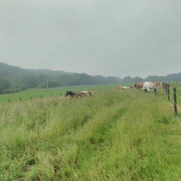
Offenstall für Pferde
Hellenthal, Ramscheid
Beate-Roemer
@Beate-Roemer
VFD-Mitglied
Wanderreiten
Vermieten
Longierzirkel/Roundpen
Paddock
Außenbox mit Paddock
Außenboxen
14 weitere...
P


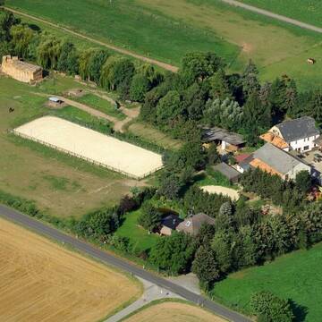
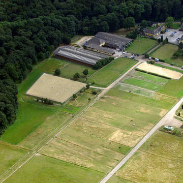
Reitanlage in traumhafter Lage
Leienkaul
Reitanlage_Maria-Schacht
@Reitanlage_Maria-Schacht
Pferdeausbildung
Reitschule
Hunde willkommen
Longierzirkel/Roundpen
Notfallboxen
Außenbox mit Paddock
Innenbox
15 weitere...
S
Reitanlage Hubertushof
Kall-Keldenich
Reitanlage-Hubertushof
@Reitanlage-Hubertushof
FN-Mitglied
Freizeitstall
Hunde willkommen
Longierzirkel/Roundpen
Hengsthaltung möglich
Außenbox mit Paddock
Innenbox
22 weitere...
P

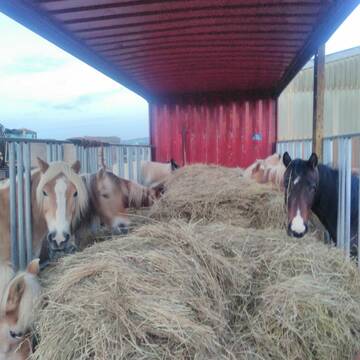
Heu aus neuer Ernte
Mechtersen
STALL-FREIde Marketing
@STALL-FREI-Marketing
Heulage und Pferdeheu aus der neuen Ernte findest du in unserem Futtermarkt
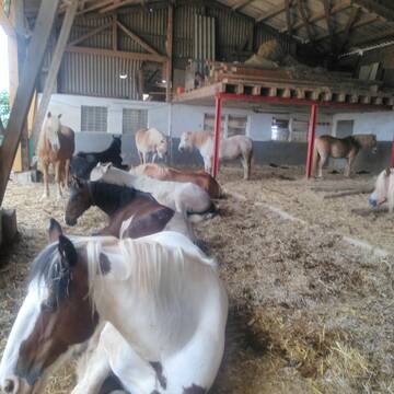
Reitstall Schlaeger - Tomberger Mühle
Euskirchen
Reitstall-Schlaeger
@Reitstall-Schlaeger
FN-Mitglied
Freizeitstall
Vermieten
Führanlage
Hunde willkommen
Außenboxen
Innenbox
20 weitere...
S
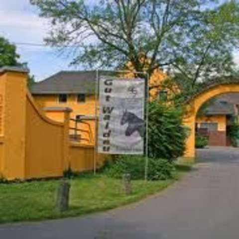
Gut Waldau - Die Reitanlage in Region Köln/Bonn
Rheinbach
Horseconcept Gut Waldau GmbH
@Horseconcept-Gut-Waldau-GmbH
FN-Mitglied
Freizeitstall
Vermieten
Verpachten
Führanlage
Hunde willkommen
Allergikerstall
Fohlenaufzucht möglich
34 weitere...
aktuell
S
Pensionsplätze für Gangpferde/Solekammer, Laufba...
Bad Münstereifel
Gangpferdegestuet-Showisi
@Gangpferdegestuet-Showisi
Freizeitstall
Gangpferdereiten
Vermieten
Krankenbox
Laufband
Fohlenaufzucht möglich
Hengsthaltung möglich
30 weitere...
P
Reiterhof Adenau
Adenau
Reiterhof-Adenau
@Reiterhof-Adenau
FN-Mitglied
Freizeitstall
Vermieten
Paddock
Reithalle
Außenbox mit Paddock
Außenboxen
17 weitere...
P
Newsletter abonnieren
Melde Dich für unseren Newsletter an und verpasse keine Neuigkeiten!
Deprecated: Creation of dynamic property Zend_View::$pageCount is deprecated in /var/www/stall-frei/htdocs/staging.stall-frei.de/library/vendor/shardj/zf1-future/library/Zend/View/Abstract.php on line 308
Deprecated: Creation of dynamic property Zend_View::$itemCountPerPage is deprecated in /var/www/stall-frei/htdocs/staging.stall-frei.de/library/vendor/shardj/zf1-future/library/Zend/View/Abstract.php on line 308
Deprecated: Creation of dynamic property Zend_View::$first is deprecated in /var/www/stall-frei/htdocs/staging.stall-frei.de/library/vendor/shardj/zf1-future/library/Zend/View/Abstract.php on line 308
Deprecated: Creation of dynamic property Zend_View::$current is deprecated in /var/www/stall-frei/htdocs/staging.stall-frei.de/library/vendor/shardj/zf1-future/library/Zend/View/Abstract.php on line 308
Deprecated: Creation of dynamic property Zend_View::$last is deprecated in /var/www/stall-frei/htdocs/staging.stall-frei.de/library/vendor/shardj/zf1-future/library/Zend/View/Abstract.php on line 308
Deprecated: Creation of dynamic property Zend_View::$previous is deprecated in /var/www/stall-frei/htdocs/staging.stall-frei.de/library/vendor/shardj/zf1-future/library/Zend/View/Abstract.php on line 308
Deprecated: Creation of dynamic property Zend_View::$next is deprecated in /var/www/stall-frei/htdocs/staging.stall-frei.de/library/vendor/shardj/zf1-future/library/Zend/View/Abstract.php on line 308
Deprecated: Creation of dynamic property Zend_View::$pagesInRange is deprecated in /var/www/stall-frei/htdocs/staging.stall-frei.de/library/vendor/shardj/zf1-future/library/Zend/View/Abstract.php on line 308
Deprecated: Creation of dynamic property Zend_View::$firstPageInRange is deprecated in /var/www/stall-frei/htdocs/staging.stall-frei.de/library/vendor/shardj/zf1-future/library/Zend/View/Abstract.php on line 308
Deprecated: Creation of dynamic property Zend_View::$lastPageInRange is deprecated in /var/www/stall-frei/htdocs/staging.stall-frei.de/library/vendor/shardj/zf1-future/library/Zend/View/Abstract.php on line 308
Deprecated: Creation of dynamic property Zend_View::$currentItemCount is deprecated in /var/www/stall-frei/htdocs/staging.stall-frei.de/library/vendor/shardj/zf1-future/library/Zend/View/Abstract.php on line 308
Deprecated: Creation of dynamic property Zend_View::$totalItemCount is deprecated in /var/www/stall-frei/htdocs/staging.stall-frei.de/library/vendor/shardj/zf1-future/library/Zend/View/Abstract.php on line 308
Deprecated: Creation of dynamic property Zend_View::$firstItemNumber is deprecated in /var/www/stall-frei/htdocs/staging.stall-frei.de/library/vendor/shardj/zf1-future/library/Zend/View/Abstract.php on line 308
Deprecated: Creation of dynamic property Zend_View::$lastItemNumber is deprecated in /var/www/stall-frei/htdocs/staging.stall-frei.de/library/vendor/shardj/zf1-future/library/Zend/View/Abstract.php on line 308
Deprecated: Creation of dynamic property Zend_View::$router is deprecated in /var/www/stall-frei/htdocs/staging.stall-frei.de/library/vendor/shardj/zf1-future/library/Zend/View/Abstract.php on line 308
Deprecated: Creation of dynamic property Zend_View::$urlParams is deprecated in /var/www/stall-frei/htdocs/staging.stall-frei.de/library/vendor/shardj/zf1-future/library/Zend/View/Abstract.php on line 308
Deprecated: Creation of dynamic property Zend_View::$showAds is deprecated in /var/www/stall-frei/htdocs/staging.stall-frei.de/library/vendor/shardj/zf1-future/library/Zend/View/Abstract.php on line 308
Deprecated: Creation of dynamic property Zend_View::$objectIds is deprecated in /var/www/stall-frei/htdocs/staging.stall-frei.de/library/vendor/shardj/zf1-future/library/Zend/View/Abstract.php on line 308
Deprecated: Creation of dynamic property Zend_View::$showNavbar is deprecated in /var/www/stall-frei/htdocs/staging.stall-frei.de/library/vendor/shardj/zf1-future/library/Zend/View/Abstract.php on line 308
Deprecated: Creation of dynamic property Zend_View::$showBreadcrumb is deprecated in /var/www/stall-frei/htdocs/staging.stall-frei.de/library/vendor/shardj/zf1-future/library/Zend/View/Abstract.php on line 308
Deprecated: Creation of dynamic property Zend_View::$showFooter is deprecated in /var/www/stall-frei/htdocs/staging.stall-frei.de/library/vendor/shardj/zf1-future/library/Zend/View/Abstract.php on line 308
Deprecated: Creation of dynamic property Zend_View::$showInternalAds is deprecated in /var/www/stall-frei/htdocs/staging.stall-frei.de/library/vendor/shardj/zf1-future/library/Zend/View/Abstract.php on line 308
Deprecated: Creation of dynamic property Zend_View::$blNoContent is deprecated in /var/www/stall-frei/htdocs/staging.stall-frei.de/library/vendor/shardj/zf1-future/library/Zend/View/Abstract.php on line 308
Deprecated: Creation of dynamic property Zend_View::$sMetaDesc is deprecated in /var/www/stall-frei/htdocs/staging.stall-frei.de/library/vendor/shardj/zf1-future/library/Zend/View/Abstract.php on line 308
Deprecated: Creation of dynamic property Zend_View::$useGmaps is deprecated in /var/www/stall-frei/htdocs/staging.stall-frei.de/library/vendor/shardj/zf1-future/library/Zend/View/Abstract.php on line 308
Deprecated: Creation of dynamic property Zend_View::$touches is deprecated in /var/www/stall-frei/htdocs/staging.stall-frei.de/library/vendor/shardj/zf1-future/library/Zend/View/Abstract.php on line 308
Deprecated: Creation of dynamic property Zend_View::$oProject is deprecated in /var/www/stall-frei/htdocs/staging.stall-frei.de/library/vendor/shardj/zf1-future/library/Zend/View/Abstract.php on line 308
Deprecated: Creation of dynamic property Zend_View::$pageHeadline is deprecated in /var/www/stall-frei/htdocs/staging.stall-frei.de/library/vendor/shardj/zf1-future/library/Zend/View/Abstract.php on line 308
Deprecated: Creation of dynamic property Zend_View::$disableLocationField is deprecated in /var/www/stall-frei/htdocs/staging.stall-frei.de/library/vendor/shardj/zf1-future/library/Zend/View/Abstract.php on line 308
Deprecated: Creation of dynamic property Zend_View::$isSearch is deprecated in /var/www/stall-frei/htdocs/staging.stall-frei.de/library/vendor/shardj/zf1-future/library/Zend/View/Abstract.php on line 308
Deprecated: Creation of dynamic property Zend_View::$pageTitle is deprecated in /var/www/stall-frei/htdocs/staging.stall-frei.de/library/vendor/shardj/zf1-future/library/Zend/View/Abstract.php on line 308
Deprecated: Creation of dynamic property Psf_Form_Element_Text::$class is deprecated in /var/www/stall-frei/htdocs/staging.stall-frei.de/library/vendor/shardj/zf1-future/library/Zend/Form/Element.php on line 874
Deprecated: Creation of dynamic property Psf_Form_Element_Text::$size is deprecated in /var/www/stall-frei/htdocs/staging.stall-frei.de/library/vendor/shardj/zf1-future/library/Zend/Form/Element.php on line 874
Deprecated: Creation of dynamic property Psf_Form_Element_Text::$placeholder is deprecated in /var/www/stall-frei/htdocs/staging.stall-frei.de/library/vendor/shardj/zf1-future/library/Zend/Form/Element.php on line 874
Deprecated: Creation of dynamic property Psf_Form_Element_Hidden::$class is deprecated in /var/www/stall-frei/htdocs/staging.stall-frei.de/library/vendor/shardj/zf1-future/library/Zend/Form/Element.php on line 874
Deprecated: Creation of dynamic property Psf_Form_Element_Hidden::$class is deprecated in /var/www/stall-frei/htdocs/staging.stall-frei.de/library/vendor/shardj/zf1-future/library/Zend/Form/Element.php on line 874
Deprecated: Creation of dynamic property Psf_Form_Element_Hidden::$class is deprecated in /var/www/stall-frei/htdocs/staging.stall-frei.de/library/vendor/shardj/zf1-future/library/Zend/Form/Element.php on line 874
Deprecated: Creation of dynamic property Psf_Form_Element_Hidden::$class is deprecated in /var/www/stall-frei/htdocs/staging.stall-frei.de/library/vendor/shardj/zf1-future/library/Zend/Form/Element.php on line 874
Deprecated: Creation of dynamic property Psf_Form_Element_Select::$class is deprecated in /var/www/stall-frei/htdocs/staging.stall-frei.de/library/vendor/shardj/zf1-future/library/Zend/Form/Element.php on line 874
Deprecated: Creation of dynamic property Psf_Form_Element_Select::$class is deprecated in /var/www/stall-frei/htdocs/staging.stall-frei.de/library/vendor/shardj/zf1-future/library/Zend/Form/Element.php on line 874
Deprecated: Creation of dynamic property Psf_Form_Element_Select::$class is deprecated in /var/www/stall-frei/htdocs/staging.stall-frei.de/library/vendor/shardj/zf1-future/library/Zend/Form/Element.php on line 874
Deprecated: Creation of dynamic property Psf_Form_Element_Select::$class is deprecated in /var/www/stall-frei/htdocs/staging.stall-frei.de/library/vendor/shardj/zf1-future/library/Zend/Form/Element.php on line 874
Deprecated: Creation of dynamic property Psf_Form_Element_Text::$class is deprecated in /var/www/stall-frei/htdocs/staging.stall-frei.de/library/vendor/shardj/zf1-future/library/Zend/Form/Element.php on line 874
Deprecated: Creation of dynamic property Psf_Form_Element_Checkbox::$label is deprecated in /var/www/stall-frei/htdocs/staging.stall-frei.de/library/vendor/shardj/zf1-future/library/Zend/Form/Element.php on line 874
Deprecated: Creation of dynamic property Zend_View::$sort is deprecated in /var/www/stall-frei/htdocs/staging.stall-frei.de/library/vendor/shardj/zf1-future/library/Zend/View/Abstract.php on line 308
Deprecated: Creation of dynamic property Zend_View::$searchLocation is deprecated in /var/www/stall-frei/htdocs/staging.stall-frei.de/library/vendor/shardj/zf1-future/library/Zend/View/Abstract.php on line 308
Deprecated: Creation of dynamic property Zend_View::$locationHint is deprecated in /var/www/stall-frei/htdocs/staging.stall-frei.de/library/vendor/shardj/zf1-future/library/Zend/View/Abstract.php on line 308
Psf_GeoCoder_Abstract::getLocation: Gonnersdorf Get Location CachedOrLive
Psf_GeoCoder_Abstract::getCachedOrLive: Gonnersdorf
Psf_GeoCoder_Abstract::convertLocationResult
{"documentation":"https:\/\/opencagedata.com\/api","licenses":[{"name":"see attribution guide","url":"https:\/\/opencagedata.com\/credits"}],"results":[{"bounds":{"northeast":{"lat":50.337144,"lng":6.6175191},"southwest":{"lat":50.3176801,"lng":6.5467572}},"components":{"ISO_3166-1_alpha-2":"DE","ISO_3166-1_alpha-3":"DEU","ISO_3166-2":["DE-RP"],"_category":"place","_normalized_city":"G\u00f6nnersdorf","_type":"village","continent":"Europe","country":"Deutschland","country_code":"de","county":"Landkreis Vulkaneifel","municipality":"Gerolstein","political_union":"European Union","state":"Rheinland-Pfalz","state_code":"RP","village":"G\u00f6nnersdorf"},"confidence":7,"formatted":"G\u00f6nnersdorf, Rheinland-Pfalz, Deutschland","geometry":{"lat":50.3280311,"lng":6.5968263}},{"bounds":{"northeast":{"lat":50.4911616,"lng":7.2952687},"southwest":{"lat":50.4668615,"lng":7.2414733}},"components":{"ISO_3166-1_alpha-2":"DE","ISO_3166-1_alpha-3":"DEU","ISO_3166-2":["DE-RP"],"_category":"place","_normalized_city":"G\u00f6nnersdorf","_type":"village","continent":"Europe","country":"Deutschland","country_code":"de","county":"Landkreis Ahrweiler","municipality":"Bad Breisig","political_union":"European Union","state":"Rheinland-Pfalz","state_code":"RP","village":"G\u00f6nnersdorf"},"confidence":7,"formatted":"G\u00f6nnersdorf, Rheinland-Pfalz, Deutschland","geometry":{"lat":50.4811183,"lng":7.2659914}},{"bounds":{"northeast":{"lat":49.0865602,"lng":12.1716509},"southwest":{"lat":49.0465602,"lng":12.1316509}},"components":{"ISO_3166-1_alpha-2":"DE","ISO_3166-1_alpha-3":"DEU","ISO_3166-2":["DE-BY"],"_category":"place","_normalized_city":"Wenzenbach","_type":"village","city":"Wenzenbach","continent":"Europe","country":"Deutschland","country_code":"de","county":"Landkreis Regensburg","political_union":"European Union","postcode":"93173","state":"Bayern","state_code":"BY","village":"Gonnersdorf"},"confidence":7,"formatted":"93173 Gonnersdorf, Deutschland","geometry":{"lat":49.0665602,"lng":12.1516509}},{"bounds":{"northeast":{"lat":49.4847259,"lng":10.8410862},"southwest":{"lat":49.4447259,"lng":10.8010862}},"components":{"ISO_3166-1_alpha-2":"DE","ISO_3166-1_alpha-3":"DEU","ISO_3166-2":["DE-BY"],"_category":"place","_normalized_city":"Cadolzburg","_type":"village","continent":"Europe","country":"Deutschland","country_code":"de","county":"Landkreis F\u00fcrth","political_union":"European Union","postcode":"90579","state":"Bayern","state_code":"BY","town":"Cadolzburg","village":"Gonnersdorf"},"confidence":7,"formatted":"90579 Gonnersdorf, Deutschland","geometry":{"lat":49.4647259,"lng":10.8210862}},{"bounds":{"northeast":{"lat":49.3469436,"lng":12.3631666},"southwest":{"lat":49.3069436,"lng":12.3231666}},"components":{"ISO_3166-1_alpha-2":"DE","ISO_3166-1_alpha-3":"DEU","ISO_3166-2":["DE-BY"],"_category":"place","_normalized_city":"Neunburg vorm Wald","_type":"hamlet","continent":"Europe","country":"Deutschland","country_code":"de","county":"Landkreis Schwandorf","hamlet":"Gonnersdorf","political_union":"European Union","postcode":"92431","state":"Bayern","state_code":"BY","town":"Neunburg vorm Wald"},"confidence":7,"formatted":"Gonnersdorf, 92431 Neunburg vorm Wald, Deutschland","geometry":{"lat":49.3269436,"lng":12.3431666}},{"bounds":{"northeast":{"lat":50.4588961,"lng":7.4263255},"southwest":{"lat":50.4388961,"lng":7.4063255}},"components":{"ISO_3166-1_alpha-2":"DE","ISO_3166-1_alpha-3":"DEU","ISO_3166-2":["DE-RP"],"_category":"place","_normalized_city":"Neuwied","_type":"neighbourhood","continent":"Europe","country":"Deutschland","country_code":"de","county":"Landkreis Neuwied","neighbourhood":"G\u00f6nnersdorf","political_union":"European Union","postcode":"56567","state":"Rheinland-Pfalz","state_code":"RP","suburb":"Feldkirchen","town":"Neuwied"},"confidence":8,"formatted":"56567 Neuwied, Deutschland","geometry":{"lat":50.4488961,"lng":7.4163255}},{"components":{"ISO_3166-1_alpha-2":"FR","ISO_3166-1_alpha-3":"FRA","ISO_3166-2":["FR-GES","FR-6AE","FR-68"],"_category":"road","_normalized_city":"Gommersdorf","_type":"road","city":"Gommersdorf","continent":"Europe","country":"France","country_code":"fr","county":"Haut-Rhin","local_authority":"Communaut\u00e9 de communes Sud Alsace Largue","political_union":"European Union","postcode":"68210","road":"Rue de Dannemarie","state":"Grand Est","state_code":"GES"},"confidence":3,"formatted":"Rue de Dannemarie, 68210 Gommersdorf, France","geometry":{"lat":47.635531,"lng":7.125003}},{"components":{"ISO_3166-1_alpha-2":"FR","ISO_3166-1_alpha-3":"FRA","ISO_3166-2":["FR-GES","FR-6AE","FR-68"],"_category":"road","_normalized_city":"Gommersdorf","_type":"road","city":"Gommersdorf","continent":"Europe","country":"France","country_code":"fr","county":"Haut-Rhin","local_authority":"Communaut\u00e9 de communes Sud Alsace Largue","political_union":"European Union","postcode":"68210","road":"Rue de la Chapelle","state":"Grand Est","state_code":"GES"},"confidence":2,"formatted":"Rue de la Chapelle, 68210 Gommersdorf, France","geometry":{"lat":47.64007,"lng":7.128771}},{"components":{"ISO_3166-1_alpha-2":"FR","ISO_3166-1_alpha-3":"FRA","ISO_3166-2":["FR-GES","FR-6AE","FR-68"],"_category":"place","_normalized_city":"Gommersdorf","_type":"city","city":"Gommersdorf","continent":"Europe","country":"France","country_code":"fr","county":"Haut-Rhin","local_authority":"Communaut\u00e9 de communes Sud Alsace Largue","political_union":"European Union","postcode":"68210","state":"Grand Est","state_code":"GES"},"confidence":2,"formatted":"Gommersdorf, Haut-Rhin, France","geometry":{"lat":47.638624,"lng":7.128307}},{"components":{"ISO_3166-1_alpha-2":"FR","ISO_3166-1_alpha-3":"FRA","ISO_3166-2":["FR-GES","FR-6AE","FR-68"],"_category":"road","_normalized_city":"Gommersdorf","_type":"road","city":"Gommersdorf","continent":"Europe","country":"France","country_code":"fr","county":"Haut-Rhin","local_authority":"Communaut\u00e9 de communes Sud Alsace Largue","political_union":"European Union","postcode":"68210","road":"Rue de l\u2019Etang","state":"Grand Est","state_code":"GES"},"confidence":2,"formatted":"Rue de l\u2019Etang, 68210 Gommersdorf, France","geometry":{"lat":47.639522,"lng":7.134781}}],"status":{"code":200,"message":"OK"},"stay_informed":{"blog":"https:\/\/blog.opencagedata.com","mastodon":"https:\/\/en.osm.town\/@opencage"},"thanks":"For using an OpenCage API","timestamp":{"created_http":"Sun, 08 Feb 2026 08:04:30 GMT","created_unix":1770537870},"total_results":10}Array
(
[0] => stdClass Object
(
[bounds] => stdClass Object
(
[northeast] => stdClass Object
(
[lat] => 50.337144
[lng] => 6.6175191
)
[southwest] => stdClass Object
(
[lat] => 50.3176801
[lng] => 6.5467572
)
)
[components] => stdClass Object
(
[ISO_3166-1_alpha-2] => DE
[ISO_3166-1_alpha-3] => DEU
[ISO_3166-2] => Array
(
[0] => DE-RP
)
[_category] => place
[_normalized_city] => Gönnersdorf
[_type] => village
[continent] => Europe
[country] => Deutschland
[country_code] => de
[county] => Landkreis Vulkaneifel
[municipality] => Gerolstein
[political_union] => European Union
[state] => Rheinland-Pfalz
[state_code] => RP
[village] => Gönnersdorf
)
[confidence] => 7
[formatted] => Gönnersdorf, Rheinland-Pfalz, Deutschland
[geometry] => stdClass Object
(
[lat] => 50.3280311
[lng] => 6.5968263
)
)
[1] => stdClass Object
(
[bounds] => stdClass Object
(
[northeast] => stdClass Object
(
[lat] => 50.4911616
[lng] => 7.2952687
)
[southwest] => stdClass Object
(
[lat] => 50.4668615
[lng] => 7.2414733
)
)
[components] => stdClass Object
(
[ISO_3166-1_alpha-2] => DE
[ISO_3166-1_alpha-3] => DEU
[ISO_3166-2] => Array
(
[0] => DE-RP
)
[_category] => place
[_normalized_city] => Gönnersdorf
[_type] => village
[continent] => Europe
[country] => Deutschland
[country_code] => de
[county] => Landkreis Ahrweiler
[municipality] => Bad Breisig
[political_union] => European Union
[state] => Rheinland-Pfalz
[state_code] => RP
[village] => Gönnersdorf
)
[confidence] => 7
[formatted] => Gönnersdorf, Rheinland-Pfalz, Deutschland
[geometry] => stdClass Object
(
[lat] => 50.4811183
[lng] => 7.2659914
)
)
[2] => stdClass Object
(
[bounds] => stdClass Object
(
[northeast] => stdClass Object
(
[lat] => 49.0865602
[lng] => 12.1716509
)
[southwest] => stdClass Object
(
[lat] => 49.0465602
[lng] => 12.1316509
)
)
[components] => stdClass Object
(
[ISO_3166-1_alpha-2] => DE
[ISO_3166-1_alpha-3] => DEU
[ISO_3166-2] => Array
(
[0] => DE-BY
)
[_category] => place
[_normalized_city] => Wenzenbach
[_type] => village
[city] => Wenzenbach
[continent] => Europe
[country] => Deutschland
[country_code] => de
[county] => Landkreis Regensburg
[political_union] => European Union
[postcode] => 93173
[state] => Bayern
[state_code] => BY
[village] => Gonnersdorf
)
[confidence] => 7
[formatted] => 93173 Gonnersdorf, Deutschland
[geometry] => stdClass Object
(
[lat] => 49.0665602
[lng] => 12.1516509
)
)
[3] => stdClass Object
(
[bounds] => stdClass Object
(
[northeast] => stdClass Object
(
[lat] => 49.4847259
[lng] => 10.8410862
)
[southwest] => stdClass Object
(
[lat] => 49.4447259
[lng] => 10.8010862
)
)
[components] => stdClass Object
(
[ISO_3166-1_alpha-2] => DE
[ISO_3166-1_alpha-3] => DEU
[ISO_3166-2] => Array
(
[0] => DE-BY
)
[_category] => place
[_normalized_city] => Cadolzburg
[_type] => village
[continent] => Europe
[country] => Deutschland
[country_code] => de
[county] => Landkreis Fürth
[political_union] => European Union
[postcode] => 90579
[state] => Bayern
[state_code] => BY
[town] => Cadolzburg
[village] => Gonnersdorf
)
[confidence] => 7
[formatted] => 90579 Gonnersdorf, Deutschland
[geometry] => stdClass Object
(
[lat] => 49.4647259
[lng] => 10.8210862
)
)
[4] => stdClass Object
(
[bounds] => stdClass Object
(
[northeast] => stdClass Object
(
[lat] => 49.3469436
[lng] => 12.3631666
)
[southwest] => stdClass Object
(
[lat] => 49.3069436
[lng] => 12.3231666
)
)
[components] => stdClass Object
(
[ISO_3166-1_alpha-2] => DE
[ISO_3166-1_alpha-3] => DEU
[ISO_3166-2] => Array
(
[0] => DE-BY
)
[_category] => place
[_normalized_city] => Neunburg vorm Wald
[_type] => hamlet
[continent] => Europe
[country] => Deutschland
[country_code] => de
[county] => Landkreis Schwandorf
[hamlet] => Gonnersdorf
[political_union] => European Union
[postcode] => 92431
[state] => Bayern
[state_code] => BY
[town] => Neunburg vorm Wald
)
[confidence] => 7
[formatted] => Gonnersdorf, 92431 Neunburg vorm Wald, Deutschland
[geometry] => stdClass Object
(
[lat] => 49.3269436
[lng] => 12.3431666
)
)
[5] => stdClass Object
(
[bounds] => stdClass Object
(
[northeast] => stdClass Object
(
[lat] => 50.4588961
[lng] => 7.4263255
)
[southwest] => stdClass Object
(
[lat] => 50.4388961
[lng] => 7.4063255
)
)
[components] => stdClass Object
(
[ISO_3166-1_alpha-2] => DE
[ISO_3166-1_alpha-3] => DEU
[ISO_3166-2] => Array
(
[0] => DE-RP
)
[_category] => place
[_normalized_city] => Neuwied
[_type] => neighbourhood
[continent] => Europe
[country] => Deutschland
[country_code] => de
[county] => Landkreis Neuwied
[neighbourhood] => Gönnersdorf
[political_union] => European Union
[postcode] => 56567
[state] => Rheinland-Pfalz
[state_code] => RP
[suburb] => Feldkirchen
[town] => Neuwied
)
[confidence] => 8
[formatted] => 56567 Neuwied, Deutschland
[geometry] => stdClass Object
(
[lat] => 50.4488961
[lng] => 7.4163255
)
)
[6] => stdClass Object
(
[components] => stdClass Object
(
[ISO_3166-1_alpha-2] => FR
[ISO_3166-1_alpha-3] => FRA
[ISO_3166-2] => Array
(
[0] => FR-GES
[1] => FR-6AE
[2] => FR-68
)
[_category] => road
[_normalized_city] => Gommersdorf
[_type] => road
[city] => Gommersdorf
[continent] => Europe
[country] => France
[country_code] => fr
[county] => Haut-Rhin
[local_authority] => Communauté de communes Sud Alsace Largue
[political_union] => European Union
[postcode] => 68210
[road] => Rue de Dannemarie
[state] => Grand Est
[state_code] => GES
)
[confidence] => 3
[formatted] => Rue de Dannemarie, 68210 Gommersdorf, France
[geometry] => stdClass Object
(
[lat] => 47.635531
[lng] => 7.125003
)
)
[7] => stdClass Object
(
[components] => stdClass Object
(
[ISO_3166-1_alpha-2] => FR
[ISO_3166-1_alpha-3] => FRA
[ISO_3166-2] => Array
(
[0] => FR-GES
[1] => FR-6AE
[2] => FR-68
)
[_category] => road
[_normalized_city] => Gommersdorf
[_type] => road
[city] => Gommersdorf
[continent] => Europe
[country] => France
[country_code] => fr
[county] => Haut-Rhin
[local_authority] => Communauté de communes Sud Alsace Largue
[political_union] => European Union
[postcode] => 68210
[road] => Rue de la Chapelle
[state] => Grand Est
[state_code] => GES
)
[confidence] => 2
[formatted] => Rue de la Chapelle, 68210 Gommersdorf, France
[geometry] => stdClass Object
(
[lat] => 47.64007
[lng] => 7.128771
)
)
[8] => stdClass Object
(
[components] => stdClass Object
(
[ISO_3166-1_alpha-2] => FR
[ISO_3166-1_alpha-3] => FRA
[ISO_3166-2] => Array
(
[0] => FR-GES
[1] => FR-6AE
[2] => FR-68
)
[_category] => place
[_normalized_city] => Gommersdorf
[_type] => city
[city] => Gommersdorf
[continent] => Europe
[country] => France
[country_code] => fr
[county] => Haut-Rhin
[local_authority] => Communauté de communes Sud Alsace Largue
[political_union] => European Union
[postcode] => 68210
[state] => Grand Est
[state_code] => GES
)
[confidence] => 2
[formatted] => Gommersdorf, Haut-Rhin, France
[geometry] => stdClass Object
(
[lat] => 47.638624
[lng] => 7.128307
)
)
[9] => stdClass Object
(
[components] => stdClass Object
(
[ISO_3166-1_alpha-2] => FR
[ISO_3166-1_alpha-3] => FRA
[ISO_3166-2] => Array
(
[0] => FR-GES
[1] => FR-6AE
[2] => FR-68
)
[_category] => road
[_normalized_city] => Gommersdorf
[_type] => road
[city] => Gommersdorf
[continent] => Europe
[country] => France
[country_code] => fr
[county] => Haut-Rhin
[local_authority] => Communauté de communes Sud Alsace Largue
[political_union] => European Union
[postcode] => 68210
[road] => Rue de l’Etang
[state] => Grand Est
[state_code] => GES
)
[confidence] => 2
[formatted] => Rue de l’Etang, 68210 Gommersdorf, France
[geometry] => stdClass Object
(
[lat] => 47.639522
[lng] => 7.134781
)
)
)
Psf_GeoCoder_OpenCageData::getKeyMap: 0
stdClass Object
(
    [bounds] => stdClass Object
        (
            [northeast] => stdClass Object
                (
                    [lat] => 50.337144
                    [lng] => 6.6175191
                )

            [southwest] => stdClass Object
                (
                    [lat] => 50.3176801
                    [lng] => 6.5467572
                )

        )

    [components] => stdClass Object
        (
            [ISO_3166-1_alpha-2] => DE
            [ISO_3166-1_alpha-3] => DEU
            [ISO_3166-2] => Array
                (
                    [0] => DE-RP
                )

            [_category] => place
            [_normalized_city] => Gönnersdorf
            [_type] => village
            [continent] => Europe
            [country] => Deutschland
            [country_code] => de
            [county] => Landkreis Vulkaneifel
            [municipality] => Gerolstein
            [political_union] => European Union
            [state] => Rheinland-Pfalz
            [state_code] => RP
            [village] => Gönnersdorf
        )

    [confidence] => 7
    [formatted] => Gönnersdorf, Rheinland-Pfalz, Deutschland
    [geometry] => stdClass Object
        (
            [lat] => 50.3280311
            [lng] => 6.5968263
        )

)
Psf_GeoCoder_OpenCageData::getCounty: Vulkaneifel
Psf_GeoCoder_OpenCageData::addMissingData REFETCH!
Array
(
    [address] => Gönnersdorf, Rheinland-Pfalz, Deutschland
    [type] => village
    [street] =>
    [city] => Gönnersdorf
    [county] => Vulkaneifel
    [state] => Rheinland-Pfalz
    [zip] =>
    [country] => Deutschland
    [suburb] =>
    [countrycode] => de
    [latitude] => 50.3280311
    [longitude] => 6.5968263
    [accuracy] => 1
    [confidence] => 7
    [bounds] => stdClass Object
        (
            [northeast] => stdClass Object
                (
                    [lat] => 50.337144
                    [lng] => 6.6175191
                )

            [southwest] => stdClass Object
                (
                    [lat] => 50.3176801
                    [lng] => 6.5467572
                )

        )

)
reformat!
Array
(
    [address] => Gönnersdorf, Rheinland-Pfalz, Deutschland
    [type] => village
    [street] =>
    [city] => Gönnersdorf
    [county] => Vulkaneifel
    [state] => Rheinland-Pfalz
    [zip] =>
    [country] => Deutschland
    [suburb] =>
    [countrycode] => de
    [latitude] => 50.3280311
    [longitude] => 6.5968263
    [accuracy] => 1
    [confidence] => 7
    [bounds] => stdClass Object
        (
            [northeast] => stdClass Object
                (
                    [lat] => 50.337144
                    [lng] => 6.6175191
                )

            [southwest] => stdClass Object
                (
                    [lat] => 50.3176801
                    [lng] => 6.5467572
                )

        )

    [place] => Gönnersdorf, Rheinland-Pfalz
    [hash] => 08b6bdcf1ceeb51cbe842687656558e6
)
Psf_GeoCoder_OpenCageData::getKeyMap: 1
stdClass Object
(
    [bounds] => stdClass Object
        (
            [northeast] => stdClass Object
                (
                    [lat] => 50.4911616
                    [lng] => 7.2952687
                )

            [southwest] => stdClass Object
                (
                    [lat] => 50.4668615
                    [lng] => 7.2414733
                )

        )

    [components] => stdClass Object
        (
            [ISO_3166-1_alpha-2] => DE
            [ISO_3166-1_alpha-3] => DEU
            [ISO_3166-2] => Array
                (
                    [0] => DE-RP
                )

            [_category] => place
            [_normalized_city] => Gönnersdorf
            [_type] => village
            [continent] => Europe
            [country] => Deutschland
            [country_code] => de
            [county] => Landkreis Ahrweiler
            [municipality] => Bad Breisig
            [political_union] => European Union
            [state] => Rheinland-Pfalz
            [state_code] => RP
            [village] => Gönnersdorf
        )

    [confidence] => 7
    [formatted] => Gönnersdorf, Rheinland-Pfalz, Deutschland
    [geometry] => stdClass Object
        (
            [lat] => 50.4811183
            [lng] => 7.2659914
        )

)
Psf_GeoCoder_OpenCageData::getCounty: Ahrweiler
Psf_GeoCoder_OpenCageData::addMissingData REFETCH!
Array
(
    [address] => Gönnersdorf, Rheinland-Pfalz, Deutschland
    [type] => village
    [street] =>
    [city] => Gönnersdorf
    [county] => Ahrweiler
    [state] => Rheinland-Pfalz
    [zip] =>
    [country] => Deutschland
    [suburb] =>
    [countrycode] => de
    [latitude] => 50.4811183
    [longitude] => 7.2659914
    [accuracy] => 1
    [confidence] => 7
    [bounds] => stdClass Object
        (
            [northeast] => stdClass Object
                (
                    [lat] => 50.4911616
                    [lng] => 7.2952687
                )

            [southwest] => stdClass Object
                (
                    [lat] => 50.4668615
                    [lng] => 7.2414733
                )

        )

)
reformat!
Array
(
    [address] => Gönnersdorf, Rheinland-Pfalz, Deutschland
    [type] => village
    [street] =>
    [city] => Gönnersdorf
    [county] => Ahrweiler
    [state] => Rheinland-Pfalz
    [zip] =>
    [country] => Deutschland
    [suburb] =>
    [countrycode] => de
    [latitude] => 50.4811183
    [longitude] => 7.2659914
    [accuracy] => 1
    [confidence] => 7
    [bounds] => stdClass Object
        (
            [northeast] => stdClass Object
                (
                    [lat] => 50.4911616
                    [lng] => 7.2952687
                )

            [southwest] => stdClass Object
                (
                    [lat] => 50.4668615
                    [lng] => 7.2414733
                )

        )

    [place] => Gönnersdorf, Rheinland-Pfalz
    [hash] => 08b6bdcf1ceeb51cbe842687656558e6
)
Psf_GeoCoder_OpenCageData::getKeyMap: 2
stdClass Object
(
    [bounds] => stdClass Object
        (
            [northeast] => stdClass Object
                (
                    [lat] => 49.0865602
                    [lng] => 12.1716509
                )

            [southwest] => stdClass Object
                (
                    [lat] => 49.0465602
                    [lng] => 12.1316509
                )

        )

    [components] => stdClass Object
        (
            [ISO_3166-1_alpha-2] => DE
            [ISO_3166-1_alpha-3] => DEU
            [ISO_3166-2] => Array
                (
                    [0] => DE-BY
                )

            [_category] => place
            [_normalized_city] => Wenzenbach
            [_type] => village
            [city] => Wenzenbach
            [continent] => Europe
            [country] => Deutschland
            [country_code] => de
            [county] => Landkreis Regensburg
            [political_union] => European Union
            [postcode] => 93173
            [state] => Bayern
            [state_code] => BY
            [village] => Gonnersdorf
        )

    [confidence] => 7
    [formatted] => 93173 Gonnersdorf, Deutschland
    [geometry] => stdClass Object
        (
            [lat] => 49.0665602
            [lng] => 12.1516509
        )

)
Psf_GeoCoder_OpenCageData::getCounty: Regensburg
Psf_GeoCoder_OpenCageData::addMissingData REFETCH!
Array
(
    [address] => 93173 Gonnersdorf, Deutschland
    [type] => village
    [street] =>
    [city] => Gonnersdorf
    [county] => Regensburg
    [state] => Bayern
    [zip] => 93173
    [country] => Deutschland
    [suburb] =>
    [countrycode] => de
    [latitude] => 49.0665602
    [longitude] => 12.1516509
    [accuracy] => 1
    [confidence] => 7
    [bounds] => stdClass Object
        (
            [northeast] => stdClass Object
                (
                    [lat] => 49.0865602
                    [lng] => 12.1716509
                )

            [southwest] => stdClass Object
                (
                    [lat] => 49.0465602
                    [lng] => 12.1316509
                )

        )

)
reformat!
Array
(
    [address] => 93173 Gonnersdorf, Deutschland
    [type] => village
    [street] =>
    [city] => Gonnersdorf
    [county] => Regensburg
    [state] => Bayern
    [zip] => 93173
    [country] => Deutschland
    [suburb] =>
    [countrycode] => de
    [latitude] => 49.0665602
    [longitude] => 12.1516509
    [accuracy] => 1
    [confidence] => 7
    [bounds] => stdClass Object
        (
            [northeast] => stdClass Object
                (
                    [lat] => 49.0865602
                    [lng] => 12.1716509
                )

            [southwest] => stdClass Object
                (
                    [lat] => 49.0465602
                    [lng] => 12.1316509
                )

        )

    [place] => 93173 Gonnersdorf, Bayern
    [hash] => 79365701f1fcb0a5d87cee8e7312915a
)
Psf_GeoCoder_OpenCageData::getKeyMap: 3
stdClass Object
(
    [bounds] => stdClass Object
        (
            [northeast] => stdClass Object
                (
                    [lat] => 49.4847259
                    [lng] => 10.8410862
                )

            [southwest] => stdClass Object
                (
                    [lat] => 49.4447259
                    [lng] => 10.8010862
                )

        )

    [components] => stdClass Object
        (
            [ISO_3166-1_alpha-2] => DE
            [ISO_3166-1_alpha-3] => DEU
            [ISO_3166-2] => Array
                (
                    [0] => DE-BY
                )

            [_category] => place
            [_normalized_city] => Cadolzburg
            [_type] => village
            [continent] => Europe
            [country] => Deutschland
            [country_code] => de
            [county] => Landkreis Fürth
            [political_union] => European Union
            [postcode] => 90579
            [state] => Bayern
            [state_code] => BY
            [town] => Cadolzburg
            [village] => Gonnersdorf
        )

    [confidence] => 7
    [formatted] => 90579 Gonnersdorf, Deutschland
    [geometry] => stdClass Object
        (
            [lat] => 49.4647259
            [lng] => 10.8210862
        )

)
Psf_GeoCoder_OpenCageData::getCounty: Fürth
Psf_GeoCoder_OpenCageData::addMissingData REFETCH!
Array
(
    [address] => 90579 Gonnersdorf, Deutschland
    [type] => village
    [street] =>
    [city] => Cadolzburg
    [county] => Fürth
    [state] => Bayern
    [zip] => 90579
    [country] => Deutschland
    [suburb] =>
    [countrycode] => de
    [latitude] => 49.4647259
    [longitude] => 10.8210862
    [accuracy] => 1
    [confidence] => 7
    [bounds] => stdClass Object
        (
            [northeast] => stdClass Object
                (
                    [lat] => 49.4847259
                    [lng] => 10.8410862
                )

            [southwest] => stdClass Object
                (
                    [lat] => 49.4447259
                    [lng] => 10.8010862
                )

        )

)
reformat!
Array
(
    [address] => 90579 Cadolzburg
    [type] => village
    [street] =>
    [city] => Cadolzburg
    [county] => Fürth
    [state] => Bayern
    [zip] => 90579
    [country] => Deutschland
    [suburb] =>
    [countrycode] => de
    [latitude] => 49.4647259
    [longitude] => 10.8210862
    [accuracy] => 1
    [confidence] => 7
    [bounds] => stdClass Object
        (
            [northeast] => stdClass Object
                (
                    [lat] => 49.4847259
                    [lng] => 10.8410862
                )

            [southwest] => stdClass Object
                (
                    [lat] => 49.4447259
                    [lng] => 10.8010862
                )

        )

    [place] => 90579 Cadolzburg, Bayern
    [hash] => cebd34b88faf7cbfbbe6460b1d4a8794
)
Psf_GeoCoder_OpenCageData::getKeyMap: 4
stdClass Object
(
    [bounds] => stdClass Object
        (
            [northeast] => stdClass Object
                (
                    [lat] => 49.3469436
                    [lng] => 12.3631666
                )

            [southwest] => stdClass Object
                (
                    [lat] => 49.3069436
                    [lng] => 12.3231666
                )

        )

    [components] => stdClass Object
        (
            [ISO_3166-1_alpha-2] => DE
            [ISO_3166-1_alpha-3] => DEU
            [ISO_3166-2] => Array
                (
                    [0] => DE-BY
                )

            [_category] => place
            [_normalized_city] => Neunburg vorm Wald
            [_type] => hamlet
            [continent] => Europe
            [country] => Deutschland
            [country_code] => de
            [county] => Landkreis Schwandorf
            [hamlet] => Gonnersdorf
            [political_union] => European Union
            [postcode] => 92431
            [state] => Bayern
            [state_code] => BY
            [town] => Neunburg vorm Wald
        )

    [confidence] => 7
    [formatted] => Gonnersdorf, 92431 Neunburg vorm Wald, Deutschland
    [geometry] => stdClass Object
        (
            [lat] => 49.3269436
            [lng] => 12.3431666
        )

)
Psf_GeoCoder_OpenCageData::getCounty: Schwandorf
Psf_GeoCoder_OpenCageData::addMissingData REFETCH!
Array
(
    [address] => Gonnersdorf, 92431 Neunburg vorm Wald, Deutschland
    [type] => hamlet
    [street] => Gonnersdorf
    [city] => Neunburg vorm Wald
    [county] => Schwandorf
    [state] => Bayern
    [zip] => 92431
    [country] => Deutschland
    [suburb] =>
    [countrycode] => de
    [latitude] => 49.3269436
    [longitude] => 12.3431666
    [accuracy] => 1
    [confidence] => 7
    [bounds] => stdClass Object
        (
            [northeast] => stdClass Object
                (
                    [lat] => 49.3469436
                    [lng] => 12.3631666
                )

            [southwest] => stdClass Object
                (
                    [lat] => 49.3069436
                    [lng] => 12.3231666
                )

        )

)
reformat!
Array
(
    [address] => Gonnersdorf, 92431 Neunburg vorm Wald, Deutschland
    [type] => hamlet
    [street] => Gonnersdorf
    [city] => Neunburg vorm Wald
    [county] => Schwandorf
    [state] => Bayern
    [zip] => 92431
    [country] => Deutschland
    [suburb] =>
    [countrycode] => de
    [latitude] => 49.3269436
    [longitude] => 12.3431666
    [accuracy] => 1
    [confidence] => 7
    [bounds] => stdClass Object
        (
            [northeast] => stdClass Object
                (
                    [lat] => 49.3469436
                    [lng] => 12.3631666
                )

            [southwest] => stdClass Object
                (
                    [lat] => 49.3069436
                    [lng] => 12.3231666
                )

        )

    [place] => Gonnersdorf, 92431 Neunburg vorm Wald, Bayern
    [hash] => f1e5f55542961a36bad7e3c15da0c42a
)
Psf_GeoCoder_OpenCageData::getKeyMap: 5
stdClass Object
(
    [bounds] => stdClass Object
        (
            [northeast] => stdClass Object
                (
                    [lat] => 50.4588961
                    [lng] => 7.4263255
                )

            [southwest] => stdClass Object
                (
                    [lat] => 50.4388961
                    [lng] => 7.4063255
                )

        )

    [components] => stdClass Object
        (
            [ISO_3166-1_alpha-2] => DE
            [ISO_3166-1_alpha-3] => DEU
            [ISO_3166-2] => Array
                (
                    [0] => DE-RP
                )

            [_category] => place
            [_normalized_city] => Neuwied
            [_type] => neighbourhood
            [continent] => Europe
            [country] => Deutschland
            [country_code] => de
            [county] => Landkreis Neuwied
            [neighbourhood] => Gönnersdorf
            [political_union] => European Union
            [postcode] => 56567
            [state] => Rheinland-Pfalz
            [state_code] => RP
            [suburb] => Feldkirchen
            [town] => Neuwied
        )

    [confidence] => 8
    [formatted] => 56567 Neuwied, Deutschland
    [geometry] => stdClass Object
        (
            [lat] => 50.4488961
            [lng] => 7.4163255
        )

)
Psf_GeoCoder_OpenCageData::getCounty: Neuwied
Psf_GeoCoder_OpenCageData::addMissingData REFETCH!
Array
(
    [address] => 56567 Neuwied, Deutschland
    [type] => neighbourhood
    [street] =>
    [city] => Neuwied
    [county] => Neuwied
    [state] => Rheinland-Pfalz
    [zip] => 56567
    [country] => Deutschland
    [suburb] => Feldkirchen
    [countrycode] => de
    [latitude] => 50.4488961
    [longitude] => 7.4163255
    [accuracy] => 1
    [confidence] => 8
    [bounds] => stdClass Object
        (
            [northeast] => stdClass Object
                (
                    [lat] => 50.4588961
                    [lng] => 7.4263255
                )

            [southwest] => stdClass Object
                (
                    [lat] => 50.4388961
                    [lng] => 7.4063255
                )

        )

)
reformat!
Array
(
    [address] => 56567 Neuwied, Deutschland
    [type] => neighbourhood
    [street] =>
    [city] => Neuwied
    [county] => Neuwied
    [state] => Rheinland-Pfalz
    [zip] => 56567
    [country] => Deutschland
    [suburb] => Feldkirchen
    [countrycode] => de
    [latitude] => 50.4488961
    [longitude] => 7.4163255
    [accuracy] => 1
    [confidence] => 8
    [bounds] => stdClass Object
        (
            [northeast] => stdClass Object
                (
                    [lat] => 50.4588961
                    [lng] => 7.4263255
                )

            [southwest] => stdClass Object
                (
                    [lat] => 50.4388961
                    [lng] => 7.4063255
                )

        )

    [place] => 56567 Neuwied, Rheinland-Pfalz
    [hash] => 0ad66117ad407f5bf04257d605215506
)
Psf_GeoCoder_OpenCageData::getKeyMap: 6
stdClass Object
(
    [components] => stdClass Object
        (
            [ISO_3166-1_alpha-2] => FR
            [ISO_3166-1_alpha-3] => FRA
            [ISO_3166-2] => Array
                (
                    [0] => FR-GES
                    [1] => FR-6AE
                    [2] => FR-68
                )

            [_category] => road
            [_normalized_city] => Gommersdorf
            [_type] => road
            [city] => Gommersdorf
            [continent] => Europe
            [country] => France
            [country_code] => fr
            [county] => Haut-Rhin
            [local_authority] => Communauté de communes Sud Alsace Largue
            [political_union] => European Union
            [postcode] => 68210
            [road] => Rue de Dannemarie
            [state] => Grand Est
            [state_code] => GES
        )

    [confidence] => 3
    [formatted] => Rue de Dannemarie, 68210 Gommersdorf, France
    [geometry] => stdClass Object
        (
            [lat] => 47.635531
            [lng] => 7.125003
        )

)
Psf_GeoCoder_OpenCageData::getCounty: Haut-Rhin
Psf_GeoCoder_OpenCageData::addMissingData REFETCH!
Array
(
    [address] => Rue de Dannemarie, 68210 Gommersdorf, France
    [type] => road
    [street] => Rue de Dannemarie
    [city] => Gommersdorf
    [county] => Haut-Rhin
    [state] => Grand Est
    [zip] => 68210
    [country] => France
    [suburb] =>
    [countrycode] => fr
    [latitude] => 47.635531
    [longitude] => 7.125003
    [accuracy] => 1
    [confidence] => 3
    [bounds] =>
)
reformat!
Array
(
    [address] => Rue de Dannemarie, 68210 Gommersdorf, France
    [type] => road
    [street] => Rue de Dannemarie
    [city] => Gommersdorf
    [county] => Haut-Rhin
    [state] => Grand Est
    [zip] => 68210
    [country] => France
    [suburb] =>
    [countrycode] => fr
    [latitude] => 47.635531
    [longitude] => 7.125003
    [accuracy] => 1
    [confidence] => 3
    [bounds] =>
    [place] => Rue de Dannemarie, 68210 Gommersdorf, Grand Est
    [hash] => 07ff5a4604b0cc383e59a231f3323ada
)
Psf_GeoCoder_OpenCageData::getKeyMap: 7
stdClass Object
(
    [components] => stdClass Object
        (
            [ISO_3166-1_alpha-2] => FR
            [ISO_3166-1_alpha-3] => FRA
            [ISO_3166-2] => Array
                (
                    [0] => FR-GES
                    [1] => FR-6AE
                    [2] => FR-68
                )

            [_category] => road
            [_normalized_city] => Gommersdorf
            [_type] => road
            [city] => Gommersdorf
            [continent] => Europe
            [country] => France
            [country_code] => fr
            [county] => Haut-Rhin
            [local_authority] => Communauté de communes Sud Alsace Largue
            [political_union] => European Union
            [postcode] => 68210
            [road] => Rue de la Chapelle
            [state] => Grand Est
            [state_code] => GES
        )

    [confidence] => 2
    [formatted] => Rue de la Chapelle, 68210 Gommersdorf, France
    [geometry] => stdClass Object
        (
            [lat] => 47.64007
            [lng] => 7.128771
        )

)
Psf_GeoCoder_OpenCageData::getCounty: Haut-Rhin
Psf_GeoCoder_OpenCageData::addMissingData REFETCH!
Array
(
    [address] => Rue de la Chapelle, 68210 Gommersdorf, France
    [type] => road
    [street] => Rue de la Chapelle
    [city] => Gommersdorf
    [county] => Haut-Rhin
    [state] => Grand Est
    [zip] => 68210
    [country] => France
    [suburb] =>
    [countrycode] => fr
    [latitude] => 47.64007
    [longitude] => 7.128771
    [accuracy] => 1
    [confidence] => 2
    [bounds] =>
)
reformat!
Array
(
    [address] => Rue de la Chapelle, 68210 Gommersdorf, France
    [type] => road
    [street] => Rue de la Chapelle
    [city] => Gommersdorf
    [county] => Haut-Rhin
    [state] => Grand Est
    [zip] => 68210
    [country] => France
    [suburb] =>
    [countrycode] => fr
    [latitude] => 47.64007
    [longitude] => 7.128771
    [accuracy] => 1
    [confidence] => 2
    [bounds] =>
    [place] => Rue de la Chapelle, 68210 Gommersdorf, Grand Est
    [hash] => ceafdb0e93abeffd71cd786bf0947639
)
Psf_GeoCoder_OpenCageData::getKeyMap: 8
stdClass Object
(
    [components] => stdClass Object
        (
            [ISO_3166-1_alpha-2] => FR
            [ISO_3166-1_alpha-3] => FRA
            [ISO_3166-2] => Array
                (
                    [0] => FR-GES
                    [1] => FR-6AE
                    [2] => FR-68
                )

            [_category] => place
            [_normalized_city] => Gommersdorf
            [_type] => city
            [city] => Gommersdorf
            [continent] => Europe
            [country] => France
            [country_code] => fr
            [county] => Haut-Rhin
            [local_authority] => Communauté de communes Sud Alsace Largue
            [political_union] => European Union
            [postcode] => 68210
            [state] => Grand Est
            [state_code] => GES
        )

    [confidence] => 2
    [formatted] => Gommersdorf, Haut-Rhin, France
    [geometry] => stdClass Object
        (
            [lat] => 47.638624
            [lng] => 7.128307
        )

)
Psf_GeoCoder_OpenCageData::getCounty: Haut-Rhin
Psf_GeoCoder_OpenCageData::addMissingData REFETCH!
Array
(
    [address] => Gommersdorf, Haut-Rhin, France
    [type] => city
    [street] =>
    [city] => Gommersdorf
    [county] => Haut-Rhin
    [state] => Grand Est
    [zip] => 68210
    [country] => France
    [suburb] =>
    [countrycode] => fr
    [latitude] => 47.638624
    [longitude] => 7.128307
    [accuracy] => 1
    [confidence] => 2
    [bounds] =>
)
reformat!
Array
(
    [address] => Gommersdorf, Haut-Rhin, France
    [type] => city
    [street] =>
    [city] => Gommersdorf
    [county] => Haut-Rhin
    [state] => Grand Est
    [zip] => 68210
    [country] => France
    [suburb] =>
    [countrycode] => fr
    [latitude] => 47.638624
    [longitude] => 7.128307
    [accuracy] => 1
    [confidence] => 2
    [bounds] =>
    [place] => 68210 Gommersdorf, Grand Est
    [hash] => ab4f8e10a55e2384c5f79b3cca6b85b2
)
Psf_GeoCoder_OpenCageData::getKeyMap: 9
stdClass Object
(
    [components] => stdClass Object
        (
            [ISO_3166-1_alpha-2] => FR
            [ISO_3166-1_alpha-3] => FRA
            [ISO_3166-2] => Array
                (
                    [0] => FR-GES
                    [1] => FR-6AE
                    [2] => FR-68
                )

            [_category] => road
            [_normalized_city] => Gommersdorf
            [_type] => road
            [city] => Gommersdorf
            [continent] => Europe
            [country] => France
            [country_code] => fr
            [county] => Haut-Rhin
            [local_authority] => Communauté de communes Sud Alsace Largue
            [political_union] => European Union
            [postcode] => 68210
            [road] => Rue de l’Etang
            [state] => Grand Est
            [state_code] => GES
        )

    [confidence] => 2
    [formatted] => Rue de l’Etang, 68210 Gommersdorf, France
    [geometry] => stdClass Object
        (
            [lat] => 47.639522
            [lng] => 7.134781
        )

)
Psf_GeoCoder_OpenCageData::getCounty: Haut-Rhin
Psf_GeoCoder_OpenCageData::addMissingData REFETCH!
Array
(
    [address] => Rue de l’Etang, 68210 Gommersdorf, France
    [type] => road
    [street] => Rue de l’Etang
    [city] => Gommersdorf
    [county] => Haut-Rhin
    [state] => Grand Est
    [zip] => 68210
    [country] => France
    [suburb] =>
    [countrycode] => fr
    [latitude] => 47.639522
    [longitude] => 7.134781
    [accuracy] => 1
    [confidence] => 2
    [bounds] =>
)
reformat!
Array
(
    [address] => Rue de l’Etang, 68210 Gommersdorf, France
    [type] => road
    [street] => Rue de l’Etang
    [city] => Gommersdorf
    [county] => Haut-Rhin
    [state] => Grand Est
    [zip] => 68210
    [country] => France
    [suburb] =>
    [countrycode] => fr
    [latitude] => 47.639522
    [longitude] => 7.134781
    [accuracy] => 1
    [confidence] => 2
    [bounds] =>
    [place] => Rue de l’Etang, 68210 Gommersdorf, Grand Est
    [hash] => f6c905845cc2c937b6c230175b0a0662
)
Deprecated: Creation of dynamic property Zend_View::$locationHintStyle is deprecated in /var/www/stall-frei/htdocs/staging.stall-frei.de/library/vendor/shardj/zf1-future/library/Zend/View/Abstract.php on line 308
Deprecated: Creation of dynamic property Zend_View::$adGeoLocation is deprecated in /var/www/stall-frei/htdocs/staging.stall-frei.de/library/vendor/shardj/zf1-future/library/Zend/View/Abstract.php on line 308
Deprecated: Creation of dynamic property Zend_View::$recordCount is deprecated in /var/www/stall-frei/htdocs/staging.stall-frei.de/library/vendor/shardj/zf1-future/library/Zend/View/Abstract.php on line 308
Deprecated: Creation of dynamic property Zend_View::$paginationParams is deprecated in /var/www/stall-frei/htdocs/staging.stall-frei.de/library/vendor/shardj/zf1-future/library/Zend/View/Abstract.php on line 308
Deprecated: Creation of dynamic property Zend_View::$objectPaginator is deprecated in /var/www/stall-frei/htdocs/staging.stall-frei.de/library/vendor/shardj/zf1-future/library/Zend/View/Abstract.php on line 308
Deprecated: Creation of dynamic property Zend_View::$featuredObjects is deprecated in /var/www/stall-frei/htdocs/staging.stall-frei.de/library/vendor/shardj/zf1-future/library/Zend/View/Abstract.php on line 308
Deprecated: Creation of dynamic property Zend_View::$hints is deprecated in /var/www/stall-frei/htdocs/staging.stall-frei.de/library/vendor/shardj/zf1-future/library/Zend/View/Abstract.php on line 308
Deprecated: Creation of dynamic property Zend_View::$attributeHints is deprecated in /var/www/stall-frei/htdocs/staging.stall-frei.de/library/vendor/shardj/zf1-future/library/Zend/View/Abstract.php on line 308
Deprecated: Creation of dynamic property Zend_View::$oSearchForm is deprecated in /var/www/stall-frei/htdocs/staging.stall-frei.de/library/vendor/shardj/zf1-future/library/Zend/View/Abstract.php on line 308