Deprecated: Creation of dynamic property Zend_View::$sMode is deprecated in /var/www/stall-frei/htdocs/staging.stall-frei.de/library/vendor/shardj/zf1-future/library/Zend/View/Abstract.php on line 308
Stallplatz oder Offenstall in Marienheide
Gesucht wird in "Hütte, 51709 Marienheide, Deutschland"
6.329 Einträge
Deprecated: Creation of dynamic property Zend_View::$listObjects is deprecated in /var/www/stall-frei/htdocs/staging.stall-frei.de/library/vendor/shardj/zf1-future/library/Zend/View/Abstract.php on line 308
Gesponsort


Deprecated: Creation of dynamic property Zend_View::$listMode is deprecated in /var/www/stall-frei/htdocs/staging.stall-frei.de/library/vendor/shardj/zf1-future/library/Zend/View/Abstract.php on line 308
Deprecated: Creation of dynamic property Zend_View::$renderedObjects is deprecated in /var/www/stall-frei/htdocs/staging.stall-frei.de/library/vendor/shardj/zf1-future/library/Zend/View/Abstract.php on line 308
Deprecated: Creation of dynamic property Zend_View::$index is deprecated in /var/www/stall-frei/htdocs/staging.stall-frei.de/library/vendor/shardj/zf1-future/library/Zend/View/Abstract.php on line 308
Deprecated: Creation of dynamic property Zend_View::$displayMode is deprecated in /var/www/stall-frei/htdocs/staging.stall-frei.de/library/vendor/shardj/zf1-future/library/Zend/View/Abstract.php on line 308
Deprecated: Creation of dynamic property Zend_View::$remarketingIds is deprecated in /var/www/stall-frei/htdocs/staging.stall-frei.de/library/vendor/shardj/zf1-future/library/Zend/View/Abstract.php on line 308
Deprecated: Creation of dynamic property Zend_View::$listItem is deprecated in /var/www/stall-frei/htdocs/staging.stall-frei.de/library/vendor/shardj/zf1-future/library/Zend/View/Abstract.php on line 308
Deprecated: Creation of dynamic property Zend_View::$object is deprecated in /var/www/stall-frei/htdocs/staging.stall-frei.de/library/vendor/shardj/zf1-future/library/Zend/View/Abstract.php on line 308
Deprecated: Creation of dynamic property Zend_View::$attributes is deprecated in /var/www/stall-frei/htdocs/staging.stall-frei.de/library/vendor/shardj/zf1-future/library/Zend/View/Abstract.php on line 308
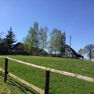
Eibachhof
Lindlar
ablumberg
@ablumberg
Freizeitstall
Paddock
Reitplatz (z.B. Dressur, Springen, Reining)
Außenbox mit Paddock
Außenboxen
Vollpension
4 weitere...
P
Deprecated: Creation of dynamic property Zend_View_Helper_Ads::$adLink is deprecated in /var/www/stall-frei/htdocs/staging.stall-frei.de/library/Psf/View/Helper/Ads.php on line 108

Heu aus neuer Ernte
Mechtersen
STALL-FREIde Marketing
@STALL-FREI-Marketing
Heulage und Pferdeheu aus der neuen Ernte findest du in unserem Futtermarkt
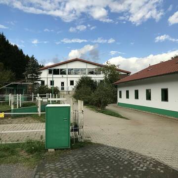
Pensionspferdestall Rolandshof
Lindlar
Rolandshof
@Rolandshof
Freizeitstall
Reitlehrer und -unterricht
Vermieten
Führanlage
Hunde willkommen
Außenbox mit Paddock
Außenboxen
13 weitere...
P

Pferdeboxen (Gruppen/Einzel) ganzjährig Weidegang
Wiehl
Stallgemeinschaft-Immerkopf
@Stallgemeinschaft-Immerkopf
Freizeitstall
Geländestrecke
Vermieten
Hunde willkommen
Paddock
Allergikerstall
Hufrehe geeignet
18 weitere...
aktuell
P


Offenstall Pferdefreunde Enkeln
Kürten
Pferdefreunde Enkeln
@Pferdefreunde-Enkeln
Freizeitstall
Vermieten
Hunde willkommen
Krankenbox
Notfallboxen
12 weitere...
P+
Leider kein Vorschaubild
Leider kein Vorschaubild
Platz in Offenstall
Osberghausen
Hoffstadt
@JHoffstadt
Geländestrecke
Verpachten
Hunde willkommen
Parkplatz für Pferdeanhänger
Gnadenbrothof
8 weitere...
B

Reitanlage Schwalbenhof
51674
Kirsten Genglawski
@KirstenGenglawski
Freizeitstall
Geländestrecke
Vermieten
Hunde willkommen
Paddock
Gnadenbrothof
Hengsthaltung möglich
19 weitere...
P

Futtersack HeuToy, Fressbremse in pink
Mechtersen
STALL-FREIde Marketing
@STALL-FREI-Marketing
Stundenlange Beschäftigung die
Koliken vorbeugt, geringe Staubinhalation mit
steuerbarer Futterentnahme

Offenstall in Lindlar hat Plätze frei
Lindlar
Nicolett Haarbrücker-Enk
@Nicolett21
Freizeitstall
Hunde willkommen
Sattelkammer/Sattelschränke
Allergikerstall
bedampftes/gewaschenes Heu
Offenstall
5 weitere...
P
Leider kein Vorschaubild
Leider kein Vorschaubild
Pferdeboxen frei
Wipperfürth
Bernd Trogemann
@Berndtrogemann
Vermieten
Hunde willkommen
Longierzirkel/Roundpen
Fohlenaufzucht möglich
Gnadenbrothof
Außenbox mit Paddock
Außenboxen
13 weitere...
B

Offenstall und Pferdeboxen
Wipperfürth
Sabrina
@Muellerorbach
Freizeitstall
Pferdeausbildung
Vermieten
Paddock
Reitplatz (z.B. Dressur, Springen, Reining)
Hengsthaltung möglich
13 weitere...
aktuell
P
Leider kein Vorschaubild
Leider kein Vorschaubild
Wipperfürth, Großscherkenbach 1
Wipperfürth
Carola Hungenberg
@abby1
Hunde willkommen
Paddock
Vollpension
Einzelne Boxen oder Stallplätze
7 weitere...
B
Werde Teil von STALL-FREI.de
Du hast eine Pferdebox frei? Freie Plätze im Offenstall, Pferdestall oder der Reitanlage kostenlos anbieten.
Deprecated: Creation of dynamic property Zend_View::$pageCount is deprecated in /var/www/stall-frei/htdocs/staging.stall-frei.de/library/vendor/shardj/zf1-future/library/Zend/View/Abstract.php on line 308
Deprecated: Creation of dynamic property Zend_View::$itemCountPerPage is deprecated in /var/www/stall-frei/htdocs/staging.stall-frei.de/library/vendor/shardj/zf1-future/library/Zend/View/Abstract.php on line 308
Deprecated: Creation of dynamic property Zend_View::$first is deprecated in /var/www/stall-frei/htdocs/staging.stall-frei.de/library/vendor/shardj/zf1-future/library/Zend/View/Abstract.php on line 308
Deprecated: Creation of dynamic property Zend_View::$current is deprecated in /var/www/stall-frei/htdocs/staging.stall-frei.de/library/vendor/shardj/zf1-future/library/Zend/View/Abstract.php on line 308
Deprecated: Creation of dynamic property Zend_View::$last is deprecated in /var/www/stall-frei/htdocs/staging.stall-frei.de/library/vendor/shardj/zf1-future/library/Zend/View/Abstract.php on line 308
Deprecated: Creation of dynamic property Zend_View::$previous is deprecated in /var/www/stall-frei/htdocs/staging.stall-frei.de/library/vendor/shardj/zf1-future/library/Zend/View/Abstract.php on line 308
Deprecated: Creation of dynamic property Zend_View::$next is deprecated in /var/www/stall-frei/htdocs/staging.stall-frei.de/library/vendor/shardj/zf1-future/library/Zend/View/Abstract.php on line 308
Deprecated: Creation of dynamic property Zend_View::$pagesInRange is deprecated in /var/www/stall-frei/htdocs/staging.stall-frei.de/library/vendor/shardj/zf1-future/library/Zend/View/Abstract.php on line 308
Deprecated: Creation of dynamic property Zend_View::$firstPageInRange is deprecated in /var/www/stall-frei/htdocs/staging.stall-frei.de/library/vendor/shardj/zf1-future/library/Zend/View/Abstract.php on line 308
Deprecated: Creation of dynamic property Zend_View::$lastPageInRange is deprecated in /var/www/stall-frei/htdocs/staging.stall-frei.de/library/vendor/shardj/zf1-future/library/Zend/View/Abstract.php on line 308
Deprecated: Creation of dynamic property Zend_View::$currentItemCount is deprecated in /var/www/stall-frei/htdocs/staging.stall-frei.de/library/vendor/shardj/zf1-future/library/Zend/View/Abstract.php on line 308
Deprecated: Creation of dynamic property Zend_View::$totalItemCount is deprecated in /var/www/stall-frei/htdocs/staging.stall-frei.de/library/vendor/shardj/zf1-future/library/Zend/View/Abstract.php on line 308
Deprecated: Creation of dynamic property Zend_View::$firstItemNumber is deprecated in /var/www/stall-frei/htdocs/staging.stall-frei.de/library/vendor/shardj/zf1-future/library/Zend/View/Abstract.php on line 308
Deprecated: Creation of dynamic property Zend_View::$lastItemNumber is deprecated in /var/www/stall-frei/htdocs/staging.stall-frei.de/library/vendor/shardj/zf1-future/library/Zend/View/Abstract.php on line 308
Deprecated: Creation of dynamic property Zend_View::$router is deprecated in /var/www/stall-frei/htdocs/staging.stall-frei.de/library/vendor/shardj/zf1-future/library/Zend/View/Abstract.php on line 308
Deprecated: Creation of dynamic property Zend_View::$urlParams is deprecated in /var/www/stall-frei/htdocs/staging.stall-frei.de/library/vendor/shardj/zf1-future/library/Zend/View/Abstract.php on line 308
Deprecated: Creation of dynamic property Zend_View::$showAds is deprecated in /var/www/stall-frei/htdocs/staging.stall-frei.de/library/vendor/shardj/zf1-future/library/Zend/View/Abstract.php on line 308
Deprecated: Creation of dynamic property Zend_View::$objectIds is deprecated in /var/www/stall-frei/htdocs/staging.stall-frei.de/library/vendor/shardj/zf1-future/library/Zend/View/Abstract.php on line 308
Deprecated: Creation of dynamic property Zend_View::$showNavbar is deprecated in /var/www/stall-frei/htdocs/staging.stall-frei.de/library/vendor/shardj/zf1-future/library/Zend/View/Abstract.php on line 308
Deprecated: Creation of dynamic property Zend_View::$showBreadcrumb is deprecated in /var/www/stall-frei/htdocs/staging.stall-frei.de/library/vendor/shardj/zf1-future/library/Zend/View/Abstract.php on line 308
Deprecated: Creation of dynamic property Zend_View::$showFooter is deprecated in /var/www/stall-frei/htdocs/staging.stall-frei.de/library/vendor/shardj/zf1-future/library/Zend/View/Abstract.php on line 308
Deprecated: Creation of dynamic property Zend_View::$showInternalAds is deprecated in /var/www/stall-frei/htdocs/staging.stall-frei.de/library/vendor/shardj/zf1-future/library/Zend/View/Abstract.php on line 308
Deprecated: Creation of dynamic property Zend_View::$blNoContent is deprecated in /var/www/stall-frei/htdocs/staging.stall-frei.de/library/vendor/shardj/zf1-future/library/Zend/View/Abstract.php on line 308
Deprecated: Creation of dynamic property Zend_View::$sMetaDesc is deprecated in /var/www/stall-frei/htdocs/staging.stall-frei.de/library/vendor/shardj/zf1-future/library/Zend/View/Abstract.php on line 308
Deprecated: Creation of dynamic property Zend_View::$useGmaps is deprecated in /var/www/stall-frei/htdocs/staging.stall-frei.de/library/vendor/shardj/zf1-future/library/Zend/View/Abstract.php on line 308
Deprecated: Creation of dynamic property Zend_View::$touches is deprecated in /var/www/stall-frei/htdocs/staging.stall-frei.de/library/vendor/shardj/zf1-future/library/Zend/View/Abstract.php on line 308
Deprecated: Creation of dynamic property Zend_View::$oProject is deprecated in /var/www/stall-frei/htdocs/staging.stall-frei.de/library/vendor/shardj/zf1-future/library/Zend/View/Abstract.php on line 308
Deprecated: Creation of dynamic property Zend_View::$pageHeadline is deprecated in /var/www/stall-frei/htdocs/staging.stall-frei.de/library/vendor/shardj/zf1-future/library/Zend/View/Abstract.php on line 308
Deprecated: Creation of dynamic property Zend_View::$disableLocationField is deprecated in /var/www/stall-frei/htdocs/staging.stall-frei.de/library/vendor/shardj/zf1-future/library/Zend/View/Abstract.php on line 308
Deprecated: Creation of dynamic property Zend_View::$isSearch is deprecated in /var/www/stall-frei/htdocs/staging.stall-frei.de/library/vendor/shardj/zf1-future/library/Zend/View/Abstract.php on line 308
Deprecated: Creation of dynamic property Zend_View::$pageTitle is deprecated in /var/www/stall-frei/htdocs/staging.stall-frei.de/library/vendor/shardj/zf1-future/library/Zend/View/Abstract.php on line 308
Deprecated: Creation of dynamic property Psf_Form_Element_Text::$class is deprecated in /var/www/stall-frei/htdocs/staging.stall-frei.de/library/vendor/shardj/zf1-future/library/Zend/Form/Element.php on line 874
Deprecated: Creation of dynamic property Psf_Form_Element_Text::$size is deprecated in /var/www/stall-frei/htdocs/staging.stall-frei.de/library/vendor/shardj/zf1-future/library/Zend/Form/Element.php on line 874
Deprecated: Creation of dynamic property Psf_Form_Element_Text::$placeholder is deprecated in /var/www/stall-frei/htdocs/staging.stall-frei.de/library/vendor/shardj/zf1-future/library/Zend/Form/Element.php on line 874
Deprecated: Creation of dynamic property Psf_Form_Element_Hidden::$class is deprecated in /var/www/stall-frei/htdocs/staging.stall-frei.de/library/vendor/shardj/zf1-future/library/Zend/Form/Element.php on line 874
Deprecated: Creation of dynamic property Psf_Form_Element_Hidden::$class is deprecated in /var/www/stall-frei/htdocs/staging.stall-frei.de/library/vendor/shardj/zf1-future/library/Zend/Form/Element.php on line 874
Deprecated: Creation of dynamic property Psf_Form_Element_Hidden::$class is deprecated in /var/www/stall-frei/htdocs/staging.stall-frei.de/library/vendor/shardj/zf1-future/library/Zend/Form/Element.php on line 874
Deprecated: Creation of dynamic property Psf_Form_Element_Hidden::$class is deprecated in /var/www/stall-frei/htdocs/staging.stall-frei.de/library/vendor/shardj/zf1-future/library/Zend/Form/Element.php on line 874
Deprecated: Creation of dynamic property Psf_Form_Element_Select::$class is deprecated in /var/www/stall-frei/htdocs/staging.stall-frei.de/library/vendor/shardj/zf1-future/library/Zend/Form/Element.php on line 874
Deprecated: Creation of dynamic property Psf_Form_Element_Select::$class is deprecated in /var/www/stall-frei/htdocs/staging.stall-frei.de/library/vendor/shardj/zf1-future/library/Zend/Form/Element.php on line 874
Deprecated: Creation of dynamic property Psf_Form_Element_Select::$class is deprecated in /var/www/stall-frei/htdocs/staging.stall-frei.de/library/vendor/shardj/zf1-future/library/Zend/Form/Element.php on line 874
Deprecated: Creation of dynamic property Psf_Form_Element_Select::$class is deprecated in /var/www/stall-frei/htdocs/staging.stall-frei.de/library/vendor/shardj/zf1-future/library/Zend/Form/Element.php on line 874
Deprecated: Creation of dynamic property Psf_Form_Element_Text::$class is deprecated in /var/www/stall-frei/htdocs/staging.stall-frei.de/library/vendor/shardj/zf1-future/library/Zend/Form/Element.php on line 874
Deprecated: Creation of dynamic property Psf_Form_Element_Checkbox::$label is deprecated in /var/www/stall-frei/htdocs/staging.stall-frei.de/library/vendor/shardj/zf1-future/library/Zend/Form/Element.php on line 874
Deprecated: Creation of dynamic property Zend_View::$sort is deprecated in /var/www/stall-frei/htdocs/staging.stall-frei.de/library/vendor/shardj/zf1-future/library/Zend/View/Abstract.php on line 308
Deprecated: Creation of dynamic property Zend_View::$searchLocation is deprecated in /var/www/stall-frei/htdocs/staging.stall-frei.de/library/vendor/shardj/zf1-future/library/Zend/View/Abstract.php on line 308
Deprecated: Creation of dynamic property Zend_View::$locationHint is deprecated in /var/www/stall-frei/htdocs/staging.stall-frei.de/library/vendor/shardj/zf1-future/library/Zend/View/Abstract.php on line 308
Psf_GeoCoder_Abstract::getLocation: Hütte Get Location CachedOrLive
Psf_GeoCoder_Abstract::getCachedOrLive: Hütte
Psf_GeoCoder_Abstract::convertLocationResult
{"documentation":"https:\/\/opencagedata.com\/api","licenses":[{"name":"see attribution guide","url":"https:\/\/opencagedata.com\/credits"}],"results":[{"bounds":{"northeast":{"lat":51.074559,"lng":7.5252857},"southwest":{"lat":51.034559,"lng":7.4852857}},"components":{"ISO_3166-1_alpha-2":"DE","ISO_3166-1_alpha-3":"DEU","ISO_3166-2":["DE-NW"],"_category":"place","_normalized_city":"Marienheide","_type":"hamlet","continent":"Europe","country":"Deutschland","country_code":"de","county":"Oberbergischer Kreis","hamlet":"H\u00fctte","political_union":"European Union","postcode":"51709","state":"Nordrhein-Westfalen","state_code":"NW","town":"Marienheide"},"confidence":7,"formatted":"H\u00fctte, 51709 Marienheide, Deutschland","geometry":{"lat":51.054559,"lng":7.5052857}},{"bounds":{"northeast":{"lat":50.3602441,"lng":7.9170436},"southwest":{"lat":50.3202441,"lng":7.8770436}},"components":{"ISO_3166-1_alpha-2":"DE","ISO_3166-1_alpha-3":"DEU","ISO_3166-2":["DE-RP"],"_category":"place","_normalized_city":"D\u00f6rnberg","_type":"village","city":"D\u00f6rnberg","continent":"Europe","country":"Deutschland","country_code":"de","county":"Rhein-Lahn-Kreis","municipality":"Diez","political_union":"European Union","postcode":"56379","state":"Rheinland-Pfalz","state_code":"RP","village":"H\u00fctte"},"confidence":7,"formatted":"56379 H\u00fctte, Deutschland","geometry":{"lat":50.3402441,"lng":7.8970436}},{"bounds":{"northeast":{"lat":50.6721585,"lng":7.7988411},"southwest":{"lat":50.6321585,"lng":7.7588411}},"components":{"ISO_3166-1_alpha-2":"DE","ISO_3166-1_alpha-3":"DEU","ISO_3166-2":["DE-RP"],"_category":"place","_normalized_city":"Hattert","_type":"village","city":"Hattert","continent":"Europe","country":"Deutschland","country_code":"de","county":"Westerwaldkreis","municipality":"Hachenburg","political_union":"European Union","postcode":"57644","state":"Rheinland-Pfalz","state_code":"RP","village":"H\u00fctte"},"confidence":7,"formatted":"57644 H\u00fctte, Deutschland","geometry":{"lat":50.6521585,"lng":7.7788411}},{"bounds":{"northeast":{"lat":51.3145398,"lng":7.4324066},"southwest":{"lat":51.3123906,"lng":7.4296203}},"components":{"ISO_3166-1_alpha-2":"DE","ISO_3166-1_alpha-3":"DEU","ISO_3166-2":["DE-NW"],"_category":"building","_normalized_city":"Hagen","_type":"building","city":"Hagen","continent":"Europe","country":"Deutschland","country_code":"de","hamlet":"Wahl","isolated_dwelling":"H\u00fctte","political_union":"European Union","postcode":"58135","state":"Nordrhein-Westfalen","state_code":"NW","suburb":"Haspe"},"confidence":10,"formatted":"H\u00fctte, Wahl, 58135 Hagen, Deutschland","geometry":{"lat":51.3136248,"lng":7.4311322}},{"bounds":{"northeast":{"lat":50.7667775,"lng":8.5178857},"southwest":{"lat":50.7467775,"lng":8.4978857}},"components":{"ISO_3166-1_alpha-2":"DE","ISO_3166-1_alpha-3":"DEU","ISO_3166-2":["DE-HE"],"_category":"place","_normalized_city":"Wommelshausen","_type":"village","continent":"Europe","country":"Deutschland","country_code":"de","county":"Landkreis Marburg-Biedenkopf","municipality":"Bad Endbach","neighbourhood":"H\u00fctte","political_union":"European Union","postcode":"35080","state":"Hessen","state_code":"HE","village":"Wommelshausen"},"confidence":8,"formatted":"35080 Wommelshausen, Deutschland","geometry":{"lat":50.7567775,"lng":8.5078857}},{"bounds":{"northeast":{"lat":53.593705,"lng":12.4833242},"southwest":{"lat":53.499178,"lng":12.3304099}},"components":{"ISO_3166-1_alpha-2":"DE","ISO_3166-1_alpha-3":"DEU","ISO_3166-2":["DE-MV"],"_category":"place","_normalized_city":"Nossentiner H\u00fctte","_type":"village","continent":"Europe","country":"Deutschland","country_code":"de","county":"Mecklenburgische Seenplatte","municipality":"Malchow","political_union":"European Union","postcode":"17214","state":"Mecklenburg-Vorpommern","state_code":"MV","village":"Nossentiner H\u00fctte"},"confidence":6,"formatted":"17214 Nossentiner H\u00fctte, Deutschland","geometry":{"lat":53.532444,"lng":12.4242619}},{"bounds":{"northeast":{"lat":52.2402312,"lng":8.1515866},"southwest":{"lat":52.1674546,"lng":7.9886702}},"components":{"ISO_3166-1_alpha-2":"DE","ISO_3166-1_alpha-3":"DEU","ISO_3166-2":["DE-NI"],"_category":"place","_normalized_city":"Georgsmarienh\u00fctte","_type":"city","continent":"Europe","country":"Deutschland","country_code":"de","county":"Landkreis Osnabr\u00fcck","political_union":"European Union","postcode":"49124","state":"Niedersachsen","state_code":"NI","town":"Georgsmarienh\u00fctte"},"confidence":7,"formatted":"49124 Georgsmarienh\u00fctte, Deutschland","geometry":{"lat":52.2,"lng":8.05}},{"bounds":{"northeast":{"lat":52.5434493,"lng":12.0021717},"southwest":{"lat":52.3316534,"lng":11.5873566}},"components":{"ISO_3166-1_alpha-2":"DE","ISO_3166-1_alpha-3":"DEU","ISO_3166-2":["DE-ST"],"_category":"place","_normalized_city":"Tangerh\u00fctte","_type":"city","continent":"Europe","country":"Deutschland","country_code":"de","county":"Stendal","political_union":"European Union","postcode":"39517","state":"Sachsen-Anhalt","state_code":"ST","town":"Tangerh\u00fctte"},"confidence":4,"formatted":"39517 Tangerh\u00fctte, Deutschland","geometry":{"lat":52.4342158,"lng":11.8061052}},{"bounds":{"northeast":{"lat":50.9328738,"lng":13.8290186},"southwest":{"lat":50.8057634,"lng":13.6669862}},"components":{"ISO_3166-1_alpha-2":"DE","ISO_3166-1_alpha-3":"DEU","ISO_3166-2":["DE-SN"],"_category":"place","_normalized_city":"Glash\u00fctte","_type":"city","continent":"Europe","country":"Deutschland","country_code":"de","county":"S\u00e4chsische Schweiz-Osterzgebirge","political_union":"European Union","postcode":"01768","state":"Sachsen","state_code":"SN","town":"Glash\u00fctte"},"confidence":6,"formatted":"01768 Glash\u00fctte, Deutschland","geometry":{"lat":50.8502095,"lng":13.7766767}},{"components":{"ISO_3166-1_alpha-2":"FR","ISO_3166-1_alpha-3":"FRA","ISO_3166-2":["FR-NAQ","FR-17"],"_category":"road","_normalized_city":"Saint-Georges-d'Ol\u00e9ron","_type":"road","city":"Saint-Georges-d'Ol\u00e9ron","continent":"Europe","country":"France","country_code":"fr","county":"Charente-Maritime","local_authority":"Communaut\u00e9 de communes de l'\u00cele d'Ol\u00e9ron","political_union":"European Union","postcode":"17190","road":"Route des Huttes","state":"Nouvelle-Aquitaine","state_code":"NAQ"},"confidence":3,"formatted":"Route des Huttes, 17190 Saint-Georges-d'Ol\u00e9ron, France","geometry":{"lat":45.990167,"lng":-1.380786}}],"status":{"code":200,"message":"OK"},"stay_informed":{"blog":"https:\/\/blog.opencagedata.com","mastodon":"https:\/\/en.osm.town\/@opencage"},"thanks":"For using an OpenCage API","timestamp":{"created_http":"Sun, 08 Feb 2026 08:27:13 GMT","created_unix":1770539233},"total_results":10}Array
(
[0] => stdClass Object
(
[bounds] => stdClass Object
(
[northeast] => stdClass Object
(
[lat] => 51.074559
[lng] => 7.5252857
)
[southwest] => stdClass Object
(
[lat] => 51.034559
[lng] => 7.4852857
)
)
[components] => stdClass Object
(
[ISO_3166-1_alpha-2] => DE
[ISO_3166-1_alpha-3] => DEU
[ISO_3166-2] => Array
(
[0] => DE-NW
)
[_category] => place
[_normalized_city] => Marienheide
[_type] => hamlet
[continent] => Europe
[country] => Deutschland
[country_code] => de
[county] => Oberbergischer Kreis
[hamlet] => Hütte
[political_union] => European Union
[postcode] => 51709
[state] => Nordrhein-Westfalen
[state_code] => NW
[town] => Marienheide
)
[confidence] => 7
[formatted] => Hütte, 51709 Marienheide, Deutschland
[geometry] => stdClass Object
(
[lat] => 51.054559
[lng] => 7.5052857
)
)
[1] => stdClass Object
(
[bounds] => stdClass Object
(
[northeast] => stdClass Object
(
[lat] => 50.3602441
[lng] => 7.9170436
)
[southwest] => stdClass Object
(
[lat] => 50.3202441
[lng] => 7.8770436
)
)
[components] => stdClass Object
(
[ISO_3166-1_alpha-2] => DE
[ISO_3166-1_alpha-3] => DEU
[ISO_3166-2] => Array
(
[0] => DE-RP
)
[_category] => place
[_normalized_city] => Dörnberg
[_type] => village
[city] => Dörnberg
[continent] => Europe
[country] => Deutschland
[country_code] => de
[county] => Rhein-Lahn-Kreis
[municipality] => Diez
[political_union] => European Union
[postcode] => 56379
[state] => Rheinland-Pfalz
[state_code] => RP
[village] => Hütte
)
[confidence] => 7
[formatted] => 56379 Hütte, Deutschland
[geometry] => stdClass Object
(
[lat] => 50.3402441
[lng] => 7.8970436
)
)
[2] => stdClass Object
(
[bounds] => stdClass Object
(
[northeast] => stdClass Object
(
[lat] => 50.6721585
[lng] => 7.7988411
)
[southwest] => stdClass Object
(
[lat] => 50.6321585
[lng] => 7.7588411
)
)
[components] => stdClass Object
(
[ISO_3166-1_alpha-2] => DE
[ISO_3166-1_alpha-3] => DEU
[ISO_3166-2] => Array
(
[0] => DE-RP
)
[_category] => place
[_normalized_city] => Hattert
[_type] => village
[city] => Hattert
[continent] => Europe
[country] => Deutschland
[country_code] => de
[county] => Westerwaldkreis
[municipality] => Hachenburg
[political_union] => European Union
[postcode] => 57644
[state] => Rheinland-Pfalz
[state_code] => RP
[village] => Hütte
)
[confidence] => 7
[formatted] => 57644 Hütte, Deutschland
[geometry] => stdClass Object
(
[lat] => 50.6521585
[lng] => 7.7788411
)
)
[3] => stdClass Object
(
[bounds] => stdClass Object
(
[northeast] => stdClass Object
(
[lat] => 51.3145398
[lng] => 7.4324066
)
[southwest] => stdClass Object
(
[lat] => 51.3123906
[lng] => 7.4296203
)
)
[components] => stdClass Object
(
[ISO_3166-1_alpha-2] => DE
[ISO_3166-1_alpha-3] => DEU
[ISO_3166-2] => Array
(
[0] => DE-NW
)
[_category] => building
[_normalized_city] => Hagen
[_type] => building
[city] => Hagen
[continent] => Europe
[country] => Deutschland
[country_code] => de
[hamlet] => Wahl
[isolated_dwelling] => Hütte
[political_union] => European Union
[postcode] => 58135
[state] => Nordrhein-Westfalen
[state_code] => NW
[suburb] => Haspe
)
[confidence] => 10
[formatted] => Hütte, Wahl, 58135 Hagen, Deutschland
[geometry] => stdClass Object
(
[lat] => 51.3136248
[lng] => 7.4311322
)
)
[4] => stdClass Object
(
[bounds] => stdClass Object
(
[northeast] => stdClass Object
(
[lat] => 50.7667775
[lng] => 8.5178857
)
[southwest] => stdClass Object
(
[lat] => 50.7467775
[lng] => 8.4978857
)
)
[components] => stdClass Object
(
[ISO_3166-1_alpha-2] => DE
[ISO_3166-1_alpha-3] => DEU
[ISO_3166-2] => Array
(
[0] => DE-HE
)
[_category] => place
[_normalized_city] => Wommelshausen
[_type] => village
[continent] => Europe
[country] => Deutschland
[country_code] => de
[county] => Landkreis Marburg-Biedenkopf
[municipality] => Bad Endbach
[neighbourhood] => Hütte
[political_union] => European Union
[postcode] => 35080
[state] => Hessen
[state_code] => HE
[village] => Wommelshausen
)
[confidence] => 8
[formatted] => 35080 Wommelshausen, Deutschland
[geometry] => stdClass Object
(
[lat] => 50.7567775
[lng] => 8.5078857
)
)
[5] => stdClass Object
(
[bounds] => stdClass Object
(
[northeast] => stdClass Object
(
[lat] => 53.593705
[lng] => 12.4833242
)
[southwest] => stdClass Object
(
[lat] => 53.499178
[lng] => 12.3304099
)
)
[components] => stdClass Object
(
[ISO_3166-1_alpha-2] => DE
[ISO_3166-1_alpha-3] => DEU
[ISO_3166-2] => Array
(
[0] => DE-MV
)
[_category] => place
[_normalized_city] => Nossentiner Hütte
[_type] => village
[continent] => Europe
[country] => Deutschland
[country_code] => de
[county] => Mecklenburgische Seenplatte
[municipality] => Malchow
[political_union] => European Union
[postcode] => 17214
[state] => Mecklenburg-Vorpommern
[state_code] => MV
[village] => Nossentiner Hütte
)
[confidence] => 6
[formatted] => 17214 Nossentiner Hütte, Deutschland
[geometry] => stdClass Object
(
[lat] => 53.532444
[lng] => 12.4242619
)
)
[6] => stdClass Object
(
[bounds] => stdClass Object
(
[northeast] => stdClass Object
(
[lat] => 52.2402312
[lng] => 8.1515866
)
[southwest] => stdClass Object
(
[lat] => 52.1674546
[lng] => 7.9886702
)
)
[components] => stdClass Object
(
[ISO_3166-1_alpha-2] => DE
[ISO_3166-1_alpha-3] => DEU
[ISO_3166-2] => Array
(
[0] => DE-NI
)
[_category] => place
[_normalized_city] => Georgsmarienhütte
[_type] => city
[continent] => Europe
[country] => Deutschland
[country_code] => de
[county] => Landkreis Osnabrück
[political_union] => European Union
[postcode] => 49124
[state] => Niedersachsen
[state_code] => NI
[town] => Georgsmarienhütte
)
[confidence] => 7
[formatted] => 49124 Georgsmarienhütte, Deutschland
[geometry] => stdClass Object
(
[lat] => 52.2
[lng] => 8.05
)
)
[7] => stdClass Object
(
[bounds] => stdClass Object
(
[northeast] => stdClass Object
(
[lat] => 52.5434493
[lng] => 12.0021717
)
[southwest] => stdClass Object
(
[lat] => 52.3316534
[lng] => 11.5873566
)
)
[components] => stdClass Object
(
[ISO_3166-1_alpha-2] => DE
[ISO_3166-1_alpha-3] => DEU
[ISO_3166-2] => Array
(
[0] => DE-ST
)
[_category] => place
[_normalized_city] => Tangerhütte
[_type] => city
[continent] => Europe
[country] => Deutschland
[country_code] => de
[county] => Stendal
[political_union] => European Union
[postcode] => 39517
[state] => Sachsen-Anhalt
[state_code] => ST
[town] => Tangerhütte
)
[confidence] => 4
[formatted] => 39517 Tangerhütte, Deutschland
[geometry] => stdClass Object
(
[lat] => 52.4342158
[lng] => 11.8061052
)
)
[8] => stdClass Object
(
[bounds] => stdClass Object
(
[northeast] => stdClass Object
(
[lat] => 50.9328738
[lng] => 13.8290186
)
[southwest] => stdClass Object
(
[lat] => 50.8057634
[lng] => 13.6669862
)
)
[components] => stdClass Object
(
[ISO_3166-1_alpha-2] => DE
[ISO_3166-1_alpha-3] => DEU
[ISO_3166-2] => Array
(
[0] => DE-SN
)
[_category] => place
[_normalized_city] => Glashütte
[_type] => city
[continent] => Europe
[country] => Deutschland
[country_code] => de
[county] => Sächsische Schweiz-Osterzgebirge
[political_union] => European Union
[postcode] => 01768
[state] => Sachsen
[state_code] => SN
[town] => Glashütte
)
[confidence] => 6
[formatted] => 01768 Glashütte, Deutschland
[geometry] => stdClass Object
(
[lat] => 50.8502095
[lng] => 13.7766767
)
)
[9] => stdClass Object
(
[components] => stdClass Object
(
[ISO_3166-1_alpha-2] => FR
[ISO_3166-1_alpha-3] => FRA
[ISO_3166-2] => Array
(
[0] => FR-NAQ
[1] => FR-17
)
[_category] => road
[_normalized_city] => Saint-Georges-d'Oléron
[_type] => road
[city] => Saint-Georges-d'Oléron
[continent] => Europe
[country] => France
[country_code] => fr
[county] => Charente-Maritime
[local_authority] => Communauté de communes de l'Île d'Oléron
[political_union] => European Union
[postcode] => 17190
[road] => Route des Huttes
[state] => Nouvelle-Aquitaine
[state_code] => NAQ
)
[confidence] => 3
[formatted] => Route des Huttes, 17190 Saint-Georges-d'Oléron, France
[geometry] => stdClass Object
(
[lat] => 45.990167
[lng] => -1.380786
)
)
)
Psf_GeoCoder_OpenCageData::getKeyMap: 0
stdClass Object
(
    [bounds] => stdClass Object
        (
            [northeast] => stdClass Object
                (
                    [lat] => 51.074559
                    [lng] => 7.5252857
                )

            [southwest] => stdClass Object
                (
                    [lat] => 51.034559
                    [lng] => 7.4852857
                )

        )

    [components] => stdClass Object
        (
            [ISO_3166-1_alpha-2] => DE
            [ISO_3166-1_alpha-3] => DEU
            [ISO_3166-2] => Array
                (
                    [0] => DE-NW
                )

            [_category] => place
            [_normalized_city] => Marienheide
            [_type] => hamlet
            [continent] => Europe
            [country] => Deutschland
            [country_code] => de
            [county] => Oberbergischer Kreis
            [hamlet] => Hütte
            [political_union] => European Union
            [postcode] => 51709
            [state] => Nordrhein-Westfalen
            [state_code] => NW
            [town] => Marienheide
        )

    [confidence] => 7
    [formatted] => Hütte, 51709 Marienheide, Deutschland
    [geometry] => stdClass Object
        (
            [lat] => 51.054559
            [lng] => 7.5052857
        )

)
Psf_GeoCoder_OpenCageData::getCounty: Oberbergischer Kreis
Psf_GeoCoder_OpenCageData::addMissingData REFETCH!
Array
(
    [address] => Hütte, 51709 Marienheide, Deutschland
    [type] => hamlet
    [street] => Hütte
    [city] => Marienheide
    [county] => Oberbergischer Kreis
    [state] => Nordrhein-Westfalen
    [zip] => 51709
    [country] => Deutschland
    [suburb] =>
    [countrycode] => de
    [latitude] => 51.054559
    [longitude] => 7.5052857
    [accuracy] => 1
    [confidence] => 7
    [bounds] => stdClass Object
        (
            [northeast] => stdClass Object
                (
                    [lat] => 51.074559
                    [lng] => 7.5252857
                )

            [southwest] => stdClass Object
                (
                    [lat] => 51.034559
                    [lng] => 7.4852857
                )

        )

)
reformat!
Array
(
    [address] => Hütte, 51709 Marienheide, Deutschland
    [type] => hamlet
    [street] => Hütte
    [city] => Marienheide
    [county] => Oberbergischer Kreis
    [state] => Nordrhein-Westfalen
    [zip] => 51709
    [country] => Deutschland
    [suburb] =>
    [countrycode] => de
    [latitude] => 51.054559
    [longitude] => 7.5052857
    [accuracy] => 1
    [confidence] => 7
    [bounds] => stdClass Object
        (
            [northeast] => stdClass Object
                (
                    [lat] => 51.074559
                    [lng] => 7.5252857
                )

            [southwest] => stdClass Object
                (
                    [lat] => 51.034559
                    [lng] => 7.4852857
                )

        )

    [place] => Hütte, 51709 Marienheide, Nordrhein-Westfalen
    [hash] => 6e792375ebe9bfd39c57d250a163deea
)
Psf_GeoCoder_OpenCageData::getKeyMap: 1
stdClass Object
(
    [bounds] => stdClass Object
        (
            [northeast] => stdClass Object
                (
                    [lat] => 50.3602441
                    [lng] => 7.9170436
                )

            [southwest] => stdClass Object
                (
                    [lat] => 50.3202441
                    [lng] => 7.8770436
                )

        )

    [components] => stdClass Object
        (
            [ISO_3166-1_alpha-2] => DE
            [ISO_3166-1_alpha-3] => DEU
            [ISO_3166-2] => Array
                (
                    [0] => DE-RP
                )

            [_category] => place
            [_normalized_city] => Dörnberg
            [_type] => village
            [city] => Dörnberg
            [continent] => Europe
            [country] => Deutschland
            [country_code] => de
            [county] => Rhein-Lahn-Kreis
            [municipality] => Diez
            [political_union] => European Union
            [postcode] => 56379
            [state] => Rheinland-Pfalz
            [state_code] => RP
            [village] => Hütte
        )

    [confidence] => 7
    [formatted] => 56379 Hütte, Deutschland
    [geometry] => stdClass Object
        (
            [lat] => 50.3402441
            [lng] => 7.8970436
        )

)
Psf_GeoCoder_OpenCageData::getCounty: Rhein-Lahn-Kreis
Psf_GeoCoder_OpenCageData::addMissingData REFETCH!
Array
(
    [address] => 56379 Hütte, Deutschland
    [type] => village
    [street] =>
    [city] => Hütte
    [county] => Rhein-Lahn-Kreis
    [state] => Rheinland-Pfalz
    [zip] => 56379
    [country] => Deutschland
    [suburb] =>
    [countrycode] => de
    [latitude] => 50.3402441
    [longitude] => 7.8970436
    [accuracy] => 1
    [confidence] => 7
    [bounds] => stdClass Object
        (
            [northeast] => stdClass Object
                (
                    [lat] => 50.3602441
                    [lng] => 7.9170436
                )

            [southwest] => stdClass Object
                (
                    [lat] => 50.3202441
                    [lng] => 7.8770436
                )

        )

)
reformat!
Array
(
    [address] => 56379 Hütte, Deutschland
    [type] => village
    [street] =>
    [city] => Hütte
    [county] => Rhein-Lahn-Kreis
    [state] => Rheinland-Pfalz
    [zip] => 56379
    [country] => Deutschland
    [suburb] =>
    [countrycode] => de
    [latitude] => 50.3402441
    [longitude] => 7.8970436
    [accuracy] => 1
    [confidence] => 7
    [bounds] => stdClass Object
        (
            [northeast] => stdClass Object
                (
                    [lat] => 50.3602441
                    [lng] => 7.9170436
                )

            [southwest] => stdClass Object
                (
                    [lat] => 50.3202441
                    [lng] => 7.8770436
                )

        )

    [place] => 56379 Hütte, Rheinland-Pfalz
    [hash] => da10e581379bcc9f0ddd85834c64011b
)
Psf_GeoCoder_OpenCageData::getKeyMap: 2
stdClass Object
(
    [bounds] => stdClass Object
        (
            [northeast] => stdClass Object
                (
                    [lat] => 50.6721585
                    [lng] => 7.7988411
                )

            [southwest] => stdClass Object
                (
                    [lat] => 50.6321585
                    [lng] => 7.7588411
                )

        )

    [components] => stdClass Object
        (
            [ISO_3166-1_alpha-2] => DE
            [ISO_3166-1_alpha-3] => DEU
            [ISO_3166-2] => Array
                (
                    [0] => DE-RP
                )

            [_category] => place
            [_normalized_city] => Hattert
            [_type] => village
            [city] => Hattert
            [continent] => Europe
            [country] => Deutschland
            [country_code] => de
            [county] => Westerwaldkreis
            [municipality] => Hachenburg
            [political_union] => European Union
            [postcode] => 57644
            [state] => Rheinland-Pfalz
            [state_code] => RP
            [village] => Hütte
        )

    [confidence] => 7
    [formatted] => 57644 Hütte, Deutschland
    [geometry] => stdClass Object
        (
            [lat] => 50.6521585
            [lng] => 7.7788411
        )

)
Psf_GeoCoder_OpenCageData::getCounty: Westerwaldkreis
Psf_GeoCoder_OpenCageData::addMissingData REFETCH!
Array
(
    [address] => 57644 Hütte, Deutschland
    [type] => village
    [street] =>
    [city] => Hütte
    [county] => Westerwaldkreis
    [state] => Rheinland-Pfalz
    [zip] => 57644
    [country] => Deutschland
    [suburb] =>
    [countrycode] => de
    [latitude] => 50.6521585
    [longitude] => 7.7788411
    [accuracy] => 1
    [confidence] => 7
    [bounds] => stdClass Object
        (
            [northeast] => stdClass Object
                (
                    [lat] => 50.6721585
                    [lng] => 7.7988411
                )

            [southwest] => stdClass Object
                (
                    [lat] => 50.6321585
                    [lng] => 7.7588411
                )

        )

)
reformat!
Array
(
    [address] => 57644 Hütte, Deutschland
    [type] => village
    [street] =>
    [city] => Hütte
    [county] => Westerwaldkreis
    [state] => Rheinland-Pfalz
    [zip] => 57644
    [country] => Deutschland
    [suburb] =>
    [countrycode] => de
    [latitude] => 50.6521585
    [longitude] => 7.7788411
    [accuracy] => 1
    [confidence] => 7
    [bounds] => stdClass Object
        (
            [northeast] => stdClass Object
                (
                    [lat] => 50.6721585
                    [lng] => 7.7988411
                )

            [southwest] => stdClass Object
                (
                    [lat] => 50.6321585
                    [lng] => 7.7588411
                )

        )

    [place] => 57644 Hütte, Rheinland-Pfalz
    [hash] => 5a4ff6903317eb09565897abf46fb9d8
)
Psf_GeoCoder_OpenCageData::getKeyMap: 3
stdClass Object
(
    [bounds] => stdClass Object
        (
            [northeast] => stdClass Object
                (
                    [lat] => 51.3145398
                    [lng] => 7.4324066
                )

            [southwest] => stdClass Object
                (
                    [lat] => 51.3123906
                    [lng] => 7.4296203
                )

        )

    [components] => stdClass Object
        (
            [ISO_3166-1_alpha-2] => DE
            [ISO_3166-1_alpha-3] => DEU
            [ISO_3166-2] => Array
                (
                    [0] => DE-NW
                )

            [_category] => building
            [_normalized_city] => Hagen
            [_type] => building
            [city] => Hagen
            [continent] => Europe
            [country] => Deutschland
            [country_code] => de
            [hamlet] => Wahl
            [isolated_dwelling] => Hütte
            [political_union] => European Union
            [postcode] => 58135
            [state] => Nordrhein-Westfalen
            [state_code] => NW
            [suburb] => Haspe
        )

    [confidence] => 10
    [formatted] => Hütte, Wahl, 58135 Hagen, Deutschland
    [geometry] => stdClass Object
        (
            [lat] => 51.3136248
            [lng] => 7.4311322
        )

)
Psf_GeoCoder_OpenCageData::getCounty: Hagen
Psf_GeoCoder_OpenCageData::addMissingData REFETCH!
Array
(
    [address] => Hütte, Wahl, 58135 Hagen, Deutschland
    [type] => building
    [street] => Wahl
    [city] => Haspe
    [county] => Hagen
    [state] => Nordrhein-Westfalen
    [zip] => 58135
    [country] => Deutschland
    [suburb] => Haspe
    [countrycode] => de
    [latitude] => 51.3136248
    [longitude] => 7.4311322
    [accuracy] => 1
    [confidence] => 10
    [bounds] => stdClass Object
        (
            [northeast] => stdClass Object
                (
                    [lat] => 51.3145398
                    [lng] => 7.4324066
                )

            [southwest] => stdClass Object
                (
                    [lat] => 51.3123906
                    [lng] => 7.4296203
                )

        )

)
reformat!
Array
(
    [address] => Wahl, 58135 Haspe
    [type] => building
    [street] => Wahl
    [city] => Haspe
    [county] => Hagen
    [state] => Nordrhein-Westfalen
    [zip] => 58135
    [country] => Deutschland
    [suburb] => Haspe
    [countrycode] => de
    [latitude] => 51.3136248
    [longitude] => 7.4311322
    [accuracy] => 1
    [confidence] => 10
    [bounds] => stdClass Object
        (
            [northeast] => stdClass Object
                (
                    [lat] => 51.3145398
                    [lng] => 7.4324066
                )

            [southwest] => stdClass Object
                (
                    [lat] => 51.3123906
                    [lng] => 7.4296203
                )

        )

    [place] => Wahl, 58135 Haspe, Nordrhein-Westfalen
    [hash] => feb135c713ba489e5f11e9fb8fc0f9b1
)
Psf_GeoCoder_OpenCageData::getKeyMap: 4
stdClass Object
(
    [bounds] => stdClass Object
        (
            [northeast] => stdClass Object
                (
                    [lat] => 50.7667775
                    [lng] => 8.5178857
                )

            [southwest] => stdClass Object
                (
                    [lat] => 50.7467775
                    [lng] => 8.4978857
                )

        )

    [components] => stdClass Object
        (
            [ISO_3166-1_alpha-2] => DE
            [ISO_3166-1_alpha-3] => DEU
            [ISO_3166-2] => Array
                (
                    [0] => DE-HE
                )

            [_category] => place
            [_normalized_city] => Wommelshausen
            [_type] => village
            [continent] => Europe
            [country] => Deutschland
            [country_code] => de
            [county] => Landkreis Marburg-Biedenkopf
            [municipality] => Bad Endbach
            [neighbourhood] => Hütte
            [political_union] => European Union
            [postcode] => 35080
            [state] => Hessen
            [state_code] => HE
            [village] => Wommelshausen
        )

    [confidence] => 8
    [formatted] => 35080 Wommelshausen, Deutschland
    [geometry] => stdClass Object
        (
            [lat] => 50.7567775
            [lng] => 8.5078857
        )

)
Psf_GeoCoder_OpenCageData::getCounty: Marburg-Biedenkopf
Psf_GeoCoder_OpenCageData::addMissingData REFETCH!
Array
(
    [address] => 35080 Wommelshausen, Deutschland
    [type] => village
    [street] =>
    [city] => Wommelshausen
    [county] => Marburg-Biedenkopf
    [state] => Hessen
    [zip] => 35080
    [country] => Deutschland
    [suburb] =>
    [countrycode] => de
    [latitude] => 50.7567775
    [longitude] => 8.5078857
    [accuracy] => 1
    [confidence] => 8
    [bounds] => stdClass Object
        (
            [northeast] => stdClass Object
                (
                    [lat] => 50.7667775
                    [lng] => 8.5178857
                )

            [southwest] => stdClass Object
                (
                    [lat] => 50.7467775
                    [lng] => 8.4978857
                )

        )

)
reformat!
Array
(
    [address] => 35080 Wommelshausen, Deutschland
    [type] => village
    [street] =>
    [city] => Wommelshausen
    [county] => Marburg-Biedenkopf
    [state] => Hessen
    [zip] => 35080
    [country] => Deutschland
    [suburb] =>
    [countrycode] => de
    [latitude] => 50.7567775
    [longitude] => 8.5078857
    [accuracy] => 1
    [confidence] => 8
    [bounds] => stdClass Object
        (
            [northeast] => stdClass Object
                (
                    [lat] => 50.7667775
                    [lng] => 8.5178857
                )

            [southwest] => stdClass Object
                (
                    [lat] => 50.7467775
                    [lng] => 8.4978857
                )

        )

    [place] => 35080 Wommelshausen, Hessen
    [hash] => cb76023440eee10c708f923a7ac61608
)
Psf_GeoCoder_OpenCageData::getKeyMap: 5
stdClass Object
(
    [bounds] => stdClass Object
        (
            [northeast] => stdClass Object
                (
                    [lat] => 53.593705
                    [lng] => 12.4833242
                )

            [southwest] => stdClass Object
                (
                    [lat] => 53.499178
                    [lng] => 12.3304099
                )

        )

    [components] => stdClass Object
        (
            [ISO_3166-1_alpha-2] => DE
            [ISO_3166-1_alpha-3] => DEU
            [ISO_3166-2] => Array
                (
                    [0] => DE-MV
                )

            [_category] => place
            [_normalized_city] => Nossentiner Hütte
            [_type] => village
            [continent] => Europe
            [country] => Deutschland
            [country_code] => de
            [county] => Mecklenburgische Seenplatte
            [municipality] => Malchow
            [political_union] => European Union
            [postcode] => 17214
            [state] => Mecklenburg-Vorpommern
            [state_code] => MV
            [village] => Nossentiner Hütte
        )

    [confidence] => 6
    [formatted] => 17214 Nossentiner Hütte, Deutschland
    [geometry] => stdClass Object
        (
            [lat] => 53.532444
            [lng] => 12.4242619
        )

)
Psf_GeoCoder_OpenCageData::getCounty: Mecklenburgische Seenplatte
Psf_GeoCoder_OpenCageData::addMissingData REFETCH!
Array
(
    [address] => 17214 Nossentiner Hütte, Deutschland
    [type] => village
    [street] =>
    [city] => Nossentiner Hütte
    [county] => Mecklenburgische Seenplatte
    [state] => Mecklenburg-Vorpommern
    [zip] => 17214
    [country] => Deutschland
    [suburb] =>
    [countrycode] => de
    [latitude] => 53.532444
    [longitude] => 12.4242619
    [accuracy] => 1
    [confidence] => 6
    [bounds] => stdClass Object
        (
            [northeast] => stdClass Object
                (
                    [lat] => 53.593705
                    [lng] => 12.4833242
                )

            [southwest] => stdClass Object
                (
                    [lat] => 53.499178
                    [lng] => 12.3304099
                )

        )

)
reformat!
Array
(
    [address] => 17214 Nossentiner Hütte, Deutschland
    [type] => village
    [street] =>
    [city] => Nossentiner Hütte
    [county] => Mecklenburgische Seenplatte
    [state] => Mecklenburg-Vorpommern
    [zip] => 17214
    [country] => Deutschland
    [suburb] =>
    [countrycode] => de
    [latitude] => 53.532444
    [longitude] => 12.4242619
    [accuracy] => 1
    [confidence] => 6
    [bounds] => stdClass Object
        (
            [northeast] => stdClass Object
                (
                    [lat] => 53.593705
                    [lng] => 12.4833242
                )

            [southwest] => stdClass Object
                (
                    [lat] => 53.499178
                    [lng] => 12.3304099
                )

        )

    [place] => 17214 Nossentiner Hütte, Mecklenburg-Vorpommern
    [hash] => cfc19ff576946b7c58bc73f7c28569be
)
Psf_GeoCoder_OpenCageData::getKeyMap: 6
stdClass Object
(
    [bounds] => stdClass Object
        (
            [northeast] => stdClass Object
                (
                    [lat] => 52.2402312
                    [lng] => 8.1515866
                )

            [southwest] => stdClass Object
                (
                    [lat] => 52.1674546
                    [lng] => 7.9886702
                )

        )

    [components] => stdClass Object
        (
            [ISO_3166-1_alpha-2] => DE
            [ISO_3166-1_alpha-3] => DEU
            [ISO_3166-2] => Array
                (
                    [0] => DE-NI
                )

            [_category] => place
            [_normalized_city] => Georgsmarienhütte
            [_type] => city
            [continent] => Europe
            [country] => Deutschland
            [country_code] => de
            [county] => Landkreis Osnabrück
            [political_union] => European Union
            [postcode] => 49124
            [state] => Niedersachsen
            [state_code] => NI
            [town] => Georgsmarienhütte
        )

    [confidence] => 7
    [formatted] => 49124 Georgsmarienhütte, Deutschland
    [geometry] => stdClass Object
        (
            [lat] => 52.2
            [lng] => 8.05
        )

)
Psf_GeoCoder_OpenCageData::getCounty: Osnabrück
Psf_GeoCoder_OpenCageData::addMissingData REFETCH!
Array
(
    [address] => 49124 Georgsmarienhütte, Deutschland
    [type] => city
    [street] =>
    [city] => Georgsmarienhütte
    [county] => Osnabrück
    [state] => Niedersachsen
    [zip] => 49124
    [country] => Deutschland
    [suburb] =>
    [countrycode] => de
    [latitude] => 52.2
    [longitude] => 8.05
    [accuracy] => 1
    [confidence] => 7
    [bounds] => stdClass Object
        (
            [northeast] => stdClass Object
                (
                    [lat] => 52.2402312
                    [lng] => 8.1515866
                )

            [southwest] => stdClass Object
                (
                    [lat] => 52.1674546
                    [lng] => 7.9886702
                )

        )

)
reformat!
Array
(
    [address] => 49124 Georgsmarienhütte, Deutschland
    [type] => city
    [street] =>
    [city] => Georgsmarienhütte
    [county] => Osnabrück
    [state] => Niedersachsen
    [zip] => 49124
    [country] => Deutschland
    [suburb] =>
    [countrycode] => de
    [latitude] => 52.2
    [longitude] => 8.05
    [accuracy] => 1
    [confidence] => 7
    [bounds] => stdClass Object
        (
            [northeast] => stdClass Object
                (
                    [lat] => 52.2402312
                    [lng] => 8.1515866
                )

            [southwest] => stdClass Object
                (
                    [lat] => 52.1674546
                    [lng] => 7.9886702
                )

        )

    [place] => 49124 Georgsmarienhütte, Niedersachsen
    [hash] => bab3caf2a3c549961039b66307a2d558
)
Psf_GeoCoder_OpenCageData::getKeyMap: 7
stdClass Object
(
    [bounds] => stdClass Object
        (
            [northeast] => stdClass Object
                (
                    [lat] => 52.5434493
                    [lng] => 12.0021717
                )

            [southwest] => stdClass Object
                (
                    [lat] => 52.3316534
                    [lng] => 11.5873566
                )

        )

    [components] => stdClass Object
        (
            [ISO_3166-1_alpha-2] => DE
            [ISO_3166-1_alpha-3] => DEU
            [ISO_3166-2] => Array
                (
                    [0] => DE-ST
                )

            [_category] => place
            [_normalized_city] => Tangerhütte
            [_type] => city
            [continent] => Europe
            [country] => Deutschland
            [country_code] => de
            [county] => Stendal
            [political_union] => European Union
            [postcode] => 39517
            [state] => Sachsen-Anhalt
            [state_code] => ST
            [town] => Tangerhütte
        )

    [confidence] => 4
    [formatted] => 39517 Tangerhütte, Deutschland
    [geometry] => stdClass Object
        (
            [lat] => 52.4342158
            [lng] => 11.8061052
        )

)
Psf_GeoCoder_OpenCageData::getCounty: Stendal
Psf_GeoCoder_OpenCageData::addMissingData REFETCH!
Array
(
    [address] => 39517 Tangerhütte, Deutschland
    [type] => city
    [street] =>
    [city] => Tangerhütte
    [county] => Stendal
    [state] => Sachsen-Anhalt
    [zip] => 39517
    [country] => Deutschland
    [suburb] =>
    [countrycode] => de
    [latitude] => 52.4342158
    [longitude] => 11.8061052
    [accuracy] => 1
    [confidence] => 4
    [bounds] => stdClass Object
        (
            [northeast] => stdClass Object
                (
                    [lat] => 52.5434493
                    [lng] => 12.0021717
                )

            [southwest] => stdClass Object
                (
                    [lat] => 52.3316534
                    [lng] => 11.5873566
                )

        )

)
reformat!
Array
(
    [address] => 39517 Tangerhütte, Deutschland
    [type] => city
    [street] =>
    [city] => Tangerhütte
    [county] => Stendal
    [state] => Sachsen-Anhalt
    [zip] => 39517
    [country] => Deutschland
    [suburb] =>
    [countrycode] => de
    [latitude] => 52.4342158
    [longitude] => 11.8061052
    [accuracy] => 1
    [confidence] => 4
    [bounds] => stdClass Object
        (
            [northeast] => stdClass Object
                (
                    [lat] => 52.5434493
                    [lng] => 12.0021717
                )

            [southwest] => stdClass Object
                (
                    [lat] => 52.3316534
                    [lng] => 11.5873566
                )

        )

    [place] => 39517 Tangerhütte, Sachsen-Anhalt
    [hash] => 63f496b1cb0b577214ccd7a16c03045e
)
Psf_GeoCoder_OpenCageData::getKeyMap: 8
stdClass Object
(
    [bounds] => stdClass Object
        (
            [northeast] => stdClass Object
                (
                    [lat] => 50.9328738
                    [lng] => 13.8290186
                )

            [southwest] => stdClass Object
                (
                    [lat] => 50.8057634
                    [lng] => 13.6669862
                )

        )

    [components] => stdClass Object
        (
            [ISO_3166-1_alpha-2] => DE
            [ISO_3166-1_alpha-3] => DEU
            [ISO_3166-2] => Array
                (
                    [0] => DE-SN
                )

            [_category] => place
            [_normalized_city] => Glashütte
            [_type] => city
            [continent] => Europe
            [country] => Deutschland
            [country_code] => de
            [county] => Sächsische Schweiz-Osterzgebirge
            [political_union] => European Union
            [postcode] => 01768
            [state] => Sachsen
            [state_code] => SN
            [town] => Glashütte
        )

    [confidence] => 6
    [formatted] => 01768 Glashütte, Deutschland
    [geometry] => stdClass Object
        (
            [lat] => 50.8502095
            [lng] => 13.7766767
        )

)
Psf_GeoCoder_OpenCageData::getCounty: Sächsische Schweiz-Osterzgebirge
Psf_GeoCoder_OpenCageData::addMissingData REFETCH!
Array
(
    [address] => 01768 Glashütte, Deutschland
    [type] => city
    [street] =>
    [city] => Glashütte
    [county] => Sächsische Schweiz-Osterzgebirge
    [state] => Sachsen
    [zip] => 01768
    [country] => Deutschland
    [suburb] =>
    [countrycode] => de
    [latitude] => 50.8502095
    [longitude] => 13.7766767
    [accuracy] => 1
    [confidence] => 6
    [bounds] => stdClass Object
        (
            [northeast] => stdClass Object
                (
                    [lat] => 50.9328738
                    [lng] => 13.8290186
                )

            [southwest] => stdClass Object
                (
                    [lat] => 50.8057634
                    [lng] => 13.6669862
                )

        )

)
reformat!
Array
(
    [address] => 01768 Glashütte, Deutschland
    [type] => city
    [street] =>
    [city] => Glashütte
    [county] => Sächsische Schweiz-Osterzgebirge
    [state] => Sachsen
    [zip] => 01768
    [country] => Deutschland
    [suburb] =>
    [countrycode] => de
    [latitude] => 50.8502095
    [longitude] => 13.7766767
    [accuracy] => 1
    [confidence] => 6
    [bounds] => stdClass Object
        (
            [northeast] => stdClass Object
                (
                    [lat] => 50.9328738
                    [lng] => 13.8290186
                )

            [southwest] => stdClass Object
                (
                    [lat] => 50.8057634
                    [lng] => 13.6669862
                )

        )

    [place] => 01768 Glashütte, Sachsen
    [hash] => b0c6feaaff73910396cf3b614822a443
)
Psf_GeoCoder_OpenCageData::getKeyMap: 9
stdClass Object
(
    [components] => stdClass Object
        (
            [ISO_3166-1_alpha-2] => FR
            [ISO_3166-1_alpha-3] => FRA
            [ISO_3166-2] => Array
                (
                    [0] => FR-NAQ
                    [1] => FR-17
                )

            [_category] => road
            [_normalized_city] => Saint-Georges-d'Oléron
            [_type] => road
            [city] => Saint-Georges-d'Oléron
            [continent] => Europe
            [country] => France
            [country_code] => fr
            [county] => Charente-Maritime
            [local_authority] => Communauté de communes de l'Île d'Oléron
            [political_union] => European Union
            [postcode] => 17190
            [road] => Route des Huttes
            [state] => Nouvelle-Aquitaine
            [state_code] => NAQ
        )

    [confidence] => 3
    [formatted] => Route des Huttes, 17190 Saint-Georges-d'Oléron, France
    [geometry] => stdClass Object
        (
            [lat] => 45.990167
            [lng] => -1.380786
        )

)
Psf_GeoCoder_OpenCageData::getCounty: Charente-Maritime
Psf_GeoCoder_OpenCageData::addMissingData REFETCH!
Array
(
    [address] => Route des Huttes, 17190 Saint-Georges-d'Oléron, France
    [type] => road
    [street] => Route des Huttes
    [city] => Saint-Georges-d'Oléron
    [county] => Charente-Maritime
    [state] => Nouvelle-Aquitaine
    [zip] => 17190
    [country] => France
    [suburb] =>
    [countrycode] => fr
    [latitude] => 45.990167
    [longitude] => -1.380786
    [accuracy] => 1
    [confidence] => 3
    [bounds] =>
)
reformat!
Array
(
    [address] => Route des Huttes, 17190 Saint-Georges-d'Oléron, France
    [type] => road
    [street] => Route des Huttes
    [city] => Saint-Georges-d'Oléron
    [county] => Charente-Maritime
    [state] => Nouvelle-Aquitaine
    [zip] => 17190
    [country] => France
    [suburb] =>
    [countrycode] => fr
    [latitude] => 45.990167
    [longitude] => -1.380786
    [accuracy] => 1
    [confidence] => 3
    [bounds] =>
    [place] => Route des Huttes, 17190 Saint-Georges-d'Oléron, Nouvelle-Aquitaine
    [hash] => 38ca3f7e89d2f69263abf86d51a6856a
)
Deprecated: Creation of dynamic property Zend_View::$locationHintStyle is deprecated in /var/www/stall-frei/htdocs/staging.stall-frei.de/library/vendor/shardj/zf1-future/library/Zend/View/Abstract.php on line 308
Deprecated: Creation of dynamic property Zend_View::$adGeoLocation is deprecated in /var/www/stall-frei/htdocs/staging.stall-frei.de/library/vendor/shardj/zf1-future/library/Zend/View/Abstract.php on line 308
Deprecated: Creation of dynamic property Zend_View::$recordCount is deprecated in /var/www/stall-frei/htdocs/staging.stall-frei.de/library/vendor/shardj/zf1-future/library/Zend/View/Abstract.php on line 308
Deprecated: Creation of dynamic property Zend_View::$paginationParams is deprecated in /var/www/stall-frei/htdocs/staging.stall-frei.de/library/vendor/shardj/zf1-future/library/Zend/View/Abstract.php on line 308
Deprecated: Creation of dynamic property Zend_View::$objectPaginator is deprecated in /var/www/stall-frei/htdocs/staging.stall-frei.de/library/vendor/shardj/zf1-future/library/Zend/View/Abstract.php on line 308
Deprecated: Creation of dynamic property Zend_View::$featuredObjects is deprecated in /var/www/stall-frei/htdocs/staging.stall-frei.de/library/vendor/shardj/zf1-future/library/Zend/View/Abstract.php on line 308
Deprecated: Creation of dynamic property Zend_View::$hints is deprecated in /var/www/stall-frei/htdocs/staging.stall-frei.de/library/vendor/shardj/zf1-future/library/Zend/View/Abstract.php on line 308
Deprecated: Creation of dynamic property Zend_View::$attributeHints is deprecated in /var/www/stall-frei/htdocs/staging.stall-frei.de/library/vendor/shardj/zf1-future/library/Zend/View/Abstract.php on line 308
Deprecated: Creation of dynamic property Zend_View::$oSearchForm is deprecated in /var/www/stall-frei/htdocs/staging.stall-frei.de/library/vendor/shardj/zf1-future/library/Zend/View/Abstract.php on line 308