Deprecated: Creation of dynamic property Zend_View::$sMode is deprecated in /var/www/stall-frei/htdocs/staging.stall-frei.de/library/vendor/shardj/zf1-future/library/Zend/View/Abstract.php on line 308
Stallplatz oder Offenstall in Bonn
Gesucht wird in "53117 Bonn, Deutschland"
6.333 Einträge
Deprecated: Creation of dynamic property Zend_View::$listObjects is deprecated in /var/www/stall-frei/htdocs/staging.stall-frei.de/library/vendor/shardj/zf1-future/library/Zend/View/Abstract.php on line 308
Gesponsort


Deprecated: Creation of dynamic property Zend_View::$listMode is deprecated in /var/www/stall-frei/htdocs/staging.stall-frei.de/library/vendor/shardj/zf1-future/library/Zend/View/Abstract.php on line 308
Deprecated: Creation of dynamic property Zend_View::$renderedObjects is deprecated in /var/www/stall-frei/htdocs/staging.stall-frei.de/library/vendor/shardj/zf1-future/library/Zend/View/Abstract.php on line 308
Deprecated: Creation of dynamic property Zend_View::$index is deprecated in /var/www/stall-frei/htdocs/staging.stall-frei.de/library/vendor/shardj/zf1-future/library/Zend/View/Abstract.php on line 308
Deprecated: Creation of dynamic property Zend_View::$displayMode is deprecated in /var/www/stall-frei/htdocs/staging.stall-frei.de/library/vendor/shardj/zf1-future/library/Zend/View/Abstract.php on line 308
Deprecated: Creation of dynamic property Zend_View::$remarketingIds is deprecated in /var/www/stall-frei/htdocs/staging.stall-frei.de/library/vendor/shardj/zf1-future/library/Zend/View/Abstract.php on line 308
Deprecated: Creation of dynamic property Zend_View::$listItem is deprecated in /var/www/stall-frei/htdocs/staging.stall-frei.de/library/vendor/shardj/zf1-future/library/Zend/View/Abstract.php on line 308
Deprecated: Creation of dynamic property Zend_View::$object is deprecated in /var/www/stall-frei/htdocs/staging.stall-frei.de/library/vendor/shardj/zf1-future/library/Zend/View/Abstract.php on line 308
Deprecated: Creation of dynamic property Zend_View::$attributes is deprecated in /var/www/stall-frei/htdocs/staging.stall-frei.de/library/vendor/shardj/zf1-future/library/Zend/View/Abstract.php on line 308
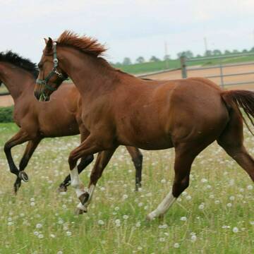
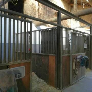
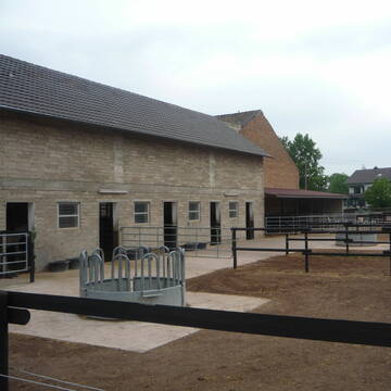
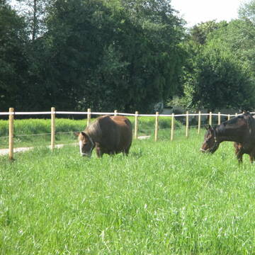
Reitstall Schlaeger - Tomberger Mühle
Euskirchen
Reitstall-Schlaeger
@Reitstall-Schlaeger
FN-Mitglied
Freizeitstall
Vermieten
Führanlage
Hunde willkommen
Außenboxen
Innenbox
20 weitere...
S


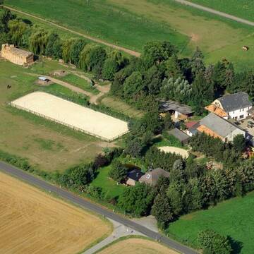
Union-Gestüt, Artgerechte Pferdehaltung im Siegt...
Eitorf
Union Gestüt
@Union-Gestuet
Freizeitstall
Vermieten
Führanlage
Hunde willkommen
Gnadenbrothof
Notfallboxen
23 weitere...
S
Deprecated: Creation of dynamic property Zend_View_Helper_Ads::$adLink is deprecated in /var/www/stall-frei/htdocs/staging.stall-frei.de/library/Psf/View/Helper/Ads.php on line 108

Futtersack HeuToy, Fressbremse in pink
Mechtersen
STALL-FREIde Marketing
@STALL-FREI-Marketing
Stundenlange Beschäftigung die
Koliken vorbeugt, geringe Staubinhalation mit
steuerbarer Futterentnahme

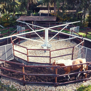
Brünkerhof Pensionsstall/ Landwirtschaftsbetrieb
Bornheim Waldorf
Landgut Brünkerhof
@Bruenkerhof
Freizeitstall
Geländestrecke
Vermieten
Verpachten
Hunde willkommen
Krankenbox
Gnadenbrothof
Hufrehe geeignet
13 weitere...
P
Leider kein Vorschaubild
Leider kein Vorschaubild
Offenstallplatz für Isländer o.ä.
Troisdorf
Glaesa
@Glaesa
Freizeitstall
Geländestrecke
Vermieten
Hunde willkommen
Longierzirkel/Roundpen
Allergikerstall
bedampftes/gewaschenes Heu
8 weitere...
B
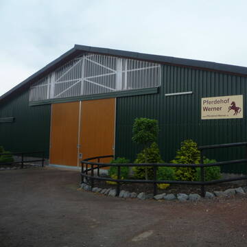
Pferdehof WERNER
Rheinbach-Flerzheim
Hubert-Werner
@Hubert-Werner
Freizeitstall
Longierzirkel/Roundpen
Paddock
Notfallboxen
Außenbox mit Paddock
Laufstall
7 weitere...
P+

Mitarbeiter gesucht?
Mechtersen
STALL-FREIde Marketing
@STALL-FREI-Marketing
Stellenangebote kostenlos veröffentlichen!


Historische Reitanlage in Köln-Dellbrück
Köln
RGS Kornspringer Köln e. V.
@Kornspringer
FN-Mitglied
Freizeitstall
Vermieten
Führanlage
Hunde willkommen
bedampftes/gewaschenes Heu
Notfallboxen
21 weitere...
S
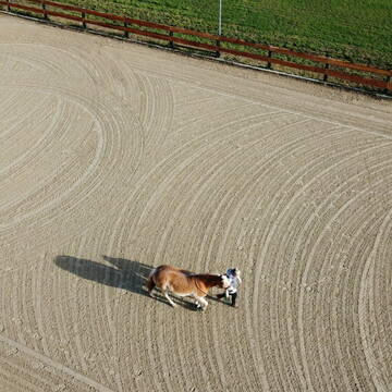
Reitanlage Gut Heiderhof
Königswinter
Hella-Toellner
@Hella-Toellner
FN-Mitglied
Pferdeausbildung
Führanlage
Longierzirkel/Roundpen
Außenboxen
Innenbox
8 weitere...
P

Pferdepension Bahners
Rheinbach- Ramershoven
Andreas-Bahners
@Andreas-Bahners
Freizeitstall
Krankenbox
Longierzirkel/Roundpen
Allergikerstall
Fohlenaufzucht möglich
Laufstall
Offenstall
13 weitere...
P+
Leider kein Vorschaubild
Leider kein Vorschaubild
Offenstallplatz Weideplatz Aufzuchtplatz
Alfter
SAKO
@SAko
Freizeitstall
Vermieten
Krankenbox
Longierzirkel/Roundpen
Notfallboxen
9 weitere...
B
Werde Teil von STALL-FREI.de
Du hast eine Pferdebox frei? Freie Plätze im Offenstall, Pferdestall oder der Reitanlage kostenlos anbieten.
Deprecated: Creation of dynamic property Zend_View::$pageCount is deprecated in /var/www/stall-frei/htdocs/staging.stall-frei.de/library/vendor/shardj/zf1-future/library/Zend/View/Abstract.php on line 308
Deprecated: Creation of dynamic property Zend_View::$itemCountPerPage is deprecated in /var/www/stall-frei/htdocs/staging.stall-frei.de/library/vendor/shardj/zf1-future/library/Zend/View/Abstract.php on line 308
Deprecated: Creation of dynamic property Zend_View::$first is deprecated in /var/www/stall-frei/htdocs/staging.stall-frei.de/library/vendor/shardj/zf1-future/library/Zend/View/Abstract.php on line 308
Deprecated: Creation of dynamic property Zend_View::$current is deprecated in /var/www/stall-frei/htdocs/staging.stall-frei.de/library/vendor/shardj/zf1-future/library/Zend/View/Abstract.php on line 308
Deprecated: Creation of dynamic property Zend_View::$last is deprecated in /var/www/stall-frei/htdocs/staging.stall-frei.de/library/vendor/shardj/zf1-future/library/Zend/View/Abstract.php on line 308
Deprecated: Creation of dynamic property Zend_View::$previous is deprecated in /var/www/stall-frei/htdocs/staging.stall-frei.de/library/vendor/shardj/zf1-future/library/Zend/View/Abstract.php on line 308
Deprecated: Creation of dynamic property Zend_View::$next is deprecated in /var/www/stall-frei/htdocs/staging.stall-frei.de/library/vendor/shardj/zf1-future/library/Zend/View/Abstract.php on line 308
Deprecated: Creation of dynamic property Zend_View::$pagesInRange is deprecated in /var/www/stall-frei/htdocs/staging.stall-frei.de/library/vendor/shardj/zf1-future/library/Zend/View/Abstract.php on line 308
Deprecated: Creation of dynamic property Zend_View::$firstPageInRange is deprecated in /var/www/stall-frei/htdocs/staging.stall-frei.de/library/vendor/shardj/zf1-future/library/Zend/View/Abstract.php on line 308
Deprecated: Creation of dynamic property Zend_View::$lastPageInRange is deprecated in /var/www/stall-frei/htdocs/staging.stall-frei.de/library/vendor/shardj/zf1-future/library/Zend/View/Abstract.php on line 308
Deprecated: Creation of dynamic property Zend_View::$currentItemCount is deprecated in /var/www/stall-frei/htdocs/staging.stall-frei.de/library/vendor/shardj/zf1-future/library/Zend/View/Abstract.php on line 308
Deprecated: Creation of dynamic property Zend_View::$totalItemCount is deprecated in /var/www/stall-frei/htdocs/staging.stall-frei.de/library/vendor/shardj/zf1-future/library/Zend/View/Abstract.php on line 308
Deprecated: Creation of dynamic property Zend_View::$firstItemNumber is deprecated in /var/www/stall-frei/htdocs/staging.stall-frei.de/library/vendor/shardj/zf1-future/library/Zend/View/Abstract.php on line 308
Deprecated: Creation of dynamic property Zend_View::$lastItemNumber is deprecated in /var/www/stall-frei/htdocs/staging.stall-frei.de/library/vendor/shardj/zf1-future/library/Zend/View/Abstract.php on line 308
Deprecated: Creation of dynamic property Zend_View::$router is deprecated in /var/www/stall-frei/htdocs/staging.stall-frei.de/library/vendor/shardj/zf1-future/library/Zend/View/Abstract.php on line 308
Deprecated: Creation of dynamic property Zend_View::$urlParams is deprecated in /var/www/stall-frei/htdocs/staging.stall-frei.de/library/vendor/shardj/zf1-future/library/Zend/View/Abstract.php on line 308
Deprecated: Creation of dynamic property Zend_View::$showAds is deprecated in /var/www/stall-frei/htdocs/staging.stall-frei.de/library/vendor/shardj/zf1-future/library/Zend/View/Abstract.php on line 308
Deprecated: Creation of dynamic property Zend_View::$objectIds is deprecated in /var/www/stall-frei/htdocs/staging.stall-frei.de/library/vendor/shardj/zf1-future/library/Zend/View/Abstract.php on line 308
Deprecated: Creation of dynamic property Zend_View::$showNavbar is deprecated in /var/www/stall-frei/htdocs/staging.stall-frei.de/library/vendor/shardj/zf1-future/library/Zend/View/Abstract.php on line 308
Deprecated: Creation of dynamic property Zend_View::$showBreadcrumb is deprecated in /var/www/stall-frei/htdocs/staging.stall-frei.de/library/vendor/shardj/zf1-future/library/Zend/View/Abstract.php on line 308
Deprecated: Creation of dynamic property Zend_View::$showFooter is deprecated in /var/www/stall-frei/htdocs/staging.stall-frei.de/library/vendor/shardj/zf1-future/library/Zend/View/Abstract.php on line 308
Deprecated: Creation of dynamic property Zend_View::$showInternalAds is deprecated in /var/www/stall-frei/htdocs/staging.stall-frei.de/library/vendor/shardj/zf1-future/library/Zend/View/Abstract.php on line 308
Deprecated: Creation of dynamic property Zend_View::$blNoContent is deprecated in /var/www/stall-frei/htdocs/staging.stall-frei.de/library/vendor/shardj/zf1-future/library/Zend/View/Abstract.php on line 308
Deprecated: Creation of dynamic property Zend_View::$sMetaDesc is deprecated in /var/www/stall-frei/htdocs/staging.stall-frei.de/library/vendor/shardj/zf1-future/library/Zend/View/Abstract.php on line 308
Deprecated: Creation of dynamic property Zend_View::$useGmaps is deprecated in /var/www/stall-frei/htdocs/staging.stall-frei.de/library/vendor/shardj/zf1-future/library/Zend/View/Abstract.php on line 308
Deprecated: Creation of dynamic property Zend_View::$touches is deprecated in /var/www/stall-frei/htdocs/staging.stall-frei.de/library/vendor/shardj/zf1-future/library/Zend/View/Abstract.php on line 308
Deprecated: Creation of dynamic property Zend_View::$oProject is deprecated in /var/www/stall-frei/htdocs/staging.stall-frei.de/library/vendor/shardj/zf1-future/library/Zend/View/Abstract.php on line 308
Deprecated: Creation of dynamic property Zend_View::$pageHeadline is deprecated in /var/www/stall-frei/htdocs/staging.stall-frei.de/library/vendor/shardj/zf1-future/library/Zend/View/Abstract.php on line 308
Deprecated: Creation of dynamic property Zend_View::$disableLocationField is deprecated in /var/www/stall-frei/htdocs/staging.stall-frei.de/library/vendor/shardj/zf1-future/library/Zend/View/Abstract.php on line 308
Deprecated: Creation of dynamic property Zend_View::$isSearch is deprecated in /var/www/stall-frei/htdocs/staging.stall-frei.de/library/vendor/shardj/zf1-future/library/Zend/View/Abstract.php on line 308
Deprecated: Creation of dynamic property Zend_View::$pageTitle is deprecated in /var/www/stall-frei/htdocs/staging.stall-frei.de/library/vendor/shardj/zf1-future/library/Zend/View/Abstract.php on line 308
Deprecated: Creation of dynamic property Psf_Form_Element_Text::$class is deprecated in /var/www/stall-frei/htdocs/staging.stall-frei.de/library/vendor/shardj/zf1-future/library/Zend/Form/Element.php on line 874
Deprecated: Creation of dynamic property Psf_Form_Element_Text::$size is deprecated in /var/www/stall-frei/htdocs/staging.stall-frei.de/library/vendor/shardj/zf1-future/library/Zend/Form/Element.php on line 874
Deprecated: Creation of dynamic property Psf_Form_Element_Text::$placeholder is deprecated in /var/www/stall-frei/htdocs/staging.stall-frei.de/library/vendor/shardj/zf1-future/library/Zend/Form/Element.php on line 874
Deprecated: Creation of dynamic property Psf_Form_Element_Hidden::$class is deprecated in /var/www/stall-frei/htdocs/staging.stall-frei.de/library/vendor/shardj/zf1-future/library/Zend/Form/Element.php on line 874
Deprecated: Creation of dynamic property Psf_Form_Element_Hidden::$class is deprecated in /var/www/stall-frei/htdocs/staging.stall-frei.de/library/vendor/shardj/zf1-future/library/Zend/Form/Element.php on line 874
Deprecated: Creation of dynamic property Psf_Form_Element_Hidden::$class is deprecated in /var/www/stall-frei/htdocs/staging.stall-frei.de/library/vendor/shardj/zf1-future/library/Zend/Form/Element.php on line 874
Deprecated: Creation of dynamic property Psf_Form_Element_Hidden::$class is deprecated in /var/www/stall-frei/htdocs/staging.stall-frei.de/library/vendor/shardj/zf1-future/library/Zend/Form/Element.php on line 874
Deprecated: Creation of dynamic property Psf_Form_Element_Select::$class is deprecated in /var/www/stall-frei/htdocs/staging.stall-frei.de/library/vendor/shardj/zf1-future/library/Zend/Form/Element.php on line 874
Deprecated: Creation of dynamic property Psf_Form_Element_Select::$class is deprecated in /var/www/stall-frei/htdocs/staging.stall-frei.de/library/vendor/shardj/zf1-future/library/Zend/Form/Element.php on line 874
Deprecated: Creation of dynamic property Psf_Form_Element_Select::$class is deprecated in /var/www/stall-frei/htdocs/staging.stall-frei.de/library/vendor/shardj/zf1-future/library/Zend/Form/Element.php on line 874
Deprecated: Creation of dynamic property Psf_Form_Element_Select::$class is deprecated in /var/www/stall-frei/htdocs/staging.stall-frei.de/library/vendor/shardj/zf1-future/library/Zend/Form/Element.php on line 874
Deprecated: Creation of dynamic property Psf_Form_Element_Text::$class is deprecated in /var/www/stall-frei/htdocs/staging.stall-frei.de/library/vendor/shardj/zf1-future/library/Zend/Form/Element.php on line 874
Deprecated: Creation of dynamic property Psf_Form_Element_Checkbox::$label is deprecated in /var/www/stall-frei/htdocs/staging.stall-frei.de/library/vendor/shardj/zf1-future/library/Zend/Form/Element.php on line 874
Deprecated: Creation of dynamic property Zend_View::$sort is deprecated in /var/www/stall-frei/htdocs/staging.stall-frei.de/library/vendor/shardj/zf1-future/library/Zend/View/Abstract.php on line 308
Deprecated: Creation of dynamic property Zend_View::$searchLocation is deprecated in /var/www/stall-frei/htdocs/staging.stall-frei.de/library/vendor/shardj/zf1-future/library/Zend/View/Abstract.php on line 308
Deprecated: Creation of dynamic property Zend_View::$locationHint is deprecated in /var/www/stall-frei/htdocs/staging.stall-frei.de/library/vendor/shardj/zf1-future/library/Zend/View/Abstract.php on line 308
Psf_GeoCoder_Abstract::getLocation: Auerberg Get Location CachedOrLive
Psf_GeoCoder_Abstract::getCachedOrLive: Auerberg
Psf_GeoCoder_Abstract::convertLocationResult
{"documentation":"https:\/\/opencagedata.com\/api","licenses":[{"name":"see attribution guide","url":"https:\/\/opencagedata.com\/credits"}],"results":[{"bounds":{"northeast":{"lat":50.7671293,"lng":7.0860469},"southwest":{"lat":50.7462297,"lng":7.056228}},"components":{"ISO_3166-1_alpha-2":"DE","ISO_3166-1_alpha-3":"DEU","ISO_3166-2":["DE-NW"],"_category":"place","_normalized_city":"Bonn","_type":"neighbourhood","city":"Bonn","city_district":"Stadtbezirk Bonn","continent":"Europe","country":"Deutschland","country_code":"de","political_union":"European Union","postcode":"53117","quarter":"Auerberg","state":"Nordrhein-Westfalen","state_code":"NW"},"confidence":7,"formatted":"53117 Bonn, Deutschland","geometry":{"lat":50.7561009,"lng":7.0731086}},{"bounds":{"northeast":{"lat":47.7353459,"lng":10.7357934},"southwest":{"lat":47.7352459,"lng":10.7356934}},"components":{"ISO_3166-1_alpha-2":"DE","ISO_3166-1_alpha-3":"DEU","ISO_3166-2":["DE-BY"],"_category":"natural\/water","_normalized_city":"Bernbeuren","_type":"peak","continent":"Europe","country":"Deutschland","country_code":"de","county":"Landkreis Weilheim-Schongau","municipality":"Bernbeuren (VGem)","peak":"Auerberg","political_union":"European Union","postcode":"87675","state":"Bayern","state_code":"BY","village":"Bernbeuren"},"confidence":9,"formatted":"Auerberg, 87675 Bernbeuren, Deutschland","geometry":{"lat":47.7352959,"lng":10.7357434}},{"bounds":{"northeast":{"lat":49.7758703,"lng":12.2296964},"southwest":{"lat":49.7757703,"lng":12.2295964}},"components":{"ISO_3166-1_alpha-2":"DE","ISO_3166-1_alpha-3":"DEU","ISO_3166-2":["DE-BY"],"_category":"building","_normalized_city":"P\u00fcchersreuth","_type":"building","continent":"Europe","country":"Deutschland","country_code":"de","county":"Landkreis Neustadt an der Waldnaab","isolated_dwelling":"Auerberg","municipality":"Neustadt an der Waldnaab (VGem)","political_union":"European Union","postcode":"95703","state":"Bayern","state_code":"BY","village":"P\u00fcchersreuth"},"confidence":10,"formatted":"Auerberg, 95703 P\u00fcchersreuth, Deutschland","geometry":{"lat":49.7758203,"lng":12.2296464}},{"bounds":{"northeast":{"lat":49.7196246,"lng":11.2959586},"southwest":{"lat":49.7195246,"lng":11.2958586}},"components":{"ISO_3166-1_alpha-2":"DE","ISO_3166-1_alpha-3":"DEU","ISO_3166-2":["DE-BY"],"_category":"natural\/water","_normalized_city":"Egloffstein","_type":"peak","continent":"Europe","country":"Deutschland","country_code":"de","county":"Landkreis Forchheim","peak":"Auerberg","political_union":"European Union","postcode":"91349","state":"Bayern","state_code":"BY","village":"Egloffstein"},"confidence":9,"formatted":"Auerberg, 91349 Egloffstein, Deutschland","geometry":{"lat":49.7195746,"lng":11.2959086}},{"bounds":{"northeast":{"lat":50.7158124,"lng":9.3741907},"southwest":{"lat":50.7157124,"lng":9.3740907}},"components":{"ISO_3166-1_alpha-2":"DE","ISO_3166-1_alpha-3":"DEU","ISO_3166-2":["DE-HE"],"_category":"natural\/water","_normalized_city":"Schwarz","_type":"peak","continent":"Europe","country":"Deutschland","country_code":"de","county":"Vogelsbergkreis","municipality":"Grebenau","peak":"Auerberg","political_union":"European Union","state":"Hessen","state_code":"HE","village":"Schwarz"},"confidence":9,"formatted":"Auerberg, Schwarz, Hessen, Deutschland","geometry":{"lat":50.7157624,"lng":9.3741407}},{"bounds":{"northeast":{"lat":47.6370087,"lng":11.9463488},"southwest":{"lat":47.6369087,"lng":11.9462488}},"components":{"ISO_3166-1_alpha-2":"DE","ISO_3166-1_alpha-3":"DEU","ISO_3166-2":["DE-BY"],"_category":"natural\/water","_normalized_city":"Bayrischzell","_type":"peak","continent":"Europe","country":"Deutschland","country_code":"de","county":"Landkreis Miesbach","peak":"Auerberg","political_union":"European Union","state":"Bayern","state_code":"BY","village":"Bayrischzell"},"confidence":9,"formatted":"Auerberg, Bayrischzell, Bayern, Deutschland","geometry":{"lat":47.6369587,"lng":11.9462988}},{"bounds":{"northeast":{"lat":50.4642824,"lng":9.1020226},"southwest":{"lat":50.4641824,"lng":9.1019226}},"components":{"ISO_3166-1_alpha-2":"DE","ISO_3166-1_alpha-3":"DEU","ISO_3166-2":["DE-HE"],"_category":"natural\/water","_normalized_city":"Rainrod","_type":"peak","continent":"Europe","country":"Deutschland","country_code":"de","county":"Vogelsbergkreis","municipality":"Schotten","peak":"Auerberg","political_union":"European Union","postcode":"63679","state":"Hessen","state_code":"HE","village":"Rainrod"},"confidence":9,"formatted":"Auerberg, 63679 Rainrod, Deutschland","geometry":{"lat":50.4642324,"lng":9.1019726}},{"bounds":{"northeast":{"lat":47.580818,"lng":11.1539054},"southwest":{"lat":47.580718,"lng":11.1538054}},"components":{"ISO_3166-1_alpha-2":"DE","ISO_3166-1_alpha-3":"DEU","ISO_3166-2":["DE-BY"],"_category":"natural\/water","_normalized_city":"Eschenlohe","_type":"peak","continent":"Europe","country":"Deutschland","country_code":"de","county":"Landkreis Garmisch-Partenkirchen","municipality":"Ohlstadt (VGem)","peak":"Auerberg","political_union":"European Union","postcode":"82496","state":"Bayern","state_code":"BY","village":"Eschenlohe"},"confidence":9,"formatted":"Auerberg, 82496 Eschenlohe, Deutschland","geometry":{"lat":47.580768,"lng":11.1538554}},{"bounds":{"northeast":{"lat":49.7088656,"lng":8.6317789},"southwest":{"lat":49.7087656,"lng":8.6316789}},"components":{"ISO_3166-1_alpha-2":"DE","ISO_3166-1_alpha-3":"DEU","ISO_3166-2":["DE-HE"],"_category":"natural\/water","_normalized_city":"Auerbach","_type":"hill","continent":"Europe","country":"Deutschland","country_code":"de","county":"Kreis Bergstra\u00dfe","hill":"Auerberg","municipality":"Bensheim","political_union":"European Union","postcode":"64625","state":"Hessen","state_code":"HE","village":"Auerbach"},"confidence":9,"formatted":"Auerberg, 64625 Auerbach, Deutschland","geometry":{"lat":49.7088156,"lng":8.6317289}},{"bounds":{"northeast":{"lat":47.7360056,"lng":10.7371391},"southwest":{"lat":47.7349402,"lng":10.7353959}},"components":{"ISO_3166-1_alpha-2":"DE","ISO_3166-1_alpha-3":"DEU","ISO_3166-2":["DE-BY"],"_category":"place","_normalized_city":"Bernbeuren","_type":"hamlet","continent":"Europe","country":"Deutschland","country_code":"de","county":"Landkreis Weilheim-Schongau","hamlet":"Auerberg","municipality":"Bernbeuren (VGem)","political_union":"European Union","state":"Bayern","state_code":"BY","village":"Bernbeuren"},"confidence":9,"formatted":"Auerberg, Bernbeuren, Bayern, Deutschland","geometry":{"lat":47.7354795,"lng":10.7365073}}],"status":{"code":200,"message":"OK"},"stay_informed":{"blog":"https:\/\/blog.opencagedata.com","mastodon":"https:\/\/en.osm.town\/@opencage"},"thanks":"For using an OpenCage API","timestamp":{"created_http":"Sun, 08 Feb 2026 21:22:06 GMT","created_unix":1770585726},"total_results":10}Array
(
[0] => stdClass Object
(
[bounds] => stdClass Object
(
[northeast] => stdClass Object
(
[lat] => 50.7671293
[lng] => 7.0860469
)
[southwest] => stdClass Object
(
[lat] => 50.7462297
[lng] => 7.056228
)
)
[components] => stdClass Object
(
[ISO_3166-1_alpha-2] => DE
[ISO_3166-1_alpha-3] => DEU
[ISO_3166-2] => Array
(
[0] => DE-NW
)
[_category] => place
[_normalized_city] => Bonn
[_type] => neighbourhood
[city] => Bonn
[city_district] => Stadtbezirk Bonn
[continent] => Europe
[country] => Deutschland
[country_code] => de
[political_union] => European Union
[postcode] => 53117
[quarter] => Auerberg
[state] => Nordrhein-Westfalen
[state_code] => NW
)
[confidence] => 7
[formatted] => 53117 Bonn, Deutschland
[geometry] => stdClass Object
(
[lat] => 50.7561009
[lng] => 7.0731086
)
)
[1] => stdClass Object
(
[bounds] => stdClass Object
(
[northeast] => stdClass Object
(
[lat] => 47.7353459
[lng] => 10.7357934
)
[southwest] => stdClass Object
(
[lat] => 47.7352459
[lng] => 10.7356934
)
)
[components] => stdClass Object
(
[ISO_3166-1_alpha-2] => DE
[ISO_3166-1_alpha-3] => DEU
[ISO_3166-2] => Array
(
[0] => DE-BY
)
[_category] => natural/water
[_normalized_city] => Bernbeuren
[_type] => peak
[continent] => Europe
[country] => Deutschland
[country_code] => de
[county] => Landkreis Weilheim-Schongau
[municipality] => Bernbeuren (VGem)
[peak] => Auerberg
[political_union] => European Union
[postcode] => 87675
[state] => Bayern
[state_code] => BY
[village] => Bernbeuren
)
[confidence] => 9
[formatted] => Auerberg, 87675 Bernbeuren, Deutschland
[geometry] => stdClass Object
(
[lat] => 47.7352959
[lng] => 10.7357434
)
)
[2] => stdClass Object
(
[bounds] => stdClass Object
(
[northeast] => stdClass Object
(
[lat] => 49.7758703
[lng] => 12.2296964
)
[southwest] => stdClass Object
(
[lat] => 49.7757703
[lng] => 12.2295964
)
)
[components] => stdClass Object
(
[ISO_3166-1_alpha-2] => DE
[ISO_3166-1_alpha-3] => DEU
[ISO_3166-2] => Array
(
[0] => DE-BY
)
[_category] => building
[_normalized_city] => Püchersreuth
[_type] => building
[continent] => Europe
[country] => Deutschland
[country_code] => de
[county] => Landkreis Neustadt an der Waldnaab
[isolated_dwelling] => Auerberg
[municipality] => Neustadt an der Waldnaab (VGem)
[political_union] => European Union
[postcode] => 95703
[state] => Bayern
[state_code] => BY
[village] => Püchersreuth
)
[confidence] => 10
[formatted] => Auerberg, 95703 Püchersreuth, Deutschland
[geometry] => stdClass Object
(
[lat] => 49.7758203
[lng] => 12.2296464
)
)
[3] => stdClass Object
(
[bounds] => stdClass Object
(
[northeast] => stdClass Object
(
[lat] => 49.7196246
[lng] => 11.2959586
)
[southwest] => stdClass Object
(
[lat] => 49.7195246
[lng] => 11.2958586
)
)
[components] => stdClass Object
(
[ISO_3166-1_alpha-2] => DE
[ISO_3166-1_alpha-3] => DEU
[ISO_3166-2] => Array
(
[0] => DE-BY
)
[_category] => natural/water
[_normalized_city] => Egloffstein
[_type] => peak
[continent] => Europe
[country] => Deutschland
[country_code] => de
[county] => Landkreis Forchheim
[peak] => Auerberg
[political_union] => European Union
[postcode] => 91349
[state] => Bayern
[state_code] => BY
[village] => Egloffstein
)
[confidence] => 9
[formatted] => Auerberg, 91349 Egloffstein, Deutschland
[geometry] => stdClass Object
(
[lat] => 49.7195746
[lng] => 11.2959086
)
)
[4] => stdClass Object
(
[bounds] => stdClass Object
(
[northeast] => stdClass Object
(
[lat] => 50.7158124
[lng] => 9.3741907
)
[southwest] => stdClass Object
(
[lat] => 50.7157124
[lng] => 9.3740907
)
)
[components] => stdClass Object
(
[ISO_3166-1_alpha-2] => DE
[ISO_3166-1_alpha-3] => DEU
[ISO_3166-2] => Array
(
[0] => DE-HE
)
[_category] => natural/water
[_normalized_city] => Schwarz
[_type] => peak
[continent] => Europe
[country] => Deutschland
[country_code] => de
[county] => Vogelsbergkreis
[municipality] => Grebenau
[peak] => Auerberg
[political_union] => European Union
[state] => Hessen
[state_code] => HE
[village] => Schwarz
)
[confidence] => 9
[formatted] => Auerberg, Schwarz, Hessen, Deutschland
[geometry] => stdClass Object
(
[lat] => 50.7157624
[lng] => 9.3741407
)
)
[5] => stdClass Object
(
[bounds] => stdClass Object
(
[northeast] => stdClass Object
(
[lat] => 47.6370087
[lng] => 11.9463488
)
[southwest] => stdClass Object
(
[lat] => 47.6369087
[lng] => 11.9462488
)
)
[components] => stdClass Object
(
[ISO_3166-1_alpha-2] => DE
[ISO_3166-1_alpha-3] => DEU
[ISO_3166-2] => Array
(
[0] => DE-BY
)
[_category] => natural/water
[_normalized_city] => Bayrischzell
[_type] => peak
[continent] => Europe
[country] => Deutschland
[country_code] => de
[county] => Landkreis Miesbach
[peak] => Auerberg
[political_union] => European Union
[state] => Bayern
[state_code] => BY
[village] => Bayrischzell
)
[confidence] => 9
[formatted] => Auerberg, Bayrischzell, Bayern, Deutschland
[geometry] => stdClass Object
(
[lat] => 47.6369587
[lng] => 11.9462988
)
)
[6] => stdClass Object
(
[bounds] => stdClass Object
(
[northeast] => stdClass Object
(
[lat] => 50.4642824
[lng] => 9.1020226
)
[southwest] => stdClass Object
(
[lat] => 50.4641824
[lng] => 9.1019226
)
)
[components] => stdClass Object
(
[ISO_3166-1_alpha-2] => DE
[ISO_3166-1_alpha-3] => DEU
[ISO_3166-2] => Array
(
[0] => DE-HE
)
[_category] => natural/water
[_normalized_city] => Rainrod
[_type] => peak
[continent] => Europe
[country] => Deutschland
[country_code] => de
[county] => Vogelsbergkreis
[municipality] => Schotten
[peak] => Auerberg
[political_union] => European Union
[postcode] => 63679
[state] => Hessen
[state_code] => HE
[village] => Rainrod
)
[confidence] => 9
[formatted] => Auerberg, 63679 Rainrod, Deutschland
[geometry] => stdClass Object
(
[lat] => 50.4642324
[lng] => 9.1019726
)
)
[7] => stdClass Object
(
[bounds] => stdClass Object
(
[northeast] => stdClass Object
(
[lat] => 47.580818
[lng] => 11.1539054
)
[southwest] => stdClass Object
(
[lat] => 47.580718
[lng] => 11.1538054
)
)
[components] => stdClass Object
(
[ISO_3166-1_alpha-2] => DE
[ISO_3166-1_alpha-3] => DEU
[ISO_3166-2] => Array
(
[0] => DE-BY
)
[_category] => natural/water
[_normalized_city] => Eschenlohe
[_type] => peak
[continent] => Europe
[country] => Deutschland
[country_code] => de
[county] => Landkreis Garmisch-Partenkirchen
[municipality] => Ohlstadt (VGem)
[peak] => Auerberg
[political_union] => European Union
[postcode] => 82496
[state] => Bayern
[state_code] => BY
[village] => Eschenlohe
)
[confidence] => 9
[formatted] => Auerberg, 82496 Eschenlohe, Deutschland
[geometry] => stdClass Object
(
[lat] => 47.580768
[lng] => 11.1538554
)
)
[8] => stdClass Object
(
[bounds] => stdClass Object
(
[northeast] => stdClass Object
(
[lat] => 49.7088656
[lng] => 8.6317789
)
[southwest] => stdClass Object
(
[lat] => 49.7087656
[lng] => 8.6316789
)
)
[components] => stdClass Object
(
[ISO_3166-1_alpha-2] => DE
[ISO_3166-1_alpha-3] => DEU
[ISO_3166-2] => Array
(
[0] => DE-HE
)
[_category] => natural/water
[_normalized_city] => Auerbach
[_type] => hill
[continent] => Europe
[country] => Deutschland
[country_code] => de
[county] => Kreis Bergstraße
[hill] => Auerberg
[municipality] => Bensheim
[political_union] => European Union
[postcode] => 64625
[state] => Hessen
[state_code] => HE
[village] => Auerbach
)
[confidence] => 9
[formatted] => Auerberg, 64625 Auerbach, Deutschland
[geometry] => stdClass Object
(
[lat] => 49.7088156
[lng] => 8.6317289
)
)
[9] => stdClass Object
(
[bounds] => stdClass Object
(
[northeast] => stdClass Object
(
[lat] => 47.7360056
[lng] => 10.7371391
)
[southwest] => stdClass Object
(
[lat] => 47.7349402
[lng] => 10.7353959
)
)
[components] => stdClass Object
(
[ISO_3166-1_alpha-2] => DE
[ISO_3166-1_alpha-3] => DEU
[ISO_3166-2] => Array
(
[0] => DE-BY
)
[_category] => place
[_normalized_city] => Bernbeuren
[_type] => hamlet
[continent] => Europe
[country] => Deutschland
[country_code] => de
[county] => Landkreis Weilheim-Schongau
[hamlet] => Auerberg
[municipality] => Bernbeuren (VGem)
[political_union] => European Union
[state] => Bayern
[state_code] => BY
[village] => Bernbeuren
)
[confidence] => 9
[formatted] => Auerberg, Bernbeuren, Bayern, Deutschland
[geometry] => stdClass Object
(
[lat] => 47.7354795
[lng] => 10.7365073
)
)
)
Psf_GeoCoder_OpenCageData::getKeyMap: 0
stdClass Object
(
    [bounds] => stdClass Object
        (
            [northeast] => stdClass Object
                (
                    [lat] => 50.7671293
                    [lng] => 7.0860469
                )

            [southwest] => stdClass Object
                (
                    [lat] => 50.7462297
                    [lng] => 7.056228
                )

        )

    [components] => stdClass Object
        (
            [ISO_3166-1_alpha-2] => DE
            [ISO_3166-1_alpha-3] => DEU
            [ISO_3166-2] => Array
                (
                    [0] => DE-NW
                )

            [_category] => place
            [_normalized_city] => Bonn
            [_type] => neighbourhood
            [city] => Bonn
            [city_district] => Stadtbezirk Bonn
            [continent] => Europe
            [country] => Deutschland
            [country_code] => de
            [political_union] => European Union
            [postcode] => 53117
            [quarter] => Auerberg
            [state] => Nordrhein-Westfalen
            [state_code] => NW
        )

    [confidence] => 7
    [formatted] => 53117 Bonn, Deutschland
    [geometry] => stdClass Object
        (
            [lat] => 50.7561009
            [lng] => 7.0731086
        )

)
Psf_GeoCoder_OpenCageData::getCounty: Bonn
Psf_GeoCoder_OpenCageData::addMissingData REFETCH!
Array
(
    [address] => 53117 Bonn, Deutschland
    [type] => neighbourhood
    [street] =>
    [city] => Bonn
    [county] => Bonn
    [state] => Nordrhein-Westfalen
    [zip] => 53117
    [country] => Deutschland
    [suburb] =>
    [countrycode] => de
    [latitude] => 50.7561009
    [longitude] => 7.0731086
    [accuracy] => 1
    [confidence] => 7
    [bounds] => stdClass Object
        (
            [northeast] => stdClass Object
                (
                    [lat] => 50.7671293
                    [lng] => 7.0860469
                )

            [southwest] => stdClass Object
                (
                    [lat] => 50.7462297
                    [lng] => 7.056228
                )

        )

)
reformat!
Array
(
    [address] => 53117 Bonn, Deutschland
    [type] => neighbourhood
    [street] =>
    [city] => Bonn
    [county] => Bonn
    [state] => Nordrhein-Westfalen
    [zip] => 53117
    [country] => Deutschland
    [suburb] =>
    [countrycode] => de
    [latitude] => 50.7561009
    [longitude] => 7.0731086
    [accuracy] => 1
    [confidence] => 7
    [bounds] => stdClass Object
        (
            [northeast] => stdClass Object
                (
                    [lat] => 50.7671293
                    [lng] => 7.0860469
                )

            [southwest] => stdClass Object
                (
                    [lat] => 50.7462297
                    [lng] => 7.056228
                )

        )

    [place] => 53117 Bonn, Nordrhein-Westfalen
    [hash] => c18829e864a61530c5c174b8d0ad1710
)
Psf_GeoCoder_OpenCageData::getKeyMap: 1
stdClass Object
(
    [bounds] => stdClass Object
        (
            [northeast] => stdClass Object
                (
                    [lat] => 47.7353459
                    [lng] => 10.7357934
                )

            [southwest] => stdClass Object
                (
                    [lat] => 47.7352459
                    [lng] => 10.7356934
                )

        )

    [components] => stdClass Object
        (
            [ISO_3166-1_alpha-2] => DE
            [ISO_3166-1_alpha-3] => DEU
            [ISO_3166-2] => Array
                (
                    [0] => DE-BY
                )

            [_category] => natural/water
            [_normalized_city] => Bernbeuren
            [_type] => peak
            [continent] => Europe
            [country] => Deutschland
            [country_code] => de
            [county] => Landkreis Weilheim-Schongau
            [municipality] => Bernbeuren (VGem)
            [peak] => Auerberg
            [political_union] => European Union
            [postcode] => 87675
            [state] => Bayern
            [state_code] => BY
            [village] => Bernbeuren
        )

    [confidence] => 9
    [formatted] => Auerberg, 87675 Bernbeuren, Deutschland
    [geometry] => stdClass Object
        (
            [lat] => 47.7352959
            [lng] => 10.7357434
        )

)
Psf_GeoCoder_OpenCageData::getCounty: Weilheim-Schongau
Psf_GeoCoder_OpenCageData::addMissingData REFETCH!
Array
(
    [address] => Auerberg, 87675 Bernbeuren, Deutschland
    [type] => peak
    [street] =>
    [city] => Bernbeuren
    [county] => Weilheim-Schongau
    [state] => Bayern
    [zip] => 87675
    [country] => Deutschland
    [suburb] =>
    [countrycode] => de
    [latitude] => 47.7352959
    [longitude] => 10.7357434
    [accuracy] => 1
    [confidence] => 9
    [bounds] => stdClass Object
        (
            [northeast] => stdClass Object
                (
                    [lat] => 47.7353459
                    [lng] => 10.7357934
                )

            [southwest] => stdClass Object
                (
                    [lat] => 47.7352459
                    [lng] => 10.7356934
                )

        )

)
reformat!
Array
(
    [address] => Auerberg, 87675 Bernbeuren, Deutschland
    [type] => peak
    [street] =>
    [city] => Bernbeuren
    [county] => Weilheim-Schongau
    [state] => Bayern
    [zip] => 87675
    [country] => Deutschland
    [suburb] =>
    [countrycode] => de
    [latitude] => 47.7352959
    [longitude] => 10.7357434
    [accuracy] => 1
    [confidence] => 9
    [bounds] => stdClass Object
        (
            [northeast] => stdClass Object
                (
                    [lat] => 47.7353459
                    [lng] => 10.7357934
                )

            [southwest] => stdClass Object
                (
                    [lat] => 47.7352459
                    [lng] => 10.7356934
                )

        )

    [place] => 87675 Bernbeuren, Bayern
    [hash] => e5bf12c01375a7fc56f8eba968386277
)
Psf_GeoCoder_OpenCageData::getKeyMap: 2
stdClass Object
(
    [bounds] => stdClass Object
        (
            [northeast] => stdClass Object
                (
                    [lat] => 49.7758703
                    [lng] => 12.2296964
                )

            [southwest] => stdClass Object
                (
                    [lat] => 49.7757703
                    [lng] => 12.2295964
                )

        )

    [components] => stdClass Object
        (
            [ISO_3166-1_alpha-2] => DE
            [ISO_3166-1_alpha-3] => DEU
            [ISO_3166-2] => Array
                (
                    [0] => DE-BY
                )

            [_category] => building
            [_normalized_city] => Püchersreuth
            [_type] => building
            [continent] => Europe
            [country] => Deutschland
            [country_code] => de
            [county] => Landkreis Neustadt an der Waldnaab
            [isolated_dwelling] => Auerberg
            [municipality] => Neustadt an der Waldnaab (VGem)
            [political_union] => European Union
            [postcode] => 95703
            [state] => Bayern
            [state_code] => BY
            [village] => Püchersreuth
        )

    [confidence] => 10
    [formatted] => Auerberg, 95703 Püchersreuth, Deutschland
    [geometry] => stdClass Object
        (
            [lat] => 49.7758203
            [lng] => 12.2296464
        )

)
Psf_GeoCoder_OpenCageData::getCounty: Neustadt an der Waldnaab
Psf_GeoCoder_OpenCageData::addMissingData REFETCH!
Array
(
    [address] => Auerberg, 95703 Püchersreuth, Deutschland
    [type] => building
    [street] =>
    [city] => Püchersreuth
    [county] => Neustadt an der Waldnaab
    [state] => Bayern
    [zip] => 95703
    [country] => Deutschland
    [suburb] =>
    [countrycode] => de
    [latitude] => 49.7758203
    [longitude] => 12.2296464
    [accuracy] => 1
    [confidence] => 10
    [bounds] => stdClass Object
        (
            [northeast] => stdClass Object
                (
                    [lat] => 49.7758703
                    [lng] => 12.2296964
                )

            [southwest] => stdClass Object
                (
                    [lat] => 49.7757703
                    [lng] => 12.2295964
                )

        )

)
reformat!
Array
(
    [address] => Auerberg, 95703 Püchersreuth, Deutschland
    [type] => building
    [street] =>
    [city] => Püchersreuth
    [county] => Neustadt an der Waldnaab
    [state] => Bayern
    [zip] => 95703
    [country] => Deutschland
    [suburb] =>
    [countrycode] => de
    [latitude] => 49.7758203
    [longitude] => 12.2296464
    [accuracy] => 1
    [confidence] => 10
    [bounds] => stdClass Object
        (
            [northeast] => stdClass Object
                (
                    [lat] => 49.7758703
                    [lng] => 12.2296964
                )

            [southwest] => stdClass Object
                (
                    [lat] => 49.7757703
                    [lng] => 12.2295964
                )

        )

    [place] => 95703 Püchersreuth, Bayern
    [hash] => b7a4f8c9442b42f35fb46003052e1d5e
)
Psf_GeoCoder_OpenCageData::getKeyMap: 3
stdClass Object
(
    [bounds] => stdClass Object
        (
            [northeast] => stdClass Object
                (
                    [lat] => 49.7196246
                    [lng] => 11.2959586
                )

            [southwest] => stdClass Object
                (
                    [lat] => 49.7195246
                    [lng] => 11.2958586
                )

        )

    [components] => stdClass Object
        (
            [ISO_3166-1_alpha-2] => DE
            [ISO_3166-1_alpha-3] => DEU
            [ISO_3166-2] => Array
                (
                    [0] => DE-BY
                )

            [_category] => natural/water
            [_normalized_city] => Egloffstein
            [_type] => peak
            [continent] => Europe
            [country] => Deutschland
            [country_code] => de
            [county] => Landkreis Forchheim
            [peak] => Auerberg
            [political_union] => European Union
            [postcode] => 91349
            [state] => Bayern
            [state_code] => BY
            [village] => Egloffstein
        )

    [confidence] => 9
    [formatted] => Auerberg, 91349 Egloffstein, Deutschland
    [geometry] => stdClass Object
        (
            [lat] => 49.7195746
            [lng] => 11.2959086
        )

)
Psf_GeoCoder_OpenCageData::getCounty: Forchheim
Psf_GeoCoder_OpenCageData::addMissingData REFETCH!
Array
(
    [address] => Auerberg, 91349 Egloffstein, Deutschland
    [type] => peak
    [street] =>
    [city] => Egloffstein
    [county] => Forchheim
    [state] => Bayern
    [zip] => 91349
    [country] => Deutschland
    [suburb] =>
    [countrycode] => de
    [latitude] => 49.7195746
    [longitude] => 11.2959086
    [accuracy] => 1
    [confidence] => 9
    [bounds] => stdClass Object
        (
            [northeast] => stdClass Object
                (
                    [lat] => 49.7196246
                    [lng] => 11.2959586
                )

            [southwest] => stdClass Object
                (
                    [lat] => 49.7195246
                    [lng] => 11.2958586
                )

        )

)
reformat!
Array
(
    [address] => Auerberg, 91349 Egloffstein, Deutschland
    [type] => peak
    [street] =>
    [city] => Egloffstein
    [county] => Forchheim
    [state] => Bayern
    [zip] => 91349
    [country] => Deutschland
    [suburb] =>
    [countrycode] => de
    [latitude] => 49.7195746
    [longitude] => 11.2959086
    [accuracy] => 1
    [confidence] => 9
    [bounds] => stdClass Object
        (
            [northeast] => stdClass Object
                (
                    [lat] => 49.7196246
                    [lng] => 11.2959586
                )

            [southwest] => stdClass Object
                (
                    [lat] => 49.7195246
                    [lng] => 11.2958586
                )

        )

    [place] => 91349 Egloffstein, Bayern
    [hash] => dab0cf4636793e5ea565a414abb789f7
)
Psf_GeoCoder_OpenCageData::getKeyMap: 4
stdClass Object
(
    [bounds] => stdClass Object
        (
            [northeast] => stdClass Object
                (
                    [lat] => 50.7158124
                    [lng] => 9.3741907
                )

            [southwest] => stdClass Object
                (
                    [lat] => 50.7157124
                    [lng] => 9.3740907
                )

        )

    [components] => stdClass Object
        (
            [ISO_3166-1_alpha-2] => DE
            [ISO_3166-1_alpha-3] => DEU
            [ISO_3166-2] => Array
                (
                    [0] => DE-HE
                )

            [_category] => natural/water
            [_normalized_city] => Schwarz
            [_type] => peak
            [continent] => Europe
            [country] => Deutschland
            [country_code] => de
            [county] => Vogelsbergkreis
            [municipality] => Grebenau
            [peak] => Auerberg
            [political_union] => European Union
            [state] => Hessen
            [state_code] => HE
            [village] => Schwarz
        )

    [confidence] => 9
    [formatted] => Auerberg, Schwarz, Hessen, Deutschland
    [geometry] => stdClass Object
        (
            [lat] => 50.7157624
            [lng] => 9.3741407
        )

)
Psf_GeoCoder_OpenCageData::getCounty: Vogelsbergkreis
Psf_GeoCoder_OpenCageData::addMissingData REFETCH!
Array
(
    [address] => Auerberg, Schwarz, Hessen, Deutschland
    [type] => peak
    [street] =>
    [city] => Schwarz
    [county] => Vogelsbergkreis
    [state] => Hessen
    [zip] =>
    [country] => Deutschland
    [suburb] =>
    [countrycode] => de
    [latitude] => 50.7157624
    [longitude] => 9.3741407
    [accuracy] => 1
    [confidence] => 9
    [bounds] => stdClass Object
        (
            [northeast] => stdClass Object
                (
                    [lat] => 50.7158124
                    [lng] => 9.3741907
                )

            [southwest] => stdClass Object
                (
                    [lat] => 50.7157124
                    [lng] => 9.3740907
                )

        )

)
reformat!
Array
(
    [address] => Auerberg, Schwarz, Hessen, Deutschland
    [type] => peak
    [street] =>
    [city] => Schwarz
    [county] => Vogelsbergkreis
    [state] => Hessen
    [zip] =>
    [country] => Deutschland
    [suburb] =>
    [countrycode] => de
    [latitude] => 50.7157624
    [longitude] => 9.3741407
    [accuracy] => 1
    [confidence] => 9
    [bounds] => stdClass Object
        (
            [northeast] => stdClass Object
                (
                    [lat] => 50.7158124
                    [lng] => 9.3741907
                )

            [southwest] => stdClass Object
                (
                    [lat] => 50.7157124
                    [lng] => 9.3740907
                )

        )

    [place] => Schwarz, Hessen
    [hash] => d8c812a3cad351e24e2caf6615128da8
)
Psf_GeoCoder_OpenCageData::getKeyMap: 5
stdClass Object
(
    [bounds] => stdClass Object
        (
            [northeast] => stdClass Object
                (
                    [lat] => 47.6370087
                    [lng] => 11.9463488
                )

            [southwest] => stdClass Object
                (
                    [lat] => 47.6369087
                    [lng] => 11.9462488
                )

        )

    [components] => stdClass Object
        (
            [ISO_3166-1_alpha-2] => DE
            [ISO_3166-1_alpha-3] => DEU
            [ISO_3166-2] => Array
                (
                    [0] => DE-BY
                )

            [_category] => natural/water
            [_normalized_city] => Bayrischzell
            [_type] => peak
            [continent] => Europe
            [country] => Deutschland
            [country_code] => de
            [county] => Landkreis Miesbach
            [peak] => Auerberg
            [political_union] => European Union
            [state] => Bayern
            [state_code] => BY
            [village] => Bayrischzell
        )

    [confidence] => 9
    [formatted] => Auerberg, Bayrischzell, Bayern, Deutschland
    [geometry] => stdClass Object
        (
            [lat] => 47.6369587
            [lng] => 11.9462988
        )

)
Psf_GeoCoder_OpenCageData::getCounty: Miesbach
Psf_GeoCoder_OpenCageData::addMissingData REFETCH!
Array
(
    [address] => Auerberg, Bayrischzell, Bayern, Deutschland
    [type] => peak
    [street] =>
    [city] => Bayrischzell
    [county] => Miesbach
    [state] => Bayern
    [zip] =>
    [country] => Deutschland
    [suburb] =>
    [countrycode] => de
    [latitude] => 47.6369587
    [longitude] => 11.9462988
    [accuracy] => 1
    [confidence] => 9
    [bounds] => stdClass Object
        (
            [northeast] => stdClass Object
                (
                    [lat] => 47.6370087
                    [lng] => 11.9463488
                )

            [southwest] => stdClass Object
                (
                    [lat] => 47.6369087
                    [lng] => 11.9462488
                )

        )

)
reformat!
Array
(
    [address] => Auerberg, Bayrischzell, Bayern, Deutschland
    [type] => peak
    [street] =>
    [city] => Bayrischzell
    [county] => Miesbach
    [state] => Bayern
    [zip] =>
    [country] => Deutschland
    [suburb] =>
    [countrycode] => de
    [latitude] => 47.6369587
    [longitude] => 11.9462988
    [accuracy] => 1
    [confidence] => 9
    [bounds] => stdClass Object
        (
            [northeast] => stdClass Object
                (
                    [lat] => 47.6370087
                    [lng] => 11.9463488
                )

            [southwest] => stdClass Object
                (
                    [lat] => 47.6369087
                    [lng] => 11.9462488
                )

        )

    [place] => Bayrischzell, Bayern
    [hash] => a9bba4b7d080edd2338990776e3f2490
)
Psf_GeoCoder_OpenCageData::getKeyMap: 6
stdClass Object
(
    [bounds] => stdClass Object
        (
            [northeast] => stdClass Object
                (
                    [lat] => 50.4642824
                    [lng] => 9.1020226
                )

            [southwest] => stdClass Object
                (
                    [lat] => 50.4641824
                    [lng] => 9.1019226
                )

        )

    [components] => stdClass Object
        (
            [ISO_3166-1_alpha-2] => DE
            [ISO_3166-1_alpha-3] => DEU
            [ISO_3166-2] => Array
                (
                    [0] => DE-HE
                )

            [_category] => natural/water
            [_normalized_city] => Rainrod
            [_type] => peak
            [continent] => Europe
            [country] => Deutschland
            [country_code] => de
            [county] => Vogelsbergkreis
            [municipality] => Schotten
            [peak] => Auerberg
            [political_union] => European Union
            [postcode] => 63679
            [state] => Hessen
            [state_code] => HE
            [village] => Rainrod
        )

    [confidence] => 9
    [formatted] => Auerberg, 63679 Rainrod, Deutschland
    [geometry] => stdClass Object
        (
            [lat] => 50.4642324
            [lng] => 9.1019726
        )

)
Psf_GeoCoder_OpenCageData::getCounty: Vogelsbergkreis
Psf_GeoCoder_OpenCageData::addMissingData REFETCH!
Array
(
    [address] => Auerberg, 63679 Rainrod, Deutschland
    [type] => peak
    [street] =>
    [city] => Rainrod
    [county] => Vogelsbergkreis
    [state] => Hessen
    [zip] => 63679
    [country] => Deutschland
    [suburb] =>
    [countrycode] => de
    [latitude] => 50.4642324
    [longitude] => 9.1019726
    [accuracy] => 1
    [confidence] => 9
    [bounds] => stdClass Object
        (
            [northeast] => stdClass Object
                (
                    [lat] => 50.4642824
                    [lng] => 9.1020226
                )

            [southwest] => stdClass Object
                (
                    [lat] => 50.4641824
                    [lng] => 9.1019226
                )

        )

)
reformat!
Array
(
    [address] => Auerberg, 63679 Rainrod, Deutschland
    [type] => peak
    [street] =>
    [city] => Rainrod
    [county] => Vogelsbergkreis
    [state] => Hessen
    [zip] => 63679
    [country] => Deutschland
    [suburb] =>
    [countrycode] => de
    [latitude] => 50.4642324
    [longitude] => 9.1019726
    [accuracy] => 1
    [confidence] => 9
    [bounds] => stdClass Object
        (
            [northeast] => stdClass Object
                (
                    [lat] => 50.4642824
                    [lng] => 9.1020226
                )

            [southwest] => stdClass Object
                (
                    [lat] => 50.4641824
                    [lng] => 9.1019226
                )

        )

    [place] => 63679 Rainrod, Hessen
    [hash] => eb0d66ccb39bc2c974dbc5dcf4f236aa
)
Psf_GeoCoder_OpenCageData::getKeyMap: 7
stdClass Object
(
    [bounds] => stdClass Object
        (
            [northeast] => stdClass Object
                (
                    [lat] => 47.580818
                    [lng] => 11.1539054
                )

            [southwest] => stdClass Object
                (
                    [lat] => 47.580718
                    [lng] => 11.1538054
                )

        )

    [components] => stdClass Object
        (
            [ISO_3166-1_alpha-2] => DE
            [ISO_3166-1_alpha-3] => DEU
            [ISO_3166-2] => Array
                (
                    [0] => DE-BY
                )

            [_category] => natural/water
            [_normalized_city] => Eschenlohe
            [_type] => peak
            [continent] => Europe
            [country] => Deutschland
            [country_code] => de
            [county] => Landkreis Garmisch-Partenkirchen
            [municipality] => Ohlstadt (VGem)
            [peak] => Auerberg
            [political_union] => European Union
            [postcode] => 82496
            [state] => Bayern
            [state_code] => BY
            [village] => Eschenlohe
        )

    [confidence] => 9
    [formatted] => Auerberg, 82496 Eschenlohe, Deutschland
    [geometry] => stdClass Object
        (
            [lat] => 47.580768
            [lng] => 11.1538554
        )

)
Psf_GeoCoder_OpenCageData::getCounty: Garmisch-Partenkirchen
Psf_GeoCoder_OpenCageData::addMissingData REFETCH!
Array
(
    [address] => Auerberg, 82496 Eschenlohe, Deutschland
    [type] => peak
    [street] =>
    [city] => Eschenlohe
    [county] => Garmisch-Partenkirchen
    [state] => Bayern
    [zip] => 82496
    [country] => Deutschland
    [suburb] =>
    [countrycode] => de
    [latitude] => 47.580768
    [longitude] => 11.1538554
    [accuracy] => 1
    [confidence] => 9
    [bounds] => stdClass Object
        (
            [northeast] => stdClass Object
                (
                    [lat] => 47.580818
                    [lng] => 11.1539054
                )

            [southwest] => stdClass Object
                (
                    [lat] => 47.580718
                    [lng] => 11.1538054
                )

        )

)
reformat!
Array
(
    [address] => Auerberg, 82496 Eschenlohe, Deutschland
    [type] => peak
    [street] =>
    [city] => Eschenlohe
    [county] => Garmisch-Partenkirchen
    [state] => Bayern
    [zip] => 82496
    [country] => Deutschland
    [suburb] =>
    [countrycode] => de
    [latitude] => 47.580768
    [longitude] => 11.1538554
    [accuracy] => 1
    [confidence] => 9
    [bounds] => stdClass Object
        (
            [northeast] => stdClass Object
                (
                    [lat] => 47.580818
                    [lng] => 11.1539054
                )

            [southwest] => stdClass Object
                (
                    [lat] => 47.580718
                    [lng] => 11.1538054
                )

        )

    [place] => 82496 Eschenlohe, Bayern
    [hash] => 676351800a854f69a7411d9a78b2f70f
)
Psf_GeoCoder_OpenCageData::getKeyMap: 8
stdClass Object
(
    [bounds] => stdClass Object
        (
            [northeast] => stdClass Object
                (
                    [lat] => 49.7088656
                    [lng] => 8.6317789
                )

            [southwest] => stdClass Object
                (
                    [lat] => 49.7087656
                    [lng] => 8.6316789
                )

        )

    [components] => stdClass Object
        (
            [ISO_3166-1_alpha-2] => DE
            [ISO_3166-1_alpha-3] => DEU
            [ISO_3166-2] => Array
                (
                    [0] => DE-HE
                )

            [_category] => natural/water
            [_normalized_city] => Auerbach
            [_type] => hill
            [continent] => Europe
            [country] => Deutschland
            [country_code] => de
            [county] => Kreis Bergstraße
            [hill] => Auerberg
            [municipality] => Bensheim
            [political_union] => European Union
            [postcode] => 64625
            [state] => Hessen
            [state_code] => HE
            [village] => Auerbach
        )

    [confidence] => 9
    [formatted] => Auerberg, 64625 Auerbach, Deutschland
    [geometry] => stdClass Object
        (
            [lat] => 49.7088156
            [lng] => 8.6317289
        )

)
Psf_GeoCoder_OpenCageData::getCounty: Bergstraße
Psf_GeoCoder_OpenCageData::addMissingData REFETCH!
Array
(
    [address] => Auerberg, 64625 Auerbach, Deutschland
    [type] => hill
    [street] =>
    [city] => Auerbach
    [county] => Bergstraße
    [state] => Hessen
    [zip] => 64625
    [country] => Deutschland
    [suburb] =>
    [countrycode] => de
    [latitude] => 49.7088156
    [longitude] => 8.6317289
    [accuracy] => 1
    [confidence] => 9
    [bounds] => stdClass Object
        (
            [northeast] => stdClass Object
                (
                    [lat] => 49.7088656
                    [lng] => 8.6317789
                )

            [southwest] => stdClass Object
                (
                    [lat] => 49.7087656
                    [lng] => 8.6316789
                )

        )

)
reformat!
Array
(
    [address] => Auerberg, 64625 Auerbach, Deutschland
    [type] => hill
    [street] =>
    [city] => Auerbach
    [county] => Bergstraße
    [state] => Hessen
    [zip] => 64625
    [country] => Deutschland
    [suburb] =>
    [countrycode] => de
    [latitude] => 49.7088156
    [longitude] => 8.6317289
    [accuracy] => 1
    [confidence] => 9
    [bounds] => stdClass Object
        (
            [northeast] => stdClass Object
                (
                    [lat] => 49.7088656
                    [lng] => 8.6317789
                )

            [southwest] => stdClass Object
                (
                    [lat] => 49.7087656
                    [lng] => 8.6316789
                )

        )

    [place] => 64625 Auerbach, Hessen
    [hash] => 34b73cd0cbfb289305a1489ec44b06c1
)
Psf_GeoCoder_OpenCageData::getKeyMap: 9
stdClass Object
(
    [bounds] => stdClass Object
        (
            [northeast] => stdClass Object
                (
                    [lat] => 47.7360056
                    [lng] => 10.7371391
                )

            [southwest] => stdClass Object
                (
                    [lat] => 47.7349402
                    [lng] => 10.7353959
                )

        )

    [components] => stdClass Object
        (
            [ISO_3166-1_alpha-2] => DE
            [ISO_3166-1_alpha-3] => DEU
            [ISO_3166-2] => Array
                (
                    [0] => DE-BY
                )

            [_category] => place
            [_normalized_city] => Bernbeuren
            [_type] => hamlet
            [continent] => Europe
            [country] => Deutschland
            [country_code] => de
            [county] => Landkreis Weilheim-Schongau
            [hamlet] => Auerberg
            [municipality] => Bernbeuren (VGem)
            [political_union] => European Union
            [state] => Bayern
            [state_code] => BY
            [village] => Bernbeuren
        )

    [confidence] => 9
    [formatted] => Auerberg, Bernbeuren, Bayern, Deutschland
    [geometry] => stdClass Object
        (
            [lat] => 47.7354795
            [lng] => 10.7365073
        )

)
Psf_GeoCoder_OpenCageData::getCounty: Weilheim-Schongau
Psf_GeoCoder_OpenCageData::addMissingData REFETCH!
Array
(
    [address] => Auerberg, Bernbeuren, Bayern, Deutschland
    [type] => hamlet
    [street] => Auerberg
    [city] => Bernbeuren
    [county] => Weilheim-Schongau
    [state] => Bayern
    [zip] =>
    [country] => Deutschland
    [suburb] =>
    [countrycode] => de
    [latitude] => 47.7354795
    [longitude] => 10.7365073
    [accuracy] => 1
    [confidence] => 9
    [bounds] => stdClass Object
        (
            [northeast] => stdClass Object
                (
                    [lat] => 47.7360056
                    [lng] => 10.7371391
                )

            [southwest] => stdClass Object
                (
                    [lat] => 47.7349402
                    [lng] => 10.7353959
                )

        )

)
reformat!
Array
(
    [address] => Auerberg, Bernbeuren, Bayern, Deutschland
    [type] => hamlet
    [street] => Auerberg
    [city] => Bernbeuren
    [county] => Weilheim-Schongau
    [state] => Bayern
    [zip] =>
    [country] => Deutschland
    [suburb] =>
    [countrycode] => de
    [latitude] => 47.7354795
    [longitude] => 10.7365073
    [accuracy] => 1
    [confidence] => 9
    [bounds] => stdClass Object
        (
            [northeast] => stdClass Object
                (
                    [lat] => 47.7360056
                    [lng] => 10.7371391
                )

            [southwest] => stdClass Object
                (
                    [lat] => 47.7349402
                    [lng] => 10.7353959
                )

        )

    [place] => Auerberg, Bernbeuren, Bayern
    [hash] => 6a809ca06cb5a46f19fc9ad523ee80d3
)
Deprecated: Creation of dynamic property Zend_View::$locationHintStyle is deprecated in /var/www/stall-frei/htdocs/staging.stall-frei.de/library/vendor/shardj/zf1-future/library/Zend/View/Abstract.php on line 308
Deprecated: Creation of dynamic property Zend_View::$adGeoLocation is deprecated in /var/www/stall-frei/htdocs/staging.stall-frei.de/library/vendor/shardj/zf1-future/library/Zend/View/Abstract.php on line 308
Deprecated: Creation of dynamic property Zend_View::$recordCount is deprecated in /var/www/stall-frei/htdocs/staging.stall-frei.de/library/vendor/shardj/zf1-future/library/Zend/View/Abstract.php on line 308
Deprecated: Creation of dynamic property Zend_View::$paginationParams is deprecated in /var/www/stall-frei/htdocs/staging.stall-frei.de/library/vendor/shardj/zf1-future/library/Zend/View/Abstract.php on line 308
Deprecated: Creation of dynamic property Zend_View::$objectPaginator is deprecated in /var/www/stall-frei/htdocs/staging.stall-frei.de/library/vendor/shardj/zf1-future/library/Zend/View/Abstract.php on line 308
Deprecated: Creation of dynamic property Zend_View::$featuredObjects is deprecated in /var/www/stall-frei/htdocs/staging.stall-frei.de/library/vendor/shardj/zf1-future/library/Zend/View/Abstract.php on line 308
Deprecated: Creation of dynamic property Zend_View::$hints is deprecated in /var/www/stall-frei/htdocs/staging.stall-frei.de/library/vendor/shardj/zf1-future/library/Zend/View/Abstract.php on line 308
Deprecated: Creation of dynamic property Zend_View::$attributeHints is deprecated in /var/www/stall-frei/htdocs/staging.stall-frei.de/library/vendor/shardj/zf1-future/library/Zend/View/Abstract.php on line 308
Deprecated: Creation of dynamic property Zend_View::$oSearchForm is deprecated in /var/www/stall-frei/htdocs/staging.stall-frei.de/library/vendor/shardj/zf1-future/library/Zend/View/Abstract.php on line 308