Deprecated: Creation of dynamic property Zend_View::$sMode is deprecated in /var/www/stall-frei/htdocs/staging.stall-frei.de/library/vendor/shardj/zf1-future/library/Zend/View/Abstract.php on line 308
Stallplatz oder Offenstall in Hammerhöhe
Gesucht wird in "51598 Hammerhöhe, Deutschland"
6.333 Einträge
Deprecated: Creation of dynamic property Zend_View::$listObjects is deprecated in /var/www/stall-frei/htdocs/staging.stall-frei.de/library/vendor/shardj/zf1-future/library/Zend/View/Abstract.php on line 308
Gesponsort


Deprecated: Creation of dynamic property Zend_View::$listMode is deprecated in /var/www/stall-frei/htdocs/staging.stall-frei.de/library/vendor/shardj/zf1-future/library/Zend/View/Abstract.php on line 308
Deprecated: Creation of dynamic property Zend_View::$renderedObjects is deprecated in /var/www/stall-frei/htdocs/staging.stall-frei.de/library/vendor/shardj/zf1-future/library/Zend/View/Abstract.php on line 308
Deprecated: Creation of dynamic property Zend_View::$index is deprecated in /var/www/stall-frei/htdocs/staging.stall-frei.de/library/vendor/shardj/zf1-future/library/Zend/View/Abstract.php on line 308
Deprecated: Creation of dynamic property Zend_View::$displayMode is deprecated in /var/www/stall-frei/htdocs/staging.stall-frei.de/library/vendor/shardj/zf1-future/library/Zend/View/Abstract.php on line 308
Deprecated: Creation of dynamic property Zend_View::$remarketingIds is deprecated in /var/www/stall-frei/htdocs/staging.stall-frei.de/library/vendor/shardj/zf1-future/library/Zend/View/Abstract.php on line 308
Deprecated: Creation of dynamic property Zend_View::$listItem is deprecated in /var/www/stall-frei/htdocs/staging.stall-frei.de/library/vendor/shardj/zf1-future/library/Zend/View/Abstract.php on line 308
Deprecated: Creation of dynamic property Zend_View::$object is deprecated in /var/www/stall-frei/htdocs/staging.stall-frei.de/library/vendor/shardj/zf1-future/library/Zend/View/Abstract.php on line 308
Deprecated: Creation of dynamic property Zend_View::$attributes is deprecated in /var/www/stall-frei/htdocs/staging.stall-frei.de/library/vendor/shardj/zf1-future/library/Zend/View/Abstract.php on line 308


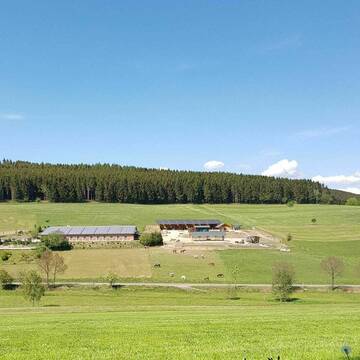
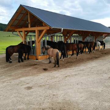
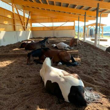
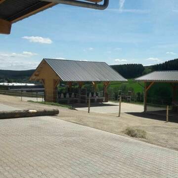
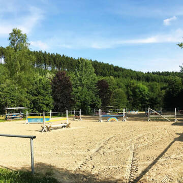
Paddockboxen zu vermieten!!!
Much
Stefan Frings
@Stefan20
Freizeitstall
Vermieten
Hunde willkommen
Krankenbox
Allergikerstall
Hufrehe geeignet
18 weitere...
S
Deprecated: Creation of dynamic property Zend_View_Helper_Ads::$adLink is deprecated in /var/www/stall-frei/htdocs/staging.stall-frei.de/library/Psf/View/Helper/Ads.php on line 108

Futtersack HeuToy, Fressbremse in pink
Mechtersen
STALL-FREIde Marketing
@STALL-FREI-Marketing
Stundenlange Beschäftigung die
Koliken vorbeugt, geringe Staubinhalation mit
steuerbarer Futterentnahme
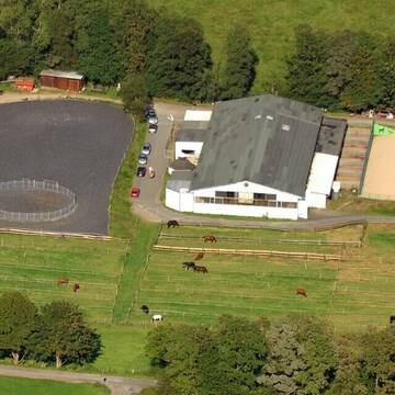
Reiterhof Kruberg Aktivstall, Bewegungsstall,Boxen
Kirchhundem
Reiterhof-Kruberg
@Reiterhof-Kruberg
Freizeitstall
Geländestrecke
Krankenbox
Longierzirkel/Roundpen
Allergikerstall
Gnadenbrothof
Außenbox mit Paddock
Außenboxen
25 weitere...
P+
Leider kein Vorschaubild
Leider kein Vorschaubild
Offenstallplatz – Allergikergeeignet, Wallach
Wenden
Julia
@JS1823
Freizeitstall
Geländestrecke
Hunde willkommen
Krankenbox
Allergikerstall
bedampftes/gewaschenes Heu
Offenstall
Paddock Trail
13 weitere...
B
Leider kein Vorschaubild
Leider kein Vorschaubild
Hof Peukert
Wenden
Christina-Walther
@Christina-Walther
Freizeitstall
Geländestrecke
Vermieten
Paddock
Parkplatz für Pferdeanhänger
Innenbox
Laufbox
11 weitere...
B

Das Leben ist ein Ponyhof
Wallmenroth
Rabenhof
@Rabenhof
Freizeitstall
Schulpferde
Vermieten
Hunde willkommen
Krankenbox
Allergikerstall
bedampftes/gewaschenes Heu
18 weitere...
P
Reitanlage am Sonnenhang: Paddockboxen
Kreuztal
Reitanlage am Sonnenhang
@Reitanlage-am-Sonnenhang-57223
Freizeitstall
Pferdeausbildung
Vermieten
Verpachten
Hunde willkommen
Krankenbox
Allergikerstall
Hufrehe geeignet
17 weitere...
P

Job gesucht?
Mechtersen
STALL-FREIde Marketing
@STALL-FREI-Marketing
Sie suchen einen Job und arbeiten gerne mit Pferden oder auf Reitanlagen?
Besuchen Sie jetzt unseren Stellenmarkt!
Reitanlage Wassmann
siegen
Pensionsstall und Pferdezucht Henrik Wassmann
@reitstallwassmann
FN-Mitglied
Freizeitstall
Vermieten
Führanlage
Hunde willkommen
Pferdezucht
23 weitere...
P+


Offenstallplatz KLEINpferd frei!!!
Much
Trollwaldhof
@Trollwaldhof
Gangpferdereiten
Pferdeausbildung
Vermieten
Paddock
Reithalle
Allergikerstall
8 weitere...
S
Leider kein Vorschaubild
Leider kein Vorschaubild
Pferdestall für Selbstversorger
Wenden
JUNG
@Tannenst.
Hunde willkommen
Krankenbox
Notfallboxen
Bewegungsstall
Offenstall
Selbstversorgung
5 weitere...
B
Leider kein Vorschaubild
Leider kein Vorschaubild
Kleine Stallgemeinschaft hat noch eine Box frei
Siegen
Stallgemeinschaft Huebinger
@Stallgemeinschaft-Huebinger
Freizeitstall
Geländestrecke
Vermieten
Paddock
Parkplatz für Pferdeanhänger
Außenbox mit Paddock
Außenboxen
14 weitere...
B
Newsletter abonnieren
Melde Dich für unseren Newsletter an und verpasse keine Neuigkeiten!
Deprecated: Creation of dynamic property Zend_View::$pageCount is deprecated in /var/www/stall-frei/htdocs/staging.stall-frei.de/library/vendor/shardj/zf1-future/library/Zend/View/Abstract.php on line 308
Deprecated: Creation of dynamic property Zend_View::$itemCountPerPage is deprecated in /var/www/stall-frei/htdocs/staging.stall-frei.de/library/vendor/shardj/zf1-future/library/Zend/View/Abstract.php on line 308
Deprecated: Creation of dynamic property Zend_View::$first is deprecated in /var/www/stall-frei/htdocs/staging.stall-frei.de/library/vendor/shardj/zf1-future/library/Zend/View/Abstract.php on line 308
Deprecated: Creation of dynamic property Zend_View::$current is deprecated in /var/www/stall-frei/htdocs/staging.stall-frei.de/library/vendor/shardj/zf1-future/library/Zend/View/Abstract.php on line 308
Deprecated: Creation of dynamic property Zend_View::$last is deprecated in /var/www/stall-frei/htdocs/staging.stall-frei.de/library/vendor/shardj/zf1-future/library/Zend/View/Abstract.php on line 308
Deprecated: Creation of dynamic property Zend_View::$previous is deprecated in /var/www/stall-frei/htdocs/staging.stall-frei.de/library/vendor/shardj/zf1-future/library/Zend/View/Abstract.php on line 308
Deprecated: Creation of dynamic property Zend_View::$next is deprecated in /var/www/stall-frei/htdocs/staging.stall-frei.de/library/vendor/shardj/zf1-future/library/Zend/View/Abstract.php on line 308
Deprecated: Creation of dynamic property Zend_View::$pagesInRange is deprecated in /var/www/stall-frei/htdocs/staging.stall-frei.de/library/vendor/shardj/zf1-future/library/Zend/View/Abstract.php on line 308
Deprecated: Creation of dynamic property Zend_View::$firstPageInRange is deprecated in /var/www/stall-frei/htdocs/staging.stall-frei.de/library/vendor/shardj/zf1-future/library/Zend/View/Abstract.php on line 308
Deprecated: Creation of dynamic property Zend_View::$lastPageInRange is deprecated in /var/www/stall-frei/htdocs/staging.stall-frei.de/library/vendor/shardj/zf1-future/library/Zend/View/Abstract.php on line 308
Deprecated: Creation of dynamic property Zend_View::$currentItemCount is deprecated in /var/www/stall-frei/htdocs/staging.stall-frei.de/library/vendor/shardj/zf1-future/library/Zend/View/Abstract.php on line 308
Deprecated: Creation of dynamic property Zend_View::$totalItemCount is deprecated in /var/www/stall-frei/htdocs/staging.stall-frei.de/library/vendor/shardj/zf1-future/library/Zend/View/Abstract.php on line 308
Deprecated: Creation of dynamic property Zend_View::$firstItemNumber is deprecated in /var/www/stall-frei/htdocs/staging.stall-frei.de/library/vendor/shardj/zf1-future/library/Zend/View/Abstract.php on line 308
Deprecated: Creation of dynamic property Zend_View::$lastItemNumber is deprecated in /var/www/stall-frei/htdocs/staging.stall-frei.de/library/vendor/shardj/zf1-future/library/Zend/View/Abstract.php on line 308
Deprecated: Creation of dynamic property Zend_View::$router is deprecated in /var/www/stall-frei/htdocs/staging.stall-frei.de/library/vendor/shardj/zf1-future/library/Zend/View/Abstract.php on line 308
Deprecated: Creation of dynamic property Zend_View::$urlParams is deprecated in /var/www/stall-frei/htdocs/staging.stall-frei.de/library/vendor/shardj/zf1-future/library/Zend/View/Abstract.php on line 308
Deprecated: Creation of dynamic property Zend_View::$showAds is deprecated in /var/www/stall-frei/htdocs/staging.stall-frei.de/library/vendor/shardj/zf1-future/library/Zend/View/Abstract.php on line 308
Deprecated: Creation of dynamic property Zend_View::$objectIds is deprecated in /var/www/stall-frei/htdocs/staging.stall-frei.de/library/vendor/shardj/zf1-future/library/Zend/View/Abstract.php on line 308
Deprecated: Creation of dynamic property Zend_View::$showNavbar is deprecated in /var/www/stall-frei/htdocs/staging.stall-frei.de/library/vendor/shardj/zf1-future/library/Zend/View/Abstract.php on line 308
Deprecated: Creation of dynamic property Zend_View::$showBreadcrumb is deprecated in /var/www/stall-frei/htdocs/staging.stall-frei.de/library/vendor/shardj/zf1-future/library/Zend/View/Abstract.php on line 308
Deprecated: Creation of dynamic property Zend_View::$showFooter is deprecated in /var/www/stall-frei/htdocs/staging.stall-frei.de/library/vendor/shardj/zf1-future/library/Zend/View/Abstract.php on line 308
Deprecated: Creation of dynamic property Zend_View::$showInternalAds is deprecated in /var/www/stall-frei/htdocs/staging.stall-frei.de/library/vendor/shardj/zf1-future/library/Zend/View/Abstract.php on line 308
Deprecated: Creation of dynamic property Zend_View::$blNoContent is deprecated in /var/www/stall-frei/htdocs/staging.stall-frei.de/library/vendor/shardj/zf1-future/library/Zend/View/Abstract.php on line 308
Deprecated: Creation of dynamic property Zend_View::$sMetaDesc is deprecated in /var/www/stall-frei/htdocs/staging.stall-frei.de/library/vendor/shardj/zf1-future/library/Zend/View/Abstract.php on line 308
Deprecated: Creation of dynamic property Zend_View::$useGmaps is deprecated in /var/www/stall-frei/htdocs/staging.stall-frei.de/library/vendor/shardj/zf1-future/library/Zend/View/Abstract.php on line 308
Deprecated: Creation of dynamic property Zend_View::$touches is deprecated in /var/www/stall-frei/htdocs/staging.stall-frei.de/library/vendor/shardj/zf1-future/library/Zend/View/Abstract.php on line 308
Deprecated: Creation of dynamic property Zend_View::$oProject is deprecated in /var/www/stall-frei/htdocs/staging.stall-frei.de/library/vendor/shardj/zf1-future/library/Zend/View/Abstract.php on line 308
Deprecated: Creation of dynamic property Zend_View::$pageHeadline is deprecated in /var/www/stall-frei/htdocs/staging.stall-frei.de/library/vendor/shardj/zf1-future/library/Zend/View/Abstract.php on line 308
Deprecated: Creation of dynamic property Zend_View::$disableLocationField is deprecated in /var/www/stall-frei/htdocs/staging.stall-frei.de/library/vendor/shardj/zf1-future/library/Zend/View/Abstract.php on line 308
Deprecated: Creation of dynamic property Zend_View::$isSearch is deprecated in /var/www/stall-frei/htdocs/staging.stall-frei.de/library/vendor/shardj/zf1-future/library/Zend/View/Abstract.php on line 308
Deprecated: Creation of dynamic property Zend_View::$pageTitle is deprecated in /var/www/stall-frei/htdocs/staging.stall-frei.de/library/vendor/shardj/zf1-future/library/Zend/View/Abstract.php on line 308
Deprecated: Creation of dynamic property Psf_Form_Element_Text::$class is deprecated in /var/www/stall-frei/htdocs/staging.stall-frei.de/library/vendor/shardj/zf1-future/library/Zend/Form/Element.php on line 874
Deprecated: Creation of dynamic property Psf_Form_Element_Text::$size is deprecated in /var/www/stall-frei/htdocs/staging.stall-frei.de/library/vendor/shardj/zf1-future/library/Zend/Form/Element.php on line 874
Deprecated: Creation of dynamic property Psf_Form_Element_Text::$placeholder is deprecated in /var/www/stall-frei/htdocs/staging.stall-frei.de/library/vendor/shardj/zf1-future/library/Zend/Form/Element.php on line 874
Deprecated: Creation of dynamic property Psf_Form_Element_Hidden::$class is deprecated in /var/www/stall-frei/htdocs/staging.stall-frei.de/library/vendor/shardj/zf1-future/library/Zend/Form/Element.php on line 874
Deprecated: Creation of dynamic property Psf_Form_Element_Hidden::$class is deprecated in /var/www/stall-frei/htdocs/staging.stall-frei.de/library/vendor/shardj/zf1-future/library/Zend/Form/Element.php on line 874
Deprecated: Creation of dynamic property Psf_Form_Element_Hidden::$class is deprecated in /var/www/stall-frei/htdocs/staging.stall-frei.de/library/vendor/shardj/zf1-future/library/Zend/Form/Element.php on line 874
Deprecated: Creation of dynamic property Psf_Form_Element_Hidden::$class is deprecated in /var/www/stall-frei/htdocs/staging.stall-frei.de/library/vendor/shardj/zf1-future/library/Zend/Form/Element.php on line 874
Deprecated: Creation of dynamic property Psf_Form_Element_Select::$class is deprecated in /var/www/stall-frei/htdocs/staging.stall-frei.de/library/vendor/shardj/zf1-future/library/Zend/Form/Element.php on line 874
Deprecated: Creation of dynamic property Psf_Form_Element_Select::$class is deprecated in /var/www/stall-frei/htdocs/staging.stall-frei.de/library/vendor/shardj/zf1-future/library/Zend/Form/Element.php on line 874
Deprecated: Creation of dynamic property Psf_Form_Element_Select::$class is deprecated in /var/www/stall-frei/htdocs/staging.stall-frei.de/library/vendor/shardj/zf1-future/library/Zend/Form/Element.php on line 874
Deprecated: Creation of dynamic property Psf_Form_Element_Select::$class is deprecated in /var/www/stall-frei/htdocs/staging.stall-frei.de/library/vendor/shardj/zf1-future/library/Zend/Form/Element.php on line 874
Deprecated: Creation of dynamic property Psf_Form_Element_Text::$class is deprecated in /var/www/stall-frei/htdocs/staging.stall-frei.de/library/vendor/shardj/zf1-future/library/Zend/Form/Element.php on line 874
Deprecated: Creation of dynamic property Psf_Form_Element_Checkbox::$label is deprecated in /var/www/stall-frei/htdocs/staging.stall-frei.de/library/vendor/shardj/zf1-future/library/Zend/Form/Element.php on line 874
Deprecated: Creation of dynamic property Zend_View::$sort is deprecated in /var/www/stall-frei/htdocs/staging.stall-frei.de/library/vendor/shardj/zf1-future/library/Zend/View/Abstract.php on line 308
Deprecated: Creation of dynamic property Zend_View::$searchLocation is deprecated in /var/www/stall-frei/htdocs/staging.stall-frei.de/library/vendor/shardj/zf1-future/library/Zend/View/Abstract.php on line 308
Deprecated: Creation of dynamic property Zend_View::$locationHint is deprecated in /var/www/stall-frei/htdocs/staging.stall-frei.de/library/vendor/shardj/zf1-future/library/Zend/View/Abstract.php on line 308
Psf_GeoCoder_Abstract::getLocation: Hammerhöhe Get Location CachedOrLive
Psf_GeoCoder_Abstract::getCachedOrLive: Hammerhöhe
Psf_GeoCoder_Abstract::convertLocationResult
{"documentation":"https:\/\/opencagedata.com\/api","licenses":[{"name":"see attribution guide","url":"https:\/\/opencagedata.com\/credits"}],"results":[{"bounds":{"northeast":{"lat":50.9313662,"lng":7.8557495},"southwest":{"lat":50.8913662,"lng":7.8157495}},"components":{"ISO_3166-1_alpha-2":"DE","ISO_3166-1_alpha-3":"DEU","ISO_3166-2":["DE-RP"],"_category":"place","_normalized_city":"Friesenhagen","_type":"village","city":"Friesenhagen","continent":"Europe","country":"Deutschland","country_code":"de","county":"Landkreis Altenkirchen (Westerwald)","municipality":"Kirchen (Sieg)","political_union":"European Union","postcode":"51598","state":"Rheinland-Pfalz","state_code":"RP","village":"Hammerh\u00f6he"},"confidence":7,"formatted":"51598 Hammerh\u00f6he, Deutschland","geometry":{"lat":50.9113662,"lng":7.8357495}},{"bounds":{"northeast":{"lat":50.9114067,"lng":7.8384577},"southwest":{"lat":50.9106533,"lng":7.8347678}},"components":{"ISO_3166-1_alpha-2":"DE","ISO_3166-1_alpha-3":"DEU","ISO_3166-2":["DE-RP"],"_category":"road","_normalized_city":"Friesenhagen","_type":"road","city":"Friesenhagen","continent":"Europe","country":"Deutschland","country_code":"de","county":"Landkreis Altenkirchen (Westerwald)","hamlet":"Gerndorferh\u00f6he","municipality":"Kirchen (Sieg)","political_union":"European Union","postcode":"51598","road":"Hammerh\u00f6he","road_type":"tertiary","state":"Rheinland-Pfalz","state_code":"RP","village":"Hammerh\u00f6he"},"confidence":9,"formatted":"Hammerh\u00f6he, 51598 Hammerh\u00f6he, Deutschland","geometry":{"lat":50.9109358,"lng":7.836596}},{"bounds":{"northeast":{"lat":49.508647,"lng":11.2717612},"southwest":{"lat":49.5078513,"lng":11.2703468}},"components":{"ISO_3166-1_alpha-2":"DE","ISO_3166-1_alpha-3":"DEU","ISO_3166-2":["DE-BY"],"_category":"road","_normalized_city":"Lauf an der Pegnitz","_type":"road","continent":"Europe","country":"Deutschland","country_code":"de","county":"Landkreis N\u00fcrnberger Land","political_union":"European Union","postcode":"91207","road":"Hammerh\u00f6he","road_type":"residential","state":"Bayern","state_code":"BY","town":"Lauf an der Pegnitz"},"confidence":9,"formatted":"Hammerh\u00f6he, 91207 Lauf an der Pegnitz, Deutschland","geometry":{"lat":49.5082088,"lng":11.2710839}},{"components":{"ISO_3166-1_alpha-2":"FR","ISO_3166-1_alpha-3":"FRA","ISO_3166-2":["FR-PDL","FR-72"],"_category":"road","_normalized_city":"Saint-Pavace","_type":"road","city":"Saint-Pavace","continent":"Europe","country":"France","country_code":"fr","county":"Sarthe","local_authority":"Communaut\u00e9 de communes Maine C\u0153ur de Sarthe","political_union":"European Union","postcode":"72190","road":"Chemin de la Hamerie","state":"Pays de la Loire","state_code":"PDL"},"confidence":3,"formatted":"Chemin de la Hamerie, 72190 Saint-Pavace, France","geometry":{"lat":48.040176,"lng":0.19666}},{"components":{"ISO_3166-1_alpha-2":"FR","ISO_3166-1_alpha-3":"FRA","ISO_3166-2":["FR-IDF","FR-92"],"_category":"road","_normalized_city":"Levallois-Perret","_type":"road","city":"Levallois-Perret","continent":"Europe","country":"France","country_code":"fr","county":"Hauts-de-Seine","local_authority":"M\u00e9tropole du Grand Paris","political_union":"European Union","postcode":"92300","road":"Rue Charles Deutschmann","state":"\u00cele-de-France","state_code":"IDF"},"confidence":3,"formatted":"Rue Charles Deutschmann, 92300 Levallois-Perret, France","geometry":{"lat":48.900049,"lng":2.2842}},{"components":{"ISO_3166-1_alpha-2":"FR","ISO_3166-1_alpha-3":"FRA","ISO_3166-2":["FR-NAQ","FR-16"],"_category":"road","_normalized_city":"Ligni\u00e8res-Ambleville","_type":"road","city":"Ligni\u00e8res-Ambleville","continent":"Europe","country":"France","country_code":"fr","county":"Charente","local_authority":"Communaut\u00e9 d'agglom\u00e9ration du Grand Cognac","political_union":"European Union","postcode":"16130","road":"La Motte - chemin des Am\u00e9ras","state":"Nouvelle-Aquitaine","state_code":"NAQ"},"confidence":2,"formatted":"La Motte - chemin des Am\u00e9ras, 16130 Ligni\u00e8res-Ambleville, France","geometry":{"lat":45.554776,"lng":-0.215324}},{"components":{"ISO_3166-1_alpha-2":"FR","ISO_3166-1_alpha-3":"FRA","ISO_3166-2":["FR-ARA","FR-01"],"_category":"road","_normalized_city":"Villeneuve","_type":"road","city":"Villeneuve","continent":"Europe","country":"France","country_code":"fr","county":"Ain","local_authority":"Communaut\u00e9 de communes Dombes Sa\u00f4ne Vall\u00e9e","political_union":"European Union","postcode":"01480","road":"Rue des Am\u00e9ries","state":"Auvergne-Rh\u00f4ne-Alpes","state_code":"ARA"},"confidence":2,"formatted":"Rue des Am\u00e9ries, 01480 Villeneuve, France","geometry":{"lat":46.017777,"lng":4.835322}},{"components":{"ISO_3166-1_alpha-2":"FR","ISO_3166-1_alpha-3":"FRA","ISO_3166-2":["FR-BRE","FR-35"],"_category":"road","_normalized_city":"Plerguer","_type":"road","city":"Plerguer","continent":"Europe","country":"France","country_code":"fr","county":"Ille-et-Vilaine","local_authority":"Saint-Malo Agglom\u00e9ration","political_union":"European Union","postcode":"35540","road":"La Ville Hamerie","state":"Bretagne","state_code":"BRE"},"confidence":2,"formatted":"La Ville Hamerie, 35540 Plerguer, France","geometry":{"lat":48.521496,"lng":-1.832193}},{"components":{"ISO_3166-1_alpha-2":"FR","ISO_3166-1_alpha-3":"FRA","ISO_3166-2":["FR-GES","FR-57"],"_category":"place","_normalized_city":"Marange-Silvange","_type":"place","city":"Marange-Silvange","continent":"Europe","country":"France","country_code":"fr","county":"Moselle","local_authority":"Communaut\u00e9 de communes du Pays Orne-Moselle","place":"Derriere Hemmerot","political_union":"European Union","postcode":"57535","state":"Grand Est","state_code":"GES"},"confidence":2,"formatted":"Derriere Hemmerot, 57535 Marange-Silvange, France","geometry":{"lat":49.227622,"lng":6.120716}},{"components":{"ISO_3166-1_alpha-2":"FR","ISO_3166-1_alpha-3":"FRA","ISO_3166-2":["FR-NOR","FR-61"],"_category":"road","_normalized_city":"Saint-Michel-Tub\u0153uf","_type":"road","city":"Saint-Michel-Tub\u0153uf","continent":"Europe","country":"France","country_code":"fr","county":"Orne","local_authority":"Communaut\u00e9 de communes des Pays de L'Aigle","political_union":"European Union","postcode":"61300","road":"La Piece du Bois Hamery","state":"Normandie","state_code":"NOR"},"confidence":2,"formatted":"La Piece du Bois Hamery, 61300 Saint-Michel-Tub\u0153uf, France","geometry":{"lat":48.768755,"lng":0.675603}}],"status":{"code":200,"message":"OK"},"stay_informed":{"blog":"https:\/\/blog.opencagedata.com","mastodon":"https:\/\/en.osm.town\/@opencage"},"thanks":"For using an OpenCage API","timestamp":{"created_http":"Sat, 07 Feb 2026 05:22:52 GMT","created_unix":1770441772},"total_results":10}Array
(
[0] => stdClass Object
(
[bounds] => stdClass Object
(
[northeast] => stdClass Object
(
[lat] => 50.9313662
[lng] => 7.8557495
)
[southwest] => stdClass Object
(
[lat] => 50.8913662
[lng] => 7.8157495
)
)
[components] => stdClass Object
(
[ISO_3166-1_alpha-2] => DE
[ISO_3166-1_alpha-3] => DEU
[ISO_3166-2] => Array
(
[0] => DE-RP
)
[_category] => place
[_normalized_city] => Friesenhagen
[_type] => village
[city] => Friesenhagen
[continent] => Europe
[country] => Deutschland
[country_code] => de
[county] => Landkreis Altenkirchen (Westerwald)
[municipality] => Kirchen (Sieg)
[political_union] => European Union
[postcode] => 51598
[state] => Rheinland-Pfalz
[state_code] => RP
[village] => Hammerhöhe
)
[confidence] => 7
[formatted] => 51598 Hammerhöhe, Deutschland
[geometry] => stdClass Object
(
[lat] => 50.9113662
[lng] => 7.8357495
)
)
[1] => stdClass Object
(
[bounds] => stdClass Object
(
[northeast] => stdClass Object
(
[lat] => 50.9114067
[lng] => 7.8384577
)
[southwest] => stdClass Object
(
[lat] => 50.9106533
[lng] => 7.8347678
)
)
[components] => stdClass Object
(
[ISO_3166-1_alpha-2] => DE
[ISO_3166-1_alpha-3] => DEU
[ISO_3166-2] => Array
(
[0] => DE-RP
)
[_category] => road
[_normalized_city] => Friesenhagen
[_type] => road
[city] => Friesenhagen
[continent] => Europe
[country] => Deutschland
[country_code] => de
[county] => Landkreis Altenkirchen (Westerwald)
[hamlet] => Gerndorferhöhe
[municipality] => Kirchen (Sieg)
[political_union] => European Union
[postcode] => 51598
[road] => Hammerhöhe
[road_type] => tertiary
[state] => Rheinland-Pfalz
[state_code] => RP
[village] => Hammerhöhe
)
[confidence] => 9
[formatted] => Hammerhöhe, 51598 Hammerhöhe, Deutschland
[geometry] => stdClass Object
(
[lat] => 50.9109358
[lng] => 7.836596
)
)
[2] => stdClass Object
(
[bounds] => stdClass Object
(
[northeast] => stdClass Object
(
[lat] => 49.508647
[lng] => 11.2717612
)
[southwest] => stdClass Object
(
[lat] => 49.5078513
[lng] => 11.2703468
)
)
[components] => stdClass Object
(
[ISO_3166-1_alpha-2] => DE
[ISO_3166-1_alpha-3] => DEU
[ISO_3166-2] => Array
(
[0] => DE-BY
)
[_category] => road
[_normalized_city] => Lauf an der Pegnitz
[_type] => road
[continent] => Europe
[country] => Deutschland
[country_code] => de
[county] => Landkreis Nürnberger Land
[political_union] => European Union
[postcode] => 91207
[road] => Hammerhöhe
[road_type] => residential
[state] => Bayern
[state_code] => BY
[town] => Lauf an der Pegnitz
)
[confidence] => 9
[formatted] => Hammerhöhe, 91207 Lauf an der Pegnitz, Deutschland
[geometry] => stdClass Object
(
[lat] => 49.5082088
[lng] => 11.2710839
)
)
[3] => stdClass Object
(
[components] => stdClass Object
(
[ISO_3166-1_alpha-2] => FR
[ISO_3166-1_alpha-3] => FRA
[ISO_3166-2] => Array
(
[0] => FR-PDL
[1] => FR-72
)
[_category] => road
[_normalized_city] => Saint-Pavace
[_type] => road
[city] => Saint-Pavace
[continent] => Europe
[country] => France
[country_code] => fr
[county] => Sarthe
[local_authority] => Communauté de communes Maine Cœur de Sarthe
[political_union] => European Union
[postcode] => 72190
[road] => Chemin de la Hamerie
[state] => Pays de la Loire
[state_code] => PDL
)
[confidence] => 3
[formatted] => Chemin de la Hamerie, 72190 Saint-Pavace, France
[geometry] => stdClass Object
(
[lat] => 48.040176
[lng] => 0.19666
)
)
[4] => stdClass Object
(
[components] => stdClass Object
(
[ISO_3166-1_alpha-2] => FR
[ISO_3166-1_alpha-3] => FRA
[ISO_3166-2] => Array
(
[0] => FR-IDF
[1] => FR-92
)
[_category] => road
[_normalized_city] => Levallois-Perret
[_type] => road
[city] => Levallois-Perret
[continent] => Europe
[country] => France
[country_code] => fr
[county] => Hauts-de-Seine
[local_authority] => Métropole du Grand Paris
[political_union] => European Union
[postcode] => 92300
[road] => Rue Charles Deutschmann
[state] => Île-de-France
[state_code] => IDF
)
[confidence] => 3
[formatted] => Rue Charles Deutschmann, 92300 Levallois-Perret, France
[geometry] => stdClass Object
(
[lat] => 48.900049
[lng] => 2.2842
)
)
[5] => stdClass Object
(
[components] => stdClass Object
(
[ISO_3166-1_alpha-2] => FR
[ISO_3166-1_alpha-3] => FRA
[ISO_3166-2] => Array
(
[0] => FR-NAQ
[1] => FR-16
)
[_category] => road
[_normalized_city] => Lignières-Ambleville
[_type] => road
[city] => Lignières-Ambleville
[continent] => Europe
[country] => France
[country_code] => fr
[county] => Charente
[local_authority] => Communauté d'agglomération du Grand Cognac
[political_union] => European Union
[postcode] => 16130
[road] => La Motte - chemin des Améras
[state] => Nouvelle-Aquitaine
[state_code] => NAQ
)
[confidence] => 2
[formatted] => La Motte - chemin des Améras, 16130 Lignières-Ambleville, France
[geometry] => stdClass Object
(
[lat] => 45.554776
[lng] => -0.215324
)
)
[6] => stdClass Object
(
[components] => stdClass Object
(
[ISO_3166-1_alpha-2] => FR
[ISO_3166-1_alpha-3] => FRA
[ISO_3166-2] => Array
(
[0] => FR-ARA
[1] => FR-01
)
[_category] => road
[_normalized_city] => Villeneuve
[_type] => road
[city] => Villeneuve
[continent] => Europe
[country] => France
[country_code] => fr
[county] => Ain
[local_authority] => Communauté de communes Dombes Saône Vallée
[political_union] => European Union
[postcode] => 01480
[road] => Rue des Améries
[state] => Auvergne-Rhône-Alpes
[state_code] => ARA
)
[confidence] => 2
[formatted] => Rue des Améries, 01480 Villeneuve, France
[geometry] => stdClass Object
(
[lat] => 46.017777
[lng] => 4.835322
)
)
[7] => stdClass Object
(
[components] => stdClass Object
(
[ISO_3166-1_alpha-2] => FR
[ISO_3166-1_alpha-3] => FRA
[ISO_3166-2] => Array
(
[0] => FR-BRE
[1] => FR-35
)
[_category] => road
[_normalized_city] => Plerguer
[_type] => road
[city] => Plerguer
[continent] => Europe
[country] => France
[country_code] => fr
[county] => Ille-et-Vilaine
[local_authority] => Saint-Malo Agglomération
[political_union] => European Union
[postcode] => 35540
[road] => La Ville Hamerie
[state] => Bretagne
[state_code] => BRE
)
[confidence] => 2
[formatted] => La Ville Hamerie, 35540 Plerguer, France
[geometry] => stdClass Object
(
[lat] => 48.521496
[lng] => -1.832193
)
)
[8] => stdClass Object
(
[components] => stdClass Object
(
[ISO_3166-1_alpha-2] => FR
[ISO_3166-1_alpha-3] => FRA
[ISO_3166-2] => Array
(
[0] => FR-GES
[1] => FR-57
)
[_category] => place
[_normalized_city] => Marange-Silvange
[_type] => place
[city] => Marange-Silvange
[continent] => Europe
[country] => France
[country_code] => fr
[county] => Moselle
[local_authority] => Communauté de communes du Pays Orne-Moselle
[place] => Derriere Hemmerot
[political_union] => European Union
[postcode] => 57535
[state] => Grand Est
[state_code] => GES
)
[confidence] => 2
[formatted] => Derriere Hemmerot, 57535 Marange-Silvange, France
[geometry] => stdClass Object
(
[lat] => 49.227622
[lng] => 6.120716
)
)
[9] => stdClass Object
(
[components] => stdClass Object
(
[ISO_3166-1_alpha-2] => FR
[ISO_3166-1_alpha-3] => FRA
[ISO_3166-2] => Array
(
[0] => FR-NOR
[1] => FR-61
)
[_category] => road
[_normalized_city] => Saint-Michel-Tubœuf
[_type] => road
[city] => Saint-Michel-Tubœuf
[continent] => Europe
[country] => France
[country_code] => fr
[county] => Orne
[local_authority] => Communauté de communes des Pays de L'Aigle
[political_union] => European Union
[postcode] => 61300
[road] => La Piece du Bois Hamery
[state] => Normandie
[state_code] => NOR
)
[confidence] => 2
[formatted] => La Piece du Bois Hamery, 61300 Saint-Michel-Tubœuf, France
[geometry] => stdClass Object
(
[lat] => 48.768755
[lng] => 0.675603
)
)
)
Psf_GeoCoder_OpenCageData::getKeyMap: 0
stdClass Object
(
    [bounds] => stdClass Object
        (
            [northeast] => stdClass Object
                (
                    [lat] => 50.9313662
                    [lng] => 7.8557495
                )

            [southwest] => stdClass Object
                (
                    [lat] => 50.8913662
                    [lng] => 7.8157495
                )

        )

    [components] => stdClass Object
        (
            [ISO_3166-1_alpha-2] => DE
            [ISO_3166-1_alpha-3] => DEU
            [ISO_3166-2] => Array
                (
                    [0] => DE-RP
                )

            [_category] => place
            [_normalized_city] => Friesenhagen
            [_type] => village
            [city] => Friesenhagen
            [continent] => Europe
            [country] => Deutschland
            [country_code] => de
            [county] => Landkreis Altenkirchen (Westerwald)
            [municipality] => Kirchen (Sieg)
            [political_union] => European Union
            [postcode] => 51598
            [state] => Rheinland-Pfalz
            [state_code] => RP
            [village] => Hammerhöhe
        )

    [confidence] => 7
    [formatted] => 51598 Hammerhöhe, Deutschland
    [geometry] => stdClass Object
        (
            [lat] => 50.9113662
            [lng] => 7.8357495
        )

)
Psf_GeoCoder_OpenCageData::getCounty: Altenkirchen (Westerwald)
Psf_GeoCoder_OpenCageData::addMissingData REFETCH!
Array
(
    [address] => 51598 Hammerhöhe, Deutschland
    [type] => village
    [street] =>
    [city] => Hammerhöhe
    [county] => Altenkirchen (Westerwald)
    [state] => Rheinland-Pfalz
    [zip] => 51598
    [country] => Deutschland
    [suburb] =>
    [countrycode] => de
    [latitude] => 50.9113662
    [longitude] => 7.8357495
    [accuracy] => 1
    [confidence] => 7
    [bounds] => stdClass Object
        (
            [northeast] => stdClass Object
                (
                    [lat] => 50.9313662
                    [lng] => 7.8557495
                )

            [southwest] => stdClass Object
                (
                    [lat] => 50.8913662
                    [lng] => 7.8157495
                )

        )

)
reformat!
Array
(
    [address] => 51598 Hammerhöhe, Deutschland
    [type] => village
    [street] =>
    [city] => Hammerhöhe
    [county] => Altenkirchen (Westerwald)
    [state] => Rheinland-Pfalz
    [zip] => 51598
    [country] => Deutschland
    [suburb] =>
    [countrycode] => de
    [latitude] => 50.9113662
    [longitude] => 7.8357495
    [accuracy] => 1
    [confidence] => 7
    [bounds] => stdClass Object
        (
            [northeast] => stdClass Object
                (
                    [lat] => 50.9313662
                    [lng] => 7.8557495
                )

            [southwest] => stdClass Object
                (
                    [lat] => 50.8913662
                    [lng] => 7.8157495
                )

        )

    [place] => 51598 Hammerhöhe, Rheinland-Pfalz
    [hash] => bb3e3d1402b3ff57f8dfdcd50620c96d
)
Psf_GeoCoder_OpenCageData::getKeyMap: 1
stdClass Object
(
    [bounds] => stdClass Object
        (
            [northeast] => stdClass Object
                (
                    [lat] => 50.9114067
                    [lng] => 7.8384577
                )

            [southwest] => stdClass Object
                (
                    [lat] => 50.9106533
                    [lng] => 7.8347678
                )

        )

    [components] => stdClass Object
        (
            [ISO_3166-1_alpha-2] => DE
            [ISO_3166-1_alpha-3] => DEU
            [ISO_3166-2] => Array
                (
                    [0] => DE-RP
                )

            [_category] => road
            [_normalized_city] => Friesenhagen
            [_type] => road
            [city] => Friesenhagen
            [continent] => Europe
            [country] => Deutschland
            [country_code] => de
            [county] => Landkreis Altenkirchen (Westerwald)
            [hamlet] => Gerndorferhöhe
            [municipality] => Kirchen (Sieg)
            [political_union] => European Union
            [postcode] => 51598
            [road] => Hammerhöhe
            [road_type] => tertiary
            [state] => Rheinland-Pfalz
            [state_code] => RP
            [village] => Hammerhöhe
        )

    [confidence] => 9
    [formatted] => Hammerhöhe, 51598 Hammerhöhe, Deutschland
    [geometry] => stdClass Object
        (
            [lat] => 50.9109358
            [lng] => 7.836596
        )

)
Psf_GeoCoder_OpenCageData::getCounty: Altenkirchen (Westerwald)
Psf_GeoCoder_OpenCageData::addMissingData REFETCH!
Array
(
    [address] => Hammerhöhe, 51598 Hammerhöhe, Deutschland
    [type] => road
    [street] => Hammerhöhe
    [city] => Hammerhöhe
    [county] => Altenkirchen (Westerwald)
    [state] => Rheinland-Pfalz
    [zip] => 51598
    [country] => Deutschland
    [suburb] =>
    [countrycode] => de
    [latitude] => 50.9109358
    [longitude] => 7.836596
    [accuracy] => 1
    [confidence] => 9
    [bounds] => stdClass Object
        (
            [northeast] => stdClass Object
                (
                    [lat] => 50.9114067
                    [lng] => 7.8384577
                )

            [southwest] => stdClass Object
                (
                    [lat] => 50.9106533
                    [lng] => 7.8347678
                )

        )

)
reformat!
Array
(
    [address] => Hammerhöhe, 51598 Hammerhöhe, Deutschland
    [type] => road
    [street] => Hammerhöhe
    [city] => Hammerhöhe
    [county] => Altenkirchen (Westerwald)
    [state] => Rheinland-Pfalz
    [zip] => 51598
    [country] => Deutschland
    [suburb] =>
    [countrycode] => de
    [latitude] => 50.9109358
    [longitude] => 7.836596
    [accuracy] => 1
    [confidence] => 9
    [bounds] => stdClass Object
        (
            [northeast] => stdClass Object
                (
                    [lat] => 50.9114067
                    [lng] => 7.8384577
                )

            [southwest] => stdClass Object
                (
                    [lat] => 50.9106533
                    [lng] => 7.8347678
                )

        )

    [place] => Hammerhöhe, 51598 Hammerhöhe, Rheinland-Pfalz
    [hash] => 78b1f66e3bca530953c03ea9f4aa0043
)
Psf_GeoCoder_OpenCageData::getKeyMap: 2
stdClass Object
(
    [bounds] => stdClass Object
        (
            [northeast] => stdClass Object
                (
                    [lat] => 49.508647
                    [lng] => 11.2717612
                )

            [southwest] => stdClass Object
                (
                    [lat] => 49.5078513
                    [lng] => 11.2703468
                )

        )

    [components] => stdClass Object
        (
            [ISO_3166-1_alpha-2] => DE
            [ISO_3166-1_alpha-3] => DEU
            [ISO_3166-2] => Array
                (
                    [0] => DE-BY
                )

            [_category] => road
            [_normalized_city] => Lauf an der Pegnitz
            [_type] => road
            [continent] => Europe
            [country] => Deutschland
            [country_code] => de
            [county] => Landkreis Nürnberger Land
            [political_union] => European Union
            [postcode] => 91207
            [road] => Hammerhöhe
            [road_type] => residential
            [state] => Bayern
            [state_code] => BY
            [town] => Lauf an der Pegnitz
        )

    [confidence] => 9
    [formatted] => Hammerhöhe, 91207 Lauf an der Pegnitz, Deutschland
    [geometry] => stdClass Object
        (
            [lat] => 49.5082088
            [lng] => 11.2710839
        )

)
Psf_GeoCoder_OpenCageData::getCounty: Nürnberger Land
Psf_GeoCoder_OpenCageData::addMissingData REFETCH!
Array
(
    [address] => Hammerhöhe, 91207 Lauf an der Pegnitz, Deutschland
    [type] => road
    [street] => Hammerhöhe
    [city] => Lauf an der Pegnitz
    [county] => Nürnberger Land
    [state] => Bayern
    [zip] => 91207
    [country] => Deutschland
    [suburb] =>
    [countrycode] => de
    [latitude] => 49.5082088
    [longitude] => 11.2710839
    [accuracy] => 1
    [confidence] => 9
    [bounds] => stdClass Object
        (
            [northeast] => stdClass Object
                (
                    [lat] => 49.508647
                    [lng] => 11.2717612
                )

            [southwest] => stdClass Object
                (
                    [lat] => 49.5078513
                    [lng] => 11.2703468
                )

        )

)
reformat!
Array
(
    [address] => Hammerhöhe, 91207 Lauf an der Pegnitz, Deutschland
    [type] => road
    [street] => Hammerhöhe
    [city] => Lauf an der Pegnitz
    [county] => Nürnberger Land
    [state] => Bayern
    [zip] => 91207
    [country] => Deutschland
    [suburb] =>
    [countrycode] => de
    [latitude] => 49.5082088
    [longitude] => 11.2710839
    [accuracy] => 1
    [confidence] => 9
    [bounds] => stdClass Object
        (
            [northeast] => stdClass Object
                (
                    [lat] => 49.508647
                    [lng] => 11.2717612
                )

            [southwest] => stdClass Object
                (
                    [lat] => 49.5078513
                    [lng] => 11.2703468
                )

        )

    [place] => Hammerhöhe, 91207 Lauf an der Pegnitz, Bayern
    [hash] => f90241549dce787640651aaef57a2522
)
Psf_GeoCoder_OpenCageData::getKeyMap: 3
stdClass Object
(
    [components] => stdClass Object
        (
            [ISO_3166-1_alpha-2] => FR
            [ISO_3166-1_alpha-3] => FRA
            [ISO_3166-2] => Array
                (
                    [0] => FR-PDL
                    [1] => FR-72
                )

            [_category] => road
            [_normalized_city] => Saint-Pavace
            [_type] => road
            [city] => Saint-Pavace
            [continent] => Europe
            [country] => France
            [country_code] => fr
            [county] => Sarthe
            [local_authority] => Communauté de communes Maine Cœur de Sarthe
            [political_union] => European Union
            [postcode] => 72190
            [road] => Chemin de la Hamerie
            [state] => Pays de la Loire
            [state_code] => PDL
        )

    [confidence] => 3
    [formatted] => Chemin de la Hamerie, 72190 Saint-Pavace, France
    [geometry] => stdClass Object
        (
            [lat] => 48.040176
            [lng] => 0.19666
        )

)
Psf_GeoCoder_OpenCageData::getCounty: Sarthe
Psf_GeoCoder_OpenCageData::addMissingData REFETCH!
Array
(
    [address] => Chemin de la Hamerie, 72190 Saint-Pavace, France
    [type] => road
    [street] => Chemin de la Hamerie
    [city] => Saint-Pavace
    [county] => Sarthe
    [state] => Pays de la Loire
    [zip] => 72190
    [country] => France
    [suburb] =>
    [countrycode] => fr
    [latitude] => 48.040176
    [longitude] => 0.19666
    [accuracy] => 1
    [confidence] => 3
    [bounds] =>
)
reformat!
Array
(
    [address] => Chemin de la Hamerie, 72190 Saint-Pavace, France
    [type] => road
    [street] => Chemin de la Hamerie
    [city] => Saint-Pavace
    [county] => Sarthe
    [state] => Pays de la Loire
    [zip] => 72190
    [country] => France
    [suburb] =>
    [countrycode] => fr
    [latitude] => 48.040176
    [longitude] => 0.19666
    [accuracy] => 1
    [confidence] => 3
    [bounds] =>
    [place] => Chemin de la Hamerie, 72190 Saint-Pavace, Pays de la Loire
    [hash] => 73eaab1ac36f9a305358511a3061bedc
)
Psf_GeoCoder_OpenCageData::getKeyMap: 4
stdClass Object
(
    [components] => stdClass Object
        (
            [ISO_3166-1_alpha-2] => FR
            [ISO_3166-1_alpha-3] => FRA
            [ISO_3166-2] => Array
                (
                    [0] => FR-IDF
                    [1] => FR-92
                )

            [_category] => road
            [_normalized_city] => Levallois-Perret
            [_type] => road
            [city] => Levallois-Perret
            [continent] => Europe
            [country] => France
            [country_code] => fr
            [county] => Hauts-de-Seine
            [local_authority] => Métropole du Grand Paris
            [political_union] => European Union
            [postcode] => 92300
            [road] => Rue Charles Deutschmann
            [state] => Île-de-France
            [state_code] => IDF
        )

    [confidence] => 3
    [formatted] => Rue Charles Deutschmann, 92300 Levallois-Perret, France
    [geometry] => stdClass Object
        (
            [lat] => 48.900049
            [lng] => 2.2842
        )

)
Psf_GeoCoder_OpenCageData::getCounty: Hauts-de-Seine
Psf_GeoCoder_OpenCageData::addMissingData REFETCH!
Array
(
    [address] => Rue Charles Deutschmann, 92300 Levallois-Perret, France
    [type] => road
    [street] => Rue Charles Deutschmann
    [city] => Levallois-Perret
    [county] => Hauts-de-Seine
    [state] => Île-de-France
    [zip] => 92300
    [country] => France
    [suburb] =>
    [countrycode] => fr
    [latitude] => 48.900049
    [longitude] => 2.2842
    [accuracy] => 1
    [confidence] => 3
    [bounds] =>
)
reformat!
Array
(
    [address] => Rue Charles Deutschmann, 92300 Levallois-Perret, France
    [type] => road
    [street] => Rue Charles Deutschmann
    [city] => Levallois-Perret
    [county] => Hauts-de-Seine
    [state] => Île-de-France
    [zip] => 92300
    [country] => France
    [suburb] =>
    [countrycode] => fr
    [latitude] => 48.900049
    [longitude] => 2.2842
    [accuracy] => 1
    [confidence] => 3
    [bounds] =>
    [place] => Rue Charles Deutschmann, 92300 Levallois-Perret, Île-de-France
    [hash] => b7dc44def3990e8a7eaf18e019eca466
)
Psf_GeoCoder_OpenCageData::getKeyMap: 5
stdClass Object
(
    [components] => stdClass Object
        (
            [ISO_3166-1_alpha-2] => FR
            [ISO_3166-1_alpha-3] => FRA
            [ISO_3166-2] => Array
                (
                    [0] => FR-NAQ
                    [1] => FR-16
                )

            [_category] => road
            [_normalized_city] => Lignières-Ambleville
            [_type] => road
            [city] => Lignières-Ambleville
            [continent] => Europe
            [country] => France
            [country_code] => fr
            [county] => Charente
            [local_authority] => Communauté d'agglomération du Grand Cognac
            [political_union] => European Union
            [postcode] => 16130
            [road] => La Motte - chemin des Améras
            [state] => Nouvelle-Aquitaine
            [state_code] => NAQ
        )

    [confidence] => 2
    [formatted] => La Motte - chemin des Améras, 16130 Lignières-Ambleville, France
    [geometry] => stdClass Object
        (
            [lat] => 45.554776
            [lng] => -0.215324
        )

)
Psf_GeoCoder_OpenCageData::getCounty: Charente
Psf_GeoCoder_OpenCageData::addMissingData REFETCH!
Array
(
    [address] => La Motte - chemin des Améras, 16130 Lignières-Ambleville, France
    [type] => road
    [street] => La Motte - chemin des Améras
    [city] => Lignières-Ambleville
    [county] => Charente
    [state] => Nouvelle-Aquitaine
    [zip] => 16130
    [country] => France
    [suburb] =>
    [countrycode] => fr
    [latitude] => 45.554776
    [longitude] => -0.215324
    [accuracy] => 1
    [confidence] => 2
    [bounds] =>
)
reformat!
Array
(
    [address] => La Motte - chemin des Améras, 16130 Lignières-Ambleville, France
    [type] => road
    [street] => La Motte - chemin des Améras
    [city] => Lignières-Ambleville
    [county] => Charente
    [state] => Nouvelle-Aquitaine
    [zip] => 16130
    [country] => France
    [suburb] =>
    [countrycode] => fr
    [latitude] => 45.554776
    [longitude] => -0.215324
    [accuracy] => 1
    [confidence] => 2
    [bounds] =>
    [place] => La Motte - chemin des Améras, 16130 Lignières-Ambleville, Nouvelle-Aquitaine
    [hash] => 6bd35c4d97a51ac1e382f42985096664
)
Psf_GeoCoder_OpenCageData::getKeyMap: 6
stdClass Object
(
    [components] => stdClass Object
        (
            [ISO_3166-1_alpha-2] => FR
            [ISO_3166-1_alpha-3] => FRA
            [ISO_3166-2] => Array
                (
                    [0] => FR-ARA
                    [1] => FR-01
                )

            [_category] => road
            [_normalized_city] => Villeneuve
            [_type] => road
            [city] => Villeneuve
            [continent] => Europe
            [country] => France
            [country_code] => fr
            [county] => Ain
            [local_authority] => Communauté de communes Dombes Saône Vallée
            [political_union] => European Union
            [postcode] => 01480
            [road] => Rue des Améries
            [state] => Auvergne-Rhône-Alpes
            [state_code] => ARA
        )

    [confidence] => 2
    [formatted] => Rue des Améries, 01480 Villeneuve, France
    [geometry] => stdClass Object
        (
            [lat] => 46.017777
            [lng] => 4.835322
        )

)
Psf_GeoCoder_OpenCageData::getCounty: Ain
Psf_GeoCoder_OpenCageData::addMissingData REFETCH!
Array
(
    [address] => Rue des Améries, 01480 Villeneuve, France
    [type] => road
    [street] => Rue des Améries
    [city] => Villeneuve
    [county] => Ain
    [state] => Auvergne-Rhône-Alpes
    [zip] => 01480
    [country] => France
    [suburb] =>
    [countrycode] => fr
    [latitude] => 46.017777
    [longitude] => 4.835322
    [accuracy] => 1
    [confidence] => 2
    [bounds] =>
)
reformat!
Array
(
    [address] => Rue des Améries, 01480 Villeneuve, France
    [type] => road
    [street] => Rue des Améries
    [city] => Villeneuve
    [county] => Ain
    [state] => Auvergne-Rhône-Alpes
    [zip] => 01480
    [country] => France
    [suburb] =>
    [countrycode] => fr
    [latitude] => 46.017777
    [longitude] => 4.835322
    [accuracy] => 1
    [confidence] => 2
    [bounds] =>
    [place] => Rue des Améries, 01480 Villeneuve, Auvergne-Rhône-Alpes
    [hash] => 5fc02f208432d3213f6b1e36c9080230
)
Psf_GeoCoder_OpenCageData::getKeyMap: 7
stdClass Object
(
    [components] => stdClass Object
        (
            [ISO_3166-1_alpha-2] => FR
            [ISO_3166-1_alpha-3] => FRA
            [ISO_3166-2] => Array
                (
                    [0] => FR-BRE
                    [1] => FR-35
                )

            [_category] => road
            [_normalized_city] => Plerguer
            [_type] => road
            [city] => Plerguer
            [continent] => Europe
            [country] => France
            [country_code] => fr
            [county] => Ille-et-Vilaine
            [local_authority] => Saint-Malo Agglomération
            [political_union] => European Union
            [postcode] => 35540
            [road] => La Ville Hamerie
            [state] => Bretagne
            [state_code] => BRE
        )

    [confidence] => 2
    [formatted] => La Ville Hamerie, 35540 Plerguer, France
    [geometry] => stdClass Object
        (
            [lat] => 48.521496
            [lng] => -1.832193
        )

)
Psf_GeoCoder_OpenCageData::getCounty: Ille-et-Vilaine
Psf_GeoCoder_OpenCageData::addMissingData REFETCH!
Array
(
    [address] => La Ville Hamerie, 35540 Plerguer, France
    [type] => road
    [street] => La Ville Hamerie
    [city] => Plerguer
    [county] => Ille-et-Vilaine
    [state] => Bretagne
    [zip] => 35540
    [country] => France
    [suburb] =>
    [countrycode] => fr
    [latitude] => 48.521496
    [longitude] => -1.832193
    [accuracy] => 1
    [confidence] => 2
    [bounds] =>
)
reformat!
Array
(
    [address] => La Ville Hamerie, 35540 Plerguer, France
    [type] => road
    [street] => La Ville Hamerie
    [city] => Plerguer
    [county] => Ille-et-Vilaine
    [state] => Bretagne
    [zip] => 35540
    [country] => France
    [suburb] =>
    [countrycode] => fr
    [latitude] => 48.521496
    [longitude] => -1.832193
    [accuracy] => 1
    [confidence] => 2
    [bounds] =>
    [place] => La Ville Hamerie, 35540 Plerguer, Bretagne
    [hash] => b1f9dd9249635ed514cb69a2da2d6c3c
)
Psf_GeoCoder_OpenCageData::getKeyMap: 8
stdClass Object
(
    [components] => stdClass Object
        (
            [ISO_3166-1_alpha-2] => FR
            [ISO_3166-1_alpha-3] => FRA
            [ISO_3166-2] => Array
                (
                    [0] => FR-GES
                    [1] => FR-57
                )

            [_category] => place
            [_normalized_city] => Marange-Silvange
            [_type] => place
            [city] => Marange-Silvange
            [continent] => Europe
            [country] => France
            [country_code] => fr
            [county] => Moselle
            [local_authority] => Communauté de communes du Pays Orne-Moselle
            [place] => Derriere Hemmerot
            [political_union] => European Union
            [postcode] => 57535
            [state] => Grand Est
            [state_code] => GES
        )

    [confidence] => 2
    [formatted] => Derriere Hemmerot, 57535 Marange-Silvange, France
    [geometry] => stdClass Object
        (
            [lat] => 49.227622
            [lng] => 6.120716
        )

)
Psf_GeoCoder_OpenCageData::getCounty: Moselle
Psf_GeoCoder_OpenCageData::addMissingData REFETCH!
Array
(
    [address] => Derriere Hemmerot, 57535 Marange-Silvange, France
    [type] => place
    [street] =>
    [city] => Marange-Silvange
    [county] => Moselle
    [state] => Grand Est
    [zip] => 57535
    [country] => France
    [suburb] =>
    [countrycode] => fr
    [latitude] => 49.227622
    [longitude] => 6.120716
    [accuracy] => 1
    [confidence] => 2
    [bounds] =>
)
reformat!
Array
(
    [address] => Derriere Hemmerot, 57535 Marange-Silvange, France
    [type] => place
    [street] =>
    [city] => Marange-Silvange
    [county] => Moselle
    [state] => Grand Est
    [zip] => 57535
    [country] => France
    [suburb] =>
    [countrycode] => fr
    [latitude] => 49.227622
    [longitude] => 6.120716
    [accuracy] => 1
    [confidence] => 2
    [bounds] =>
    [place] => 57535 Marange-Silvange, Grand Est
    [hash] => ff72959ceabfe0545dc3963b59a3ab90
)
Psf_GeoCoder_OpenCageData::getKeyMap: 9
stdClass Object
(
    [components] => stdClass Object
        (
            [ISO_3166-1_alpha-2] => FR
            [ISO_3166-1_alpha-3] => FRA
            [ISO_3166-2] => Array
                (
                    [0] => FR-NOR
                    [1] => FR-61
                )

            [_category] => road
            [_normalized_city] => Saint-Michel-Tubœuf
            [_type] => road
            [city] => Saint-Michel-Tubœuf
            [continent] => Europe
            [country] => France
            [country_code] => fr
            [county] => Orne
            [local_authority] => Communauté de communes des Pays de L'Aigle
            [political_union] => European Union
            [postcode] => 61300
            [road] => La Piece du Bois Hamery
            [state] => Normandie
            [state_code] => NOR
        )

    [confidence] => 2
    [formatted] => La Piece du Bois Hamery, 61300 Saint-Michel-Tubœuf, France
    [geometry] => stdClass Object
        (
            [lat] => 48.768755
            [lng] => 0.675603
        )

)
Psf_GeoCoder_OpenCageData::getCounty: Orne
Psf_GeoCoder_OpenCageData::addMissingData REFETCH!
Array
(
    [address] => La Piece du Bois Hamery, 61300 Saint-Michel-Tubœuf, France
    [type] => road
    [street] => La Piece du Bois Hamery
    [city] => Saint-Michel-Tubœuf
    [county] => Orne
    [state] => Normandie
    [zip] => 61300
    [country] => France
    [suburb] =>
    [countrycode] => fr
    [latitude] => 48.768755
    [longitude] => 0.675603
    [accuracy] => 1
    [confidence] => 2
    [bounds] =>
)
reformat!
Array
(
    [address] => La Piece du Bois Hamery, 61300 Saint-Michel-Tubœuf, France
    [type] => road
    [street] => La Piece du Bois Hamery
    [city] => Saint-Michel-Tubœuf
    [county] => Orne
    [state] => Normandie
    [zip] => 61300
    [country] => France
    [suburb] =>
    [countrycode] => fr
    [latitude] => 48.768755
    [longitude] => 0.675603
    [accuracy] => 1
    [confidence] => 2
    [bounds] =>
    [place] => La Piece du Bois Hamery, 61300 Saint-Michel-Tubœuf, Normandie
    [hash] => 1f45420eb15be753febe910f28e81ffe
)
Deprecated: Creation of dynamic property Zend_View::$locationHintStyle is deprecated in /var/www/stall-frei/htdocs/staging.stall-frei.de/library/vendor/shardj/zf1-future/library/Zend/View/Abstract.php on line 308
Deprecated: Creation of dynamic property Zend_View::$adGeoLocation is deprecated in /var/www/stall-frei/htdocs/staging.stall-frei.de/library/vendor/shardj/zf1-future/library/Zend/View/Abstract.php on line 308
Deprecated: Creation of dynamic property Zend_View::$recordCount is deprecated in /var/www/stall-frei/htdocs/staging.stall-frei.de/library/vendor/shardj/zf1-future/library/Zend/View/Abstract.php on line 308
Deprecated: Creation of dynamic property Zend_View::$paginationParams is deprecated in /var/www/stall-frei/htdocs/staging.stall-frei.de/library/vendor/shardj/zf1-future/library/Zend/View/Abstract.php on line 308
Deprecated: Creation of dynamic property Zend_View::$objectPaginator is deprecated in /var/www/stall-frei/htdocs/staging.stall-frei.de/library/vendor/shardj/zf1-future/library/Zend/View/Abstract.php on line 308
Deprecated: Creation of dynamic property Zend_View::$featuredObjects is deprecated in /var/www/stall-frei/htdocs/staging.stall-frei.de/library/vendor/shardj/zf1-future/library/Zend/View/Abstract.php on line 308
Deprecated: Creation of dynamic property Zend_View::$hints is deprecated in /var/www/stall-frei/htdocs/staging.stall-frei.de/library/vendor/shardj/zf1-future/library/Zend/View/Abstract.php on line 308
Deprecated: Creation of dynamic property Zend_View::$attributeHints is deprecated in /var/www/stall-frei/htdocs/staging.stall-frei.de/library/vendor/shardj/zf1-future/library/Zend/View/Abstract.php on line 308
Deprecated: Creation of dynamic property Zend_View::$oSearchForm is deprecated in /var/www/stall-frei/htdocs/staging.stall-frei.de/library/vendor/shardj/zf1-future/library/Zend/View/Abstract.php on line 308