Deprecated: Creation of dynamic property Zend_View::$sMode is deprecated in /var/www/stall-frei/htdocs/staging.stall-frei.de/library/vendor/shardj/zf1-future/library/Zend/View/Abstract.php on line 308
Stallplatz oder Offenstall in Westerberg
Gesucht wird in "49076 Westerberg"
6.334 Einträge
Deprecated: Creation of dynamic property Zend_View::$listObjects is deprecated in /var/www/stall-frei/htdocs/staging.stall-frei.de/library/vendor/shardj/zf1-future/library/Zend/View/Abstract.php on line 308
Gesponsort


Deprecated: Creation of dynamic property Zend_View::$listMode is deprecated in /var/www/stall-frei/htdocs/staging.stall-frei.de/library/vendor/shardj/zf1-future/library/Zend/View/Abstract.php on line 308
Deprecated: Creation of dynamic property Zend_View::$renderedObjects is deprecated in /var/www/stall-frei/htdocs/staging.stall-frei.de/library/vendor/shardj/zf1-future/library/Zend/View/Abstract.php on line 308
Deprecated: Creation of dynamic property Zend_View::$index is deprecated in /var/www/stall-frei/htdocs/staging.stall-frei.de/library/vendor/shardj/zf1-future/library/Zend/View/Abstract.php on line 308
Deprecated: Creation of dynamic property Zend_View::$displayMode is deprecated in /var/www/stall-frei/htdocs/staging.stall-frei.de/library/vendor/shardj/zf1-future/library/Zend/View/Abstract.php on line 308
Deprecated: Creation of dynamic property Zend_View::$remarketingIds is deprecated in /var/www/stall-frei/htdocs/staging.stall-frei.de/library/vendor/shardj/zf1-future/library/Zend/View/Abstract.php on line 308
Deprecated: Creation of dynamic property Zend_View::$listItem is deprecated in /var/www/stall-frei/htdocs/staging.stall-frei.de/library/vendor/shardj/zf1-future/library/Zend/View/Abstract.php on line 308
Deprecated: Creation of dynamic property Zend_View::$object is deprecated in /var/www/stall-frei/htdocs/staging.stall-frei.de/library/vendor/shardj/zf1-future/library/Zend/View/Abstract.php on line 308
Deprecated: Creation of dynamic property Zend_View::$attributes is deprecated in /var/www/stall-frei/htdocs/staging.stall-frei.de/library/vendor/shardj/zf1-future/library/Zend/View/Abstract.php on line 308
Leider kein Vorschaubild
Leider kein Vorschaubild
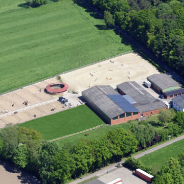
Stallgasse / Stalltrakt zum 1.3.26 frei
Wallenhorst
Stall-Sudowe
@Stall-Sudowe
FN-Mitglied
Freizeitstall
Vermieten
Verpachten
Führanlage
Hunde willkommen
Allergikerstall
bedampftes/gewaschenes Heu
33 weitere...
B
Deprecated: Creation of dynamic property Zend_View_Helper_Ads::$adLink is deprecated in /var/www/stall-frei/htdocs/staging.stall-frei.de/library/Psf/View/Helper/Ads.php on line 108

***Reitstall Birkenhof*** Pferdegerechte Haltung
Köln
Daniele-Fazzi
@Daniele-Fazzi
Herzlich Willkommen
auf dem Reitstall Birkenhof
Jetzt neu ‼️ auf dem Birkenhof:
Private Geländestrecke rund um unser
Leider kein Vorschaubild
Leider kein Vorschaubild
Paddockbox zu sofort oder später frei
Wallenhorst
Stall-Sudowe
@Stall-Sudowe
FN-Mitglied
Freizeitstall
Vermieten
Führanlage
Hunde willkommen
Allergikerstall
Fohlenaufzucht möglich
25 weitere...
B


Idyllische Reitanlage in Ostercappeln
Ostercappeln
Melissa Glaap
@MelissaGlaap
Vermieten
Führanlage
Hunde willkommen
Außenbox mit Paddock
Innenbox
Vollpension
10 weitere...
P+
Leider kein Vorschaubild
Leider kein Vorschaubild
Offenstallplätze und Ponnybox
Wallenhorst
Pferdepension Hof Kollenberg
@Ph.K.
Geländestrecke
Longierzirkel/Roundpen
Paddock
Innenbox
Offenstall
Vollpension
9 weitere...
B
Leider kein Vorschaubild
Leider kein Vorschaubild
Aktivstall/Bewegungsstall
Wallenhorst
Pferdepension Hof Kollenberg
@Ph.K.
Freizeitstall
Geländestrecke
Vermieten
Hunde willkommen
Longierzirkel/Roundpen
Bewegungsstall
Paddock Trail
14 weitere...
B

Persönlichkeitsentwicklung mit Pferden
Bad Salzuflen
Katja Dors
@Pferdezeiten
Begleite andere auf ihrem Entwicklungsweg und entdecke die transformative Kraft der pferdegestützten Persönlichkeitsentwicklung !
neu
R
Leider kein Vorschaubild
Leider kein Vorschaubild
Offenstallplatz frei
Osnabrück
Jessica Szepst
@jessicasz
Freizeitstall
Vermieten
Longierzirkel/Roundpen
Reitplatz (z.B. Dressur, Springen, Reining)
Hufrehe geeignet
7 weitere...
B


Gepflegter Offenstall in Lienen
Lienen
Sabine Seiferth
@Hof-Silbermann
Freizeitstall
Vermieten
Hunde willkommen
Krankenbox
Allergikerstall
Notfallboxen
12 weitere...
P+
Leider kein Vorschaubild
Leider kein Vorschaubild
1 große Kleinpferde/Ponybox in Vollpension frei
Wallenhorst
Nicole Dahlitz
@Dahlitz
Pferdeausbildung
Reitlehrer und -unterricht
Vermieten
Hunde willkommen
Longierzirkel/Roundpen
Außenbox mit Paddock
Außenboxen
14 weitere...
B

Wunderschöne Reitanlage in ruhiger Lage
Westerkappeln
Muehlenhof
@Muehlenhof3
Pferdeausbildung
Reitlehrer und -unterricht
Vermieten
Hunde willkommen
Longierzirkel/Roundpen
Innenbox
15 weitere...
P

Offenstall- und Boxenplätze frei
Bissendorf
Halterbergshof
@Sandra76
FN-Mitglied
Freizeitstall
Vermieten
Hunde willkommen
Krankenbox
Allergikerstall
Gnadenbrothof
35 weitere...
P
Newsletter abonnieren
Melde Dich für unseren Newsletter an und verpasse keine Neuigkeiten!
Deprecated: Creation of dynamic property Zend_View::$pageCount is deprecated in /var/www/stall-frei/htdocs/staging.stall-frei.de/library/vendor/shardj/zf1-future/library/Zend/View/Abstract.php on line 308
Deprecated: Creation of dynamic property Zend_View::$itemCountPerPage is deprecated in /var/www/stall-frei/htdocs/staging.stall-frei.de/library/vendor/shardj/zf1-future/library/Zend/View/Abstract.php on line 308
Deprecated: Creation of dynamic property Zend_View::$first is deprecated in /var/www/stall-frei/htdocs/staging.stall-frei.de/library/vendor/shardj/zf1-future/library/Zend/View/Abstract.php on line 308
Deprecated: Creation of dynamic property Zend_View::$current is deprecated in /var/www/stall-frei/htdocs/staging.stall-frei.de/library/vendor/shardj/zf1-future/library/Zend/View/Abstract.php on line 308
Deprecated: Creation of dynamic property Zend_View::$last is deprecated in /var/www/stall-frei/htdocs/staging.stall-frei.de/library/vendor/shardj/zf1-future/library/Zend/View/Abstract.php on line 308
Deprecated: Creation of dynamic property Zend_View::$previous is deprecated in /var/www/stall-frei/htdocs/staging.stall-frei.de/library/vendor/shardj/zf1-future/library/Zend/View/Abstract.php on line 308
Deprecated: Creation of dynamic property Zend_View::$next is deprecated in /var/www/stall-frei/htdocs/staging.stall-frei.de/library/vendor/shardj/zf1-future/library/Zend/View/Abstract.php on line 308
Deprecated: Creation of dynamic property Zend_View::$pagesInRange is deprecated in /var/www/stall-frei/htdocs/staging.stall-frei.de/library/vendor/shardj/zf1-future/library/Zend/View/Abstract.php on line 308
Deprecated: Creation of dynamic property Zend_View::$firstPageInRange is deprecated in /var/www/stall-frei/htdocs/staging.stall-frei.de/library/vendor/shardj/zf1-future/library/Zend/View/Abstract.php on line 308
Deprecated: Creation of dynamic property Zend_View::$lastPageInRange is deprecated in /var/www/stall-frei/htdocs/staging.stall-frei.de/library/vendor/shardj/zf1-future/library/Zend/View/Abstract.php on line 308
Deprecated: Creation of dynamic property Zend_View::$currentItemCount is deprecated in /var/www/stall-frei/htdocs/staging.stall-frei.de/library/vendor/shardj/zf1-future/library/Zend/View/Abstract.php on line 308
Deprecated: Creation of dynamic property Zend_View::$totalItemCount is deprecated in /var/www/stall-frei/htdocs/staging.stall-frei.de/library/vendor/shardj/zf1-future/library/Zend/View/Abstract.php on line 308
Deprecated: Creation of dynamic property Zend_View::$firstItemNumber is deprecated in /var/www/stall-frei/htdocs/staging.stall-frei.de/library/vendor/shardj/zf1-future/library/Zend/View/Abstract.php on line 308
Deprecated: Creation of dynamic property Zend_View::$lastItemNumber is deprecated in /var/www/stall-frei/htdocs/staging.stall-frei.de/library/vendor/shardj/zf1-future/library/Zend/View/Abstract.php on line 308
Deprecated: Creation of dynamic property Zend_View::$router is deprecated in /var/www/stall-frei/htdocs/staging.stall-frei.de/library/vendor/shardj/zf1-future/library/Zend/View/Abstract.php on line 308
Deprecated: Creation of dynamic property Zend_View::$urlParams is deprecated in /var/www/stall-frei/htdocs/staging.stall-frei.de/library/vendor/shardj/zf1-future/library/Zend/View/Abstract.php on line 308
Deprecated: Creation of dynamic property Zend_View::$showAds is deprecated in /var/www/stall-frei/htdocs/staging.stall-frei.de/library/vendor/shardj/zf1-future/library/Zend/View/Abstract.php on line 308
Deprecated: Creation of dynamic property Zend_View::$objectIds is deprecated in /var/www/stall-frei/htdocs/staging.stall-frei.de/library/vendor/shardj/zf1-future/library/Zend/View/Abstract.php on line 308
Deprecated: Creation of dynamic property Zend_View::$showNavbar is deprecated in /var/www/stall-frei/htdocs/staging.stall-frei.de/library/vendor/shardj/zf1-future/library/Zend/View/Abstract.php on line 308
Deprecated: Creation of dynamic property Zend_View::$showBreadcrumb is deprecated in /var/www/stall-frei/htdocs/staging.stall-frei.de/library/vendor/shardj/zf1-future/library/Zend/View/Abstract.php on line 308
Deprecated: Creation of dynamic property Zend_View::$showFooter is deprecated in /var/www/stall-frei/htdocs/staging.stall-frei.de/library/vendor/shardj/zf1-future/library/Zend/View/Abstract.php on line 308
Deprecated: Creation of dynamic property Zend_View::$showInternalAds is deprecated in /var/www/stall-frei/htdocs/staging.stall-frei.de/library/vendor/shardj/zf1-future/library/Zend/View/Abstract.php on line 308
Deprecated: Creation of dynamic property Zend_View::$blNoContent is deprecated in /var/www/stall-frei/htdocs/staging.stall-frei.de/library/vendor/shardj/zf1-future/library/Zend/View/Abstract.php on line 308
Deprecated: Creation of dynamic property Zend_View::$sMetaDesc is deprecated in /var/www/stall-frei/htdocs/staging.stall-frei.de/library/vendor/shardj/zf1-future/library/Zend/View/Abstract.php on line 308
Deprecated: Creation of dynamic property Zend_View::$useGmaps is deprecated in /var/www/stall-frei/htdocs/staging.stall-frei.de/library/vendor/shardj/zf1-future/library/Zend/View/Abstract.php on line 308
Deprecated: Creation of dynamic property Zend_View::$touches is deprecated in /var/www/stall-frei/htdocs/staging.stall-frei.de/library/vendor/shardj/zf1-future/library/Zend/View/Abstract.php on line 308
Deprecated: Creation of dynamic property Zend_View::$oProject is deprecated in /var/www/stall-frei/htdocs/staging.stall-frei.de/library/vendor/shardj/zf1-future/library/Zend/View/Abstract.php on line 308
Deprecated: Creation of dynamic property Zend_View::$pageHeadline is deprecated in /var/www/stall-frei/htdocs/staging.stall-frei.de/library/vendor/shardj/zf1-future/library/Zend/View/Abstract.php on line 308
Deprecated: Creation of dynamic property Zend_View::$disableLocationField is deprecated in /var/www/stall-frei/htdocs/staging.stall-frei.de/library/vendor/shardj/zf1-future/library/Zend/View/Abstract.php on line 308
Deprecated: Creation of dynamic property Zend_View::$isSearch is deprecated in /var/www/stall-frei/htdocs/staging.stall-frei.de/library/vendor/shardj/zf1-future/library/Zend/View/Abstract.php on line 308
Deprecated: Creation of dynamic property Zend_View::$pageTitle is deprecated in /var/www/stall-frei/htdocs/staging.stall-frei.de/library/vendor/shardj/zf1-future/library/Zend/View/Abstract.php on line 308
Deprecated: Creation of dynamic property Psf_Form_Element_Text::$class is deprecated in /var/www/stall-frei/htdocs/staging.stall-frei.de/library/vendor/shardj/zf1-future/library/Zend/Form/Element.php on line 874
Deprecated: Creation of dynamic property Psf_Form_Element_Text::$size is deprecated in /var/www/stall-frei/htdocs/staging.stall-frei.de/library/vendor/shardj/zf1-future/library/Zend/Form/Element.php on line 874
Deprecated: Creation of dynamic property Psf_Form_Element_Text::$placeholder is deprecated in /var/www/stall-frei/htdocs/staging.stall-frei.de/library/vendor/shardj/zf1-future/library/Zend/Form/Element.php on line 874
Deprecated: Creation of dynamic property Psf_Form_Element_Hidden::$class is deprecated in /var/www/stall-frei/htdocs/staging.stall-frei.de/library/vendor/shardj/zf1-future/library/Zend/Form/Element.php on line 874
Deprecated: Creation of dynamic property Psf_Form_Element_Hidden::$class is deprecated in /var/www/stall-frei/htdocs/staging.stall-frei.de/library/vendor/shardj/zf1-future/library/Zend/Form/Element.php on line 874
Deprecated: Creation of dynamic property Psf_Form_Element_Hidden::$class is deprecated in /var/www/stall-frei/htdocs/staging.stall-frei.de/library/vendor/shardj/zf1-future/library/Zend/Form/Element.php on line 874
Deprecated: Creation of dynamic property Psf_Form_Element_Hidden::$class is deprecated in /var/www/stall-frei/htdocs/staging.stall-frei.de/library/vendor/shardj/zf1-future/library/Zend/Form/Element.php on line 874
Deprecated: Creation of dynamic property Psf_Form_Element_Select::$class is deprecated in /var/www/stall-frei/htdocs/staging.stall-frei.de/library/vendor/shardj/zf1-future/library/Zend/Form/Element.php on line 874
Deprecated: Creation of dynamic property Psf_Form_Element_Select::$class is deprecated in /var/www/stall-frei/htdocs/staging.stall-frei.de/library/vendor/shardj/zf1-future/library/Zend/Form/Element.php on line 874
Deprecated: Creation of dynamic property Psf_Form_Element_Select::$class is deprecated in /var/www/stall-frei/htdocs/staging.stall-frei.de/library/vendor/shardj/zf1-future/library/Zend/Form/Element.php on line 874
Deprecated: Creation of dynamic property Psf_Form_Element_Select::$class is deprecated in /var/www/stall-frei/htdocs/staging.stall-frei.de/library/vendor/shardj/zf1-future/library/Zend/Form/Element.php on line 874
Deprecated: Creation of dynamic property Psf_Form_Element_Text::$class is deprecated in /var/www/stall-frei/htdocs/staging.stall-frei.de/library/vendor/shardj/zf1-future/library/Zend/Form/Element.php on line 874
Deprecated: Creation of dynamic property Psf_Form_Element_Checkbox::$label is deprecated in /var/www/stall-frei/htdocs/staging.stall-frei.de/library/vendor/shardj/zf1-future/library/Zend/Form/Element.php on line 874
Deprecated: Creation of dynamic property Zend_View::$sort is deprecated in /var/www/stall-frei/htdocs/staging.stall-frei.de/library/vendor/shardj/zf1-future/library/Zend/View/Abstract.php on line 308
Deprecated: Creation of dynamic property Zend_View::$searchLocation is deprecated in /var/www/stall-frei/htdocs/staging.stall-frei.de/library/vendor/shardj/zf1-future/library/Zend/View/Abstract.php on line 308
Deprecated: Creation of dynamic property Zend_View::$locationHint is deprecated in /var/www/stall-frei/htdocs/staging.stall-frei.de/library/vendor/shardj/zf1-future/library/Zend/View/Abstract.php on line 308
Psf_GeoCoder_Abstract::getLocation: Westerberg Get Location CachedOrLive
Psf_GeoCoder_Abstract::getCachedOrLive: Westerberg
Psf_GeoCoder_Abstract::convertLocationResult
{"documentation":"https:\/\/opencagedata.com\/api","licenses":[{"name":"see attribution guide","url":"https:\/\/opencagedata.com\/credits"}],"results":[{"bounds":{"northeast":{"lat":52.2928734,"lng":8.043454},"southwest":{"lat":52.274444,"lng":7.9877582}},"components":{"ISO_3166-1_alpha-2":"DE","ISO_3166-1_alpha-3":"DEU","ISO_3166-2":["DE-NI"],"_category":"place","_normalized_city":"Osnabr\u00fcck","_type":"neighbourhood","city":"Osnabr\u00fcck","continent":"Europe","country":"Deutschland","country_code":"de","political_union":"European Union","postcode":"49076","state":"Niedersachsen","state_code":"NI","suburb":"Westerberg"},"confidence":7,"formatted":"49076 Osnabr\u00fcck, Deutschland","geometry":{"lat":52.2816507,"lng":8.0182901}},{"bounds":{"northeast":{"lat":51.960163,"lng":7.3657471},"southwest":{"lat":51.960063,"lng":7.3656471}},"components":{"ISO_3166-1_alpha-2":"DE","ISO_3166-1_alpha-3":"DEU","ISO_3166-2":["DE-NW"],"_category":"natural\/water","_normalized_city":"Nottuln","_type":"peak","continent":"Europe","country":"Deutschland","country_code":"de","county":"Kreis Coesfeld","peak":"Westerberg","political_union":"European Union","postcode":"48301","state":"Nordrhein-Westfalen","state_code":"NW","town":"Nottuln"},"confidence":9,"formatted":"Westerberg, 48301 Nottuln, Deutschland","geometry":{"lat":51.960113,"lng":7.3656971}},{"bounds":{"northeast":{"lat":51.5506903,"lng":10.8217063},"southwest":{"lat":51.5505903,"lng":10.8216063}},"components":{"ISO_3166-1_alpha-2":"DE","ISO_3166-1_alpha-3":"DEU","ISO_3166-2":["DE-TH"],"_category":"natural\/water","_normalized_city":"Neustadt\/Harz","_type":"peak","continent":"Europe","country":"Deutschland","country_code":"de","county":"Landkreis Nordhausen","municipality":"Harztor","peak":"Westerberg","political_union":"European Union","postcode":"99762","state":"Th\u00fcringen","state_code":"TH","village":"Neustadt\/Harz"},"confidence":9,"formatted":"Westerberg, 99762 Neustadt\/Harz, Deutschland","geometry":{"lat":51.5506403,"lng":10.8216563}},{"bounds":{"northeast":{"lat":51.9155226,"lng":10.341534},"southwest":{"lat":51.9154226,"lng":10.341434}},"components":{"ISO_3166-1_alpha-2":"DE","ISO_3166-1_alpha-3":"DEU","ISO_3166-2":["DE-NI"],"_category":"natural\/water","_normalized_city":"Harz (LK Goslar)","_type":"peak","city":"Harz (LK Goslar)","continent":"Europe","country":"Deutschland","country_code":"de","county":"Landkreis Goslar","peak":"Westerberg","political_union":"European Union","postcode":"38685","state":"Niedersachsen","state_code":"NI"},"confidence":9,"formatted":"Westerberg, 38685 Harz (LK Goslar), Deutschland","geometry":{"lat":51.9154726,"lng":10.341484}},{"bounds":{"northeast":{"lat":47.7018361,"lng":11.8486208},"southwest":{"lat":47.7017361,"lng":11.8485208}},"components":{"ISO_3166-1_alpha-2":"DE","ISO_3166-1_alpha-3":"DEU","ISO_3166-2":["DE-BY"],"_category":"natural\/water","_normalized_city":"Schliersee","_type":"peak","continent":"Europe","country":"Deutschland","country_code":"de","county":"Landkreis Miesbach","peak":"Westerberg","political_union":"European Union","postcode":"83727","state":"Bayern","state_code":"BY","village":"Schliersee"},"confidence":9,"formatted":"Westerberg, 83727 Schliersee, Deutschland","geometry":{"lat":47.7017861,"lng":11.8485708}},{"bounds":{"northeast":{"lat":51.8508119,"lng":10.6517695},"southwest":{"lat":51.8507119,"lng":10.6516695}},"components":{"ISO_3166-1_alpha-2":"DE","ISO_3166-1_alpha-3":"DEU","ISO_3166-2":["DE-ST"],"_category":"natural\/water","_normalized_city":"Ilsenburg","_type":"peak","continent":"Europe","country":"Deutschland","country_code":"de","county":"Landkreis Harz","peak":"Westerberg","political_union":"European Union","state":"Sachsen-Anhalt","state_code":"ST","town":"Ilsenburg"},"confidence":9,"formatted":"Westerberg, Ilsenburg, Sachsen-Anhalt, Deutschland","geometry":{"lat":51.8507619,"lng":10.6517195}},{"bounds":{"northeast":{"lat":52.28193,"lng":8.0166038},"southwest":{"lat":52.28183,"lng":8.0165038}},"components":{"ISO_3166-1_alpha-2":"DE","ISO_3166-1_alpha-3":"DEU","ISO_3166-2":["DE-NI"],"_category":"natural\/water","_normalized_city":"Osnabr\u00fcck","_type":"peak","city":"Osnabr\u00fcck","continent":"Europe","country":"Deutschland","country_code":"de","peak":"Westerberg","political_union":"European Union","postcode":"49076","state":"Niedersachsen","state_code":"NI"},"confidence":9,"formatted":"Westerberg, 49076 Osnabr\u00fcck, Deutschland","geometry":{"lat":52.28188,"lng":8.0165538}},{"bounds":{"northeast":{"lat":52.5062374,"lng":7.7342711},"southwest":{"lat":52.5061374,"lng":7.7341711}},"components":{"ISO_3166-1_alpha-2":"DE","ISO_3166-1_alpha-3":"DEU","ISO_3166-2":["DE-NI"],"_category":"natural\/water","_normalized_city":"F\u00fcrstenau","_type":"peak","continent":"Europe","country":"Deutschland","country_code":"de","county":"Landkreis Osnabr\u00fcck","municipality":"Samtgemeinde F\u00fcrstenau","peak":"Westerberg","political_union":"European Union","state":"Niedersachsen","state_code":"NI","town":"F\u00fcrstenau"},"confidence":9,"formatted":"Westerberg, F\u00fcrstenau, Niedersachsen, Deutschland","geometry":{"lat":52.5061874,"lng":7.7342211}},{"bounds":{"northeast":{"lat":51.5410158,"lng":10.1275319},"southwest":{"lat":51.5409158,"lng":10.1274319}},"components":{"ISO_3166-1_alpha-2":"DE","ISO_3166-1_alpha-3":"DEU","ISO_3166-2":["DE-NI"],"_category":"natural\/water","_normalized_city":"Landolfshausen","_type":"peak","continent":"Europe","country":"Deutschland","country_code":"de","county":"Landkreis G\u00f6ttingen","municipality":"Samtgemeinde Radolfshausen","peak":"Westerberg","political_union":"European Union","postcode":"37136","state":"Niedersachsen","state_code":"NI","village":"Landolfshausen"},"confidence":9,"formatted":"Westerberg, 37136 Landolfshausen, Deutschland","geometry":{"lat":51.5409658,"lng":10.1274819}},{"components":{"ISO_3166-1_alpha-2":"FR","ISO_3166-1_alpha-3":"FRA","ISO_3166-2":["FR-GES","FR-6AE","FR-67"],"_category":"road","_normalized_city":"Romanswiller","_type":"road","city":"Romanswiller","continent":"Europe","country":"France","country_code":"fr","county":"Bas-Rhin","local_authority":"Communaut\u00e9 de communes de la Mossig et du Vignoble","political_union":"European Union","postcode":"67310","road":"Rue du Westenberg","state":"Grand Est","state_code":"GES"},"confidence":3,"formatted":"Rue du Westenberg, 67310 Romanswiller, France","geometry":{"lat":48.645464,"lng":7.403415}}],"status":{"code":200,"message":"OK"},"stay_informed":{"blog":"https:\/\/blog.opencagedata.com","mastodon":"https:\/\/en.osm.town\/@opencage"},"thanks":"For using an OpenCage API","timestamp":{"created_http":"Sun, 08 Feb 2026 00:57:24 GMT","created_unix":1770512244},"total_results":10}Array
(
[0] => stdClass Object
(
[bounds] => stdClass Object
(
[northeast] => stdClass Object
(
[lat] => 52.2928734
[lng] => 8.043454
)
[southwest] => stdClass Object
(
[lat] => 52.274444
[lng] => 7.9877582
)
)
[components] => stdClass Object
(
[ISO_3166-1_alpha-2] => DE
[ISO_3166-1_alpha-3] => DEU
[ISO_3166-2] => Array
(
[0] => DE-NI
)
[_category] => place
[_normalized_city] => Osnabrück
[_type] => neighbourhood
[city] => Osnabrück
[continent] => Europe
[country] => Deutschland
[country_code] => de
[political_union] => European Union
[postcode] => 49076
[state] => Niedersachsen
[state_code] => NI
[suburb] => Westerberg
)
[confidence] => 7
[formatted] => 49076 Osnabrück, Deutschland
[geometry] => stdClass Object
(
[lat] => 52.2816507
[lng] => 8.0182901
)
)
[1] => stdClass Object
(
[bounds] => stdClass Object
(
[northeast] => stdClass Object
(
[lat] => 51.960163
[lng] => 7.3657471
)
[southwest] => stdClass Object
(
[lat] => 51.960063
[lng] => 7.3656471
)
)
[components] => stdClass Object
(
[ISO_3166-1_alpha-2] => DE
[ISO_3166-1_alpha-3] => DEU
[ISO_3166-2] => Array
(
[0] => DE-NW
)
[_category] => natural/water
[_normalized_city] => Nottuln
[_type] => peak
[continent] => Europe
[country] => Deutschland
[country_code] => de
[county] => Kreis Coesfeld
[peak] => Westerberg
[political_union] => European Union
[postcode] => 48301
[state] => Nordrhein-Westfalen
[state_code] => NW
[town] => Nottuln
)
[confidence] => 9
[formatted] => Westerberg, 48301 Nottuln, Deutschland
[geometry] => stdClass Object
(
[lat] => 51.960113
[lng] => 7.3656971
)
)
[2] => stdClass Object
(
[bounds] => stdClass Object
(
[northeast] => stdClass Object
(
[lat] => 51.5506903
[lng] => 10.8217063
)
[southwest] => stdClass Object
(
[lat] => 51.5505903
[lng] => 10.8216063
)
)
[components] => stdClass Object
(
[ISO_3166-1_alpha-2] => DE
[ISO_3166-1_alpha-3] => DEU
[ISO_3166-2] => Array
(
[0] => DE-TH
)
[_category] => natural/water
[_normalized_city] => Neustadt/Harz
[_type] => peak
[continent] => Europe
[country] => Deutschland
[country_code] => de
[county] => Landkreis Nordhausen
[municipality] => Harztor
[peak] => Westerberg
[political_union] => European Union
[postcode] => 99762
[state] => Thüringen
[state_code] => TH
[village] => Neustadt/Harz
)
[confidence] => 9
[formatted] => Westerberg, 99762 Neustadt/Harz, Deutschland
[geometry] => stdClass Object
(
[lat] => 51.5506403
[lng] => 10.8216563
)
)
[3] => stdClass Object
(
[bounds] => stdClass Object
(
[northeast] => stdClass Object
(
[lat] => 51.9155226
[lng] => 10.341534
)
[southwest] => stdClass Object
(
[lat] => 51.9154226
[lng] => 10.341434
)
)
[components] => stdClass Object
(
[ISO_3166-1_alpha-2] => DE
[ISO_3166-1_alpha-3] => DEU
[ISO_3166-2] => Array
(
[0] => DE-NI
)
[_category] => natural/water
[_normalized_city] => Harz (LK Goslar)
[_type] => peak
[city] => Harz (LK Goslar)
[continent] => Europe
[country] => Deutschland
[country_code] => de
[county] => Landkreis Goslar
[peak] => Westerberg
[political_union] => European Union
[postcode] => 38685
[state] => Niedersachsen
[state_code] => NI
)
[confidence] => 9
[formatted] => Westerberg, 38685 Harz (LK Goslar), Deutschland
[geometry] => stdClass Object
(
[lat] => 51.9154726
[lng] => 10.341484
)
)
[4] => stdClass Object
(
[bounds] => stdClass Object
(
[northeast] => stdClass Object
(
[lat] => 47.7018361
[lng] => 11.8486208
)
[southwest] => stdClass Object
(
[lat] => 47.7017361
[lng] => 11.8485208
)
)
[components] => stdClass Object
(
[ISO_3166-1_alpha-2] => DE
[ISO_3166-1_alpha-3] => DEU
[ISO_3166-2] => Array
(
[0] => DE-BY
)
[_category] => natural/water
[_normalized_city] => Schliersee
[_type] => peak
[continent] => Europe
[country] => Deutschland
[country_code] => de
[county] => Landkreis Miesbach
[peak] => Westerberg
[political_union] => European Union
[postcode] => 83727
[state] => Bayern
[state_code] => BY
[village] => Schliersee
)
[confidence] => 9
[formatted] => Westerberg, 83727 Schliersee, Deutschland
[geometry] => stdClass Object
(
[lat] => 47.7017861
[lng] => 11.8485708
)
)
[5] => stdClass Object
(
[bounds] => stdClass Object
(
[northeast] => stdClass Object
(
[lat] => 51.8508119
[lng] => 10.6517695
)
[southwest] => stdClass Object
(
[lat] => 51.8507119
[lng] => 10.6516695
)
)
[components] => stdClass Object
(
[ISO_3166-1_alpha-2] => DE
[ISO_3166-1_alpha-3] => DEU
[ISO_3166-2] => Array
(
[0] => DE-ST
)
[_category] => natural/water
[_normalized_city] => Ilsenburg
[_type] => peak
[continent] => Europe
[country] => Deutschland
[country_code] => de
[county] => Landkreis Harz
[peak] => Westerberg
[political_union] => European Union
[state] => Sachsen-Anhalt
[state_code] => ST
[town] => Ilsenburg
)
[confidence] => 9
[formatted] => Westerberg, Ilsenburg, Sachsen-Anhalt, Deutschland
[geometry] => stdClass Object
(
[lat] => 51.8507619
[lng] => 10.6517195
)
)
[6] => stdClass Object
(
[bounds] => stdClass Object
(
[northeast] => stdClass Object
(
[lat] => 52.28193
[lng] => 8.0166038
)
[southwest] => stdClass Object
(
[lat] => 52.28183
[lng] => 8.0165038
)
)
[components] => stdClass Object
(
[ISO_3166-1_alpha-2] => DE
[ISO_3166-1_alpha-3] => DEU
[ISO_3166-2] => Array
(
[0] => DE-NI
)
[_category] => natural/water
[_normalized_city] => Osnabrück
[_type] => peak
[city] => Osnabrück
[continent] => Europe
[country] => Deutschland
[country_code] => de
[peak] => Westerberg
[political_union] => European Union
[postcode] => 49076
[state] => Niedersachsen
[state_code] => NI
)
[confidence] => 9
[formatted] => Westerberg, 49076 Osnabrück, Deutschland
[geometry] => stdClass Object
(
[lat] => 52.28188
[lng] => 8.0165538
)
)
[7] => stdClass Object
(
[bounds] => stdClass Object
(
[northeast] => stdClass Object
(
[lat] => 52.5062374
[lng] => 7.7342711
)
[southwest] => stdClass Object
(
[lat] => 52.5061374
[lng] => 7.7341711
)
)
[components] => stdClass Object
(
[ISO_3166-1_alpha-2] => DE
[ISO_3166-1_alpha-3] => DEU
[ISO_3166-2] => Array
(
[0] => DE-NI
)
[_category] => natural/water
[_normalized_city] => Fürstenau
[_type] => peak
[continent] => Europe
[country] => Deutschland
[country_code] => de
[county] => Landkreis Osnabrück
[municipality] => Samtgemeinde Fürstenau
[peak] => Westerberg
[political_union] => European Union
[state] => Niedersachsen
[state_code] => NI
[town] => Fürstenau
)
[confidence] => 9
[formatted] => Westerberg, Fürstenau, Niedersachsen, Deutschland
[geometry] => stdClass Object
(
[lat] => 52.5061874
[lng] => 7.7342211
)
)
[8] => stdClass Object
(
[bounds] => stdClass Object
(
[northeast] => stdClass Object
(
[lat] => 51.5410158
[lng] => 10.1275319
)
[southwest] => stdClass Object
(
[lat] => 51.5409158
[lng] => 10.1274319
)
)
[components] => stdClass Object
(
[ISO_3166-1_alpha-2] => DE
[ISO_3166-1_alpha-3] => DEU
[ISO_3166-2] => Array
(
[0] => DE-NI
)
[_category] => natural/water
[_normalized_city] => Landolfshausen
[_type] => peak
[continent] => Europe
[country] => Deutschland
[country_code] => de
[county] => Landkreis Göttingen
[municipality] => Samtgemeinde Radolfshausen
[peak] => Westerberg
[political_union] => European Union
[postcode] => 37136
[state] => Niedersachsen
[state_code] => NI
[village] => Landolfshausen
)
[confidence] => 9
[formatted] => Westerberg, 37136 Landolfshausen, Deutschland
[geometry] => stdClass Object
(
[lat] => 51.5409658
[lng] => 10.1274819
)
)
[9] => stdClass Object
(
[components] => stdClass Object
(
[ISO_3166-1_alpha-2] => FR
[ISO_3166-1_alpha-3] => FRA
[ISO_3166-2] => Array
(
[0] => FR-GES
[1] => FR-6AE
[2] => FR-67
)
[_category] => road
[_normalized_city] => Romanswiller
[_type] => road
[city] => Romanswiller
[continent] => Europe
[country] => France
[country_code] => fr
[county] => Bas-Rhin
[local_authority] => Communauté de communes de la Mossig et du Vignoble
[political_union] => European Union
[postcode] => 67310
[road] => Rue du Westenberg
[state] => Grand Est
[state_code] => GES
)
[confidence] => 3
[formatted] => Rue du Westenberg, 67310 Romanswiller, France
[geometry] => stdClass Object
(
[lat] => 48.645464
[lng] => 7.403415
)
)
)
Psf_GeoCoder_OpenCageData::getKeyMap: 0
stdClass Object
(
    [bounds] => stdClass Object
        (
            [northeast] => stdClass Object
                (
                    [lat] => 52.2928734
                    [lng] => 8.043454
                )

            [southwest] => stdClass Object
                (
                    [lat] => 52.274444
                    [lng] => 7.9877582
                )

        )

    [components] => stdClass Object
        (
            [ISO_3166-1_alpha-2] => DE
            [ISO_3166-1_alpha-3] => DEU
            [ISO_3166-2] => Array
                (
                    [0] => DE-NI
                )

            [_category] => place
            [_normalized_city] => Osnabrück
            [_type] => neighbourhood
            [city] => Osnabrück
            [continent] => Europe
            [country] => Deutschland
            [country_code] => de
            [political_union] => European Union
            [postcode] => 49076
            [state] => Niedersachsen
            [state_code] => NI
            [suburb] => Westerberg
        )

    [confidence] => 7
    [formatted] => 49076 Osnabrück, Deutschland
    [geometry] => stdClass Object
        (
            [lat] => 52.2816507
            [lng] => 8.0182901
        )

)
Psf_GeoCoder_OpenCageData::getCounty: Osnabrück
Psf_GeoCoder_OpenCageData::addMissingData REFETCH!
Array
(
    [address] => 49076 Osnabrück, Deutschland
    [type] => neighbourhood
    [street] =>
    [city] => Westerberg
    [county] => Osnabrück
    [state] => Niedersachsen
    [zip] => 49076
    [country] => Deutschland
    [suburb] => Westerberg
    [countrycode] => de
    [latitude] => 52.2816507
    [longitude] => 8.0182901
    [accuracy] => 1
    [confidence] => 7
    [bounds] => stdClass Object
        (
            [northeast] => stdClass Object
                (
                    [lat] => 52.2928734
                    [lng] => 8.043454
                )

            [southwest] => stdClass Object
                (
                    [lat] => 52.274444
                    [lng] => 7.9877582
                )

        )

)
reformat!
Array
(
    [address] => 49076 Westerberg
    [type] => neighbourhood
    [street] =>
    [city] => Westerberg
    [county] => Osnabrück
    [state] => Niedersachsen
    [zip] => 49076
    [country] => Deutschland
    [suburb] => Westerberg
    [countrycode] => de
    [latitude] => 52.2816507
    [longitude] => 8.0182901
    [accuracy] => 1
    [confidence] => 7
    [bounds] => stdClass Object
        (
            [northeast] => stdClass Object
                (
                    [lat] => 52.2928734
                    [lng] => 8.043454
                )

            [southwest] => stdClass Object
                (
                    [lat] => 52.274444
                    [lng] => 7.9877582
                )

        )

    [place] => 49076 Westerberg, Niedersachsen
    [hash] => 0bc81096ea4dc264fe19b608dd67c673
)
Psf_GeoCoder_OpenCageData::getKeyMap: 1
stdClass Object
(
    [bounds] => stdClass Object
        (
            [northeast] => stdClass Object
                (
                    [lat] => 51.960163
                    [lng] => 7.3657471
                )

            [southwest] => stdClass Object
                (
                    [lat] => 51.960063
                    [lng] => 7.3656471
                )

        )

    [components] => stdClass Object
        (
            [ISO_3166-1_alpha-2] => DE
            [ISO_3166-1_alpha-3] => DEU
            [ISO_3166-2] => Array
                (
                    [0] => DE-NW
                )

            [_category] => natural/water
            [_normalized_city] => Nottuln
            [_type] => peak
            [continent] => Europe
            [country] => Deutschland
            [country_code] => de
            [county] => Kreis Coesfeld
            [peak] => Westerberg
            [political_union] => European Union
            [postcode] => 48301
            [state] => Nordrhein-Westfalen
            [state_code] => NW
            [town] => Nottuln
        )

    [confidence] => 9
    [formatted] => Westerberg, 48301 Nottuln, Deutschland
    [geometry] => stdClass Object
        (
            [lat] => 51.960113
            [lng] => 7.3656971
        )

)
Psf_GeoCoder_OpenCageData::getCounty: Coesfeld
Psf_GeoCoder_OpenCageData::addMissingData REFETCH!
Array
(
    [address] => Westerberg, 48301 Nottuln, Deutschland
    [type] => peak
    [street] =>
    [city] => Nottuln
    [county] => Coesfeld
    [state] => Nordrhein-Westfalen
    [zip] => 48301
    [country] => Deutschland
    [suburb] =>
    [countrycode] => de
    [latitude] => 51.960113
    [longitude] => 7.3656971
    [accuracy] => 1
    [confidence] => 9
    [bounds] => stdClass Object
        (
            [northeast] => stdClass Object
                (
                    [lat] => 51.960163
                    [lng] => 7.3657471
                )

            [southwest] => stdClass Object
                (
                    [lat] => 51.960063
                    [lng] => 7.3656471
                )

        )

)
reformat!
Array
(
    [address] => Westerberg, 48301 Nottuln, Deutschland
    [type] => peak
    [street] =>
    [city] => Nottuln
    [county] => Coesfeld
    [state] => Nordrhein-Westfalen
    [zip] => 48301
    [country] => Deutschland
    [suburb] =>
    [countrycode] => de
    [latitude] => 51.960113
    [longitude] => 7.3656971
    [accuracy] => 1
    [confidence] => 9
    [bounds] => stdClass Object
        (
            [northeast] => stdClass Object
                (
                    [lat] => 51.960163
                    [lng] => 7.3657471
                )

            [southwest] => stdClass Object
                (
                    [lat] => 51.960063
                    [lng] => 7.3656471
                )

        )

    [place] => 48301 Nottuln, Nordrhein-Westfalen
    [hash] => d7589f008c7d2fa9c937bba5c499daeb
)
Psf_GeoCoder_OpenCageData::getKeyMap: 2
stdClass Object
(
    [bounds] => stdClass Object
        (
            [northeast] => stdClass Object
                (
                    [lat] => 51.5506903
                    [lng] => 10.8217063
                )

            [southwest] => stdClass Object
                (
                    [lat] => 51.5505903
                    [lng] => 10.8216063
                )

        )

    [components] => stdClass Object
        (
            [ISO_3166-1_alpha-2] => DE
            [ISO_3166-1_alpha-3] => DEU
            [ISO_3166-2] => Array
                (
                    [0] => DE-TH
                )

            [_category] => natural/water
            [_normalized_city] => Neustadt/Harz
            [_type] => peak
            [continent] => Europe
            [country] => Deutschland
            [country_code] => de
            [county] => Landkreis Nordhausen
            [municipality] => Harztor
            [peak] => Westerberg
            [political_union] => European Union
            [postcode] => 99762
            [state] => Thüringen
            [state_code] => TH
            [village] => Neustadt/Harz
        )

    [confidence] => 9
    [formatted] => Westerberg, 99762 Neustadt/Harz, Deutschland
    [geometry] => stdClass Object
        (
            [lat] => 51.5506403
            [lng] => 10.8216563
        )

)
Psf_GeoCoder_OpenCageData::getCounty: Nordhausen
Psf_GeoCoder_OpenCageData::addMissingData REFETCH!
Array
(
    [address] => Westerberg, 99762 Neustadt/Harz, Deutschland
    [type] => peak
    [street] =>
    [city] => Neustadt/Harz
    [county] => Nordhausen
    [state] => Thüringen
    [zip] => 99762
    [country] => Deutschland
    [suburb] =>
    [countrycode] => de
    [latitude] => 51.5506403
    [longitude] => 10.8216563
    [accuracy] => 1
    [confidence] => 9
    [bounds] => stdClass Object
        (
            [northeast] => stdClass Object
                (
                    [lat] => 51.5506903
                    [lng] => 10.8217063
                )

            [southwest] => stdClass Object
                (
                    [lat] => 51.5505903
                    [lng] => 10.8216063
                )

        )

)
reformat!
Array
(
    [address] => Westerberg, 99762 Neustadt/Harz, Deutschland
    [type] => peak
    [street] =>
    [city] => Neustadt/Harz
    [county] => Nordhausen
    [state] => Thüringen
    [zip] => 99762
    [country] => Deutschland
    [suburb] =>
    [countrycode] => de
    [latitude] => 51.5506403
    [longitude] => 10.8216563
    [accuracy] => 1
    [confidence] => 9
    [bounds] => stdClass Object
        (
            [northeast] => stdClass Object
                (
                    [lat] => 51.5506903
                    [lng] => 10.8217063
                )

            [southwest] => stdClass Object
                (
                    [lat] => 51.5505903
                    [lng] => 10.8216063
                )

        )

    [place] => 99762 Neustadt/Harz, Thüringen
    [hash] => cae001b73f7604821f69dc6f9a167698
)
Psf_GeoCoder_OpenCageData::getKeyMap: 3
stdClass Object
(
    [bounds] => stdClass Object
        (
            [northeast] => stdClass Object
                (
                    [lat] => 51.9155226
                    [lng] => 10.341534
                )

            [southwest] => stdClass Object
                (
                    [lat] => 51.9154226
                    [lng] => 10.341434
                )

        )

    [components] => stdClass Object
        (
            [ISO_3166-1_alpha-2] => DE
            [ISO_3166-1_alpha-3] => DEU
            [ISO_3166-2] => Array
                (
                    [0] => DE-NI
                )

            [_category] => natural/water
            [_normalized_city] => Harz (LK Goslar)
            [_type] => peak
            [city] => Harz (LK Goslar)
            [continent] => Europe
            [country] => Deutschland
            [country_code] => de
            [county] => Landkreis Goslar
            [peak] => Westerberg
            [political_union] => European Union
            [postcode] => 38685
            [state] => Niedersachsen
            [state_code] => NI
        )

    [confidence] => 9
    [formatted] => Westerberg, 38685 Harz (LK Goslar), Deutschland
    [geometry] => stdClass Object
        (
            [lat] => 51.9154726
            [lng] => 10.341484
        )

)
Psf_GeoCoder_OpenCageData::getCounty: Goslar
Psf_GeoCoder_OpenCageData::addMissingData REFETCH!
Array
(
    [address] => Westerberg, 38685 Harz (LK Goslar), Deutschland
    [type] => peak
    [street] =>
    [city] => Harz (LK Goslar)
    [county] => Goslar
    [state] => Niedersachsen
    [zip] => 38685
    [country] => Deutschland
    [suburb] =>
    [countrycode] => de
    [latitude] => 51.9154726
    [longitude] => 10.341484
    [accuracy] => 1
    [confidence] => 9
    [bounds] => stdClass Object
        (
            [northeast] => stdClass Object
                (
                    [lat] => 51.9155226
                    [lng] => 10.341534
                )

            [southwest] => stdClass Object
                (
                    [lat] => 51.9154226
                    [lng] => 10.341434
                )

        )

)
reformat!
Array
(
    [address] => Westerberg, 38685 Harz (LK Goslar), Deutschland
    [type] => peak
    [street] =>
    [city] => Harz (LK Goslar)
    [county] => Goslar
    [state] => Niedersachsen
    [zip] => 38685
    [country] => Deutschland
    [suburb] =>
    [countrycode] => de
    [latitude] => 51.9154726
    [longitude] => 10.341484
    [accuracy] => 1
    [confidence] => 9
    [bounds] => stdClass Object
        (
            [northeast] => stdClass Object
                (
                    [lat] => 51.9155226
                    [lng] => 10.341534
                )

            [southwest] => stdClass Object
                (
                    [lat] => 51.9154226
                    [lng] => 10.341434
                )

        )

    [place] => 38685 Harz (LK Goslar), Niedersachsen
    [hash] => 50c537a9486816a2d3a880f0ad68b33f
)
Psf_GeoCoder_OpenCageData::getKeyMap: 4
stdClass Object
(
    [bounds] => stdClass Object
        (
            [northeast] => stdClass Object
                (
                    [lat] => 47.7018361
                    [lng] => 11.8486208
                )

            [southwest] => stdClass Object
                (
                    [lat] => 47.7017361
                    [lng] => 11.8485208
                )

        )

    [components] => stdClass Object
        (
            [ISO_3166-1_alpha-2] => DE
            [ISO_3166-1_alpha-3] => DEU
            [ISO_3166-2] => Array
                (
                    [0] => DE-BY
                )

            [_category] => natural/water
            [_normalized_city] => Schliersee
            [_type] => peak
            [continent] => Europe
            [country] => Deutschland
            [country_code] => de
            [county] => Landkreis Miesbach
            [peak] => Westerberg
            [political_union] => European Union
            [postcode] => 83727
            [state] => Bayern
            [state_code] => BY
            [village] => Schliersee
        )

    [confidence] => 9
    [formatted] => Westerberg, 83727 Schliersee, Deutschland
    [geometry] => stdClass Object
        (
            [lat] => 47.7017861
            [lng] => 11.8485708
        )

)
Psf_GeoCoder_OpenCageData::getCounty: Miesbach
Psf_GeoCoder_OpenCageData::addMissingData REFETCH!
Array
(
    [address] => Westerberg, 83727 Schliersee, Deutschland
    [type] => peak
    [street] =>
    [city] => Schliersee
    [county] => Miesbach
    [state] => Bayern
    [zip] => 83727
    [country] => Deutschland
    [suburb] =>
    [countrycode] => de
    [latitude] => 47.7017861
    [longitude] => 11.8485708
    [accuracy] => 1
    [confidence] => 9
    [bounds] => stdClass Object
        (
            [northeast] => stdClass Object
                (
                    [lat] => 47.7018361
                    [lng] => 11.8486208
                )

            [southwest] => stdClass Object
                (
                    [lat] => 47.7017361
                    [lng] => 11.8485208
                )

        )

)
reformat!
Array
(
    [address] => Westerberg, 83727 Schliersee, Deutschland
    [type] => peak
    [street] =>
    [city] => Schliersee
    [county] => Miesbach
    [state] => Bayern
    [zip] => 83727
    [country] => Deutschland
    [suburb] =>
    [countrycode] => de
    [latitude] => 47.7017861
    [longitude] => 11.8485708
    [accuracy] => 1
    [confidence] => 9
    [bounds] => stdClass Object
        (
            [northeast] => stdClass Object
                (
                    [lat] => 47.7018361
                    [lng] => 11.8486208
                )

            [southwest] => stdClass Object
                (
                    [lat] => 47.7017361
                    [lng] => 11.8485208
                )

        )

    [place] => 83727 Schliersee, Bayern
    [hash] => b79cfa29b6fa6189e6efceb12df444d1
)
Psf_GeoCoder_OpenCageData::getKeyMap: 5
stdClass Object
(
    [bounds] => stdClass Object
        (
            [northeast] => stdClass Object
                (
                    [lat] => 51.8508119
                    [lng] => 10.6517695
                )

            [southwest] => stdClass Object
                (
                    [lat] => 51.8507119
                    [lng] => 10.6516695
                )

        )

    [components] => stdClass Object
        (
            [ISO_3166-1_alpha-2] => DE
            [ISO_3166-1_alpha-3] => DEU
            [ISO_3166-2] => Array
                (
                    [0] => DE-ST
                )

            [_category] => natural/water
            [_normalized_city] => Ilsenburg
            [_type] => peak
            [continent] => Europe
            [country] => Deutschland
            [country_code] => de
            [county] => Landkreis Harz
            [peak] => Westerberg
            [political_union] => European Union
            [state] => Sachsen-Anhalt
            [state_code] => ST
            [town] => Ilsenburg
        )

    [confidence] => 9
    [formatted] => Westerberg, Ilsenburg, Sachsen-Anhalt, Deutschland
    [geometry] => stdClass Object
        (
            [lat] => 51.8507619
            [lng] => 10.6517195
        )

)
Psf_GeoCoder_OpenCageData::getCounty: Harz
Psf_GeoCoder_OpenCageData::addMissingData REFETCH!
Array
(
    [address] => Westerberg, Ilsenburg, Sachsen-Anhalt, Deutschland
    [type] => peak
    [street] =>
    [city] => Ilsenburg
    [county] => Harz
    [state] => Sachsen-Anhalt
    [zip] =>
    [country] => Deutschland
    [suburb] =>
    [countrycode] => de
    [latitude] => 51.8507619
    [longitude] => 10.6517195
    [accuracy] => 1
    [confidence] => 9
    [bounds] => stdClass Object
        (
            [northeast] => stdClass Object
                (
                    [lat] => 51.8508119
                    [lng] => 10.6517695
                )

            [southwest] => stdClass Object
                (
                    [lat] => 51.8507119
                    [lng] => 10.6516695
                )

        )

)
reformat!
Array
(
    [address] => Westerberg, Ilsenburg, Sachsen-Anhalt, Deutschland
    [type] => peak
    [street] =>
    [city] => Ilsenburg
    [county] => Harz
    [state] => Sachsen-Anhalt
    [zip] =>
    [country] => Deutschland
    [suburb] =>
    [countrycode] => de
    [latitude] => 51.8507619
    [longitude] => 10.6517195
    [accuracy] => 1
    [confidence] => 9
    [bounds] => stdClass Object
        (
            [northeast] => stdClass Object
                (
                    [lat] => 51.8508119
                    [lng] => 10.6517695
                )

            [southwest] => stdClass Object
                (
                    [lat] => 51.8507119
                    [lng] => 10.6516695
                )

        )

    [place] => Ilsenburg, Sachsen-Anhalt
    [hash] => 10f26e770ef1bb6ec98b8b6309b05cd6
)
Psf_GeoCoder_OpenCageData::getKeyMap: 6
stdClass Object
(
    [bounds] => stdClass Object
        (
            [northeast] => stdClass Object
                (
                    [lat] => 52.28193
                    [lng] => 8.0166038
                )

            [southwest] => stdClass Object
                (
                    [lat] => 52.28183
                    [lng] => 8.0165038
                )

        )

    [components] => stdClass Object
        (
            [ISO_3166-1_alpha-2] => DE
            [ISO_3166-1_alpha-3] => DEU
            [ISO_3166-2] => Array
                (
                    [0] => DE-NI
                )

            [_category] => natural/water
            [_normalized_city] => Osnabrück
            [_type] => peak
            [city] => Osnabrück
            [continent] => Europe
            [country] => Deutschland
            [country_code] => de
            [peak] => Westerberg
            [political_union] => European Union
            [postcode] => 49076
            [state] => Niedersachsen
            [state_code] => NI
        )

    [confidence] => 9
    [formatted] => Westerberg, 49076 Osnabrück, Deutschland
    [geometry] => stdClass Object
        (
            [lat] => 52.28188
            [lng] => 8.0165538
        )

)
Psf_GeoCoder_OpenCageData::getCounty: Osnabrück
Psf_GeoCoder_OpenCageData::addMissingData REFETCH!
Array
(
    [address] => Westerberg, 49076 Osnabrück, Deutschland
    [type] => peak
    [street] =>
    [city] => Osnabrück
    [county] => Osnabrück
    [state] => Niedersachsen
    [zip] => 49076
    [country] => Deutschland
    [suburb] =>
    [countrycode] => de
    [latitude] => 52.28188
    [longitude] => 8.0165538
    [accuracy] => 1
    [confidence] => 9
    [bounds] => stdClass Object
        (
            [northeast] => stdClass Object
                (
                    [lat] => 52.28193
                    [lng] => 8.0166038
                )

            [southwest] => stdClass Object
                (
                    [lat] => 52.28183
                    [lng] => 8.0165038
                )

        )

)
reformat!
Array
(
    [address] => Westerberg, 49076 Osnabrück, Deutschland
    [type] => peak
    [street] =>
    [city] => Osnabrück
    [county] => Osnabrück
    [state] => Niedersachsen
    [zip] => 49076
    [country] => Deutschland
    [suburb] =>
    [countrycode] => de
    [latitude] => 52.28188
    [longitude] => 8.0165538
    [accuracy] => 1
    [confidence] => 9
    [bounds] => stdClass Object
        (
            [northeast] => stdClass Object
                (
                    [lat] => 52.28193
                    [lng] => 8.0166038
                )

            [southwest] => stdClass Object
                (
                    [lat] => 52.28183
                    [lng] => 8.0165038
                )

        )

    [place] => 49076 Osnabrück, Niedersachsen
    [hash] => 9a913d3aea707538712abbef2ce0b15e
)
Psf_GeoCoder_OpenCageData::getKeyMap: 7
stdClass Object
(
    [bounds] => stdClass Object
        (
            [northeast] => stdClass Object
                (
                    [lat] => 52.5062374
                    [lng] => 7.7342711
                )

            [southwest] => stdClass Object
                (
                    [lat] => 52.5061374
                    [lng] => 7.7341711
                )

        )

    [components] => stdClass Object
        (
            [ISO_3166-1_alpha-2] => DE
            [ISO_3166-1_alpha-3] => DEU
            [ISO_3166-2] => Array
                (
                    [0] => DE-NI
                )

            [_category] => natural/water
            [_normalized_city] => Fürstenau
            [_type] => peak
            [continent] => Europe
            [country] => Deutschland
            [country_code] => de
            [county] => Landkreis Osnabrück
            [municipality] => Samtgemeinde Fürstenau
            [peak] => Westerberg
            [political_union] => European Union
            [state] => Niedersachsen
            [state_code] => NI
            [town] => Fürstenau
        )

    [confidence] => 9
    [formatted] => Westerberg, Fürstenau, Niedersachsen, Deutschland
    [geometry] => stdClass Object
        (
            [lat] => 52.5061874
            [lng] => 7.7342211
        )

)
Psf_GeoCoder_OpenCageData::getCounty: Osnabrück
Psf_GeoCoder_OpenCageData::addMissingData REFETCH!
Array
(
    [address] => Westerberg, Fürstenau, Niedersachsen, Deutschland
    [type] => peak
    [street] =>
    [city] => Fürstenau
    [county] => Osnabrück
    [state] => Niedersachsen
    [zip] =>
    [country] => Deutschland
    [suburb] =>
    [countrycode] => de
    [latitude] => 52.5061874
    [longitude] => 7.7342211
    [accuracy] => 1
    [confidence] => 9
    [bounds] => stdClass Object
        (
            [northeast] => stdClass Object
                (
                    [lat] => 52.5062374
                    [lng] => 7.7342711
                )

            [southwest] => stdClass Object
                (
                    [lat] => 52.5061374
                    [lng] => 7.7341711
                )

        )

)
reformat!
Array
(
    [address] => Westerberg, Fürstenau, Niedersachsen, Deutschland
    [type] => peak
    [street] =>
    [city] => Fürstenau
    [county] => Osnabrück
    [state] => Niedersachsen
    [zip] =>
    [country] => Deutschland
    [suburb] =>
    [countrycode] => de
    [latitude] => 52.5061874
    [longitude] => 7.7342211
    [accuracy] => 1
    [confidence] => 9
    [bounds] => stdClass Object
        (
            [northeast] => stdClass Object
                (
                    [lat] => 52.5062374
                    [lng] => 7.7342711
                )

            [southwest] => stdClass Object
                (
                    [lat] => 52.5061374
                    [lng] => 7.7341711
                )

        )

    [place] => Fürstenau, Niedersachsen
    [hash] => b87abfa89ae3ad32339cba14e4c05c84
)
Psf_GeoCoder_OpenCageData::getKeyMap: 8
stdClass Object
(
    [bounds] => stdClass Object
        (
            [northeast] => stdClass Object
                (
                    [lat] => 51.5410158
                    [lng] => 10.1275319
                )

            [southwest] => stdClass Object
                (
                    [lat] => 51.5409158
                    [lng] => 10.1274319
                )

        )

    [components] => stdClass Object
        (
            [ISO_3166-1_alpha-2] => DE
            [ISO_3166-1_alpha-3] => DEU
            [ISO_3166-2] => Array
                (
                    [0] => DE-NI
                )

            [_category] => natural/water
            [_normalized_city] => Landolfshausen
            [_type] => peak
            [continent] => Europe
            [country] => Deutschland
            [country_code] => de
            [county] => Landkreis Göttingen
            [municipality] => Samtgemeinde Radolfshausen
            [peak] => Westerberg
            [political_union] => European Union
            [postcode] => 37136
            [state] => Niedersachsen
            [state_code] => NI
            [village] => Landolfshausen
        )

    [confidence] => 9
    [formatted] => Westerberg, 37136 Landolfshausen, Deutschland
    [geometry] => stdClass Object
        (
            [lat] => 51.5409658
            [lng] => 10.1274819
        )

)
Psf_GeoCoder_OpenCageData::getCounty: Göttingen
Psf_GeoCoder_OpenCageData::addMissingData REFETCH!
Array
(
    [address] => Westerberg, 37136 Landolfshausen, Deutschland
    [type] => peak
    [street] =>
    [city] => Landolfshausen
    [county] => Göttingen
    [state] => Niedersachsen
    [zip] => 37136
    [country] => Deutschland
    [suburb] =>
    [countrycode] => de
    [latitude] => 51.5409658
    [longitude] => 10.1274819
    [accuracy] => 1
    [confidence] => 9
    [bounds] => stdClass Object
        (
            [northeast] => stdClass Object
                (
                    [lat] => 51.5410158
                    [lng] => 10.1275319
                )

            [southwest] => stdClass Object
                (
                    [lat] => 51.5409158
                    [lng] => 10.1274319
                )

        )

)
reformat!
Array
(
    [address] => Westerberg, 37136 Landolfshausen, Deutschland
    [type] => peak
    [street] =>
    [city] => Landolfshausen
    [county] => Göttingen
    [state] => Niedersachsen
    [zip] => 37136
    [country] => Deutschland
    [suburb] =>
    [countrycode] => de
    [latitude] => 51.5409658
    [longitude] => 10.1274819
    [accuracy] => 1
    [confidence] => 9
    [bounds] => stdClass Object
        (
            [northeast] => stdClass Object
                (
                    [lat] => 51.5410158
                    [lng] => 10.1275319
                )

            [southwest] => stdClass Object
                (
                    [lat] => 51.5409158
                    [lng] => 10.1274319
                )

        )

    [place] => 37136 Landolfshausen, Niedersachsen
    [hash] => 0a26d8b9d46cb40b71ce1b1890cbf92e
)
Psf_GeoCoder_OpenCageData::getKeyMap: 9
stdClass Object
(
    [components] => stdClass Object
        (
            [ISO_3166-1_alpha-2] => FR
            [ISO_3166-1_alpha-3] => FRA
            [ISO_3166-2] => Array
                (
                    [0] => FR-GES
                    [1] => FR-6AE
                    [2] => FR-67
                )

            [_category] => road
            [_normalized_city] => Romanswiller
            [_type] => road
            [city] => Romanswiller
            [continent] => Europe
            [country] => France
            [country_code] => fr
            [county] => Bas-Rhin
            [local_authority] => Communauté de communes de la Mossig et du Vignoble
            [political_union] => European Union
            [postcode] => 67310
            [road] => Rue du Westenberg
            [state] => Grand Est
            [state_code] => GES
        )

    [confidence] => 3
    [formatted] => Rue du Westenberg, 67310 Romanswiller, France
    [geometry] => stdClass Object
        (
            [lat] => 48.645464
            [lng] => 7.403415
        )

)
Psf_GeoCoder_OpenCageData::getCounty: Bas-Rhin
Psf_GeoCoder_OpenCageData::addMissingData REFETCH!
Array
(
    [address] => Rue du Westenberg, 67310 Romanswiller, France
    [type] => road
    [street] => Rue du Westenberg
    [city] => Romanswiller
    [county] => Bas-Rhin
    [state] => Grand Est
    [zip] => 67310
    [country] => France
    [suburb] =>
    [countrycode] => fr
    [latitude] => 48.645464
    [longitude] => 7.403415
    [accuracy] => 1
    [confidence] => 3
    [bounds] =>
)
reformat!
Array
(
    [address] => Rue du Westenberg, 67310 Romanswiller, France
    [type] => road
    [street] => Rue du Westenberg
    [city] => Romanswiller
    [county] => Bas-Rhin
    [state] => Grand Est
    [zip] => 67310
    [country] => France
    [suburb] =>
    [countrycode] => fr
    [latitude] => 48.645464
    [longitude] => 7.403415
    [accuracy] => 1
    [confidence] => 3
    [bounds] =>
    [place] => Rue du Westenberg, 67310 Romanswiller, Grand Est
    [hash] => ef0561d9c9521e84ae78fa96e396bf9f
)
Deprecated: Creation of dynamic property Zend_View::$locationHintStyle is deprecated in /var/www/stall-frei/htdocs/staging.stall-frei.de/library/vendor/shardj/zf1-future/library/Zend/View/Abstract.php on line 308
Deprecated: Creation of dynamic property Zend_View::$adGeoLocation is deprecated in /var/www/stall-frei/htdocs/staging.stall-frei.de/library/vendor/shardj/zf1-future/library/Zend/View/Abstract.php on line 308
Deprecated: Creation of dynamic property Zend_View::$recordCount is deprecated in /var/www/stall-frei/htdocs/staging.stall-frei.de/library/vendor/shardj/zf1-future/library/Zend/View/Abstract.php on line 308
Deprecated: Creation of dynamic property Zend_View::$paginationParams is deprecated in /var/www/stall-frei/htdocs/staging.stall-frei.de/library/vendor/shardj/zf1-future/library/Zend/View/Abstract.php on line 308
Deprecated: Creation of dynamic property Zend_View::$objectPaginator is deprecated in /var/www/stall-frei/htdocs/staging.stall-frei.de/library/vendor/shardj/zf1-future/library/Zend/View/Abstract.php on line 308
Deprecated: Creation of dynamic property Zend_View::$featuredObjects is deprecated in /var/www/stall-frei/htdocs/staging.stall-frei.de/library/vendor/shardj/zf1-future/library/Zend/View/Abstract.php on line 308
Deprecated: Creation of dynamic property Zend_View::$hints is deprecated in /var/www/stall-frei/htdocs/staging.stall-frei.de/library/vendor/shardj/zf1-future/library/Zend/View/Abstract.php on line 308
Deprecated: Creation of dynamic property Zend_View::$attributeHints is deprecated in /var/www/stall-frei/htdocs/staging.stall-frei.de/library/vendor/shardj/zf1-future/library/Zend/View/Abstract.php on line 308
Deprecated: Creation of dynamic property Zend_View::$oSearchForm is deprecated in /var/www/stall-frei/htdocs/staging.stall-frei.de/library/vendor/shardj/zf1-future/library/Zend/View/Abstract.php on line 308