Deprecated: Creation of dynamic property Zend_View::$sMode is deprecated in /var/www/stall-frei/htdocs/staging.stall-frei.de/library/vendor/shardj/zf1-future/library/Zend/View/Abstract.php on line 308
Stallplatz oder Offenstall in Munster
Gesucht wird in "Kronsberg, Munster, Niedersachsen, Deutschland"
6.341 Einträge
Deprecated: Creation of dynamic property Zend_View::$listObjects is deprecated in /var/www/stall-frei/htdocs/staging.stall-frei.de/library/vendor/shardj/zf1-future/library/Zend/View/Abstract.php on line 308
Gesponsort


Deprecated: Creation of dynamic property Zend_View::$listMode is deprecated in /var/www/stall-frei/htdocs/staging.stall-frei.de/library/vendor/shardj/zf1-future/library/Zend/View/Abstract.php on line 308
Deprecated: Creation of dynamic property Zend_View::$renderedObjects is deprecated in /var/www/stall-frei/htdocs/staging.stall-frei.de/library/vendor/shardj/zf1-future/library/Zend/View/Abstract.php on line 308
Deprecated: Creation of dynamic property Zend_View::$index is deprecated in /var/www/stall-frei/htdocs/staging.stall-frei.de/library/vendor/shardj/zf1-future/library/Zend/View/Abstract.php on line 308
Deprecated: Creation of dynamic property Zend_View::$displayMode is deprecated in /var/www/stall-frei/htdocs/staging.stall-frei.de/library/vendor/shardj/zf1-future/library/Zend/View/Abstract.php on line 308
Deprecated: Creation of dynamic property Zend_View::$remarketingIds is deprecated in /var/www/stall-frei/htdocs/staging.stall-frei.de/library/vendor/shardj/zf1-future/library/Zend/View/Abstract.php on line 308
Deprecated: Creation of dynamic property Zend_View::$listItem is deprecated in /var/www/stall-frei/htdocs/staging.stall-frei.de/library/vendor/shardj/zf1-future/library/Zend/View/Abstract.php on line 308
Deprecated: Creation of dynamic property Zend_View::$object is deprecated in /var/www/stall-frei/htdocs/staging.stall-frei.de/library/vendor/shardj/zf1-future/library/Zend/View/Abstract.php on line 308
Deprecated: Creation of dynamic property Zend_View::$attributes is deprecated in /var/www/stall-frei/htdocs/staging.stall-frei.de/library/vendor/shardj/zf1-future/library/Zend/View/Abstract.php on line 308
Leider kein Vorschaubild
Leider kein Vorschaubild
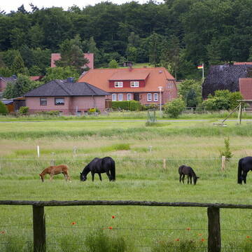
Paddocktrail, Aktivstall, Pferdepension
Soltau
Osteo & Hoof Care
@Christina-Grefe-Flessner
Freizeitstall
Geländestrecke
Vermieten
Führanlage
Hunde willkommen
Allergikerstall
Notfallboxen
21 weitere...
B


Schanzenhof Handeloh Offenstallhaltung und Boxen
Handeloh
Schanzenhof
@Schanzenhof
FN-Mitglied
Freizeitstall
Hunde willkommen
Krankenbox
Allergikerstall
Hufrehe geeignet
Außenbox mit Paddock
Außenboxen
22 weitere...
ganz aktuell
S
Deprecated: Creation of dynamic property Zend_View_Helper_Ads::$adLink is deprecated in /var/www/stall-frei/htdocs/staging.stall-frei.de/library/Psf/View/Helper/Ads.php on line 108

Futtersack HeuToy, Fressbremse in pink
Mechtersen
STALL-FREIde Marketing
@STALL-FREI-Marketing
Stundenlange Beschäftigung die
Koliken vorbeugt, geringe Staubinhalation mit
steuerbarer Futterentnahme

Offenstallplatz in Wallach-WG frei
Schneverdingen
Cornelia
@Cornelia-Koller
Krankenbox
Longierzirkel/Roundpen
Allergikerstall
Notfallboxen
Offenstall
Halbpension
Selbstversorgung
8 weitere...
P

Freie Pferdeboxen auf dem Heidehof Rehlingen
Rehlingen
Heidehof-Rehlingen
@Heidehof-Rehlingen
Freizeitstall
Vermieten
Longierzirkel/Roundpen
Paddock
Außenboxen
10 weitere...
P
Leider kein Vorschaubild
Leider kein Vorschaubild
Pferdebox auf dem Oehlshof
Soltau
Janina
@Janina77
Geländestrecke
Vermieten
Krankenbox
Longierzirkel/Roundpen
Notfallboxen
15 weitere...
B


Heiners Reiterhof hat Plätze frei 💕
Vierhöfen
Cord Vick
@HeinersReiterhof
FN-Mitglied
Freizeitstall
Hunde willkommen
Longierzirkel/Roundpen
Außenbox mit Paddock
Innenbox
Halbpension
Selbstversorgung
17 weitere...
S
Hof Bartholdt, 21376 Lübberstedt
Gödenstorf
Hof-Bartholdt
@Hof-Bartholdt
FN-Mitglied
Freizeitstall
Vermieten
Longierzirkel/Roundpen
Parkplatz für Pferdeanhänger
Pferdezucht
Zuchtstutenhaltung möglich
18 weitere...
P+
Leider kein Vorschaubild
Leider kein Vorschaubild
Offenstallplätze frei
Faßberg
M.Schöfer
@HofWacholderheideGbR
Freizeitstall
Vermieten
Hunde willkommen
Krankenbox
Notfallboxen
14 weitere...
B


Offenstall,Rentner,Allergiker,Weide,Vollpension
Bergen
Sandra-Gralher
@Sandra-Gralher
Weide
Allergikerstall
Offenstall
Vollpension
P
Leider kein Vorschaubild
Leider kein Vorschaubild
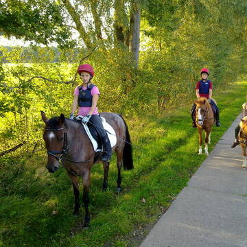
Große Paddockbox mit tägl. Weidegang
Schneverdingen
Heber Stall
@Inneke
Freizeitstall
Pferdeausbildung
Vermieten
Hunde willkommen
Longierzirkel/Roundpen
Allergikerstall
Fohlenaufzucht möglich
21 weitere...
B
Veröffentliche deine Suche als Gesuch und Suchauftrag, dann erhältst du Angebote, neue Treffer und Änderungen per E-Mail.
Diese Suche als Gesuch veröffentlichenDeprecated: Creation of dynamic property Zend_View::$pageCount is deprecated in /var/www/stall-frei/htdocs/staging.stall-frei.de/library/vendor/shardj/zf1-future/library/Zend/View/Abstract.php on line 308
Deprecated: Creation of dynamic property Zend_View::$itemCountPerPage is deprecated in /var/www/stall-frei/htdocs/staging.stall-frei.de/library/vendor/shardj/zf1-future/library/Zend/View/Abstract.php on line 308
Deprecated: Creation of dynamic property Zend_View::$first is deprecated in /var/www/stall-frei/htdocs/staging.stall-frei.de/library/vendor/shardj/zf1-future/library/Zend/View/Abstract.php on line 308
Deprecated: Creation of dynamic property Zend_View::$current is deprecated in /var/www/stall-frei/htdocs/staging.stall-frei.de/library/vendor/shardj/zf1-future/library/Zend/View/Abstract.php on line 308
Deprecated: Creation of dynamic property Zend_View::$last is deprecated in /var/www/stall-frei/htdocs/staging.stall-frei.de/library/vendor/shardj/zf1-future/library/Zend/View/Abstract.php on line 308
Deprecated: Creation of dynamic property Zend_View::$previous is deprecated in /var/www/stall-frei/htdocs/staging.stall-frei.de/library/vendor/shardj/zf1-future/library/Zend/View/Abstract.php on line 308
Deprecated: Creation of dynamic property Zend_View::$next is deprecated in /var/www/stall-frei/htdocs/staging.stall-frei.de/library/vendor/shardj/zf1-future/library/Zend/View/Abstract.php on line 308
Deprecated: Creation of dynamic property Zend_View::$pagesInRange is deprecated in /var/www/stall-frei/htdocs/staging.stall-frei.de/library/vendor/shardj/zf1-future/library/Zend/View/Abstract.php on line 308
Deprecated: Creation of dynamic property Zend_View::$firstPageInRange is deprecated in /var/www/stall-frei/htdocs/staging.stall-frei.de/library/vendor/shardj/zf1-future/library/Zend/View/Abstract.php on line 308
Deprecated: Creation of dynamic property Zend_View::$lastPageInRange is deprecated in /var/www/stall-frei/htdocs/staging.stall-frei.de/library/vendor/shardj/zf1-future/library/Zend/View/Abstract.php on line 308
Deprecated: Creation of dynamic property Zend_View::$currentItemCount is deprecated in /var/www/stall-frei/htdocs/staging.stall-frei.de/library/vendor/shardj/zf1-future/library/Zend/View/Abstract.php on line 308
Deprecated: Creation of dynamic property Zend_View::$totalItemCount is deprecated in /var/www/stall-frei/htdocs/staging.stall-frei.de/library/vendor/shardj/zf1-future/library/Zend/View/Abstract.php on line 308
Deprecated: Creation of dynamic property Zend_View::$firstItemNumber is deprecated in /var/www/stall-frei/htdocs/staging.stall-frei.de/library/vendor/shardj/zf1-future/library/Zend/View/Abstract.php on line 308
Deprecated: Creation of dynamic property Zend_View::$lastItemNumber is deprecated in /var/www/stall-frei/htdocs/staging.stall-frei.de/library/vendor/shardj/zf1-future/library/Zend/View/Abstract.php on line 308
Deprecated: Creation of dynamic property Zend_View::$router is deprecated in /var/www/stall-frei/htdocs/staging.stall-frei.de/library/vendor/shardj/zf1-future/library/Zend/View/Abstract.php on line 308
Deprecated: Creation of dynamic property Zend_View::$urlParams is deprecated in /var/www/stall-frei/htdocs/staging.stall-frei.de/library/vendor/shardj/zf1-future/library/Zend/View/Abstract.php on line 308
Deprecated: Creation of dynamic property Zend_View::$showAds is deprecated in /var/www/stall-frei/htdocs/staging.stall-frei.de/library/vendor/shardj/zf1-future/library/Zend/View/Abstract.php on line 308
Deprecated: Creation of dynamic property Zend_View::$objectIds is deprecated in /var/www/stall-frei/htdocs/staging.stall-frei.de/library/vendor/shardj/zf1-future/library/Zend/View/Abstract.php on line 308
Deprecated: Creation of dynamic property Zend_View::$showNavbar is deprecated in /var/www/stall-frei/htdocs/staging.stall-frei.de/library/vendor/shardj/zf1-future/library/Zend/View/Abstract.php on line 308
Deprecated: Creation of dynamic property Zend_View::$showBreadcrumb is deprecated in /var/www/stall-frei/htdocs/staging.stall-frei.de/library/vendor/shardj/zf1-future/library/Zend/View/Abstract.php on line 308
Deprecated: Creation of dynamic property Zend_View::$showFooter is deprecated in /var/www/stall-frei/htdocs/staging.stall-frei.de/library/vendor/shardj/zf1-future/library/Zend/View/Abstract.php on line 308
Deprecated: Creation of dynamic property Zend_View::$showInternalAds is deprecated in /var/www/stall-frei/htdocs/staging.stall-frei.de/library/vendor/shardj/zf1-future/library/Zend/View/Abstract.php on line 308
Deprecated: Creation of dynamic property Zend_View::$blNoContent is deprecated in /var/www/stall-frei/htdocs/staging.stall-frei.de/library/vendor/shardj/zf1-future/library/Zend/View/Abstract.php on line 308
Deprecated: Creation of dynamic property Zend_View::$sMetaDesc is deprecated in /var/www/stall-frei/htdocs/staging.stall-frei.de/library/vendor/shardj/zf1-future/library/Zend/View/Abstract.php on line 308
Deprecated: Creation of dynamic property Zend_View::$useGmaps is deprecated in /var/www/stall-frei/htdocs/staging.stall-frei.de/library/vendor/shardj/zf1-future/library/Zend/View/Abstract.php on line 308
Deprecated: Creation of dynamic property Zend_View::$touches is deprecated in /var/www/stall-frei/htdocs/staging.stall-frei.de/library/vendor/shardj/zf1-future/library/Zend/View/Abstract.php on line 308
Deprecated: Creation of dynamic property Zend_View::$oProject is deprecated in /var/www/stall-frei/htdocs/staging.stall-frei.de/library/vendor/shardj/zf1-future/library/Zend/View/Abstract.php on line 308
Deprecated: Creation of dynamic property Zend_View::$pageHeadline is deprecated in /var/www/stall-frei/htdocs/staging.stall-frei.de/library/vendor/shardj/zf1-future/library/Zend/View/Abstract.php on line 308
Deprecated: Creation of dynamic property Zend_View::$disableLocationField is deprecated in /var/www/stall-frei/htdocs/staging.stall-frei.de/library/vendor/shardj/zf1-future/library/Zend/View/Abstract.php on line 308
Deprecated: Creation of dynamic property Zend_View::$isSearch is deprecated in /var/www/stall-frei/htdocs/staging.stall-frei.de/library/vendor/shardj/zf1-future/library/Zend/View/Abstract.php on line 308
Deprecated: Creation of dynamic property Zend_View::$pageTitle is deprecated in /var/www/stall-frei/htdocs/staging.stall-frei.de/library/vendor/shardj/zf1-future/library/Zend/View/Abstract.php on line 308
Deprecated: Creation of dynamic property Psf_Form_Element_Text::$class is deprecated in /var/www/stall-frei/htdocs/staging.stall-frei.de/library/vendor/shardj/zf1-future/library/Zend/Form/Element.php on line 874
Deprecated: Creation of dynamic property Psf_Form_Element_Text::$size is deprecated in /var/www/stall-frei/htdocs/staging.stall-frei.de/library/vendor/shardj/zf1-future/library/Zend/Form/Element.php on line 874
Deprecated: Creation of dynamic property Psf_Form_Element_Text::$placeholder is deprecated in /var/www/stall-frei/htdocs/staging.stall-frei.de/library/vendor/shardj/zf1-future/library/Zend/Form/Element.php on line 874
Deprecated: Creation of dynamic property Psf_Form_Element_Hidden::$class is deprecated in /var/www/stall-frei/htdocs/staging.stall-frei.de/library/vendor/shardj/zf1-future/library/Zend/Form/Element.php on line 874
Deprecated: Creation of dynamic property Psf_Form_Element_Hidden::$class is deprecated in /var/www/stall-frei/htdocs/staging.stall-frei.de/library/vendor/shardj/zf1-future/library/Zend/Form/Element.php on line 874
Deprecated: Creation of dynamic property Psf_Form_Element_Hidden::$class is deprecated in /var/www/stall-frei/htdocs/staging.stall-frei.de/library/vendor/shardj/zf1-future/library/Zend/Form/Element.php on line 874
Deprecated: Creation of dynamic property Psf_Form_Element_Hidden::$class is deprecated in /var/www/stall-frei/htdocs/staging.stall-frei.de/library/vendor/shardj/zf1-future/library/Zend/Form/Element.php on line 874
Deprecated: Creation of dynamic property Psf_Form_Element_Select::$class is deprecated in /var/www/stall-frei/htdocs/staging.stall-frei.de/library/vendor/shardj/zf1-future/library/Zend/Form/Element.php on line 874
Deprecated: Creation of dynamic property Psf_Form_Element_Select::$class is deprecated in /var/www/stall-frei/htdocs/staging.stall-frei.de/library/vendor/shardj/zf1-future/library/Zend/Form/Element.php on line 874
Deprecated: Creation of dynamic property Psf_Form_Element_Select::$class is deprecated in /var/www/stall-frei/htdocs/staging.stall-frei.de/library/vendor/shardj/zf1-future/library/Zend/Form/Element.php on line 874
Deprecated: Creation of dynamic property Psf_Form_Element_Select::$class is deprecated in /var/www/stall-frei/htdocs/staging.stall-frei.de/library/vendor/shardj/zf1-future/library/Zend/Form/Element.php on line 874
Deprecated: Creation of dynamic property Psf_Form_Element_Text::$class is deprecated in /var/www/stall-frei/htdocs/staging.stall-frei.de/library/vendor/shardj/zf1-future/library/Zend/Form/Element.php on line 874
Deprecated: Creation of dynamic property Psf_Form_Element_Checkbox::$label is deprecated in /var/www/stall-frei/htdocs/staging.stall-frei.de/library/vendor/shardj/zf1-future/library/Zend/Form/Element.php on line 874
Deprecated: Creation of dynamic property Zend_View::$sort is deprecated in /var/www/stall-frei/htdocs/staging.stall-frei.de/library/vendor/shardj/zf1-future/library/Zend/View/Abstract.php on line 308
Deprecated: Creation of dynamic property Zend_View::$searchLocation is deprecated in /var/www/stall-frei/htdocs/staging.stall-frei.de/library/vendor/shardj/zf1-future/library/Zend/View/Abstract.php on line 308
Deprecated: Creation of dynamic property Zend_View::$locationHint is deprecated in /var/www/stall-frei/htdocs/staging.stall-frei.de/library/vendor/shardj/zf1-future/library/Zend/View/Abstract.php on line 308
Psf_GeoCoder_Abstract::getLocation: Kronsberg Get Location CachedOrLive
Psf_GeoCoder_Abstract::getCachedOrLive: Kronsberg
Psf_GeoCoder_Abstract::convertLocationResult
{"documentation":"https:\/\/opencagedata.com\/api","licenses":[{"name":"see attribution guide","url":"https:\/\/opencagedata.com\/credits"}],"results":[{"bounds":{"northeast":{"lat":52.984755,"lng":10.041133},"southwest":{"lat":52.984655,"lng":10.041033}},"components":{"ISO_3166-1_alpha-2":"DE","ISO_3166-1_alpha-3":"DEU","ISO_3166-2":["DE-NI"],"_category":"natural\/water","_normalized_city":"Munster","_type":"peak","continent":"Europe","country":"Deutschland","country_code":"de","county":"Heidekreis","peak":"Kronsberg","political_union":"European Union","state":"Niedersachsen","state_code":"NI","town":"Munster"},"confidence":9,"formatted":"Kronsberg, Munster, Niedersachsen, Deutschland","geometry":{"lat":52.984705,"lng":10.041083}},{"bounds":{"northeast":{"lat":54.5273922,"lng":9.9559714},"southwest":{"lat":54.5272922,"lng":9.9558714}},"components":{"ISO_3166-1_alpha-2":"DE","ISO_3166-1_alpha-3":"DEU","ISO_3166-2":["DE-SH"],"_category":"natural\/water","_normalized_city":"Waabs","_type":"peak","continent":"Europe","country":"Deutschland","country_code":"de","county":"Kreis Rendsburg-Eckernf\u00f6rde","municipality":"Schlei-Ostsee","peak":"Kronsberg","political_union":"European Union","postcode":"24369","state":"Schleswig-Holstein","state_code":"SH","village":"Waabs"},"confidence":9,"formatted":"Kronsberg, 24369 Waabs, Deutschland","geometry":{"lat":54.5273422,"lng":9.9559214}},{"bounds":{"northeast":{"lat":51.6450437,"lng":11.0758673},"southwest":{"lat":51.6449437,"lng":11.0757673}},"components":{"ISO_3166-1_alpha-2":"DE","ISO_3166-1_alpha-3":"DEU","ISO_3166-2":["DE-ST"],"_category":"natural\/water","_normalized_city":"Harzgerode","_type":"peak","continent":"Europe","country":"Deutschland","country_code":"de","county":"Landkreis Harz","peak":"Kronsberg","political_union":"European Union","state":"Sachsen-Anhalt","state_code":"ST","town":"Harzgerode"},"confidence":9,"formatted":"Kronsberg, Harzgerode, Sachsen-Anhalt, Deutschland","geometry":{"lat":51.6449937,"lng":11.0758173}},{"bounds":{"northeast":{"lat":53.3695664,"lng":9.7807144},"southwest":{"lat":53.3694664,"lng":9.7806144}},"components":{"ISO_3166-1_alpha-2":"DE","ISO_3166-1_alpha-3":"DEU","ISO_3166-2":["DE-NI"],"_category":"natural\/water","_normalized_city":"Wenzendorf","_type":"peak","continent":"Europe","country":"Deutschland","country_code":"de","county":"Landkreis Harburg","municipality":"Samtgemeinde Hollenstedt","peak":"Kronsberg","political_union":"European Union","postcode":"21279","state":"Niedersachsen","state_code":"NI","village":"Wenzendorf"},"confidence":9,"formatted":"Kronsberg, 21279 Wenzendorf, Deutschland","geometry":{"lat":53.3695164,"lng":9.7806644}},{"bounds":{"northeast":{"lat":54.3454505,"lng":12.627909},"southwest":{"lat":54.3054505,"lng":12.587909}},"components":{"ISO_3166-1_alpha-2":"DE","ISO_3166-1_alpha-3":"DEU","ISO_3166-2":["DE-MV"],"_category":"place","_normalized_city":"Kronsberg","_type":"village","continent":"Europe","country":"Deutschland","country_code":"de","county":"Vorpommern-R\u00fcgen","political_union":"European Union","state":"Mecklenburg-Vorpommern","state_code":"MV","village":"Kronsberg"},"confidence":7,"formatted":"Kronsberg, Mecklenburg-Vorpommern, Deutschland","geometry":{"lat":54.3254505,"lng":12.607909}},{"bounds":{"northeast":{"lat":52.3581288,"lng":9.854295},"southwest":{"lat":52.3181288,"lng":9.814295}},"components":{"ISO_3166-1_alpha-2":"DE","ISO_3166-1_alpha-3":"DEU","ISO_3166-2":["DE-NI"],"_category":"place","_normalized_city":"Hannover","_type":"neighbourhood","city":"Hannover","city_district":"Kirchrode-Bemerode-W\u00fclferode","continent":"Europe","country":"Deutschland","country_code":"de","county":"Region Hannover","political_union":"European Union","postcode":"30539","state":"Niedersachsen","state_code":"NI","suburb":"Kronsberg"},"confidence":7,"formatted":"30539 Hannover, Deutschland","geometry":{"lat":52.3381288,"lng":9.834295}},{"bounds":{"northeast":{"lat":53.0185482,"lng":7.9331622},"southwest":{"lat":53.0138442,"lng":7.9256051}},"components":{"ISO_3166-1_alpha-2":"DE","ISO_3166-1_alpha-3":"DEU","ISO_3166-2":["DE-NI"],"_category":"unknown","_normalized_city":"B\u00f6sel","_type":"lake","continent":"Europe","country":"Deutschland","country_code":"de","county":"Landkreis Cloppenburg","lake":"Kronsberg","political_union":"European Union","postcode":"26219","state":"Niedersachsen","state_code":"NI","village":"B\u00f6sel"},"confidence":9,"formatted":"Kronsberg, 26219 B\u00f6sel, Deutschland","geometry":{"lat":53.0162591,"lng":7.9294869}},{"bounds":{"northeast":{"lat":53.9289481,"lng":13.3492089},"southwest":{"lat":53.8889481,"lng":13.3092089}},"components":{"ISO_3166-1_alpha-2":"DE","ISO_3166-1_alpha-3":"DEU","ISO_3166-2":["DE-MV"],"_category":"place","_normalized_city":"Jarmen","_type":"hamlet","continent":"Europe","country":"Deutschland","country_code":"de","county":"Vorpommern-Greifswald","hamlet":"Kronsberg","municipality":"Jarmen-Tutow","political_union":"European Union","postcode":"17126","state":"Mecklenburg-Vorpommern","state_code":"MV","town":"Jarmen"},"confidence":7,"formatted":"Kronsberg, 17126 Jarmen, Deutschland","geometry":{"lat":53.9089481,"lng":13.3292089}},{"bounds":{"northeast":{"lat":48.3188566,"lng":12.8203425},"southwest":{"lat":48.2988566,"lng":12.8003425}},"components":{"ISO_3166-1_alpha-2":"DE","ISO_3166-1_alpha-3":"DEU","ISO_3166-2":["DE-BY"],"_category":"agriculture","_normalized_city":"Erlbach","_type":"farm","continent":"Europe","country":"Deutschland","country_code":"de","county":"Landkreis Alt\u00f6tting","farm":"Kronsberg","hamlet":"Vorrathing","municipality":"Reischach (VGem)","political_union":"European Union","postcode":"84567","state":"Bayern","state_code":"BY","village":"Erlbach"},"confidence":8,"formatted":"Kronsberg, Vorrathing, 84567 Erlbach, Deutschland","geometry":{"lat":48.3088566,"lng":12.8103425}},{"bounds":{"northeast":{"lat":53.2941482,"lng":10.5208286},"southwest":{"lat":53.2913091,"lng":10.5144237}},"components":{"ISO_3166-1_alpha-2":"DE","ISO_3166-1_alpha-3":"DEU","ISO_3166-2":["DE-NI"],"_category":"place","_normalized_city":"Rullstorf","_type":"village","continent":"Europe","country":"Deutschland","country_code":"de","county":"Landkreis L\u00fcneburg","municipality":"Samtgemeinde Scharnebeck","political_union":"European Union","postcode":"21379","residential":"Kronsberg","state":"Niedersachsen","state_code":"NI","village":"Rullstorf"},"confidence":9,"formatted":"21379 Rullstorf, Deutschland","geometry":{"lat":53.2927328,"lng":10.5167349}}],"status":{"code":200,"message":"OK"},"stay_informed":{"blog":"https:\/\/blog.opencagedata.com","mastodon":"https:\/\/en.osm.town\/@opencage"},"thanks":"For using an OpenCage API","timestamp":{"created_http":"Sat, 07 Feb 2026 06:44:29 GMT","created_unix":1770446669},"total_results":10}Array
(
[0] => stdClass Object
(
[bounds] => stdClass Object
(
[northeast] => stdClass Object
(
[lat] => 52.984755
[lng] => 10.041133
)
[southwest] => stdClass Object
(
[lat] => 52.984655
[lng] => 10.041033
)
)
[components] => stdClass Object
(
[ISO_3166-1_alpha-2] => DE
[ISO_3166-1_alpha-3] => DEU
[ISO_3166-2] => Array
(
[0] => DE-NI
)
[_category] => natural/water
[_normalized_city] => Munster
[_type] => peak
[continent] => Europe
[country] => Deutschland
[country_code] => de
[county] => Heidekreis
[peak] => Kronsberg
[political_union] => European Union
[state] => Niedersachsen
[state_code] => NI
[town] => Munster
)
[confidence] => 9
[formatted] => Kronsberg, Munster, Niedersachsen, Deutschland
[geometry] => stdClass Object
(
[lat] => 52.984705
[lng] => 10.041083
)
)
[1] => stdClass Object
(
[bounds] => stdClass Object
(
[northeast] => stdClass Object
(
[lat] => 54.5273922
[lng] => 9.9559714
)
[southwest] => stdClass Object
(
[lat] => 54.5272922
[lng] => 9.9558714
)
)
[components] => stdClass Object
(
[ISO_3166-1_alpha-2] => DE
[ISO_3166-1_alpha-3] => DEU
[ISO_3166-2] => Array
(
[0] => DE-SH
)
[_category] => natural/water
[_normalized_city] => Waabs
[_type] => peak
[continent] => Europe
[country] => Deutschland
[country_code] => de
[county] => Kreis Rendsburg-Eckernförde
[municipality] => Schlei-Ostsee
[peak] => Kronsberg
[political_union] => European Union
[postcode] => 24369
[state] => Schleswig-Holstein
[state_code] => SH
[village] => Waabs
)
[confidence] => 9
[formatted] => Kronsberg, 24369 Waabs, Deutschland
[geometry] => stdClass Object
(
[lat] => 54.5273422
[lng] => 9.9559214
)
)
[2] => stdClass Object
(
[bounds] => stdClass Object
(
[northeast] => stdClass Object
(
[lat] => 51.6450437
[lng] => 11.0758673
)
[southwest] => stdClass Object
(
[lat] => 51.6449437
[lng] => 11.0757673
)
)
[components] => stdClass Object
(
[ISO_3166-1_alpha-2] => DE
[ISO_3166-1_alpha-3] => DEU
[ISO_3166-2] => Array
(
[0] => DE-ST
)
[_category] => natural/water
[_normalized_city] => Harzgerode
[_type] => peak
[continent] => Europe
[country] => Deutschland
[country_code] => de
[county] => Landkreis Harz
[peak] => Kronsberg
[political_union] => European Union
[state] => Sachsen-Anhalt
[state_code] => ST
[town] => Harzgerode
)
[confidence] => 9
[formatted] => Kronsberg, Harzgerode, Sachsen-Anhalt, Deutschland
[geometry] => stdClass Object
(
[lat] => 51.6449937
[lng] => 11.0758173
)
)
[3] => stdClass Object
(
[bounds] => stdClass Object
(
[northeast] => stdClass Object
(
[lat] => 53.3695664
[lng] => 9.7807144
)
[southwest] => stdClass Object
(
[lat] => 53.3694664
[lng] => 9.7806144
)
)
[components] => stdClass Object
(
[ISO_3166-1_alpha-2] => DE
[ISO_3166-1_alpha-3] => DEU
[ISO_3166-2] => Array
(
[0] => DE-NI
)
[_category] => natural/water
[_normalized_city] => Wenzendorf
[_type] => peak
[continent] => Europe
[country] => Deutschland
[country_code] => de
[county] => Landkreis Harburg
[municipality] => Samtgemeinde Hollenstedt
[peak] => Kronsberg
[political_union] => European Union
[postcode] => 21279
[state] => Niedersachsen
[state_code] => NI
[village] => Wenzendorf
)
[confidence] => 9
[formatted] => Kronsberg, 21279 Wenzendorf, Deutschland
[geometry] => stdClass Object
(
[lat] => 53.3695164
[lng] => 9.7806644
)
)
[4] => stdClass Object
(
[bounds] => stdClass Object
(
[northeast] => stdClass Object
(
[lat] => 54.3454505
[lng] => 12.627909
)
[southwest] => stdClass Object
(
[lat] => 54.3054505
[lng] => 12.587909
)
)
[components] => stdClass Object
(
[ISO_3166-1_alpha-2] => DE
[ISO_3166-1_alpha-3] => DEU
[ISO_3166-2] => Array
(
[0] => DE-MV
)
[_category] => place
[_normalized_city] => Kronsberg
[_type] => village
[continent] => Europe
[country] => Deutschland
[country_code] => de
[county] => Vorpommern-Rügen
[political_union] => European Union
[state] => Mecklenburg-Vorpommern
[state_code] => MV
[village] => Kronsberg
)
[confidence] => 7
[formatted] => Kronsberg, Mecklenburg-Vorpommern, Deutschland
[geometry] => stdClass Object
(
[lat] => 54.3254505
[lng] => 12.607909
)
)
[5] => stdClass Object
(
[bounds] => stdClass Object
(
[northeast] => stdClass Object
(
[lat] => 52.3581288
[lng] => 9.854295
)
[southwest] => stdClass Object
(
[lat] => 52.3181288
[lng] => 9.814295
)
)
[components] => stdClass Object
(
[ISO_3166-1_alpha-2] => DE
[ISO_3166-1_alpha-3] => DEU
[ISO_3166-2] => Array
(
[0] => DE-NI
)
[_category] => place
[_normalized_city] => Hannover
[_type] => neighbourhood
[city] => Hannover
[city_district] => Kirchrode-Bemerode-Wülferode
[continent] => Europe
[country] => Deutschland
[country_code] => de
[county] => Region Hannover
[political_union] => European Union
[postcode] => 30539
[state] => Niedersachsen
[state_code] => NI
[suburb] => Kronsberg
)
[confidence] => 7
[formatted] => 30539 Hannover, Deutschland
[geometry] => stdClass Object
(
[lat] => 52.3381288
[lng] => 9.834295
)
)
[6] => stdClass Object
(
[bounds] => stdClass Object
(
[northeast] => stdClass Object
(
[lat] => 53.0185482
[lng] => 7.9331622
)
[southwest] => stdClass Object
(
[lat] => 53.0138442
[lng] => 7.9256051
)
)
[components] => stdClass Object
(
[ISO_3166-1_alpha-2] => DE
[ISO_3166-1_alpha-3] => DEU
[ISO_3166-2] => Array
(
[0] => DE-NI
)
[_category] => unknown
[_normalized_city] => Bösel
[_type] => lake
[continent] => Europe
[country] => Deutschland
[country_code] => de
[county] => Landkreis Cloppenburg
[lake] => Kronsberg
[political_union] => European Union
[postcode] => 26219
[state] => Niedersachsen
[state_code] => NI
[village] => Bösel
)
[confidence] => 9
[formatted] => Kronsberg, 26219 Bösel, Deutschland
[geometry] => stdClass Object
(
[lat] => 53.0162591
[lng] => 7.9294869
)
)
[7] => stdClass Object
(
[bounds] => stdClass Object
(
[northeast] => stdClass Object
(
[lat] => 53.9289481
[lng] => 13.3492089
)
[southwest] => stdClass Object
(
[lat] => 53.8889481
[lng] => 13.3092089
)
)
[components] => stdClass Object
(
[ISO_3166-1_alpha-2] => DE
[ISO_3166-1_alpha-3] => DEU
[ISO_3166-2] => Array
(
[0] => DE-MV
)
[_category] => place
[_normalized_city] => Jarmen
[_type] => hamlet
[continent] => Europe
[country] => Deutschland
[country_code] => de
[county] => Vorpommern-Greifswald
[hamlet] => Kronsberg
[municipality] => Jarmen-Tutow
[political_union] => European Union
[postcode] => 17126
[state] => Mecklenburg-Vorpommern
[state_code] => MV
[town] => Jarmen
)
[confidence] => 7
[formatted] => Kronsberg, 17126 Jarmen, Deutschland
[geometry] => stdClass Object
(
[lat] => 53.9089481
[lng] => 13.3292089
)
)
[8] => stdClass Object
(
[bounds] => stdClass Object
(
[northeast] => stdClass Object
(
[lat] => 48.3188566
[lng] => 12.8203425
)
[southwest] => stdClass Object
(
[lat] => 48.2988566
[lng] => 12.8003425
)
)
[components] => stdClass Object
(
[ISO_3166-1_alpha-2] => DE
[ISO_3166-1_alpha-3] => DEU
[ISO_3166-2] => Array
(
[0] => DE-BY
)
[_category] => agriculture
[_normalized_city] => Erlbach
[_type] => farm
[continent] => Europe
[country] => Deutschland
[country_code] => de
[county] => Landkreis Altötting
[farm] => Kronsberg
[hamlet] => Vorrathing
[municipality] => Reischach (VGem)
[political_union] => European Union
[postcode] => 84567
[state] => Bayern
[state_code] => BY
[village] => Erlbach
)
[confidence] => 8
[formatted] => Kronsberg, Vorrathing, 84567 Erlbach, Deutschland
[geometry] => stdClass Object
(
[lat] => 48.3088566
[lng] => 12.8103425
)
)
[9] => stdClass Object
(
[bounds] => stdClass Object
(
[northeast] => stdClass Object
(
[lat] => 53.2941482
[lng] => 10.5208286
)
[southwest] => stdClass Object
(
[lat] => 53.2913091
[lng] => 10.5144237
)
)
[components] => stdClass Object
(
[ISO_3166-1_alpha-2] => DE
[ISO_3166-1_alpha-3] => DEU
[ISO_3166-2] => Array
(
[0] => DE-NI
)
[_category] => place
[_normalized_city] => Rullstorf
[_type] => village
[continent] => Europe
[country] => Deutschland
[country_code] => de
[county] => Landkreis Lüneburg
[municipality] => Samtgemeinde Scharnebeck
[political_union] => European Union
[postcode] => 21379
[residential] => Kronsberg
[state] => Niedersachsen
[state_code] => NI
[village] => Rullstorf
)
[confidence] => 9
[formatted] => 21379 Rullstorf, Deutschland
[geometry] => stdClass Object
(
[lat] => 53.2927328
[lng] => 10.5167349
)
)
)
Psf_GeoCoder_OpenCageData::getKeyMap: 0
stdClass Object
(
    [bounds] => stdClass Object
        (
            [northeast] => stdClass Object
                (
                    [lat] => 52.984755
                    [lng] => 10.041133
                )

            [southwest] => stdClass Object
                (
                    [lat] => 52.984655
                    [lng] => 10.041033
                )

        )

    [components] => stdClass Object
        (
            [ISO_3166-1_alpha-2] => DE
            [ISO_3166-1_alpha-3] => DEU
            [ISO_3166-2] => Array
                (
                    [0] => DE-NI
                )

            [_category] => natural/water
            [_normalized_city] => Munster
            [_type] => peak
            [continent] => Europe
            [country] => Deutschland
            [country_code] => de
            [county] => Heidekreis
            [peak] => Kronsberg
            [political_union] => European Union
            [state] => Niedersachsen
            [state_code] => NI
            [town] => Munster
        )

    [confidence] => 9
    [formatted] => Kronsberg, Munster, Niedersachsen, Deutschland
    [geometry] => stdClass Object
        (
            [lat] => 52.984705
            [lng] => 10.041083
        )

)
Psf_GeoCoder_OpenCageData::getCounty: Heidekreis
Psf_GeoCoder_OpenCageData::addMissingData REFETCH!
Array
(
    [address] => Kronsberg, Munster, Niedersachsen, Deutschland
    [type] => peak
    [street] =>
    [city] => Munster
    [county] => Heidekreis
    [state] => Niedersachsen
    [zip] =>
    [country] => Deutschland
    [suburb] =>
    [countrycode] => de
    [latitude] => 52.984705
    [longitude] => 10.041083
    [accuracy] => 1
    [confidence] => 9
    [bounds] => stdClass Object
        (
            [northeast] => stdClass Object
                (
                    [lat] => 52.984755
                    [lng] => 10.041133
                )

            [southwest] => stdClass Object
                (
                    [lat] => 52.984655
                    [lng] => 10.041033
                )

        )

)
reformat!
Array
(
    [address] => Kronsberg, Munster, Niedersachsen, Deutschland
    [type] => peak
    [street] =>
    [city] => Munster
    [county] => Heidekreis
    [state] => Niedersachsen
    [zip] =>
    [country] => Deutschland
    [suburb] =>
    [countrycode] => de
    [latitude] => 52.984705
    [longitude] => 10.041083
    [accuracy] => 1
    [confidence] => 9
    [bounds] => stdClass Object
        (
            [northeast] => stdClass Object
                (
                    [lat] => 52.984755
                    [lng] => 10.041133
                )

            [southwest] => stdClass Object
                (
                    [lat] => 52.984655
                    [lng] => 10.041033
                )

        )

    [place] => Munster, Niedersachsen
    [hash] => e273965378650c1e5ad5df4f6ec92a1a
)
Psf_GeoCoder_OpenCageData::getKeyMap: 1
stdClass Object
(
    [bounds] => stdClass Object
        (
            [northeast] => stdClass Object
                (
                    [lat] => 54.5273922
                    [lng] => 9.9559714
                )

            [southwest] => stdClass Object
                (
                    [lat] => 54.5272922
                    [lng] => 9.9558714
                )

        )

    [components] => stdClass Object
        (
            [ISO_3166-1_alpha-2] => DE
            [ISO_3166-1_alpha-3] => DEU
            [ISO_3166-2] => Array
                (
                    [0] => DE-SH
                )

            [_category] => natural/water
            [_normalized_city] => Waabs
            [_type] => peak
            [continent] => Europe
            [country] => Deutschland
            [country_code] => de
            [county] => Kreis Rendsburg-Eckernförde
            [municipality] => Schlei-Ostsee
            [peak] => Kronsberg
            [political_union] => European Union
            [postcode] => 24369
            [state] => Schleswig-Holstein
            [state_code] => SH
            [village] => Waabs
        )

    [confidence] => 9
    [formatted] => Kronsberg, 24369 Waabs, Deutschland
    [geometry] => stdClass Object
        (
            [lat] => 54.5273422
            [lng] => 9.9559214
        )

)
Psf_GeoCoder_OpenCageData::getCounty: Rendsburg-Eckernförde
Psf_GeoCoder_OpenCageData::addMissingData REFETCH!
Array
(
    [address] => Kronsberg, 24369 Waabs, Deutschland
    [type] => peak
    [street] =>
    [city] => Waabs
    [county] => Rendsburg-Eckernförde
    [state] => Schleswig-Holstein
    [zip] => 24369
    [country] => Deutschland
    [suburb] =>
    [countrycode] => de
    [latitude] => 54.5273422
    [longitude] => 9.9559214
    [accuracy] => 1
    [confidence] => 9
    [bounds] => stdClass Object
        (
            [northeast] => stdClass Object
                (
                    [lat] => 54.5273922
                    [lng] => 9.9559714
                )

            [southwest] => stdClass Object
                (
                    [lat] => 54.5272922
                    [lng] => 9.9558714
                )

        )

)
reformat!
Array
(
    [address] => Kronsberg, 24369 Waabs, Deutschland
    [type] => peak
    [street] =>
    [city] => Waabs
    [county] => Rendsburg-Eckernförde
    [state] => Schleswig-Holstein
    [zip] => 24369
    [country] => Deutschland
    [suburb] =>
    [countrycode] => de
    [latitude] => 54.5273422
    [longitude] => 9.9559214
    [accuracy] => 1
    [confidence] => 9
    [bounds] => stdClass Object
        (
            [northeast] => stdClass Object
                (
                    [lat] => 54.5273922
                    [lng] => 9.9559714
                )

            [southwest] => stdClass Object
                (
                    [lat] => 54.5272922
                    [lng] => 9.9558714
                )

        )

    [place] => 24369 Waabs, Schleswig-Holstein
    [hash] => 5c1b30a4d7c35cc6d42b8103e114fb98
)
Psf_GeoCoder_OpenCageData::getKeyMap: 2
stdClass Object
(
    [bounds] => stdClass Object
        (
            [northeast] => stdClass Object
                (
                    [lat] => 51.6450437
                    [lng] => 11.0758673
                )

            [southwest] => stdClass Object
                (
                    [lat] => 51.6449437
                    [lng] => 11.0757673
                )

        )

    [components] => stdClass Object
        (
            [ISO_3166-1_alpha-2] => DE
            [ISO_3166-1_alpha-3] => DEU
            [ISO_3166-2] => Array
                (
                    [0] => DE-ST
                )

            [_category] => natural/water
            [_normalized_city] => Harzgerode
            [_type] => peak
            [continent] => Europe
            [country] => Deutschland
            [country_code] => de
            [county] => Landkreis Harz
            [peak] => Kronsberg
            [political_union] => European Union
            [state] => Sachsen-Anhalt
            [state_code] => ST
            [town] => Harzgerode
        )

    [confidence] => 9
    [formatted] => Kronsberg, Harzgerode, Sachsen-Anhalt, Deutschland
    [geometry] => stdClass Object
        (
            [lat] => 51.6449937
            [lng] => 11.0758173
        )

)
Psf_GeoCoder_OpenCageData::getCounty: Harz
Psf_GeoCoder_OpenCageData::addMissingData REFETCH!
Array
(
    [address] => Kronsberg, Harzgerode, Sachsen-Anhalt, Deutschland
    [type] => peak
    [street] =>
    [city] => Harzgerode
    [county] => Harz
    [state] => Sachsen-Anhalt
    [zip] =>
    [country] => Deutschland
    [suburb] =>
    [countrycode] => de
    [latitude] => 51.6449937
    [longitude] => 11.0758173
    [accuracy] => 1
    [confidence] => 9
    [bounds] => stdClass Object
        (
            [northeast] => stdClass Object
                (
                    [lat] => 51.6450437
                    [lng] => 11.0758673
                )

            [southwest] => stdClass Object
                (
                    [lat] => 51.6449437
                    [lng] => 11.0757673
                )

        )

)
reformat!
Array
(
    [address] => Kronsberg, Harzgerode, Sachsen-Anhalt, Deutschland
    [type] => peak
    [street] =>
    [city] => Harzgerode
    [county] => Harz
    [state] => Sachsen-Anhalt
    [zip] =>
    [country] => Deutschland
    [suburb] =>
    [countrycode] => de
    [latitude] => 51.6449937
    [longitude] => 11.0758173
    [accuracy] => 1
    [confidence] => 9
    [bounds] => stdClass Object
        (
            [northeast] => stdClass Object
                (
                    [lat] => 51.6450437
                    [lng] => 11.0758673
                )

            [southwest] => stdClass Object
                (
                    [lat] => 51.6449437
                    [lng] => 11.0757673
                )

        )

    [place] => Harzgerode, Sachsen-Anhalt
    [hash] => 03ab6185757bff93ba281adca15e6d74
)
Psf_GeoCoder_OpenCageData::getKeyMap: 3
stdClass Object
(
    [bounds] => stdClass Object
        (
            [northeast] => stdClass Object
                (
                    [lat] => 53.3695664
                    [lng] => 9.7807144
                )

            [southwest] => stdClass Object
                (
                    [lat] => 53.3694664
                    [lng] => 9.7806144
                )

        )

    [components] => stdClass Object
        (
            [ISO_3166-1_alpha-2] => DE
            [ISO_3166-1_alpha-3] => DEU
            [ISO_3166-2] => Array
                (
                    [0] => DE-NI
                )

            [_category] => natural/water
            [_normalized_city] => Wenzendorf
            [_type] => peak
            [continent] => Europe
            [country] => Deutschland
            [country_code] => de
            [county] => Landkreis Harburg
            [municipality] => Samtgemeinde Hollenstedt
            [peak] => Kronsberg
            [political_union] => European Union
            [postcode] => 21279
            [state] => Niedersachsen
            [state_code] => NI
            [village] => Wenzendorf
        )

    [confidence] => 9
    [formatted] => Kronsberg, 21279 Wenzendorf, Deutschland
    [geometry] => stdClass Object
        (
            [lat] => 53.3695164
            [lng] => 9.7806644
        )

)
Psf_GeoCoder_OpenCageData::getCounty: Harburg
Psf_GeoCoder_OpenCageData::addMissingData REFETCH!
Array
(
    [address] => Kronsberg, 21279 Wenzendorf, Deutschland
    [type] => peak
    [street] =>
    [city] => Wenzendorf
    [county] => Harburg
    [state] => Niedersachsen
    [zip] => 21279
    [country] => Deutschland
    [suburb] =>
    [countrycode] => de
    [latitude] => 53.3695164
    [longitude] => 9.7806644
    [accuracy] => 1
    [confidence] => 9
    [bounds] => stdClass Object
        (
            [northeast] => stdClass Object
                (
                    [lat] => 53.3695664
                    [lng] => 9.7807144
                )

            [southwest] => stdClass Object
                (
                    [lat] => 53.3694664
                    [lng] => 9.7806144
                )

        )

)
reformat!
Array
(
    [address] => Kronsberg, 21279 Wenzendorf, Deutschland
    [type] => peak
    [street] =>
    [city] => Wenzendorf
    [county] => Harburg
    [state] => Niedersachsen
    [zip] => 21279
    [country] => Deutschland
    [suburb] =>
    [countrycode] => de
    [latitude] => 53.3695164
    [longitude] => 9.7806644
    [accuracy] => 1
    [confidence] => 9
    [bounds] => stdClass Object
        (
            [northeast] => stdClass Object
                (
                    [lat] => 53.3695664
                    [lng] => 9.7807144
                )

            [southwest] => stdClass Object
                (
                    [lat] => 53.3694664
                    [lng] => 9.7806144
                )

        )

    [place] => 21279 Wenzendorf, Niedersachsen
    [hash] => ac6cd49709e0345f7fa8ea0fb0be8709
)
Psf_GeoCoder_OpenCageData::getKeyMap: 4
stdClass Object
(
    [bounds] => stdClass Object
        (
            [northeast] => stdClass Object
                (
                    [lat] => 54.3454505
                    [lng] => 12.627909
                )

            [southwest] => stdClass Object
                (
                    [lat] => 54.3054505
                    [lng] => 12.587909
                )

        )

    [components] => stdClass Object
        (
            [ISO_3166-1_alpha-2] => DE
            [ISO_3166-1_alpha-3] => DEU
            [ISO_3166-2] => Array
                (
                    [0] => DE-MV
                )

            [_category] => place
            [_normalized_city] => Kronsberg
            [_type] => village
            [continent] => Europe
            [country] => Deutschland
            [country_code] => de
            [county] => Vorpommern-Rügen
            [political_union] => European Union
            [state] => Mecklenburg-Vorpommern
            [state_code] => MV
            [village] => Kronsberg
        )

    [confidence] => 7
    [formatted] => Kronsberg, Mecklenburg-Vorpommern, Deutschland
    [geometry] => stdClass Object
        (
            [lat] => 54.3254505
            [lng] => 12.607909
        )

)
Psf_GeoCoder_OpenCageData::getCounty: Vorpommern-Rügen
Psf_GeoCoder_OpenCageData::addMissingData REFETCH!
Array
(
    [address] => Kronsberg, Mecklenburg-Vorpommern, Deutschland
    [type] => village
    [street] =>
    [city] => Kronsberg
    [county] => Vorpommern-Rügen
    [state] => Mecklenburg-Vorpommern
    [zip] =>
    [country] => Deutschland
    [suburb] =>
    [countrycode] => de
    [latitude] => 54.3254505
    [longitude] => 12.607909
    [accuracy] => 1
    [confidence] => 7
    [bounds] => stdClass Object
        (
            [northeast] => stdClass Object
                (
                    [lat] => 54.3454505
                    [lng] => 12.627909
                )

            [southwest] => stdClass Object
                (
                    [lat] => 54.3054505
                    [lng] => 12.587909
                )

        )

)
reformat!
Array
(
    [address] => Kronsberg, Mecklenburg-Vorpommern, Deutschland
    [type] => village
    [street] =>
    [city] => Kronsberg
    [county] => Vorpommern-Rügen
    [state] => Mecklenburg-Vorpommern
    [zip] =>
    [country] => Deutschland
    [suburb] =>
    [countrycode] => de
    [latitude] => 54.3254505
    [longitude] => 12.607909
    [accuracy] => 1
    [confidence] => 7
    [bounds] => stdClass Object
        (
            [northeast] => stdClass Object
                (
                    [lat] => 54.3454505
                    [lng] => 12.627909
                )

            [southwest] => stdClass Object
                (
                    [lat] => 54.3054505
                    [lng] => 12.587909
                )

        )

    [place] => Kronsberg, Mecklenburg-Vorpommern
    [hash] => a4ee953ed11f5886205e41c2896e29a7
)
Psf_GeoCoder_OpenCageData::getKeyMap: 5
stdClass Object
(
    [bounds] => stdClass Object
        (
            [northeast] => stdClass Object
                (
                    [lat] => 52.3581288
                    [lng] => 9.854295
                )

            [southwest] => stdClass Object
                (
                    [lat] => 52.3181288
                    [lng] => 9.814295
                )

        )

    [components] => stdClass Object
        (
            [ISO_3166-1_alpha-2] => DE
            [ISO_3166-1_alpha-3] => DEU
            [ISO_3166-2] => Array
                (
                    [0] => DE-NI
                )

            [_category] => place
            [_normalized_city] => Hannover
            [_type] => neighbourhood
            [city] => Hannover
            [city_district] => Kirchrode-Bemerode-Wülferode
            [continent] => Europe
            [country] => Deutschland
            [country_code] => de
            [county] => Region Hannover
            [political_union] => European Union
            [postcode] => 30539
            [state] => Niedersachsen
            [state_code] => NI
            [suburb] => Kronsberg
        )

    [confidence] => 7
    [formatted] => 30539 Hannover, Deutschland
    [geometry] => stdClass Object
        (
            [lat] => 52.3381288
            [lng] => 9.834295
        )

)
Psf_GeoCoder_OpenCageData::getCounty: Hannover
Psf_GeoCoder_OpenCageData::addMissingData REFETCH!
Array
(
    [address] => 30539 Hannover, Deutschland
    [type] => neighbourhood
    [street] =>
    [city] => Kronsberg
    [county] => Hannover
    [state] => Niedersachsen
    [zip] => 30539
    [country] => Deutschland
    [suburb] => Kronsberg
    [countrycode] => de
    [latitude] => 52.3381288
    [longitude] => 9.834295
    [accuracy] => 1
    [confidence] => 7
    [bounds] => stdClass Object
        (
            [northeast] => stdClass Object
                (
                    [lat] => 52.3581288
                    [lng] => 9.854295
                )

            [southwest] => stdClass Object
                (
                    [lat] => 52.3181288
                    [lng] => 9.814295
                )

        )

)
reformat!
Array
(
    [address] => 30539 Kronsberg
    [type] => neighbourhood
    [street] =>
    [city] => Kronsberg
    [county] => Hannover
    [state] => Niedersachsen
    [zip] => 30539
    [country] => Deutschland
    [suburb] => Kronsberg
    [countrycode] => de
    [latitude] => 52.3381288
    [longitude] => 9.834295
    [accuracy] => 1
    [confidence] => 7
    [bounds] => stdClass Object
        (
            [northeast] => stdClass Object
                (
                    [lat] => 52.3581288
                    [lng] => 9.854295
                )

            [southwest] => stdClass Object
                (
                    [lat] => 52.3181288
                    [lng] => 9.814295
                )

        )

    [place] => 30539 Kronsberg, Niedersachsen
    [hash] => dcd0b4a8a918bd2f4b9adf3761cc3ef7
)
Psf_GeoCoder_OpenCageData::getKeyMap: 6
stdClass Object
(
    [bounds] => stdClass Object
        (
            [northeast] => stdClass Object
                (
                    [lat] => 53.0185482
                    [lng] => 7.9331622
                )

            [southwest] => stdClass Object
                (
                    [lat] => 53.0138442
                    [lng] => 7.9256051
                )

        )

    [components] => stdClass Object
        (
            [ISO_3166-1_alpha-2] => DE
            [ISO_3166-1_alpha-3] => DEU
            [ISO_3166-2] => Array
                (
                    [0] => DE-NI
                )

            [_category] => unknown
            [_normalized_city] => Bösel
            [_type] => lake
            [continent] => Europe
            [country] => Deutschland
            [country_code] => de
            [county] => Landkreis Cloppenburg
            [lake] => Kronsberg
            [political_union] => European Union
            [postcode] => 26219
            [state] => Niedersachsen
            [state_code] => NI
            [village] => Bösel
        )

    [confidence] => 9
    [formatted] => Kronsberg, 26219 Bösel, Deutschland
    [geometry] => stdClass Object
        (
            [lat] => 53.0162591
            [lng] => 7.9294869
        )

)
Psf_GeoCoder_OpenCageData::getCounty: Cloppenburg
Psf_GeoCoder_OpenCageData::addMissingData REFETCH!
Array
(
    [address] => Kronsberg, 26219 Bösel, Deutschland
    [type] => lake
    [street] =>
    [city] => Bösel
    [county] => Cloppenburg
    [state] => Niedersachsen
    [zip] => 26219
    [country] => Deutschland
    [suburb] =>
    [countrycode] => de
    [latitude] => 53.0162591
    [longitude] => 7.9294869
    [accuracy] => 1
    [confidence] => 9
    [bounds] => stdClass Object
        (
            [northeast] => stdClass Object
                (
                    [lat] => 53.0185482
                    [lng] => 7.9331622
                )

            [southwest] => stdClass Object
                (
                    [lat] => 53.0138442
                    [lng] => 7.9256051
                )

        )

)
reformat!
Array
(
    [address] => Kronsberg, 26219 Bösel, Deutschland
    [type] => lake
    [street] =>
    [city] => Bösel
    [county] => Cloppenburg
    [state] => Niedersachsen
    [zip] => 26219
    [country] => Deutschland
    [suburb] =>
    [countrycode] => de
    [latitude] => 53.0162591
    [longitude] => 7.9294869
    [accuracy] => 1
    [confidence] => 9
    [bounds] => stdClass Object
        (
            [northeast] => stdClass Object
                (
                    [lat] => 53.0185482
                    [lng] => 7.9331622
                )

            [southwest] => stdClass Object
                (
                    [lat] => 53.0138442
                    [lng] => 7.9256051
                )

        )

    [place] => 26219 Bösel, Niedersachsen
    [hash] => 716a20274d5d09279e02b84de6825fd0
)
Psf_GeoCoder_OpenCageData::getKeyMap: 7
stdClass Object
(
    [bounds] => stdClass Object
        (
            [northeast] => stdClass Object
                (
                    [lat] => 53.9289481
                    [lng] => 13.3492089
                )

            [southwest] => stdClass Object
                (
                    [lat] => 53.8889481
                    [lng] => 13.3092089
                )

        )

    [components] => stdClass Object
        (
            [ISO_3166-1_alpha-2] => DE
            [ISO_3166-1_alpha-3] => DEU
            [ISO_3166-2] => Array
                (
                    [0] => DE-MV
                )

            [_category] => place
            [_normalized_city] => Jarmen
            [_type] => hamlet
            [continent] => Europe
            [country] => Deutschland
            [country_code] => de
            [county] => Vorpommern-Greifswald
            [hamlet] => Kronsberg
            [municipality] => Jarmen-Tutow
            [political_union] => European Union
            [postcode] => 17126
            [state] => Mecklenburg-Vorpommern
            [state_code] => MV
            [town] => Jarmen
        )

    [confidence] => 7
    [formatted] => Kronsberg, 17126 Jarmen, Deutschland
    [geometry] => stdClass Object
        (
            [lat] => 53.9089481
            [lng] => 13.3292089
        )

)
Psf_GeoCoder_OpenCageData::getCounty: Vorpommern-Greifswald
Psf_GeoCoder_OpenCageData::addMissingData REFETCH!
Array
(
    [address] => Kronsberg, 17126 Jarmen, Deutschland
    [type] => hamlet
    [street] => Kronsberg
    [city] => Jarmen
    [county] => Vorpommern-Greifswald
    [state] => Mecklenburg-Vorpommern
    [zip] => 17126
    [country] => Deutschland
    [suburb] =>
    [countrycode] => de
    [latitude] => 53.9089481
    [longitude] => 13.3292089
    [accuracy] => 1
    [confidence] => 7
    [bounds] => stdClass Object
        (
            [northeast] => stdClass Object
                (
                    [lat] => 53.9289481
                    [lng] => 13.3492089
                )

            [southwest] => stdClass Object
                (
                    [lat] => 53.8889481
                    [lng] => 13.3092089
                )

        )

)
reformat!
Array
(
    [address] => Kronsberg, 17126 Jarmen, Deutschland
    [type] => hamlet
    [street] => Kronsberg
    [city] => Jarmen
    [county] => Vorpommern-Greifswald
    [state] => Mecklenburg-Vorpommern
    [zip] => 17126
    [country] => Deutschland
    [suburb] =>
    [countrycode] => de
    [latitude] => 53.9089481
    [longitude] => 13.3292089
    [accuracy] => 1
    [confidence] => 7
    [bounds] => stdClass Object
        (
            [northeast] => stdClass Object
                (
                    [lat] => 53.9289481
                    [lng] => 13.3492089
                )

            [southwest] => stdClass Object
                (
                    [lat] => 53.8889481
                    [lng] => 13.3092089
                )

        )

    [place] => Kronsberg, 17126 Jarmen, Mecklenburg-Vorpommern
    [hash] => 957d5ef22198c42fc9eeacd3ff08acaa
)
Psf_GeoCoder_OpenCageData::getKeyMap: 8
stdClass Object
(
    [bounds] => stdClass Object
        (
            [northeast] => stdClass Object
                (
                    [lat] => 48.3188566
                    [lng] => 12.8203425
                )

            [southwest] => stdClass Object
                (
                    [lat] => 48.2988566
                    [lng] => 12.8003425
                )

        )

    [components] => stdClass Object
        (
            [ISO_3166-1_alpha-2] => DE
            [ISO_3166-1_alpha-3] => DEU
            [ISO_3166-2] => Array
                (
                    [0] => DE-BY
                )

            [_category] => agriculture
            [_normalized_city] => Erlbach
            [_type] => farm
            [continent] => Europe
            [country] => Deutschland
            [country_code] => de
            [county] => Landkreis Altötting
            [farm] => Kronsberg
            [hamlet] => Vorrathing
            [municipality] => Reischach (VGem)
            [political_union] => European Union
            [postcode] => 84567
            [state] => Bayern
            [state_code] => BY
            [village] => Erlbach
        )

    [confidence] => 8
    [formatted] => Kronsberg, Vorrathing, 84567 Erlbach, Deutschland
    [geometry] => stdClass Object
        (
            [lat] => 48.3088566
            [lng] => 12.8103425
        )

)
Psf_GeoCoder_OpenCageData::getCounty: Altötting
Psf_GeoCoder_OpenCageData::addMissingData REFETCH!
Array
(
    [address] => Kronsberg, Vorrathing, 84567 Erlbach, Deutschland
    [type] => farm
    [street] => Vorrathing
    [city] => Erlbach
    [county] => Altötting
    [state] => Bayern
    [zip] => 84567
    [country] => Deutschland
    [suburb] =>
    [countrycode] => de
    [latitude] => 48.3088566
    [longitude] => 12.8103425
    [accuracy] => 1
    [confidence] => 8
    [bounds] => stdClass Object
        (
            [northeast] => stdClass Object
                (
                    [lat] => 48.3188566
                    [lng] => 12.8203425
                )

            [southwest] => stdClass Object
                (
                    [lat] => 48.2988566
                    [lng] => 12.8003425
                )

        )

)
reformat!
Array
(
    [address] => Kronsberg, Vorrathing, 84567 Erlbach, Deutschland
    [type] => farm
    [street] => Vorrathing
    [city] => Erlbach
    [county] => Altötting
    [state] => Bayern
    [zip] => 84567
    [country] => Deutschland
    [suburb] =>
    [countrycode] => de
    [latitude] => 48.3088566
    [longitude] => 12.8103425
    [accuracy] => 1
    [confidence] => 8
    [bounds] => stdClass Object
        (
            [northeast] => stdClass Object
                (
                    [lat] => 48.3188566
                    [lng] => 12.8203425
                )

            [southwest] => stdClass Object
                (
                    [lat] => 48.2988566
                    [lng] => 12.8003425
                )

        )

    [place] => Vorrathing, 84567 Erlbach, Bayern
    [hash] => 5c7d0d1330edc74064b140d381ad3b41
)
Psf_GeoCoder_OpenCageData::getKeyMap: 9
stdClass Object
(
    [bounds] => stdClass Object
        (
            [northeast] => stdClass Object
                (
                    [lat] => 53.2941482
                    [lng] => 10.5208286
                )

            [southwest] => stdClass Object
                (
                    [lat] => 53.2913091
                    [lng] => 10.5144237
                )

        )

    [components] => stdClass Object
        (
            [ISO_3166-1_alpha-2] => DE
            [ISO_3166-1_alpha-3] => DEU
            [ISO_3166-2] => Array
                (
                    [0] => DE-NI
                )

            [_category] => place
            [_normalized_city] => Rullstorf
            [_type] => village
            [continent] => Europe
            [country] => Deutschland
            [country_code] => de
            [county] => Landkreis Lüneburg
            [municipality] => Samtgemeinde Scharnebeck
            [political_union] => European Union
            [postcode] => 21379
            [residential] => Kronsberg
            [state] => Niedersachsen
            [state_code] => NI
            [village] => Rullstorf
        )

    [confidence] => 9
    [formatted] => 21379 Rullstorf, Deutschland
    [geometry] => stdClass Object
        (
            [lat] => 53.2927328
            [lng] => 10.5167349
        )

)
Psf_GeoCoder_OpenCageData::getCounty: Lüneburg
Psf_GeoCoder_OpenCageData::addMissingData REFETCH!
Array
(
    [address] => 21379 Rullstorf, Deutschland
    [type] => village
    [street] =>
    [city] => Rullstorf
    [county] => Lüneburg
    [state] => Niedersachsen
    [zip] => 21379
    [country] => Deutschland
    [suburb] =>
    [countrycode] => de
    [latitude] => 53.2927328
    [longitude] => 10.5167349
    [accuracy] => 1
    [confidence] => 9
    [bounds] => stdClass Object
        (
            [northeast] => stdClass Object
                (
                    [lat] => 53.2941482
                    [lng] => 10.5208286
                )

            [southwest] => stdClass Object
                (
                    [lat] => 53.2913091
                    [lng] => 10.5144237
                )

        )

)
reformat!
Array
(
    [address] => 21379 Rullstorf, Deutschland
    [type] => village
    [street] =>
    [city] => Rullstorf
    [county] => Lüneburg
    [state] => Niedersachsen
    [zip] => 21379
    [country] => Deutschland
    [suburb] =>
    [countrycode] => de
    [latitude] => 53.2927328
    [longitude] => 10.5167349
    [accuracy] => 1
    [confidence] => 9
    [bounds] => stdClass Object
        (
            [northeast] => stdClass Object
                (
                    [lat] => 53.2941482
                    [lng] => 10.5208286
                )

            [southwest] => stdClass Object
                (
                    [lat] => 53.2913091
                    [lng] => 10.5144237
                )

        )

    [place] => 21379 Rullstorf, Niedersachsen
    [hash] => a52d6a9d6be45b0904cfd1bc5cf2e3f0
)
Deprecated: Creation of dynamic property Zend_View::$locationHintStyle is deprecated in /var/www/stall-frei/htdocs/staging.stall-frei.de/library/vendor/shardj/zf1-future/library/Zend/View/Abstract.php on line 308
Deprecated: Creation of dynamic property Zend_View::$adGeoLocation is deprecated in /var/www/stall-frei/htdocs/staging.stall-frei.de/library/vendor/shardj/zf1-future/library/Zend/View/Abstract.php on line 308
Deprecated: Creation of dynamic property Zend_View::$recordCount is deprecated in /var/www/stall-frei/htdocs/staging.stall-frei.de/library/vendor/shardj/zf1-future/library/Zend/View/Abstract.php on line 308
Deprecated: Creation of dynamic property Zend_View::$paginationParams is deprecated in /var/www/stall-frei/htdocs/staging.stall-frei.de/library/vendor/shardj/zf1-future/library/Zend/View/Abstract.php on line 308
Deprecated: Creation of dynamic property Zend_View::$objectPaginator is deprecated in /var/www/stall-frei/htdocs/staging.stall-frei.de/library/vendor/shardj/zf1-future/library/Zend/View/Abstract.php on line 308
Deprecated: Creation of dynamic property Zend_View::$featuredObjects is deprecated in /var/www/stall-frei/htdocs/staging.stall-frei.de/library/vendor/shardj/zf1-future/library/Zend/View/Abstract.php on line 308
Deprecated: Creation of dynamic property Zend_View::$hints is deprecated in /var/www/stall-frei/htdocs/staging.stall-frei.de/library/vendor/shardj/zf1-future/library/Zend/View/Abstract.php on line 308
Deprecated: Creation of dynamic property Zend_View::$attributeHints is deprecated in /var/www/stall-frei/htdocs/staging.stall-frei.de/library/vendor/shardj/zf1-future/library/Zend/View/Abstract.php on line 308
Deprecated: Creation of dynamic property Zend_View::$oSearchForm is deprecated in /var/www/stall-frei/htdocs/staging.stall-frei.de/library/vendor/shardj/zf1-future/library/Zend/View/Abstract.php on line 308