Deprecated: Creation of dynamic property Zend_View::$sMode is deprecated in /var/www/stall-frei/htdocs/staging.stall-frei.de/library/vendor/shardj/zf1-future/library/Zend/View/Abstract.php on line 308
Stallplatz oder Offenstall in Ingoldingen
Gesucht wird in "Burgberg, 88456 Ingoldingen, Deutschland"
6.333 Einträge
Deprecated: Creation of dynamic property Zend_View::$listObjects is deprecated in /var/www/stall-frei/htdocs/staging.stall-frei.de/library/vendor/shardj/zf1-future/library/Zend/View/Abstract.php on line 308
Gesponsort


Deprecated: Creation of dynamic property Zend_View::$listMode is deprecated in /var/www/stall-frei/htdocs/staging.stall-frei.de/library/vendor/shardj/zf1-future/library/Zend/View/Abstract.php on line 308
Deprecated: Creation of dynamic property Zend_View::$renderedObjects is deprecated in /var/www/stall-frei/htdocs/staging.stall-frei.de/library/vendor/shardj/zf1-future/library/Zend/View/Abstract.php on line 308
Deprecated: Creation of dynamic property Zend_View::$index is deprecated in /var/www/stall-frei/htdocs/staging.stall-frei.de/library/vendor/shardj/zf1-future/library/Zend/View/Abstract.php on line 308
Deprecated: Creation of dynamic property Zend_View::$displayMode is deprecated in /var/www/stall-frei/htdocs/staging.stall-frei.de/library/vendor/shardj/zf1-future/library/Zend/View/Abstract.php on line 308
Deprecated: Creation of dynamic property Zend_View::$remarketingIds is deprecated in /var/www/stall-frei/htdocs/staging.stall-frei.de/library/vendor/shardj/zf1-future/library/Zend/View/Abstract.php on line 308
Deprecated: Creation of dynamic property Zend_View::$listItem is deprecated in /var/www/stall-frei/htdocs/staging.stall-frei.de/library/vendor/shardj/zf1-future/library/Zend/View/Abstract.php on line 308
Deprecated: Creation of dynamic property Zend_View::$object is deprecated in /var/www/stall-frei/htdocs/staging.stall-frei.de/library/vendor/shardj/zf1-future/library/Zend/View/Abstract.php on line 308
Deprecated: Creation of dynamic property Zend_View::$attributes is deprecated in /var/www/stall-frei/htdocs/staging.stall-frei.de/library/vendor/shardj/zf1-future/library/Zend/View/Abstract.php on line 308
Leider kein Vorschaubild
Leider kein Vorschaubild
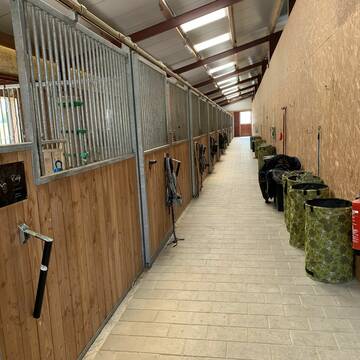
Pferdebox frei - Zuchtstuten/ Stute mit Fohlen
Ahlen
CMeyer
@CMeyer
Vermieten
Hunde willkommen
Pensions- und Gastboxen
Notfallboxen
Pferdezucht
Innenbox
8 weitere...
B
Leider kein Vorschaubild
Leider kein Vorschaubild
Freie Plätze im Laufstall
Bad Wurzach
Stefanie Restle
@Steffi81
Krankenbox
Sommerweide
Fohlenaufzucht möglich
Gnadenbrothof
Bewegungsstall
Laufstall
Vollpension
1 weitere...
B
Deprecated: Creation of dynamic property Zend_View_Helper_Ads::$adLink is deprecated in /var/www/stall-frei/htdocs/staging.stall-frei.de/library/Psf/View/Helper/Ads.php on line 108

Heu und Heulage verkaufen
Mechtersen
STALL-FREIde Marketing
@STALL-FREI-Marketing
Verkaufen Sie Ihr Heu und Ihre Heulage direkt an Reiter, Pferdeställe und Reitanlagen


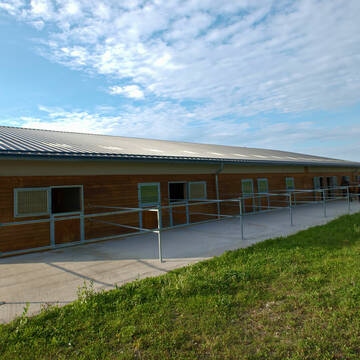
Reitanlage und Pferdepension Greckenhof
Ravensburg
Greckenhof-Reitanlage
@GreckenhofReitanlagePension
Freizeitstall
Geländestrecke
Vermieten
Führanlage
Paddock
Außenbox mit Paddock
12 weitere...
ganz aktuell
P+

Pferdepension Längle
Fulgenstadt
Franz Längle
@Pferdepension-Laengle
Freizeitstall
Geländestrecke
Vermieten
Longierzirkel/Roundpen
Reitplatz (z.B. Dressur, Springen, Reining)
Bewegungsstall
Laufstall
9 weitere...
P

Liebevolles zuhause für dein Pferd 🐴
Fronhofen
Anna Pfeffer
@Privatstall_Fronhofen
Weide
Allergikerstall
Gnadenbrothof
Außenbox mit Paddock
Vollpension
1 weitere...
P

Heu aus neuer Ernte
Mechtersen
STALL-FREIde Marketing
@STALL-FREI-Marketing
Heulage und Pferdeheu aus der neuen Ernte findest du in unserem Futtermarkt
Leider kein Vorschaubild
Leider kein Vorschaubild
Offenstallplatz für Rentner-Stute (200Euro)
Boms
Offenstall Rentnerstute
@Elisa4
Vermieten
Sommerweide
Videoüberwachung
Allergikerstall
bedampftes/gewaschenes Heu
Offenstall
Paddock Trail
5 weitere...
B

Entdecke die Vorteile unserer Atlantikheu - Herde!
Leutkirch im Allgäu
Pferdehof Zur Größermühle
@Pferdehof-Zur-Groessermuehle
Freizeitstall
Geländestrecke
Vermieten
Hunde willkommen
Krankenbox
Allergikerstall
Fohlenaufzucht möglich
34 weitere...
P
Leider kein Vorschaubild
Leider kein Vorschaubild
Pferdebox / Offenstall
Bad Saulgau
JoFi
@JoFi
Freizeitstall
Vermieten
Hunde willkommen
Paddock
Allergikerstall
10 weitere...
B
Leider kein Vorschaubild
Leider kein Vorschaubild
Offenstallplätze frei
Offenstall
@Offenstall86
Freizeitstall
Geländestrecke
Hunde willkommen
Paddock
Außenbox mit Paddock
Offenstall
Selbstversorgung
7 weitere...
B
Rehazentrum für Pferde & Hunde- Equicane The...
Ravensburg
Equicane-Therapie
@Equicane-Therapie
Pferdeausbildung
Rehabilitationsstall
Vermieten
Hunde willkommen
Krankenbox
Allergikerstall
Hengsthaltung möglich
16 weitere...
P+
Veröffentliche deine Suche als Gesuch und Suchauftrag, dann erhältst du Angebote, neue Treffer und Änderungen per E-Mail.
Diese Suche als Gesuch veröffentlichenDeprecated: Creation of dynamic property Zend_View::$pageCount is deprecated in /var/www/stall-frei/htdocs/staging.stall-frei.de/library/vendor/shardj/zf1-future/library/Zend/View/Abstract.php on line 308
Deprecated: Creation of dynamic property Zend_View::$itemCountPerPage is deprecated in /var/www/stall-frei/htdocs/staging.stall-frei.de/library/vendor/shardj/zf1-future/library/Zend/View/Abstract.php on line 308
Deprecated: Creation of dynamic property Zend_View::$first is deprecated in /var/www/stall-frei/htdocs/staging.stall-frei.de/library/vendor/shardj/zf1-future/library/Zend/View/Abstract.php on line 308
Deprecated: Creation of dynamic property Zend_View::$current is deprecated in /var/www/stall-frei/htdocs/staging.stall-frei.de/library/vendor/shardj/zf1-future/library/Zend/View/Abstract.php on line 308
Deprecated: Creation of dynamic property Zend_View::$last is deprecated in /var/www/stall-frei/htdocs/staging.stall-frei.de/library/vendor/shardj/zf1-future/library/Zend/View/Abstract.php on line 308
Deprecated: Creation of dynamic property Zend_View::$previous is deprecated in /var/www/stall-frei/htdocs/staging.stall-frei.de/library/vendor/shardj/zf1-future/library/Zend/View/Abstract.php on line 308
Deprecated: Creation of dynamic property Zend_View::$next is deprecated in /var/www/stall-frei/htdocs/staging.stall-frei.de/library/vendor/shardj/zf1-future/library/Zend/View/Abstract.php on line 308
Deprecated: Creation of dynamic property Zend_View::$pagesInRange is deprecated in /var/www/stall-frei/htdocs/staging.stall-frei.de/library/vendor/shardj/zf1-future/library/Zend/View/Abstract.php on line 308
Deprecated: Creation of dynamic property Zend_View::$firstPageInRange is deprecated in /var/www/stall-frei/htdocs/staging.stall-frei.de/library/vendor/shardj/zf1-future/library/Zend/View/Abstract.php on line 308
Deprecated: Creation of dynamic property Zend_View::$lastPageInRange is deprecated in /var/www/stall-frei/htdocs/staging.stall-frei.de/library/vendor/shardj/zf1-future/library/Zend/View/Abstract.php on line 308
Deprecated: Creation of dynamic property Zend_View::$currentItemCount is deprecated in /var/www/stall-frei/htdocs/staging.stall-frei.de/library/vendor/shardj/zf1-future/library/Zend/View/Abstract.php on line 308
Deprecated: Creation of dynamic property Zend_View::$totalItemCount is deprecated in /var/www/stall-frei/htdocs/staging.stall-frei.de/library/vendor/shardj/zf1-future/library/Zend/View/Abstract.php on line 308
Deprecated: Creation of dynamic property Zend_View::$firstItemNumber is deprecated in /var/www/stall-frei/htdocs/staging.stall-frei.de/library/vendor/shardj/zf1-future/library/Zend/View/Abstract.php on line 308
Deprecated: Creation of dynamic property Zend_View::$lastItemNumber is deprecated in /var/www/stall-frei/htdocs/staging.stall-frei.de/library/vendor/shardj/zf1-future/library/Zend/View/Abstract.php on line 308
Deprecated: Creation of dynamic property Zend_View::$router is deprecated in /var/www/stall-frei/htdocs/staging.stall-frei.de/library/vendor/shardj/zf1-future/library/Zend/View/Abstract.php on line 308
Deprecated: Creation of dynamic property Zend_View::$urlParams is deprecated in /var/www/stall-frei/htdocs/staging.stall-frei.de/library/vendor/shardj/zf1-future/library/Zend/View/Abstract.php on line 308
Deprecated: Creation of dynamic property Zend_View::$showAds is deprecated in /var/www/stall-frei/htdocs/staging.stall-frei.de/library/vendor/shardj/zf1-future/library/Zend/View/Abstract.php on line 308
Deprecated: Creation of dynamic property Zend_View::$objectIds is deprecated in /var/www/stall-frei/htdocs/staging.stall-frei.de/library/vendor/shardj/zf1-future/library/Zend/View/Abstract.php on line 308
Deprecated: Creation of dynamic property Zend_View::$showNavbar is deprecated in /var/www/stall-frei/htdocs/staging.stall-frei.de/library/vendor/shardj/zf1-future/library/Zend/View/Abstract.php on line 308
Deprecated: Creation of dynamic property Zend_View::$showBreadcrumb is deprecated in /var/www/stall-frei/htdocs/staging.stall-frei.de/library/vendor/shardj/zf1-future/library/Zend/View/Abstract.php on line 308
Deprecated: Creation of dynamic property Zend_View::$showFooter is deprecated in /var/www/stall-frei/htdocs/staging.stall-frei.de/library/vendor/shardj/zf1-future/library/Zend/View/Abstract.php on line 308
Deprecated: Creation of dynamic property Zend_View::$showInternalAds is deprecated in /var/www/stall-frei/htdocs/staging.stall-frei.de/library/vendor/shardj/zf1-future/library/Zend/View/Abstract.php on line 308
Deprecated: Creation of dynamic property Zend_View::$blNoContent is deprecated in /var/www/stall-frei/htdocs/staging.stall-frei.de/library/vendor/shardj/zf1-future/library/Zend/View/Abstract.php on line 308
Deprecated: Creation of dynamic property Zend_View::$sMetaDesc is deprecated in /var/www/stall-frei/htdocs/staging.stall-frei.de/library/vendor/shardj/zf1-future/library/Zend/View/Abstract.php on line 308
Deprecated: Creation of dynamic property Zend_View::$useGmaps is deprecated in /var/www/stall-frei/htdocs/staging.stall-frei.de/library/vendor/shardj/zf1-future/library/Zend/View/Abstract.php on line 308
Deprecated: Creation of dynamic property Zend_View::$touches is deprecated in /var/www/stall-frei/htdocs/staging.stall-frei.de/library/vendor/shardj/zf1-future/library/Zend/View/Abstract.php on line 308
Deprecated: Creation of dynamic property Zend_View::$oProject is deprecated in /var/www/stall-frei/htdocs/staging.stall-frei.de/library/vendor/shardj/zf1-future/library/Zend/View/Abstract.php on line 308
Deprecated: Creation of dynamic property Zend_View::$pageHeadline is deprecated in /var/www/stall-frei/htdocs/staging.stall-frei.de/library/vendor/shardj/zf1-future/library/Zend/View/Abstract.php on line 308
Deprecated: Creation of dynamic property Zend_View::$disableLocationField is deprecated in /var/www/stall-frei/htdocs/staging.stall-frei.de/library/vendor/shardj/zf1-future/library/Zend/View/Abstract.php on line 308
Deprecated: Creation of dynamic property Zend_View::$isSearch is deprecated in /var/www/stall-frei/htdocs/staging.stall-frei.de/library/vendor/shardj/zf1-future/library/Zend/View/Abstract.php on line 308
Deprecated: Creation of dynamic property Zend_View::$pageTitle is deprecated in /var/www/stall-frei/htdocs/staging.stall-frei.de/library/vendor/shardj/zf1-future/library/Zend/View/Abstract.php on line 308
Deprecated: Creation of dynamic property Psf_Form_Element_Text::$class is deprecated in /var/www/stall-frei/htdocs/staging.stall-frei.de/library/vendor/shardj/zf1-future/library/Zend/Form/Element.php on line 874
Deprecated: Creation of dynamic property Psf_Form_Element_Text::$size is deprecated in /var/www/stall-frei/htdocs/staging.stall-frei.de/library/vendor/shardj/zf1-future/library/Zend/Form/Element.php on line 874
Deprecated: Creation of dynamic property Psf_Form_Element_Text::$placeholder is deprecated in /var/www/stall-frei/htdocs/staging.stall-frei.de/library/vendor/shardj/zf1-future/library/Zend/Form/Element.php on line 874
Deprecated: Creation of dynamic property Psf_Form_Element_Hidden::$class is deprecated in /var/www/stall-frei/htdocs/staging.stall-frei.de/library/vendor/shardj/zf1-future/library/Zend/Form/Element.php on line 874
Deprecated: Creation of dynamic property Psf_Form_Element_Hidden::$class is deprecated in /var/www/stall-frei/htdocs/staging.stall-frei.de/library/vendor/shardj/zf1-future/library/Zend/Form/Element.php on line 874
Deprecated: Creation of dynamic property Psf_Form_Element_Hidden::$class is deprecated in /var/www/stall-frei/htdocs/staging.stall-frei.de/library/vendor/shardj/zf1-future/library/Zend/Form/Element.php on line 874
Deprecated: Creation of dynamic property Psf_Form_Element_Hidden::$class is deprecated in /var/www/stall-frei/htdocs/staging.stall-frei.de/library/vendor/shardj/zf1-future/library/Zend/Form/Element.php on line 874
Deprecated: Creation of dynamic property Psf_Form_Element_Select::$class is deprecated in /var/www/stall-frei/htdocs/staging.stall-frei.de/library/vendor/shardj/zf1-future/library/Zend/Form/Element.php on line 874
Deprecated: Creation of dynamic property Psf_Form_Element_Select::$class is deprecated in /var/www/stall-frei/htdocs/staging.stall-frei.de/library/vendor/shardj/zf1-future/library/Zend/Form/Element.php on line 874
Deprecated: Creation of dynamic property Psf_Form_Element_Select::$class is deprecated in /var/www/stall-frei/htdocs/staging.stall-frei.de/library/vendor/shardj/zf1-future/library/Zend/Form/Element.php on line 874
Deprecated: Creation of dynamic property Psf_Form_Element_Select::$class is deprecated in /var/www/stall-frei/htdocs/staging.stall-frei.de/library/vendor/shardj/zf1-future/library/Zend/Form/Element.php on line 874
Deprecated: Creation of dynamic property Psf_Form_Element_Text::$class is deprecated in /var/www/stall-frei/htdocs/staging.stall-frei.de/library/vendor/shardj/zf1-future/library/Zend/Form/Element.php on line 874
Deprecated: Creation of dynamic property Psf_Form_Element_Checkbox::$label is deprecated in /var/www/stall-frei/htdocs/staging.stall-frei.de/library/vendor/shardj/zf1-future/library/Zend/Form/Element.php on line 874
Deprecated: Creation of dynamic property Zend_View::$sort is deprecated in /var/www/stall-frei/htdocs/staging.stall-frei.de/library/vendor/shardj/zf1-future/library/Zend/View/Abstract.php on line 308
Deprecated: Creation of dynamic property Zend_View::$searchLocation is deprecated in /var/www/stall-frei/htdocs/staging.stall-frei.de/library/vendor/shardj/zf1-future/library/Zend/View/Abstract.php on line 308
Deprecated: Creation of dynamic property Zend_View::$locationHint is deprecated in /var/www/stall-frei/htdocs/staging.stall-frei.de/library/vendor/shardj/zf1-future/library/Zend/View/Abstract.php on line 308
Psf_GeoCoder_Abstract::getLocation: Burgberg Get Location CachedOrLive
Psf_GeoCoder_Abstract::getCachedOrLive: Burgberg
Psf_GeoCoder_Abstract::convertLocationResult
{"documentation":"https:\/\/opencagedata.com\/api","licenses":[{"name":"see attribution guide","url":"https:\/\/opencagedata.com\/credits"}],"results":[{"bounds":{"northeast":{"lat":47.9986631,"lng":9.7411554},"southwest":{"lat":47.9985631,"lng":9.7410554}},"components":{"ISO_3166-1_alpha-2":"DE","ISO_3166-1_alpha-3":"DEU","ISO_3166-2":["DE-BW"],"_category":"natural\/water","_normalized_city":"Ingoldingen","_type":"peak","continent":"Europe","country":"Deutschland","country_code":"de","county":"Landkreis Biberach","municipality":"VVG der Stadt Bad Schussenried","peak":"Burgberg","political_union":"European Union","postcode":"88456","state":"Baden-W\u00fcrttemberg","state_code":"BW","village":"Ingoldingen"},"confidence":9,"formatted":"Burgberg, 88456 Ingoldingen, Deutschland","geometry":{"lat":47.9986131,"lng":9.7411054}},{"bounds":{"northeast":{"lat":48.9639823,"lng":9.294481},"southwest":{"lat":48.9638823,"lng":9.294381}},"components":{"ISO_3166-1_alpha-2":"DE","ISO_3166-1_alpha-3":"DEU","ISO_3166-2":["DE-BW"],"_category":"natural\/water","_normalized_city":"Steinheim an der Murr","_type":"peak","continent":"Europe","country":"Deutschland","country_code":"de","county":"Landkreis Ludwigsburg","municipality":"GVV Steinheim-Murr","peak":"Burgberg","political_union":"European Union","postcode":"71729","state":"Baden-W\u00fcrttemberg","state_code":"BW","town":"Steinheim an der Murr"},"confidence":9,"formatted":"Burgberg, 71729 Steinheim an der Murr, Deutschland","geometry":{"lat":48.9639323,"lng":9.294431}},{"bounds":{"northeast":{"lat":49.6278433,"lng":11.0345395},"southwest":{"lat":49.5878433,"lng":10.9945395}},"components":{"ISO_3166-1_alpha-2":"DE","ISO_3166-1_alpha-3":"DEU","ISO_3166-2":["DE-BY"],"_category":"place","_normalized_city":"Erlangen","_type":"neighbourhood","city":"Erlangen","continent":"Europe","country":"Deutschland","country_code":"de","county":"Erlangen","political_union":"European Union","postcode":"91054","state":"Bayern","state_code":"BY","suburb":"Burgberg"},"confidence":7,"formatted":"91054 Erlangen, Deutschland","geometry":{"lat":49.6078433,"lng":11.0145395}},{"bounds":{"northeast":{"lat":51.8774605,"lng":9.5253416},"southwest":{"lat":51.8773605,"lng":9.5252416}},"components":{"ISO_3166-1_alpha-2":"DE","ISO_3166-1_alpha-3":"DEU","ISO_3166-2":["DE-NI"],"_category":"natural\/water","_normalized_city":"Golmbach","_type":"peak","continent":"Europe","country":"Deutschland","country_code":"de","county":"Landkreis Holzminden","municipality":"Samtgemeinde Bevern","peak":"Burgberg","political_union":"European Union","postcode":"37640","state":"Niedersachsen","state_code":"NI","village":"Golmbach"},"confidence":9,"formatted":"Burgberg, 37640 Golmbach, Deutschland","geometry":{"lat":51.8774105,"lng":9.5252916}},{"bounds":{"northeast":{"lat":50.1624465,"lng":11.0823458},"southwest":{"lat":50.1224465,"lng":11.0423458}},"components":{"ISO_3166-1_alpha-2":"DE","ISO_3166-1_alpha-3":"DEU","ISO_3166-2":["DE-BY"],"_category":"place","_normalized_city":"Lichtenfels","_type":"village","continent":"Europe","country":"Deutschland","country_code":"de","county":"Landkreis Lichtenfels","political_union":"European Union","postcode":"96215","state":"Bayern","state_code":"BY","town":"Lichtenfels","village":"Burgberg"},"confidence":7,"formatted":"96215 Burgberg, Deutschland","geometry":{"lat":50.1424465,"lng":11.0623458}},{"bounds":{"northeast":{"lat":49.1207201,"lng":9.9754046},"southwest":{"lat":49.1206201,"lng":9.9753046}},"components":{"ISO_3166-1_alpha-2":"DE","ISO_3166-1_alpha-3":"DEU","ISO_3166-2":["DE-BW"],"_category":"natural\/water","_normalized_city":"Frankenhardt","_type":"peak","continent":"Europe","country":"Deutschland","country_code":"de","county":"Landkreis Schw\u00e4bisch Hall","municipality":"Frankenhardt","peak":"Burgberg","political_union":"European Union","state":"Baden-W\u00fcrttemberg","state_code":"BW"},"confidence":9,"formatted":"Burgberg, Frankenhardt, Baden-W\u00fcrttemberg, Deutschland","geometry":{"lat":49.1206701,"lng":9.9753546}},{"bounds":{"northeast":{"lat":51.2843683,"lng":9.3334402},"southwest":{"lat":51.2842683,"lng":9.3333402}},"components":{"ISO_3166-1_alpha-2":"DE","ISO_3166-1_alpha-3":"DEU","ISO_3166-2":["DE-HE"],"_category":"natural\/water","_normalized_city":"Hoof","_type":"peak","continent":"Europe","country":"Deutschland","country_code":"de","county":"Landkreis Kassel","municipality":"Schauenburg","peak":"Burgberg","political_union":"European Union","postcode":"34270","state":"Hessen","state_code":"HE","village":"Hoof"},"confidence":9,"formatted":"Burgberg, 34270 Hoof, Deutschland","geometry":{"lat":51.2843183,"lng":9.3333902}},{"bounds":{"northeast":{"lat":50.6946258,"lng":6.4419762},"southwest":{"lat":50.6945258,"lng":6.4418762}},"components":{"ISO_3166-1_alpha-2":"DE","ISO_3166-1_alpha-3":"DEU","ISO_3166-2":["DE-NW"],"_category":"natural\/water","_normalized_city":"H\u00fcrtgenwald","_type":"peak","city":"H\u00fcrtgenwald","continent":"Europe","country":"Deutschland","country_code":"de","county":"Kreis D\u00fcren","peak":"Burgberg","political_union":"European Union","postcode":"52385","state":"Nordrhein-Westfalen","state_code":"NW"},"confidence":9,"formatted":"Burgberg, 52385 H\u00fcrtgenwald, Deutschland","geometry":{"lat":50.6945758,"lng":6.4419262}},{"bounds":{"northeast":{"lat":51.2487933,"lng":9.3603756},"southwest":{"lat":51.2486933,"lng":9.3602756}},"components":{"ISO_3166-1_alpha-2":"DE","ISO_3166-1_alpha-3":"DEU","ISO_3166-2":["DE-HE"],"_category":"natural\/water","_normalized_city":"Baunatal","_type":"peak","continent":"Europe","country":"Deutschland","country_code":"de","county":"Landkreis Kassel","peak":"Burgberg","political_union":"European Union","postcode":"34270","state":"Hessen","state_code":"HE","town":"Baunatal"},"confidence":9,"formatted":"Burgberg, 34270 Baunatal, Deutschland","geometry":{"lat":51.2487433,"lng":9.3603256}},{"components":{"ISO_3166-1_alpha-2":"FR","ISO_3166-1_alpha-3":"FRA","ISO_3166-2":["FR-OCC","FR-12"],"_category":"road","_normalized_city":"Sainte-Radegonde","_type":"road","city":"Sainte-Radegonde","continent":"Europe","country":"France","country_code":"fr","county":"Aveyron","local_authority":"Rodez Agglom\u00e9ration","political_union":"European Union","postcode":"12850","road":"Route de la Burguiere","state":"Occitanie","state_code":"OCC"},"confidence":2,"formatted":"Route de la Burguiere, 12850 Sainte-Radegonde, France","geometry":{"lat":44.320027,"lng":2.653046}}],"status":{"code":200,"message":"OK"},"stay_informed":{"blog":"https:\/\/blog.opencagedata.com","mastodon":"https:\/\/en.osm.town\/@opencage"},"thanks":"For using an OpenCage API","timestamp":{"created_http":"Sun, 08 Feb 2026 18:17:09 GMT","created_unix":1770574629},"total_results":10}Array
(
[0] => stdClass Object
(
[bounds] => stdClass Object
(
[northeast] => stdClass Object
(
[lat] => 47.9986631
[lng] => 9.7411554
)
[southwest] => stdClass Object
(
[lat] => 47.9985631
[lng] => 9.7410554
)
)
[components] => stdClass Object
(
[ISO_3166-1_alpha-2] => DE
[ISO_3166-1_alpha-3] => DEU
[ISO_3166-2] => Array
(
[0] => DE-BW
)
[_category] => natural/water
[_normalized_city] => Ingoldingen
[_type] => peak
[continent] => Europe
[country] => Deutschland
[country_code] => de
[county] => Landkreis Biberach
[municipality] => VVG der Stadt Bad Schussenried
[peak] => Burgberg
[political_union] => European Union
[postcode] => 88456
[state] => Baden-Württemberg
[state_code] => BW
[village] => Ingoldingen
)
[confidence] => 9
[formatted] => Burgberg, 88456 Ingoldingen, Deutschland
[geometry] => stdClass Object
(
[lat] => 47.9986131
[lng] => 9.7411054
)
)
[1] => stdClass Object
(
[bounds] => stdClass Object
(
[northeast] => stdClass Object
(
[lat] => 48.9639823
[lng] => 9.294481
)
[southwest] => stdClass Object
(
[lat] => 48.9638823
[lng] => 9.294381
)
)
[components] => stdClass Object
(
[ISO_3166-1_alpha-2] => DE
[ISO_3166-1_alpha-3] => DEU
[ISO_3166-2] => Array
(
[0] => DE-BW
)
[_category] => natural/water
[_normalized_city] => Steinheim an der Murr
[_type] => peak
[continent] => Europe
[country] => Deutschland
[country_code] => de
[county] => Landkreis Ludwigsburg
[municipality] => GVV Steinheim-Murr
[peak] => Burgberg
[political_union] => European Union
[postcode] => 71729
[state] => Baden-Württemberg
[state_code] => BW
[town] => Steinheim an der Murr
)
[confidence] => 9
[formatted] => Burgberg, 71729 Steinheim an der Murr, Deutschland
[geometry] => stdClass Object
(
[lat] => 48.9639323
[lng] => 9.294431
)
)
[2] => stdClass Object
(
[bounds] => stdClass Object
(
[northeast] => stdClass Object
(
[lat] => 49.6278433
[lng] => 11.0345395
)
[southwest] => stdClass Object
(
[lat] => 49.5878433
[lng] => 10.9945395
)
)
[components] => stdClass Object
(
[ISO_3166-1_alpha-2] => DE
[ISO_3166-1_alpha-3] => DEU
[ISO_3166-2] => Array
(
[0] => DE-BY
)
[_category] => place
[_normalized_city] => Erlangen
[_type] => neighbourhood
[city] => Erlangen
[continent] => Europe
[country] => Deutschland
[country_code] => de
[county] => Erlangen
[political_union] => European Union
[postcode] => 91054
[state] => Bayern
[state_code] => BY
[suburb] => Burgberg
)
[confidence] => 7
[formatted] => 91054 Erlangen, Deutschland
[geometry] => stdClass Object
(
[lat] => 49.6078433
[lng] => 11.0145395
)
)
[3] => stdClass Object
(
[bounds] => stdClass Object
(
[northeast] => stdClass Object
(
[lat] => 51.8774605
[lng] => 9.5253416
)
[southwest] => stdClass Object
(
[lat] => 51.8773605
[lng] => 9.5252416
)
)
[components] => stdClass Object
(
[ISO_3166-1_alpha-2] => DE
[ISO_3166-1_alpha-3] => DEU
[ISO_3166-2] => Array
(
[0] => DE-NI
)
[_category] => natural/water
[_normalized_city] => Golmbach
[_type] => peak
[continent] => Europe
[country] => Deutschland
[country_code] => de
[county] => Landkreis Holzminden
[municipality] => Samtgemeinde Bevern
[peak] => Burgberg
[political_union] => European Union
[postcode] => 37640
[state] => Niedersachsen
[state_code] => NI
[village] => Golmbach
)
[confidence] => 9
[formatted] => Burgberg, 37640 Golmbach, Deutschland
[geometry] => stdClass Object
(
[lat] => 51.8774105
[lng] => 9.5252916
)
)
[4] => stdClass Object
(
[bounds] => stdClass Object
(
[northeast] => stdClass Object
(
[lat] => 50.1624465
[lng] => 11.0823458
)
[southwest] => stdClass Object
(
[lat] => 50.1224465
[lng] => 11.0423458
)
)
[components] => stdClass Object
(
[ISO_3166-1_alpha-2] => DE
[ISO_3166-1_alpha-3] => DEU
[ISO_3166-2] => Array
(
[0] => DE-BY
)
[_category] => place
[_normalized_city] => Lichtenfels
[_type] => village
[continent] => Europe
[country] => Deutschland
[country_code] => de
[county] => Landkreis Lichtenfels
[political_union] => European Union
[postcode] => 96215
[state] => Bayern
[state_code] => BY
[town] => Lichtenfels
[village] => Burgberg
)
[confidence] => 7
[formatted] => 96215 Burgberg, Deutschland
[geometry] => stdClass Object
(
[lat] => 50.1424465
[lng] => 11.0623458
)
)
[5] => stdClass Object
(
[bounds] => stdClass Object
(
[northeast] => stdClass Object
(
[lat] => 49.1207201
[lng] => 9.9754046
)
[southwest] => stdClass Object
(
[lat] => 49.1206201
[lng] => 9.9753046
)
)
[components] => stdClass Object
(
[ISO_3166-1_alpha-2] => DE
[ISO_3166-1_alpha-3] => DEU
[ISO_3166-2] => Array
(
[0] => DE-BW
)
[_category] => natural/water
[_normalized_city] => Frankenhardt
[_type] => peak
[continent] => Europe
[country] => Deutschland
[country_code] => de
[county] => Landkreis Schwäbisch Hall
[municipality] => Frankenhardt
[peak] => Burgberg
[political_union] => European Union
[state] => Baden-Württemberg
[state_code] => BW
)
[confidence] => 9
[formatted] => Burgberg, Frankenhardt, Baden-Württemberg, Deutschland
[geometry] => stdClass Object
(
[lat] => 49.1206701
[lng] => 9.9753546
)
)
[6] => stdClass Object
(
[bounds] => stdClass Object
(
[northeast] => stdClass Object
(
[lat] => 51.2843683
[lng] => 9.3334402
)
[southwest] => stdClass Object
(
[lat] => 51.2842683
[lng] => 9.3333402
)
)
[components] => stdClass Object
(
[ISO_3166-1_alpha-2] => DE
[ISO_3166-1_alpha-3] => DEU
[ISO_3166-2] => Array
(
[0] => DE-HE
)
[_category] => natural/water
[_normalized_city] => Hoof
[_type] => peak
[continent] => Europe
[country] => Deutschland
[country_code] => de
[county] => Landkreis Kassel
[municipality] => Schauenburg
[peak] => Burgberg
[political_union] => European Union
[postcode] => 34270
[state] => Hessen
[state_code] => HE
[village] => Hoof
)
[confidence] => 9
[formatted] => Burgberg, 34270 Hoof, Deutschland
[geometry] => stdClass Object
(
[lat] => 51.2843183
[lng] => 9.3333902
)
)
[7] => stdClass Object
(
[bounds] => stdClass Object
(
[northeast] => stdClass Object
(
[lat] => 50.6946258
[lng] => 6.4419762
)
[southwest] => stdClass Object
(
[lat] => 50.6945258
[lng] => 6.4418762
)
)
[components] => stdClass Object
(
[ISO_3166-1_alpha-2] => DE
[ISO_3166-1_alpha-3] => DEU
[ISO_3166-2] => Array
(
[0] => DE-NW
)
[_category] => natural/water
[_normalized_city] => Hürtgenwald
[_type] => peak
[city] => Hürtgenwald
[continent] => Europe
[country] => Deutschland
[country_code] => de
[county] => Kreis Düren
[peak] => Burgberg
[political_union] => European Union
[postcode] => 52385
[state] => Nordrhein-Westfalen
[state_code] => NW
)
[confidence] => 9
[formatted] => Burgberg, 52385 Hürtgenwald, Deutschland
[geometry] => stdClass Object
(
[lat] => 50.6945758
[lng] => 6.4419262
)
)
[8] => stdClass Object
(
[bounds] => stdClass Object
(
[northeast] => stdClass Object
(
[lat] => 51.2487933
[lng] => 9.3603756
)
[southwest] => stdClass Object
(
[lat] => 51.2486933
[lng] => 9.3602756
)
)
[components] => stdClass Object
(
[ISO_3166-1_alpha-2] => DE
[ISO_3166-1_alpha-3] => DEU
[ISO_3166-2] => Array
(
[0] => DE-HE
)
[_category] => natural/water
[_normalized_city] => Baunatal
[_type] => peak
[continent] => Europe
[country] => Deutschland
[country_code] => de
[county] => Landkreis Kassel
[peak] => Burgberg
[political_union] => European Union
[postcode] => 34270
[state] => Hessen
[state_code] => HE
[town] => Baunatal
)
[confidence] => 9
[formatted] => Burgberg, 34270 Baunatal, Deutschland
[geometry] => stdClass Object
(
[lat] => 51.2487433
[lng] => 9.3603256
)
)
[9] => stdClass Object
(
[components] => stdClass Object
(
[ISO_3166-1_alpha-2] => FR
[ISO_3166-1_alpha-3] => FRA
[ISO_3166-2] => Array
(
[0] => FR-OCC
[1] => FR-12
)
[_category] => road
[_normalized_city] => Sainte-Radegonde
[_type] => road
[city] => Sainte-Radegonde
[continent] => Europe
[country] => France
[country_code] => fr
[county] => Aveyron
[local_authority] => Rodez Agglomération
[political_union] => European Union
[postcode] => 12850
[road] => Route de la Burguiere
[state] => Occitanie
[state_code] => OCC
)
[confidence] => 2
[formatted] => Route de la Burguiere, 12850 Sainte-Radegonde, France
[geometry] => stdClass Object
(
[lat] => 44.320027
[lng] => 2.653046
)
)
)
Psf_GeoCoder_OpenCageData::getKeyMap: 0
stdClass Object
(
    [bounds] => stdClass Object
        (
            [northeast] => stdClass Object
                (
                    [lat] => 47.9986631
                    [lng] => 9.7411554
                )

            [southwest] => stdClass Object
                (
                    [lat] => 47.9985631
                    [lng] => 9.7410554
                )

        )

    [components] => stdClass Object
        (
            [ISO_3166-1_alpha-2] => DE
            [ISO_3166-1_alpha-3] => DEU
            [ISO_3166-2] => Array
                (
                    [0] => DE-BW
                )

            [_category] => natural/water
            [_normalized_city] => Ingoldingen
            [_type] => peak
            [continent] => Europe
            [country] => Deutschland
            [country_code] => de
            [county] => Landkreis Biberach
            [municipality] => VVG der Stadt Bad Schussenried
            [peak] => Burgberg
            [political_union] => European Union
            [postcode] => 88456
            [state] => Baden-Württemberg
            [state_code] => BW
            [village] => Ingoldingen
        )

    [confidence] => 9
    [formatted] => Burgberg, 88456 Ingoldingen, Deutschland
    [geometry] => stdClass Object
        (
            [lat] => 47.9986131
            [lng] => 9.7411054
        )

)
Psf_GeoCoder_OpenCageData::getCounty: Biberach
Psf_GeoCoder_OpenCageData::addMissingData REFETCH!
Array
(
    [address] => Burgberg, 88456 Ingoldingen, Deutschland
    [type] => peak
    [street] =>
    [city] => Ingoldingen
    [county] => Biberach
    [state] => Baden-Württemberg
    [zip] => 88456
    [country] => Deutschland
    [suburb] =>
    [countrycode] => de
    [latitude] => 47.9986131
    [longitude] => 9.7411054
    [accuracy] => 1
    [confidence] => 9
    [bounds] => stdClass Object
        (
            [northeast] => stdClass Object
                (
                    [lat] => 47.9986631
                    [lng] => 9.7411554
                )

            [southwest] => stdClass Object
                (
                    [lat] => 47.9985631
                    [lng] => 9.7410554
                )

        )

)
reformat!
Array
(
    [address] => Burgberg, 88456 Ingoldingen, Deutschland
    [type] => peak
    [street] =>
    [city] => Ingoldingen
    [county] => Biberach
    [state] => Baden-Württemberg
    [zip] => 88456
    [country] => Deutschland
    [suburb] =>
    [countrycode] => de
    [latitude] => 47.9986131
    [longitude] => 9.7411054
    [accuracy] => 1
    [confidence] => 9
    [bounds] => stdClass Object
        (
            [northeast] => stdClass Object
                (
                    [lat] => 47.9986631
                    [lng] => 9.7411554
                )

            [southwest] => stdClass Object
                (
                    [lat] => 47.9985631
                    [lng] => 9.7410554
                )

        )

    [place] => 88456 Ingoldingen, Baden-Württemberg
    [hash] => 28ea5861e95c34bbff998954f543d6fb
)
Psf_GeoCoder_OpenCageData::getKeyMap: 1
stdClass Object
(
    [bounds] => stdClass Object
        (
            [northeast] => stdClass Object
                (
                    [lat] => 48.9639823
                    [lng] => 9.294481
                )

            [southwest] => stdClass Object
                (
                    [lat] => 48.9638823
                    [lng] => 9.294381
                )

        )

    [components] => stdClass Object
        (
            [ISO_3166-1_alpha-2] => DE
            [ISO_3166-1_alpha-3] => DEU
            [ISO_3166-2] => Array
                (
                    [0] => DE-BW
                )

            [_category] => natural/water
            [_normalized_city] => Steinheim an der Murr
            [_type] => peak
            [continent] => Europe
            [country] => Deutschland
            [country_code] => de
            [county] => Landkreis Ludwigsburg
            [municipality] => GVV Steinheim-Murr
            [peak] => Burgberg
            [political_union] => European Union
            [postcode] => 71729
            [state] => Baden-Württemberg
            [state_code] => BW
            [town] => Steinheim an der Murr
        )

    [confidence] => 9
    [formatted] => Burgberg, 71729 Steinheim an der Murr, Deutschland
    [geometry] => stdClass Object
        (
            [lat] => 48.9639323
            [lng] => 9.294431
        )

)
Psf_GeoCoder_OpenCageData::getCounty: Ludwigsburg
Psf_GeoCoder_OpenCageData::addMissingData REFETCH!
Array
(
    [address] => Burgberg, 71729 Steinheim an der Murr, Deutschland
    [type] => peak
    [street] =>
    [city] => Steinheim an der Murr
    [county] => Ludwigsburg
    [state] => Baden-Württemberg
    [zip] => 71729
    [country] => Deutschland
    [suburb] =>
    [countrycode] => de
    [latitude] => 48.9639323
    [longitude] => 9.294431
    [accuracy] => 1
    [confidence] => 9
    [bounds] => stdClass Object
        (
            [northeast] => stdClass Object
                (
                    [lat] => 48.9639823
                    [lng] => 9.294481
                )

            [southwest] => stdClass Object
                (
                    [lat] => 48.9638823
                    [lng] => 9.294381
                )

        )

)
reformat!
Array
(
    [address] => Burgberg, 71729 Steinheim an der Murr, Deutschland
    [type] => peak
    [street] =>
    [city] => Steinheim an der Murr
    [county] => Ludwigsburg
    [state] => Baden-Württemberg
    [zip] => 71729
    [country] => Deutschland
    [suburb] =>
    [countrycode] => de
    [latitude] => 48.9639323
    [longitude] => 9.294431
    [accuracy] => 1
    [confidence] => 9
    [bounds] => stdClass Object
        (
            [northeast] => stdClass Object
                (
                    [lat] => 48.9639823
                    [lng] => 9.294481
                )

            [southwest] => stdClass Object
                (
                    [lat] => 48.9638823
                    [lng] => 9.294381
                )

        )

    [place] => 71729 Steinheim an der Murr, Baden-Württemberg
    [hash] => dc424835469b85f5cd6442d68f3697af
)
Psf_GeoCoder_OpenCageData::getKeyMap: 2
stdClass Object
(
    [bounds] => stdClass Object
        (
            [northeast] => stdClass Object
                (
                    [lat] => 49.6278433
                    [lng] => 11.0345395
                )

            [southwest] => stdClass Object
                (
                    [lat] => 49.5878433
                    [lng] => 10.9945395
                )

        )

    [components] => stdClass Object
        (
            [ISO_3166-1_alpha-2] => DE
            [ISO_3166-1_alpha-3] => DEU
            [ISO_3166-2] => Array
                (
                    [0] => DE-BY
                )

            [_category] => place
            [_normalized_city] => Erlangen
            [_type] => neighbourhood
            [city] => Erlangen
            [continent] => Europe
            [country] => Deutschland
            [country_code] => de
            [county] => Erlangen
            [political_union] => European Union
            [postcode] => 91054
            [state] => Bayern
            [state_code] => BY
            [suburb] => Burgberg
        )

    [confidence] => 7
    [formatted] => 91054 Erlangen, Deutschland
    [geometry] => stdClass Object
        (
            [lat] => 49.6078433
            [lng] => 11.0145395
        )

)
Psf_GeoCoder_OpenCageData::getCounty: Erlangen
Psf_GeoCoder_OpenCageData::addMissingData REFETCH!
Array
(
    [address] => 91054 Erlangen, Deutschland
    [type] => neighbourhood
    [street] =>
    [city] => Burgberg
    [county] => Erlangen
    [state] => Bayern
    [zip] => 91054
    [country] => Deutschland
    [suburb] => Burgberg
    [countrycode] => de
    [latitude] => 49.6078433
    [longitude] => 11.0145395
    [accuracy] => 1
    [confidence] => 7
    [bounds] => stdClass Object
        (
            [northeast] => stdClass Object
                (
                    [lat] => 49.6278433
                    [lng] => 11.0345395
                )

            [southwest] => stdClass Object
                (
                    [lat] => 49.5878433
                    [lng] => 10.9945395
                )

        )

)
reformat!
Array
(
    [address] => 91054 Burgberg
    [type] => neighbourhood
    [street] =>
    [city] => Burgberg
    [county] => Erlangen
    [state] => Bayern
    [zip] => 91054
    [country] => Deutschland
    [suburb] => Burgberg
    [countrycode] => de
    [latitude] => 49.6078433
    [longitude] => 11.0145395
    [accuracy] => 1
    [confidence] => 7
    [bounds] => stdClass Object
        (
            [northeast] => stdClass Object
                (
                    [lat] => 49.6278433
                    [lng] => 11.0345395
                )

            [southwest] => stdClass Object
                (
                    [lat] => 49.5878433
                    [lng] => 10.9945395
                )

        )

    [place] => 91054 Burgberg, Bayern
    [hash] => 6c4a5a61ce1a0337e7d758dafd43038c
)
Psf_GeoCoder_OpenCageData::getKeyMap: 3
stdClass Object
(
    [bounds] => stdClass Object
        (
            [northeast] => stdClass Object
                (
                    [lat] => 51.8774605
                    [lng] => 9.5253416
                )

            [southwest] => stdClass Object
                (
                    [lat] => 51.8773605
                    [lng] => 9.5252416
                )

        )

    [components] => stdClass Object
        (
            [ISO_3166-1_alpha-2] => DE
            [ISO_3166-1_alpha-3] => DEU
            [ISO_3166-2] => Array
                (
                    [0] => DE-NI
                )

            [_category] => natural/water
            [_normalized_city] => Golmbach
            [_type] => peak
            [continent] => Europe
            [country] => Deutschland
            [country_code] => de
            [county] => Landkreis Holzminden
            [municipality] => Samtgemeinde Bevern
            [peak] => Burgberg
            [political_union] => European Union
            [postcode] => 37640
            [state] => Niedersachsen
            [state_code] => NI
            [village] => Golmbach
        )

    [confidence] => 9
    [formatted] => Burgberg, 37640 Golmbach, Deutschland
    [geometry] => stdClass Object
        (
            [lat] => 51.8774105
            [lng] => 9.5252916
        )

)
Psf_GeoCoder_OpenCageData::getCounty: Holzminden
Psf_GeoCoder_OpenCageData::addMissingData REFETCH!
Array
(
    [address] => Burgberg, 37640 Golmbach, Deutschland
    [type] => peak
    [street] =>
    [city] => Golmbach
    [county] => Holzminden
    [state] => Niedersachsen
    [zip] => 37640
    [country] => Deutschland
    [suburb] =>
    [countrycode] => de
    [latitude] => 51.8774105
    [longitude] => 9.5252916
    [accuracy] => 1
    [confidence] => 9
    [bounds] => stdClass Object
        (
            [northeast] => stdClass Object
                (
                    [lat] => 51.8774605
                    [lng] => 9.5253416
                )

            [southwest] => stdClass Object
                (
                    [lat] => 51.8773605
                    [lng] => 9.5252416
                )

        )

)
reformat!
Array
(
    [address] => Burgberg, 37640 Golmbach, Deutschland
    [type] => peak
    [street] =>
    [city] => Golmbach
    [county] => Holzminden
    [state] => Niedersachsen
    [zip] => 37640
    [country] => Deutschland
    [suburb] =>
    [countrycode] => de
    [latitude] => 51.8774105
    [longitude] => 9.5252916
    [accuracy] => 1
    [confidence] => 9
    [bounds] => stdClass Object
        (
            [northeast] => stdClass Object
                (
                    [lat] => 51.8774605
                    [lng] => 9.5253416
                )

            [southwest] => stdClass Object
                (
                    [lat] => 51.8773605
                    [lng] => 9.5252416
                )

        )

    [place] => 37640 Golmbach, Niedersachsen
    [hash] => 91d35f939235bc175276b3eee1d58c48
)
Psf_GeoCoder_OpenCageData::getKeyMap: 4
stdClass Object
(
    [bounds] => stdClass Object
        (
            [northeast] => stdClass Object
                (
                    [lat] => 50.1624465
                    [lng] => 11.0823458
                )

            [southwest] => stdClass Object
                (
                    [lat] => 50.1224465
                    [lng] => 11.0423458
                )

        )

    [components] => stdClass Object
        (
            [ISO_3166-1_alpha-2] => DE
            [ISO_3166-1_alpha-3] => DEU
            [ISO_3166-2] => Array
                (
                    [0] => DE-BY
                )

            [_category] => place
            [_normalized_city] => Lichtenfels
            [_type] => village
            [continent] => Europe
            [country] => Deutschland
            [country_code] => de
            [county] => Landkreis Lichtenfels
            [political_union] => European Union
            [postcode] => 96215
            [state] => Bayern
            [state_code] => BY
            [town] => Lichtenfels
            [village] => Burgberg
        )

    [confidence] => 7
    [formatted] => 96215 Burgberg, Deutschland
    [geometry] => stdClass Object
        (
            [lat] => 50.1424465
            [lng] => 11.0623458
        )

)
Psf_GeoCoder_OpenCageData::getCounty: Lichtenfels
Psf_GeoCoder_OpenCageData::addMissingData REFETCH!
Array
(
    [address] => 96215 Burgberg, Deutschland
    [type] => village
    [street] =>
    [city] => Lichtenfels
    [county] => Lichtenfels
    [state] => Bayern
    [zip] => 96215
    [country] => Deutschland
    [suburb] =>
    [countrycode] => de
    [latitude] => 50.1424465
    [longitude] => 11.0623458
    [accuracy] => 1
    [confidence] => 7
    [bounds] => stdClass Object
        (
            [northeast] => stdClass Object
                (
                    [lat] => 50.1624465
                    [lng] => 11.0823458
                )

            [southwest] => stdClass Object
                (
                    [lat] => 50.1224465
                    [lng] => 11.0423458
                )

        )

)
reformat!
Array
(
    [address] => 96215 Lichtenfels
    [type] => village
    [street] =>
    [city] => Lichtenfels
    [county] => Lichtenfels
    [state] => Bayern
    [zip] => 96215
    [country] => Deutschland
    [suburb] =>
    [countrycode] => de
    [latitude] => 50.1424465
    [longitude] => 11.0623458
    [accuracy] => 1
    [confidence] => 7
    [bounds] => stdClass Object
        (
            [northeast] => stdClass Object
                (
                    [lat] => 50.1624465
                    [lng] => 11.0823458
                )

            [southwest] => stdClass Object
                (
                    [lat] => 50.1224465
                    [lng] => 11.0423458
                )

        )

    [place] => 96215 Lichtenfels, Bayern
    [hash] => a3c2ce37faa73be70208c2d9336de768
)
Psf_GeoCoder_OpenCageData::getKeyMap: 5
stdClass Object
(
    [bounds] => stdClass Object
        (
            [northeast] => stdClass Object
                (
                    [lat] => 49.1207201
                    [lng] => 9.9754046
                )

            [southwest] => stdClass Object
                (
                    [lat] => 49.1206201
                    [lng] => 9.9753046
                )

        )

    [components] => stdClass Object
        (
            [ISO_3166-1_alpha-2] => DE
            [ISO_3166-1_alpha-3] => DEU
            [ISO_3166-2] => Array
                (
                    [0] => DE-BW
                )

            [_category] => natural/water
            [_normalized_city] => Frankenhardt
            [_type] => peak
            [continent] => Europe
            [country] => Deutschland
            [country_code] => de
            [county] => Landkreis Schwäbisch Hall
            [municipality] => Frankenhardt
            [peak] => Burgberg
            [political_union] => European Union
            [state] => Baden-Württemberg
            [state_code] => BW
        )

    [confidence] => 9
    [formatted] => Burgberg, Frankenhardt, Baden-Württemberg, Deutschland
    [geometry] => stdClass Object
        (
            [lat] => 49.1206701
            [lng] => 9.9753546
        )

)
Psf_GeoCoder_OpenCageData::getCounty: Schwäbisch Hall
Psf_GeoCoder_OpenCageData::addMissingData REFETCH!
Array
(
    [address] => Burgberg, Frankenhardt, Baden-Württemberg, Deutschland
    [type] => peak
    [street] =>
    [city] =>
    [county] => Schwäbisch Hall
    [state] => Baden-Württemberg
    [zip] =>
    [country] => Deutschland
    [suburb] =>
    [countrycode] => de
    [latitude] => 49.1206701
    [longitude] => 9.9753546
    [accuracy] => 1
    [confidence] => 9
    [bounds] => stdClass Object
        (
            [northeast] => stdClass Object
                (
                    [lat] => 49.1207201
                    [lng] => 9.9754046
                )

            [southwest] => stdClass Object
                (
                    [lat] => 49.1206201
                    [lng] => 9.9753046
                )

        )

)
reformat!
Array
(
    [address] => Burgberg, Frankenhardt, Baden-Württemberg, Deutschland
    [type] => peak
    [street] =>
    [city] =>
    [county] => Schwäbisch Hall
    [state] => Baden-Württemberg
    [zip] =>
    [country] => Deutschland
    [suburb] =>
    [countrycode] => de
    [latitude] => 49.1206701
    [longitude] => 9.9753546
    [accuracy] => 1
    [confidence] => 9
    [bounds] => stdClass Object
        (
            [northeast] => stdClass Object
                (
                    [lat] => 49.1207201
                    [lng] => 9.9754046
                )

            [southwest] => stdClass Object
                (
                    [lat] => 49.1206201
                    [lng] => 9.9753046
                )

        )

    [place] => , Baden-Württemberg
    [hash] => 950c298a94b56d49d9c51ebdbcf65ecd
)
Psf_GeoCoder_OpenCageData::getKeyMap: 6
stdClass Object
(
    [bounds] => stdClass Object
        (
            [northeast] => stdClass Object
                (
                    [lat] => 51.2843683
                    [lng] => 9.3334402
                )

            [southwest] => stdClass Object
                (
                    [lat] => 51.2842683
                    [lng] => 9.3333402
                )

        )

    [components] => stdClass Object
        (
            [ISO_3166-1_alpha-2] => DE
            [ISO_3166-1_alpha-3] => DEU
            [ISO_3166-2] => Array
                (
                    [0] => DE-HE
                )

            [_category] => natural/water
            [_normalized_city] => Hoof
            [_type] => peak
            [continent] => Europe
            [country] => Deutschland
            [country_code] => de
            [county] => Landkreis Kassel
            [municipality] => Schauenburg
            [peak] => Burgberg
            [political_union] => European Union
            [postcode] => 34270
            [state] => Hessen
            [state_code] => HE
            [village] => Hoof
        )

    [confidence] => 9
    [formatted] => Burgberg, 34270 Hoof, Deutschland
    [geometry] => stdClass Object
        (
            [lat] => 51.2843183
            [lng] => 9.3333902
        )

)
Psf_GeoCoder_OpenCageData::getCounty: Kassel
Psf_GeoCoder_OpenCageData::addMissingData REFETCH!
Array
(
    [address] => Burgberg, 34270 Hoof, Deutschland
    [type] => peak
    [street] =>
    [city] => Hoof
    [county] => Kassel
    [state] => Hessen
    [zip] => 34270
    [country] => Deutschland
    [suburb] =>
    [countrycode] => de
    [latitude] => 51.2843183
    [longitude] => 9.3333902
    [accuracy] => 1
    [confidence] => 9
    [bounds] => stdClass Object
        (
            [northeast] => stdClass Object
                (
                    [lat] => 51.2843683
                    [lng] => 9.3334402
                )

            [southwest] => stdClass Object
                (
                    [lat] => 51.2842683
                    [lng] => 9.3333402
                )

        )

)
reformat!
Array
(
    [address] => Burgberg, 34270 Hoof, Deutschland
    [type] => peak
    [street] =>
    [city] => Hoof
    [county] => Kassel
    [state] => Hessen
    [zip] => 34270
    [country] => Deutschland
    [suburb] =>
    [countrycode] => de
    [latitude] => 51.2843183
    [longitude] => 9.3333902
    [accuracy] => 1
    [confidence] => 9
    [bounds] => stdClass Object
        (
            [northeast] => stdClass Object
                (
                    [lat] => 51.2843683
                    [lng] => 9.3334402
                )

            [southwest] => stdClass Object
                (
                    [lat] => 51.2842683
                    [lng] => 9.3333402
                )

        )

    [place] => 34270 Hoof, Hessen
    [hash] => c638458b9fbdcab7a443e121f8cee11c
)
Psf_GeoCoder_OpenCageData::getKeyMap: 7
stdClass Object
(
    [bounds] => stdClass Object
        (
            [northeast] => stdClass Object
                (
                    [lat] => 50.6946258
                    [lng] => 6.4419762
                )

            [southwest] => stdClass Object
                (
                    [lat] => 50.6945258
                    [lng] => 6.4418762
                )

        )

    [components] => stdClass Object
        (
            [ISO_3166-1_alpha-2] => DE
            [ISO_3166-1_alpha-3] => DEU
            [ISO_3166-2] => Array
                (
                    [0] => DE-NW
                )

            [_category] => natural/water
            [_normalized_city] => Hürtgenwald
            [_type] => peak
            [city] => Hürtgenwald
            [continent] => Europe
            [country] => Deutschland
            [country_code] => de
            [county] => Kreis Düren
            [peak] => Burgberg
            [political_union] => European Union
            [postcode] => 52385
            [state] => Nordrhein-Westfalen
            [state_code] => NW
        )

    [confidence] => 9
    [formatted] => Burgberg, 52385 Hürtgenwald, Deutschland
    [geometry] => stdClass Object
        (
            [lat] => 50.6945758
            [lng] => 6.4419262
        )

)
Psf_GeoCoder_OpenCageData::getCounty: Düren
Psf_GeoCoder_OpenCageData::addMissingData REFETCH!
Array
(
    [address] => Burgberg, 52385 Hürtgenwald, Deutschland
    [type] => peak
    [street] =>
    [city] => Hürtgenwald
    [county] => Düren
    [state] => Nordrhein-Westfalen
    [zip] => 52385
    [country] => Deutschland
    [suburb] =>
    [countrycode] => de
    [latitude] => 50.6945758
    [longitude] => 6.4419262
    [accuracy] => 1
    [confidence] => 9
    [bounds] => stdClass Object
        (
            [northeast] => stdClass Object
                (
                    [lat] => 50.6946258
                    [lng] => 6.4419762
                )

            [southwest] => stdClass Object
                (
                    [lat] => 50.6945258
                    [lng] => 6.4418762
                )

        )

)
reformat!
Array
(
    [address] => Burgberg, 52385 Hürtgenwald, Deutschland
    [type] => peak
    [street] =>
    [city] => Hürtgenwald
    [county] => Düren
    [state] => Nordrhein-Westfalen
    [zip] => 52385
    [country] => Deutschland
    [suburb] =>
    [countrycode] => de
    [latitude] => 50.6945758
    [longitude] => 6.4419262
    [accuracy] => 1
    [confidence] => 9
    [bounds] => stdClass Object
        (
            [northeast] => stdClass Object
                (
                    [lat] => 50.6946258
                    [lng] => 6.4419762
                )

            [southwest] => stdClass Object
                (
                    [lat] => 50.6945258
                    [lng] => 6.4418762
                )

        )

    [place] => 52385 Hürtgenwald, Nordrhein-Westfalen
    [hash] => f98881762df116b34c3aedf3b1118c0b
)
Psf_GeoCoder_OpenCageData::getKeyMap: 8
stdClass Object
(
    [bounds] => stdClass Object
        (
            [northeast] => stdClass Object
                (
                    [lat] => 51.2487933
                    [lng] => 9.3603756
                )

            [southwest] => stdClass Object
                (
                    [lat] => 51.2486933
                    [lng] => 9.3602756
                )

        )

    [components] => stdClass Object
        (
            [ISO_3166-1_alpha-2] => DE
            [ISO_3166-1_alpha-3] => DEU
            [ISO_3166-2] => Array
                (
                    [0] => DE-HE
                )

            [_category] => natural/water
            [_normalized_city] => Baunatal
            [_type] => peak
            [continent] => Europe
            [country] => Deutschland
            [country_code] => de
            [county] => Landkreis Kassel
            [peak] => Burgberg
            [political_union] => European Union
            [postcode] => 34270
            [state] => Hessen
            [state_code] => HE
            [town] => Baunatal
        )

    [confidence] => 9
    [formatted] => Burgberg, 34270 Baunatal, Deutschland
    [geometry] => stdClass Object
        (
            [lat] => 51.2487433
            [lng] => 9.3603256
        )

)
Psf_GeoCoder_OpenCageData::getCounty: Kassel
Psf_GeoCoder_OpenCageData::addMissingData REFETCH!
Array
(
    [address] => Burgberg, 34270 Baunatal, Deutschland
    [type] => peak
    [street] =>
    [city] => Baunatal
    [county] => Kassel
    [state] => Hessen
    [zip] => 34270
    [country] => Deutschland
    [suburb] =>
    [countrycode] => de
    [latitude] => 51.2487433
    [longitude] => 9.3603256
    [accuracy] => 1
    [confidence] => 9
    [bounds] => stdClass Object
        (
            [northeast] => stdClass Object
                (
                    [lat] => 51.2487933
                    [lng] => 9.3603756
                )

            [southwest] => stdClass Object
                (
                    [lat] => 51.2486933
                    [lng] => 9.3602756
                )

        )

)
reformat!
Array
(
    [address] => Burgberg, 34270 Baunatal, Deutschland
    [type] => peak
    [street] =>
    [city] => Baunatal
    [county] => Kassel
    [state] => Hessen
    [zip] => 34270
    [country] => Deutschland
    [suburb] =>
    [countrycode] => de
    [latitude] => 51.2487433
    [longitude] => 9.3603256
    [accuracy] => 1
    [confidence] => 9
    [bounds] => stdClass Object
        (
            [northeast] => stdClass Object
                (
                    [lat] => 51.2487933
                    [lng] => 9.3603756
                )

            [southwest] => stdClass Object
                (
                    [lat] => 51.2486933
                    [lng] => 9.3602756
                )

        )

    [place] => 34270 Baunatal, Hessen
    [hash] => dc52aef3b9118b8b77435bdd9f8435b1
)
Psf_GeoCoder_OpenCageData::getKeyMap: 9
stdClass Object
(
    [components] => stdClass Object
        (
            [ISO_3166-1_alpha-2] => FR
            [ISO_3166-1_alpha-3] => FRA
            [ISO_3166-2] => Array
                (
                    [0] => FR-OCC
                    [1] => FR-12
                )

            [_category] => road
            [_normalized_city] => Sainte-Radegonde
            [_type] => road
            [city] => Sainte-Radegonde
            [continent] => Europe
            [country] => France
            [country_code] => fr
            [county] => Aveyron
            [local_authority] => Rodez Agglomération
            [political_union] => European Union
            [postcode] => 12850
            [road] => Route de la Burguiere
            [state] => Occitanie
            [state_code] => OCC
        )

    [confidence] => 2
    [formatted] => Route de la Burguiere, 12850 Sainte-Radegonde, France
    [geometry] => stdClass Object
        (
            [lat] => 44.320027
            [lng] => 2.653046
        )

)
Psf_GeoCoder_OpenCageData::getCounty: Aveyron
Psf_GeoCoder_OpenCageData::addMissingData REFETCH!
Array
(
    [address] => Route de la Burguiere, 12850 Sainte-Radegonde, France
    [type] => road
    [street] => Route de la Burguiere
    [city] => Sainte-Radegonde
    [county] => Aveyron
    [state] => Occitanie
    [zip] => 12850
    [country] => France
    [suburb] =>
    [countrycode] => fr
    [latitude] => 44.320027
    [longitude] => 2.653046
    [accuracy] => 1
    [confidence] => 2
    [bounds] =>
)
reformat!
Array
(
    [address] => Route de la Burguiere, 12850 Sainte-Radegonde, France
    [type] => road
    [street] => Route de la Burguiere
    [city] => Sainte-Radegonde
    [county] => Aveyron
    [state] => Occitanie
    [zip] => 12850
    [country] => France
    [suburb] =>
    [countrycode] => fr
    [latitude] => 44.320027
    [longitude] => 2.653046
    [accuracy] => 1
    [confidence] => 2
    [bounds] =>
    [place] => Route de la Burguiere, 12850 Sainte-Radegonde, Occitanie
    [hash] => 4215530d53afff52e66e493630491d8f
)
Deprecated: Creation of dynamic property Zend_View::$locationHintStyle is deprecated in /var/www/stall-frei/htdocs/staging.stall-frei.de/library/vendor/shardj/zf1-future/library/Zend/View/Abstract.php on line 308
Deprecated: Creation of dynamic property Zend_View::$adGeoLocation is deprecated in /var/www/stall-frei/htdocs/staging.stall-frei.de/library/vendor/shardj/zf1-future/library/Zend/View/Abstract.php on line 308
Deprecated: Creation of dynamic property Zend_View::$recordCount is deprecated in /var/www/stall-frei/htdocs/staging.stall-frei.de/library/vendor/shardj/zf1-future/library/Zend/View/Abstract.php on line 308
Deprecated: Creation of dynamic property Zend_View::$paginationParams is deprecated in /var/www/stall-frei/htdocs/staging.stall-frei.de/library/vendor/shardj/zf1-future/library/Zend/View/Abstract.php on line 308
Deprecated: Creation of dynamic property Zend_View::$objectPaginator is deprecated in /var/www/stall-frei/htdocs/staging.stall-frei.de/library/vendor/shardj/zf1-future/library/Zend/View/Abstract.php on line 308
Deprecated: Creation of dynamic property Zend_View::$featuredObjects is deprecated in /var/www/stall-frei/htdocs/staging.stall-frei.de/library/vendor/shardj/zf1-future/library/Zend/View/Abstract.php on line 308
Deprecated: Creation of dynamic property Zend_View::$hints is deprecated in /var/www/stall-frei/htdocs/staging.stall-frei.de/library/vendor/shardj/zf1-future/library/Zend/View/Abstract.php on line 308
Deprecated: Creation of dynamic property Zend_View::$attributeHints is deprecated in /var/www/stall-frei/htdocs/staging.stall-frei.de/library/vendor/shardj/zf1-future/library/Zend/View/Abstract.php on line 308
Deprecated: Creation of dynamic property Zend_View::$oSearchForm is deprecated in /var/www/stall-frei/htdocs/staging.stall-frei.de/library/vendor/shardj/zf1-future/library/Zend/View/Abstract.php on line 308