Deprecated: Creation of dynamic property Zend_View::$sMode is deprecated in /var/www/stall-frei/htdocs/staging.stall-frei.de/library/vendor/shardj/zf1-future/library/Zend/View/Abstract.php on line 308
Stallplatz oder Offenstall in Gmund
Gesucht wird in "Am Steinberg, 83703 Gmund, Deutschland"
6.329 Einträge
Deprecated: Creation of dynamic property Zend_View::$listObjects is deprecated in /var/www/stall-frei/htdocs/staging.stall-frei.de/library/vendor/shardj/zf1-future/library/Zend/View/Abstract.php on line 308
Gesponsort


Deprecated: Creation of dynamic property Zend_View::$listMode is deprecated in /var/www/stall-frei/htdocs/staging.stall-frei.de/library/vendor/shardj/zf1-future/library/Zend/View/Abstract.php on line 308
Deprecated: Creation of dynamic property Zend_View::$renderedObjects is deprecated in /var/www/stall-frei/htdocs/staging.stall-frei.de/library/vendor/shardj/zf1-future/library/Zend/View/Abstract.php on line 308
Deprecated: Creation of dynamic property Zend_View::$index is deprecated in /var/www/stall-frei/htdocs/staging.stall-frei.de/library/vendor/shardj/zf1-future/library/Zend/View/Abstract.php on line 308
Deprecated: Creation of dynamic property Zend_View::$displayMode is deprecated in /var/www/stall-frei/htdocs/staging.stall-frei.de/library/vendor/shardj/zf1-future/library/Zend/View/Abstract.php on line 308
Deprecated: Creation of dynamic property Zend_View::$remarketingIds is deprecated in /var/www/stall-frei/htdocs/staging.stall-frei.de/library/vendor/shardj/zf1-future/library/Zend/View/Abstract.php on line 308
Deprecated: Creation of dynamic property Zend_View::$listItem is deprecated in /var/www/stall-frei/htdocs/staging.stall-frei.de/library/vendor/shardj/zf1-future/library/Zend/View/Abstract.php on line 308
Deprecated: Creation of dynamic property Zend_View::$object is deprecated in /var/www/stall-frei/htdocs/staging.stall-frei.de/library/vendor/shardj/zf1-future/library/Zend/View/Abstract.php on line 308
Deprecated: Creation of dynamic property Zend_View::$attributes is deprecated in /var/www/stall-frei/htdocs/staging.stall-frei.de/library/vendor/shardj/zf1-future/library/Zend/View/Abstract.php on line 308
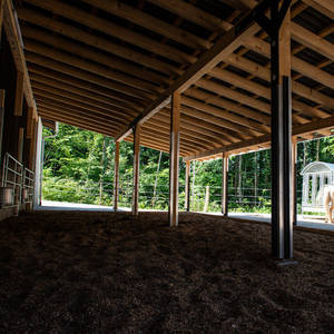
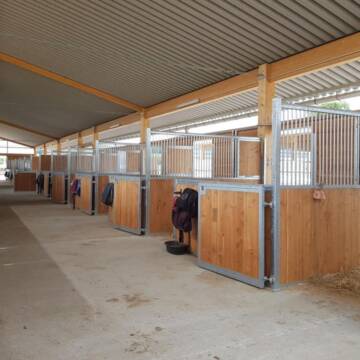
Offenstall für Wallache
Lenggries
Gut-Hohenburg
@Gut-Hohenburg
Vermieten
Paddock
Parkplatz für Pferdeanhänger
Offenstall
Einzelne Boxen oder Stallplätze
3 weitere...
P

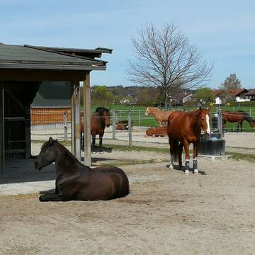
Islandpferde Offenstall
Irschenberg
Carolin Nebl
@Carolin-Nebl
Freizeitstall
Gangpferdereiten
Reitplatz (z.B. Dressur, Springen, Reining)
Sattelkammer/Sattelschränke
Hufrehe geeignet
Notfallboxen
Offenstall
6 weitere...
P
Deprecated: Creation of dynamic property Zend_View_Helper_Ads::$adLink is deprecated in /var/www/stall-frei/htdocs/staging.stall-frei.de/library/Psf/View/Helper/Ads.php on line 108

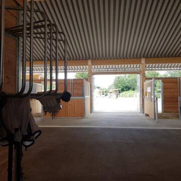
Pferdepension Hit Aktivstall Kürmerhof
Hohenkammer
Kuermerhof
@Kuermerhof
*******JETZT NEU MIT ENTSTAUBTEM BIOHEU*********
*******Demnächst mit einem Abenteuerspielplatz für Pferde ( Extrem Trail/Pa

Paddockboxen
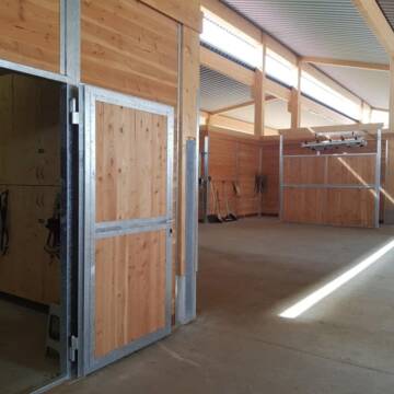
Irschenberg
private Reitanlage
@Pferdegesundheitszentrum-HV
Freizeitstall
Pferdeausbildung
Vermieten
Hunde willkommen
Krankenbox
Allergikerstall
bedampftes/gewaschenes Heu
27 weitere...
P

2x Offenstall Platz frei
Miesbach
Freizeitstall Unteraigen
@Veronika226
Freizeitstall
Pferdeausbildung
Hunde willkommen
Krankenbox
Außenbox mit Paddock
Außenboxen
Vollpension
16 weitere...
P
Messerschmidhof - Artgerecht und Individuell
Feldkirchen-Westerham
Messerschmidhof
@Messerschmidhof
FN-Mitglied
Führanlage
Hunde willkommen
Allergikerstall
bedampftes/gewaschenes Heu
Außenbox mit Paddock
Außenboxen
18 weitere...
P+


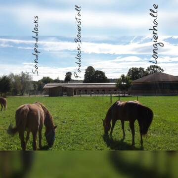
HIT-Aktiv Offenstall
Egmating
Reitanlage zum Kastl
@Reitanlage_zum_Kastl
Vermieten
Krankenbox
Longierzirkel/Roundpen
Hufrehe geeignet
Bewegungsstall
Offenstall
12 weitere...
aktuell
S

Neuer HIT Aktivstall - Gut Moosrain
Murnau am Staffelsee
Markus-Simson
@Markus-Simson
Wir bieten Ihnen das HIT Aktivstall Konzept auf dem neuesten Stand in einzigartiger Lage und in einer geschlossenen Anlage:
- Fut
brandneu
R
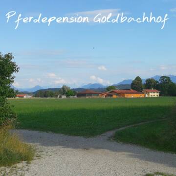
Ein bis zwei Plätze im Aktivstall zu vergeben
Bruckmühl /Waith
Pferdepension-Goldbachhof
@Pferdepension-Goldbachhof
FN-Mitglied
Freizeitstall
Krankenbox
Paddock
Außenbox mit Paddock
Bewegungsstall
Vollpension
12 weitere...
P+


Paddock Box
Feldkirchen-Westerham
Stefanie Bornschlegel
@Stefanie-Bornschlegel
Freizeitstall
Vermieten
Krankenbox
Longierzirkel/Roundpen
Allergikerstall
Gnadenbrothof
12 weitere...
P+

Pferdehof Nagota
Weyarn
Susanne Haßler
@PferdehofNagota
Freizeitstall
VFD-Mitglied
Vermieten
Paddock
Reitplatz (z.B. Dressur, Springen, Reining)
Bewegungsstall
Offenstall
10 weitere...
P

Freizeitreiter- und Gnadenbrotpferdehof
Otterfing
Maria-Diessl
@Maria-Diessl
Freizeitstall
Vermieten
Paddock
Reitplatz (z.B. Dressur, Springen, Reining)
Gnadenbrothof
7 weitere...
P
Veröffentliche deine Suche als Gesuch und Suchauftrag, dann erhältst du Angebote, neue Treffer und Änderungen per E-Mail.
Diese Suche als Gesuch veröffentlichenDeprecated: Creation of dynamic property Zend_View::$pageCount is deprecated in /var/www/stall-frei/htdocs/staging.stall-frei.de/library/vendor/shardj/zf1-future/library/Zend/View/Abstract.php on line 308
Deprecated: Creation of dynamic property Zend_View::$itemCountPerPage is deprecated in /var/www/stall-frei/htdocs/staging.stall-frei.de/library/vendor/shardj/zf1-future/library/Zend/View/Abstract.php on line 308
Deprecated: Creation of dynamic property Zend_View::$first is deprecated in /var/www/stall-frei/htdocs/staging.stall-frei.de/library/vendor/shardj/zf1-future/library/Zend/View/Abstract.php on line 308
Deprecated: Creation of dynamic property Zend_View::$current is deprecated in /var/www/stall-frei/htdocs/staging.stall-frei.de/library/vendor/shardj/zf1-future/library/Zend/View/Abstract.php on line 308
Deprecated: Creation of dynamic property Zend_View::$last is deprecated in /var/www/stall-frei/htdocs/staging.stall-frei.de/library/vendor/shardj/zf1-future/library/Zend/View/Abstract.php on line 308
Deprecated: Creation of dynamic property Zend_View::$previous is deprecated in /var/www/stall-frei/htdocs/staging.stall-frei.de/library/vendor/shardj/zf1-future/library/Zend/View/Abstract.php on line 308
Deprecated: Creation of dynamic property Zend_View::$next is deprecated in /var/www/stall-frei/htdocs/staging.stall-frei.de/library/vendor/shardj/zf1-future/library/Zend/View/Abstract.php on line 308
Deprecated: Creation of dynamic property Zend_View::$pagesInRange is deprecated in /var/www/stall-frei/htdocs/staging.stall-frei.de/library/vendor/shardj/zf1-future/library/Zend/View/Abstract.php on line 308
Deprecated: Creation of dynamic property Zend_View::$firstPageInRange is deprecated in /var/www/stall-frei/htdocs/staging.stall-frei.de/library/vendor/shardj/zf1-future/library/Zend/View/Abstract.php on line 308
Deprecated: Creation of dynamic property Zend_View::$lastPageInRange is deprecated in /var/www/stall-frei/htdocs/staging.stall-frei.de/library/vendor/shardj/zf1-future/library/Zend/View/Abstract.php on line 308
Deprecated: Creation of dynamic property Zend_View::$currentItemCount is deprecated in /var/www/stall-frei/htdocs/staging.stall-frei.de/library/vendor/shardj/zf1-future/library/Zend/View/Abstract.php on line 308
Deprecated: Creation of dynamic property Zend_View::$totalItemCount is deprecated in /var/www/stall-frei/htdocs/staging.stall-frei.de/library/vendor/shardj/zf1-future/library/Zend/View/Abstract.php on line 308
Deprecated: Creation of dynamic property Zend_View::$firstItemNumber is deprecated in /var/www/stall-frei/htdocs/staging.stall-frei.de/library/vendor/shardj/zf1-future/library/Zend/View/Abstract.php on line 308
Deprecated: Creation of dynamic property Zend_View::$lastItemNumber is deprecated in /var/www/stall-frei/htdocs/staging.stall-frei.de/library/vendor/shardj/zf1-future/library/Zend/View/Abstract.php on line 308
Deprecated: Creation of dynamic property Zend_View::$router is deprecated in /var/www/stall-frei/htdocs/staging.stall-frei.de/library/vendor/shardj/zf1-future/library/Zend/View/Abstract.php on line 308
Deprecated: Creation of dynamic property Zend_View::$urlParams is deprecated in /var/www/stall-frei/htdocs/staging.stall-frei.de/library/vendor/shardj/zf1-future/library/Zend/View/Abstract.php on line 308
Deprecated: Creation of dynamic property Zend_View::$showAds is deprecated in /var/www/stall-frei/htdocs/staging.stall-frei.de/library/vendor/shardj/zf1-future/library/Zend/View/Abstract.php on line 308
Deprecated: Creation of dynamic property Zend_View::$objectIds is deprecated in /var/www/stall-frei/htdocs/staging.stall-frei.de/library/vendor/shardj/zf1-future/library/Zend/View/Abstract.php on line 308
Deprecated: Creation of dynamic property Zend_View::$showNavbar is deprecated in /var/www/stall-frei/htdocs/staging.stall-frei.de/library/vendor/shardj/zf1-future/library/Zend/View/Abstract.php on line 308
Deprecated: Creation of dynamic property Zend_View::$showBreadcrumb is deprecated in /var/www/stall-frei/htdocs/staging.stall-frei.de/library/vendor/shardj/zf1-future/library/Zend/View/Abstract.php on line 308
Deprecated: Creation of dynamic property Zend_View::$showFooter is deprecated in /var/www/stall-frei/htdocs/staging.stall-frei.de/library/vendor/shardj/zf1-future/library/Zend/View/Abstract.php on line 308
Deprecated: Creation of dynamic property Zend_View::$showInternalAds is deprecated in /var/www/stall-frei/htdocs/staging.stall-frei.de/library/vendor/shardj/zf1-future/library/Zend/View/Abstract.php on line 308
Deprecated: Creation of dynamic property Zend_View::$blNoContent is deprecated in /var/www/stall-frei/htdocs/staging.stall-frei.de/library/vendor/shardj/zf1-future/library/Zend/View/Abstract.php on line 308
Deprecated: Creation of dynamic property Zend_View::$sMetaDesc is deprecated in /var/www/stall-frei/htdocs/staging.stall-frei.de/library/vendor/shardj/zf1-future/library/Zend/View/Abstract.php on line 308
Deprecated: Creation of dynamic property Zend_View::$useGmaps is deprecated in /var/www/stall-frei/htdocs/staging.stall-frei.de/library/vendor/shardj/zf1-future/library/Zend/View/Abstract.php on line 308
Deprecated: Creation of dynamic property Zend_View::$touches is deprecated in /var/www/stall-frei/htdocs/staging.stall-frei.de/library/vendor/shardj/zf1-future/library/Zend/View/Abstract.php on line 308
Deprecated: Creation of dynamic property Zend_View::$oProject is deprecated in /var/www/stall-frei/htdocs/staging.stall-frei.de/library/vendor/shardj/zf1-future/library/Zend/View/Abstract.php on line 308
Deprecated: Creation of dynamic property Zend_View::$pageHeadline is deprecated in /var/www/stall-frei/htdocs/staging.stall-frei.de/library/vendor/shardj/zf1-future/library/Zend/View/Abstract.php on line 308
Deprecated: Creation of dynamic property Zend_View::$disableLocationField is deprecated in /var/www/stall-frei/htdocs/staging.stall-frei.de/library/vendor/shardj/zf1-future/library/Zend/View/Abstract.php on line 308
Deprecated: Creation of dynamic property Zend_View::$isSearch is deprecated in /var/www/stall-frei/htdocs/staging.stall-frei.de/library/vendor/shardj/zf1-future/library/Zend/View/Abstract.php on line 308
Deprecated: Creation of dynamic property Zend_View::$pageTitle is deprecated in /var/www/stall-frei/htdocs/staging.stall-frei.de/library/vendor/shardj/zf1-future/library/Zend/View/Abstract.php on line 308
Deprecated: Creation of dynamic property Psf_Form_Element_Text::$class is deprecated in /var/www/stall-frei/htdocs/staging.stall-frei.de/library/vendor/shardj/zf1-future/library/Zend/Form/Element.php on line 874
Deprecated: Creation of dynamic property Psf_Form_Element_Text::$size is deprecated in /var/www/stall-frei/htdocs/staging.stall-frei.de/library/vendor/shardj/zf1-future/library/Zend/Form/Element.php on line 874
Deprecated: Creation of dynamic property Psf_Form_Element_Text::$placeholder is deprecated in /var/www/stall-frei/htdocs/staging.stall-frei.de/library/vendor/shardj/zf1-future/library/Zend/Form/Element.php on line 874
Deprecated: Creation of dynamic property Psf_Form_Element_Hidden::$class is deprecated in /var/www/stall-frei/htdocs/staging.stall-frei.de/library/vendor/shardj/zf1-future/library/Zend/Form/Element.php on line 874
Deprecated: Creation of dynamic property Psf_Form_Element_Hidden::$class is deprecated in /var/www/stall-frei/htdocs/staging.stall-frei.de/library/vendor/shardj/zf1-future/library/Zend/Form/Element.php on line 874
Deprecated: Creation of dynamic property Psf_Form_Element_Hidden::$class is deprecated in /var/www/stall-frei/htdocs/staging.stall-frei.de/library/vendor/shardj/zf1-future/library/Zend/Form/Element.php on line 874
Deprecated: Creation of dynamic property Psf_Form_Element_Hidden::$class is deprecated in /var/www/stall-frei/htdocs/staging.stall-frei.de/library/vendor/shardj/zf1-future/library/Zend/Form/Element.php on line 874
Deprecated: Creation of dynamic property Psf_Form_Element_Select::$class is deprecated in /var/www/stall-frei/htdocs/staging.stall-frei.de/library/vendor/shardj/zf1-future/library/Zend/Form/Element.php on line 874
Deprecated: Creation of dynamic property Psf_Form_Element_Select::$class is deprecated in /var/www/stall-frei/htdocs/staging.stall-frei.de/library/vendor/shardj/zf1-future/library/Zend/Form/Element.php on line 874
Deprecated: Creation of dynamic property Psf_Form_Element_Select::$class is deprecated in /var/www/stall-frei/htdocs/staging.stall-frei.de/library/vendor/shardj/zf1-future/library/Zend/Form/Element.php on line 874
Deprecated: Creation of dynamic property Psf_Form_Element_Select::$class is deprecated in /var/www/stall-frei/htdocs/staging.stall-frei.de/library/vendor/shardj/zf1-future/library/Zend/Form/Element.php on line 874
Deprecated: Creation of dynamic property Psf_Form_Element_Text::$class is deprecated in /var/www/stall-frei/htdocs/staging.stall-frei.de/library/vendor/shardj/zf1-future/library/Zend/Form/Element.php on line 874
Deprecated: Creation of dynamic property Psf_Form_Element_Checkbox::$label is deprecated in /var/www/stall-frei/htdocs/staging.stall-frei.de/library/vendor/shardj/zf1-future/library/Zend/Form/Element.php on line 874
Deprecated: Creation of dynamic property Zend_View::$sort is deprecated in /var/www/stall-frei/htdocs/staging.stall-frei.de/library/vendor/shardj/zf1-future/library/Zend/View/Abstract.php on line 308
Deprecated: Creation of dynamic property Zend_View::$searchLocation is deprecated in /var/www/stall-frei/htdocs/staging.stall-frei.de/library/vendor/shardj/zf1-future/library/Zend/View/Abstract.php on line 308
Deprecated: Creation of dynamic property Zend_View::$locationHint is deprecated in /var/www/stall-frei/htdocs/staging.stall-frei.de/library/vendor/shardj/zf1-future/library/Zend/View/Abstract.php on line 308
Psf_GeoCoder_Abstract::getLocation: Am Steinberg Get Location CachedOrLive
Psf_GeoCoder_Abstract::getCachedOrLive: Am Steinberg
Psf_GeoCoder_Abstract::convertLocationResult
{"documentation":"https:\/\/opencagedata.com\/api","licenses":[{"name":"see attribution guide","url":"https:\/\/opencagedata.com\/credits"}],"results":[{"bounds":{"northeast":{"lat":47.7708814,"lng":11.7301052},"southwest":{"lat":47.7308814,"lng":11.6901052}},"components":{"ISO_3166-1_alpha-2":"DE","ISO_3166-1_alpha-3":"DEU","ISO_3166-2":["DE-BY"],"_category":"place","_normalized_city":"Gmund","_type":"hamlet","continent":"Europe","country":"Deutschland","country_code":"de","county":"Landkreis Miesbach","hamlet":"Am Steinberg","political_union":"European Union","postcode":"83703","state":"Bayern","state_code":"BY","village":"Gmund"},"confidence":7,"formatted":"Am Steinberg, 83703 Gmund, Deutschland","geometry":{"lat":47.7508814,"lng":11.7101052}},{"bounds":{"northeast":{"lat":47.9658166,"lng":11.9701609},"southwest":{"lat":47.9458166,"lng":11.9501609}},"components":{"ISO_3166-1_alpha-2":"DE","ISO_3166-1_alpha-3":"DEU","ISO_3166-2":["DE-BY"],"_category":"agriculture","_normalized_city":"Tuntenhausen","_type":"farm","city":"Tuntenhausen","continent":"Europe","country":"Deutschland","country_code":"de","county":"Landkreis Rosenheim","farm":"Am Steinberg","political_union":"European Union","postcode":"83104","state":"Bayern","state_code":"BY"},"confidence":8,"formatted":"Am Steinberg, 83104 Tuntenhausen, Deutschland","geometry":{"lat":47.9558166,"lng":11.9601609}},{"bounds":{"northeast":{"lat":50.8007156,"lng":12.8817381},"southwest":{"lat":50.7960807,"lng":12.8731081}},"components":{"ISO_3166-1_alpha-2":"DE","ISO_3166-1_alpha-3":"DEU","ISO_3166-2":["DE-SN"],"_category":"outdoors\/recreation","_normalized_city":"Chemnitz","_type":"allotments","allotments":"Am Steinberg","city":"Chemnitz","continent":"Europe","country":"Deutschland","country_code":"de","political_union":"European Union","postcode":"09122","state":"Sachsen","state_code":"SN","suburb":"Stelzendorf"},"confidence":9,"formatted":"Am Steinberg, 09122 Chemnitz, Deutschland","geometry":{"lat":50.7986404,"lng":12.8772169}},{"bounds":{"northeast":{"lat":50.7199116,"lng":12.7967355},"southwest":{"lat":50.7179806,"lng":12.7940499}},"components":{"ISO_3166-1_alpha-2":"DE","ISO_3166-1_alpha-3":"DEU","ISO_3166-2":["DE-SN"],"_category":"outdoors\/recreation","_normalized_city":"Niederdorf","_type":"allotments","allotments":"Am Steinberg","continent":"Europe","country":"Deutschland","country_code":"de","county":"Erzgebirgskreis","municipality":"Stollberg\/Niederdorf","political_union":"European Union","postcode":"09366","state":"Sachsen","state_code":"SN","village":"Niederdorf"},"confidence":9,"formatted":"Am Steinberg, 09366 Niederdorf, Deutschland","geometry":{"lat":50.7189356,"lng":12.7953894}},{"bounds":{"northeast":{"lat":50.029631,"lng":8.780328},"southwest":{"lat":50.0293321,"lng":8.7799212}},"components":{"ISO_3166-1_alpha-2":"DE","ISO_3166-1_alpha-3":"DEU","ISO_3166-2":["DE-HE"],"_category":"road","_normalized_city":"Dietzenbach","_type":"road","continent":"Europe","country":"Deutschland","country_code":"de","county":"Landkreis Offenbach","political_union":"European Union","postcode":"63128","square":"Am Steinberg","state":"Hessen","state_code":"HE","suburb":"Steinberg","town":"Dietzenbach"},"confidence":9,"formatted":"Am Steinberg, 63128 Dietzenbach, Deutschland","geometry":{"lat":50.0294677,"lng":8.7800955}},{"bounds":{"northeast":{"lat":49.6939902,"lng":17.5961674},"southwest":{"lat":49.6739902,"lng":17.5761674}},"components":{"ISO_3166-1_alpha-2":"CZ","ISO_3166-1_alpha-3":"CZE","ISO_3166-2":["CZ-71","CZ-712"],"_category":"place","_normalized_city":"Truppen\u00fcbungsplatz Liebau","_type":"hamlet","continent":"Europe","country":"Tschechien","country_code":"cz","locality":"Am Steinberg","municipality":"Truppen\u00fcbungsplatz Liebau","political_union":"European Union","region":"Mittelm\u00e4hren","state":"Olm\u00fctzer Region","state_district":"Bezirk Olm\u00fctz","suburb":"D\u0159emovice u M\u011bsta Libav\u00e1"},"confidence":8,"formatted":"D\u0159emovice u M\u011bsta Libav\u00e1, Am Steinberg, Bezirk Olm\u00fctz, Tschechien","geometry":{"lat":49.6839902,"lng":17.5861674}},{"bounds":{"northeast":{"lat":51.2396941,"lng":6.4025075},"southwest":{"lat":51.2196941,"lng":6.3825075}},"components":{"ISO_3166-1_alpha-2":"DE","ISO_3166-1_alpha-3":"DEU","ISO_3166-2":["DE-NW"],"_category":"place","_normalized_city":"Viersen","_type":"hamlet","continent":"Europe","country":"Deutschland","country_code":"de","county":"Kreis Viersen","hamlet":"Noverh\u00f6fe","locality":"Am Steinberg","political_union":"European Union","postcode":"41748","state":"Nordrhein-Westfalen","state_code":"NW","town":"Viersen"},"confidence":8,"formatted":"Noverh\u00f6fe, 41748 Viersen, Deutschland","geometry":{"lat":51.2296941,"lng":6.3925075}},{"bounds":{"northeast":{"lat":47.5766257,"lng":7.4170868},"southwest":{"lat":47.5566257,"lng":7.3970868}},"components":{"ISO_3166-1_alpha-2":"FR","ISO_3166-1_alpha-3":"FRA","ISO_3166-2":["FR-GES","FR-6AE","FR-68"],"_category":"place","_normalized_city":"Kn\u00f6ringen","_type":"hamlet","continent":"Europe","country":"Frankreich","country_code":"fr","county":"Oberelsass","local_authority":"Saint-Louis Agglom\u00e9ration","locality":"Am Steinberg","municipality":"M\u00fclhausen","political_union":"European Union","postcode":"68220","region":"Metropolitanes Frankreich","state":"Grand Est","state_code":"GES","state_district":"Collectivit\u00e9 europ\u00e9enne d'Alsace","village":"Kn\u00f6ringen"},"confidence":8,"formatted":"68220 Kn\u00f6ringen, Frankreich","geometry":{"lat":47.5666257,"lng":7.4070868}},{"bounds":{"northeast":{"lat":50.8960999,"lng":11.1832589},"southwest":{"lat":50.8945264,"lng":11.1812156}},"components":{"ISO_3166-1_alpha-2":"DE","ISO_3166-1_alpha-3":"DEU","ISO_3166-2":["DE-TH"],"_category":"road","_normalized_city":"Nauendorf","_type":"road","continent":"Europe","country":"Deutschland","country_code":"de","county":"Landkreis Weimarer Land","municipality":"Kranichfeld","political_union":"European Union","postcode":"99448","road":"Am Steinberg","road_type":"living_street","state":"Th\u00fcringen","state_code":"TH","village":"Nauendorf"},"confidence":9,"formatted":"Am Steinberg, 99448 Nauendorf, Deutschland","geometry":{"lat":50.8957498,"lng":11.1827584}},{"components":{"ISO_3166-1_alpha-2":"FR","ISO_3166-1_alpha-3":"FRA","ISO_3166-2":["FR-GES","FR-6AE","FR-68"],"_category":"road","_normalized_city":"Flaxlanden","_type":"road","city":"Flaxlanden","continent":"Europe","country":"France","country_code":"fr","county":"Haut-Rhin","local_authority":"Mulhouse Alsace Agglom\u00e9ration","political_union":"European Union","postcode":"68720","road":"Rue du Steinberg","state":"Grand Est","state_code":"GES"},"confidence":5,"formatted":"Rue du Steinberg, 68720 Flaxlanden, France","geometry":{"lat":47.693032,"lng":7.317253}}],"status":{"code":200,"message":"OK"},"stay_informed":{"blog":"https:\/\/blog.opencagedata.com","mastodon":"https:\/\/en.osm.town\/@opencage"},"thanks":"For using an OpenCage API","timestamp":{"created_http":"Sat, 07 Feb 2026 14:50:48 GMT","created_unix":1770475848},"total_results":10}Array
(
[0] => stdClass Object
(
[bounds] => stdClass Object
(
[northeast] => stdClass Object
(
[lat] => 47.7708814
[lng] => 11.7301052
)
[southwest] => stdClass Object
(
[lat] => 47.7308814
[lng] => 11.6901052
)
)
[components] => stdClass Object
(
[ISO_3166-1_alpha-2] => DE
[ISO_3166-1_alpha-3] => DEU
[ISO_3166-2] => Array
(
[0] => DE-BY
)
[_category] => place
[_normalized_city] => Gmund
[_type] => hamlet
[continent] => Europe
[country] => Deutschland
[country_code] => de
[county] => Landkreis Miesbach
[hamlet] => Am Steinberg
[political_union] => European Union
[postcode] => 83703
[state] => Bayern
[state_code] => BY
[village] => Gmund
)
[confidence] => 7
[formatted] => Am Steinberg, 83703 Gmund, Deutschland
[geometry] => stdClass Object
(
[lat] => 47.7508814
[lng] => 11.7101052
)
)
[1] => stdClass Object
(
[bounds] => stdClass Object
(
[northeast] => stdClass Object
(
[lat] => 47.9658166
[lng] => 11.9701609
)
[southwest] => stdClass Object
(
[lat] => 47.9458166
[lng] => 11.9501609
)
)
[components] => stdClass Object
(
[ISO_3166-1_alpha-2] => DE
[ISO_3166-1_alpha-3] => DEU
[ISO_3166-2] => Array
(
[0] => DE-BY
)
[_category] => agriculture
[_normalized_city] => Tuntenhausen
[_type] => farm
[city] => Tuntenhausen
[continent] => Europe
[country] => Deutschland
[country_code] => de
[county] => Landkreis Rosenheim
[farm] => Am Steinberg
[political_union] => European Union
[postcode] => 83104
[state] => Bayern
[state_code] => BY
)
[confidence] => 8
[formatted] => Am Steinberg, 83104 Tuntenhausen, Deutschland
[geometry] => stdClass Object
(
[lat] => 47.9558166
[lng] => 11.9601609
)
)
[2] => stdClass Object
(
[bounds] => stdClass Object
(
[northeast] => stdClass Object
(
[lat] => 50.8007156
[lng] => 12.8817381
)
[southwest] => stdClass Object
(
[lat] => 50.7960807
[lng] => 12.8731081
)
)
[components] => stdClass Object
(
[ISO_3166-1_alpha-2] => DE
[ISO_3166-1_alpha-3] => DEU
[ISO_3166-2] => Array
(
[0] => DE-SN
)
[_category] => outdoors/recreation
[_normalized_city] => Chemnitz
[_type] => allotments
[allotments] => Am Steinberg
[city] => Chemnitz
[continent] => Europe
[country] => Deutschland
[country_code] => de
[political_union] => European Union
[postcode] => 09122
[state] => Sachsen
[state_code] => SN
[suburb] => Stelzendorf
)
[confidence] => 9
[formatted] => Am Steinberg, 09122 Chemnitz, Deutschland
[geometry] => stdClass Object
(
[lat] => 50.7986404
[lng] => 12.8772169
)
)
[3] => stdClass Object
(
[bounds] => stdClass Object
(
[northeast] => stdClass Object
(
[lat] => 50.7199116
[lng] => 12.7967355
)
[southwest] => stdClass Object
(
[lat] => 50.7179806
[lng] => 12.7940499
)
)
[components] => stdClass Object
(
[ISO_3166-1_alpha-2] => DE
[ISO_3166-1_alpha-3] => DEU
[ISO_3166-2] => Array
(
[0] => DE-SN
)
[_category] => outdoors/recreation
[_normalized_city] => Niederdorf
[_type] => allotments
[allotments] => Am Steinberg
[continent] => Europe
[country] => Deutschland
[country_code] => de
[county] => Erzgebirgskreis
[municipality] => Stollberg/Niederdorf
[political_union] => European Union
[postcode] => 09366
[state] => Sachsen
[state_code] => SN
[village] => Niederdorf
)
[confidence] => 9
[formatted] => Am Steinberg, 09366 Niederdorf, Deutschland
[geometry] => stdClass Object
(
[lat] => 50.7189356
[lng] => 12.7953894
)
)
[4] => stdClass Object
(
[bounds] => stdClass Object
(
[northeast] => stdClass Object
(
[lat] => 50.029631
[lng] => 8.780328
)
[southwest] => stdClass Object
(
[lat] => 50.0293321
[lng] => 8.7799212
)
)
[components] => stdClass Object
(
[ISO_3166-1_alpha-2] => DE
[ISO_3166-1_alpha-3] => DEU
[ISO_3166-2] => Array
(
[0] => DE-HE
)
[_category] => road
[_normalized_city] => Dietzenbach
[_type] => road
[continent] => Europe
[country] => Deutschland
[country_code] => de
[county] => Landkreis Offenbach
[political_union] => European Union
[postcode] => 63128
[square] => Am Steinberg
[state] => Hessen
[state_code] => HE
[suburb] => Steinberg
[town] => Dietzenbach
)
[confidence] => 9
[formatted] => Am Steinberg, 63128 Dietzenbach, Deutschland
[geometry] => stdClass Object
(
[lat] => 50.0294677
[lng] => 8.7800955
)
)
[5] => stdClass Object
(
[bounds] => stdClass Object
(
[northeast] => stdClass Object
(
[lat] => 49.6939902
[lng] => 17.5961674
)
[southwest] => stdClass Object
(
[lat] => 49.6739902
[lng] => 17.5761674
)
)
[components] => stdClass Object
(
[ISO_3166-1_alpha-2] => CZ
[ISO_3166-1_alpha-3] => CZE
[ISO_3166-2] => Array
(
[0] => CZ-71
[1] => CZ-712
)
[_category] => place
[_normalized_city] => Truppenübungsplatz Liebau
[_type] => hamlet
[continent] => Europe
[country] => Tschechien
[country_code] => cz
[locality] => Am Steinberg
[municipality] => Truppenübungsplatz Liebau
[political_union] => European Union
[region] => Mittelmähren
[state] => Olmützer Region
[state_district] => Bezirk Olmütz
[suburb] => Dřemovice u Města Libavá
)
[confidence] => 8
[formatted] => Dřemovice u Města Libavá, Am Steinberg, Bezirk Olmütz, Tschechien
[geometry] => stdClass Object
(
[lat] => 49.6839902
[lng] => 17.5861674
)
)
[6] => stdClass Object
(
[bounds] => stdClass Object
(
[northeast] => stdClass Object
(
[lat] => 51.2396941
[lng] => 6.4025075
)
[southwest] => stdClass Object
(
[lat] => 51.2196941
[lng] => 6.3825075
)
)
[components] => stdClass Object
(
[ISO_3166-1_alpha-2] => DE
[ISO_3166-1_alpha-3] => DEU
[ISO_3166-2] => Array
(
[0] => DE-NW
)
[_category] => place
[_normalized_city] => Viersen
[_type] => hamlet
[continent] => Europe
[country] => Deutschland
[country_code] => de
[county] => Kreis Viersen
[hamlet] => Noverhöfe
[locality] => Am Steinberg
[political_union] => European Union
[postcode] => 41748
[state] => Nordrhein-Westfalen
[state_code] => NW
[town] => Viersen
)
[confidence] => 8
[formatted] => Noverhöfe, 41748 Viersen, Deutschland
[geometry] => stdClass Object
(
[lat] => 51.2296941
[lng] => 6.3925075
)
)
[7] => stdClass Object
(
[bounds] => stdClass Object
(
[northeast] => stdClass Object
(
[lat] => 47.5766257
[lng] => 7.4170868
)
[southwest] => stdClass Object
(
[lat] => 47.5566257
[lng] => 7.3970868
)
)
[components] => stdClass Object
(
[ISO_3166-1_alpha-2] => FR
[ISO_3166-1_alpha-3] => FRA
[ISO_3166-2] => Array
(
[0] => FR-GES
[1] => FR-6AE
[2] => FR-68
)
[_category] => place
[_normalized_city] => Knöringen
[_type] => hamlet
[continent] => Europe
[country] => Frankreich
[country_code] => fr
[county] => Oberelsass
[local_authority] => Saint-Louis Agglomération
[locality] => Am Steinberg
[municipality] => Mülhausen
[political_union] => European Union
[postcode] => 68220
[region] => Metropolitanes Frankreich
[state] => Grand Est
[state_code] => GES
[state_district] => Collectivité européenne d'Alsace
[village] => Knöringen
)
[confidence] => 8
[formatted] => 68220 Knöringen, Frankreich
[geometry] => stdClass Object
(
[lat] => 47.5666257
[lng] => 7.4070868
)
)
[8] => stdClass Object
(
[bounds] => stdClass Object
(
[northeast] => stdClass Object
(
[lat] => 50.8960999
[lng] => 11.1832589
)
[southwest] => stdClass Object
(
[lat] => 50.8945264
[lng] => 11.1812156
)
)
[components] => stdClass Object
(
[ISO_3166-1_alpha-2] => DE
[ISO_3166-1_alpha-3] => DEU
[ISO_3166-2] => Array
(
[0] => DE-TH
)
[_category] => road
[_normalized_city] => Nauendorf
[_type] => road
[continent] => Europe
[country] => Deutschland
[country_code] => de
[county] => Landkreis Weimarer Land
[municipality] => Kranichfeld
[political_union] => European Union
[postcode] => 99448
[road] => Am Steinberg
[road_type] => living_street
[state] => Thüringen
[state_code] => TH
[village] => Nauendorf
)
[confidence] => 9
[formatted] => Am Steinberg, 99448 Nauendorf, Deutschland
[geometry] => stdClass Object
(
[lat] => 50.8957498
[lng] => 11.1827584
)
)
[9] => stdClass Object
(
[components] => stdClass Object
(
[ISO_3166-1_alpha-2] => FR
[ISO_3166-1_alpha-3] => FRA
[ISO_3166-2] => Array
(
[0] => FR-GES
[1] => FR-6AE
[2] => FR-68
)
[_category] => road
[_normalized_city] => Flaxlanden
[_type] => road
[city] => Flaxlanden
[continent] => Europe
[country] => France
[country_code] => fr
[county] => Haut-Rhin
[local_authority] => Mulhouse Alsace Agglomération
[political_union] => European Union
[postcode] => 68720
[road] => Rue du Steinberg
[state] => Grand Est
[state_code] => GES
)
[confidence] => 5
[formatted] => Rue du Steinberg, 68720 Flaxlanden, France
[geometry] => stdClass Object
(
[lat] => 47.693032
[lng] => 7.317253
)
)
)
Psf_GeoCoder_OpenCageData::getKeyMap: 0
stdClass Object
(
    [bounds] => stdClass Object
        (
            [northeast] => stdClass Object
                (
                    [lat] => 47.7708814
                    [lng] => 11.7301052
                )

            [southwest] => stdClass Object
                (
                    [lat] => 47.7308814
                    [lng] => 11.6901052
                )

        )

    [components] => stdClass Object
        (
            [ISO_3166-1_alpha-2] => DE
            [ISO_3166-1_alpha-3] => DEU
            [ISO_3166-2] => Array
                (
                    [0] => DE-BY
                )

            [_category] => place
            [_normalized_city] => Gmund
            [_type] => hamlet
            [continent] => Europe
            [country] => Deutschland
            [country_code] => de
            [county] => Landkreis Miesbach
            [hamlet] => Am Steinberg
            [political_union] => European Union
            [postcode] => 83703
            [state] => Bayern
            [state_code] => BY
            [village] => Gmund
        )

    [confidence] => 7
    [formatted] => Am Steinberg, 83703 Gmund, Deutschland
    [geometry] => stdClass Object
        (
            [lat] => 47.7508814
            [lng] => 11.7101052
        )

)
Psf_GeoCoder_OpenCageData::getCounty: Miesbach
Psf_GeoCoder_OpenCageData::addMissingData REFETCH!
Array
(
    [address] => Am Steinberg, 83703 Gmund, Deutschland
    [type] => hamlet
    [street] => Am Steinberg
    [city] => Gmund
    [county] => Miesbach
    [state] => Bayern
    [zip] => 83703
    [country] => Deutschland
    [suburb] =>
    [countrycode] => de
    [latitude] => 47.7508814
    [longitude] => 11.7101052
    [accuracy] => 1
    [confidence] => 7
    [bounds] => stdClass Object
        (
            [northeast] => stdClass Object
                (
                    [lat] => 47.7708814
                    [lng] => 11.7301052
                )

            [southwest] => stdClass Object
                (
                    [lat] => 47.7308814
                    [lng] => 11.6901052
                )

        )

)
reformat!
Array
(
    [address] => Am Steinberg, 83703 Gmund, Deutschland
    [type] => hamlet
    [street] => Am Steinberg
    [city] => Gmund
    [county] => Miesbach
    [state] => Bayern
    [zip] => 83703
    [country] => Deutschland
    [suburb] =>
    [countrycode] => de
    [latitude] => 47.7508814
    [longitude] => 11.7101052
    [accuracy] => 1
    [confidence] => 7
    [bounds] => stdClass Object
        (
            [northeast] => stdClass Object
                (
                    [lat] => 47.7708814
                    [lng] => 11.7301052
                )

            [southwest] => stdClass Object
                (
                    [lat] => 47.7308814
                    [lng] => 11.6901052
                )

        )

    [place] => Am Steinberg, 83703 Gmund, Bayern
    [hash] => ead69cd7341164fec570fb76272a782c
)
Psf_GeoCoder_OpenCageData::getKeyMap: 1
stdClass Object
(
    [bounds] => stdClass Object
        (
            [northeast] => stdClass Object
                (
                    [lat] => 47.9658166
                    [lng] => 11.9701609
                )

            [southwest] => stdClass Object
                (
                    [lat] => 47.9458166
                    [lng] => 11.9501609
                )

        )

    [components] => stdClass Object
        (
            [ISO_3166-1_alpha-2] => DE
            [ISO_3166-1_alpha-3] => DEU
            [ISO_3166-2] => Array
                (
                    [0] => DE-BY
                )

            [_category] => agriculture
            [_normalized_city] => Tuntenhausen
            [_type] => farm
            [city] => Tuntenhausen
            [continent] => Europe
            [country] => Deutschland
            [country_code] => de
            [county] => Landkreis Rosenheim
            [farm] => Am Steinberg
            [political_union] => European Union
            [postcode] => 83104
            [state] => Bayern
            [state_code] => BY
        )

    [confidence] => 8
    [formatted] => Am Steinberg, 83104 Tuntenhausen, Deutschland
    [geometry] => stdClass Object
        (
            [lat] => 47.9558166
            [lng] => 11.9601609
        )

)
Psf_GeoCoder_OpenCageData::getCounty: Rosenheim
Psf_GeoCoder_OpenCageData::addMissingData REFETCH!
Array
(
    [address] => Am Steinberg, 83104 Tuntenhausen, Deutschland
    [type] => farm
    [street] =>
    [city] => Tuntenhausen
    [county] => Rosenheim
    [state] => Bayern
    [zip] => 83104
    [country] => Deutschland
    [suburb] =>
    [countrycode] => de
    [latitude] => 47.9558166
    [longitude] => 11.9601609
    [accuracy] => 1
    [confidence] => 8
    [bounds] => stdClass Object
        (
            [northeast] => stdClass Object
                (
                    [lat] => 47.9658166
                    [lng] => 11.9701609
                )

            [southwest] => stdClass Object
                (
                    [lat] => 47.9458166
                    [lng] => 11.9501609
                )

        )

)
reformat!
Array
(
    [address] => Am Steinberg, 83104 Tuntenhausen, Deutschland
    [type] => farm
    [street] =>
    [city] => Tuntenhausen
    [county] => Rosenheim
    [state] => Bayern
    [zip] => 83104
    [country] => Deutschland
    [suburb] =>
    [countrycode] => de
    [latitude] => 47.9558166
    [longitude] => 11.9601609
    [accuracy] => 1
    [confidence] => 8
    [bounds] => stdClass Object
        (
            [northeast] => stdClass Object
                (
                    [lat] => 47.9658166
                    [lng] => 11.9701609
                )

            [southwest] => stdClass Object
                (
                    [lat] => 47.9458166
                    [lng] => 11.9501609
                )

        )

    [place] => 83104 Tuntenhausen, Bayern
    [hash] => 8d925a7ccc9c0d614f000f34e1e6bae3
)
Psf_GeoCoder_OpenCageData::getKeyMap: 2
stdClass Object
(
    [bounds] => stdClass Object
        (
            [northeast] => stdClass Object
                (
                    [lat] => 50.8007156
                    [lng] => 12.8817381
                )

            [southwest] => stdClass Object
                (
                    [lat] => 50.7960807
                    [lng] => 12.8731081
                )

        )

    [components] => stdClass Object
        (
            [ISO_3166-1_alpha-2] => DE
            [ISO_3166-1_alpha-3] => DEU
            [ISO_3166-2] => Array
                (
                    [0] => DE-SN
                )

            [_category] => outdoors/recreation
            [_normalized_city] => Chemnitz
            [_type] => allotments
            [allotments] => Am Steinberg
            [city] => Chemnitz
            [continent] => Europe
            [country] => Deutschland
            [country_code] => de
            [political_union] => European Union
            [postcode] => 09122
            [state] => Sachsen
            [state_code] => SN
            [suburb] => Stelzendorf
        )

    [confidence] => 9
    [formatted] => Am Steinberg, 09122 Chemnitz, Deutschland
    [geometry] => stdClass Object
        (
            [lat] => 50.7986404
            [lng] => 12.8772169
        )

)
Psf_GeoCoder_OpenCageData::getCounty: Chemnitz
Psf_GeoCoder_OpenCageData::addMissingData REFETCH!
Array
(
    [address] => Am Steinberg, 09122 Chemnitz, Deutschland
    [type] => allotments
    [street] =>
    [city] => Stelzendorf
    [county] => Chemnitz
    [state] => Sachsen
    [zip] => 09122
    [country] => Deutschland
    [suburb] => Stelzendorf
    [countrycode] => de
    [latitude] => 50.7986404
    [longitude] => 12.8772169
    [accuracy] => 1
    [confidence] => 9
    [bounds] => stdClass Object
        (
            [northeast] => stdClass Object
                (
                    [lat] => 50.8007156
                    [lng] => 12.8817381
                )

            [southwest] => stdClass Object
                (
                    [lat] => 50.7960807
                    [lng] => 12.8731081
                )

        )

)
reformat!
Array
(
    [address] => 09122 Stelzendorf
    [type] => allotments
    [street] =>
    [city] => Stelzendorf
    [county] => Chemnitz
    [state] => Sachsen
    [zip] => 09122
    [country] => Deutschland
    [suburb] => Stelzendorf
    [countrycode] => de
    [latitude] => 50.7986404
    [longitude] => 12.8772169
    [accuracy] => 1
    [confidence] => 9
    [bounds] => stdClass Object
        (
            [northeast] => stdClass Object
                (
                    [lat] => 50.8007156
                    [lng] => 12.8817381
                )

            [southwest] => stdClass Object
                (
                    [lat] => 50.7960807
                    [lng] => 12.8731081
                )

        )

    [place] => 09122 Stelzendorf, Sachsen
    [hash] => d47115a5558b3d8a97a770073e55dd29
)
Psf_GeoCoder_OpenCageData::getKeyMap: 3
stdClass Object
(
    [bounds] => stdClass Object
        (
            [northeast] => stdClass Object
                (
                    [lat] => 50.7199116
                    [lng] => 12.7967355
                )

            [southwest] => stdClass Object
                (
                    [lat] => 50.7179806
                    [lng] => 12.7940499
                )

        )

    [components] => stdClass Object
        (
            [ISO_3166-1_alpha-2] => DE
            [ISO_3166-1_alpha-3] => DEU
            [ISO_3166-2] => Array
                (
                    [0] => DE-SN
                )

            [_category] => outdoors/recreation
            [_normalized_city] => Niederdorf
            [_type] => allotments
            [allotments] => Am Steinberg
            [continent] => Europe
            [country] => Deutschland
            [country_code] => de
            [county] => Erzgebirgskreis
            [municipality] => Stollberg/Niederdorf
            [political_union] => European Union
            [postcode] => 09366
            [state] => Sachsen
            [state_code] => SN
            [village] => Niederdorf
        )

    [confidence] => 9
    [formatted] => Am Steinberg, 09366 Niederdorf, Deutschland
    [geometry] => stdClass Object
        (
            [lat] => 50.7189356
            [lng] => 12.7953894
        )

)
Psf_GeoCoder_OpenCageData::getCounty: Erzgebirgskreis
Psf_GeoCoder_OpenCageData::addMissingData REFETCH!
Array
(
    [address] => Am Steinberg, 09366 Niederdorf, Deutschland
    [type] => allotments
    [street] =>
    [city] => Niederdorf
    [county] => Erzgebirgskreis
    [state] => Sachsen
    [zip] => 09366
    [country] => Deutschland
    [suburb] =>
    [countrycode] => de
    [latitude] => 50.7189356
    [longitude] => 12.7953894
    [accuracy] => 1
    [confidence] => 9
    [bounds] => stdClass Object
        (
            [northeast] => stdClass Object
                (
                    [lat] => 50.7199116
                    [lng] => 12.7967355
                )

            [southwest] => stdClass Object
                (
                    [lat] => 50.7179806
                    [lng] => 12.7940499
                )

        )

)
reformat!
Array
(
    [address] => Am Steinberg, 09366 Niederdorf, Deutschland
    [type] => allotments
    [street] =>
    [city] => Niederdorf
    [county] => Erzgebirgskreis
    [state] => Sachsen
    [zip] => 09366
    [country] => Deutschland
    [suburb] =>
    [countrycode] => de
    [latitude] => 50.7189356
    [longitude] => 12.7953894
    [accuracy] => 1
    [confidence] => 9
    [bounds] => stdClass Object
        (
            [northeast] => stdClass Object
                (
                    [lat] => 50.7199116
                    [lng] => 12.7967355
                )

            [southwest] => stdClass Object
                (
                    [lat] => 50.7179806
                    [lng] => 12.7940499
                )

        )

    [place] => 09366 Niederdorf, Sachsen
    [hash] => 126c478d8c9341a0a9b6ac2c12f424c3
)
Psf_GeoCoder_OpenCageData::getKeyMap: 4
stdClass Object
(
    [bounds] => stdClass Object
        (
            [northeast] => stdClass Object
                (
                    [lat] => 50.029631
                    [lng] => 8.780328
                )

            [southwest] => stdClass Object
                (
                    [lat] => 50.0293321
                    [lng] => 8.7799212
                )

        )

    [components] => stdClass Object
        (
            [ISO_3166-1_alpha-2] => DE
            [ISO_3166-1_alpha-3] => DEU
            [ISO_3166-2] => Array
                (
                    [0] => DE-HE
                )

            [_category] => road
            [_normalized_city] => Dietzenbach
            [_type] => road
            [continent] => Europe
            [country] => Deutschland
            [country_code] => de
            [county] => Landkreis Offenbach
            [political_union] => European Union
            [postcode] => 63128
            [square] => Am Steinberg
            [state] => Hessen
            [state_code] => HE
            [suburb] => Steinberg
            [town] => Dietzenbach
        )

    [confidence] => 9
    [formatted] => Am Steinberg, 63128 Dietzenbach, Deutschland
    [geometry] => stdClass Object
        (
            [lat] => 50.0294677
            [lng] => 8.7800955
        )

)
Psf_GeoCoder_OpenCageData::getCounty: Offenbach
Psf_GeoCoder_OpenCageData::addMissingData REFETCH!
Array
(
    [address] => Am Steinberg, 63128 Dietzenbach, Deutschland
    [type] => road
    [street] =>
    [city] => Dietzenbach
    [county] => Offenbach
    [state] => Hessen
    [zip] => 63128
    [country] => Deutschland
    [suburb] => Steinberg
    [countrycode] => de
    [latitude] => 50.0294677
    [longitude] => 8.7800955
    [accuracy] => 1
    [confidence] => 9
    [bounds] => stdClass Object
        (
            [northeast] => stdClass Object
                (
                    [lat] => 50.029631
                    [lng] => 8.780328
                )

            [southwest] => stdClass Object
                (
                    [lat] => 50.0293321
                    [lng] => 8.7799212
                )

        )

)
reformat!
Array
(
    [address] => Am Steinberg, 63128 Dietzenbach, Deutschland
    [type] => road
    [street] =>
    [city] => Dietzenbach
    [county] => Offenbach
    [state] => Hessen
    [zip] => 63128
    [country] => Deutschland
    [suburb] => Steinberg
    [countrycode] => de
    [latitude] => 50.0294677
    [longitude] => 8.7800955
    [accuracy] => 1
    [confidence] => 9
    [bounds] => stdClass Object
        (
            [northeast] => stdClass Object
                (
                    [lat] => 50.029631
                    [lng] => 8.780328
                )

            [southwest] => stdClass Object
                (
                    [lat] => 50.0293321
                    [lng] => 8.7799212
                )

        )

    [place] => 63128 Dietzenbach, Hessen
    [hash] => a0889cb5c01b09ad542d810f691dee58
)
Psf_GeoCoder_OpenCageData::getKeyMap: 5
stdClass Object
(
    [bounds] => stdClass Object
        (
            [northeast] => stdClass Object
                (
                    [lat] => 49.6939902
                    [lng] => 17.5961674
                )

            [southwest] => stdClass Object
                (
                    [lat] => 49.6739902
                    [lng] => 17.5761674
                )

        )

    [components] => stdClass Object
        (
            [ISO_3166-1_alpha-2] => CZ
            [ISO_3166-1_alpha-3] => CZE
            [ISO_3166-2] => Array
                (
                    [0] => CZ-71
                    [1] => CZ-712
                )

            [_category] => place
            [_normalized_city] => Truppenübungsplatz Liebau
            [_type] => hamlet
            [continent] => Europe
            [country] => Tschechien
            [country_code] => cz
            [locality] => Am Steinberg
            [municipality] => Truppenübungsplatz Liebau
            [political_union] => European Union
            [region] => Mittelmähren
            [state] => Olmützer Region
            [state_district] => Bezirk Olmütz
            [suburb] => Dřemovice u Města Libavá
        )

    [confidence] => 8
    [formatted] => Dřemovice u Města Libavá, Am Steinberg, Bezirk Olmütz, Tschechien
    [geometry] => stdClass Object
        (
            [lat] => 49.6839902
            [lng] => 17.5861674
        )

)
Psf_GeoCoder_OpenCageData::getCounty:
Psf_GeoCoder_OpenCageData::addMissingData REFETCH!
Array
(
    [address] => Dřemovice u Města Libavá, Am Steinberg, Bezirk Olmütz, Tschechien
    [type] => hamlet
    [street] =>
    [city] => Dřemovice u Města Libavá
    [county] =>
    [state] => Olmützer Region
    [zip] =>
    [country] => Tschechien
    [suburb] => Dřemovice u Města Libavá
    [countrycode] => cz
    [latitude] => 49.6839902
    [longitude] => 17.5861674
    [accuracy] => 1
    [confidence] => 8
    [bounds] => stdClass Object
        (
            [northeast] => stdClass Object
                (
                    [lat] => 49.6939902
                    [lng] => 17.5961674
                )

            [southwest] => stdClass Object
                (
                    [lat] => 49.6739902
                    [lng] => 17.5761674
                )

        )

)
reformat!
Array
(
    [address] => Dřemovice u Města Libavá, Am Steinberg, Bezirk Olmütz, Tschechien
    [type] => hamlet
    [street] =>
    [city] => Dřemovice u Města Libavá
    [county] =>
    [state] => Olmützer Region
    [zip] =>
    [country] => Tschechien
    [suburb] => Dřemovice u Města Libavá
    [countrycode] => cz
    [latitude] => 49.6839902
    [longitude] => 17.5861674
    [accuracy] => 1
    [confidence] => 8
    [bounds] => stdClass Object
        (
            [northeast] => stdClass Object
                (
                    [lat] => 49.6939902
                    [lng] => 17.5961674
                )

            [southwest] => stdClass Object
                (
                    [lat] => 49.6739902
                    [lng] => 17.5761674
                )

        )

    [place] => Dřemovice u Města Libavá, Olmützer Region
    [hash] => 2b0fb4bbca323495075f1f202440a79a
)
Psf_GeoCoder_OpenCageData::getKeyMap: 6
stdClass Object
(
    [bounds] => stdClass Object
        (
            [northeast] => stdClass Object
                (
                    [lat] => 51.2396941
                    [lng] => 6.4025075
                )

            [southwest] => stdClass Object
                (
                    [lat] => 51.2196941
                    [lng] => 6.3825075
                )

        )

    [components] => stdClass Object
        (
            [ISO_3166-1_alpha-2] => DE
            [ISO_3166-1_alpha-3] => DEU
            [ISO_3166-2] => Array
                (
                    [0] => DE-NW
                )

            [_category] => place
            [_normalized_city] => Viersen
            [_type] => hamlet
            [continent] => Europe
            [country] => Deutschland
            [country_code] => de
            [county] => Kreis Viersen
            [hamlet] => Noverhöfe
            [locality] => Am Steinberg
            [political_union] => European Union
            [postcode] => 41748
            [state] => Nordrhein-Westfalen
            [state_code] => NW
            [town] => Viersen
        )

    [confidence] => 8
    [formatted] => Noverhöfe, 41748 Viersen, Deutschland
    [geometry] => stdClass Object
        (
            [lat] => 51.2296941
            [lng] => 6.3925075
        )

)
Psf_GeoCoder_OpenCageData::getCounty: Viersen
Psf_GeoCoder_OpenCageData::addMissingData REFETCH!
Array
(
    [address] => Noverhöfe, 41748 Viersen, Deutschland
    [type] => hamlet
    [street] => Noverhöfe
    [city] => Viersen
    [county] => Viersen
    [state] => Nordrhein-Westfalen
    [zip] => 41748
    [country] => Deutschland
    [suburb] =>
    [countrycode] => de
    [latitude] => 51.2296941
    [longitude] => 6.3925075
    [accuracy] => 1
    [confidence] => 8
    [bounds] => stdClass Object
        (
            [northeast] => stdClass Object
                (
                    [lat] => 51.2396941
                    [lng] => 6.4025075
                )

            [southwest] => stdClass Object
                (
                    [lat] => 51.2196941
                    [lng] => 6.3825075
                )

        )

)
reformat!
Array
(
    [address] => Noverhöfe, 41748 Viersen, Deutschland
    [type] => hamlet
    [street] => Noverhöfe
    [city] => Viersen
    [county] => Viersen
    [state] => Nordrhein-Westfalen
    [zip] => 41748
    [country] => Deutschland
    [suburb] =>
    [countrycode] => de
    [latitude] => 51.2296941
    [longitude] => 6.3925075
    [accuracy] => 1
    [confidence] => 8
    [bounds] => stdClass Object
        (
            [northeast] => stdClass Object
                (
                    [lat] => 51.2396941
                    [lng] => 6.4025075
                )

            [southwest] => stdClass Object
                (
                    [lat] => 51.2196941
                    [lng] => 6.3825075
                )

        )

    [place] => Noverhöfe, 41748 Viersen, Nordrhein-Westfalen
    [hash] => ab14d3421a103f4baff2fc8fc26da6f3
)
Psf_GeoCoder_OpenCageData::getKeyMap: 7
stdClass Object
(
    [bounds] => stdClass Object
        (
            [northeast] => stdClass Object
                (
                    [lat] => 47.5766257
                    [lng] => 7.4170868
                )

            [southwest] => stdClass Object
                (
                    [lat] => 47.5566257
                    [lng] => 7.3970868
                )

        )

    [components] => stdClass Object
        (
            [ISO_3166-1_alpha-2] => FR
            [ISO_3166-1_alpha-3] => FRA
            [ISO_3166-2] => Array
                (
                    [0] => FR-GES
                    [1] => FR-6AE
                    [2] => FR-68
                )

            [_category] => place
            [_normalized_city] => Knöringen
            [_type] => hamlet
            [continent] => Europe
            [country] => Frankreich
            [country_code] => fr
            [county] => Oberelsass
            [local_authority] => Saint-Louis Agglomération
            [locality] => Am Steinberg
            [municipality] => Mülhausen
            [political_union] => European Union
            [postcode] => 68220
            [region] => Metropolitanes Frankreich
            [state] => Grand Est
            [state_code] => GES
            [state_district] => Collectivité européenne d'Alsace
            [village] => Knöringen
        )

    [confidence] => 8
    [formatted] => 68220 Knöringen, Frankreich
    [geometry] => stdClass Object
        (
            [lat] => 47.5666257
            [lng] => 7.4070868
        )

)
Psf_GeoCoder_OpenCageData::getCounty: Oberelsass
Psf_GeoCoder_OpenCageData::addMissingData REFETCH!
Array
(
    [address] => 68220 Knöringen, Frankreich
    [type] => hamlet
    [street] =>
    [city] => Knöringen
    [county] => Oberelsass
    [state] => Grand Est
    [zip] => 68220
    [country] => Frankreich
    [suburb] =>
    [countrycode] => fr
    [latitude] => 47.5666257
    [longitude] => 7.4070868
    [accuracy] => 1
    [confidence] => 8
    [bounds] => stdClass Object
        (
            [northeast] => stdClass Object
                (
                    [lat] => 47.5766257
                    [lng] => 7.4170868
                )

            [southwest] => stdClass Object
                (
                    [lat] => 47.5566257
                    [lng] => 7.3970868
                )

        )

)
reformat!
Array
(
    [address] => 68220 Knöringen, Frankreich
    [type] => hamlet
    [street] =>
    [city] => Knöringen
    [county] => Oberelsass
    [state] => Grand Est
    [zip] => 68220
    [country] => Frankreich
    [suburb] =>
    [countrycode] => fr
    [latitude] => 47.5666257
    [longitude] => 7.4070868
    [accuracy] => 1
    [confidence] => 8
    [bounds] => stdClass Object
        (
            [northeast] => stdClass Object
                (
                    [lat] => 47.5766257
                    [lng] => 7.4170868
                )

            [southwest] => stdClass Object
                (
                    [lat] => 47.5566257
                    [lng] => 7.3970868
                )

        )

    [place] => 68220 Knöringen, Grand Est
    [hash] => 846c47e4329f818655e773333bdcfab0
)
Psf_GeoCoder_OpenCageData::getKeyMap: 8
stdClass Object
(
    [bounds] => stdClass Object
        (
            [northeast] => stdClass Object
                (
                    [lat] => 50.8960999
                    [lng] => 11.1832589
                )

            [southwest] => stdClass Object
                (
                    [lat] => 50.8945264
                    [lng] => 11.1812156
                )

        )

    [components] => stdClass Object
        (
            [ISO_3166-1_alpha-2] => DE
            [ISO_3166-1_alpha-3] => DEU
            [ISO_3166-2] => Array
                (
                    [0] => DE-TH
                )

            [_category] => road
            [_normalized_city] => Nauendorf
            [_type] => road
            [continent] => Europe
            [country] => Deutschland
            [country_code] => de
            [county] => Landkreis Weimarer Land
            [municipality] => Kranichfeld
            [political_union] => European Union
            [postcode] => 99448
            [road] => Am Steinberg
            [road_type] => living_street
            [state] => Thüringen
            [state_code] => TH
            [village] => Nauendorf
        )

    [confidence] => 9
    [formatted] => Am Steinberg, 99448 Nauendorf, Deutschland
    [geometry] => stdClass Object
        (
            [lat] => 50.8957498
            [lng] => 11.1827584
        )

)
Psf_GeoCoder_OpenCageData::getCounty: Weimarer Land
Psf_GeoCoder_OpenCageData::addMissingData REFETCH!
Array
(
    [address] => Am Steinberg, 99448 Nauendorf, Deutschland
    [type] => road
    [street] => Am Steinberg
    [city] => Nauendorf
    [county] => Weimarer Land
    [state] => Thüringen
    [zip] => 99448
    [country] => Deutschland
    [suburb] =>
    [countrycode] => de
    [latitude] => 50.8957498
    [longitude] => 11.1827584
    [accuracy] => 1
    [confidence] => 9
    [bounds] => stdClass Object
        (
            [northeast] => stdClass Object
                (
                    [lat] => 50.8960999
                    [lng] => 11.1832589
                )

            [southwest] => stdClass Object
                (
                    [lat] => 50.8945264
                    [lng] => 11.1812156
                )

        )

)
reformat!
Array
(
    [address] => Am Steinberg, 99448 Nauendorf, Deutschland
    [type] => road
    [street] => Am Steinberg
    [city] => Nauendorf
    [county] => Weimarer Land
    [state] => Thüringen
    [zip] => 99448
    [country] => Deutschland
    [suburb] =>
    [countrycode] => de
    [latitude] => 50.8957498
    [longitude] => 11.1827584
    [accuracy] => 1
    [confidence] => 9
    [bounds] => stdClass Object
        (
            [northeast] => stdClass Object
                (
                    [lat] => 50.8960999
                    [lng] => 11.1832589
                )

            [southwest] => stdClass Object
                (
                    [lat] => 50.8945264
                    [lng] => 11.1812156
                )

        )

    [place] => Am Steinberg, 99448 Nauendorf, Thüringen
    [hash] => 73f1e23ddd37d48f44fa8ba81a467f26
)
Psf_GeoCoder_OpenCageData::getKeyMap: 9
stdClass Object
(
    [components] => stdClass Object
        (
            [ISO_3166-1_alpha-2] => FR
            [ISO_3166-1_alpha-3] => FRA
            [ISO_3166-2] => Array
                (
                    [0] => FR-GES
                    [1] => FR-6AE
                    [2] => FR-68
                )

            [_category] => road
            [_normalized_city] => Flaxlanden
            [_type] => road
            [city] => Flaxlanden
            [continent] => Europe
            [country] => France
            [country_code] => fr
            [county] => Haut-Rhin
            [local_authority] => Mulhouse Alsace Agglomération
            [political_union] => European Union
            [postcode] => 68720
            [road] => Rue du Steinberg
            [state] => Grand Est
            [state_code] => GES
        )

    [confidence] => 5
    [formatted] => Rue du Steinberg, 68720 Flaxlanden, France
    [geometry] => stdClass Object
        (
            [lat] => 47.693032
            [lng] => 7.317253
        )

)
Psf_GeoCoder_OpenCageData::getCounty: Haut-Rhin
Psf_GeoCoder_OpenCageData::addMissingData REFETCH!
Array
(
    [address] => Rue du Steinberg, 68720 Flaxlanden, France
    [type] => road
    [street] => Rue du Steinberg
    [city] => Flaxlanden
    [county] => Haut-Rhin
    [state] => Grand Est
    [zip] => 68720
    [country] => France
    [suburb] =>
    [countrycode] => fr
    [latitude] => 47.693032
    [longitude] => 7.317253
    [accuracy] => 1
    [confidence] => 5
    [bounds] =>
)
reformat!
Array
(
    [address] => Rue du Steinberg, 68720 Flaxlanden, France
    [type] => road
    [street] => Rue du Steinberg
    [city] => Flaxlanden
    [county] => Haut-Rhin
    [state] => Grand Est
    [zip] => 68720
    [country] => France
    [suburb] =>
    [countrycode] => fr
    [latitude] => 47.693032
    [longitude] => 7.317253
    [accuracy] => 1
    [confidence] => 5
    [bounds] =>
    [place] => Rue du Steinberg, 68720 Flaxlanden, Grand Est
    [hash] => e6e30a22eae0834bfaf41ffcb1e24223
)
Deprecated: Creation of dynamic property Zend_View::$locationHintStyle is deprecated in /var/www/stall-frei/htdocs/staging.stall-frei.de/library/vendor/shardj/zf1-future/library/Zend/View/Abstract.php on line 308
Deprecated: Creation of dynamic property Zend_View::$adGeoLocation is deprecated in /var/www/stall-frei/htdocs/staging.stall-frei.de/library/vendor/shardj/zf1-future/library/Zend/View/Abstract.php on line 308
Deprecated: Creation of dynamic property Zend_View::$recordCount is deprecated in /var/www/stall-frei/htdocs/staging.stall-frei.de/library/vendor/shardj/zf1-future/library/Zend/View/Abstract.php on line 308
Deprecated: Creation of dynamic property Zend_View::$paginationParams is deprecated in /var/www/stall-frei/htdocs/staging.stall-frei.de/library/vendor/shardj/zf1-future/library/Zend/View/Abstract.php on line 308
Deprecated: Creation of dynamic property Zend_View::$objectPaginator is deprecated in /var/www/stall-frei/htdocs/staging.stall-frei.de/library/vendor/shardj/zf1-future/library/Zend/View/Abstract.php on line 308
Deprecated: Creation of dynamic property Zend_View::$featuredObjects is deprecated in /var/www/stall-frei/htdocs/staging.stall-frei.de/library/vendor/shardj/zf1-future/library/Zend/View/Abstract.php on line 308
Deprecated: Creation of dynamic property Zend_View::$hints is deprecated in /var/www/stall-frei/htdocs/staging.stall-frei.de/library/vendor/shardj/zf1-future/library/Zend/View/Abstract.php on line 308
Deprecated: Creation of dynamic property Zend_View::$attributeHints is deprecated in /var/www/stall-frei/htdocs/staging.stall-frei.de/library/vendor/shardj/zf1-future/library/Zend/View/Abstract.php on line 308
Deprecated: Creation of dynamic property Zend_View::$oSearchForm is deprecated in /var/www/stall-frei/htdocs/staging.stall-frei.de/library/vendor/shardj/zf1-future/library/Zend/View/Abstract.php on line 308