Deprecated: Creation of dynamic property Zend_View::$sMode is deprecated in /var/www/stall-frei/htdocs/staging.stall-frei.de/library/vendor/shardj/zf1-future/library/Zend/View/Abstract.php on line 308
Stallplatz oder Offenstall in Wurmberg
Gesucht wird in "75449 Wurmberg, Deutschland"
6.351 Einträge
Deprecated: Creation of dynamic property Zend_View::$listObjects is deprecated in /var/www/stall-frei/htdocs/staging.stall-frei.de/library/vendor/shardj/zf1-future/library/Zend/View/Abstract.php on line 308
Gesponsort


Deprecated: Creation of dynamic property Zend_View::$listMode is deprecated in /var/www/stall-frei/htdocs/staging.stall-frei.de/library/vendor/shardj/zf1-future/library/Zend/View/Abstract.php on line 308
Deprecated: Creation of dynamic property Zend_View::$renderedObjects is deprecated in /var/www/stall-frei/htdocs/staging.stall-frei.de/library/vendor/shardj/zf1-future/library/Zend/View/Abstract.php on line 308
Deprecated: Creation of dynamic property Zend_View::$index is deprecated in /var/www/stall-frei/htdocs/staging.stall-frei.de/library/vendor/shardj/zf1-future/library/Zend/View/Abstract.php on line 308
Deprecated: Creation of dynamic property Zend_View::$displayMode is deprecated in /var/www/stall-frei/htdocs/staging.stall-frei.de/library/vendor/shardj/zf1-future/library/Zend/View/Abstract.php on line 308
Deprecated: Creation of dynamic property Zend_View::$remarketingIds is deprecated in /var/www/stall-frei/htdocs/staging.stall-frei.de/library/vendor/shardj/zf1-future/library/Zend/View/Abstract.php on line 308
Deprecated: Creation of dynamic property Zend_View::$listItem is deprecated in /var/www/stall-frei/htdocs/staging.stall-frei.de/library/vendor/shardj/zf1-future/library/Zend/View/Abstract.php on line 308
Deprecated: Creation of dynamic property Zend_View::$object is deprecated in /var/www/stall-frei/htdocs/staging.stall-frei.de/library/vendor/shardj/zf1-future/library/Zend/View/Abstract.php on line 308
Deprecated: Creation of dynamic property Zend_View::$attributes is deprecated in /var/www/stall-frei/htdocs/staging.stall-frei.de/library/vendor/shardj/zf1-future/library/Zend/View/Abstract.php on line 308

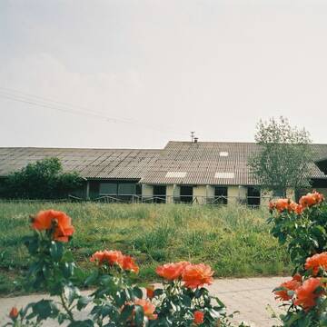
Offenstall in Hochdorf/Enz
Eberdingen
Schwerdtle
@PferdehofSchwerdtle
FN-Mitglied
Freizeitstall
Vermieten
Laufband
Longierzirkel/Roundpen
Laufstall
Offenstall
12 weitere...
P
Sonnenhof-Gebersheim
Leonberg
Sonnenhof eGbR
@W.-u-.A-.Gieck-Sonnenhof-GbR
FN-Mitglied
Pferdeausbildung
Vermieten
Laufband
Paddock
Außenbox mit Paddock
Außenboxen
16 weitere...
P
Deprecated: Creation of dynamic property Zend_View_Helper_Ads::$adLink is deprecated in /var/www/stall-frei/htdocs/staging.stall-frei.de/library/Psf/View/Helper/Ads.php on line 108


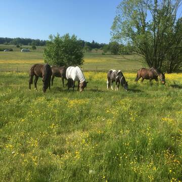
Offenstallplatz mit Paddock Trail für Stute frei
Gebersheim
Gebersheim Falkenhof
@Kristina-Kogel
Freizeitstall
Vermieten
Hunde willkommen
Sattelkammer/Sattelschränke
Gnadenbrothof
Hufrehe geeignet
12 weitere...
P

Offenstallplatz
Weil Der Stadt
Holiday Ranch
@RMB-Offenstall
Freizeitstall
Vermieten
Hunde willkommen
Krankenbox
Gnadenbrothof
11 weitere...
P
Schöne Stallplätze auch für Rentnerpferde optim...
Engelsbrand
thomas-Korbus
@thomas-Korbus
Reitplatz (z.B. Dressur, Springen, Reining)
Sattelkammer/Sattelschränke
Hengsthaltung möglich
Außenboxen
Innenbox
Vollpension
5 weitere...
P

Futtersack HeuToy, Fressbremse in pink
Mechtersen
STALL-FREIde Marketing
@STALL-FREI-Marketing
Stundenlange Beschäftigung die
Koliken vorbeugt, geringe Staubinhalation mit
steuerbarer Futterentnahme
Leider kein Vorschaubild
Leider kein Vorschaubild
Pensionsstall für Rentnerpferde
Pforzheim
Pferdepension Bosch
@Pferdepension_Bosch
Vermieten
Hunde willkommen
Krankenbox
Gnadenbrothof
Innenbox
8 weitere...
B

Pferdepension Güthlerhof
Weil der Stadt
Pferdepension-Guethlerhof-Rainer-Siegle
@Guethlerhof
FN-Mitglied
Reitlehrer und -unterricht
Vermieten
Führanlage
Hunde willkommen
Allergikerstall
Hengsthaltung möglich
23 weitere...
P


Boxen in Vollpension
Korntal-Münchingen
Strohberghof
@DietmarSchmalzridt
Freizeitstall
Pferdeausbildung
Vermieten
Führanlage
Hunde willkommen
Außenbox mit Paddock
Außenboxen
16 weitere...
P+

Reitanlage Rau
Weil der Stadt
Reitanlage-Markus-Rau
@Reitanlage-Markus-Rau
Führanlage
Longierzirkel/Roundpen
Hengsthaltung möglich
Notfallboxen
Außenbox mit Paddock
Außenboxen
Halbpension
Vollpension
10 weitere...
P
Leider kein Vorschaubild
Leider kein Vorschaubild
Offenstall mit Koppel als Selbstversorger
Eberdingen-Nussdorf
Karle Rapp
@Karle_Rapp
FN-Mitglied
Freizeitstall
Verpachten
Führanlage
Longierzirkel/Roundpen
Offenstall
13 weitere...
B
Werde Teil von STALL-FREI.de
Du hast eine Pferdebox frei? Freie Plätze im Offenstall, Pferdestall oder der Reitanlage kostenlos anbieten.
Deprecated: Creation of dynamic property Zend_View::$pageCount is deprecated in /var/www/stall-frei/htdocs/staging.stall-frei.de/library/vendor/shardj/zf1-future/library/Zend/View/Abstract.php on line 308
Deprecated: Creation of dynamic property Zend_View::$itemCountPerPage is deprecated in /var/www/stall-frei/htdocs/staging.stall-frei.de/library/vendor/shardj/zf1-future/library/Zend/View/Abstract.php on line 308
Deprecated: Creation of dynamic property Zend_View::$first is deprecated in /var/www/stall-frei/htdocs/staging.stall-frei.de/library/vendor/shardj/zf1-future/library/Zend/View/Abstract.php on line 308
Deprecated: Creation of dynamic property Zend_View::$current is deprecated in /var/www/stall-frei/htdocs/staging.stall-frei.de/library/vendor/shardj/zf1-future/library/Zend/View/Abstract.php on line 308
Deprecated: Creation of dynamic property Zend_View::$last is deprecated in /var/www/stall-frei/htdocs/staging.stall-frei.de/library/vendor/shardj/zf1-future/library/Zend/View/Abstract.php on line 308
Deprecated: Creation of dynamic property Zend_View::$previous is deprecated in /var/www/stall-frei/htdocs/staging.stall-frei.de/library/vendor/shardj/zf1-future/library/Zend/View/Abstract.php on line 308
Deprecated: Creation of dynamic property Zend_View::$next is deprecated in /var/www/stall-frei/htdocs/staging.stall-frei.de/library/vendor/shardj/zf1-future/library/Zend/View/Abstract.php on line 308
Deprecated: Creation of dynamic property Zend_View::$pagesInRange is deprecated in /var/www/stall-frei/htdocs/staging.stall-frei.de/library/vendor/shardj/zf1-future/library/Zend/View/Abstract.php on line 308
Deprecated: Creation of dynamic property Zend_View::$firstPageInRange is deprecated in /var/www/stall-frei/htdocs/staging.stall-frei.de/library/vendor/shardj/zf1-future/library/Zend/View/Abstract.php on line 308
Deprecated: Creation of dynamic property Zend_View::$lastPageInRange is deprecated in /var/www/stall-frei/htdocs/staging.stall-frei.de/library/vendor/shardj/zf1-future/library/Zend/View/Abstract.php on line 308
Deprecated: Creation of dynamic property Zend_View::$currentItemCount is deprecated in /var/www/stall-frei/htdocs/staging.stall-frei.de/library/vendor/shardj/zf1-future/library/Zend/View/Abstract.php on line 308
Deprecated: Creation of dynamic property Zend_View::$totalItemCount is deprecated in /var/www/stall-frei/htdocs/staging.stall-frei.de/library/vendor/shardj/zf1-future/library/Zend/View/Abstract.php on line 308
Deprecated: Creation of dynamic property Zend_View::$firstItemNumber is deprecated in /var/www/stall-frei/htdocs/staging.stall-frei.de/library/vendor/shardj/zf1-future/library/Zend/View/Abstract.php on line 308
Deprecated: Creation of dynamic property Zend_View::$lastItemNumber is deprecated in /var/www/stall-frei/htdocs/staging.stall-frei.de/library/vendor/shardj/zf1-future/library/Zend/View/Abstract.php on line 308
Deprecated: Creation of dynamic property Zend_View::$router is deprecated in /var/www/stall-frei/htdocs/staging.stall-frei.de/library/vendor/shardj/zf1-future/library/Zend/View/Abstract.php on line 308
Deprecated: Creation of dynamic property Zend_View::$urlParams is deprecated in /var/www/stall-frei/htdocs/staging.stall-frei.de/library/vendor/shardj/zf1-future/library/Zend/View/Abstract.php on line 308
Deprecated: Creation of dynamic property Zend_View::$showAds is deprecated in /var/www/stall-frei/htdocs/staging.stall-frei.de/library/vendor/shardj/zf1-future/library/Zend/View/Abstract.php on line 308
Deprecated: Creation of dynamic property Zend_View::$objectIds is deprecated in /var/www/stall-frei/htdocs/staging.stall-frei.de/library/vendor/shardj/zf1-future/library/Zend/View/Abstract.php on line 308
Deprecated: Creation of dynamic property Zend_View::$showNavbar is deprecated in /var/www/stall-frei/htdocs/staging.stall-frei.de/library/vendor/shardj/zf1-future/library/Zend/View/Abstract.php on line 308
Deprecated: Creation of dynamic property Zend_View::$showBreadcrumb is deprecated in /var/www/stall-frei/htdocs/staging.stall-frei.de/library/vendor/shardj/zf1-future/library/Zend/View/Abstract.php on line 308
Deprecated: Creation of dynamic property Zend_View::$showFooter is deprecated in /var/www/stall-frei/htdocs/staging.stall-frei.de/library/vendor/shardj/zf1-future/library/Zend/View/Abstract.php on line 308
Deprecated: Creation of dynamic property Zend_View::$showInternalAds is deprecated in /var/www/stall-frei/htdocs/staging.stall-frei.de/library/vendor/shardj/zf1-future/library/Zend/View/Abstract.php on line 308
Deprecated: Creation of dynamic property Zend_View::$blNoContent is deprecated in /var/www/stall-frei/htdocs/staging.stall-frei.de/library/vendor/shardj/zf1-future/library/Zend/View/Abstract.php on line 308
Deprecated: Creation of dynamic property Zend_View::$sMetaDesc is deprecated in /var/www/stall-frei/htdocs/staging.stall-frei.de/library/vendor/shardj/zf1-future/library/Zend/View/Abstract.php on line 308
Deprecated: Creation of dynamic property Zend_View::$useGmaps is deprecated in /var/www/stall-frei/htdocs/staging.stall-frei.de/library/vendor/shardj/zf1-future/library/Zend/View/Abstract.php on line 308
Deprecated: Creation of dynamic property Zend_View::$touches is deprecated in /var/www/stall-frei/htdocs/staging.stall-frei.de/library/vendor/shardj/zf1-future/library/Zend/View/Abstract.php on line 308
Deprecated: Creation of dynamic property Zend_View::$oProject is deprecated in /var/www/stall-frei/htdocs/staging.stall-frei.de/library/vendor/shardj/zf1-future/library/Zend/View/Abstract.php on line 308
Deprecated: Creation of dynamic property Zend_View::$pageHeadline is deprecated in /var/www/stall-frei/htdocs/staging.stall-frei.de/library/vendor/shardj/zf1-future/library/Zend/View/Abstract.php on line 308
Deprecated: Creation of dynamic property Zend_View::$disableLocationField is deprecated in /var/www/stall-frei/htdocs/staging.stall-frei.de/library/vendor/shardj/zf1-future/library/Zend/View/Abstract.php on line 308
Deprecated: Creation of dynamic property Zend_View::$isSearch is deprecated in /var/www/stall-frei/htdocs/staging.stall-frei.de/library/vendor/shardj/zf1-future/library/Zend/View/Abstract.php on line 308
Deprecated: Creation of dynamic property Zend_View::$pageTitle is deprecated in /var/www/stall-frei/htdocs/staging.stall-frei.de/library/vendor/shardj/zf1-future/library/Zend/View/Abstract.php on line 308
Deprecated: Creation of dynamic property Psf_Form_Element_Text::$class is deprecated in /var/www/stall-frei/htdocs/staging.stall-frei.de/library/vendor/shardj/zf1-future/library/Zend/Form/Element.php on line 874
Deprecated: Creation of dynamic property Psf_Form_Element_Text::$size is deprecated in /var/www/stall-frei/htdocs/staging.stall-frei.de/library/vendor/shardj/zf1-future/library/Zend/Form/Element.php on line 874
Deprecated: Creation of dynamic property Psf_Form_Element_Text::$placeholder is deprecated in /var/www/stall-frei/htdocs/staging.stall-frei.de/library/vendor/shardj/zf1-future/library/Zend/Form/Element.php on line 874
Deprecated: Creation of dynamic property Psf_Form_Element_Hidden::$class is deprecated in /var/www/stall-frei/htdocs/staging.stall-frei.de/library/vendor/shardj/zf1-future/library/Zend/Form/Element.php on line 874
Deprecated: Creation of dynamic property Psf_Form_Element_Hidden::$class is deprecated in /var/www/stall-frei/htdocs/staging.stall-frei.de/library/vendor/shardj/zf1-future/library/Zend/Form/Element.php on line 874
Deprecated: Creation of dynamic property Psf_Form_Element_Hidden::$class is deprecated in /var/www/stall-frei/htdocs/staging.stall-frei.de/library/vendor/shardj/zf1-future/library/Zend/Form/Element.php on line 874
Deprecated: Creation of dynamic property Psf_Form_Element_Hidden::$class is deprecated in /var/www/stall-frei/htdocs/staging.stall-frei.de/library/vendor/shardj/zf1-future/library/Zend/Form/Element.php on line 874
Deprecated: Creation of dynamic property Psf_Form_Element_Select::$class is deprecated in /var/www/stall-frei/htdocs/staging.stall-frei.de/library/vendor/shardj/zf1-future/library/Zend/Form/Element.php on line 874
Deprecated: Creation of dynamic property Psf_Form_Element_Select::$class is deprecated in /var/www/stall-frei/htdocs/staging.stall-frei.de/library/vendor/shardj/zf1-future/library/Zend/Form/Element.php on line 874
Deprecated: Creation of dynamic property Psf_Form_Element_Select::$class is deprecated in /var/www/stall-frei/htdocs/staging.stall-frei.de/library/vendor/shardj/zf1-future/library/Zend/Form/Element.php on line 874
Deprecated: Creation of dynamic property Psf_Form_Element_Select::$class is deprecated in /var/www/stall-frei/htdocs/staging.stall-frei.de/library/vendor/shardj/zf1-future/library/Zend/Form/Element.php on line 874
Deprecated: Creation of dynamic property Psf_Form_Element_Text::$class is deprecated in /var/www/stall-frei/htdocs/staging.stall-frei.de/library/vendor/shardj/zf1-future/library/Zend/Form/Element.php on line 874
Deprecated: Creation of dynamic property Psf_Form_Element_Checkbox::$label is deprecated in /var/www/stall-frei/htdocs/staging.stall-frei.de/library/vendor/shardj/zf1-future/library/Zend/Form/Element.php on line 874
Deprecated: Creation of dynamic property Zend_View::$sort is deprecated in /var/www/stall-frei/htdocs/staging.stall-frei.de/library/vendor/shardj/zf1-future/library/Zend/View/Abstract.php on line 308
Deprecated: Creation of dynamic property Zend_View::$searchLocation is deprecated in /var/www/stall-frei/htdocs/staging.stall-frei.de/library/vendor/shardj/zf1-future/library/Zend/View/Abstract.php on line 308
Deprecated: Creation of dynamic property Zend_View::$locationHint is deprecated in /var/www/stall-frei/htdocs/staging.stall-frei.de/library/vendor/shardj/zf1-future/library/Zend/View/Abstract.php on line 308
Psf_GeoCoder_Abstract::getLocation: Wurmberg Get Location CachedOrLive
Psf_GeoCoder_Abstract::getCachedOrLive: Wurmberg
Psf_GeoCoder_Abstract::convertLocationResult
{"documentation":"https:\/\/opencagedata.com\/api","licenses":[{"name":"see attribution guide","url":"https:\/\/opencagedata.com\/credits"}],"results":[{"bounds":{"northeast":{"lat":48.8886135,"lng":8.8441659},"southwest":{"lat":48.8609374,"lng":8.7905589}},"components":{"ISO_3166-1_alpha-2":"DE","ISO_3166-1_alpha-3":"DEU","ISO_3166-2":["DE-BW"],"_category":"place","_normalized_city":"Wurmberg","_type":"village","continent":"Europe","country":"Deutschland","country_code":"de","county":"Enzkreis","municipality":"GVV Heckeng\u00e4u","political_union":"European Union","postcode":"75449","state":"Baden-W\u00fcrttemberg","state_code":"BW","village":"Wurmberg"},"confidence":7,"formatted":"75449 Wurmberg, Deutschland","geometry":{"lat":48.8702888,"lng":8.8201671}},{"bounds":{"northeast":{"lat":51.7565687,"lng":10.6182577},"southwest":{"lat":51.7564687,"lng":10.6181577}},"components":{"ISO_3166-1_alpha-2":"DE","ISO_3166-1_alpha-3":"DEU","ISO_3166-2":["DE-NI"],"_category":"natural\/water","_normalized_city":"Braunlage","_type":"peak","continent":"Europe","country":"Deutschland","country_code":"de","county":"Landkreis Goslar","peak":"Wurmberg","political_union":"European Union","postcode":"38879","state":"Niedersachsen","state_code":"NI","town":"Braunlage"},"confidence":9,"formatted":"Wurmberg, 38879 Braunlage, Deutschland","geometry":{"lat":51.7565187,"lng":10.6182077}},{"bounds":{"northeast":{"lat":50.8914317,"lng":7.9626354},"southwest":{"lat":50.8913317,"lng":7.9625354}},"components":{"ISO_3166-1_alpha-2":"DE","ISO_3166-1_alpha-3":"DEU","ISO_3166-2":["DE-NW"],"_category":"natural\/water","_normalized_city":"Siegen","_type":"peak","city":"Siegen","continent":"Europe","country":"Deutschland","country_code":"de","county":"Kreis Siegen-Wittgenstein","peak":"Wurmberg","political_union":"European Union","postcode":"57078","state":"Nordrhein-Westfalen","state_code":"NW"},"confidence":9,"formatted":"Wurmberg, 57078 Siegen, Deutschland","geometry":{"lat":50.8913817,"lng":7.9625854}},{"bounds":{"northeast":{"lat":51.3313677,"lng":9.3993426},"southwest":{"lat":51.3312677,"lng":9.3992426}},"components":{"ISO_3166-1_alpha-2":"DE","ISO_3166-1_alpha-3":"DEU","ISO_3166-2":["DE-HE"],"_category":"natural\/water","_normalized_city":"Kassel","_type":"peak","city":"Kassel","continent":"Europe","country":"Deutschland","country_code":"de","peak":"Wurmberg","political_union":"European Union","postcode":"34292","state":"Hessen","state_code":"HE"},"confidence":9,"formatted":"Wurmberg, 34292 Kassel, Deutschland","geometry":{"lat":51.3313177,"lng":9.3992926}},{"bounds":{"northeast":{"lat":51.2097988,"lng":11.7071461},"southwest":{"lat":51.2096988,"lng":11.7070461}},"components":{"ISO_3166-1_alpha-2":"DE","ISO_3166-1_alpha-3":"DEU","ISO_3166-2":["DE-ST"],"_category":"natural\/water","_normalized_city":"Balgst\u00e4dt","_type":"peak","continent":"Europe","country":"Deutschland","country_code":"de","county":"Burgenlandkreis","municipality":"Unstruttal","peak":"Wurmberg","political_union":"European Union","state":"Sachsen-Anhalt","state_code":"ST","village":"Balgst\u00e4dt"},"confidence":9,"formatted":"Wurmberg, Balgst\u00e4dt, Sachsen-Anhalt, Deutschland","geometry":{"lat":51.2097488,"lng":11.7070961}},{"bounds":{"northeast":{"lat":49.6043861,"lng":9.4826076},"southwest":{"lat":49.6042861,"lng":9.4825076}},"components":{"ISO_3166-1_alpha-2":"DE","ISO_3166-1_alpha-3":"DEU","ISO_3166-2":["DE-BW"],"_category":"natural\/water","_normalized_city":"Hardheim","_type":"peak","continent":"Europe","country":"Deutschland","country_code":"de","county":"Neckar-Odenwald-Kreis","municipality":"GVV Hardheim-Walld\u00fcrn","peak":"Wurmberg","political_union":"European Union","postcode":"74736","state":"Baden-W\u00fcrttemberg","state_code":"BW","village":"Hardheim"},"confidence":9,"formatted":"Wurmberg, 74736 Hardheim, Deutschland","geometry":{"lat":49.6043361,"lng":9.4825576}},{"bounds":{"northeast":{"lat":50.8071049,"lng":11.635216},"southwest":{"lat":50.8070049,"lng":11.635116}},"components":{"ISO_3166-1_alpha-2":"DE","ISO_3166-1_alpha-3":"DEU","ISO_3166-2":["DE-TH"],"_category":"natural\/water","_normalized_city":"Seitenroda","_type":"peak","continent":"Europe","country":"Deutschland","country_code":"de","county":"Saale-Holzland-Kreis","municipality":"S\u00fcdliches Saaletal","peak":"Wurmberg","political_union":"European Union","state":"Th\u00fcringen","state_code":"TH","village":"Seitenroda"},"confidence":9,"formatted":"Wurmberg, Seitenroda, Th\u00fcringen, Deutschland","geometry":{"lat":50.8070549,"lng":11.635166}},{"bounds":{"northeast":{"lat":49.7131332,"lng":9.6548553},"southwest":{"lat":49.7130332,"lng":9.6547553}},"components":{"ISO_3166-1_alpha-2":"DE","ISO_3166-1_alpha-3":"DEU","ISO_3166-2":["DE-BY"],"_category":"natural\/water","_normalized_city":"Neubrunn","_type":"peak","continent":"Europe","country":"Deutschland","country_code":"de","county":"Landkreis W\u00fcrzburg","peak":"Wurmberg","political_union":"European Union","postcode":"97277","state":"Bayern","state_code":"BY","village":"Neubrunn"},"confidence":9,"formatted":"Wurmberg, 97277 Neubrunn, Deutschland","geometry":{"lat":49.7130832,"lng":9.6548053}},{"bounds":{"northeast":{"lat":50.2009902,"lng":10.21144},"southwest":{"lat":50.2008902,"lng":10.21134}},"components":{"ISO_3166-1_alpha-2":"DE","ISO_3166-1_alpha-3":"DEU","ISO_3166-2":["DE-BY"],"_category":"natural\/water","_normalized_city":"Ma\u00dfbach","_type":"peak","continent":"Europe","country":"Deutschland","country_code":"de","county":"Landkreis Bad Kissingen","municipality":"Ma\u00dfbach (VGem)","peak":"Wurmberg","political_union":"European Union","postcode":"97517","state":"Bayern","state_code":"BY","village":"Ma\u00dfbach"},"confidence":9,"formatted":"Wurmberg, 97517 Ma\u00dfbach, Deutschland","geometry":{"lat":50.2009402,"lng":10.21139}},{"bounds":{"northeast":{"lat":49.4488221,"lng":9.5821777},"southwest":{"lat":49.4487221,"lng":9.5820777}},"components":{"ISO_3166-1_alpha-2":"DE","ISO_3166-1_alpha-3":"DEU","ISO_3166-2":["DE-BW"],"_category":"natural\/water","_normalized_city":"Ahorn","_type":"peak","continent":"Europe","country":"Deutschland","country_code":"de","county":"Main-Tauber-Kreis","municipality":"Ahorn","peak":"Wurmberg","political_union":"European Union","state":"Baden-W\u00fcrttemberg","state_code":"BW"},"confidence":9,"formatted":"Wurmberg, Ahorn, Baden-W\u00fcrttemberg, Deutschland","geometry":{"lat":49.4487721,"lng":9.5821277}}],"status":{"code":200,"message":"OK"},"stay_informed":{"blog":"https:\/\/blog.opencagedata.com","mastodon":"https:\/\/en.osm.town\/@opencage"},"thanks":"For using an OpenCage API","timestamp":{"created_http":"Fri, 06 Feb 2026 14:38:33 GMT","created_unix":1770388713},"total_results":10}Array
(
[0] => stdClass Object
(
[bounds] => stdClass Object
(
[northeast] => stdClass Object
(
[lat] => 48.8886135
[lng] => 8.8441659
)
[southwest] => stdClass Object
(
[lat] => 48.8609374
[lng] => 8.7905589
)
)
[components] => stdClass Object
(
[ISO_3166-1_alpha-2] => DE
[ISO_3166-1_alpha-3] => DEU
[ISO_3166-2] => Array
(
[0] => DE-BW
)
[_category] => place
[_normalized_city] => Wurmberg
[_type] => village
[continent] => Europe
[country] => Deutschland
[country_code] => de
[county] => Enzkreis
[municipality] => GVV Heckengäu
[political_union] => European Union
[postcode] => 75449
[state] => Baden-Württemberg
[state_code] => BW
[village] => Wurmberg
)
[confidence] => 7
[formatted] => 75449 Wurmberg, Deutschland
[geometry] => stdClass Object
(
[lat] => 48.8702888
[lng] => 8.8201671
)
)
[1] => stdClass Object
(
[bounds] => stdClass Object
(
[northeast] => stdClass Object
(
[lat] => 51.7565687
[lng] => 10.6182577
)
[southwest] => stdClass Object
(
[lat] => 51.7564687
[lng] => 10.6181577
)
)
[components] => stdClass Object
(
[ISO_3166-1_alpha-2] => DE
[ISO_3166-1_alpha-3] => DEU
[ISO_3166-2] => Array
(
[0] => DE-NI
)
[_category] => natural/water
[_normalized_city] => Braunlage
[_type] => peak
[continent] => Europe
[country] => Deutschland
[country_code] => de
[county] => Landkreis Goslar
[peak] => Wurmberg
[political_union] => European Union
[postcode] => 38879
[state] => Niedersachsen
[state_code] => NI
[town] => Braunlage
)
[confidence] => 9
[formatted] => Wurmberg, 38879 Braunlage, Deutschland
[geometry] => stdClass Object
(
[lat] => 51.7565187
[lng] => 10.6182077
)
)
[2] => stdClass Object
(
[bounds] => stdClass Object
(
[northeast] => stdClass Object
(
[lat] => 50.8914317
[lng] => 7.9626354
)
[southwest] => stdClass Object
(
[lat] => 50.8913317
[lng] => 7.9625354
)
)
[components] => stdClass Object
(
[ISO_3166-1_alpha-2] => DE
[ISO_3166-1_alpha-3] => DEU
[ISO_3166-2] => Array
(
[0] => DE-NW
)
[_category] => natural/water
[_normalized_city] => Siegen
[_type] => peak
[city] => Siegen
[continent] => Europe
[country] => Deutschland
[country_code] => de
[county] => Kreis Siegen-Wittgenstein
[peak] => Wurmberg
[political_union] => European Union
[postcode] => 57078
[state] => Nordrhein-Westfalen
[state_code] => NW
)
[confidence] => 9
[formatted] => Wurmberg, 57078 Siegen, Deutschland
[geometry] => stdClass Object
(
[lat] => 50.8913817
[lng] => 7.9625854
)
)
[3] => stdClass Object
(
[bounds] => stdClass Object
(
[northeast] => stdClass Object
(
[lat] => 51.3313677
[lng] => 9.3993426
)
[southwest] => stdClass Object
(
[lat] => 51.3312677
[lng] => 9.3992426
)
)
[components] => stdClass Object
(
[ISO_3166-1_alpha-2] => DE
[ISO_3166-1_alpha-3] => DEU
[ISO_3166-2] => Array
(
[0] => DE-HE
)
[_category] => natural/water
[_normalized_city] => Kassel
[_type] => peak
[city] => Kassel
[continent] => Europe
[country] => Deutschland
[country_code] => de
[peak] => Wurmberg
[political_union] => European Union
[postcode] => 34292
[state] => Hessen
[state_code] => HE
)
[confidence] => 9
[formatted] => Wurmberg, 34292 Kassel, Deutschland
[geometry] => stdClass Object
(
[lat] => 51.3313177
[lng] => 9.3992926
)
)
[4] => stdClass Object
(
[bounds] => stdClass Object
(
[northeast] => stdClass Object
(
[lat] => 51.2097988
[lng] => 11.7071461
)
[southwest] => stdClass Object
(
[lat] => 51.2096988
[lng] => 11.7070461
)
)
[components] => stdClass Object
(
[ISO_3166-1_alpha-2] => DE
[ISO_3166-1_alpha-3] => DEU
[ISO_3166-2] => Array
(
[0] => DE-ST
)
[_category] => natural/water
[_normalized_city] => Balgstädt
[_type] => peak
[continent] => Europe
[country] => Deutschland
[country_code] => de
[county] => Burgenlandkreis
[municipality] => Unstruttal
[peak] => Wurmberg
[political_union] => European Union
[state] => Sachsen-Anhalt
[state_code] => ST
[village] => Balgstädt
)
[confidence] => 9
[formatted] => Wurmberg, Balgstädt, Sachsen-Anhalt, Deutschland
[geometry] => stdClass Object
(
[lat] => 51.2097488
[lng] => 11.7070961
)
)
[5] => stdClass Object
(
[bounds] => stdClass Object
(
[northeast] => stdClass Object
(
[lat] => 49.6043861
[lng] => 9.4826076
)
[southwest] => stdClass Object
(
[lat] => 49.6042861
[lng] => 9.4825076
)
)
[components] => stdClass Object
(
[ISO_3166-1_alpha-2] => DE
[ISO_3166-1_alpha-3] => DEU
[ISO_3166-2] => Array
(
[0] => DE-BW
)
[_category] => natural/water
[_normalized_city] => Hardheim
[_type] => peak
[continent] => Europe
[country] => Deutschland
[country_code] => de
[county] => Neckar-Odenwald-Kreis
[municipality] => GVV Hardheim-Walldürn
[peak] => Wurmberg
[political_union] => European Union
[postcode] => 74736
[state] => Baden-Württemberg
[state_code] => BW
[village] => Hardheim
)
[confidence] => 9
[formatted] => Wurmberg, 74736 Hardheim, Deutschland
[geometry] => stdClass Object
(
[lat] => 49.6043361
[lng] => 9.4825576
)
)
[6] => stdClass Object
(
[bounds] => stdClass Object
(
[northeast] => stdClass Object
(
[lat] => 50.8071049
[lng] => 11.635216
)
[southwest] => stdClass Object
(
[lat] => 50.8070049
[lng] => 11.635116
)
)
[components] => stdClass Object
(
[ISO_3166-1_alpha-2] => DE
[ISO_3166-1_alpha-3] => DEU
[ISO_3166-2] => Array
(
[0] => DE-TH
)
[_category] => natural/water
[_normalized_city] => Seitenroda
[_type] => peak
[continent] => Europe
[country] => Deutschland
[country_code] => de
[county] => Saale-Holzland-Kreis
[municipality] => Südliches Saaletal
[peak] => Wurmberg
[political_union] => European Union
[state] => Thüringen
[state_code] => TH
[village] => Seitenroda
)
[confidence] => 9
[formatted] => Wurmberg, Seitenroda, Thüringen, Deutschland
[geometry] => stdClass Object
(
[lat] => 50.8070549
[lng] => 11.635166
)
)
[7] => stdClass Object
(
[bounds] => stdClass Object
(
[northeast] => stdClass Object
(
[lat] => 49.7131332
[lng] => 9.6548553
)
[southwest] => stdClass Object
(
[lat] => 49.7130332
[lng] => 9.6547553
)
)
[components] => stdClass Object
(
[ISO_3166-1_alpha-2] => DE
[ISO_3166-1_alpha-3] => DEU
[ISO_3166-2] => Array
(
[0] => DE-BY
)
[_category] => natural/water
[_normalized_city] => Neubrunn
[_type] => peak
[continent] => Europe
[country] => Deutschland
[country_code] => de
[county] => Landkreis Würzburg
[peak] => Wurmberg
[political_union] => European Union
[postcode] => 97277
[state] => Bayern
[state_code] => BY
[village] => Neubrunn
)
[confidence] => 9
[formatted] => Wurmberg, 97277 Neubrunn, Deutschland
[geometry] => stdClass Object
(
[lat] => 49.7130832
[lng] => 9.6548053
)
)
[8] => stdClass Object
(
[bounds] => stdClass Object
(
[northeast] => stdClass Object
(
[lat] => 50.2009902
[lng] => 10.21144
)
[southwest] => stdClass Object
(
[lat] => 50.2008902
[lng] => 10.21134
)
)
[components] => stdClass Object
(
[ISO_3166-1_alpha-2] => DE
[ISO_3166-1_alpha-3] => DEU
[ISO_3166-2] => Array
(
[0] => DE-BY
)
[_category] => natural/water
[_normalized_city] => Maßbach
[_type] => peak
[continent] => Europe
[country] => Deutschland
[country_code] => de
[county] => Landkreis Bad Kissingen
[municipality] => Maßbach (VGem)
[peak] => Wurmberg
[political_union] => European Union
[postcode] => 97517
[state] => Bayern
[state_code] => BY
[village] => Maßbach
)
[confidence] => 9
[formatted] => Wurmberg, 97517 Maßbach, Deutschland
[geometry] => stdClass Object
(
[lat] => 50.2009402
[lng] => 10.21139
)
)
[9] => stdClass Object
(
[bounds] => stdClass Object
(
[northeast] => stdClass Object
(
[lat] => 49.4488221
[lng] => 9.5821777
)
[southwest] => stdClass Object
(
[lat] => 49.4487221
[lng] => 9.5820777
)
)
[components] => stdClass Object
(
[ISO_3166-1_alpha-2] => DE
[ISO_3166-1_alpha-3] => DEU
[ISO_3166-2] => Array
(
[0] => DE-BW
)
[_category] => natural/water
[_normalized_city] => Ahorn
[_type] => peak
[continent] => Europe
[country] => Deutschland
[country_code] => de
[county] => Main-Tauber-Kreis
[municipality] => Ahorn
[peak] => Wurmberg
[political_union] => European Union
[state] => Baden-Württemberg
[state_code] => BW
)
[confidence] => 9
[formatted] => Wurmberg, Ahorn, Baden-Württemberg, Deutschland
[geometry] => stdClass Object
(
[lat] => 49.4487721
[lng] => 9.5821277
)
)
)
Psf_GeoCoder_OpenCageData::getKeyMap: 0
stdClass Object
(
    [bounds] => stdClass Object
        (
            [northeast] => stdClass Object
                (
                    [lat] => 48.8886135
                    [lng] => 8.8441659
                )

            [southwest] => stdClass Object
                (
                    [lat] => 48.8609374
                    [lng] => 8.7905589
                )

        )

    [components] => stdClass Object
        (
            [ISO_3166-1_alpha-2] => DE
            [ISO_3166-1_alpha-3] => DEU
            [ISO_3166-2] => Array
                (
                    [0] => DE-BW
                )

            [_category] => place
            [_normalized_city] => Wurmberg
            [_type] => village
            [continent] => Europe
            [country] => Deutschland
            [country_code] => de
            [county] => Enzkreis
            [municipality] => GVV Heckengäu
            [political_union] => European Union
            [postcode] => 75449
            [state] => Baden-Württemberg
            [state_code] => BW
            [village] => Wurmberg
        )

    [confidence] => 7
    [formatted] => 75449 Wurmberg, Deutschland
    [geometry] => stdClass Object
        (
            [lat] => 48.8702888
            [lng] => 8.8201671
        )

)
Psf_GeoCoder_OpenCageData::getCounty: Enzkreis
Psf_GeoCoder_OpenCageData::addMissingData REFETCH!
Array
(
    [address] => 75449 Wurmberg, Deutschland
    [type] => village
    [street] =>
    [city] => Wurmberg
    [county] => Enzkreis
    [state] => Baden-Württemberg
    [zip] => 75449
    [country] => Deutschland
    [suburb] =>
    [countrycode] => de
    [latitude] => 48.8702888
    [longitude] => 8.8201671
    [accuracy] => 1
    [confidence] => 7
    [bounds] => stdClass Object
        (
            [northeast] => stdClass Object
                (
                    [lat] => 48.8886135
                    [lng] => 8.8441659
                )

            [southwest] => stdClass Object
                (
                    [lat] => 48.8609374
                    [lng] => 8.7905589
                )

        )

)
reformat!
Array
(
    [address] => 75449 Wurmberg, Deutschland
    [type] => village
    [street] =>
    [city] => Wurmberg
    [county] => Enzkreis
    [state] => Baden-Württemberg
    [zip] => 75449
    [country] => Deutschland
    [suburb] =>
    [countrycode] => de
    [latitude] => 48.8702888
    [longitude] => 8.8201671
    [accuracy] => 1
    [confidence] => 7
    [bounds] => stdClass Object
        (
            [northeast] => stdClass Object
                (
                    [lat] => 48.8886135
                    [lng] => 8.8441659
                )

            [southwest] => stdClass Object
                (
                    [lat] => 48.8609374
                    [lng] => 8.7905589
                )

        )

    [place] => 75449 Wurmberg, Baden-Württemberg
    [hash] => 0069e48704db741a2539d80bae108b39
)
Psf_GeoCoder_OpenCageData::getKeyMap: 1
stdClass Object
(
    [bounds] => stdClass Object
        (
            [northeast] => stdClass Object
                (
                    [lat] => 51.7565687
                    [lng] => 10.6182577
                )

            [southwest] => stdClass Object
                (
                    [lat] => 51.7564687
                    [lng] => 10.6181577
                )

        )

    [components] => stdClass Object
        (
            [ISO_3166-1_alpha-2] => DE
            [ISO_3166-1_alpha-3] => DEU
            [ISO_3166-2] => Array
                (
                    [0] => DE-NI
                )

            [_category] => natural/water
            [_normalized_city] => Braunlage
            [_type] => peak
            [continent] => Europe
            [country] => Deutschland
            [country_code] => de
            [county] => Landkreis Goslar
            [peak] => Wurmberg
            [political_union] => European Union
            [postcode] => 38879
            [state] => Niedersachsen
            [state_code] => NI
            [town] => Braunlage
        )

    [confidence] => 9
    [formatted] => Wurmberg, 38879 Braunlage, Deutschland
    [geometry] => stdClass Object
        (
            [lat] => 51.7565187
            [lng] => 10.6182077
        )

)
Psf_GeoCoder_OpenCageData::getCounty: Goslar
Psf_GeoCoder_OpenCageData::addMissingData REFETCH!
Array
(
    [address] => Wurmberg, 38879 Braunlage, Deutschland
    [type] => peak
    [street] =>
    [city] => Braunlage
    [county] => Goslar
    [state] => Niedersachsen
    [zip] => 38879
    [country] => Deutschland
    [suburb] =>
    [countrycode] => de
    [latitude] => 51.7565187
    [longitude] => 10.6182077
    [accuracy] => 1
    [confidence] => 9
    [bounds] => stdClass Object
        (
            [northeast] => stdClass Object
                (
                    [lat] => 51.7565687
                    [lng] => 10.6182577
                )

            [southwest] => stdClass Object
                (
                    [lat] => 51.7564687
                    [lng] => 10.6181577
                )

        )

)
reformat!
Array
(
    [address] => Wurmberg, 38879 Braunlage, Deutschland
    [type] => peak
    [street] =>
    [city] => Braunlage
    [county] => Goslar
    [state] => Niedersachsen
    [zip] => 38879
    [country] => Deutschland
    [suburb] =>
    [countrycode] => de
    [latitude] => 51.7565187
    [longitude] => 10.6182077
    [accuracy] => 1
    [confidence] => 9
    [bounds] => stdClass Object
        (
            [northeast] => stdClass Object
                (
                    [lat] => 51.7565687
                    [lng] => 10.6182577
                )

            [southwest] => stdClass Object
                (
                    [lat] => 51.7564687
                    [lng] => 10.6181577
                )

        )

    [place] => 38879 Braunlage, Niedersachsen
    [hash] => 79b1eefa9a04652b9346743c19772d30
)
Psf_GeoCoder_OpenCageData::getKeyMap: 2
stdClass Object
(
    [bounds] => stdClass Object
        (
            [northeast] => stdClass Object
                (
                    [lat] => 50.8914317
                    [lng] => 7.9626354
                )

            [southwest] => stdClass Object
                (
                    [lat] => 50.8913317
                    [lng] => 7.9625354
                )

        )

    [components] => stdClass Object
        (
            [ISO_3166-1_alpha-2] => DE
            [ISO_3166-1_alpha-3] => DEU
            [ISO_3166-2] => Array
                (
                    [0] => DE-NW
                )

            [_category] => natural/water
            [_normalized_city] => Siegen
            [_type] => peak
            [city] => Siegen
            [continent] => Europe
            [country] => Deutschland
            [country_code] => de
            [county] => Kreis Siegen-Wittgenstein
            [peak] => Wurmberg
            [political_union] => European Union
            [postcode] => 57078
            [state] => Nordrhein-Westfalen
            [state_code] => NW
        )

    [confidence] => 9
    [formatted] => Wurmberg, 57078 Siegen, Deutschland
    [geometry] => stdClass Object
        (
            [lat] => 50.8913817
            [lng] => 7.9625854
        )

)
Psf_GeoCoder_OpenCageData::getCounty: Siegen-Wittgenstein
Psf_GeoCoder_OpenCageData::addMissingData REFETCH!
Array
(
    [address] => Wurmberg, 57078 Siegen, Deutschland
    [type] => peak
    [street] =>
    [city] => Siegen
    [county] => Siegen-Wittgenstein
    [state] => Nordrhein-Westfalen
    [zip] => 57078
    [country] => Deutschland
    [suburb] =>
    [countrycode] => de
    [latitude] => 50.8913817
    [longitude] => 7.9625854
    [accuracy] => 1
    [confidence] => 9
    [bounds] => stdClass Object
        (
            [northeast] => stdClass Object
                (
                    [lat] => 50.8914317
                    [lng] => 7.9626354
                )

            [southwest] => stdClass Object
                (
                    [lat] => 50.8913317
                    [lng] => 7.9625354
                )

        )

)
reformat!
Array
(
    [address] => Wurmberg, 57078 Siegen, Deutschland
    [type] => peak
    [street] =>
    [city] => Siegen
    [county] => Siegen-Wittgenstein
    [state] => Nordrhein-Westfalen
    [zip] => 57078
    [country] => Deutschland
    [suburb] =>
    [countrycode] => de
    [latitude] => 50.8913817
    [longitude] => 7.9625854
    [accuracy] => 1
    [confidence] => 9
    [bounds] => stdClass Object
        (
            [northeast] => stdClass Object
                (
                    [lat] => 50.8914317
                    [lng] => 7.9626354
                )

            [southwest] => stdClass Object
                (
                    [lat] => 50.8913317
                    [lng] => 7.9625354
                )

        )

    [place] => 57078 Siegen, Nordrhein-Westfalen
    [hash] => 6407371af685e5cba3361918377b8d1e
)
Psf_GeoCoder_OpenCageData::getKeyMap: 3
stdClass Object
(
    [bounds] => stdClass Object
        (
            [northeast] => stdClass Object
                (
                    [lat] => 51.3313677
                    [lng] => 9.3993426
                )

            [southwest] => stdClass Object
                (
                    [lat] => 51.3312677
                    [lng] => 9.3992426
                )

        )

    [components] => stdClass Object
        (
            [ISO_3166-1_alpha-2] => DE
            [ISO_3166-1_alpha-3] => DEU
            [ISO_3166-2] => Array
                (
                    [0] => DE-HE
                )

            [_category] => natural/water
            [_normalized_city] => Kassel
            [_type] => peak
            [city] => Kassel
            [continent] => Europe
            [country] => Deutschland
            [country_code] => de
            [peak] => Wurmberg
            [political_union] => European Union
            [postcode] => 34292
            [state] => Hessen
            [state_code] => HE
        )

    [confidence] => 9
    [formatted] => Wurmberg, 34292 Kassel, Deutschland
    [geometry] => stdClass Object
        (
            [lat] => 51.3313177
            [lng] => 9.3992926
        )

)
Psf_GeoCoder_OpenCageData::getCounty: Kassel
Psf_GeoCoder_OpenCageData::addMissingData REFETCH!
Array
(
    [address] => Wurmberg, 34292 Kassel, Deutschland
    [type] => peak
    [street] =>
    [city] => Kassel
    [county] => Kassel
    [state] => Hessen
    [zip] => 34292
    [country] => Deutschland
    [suburb] =>
    [countrycode] => de
    [latitude] => 51.3313177
    [longitude] => 9.3992926
    [accuracy] => 1
    [confidence] => 9
    [bounds] => stdClass Object
        (
            [northeast] => stdClass Object
                (
                    [lat] => 51.3313677
                    [lng] => 9.3993426
                )

            [southwest] => stdClass Object
                (
                    [lat] => 51.3312677
                    [lng] => 9.3992426
                )

        )

)
reformat!
Array
(
    [address] => Wurmberg, 34292 Kassel, Deutschland
    [type] => peak
    [street] =>
    [city] => Kassel
    [county] => Kassel
    [state] => Hessen
    [zip] => 34292
    [country] => Deutschland
    [suburb] =>
    [countrycode] => de
    [latitude] => 51.3313177
    [longitude] => 9.3992926
    [accuracy] => 1
    [confidence] => 9
    [bounds] => stdClass Object
        (
            [northeast] => stdClass Object
                (
                    [lat] => 51.3313677
                    [lng] => 9.3993426
                )

            [southwest] => stdClass Object
                (
                    [lat] => 51.3312677
                    [lng] => 9.3992426
                )

        )

    [place] => 34292 Kassel, Hessen
    [hash] => bd92c8c244fe365eeb01ba8caa4c1bcd
)
Psf_GeoCoder_OpenCageData::getKeyMap: 4
stdClass Object
(
    [bounds] => stdClass Object
        (
            [northeast] => stdClass Object
                (
                    [lat] => 51.2097988
                    [lng] => 11.7071461
                )

            [southwest] => stdClass Object
                (
                    [lat] => 51.2096988
                    [lng] => 11.7070461
                )

        )

    [components] => stdClass Object
        (
            [ISO_3166-1_alpha-2] => DE
            [ISO_3166-1_alpha-3] => DEU
            [ISO_3166-2] => Array
                (
                    [0] => DE-ST
                )

            [_category] => natural/water
            [_normalized_city] => Balgstädt
            [_type] => peak
            [continent] => Europe
            [country] => Deutschland
            [country_code] => de
            [county] => Burgenlandkreis
            [municipality] => Unstruttal
            [peak] => Wurmberg
            [political_union] => European Union
            [state] => Sachsen-Anhalt
            [state_code] => ST
            [village] => Balgstädt
        )

    [confidence] => 9
    [formatted] => Wurmberg, Balgstädt, Sachsen-Anhalt, Deutschland
    [geometry] => stdClass Object
        (
            [lat] => 51.2097488
            [lng] => 11.7070961
        )

)
Psf_GeoCoder_OpenCageData::getCounty: Burgenlandkreis
Psf_GeoCoder_OpenCageData::addMissingData REFETCH!
Array
(
    [address] => Wurmberg, Balgstädt, Sachsen-Anhalt, Deutschland
    [type] => peak
    [street] =>
    [city] => Balgstädt
    [county] => Burgenlandkreis
    [state] => Sachsen-Anhalt
    [zip] =>
    [country] => Deutschland
    [suburb] =>
    [countrycode] => de
    [latitude] => 51.2097488
    [longitude] => 11.7070961
    [accuracy] => 1
    [confidence] => 9
    [bounds] => stdClass Object
        (
            [northeast] => stdClass Object
                (
                    [lat] => 51.2097988
                    [lng] => 11.7071461
                )

            [southwest] => stdClass Object
                (
                    [lat] => 51.2096988
                    [lng] => 11.7070461
                )

        )

)
reformat!
Array
(
    [address] => Wurmberg, Balgstädt, Sachsen-Anhalt, Deutschland
    [type] => peak
    [street] =>
    [city] => Balgstädt
    [county] => Burgenlandkreis
    [state] => Sachsen-Anhalt
    [zip] =>
    [country] => Deutschland
    [suburb] =>
    [countrycode] => de
    [latitude] => 51.2097488
    [longitude] => 11.7070961
    [accuracy] => 1
    [confidence] => 9
    [bounds] => stdClass Object
        (
            [northeast] => stdClass Object
                (
                    [lat] => 51.2097988
                    [lng] => 11.7071461
                )

            [southwest] => stdClass Object
                (
                    [lat] => 51.2096988
                    [lng] => 11.7070461
                )

        )

    [place] => Balgstädt, Sachsen-Anhalt
    [hash] => ef13e6f499a8c8a7d87a2889cd9b13dd
)
Psf_GeoCoder_OpenCageData::getKeyMap: 5
stdClass Object
(
    [bounds] => stdClass Object
        (
            [northeast] => stdClass Object
                (
                    [lat] => 49.6043861
                    [lng] => 9.4826076
                )

            [southwest] => stdClass Object
                (
                    [lat] => 49.6042861
                    [lng] => 9.4825076
                )

        )

    [components] => stdClass Object
        (
            [ISO_3166-1_alpha-2] => DE
            [ISO_3166-1_alpha-3] => DEU
            [ISO_3166-2] => Array
                (
                    [0] => DE-BW
                )

            [_category] => natural/water
            [_normalized_city] => Hardheim
            [_type] => peak
            [continent] => Europe
            [country] => Deutschland
            [country_code] => de
            [county] => Neckar-Odenwald-Kreis
            [municipality] => GVV Hardheim-Walldürn
            [peak] => Wurmberg
            [political_union] => European Union
            [postcode] => 74736
            [state] => Baden-Württemberg
            [state_code] => BW
            [village] => Hardheim
        )

    [confidence] => 9
    [formatted] => Wurmberg, 74736 Hardheim, Deutschland
    [geometry] => stdClass Object
        (
            [lat] => 49.6043361
            [lng] => 9.4825576
        )

)
Psf_GeoCoder_OpenCageData::getCounty: Neckar-Odenwald-Kreis
Psf_GeoCoder_OpenCageData::addMissingData REFETCH!
Array
(
    [address] => Wurmberg, 74736 Hardheim, Deutschland
    [type] => peak
    [street] =>
    [city] => Hardheim
    [county] => Neckar-Odenwald-Kreis
    [state] => Baden-Württemberg
    [zip] => 74736
    [country] => Deutschland
    [suburb] =>
    [countrycode] => de
    [latitude] => 49.6043361
    [longitude] => 9.4825576
    [accuracy] => 1
    [confidence] => 9
    [bounds] => stdClass Object
        (
            [northeast] => stdClass Object
                (
                    [lat] => 49.6043861
                    [lng] => 9.4826076
                )

            [southwest] => stdClass Object
                (
                    [lat] => 49.6042861
                    [lng] => 9.4825076
                )

        )

)
reformat!
Array
(
    [address] => Wurmberg, 74736 Hardheim, Deutschland
    [type] => peak
    [street] =>
    [city] => Hardheim
    [county] => Neckar-Odenwald-Kreis
    [state] => Baden-Württemberg
    [zip] => 74736
    [country] => Deutschland
    [suburb] =>
    [countrycode] => de
    [latitude] => 49.6043361
    [longitude] => 9.4825576
    [accuracy] => 1
    [confidence] => 9
    [bounds] => stdClass Object
        (
            [northeast] => stdClass Object
                (
                    [lat] => 49.6043861
                    [lng] => 9.4826076
                )

            [southwest] => stdClass Object
                (
                    [lat] => 49.6042861
                    [lng] => 9.4825076
                )

        )

    [place] => 74736 Hardheim, Baden-Württemberg
    [hash] => db9a048a48cd000efc53da1484ce2baf
)
Psf_GeoCoder_OpenCageData::getKeyMap: 6
stdClass Object
(
    [bounds] => stdClass Object
        (
            [northeast] => stdClass Object
                (
                    [lat] => 50.8071049
                    [lng] => 11.635216
                )

            [southwest] => stdClass Object
                (
                    [lat] => 50.8070049
                    [lng] => 11.635116
                )

        )

    [components] => stdClass Object
        (
            [ISO_3166-1_alpha-2] => DE
            [ISO_3166-1_alpha-3] => DEU
            [ISO_3166-2] => Array
                (
                    [0] => DE-TH
                )

            [_category] => natural/water
            [_normalized_city] => Seitenroda
            [_type] => peak
            [continent] => Europe
            [country] => Deutschland
            [country_code] => de
            [county] => Saale-Holzland-Kreis
            [municipality] => Südliches Saaletal
            [peak] => Wurmberg
            [political_union] => European Union
            [state] => Thüringen
            [state_code] => TH
            [village] => Seitenroda
        )

    [confidence] => 9
    [formatted] => Wurmberg, Seitenroda, Thüringen, Deutschland
    [geometry] => stdClass Object
        (
            [lat] => 50.8070549
            [lng] => 11.635166
        )

)
Psf_GeoCoder_OpenCageData::getCounty: Saale-Holzland-Kreis
Psf_GeoCoder_OpenCageData::addMissingData REFETCH!
Array
(
    [address] => Wurmberg, Seitenroda, Thüringen, Deutschland
    [type] => peak
    [street] =>
    [city] => Seitenroda
    [county] => Saale-Holzland-Kreis
    [state] => Thüringen
    [zip] =>
    [country] => Deutschland
    [suburb] =>
    [countrycode] => de
    [latitude] => 50.8070549
    [longitude] => 11.635166
    [accuracy] => 1
    [confidence] => 9
    [bounds] => stdClass Object
        (
            [northeast] => stdClass Object
                (
                    [lat] => 50.8071049
                    [lng] => 11.635216
                )

            [southwest] => stdClass Object
                (
                    [lat] => 50.8070049
                    [lng] => 11.635116
                )

        )

)
reformat!
Array
(
    [address] => Wurmberg, Seitenroda, Thüringen, Deutschland
    [type] => peak
    [street] =>
    [city] => Seitenroda
    [county] => Saale-Holzland-Kreis
    [state] => Thüringen
    [zip] =>
    [country] => Deutschland
    [suburb] =>
    [countrycode] => de
    [latitude] => 50.8070549
    [longitude] => 11.635166
    [accuracy] => 1
    [confidence] => 9
    [bounds] => stdClass Object
        (
            [northeast] => stdClass Object
                (
                    [lat] => 50.8071049
                    [lng] => 11.635216
                )

            [southwest] => stdClass Object
                (
                    [lat] => 50.8070049
                    [lng] => 11.635116
                )

        )

    [place] => Seitenroda, Thüringen
    [hash] => 84fea4f13fa881513f35d179aaef7ea2
)
Psf_GeoCoder_OpenCageData::getKeyMap: 7
stdClass Object
(
    [bounds] => stdClass Object
        (
            [northeast] => stdClass Object
                (
                    [lat] => 49.7131332
                    [lng] => 9.6548553
                )

            [southwest] => stdClass Object
                (
                    [lat] => 49.7130332
                    [lng] => 9.6547553
                )

        )

    [components] => stdClass Object
        (
            [ISO_3166-1_alpha-2] => DE
            [ISO_3166-1_alpha-3] => DEU
            [ISO_3166-2] => Array
                (
                    [0] => DE-BY
                )

            [_category] => natural/water
            [_normalized_city] => Neubrunn
            [_type] => peak
            [continent] => Europe
            [country] => Deutschland
            [country_code] => de
            [county] => Landkreis Würzburg
            [peak] => Wurmberg
            [political_union] => European Union
            [postcode] => 97277
            [state] => Bayern
            [state_code] => BY
            [village] => Neubrunn
        )

    [confidence] => 9
    [formatted] => Wurmberg, 97277 Neubrunn, Deutschland
    [geometry] => stdClass Object
        (
            [lat] => 49.7130832
            [lng] => 9.6548053
        )

)
Psf_GeoCoder_OpenCageData::getCounty: Würzburg
Psf_GeoCoder_OpenCageData::addMissingData REFETCH!
Array
(
    [address] => Wurmberg, 97277 Neubrunn, Deutschland
    [type] => peak
    [street] =>
    [city] => Neubrunn
    [county] => Würzburg
    [state] => Bayern
    [zip] => 97277
    [country] => Deutschland
    [suburb] =>
    [countrycode] => de
    [latitude] => 49.7130832
    [longitude] => 9.6548053
    [accuracy] => 1
    [confidence] => 9
    [bounds] => stdClass Object
        (
            [northeast] => stdClass Object
                (
                    [lat] => 49.7131332
                    [lng] => 9.6548553
                )

            [southwest] => stdClass Object
                (
                    [lat] => 49.7130332
                    [lng] => 9.6547553
                )

        )

)
reformat!
Array
(
    [address] => Wurmberg, 97277 Neubrunn, Deutschland
    [type] => peak
    [street] =>
    [city] => Neubrunn
    [county] => Würzburg
    [state] => Bayern
    [zip] => 97277
    [country] => Deutschland
    [suburb] =>
    [countrycode] => de
    [latitude] => 49.7130832
    [longitude] => 9.6548053
    [accuracy] => 1
    [confidence] => 9
    [bounds] => stdClass Object
        (
            [northeast] => stdClass Object
                (
                    [lat] => 49.7131332
                    [lng] => 9.6548553
                )

            [southwest] => stdClass Object
                (
                    [lat] => 49.7130332
                    [lng] => 9.6547553
                )

        )

    [place] => 97277 Neubrunn, Bayern
    [hash] => f9cd4809dbb5a6217576a3d9701449ce
)
Psf_GeoCoder_OpenCageData::getKeyMap: 8
stdClass Object
(
    [bounds] => stdClass Object
        (
            [northeast] => stdClass Object
                (
                    [lat] => 50.2009902
                    [lng] => 10.21144
                )

            [southwest] => stdClass Object
                (
                    [lat] => 50.2008902
                    [lng] => 10.21134
                )

        )

    [components] => stdClass Object
        (
            [ISO_3166-1_alpha-2] => DE
            [ISO_3166-1_alpha-3] => DEU
            [ISO_3166-2] => Array
                (
                    [0] => DE-BY
                )

            [_category] => natural/water
            [_normalized_city] => Maßbach
            [_type] => peak
            [continent] => Europe
            [country] => Deutschland
            [country_code] => de
            [county] => Landkreis Bad Kissingen
            [municipality] => Maßbach (VGem)
            [peak] => Wurmberg
            [political_union] => European Union
            [postcode] => 97517
            [state] => Bayern
            [state_code] => BY
            [village] => Maßbach
        )

    [confidence] => 9
    [formatted] => Wurmberg, 97517 Maßbach, Deutschland
    [geometry] => stdClass Object
        (
            [lat] => 50.2009402
            [lng] => 10.21139
        )

)
Psf_GeoCoder_OpenCageData::getCounty: Bad Kissingen
Psf_GeoCoder_OpenCageData::addMissingData REFETCH!
Array
(
    [address] => Wurmberg, 97517 Maßbach, Deutschland
    [type] => peak
    [street] =>
    [city] => Maßbach
    [county] => Bad Kissingen
    [state] => Bayern
    [zip] => 97517
    [country] => Deutschland
    [suburb] =>
    [countrycode] => de
    [latitude] => 50.2009402
    [longitude] => 10.21139
    [accuracy] => 1
    [confidence] => 9
    [bounds] => stdClass Object
        (
            [northeast] => stdClass Object
                (
                    [lat] => 50.2009902
                    [lng] => 10.21144
                )

            [southwest] => stdClass Object
                (
                    [lat] => 50.2008902
                    [lng] => 10.21134
                )

        )

)
reformat!
Array
(
    [address] => Wurmberg, 97517 Maßbach, Deutschland
    [type] => peak
    [street] =>
    [city] => Maßbach
    [county] => Bad Kissingen
    [state] => Bayern
    [zip] => 97517
    [country] => Deutschland
    [suburb] =>
    [countrycode] => de
    [latitude] => 50.2009402
    [longitude] => 10.21139
    [accuracy] => 1
    [confidence] => 9
    [bounds] => stdClass Object
        (
            [northeast] => stdClass Object
                (
                    [lat] => 50.2009902
                    [lng] => 10.21144
                )

            [southwest] => stdClass Object
                (
                    [lat] => 50.2008902
                    [lng] => 10.21134
                )

        )

    [place] => 97517 Maßbach, Bayern
    [hash] => 22908cfd95cafb8ba840ca41555886d8
)
Psf_GeoCoder_OpenCageData::getKeyMap: 9
stdClass Object
(
    [bounds] => stdClass Object
        (
            [northeast] => stdClass Object
                (
                    [lat] => 49.4488221
                    [lng] => 9.5821777
                )

            [southwest] => stdClass Object
                (
                    [lat] => 49.4487221
                    [lng] => 9.5820777
                )

        )

    [components] => stdClass Object
        (
            [ISO_3166-1_alpha-2] => DE
            [ISO_3166-1_alpha-3] => DEU
            [ISO_3166-2] => Array
                (
                    [0] => DE-BW
                )

            [_category] => natural/water
            [_normalized_city] => Ahorn
            [_type] => peak
            [continent] => Europe
            [country] => Deutschland
            [country_code] => de
            [county] => Main-Tauber-Kreis
            [municipality] => Ahorn
            [peak] => Wurmberg
            [political_union] => European Union
            [state] => Baden-Württemberg
            [state_code] => BW
        )

    [confidence] => 9
    [formatted] => Wurmberg, Ahorn, Baden-Württemberg, Deutschland
    [geometry] => stdClass Object
        (
            [lat] => 49.4487721
            [lng] => 9.5821277
        )

)
Psf_GeoCoder_OpenCageData::getCounty: Main-Tauber-Kreis
Psf_GeoCoder_OpenCageData::addMissingData REFETCH!
Array
(
    [address] => Wurmberg, Ahorn, Baden-Württemberg, Deutschland
    [type] => peak
    [street] =>
    [city] =>
    [county] => Main-Tauber-Kreis
    [state] => Baden-Württemberg
    [zip] =>
    [country] => Deutschland
    [suburb] =>
    [countrycode] => de
    [latitude] => 49.4487721
    [longitude] => 9.5821277
    [accuracy] => 1
    [confidence] => 9
    [bounds] => stdClass Object
        (
            [northeast] => stdClass Object
                (
                    [lat] => 49.4488221
                    [lng] => 9.5821777
                )

            [southwest] => stdClass Object
                (
                    [lat] => 49.4487221
                    [lng] => 9.5820777
                )

        )

)
reformat!
Array
(
    [address] => Wurmberg, Ahorn, Baden-Württemberg, Deutschland
    [type] => peak
    [street] =>
    [city] =>
    [county] => Main-Tauber-Kreis
    [state] => Baden-Württemberg
    [zip] =>
    [country] => Deutschland
    [suburb] =>
    [countrycode] => de
    [latitude] => 49.4487721
    [longitude] => 9.5821277
    [accuracy] => 1
    [confidence] => 9
    [bounds] => stdClass Object
        (
            [northeast] => stdClass Object
                (
                    [lat] => 49.4488221
                    [lng] => 9.5821777
                )

            [southwest] => stdClass Object
                (
                    [lat] => 49.4487221
                    [lng] => 9.5820777
                )

        )

    [place] => , Baden-Württemberg
    [hash] => 950c298a94b56d49d9c51ebdbcf65ecd
)
Deprecated: Creation of dynamic property Zend_View::$locationHintStyle is deprecated in /var/www/stall-frei/htdocs/staging.stall-frei.de/library/vendor/shardj/zf1-future/library/Zend/View/Abstract.php on line 308
Deprecated: Creation of dynamic property Zend_View::$adGeoLocation is deprecated in /var/www/stall-frei/htdocs/staging.stall-frei.de/library/vendor/shardj/zf1-future/library/Zend/View/Abstract.php on line 308
Deprecated: Creation of dynamic property Zend_View::$recordCount is deprecated in /var/www/stall-frei/htdocs/staging.stall-frei.de/library/vendor/shardj/zf1-future/library/Zend/View/Abstract.php on line 308
Deprecated: Creation of dynamic property Zend_View::$paginationParams is deprecated in /var/www/stall-frei/htdocs/staging.stall-frei.de/library/vendor/shardj/zf1-future/library/Zend/View/Abstract.php on line 308
Deprecated: Creation of dynamic property Zend_View::$objectPaginator is deprecated in /var/www/stall-frei/htdocs/staging.stall-frei.de/library/vendor/shardj/zf1-future/library/Zend/View/Abstract.php on line 308
Deprecated: Creation of dynamic property Zend_View::$featuredObjects is deprecated in /var/www/stall-frei/htdocs/staging.stall-frei.de/library/vendor/shardj/zf1-future/library/Zend/View/Abstract.php on line 308
Deprecated: Creation of dynamic property Zend_View::$hints is deprecated in /var/www/stall-frei/htdocs/staging.stall-frei.de/library/vendor/shardj/zf1-future/library/Zend/View/Abstract.php on line 308
Deprecated: Creation of dynamic property Zend_View::$attributeHints is deprecated in /var/www/stall-frei/htdocs/staging.stall-frei.de/library/vendor/shardj/zf1-future/library/Zend/View/Abstract.php on line 308
Deprecated: Creation of dynamic property Zend_View::$oSearchForm is deprecated in /var/www/stall-frei/htdocs/staging.stall-frei.de/library/vendor/shardj/zf1-future/library/Zend/View/Abstract.php on line 308