Deprecated: Creation of dynamic property Zend_View::$sMode is deprecated in /var/www/stall-frei/htdocs/staging.stall-frei.de/library/vendor/shardj/zf1-future/library/Zend/View/Abstract.php on line 308
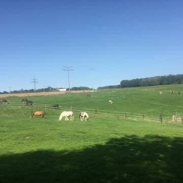
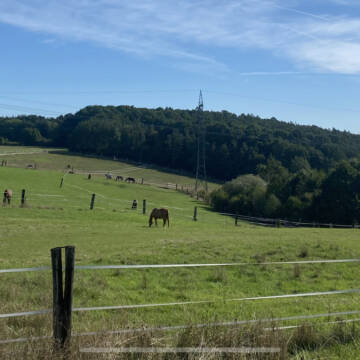
Stallplatz oder Offenstall in Neuendettelsau
Gesucht wird in "91575 Neuendettelsau"
6.329 Einträge
Deprecated: Creation of dynamic property Zend_View::$listObjects is deprecated in /var/www/stall-frei/htdocs/staging.stall-frei.de/library/vendor/shardj/zf1-future/library/Zend/View/Abstract.php on line 308
Gesponsort


Deprecated: Creation of dynamic property Zend_View::$listMode is deprecated in /var/www/stall-frei/htdocs/staging.stall-frei.de/library/vendor/shardj/zf1-future/library/Zend/View/Abstract.php on line 308
Deprecated: Creation of dynamic property Zend_View::$renderedObjects is deprecated in /var/www/stall-frei/htdocs/staging.stall-frei.de/library/vendor/shardj/zf1-future/library/Zend/View/Abstract.php on line 308
Deprecated: Creation of dynamic property Zend_View::$index is deprecated in /var/www/stall-frei/htdocs/staging.stall-frei.de/library/vendor/shardj/zf1-future/library/Zend/View/Abstract.php on line 308
Deprecated: Creation of dynamic property Zend_View::$displayMode is deprecated in /var/www/stall-frei/htdocs/staging.stall-frei.de/library/vendor/shardj/zf1-future/library/Zend/View/Abstract.php on line 308
Deprecated: Creation of dynamic property Zend_View::$remarketingIds is deprecated in /var/www/stall-frei/htdocs/staging.stall-frei.de/library/vendor/shardj/zf1-future/library/Zend/View/Abstract.php on line 308
Deprecated: Creation of dynamic property Zend_View::$listItem is deprecated in /var/www/stall-frei/htdocs/staging.stall-frei.de/library/vendor/shardj/zf1-future/library/Zend/View/Abstract.php on line 308
Deprecated: Creation of dynamic property Zend_View::$object is deprecated in /var/www/stall-frei/htdocs/staging.stall-frei.de/library/vendor/shardj/zf1-future/library/Zend/View/Abstract.php on line 308
Deprecated: Creation of dynamic property Zend_View::$attributes is deprecated in /var/www/stall-frei/htdocs/staging.stall-frei.de/library/vendor/shardj/zf1-future/library/Zend/View/Abstract.php on line 308
Leider kein Vorschaubild
Leider kein Vorschaubild
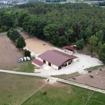
Zucht und Pensionsstall
Petersaurach
Andi
@Wied
Freizeitstall
Gangpferdereiten
Vermieten
Hunde willkommen
Krankenbox
Allergikerstall
bedampftes/gewaschenes Heu
38 weitere...
B
Leider kein Vorschaubild
Leider kein Vorschaubild
Boxen frei in Unterbaimbach bei Schwabach
Schwabach / Unterbaimbach
V.G.
@V.G.
Freizeitstall
Vermieten
Verpachten
Longierzirkel/Roundpen
Paddock
Hufrehe geeignet
13 weitere...
aktuell
B
Deprecated: Creation of dynamic property Zend_View_Helper_Ads::$adLink is deprecated in /var/www/stall-frei/htdocs/staging.stall-frei.de/library/Psf/View/Helper/Ads.php on line 108

Futtersack HeuToy, Fressbremse in pink
Mechtersen
STALL-FREIde Marketing
@STALL-FREI-Marketing
Stundenlange Beschäftigung die
Koliken vorbeugt, geringe Staubinhalation mit
steuerbarer Futterentnahme

Fensterbox mit Ganztags-Auslauf & Trainingsp...
Schwanstetten
Reitanlage am Europakanal
@DHussong
Pferdeausbildung
Reitlehrer und -unterricht
Vermieten
Führanlage
Hunde willkommen
Innenbox
13 weitere...
P
Leider kein Vorschaubild
Leider kein Vorschaubild
Reichhart Ranch
Büchenbach
Sabine-Reichhart
@Sabine-Reichhart
Freizeitstall
Geländestrecke
Hunde willkommen
Krankenbox
Hengsthaltung möglich
Hufrehe geeignet
Außenboxen
20 weitere...
B

Außenboxen und Offenstall
Schwanstetten
Jasmin Nitsche
@Jassi1211
Pflegepferd
Reitschule
Vermieten
Hunde willkommen
Paddock
Hufrehe geeignet
13 weitere...
aktuell
P
Leider kein Vorschaubild
Leider kein Vorschaubild
Offenstallplatz mit Trail in Wallachherde
Roßtal
Pferdehof am Bibertgrund
@Lena_GP
Freizeitstall
Vermieten
Hunde willkommen
Krankenbox
Notfallboxen
12 weitere...
B
Leider kein Vorschaubild
Leider kein Vorschaubild
Offenstall für Wallach zeitgesteuerte Heufütteru...
Roßtal
Pferdehof am Bibertgrund
@Lena_GP
Freizeitstall
Vermieten
Hunde willkommen
Krankenbox
Notfallboxen
10 weitere...
B

Leider kein Vorschaubild
Leider kein Vorschaubild
Offenstellplatz frei
Petersaurach
Yvonne Schmidt
@Schmidt5
Freizeitstall
Vermieten
Hunde willkommen
Krankenbox
zuckerreduziertes Heu
9 weitere...
neu
B

Freie Pferdebox
Langenzenn
Dietmar-Bernhardt
@Dietmar-Bernhardt
Freizeitstall
Hunde willkommen
Krankenbox
Außenboxen
Innenbox
Vollpension
10 weitere...
P+
Reitstall Vogel
Nürnberg
Familie-Vogel
@Familie-Vogel
FN-Mitglied
Freizeitstall
Vermieten
Hunde willkommen
Krankenbox
Allergikerstall
Gnadenbrothof
18 weitere...
P
Newsletter abonnieren
Melde Dich für unseren Newsletter an und verpasse keine Neuigkeiten!
Deprecated: Creation of dynamic property Zend_View::$pageCount is deprecated in /var/www/stall-frei/htdocs/staging.stall-frei.de/library/vendor/shardj/zf1-future/library/Zend/View/Abstract.php on line 308
Deprecated: Creation of dynamic property Zend_View::$itemCountPerPage is deprecated in /var/www/stall-frei/htdocs/staging.stall-frei.de/library/vendor/shardj/zf1-future/library/Zend/View/Abstract.php on line 308
Deprecated: Creation of dynamic property Zend_View::$first is deprecated in /var/www/stall-frei/htdocs/staging.stall-frei.de/library/vendor/shardj/zf1-future/library/Zend/View/Abstract.php on line 308
Deprecated: Creation of dynamic property Zend_View::$current is deprecated in /var/www/stall-frei/htdocs/staging.stall-frei.de/library/vendor/shardj/zf1-future/library/Zend/View/Abstract.php on line 308
Deprecated: Creation of dynamic property Zend_View::$last is deprecated in /var/www/stall-frei/htdocs/staging.stall-frei.de/library/vendor/shardj/zf1-future/library/Zend/View/Abstract.php on line 308
Deprecated: Creation of dynamic property Zend_View::$previous is deprecated in /var/www/stall-frei/htdocs/staging.stall-frei.de/library/vendor/shardj/zf1-future/library/Zend/View/Abstract.php on line 308
Deprecated: Creation of dynamic property Zend_View::$next is deprecated in /var/www/stall-frei/htdocs/staging.stall-frei.de/library/vendor/shardj/zf1-future/library/Zend/View/Abstract.php on line 308
Deprecated: Creation of dynamic property Zend_View::$pagesInRange is deprecated in /var/www/stall-frei/htdocs/staging.stall-frei.de/library/vendor/shardj/zf1-future/library/Zend/View/Abstract.php on line 308
Deprecated: Creation of dynamic property Zend_View::$firstPageInRange is deprecated in /var/www/stall-frei/htdocs/staging.stall-frei.de/library/vendor/shardj/zf1-future/library/Zend/View/Abstract.php on line 308
Deprecated: Creation of dynamic property Zend_View::$lastPageInRange is deprecated in /var/www/stall-frei/htdocs/staging.stall-frei.de/library/vendor/shardj/zf1-future/library/Zend/View/Abstract.php on line 308
Deprecated: Creation of dynamic property Zend_View::$currentItemCount is deprecated in /var/www/stall-frei/htdocs/staging.stall-frei.de/library/vendor/shardj/zf1-future/library/Zend/View/Abstract.php on line 308
Deprecated: Creation of dynamic property Zend_View::$totalItemCount is deprecated in /var/www/stall-frei/htdocs/staging.stall-frei.de/library/vendor/shardj/zf1-future/library/Zend/View/Abstract.php on line 308
Deprecated: Creation of dynamic property Zend_View::$firstItemNumber is deprecated in /var/www/stall-frei/htdocs/staging.stall-frei.de/library/vendor/shardj/zf1-future/library/Zend/View/Abstract.php on line 308
Deprecated: Creation of dynamic property Zend_View::$lastItemNumber is deprecated in /var/www/stall-frei/htdocs/staging.stall-frei.de/library/vendor/shardj/zf1-future/library/Zend/View/Abstract.php on line 308
Deprecated: Creation of dynamic property Zend_View::$router is deprecated in /var/www/stall-frei/htdocs/staging.stall-frei.de/library/vendor/shardj/zf1-future/library/Zend/View/Abstract.php on line 308
Deprecated: Creation of dynamic property Zend_View::$urlParams is deprecated in /var/www/stall-frei/htdocs/staging.stall-frei.de/library/vendor/shardj/zf1-future/library/Zend/View/Abstract.php on line 308
Deprecated: Creation of dynamic property Zend_View::$showAds is deprecated in /var/www/stall-frei/htdocs/staging.stall-frei.de/library/vendor/shardj/zf1-future/library/Zend/View/Abstract.php on line 308
Deprecated: Creation of dynamic property Zend_View::$objectIds is deprecated in /var/www/stall-frei/htdocs/staging.stall-frei.de/library/vendor/shardj/zf1-future/library/Zend/View/Abstract.php on line 308
Deprecated: Creation of dynamic property Zend_View::$showNavbar is deprecated in /var/www/stall-frei/htdocs/staging.stall-frei.de/library/vendor/shardj/zf1-future/library/Zend/View/Abstract.php on line 308
Deprecated: Creation of dynamic property Zend_View::$showBreadcrumb is deprecated in /var/www/stall-frei/htdocs/staging.stall-frei.de/library/vendor/shardj/zf1-future/library/Zend/View/Abstract.php on line 308
Deprecated: Creation of dynamic property Zend_View::$showFooter is deprecated in /var/www/stall-frei/htdocs/staging.stall-frei.de/library/vendor/shardj/zf1-future/library/Zend/View/Abstract.php on line 308
Deprecated: Creation of dynamic property Zend_View::$showInternalAds is deprecated in /var/www/stall-frei/htdocs/staging.stall-frei.de/library/vendor/shardj/zf1-future/library/Zend/View/Abstract.php on line 308
Deprecated: Creation of dynamic property Zend_View::$blNoContent is deprecated in /var/www/stall-frei/htdocs/staging.stall-frei.de/library/vendor/shardj/zf1-future/library/Zend/View/Abstract.php on line 308
Deprecated: Creation of dynamic property Zend_View::$sMetaDesc is deprecated in /var/www/stall-frei/htdocs/staging.stall-frei.de/library/vendor/shardj/zf1-future/library/Zend/View/Abstract.php on line 308
Deprecated: Creation of dynamic property Zend_View::$useGmaps is deprecated in /var/www/stall-frei/htdocs/staging.stall-frei.de/library/vendor/shardj/zf1-future/library/Zend/View/Abstract.php on line 308
Deprecated: Creation of dynamic property Zend_View::$touches is deprecated in /var/www/stall-frei/htdocs/staging.stall-frei.de/library/vendor/shardj/zf1-future/library/Zend/View/Abstract.php on line 308
Deprecated: Creation of dynamic property Zend_View::$oProject is deprecated in /var/www/stall-frei/htdocs/staging.stall-frei.de/library/vendor/shardj/zf1-future/library/Zend/View/Abstract.php on line 308
Deprecated: Creation of dynamic property Zend_View::$pageHeadline is deprecated in /var/www/stall-frei/htdocs/staging.stall-frei.de/library/vendor/shardj/zf1-future/library/Zend/View/Abstract.php on line 308
Deprecated: Creation of dynamic property Zend_View::$disableLocationField is deprecated in /var/www/stall-frei/htdocs/staging.stall-frei.de/library/vendor/shardj/zf1-future/library/Zend/View/Abstract.php on line 308
Deprecated: Creation of dynamic property Zend_View::$isSearch is deprecated in /var/www/stall-frei/htdocs/staging.stall-frei.de/library/vendor/shardj/zf1-future/library/Zend/View/Abstract.php on line 308
Deprecated: Creation of dynamic property Zend_View::$pageTitle is deprecated in /var/www/stall-frei/htdocs/staging.stall-frei.de/library/vendor/shardj/zf1-future/library/Zend/View/Abstract.php on line 308
Deprecated: Creation of dynamic property Psf_Form_Element_Text::$class is deprecated in /var/www/stall-frei/htdocs/staging.stall-frei.de/library/vendor/shardj/zf1-future/library/Zend/Form/Element.php on line 874
Deprecated: Creation of dynamic property Psf_Form_Element_Text::$size is deprecated in /var/www/stall-frei/htdocs/staging.stall-frei.de/library/vendor/shardj/zf1-future/library/Zend/Form/Element.php on line 874
Deprecated: Creation of dynamic property Psf_Form_Element_Text::$placeholder is deprecated in /var/www/stall-frei/htdocs/staging.stall-frei.de/library/vendor/shardj/zf1-future/library/Zend/Form/Element.php on line 874
Deprecated: Creation of dynamic property Psf_Form_Element_Hidden::$class is deprecated in /var/www/stall-frei/htdocs/staging.stall-frei.de/library/vendor/shardj/zf1-future/library/Zend/Form/Element.php on line 874
Deprecated: Creation of dynamic property Psf_Form_Element_Hidden::$class is deprecated in /var/www/stall-frei/htdocs/staging.stall-frei.de/library/vendor/shardj/zf1-future/library/Zend/Form/Element.php on line 874
Deprecated: Creation of dynamic property Psf_Form_Element_Hidden::$class is deprecated in /var/www/stall-frei/htdocs/staging.stall-frei.de/library/vendor/shardj/zf1-future/library/Zend/Form/Element.php on line 874
Deprecated: Creation of dynamic property Psf_Form_Element_Hidden::$class is deprecated in /var/www/stall-frei/htdocs/staging.stall-frei.de/library/vendor/shardj/zf1-future/library/Zend/Form/Element.php on line 874
Deprecated: Creation of dynamic property Psf_Form_Element_Select::$class is deprecated in /var/www/stall-frei/htdocs/staging.stall-frei.de/library/vendor/shardj/zf1-future/library/Zend/Form/Element.php on line 874
Deprecated: Creation of dynamic property Psf_Form_Element_Select::$class is deprecated in /var/www/stall-frei/htdocs/staging.stall-frei.de/library/vendor/shardj/zf1-future/library/Zend/Form/Element.php on line 874
Deprecated: Creation of dynamic property Psf_Form_Element_Select::$class is deprecated in /var/www/stall-frei/htdocs/staging.stall-frei.de/library/vendor/shardj/zf1-future/library/Zend/Form/Element.php on line 874
Deprecated: Creation of dynamic property Psf_Form_Element_Select::$class is deprecated in /var/www/stall-frei/htdocs/staging.stall-frei.de/library/vendor/shardj/zf1-future/library/Zend/Form/Element.php on line 874
Deprecated: Creation of dynamic property Psf_Form_Element_Text::$class is deprecated in /var/www/stall-frei/htdocs/staging.stall-frei.de/library/vendor/shardj/zf1-future/library/Zend/Form/Element.php on line 874
Deprecated: Creation of dynamic property Psf_Form_Element_Checkbox::$label is deprecated in /var/www/stall-frei/htdocs/staging.stall-frei.de/library/vendor/shardj/zf1-future/library/Zend/Form/Element.php on line 874
Deprecated: Creation of dynamic property Zend_View::$sort is deprecated in /var/www/stall-frei/htdocs/staging.stall-frei.de/library/vendor/shardj/zf1-future/library/Zend/View/Abstract.php on line 308
Deprecated: Creation of dynamic property Zend_View::$searchLocation is deprecated in /var/www/stall-frei/htdocs/staging.stall-frei.de/library/vendor/shardj/zf1-future/library/Zend/View/Abstract.php on line 308
Deprecated: Creation of dynamic property Zend_View::$locationHint is deprecated in /var/www/stall-frei/htdocs/staging.stall-frei.de/library/vendor/shardj/zf1-future/library/Zend/View/Abstract.php on line 308
Psf_GeoCoder_Abstract::getLocation: Wollersdorf Get Location CachedOrLive
Psf_GeoCoder_Abstract::getCachedOrLive: Wollersdorf
Psf_GeoCoder_Abstract::convertLocationResult
{"documentation":"https:\/\/opencagedata.com\/api","licenses":[{"name":"see attribution guide","url":"https:\/\/opencagedata.com\/credits"}],"results":[{"bounds":{"northeast":{"lat":49.3156153,"lng":10.875547},"southwest":{"lat":49.2756153,"lng":10.835547}},"components":{"ISO_3166-1_alpha-2":"DE","ISO_3166-1_alpha-3":"DEU","ISO_3166-2":["DE-BY"],"_category":"place","_normalized_city":"Neuendettelsau","_type":"village","continent":"Europe","country":"Deutschland","country_code":"de","county":"Landkreis Ansbach","political_union":"European Union","postcode":"91575","state":"Bayern","state_code":"BY","town":"Neuendettelsau","village":"Wollersdorf"},"confidence":7,"formatted":"91575 Wollersdorf, Deutschland","geometry":{"lat":49.2956153,"lng":10.855547}},{"bounds":{"northeast":{"lat":48.9820136,"lng":12.6753264},"southwest":{"lat":48.9420136,"lng":12.6353264}},"components":{"ISO_3166-1_alpha-2":"DE","ISO_3166-1_alpha-3":"DEU","ISO_3166-2":["DE-BY"],"_category":"place","_normalized_city":"Mitterfels","_type":"hamlet","city":"Mitterfels","continent":"Europe","country":"Deutschland","country_code":"de","county":"Landkreis Straubing-Bogen","hamlet":"Wollersdorf","municipality":"Mitterfels (VGem)","political_union":"European Union","postcode":"94360","state":"Bayern","state_code":"BY"},"confidence":7,"formatted":"Wollersdorf, 94360 Mitterfels, Deutschland","geometry":{"lat":48.9620136,"lng":12.6553264}},{"bounds":{"northeast":{"lat":48.54147,"lng":11.9005154},"southwest":{"lat":48.50147,"lng":11.8605154}},"components":{"ISO_3166-1_alpha-2":"DE","ISO_3166-1_alpha-3":"DEU","ISO_3166-2":["DE-BY"],"_category":"place","_normalized_city":"Mauern","_type":"hamlet","continent":"Europe","country":"Deutschland","country_code":"de","county":"Landkreis Freising","hamlet":"Wollersdorf","municipality":"Mauern (VGem)","political_union":"European Union","postcode":"85419","state":"Bayern","state_code":"BY","village":"Mauern"},"confidence":7,"formatted":"Wollersdorf, 85419 Mauern, Deutschland","geometry":{"lat":48.52147,"lng":11.8805154}},{"bounds":{"northeast":{"lat":48.5286403,"lng":11.877783},"southwest":{"lat":48.5224572,"lng":11.865726}},"components":{"ISO_3166-1_alpha-2":"DE","ISO_3166-1_alpha-3":"DEU","ISO_3166-2":["DE-BY"],"_category":"road","_normalized_city":"Mauern","_type":"road","continent":"Europe","country":"Deutschland","country_code":"de","county":"Landkreis Freising","hamlet":"Wollersdorf","municipality":"Mauern (VGem)","political_union":"European Union","postcode":"85419","road":"Wollersdorf","road_type":"residential","state":"Bayern","state_code":"BY","village":"Mauern"},"confidence":9,"formatted":"Wollersdorf, 85419 Mauern, Deutschland","geometry":{"lat":48.5259452,"lng":11.8720002}},{"bounds":{"northeast":{"lat":49.2954178,"lng":10.8543699},"southwest":{"lat":49.2953128,"lng":10.8535223}},"components":{"ISO_3166-1_alpha-2":"DE","ISO_3166-1_alpha-3":"DEU","ISO_3166-2":["DE-BY"],"_category":"road","_normalized_city":"Neuendettelsau","_type":"road","continent":"Europe","country":"Deutschland","country_code":"de","county":"Landkreis Ansbach","political_union":"European Union","postcode":"91564","road":"Wollersdorf","road_type":"tertiary","state":"Bayern","state_code":"BY","town":"Neuendettelsau","village":"Wollersdorf"},"confidence":9,"formatted":"Wollersdorf, 91564 Wollersdorf, Deutschland","geometry":{"lat":49.2953292,"lng":10.8539465}},{"bounds":{"northeast":{"lat":48.3657847,"lng":12.6257595},"southwest":{"lat":48.3257847,"lng":12.5857595}},"components":{"ISO_3166-1_alpha-2":"DE","ISO_3166-1_alpha-3":"DEU","ISO_3166-2":["DE-BY"],"_category":"place","_normalized_city":"Pleiskirchen","_type":"hamlet","continent":"Europe","country":"Deutschland","country_code":"de","county":"Landkreis Alt\u00f6tting","hamlet":"W\u00f6llersdorf","political_union":"European Union","postcode":"84568","state":"Bayern","state_code":"BY","village":"Pleiskirchen"},"confidence":7,"formatted":"W\u00f6llersdorf, 84568 Pleiskirchen, Deutschland","geometry":{"lat":48.3457847,"lng":12.6057595}},{"components":{"ISO_3166-1_alpha-2":"FR","ISO_3166-1_alpha-3":"FRA","ISO_3166-2":["FR-GES","FR-6AE","FR-68"],"_category":"road","_normalized_city":"Wolfersdorf","_type":"road","city":"Wolfersdorf","continent":"Europe","country":"France","country_code":"fr","county":"Haut-Rhin","local_authority":"Communaut\u00e9 de communes Sud Alsace Largue","political_union":"European Union","postcode":"68210","road":"Impasse de la Chapelle","state":"Grand Est","state_code":"GES"},"confidence":3,"formatted":"Impasse de la Chapelle, 68210 Wolfersdorf, France","geometry":{"lat":47.639514,"lng":7.111418}},{"components":{"ISO_3166-1_alpha-2":"FR","ISO_3166-1_alpha-3":"FRA","ISO_3166-2":["FR-GES","FR-6AE","FR-68"],"_category":"place","_normalized_city":"Wolfersdorf","_type":"city","city":"Wolfersdorf","continent":"Europe","country":"France","country_code":"fr","county":"Haut-Rhin","local_authority":"Communaut\u00e9 de communes Sud Alsace Largue","political_union":"European Union","postcode":"68210","state":"Grand Est","state_code":"GES"},"confidence":3,"formatted":"Wolfersdorf, Haut-Rhin, France","geometry":{"lat":47.637704,"lng":7.110948}},{"components":{"ISO_3166-1_alpha-2":"FR","ISO_3166-1_alpha-3":"FRA","ISO_3166-2":["FR-GES","FR-6AE","FR-68"],"_category":"road","_normalized_city":"Wolfersdorf","_type":"road","city":"Wolfersdorf","continent":"Europe","country":"France","country_code":"fr","county":"Haut-Rhin","local_authority":"Communaut\u00e9 de communes Sud Alsace Largue","political_union":"European Union","postcode":"68210","road":"Rue de la Largue","state":"Grand Est","state_code":"GES"},"confidence":2,"formatted":"Rue de la Largue, 68210 Wolfersdorf, France","geometry":{"lat":47.63736,"lng":7.11436}},{"components":{"ISO_3166-1_alpha-2":"FR","ISO_3166-1_alpha-3":"FRA","ISO_3166-2":["FR-GES","FR-6AE","FR-68"],"_category":"road","_normalized_city":"Wolfersdorf","_type":"road","city":"Wolfersdorf","continent":"Europe","country":"France","country_code":"fr","county":"Haut-Rhin","local_authority":"Communaut\u00e9 de communes Sud Alsace Largue","political_union":"European Union","postcode":"68210","road":"Impasse de la Grange","state":"Grand Est","state_code":"GES"},"confidence":2,"formatted":"Impasse de la Grange, 68210 Wolfersdorf, France","geometry":{"lat":47.637648,"lng":7.110364}}],"status":{"code":200,"message":"OK"},"stay_informed":{"blog":"https:\/\/blog.opencagedata.com","mastodon":"https:\/\/en.osm.town\/@opencage"},"thanks":"For using an OpenCage API","timestamp":{"created_http":"Sat, 07 Feb 2026 19:50:41 GMT","created_unix":1770493841},"total_results":10}Array
(
[0] => stdClass Object
(
[bounds] => stdClass Object
(
[northeast] => stdClass Object
(
[lat] => 49.3156153
[lng] => 10.875547
)
[southwest] => stdClass Object
(
[lat] => 49.2756153
[lng] => 10.835547
)
)
[components] => stdClass Object
(
[ISO_3166-1_alpha-2] => DE
[ISO_3166-1_alpha-3] => DEU
[ISO_3166-2] => Array
(
[0] => DE-BY
)
[_category] => place
[_normalized_city] => Neuendettelsau
[_type] => village
[continent] => Europe
[country] => Deutschland
[country_code] => de
[county] => Landkreis Ansbach
[political_union] => European Union
[postcode] => 91575
[state] => Bayern
[state_code] => BY
[town] => Neuendettelsau
[village] => Wollersdorf
)
[confidence] => 7
[formatted] => 91575 Wollersdorf, Deutschland
[geometry] => stdClass Object
(
[lat] => 49.2956153
[lng] => 10.855547
)
)
[1] => stdClass Object
(
[bounds] => stdClass Object
(
[northeast] => stdClass Object
(
[lat] => 48.9820136
[lng] => 12.6753264
)
[southwest] => stdClass Object
(
[lat] => 48.9420136
[lng] => 12.6353264
)
)
[components] => stdClass Object
(
[ISO_3166-1_alpha-2] => DE
[ISO_3166-1_alpha-3] => DEU
[ISO_3166-2] => Array
(
[0] => DE-BY
)
[_category] => place
[_normalized_city] => Mitterfels
[_type] => hamlet
[city] => Mitterfels
[continent] => Europe
[country] => Deutschland
[country_code] => de
[county] => Landkreis Straubing-Bogen
[hamlet] => Wollersdorf
[municipality] => Mitterfels (VGem)
[political_union] => European Union
[postcode] => 94360
[state] => Bayern
[state_code] => BY
)
[confidence] => 7
[formatted] => Wollersdorf, 94360 Mitterfels, Deutschland
[geometry] => stdClass Object
(
[lat] => 48.9620136
[lng] => 12.6553264
)
)
[2] => stdClass Object
(
[bounds] => stdClass Object
(
[northeast] => stdClass Object
(
[lat] => 48.54147
[lng] => 11.9005154
)
[southwest] => stdClass Object
(
[lat] => 48.50147
[lng] => 11.8605154
)
)
[components] => stdClass Object
(
[ISO_3166-1_alpha-2] => DE
[ISO_3166-1_alpha-3] => DEU
[ISO_3166-2] => Array
(
[0] => DE-BY
)
[_category] => place
[_normalized_city] => Mauern
[_type] => hamlet
[continent] => Europe
[country] => Deutschland
[country_code] => de
[county] => Landkreis Freising
[hamlet] => Wollersdorf
[municipality] => Mauern (VGem)
[political_union] => European Union
[postcode] => 85419
[state] => Bayern
[state_code] => BY
[village] => Mauern
)
[confidence] => 7
[formatted] => Wollersdorf, 85419 Mauern, Deutschland
[geometry] => stdClass Object
(
[lat] => 48.52147
[lng] => 11.8805154
)
)
[3] => stdClass Object
(
[bounds] => stdClass Object
(
[northeast] => stdClass Object
(
[lat] => 48.5286403
[lng] => 11.877783
)
[southwest] => stdClass Object
(
[lat] => 48.5224572
[lng] => 11.865726
)
)
[components] => stdClass Object
(
[ISO_3166-1_alpha-2] => DE
[ISO_3166-1_alpha-3] => DEU
[ISO_3166-2] => Array
(
[0] => DE-BY
)
[_category] => road
[_normalized_city] => Mauern
[_type] => road
[continent] => Europe
[country] => Deutschland
[country_code] => de
[county] => Landkreis Freising
[hamlet] => Wollersdorf
[municipality] => Mauern (VGem)
[political_union] => European Union
[postcode] => 85419
[road] => Wollersdorf
[road_type] => residential
[state] => Bayern
[state_code] => BY
[village] => Mauern
)
[confidence] => 9
[formatted] => Wollersdorf, 85419 Mauern, Deutschland
[geometry] => stdClass Object
(
[lat] => 48.5259452
[lng] => 11.8720002
)
)
[4] => stdClass Object
(
[bounds] => stdClass Object
(
[northeast] => stdClass Object
(
[lat] => 49.2954178
[lng] => 10.8543699
)
[southwest] => stdClass Object
(
[lat] => 49.2953128
[lng] => 10.8535223
)
)
[components] => stdClass Object
(
[ISO_3166-1_alpha-2] => DE
[ISO_3166-1_alpha-3] => DEU
[ISO_3166-2] => Array
(
[0] => DE-BY
)
[_category] => road
[_normalized_city] => Neuendettelsau
[_type] => road
[continent] => Europe
[country] => Deutschland
[country_code] => de
[county] => Landkreis Ansbach
[political_union] => European Union
[postcode] => 91564
[road] => Wollersdorf
[road_type] => tertiary
[state] => Bayern
[state_code] => BY
[town] => Neuendettelsau
[village] => Wollersdorf
)
[confidence] => 9
[formatted] => Wollersdorf, 91564 Wollersdorf, Deutschland
[geometry] => stdClass Object
(
[lat] => 49.2953292
[lng] => 10.8539465
)
)
[5] => stdClass Object
(
[bounds] => stdClass Object
(
[northeast] => stdClass Object
(
[lat] => 48.3657847
[lng] => 12.6257595
)
[southwest] => stdClass Object
(
[lat] => 48.3257847
[lng] => 12.5857595
)
)
[components] => stdClass Object
(
[ISO_3166-1_alpha-2] => DE
[ISO_3166-1_alpha-3] => DEU
[ISO_3166-2] => Array
(
[0] => DE-BY
)
[_category] => place
[_normalized_city] => Pleiskirchen
[_type] => hamlet
[continent] => Europe
[country] => Deutschland
[country_code] => de
[county] => Landkreis Altötting
[hamlet] => Wöllersdorf
[political_union] => European Union
[postcode] => 84568
[state] => Bayern
[state_code] => BY
[village] => Pleiskirchen
)
[confidence] => 7
[formatted] => Wöllersdorf, 84568 Pleiskirchen, Deutschland
[geometry] => stdClass Object
(
[lat] => 48.3457847
[lng] => 12.6057595
)
)
[6] => stdClass Object
(
[components] => stdClass Object
(
[ISO_3166-1_alpha-2] => FR
[ISO_3166-1_alpha-3] => FRA
[ISO_3166-2] => Array
(
[0] => FR-GES
[1] => FR-6AE
[2] => FR-68
)
[_category] => road
[_normalized_city] => Wolfersdorf
[_type] => road
[city] => Wolfersdorf
[continent] => Europe
[country] => France
[country_code] => fr
[county] => Haut-Rhin
[local_authority] => Communauté de communes Sud Alsace Largue
[political_union] => European Union
[postcode] => 68210
[road] => Impasse de la Chapelle
[state] => Grand Est
[state_code] => GES
)
[confidence] => 3
[formatted] => Impasse de la Chapelle, 68210 Wolfersdorf, France
[geometry] => stdClass Object
(
[lat] => 47.639514
[lng] => 7.111418
)
)
[7] => stdClass Object
(
[components] => stdClass Object
(
[ISO_3166-1_alpha-2] => FR
[ISO_3166-1_alpha-3] => FRA
[ISO_3166-2] => Array
(
[0] => FR-GES
[1] => FR-6AE
[2] => FR-68
)
[_category] => place
[_normalized_city] => Wolfersdorf
[_type] => city
[city] => Wolfersdorf
[continent] => Europe
[country] => France
[country_code] => fr
[county] => Haut-Rhin
[local_authority] => Communauté de communes Sud Alsace Largue
[political_union] => European Union
[postcode] => 68210
[state] => Grand Est
[state_code] => GES
)
[confidence] => 3
[formatted] => Wolfersdorf, Haut-Rhin, France
[geometry] => stdClass Object
(
[lat] => 47.637704
[lng] => 7.110948
)
)
[8] => stdClass Object
(
[components] => stdClass Object
(
[ISO_3166-1_alpha-2] => FR
[ISO_3166-1_alpha-3] => FRA
[ISO_3166-2] => Array
(
[0] => FR-GES
[1] => FR-6AE
[2] => FR-68
)
[_category] => road
[_normalized_city] => Wolfersdorf
[_type] => road
[city] => Wolfersdorf
[continent] => Europe
[country] => France
[country_code] => fr
[county] => Haut-Rhin
[local_authority] => Communauté de communes Sud Alsace Largue
[political_union] => European Union
[postcode] => 68210
[road] => Rue de la Largue
[state] => Grand Est
[state_code] => GES
)
[confidence] => 2
[formatted] => Rue de la Largue, 68210 Wolfersdorf, France
[geometry] => stdClass Object
(
[lat] => 47.63736
[lng] => 7.11436
)
)
[9] => stdClass Object
(
[components] => stdClass Object
(
[ISO_3166-1_alpha-2] => FR
[ISO_3166-1_alpha-3] => FRA
[ISO_3166-2] => Array
(
[0] => FR-GES
[1] => FR-6AE
[2] => FR-68
)
[_category] => road
[_normalized_city] => Wolfersdorf
[_type] => road
[city] => Wolfersdorf
[continent] => Europe
[country] => France
[country_code] => fr
[county] => Haut-Rhin
[local_authority] => Communauté de communes Sud Alsace Largue
[political_union] => European Union
[postcode] => 68210
[road] => Impasse de la Grange
[state] => Grand Est
[state_code] => GES
)
[confidence] => 2
[formatted] => Impasse de la Grange, 68210 Wolfersdorf, France
[geometry] => stdClass Object
(
[lat] => 47.637648
[lng] => 7.110364
)
)
)
Psf_GeoCoder_OpenCageData::getKeyMap: 0
stdClass Object
(
    [bounds] => stdClass Object
        (
            [northeast] => stdClass Object
                (
                    [lat] => 49.3156153
                    [lng] => 10.875547
                )

            [southwest] => stdClass Object
                (
                    [lat] => 49.2756153
                    [lng] => 10.835547
                )

        )

    [components] => stdClass Object
        (
            [ISO_3166-1_alpha-2] => DE
            [ISO_3166-1_alpha-3] => DEU
            [ISO_3166-2] => Array
                (
                    [0] => DE-BY
                )

            [_category] => place
            [_normalized_city] => Neuendettelsau
            [_type] => village
            [continent] => Europe
            [country] => Deutschland
            [country_code] => de
            [county] => Landkreis Ansbach
            [political_union] => European Union
            [postcode] => 91575
            [state] => Bayern
            [state_code] => BY
            [town] => Neuendettelsau
            [village] => Wollersdorf
        )

    [confidence] => 7
    [formatted] => 91575 Wollersdorf, Deutschland
    [geometry] => stdClass Object
        (
            [lat] => 49.2956153
            [lng] => 10.855547
        )

)
Psf_GeoCoder_OpenCageData::getCounty: Ansbach
Psf_GeoCoder_OpenCageData::addMissingData REFETCH!
Array
(
    [address] => 91575 Wollersdorf, Deutschland
    [type] => village
    [street] =>
    [city] => Neuendettelsau
    [county] => Ansbach
    [state] => Bayern
    [zip] => 91575
    [country] => Deutschland
    [suburb] =>
    [countrycode] => de
    [latitude] => 49.2956153
    [longitude] => 10.855547
    [accuracy] => 1
    [confidence] => 7
    [bounds] => stdClass Object
        (
            [northeast] => stdClass Object
                (
                    [lat] => 49.3156153
                    [lng] => 10.875547
                )

            [southwest] => stdClass Object
                (
                    [lat] => 49.2756153
                    [lng] => 10.835547
                )

        )

)
reformat!
Array
(
    [address] => 91575 Neuendettelsau
    [type] => village
    [street] =>
    [city] => Neuendettelsau
    [county] => Ansbach
    [state] => Bayern
    [zip] => 91575
    [country] => Deutschland
    [suburb] =>
    [countrycode] => de
    [latitude] => 49.2956153
    [longitude] => 10.855547
    [accuracy] => 1
    [confidence] => 7
    [bounds] => stdClass Object
        (
            [northeast] => stdClass Object
                (
                    [lat] => 49.3156153
                    [lng] => 10.875547
                )

            [southwest] => stdClass Object
                (
                    [lat] => 49.2756153
                    [lng] => 10.835547
                )

        )

    [place] => 91575 Neuendettelsau, Bayern
    [hash] => bf768029c37e5f60083a0d9658cf2d34
)
Psf_GeoCoder_OpenCageData::getKeyMap: 1
stdClass Object
(
    [bounds] => stdClass Object
        (
            [northeast] => stdClass Object
                (
                    [lat] => 48.9820136
                    [lng] => 12.6753264
                )

            [southwest] => stdClass Object
                (
                    [lat] => 48.9420136
                    [lng] => 12.6353264
                )

        )

    [components] => stdClass Object
        (
            [ISO_3166-1_alpha-2] => DE
            [ISO_3166-1_alpha-3] => DEU
            [ISO_3166-2] => Array
                (
                    [0] => DE-BY
                )

            [_category] => place
            [_normalized_city] => Mitterfels
            [_type] => hamlet
            [city] => Mitterfels
            [continent] => Europe
            [country] => Deutschland
            [country_code] => de
            [county] => Landkreis Straubing-Bogen
            [hamlet] => Wollersdorf
            [municipality] => Mitterfels (VGem)
            [political_union] => European Union
            [postcode] => 94360
            [state] => Bayern
            [state_code] => BY
        )

    [confidence] => 7
    [formatted] => Wollersdorf, 94360 Mitterfels, Deutschland
    [geometry] => stdClass Object
        (
            [lat] => 48.9620136
            [lng] => 12.6553264
        )

)
Psf_GeoCoder_OpenCageData::getCounty: Straubing-Bogen
Psf_GeoCoder_OpenCageData::addMissingData REFETCH!
Array
(
    [address] => Wollersdorf, 94360 Mitterfels, Deutschland
    [type] => hamlet
    [street] => Wollersdorf
    [city] => Mitterfels
    [county] => Straubing-Bogen
    [state] => Bayern
    [zip] => 94360
    [country] => Deutschland
    [suburb] =>
    [countrycode] => de
    [latitude] => 48.9620136
    [longitude] => 12.6553264
    [accuracy] => 1
    [confidence] => 7
    [bounds] => stdClass Object
        (
            [northeast] => stdClass Object
                (
                    [lat] => 48.9820136
                    [lng] => 12.6753264
                )

            [southwest] => stdClass Object
                (
                    [lat] => 48.9420136
                    [lng] => 12.6353264
                )

        )

)
reformat!
Array
(
    [address] => Wollersdorf, 94360 Mitterfels, Deutschland
    [type] => hamlet
    [street] => Wollersdorf
    [city] => Mitterfels
    [county] => Straubing-Bogen
    [state] => Bayern
    [zip] => 94360
    [country] => Deutschland
    [suburb] =>
    [countrycode] => de
    [latitude] => 48.9620136
    [longitude] => 12.6553264
    [accuracy] => 1
    [confidence] => 7
    [bounds] => stdClass Object
        (
            [northeast] => stdClass Object
                (
                    [lat] => 48.9820136
                    [lng] => 12.6753264
                )

            [southwest] => stdClass Object
                (
                    [lat] => 48.9420136
                    [lng] => 12.6353264
                )

        )

    [place] => Wollersdorf, 94360 Mitterfels, Bayern
    [hash] => cbbe4ecdfa2fc54c99e5fc0bfa28c073
)
Psf_GeoCoder_OpenCageData::getKeyMap: 2
stdClass Object
(
    [bounds] => stdClass Object
        (
            [northeast] => stdClass Object
                (
                    [lat] => 48.54147
                    [lng] => 11.9005154
                )

            [southwest] => stdClass Object
                (
                    [lat] => 48.50147
                    [lng] => 11.8605154
                )

        )

    [components] => stdClass Object
        (
            [ISO_3166-1_alpha-2] => DE
            [ISO_3166-1_alpha-3] => DEU
            [ISO_3166-2] => Array
                (
                    [0] => DE-BY
                )

            [_category] => place
            [_normalized_city] => Mauern
            [_type] => hamlet
            [continent] => Europe
            [country] => Deutschland
            [country_code] => de
            [county] => Landkreis Freising
            [hamlet] => Wollersdorf
            [municipality] => Mauern (VGem)
            [political_union] => European Union
            [postcode] => 85419
            [state] => Bayern
            [state_code] => BY
            [village] => Mauern
        )

    [confidence] => 7
    [formatted] => Wollersdorf, 85419 Mauern, Deutschland
    [geometry] => stdClass Object
        (
            [lat] => 48.52147
            [lng] => 11.8805154
        )

)
Psf_GeoCoder_OpenCageData::getCounty: Freising
Psf_GeoCoder_OpenCageData::addMissingData REFETCH!
Array
(
    [address] => Wollersdorf, 85419 Mauern, Deutschland
    [type] => hamlet
    [street] => Wollersdorf
    [city] => Mauern
    [county] => Freising
    [state] => Bayern
    [zip] => 85419
    [country] => Deutschland
    [suburb] =>
    [countrycode] => de
    [latitude] => 48.52147
    [longitude] => 11.8805154
    [accuracy] => 1
    [confidence] => 7
    [bounds] => stdClass Object
        (
            [northeast] => stdClass Object
                (
                    [lat] => 48.54147
                    [lng] => 11.9005154
                )

            [southwest] => stdClass Object
                (
                    [lat] => 48.50147
                    [lng] => 11.8605154
                )

        )

)
reformat!
Array
(
    [address] => Wollersdorf, 85419 Mauern, Deutschland
    [type] => hamlet
    [street] => Wollersdorf
    [city] => Mauern
    [county] => Freising
    [state] => Bayern
    [zip] => 85419
    [country] => Deutschland
    [suburb] =>
    [countrycode] => de
    [latitude] => 48.52147
    [longitude] => 11.8805154
    [accuracy] => 1
    [confidence] => 7
    [bounds] => stdClass Object
        (
            [northeast] => stdClass Object
                (
                    [lat] => 48.54147
                    [lng] => 11.9005154
                )

            [southwest] => stdClass Object
                (
                    [lat] => 48.50147
                    [lng] => 11.8605154
                )

        )

    [place] => Wollersdorf, 85419 Mauern, Bayern
    [hash] => 7ebc99b5e5512ffb2209315c6813b89e
)
Psf_GeoCoder_OpenCageData::getKeyMap: 3
stdClass Object
(
    [bounds] => stdClass Object
        (
            [northeast] => stdClass Object
                (
                    [lat] => 48.5286403
                    [lng] => 11.877783
                )

            [southwest] => stdClass Object
                (
                    [lat] => 48.5224572
                    [lng] => 11.865726
                )

        )

    [components] => stdClass Object
        (
            [ISO_3166-1_alpha-2] => DE
            [ISO_3166-1_alpha-3] => DEU
            [ISO_3166-2] => Array
                (
                    [0] => DE-BY
                )

            [_category] => road
            [_normalized_city] => Mauern
            [_type] => road
            [continent] => Europe
            [country] => Deutschland
            [country_code] => de
            [county] => Landkreis Freising
            [hamlet] => Wollersdorf
            [municipality] => Mauern (VGem)
            [political_union] => European Union
            [postcode] => 85419
            [road] => Wollersdorf
            [road_type] => residential
            [state] => Bayern
            [state_code] => BY
            [village] => Mauern
        )

    [confidence] => 9
    [formatted] => Wollersdorf, 85419 Mauern, Deutschland
    [geometry] => stdClass Object
        (
            [lat] => 48.5259452
            [lng] => 11.8720002
        )

)
Psf_GeoCoder_OpenCageData::getCounty: Freising
Psf_GeoCoder_OpenCageData::addMissingData REFETCH!
Array
(
    [address] => Wollersdorf, 85419 Mauern, Deutschland
    [type] => road
    [street] => Wollersdorf
    [city] => Mauern
    [county] => Freising
    [state] => Bayern
    [zip] => 85419
    [country] => Deutschland
    [suburb] =>
    [countrycode] => de
    [latitude] => 48.5259452
    [longitude] => 11.8720002
    [accuracy] => 1
    [confidence] => 9
    [bounds] => stdClass Object
        (
            [northeast] => stdClass Object
                (
                    [lat] => 48.5286403
                    [lng] => 11.877783
                )

            [southwest] => stdClass Object
                (
                    [lat] => 48.5224572
                    [lng] => 11.865726
                )

        )

)
reformat!
Array
(
    [address] => Wollersdorf, 85419 Mauern, Deutschland
    [type] => road
    [street] => Wollersdorf
    [city] => Mauern
    [county] => Freising
    [state] => Bayern
    [zip] => 85419
    [country] => Deutschland
    [suburb] =>
    [countrycode] => de
    [latitude] => 48.5259452
    [longitude] => 11.8720002
    [accuracy] => 1
    [confidence] => 9
    [bounds] => stdClass Object
        (
            [northeast] => stdClass Object
                (
                    [lat] => 48.5286403
                    [lng] => 11.877783
                )

            [southwest] => stdClass Object
                (
                    [lat] => 48.5224572
                    [lng] => 11.865726
                )

        )

    [place] => Wollersdorf, 85419 Mauern, Bayern
    [hash] => 7ebc99b5e5512ffb2209315c6813b89e
)
Psf_GeoCoder_OpenCageData::getKeyMap: 4
stdClass Object
(
    [bounds] => stdClass Object
        (
            [northeast] => stdClass Object
                (
                    [lat] => 49.2954178
                    [lng] => 10.8543699
                )

            [southwest] => stdClass Object
                (
                    [lat] => 49.2953128
                    [lng] => 10.8535223
                )

        )

    [components] => stdClass Object
        (
            [ISO_3166-1_alpha-2] => DE
            [ISO_3166-1_alpha-3] => DEU
            [ISO_3166-2] => Array
                (
                    [0] => DE-BY
                )

            [_category] => road
            [_normalized_city] => Neuendettelsau
            [_type] => road
            [continent] => Europe
            [country] => Deutschland
            [country_code] => de
            [county] => Landkreis Ansbach
            [political_union] => European Union
            [postcode] => 91564
            [road] => Wollersdorf
            [road_type] => tertiary
            [state] => Bayern
            [state_code] => BY
            [town] => Neuendettelsau
            [village] => Wollersdorf
        )

    [confidence] => 9
    [formatted] => Wollersdorf, 91564 Wollersdorf, Deutschland
    [geometry] => stdClass Object
        (
            [lat] => 49.2953292
            [lng] => 10.8539465
        )

)
Psf_GeoCoder_OpenCageData::getCounty: Ansbach
Psf_GeoCoder_OpenCageData::addMissingData REFETCH!
Array
(
    [address] => Wollersdorf, 91564 Wollersdorf, Deutschland
    [type] => road
    [street] => Wollersdorf
    [city] => Neuendettelsau
    [county] => Ansbach
    [state] => Bayern
    [zip] => 91564
    [country] => Deutschland
    [suburb] =>
    [countrycode] => de
    [latitude] => 49.2953292
    [longitude] => 10.8539465
    [accuracy] => 1
    [confidence] => 9
    [bounds] => stdClass Object
        (
            [northeast] => stdClass Object
                (
                    [lat] => 49.2954178
                    [lng] => 10.8543699
                )

            [southwest] => stdClass Object
                (
                    [lat] => 49.2953128
                    [lng] => 10.8535223
                )

        )

)
reformat!
Array
(
    [address] => Wollersdorf, 91564 Neuendettelsau
    [type] => road
    [street] => Wollersdorf
    [city] => Neuendettelsau
    [county] => Ansbach
    [state] => Bayern
    [zip] => 91564
    [country] => Deutschland
    [suburb] =>
    [countrycode] => de
    [latitude] => 49.2953292
    [longitude] => 10.8539465
    [accuracy] => 1
    [confidence] => 9
    [bounds] => stdClass Object
        (
            [northeast] => stdClass Object
                (
                    [lat] => 49.2954178
                    [lng] => 10.8543699
                )

            [southwest] => stdClass Object
                (
                    [lat] => 49.2953128
                    [lng] => 10.8535223
                )

        )

    [place] => Wollersdorf, 91564 Neuendettelsau, Bayern
    [hash] => abe5697e77003367ea67a9df661a9629
)
Psf_GeoCoder_OpenCageData::getKeyMap: 5
stdClass Object
(
    [bounds] => stdClass Object
        (
            [northeast] => stdClass Object
                (
                    [lat] => 48.3657847
                    [lng] => 12.6257595
                )

            [southwest] => stdClass Object
                (
                    [lat] => 48.3257847
                    [lng] => 12.5857595
                )

        )

    [components] => stdClass Object
        (
            [ISO_3166-1_alpha-2] => DE
            [ISO_3166-1_alpha-3] => DEU
            [ISO_3166-2] => Array
                (
                    [0] => DE-BY
                )

            [_category] => place
            [_normalized_city] => Pleiskirchen
            [_type] => hamlet
            [continent] => Europe
            [country] => Deutschland
            [country_code] => de
            [county] => Landkreis Altötting
            [hamlet] => Wöllersdorf
            [political_union] => European Union
            [postcode] => 84568
            [state] => Bayern
            [state_code] => BY
            [village] => Pleiskirchen
        )

    [confidence] => 7
    [formatted] => Wöllersdorf, 84568 Pleiskirchen, Deutschland
    [geometry] => stdClass Object
        (
            [lat] => 48.3457847
            [lng] => 12.6057595
        )

)
Psf_GeoCoder_OpenCageData::getCounty: Altötting
Psf_GeoCoder_OpenCageData::addMissingData REFETCH!
Array
(
    [address] => Wöllersdorf, 84568 Pleiskirchen, Deutschland
    [type] => hamlet
    [street] => Wöllersdorf
    [city] => Pleiskirchen
    [county] => Altötting
    [state] => Bayern
    [zip] => 84568
    [country] => Deutschland
    [suburb] =>
    [countrycode] => de
    [latitude] => 48.3457847
    [longitude] => 12.6057595
    [accuracy] => 1
    [confidence] => 7
    [bounds] => stdClass Object
        (
            [northeast] => stdClass Object
                (
                    [lat] => 48.3657847
                    [lng] => 12.6257595
                )

            [southwest] => stdClass Object
                (
                    [lat] => 48.3257847
                    [lng] => 12.5857595
                )

        )

)
reformat!
Array
(
    [address] => Wöllersdorf, 84568 Pleiskirchen, Deutschland
    [type] => hamlet
    [street] => Wöllersdorf
    [city] => Pleiskirchen
    [county] => Altötting
    [state] => Bayern
    [zip] => 84568
    [country] => Deutschland
    [suburb] =>
    [countrycode] => de
    [latitude] => 48.3457847
    [longitude] => 12.6057595
    [accuracy] => 1
    [confidence] => 7
    [bounds] => stdClass Object
        (
            [northeast] => stdClass Object
                (
                    [lat] => 48.3657847
                    [lng] => 12.6257595
                )

            [southwest] => stdClass Object
                (
                    [lat] => 48.3257847
                    [lng] => 12.5857595
                )

        )

    [place] => Wöllersdorf, 84568 Pleiskirchen, Bayern
    [hash] => 6e8c36d9ceb7bc2b8ec2a6d19b95e9cd
)
Psf_GeoCoder_OpenCageData::getKeyMap: 6
stdClass Object
(
    [components] => stdClass Object
        (
            [ISO_3166-1_alpha-2] => FR
            [ISO_3166-1_alpha-3] => FRA
            [ISO_3166-2] => Array
                (
                    [0] => FR-GES
                    [1] => FR-6AE
                    [2] => FR-68
                )

            [_category] => road
            [_normalized_city] => Wolfersdorf
            [_type] => road
            [city] => Wolfersdorf
            [continent] => Europe
            [country] => France
            [country_code] => fr
            [county] => Haut-Rhin
            [local_authority] => Communauté de communes Sud Alsace Largue
            [political_union] => European Union
            [postcode] => 68210
            [road] => Impasse de la Chapelle
            [state] => Grand Est
            [state_code] => GES
        )

    [confidence] => 3
    [formatted] => Impasse de la Chapelle, 68210 Wolfersdorf, France
    [geometry] => stdClass Object
        (
            [lat] => 47.639514
            [lng] => 7.111418
        )

)
Psf_GeoCoder_OpenCageData::getCounty: Haut-Rhin
Psf_GeoCoder_OpenCageData::addMissingData REFETCH!
Array
(
    [address] => Impasse de la Chapelle, 68210 Wolfersdorf, France
    [type] => road
    [street] => Impasse de la Chapelle
    [city] => Wolfersdorf
    [county] => Haut-Rhin
    [state] => Grand Est
    [zip] => 68210
    [country] => France
    [suburb] =>
    [countrycode] => fr
    [latitude] => 47.639514
    [longitude] => 7.111418
    [accuracy] => 1
    [confidence] => 3
    [bounds] =>
)
reformat!
Array
(
    [address] => Impasse de la Chapelle, 68210 Wolfersdorf, France
    [type] => road
    [street] => Impasse de la Chapelle
    [city] => Wolfersdorf
    [county] => Haut-Rhin
    [state] => Grand Est
    [zip] => 68210
    [country] => France
    [suburb] =>
    [countrycode] => fr
    [latitude] => 47.639514
    [longitude] => 7.111418
    [accuracy] => 1
    [confidence] => 3
    [bounds] =>
    [place] => Impasse de la Chapelle, 68210 Wolfersdorf, Grand Est
    [hash] => c34d3506f6c3db4b1bd811e6fe99e527
)
Psf_GeoCoder_OpenCageData::getKeyMap: 7
stdClass Object
(
    [components] => stdClass Object
        (
            [ISO_3166-1_alpha-2] => FR
            [ISO_3166-1_alpha-3] => FRA
            [ISO_3166-2] => Array
                (
                    [0] => FR-GES
                    [1] => FR-6AE
                    [2] => FR-68
                )

            [_category] => place
            [_normalized_city] => Wolfersdorf
            [_type] => city
            [city] => Wolfersdorf
            [continent] => Europe
            [country] => France
            [country_code] => fr
            [county] => Haut-Rhin
            [local_authority] => Communauté de communes Sud Alsace Largue
            [political_union] => European Union
            [postcode] => 68210
            [state] => Grand Est
            [state_code] => GES
        )

    [confidence] => 3
    [formatted] => Wolfersdorf, Haut-Rhin, France
    [geometry] => stdClass Object
        (
            [lat] => 47.637704
            [lng] => 7.110948
        )

)
Psf_GeoCoder_OpenCageData::getCounty: Haut-Rhin
Psf_GeoCoder_OpenCageData::addMissingData REFETCH!
Array
(
    [address] => Wolfersdorf, Haut-Rhin, France
    [type] => city
    [street] =>
    [city] => Wolfersdorf
    [county] => Haut-Rhin
    [state] => Grand Est
    [zip] => 68210
    [country] => France
    [suburb] =>
    [countrycode] => fr
    [latitude] => 47.637704
    [longitude] => 7.110948
    [accuracy] => 1
    [confidence] => 3
    [bounds] =>
)
reformat!
Array
(
    [address] => Wolfersdorf, Haut-Rhin, France
    [type] => city
    [street] =>
    [city] => Wolfersdorf
    [county] => Haut-Rhin
    [state] => Grand Est
    [zip] => 68210
    [country] => France
    [suburb] =>
    [countrycode] => fr
    [latitude] => 47.637704
    [longitude] => 7.110948
    [accuracy] => 1
    [confidence] => 3
    [bounds] =>
    [place] => 68210 Wolfersdorf, Grand Est
    [hash] => 69f3ead6c8a0f51966eb92e7da28ec30
)
Psf_GeoCoder_OpenCageData::getKeyMap: 8
stdClass Object
(
    [components] => stdClass Object
        (
            [ISO_3166-1_alpha-2] => FR
            [ISO_3166-1_alpha-3] => FRA
            [ISO_3166-2] => Array
                (
                    [0] => FR-GES
                    [1] => FR-6AE
                    [2] => FR-68
                )

            [_category] => road
            [_normalized_city] => Wolfersdorf
            [_type] => road
            [city] => Wolfersdorf
            [continent] => Europe
            [country] => France
            [country_code] => fr
            [county] => Haut-Rhin
            [local_authority] => Communauté de communes Sud Alsace Largue
            [political_union] => European Union
            [postcode] => 68210
            [road] => Rue de la Largue
            [state] => Grand Est
            [state_code] => GES
        )

    [confidence] => 2
    [formatted] => Rue de la Largue, 68210 Wolfersdorf, France
    [geometry] => stdClass Object
        (
            [lat] => 47.63736
            [lng] => 7.11436
        )

)
Psf_GeoCoder_OpenCageData::getCounty: Haut-Rhin
Psf_GeoCoder_OpenCageData::addMissingData REFETCH!
Array
(
    [address] => Rue de la Largue, 68210 Wolfersdorf, France
    [type] => road
    [street] => Rue de la Largue
    [city] => Wolfersdorf
    [county] => Haut-Rhin
    [state] => Grand Est
    [zip] => 68210
    [country] => France
    [suburb] =>
    [countrycode] => fr
    [latitude] => 47.63736
    [longitude] => 7.11436
    [accuracy] => 1
    [confidence] => 2
    [bounds] =>
)
reformat!
Array
(
    [address] => Rue de la Largue, 68210 Wolfersdorf, France
    [type] => road
    [street] => Rue de la Largue
    [city] => Wolfersdorf
    [county] => Haut-Rhin
    [state] => Grand Est
    [zip] => 68210
    [country] => France
    [suburb] =>
    [countrycode] => fr
    [latitude] => 47.63736
    [longitude] => 7.11436
    [accuracy] => 1
    [confidence] => 2
    [bounds] =>
    [place] => Rue de la Largue, 68210 Wolfersdorf, Grand Est
    [hash] => bcc7574cd7d93efe5185c746b7f166ef
)
Psf_GeoCoder_OpenCageData::getKeyMap: 9
stdClass Object
(
    [components] => stdClass Object
        (
            [ISO_3166-1_alpha-2] => FR
            [ISO_3166-1_alpha-3] => FRA
            [ISO_3166-2] => Array
                (
                    [0] => FR-GES
                    [1] => FR-6AE
                    [2] => FR-68
                )

            [_category] => road
            [_normalized_city] => Wolfersdorf
            [_type] => road
            [city] => Wolfersdorf
            [continent] => Europe
            [country] => France
            [country_code] => fr
            [county] => Haut-Rhin
            [local_authority] => Communauté de communes Sud Alsace Largue
            [political_union] => European Union
            [postcode] => 68210
            [road] => Impasse de la Grange
            [state] => Grand Est
            [state_code] => GES
        )

    [confidence] => 2
    [formatted] => Impasse de la Grange, 68210 Wolfersdorf, France
    [geometry] => stdClass Object
        (
            [lat] => 47.637648
            [lng] => 7.110364
        )

)
Psf_GeoCoder_OpenCageData::getCounty: Haut-Rhin
Psf_GeoCoder_OpenCageData::addMissingData REFETCH!
Array
(
    [address] => Impasse de la Grange, 68210 Wolfersdorf, France
    [type] => road
    [street] => Impasse de la Grange
    [city] => Wolfersdorf
    [county] => Haut-Rhin
    [state] => Grand Est
    [zip] => 68210
    [country] => France
    [suburb] =>
    [countrycode] => fr
    [latitude] => 47.637648
    [longitude] => 7.110364
    [accuracy] => 1
    [confidence] => 2
    [bounds] =>
)
reformat!
Array
(
    [address] => Impasse de la Grange, 68210 Wolfersdorf, France
    [type] => road
    [street] => Impasse de la Grange
    [city] => Wolfersdorf
    [county] => Haut-Rhin
    [state] => Grand Est
    [zip] => 68210
    [country] => France
    [suburb] =>
    [countrycode] => fr
    [latitude] => 47.637648
    [longitude] => 7.110364
    [accuracy] => 1
    [confidence] => 2
    [bounds] =>
    [place] => Impasse de la Grange, 68210 Wolfersdorf, Grand Est
    [hash] => e16ae1eb070dc67373c3ff5cfd310203
)
Deprecated: Creation of dynamic property Zend_View::$locationHintStyle is deprecated in /var/www/stall-frei/htdocs/staging.stall-frei.de/library/vendor/shardj/zf1-future/library/Zend/View/Abstract.php on line 308
Deprecated: Creation of dynamic property Zend_View::$adGeoLocation is deprecated in /var/www/stall-frei/htdocs/staging.stall-frei.de/library/vendor/shardj/zf1-future/library/Zend/View/Abstract.php on line 308
Deprecated: Creation of dynamic property Zend_View::$recordCount is deprecated in /var/www/stall-frei/htdocs/staging.stall-frei.de/library/vendor/shardj/zf1-future/library/Zend/View/Abstract.php on line 308
Deprecated: Creation of dynamic property Zend_View::$paginationParams is deprecated in /var/www/stall-frei/htdocs/staging.stall-frei.de/library/vendor/shardj/zf1-future/library/Zend/View/Abstract.php on line 308
Deprecated: Creation of dynamic property Zend_View::$objectPaginator is deprecated in /var/www/stall-frei/htdocs/staging.stall-frei.de/library/vendor/shardj/zf1-future/library/Zend/View/Abstract.php on line 308
Deprecated: Creation of dynamic property Zend_View::$featuredObjects is deprecated in /var/www/stall-frei/htdocs/staging.stall-frei.de/library/vendor/shardj/zf1-future/library/Zend/View/Abstract.php on line 308
Deprecated: Creation of dynamic property Zend_View::$hints is deprecated in /var/www/stall-frei/htdocs/staging.stall-frei.de/library/vendor/shardj/zf1-future/library/Zend/View/Abstract.php on line 308
Deprecated: Creation of dynamic property Zend_View::$attributeHints is deprecated in /var/www/stall-frei/htdocs/staging.stall-frei.de/library/vendor/shardj/zf1-future/library/Zend/View/Abstract.php on line 308
Deprecated: Creation of dynamic property Zend_View::$oSearchForm is deprecated in /var/www/stall-frei/htdocs/staging.stall-frei.de/library/vendor/shardj/zf1-future/library/Zend/View/Abstract.php on line 308