Deprecated: Creation of dynamic property Zend_View::$sMode is deprecated in /var/www/stall-frei/htdocs/staging.stall-frei.de/library/vendor/shardj/zf1-future/library/Zend/View/Abstract.php on line 308
Stallplatz oder Offenstall in Regen
Gesucht wird in "94227 Regen"
6.330 Einträge
Deprecated: Creation of dynamic property Zend_View::$listObjects is deprecated in /var/www/stall-frei/htdocs/staging.stall-frei.de/library/vendor/shardj/zf1-future/library/Zend/View/Abstract.php on line 308
Gesponsort


Deprecated: Creation of dynamic property Zend_View::$listMode is deprecated in /var/www/stall-frei/htdocs/staging.stall-frei.de/library/vendor/shardj/zf1-future/library/Zend/View/Abstract.php on line 308
Deprecated: Creation of dynamic property Zend_View::$renderedObjects is deprecated in /var/www/stall-frei/htdocs/staging.stall-frei.de/library/vendor/shardj/zf1-future/library/Zend/View/Abstract.php on line 308
Deprecated: Creation of dynamic property Zend_View::$index is deprecated in /var/www/stall-frei/htdocs/staging.stall-frei.de/library/vendor/shardj/zf1-future/library/Zend/View/Abstract.php on line 308
Deprecated: Creation of dynamic property Zend_View::$displayMode is deprecated in /var/www/stall-frei/htdocs/staging.stall-frei.de/library/vendor/shardj/zf1-future/library/Zend/View/Abstract.php on line 308
Deprecated: Creation of dynamic property Zend_View::$remarketingIds is deprecated in /var/www/stall-frei/htdocs/staging.stall-frei.de/library/vendor/shardj/zf1-future/library/Zend/View/Abstract.php on line 308
Deprecated: Creation of dynamic property Zend_View::$listItem is deprecated in /var/www/stall-frei/htdocs/staging.stall-frei.de/library/vendor/shardj/zf1-future/library/Zend/View/Abstract.php on line 308
Deprecated: Creation of dynamic property Zend_View::$object is deprecated in /var/www/stall-frei/htdocs/staging.stall-frei.de/library/vendor/shardj/zf1-future/library/Zend/View/Abstract.php on line 308
Deprecated: Creation of dynamic property Zend_View::$attributes is deprecated in /var/www/stall-frei/htdocs/staging.stall-frei.de/library/vendor/shardj/zf1-future/library/Zend/View/Abstract.php on line 308


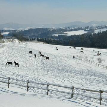
Boxen und Offenstall Plätze frei
Beutelsbach
Gabi-Grasse
@GabiGrasse
Freizeitstall
Reitlehrer und -unterricht
Vermieten
Hunde willkommen
Longierzirkel/Roundpen
Allergikerstall
Hufrehe geeignet
14 weitere...
P+
Deprecated: Creation of dynamic property Zend_View_Helper_Ads::$adLink is deprecated in /var/www/stall-frei/htdocs/staging.stall-frei.de/library/Psf/View/Helper/Ads.php on line 108

Heu und Heulage verkaufen
Mechtersen
STALL-FREIde Marketing
@STALL-FREI-Marketing
Verkaufen Sie Ihr Heu und Ihre Heulage direkt an Reiter, Pferdeställe und Reitanlagen


Vermiete 4 paddockboxen
Salzweg
Pferdehof-Hoell1
@Pferdehof-Hoell1
FN-Mitglied
Vermieten
Paddock
Parkplatz für Pferdeanhänger
Hufrehe geeignet
11 weitere...
aktuell
P+

Kleiner privater Reitstall oberhalb von Sandbach
Vilshofen an der Donau
Rebekka-Reimold
@Rebekka-Reimold
Freizeitstall
Pferdeausbildung
Hunde willkommen
Longierzirkel/Roundpen
Außenboxen
Innenbox
Halbpension
10 weitere...
P

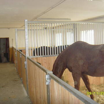
Einstellplatz frei
Tiefenbach
Tanja Löw
@Reitstall-Loew
Freizeitstall
Vermieten
Reithalle
Sommerweide
Außenbox mit Paddock
Innenbox
8 weitere...
aktuell
P


Wohnen mit Pferd(en) oder Offenstallplätze
Falkenstein
KnallerbsenHof
@KnallerbsenHof
Vermieten
Hunde willkommen
Parkplatz für Pferdeanhänger
Offenstall
Selbstversorgung
8 weitere...
P+

Pferdepension Hit Aktivstall Kürmerhof
Hohenkammer
Kuermerhof
@Kuermerhof
*******JETZT NEU MIT ENTSTAUBTEM BIOHEU*********
*******Demnächst mit einem Abenteuerspielplatz für Pferde ( Extrem Trail/Pa
Leider kein Vorschaubild
Leider kein Vorschaubild
Aktivstall, Offenstall in Ascha, Platz frei
Ascha
Daniela Foierl
@daniela-foierl
Vermieten
Hunde willkommen
Krankenbox
Fohlenaufzucht möglich
Hufrehe geeignet
Bewegungsstall
Laufstall
17 weitere...
B
Leider kein Vorschaubild
Leider kein Vorschaubild
Box/Paddock frei
Ascha
Reitstall Susan-Peikert
@Reitstall-Susan-Peikert
Fahrstall, Kutschwagen
Freizeitstall
Vermieten
Hunde willkommen
Krankenbox
Gnadenbrothof
Hengsthaltung möglich
23 weitere...
B


Schauer Aktivstall-Bewegungsstall
Neuburg
Aktivstall Kaelberbach-Hof
@Kaelberbach-Hof
Freizeitstall
Pferdeausbildung
Vermieten
Hunde willkommen
Krankenbox
Allergikerstall
Gnadenbrothof
25 weitere...
P+
Leider kein Vorschaubild
Leider kein Vorschaubild
B
Leider kein Vorschaubild
Leider kein Vorschaubild
B
Deprecated: Creation of dynamic property Zend_View::$pageCount is deprecated in /var/www/stall-frei/htdocs/staging.stall-frei.de/library/vendor/shardj/zf1-future/library/Zend/View/Abstract.php on line 308
Deprecated: Creation of dynamic property Zend_View::$itemCountPerPage is deprecated in /var/www/stall-frei/htdocs/staging.stall-frei.de/library/vendor/shardj/zf1-future/library/Zend/View/Abstract.php on line 308
Deprecated: Creation of dynamic property Zend_View::$first is deprecated in /var/www/stall-frei/htdocs/staging.stall-frei.de/library/vendor/shardj/zf1-future/library/Zend/View/Abstract.php on line 308
Deprecated: Creation of dynamic property Zend_View::$current is deprecated in /var/www/stall-frei/htdocs/staging.stall-frei.de/library/vendor/shardj/zf1-future/library/Zend/View/Abstract.php on line 308
Deprecated: Creation of dynamic property Zend_View::$last is deprecated in /var/www/stall-frei/htdocs/staging.stall-frei.de/library/vendor/shardj/zf1-future/library/Zend/View/Abstract.php on line 308
Deprecated: Creation of dynamic property Zend_View::$previous is deprecated in /var/www/stall-frei/htdocs/staging.stall-frei.de/library/vendor/shardj/zf1-future/library/Zend/View/Abstract.php on line 308
Deprecated: Creation of dynamic property Zend_View::$next is deprecated in /var/www/stall-frei/htdocs/staging.stall-frei.de/library/vendor/shardj/zf1-future/library/Zend/View/Abstract.php on line 308
Deprecated: Creation of dynamic property Zend_View::$pagesInRange is deprecated in /var/www/stall-frei/htdocs/staging.stall-frei.de/library/vendor/shardj/zf1-future/library/Zend/View/Abstract.php on line 308
Deprecated: Creation of dynamic property Zend_View::$firstPageInRange is deprecated in /var/www/stall-frei/htdocs/staging.stall-frei.de/library/vendor/shardj/zf1-future/library/Zend/View/Abstract.php on line 308
Deprecated: Creation of dynamic property Zend_View::$lastPageInRange is deprecated in /var/www/stall-frei/htdocs/staging.stall-frei.de/library/vendor/shardj/zf1-future/library/Zend/View/Abstract.php on line 308
Deprecated: Creation of dynamic property Zend_View::$currentItemCount is deprecated in /var/www/stall-frei/htdocs/staging.stall-frei.de/library/vendor/shardj/zf1-future/library/Zend/View/Abstract.php on line 308
Deprecated: Creation of dynamic property Zend_View::$totalItemCount is deprecated in /var/www/stall-frei/htdocs/staging.stall-frei.de/library/vendor/shardj/zf1-future/library/Zend/View/Abstract.php on line 308
Deprecated: Creation of dynamic property Zend_View::$firstItemNumber is deprecated in /var/www/stall-frei/htdocs/staging.stall-frei.de/library/vendor/shardj/zf1-future/library/Zend/View/Abstract.php on line 308
Deprecated: Creation of dynamic property Zend_View::$lastItemNumber is deprecated in /var/www/stall-frei/htdocs/staging.stall-frei.de/library/vendor/shardj/zf1-future/library/Zend/View/Abstract.php on line 308
Deprecated: Creation of dynamic property Zend_View::$router is deprecated in /var/www/stall-frei/htdocs/staging.stall-frei.de/library/vendor/shardj/zf1-future/library/Zend/View/Abstract.php on line 308
Deprecated: Creation of dynamic property Zend_View::$urlParams is deprecated in /var/www/stall-frei/htdocs/staging.stall-frei.de/library/vendor/shardj/zf1-future/library/Zend/View/Abstract.php on line 308
Deprecated: Creation of dynamic property Zend_View::$showAds is deprecated in /var/www/stall-frei/htdocs/staging.stall-frei.de/library/vendor/shardj/zf1-future/library/Zend/View/Abstract.php on line 308
Deprecated: Creation of dynamic property Zend_View::$objectIds is deprecated in /var/www/stall-frei/htdocs/staging.stall-frei.de/library/vendor/shardj/zf1-future/library/Zend/View/Abstract.php on line 308
Deprecated: Creation of dynamic property Zend_View::$showNavbar is deprecated in /var/www/stall-frei/htdocs/staging.stall-frei.de/library/vendor/shardj/zf1-future/library/Zend/View/Abstract.php on line 308
Deprecated: Creation of dynamic property Zend_View::$showBreadcrumb is deprecated in /var/www/stall-frei/htdocs/staging.stall-frei.de/library/vendor/shardj/zf1-future/library/Zend/View/Abstract.php on line 308
Deprecated: Creation of dynamic property Zend_View::$showFooter is deprecated in /var/www/stall-frei/htdocs/staging.stall-frei.de/library/vendor/shardj/zf1-future/library/Zend/View/Abstract.php on line 308
Deprecated: Creation of dynamic property Zend_View::$showInternalAds is deprecated in /var/www/stall-frei/htdocs/staging.stall-frei.de/library/vendor/shardj/zf1-future/library/Zend/View/Abstract.php on line 308
Deprecated: Creation of dynamic property Zend_View::$blNoContent is deprecated in /var/www/stall-frei/htdocs/staging.stall-frei.de/library/vendor/shardj/zf1-future/library/Zend/View/Abstract.php on line 308
Deprecated: Creation of dynamic property Zend_View::$sMetaDesc is deprecated in /var/www/stall-frei/htdocs/staging.stall-frei.de/library/vendor/shardj/zf1-future/library/Zend/View/Abstract.php on line 308
Deprecated: Creation of dynamic property Zend_View::$useGmaps is deprecated in /var/www/stall-frei/htdocs/staging.stall-frei.de/library/vendor/shardj/zf1-future/library/Zend/View/Abstract.php on line 308
Deprecated: Creation of dynamic property Zend_View::$touches is deprecated in /var/www/stall-frei/htdocs/staging.stall-frei.de/library/vendor/shardj/zf1-future/library/Zend/View/Abstract.php on line 308
Deprecated: Creation of dynamic property Zend_View::$oProject is deprecated in /var/www/stall-frei/htdocs/staging.stall-frei.de/library/vendor/shardj/zf1-future/library/Zend/View/Abstract.php on line 308
Deprecated: Creation of dynamic property Zend_View::$pageHeadline is deprecated in /var/www/stall-frei/htdocs/staging.stall-frei.de/library/vendor/shardj/zf1-future/library/Zend/View/Abstract.php on line 308
Deprecated: Creation of dynamic property Zend_View::$disableLocationField is deprecated in /var/www/stall-frei/htdocs/staging.stall-frei.de/library/vendor/shardj/zf1-future/library/Zend/View/Abstract.php on line 308
Deprecated: Creation of dynamic property Zend_View::$isSearch is deprecated in /var/www/stall-frei/htdocs/staging.stall-frei.de/library/vendor/shardj/zf1-future/library/Zend/View/Abstract.php on line 308
Deprecated: Creation of dynamic property Zend_View::$pageTitle is deprecated in /var/www/stall-frei/htdocs/staging.stall-frei.de/library/vendor/shardj/zf1-future/library/Zend/View/Abstract.php on line 308
Deprecated: Creation of dynamic property Psf_Form_Element_Text::$class is deprecated in /var/www/stall-frei/htdocs/staging.stall-frei.de/library/vendor/shardj/zf1-future/library/Zend/Form/Element.php on line 874
Deprecated: Creation of dynamic property Psf_Form_Element_Text::$size is deprecated in /var/www/stall-frei/htdocs/staging.stall-frei.de/library/vendor/shardj/zf1-future/library/Zend/Form/Element.php on line 874
Deprecated: Creation of dynamic property Psf_Form_Element_Text::$placeholder is deprecated in /var/www/stall-frei/htdocs/staging.stall-frei.de/library/vendor/shardj/zf1-future/library/Zend/Form/Element.php on line 874
Deprecated: Creation of dynamic property Psf_Form_Element_Hidden::$class is deprecated in /var/www/stall-frei/htdocs/staging.stall-frei.de/library/vendor/shardj/zf1-future/library/Zend/Form/Element.php on line 874
Deprecated: Creation of dynamic property Psf_Form_Element_Hidden::$class is deprecated in /var/www/stall-frei/htdocs/staging.stall-frei.de/library/vendor/shardj/zf1-future/library/Zend/Form/Element.php on line 874
Deprecated: Creation of dynamic property Psf_Form_Element_Hidden::$class is deprecated in /var/www/stall-frei/htdocs/staging.stall-frei.de/library/vendor/shardj/zf1-future/library/Zend/Form/Element.php on line 874
Deprecated: Creation of dynamic property Psf_Form_Element_Hidden::$class is deprecated in /var/www/stall-frei/htdocs/staging.stall-frei.de/library/vendor/shardj/zf1-future/library/Zend/Form/Element.php on line 874
Deprecated: Creation of dynamic property Psf_Form_Element_Select::$class is deprecated in /var/www/stall-frei/htdocs/staging.stall-frei.de/library/vendor/shardj/zf1-future/library/Zend/Form/Element.php on line 874
Deprecated: Creation of dynamic property Psf_Form_Element_Select::$class is deprecated in /var/www/stall-frei/htdocs/staging.stall-frei.de/library/vendor/shardj/zf1-future/library/Zend/Form/Element.php on line 874
Deprecated: Creation of dynamic property Psf_Form_Element_Select::$class is deprecated in /var/www/stall-frei/htdocs/staging.stall-frei.de/library/vendor/shardj/zf1-future/library/Zend/Form/Element.php on line 874
Deprecated: Creation of dynamic property Psf_Form_Element_Select::$class is deprecated in /var/www/stall-frei/htdocs/staging.stall-frei.de/library/vendor/shardj/zf1-future/library/Zend/Form/Element.php on line 874
Deprecated: Creation of dynamic property Psf_Form_Element_Text::$class is deprecated in /var/www/stall-frei/htdocs/staging.stall-frei.de/library/vendor/shardj/zf1-future/library/Zend/Form/Element.php on line 874
Deprecated: Creation of dynamic property Psf_Form_Element_Checkbox::$label is deprecated in /var/www/stall-frei/htdocs/staging.stall-frei.de/library/vendor/shardj/zf1-future/library/Zend/Form/Element.php on line 874
Deprecated: Creation of dynamic property Zend_View::$sort is deprecated in /var/www/stall-frei/htdocs/staging.stall-frei.de/library/vendor/shardj/zf1-future/library/Zend/View/Abstract.php on line 308
Deprecated: Creation of dynamic property Zend_View::$searchLocation is deprecated in /var/www/stall-frei/htdocs/staging.stall-frei.de/library/vendor/shardj/zf1-future/library/Zend/View/Abstract.php on line 308
Deprecated: Creation of dynamic property Zend_View::$locationHint is deprecated in /var/www/stall-frei/htdocs/staging.stall-frei.de/library/vendor/shardj/zf1-future/library/Zend/View/Abstract.php on line 308
Psf_GeoCoder_Abstract::getLocation: Dreieck Get Location CachedOrLive
Psf_GeoCoder_Abstract::getCachedOrLive: Dreieck
Psf_GeoCoder_Abstract::convertLocationResult
{"documentation":"https:\/\/opencagedata.com\/api","licenses":[{"name":"see attribution guide","url":"https:\/\/opencagedata.com\/credits"}],"results":[{"bounds":{"northeast":{"lat":49.0122128,"lng":13.2166279},"southwest":{"lat":48.9722128,"lng":13.1766279}},"components":{"ISO_3166-1_alpha-2":"DE","ISO_3166-1_alpha-3":"DEU","ISO_3166-2":["DE-BY"],"_category":"place","_normalized_city":"Regen","_type":"village","continent":"Europe","country":"Deutschland","country_code":"de","county":"Landkreis Regen","political_union":"European Union","postcode":"94227","state":"Bayern","state_code":"BY","town":"Regen","village":"Dreieck"},"confidence":7,"formatted":"94227 Dreieck, Deutschland","geometry":{"lat":48.9922128,"lng":13.1966279}},{"bounds":{"northeast":{"lat":52.1908865,"lng":11.6375782},"southwest":{"lat":52.1894522,"lng":11.6354469}},"components":{"ISO_3166-1_alpha-2":"DE","ISO_3166-1_alpha-3":"DEU","ISO_3166-2":["DE-ST"],"_category":"natural\/water","_normalized_city":"Magdeburg","_type":"water","city":"Magdeburg","continent":"Europe","country":"Deutschland","country_code":"de","political_union":"European Union","postcode":"39126","state":"Sachsen-Anhalt","state_code":"ST","suburb":"Neust\u00e4dter See","water":"Dreieck"},"confidence":9,"formatted":"Dreieck, 39126 Magdeburg, Deutschland","geometry":{"lat":52.190184,"lng":11.6366697}},{"bounds":{"northeast":{"lat":50.3777154,"lng":8.6131382},"southwest":{"lat":50.3774547,"lng":8.6126077}},"components":{"ISO_3166-1_alpha-2":"DE","ISO_3166-1_alpha-3":"DEU","ISO_3166-2":["DE-HE"],"_category":"natural\/water","_normalized_city":"Wiesental","_type":"grassland","continent":"Europe","country":"Deutschland","country_code":"de","county":"Wetteraukreis","grassland":"Dreieck","municipality":"Butzbach","political_union":"European Union","postcode":"35510","state":"Hessen","state_code":"HE","village":"Wiesental"},"confidence":9,"formatted":"Dreieck, 35510 Wiesental, Deutschland","geometry":{"lat":50.3775823,"lng":8.6128526}},{"bounds":{"northeast":{"lat":52.0957334,"lng":7.3511527},"southwest":{"lat":52.0881125,"lng":7.3447721}},"components":{"ISO_3166-1_alpha-2":"DE","ISO_3166-1_alpha-3":"DEU","ISO_3166-2":["DE-NW"],"_category":"natural\/water","_normalized_city":"Horstmar","_type":"forest","city_district":"Leer","continent":"Europe","country":"Deutschland","country_code":"de","county":"Kreis Steinfurt","forest":"Dreieck","hamlet":"Alst","political_union":"European Union","postcode":"48612","state":"Nordrhein-Westfalen","state_code":"NW","village":"Horstmar"},"confidence":9,"formatted":"Dreieck, Alst, 48612 Horstmar, Deutschland","geometry":{"lat":52.0930604,"lng":7.3481466}},{"bounds":{"northeast":{"lat":53.111642,"lng":13.6414094},"southwest":{"lat":53.1088111,"lng":13.6341586}},"components":{"ISO_3166-1_alpha-2":"DE","ISO_3166-1_alpha-3":"DEU","ISO_3166-2":["DE-BB"],"_category":"unknown","_normalized_city":"Milmersdorf","_type":"municipal_federation","continent":"Europe","country":"Deutschland","country_code":"de","county":"Uckermark","municipal_federation":"Gerswalde","political_union":"European Union","postcode":"17268","residential":"Dreieck","state":"Brandenburg","state_code":"BB","village":"Milmersdorf"},"confidence":9,"formatted":"Gerswalde, 17268 Milmersdorf, Deutschland","geometry":{"lat":53.110225,"lng":13.6378919}},{"bounds":{"northeast":{"lat":51.5206163,"lng":7.1198471},"southwest":{"lat":51.5202544,"lng":7.119394}},"components":{"ISO_3166-1_alpha-2":"DE","ISO_3166-1_alpha-3":"DEU","ISO_3166-2":["DE-NW"],"_category":"natural\/water","_normalized_city":"Gelsenkirchen","_type":"meadow","city":"Gelsenkirchen","city_district":"Gelsenkirchen-Mitte","continent":"Europe","country":"Deutschland","country_code":"de","meadow":"\u00b4Dreieck\u00b4","political_union":"European Union","postcode":"45888","state":"Nordrhein-Westfalen","state_code":"NW","suburb":"Bulmke-H\u00fcllen"},"confidence":9,"formatted":"\u00b4Dreieck\u00b4, 45888 Gelsenkirchen, Deutschland","geometry":{"lat":51.5204325,"lng":7.1196471}},{"bounds":{"northeast":{"lat":48.469953,"lng":9.44763},"southwest":{"lat":48.4697921,"lng":9.4471834}},"components":{"ISO_3166-1_alpha-2":"DE","ISO_3166-1_alpha-3":"DEU","ISO_3166-2":["DE-BW"],"_category":"outdoors\/recreation","_normalized_city":"Bad Urach","_type":"park","continent":"Europe","country":"Deutschland","country_code":"de","county":"Landkreis Reutlingen","municipality":"VVG der Stadt Bad Urach","park":"Dreieck","political_union":"European Union","postcode":"72574","state":"Baden-W\u00fcrttemberg","state_code":"BW","town":"Bad Urach","village":"Wittlingen"},"confidence":9,"formatted":"Dreieck, 72574 Wittlingen, Deutschland","geometry":{"lat":48.4698547,"lng":9.4473539}},{"bounds":{"northeast":{"lat":53.7742847,"lng":9.6621264},"southwest":{"lat":53.7542847,"lng":9.6421264}},"components":{"ISO_3166-1_alpha-2":"DE","ISO_3166-1_alpha-3":"DEU","ISO_3166-2":["DE-SH"],"_category":"place","_normalized_city":"Elmshorn","_type":"neighbourhood","continent":"Europe","country":"Deutschland","country_code":"de","county":"Kreis Pinneberg","neighbourhood":"Dreieck","political_union":"European Union","postcode":"25335","state":"Schleswig-Holstein","state_code":"SH","town":"Elmshorn"},"confidence":8,"formatted":"25335 Elmshorn, Deutschland","geometry":{"lat":53.7642847,"lng":9.6521264}},{"bounds":{"northeast":{"lat":52.373797,"lng":13.6015579},"southwest":{"lat":52.353797,"lng":13.5815579}},"components":{"ISO_3166-1_alpha-2":"DE","ISO_3166-1_alpha-3":"DEU","ISO_3166-2":["DE-BB"],"_category":"place","_normalized_city":"Schulzendorf","_type":"hamlet","continent":"Europe","country":"Deutschland","country_code":"de","county":"Dahme-Spreewald","locality":"Dreieck","municipality":"Schenkendorf-Krummensee","political_union":"European Union","postcode":"15732","state":"Brandenburg","state_code":"BB","village":"Schulzendorf"},"confidence":8,"formatted":"Dreieck, 15732 Schulzendorf, Deutschland","geometry":{"lat":52.363797,"lng":13.5915579}},{"components":{"ISO_3166-1_alpha-2":"FR","ISO_3166-1_alpha-3":"FRA","ISO_3166-2":["FR-IDF","FR-92"],"_category":"road","_normalized_city":"Levallois-Perret","_type":"road","city":"Levallois-Perret","continent":"Europe","country":"France","country_code":"fr","county":"Hauts-de-Seine","local_authority":"M\u00e9tropole du Grand Paris","political_union":"European Union","postcode":"92300","road":"Rue Charles Deutschmann","state":"\u00cele-de-France","state_code":"IDF"},"confidence":2,"formatted":"Rue Charles Deutschmann, 92300 Levallois-Perret, France","geometry":{"lat":48.900049,"lng":2.2842}}],"status":{"code":200,"message":"OK"},"stay_informed":{"blog":"https:\/\/blog.opencagedata.com","mastodon":"https:\/\/en.osm.town\/@opencage"},"thanks":"For using an OpenCage API","timestamp":{"created_http":"Sun, 08 Feb 2026 05:14:40 GMT","created_unix":1770527680},"total_results":10}Array
(
[0] => stdClass Object
(
[bounds] => stdClass Object
(
[northeast] => stdClass Object
(
[lat] => 49.0122128
[lng] => 13.2166279
)
[southwest] => stdClass Object
(
[lat] => 48.9722128
[lng] => 13.1766279
)
)
[components] => stdClass Object
(
[ISO_3166-1_alpha-2] => DE
[ISO_3166-1_alpha-3] => DEU
[ISO_3166-2] => Array
(
[0] => DE-BY
)
[_category] => place
[_normalized_city] => Regen
[_type] => village
[continent] => Europe
[country] => Deutschland
[country_code] => de
[county] => Landkreis Regen
[political_union] => European Union
[postcode] => 94227
[state] => Bayern
[state_code] => BY
[town] => Regen
[village] => Dreieck
)
[confidence] => 7
[formatted] => 94227 Dreieck, Deutschland
[geometry] => stdClass Object
(
[lat] => 48.9922128
[lng] => 13.1966279
)
)
[1] => stdClass Object
(
[bounds] => stdClass Object
(
[northeast] => stdClass Object
(
[lat] => 52.1908865
[lng] => 11.6375782
)
[southwest] => stdClass Object
(
[lat] => 52.1894522
[lng] => 11.6354469
)
)
[components] => stdClass Object
(
[ISO_3166-1_alpha-2] => DE
[ISO_3166-1_alpha-3] => DEU
[ISO_3166-2] => Array
(
[0] => DE-ST
)
[_category] => natural/water
[_normalized_city] => Magdeburg
[_type] => water
[city] => Magdeburg
[continent] => Europe
[country] => Deutschland
[country_code] => de
[political_union] => European Union
[postcode] => 39126
[state] => Sachsen-Anhalt
[state_code] => ST
[suburb] => Neustädter See
[water] => Dreieck
)
[confidence] => 9
[formatted] => Dreieck, 39126 Magdeburg, Deutschland
[geometry] => stdClass Object
(
[lat] => 52.190184
[lng] => 11.6366697
)
)
[2] => stdClass Object
(
[bounds] => stdClass Object
(
[northeast] => stdClass Object
(
[lat] => 50.3777154
[lng] => 8.6131382
)
[southwest] => stdClass Object
(
[lat] => 50.3774547
[lng] => 8.6126077
)
)
[components] => stdClass Object
(
[ISO_3166-1_alpha-2] => DE
[ISO_3166-1_alpha-3] => DEU
[ISO_3166-2] => Array
(
[0] => DE-HE
)
[_category] => natural/water
[_normalized_city] => Wiesental
[_type] => grassland
[continent] => Europe
[country] => Deutschland
[country_code] => de
[county] => Wetteraukreis
[grassland] => Dreieck
[municipality] => Butzbach
[political_union] => European Union
[postcode] => 35510
[state] => Hessen
[state_code] => HE
[village] => Wiesental
)
[confidence] => 9
[formatted] => Dreieck, 35510 Wiesental, Deutschland
[geometry] => stdClass Object
(
[lat] => 50.3775823
[lng] => 8.6128526
)
)
[3] => stdClass Object
(
[bounds] => stdClass Object
(
[northeast] => stdClass Object
(
[lat] => 52.0957334
[lng] => 7.3511527
)
[southwest] => stdClass Object
(
[lat] => 52.0881125
[lng] => 7.3447721
)
)
[components] => stdClass Object
(
[ISO_3166-1_alpha-2] => DE
[ISO_3166-1_alpha-3] => DEU
[ISO_3166-2] => Array
(
[0] => DE-NW
)
[_category] => natural/water
[_normalized_city] => Horstmar
[_type] => forest
[city_district] => Leer
[continent] => Europe
[country] => Deutschland
[country_code] => de
[county] => Kreis Steinfurt
[forest] => Dreieck
[hamlet] => Alst
[political_union] => European Union
[postcode] => 48612
[state] => Nordrhein-Westfalen
[state_code] => NW
[village] => Horstmar
)
[confidence] => 9
[formatted] => Dreieck, Alst, 48612 Horstmar, Deutschland
[geometry] => stdClass Object
(
[lat] => 52.0930604
[lng] => 7.3481466
)
)
[4] => stdClass Object
(
[bounds] => stdClass Object
(
[northeast] => stdClass Object
(
[lat] => 53.111642
[lng] => 13.6414094
)
[southwest] => stdClass Object
(
[lat] => 53.1088111
[lng] => 13.6341586
)
)
[components] => stdClass Object
(
[ISO_3166-1_alpha-2] => DE
[ISO_3166-1_alpha-3] => DEU
[ISO_3166-2] => Array
(
[0] => DE-BB
)
[_category] => unknown
[_normalized_city] => Milmersdorf
[_type] => municipal_federation
[continent] => Europe
[country] => Deutschland
[country_code] => de
[county] => Uckermark
[municipal_federation] => Gerswalde
[political_union] => European Union
[postcode] => 17268
[residential] => Dreieck
[state] => Brandenburg
[state_code] => BB
[village] => Milmersdorf
)
[confidence] => 9
[formatted] => Gerswalde, 17268 Milmersdorf, Deutschland
[geometry] => stdClass Object
(
[lat] => 53.110225
[lng] => 13.6378919
)
)
[5] => stdClass Object
(
[bounds] => stdClass Object
(
[northeast] => stdClass Object
(
[lat] => 51.5206163
[lng] => 7.1198471
)
[southwest] => stdClass Object
(
[lat] => 51.5202544
[lng] => 7.119394
)
)
[components] => stdClass Object
(
[ISO_3166-1_alpha-2] => DE
[ISO_3166-1_alpha-3] => DEU
[ISO_3166-2] => Array
(
[0] => DE-NW
)
[_category] => natural/water
[_normalized_city] => Gelsenkirchen
[_type] => meadow
[city] => Gelsenkirchen
[city_district] => Gelsenkirchen-Mitte
[continent] => Europe
[country] => Deutschland
[country_code] => de
[meadow] => ´Dreieck´
[political_union] => European Union
[postcode] => 45888
[state] => Nordrhein-Westfalen
[state_code] => NW
[suburb] => Bulmke-Hüllen
)
[confidence] => 9
[formatted] => ´Dreieck´, 45888 Gelsenkirchen, Deutschland
[geometry] => stdClass Object
(
[lat] => 51.5204325
[lng] => 7.1196471
)
)
[6] => stdClass Object
(
[bounds] => stdClass Object
(
[northeast] => stdClass Object
(
[lat] => 48.469953
[lng] => 9.44763
)
[southwest] => stdClass Object
(
[lat] => 48.4697921
[lng] => 9.4471834
)
)
[components] => stdClass Object
(
[ISO_3166-1_alpha-2] => DE
[ISO_3166-1_alpha-3] => DEU
[ISO_3166-2] => Array
(
[0] => DE-BW
)
[_category] => outdoors/recreation
[_normalized_city] => Bad Urach
[_type] => park
[continent] => Europe
[country] => Deutschland
[country_code] => de
[county] => Landkreis Reutlingen
[municipality] => VVG der Stadt Bad Urach
[park] => Dreieck
[political_union] => European Union
[postcode] => 72574
[state] => Baden-Württemberg
[state_code] => BW
[town] => Bad Urach
[village] => Wittlingen
)
[confidence] => 9
[formatted] => Dreieck, 72574 Wittlingen, Deutschland
[geometry] => stdClass Object
(
[lat] => 48.4698547
[lng] => 9.4473539
)
)
[7] => stdClass Object
(
[bounds] => stdClass Object
(
[northeast] => stdClass Object
(
[lat] => 53.7742847
[lng] => 9.6621264
)
[southwest] => stdClass Object
(
[lat] => 53.7542847
[lng] => 9.6421264
)
)
[components] => stdClass Object
(
[ISO_3166-1_alpha-2] => DE
[ISO_3166-1_alpha-3] => DEU
[ISO_3166-2] => Array
(
[0] => DE-SH
)
[_category] => place
[_normalized_city] => Elmshorn
[_type] => neighbourhood
[continent] => Europe
[country] => Deutschland
[country_code] => de
[county] => Kreis Pinneberg
[neighbourhood] => Dreieck
[political_union] => European Union
[postcode] => 25335
[state] => Schleswig-Holstein
[state_code] => SH
[town] => Elmshorn
)
[confidence] => 8
[formatted] => 25335 Elmshorn, Deutschland
[geometry] => stdClass Object
(
[lat] => 53.7642847
[lng] => 9.6521264
)
)
[8] => stdClass Object
(
[bounds] => stdClass Object
(
[northeast] => stdClass Object
(
[lat] => 52.373797
[lng] => 13.6015579
)
[southwest] => stdClass Object
(
[lat] => 52.353797
[lng] => 13.5815579
)
)
[components] => stdClass Object
(
[ISO_3166-1_alpha-2] => DE
[ISO_3166-1_alpha-3] => DEU
[ISO_3166-2] => Array
(
[0] => DE-BB
)
[_category] => place
[_normalized_city] => Schulzendorf
[_type] => hamlet
[continent] => Europe
[country] => Deutschland
[country_code] => de
[county] => Dahme-Spreewald
[locality] => Dreieck
[municipality] => Schenkendorf-Krummensee
[political_union] => European Union
[postcode] => 15732
[state] => Brandenburg
[state_code] => BB
[village] => Schulzendorf
)
[confidence] => 8
[formatted] => Dreieck, 15732 Schulzendorf, Deutschland
[geometry] => stdClass Object
(
[lat] => 52.363797
[lng] => 13.5915579
)
)
[9] => stdClass Object
(
[components] => stdClass Object
(
[ISO_3166-1_alpha-2] => FR
[ISO_3166-1_alpha-3] => FRA
[ISO_3166-2] => Array
(
[0] => FR-IDF
[1] => FR-92
)
[_category] => road
[_normalized_city] => Levallois-Perret
[_type] => road
[city] => Levallois-Perret
[continent] => Europe
[country] => France
[country_code] => fr
[county] => Hauts-de-Seine
[local_authority] => Métropole du Grand Paris
[political_union] => European Union
[postcode] => 92300
[road] => Rue Charles Deutschmann
[state] => Île-de-France
[state_code] => IDF
)
[confidence] => 2
[formatted] => Rue Charles Deutschmann, 92300 Levallois-Perret, France
[geometry] => stdClass Object
(
[lat] => 48.900049
[lng] => 2.2842
)
)
)
Psf_GeoCoder_OpenCageData::getKeyMap: 0
stdClass Object
(
    [bounds] => stdClass Object
        (
            [northeast] => stdClass Object
                (
                    [lat] => 49.0122128
                    [lng] => 13.2166279
                )

            [southwest] => stdClass Object
                (
                    [lat] => 48.9722128
                    [lng] => 13.1766279
                )

        )

    [components] => stdClass Object
        (
            [ISO_3166-1_alpha-2] => DE
            [ISO_3166-1_alpha-3] => DEU
            [ISO_3166-2] => Array
                (
                    [0] => DE-BY
                )

            [_category] => place
            [_normalized_city] => Regen
            [_type] => village
            [continent] => Europe
            [country] => Deutschland
            [country_code] => de
            [county] => Landkreis Regen
            [political_union] => European Union
            [postcode] => 94227
            [state] => Bayern
            [state_code] => BY
            [town] => Regen
            [village] => Dreieck
        )

    [confidence] => 7
    [formatted] => 94227 Dreieck, Deutschland
    [geometry] => stdClass Object
        (
            [lat] => 48.9922128
            [lng] => 13.1966279
        )

)
Psf_GeoCoder_OpenCageData::getCounty: Regen
Psf_GeoCoder_OpenCageData::addMissingData REFETCH!
Array
(
    [address] => 94227 Dreieck, Deutschland
    [type] => village
    [street] =>
    [city] => Regen
    [county] => Regen
    [state] => Bayern
    [zip] => 94227
    [country] => Deutschland
    [suburb] =>
    [countrycode] => de
    [latitude] => 48.9922128
    [longitude] => 13.1966279
    [accuracy] => 1
    [confidence] => 7
    [bounds] => stdClass Object
        (
            [northeast] => stdClass Object
                (
                    [lat] => 49.0122128
                    [lng] => 13.2166279
                )

            [southwest] => stdClass Object
                (
                    [lat] => 48.9722128
                    [lng] => 13.1766279
                )

        )

)
reformat!
Array
(
    [address] => 94227 Regen
    [type] => village
    [street] =>
    [city] => Regen
    [county] => Regen
    [state] => Bayern
    [zip] => 94227
    [country] => Deutschland
    [suburb] =>
    [countrycode] => de
    [latitude] => 48.9922128
    [longitude] => 13.1966279
    [accuracy] => 1
    [confidence] => 7
    [bounds] => stdClass Object
        (
            [northeast] => stdClass Object
                (
                    [lat] => 49.0122128
                    [lng] => 13.2166279
                )

            [southwest] => stdClass Object
                (
                    [lat] => 48.9722128
                    [lng] => 13.1766279
                )

        )

    [place] => 94227 Regen, Bayern
    [hash] => 1c22f355e8217b28b4168c18410d305c
)
Psf_GeoCoder_OpenCageData::getKeyMap: 1
stdClass Object
(
    [bounds] => stdClass Object
        (
            [northeast] => stdClass Object
                (
                    [lat] => 52.1908865
                    [lng] => 11.6375782
                )

            [southwest] => stdClass Object
                (
                    [lat] => 52.1894522
                    [lng] => 11.6354469
                )

        )

    [components] => stdClass Object
        (
            [ISO_3166-1_alpha-2] => DE
            [ISO_3166-1_alpha-3] => DEU
            [ISO_3166-2] => Array
                (
                    [0] => DE-ST
                )

            [_category] => natural/water
            [_normalized_city] => Magdeburg
            [_type] => water
            [city] => Magdeburg
            [continent] => Europe
            [country] => Deutschland
            [country_code] => de
            [political_union] => European Union
            [postcode] => 39126
            [state] => Sachsen-Anhalt
            [state_code] => ST
            [suburb] => Neustädter See
            [water] => Dreieck
        )

    [confidence] => 9
    [formatted] => Dreieck, 39126 Magdeburg, Deutschland
    [geometry] => stdClass Object
        (
            [lat] => 52.190184
            [lng] => 11.6366697
        )

)
Psf_GeoCoder_OpenCageData::getCounty: Magdeburg
Psf_GeoCoder_OpenCageData::addMissingData REFETCH!
Array
(
    [address] => Dreieck, 39126 Magdeburg, Deutschland
    [type] => water
    [street] =>
    [city] => Neustädter See
    [county] => Magdeburg
    [state] => Sachsen-Anhalt
    [zip] => 39126
    [country] => Deutschland
    [suburb] => Neustädter See
    [countrycode] => de
    [latitude] => 52.190184
    [longitude] => 11.6366697
    [accuracy] => 1
    [confidence] => 9
    [bounds] => stdClass Object
        (
            [northeast] => stdClass Object
                (
                    [lat] => 52.1908865
                    [lng] => 11.6375782
                )

            [southwest] => stdClass Object
                (
                    [lat] => 52.1894522
                    [lng] => 11.6354469
                )

        )

)
reformat!
Array
(
    [address] => 39126 Neustädter See
    [type] => water
    [street] =>
    [city] => Neustädter See
    [county] => Magdeburg
    [state] => Sachsen-Anhalt
    [zip] => 39126
    [country] => Deutschland
    [suburb] => Neustädter See
    [countrycode] => de
    [latitude] => 52.190184
    [longitude] => 11.6366697
    [accuracy] => 1
    [confidence] => 9
    [bounds] => stdClass Object
        (
            [northeast] => stdClass Object
                (
                    [lat] => 52.1908865
                    [lng] => 11.6375782
                )

            [southwest] => stdClass Object
                (
                    [lat] => 52.1894522
                    [lng] => 11.6354469
                )

        )

    [place] => 39126 Neustädter See, Sachsen-Anhalt
    [hash] => a0671e272bad6e7623dc1b92a8d4352d
)
Psf_GeoCoder_OpenCageData::getKeyMap: 2
stdClass Object
(
    [bounds] => stdClass Object
        (
            [northeast] => stdClass Object
                (
                    [lat] => 50.3777154
                    [lng] => 8.6131382
                )

            [southwest] => stdClass Object
                (
                    [lat] => 50.3774547
                    [lng] => 8.6126077
                )

        )

    [components] => stdClass Object
        (
            [ISO_3166-1_alpha-2] => DE
            [ISO_3166-1_alpha-3] => DEU
            [ISO_3166-2] => Array
                (
                    [0] => DE-HE
                )

            [_category] => natural/water
            [_normalized_city] => Wiesental
            [_type] => grassland
            [continent] => Europe
            [country] => Deutschland
            [country_code] => de
            [county] => Wetteraukreis
            [grassland] => Dreieck
            [municipality] => Butzbach
            [political_union] => European Union
            [postcode] => 35510
            [state] => Hessen
            [state_code] => HE
            [village] => Wiesental
        )

    [confidence] => 9
    [formatted] => Dreieck, 35510 Wiesental, Deutschland
    [geometry] => stdClass Object
        (
            [lat] => 50.3775823
            [lng] => 8.6128526
        )

)
Psf_GeoCoder_OpenCageData::getCounty: Wetteraukreis
Psf_GeoCoder_OpenCageData::addMissingData REFETCH!
Array
(
    [address] => Dreieck, 35510 Wiesental, Deutschland
    [type] => grassland
    [street] =>
    [city] => Wiesental
    [county] => Wetteraukreis
    [state] => Hessen
    [zip] => 35510
    [country] => Deutschland
    [suburb] =>
    [countrycode] => de
    [latitude] => 50.3775823
    [longitude] => 8.6128526
    [accuracy] => 1
    [confidence] => 9
    [bounds] => stdClass Object
        (
            [northeast] => stdClass Object
                (
                    [lat] => 50.3777154
                    [lng] => 8.6131382
                )

            [southwest] => stdClass Object
                (
                    [lat] => 50.3774547
                    [lng] => 8.6126077
                )

        )

)
reformat!
Array
(
    [address] => Dreieck, 35510 Wiesental, Deutschland
    [type] => grassland
    [street] =>
    [city] => Wiesental
    [county] => Wetteraukreis
    [state] => Hessen
    [zip] => 35510
    [country] => Deutschland
    [suburb] =>
    [countrycode] => de
    [latitude] => 50.3775823
    [longitude] => 8.6128526
    [accuracy] => 1
    [confidence] => 9
    [bounds] => stdClass Object
        (
            [northeast] => stdClass Object
                (
                    [lat] => 50.3777154
                    [lng] => 8.6131382
                )

            [southwest] => stdClass Object
                (
                    [lat] => 50.3774547
                    [lng] => 8.6126077
                )

        )

    [place] => 35510 Wiesental, Hessen
    [hash] => e9c6e1231b274d8da81155db33ba553d
)
Psf_GeoCoder_OpenCageData::getKeyMap: 3
stdClass Object
(
    [bounds] => stdClass Object
        (
            [northeast] => stdClass Object
                (
                    [lat] => 52.0957334
                    [lng] => 7.3511527
                )

            [southwest] => stdClass Object
                (
                    [lat] => 52.0881125
                    [lng] => 7.3447721
                )

        )

    [components] => stdClass Object
        (
            [ISO_3166-1_alpha-2] => DE
            [ISO_3166-1_alpha-3] => DEU
            [ISO_3166-2] => Array
                (
                    [0] => DE-NW
                )

            [_category] => natural/water
            [_normalized_city] => Horstmar
            [_type] => forest
            [city_district] => Leer
            [continent] => Europe
            [country] => Deutschland
            [country_code] => de
            [county] => Kreis Steinfurt
            [forest] => Dreieck
            [hamlet] => Alst
            [political_union] => European Union
            [postcode] => 48612
            [state] => Nordrhein-Westfalen
            [state_code] => NW
            [village] => Horstmar
        )

    [confidence] => 9
    [formatted] => Dreieck, Alst, 48612 Horstmar, Deutschland
    [geometry] => stdClass Object
        (
            [lat] => 52.0930604
            [lng] => 7.3481466
        )

)
Psf_GeoCoder_OpenCageData::getCounty: Steinfurt
Psf_GeoCoder_OpenCageData::addMissingData REFETCH!
Array
(
    [address] => Dreieck, Alst, 48612 Horstmar, Deutschland
    [type] => forest
    [street] => Alst
    [city] => Horstmar
    [county] => Steinfurt
    [state] => Nordrhein-Westfalen
    [zip] => 48612
    [country] => Deutschland
    [suburb] =>
    [countrycode] => de
    [latitude] => 52.0930604
    [longitude] => 7.3481466
    [accuracy] => 1
    [confidence] => 9
    [bounds] => stdClass Object
        (
            [northeast] => stdClass Object
                (
                    [lat] => 52.0957334
                    [lng] => 7.3511527
                )

            [southwest] => stdClass Object
                (
                    [lat] => 52.0881125
                    [lng] => 7.3447721
                )

        )

)
reformat!
Array
(
    [address] => Dreieck, Alst, 48612 Horstmar, Deutschland
    [type] => forest
    [street] => Alst
    [city] => Horstmar
    [county] => Steinfurt
    [state] => Nordrhein-Westfalen
    [zip] => 48612
    [country] => Deutschland
    [suburb] =>
    [countrycode] => de
    [latitude] => 52.0930604
    [longitude] => 7.3481466
    [accuracy] => 1
    [confidence] => 9
    [bounds] => stdClass Object
        (
            [northeast] => stdClass Object
                (
                    [lat] => 52.0957334
                    [lng] => 7.3511527
                )

            [southwest] => stdClass Object
                (
                    [lat] => 52.0881125
                    [lng] => 7.3447721
                )

        )

    [place] => Alst, 48612 Horstmar, Nordrhein-Westfalen
    [hash] => 13542177faac2bc60a62c78b013b4c81
)
Psf_GeoCoder_OpenCageData::getKeyMap: 4
stdClass Object
(
    [bounds] => stdClass Object
        (
            [northeast] => stdClass Object
                (
                    [lat] => 53.111642
                    [lng] => 13.6414094
                )

            [southwest] => stdClass Object
                (
                    [lat] => 53.1088111
                    [lng] => 13.6341586
                )

        )

    [components] => stdClass Object
        (
            [ISO_3166-1_alpha-2] => DE
            [ISO_3166-1_alpha-3] => DEU
            [ISO_3166-2] => Array
                (
                    [0] => DE-BB
                )

            [_category] => unknown
            [_normalized_city] => Milmersdorf
            [_type] => municipal_federation
            [continent] => Europe
            [country] => Deutschland
            [country_code] => de
            [county] => Uckermark
            [municipal_federation] => Gerswalde
            [political_union] => European Union
            [postcode] => 17268
            [residential] => Dreieck
            [state] => Brandenburg
            [state_code] => BB
            [village] => Milmersdorf
        )

    [confidence] => 9
    [formatted] => Gerswalde, 17268 Milmersdorf, Deutschland
    [geometry] => stdClass Object
        (
            [lat] => 53.110225
            [lng] => 13.6378919
        )

)
Psf_GeoCoder_OpenCageData::getCounty: Uckermark
Psf_GeoCoder_OpenCageData::addMissingData REFETCH!
Array
(
    [address] => Gerswalde, 17268 Milmersdorf, Deutschland
    [type] => municipal_federation
    [street] =>
    [city] => Milmersdorf
    [county] => Uckermark
    [state] => Brandenburg
    [zip] => 17268
    [country] => Deutschland
    [suburb] =>
    [countrycode] => de
    [latitude] => 53.110225
    [longitude] => 13.6378919
    [accuracy] => 1
    [confidence] => 9
    [bounds] => stdClass Object
        (
            [northeast] => stdClass Object
                (
                    [lat] => 53.111642
                    [lng] => 13.6414094
                )

            [southwest] => stdClass Object
                (
                    [lat] => 53.1088111
                    [lng] => 13.6341586
                )

        )

)
reformat!
Array
(
    [address] => Gerswalde, 17268 Milmersdorf, Deutschland
    [type] => municipal_federation
    [street] =>
    [city] => Milmersdorf
    [county] => Uckermark
    [state] => Brandenburg
    [zip] => 17268
    [country] => Deutschland
    [suburb] =>
    [countrycode] => de
    [latitude] => 53.110225
    [longitude] => 13.6378919
    [accuracy] => 1
    [confidence] => 9
    [bounds] => stdClass Object
        (
            [northeast] => stdClass Object
                (
                    [lat] => 53.111642
                    [lng] => 13.6414094
                )

            [southwest] => stdClass Object
                (
                    [lat] => 53.1088111
                    [lng] => 13.6341586
                )

        )

    [place] => 17268 Milmersdorf, Brandenburg
    [hash] => b0f47aa9595123d9549714e206055cd6
)
Psf_GeoCoder_OpenCageData::getKeyMap: 5
stdClass Object
(
    [bounds] => stdClass Object
        (
            [northeast] => stdClass Object
                (
                    [lat] => 51.5206163
                    [lng] => 7.1198471
                )

            [southwest] => stdClass Object
                (
                    [lat] => 51.5202544
                    [lng] => 7.119394
                )

        )

    [components] => stdClass Object
        (
            [ISO_3166-1_alpha-2] => DE
            [ISO_3166-1_alpha-3] => DEU
            [ISO_3166-2] => Array
                (
                    [0] => DE-NW
                )

            [_category] => natural/water
            [_normalized_city] => Gelsenkirchen
            [_type] => meadow
            [city] => Gelsenkirchen
            [city_district] => Gelsenkirchen-Mitte
            [continent] => Europe
            [country] => Deutschland
            [country_code] => de
            [meadow] => ´Dreieck´
            [political_union] => European Union
            [postcode] => 45888
            [state] => Nordrhein-Westfalen
            [state_code] => NW
            [suburb] => Bulmke-Hüllen
        )

    [confidence] => 9
    [formatted] => ´Dreieck´, 45888 Gelsenkirchen, Deutschland
    [geometry] => stdClass Object
        (
            [lat] => 51.5204325
            [lng] => 7.1196471
        )

)
Psf_GeoCoder_OpenCageData::getCounty: Gelsenkirchen
Psf_GeoCoder_OpenCageData::addMissingData REFETCH!
Array
(
    [address] => ´Dreieck´, 45888 Gelsenkirchen, Deutschland
    [type] => meadow
    [street] =>
    [city] => Bulmke-Hüllen
    [county] => Gelsenkirchen
    [state] => Nordrhein-Westfalen
    [zip] => 45888
    [country] => Deutschland
    [suburb] => Bulmke-Hüllen
    [countrycode] => de
    [latitude] => 51.5204325
    [longitude] => 7.1196471
    [accuracy] => 1
    [confidence] => 9
    [bounds] => stdClass Object
        (
            [northeast] => stdClass Object
                (
                    [lat] => 51.5206163
                    [lng] => 7.1198471
                )

            [southwest] => stdClass Object
                (
                    [lat] => 51.5202544
                    [lng] => 7.119394
                )

        )

)
reformat!
Array
(
    [address] => 45888 Bulmke-Hüllen
    [type] => meadow
    [street] =>
    [city] => Bulmke-Hüllen
    [county] => Gelsenkirchen
    [state] => Nordrhein-Westfalen
    [zip] => 45888
    [country] => Deutschland
    [suburb] => Bulmke-Hüllen
    [countrycode] => de
    [latitude] => 51.5204325
    [longitude] => 7.1196471
    [accuracy] => 1
    [confidence] => 9
    [bounds] => stdClass Object
        (
            [northeast] => stdClass Object
                (
                    [lat] => 51.5206163
                    [lng] => 7.1198471
                )

            [southwest] => stdClass Object
                (
                    [lat] => 51.5202544
                    [lng] => 7.119394
                )

        )

    [place] => 45888 Bulmke-Hüllen, Nordrhein-Westfalen
    [hash] => f846905b4140c229ee636e3a0f5073df
)
Psf_GeoCoder_OpenCageData::getKeyMap: 6
stdClass Object
(
    [bounds] => stdClass Object
        (
            [northeast] => stdClass Object
                (
                    [lat] => 48.469953
                    [lng] => 9.44763
                )

            [southwest] => stdClass Object
                (
                    [lat] => 48.4697921
                    [lng] => 9.4471834
                )

        )

    [components] => stdClass Object
        (
            [ISO_3166-1_alpha-2] => DE
            [ISO_3166-1_alpha-3] => DEU
            [ISO_3166-2] => Array
                (
                    [0] => DE-BW
                )

            [_category] => outdoors/recreation
            [_normalized_city] => Bad Urach
            [_type] => park
            [continent] => Europe
            [country] => Deutschland
            [country_code] => de
            [county] => Landkreis Reutlingen
            [municipality] => VVG der Stadt Bad Urach
            [park] => Dreieck
            [political_union] => European Union
            [postcode] => 72574
            [state] => Baden-Württemberg
            [state_code] => BW
            [town] => Bad Urach
            [village] => Wittlingen
        )

    [confidence] => 9
    [formatted] => Dreieck, 72574 Wittlingen, Deutschland
    [geometry] => stdClass Object
        (
            [lat] => 48.4698547
            [lng] => 9.4473539
        )

)
Psf_GeoCoder_OpenCageData::getCounty: Reutlingen
Psf_GeoCoder_OpenCageData::addMissingData REFETCH!
Array
(
    [address] => Dreieck, 72574 Wittlingen, Deutschland
    [type] => park
    [street] =>
    [city] => Bad Urach
    [county] => Reutlingen
    [state] => Baden-Württemberg
    [zip] => 72574
    [country] => Deutschland
    [suburb] =>
    [countrycode] => de
    [latitude] => 48.4698547
    [longitude] => 9.4473539
    [accuracy] => 1
    [confidence] => 9
    [bounds] => stdClass Object
        (
            [northeast] => stdClass Object
                (
                    [lat] => 48.469953
                    [lng] => 9.44763
                )

            [southwest] => stdClass Object
                (
                    [lat] => 48.4697921
                    [lng] => 9.4471834
                )

        )

)
reformat!
Array
(
    [address] => 72574 Bad Urach
    [type] => park
    [street] =>
    [city] => Bad Urach
    [county] => Reutlingen
    [state] => Baden-Württemberg
    [zip] => 72574
    [country] => Deutschland
    [suburb] =>
    [countrycode] => de
    [latitude] => 48.4698547
    [longitude] => 9.4473539
    [accuracy] => 1
    [confidence] => 9
    [bounds] => stdClass Object
        (
            [northeast] => stdClass Object
                (
                    [lat] => 48.469953
                    [lng] => 9.44763
                )

            [southwest] => stdClass Object
                (
                    [lat] => 48.4697921
                    [lng] => 9.4471834
                )

        )

    [place] => 72574 Bad Urach, Baden-Württemberg
    [hash] => 728fe5e09b995d7410c6d000416b3459
)
Psf_GeoCoder_OpenCageData::getKeyMap: 7
stdClass Object
(
    [bounds] => stdClass Object
        (
            [northeast] => stdClass Object
                (
                    [lat] => 53.7742847
                    [lng] => 9.6621264
                )

            [southwest] => stdClass Object
                (
                    [lat] => 53.7542847
                    [lng] => 9.6421264
                )

        )

    [components] => stdClass Object
        (
            [ISO_3166-1_alpha-2] => DE
            [ISO_3166-1_alpha-3] => DEU
            [ISO_3166-2] => Array
                (
                    [0] => DE-SH
                )

            [_category] => place
            [_normalized_city] => Elmshorn
            [_type] => neighbourhood
            [continent] => Europe
            [country] => Deutschland
            [country_code] => de
            [county] => Kreis Pinneberg
            [neighbourhood] => Dreieck
            [political_union] => European Union
            [postcode] => 25335
            [state] => Schleswig-Holstein
            [state_code] => SH
            [town] => Elmshorn
        )

    [confidence] => 8
    [formatted] => 25335 Elmshorn, Deutschland
    [geometry] => stdClass Object
        (
            [lat] => 53.7642847
            [lng] => 9.6521264
        )

)
Psf_GeoCoder_OpenCageData::getCounty: Pinneberg
Psf_GeoCoder_OpenCageData::addMissingData REFETCH!
Array
(
    [address] => 25335 Elmshorn, Deutschland
    [type] => neighbourhood
    [street] =>
    [city] => Elmshorn
    [county] => Pinneberg
    [state] => Schleswig-Holstein
    [zip] => 25335
    [country] => Deutschland
    [suburb] =>
    [countrycode] => de
    [latitude] => 53.7642847
    [longitude] => 9.6521264
    [accuracy] => 1
    [confidence] => 8
    [bounds] => stdClass Object
        (
            [northeast] => stdClass Object
                (
                    [lat] => 53.7742847
                    [lng] => 9.6621264
                )

            [southwest] => stdClass Object
                (
                    [lat] => 53.7542847
                    [lng] => 9.6421264
                )

        )

)
reformat!
Array
(
    [address] => 25335 Elmshorn, Deutschland
    [type] => neighbourhood
    [street] =>
    [city] => Elmshorn
    [county] => Pinneberg
    [state] => Schleswig-Holstein
    [zip] => 25335
    [country] => Deutschland
    [suburb] =>
    [countrycode] => de
    [latitude] => 53.7642847
    [longitude] => 9.6521264
    [accuracy] => 1
    [confidence] => 8
    [bounds] => stdClass Object
        (
            [northeast] => stdClass Object
                (
                    [lat] => 53.7742847
                    [lng] => 9.6621264
                )

            [southwest] => stdClass Object
                (
                    [lat] => 53.7542847
                    [lng] => 9.6421264
                )

        )

    [place] => 25335 Elmshorn, Schleswig-Holstein
    [hash] => 28703643942afd6c013a787e30d4d459
)
Psf_GeoCoder_OpenCageData::getKeyMap: 8
stdClass Object
(
    [bounds] => stdClass Object
        (
            [northeast] => stdClass Object
                (
                    [lat] => 52.373797
                    [lng] => 13.6015579
                )

            [southwest] => stdClass Object
                (
                    [lat] => 52.353797
                    [lng] => 13.5815579
                )

        )

    [components] => stdClass Object
        (
            [ISO_3166-1_alpha-2] => DE
            [ISO_3166-1_alpha-3] => DEU
            [ISO_3166-2] => Array
                (
                    [0] => DE-BB
                )

            [_category] => place
            [_normalized_city] => Schulzendorf
            [_type] => hamlet
            [continent] => Europe
            [country] => Deutschland
            [country_code] => de
            [county] => Dahme-Spreewald
            [locality] => Dreieck
            [municipality] => Schenkendorf-Krummensee
            [political_union] => European Union
            [postcode] => 15732
            [state] => Brandenburg
            [state_code] => BB
            [village] => Schulzendorf
        )

    [confidence] => 8
    [formatted] => Dreieck, 15732 Schulzendorf, Deutschland
    [geometry] => stdClass Object
        (
            [lat] => 52.363797
            [lng] => 13.5915579
        )

)
Psf_GeoCoder_OpenCageData::getCounty: Dahme-Spreewald
Psf_GeoCoder_OpenCageData::addMissingData REFETCH!
Array
(
    [address] => Dreieck, 15732 Schulzendorf, Deutschland
    [type] => hamlet
    [street] =>
    [city] => Schulzendorf
    [county] => Dahme-Spreewald
    [state] => Brandenburg
    [zip] => 15732
    [country] => Deutschland
    [suburb] =>
    [countrycode] => de
    [latitude] => 52.363797
    [longitude] => 13.5915579
    [accuracy] => 1
    [confidence] => 8
    [bounds] => stdClass Object
        (
            [northeast] => stdClass Object
                (
                    [lat] => 52.373797
                    [lng] => 13.6015579
                )

            [southwest] => stdClass Object
                (
                    [lat] => 52.353797
                    [lng] => 13.5815579
                )

        )

)
reformat!
Array
(
    [address] => Dreieck, 15732 Schulzendorf, Deutschland
    [type] => hamlet
    [street] =>
    [city] => Schulzendorf
    [county] => Dahme-Spreewald
    [state] => Brandenburg
    [zip] => 15732
    [country] => Deutschland
    [suburb] =>
    [countrycode] => de
    [latitude] => 52.363797
    [longitude] => 13.5915579
    [accuracy] => 1
    [confidence] => 8
    [bounds] => stdClass Object
        (
            [northeast] => stdClass Object
                (
                    [lat] => 52.373797
                    [lng] => 13.6015579
                )

            [southwest] => stdClass Object
                (
                    [lat] => 52.353797
                    [lng] => 13.5815579
                )

        )

    [place] => 15732 Schulzendorf, Brandenburg
    [hash] => 11b22e18703c6771eb7767a3d2cbf19c
)
Psf_GeoCoder_OpenCageData::getKeyMap: 9
stdClass Object
(
    [components] => stdClass Object
        (
            [ISO_3166-1_alpha-2] => FR
            [ISO_3166-1_alpha-3] => FRA
            [ISO_3166-2] => Array
                (
                    [0] => FR-IDF
                    [1] => FR-92
                )

            [_category] => road
            [_normalized_city] => Levallois-Perret
            [_type] => road
            [city] => Levallois-Perret
            [continent] => Europe
            [country] => France
            [country_code] => fr
            [county] => Hauts-de-Seine
            [local_authority] => Métropole du Grand Paris
            [political_union] => European Union
            [postcode] => 92300
            [road] => Rue Charles Deutschmann
            [state] => Île-de-France
            [state_code] => IDF
        )

    [confidence] => 2
    [formatted] => Rue Charles Deutschmann, 92300 Levallois-Perret, France
    [geometry] => stdClass Object
        (
            [lat] => 48.900049
            [lng] => 2.2842
        )

)
Psf_GeoCoder_OpenCageData::getCounty: Hauts-de-Seine
Psf_GeoCoder_OpenCageData::addMissingData REFETCH!
Array
(
    [address] => Rue Charles Deutschmann, 92300 Levallois-Perret, France
    [type] => road
    [street] => Rue Charles Deutschmann
    [city] => Levallois-Perret
    [county] => Hauts-de-Seine
    [state] => Île-de-France
    [zip] => 92300
    [country] => France
    [suburb] =>
    [countrycode] => fr
    [latitude] => 48.900049
    [longitude] => 2.2842
    [accuracy] => 1
    [confidence] => 2
    [bounds] =>
)
reformat!
Array
(
    [address] => Rue Charles Deutschmann, 92300 Levallois-Perret, France
    [type] => road
    [street] => Rue Charles Deutschmann
    [city] => Levallois-Perret
    [county] => Hauts-de-Seine
    [state] => Île-de-France
    [zip] => 92300
    [country] => France
    [suburb] =>
    [countrycode] => fr
    [latitude] => 48.900049
    [longitude] => 2.2842
    [accuracy] => 1
    [confidence] => 2
    [bounds] =>
    [place] => Rue Charles Deutschmann, 92300 Levallois-Perret, Île-de-France
    [hash] => b7dc44def3990e8a7eaf18e019eca466
)
Deprecated: Creation of dynamic property Zend_View::$locationHintStyle is deprecated in /var/www/stall-frei/htdocs/staging.stall-frei.de/library/vendor/shardj/zf1-future/library/Zend/View/Abstract.php on line 308
Deprecated: Creation of dynamic property Zend_View::$adGeoLocation is deprecated in /var/www/stall-frei/htdocs/staging.stall-frei.de/library/vendor/shardj/zf1-future/library/Zend/View/Abstract.php on line 308
Deprecated: Creation of dynamic property Zend_View::$recordCount is deprecated in /var/www/stall-frei/htdocs/staging.stall-frei.de/library/vendor/shardj/zf1-future/library/Zend/View/Abstract.php on line 308
Deprecated: Creation of dynamic property Zend_View::$paginationParams is deprecated in /var/www/stall-frei/htdocs/staging.stall-frei.de/library/vendor/shardj/zf1-future/library/Zend/View/Abstract.php on line 308
Deprecated: Creation of dynamic property Zend_View::$objectPaginator is deprecated in /var/www/stall-frei/htdocs/staging.stall-frei.de/library/vendor/shardj/zf1-future/library/Zend/View/Abstract.php on line 308
Deprecated: Creation of dynamic property Zend_View::$featuredObjects is deprecated in /var/www/stall-frei/htdocs/staging.stall-frei.de/library/vendor/shardj/zf1-future/library/Zend/View/Abstract.php on line 308
Deprecated: Creation of dynamic property Zend_View::$hints is deprecated in /var/www/stall-frei/htdocs/staging.stall-frei.de/library/vendor/shardj/zf1-future/library/Zend/View/Abstract.php on line 308
Deprecated: Creation of dynamic property Zend_View::$attributeHints is deprecated in /var/www/stall-frei/htdocs/staging.stall-frei.de/library/vendor/shardj/zf1-future/library/Zend/View/Abstract.php on line 308
Deprecated: Creation of dynamic property Zend_View::$oSearchForm is deprecated in /var/www/stall-frei/htdocs/staging.stall-frei.de/library/vendor/shardj/zf1-future/library/Zend/View/Abstract.php on line 308