Deprecated: Creation of dynamic property Zend_View::$sMode is deprecated in /var/www/stall-frei/htdocs/staging.stall-frei.de/library/vendor/shardj/zf1-future/library/Zend/View/Abstract.php on line 308
Stallplatz oder Offenstall in Ramberg
Gesucht wird in "Ramberg, Rheinland-Pfalz, Deutschland"
6.328 Einträge
Deprecated: Creation of dynamic property Zend_View::$listObjects is deprecated in /var/www/stall-frei/htdocs/staging.stall-frei.de/library/vendor/shardj/zf1-future/library/Zend/View/Abstract.php on line 308
Gesponsort


Deprecated: Creation of dynamic property Zend_View::$listMode is deprecated in /var/www/stall-frei/htdocs/staging.stall-frei.de/library/vendor/shardj/zf1-future/library/Zend/View/Abstract.php on line 308
Deprecated: Creation of dynamic property Zend_View::$renderedObjects is deprecated in /var/www/stall-frei/htdocs/staging.stall-frei.de/library/vendor/shardj/zf1-future/library/Zend/View/Abstract.php on line 308
Deprecated: Creation of dynamic property Zend_View::$index is deprecated in /var/www/stall-frei/htdocs/staging.stall-frei.de/library/vendor/shardj/zf1-future/library/Zend/View/Abstract.php on line 308
Deprecated: Creation of dynamic property Zend_View::$displayMode is deprecated in /var/www/stall-frei/htdocs/staging.stall-frei.de/library/vendor/shardj/zf1-future/library/Zend/View/Abstract.php on line 308
Deprecated: Creation of dynamic property Zend_View::$remarketingIds is deprecated in /var/www/stall-frei/htdocs/staging.stall-frei.de/library/vendor/shardj/zf1-future/library/Zend/View/Abstract.php on line 308
Deprecated: Creation of dynamic property Zend_View::$listItem is deprecated in /var/www/stall-frei/htdocs/staging.stall-frei.de/library/vendor/shardj/zf1-future/library/Zend/View/Abstract.php on line 308
Deprecated: Creation of dynamic property Zend_View::$object is deprecated in /var/www/stall-frei/htdocs/staging.stall-frei.de/library/vendor/shardj/zf1-future/library/Zend/View/Abstract.php on line 308
Deprecated: Creation of dynamic property Zend_View::$attributes is deprecated in /var/www/stall-frei/htdocs/staging.stall-frei.de/library/vendor/shardj/zf1-future/library/Zend/View/Abstract.php on line 308


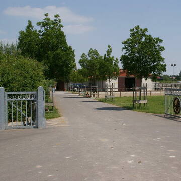
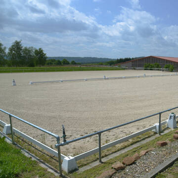
Allergiker Offenstall 1 Wallachplatz frei
Dudenhofen
Schweizer1
@Schweizer1
Freizeitstall
Vermieten
Hunde willkommen
Longierzirkel/Roundpen
Allergikerstall
Hufrehe geeignet
12 weitere...
aktuell
P+
Deprecated: Creation of dynamic property Zend_View_Helper_Ads::$adLink is deprecated in /var/www/stall-frei/htdocs/staging.stall-frei.de/library/Psf/View/Helper/Ads.php on line 108

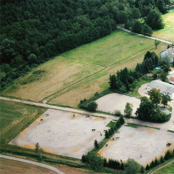
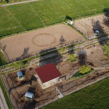
HIT Aktiv-Stall (Wallache) bei Fam. Senckenberg
Groß-Gerau
Senckenberg
@Senckenberg
Mehr Freiheit für Ihr Pferd - freie Plätze im HIT-Aktivstall
Doc O Lena Ranch
Meckenheim
Ingrid Briegel
@Ingrid Briegel
FN-Mitglied
Freizeitstall
Führanlage
Longierzirkel/Roundpen
Hengsthaltung möglich
Außenbox mit Paddock
Außenboxen
25 weitere...
P
Ganerbhof Erwin Reinhard
Haßloch
Ganerbhof
@Ganerbhof
Fahrstall, Kutschwagen
Freizeitstall
Hunde willkommen
Krankenbox
Allergikerstall
Notfallboxen
Bewegungsstall
Laufstall
15 weitere...
P


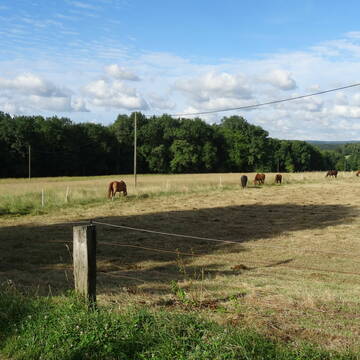

Pferdepension Engelhof
Altleiningen
Marietta-und-Markus-Nordhorn
@Marietta-und-Markus-Nordhorn
Freizeitstall
Geländestrecke
Vermieten
Verpachten
Paddock
Parkplatz für Pferdeanhänger
Gnadenbrothof
16 weitere...
aktuell
P+
Leider kein Vorschaubild
Leider kein Vorschaubild
Ranch/Offenstall/Reithalle
Steinweiler
Palatino-Ranch
@Palatino-Ranch
Freizeitstall
Pferdeausbildung
Hunde willkommen
Krankenbox
Notfallboxen
Innenbox
Laufstall
18 weitere...
B

Frisches Stroh zu verkaufen!
Mechtersen
STALL-FREIde Marketing
@STALL-FREI-Marketing
Kaufe frisches Stroh für dein Pferd!
Reitanlage Fröhnerhof
Mehlingen
Reitanlage-Froehnerhof
@Reitanlage-Froehnerhof
Gastronomie
Geländestrecke
Vermieten
Führanlage
Laufband
Hengsthaltung möglich
21 weitere...
P+

Einstellplatz Box in Hatzenbühl
Hatzenbühl
Stall-Schmitt
@Stall-Schmitt
Hunde willkommen
Parkplatz für Pferdeanhänger
Innenbox
Vollpension
6 weitere...
aktuell
P
Leider kein Vorschaubild
Leider kein Vorschaubild
2 Paddockbox und 1 Außenbox frei
Barbelroth
Theo Schönek
@TheoS
FN-Mitglied
Freizeitstall
Vermieten
Paddock
Parkplatz für Pferdeanhänger
bedampftes/gewaschenes Heu
Fohlenaufzucht möglich
15 weitere...
B
Bewegungsstall, Hufbeschlag, Sattlerei, Futteranb.
Hatzenbühl
Stall-Schmitt
@Stall-Schmitt
Fahrstall, Kutschwagen
Freizeitstall
Hunde willkommen
Reitplatz (z.B. Dressur, Springen, Reining)
Bewegungsstall
Schauer-Bewegungsstall
7 weitere...
aktuell
P
Leider kein Vorschaubild
Leider kein Vorschaubild
Pensionspferde
Hassloch
Pfalzmühle Hassloch
@Pfalzmuehle
FN-Mitglied
Geländestrecke
Vermieten
Verpachten
Hunde willkommen
Longierzirkel/Roundpen
Allergikerstall
bedampftes/gewaschenes Heu
24 weitere...
B
Newsletter abonnieren
Melde Dich für unseren Newsletter an und verpasse keine Neuigkeiten!
Deprecated: Creation of dynamic property Zend_View::$pageCount is deprecated in /var/www/stall-frei/htdocs/staging.stall-frei.de/library/vendor/shardj/zf1-future/library/Zend/View/Abstract.php on line 308
Deprecated: Creation of dynamic property Zend_View::$itemCountPerPage is deprecated in /var/www/stall-frei/htdocs/staging.stall-frei.de/library/vendor/shardj/zf1-future/library/Zend/View/Abstract.php on line 308
Deprecated: Creation of dynamic property Zend_View::$first is deprecated in /var/www/stall-frei/htdocs/staging.stall-frei.de/library/vendor/shardj/zf1-future/library/Zend/View/Abstract.php on line 308
Deprecated: Creation of dynamic property Zend_View::$current is deprecated in /var/www/stall-frei/htdocs/staging.stall-frei.de/library/vendor/shardj/zf1-future/library/Zend/View/Abstract.php on line 308
Deprecated: Creation of dynamic property Zend_View::$last is deprecated in /var/www/stall-frei/htdocs/staging.stall-frei.de/library/vendor/shardj/zf1-future/library/Zend/View/Abstract.php on line 308
Deprecated: Creation of dynamic property Zend_View::$previous is deprecated in /var/www/stall-frei/htdocs/staging.stall-frei.de/library/vendor/shardj/zf1-future/library/Zend/View/Abstract.php on line 308
Deprecated: Creation of dynamic property Zend_View::$next is deprecated in /var/www/stall-frei/htdocs/staging.stall-frei.de/library/vendor/shardj/zf1-future/library/Zend/View/Abstract.php on line 308
Deprecated: Creation of dynamic property Zend_View::$pagesInRange is deprecated in /var/www/stall-frei/htdocs/staging.stall-frei.de/library/vendor/shardj/zf1-future/library/Zend/View/Abstract.php on line 308
Deprecated: Creation of dynamic property Zend_View::$firstPageInRange is deprecated in /var/www/stall-frei/htdocs/staging.stall-frei.de/library/vendor/shardj/zf1-future/library/Zend/View/Abstract.php on line 308
Deprecated: Creation of dynamic property Zend_View::$lastPageInRange is deprecated in /var/www/stall-frei/htdocs/staging.stall-frei.de/library/vendor/shardj/zf1-future/library/Zend/View/Abstract.php on line 308
Deprecated: Creation of dynamic property Zend_View::$currentItemCount is deprecated in /var/www/stall-frei/htdocs/staging.stall-frei.de/library/vendor/shardj/zf1-future/library/Zend/View/Abstract.php on line 308
Deprecated: Creation of dynamic property Zend_View::$totalItemCount is deprecated in /var/www/stall-frei/htdocs/staging.stall-frei.de/library/vendor/shardj/zf1-future/library/Zend/View/Abstract.php on line 308
Deprecated: Creation of dynamic property Zend_View::$firstItemNumber is deprecated in /var/www/stall-frei/htdocs/staging.stall-frei.de/library/vendor/shardj/zf1-future/library/Zend/View/Abstract.php on line 308
Deprecated: Creation of dynamic property Zend_View::$lastItemNumber is deprecated in /var/www/stall-frei/htdocs/staging.stall-frei.de/library/vendor/shardj/zf1-future/library/Zend/View/Abstract.php on line 308
Deprecated: Creation of dynamic property Zend_View::$router is deprecated in /var/www/stall-frei/htdocs/staging.stall-frei.de/library/vendor/shardj/zf1-future/library/Zend/View/Abstract.php on line 308
Deprecated: Creation of dynamic property Zend_View::$urlParams is deprecated in /var/www/stall-frei/htdocs/staging.stall-frei.de/library/vendor/shardj/zf1-future/library/Zend/View/Abstract.php on line 308
Deprecated: Creation of dynamic property Zend_View::$showAds is deprecated in /var/www/stall-frei/htdocs/staging.stall-frei.de/library/vendor/shardj/zf1-future/library/Zend/View/Abstract.php on line 308
Deprecated: Creation of dynamic property Zend_View::$objectIds is deprecated in /var/www/stall-frei/htdocs/staging.stall-frei.de/library/vendor/shardj/zf1-future/library/Zend/View/Abstract.php on line 308
Deprecated: Creation of dynamic property Zend_View::$showNavbar is deprecated in /var/www/stall-frei/htdocs/staging.stall-frei.de/library/vendor/shardj/zf1-future/library/Zend/View/Abstract.php on line 308
Deprecated: Creation of dynamic property Zend_View::$showBreadcrumb is deprecated in /var/www/stall-frei/htdocs/staging.stall-frei.de/library/vendor/shardj/zf1-future/library/Zend/View/Abstract.php on line 308
Deprecated: Creation of dynamic property Zend_View::$showFooter is deprecated in /var/www/stall-frei/htdocs/staging.stall-frei.de/library/vendor/shardj/zf1-future/library/Zend/View/Abstract.php on line 308
Deprecated: Creation of dynamic property Zend_View::$showInternalAds is deprecated in /var/www/stall-frei/htdocs/staging.stall-frei.de/library/vendor/shardj/zf1-future/library/Zend/View/Abstract.php on line 308
Deprecated: Creation of dynamic property Zend_View::$blNoContent is deprecated in /var/www/stall-frei/htdocs/staging.stall-frei.de/library/vendor/shardj/zf1-future/library/Zend/View/Abstract.php on line 308
Deprecated: Creation of dynamic property Zend_View::$sMetaDesc is deprecated in /var/www/stall-frei/htdocs/staging.stall-frei.de/library/vendor/shardj/zf1-future/library/Zend/View/Abstract.php on line 308
Deprecated: Creation of dynamic property Zend_View::$useGmaps is deprecated in /var/www/stall-frei/htdocs/staging.stall-frei.de/library/vendor/shardj/zf1-future/library/Zend/View/Abstract.php on line 308
Deprecated: Creation of dynamic property Zend_View::$touches is deprecated in /var/www/stall-frei/htdocs/staging.stall-frei.de/library/vendor/shardj/zf1-future/library/Zend/View/Abstract.php on line 308
Deprecated: Creation of dynamic property Zend_View::$oProject is deprecated in /var/www/stall-frei/htdocs/staging.stall-frei.de/library/vendor/shardj/zf1-future/library/Zend/View/Abstract.php on line 308
Deprecated: Creation of dynamic property Zend_View::$pageHeadline is deprecated in /var/www/stall-frei/htdocs/staging.stall-frei.de/library/vendor/shardj/zf1-future/library/Zend/View/Abstract.php on line 308
Deprecated: Creation of dynamic property Zend_View::$disableLocationField is deprecated in /var/www/stall-frei/htdocs/staging.stall-frei.de/library/vendor/shardj/zf1-future/library/Zend/View/Abstract.php on line 308
Deprecated: Creation of dynamic property Zend_View::$isSearch is deprecated in /var/www/stall-frei/htdocs/staging.stall-frei.de/library/vendor/shardj/zf1-future/library/Zend/View/Abstract.php on line 308
Deprecated: Creation of dynamic property Zend_View::$pageTitle is deprecated in /var/www/stall-frei/htdocs/staging.stall-frei.de/library/vendor/shardj/zf1-future/library/Zend/View/Abstract.php on line 308
Deprecated: Creation of dynamic property Psf_Form_Element_Text::$class is deprecated in /var/www/stall-frei/htdocs/staging.stall-frei.de/library/vendor/shardj/zf1-future/library/Zend/Form/Element.php on line 874
Deprecated: Creation of dynamic property Psf_Form_Element_Text::$size is deprecated in /var/www/stall-frei/htdocs/staging.stall-frei.de/library/vendor/shardj/zf1-future/library/Zend/Form/Element.php on line 874
Deprecated: Creation of dynamic property Psf_Form_Element_Text::$placeholder is deprecated in /var/www/stall-frei/htdocs/staging.stall-frei.de/library/vendor/shardj/zf1-future/library/Zend/Form/Element.php on line 874
Deprecated: Creation of dynamic property Psf_Form_Element_Hidden::$class is deprecated in /var/www/stall-frei/htdocs/staging.stall-frei.de/library/vendor/shardj/zf1-future/library/Zend/Form/Element.php on line 874
Deprecated: Creation of dynamic property Psf_Form_Element_Hidden::$class is deprecated in /var/www/stall-frei/htdocs/staging.stall-frei.de/library/vendor/shardj/zf1-future/library/Zend/Form/Element.php on line 874
Deprecated: Creation of dynamic property Psf_Form_Element_Hidden::$class is deprecated in /var/www/stall-frei/htdocs/staging.stall-frei.de/library/vendor/shardj/zf1-future/library/Zend/Form/Element.php on line 874
Deprecated: Creation of dynamic property Psf_Form_Element_Hidden::$class is deprecated in /var/www/stall-frei/htdocs/staging.stall-frei.de/library/vendor/shardj/zf1-future/library/Zend/Form/Element.php on line 874
Deprecated: Creation of dynamic property Psf_Form_Element_Select::$class is deprecated in /var/www/stall-frei/htdocs/staging.stall-frei.de/library/vendor/shardj/zf1-future/library/Zend/Form/Element.php on line 874
Deprecated: Creation of dynamic property Psf_Form_Element_Select::$class is deprecated in /var/www/stall-frei/htdocs/staging.stall-frei.de/library/vendor/shardj/zf1-future/library/Zend/Form/Element.php on line 874
Deprecated: Creation of dynamic property Psf_Form_Element_Select::$class is deprecated in /var/www/stall-frei/htdocs/staging.stall-frei.de/library/vendor/shardj/zf1-future/library/Zend/Form/Element.php on line 874
Deprecated: Creation of dynamic property Psf_Form_Element_Select::$class is deprecated in /var/www/stall-frei/htdocs/staging.stall-frei.de/library/vendor/shardj/zf1-future/library/Zend/Form/Element.php on line 874
Deprecated: Creation of dynamic property Psf_Form_Element_Text::$class is deprecated in /var/www/stall-frei/htdocs/staging.stall-frei.de/library/vendor/shardj/zf1-future/library/Zend/Form/Element.php on line 874
Deprecated: Creation of dynamic property Psf_Form_Element_Checkbox::$label is deprecated in /var/www/stall-frei/htdocs/staging.stall-frei.de/library/vendor/shardj/zf1-future/library/Zend/Form/Element.php on line 874
Deprecated: Creation of dynamic property Zend_View::$sort is deprecated in /var/www/stall-frei/htdocs/staging.stall-frei.de/library/vendor/shardj/zf1-future/library/Zend/View/Abstract.php on line 308
Deprecated: Creation of dynamic property Zend_View::$searchLocation is deprecated in /var/www/stall-frei/htdocs/staging.stall-frei.de/library/vendor/shardj/zf1-future/library/Zend/View/Abstract.php on line 308
Deprecated: Creation of dynamic property Zend_View::$locationHint is deprecated in /var/www/stall-frei/htdocs/staging.stall-frei.de/library/vendor/shardj/zf1-future/library/Zend/View/Abstract.php on line 308
Psf_GeoCoder_Abstract::getLocation: Ramberg Get Location CachedOrLive
Psf_GeoCoder_Abstract::getCachedOrLive: Ramberg
Psf_GeoCoder_Abstract::convertLocationResult
{"documentation":"https:\/\/opencagedata.com\/api","licenses":[{"name":"see attribution guide","url":"https:\/\/opencagedata.com\/credits"}],"results":[{"bounds":{"northeast":{"lat":49.2838282,"lng":8.0447759},"southwest":{"lat":49.2517262,"lng":7.9843722}},"components":{"ISO_3166-1_alpha-2":"DE","ISO_3166-1_alpha-3":"DEU","ISO_3166-2":["DE-RP"],"_category":"place","_normalized_city":"Ramberg","_type":"village","continent":"Europe","country":"Deutschland","country_code":"de","county":"Landkreis S\u00fcdliche Weinstra\u00dfe","municipality":"Annweiler am Trifels","political_union":"European Union","state":"Rheinland-Pfalz","state_code":"RP","village":"Ramberg"},"confidence":7,"formatted":"Ramberg, Rheinland-Pfalz, Deutschland","geometry":{"lat":49.2606966,"lng":8.0083015}},{"bounds":{"northeast":{"lat":48.7165775,"lng":10.735015},"southwest":{"lat":48.7164775,"lng":10.734915}},"components":{"ISO_3166-1_alpha-2":"DE","ISO_3166-1_alpha-3":"DEU","ISO_3166-2":["DE-BY"],"_category":"natural\/water","_normalized_city":"Donauw\u00f6rth","_type":"peak","continent":"Europe","country":"Deutschland","country_code":"de","county":"Landkreis Donau-Ries","peak":"Ramberg","political_union":"European Union","postcode":"86609","state":"Bayern","state_code":"BY","town":"Donauw\u00f6rth"},"confidence":9,"formatted":"Ramberg, 86609 Donauw\u00f6rth, Deutschland","geometry":{"lat":48.7165275,"lng":10.734965}},{"bounds":{"northeast":{"lat":49.35636,"lng":12.2888266},"southwest":{"lat":49.35626,"lng":12.2887266}},"components":{"ISO_3166-1_alpha-2":"DE","ISO_3166-1_alpha-3":"DEU","ISO_3166-2":["DE-BY"],"_category":"natural\/water","_normalized_city":"Neunburg vorm Wald","_type":"peak","continent":"Europe","country":"Deutschland","country_code":"de","county":"Landkreis Schwandorf","peak":"Ramberg","political_union":"European Union","state":"Bayern","state_code":"BY","town":"Neunburg vorm Wald"},"confidence":9,"formatted":"Ramberg, Neunburg vorm Wald, Bayern, Deutschland","geometry":{"lat":49.35631,"lng":12.2887766}},{"bounds":{"northeast":{"lat":51.2932986,"lng":8.0875926},"southwest":{"lat":51.2931986,"lng":8.0874926}},"components":{"ISO_3166-1_alpha-2":"DE","ISO_3166-1_alpha-3":"DEU","ISO_3166-2":["DE-NW"],"_category":"natural\/water","_normalized_city":"Sundern","_type":"peak","continent":"Europe","country":"Deutschland","country_code":"de","county":"Hochsauerlandkreis","peak":"Ramberg","political_union":"European Union","state":"Nordrhein-Westfalen","state_code":"NW","town":"Sundern"},"confidence":9,"formatted":"Ramberg, Sundern, Nordrhein-Westfalen, Deutschland","geometry":{"lat":51.2932486,"lng":8.0875426}},{"bounds":{"northeast":{"lat":47.8334805,"lng":12.6180997},"southwest":{"lat":47.7934805,"lng":12.5780997}},"components":{"ISO_3166-1_alpha-2":"DE","ISO_3166-1_alpha-3":"DEU","ISO_3166-2":["DE-BY"],"_category":"place","_normalized_city":"Bergen","_type":"hamlet","city":"Bergen","continent":"Europe","country":"Deutschland","country_code":"de","county":"Landkreis Traunstein","hamlet":"Ramberg","municipality":"Bergen (VGem)","political_union":"European Union","postcode":"83346","state":"Bayern","state_code":"BY"},"confidence":7,"formatted":"Ramberg, 83346 Bergen, Deutschland","geometry":{"lat":47.8134805,"lng":12.5980997}},{"components":{"ISO_3166-1_alpha-2":"FR","ISO_3166-1_alpha-3":"FRA","ISO_3166-2":["FR-PAC","FR-13"],"_category":"road","_normalized_city":"Gardanne","_type":"road","city":"Gardanne","continent":"Europe","country":"France","country_code":"fr","county":"Bouches-du-Rh\u00f4ne","local_authority":"Aix-Marseille-Provence","political_union":"European Union","postcode":"13120","road":"Chemin de Rambert","state":"Provence-Alpes-C\u00f4te d'Azur","state_code":"PAC"},"confidence":3,"formatted":"Chemin de Rambert, 13120 Gardanne, France","geometry":{"lat":43.480678,"lng":5.471453}},{"components":{"ISO_3166-1_alpha-2":"FR","ISO_3166-1_alpha-3":"FRA","ISO_3166-2":["FR-PAC","FR-13"],"_category":"road","_normalized_city":"Meyreuil","_type":"road","city":"Meyreuil","continent":"Europe","country":"France","country_code":"fr","county":"Bouches-du-Rh\u00f4ne","local_authority":"Aix-Marseille-Provence","political_union":"European Union","postcode":"13590","road":"Chemin de Rambert","state":"Provence-Alpes-C\u00f4te d'Azur","state_code":"PAC"},"confidence":3,"formatted":"Chemin de Rambert, 13590 Meyreuil, France","geometry":{"lat":43.482771,"lng":5.487765}},{"components":{"ISO_3166-1_alpha-2":"FR","ISO_3166-1_alpha-3":"FRA","ISO_3166-2":["FR-ARA","FR-43"],"_category":"road","_normalized_city":"Saint-Just-Malmont","_type":"road","city":"Saint-Just-Malmont","continent":"Europe","country":"France","country_code":"fr","county":"Haute-Loire","local_authority":"Communaut\u00e9 de communes Loire et Sem\u00e8ne","political_union":"European Union","postcode":"43240","road":"Chemin de Rambert","state":"Auvergne-Rh\u00f4ne-Alpes","state_code":"ARA"},"confidence":3,"formatted":"Chemin de Rambert, 43240 Saint-Just-Malmont, France","geometry":{"lat":45.327456,"lng":4.331907}},{"components":{"ISO_3166-1_alpha-2":"FR","ISO_3166-1_alpha-3":"FRA","ISO_3166-2":["FR-ARA","FR-63"],"_category":"road","_normalized_city":"Saint-Amant-Roche-Savine","_type":"road","city":"Saint-Amant-Roche-Savine","continent":"Europe","country":"France","country_code":"fr","county":"Puy-de-D\u00f4me","local_authority":"Communaut\u00e9 de communes Ambert Livradois Forez","political_union":"European Union","postcode":"63890","road":"Chemin de Rambert","state":"Auvergne-Rh\u00f4ne-Alpes","state_code":"ARA"},"confidence":3,"formatted":"Chemin de Rambert, 63890 Saint-Amant-Roche-Savine, France","geometry":{"lat":45.58377,"lng":3.612965}},{"components":{"ISO_3166-1_alpha-2":"FR","ISO_3166-1_alpha-3":"FRA","ISO_3166-2":["FR-OCC","FR-12"],"_category":"road","_normalized_city":"Montlaur","_type":"road","city":"Montlaur","continent":"Europe","country":"France","country_code":"fr","county":"Aveyron","local_authority":"Communaut\u00e9 de communes Monts, Rance et Rougier","political_union":"European Union","postcode":"12400","road":"Chemin de Rambert","state":"Occitanie","state_code":"OCC"},"confidence":3,"formatted":"Chemin de Rambert, 12400 Montlaur, France","geometry":{"lat":43.870673,"lng":2.806703}}],"status":{"code":200,"message":"OK"},"stay_informed":{"blog":"https:\/\/blog.opencagedata.com","mastodon":"https:\/\/en.osm.town\/@opencage"},"thanks":"For using an OpenCage API","timestamp":{"created_http":"Sun, 08 Feb 2026 02:58:09 GMT","created_unix":1770519489},"total_results":10}Array
(
[0] => stdClass Object
(
[bounds] => stdClass Object
(
[northeast] => stdClass Object
(
[lat] => 49.2838282
[lng] => 8.0447759
)
[southwest] => stdClass Object
(
[lat] => 49.2517262
[lng] => 7.9843722
)
)
[components] => stdClass Object
(
[ISO_3166-1_alpha-2] => DE
[ISO_3166-1_alpha-3] => DEU
[ISO_3166-2] => Array
(
[0] => DE-RP
)
[_category] => place
[_normalized_city] => Ramberg
[_type] => village
[continent] => Europe
[country] => Deutschland
[country_code] => de
[county] => Landkreis Südliche Weinstraße
[municipality] => Annweiler am Trifels
[political_union] => European Union
[state] => Rheinland-Pfalz
[state_code] => RP
[village] => Ramberg
)
[confidence] => 7
[formatted] => Ramberg, Rheinland-Pfalz, Deutschland
[geometry] => stdClass Object
(
[lat] => 49.2606966
[lng] => 8.0083015
)
)
[1] => stdClass Object
(
[bounds] => stdClass Object
(
[northeast] => stdClass Object
(
[lat] => 48.7165775
[lng] => 10.735015
)
[southwest] => stdClass Object
(
[lat] => 48.7164775
[lng] => 10.734915
)
)
[components] => stdClass Object
(
[ISO_3166-1_alpha-2] => DE
[ISO_3166-1_alpha-3] => DEU
[ISO_3166-2] => Array
(
[0] => DE-BY
)
[_category] => natural/water
[_normalized_city] => Donauwörth
[_type] => peak
[continent] => Europe
[country] => Deutschland
[country_code] => de
[county] => Landkreis Donau-Ries
[peak] => Ramberg
[political_union] => European Union
[postcode] => 86609
[state] => Bayern
[state_code] => BY
[town] => Donauwörth
)
[confidence] => 9
[formatted] => Ramberg, 86609 Donauwörth, Deutschland
[geometry] => stdClass Object
(
[lat] => 48.7165275
[lng] => 10.734965
)
)
[2] => stdClass Object
(
[bounds] => stdClass Object
(
[northeast] => stdClass Object
(
[lat] => 49.35636
[lng] => 12.2888266
)
[southwest] => stdClass Object
(
[lat] => 49.35626
[lng] => 12.2887266
)
)
[components] => stdClass Object
(
[ISO_3166-1_alpha-2] => DE
[ISO_3166-1_alpha-3] => DEU
[ISO_3166-2] => Array
(
[0] => DE-BY
)
[_category] => natural/water
[_normalized_city] => Neunburg vorm Wald
[_type] => peak
[continent] => Europe
[country] => Deutschland
[country_code] => de
[county] => Landkreis Schwandorf
[peak] => Ramberg
[political_union] => European Union
[state] => Bayern
[state_code] => BY
[town] => Neunburg vorm Wald
)
[confidence] => 9
[formatted] => Ramberg, Neunburg vorm Wald, Bayern, Deutschland
[geometry] => stdClass Object
(
[lat] => 49.35631
[lng] => 12.2887766
)
)
[3] => stdClass Object
(
[bounds] => stdClass Object
(
[northeast] => stdClass Object
(
[lat] => 51.2932986
[lng] => 8.0875926
)
[southwest] => stdClass Object
(
[lat] => 51.2931986
[lng] => 8.0874926
)
)
[components] => stdClass Object
(
[ISO_3166-1_alpha-2] => DE
[ISO_3166-1_alpha-3] => DEU
[ISO_3166-2] => Array
(
[0] => DE-NW
)
[_category] => natural/water
[_normalized_city] => Sundern
[_type] => peak
[continent] => Europe
[country] => Deutschland
[country_code] => de
[county] => Hochsauerlandkreis
[peak] => Ramberg
[political_union] => European Union
[state] => Nordrhein-Westfalen
[state_code] => NW
[town] => Sundern
)
[confidence] => 9
[formatted] => Ramberg, Sundern, Nordrhein-Westfalen, Deutschland
[geometry] => stdClass Object
(
[lat] => 51.2932486
[lng] => 8.0875426
)
)
[4] => stdClass Object
(
[bounds] => stdClass Object
(
[northeast] => stdClass Object
(
[lat] => 47.8334805
[lng] => 12.6180997
)
[southwest] => stdClass Object
(
[lat] => 47.7934805
[lng] => 12.5780997
)
)
[components] => stdClass Object
(
[ISO_3166-1_alpha-2] => DE
[ISO_3166-1_alpha-3] => DEU
[ISO_3166-2] => Array
(
[0] => DE-BY
)
[_category] => place
[_normalized_city] => Bergen
[_type] => hamlet
[city] => Bergen
[continent] => Europe
[country] => Deutschland
[country_code] => de
[county] => Landkreis Traunstein
[hamlet] => Ramberg
[municipality] => Bergen (VGem)
[political_union] => European Union
[postcode] => 83346
[state] => Bayern
[state_code] => BY
)
[confidence] => 7
[formatted] => Ramberg, 83346 Bergen, Deutschland
[geometry] => stdClass Object
(
[lat] => 47.8134805
[lng] => 12.5980997
)
)
[5] => stdClass Object
(
[components] => stdClass Object
(
[ISO_3166-1_alpha-2] => FR
[ISO_3166-1_alpha-3] => FRA
[ISO_3166-2] => Array
(
[0] => FR-PAC
[1] => FR-13
)
[_category] => road
[_normalized_city] => Gardanne
[_type] => road
[city] => Gardanne
[continent] => Europe
[country] => France
[country_code] => fr
[county] => Bouches-du-Rhône
[local_authority] => Aix-Marseille-Provence
[political_union] => European Union
[postcode] => 13120
[road] => Chemin de Rambert
[state] => Provence-Alpes-Côte d'Azur
[state_code] => PAC
)
[confidence] => 3
[formatted] => Chemin de Rambert, 13120 Gardanne, France
[geometry] => stdClass Object
(
[lat] => 43.480678
[lng] => 5.471453
)
)
[6] => stdClass Object
(
[components] => stdClass Object
(
[ISO_3166-1_alpha-2] => FR
[ISO_3166-1_alpha-3] => FRA
[ISO_3166-2] => Array
(
[0] => FR-PAC
[1] => FR-13
)
[_category] => road
[_normalized_city] => Meyreuil
[_type] => road
[city] => Meyreuil
[continent] => Europe
[country] => France
[country_code] => fr
[county] => Bouches-du-Rhône
[local_authority] => Aix-Marseille-Provence
[political_union] => European Union
[postcode] => 13590
[road] => Chemin de Rambert
[state] => Provence-Alpes-Côte d'Azur
[state_code] => PAC
)
[confidence] => 3
[formatted] => Chemin de Rambert, 13590 Meyreuil, France
[geometry] => stdClass Object
(
[lat] => 43.482771
[lng] => 5.487765
)
)
[7] => stdClass Object
(
[components] => stdClass Object
(
[ISO_3166-1_alpha-2] => FR
[ISO_3166-1_alpha-3] => FRA
[ISO_3166-2] => Array
(
[0] => FR-ARA
[1] => FR-43
)
[_category] => road
[_normalized_city] => Saint-Just-Malmont
[_type] => road
[city] => Saint-Just-Malmont
[continent] => Europe
[country] => France
[country_code] => fr
[county] => Haute-Loire
[local_authority] => Communauté de communes Loire et Semène
[political_union] => European Union
[postcode] => 43240
[road] => Chemin de Rambert
[state] => Auvergne-Rhône-Alpes
[state_code] => ARA
)
[confidence] => 3
[formatted] => Chemin de Rambert, 43240 Saint-Just-Malmont, France
[geometry] => stdClass Object
(
[lat] => 45.327456
[lng] => 4.331907
)
)
[8] => stdClass Object
(
[components] => stdClass Object
(
[ISO_3166-1_alpha-2] => FR
[ISO_3166-1_alpha-3] => FRA
[ISO_3166-2] => Array
(
[0] => FR-ARA
[1] => FR-63
)
[_category] => road
[_normalized_city] => Saint-Amant-Roche-Savine
[_type] => road
[city] => Saint-Amant-Roche-Savine
[continent] => Europe
[country] => France
[country_code] => fr
[county] => Puy-de-Dôme
[local_authority] => Communauté de communes Ambert Livradois Forez
[political_union] => European Union
[postcode] => 63890
[road] => Chemin de Rambert
[state] => Auvergne-Rhône-Alpes
[state_code] => ARA
)
[confidence] => 3
[formatted] => Chemin de Rambert, 63890 Saint-Amant-Roche-Savine, France
[geometry] => stdClass Object
(
[lat] => 45.58377
[lng] => 3.612965
)
)
[9] => stdClass Object
(
[components] => stdClass Object
(
[ISO_3166-1_alpha-2] => FR
[ISO_3166-1_alpha-3] => FRA
[ISO_3166-2] => Array
(
[0] => FR-OCC
[1] => FR-12
)
[_category] => road
[_normalized_city] => Montlaur
[_type] => road
[city] => Montlaur
[continent] => Europe
[country] => France
[country_code] => fr
[county] => Aveyron
[local_authority] => Communauté de communes Monts, Rance et Rougier
[political_union] => European Union
[postcode] => 12400
[road] => Chemin de Rambert
[state] => Occitanie
[state_code] => OCC
)
[confidence] => 3
[formatted] => Chemin de Rambert, 12400 Montlaur, France
[geometry] => stdClass Object
(
[lat] => 43.870673
[lng] => 2.806703
)
)
)
Psf_GeoCoder_OpenCageData::getKeyMap: 0
stdClass Object
(
    [bounds] => stdClass Object
        (
            [northeast] => stdClass Object
                (
                    [lat] => 49.2838282
                    [lng] => 8.0447759
                )

            [southwest] => stdClass Object
                (
                    [lat] => 49.2517262
                    [lng] => 7.9843722
                )

        )

    [components] => stdClass Object
        (
            [ISO_3166-1_alpha-2] => DE
            [ISO_3166-1_alpha-3] => DEU
            [ISO_3166-2] => Array
                (
                    [0] => DE-RP
                )

            [_category] => place
            [_normalized_city] => Ramberg
            [_type] => village
            [continent] => Europe
            [country] => Deutschland
            [country_code] => de
            [county] => Landkreis Südliche Weinstraße
            [municipality] => Annweiler am Trifels
            [political_union] => European Union
            [state] => Rheinland-Pfalz
            [state_code] => RP
            [village] => Ramberg
        )

    [confidence] => 7
    [formatted] => Ramberg, Rheinland-Pfalz, Deutschland
    [geometry] => stdClass Object
        (
            [lat] => 49.2606966
            [lng] => 8.0083015
        )

)
Psf_GeoCoder_OpenCageData::getCounty: Südliche Weinstraße
Psf_GeoCoder_OpenCageData::addMissingData REFETCH!
Array
(
    [address] => Ramberg, Rheinland-Pfalz, Deutschland
    [type] => village
    [street] =>
    [city] => Ramberg
    [county] => Südliche Weinstraße
    [state] => Rheinland-Pfalz
    [zip] =>
    [country] => Deutschland
    [suburb] =>
    [countrycode] => de
    [latitude] => 49.2606966
    [longitude] => 8.0083015
    [accuracy] => 1
    [confidence] => 7
    [bounds] => stdClass Object
        (
            [northeast] => stdClass Object
                (
                    [lat] => 49.2838282
                    [lng] => 8.0447759
                )

            [southwest] => stdClass Object
                (
                    [lat] => 49.2517262
                    [lng] => 7.9843722
                )

        )

)
reformat!
Array
(
    [address] => Ramberg, Rheinland-Pfalz, Deutschland
    [type] => village
    [street] =>
    [city] => Ramberg
    [county] => Südliche Weinstraße
    [state] => Rheinland-Pfalz
    [zip] =>
    [country] => Deutschland
    [suburb] =>
    [countrycode] => de
    [latitude] => 49.2606966
    [longitude] => 8.0083015
    [accuracy] => 1
    [confidence] => 7
    [bounds] => stdClass Object
        (
            [northeast] => stdClass Object
                (
                    [lat] => 49.2838282
                    [lng] => 8.0447759
                )

            [southwest] => stdClass Object
                (
                    [lat] => 49.2517262
                    [lng] => 7.9843722
                )

        )

    [place] => Ramberg, Rheinland-Pfalz
    [hash] => c4a58fdb0a634e9e7bec10233e10da97
)
Psf_GeoCoder_OpenCageData::getKeyMap: 1
stdClass Object
(
    [bounds] => stdClass Object
        (
            [northeast] => stdClass Object
                (
                    [lat] => 48.7165775
                    [lng] => 10.735015
                )

            [southwest] => stdClass Object
                (
                    [lat] => 48.7164775
                    [lng] => 10.734915
                )

        )

    [components] => stdClass Object
        (
            [ISO_3166-1_alpha-2] => DE
            [ISO_3166-1_alpha-3] => DEU
            [ISO_3166-2] => Array
                (
                    [0] => DE-BY
                )

            [_category] => natural/water
            [_normalized_city] => Donauwörth
            [_type] => peak
            [continent] => Europe
            [country] => Deutschland
            [country_code] => de
            [county] => Landkreis Donau-Ries
            [peak] => Ramberg
            [political_union] => European Union
            [postcode] => 86609
            [state] => Bayern
            [state_code] => BY
            [town] => Donauwörth
        )

    [confidence] => 9
    [formatted] => Ramberg, 86609 Donauwörth, Deutschland
    [geometry] => stdClass Object
        (
            [lat] => 48.7165275
            [lng] => 10.734965
        )

)
Psf_GeoCoder_OpenCageData::getCounty: Donau-Ries
Psf_GeoCoder_OpenCageData::addMissingData REFETCH!
Array
(
    [address] => Ramberg, 86609 Donauwörth, Deutschland
    [type] => peak
    [street] =>
    [city] => Donauwörth
    [county] => Donau-Ries
    [state] => Bayern
    [zip] => 86609
    [country] => Deutschland
    [suburb] =>
    [countrycode] => de
    [latitude] => 48.7165275
    [longitude] => 10.734965
    [accuracy] => 1
    [confidence] => 9
    [bounds] => stdClass Object
        (
            [northeast] => stdClass Object
                (
                    [lat] => 48.7165775
                    [lng] => 10.735015
                )

            [southwest] => stdClass Object
                (
                    [lat] => 48.7164775
                    [lng] => 10.734915
                )

        )

)
reformat!
Array
(
    [address] => Ramberg, 86609 Donauwörth, Deutschland
    [type] => peak
    [street] =>
    [city] => Donauwörth
    [county] => Donau-Ries
    [state] => Bayern
    [zip] => 86609
    [country] => Deutschland
    [suburb] =>
    [countrycode] => de
    [latitude] => 48.7165275
    [longitude] => 10.734965
    [accuracy] => 1
    [confidence] => 9
    [bounds] => stdClass Object
        (
            [northeast] => stdClass Object
                (
                    [lat] => 48.7165775
                    [lng] => 10.735015
                )

            [southwest] => stdClass Object
                (
                    [lat] => 48.7164775
                    [lng] => 10.734915
                )

        )

    [place] => 86609 Donauwörth, Bayern
    [hash] => 74bbdf888eeece7b987fa10b4574dcfb
)
Psf_GeoCoder_OpenCageData::getKeyMap: 2
stdClass Object
(
    [bounds] => stdClass Object
        (
            [northeast] => stdClass Object
                (
                    [lat] => 49.35636
                    [lng] => 12.2888266
                )

            [southwest] => stdClass Object
                (
                    [lat] => 49.35626
                    [lng] => 12.2887266
                )

        )

    [components] => stdClass Object
        (
            [ISO_3166-1_alpha-2] => DE
            [ISO_3166-1_alpha-3] => DEU
            [ISO_3166-2] => Array
                (
                    [0] => DE-BY
                )

            [_category] => natural/water
            [_normalized_city] => Neunburg vorm Wald
            [_type] => peak
            [continent] => Europe
            [country] => Deutschland
            [country_code] => de
            [county] => Landkreis Schwandorf
            [peak] => Ramberg
            [political_union] => European Union
            [state] => Bayern
            [state_code] => BY
            [town] => Neunburg vorm Wald
        )

    [confidence] => 9
    [formatted] => Ramberg, Neunburg vorm Wald, Bayern, Deutschland
    [geometry] => stdClass Object
        (
            [lat] => 49.35631
            [lng] => 12.2887766
        )

)
Psf_GeoCoder_OpenCageData::getCounty: Schwandorf
Psf_GeoCoder_OpenCageData::addMissingData REFETCH!
Array
(
    [address] => Ramberg, Neunburg vorm Wald, Bayern, Deutschland
    [type] => peak
    [street] =>
    [city] => Neunburg vorm Wald
    [county] => Schwandorf
    [state] => Bayern
    [zip] =>
    [country] => Deutschland
    [suburb] =>
    [countrycode] => de
    [latitude] => 49.35631
    [longitude] => 12.2887766
    [accuracy] => 1
    [confidence] => 9
    [bounds] => stdClass Object
        (
            [northeast] => stdClass Object
                (
                    [lat] => 49.35636
                    [lng] => 12.2888266
                )

            [southwest] => stdClass Object
                (
                    [lat] => 49.35626
                    [lng] => 12.2887266
                )

        )

)
reformat!
Array
(
    [address] => Ramberg, Neunburg vorm Wald, Bayern, Deutschland
    [type] => peak
    [street] =>
    [city] => Neunburg vorm Wald
    [county] => Schwandorf
    [state] => Bayern
    [zip] =>
    [country] => Deutschland
    [suburb] =>
    [countrycode] => de
    [latitude] => 49.35631
    [longitude] => 12.2887766
    [accuracy] => 1
    [confidence] => 9
    [bounds] => stdClass Object
        (
            [northeast] => stdClass Object
                (
                    [lat] => 49.35636
                    [lng] => 12.2888266
                )

            [southwest] => stdClass Object
                (
                    [lat] => 49.35626
                    [lng] => 12.2887266
                )

        )

    [place] => Neunburg vorm Wald, Bayern
    [hash] => 5d9d6852fc3edafc2575b086731da7ae
)
Psf_GeoCoder_OpenCageData::getKeyMap: 3
stdClass Object
(
    [bounds] => stdClass Object
        (
            [northeast] => stdClass Object
                (
                    [lat] => 51.2932986
                    [lng] => 8.0875926
                )

            [southwest] => stdClass Object
                (
                    [lat] => 51.2931986
                    [lng] => 8.0874926
                )

        )

    [components] => stdClass Object
        (
            [ISO_3166-1_alpha-2] => DE
            [ISO_3166-1_alpha-3] => DEU
            [ISO_3166-2] => Array
                (
                    [0] => DE-NW
                )

            [_category] => natural/water
            [_normalized_city] => Sundern
            [_type] => peak
            [continent] => Europe
            [country] => Deutschland
            [country_code] => de
            [county] => Hochsauerlandkreis
            [peak] => Ramberg
            [political_union] => European Union
            [state] => Nordrhein-Westfalen
            [state_code] => NW
            [town] => Sundern
        )

    [confidence] => 9
    [formatted] => Ramberg, Sundern, Nordrhein-Westfalen, Deutschland
    [geometry] => stdClass Object
        (
            [lat] => 51.2932486
            [lng] => 8.0875426
        )

)
Psf_GeoCoder_OpenCageData::getCounty: Hochsauerlandkreis
Psf_GeoCoder_OpenCageData::addMissingData REFETCH!
Array
(
    [address] => Ramberg, Sundern, Nordrhein-Westfalen, Deutschland
    [type] => peak
    [street] =>
    [city] => Sundern
    [county] => Hochsauerlandkreis
    [state] => Nordrhein-Westfalen
    [zip] =>
    [country] => Deutschland
    [suburb] =>
    [countrycode] => de
    [latitude] => 51.2932486
    [longitude] => 8.0875426
    [accuracy] => 1
    [confidence] => 9
    [bounds] => stdClass Object
        (
            [northeast] => stdClass Object
                (
                    [lat] => 51.2932986
                    [lng] => 8.0875926
                )

            [southwest] => stdClass Object
                (
                    [lat] => 51.2931986
                    [lng] => 8.0874926
                )

        )

)
reformat!
Array
(
    [address] => Ramberg, Sundern, Nordrhein-Westfalen, Deutschland
    [type] => peak
    [street] =>
    [city] => Sundern
    [county] => Hochsauerlandkreis
    [state] => Nordrhein-Westfalen
    [zip] =>
    [country] => Deutschland
    [suburb] =>
    [countrycode] => de
    [latitude] => 51.2932486
    [longitude] => 8.0875426
    [accuracy] => 1
    [confidence] => 9
    [bounds] => stdClass Object
        (
            [northeast] => stdClass Object
                (
                    [lat] => 51.2932986
                    [lng] => 8.0875926
                )

            [southwest] => stdClass Object
                (
                    [lat] => 51.2931986
                    [lng] => 8.0874926
                )

        )

    [place] => Sundern, Nordrhein-Westfalen
    [hash] => b56e711c8bf18547bf9b8fee07b4331e
)
Psf_GeoCoder_OpenCageData::getKeyMap: 4
stdClass Object
(
    [bounds] => stdClass Object
        (
            [northeast] => stdClass Object
                (
                    [lat] => 47.8334805
                    [lng] => 12.6180997
                )

            [southwest] => stdClass Object
                (
                    [lat] => 47.7934805
                    [lng] => 12.5780997
                )

        )

    [components] => stdClass Object
        (
            [ISO_3166-1_alpha-2] => DE
            [ISO_3166-1_alpha-3] => DEU
            [ISO_3166-2] => Array
                (
                    [0] => DE-BY
                )

            [_category] => place
            [_normalized_city] => Bergen
            [_type] => hamlet
            [city] => Bergen
            [continent] => Europe
            [country] => Deutschland
            [country_code] => de
            [county] => Landkreis Traunstein
            [hamlet] => Ramberg
            [municipality] => Bergen (VGem)
            [political_union] => European Union
            [postcode] => 83346
            [state] => Bayern
            [state_code] => BY
        )

    [confidence] => 7
    [formatted] => Ramberg, 83346 Bergen, Deutschland
    [geometry] => stdClass Object
        (
            [lat] => 47.8134805
            [lng] => 12.5980997
        )

)
Psf_GeoCoder_OpenCageData::getCounty: Traunstein
Psf_GeoCoder_OpenCageData::addMissingData REFETCH!
Array
(
    [address] => Ramberg, 83346 Bergen, Deutschland
    [type] => hamlet
    [street] => Ramberg
    [city] => Bergen
    [county] => Traunstein
    [state] => Bayern
    [zip] => 83346
    [country] => Deutschland
    [suburb] =>
    [countrycode] => de
    [latitude] => 47.8134805
    [longitude] => 12.5980997
    [accuracy] => 1
    [confidence] => 7
    [bounds] => stdClass Object
        (
            [northeast] => stdClass Object
                (
                    [lat] => 47.8334805
                    [lng] => 12.6180997
                )

            [southwest] => stdClass Object
                (
                    [lat] => 47.7934805
                    [lng] => 12.5780997
                )

        )

)
reformat!
Array
(
    [address] => Ramberg, 83346 Bergen, Deutschland
    [type] => hamlet
    [street] => Ramberg
    [city] => Bergen
    [county] => Traunstein
    [state] => Bayern
    [zip] => 83346
    [country] => Deutschland
    [suburb] =>
    [countrycode] => de
    [latitude] => 47.8134805
    [longitude] => 12.5980997
    [accuracy] => 1
    [confidence] => 7
    [bounds] => stdClass Object
        (
            [northeast] => stdClass Object
                (
                    [lat] => 47.8334805
                    [lng] => 12.6180997
                )

            [southwest] => stdClass Object
                (
                    [lat] => 47.7934805
                    [lng] => 12.5780997
                )

        )

    [place] => Ramberg, 83346 Bergen, Bayern
    [hash] => 174900e9810c4c4a312963719d1b0077
)
Psf_GeoCoder_OpenCageData::getKeyMap: 5
stdClass Object
(
    [components] => stdClass Object
        (
            [ISO_3166-1_alpha-2] => FR
            [ISO_3166-1_alpha-3] => FRA
            [ISO_3166-2] => Array
                (
                    [0] => FR-PAC
                    [1] => FR-13
                )

            [_category] => road
            [_normalized_city] => Gardanne
            [_type] => road
            [city] => Gardanne
            [continent] => Europe
            [country] => France
            [country_code] => fr
            [county] => Bouches-du-Rhône
            [local_authority] => Aix-Marseille-Provence
            [political_union] => European Union
            [postcode] => 13120
            [road] => Chemin de Rambert
            [state] => Provence-Alpes-Côte d'Azur
            [state_code] => PAC
        )

    [confidence] => 3
    [formatted] => Chemin de Rambert, 13120 Gardanne, France
    [geometry] => stdClass Object
        (
            [lat] => 43.480678
            [lng] => 5.471453
        )

)
Psf_GeoCoder_OpenCageData::getCounty: Bouches-du-Rhône
Psf_GeoCoder_OpenCageData::addMissingData REFETCH!
Array
(
    [address] => Chemin de Rambert, 13120 Gardanne, France
    [type] => road
    [street] => Chemin de Rambert
    [city] => Gardanne
    [county] => Bouches-du-Rhône
    [state] => Provence-Alpes-Côte d'Azur
    [zip] => 13120
    [country] => France
    [suburb] =>
    [countrycode] => fr
    [latitude] => 43.480678
    [longitude] => 5.471453
    [accuracy] => 1
    [confidence] => 3
    [bounds] =>
)
reformat!
Array
(
    [address] => Chemin de Rambert, 13120 Gardanne, France
    [type] => road
    [street] => Chemin de Rambert
    [city] => Gardanne
    [county] => Bouches-du-Rhône
    [state] => Provence-Alpes-Côte d'Azur
    [zip] => 13120
    [country] => France
    [suburb] =>
    [countrycode] => fr
    [latitude] => 43.480678
    [longitude] => 5.471453
    [accuracy] => 1
    [confidence] => 3
    [bounds] =>
    [place] => Chemin de Rambert, 13120 Gardanne, Provence-Alpes-Côte d'Azur
    [hash] => 77a515a8094e36f1abe0a22b0e41eb9c
)
Psf_GeoCoder_OpenCageData::getKeyMap: 6
stdClass Object
(
    [components] => stdClass Object
        (
            [ISO_3166-1_alpha-2] => FR
            [ISO_3166-1_alpha-3] => FRA
            [ISO_3166-2] => Array
                (
                    [0] => FR-PAC
                    [1] => FR-13
                )

            [_category] => road
            [_normalized_city] => Meyreuil
            [_type] => road
            [city] => Meyreuil
            [continent] => Europe
            [country] => France
            [country_code] => fr
            [county] => Bouches-du-Rhône
            [local_authority] => Aix-Marseille-Provence
            [political_union] => European Union
            [postcode] => 13590
            [road] => Chemin de Rambert
            [state] => Provence-Alpes-Côte d'Azur
            [state_code] => PAC
        )

    [confidence] => 3
    [formatted] => Chemin de Rambert, 13590 Meyreuil, France
    [geometry] => stdClass Object
        (
            [lat] => 43.482771
            [lng] => 5.487765
        )

)
Psf_GeoCoder_OpenCageData::getCounty: Bouches-du-Rhône
Psf_GeoCoder_OpenCageData::addMissingData REFETCH!
Array
(
    [address] => Chemin de Rambert, 13590 Meyreuil, France
    [type] => road
    [street] => Chemin de Rambert
    [city] => Meyreuil
    [county] => Bouches-du-Rhône
    [state] => Provence-Alpes-Côte d'Azur
    [zip] => 13590
    [country] => France
    [suburb] =>
    [countrycode] => fr
    [latitude] => 43.482771
    [longitude] => 5.487765
    [accuracy] => 1
    [confidence] => 3
    [bounds] =>
)
reformat!
Array
(
    [address] => Chemin de Rambert, 13590 Meyreuil, France
    [type] => road
    [street] => Chemin de Rambert
    [city] => Meyreuil
    [county] => Bouches-du-Rhône
    [state] => Provence-Alpes-Côte d'Azur
    [zip] => 13590
    [country] => France
    [suburb] =>
    [countrycode] => fr
    [latitude] => 43.482771
    [longitude] => 5.487765
    [accuracy] => 1
    [confidence] => 3
    [bounds] =>
    [place] => Chemin de Rambert, 13590 Meyreuil, Provence-Alpes-Côte d'Azur
    [hash] => 95875218aec1878a1dc0f06eb5cb80aa
)
Psf_GeoCoder_OpenCageData::getKeyMap: 7
stdClass Object
(
    [components] => stdClass Object
        (
            [ISO_3166-1_alpha-2] => FR
            [ISO_3166-1_alpha-3] => FRA
            [ISO_3166-2] => Array
                (
                    [0] => FR-ARA
                    [1] => FR-43
                )

            [_category] => road
            [_normalized_city] => Saint-Just-Malmont
            [_type] => road
            [city] => Saint-Just-Malmont
            [continent] => Europe
            [country] => France
            [country_code] => fr
            [county] => Haute-Loire
            [local_authority] => Communauté de communes Loire et Semène
            [political_union] => European Union
            [postcode] => 43240
            [road] => Chemin de Rambert
            [state] => Auvergne-Rhône-Alpes
            [state_code] => ARA
        )

    [confidence] => 3
    [formatted] => Chemin de Rambert, 43240 Saint-Just-Malmont, France
    [geometry] => stdClass Object
        (
            [lat] => 45.327456
            [lng] => 4.331907
        )

)
Psf_GeoCoder_OpenCageData::getCounty: Haute-Loire
Psf_GeoCoder_OpenCageData::addMissingData REFETCH!
Array
(
    [address] => Chemin de Rambert, 43240 Saint-Just-Malmont, France
    [type] => road
    [street] => Chemin de Rambert
    [city] => Saint-Just-Malmont
    [county] => Haute-Loire
    [state] => Auvergne-Rhône-Alpes
    [zip] => 43240
    [country] => France
    [suburb] =>
    [countrycode] => fr
    [latitude] => 45.327456
    [longitude] => 4.331907
    [accuracy] => 1
    [confidence] => 3
    [bounds] =>
)
reformat!
Array
(
    [address] => Chemin de Rambert, 43240 Saint-Just-Malmont, France
    [type] => road
    [street] => Chemin de Rambert
    [city] => Saint-Just-Malmont
    [county] => Haute-Loire
    [state] => Auvergne-Rhône-Alpes
    [zip] => 43240
    [country] => France
    [suburb] =>
    [countrycode] => fr
    [latitude] => 45.327456
    [longitude] => 4.331907
    [accuracy] => 1
    [confidence] => 3
    [bounds] =>
    [place] => Chemin de Rambert, 43240 Saint-Just-Malmont, Auvergne-Rhône-Alpes
    [hash] => 84667d04f95b79619bdfe38f72b9a2a8
)
Psf_GeoCoder_OpenCageData::getKeyMap: 8
stdClass Object
(
    [components] => stdClass Object
        (
            [ISO_3166-1_alpha-2] => FR
            [ISO_3166-1_alpha-3] => FRA
            [ISO_3166-2] => Array
                (
                    [0] => FR-ARA
                    [1] => FR-63
                )

            [_category] => road
            [_normalized_city] => Saint-Amant-Roche-Savine
            [_type] => road
            [city] => Saint-Amant-Roche-Savine
            [continent] => Europe
            [country] => France
            [country_code] => fr
            [county] => Puy-de-Dôme
            [local_authority] => Communauté de communes Ambert Livradois Forez
            [political_union] => European Union
            [postcode] => 63890
            [road] => Chemin de Rambert
            [state] => Auvergne-Rhône-Alpes
            [state_code] => ARA
        )

    [confidence] => 3
    [formatted] => Chemin de Rambert, 63890 Saint-Amant-Roche-Savine, France
    [geometry] => stdClass Object
        (
            [lat] => 45.58377
            [lng] => 3.612965
        )

)
Psf_GeoCoder_OpenCageData::getCounty: Puy-de-Dôme
Psf_GeoCoder_OpenCageData::addMissingData REFETCH!
Array
(
    [address] => Chemin de Rambert, 63890 Saint-Amant-Roche-Savine, France
    [type] => road
    [street] => Chemin de Rambert
    [city] => Saint-Amant-Roche-Savine
    [county] => Puy-de-Dôme
    [state] => Auvergne-Rhône-Alpes
    [zip] => 63890
    [country] => France
    [suburb] =>
    [countrycode] => fr
    [latitude] => 45.58377
    [longitude] => 3.612965
    [accuracy] => 1
    [confidence] => 3
    [bounds] =>
)
reformat!
Array
(
    [address] => Chemin de Rambert, 63890 Saint-Amant-Roche-Savine, France
    [type] => road
    [street] => Chemin de Rambert
    [city] => Saint-Amant-Roche-Savine
    [county] => Puy-de-Dôme
    [state] => Auvergne-Rhône-Alpes
    [zip] => 63890
    [country] => France
    [suburb] =>
    [countrycode] => fr
    [latitude] => 45.58377
    [longitude] => 3.612965
    [accuracy] => 1
    [confidence] => 3
    [bounds] =>
    [place] => Chemin de Rambert, 63890 Saint-Amant-Roche-Savine, Auvergne-Rhône-Alpes
    [hash] => 4b55078580c52b0cbeed13fb66a57113
)
Psf_GeoCoder_OpenCageData::getKeyMap: 9
stdClass Object
(
    [components] => stdClass Object
        (
            [ISO_3166-1_alpha-2] => FR
            [ISO_3166-1_alpha-3] => FRA
            [ISO_3166-2] => Array
                (
                    [0] => FR-OCC
                    [1] => FR-12
                )

            [_category] => road
            [_normalized_city] => Montlaur
            [_type] => road
            [city] => Montlaur
            [continent] => Europe
            [country] => France
            [country_code] => fr
            [county] => Aveyron
            [local_authority] => Communauté de communes Monts, Rance et Rougier
            [political_union] => European Union
            [postcode] => 12400
            [road] => Chemin de Rambert
            [state] => Occitanie
            [state_code] => OCC
        )

    [confidence] => 3
    [formatted] => Chemin de Rambert, 12400 Montlaur, France
    [geometry] => stdClass Object
        (
            [lat] => 43.870673
            [lng] => 2.806703
        )

)
Psf_GeoCoder_OpenCageData::getCounty: Aveyron
Psf_GeoCoder_OpenCageData::addMissingData REFETCH!
Array
(
    [address] => Chemin de Rambert, 12400 Montlaur, France
    [type] => road
    [street] => Chemin de Rambert
    [city] => Montlaur
    [county] => Aveyron
    [state] => Occitanie
    [zip] => 12400
    [country] => France
    [suburb] =>
    [countrycode] => fr
    [latitude] => 43.870673
    [longitude] => 2.806703
    [accuracy] => 1
    [confidence] => 3
    [bounds] =>
)
reformat!
Array
(
    [address] => Chemin de Rambert, 12400 Montlaur, France
    [type] => road
    [street] => Chemin de Rambert
    [city] => Montlaur
    [county] => Aveyron
    [state] => Occitanie
    [zip] => 12400
    [country] => France
    [suburb] =>
    [countrycode] => fr
    [latitude] => 43.870673
    [longitude] => 2.806703
    [accuracy] => 1
    [confidence] => 3
    [bounds] =>
    [place] => Chemin de Rambert, 12400 Montlaur, Occitanie
    [hash] => c5b10bb47113086de2e659a0aaa369d2
)
Deprecated: Creation of dynamic property Zend_View::$locationHintStyle is deprecated in /var/www/stall-frei/htdocs/staging.stall-frei.de/library/vendor/shardj/zf1-future/library/Zend/View/Abstract.php on line 308
Deprecated: Creation of dynamic property Zend_View::$adGeoLocation is deprecated in /var/www/stall-frei/htdocs/staging.stall-frei.de/library/vendor/shardj/zf1-future/library/Zend/View/Abstract.php on line 308
Deprecated: Creation of dynamic property Zend_View::$recordCount is deprecated in /var/www/stall-frei/htdocs/staging.stall-frei.de/library/vendor/shardj/zf1-future/library/Zend/View/Abstract.php on line 308
Deprecated: Creation of dynamic property Zend_View::$paginationParams is deprecated in /var/www/stall-frei/htdocs/staging.stall-frei.de/library/vendor/shardj/zf1-future/library/Zend/View/Abstract.php on line 308
Deprecated: Creation of dynamic property Zend_View::$objectPaginator is deprecated in /var/www/stall-frei/htdocs/staging.stall-frei.de/library/vendor/shardj/zf1-future/library/Zend/View/Abstract.php on line 308
Deprecated: Creation of dynamic property Zend_View::$featuredObjects is deprecated in /var/www/stall-frei/htdocs/staging.stall-frei.de/library/vendor/shardj/zf1-future/library/Zend/View/Abstract.php on line 308
Deprecated: Creation of dynamic property Zend_View::$hints is deprecated in /var/www/stall-frei/htdocs/staging.stall-frei.de/library/vendor/shardj/zf1-future/library/Zend/View/Abstract.php on line 308
Deprecated: Creation of dynamic property Zend_View::$attributeHints is deprecated in /var/www/stall-frei/htdocs/staging.stall-frei.de/library/vendor/shardj/zf1-future/library/Zend/View/Abstract.php on line 308
Deprecated: Creation of dynamic property Zend_View::$oSearchForm is deprecated in /var/www/stall-frei/htdocs/staging.stall-frei.de/library/vendor/shardj/zf1-future/library/Zend/View/Abstract.php on line 308