Deprecated: Creation of dynamic property Zend_View::$sMode is deprecated in /var/www/stall-frei/htdocs/staging.stall-frei.de/library/vendor/shardj/zf1-future/library/Zend/View/Abstract.php on line 308
Stallplatz oder Offenstall in Oberthal
Gesucht wird in "66649 Oberthal, Deutschland"
6.334 Einträge
Deprecated: Creation of dynamic property Zend_View::$listObjects is deprecated in /var/www/stall-frei/htdocs/staging.stall-frei.de/library/vendor/shardj/zf1-future/library/Zend/View/Abstract.php on line 308
Gesponsort


Deprecated: Creation of dynamic property Zend_View::$listMode is deprecated in /var/www/stall-frei/htdocs/staging.stall-frei.de/library/vendor/shardj/zf1-future/library/Zend/View/Abstract.php on line 308
Deprecated: Creation of dynamic property Zend_View::$renderedObjects is deprecated in /var/www/stall-frei/htdocs/staging.stall-frei.de/library/vendor/shardj/zf1-future/library/Zend/View/Abstract.php on line 308
Deprecated: Creation of dynamic property Zend_View::$index is deprecated in /var/www/stall-frei/htdocs/staging.stall-frei.de/library/vendor/shardj/zf1-future/library/Zend/View/Abstract.php on line 308
Deprecated: Creation of dynamic property Zend_View::$displayMode is deprecated in /var/www/stall-frei/htdocs/staging.stall-frei.de/library/vendor/shardj/zf1-future/library/Zend/View/Abstract.php on line 308
Deprecated: Creation of dynamic property Zend_View::$remarketingIds is deprecated in /var/www/stall-frei/htdocs/staging.stall-frei.de/library/vendor/shardj/zf1-future/library/Zend/View/Abstract.php on line 308
Deprecated: Creation of dynamic property Zend_View::$listItem is deprecated in /var/www/stall-frei/htdocs/staging.stall-frei.de/library/vendor/shardj/zf1-future/library/Zend/View/Abstract.php on line 308
Deprecated: Creation of dynamic property Zend_View::$object is deprecated in /var/www/stall-frei/htdocs/staging.stall-frei.de/library/vendor/shardj/zf1-future/library/Zend/View/Abstract.php on line 308
Deprecated: Creation of dynamic property Zend_View::$attributes is deprecated in /var/www/stall-frei/htdocs/staging.stall-frei.de/library/vendor/shardj/zf1-future/library/Zend/View/Abstract.php on line 308

Dein Pferd im naturahen Paddocktrail
Rimsberg
Kleewiesenhof
@Kleewiesenhof
Freizeitstall
Pferdeausbildung
Krankenbox
Reithalle
Bewegungsstall
Paddock Trail
Vollpension
7 weitere...
P
Deprecated: Creation of dynamic property Zend_View_Helper_Ads::$adLink is deprecated in /var/www/stall-frei/htdocs/staging.stall-frei.de/library/Psf/View/Helper/Ads.php on line 108

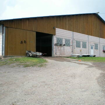
***Reitstall Birkenhof*** Pferdegerechte Haltung
Köln
Daniele-Fazzi
@Daniele-Fazzi
Herzlich Willkommen
auf dem Reitstall Birkenhof
Jetzt neu ‼️ auf dem Birkenhof:
Private Geländestrecke rund um unser
Reitanlage Grafen
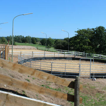
Rimsberg
Simone-Grafen
@Simone-Grafen
FN-Mitglied
Geländestrecke
Vermieten
Verpachten
Paddock
Parkplatz für Pferdeanhänger
Gnadenbrothof
Hengsthaltung möglich
21 weitere...
P


Lehnenhof Schwarzenholz
Saarwellingen
Familie Raubuch
@Lehnenhof
Freizeitstall
Geländestrecke
Vermieten
Hunde willkommen
Krankenbox
Notfallboxen
14 weitere...
ganz aktuell
P+
Leider kein Vorschaubild
Leider kein Vorschaubild
Boxen frei
Wadern-Gehweiler
Julian Glunz
@BlackStoneRanch
FN-Mitglied
Freizeitstall
Vermieten
Führanlage
Hunde willkommen
Allergikerstall
bedampftes/gewaschenes Heu
38 weitere...
B
Pferdepension Römerhof
Hermeskeil
Roemerhof-Hermeskeil
@Roemerhof-Hermeskeil
Freizeitstall
Reitlehrer und -unterricht
Longierzirkel/Roundpen
Parkplatz für Pferdeanhänger
bedampftes/gewaschenes Heu
Gnadenbrothof
Innenbox
12 weitere...
P
Leider kein Vorschaubild
Leider kein Vorschaubild
Pensionsplätze auf dem Steffeshof
Eppelborn
Steffeshof
@Steffeshof_eGbr
Freizeitstall
Gangpferdereiten
Hunde willkommen
Krankenbox
Allergikerstall
Fohlenaufzucht möglich
Außenboxen
Innenbox
23 weitere...
aktuell
B

Boxen / Offenstall mit Paddock und Weiden
Reichenbach
Tamara Bergrath
@TamaraB
Freizeitstall
Reitlehrer und -unterricht
Vermieten
Hunde willkommen
Krankenbox
Hufrehe geeignet
Notfallboxen
17 weitere...
P
Leider kein Vorschaubild
Leider kein Vorschaubild
Offenstallplätze frei
Breitenbach
Sindy
@Sindy98
Freizeitstall
Vermieten
Hunde willkommen
Reitplatz (z.B. Dressur, Springen, Reining)
Innenbox
Offenstall
7 weitere...
B

Futtersack HeuToy, Fressbremse in pink
Mechtersen
STALL-FREIde Marketing
@STALL-FREI-Marketing
Stundenlange Beschäftigung die
Koliken vorbeugt, geringe Staubinhalation mit
steuerbarer Futterentnahme
Top Anlage mit familiärer Atmosphäre
Schmelz
Gangpferde Birkenhof
@Gangpferde-Birkenhof
FN-Mitglied
Freizeitstall
Hunde willkommen
Krankenbox
Allergikerstall
bedampftes/gewaschenes Heu
Außenbox mit Paddock
Außenboxen
44 weitere...
P
Leider kein Vorschaubild
Leider kein Vorschaubild
2 frei Plätze in Asthmatikerstall
Konken
Sarah Woll-von Blohn
@sarah-von-blohn
Freizeitstall
Geländestrecke
Vermieten
Hunde willkommen
Krankenbox
bedampftes/gewaschenes Heu
Notfallboxen
11 weitere...
B
Reitschulen mit Außenbox mit Paddock
Stallplätze mit Reitplatz (z.B. Dressur, Springen, Reining)
Reitanlagen mit Einzelne Boxen oder Stallplätze
Deprecated: Creation of dynamic property Zend_View::$pageCount is deprecated in /var/www/stall-frei/htdocs/staging.stall-frei.de/library/vendor/shardj/zf1-future/library/Zend/View/Abstract.php on line 308
Deprecated: Creation of dynamic property Zend_View::$itemCountPerPage is deprecated in /var/www/stall-frei/htdocs/staging.stall-frei.de/library/vendor/shardj/zf1-future/library/Zend/View/Abstract.php on line 308
Deprecated: Creation of dynamic property Zend_View::$first is deprecated in /var/www/stall-frei/htdocs/staging.stall-frei.de/library/vendor/shardj/zf1-future/library/Zend/View/Abstract.php on line 308
Deprecated: Creation of dynamic property Zend_View::$current is deprecated in /var/www/stall-frei/htdocs/staging.stall-frei.de/library/vendor/shardj/zf1-future/library/Zend/View/Abstract.php on line 308
Deprecated: Creation of dynamic property Zend_View::$last is deprecated in /var/www/stall-frei/htdocs/staging.stall-frei.de/library/vendor/shardj/zf1-future/library/Zend/View/Abstract.php on line 308
Deprecated: Creation of dynamic property Zend_View::$previous is deprecated in /var/www/stall-frei/htdocs/staging.stall-frei.de/library/vendor/shardj/zf1-future/library/Zend/View/Abstract.php on line 308
Deprecated: Creation of dynamic property Zend_View::$next is deprecated in /var/www/stall-frei/htdocs/staging.stall-frei.de/library/vendor/shardj/zf1-future/library/Zend/View/Abstract.php on line 308
Deprecated: Creation of dynamic property Zend_View::$pagesInRange is deprecated in /var/www/stall-frei/htdocs/staging.stall-frei.de/library/vendor/shardj/zf1-future/library/Zend/View/Abstract.php on line 308
Deprecated: Creation of dynamic property Zend_View::$firstPageInRange is deprecated in /var/www/stall-frei/htdocs/staging.stall-frei.de/library/vendor/shardj/zf1-future/library/Zend/View/Abstract.php on line 308
Deprecated: Creation of dynamic property Zend_View::$lastPageInRange is deprecated in /var/www/stall-frei/htdocs/staging.stall-frei.de/library/vendor/shardj/zf1-future/library/Zend/View/Abstract.php on line 308
Deprecated: Creation of dynamic property Zend_View::$currentItemCount is deprecated in /var/www/stall-frei/htdocs/staging.stall-frei.de/library/vendor/shardj/zf1-future/library/Zend/View/Abstract.php on line 308
Deprecated: Creation of dynamic property Zend_View::$totalItemCount is deprecated in /var/www/stall-frei/htdocs/staging.stall-frei.de/library/vendor/shardj/zf1-future/library/Zend/View/Abstract.php on line 308
Deprecated: Creation of dynamic property Zend_View::$firstItemNumber is deprecated in /var/www/stall-frei/htdocs/staging.stall-frei.de/library/vendor/shardj/zf1-future/library/Zend/View/Abstract.php on line 308
Deprecated: Creation of dynamic property Zend_View::$lastItemNumber is deprecated in /var/www/stall-frei/htdocs/staging.stall-frei.de/library/vendor/shardj/zf1-future/library/Zend/View/Abstract.php on line 308
Deprecated: Creation of dynamic property Zend_View::$router is deprecated in /var/www/stall-frei/htdocs/staging.stall-frei.de/library/vendor/shardj/zf1-future/library/Zend/View/Abstract.php on line 308
Deprecated: Creation of dynamic property Zend_View::$urlParams is deprecated in /var/www/stall-frei/htdocs/staging.stall-frei.de/library/vendor/shardj/zf1-future/library/Zend/View/Abstract.php on line 308
Deprecated: Creation of dynamic property Zend_View::$showAds is deprecated in /var/www/stall-frei/htdocs/staging.stall-frei.de/library/vendor/shardj/zf1-future/library/Zend/View/Abstract.php on line 308
Deprecated: Creation of dynamic property Zend_View::$objectIds is deprecated in /var/www/stall-frei/htdocs/staging.stall-frei.de/library/vendor/shardj/zf1-future/library/Zend/View/Abstract.php on line 308
Deprecated: Creation of dynamic property Zend_View::$showNavbar is deprecated in /var/www/stall-frei/htdocs/staging.stall-frei.de/library/vendor/shardj/zf1-future/library/Zend/View/Abstract.php on line 308
Deprecated: Creation of dynamic property Zend_View::$showBreadcrumb is deprecated in /var/www/stall-frei/htdocs/staging.stall-frei.de/library/vendor/shardj/zf1-future/library/Zend/View/Abstract.php on line 308
Deprecated: Creation of dynamic property Zend_View::$showFooter is deprecated in /var/www/stall-frei/htdocs/staging.stall-frei.de/library/vendor/shardj/zf1-future/library/Zend/View/Abstract.php on line 308
Deprecated: Creation of dynamic property Zend_View::$showInternalAds is deprecated in /var/www/stall-frei/htdocs/staging.stall-frei.de/library/vendor/shardj/zf1-future/library/Zend/View/Abstract.php on line 308
Deprecated: Creation of dynamic property Zend_View::$blNoContent is deprecated in /var/www/stall-frei/htdocs/staging.stall-frei.de/library/vendor/shardj/zf1-future/library/Zend/View/Abstract.php on line 308
Deprecated: Creation of dynamic property Zend_View::$sMetaDesc is deprecated in /var/www/stall-frei/htdocs/staging.stall-frei.de/library/vendor/shardj/zf1-future/library/Zend/View/Abstract.php on line 308
Deprecated: Creation of dynamic property Zend_View::$useGmaps is deprecated in /var/www/stall-frei/htdocs/staging.stall-frei.de/library/vendor/shardj/zf1-future/library/Zend/View/Abstract.php on line 308
Deprecated: Creation of dynamic property Zend_View::$touches is deprecated in /var/www/stall-frei/htdocs/staging.stall-frei.de/library/vendor/shardj/zf1-future/library/Zend/View/Abstract.php on line 308
Deprecated: Creation of dynamic property Zend_View::$oProject is deprecated in /var/www/stall-frei/htdocs/staging.stall-frei.de/library/vendor/shardj/zf1-future/library/Zend/View/Abstract.php on line 308
Deprecated: Creation of dynamic property Zend_View::$pageHeadline is deprecated in /var/www/stall-frei/htdocs/staging.stall-frei.de/library/vendor/shardj/zf1-future/library/Zend/View/Abstract.php on line 308
Deprecated: Creation of dynamic property Zend_View::$disableLocationField is deprecated in /var/www/stall-frei/htdocs/staging.stall-frei.de/library/vendor/shardj/zf1-future/library/Zend/View/Abstract.php on line 308
Deprecated: Creation of dynamic property Zend_View::$isSearch is deprecated in /var/www/stall-frei/htdocs/staging.stall-frei.de/library/vendor/shardj/zf1-future/library/Zend/View/Abstract.php on line 308
Deprecated: Creation of dynamic property Zend_View::$pageTitle is deprecated in /var/www/stall-frei/htdocs/staging.stall-frei.de/library/vendor/shardj/zf1-future/library/Zend/View/Abstract.php on line 308
Deprecated: Creation of dynamic property Psf_Form_Element_Text::$class is deprecated in /var/www/stall-frei/htdocs/staging.stall-frei.de/library/vendor/shardj/zf1-future/library/Zend/Form/Element.php on line 874
Deprecated: Creation of dynamic property Psf_Form_Element_Text::$size is deprecated in /var/www/stall-frei/htdocs/staging.stall-frei.de/library/vendor/shardj/zf1-future/library/Zend/Form/Element.php on line 874
Deprecated: Creation of dynamic property Psf_Form_Element_Text::$placeholder is deprecated in /var/www/stall-frei/htdocs/staging.stall-frei.de/library/vendor/shardj/zf1-future/library/Zend/Form/Element.php on line 874
Deprecated: Creation of dynamic property Psf_Form_Element_Hidden::$class is deprecated in /var/www/stall-frei/htdocs/staging.stall-frei.de/library/vendor/shardj/zf1-future/library/Zend/Form/Element.php on line 874
Deprecated: Creation of dynamic property Psf_Form_Element_Hidden::$class is deprecated in /var/www/stall-frei/htdocs/staging.stall-frei.de/library/vendor/shardj/zf1-future/library/Zend/Form/Element.php on line 874
Deprecated: Creation of dynamic property Psf_Form_Element_Hidden::$class is deprecated in /var/www/stall-frei/htdocs/staging.stall-frei.de/library/vendor/shardj/zf1-future/library/Zend/Form/Element.php on line 874
Deprecated: Creation of dynamic property Psf_Form_Element_Hidden::$class is deprecated in /var/www/stall-frei/htdocs/staging.stall-frei.de/library/vendor/shardj/zf1-future/library/Zend/Form/Element.php on line 874
Deprecated: Creation of dynamic property Psf_Form_Element_Select::$class is deprecated in /var/www/stall-frei/htdocs/staging.stall-frei.de/library/vendor/shardj/zf1-future/library/Zend/Form/Element.php on line 874
Deprecated: Creation of dynamic property Psf_Form_Element_Select::$class is deprecated in /var/www/stall-frei/htdocs/staging.stall-frei.de/library/vendor/shardj/zf1-future/library/Zend/Form/Element.php on line 874
Deprecated: Creation of dynamic property Psf_Form_Element_Select::$class is deprecated in /var/www/stall-frei/htdocs/staging.stall-frei.de/library/vendor/shardj/zf1-future/library/Zend/Form/Element.php on line 874
Deprecated: Creation of dynamic property Psf_Form_Element_Select::$class is deprecated in /var/www/stall-frei/htdocs/staging.stall-frei.de/library/vendor/shardj/zf1-future/library/Zend/Form/Element.php on line 874
Deprecated: Creation of dynamic property Psf_Form_Element_Text::$class is deprecated in /var/www/stall-frei/htdocs/staging.stall-frei.de/library/vendor/shardj/zf1-future/library/Zend/Form/Element.php on line 874
Deprecated: Creation of dynamic property Psf_Form_Element_Checkbox::$label is deprecated in /var/www/stall-frei/htdocs/staging.stall-frei.de/library/vendor/shardj/zf1-future/library/Zend/Form/Element.php on line 874
Deprecated: Creation of dynamic property Zend_View::$sort is deprecated in /var/www/stall-frei/htdocs/staging.stall-frei.de/library/vendor/shardj/zf1-future/library/Zend/View/Abstract.php on line 308
Deprecated: Creation of dynamic property Zend_View::$searchLocation is deprecated in /var/www/stall-frei/htdocs/staging.stall-frei.de/library/vendor/shardj/zf1-future/library/Zend/View/Abstract.php on line 308
Deprecated: Creation of dynamic property Zend_View::$locationHint is deprecated in /var/www/stall-frei/htdocs/staging.stall-frei.de/library/vendor/shardj/zf1-future/library/Zend/View/Abstract.php on line 308
Psf_GeoCoder_Abstract::getLocation: Oberthal Get Location CachedOrLive
Psf_GeoCoder_Abstract::getCachedOrLive: Oberthal
Psf_GeoCoder_Abstract::convertLocationResult
{"documentation":"https:\/\/opencagedata.com\/api","licenses":[{"name":"see attribution guide","url":"https:\/\/opencagedata.com\/credits"}],"results":[{"bounds":{"northeast":{"lat":49.5518944,"lng":7.1420097},"southwest":{"lat":49.4941027,"lng":7.0481254}},"components":{"ISO_3166-1_alpha-2":"DE","ISO_3166-1_alpha-3":"DEU","ISO_3166-2":["DE-SL"],"_category":"place","_normalized_city":"Oberthal","_type":"village","continent":"Europe","country":"Deutschland","country_code":"de","county":"Landkreis St. Wendel","political_union":"European Union","postcode":"66649","state":"Saarland","state_code":"SL","village":"Oberthal"},"confidence":7,"formatted":"66649 Oberthal, Deutschland","geometry":{"lat":49.5114206,"lng":7.0849085}},{"bounds":{"northeast":{"lat":50.1760356,"lng":9.9176881},"southwest":{"lat":50.1360356,"lng":9.8776881}},"components":{"ISO_3166-1_alpha-2":"DE","ISO_3166-1_alpha-3":"DEU","ISO_3166-2":["DE-BY"],"_category":"place","_normalized_city":"Hammelburg","_type":"city","continent":"Europe","country":"Deutschland","country_code":"de","county":"Landkreis Bad Kissingen","political_union":"European Union","postcode":"97762","state":"Bayern","state_code":"BY","town":"Hammelburg"},"confidence":7,"formatted":"97762 Hammelburg, Deutschland","geometry":{"lat":50.1560356,"lng":9.8976881}},{"bounds":{"northeast":{"lat":47.9675508,"lng":12.2419789},"southwest":{"lat":47.9275508,"lng":12.2019789}},"components":{"ISO_3166-1_alpha-2":"DE","ISO_3166-1_alpha-3":"DEU","ISO_3166-2":["DE-BY"],"_category":"place","_normalized_city":"S\u00f6chtenau","_type":"hamlet","continent":"Europe","country":"Deutschland","country_code":"de","county":"Landkreis Rosenheim","hamlet":"Oberthal","political_union":"European Union","postcode":"83139","state":"Bayern","state_code":"BY","village":"S\u00f6chtenau"},"confidence":7,"formatted":"Oberthal, 83139 S\u00f6chtenau, Deutschland","geometry":{"lat":47.9475508,"lng":12.2219789}},{"bounds":{"northeast":{"lat":47.8936538,"lng":10.2784641},"southwest":{"lat":47.8536538,"lng":10.2384641}},"components":{"ISO_3166-1_alpha-2":"DE","ISO_3166-1_alpha-3":"DEU","ISO_3166-2":["DE-BY"],"_category":"place","_normalized_city":"Thal","_type":"hamlet","continent":"Europe","country":"Deutschland","country_code":"de","county":"Landkreis Unterallg\u00e4u","hamlet":"Oberthal","municipality":"Bad Gr\u00f6nenbach","political_union":"European Union","postcode":"87787","state":"Bayern","state_code":"BY","village":"Thal"},"confidence":7,"formatted":"Oberthal, 87787 Thal, Deutschland","geometry":{"lat":47.8736538,"lng":10.2584641}},{"bounds":{"northeast":{"lat":48.4631623,"lng":12.7838407},"southwest":{"lat":48.4231623,"lng":12.7438407}},"components":{"ISO_3166-1_alpha-2":"DE","ISO_3166-1_alpha-3":"DEU","ISO_3166-2":["DE-BY"],"_category":"place","_normalized_city":"Eggenfelden","_type":"hamlet","continent":"Europe","country":"Deutschland","country_code":"de","county":"Landkreis Rottal-Inn","hamlet":"Oberthal","political_union":"European Union","postcode":"84307","state":"Bayern","state_code":"BY","town":"Eggenfelden"},"confidence":7,"formatted":"Oberthal, 84307 Eggenfelden, Deutschland","geometry":{"lat":48.4431623,"lng":12.7638407}},{"bounds":{"northeast":{"lat":48.3305432,"lng":12.7444084},"southwest":{"lat":48.2905432,"lng":12.7044084}},"components":{"ISO_3166-1_alpha-2":"DE","ISO_3166-1_alpha-3":"DEU","ISO_3166-2":["DE-BY"],"_category":"place","_normalized_city":"Reischach","_type":"hamlet","continent":"Europe","country":"Deutschland","country_code":"de","county":"Landkreis Alt\u00f6tting","hamlet":"Oberthal","municipality":"Reischach (VGem)","political_union":"European Union","postcode":"84571","state":"Bayern","state_code":"BY","village":"Reischach"},"confidence":7,"formatted":"Oberthal, 84571 Reischach, Deutschland","geometry":{"lat":48.3105432,"lng":12.7244084}},{"components":{"ISO_3166-1_alpha-2":"FR","ISO_3166-1_alpha-3":"FRA","ISO_3166-2":["FR-GES","FR-88"],"_category":"road","_normalized_city":"Moyenmoutier","_type":"road","city":"Moyenmoutier","continent":"Europe","country":"France","country_code":"fr","county":"Vosges","local_authority":"Communaut\u00e9 d'agglom\u00e9ration de Saint-Di\u00e9-des-Vosges","political_union":"European Union","postcode":"88420","road":"Place D Oberthal","state":"Grand Est","state_code":"GES"},"confidence":3,"formatted":"Place D Oberthal, 88420 Moyenmoutier, France","geometry":{"lat":48.378672,"lng":6.916066}},{"components":{"ISO_3166-1_alpha-2":"FR","ISO_3166-1_alpha-3":"FRA","ISO_3166-2":["FR-GES","FR-6AE","FR-68"],"_category":"road","_normalized_city":"Berrwiller","_type":"road","city":"Berrwiller","continent":"Europe","country":"France","country_code":"fr","county":"Haut-Rhin","local_authority":"Mulhouse Alsace Agglom\u00e9ration","political_union":"European Union","postcode":"68500","road":"Chemin de l' Oberwald","state":"Grand Est","state_code":"GES"},"confidence":2,"formatted":"Chemin de l' Oberwald, 68500 Berrwiller, France","geometry":{"lat":47.844631,"lng":7.199959}},{"components":{"ISO_3166-1_alpha-2":"FR","ISO_3166-1_alpha-3":"FRA","ISO_3166-2":["FR-GES","FR-6AE","FR-68"],"_category":"road","_normalized_city":"Issenheim","_type":"road","city":"Issenheim","continent":"Europe","country":"France","country_code":"fr","county":"Haut-Rhin","local_authority":"Communaut\u00e9 de communes de la R\u00e9gion de Guebwiller","political_union":"European Union","postcode":"68500","road":"Rue de l\u2019Oberwald","state":"Grand Est","state_code":"GES"},"confidence":2,"formatted":"Rue de l\u2019Oberwald, 68500 Issenheim, France","geometry":{"lat":47.89619,"lng":7.235184}},{"components":{"ISO_3166-1_alpha-2":"FR","ISO_3166-1_alpha-3":"FRA","ISO_3166-2":["FR-OCC","FR-81"],"_category":"road","_normalized_city":"Paulinet","_type":"road","city":"Paulinet","continent":"Europe","country":"France","country_code":"fr","county":"Tarn","local_authority":"Communaut\u00e9 de communes des Monts d'Alban et du Villefranchois","political_union":"European Union","postcode":"81250","road":"Chemin de Bertal","state":"Occitanie","state_code":"OCC"},"confidence":2,"formatted":"Chemin de Bertal, 81250 Paulinet, France","geometry":{"lat":43.796901,"lng":2.473581}}],"status":{"code":200,"message":"OK"},"stay_informed":{"blog":"https:\/\/blog.opencagedata.com","mastodon":"https:\/\/en.osm.town\/@opencage"},"thanks":"For using an OpenCage API","timestamp":{"created_http":"Sat, 07 Feb 2026 11:19:37 GMT","created_unix":1770463177},"total_results":10}Array
(
[0] => stdClass Object
(
[bounds] => stdClass Object
(
[northeast] => stdClass Object
(
[lat] => 49.5518944
[lng] => 7.1420097
)
[southwest] => stdClass Object
(
[lat] => 49.4941027
[lng] => 7.0481254
)
)
[components] => stdClass Object
(
[ISO_3166-1_alpha-2] => DE
[ISO_3166-1_alpha-3] => DEU
[ISO_3166-2] => Array
(
[0] => DE-SL
)
[_category] => place
[_normalized_city] => Oberthal
[_type] => village
[continent] => Europe
[country] => Deutschland
[country_code] => de
[county] => Landkreis St. Wendel
[political_union] => European Union
[postcode] => 66649
[state] => Saarland
[state_code] => SL
[village] => Oberthal
)
[confidence] => 7
[formatted] => 66649 Oberthal, Deutschland
[geometry] => stdClass Object
(
[lat] => 49.5114206
[lng] => 7.0849085
)
)
[1] => stdClass Object
(
[bounds] => stdClass Object
(
[northeast] => stdClass Object
(
[lat] => 50.1760356
[lng] => 9.9176881
)
[southwest] => stdClass Object
(
[lat] => 50.1360356
[lng] => 9.8776881
)
)
[components] => stdClass Object
(
[ISO_3166-1_alpha-2] => DE
[ISO_3166-1_alpha-3] => DEU
[ISO_3166-2] => Array
(
[0] => DE-BY
)
[_category] => place
[_normalized_city] => Hammelburg
[_type] => city
[continent] => Europe
[country] => Deutschland
[country_code] => de
[county] => Landkreis Bad Kissingen
[political_union] => European Union
[postcode] => 97762
[state] => Bayern
[state_code] => BY
[town] => Hammelburg
)
[confidence] => 7
[formatted] => 97762 Hammelburg, Deutschland
[geometry] => stdClass Object
(
[lat] => 50.1560356
[lng] => 9.8976881
)
)
[2] => stdClass Object
(
[bounds] => stdClass Object
(
[northeast] => stdClass Object
(
[lat] => 47.9675508
[lng] => 12.2419789
)
[southwest] => stdClass Object
(
[lat] => 47.9275508
[lng] => 12.2019789
)
)
[components] => stdClass Object
(
[ISO_3166-1_alpha-2] => DE
[ISO_3166-1_alpha-3] => DEU
[ISO_3166-2] => Array
(
[0] => DE-BY
)
[_category] => place
[_normalized_city] => Söchtenau
[_type] => hamlet
[continent] => Europe
[country] => Deutschland
[country_code] => de
[county] => Landkreis Rosenheim
[hamlet] => Oberthal
[political_union] => European Union
[postcode] => 83139
[state] => Bayern
[state_code] => BY
[village] => Söchtenau
)
[confidence] => 7
[formatted] => Oberthal, 83139 Söchtenau, Deutschland
[geometry] => stdClass Object
(
[lat] => 47.9475508
[lng] => 12.2219789
)
)
[3] => stdClass Object
(
[bounds] => stdClass Object
(
[northeast] => stdClass Object
(
[lat] => 47.8936538
[lng] => 10.2784641
)
[southwest] => stdClass Object
(
[lat] => 47.8536538
[lng] => 10.2384641
)
)
[components] => stdClass Object
(
[ISO_3166-1_alpha-2] => DE
[ISO_3166-1_alpha-3] => DEU
[ISO_3166-2] => Array
(
[0] => DE-BY
)
[_category] => place
[_normalized_city] => Thal
[_type] => hamlet
[continent] => Europe
[country] => Deutschland
[country_code] => de
[county] => Landkreis Unterallgäu
[hamlet] => Oberthal
[municipality] => Bad Grönenbach
[political_union] => European Union
[postcode] => 87787
[state] => Bayern
[state_code] => BY
[village] => Thal
)
[confidence] => 7
[formatted] => Oberthal, 87787 Thal, Deutschland
[geometry] => stdClass Object
(
[lat] => 47.8736538
[lng] => 10.2584641
)
)
[4] => stdClass Object
(
[bounds] => stdClass Object
(
[northeast] => stdClass Object
(
[lat] => 48.4631623
[lng] => 12.7838407
)
[southwest] => stdClass Object
(
[lat] => 48.4231623
[lng] => 12.7438407
)
)
[components] => stdClass Object
(
[ISO_3166-1_alpha-2] => DE
[ISO_3166-1_alpha-3] => DEU
[ISO_3166-2] => Array
(
[0] => DE-BY
)
[_category] => place
[_normalized_city] => Eggenfelden
[_type] => hamlet
[continent] => Europe
[country] => Deutschland
[country_code] => de
[county] => Landkreis Rottal-Inn
[hamlet] => Oberthal
[political_union] => European Union
[postcode] => 84307
[state] => Bayern
[state_code] => BY
[town] => Eggenfelden
)
[confidence] => 7
[formatted] => Oberthal, 84307 Eggenfelden, Deutschland
[geometry] => stdClass Object
(
[lat] => 48.4431623
[lng] => 12.7638407
)
)
[5] => stdClass Object
(
[bounds] => stdClass Object
(
[northeast] => stdClass Object
(
[lat] => 48.3305432
[lng] => 12.7444084
)
[southwest] => stdClass Object
(
[lat] => 48.2905432
[lng] => 12.7044084
)
)
[components] => stdClass Object
(
[ISO_3166-1_alpha-2] => DE
[ISO_3166-1_alpha-3] => DEU
[ISO_3166-2] => Array
(
[0] => DE-BY
)
[_category] => place
[_normalized_city] => Reischach
[_type] => hamlet
[continent] => Europe
[country] => Deutschland
[country_code] => de
[county] => Landkreis Altötting
[hamlet] => Oberthal
[municipality] => Reischach (VGem)
[political_union] => European Union
[postcode] => 84571
[state] => Bayern
[state_code] => BY
[village] => Reischach
)
[confidence] => 7
[formatted] => Oberthal, 84571 Reischach, Deutschland
[geometry] => stdClass Object
(
[lat] => 48.3105432
[lng] => 12.7244084
)
)
[6] => stdClass Object
(
[components] => stdClass Object
(
[ISO_3166-1_alpha-2] => FR
[ISO_3166-1_alpha-3] => FRA
[ISO_3166-2] => Array
(
[0] => FR-GES
[1] => FR-88
)
[_category] => road
[_normalized_city] => Moyenmoutier
[_type] => road
[city] => Moyenmoutier
[continent] => Europe
[country] => France
[country_code] => fr
[county] => Vosges
[local_authority] => Communauté d'agglomération de Saint-Dié-des-Vosges
[political_union] => European Union
[postcode] => 88420
[road] => Place D Oberthal
[state] => Grand Est
[state_code] => GES
)
[confidence] => 3
[formatted] => Place D Oberthal, 88420 Moyenmoutier, France
[geometry] => stdClass Object
(
[lat] => 48.378672
[lng] => 6.916066
)
)
[7] => stdClass Object
(
[components] => stdClass Object
(
[ISO_3166-1_alpha-2] => FR
[ISO_3166-1_alpha-3] => FRA
[ISO_3166-2] => Array
(
[0] => FR-GES
[1] => FR-6AE
[2] => FR-68
)
[_category] => road
[_normalized_city] => Berrwiller
[_type] => road
[city] => Berrwiller
[continent] => Europe
[country] => France
[country_code] => fr
[county] => Haut-Rhin
[local_authority] => Mulhouse Alsace Agglomération
[political_union] => European Union
[postcode] => 68500
[road] => Chemin de l' Oberwald
[state] => Grand Est
[state_code] => GES
)
[confidence] => 2
[formatted] => Chemin de l' Oberwald, 68500 Berrwiller, France
[geometry] => stdClass Object
(
[lat] => 47.844631
[lng] => 7.199959
)
)
[8] => stdClass Object
(
[components] => stdClass Object
(
[ISO_3166-1_alpha-2] => FR
[ISO_3166-1_alpha-3] => FRA
[ISO_3166-2] => Array
(
[0] => FR-GES
[1] => FR-6AE
[2] => FR-68
)
[_category] => road
[_normalized_city] => Issenheim
[_type] => road
[city] => Issenheim
[continent] => Europe
[country] => France
[country_code] => fr
[county] => Haut-Rhin
[local_authority] => Communauté de communes de la Région de Guebwiller
[political_union] => European Union
[postcode] => 68500
[road] => Rue de l’Oberwald
[state] => Grand Est
[state_code] => GES
)
[confidence] => 2
[formatted] => Rue de l’Oberwald, 68500 Issenheim, France
[geometry] => stdClass Object
(
[lat] => 47.89619
[lng] => 7.235184
)
)
[9] => stdClass Object
(
[components] => stdClass Object
(
[ISO_3166-1_alpha-2] => FR
[ISO_3166-1_alpha-3] => FRA
[ISO_3166-2] => Array
(
[0] => FR-OCC
[1] => FR-81
)
[_category] => road
[_normalized_city] => Paulinet
[_type] => road
[city] => Paulinet
[continent] => Europe
[country] => France
[country_code] => fr
[county] => Tarn
[local_authority] => Communauté de communes des Monts d'Alban et du Villefranchois
[political_union] => European Union
[postcode] => 81250
[road] => Chemin de Bertal
[state] => Occitanie
[state_code] => OCC
)
[confidence] => 2
[formatted] => Chemin de Bertal, 81250 Paulinet, France
[geometry] => stdClass Object
(
[lat] => 43.796901
[lng] => 2.473581
)
)
)
Psf_GeoCoder_OpenCageData::getKeyMap: 0
stdClass Object
(
    [bounds] => stdClass Object
        (
            [northeast] => stdClass Object
                (
                    [lat] => 49.5518944
                    [lng] => 7.1420097
                )

            [southwest] => stdClass Object
                (
                    [lat] => 49.4941027
                    [lng] => 7.0481254
                )

        )

    [components] => stdClass Object
        (
            [ISO_3166-1_alpha-2] => DE
            [ISO_3166-1_alpha-3] => DEU
            [ISO_3166-2] => Array
                (
                    [0] => DE-SL
                )

            [_category] => place
            [_normalized_city] => Oberthal
            [_type] => village
            [continent] => Europe
            [country] => Deutschland
            [country_code] => de
            [county] => Landkreis St. Wendel
            [political_union] => European Union
            [postcode] => 66649
            [state] => Saarland
            [state_code] => SL
            [village] => Oberthal
        )

    [confidence] => 7
    [formatted] => 66649 Oberthal, Deutschland
    [geometry] => stdClass Object
        (
            [lat] => 49.5114206
            [lng] => 7.0849085
        )

)
Psf_GeoCoder_OpenCageData::getCounty: St. Wendel
Psf_GeoCoder_OpenCageData::addMissingData REFETCH!
Array
(
    [address] => 66649 Oberthal, Deutschland
    [type] => village
    [street] =>
    [city] => Oberthal
    [county] => St. Wendel
    [state] => Saarland
    [zip] => 66649
    [country] => Deutschland
    [suburb] =>
    [countrycode] => de
    [latitude] => 49.5114206
    [longitude] => 7.0849085
    [accuracy] => 1
    [confidence] => 7
    [bounds] => stdClass Object
        (
            [northeast] => stdClass Object
                (
                    [lat] => 49.5518944
                    [lng] => 7.1420097
                )

            [southwest] => stdClass Object
                (
                    [lat] => 49.4941027
                    [lng] => 7.0481254
                )

        )

)
reformat!
Array
(
    [address] => 66649 Oberthal, Deutschland
    [type] => village
    [street] =>
    [city] => Oberthal
    [county] => St. Wendel
    [state] => Saarland
    [zip] => 66649
    [country] => Deutschland
    [suburb] =>
    [countrycode] => de
    [latitude] => 49.5114206
    [longitude] => 7.0849085
    [accuracy] => 1
    [confidence] => 7
    [bounds] => stdClass Object
        (
            [northeast] => stdClass Object
                (
                    [lat] => 49.5518944
                    [lng] => 7.1420097
                )

            [southwest] => stdClass Object
                (
                    [lat] => 49.4941027
                    [lng] => 7.0481254
                )

        )

    [place] => 66649 Oberthal, Saarland
    [hash] => 32abbb849b713b8b9abd16e2238e0592
)
Psf_GeoCoder_OpenCageData::getKeyMap: 1
stdClass Object
(
    [bounds] => stdClass Object
        (
            [northeast] => stdClass Object
                (
                    [lat] => 50.1760356
                    [lng] => 9.9176881
                )

            [southwest] => stdClass Object
                (
                    [lat] => 50.1360356
                    [lng] => 9.8776881
                )

        )

    [components] => stdClass Object
        (
            [ISO_3166-1_alpha-2] => DE
            [ISO_3166-1_alpha-3] => DEU
            [ISO_3166-2] => Array
                (
                    [0] => DE-BY
                )

            [_category] => place
            [_normalized_city] => Hammelburg
            [_type] => city
            [continent] => Europe
            [country] => Deutschland
            [country_code] => de
            [county] => Landkreis Bad Kissingen
            [political_union] => European Union
            [postcode] => 97762
            [state] => Bayern
            [state_code] => BY
            [town] => Hammelburg
        )

    [confidence] => 7
    [formatted] => 97762 Hammelburg, Deutschland
    [geometry] => stdClass Object
        (
            [lat] => 50.1560356
            [lng] => 9.8976881
        )

)
Psf_GeoCoder_OpenCageData::getCounty: Bad Kissingen
Psf_GeoCoder_OpenCageData::addMissingData REFETCH!
Array
(
    [address] => 97762 Hammelburg, Deutschland
    [type] => city
    [street] =>
    [city] => Hammelburg
    [county] => Bad Kissingen
    [state] => Bayern
    [zip] => 97762
    [country] => Deutschland
    [suburb] =>
    [countrycode] => de
    [latitude] => 50.1560356
    [longitude] => 9.8976881
    [accuracy] => 1
    [confidence] => 7
    [bounds] => stdClass Object
        (
            [northeast] => stdClass Object
                (
                    [lat] => 50.1760356
                    [lng] => 9.9176881
                )

            [southwest] => stdClass Object
                (
                    [lat] => 50.1360356
                    [lng] => 9.8776881
                )

        )

)
reformat!
Array
(
    [address] => 97762 Hammelburg, Deutschland
    [type] => city
    [street] =>
    [city] => Hammelburg
    [county] => Bad Kissingen
    [state] => Bayern
    [zip] => 97762
    [country] => Deutschland
    [suburb] =>
    [countrycode] => de
    [latitude] => 50.1560356
    [longitude] => 9.8976881
    [accuracy] => 1
    [confidence] => 7
    [bounds] => stdClass Object
        (
            [northeast] => stdClass Object
                (
                    [lat] => 50.1760356
                    [lng] => 9.9176881
                )

            [southwest] => stdClass Object
                (
                    [lat] => 50.1360356
                    [lng] => 9.8776881
                )

        )

    [place] => 97762 Hammelburg, Bayern
    [hash] => ce33fba4a6b934a640d06d4456e155b0
)
Psf_GeoCoder_OpenCageData::getKeyMap: 2
stdClass Object
(
    [bounds] => stdClass Object
        (
            [northeast] => stdClass Object
                (
                    [lat] => 47.9675508
                    [lng] => 12.2419789
                )

            [southwest] => stdClass Object
                (
                    [lat] => 47.9275508
                    [lng] => 12.2019789
                )

        )

    [components] => stdClass Object
        (
            [ISO_3166-1_alpha-2] => DE
            [ISO_3166-1_alpha-3] => DEU
            [ISO_3166-2] => Array
                (
                    [0] => DE-BY
                )

            [_category] => place
            [_normalized_city] => Söchtenau
            [_type] => hamlet
            [continent] => Europe
            [country] => Deutschland
            [country_code] => de
            [county] => Landkreis Rosenheim
            [hamlet] => Oberthal
            [political_union] => European Union
            [postcode] => 83139
            [state] => Bayern
            [state_code] => BY
            [village] => Söchtenau
        )

    [confidence] => 7
    [formatted] => Oberthal, 83139 Söchtenau, Deutschland
    [geometry] => stdClass Object
        (
            [lat] => 47.9475508
            [lng] => 12.2219789
        )

)
Psf_GeoCoder_OpenCageData::getCounty: Rosenheim
Psf_GeoCoder_OpenCageData::addMissingData REFETCH!
Array
(
    [address] => Oberthal, 83139 Söchtenau, Deutschland
    [type] => hamlet
    [street] => Oberthal
    [city] => Söchtenau
    [county] => Rosenheim
    [state] => Bayern
    [zip] => 83139
    [country] => Deutschland
    [suburb] =>
    [countrycode] => de
    [latitude] => 47.9475508
    [longitude] => 12.2219789
    [accuracy] => 1
    [confidence] => 7
    [bounds] => stdClass Object
        (
            [northeast] => stdClass Object
                (
                    [lat] => 47.9675508
                    [lng] => 12.2419789
                )

            [southwest] => stdClass Object
                (
                    [lat] => 47.9275508
                    [lng] => 12.2019789
                )

        )

)
reformat!
Array
(
    [address] => Oberthal, 83139 Söchtenau, Deutschland
    [type] => hamlet
    [street] => Oberthal
    [city] => Söchtenau
    [county] => Rosenheim
    [state] => Bayern
    [zip] => 83139
    [country] => Deutschland
    [suburb] =>
    [countrycode] => de
    [latitude] => 47.9475508
    [longitude] => 12.2219789
    [accuracy] => 1
    [confidence] => 7
    [bounds] => stdClass Object
        (
            [northeast] => stdClass Object
                (
                    [lat] => 47.9675508
                    [lng] => 12.2419789
                )

            [southwest] => stdClass Object
                (
                    [lat] => 47.9275508
                    [lng] => 12.2019789
                )

        )

    [place] => Oberthal, 83139 Söchtenau, Bayern
    [hash] => f5e5f5d0ece021fe6703e18ced26a8ee
)
Psf_GeoCoder_OpenCageData::getKeyMap: 3
stdClass Object
(
    [bounds] => stdClass Object
        (
            [northeast] => stdClass Object
                (
                    [lat] => 47.8936538
                    [lng] => 10.2784641
                )

            [southwest] => stdClass Object
                (
                    [lat] => 47.8536538
                    [lng] => 10.2384641
                )

        )

    [components] => stdClass Object
        (
            [ISO_3166-1_alpha-2] => DE
            [ISO_3166-1_alpha-3] => DEU
            [ISO_3166-2] => Array
                (
                    [0] => DE-BY
                )

            [_category] => place
            [_normalized_city] => Thal
            [_type] => hamlet
            [continent] => Europe
            [country] => Deutschland
            [country_code] => de
            [county] => Landkreis Unterallgäu
            [hamlet] => Oberthal
            [municipality] => Bad Grönenbach
            [political_union] => European Union
            [postcode] => 87787
            [state] => Bayern
            [state_code] => BY
            [village] => Thal
        )

    [confidence] => 7
    [formatted] => Oberthal, 87787 Thal, Deutschland
    [geometry] => stdClass Object
        (
            [lat] => 47.8736538
            [lng] => 10.2584641
        )

)
Psf_GeoCoder_OpenCageData::getCounty: Unterallgäu
Psf_GeoCoder_OpenCageData::addMissingData REFETCH!
Array
(
    [address] => Oberthal, 87787 Thal, Deutschland
    [type] => hamlet
    [street] => Oberthal
    [city] => Thal
    [county] => Unterallgäu
    [state] => Bayern
    [zip] => 87787
    [country] => Deutschland
    [suburb] =>
    [countrycode] => de
    [latitude] => 47.8736538
    [longitude] => 10.2584641
    [accuracy] => 1
    [confidence] => 7
    [bounds] => stdClass Object
        (
            [northeast] => stdClass Object
                (
                    [lat] => 47.8936538
                    [lng] => 10.2784641
                )

            [southwest] => stdClass Object
                (
                    [lat] => 47.8536538
                    [lng] => 10.2384641
                )

        )

)
reformat!
Array
(
    [address] => Oberthal, 87787 Thal, Deutschland
    [type] => hamlet
    [street] => Oberthal
    [city] => Thal
    [county] => Unterallgäu
    [state] => Bayern
    [zip] => 87787
    [country] => Deutschland
    [suburb] =>
    [countrycode] => de
    [latitude] => 47.8736538
    [longitude] => 10.2584641
    [accuracy] => 1
    [confidence] => 7
    [bounds] => stdClass Object
        (
            [northeast] => stdClass Object
                (
                    [lat] => 47.8936538
                    [lng] => 10.2784641
                )

            [southwest] => stdClass Object
                (
                    [lat] => 47.8536538
                    [lng] => 10.2384641
                )

        )

    [place] => Oberthal, 87787 Thal, Bayern
    [hash] => 79fed5fc7342164fb34034b1088d5b78
)
Psf_GeoCoder_OpenCageData::getKeyMap: 4
stdClass Object
(
    [bounds] => stdClass Object
        (
            [northeast] => stdClass Object
                (
                    [lat] => 48.4631623
                    [lng] => 12.7838407
                )

            [southwest] => stdClass Object
                (
                    [lat] => 48.4231623
                    [lng] => 12.7438407
                )

        )

    [components] => stdClass Object
        (
            [ISO_3166-1_alpha-2] => DE
            [ISO_3166-1_alpha-3] => DEU
            [ISO_3166-2] => Array
                (
                    [0] => DE-BY
                )

            [_category] => place
            [_normalized_city] => Eggenfelden
            [_type] => hamlet
            [continent] => Europe
            [country] => Deutschland
            [country_code] => de
            [county] => Landkreis Rottal-Inn
            [hamlet] => Oberthal
            [political_union] => European Union
            [postcode] => 84307
            [state] => Bayern
            [state_code] => BY
            [town] => Eggenfelden
        )

    [confidence] => 7
    [formatted] => Oberthal, 84307 Eggenfelden, Deutschland
    [geometry] => stdClass Object
        (
            [lat] => 48.4431623
            [lng] => 12.7638407
        )

)
Psf_GeoCoder_OpenCageData::getCounty: Rottal-Inn
Psf_GeoCoder_OpenCageData::addMissingData REFETCH!
Array
(
    [address] => Oberthal, 84307 Eggenfelden, Deutschland
    [type] => hamlet
    [street] => Oberthal
    [city] => Eggenfelden
    [county] => Rottal-Inn
    [state] => Bayern
    [zip] => 84307
    [country] => Deutschland
    [suburb] =>
    [countrycode] => de
    [latitude] => 48.4431623
    [longitude] => 12.7638407
    [accuracy] => 1
    [confidence] => 7
    [bounds] => stdClass Object
        (
            [northeast] => stdClass Object
                (
                    [lat] => 48.4631623
                    [lng] => 12.7838407
                )

            [southwest] => stdClass Object
                (
                    [lat] => 48.4231623
                    [lng] => 12.7438407
                )

        )

)
reformat!
Array
(
    [address] => Oberthal, 84307 Eggenfelden, Deutschland
    [type] => hamlet
    [street] => Oberthal
    [city] => Eggenfelden
    [county] => Rottal-Inn
    [state] => Bayern
    [zip] => 84307
    [country] => Deutschland
    [suburb] =>
    [countrycode] => de
    [latitude] => 48.4431623
    [longitude] => 12.7638407
    [accuracy] => 1
    [confidence] => 7
    [bounds] => stdClass Object
        (
            [northeast] => stdClass Object
                (
                    [lat] => 48.4631623
                    [lng] => 12.7838407
                )

            [southwest] => stdClass Object
                (
                    [lat] => 48.4231623
                    [lng] => 12.7438407
                )

        )

    [place] => Oberthal, 84307 Eggenfelden, Bayern
    [hash] => f1964d74c44e44d14d889a9748f986f8
)
Psf_GeoCoder_OpenCageData::getKeyMap: 5
stdClass Object
(
    [bounds] => stdClass Object
        (
            [northeast] => stdClass Object
                (
                    [lat] => 48.3305432
                    [lng] => 12.7444084
                )

            [southwest] => stdClass Object
                (
                    [lat] => 48.2905432
                    [lng] => 12.7044084
                )

        )

    [components] => stdClass Object
        (
            [ISO_3166-1_alpha-2] => DE
            [ISO_3166-1_alpha-3] => DEU
            [ISO_3166-2] => Array
                (
                    [0] => DE-BY
                )

            [_category] => place
            [_normalized_city] => Reischach
            [_type] => hamlet
            [continent] => Europe
            [country] => Deutschland
            [country_code] => de
            [county] => Landkreis Altötting
            [hamlet] => Oberthal
            [municipality] => Reischach (VGem)
            [political_union] => European Union
            [postcode] => 84571
            [state] => Bayern
            [state_code] => BY
            [village] => Reischach
        )

    [confidence] => 7
    [formatted] => Oberthal, 84571 Reischach, Deutschland
    [geometry] => stdClass Object
        (
            [lat] => 48.3105432
            [lng] => 12.7244084
        )

)
Psf_GeoCoder_OpenCageData::getCounty: Altötting
Psf_GeoCoder_OpenCageData::addMissingData REFETCH!
Array
(
    [address] => Oberthal, 84571 Reischach, Deutschland
    [type] => hamlet
    [street] => Oberthal
    [city] => Reischach
    [county] => Altötting
    [state] => Bayern
    [zip] => 84571
    [country] => Deutschland
    [suburb] =>
    [countrycode] => de
    [latitude] => 48.3105432
    [longitude] => 12.7244084
    [accuracy] => 1
    [confidence] => 7
    [bounds] => stdClass Object
        (
            [northeast] => stdClass Object
                (
                    [lat] => 48.3305432
                    [lng] => 12.7444084
                )

            [southwest] => stdClass Object
                (
                    [lat] => 48.2905432
                    [lng] => 12.7044084
                )

        )

)
reformat!
Array
(
    [address] => Oberthal, 84571 Reischach, Deutschland
    [type] => hamlet
    [street] => Oberthal
    [city] => Reischach
    [county] => Altötting
    [state] => Bayern
    [zip] => 84571
    [country] => Deutschland
    [suburb] =>
    [countrycode] => de
    [latitude] => 48.3105432
    [longitude] => 12.7244084
    [accuracy] => 1
    [confidence] => 7
    [bounds] => stdClass Object
        (
            [northeast] => stdClass Object
                (
                    [lat] => 48.3305432
                    [lng] => 12.7444084
                )

            [southwest] => stdClass Object
                (
                    [lat] => 48.2905432
                    [lng] => 12.7044084
                )

        )

    [place] => Oberthal, 84571 Reischach, Bayern
    [hash] => baa060b21bc6bb3ff43dee3637d28e91
)
Psf_GeoCoder_OpenCageData::getKeyMap: 6
stdClass Object
(
    [components] => stdClass Object
        (
            [ISO_3166-1_alpha-2] => FR
            [ISO_3166-1_alpha-3] => FRA
            [ISO_3166-2] => Array
                (
                    [0] => FR-GES
                    [1] => FR-88
                )

            [_category] => road
            [_normalized_city] => Moyenmoutier
            [_type] => road
            [city] => Moyenmoutier
            [continent] => Europe
            [country] => France
            [country_code] => fr
            [county] => Vosges
            [local_authority] => Communauté d'agglomération de Saint-Dié-des-Vosges
            [political_union] => European Union
            [postcode] => 88420
            [road] => Place D Oberthal
            [state] => Grand Est
            [state_code] => GES
        )

    [confidence] => 3
    [formatted] => Place D Oberthal, 88420 Moyenmoutier, France
    [geometry] => stdClass Object
        (
            [lat] => 48.378672
            [lng] => 6.916066
        )

)
Psf_GeoCoder_OpenCageData::getCounty: Vosges
Psf_GeoCoder_OpenCageData::addMissingData REFETCH!
Array
(
    [address] => Place D Oberthal, 88420 Moyenmoutier, France
    [type] => road
    [street] => Place D Oberthal
    [city] => Moyenmoutier
    [county] => Vosges
    [state] => Grand Est
    [zip] => 88420
    [country] => France
    [suburb] =>
    [countrycode] => fr
    [latitude] => 48.378672
    [longitude] => 6.916066
    [accuracy] => 1
    [confidence] => 3
    [bounds] =>
)
reformat!
Array
(
    [address] => Place D Oberthal, 88420 Moyenmoutier, France
    [type] => road
    [street] => Place D Oberthal
    [city] => Moyenmoutier
    [county] => Vosges
    [state] => Grand Est
    [zip] => 88420
    [country] => France
    [suburb] =>
    [countrycode] => fr
    [latitude] => 48.378672
    [longitude] => 6.916066
    [accuracy] => 1
    [confidence] => 3
    [bounds] =>
    [place] => Place D Oberthal, 88420 Moyenmoutier, Grand Est
    [hash] => 468b00f37e11bad34faef4cacabf8d3f
)
Psf_GeoCoder_OpenCageData::getKeyMap: 7
stdClass Object
(
    [components] => stdClass Object
        (
            [ISO_3166-1_alpha-2] => FR
            [ISO_3166-1_alpha-3] => FRA
            [ISO_3166-2] => Array
                (
                    [0] => FR-GES
                    [1] => FR-6AE
                    [2] => FR-68
                )

            [_category] => road
            [_normalized_city] => Berrwiller
            [_type] => road
            [city] => Berrwiller
            [continent] => Europe
            [country] => France
            [country_code] => fr
            [county] => Haut-Rhin
            [local_authority] => Mulhouse Alsace Agglomération
            [political_union] => European Union
            [postcode] => 68500
            [road] => Chemin de l' Oberwald
            [state] => Grand Est
            [state_code] => GES
        )

    [confidence] => 2
    [formatted] => Chemin de l' Oberwald, 68500 Berrwiller, France
    [geometry] => stdClass Object
        (
            [lat] => 47.844631
            [lng] => 7.199959
        )

)
Psf_GeoCoder_OpenCageData::getCounty: Haut-Rhin
Psf_GeoCoder_OpenCageData::addMissingData REFETCH!
Array
(
    [address] => Chemin de l' Oberwald, 68500 Berrwiller, France
    [type] => road
    [street] => Chemin de l' Oberwald
    [city] => Berrwiller
    [county] => Haut-Rhin
    [state] => Grand Est
    [zip] => 68500
    [country] => France
    [suburb] =>
    [countrycode] => fr
    [latitude] => 47.844631
    [longitude] => 7.199959
    [accuracy] => 1
    [confidence] => 2
    [bounds] =>
)
reformat!
Array
(
    [address] => Chemin de l' Oberwald, 68500 Berrwiller, France
    [type] => road
    [street] => Chemin de l' Oberwald
    [city] => Berrwiller
    [county] => Haut-Rhin
    [state] => Grand Est
    [zip] => 68500
    [country] => France
    [suburb] =>
    [countrycode] => fr
    [latitude] => 47.844631
    [longitude] => 7.199959
    [accuracy] => 1
    [confidence] => 2
    [bounds] =>
    [place] => Chemin de l' Oberwald, 68500 Berrwiller, Grand Est
    [hash] => 97444485515d234ecfdc473595486e85
)
Psf_GeoCoder_OpenCageData::getKeyMap: 8
stdClass Object
(
    [components] => stdClass Object
        (
            [ISO_3166-1_alpha-2] => FR
            [ISO_3166-1_alpha-3] => FRA
            [ISO_3166-2] => Array
                (
                    [0] => FR-GES
                    [1] => FR-6AE
                    [2] => FR-68
                )

            [_category] => road
            [_normalized_city] => Issenheim
            [_type] => road
            [city] => Issenheim
            [continent] => Europe
            [country] => France
            [country_code] => fr
            [county] => Haut-Rhin
            [local_authority] => Communauté de communes de la Région de Guebwiller
            [political_union] => European Union
            [postcode] => 68500
            [road] => Rue de l’Oberwald
            [state] => Grand Est
            [state_code] => GES
        )

    [confidence] => 2
    [formatted] => Rue de l’Oberwald, 68500 Issenheim, France
    [geometry] => stdClass Object
        (
            [lat] => 47.89619
            [lng] => 7.235184
        )

)
Psf_GeoCoder_OpenCageData::getCounty: Haut-Rhin
Psf_GeoCoder_OpenCageData::addMissingData REFETCH!
Array
(
    [address] => Rue de l’Oberwald, 68500 Issenheim, France
    [type] => road
    [street] => Rue de l’Oberwald
    [city] => Issenheim
    [county] => Haut-Rhin
    [state] => Grand Est
    [zip] => 68500
    [country] => France
    [suburb] =>
    [countrycode] => fr
    [latitude] => 47.89619
    [longitude] => 7.235184
    [accuracy] => 1
    [confidence] => 2
    [bounds] =>
)
reformat!
Array
(
    [address] => Rue de l’Oberwald, 68500 Issenheim, France
    [type] => road
    [street] => Rue de l’Oberwald
    [city] => Issenheim
    [county] => Haut-Rhin
    [state] => Grand Est
    [zip] => 68500
    [country] => France
    [suburb] =>
    [countrycode] => fr
    [latitude] => 47.89619
    [longitude] => 7.235184
    [accuracy] => 1
    [confidence] => 2
    [bounds] =>
    [place] => Rue de l’Oberwald, 68500 Issenheim, Grand Est
    [hash] => 6439d0f1271861348aced89c25b2755e
)
Psf_GeoCoder_OpenCageData::getKeyMap: 9
stdClass Object
(
    [components] => stdClass Object
        (
            [ISO_3166-1_alpha-2] => FR
            [ISO_3166-1_alpha-3] => FRA
            [ISO_3166-2] => Array
                (
                    [0] => FR-OCC
                    [1] => FR-81
                )

            [_category] => road
            [_normalized_city] => Paulinet
            [_type] => road
            [city] => Paulinet
            [continent] => Europe
            [country] => France
            [country_code] => fr
            [county] => Tarn
            [local_authority] => Communauté de communes des Monts d'Alban et du Villefranchois
            [political_union] => European Union
            [postcode] => 81250
            [road] => Chemin de Bertal
            [state] => Occitanie
            [state_code] => OCC
        )

    [confidence] => 2
    [formatted] => Chemin de Bertal, 81250 Paulinet, France
    [geometry] => stdClass Object
        (
            [lat] => 43.796901
            [lng] => 2.473581
        )

)
Psf_GeoCoder_OpenCageData::getCounty: Tarn
Psf_GeoCoder_OpenCageData::addMissingData REFETCH!
Array
(
    [address] => Chemin de Bertal, 81250 Paulinet, France
    [type] => road
    [street] => Chemin de Bertal
    [city] => Paulinet
    [county] => Tarn
    [state] => Occitanie
    [zip] => 81250
    [country] => France
    [suburb] =>
    [countrycode] => fr
    [latitude] => 43.796901
    [longitude] => 2.473581
    [accuracy] => 1
    [confidence] => 2
    [bounds] =>
)
reformat!
Array
(
    [address] => Chemin de Bertal, 81250 Paulinet, France
    [type] => road
    [street] => Chemin de Bertal
    [city] => Paulinet
    [county] => Tarn
    [state] => Occitanie
    [zip] => 81250
    [country] => France
    [suburb] =>
    [countrycode] => fr
    [latitude] => 43.796901
    [longitude] => 2.473581
    [accuracy] => 1
    [confidence] => 2
    [bounds] =>
    [place] => Chemin de Bertal, 81250 Paulinet, Occitanie
    [hash] => b330fc07f98b52ba8e5f75ab96fc8ff2
)
Deprecated: Creation of dynamic property Zend_View::$locationHintStyle is deprecated in /var/www/stall-frei/htdocs/staging.stall-frei.de/library/vendor/shardj/zf1-future/library/Zend/View/Abstract.php on line 308
Deprecated: Creation of dynamic property Zend_View::$adGeoLocation is deprecated in /var/www/stall-frei/htdocs/staging.stall-frei.de/library/vendor/shardj/zf1-future/library/Zend/View/Abstract.php on line 308
Deprecated: Creation of dynamic property Zend_View::$recordCount is deprecated in /var/www/stall-frei/htdocs/staging.stall-frei.de/library/vendor/shardj/zf1-future/library/Zend/View/Abstract.php on line 308
Deprecated: Creation of dynamic property Zend_View::$paginationParams is deprecated in /var/www/stall-frei/htdocs/staging.stall-frei.de/library/vendor/shardj/zf1-future/library/Zend/View/Abstract.php on line 308
Deprecated: Creation of dynamic property Zend_View::$objectPaginator is deprecated in /var/www/stall-frei/htdocs/staging.stall-frei.de/library/vendor/shardj/zf1-future/library/Zend/View/Abstract.php on line 308
Deprecated: Creation of dynamic property Zend_View::$featuredObjects is deprecated in /var/www/stall-frei/htdocs/staging.stall-frei.de/library/vendor/shardj/zf1-future/library/Zend/View/Abstract.php on line 308
Deprecated: Creation of dynamic property Zend_View::$hints is deprecated in /var/www/stall-frei/htdocs/staging.stall-frei.de/library/vendor/shardj/zf1-future/library/Zend/View/Abstract.php on line 308
Deprecated: Creation of dynamic property Zend_View::$attributeHints is deprecated in /var/www/stall-frei/htdocs/staging.stall-frei.de/library/vendor/shardj/zf1-future/library/Zend/View/Abstract.php on line 308
Deprecated: Creation of dynamic property Zend_View::$oSearchForm is deprecated in /var/www/stall-frei/htdocs/staging.stall-frei.de/library/vendor/shardj/zf1-future/library/Zend/View/Abstract.php on line 308