Deprecated: Creation of dynamic property Zend_View::$sMode is deprecated in /var/www/stall-frei/htdocs/staging.stall-frei.de/library/vendor/shardj/zf1-future/library/Zend/View/Abstract.php on line 308
Stallplatz oder Offenstall in Isen
Gesucht wird in "Straß, Urtlmühle, 84424 Isen, Deutschland"
6.331 Einträge
Deprecated: Creation of dynamic property Zend_View::$listObjects is deprecated in /var/www/stall-frei/htdocs/staging.stall-frei.de/library/vendor/shardj/zf1-future/library/Zend/View/Abstract.php on line 308
Gesponsort


Deprecated: Creation of dynamic property Zend_View::$listMode is deprecated in /var/www/stall-frei/htdocs/staging.stall-frei.de/library/vendor/shardj/zf1-future/library/Zend/View/Abstract.php on line 308
Deprecated: Creation of dynamic property Zend_View::$renderedObjects is deprecated in /var/www/stall-frei/htdocs/staging.stall-frei.de/library/vendor/shardj/zf1-future/library/Zend/View/Abstract.php on line 308
Deprecated: Creation of dynamic property Zend_View::$index is deprecated in /var/www/stall-frei/htdocs/staging.stall-frei.de/library/vendor/shardj/zf1-future/library/Zend/View/Abstract.php on line 308
Deprecated: Creation of dynamic property Zend_View::$displayMode is deprecated in /var/www/stall-frei/htdocs/staging.stall-frei.de/library/vendor/shardj/zf1-future/library/Zend/View/Abstract.php on line 308
Deprecated: Creation of dynamic property Zend_View::$remarketingIds is deprecated in /var/www/stall-frei/htdocs/staging.stall-frei.de/library/vendor/shardj/zf1-future/library/Zend/View/Abstract.php on line 308
Deprecated: Creation of dynamic property Zend_View::$listItem is deprecated in /var/www/stall-frei/htdocs/staging.stall-frei.de/library/vendor/shardj/zf1-future/library/Zend/View/Abstract.php on line 308
Deprecated: Creation of dynamic property Zend_View::$object is deprecated in /var/www/stall-frei/htdocs/staging.stall-frei.de/library/vendor/shardj/zf1-future/library/Zend/View/Abstract.php on line 308
Deprecated: Creation of dynamic property Zend_View::$attributes is deprecated in /var/www/stall-frei/htdocs/staging.stall-frei.de/library/vendor/shardj/zf1-future/library/Zend/View/Abstract.php on line 308
Leider kein Vorschaubild
Leider kein Vorschaubild
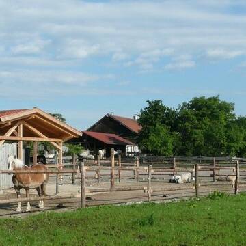
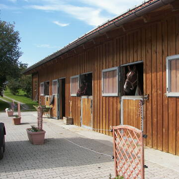
Freizeitstall hat Boxen frei
Maitenbeth
Regina Schön
@Freizeitstall12
Freizeitstall
Longierzirkel/Roundpen
Sattelkammer/Sattelschränke
Innenbox
Offenstall
Halbpension
4 weitere...
B
Deprecated: Creation of dynamic property Zend_View_Helper_Ads::$adLink is deprecated in /var/www/stall-frei/htdocs/staging.stall-frei.de/library/Psf/View/Helper/Ads.php on line 108

Aktivstall Blaslhof , der Weg lohnt sich!!
Uffing am Staffelsee
Blaslhof Aktivstall
@Blaslhof
Unser HIT Aktivstall ist 2008 mit 5 Stallsternen, der höchstmöglichen Auszeichnung für Artgerechte Pferdehaltung belohnt worde
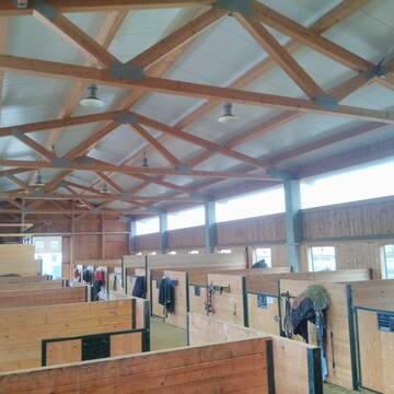
SH ~ Schrankenschneiderhof ~ bei Ebersberg
Ebersberg
Schrankenschneiderhof
@Schrankenschneiderhof
Freizeitstall
Pferdeausbildung
Krankenbox
Longierzirkel/Roundpen
Allergikerstall
Hengsthaltung möglich
Bewegungsstall
Laufstall
21 weitere...
P


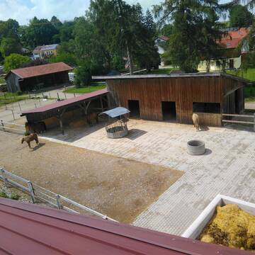
Plätze im Aktivstall frei, Paddockbox
obertaufkirchen
powerprideranch
@powerprideranch
Freizeitstall
Pflegepferd
Hunde willkommen
Krankenbox
Allergikerstall
Fohlenaufzucht möglich
Außenbox mit Paddock
Bewegungsstall
24 weitere...
P+


Pferdeboxen zu Vermietung
Kirchseeon
manfredkirchhof
@manfredkirchhof
Verpachten
Paddock
Parkplatz für Pferdeanhänger
Innenbox
Selbstversorgung
Vollpension
4 weitere...
ganz aktuell
P+


HIT-Aktiv Offenstall
Egmating
Reitanlage zum Kastl
@Reitanlage_zum_Kastl
Vermieten
Krankenbox
Longierzirkel/Roundpen
Hufrehe geeignet
Bewegungsstall
Offenstall
12 weitere...
aktuell
S
Momentan sind alle Plätze belegt
Purfing
Thomas-Huber
@Thomas-Huber
Freizeitstall
Longierzirkel/Roundpen
Paddock
Außenbox mit Paddock
Außenboxen
10 weitere...
P+

Futtersack HeuToy, Fressbremse in pink
Mechtersen
STALL-FREIde Marketing
@STALL-FREI-Marketing
Stundenlange Beschäftigung die
Koliken vorbeugt, geringe Staubinhalation mit
steuerbarer Futterentnahme
Reitstall Adlberger
Markt Schwaben
Adlberger Höfe
@Adlberger Höfe
Pferdeausbildung
Reitlehrer und -unterricht
Paddock
Reithalle
Außenbox mit Paddock
Außenboxen
Vollpension
10 weitere...
P


Reitanlage Heimgarten
Frauenneuharting
Mario Waizmann
@Mariowaiz
Freizeitstall
Vermieten
Führanlage
Paddock
Notfallboxen
Zuchtstutenhaltung möglich
5 weitere...
P+
Newsletter abonnieren
Melde Dich für unseren Newsletter an und verpasse keine Neuigkeiten!
Deprecated: Creation of dynamic property Zend_View::$pageCount is deprecated in /var/www/stall-frei/htdocs/staging.stall-frei.de/library/vendor/shardj/zf1-future/library/Zend/View/Abstract.php on line 308
Deprecated: Creation of dynamic property Zend_View::$itemCountPerPage is deprecated in /var/www/stall-frei/htdocs/staging.stall-frei.de/library/vendor/shardj/zf1-future/library/Zend/View/Abstract.php on line 308
Deprecated: Creation of dynamic property Zend_View::$first is deprecated in /var/www/stall-frei/htdocs/staging.stall-frei.de/library/vendor/shardj/zf1-future/library/Zend/View/Abstract.php on line 308
Deprecated: Creation of dynamic property Zend_View::$current is deprecated in /var/www/stall-frei/htdocs/staging.stall-frei.de/library/vendor/shardj/zf1-future/library/Zend/View/Abstract.php on line 308
Deprecated: Creation of dynamic property Zend_View::$last is deprecated in /var/www/stall-frei/htdocs/staging.stall-frei.de/library/vendor/shardj/zf1-future/library/Zend/View/Abstract.php on line 308
Deprecated: Creation of dynamic property Zend_View::$previous is deprecated in /var/www/stall-frei/htdocs/staging.stall-frei.de/library/vendor/shardj/zf1-future/library/Zend/View/Abstract.php on line 308
Deprecated: Creation of dynamic property Zend_View::$next is deprecated in /var/www/stall-frei/htdocs/staging.stall-frei.de/library/vendor/shardj/zf1-future/library/Zend/View/Abstract.php on line 308
Deprecated: Creation of dynamic property Zend_View::$pagesInRange is deprecated in /var/www/stall-frei/htdocs/staging.stall-frei.de/library/vendor/shardj/zf1-future/library/Zend/View/Abstract.php on line 308
Deprecated: Creation of dynamic property Zend_View::$firstPageInRange is deprecated in /var/www/stall-frei/htdocs/staging.stall-frei.de/library/vendor/shardj/zf1-future/library/Zend/View/Abstract.php on line 308
Deprecated: Creation of dynamic property Zend_View::$lastPageInRange is deprecated in /var/www/stall-frei/htdocs/staging.stall-frei.de/library/vendor/shardj/zf1-future/library/Zend/View/Abstract.php on line 308
Deprecated: Creation of dynamic property Zend_View::$currentItemCount is deprecated in /var/www/stall-frei/htdocs/staging.stall-frei.de/library/vendor/shardj/zf1-future/library/Zend/View/Abstract.php on line 308
Deprecated: Creation of dynamic property Zend_View::$totalItemCount is deprecated in /var/www/stall-frei/htdocs/staging.stall-frei.de/library/vendor/shardj/zf1-future/library/Zend/View/Abstract.php on line 308
Deprecated: Creation of dynamic property Zend_View::$firstItemNumber is deprecated in /var/www/stall-frei/htdocs/staging.stall-frei.de/library/vendor/shardj/zf1-future/library/Zend/View/Abstract.php on line 308
Deprecated: Creation of dynamic property Zend_View::$lastItemNumber is deprecated in /var/www/stall-frei/htdocs/staging.stall-frei.de/library/vendor/shardj/zf1-future/library/Zend/View/Abstract.php on line 308
Deprecated: Creation of dynamic property Zend_View::$router is deprecated in /var/www/stall-frei/htdocs/staging.stall-frei.de/library/vendor/shardj/zf1-future/library/Zend/View/Abstract.php on line 308
Deprecated: Creation of dynamic property Zend_View::$urlParams is deprecated in /var/www/stall-frei/htdocs/staging.stall-frei.de/library/vendor/shardj/zf1-future/library/Zend/View/Abstract.php on line 308
Deprecated: Creation of dynamic property Zend_View::$showAds is deprecated in /var/www/stall-frei/htdocs/staging.stall-frei.de/library/vendor/shardj/zf1-future/library/Zend/View/Abstract.php on line 308
Deprecated: Creation of dynamic property Zend_View::$objectIds is deprecated in /var/www/stall-frei/htdocs/staging.stall-frei.de/library/vendor/shardj/zf1-future/library/Zend/View/Abstract.php on line 308
Deprecated: Creation of dynamic property Zend_View::$showNavbar is deprecated in /var/www/stall-frei/htdocs/staging.stall-frei.de/library/vendor/shardj/zf1-future/library/Zend/View/Abstract.php on line 308
Deprecated: Creation of dynamic property Zend_View::$showBreadcrumb is deprecated in /var/www/stall-frei/htdocs/staging.stall-frei.de/library/vendor/shardj/zf1-future/library/Zend/View/Abstract.php on line 308
Deprecated: Creation of dynamic property Zend_View::$showFooter is deprecated in /var/www/stall-frei/htdocs/staging.stall-frei.de/library/vendor/shardj/zf1-future/library/Zend/View/Abstract.php on line 308
Deprecated: Creation of dynamic property Zend_View::$showInternalAds is deprecated in /var/www/stall-frei/htdocs/staging.stall-frei.de/library/vendor/shardj/zf1-future/library/Zend/View/Abstract.php on line 308
Deprecated: Creation of dynamic property Zend_View::$blNoContent is deprecated in /var/www/stall-frei/htdocs/staging.stall-frei.de/library/vendor/shardj/zf1-future/library/Zend/View/Abstract.php on line 308
Deprecated: Creation of dynamic property Zend_View::$sMetaDesc is deprecated in /var/www/stall-frei/htdocs/staging.stall-frei.de/library/vendor/shardj/zf1-future/library/Zend/View/Abstract.php on line 308
Deprecated: Creation of dynamic property Zend_View::$useGmaps is deprecated in /var/www/stall-frei/htdocs/staging.stall-frei.de/library/vendor/shardj/zf1-future/library/Zend/View/Abstract.php on line 308
Deprecated: Creation of dynamic property Zend_View::$touches is deprecated in /var/www/stall-frei/htdocs/staging.stall-frei.de/library/vendor/shardj/zf1-future/library/Zend/View/Abstract.php on line 308
Deprecated: Creation of dynamic property Zend_View::$oProject is deprecated in /var/www/stall-frei/htdocs/staging.stall-frei.de/library/vendor/shardj/zf1-future/library/Zend/View/Abstract.php on line 308
Deprecated: Creation of dynamic property Zend_View::$pageHeadline is deprecated in /var/www/stall-frei/htdocs/staging.stall-frei.de/library/vendor/shardj/zf1-future/library/Zend/View/Abstract.php on line 308
Deprecated: Creation of dynamic property Zend_View::$disableLocationField is deprecated in /var/www/stall-frei/htdocs/staging.stall-frei.de/library/vendor/shardj/zf1-future/library/Zend/View/Abstract.php on line 308
Deprecated: Creation of dynamic property Zend_View::$isSearch is deprecated in /var/www/stall-frei/htdocs/staging.stall-frei.de/library/vendor/shardj/zf1-future/library/Zend/View/Abstract.php on line 308
Deprecated: Creation of dynamic property Zend_View::$pageTitle is deprecated in /var/www/stall-frei/htdocs/staging.stall-frei.de/library/vendor/shardj/zf1-future/library/Zend/View/Abstract.php on line 308
Deprecated: Creation of dynamic property Psf_Form_Element_Text::$class is deprecated in /var/www/stall-frei/htdocs/staging.stall-frei.de/library/vendor/shardj/zf1-future/library/Zend/Form/Element.php on line 874
Deprecated: Creation of dynamic property Psf_Form_Element_Text::$size is deprecated in /var/www/stall-frei/htdocs/staging.stall-frei.de/library/vendor/shardj/zf1-future/library/Zend/Form/Element.php on line 874
Deprecated: Creation of dynamic property Psf_Form_Element_Text::$placeholder is deprecated in /var/www/stall-frei/htdocs/staging.stall-frei.de/library/vendor/shardj/zf1-future/library/Zend/Form/Element.php on line 874
Deprecated: Creation of dynamic property Psf_Form_Element_Hidden::$class is deprecated in /var/www/stall-frei/htdocs/staging.stall-frei.de/library/vendor/shardj/zf1-future/library/Zend/Form/Element.php on line 874
Deprecated: Creation of dynamic property Psf_Form_Element_Hidden::$class is deprecated in /var/www/stall-frei/htdocs/staging.stall-frei.de/library/vendor/shardj/zf1-future/library/Zend/Form/Element.php on line 874
Deprecated: Creation of dynamic property Psf_Form_Element_Hidden::$class is deprecated in /var/www/stall-frei/htdocs/staging.stall-frei.de/library/vendor/shardj/zf1-future/library/Zend/Form/Element.php on line 874
Deprecated: Creation of dynamic property Psf_Form_Element_Hidden::$class is deprecated in /var/www/stall-frei/htdocs/staging.stall-frei.de/library/vendor/shardj/zf1-future/library/Zend/Form/Element.php on line 874
Deprecated: Creation of dynamic property Psf_Form_Element_Select::$class is deprecated in /var/www/stall-frei/htdocs/staging.stall-frei.de/library/vendor/shardj/zf1-future/library/Zend/Form/Element.php on line 874
Deprecated: Creation of dynamic property Psf_Form_Element_Select::$class is deprecated in /var/www/stall-frei/htdocs/staging.stall-frei.de/library/vendor/shardj/zf1-future/library/Zend/Form/Element.php on line 874
Deprecated: Creation of dynamic property Psf_Form_Element_Select::$class is deprecated in /var/www/stall-frei/htdocs/staging.stall-frei.de/library/vendor/shardj/zf1-future/library/Zend/Form/Element.php on line 874
Deprecated: Creation of dynamic property Psf_Form_Element_Select::$class is deprecated in /var/www/stall-frei/htdocs/staging.stall-frei.de/library/vendor/shardj/zf1-future/library/Zend/Form/Element.php on line 874
Deprecated: Creation of dynamic property Psf_Form_Element_Text::$class is deprecated in /var/www/stall-frei/htdocs/staging.stall-frei.de/library/vendor/shardj/zf1-future/library/Zend/Form/Element.php on line 874
Deprecated: Creation of dynamic property Psf_Form_Element_Checkbox::$label is deprecated in /var/www/stall-frei/htdocs/staging.stall-frei.de/library/vendor/shardj/zf1-future/library/Zend/Form/Element.php on line 874
Deprecated: Creation of dynamic property Zend_View::$sort is deprecated in /var/www/stall-frei/htdocs/staging.stall-frei.de/library/vendor/shardj/zf1-future/library/Zend/View/Abstract.php on line 308
Deprecated: Creation of dynamic property Zend_View::$searchLocation is deprecated in /var/www/stall-frei/htdocs/staging.stall-frei.de/library/vendor/shardj/zf1-future/library/Zend/View/Abstract.php on line 308
Deprecated: Creation of dynamic property Zend_View::$locationHint is deprecated in /var/www/stall-frei/htdocs/staging.stall-frei.de/library/vendor/shardj/zf1-future/library/Zend/View/Abstract.php on line 308
Psf_GeoCoder_Abstract::getLocation: Straß Get Location CachedOrLive
Psf_GeoCoder_Abstract::getCachedOrLive: Straß
Psf_GeoCoder_Abstract::convertLocationResult
{"documentation":"https:\/\/opencagedata.com\/api","licenses":[{"name":"see attribution guide","url":"https:\/\/opencagedata.com\/credits"}],"results":[{"bounds":{"northeast":{"lat":48.210442,"lng":12.0611716},"southwest":{"lat":48.190442,"lng":12.0411716}},"components":{"ISO_3166-1_alpha-2":"DE","ISO_3166-1_alpha-3":"DEU","ISO_3166-2":["DE-BY"],"_category":"agriculture","_normalized_city":"Isen","_type":"farm","city":"Isen","continent":"Europe","country":"Deutschland","country_code":"de","county":"Landkreis Erding","farm":"Stra\u00df","hamlet":"Urtlm\u00fchle","political_union":"European Union","postcode":"84424","state":"Bayern","state_code":"BY"},"confidence":8,"formatted":"Stra\u00df, Urtlm\u00fchle, 84424 Isen, Deutschland","geometry":{"lat":48.200442,"lng":12.0511716}},{"bounds":{"northeast":{"lat":50.8736231,"lng":6.0993469},"southwest":{"lat":50.8336231,"lng":6.0593469}},"components":{"ISO_3166-1_alpha-2":"DE","ISO_3166-1_alpha-3":"DEU","ISO_3166-2":["DE-NW"],"_category":"place","_normalized_city":"Herzogenrath","_type":"neighbourhood","continent":"Europe","country":"Deutschland","country_code":"de","county":"St\u00e4dteregion Aachen","political_union":"European Union","postcode":"52134","state":"Nordrhein-Westfalen","state_code":"NW","suburb":"Stra\u00df","town":"Herzogenrath"},"confidence":7,"formatted":"52134 Herzogenrath, Deutschland","geometry":{"lat":50.8536231,"lng":6.0793469}},{"bounds":{"northeast":{"lat":50.7613173,"lng":6.4508515},"southwest":{"lat":50.7213173,"lng":6.4108515}},"components":{"ISO_3166-1_alpha-2":"DE","ISO_3166-1_alpha-3":"DEU","ISO_3166-2":["DE-NW"],"_category":"place","_normalized_city":"H\u00fcrtgenwald","_type":"village","city":"H\u00fcrtgenwald","continent":"Europe","country":"Deutschland","country_code":"de","county":"Kreis D\u00fcren","political_union":"European Union","postcode":"52393","state":"Nordrhein-Westfalen","state_code":"NW","village":"Stra\u00df"},"confidence":7,"formatted":"52393 Stra\u00df, Deutschland","geometry":{"lat":50.7413173,"lng":6.4308515}},{"bounds":{"northeast":{"lat":50.1610997,"lng":11.3488767},"southwest":{"lat":50.1609997,"lng":11.3487767}},"components":{"ISO_3166-1_alpha-2":"DE","ISO_3166-1_alpha-3":"DEU","ISO_3166-2":["DE-BY"],"_category":"building","_normalized_city":"Mainleus","_type":"building","city":"Mainleus","continent":"Europe","country":"Deutschland","country_code":"de","county":"Landkreis Kulmbach","isolated_dwelling":"Stra\u00df","political_union":"European Union","postcode":"95336","state":"Bayern","state_code":"BY"},"confidence":10,"formatted":"Stra\u00df, 95336 Mainleus, Deutschland","geometry":{"lat":50.1610497,"lng":11.3488267}},{"bounds":{"northeast":{"lat":48.7296577,"lng":11.0761328},"southwest":{"lat":48.6896577,"lng":11.0361328}},"components":{"ISO_3166-1_alpha-2":"DE","ISO_3166-1_alpha-3":"DEU","ISO_3166-2":["DE-BY"],"_category":"place","_normalized_city":"Burgheim","_type":"village","city":"Burgheim","continent":"Europe","country":"Deutschland","country_code":"de","county":"Landkreis Neuburg-Schrobenhausen","political_union":"European Union","postcode":"86666","state":"Bayern","state_code":"BY","village":"Stra\u00df"},"confidence":7,"formatted":"86666 Stra\u00df, Deutschland","geometry":{"lat":48.7096577,"lng":11.0561328}},{"bounds":{"northeast":{"lat":47.6801995,"lng":10.0474181},"southwest":{"lat":47.6401995,"lng":10.0074181}},"components":{"ISO_3166-1_alpha-2":"DE","ISO_3166-1_alpha-3":"DEU","ISO_3166-2":["DE-BY"],"_category":"place","_normalized_city":"Maierh\u00f6fen","_type":"hamlet","city":"Maierh\u00f6fen","continent":"Europe","country":"Deutschland","country_code":"de","county":"Landkreis Lindau","hamlet":"Stra\u00df","municipality":"Argental (VGem)","political_union":"European Union","postcode":"88167","state":"Bayern","state_code":"BY"},"confidence":7,"formatted":"Stra\u00df, 88167 Maierh\u00f6fen, Deutschland","geometry":{"lat":47.6601995,"lng":10.0274181}},{"bounds":{"northeast":{"lat":48.5282429,"lng":12.7661256},"southwest":{"lat":48.4882429,"lng":12.7261256}},"components":{"ISO_3166-1_alpha-2":"DE","ISO_3166-1_alpha-3":"DEU","ISO_3166-2":["DE-BY"],"_category":"place","_normalized_city":"Malgersdorf","_type":"hamlet","continent":"Europe","country":"Deutschland","country_code":"de","county":"Landkreis Rottal-Inn","hamlet":"Stra\u00df","municipality":"Falkenberg (VGem)","political_union":"European Union","postcode":"84333","state":"Bayern","state_code":"BY","village":"Malgersdorf"},"confidence":7,"formatted":"Stra\u00df, 84333 Malgersdorf, Deutschland","geometry":{"lat":48.5082429,"lng":12.7461256}},{"bounds":{"northeast":{"lat":48.4350243,"lng":10.1563671},"southwest":{"lat":48.3950243,"lng":10.1163671}},"components":{"ISO_3166-1_alpha-2":"DE","ISO_3166-1_alpha-3":"DEU","ISO_3166-2":["DE-BY"],"_category":"place","_normalized_city":"Nersingen","_type":"village","city":"Nersingen","continent":"Europe","country":"Deutschland","country_code":"de","county":"Landkreis Neu-Ulm","political_union":"European Union","postcode":"89278","state":"Bayern","state_code":"BY","village":"Stra\u00df"},"confidence":7,"formatted":"89278 Stra\u00df, Deutschland","geometry":{"lat":48.4150243,"lng":10.1363671}},{"bounds":{"northeast":{"lat":47.8587295,"lng":12.9134377},"southwest":{"lat":47.8187295,"lng":12.8734377}},"components":{"ISO_3166-1_alpha-2":"DE","ISO_3166-1_alpha-3":"DEU","ISO_3166-2":["DE-BY"],"_category":"place","_normalized_city":"Ainring","_type":"village","city":"Ainring","continent":"Europe","country":"Deutschland","country_code":"de","county":"Landkreis Berchtesgadener Land","political_union":"European Union","state":"Bayern","state_code":"BY","village":"Stra\u00df"},"confidence":7,"formatted":"Stra\u00df, Bayern, Deutschland","geometry":{"lat":47.8387295,"lng":12.8934377}},{"bounds":{"northeast":{"lat":47.733239,"lng":9.6274524},"southwest":{"lat":47.693239,"lng":9.5874524}},"components":{"ISO_3166-1_alpha-2":"DE","ISO_3166-1_alpha-3":"DEU","ISO_3166-2":["DE-BW"],"_category":"place","_normalized_city":"Meckenbeuren","_type":"neighbourhood","continent":"Europe","country":"Deutschland","country_code":"de","county":"Bodenseekreis","political_union":"European Union","state":"Baden-W\u00fcrttemberg","state_code":"BW","suburb":"Stra\u00df","town":"Meckenbeuren"},"confidence":7,"formatted":"Stra\u00df, Meckenbeuren, Baden-W\u00fcrttemberg, Deutschland","geometry":{"lat":47.713239,"lng":9.6074524}}],"status":{"code":200,"message":"OK"},"stay_informed":{"blog":"https:\/\/blog.opencagedata.com","mastodon":"https:\/\/en.osm.town\/@opencage"},"thanks":"For using an OpenCage API","timestamp":{"created_http":"Sat, 07 Feb 2026 06:22:47 GMT","created_unix":1770445367},"total_results":10}Array
(
[0] => stdClass Object
(
[bounds] => stdClass Object
(
[northeast] => stdClass Object
(
[lat] => 48.210442
[lng] => 12.0611716
)
[southwest] => stdClass Object
(
[lat] => 48.190442
[lng] => 12.0411716
)
)
[components] => stdClass Object
(
[ISO_3166-1_alpha-2] => DE
[ISO_3166-1_alpha-3] => DEU
[ISO_3166-2] => Array
(
[0] => DE-BY
)
[_category] => agriculture
[_normalized_city] => Isen
[_type] => farm
[city] => Isen
[continent] => Europe
[country] => Deutschland
[country_code] => de
[county] => Landkreis Erding
[farm] => Straß
[hamlet] => Urtlmühle
[political_union] => European Union
[postcode] => 84424
[state] => Bayern
[state_code] => BY
)
[confidence] => 8
[formatted] => Straß, Urtlmühle, 84424 Isen, Deutschland
[geometry] => stdClass Object
(
[lat] => 48.200442
[lng] => 12.0511716
)
)
[1] => stdClass Object
(
[bounds] => stdClass Object
(
[northeast] => stdClass Object
(
[lat] => 50.8736231
[lng] => 6.0993469
)
[southwest] => stdClass Object
(
[lat] => 50.8336231
[lng] => 6.0593469
)
)
[components] => stdClass Object
(
[ISO_3166-1_alpha-2] => DE
[ISO_3166-1_alpha-3] => DEU
[ISO_3166-2] => Array
(
[0] => DE-NW
)
[_category] => place
[_normalized_city] => Herzogenrath
[_type] => neighbourhood
[continent] => Europe
[country] => Deutschland
[country_code] => de
[county] => Städteregion Aachen
[political_union] => European Union
[postcode] => 52134
[state] => Nordrhein-Westfalen
[state_code] => NW
[suburb] => Straß
[town] => Herzogenrath
)
[confidence] => 7
[formatted] => 52134 Herzogenrath, Deutschland
[geometry] => stdClass Object
(
[lat] => 50.8536231
[lng] => 6.0793469
)
)
[2] => stdClass Object
(
[bounds] => stdClass Object
(
[northeast] => stdClass Object
(
[lat] => 50.7613173
[lng] => 6.4508515
)
[southwest] => stdClass Object
(
[lat] => 50.7213173
[lng] => 6.4108515
)
)
[components] => stdClass Object
(
[ISO_3166-1_alpha-2] => DE
[ISO_3166-1_alpha-3] => DEU
[ISO_3166-2] => Array
(
[0] => DE-NW
)
[_category] => place
[_normalized_city] => Hürtgenwald
[_type] => village
[city] => Hürtgenwald
[continent] => Europe
[country] => Deutschland
[country_code] => de
[county] => Kreis Düren
[political_union] => European Union
[postcode] => 52393
[state] => Nordrhein-Westfalen
[state_code] => NW
[village] => Straß
)
[confidence] => 7
[formatted] => 52393 Straß, Deutschland
[geometry] => stdClass Object
(
[lat] => 50.7413173
[lng] => 6.4308515
)
)
[3] => stdClass Object
(
[bounds] => stdClass Object
(
[northeast] => stdClass Object
(
[lat] => 50.1610997
[lng] => 11.3488767
)
[southwest] => stdClass Object
(
[lat] => 50.1609997
[lng] => 11.3487767
)
)
[components] => stdClass Object
(
[ISO_3166-1_alpha-2] => DE
[ISO_3166-1_alpha-3] => DEU
[ISO_3166-2] => Array
(
[0] => DE-BY
)
[_category] => building
[_normalized_city] => Mainleus
[_type] => building
[city] => Mainleus
[continent] => Europe
[country] => Deutschland
[country_code] => de
[county] => Landkreis Kulmbach
[isolated_dwelling] => Straß
[political_union] => European Union
[postcode] => 95336
[state] => Bayern
[state_code] => BY
)
[confidence] => 10
[formatted] => Straß, 95336 Mainleus, Deutschland
[geometry] => stdClass Object
(
[lat] => 50.1610497
[lng] => 11.3488267
)
)
[4] => stdClass Object
(
[bounds] => stdClass Object
(
[northeast] => stdClass Object
(
[lat] => 48.7296577
[lng] => 11.0761328
)
[southwest] => stdClass Object
(
[lat] => 48.6896577
[lng] => 11.0361328
)
)
[components] => stdClass Object
(
[ISO_3166-1_alpha-2] => DE
[ISO_3166-1_alpha-3] => DEU
[ISO_3166-2] => Array
(
[0] => DE-BY
)
[_category] => place
[_normalized_city] => Burgheim
[_type] => village
[city] => Burgheim
[continent] => Europe
[country] => Deutschland
[country_code] => de
[county] => Landkreis Neuburg-Schrobenhausen
[political_union] => European Union
[postcode] => 86666
[state] => Bayern
[state_code] => BY
[village] => Straß
)
[confidence] => 7
[formatted] => 86666 Straß, Deutschland
[geometry] => stdClass Object
(
[lat] => 48.7096577
[lng] => 11.0561328
)
)
[5] => stdClass Object
(
[bounds] => stdClass Object
(
[northeast] => stdClass Object
(
[lat] => 47.6801995
[lng] => 10.0474181
)
[southwest] => stdClass Object
(
[lat] => 47.6401995
[lng] => 10.0074181
)
)
[components] => stdClass Object
(
[ISO_3166-1_alpha-2] => DE
[ISO_3166-1_alpha-3] => DEU
[ISO_3166-2] => Array
(
[0] => DE-BY
)
[_category] => place
[_normalized_city] => Maierhöfen
[_type] => hamlet
[city] => Maierhöfen
[continent] => Europe
[country] => Deutschland
[country_code] => de
[county] => Landkreis Lindau
[hamlet] => Straß
[municipality] => Argental (VGem)
[political_union] => European Union
[postcode] => 88167
[state] => Bayern
[state_code] => BY
)
[confidence] => 7
[formatted] => Straß, 88167 Maierhöfen, Deutschland
[geometry] => stdClass Object
(
[lat] => 47.6601995
[lng] => 10.0274181
)
)
[6] => stdClass Object
(
[bounds] => stdClass Object
(
[northeast] => stdClass Object
(
[lat] => 48.5282429
[lng] => 12.7661256
)
[southwest] => stdClass Object
(
[lat] => 48.4882429
[lng] => 12.7261256
)
)
[components] => stdClass Object
(
[ISO_3166-1_alpha-2] => DE
[ISO_3166-1_alpha-3] => DEU
[ISO_3166-2] => Array
(
[0] => DE-BY
)
[_category] => place
[_normalized_city] => Malgersdorf
[_type] => hamlet
[continent] => Europe
[country] => Deutschland
[country_code] => de
[county] => Landkreis Rottal-Inn
[hamlet] => Straß
[municipality] => Falkenberg (VGem)
[political_union] => European Union
[postcode] => 84333
[state] => Bayern
[state_code] => BY
[village] => Malgersdorf
)
[confidence] => 7
[formatted] => Straß, 84333 Malgersdorf, Deutschland
[geometry] => stdClass Object
(
[lat] => 48.5082429
[lng] => 12.7461256
)
)
[7] => stdClass Object
(
[bounds] => stdClass Object
(
[northeast] => stdClass Object
(
[lat] => 48.4350243
[lng] => 10.1563671
)
[southwest] => stdClass Object
(
[lat] => 48.3950243
[lng] => 10.1163671
)
)
[components] => stdClass Object
(
[ISO_3166-1_alpha-2] => DE
[ISO_3166-1_alpha-3] => DEU
[ISO_3166-2] => Array
(
[0] => DE-BY
)
[_category] => place
[_normalized_city] => Nersingen
[_type] => village
[city] => Nersingen
[continent] => Europe
[country] => Deutschland
[country_code] => de
[county] => Landkreis Neu-Ulm
[political_union] => European Union
[postcode] => 89278
[state] => Bayern
[state_code] => BY
[village] => Straß
)
[confidence] => 7
[formatted] => 89278 Straß, Deutschland
[geometry] => stdClass Object
(
[lat] => 48.4150243
[lng] => 10.1363671
)
)
[8] => stdClass Object
(
[bounds] => stdClass Object
(
[northeast] => stdClass Object
(
[lat] => 47.8587295
[lng] => 12.9134377
)
[southwest] => stdClass Object
(
[lat] => 47.8187295
[lng] => 12.8734377
)
)
[components] => stdClass Object
(
[ISO_3166-1_alpha-2] => DE
[ISO_3166-1_alpha-3] => DEU
[ISO_3166-2] => Array
(
[0] => DE-BY
)
[_category] => place
[_normalized_city] => Ainring
[_type] => village
[city] => Ainring
[continent] => Europe
[country] => Deutschland
[country_code] => de
[county] => Landkreis Berchtesgadener Land
[political_union] => European Union
[state] => Bayern
[state_code] => BY
[village] => Straß
)
[confidence] => 7
[formatted] => Straß, Bayern, Deutschland
[geometry] => stdClass Object
(
[lat] => 47.8387295
[lng] => 12.8934377
)
)
[9] => stdClass Object
(
[bounds] => stdClass Object
(
[northeast] => stdClass Object
(
[lat] => 47.733239
[lng] => 9.6274524
)
[southwest] => stdClass Object
(
[lat] => 47.693239
[lng] => 9.5874524
)
)
[components] => stdClass Object
(
[ISO_3166-1_alpha-2] => DE
[ISO_3166-1_alpha-3] => DEU
[ISO_3166-2] => Array
(
[0] => DE-BW
)
[_category] => place
[_normalized_city] => Meckenbeuren
[_type] => neighbourhood
[continent] => Europe
[country] => Deutschland
[country_code] => de
[county] => Bodenseekreis
[political_union] => European Union
[state] => Baden-Württemberg
[state_code] => BW
[suburb] => Straß
[town] => Meckenbeuren
)
[confidence] => 7
[formatted] => Straß, Meckenbeuren, Baden-Württemberg, Deutschland
[geometry] => stdClass Object
(
[lat] => 47.713239
[lng] => 9.6074524
)
)
)
Psf_GeoCoder_OpenCageData::getKeyMap: 0
stdClass Object
(
    [bounds] => stdClass Object
        (
            [northeast] => stdClass Object
                (
                    [lat] => 48.210442
                    [lng] => 12.0611716
                )

            [southwest] => stdClass Object
                (
                    [lat] => 48.190442
                    [lng] => 12.0411716
                )

        )

    [components] => stdClass Object
        (
            [ISO_3166-1_alpha-2] => DE
            [ISO_3166-1_alpha-3] => DEU
            [ISO_3166-2] => Array
                (
                    [0] => DE-BY
                )

            [_category] => agriculture
            [_normalized_city] => Isen
            [_type] => farm
            [city] => Isen
            [continent] => Europe
            [country] => Deutschland
            [country_code] => de
            [county] => Landkreis Erding
            [farm] => Straß
            [hamlet] => Urtlmühle
            [political_union] => European Union
            [postcode] => 84424
            [state] => Bayern
            [state_code] => BY
        )

    [confidence] => 8
    [formatted] => Straß, Urtlmühle, 84424 Isen, Deutschland
    [geometry] => stdClass Object
        (
            [lat] => 48.200442
            [lng] => 12.0511716
        )

)
Psf_GeoCoder_OpenCageData::getCounty: Erding
Psf_GeoCoder_OpenCageData::addMissingData REFETCH!
Array
(
    [address] => Straß, Urtlmühle, 84424 Isen, Deutschland
    [type] => farm
    [street] => Urtlmühle
    [city] => Isen
    [county] => Erding
    [state] => Bayern
    [zip] => 84424
    [country] => Deutschland
    [suburb] =>
    [countrycode] => de
    [latitude] => 48.200442
    [longitude] => 12.0511716
    [accuracy] => 1
    [confidence] => 8
    [bounds] => stdClass Object
        (
            [northeast] => stdClass Object
                (
                    [lat] => 48.210442
                    [lng] => 12.0611716
                )

            [southwest] => stdClass Object
                (
                    [lat] => 48.190442
                    [lng] => 12.0411716
                )

        )

)
reformat!
Array
(
    [address] => Straß, Urtlmühle, 84424 Isen, Deutschland
    [type] => farm
    [street] => Urtlmühle
    [city] => Isen
    [county] => Erding
    [state] => Bayern
    [zip] => 84424
    [country] => Deutschland
    [suburb] =>
    [countrycode] => de
    [latitude] => 48.200442
    [longitude] => 12.0511716
    [accuracy] => 1
    [confidence] => 8
    [bounds] => stdClass Object
        (
            [northeast] => stdClass Object
                (
                    [lat] => 48.210442
                    [lng] => 12.0611716
                )

            [southwest] => stdClass Object
                (
                    [lat] => 48.190442
                    [lng] => 12.0411716
                )

        )

    [place] => Urtlmühle, 84424 Isen, Bayern
    [hash] => 7e75753b1260a740857c43458adcf5d2
)
Psf_GeoCoder_OpenCageData::getKeyMap: 1
stdClass Object
(
    [bounds] => stdClass Object
        (
            [northeast] => stdClass Object
                (
                    [lat] => 50.8736231
                    [lng] => 6.0993469
                )

            [southwest] => stdClass Object
                (
                    [lat] => 50.8336231
                    [lng] => 6.0593469
                )

        )

    [components] => stdClass Object
        (
            [ISO_3166-1_alpha-2] => DE
            [ISO_3166-1_alpha-3] => DEU
            [ISO_3166-2] => Array
                (
                    [0] => DE-NW
                )

            [_category] => place
            [_normalized_city] => Herzogenrath
            [_type] => neighbourhood
            [continent] => Europe
            [country] => Deutschland
            [country_code] => de
            [county] => Städteregion Aachen
            [political_union] => European Union
            [postcode] => 52134
            [state] => Nordrhein-Westfalen
            [state_code] => NW
            [suburb] => Straß
            [town] => Herzogenrath
        )

    [confidence] => 7
    [formatted] => 52134 Herzogenrath, Deutschland
    [geometry] => stdClass Object
        (
            [lat] => 50.8536231
            [lng] => 6.0793469
        )

)
Psf_GeoCoder_OpenCageData::getCounty: Städteregion Aachen
Psf_GeoCoder_OpenCageData::addMissingData REFETCH!
Array
(
    [address] => 52134 Herzogenrath, Deutschland
    [type] => neighbourhood
    [street] =>
    [city] => Herzogenrath
    [county] => Städteregion Aachen
    [state] => Nordrhein-Westfalen
    [zip] => 52134
    [country] => Deutschland
    [suburb] => Straß
    [countrycode] => de
    [latitude] => 50.8536231
    [longitude] => 6.0793469
    [accuracy] => 1
    [confidence] => 7
    [bounds] => stdClass Object
        (
            [northeast] => stdClass Object
                (
                    [lat] => 50.8736231
                    [lng] => 6.0993469
                )

            [southwest] => stdClass Object
                (
                    [lat] => 50.8336231
                    [lng] => 6.0593469
                )

        )

)
reformat!
Array
(
    [address] => 52134 Herzogenrath, Deutschland
    [type] => neighbourhood
    [street] =>
    [city] => Herzogenrath
    [county] => Städteregion Aachen
    [state] => Nordrhein-Westfalen
    [zip] => 52134
    [country] => Deutschland
    [suburb] => Straß
    [countrycode] => de
    [latitude] => 50.8536231
    [longitude] => 6.0793469
    [accuracy] => 1
    [confidence] => 7
    [bounds] => stdClass Object
        (
            [northeast] => stdClass Object
                (
                    [lat] => 50.8736231
                    [lng] => 6.0993469
                )

            [southwest] => stdClass Object
                (
                    [lat] => 50.8336231
                    [lng] => 6.0593469
                )

        )

    [place] => 52134 Herzogenrath, Nordrhein-Westfalen
    [hash] => 0e8e5324f6f69d31566d3d2b65bee243
)
Psf_GeoCoder_OpenCageData::getKeyMap: 2
stdClass Object
(
    [bounds] => stdClass Object
        (
            [northeast] => stdClass Object
                (
                    [lat] => 50.7613173
                    [lng] => 6.4508515
                )

            [southwest] => stdClass Object
                (
                    [lat] => 50.7213173
                    [lng] => 6.4108515
                )

        )

    [components] => stdClass Object
        (
            [ISO_3166-1_alpha-2] => DE
            [ISO_3166-1_alpha-3] => DEU
            [ISO_3166-2] => Array
                (
                    [0] => DE-NW
                )

            [_category] => place
            [_normalized_city] => Hürtgenwald
            [_type] => village
            [city] => Hürtgenwald
            [continent] => Europe
            [country] => Deutschland
            [country_code] => de
            [county] => Kreis Düren
            [political_union] => European Union
            [postcode] => 52393
            [state] => Nordrhein-Westfalen
            [state_code] => NW
            [village] => Straß
        )

    [confidence] => 7
    [formatted] => 52393 Straß, Deutschland
    [geometry] => stdClass Object
        (
            [lat] => 50.7413173
            [lng] => 6.4308515
        )

)
Psf_GeoCoder_OpenCageData::getCounty: Düren
Psf_GeoCoder_OpenCageData::addMissingData REFETCH!
Array
(
    [address] => 52393 Straß, Deutschland
    [type] => village
    [street] =>
    [city] => Straß
    [county] => Düren
    [state] => Nordrhein-Westfalen
    [zip] => 52393
    [country] => Deutschland
    [suburb] =>
    [countrycode] => de
    [latitude] => 50.7413173
    [longitude] => 6.4308515
    [accuracy] => 1
    [confidence] => 7
    [bounds] => stdClass Object
        (
            [northeast] => stdClass Object
                (
                    [lat] => 50.7613173
                    [lng] => 6.4508515
                )

            [southwest] => stdClass Object
                (
                    [lat] => 50.7213173
                    [lng] => 6.4108515
                )

        )

)
reformat!
Array
(
    [address] => 52393 Straß, Deutschland
    [type] => village
    [street] =>
    [city] => Straß
    [county] => Düren
    [state] => Nordrhein-Westfalen
    [zip] => 52393
    [country] => Deutschland
    [suburb] =>
    [countrycode] => de
    [latitude] => 50.7413173
    [longitude] => 6.4308515
    [accuracy] => 1
    [confidence] => 7
    [bounds] => stdClass Object
        (
            [northeast] => stdClass Object
                (
                    [lat] => 50.7613173
                    [lng] => 6.4508515
                )

            [southwest] => stdClass Object
                (
                    [lat] => 50.7213173
                    [lng] => 6.4108515
                )

        )

    [place] => 52393 Straß, Nordrhein-Westfalen
    [hash] => 79099c4a9e5b83812e4e5b3492cabfff
)
Psf_GeoCoder_OpenCageData::getKeyMap: 3
stdClass Object
(
    [bounds] => stdClass Object
        (
            [northeast] => stdClass Object
                (
                    [lat] => 50.1610997
                    [lng] => 11.3488767
                )

            [southwest] => stdClass Object
                (
                    [lat] => 50.1609997
                    [lng] => 11.3487767
                )

        )

    [components] => stdClass Object
        (
            [ISO_3166-1_alpha-2] => DE
            [ISO_3166-1_alpha-3] => DEU
            [ISO_3166-2] => Array
                (
                    [0] => DE-BY
                )

            [_category] => building
            [_normalized_city] => Mainleus
            [_type] => building
            [city] => Mainleus
            [continent] => Europe
            [country] => Deutschland
            [country_code] => de
            [county] => Landkreis Kulmbach
            [isolated_dwelling] => Straß
            [political_union] => European Union
            [postcode] => 95336
            [state] => Bayern
            [state_code] => BY
        )

    [confidence] => 10
    [formatted] => Straß, 95336 Mainleus, Deutschland
    [geometry] => stdClass Object
        (
            [lat] => 50.1610497
            [lng] => 11.3488267
        )

)
Psf_GeoCoder_OpenCageData::getCounty: Kulmbach
Psf_GeoCoder_OpenCageData::addMissingData REFETCH!
Array
(
    [address] => Straß, 95336 Mainleus, Deutschland
    [type] => building
    [street] =>
    [city] => Mainleus
    [county] => Kulmbach
    [state] => Bayern
    [zip] => 95336
    [country] => Deutschland
    [suburb] =>
    [countrycode] => de
    [latitude] => 50.1610497
    [longitude] => 11.3488267
    [accuracy] => 1
    [confidence] => 10
    [bounds] => stdClass Object
        (
            [northeast] => stdClass Object
                (
                    [lat] => 50.1610997
                    [lng] => 11.3488767
                )

            [southwest] => stdClass Object
                (
                    [lat] => 50.1609997
                    [lng] => 11.3487767
                )

        )

)
reformat!
Array
(
    [address] => Straß, 95336 Mainleus, Deutschland
    [type] => building
    [street] =>
    [city] => Mainleus
    [county] => Kulmbach
    [state] => Bayern
    [zip] => 95336
    [country] => Deutschland
    [suburb] =>
    [countrycode] => de
    [latitude] => 50.1610497
    [longitude] => 11.3488267
    [accuracy] => 1
    [confidence] => 10
    [bounds] => stdClass Object
        (
            [northeast] => stdClass Object
                (
                    [lat] => 50.1610997
                    [lng] => 11.3488767
                )

            [southwest] => stdClass Object
                (
                    [lat] => 50.1609997
                    [lng] => 11.3487767
                )

        )

    [place] => 95336 Mainleus, Bayern
    [hash] => 1d8307b61d2ed6141928cc033596f37f
)
Psf_GeoCoder_OpenCageData::getKeyMap: 4
stdClass Object
(
    [bounds] => stdClass Object
        (
            [northeast] => stdClass Object
                (
                    [lat] => 48.7296577
                    [lng] => 11.0761328
                )

            [southwest] => stdClass Object
                (
                    [lat] => 48.6896577
                    [lng] => 11.0361328
                )

        )

    [components] => stdClass Object
        (
            [ISO_3166-1_alpha-2] => DE
            [ISO_3166-1_alpha-3] => DEU
            [ISO_3166-2] => Array
                (
                    [0] => DE-BY
                )

            [_category] => place
            [_normalized_city] => Burgheim
            [_type] => village
            [city] => Burgheim
            [continent] => Europe
            [country] => Deutschland
            [country_code] => de
            [county] => Landkreis Neuburg-Schrobenhausen
            [political_union] => European Union
            [postcode] => 86666
            [state] => Bayern
            [state_code] => BY
            [village] => Straß
        )

    [confidence] => 7
    [formatted] => 86666 Straß, Deutschland
    [geometry] => stdClass Object
        (
            [lat] => 48.7096577
            [lng] => 11.0561328
        )

)
Psf_GeoCoder_OpenCageData::getCounty: Neuburg-Schrobenhausen
Psf_GeoCoder_OpenCageData::addMissingData REFETCH!
Array
(
    [address] => 86666 Straß, Deutschland
    [type] => village
    [street] =>
    [city] => Straß
    [county] => Neuburg-Schrobenhausen
    [state] => Bayern
    [zip] => 86666
    [country] => Deutschland
    [suburb] =>
    [countrycode] => de
    [latitude] => 48.7096577
    [longitude] => 11.0561328
    [accuracy] => 1
    [confidence] => 7
    [bounds] => stdClass Object
        (
            [northeast] => stdClass Object
                (
                    [lat] => 48.7296577
                    [lng] => 11.0761328
                )

            [southwest] => stdClass Object
                (
                    [lat] => 48.6896577
                    [lng] => 11.0361328
                )

        )

)
reformat!
Array
(
    [address] => 86666 Straß, Deutschland
    [type] => village
    [street] =>
    [city] => Straß
    [county] => Neuburg-Schrobenhausen
    [state] => Bayern
    [zip] => 86666
    [country] => Deutschland
    [suburb] =>
    [countrycode] => de
    [latitude] => 48.7096577
    [longitude] => 11.0561328
    [accuracy] => 1
    [confidence] => 7
    [bounds] => stdClass Object
        (
            [northeast] => stdClass Object
                (
                    [lat] => 48.7296577
                    [lng] => 11.0761328
                )

            [southwest] => stdClass Object
                (
                    [lat] => 48.6896577
                    [lng] => 11.0361328
                )

        )

    [place] => 86666 Straß, Bayern
    [hash] => bb6dbcae93424b5b81f6c90daed85b68
)
Psf_GeoCoder_OpenCageData::getKeyMap: 5
stdClass Object
(
    [bounds] => stdClass Object
        (
            [northeast] => stdClass Object
                (
                    [lat] => 47.6801995
                    [lng] => 10.0474181
                )

            [southwest] => stdClass Object
                (
                    [lat] => 47.6401995
                    [lng] => 10.0074181
                )

        )

    [components] => stdClass Object
        (
            [ISO_3166-1_alpha-2] => DE
            [ISO_3166-1_alpha-3] => DEU
            [ISO_3166-2] => Array
                (
                    [0] => DE-BY
                )

            [_category] => place
            [_normalized_city] => Maierhöfen
            [_type] => hamlet
            [city] => Maierhöfen
            [continent] => Europe
            [country] => Deutschland
            [country_code] => de
            [county] => Landkreis Lindau
            [hamlet] => Straß
            [municipality] => Argental (VGem)
            [political_union] => European Union
            [postcode] => 88167
            [state] => Bayern
            [state_code] => BY
        )

    [confidence] => 7
    [formatted] => Straß, 88167 Maierhöfen, Deutschland
    [geometry] => stdClass Object
        (
            [lat] => 47.6601995
            [lng] => 10.0274181
        )

)
Psf_GeoCoder_OpenCageData::getCounty: Lindau
Psf_GeoCoder_OpenCageData::addMissingData REFETCH!
Array
(
    [address] => Straß, 88167 Maierhöfen, Deutschland
    [type] => hamlet
    [street] => Straß
    [city] => Maierhöfen
    [county] => Lindau
    [state] => Bayern
    [zip] => 88167
    [country] => Deutschland
    [suburb] =>
    [countrycode] => de
    [latitude] => 47.6601995
    [longitude] => 10.0274181
    [accuracy] => 1
    [confidence] => 7
    [bounds] => stdClass Object
        (
            [northeast] => stdClass Object
                (
                    [lat] => 47.6801995
                    [lng] => 10.0474181
                )

            [southwest] => stdClass Object
                (
                    [lat] => 47.6401995
                    [lng] => 10.0074181
                )

        )

)
reformat!
Array
(
    [address] => Straß, 88167 Maierhöfen, Deutschland
    [type] => hamlet
    [street] => Straß
    [city] => Maierhöfen
    [county] => Lindau
    [state] => Bayern
    [zip] => 88167
    [country] => Deutschland
    [suburb] =>
    [countrycode] => de
    [latitude] => 47.6601995
    [longitude] => 10.0274181
    [accuracy] => 1
    [confidence] => 7
    [bounds] => stdClass Object
        (
            [northeast] => stdClass Object
                (
                    [lat] => 47.6801995
                    [lng] => 10.0474181
                )

            [southwest] => stdClass Object
                (
                    [lat] => 47.6401995
                    [lng] => 10.0074181
                )

        )

    [place] => Straß, 88167 Maierhöfen, Bayern
    [hash] => 8046f9f8d031cd78937644eae2bd8b72
)
Psf_GeoCoder_OpenCageData::getKeyMap: 6
stdClass Object
(
    [bounds] => stdClass Object
        (
            [northeast] => stdClass Object
                (
                    [lat] => 48.5282429
                    [lng] => 12.7661256
                )

            [southwest] => stdClass Object
                (
                    [lat] => 48.4882429
                    [lng] => 12.7261256
                )

        )

    [components] => stdClass Object
        (
            [ISO_3166-1_alpha-2] => DE
            [ISO_3166-1_alpha-3] => DEU
            [ISO_3166-2] => Array
                (
                    [0] => DE-BY
                )

            [_category] => place
            [_normalized_city] => Malgersdorf
            [_type] => hamlet
            [continent] => Europe
            [country] => Deutschland
            [country_code] => de
            [county] => Landkreis Rottal-Inn
            [hamlet] => Straß
            [municipality] => Falkenberg (VGem)
            [political_union] => European Union
            [postcode] => 84333
            [state] => Bayern
            [state_code] => BY
            [village] => Malgersdorf
        )

    [confidence] => 7
    [formatted] => Straß, 84333 Malgersdorf, Deutschland
    [geometry] => stdClass Object
        (
            [lat] => 48.5082429
            [lng] => 12.7461256
        )

)
Psf_GeoCoder_OpenCageData::getCounty: Rottal-Inn
Psf_GeoCoder_OpenCageData::addMissingData REFETCH!
Array
(
    [address] => Straß, 84333 Malgersdorf, Deutschland
    [type] => hamlet
    [street] => Straß
    [city] => Malgersdorf
    [county] => Rottal-Inn
    [state] => Bayern
    [zip] => 84333
    [country] => Deutschland
    [suburb] =>
    [countrycode] => de
    [latitude] => 48.5082429
    [longitude] => 12.7461256
    [accuracy] => 1
    [confidence] => 7
    [bounds] => stdClass Object
        (
            [northeast] => stdClass Object
                (
                    [lat] => 48.5282429
                    [lng] => 12.7661256
                )

            [southwest] => stdClass Object
                (
                    [lat] => 48.4882429
                    [lng] => 12.7261256
                )

        )

)
reformat!
Array
(
    [address] => Straß, 84333 Malgersdorf, Deutschland
    [type] => hamlet
    [street] => Straß
    [city] => Malgersdorf
    [county] => Rottal-Inn
    [state] => Bayern
    [zip] => 84333
    [country] => Deutschland
    [suburb] =>
    [countrycode] => de
    [latitude] => 48.5082429
    [longitude] => 12.7461256
    [accuracy] => 1
    [confidence] => 7
    [bounds] => stdClass Object
        (
            [northeast] => stdClass Object
                (
                    [lat] => 48.5282429
                    [lng] => 12.7661256
                )

            [southwest] => stdClass Object
                (
                    [lat] => 48.4882429
                    [lng] => 12.7261256
                )

        )

    [place] => Straß, 84333 Malgersdorf, Bayern
    [hash] => 218d6c6d5515e94665b39af19cbf0cdc
)
Psf_GeoCoder_OpenCageData::getKeyMap: 7
stdClass Object
(
    [bounds] => stdClass Object
        (
            [northeast] => stdClass Object
                (
                    [lat] => 48.4350243
                    [lng] => 10.1563671
                )

            [southwest] => stdClass Object
                (
                    [lat] => 48.3950243
                    [lng] => 10.1163671
                )

        )

    [components] => stdClass Object
        (
            [ISO_3166-1_alpha-2] => DE
            [ISO_3166-1_alpha-3] => DEU
            [ISO_3166-2] => Array
                (
                    [0] => DE-BY
                )

            [_category] => place
            [_normalized_city] => Nersingen
            [_type] => village
            [city] => Nersingen
            [continent] => Europe
            [country] => Deutschland
            [country_code] => de
            [county] => Landkreis Neu-Ulm
            [political_union] => European Union
            [postcode] => 89278
            [state] => Bayern
            [state_code] => BY
            [village] => Straß
        )

    [confidence] => 7
    [formatted] => 89278 Straß, Deutschland
    [geometry] => stdClass Object
        (
            [lat] => 48.4150243
            [lng] => 10.1363671
        )

)
Psf_GeoCoder_OpenCageData::getCounty: Neu-Ulm
Psf_GeoCoder_OpenCageData::addMissingData REFETCH!
Array
(
    [address] => 89278 Straß, Deutschland
    [type] => village
    [street] =>
    [city] => Straß
    [county] => Neu-Ulm
    [state] => Bayern
    [zip] => 89278
    [country] => Deutschland
    [suburb] =>
    [countrycode] => de
    [latitude] => 48.4150243
    [longitude] => 10.1363671
    [accuracy] => 1
    [confidence] => 7
    [bounds] => stdClass Object
        (
            [northeast] => stdClass Object
                (
                    [lat] => 48.4350243
                    [lng] => 10.1563671
                )

            [southwest] => stdClass Object
                (
                    [lat] => 48.3950243
                    [lng] => 10.1163671
                )

        )

)
reformat!
Array
(
    [address] => 89278 Straß, Deutschland
    [type] => village
    [street] =>
    [city] => Straß
    [county] => Neu-Ulm
    [state] => Bayern
    [zip] => 89278
    [country] => Deutschland
    [suburb] =>
    [countrycode] => de
    [latitude] => 48.4150243
    [longitude] => 10.1363671
    [accuracy] => 1
    [confidence] => 7
    [bounds] => stdClass Object
        (
            [northeast] => stdClass Object
                (
                    [lat] => 48.4350243
                    [lng] => 10.1563671
                )

            [southwest] => stdClass Object
                (
                    [lat] => 48.3950243
                    [lng] => 10.1163671
                )

        )

    [place] => 89278 Straß, Bayern
    [hash] => 5cd1b15cce08d3c638d5d00414a73067
)
Psf_GeoCoder_OpenCageData::getKeyMap: 8
stdClass Object
(
    [bounds] => stdClass Object
        (
            [northeast] => stdClass Object
                (
                    [lat] => 47.8587295
                    [lng] => 12.9134377
                )

            [southwest] => stdClass Object
                (
                    [lat] => 47.8187295
                    [lng] => 12.8734377
                )

        )

    [components] => stdClass Object
        (
            [ISO_3166-1_alpha-2] => DE
            [ISO_3166-1_alpha-3] => DEU
            [ISO_3166-2] => Array
                (
                    [0] => DE-BY
                )

            [_category] => place
            [_normalized_city] => Ainring
            [_type] => village
            [city] => Ainring
            [continent] => Europe
            [country] => Deutschland
            [country_code] => de
            [county] => Landkreis Berchtesgadener Land
            [political_union] => European Union
            [state] => Bayern
            [state_code] => BY
            [village] => Straß
        )

    [confidence] => 7
    [formatted] => Straß, Bayern, Deutschland
    [geometry] => stdClass Object
        (
            [lat] => 47.8387295
            [lng] => 12.8934377
        )

)
Psf_GeoCoder_OpenCageData::getCounty: Berchtesgadener Land
Psf_GeoCoder_OpenCageData::addMissingData REFETCH!
Array
(
    [address] => Straß, Bayern, Deutschland
    [type] => village
    [street] =>
    [city] => Straß
    [county] => Berchtesgadener Land
    [state] => Bayern
    [zip] =>
    [country] => Deutschland
    [suburb] =>
    [countrycode] => de
    [latitude] => 47.8387295
    [longitude] => 12.8934377
    [accuracy] => 1
    [confidence] => 7
    [bounds] => stdClass Object
        (
            [northeast] => stdClass Object
                (
                    [lat] => 47.8587295
                    [lng] => 12.9134377
                )

            [southwest] => stdClass Object
                (
                    [lat] => 47.8187295
                    [lng] => 12.8734377
                )

        )

)
reformat!
Array
(
    [address] => Straß, Bayern, Deutschland
    [type] => village
    [street] =>
    [city] => Straß
    [county] => Berchtesgadener Land
    [state] => Bayern
    [zip] =>
    [country] => Deutschland
    [suburb] =>
    [countrycode] => de
    [latitude] => 47.8387295
    [longitude] => 12.8934377
    [accuracy] => 1
    [confidence] => 7
    [bounds] => stdClass Object
        (
            [northeast] => stdClass Object
                (
                    [lat] => 47.8587295
                    [lng] => 12.9134377
                )

            [southwest] => stdClass Object
                (
                    [lat] => 47.8187295
                    [lng] => 12.8734377
                )

        )

    [place] => Straß, Bayern
    [hash] => 475d34a2066e2b8525f09c11c5d5237a
)
Psf_GeoCoder_OpenCageData::getKeyMap: 9
stdClass Object
(
    [bounds] => stdClass Object
        (
            [northeast] => stdClass Object
                (
                    [lat] => 47.733239
                    [lng] => 9.6274524
                )

            [southwest] => stdClass Object
                (
                    [lat] => 47.693239
                    [lng] => 9.5874524
                )

        )

    [components] => stdClass Object
        (
            [ISO_3166-1_alpha-2] => DE
            [ISO_3166-1_alpha-3] => DEU
            [ISO_3166-2] => Array
                (
                    [0] => DE-BW
                )

            [_category] => place
            [_normalized_city] => Meckenbeuren
            [_type] => neighbourhood
            [continent] => Europe
            [country] => Deutschland
            [country_code] => de
            [county] => Bodenseekreis
            [political_union] => European Union
            [state] => Baden-Württemberg
            [state_code] => BW
            [suburb] => Straß
            [town] => Meckenbeuren
        )

    [confidence] => 7
    [formatted] => Straß, Meckenbeuren, Baden-Württemberg, Deutschland
    [geometry] => stdClass Object
        (
            [lat] => 47.713239
            [lng] => 9.6074524
        )

)
Psf_GeoCoder_OpenCageData::getCounty: Bodenseekreis
Psf_GeoCoder_OpenCageData::addMissingData REFETCH!
Array
(
    [address] => Straß, Meckenbeuren, Baden-Württemberg, Deutschland
    [type] => neighbourhood
    [street] =>
    [city] => Meckenbeuren
    [county] => Bodenseekreis
    [state] => Baden-Württemberg
    [zip] =>
    [country] => Deutschland
    [suburb] => Straß
    [countrycode] => de
    [latitude] => 47.713239
    [longitude] => 9.6074524
    [accuracy] => 1
    [confidence] => 7
    [bounds] => stdClass Object
        (
            [northeast] => stdClass Object
                (
                    [lat] => 47.733239
                    [lng] => 9.6274524
                )

            [southwest] => stdClass Object
                (
                    [lat] => 47.693239
                    [lng] => 9.5874524
                )

        )

)
reformat!
Array
(
    [address] => Straß, Meckenbeuren, Baden-Württemberg, Deutschland
    [type] => neighbourhood
    [street] =>
    [city] => Meckenbeuren
    [county] => Bodenseekreis
    [state] => Baden-Württemberg
    [zip] =>
    [country] => Deutschland
    [suburb] => Straß
    [countrycode] => de
    [latitude] => 47.713239
    [longitude] => 9.6074524
    [accuracy] => 1
    [confidence] => 7
    [bounds] => stdClass Object
        (
            [northeast] => stdClass Object
                (
                    [lat] => 47.733239
                    [lng] => 9.6274524
                )

            [southwest] => stdClass Object
                (
                    [lat] => 47.693239
                    [lng] => 9.5874524
                )

        )

    [place] => Meckenbeuren, Baden-Württemberg
    [hash] => 752a4d0620b112f244dc157db2d5a94c
)
Deprecated: Creation of dynamic property Zend_View::$locationHintStyle is deprecated in /var/www/stall-frei/htdocs/staging.stall-frei.de/library/vendor/shardj/zf1-future/library/Zend/View/Abstract.php on line 308
Deprecated: Creation of dynamic property Zend_View::$adGeoLocation is deprecated in /var/www/stall-frei/htdocs/staging.stall-frei.de/library/vendor/shardj/zf1-future/library/Zend/View/Abstract.php on line 308
Deprecated: Creation of dynamic property Zend_View::$recordCount is deprecated in /var/www/stall-frei/htdocs/staging.stall-frei.de/library/vendor/shardj/zf1-future/library/Zend/View/Abstract.php on line 308
Deprecated: Creation of dynamic property Zend_View::$paginationParams is deprecated in /var/www/stall-frei/htdocs/staging.stall-frei.de/library/vendor/shardj/zf1-future/library/Zend/View/Abstract.php on line 308
Deprecated: Creation of dynamic property Zend_View::$objectPaginator is deprecated in /var/www/stall-frei/htdocs/staging.stall-frei.de/library/vendor/shardj/zf1-future/library/Zend/View/Abstract.php on line 308
Deprecated: Creation of dynamic property Zend_View::$featuredObjects is deprecated in /var/www/stall-frei/htdocs/staging.stall-frei.de/library/vendor/shardj/zf1-future/library/Zend/View/Abstract.php on line 308
Deprecated: Creation of dynamic property Zend_View::$hints is deprecated in /var/www/stall-frei/htdocs/staging.stall-frei.de/library/vendor/shardj/zf1-future/library/Zend/View/Abstract.php on line 308
Deprecated: Creation of dynamic property Zend_View::$attributeHints is deprecated in /var/www/stall-frei/htdocs/staging.stall-frei.de/library/vendor/shardj/zf1-future/library/Zend/View/Abstract.php on line 308
Deprecated: Creation of dynamic property Zend_View::$oSearchForm is deprecated in /var/www/stall-frei/htdocs/staging.stall-frei.de/library/vendor/shardj/zf1-future/library/Zend/View/Abstract.php on line 308