Deprecated: Creation of dynamic property Zend_View::$sMode is deprecated in /var/www/stall-frei/htdocs/staging.stall-frei.de/library/vendor/shardj/zf1-future/library/Zend/View/Abstract.php on line 308
Stallplatz oder Offenstall in Itter
Gesucht wird in "Itter, Düsseldorf, Nordrhein-Westfalen, Deutschland"
6.334 Einträge
Deprecated: Creation of dynamic property Zend_View::$listObjects is deprecated in /var/www/stall-frei/htdocs/staging.stall-frei.de/library/vendor/shardj/zf1-future/library/Zend/View/Abstract.php on line 308
Gesponsort


Deprecated: Creation of dynamic property Zend_View::$listMode is deprecated in /var/www/stall-frei/htdocs/staging.stall-frei.de/library/vendor/shardj/zf1-future/library/Zend/View/Abstract.php on line 308
Deprecated: Creation of dynamic property Zend_View::$renderedObjects is deprecated in /var/www/stall-frei/htdocs/staging.stall-frei.de/library/vendor/shardj/zf1-future/library/Zend/View/Abstract.php on line 308
Deprecated: Creation of dynamic property Zend_View::$index is deprecated in /var/www/stall-frei/htdocs/staging.stall-frei.de/library/vendor/shardj/zf1-future/library/Zend/View/Abstract.php on line 308
Deprecated: Creation of dynamic property Zend_View::$displayMode is deprecated in /var/www/stall-frei/htdocs/staging.stall-frei.de/library/vendor/shardj/zf1-future/library/Zend/View/Abstract.php on line 308
Deprecated: Creation of dynamic property Zend_View::$remarketingIds is deprecated in /var/www/stall-frei/htdocs/staging.stall-frei.de/library/vendor/shardj/zf1-future/library/Zend/View/Abstract.php on line 308
Deprecated: Creation of dynamic property Zend_View::$listItem is deprecated in /var/www/stall-frei/htdocs/staging.stall-frei.de/library/vendor/shardj/zf1-future/library/Zend/View/Abstract.php on line 308
Deprecated: Creation of dynamic property Zend_View::$object is deprecated in /var/www/stall-frei/htdocs/staging.stall-frei.de/library/vendor/shardj/zf1-future/library/Zend/View/Abstract.php on line 308
Deprecated: Creation of dynamic property Zend_View::$attributes is deprecated in /var/www/stall-frei/htdocs/staging.stall-frei.de/library/vendor/shardj/zf1-future/library/Zend/View/Abstract.php on line 308
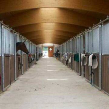
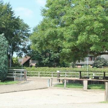
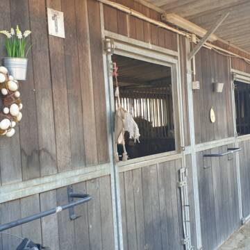
Wir haben aktuell Paddockbox-Fensterbox frei
Pulheim
Schumacher
@Reitanlage-Junkerhof
FN-Mitglied
Pferdeausbildung
Führanlage
Hunde willkommen
Allergikerstall
bedampftes/gewaschenes Heu
Außenbox mit Paddock
Außenboxen
26 weitere...
ganz aktuell
S
Deprecated: Creation of dynamic property Zend_View_Helper_Ads::$adLink is deprecated in /var/www/stall-frei/htdocs/staging.stall-frei.de/library/Psf/View/Helper/Ads.php on line 108

Futtersack HeuToy, Fressbremse in pink
Mechtersen
STALL-FREIde Marketing
@STALL-FREI-Marketing
Stundenlange Beschäftigung die
Koliken vorbeugt, geringe Staubinhalation mit
steuerbarer Futterentnahme
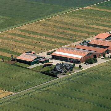
Weitzhof - Ihr Pferd in guten Händen
Neuss-Allerheiligen
Weitzhof
@Weitzhof
FN-Mitglied
Freizeitstall
Führanlage
Longierzirkel/Roundpen
Außenbox mit Paddock
Außenboxen
Vollpension
12 weitere...
P


Bergische Weidegründe
Burscheid
Bergische Weidegründe
@HufRehastation-Allergiker
Freizeitstall
Geländestrecke
Hunde willkommen
Krankenbox
Allergikerstall
Gnadenbrothof
Bewegungsstall
Laufstall
28 weitere...
ganz aktuell
S
Wittgeshof
Dormagen
Leuffen
@Leuffen
Freizeitstall
Longierzirkel/Roundpen
Paddock
Außenboxen
Innenbox
Halbpension
9 weitere...
P

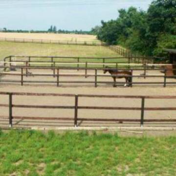
Offenstall; Paddockbox; Sommerweideplätze
Düsseldorf
Gut-Klein-Duessel
@Gut-Klein-Duessel
Freizeitstall
Gangpferdereiten
Krankenbox
Longierzirkel/Roundpen
Allergikerstall
bedampftes/gewaschenes Heu
Außenbox mit Paddock
Offenstall
13 weitere...
aktuell
P
Sport- Stall hat Plätze frei
Willich
Zuchstallmanns
@Zuchstallmanns
FN-Mitglied
Pferdeausbildung
Vermieten
Verpachten
Führanlage
Paddock
Pferdezucht
Zuchtstutenhaltung möglich
20 weitere...
S

Heu und Heulage verkaufen
Mechtersen
STALL-FREIde Marketing
@STALL-FREI-Marketing
Verkaufen Sie Ihr Heu und Ihre Heulage direkt an Reiter, Pferdeställe und Reitanlagen

Offenstallplatz für Stute frei!
Hilden
Weißberg
@Weissberg
Freizeitstall
Hunde willkommen
Krankenbox
Hufrehe geeignet
Notfallboxen
Bewegungsstall
Laufstall
14 weitere...
aktuell
P
Pensionsstall Lohäuschen Aussen- u. Paddockboxen
Düsseldorf
Pensionsstall-Lohaeuschen
@Pensionsstall-Lohaeuschen
Freizeitstall
Reitschule
Vermieten
Hunde willkommen
Longierzirkel/Roundpen
Gnadenbrothof
Hufrehe geeignet
10 weitere...
P
Gut Hellerhof, Düsseldorf
Düsseldorf
Willi-Muench
@Willi-Muench
FN-Mitglied
Freizeitstall
Vermieten
Führanlage
Hunde willkommen
Pferdezucht
22 weitere...
P
Weidenpescherhof Nauen-Engels
Dormagen
Nauen-Engels
@Nauen-Engels
Freizeitstall
Westernreiten
Vermieten
Führanlage
Longierzirkel/Roundpen
Außenboxen
Innenbox
14 weitere...
P
Werde Teil von STALL-FREI.de
Du hast eine Pferdebox frei? Freie Plätze im Offenstall, Pferdestall oder der Reitanlage kostenlos anbieten.
Deprecated: Creation of dynamic property Zend_View::$pageCount is deprecated in /var/www/stall-frei/htdocs/staging.stall-frei.de/library/vendor/shardj/zf1-future/library/Zend/View/Abstract.php on line 308
Deprecated: Creation of dynamic property Zend_View::$itemCountPerPage is deprecated in /var/www/stall-frei/htdocs/staging.stall-frei.de/library/vendor/shardj/zf1-future/library/Zend/View/Abstract.php on line 308
Deprecated: Creation of dynamic property Zend_View::$first is deprecated in /var/www/stall-frei/htdocs/staging.stall-frei.de/library/vendor/shardj/zf1-future/library/Zend/View/Abstract.php on line 308
Deprecated: Creation of dynamic property Zend_View::$current is deprecated in /var/www/stall-frei/htdocs/staging.stall-frei.de/library/vendor/shardj/zf1-future/library/Zend/View/Abstract.php on line 308
Deprecated: Creation of dynamic property Zend_View::$last is deprecated in /var/www/stall-frei/htdocs/staging.stall-frei.de/library/vendor/shardj/zf1-future/library/Zend/View/Abstract.php on line 308
Deprecated: Creation of dynamic property Zend_View::$previous is deprecated in /var/www/stall-frei/htdocs/staging.stall-frei.de/library/vendor/shardj/zf1-future/library/Zend/View/Abstract.php on line 308
Deprecated: Creation of dynamic property Zend_View::$next is deprecated in /var/www/stall-frei/htdocs/staging.stall-frei.de/library/vendor/shardj/zf1-future/library/Zend/View/Abstract.php on line 308
Deprecated: Creation of dynamic property Zend_View::$pagesInRange is deprecated in /var/www/stall-frei/htdocs/staging.stall-frei.de/library/vendor/shardj/zf1-future/library/Zend/View/Abstract.php on line 308
Deprecated: Creation of dynamic property Zend_View::$firstPageInRange is deprecated in /var/www/stall-frei/htdocs/staging.stall-frei.de/library/vendor/shardj/zf1-future/library/Zend/View/Abstract.php on line 308
Deprecated: Creation of dynamic property Zend_View::$lastPageInRange is deprecated in /var/www/stall-frei/htdocs/staging.stall-frei.de/library/vendor/shardj/zf1-future/library/Zend/View/Abstract.php on line 308
Deprecated: Creation of dynamic property Zend_View::$currentItemCount is deprecated in /var/www/stall-frei/htdocs/staging.stall-frei.de/library/vendor/shardj/zf1-future/library/Zend/View/Abstract.php on line 308
Deprecated: Creation of dynamic property Zend_View::$totalItemCount is deprecated in /var/www/stall-frei/htdocs/staging.stall-frei.de/library/vendor/shardj/zf1-future/library/Zend/View/Abstract.php on line 308
Deprecated: Creation of dynamic property Zend_View::$firstItemNumber is deprecated in /var/www/stall-frei/htdocs/staging.stall-frei.de/library/vendor/shardj/zf1-future/library/Zend/View/Abstract.php on line 308
Deprecated: Creation of dynamic property Zend_View::$lastItemNumber is deprecated in /var/www/stall-frei/htdocs/staging.stall-frei.de/library/vendor/shardj/zf1-future/library/Zend/View/Abstract.php on line 308
Deprecated: Creation of dynamic property Zend_View::$router is deprecated in /var/www/stall-frei/htdocs/staging.stall-frei.de/library/vendor/shardj/zf1-future/library/Zend/View/Abstract.php on line 308
Deprecated: Creation of dynamic property Zend_View::$urlParams is deprecated in /var/www/stall-frei/htdocs/staging.stall-frei.de/library/vendor/shardj/zf1-future/library/Zend/View/Abstract.php on line 308
Deprecated: Creation of dynamic property Zend_View::$showAds is deprecated in /var/www/stall-frei/htdocs/staging.stall-frei.de/library/vendor/shardj/zf1-future/library/Zend/View/Abstract.php on line 308
Deprecated: Creation of dynamic property Zend_View::$objectIds is deprecated in /var/www/stall-frei/htdocs/staging.stall-frei.de/library/vendor/shardj/zf1-future/library/Zend/View/Abstract.php on line 308
Deprecated: Creation of dynamic property Zend_View::$showNavbar is deprecated in /var/www/stall-frei/htdocs/staging.stall-frei.de/library/vendor/shardj/zf1-future/library/Zend/View/Abstract.php on line 308
Deprecated: Creation of dynamic property Zend_View::$showBreadcrumb is deprecated in /var/www/stall-frei/htdocs/staging.stall-frei.de/library/vendor/shardj/zf1-future/library/Zend/View/Abstract.php on line 308
Deprecated: Creation of dynamic property Zend_View::$showFooter is deprecated in /var/www/stall-frei/htdocs/staging.stall-frei.de/library/vendor/shardj/zf1-future/library/Zend/View/Abstract.php on line 308
Deprecated: Creation of dynamic property Zend_View::$showInternalAds is deprecated in /var/www/stall-frei/htdocs/staging.stall-frei.de/library/vendor/shardj/zf1-future/library/Zend/View/Abstract.php on line 308
Deprecated: Creation of dynamic property Zend_View::$blNoContent is deprecated in /var/www/stall-frei/htdocs/staging.stall-frei.de/library/vendor/shardj/zf1-future/library/Zend/View/Abstract.php on line 308
Deprecated: Creation of dynamic property Zend_View::$sMetaDesc is deprecated in /var/www/stall-frei/htdocs/staging.stall-frei.de/library/vendor/shardj/zf1-future/library/Zend/View/Abstract.php on line 308
Deprecated: Creation of dynamic property Zend_View::$useGmaps is deprecated in /var/www/stall-frei/htdocs/staging.stall-frei.de/library/vendor/shardj/zf1-future/library/Zend/View/Abstract.php on line 308
Deprecated: Creation of dynamic property Zend_View::$touches is deprecated in /var/www/stall-frei/htdocs/staging.stall-frei.de/library/vendor/shardj/zf1-future/library/Zend/View/Abstract.php on line 308
Deprecated: Creation of dynamic property Zend_View::$oProject is deprecated in /var/www/stall-frei/htdocs/staging.stall-frei.de/library/vendor/shardj/zf1-future/library/Zend/View/Abstract.php on line 308
Deprecated: Creation of dynamic property Zend_View::$pageHeadline is deprecated in /var/www/stall-frei/htdocs/staging.stall-frei.de/library/vendor/shardj/zf1-future/library/Zend/View/Abstract.php on line 308
Deprecated: Creation of dynamic property Zend_View::$disableLocationField is deprecated in /var/www/stall-frei/htdocs/staging.stall-frei.de/library/vendor/shardj/zf1-future/library/Zend/View/Abstract.php on line 308
Deprecated: Creation of dynamic property Zend_View::$isSearch is deprecated in /var/www/stall-frei/htdocs/staging.stall-frei.de/library/vendor/shardj/zf1-future/library/Zend/View/Abstract.php on line 308
Deprecated: Creation of dynamic property Zend_View::$pageTitle is deprecated in /var/www/stall-frei/htdocs/staging.stall-frei.de/library/vendor/shardj/zf1-future/library/Zend/View/Abstract.php on line 308
Deprecated: Creation of dynamic property Psf_Form_Element_Text::$class is deprecated in /var/www/stall-frei/htdocs/staging.stall-frei.de/library/vendor/shardj/zf1-future/library/Zend/Form/Element.php on line 874
Deprecated: Creation of dynamic property Psf_Form_Element_Text::$size is deprecated in /var/www/stall-frei/htdocs/staging.stall-frei.de/library/vendor/shardj/zf1-future/library/Zend/Form/Element.php on line 874
Deprecated: Creation of dynamic property Psf_Form_Element_Text::$placeholder is deprecated in /var/www/stall-frei/htdocs/staging.stall-frei.de/library/vendor/shardj/zf1-future/library/Zend/Form/Element.php on line 874
Deprecated: Creation of dynamic property Psf_Form_Element_Hidden::$class is deprecated in /var/www/stall-frei/htdocs/staging.stall-frei.de/library/vendor/shardj/zf1-future/library/Zend/Form/Element.php on line 874
Deprecated: Creation of dynamic property Psf_Form_Element_Hidden::$class is deprecated in /var/www/stall-frei/htdocs/staging.stall-frei.de/library/vendor/shardj/zf1-future/library/Zend/Form/Element.php on line 874
Deprecated: Creation of dynamic property Psf_Form_Element_Hidden::$class is deprecated in /var/www/stall-frei/htdocs/staging.stall-frei.de/library/vendor/shardj/zf1-future/library/Zend/Form/Element.php on line 874
Deprecated: Creation of dynamic property Psf_Form_Element_Hidden::$class is deprecated in /var/www/stall-frei/htdocs/staging.stall-frei.de/library/vendor/shardj/zf1-future/library/Zend/Form/Element.php on line 874
Deprecated: Creation of dynamic property Psf_Form_Element_Select::$class is deprecated in /var/www/stall-frei/htdocs/staging.stall-frei.de/library/vendor/shardj/zf1-future/library/Zend/Form/Element.php on line 874
Deprecated: Creation of dynamic property Psf_Form_Element_Select::$class is deprecated in /var/www/stall-frei/htdocs/staging.stall-frei.de/library/vendor/shardj/zf1-future/library/Zend/Form/Element.php on line 874
Deprecated: Creation of dynamic property Psf_Form_Element_Select::$class is deprecated in /var/www/stall-frei/htdocs/staging.stall-frei.de/library/vendor/shardj/zf1-future/library/Zend/Form/Element.php on line 874
Deprecated: Creation of dynamic property Psf_Form_Element_Select::$class is deprecated in /var/www/stall-frei/htdocs/staging.stall-frei.de/library/vendor/shardj/zf1-future/library/Zend/Form/Element.php on line 874
Deprecated: Creation of dynamic property Psf_Form_Element_Text::$class is deprecated in /var/www/stall-frei/htdocs/staging.stall-frei.de/library/vendor/shardj/zf1-future/library/Zend/Form/Element.php on line 874
Deprecated: Creation of dynamic property Psf_Form_Element_Checkbox::$label is deprecated in /var/www/stall-frei/htdocs/staging.stall-frei.de/library/vendor/shardj/zf1-future/library/Zend/Form/Element.php on line 874
Deprecated: Creation of dynamic property Zend_View::$sort is deprecated in /var/www/stall-frei/htdocs/staging.stall-frei.de/library/vendor/shardj/zf1-future/library/Zend/View/Abstract.php on line 308
Deprecated: Creation of dynamic property Zend_View::$searchLocation is deprecated in /var/www/stall-frei/htdocs/staging.stall-frei.de/library/vendor/shardj/zf1-future/library/Zend/View/Abstract.php on line 308
Deprecated: Creation of dynamic property Zend_View::$locationHint is deprecated in /var/www/stall-frei/htdocs/staging.stall-frei.de/library/vendor/shardj/zf1-future/library/Zend/View/Abstract.php on line 308
Psf_GeoCoder_Abstract::getLocation: Itter Get Location CachedOrLive
Psf_GeoCoder_Abstract::getCachedOrLive: Itter
Psf_GeoCoder_Abstract::convertLocationResult
{"documentation":"https:\/\/opencagedata.com\/api","licenses":[{"name":"see attribution guide","url":"https:\/\/opencagedata.com\/credits"}],"results":[{"bounds":{"northeast":{"lat":51.1755792,"lng":6.8288326},"southwest":{"lat":51.1456321,"lng":6.808535}},"components":{"ISO_3166-1_alpha-2":"DE","ISO_3166-1_alpha-3":"DEU","ISO_3166-2":["DE-NW"],"_category":"place","_normalized_city":"D\u00fcsseldorf","_type":"neighbourhood","city":"D\u00fcsseldorf","city_district":"Stadtbezirk 9","continent":"Europe","country":"Deutschland","country_code":"de","political_union":"European Union","state":"Nordrhein-Westfalen","state_code":"NW","suburb":"Itter"},"confidence":7,"formatted":"Itter, D\u00fcsseldorf, Nordrhein-Westfalen, Deutschland","geometry":{"lat":51.1678914,"lng":6.8176664}},{"bounds":{"northeast":{"lat":51.2081974,"lng":7.0671796},"southwest":{"lat":51.1543858,"lng":6.857572}},"components":{"ISO_3166-1_alpha-2":"DE","ISO_3166-1_alpha-3":"DEU","ISO_3166-2":["DE-NW"],"_category":"natural\/water","_normalized_city":"Hilden","_type":"river","continent":"Europe","country":"Deutschland","country_code":"de","county":"Kreis Mettmann","political_union":"European Union","river":"Itter","state":"Nordrhein-Westfalen","state_code":"NW","town":"Hilden"},"confidence":6,"formatted":"Itter, Hilden, Nordrhein-Westfalen, Deutschland","geometry":{"lat":51.1716745,"lng":6.9662625}},{"bounds":{"northeast":{"lat":51.3723136,"lng":8.7236089},"southwest":{"lat":51.2535915,"lng":8.5861111}},"components":{"ISO_3166-1_alpha-2":"DE","ISO_3166-1_alpha-3":"DEU","ISO_3166-2":["DE-HE"],"_category":"natural\/water","_normalized_city":"Rattlar","_type":"river","continent":"Europe","country":"Deutschland","country_code":"de","county":"Landkreis Waldeck-Frankenberg","municipality":"Willingen (Upland)","political_union":"European Union","river":"Itter","state":"Hessen","state_code":"HE","village":"Rattlar"},"confidence":6,"formatted":"Itter, Rattlar, Hessen, Deutschland","geometry":{"lat":51.3326562,"lng":8.6415517}},{"bounds":{"northeast":{"lat":49.6010389,"lng":9.0867911},"southwest":{"lat":49.4644225,"lng":8.974564}},"components":{"ISO_3166-1_alpha-2":"DE","ISO_3166-1_alpha-3":"DEU","ISO_3166-2":["DE-BW"],"_category":"natural\/water","_type":"river","continent":"Europe","country":"Deutschland","country_code":"de","county":"Rhein-Neckar-Kreis","political_union":"European Union","river":"Itter","state":"Baden-W\u00fcrttemberg","state_code":"BW"},"confidence":6,"formatted":"Itter, Rhein-Neckar-Kreis, Baden-W\u00fcrttemberg, Deutschland","geometry":{"lat":49.5069734,"lng":9.0422948}},{"bounds":{"northeast":{"lat":51.2369808,"lng":8.8981876},"southwest":{"lat":51.1828802,"lng":8.8333142}},"components":{"ISO_3166-1_alpha-2":"DE","ISO_3166-1_alpha-3":"DEU","ISO_3166-2":["DE-HE"],"_category":"natural\/water","_normalized_city":"Dorfitter","_type":"river","continent":"Europe","country":"Deutschland","country_code":"de","county":"Landkreis Waldeck-Frankenberg","municipality":"V\u00f6hl","political_union":"European Union","river":"Itter","state":"Hessen","state_code":"HE","village":"Dorfitter"},"confidence":7,"formatted":"Itter, Dorfitter, Hessen, Deutschland","geometry":{"lat":51.2260378,"lng":8.8913146}},{"bounds":{"northeast":{"lat":51.1606804,"lng":6.8739944},"southwest":{"lat":51.1604918,"lng":6.8739932}},"components":{"ISO_3166-1_alpha-2":"DE","ISO_3166-1_alpha-3":"DEU","ISO_3166-2":["DE-NW"],"_category":"natural\/water","_normalized_city":"D\u00fcsseldorf","_type":"river","city":"D\u00fcsseldorf","city_district":"Stadtbezirk 9","continent":"Europe","country":"Deutschland","country_code":"de","political_union":"European Union","postcode":"40593","river":"Itter","state":"Nordrhein-Westfalen","state_code":"NW","suburb":"Benrath"},"confidence":9,"formatted":"Itter, 40593 D\u00fcsseldorf, Deutschland","geometry":{"lat":51.1605861,"lng":6.8739938}},{"bounds":{"northeast":{"lat":52.4850174,"lng":6.7643874},"southwest":{"lat":52.4798978,"lng":6.7463264}},"components":{"ISO_3166-1_alpha-2":"DE","ISO_3166-1_alpha-3":"DEU","ISO_3166-2":["DE-NI"],"_category":"natural\/water","_normalized_city":"Itterbeck","_type":"stream","continent":"Europe","country":"Deutschland","country_code":"de","county":"Landkreis Grafschaft Bentheim","hamlet":"Itterbeckermoor","municipality":"Samtgemeinde Uelsen","political_union":"European Union","postcode":"49847","state":"Niedersachsen","state_code":"NI","stream":"Itter","village":"Itterbeck"},"confidence":9,"formatted":"Itter, Itterbeckermoor, 49847 Itterbeck, Deutschland","geometry":{"lat":52.482473,"lng":6.7553418}},{"bounds":{"northeast":{"lat":52.4786369,"lng":6.7473448},"southwest":{"lat":52.4721471,"lng":6.7352979}},"components":{"ISO_3166-1_alpha-2":"DE","ISO_3166-1_alpha-3":"DEU","ISO_3166-2":["DE-NI"],"_category":"natural\/water","_normalized_city":"Itterbeck","_type":"stream","continent":"Europe","country":"Deutschland","country_code":"de","county":"Landkreis Grafschaft Bentheim","hamlet":"Itterbeckerdoose","municipality":"Samtgemeinde Uelsen","political_union":"European Union","postcode":"49847","state":"Niedersachsen","state_code":"NI","stream":"Itter","village":"Itterbeck"},"confidence":9,"formatted":"Itter, Itterbeckerdoose, 49847 Itterbeck, Deutschland","geometry":{"lat":52.4753884,"lng":6.7413232}},{"bounds":{"northeast":{"lat":52.5039187,"lng":6.7970476},"southwest":{"lat":52.502778,"lng":6.7954854}},"components":{"ISO_3166-1_alpha-2":"DE","ISO_3166-1_alpha-3":"DEU","ISO_3166-2":["DE-NI"],"_category":"natural\/water","_normalized_city":"Itterbeck","_type":"stream","continent":"Europe","country":"Deutschland","country_code":"de","county":"Landkreis Grafschaft Bentheim","municipality":"Samtgemeinde Uelsen","political_union":"European Union","postcode":"49847","state":"Niedersachsen","state_code":"NI","stream":"Itter","village":"Itterbeck"},"confidence":9,"formatted":"Itter, 49847 Itterbeck, Deutschland","geometry":{"lat":52.5035925,"lng":6.7960489}},{"components":{"ISO_3166-1_alpha-2":"FR","ISO_3166-1_alpha-3":"FRA","ISO_3166-2":["FR-OCC","FR-32"],"_category":"road","_normalized_city":"Lass\u00e9ran","_type":"road","city":"Lass\u00e9ran","continent":"Europe","country":"France","country_code":"fr","county":"Gers","local_authority":"Communaut\u00e9 de communes Val de Gers","political_union":"European Union","postcode":"32550","road":"Chemin de la Hitt\u00e8re","state":"Occitanie","state_code":"OCC"},"confidence":3,"formatted":"Chemin de la Hitt\u00e8re, 32550 Lass\u00e9ran, France","geometry":{"lat":43.591931,"lng":0.548493}}],"status":{"code":200,"message":"OK"},"stay_informed":{"blog":"https:\/\/blog.opencagedata.com","mastodon":"https:\/\/en.osm.town\/@opencage"},"thanks":"For using an OpenCage API","timestamp":{"created_http":"Sat, 07 Feb 2026 14:00:33 GMT","created_unix":1770472833},"total_results":10}Array
(
[0] => stdClass Object
(
[bounds] => stdClass Object
(
[northeast] => stdClass Object
(
[lat] => 51.1755792
[lng] => 6.8288326
)
[southwest] => stdClass Object
(
[lat] => 51.1456321
[lng] => 6.808535
)
)
[components] => stdClass Object
(
[ISO_3166-1_alpha-2] => DE
[ISO_3166-1_alpha-3] => DEU
[ISO_3166-2] => Array
(
[0] => DE-NW
)
[_category] => place
[_normalized_city] => Düsseldorf
[_type] => neighbourhood
[city] => Düsseldorf
[city_district] => Stadtbezirk 9
[continent] => Europe
[country] => Deutschland
[country_code] => de
[political_union] => European Union
[state] => Nordrhein-Westfalen
[state_code] => NW
[suburb] => Itter
)
[confidence] => 7
[formatted] => Itter, Düsseldorf, Nordrhein-Westfalen, Deutschland
[geometry] => stdClass Object
(
[lat] => 51.1678914
[lng] => 6.8176664
)
)
[1] => stdClass Object
(
[bounds] => stdClass Object
(
[northeast] => stdClass Object
(
[lat] => 51.2081974
[lng] => 7.0671796
)
[southwest] => stdClass Object
(
[lat] => 51.1543858
[lng] => 6.857572
)
)
[components] => stdClass Object
(
[ISO_3166-1_alpha-2] => DE
[ISO_3166-1_alpha-3] => DEU
[ISO_3166-2] => Array
(
[0] => DE-NW
)
[_category] => natural/water
[_normalized_city] => Hilden
[_type] => river
[continent] => Europe
[country] => Deutschland
[country_code] => de
[county] => Kreis Mettmann
[political_union] => European Union
[river] => Itter
[state] => Nordrhein-Westfalen
[state_code] => NW
[town] => Hilden
)
[confidence] => 6
[formatted] => Itter, Hilden, Nordrhein-Westfalen, Deutschland
[geometry] => stdClass Object
(
[lat] => 51.1716745
[lng] => 6.9662625
)
)
[2] => stdClass Object
(
[bounds] => stdClass Object
(
[northeast] => stdClass Object
(
[lat] => 51.3723136
[lng] => 8.7236089
)
[southwest] => stdClass Object
(
[lat] => 51.2535915
[lng] => 8.5861111
)
)
[components] => stdClass Object
(
[ISO_3166-1_alpha-2] => DE
[ISO_3166-1_alpha-3] => DEU
[ISO_3166-2] => Array
(
[0] => DE-HE
)
[_category] => natural/water
[_normalized_city] => Rattlar
[_type] => river
[continent] => Europe
[country] => Deutschland
[country_code] => de
[county] => Landkreis Waldeck-Frankenberg
[municipality] => Willingen (Upland)
[political_union] => European Union
[river] => Itter
[state] => Hessen
[state_code] => HE
[village] => Rattlar
)
[confidence] => 6
[formatted] => Itter, Rattlar, Hessen, Deutschland
[geometry] => stdClass Object
(
[lat] => 51.3326562
[lng] => 8.6415517
)
)
[3] => stdClass Object
(
[bounds] => stdClass Object
(
[northeast] => stdClass Object
(
[lat] => 49.6010389
[lng] => 9.0867911
)
[southwest] => stdClass Object
(
[lat] => 49.4644225
[lng] => 8.974564
)
)
[components] => stdClass Object
(
[ISO_3166-1_alpha-2] => DE
[ISO_3166-1_alpha-3] => DEU
[ISO_3166-2] => Array
(
[0] => DE-BW
)
[_category] => natural/water
[_type] => river
[continent] => Europe
[country] => Deutschland
[country_code] => de
[county] => Rhein-Neckar-Kreis
[political_union] => European Union
[river] => Itter
[state] => Baden-Württemberg
[state_code] => BW
)
[confidence] => 6
[formatted] => Itter, Rhein-Neckar-Kreis, Baden-Württemberg, Deutschland
[geometry] => stdClass Object
(
[lat] => 49.5069734
[lng] => 9.0422948
)
)
[4] => stdClass Object
(
[bounds] => stdClass Object
(
[northeast] => stdClass Object
(
[lat] => 51.2369808
[lng] => 8.8981876
)
[southwest] => stdClass Object
(
[lat] => 51.1828802
[lng] => 8.8333142
)
)
[components] => stdClass Object
(
[ISO_3166-1_alpha-2] => DE
[ISO_3166-1_alpha-3] => DEU
[ISO_3166-2] => Array
(
[0] => DE-HE
)
[_category] => natural/water
[_normalized_city] => Dorfitter
[_type] => river
[continent] => Europe
[country] => Deutschland
[country_code] => de
[county] => Landkreis Waldeck-Frankenberg
[municipality] => Vöhl
[political_union] => European Union
[river] => Itter
[state] => Hessen
[state_code] => HE
[village] => Dorfitter
)
[confidence] => 7
[formatted] => Itter, Dorfitter, Hessen, Deutschland
[geometry] => stdClass Object
(
[lat] => 51.2260378
[lng] => 8.8913146
)
)
[5] => stdClass Object
(
[bounds] => stdClass Object
(
[northeast] => stdClass Object
(
[lat] => 51.1606804
[lng] => 6.8739944
)
[southwest] => stdClass Object
(
[lat] => 51.1604918
[lng] => 6.8739932
)
)
[components] => stdClass Object
(
[ISO_3166-1_alpha-2] => DE
[ISO_3166-1_alpha-3] => DEU
[ISO_3166-2] => Array
(
[0] => DE-NW
)
[_category] => natural/water
[_normalized_city] => Düsseldorf
[_type] => river
[city] => Düsseldorf
[city_district] => Stadtbezirk 9
[continent] => Europe
[country] => Deutschland
[country_code] => de
[political_union] => European Union
[postcode] => 40593
[river] => Itter
[state] => Nordrhein-Westfalen
[state_code] => NW
[suburb] => Benrath
)
[confidence] => 9
[formatted] => Itter, 40593 Düsseldorf, Deutschland
[geometry] => stdClass Object
(
[lat] => 51.1605861
[lng] => 6.8739938
)
)
[6] => stdClass Object
(
[bounds] => stdClass Object
(
[northeast] => stdClass Object
(
[lat] => 52.4850174
[lng] => 6.7643874
)
[southwest] => stdClass Object
(
[lat] => 52.4798978
[lng] => 6.7463264
)
)
[components] => stdClass Object
(
[ISO_3166-1_alpha-2] => DE
[ISO_3166-1_alpha-3] => DEU
[ISO_3166-2] => Array
(
[0] => DE-NI
)
[_category] => natural/water
[_normalized_city] => Itterbeck
[_type] => stream
[continent] => Europe
[country] => Deutschland
[country_code] => de
[county] => Landkreis Grafschaft Bentheim
[hamlet] => Itterbeckermoor
[municipality] => Samtgemeinde Uelsen
[political_union] => European Union
[postcode] => 49847
[state] => Niedersachsen
[state_code] => NI
[stream] => Itter
[village] => Itterbeck
)
[confidence] => 9
[formatted] => Itter, Itterbeckermoor, 49847 Itterbeck, Deutschland
[geometry] => stdClass Object
(
[lat] => 52.482473
[lng] => 6.7553418
)
)
[7] => stdClass Object
(
[bounds] => stdClass Object
(
[northeast] => stdClass Object
(
[lat] => 52.4786369
[lng] => 6.7473448
)
[southwest] => stdClass Object
(
[lat] => 52.4721471
[lng] => 6.7352979
)
)
[components] => stdClass Object
(
[ISO_3166-1_alpha-2] => DE
[ISO_3166-1_alpha-3] => DEU
[ISO_3166-2] => Array
(
[0] => DE-NI
)
[_category] => natural/water
[_normalized_city] => Itterbeck
[_type] => stream
[continent] => Europe
[country] => Deutschland
[country_code] => de
[county] => Landkreis Grafschaft Bentheim
[hamlet] => Itterbeckerdoose
[municipality] => Samtgemeinde Uelsen
[political_union] => European Union
[postcode] => 49847
[state] => Niedersachsen
[state_code] => NI
[stream] => Itter
[village] => Itterbeck
)
[confidence] => 9
[formatted] => Itter, Itterbeckerdoose, 49847 Itterbeck, Deutschland
[geometry] => stdClass Object
(
[lat] => 52.4753884
[lng] => 6.7413232
)
)
[8] => stdClass Object
(
[bounds] => stdClass Object
(
[northeast] => stdClass Object
(
[lat] => 52.5039187
[lng] => 6.7970476
)
[southwest] => stdClass Object
(
[lat] => 52.502778
[lng] => 6.7954854
)
)
[components] => stdClass Object
(
[ISO_3166-1_alpha-2] => DE
[ISO_3166-1_alpha-3] => DEU
[ISO_3166-2] => Array
(
[0] => DE-NI
)
[_category] => natural/water
[_normalized_city] => Itterbeck
[_type] => stream
[continent] => Europe
[country] => Deutschland
[country_code] => de
[county] => Landkreis Grafschaft Bentheim
[municipality] => Samtgemeinde Uelsen
[political_union] => European Union
[postcode] => 49847
[state] => Niedersachsen
[state_code] => NI
[stream] => Itter
[village] => Itterbeck
)
[confidence] => 9
[formatted] => Itter, 49847 Itterbeck, Deutschland
[geometry] => stdClass Object
(
[lat] => 52.5035925
[lng] => 6.7960489
)
)
[9] => stdClass Object
(
[components] => stdClass Object
(
[ISO_3166-1_alpha-2] => FR
[ISO_3166-1_alpha-3] => FRA
[ISO_3166-2] => Array
(
[0] => FR-OCC
[1] => FR-32
)
[_category] => road
[_normalized_city] => Lasséran
[_type] => road
[city] => Lasséran
[continent] => Europe
[country] => France
[country_code] => fr
[county] => Gers
[local_authority] => Communauté de communes Val de Gers
[political_union] => European Union
[postcode] => 32550
[road] => Chemin de la Hittère
[state] => Occitanie
[state_code] => OCC
)
[confidence] => 3
[formatted] => Chemin de la Hittère, 32550 Lasséran, France
[geometry] => stdClass Object
(
[lat] => 43.591931
[lng] => 0.548493
)
)
)
Psf_GeoCoder_OpenCageData::getKeyMap: 0
stdClass Object
(
    [bounds] => stdClass Object
        (
            [northeast] => stdClass Object
                (
                    [lat] => 51.1755792
                    [lng] => 6.8288326
                )

            [southwest] => stdClass Object
                (
                    [lat] => 51.1456321
                    [lng] => 6.808535
                )

        )

    [components] => stdClass Object
        (
            [ISO_3166-1_alpha-2] => DE
            [ISO_3166-1_alpha-3] => DEU
            [ISO_3166-2] => Array
                (
                    [0] => DE-NW
                )

            [_category] => place
            [_normalized_city] => Düsseldorf
            [_type] => neighbourhood
            [city] => Düsseldorf
            [city_district] => Stadtbezirk 9
            [continent] => Europe
            [country] => Deutschland
            [country_code] => de
            [political_union] => European Union
            [state] => Nordrhein-Westfalen
            [state_code] => NW
            [suburb] => Itter
        )

    [confidence] => 7
    [formatted] => Itter, Düsseldorf, Nordrhein-Westfalen, Deutschland
    [geometry] => stdClass Object
        (
            [lat] => 51.1678914
            [lng] => 6.8176664
        )

)
Psf_GeoCoder_OpenCageData::getCounty: Düsseldorf
Psf_GeoCoder_OpenCageData::addMissingData REFETCH!
Array
(
    [address] => Itter, Düsseldorf, Nordrhein-Westfalen, Deutschland
    [type] => neighbourhood
    [street] =>
    [city] => Itter
    [county] => Düsseldorf
    [state] => Nordrhein-Westfalen
    [zip] =>
    [country] => Deutschland
    [suburb] => Itter
    [countrycode] => de
    [latitude] => 51.1678914
    [longitude] => 6.8176664
    [accuracy] => 1
    [confidence] => 7
    [bounds] => stdClass Object
        (
            [northeast] => stdClass Object
                (
                    [lat] => 51.1755792
                    [lng] => 6.8288326
                )

            [southwest] => stdClass Object
                (
                    [lat] => 51.1456321
                    [lng] => 6.808535
                )

        )

)
reformat!
Array
(
    [address] => Itter, Düsseldorf, Nordrhein-Westfalen, Deutschland
    [type] => neighbourhood
    [street] =>
    [city] => Itter
    [county] => Düsseldorf
    [state] => Nordrhein-Westfalen
    [zip] =>
    [country] => Deutschland
    [suburb] => Itter
    [countrycode] => de
    [latitude] => 51.1678914
    [longitude] => 6.8176664
    [accuracy] => 1
    [confidence] => 7
    [bounds] => stdClass Object
        (
            [northeast] => stdClass Object
                (
                    [lat] => 51.1755792
                    [lng] => 6.8288326
                )

            [southwest] => stdClass Object
                (
                    [lat] => 51.1456321
                    [lng] => 6.808535
                )

        )

    [place] => Itter, Nordrhein-Westfalen
    [hash] => c1066533ab471a386d4d988b5deded30
)
Psf_GeoCoder_OpenCageData::getKeyMap: 1
stdClass Object
(
    [bounds] => stdClass Object
        (
            [northeast] => stdClass Object
                (
                    [lat] => 51.2081974
                    [lng] => 7.0671796
                )

            [southwest] => stdClass Object
                (
                    [lat] => 51.1543858
                    [lng] => 6.857572
                )

        )

    [components] => stdClass Object
        (
            [ISO_3166-1_alpha-2] => DE
            [ISO_3166-1_alpha-3] => DEU
            [ISO_3166-2] => Array
                (
                    [0] => DE-NW
                )

            [_category] => natural/water
            [_normalized_city] => Hilden
            [_type] => river
            [continent] => Europe
            [country] => Deutschland
            [country_code] => de
            [county] => Kreis Mettmann
            [political_union] => European Union
            [river] => Itter
            [state] => Nordrhein-Westfalen
            [state_code] => NW
            [town] => Hilden
        )

    [confidence] => 6
    [formatted] => Itter, Hilden, Nordrhein-Westfalen, Deutschland
    [geometry] => stdClass Object
        (
            [lat] => 51.1716745
            [lng] => 6.9662625
        )

)
Psf_GeoCoder_OpenCageData::getCounty: Mettmann
Psf_GeoCoder_OpenCageData::addMissingData REFETCH!
Array
(
    [address] => Itter, Hilden, Nordrhein-Westfalen, Deutschland
    [type] => river
    [street] =>
    [city] => Hilden
    [county] => Mettmann
    [state] => Nordrhein-Westfalen
    [zip] =>
    [country] => Deutschland
    [suburb] =>
    [countrycode] => de
    [latitude] => 51.1716745
    [longitude] => 6.9662625
    [accuracy] => 1
    [confidence] => 6
    [bounds] => stdClass Object
        (
            [northeast] => stdClass Object
                (
                    [lat] => 51.2081974
                    [lng] => 7.0671796
                )

            [southwest] => stdClass Object
                (
                    [lat] => 51.1543858
                    [lng] => 6.857572
                )

        )

)
reformat!
Array
(
    [address] => Itter, Hilden, Nordrhein-Westfalen, Deutschland
    [type] => river
    [street] =>
    [city] => Hilden
    [county] => Mettmann
    [state] => Nordrhein-Westfalen
    [zip] =>
    [country] => Deutschland
    [suburb] =>
    [countrycode] => de
    [latitude] => 51.1716745
    [longitude] => 6.9662625
    [accuracy] => 1
    [confidence] => 6
    [bounds] => stdClass Object
        (
            [northeast] => stdClass Object
                (
                    [lat] => 51.2081974
                    [lng] => 7.0671796
                )

            [southwest] => stdClass Object
                (
                    [lat] => 51.1543858
                    [lng] => 6.857572
                )

        )

    [place] => Hilden, Nordrhein-Westfalen
    [hash] => 416b83b830318f968a76292ba1abe0d3
)
Psf_GeoCoder_OpenCageData::getKeyMap: 2
stdClass Object
(
    [bounds] => stdClass Object
        (
            [northeast] => stdClass Object
                (
                    [lat] => 51.3723136
                    [lng] => 8.7236089
                )

            [southwest] => stdClass Object
                (
                    [lat] => 51.2535915
                    [lng] => 8.5861111
                )

        )

    [components] => stdClass Object
        (
            [ISO_3166-1_alpha-2] => DE
            [ISO_3166-1_alpha-3] => DEU
            [ISO_3166-2] => Array
                (
                    [0] => DE-HE
                )

            [_category] => natural/water
            [_normalized_city] => Rattlar
            [_type] => river
            [continent] => Europe
            [country] => Deutschland
            [country_code] => de
            [county] => Landkreis Waldeck-Frankenberg
            [municipality] => Willingen (Upland)
            [political_union] => European Union
            [river] => Itter
            [state] => Hessen
            [state_code] => HE
            [village] => Rattlar
        )

    [confidence] => 6
    [formatted] => Itter, Rattlar, Hessen, Deutschland
    [geometry] => stdClass Object
        (
            [lat] => 51.3326562
            [lng] => 8.6415517
        )

)
Psf_GeoCoder_OpenCageData::getCounty: Waldeck-Frankenberg
Psf_GeoCoder_OpenCageData::addMissingData REFETCH!
Array
(
    [address] => Itter, Rattlar, Hessen, Deutschland
    [type] => river
    [street] =>
    [city] => Rattlar
    [county] => Waldeck-Frankenberg
    [state] => Hessen
    [zip] =>
    [country] => Deutschland
    [suburb] =>
    [countrycode] => de
    [latitude] => 51.3326562
    [longitude] => 8.6415517
    [accuracy] => 1
    [confidence] => 6
    [bounds] => stdClass Object
        (
            [northeast] => stdClass Object
                (
                    [lat] => 51.3723136
                    [lng] => 8.7236089
                )

            [southwest] => stdClass Object
                (
                    [lat] => 51.2535915
                    [lng] => 8.5861111
                )

        )

)
reformat!
Array
(
    [address] => Itter, Rattlar, Hessen, Deutschland
    [type] => river
    [street] =>
    [city] => Rattlar
    [county] => Waldeck-Frankenberg
    [state] => Hessen
    [zip] =>
    [country] => Deutschland
    [suburb] =>
    [countrycode] => de
    [latitude] => 51.3326562
    [longitude] => 8.6415517
    [accuracy] => 1
    [confidence] => 6
    [bounds] => stdClass Object
        (
            [northeast] => stdClass Object
                (
                    [lat] => 51.3723136
                    [lng] => 8.7236089
                )

            [southwest] => stdClass Object
                (
                    [lat] => 51.2535915
                    [lng] => 8.5861111
                )

        )

    [place] => Rattlar, Hessen
    [hash] => 094427672bf48fad907e08e6c17931b2
)
Psf_GeoCoder_OpenCageData::getKeyMap: 3
stdClass Object
(
    [bounds] => stdClass Object
        (
            [northeast] => stdClass Object
                (
                    [lat] => 49.6010389
                    [lng] => 9.0867911
                )

            [southwest] => stdClass Object
                (
                    [lat] => 49.4644225
                    [lng] => 8.974564
                )

        )

    [components] => stdClass Object
        (
            [ISO_3166-1_alpha-2] => DE
            [ISO_3166-1_alpha-3] => DEU
            [ISO_3166-2] => Array
                (
                    [0] => DE-BW
                )

            [_category] => natural/water
            [_type] => river
            [continent] => Europe
            [country] => Deutschland
            [country_code] => de
            [county] => Rhein-Neckar-Kreis
            [political_union] => European Union
            [river] => Itter
            [state] => Baden-Württemberg
            [state_code] => BW
        )

    [confidence] => 6
    [formatted] => Itter, Rhein-Neckar-Kreis, Baden-Württemberg, Deutschland
    [geometry] => stdClass Object
        (
            [lat] => 49.5069734
            [lng] => 9.0422948
        )

)
Psf_GeoCoder_OpenCageData::getCounty: Rhein-Neckar-Kreis
Psf_GeoCoder_OpenCageData::addMissingData REFETCH!
Array
(
    [address] => Itter, Rhein-Neckar-Kreis, Baden-Württemberg, Deutschland
    [type] => river
    [street] =>
    [city] =>
    [county] => Rhein-Neckar-Kreis
    [state] => Baden-Württemberg
    [zip] =>
    [country] => Deutschland
    [suburb] =>
    [countrycode] => de
    [latitude] => 49.5069734
    [longitude] => 9.0422948
    [accuracy] => 1
    [confidence] => 6
    [bounds] => stdClass Object
        (
            [northeast] => stdClass Object
                (
                    [lat] => 49.6010389
                    [lng] => 9.0867911
                )

            [southwest] => stdClass Object
                (
                    [lat] => 49.4644225
                    [lng] => 8.974564
                )

        )

)
reformat!
Array
(
    [address] => Itter, Rhein-Neckar-Kreis, Baden-Württemberg, Deutschland
    [type] => river
    [street] =>
    [city] =>
    [county] => Rhein-Neckar-Kreis
    [state] => Baden-Württemberg
    [zip] =>
    [country] => Deutschland
    [suburb] =>
    [countrycode] => de
    [latitude] => 49.5069734
    [longitude] => 9.0422948
    [accuracy] => 1
    [confidence] => 6
    [bounds] => stdClass Object
        (
            [northeast] => stdClass Object
                (
                    [lat] => 49.6010389
                    [lng] => 9.0867911
                )

            [southwest] => stdClass Object
                (
                    [lat] => 49.4644225
                    [lng] => 8.974564
                )

        )

    [place] => , Baden-Württemberg
    [hash] => 950c298a94b56d49d9c51ebdbcf65ecd
)
Psf_GeoCoder_OpenCageData::getKeyMap: 4
stdClass Object
(
    [bounds] => stdClass Object
        (
            [northeast] => stdClass Object
                (
                    [lat] => 51.2369808
                    [lng] => 8.8981876
                )

            [southwest] => stdClass Object
                (
                    [lat] => 51.1828802
                    [lng] => 8.8333142
                )

        )

    [components] => stdClass Object
        (
            [ISO_3166-1_alpha-2] => DE
            [ISO_3166-1_alpha-3] => DEU
            [ISO_3166-2] => Array
                (
                    [0] => DE-HE
                )

            [_category] => natural/water
            [_normalized_city] => Dorfitter
            [_type] => river
            [continent] => Europe
            [country] => Deutschland
            [country_code] => de
            [county] => Landkreis Waldeck-Frankenberg
            [municipality] => Vöhl
            [political_union] => European Union
            [river] => Itter
            [state] => Hessen
            [state_code] => HE
            [village] => Dorfitter
        )

    [confidence] => 7
    [formatted] => Itter, Dorfitter, Hessen, Deutschland
    [geometry] => stdClass Object
        (
            [lat] => 51.2260378
            [lng] => 8.8913146
        )

)
Psf_GeoCoder_OpenCageData::getCounty: Waldeck-Frankenberg
Psf_GeoCoder_OpenCageData::addMissingData REFETCH!
Array
(
    [address] => Itter, Dorfitter, Hessen, Deutschland
    [type] => river
    [street] =>
    [city] => Dorfitter
    [county] => Waldeck-Frankenberg
    [state] => Hessen
    [zip] =>
    [country] => Deutschland
    [suburb] =>
    [countrycode] => de
    [latitude] => 51.2260378
    [longitude] => 8.8913146
    [accuracy] => 1
    [confidence] => 7
    [bounds] => stdClass Object
        (
            [northeast] => stdClass Object
                (
                    [lat] => 51.2369808
                    [lng] => 8.8981876
                )

            [southwest] => stdClass Object
                (
                    [lat] => 51.1828802
                    [lng] => 8.8333142
                )

        )

)
reformat!
Array
(
    [address] => Itter, Dorfitter, Hessen, Deutschland
    [type] => river
    [street] =>
    [city] => Dorfitter
    [county] => Waldeck-Frankenberg
    [state] => Hessen
    [zip] =>
    [country] => Deutschland
    [suburb] =>
    [countrycode] => de
    [latitude] => 51.2260378
    [longitude] => 8.8913146
    [accuracy] => 1
    [confidence] => 7
    [bounds] => stdClass Object
        (
            [northeast] => stdClass Object
                (
                    [lat] => 51.2369808
                    [lng] => 8.8981876
                )

            [southwest] => stdClass Object
                (
                    [lat] => 51.1828802
                    [lng] => 8.8333142
                )

        )

    [place] => Dorfitter, Hessen
    [hash] => fa294fc44646c27c8b8498946c112b07
)
Psf_GeoCoder_OpenCageData::getKeyMap: 5
stdClass Object
(
    [bounds] => stdClass Object
        (
            [northeast] => stdClass Object
                (
                    [lat] => 51.1606804
                    [lng] => 6.8739944
                )

            [southwest] => stdClass Object
                (
                    [lat] => 51.1604918
                    [lng] => 6.8739932
                )

        )

    [components] => stdClass Object
        (
            [ISO_3166-1_alpha-2] => DE
            [ISO_3166-1_alpha-3] => DEU
            [ISO_3166-2] => Array
                (
                    [0] => DE-NW
                )

            [_category] => natural/water
            [_normalized_city] => Düsseldorf
            [_type] => river
            [city] => Düsseldorf
            [city_district] => Stadtbezirk 9
            [continent] => Europe
            [country] => Deutschland
            [country_code] => de
            [political_union] => European Union
            [postcode] => 40593
            [river] => Itter
            [state] => Nordrhein-Westfalen
            [state_code] => NW
            [suburb] => Benrath
        )

    [confidence] => 9
    [formatted] => Itter, 40593 Düsseldorf, Deutschland
    [geometry] => stdClass Object
        (
            [lat] => 51.1605861
            [lng] => 6.8739938
        )

)
Psf_GeoCoder_OpenCageData::getCounty: Düsseldorf
Psf_GeoCoder_OpenCageData::addMissingData REFETCH!
Array
(
    [address] => Itter, 40593 Düsseldorf, Deutschland
    [type] => river
    [street] =>
    [city] => Benrath
    [county] => Düsseldorf
    [state] => Nordrhein-Westfalen
    [zip] => 40593
    [country] => Deutschland
    [suburb] => Benrath
    [countrycode] => de
    [latitude] => 51.1605861
    [longitude] => 6.8739938
    [accuracy] => 1
    [confidence] => 9
    [bounds] => stdClass Object
        (
            [northeast] => stdClass Object
                (
                    [lat] => 51.1606804
                    [lng] => 6.8739944
                )

            [southwest] => stdClass Object
                (
                    [lat] => 51.1604918
                    [lng] => 6.8739932
                )

        )

)
reformat!
Array
(
    [address] => 40593 Benrath
    [type] => river
    [street] =>
    [city] => Benrath
    [county] => Düsseldorf
    [state] => Nordrhein-Westfalen
    [zip] => 40593
    [country] => Deutschland
    [suburb] => Benrath
    [countrycode] => de
    [latitude] => 51.1605861
    [longitude] => 6.8739938
    [accuracy] => 1
    [confidence] => 9
    [bounds] => stdClass Object
        (
            [northeast] => stdClass Object
                (
                    [lat] => 51.1606804
                    [lng] => 6.8739944
                )

            [southwest] => stdClass Object
                (
                    [lat] => 51.1604918
                    [lng] => 6.8739932
                )

        )

    [place] => 40593 Benrath, Nordrhein-Westfalen
    [hash] => 080c411791b838c8c59ca54f9740b074
)
Psf_GeoCoder_OpenCageData::getKeyMap: 6
stdClass Object
(
    [bounds] => stdClass Object
        (
            [northeast] => stdClass Object
                (
                    [lat] => 52.4850174
                    [lng] => 6.7643874
                )

            [southwest] => stdClass Object
                (
                    [lat] => 52.4798978
                    [lng] => 6.7463264
                )

        )

    [components] => stdClass Object
        (
            [ISO_3166-1_alpha-2] => DE
            [ISO_3166-1_alpha-3] => DEU
            [ISO_3166-2] => Array
                (
                    [0] => DE-NI
                )

            [_category] => natural/water
            [_normalized_city] => Itterbeck
            [_type] => stream
            [continent] => Europe
            [country] => Deutschland
            [country_code] => de
            [county] => Landkreis Grafschaft Bentheim
            [hamlet] => Itterbeckermoor
            [municipality] => Samtgemeinde Uelsen
            [political_union] => European Union
            [postcode] => 49847
            [state] => Niedersachsen
            [state_code] => NI
            [stream] => Itter
            [village] => Itterbeck
        )

    [confidence] => 9
    [formatted] => Itter, Itterbeckermoor, 49847 Itterbeck, Deutschland
    [geometry] => stdClass Object
        (
            [lat] => 52.482473
            [lng] => 6.7553418
        )

)
Psf_GeoCoder_OpenCageData::getCounty: Grafschaft Bentheim
Psf_GeoCoder_OpenCageData::addMissingData REFETCH!
Array
(
    [address] => Itter, Itterbeckermoor, 49847 Itterbeck, Deutschland
    [type] => stream
    [street] => Itterbeckermoor
    [city] => Itterbeck
    [county] => Grafschaft Bentheim
    [state] => Niedersachsen
    [zip] => 49847
    [country] => Deutschland
    [suburb] =>
    [countrycode] => de
    [latitude] => 52.482473
    [longitude] => 6.7553418
    [accuracy] => 1
    [confidence] => 9
    [bounds] => stdClass Object
        (
            [northeast] => stdClass Object
                (
                    [lat] => 52.4850174
                    [lng] => 6.7643874
                )

            [southwest] => stdClass Object
                (
                    [lat] => 52.4798978
                    [lng] => 6.7463264
                )

        )

)
reformat!
Array
(
    [address] => Itter, Itterbeckermoor, 49847 Itterbeck, Deutschland
    [type] => stream
    [street] => Itterbeckermoor
    [city] => Itterbeck
    [county] => Grafschaft Bentheim
    [state] => Niedersachsen
    [zip] => 49847
    [country] => Deutschland
    [suburb] =>
    [countrycode] => de
    [latitude] => 52.482473
    [longitude] => 6.7553418
    [accuracy] => 1
    [confidence] => 9
    [bounds] => stdClass Object
        (
            [northeast] => stdClass Object
                (
                    [lat] => 52.4850174
                    [lng] => 6.7643874
                )

            [southwest] => stdClass Object
                (
                    [lat] => 52.4798978
                    [lng] => 6.7463264
                )

        )

    [place] => Itterbeckermoor, 49847 Itterbeck, Niedersachsen
    [hash] => f61500a16411ff156d549a06945ca05c
)
Psf_GeoCoder_OpenCageData::getKeyMap: 7
stdClass Object
(
    [bounds] => stdClass Object
        (
            [northeast] => stdClass Object
                (
                    [lat] => 52.4786369
                    [lng] => 6.7473448
                )

            [southwest] => stdClass Object
                (
                    [lat] => 52.4721471
                    [lng] => 6.7352979
                )

        )

    [components] => stdClass Object
        (
            [ISO_3166-1_alpha-2] => DE
            [ISO_3166-1_alpha-3] => DEU
            [ISO_3166-2] => Array
                (
                    [0] => DE-NI
                )

            [_category] => natural/water
            [_normalized_city] => Itterbeck
            [_type] => stream
            [continent] => Europe
            [country] => Deutschland
            [country_code] => de
            [county] => Landkreis Grafschaft Bentheim
            [hamlet] => Itterbeckerdoose
            [municipality] => Samtgemeinde Uelsen
            [political_union] => European Union
            [postcode] => 49847
            [state] => Niedersachsen
            [state_code] => NI
            [stream] => Itter
            [village] => Itterbeck
        )

    [confidence] => 9
    [formatted] => Itter, Itterbeckerdoose, 49847 Itterbeck, Deutschland
    [geometry] => stdClass Object
        (
            [lat] => 52.4753884
            [lng] => 6.7413232
        )

)
Psf_GeoCoder_OpenCageData::getCounty: Grafschaft Bentheim
Psf_GeoCoder_OpenCageData::addMissingData REFETCH!
Array
(
    [address] => Itter, Itterbeckerdoose, 49847 Itterbeck, Deutschland
    [type] => stream
    [street] => Itterbeckerdoose
    [city] => Itterbeck
    [county] => Grafschaft Bentheim
    [state] => Niedersachsen
    [zip] => 49847
    [country] => Deutschland
    [suburb] =>
    [countrycode] => de
    [latitude] => 52.4753884
    [longitude] => 6.7413232
    [accuracy] => 1
    [confidence] => 9
    [bounds] => stdClass Object
        (
            [northeast] => stdClass Object
                (
                    [lat] => 52.4786369
                    [lng] => 6.7473448
                )

            [southwest] => stdClass Object
                (
                    [lat] => 52.4721471
                    [lng] => 6.7352979
                )

        )

)
reformat!
Array
(
    [address] => Itter, Itterbeckerdoose, 49847 Itterbeck, Deutschland
    [type] => stream
    [street] => Itterbeckerdoose
    [city] => Itterbeck
    [county] => Grafschaft Bentheim
    [state] => Niedersachsen
    [zip] => 49847
    [country] => Deutschland
    [suburb] =>
    [countrycode] => de
    [latitude] => 52.4753884
    [longitude] => 6.7413232
    [accuracy] => 1
    [confidence] => 9
    [bounds] => stdClass Object
        (
            [northeast] => stdClass Object
                (
                    [lat] => 52.4786369
                    [lng] => 6.7473448
                )

            [southwest] => stdClass Object
                (
                    [lat] => 52.4721471
                    [lng] => 6.7352979
                )

        )

    [place] => Itterbeckerdoose, 49847 Itterbeck, Niedersachsen
    [hash] => d9b206453e560af0fced312640d57997
)
Psf_GeoCoder_OpenCageData::getKeyMap: 8
stdClass Object
(
    [bounds] => stdClass Object
        (
            [northeast] => stdClass Object
                (
                    [lat] => 52.5039187
                    [lng] => 6.7970476
                )

            [southwest] => stdClass Object
                (
                    [lat] => 52.502778
                    [lng] => 6.7954854
                )

        )

    [components] => stdClass Object
        (
            [ISO_3166-1_alpha-2] => DE
            [ISO_3166-1_alpha-3] => DEU
            [ISO_3166-2] => Array
                (
                    [0] => DE-NI
                )

            [_category] => natural/water
            [_normalized_city] => Itterbeck
            [_type] => stream
            [continent] => Europe
            [country] => Deutschland
            [country_code] => de
            [county] => Landkreis Grafschaft Bentheim
            [municipality] => Samtgemeinde Uelsen
            [political_union] => European Union
            [postcode] => 49847
            [state] => Niedersachsen
            [state_code] => NI
            [stream] => Itter
            [village] => Itterbeck
        )

    [confidence] => 9
    [formatted] => Itter, 49847 Itterbeck, Deutschland
    [geometry] => stdClass Object
        (
            [lat] => 52.5035925
            [lng] => 6.7960489
        )

)
Psf_GeoCoder_OpenCageData::getCounty: Grafschaft Bentheim
Psf_GeoCoder_OpenCageData::addMissingData REFETCH!
Array
(
    [address] => Itter, 49847 Itterbeck, Deutschland
    [type] => stream
    [street] =>
    [city] => Itterbeck
    [county] => Grafschaft Bentheim
    [state] => Niedersachsen
    [zip] => 49847
    [country] => Deutschland
    [suburb] =>
    [countrycode] => de
    [latitude] => 52.5035925
    [longitude] => 6.7960489
    [accuracy] => 1
    [confidence] => 9
    [bounds] => stdClass Object
        (
            [northeast] => stdClass Object
                (
                    [lat] => 52.5039187
                    [lng] => 6.7970476
                )

            [southwest] => stdClass Object
                (
                    [lat] => 52.502778
                    [lng] => 6.7954854
                )

        )

)
reformat!
Array
(
    [address] => Itter, 49847 Itterbeck, Deutschland
    [type] => stream
    [street] =>
    [city] => Itterbeck
    [county] => Grafschaft Bentheim
    [state] => Niedersachsen
    [zip] => 49847
    [country] => Deutschland
    [suburb] =>
    [countrycode] => de
    [latitude] => 52.5035925
    [longitude] => 6.7960489
    [accuracy] => 1
    [confidence] => 9
    [bounds] => stdClass Object
        (
            [northeast] => stdClass Object
                (
                    [lat] => 52.5039187
                    [lng] => 6.7970476
                )

            [southwest] => stdClass Object
                (
                    [lat] => 52.502778
                    [lng] => 6.7954854
                )

        )

    [place] => 49847 Itterbeck, Niedersachsen
    [hash] => 3c09b4011360327abaf3996523744d70
)
Psf_GeoCoder_OpenCageData::getKeyMap: 9
stdClass Object
(
    [components] => stdClass Object
        (
            [ISO_3166-1_alpha-2] => FR
            [ISO_3166-1_alpha-3] => FRA
            [ISO_3166-2] => Array
                (
                    [0] => FR-OCC
                    [1] => FR-32
                )

            [_category] => road
            [_normalized_city] => Lasséran
            [_type] => road
            [city] => Lasséran
            [continent] => Europe
            [country] => France
            [country_code] => fr
            [county] => Gers
            [local_authority] => Communauté de communes Val de Gers
            [political_union] => European Union
            [postcode] => 32550
            [road] => Chemin de la Hittère
            [state] => Occitanie
            [state_code] => OCC
        )

    [confidence] => 3
    [formatted] => Chemin de la Hittère, 32550 Lasséran, France
    [geometry] => stdClass Object
        (
            [lat] => 43.591931
            [lng] => 0.548493
        )

)
Psf_GeoCoder_OpenCageData::getCounty: Gers
Psf_GeoCoder_OpenCageData::addMissingData REFETCH!
Array
(
    [address] => Chemin de la Hittère, 32550 Lasséran, France
    [type] => road
    [street] => Chemin de la Hittère
    [city] => Lasséran
    [county] => Gers
    [state] => Occitanie
    [zip] => 32550
    [country] => France
    [suburb] =>
    [countrycode] => fr
    [latitude] => 43.591931
    [longitude] => 0.548493
    [accuracy] => 1
    [confidence] => 3
    [bounds] =>
)
reformat!
Array
(
    [address] => Chemin de la Hittère, 32550 Lasséran, France
    [type] => road
    [street] => Chemin de la Hittère
    [city] => Lasséran
    [county] => Gers
    [state] => Occitanie
    [zip] => 32550
    [country] => France
    [suburb] =>
    [countrycode] => fr
    [latitude] => 43.591931
    [longitude] => 0.548493
    [accuracy] => 1
    [confidence] => 3
    [bounds] =>
    [place] => Chemin de la Hittère, 32550 Lasséran, Occitanie
    [hash] => f901d5d18e2d3918eb94bb0900f522f0
)
Deprecated: Creation of dynamic property Zend_View::$locationHintStyle is deprecated in /var/www/stall-frei/htdocs/staging.stall-frei.de/library/vendor/shardj/zf1-future/library/Zend/View/Abstract.php on line 308
Deprecated: Creation of dynamic property Zend_View::$adGeoLocation is deprecated in /var/www/stall-frei/htdocs/staging.stall-frei.de/library/vendor/shardj/zf1-future/library/Zend/View/Abstract.php on line 308
Deprecated: Creation of dynamic property Zend_View::$recordCount is deprecated in /var/www/stall-frei/htdocs/staging.stall-frei.de/library/vendor/shardj/zf1-future/library/Zend/View/Abstract.php on line 308
Deprecated: Creation of dynamic property Zend_View::$paginationParams is deprecated in /var/www/stall-frei/htdocs/staging.stall-frei.de/library/vendor/shardj/zf1-future/library/Zend/View/Abstract.php on line 308
Deprecated: Creation of dynamic property Zend_View::$objectPaginator is deprecated in /var/www/stall-frei/htdocs/staging.stall-frei.de/library/vendor/shardj/zf1-future/library/Zend/View/Abstract.php on line 308
Deprecated: Creation of dynamic property Zend_View::$featuredObjects is deprecated in /var/www/stall-frei/htdocs/staging.stall-frei.de/library/vendor/shardj/zf1-future/library/Zend/View/Abstract.php on line 308
Deprecated: Creation of dynamic property Zend_View::$hints is deprecated in /var/www/stall-frei/htdocs/staging.stall-frei.de/library/vendor/shardj/zf1-future/library/Zend/View/Abstract.php on line 308
Deprecated: Creation of dynamic property Zend_View::$attributeHints is deprecated in /var/www/stall-frei/htdocs/staging.stall-frei.de/library/vendor/shardj/zf1-future/library/Zend/View/Abstract.php on line 308
Deprecated: Creation of dynamic property Zend_View::$oSearchForm is deprecated in /var/www/stall-frei/htdocs/staging.stall-frei.de/library/vendor/shardj/zf1-future/library/Zend/View/Abstract.php on line 308